
40 minute read
“The Hardest Worked River In The World”: The 1962 Bear River Project, Utah and Idaho

“The Hardest Worked River In The World”: The 1962 Bear River Project, Utah and Idaho
By ROBERT PARSON
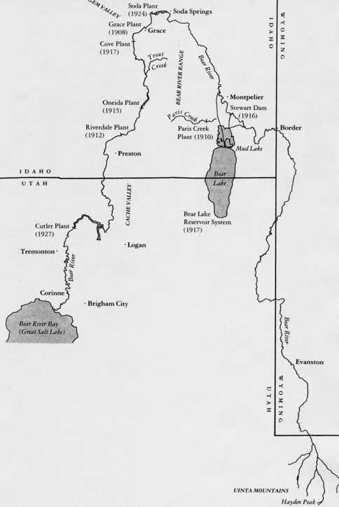
Arising on the north slope of the Uinta Mountains in northeastern Utah, Bear River travels five hundred miles through three states and ten counties in Utah, Wyoming, and Idaho. The river’s route traverses from mountain slopes, through several valleys, deep canyons and gorges before terminating at the Great Salt Lake, only ninety miles from where it begins.This unique geological and geographical mix, as well as interstate politics have complicated efforts to fully harness its waters.
Most early development occurred on the river’s tributaries. Pioneer settlers began damming and diverting these for irrigation and manufacture in Wyoming, Utah, and Idaho as early as the 1860s. Electricity producers began harnessing the Bear River for hydro-electric power as early as 1902. While water users have appropriated every drop of natural flow in Bear River, its silt-laden current, charged by the spring run-off from the Bear River Basin’s 4.8 million acres, still carries into the Great Salt Lake a yearly estimate of nearly five hundred thousand acre-feet of unconsumed water. Utilizing this unconsumed water through the construction of large water storage facilities has challenged state, federal, and private water managers, developers, and engineers to the present day. Between 1902 and 1904, the United States Reclamation Service, predecessor to the United States Bureau of Reclamation (USBR), explored the possibility of diverting Bear River out of the basin at Soda Springs, Caribou County, Idaho, into the Portneuf River, then re-diverting the water six miles down stream near McCammon, Idaho, into a canal running back south across the divide of the Great Basin and the Snake River drainage system near Red Rock Pass, and extending south as far as Preston, Franklin County, Idaho. After engineer George L. Swendsen surveyed this lengthy and circuitous route, he concluded that the project was “unpracticable.” [sic] 1

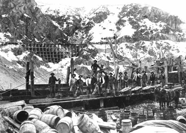
Oregon Short Line Railroad traveling through Bear River Canyon, circa 1913.
SHIPLER COLLECTION, UTAH STATE HISTORICAL SOCIETY
At the request of Utah’s Cache County Water Users Association in 1923, USBR surveyed a site for the Hyrum Dam and Reservoir on the Little Bear River in southern Cache Valley, and twelve years later constructed the facility. 2 Hyrum Dam and Reservoir, along with the enlarged Newton Dam and Reservoir (1946) in Cache County, and the Preston Bench Project (1949) on Mink and Worm creeks in Franklin County, are the only USBR projects ever completed on the Bear River or its tributaries.
In July 1962 the USBR released its feasibility report for the Bear River Project (BRP), an ambitious plan which proposed dams on the Bear River near Honeyville in Box Elder County to supply municipal and industrial water to Utah’s urban centers, and on the Blacksmith Fork River to irrigate lands in southern Cache County. The report also proposed enlarging Glendale Reservoir on Worm Creek northeast of Preston to supply irrigation water for lands along the valley’s east bench from Preston thirty miles south to Smithfield.
The largest and most controversial part of BRP, however, was the High Oneida Dam, located directly on Bear River ten miles northeast of Preston. This portion of the project included a 105 mile long canal carrying water along the valley’s northern and western boundaries, stretching as far as Malad, Oneida County, Idaho. From its far western point, the canal turned south into Box Elder County. Completion of the High Oneida Dam and canal system, according to project engineer Dean Bischoff, would make Bear River “the hardest worked river in the world.” 3
With a cost/benefit ratio of nearly one to three, the Bear River Project held great promise. The feasibility report claimed annual benefits would amount to more than eight million dollars, and compare very favorably with less than three million dollars in operating costs. 4 The report failed, however, to acknowledge the inequality of benefits. The Bear River drainage is divided into three divisions, and two basins, the upper basin, above Bear Lake, and the lower basin that includes six counties, four in Idaho and two in Utah below the lake. While the entire area is part of a single river basin, the Bureau chose to disregard the geographic pecularities and calculated costs and benefits as if no differences existed. The math was simple, the reality much more complicated. Each state, even each county within the project area, had different expectations for river development. One large project could not meet the needs of each area. Utah stood to gain the most, with nearly 70 percent of project water destined for its farms, factories, and municipalities. Thirty percent remained to provide supplemental water in Franklin County and to irrigate new lands in Oneida County.
Bear Lake and Caribou counties would share in the project’s cost but receive only token benefit through a complicated series of water exchanges with downstream irrigators. Furthermore, the reservoir behind High Oneida Dam would inundate twelve thousand acres of Caribou County farmland, canceling the twelve thousand acres of new land slated for Oneida County, making the dam’s benefits negligible for Idaho.
A delicate balance had long existed between Idaho and Utah water users below Bear Lake. Beginning in the 1870s and extending through the 1890s, settlers moved onto the high, arid plains below Soda Springs in Gem and Gentile valleys. Initially, settlers attempted dry-farming; however, planning commenced almost immediately to bring Bear River water to the land. 5 After several failures, John Trappett and a handful of other men formed the Last Chance Canal Company in 1897.The name paid honor to past efforts, and also implied that this would be the settlers’ “last chance” to acquire a right on Bear River. 6 This was particularly true considering other developments taking place in Box Elder County and at Bear Lake.
In 1889 the Bear Lake and River Water Works and Irrigation Company (Bear River Canal Company) proposed constructing two canals on either side of Bear River Canyon, between Cache and Box Elder counties. The company filed for nearly two thousand second feet (cfs) of Bear River water. 7 Project promoter John R. Bothwell also hoped to tap Bear Lake as a storage reservoir, and dispatched engineer Joseph U. Crawford to the lake’s north shore to study the possibilities in 1889. Crawford reported favorably on the possibility of converting Bear Lake into a storage reservoir, but the financial panic of the 1890s impeded the company’s ability to fulfill that goal. 8
In 1888 USGS began a survey of irrigated and potentially irrigable lands in the western United States. Foremost in the mind of Colorado River explorer and now Director of the USGS John Wesley Powell was the identification of potential reservoir sites and their subsequent withdrawal from homestead entry. Bear Lake was one of the first sites identified. However, the federal government restricted private development around Bear Lake by temporarily reserving lands around it. 9 Ignoring this prohibition, Telluride Power Company began its own survey of Bear Lake in 1902. Bear River did not naturally flow into Bear Lake, although during periods of flood the two co-mingled through Mud Lake to the north. Telluride’s plan, much like that of the Bear River Canal Company, included the construction of an inlet canal to convey water from Bear River into the lake, and an outlet canal to return stored water back into the river channel via Mud Lake. The river fell more than four hundred feet through the deep canyons of Gem Valley, making it optimal for hydroelectric power production. If Telluride could harness Bear Lake to store the estimated 1.5 million acre feet of water, the company, with an almost inexhaustible water supply, would be poised to become one of the largest hydro-electric companies in the West.

The federal reserve around Bear Lake prevented Telluride Power from exploiting Bear Lake until 1907 when the Department of Interior finally granted it a right of way for the two supply canals. Similarly, financial constraints prevented the Bear River Canal Company (purchased by Utah and Idaho Sugar Company in 1902) from realizing its full two thousand cfs appropriation. Both events worked to the advantage of the Last Chance Company, which completed work on its main canal in 1902.
In 1912 Utah Power and Light Company (UP&L) absorbed Telluride Power, constructed additional downstream power plants, and purchased the Wheelon Power Plant in Box Elder County from U and I Sugar Company. The agreement between the two companies compelled U P & L to supply irrigation water to the sugar company’s canals in exchange for its agreeing to abandon interest in Bear Lake and in electric power generation. In 1917, UP&L began operating its Lifton Pump Station on Bear Lake’s north shore, giving the power company greater access to the lake’s storage, allowing them to more accurately control Bear River, and to successively generate power at five downstream plants by 1927.
During the 1920s and 1930s, the level of Bear Lake fell more than twenty feet as a result of withdrawals for power generation, irrigation, and drought, reaching its historic low of 5,902 feet above sea level in 1934. Although residents of Bear Lake County complained bitterly to the power company, UP&L had secured its right to deplete Bear Lake in two court cases decided in the 1920s.
In the first case initiated in 1914, the power company named the Last Chance Canal Company and other defendants in a lawsuit over water rights on Bear River below Bear Lake in Idaho. Idaho state law required irrigators to file their intent to appropriate water prior to building a canal. Most, however, could only estimate their canal’s capacity, the number of acres it would irrigate, or even the exact route it would take until construction was nearly complete. For instance, during the trial Last Chance produced documentation for filings ranging from 450 cfs to over 6,600 cfs. One early filing even specified the company’s intended use of the water as including irrigation, culinary, and any “such other purposes as we may desire.” 10 In comparison, UP&L provided the court with precise documentation from expert witnesses who challenged the rough estimates of irrigators.
In his 1920 decision, Frank S. Dietrich, federal judge for the Idaho Eastern District, disregarded much of UP&L’s argument, but still awarded the power company a generous non-consumptive right to the Bear River, allowing them to divert and store 5,500 cfs in Bear Lake. While protecting irrigators who had appropriated water before UP&L, the Dietrich Decree only awarded the Last Chance Canal Company the 450 cfs capacity of its main canal. Additionally, the Dietrich Decree gave the power company control of Bear River from Bear Lake to the Utah-Idaho border. The decree forced canal companies experiencing water shortages, or requiring additional water, to rent storage water out of Bear Lake from UP&L.A second court decree, the 1924 Kimball Decree in Utah, extended UP&L’s control below the Idaho-Utah border. 11
In 1897 USGS Engineer Samuel Fortier predicted a time “not far distant when conflicts over water rights must arise...[because] three States obtain water...” from Bear River. 12 The 1930s drought heightened these interstate conflicts. Not only did UP&L deplete Bear Lake to its lowest historic level but downstream irrigators became irritated and demanded the power company fulfill its contract obligations and find some way to squeeze even more water from the lake. A group of angry Caribou County farmers even discussed dynamiting the power company’s artificial dyke, separating Bear Lake from Mud Lake. If the dyke was breached, Bear Lake water would spill from the lake into Mud Lake and eventually into Bear River. However, Bear Lake was so low in 1934 that it is doubtful if the farmers would have realized much water out of it. Only a hasty meeting between the irrigators, the power company, and political and religious leaders in southeastern Idaho, averted an all out water war. 13
These problems demanded that an interstate agreement or compact among the three states and their respective water users be established to manage the flow of water of the Bear River. All three state legislatures initiated discussions beginning in the late 1930s and eventually passed enabling legislation to cooperate on an interstate agreement: Idaho in 1943, Wyoming in 1945, and Utah in 1953. All three states ratified the compact in 1955, and President Dwight D. Eisenhower signed the Bear River Compact into law in 1958. 14
The compact defined uses and stipulated minimum levels in Bear Lake, including establishing an irrigation reserve. It divided the unappropriated water in Bear River above Bear Lake between the three states, while limiting the amount of water the three states could store above the lake. It also established the Bear River Commission, an administrative agency comprised of members from each state. 15 As the compact sought to ameliorate conflict on Bear River, it failed to divide water in the lower basin between Utah and Idaho. In 1962, after the Bureau of Reclamation released its feasibility report for the Bear River Project, old controversies once again resurfaced.
In the early 1960s local promoters organized the Bear River Central Coordinating Committee to work with the Bureau in publicizing the BRP. Members of the committee included L. B. Caine, President of the Cache County Water Users Association and a reclamation advocate who had been working with USBR since construction of the Hyrum Project in the 1930s; R. G. Cranney, Preston businessman; Lamont Tueller, Cache County Extension Agent, who also acted as secretary for the organization; local irrigation company officials; and representatives from five of the six affected Utah and Idaho counties. The committee’s initial support came from Cache County, Utah, and Franklin County, Idaho. The feasibility report also generated considerable support in Box Elder and Oneida counties, where it promised water for more than thirty thousand new acres of irrigable farmland.
While Caribou County representatives elected not to affiliate with the central committee, they still favored “any economical plan which [would] put to further beneficial use the waters of the Bear River….”The problem with BRP, cautioned Last Chance Canal Company secretary Fred M. Cooper, was its lack of economic benefits for Caribou and Bear Lake counties. Urging fellow citizens and water users to evaluate the project for both its positive and negative aspects, Cooper cited five major drawbacks to BRP: (1) it would threaten the sanctity of the Bear River Compact; (2) it would threaten the irrigation reserve stored in Bear Lake by using it to fill the High Oneida Dam; (3) it would inundate UP&L’s power plant at Oneida and curtail operation of the company’s plant at the Cutler Dam farther downstream resulting in decreased tax revenues for counties; (4) it would inundate more than twelve thousand acres of farm land upstream from the proposed Oneida Dam in Caribou County; and (5) it would lower the level of Bear Lake, thereby destroying the recreational industry around it. 16
Although Cooper was an acknowledged expert on Bear River and had represented Idaho in negotiations leading to the Bear River Compact, the central committee largely ignored his suggestions. They continued promoting the project during fall 1962 by conducting tours of the project area for Franklin, Cache and Box Elder counties, and for the Utah Water and Power Board. Confident that supporters far outnumbered detractors, the central committee organized tours only where support existed. Tours were not organized for Bear Lake and Caribou counties.
Opponents to the project appealed to Idaho Governor Robert E. Smylie who convened public hearings at Preston, Grace, and Montpelier in December 1962. 17 An overwhelming majority of water users at Grace and Montpelier opposed the project, but most disturbing to project advocates was the substantial opposition in Franklin County. 18 The Board of County Commissioners in Franklin County asserted, “no one asked for our opinion.” The commissioners embraced any water development project “with Federal funds, or otherwise, which is of benefit to Franklin County,” but concluded that “the proposed project is a great thing for our neighbors in Utah, but the benefits of such a project in Franklin County are negligible.” 19

SALT LAKE TRIBUNE COLLECTION, UTAH STATE HISTORICAL SOCIETY
Despite complaints, Utah interests continued pressing for BRP’s approval. In January 1963 Utah Senator Frank Moss introduced a federal bill to authorize the project. 20 In response, Governor Smylie addressed a letter to Dean Bischoff stating that “submission [of the report] in its present form to the Congress would be premature....” Smylie requested that Bischoff conduct further “study on the ground,” hold hearings in the affected areas, then submit the revised report to the states “for complete review.” 21
The central committee discussed Smylie’s letter at a meeting in March 1963. Bear Lake County representatives also pleaded their case, asking that “the central committee [preserve Bear Lake] as near as possible to...historic level[s].” The committee discussed impacts to the lake and other project problems, but failed to pass any motions addressing Bear Lake County’s concerns or the governor’s letter. 22 In fact, at its next meeting held with Utah Senator Frank Moss, the senator intimated that Idaho congressional leaders would “go along with the Bear River Project,” regardless of constituent opposition. Idaho’s delegation, according to Moss, did “not want to delay or make additional studies as Governor Smylie requested.” 23
On March 21 the central committee issued a response to Governor Smylie’s assertion that citizens in southeastern Idaho were “remarkably uninformed” about the project. The committee claimed to have held more than twenty meetings, conducted tours, and informed the public through radio programs and newspapers. Furthermore, the committee contended that the twelve thousand acres of land in Caribou County required for the reservoir would be compensated by twelve thousand acres of new lands in Oneida County, and that the eighty-six million dollar project would serve as a potent economic stimulus for Franklin County. The central committee also claimed deleterious impacts to Bear Lake would be negligible, and that the project would fully conform to Bear River Compact provisions. 24
The feasibility report, however, included a recommended, or adopted plan, plus two alternatives. While the adopted plan would operate “practically independent of Bear Lake,” the alternative plans would need “a substantial part of the storage water in Bear Lake” to irrigate an additional 9,300 acres in Oneida County. Alternative plan II also included a hydroelectric power plant at the dam site. Both alternatives required changes in water uses below Bear Lake that appeared to undermine the Bear River Compact by interfering with the irrigation reserve held in Bear Lake. From a cost/benefit perspective, alternate plan I was superior. Alternate plan II, with its hydroelectric component, was superior in terms of the project’s repayment. Opponents in Bear Lake County suspected that economics might dictate a preference for one of the alternative plans, which would further deplete Bear Lake. 25
In July 1963 USBR filed with the Idaho Office of Reclamation to appropriate storage water from Bear River. 26 It also asked to increase the reservoir’s active storage capacity from 225,000 to 325,000 acre feet, and the canal’s capacity from 1,380 to 1,500 cfs. 27 Detractors had trumpeted the likelihood of this development since November 1962 when Dr. Evan Kackley, a retired physician and rancher from Soda Springs, submitted a lengthy rebuttal to the Bear River Project. He warned irrigators that one “episode of drought would create irresistible demands that the Bear River Compact be opened and Bear Lake again drained down....” 28 Kackley’s warning that such a development would lead to “total regulation of the river by the Reclamation Service,” including Bear Lake, and “eliminate all future water rights on Bear River,” played to the fears of Idaho water users. 29 Already apprehensive over the Bureau’s motives, Kackley’s constituents needed little evidence to support their suspicions.
The Bureau’s proposal to create a bi-state water conservancy district to contract with USBR and to finance the project further inflamed opponents’ suspicions. The “Utida” district would include Cache, Box Elder, Rich, Franklin, Caribou, Oneida, and Bear Lake counties. The Water Conservancy Act of 1941 provided the means for establishing such a district in Utah. 30 However, no such mechanism existed in Idaho. “The history of any power to tax is that the entering size is but the wedge...there is no terminating end to the Utida District, but one of self-propagation in time and magnitude,” wrote Kackley. “Idaho...has...pursued a course for over a half century to guard the integrity of their princess, water, that has made their deserts bloom, against compromise or adultery. This is opening the door to her abode.” 31
Supporters of BRP found it easy to dismiss Kackley’s largely undocumented critique as an “emotional appeal based on erroneous information or deliberate misuse of facts.” 32 Furthermore, Utah Governor George D. Clyde dismissed Governor Smylie’s suggestion for more study and implored the Bureau to complete its report “immediately” and submit it to Congress. 33 The central committee continued to promote the project aggressively by distributing a brochure entitled “Bear River Project: Know the Facts.” The committee distributed the brochure according to “where it was most needed and where it [would] accomplish the most good,” circulating it most abundantly in Franklin, Cache, Box Elder and Oneida counties. Only five hundred copies of the brochure were sent to Bear Lake County, and the committee voted not to disseminate it to Caribou County where water users were opposed to the project. 34
The brochure’s release caused a firestorm of protest in Bear Lake County when the names of the county’s representatives appeared as project supporters. Lloyd Dunn, president of the Georgetown Irrigation Company and one of the county’s representatives, attempted to distance himself from the central committee by explaining that the brochure represented the opinion of a majority of the committee, but not the Bear Lake County contingent. “Our purpose in attending the meetings of the coordinating committee was to present some alternate views at the planning level,” Dunn stated. He concluded, however, that it “has become evident that the Regional Engineer’s office will not incorporate the changes that would remove our basic objections.” Dunn proposed organizing opponents into a committee composed of “various service clubs, city governments, irrigation companies, and industries.” In conclusion, he warned that those embarking “upon an endeavor of this kind should expect to be criticized and castigated as a reward.” 35
Opponents to western water development often were accused of being barriers to progress. Opponents of the Central Utah Project, for instance, after waging a successful battle to prevent construction of Echo Park Dam on the Green River below Dinosaur National Monument along the Colorado-Utah border, drew criticism from nearly every congressional delegation and state water agency in the West. By appealing to a broad, national constituency concerned with the preservation of national parks, national monuments, and natural landscapes the Sierra Club, Wilderness Association, and other groups succeeded in scuttling Echo Park Dam, preserving the Dinosaur National Monument and the spectacular scenery in the canyons surrounding it. Although later the dam on the Green River at Flaming Gorge (1962) and the dam at Glen Canyon (1964) on the Colorado River eventually spoiled river canyons of equal majesty, preservationists pointed to the triumph at Echo Park as a turning point in the history of western water development. 36
Opponents of BRP, however, could scarcely be characterized as preservationists. Like BRP’s boosters, opponents favored development, and except for concerns over the level of Bear Lake, which were primarily economic, opponents raised few environmental issues. Rather, the debate focused on the unequal distribution of project water.
Increasingly, opponents viewed the project as a “Utah water grab,” and objected to the Bureau’s attempt to “ram it down our throats.” 37 Following Lloyd Dunn’s suggestion, opponents organized the Bear River Protective Association in July 1963. In addition to Dunn, other members of the association included Reed Budge, state senator and rancher from Soda Springs; Dr. Evan Kackley, a retired physician from Boise and Soda Springs; county attorneys from Bear Lake and Caribou counties, irrigation company officials, and others appointed by the county commissioners of Franklin, Bear Lake, and Caribou counties. Members of the association campaigned vigorously using newspapers and public meetings to agitate against the Bear River Project.
Project proponents, like Central Committee Chairman L. B. Caine, feared that the opponents’ determination might “discredit the project and prevent or delay its eventual construction.” Caine drafted a letter to USBR Commissioner Floyd E. Dominy expressing his group’s continued support for the project, while taking exception to the “misrepresentation of facts...made by the Kackley opposition group....” 38
Both groups expressed their views to Idaho Reclamation Director Carl Tappan during hearings held in Boise to discuss the Bureau’s water filing. The Bureau’s engineers defended the feasibility report’s figures, claiming that enough flood water accrued each year to more than fill the reservoir without impacting Bear Lake or the rights of irrigators. According to USBR, only the water rights of UP&L would suffer.
Robert Porter, power company attorney, however, testified that “no arrangements [had] been made by the government for obtaining this water.” Opponents capitalized on his remarks by emphasizing that without the power company’s acquiescence, the project would be impossible. 39 They further accused the Bureau of blatantly disregarding Governor Smylie’s request to conduct additional studies and of trying to monopolize water development on the river by protesting a rival application to appropriate storage water made by the Caribou Water Development Company. 40
The Caribou Water Development Company anticipated the Bureau’s water filing by three months, when in April 1963 it applied to appropriate forty-thousand acre feet of water for a dam and reservoir on Bear River, south of Soda Springs. 41 The reservoir would supply water to the Last Chance Canal, obviating the canal company’s need to purchase Bear Lake water from UP&L. Bureau engineers doubted whether the Caribou Company could afford to build the $1.6 million project, and protested that the company’s “nuisance filing” was designed primarily to impede BRP by removing forty-thousand acre feet of project water. 42
Financial constraints did hamper such small Idaho projects. In addition to opposing BRP, another of the Bear River Protective Association’s goals was to secure legislation authorizing no-interest state loans for small reclamation projects in Idaho. Since 1949, Utah irrigation companies had benefited from no interest loans through the state’s revolving construction fund. The loans enabled irrigators to construct the Woodruff Narrows Dam on the Bear River east of Woodruff near the Utah/Wyoming border, and the Porcupine Dam on the Little Bear River southeast of Paradise in Cache County. The association often pointed to the no interest Utah model and advocated using it in Idaho to construct several smaller projects on Bear River rather than one large federal project. Advocates claimed that smaller projects, such as that proposed by the Caribou Company, would more equitably divide the water among counties and could be constructed more economically without requiring a water conservancy district. 43
Many perceived the Bureau’s protest of the Caribou Company’s application as heavy-handed. Even L. B. Caine thought it only “furnished the opposition group [with] some good ammunition,” and urged USBR to withdraw its petition. 44 The Bureau complied with Caine’s request but delayed announcing the removal of its protest until testimony on BRP concluded. R. G. Cranney applauded the timing and enthusiastically reported later that opponents responded to the Bureau’s concession with “shock and disbelief.” 45
Cranney hoped the Bureau’s concession might induce some upstream opponents to break rank and join with the central committee. Not only did the anticipated mutiny fail to materialize, but opponents persisted in their attack. Hinting that Idaho congressional leaders might order a complete investigation of the Bureau’s Region 4, opponents resumed publicizing their major objections to the project, emphasizing that the forty thousand acre-foot appropriation granted to the Caribou Water Development Company now made the BRP even less feasible. 46
The conflict reached Washington, D.C. as early as July, when Idaho Senator Len Jordan asked USBR Commissioner Floyd E. Dominy to re-evaluate BRP, stressing that “Full support of the people in this area is needed if [the project] is to get favorable congressional action....” 47 In October 1963, Dominy met with the project’s supporters and detractors. Even while proclaiming the project as feasible, Dominy cautioned that in its present stage, “it could take years before it is ready for presentation to Congress.” Urging conciliation from both groups, Dominy exhorted them to remember that water was the “single limiting ingredient for development,” and that only through working “together [could we] develop all our water [and] keep our trained youth at home.” 48
Dominy’s words were favorably received, as both groups fully ascribed to the rhetoric of water development, except that some Idahoans opposed paying to develop water that they could not use. During the ensuing weeks, USBR began revising its feasibility report to more equitably divide the river between the two states. While Bureau engineers could divide project waters evenly between Idaho and Utah, geography prevented equitable division between upstream and downstream counties. In December 1963, the Bureau delivered a revised report to Governor Smylie. The governor characterized the fifty-fifty division of water between Utah and Idaho as “a step in the right direction,” but recommended additional study to determine “whether the... residents of the area specifically affected [would] support the project.” 49
R.G. Cranney again expressed optimism over the governor’s comments and reported to the central committee that, in his opinion, “Smylie wants [the] project, now.... We are definitely on our way with the BRP.” 50 Opponents, however, responded negatively to the governor’s statement and condemned the revised report as “a serious and immediate threat,” which contained “no substantial improvements.” 51 In January 1964, officials from Caribou and Bear Lake counties appealed to Idaho Attorney General Allan G. Shepard to “help scuttle” BRP, and “protect...[Idaho’s] inviolate right...to the waters of Bear River.” 52
Project proponents had difficulty reconciling their inability to find a compromise with fellow irrigators in Caribou and Bear Lake counties. Some proponents suspected UP&L to be “back of the Idaho opposition,” knocking off counties “one by one, first Caribou, then Bear Lake and who knows which county will be next?” 53 Publicly, the power company remained curiously silent, particularly considering the potential loss of its Oneida power plant, plus curtailment of its hydroelectric operations at Soda, Grace, Cove, and especially Cutler. Privately, however, UP&L criticized the project as having “a number of very bad features,” and took the position “that these bad features should be fully disclosed...before the Bureau’s salesmen go out in the field en-masse to sell this project to the people....” 54
E.A. Hunter, assistant to company President E. M. Naughton, enumerated these “bad features” to Utah Senator Wallace F. Bennett as early as April 1961. Hunter’s criticisms included the deleterious impact to Bear Lake, the inundation of the company’s Oneida Power Plant, the subsequent loss of county tax revenue, and the contravention of the Bear River Compact. 55
The dissemination of a critique of the project prepared by geologist Dr. Robert C. Bright in January 1964 redoubled proponents’ suspicions regarding UP&L. Although Bright proclaimed his impartiality, Cranney and other supporters questioned how he found the funding and resources to conduct his investigation. 56 Bright contended that the Oneida Dam would increase the river’s silt load, complicate drainage problems, and lower the level of Great Salt Lake, thereby impacting industry and causing climatic changes in the Salt Lake Valley. Most alarming to project proponents was Bright’s contention that the dam site straddled a fault line and that the shale along the canyon walls would, over time, absorb water, swell, and possibly cause the dam to fail. 57

Though Bright’s study devoted little space to a potential geologic hazard, it still cast doubt on the wisdom of building the High Oneida Dam. Unlike past challenges, project supporters could not dismiss Bright’s scientific evaluation as a simple “emotional appeal based on erroneous information or deliberate misuse of facts.” 58 The Utah Water and Power Board recruited Bright’s former professor, Dr. R. E. Marsell of the University of Utah, to refute Bright’s findings. Nevertheless, Marsell limited his comments to the possible impacts to the Great Salt Lake, changes in climate, salt storms arising from exposed shoreline, and effects on the salt and recreational industries around the lake’s shores. 59 Others assailed Bright’s assertion of downstream erosion, silt, and drainage problems. His geologic analysis, however, remained unchallenged, and the specter of a devastating flood hounded USBR and local supporters for the next six years. 60
The Bureau officially released its revised report dividing project waters evenly between Idaho and Utah in November 1966.The revised report still included dams on Blacksmith Fork River and at Honeyville, and the enlargement at Glendale. As an alternative to the High Oneida Dam, engineers proposed building a smaller dam and reservoir that would not flood upstream agricultural lands. To compensate for the reservoir’s smaller capacity, the Bureau proposed constructing another smaller dam near Smithfield, while assuming responsibility for constructing the Caribou Company’s project near Soda Springs. 61
Caribou County water officials and users denounced the Bureau’s attempt to “federalize” a private water right, while opposition to the Smithfield site, which would immerse more than five thousand acres of river bottoms, surfaced for the first time in Cache County. 62 The Bureau also lost support for BRP in Oneida and Box Elder counties. The smaller Oneida dam preserved twelve thousand Caribou County acres, but diminished by nearly twenty-five thousand the irrigated acreage in Oneida and Box Elder counties. Furthermore, the Honeyville Dam, which would inundate nearly four thousand acres of crop land, twenty homes, and the state monument at Hampton’s Ford, had no appreciable benefit for Box Elder County. Its main purpose was to supply water to the Bear River Migratory Bird Refuge, and to municipal and industrial water users in the vicinity of Ogden, Utah. As cost/benefit ratios for BRP plummeted by one-third, supporters from Box Elder and Oneida counties expressed “grave concern regarding the modified plans.” 63
With support shrinking, newly appointed Director of the Bureau’s Region 4, David L. Crandall, appealed to the Bear River Commission “to arrive at some kind of understanding on the division of Bear River [below Bear Lake]...so a new, mutually acceptable feasibility report [can] be completed.... It is fruitless,” Crandall concluded, “to continue with plans until enough support can be mustered to develop the project....” 64
In June 1970, USBR issued its final appraisal of the Bear River Project. Summarizing its “extensive studies in the Bear River Basin...over many years,” USBR conceded its inability to develop a feasible interstate plan where so many competing interests existed.The report stated:
Spurred by the withdrawal of USBR, a tri-state negotiating committee began meeting in 1970 to suggest revisions to the Bear River Compact that would divide the waters of the lower basin. In December 1978, after extensive debate and public input, the Bear River Commission approved amendments to the compact and submitted it to Congress. President Jimmy Carter signed the amended compact in February 1980. In addition to increasing the allowable storage above Bear Lake for Wyoming, Utah, and Idaho, the amended compact also divided the river below between Idaho and Utah. It awarded Idaho the right to develop the first 125,000 acre-feet of unconsumed water, Utah the next 275,000 acre-feet, with the next 150,000 acre-feet divided evenly between the two. If any water remained for further development, the compact divided it 70/30 in Utah’s favor. 66
For the balance of the twentieth century, Utah took the lead in developing its rights under the amended compact, implementing a state water plan emphasizing Bear River in 1984 and creating the Bear River Development Task Force in 1989. Following the task force’s suggestion, the legislature passed the Bear River Development Act in 1991 and directed the Utah Division of Water Resources (UDWR) “to plan, construct, own, and operate reservoirs and associated facilities...and to market developed waters.” 67
Utah clung to the slim possibility that they could still persuade Idaho to cooperatively build the High Oneida Dam. 68 Then, in 1992, the Birch Power Company filed a proposal with the Federal Energy Regulatory Commission to build a hydroelectric power plant at the Oneida site. The proposal rallied local sportsmen and river enthusiasts who requested that the Bureau of Land Management (BLM) inventory Bear River for federal wild and scenic river designation. BLM complied, and completed its report in May 1995. BLM designated the Oneida Narrows as one of the sites on Bear River in Idaho “eligible” for wild and scenic status based on its “outstandingly remarkable” recreational and wildlife aspects. Wild and scenic river designation involved two separate surveys, one to determine eligibility, and the other to determine suitability. Although a suitability survey has never been completed at the Oneida Narrows, its “eligibility” still demanded that BLM manage the area as wild and scenic until such time as the suitability assessment was completed. This designation made it more difficult to undertake any large water developments in the area, and induced the Birch Power Company to withdraw its proposal. It simultaneously dashed Utah’s hopes of a joint project with Idaho. 69
West-side canal of the Bear River Canal Company, Box Elder County. Background is the Coffer Dam used by the canal company circa 1920. Coffer Dam later submerged when UP&L constructed Cutler Dam in 1920s.
UTAH STATE UNIVERSITY SPECIAL COLLECTIONS
Unlike the period of thirty years earlier, when BRP promoters had to contend mostly with dissatisfied farmers and ranchers, the Utah Division of Water Resources now had to contend with recreationists and environmental advocates. Furthermore, the division’s consulting firm issued a study of the Blacksmith Fork site that dealt an additional blow to the state’s water plan. It reported that the “proposed reservoir would inundate wet-meadow bottomlands...[destroy] approximately 2 miles of class 1 or 2 trout stream...[which] could not be mitigated... impact elk migration... displace... flora and fauna,” and impact at least one threatened or endangered species. 70
Environmental concerns at Oneida and Blacksmith Fork forced the Division of Water Resources to concentrate on the Honeyville site. Even there, however, the intermittent reluctance of residents during the 1960s gave way to sustained resistance during the 1990s as they complained about poor water quality in the reservoir, submersion of five community drinking water systems, the loss of four thousand acres of prime farm land and wildlife habitat, inundation of two public parks, and destruction of the nationally registered, historic Hampton Ford Station. 71
Flume of the Last Chance Canal Company, near Grace, Idaho, circa 1900.
UTAH STATE UNIVERSITY SPECIAL COLLECTIONS
Although the state moved aggressively to fill the space created by the Bureau’s departure during the 1970s, Utah was equally ineffective in its efforts to develop any large Bear River projects. Curtailing its plans considerably during the last several years, the Division of Water Resources now proposes building only a pipeline connecting the river below Cutler Dam with Willard Bay in southern Box Elder County, and another conveying the water from Willard Bay to water the Wasatch Front. Weber Basin Water Conservancy District, which owns and operates Willard Bay, has resisted this plan claiming the introduction of Bear River would compromise water quality in the bay. Public resistance to the Honeyville Dam and the Barrens Dam, an off-stream reservoir proposed in Cache County, has further led UDWR to consider dam construction only when residents of Box Elder and Cache counties “need the water.” 72
Idaho has been less active in attempting to utilize its portion of Bear River. Southeastern Idaho still contains thousands of potentially irrigable acres, but small grains and forages dominate agriculture in its high, cold climate, making it economically impractical to reclaim land where production will not compensate for development. Some small irrigation reservoirs, such as Daniels on the Little Malad River in Oneida County, and Montpelier Creek in Bear Lake County, have been cooperatively constructed by irrigation companies, but Idaho has yet to build any large, main stem, Bear River reservoirs. 73
Irrigators in Caribou County had studied the prospect of a main stem dam since the Caribou Water Development Company acquired its forty thousand acre-foot right in 1963. In 1980 stockholders in the Last Chance Canal decided against building the Caribou Dam and voted instead to raise and operate their own hydroelectric plant on Bear River. The power plant, stockholders reasoned, would not only provide the company with cheap electricity, but would also produce revenue by allowing it to sell excess energy to UP&L. In 1983, after UP&L incurred a debt of nearly $2.5 million, the company’s Last Constructing an irrigation canal Chance turbines went on line. Less than a through Bear River Canyon year later, UP&L approached the irrigation company with an offer to buy the power plant. In return, the power company offered to assume all of the irrigation company’s debt, discount its electric charges, and provide supplemental storage water from Bear Lake at no charge. In December 1983 stockholders voted unanimously to accept UP&L’s offer and acquired, for the first time since the 1920 Detrich Decree, an inexpensive, dependable water supply. 74

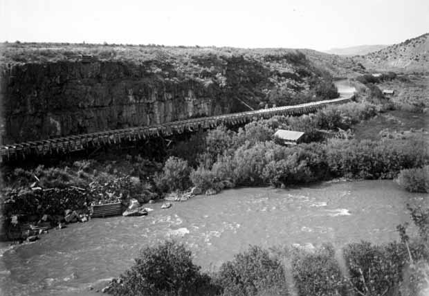
Constructing an irrigation canal through Bear River Canyon (Gorge). Looking south.
COURTESY DONCALL AND ROBERT E. JENSEN, UTAH STATE HISTORICAL SOCIETY
Bear River continues to send its torrent of spring flood waters downstream, impeded only by the same small hydro-electric dams that have existed for more than seventy years. Utah continues to envision these waters longingly as a means of quenching the thirst of a growing Wasatch Front. In contrast with the dynamic population growth of the Wasatch Front, the population in Idaho’s Bear River Basin has remained fairly static for the last forty years, which limits the state’s need to develop additional municipal and industrial water supplies. Need will govern future Bear River developments, and it is unlikely that either state will successfully circumvent the social, environmental, and financial complexities until the needs of its citizens eclipse the disadvantages of development.
NOTES
Robert Parson is the university archivist for Utah State University. He wishes to thank John Walters for his insightful suggestions.
1 William M.Green, Report on the Cache Valley Project of the Salt Lake Basin Investigations,Utah (Salt Lake City:United States Bureau of Reclamation,1924),18-19.
2 Ibid.,20.
3 Preston Citizen (Preston,Idaho),November 17,1962.
4 Bear River Project,Part I,Feasibility Report,Oneida Division,Idaho and Utah;Part II,Reconnaissance Report,Blacksmith Fork Division,Utah (Salt Lake City:United States Bureau of Reclamation,1962),86. Hereafter cited as BRP.
5 Max R.McCarthy, The Last Chance Canal Company ( Provo:Brigham Young University,Charles Redd Center for Western Studies,1987),23.
6 Ibid.,27.
7 A cubic foot per second (cfs) is the common means used to measure the flow of water.The United States Geological Survey defines cubic foot per second(cfs) as “the flow rate or discharge equal to one cubic foot of water per second or about 7.5 gallons per second.”
8 Jarvis -Conklin Mortgage Trust Co.,“A Description of the Location,Works and Business of the Bear Lake and River Water Works and Irrigation Co.”(Kansas City,Mo.,1889),26-31.Copy found in Special Collections and Archives,Utah State University.
9 Report of the Special Committee of the United States Senate on the Irrigation and Reclamation of Arid Lands, Report of Committee and Views of the Minority, 4 vols.(Washington,D.C.:GPO,1890),2:45.
10 McCarthy, The Last Chance Canal Company,28.
11 See, Utah Power and Light Company v Richmond Irrigation Company,et al,final decree copy in Special Collections and Archives,Utah State University;and Utah Power and Light Company v Last Chance Canal Company,et al.,final decree In Equity No 203,U.S.District Court of Idaho,Eastern Division,July 14,1920.
12 Samuel Fortier, Seepage Water of Northern Utah, USGS Water Supply Paper no.7 (Washington,D.C.: GPO,1897),12.
13 Ellen Carney, Ellis Kackley:Best Damn Doctor in the West (Bend,Oregon:Maverick Publications, 1990),236-38.
14 First Annual Report of the Bear River Commission,(Logan,Utah:The Commission,1959),9.
15 Ibid.,9-10.
16 Caribou County Sun (Soda Springs,Idaho),January 5,1961.
17 Preston Citizen,December 10,1962.
18 News-Examiner (Montpelier,Idaho),January 10,1963, Preston Citizen,January 10,1963.
19 Ibid.,November 1,1962.
20 Herald Journal (Logan,Utah),January 17,1963.
21 News-Examiner,March 14,1963.
22 Minutes of the Bear River Central Coordinating Committee,March 16,1963.Contained in Papers of Wade H.Andrews,Special Collections and Archives,Utah State University,Logan,Utah.Hereafter BRCC minutes.
23 Ibid.,April 4,1963.
24 Preston Citizen, March 21,1963.
25 BRP,96-100.
26 Preston Citizen, June 20,1963.
27 Caribou County Sun,July 11,1963.
28 Evan Kackley,“A Critique of the Bear River Project,Major Report,”November 20,1962,p.34. Contained in Papers of Wade H.Andrews,Special Collections and Archives,Utah State University,Logan, Utah.
29 Ibid.,31.
30 Utah Code Annotated 12 vols.(Charlottesville,Virginia:The Miche Co.,1997),7C:211.
31 Kackley,“A Critique of the Bear River Project,Major Report,”54-55.
32 News-Examiner,March 12,1964.
33 Herald Journal,May 3,1963.
34 BRCC minutes,June 11,1963.
35 News-Examiner,April 4,1963.
36 Mark Harvey, A Symbol of Wilderness:Echo Park and the American Conservation Movement (Seattle: University of Washington,2000),xv-xx.
37 Preston Citizen,November 25,1963.See also,Interview with Reed Budge and Evan Kackley,June 16,1965,contained in Papers of Wade H.Andrews.
38 BRCC minutes,July 18,1963.
39 Idaho Daily Statesman (Boise),August 28,1963.
40 Ibid.
41 Caribou County Sun,May 2,1963.
42 BRCC minutes,July 31,1963.
43 News-Examiner,May 2,1963.Idaho eventually passed legislation creating a small project fund in 1969.See, Idaho Daily Statesman,March 16,1969.
44 BRCC minutes,July 31,1963.
45 Ibid.,September 25,1963.
46 News-Examiner,September 10,1963.
47 Caribou County Sun,July 18,1963.
48 Salt Lake Tribune,October 23,1963.
49 Ibid.,December 19 and 20,1963.
50 BRCC minutes,December 19,1963.
51 Herald Journal,January 24,1964, Salt Lake Tribune, January 23,1964.
52 Ibid.
53 BRCC minutes,July 31,1963.
54 E.A.Hunter to Wallace F.Bennett,April 10,1961,contained in the Papers of Frederick P.Champ, Special Collections and Archives,Utah State University,Logan,Utah.
55 Ibid.
56 News-Examiner,March 12,1964.Lloyd Dunn later acknowledged that Bright had used sources provided him by UP&L,which had investigated the proposed site in 1923.The potential hazard convinced the power company to move construction of its Oneida power plant farther upstream.See discussion with Lloyd Dunn,Georgetown,Idaho,contained in Wade H.Andrews Papers.
57 Robert C.Bright,“Partial Review of the Feasibility Report of the Bear River Project,”contained in Wade H.Andrews Papers.
58 News-Examiner,March 12,1964.
59 R.E.Marsell to Jay R.Bingham,February 11,1964,contained in Wade H.Andrews Papers.
60 Robert C.Bright to Jay R.Bingham,July 25,1964,contained in Wade H.Andrews Papers.
61 Alternative Plans for Bear River Project,Idaho and Utah (Salt Lake City:The Bureau),1-7.
62 Board of Water Resources Tour of the Bear River Basin, August 3-5,1988 (Salt Lake City:The Board, 1988),68.
63 BRCC minutes,January 15,1964.
64 Preston Citizen,April 20,1967.
65 Bear River InvestigationsStatus Report (Salt Lake City:The Bureau,1970),1-2.
66 Amended Bear River Compact Summary (Salt Lake City:Utah Division of Water Resources,1988),7.
67 Utah State Water Plan:Bear River Basin (Salt Lake City:Utah Division of Water Resources,1992), Section 9,2.
68 Ibid.,9,23.
69 Final Resource Assessment:Bear River Wild and Scenic Eligibility,Bear River,Idaho (Pocatello,Idaho:BLM, 1995),11.
70 Board of Water Resources Tour of the Bear River Basin,11.
71 Ibid.,32-33.
72 Bear River Development (Salt Lake City:Utah Division of Water Resources,2000),2.The Utah Legislature passed a bill in 2002 which effectively removed the Barrens and Honeyville dam sites from the State’s water plan.See, Herald Journal,February 15,2002.
73 The Twin Lakes Canal Company,which takes water out of Mink Creek northeast of Preston and conveys it through a complex system of canals and siphons to irrigate land in the vicinity of Dayton, Idaho,has recently sought permission to construct a dam on the Bear River.See Herald Journal,February 6,2004.
74 McCarthy, The Last Chance Canal Company,94-100.
