5 minute read
MOTU TRAILS


Path of progress
Why a decade-old cycle trail is proving a boon for tourists and the local community contributing to its success.
Advertisement
WORDS SUE HOFFART / PHOTOS JIM ROBINSON, NEIL ROBERT HUTTON & CAM MACKENZIE
Ascenic dunes trail that has resolved a watery paradox for the coastal town of Ōpōtiki is proving a massive drawcard for both locals and visitors.
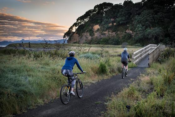
Ancient waka travellers and modernday boat owners have always been able to access the ocean by way of the twin rivers that wrap around the Eastern Bay of Plenty township. But it took a cycle trail and handsome suspension bridge spanning the Ōtara River to connect walkers, joggers and bikers with the gloriously long stretch of coastline on their doorstep.
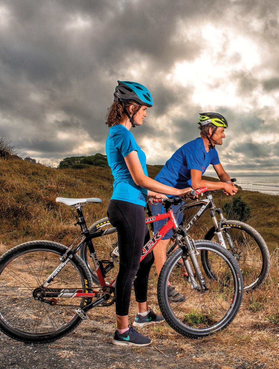
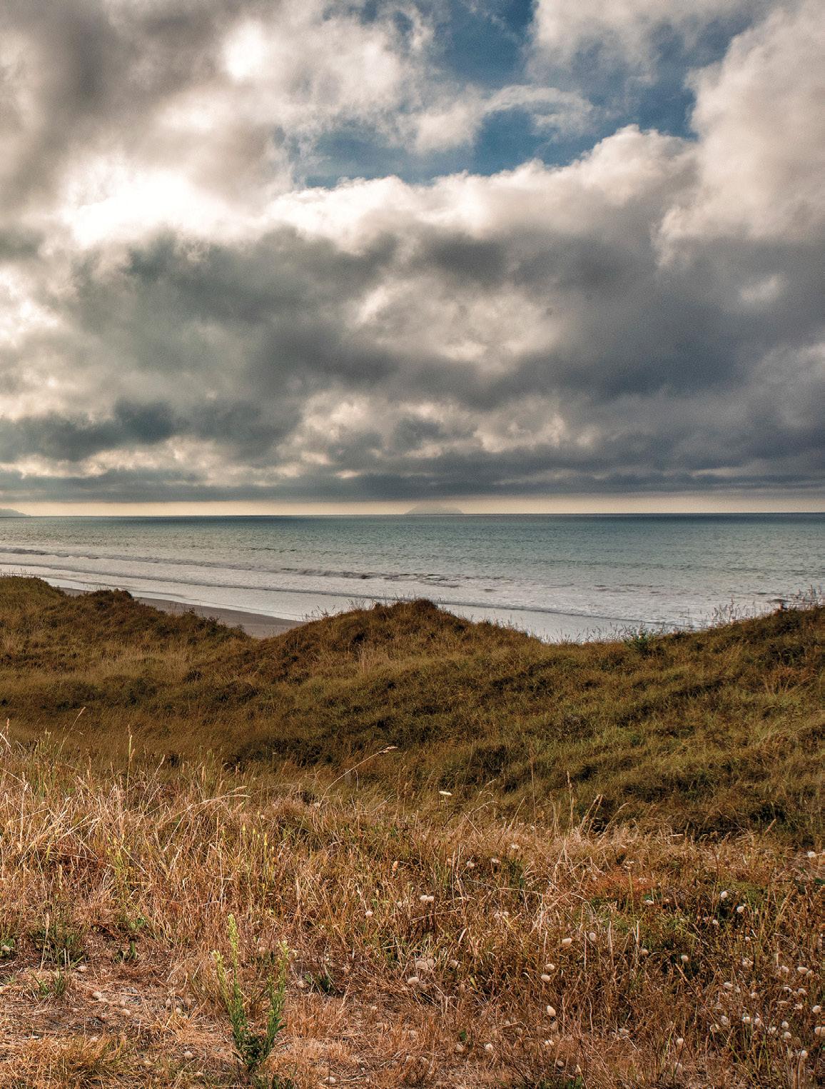
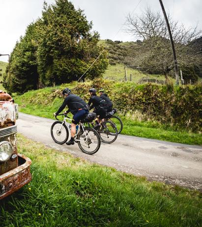
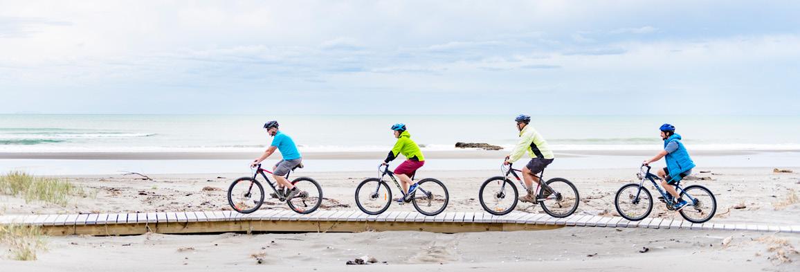
Most of the spectacular Motu Trails cycleway network lies inland, where rugged grade three and four tracks attract hardy mountain bikers keen to test themselves on backcountry roads and steep forest trails. Collectively, they comprise more than 30km of track and 150km of gravel and back roads. The most mellow section, though, begins with a pedestrian bridge on the northern edge of town and a delightfully scenic, undulating gravel track running parallel to the shoreline.
It’s this 9km grade two ‘dunes trail’ that has given the town its beach, according to tourism operator and local resident Volker Grindel. The decade-old trail has become increasingly popular with Ōpōtiki folk and tourists. “Before, everyone needed a car to get to the beach,” he says.

These days, local children and car-less residents can reach the coast safely on foot by crossing the Pakowhai ki Otutaopuku bridge, rather than having to walk more than 3km along the highway and side road. So too can tourists who arrive by bus or bike. After crossing the river, the trail meanders past grazing cows and opens onto views of the East Cape and nearby Moutohorā (Whale Island).


“The dunes section is the most used part of the Motu Trails,” says Volker. “The town kids and people who live here use it a lot for fitness – running, jogging. And the kids who live out of town use it to come to school on their bikes because it’s safer than the highway. I’ve even seen a little fella with training wheels.”

Volker and his wife Andrea operate a small backpackers’ hostel, and Andrea runs their busy Kafe Friends coffee cart just off the main street. The German-born couple, who met in Ōpōtiki after her car broke down there, are seeing increasing numbers of day trippers in bike gear from nearby Rotorua, Whakātane and Tauranga.

Volker says that during summer holidays and weekends, Tirohanga Beach Motor Camp, partway along the dunes, is packed with people using bikes. Plenty of those campers and cycle tourists make their way along the trail to the town centre.
“Before, they were not taking their kids on that busy road. Now, they come to town do some shopping, drop in for coffee here or somewhere else. So the Four Square, the New World, the gas stations all get something out of this trail, too.”
Andrea runs along the dunes when she’s training for half-marathons, plus it’s used by local schools that have been inspired to run duathlons and small cycle events for students – and by dog walkers.
Long-time volunteer trail builder, keen biker and Motu Trails executive officer Jim Robinson does track assessments, as well as overseeing signage, the trails website and Facebook page, and multiple other things. He laughs at his fancy title and stresses that the trust-run operation is small and heavily reliant on unpaid
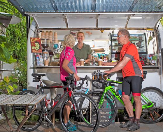
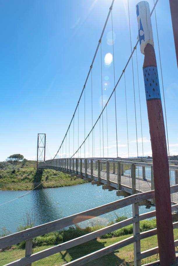

OPPOSITE, TOP LEFT The Pakowhai ki Otutaopuku bridge connects Ōpōtiki with the ocean. OPPOSITE, TOP RIGHT When not using the dunes trail to train for running events, Kafe Friends owner-barista Andrea Grindel serves visiting cyclists from her coffee cart.
community involvement, as well as council and conservation department input. But he says there’s no doubting the Motu social and economic benefits, or its standing as a ‘great ride’ of Ngā Haerenga, the New Zealand Cycle Trail.
Jim recalls that one section of coastline now occupied by the dunes trail had been used for dumping rubbish. Other parts had been grazed by stock or were covered in gorse, kikuyu, boxthorn, pampas and other undesirable invaders. So he’s
especially enthused about the ongoing planting and beautification programme that has transformed the “really important but environmentally degraded” sand dunes area with the help of about 20,000 flax bushes, cabbage trees, pōhutukawa and other native plants. All have been poked into the ground by volunteers, with another three planting days planned for this winter. S I G N S D E N O T E C U LT U R A L LY S I G N I F I C A N T A R E A S , I N C L U D I N G H I S T O R I C L A N D I N G S I T E S A N D B U R I A L G R O U N D S , A N D T H E T R A C K R O U T E WA S C H O S E N T O AV O I D ESPECIALLY SACRED OR SENSITIVE SITES.
Interpretive signs denote culturally significant areas, including historic landing sites and burial grounds, and the track route was chosen to avoid especially sacred or sensitive sites.
Local potters and environmentalists Margaret and Stuart Slade provided handmade ceramic tiles depicting birds, mounted on concrete culverts to create sturdy sculptures. Earlier artworks were provided by schoolchildren who painted wooden cut-outs of birds and animals as a conservation-week project.
Small tourism operators have sprung up to offer farm-stay accommodation, food and shuttle transport to mountain bikers using the trails that connect Ōpōtiki to Gisborne. Late last year, long-time kayak tour operator Kenny McCracken began offering guided bike tours along the dunes, incorporating local history and food with an optional swim along the way.
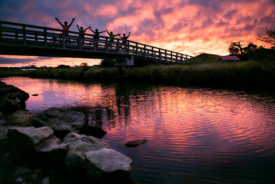
“There’s a massive amount of community ownership of the trail,” says Jim.


