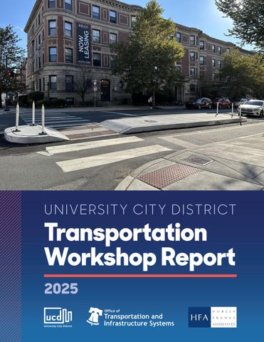
U NIVERSITY CITY DISTRICT
Transportation Workshop Report 2025
Acknowledgements Invited Organizations: Brandywine Reality Trust The Children’s Hospital of Philadelphia The Delaware Valley Regional Planning Commission (DVRPC) The Department of Streets (City of Philadelphia) The Department of Planning and Development (City of Philadelphia) Drexel University The Pennsylvania Department of Transportation (PennDOT) Southeastern Pennsylvania Transportation Authority (SEPTA) The University of Pennsylvania The University of Pennsylvania Health System Wexford Science and Technology
Workshop Staff: Matthew Bergheiser University City District Alan Garry University City District Nate Hommel University City District Jeannette Brugger Office of Transportation and Infrastructure Systems (OTIS) Christopher Puchalsky Office of Transportation and Infrastructure Systems (OTIS) Benjamin She Office of Transportation and Infrastructure Systems (OTIS) Jennifer Hurley Hurley Franks & Associates
Workshop Host: University City Science Center 1
Please Note
W
hat follows is a summation of workshops held with representatives from University City District, Philadelphia’s Office of Transportation Infrastructure Systems (OTIS), and a small group of partners to discuss a select set of transportation issues and identify possible short and long-term interventions. This report is the first of many steps, including additional meetings with an expanded group of stakeholders consisting of community representatives and local elected officials.
Table Of Contents Executive Summary 3 Framing The Context: Data About University City 4 Continued Major Development Is Planned In And Around University City 4
Workshop Outcomes: Short-Term Actions 13 High Priority Short Term Actions 13 Short-Term Actions List 13
High Priority Short-Term Actions 15 30th Street Station Area 15 34th Street Area 15 38th Street / University Avenue Area 16 Spruce, Chestnut, And Walnut Street Area 16
Medium Priority Short-Term Actions 17 Low Priority Short-Term Actions 17 Looking Ahead: Big Picture Discussion 17 Conclusion: What's Next? 20 Appendix 20 2
Executive Summary
P
hiladelphia’s University City neighborhood has experienced rapid development of educational, medical, and commercial facilities, generating employment and residential growth. These changes present transportation challenges that, if not addressed, could interfere with the infrastructure of University City.
Concurrently, institutional growth and new funding opportunities present the potential for major infrastructure investments. A key goal is to invest in transportation infrastructure improvements that support rather than undermine an improved quality of life for employees, residents, and visitors alike. These investments will support University City’s vision for itself as a livable community and economic engine for the region with high quality jobs. To support this goal, the city’s Office of Transportation & Infrastructure Systems (OTIS) partnered with University City District (UCD) to host two stakeholder workshops in Winter of 2024. The goal of these workshops was to lay out and discuss transportation and development issues facing University City. Together, the workshop group developed ideas for transportation improvements and actions that could be implemented within two time periods: 1) a few years, and 2) transformative long-term projects. This report documents the results of these two workshops and details action items for transforming University City into a future that is safe and equitable for all. Two notes for context: transportation infrastructure should prioritize high-quality emergency service trips by ambulance or medical transport. Today, these trips are mixed with private-vehicle-centric travel, which both slows those trips and cause associated traffic safety and air quality issues. In addition, there is a transit funding crisis in Pennsylvania which has and will impact service and funding for the Southeastern Pennsylvania Transportation Authority (SEPTA). Recommendations in this report are transit and multimodal forward in nature and assume optimistic change on both of these fronts. 3
Framing The Context: Data About University City
T
oday, University City benefits from a booming education and research sector that is bolstered by a robust transportation infrastructure and travel modes. To keep this momentum going both private and public sector actors will need to work together to clearly frame a vision for University City and ensure that transportation infrastructure is expanded and upgraded in a way that supports quality of life in University City. Here are some highlights and conclusions on transportation and development data. More details can be found in the Appendix.
CONTINUED MAJOR DEVELOPMENT IS PLANNED IN AND AROUND UNIVERSITY CITY: Schuylkill Yards, uCity Square, HUP/CHOP facility expansion, Market/Chestnut west of 40th Street, and Pennovation District.
Current Development in University City SP RI NG GA
RD EN ST.
Philadelphia 30 th Street District Site
50 TH S
T.
POW ELTO N AVE . CH ES TN UT
M AR KE T
ST.
uCity Square
ST. ST.
M AR KE T
E AVE.
AV
ST .
49 T
H
K
E.
G IN
45 T
SE
SS
IN
G
ST .
AV
E.
H
S T.
3 4 TH
S T.
3 8 TH
ST.
ST.
ST.
ST .
AV
E.
O
DL
Pennovation Works
O
H
LD
CH ES TN UT
W
50 T
SP
RIN
IE GF
D
BALTIMOR
WAL NU T
SP RU CE ST .
OO D AV E.
AN
LA RC HW
40 TH ST .
SP RU CE ST .
42 ND ST .
4 5 TH S
T.
WAL NU T
Schuylkill Yards Site
Academic
Commercial
Medical
Residential / Mixed Use
1. 2.
11. 3001 JFK Blvd: The East Tower 12. 3151 Market 13. 3201 Cuthbert Street 14. 3440 Market 15. 3600 Civic Center Blvd Overbuild 16. 3711 Market 17. 3838 Market 18. 4.0 University Place 19. The Food Hall at Schuylkill Yards 20. Sheraton Philadelphia University City Hotel 21. Spark Gene Therapy Innovation Center 22. Two-Three uCity Square 23. Ultra Labs Philadelphia
24. Morgan Center for Research and Innovation 25. Penn Presbyterian Medical Center Parking Garage 26. Roberts Children’s Health at Children’s Hospital of Philadelphia (CHOP)
29. 30. 31. 32. 33. 34. 35. 36. 37. 38. 39. 40. 41. 42.
Amy Gutmann Hall Buckley Bubble at Vidas Athletic Complex 3. College Hall West Wing Renovation 4. Franklin Field Team Operations 5. Ott Center for Track and Field 6. Penn Museum Renovations Phase 2 7. The Quadrangle Renovation 8. Stuart Weitzman Hall 9. Student Performing Arts Center 10. Vagelos Laboratory for Energy Science and Technology
Public Space 27. Drexel Lawn 28. West Philly Waterfront
3025 JFK Blvd: The West Tower 3801 Chestnut Street 3935 Walnut Street Redevelopment 4011 Market Street 4145 Chestnut Street Garden Court Plaza Extension The Linden LVL West The Mark Philadelphia Mill Creek Station The Residences on Sansom The Standard at Philadelphia Triad Apartments Westpark SOURCE: UCD
4
New Construction or Major Renovations New Construction or Major Renovations 3,000,000
Square Feet of Development
2,500,000
2,000,000
1,500,000
1,000,000
25
24
20
23
20
22
20
21
20
20
20
19
20
18
20
17
20
16
20
15
20
14
20
13
20
12
20
11
20
10
20
09
20
08
20
07
20
06
20
05
20
04
20
03
20
20
20
02
0
*
500,000
* = Projected • Source: UCD
DVRPC traffic modeling, Future development DVRPC modeling uture de scenario: elo ment scenario: Over traffic 1.5 million square feet of new development valued at over Assumed full buildout of Schuylkill HUP/CHOP ssumed full uildout of Yards, ctouUniversity l ill ardsCity’sPinventory C P in 2024, $252 Million was added th Development west of 38 Street & uCity Square included in model
De elo est t square t uCit uare included model withment another 2.7ofmillion feet coming online in in 2025. Approximate Value of New Real Estate Development Projects $12
$10
$6
$4
$2
Cumulative Value
* 26
*
20
25
24
20
23
20
20
22 20
21
20
20
20
19 20
18
20
17
20
16 20
15 20
14
13
20
12
20
11
New Construction
20
20
10
20
09 20
08
20
07 20
06
20
05 20
04 20
03
$0 20
Dollars (Billions)
$8
* = Projected • Source: UCD
5
Motorized traffic is at or near capacity already, transit has far more available capacityresults to meet demand DVRPC traffic modeling (2022): ncrease in suburban commuter demand can be met through SEPTA Regional Rail masterplan and of I-76, South St, U • High development scenario predicts overcapacity TCO extension • Motorized traffic is at or near capacity already, transit has far more av • Increase in suburban commuter cancannot be met through University City’sdemand growth rely SEPTA PM Peak Volume Traffic PATCO extension on car travel: Traffic modeling from the Delaware Valley Regional Planning Commission (DVRPC) shows that all major arterials will be overcapacity if planned development continues at the current pace withBike/ped/transit auto-centric development patterns and mode choice, specifically private-vehicle transportation for commuting purposes. Capacity on these roadways should be reserved for high-quality trips for emergency vehicles and ill patient transport.
University City has multiple transit options to accommodate development: The increase in regional commuter demand can be met through SEPTA Regional Rail master plan and PATCO extension. Urban commuter demand can be met through enhanced LUCY service, improved SEPTA service, and additional high-quality bike infrastructure.
Public Transportation Routes in University City
SOURCE: UCD
6
University City is a multimodal place: Commute mode share within the district is 30% walk, 23% car, 19% transit, and 3% bike, with 22% work from home (Census ACS 2023). Small block sizes, extensive sidewalks and bike lanes, and the density of housing, restaurants, and workplaces encourage a variety of travel modes, including transit.
University City Commute Mode Share
SOURCE: U.S. CENSUS
University City workers come from transit/bike/walk-friendly multimodal places, including Center City, West Philadelphia, South Philadelphia, and Delaware County. These areas encourage non-car dependent lifestyles through density of amenities and jobs, walkable urban fabrics, and bikefriendly streets.
University City: Most workers live in transit/bike/walkfriendly areas
Total workers 1 - 14 15 - 36 37 - 71 72 - 127
University City census tracts
128 - 214
Hexbin map generated from Census block group centroids. Hexagons 1000m in diameter.
215 - 389 390 - 816
Source: Longitudinal Employment-Household Dynamics, U.S. Census Bureau (2021)
7
University City vehicle traffic is nearly up to pre-pandemic levels: Post-pandemic traffic volume into University City is 80% of pre-pandemic levels. This return of traffic indicates continuing demand for travel within University City.
Vehicle Origins into University City
Origins into University City
SOURCE: PLACER.AI, 2024
Vehicle Destinations out of University City
SOURCE: PLACER.AI, 2024
8
IndegoIndego Trips inTrips UCDin UCD 300,000
250,000 Trips Per Year inUniversity City District
University City bicycle traffic volumes and separated bicycle infrastructure has grown tremendously post-pandemic: The number of yearly Indego bike share trips that start or end in University City has increased by 80% since 2019, with station expansion throughout the area. University City trips make up 23% of all Indego use citywide. Expansion of parking-separated bike lanes on Chestnut, Walnut, and 48th Streets, as well as the upcoming addition of 47 th Street, has measurably improved the bicycle network in University City.
200,000
150,000
100,000
50,000
0
2019
2020
2021
2022
2023
2024
SOURCE: INDEGO
9
ormed, PCPC collected information during daytime hours arking spaces available as well as the number of spaces e public facilities in University City containing 30 or pancy rates was notwas collected at 5 locations. Among the 30 sites surveyed 74%, equaling 8,518 spaces at public facilities private facilitiesdue hadtohave athe 69.8% University City 2017, does primarily not currently a parking shortage: Despite increased development, mately 3.5% increasewhile from private parking facilities. parking rate occupancy public facilities has remained constant from 2017 to 2023. This includes st public occupancy at 58.3%.atExcluding Powelton
both public and lots for health and education institutions like HUP, CHOP, the VA, he other neighborhoods had employee capacity changes within th 30 Street Station, University of Pennsylvania, Drexel University, and Presbyterian Hospital, acity changes. among others.
Public Daytime Parking Occupancy Daytime Occupancy 2017
cy
c pancy %
Area West
Spruce 63.4% Hill
Village 91.9% 60.29% 79% 80.44% 30th St Station 73% 78.83% 61.3% Penn / 64.8% Drexel 58.33% 63.4% 79% 72.48%
St. Joseph’s
N/A
%
Powelton 30th St Station
%
Penn/Drexel
%
Medical Campus
%
WestSpruce Powelton Hill
n the lities es in new
61.3%
N/A
Powelton Village
91.9%Campus Medical 76.1% ALL University City 70.1%
N/A 73.6%
USciences N/A
PublicParking DaytimeDaytime Occupancy Public Occupancy 2023 Private Daytime Occupancy St Garden Spring
Ave Haverford
Powelton Powelton Village Village N/A 58.5%
West West Powelton Powelton 58.3% 13.6%
USciences 86.3%
St. Joe’s N/A
Penn / Penn Drexel/ Drexel 80.4% 62%
So ut h
Medical Campus Campus Medical 78.8% 79.9%
30th St 30th St Station Station 60.3% 60.5%
St
Sc hu ylk ill Ri ve r
Spruce Hill 72.5%Hill Spruce 67.5%
38th St
ities, pancy eublic oods. d yllage fublic ehood f. the 7te in ms. Of s, the 9.9%, gt the divate %d and m. The yivate s
64.8%
45th St
%
2017 Public 2023 Public Powelton Occupancy % Occupancy %
SOURCE: PHILADELPHIA CITY PLANNING COMMISSION
Source: Philadelphia City Planning Commission, 2023
10
UNIVERCITY C PHILADELPHIA Planning District Facts 40 TH ST
University City streets have many High Injury Network streets and are not safe for roadway users: University City experiences a higher number of fatal and serious-injury traffic crashes, especially UNIVERCITY CITY & SOUTHW pedestrian/bike crashes, relative to the rest of Philadelphia. The area also has a number of Vision PHILADELPHIA Zero High Injury Network streets, where 80% of fatal and seriousPlanning crashesDistrict occur on 12% of PhiladelFacts phia streets. Many of these streets include high-pedestrian and bicycle streets that link institutions th to residential and commercial areas, 30UNIVERCITY Street Station andCITY across& theSOUTHWEST Schuylkill River, including Market, Chestnut, Walnut, and South Streets, and Baltimore and University Avenues. There are PHILADELPHIA ongoing Vision Zero Projects on several Planning of these streets, but more work and investment are needed District Facts to improve traffic safety in University City. W ALNUT
ST
ST
E AV
AV E
PK
ST
K
W
Y
54 TH
CHESTN
E AV D UTLST FIE
MARKET ST
Y S RA G
E AV
EE
G
IN SS SE G
G
E AV
W
AV E
PK
ST
K
RIN SP
KIN
TH 49
3 8TH S T
ST
CR
ST
UNIV ERS ITY
EE
E AV
S
SPRUCE
V E DA AN DL OO
FIE G
TH 49
CR
AN
BB CO
M FF HO
RIN SP
ST
ST
W
TH 47
40 TH ST
Planning District Facts University City Vision Zero Facts W ALNUT
E
RE AV IMO BALT
MARKET ST
CHESTN UT ST E AV LD
ST
ST
S
SPRUCE
TH
BB CO
3 8TH S T
AN
54
UNIVERCITY CITY & SOUTHWEST PHILADELPHIA M FF HO
V E DA AN DL OO
ST
ST
W
TH 47
W ALNUT
E
40 TH ST
RE AV IMO BALT
UNIV ERS ITY
A
SPRUCE
Y
TH 47
TH
ST
ST
EE CR K PK W Y
W
TH 47
V E DA AN DL OO
E AV 54 TH ST
S
LD
E AV
G
E AV
3
G IN MARKET ST SS SE G
Y S RA G
Traffic deaths in this district each year (2020-2024 average)
PK Y
Traffic Death (2024)
3
Traffic deaths in this
Traffic deaths in this district each year (2020-2024 average)0
3
Serious Injury Crash (2024)
R G
Traffic deaths in this district each year (2020-2024 average)
24 0
Serious Injury Crash (2024)
2.5 5
24 1 0 Mi l es
1 0 Mi l es
Serious traffic this district ea (2020-2024 av
High Injury Network 2025
Serious traffic injuries in this district each year (2020-2024 average)
Serious Injury Crash (2024)
24
High Injury Network 2025
Serious traffic injuries in this district each year (2020-2024 average)
2.5 5
1 0 Mi l es
18%
High Injury Network 2025
Serious traffic injuries in
district each yearCrashes (2020-2024) this district each year University City (2020-2024 average)
24
2.5 5
E AV
Traffic Death (2024)
W E
AV Traffic Death (2024) S AY
E AV
0
18%
ST
K
G IN SS SE NG KI
Serious Injury Crash (2024)
TH 49
EE CR
SP
E FI NG RI
IN SS SE G KIN
UT ST KIN
3
ST
AN
BB CO
M FF HO
E
CHESTN
ST
RIN SP
E AV
E AV
Traffic Death (2024)
E AV
TH 49
LD FIE G
3 8TH S T
54
SPRUCE
UNIV ERSIT Y AV E
E AV
S
V RE A IMO BALT
Y S RA G
ST
AN
BB CO
M FF HO
E
V E DA AN DL OO
UNIV ERS ITY
40 TH ST
RE AV IMO BALT
W ALNU T ST
W
(2020-2024 average)
18%
Vision Zero Project Percent of street miles in this district on the High Injury Network (2025)
Vision Zero Project Percent of street miles in this district on the High Injury Network (2025)
Crash Severity
Killed or Severely Injured (KSI) Other
SOURCE: CITY OF PHILADELPHIA, OFFICE OF TRANSPORTATION AND INFRASTRUCTURE SYSTEMS
11
Vi
Per this Inju
University City’s road network is at capacity and does not prioritize highvalue trips. High-value trips are those made by emergency vehicles, seriously-ill patients, and freight deliveries. Commuting and through-drivers should not be prioritized on the local street network and are currently clogging the road network and diminishing access for the high-value trips.
12
Workshop Outcomes: Short-Term Actions
T
hrough discussion at the workshops, participants developed ideas for many short-term improvements that could be fully implemented within 3-5 years. OTIS and UCD are committed to working together to realize these improvements with the workshop attendee partner agencies.
Here you will find descriptions of the highest priority actions and a listing of all of the action ideas with more details in the Appendix.
HIGH PRIORITY SHORT TERM ACTIONS AREA
HIGH PRIORITY SHORT TERM ACTIONS
30th Street Area
LUCY Bus Service Expansion Drexel area • • • • •
Expand schedules and service Reevaluate routes and stops to better reflect development locations More service between 30th + Penn Medicine More layover space on JFK Explore options for partnering with SEPTA
SEPTA Station Last Mile Improvements Metro stations •
Lighting, sidewalks, micromobility hubs, security
SEPTA System Safety Ambassadors Metro stations •
34th Street Area
UCD ambassadors in stations
Encourage Trip Chaining from 30th Street From HUP/CHOP •
Expand on CHOP program to encourage employees to trip chain and park at 30th Street
13
AREA
HIGH PRIORITY SHORT TERM ACTIONS
38th Street Area
34th & Grays Ferry Intersection Improvements 34th & Grays Ferry Intersection + Wharton Street •
•
The projected amount of development on the 34th Street corridor is not sustainable and the modal demand of the projected vehicle traffic paired with Vision Zero High Injury Network streets and new bike and trail links is concerning. The Planning Commission is leading a Transportation & Community Development Initiative Study funded by DVRPC that will: 1. Develop a Visioning Report that quantifies the traffic impacts of proposed developments 2. Assemble a Transportation Demand Management Toolkit of policies for public and private institutions to manage and balance travel demand with a particular focus on the context of the area
Christian to Crescent Trail Bridge In May 2025, the Christian to Crescent Trail Bridge opened, connecting the Grays Ferry Crescent to the more than 30-miles of the Schuylkill River Trail Grays Ferry Swing Bridge In 2025, the Grays Ferry Bridge will connect the Schuylkill River Trail over the Schuylkill River to Bartram’s Garden and points south. Spruce / Walnut / Chestnut
Parking/Loading Reconfiguration Whole area • • •
Loading zones at commercial corridors + Wawa(s) Both pickup & drop-off Food delivery + Uber/Lyft
14
High Priority Short-Term Actions 30TH STREET STATION AREA: LUCY Service Expansion (Drexel Area)
The LUCY bus was established in 1999 to relieve congestion within University City, reducing the need for redundant institutional shuttles while providing a last-mile urban circulator to connect between major institutions and 30th Street Station. While service frequency changes have been made in the last two decades, the LUCY route has not been fundamentally altered since the early 2000s, despite large changes in the urban fabric of University City. To address these concerns, University City District will explore improvements and modifications to the LUCY service. A survey, which is currently fielding, created in collaboration with SEPTA of LUCY riders at partner institutions will inform proposed upgrades and changes to LUCY. These improvements could include an expansion of the existing schedule, expansion of the LUCY service area, and a reevaluation of the existing route to improve operational efficiency, an app-replacement for the current badge system for LUCY partner institution employees, and more layover space on JFK Boulevard.
SEPTA Station Last Mile Improvements (Metro Stations)
University City District and the Office of Transportation and Infrastructure Services will partner to improve the “last mile” experience in University City, where riders walk, scoot, or bike to their destination after getting off the bus, trolley, or L train. These improvements could include enhanced lighting, sidewalk improvements, micromobility hubs (increased and enhanced bike and scooter storage), and additional staff for improved personal safety at stations.
SEPTA System Safety Ambassadors (Metro Stations)
University City District and SEPTA will explore ways to improve personal safety wtihin Metro stations, which could include enhanced coordination with existing UCD Safety Ambassadors or UCD Safety Ambassadors within SEPTA stations.
34TH STREET AREA: Encourage Trip Chaining from 30th Street (from HUP/CHOP)
To reduce congestion and encourage trip chaining, University City District will work with the Children’s Hospital of Philadelphia to expand on the existing program encouraging employees to park at 30th Street and walk, bike, or take LUCY to the hospital campus at 34th Street. 15
38TH STREET / UNIVERSITY AVENUE AREA: 34th & Grays Ferry Intersection Improvements (34th & Grays Ferry Intersection + Wharton Street)
This intersection is a major connector between University City, South Philadelphia, and points farther through I-76. Recent investment by the University of Pennslyvania with the Pennovation Center serves to strengthen the tie between this area and University City. Currently, the amount of growth at this intersection and its car dependency is not sustainable. There is a need to deeply understand the transit mode share, future development plans, and land use in the area. Solutions to these problems need to better support people walking, biking, and taking transit, in addition to those driving cars.
SPRUCE, CHESTNUT, AND WALNUT STREET AREA: Parking/Loading Reconfiguration (Whole Area)
Increased delivery traffic in recent years, stemming from rising popularity in food delivery apps and continued rise in online shopping, present logistical challenges to the commercial corridors of University City. Imrpovements to select areas of Walnut and Chestnut Street with loading zones and parking protected bike lanes have aleviated conflicts among bicycle riders, cars, and delivery vehicles, with more room remaining to improve traffic flow and reduce conflict. These solutions could include greater use of loading zones near commercial centers, particularly on Spruce Street, and enhanced, proactive communication between University City District, local businesses, and OTIS to identify conflict areas for future improvements. Pilot programs include the PPA’s Smart Loading Zones in Center City and SEPTA and the PPA’s Automated Bus Camera Enforcement in Center City and University City along Market, Chestnut, and Walnut Streets. These programs could provide solutions to loading and double-parking issues respectively. Early feedback from the first period of both pilots is positive, with the technology working as intended and over 20,000 citations for double parking, overstaying time in loading zones, and blocking bus stops. 16
Medium Priority Short-Term Actions
U
niversity City District will work with relevant stakeholders to achieve the following medium priority improvements to the University City Area:
•
Construction of Complete Streets at the 30th and Market Area, as well as the 33rd / 34th / Civic Center Area
•
Greater institutional support of transit priority
•
UCD wayfinding signage improvements at the 38th Street / University Avenue Area
•
Traffic calming on Walnut and Chestnut Streets • The Department of Streets has built concrete pedestrian refuge islands on Chestnut Street between Cobbs Creek Parkway and 43rd Street
Low Priority Short-Term Actions
T
he following are important but lower priority items discussed in the workshops. This priority ranking means that these projects will progress forward if an institution champion is found or within a specific funding program. University City District will work with relevant stakeholders to further define the scope and next steps for the following improvements: •
Creation of a JFK/Filbert/Cuthbert Street Pedestrian Walk through Drexel
•
Creation of pedestrian scrambles at busy intersections along Woodland Walk • This includes 34th and Walnut, 33rd and Chestnut, and 31st and Market
•
Traffic retiming study in 34th Street Area
•
Investigate staggering work shifts at local institutions
•
Bus supporting infrastructure and bus stop rebalancing in 38th Street Area
•
Investigate studying a transportation demand management (TDM) and parking study at Presbyterian Hospital campus
Looking Ahead: Big Picture Discussion
P
articipants in the second workshop discussed potential “big picture” ideas for changes that could be transformative. These ideas were presented as possible scenarios to spark thinking and discussion. The ideas were chosen for discussion because they are challenging and would require significant time, collaboration, and funding, but they are each within the realm of what is potentially feasible.
17
Participants had lively discussions considering what it would take to make each idea successful, possible pros and cons, and how each idea could affect other issues: • • • • • • • •
Walkability Ped/bike accessibility Vehicle travel Parking Neighborhood quality of life Economic development Employee/student/customer/patient attraction/retention Other issues participants raised
Below are the ideas used to spark discussion during the workshops. UCD will work with OTIS and major University City partners to prioritize and move these ideas forward for concept development and funding.
25th Street Transit Corridor New Innovation District Rail Line: Running from 30th Street to Bellwether District to Navy Yard. A rail service using the existing elevated track owned by CSX, this project could follow in the footsteps of other public transit projects which repurposed freight tracks, including the Ottawa O-Train and MTA Interborough Express (IBX). This is under evaluation in a City feasibility study at this time.
25th Street Transit Corridor •
“Innovation Line”: 30th Street – U. City – Bellwether District – Navy Yard
•
SEPTA Regional Rail branch
•
Paired with 25th Street Corridor improvements
•
Last-mile connections needed for all major job destinations
18
38th & University Avenue Plan Plan to create combined land use and transportation vision and detail future improvements for the corridor. The section of 38 th Street and University Avenue between Lancaster Avenue and 34th Street is an area of institutional land use, often with parking lots and blank walls to the street. A unified vision for the corridor that connects several major institutions could enliven and define this area as a destination of supportive and vibrant land uses.
Extensive Complete Streets Expansion Bring Complete Streets to as much of University City as possible. Work to streamline design requirements, funding, and identification of projects. Significant progress has already been achieved towards this goal since the workshop, including the completion of the 48th Street separated bike lane, approval and construction of the 47th Street separated bike lane and street redesign, Walnut Street separated bike lane from 22nd to 33rd Street, 33rd to 63rd Street, concrete pedestrian islands on Chestnut Street, and a mid-block crossing on the 3200 block of Chestnut Street. Additional traffic safety improvements around the district can bolster University City to an area where public realm improvements, zoning requirements, and end-of-commute facilities prioritize walking, biking, and transit.
19
PATCO Extension A PATCO extension to University City. This idea is commonly discussed to allow greater access to University City from Center City and New Jersey. It was discussed by regional leaders in the 1960s and 1970s and is included in OTIS’s Vision for 2045 Transit Plan. This is being evaluated further by a City feasibility study.
UCD Parking Cap Move parking to periphery, add internal circulation, and limit growth of net new parking. Parking maximums have a long history outside of the United States, such as London, Zurich, and Amsterdam. This policy would also serve to preserve existing auto capacity for high-value trips.
UCD Parking Revenue District Parking revenues within UCD directed to public realm improvements in UCD. This could be achieved through a supplemental UCD service area increase on the existing City gross parking revenue tax, or a Parking Benefit District (PBD). Special attention would be paid to ensure that the tax does not excessively burden critically ill patients at the hospitals.
Conclusion: What's Next?
O
TIS and UCD will work together with attendees and agencies to move forward on the projects listed here. We will use this document, this group, to drive future funding allocation. In 5 years, we will issue a progress summary.
Appendix • Workshop 1 Data Handout (see attached) • Workshop 2 Data Handout + Big Picture Ideas (see attached) • Short-Term Actions Table
20
We hope you have found this report useful! If you would like to discuss these findings in more depth, please contact: Joe Dizenhuz Manager of Research & Analysis University City District jdizenhuz@universitycity.org 267.635.2861 Jeannette Brugger, AICP Bicycle & Pedestrian Coordinator Office of Multimodal Planning Office of Transportation & Infrastructure City of Philadelphia jeannette.brugger@phila.gov
21
University City District 3940 Chestnut Street Philadelphia, PA 19104 215.243.0555
To make a secure, online donation to UCD, please visit:
www.universitycity.org/donate
universitycity.org universitycity @ucdphl @universitycity
22
APPENDIX: SHORT-TERM ACTIONS LIST AREA
HIGH PRIORITY
MEDIUM PRIORITY
LOW PRIORITY
30th Street Area
LUCY service improvements
Market Street complete streets
JFK/Filbert/Cuthbert pedestrian walk through Drexel
SEPTA station last mile improvements
Pedestrian scrambles at intersections
SEPTA system safety ambassadors 34th Street Area
Encourage Trip Chaining from 30th Street
30th/34th/33rd/Civic Center complete streets Transit priority institutional support
38th Street Area
34th & Grays Ferry intersection improvements
UC District wayfinding signage improvements
Traffic signal retiming study Stagger work shifts
Bus supporting infrastructure and stop rebalancing Presbyterian hospital TDM/parking study
Spruce / Walnut / Chestnut
Parking/Loading reconfiguration
Walnut/Chestnut traffic calming
tm s
23