OPEN NEW WORLDS
A JOURNEY THROUGH THE KISLAK COLLECTION
SELECTED
2019 INAUGURAL EXHIBITION
THE GALLERY AT THE KISLAK CENTER

A JOURNEY THROUGH THE KISLAK COLLECTION
SELECTED
2019 INAUGURAL EXHIBITION
THE GALLERY AT THE KISLAK CENTER
By Arthur Dunkelman, Director and Curator, Jay I. Kislak Foundation
Published on the occasion of the May 2, 2019, opening of the exhibition Open New Worlds: A Journey Through the Kislak Collection at the Gallery at the Kislak Center, University of Miami Otto G. Richter Library.
Design: Sean Keenan, Keenan Kreative
Editor: Barbara Pierce, Libra Communication
Printing: NuPress of Miami, Inc.
© 2019 University of Miami Libraries. No part of this publication may be reprinted or reproduced in any form without the written permission of the University of Miami Libraries, University of Miami, Coral Gables, Florida 33146.
Jay I. Kislak Foundation
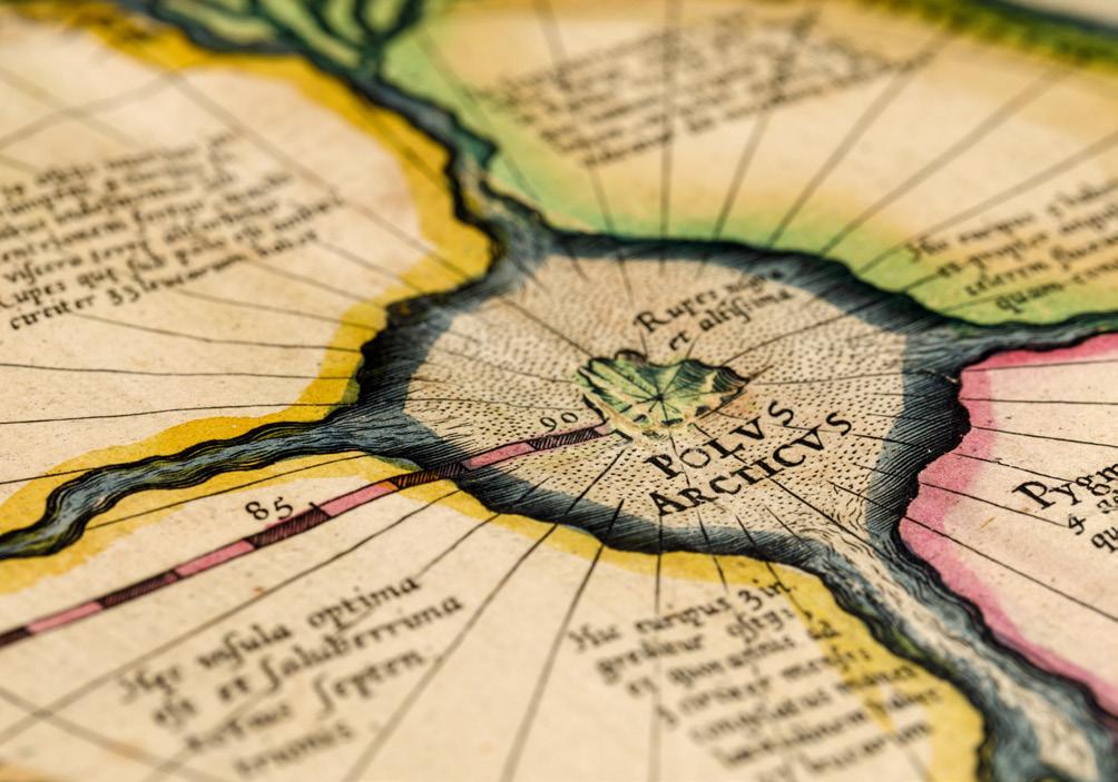
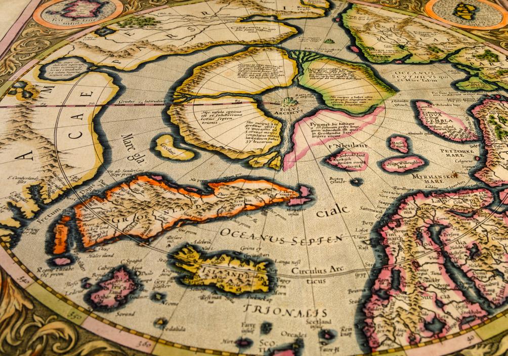
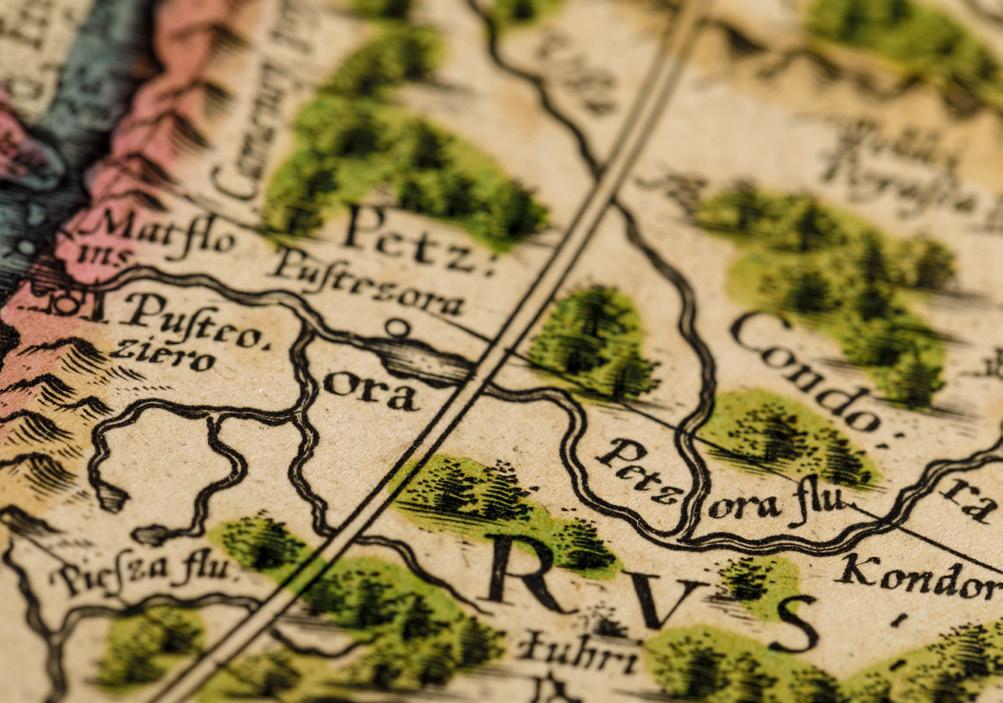
Front cover, inside front cover, and back cover: Details, Septentrionalium Terrarum Descriptio Gerard Mercator, 1594.
Jay I. Kislak Collection of the Early Americas, Exploration and Navigation
All images featured in this brochure are of materials from the Jay I. Kislak Collection of the Early Americas, Exploration and Navigation.
Jay I. Kislak
JUNE 6, 1922–OCTOBER 3, 2018
Jay I. Kislak, a real estate entrepreneur, came to South Florida in the early 1950s and, with his wife, Jean, a former art curator, began building a personal collection of unique manuscripts, rare books, maps, and artifacts documenting the history of the Americas. Over the years, this extraordinary array of valuable documents and objects grew into the Jay I. Kislak Collection of the Early Americas, Exploration and Navigation, widely recognized today as one of the world’s most important collections of its kind.
Mr. Kislak’s vision for the collection—to promote public awareness of and scholarly research into the history and cultures of the Americas—led him to donate a portion
of its holdings to the Library of Congress in 2004 and to establish the Kislak Center for Special Collections, Rare Books and Manuscripts at the University of Pennsylvania in 2013. He made a landmark gift of the remaining portion of the Collection to the University of Miami and Miami Dade College in 2016.
Now available to scholars and members of the public through the University of Miami Libraries’ Special Collections program in the Kislak Center at the University of Miami, the collection complements the University’s role as a hemispheric geographic and intellectual crossroads, connecting institutions, individuals, and ideas across the Americas and throughout the world.
Established in 1984, the Jay I. Kislak Foundation is a private, nonprofit cultural institution engaged in the collection, conservation, research, and interpretation of rare books, manuscripts, maps, and indigenous art and cultural artifacts of the Americas and other parts of the world. The Kislak collections are rich in primary research materials on the history of Florida, the Caribbean, and Mesoamerica, with special emphasis on native cultures, their contact with Europeans, and the colonial period. The Foundation’s purpose is to advance knowledge and understanding of world cultures and history through its collections and through programs of research, education, exhibition, and publication.
The landmark 2016 gift of the Jay I. Kislak Collection of the Early Americas, Exploration and Navigation to the University of Miami and Miami Dade College has transformed the University of Miami and its Libraries. The Kislak Center at the University of Miami opened in March 2018 in the heart of the Coral Gables campus at the nexus of the Libraries and Learning Commons. The elegant and beautiful multipurpose space provides a welcoming venue for lectures, debates, conferences, workshops, concerts, plays, and other events. As the Center enters its second year of operation, it is fulfilling its mission, serving as a dynamic hub for learning and lively academic and cultural exchange.
Open New Worlds: A Journey Through the Kislak Collection is the inaugural exhibition in the Gallery at the Kislak Center. The brand new mezzanine-level gallery features nearly 200 items from the Collection. The exquisite assembly of rare books, manuscripts, maps, photographs, and artifacts conveys a multifaceted history of the Americas, hemispheric cultural encounters, and global exploration beginning with Native American cultures and extending to modern times. The exhibit also serves as a window into the larger array of primary sources available in Special Collections. The Kislak Center and the Kislak Collection embody the University of Miami Libraries’ hemispheric leadership goal – to be a rich and accessible resource for expanding global knowledge, catalyzing research, and making fresh discoveries.
This souvenir booklet highlights just a small number of items from the exhibition, carefully selected by its curator, Arthur Dunkelman. We are deeply grateful to the Kislak Foundation for its extraordinary generosity, and, in particular, to Mr. Dunkelman, director and curator of the Kislak Foundation since 1995, for his expertise and commitment in bringing this exciting exhibit to fruition.
Charles Eckman, Dean and University Librarian
University of Miami Libraries
Jay Kislak’s passion for assembling this collection reflects his adventurous spirit, his tireless curiosity, and his humanity. It rests on a simple, yet profound vision: that the collection should tell the story of the history and cultures of the Americas beginning with the indigenous peoples and proceed through the historical encounters and cultural collisions that continue to shape our present-day society.
Jay moved his family to Miami in the early 1950s and established what would become one of the country’s largest privately held mortgage banks. In seeking to learn about Florida, he discovered the richness and complexity of Spain’s colonial history. Prophetically, the first significant book that Jay acquired was René Goulaine de Laudonnière’s L’histoire notable de la Floride, published in 1586, which is on view in the exhibit. It set the direction and course of his collecting passion for the next half-century.
A former Navy Aviator who served in World War II, in civilian life Jay owned and flew his own planes, enabling him to explore seldomvisited areas of the Maya region and to meet archaeologists who were beginning to decipher the Mayan glyphic language. What were they saying? As an historian he was fascinated, and as a collector he was hooked. This began his journey into the Pre-Columbian world.
Jay traveled around the world several times and set foot on both poles. He was enthralled by the stories of modern explorers who devoted, and often risked, their lives to investigate the Arctic and Antarctic, and he brought his incomparable enthusiasm to accumulating an important library devoted to the polar regions.
Jay pursued these fascinations where they led him. He was always on a hunt for the most significant, the finest example, as he built an extraordinary collection ranging from a 3,000-year-old Olmec cup to magnificent photographs recording Robert Scott’s doomed expedition to Antarctica.
Jay knew and respected each item in the collection and saw his role as that of a caretaker, safeguarding these treasures and the stories they tell for future generations.
It was a joy and a privilege to help Jay create this unique, enduring cultural legacy. I will miss him always.
Arthur Dunkelman, Director and Curator
Jay I. Kislak Foundation, Inc.
Spain sent conquistadors and colonists to the New World to seek wealth and priests to spread Christianity. Spanish missionaries learned native languages and sought to understand the lives of the people whom they sought to convert—thus becoming, in effect, the first ethnographers in the New World.
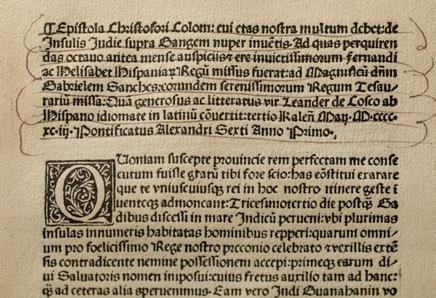
Epistola de insulis nuper inventis. Rome: Eucharius Silber, 1493.
This contemporaneous printed version of Columbus’s handwritten letter to the Spanish monarchs, King Ferdinand and Queen Isabella, describes his astonishing 1492 journey. Columbus sailed west into the Atlantic, planning to reach the riches of Asia— not realizing that the New World stood in his way. Until the end of his life, Columbus believed the lands he had found were part of Asia.
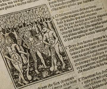
Secondo cantare dell’India. Rome: Johann Besicken and Sigismundus Mayer, between 11 August 1494 and 10 August 1495.
In 1493, Dati published a version in verse of Columbus’s letter. Presuming the Spanish explorer had made landfall in Asia, Dati embellishes this “second song” with references to the exotic spices, fantastic animals and birds, and strange human creatures he imagined populated India.
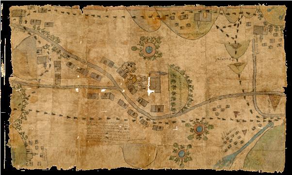
San Juan Tolcayuca with manuscript map
Nahua, Mexico, late 17th or early 18th century.
Manuscript map on amate (fig tree bark) paper.
During the late 17th and early 18th centuries, Mexican village lands were often threatened by Spanish land owners. To protect these communities, the authorities established land courts. Towns that lacked written histories of their boundaries would sometimes commission documents made to substantiate claims. This map was created to identify the boundaries of the town of Tolcayuca as of the year 1520.
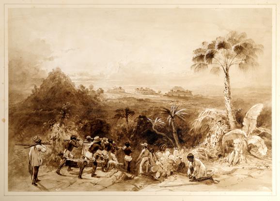
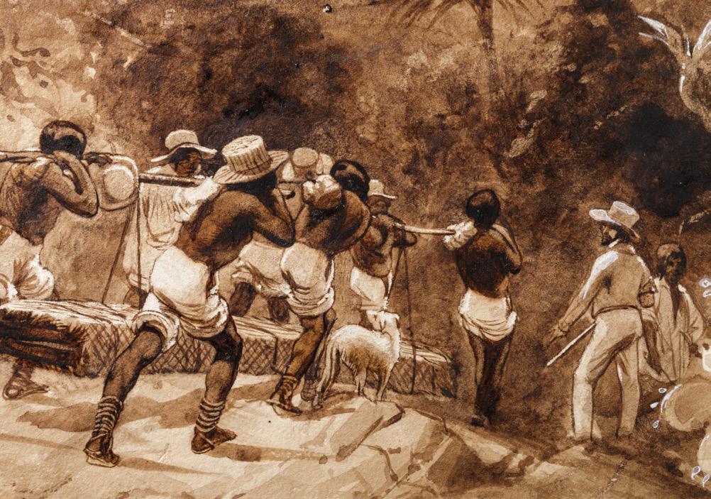
General view of Kabah, Yucatán, 1839.
Sepia wash heightened with white on paper.
Catherwood was a British architect and artist who traveled with John Lloyd Stephens on a 3,000-mile journey through the unexplored Maya regions of Honduras, Guatemala, and the Yucatán Peninsula. In this scene, workmen are carrying a stone monument destined for a planned museum in New York.
Mapping and Navigation
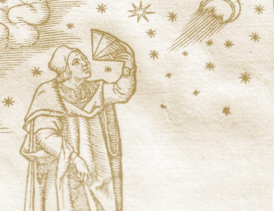
Western concepts of geography were strongly influenced by the work of Claudius Ptolemy, whose Geographia included all then-known geographic information regarding Europe, Africa, and Asia. During the 16th century, improved navigational tools and cartographic skills enhanced the accuracy of maps. Far from straightforward representations of land masses and natural features, maps reflect the perspectives and territorial ambitions of their sponsors—thus not only depicting geography but shaping history.
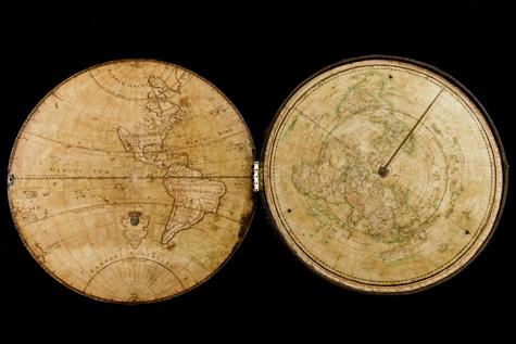
Guillaume Delisle
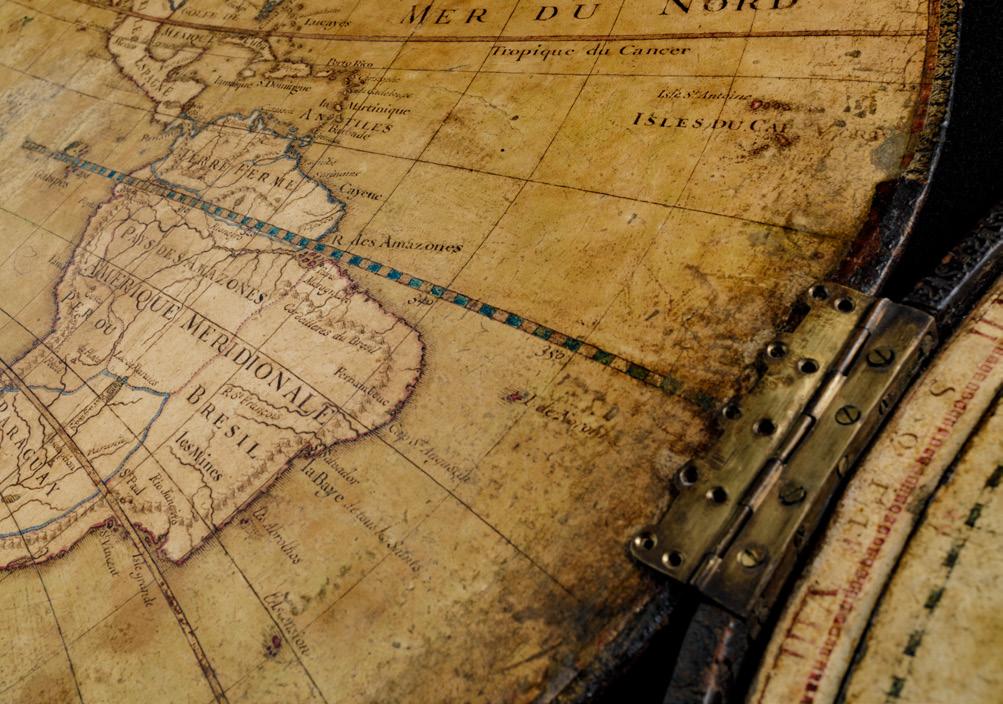
Manuscript world map for Louis XV, 1720.
This signature piece at the entrance to the Kislak Gallery is the first map of the world created to instruct the 10-year-old King of France Louis XV. The translation of Delisle’s dedication reads: “To the King by his very humble obedient servant and faithful subject Delisle first Geographer.”
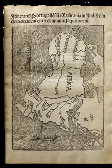
Itinerarium Portugallensium. Milan: J. A. Scinzenzeler, 1508.
This earliest published collection of voyages and travels includes the late 15th-century expedition of Vasco da Gama, the first European to reach India by sea by rounding the Cape of Good Hope. It includes the first printed map to depict Africa as surrounded by ocean.
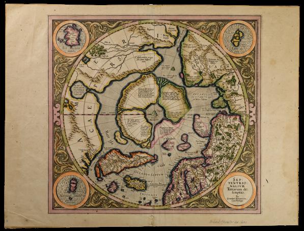
Septentrionalium Terrarum Descriptio Amsterdam, 1594.
After the voyages of Columbus and Magellan, mariners willing to brave the frozen North sought alternate routes to Asia, including a northwestern passage through the Canadian Arctic and a northeastern passage across Russia to the Pacific. In this iconic map, the North Pole is envisioned as four islands separated by four rivers carrying the oceans of the world toward a whirlpool swirling around a black lodestone mountain.
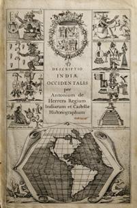
Novus orbis. Amsterdam: Michael Colinus, 1622.
Jacob Le Maire’s account of the first rounding of Cape Horn dispelled the myth of Terra Australis (South Land), an imaginary continent speculated about since antiquity that appeared on maps between the 15th and 17th centuries. Herrera’s work was first published in Spanish in 1601 as part of his Historia general de los hechos de los Castellanos. This Latin edition includes additional information and maps that document the Jacob Le Maire and Willem Schouten circumnavigation of the globe (1615–1617) in search of a new route to the Spice Islands.
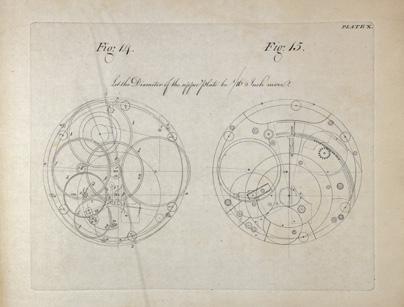
The Principles of Mr. Harrison’s Time-Keeper. London: W. Richardson and S. Clark, 1767.
In 1730, clockmaker John Harrison described a highly accurate chronometer to measure longitude. Harrison’s clock was successfully tested on two voyages to the West Indies, and, importantly, on James Cook’s first voyage in search of a mythical Terra Australes that resulted in his first circumnavigation of the globe.
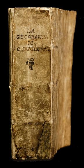
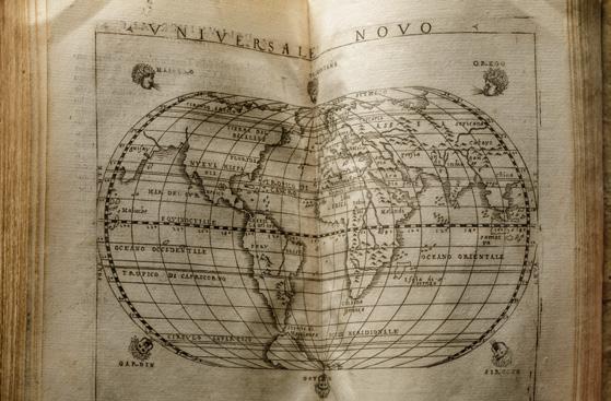
Giacomo Gastaldi [Claudius Ptolemaeus]
La Geografia. Venice: Giovanni Baptista Pedrezano, 1548.
This atlas by the most innovative and influential Italian cartographer of his time includes 26 new engravings of the ancient world based on Ptolemy’s Geographia, and 34 entirely new maps designed by Gastaldi, including seven regional maps of the Americas. Among these are the first printed maps of the Mississippi and Florida region and of coastal New England.
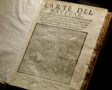
Pedro de Medina
L’Arte del navegar. Venice: A Pincio, for G.B. Pedrezano, 1554.
This practical treatise on navigation was based on the firsthand experiences of pilots and ship’s masters. Accurate geographical details such as the mouth of the Mississippi and the gulf of the St. Lawrence made it possible to challenge Spanish domination of American waters.
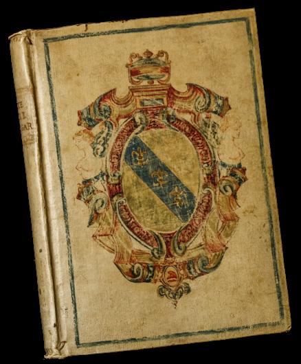
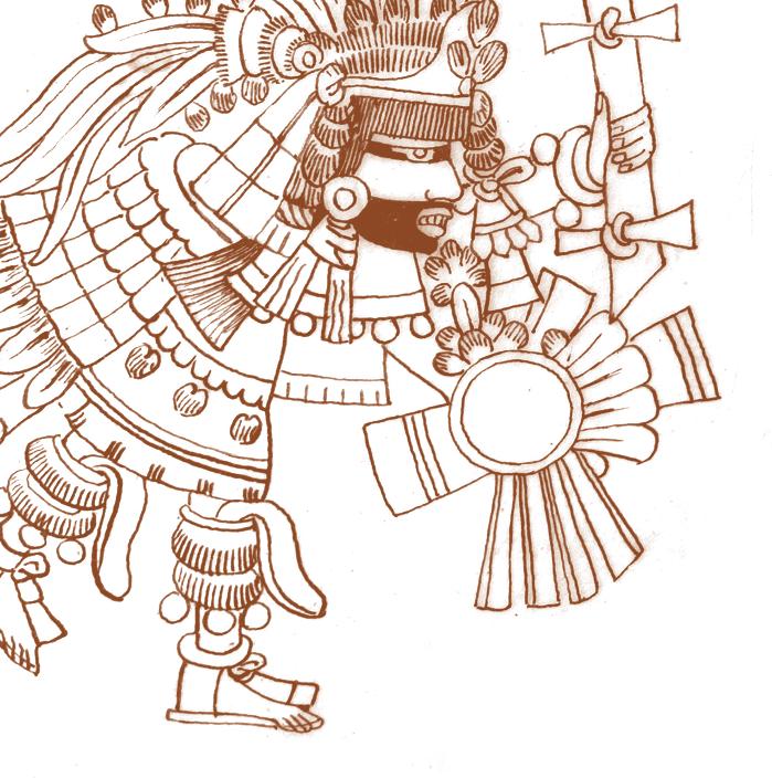
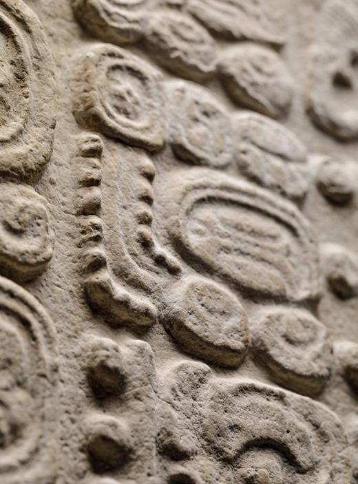
Around 2000 BCE, complex cultures began to form in the Americas, including civilizations with intricate social, economic, and political systems, large cities, and sophisticated arts. Among them were the Maya, who developed one of only five written languages in human history. Though the Maya civilization collapsed centuries before the arrival of the Spanish and the Conquest of the Inca and Aztec Empires, millions of contemporary Maya maintain their languages and cultural traditions. To understand Native American cultures prior to European contact, scholars study artifacts created for use in rituals, personal adornment, and as historical records.
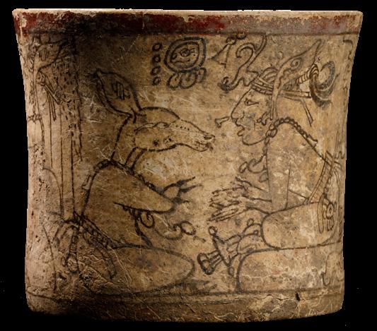
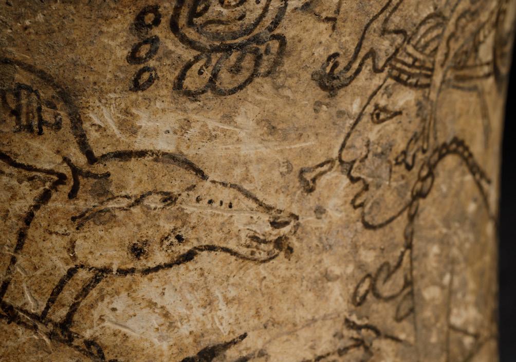
Late Classic period, Mirador Basin, Guatemala. 650–850 CE. Earthenware with slip paint.
This is called a codex-style vase because it tells a story, depicting multiple scenes from a myth involving the death of an aged deity sometimes identified as the Keeper of the Animals. His young wife runs off with the Maize God, who is disguised as a deer.
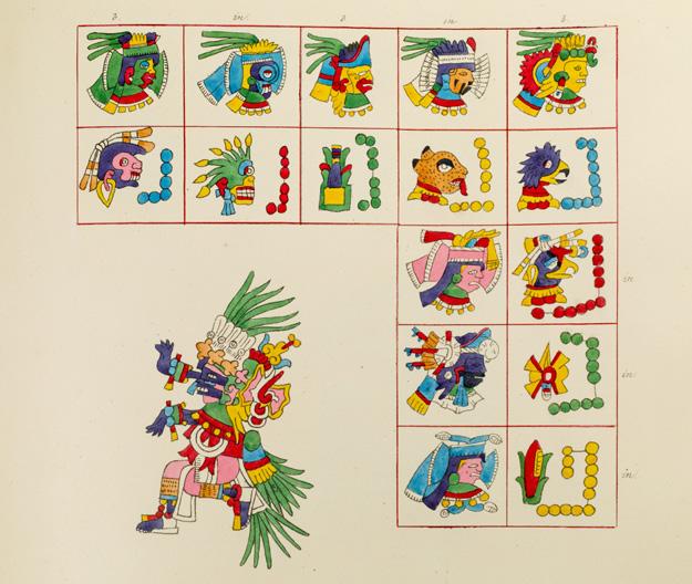
Lord Henry Kingsborough
Antiquities of Mexico. London: Privately printed, 1831–48.
Kingsborough was enthralled with the Mesoamerican painted books (codices) in European collections and believed that they were created by Native Americans related to the Lost Tribe of Israel. Antiquities of Mexico includes accurate reproductions of every page of the surviving books. The nine lavish folio volumes inspired several 19th-century adventurers. Unfortunately, the exorbitant production costs landed Lord Kingsborough in debtors’ prison.
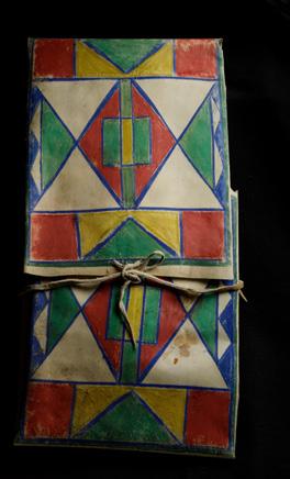
Parfleche bag
Plains Indian, North American, ca. 1850. Rawhide and paint.
Experts often can use design elements in these containers to identify tribal origins. Nomadic Native American people living on the plains of the United States made this useful container from rawhide. Typically painted with symbolic triangles and diamonds, it held food or personal possessions. Created by women, these functional objects also provided a powerful means for artistic expression and affirmation of cultural identity.
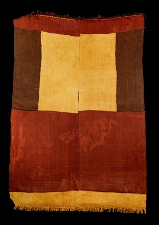
Coastal Peru, 700–1000 CE.
Handwoven, dyed wool.
This garment was hand-woven in ten rectangular sections dyed red, yellow, and brown, then sewn together, leaving a central slit to fit over the head. Tassel-like fringes decorate the top and bottom.
A major theme of the Kislak Collection is the tumultuous story of Florida, from the disastrous attempts of French Huguenots to establish a colony to the three bloody Seminole Wars that began in 1816 and continued until 1858, 14 years after Florida became a state. It was the longest and most expensive conflict with Native American tribes in United States history and resulted in the forcible relocation of the tribe to Oklahoma Territory.
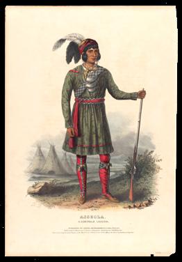
History of the Indian Tribes of North America. Philadelphia: Daniel Rice and James Clark, 1838–1844.
Thomas McKenney served as commissioner of Indian Affairs from 1824 to 1830. Seeking to publish a record of the vanishing peoples of the continent, he engaged artist Charles Bird King to portray tribal representatives when they traveled to Washington, D.C., to sign peace treaties. This portrait, one of eight, depicts Osceola (Rising Sun), a leader of the Seminole resistance to U.S. government aggression.
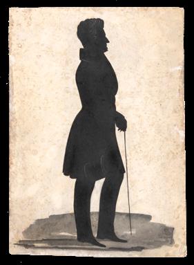
Thomas Loraine McKenney (No place), 1836.
Cut and pasted silhouette
This full-length profile of McKenney is cut from vellum paper; subtle details such as his hair, collar, and hand are inked in white.
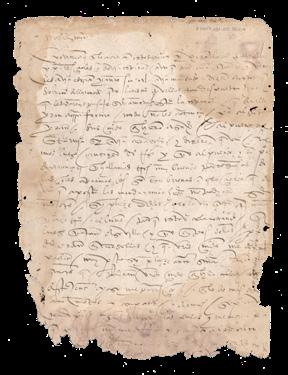
Francisco de Garay
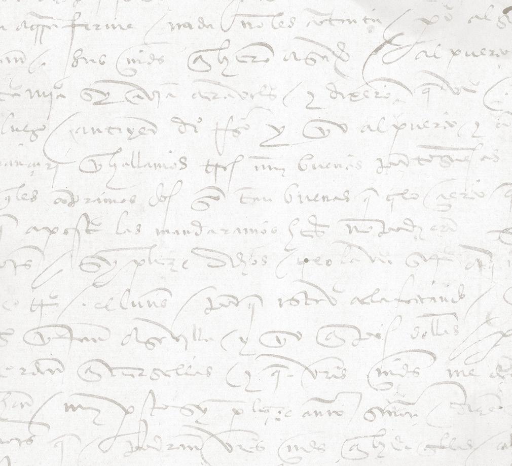
Autograph letter to Ochoa de Isasaga, Casa de Contratacion de Indias, Seville, Spain, February 1514.
The earliest item in the Kislak Collection relating to Florida, this letter documents the purchase of ships intended for Alonso Álvarez de Pineda’s exploration of the Gulf of Mexico. The expedition discovered the Mississippi Delta and confirmed that Florida was a peninsula, not an island. Garay sailed with Columbus, who was his brother-in-law, on his second voyage and was a founder of the Hispaniola colony.
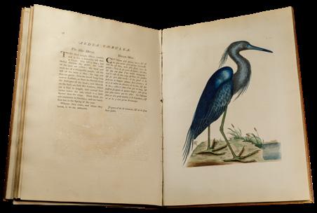
The Natural History of Carolina, Florida and the Bahama Islands London, 1771.
A century before John James Audubon, Mark Catesby collected and published magnificent hand-colored images of American wildlife and plants. Lacking funds, Catesby taught himself engraving, etched his own plates, had them handcolored, and offered them for sale by subscription. He was the first artist to use large-format images that made it possible to render plants and animals in great detail. This work marked the beginning of American ornithology and ranks as one of the most important natural history books ever produced.
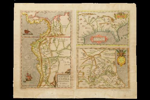
Abraham Ortelius
Pervviae Avriferle Regionis Typvs. Antwerp, 1589.
This is one of the earliest maps to show inland details, especially river systems used for exploration. La Florida is based on the work of Jerónimo de Chaves, who relied on information recorded by Hernando de Soto’s secretary. Pervviae Avriferae Regionis Typvs depicts the Inca Empire conquered by Spain in the 1530s. Guastecan shows a portion of eastcentral Mexico along the coast of the Gulf of Mexico.
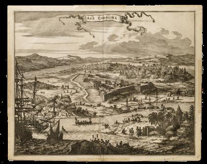
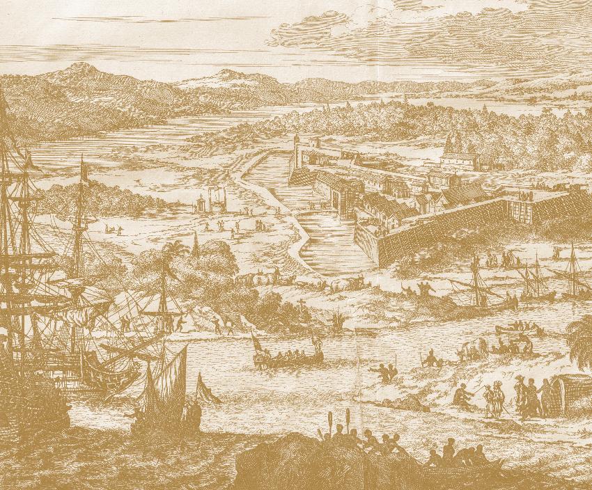
John Ogilby Arx Caroline.
From: America. London, 1671.
Fort Caroline was founded in 1564 by French Huguenots at the mouth of the river now called St. John’s. The fort is shown fortified with gun emplacements. Alongside the busy harbor, the countryside is depicted with cattle, natives, and colonists going about their daily chores.
From 1897 to 1917—the Heroic Age of Antarctic Exploration—research expeditions from ten countries launched intensive scientific and geographical studies in Antarctica. Lacking modern transport and communication technologies and relying heavily on their participants’ mental and physical stamina, the expeditions nevertheless generated extensive scientific data and numerous specimens across a wide range of disciplines.
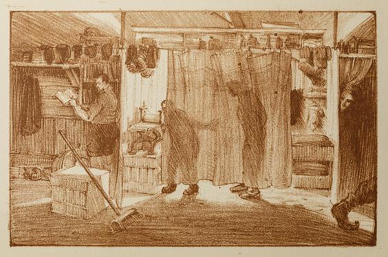
Aurora Australis. East Antarctica: Printed at the sign of The Penguins, winter quarters of the British Antarctic Expedition, 1908.
Royal Navy seamen Frank Wild and Ernest Joyce took a quick printing course before leaving on Shackleton’s Nimrod Expedition, which came within 100 miles of the South Pole. Despite the cold and cramped conditions at base camp, the two ingeniously repurposed expedition supplies to print and bind about 100 copies of this book—the first to be printed in the Antarctic.
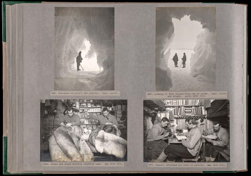
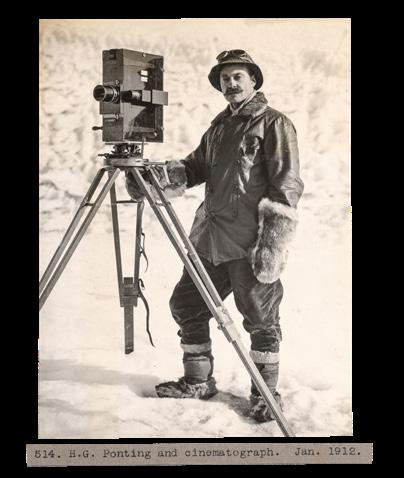
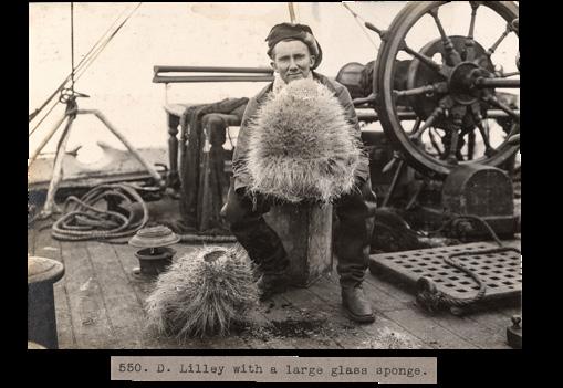
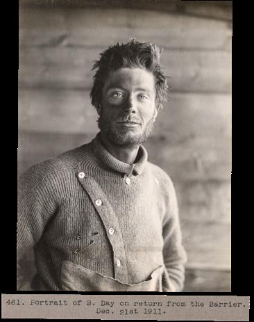
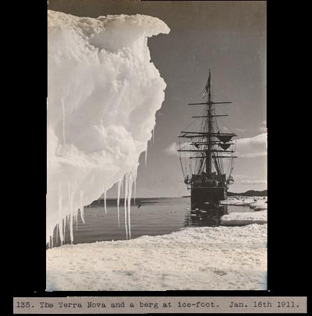
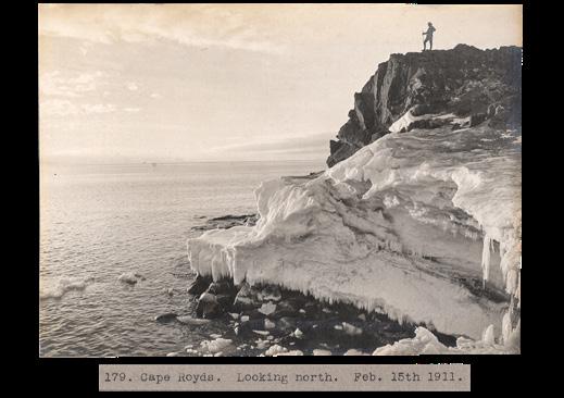
Album containing 449 [of a total of 825] negatives taken during the 1910 British Antarctic Expedition. Gelatin silver prints, 1910–1912.
Herbert Ponting was the official expedition photographer for the British Antarctic Expedition to the South Pole, also known as the Terra Nova Expedition, led by Robert Falcon Scott. Ponting set up a darkroom at base camp and meticulously prepared and developed his own glass plate negatives. Though Scott and his crew perished under desperate circumstances, Ponting’s magnificently clear photographs are an enduring testament to their determination and Antarctica’s harsh beauty.
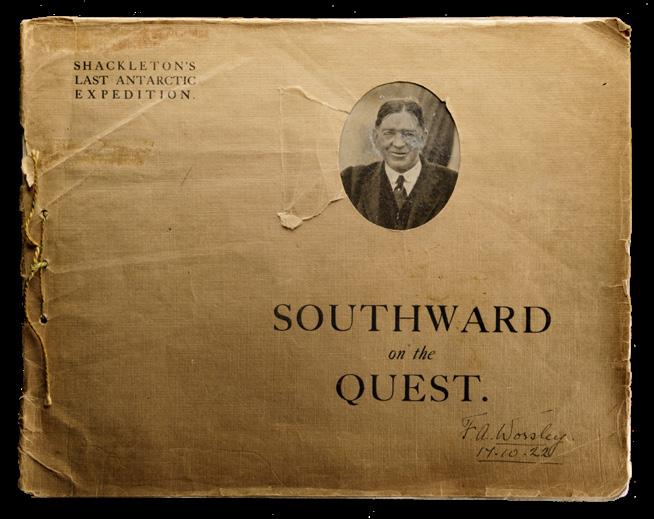
Southward on the Quest. Scala Souvenir. [No place] [ca. 1922]. Signed by Frank Worsley, Captain of the Endurance, 1914–17.
Shackleton’s last expedition marks the end of the Heroic Age of Antarctic Exploration. Lacking financial support for his plan to explore the Arctic’s Beaufort Sea, Shackleton set out to explore the Antarctic coastline. Shortly after arriving at South Georgia Island, Shackleton died on January 5, 1922. The album contains eight sepiatoned photographs, one showing Shackleton on the Quest, hat doffed in farewell.
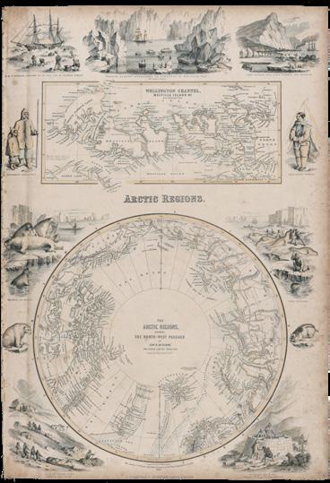
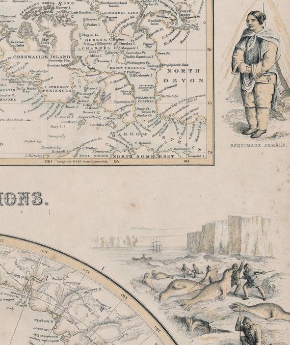
The Arctic Regions. London: A. Fullarton and Co., 1854.
From: The Royal Illustrated Atlas of Modern Geography
This highly decorative hand-colored map of the Arctic Regions, including the Northwest Passage, as determined by Captain Robert McClure and other Arctic voyagers, features scenes of wildlife, people, and landscapes.
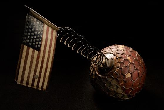
Painted cork topped by a 45-star metal American flag with the name of the expedition engraved around the top of the base [ca. 1902].
The top of this buoy unscrews to reveal a hollowed-out area in which Arctic explorers could place a message. The buoy was then either tossed overboard or left at a designated place for another ship to pick up. The Baldwin-Ziegler expedition, also known as the Fiala expedition, was a failed attempt to reach the North Pole by dog sled.
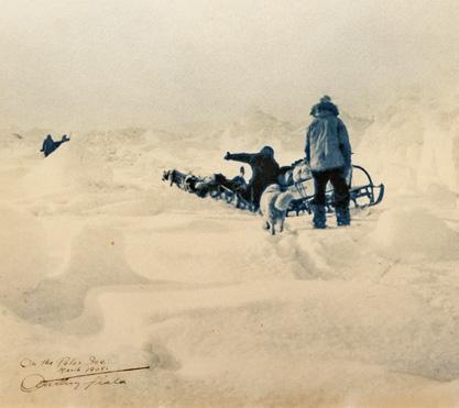
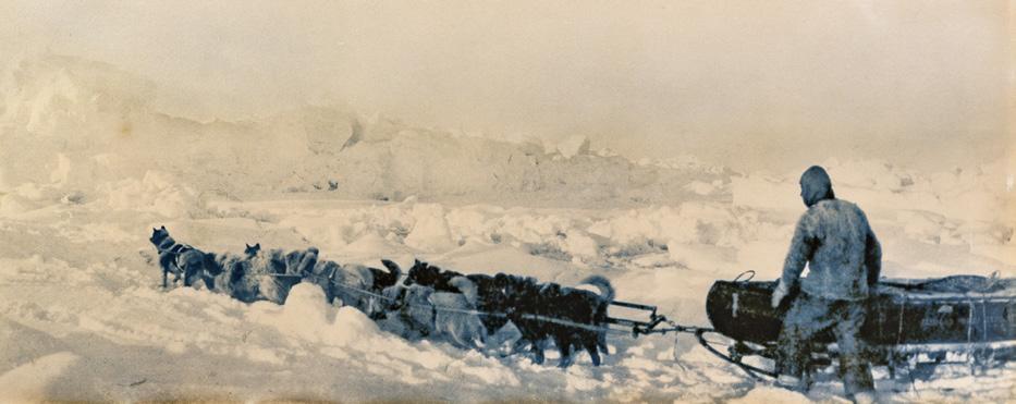
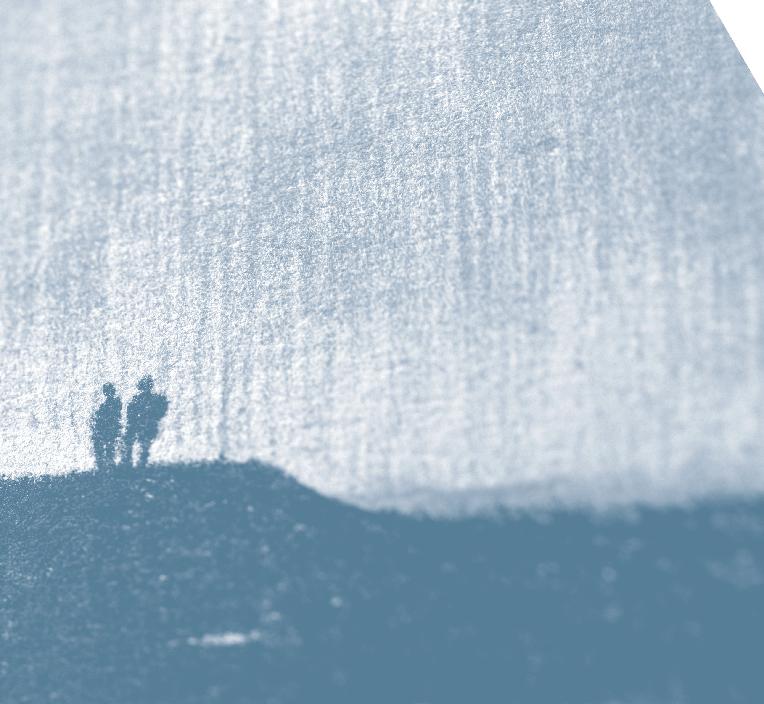
Panoramic view towards Ziegler Island: On the Polar Ice. March 1905. Baldwin-Ziegler Polar Expedition, 82 Degrees North Latitude.
Blue-tinted gelatin silver print signed and dated.
Anthony Fiala was the photographer for an expedition to the North Pole led by Evelyn Briggs Baldwin and financed by William Ziegler. Their ship was crushed by an ice swell in the winter of 1905 and sank without a trace. The party remained stranded north of the Arctic Circle for two years before being rescued.
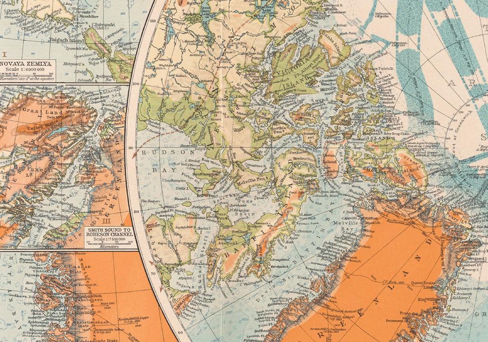
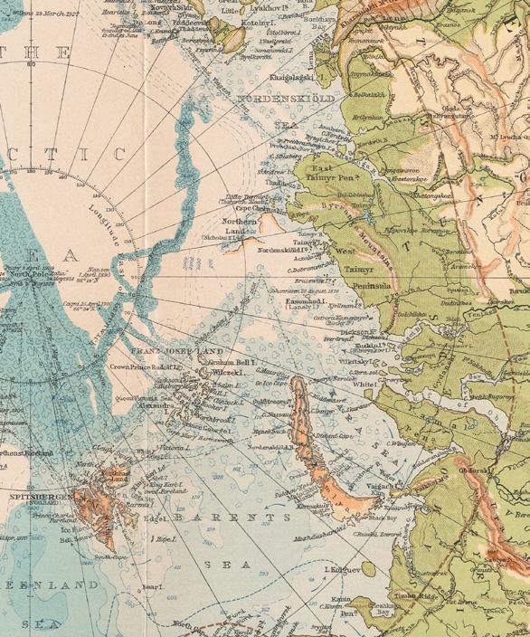
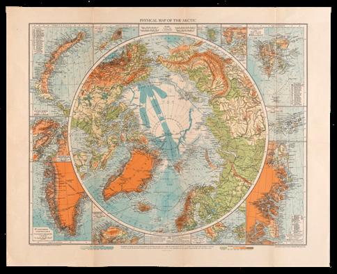
Physical Map of the Arctic
New York: American Geographical Society, 1929.
Adapted from Andrees Handatlas, 1924.
Founded by 31 philanthropists, historians, publishers, and editors who had an interest in polar exploration, the American Geographical Society provided technical and professional support to many polar expeditions.
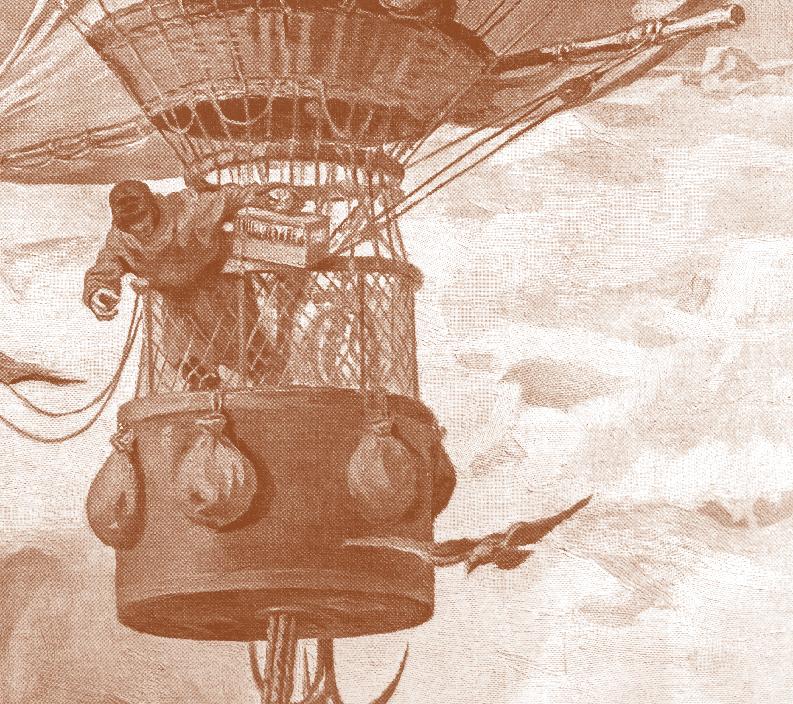
Just as the dynamic flow of human explorations and encounters like those dramatized by the panoramic sweep of the Kislak Collection never ceases, University of Miami Libraries envisions an ongoing, evolving series of programs and activities inspired by this extraordinary trove of historical treasures.
In keeping with the Libraries’ commitment to utilizing the latest information technologies to facilitate research and nurture new knowledge, we will also be expanding access to these items through 2D and 3D digitization, online exhibits, and a collaborative virtual library.
A subsequent exhibition featuring World War II artifacts from the collection is already being planned; many more exhibits highlighting varied facets of this vast and fascinating collection will follow.
We invite you to become part of the Kislak Center community and join us for future exhibitions and educational events that spur new insights into the origins, trends, and prospects of our dynamic multicultural society.
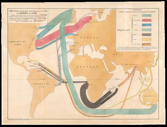
Carte figurative et approximative représentant pour l’année 1858 les émigrants du globe, les pays dóu ils partent et ceux oú ils arrivent, 1862.
This map of migration flows from Europe, Africa, China, and South Asia in the year 1858 was created by Charles Joseph Minard, a French civil engineer and pioneer in the use of graphics to convey statistical information. This snapshot of global emigration uses lines of different colors and relative thickness to depict the size and direction of global emigration in a single year. It was a pivotal moment for the Americas and for the course and direction of the Kislak Collection. Created at the dawn of the “information age,” it is a vivid and poignant reminder of connections between exploration and migration as well as the broad sweep of cultural encounters in the modern era.
This rare copy was recently acquired by the University of Miami Libraries as its 4-millionth holding in honor of Jay I. Kislak and will be housed with the Kislak Collection.
We wish to thank all the individuals who generously contributed their expertise and efforts to the preparation of this companion brochure to the exhibit Open New Worlds: A Journey Through the Kislak Collection.
Jay I. Kislak Foundation
University of Miami Libraries
Departments of Creative Services, Digital Production, Preservation Strategies, and Special Collections
Jay I. Kislak Foundation