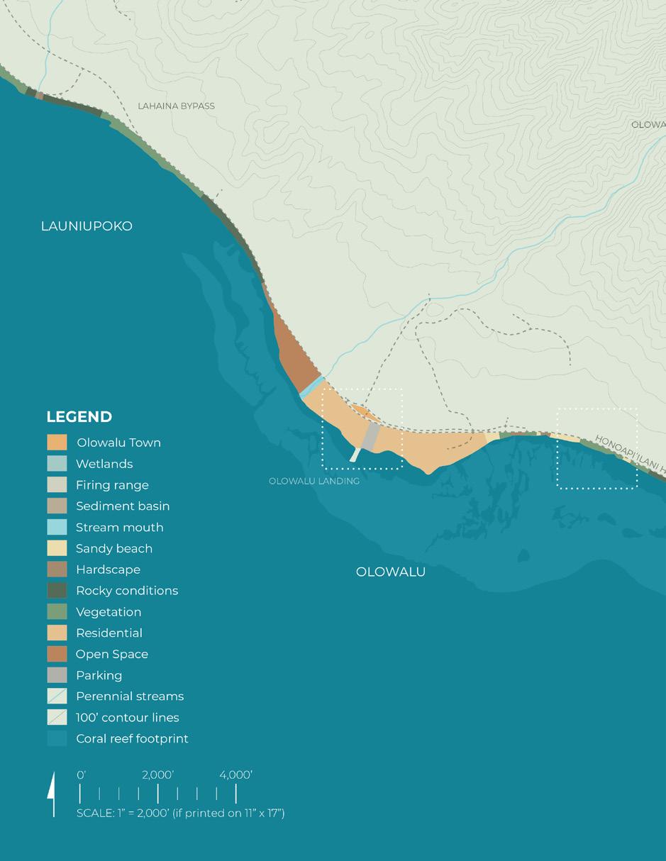
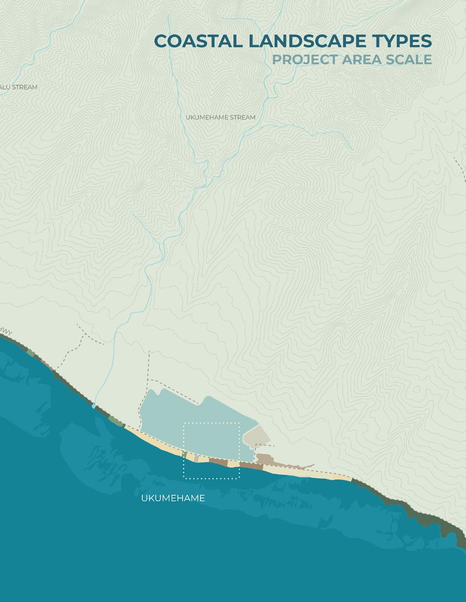
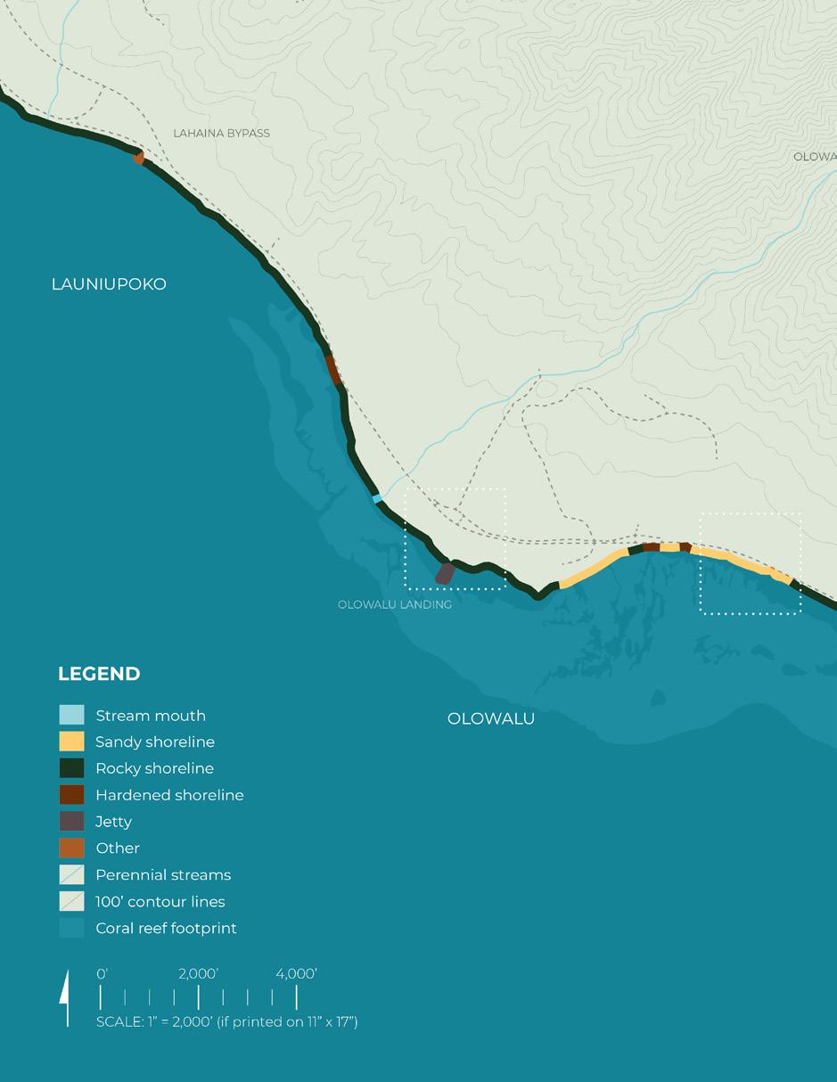
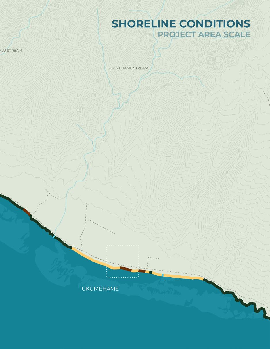
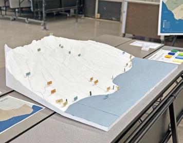
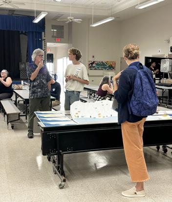
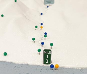
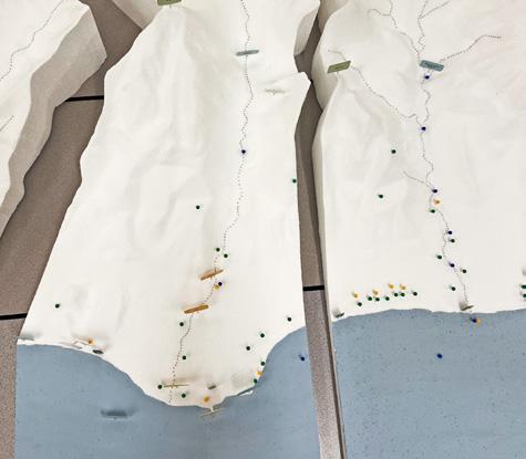
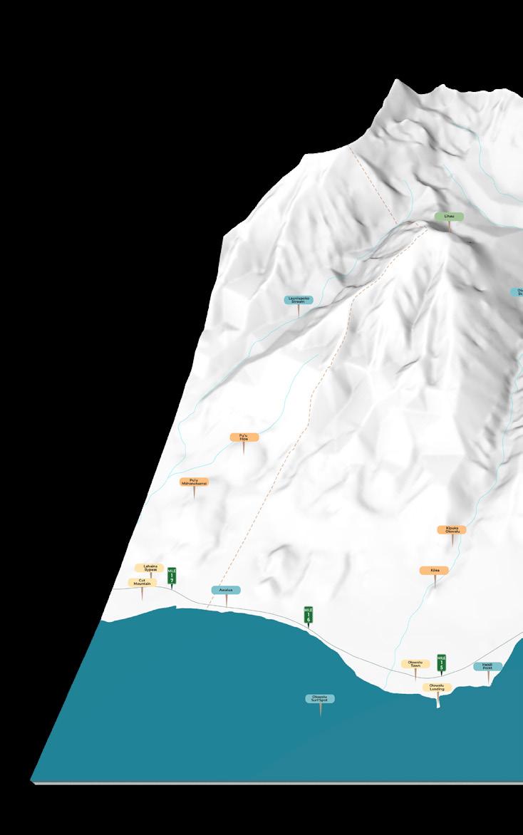
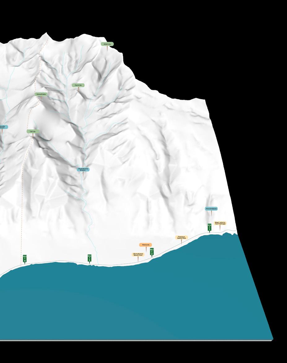
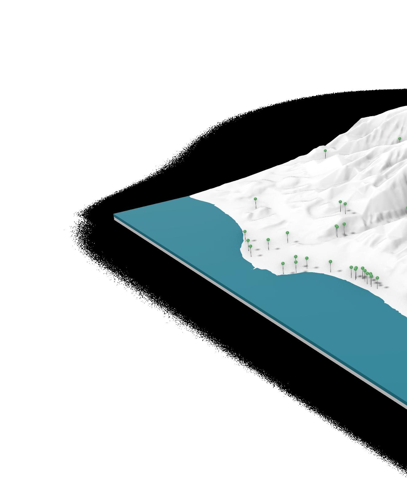
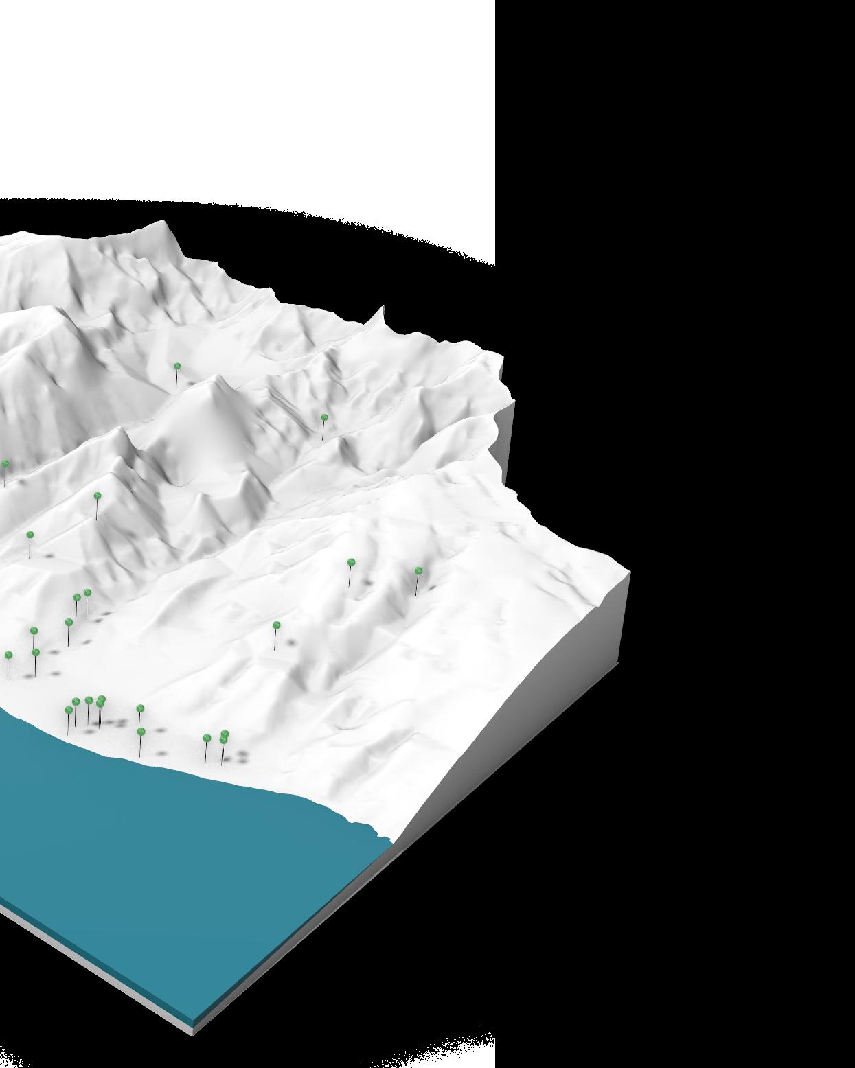
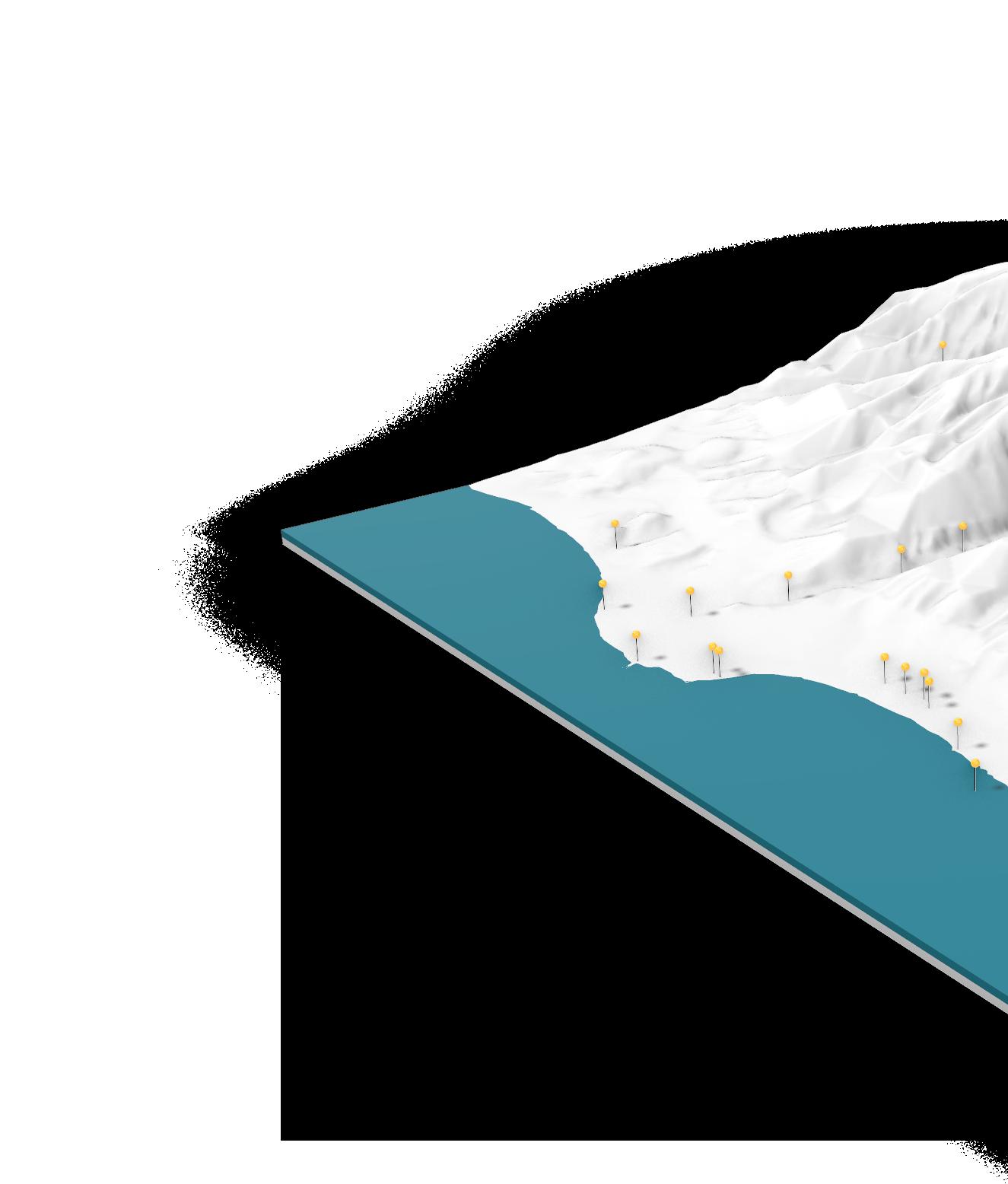
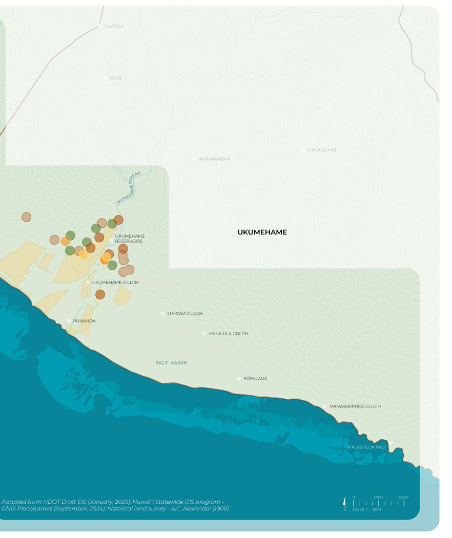
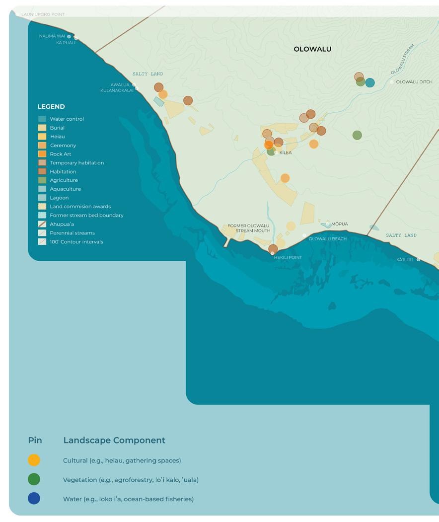
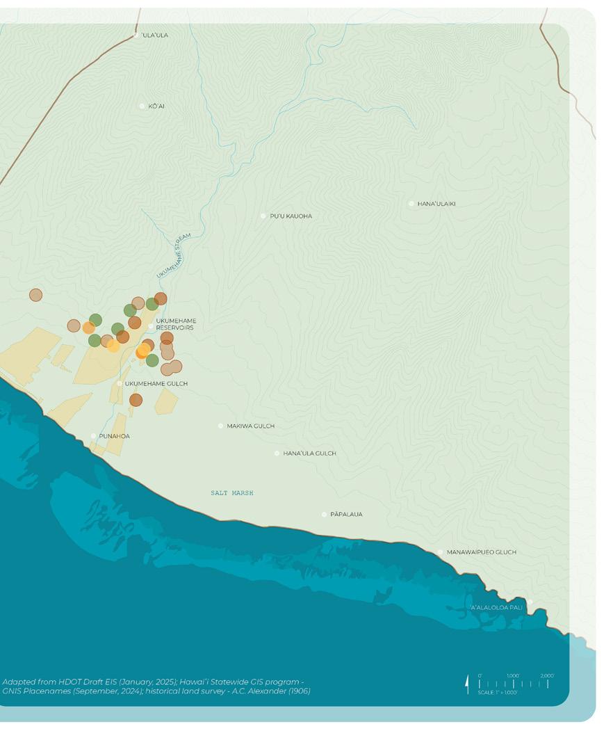
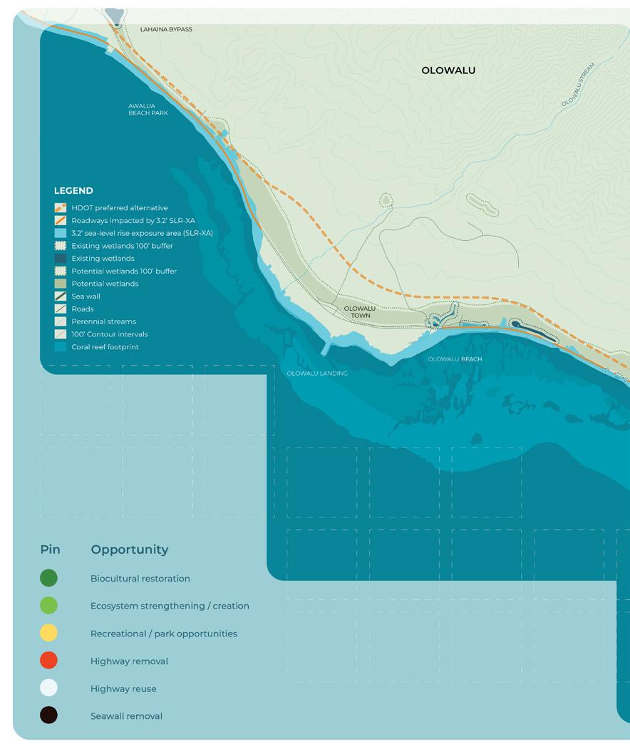
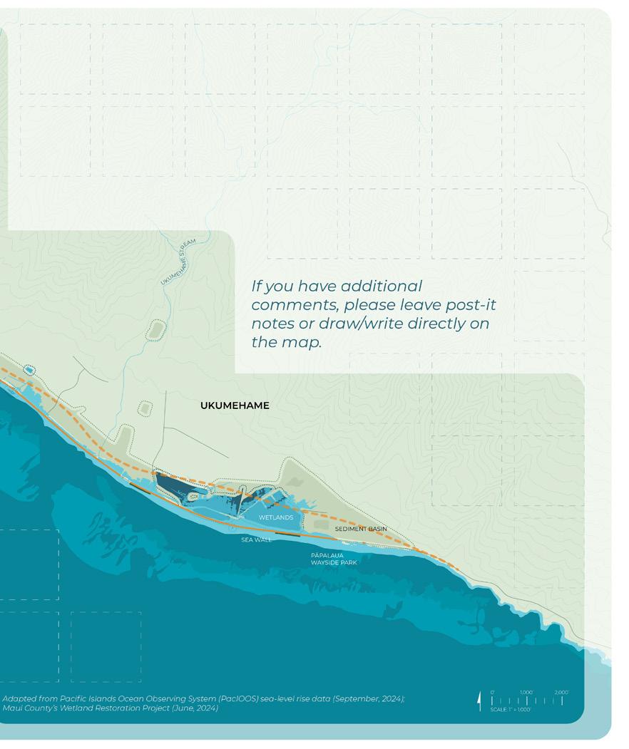
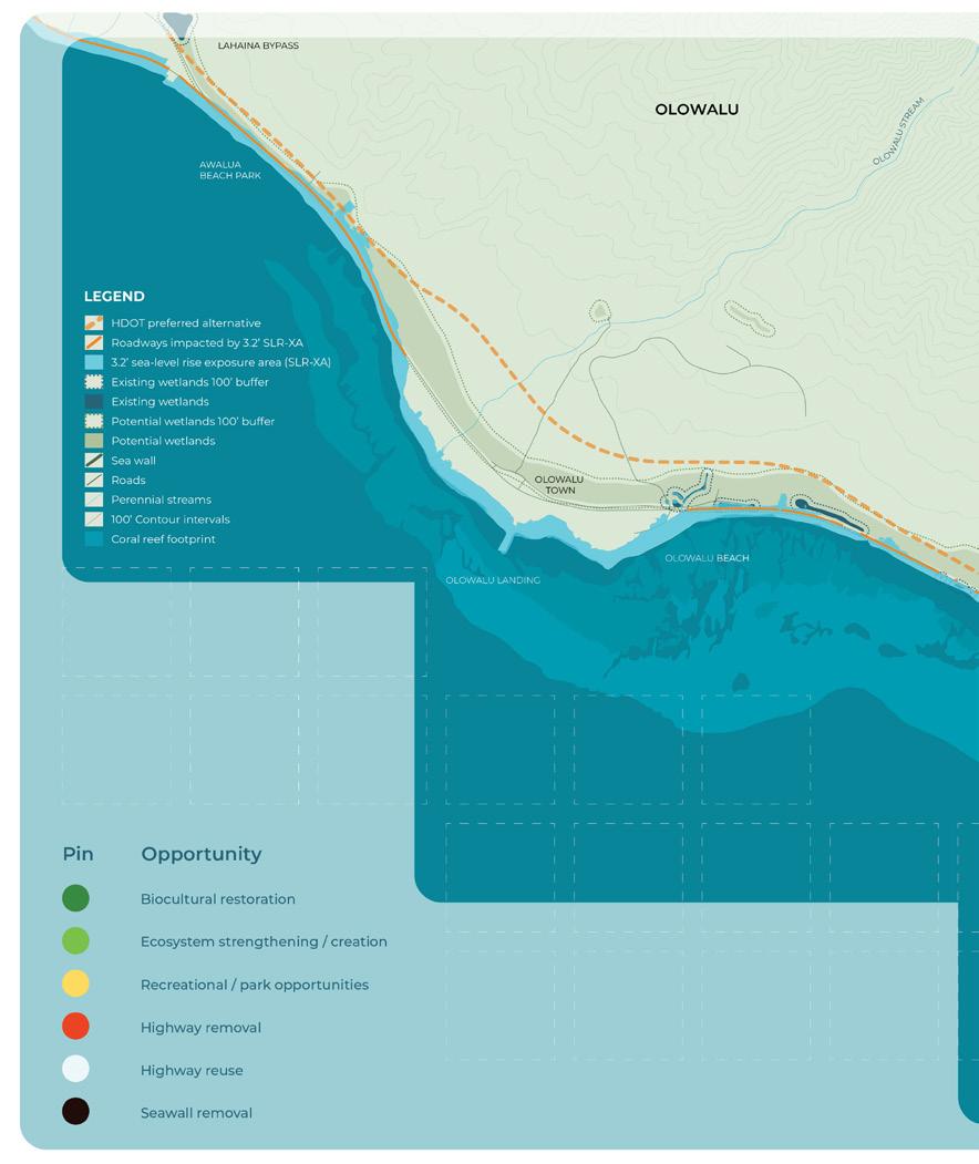
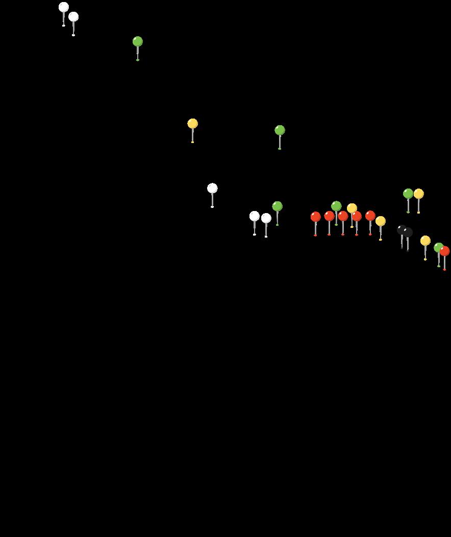
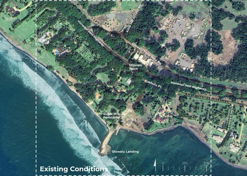
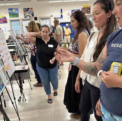
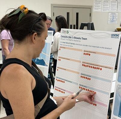
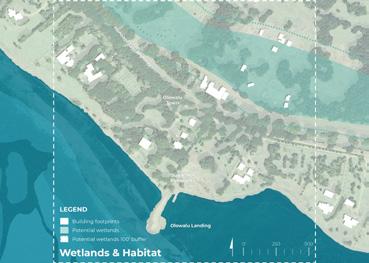
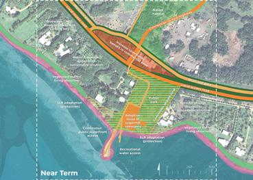
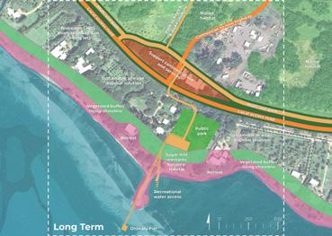
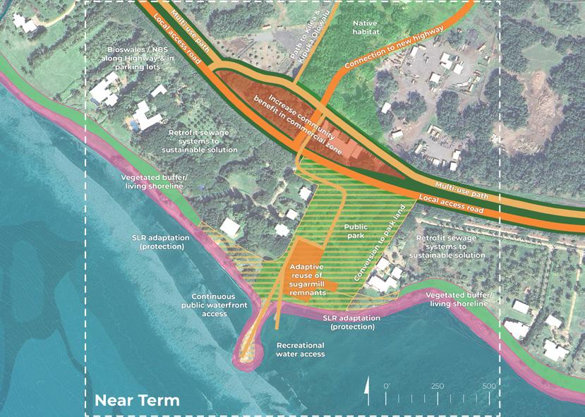
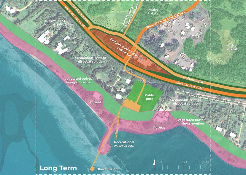
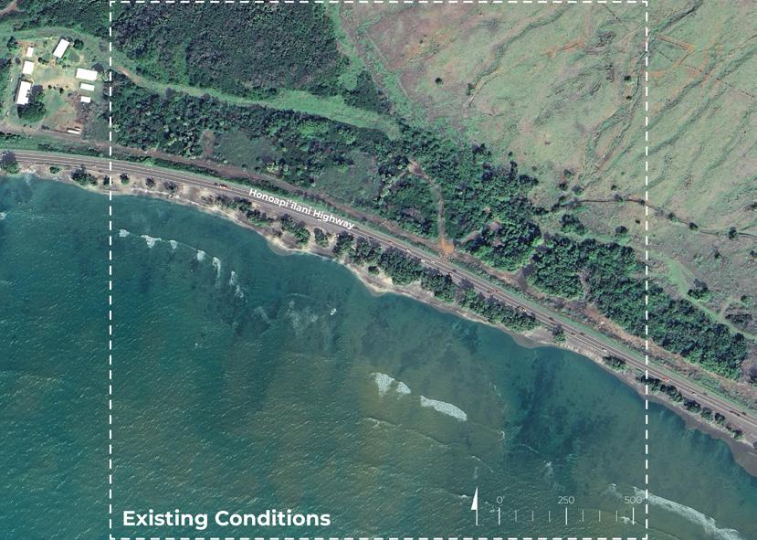
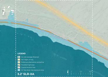
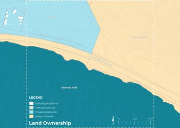
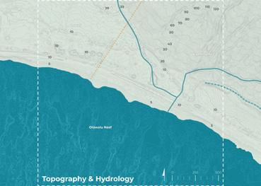
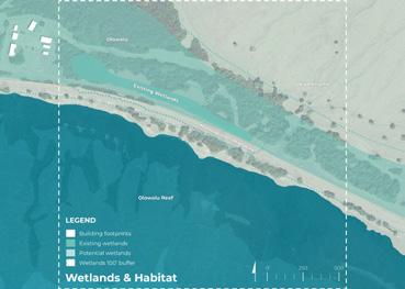
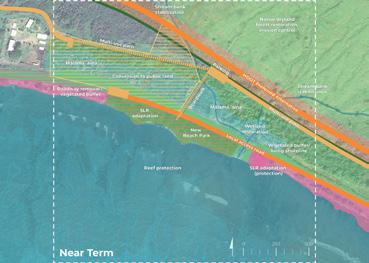
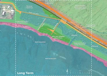
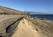
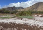
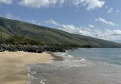
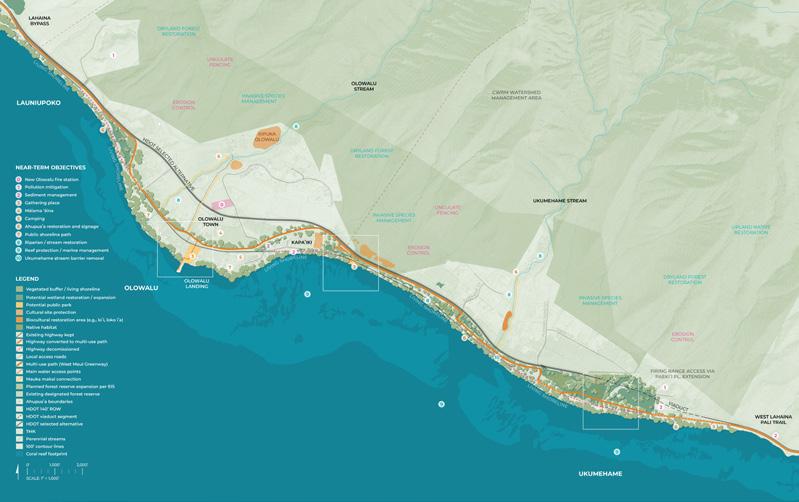
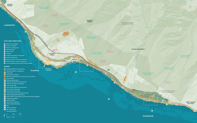
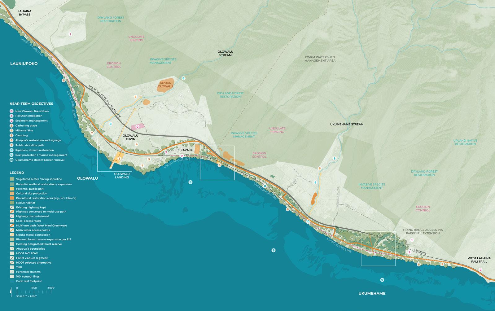
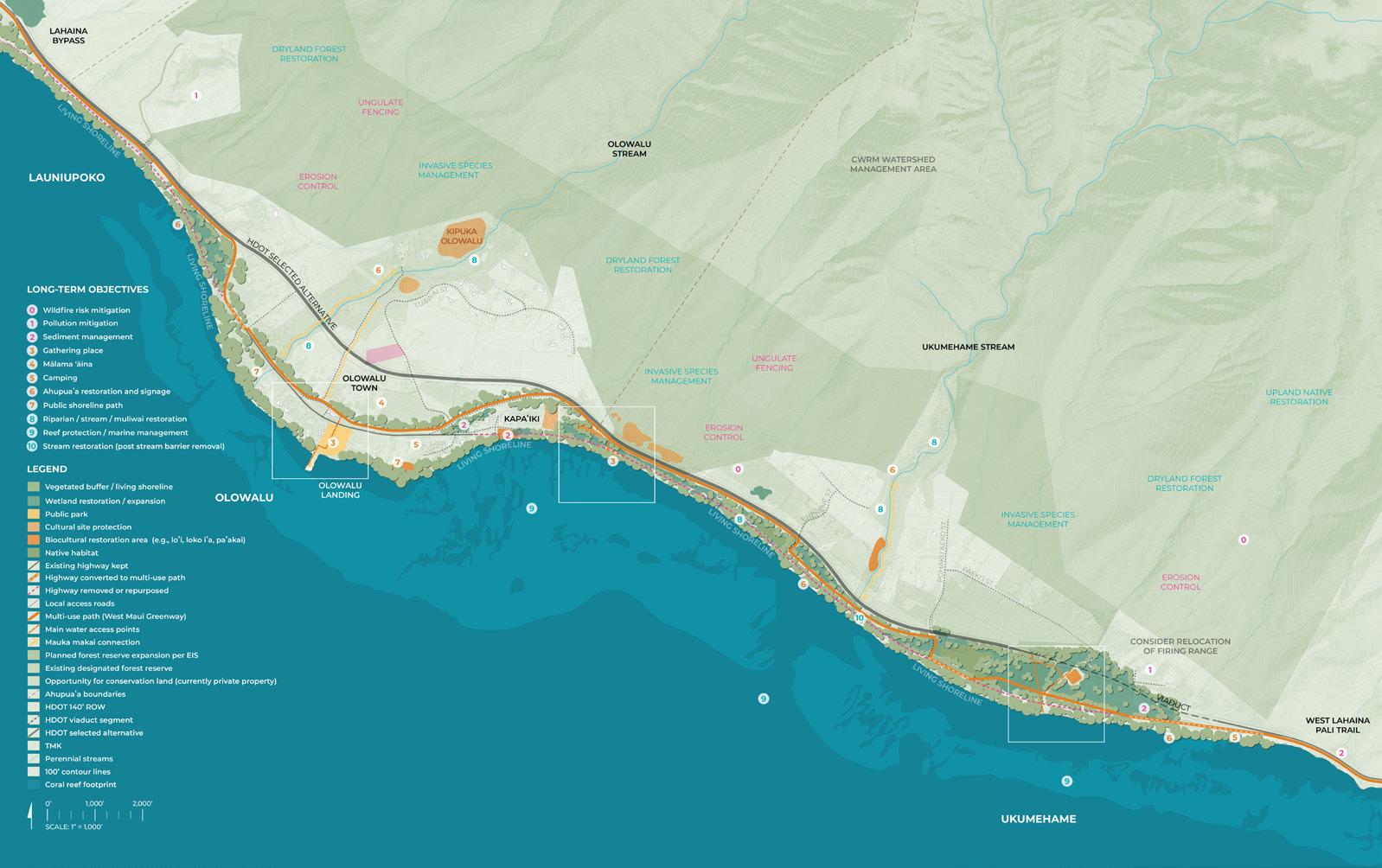
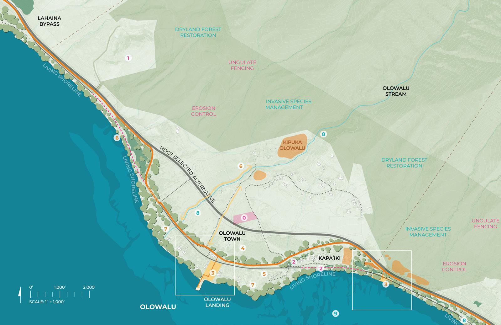
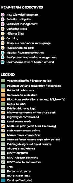
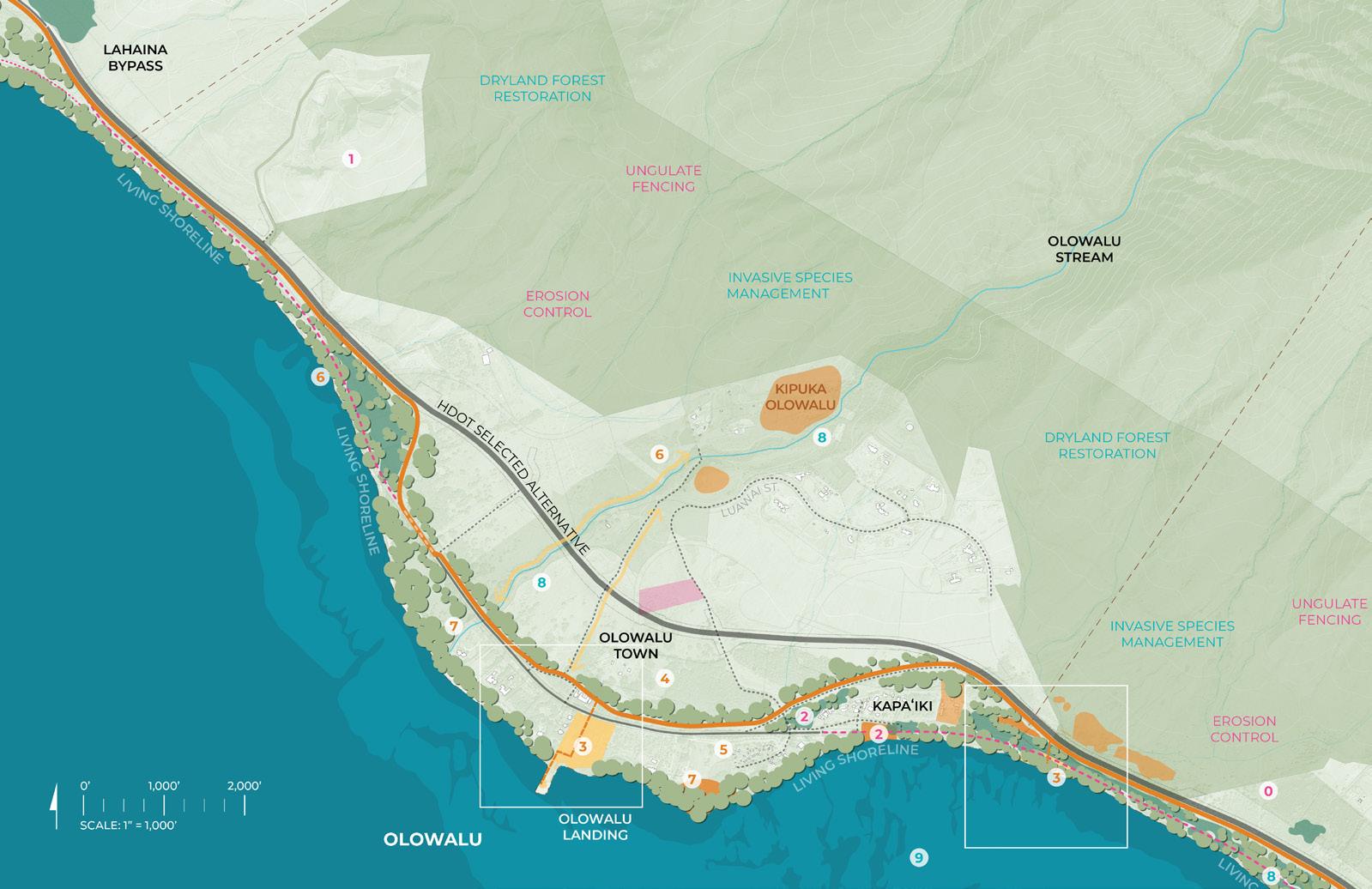
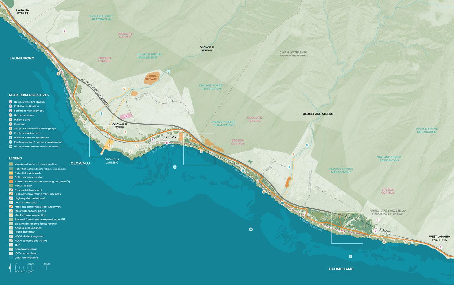
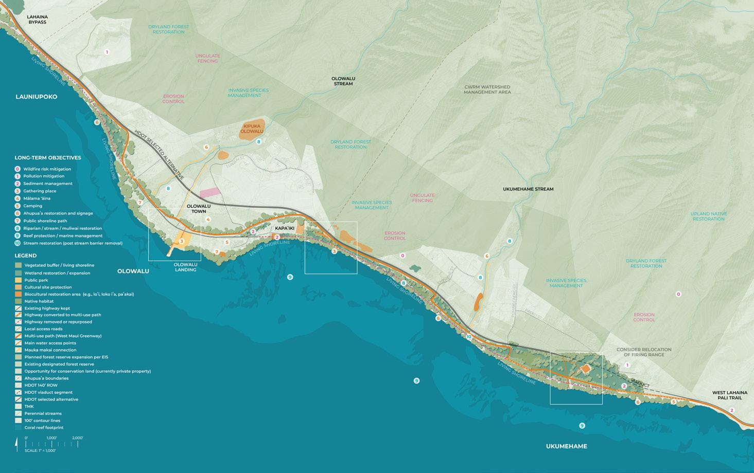
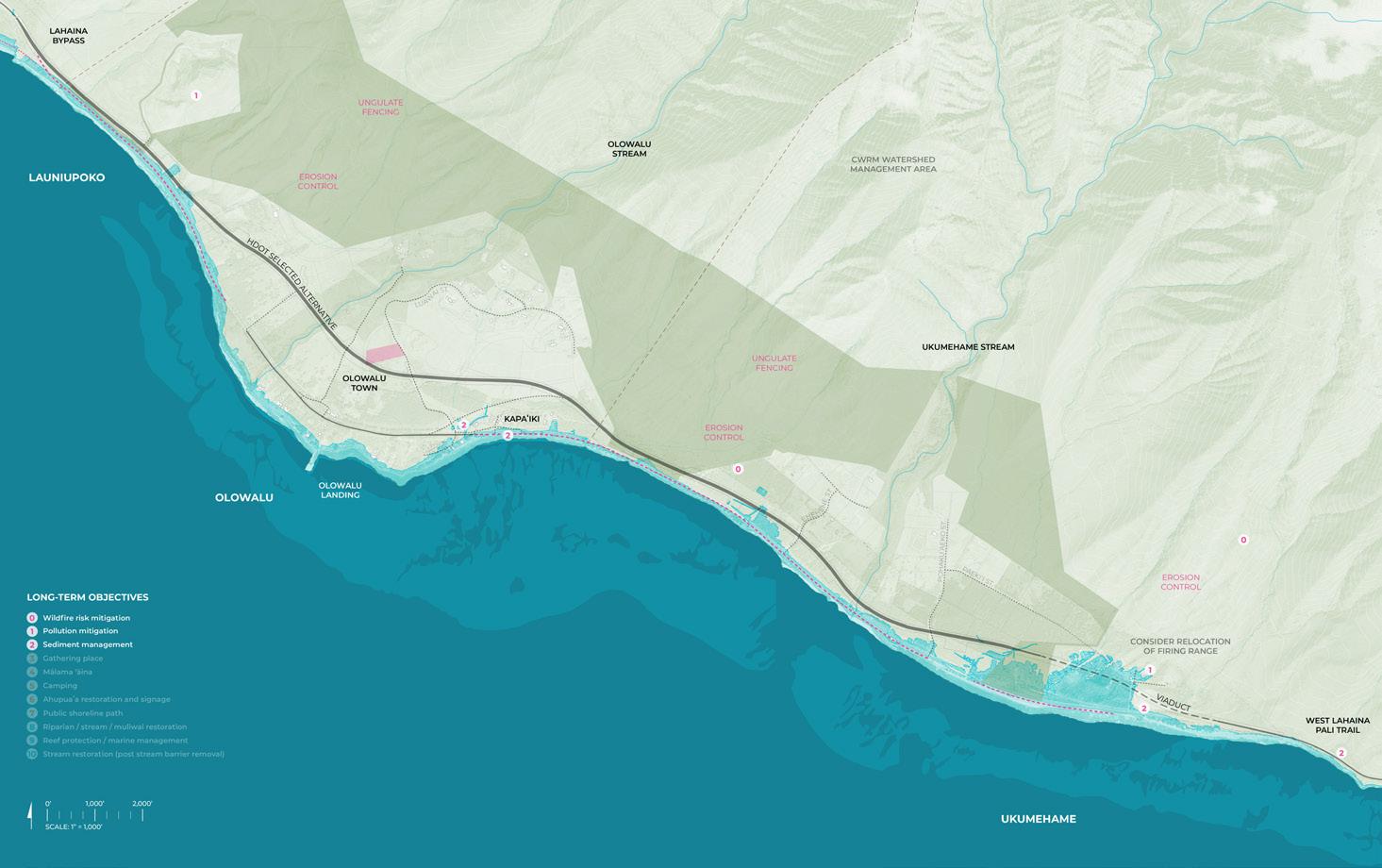
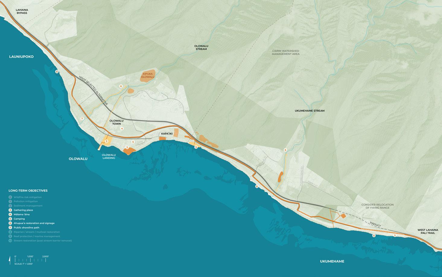
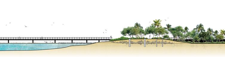
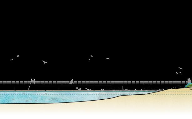
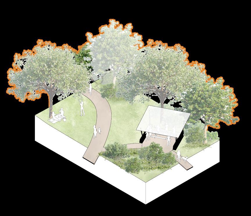
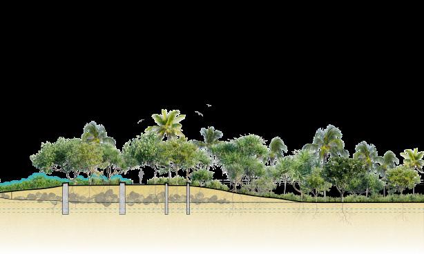
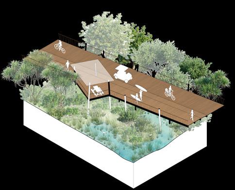
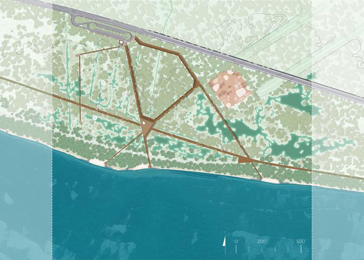
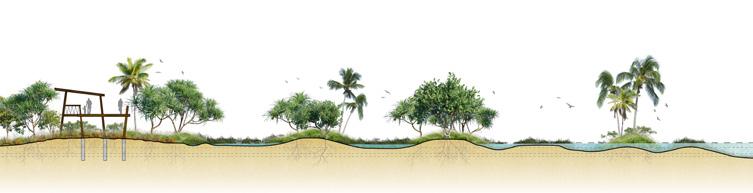
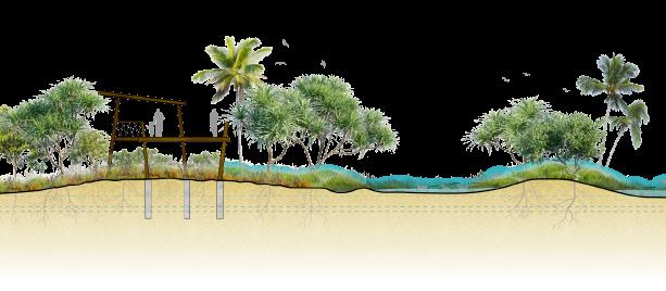
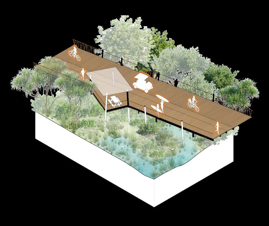
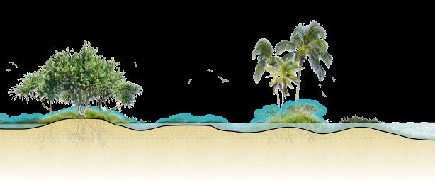
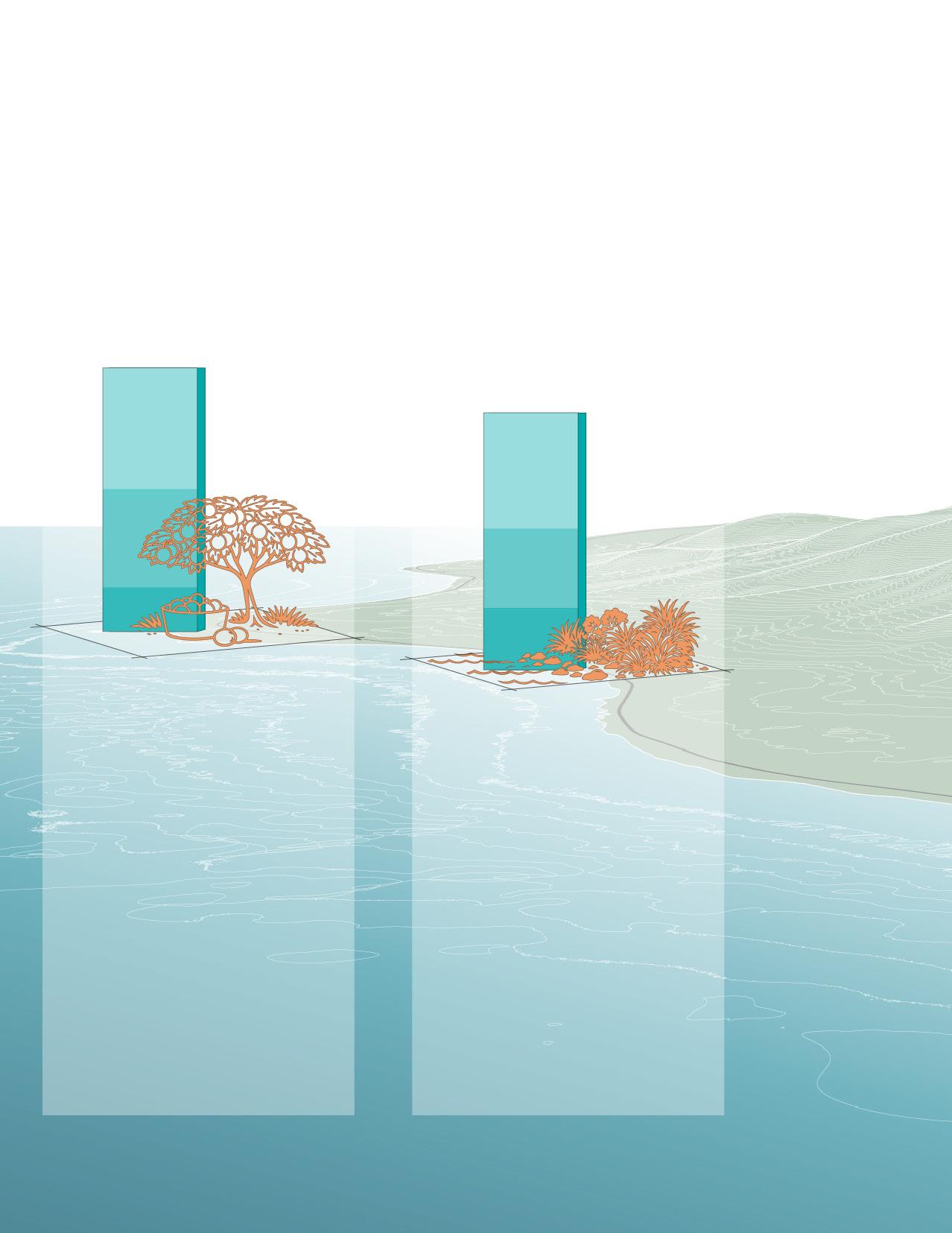
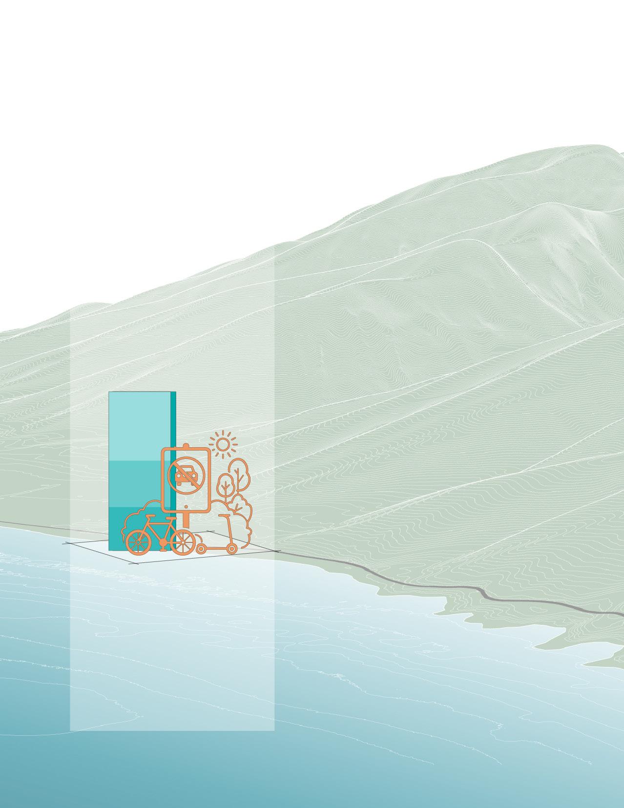
This report summarizes academic, community-engaged proof-of-concept design research and serves as a visionary educational tool intended to foster dialogue about future opportunities for resilience along the Olowalu–Ukumehame coastal corridor. The document explores speculative long-term design scenarios and does not serve as a traditional planning document.
Suggested Citation:
Stilgenbauer, J., et al., July 2026, “Olowalu: The Road to Resilience”. Prepared by the University of Hawai‘i Community Design Center (UHCDC) for The Nature Conservancy, Hawai‘i and Palmyra (TNC).
This project report summarizes community-engaged, academic proof-of-concept design research and serves as a visionary tool intended to foster dialogue about future planning along the Olowalu and Ukumehame coast in West Maui, Hawaiʻi.
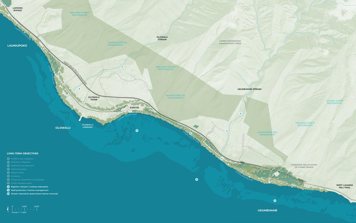
Aimed at incorporating local and traditional ecological knowledge and improving reef, coastal, and community resilience to help adapt to the growing impacts of climate change, Olowalu: The Road to Resilience envisions long-term nature-based shoreline design solutions in the context of a coastal highway realignment project.
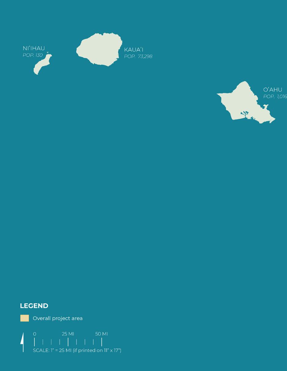
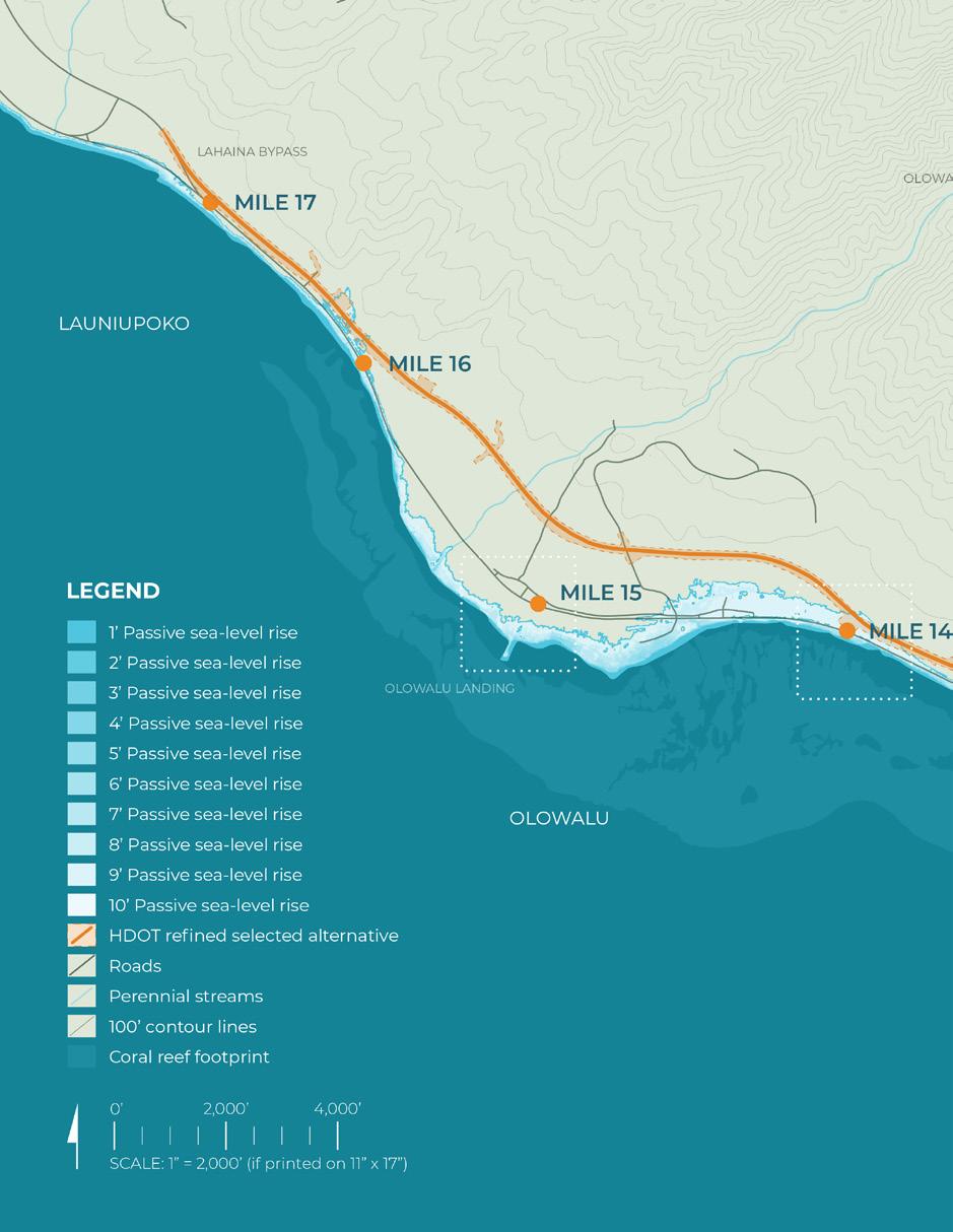
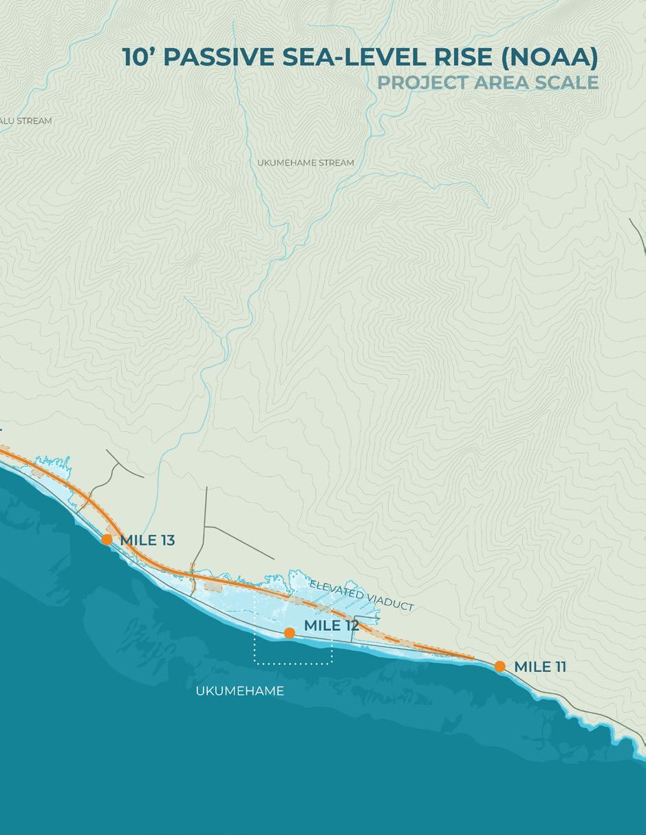
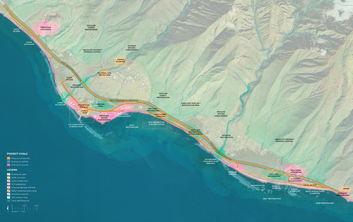
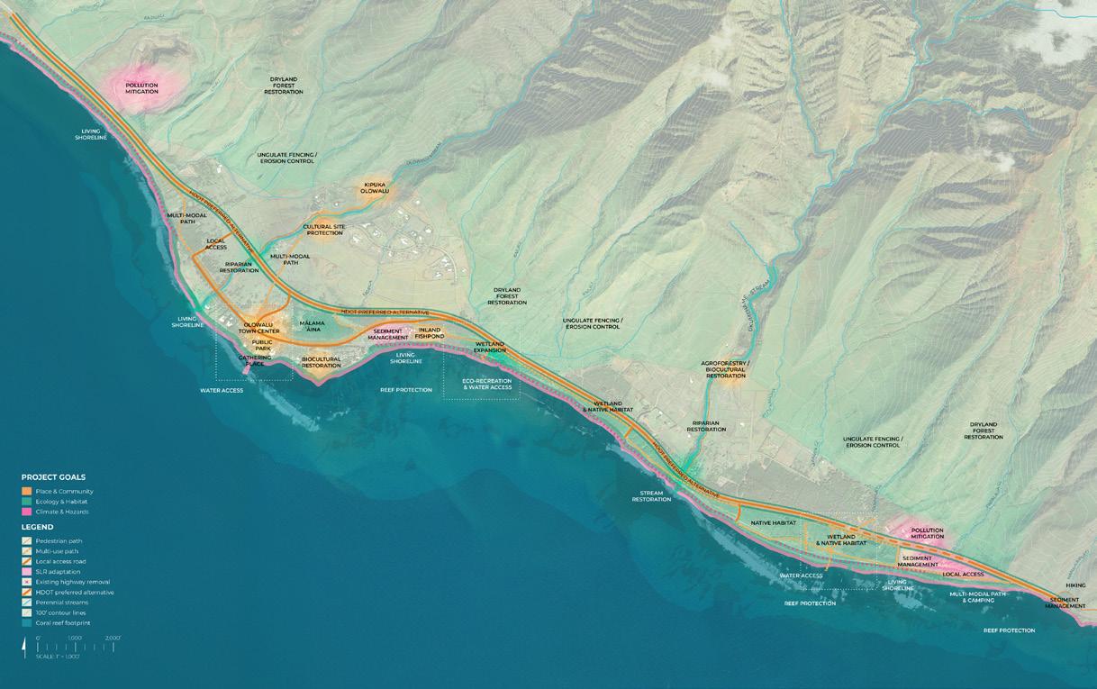
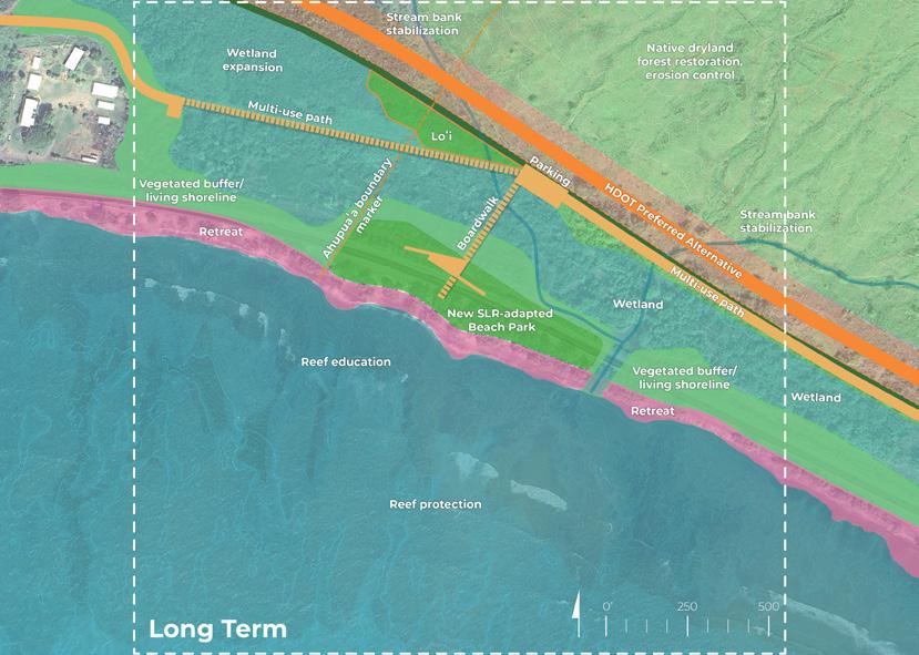
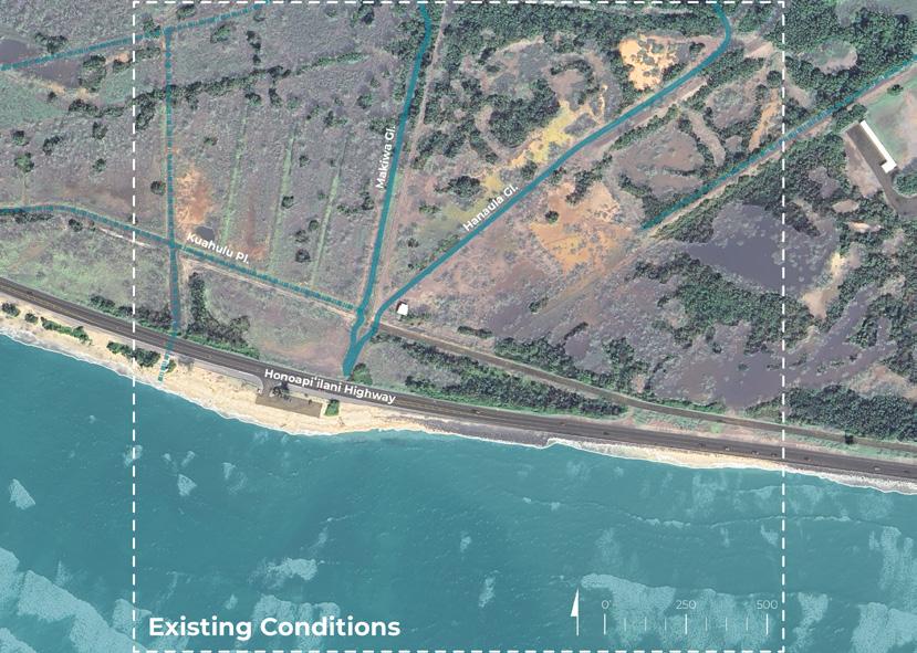
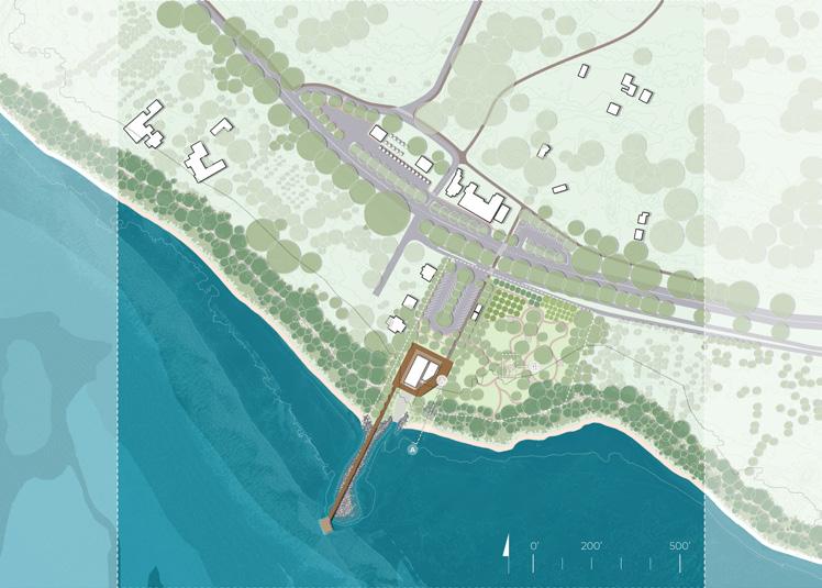
Project Area Scale Long-Term Proof-of-Concept Design (UHCDC)
Background, Timeline, and Scope
The Nature Conservancy (TNC) Hawaiʻi and Palmyra
TNC is a global environmental nonprofit working to create a world where people and nature can thrive. Founded in the U.S. through grassroots action in 1951, TNC has grown to become one of the most effective and wide-reaching environmental organizations in the world. In Hawaiʻi, TNC promotes healthy and vibrant coral reefs and marine ecosystems through community outreach, scientific monitoring, and restoration efforts across the state.
Emily Fielding, Hawaiʻi Marine Conservation Director
Nalei Sampson, Maui Marine Project Coordinator
Dr. Kim Falinski, Lead Water Scientist
Amy Bruno, Project Manager, Hawaiʻi Marine Program
Anna Zagora and Nolan Clark, TNC Kupu Members
University of Hawaiʻi Community Design Center (UHCDC)
UHCDC is a service-learning program and teaching practice, established and led by the University of Hawaiʻi (UH) School of Architecture, that provides a platform for applied research, planning, placemaking, and design involving UH faculty, staff, students, and partnered professionals across UH campuses, departments, and professional disciplines.
UHCDC Team:
Judith Stilgenbauer, FASLA, Principal Investigator and Professor, School of Architecture
Sierra Spears, Research Associate and Graduate Research Assistant (October 2024 - July 2026)
Emily Sobolewski Knight, Research Associate (October 2024 - July 2025)
Kaimana Tuazon, Project Designer (July 2025 - July 2026)
Xavier Duarte, Research Associate (September 2025 - June 2026)
Student Project Assistants:
Dersel Bonai (January 2025 - May 2026), Zoë Angelopulo (October 2024 - May 2025), Kenny Morrow (October 2024 - May 2025), Sarah Obra-Nakata (October - December 2024)
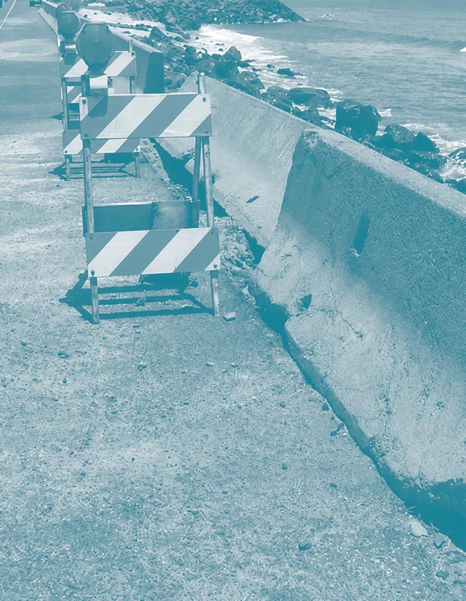
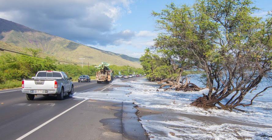
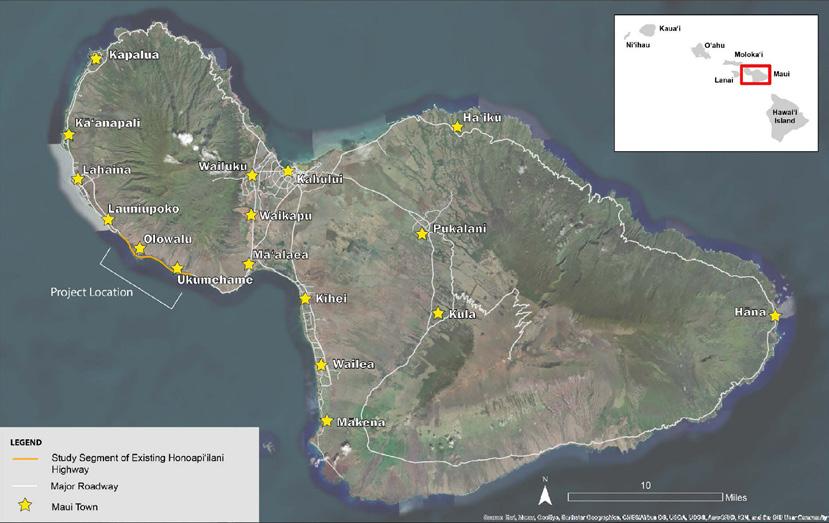
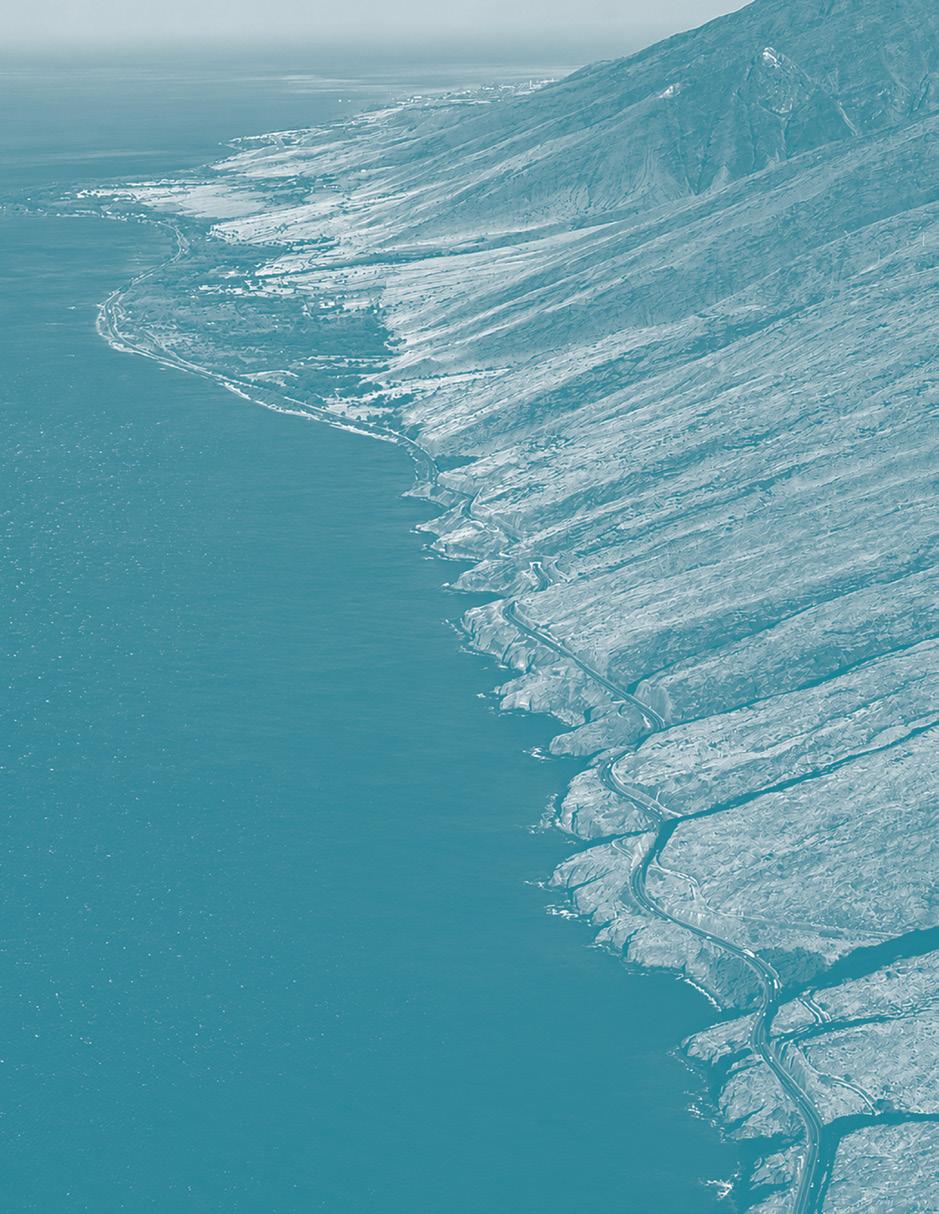
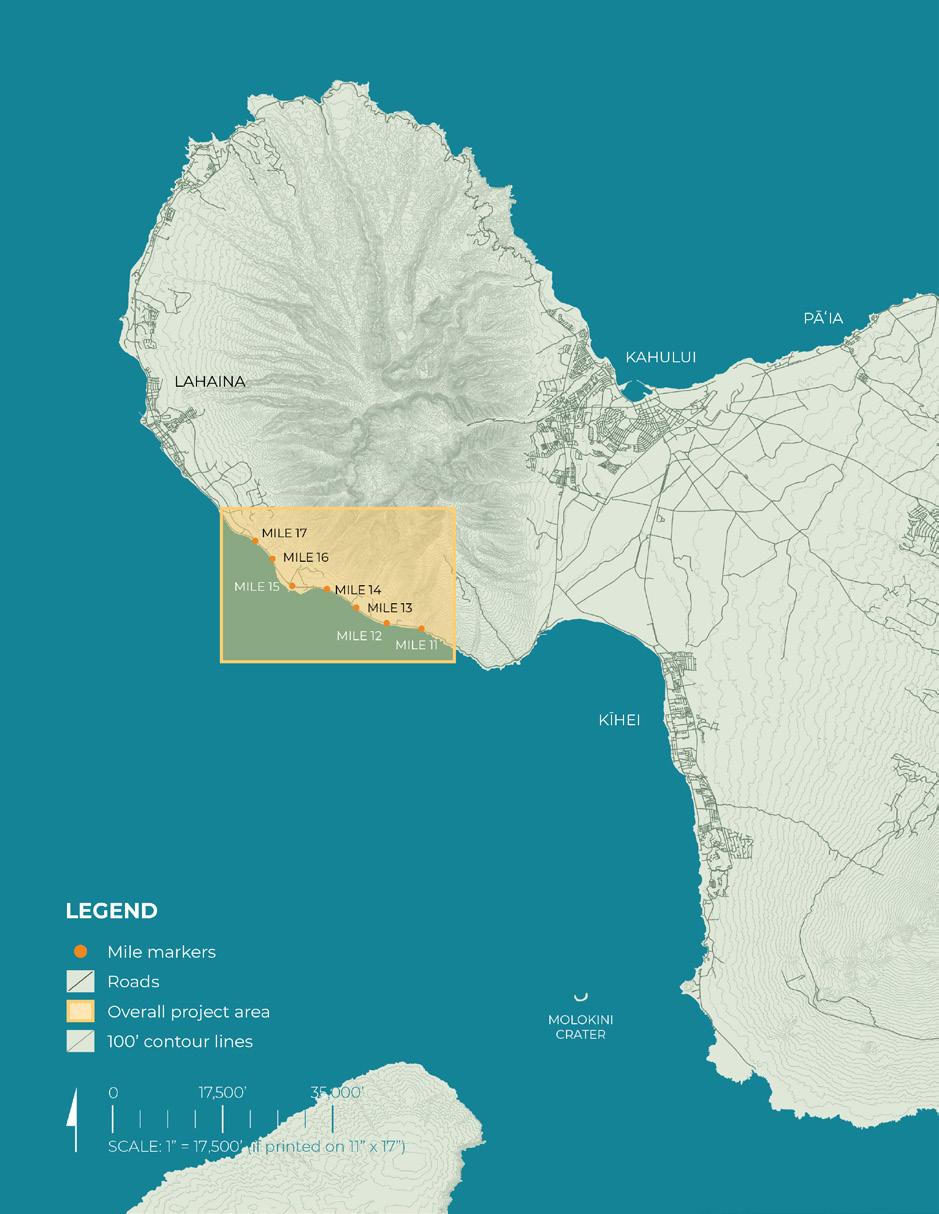
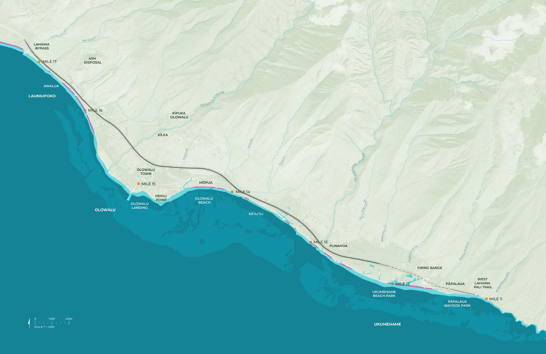
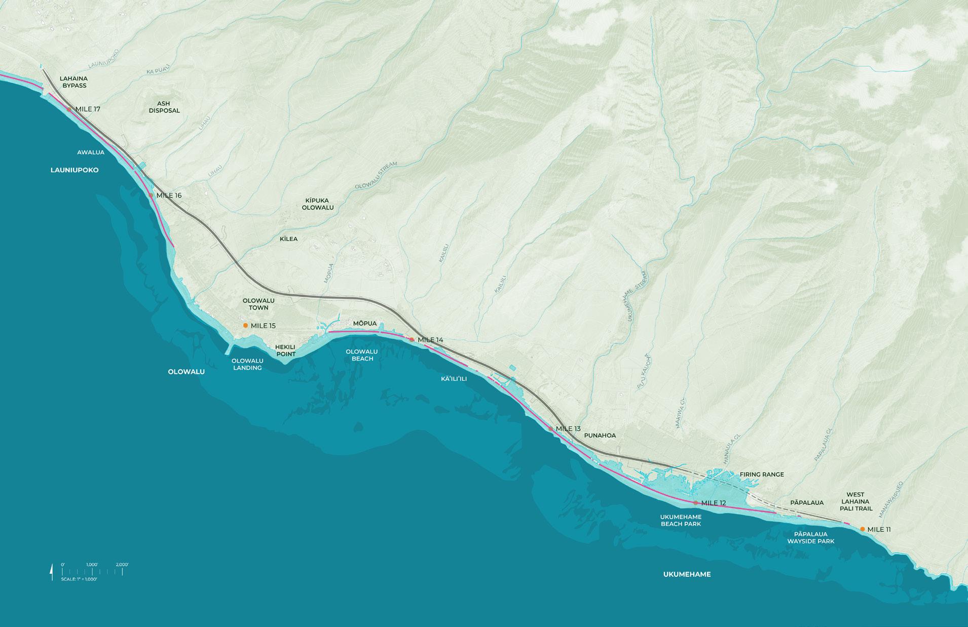
Flooding, erosion, and fire from the impacts of climate change and extreme weather events have increased in frequency and intensity along the makai areas of the Olowalu and Ukumehame ahupuaʻa in West Maui. Complementing ongoing Honoapiʻilani Highway realignment planning led by the State of Hawaiʻi Department of Transportation, TNC and UHCDC worked with public and private partners on engaging the community and stakeholders in the development of a proof-of-concept design for the coastal area stretching approximately 6 miles from Ukumehame to Launiupoko.
The planned highway realignment provides a unique opportunity to restore the area’s coastal zone by incorporating open spaces, traditional biocultural practices, and nature-based solutions, such as living shoreline systems, via a participatory planning and co-design process that re-envisions the old right-of-way.
By strengthening coastal landscapes and ecosystems, this project intends to increase the ecological, social, cultural, recreational, and economic benefits they provide and reduce pressures on the Olowalu-Ukumehame reef system. The work aims to improve coastal and community resilience to help mitigate and adapt to the growing impacts of climate change, including sea level rise.
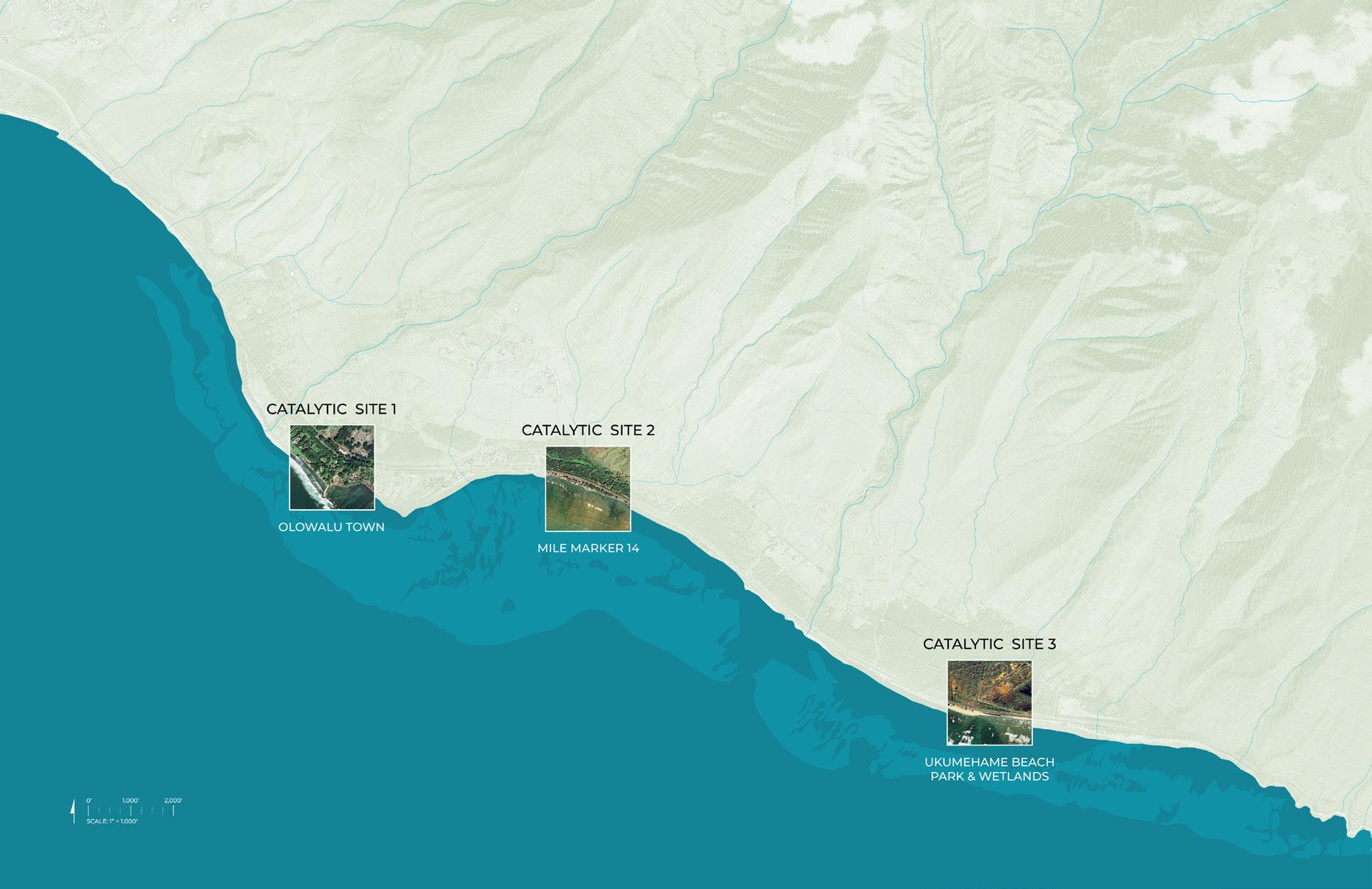
Based on community input and feedback, the project team has created a vision for what the coastal space might look like and how it would perform once the highway is moved inland. It is our hope that this report—with its speculative and forward-looking proof-of-concept designs for three catalytic sites—will contribute to a continued engaged and robust local discourse on climate-resilient and adaptive future waterfront amenities and living shoreline systems for West Maui.
Olowalu
In 2017, West Maui’s Olowalu reef was declared a Mission Blue Hope Spot—a place that is critical to the health of our oceans. Spanning the coast from Olowalu to Pāpalaua, the 939-acre reef boasts a stunning diversity of coral, harbors
Coral Reef Benefits:
Protect Coasts
Coral reefs block up to 97% of the wave energy hitting our coastlines.
Contribute to Resilience
Coral reef restoration contributes to biodiversity and nature-based SLR adaptation.
Prevent Flooding
Reefs provide flood protection to people, property, and jobs valued at more than $836 million each year.
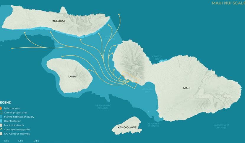
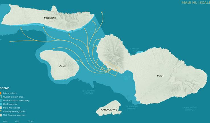
the largest known manta ray population in the United States, and is a primary source of coral larvae for the reefs of Lānaʻi, Molokaʻi, and West Maui.
Sustain Fisheries
Hawaiʻi’s reefs support nearshore fisheries worth $13.4 million each year.
Connect Us to Cultural Heritage
Hawaiʻi’s reefs connect us to our islands’ natural and cultural heritage.
Support Livelihoods
Coral reefs contribute more than $1.2 billion through reef-related tourism to the state’s economy.
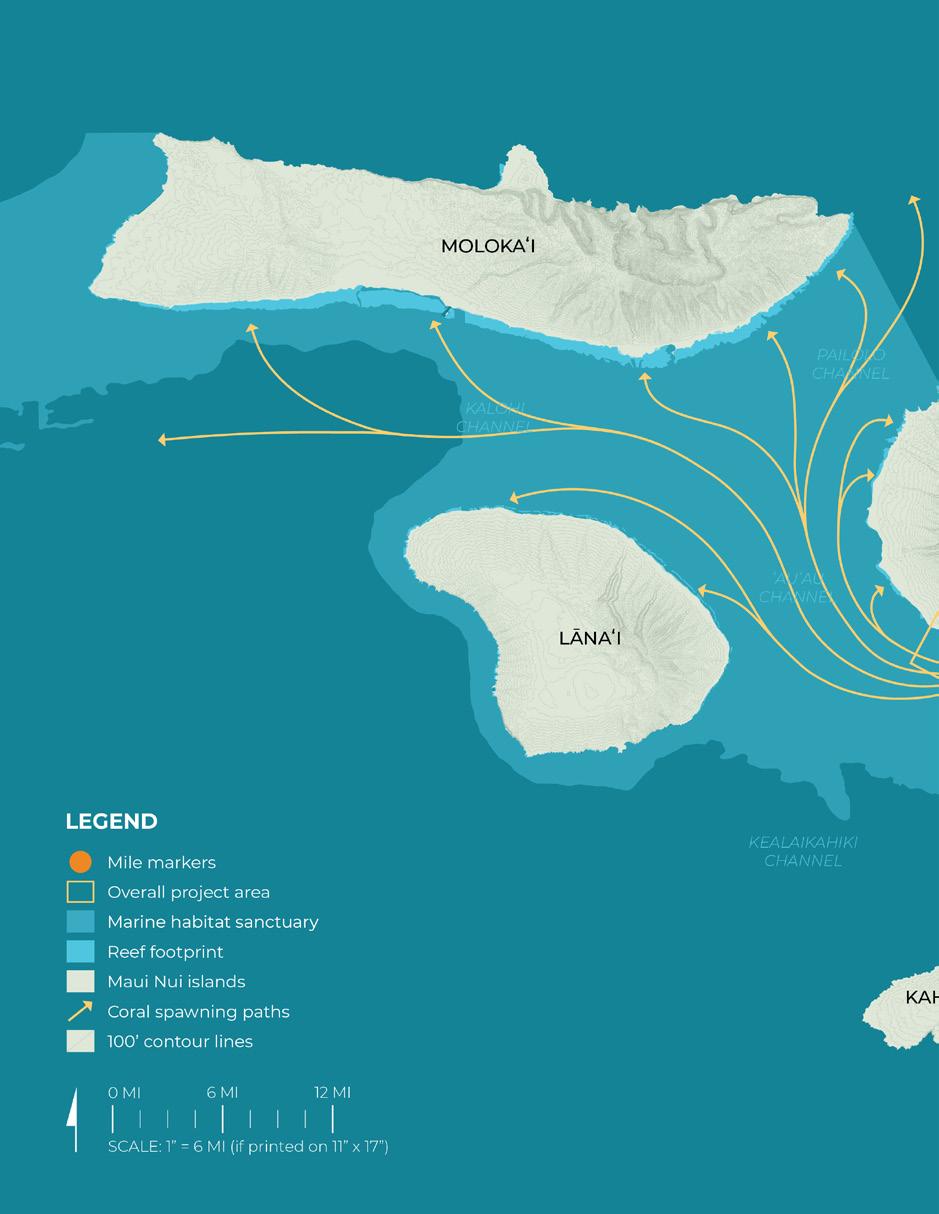
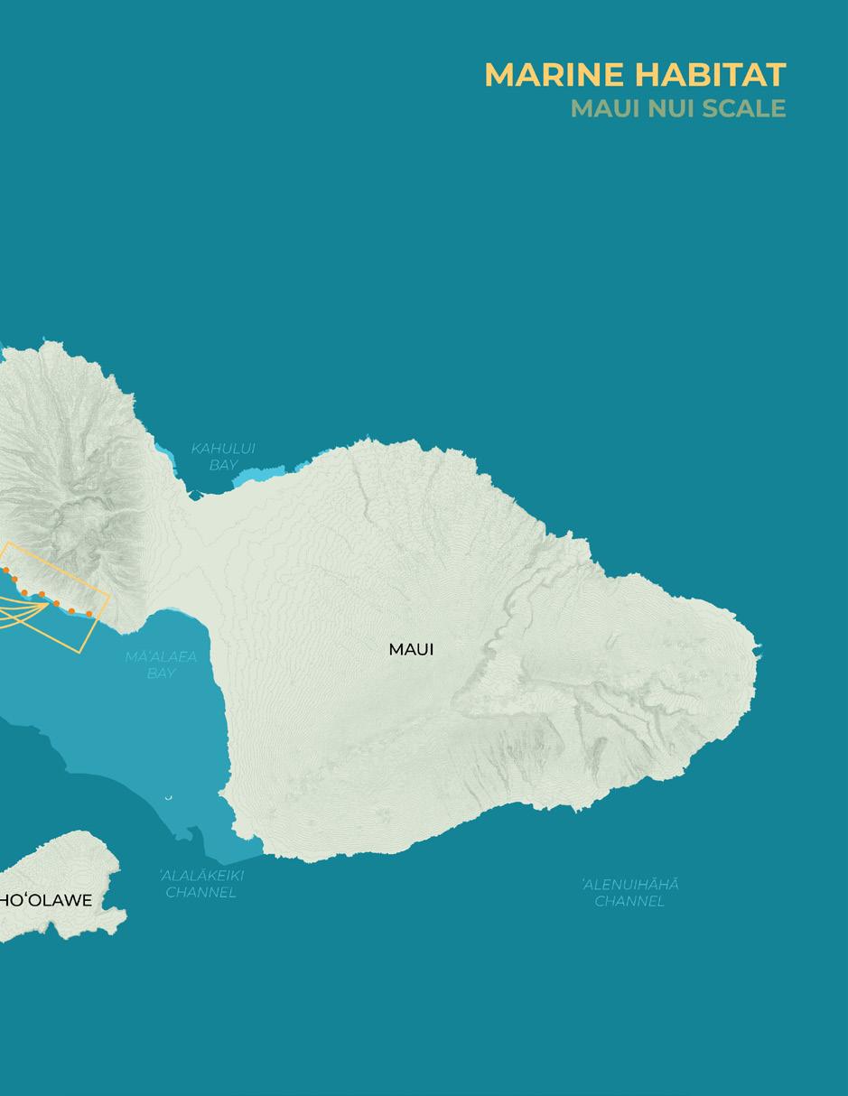
Coral spawning paths (adapted from Modeling Fine-Scale Coral Larval Dispersal and Interisland Connectivity to Help Designate Mutually-Supporting Coral Reef Marine Protected Areas)
BACKGROUND, TIMELINE, AND SCOPE
Timeline and Scope
Overview of Project Phases
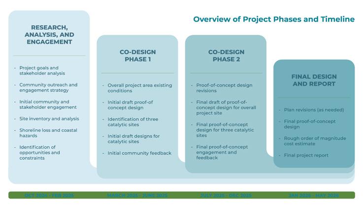
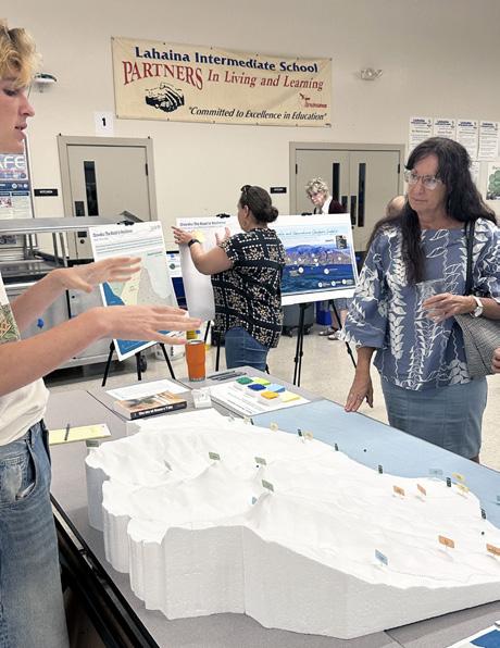
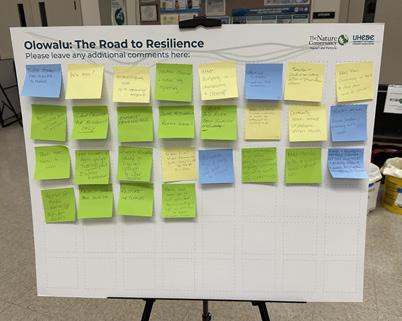
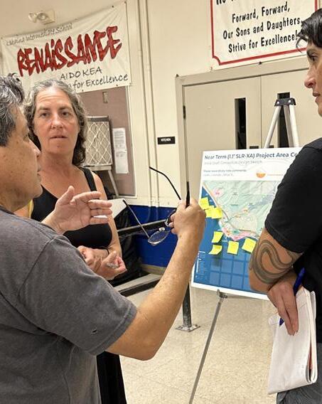
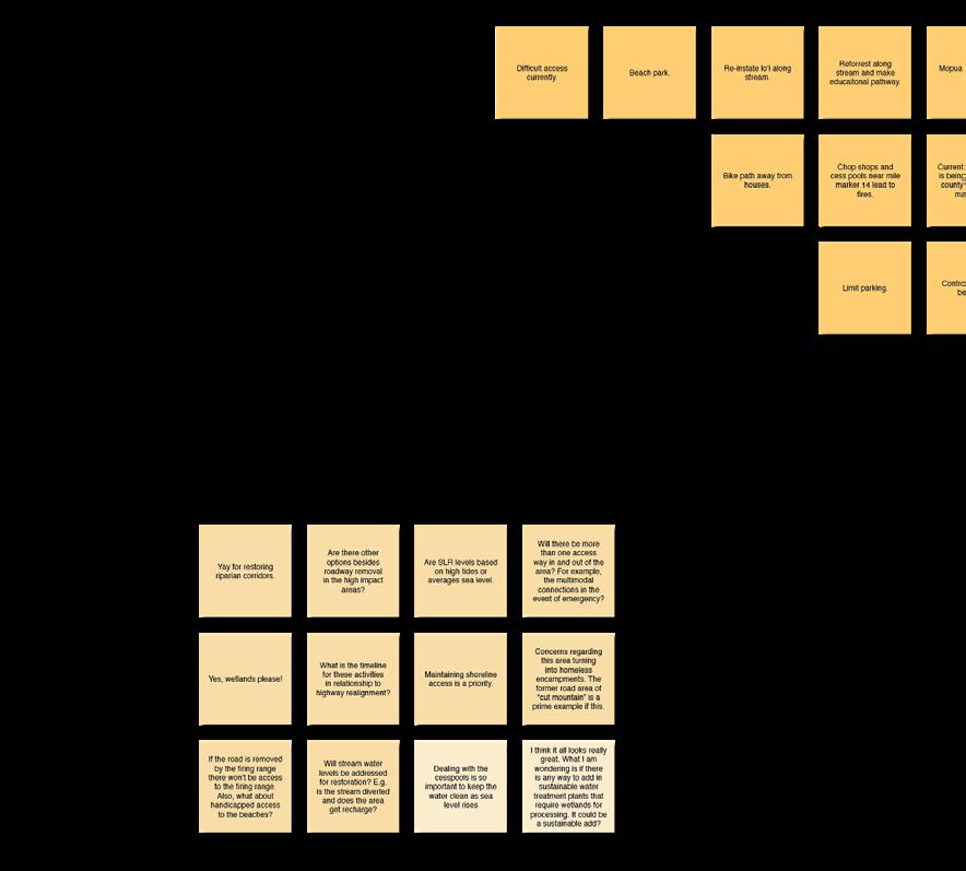
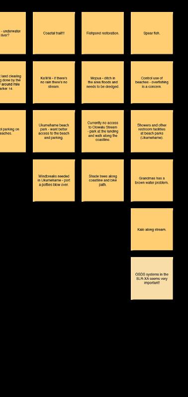
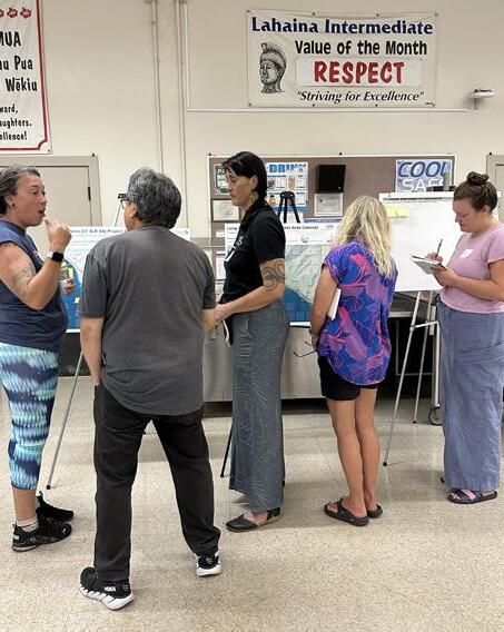
This Olowalu: The Road to Resilience project lasted one year and ten months, from October 2024 through July 2026 and was comprised of four major phases, depicted in the graphic below. During the research, analysis, and initial engagement phase, the project team developed goals and guiding principles, conducted a stakeholder and community group analysis, and created a strategy and framework for subsequent engagement and participatory visioning/ co-design activities. UHCDC researched, reviewed, analyzed, and summarized existing project area information, reports, reviewed site conditions on the ground, and, with input from TNC staff experts, prepared inventory and analysis maps at a range of scales (Chapter 3 below). During February 2025, TNC and UHCDC hosted an initial series of community meetings to listen, share information about nature-based solutions, and understand priorities/concerns.
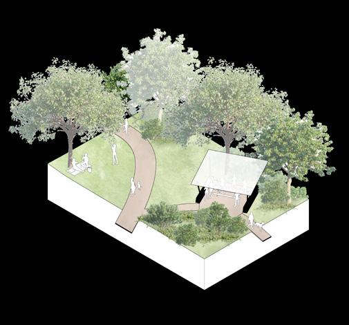
The next major project phase focused on the development of initial conceptual planning and design drafts for the overall project area and three smaller coastal sites, based on prior site analysis and general engagement results. In this process, UHCDC identified and mapped three catalytic project site locations. These catalytic sites zoom in to important aspects of the overall, initial proof-of-concept design framework plan and highlight specific instances of coastal resilience or habitat/cultural restoration accommodations and recreational opportunities—typical adaptation solutions that might also be applicable to other parts of the overall project area.
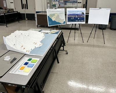
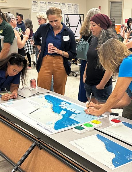
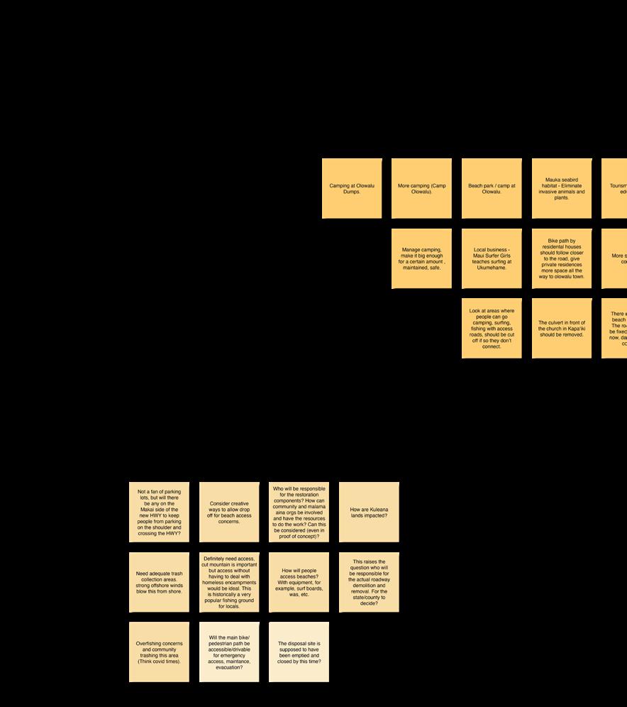
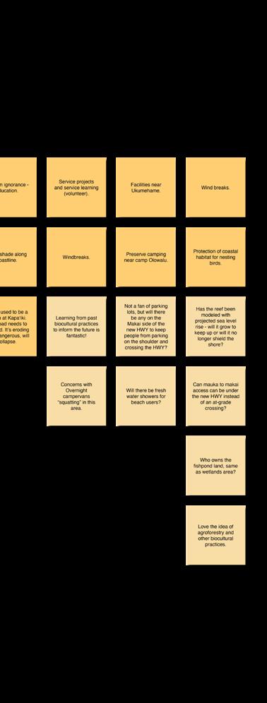
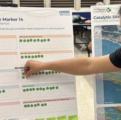
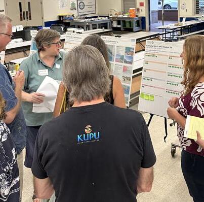
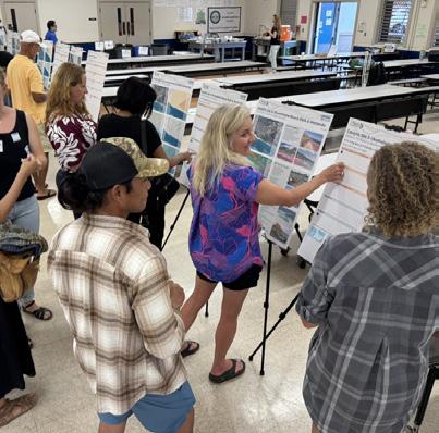
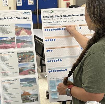
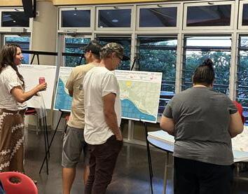
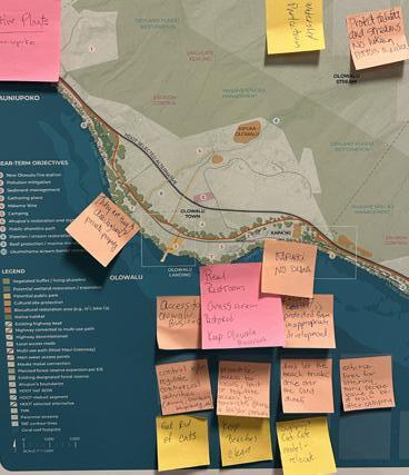
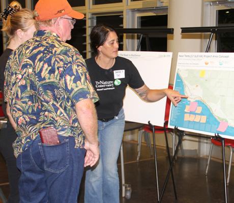
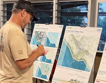
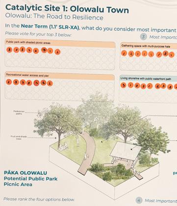
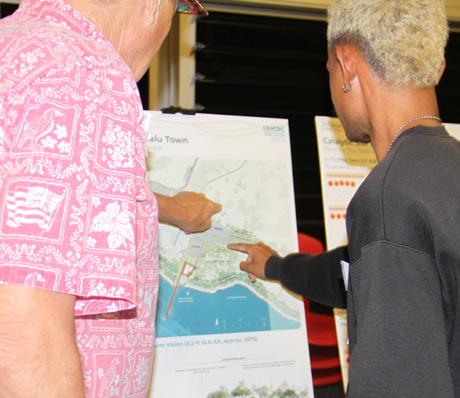
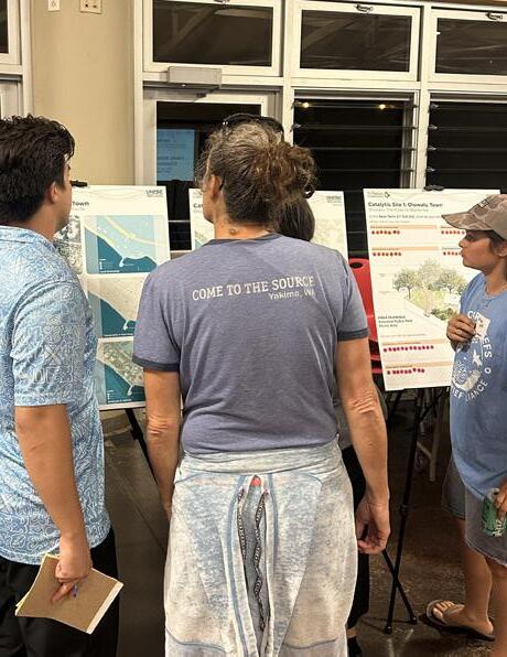
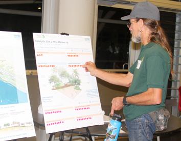
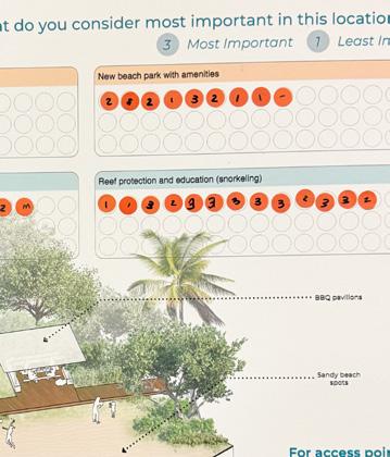
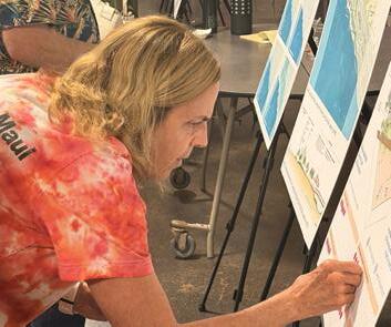
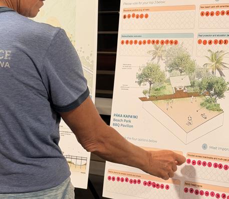
In late May and early June of 2025, community members and stakeholders were invited to a first series of co-design workshops aimed at envisioning the resilient future of the Olowalu and Ukumehame coast once the Honoapiʻilani Highway is realigned. Chapter 4 (below) summarizes the event material and engagement results.
ANALYSIS , AND ENGAGEMENT
CO RESEARCH,
-Project goals and stakeholder analysis
-Community outreach and engagement strategy
-Initial community and stakeholder engagement
-Site inventory and analysis
-Shoreline loss and coastal hazards
-Identification of opportunities and constraints
OCT 2024 - FEB 2025
-Overall conditions
-Initial draft concept
-Identification catalytic
-Initial draft catalytic
-Initial community
Subsequently, during the third major project phase, based on prior community feedback, the UHCDC team revised the conceptual sketches into refined draft proof-of-concept design materials at both the overall project area and catalytic site scales. In November 2025, community members and stakeholders participated in
CO-DESIGN PHASE 1
project area existing conditions
draft proof-of concept design
dentification of three ic sites
draft designs for ic sites
community feedback
CO-DESIGN PHASE 2
-Proof-of-concept design revisions
-Final draft of proof-ofconcept design for overall project site
-Final proof-of-concept design for three catalytic sites
-Final proof-of-concept engagement and feedback
a second series of co-design workshops aimed at envisioning the project location’s resilient future. Part three of Chapter 4 (below) summarizes this second co-design phase in detail.
The final project phase was dedicated to the development of a final, overall proof-of-concept
Overall Timeline
FINAL DESIGN AND REPORT
-P lan revisions (as needed)
-F inal proof-of-concept design
- Rough order of magnitude cost estimate
-F inal project report
design (near-term and long-term scenarios) representing a collaboratively developed vision for the coastal areas of Olowalu and Ukumehame. Additionally, based on these design products, a rough order of magnitude cost estimate was developed, reflecting an opinion on probable long-term construction cost.
Chapter 2 establishes the planning context guiding decision-making within the Olowalu–Ukumehame coastal corridor. The project area is influenced by various infrastructure initiatives, transportation frameworks, environmental review processes, and coordinated public and nonprofit efforts that shape both current conditions and future direction.
This chapter highlights selected existing plans and projects across four areas: the Honoapiʻilani Highway Improvements Final Environmental Impact Statement, regional transportation and infrastructure plans, coastal and environmental resilience studies, and other related projects. Together, these efforts define the broader framework within which this project operates. Their scope, objectives, and status inform subsequent phases of analysis and design.
Additionally, this chapter summarizes selected relevant, implemented projects that have served as precedents and informed design decisions for Olowalu: The Road to Resilience.
A complete list of cited resources and documents is included in the Sources portion at the end of this report.
Honoapiʻilani Highway (image adapted from https://www.honoapiilanihwyimprovements.com/)
Honoapi‘ilani Highway Improvements EIS
This subchapter introduces the Honoapiʻilani Highway Improvements Final Environmental Impact Statement (EIS) document, which is part of an ongoing transportation planning process that establishes the primary infrastructure framework influencing the future of the Olowalu-Ukumehame coastal corridor.
Four key components are examined: the project’s purpose and need, the range of alternatives considered, the selection of the preferred inland alignment, and refinements incorporated through consultation and technical analysis. Together, these elements define the approved future transportation corridor, right-of-way configuration, and regulatory commitments adopted by federal and state agencies.
By outlining the scope and outcomes of the Final EIS, this subchapter establishes the infrastructural framework that guides many subsequent planning and design decisions within the project area. Understanding the selected alignment clarifies the physical constraints and coordination requirements that shape potential proposed interventions within the corridor.
HONOAPI‘ILANI HIGHWAY IMPROVEMENTS FINAL EIS
Honoapiʻilani Highway Improvements Project
Final Environmental Impact Statement (2025), Federal Highway Administration and Hawai‘i Department of Transportation
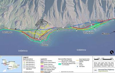
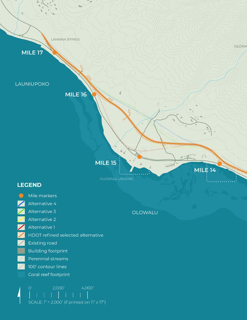
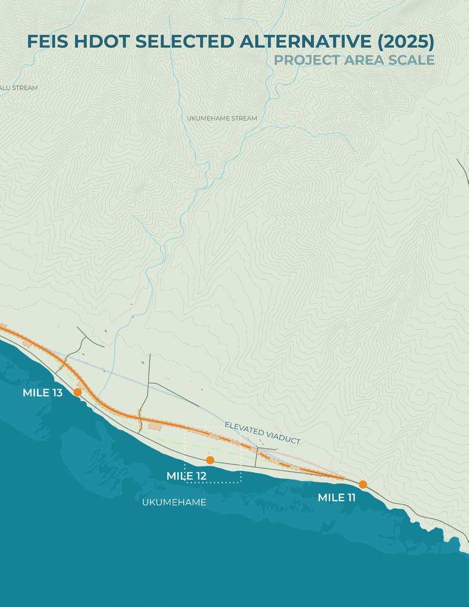
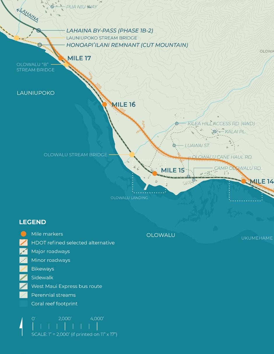
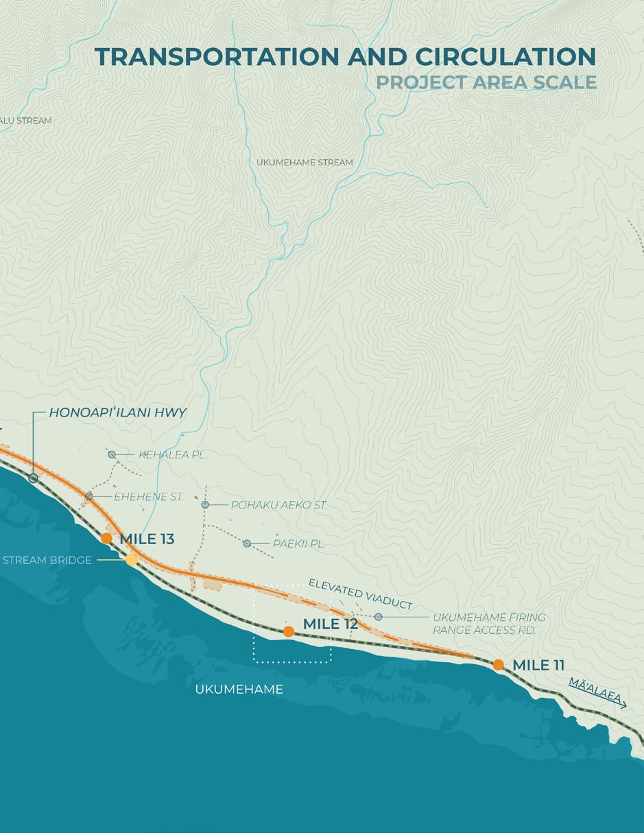
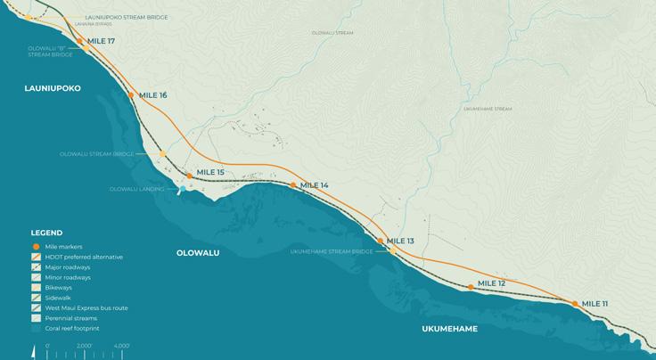
The Honoapiʻilani Highway Improvements Project is a federally led transportation initiative administered by the Federal Highway Administration (FHWA) in cooperation with the Hawaiʻi Department of Transportation (HDOT). The project corridor extends approximately six miles between Mile Marker 11 in Ukumehame and Mile Marker 17 in Launiupoko and passes through the Olowalu ahupuaʻa. In September 2025, FHWA and HDOT published the Final Environmental Impact Statement and issued a Record of Decision selecting a refined inland alignment alternative (FHWA, 2025).
Honoapiʻilani Highway is the primary transportation corridor serving West Maui. The Final EIS evaluates improvements to this segment of highway in response to long-term infrastructure vulnerability and regional transportation needs. The selected alternative relocates the highway to an inland alignment, altering circulation patterns, access configurations, and the relationship between mauka and makai lands within the Olowalu ahupuaʻa. As a major state infrastructure investment, the project establishes crucial planning and design context for the Olowalu: The Road to Resilience project.
Purpose and Need
The stated purpose of the Honoapiʻilani Highway Improvements Project is to improve the long-term resilience of the highway corridor between Ukumehame and Launiupoko in response to coastal erosion and projected sea level rise. The Final EIS explains that the existing highway alignment has experienced repeated impacts from shoreline retreat, wave overtopping, and storm-related flooding, resulting in roadway damage, safety concerns, and service disruptions (FHWA & HDOT, 2025). These im-
pacts are expected to intensify under future sea level rise scenarios, increasing maintenance demands and the risk of extended closures.
As summarized in the transportation technical report, “the primary purpose and need for this Honoapiʻilani Highway Improvements Project is to increase the resiliency of this segment of Honoapiʻilani Highway by responding to existing shoreline erosion and effects of projected sea level rise” (FHWA & HDOT, 2025, p. 3.14-I-1).
To address this need, the project proposes relocating the primary arterial inland, outside areas projected to be vulnerable to long-term shoreline change and coastal inundation.
In addition to reducing exposure to climate-related hazards, the Final EIS emphasizes the importance of maintaining reliable regional connectivity. Because Honoapiʻilani Highway provides essential access for West Maui residents, businesses, and emergency services, disruptions to the corridor have implications for mobility, economic stability, and disaster response capacity (FHWA & HDOT, 2025). The inland relocation is therefore intended to enhance both physical resilience and transportation reliability under changing coastal conditions.
Alternatives Considered
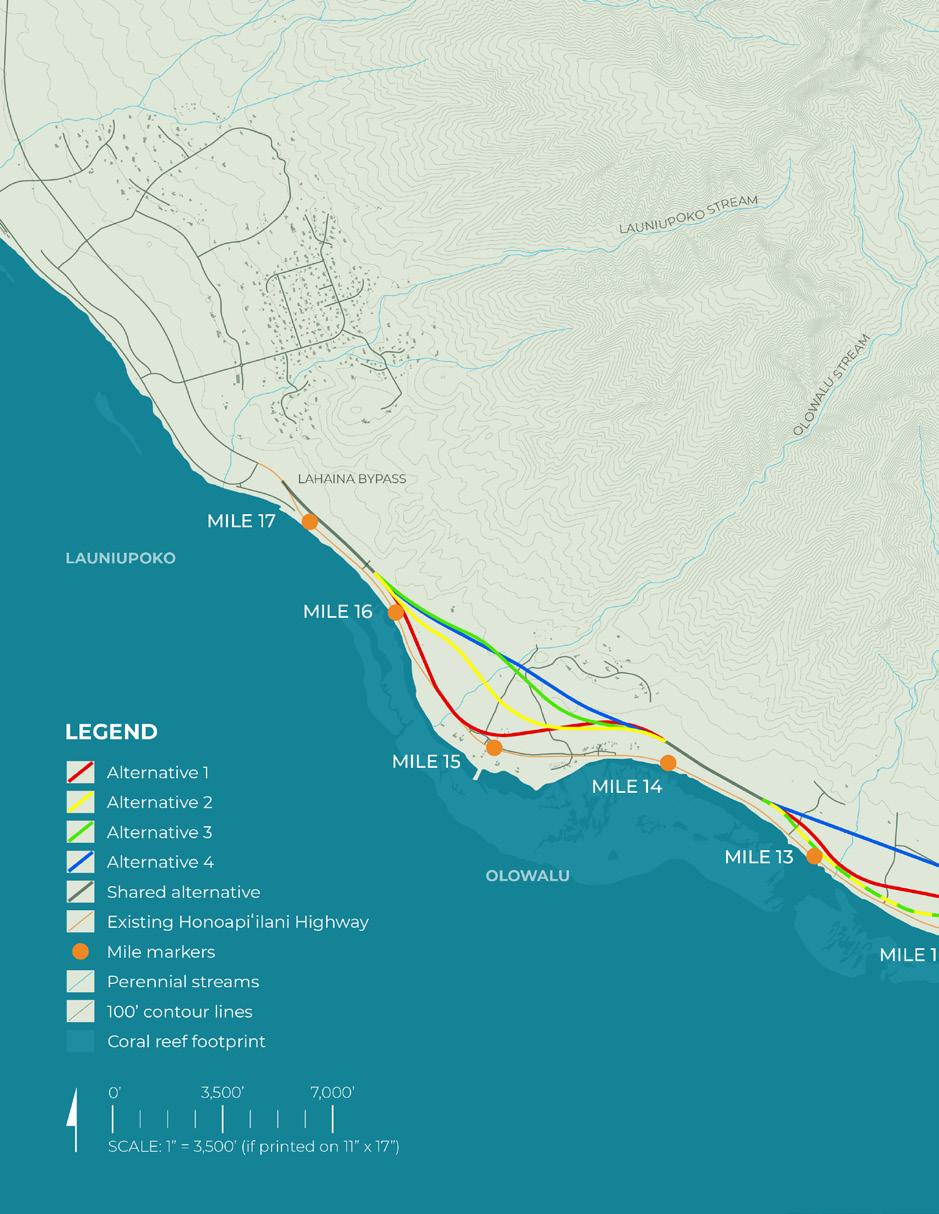
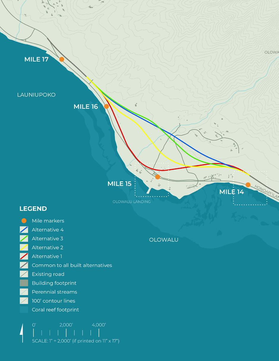
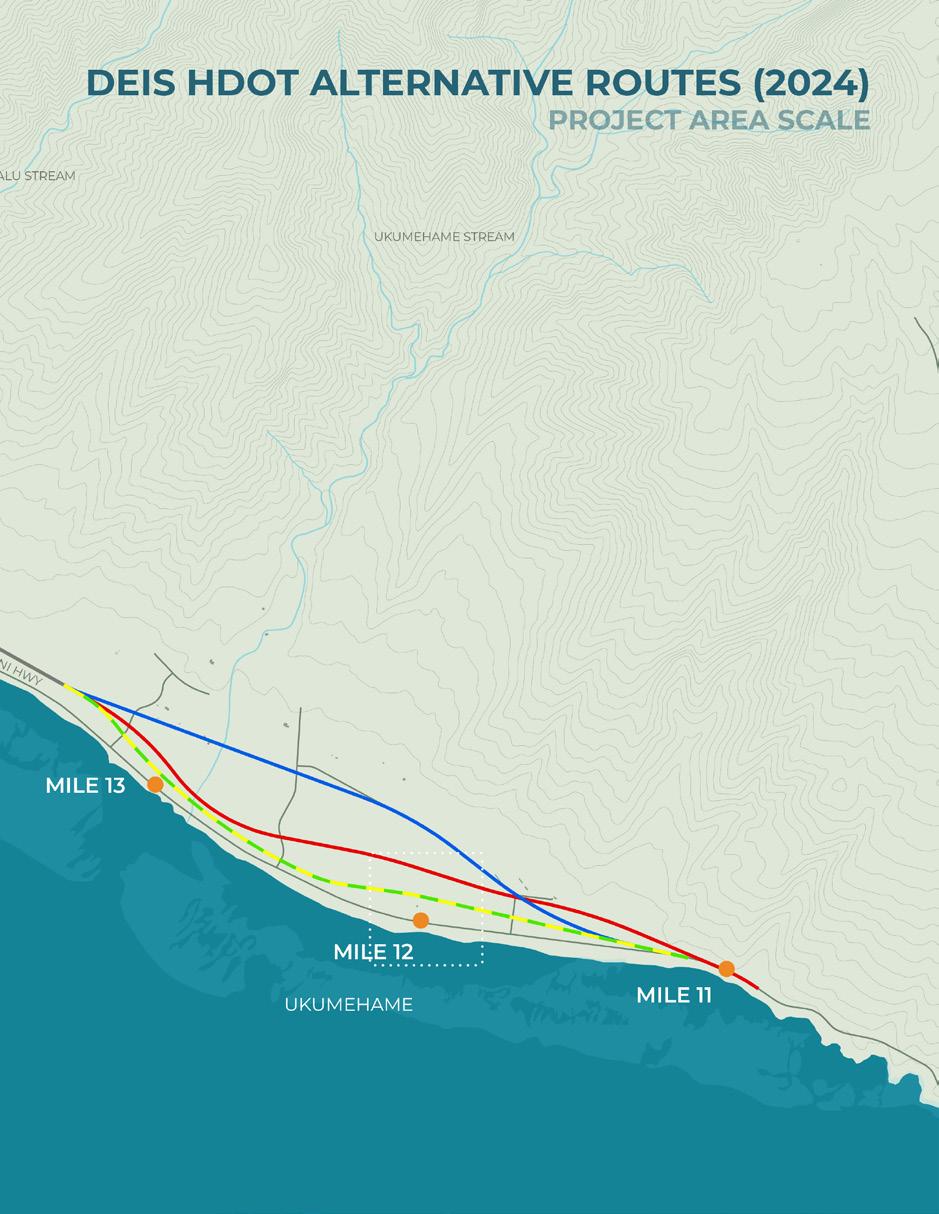
The Draft Environmental Impact Statement (DEIS) evaluated a No Build Alternative and four Build Alternatives to meet the project’s purpose and need (FHWA & HDOT, 2025). The No Build Alternative assumed continued maintenance of the shoreline highway without major realignment. Although this approach would avoid new land disturbance, it would not address longterm vulnerability to coastal erosion and sea level rise or sustain roadway function under projected conditions (FHWA & HDOT, 2025).
The Build Alternatives proposed inland realignments through Ukumehame and Olowalu. These alternatives varied in mauka shift, road-
Critical impact event on Honoapi‘ilani Highway in Ukumehame (Asa Ellison, PACIOOS, Wave run-up forecast examples: Ukumehame, West Maui, 2017)
way geometry, intersection design, and access configuration. In Olowalu, they differed in how they maintained connections to Olowalu Village Road, shoreline access, and adjacent agricultural lands (FHWA & HDOT, 2025).
Each alternative was evaluated for transportation performance, environmental impacts, protection of cultural and historic resources, agricultural land conversion, and regulatory compliance, including Sections 106 of the National Historic Preservation Act and 4(f) of the Department of Transportation Act (FHWA & HDOT, 2025).
Following comparative analysis of transportation performance, environmental impacts, and feasibility, the DEIS identified a Preferred Alter-
native. The Record of Decision confirms its selection, with refinements incorporated into the Final EIS to address implementation and mitigation considerations (FHWA, 2025).
By relocating the highway mauka of erosion-prone areas, the inland alternatives reduce exposure to coastal hazards and strengthen roadway resilience. This shift moves the project from shoreline maintenance toward a stable inland alignment responsive to sea level rise.
Selected Alternative Refinements
After publication of the Draft EIS, additional studies and consultation resulted in refinements to the Selected Alternative. Although the overall inland relocation strategy was retained, modifications were incorporated and evaluated in the Final EIS prior to issuance of the Record of Decision (FHWA, 2025).
Within the Olowalu segment, further archaeological investigations conducted under Section 106 compliance identified previously undocumented cultural resources within portions of the proposed alignment corridor, including areas near Mile Marker 14. In response to these findings, segments of the alignment were adjusted to avoid or minimize direct impacts to significant archaeological sites.
The Final EIS also documents the evaluation of historic properties within the Area of Potential Effects (APE) and coordination undertaken with the State Historic Preservation Division (SHPD) to address potential adverse effects (FHWA & HDOT, 2025, Appendix 4). These refinements demonstrate that cultural resource findings directly informed final design decisions within the Olowalu–Ukumehame corridor, resulting in localized modifications to the horizontal alignment while maintaining the broader inland relocation objective.
Additional design refinement occurred within
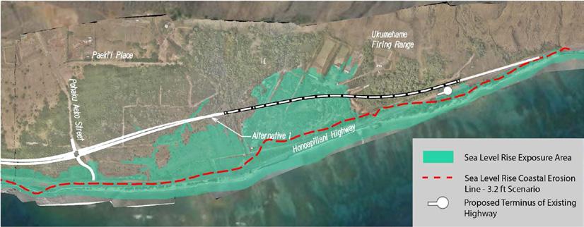
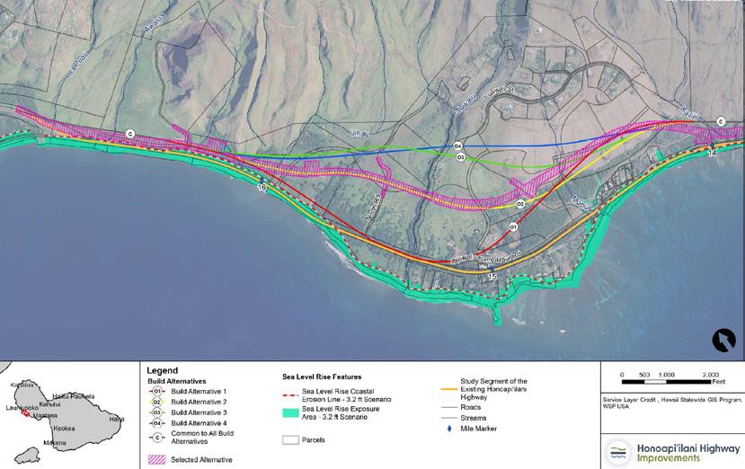
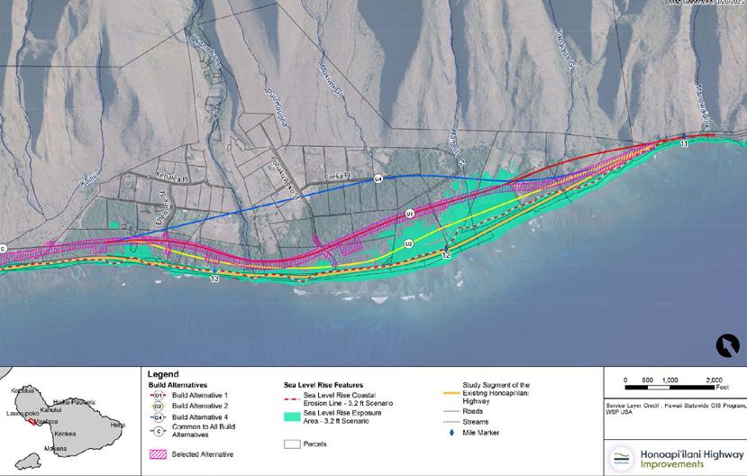
Alternatives Evaluated in the Draft EIS (FHWA & HDOT, Honoapiʻilani Highway Improvements Project FEIS, 2025)
Draft EIS Identification of the Preferred Alternative (FHWA & HDOT, Honoapiʻilani Highway Improvements Project FEIS, 2025)
the Ukumehame segment, where the alignment crosses an existing HDOT detention basin and approaches the Ukumehame Firing Range. Appendix 5 of the Final EIS documents the evaluation of constructing this portion of the roadway either on an at-grade embankment or as an elevated viaduct structure (FHWA & HDOT, 2025). Although the embankment option presented lower direct construction costs, it would have eliminated the functional capacity of the detention basin and required substantial redesign of watershed management infrastructure.
Whereas, the viaduct option was ultimately identified as the preferred approach because it minimized impacts to the detention basin, reduced environmental effects, and better supported the project’s resiliency objectives (FHWA & HDOT, 2025).
As part of the alternatives analysis, access to the Ukumehame Firing Range was evaluated under different configurations, including routing via Pōhaku ʻaeko Street and the existing Honoapiʻilani Highway (FHWA & HDOT, 2025). Under the
Ukumehame - Refinement at Northern Connection to Olowalu (FHWA & HDOT, Honoapiʻilani Highway Improvements Project FEIS, 2025)
selected configuration, access would be maintained via the existing firing range driveway, which would pass beneath the elevated viaduct structure, allowing the primary highway alignment to traverse the site overhead.
Together, these refinements illustrate how cultural, environmental, hydrological, and operational considerations shaped the final configuration of the Selected Alternative. While the inland relocation strategy remained consistent, adjustments to both horizontal alignment and structural design reflect the iterative planning and consultation process documented in the Final EIS.
These refinements are directly relevant to the Olowalu: The Road to Resilience project because the revised Selected Alternative establishes the transportation framework incorporat-
ed into the project’s design sketches. Both the project area scale planning framework and the catalytic site concepts were developed to reflect the Final EIS alignment, ensuring that resilience strategies were coordinated with the adopted state transportation alignment.
Final EIS Refinements to Selected Alternative - Olowalu (FHWA & HDOT, Honoapiʻilani Highway Improvements Project FEIS, 2025)
Final EIS Refinements to the Selected Alternative - Ukumehame (FHWA & HDOT, Honoapiʻilani Highway Improvements Project FEIS, 2025)
West Maui coastline (Hawaiʻi Highways Climate Adaptation Action Plan, 2021)
Other Transportation and Infrastructure Plans
This subchapter examines additional state, county, and regional planning documents that guide mobility, safety, and long-term infrastructure investment within the Olowalu–Ukumehame corridor.
Four primary plans are included: the Pali to Puamana Parkway Master Plan (2005), the Hele Mai Maui Long Range Transportation Plan 2040 (2019), the Hawaiʻi Highways Climate Adaptation Action Plan (2021), and the West Maui Greenway Plan (2022). Together, these documents establish policy direction related to inland realignment, multimodal connectivity, climate adaptation, and coordinated corridor planning.
By tracing the evolution of these previously proposed transportation frameworks, this subchapter establishes the strategic context that informs ongoing infrastructure decisions within the corridor. Understanding these plans clarifies the mobility objectives, resilience priorities, and system-level investments that shape future planning and design efforts.
Summary
The Olowalu–Ukumehame coastal corridor has been the focus of multiple transportation and infrastructure planning efforts at the county, state, and regional levels. These plans respond to long-standing concerns regarding coastal erosion, sea level rise, limited access, and the vulnerability of the Honoapiʻilani Highway as West Maui’s primary transportation link. Collectively, they emphasize improving safety, enhancing multimodal connectivity, and increasing longterm resilience while protecting cultural, socio-economic, and natural resources.
Pali to Puamana Parkway Master Plan (2005), prepared by R.M. Towill Corporation for County of Maui Planning Department
The Pali to Puamana Parkway Master Plan (2005) establishes a long-term vision for transforming the Honoapiʻilani Highway corridor into a multimodal scenic parkway that integrates transportation function with environmental stewardship and community values. Extending from the Pali tunnels at Ukumehame to Puamana, the plan seeks to improve safety, enhance corridor aesthetics, and expand public access to coastal resources.
A central recommendation by the plan is to relocate the highway inland, particularly between Launiupoko and Olowalu, to avoid natural hazard zones like tsunami inundation areas, coastal erosion zones, and stream floodways. The proposed alignment extends the Lahaina Bypass from the Kai Hele Kū Street intersection to the western approach of the Pali tunnels. The plan also anticipates that future state studies may consider extending this inland route further toward Māʻalaea. By shifting the roadway mauka, the corridor makai of the new alignment could
be re-envisioned as a linear park or greenbelt, preserving open space while improving recreational and shoreline access.
Protection of cultural and ecological resources is a guiding principle of the Master Plan. The document calls for preservation of archaeological sites, traditional land uses, and sensitive natural features, including the Olowalu reef system. Shoreline access is framed not simply as recreation but as stewardship of place, reinforcing cultural continuity and respect for the coastal landscape.
Transportation objectives focus on establishing a continuous multipurpose pathway for walking and bicycling along both sides of the new alignment. The pathway network is intended to connect with a shoreline trail system, improving mauka to makai access throughout the corridor. The plan also recommends accommodating future bus transit stations at key intersections, with supporting pedestrian, bicycle, and vehicular access as well as parking facilities.
Areas prone to flooding, erosion, wetlands, or steep slopes receive particular attention. In these sensitive zones, the plan encourages reducing dependence on single-occupancy vehicles while promoting alternative modes of travel to limit environmental disturbance. Through this integrated approach, the Parkway Master
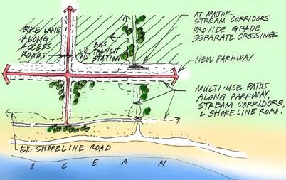
Sketch of proposed Olowalu parkway (R.M. Towill Corporation, Pali to Puamana Parkway Master Plan, 2005)
Plan advances a corridor strategy that prioritizes hazard avoidance, multimodal mobility, cultural preservation, and long-term coastal resilience.
Thus this plan provides an early framework for realigning the Honoapiʻilani Highway. Its recommendations continue to inform current discussions about how transportation improvements can support ecological health, cultural resources, and community priorities within the coastal corridor.
The included sketch illustrates a multimodal corridor along the proposed inland parkway. It includes bike lanes, a bus transit station, and multi-use paths that extend along stream corridors and the existing shoreline road. The design connects the parkway’s multi-use pathway system with the shoreline trail network, creating seamless mauka to makai access and supporting resilient, accessible coastal mobility.
Hele Mai Maui Long Range Transportation Plan 2040 (2019), prepared by Maui Metropolitan Planning Organization
The Hele Mai Maui Long Range Transportation Plan 2040 (2019) establishes a twenty-year vision for a safe, connected, and sustainable transportation system. Developed through public outreach, the plan prioritizes safety, sustainability, mobility, equity, and resilience. It does this by promoting multimodal corridors that accommodate walking, bicycling, transit, and driving while strengthening cultural and natural resources.
Within this framework, the Honoapiʻilani Highway corridor in West Maui is recognized as a critical regional connection requiring long-term investment and strategic adaptation. The plan identifies coastal roadways as increasingly vul-
nerable to erosion, flooding, and sea level rise. For that reason, climate resilience is a core goal, with specific emphasis on reducing exposure to hazards while protecting Maui’s environmental and cultural landscapes.
The recommended investment strategy combines new connections, multimodal improvements, safety enhancements, maintenance, and preservation. For corridors such as Honoapiʻilani Highway, this approach supports system reliability while expanding travel options. Thus, scenario analysis demonstrates that new connections can improve network redundancy and provide alternative access routes, which is particularly important for communities with limited ingress and egress.
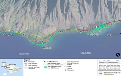
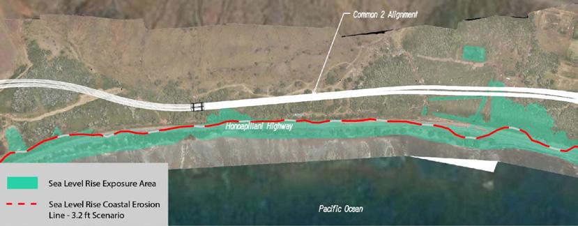
The plan also outlines the consequences of projected sea level rise. Under a 3.2-foot scenario, more than eleven miles of coastal roads on Maui could become impassable, disrupting mobility and isolating rural communities. This finding underscores the urgency of inland realignment strategies in vulnerable areas such as Olowalu and Ukumehame.
Community engagement is central to implementation. Public workshops, surveys, and advisory groups highlighted strong sup-
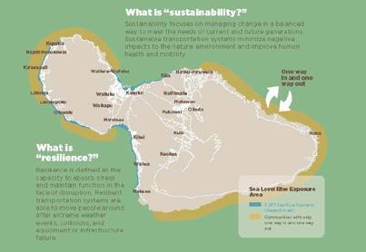
Single-route access Maui communities (Maui Metropolitan Planning Organization, Hele Mai Maui Long Range Transportation Plan, 2019)
port for safer corridors, multimodal access, and protection of natural resources. The plan calls for continued collaboration as projects advance, particularly where infrastructure investments intersect with culturally significant landscapes or sensitive ecosystems. In relation to Olowalu, the plan reinforces that the Honoapiʻilani Highway Realignment is not solely a transportation improvement. It is part of a broader island-wide strategy to enhance resilience, improve access, and integrate infrastructure planning with environmental stewardship and community priorities.
The map included on the previous page illustrates areas at risk under a 3.2-foot sea level rise scenario and identifies coastal communities with limited access routes. The corridor between Olowalu and Māʻalaea is highlighted as particularly vulnerable, where segments of Honoapiʻilani Highway face increasing exposure to coastal erosion and overtopping. By emphasizing regions with only one way in and one way out, the map underscores the need for resilient, climate-responsive transportation planning to maintain connectivity and safety.
Hawaiʻi Highways Climate Adaptation Action Plan (2021), prepared by Hawai‘i Department of Transportation Highways Division
The direction outlined in the Hawai‘i Highways Climate Adaptation Action Plan (2021) provides important context for the Olowalu corridor and the proposed Honoapiʻilani Highway realignment. The Action Plan calls for a shift from reactive infrastructure repair toward proactive, forward-looking design that integrates climate projections, exposure assessments, and system-level risk evaluation into project development. For Olowalu: The Road to Resilience, where the existing highway is repeated-
ly exposed to coastal erosion, overtopping, and long-term sea level rise, this framework reinforces the need to evaluate alignment alternatives and design strategies based on future climate conditions rather than historic trends.
The Design/Mitigation section emphasizes embedding resilience directly into project design processes, including updates to manuals, standards, and internal guidance so that climate considerations become routine components of planning and engineering decisions. This institutional shift is directly relevant to Olowalu: The Road to Resilience project, where highway relocation is not simply a transportation upgrade but a resilience intervention intended to reduce long-term exposure to coastal hazards. The Action Plan’s recommendation to use structured decision-making frameworks, such as those that evaluate consequence, uncertainty, and system interdependencies, aligns with the need to assess how highway realignment affects emergency access, evacuation routes, and continuity of service for West Maui communities.
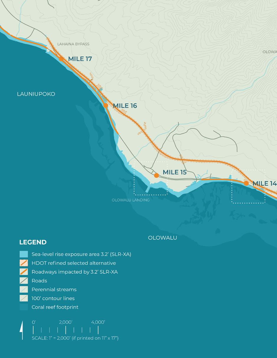
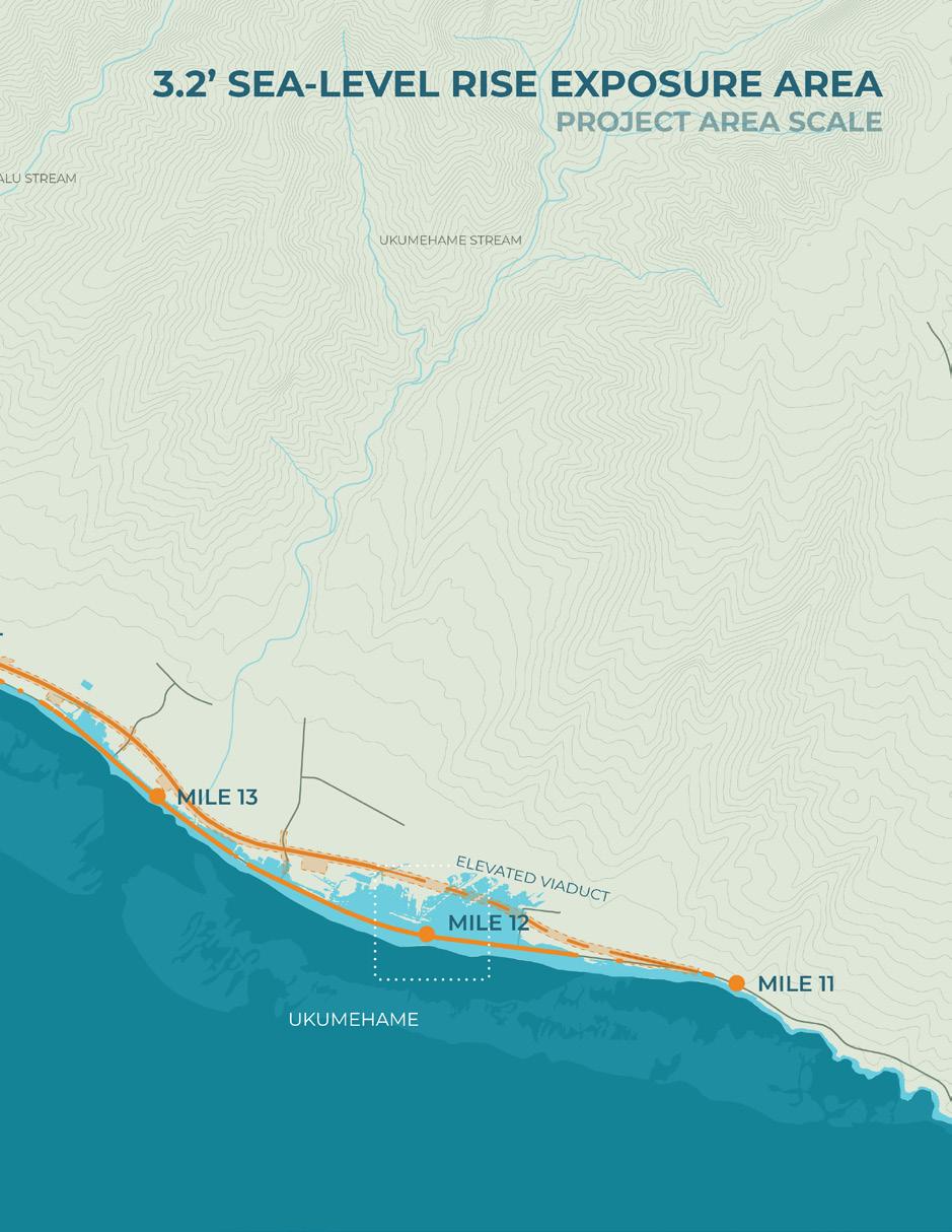
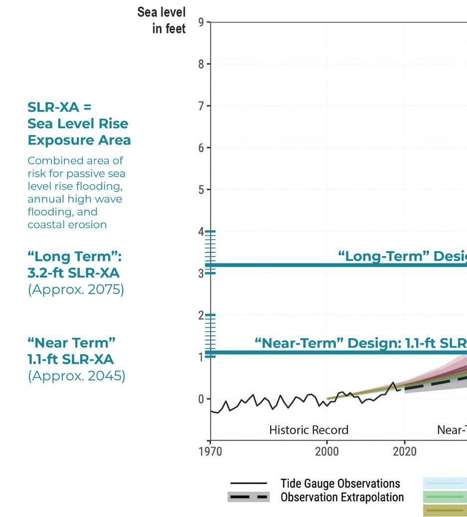
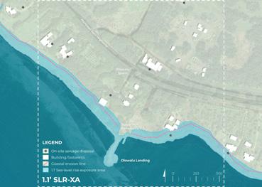
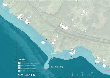
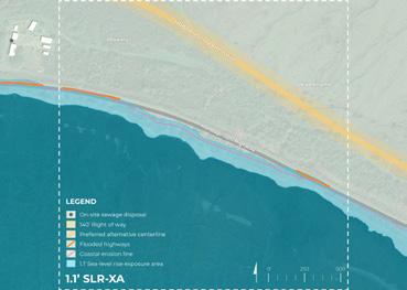
The Action Plan also stresses the importance of incorporating climate data and modeling tools, including SLR-XA, to inform project-level design decisions in coastal hazard zones. In the context of Olowalu, this supports data-driven evaluation of inundation risk, erosion trends, and hydraulic performance to determine appropriate setbacks, drainage systems, bridge design, and elevation strategies. It further reinforces the need for site-specific investigations to validate corridor-level exposure assessments and ensure that design responses are proportionate to projected risks.
Another key theme presented is collaboration and partnership. The Action Plan acknowledges that climate adaptation requires coordination across agencies, disciplines, and stakeholders, including state and county entities, federal partners, researchers, and community organizations. The partnership model emerging in
Olowalu: The Road to Resilience project, involving HDOT, TNC, and UHCDC, reflects this directive. HDOT’s infrastructure mandate, combined with TNC’s conservation expertise and UHCDC’s design and planning capacity, demonstrates the type of cross-sector collaboration envisioned in the Action Plan to advance resilient transportation solutions.
Finally, the Action Plan encourages integrating resilience improvements into capital projects whenever feasible, rather than treating adaptation as a standalone initiative. The Honoapiʻilani Highway realignment exemplifies this approach by embedding long-term hazard reduction, improved system reliability, and environmentally responsive design into a major infrastructure investment. By aligning design decisions with projected climate conditions and resilience strategies, the project area can serve as a practical application of the policies and mitigation principles articulated in the Hawai‘i Highways Climate Adaptation Action Plan.
West Maui Greenway Plan (2022), prepared by Alta Planning+Design and SSFM International for Maui Metropolitan Planning Organization
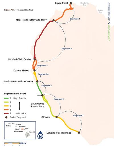
The West Maui Greenway Plan (2022) establishes a long-term vision for a 25-mile multi-use path connecting the Lahaina Pali Trailhead near Ukumehame to Līpoa Point. Conceived as both a transportation facility and a recreational ribbon, the greenway provides a safe, comfortable alternative to traveling along Honoapiʻilani Highway. Designed for people of all ages and abilities who walk, bike, or use mobility devices, the project emphasizes separation from vehicle traffic to improve safety and user experience.
The plan is guided by five primary goals: fos-
tering community, bringing joy, strengthening connectivity, promoting safety and comfort, and ensuring feasibility. These goals shaped evaluation of route alternatives across six corridor segments, including the Olowalu to Lahaina Pali Trailhead segment, which overlaps with the Olowalu: The Road to Resilience project area. Each segment was assessed using criteria tied to key destinations, transportation equity, sea level rise exposure, right-of-way constraints, and compatibility with planned projects such as the Honoapiʻilani Highway Realignment.
Community engagement played a key role in defining the preferred alignment. Across four rounds of outreach, residents expressed strong support for a route separated from vehicle traffic, with shade, seating, hydration stations, and interpretive elements. Survey results indicated that most participants favored a greenway of-
Proposed West Maui Greenway Route (Alta Planning+Design and SSFM International, West Maui Greenway, 2022)
OTHER TRANSPORTATION &
Precedent Studies
fering scenic value and gathering space rather than the most direct commuter route. Residents also raised concerns about long-term maintenance, user conflicts involving e-bikes or other motorized devices, and potential commercialization that could alter community character.
Graphics: WMG Report
West Maui Greenway
Maui, HI
Brief description:
Precedent Studies
Local
The West Maui Greenway is a proposed 25-mile multi-use trail repurposing an old cane haul road into a safe, scenic corridor for recreation, active transportation, and community connection. Beyond enhancing mobility, it serves as a vital piece of resilient infrastructure, offering an emergency evacuation route and a sustainable alternative to car travel.
West Maui Greenway
Maui, HI
Brief description:
The Olowalu to Pali Trailhead segment ranked third in overall priority among the six segments, reflecting moderate to high community interest. This segment intersects areas vulnerable to sea level rise and wildfire. The plan acknowledges portions of the corridor fall within the 3.2-foot sea level rise exposure area and recommends strategies such as managed retreat, mauka alignments, native planting and green infrastructure to reduce erosion, flooding, and heat impacts. In southern areas near Olowalu, the greenway may initially run adjacent to the existing highway, with a long-term transition toward the inland bypass once realignment occurs.
Key components:
• 2 ft. buffers
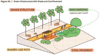
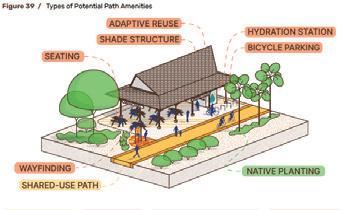
• Shade structures
• Adaptive re-use
• Native Plant species
• Shared Use pathways
• Cool Pavement
• Transitions
The West Maui Greenway is a proposed 25-mile multi-use trail repurposing an old cane haul road into a safe, scenic corridor for recreation, active transportation, and community connection. Beyond enhancing mobility, it serves as a vital piece of resilient infrastructure, offering an emergency evacuation route and a sustainable alternative to car travel.
Key takeaways:
Image: UHCDC
Graphics: WMG Report
• Methods to orchestrate different levels of users speed is needed in shared zones
PLANS
Key components:
• 2 ft. buffers
• Shade structures
• Adaptive re-use
• Native Plant species
•
• • Effective use of path features that go beyond the fundementals like shade structures and wayfinding elements.
Graphics: WMG Report
• Green Infrastructure provide shade, absorb
• heat, stormwater runoff, etc.
• Shared Use pathways
• Cool Pavement
• Transitions
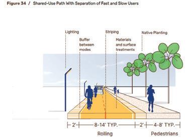
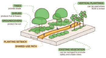
The design guidance offered emphasizes flexibility to respond to varying corridor conditions. Greenway typologies are adapted based on right-of-way constraints, environmental sensitivity, and proximity to nearby communities. In higher-demand areas, separated walking and biking zones are recommended to enhance safety and user comfort. Native plantings, bioswales, and shaded rest areas are incorporated to improve the user experience while supporting stormwater management and climate resilience. The plan also identifies opportunities for cultural interpretation, wayfinding, and
Graphics: WMG Report
Key takeaways:
• Methods to orchestrate different levels of users speed is needed in shared zones
• • Effective use of path features that go beyond the fundementals like shade structures and wayfinding elements.
• • Green Infrastructure provide shade, absorb
• heat, stormwater runoff, etc.
Graphics: WMG Report
Graphics: WMG Report
Graphics: WMG Report
Graphics: WMG Report
Sources: West Maui Greenway Plan Report 2022
Graphics: WMG Report
Sources: West Maui Greenway Plan Report 2022
Graphics: WMG Report
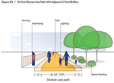
12’ Shared-use path with adjacent 2’ buffers (WMG Report, 2022)
Types of potential path amenities (WMG Report, 2022)
Green infrastructure with shade and cool pavement (WMG Report, 2022)
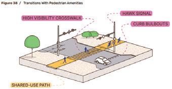
Transitions with pedestrian amenities (WMG Report, 2022)
Green infrastructure with plantings and vegetation (WMG Report, 2022)
connections to parks, beaches, and trailheads.
For Olowalu: The Road to Resilience, the West Maui Greenway Plan reinforces the importance of coordinating active transportation planning with broader corridor transformation efforts. As Segment 7 advances, its alignment can be integrated with future roadway changes, shoreline access improvements, and open space planning. By prioritizing safety, ecological sensitivity, and community-defined values, the Greenway Plan strengthens mauka-makai connectivity and supports long-term resilience in the Olowalu–Ukumehame corridor.
The proof-of-concept design and visioning proposals presented in chapters 5 through 8 below incorporate a number of program elements from the West Maui Greenway Plan’s design guidance. They further take inspiration from the plan when determining the widths of various types of proposed multi-use paths and elevated boardwalks.
West Maui Community Plan (2022), prepared by County of Maui Department of Planning
The West Maui Community Plan (2022) establishes a long-term framework for guiding land use, infrastructure, and development decisions across the West Maui region over the next 20 years. The plan provides policies that guide
development review, zoning updates, and capital improvement investment. It supports responsible growth while protecting the natural systems, cultural landscapes, and community character that define the region.
The plan is organized around five primary goals that reflect community priorities. These include building ready and resilient systems, creating a balanced and connected transportation network, protecting natural and cultural resources, supporting economic opportunity, and maintaining safe and livable communities. Together, these goals guide how land is managed and how future development should occur while safeguarding the environmental and cultural qualities that make West Maui unique.
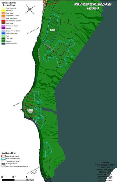
Within the Growth Framework, the southern portion of West Maui, including Launiupoko, Olowalu, and Ukumehame, is identified as Subarea 4. This area includes agricultural lands, rural residential communities, coastal open space, and watershed systems that descend from the West Maui Mountains. Numerous gulches and natural drainage corridors shape the landscape. These features convey water from the uplands to the shoreline and play an important role in watershed health, sediment transport, and coastal processes. Much of the land south of Puamana, including the Olowalu–Ukumehame corridor, is also designated as an Area of Stability. These areas are intended to remain largely undeveloped in order to protect open space, agricultural lands, watershed systems, and culturally significant landscapes. Community feedback emphasized the importance of preserving these lands to maintain rural character while protecting natural resources and traditional practices.
However, the plan identifies opportunities to expand parks, open space, and recreational corridors across West Maui. One concept supported by the plan is managing lands makai of a future realigned Honoapiʻilani Highway as
Sources: West Maui Greenway Plan Report 2022
coastal open space and parkland. These areas could provide shoreline protection, recreational access, and climate adaptation benefits as sea level rise increasingly affects the existing coastal roadway.
coastal areas. Relocating the highway inland would allow coastal lands to transition to open space, wetlands, and recreational areas that improve shoreline resilience and public access.
For the Olowalu–Ukumehame corridor, the West Maui Community Plan reinforces a regional vision that integrates shoreline preservation, watershed stewardship, and transportation adaptation. By prioritizing protection of open lands, resilience to coastal hazards, and coordinated infrastructure planning, the plan provides policy guidance that supports the long-term goals of the Olowalu: The Road to Resilience project.
Transportation improvements are another key component of the plan. Policies support development of a more connected transportation network that includes multimodal pathways and improved pedestrian and bicycle infrastructure. The plan also encourages coordination with the State to prioritize realignment of Honoapiʻilani Highway away from vulnerable
Community Plan Designations within Subarea 4: Launiupoko-Ukumehame (County of Maui Department of Planning, West Maui Community Plan, 2022)
This page intentionally left blank.
Tree at Ukumehame Beach Park (UHCDC, 2025)
Coastal Resilience Studies
The Coastal Resilience Studies subchapter examines scientific assessments, adaptation frameworks, and community-based research that document shoreline dynamics, watershed conditions, reef health, and long-term climate exposure within the Olowalu–Ukumehame corridor.
Four primary studies are documented: Increasing Resilience of Coral Reefs and Coastal Communities in Olowalu (2022), the Beach Management Plan for Maui (2008), the Beach Parks Vulnerability and Adaptation Study (2021), and the Convening a Community of Practice Around Olowalu Reef workshop findings (2022). Together, these efforts evaluate sediment transport, sea level rise exposure, coastal erosion, park vulnerability, and ridge-to-reef system interdependencies.
By synthesizing these resilience-focused investigations, this subchapter establishes the environmental risk profile and ridge-to-reef perspective that inform corridor-scale planning. Understanding these documented conditions clarifies the ecological processes, hazard projections, and stewardship priorities that shape long-term adaptation strategies within the Olowalu–Ukumehame landscape.
The Olowalu–Ukumehame corridor has been included in studies examining shoreline change, watershed conditions, reef health, and community stewardship priorities. These efforts recognize that long-term resilience in West Maui depends on strengthening coastal and nearshore systems, such as “living shorelines,” which mitigate hazards and protect cultural and recreational resources. Collectively, the studies highlight sediment reduction, reef protection, wetland restoration, and ridge-to-reef connectivity.
Beach Management Plan for Maui (2008)
, prepared by University of Hawai‘i Sea Grant College Program for County of Maui Department of Planning
The Beach Management Plan for Maui (2008) provides a framework for addressing chronic erosion, sea level rise, shoreline armoring, and development pressure along Maui’s coastlines. Recognizing that beaches are shaped by dynamic coastal processes, the plan calls for a shift away from parcel-by-parcel hardening toward coordinated, ecosystem-based strategies that prioritize longterm beach preservation, hazard mitigation, and responsible shoreline development.
A central recommendation is managing shorelines at the scale of littoral cells rather than individual properties. This approach acknowledges that erosion patterns and sediment transport extend beyond property boundaries and require coordinated planning. In relation to the Olowalu: The Road to Resilience project, this framework aligns directly with the site analysis, which identified areas of concentrated sea level rise exposure across multiple TMKs rather than within a single parcel. Design and planning de-
cisions were made based on this data.
The plan provides clear guidance on shoreline protection, emphasizing that hard armoring should be considered a last resort on sandy beaches experiencing chronic erosion. Rather than relying on structural defenses, it promotes approaches that work with natural coastal processes. Retreat and relocation are encouraged where feasible to reduce long-term exposure, while beach nourishment and dune restoration are identified as preferred strategies for maintaining beach width and recreational value. In contrast, the plan cautions that shoreline armoring often accelerates beach narrowing and eventual loss, reinforcing the need to carefully evaluate long-term tradeoffs during permitting and design.
To support these nature-based approaches, the plan calls for protecting inland sand reserves, evaluating offshore sand sources, and strengthening inter-agency coordination to improve implementation. On that note, dune systems receive particular attention as dynamic, living features that stabilize shorelines and absorb wave energy during storm events. Recommended measures include fencing, native revegetation, and managed access to reduce disturbance and allow dunes to function as effective natural buffers.
The plan also encourages relocating vulnerable infrastructure and limiting new construction within projected hazard zones, particularly in low-lying areas such as Ukumehame and Olowalu. By emphasizing near and long-term SLRXA data and adaptive siting decisions, it highlights the importance of planning for future shoreline conditions rather than relying solely on historic trends. At the same time, the plan situates beach preservation within a broader mauka-to-makai framework that connects reef health, water quality, and upland land use. This systems-based perspective is especially relevant to Olowalu, where watershed processes,
sediment transport, and infrastructure decisions directly influence shoreline stability, reinforcing the need for coordinated strategies that strengthen long-term resilience across the Olowalu–Ukumehame coastal corridor.
Maui County Beach Parks Vulnerability and Adaptation Study (2021), prepared by Tetra Tech, Inc. for County of Maui Department of Parks and Recreation
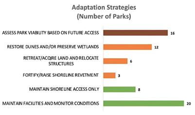
The Beach Parks Vulnerability and Adaptation Study (2021) evaluates how sea level rise, chronic erosion, and coastal flooding will affect 65 beach parks and their associated facilities across Maui County. The findings indicate that 46 parks, more than 70 percent, are projected to experience flooding and land loss within the next three decades. Under a 2.0-foot sea level rise scenario, more than one-third of park facilities could be affected as early as 2050.
In West Maui, vulnerability is intensified due to geography. Many beach parks occupy narrow strips of land between the shoreline and Honoapiʻilani Highway, leaving little room for inland retreat as the shoreline migrates. This physical constraint creates a direct link between park viability and transportation infrastructure. Where roads are exposed to flooding or erosion, public access to parks is equally at risk. A framework of six coastal adaptation pathways that reflect varying degrees of exposure and feasibility was proposed. These range from maintaining shoreline access in highly constrained sites to more reformative solutions like dune or wetland restoration, relocation of facilities, shoreline fortification, and managed retreat. Approximately one-third of the parks are categorized as access-dependent, meaning their continued use relies on the adaptability
of adjacent roads and highways. Another third require proactive ecological restoration or land acquisition to remain functional over time.
The study identifies several essential components of long-term resilience, including a shift from static park master plans to adaptive, flexible management strategies that respond to changing shoreline conditions. It emphasizes cross-agency coordination, cultural sensitivity, and public education as critical to effective implementation. This framework creates opportunities to prioritize nature-based solutions where feasible, such as dune stabilization and wetland enhancement, which provide ecological benefits while reducing hazard exposure.
For the Olowalu-Ukumehame project area, the study reinforces a central theme: shoreline recreation, transportation infrastructure, and sea level rise adaptation are interconnected. It identifies Ukumehame Beach Park as a Low Adaptation Potential site with 80% of the park’s area falling within the 3.2’ SLR-XA. As Honoapiʻilani Highway faces increasing exposure, the future of nearby coastal parks and public access must be considered. The study’s findings support an integrated corridor approach that aligns shoreline preservation, highway adaptation, and long-term access to sustain both community use and coastal function.
Adaptation strategies for West Maui parks (Tetra Tech, Inc., Maui County Beach Parks Vulnerability and Adaptation Study, 2021)
Convening a Community of Practice Around Olowalu Reef: Workshop Notes (2022), prepared by Kipuka Olowalu, The Coral Reef Alliance and The Nature Conservancy
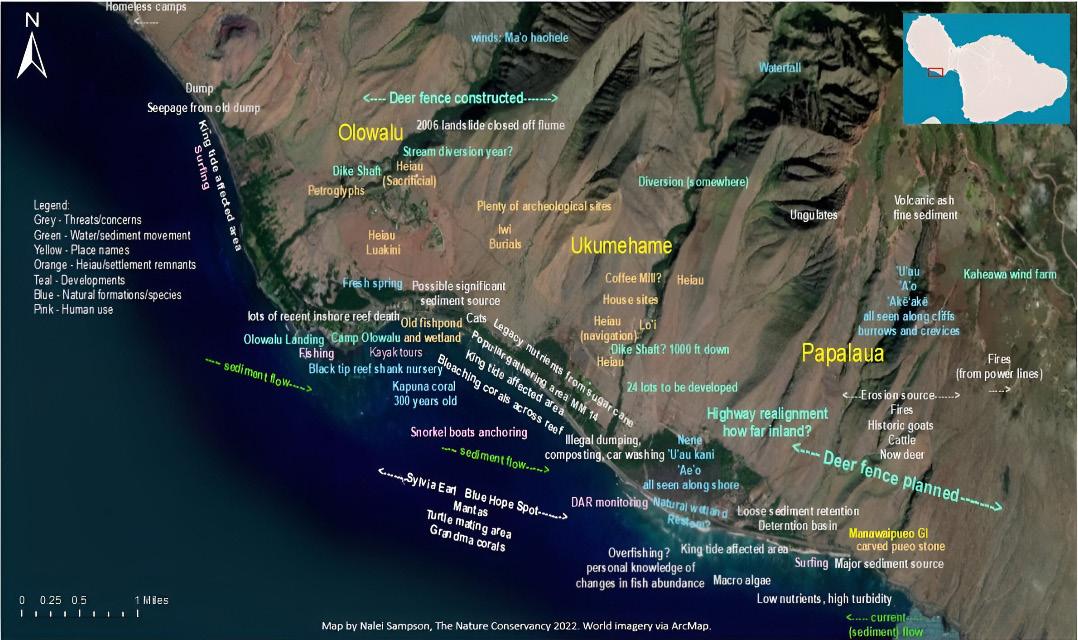
This 2022 workshop brought together community members, lineal descendants, cultural practitioners, agency representatives, and conservation organizations to examine environmental conditions and resilience priorities within the Olowalu–Ukumehame corridor. Through historical aerial imagery review and collaborative mapping exercises, participants documented patterns of land use change, stream diversion, sediment transport, shoreline erosion, reef degradation, and culturally significant sites.
Discussions revealed widespread concern about high turbidity, nutrient runoff, and sedimentation associated with historic agricultural practices and altered hydrology. Participants also identified coastal erosion from king tides, wetland degradation, invasive species such as kiawe and opiuma, wildfire impacts, ungulate disturbance, and increasing shoreline use pressure. Many of these challenges were traced to plantation-era modifications, including redirected streams, berm construction, and water diversion systems that continue to influence watershed and nearshore conditions today.
A ridge-to-reef perspective guided much of the conversation, reinforcing that upland erosion and watershed management directly influence reef health and shoreline stability. Manawaipueo Gulch and other mauka areas were identified as key sediment sources, highlighting the need for erosion control, wetland rehabilitation, native vegetation recovery, and improved stream and culvert management. The Olowalu reef was recognized not only as an ecological resource,
but also as natural protective infrastructure that reduces wave energy and coastal erosion. In doing so, it helps buffer low-lying lands and segments of Honoapiʻilani Highway from storm impacts and sea level rise.
It is important to note that traditional ecological knowledge was central to the workshop and grounded discussions in place-based stewardship. Participants shared ʻike kūpuna, including the names of local winds such as Maʻohaohele and rains like Papawai, along with enduring practices such as loʻi kalo and ʻuala cultivation that continue to shape relationships to the landscape. Cultural resources, including heiau, burial sites, wetlands, and gathering areas, were identified as living systems requiring active care. Within this broader context of cultural continuity and landscape stewardship, participants also discussed the planned highway realignment and considered how lands makai of a future alignment could be restored to support habitat, recreation, and long-term cultural resilience.
These workshop findings are relevant to the Olowalu: The Road to Resilience project because they provide place-based insight that complements technical assessments. They reinforce that transportation adaptation, watershed restoration, shoreline management, and reef protection are interconnected and must be advanced through culturally grounded, cross-boundary strategies to strengthen longterm resilience in West Maui.
This map included on the next page reflects community-identified observations from the Olowalu to Pāpalaua mapping workshop. It documents sediment sources, altered streams, erosion hotspots, reef conditions, cultural sites, and areas of human use across the mauka-tomakai landscape. By integrating ecological, cultural, and infrastructure considerations, the map highlights the interconnected relationship between watershed processes, reef health, and coastal resilience.
Increasing Resilience of Coral Reefs and Coastal Communities in Olowalu (2022), prepared by The Nature Conservancy for NOAA Fisheries Habitat Conservation Center
This report provides a ridge-to-reef assessment of the Olowalu–Ukumehame coastal corridor, examining how land-based sediment, altered hydrology, wildfire impacts, and coastal change affect reef health and shoreline stability in the region. It identifies the Olowalu reef as a critical ecological and protective asset that reduces wave energy, moderates coastal erosion, and helps buffer Honoapiʻilani Highway and adjacent low-lying lands from storm impacts and sea level rise. The study further recognizes the reef’s role in supporting fisheries, biodiversity,
and local recreation, underscoring its ecological and economic value to West Maui.
Through detailed mapping and modeling, the study documents erosion hotspots in upland gulches such as Manawaipueo and Pāpalaua, where fire, ungulate disturbance, historic land clearing, and sparse vegetation accelerate sediment transport to the nearshore environment. Sediment plumes originating from these areas are shown to reduce water clarity and smother coral colonies, particularly during storm events. The report emphasizes that sedimentation remains one of the most significant stressors to coral health, compounding the impacts of bleaching events, warming seas, and reduced freshwater recharge. These findings reinforce the need to address watershed conditions as part of any long-term coastal resilience strategy.
In addition, the report advances a manage-
Olowalu–Pāpalaua community feedback (The Nature Conservancy, Increasing Resilience of Coral Reefs and Coastal Communities in Olowalu, 2022)
ment framework that integrates upland restoration, sediment detention basins, native vegetation recovery, and improved stormwater management with nearshore reef protection. Nature-based approaches, including wetland restoration, dune stabilization, and preservation of coastal open space are identified as strategies that strengthen both ecological function and hazard mitigation. However, managed retreat and inland relocation of vulnerable infrastructure are also discussed as adaptive responses in areas facing increasing exposure.
For the Olowalu: The Road to Resilience project, this study provides scientific grounding for a systems-based approach to resilience. It affirms
that shoreline stabilization, transportation planning, and infrastructure decisions cannot be separated from watershed processes and reef health. By highlighting the reef’s protective role and the ways sediment, freshwater flow, and land use shape coastal conditions, the report supports corridor-scale planning. It highlights the reef’s protective function and the influence of sediment, freshwater flow, and land use on coastal conditions. In doing so, the report supports an approach that integrates watershed restoration, shoreline conservation, and longterm adaptation of Honoapiʻilani Highway.
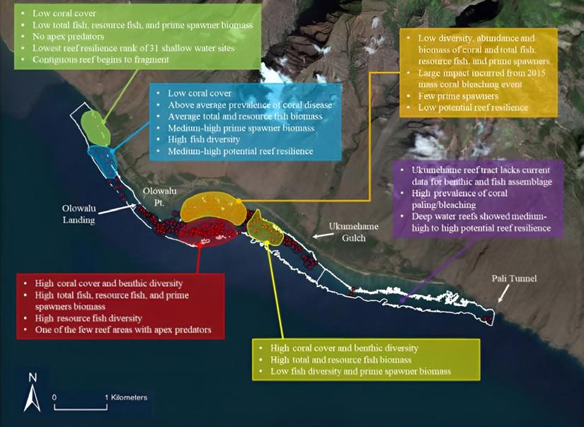
The report graphic above illustrates reef conditions and resilience along the Olowalu–Ukume-
Olowalu–Ukumehame reef (The Nature Conservancy, Increasing Resilience of Coral Reefs and Coastal Communities in Olowalu, 2022)
37 Olowalu: The Road to Resilience
hame coastline, showing variations in coral cover, fish biomass, spawning populations, and overall reef health. Areas near Olowalu Point exhibit high coral cover and fish diversity, while other segments display lower coral cover, higher disease prevalence, and reduced resilience following bleaching events. The map highlights the ecological significance of the Olowalu reef system and the need for careful shoreline and watershed management.
Keālia Pond (UHCDC)
Built Precedent Projects
Reviewing implemented precedent projects guides the creative proof-of-concept design and visioning process towards informed and contextually relevant decisions.
As part of the initial research phase of Olowalu: The Road to Resilience, the project team examined and analyzed local and global built work that exemplifies principles, programs, and design elements of relevance.
This subchapter summarizes select precedent projects that have informed design decisions at both the overall project area and catalytic site scales.
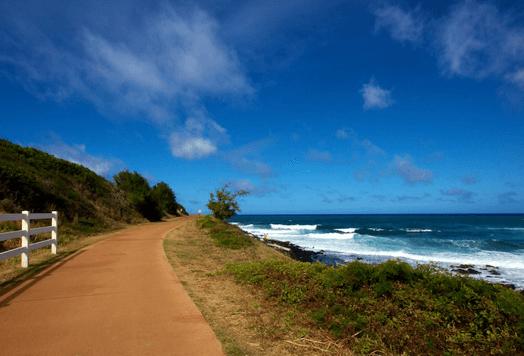
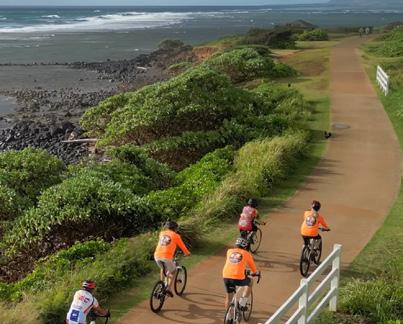
Kauaʻi East Side Bike Path, Location: Kaua‘i, Hawai‘i, Project Year: 2003-current, Project Area: 20 miles
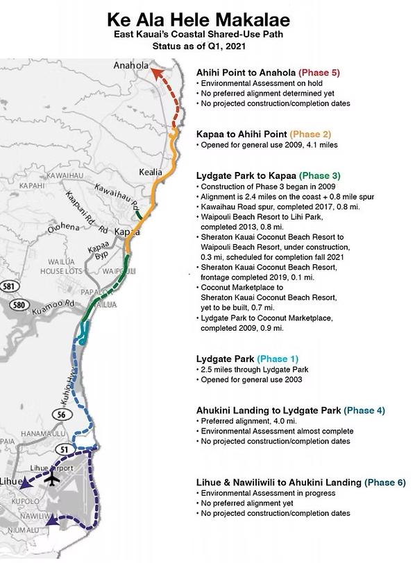
The Kaua‘i East Side Bike Path, known as Ke Ala Hele Makālae, meaning “the path that goes along the coast,” is a federally funded public infrastructure project located along the island’s eastern shoreline (Kauai Path, 2024). It is designed to connect shoreline communities and public spaces through a planned 20-mile continuous shared-use path extending from Anahola to Līhuʻe (Kauai Path, 2024).
The project gained momentum in the 1990s with the goal of securing public shoreline access and linking Kaua‘i’s major population centers through active transportation infrastructure. Under the administration of Mayor Maryann Kusaka, the path was divided into six phases and assigned to the county’s Public Works Department (Kauai Path, 2024).
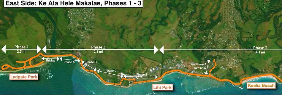
As of 2024, the path extends approximately 7.6 miles from Lydgate Park through Kapa‘a to Ahihi Point. Phases 1 and 2 are complete, while Phase 3, which connects Lydgate Park to Kapa‘a, remains partially under construction. These completed segments link over a dozen pavilions, three playgrounds, multiple accessible beaches, and Kapa‘a’s commercial core (Kauai Path, 2024).
The project has been recognized for enhancing public safety, health, and shoreline access. It serves as a successful model for coastal multimodal infrastructure in Hawai‘i.
East Side: Ke Ala Hele Makalae, Phases 1-3 Map (Kauai Path, 2024)
Kauai Path, 2024
Multi-Use Transportation
The path accommodates a wide range of users, including pedestrians, cyclists, and individuals walking pets. It provides a safe and scenic alternative to roadway travel, and its shared-use nature supports public health, climate resilience, and overall community well-being.
Implementing similar strategies in the Launiupoko–Ukumehame corridor could help reduce car dependency, offer alternative commuting routes, and enhance access to businesses and residences along the planned realigned Honoapiʻilani Highway corridor.
The path establishes lateral access along the coastline, allowing users to travel safely and continuously along the shore. It was developed with the intention of preserving public access in perpetuity, connecting communities to beaches, parks, and cultural sites (Kauai Path, 2024).
Applying similar strategies in the Launiupoko–Ukumehame corridor could help protect shoreline connectivity and ensure long-term access for recreation, cultural practices, and community stewardship.
Adaptive/Phased Implementation
The path was developed in distinct phases, allowing for steady progress while adapting to logistical, environmental, and funding constraints. This incremental strategy enabled early segments to be completed and used, which built community support and institutional momentum for future phases.
A similar approach in the Launiupoko–Ukumehame corridor could guide near-term actions toward a 2045 milestone while setting the foundation for longer-term outcomes through 2075, ensuring flexibility towards climate change and land use shifts.
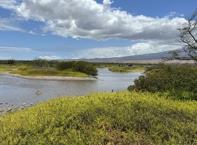
Keālia Pond National Wildlife Refuge is a federally protected wetland on the south-central coast of Maui. Established in 1992, it was created to conserve essential habitat for endangered waterbirds (U.S. Fish & Wildlife Service, n.d.). Spanning approximately 700 acres, it is managed by the U.S. Fish & Wildlife Service as part of the National Wildlife Refuge System (U.S. Fish & Wildlife Service, n.d.). It remains one of the few natural lowland wetlands in the Hawaiian Islands and is the largest of its kind on Maui (U.S. Fish & Wildlife Service, n.d.).
Located between Kīhei and Mā‘alaea, the refuge acts as a natural basin for freshwater runoff from the West Maui Mountains and seasonal coastal flows. It provides critical nesting, feeding, and resting habitat for native and endemic species, including the endangered ae‘o (Hawaiian stilt) and ‘alae ke‘oke‘o (Hawaiian coot) (U.S. Fish & Wildlife Service, n.d.). In winter, it also supports migratory shorebirds and waterfowl from across the Pacific, making it a notable site for wildlife observation and education.
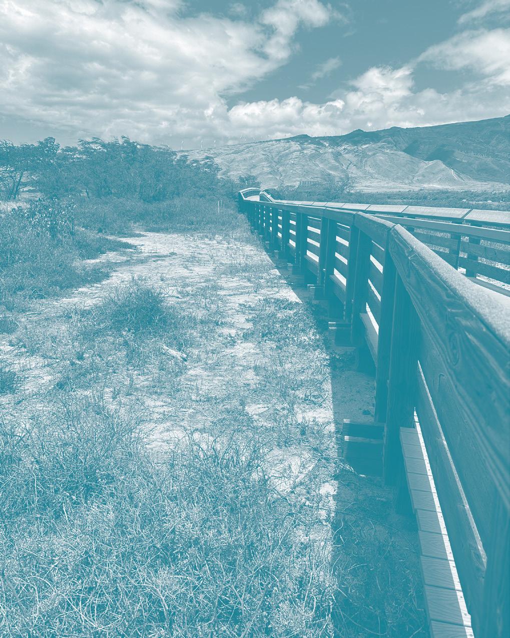
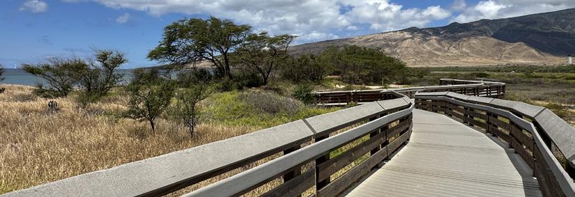
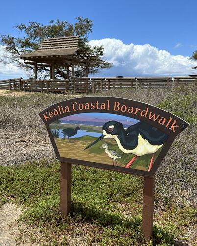
Amenities include the half-mile elevated Keālia Coastal Boardwalk, which is a raised walkway
through the wetland and a visitor center with interpretive exhibits. Through habitat protection, monitoring, and public outreach, the refuge supports wetland conservation while connecting people with Hawai‘i’s unique native and migratory wildlife (U.S. Fish & Wildlife Service, n.d.).
Keālia Pond boardwalk (UHCDC, 2025)
Local
Keālia Pond signage (UHCDC, 2025)
Wetland Function and Restoration
Keālia Pond functions as a natural basin for stormwater and seasonal coastal flows, illustrating how wetland systems can support flood control, water filtration, and habitat resilience.
Protecting and restoring similar coastal wetlands in the Launiupoko–Ukumehame corridor could provide nature-based solutions for managing runoff, reducing erosion, and buffering the impacts of climate change as sea level rise and storm intensity increase.
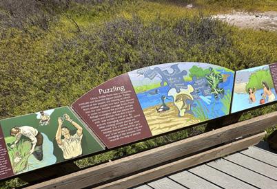
Interpretive Engagement
Keālia Pond’s visitor center and on-site signage offer opportunities for environmental education and community outreach. These tools help connect people to native species, wetland ecosystems, and conservation practices.
In the Launiupoko–Ukumehame corridor, incorporating interpretive features and learning spaces could foster place-based understanding and long-term stewardship of natural and cultural resources.
Low-Impact Infrastructure
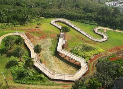
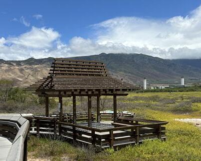
The Keālia Coastal Boardwalk demonstrates how public access can be designed to minimize disturbance to sensitive habitats.
Elevated walkways, viewing platforms, and rest areas allow visitors to engage with the landscape while protecting ecological integrity. In Olowalu, similar features such as raised paths and shaded pavilions could support responsible access and community gathering in culturally and ecologically significant areas.
Keālia Pond signage (UHCDC, 2025)
Keālia Pond wetland (UHCDC, 2025)
Keālia Pond viewing platform (UHCDC, 2025)
State Park, Location: Kauaʻi, Hawai‘i, Project Year: 2018, DLNR
PBR Hawaiʻi collaborated with State Parks and the Hā‘ena community to develop and implement a master plan for one of Hawai‘i’s most heavily visited state parks. Given the park’s significant cultural, archaeological, and ecological resources, the planning process focused on balancing conservation, cultural stewardship, and recreational access.
The master plan integrates previous research with new technical studies to document cultural, archaeological, and natural resources while addressing transportation and infrastructure needs. Following unanimous approval of the Final Environmental Impact Statement (FEIS) by the Board of Land and Natural Resources in May 2018 and acceptance by the Governor in July 2018, several key improvements were realized through emergency funding after the 2018 floods. These included a new entry path through the loʻi and hau forest, parking area enhancements, and the implementation of visitor capacity limits supported by adaptive management strategies.
The project received the 2020 Outstanding Planning Award from the American Planning Association Hawai‘i Chapter and has since become a model for managing environmentally
and culturally sensitive destinations experiencing high visitor demand.
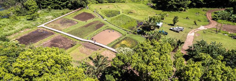
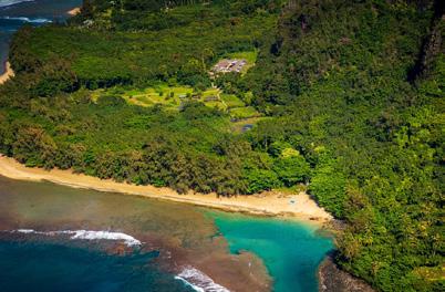
Hāʻena State Park (Kauai.com, https://www.kauai.com/kee-beach)
Hāʻena State Park aerial view (PBR Hawaiʻi, https://pbrhawaii.com/projects/haena-state-park-master-plan/)
Hāʻena
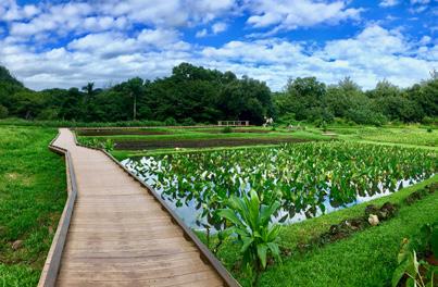
Hāʻena State Park walkway (PBR Hawaiʻi, https://pbrhawaii.com/projects/ haena-state-park-master-plan/)
Key Programs and Takeaways
Hāʻena State Park implements a visitor reservation and capacity management system to reduce overcrowding and protect sensitive environmental and cultural resources. The project emphasizes cultural landscape preservation, native habitat restoration, and archaeological resource protection to maintain the ecological and historical significance of the area. It also incorporates loʻi and cultural interpretive pathways that educate visitors about traditional Hawaiian practices, history, and relationships to the land.
Shuttle and access management programs help reduce traffic congestion and environmental impacts while improving access into the park. Community stewardship programs encourage local participation, while adaptive environmental management strategies allow the park to respond to changing environmental
conditions and visitor needs over time.
Hāʻena State Park demonstrates how managed public access can successfully balance conservation, cultural preservation, and recreation. The project integrates Hawaiian cultural landscapes and storytelling into the visitor experience, creating a stronger connection between people and place. It also highlights how community stewardship and collaborative management can support the long-term protection of environmental and cultural resources.
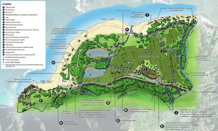
Hāʻena State Park Master Plan (PBR Hawaiʻi, https://pbrhawaii.com/projects/haena-state-park-master-plan/)
Te Ara Manawa, Location: Auckland, New Zealand, Project Year: 2018
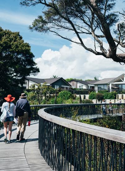
Te Ara Manawa is a five-kilometer coastal park and shared walking and cycling corridor that forms a major component of the Hobsonville Point master plan in Auckland, New Zealand. Developed on the former site of a New Zealand Air Force base, the project supports the creation of a sustainable and socially connected community by linking new residential neighborhoods to the Waitematā Harbour and a network of parks, schools, public spaces, and transportation routes. In te reo Māori, Te Ara Manawa translates to “pathway among the mangroves,” reflecting the project’s emphasis on ecological restoration and cultural connection.
Designed by Isthmus in collaboration with Nelson Byrd Woltz Landscape Architects, the coastal park serves as both an ecological corridor and a recreational destination. The design restores and connects coastal habitats while providing opportunities for walking, cycling, play, relaxation, and environmental education. Key features include elevated boardwalks through mangrove environments, waterfront promenades, sculptural bridges spanning vegetated gullies, viewing areas overlooking the harbor, picnic spaces, and integrated public art. The project also preserves and reinterprets remnants of the former Air Force base, incor-
porating historic structures into the landscape as community amenities and interpretive elements that reveal the site’s layered history.
Te Ara Manawa coastal pathway (Landezine, https://landezine.com/te-ara-manawa-by-isthmus/)
Te Ara Manawa pathway (Landezine, https://landezine.com/te-ara-manawa-by-isthmus/)
Key Programs and Takeaways
Te Ara Manawa includes a coastal multi-use pathway that improves pedestrian and bicycle connectivity along the waterfront while encouraging recreational use of the landscape. The project incorporates scenic lookouts and viewing platforms that frame views of the harbor and surrounding environment, as well as nature-based play areas and picnic spaces that support gathering and community activity. Cultural interpretation and storytelling elements are integrated throughout the site to communicate local history, identity, and relationships to place.
The project also adaptively reuses former military structures, preserving historic elements while transforming them into public spaces for exploration and engagement. Harbor access and connectivity improvements strengthen public interaction with the waterfront, while environmental education opportunities en-
courage awareness of local ecological systems and restoration efforts.
Te Ara Manawa demonstrates how ecological restoration can be integrated with recreational infrastructure to create a connected and resilient public landscape. The project successfully incorporates cultural narratives and local identity into the design, strengthening community connections to place. It also highlights how the preservation and reuse of historic site elements can celebrate heritage while creating unique public experiences.
Te Ara Manawa coastal pathway (Landezine, https://landezine.com/te-ara-manawa-by-isthmus/)
SITE CONDITIONS
Chapter 3 establishes the context for reenvisioning the Olowalu–Ukumehame coastal corridor. The landscape examined in this report reflects layered environmental systems, cultural significance, and infrastructure networks that collectively shape its present character and function.
This chapter documents both inherited landscape structures and existing built environment conditions across multiple scales. By examining the project area through historical, ecological, and spatial lenses, the following site inventory clarifies land, water, access, and ownership patterns.
Together, these conditions establish the physical and cultural framework that guides subsequent design strategies and ensures responsiveness to existing land use systems.
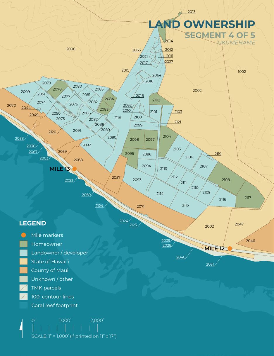
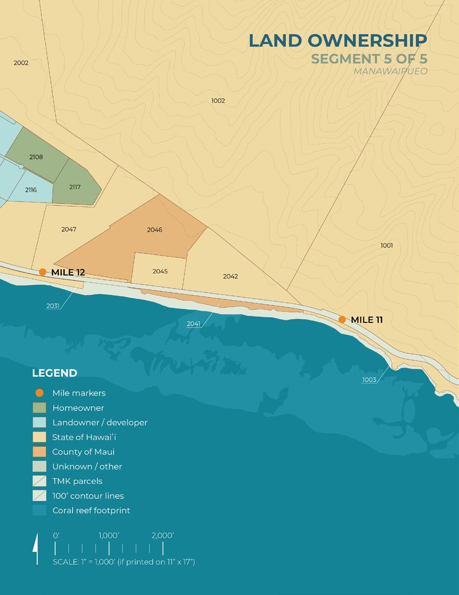
Document and GIS data sources are included in the Sources portion at the end of this report.
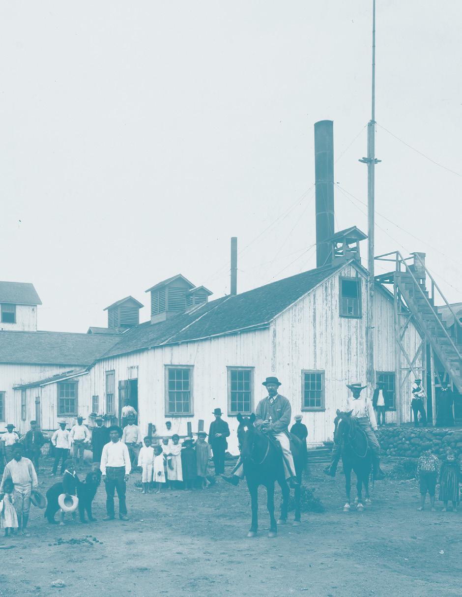
Olowalu Mill, Maui (Brother Gabriel Bertram Bellinghausen, 1849-1933)
Site History
This subchapter examines major land use changes that have shaped land tenure, hydrology, and access within the project area.
Three primary phases of land use changes are documented: the Māhele and land tenure restructuring, plantation-era hydrological modification, and transportation and infrastructure development. Each phase altered patterns of ownership, freshwater distribution, shoreline access, and settlement across the ahupuaʻa of Launiupoko, Olowalu, and Ukumehame.
By tracing these transformations, the following analysis establishes the historical framework that has shaped existing spatial patterns and environmental systems within the Olowalu-Ukumehame coastal corridor. Understanding these layered land use changes clarifies the conditions, sensitivities, and constraints that guide future design opportunities.
Traditional Land Use
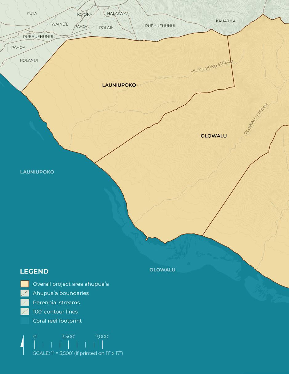
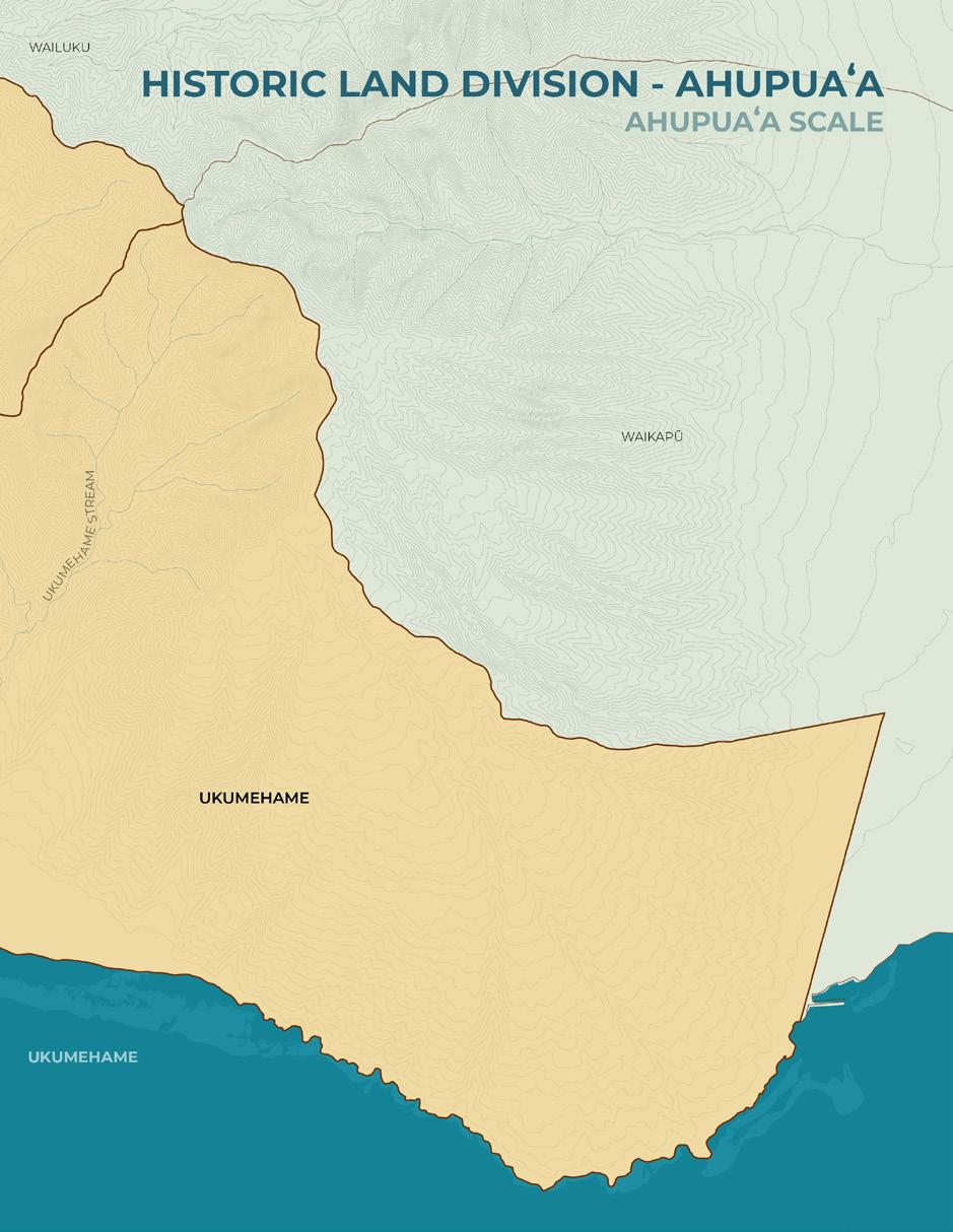
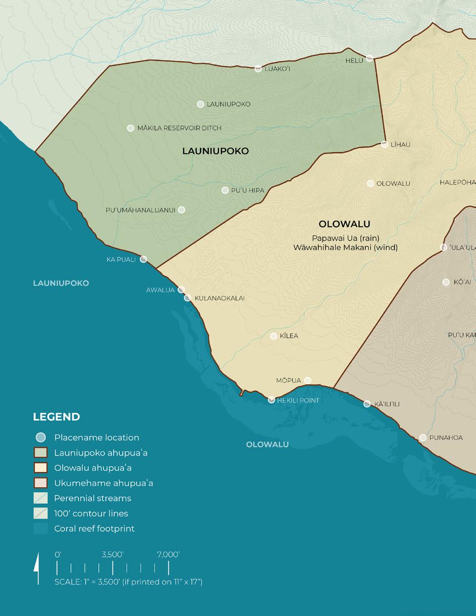
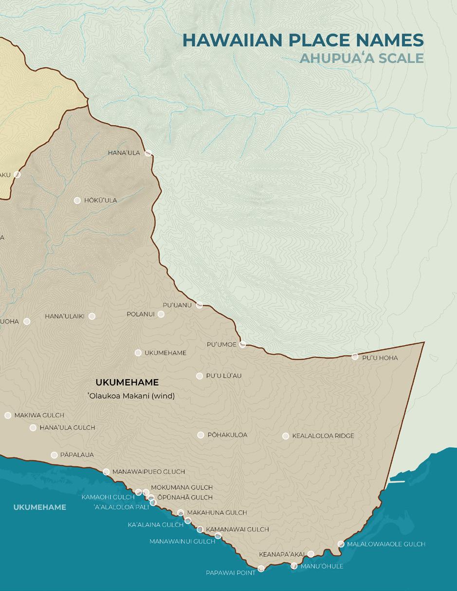
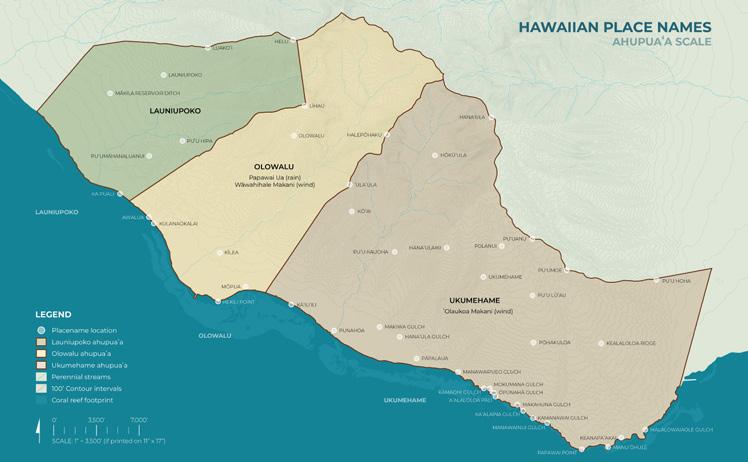
The ahupuaʻa of Launiupoko, Olowalu, and Ukumehame form a connected cultural and ecological landscape along the leeward coast of West Maui within the historic moku of Lāhaina (HDOT and FHWA 2025). Organized within the ahupuaʻa system, these land divisions historically extended from upland watersheds to nearshore fisheries and sustained interconnected ecological zones including forest resources, agricultural terraces, stream systems, wetlands, and reef environments.
Māhele-era documentation confirms that the corridor supported wetland and dryland kalo cultivation, along with banana, sweet potato, breadfruit, paper mulberry, coconut, kukui, and screwpine (HDOT and FHWA 2025). Loko iʻa were
present along the Olowalu shoreline, including Ka Loko Iʻa o Kapāiki, reinforcing the integration of marine and agricultural systems (HDOT and FHWA 2025). These traditional biocultural land and marine practices reflect integrated maukato-makai resource management.
Leeward dryland forests historically supported native plant species such as wiliwili (Erythrina sandwicensis), valued for its buoyant wood used in canoe components and net floats (Handy et al. 1991). These ecological systems shaped subsistence practices and material culture across West Maui.
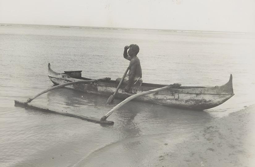
Hawaiian with canoe, Lahaina, Maui (R.J. Baker, c. 1912)
Land Use Changes
The present-day physical, ecological, and cultural conditions of West Maui are the result of successive land use transformations. Three primary phases of land use change shaped the project area: (1) Māhele-era land tenure restructuring, (2) plantation-era hydrological modification, and (3) transportation and infrastructure development. Each phase altered patterns of land ownership, water distribution, access, and settlement, contributing to the layered landscape observed today. The following sections summarize these transitions and their relevance to current site conditions:
1 Māhele & Land Tenure Restructuring
The Māhele of 1848 initiated a formal restructuring of Hawaiʻi’s land tenure system, dividing lands into Crown, Government, and Konohiki holdings while requiring Native tenants to submit claims to the Land Commission. Although tenant rights were reserved under the principle of Koe na Kuleana o Kanaka, the introduction of surveyed parcels and fee-simple ownership altered traditional stewardship relationships (HDOT and FHWA 2025).
Within the Olowalu ahupuaʻa, 91 claims were submitted during the Māhele process; only 13 were fully awarded, 17 partially awarded, and 61 denied (ʻĀina Archaeology 2025). Ukumehame claim tables similarly document numerous loʻi, kula lands, and house lots during the mid-nineteenth century (ʻĀina Archaeology 2025). These records confirm active cultivation but also illustrate the uneven outcomes of land division and the gradual consolidation of property under aliʻi estates, government entities, and later private ownership.
2 Plantation-Era Hydrological Modification
Following land consolidation, plantation agriculture reshaped the corridor through extensive
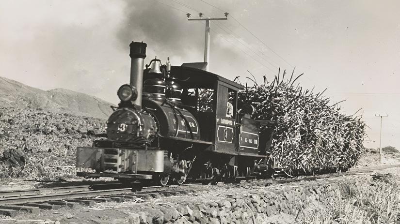
irrigation infrastructure and stream diversions. Traditional ʻauwai systems were destroyed or significantly modified during sugar plantation development, disrupting freshwater connectivity between mauka areas and coastal wetlands and contributing to long-term ecological change (HDOT and FHWA 2025).
Section 3.9 of the Honoapiʻilani Highway Improvements Project Final Environmental Impact Statement identifies multiple surface water resources and regulatory frameworks governing streams and wetlands within the project area (HDOT and FHWA 2025). The continued presence of perennial and intermittent streams reinforces the historic importance of freshwater within Olowalu and Ukumehame.
3 Transportation & Infrastructure Development
The project area has long functioned as a route of passage between West and Central Maui. The Lahaina Pali Trail preserves a segment of the ancient ʻalā loa, the “long road” that once circled the island. Hawaiian tradition attributes portions of this system to the aliʻi Kīhaʻa Piʻilani.
By the early nineteenth century, a boulder-paved inland track crossed the southern slopes of West Maui. Around 1900, prison laborers constructed a one-way dirt road along the base of the Pali, marking the transition from foot travel to vehicular transport. In 1951, the modern Honoapiʻilani Highway replaced much of the earlier alignment (Na Ala Hele 1995). These successive transportation layers overlaid earlier cultural pathways and contributed to changes in drainage and access patterns.
Ahupua‘a Historical Context
Although the three ahupuaʻa within the project area share a connected historical trajectory, they differ in topography, cultural sites, and hydrological characteristics that shape present conditions.
Olowalu contains a broad alluvial valley defined by Olowalu Stream and associated wetlands. It is historically recognized as Ka Puʻuhonua o Olowalu, a place of refuge within the district (HDOT & FHWA, 2025). In 1790, Captain Simon Metcalfe ordered cannon fire upon Native Hawaiians in Olowalu Bay, an event remembered as Kalolopahu (Kamakau, 1992). Archaeological inventories identify terraces and habitation features within the valley floor and lower slopes (HDOT & FHWA, 2025). The concentration of cultural resources and valley hydrology distinguish Olowalu from other parts of the project area.
Ukumehame is characterized by narrower
stream corridors and coastal plains that historically supported loʻi and kula lands documented in Māhele records (ʻĀina Archaeology, 2025). The Lahaina Pali Trail traverses the slopes above the ahupuaʻa, reinforcing its role in regional movement and exchange (Na Ala Hele, 1995). Present conditions reflect altered freshwater flows and coastal dryland vegetation typical of leeward Maui, influencing drainage, erosion patterns, and habitat conditions.
Launiupoko, forming the northern extent of the corridor, is partially included within the project area (HDOT & FHWA, 2025). Its name translates to “short coconut leaf” (Pukui et al., 1974), reflecting environmental characteristics embedded in place-based knowledge. The ahupuaʻa shares similar dryland coastal systems and historical agricultural use, though fewer documented cultural sites occur within the project footprint relative to Olowalu.
Native Hawaiian communities actively stewarded the ahupua‘a of Launiupoko, Olowalu, and Ukumehame. The area supported extensive lo‘i systems, coastal fisheries, and upland resource gathering. Olowalu served as a recognized pu‘uhonua (place of refuge).
Mid to late 1800s
Expansion of sugarcane agriculture across West Maui began. Plantation enterprises diverted stream water from mauka valleys, altering traditional water systems and leading to the decline of lo‘i and wetlands.
1927
The Honoapi‘ilani Highway was constructed around West Maui, following the path of the ancient alaloa (long trail). Built in part with convict labor, it disrupted coastal wetlands and altered traditional travel routes.
Late 1900s to early 2000s
The decline of the sugar industry began. Former plantation parcels and water infrastructure were incrementally sold to developers, altering regional hydrology and access. Development pressure increased across the corridor.
1790
The Olowalu Massacre occurred when a Western trading vessel fired from canoes in OIowalu Bay, killing over 100 Native Hawaiians. This event marked one of the earliest violent encounters between Hawaiians and foreigners.
Late
1800s to early 1900s
Land tenure shifted under the Mahele and subsequent privatization. Large tracts in Launiupoko and Olowalu transitioned from ali‘i to private ownership.
Mid 1900s
Sugarcane operations intensified. Pioneer Mill and other companies expanded infrastructure, reinforcing stream diversions and contributing to widespread ecological drying from Launiupoko to Ukumehame.
2020 to current
The project area faces heightened climate risks, infrastructure stress, and community concerns over water equity, access, and land use. Restoration efforts and climate adaptation planning become a priority.
West Maui coastline (UHCDC, 2025)
Site Inventory
This subchapter spatially identifies, records, and assesses the project area’s existing natural and built environment conditions. The process of site inventory and analysis contributes to the identification of opportunities and constraints in the project area.
While the project is focused on the immediate coastal area stretching approximately 6 miles from Ukumehame to Launiupoko, it must investigate a site and its systems through a multi-scalar lens through research-based design.
The maps and data summarized in this chapter inform the development of a long-term vision. By identifying patterns in land ownership, ecological sensitivity, infrastructure, and cultural landmarks, this inventory provides the spatial framework for imagining future scenarios.
The maps are organized by scale: State Scale, Maui Nui Scale, Maui Island Scale, West Maui Scale, Ahupuaʻa Scale, Project Area Scale.
By aligning contemporary datasets with Native Hawaiian land divisions and place names (moku, ahupuaʻa, and wahi pana), the analysis centers a Traditional Ecological Knowledge-based understanding of place.
Map scales included in this section:
State Scale
Maui Nui Scale
Maui Island Scale
West Maui Scale
Ahupuaʻa Scale
Project Area Scale
The list included below provides an overview of the range of map scales and content. GIS data layers used are listed in the Sources portion at the end of this report.
List of Maps
State Scale: Island Chain Context
Maui Nui Scale: Marine Habitat
Maui Island Scale:
Site Context
Historic Land Division (Moku)
Maui County Regional Planning Areas
West Maui Scale:
Historic Land Division (Moku & Ahupuaʻa)
State Senate Districts (2024)
State House Districts (2024)
City Council Districts (2024)
Maui County Census (2020)
Moisture Zones
State Land Use and Critical Habitat
Historic Agriculture
Watershed Partnerships
Ahupuaʻa Scale:
Historic Land Division (Ahupuaʻa)
Hawaiian Placenames
Geology
Topography
Hydrology
Watersheds (CWRM)
Watersheds (DAR)
Aquifers
Ahupuaʻa Scale (continued):
Coastal Ecology and Habitat
Benthic and Reef Habitat
State Land Use and Critical Habitat
Buildings and Roads
Landmarks and Destinations
Zoning
Land Ownership
Project Segment Map Frames
Fire Risk Areas
Historic Fires By Year
Project Area Scale:
Soils
Land Cover Types
Habitat Status
Ecology and Habitat
HDOT Alternative Routes (2024)
HDOT Selected Alternative (2025)
Transportation and Circulation
Maui County Plan (2012)
Ocean and Coastal Recreation
Coastal Landscape Types
Shoreline Conditions
Potential Reef Contaminants
FEMA Flood Risk Zones
Tsunami Evacuation Zones
1.1’ Sea Level Rise Exposure Area
3.2’ Sea Level Rise Exposure Area
6’ Passive Sea Level Rise (NOAA)
10’ Passive Sea Level Rise (NOAA)
Tract 320 Census Data
Population
Population
American Indian and Alaska Native
Asian
Black or African American
Hispanic or Latino
Native Hawaiian and Other Pacific Islander
Not Hispanic or Latino
Other
Two or More
White
Employment
Employment Commuting (avg. time in minutes)
Employment and Labor Force Status
Education (Bachelors degree or higher)
School Enrollment
Median Household Income
Poverty
Families and Arrangements
Average Family Size
Housing Units
Occupied Housing Units
Home Ownership Rate
Language Spoken at Home (other than English)
Older Population
Average Age
Insurance (without) Disability
Data source: GNIS (Geographic Names), Hawaiʻi State GIS Program (February, 2024)
Hawaiian Placenames
Variants and descriptions transcribed and sourced from:
Kamaʻemaʻe Smith, K. (2011). Puʻuhonua: The legacy of Olowalu. In J. Engledow & H. Rodrigues (Eds.). Kapueolaʻākeanui Pata, C. (2022). ʻOhuʻohu nā mauna o ʻeʻeka: Place names of Maui Komohana. North Beach–West Maui Benefit Fund Inc. Ulukau: The Hawaiian Electronic Library. (n.d.). https://ulukau.org/index.php?l=en
Place Names Variants Description
ʻAʻalaloloa Pali Aalaloloa, ʻAʻala-loloa
Awalua
Literally, very fragrant; Ridge, cliff, and trail that joins the windward and leeward sides of the ahupuaʻa of Ukumehame, ʻAʻala Loloa n. - wind name
Literally double harbor; Shoreline region in the ahupuaʻa of Launiupoko Halepōhaku
Hana’ula Hanaula
Hanaʻulaiki
Hanaula
Hawaiʻi-kekeʻe Hawaiʻikekee, Hawaiʻikekeʻe
Hekili
Helu
Hekili Point, L. Hekili, Lae o Hekili
Literally stone house; Mountain peak (3786 ft) between the valleys of Olowalu and Ukumehame
Lit. red bay; However, judging by the attributes of this peak, well detached from the sea, another interpretation of the name could be: Hanaʻ ula - red notch. [note one of the many bays in Maui komohana, none begin with the title Hana-. ]; Peak (4,616 ft.) between the valleys of Ukumehame and Waikapū; New also, the name of a gulch in the ahupuaʻa of Ukumehame found between the gulches of Makaiwa and Pāpalaua
Literally, lesser Hanaʻula (hanaʻula-Red notch)
Peak (2,956 ft) in the ahupuaʻa of Ukumehame above Hanaʻula gulch
Meaning undetermined, perhaps distorted Hawaiʻi; ʻIli in the ahupuaʻa of Olowalu
Literally thunder
Shoreline point in the ahupuaʻa of Olowalu
Literally scratch or count
Peak (4,685 ft) between the valleys of kauaʻula & launiopoko, Moku of Lāhainā
Place Names Variants Description
Hōkūʻula Hokuula N. a star, perhaps Mars, but see Auhaele Lit. red star Large conspicuous hill (2,524 ft.) in the valley of Ukumehame
ʻAʻalaloloa Pali
ʻŌhiʻa ʻŌhiʻanui, ʻŌhiʻaiki
ʻUlaʻula Puʻu ʻUlaʻula
Literally very fragrant Ridge, cliff, and trail that joins the windward and leeward sides of the ahupuaʻa of Ukumehame N. wind name
Two kinds of trees: ʻŌhiʻa ai, and ʻŌhiʻa lehua; a variety of taro; a red birthmark; vs. Tabooed, as food patches during famine, so-called because people did not eat from their taro patches, but from upland ʻōhiʻa ʻai, ti, and sweet potatoes; and ʻili in the ahupuaʻa of Ukumehame
Literally red hill
Point (3,058 ft) along Kaluakoʻi Ridge found along the boundary of the ahupuaʻa of Launiupoko and the ahupuaʻa of Kauaʻula in the kalana of Lāhainā
Ka Loko Kapaiki
Ka Pūʻali Ka Puali
Kaʻalaina Gulch
Kāʻalaʻino
Kāʻiliʻili Kaliili
Kaluaʻaha
Kaluaaho, Kaluaana, Kaluaha, Kaluaaha
Kāluakanaka Kaluakanaka
Kamanawai Gulch
Kamani
Kamaʻohi Gulch
Kamaohi
An inland fishpond called Ka Loko Kapaiki rest near Olowalu shoreline. The pond sits between Honoapi‘ilani Highway, track of the Alaloa footpath circumventing all Maui, and Chiefess Kalola’s kauhale site.
A warrior soldier, so called because Hawaiian fighters tied (pūʻali) their malos at the waist so that no flap would dangle for a foe to seize; army, host, multitude
To gird tightly about the waist, as of malo clad warriors, or as corsetted women; compressed, constricted in the middle; grooved, notched; irregularly shaped, as taro; notch; tight belt… Irregularly shaped ravine
A vague term for an adopted man or boy who had no servants Shoreline area between Kūlanaokalaiʻi and Nālimawai in the ahupuaʻa of Launiupoko
Pronunciation and meaning undetermined, perhaps kāʻala ʻino - spoiled limpet; Gulch between the gulches of Makahuna and Kamanawai in the ahupuaʻa of Ukumehame
Literally the pebble Shoreline area along Mōpua, ahupuaʻa of Olowalu
In definining another region of the same name, Ka-ula-ʻaha... Lit. gathering pit; ʻIli in the ahupuaʻa of Olowalu
Pronunciation and meaning undetermined, perhaps: Kālua kanaka - to bake a human; or ka lua kanaka the human grave; ʻIli in the ahupuaʻa of Olowalu
Literally, stream branch; Gulch, stream, and small bay just northwest of Manawainui Gulch in the ahupuaʻa of Ukumehame
A large tree (Calophyllum inophyllum); vt. Smooth, shiny, polished, as of Kamani wood. ʻili (Kamani 1-3) in the ahupuaʻa of Olowalu
Literally, young child
Gulch, stream, and small cove in the ahupuaʻa of Ukumehame
Place Names Variants Description
Kapaiki
Kapa: Tapa, as made from wauke or māmaki bark; formerly clothes of any kind or bedclothes; quilt, iki: literally translating to small, little, slightly; a little, trifle; not at all (with a negative)
Kaunukukahi Kaunukūahi Literally, the altar that stands alone; ʻili in the ahupuaʻa of Olowalu
Literally, the waters of Loa Heiau in the ahupuaa of Olowalu Perhaps related to the ‘ili in Olowalu called Wailoa
Literally, the very long path; The name found on modern maps for the prominent ridge that forms on the east side of the Manawainui Gulch, ahupuaʻa of Ukumehame
Keanapaʻakai Keanapaakai Literally, the salt cove; Cove, which historically served as a point along the shoreline below ʻAʻalaloloa Ridge, jsut to the west of ʻĀnehenehe in the ahupuaʻa of Ukumehame. (McGregorʻs Landing)
Kihau
Kīlea Puʻu Kilea, Puukilea, Kilea
Kōʻai
Kūʻēkūʻē
Kuʻekuʻe, Kuekue
Kulanaokalai
Lahaina Lāhainā, Lāhaina
Kīhau: literally frugal, saving; sparingly; to ration carefully.
Literally small but conspicuous hill Famed hill in the ahupuaʻa of Olowalu, just north of Kawaialoa heiau. The north side of the hill features impressive panels of pre-contact and contemporary petroglyphs. On the northwest side can be found the Olowalu Bluff Shelter (Bishop Museum site m-4). Graves have also been recorded on the summit of this hill
Verb. to stir with a circular motion of the hand; to wind around, creep around, as vine; to gird around, as a pāʻū sarong; to brace with a paddle Peak (2,585 ft) in the ahupuaʻa of Ukumehame found on a ridge that is shaded on the north by ʻUlaʻula peak (3,078 ft)
Pronunciation and meaning undetermined: perhaps kuekue - sound of tapping, kuʻe kuʻe - elbow, wristbone, joint, knuckle; Kūʻē Kūʻēdissagreement, dissention, oppostion, quarrel, bickering, animosity; ʻIli in the ahupuaʻa of Olowalu
Literally site of serenity
Shoreline area in the ahupuaʻa of Launiupoko
Name of one of three moku of Maui Komohana. Lahaina is also the name of the kalana found in the moku of Lahaina. From 1820 to 1845, Lahaina was the captial of the Hawaiiian Kingdom.; perhaps lahaiana - a variety of sugarcane, a variety of sweet potato, poising, leasing; Lā hainā - merciless sun
Launiupoko Olauniupoko Short fronded coconut (trees)
Ahupuaʻa, valley, and stream in the moku of Lahaina. The valley is found beneath the peaks of Keʻekeʻehia on the north and Lihau on the south
Līhau Lihau
Gentle cool rain that was considered lucky for fisherman (UL 241); moist and fresh, as plants in the dew or rain; fresh, dew-laden air
A variety of sweet potato
Place Names Variants Description
Luakoʻi
Literally adze quarry/pit primitive rock quarry that was used by the ancient Hawaiians to both obtain basalt and make various stone tools (NPS) Ridge and peak (3,000 ft) between the valleys of launiupoko and kauaʻula
Maʻomaʻo Maomao Green, greenness, to paint green or to make green n. green tapa, as of māmaki bark an ili in the ahupuaʻa of Ukumehame
Makahuna Gulch
Lit. hidden point or hidden eyes; Shoreline area between Ōpūnahā and Kāʻalaʻino in the ahupuaʻa of Ukumehame
Mākila Maui name for mānai, needle; to string, as leis Ahupuaʻa in the kalana of Lahaina. Also a reservoir, and a ditch, and a shoreline point now known as “Puamana Beach”
Makiwa Gulch Makaiwa N. mother of pearl eyes, as in an image, especially of the god Lono Nine guiding stars Shoreline area below Keawāwa in the kalana of Lahaina Also, the gulch of the east of Puʻu Kauoha, in the ahupuaʻa of Ukumehame, along with the shoreline region below it
Malalowaiaʻole Gulch
Malalowaiaole
Manawainui Gulch
Manawaipueo Gulch
Manuʻōhule
Perhaps: ma lalo wai a ʻOle - under waters of ʻOle; Gulch to the west of Kealaloa Ridge, which opens to the east of ʻĀnehenehe in the ahupuaʻa of Ukumehame
Manowainui Literally, large stream branch; Largest gulch along the cliffs of ʻAʻalaloloa on the southern side of the ahupuaʻa of Ukumehame
Literally owl stream branch
Gulch at the western base of “the pali”, ahupuaʻa of ukumehame. Also, the western end of the ‘A’alaloloa trail
Wash Rock
McGregor Point ‘Ānehenehe, Anehenehe
Mokumana Gulch Moku-mana
Mōpua Mopua
Probably lit., bird [of the] meeting point of receding and incoming waves; Shoreline point and area found between the points of Papawai and ʻĀnehenehe, in the ahupuaʻa of Ukumehame; dive site, Lahaina Pali, Maui
Superimposed name of foreign origin for the point of ʻĀnehenehe, in the ahupuaʻa of Ukumehame. The historic landing was found in the cove of Keanapaʻakai
Literally, stream branch severance/break Gulch that ends in the same cove as Ōpūnahā, in the ahupuaʻa of Ukumehame
Literally melodious (said to be the name of a legendary character). ʻIli along the shoreline in the ahupuaʻa of Olowalu Olowalu “Olo walu.” Joint action; simultaneous sounds; din of many voices, sounds, as of horns or roosters; to rush or attack in concert; as groups, as of hills (olowalu pu’u)
Store house, as for chief’s property. Rare. Valley, stream, peninsula, ahupuaʻa, and sugar plantation in the moku of lahaina, situated between the ahupuaa of ukumehame & launiupoko. The site of the former Olowalu Mill & Olowalu company & the Olowalu landing
Place Names Variants Description
Ōpūnahā Gulch Ōpūnahā, ʻŌpūnaha
Paʻapa
Pākalā Pākala, Pakala
Pāpalaua Papalau, Papalaau
Papawai Point
Paʻūmaumau Paumauma, Paumaumau, Paʻumaumau
Pōhakuloa
Polanui Kākala
Puʻu Anu Puʻuanu, Puuanu
Puʻu Lūʻau
Puʻu Moe
Puʻu Hipa
Puʻu Hona Puʻu Hoha
Puʻu Kauoha
Pronunciation and meaning undetermined, perhaps: ōpū-nahā-”Lit. broken cluster or ʻōpū nahā-split belly; Gulch that ends in the same cove as Mokumana in the ahupuaʻa of Ukumehame
Pa-,pā- : Prefix to many bases, with general meaning of “in the nature of, having the quality of.
ʻApa: literally to delay, waste time, tarry, linger, keep others waiting.
Pronunciation and meaning undetermined perhaps: “pa.kala. I. n. Young of the ala, a fish. 2. vs. Rough, as skin of kala, a fish” /HD/ “pã kala a releasing enclosure. Land section, Lahaina, Maui.” /Parker/ pā kala—parcel of kala sweet potatoes or rough fence or pa ka lā—the sun shines
Literally rainy fog
‘Ili in the ahupuaʻa of Ukumehame
The beach park along the shoreline is also known by the superimposed name of of foreign origin “Old lady’s”
Lit. water stratum; Point along the coast in the ahupuaʻa of Ukumehame. Location of the Papawai Scenic Lookout; Dive site
Pronunciation and meaning undetermined, perhaps: pau maumau - forever done; paʻu maumau continued tedium; or paʻūmaumaucontinuously damp; ʻIli in the ahupuaʻa of Olowalu
Literally long stone
An upland place to the west of Manawainui Gulch, in and of Kāʻalaʻino and Kamanawai in the ahupuaʻa of Ukumehame
Literally, Greater pola; Flap, as of a loincloth or sarong; tail of a kite…; Platform or high seat between the canoes of a double canoe; Blossoms and sheath of a banana Rare variant of Kākala, spines of a fish
Literally, cool hill; Prominent hill (3,041 ft) in the ahupuaʻa of Ukumehame, situated just within the shared border between the moku of Lahaina and the Moku of Wailuku
Literally taro topped hill
Prominent upland hill (2,336 ft) found on the westside of Manawainui Gulch, ahupuaʻa of Ukumehame
Lit. sleeping hill or prostrate hill
Prominent upland hill (2,433 ft) found at the east of Manawainui gulch, higher up on the ridge above puʻu Hona, in the ahupuaʻa of Ukumehame
Hipa hill: “Hipa is said to have been a mythological character.” - perhaps related to: Hipakāne (Aries)
Literally Hona Hill; Hill in the ahupuaʻa of Ukumehame, found in the “Wailuku” side of the trailhead for the Lāhainā Pali Trail
Literally decree hill
Hill (1100 ft) in the ahupuaʻa of Ukumehame, situated in the valley between Ukumehame and the gulch of Makaiwa
Place Names Variants Description
Puʻu Māhanaluanui
Literally large twin hills
Punahoa Literally, companion spring Shoreline and spring near the mouth of Olowalu spring in the ahupuaʻa of Olowalu
Ukumehame
Wailoa
To pay with mehame wood In size, the largest ahupuaʻa in the moku of Lahaina
Name of a star near the Pleiades, said to be a member of the group called Kaulua. it is also said to be the name of an ancient chief; Lit. Long stream; ʻIli in the ahupuaʻa of Olowalu; perhaps related to Kawaialoa
Wetland data source: Maui Countyʻs Wetland Restoration Project (June, 2024)
Data source: HDOT build alternatives indicated in DEIS (October, 2024)
121 Olowalu: The Road to Resilience, The Nature Conservancy & University of Hawaiʻi Community Design Center
The following five land ownership maps zoom in to the segments marked above. The maps were prepared in 2024 and are arranged from west (Lahaina Bypass) to east (Maunawaipueo).
This page intentionally left blank.
Fire risk data source: Hawaiʻi Statewide GIS Program (Ocotber, 2024)
Data source: Large Fire Perimeter Data for Hawai’i (1999 - current), Pacific Fire Exchange
Data source: USDA, Natural Resources Conservation Service, Web soil survey (October, 2024)
Adapted from Maui Countyʻs Wetland Restoration Project (June, 2024)
Data source: HDOT build alternatives indicated in DEIS (October, 2024)
Data source: HDOT refined selected alternative indicated in FEIS (September, 2025)
Data source: Maui Island Plan (December, 2012)
Data source: Pacific Islands Ocean Observinc System (PacIOOS) sea level rise data (September, 2024)
Data source: Pacific Islands Ocean Observinc System (PacIOOS) sea level rise data (September, 2024)
Data source: National Oceanic and Atmospheric Administration sea level rise data (September, 2024)
Data source: National Oceanic and Atmospheric Administration sea level rise data (September, 2024)
Chapter 4 documents three extensive rounds of engaging community members and stakeholders in the project’s iterative, participatory visioning and proof-of-concept design process, with the goal to arrive at a collaboratively developed vision for the coastal areas of Olowalu-Ukumehame and realizing co-benefits for people and nature.
Subchapter 4.1 summarizes the event materials and outcomes of an initial series of community meetings held in February 2025, intended to listen, share information about nature-based solutions, and understand participants’ priorities and concerns.
In late May and early June of 2025, community members and stakeholders were invited to a first round of co-design workshops aimed at envisioning the resilient future of the Olowalu and Ukumehame coast once the Honoapiʻilani Highway is realigned. Subchapter 4.2 documents the engagement exercise materials and a summary of results from these events.
Subchapter 4.3 summarizes the concluding round of co-design events, held in November 2025. At that time, community members and stakeholders provided their feedback and input on revised and further developed conceptual design sketches at both the overall project area and catalytic site scales.
This iterative process of seeking repeated community input, and subsequently refining the proposed design products based on feedback received, was at the core of the Olowalu: The Road to Resilience project. The engagement and co-design phases were instrumental in the proof-of concept design decision making process (also see Chapter 5 below).
Initial Community and Stakeholder Engagement
In February 2025, TNC and UHCDC conducted an initial series of engagement events as part of a broader initiative to explore nature-based solutions for coastal resilience. The project team met with stakeholders and community members to listen, gather feedback, and understand priorities and concerns regarding the project area.
This phase of engagement consisted of three meetings: one in-person event at the Lahaina Intermediate School cafeteria, followed by two virtual sessions on Zoom, with a combined total of 92 participants. The primary focus of these events was to introduce the project and gather ideas and knowledge from the community.
In addition to preparing and guiding engagement activities, UHCDC created educational materials focused on the importance of coral reefs, nature-based solutions, traditional ecological knowledge, and sea level rise effects and adaptation. These resources were integrated into the sessions to provide context and support informed discussions.
This report subchapter summarizes event materials, interactive exercises, and outcomes. Insights gathered from the initial community engagement phase shaped the preliminary visioning and conceptual design development, ultimately aiming to create a framework for a more resilient and sustainable Olowalu–Ukumehame coastline and reef system.
Engagement activities/materials included in this chapter:
Project Overview and Background Materials
Entry Question
Activity 1: Talk-Story Map
Activity 2: Ridge-to-Reef Model
Activity 3: Coastal Interventions
Exit Question
Project Overview And Background Materials
OLOWALU: THE ROAD TO RESILIENCE
The upcoming Honoapiʻilani Highway realignment provides a unique opportunity for your input on the future of the Olowalu and Ukumehame coastal corridor that reflects ʻike kupuna, nature-based solutions, and community priorities.
COMMUNITY
MEETINGS
JOIN US TO LEARN ABOUT THE PROJECT AND SHARE YOUR ʻIKE AND MANAʻO.
https://tnc.zoom.us/meeting/register/x4O3irrQQqONiFoIkhWTA ALTERNATIVE 1
Tuesday Feb 11, 2025 12 - 1:30 PM ZOOM REGISTRATION
Thursday Feb 13, 2025 5:30 - 7 PM ZOOM REGISTRATION
https://tnc.zoom.us/meeting/register/ pxGgqK0MToiRijZvvUdPyA ALTERNATIVE 2
Each meeting will cover the same content: project introduction, interactive community visioning, and talk story. At the in-person event, light dinner and beverages will be served. Throughout the year, there will be two additional rounds of visioning and co-design meetings.
LEARN MORE
For additional project and meeting info, please scan the QR code. QUESTIONS? https://storymaps.arcgis.com/stories/2ba79613d0aa4da182fe9bc34cc10cc7
The planned Honoapiʻilani Highway realignment provides opportunities to re-imagine the Olowalu-Ukumehame coastal corridor by incorporating park spaces, traditional biocultural practices, and nature-based solutions.
This project aims to strengthen coastal ecosystems, reduce pressures on the Olowalu-Ukumehame reef system, and improve resilience to help the area adapt to climate change effects, including sea level rise.
Emily Fielding, Hawai’i Marine Conservation Director
Nalei Sampson, Maui Marine Project Coordinator
UHCDC Team:
Judith Stilgenbauer, FASLA, Principal Investigator and Professor Emily Sobolewski Knight, ASLA, Research Associate Sierra Spears, Research Associate Student Assistants: Zoë Angelopulo, Dersel Bonai, Sarah Obra-Nakata, Kenny Morrow
Contact:
t.farnsworth@tnc.org or UHCDC.Olowalu@gmail.com
Road
Olowalu: The Road to Resilience
Importance of the Olowalu Reef
In 2017, West Maui’s Olowalu reef was declared a Mission Blue Hope Spot—a place that is critical to the health of our oceans. Spanning the coast from Olowalu to Pāpalaua, the 939-acre reef boasts a stunning diversity of coral, harbors the largest known manta ray population in the United States, and is a primary source of coral larvae for the reefs of Lāna’i, Moloka’i, and West Maui.
Coral Reef Benefits
Protect Coasts
Coral reefs block up to 97% of the wave energy hitting our coastlines.
Prevent Flooding
Reefs provide flood protection to people, property, and jobs valued at more than $836 million each year.
Sustain Fisheries
Hawai’i’s reefs support nearshore fisheries worth $13.4 million each year.
Support Livelihoods
Coral reefs contribute more than $1.2 billion through reef-related tourism to the state’s economy.
Connect Us to Cultural Heritage
Hawai’i’s reefs connect us to our islands’ natural and cultural heritage.
Benefits of Nature-Based Solutions for Climate Resilience
Nature-based solutions are sustainable planning, design, environmental management, and engineering practices that weave natural features or processes into the built environment to promote adaptation and resilience. These solutions use natural features and processes to combat climate change and reduce flood risk.
Natural and nature-inspired layered blue-green infrastructure that stabilizes and protects coastal edges and landscapes, absorbs flooding, attenuates wave energy, provides habitat, improves water quality, biodiversity, and promotes coastal resilience.
Reef Restoration
Increase biodiversity
Protect coastline from wave impacts
Create habitat for native species
Living Breakwaters
Increase biodiversity
Protect coastline from wave impacts
Create habitat for native species
Contribute to layered living shorelines
Wetlands, Tidal Marshes, Coastal Buffers
Provide ecosystem services
Increase distance between water and development
Absorb inundation and sediment
Provide habitat
Dune Restoration
Provide coastal protection
Increase native habitat
Reduce the risk of coastal hazards
Traditional Ecological Knowledge
The location-specific evolving knowledge acquired by indigenous and local peoples over hundreds or thousands of years through direct contact with the environment. Hawaiian biocultural land-water practices manage resources sustainably and create community.
Loʻi Kalo (Wetland Taro Farming)
Filter water and capture sediment
Promote biodiversity
Contribute to flood mitigation
Regulate soil and water temperature
Support local food cultivation
Provide cultural and educational opportunities
Promote public and community health
Loko Iʻa (Fishponds)
Capture sediment
Support local food production
Provide cultural and educational opportunities
Engage the community
Contribute to living shoreline systems
Provide ecosystem services and biodiversity
Benefit local economy
In the built environment, many vegetated landscape elements function as green infrastructure. Those systems harness natural processes, contribute to biodiversity, and increase resilience by providing critical ecosystem services for communities and sites.
Stream Bank Naturalization
Increase vegetation cover
Control erosion
Provide ecosystem services
Support native riparian habitat
Increase biodiversity
Native Plant/Forest Restoration
Create native habitat
Sequester carbon dioxide
Improve air and water quality
Decrease runoff and erosion
Provide economic benefits
Green Stormwater Infrastructure
Mitigate and clean runoff and sediment
Reduce sediment discharge into water
Provide other ecosystem services
Increase biodiversity and habitat
Benefit public health
Reduce flood risk and increase resilience
Intentional integration of landscape elements that produce food, energy/fuel, fiber and/or other resources in sustainable and locale-appropriate ways while providing environmental and social/cultural benefits.
Agroforestry
Increase shade and regulate microclimate
Enhance soil health and air quality
Support local food cultivation
Sequester carbon
Reduce sediment and runoff
Provide restorative properties
Engage the community
Create wildlife habitat
Support mauka-makai connectivity
Traditional Agriculture and Farming
Produce local food
Establish pilina with āʻina
Promote food security
Support pollinator species
Re-use stormwater & greywater
Enhance soil health
Build community
Benefit public health
Productive Landscapes
Living Shoreline Systems
Green Infrastructure
Olowalu: The Road to Resilience Potential
Sea-Level Rise Impacts and Strategies
Sea-Level Rise Adaptation Design Strategies
Nature-Based and Living Systems
Soft blue-green infrastructure that supports ecosystem services, increases the distance between water and the built environment, retains and absorbs inundation, attenuates waves, slows erosion, provides habitat, and contributes to biodiversity. Examples: wetlands, tidal marshes, and other living coastal buffers.
Managed Retreat (Relocation)
Long-term relocation or removal of existing buildings, infrastructure, and resources out of hazard areas to higher elevations and limited construction of new development in vulnerable areas. Planned withdrawal from the shoreline and/or low-lying zones over time through strategic relocation. Example: Honoapiʻilani Hwy re-alignment.
Hardened Shoreline Protection
Hard, engineered, linear infrastructure systems designed to defend, armor, and stabilize the shoreline and resources in their current location. Examples: impermeable structures, seawalls, levees, dikes, revetments, groins, breakwaters, riprap, dams, flood gates, storm surge barriers, etc.
Coastal Flooding and Inundation Threats
Floodable Structures and Landscapes
Structures and landscapes designed to withstand and function during inundation events. Accommodating habitable space, critical assets, and vulnerable infrastructure on upper levels or at higher elevations decreases hazard risks and increases resilience to the impacts of sea level rise and flooding.
Elevated Structures and Landscapes
Accommodating in place by raising the height of land, infrastructure, buildings, and other resources for existing or new development over time to safer elevations using fill and/or pilings with the goal of decreasing hazard risks and increasing resilience to the impacts of sea level rise and flooding.
Floating Structures and Landscapes
Accommodating and adapting in place by floating buildings, transportation elements, and infrastructure designed with fluctuating and rising water levels in mind has the potential to increase resilience to the impacts of sea level rise and flooding. Structures are fastened to the coast or bottom of water with flexible connections.
What is the first word that comes to mind when you think of the current Honoapi’ilani Highway?
At the start of the in-person engagement event, participants were invited to respond to an entry question displayed on a whiteboard: “What is the first word that comes to mind when you think of the current Honoapiʻilani Highway?” This prompt encouraged community members to share their immediate thoughts and perceptions, setting the tone for the discussions ahead.
As participants entered the cafeteria, they wrote their responses directly on the whiteboard, creating a collective reflection of public sentiment. The words varied widely, capturing both concerns and observations, from traffic and erosion to access and resilience.
During the two virtual events, participants engaged with the same question through Mentimeter, a digital interactive tool that allowed them to contribute responses in real time.
The resulting word cloud visually summarizes the responses from both in-person and virtual events. In the graphic, larger words indicate more frequent mentions, illustrating key themes. Participant responses highlighted the vulnerabilities and challenges of the existing Honoapiʻilani Highway while also acknowledging the surrounding area’s natural beauty and significance.
Top responses from participants were:
• Traffic (8)
• Erosion (7)
• Sea level rise (5)
• Wet (3)
• Flooding (3)
• Scenic (3)
Categories Green: Natural features and recreation
Orange/yellow: Road-related hazards and problems
Blue: Climate-related vulnerabilities
Talk-Story Map
Activity 1: Talk-Story Map
Local knowledge from residents and community members is essential in developing a conceptual design that prioritizes both coastal resilience and the well-being of the community. The first interactive exercise encouraged participants to share their insight and expertise about the existing project area.
A large-format (14 ft x 5.5 ft), high-resolution aerial map, printed on vinyl, depicted current conditions along the Olowalu-Ukumehame coastline, with key locations, place names, and the proposed highway realignment highlighted. The project team invited participants to engage with the Talk-Story Map by leaving comments via color-coded sticky notes in response to four prompts:
Your favorite place and why
Your go-to outdoor activity
Opportunities for future public space
Places you avoid and why
Participants could contribute multiple notes for each category, enabling a wide range of perspectives and insights. For the two virtual community and stakeholder engagement events, the project team prepared a digital whiteboard version of the talk-story map. Participants could either leave virtual sticky notes themselves, speak during the Zoom meetings, or leave written comments in the meeting chat room for UHCDC staff members to transcribe and post on the digital board. This process ultimately revealed how residents and stakeholders currently interact with the coastal environment and highlighted locations of cultural and personal significance.
Materials included in this section: Engagement Event Activity Photos
Talk-Story Map (Materials Provided to Participants)
Talk-Story Map (Results) Summary and Analysis
Workshop participants interacting with the Talk-Story Map (Images: UHCDC)
INITIAL COMMUNITY AND STAKEHOLDER ENGAGEMENT
Talk-Story Map - Provided Materials
Talk-Story Map provided to participants for feedback (original size: 14’ x 5.5’, reduced in scale for summary report).
Numerous favored locations were concentrated around mile marker 14, recognized as a popular hub for go-to water-based recreational activities that emphasize the area’s connection to marine life and aquatic ecosystems. The stretch between mile marker 14 and the firing range was identified as having significant
potential for public space, while areas people tended to avoid were often associated with trash dumping and houseless encampments. Overall, the comments highlighted the importance of recreation, access to open space, and the preservation of natural features.
Lahaina
Bypass
Cut Mountain
Awalua Beach
Bottle neck
Greenway / bike path WMG Connection
INITIAL
COMMUNITY AND STAKEHOLDER ENGAGEMENT
Talk-Story Map - Sticky Note Zoom-In: In-Person and Virtual
Lahaina TDS
Houseless folks living in vehicle
Shelling
I love taking my keiki to Launiupoko. They’re learning to surf.
Ash disposal
Bike / pedestrian
Great surf spot
Shelling
As a local, I avoid the whole area because it’s right on the road. people would never campthere in the past. Now the demand is huge.
Olowalu Sur f Spot
Paintball + event venue
Surfing
Bike / pedestrian
Ride / walk along the bike path
Talk-Story Map - Sticky Note Zoom-In: In-Person and Virtual
Olowalu Stream
been going to Olowalu town since I was a kid, the food is delicious
I would like to be able to walk to the beach along the shoreline
I used to love going to the landing with my family, but it often feels unwelcoming due to others kinda taking it
Olowalu Landing
over for parties. It's the only place my dad can get in the water because of the ease of access with the landing ramp.
truly appreciate Olowalu center.recycling/waste
We lucky to have close to town.
Turning left on highway
Get rid of cat colony
Water birds Connect to greenway
Bike recreation hub
colonies
Seabird
Hiking
Talk-Story Map - Sticky Note Zoom-In: In-Person and Virtual
Protect the watershed
No hiking
Oopū
Volunteering
Malama ʻĀina
Cultural opportunities
When I am home, Kipuka Olowalu
Kipuka Olowalu
I like Kipuka Olowalu and the view Lihau from the area between Olowalu and Ukumehame, but I 1/2 2/2 am not Kama'aina to this place. I was lucky enough to have Nate Naho'oikaika about ka nani o Lihau.
Olowalu Petroglyphs
History: love the petroglyphs (need more protection)
INITIAL COMMUNITY AND STAKEHOLDER
Talk-Story Map - Sticky Note Zoom-In: In-Person and Virtual
As a local, I avoid the whole area because it’s right on the road. people
STOP SPEAR FISHING IN THIS AREA, especially commercial spear fishing tours. It is a wonderful area to promote a non-consumptive activities both recreational and commercial, such as snorkeling, diving, and Commercialboating. snorkeling tour companiesinstructionsprovide to participants to responsibly enjoy this reef and avoid things like improper sunscreen use, touching coral, killing or taking of
How about designating the whole makai area for public use, public access, and conservation, to ensure its
Snorkeling, beach time with my family
Family beach
truly appreciate the Olowalu center.recycling/waste We are so lucky to have it close to town.
As a local, I avoid the whole area because it’s right on the road. people
STOP SPEAR FISHING IN THIS AREA, especially commercial spear fishing tours. It is a wonderful area to promote a non-consumptive activities both recreational and commercial, such as snorkeling, diving, and Commercialboating. snorkeling tour companiesinstructionsprovide to participants to responsibly enjoy this reef and avoid things like improper sunscreen use, touching coral, killing or taking of
Olowalu Beach
anything, keeping distance turtles
How about designating the whole makai area for public use, including parks, 1/2
we need more
Snorkeling, beach time with my family
INITIAL
COMMUNITY AND STAKEHOLDER ENGAGEMENT
Talk-Story Map - Sticky Note Zoom-In: In-Person and Virtual
access, and conservation, to ensure its preservation for future generations.
This discharge at teh corner is a stormwater hazard. HOKWO has lots of photos. Likely connects to the old inland pond
Avoid mm 14 because crowding, limited parking and deep sand on side of road
Stretch is good for babies – shallow, calm, sandy water
Existing Highway
Make sure this doesn’t just become a new homeless camp...set some parking lots with anything, and distanceproper from turtles
Fav place is any place along this shore. I paint, snorkel, whale watch and just enjoy the peacefullness there, surfing and fishing are huge for a lot of my friends
Snorkeling, when there's no brown water
Snorkeling
Mile marker 14 has the only sand channel out through the reef to deeper water
awesome snorkeling but usually avoid because of difficulty parking, crowded, or high surf making it inaccessible
Local access for beaches (old road)
Diving
Robʻs favorite spot
Kidsʻ favorite beach spot
would like to be to walk to the beach along the shoreline
over for parties. It's the only place my dad can get in the water because of the ease of access with the landing ramp.
Beach
Snorkeling
This discharge at teh corner is a stormwater hazard. HOKWO has lots of photos. Likely connects to the old inland pond Fav place is any place along this shore. I paint, snorkel, whale watch and just enjoy the peacefullness there, surfing and fishing are huge for a lot of my friends
I am a 6th generation part native hawaiian and work in the industry.boating livelyhoodMy is dependant on access to this area. we need more day use moorings in this area. We teach responsible and sustainable reef use for human interaction, we do not condone the taking of any marine life,and try to inspire
2/3 3/3
(more other sites corals were tested from in W. Maui), Good to guide parts of the reef where we can focus on mitigating other local stressors to help give heat tolerant corals a better
Talk-Story Map - Sticky Note Zoom-In: In-Person and Virtual
and educate our participants to understand this important ecosystem and how people can impact it in both good and bad ways.
Amazing reef
Seabird colonies
Talk-Story Map - Sticky Note Zoom-In: In-Person and Virtual
Oopū
Snorkeling, beach time with my family
diving, and Commercialboating.
snorkeling tour companiesinstructionsprovide to participants to responsibly enjoy this reef and avoid things like improper sunscreen use, touching coral, killing or taking of 4/5 anything, and keeping distanceproper from turtles
How about designating the whole makai area for public use, including parks, public access, and conservation, to ensure its preservation for future generations. 1/2 2/2
Avoid mm 14 because crowding, limited parking and deep sand on side of road
Stretch is good for babies – shallow, calm, sandy water
Existin
Mile marker 14 has the only sand channel out through the reef to deeper water Fav place is any place along this shore. I paint, snorkel, whale watch and just enjoy peacefullness surfing are huge my
Put the road higher (III)
Fire risk
Greenway
Family beach time
Fishing
Robʻs favorite spot
risk
Local access for beaches (old road)
ng Highway
INITIAL COMMUNITY AND STAKEHOLDER ENGAGEMENT
Talk-Story Map - Sticky Note Zoom-In: In-Person and Virtual
Abandoned cars, fluids / toxic (I)
Homeless encampment
MM 13.5 - 14; illegal dumping, abandoned vehicles, encampments
enjoy the peacefullness there, and fishing huge for a lot of friends
awesome snorkeling but usually avoid because of difficulty parking, crowded, or high surf making it inaccessible
Make sure this doesn’t just become a new homeless camp...set some parking lots with gates and hours and prohibit after hours parking
Lots of trash along the highway, houseless population living in cars 1/2 2/2
access to open space
Camping spaces
Seabird colonies
Fav place is any
Mile marker 14 has the only sand channel out through the reef to deeper water
awesome snorkeling because of difficulty parking, crowded, or high surf making it inaccessible
access to open space
Auʻau Channel
Fav place is any place along this shore. I paint, snorkel, whale watch and just enjoy the peacefullness there, surfing and fishing are huge for a lot of my friends
SCUBA / snorkel
Robʻs favorite spot
Amazing reef
Camping spaces
INITIAL COMMUNITY AND STAKEHOLDER ENGAGEMENT
Talk-Story Map - Sticky Note Zoom-In: In-Person and Virtual
How about designating the whole makai area for public use, including parks, public access, and conservation, to ensure its preservation for future generations. 1/2 2/2
Ukumehame Stream
Plus, people are driving their trucks into the streams near the encampmentseven though barriers were installed. It's a pity to see the lack of respect for the environment.
public access around both Olowalu and Ukumehame stream - but how to manage so it is not trashed or used for car washing
Seabird colonies
INITIAL COMMUNITY AND STAKEHOLDER ENGAGEMENT
Talk-Story Map - Sticky Note Zoom-In: In-Person and Virtual
But I understand the coastal water quality is struggling at Ukumehame ��
Wetlands
Ukumehame Wetlands
Restoration of Ukumehame Wetlands!
Access and education at wetlands
truly appreciate the Olowalu center.recycling/waste We are so lucky to have it close to town. Wetlands lovebeachUkumehame park for whale watching and surfing.
Favorite place –Ukumehame beach park because it’s where I met my husband
Snorkeling, surfing, beach time with my keiki
Ukumehame Beach Park
Nice public park w/facilities + shade
truly appreciate the Olowalu center.recycling/waste We are so lucky to have it close to town.
trash
Access and education at wetlands
But I understand the coastal water quality is struggling at Ukumehame ��
lovebeachUkumehame park for whale watching and surfing.
Favorite place –Ukumehame beach park because it’s where I met my husband Snorkeling, surfing, beach time with my keiki
Ukumehame Beach Park
bathroom facilities
Surfing at Ukumehame is always special too. The view back to the ko’olau is gorgeous
Wetlands
Dumping
Public
Camping space
Public showers
Beach time
Surfing
Surfing + livelihood
INITIAL COMMUNITY AND STAKEHOLDER ENGAGEMENT
Talk-Story Map - Sticky Note Zoom-In: In-Person and Virtual
Camping at Pāpalaua
Love setting up camp for the day and just playing in the water with family
Improve and expand Ukumehame BP and Pāpalaua State Wayside Park camping spaces
used to love surfing here but stopped when i noticed a huge drain pipe emptying into this area
Snorkeling, when there's no brown water
Wayside Park
Pāpalaua
Sur f Spot
is always special too. The view back to the ko’olau is gorgeous
Surfing at Pāpalaua "grandmas"
Surfing at Ukumehame
Camping / surfing
Wetland boardwalk
Water birds
Surfing
Surfing
Manta feeding station
Ukumehame Wetlands
Access and education at wetlands
Restoration of Ukumehame Wetlands!
lovebeachUkumehame park for whale watching and surfing.
Wetlands
Firing Range
Move firing range out of W. Maui
Improve and expand
Ukumehame BP and Pāpalaua State Wayside Park
Sediment retention "ponds"
camp and
used to love surfing here but stopped when i noticed a huge drain pipe emptying into this area
Snorkeling, when there's no brown water
Pāpalaua Wa
Camping at Pāpalaua
Wetland boardwalk
Water birds
Seabird colonies
Surfing
Surfing
Need more family-friendly parks in this area.
Showers, Toilets, Trees for shade.
Think Launiupoko park. But also be prepared for the strong winds - plants trees that can sustain the 60 MPH gusts in this areacoconut grove etc. 1/2 2/2
Love setting up camp for the day and just playing in the water with family
āpalaua State
ayside Park
camping spaces
Talk-Story Map - Sticky Note Zoom-In: In-Person and Virtual
Pali trail! Iʻve only done a portion of it but I love the views ��
West Lahaina Pali Trail
MM 11 because it’s the first place the cliffs come down to sand. Great launch for kayaking back against the Pali.
Fishing garbage, homeless garbage
I really love the reef here but it’s dirty now.
Yes, hiking Pali Trail
Outdoor long walks on West Maui Greenway eventually starting here
Bike amenities (shade, etc.)
Manta feeding station
Amazing reef
Talk-Story Map - In-Person and Virtual Events Sticky Notes Summary and Analysis
FAVORITE PLACE AND WHY INITIAL COMMUNITY AND
Work here for surf comps / retreats
Diving
Been going to Olowalu town since i was a kid, the food is delicious I love taking my keiki to
I really love the reef here but it’s dirty now.
I am
MM 11 because it’s the first place the cliffs come down to sand. Great launch for kayaking back against the pali.
I love the landing for its views!
Mile marker 14 has the only sand channel out through the reef to deeper water
Pali trail! I’ve only done a portion of it but i love the views :) History: love the(needpetroglyphs protection)more
Fav place is any place along this shore. I paint, snorkel, whale watch and just enjoy
The there,peacefulness surfing and fishing are huge for a lot of my friends
Surfing at Ukumehame is always special too. The view back to the Ko’olau is gorgeous
Love
Ukumehame Beach Park for whale watching and surfing.
Rob’s favorite spot
Amazing reef
Manta feedingstation Sunsets
Surfing + livelihood Ride / walk along the bike path Oopū
Ukumehame wetlands
Relaxing @ camp
Wetlands
Camping at Pāpalaua Beautiful stream
When
home, Kipuka Olowalu. Amazing place
Top Favorite Places and Why
Ranked by Mentions
• Surfing Spots
Ukumehame, Pāpalaua, and Launiupoko; highlighted for their great surf, scenic views, and connection to livelihood.
• Coastal Recreation Areas
Mile Marker 14, Pāpalaua and beach side camping places, thriving reef areas, and anywhere along the shore; visited for snorkeling, diving, whale watching, fishing, peacefulness, relaxation, painting, camping, and use of sand channel through the reef.
• Culturally and Historically Significant Places
Petroglyphs, Olowalu town, and Kipuka Olowalu; highlighted for cultural opportunities, and historical connections.
• Scenic Views and Nature
Ukumehame wetlands, and the view of the Koʻolau mountains from the shoreline.
• Biking and Walking Trails
The bike path, and the Pali Trail; highlighted as a favorite for both riding and walking.
Number of Sticky Notes Left Per Category
GO TO OUTDOOR ACTIVITY INITIAL
Talk-Story Map - In-Person and Virtual Events Sticky Notes Summary and Analysis
Most Popular Outdoor Activities
Ranked by Mentions
• Surfing
Most frequently mentioned activity, with specific spots like Pāpalaua (“Grandmas”) and Ukumehame Beach Park.
• Snorkeling
A top activity, often mentioned alongside clear water conditions.
• Beach Time
Includes family beach outings, shelling, and general enjoyment of the shoreline.
• Hiking
Popular trails like the Pali Trail were highlighted.
• Fishing and Diving
Noted as key ocean activities.
• Biking and Walking
Appreciation for pedestrian-friendly areas.
• Environmental Stewardship
Volunteering (Mālama ʻĀina) and protecting the watershed were valued.
• Recreation and Events
Paintball and event venues were mentioned as additional activities.
Number of Sticky Notes Left Per Category
Favorite Places
Outdoor Activities
Future Public Space Opportunities
Places Avoided
Talk-Story Map - In-Person and Virtual Events Sticky Notes Summary and Analysis
OPPORTUNITIES FOR FUTURE PUBLIC SPACE
More publicaccess / use
Add benches and picnic area at bottom of stream Bike recreation hub Improve and expand
Outdoor long walks on West
Greenway eventually starting here
Camping / surfing
Seabird colonies
Connect to greenway
How wholedesignatingaboutthe makai area forparks,publicuse,including publicaccess,andconservation, to ensure its futurepreservationfor generations.
Strong support for the West Maui Greenway connection, bike paths, recreation hubs, and shaded amenities.
• Public Access and Open Space
Desire for more public access to beaches, removal of eroding road portions, and improved walking access along the shoreline.
• Environmental Protection and Conservation
Emphasis on seabird colonies, water birds, wetland boardwalks, and watershed restoration efforts.
• Parks and Facilities
Interest in a public park with facilities, including benches, picnic areas, bathrooms, showers, and shaded areas.
• Camping and Outdoor Recreation
Demand for camping spaces, with mentions of surfing and hiking amenities.
• Restoration and Management
Call for constant presence, management, and clean-up efforts to maintain and protect the area.
• Expansion of Existing Parks
Suggestions to improve and expand Ukumehame Beach Park and Pāpalaua State Wayside Park.
• Education and Awareness
Interest in access and education at wetlands to promote environmental stewardship.
Number of Sticky Notes Left Per Category
Favorite Places
Outdoor Activities
Future Public Space Opportunities
Places Avoided
PLACES YOU AVOID AND WHY
Top Avoided Areas and Issues
Ranked by Concern
• Houseless Encampments
The most frequently mentioned issue, with multiple references to avoiding areas near encampments due to safety, garbage, and environmental concerns.
• Illegal Dumping and Abandoned Vehicles
Concerns about trash, abandoned cars, and toxic fluids making certain areas unappealing or unsafe.
• Traffic and Road Safety
Issues with bottlenecks, difficulty turning left on the highway, and general congestion.
• Environmental and Fire Risks
Fire hazards, ash disposal, and sediment retention ponds were noted as concerns.
• Road Relocation
Suggestions to move the road higher (mauka) to address environmental and safety concerns.
• Overcrowding and Parking Issues
Mile markers 13.5-14 were highlighted due to overcrowding, deep sand, and limited parking.
• Poor Water Quality
Concerns about coastal water quality at Ukumehame.
• Unpleasant Recreational Areas
Avoidance of areas due to fishing and homeless-related garbage, lack of hiking opportunities, and concerns over the firing range.
Number of Sticky Notes Left Per Category
Favorite Places
Outdoor Activities
Future Public Space Opportunities
Places Avoided
INITIAL COMMUNITY AND STAKEHOLDER ENGAGEMENT
Talk-Story Map - Synthesis of In-Person and Virtual Event Results
Heat map analysis of comments left during in-person and virtual engagement sessions indicates the importance of the coastline. Opportunities identified are located throughout the project area, with an emphasis along the existing Honoapiʻilani Highway.
TALK-STORY MAP SYNTHESIS
INITIAL COMMUNITY AND STAKEHOLDER ENGAGEMENT
Ridge-to-Reef Model
Activity 2: Ridge-to-Reef Model
Effective coastal visioning must consider entire watersheds, as conditions in upper elevations directly impact the coastal environment. The second interactive exercise focused on collecting feedback at the scale of the Ukumehame, Olowalu, and Launiupoko ahupuaʻa, emphasizing the interconnectedness of upland and low-lying ecosystems.
To facilitate this discussion, the UHCDC project team fabricated a 4’ x 4’ 3D physical topography model, providing a scaled representation of the region’s geography. The model highlighted key features that included streams, mountain peaks, mile markers, the current Honoapiʻilani Highway, and culturally significant place names.
Alongside the model, two supplementary components provided cultural and ecological context:
• A map of Hawaiian Place Names (Wahi Pana) within the project area, illustrating historically and culturally important sites.
• A draft of TNC’s Ahupua‘a Snapshot, offering a mauka to makai assessment of environmental conditions, land use, and key ecological features within the Olowalu-Ukumehame ahupua‘a.
The project team asked participants to identify places in the model where they saw opportunities for cultural, ecological, or hydrological improvements and encouraged them to leave written comments, elaborating on specific opportunities. Additionally, community members and stakeholders were given the opportunity to label any unidentified locations that were not already pinpointed on the model and leave sticky notes with comments and feedback.
The community’s engagement with the model broadly highlighted the importance of restoring cultural, ecological, and hydrological aspects, particularly focusing on vegetation, while emphasizing the need for resilience along stream corridors and coastal zones.
Materials included in this section:
Engagement Event Activity Photos
Ridge-to-Reef Model (Materials Provided to Participants)
Ridge-to-Reef Model (Results)
Summary and Analysis
Workshop participants interacting with the large, physical ridge-to-reef model (Images: UHCDC)
INITIAL COMMUNITY AND STAKEHOLDER ENGAGEMENT
Ridge-to-Reef Model - Accompanying Materials (In-Person and Virtual Engagement Events)
Olowalu: The Road to Resilience
Wahi Pana Map
We would greatly appreciate your input and help in further identifying and honoring proper Hawaiian place names within the ahupuaʻa of Launiupoko, Olowalu, and Ukumehame. Traditional place names often reflect natural resources, topography, other landscape features, weather phenomena, and stories, all of which play important roles in envisioning, planning, and designing culturally and ecologically sustainable and resilient environments.
The accompanying materials played a crucial role in enhancing participant engagement and providing cultural and ecological context to the discussion. The Wahi Pana Map helped ground the conversation in historical and cultural knowledge by showcasing traditional Hawaiian place names and their significance within the Launiupoko, Olowalu, and Ukumehame ahupua‘a.
This resource emphasized how place names often reflect natural resources, topography, and local stories, all of which contribute to planning more culturally and ecologically sustainable interventions.
Ridge-to-reef model and accompanying materials
Wahi Pana Map (original presentation board size: 30” x 24”, reduced in scale for summary report)
Olowalu and Ukumehame Ahupua‘a Snapshot
TO
Additionally, The Nature Conservancy’s Ahupua‘a Snapshot--result of earlier community engagement efforts--provided a mauka to makai (mountains to sea) assessment of environmental conditions and key features within the study area. The draft version of this resource outlined critical threats such as erosion, flooding, habitat degradation, and sea level rise, while also identifying opportunities for ecological restoration, conservation efforts, and community-driven stewardship.
This visual representation helped participants understand the interconnectedness of upland and coastal systems and consider potential solutions from a watershed-scale perspective.
Ahupuaʻa snapshot (original presentation board size: 30” x 24”, reduced in scale for summary report)
INITIAL COMMUNITY AND STAKEHOLDER ENGAGEMENT
Ridge-to-Reef Model - Provided Materials (In-Person and Virtual Engagement Events)
In-Person and Virtual Events Prompt:
Using pins, mark places where you see opportunities for ahupuaʻa scale improvements.
Cultural Vegetation Water
Launiupoko
Olowalu
Ukumehame
Ridge-to-Reef Model - In-Person and Virtual Event Results (2/6/25, 2/11/25, 2/13/25)
Number of Pins Placed Per Category
Vegetation 51
Cultural 17 Water 34
The Ridge-to-Reef Model exercise captured key community priorities across the Ukumehame, Olowalu, and Launiupoko ahupua‘as, with a total of 102 pins placed.
The large number of vegetation-related pins highlights a strong focus on native plant restoration, erosion control, and watershed health, while water-related pins emphasize concerns about stream flow, freshwater quality, and impacts of sediment on the Olowalu Reef. The cultural pins reflect a commitment to preserving significant sites and improving access, reinforcing the value of traditional ecological knowledge (TEK) in resilience planning.
Launiupoko
Olowalu
Ukumehame
Number of Sticky Notes Per Category
Analysis of Sticky Note Comments
VEGETATION
Sustainable Agriculture and Land Management:
Use goats to reduce fire risk, remove invasive trees, and plant native/edible vegetation along the highway. Expand tree planting (mauka to makai).
Ecosystem and Habitat Restoration:
Restore native habitats, wetlands, and reefs by replanting vegetation and cleaning up pollution. Remove seawalls and restore dunes to support coastal health.
Tourism and Recreation Management:
Protect Olowalu and Puʻu Kilea from over-tourism, limit upslope recreation for habitat recovery, maintain surf access with proper infrastructure, and establish resident-only campgrounds.
Infrastructure and Community Concerns:
Address homelessness through enforcement and support services.
Add goats to the dry grassy areas - prevent fires
Balanced development that considers the long-term health of the coast
You all haveexpressed the right approach to protecting the land and ocean for future generations, and all the plants and animals affected by it. Thank you so much!!
Plant trees mauka to makai
Habitat for mauka native species (oopu, bats, seabirds)
ENGAGEMENT
Ridge-to-Reef Model - In-Person and Virtual Engagement Event Summary and Analysis
Number of Sticky Notes Per Category
Culture-Related Sticky Notes Left by Participants
Gathering spaces with shaded areas, walkways, and places to connect with nature.
Archaeological sites - identify and protection/ management.
Community space around ukumehame stream mouth. Deter dumping in Ukumehame & clean up.
West Maui Greenway on Hwy 30 & drop down access for vehicles.
Beaches and park area along bottom of Ukumehame stream.
Ensure West Maui Greenway gets incorporated into this plan
Make sure coastline is protected for uses beyond recreation
Work with Native Hawaiiancommunity to broaden waterwaysthe by relocating rocks.
Honoring traditional wisdom and Hawaiian stewardship practices to guide the way forward.
Study place names, learn from them, for example traditional plant names, etc. (be as place specific as possible) Do it all (hydrological, ecological and cultural restoration)Everywhere!
Puʻu Kilea?
Analysis of Sticky Note Comments
CULTURAL
Environmental and Waterway Management:
Partner with the Native Hawaiian community on waterway improvements, enhance water flow by relocating rocks, prevent dumping and conduct regular cleanups.
Recreational and Community Spaces:
Incorporate the West Maui Greenway, develop parks and beach areas near Ukumehame Stream, create a community space at the stream’s mouth.
Infrastructure and Accessibility: Provide vehicle access from Highway 30 to the Greenway.
Cultural and Historical Preservation:
Protect and manage archaeological sites and address concerns related to Puʻu Kilea.
INITIAL COMMUNITY AND STAKEHOLDER ENGAGEMENT
Ridge-to-Reef Model - In-Person and Virtual Engagement Event Summary and Analysis
Number of Sticky Notes Per Category
Water-Related Sticky Notes
Left by Participants
Analysis of Sticky Note Comments
WATER
Stream Protection:
Preserve and protect all streams from mauka to makai to maintain natural water flow and ecosystem health.
Wetland and Waterway Restoration:
Restore wetlands, remove barriers that disrupt natural processes, and improve waterway flow to support ecological balance.
Ecosystem Management:
Focus on maintaining existing activities rather than adding new ones, especially limiting mauka hiking to reduce environmental strain.
Location of Blue Pins Only
INITIAL COMMUNITY AND STAKEHOLDER ENGAGEMENT
Ridge-to-Reef Model - Synthesis of In-Person and Virtual Event Results
CLEAN UP POLLUTION STRENGTHEN CULTURAL SITES
OLOWALU
Categories:
Ecological Opportunities
Cultural Opportunities
Hydrological Opportunities
Results from the Ridge-to-Reef Model engagement activity (in-person and virtual events combined) highlight community member and stakeholder priorities, as well as themes at the ahupua’a scale.
Opportunity locations marked by workshop at-
tendees were concentrated along stream corridors and coastal zones. The majority of pins placed by participants focused on ecological opportunities, particularly vegetation (51 pins), water (34 pins), and cultural (17 pins).
Key themes that emerged included protecting
CONTROLSPECIESINVASIVE NATIVEFORESTS
STRENGTHENMAUKATO MAKAIRELATIONSHIPS
RESTORE WETLANDS
IMPROVE ACCESS PROTECTSTREAM
RESTORE NATIVE FORESTS
mauka areas and streams, native forest rehabilitation, wetland restoration, pollution cleanup, and preservation of the mauka-to-makai relationship. These priorities emphasize the community’s focus on restoring natural ecosystems, improving water quality, and strengthening watershed resilience.
Coastal Interventions
Activity 3: Coastal Interventions
This interactive mapping exercise engaged stakeholders in a timeline-based coastal visioning activity, designed to explore how historic land uses within the project area have shaped the present-day landscape and identified future opportunities for resilience. The activity was structured around three maps, each illustrating a different time period: pre-Western contact, plantation era, and future conditions.
The project team asked participants to place pins and provide written comments on the maps to share insights, concerns, and ideas, in response to questions about coastal changes and potential interventions:
• Pre-Contact Map: Identify landscape components (cultural, vegetated, hydrological) that should be maintained or restored, drawing from traditional land use to guide contemporary resilience strategies.
• Plantation Era Map: Identify the environmental consequences of plantation era land uses (e.g., sedimentation, altered waterways, land degradation), while also noting landscape elements worth preserving.
• Resilient Future Map: Highlight opportunities for biocultural restoration sites, ecosystem strengthening, recreational enhancements, highway reuse or removal, and seawall removal.
As a supplement to the three maps, the project team provided participants with educational boards focusing on nature-based solutions (NBS), traditional ecological knowledge (TEK), and sea level rise adaptation intended to inform responses.
Materials included in this section: Engagement Event Activity Photos
Important to find out where the heiaus are from Aunties and Uncles for future places to not touch.
Plant food plants: Ulu, Kalo, Banana, etc.
Pins Placed Per Category
Cultural Water
Pins placed and comments left indicate that participants recognized the potential to strengthen biocultural restoration efforts at and around Kipuka Olowalu. Additionally, participants highlighted coastal opportunity locations.
Pin Placement by Map Legend Category
Agriculture Habitation
Aquaculture
Agriculture Habitation
Burial Ceremony Rock Art
Agriculture Habitation
Aquaculture
Burial Ceremony
INITIAL
Coastal Interventions: Plantation Era - Provided Materials
Which environmental consequences from the plantation era need to be addressed? What is worth preserving from this era?
Coastal Interventions: Plantation Era - In-Person Engagement Event Results (2/6/25)
Run-off from fallow fields
Memories of the old plantation camp behind the store
Watershed and water resource resiliencereservoirs
Old cane haul roads used for WM greenway Mango trees!
History
Old can haul roads preserve and use for West Maui Greenway
Remediate soil
Modified stream passage route
Old cane roads became muddy conduits
Remediate soil and waters in polluted area like sugar mill with bio remediation and public park
Malama the remaining ohana who still live there ʻohana Nahoʻoikaika
Stream access for recreation
Get rid of cat colony at the landing Erosion and invasive grasses
Plastic out of the soil! It’s all over the place
Get all the old plastic and piping out of the soil
Restore cultural sites destroyed by plantation Dry/dead grasses near and under telephone lines. No clearing of invasives
Coastal Interventions: Plantation Era - In-Person Event Summary and Analysis (2/6/25)
Number of Sticky Notes Per Category
Remediate soil
Old cane roads became muddy conduits
Remediate soil and waters in polluted area like sugar mill with bio remediation and public park
stream passage route Malama the remaining ohana who still live there
Restore cultural sites destroyed by plantation Erosion and invasive grasses
Plastic out of the soil! Its all over the place
Preserve Olowalusugar mill
Get rid of cat colony at thelanding
Dry/dead grasses near and under telephone lines. No clearing of invasives
Get all the old plastic and piping out of the soil
Watershed and water resourceresilience -reservoirs Memories of the old plantation camp behind the store
Old cane haul roads preserve and use for West Maui Greenway Run-off from fallow fields
Old cane haul roads used for WM Greenway
Mango trees!
Synthesis of Sticky Note Comments
PLANTATION ERA ENVIRONMENTAL CONSTRAINTS
• Address soil and water pollution through remediation and bio-remediation.
• Remove plastic and legacy pollutants from the land.
• Manage erosion, invasive species, and problematic vegetation.
• Modify stream routes and restore old cane roads.
• Ensure safe recreational access to streams and address wildlife concerns (e.g., cat colonies).
• Care for local families and communities (ʻohana Nahoʻoikaika).
• Restore and preserve cultural sites and the Olowalu sugar mill.
• Address environmental issues such as runoff from fallow fields and the resilience of water resources (e.g., reservoirs).
• Re-purpose old cane haul roads for sustainable projects like the West Maui Greenway.
• Highlight and preserve local agricultural heritage, including mango trees.
• Focus on the importance of local agriculture and as part of the area’s native flora.
• Reflect on the historical significance of the old plantation camp located behind the store, representing a key part of local heritage.
• A general reference to the area’s past, encompassing its cultural and historical developments.
What is worth preserving from this era?
Cultural and Historical Preservation
Ecological Restoration and Remediation
Which environmental consequences from the plantation era need to be addressed?
Ecological Restoration and Remediation
Cultural and Historical Preservation
Pie chart summarizing number of written comments left during the in-person event on the Coastal Interventions: Plantation Era mapping exercise, organized by thematic category.
If left in place, the existing highway may eventually act as a hardened shoreline, leading to significant impacts such as beach loss and loss on critical habit.
There was a cost analysis in the book Thinking about Traffic in West Maui and what Judith said.
Honoring traditional wisdom and Hawaiian stewardship practices to guide the way forward.
Thriving native shorelines, Healthy coral reefs supporting marine life and naturally buffering waves.
Take knowledge from historic land use (native tree plantings)
Restored fishponds that blend tradition with sustainability, protecting marine habitats.
Public beaches with open access for everyone to enjoy.
Think of the reduction in miles driven
Gathering spaces with shaded areas, walkways, and places to connect with nature.
Balanced development that considers the long-term health of the coast.
I’m not a scientist, but many old time farmers say it doesn’t rain like it used to. In my 65 years, I’d say the same. We should embrace weather trends and not try to get more water when rainfall is going down (maybe).
Remove all sea walls, remove existing highway in areas that already will be underwater
Remove sea walls and highway sections that intersect with 3.2 ft SLR-XA at times based on planned triggers. Create an adaptation plan similar to DPR’s beach park adaptation plan for Hoaloha BP under development.
Perhaps remove the highway and encourage more native vegetation and wetlands near Ukumehame and places of the road that get wet during king tides? Just a thought...
Expand recreational & park opportunities at Ukumehame and encourage native vegetation with educational signs and information.
Coastal area is such a special place for gathering/collecting, and we should keep the space open for people who use the coastline
Recreation focused away from the coastline, and reserve the coastline as a space for people to come together, gather
In terms of re-imagining public spaces—Papalaua Wayside Park that is in the SLR-XA zone with the sedimentation basin directly mauka, Ukumehame Firing Range, wetlands, archaeological sites, etc. is somewhere I could see creative (and challenging) landscape architecture solutions (that incorporate nature-based solutions). Especially as a cul-de-sac is proposed here in the HDOT EIS proposed alternative.
Remove sea wall west of Papalaua Wayside Park, create layered living shoreline systems, turn old highway into elevated boardwalk, and (re)establish salt marsh.
Any proposed work should not accelerate the impacts of SLR and erosion to impact the reliability of the realigned highway
Considering removal of the existing highway in areas of known nene habitat to help protect the species
I can concur, from the data, that rainfall has been declining since the 80s, and are predicted to continue to decline.
If we put a tunnel through the mountain from Wailuku….you could eliminate the road past Maʻalaea all the way to Olowalu.
Coastal Interventions: Resilient Future - Synthesis of In-Person and Virtual Event Results
Number of Sticky Notes Per Category
Word Cloud Summary of Sticky Note Comments
Written responses from the Resilient Future: Coastal Interventions activity reveal a strong emphasis on ecological restoration, expanding parks and open spaces for recreation, and removing the existing highway. Participants frequently highlighted opportunities to enhance coastal resilience and public access. The five most commonly used words were: highway (12), remove (8), park (7), Ukumehame (6), and beach (6), reflecting key priorities in re-imagining the coastal area.
Summary of Sticky Note Comments
ECOLOGICAL RESILIENCE
• Native forest and wetland restoration
• Shoreline restoration (dunes, salt marshes, living shorelines)
• Habitat protection for wildlife (waterbirds, seabirds, nene)
• Vegetation and tree planting (e.g., Milo trees, native plants)
• Restoration of critical habitats (e.g., Oʻopu, shrimping, seabird colonies)
• Sea level rise adaptation and shoreline protection
• Coastal erosion and sediment management
• Ecosystem management to support biodiversity and natural balance
• Protection of wildlife from threats (e.g., alien species, habitat destruction)
INFRASTRUCTURE AND TRANSPORTATION
• Long-term planning for roads and access impacted by sea level rise
• Sustainable infrastructure development (e.g., highway removal, raised highways, greenways)
• Conversion of old highway sections into bike and walking paths
• Traffic management and mobility (e.g., parking, bike paths, pedestrian access)
TRADITIONAL BIOCULTURAL PRACTICES
• Incorporation of Hawaiian stewardship and cultural practices in planning
• Development of culturally informative parks and educational spaces
• Promotion of traditional practices (e.g., fishing, gathering, and coastal activities)
• Educational programs and cultural interpretative signage
• Preservation of coastal areas for traditional practices and gathering
POLLUTION AND WASTE
• Homelessness management and prevention of illegal dumping
• Waste management (e.g., removal of junk cars, pollution mitigation)
• Pollution control and enforcement at key locations (e.g., mile marker 13)
RECREATION, PUBLIC ACCESS, AND COMMUNITY
• Management of tourism (limits, parking fees, and resident access)
• Green spaces for community activities and environmental restoration projects
• Creation and improvement of parks, camping areas, and public spaces
• Safe, clean beaches and open spaces for families and the public
• Public access to beaches, parks, and recreational areas
• Development of public spaces for gathering, fishing, and cultural activities
• Development of facilities for recreation (e.g., tables, bathrooms, shaded areas)
Exit Question - In-Person and Virtual Engagement Event Results
(2/6/25, 2/11/25, 2/13/25)
After today’s meeting, what word comes to mind when you think about the future of the coastal area?
At the end of the in-person engagement event, participants were invited to respond to an exit question displayed on a whiteboard: “After today’s meeting, what word comes to mind when you think about the future of the coastal area?” This final exercise encouraged reflection on the discussions and ideas shared throughout the event.
As with the entry question, participants wrote their responses directly on the whiteboard. During the two virtual events, participants answered the same question through Mentimeter, a digital engagement tool that allowed them to submit responses in real time.
The resulting word cloud visually summarizes the collective sentiment from both in-person and virtual participants. In the graphic, larger words indicate more frequent mentions, illustrating key themes. The responses revealed a shared vision for resilience, sustainability, and the opportunity that the relocation of the Honoapiʻilani Highway brings.
Top responses from participants were:
• Resilience (6)
• Hope (3)
• Wetlands (3)
• Living shorelines (2)
• Malama (2)
• Opportunity (2)
Categories
Blue/green: Nature-Based Solutions, Traditional Ecological Knowledge, restoration
Orange/yellow: General action words, retreat, etc.
Co-Design Phase 1
In May and June 2025, UHCDC and TNC convened the second round of community engagement sessions. These meetings built directly on the priorities and insights gathered during the initial February events. Structured as co-design meetings, the second round of community and stakeholder engagement included both in-person and virtual formats, allowing participants to review and respond to draft conceptual design ideas developed from site research, inventory and analysis mapping, and community input.
During the introductory presentation, the project team summarized overarching goals and timeline considerations. The first phase addresses near-term conditions, using the 1.1-foot sea level rise exposure area (SLR-XA), anticipated around 2045. The second design phase addresses long-term considerations based on a 3.2-foot SLR-XA scenario, approximately 2075.
The events consisted of an overview presentation followed by a series of four interactive exercises:
• Overall Project Area
• Catalytic Site 1: Olowalu Town
• Catalytic Site 2: Mile Marker 14
• Catalytic Site 3: Ukumehame Beach Park & Wetlands
The insights gathered from this first co-design phase will inform subsequent design iterations for the overall project area and the three catalytic sites.
Engagement activities/materials included in this chapter:
Activity 1: Project Area Conceptual Design Sketch
Activity 2: Catalytic Site 1 - Olowalu Town
Activity 3: Catalytic Site 2 - Mile Marker 14
Activity 4: Catalytic Site 3 - Ukumehame Beach Park and Wetlands
CO-DESIGN PHASE 1
Event Materials
OLOWALU: THE ROAD TO RESILIENCE
The upcoming Honoapiʻilani Highway realignment provides a unique opportunity for your input on the future of the Olowalu and Ukumehame coastal corridor that reflects ʻike kupuna, nature-based solutions, and community priorities.
CO-DESIGN COMMUNITY MEETINGS
Please join us to give your feedback on the first draft of a conceptual design based on prior community input and potential solutions addressing environmental threats and hazards.
Thursday May 29, 2025 5:30 - 7:30 PM LAHAINA INTERMEDIATE CAFETERIA 871 Lahainaluna Rd, Lahaina, HI 96761
RSVP LINK: https://forms.gle/9NYMGwLMfx2c8mJU6
1
Tuesday June 3, 2025 12 - 1:30 PM ZOOM REGISTRATION
Each meeting will cover the same content: brief project overview, summary of initial community engagement, participatory design, and talk story. At the in-person event, light dinner and beverages will be served. In the fall, there will be one additional round of co-design meetings.
LEARN MORE
For additional project and meeting info, please scan the QR code.
Event Materials - Design Timescale: Definition of “Near Term” and “Long Term”
Event Materials - Visualization of Project Timeline SLR Datums and Impacts
CO-DESIGN PHASE 1
Event Materials - Catalytic Site Introduction
Overall Project Area Scale
Activity 1: Project Area Conceptual Design Sketch
The first co-design engagement activity focused on the overall project area, which spans the Olowalu–Ukumehame coastal corridor. The project team invited participants to reflect on large-scale strategies and interventions for resilience across this dynamic landscape.
Initial draft sketches for near-term (1.1’ SLR-XA) and long-term (3.2’ SLR-XA) sea level rise adaptation scenarios presented concepts that began to re-imagine the existing Honoapiʻilani Highway and adjacent coastal areas. These preliminary visions for the near term and long term illustrated potential future circulation routes, programmatic opportunities, and areas for possible highway removal.
Participants reviewed proposals organized under the project’s three core goals: Place & Community Ecology & Habitat Climate & Hazards
Community members were asked to provide input using sticky notes in response to the prompts: “I wish…,” “I wonder…,” and “What if…”.
Community input and feedback received during the events helped identify shared priorities and will guide the ongoing refinement of an integrated overall project area vision that supports biocultural resilience and long-term climate adaptation.
Materials included in this section:
Engagement Event Activity Photos
Conceptual Design Sketch Boards - Near / Long Term (Materials Provided to Participants)
Conceptual Design Sketch Boards - Near / Long Term (In-Person and Virtual Results)
Summary and Analysis
Workshop participants interacting with the Project Area Scale boards (Images: UHCDC)
CO-DESIGN PHASE 1
Overall Project Area Scale - Provided Materials
Near Term (1.1’ SLR-XA) Project Area Concept
Initial Draft Conceptual Design Sketch
Please leave sticky note comments: I wish... I wonder... What if...
Near-Term Design Sketch Elements:
The initial draft conceptual sketch for the near term (approx. 2045) highlights the following proposed design elements:
• Hawaiʻi Department of Transportation (HDOT) identified preferred highway realignment alternative
• Vehicular local access roads
• Pedestrian and multi-modal paths
• Locations where the existing highway is suggested to be removed due to anticipated sea level rise impacts and erosion
• Other proposed programming color coded by project goal
Workshop participants interacting with the Project Area Scale boards
Overall Project Area Scale - Results, Summary and Analysis
Near Term (1.1’ SLR-XA) Project Area Concept
Initial Draft Conceptual Design Sketch
Please leave sticky note comments: I wish... I wonder... What if...
For transcribed post-it comments, refer to the end of this chapter.
Number of Sticky Notes Left Per Project Goal Category
Place & Community
Ecology & Habitat
Climate & Hazards
PLACE AND COMMUNITY
• Improve access to beaches, trails, and facilities (including ADA and emergency routes)
• Provide more amenities like restrooms, showers, shade, and windbreaks
Manage parking and address concerns about encampments and safety
ECOLOGY AND HABITAT
• Restore streams, wetlands, loʻi, and fishponds using biocultural practices
Protect native ecosystems and support traditional fishing methods
• Use restoration projects as opportunities for education and stewardship
CLIMATE AND HAZARDS
• Address cesspools, flooding, fires, and pollution risks
• Plan for sea level rise with better modeling and infrastructure adaptation
• Clarify roles, responsibilities, and timelines for hazardrelated projects
Overall Project Area Scale - Provided Materials
Long Term (3.2’ SLR-XA) Project Area Concept
Initial Draft Conceptual Design Sketch
Please leave sticky note comments: I wish... I wonder... What if...
Long-Term Design Sketch Elements:
The initial draft conceptual design sketch highlights the following proposed design elements: Hawaiʻi Department of Transportation (HDOT) identified preferred highway realignment alternative
• Vehicular local access roads
• Pedestrian and multi-modal paths
• Locations where the existing highway is suggested to be removed due to anticipated sea level rise impacts and erosion
• Other proposed programming color coded by project goal
CO-DESIGN PHASE 1
Overall Project Area Scale - Results, Summary and Analysis
Long Term (3.2’ SLR-XA) Project Area Concept
ECOLOGY
Number of Sticky Notes Left Per Project Goal Category
Place & Community
Ecology & Habitat
7 24
Climate & Hazards 10
Participant Priorities
PLACE AND COMMUNITY
• Protect and improve access to beaches, campsites, and trails
• Add facilities and amenities like showers, shade, and drop-off zones
Support local land use and educate visitors and site users on respectful practices
ECOLOGY AND HABITAT
• Restore and protect native habitat and manage invasive species
Support traditional biocultural practices and empower local stewardship
• Clarify land ownership and management/maintenance responsibilities for ecological priority areas
CLIMATE AND HAZARDS
• Address environmental threats like overfishing, pollution, and wind impacts
• Plan for sea level rise and long-term infrastructure adaptation and relocation
• Establish responsibility for land care, roadway maintenance and hazard mitigation
Catalytic Site 1
Activity 2: Catalytic Site 1 - Olowalu Town
The second activity focused on Catalytic Site 1: Olowalu Town, a location shaped by its commercial activity and layered cultural history. The project team provided participants with large-format boards (24”x30”) featuring maps and diagrams that outlined existing conditions, challenges, and opportunities for the area.
The site was introduced through a series of analysis maps highlighting:
• Existing conditions
• Land ownership
• Topography and hydrology
• Wetlands and habitat
• 1.1’ sea level rise exposure area impacts
• 3.2’ sea level rise exposure area impacts
Community members were encouraged to evaluate and respond to proposed design interventions for both near-term (1.1’ SLR-XA, anticipated around 2045) and long-term (3.2’ SLR-XA, approximately 2075) sea level rise scenarios. Participants voted on their top five potential programs or interventions using colored dots for the near and long-term visions. Additionally, they left input and suggestions via open-ended comments and questions to further inform the design process.
The results and feedback gathered during this activity will inform subsequent, more refined design iterations for the catalytic site.
Materials included in this section:
Engagement Event Activity Photos
Site Analysis: Opportunities and Constraints Board (Materials Provided to Participants)
Initial Draft Conceptual Design Sketches - Near and Long Term (Materials Provided to Participants)
Near Term Initial Draft Conceptual Design Sketch (In-Person & Virtual Results)
Long Term Initial Draft Conceptual Design Sketch (In-Person & Virtual Results) Summary and Analysis
Workshop participants interacting with the Catalytic Site 1 boards (Images: UHCDC)
CO-DESIGN PHASE 1
Catalytic Site 1 - Provided Materials
Catalytic Site 1: Olowalu Town
Site Analysis: Opportunities and Constraints
Site Analysis board (original presentation board size: 24” x 30”, reduced in scale for summary report)
Catalytic Site 1: Olowalu Town
Initial Draft Conceptual Design Sketches May 2025
Existing Conditions
• Commercial uses and services
Large impervious surfaces
Lack of public access along coastline
Sugar mill remnants
Invasive species
Recreational water access
Privately owned land
On-site sewage disposal (cesspools)
Near Term (1.1’ SLR-XA)
PLACE & COMMUNITY
Connect to new highway
Multi-use path (West Maui Greenway)
Increase community benefit in commercial zone
Conversion to park land (public-private partnership)
Continuous waterfront access
Adaptive reuse of sugar mill remnants
ECOLOGY & HABITAT
Vegetated buffer / living shoreline
Bioswales / nature-based solutions along highway and parking lots
Native habitat restoration
CLIMATE & HAZARDS
SLR adaptation (coastline protection)
Retrofit sewage disposal to sustainable solution
Long Term (3.2’ SLR-XA)
PLACE & COMMUNITY
Multi-use path (West Maui Greenway)
Continue to support commercial use, services, and community resources
Create resilience hub
Public park
Recreational water access
Olowalu Pier
ECOLOGY & HABITAT
Vegetated buffer / living shoreline
Clean sugar mill remnants become habitat
Continued native habitat restoration
CLIMATE & HAZARDS
SLR adaptation (retreat)
Sustainable sewage disposal solution
Bioswales / nature-based solutions along highway & parking lots
CO-DESIGN PHASE 1
Catalytic Site 1 - Provided Materials
Catalytic Site 1: Olowalu Town
Olowalu: The Road to Resilience
In the Near Term (1.1’ SLR-XA), what do you consider most important in this location?
Please vote for your top 5 below:
Connect to new highway
Increase community benefit in commercial zone
Multi-use path (West Maui Greenway)
Conversion to park land (public-private partnership) and continuous waterfront access
Adaptive reuse of sugar mill remnants
Bioswales / nature-based solutions along highway and parking lots
Vegetated buffer / living shoreline
Sea-level rise adaptation (coastline protection)
Additional comments (I wish... I wonder... What if...)
Native habitat restoration
Retrofit sewage disposal to sustainable solution
Near Term Dot Voting board (original presentation board size: 24” x 30”, reduced in scale for summary report)
Catalytic Site 1: Olowalu Town
Olowalu: The Road to Resilience
In the Long Term (3.2’ SLR-XA), what do you consider most important in this location?
Please vote for your top 5 below:
Continue to support commercial use and services
Multi-use path (West Maui Greenway)
Vegetated buffer / living shoreline
Continued native habitat restoration
sewage disposal to sustainable solution
Additional comments (I like... I wish... I wonder...)
Water transportation (taxi / ferry)
park
Recreational water access via pier
Sea-level rise adaptation (retreat)
Bioswales / nature-based solutions along highway and in parking lots
Long Term Dot Voting board (original presentation board size: 24” x 30”, reduced in scale for summary report)
Public
Retrofit
CO-DESIGN PHASE 1
Catalytic Site 1 - In-Person Event Results (5/29/25)
Near Term Board Results (In Person)
The graphic below visually represents community and stakeholder feedback received during the in-person event. For transcribed post-it comments, refer to the end of this chapter.
Catalytic Site 1: Olowalu Town
Olowalu: The Road to Resilience
Participants were asked: In the Near Term (1.1’ SLR-XA), what do you consider most important in this location?
In the Near Term (1.1’ SLR-XA), what do you consider most important in this location?
1 2 14 13 2 9 6 12 9 14
Long Term Board Results (In Person)
The graphic below visually represents community and stakeholder feedback received during the in-person event. For transcribed post-it comments, refer to the end of this chapter.
Catalytic Site 1: Olowalu Town
Olowalu:
The Road to Resilience
Participants were asked: In the Long Term (3.2’ SLR-XA), what do you consider most important in this location?
In the Long Term (3.2’ SLR-XA), what do you consider most important in this location?
8 10 7 7 10 8 3 7 8 8
Term Dot Voting board results (original presentation board size: 24” x 30”, reduced in scale for summary report)
Long
Catalytic Site 1 - Virtual Event Results (6/3/25 , 6/5/25
Near Term Voting Results (Virtual)
Voting categories were verbatim to in-person event )
Connect to new highway
Increase community benefit in commercial zone
Multi-use path (West Maui Greenway)
Adaptive reuse of sugar mill remnants
Possible conversion to park land (publicprivate partnership) and continuous waterfront access
Bioswales / nature-based solutions along highway and parking lots
Vegetated buffer / living shoreline
Sea level rise adaptation (coastal protection)
Native habitat restoration
Retrofit sewage systems to sustainable solution
Catalytic Site 1 - Virtual Event Results (6/3/25, 6/5/25)
Near Term Written Comments (Virtual)
Participants were asked to provide any additional feedback or comments
I wish we could walk from Hekili Point to Awakea Beach
This era of Hawaiʻi’s history brought a lot of our populationlocalto Hawaiʻi (2/2) CO-DESIGN PHASE 1
Plant more monkeypods! love that part of the road.
Would love to see the ruins cleaned up!
Education of beach users on malama ʻāina.
Sugar mill was the reason for decline of Olowalu, please be careful with “remnant reuse or resolution”
Love the historic aspect of incorporating old cane equipment. (1/2)
Fresh water showers for beach users
Bike path!
Bettershorelinepublic access!
Good place for a Resilience Hub
Long Term Written Comments (Virtual)
Participants were asked to provide any additional feedback or comments
Love the pier!
I love the idea of a walking path along the stream and bringingrestoration about moreconnectionahupua’a
Make sure public has access and that residents are prioritized
Needs long term funding for continued management and maintenance
Concerns with ocean users accessing reef from shorelinewalking/standing on reef. (1/2)
Overfishing. Speer fishers have removed so much fish from reef. (2/2)
Traffic concerns. and “smart” merges to avoid road rage (think Bypass going from Lahaina towards...
...the Pali) cars driving along the shoulder to go around cars merging. No policing in this area
My parents got married at Olowalu Plantation 50 years ago. Special spot.
Incorporate the sugar mill ruins please?
Include public/private partnerships for long term restoration,... (1/2)
integrating...agroforestry,native Hawaiian orgs and practices. (2/2)
Is there planning for managed retreat?
Outreach to landowners in the affected area?
I wish we could act short term, but do a better job thinking long term. It’s nice to have parks
and commercial zones, but if we destroy ʻāina and the planet, a park won’t have much use.
Wastewater and power infrastructure
Access to ocean and including the Greenway or multi modal access will be complimentary. (1/2)
Who’s responsible for maintaining the restoration areas long term? Is it TNC? Community? Government? It seems too far into the future. Can we work on the near term?
Including nature based solutions with a Greenway could help accomplish many goals.(2/2)
Possible conversion to park land (public-private partnership) and continuous waterfront access
33 26 25
Native habitat restoration
24
Vegetated buffer / living shoreline
Multi-use path (West Maui Greenway)
Sea level rise adaptation (coastal protection)
Bioswales / NBS along highway and parking lots
Increase community benefit in commercial zone
Connect to new highway
23 20 19 9 6 5
Adaptive reuse of sugar mill remnants
Summary of Participant Priorities (Written Comments)
• Public Access and Stewardship:
Interest in developing Olowalu as a resilience hub, emphasizing its potential for integrated community services, education, and emergency preparedness Listed
Support for increased public land ownership and improved shoreline access, including walkable routes (e.g., from Hekili Point to Awakea Beach), bike paths, and freshwater showers; paired with education on mālama ʻāina to promote responsible land use and visitor behavior
• Cultural and Historical Sensitivity:
Recognition of the sugar cane era’s historical remnants, with caution to acknowledge the industry’s impact on Olowalu; recommendations for thoughtful adaptive reuse, including preservation or cleanup of the sugar mill ruins
• Environmental Restoration:
Calls to remove invasive species and prioritize planting native or valued trees; monkeypods were highlighted as important to maintaining Olowalu’s distinctive character
Continued native habitat restoration Continue to support commercial use, services, and community resources
Retrofit sewage systems to sustainable solution
Summary of Participant Priorities (Written Comments)
Listed in a Non-Ranked Order
• Access, Connectivity and Infrastructure
Strong support for shoreline access through multi-use paths; calls for public bathrooms, showers, parking (with local preference), boat ramps, and improved road safety and design
• Community Land and Access Preservation
Desire to relocate Camp Olowalu if needed and create new community campgrounds; preserve Olowalu’s historic character; protect and prioritize local privacy and access; maintain mauka businesses and manage makai retreat
• Cultural and Ecological Stewardship
Preserve petroglyphs, sugar mill ruins, and cultural sites; educate the public on reef protection; reduce ocean exploitation through better stewardship and community engagement
• Climate Resilience and Sustainability
Integrate sea level rise and retreat planning; support nature-based infrastructure, grey water reuse, and sustainable utilities; address short and long-term priorities with urgency
• Governance and Partnerships
Clarify who manages, funds, and maintains restoration efforts; ensure collaboration with Native Hawaiian organizations and landowners for long term care and access
Catalytic Site 1 - Feedback Synthesis
Overall Community Priorities
Per Project Goal (Near and Long Term)
The bullet points below represent a high-level summary of workshop participants’ overall priorities organized by project goal.
PLACE & COMMUNITY
• Improve coastal access for beaches, trails, campsites, and recreation
• Improve and implement public infrastructure, including restrooms, showers, bike paths, and parking
• Preserve local identity by protecting cultural and historical sites and supporting local businesses
• Ensure safety with better traffic management and thoughtful land use
• Increase community benefit through public land ownership and sustainable design (e.g., resilience hubs)
ECOLOGY & HABITAT
• Restore native ecosystems and culturally significant areas like streams, reefs, and petroglyphs
• Remove invasive species and promote native plantings
• Support biocultural practices and community-led stewardship
• Educate visitors and site users to encourage respectful practices and mālama ʻāina
CLIMATE & HAZARDS
• Prepare for climate impacts including sea level rise, flooding, high winds, and fire
• Establish clear roles of accountability, funding, and long-term maintenance plans
• Approach redevelopment carefully to avoid repeating past environmental harms
CATALYTIC SITE 1 OLOWALU TOWN
69
total votes
68
total votes
53
total votes
NEAR-TERM DESIGN
Participant voting on design goals equally emphasized place & community and ecology & habitat
LONG-TERM DESIGN
In their voting, participants prioritized the place & community design goal, followed by ecology & habitat and climate & resilience identified as secondary priorities.
93
total votes
46 total votes
57 total votes
Catalytic Site 2
Activity 3: Catalytic Site 2 - Mile Marker 14
The third activity focused on Catalytic Site 2: Mile Marker 14, an area heavily used for snorkeling and coastal recreation. The project team provided participants with large-format boards (24”x30”) featuring maps and diagrams that outlined existing conditions, challenges, and opportunities for the area.
The site was introduced through a series of analysis maps highlighting:
• Existing conditions
• Land ownership
• Topography and hydrology
• Wetlands and habitat
• 1.1’ sea level rise exposure area impacts
• 3.2’ sea level rise exposure area impacts
Community members were encouraged to evaluate and respond to proposed design interventions for both near-term (1.1’ SLR-XA, anticipated around 2045) and long-term (3.2’ SLR-XA, approximately 2075) sea level rise scenarios. Participants voted on their top five potential programs or interventions using colored dots for the near and long-term visions. Additionally, they left input and suggestions via open-ended comments and questions to further inform the design process.
The results and feedback gathered during this activity will inform subsequent, more refined design iterations for the catalytic site.
Materials included in this section:
Engagement Event Activity Photos
Site Analysis: Opportunities and Constraints Board (Materials Provided to Participants)
Initial Draft Conceptual Design Sketches - Near and Long Term (Materials Provided to Participants)
Near Term Initial Draft Conceptual Design Sketch (In-Person & Virtual Results)
Long Term Initial Draft Conceptual Design Sketch (In-Person & Virtual Results)
Summary and Analysis
Workshop participants interacting with the Catalytic Site 2 boards (Images: UHCDC)
CO-DESIGN PHASE 1
Catalytic Site 2 - Provided Materials
Catalytic
Site 2: Mile Marker 14
Site Analysis: Opportunities and Constraints
Site Analysis board (original presentation board size: 24” x 30”, reduced in scale for summary report)
Catalytic Site 2: Mile Marker 14
Initial Draft Conceptual Design Sketches
Existing Conditions
• Popular snorkeling spot
Illegal dumping and long-term houseless
population
Coastal erosion and sedimentation
Impacts of parking and tourism on shoreline and reef
Invasive species
Severe roadway erosion
Coastal erosion hotspot
Near Term (1.1’ SLR-XA)
PLACE & COMMUNITY
Local access road (protect existing highway)
• Multi-use path (West Maui Greenway)
Conversion to public land
Potential new public beach park
Beach park parking
Boardwalk access
ECOLOGY & HABITAT
Reef restoration
• Mālama ʻāina (clean illegal dumping, etc.)
Native dryland forest and stream restoration, erosion control
Wetland restoration
CLIMATE & HAZARDS
SLR adaptation (existing roadway protection)
• Partial roadway removal (and/or other adaptation solution with vegetated buffer)
Long Term (3.2’ SLR-XA)
PLACE & COMMUNITY
Multi-use path (West Maui Greenway)
Boardwalk access to beach park
Reef education
Biocultural practices (loʻi kalo)
Ahupuaʻa boundary marker
ECOLOGY & HABITAT
Reef protection
Maintain native dryland forest and streams (erosion control)
Wetland expansion
Vegetated buffer / living shoreline
CLIMATE & HAZARDS
SLR adaptation - beach park (adapt in place)
SLR adaptation - roadway removal (retreat)
CO-DESIGN PHASE 1
Catalytic Site 2 - Provided Materials
Catalytic Site 2: Mile Marker 14
Olowalu: The Road to Resilience
In the Near Term (1.1’ SLR-XA), what do you consider most important in this location?
Please vote for your top 5 below:
Local access road (protect existing highway)
Conversion to public land
dryland forest & stream restoration, erosion control
Additional comments (I wish... I wonder... What if...)
Near Term Dot Voting board (original presentation board size: 24” x 30”, reduced in scale for summary report)
Partial roadway removal (and/or other adaptation solution with vegetated buffer)
Sea-level rise adaptation - beach park (adapt in place)
Maintain
Ahupuaʻa boundary marker
Reef education
Multi-use path (West Maui Greenway)
CO-DESIGN PHASE 1
Catalytic Site 2 - In-Person Event Results (5/29/25)
Near Term Board Results (In Person)
The graphic below visually represents community and stakeholder feedback received during the in-person event. For transcribed post-it comments, refer to the end of this chapter.
Catalytic Site 2: Mile Marker 14
Olowalu: The Road to Resilience
Participants were asked: In the Near Term (1.1’ SLR-XA), what do you consider most important in this location?
In the Near Term (1.1’ SLR-XA), what do you consider most important in this location?
2 5 11 8 9 14 19 11 9 8
Long Term Board Results (In Person)
The graphic below visually represents community and stakeholder feedback received during the in-person event. For transcribed post-it comments, refer to the end of this chapter.
Catalytic Site 2: Mile Marker 14
Olowalu: The Road to Resilience
Participants were asked: In the Long Term (3.2’ SLR-XA), what do you consider most important in this location?
In the Long Term (3.2’ SLR-XA), what do you consider most important in this location?
16 5 3 13 3 12 14 9 3 11
Catalytic Site 2 - Virtual Event Results (6/3/25 , 6/5/25
Near Term Voting Results (Virtual)
Voting categories were verbatim to in-person event
Local access road (protect existing highway)
Multi-use path (West Maui Greenway)
Conversion to public land
Reef restoration
Native dryland forest & stream restoration, erosion control
Catalytic Site 2 - Virtual Event Results (6/3/25, 6/5/25)
Near Term Written Comments (Virtual)
Participants were asked to provide any additional feedback or comments
What is means for private to public land conversion?
Open space fund, legacy lands, eminent domain?
The boardwalks over the wetland would be so fun! Great way of accessing the new beach park.
Stop cars from driving right up on the sand... provide adequate parking. And find ways to keep cars from staying there for days/weeks on end
museum
Is there any consideration of the permitted housing in your plans?
We need that road as emergency access, or another solution
I wish for what ever changes are made that they are made with aloha ʻāina in mind. (1/2
If we do that kuleana first, anything else is nice, but our first priority should be malama ʻāina. (2/2)
Parking far away enough to prevent long term camping and homeless
A sugar andmuseummill educationwetlandcenter would be cool.
Keeping access through the area with multi modal will help with emergency access, (1/2)
I feel restorationreefshould be afterprioritized the land based activities have concluded.
How would the formal creation of a beach park work? Is Maui County open to the idea?
Mile Marker 14 was our favorite camping area before anyone knew about it. No place else.
Would there be bathrooms, maybe in the parking area by the new highway?
Can do some loading zones for cars with keiki closer to shore, then actual parking lot further from shore
and it should include opportunities for native plantings, agroforestry or bioswales, etc. (2/2)
We need plant some native species! And shade in some way
Cut down the trees, they are part of erosion problem.
We need to address the homeless issues so locals will feel safe to take their children back to Cut-Mountain and other spots to fish or dive.
I take issue with the comments about overfishing; people go here because it’s easy access and beach friendly for the keiki.
Clean up the cars and dumpingillegal all through that area
Love the boardwalk concept
Trash/ refuse is important
The parking is just too far away, esp for local families with lots of keiki, beach toys, lunch, etc. (1/2)
Need to find something accessiblemore for this area. (2/2)
While wetlands have potential here - maintaining wetlands requires so maintenance?much Who would do that?
Creative drop offs for beach and aquatic access
Sugar
Shade!
More trees!
Long Term Written Comments (Virtual)
Participants were asked to provide any additional feedback or comments
Native vegetation
Great idea to have loʻi kalo near the intermittent stream. Can we find room for more?
Comfort stations using natural materials
Greenway could also facilitate restoration and stewardship activities, providing access for people to get to locations
People living and working together with the land
Want to see this benefit the public and day users. Do not want to see it Maui’sbecome next homeless camp.
Coconut grove!
Will there be farm stands?
Fresh water showers for beach users
Buy was niu (coconut)
Re-evaluate the old stream way of Olowalu Stream
Public camping
And more opportunities for loʻi! Buy and ulu too
Is planning for wildfire outside of the scope of this?
No ventures,commercial kayaks take up all the space
Great to see attention to native plants
I think access from the HDOT preferred alternative needs to be better studied. Don’t need too much development. I like open spaces that people can connect to nature.
Loʻi needs to be designed with either descendants and/ a native Hawaiian organization. (1/2)
Love the proposal of loʻi kalo between the stream and wetland. Can we have more?
It could be opportunityeducationalan as well (2/2)
Legit camping area?
More fruit trees, canoe plants
What is the effect of reduced rainfall in the uplands and impact on groundwater and wetlands?
Partial roadway removal (and/or other adaptation solution with vegetated buffer)
Conversion to public land
Local access road (protect existing highway)
)
Summary of Participant Priorities (Written Comments)
Listed in a Non-Ranked Order
• Public Access and Amenities
Strong support for improved beach access, boardwalks, parking, bathrooms, and trash services to improve public use and comfort
• Community Safety and Cultural Integrity
Desire for safe, clean spaces free of unmanaged houselessness and dumping; strong emphasis on protecting cultural sites and aligning planning with aloha ʻāina values
• Ecological Restoration and Habitat Protection
Calls to restore native forests and wetlands, remove invasive species, and safeguard reef, seabird, and wetland ecosystems using nature-based solutions
• Climate Resilience and Infrastructure Planning
Support for fire and erosion mitigation through native planting, road relocation planning, and low-impact infrastructure that balances access with ecological sensitivity
• Governance and Long-Term Stewardship
Emphasis on transparent planning, public benefit, and long-term maintenance strategies, especially for wetlands and restored areas, with clear responsibility and funding
Sea level rise adaptation - beach park (adapt in place)
Ahupuaʻa boundary marker
Summary of Participant Priorities (Written Comments)
• Access and Amenities
Concerns about rainfall decline, water availability, fire risk, and long-term wetland health; some urge immediate action rather than distant or abstract plans Listed
Interest in public bathrooms, showers, and camping—with concern about managing houselessness; emphasis on evaluating access routes carefully to ensure functionality and equity
• Community-Centered Design and Land Use
Desire for minimal development that preserves open space and natural character; support for uses like farm stands, greenways, and coconut groves that encourage gathering and stewardship over commercialization
• Cultural Stewardship and Public Engagement
Calls for public participation in planning and restoration, led by Native Hawaiian values and leadership; projects like loʻi and stream paths are seen as cultural connectors and educational opportunities
• Ecological Restoration and Agroecology
Strong support for invasive species removal, native planting, and habitat protection; loʻi kalo, ʻuala, ʻulu, and canoe plants are favored for their ecological and cultural significance
• Climate Resilience and Urgency
CO-DESIGN PHASE 1
Catalytic Site 2 - Feedback Synthesis
Overall Community Priorities
Per Project Goal (Near and Long Term)
The bullet points below represent a high-level summary of workshop participants’ overall priorities organized by project goal.
• Preserve and maintain camping areas, while staying concerned with preventing houselessness and over-commercialization
• Protect cultural sites and restore pre-highway conditions
• Create clean open spaces that serve local families and day users
• Promote public participation, especially Native Hawaiian leadership, in planning and stewardship
• Integrate farm stands, coconut groves, and gathering spaces
ECOLOGY & HABITAT
• Native reforestation, wetland restoration, and canoe crop plantings
• Protect reef, seabird, and wetland habitats
• Remove invasive species (e.g., kiawe, rodents, and ungulates)
• Integrate loʻi kalo, ʻuala, and ʻulu as part of food and ecological resilience
• Ensure restoration efforts are grounded in education and culture
CLIMATE & HAZARDS
• Use native vegetation to reduce fire and drought risk
• Relocate roads inland and avoid shoreline hardening
• Respond to reduced rainfall, groundwater access, and wetland health
• Manage runoff and pollution to protect reef
• Address erosion, flooding, and other near-term threats
81
total votes
106 total votes
30 total votes
NEAR-TERM DESIGN
Participant voting on design goals emphasized ecology & habitat design goal, followed by place & community.
LONG-TERM DESIGN
In their voting, participants prioritized the place & community design goal followed by ecology & habitat and climate & hazards.
2045 2075
87 total votes
72 total votes
33 total votes
Catalytic Site 3
Activity 4: Catalytic Site 3Ukumehame Beach Park & Wetlands
The fourth activity focused on Catalytic Site 3: Ukumehame Beach Park and Wetlands, an area that already experiences the impacts of sea level rise. Participants were provided with large-format boards (24”x30”) featuring maps and diagrams that outlined existing conditions, challenges, and opportunities for the area.
The site was introduced through a series of analysis maps highlighting:
• Existing conditions
• Land ownership
• Topography and hydrology
• Wetlands and habitat
• 1.1’ sea level rise exposure area
• 3.2’ sea level rise exposure area
The project team encouraged community members to evaluate and respond to proposed design actions for both near-term (1.1’ SLR-XA, anticipated around 2045) and long-term (3.2’ SLR-XA, approximately 2075) sea level rise scenarios. Participants were asked to vote on their top five potential programs or interventions using colored dots for the near and long-term visions. Additionally, they left input and suggestions via open-ended comments and questions to further inform the design process.
The results and feedback gathered during this activity will inform subsequent, more refined design iterations for the catalytic site.
Materials included in this section:
Engagement Event Activity Photos
Site Analysis: Opportunities and Constraints Board (Materials Provided to Participants)
Initial Draft Conceptual Design Sketches - Near and Long Term (Materials Provided to Participants)
Near Term Initial Draft Conceptual Design Sketch (In-Person & Virtual Results)
Long Term Initial Draft Conceptual Design Sketch (In-Person & Virtual Results)
Summary and Analysis CO-DESIGN
Workshop participants interacting with the Catalytic Site 3 boards (Images: UHCDC)
CO-DESIGN PHASE 1
Catalytic Site 3 - Provided Materials
Catalytic Site 3: Ukumehame Beach Park & Wetlands
Site Analysis: Opportunities and Constraints
Site Analysis board (original presentation board size: 24” x 30”, reduced in scale for summary report)
In the Long Term (3.2’ SLR-XA), what do you consider most important in this location?
Please vote for your top 5 below:
Expand wetland and water access via network of boardwalks
Land return
(salt) farming and other biocultural practices
watching
Native habitat restoration and sediment mitigation
Additional comments (I wish... I wonder... What if...)
Vegetated buffer / living shoreline
Sea-level rise adaptation (protection and nature based solutions)
Term Dot Voting board (original presentation board size: 24” x 30”, reduced in scale for summary report)
Wildlife
Wetland education
Reef protection
Wetland expansion
Paʻakai
Long
CO-DESIGN PHASE 1
Catalytic Site 3 - In-Person Event Results (5/29/25)
Near Term Board Results (In Person)
The graphic below visually represents community and stakeholder feedback received during the in-person event. For transcribed post-it comments, refer to the end of this chapter.
Catalytic Site 3: Ukumehame Beach Park & Wetlands
Olowalu: The Road to Resilience
Participants were asked: In the Near Term (1.1’ SLR-XA), what do you consider most important in this location?
In the Near Term (1.1’ SLR-XA), what do you consider most important in this location?
8 3 17 2 8 10 11 8 10 10
Long Term Board Results (In Person)
The graphic below visually represents community and stakeholder feedback received during the in-person event. For transcribed post-it comments, refer to the end of this chapter.
Catalytic Site 3: Ukumehame Beach Park & Wetlands
Olowalu: The Road to Resilience
Participants were asked: In the Long Term (3.2’ SLR-XA), what do you consider most important in this location?
In the Long Term (3.2’ SLR-XA), what do you consider most important in this location?
13 5 1 1 5 7 14 7 10 12
Long Term Dot Voting board results (original presentation board size: 24” x 30”, reduced in scale for summary report)
Catalytic Site 3 - Virtual Event Results (6/3/25 , 6/5/25
Near Term Voting Results (Virtual)
multi-use path (West Maui Greenway)
CO-DESIGN PHASE 1
Catalytic Site 3 - Virtual Event Results (6/3/25, 6/5/25)
Near Term Written Comments (Virtual)
Participants were asked to provide any additional feedback or comments
Love the idea of malama ʻāina efforts led by lineal descendants and supported by the state.
Will there be a beach left at all?
Is the new HWY elevated in this area? It looks like it’s projected to be in the water soon.
40-60kt winds in this area..
Boardwalks!
Bird habitat!! Love wetland birds
Who will manage all of this?
If kānaka maoli are involved in restoration and stewardship, have Lo’i and loko i’a been considered here?
Many of the comments were geared towards surfing, when I used to dive in Ukumehame, no surfers (1/2)
were around, only divers. The reef was beautiful and alive. This area used to be known for fishing and diving, not surfing. (2/2)
Fresh water for showers
Maybe a fishpond?
Ahupua’a frameworkconceptualmust revisited.
Again,issueshomeless
This is a popular park area and surf spot. Need adequate parking and would be good to be fairly close to shore.
Highway will be very heavily affected early on in this area.
Given how much the salt water will claim the land, we need to be realistic about what we can actually do here. (1/2)
Think about how salty the wetlands will be as the sea level rises
It’s important to think about how to retreat from the beach park first
Parking is not for camper vans
“This is one of our last remaining easy access areas, and while I applaud all your work to restore the wildlife, birds, wetlands,vegetation, etc. (1/2)
You can use the spot to get into the ocean, feelsdevelopmentbut (2/2)unrealistic
If indeed bioag then how do we address contaminationpollution/ in areas like the gun range
Do away with the firing range—get the land back!
Saltmarshes
Please keep in mind the other endangered species, the local family. (2/2)
Address mauka pollution, ways to address
Plant a coconut grove
I do not like boardwalks, have you seen the one in Ma’alaea? I can’t take my dog on it, there aren’t enough spots to access the beach,(1/2)
that means the keiki have to walk even farther to reach the tidal pools and the parking lot to access the boardwalk is ridiculously small. Not pono. (2/2)
When I used to dive in Ukumehame, no surfers were around, only divers. The reef was beautiful and alive. This area used to be known for fishing and diving, not surfing.
Loko i’a may be a good option (fishpond)
Pākoa (or Pākoʻa) is the place name of Ukumehame Beach Park
Long Term Written Comments (Virtual)
Participants were asked to provide any additional feedback or comments
Move the road, and create beach park space with showers.
Public signage that tells the public what trees or fruits etc are present
Protect the reef by minimizing runoff and pollution from cars
Has an EIS been conducted? It would be helpful to locate sensitive sites prior to creating a site plan
I’d love to see wildfire mitigation and management built into the planning process (1/2)
The surf break may be very different in 50 years - will attempts be made to raise the reef?
The network of educational boardwalks over future salt marshes is great. (1/2)
Make the entire area an ecological priority zone please. With surf access. (2/2)
houseless(includingfire risks and native ecosystem management) (2/2)
Remove the invasive Kiawe and plant coconut groves.
Wetland restoration and formal protections for this area
Greenspace for people to enjoy and experience
It’s not only surfers that use this area, think of the others too. Fisherman, divers, families. (1/2)
Including ahupuaʻa restoration will be important if land back is an option.
Create more beaches everyonewhere can easily please.access (2/2)
There will be limited access from the new road. How will that be addressed?
Ensure it does not become Maui’s next homeless camp...
There are a lot of permitted lots in this area.
Consultation with kānaka maoli is important to understand best practices for this area. (1/2)
There may be other priorities that are not listed. (2/2)
Get a handle on the over-fishing in this area.
Beach parking is too far, would be difficult for people with mobility issues
Was this where an old fishpond existed?
There’s no mention of ‘iwi... so much of this is likely burial grounds
The theextendingpierinto surf break doesn’tfeasibleseem
Trash / refuse
Addressing Kiawe trees and as mentioned, the homeless/ dump issue.
This location provides an opportunity to promote biodiversity. (1/2)
Return it to “nature” and have humans touch the ground lightly/hover above habitat. (2/2)
Remember that the wetlands have a job.
Active management of the land is needed and people need to have kuleana to the land (1/2)
Addressing Kiawe trees and as mentioned, the homeless/ dump issue.
and taking care of it if they want to use it. not only as tax payers but as stewards of the place. (2/2)
“Whale watching” here sounds like a tourist trap?
Will sand come back? Put it back how it was.
Protect snorkeler access and other non-consumptive uses
Summary of Participant Priorities (Written Comments)
Listed in a Non-Ranked Order
• Access and Beach Amenities
Support for low-impact infrastructure such as bathrooms, showers, and surf access improvements; emphasis on introducing shoreline parking for families, and limiting vehicle (e.g., camper vans) access on beaches
• Cultural Leadership and Traditional Practices
Strong backing for Kānaka Maoli and lineal descendant leadership; interest in restoring traditional land systems like lo‘i, loko i‘a, and ahupuaʻa-based planning
• Ecological Protection and Habitat Restoration
High value placed on protecting wetlands, bird habitats, and restoring native vegetation; priority to remove invasive species and encourage shade-providing native trees
• Water Quality and Pollution Management
Concern about runoff, sediment, and contamination; emphasis on a watershed-based approach to promote reef health and pollution control
• Climate and Hazard Resilience
Recognition that existing infrastructure is unsustainable due to erosion and sea level rise; calls for retreat planning and consideration of alternative inland routes (e.g., cane haul road)
Summary of Participant Priorities (Written Comments)
• Access and Low-Impact Infrastructure
Support for shoreline and beach improvements: inclusive but managed coastal access, off-beach amenities like bathrooms, showers, shaded areas, and educational signage; strong opposition to beach parking to prevent erosion and pollution
• Ecological Restoration and Native Planting
Calls to begin native planting immediately (e.g., milo, ʻulu, hala, coconut); support for restoring and protecting wetlands, reefs, and bird habitats
• Cultural Stewardship and Traditional Systems
Strong support for Kānaka Maoli leadership, protecting iwi and historic sites, and restoring ahupuaʻa systems that promote stewardship and cultural connection
• Climate Adaptation and Resilience
Broad agreement to move roads inland and avoid shoreline hardening; preference for nature-based solutions that plan for salt marshes, sea level rise, and fire risks
• Long-Term Management and Public Engagement
Need for active stewardship to address trash, wildfire, houselessness, and overfishing; support for public and visitor education, interpretive signage, and linking access with kuleana (responsibility)
Catalytic Site 3 - Feedback Synthesis
Overall Community Priorities
Per Project Goal (Near and Long Term)
The bullet points below represent a high-level summary of workshop participants’ overall priorities organized by project goal.
PLACE & COMMUNITY
• Low-impact amenities (e.g., bathrooms, showers, shade, and educational signage)
• Access should serve all users (e.g., surfers, families, divers) while avoiding beach parking and campervan use
• Inclusive, managed public access with minimal environmental footprint
• Incorporate Native Hawaiian leadership, especially lineal descendants, in future planning and land stewardship
• Restore loʻi, loko i‘a, and ahupuaʻa systems, reinforcing kuleana and cultural connection
• Public engagement through education, signage, and stewardship
ECOLOGY & HABITAT
• Restore native habitats with immediate planting of species like milo, ʻulu, and hala
• Protect wetlands, reef systems, and bird habitats
• Remove invasive species including kiawe and rodents
• Create an ecological zone with elevated walkways and minimal disturbance
• Intertwine ecosystem protection with cultural practices and public education
CLIMATE & HAZARDS
• Roads inland and avoid shoreline hardening
• Address erosion, sea level rise, saltwater intrusion, and fire risk
• Prioritize nature-based solutions
• Manage runoff, watershed pollution, and legacy contamination
• Explore alternative routes for future access (e.g., cane haul road)
• Long-term land management to address trash, overfishing, and houselessness
CATALYTIC SITE 3 UKUMEHAME BEACH PARK & WETLANDS
67 total votes
87 total votes
37 total votes
LONG-TERM DESIGN
In their voting, participants prioritized the ecology & habitat design goal, followed by place & community as a secondary priority.
2045 2075
NEAR-TERM DESIGN
Participant voting on design goals emphasized ecology & habitat design goal followed by place & community.
60 total votes
87 total votes
22 total votes
CO-DESIGN PHASE 1
Overall Event Summary and Synthesis
Project Goal Priority by Event Activity
Percentages based on both dot voting and written comments
OVERALL
PROJECT AREA
Participant responses suggested that the overall project area design interventions should expand on the place & community project goal.
CATALYTIC SITE 1
Participant responses suggested that the focus of the Olowalu Town catalytic site should prioritize enhancing placemaking and community services
CATALYTIC SITE 2
Participant responses suggested that the focus of the Mile Marker 14 catalytic site should prioritize both ecology & habitat and place & community.
CATALYTIC SITE 3
Participant responses suggested that the focus of the Ukumehame catalytic site should prioritize the ecology & habitat project goal
CO-DESIGN PHASE 1
Transcribed Overall Project Area Written Comments (In-Person and Virtual)
Near Term Written Comments
Comment Date
Difficult access currently 05/29
Beach Park 05/29
Coastal trail!!! 05/29
Bike path away from houses 05/29
Control parking on beaches 05/29
Ukumehame beach park - want better access to the beach and parking 05/29
Currently no access to olowalu stream - park at the landing and walk along the coastline 05/29
Hekili point as Cape Hekili, or Ka Lae Hekili 05/29
Showers and other restroom facilities at beach parks (Ukumehame) 05/29
Limit parking 05/29
Windbreaks needed in ukumehame - port a potties blow over 05/29
Shade trees! along coastline and bike path 05/29
I like the idea of a stream side pathway for everyone to be able to walk on that would show ahupua‘a connectivity 05/29
The traditional name of Ukumehame Beach Park is Pāko‘a 05/29
Parking far away and having to walk will not work for local people. We take the strollers, tents, coolers, grill, baby bags, boogie boards, swim rings, clothes, etc. Beach day is an outing, we are not tourists who bring a towel and some sunscreen. This is just not practical to lug all that gear and your keiki that far.
Maybe a round-about with drop off for your gear and 'ohana, then one person go back and park the car. How can Grandma walk that far to get to the ocean lugging her own chair? Naska (Kanahā) might be a good example, but it also has an extremely large homeless population.
06/03
Comment
Concerns regarding this area turning into homeless encampments. The former road area of "cut mountain" is a prime example if this.
Will there be more than one access way in and out of the area? For example, the multi modal connections in the event of emergency?"
If the road is removed by the firing range there won’t be access to the firing range. Also, what about handicapped access to the beaches?
I also take issue with "non-consumptive areas"; we already have preserves for that in Makena and Kapalua. We fish and dive not to sell, but to provide for our 'ohana the way our parents and grandparents did. There is no better gift to give a kupuna than a fish you caught yourself.
Date
06/03
06/03
06/03
06/03
06/03
Re-instate lo‘i along stream 05/29
Reforest along stream and make educational pathway 05/29
Mopua - underwater river? 05/29
Fishpond restoration 05/29 Spear fish 05/29
Kailiili - if there's no rain there's no stream 05/29
Mopua - ditch in the area floods and needs to be dredged 05/29
Me and my family believe that if we are to save the coral reef, “We have to control use of the beach because it is at capacity.” 05/29
Yay for restoring riparian corridors. 06/03
What do I like? The preservation of our land. Have you seen the 8 mile ocean front path on Kaua'i? It traversed the coast, with picnic tables and some access to reach the water. It is beautiful and could be a good model for Maui
Yes, wetlands please!
Maintaining shoreline access is a priority 06/03
06/03
06/03
Will stream water levels be addressed for restoration? Eg is the stream diverted and does the area get recharge? 06/03
Comment Date
Chop shops and cess pools near mile marker 14 lead to fires 05/29
Current land clearing is being done by the county around mile marker 14 05/29
Control use of beaches - overfishing is a concern 05/29
Grandmas has a brown water problem 05/29
Kalo along stream 05/29
OSDS systems in the SLR-XA seems very important! 06/03
Are there other options besides roadway removal in the high impact areas? 06/03
If overfishing is a concern, then we need to stop blocking off access points with boulders along the pali and along Olowalu.
06/03
Are SLR levels based on high tides or averages sea level 06/03
What is the timeline for these activities in relationship to highway realignment? 06/03
Dealing with the cesspools is so important to keep the water clean as sea level rises 06/05
I think it all looks really great. What I am wondering is if there is any way to add in sustainable water treatment plants that require wetlands for processing. It could be a sustainable add?
06/05
CO-DESIGN PHASE 1
Transcribed Overall Project Area Written Comments (In-Person and Virtual)
Long Term Written Comments
Comment Date
Camping at Olowalu Dumps * 05/29
More camping (Camp Olowalu) 05/29
Beach park / camp at Olowalu 05/29
Tourism ignorance - education 05/29
Service projects and service learning (volunteer) 05/29
Facilities near Ukumehame 05/29
Local business - Maui Surfer Girls teaches surfing at Ukumehame 05/29
Bike path by residential houses should follow closer to the road, give private residences more space all the way to Olowalu town 05/29
More shade along coastline 05/29
Preserve camping near camp olowalu 05/29
Not a fan of parking lots, but will there be any on the Makai side of the new HWY to keep people from parking on the shoulder and crossing the HWY? 06/03
Will there be fresh water showers for beach users? 06/03
How are Kuleana lands impacted ? 06/03
Can mauka to makai access can be under the new HWY instead of an at-grade crossing? 06/03
Who will be responsible for the restoration components? How can community and malama ‘āina orgs be involved and have the resources to do the work? Can this be considered (even in proof of concept)? 06/03
Definitely need access, cut mountain is important but access without having to deal with homeless encampments would be ideal. This is historically a very popular fishing ground for locals.
06/03
How will people access beaches? With equipment, for example, surf boards, was, etc 06/03
Consider creative ways to allow drop off for beach access concerns 06/03
Comment Date
Will the main bike/pedestrian path be accessible/ drivable for emergency access, maintenance, evacuation? 06/05
Mauka seabird habitat - Eliminate invasive animals and plants 05/29
Protection of coastal habitat for nesting birds 05/29
Love the idea of agroforestry and other biocultural practices. 06/03
Who owns the fishpond land, same as wetlands area? 06/03
Learning from past biocultural practices to inform the future is fantastic! 06/03
Has the reef been modeled with projected sea level rise - will it grow to keep up or will it no longer shield the shore? 06/03
Currently there is zero enforcement of junk cars, oil and chemical barrels off Ehehene Street. Last count over 150 cars. 05/29
Wind breaks
05/29
If the highway is moved, what prevents the area from becoming a hazmat zone of trash and cars? 05/29
Windbreaks
Concerns with Overnight camper vans "squatting" in this area
05/29
06/03
This raises the question who will be responsible for the actual roadway demolition and removal. For the state/county to decide? 06/03
Overfishing concerns and community trashing this area (Think covid times). 06/03
Need adequate trash collection areas. Strong offshore winds blow this from shore 06/03
The disposal site is supposed to have been emptied and closed by this time? 06/05
* Olowalu Dumps refers to beach near Cut Mountain
CO-DESIGN PHASE 1
Transcribed Catalytic Site 1 Written Comments (In-Person and Virtual)
Near Term Written Comments
Comment Date
Convert private lands to public ownership 05/29
Plant more monkeypods! Love that part of the road. 06/03
Fresh water showers for beach users 06/03
Bike path! 06/03
Love the historic aspect of incorporating old cane equipment. This era of Hawaiʻi's history brought a lot of our local population to Hawaiʻi 06/03
I wish we could walk from Hekili Point to Awakea Beach 06/03
Better public shoreline access! 06/03
Good place for a Resilience Hub 06/03
Eliminate invasive plants and animals 05/29
Education of beach users on malama ‘āina. 06/03
Sugar mill was the reason for decline of Olowalu, please be careful with "remnant reuse or resolution" 05/29
Would love to see the ruins cleaned up! 06/03
Long Term Written Comments
Comment Date
If Camp Olowalu goes underwater where can we relocate camp - we need a camp ground for community 05/29
Shoreline path along coast 05/29
Please improve landing for another boat access ramp 05/29
Shoreline bike path 05/29
Public bathrooms (incinerators) 05/29
Preserving culture; the petroglyph areas 05/29
Multi use and greenway paths are key 05/29
Public bathrooms 05/29
I like multi-use pathway. Just make sure kūpuna, keiki and practitioners can access 05/29
Preserving the sweetness of the town 05/29
Camp grounds near Olowalu dumps 05/29
Parking areas including local reserved spots (ID required) 05/29
Is that the proposed route for connection to highway road 05/29
More showers 05/29
Mauka business should remain (Olowalu store) makai houses should retreat 05/29
Love the pier! 06/03
My parents got married at Olowalu Plantation 50 years ago. Special spot. 06/03
Access to the ocean and including the Greenway or multi modal access will be complimentary. Including nature based solutions with a Greenway could help accomplish many goals 06/03
Incorporate the sugar mill ruins please? 06/03
Comment Date
I love the idea of a walking path along the stream and restoration bringing about more ahupua'a connection 06/03
Include public/private partnerships for long term restoration, agroforestry, integrating native Hawaiian orgs and practices 06/03
Concerns with ocean users accessing reef from shoreline - walking/standing on reef. Overfishing. Speer fishers have removed so much fish from reef 06/03
Who’s responsible for maintaining the restoration areas long term? Is it TNC? Community? Government? 06/03
Outreach to landowners in the affected area? 06/05
Make sure public has access and that residents are prioritized 06/05
Safety; always traffic accidents in this area 05/29
Safety and thoughts of residents who have had privacy in this area 05/29
Grey water capture for sinks 05/29
It seems too far into the future. Can we work on the near term? 06/03
Needs long term funding for continued management and maintenance 06/03
Is there planning for managed retreat? 06/03
Traffic concerns. and "smart" merges to avoid road rage (think Bypass going from Lahaina towards the Pali) cars driving along the shoulder to go around cars merging. No policing in this area 06/03
Wastewater and power infrastructure 06/03
I wish we could act short term, but do a better job thinking long term. It’s nice to have parks and commercial zones, but if we destroy ‘āina and the planet, a park won’t have much use.
06/03
CO-DESIGN PHASE 1
Transcribed Catalytic Site 2 Written Comments (In-Person and Virtual)
Near Term Written Comments
Comment Date
Public bathrooms 05/29
Maintaining any part of Olowalu for public not homeless / fire prone 05/29
Make a turn down closer to Pali to Olowalu 05/29
What happens when burials are found? 05/29
Preserving cultural significant areas 05/29
Clear houseless population 05/29
Coastal trail and access with interpretive signage 05/29
Mile marker 14 was our favorite camping area before anyone knew about it. No place else. 05/29
The boardwalks over the wetland would be so fun! Great way of accessing the new beach park. 06/03
Is there any consideration of the permitted housing in your plans? 06/03
Shade! 06/03
Sugar museum 06/03
Keeping access through the area with multi modal will help with emergency access, and it should include opportunities for native plantings, agroforestry or bioswales, etc. 06/03
Can do some loading zones for cars with keiki closer to shore, then actual parking lot further from shore 06/03
Homeless 06/03
Love the boardwalk concept 06/03
Would there be bathrooms, maybe in the parking area by the new highway? 06/03
Clean up the cars and illegal dumping all through that area 06/03
A sugar mill museum and wetland education center would be cool. 06/03
Comment
Date
The parking is just too far away, esp for local families with lots of keiki, beach toys, lunch, etc. Need to find something more accessible for this area. 06/03
Parking far away enough to prevent long term camping and homeless 06/03
Creative drop offs for beach and aquatic access 06/03
How would the formal creation of a beach park work? Is Maui County open to the idea?
What is means for private to public land conversion? Open space fund, legacy lands, eminent domain?
We need to address the homeless issues so locals will feel safe to take their children back to Cut-Mountain and other spots to fish or dive.
I take issue with the comments about overfishing; people go here because it's easy access and beach friendly for the keiki.
06/05
06/05
06/03
06/03
When it rains, the water browns bad, therefore re-forestry is important to save the reef! 05/29
Preserving the wetlands to cool and recharge the aquifer 05/29
Don’t remove all trees (fish and people need shade) 05/29
Invasive plant removal and control 05/29
Invasive plant and animal eradication 05/29
Rid kiawe trees on coast and replace with kukui, kou, and milo 05/29
Make it the way it was before. Before highway was raised. 05/29
Restoring dry land foresting for fire buffer and mitigation 05/29
Try to protect the reef and ocean from the runoff 05/29
Reforest the dry land plants is better than invasive brown grass anyday 05/29
Water bird habitat 05/29
Seabird breeding habitat 05/29
Comment Date
Invasive ungulate and rodent control 05/29
I feel reef restoration should be prioritized after the land based activities have concluded. 06/03
We need plant some native species! And shade in some way 06/03
More trees! 06/03
I wish for what ever changes are made that they are made with aloha ‘āina in mind. If we do that kuleana first, anything else is nice, but our first priority should be malama ‘āina.
06/03
While wetlands have potential here - maintaining wetlands requires so much maintenance? Who would do that? 06/03
Shoreline stabilization (natural, no walls) 05/29
Keeping area clean and taken care of, as opposed to homeless camps 05/29
What is the least impactful, does the whole area need to move road inland? 05/29
Consistency, so trash and cars don't get abandoned here 05/29
What is the impact on road moving inward, what cultural sites will be lost 05/29
Cut down the trees, they are part of the erosion problem. 05/29
Stop cars from driving right up on the sand... Provide adequate parking. And find ways to keep cars from staying there for days/weeks on end 06/03
Trash/ refuse is important 06/03
We need that road as emergency access, or another solution 06/03
CO-DESIGN PHASE 1
Transcribed Catalytic Site 2 Written Comments (In-Person and Virtual)
Long Term Written Comments
Comment Date
Get rid of old road, back to how it was before 05/29
Public bathrooms 05/29
Lo‘i needs to be designed with either descendants and/ a native Hawaiian organization. It could be an educational opportunity as well 06/03
People living and working together with the land 06/03
Fresh water showers for beach users 06/03
I think access from the HDOT preferred alternative needs to be better studied. 06/03
More fruit trees, canoe plants 06/03
Will there be farm stands? 06/03
Legit camping area? 06/03
Respectfully, it seems too far future! 06/03
Public camping 06/03
Comfort stations using natural materials 06/03
Greenway could also facilitate restoration and stewardship activities, providing access for people to get to locations 06/03
Want to see this benefit the public and day users. Do not want to see it become Maui’s next homeless camp. 06/03
Coconut grove! 06/03
Monkeypods along the new highway 06/03
And more opportunities for lo’i! Buy and ulu too 06/03
No commercial ventures, kayaks take up all the space 06/03
Invasive plant and animal eradication 05/29
Waterbird and seabird habitat 05/29
Community engagement with wildlife and reef management 05/29
Comment
Date
Don’t need too much development. I like open spaces that people can connect to nature. 06/03
Buy was niu (coconut)* 06/03
Great to see attention to native plants 06/03
Native vegetation 06/03
Great idea to have lo’i kalo near the intermittent stream. Can we find room for more? 06/03
What about Uala, instead of lo’i kalo? 06/03
Reevaluate the old stream way of Olowalu Stream 06/03
Love the proposal of lo’i kalo between the stream and wetland. Can we have more? 06/05
What is the effect of reduced rainfall in the uplands and impact on groundwater and wetlands? 06/05
Lo'i needs wai 06/05
Is planning for wildfire outside of the scope of this? 06/03
* “By was niu” (coconut) comment maybe is supposed to be “before was niu”
CO-DESIGN PHASE 1
Transcribed Catalytic Site 3 Written Comments (In-Person and Virtual)
Near Term Written Comments
Comment Date
Public bathrooms (low impact) 05/29
Can we use the cane haul road? 05/29
Can we modify the road in the near term 05/29
Can we plant things now 05/29
No WMG - it's too hot and there are no proposed trees for shade 05/29
SSFM is contracted to do EIS for WMG. 15.1 million grant has not been tapped 05/29
Restrict vehicle access to beaches and shoreline. Prohibit it. 05/29
Replace Kānaka Maoli Stewardship with lineal descendants 05/29
Boardwalk for surf access would be great if protecting nature is the goal. 05/29
What is the Kānaka Maoli were gathered to be more engaged and opinions heard? 05/29
Can we have facilities? Bathrooms? 05/29
What to do with parking? 05/29
Pākoa (or Pāko‘a) is the place name of Ukumehame Beach Park 05/29
Do away with the firing range—get the land back! 05/29
Love the idea of malama ‘āina efforts led by lineal descendants and supported by the state. 06/03
Maybe a fishpond? 06/03
Who will manage all of this? 06/03
Given how much the salt water will claim the land, we need to be realistic about what we can actually do here. You can use the spot to get into the ocean, but development feels unrealistic
06/03
Ahupua’a conceptual framework must revisited. 06/03
Again, homeless issues
Fresh water for showers
06/03
06/03
Comment
If kānaka maoli are involved in restoration and stewardship, have Lo‘i and loko i'a been considered here?
This is a popular park area and surf spot. Need adequate parking and would be good to be fairly close to shore.
Date
06/03
06/03
Loko i'a may be a good option (fishpond) 06/03
Parking is not for campervans
Many of the comments were geared towards surfing, when I used to dive in Ukumehame, no surfers were around, only divers. The reef was beautiful and alive. This area used to be known for fishing and diving, not surfing.
I do not like boardwalks, have you seen the one in Ma'alaea? I can't take my dog on it, there aren't enough spots to access the beach, that means the keiki have to walk even farther to reach the tidal pools and the parking lot to access the boardwalk is ridiculously small. Not pono.
When I used to dive in Ukumehame, no surfers were around, only divers. The reef was beautiful and alive. This area used to be known for fishing and diving, not surfing.
Boardwalks!
06/03
06/03
06/03
06/03
06/05
Provide for wetland birds and habitats 05/29
Eradicate invasive plants and animals 05/29
Bird habitat!! Love wetland birds 06/03
40-60kt winds in this area.. 06/03
Think about how salty the wetlands will be as the sea level rises 06/03
Saltmarshes 06/03
Plant a coconut grove 06/03
Comment Date
This is one of our last remaining easy access areas, and while I applaud all your work to restore the wildlife, birds, vegetation, wetlands, etc. Please keep in mind the other endangered species, the local families 06/03
Already a safety issue? 05/29
We need to protect road now 05/29
Can have hardening to protect road 05/29
T-groin? 05/29
Worry about all that is leaching into reef now (sediment) 05/29
Is the new HWY elevated in this area? It looks like it's projected to be in the water soon. 06/03
Highway will be very heavily affected early on in this area. 06/03
Will there be a beach left at all? 06/03
If indeed bioag then how do we address pollution/contamination in areas like the gun range 06/03
It’s important to think about how to retreat from the beach park first 06/03
Address mauka pollution, ways to address 06/03
CO-DESIGN PHASE 1
Transcribed Catalytic Site 3 Written Comments (In-Person and Virtual)
Long Term Written Comments
Comment Date
Surfers will have to schlep their gear quite a ways 05/29
Maui Surfer Girls - CORA permit? When inundated 05/29
Will my 25 year business be able to survive these changes - how can we steward this area? 05/29
Boardwalk in ocean makes no sense 05/29
Need shade and access 05/29
"Land return" is a strange phrase here 05/29
No parking on beach because of erosion 05/29
Restricted vehicle use on beach / shoreline. 05/29
Public bathrooms at parking lot 05/29
Beach parking is too far, would be difficult for people with mobility issues. 05/29
The pier extending into the surf break doesn’t seem feasible 06/03
The surf break may be very different in 50 years - will attempts be made to raise the reef? 06/03
Move the road, and create beach park space with showers. 06/03
Consultation with kānaka maoli is important to understand best practices for this area. There may be other priorities that are not listed. 06/03
Ensure it does not become Maui’s next homeless camp... 06/03
Was this where an old fishpond existed? 06/03
Protect snorkeler access and other nonconsumptive uses 06/03
Public signage that tells the public what trees or fruits etc are present 06/03
Greenspace for people to enjoy and experience 06/03
The network of educational boardwalks over future salt marshes is great. Make the entire area an ecological priority zone please. With surf access. 06/03
Comment
Date
There are a lot of permitted lots in this area. 06/03
"Whale watching" here sounds like a tourist trap? 06/03
There's no mention of 'iwi... So much of this is likely burial grounds 06/03
It’s not only surfers that use this area, think of the others too. Fisherman, divers, families. Create more beaches where everyone can easily access please. 06/03
Active management of the land is needed and people need to have kuleana to the land and taking care of it if they want to use it. Not only as tax payers but as stewards of the place.
06/03
There will be limited access from the new road. How will that be addressed? 06/03
Get a handle on the over-fishing in this area. 06/03
Including ahupuaa restoration will be important if land back is an option. 06/03
Eradicate invasive plants and animals 05/29
Ohia forest 05/29
Milo instead of kiawe 05/29
Plant ulu and hala at the coast 05/29
Can we plant now? Milo? 05/29
Elevated viaduct and waterbird habitat can be compatible 05/29
Remember that the wetlands have a job. 05/29
Will sand come back? Put it back how it was. 05/29
Remove the invasive kiawe and plant coconut groves.
06/03
Wetland restoration and formal protections for this area 06/03
Protect the reef by minimizing runoff and pollution from cars 06/03
Comment Date
Has an EIS been conducted? It would be helpful to locate sensitive sites prior to creating a site plan 06/03
I’d love to see wildfire mitigation and management built into the planning process (including houseless fire risks and native ecosystem management)
This location provides an opportunity to promote biodiversity. Return it to “nature” and have humans touch the ground lightly/hover above habitat.
Return the place to nature
06/03
06/03
06/05
If the road starts to go, what should we do? 05/29
If existing roadway fails, move inland - no hardening shoreline. 05/29
Can we elevate? Connect? 05/29
The least impactful solution for the long term 05/29
We need to protect it for now 05/29
Trash / refuse 06/03
Addressing kiawe trees and as mentioned, the homeless/dump issue. 06/03
Co-Design Phase 2
In November 2025, UHCDC and TNC convened the third and final round of community engagement sessions. These meetings built directly on the priorities and insights gathered during the initial February events, as well as the May/June co-design events. Structured as interactive, participatory co-design meetings, the third round of community and stakeholder engagement included both in-person and virtual formats, allowing participants to review and respond to new draft conceptual design ideas developed from site research, analysis mapping, and community on previous designs.
During the introductory presentation, the project team summarized overarching goals, and timeline considerations. The first phase addresses near-term conditions, using the 1.1-foot sea level rise exposure area (SLR-XA), anticipated around 2045. The second design phase addresses long-term considerations based on a 3.2-foot SLR-XA scenario, approximately 2075.
During this round, each of the three events consisted of an overview presentation followed by a series of four interactive exercises. The insights gathered from this concluding co-design phase will inform final, proof-of-concept design concepts (near-term and long-term scenarios) representing a collaboratively developed vision for the overall project area, and three catalytic sites.
Event dates and participant numbers:
November 18, 2025, 5:00 - 8:00 PM (Lahainaluna High School) - 31 participants
Engagement activities/materials included in this chapter:
Activity 1: Overall Project Area Conceptual Design Sketch
Activity 2: Catalytic Site 1 - Olowalu Town
Activity 3: Catalytic Site 2 - Mile Marker 14
Activity 4: Catalytic Site 3 - Ukumehame Beach Park and Wetlands
OLOWALU: THE ROAD TO RESILIENCE
The upcoming Honoapiʻilani Highway realignment provides a unique opportunity for your input on the future of the Olowalu and Ukumehame coastal corridor that reflects ʻike kupuna, nature-based solutions, and community priorities.
FINAL ROUND OF CO-DESIGN COMMUNITY MEETINGS
Tuesday November 18, 2025
5:00 - 8:00 PM LAHAINALUNA HIGH SCHOOL
980 Lahainaluna Rd, Lahaina, HI 96761
Thursday November 20, 2025 4:30 - 6:00 PM
ZOOM REGISTRATION
Friday November 21, 2025 12:00 - 1:30 PM
ZOOM REGISTRATION
Please join us to give your feedback on a new conceptual design draft based on prior community input and potential solutions addressing environmental threats and hazards. Light dinner and beverages will be provided.
Each meeting will cover the same content: brief project overview, summary of previous community activities, participatory design, and talk story. At the in-person event, light dinner and beverages will be served. This is the final round of co-design meetings for this project.
LEARN MORE
Scan here for more information and to review previous event materials:
https://arcg.is/9qzyn1
Contact: t.farnsworth@tnc.org xduarte@hawaii.edu
Project Goals Diagram
Project Goal Icons
PLACE & COMMUNITY
ECOLOGY & HABITAT
CLIMATE & HAZARDS
Adapted from: Pacific Islands Ocean Observing System (PacIOOS)sea-level rise data (September, 2024)
Adapted from: Pacific Islands Ocean Observing System (PacIOOS)sea-level rise data (September, 2024)
Catalytic Site Scale
Overall Project Area Scale
Activity 1: Project Area Conceptual Design Sketch
For this second iteration of co-design at the overall project area scale, which spans the Olowalu–Ukumehame coastal corridor, the project team invited participants to reflect on big-picture strategies and interventions for resilience across this dynamic landscape.
Refined draft sketches for near-term (1.1’ SLR-XA) and long-term (3.2’ SLR-XA) sea level rise adaptation design scenarios presented concepts that re-imagine the existing Honoapiʻilani Highway and adjacent coastal areas. These visions for the near term and long term illustrated potential future circulation routes, programmatic opportunities, and areas for possible highway removal.
Participants reviewed proposals organized under the project’s three core goals: Place and Community Ecology and Habitat Climate and Hazards
The project team asked stakeholders and community members to provide input using sticky notes in response to the prompts: “Post-highway relocation, which interventions do you consider most urgent (next twenty years)?” and “In this 2075 vision, which plan elements do you consider most important for a resilient future?”
Community input and feedback received during the events has helped identify shared priorities and will guide a final proof-of-concept design vision for the overall project area that supports social-ecological resilience and long-term climate adaptation.
Materials included in this section: Co-Design Event Activity Photos Conceptual Design Sketch Boards - Near / Long Term (Materials Provided to Participants) Near / Long Term Results (In-Person and Virtual) Summary and Analysis (Categorized by Project Goal)
Workshop participants interacting with Project Area Scale boards (Images: UHCDC & TNC)
Overall Project Area Scale - Provided Materials
Near-Term Design Sketch Elements:
Near Term (1.1’ SLR-XA) Project Area Concept
Draft Conceptual Design Sketch
Please leave sticky note comments: Post-highway relocation, which interventions do you consider most urgent (next twenty years)?
The draft conceptual sketch for the near-term (approx. 2045) highlights the following proposed design elements: Near Term Draft Conceptual Design Sketch (original presentation board size: 24” x 30”, reduced in scale for summary report)
• Hawaiʻi Department of Transportation (HDOT) adjusted preferred selected highway realignment alternative
• Vehicular local access roads
• Pedestrian and multi-modal paths
• Locations where the existing highway is suggested to be decommissioned due to anticipated sea level rise impacts and erosion
• Other proposed programming color coded by project goal
Long-Term Design Sketch Elements:
Long Term (3.2’ SLR-XA) Project Area Concept
Draft Conceptual Design Sketch
Please leave sticky note comments: In this 2075 vision, which plan elements do you consider most important for a resilient future?
Long Term Draft Conceptual Design Sketch (original presentation board size: 24” x 30”, reduced in scale for summary report)
The draft conceptual sketch for the long-term (approx. 2075) highlights the following proposed design elements:
• Pedestrian and multi-modal paths
• Wetland/native habitat restoration
• Living shorelines
• Opportunities for conservation land
• Proposed public parks
• Locations where the existing highway is suggested to be removed or repurposed due to anticipated sea level rise impacts and erosion
Other proposed programming color coded by project goal
Please leave sticky note comments:
CO-DESIGN PHASE 2
Post-highway relocation, which interventions do you consider
Overall Project Area Scale - Provided Materials: Near-Term Sketch Design
consider most urgent (next twenty years)?
Near-Term Conceptual Design Sketch (original presentation board size: 24” x 30”, reduced in scale for summary report)
CO-DESIGN PHASE 2
In this 2075 vision, which plan elements do you consider most
Overall Project Area Scale - Provided Materials: Long-Term Sketch Design
Long-Term Conceptual Design Sketch (original presentation board size: 24” x 30”, reduced in scale for summary report)
Please leave sticky note comments: Post-highway relocation, which interventions
Participant Sticky-Note Comments
For transcribed post-it comments, refer to the end of this chapter.
At the in-person event, for the near-term project area scale prompt, 7 sticky note comments were left.
At the first virtual event, for the near-term project area scale prompt, 17 sticky note comments were left.
At the second virtual event, for the nearterm project area scale prompt, 17 sticky note comments were left.
interventions do you consider most urgent (next twenty years)?
Protect
Support
Ensuring
Start
Restoring historic hydrologic connections
Enforce fines for littering, many people leave a lot trash after camping
Beach access and parking and shoreline restoration is my first priority
Multi use path / Greenway Remove exisiting highway in sustainable ways
Draft Conceptual Design Sketch
CO-DESIGN PHASE 2
Overall Project Area Scale - Results: Long-Term
Please leave sticky note comments: In this 2075 vision, which plan elements do
Participant Sticky-Note Comments
For transcribed post-it comments, refer to the end of this chapter.
In-Person Response
At the in-person event, for the long-term project area scale prompt, 7 sticky note comments were left.
Virtual Response Virtual Response
At the first virtual event, for the long-term project area scale prompt, 18 sticky note comments were left.
At the second virtual event, for the longterm project area scale prompt, 19 sticky note comments were left.
do you consider most important for a resilient future?
Overall Project Area Scale - Summary and Analysis: Climate and Hazards
Participant Priorities by Project Goal
Participant priorities are counted by number of sticky notes left per project goal category. Included is a compilation of all project area scale comments left at the in-person and two virtual events.
Overall theme of comments:
Near Term: Invasive plants, animals, water systems, cultural ecology, and ecosystem restoration.
Long Term: Managed retreat, adaptive / flexible design, and flooding and hydrology.
Overall theme of comments:
Near Term: Access, mobility, governance, and human use.
Long Term: Land use and planning, public access, cultural rights and values, mobility and public safety, and community stewardship.
Overall theme of comments:
Near Term: Risk reduction, erosion, sea level rise, flooding, and infrastructure removal.
Long Term: Invasive species management, protection of sensitive areas and cultural ecologies, and restoration of natural ecosystems.
Allowing space for flooding while maintaining community access
Protecting
Are there any measures proposed by HDOT with funding sources identified to mitigate future SLR and coastal erosion impacts to the realigned highway so that we are not in the same situation in 30yrs?
Incorporating kilo and adaptive management Removing the road in areas likely to be impacted first by SLR-reastablish ecosystem functions of
Removal or relocation of obsolete or vulnerable hard infrastructure that impacts health and function of coastal habitats
Highway relocation as soon as possible
Flexible and adaptive design of features adn infrastructures
Don’t
Overall Project Area Scale - Summary and Analysis: Place and Community
Participant Priorities by Project Goal
Participant priorities are counted by number of sticky notes left per project goal category. Included is a compilation of all project area scale comments left at the in-person and two virtual events.
Overall theme of comments:
Near Term: Invasive plants, animals, water systems, cultural ecology, and ecosystem restoration.
Long Term: Managed retreat, adaptive / flexible design, and flooding and hydrology.
and Community
Overall theme of comments:
Near Term: Access, mobility, governance, and human use.
Long Term: Land use and planning, public access, cultural rights and values, mobility and public safety, and community stewardship.
Overall theme of comments:
Near Term: Risk reduction, erosion, sea level rise, flooding, and infrastructure removal.
Long Term: Invasive species management, protection of sensitive areas and cultural ecologies, and restoration of natural ecosystems.
Overall Project Area Scale - Summary and Analysis: Ecology and Habitat
Participant Priorities by Project Goal
Participant priorities are counted by number of sticky notes left per project goal category. Included is a compilation of all project area scale comments left at the in-person and two virtual events.
Climate and Hazards
Overall theme of comments:
Near Term: Invasive plants, animals, water systems, cultural ecology, and ecosystem restoration.
20
Overall theme of comments:
Near Term: Access, mobility, governance, and human use.
Long Term: Managed retreat, adaptive / flexible design, and flooding and hydrology. 16 Place and Community
Long Term: Land use and planning, public access, cultural rights and values, mobility and public safety, and community stewardship.
Ecology and Habitat
Overall theme of comments:
Near Term: Risk reduction, erosion, sea level rise, flooding, and infrastructure removal.
Long Term: Invasive species management, protection of sensitive areas and cultural ecologies, and restoration of natural ecosystems.
Catalytic Site 1
Activity 2: Catalytic Site 1 - Olowalu Town
The second activity focused on Catalytic Site 1: Olowalu Town, a location shaped by its commercial activity and layered cultural history. During the in-person event, the project team provided participants with large-format presentation boards (24”x30”) featuring maps and diagrams that outlined existing conditions, challenges, and opportunities for the area.
The site was introduced through a series of analysis maps highlighting:
• Existing conditions
• Land ownership
• Topography and hydrology
• Wetlands and habitat
• 1.1’ sea level rise exposure area impacts
• 3.2’ sea level rise exposure area impacts
The project team encouraged community members to evaluate and respond to proposed final draft design interventions for long-term (3.2’ SLR-XA, approximately 2075) sea level rise scenarios. Participants voted on their top 3 near-term priorities that they would like to see implemented first in this location. Additionally, participants were asked to rank their preferences for potential public park programs that would be implemented in the long term.
The results and feedback gathered during this activity helped identify shared priorities and will guide a final proof-of-concept design vision for the catalytic site.
Materials included in this section:
Engagement Event Activity Photos
Draft Conceptual Design Sketches - Long Term (Materials Provided to Participants)
Long Term Draft Conceptual Design Sketch (In-Person and Virtual Results)
Feedback Summary and Synthesis
Workshop participants interacting with the Catalytic Site 1 boards (Images: UHCDC & TNC)
CO-DESIGN PHASE 2
Catalytic Site 1 - Provided Materials
Catalytic Site 1: Olowalu Town
Olowalu: The Road to Resilience
In the Near Term (1.1’ SLR-XA), what do you consider most important in this location?
Please vote for your top 3 below:
Most Important 3 Least Important 1
PĀKA OLOWALU
Potential Public Park Picnic Area
Please rank the four options below.
For a potential future public park near Olowalu Landing, which of the following would you like to see most?
Most Important Least Important 1
Draft Conceptual Isometric Sketch (original presentation board size: 24” x 30”, reduced in scale for summary report)
Pedestrian paths for walking and exercise
Grassy areas for recreational uses
Fruit trees, such as ‘Ulu, for shade and harvesting
Recreational water access and pier
Shaded picnic tables
Fruit and shade trees
Grassy areas for recreation
Pedestrian paths
Catalytic Site 1: Olowalu Town
Olowalu: The Road to Resilience
CO-DESIGN PHASE 2
Catalytic Site 1 - In-Person and Virtual Event Results (11/18/25, 11/20/25, 11/21/25)
Dot Voting Board Results (In Person)
The graphic below visually represents community and stakeholder feedback received during the in-person event. For transcribed additional comments, refer to the end of this chapter.
Catalytic Site 1: Olowalu Town
Olowalu: The Road to Resilience
In the Near Term (1.1’ SLR-XA), what do you consider most important in this location?
Please vote for your top 3 below:
3 Least Important 1
Potential Public Park Picnic Area
Please rank the four options below.
For a potential future public park near Olowalu Landing, which of the following would you like to see most?
Least Important 1
Dot Voting Board Results (Virtual)
Attendees were asked to rank the options based on which they found most important at this location.
(11/20/25 , 11/21/25
# #
NEAR TERM (1.1’ SLR-XA) DOT VOTING:
3 = Most Important 1 = Least Important # # )
Public park with shaded picnic areas
Gathering space with multi-purpose hale
Recreational water access and pier
Living shoreline with public waterfront park
POTENTIAL FUTURE PUBLIC PARK NEAR OLOWALU LANDING DOT VOTING:
4 = Most Important 1 = Least Important
Fruit trees, such as ‘Ulu, for shade and harvesting
Shaded picnic tables with barbecues
Grassy areas for recreational uses
Pedestrian paths for walking and exercise
CO-DESIGN PHASE 2
Catalytic Site 1 - Feedback Summary and Synthesis
Cumulative Dot Voting
This summary includes all feedback acquired at both the in-person and virtual events. The information gathered is based on the provided draft conceptual plan, section and isometric drawings.
NEAR-TERM COMMUNITY PRIORITIES (1.1’ SLR-XA, APPROX. 2045) :
Living shoreline with public waterfront park
49
Recreational water access and pier
44
Gathering space with multi-purpose hale
43
Public park with shaded picnic areas
COMMUNITY PREFERENCES FOR POTENTIAL PUBLIC PARK PROGRAMS 11/18/25 11/20/25 11/21/25
98
Fruit trees, such as ‘Ulu, for shade and harvesting
Pedestrian paths for walking and exercise
Grassy areas for recreation uses
121
107
83
80
Shaded picnic tables with barbecues
Catalytic Site 2
Activity 3: Catalytic Site 2 - Mile Marker 14
The third activity focused on Catalytic Site 2: Mile Marker 14, an area heavily used for snorkeling and coastal recreation. During the in-person event, the project team provided participants with large-format presentation boards (24”x30”) featuring maps and diagrams that outlined existing conditions, challenges, and opportunities for the area.
The site was introduced through a series of analysis maps highlighting:
• Existing conditions
• Land ownership
• Topography and hydrology
• Wetlands and habitat
• 1.1’ sea level rise exposure area impacts
• 3.2’ sea level rise exposure area impacts
The project team encouraged community members to evaluate and respond to proposed final draft design interventions for long-term (3.2’ SLR-XA, approximately 2075) sea level rise scenarios. Participants voted on their top 3 near-term priorities that they would like to see implemented first in this location. Additionally, participants were asked to rank their preferences for potential public beach park elements that would be implemented in the long term.
The results and feedback gathered during this activity helped identify shared priorities and will guide a final proof-of-concept vision for the catalytic site.
Materials included in this section:
Engagement Event Activity Photos
Draft Conceptual Design Sketches - Long Term (Materials Provided to Participants)
Long Term Draft Conceptual Design Sketch (In-Person and Virtual Results)
Feedback Summary and Synthesis
Workshop participants interacting with the Catalytic Site 2 boards (Images: UHCDC & TNC)
Catalytic Site 2 - Provided Materials
Catalytic Site 2: Mile Marker 14
Olowalu: The Road to Resilience
In the Near Term (1.1’ SLR-XA), what do you consider most important in this location?
Please vote for your top 3 below:
1
Beach Park
BBQ Pavilion
Please rank the four options below.
For access points to the proposed, resilient beach park and reef-friendly snorkeling, which of the following elements are most important?
1
New beach park with amenities
Biocultural practices (e.g, loʻi kalo)
Sandy beach spots
Wooden access boardwalks and multi-use platforms
Native plants for erosion control and shade
Shaded beach BBQ pavilions
Wetland/habitat restoration
Reef protection and education (snorkeling)
Sandy beach spots
Wooden platforms and boardwalks
BBQ pavilions
Native plants for shade and erosion control
Catalytic Site 2: Mile Marker 14
Olowalu: The Road to Resilience
CO-DESIGN PHASE 2
Catalytic Site 2 - In-Person and Virtual Event Results (11/18/25, 11/20/25, 11/21/25)
Dot Voting Board Results (In
Person)
The graphic below visually represents community and stakeholder feedback received during the in-person event. For transcribed additional comments, refer to the end of this chapter.
Catalytic Site 2: Mile Marker 14
Olowalu: The Road to Resilience
In the Near Term (1.1’ SLR-XA), what do you consider most important in this location?
Please vote for your top 3 below:
Please rank the four options below.
For access points to the proposed, resilient beach park and reef-friendly snorkeling, which of the following elements are most important?
Dot Voting Board Results (Virtual)
Attendees were asked to rank the options based on which they found most important at this location.
(11/20/25 , 11/21/25 # # ) # #
NEAR TERM (1.1’ SLR-XA) DOT VOTING:
3 = Most Important 1 = Least Important
Biocultural practices (e.g, loʻi kalo)
New beach park with amenities
Wetland/habitat restoration
Reef protection and education (snorkeling)
POTENTIAL
4 = Most Important 1 = Least Important
Shaded beach BBQ pavilions
Native plants for erosion control and shade
Wooden access boardwalks and multi-use platforms
CO-DESIGN PHASE 2
Catalytic Site 2 - Feedback Summary and Synthesis
Cumulative Dot Voting
This summary includes all feedback acquired at both the in-person and virtual events. The information gathered is based on the provided draft conceptual plan, section and isometric drawings.
11/18/25 11/20/25 11/21/25
NEAR-TERM COMMUNITY PRIORITIES (1.1’ SLR-XA, APPROX. 2045) :
Wetland/habitat restoration
97
75
Reef protection and education (snorkeling)
44
Biocultural practices (e.g, loʻi kalo)
37
New beach park with amenities
Catalytic Site 3
Activity 4: Catalytic Site 3Ukumehame Beach Park & Wetlands
The fourth activity focused on Catalytic Site 3: Ukumehame Beach Park and Wetlands, an area that already experiences the impacts of sea level rise. During the in-person event, the project team provided participants with large-format presentation boards (24”x30”) featuring maps and diagrams that outlined existing conditions, challenges, and opportunities for the area.
The site was introduced through a series of analysis maps highlighting:
• Existing conditions
• Land ownership
• Topography and hydrology
• Wetlands and habitat
• 1.1’ sea level rise exposure area impacts
• 3.2’ sea level rise exposure area impacts
The project team encouraged community members to evaluate and respond to proposed final draft design interventions for long-term (3.2’ SLR-XA, approximately 2075) sea level rise scenarios. Participants voted on their top 3 near-term priorities that they would like to see implemented first in this location. Additionally, participants were asked to rank their preferences for a shared drivable boardwalk.
The results and feedback gathered during this activity helped identify shared priorities and will guide a final proof-of-concept vision for the catalytic site.
Materials included in this section:
Engagement Event Activity Photos
Draft Conceptual Design Sketches - Long Term (Materials Provided to Participants)
Long Term Draft Conceptual Design Sketch (In-Person and Virtual Results)
Feedback Summary and Synthesis
Workshop participants interacting with the Catalytic Site 3 boards (Images: UHCDC & TNC)
CO-DESIGN PHASE 2
Catalytic Site 3 - Provided Materials
Catalytic Site 3: Ukumehame Beach Park & Wetlands
Olowalu: The Road to Resilience
In the Near Term (1.1’ SLR-XA), what do you consider most important in this location?
Please vote for your top 3 below:
Most Important 3 Least Important 1
Shared Drivable Beach Access Boardwalk
Please rank the four options below.
Keeping in mind environmental impact and cost, for loading and drop off access via a drivable boardwalk, which of the following options would you prefer?
Most Desirable 4 Least Desirable 1
Living shoreline and sediment mitigation
Water access via boardwalks (surfing)
Elevated multi-use path (West Maui Greenway)
Individual cars
Autonomous electric go-around shuttle/tram from parking lot
Shared electric golf carts from parking lot
No vehicular access (walking and biking, etc. only)
ALA KAHAKAI
Native habitat/wetland restoration and education
Wetland restoration
Native habitat
Shaded rest, view, and picnic zones
Shared, drivable boardwalk
Catalytic Site 3: Ukumehame Beach Park & Wetlands
Olowalu: The Road to Resilience
CO-DESIGN PHASE 2
Catalytic Site 3 - In-Person and Virtual Event Results (11/18/25, 11/20/25, 11/21/25)
Dot Voting Board Results (In Person)
The graphic below visually represents community and stakeholder feedback received during the in-person event. For transcribed additional comments, refer to the end of this chapter.
Catalytic Site 3: Ukumehame Beach Park & Wetlands
Olowalu:
The Road to Resilience
In the Near Term (1.1’ SLR-XA), what do you consider most important in this location?
Please vote for your top 3 below:
Please rank the four options below.
Keeping in mind environmental impact and cost, for loading and drop off access via a drivable boardwalk, which of the following options would you prefer?
Voting (original presentation board size: 24” x 30”, reduced in scale for summary report)
multi-use path (West Maui Greenway)
Dot Voting Board Results (Virtual)
Attendees were asked to rank the options based on which they found most important at this location.
NEAR TERM (1.1’ SLR-XA) DOT VOTING:
3 = Most Important 1 = Least Important
Elevated multi-use path (West Maui Greenway) Water access via boardwalks (surfing)
Native habitat/wetland restoration and education
4 = Most Important 1 = Least Important (11/20/25 , 11/21/25 # # ) # #
No vehicular access (walking and biking, etc. only)
Autonomous electric go-around shuttle/tram from parking lot
Shared electric golf carts from parking lot
CO-DESIGN PHASE 2
Catalytic Site 3 - Feedback Summary and Synthesis
Cumulative Dot Voting
This summary includes all feedback acquired at both the in-person and virtual events. The information gathered is based on the provided draft conceptual plan, section and isometric drawings.
11/18/25 11/20/25 11/21/25
NEAR-TERM COMMUNITY PRIORITIES (1.1’ SLR-XA, APPROX. 2045) :
89
Native habitat/wetland restoration and education
Living shoreline and sediment mitigation
72
56
Elevated multi-use path (West Maui Greenway)
38
Water access via boardwalks (surfing)
COMMUNITY PREFERENCES FOR SHARED DRIVABLE BOARDWALK
Autonomous electric go-around shuttle/tram from parking lot 125
CO-DESIGN PHASE 2
Overall Event Synthesis
Project Goal Priorites by Catalytic Site
The identification of top community priorities per catalytic site is based on combined results from all three round-two co-design events.
CATALYTIC
SITE 1
LIVING SHORELINE WITH PUBLIC WATERFRONT PARK
FRUIT TREES, SUCH AS ʻULU, FOR SHADE AND HARVESTING
Participant responses suggested that, over the next twenty years, the community would like to see a living shoreline with public waterfront access addressed first. Looking ahead to 2075, when shown what a potential future public park could look like near Olowalu Landing, the community was most supportive of incorporating fruit trees for shade and harvesting.
CATALYTIC SITE 2
WETLAND + HABITAT RESTORATION
BEACH PARK
NATIVE PLANTS FOR EROSION CONTROL AND SHADE
Participant responses indicated that, through the next two decades, wetland and habitat restoration should be addressed first. Looking ahead to 2075, when shown a potential resilient beach park in the area currently commonly referred to as MM14, the community expressed a clear preference for native plants for erosion control and shade.
CATALYTIC SITE 3
NATIVE HABITAT + WETLAND RESTORATION AND EDUCATION
Based on participant responses, within the next twenty years, native habitat and/or wetland restoration and education should be addressed first. Looking ahead to 2075, when shown a boardwalk for shared waterfront and surf access, the community expressed an interest in either no vehicular access or an autonomous go-around shuttle/ tram with an option of biking or walking.
CO-DESIGN PHASE 2
Transcribed Overall Project Area Written Comments (In-Person and Virtual)
Near Term Written Comments
Comment Date
Native plants - Launiupoko 11/18
Why are they clearing this private property? 11/18
Watershed protection 11/18
Protect habitat and streams. No hiiking paths mauka 11/18
Access to Olowalu business 11/18
Real restroom. Grass area restored. Keep olowalu business 11/18
Control &/or regulate commercial activities (diving, snorkeling, kayaking, etc.) 11/18
Get rid of cats 11/18
Priorittize access for locals, limit or regulate access for tourists (charge a fee) for parking 11/18
Keep beaches clean 11/18
Ensuring the coast is protected from inappropriate development 11/18
Don't let the trucks drive over the sand dunes 11/18
Support cat cafe model - relocate 11/18
Enfore fines for littering, many people leave a lot trash after camping 11/18
Erosion control 11/18
Riparian stream restoration 11/18
Preservation and restoration of habitat connectivity 11/18
Prioritize natives in landscapes including parks 11/18
Comment
Kapaiki no okina
Wetland restoration
Restoration of cultural practices along the shoreline 11/20
At the least something that’s gonna accommodate proper highway access travel for both our residence and visitors that isn’t creating further congestion of traffic which is already an issue 11/20
Keep existing road viable until new highway finished 11/20
Multi use pathway / Emergency evacuation 11/20
Access, pathway, restoration of wetlands and addressing erosion/run off 11/20
Access to areas that are cut off by new highway. 11/20
Access to shoreline 11/20
Protecting shoreline with nature based and indigenous solutions 11/20
Beach access and parking and shoreline restoration is my first priority 11/20
Multi-use pathway Erosion control through native vegetation 11/20
Start restoration efforts early 11/20
Protecting and stabilizing the shoreline using natural systems 11/20
The West Maui Greenway for changing the way people move through the area and to help with erosion control 11/20
Time out of shoreline use to enable return of marine life 11/20
Multi use path / Greenway 11/20
Comment Date
Remove existing highway in sustainable ways 11/20
Removing the road in areas likley to be impacted first by SLR- reestablish ecosystem functions of these areas 11/21
Native planting 11/21
Coastal zone protection via nature based solutions to mitigate SLR and land based flooding 11/21
Restoring historic hydrologic connections 11/21
Multi modal use . Make it a shared use bike path for future generations to enjoy too 11/21
Anything that prevents sedimentation of the reef and protects water quality 11/21
Nature-based Solution Demonstrations that will inspire and build support and attract funding to expand to other reaches 11/21
Consideration of how to address unhoused in the area with compassion but also for public safety 11/21
Land management 11/21
Start the living shoreline plantings early where possible 11/21
Creating room for coastal habitat 11/21
Wetland restoration to improve water quality for community and provide habitat for migratory and native birds 11/21
Establishment of a useable coastal path along or a part of the existing road. 11/21
Start thinking about organizing community groups because a coordinated coalition will be essential. 11/21
Start conversation with county to determine their capacity to handle new management responsibilities. 11/21
CO-DESIGN PHASE 2
Transcribed Overall Project Area Written Comments (In-Person and Virtual)
Long Term Written Comments
Habitat restoration 11/18
Protect habitat and streams mauka - no hiking trails 11/18
(Ukumehame) Think about development that is happening in this area right now 11/18
New habitat by firing range 11/18
Reef restoration 11/18
Bathrooms, showers 11/18
Natural (not overly manacured) public space 11/18
Restoration of the wetlands. 11/20
Wetland and habitat restoration 11/20
Native plant restoration and land management 11/20
Open space just as the plan indicates. 11/20
Certainly something that ensures that the whole hillside there for that matter along that whole corridor is protected in a way that is not gonna have any impact on the shoreline 11/20
Public shoreline access along the whole coastline - by walking or other not driving 11/20
Some kind of acknowledgement of gathering rights by native Hawaiians who still live there 11/20
Balance of land conservation, road access, room for commercial and residential growth and developing shoreline 11/20
A community driven managed retreat plan 11/20 Public access to the shore 11/20
space for recreational and community activities
Land back!
Stewarding the aina and opportunity for cultural learning tied to stewardship and connecting mauka-makai. Access via wmg! 11/20
Functional hydrology 11/21
Flexible and adaptive design of features and infrastructure 11/21
Highway relocation as soon as possible. 11/21
Removal or relocation of obsolete or vulnerable hard infrastructure that impacts health and function of coastal habitats 11/21
Are there any measures proposed by HDOT with funding sources identified to mitigate future SLR and coastal erosion impacts to the realigned highway so that we are not in the same situation in 30yrs? 11/21
Allowing space for flooding while maintaining community access 11/21
Community stewardship 11/21
Early wins to inspire people 11/21
Comment Date
Incorporating kilo and adaptive management 11/21
Wetland 11/21
The land is returned to its most natural precontact state 11/21
Maintain or create public coastal access, 11/21
Keep or restore natural features 11/21
Maintain the mauka to makai vision for restoration 11/21
Returning the land to to it’s natural state 11/21
Wetland restoration, coastal ecosystem function (natural movement of sand etc.), removing all impacted hard infrastructure 11/21
Coordinated planning for the different parts of the plan- a multi agency approach. 11/21
Sustainable living practices supported, ie: stream restoration and kanawai water management system; eliminate invasive species that are not contributing to sustainabilit 11/21
Restoration and allowing coastal habitats space to migrate with sea level rise 11/21
In Person Event - 11/18
Who manages this? Wetlands are complex. 3
Protection of limu, fishing access, herbivore restriction. 3
Bigger concern is Papalaua / Grandmas hike area - it floods when there is heavy rains. 3
Where is the road actually moving to?
I really wonder if the "decision makers" are actually going to look at or listen to the feedback (all the work being done here)?
Why isnʻt HDOT here?
For us, the road going north is more important if it will save lives - safety is more of a concern. I feel like the priority is really skewed right now.
Really keeping open space unoccupied.
We need an access road by the Olowalu store. Right now where the road is planned, the traffic will bypass our store / the whole town completely - a lot of bussinesses may suffer.
FYI-Sugar mill is a historic property. The sugar mill area was designated as the Olowalu Sugar Mill Historic District, and the Architectural study done for the relocation of the Honoapiilani Highway suggested that a much larger area, incompassing much of Olowalu, including the mill site, be designated the Pioneer Mill Plantation Historic District.
Greenway should not abut the highway as they are separate projects, so the county cannot put its Greenway in the State ROW.
My understanding is the CDC is using the existing plans for the Greenway, which will change now that we have a preferred alternative.
Please use access points as they exist in the FEIS. Only Luawai will provide access (signalized) to the new Honoapiilani Highway in Olowalu.
Comment Site
Regarding the existing highway, if the work will impact or use the state highway system, please contact HDOT early in the process and obtain appropriate permits.
Please note that HDOT does not endorse any of conceptual plans.
CO-DESIGN PHASE 2
Transcribed General Comments and Notes (In-Person and Virtual)
Virtual Event - 11/20
Comment
Hinano Rodrigues representing the Ka'ahui/ Rodrigues 'ohana of Kapaiki (not Kapa'iki), lineal descendants of those who once lived and are still living in Olowalu and Ukumehame. 1
Kailiili is much further towards Ukumehame. 2 & 3
The selected route has a large square coming off the highway to acquire. This is in an archeological wetland.
I think that area is more Mopua than Kapaiki? 1
Mahalo. Also the W in Olowalu is a glided not a true alphabet, therefore you cannot use a V sound.
Ukumehame Park is Pako'a. 3
That’s correct—preliminary design is a 3100 to 3700 linear feet of elevated highway to cross over the wetlands, detention basin, firing range access 3
trying to stay in my lane because i'm not from this community but maybe bus/transit access could be something to consider..
Virtual Event - 11/21
Concern around us/the designs not taking into account how much the shoreline is used and that people will want vehicular access 2 & 3
From Council Chair Alice Leeʻs office and former County Planning Department Director: comments on finance/budget, permitting, on implementation on design elements… to be sure that these are considered as part of design and planning process
Pacific Birds—on wetlands and highway viaduct—advocating to plan for birds habitat in restoration planning, suggesting that fencing be installed around the viaduct to protect waterbirds; another comment on overall support for the project and ….?? 3
Former County Energy Commissioner and currently lead at Hā Sustainability consultants— importance of ensuring that park infrastructure is adapted so that it does not meet the same fate as (the pavilion) at Baldwin Beach 2
She commented that she does not support ANY vehicular access within Cat Site 3 and left it off her voting list. 3
Environmental scientist and Save the Wetlands Hui—comment on promoting restoration…. 3