Choreographing Space: Ideograms and the Perception of Linear Movement in Designed Landscapes

Soyoung Park
Ideograms and the Perception of Linear Movement in Designed Landscapes
Supervised by Michael Evans
2024-2025
BARC0170 : Engineering and Architecture Dissertation
Bartlett School of Built Environment University College London

I wish to express my deepest gratitude to my supervisor, Michael Evans, whose expert guidance and steadfast support have been instrumental in every stage of this research. Over the past year, Michael challenged me to sharpen my critical thinking and broaden my perspectives. His detailed feedback at each meeting helped me to refine my arguments and improve the clarity of my dissertation. Beyond his academic rigour, his wholehearted encouragement during challenging moments sustained my motivation and confidence. I feel privileged to have benefited from his exceptional knowledge of architectural theory and his patient mentorship throughout this dissertation.
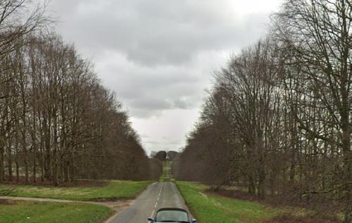
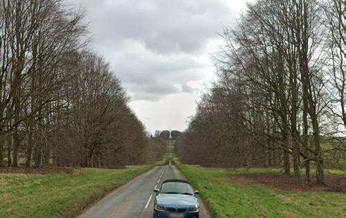
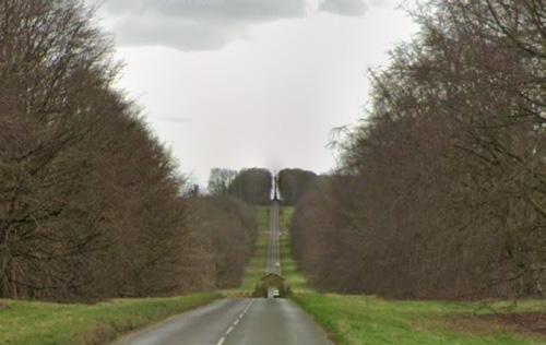
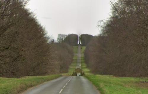
I am also deeply grateful to Professor Michael Stacey for kindly providing the image material for the Castle Howard case study and for his constructive comments during the term. His insights enriched my visual analysis and significantly enhanced the overall quality of this work.
My thanks go to my design unit tutor, Cristina Morbi. Her inspiring teaching in the third year first sparked my interest in this topic and laid the essential groundwork for this dissertation.
Finally, I am also indebted to my colleagues for their stimulating discussions and to my friends and family for their constant encouragement and understanding. I would also like to extend my heartfelt thanks to my mother, whose visits to the Buseoksa Temple with me and constant encouragement have been a source of strength and motivation throughout this journey.
This dissertation addresses the persistent methodological gap in landscape representation by demonstrating that conventional media such as orthographic plans, cross-sections and still photographs systematically fail to capture the unfolding, lived experience of movement through designed spaces. It begins with a critical review of existing representational tools and abstract precedents, revealing how metric measurements and static technical diagrams omit the sequential narrative of visitor interaction.
Building on these insights the study develops a refined ideogrammatic methodology that combines phenomenological observation with diagrammatic synthesis to provide a coherent visual grammar. This framework maps thresholds, framed views and moments of concealment or revelation as a concise set of visual symbols that can be flexibly applied across diverse sites.
To validate its versatility the method is tested on two historically and culturally contrasting case studies: Buseoksa Temple in Korea and Castle Howard in England. By tracing the linear sequences that structure visitor movement through each landscape the analysis clarifies how spatial choreography guides perception and constructs a narrative logic unique to each site. The resulting ideograms distil these findings into a legible representation of the hidden organisational spine, accessible to designers, scholars and the public alike. Furthermore, by identifying common spatial principles across culturally and historically distinct case studies, the research highlights underlying cross-cultural approaches to landscape design, suggesting universal structures in spatial choreography. This insight provides designers and scholars with a transferable framework capable of addressing cultural differences through shared design languages, enriching international practice and interdisciplinary research.
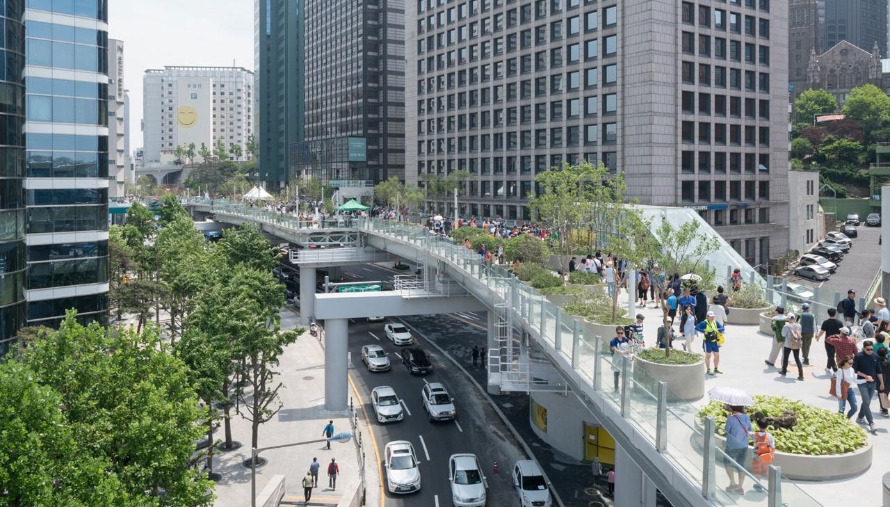
Attention then shifts to contemporary practice with a focused examination of Seoul’s Seoullo 7017 elevated walkway. Here the dissertation demonstrates the framework’s practical utility by pinpointing opportunities for strengthened portals, calibrated sightlines and phased enhancements that enrich the visitor experience while preserving the primary circulatory axis.
The research thus delivers a comprehensive toolkit that bridges analytical rigour and design intervention. The findings confirm that careful attention to sequential movement deepens public understanding, elevates spatial quality and equips practitioners with a transferable visual language for shaping dynamic landscapes in varied contexts. By offering a replicable process and a concise set of ideograms this research contributes a new analytical instrument that can inform both scholarly inquiry and practical design, ensuring that the choreography of movement remains central to memorable landscape architecture.
Keywords: Sequential Experience, Ideogrammatic Methodology, Sequential Movement , Landscape Representation, Linear Landscapes, Design Intervention, Phenomenological Analysis
2.1 James Corner and the Relevance of “Taking Measures”
2.1.2
2.1.3
Taking Measures Across the American Landscape: and Its Key Concepts
2.1.4 The Diagrammatic Images
2.1.5 Collage diagrams versus proposed ideograms
2.2 Min and Lee (2019): A Conceptual Framework for the Externalization of Ecological Wisdom: The Case of Traditional Korean Gardens
2.3 Hazlehurst, F.H. (1980). Gardens of Illusion. Vanderbilt University Press (TN).
2.4 Lee, S. (2017). The Identity of Korean Architecture. Dongnyeok.
METHODOLOGY
3.1 Framing the Experiential Spine: Grounds for an Ideogrammatic Method
3.2 The Ideogrammatic Approach
3.3 Research Process
3.4 Significance of this Method
3.5 Preview of Case Studies
4.1 Buseoksa Temple
4.1.1
4.1.2
4.1.3
James Corner’s Theoretical Background Historical / Cultural Context
Overall Site Layout
Ideogrammatic Analysis
4.2 Castle Howard “The Stray”
4.2.1
4.2.2
4.2.3 The Measures
Overall Site Layout
Ideogrammatic Analysis
Analysis of Both Sites Utilising Ideogram
5.1 Project Overview: Seoullo 7017
An
Policy Significance: Urban Regenration and Creation of Citizen space 4.3.2 5.1.2 5.1.4
5.2 Image Analysis of Seoullo 7017 as Reflected in Public Opinion
5.3 Behaviour Mapping and Zone Selection for seoullo 7017 Redesign
The design of gardens and landscapes that have been purposefully contrived centres on structuring the visitor’s experience and, in particular, on choreographing the sequence of views that unfolds. This approach is fundamentally different from the spontaneous way in which a natural landscape is experienced.
The motivation for the present study arises from an interest in both English and Korean traditions of landscape design. During the author’s third and fourth years in the architectural‐design studio, the concept of sequence emerged as a central concern. Each annual project prioritised how visitors would move through the combined landscape and built environment, how they would perceive their surroundings and how they would interact with the space. Furthermore, design-studio discussions consistently emphasised the significance of linear sequence in architectural design. This dissertation focuses specifically on the most fundamental form of sequence, the linear sequence, analysing its design principles in depth. It explores how, by periodically introducing built structures along a defined linear sequence, landscapes guide and control the visitor’s experience, thereby uniting studio discussions with historical precedent.
At Castle Howard in North Yorkshire, processional promenades orchestrate framed views through rolling terrain. At Buseoksa Temple in Korea, pilgrims proceed through a succession of gates and pavilions that guide them up a mountainside towards a goal of enlightenment. This research examines the walkway as a design device, seeking to identify the principles that underlie these culturally distinct practices. Although linear landscape designs may appear straightforward and constrained, they in fact pose an exacting challenge for designers, demanding exceptional ingenuity and imaginative flair to orchestrate a coherent spatial narrative.
They are also highly topical because cities worldwide have embraced linear pathways as instruments of urban renewal since 1990.1.1 Disused railways have become promenades, viaducts have been repurposed as elevated gardens and riverbanks reclaimed for slow journeys on foot or by bicycle. From the Promenade Plantée René-Dumont in Paris to the High Line in New York, Mauerpark in Berlin and the Rail Corridor in Singapore, such linear parks stitch together neighbourhoods and afford fresh vantage points over the urban fabric. Meanwhile, in central London, the Camden Highline joining King’s Cross to Camden Gardens has received regulatory approval and is awaiting implementation. 1.2
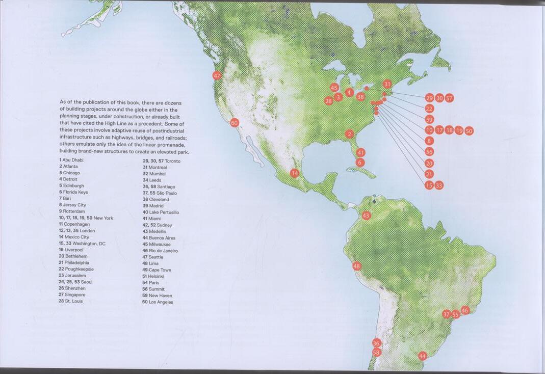
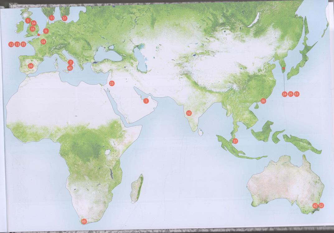
In their 2015 book The High Line: Foreseen, Unforeseen, James Corner and Diller Scofidio + Renfro documented over sixty comparable linear park projects worldwide, and subsequent research has identified at least twenty further examples (see Appendix 1). The High Line’s rapid transformation, from a community-led initiative to attracting over six million annual visitors – 20 times the anticipated number - and securing substantial public and private investment in its surroundings, epitomises how the ‘genie escaped the bottle’ effect of linear-park developments. These interventions have catalysed urban regeneration, resulting in significant economic uplift and demographic change within their surrounding communities.1.3
Despite their potential, depicting the temporal and spatial unfolding of a designed landscape
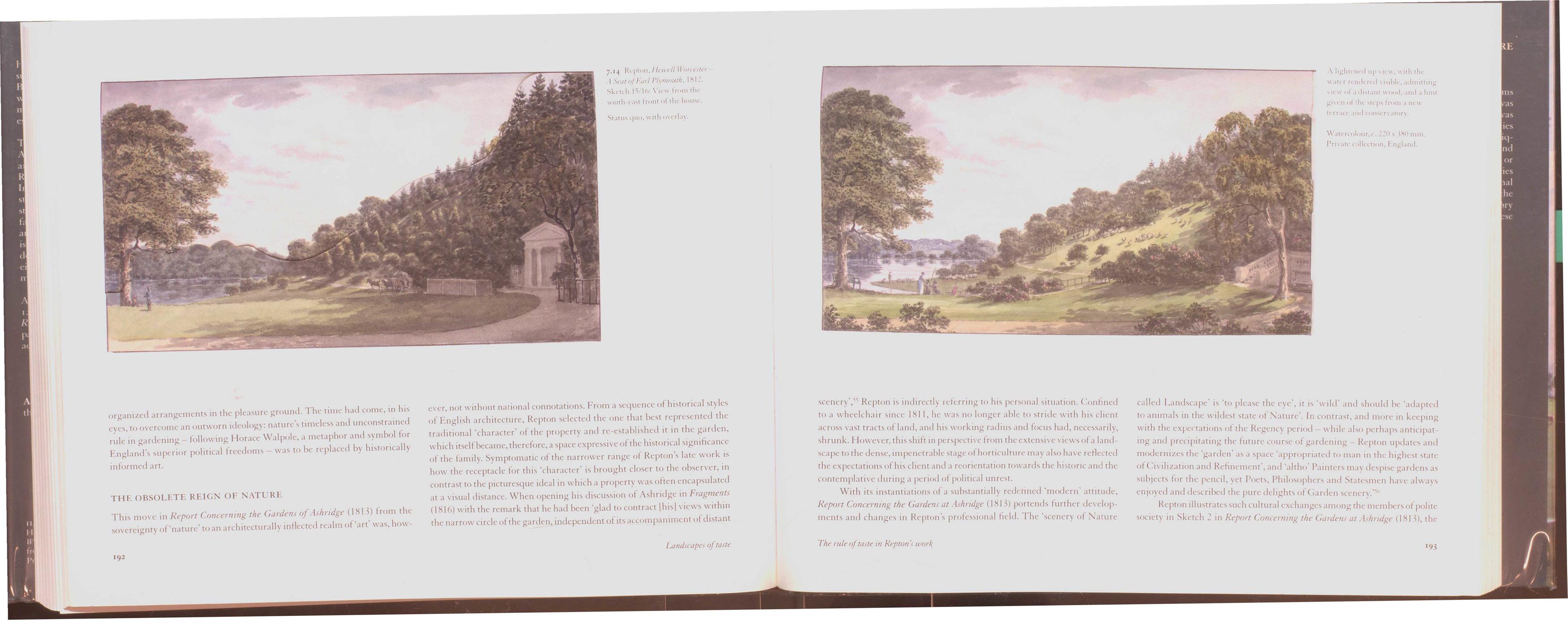
suppresses background depth and lateral detail. Subtle shifts in terrain, seasonal variation and the spatial drama perceived while walking through the garden remain invisible. The device therefore conveys the idea of improvement clearly, but it understates the richer character of the landscape that visitors will experience on the ground, making it hard to judge how far the
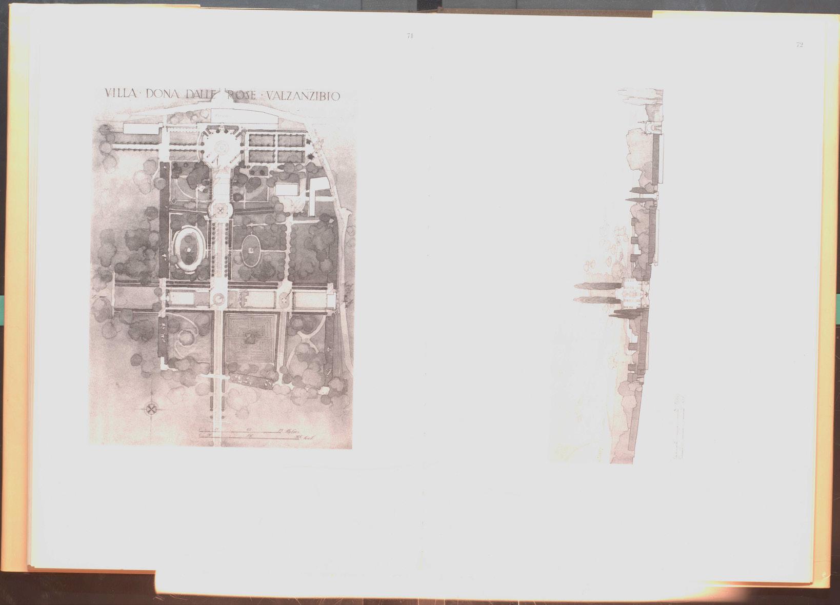
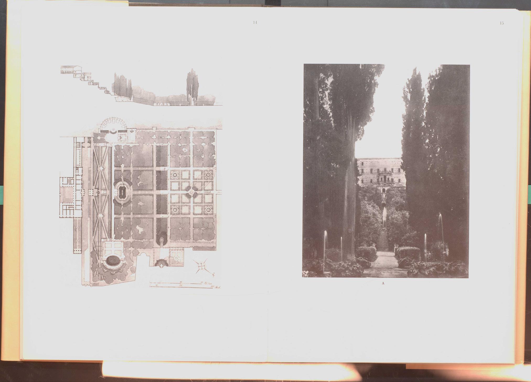
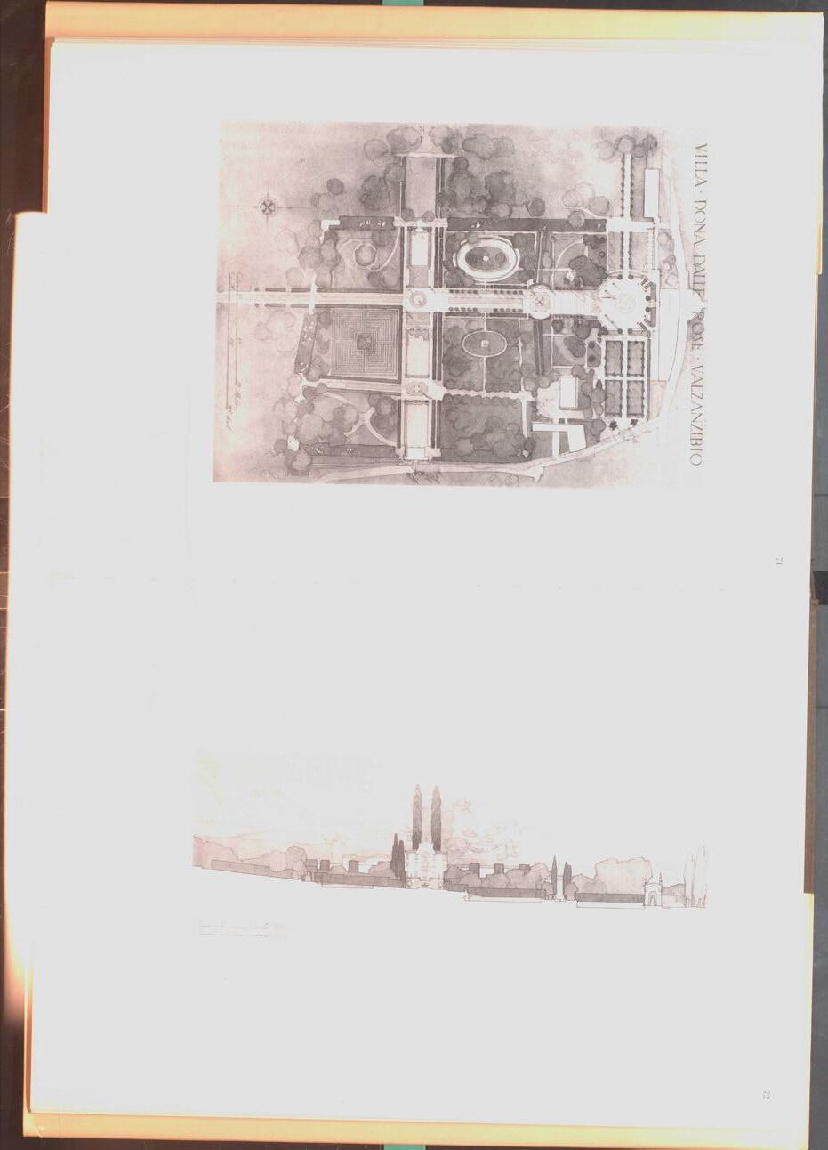
Two dimensional plans and sections can only partially convey how a visitor moves through a garden. On steep terrain they become more instructive. Figure 1.5, adapted from Shepherd and Jellicoe’s plate of Villa Garzoni1.5, reveals a cascade stair, intermediate landings and a terminating fountain; the sequence is legible in both plan and section because the vertical rhythm is pronounced. By contrast, Figures 1.4 illustrates Villa Valsanzibio, where the gradient is gentle. In such a flat profile the incremental rise in eye level, the staggered ponds and the shallow terraces are scarcely apparent on paper. The same difficulty occurs at Castle Howard, whose broad, level platform hides subtle changes that can be perceived only when one walks the site.
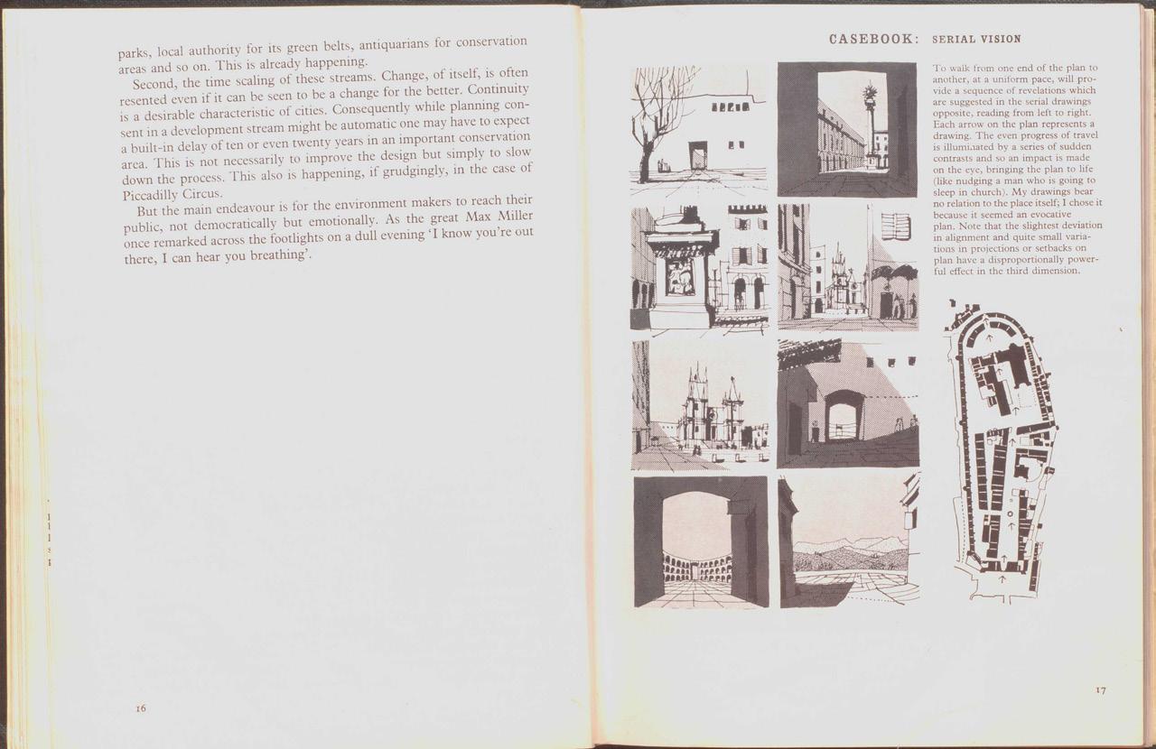
When analysing townscape Gordon Cullen (1914 – 1994) devised a graphic language that relied on strong tonal contrast, a simplification he adopted as his eyesight deteriorated with age. In The Concise Townscape (1961)1.6 he introduced Serial Vision, a method that strings together small urban vignettes to form a narrative of a walk through the city. The technique is
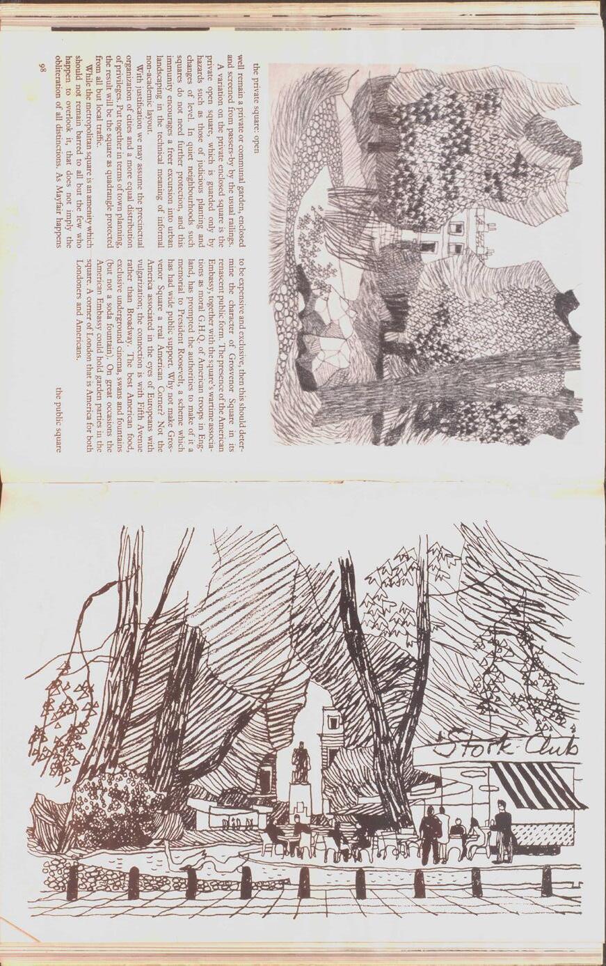
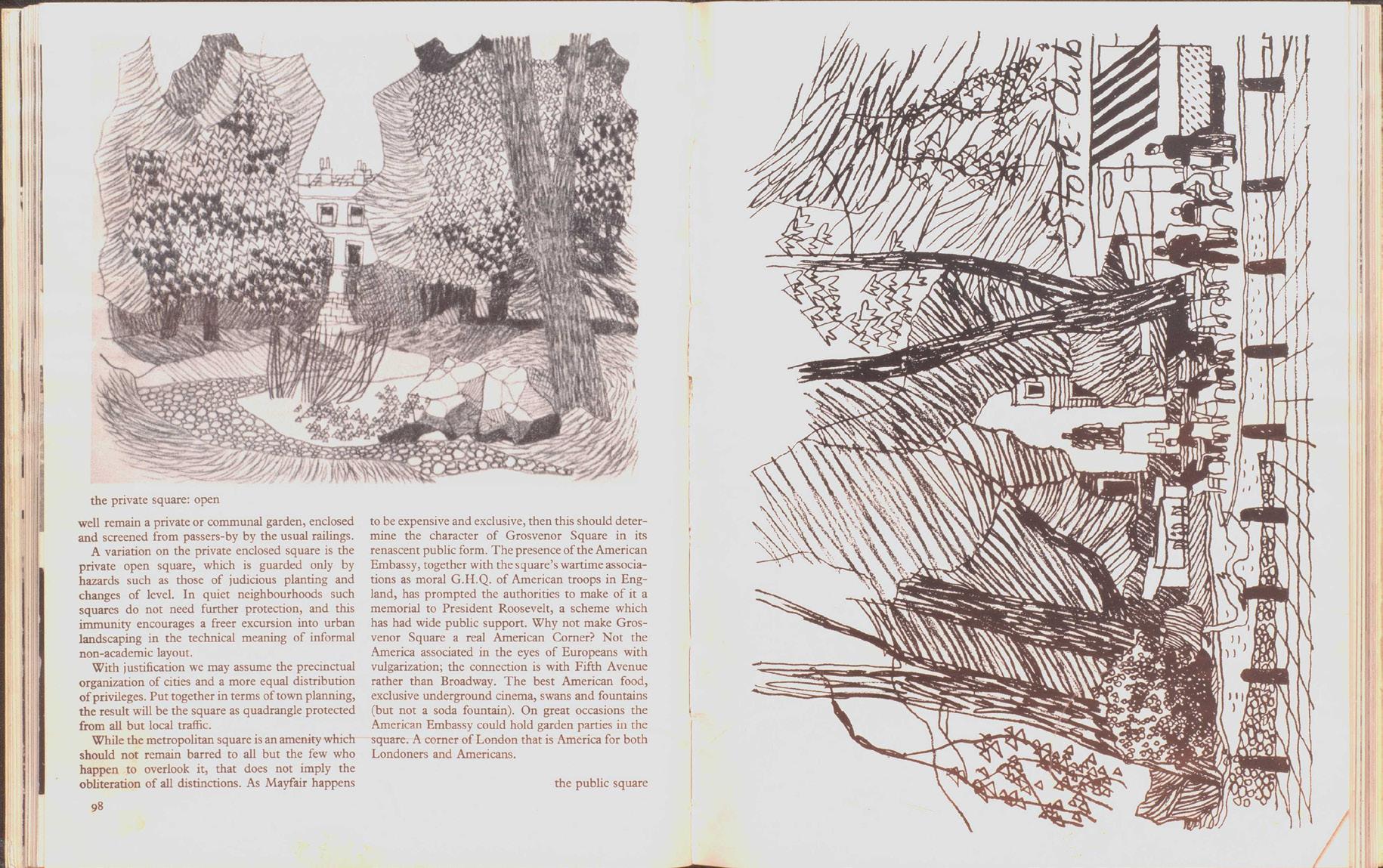
therefore relevant to linear landscape design. Figure 16 reproduces Cullen’s canonical Seri al Vision plate. Figures 1.7 and 1.8 apply the same method to a public square and expose its limits. When landscape elements such as trees are rendered with a fixed viewpoint and heavy contrast, they collapse into surface pattern so the drawings communicate rhythm and enclo sure but convey little depth or topographic change.
Systematic documentation of the kind required to obtain statutory approvals for new urban linear interventions is comprehensive but these require a level of information that becomes indigestible – the Camden Highline submission for example, is 170 pages long.
Each technique illuminates one dimension of the linear experience, but none fully captures the continuous interplay between path, view and perception.1.7
This dissertation, therefore, develops an analytical method that combines phenomenological observation with diagrammatic synthesis. First, the method is tested on two case studies, Buseoksa Temple and Castle Howard, to reveal how specific design mechanisms generate the intended perceptual effects. Second, the study presents a synthetic technique for transforming sequences of illustrative images into abstract ideograms. Moreover, the analytical framework proposed here may be applied synthetically to contemporary projects such as Seoul’s Seoullo, demonstrating its broader relevance to urban-renewal initiatives. These ideograms distil the essential spine of each route into a coherent visual language. The following chapters set out the theoretical foundations, outline the ideogrammatic approach and apply it to the case studies before reflecting on the broader implications for the discipline of landscape architecture.

2.1.1
James Corner is a landscape architect and theorist renowned for integrating academic study with practical design in modern urban and landscape architecture. He was born in Preston, Lancashire, and studied for his degree in landscape architecture at Manchester Metropolitan University, graduating in 1983.2.1 In 1989, he was appointed as a landscape architecture professor at the University of Pennsylvania and subsequently founded James Corner Field Operations, a firm through which he has directed significant urban revitalisation initiatives, including the New York High Line in conjunction with architects Diller Scofidio + Renfro.2.2 His major interest is integrating the academic study of social, cultural, historical and political factors within landscape analysis, which he characterises as typically limited to metric measurements and technical considerations governing the components of landscape design.2.3 According to his own perspective, landscape is no longer to be considered a static and physical thing but a dynamic area where natural processes, institutional frameworks, cultural ideas, and human activities interact.2.4
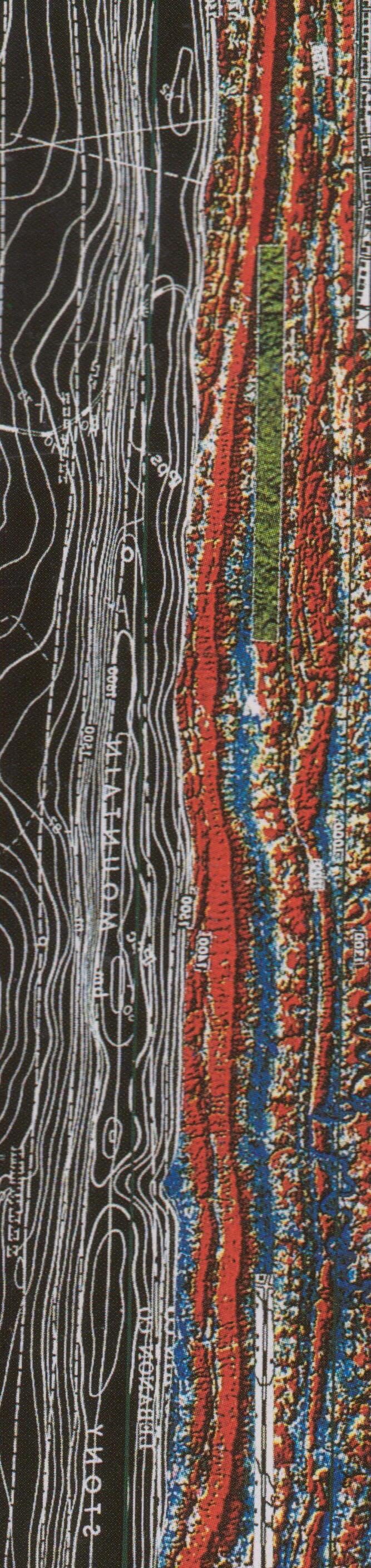
In 1996, Corner published, in conjunction with Alex Mclean - an aerial photographer – an influential book “Taking Measures Across the American Landscape” which describes his expanded conception of “Measurement.” Instead of identifying it as a simple method of quantifying distance, area, or elevation, Corner conceptualises measuring as an analytical tool connecting landscape to historical, sociological, and spiritual contexts. Juxtaposing aerial photographs and diagrams, he proposes five distinct categories of “Measure” – Land, Control, Rule, Fit and Faith - each emphasising a unique aspect of land, organisation, habitation or perception.2.5
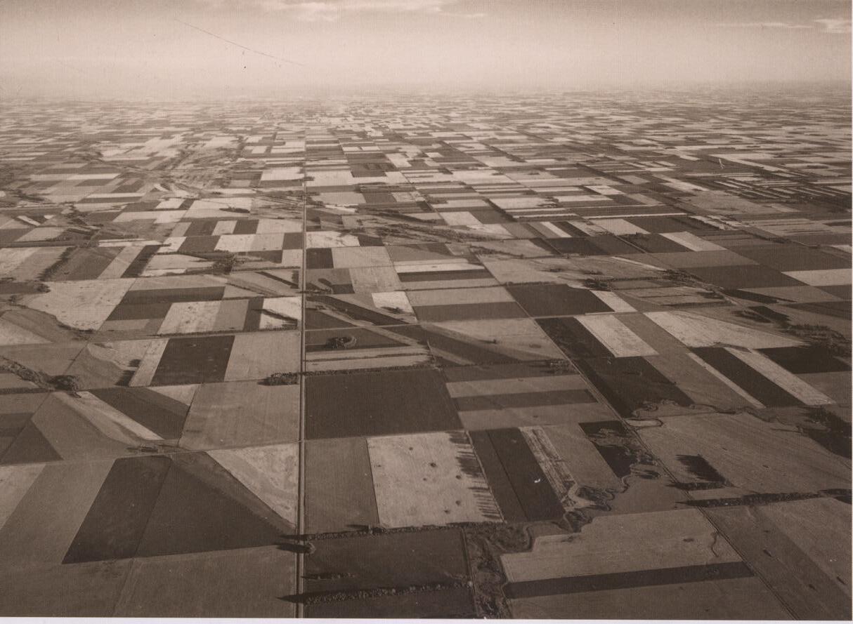
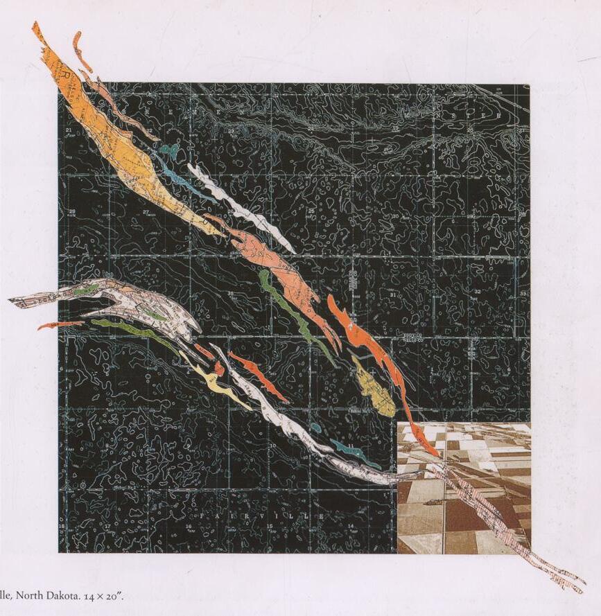
Figure 2.1 and 2.2: Typical page format showing Reynolds, North Dakota, combining a photograph of the terrain, where ancient beach ridges intersect the rectilinear survey grid, with James Corner’s interpretive diagram. The diagram incorporates data collected under Corner’s five measures (such as boundary, surface, cleaving, cracking and layering) to highlight the interplay between the natural landforms and the imposed grid.
In Chapter 1, Corner’s colleague Dennis Cosgrove - a cultural geographer at the University of Pennsylvania - contributes an essay that lays the theoretical groundwork for Corner’s approach by examining the quasi-orthogonal survey grid that extends over much of the American continent.2.6 Formalised just nine years after the Declaration of Independence under the Land Ordinance Act of 1785 - the existing states of the Eastern Seaboard aimed to establish a standardised rectangular survey dividing future western territories into six-mile-square “townships,” themselves subdivided into one-mile-square “sections” as a means of parcelling out land for the Federal Government to sell – avoiding the need for the existing states to fund this further expansion. Although this system brought administrative clarity, it frequently failed to accommodate local topography, ecological factors, and cultural practices.
The large-scale attempts to impose a single grid system across an entire continent highlighted several practical and conceptual difficulties. Natural boundaries, including coastlines and regional borders, rarely form neat lines, making it difficult for a uniform grid to capture the land’s irregular contours. It also ignored the inherent impossibility of imposing a Cartesian grid over a spherical surface. The curvature of the Earth means that large-scale gridded projections require certain corrective measures, which introduce distortions and widen the gap between the map’s schematic grid and the land’s true form.
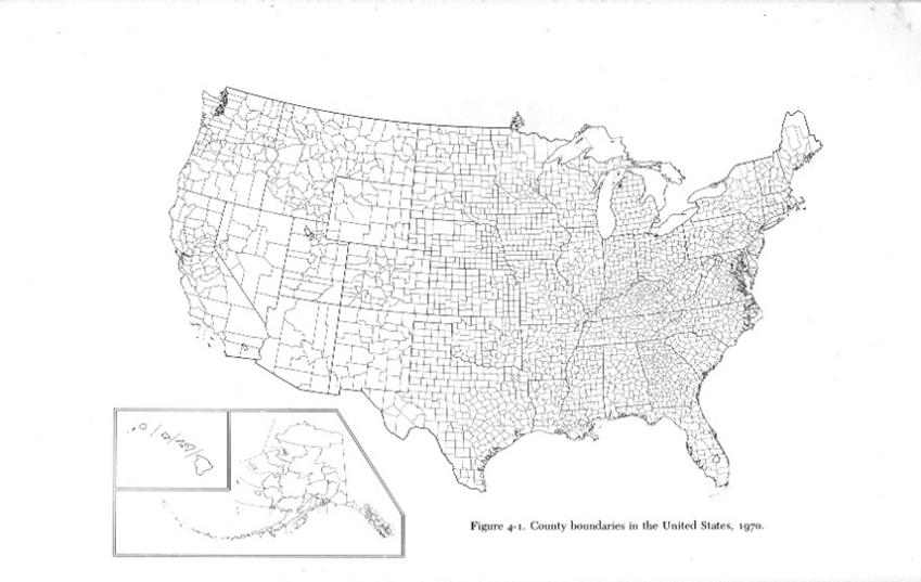
The actual outcome of the survey is illustrated in the map cited by Cosgrove, Figure 2.3, which plots the administrative boundaries into which westward settlement under the Land Ordnance Act was progressively divided.2.7 This shows the original Eastern Seaboard states unaffected by gridding. Moving west, the ‘counties’ are assembled from the notional ‘six-mile-square townships’ but subject to corrections for the northerly converging lines of longitude and major geographical features such as the Mississippi/Missouri river basin. However, it had little effect on how administrative boundaries were drawn where it encountered the mountain chain that runs north-south down the Pacific side of the continent. In these regions, topographical features predominantly determine how the land is organised, along with some input from the Spanish colonialists who had previously occupied regions of the South-West.
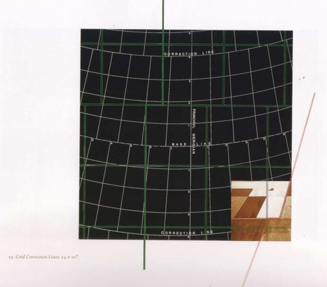
Figure 2.4 shows Corner’s diagram illustrating how “correction lines” were typically introduced to adjust the Survey Grid, compensating for geographic curvature and modifying alignments across large distances.
The Survey Grid was though systematically extended out to the Pacific Coast. Figure 2.5 provides a pivotal visual link between the abstract practice of mapping and Corner’s initial conceptual “Measure”: the ‘Measure of Land’. He locates this survey point in the Taft Oil Field, which runs parallel with and immediately adjacent to the San Andreas Fault in Southern California. By highlighting how any rigid grid struggles against the unstable terrain of the San Andreas Fault, where the Earth’s crust has been shifting for millions of years, it underscores the limitations of relying on fixed geometric systems to capture a perpetually evolving landscape.2.8
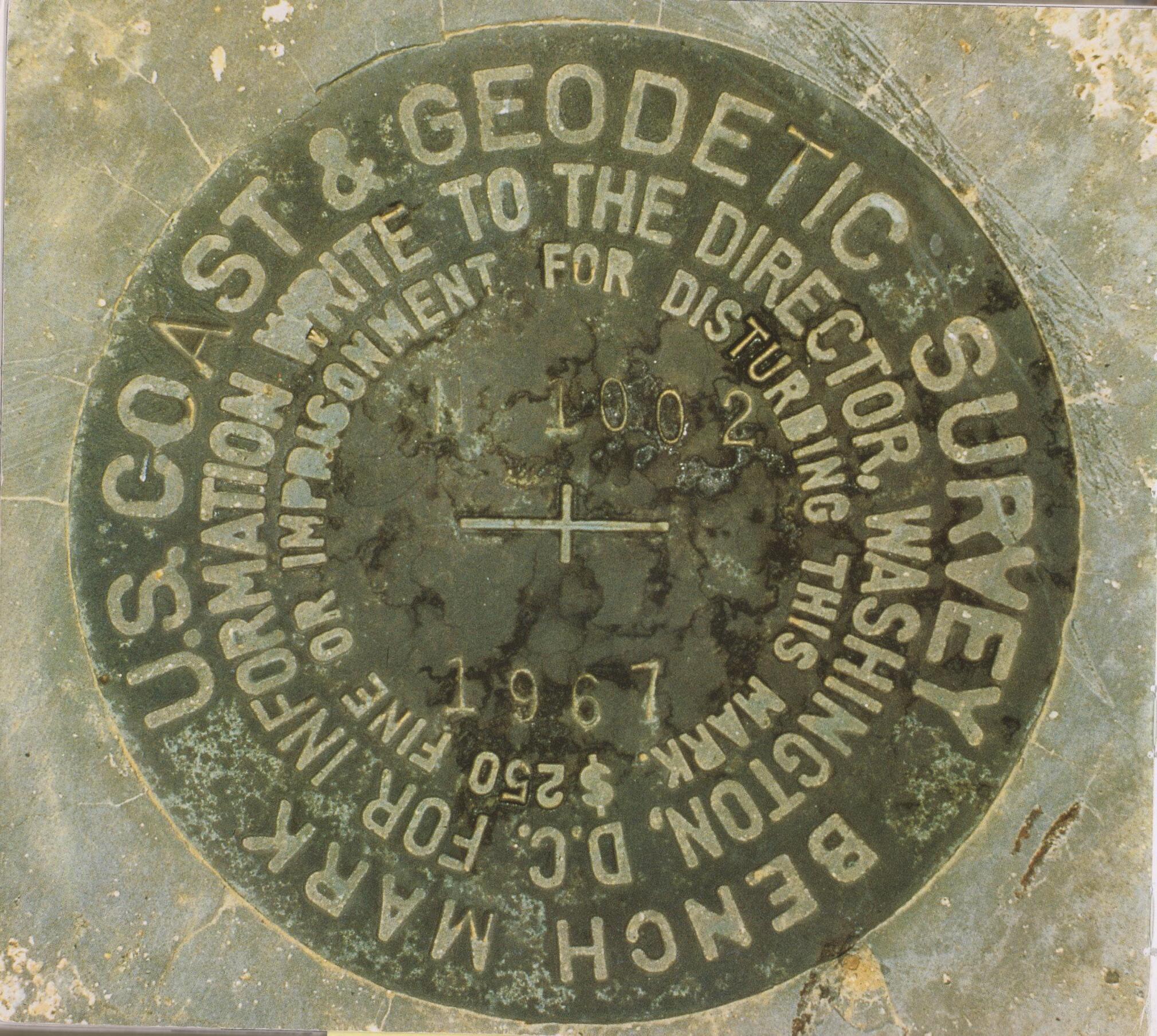
In Chapter 4, Corner introduces the concept of aporia to highlight the tension between the rigid survey grid of the 1785 Land Ordinance Act and the ever-shifting nature of real landscapes.2.9 He argues that such Cartesian methods fail to capture how people experience and adapt to such continuing change; a gap he characterises as aporia. He insists that understanding the land involves more than grids and numbers, calling for cultural, historical and spiritual perspectives to be incorporated. This mismatch underlines why Corner supplements the typical grid with his five additional ‘Measures’, which he names Land, Control, Rule, Fit and Faith.2.10 By overlaying diagrams and annotations onto aerial images, he shows that a deeper understanding of the environment comes not from discarding the grid entirely, but from recognising its limitations and blending it with insights that acknowledge the fluidity of the landscape.
The alternatives to the strictly geometrical discipline of the Land Ordnance Survey, he therefore proposes are:
• Measures of Land: These show how natural forces (for example, shifting river channels or erosion) continually reshape landforms despite the imposed grid, reminding us that the land itself resists fixed boundaries.
• Measures of Control: These highlight how large-scale human interventions such as dams, levees, and power lines overlay the grid and impose new forms of regulation or alterations.
• Measures of Rule: Covering the societal frameworks like sports fields, cemeteries, airports, and train depots that define formal boundaries and regulate spatial use within any larger grid.
• Measures of Fit: Focused on how human activities, such as contour ploughing and road construction, conform to or adapt the grid to uneven terrain.
• Measures of Faith: Addressing spiritual or symbolic dimensions in which celestial events and sacred sites create intangible relationships that transcend rigid mapping.
The following images illustrate how he applies these ‘Measures’ as a means of interpreting how these landscapes are configured.
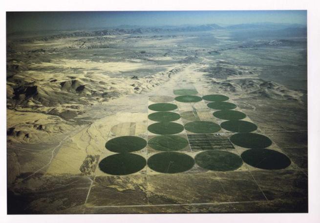
In this image, the areas of rough topography represent ‘Measures of Land’; which generally preclude the use of the Survey Grid as an organisational discipline. The circular irrigated fields which to become fertile extract water from deep aquifers constitute ‘Measures of Control’. He describes how their mechanical arms require the soil to be very precisely levelled – a process that allows the Survey Grid to be imposed in their immediate vicinity.
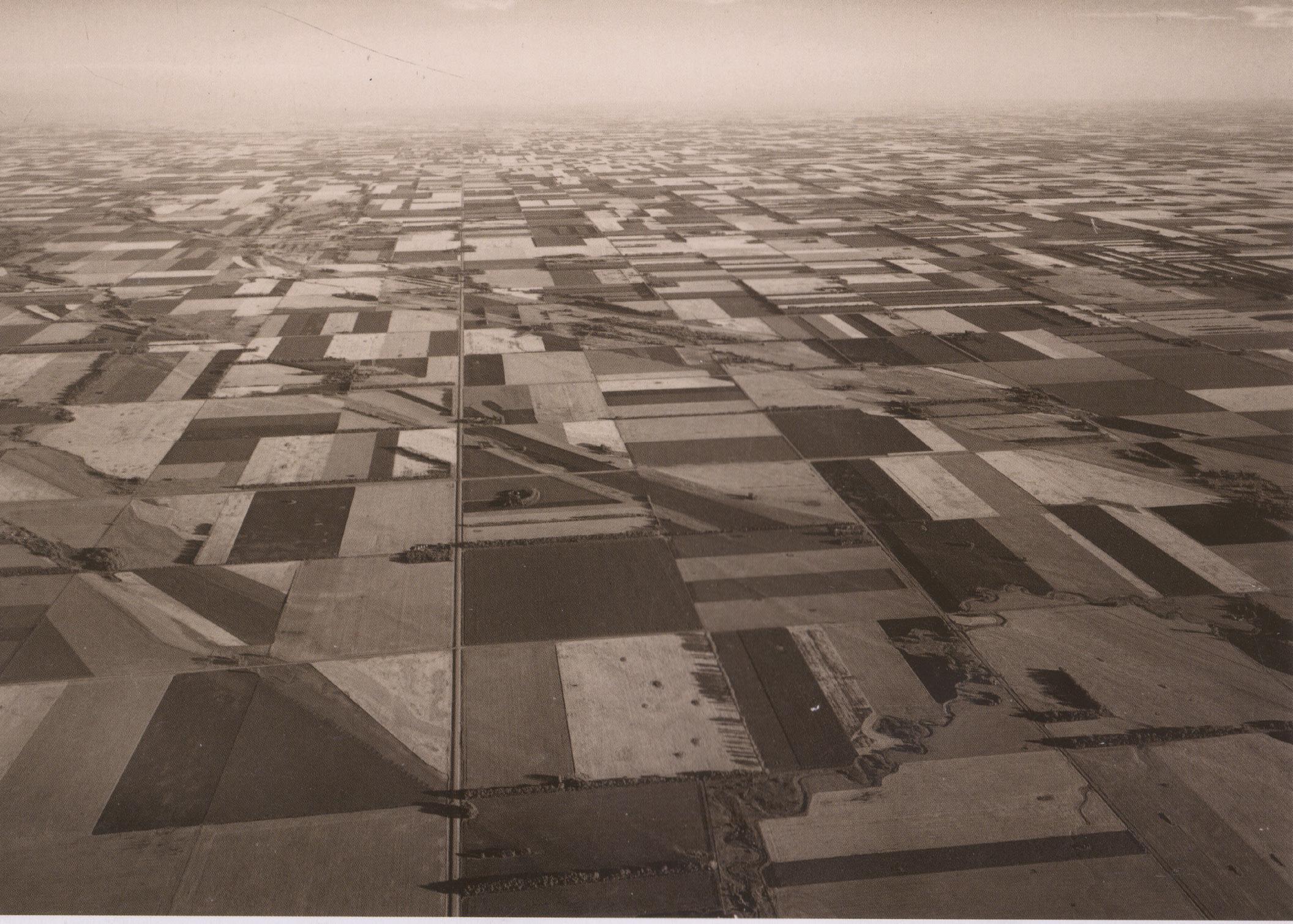
This photograph illustrates the relationship between the topographic features of the Reynolds area in North Dakota and the artificially imposed Survey Grid system which predominantly structures its cultivation and inhabitation. This region was covered by an ancient lake, and as its waters receded over time, a series of natural ridges emerged. These cut diagonally across the Survey Grid and consequently, because each plot of land differs in slope, soil fertility, and water retention capacity, effective land use and farming practices require a more flexible approach - a Measure of Fit. The arrows highlight where farmers have switched to contour ploughing – with furrows perpendicular to the slopes – as a means of preventing soil erosion. This perspective moves beyond a one-size-fits-all grid, illustrating that sustainable land use emerges through ongoing dialogue with the land itself.
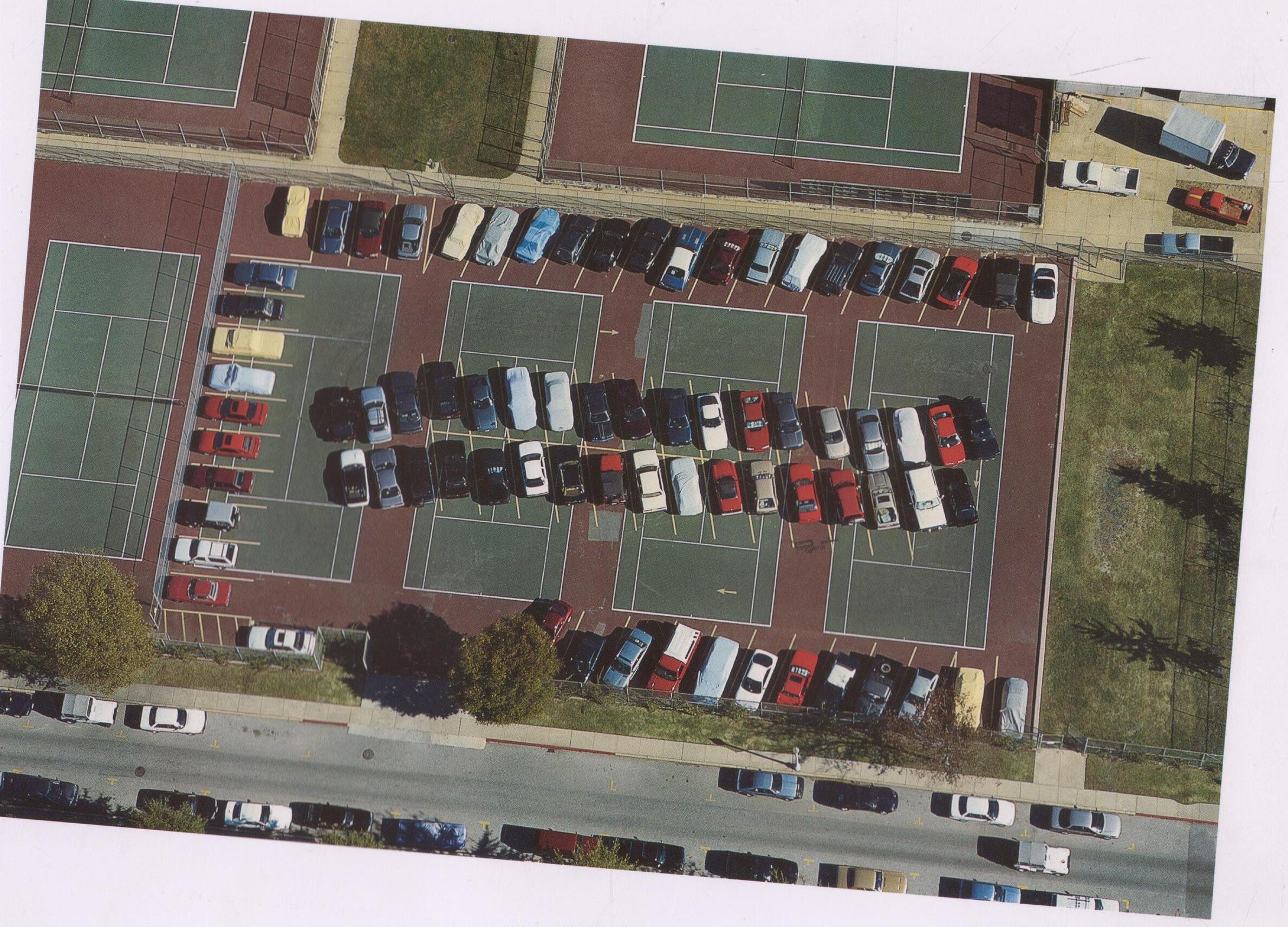
This image of parking lots or overlaying tennis courts illustrates Measures of Rule. The uniform survey grid becomes layered with spaces designated for specific human activities - each defined by rules like lane stripes, or the fixed dimensions of playing areas
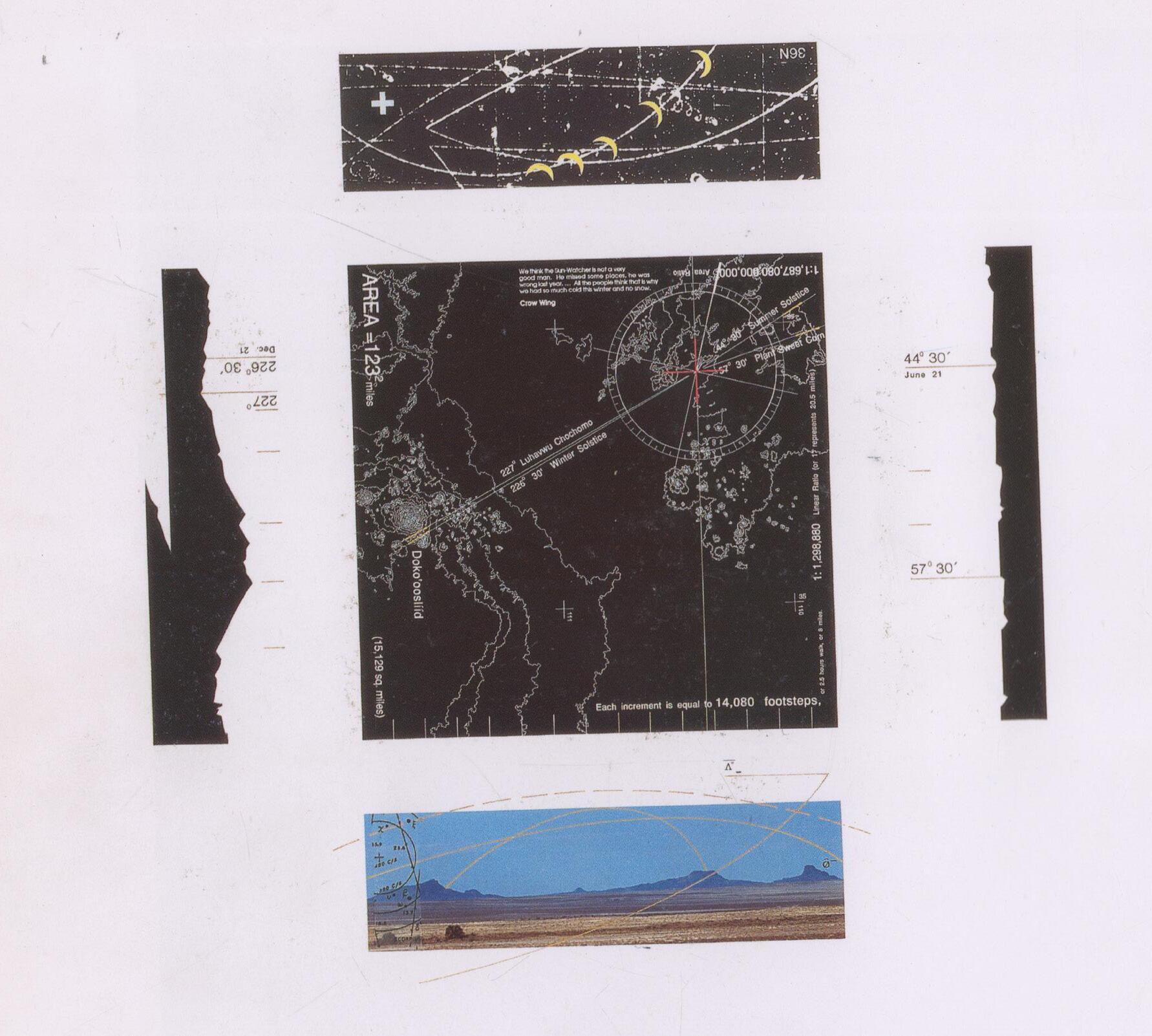
Corner’s “Measure of Faith” highlights how conceptual, spiritual as well as cosmological frameworks inform the way people perceive and organise the land, extending beyond purely metric or scientific methods. This concept is illustrated in the diagram describing the Hopi Horizon Calendar, Figure 9. Through the use of the sun’s rising and setting positions along the horizon, the Hopi planned and scheduled agricultural tasks, marked religious observances and predicted seasonal change. Mountain ridges and horizon lines were used as a benchmark in order to precisely track the sun’s movements rather than simply relying on a grid or quantitative data. His perspective underlines a credo in which Earth and heaven are connected with hallowed meaning, suggesting how cosmic and religious rhythms can guide our interactions with the natural world. However, for the examples to be studied in this dissertation, this category needs to be broadened to include how more personalised underpinnings such as political status or dynastic aspirations have been embodied within landscape design.
An important question arises when analysing the diagrammatic description of the Hopi Horizon Calendar, which combines conventional base mapping, simplified profiles of the horizon, photography overlaid with solar trajectories, and what seem to be lunar phases along with text notes. Does this single image fully encapsulate how the Hopi people really aligned their holy practices and sowing schedules, or is further information required to fully clarify and grasp its more profound cultural and cosmic layers? It is not clear, for instance, what role the images of the moon along the top edge play in this context.
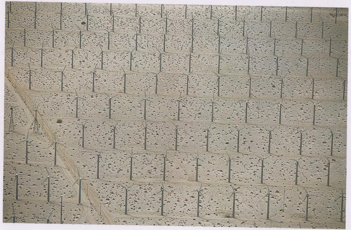
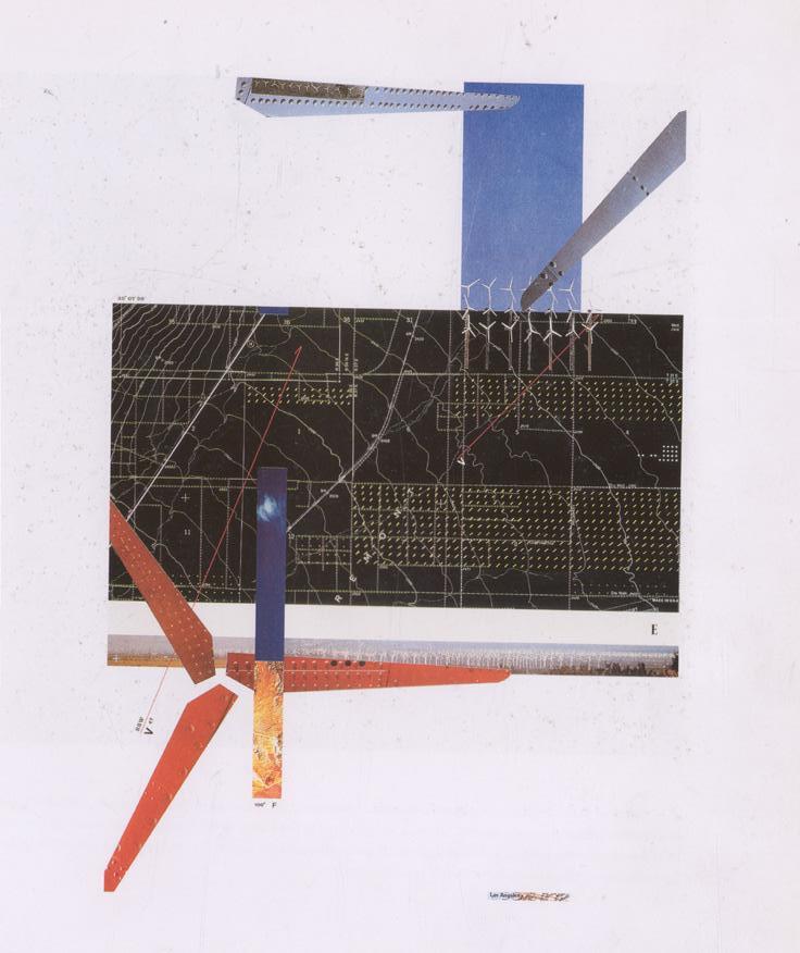
ysis of windmill fields.
Considering his example of Californian windmills, where vast terrain is juxtaposed with a huge array of enormous turbines, giving viewers a direct sense of the architectural influence and scale of human intervention, his summary diagram most closely resembles an abstract artwork and seems to convey less than the aerial photograph by McLean. Compared with Corner’s metric survey map overlayed with collaged elements, the more conventional windmill image highlights exact locations and conveys extensive cultural and ecological narratives about the interaction of infrastructure with natural landscapes, and the vastness of the American West.
An essential question about Taking Measures Across the American Landscape is therefore whether Corner’s collage-like arrangements are, in general, entirely self–explanatory, or whether they tend more towards art pieces. These layered images, integrating aerial photography, text, and diagrammatic elements, are visually abstract but may be challenging to interpret without further explanations.
Figure 2.12 shows the Very Large Array antennas laid out on the New Mexico desert floor, illustrating how nano-precision instruments on Earth are scaled to read cosmic distances.
Figure 2.13 shows the tiered adobe dwellings of Acoma Pueblo, New Mexico, whose thick clay walls and south-facing terraces capture winter sunlight yet keep the interiors cool in summer.
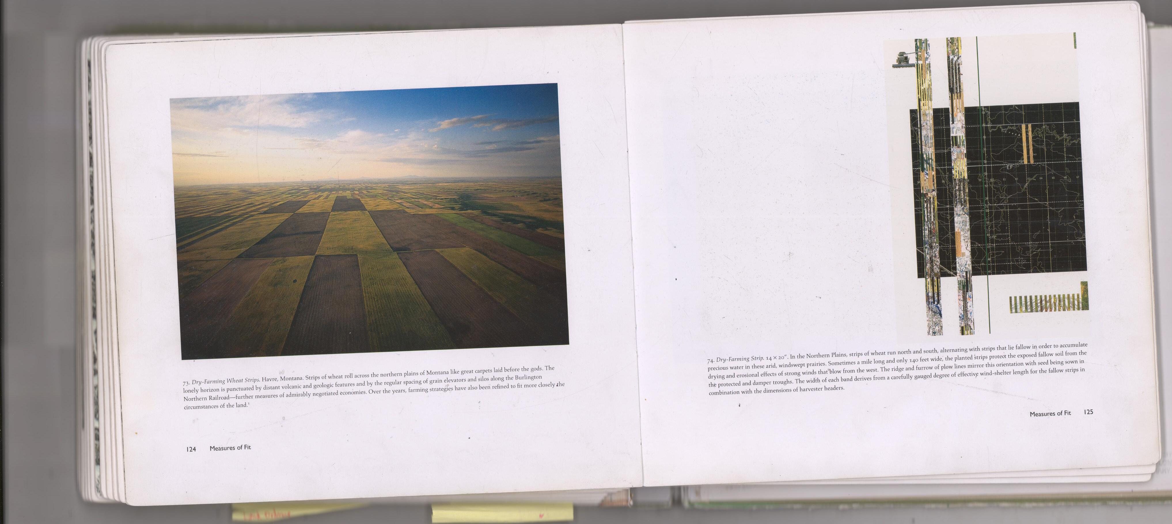
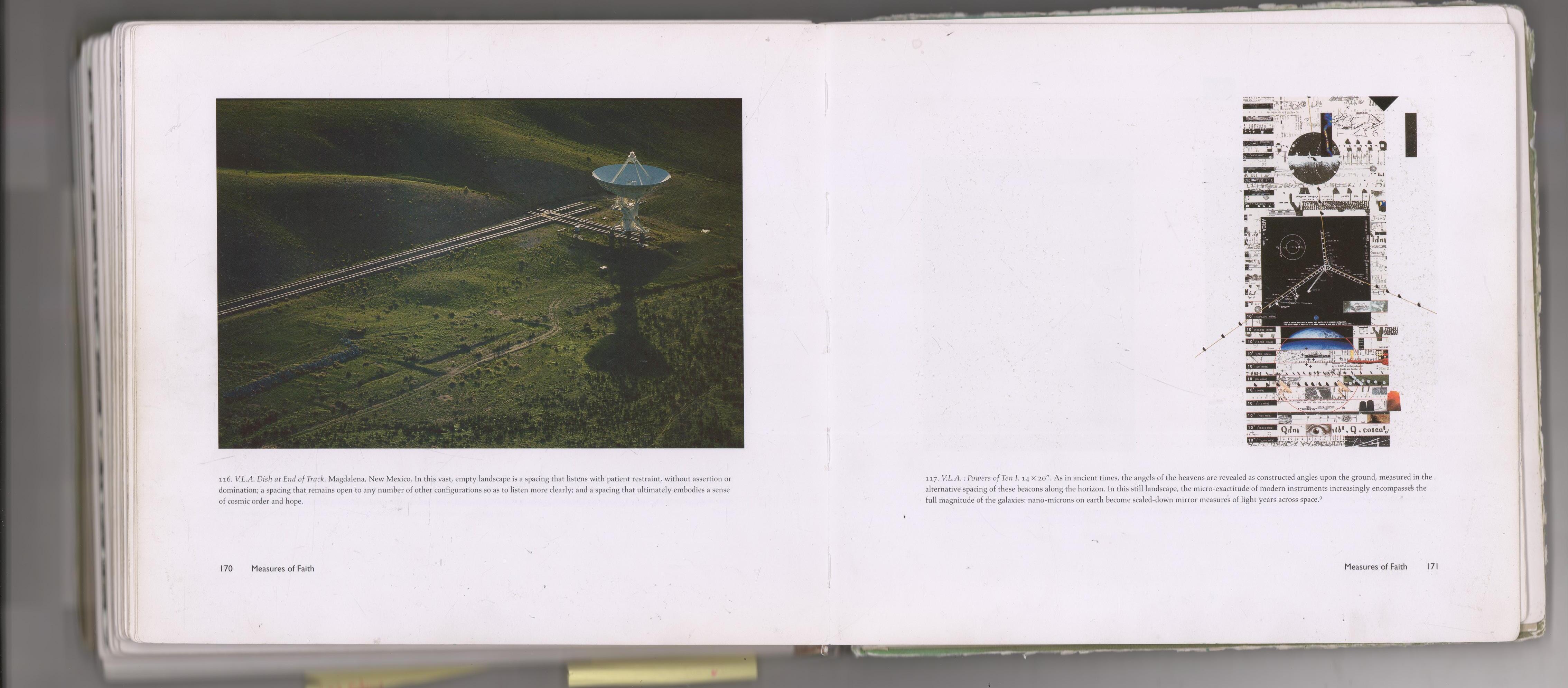
Figure 2.14 shows mile-long, 140-foot-wide dry-farming strips in the Northern Plains, where alternating north–south bands of wheat and fallow conserve moisture
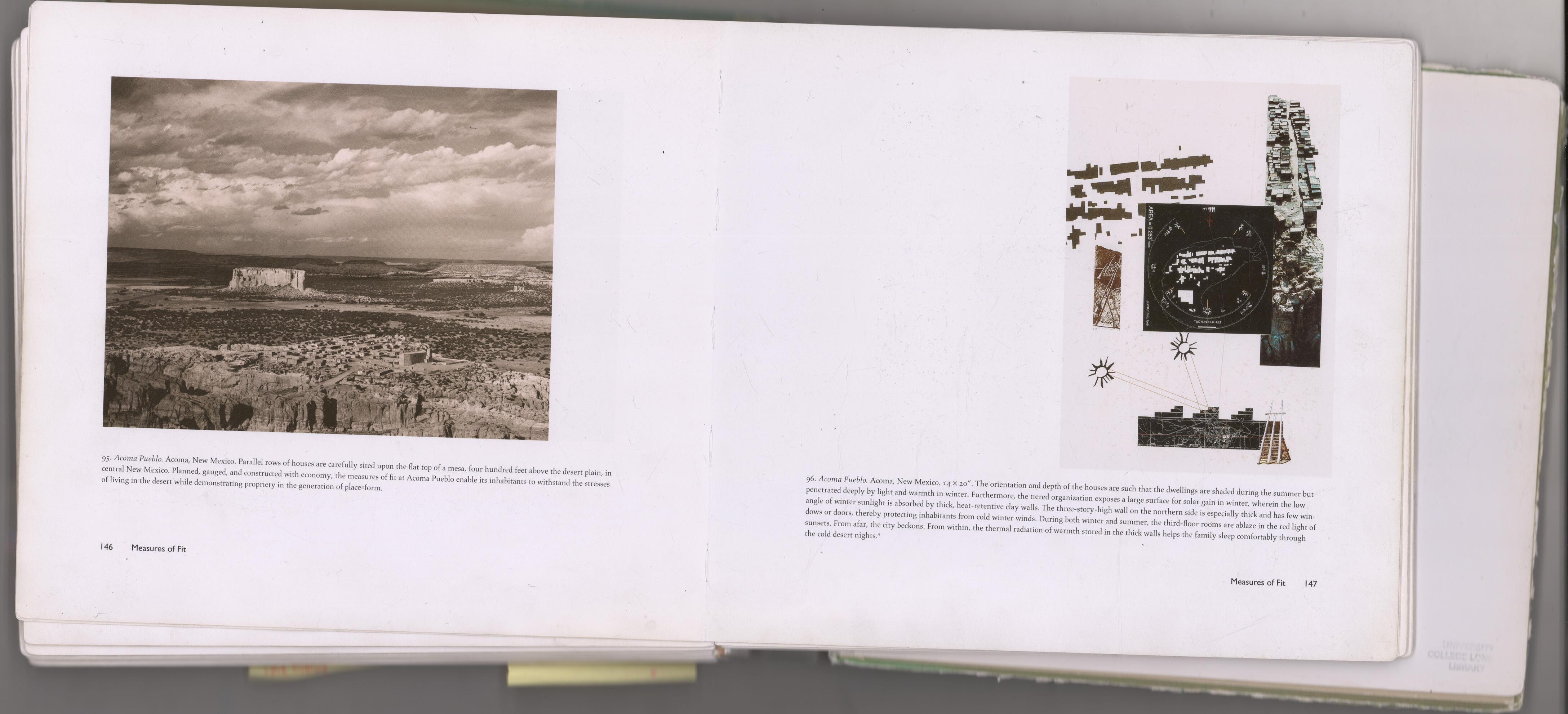
Each diagram combines relevant information drawn from each of his five Measures and combines this information with that from the Survey Grid.
Nonetheless, it is noteworthy that Corner was essentially the first to systematically employ an abstracted “graphical Measurement” approach to landscape analysis, suggesting the possibility of representing the multifaceted qualities of landscapes more concisely through diagrams rather than relying solely on realistic imagery, technical or descriptive language.
His aim was always, however, to capture the unique characteristics of specific landscapes and to highlight their diversity and the differences between them. He did not try to narrate the experience of travelling within each setting. Nor did he design his diagrams to enable comparisons to be made between different environments.
This dissertation adopts Corner’s emphasis on “abstraction” but aims to refine it into a new framework called an “ideogram,” designed to enhance the potential for making comparisons between locations.
It seeks to streamline the “collage” method into a simpler, one-dimensional format - enabling readers to understand each site’s spatial environment as it evolves, without additional lengthy explanations, but also summarising the underlying compositional techniques employed by landscape designers that evoke theses effects.
Whereas Corner’s collage method excelled at amplifying the distinctiveness of individual sites, the ideogrammatic approach proposed in this study places the visitor’s perspective, often overlooked in contemporary architecture, at the centre of its interpretive framework, thereby offering a more structured means of highlighting both the similarities and the differences across multiple locations.
Ultimately, this strategy can be understood as a process of reframing numerous, disparate landscapes that have been consciously designed into a common visual language. The key lies in reconfiguring each site’s distinctive elements within a standardised schema in such a way that meaningful comparisons can be drawn, without oversimplifying the site’s essence. Rather than diminishing the narrative quality that Corner’s approach evokes, this method can actually clarify the intersecting narratives at work within each landscape. In this sense, the ideogram expands upon the visual and interpretive richness of collage diagrams, structuring them more systematically as a tool for analysing and interconnecting diverse case studies from multiple perspectives.
This research, conducted by Aram Min and Ji-Hyun Lee aims to demonstrate that the concept of ‘ecological wisdom’ has long-standing roots in Korean landscape design. The term initially gained prominence in discussions surrounding urban sustainability, particularly within landscape architecture and urban planning. 2.11
Although “ecological wisdom” appears to be a relatively modern term 2.12, the authors highlight that many older traditions, practices, and precedents, successfully applied throughout history, had already encompassed its fundamental principles. 2.13
After defining ‘ecological wisdom’, the second half of the research paper uses quantitative methodologies to analyse some traditional Korean landscapes, especially focusing on the private gardens (drawn from gardens nationwide, though several regions remain unrepresented) of the Joseon Dynasty (1392–1910). Using a four-stage method, consisting of case definition, geometric and environmental data deconstruction, similarity calculation and matrix correlation, the relationship between key spatial organisation and environmental factors such as temperature, topography, proximity to water sources are tabulated systematically by Min and Lee. Subsequently they underline how proven designs from the past can be used in future to design ecologically sound and sustainable landscape.
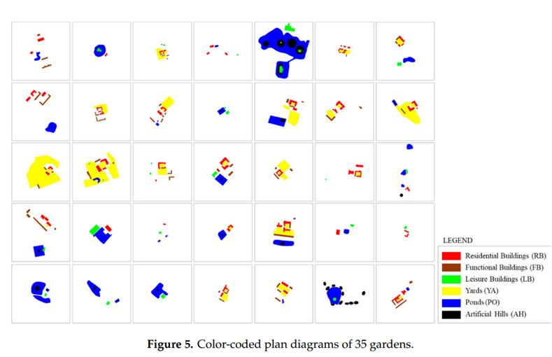
Figure 2.15 shows the colour-coded plan diagrams of 35 gardens by Min and Lee
Min and Lee aimed to provide a reproducible, analytic-based method for examining the relationship between architectural elements and environmental conditions. They used matrix and geometric algorithms, such as Histogram of Force, to test the feasibility of large-sample or multi-site comparative investigations. Their research highlights the significance of” learning from tradition” and, by analysing observational, historical examples of careful integration with nature, concludes that ecological wisdom is, in fact, deeply embedded in past practice.
Histogram of force:

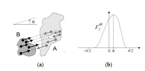
Figure 2.16 shows the diagram of the Histogram of Force
The Histogram of Force (HoF) algorithm offers a systematic means of quantifying spatial relationships by designating one object (B) as a reference, distributing random or evenly spaced points within it, and projecting vectors at various angular increments to detect intersections with a second object (A). The lengths of these intersecting vector segments are then summed to generate a histogram-like measurement. In their study, Min and Lee applied this approach to six principal categories of garden elements residential building (RB), functional building (FB), leisure building (LB), courtyard (YA), pond (PO), and artificial hill (AH) treating each category pair as (A, B). For example, they choose RB as the reference object (B) and PO as the argument object (A) and run the algorithm to examine the spatial interactions between these two features. By repeating this procedure for all 15 possible pairings, the authors captured each garden’s spatial patterns in a quantitative format.
Because the cumulative length of the intersecting vector segments effectively functions as a frequency count, the overall value grows larger when the objects in question are either sizable or in close proximity. HoF can further incorporate a ‘force’ concept by using the inverse of distance or its square to emphasise the influence of nearer points. Specifically, the ‘constant
force’ mode (F0) adopts raw distance as is, whereas the ‘gravitational force’ mode (F2) squares the distance to highlight closer interactions more strongly. In doing so, HoF enables researchers to systematically quantify and visualise how two objects are arranged relative to one another, thereby facilitating a richer understanding of spatial configurations in traditional gardens.
Min and Lee’s study effectively demonstrates how key garden elements, such as ponds and functional buildings, relate to environmental factors like average temperature and soil conditions, therefore providing a clearer understanding of the “what” and “where” of traditional garden design. However, they devote less attention to how individuals physically move through, perceive, and emotionally engage with these spaces, namely the experiential “how.”
This omission seems not to be an oversight but rather a deliberate emphasis on quantitative methods, which consequently leaves room for future research to explore more intangible aspects such as circulation, sense of place, and aesthetic or spiritual resonance. Nonetheless, the framework they present furnishes a solid empirical foundation for demonstrating the usefulness of abstraction in describing landscapes.
2.3 Hazlehurst, F.H. (1980). Gardens of Illusion. Vanderbilt University Press (TN).
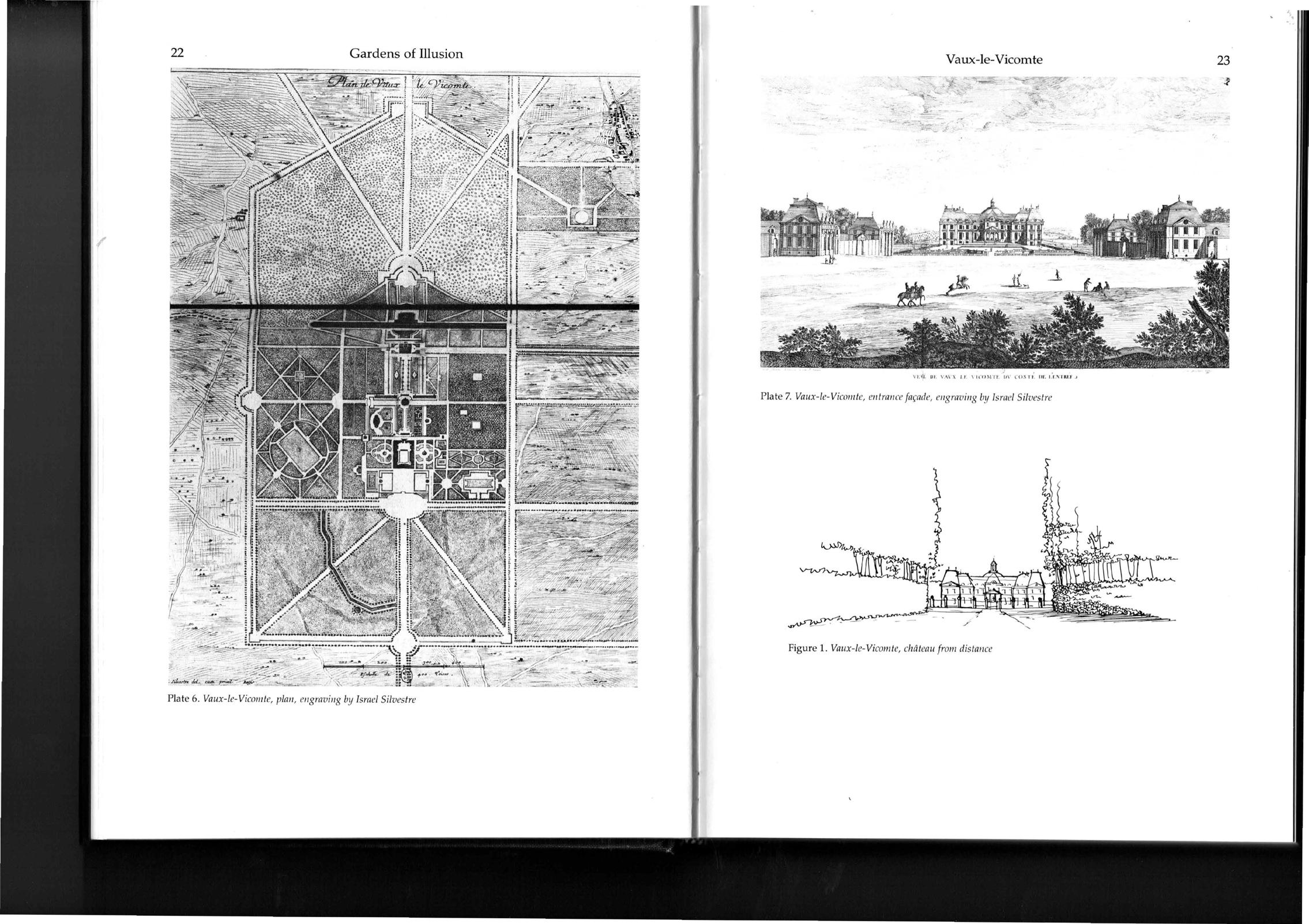
Franklin Hamilton Hazlehurst’s Gardens of Illusion: The Genius of André Le Nostre 2.14, offers an in-depth examination of his 17th-century French garden masterpieces such as Fontainebleau, Versailles, The Tuilerie Gardens and Chantilly; mostly royal commissions. Vaux-le-Vicomte (1656–1661), where he first demonstrated his genius was however Commissioned by Nicolas Fouquet, Louis XIV’s finance minister, and formed part of a collaboration with the architect Louis Le Vau, and the painter Charles Le Brun who decorated the interior of the château, Vaux-le-Vicomte is portrayed by Hazlehurst as the key precursor to the French Baroque formal gardens that would later culminate in Versailles.
According to Hazlehurst, the Vaux-le-Vicomte garden was conceived as a unified “stage”2.15, integrating the château with its surroundings. The dominant central axis and multiple subsidiary axes connect parterres, water features, and woodland areas, and extend along roughly one kilometre. The main promenade, starting at the château, proceeds through ornate parterres, circular fountains, a grand cascade, canals, a grotto, and ultimately up to a hilltop Hercules statue, while side paths or wooded trails create a more private, intimate atmosphere. Though seemingly straightforward at first glance, Le Nostre orchestrated subtle manipulations of topography, slope, and water channels so that visitors experience intentional surprises as
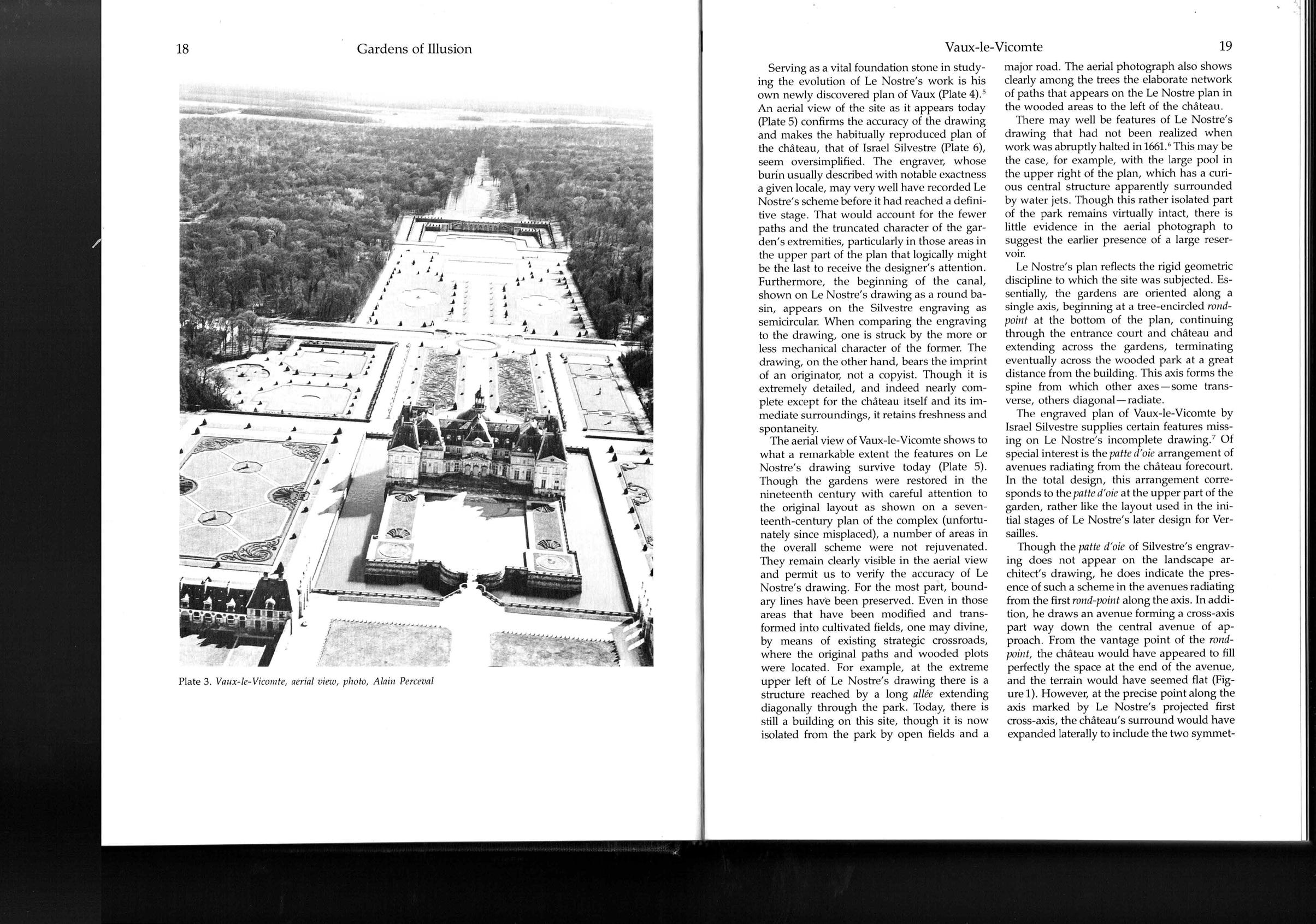
Elements such as fountains, waterfalls, canals, large sculptures, herm statues, and grottos serve as visual focal points, instilling a dynamic quality throughout the garden. Hazlehurst pays particular attention to how viewpoints change at key locations, such as the château entrance, terraces, the waterfall area, and the hilltop; demonstrating how the calculated angles and heights of water features produce illusionary effects and how withholding a full view of the garden’s depth until after passing through the central salon imparts a theatrical experience.
For instance, although imposing in scale, one of the grand basins (298m x 16m) at Vaux-leVicomte remains hidden when visitors first leave the château. As visitors proceed farther along the central axis, the basin gradually comes into view, amplifying the sense of discovery and drama. This deliberate timing underscores Le Nostre’s skillful orchestration of visual revelations, ensuring that each element of the garden emerges as part of a carefully choreographed sequence of surprises.
These theatrical effects owe much to the radical manipulation of the site’s original levels. Through substantial earthworks, Le Nostre was able to conceal or emphasise specific features at strategic points in the promenade. By recalibrating natural slopes and shifting large portions of terrain, he ensured that visitors would never see the entire composition until they had walked through it, transforming what could have been a simple garden stroll into a series of unfolding vistas.
To illustrate these “shifting views as one walks,” Hazlehurst initially employs photographic views in tandem with a plan diagram for each major development of the sequence approaching the front of the chateau, providing a step-by-step account of the visitor’s visual experience. While this method greatly enhances realism, it remains unable to fully capture the dynamic, immediate nature of being on-site.2.16
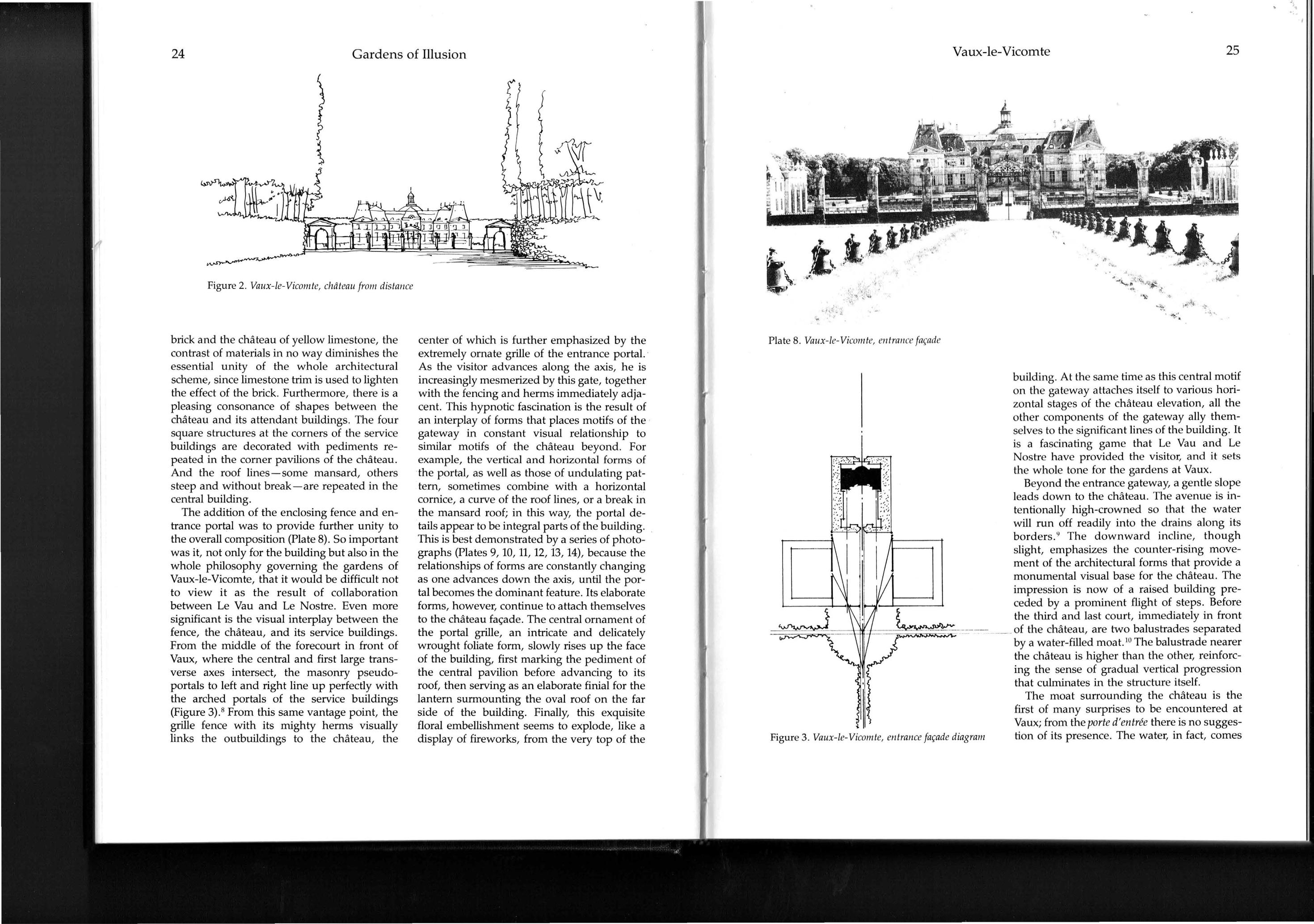
Figure 2.19 shows the entrance façade of Vaux-le-Vicomte, along with the location of points A to F on the accompanying plan.
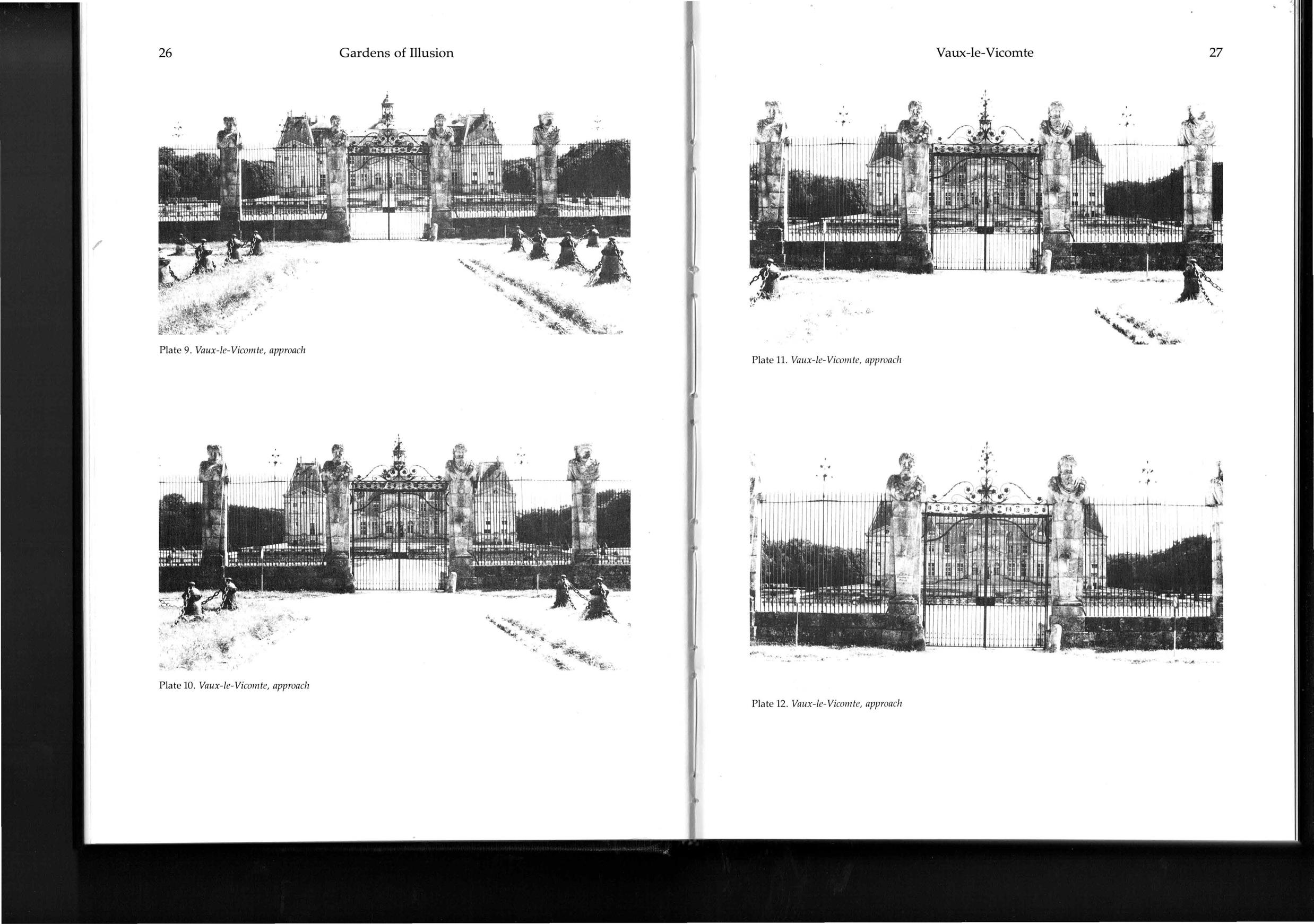
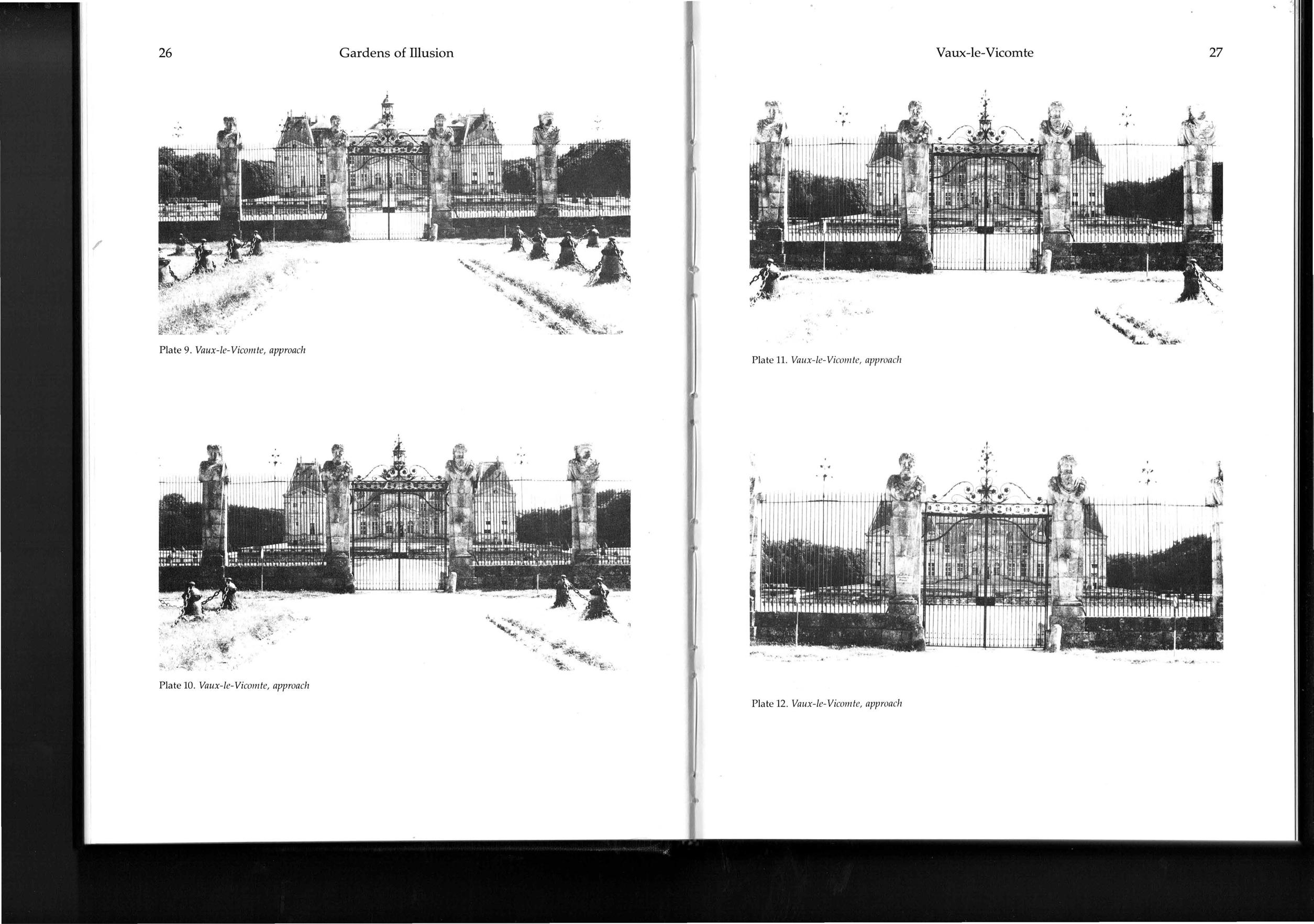
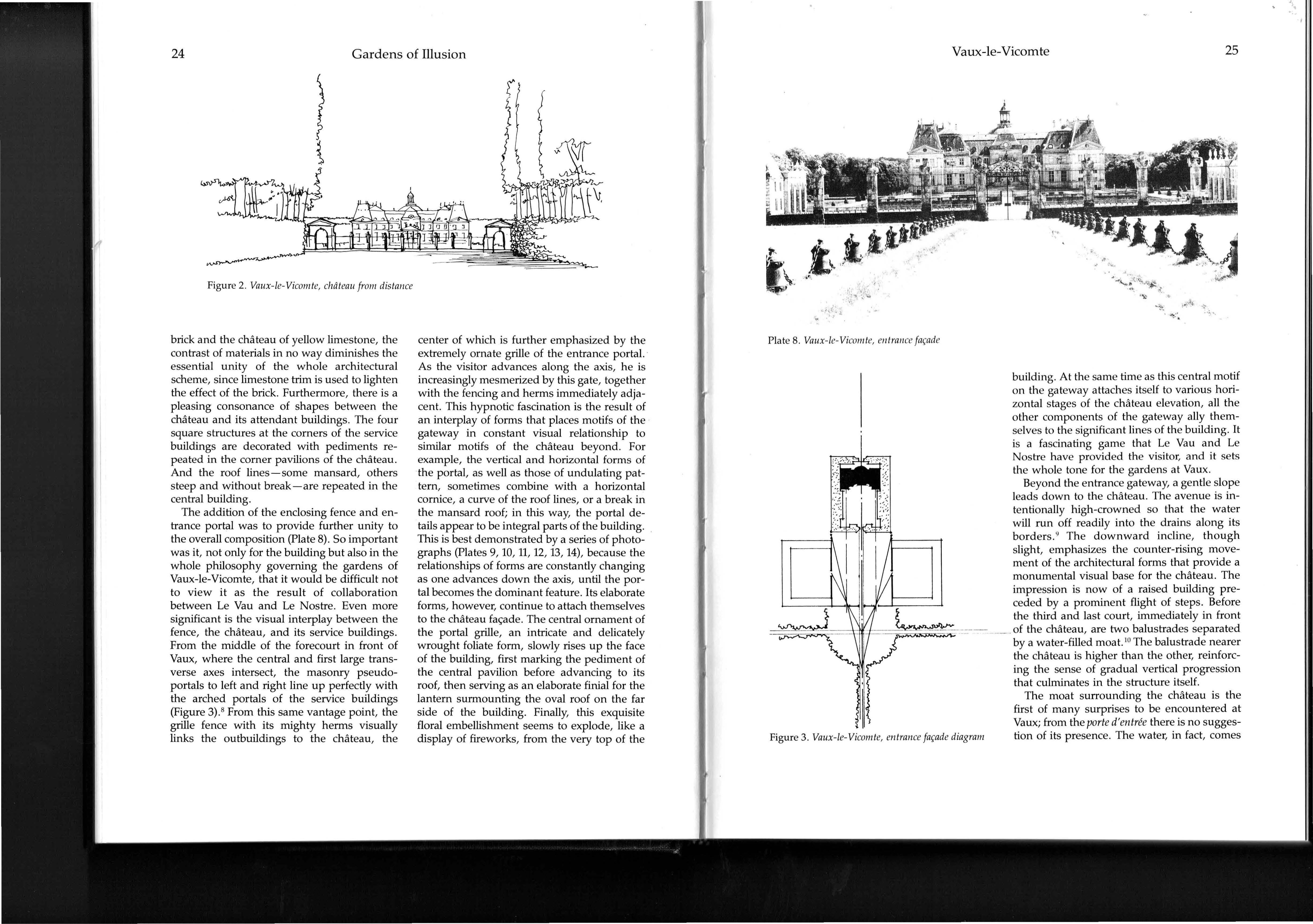
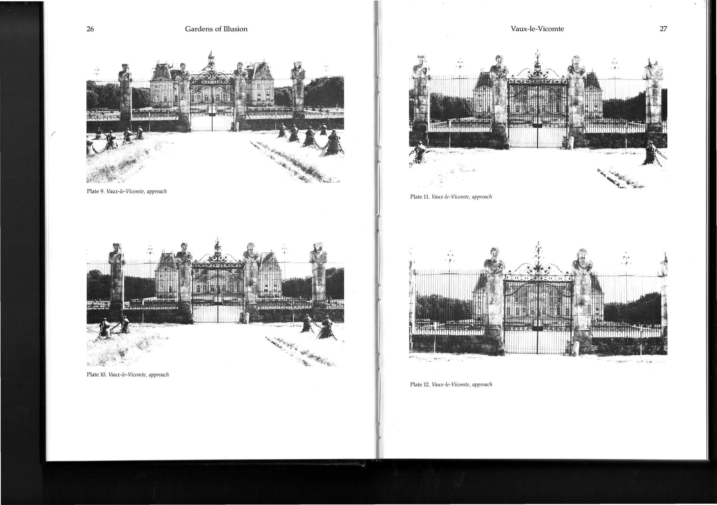
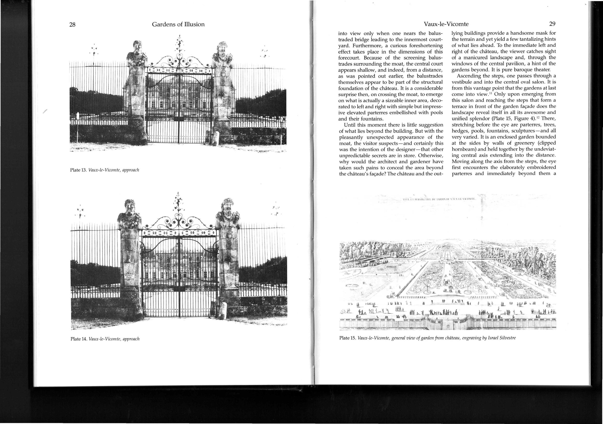
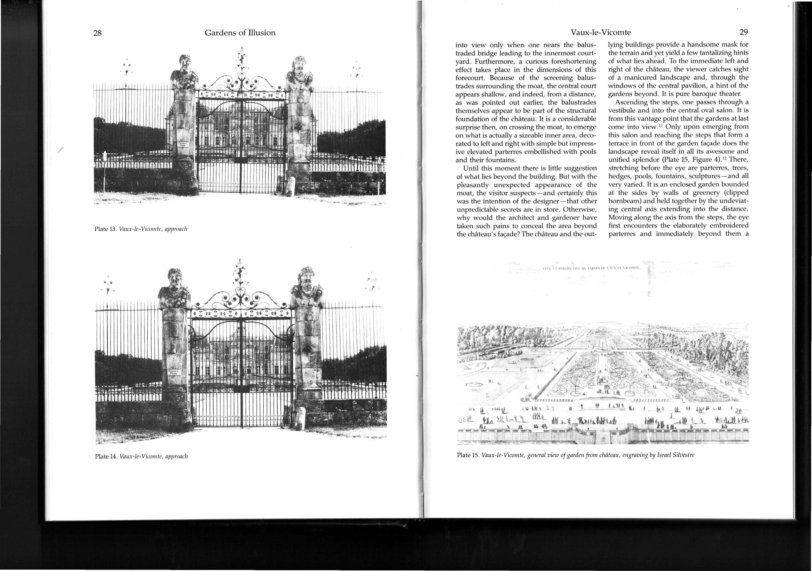
As the descriptive method above covers a distance of only about 50m, documenting the entire garden with stretches about a kilometre beyond the château to this level of detail would require an overwhelming volume of material, and fully conveying each fleeting “moment of change” is inherently difficult. In other words, although Hazlehurst’s combined use of photographic vantage points and plan drawings explains the designer’s aims and helps intensify the sense of presence, it still cannot completely re-create the lived experience of moving through the
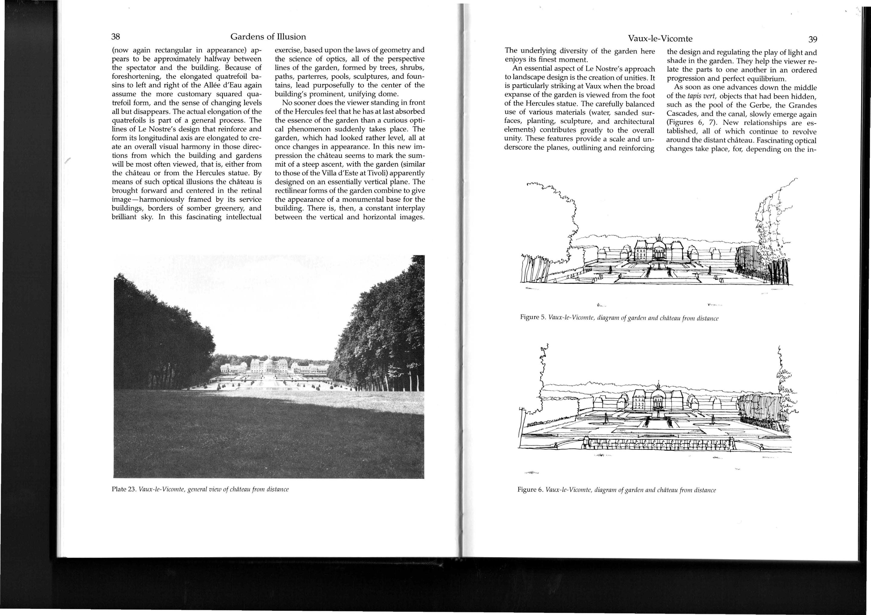
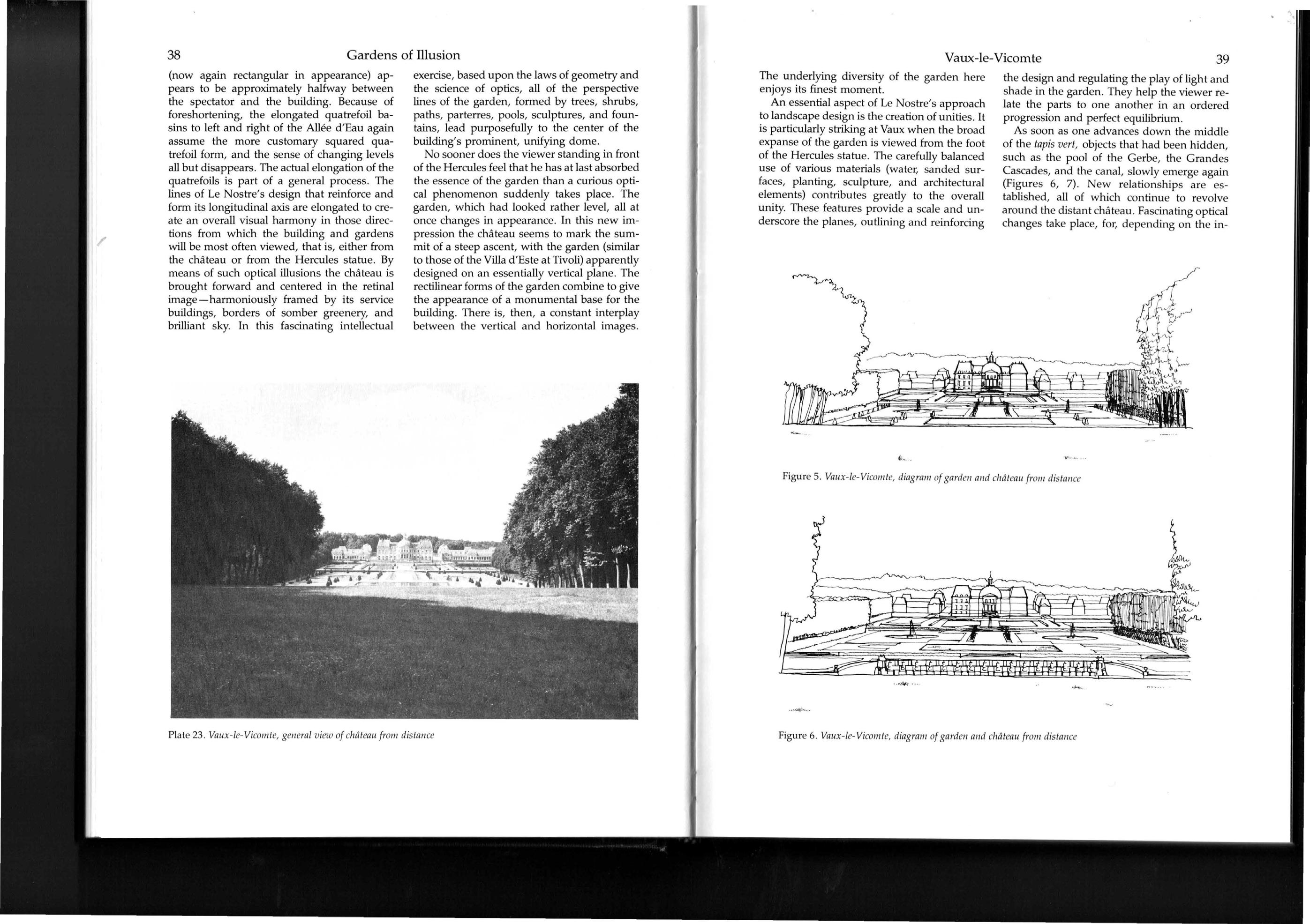
shows diagrammatic perspectives of Vaux le Vicomte, drawn from two successive positions along the central axis to illustrate the changing relationship between château, parterre and flanking bosquets
Hazlehurst also utilises illustrations by Philetus H. Holt III in order to provide diagrammatic analysis of Vaux-le-Vicomte. His diagrams feature two contrasting modes of representation. On the one hand, the château and the parterre vegetation are depicted almost exclusively by simple lines, thereby minimising graphic detail. On the other hand, hatching and black infill are utilised to emphasise elements, such as trees.
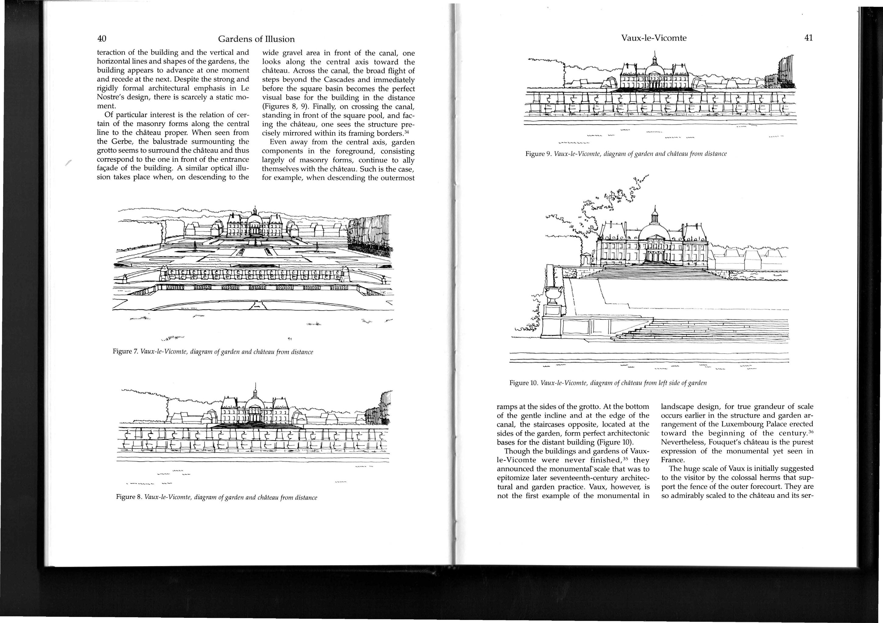
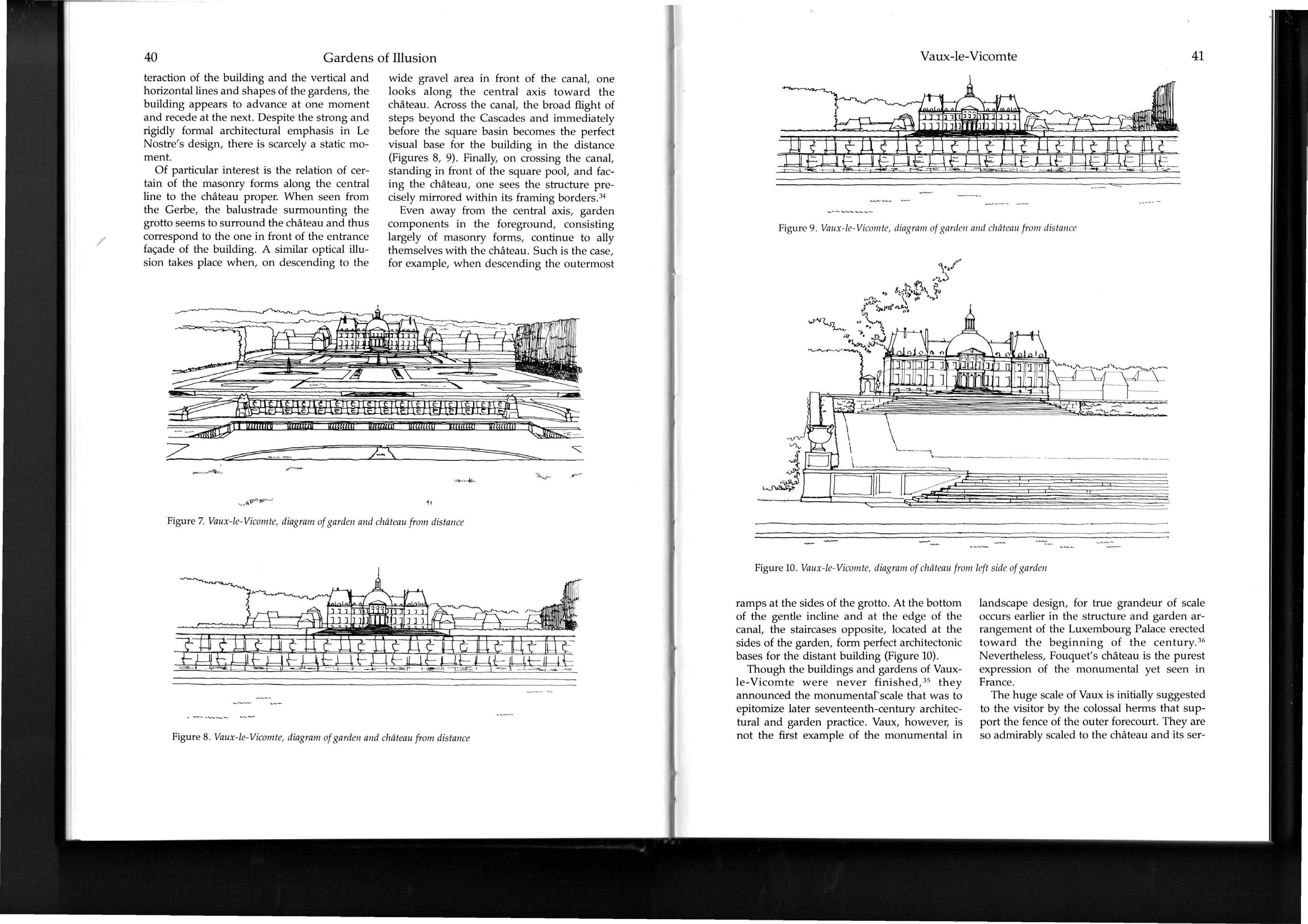
This combination, however, gives the diagram a painterly feel that can make it somewhat difficult to grasp the spatial relationships and focal points that the author is trying to make at a glance. For instance, it is not entirely clear whether the hatching on the trees is meant to emphasise those trees themselves or merely reflects the interplay of light and shadow in the original reference image. Moreover, it is not easy to determine whether the trees are intended to encircle the viewer’s field of vision as a core design feature or whether that effect is incidental.
Because the diagrams incorporate a great deal of detail and intricate line work, Le Nostre’s design intent remains insufficiently abstracted, making it challenging to immediately identify key differences as the design unfolds. As a result, they feel closer to illustration than to strictly analytical diagramming, limiting the ability to convey the underlying design ideas swiftly and clearly.
Nevertheless, Hazlehurst’s efforts to depict sequences diagrammatically, together with his emphasis on comparing diverse environments to highlight shared characteristics, deserve recognition for their academic value. While Gordon Cullen’s method , discussed in the Introduction, may provide a more vivid representation of momentary sequences of townscapes, it still faces limitations when it comes to comprehensively illustrating broader landscapes.
From an interdisciplinary research perspective or in large-scale landscape analysis, Hazlehurst’s approach thus holds considerable merit. However, because it does not fully align with the objectives of this study, it only partially adopts Hazlehurst’s analytical framework. This study will also intend to develop an ideogram that simplifies and segments large-scale landscape spaces, enabling a more holistic and manageable visualisation of extensive environments.
Sang-heon Lee’s “The Identity of Korean Architecture” attempts to clearly delineate what he sees as the essential differences between Korean and ‘Western’ architecture, theorising the unique characteristics and wisdom of Korean architecture and proposing ways to embody them in a contemporary context. Unlike ‘Western’ architecture, which exists primarily as an object of aesthetic perception, Korean architecture, he argues, was understood as a means to attain enlightenment or spiritual realisation rather than as an independent discipline in itself. 2.17
However, there is a limitation in the way Lee treats “Western architecture” as a single unified category. He differentiates Korean architecture from that of China and Japan yet does not make comparable distinctions for ‘Western’ traditions. This approach risks overlooking the wide diversity in European architectural histories, including those of Italy, France, and England, each of which has its own historical, cultural, and geographical background and developments in North America. By focusing almost exclusively on the Joseon dynasty, he also underrepresents earlier periods of Korean architecture such as Goryeo (AD 918–1392) (Park, n.d.), Silla, and Baekje (100 BC – AD 700) (Lee, 2014). This indicates that it is difficult to maintain the idea of one uniform and unbroken tradition in any culture, whether in the East or the West.
He argues that whereas ‘Western’ architecture places a strong emphasis on visual experience, Korean architecture highlights human scale through the use of the five senses and bodily experience. In terms of the subject of experience, he argues ‘Western’ viewers tend to observe architecture from a visual distance, while in Korea, the subject simultaneously occupies both the inside and the outside.2.18
Lee points to Kim Hong-do’s painting Ju-Sang-Gwan-Mae-Do (舟上觀梅圖 ) as an illustration of this phenomenon: the overall landscape is viewed from above, yet the boat floating on the river is presented as if seen from below looking upward. Lee also notes that in a Joseon-era painting (from King Yeongjo’s 23rd year, AD 1747) of the Confucian institute known as Taehak ( 太學 ), site layout, plan, and elevation can appear together on the same surface. According to Lee, rather than rationalising architecture from a single viewpoint with geometric perspective or discrete plan/elevation drawings, Korean illustrations integrate diverse vantage points into one image, thereby reflecting an experiential and life-oriented spatiality.2.19

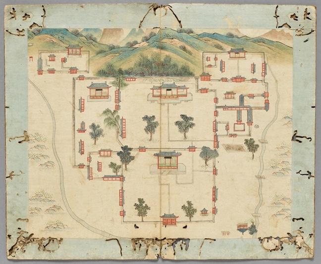
He further maintains that Korean architectural depictions were not intended as “design perspectives” for construction but as post-construction records, blending multiple viewpoints throughout a single scene. By contrast, ‘Western’ architecture, according to Lee, often employs a single viewpoint (primarily visual). Consequently, he contends that Korean architecture can only be fully experienced through fluid, scattered perspectives and embodied sensation it cannot be grasped from a single exterior vantage point. One must move among various positions to piece together the whole, so that nature and architecture interweave rather than remain separate, culminating in a concept of space that is simultaneously both inside and outside, and outside and inside.
However, it is not entirely impossible to find a similar emphasis on shifting viewpoints and integrated landscapes within ‘Western’ traditions. For instance, Vanbrugh and Hawksmoor’s landscape and circulatory design at Castle Howard, which forms Case Study 2 encourages visitors to move through the grounds and scenes in succession. Consequently, Castle Howard cannot be grasped from a single spot but instead reveals its full character only through an experiential process in which buildings and surroundings are closely interwoven. This observa-
tion suggests that ‘Western’ architecture can accommodate multiple viewpoints and dynamic spatial engagement, and it therefore challenges Lee’s position that ‘Western’ design invariably revolves around a singular perspective.
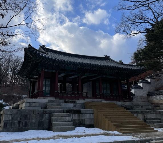
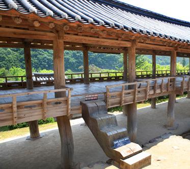
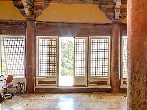
In Lee’s conception of Korean architecture, the boundaries between inside and outside are neither distinct nor fixed; rather, they overlap ambiguously. Elements such as eaves, maru (wooden floors), and courtyards create these flexible borders. When expanding individual spaces, Korean architecture often forms a collective ensemble surrounding courtyards or open spaces, leaving the centre empty. He contrasts this approach with ‘Western’ architecture, which defines a sense of space focused on a solid central mass. In this view, Korean buildings are not enclosed objects but rather woven into their surrounding environment, with no single point of demarcation between what is indoors and outdoors. This fluidity contrasts with an architectural model that rests on a unified central core.2.20
Furthermore, he emphasises, in its relationship with nature, Korean architecture does not separate but rather connects and harmonises architecture and the natural environment. This philosophy is evident in how gardens are arranged and how building sites are selected. He argues that in Korea, what is referred to as “architecture” was never delineated as a specialised field of knowledge in the way it was in the West, where “architecture” became an institutionalised profession. In Korea, constructing a house was traditionally termed yeongjo (營造 ) or yeonggeon ( 營建), denoting not only the technical and procedural aspects of building but also subsequent upkeep and management—an activity encapsulated in the concept of gyeongyeong ( 經營). Significantly, this term indicates that rather than objectifying the structure itself, Korean tradition emphasised the modes of living and daily practices facilitated by the building.2.21
The term “건축 (architecture)” was introduced via Japan’s translation of the ‘Western’ concept into Sino-Japanese characters in the nineteenth century, which then spread to Korea, China, and elsewhere in East Asia. However, when ‘Western’ architecture reached Korea through Japan, the original nuances of “architecture” were not thoroughly assimilated, and it tended to be regarded simply as a novel technology. While East Asia in general had relatively few theoretical treatises on architecture, the process of constructing houses undoubtedly involved sensibilities and knowledge that transcended purely technical application.
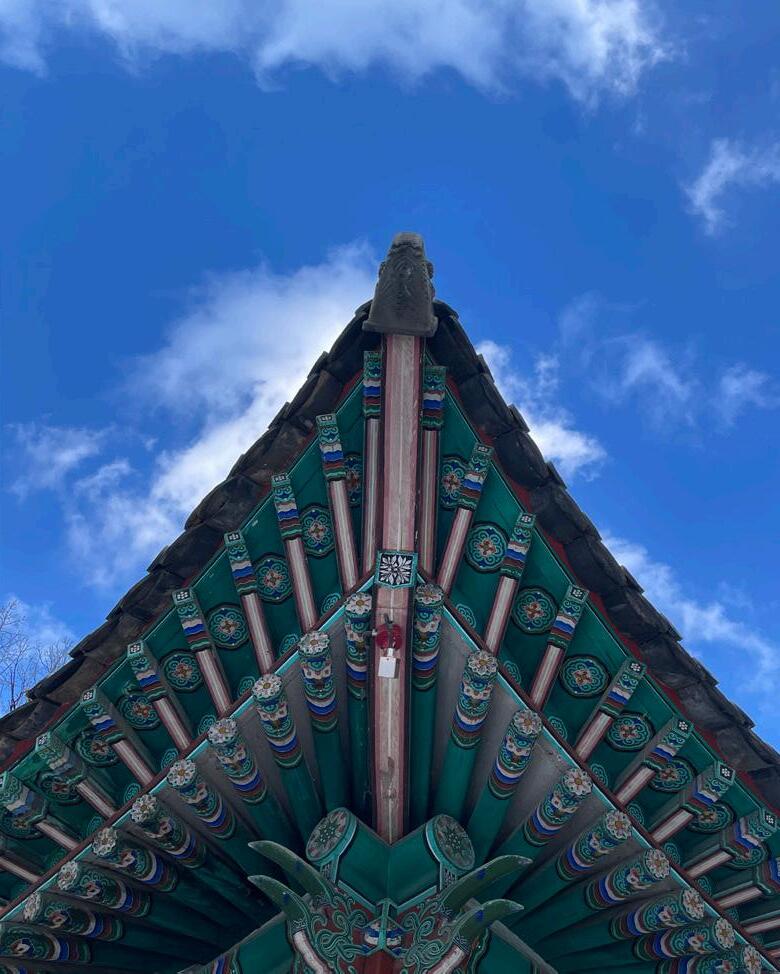
Lee states that Korean architecture, in particular, was characterised by a reliance on experiential and sensory understanding rather than rigorous quantification or theorisation. He points out for instance, that in the early twelfth century, China published the Yingzao Fashi ( 營造法 式), systematically codifying architectural knowledge, and Japan similarly compiled regulations for its master carpenters. By contrast, in Korea, fewer tools were developed; carpenters famously used only a small number of tools such as planes, reflecting a preference for intuitive, experience-based approaches over mechanical standardisation. As a result, Korean buildings often preserved natural curves and the inherent shapes of materials. The three-dimensional curvature of eaves and the sanja seokkarae ( 山字 서까래 ) rafters exemplify these forms, which do not lend themselves easily to quantification.
In contemporary cities, however, residents have largely become accustomed to ‘Western’ frameworks of perception and environment, making it difficult to experience or design urban spaces and architecture solely from a traditional internal vantage point. Consequently, this book advocates for a new architectural order, one that transcends Western-centric models and reinterprets the intrinsic principles of Korean traditional architecture within a modern context. Crucially, it argues that this “new architecture” must not merely replicate historical forms but rather incorporate the accumulated wisdom and insight of tradition in ways that are resonant and meaningful for present-day conditions.
Lee is sceptical of the claim that cultural characteristics will eventually merge into a single entity through globalisation. He argues that architecture inherently depends on each region’s natural environment and cultural context, making the notion of a fully universalised architecture that disregards local identity and climate unfeasible. Consequently, he stresses the importance of exploring and maintaining regional architectural traditions and cultures.
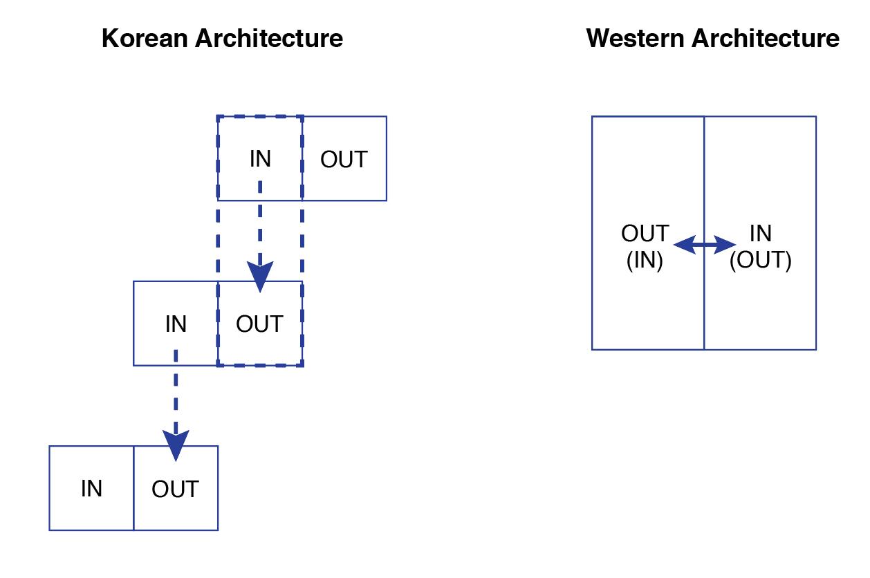
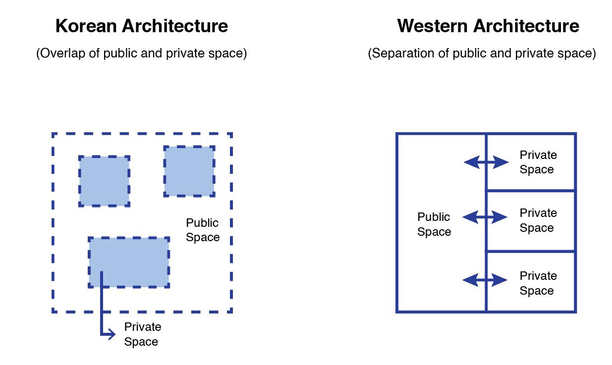
Building upon these considerations, the approach focuses on analysing the visual characteristics of Korean and ‘Western’ architecture by transforming them into “diagrams,” then applying those insights in a contemporary manner suited to the Korean context. However, these diagrams have limitations in visually capturing Lee’s concept of spatial fluidity within the Korean tradition. Their simplified representation, relying solely on plans and textual annotation, restricts their explanatory effectiveness. If Lee had utilised sectional diagrams rather than simplified plans, it could have more clearly illustrated how the positions of maru and eaves relate to walls and thereby articulated the dynamic interplay between interior and exterior spaces typical of Korean traditional architecture.
Therefore, the approach here focuses on a means of analysing the visual characteristics of Korean and ‘Western’ architecture by transforming them into “diagrams,” then applying those insights in a contemporary manner when investigating the Korean context. This perspective seeks to contribute to the advancement of future architectural design and provides an important way for Korean architecture to integrate with a Western-centric paradigm and move toward a modern and creative expression rooted in Korea’s traditional culture.
This study investigates linear routes in historical British and Korean contexts to highlight the carefully sequenced experience intended for visitors as they move through these landscapes. Actual visits inevitably vary with weather, season and moment-to-moment sensory inputs such as birdsong, yet each site possesses a stable backbone to the design that endures across those fluctuations. That spine is defined by the way views are framed, the deliberate placement of objects (the vertebrae that form the route), and provides the year-round correlations between key features regardless of environmental conditions which make every visit a unique experience.
The ideograms produced for this research, therefore, focus on that designer-made backbone, purposely omitting every nuance of climate, season or sound. Although visually simple, they capture the rhythm and spatial pattern through which the route was meant to guide its audience, ensuring the diagrams remain faithful representations of the site’s essential structure and of the designer’s enduring intent under changing conditions.
The most intuitive analogy is the London Underground map. One version above is geographic, recording every meander of the Thames, every principal road alignment and correct spatial relationship; the other, far more widely recognised, is a schematic diagram that straightens each line and shows only the order of stations and their interchanges. While the geographic map preserves its full landscape context, the schematic deliberately sheds that environmental “noise,” laying bare the network’s operative logic.
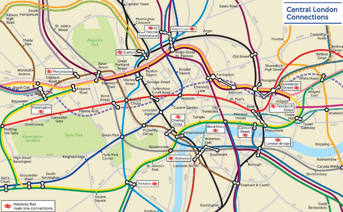
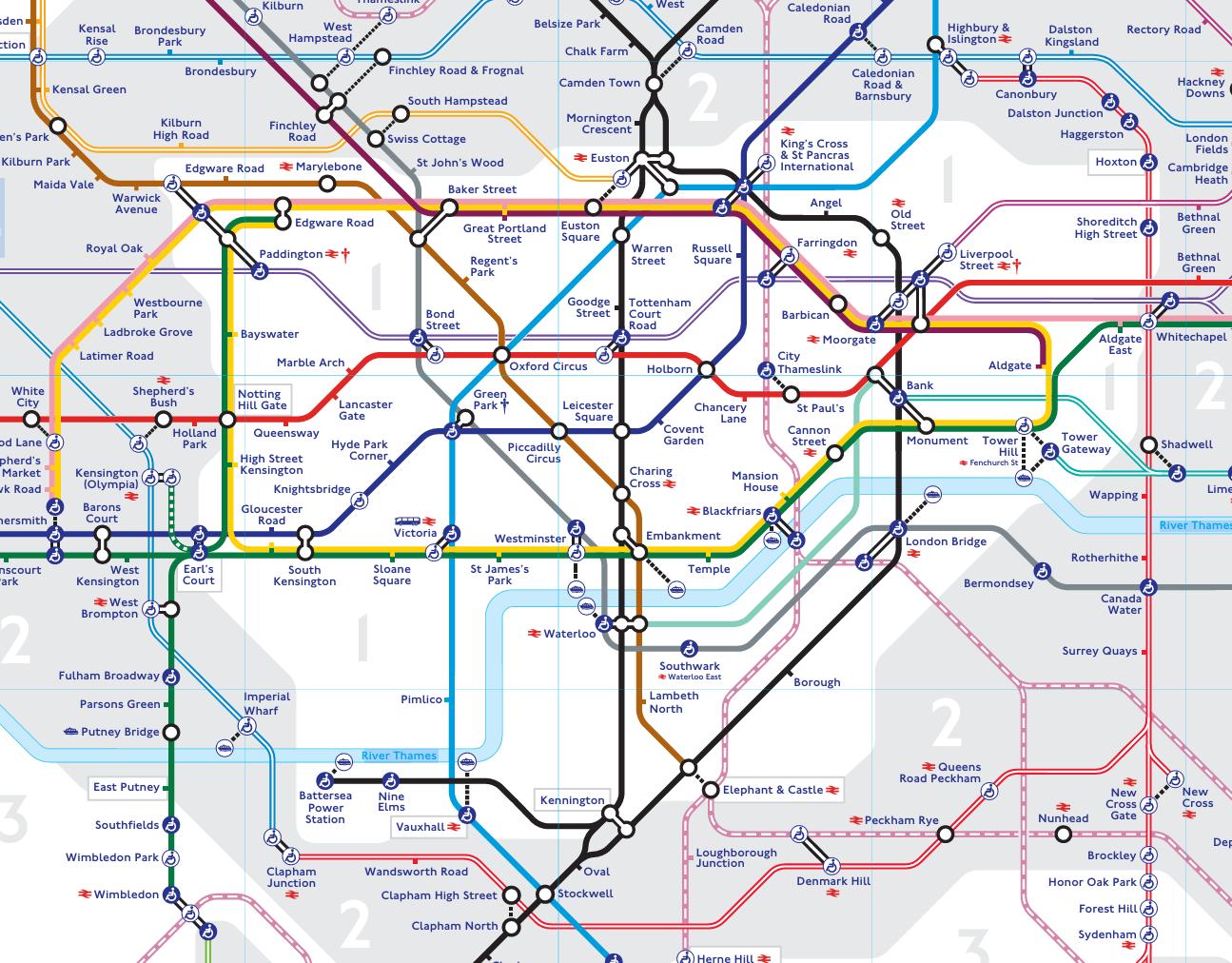
In the same way, the ideograms adopt this principle of reduction. By stripping away the environmental variables that inflect each individual visit, they expose only the journey’s spine and the devices that function as its vertebrae. Just as placing the two Tube maps side by side clarifies how simplification sharpens structural understanding, these diagrams compress each landscape’s intended rhythm and sequence into a lucid graphic form.
In Taking Measures Across the American Landscape (1996), James Corner redefines “measurement” as more than a matter of physical quantities; it becomes a register of social, cultural, natural, and even spiritual forces. His collage drawings compress each site into a single, resonant image that exposes hidden orders of topography and history. What they cannot show, however, is how perception changes from one step to the next as a visitor walks through the terrain. The method excels at apprehending a place in isolation, yet it offers little guidance when we wish to compare different routes and their choreographed experiences.
Corner acknowledges this limitation himself. He refers only briefly to the routes the surveyors’ traverses that first inscribed these landscapes on paper, and he questions whether the idea of movement can ever be captured in a single photograph. In Taking Measures, he sought not to describe movement through space but to distil it into a single, synthesised experience. When he turned to linear projects such as New York’s High Line, that strategy proved inadequate; he amended his approach by adopting a sequence-based design logic that adopts progressive views, timed reveals, and the embodied choreography of walking. This evolution directly bolsters the methodological stance taken in this dissertation, underscoring the need to study landscapes as temporal processes rather than static images. Nevertheless, even Corner’s treatment of the High Line monograph does not reach the degree of abstraction realised by the ideogrammatic method advanced in this dissertation.
Min and Lee (2019) analysed historic gardens from a purely quantitative perspective. They mapped the geometric relationships among terraces, axes and focal points, and their measurements revealed recurring spatial patterns. However, the approach did not explain how these arrangements are felt by someone who walks, pauses or turns within the space.
In contrast, Hazlehurst’s Gardens of Illusion relies on diagrammatic descriptions that link plans to sequences of photographs so that different places can be compared. His diagrams succeed over the first fifty metres of an approach path, where a handful of images can capture subtle shifts in view, yet they become unwieldy once the walk stretches to a kilometre. The graphics that are semi-abstract and highlight key moments of change but remain too pictorial and never become abstract enough to place Le Nôstre’s various gardens, or any other long and continuous linear experience, on an analytical footing useful for comparison.
Lee’s research on Korean architectural identity argues that spatial experience in the Korean tradition is fundamentally holistic: buildings, topography, vegetation, sound and seasonal change form an indivisible environmental continuum. Unlike his ‘Western’ paradigms that privilege discrete architectural objects, Korean design is read as porous and dynamic, with movement dissolving the threshold between inside and outside. To visualise this, Lee employs step square diagrams annotated with directional arrows. While these graphics do register flows and overlaps, they remain plan-based and essentially static; they cannot reveal how sensations evolve from one moment to the next along a path. As a result, they fall short of offering the experiential narrative or comparative clarity required for this study, a gap the proposed ideogram method is designed to bridge.
This study therefore adopts an ideogram method that answers the shortcomings of earlier work. Corner’s collages freeze a landscape in a single frame, Min and Lee’s statistics chart form without feeling, and Hazlehurst’s photographs and key plans lose clarity once a walk grows long. Lee’s step square diagrams hint at movement yet stay fixed on the page. The proposed ideogram follows each key spatial device moment by moment, recording how perception unfolds along a route. It keeps the designer’s intended structure in view while letting different journeys be set beside one another for clear comparison. By placing the visitor’s changing outlook at the centre of the analysis, the method bridges the gap between formal description and lived experience.
In response to these challenges, this study adopts an ideogrammatic method. It takes useful ideas from Corner, Min and Lee, Hazlehurst and Lee, and addresses the gaps that remain in visitor-centred comparisons. It does so in the following ways.
1.Focusing on Key Elements
Ideograms display symbols for framing gateways, buildings, significant objects, and lines of sight. This avoids unnecessary detail and directs attention to the elements visitors actively notice.
2.Emphasising Sequences of Movement
The research identifies how visitors see or lose sight of features at particular points. These changes are shown through step-by-step diagrams representing visibility and orientation shifts.
3.Applying a Consistent Format
Each site’s diagram is presented in the same visual style, which allows for systematic comparison across different sites and cultures. A single legend marks essential components such as portals and focal objects.
4.Combining Multiple Sources
Diagrams reflect information from site visits, historical records, archival maps, and online visual tools such as Google Street View.
5.Definition of the backbone
The basis of any linear design consists of the elements that together form the spine of the design, such as visual framing, the strategic placement of objects, and the rhythm of sequences. As people pass through space, visual framing defines what is revealed or hidden as they go from one point to another or from one time to another. The direction of the movement is directed by the placement of objects and by the rhythm of the sequences, which arranges and times the sequences and objects in a deliberate and immersive manner, regardless of external factors.
A clear set of basic graphic symbols is devised to represent recurring features. These shapes identify gateways, interior and exterior views, framed scenes, and focal points; each of which affects visual perception. Less significant details, such as minor vegetation or terrain changes, are usually excluded.
Basic Element
Ideogram
Description
This frame defines the extent of the perceptual field.3.1
Thicker edges to the frame indicate enclosure by trees, walls etc, that constrain attention to what is directly ahead
This indicates that views expand laterally - in one or both directions.
This symbol denotes an object (for example, a pyramid).
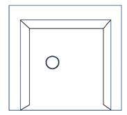
This icon represents a framing device, such as a gateway
This shape indicates the experience of being inside the framing device.


This symbol represents an abrupt change of level such as a stair
All the dotted lines represent elements that are present but hidden (obscured from direct view).
This indicates an enclosed space like the courtyard at Buseoksa Temple
Figure 3.3 shows the single elements of the ideogram and their descriptions.
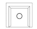
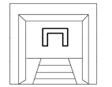
The table below presents examples of combinations of the single-element graphic symbols discussed above. above to create ideograms.
Basic Element
Ideogram
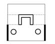
Description
Within a gate, the visitor observes an object ahead.
Within a gate, the visitor observes the next gate only after mounting its staircase.
The visitor can observe the hidden extended walls beside the next gate while within a courtyard, which contains the two objects.
Figure 3.4 shows examples of combining single elements of ideograms and their descriptions.
Each ideogram functions as a vertebra in the route’s spine. It freezes one viewing compositional condition, showing the prospect in front of the visitor and the way key objects frame that view. The investigations by the experimental psychologist Michael Kubovy and his colleagues about the implicit priority given to forward vision and the inability to ideate easily what exists behind the head are relevant. Also experiments conducted by David N. Lee and his collaborartors have shown that people privilege the optic array directly in front of them when visual cues clash with bodily cues. Lee’s “moving room” experiment further demonstrates that observers can feel themselves in motion on the basis of frontal visual information alone and that, when visual and bodily signals conflict, they trust the forward view first.3.2
As the visitor advances, a fresh ideogram slots into place while the previous one slips from sight, so the drawings accumulate vertebra by vertebra to build a continuous backbone of experience. In this way, the full set of diagrams records how sightlines open, overlap and close again, turning movement itself into a legible sequence. However, exactly where the transitions between successive conditions occur will vary according to the different eye levels of individuals.
The study aligns these diagrams side by side. It then identifies shared ideas, such as linear routes and staged openings, along with any differences that arise from cultural or historical backgrounds.
This method reveals ways to compare user experiences on large sites without overwhelming detail. It shows the main spatial patterns rather than every minor element and focuses on how design decisions guide visitors through each environment. Its structure is influenced by Corner’s emphasis on abstraction, Min and Lee’s urge for systematic comparisons, and Hazlehurst’s interest in sequential representation. It also engages with Lee’s exploration of cultural identity and allows exploration of whether distinct traditions can share common approaches in creating immersive spaces.
This framework may be extended to other linear parks and heritage site studies. The ideogram technique brings out similarities in places that might seem unrelated, such as old temples, eighteenth-century gardens, and newly converted overpasses. By extracting the most essential elements of each layout, the research demonstrates that core spatial organisation can be universal, even when expressed in diverse cultural settings.
This methodology will be applied to two case studies, Buseoksa Temple and Castle Howard, in the following sections. Sequences, framing, and placement of objects that define the visitor experience at each site will be mapped out using ideograms.
Although examining just two examples does not allow universal generalisations to be made, it provides valuable insights into how designers utilise such sequencing, object placement and framing that guide visitors through space. This study intends to distil these techniques of design, showing the principles that underly the coherent experience of space beneath the ever-changing external conditions of any particular visit.
These two locations have been chosen because each marks the point at which a new way of thinking about designed landscapes first emerged within its own culture.
In seventh-century Korea, Buseoksa Temple inaugurates a temple layout that guided pilgrims through a sequence of progressively revealed spaces. (see Appendix 2) In early eighteenth-century Britain, Castle Howard has come to be seen as the origin of the English Landscape Design tradition that went on to become highly influential abroad, signalling a shift away from the formality of Baroque display. 3.3
Although separated by more than a millennium and by great geographic distance, both sites evolved through additive accretion and therefore offer comparable examples of how their designers choreographed movement and perception over time. Research on these two case studies will help focus on how these two design principles manifest themselves in different cultural contexts, showing commonalities which underpin both and identifying differences.
By synthesising the insights drawn from these analyses, the study will present core design principles that can be applied in diverse contexts (historical, cultural, and in the design of future urban regeneration) and outline directions for future research.
Finally, the implementation of these ideas will be demonstrated with an example from the Seoullo 7017 project, demonstrating how universal design strategies can be adapted to contemporary urban contexts.
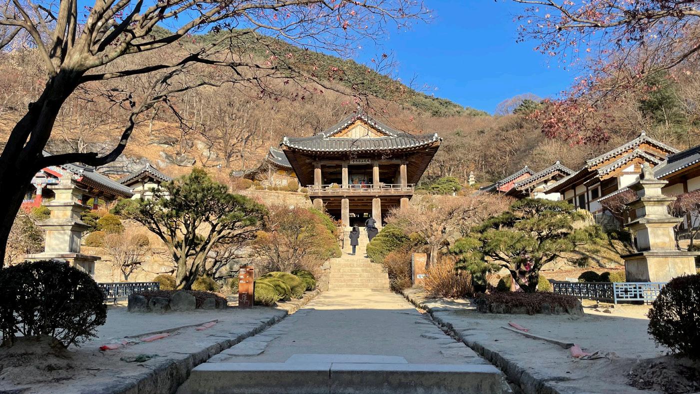

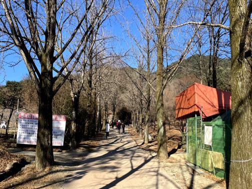
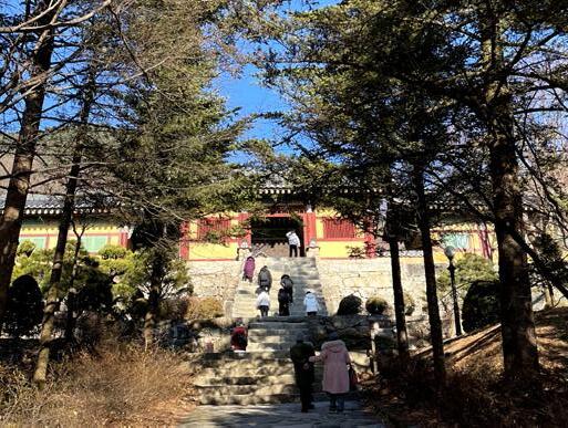
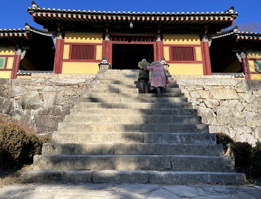
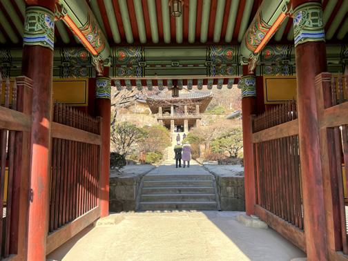
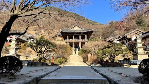
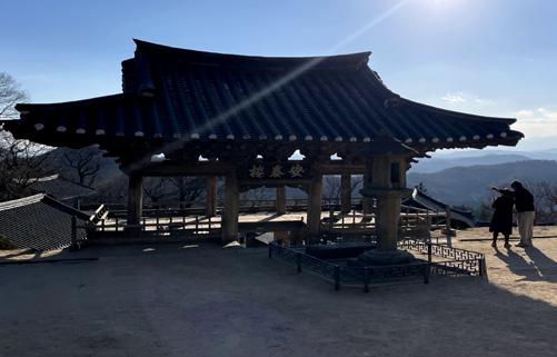
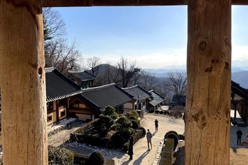
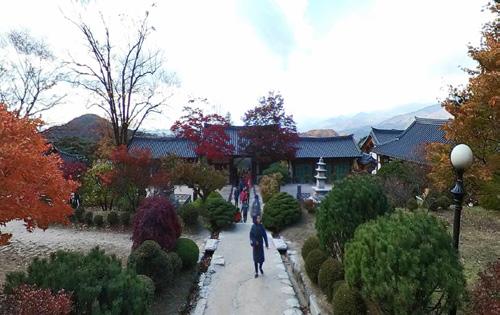
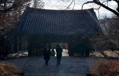
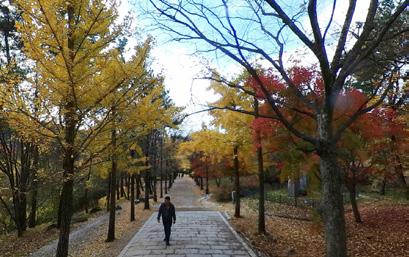
Buseoksa Temple is analysed in this study not for its religious function or historical significance, but for its role as a particularly prominent and representative example of spatial sequencing within Korean traditional architecture, carefully controlling visitors’ movement, perception, and engagement with the landscape. This case study examines how the temple’s architectural layout influences visitors’ experience of gradual revelation, transition, and spatial rhythm as they navigate through the site.4.1
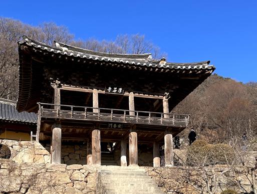
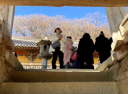
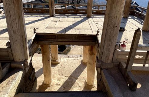
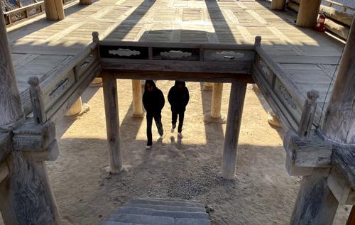
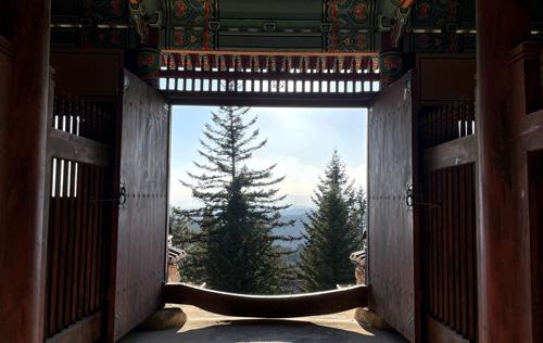
At Buseoksa Temple, the boundary between interior and exterior is, as Lee has asserted, notably fluid in many of the structures, but less so in some others. In the most complex examples, one passes through or even underneath a nu-maru (a raised wooden floor) or veranda, thereby creating an intermediate zone that is neither fully inside nor entirely outside. This spatial arrangement encourages visitors to experience subtle changes in light, air, and temperature while moving through the temple complex. Consequently, the line between “inside” and “outside” becomes remarkably permeable. 4.2
4.1.1
Buseoksa Temple is a representative Buddhist temple in Korea, located in Yeongju, North Gyeongsang Province, and is related to the Hwaeom 嚴. 4.3 The Hwaeom was a new branch of Buddhism in Korea that expounds the doctrine of an interpenetrating realm of all phenomena in which the one embodies the whole and the whole resides in the one. In the seventh century the Chinese master Fazang systematised its teachings and clarified the mutual interdependence of all phenomena. In 676 A.D., King Munmu of Silla, intent on consolidating royal authority, instructed the monk Uisang to establish Buseoksa Temple, making it the first state-sponsored realisation of Hwaeom thought in Korea, as it is recorded in Songgaoseungjeon (宋高僧 傳 ) and the Samguk Yusa (三國遺事 ). Legend holds that, upon returning from Tang China, Uisang was aided by Seonmyo (선묘) who became a protective dragon and transformed-into a massive “floating stone” (부석) to fend off outlaws at Bonghwangsan. It has undergone several reconstructions, reflecting the royal patronage and social and political environment during its history. The name of “Buseok (浮石)” comes from the meaning of “floating stone”, it is still remaining and visible behind Muryangsujeon, it emphasises the temple’s mythic aura.4.4 Today, Busoeksa Temple remains as a dynamic place of worship and was inscribed on the UNESCO World Heritage List under the title “Sansa, Buddhist Mountain Monasteries in Korea”
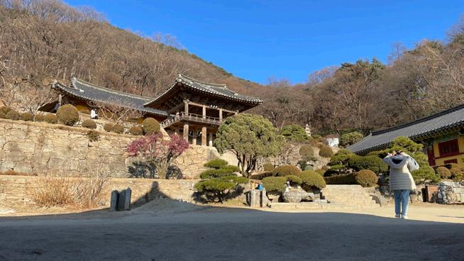
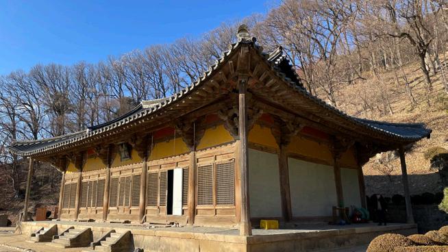
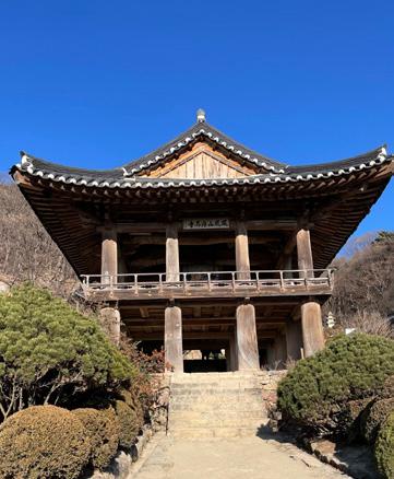
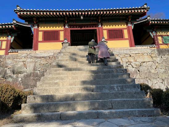
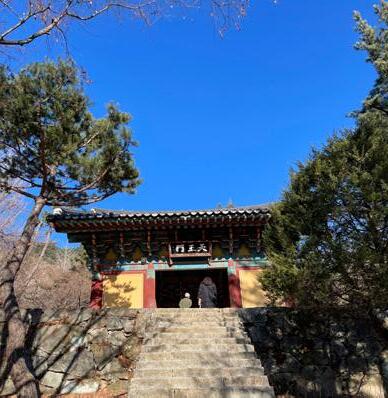
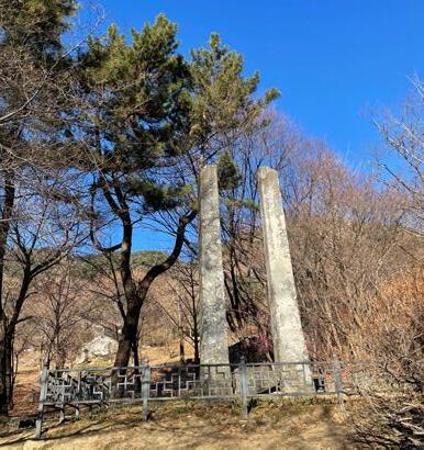
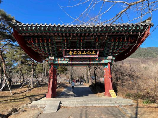
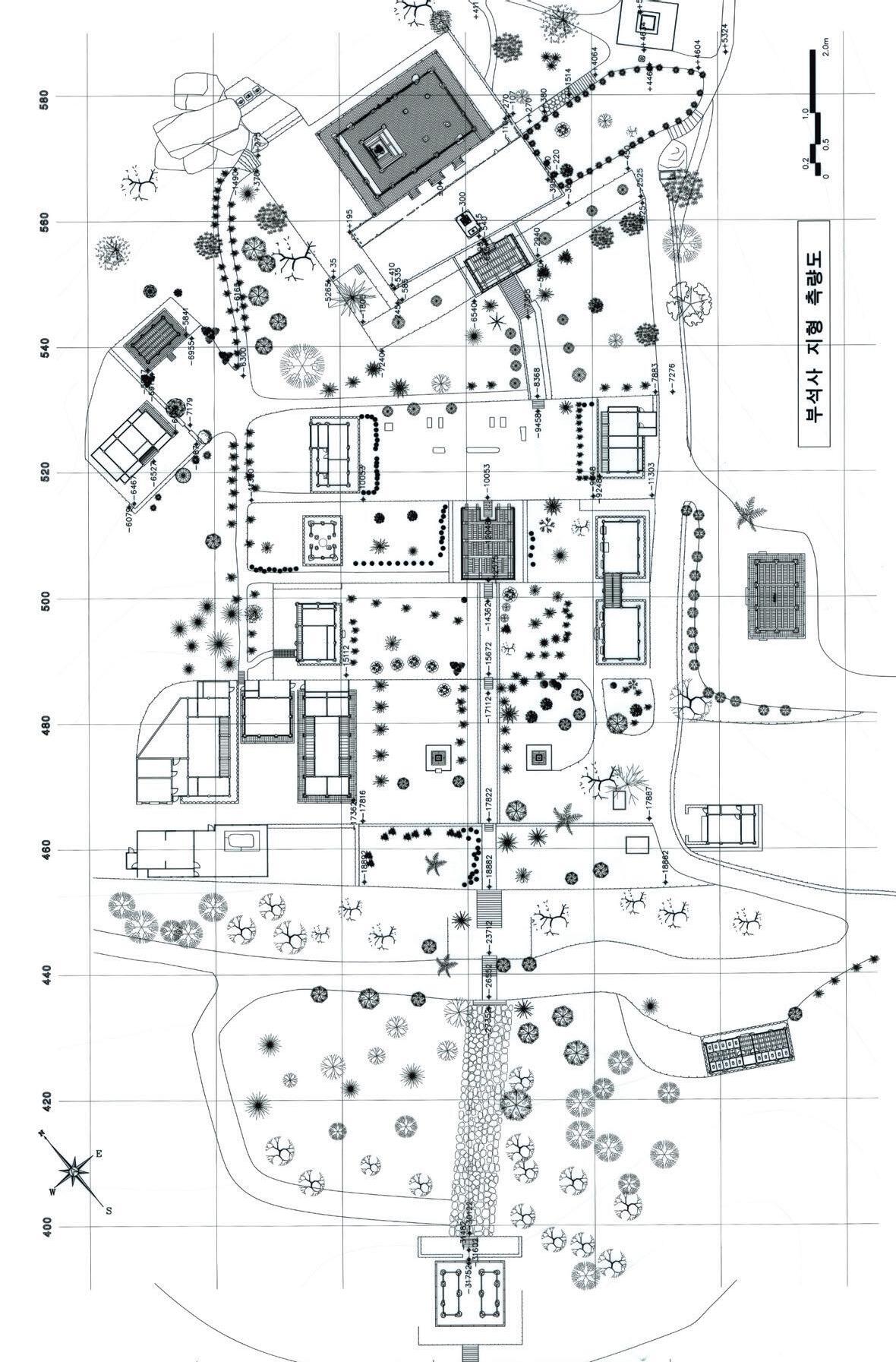
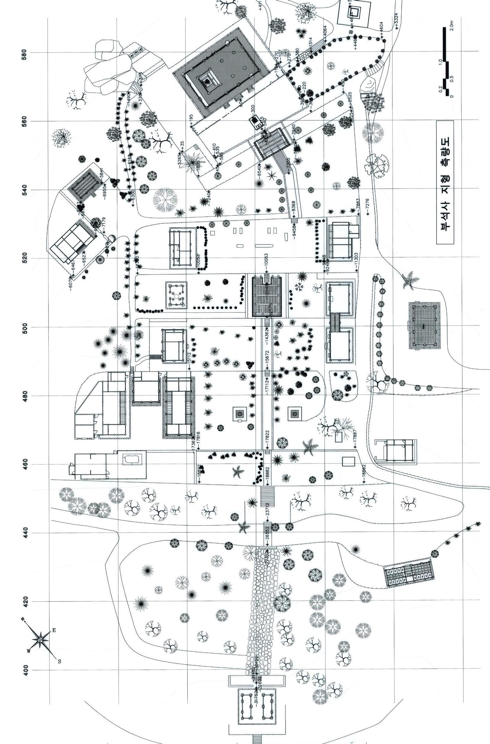
Situated on a sloping mountainside, Buseoksa Temple’s layout emphasises both practical and symbolic spatial organisation.
4.1 shows the key architectural elements of Buseoksa Temple, as represented on the site plan.
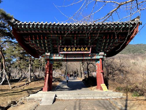
A.Iljumun Gate ( 일주문 )
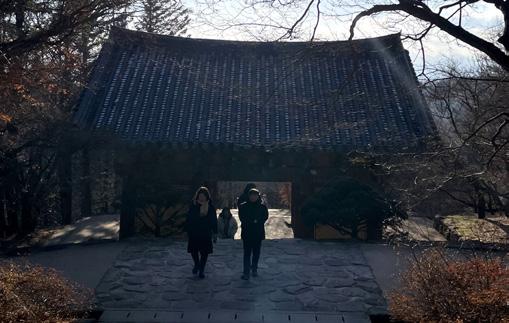
It serves as a symbolic boundary between the secular world and the sacred Buddhist realm, emphasising the separation between the external and internal worlds; lacking a physical door, it also acts as a symbolic gateway of the mind.
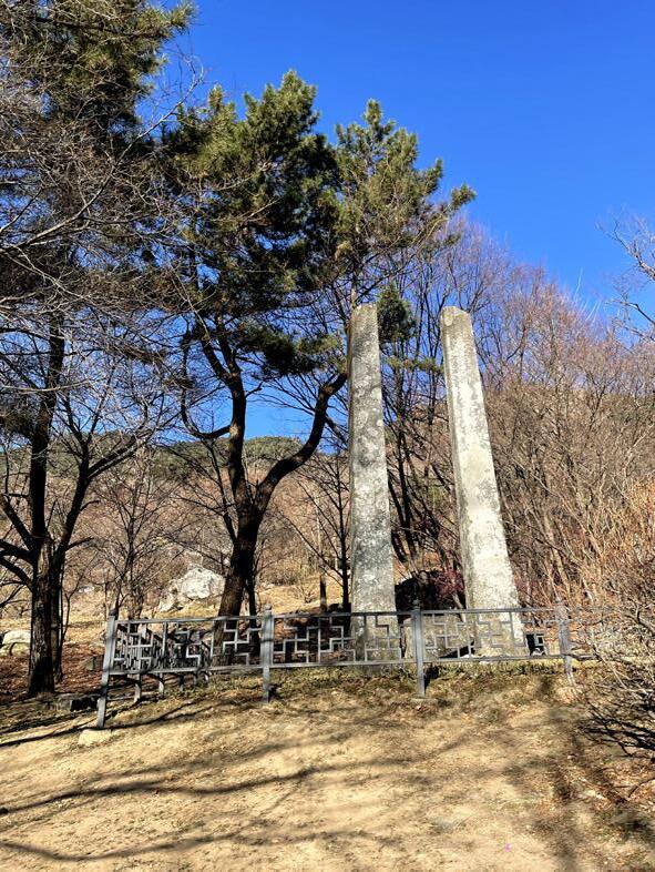
B.Dangganjiju ( 당간지주)
Having crossed the Iljumun Gate, visitors find themselves at two stone pillars called Dangganjiju, used to support the flagpole also “danggan.” Pillars of holiness as they are, they invoke prayers as you enter. The flags raised on the danggan during ceremonies reiterate the temple’s sacredness, while the Dangganjiju itself, active and visible as ever, reaffirms its continuity with Buddhist tradition.
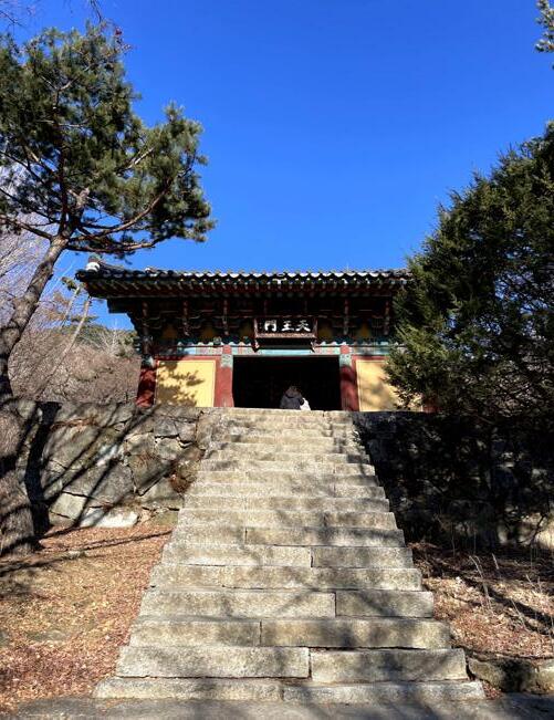
C.Cheonwangmun Gate ( 천왕문)
In Cheonwangmun Gate, where sculptures of the Four Heavenly Kings are on guard. By protecting the Buddhist law and warding off bad spirits, these powerful characters foster a sense of guarded sacredness. The gate emphasises the transition from the secular world outside to the sacred realm inside as a point of passage.
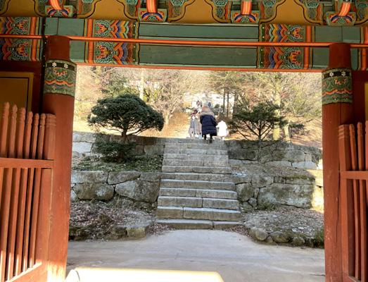
D. Hwakjangmun Gate (확장문)
This gate visually extends laterally beyond the composition of Cheonwangmun Gate, forming a spatial barrier that enhances the rhythm of progression through the temple site. Its paired structure resembles that of Gates E and F, distinguishing Buseoksa Temple’s layered approach from the simpler axial sequence found at Castle Howard.
E. Beomjonggak (범종각, Bell Pavilion)
Functioning as the central structure that symbolises both stability and tranquillity at Buseoksa, the Beomjonggak houses the temple bell. Its resonant chimes carry throughout the temple grounds, forging a sonic link among the various spaces within.
F. Anyangru ( 안양루 )
In Buddhist belief, Anyangru serves as a symbolic entrance to a Pure Land, being a transitional space that guides visitors into the sacred realm of Buseoksa. Its design and higher position suggest a kind of spiritual ascension, where all who pass through would think about the create from normal to the sacred.
G. Muryangsujeon ( 무량수전)
At the heart of Buseoksa lies Muryangsujeon, the temple’s central and most sacred hall, embodying the Buddha’s Pure Land. Within its serene interior stands an Amida Buddha statue, drawing worshippers who seek peace and spiritual connection. The hall’s profound atmosphere underscores its significance as a focal point for devotion and enlightenment. 4.1.2
4.2 shows the ideograms overlaid on the site map of the
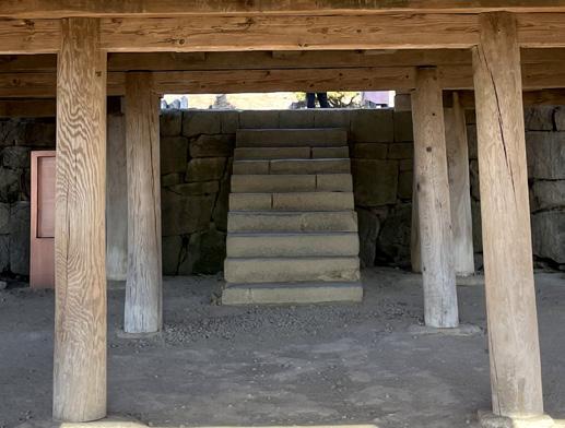
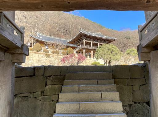
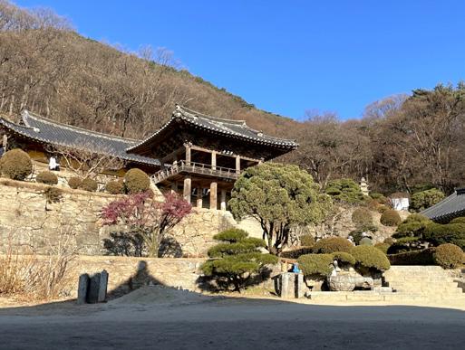
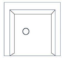
4.3 shows the ideograms overlaid on the site map of



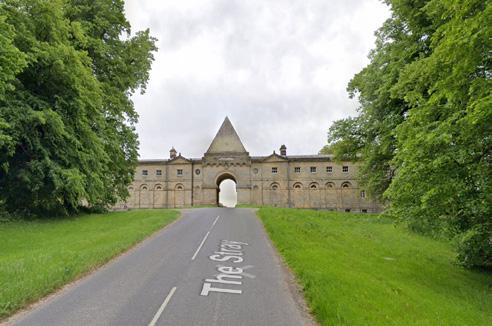
Linear routes can transform the way a landscape is read by pacing what the visitor sees and when it is seen. At the dawn of the eighteenth century, when the English landscape garden was first breaking away from rigid baroque formality, Castle Howard in North Yorkshire offered a pioneering starting point for this new paradigm.4.5
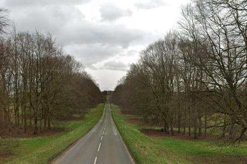
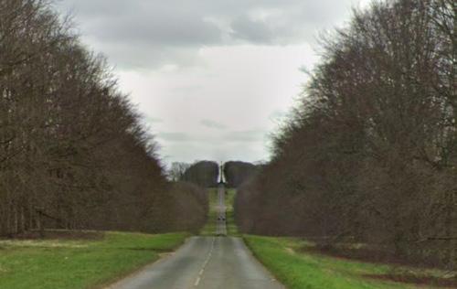
The house, commissioned by the third Earl of Carlisle, was begun in 1699 by the architects Sir John Vanbrugh and Nicholas Hawksmoor who finished their work by 1712. The design of the landscape setting followed on between about 1705 and the mid-1730s, starting with a straight approach road known as The Stray, which replaces static display with an experience that unfolds step by step over two kilometres.
In Chapter 1 of his book Modern Architecture Neil Levine summarises the work of the scholars who have located Castle Howard as the origin of the English Landscape Tradition, often regarded as Britain’s most important contribution to the visual arts. He distinguishes sharply the house from the garden in terms of representational capacity; the house employing well established conventions of classicism to express the prestige of a significant politician. However, he argues that once the third Earl of Carlisle withdrew from public life in 1714 and began to develop the gardens and landscape, he sought to embody his dynasty’s occupation of its estates by promoting radically new methods of architectural representation, subsequently developed into the theory of association. In particular he notes that the use of buildings in different historical styles to create ‘instant history’, the use of simplified geometry in these structures and ambiguities of scale created by similar volumes spaced across distance which became characteristic of the English Landscape Tradition were all first introduced here. Levine boldly argues that this shift in the landscape design marks the origins of the mindset that underpins a tradition of modernism in architecture.4.6
This processional walk, therefore, anchors this study as the British counterpart to the Korean temple path at Buseoksa Temple.
4.2.1
Castle Howard is a seminal English country house and landscape garden located in the Howardian Hills of North Yorkshire, roughly 24 km north east of York. Contemporary sources record that Carlisle, as a politician sought both to proclaim Whig modernity with “a showy country house” and to create a lasting family seat where he could retire with his children that would aggrandise the Howard name while providing proper residence and guardianship for his heirs.4.17
Construction of the landscape unfolded piecemeal throughout the eighteenth century, producing an additive sequence of architectural ‘incidents’ aligned on a dominant north–south axis: the Obelisk (1714), Pyramid Gate (c. 1720s), Temple of the Four Winds (1724–30) and Mausoleum (begun 1729). The Earl, who had been on a Grand Tour to Italy, is considered to have played an active role in discussing the evolution of the landscape design in particular. Some of these monuments adapt classical forms familiar from the landscapes of Claude Lorrain and Nicolas Poussin, prints of which were owned by Hawksmoor, though Carlisle himself never bought their works.4.8 However, Levine and others have stressed that creating this prototype of the processional English landscape garden required imaginative thought quite distinct from the composition of static landscape pictures.4.9
Today, Castle Howard remains in Howard family ownership, is listed Grade I, and continues to draw visitors.
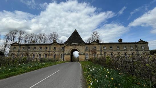
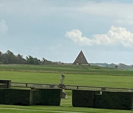

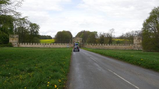
A.Carrmire Gate (c. 1730)
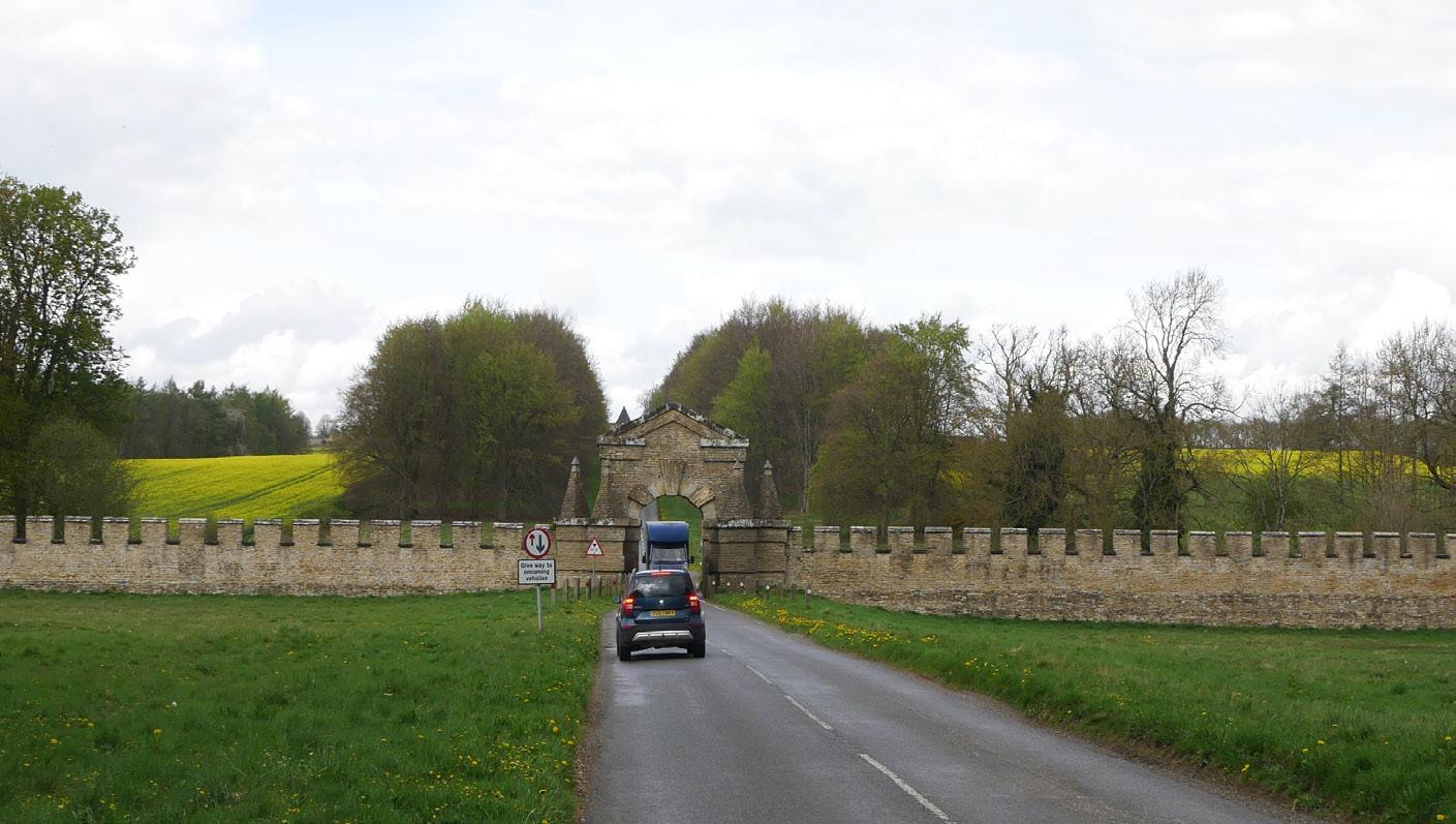
Hawksmoor’s Carrmire Gate forms the estate’s outer portal. A rough-hewn round arch set in rubblestone walls, flanked by mock-medieval bastions and cross-shaped machicolations, it conjures an imagined feudal past while marking the moment the public road yields to the Howard domain.
B.Pyramid (1728)
Set on St Anne’s Hill, this 28-foot blank cenotaph honours William Howard (add dates), founder of the Carlisle line of Earls. A tiny rear door leads to a vaulted chamber where his bust, poised on a rustic pedestal, peers outward “with late Roman other worldliness,” binding ancestral memory to the landscape narrative.
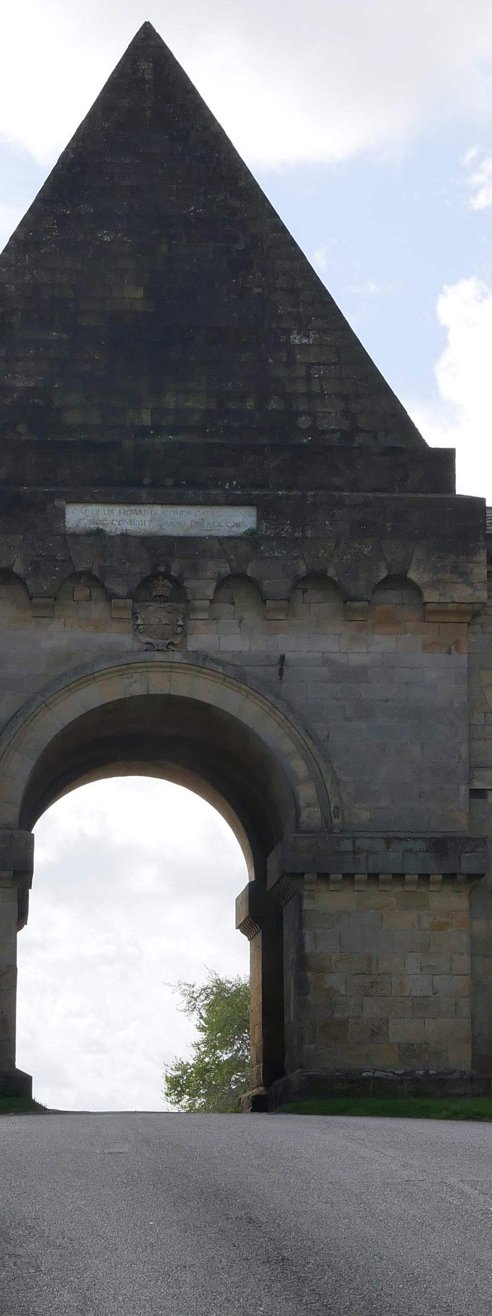
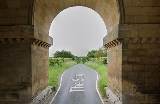
C.Pyramid Gate (1719)
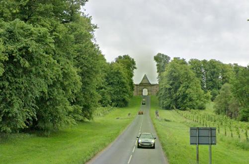
Further north, Vanbrugh’s solid cubical gatehouse crowns its arch with a steep pyramidal roof. Passing through, the visitor sees the Obelisk framed ahead, loses it behind the masonry, then regains it, initiating the reveal–conceal rhythm that structures the whole processional composition. Curtainwall bastions added in the 1720s intensify the theatrical effect. The inhabited wings were introduced at a later date. Although the Pyramid Gate wings date from 1756, the curtain walls of 1720 would still have effected the perceptual switch -that occurs to the east side - between the Tomb and the Mausoleum on passing through the archway.
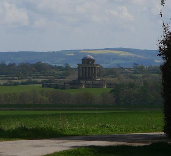
D.Mausoleum (1729 – 45)
Hawksmoor’s mausoleum, twenty Doric columns round a tall circular drum, domed to ninety feet, sits on the far side of the house about 1.7km from the Pyramid Gate. It is first glimpsed to the right having passed through the Gate’s archway and embodies the family’s claim to permanence on the estate. Deemed a masterpiece by many, Horace Walpole even declared it “would tempt one to be buried alive.”
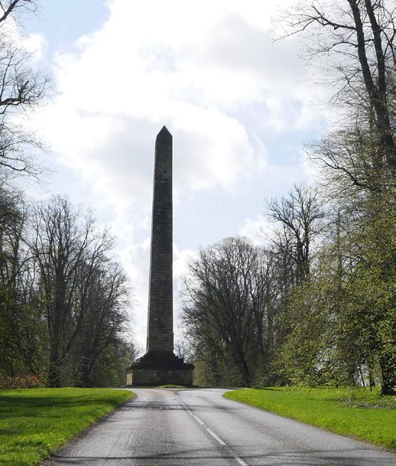
E.Obelisk (1714)
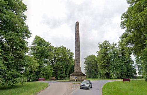
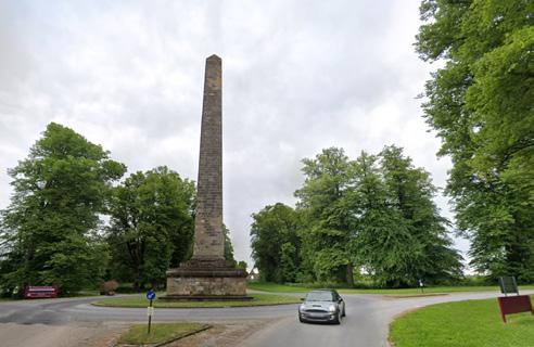
Set nearly two kilometres from the crossroads at the start of The Stray, Vanburgh’s tall limestone shaft works as the ceremonial point of entry. From the approach road, it catches the eye long before any building is seen, anchoring the visitor’s first orientation to the estate. It was only the second monumental obelisk built in Britain; the first by Hawksmoor was finished only 12 years before in 1702.4.10
:Note The monumental column set on axis beyond the south end of The Stray is not examined here, because it was erected much later in 1867 by the seventh Earl of Carlisle, and therefore lies outside the design phase under review. Likewise, the lateral route linking the Obelisk, the Temple of the Four Winds and the Mausoleum is excluded, as it forms a picturesque, non-linear circuit, whereas the present study is confined to strictly linear compositions.
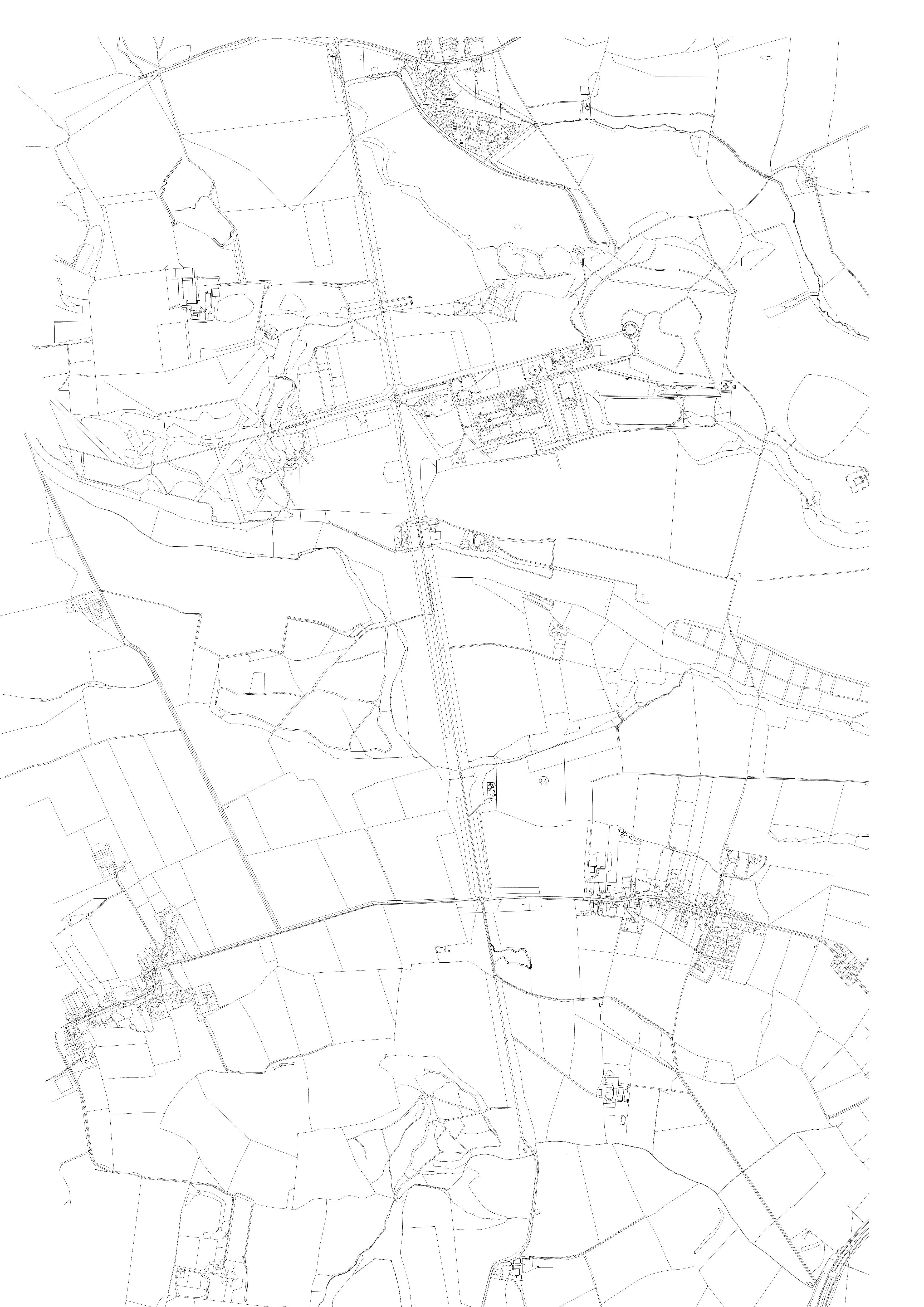
4.5 presents ideograms overlaid on a site map of “The Stray,” the ascent
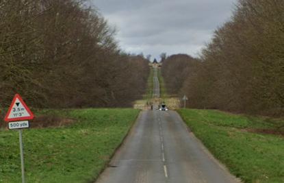
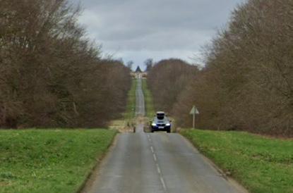
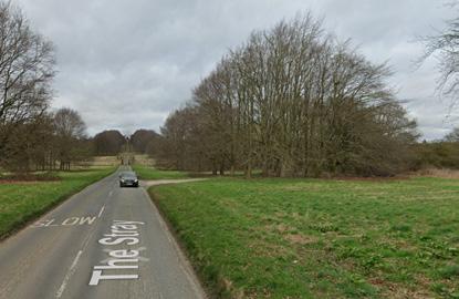
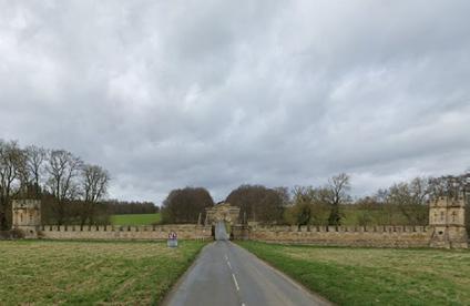
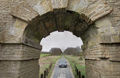
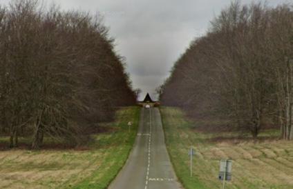
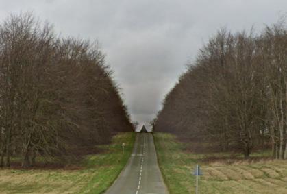
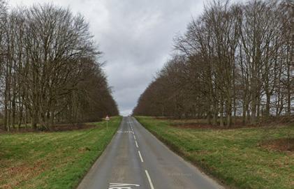
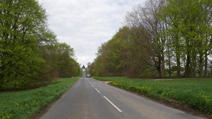
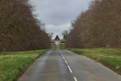
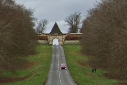
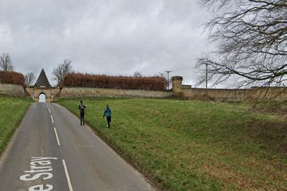
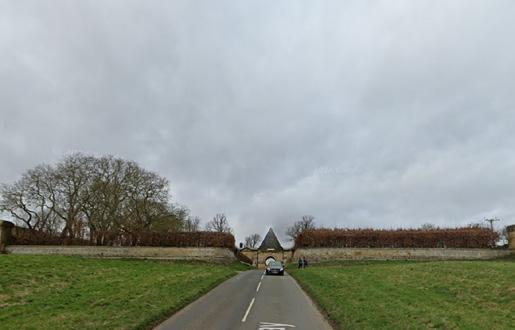
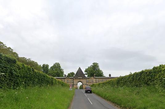
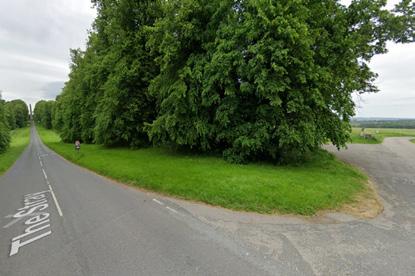
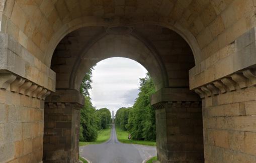
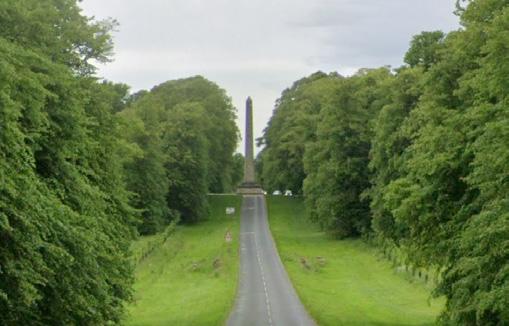
4.6 presents ideograms overlaid on a site map of “The Stray,”
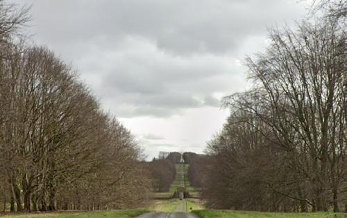
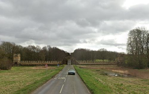
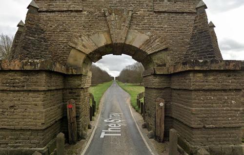
4.3.1Rationale
Buseoksa Temple and Castle Howard are examined together because each represents the moment at which its culture first emerged with a new paradigm. Buseoksa Temple, founded in AD 676, was established explicitly to propagate the newly introduced Hwaeom Buddhist tradition. Castle Howard, whose essential configuration was complete by about 1726, is widely acknowledged as the point of departure for the English landscape garden. Juxtaposing the two sites, therefore, allows direct observation of how paradigm-shifting ideas were translated into built form under radically different circumstances, and it strengthens the claim that certain design principles can transcend any single period, geography or faith.
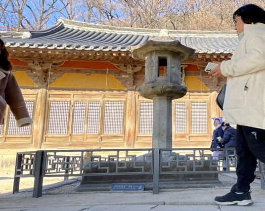
In both landscapes, the designers laid out a longitudinal spine first and then permitted later patrons to append thresholds and incident objects along that line. At Buseoksa Temple, the axis climbs from Iljumun to Muryangsujeon; at Castle Howard, it runs from Carrmire Gate to the Obelisk. Subsequent generations inserted stone lanterns, bell pavilions, obelisks, pyramids and temples without disturbing the original alignment. The spine, therefore, acts as a stable interpretative thread, while incremental insertions supply rhythm, hesitation and climax. Evidence from historic surveys confirms that each addition respected the earlier ordering, suggesting conscious maintenance of narrative legibility rather than accidental growth. Thus, even an apparently simple straight walk is shown to be an instrument deliberately calibrated to modulate sight lines, pacing and emotional emphasis.
4.3.2 Analysis of both sites utilising ideogram
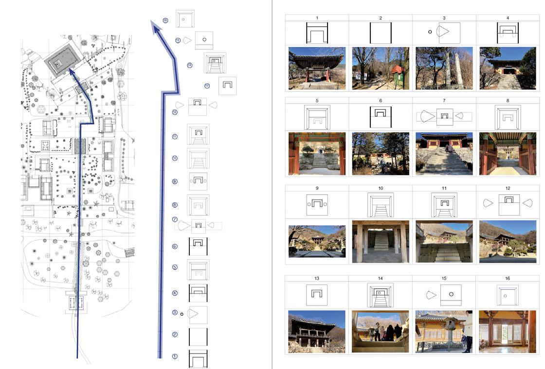
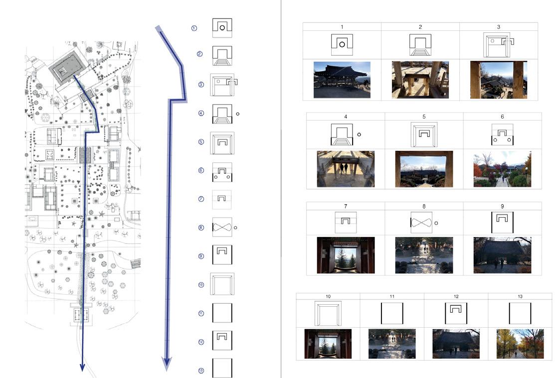
4.7 shows the figure 4.2 and 4.3
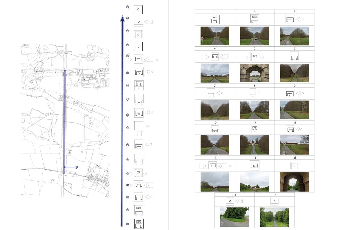
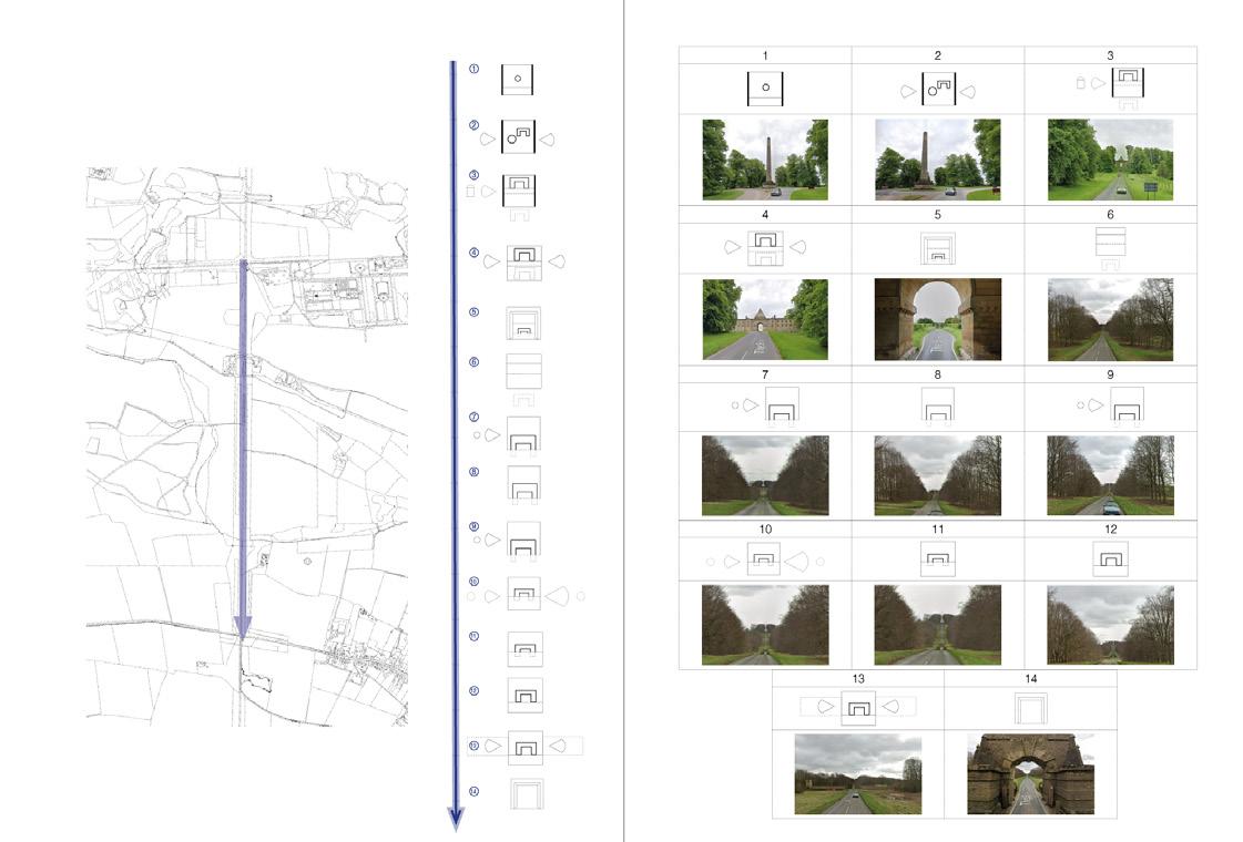
4.8 shows the figure 4.5 and 4.6
4.3.2.1 Commonalities between the two case studies
Ideogrammatic mapping identifies seven recurrent patterns, deployed in both Korea and Britain to regulate the tempo and focus of the walk.
(1) Frame in Frame
Successive gateways, arches or pavilions are nested so that one “frame” opens onto another, compressing then expanding the field of view to accumulate and then release anticipation .
(2) Object in Frame
A distant lantern or obelisk is held centrally within each aperture, fixing orientation and encouraging onward movement .
(3) Exploiting the Profile of the Terrain
Abrupt rises or descents, such as stepping onto a platform and then dropping immediately to a lower stair, momentarily erase the preceding panorama, bringing about the disappearance of all other elements except the path itself. The visitor’s attention is then recaptured by the next, freshly emerging prospect.
(4) Flat Frames and being inside a box
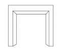

A simple framed view differs from an enclosed “box” in which the visitor enters, both serving to focus attention, yet offering distinct degrees of immersion.
(5) Isolated vertical objects

Freestanding pillars or monuments punctuate long horizontals, introducing a rhythm and acting as distant beacons.
(6) Using landscape to constrain the view

Hillsides, belts of planting or low embankments serve as a “thick side” to the frame, restricting sightlines and sustaining curiosity to what is ahead.
(7) Mock defensive walls which divide the sequence
Low, non-defensive walls or fences momentarily obscure lateral views, intensifying the sensation of spaciousness when the vista reopens.
Both sites generate a wide range of spatial and perceptual experiences using a limited set of generic architectural types. These are strategically dispersed across the site in small structures such as gates, pavilions, and monuments, which collectively guide orientation and rhythm. Despite their modest scale and number, these elements structure how visitors perceive and move through the landscape, reinforcing symbolic or psychological transitions embedded in the sequence.
It is not the elements in isolation but their sequential orchestration that unlocks their full impact. Each architectural device individually contributes to the overall spatial composition; however, their true effectiveness emerges in their sequential interplay. Together, these mechanisms orchestrate a carefully modulated spatial journey, balancing controlled concealment with measured disclosure to sustain interest and engagement. Remarkably, these minimal and widely dispersed structures exert a disproportionate influence, commanding expansive stretches of landscape with precise architectural intent.
4.3.2.2 Uniqueness of the Two Case Studies
A. Buseoksa Temple
(1) Sequential Revelation of Elements
Architectural components unfold one by one rather than being visible from a distance, creating a measured anticipation as visitors progress.
(2) Repetition of a gateway
Identical-looking gateways (Anyangru and Beomjonggak (Bell Pavilion)) appear at two different elevations, prompting an intentional echo in the visitor’s memory and reinforcing rhythm through déjà-vu.
(3)Two-storey Pavilion, Steep Internal Staircases
Gateways are entered by climbing steep steps within their frames, delaying views of the next element until the visitor has fully passed through (ideogram 10 &11). Visitors ascend the lower steps, during which their view is momentarily obstructed, and anticipation is heightened; only upon reaching the platform is the full vista unveiled. This concisely applies the traditional Korean nuhajin-ip ( 樓下進入) technique. A more detailed explanation is continued in Appendix 2.
(4) Concealment by Terrain Contours
Just beyond the fifth ideogram, site topography masks the route ahead, momentarily hiding all upcoming elements.
(5) Richly Developed Gateway Interiors
The spatial volume inside each framed gateway is more elaborate, with additional platforms and interstitial spaces that deepen the experiential sequence.
(6) Defined Courtyard Expansion
At the sixth ideogram the path opens into a clearly bounded courtyard, a moment of spatial relief unique to the Korean example.
B. Castle Howard
(1) Immediate Panorama at Entry
All principal elements are revealed at once on the main axis, fixing orientation from the outset rather than unfolding sequentially.
(2) Overlapping Framed Gateway
A framing gateway appears above its predecessor (ideograms 1–2), creating a layered portal effect absent at Buseoksa.
(3) Selective Disappearance of Elements
Certain features, notably the Obelisk, vanish after their first appearance—visible in only 10 of the 17 ideograms.
(4) Complete Disappearance at Carrmire Gate and Pyramid Gate
On the northward ascent, travellers pass through Carrmire Gate (ideogram 8), at which point all three principal elements vanish from view; on the return journey, passage through the Pyramid Gate (ideogram 6) similarly conceals every component, thereby emphasising a dramatic moment of transition.
(5) Concealed Service Courtyard
A courtyard of outbuildings accompanies the Pyramid Gate but remains unseen until after the forecourt, offering a hidden spatial counterpoint to the main route.
4.3.2.3 Equivalence between the Two Case Studies
(1) Relationship between horizon and structures
• Buseoksa Temple: On the descent the two-storey pavilions deliberately align the visitor’s view towards the horizon through staircases and elevated platforms.
• Castle Howard: The side walls of Carrmire Gate are carefully positioned to align with the distant horizon landscape as visitors exit.
(2) Design strategies for transitional experiences
• Buseoksa Temple: At Buseoksa Temple, passing through the final gate powerfully reframes the visitor’s perception, first guiding them through the ordained stages of worldly passage and then, upon emerging beyond the portal, unveiling the radiant realm of enlightenment.
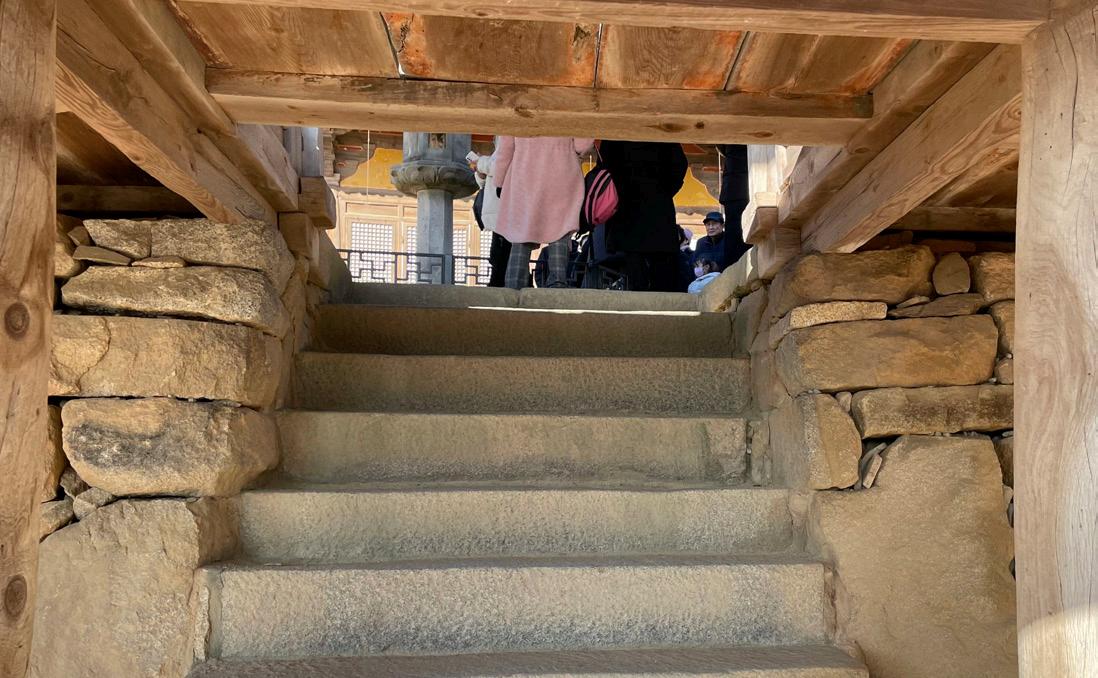
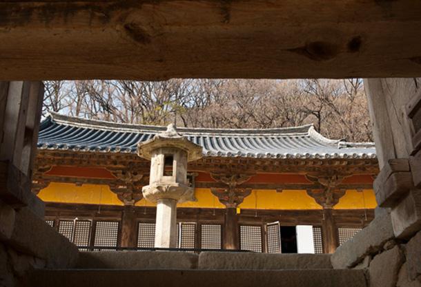
• Castle Howard: Moving through the Pyramid Gate shifts perception from the Pyramid Tomb of the founder of the Howard line of nobility visible in front of it to the Mausoleum intended to house future generations which unexpectedly appears instead having passed through the arch.
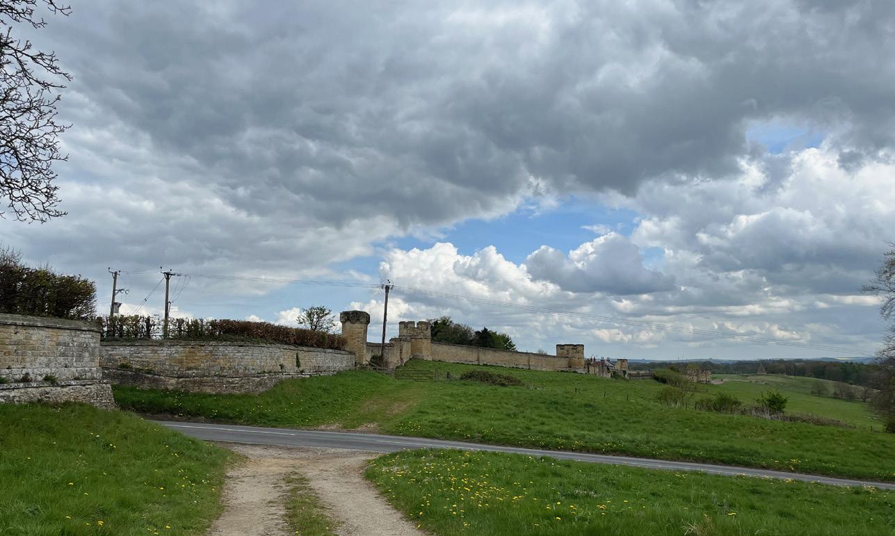
4.11 At Castle Howard, the Pyramid Gate is precisely aligned with the distant pyramid tomb, framing the view in a deliberate composition. This spatial arrangement guides the visitor’s gaze toward a symbolic focal point.
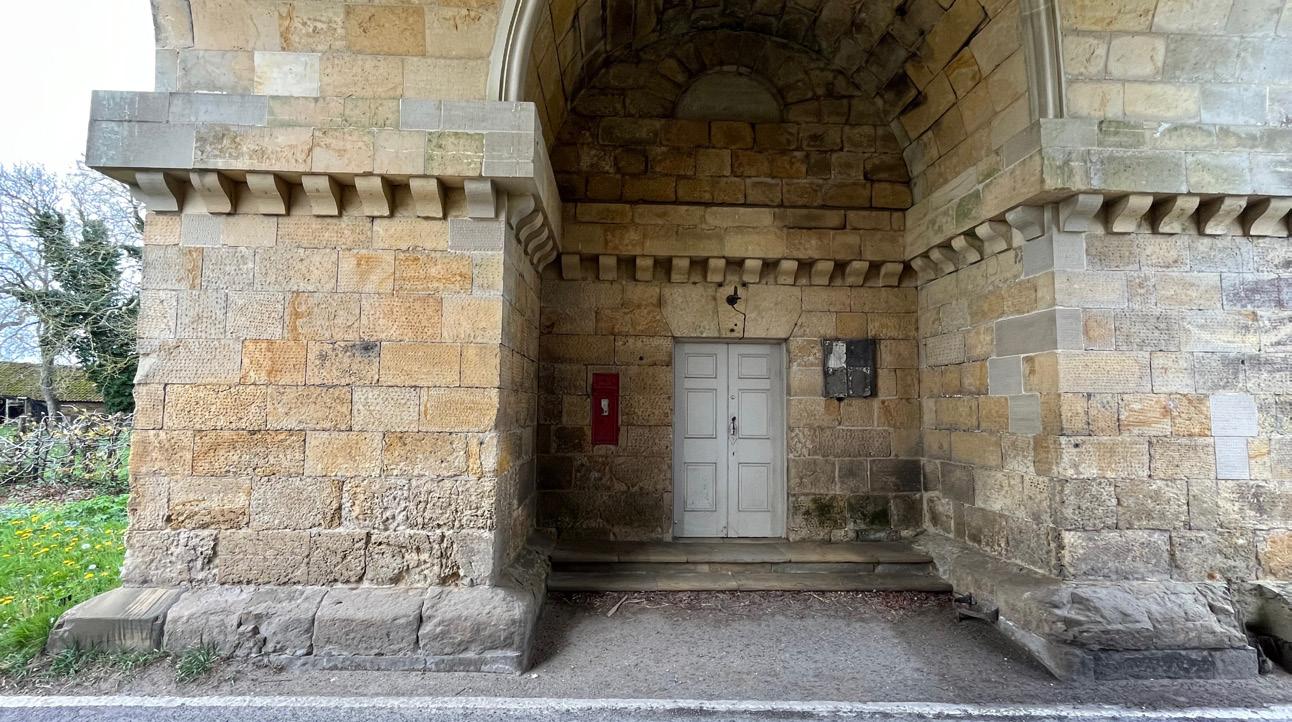
Figure 4.12 As the visitor passes through the arch of the Pyramid Gate, the pyramid tomb disappears from view. This transitional moment causes brief visual disorientation and recalibrates the spatial experience.
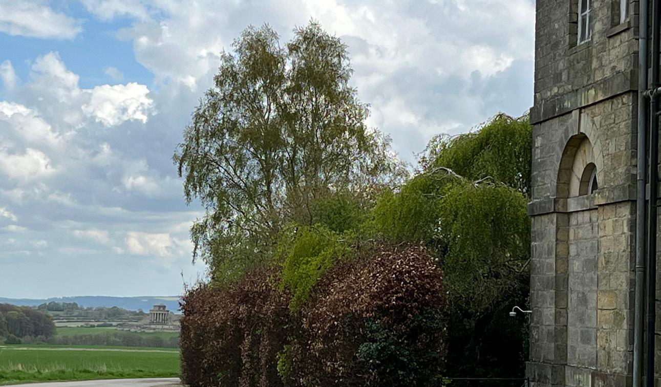
Figure 4.13After fully exiting the gate, the pyramid tomb is no longer visible. Instead, the mausoleum comes into view, not directly ahead, but from the right-hand side, offering a renewed and unexpected perspective of the destination.
• Buseoksa Temple: The ascent and descent offer clearly different experiences. During the ascent, gates, stairs, and architectural elements are gradually revealed, building symbolic rhythm and anticipation. During the descent, by contrast, the same elements simply unfold in succession, yet the overall experience becomes much more expansive. This is due to the elevated vantage point, which opens up broader views across the mountain landscape. As visitors move downwards, stepping onto open platforms and passing beneath projecting eaves, they encounter a more visually liberated spatial rhythm, in contrast to the compressed and veiled progression on the way up.
• Castle Howard: The ascent and descent are visually similar, as the path is symmetrical in both directions. However, there are subtle differences. On the way in, the landscape unfolds gradually, with main features like the Obelisk appearing early. On the return, especially after passing through the Pyramid Gate, those same elements disappear from view. While the changes are less dramatic than at Buseoksa, the two directions still create distinct visual rhythms.
Both Buseoksa Temple and Castle Howard manipulate the relationship between architecture, human positioning and the surrounding landscape in order to focus perception, carefully sequencing movement to create a controlled and directed spatial experience rather than the diffuse quality of a purely natural setting. This deliberate orchestration of perception and movement reflects a deeper architectural principle in both case studies, whereby the visitor’s journey is structured as a series of controlled episodes integrating architectural and visual devices to sustain engagement. Moreover, despite employing a very limited repertoire of generic elements (Castle Howard uses five elements and Buseoksa Temple uses seven elements), each site succeeds in generating a remarkably rich and varied succession of visual events, demonstrating how a multiplicity of experiences may be achieved from a restricted array of components.
According to the “Mystery and Preference in Within-Forest Settings” 4.11 study, when about one-third to one-half of a coming scene is visible, curiosity and forward movement peak. Both case studies maintain this exposure band with notable consistency. No frame grants a complete preview, and no mask removes the view entirely. Instead, each site cycles through full prospect, partial glimpse and concealment, establishing a steady rhythm of anticipation and satisfaction. Partial occlusion is therefore not just a by product of topography but a deliberate timing device that governs walking speed and dwell time. The pattern can be expressed as conceal, arouse, reveal and anchor. It functions as a perceptual metronome that scores the walk as a sequence of measured discoveries.
Buseoksa and Castle Howard employ the same repertoire of sequential framing, partial masking and rhythmic anchoring to choreograph perception and movement. Their designers, separated by epoch and culture, converged on a universal sequence of concealment, curiosity and advance. The methodology of Ideogrammatic analysis has proved effective in exposing this structure and demonstrates its value as both an analytical lens for historic works and a planning script for contemporary synthesis. By translating the backbone and modular logic that has been developed here into present-day projects, and by fine-tuning visibility to the human thresholds of curiosity, these can be made to replicate the enduring capacity of these two Case Study landscapes to guide movement, organise attention and sustain delight.
In summary, this analytical method may be likened to the difference between attending a concert and merely listening versus taking the musical score with you. An ordinary concert-goer receives the immediate sonic and emotional experience; by contrast, someone who follows the score perceives not only the aural effect but also the precise compositional gestures, identifying which instruments are producing the effects at key moments, how climaxes are achieved, and the structural logic at work over time. Likewise, these case studies afford both the direct, phenomenological journey through the landscape and, through systematic analysis, a deeper understanding of the underlying design mechanisms that generate those perceptual effects.
The techniques shared by the Case Studies suggest transferable rules for modern practice.
1. Secure the spine
Identify and protect the principal axis pathway, whether it is a historical avenue, an elevated roadway or a service corridor, before introducing subsidiary interventions.
2. Calibrate visibility
Use planting, low screens, or gentle curves to hold views within thirty to fifty per cent of the angle of the field of view, a range that maintains curiosity while avoiding disorientation.
3. Deploy vertical anchors
Repeat similar elements at intervals of the walking length to punctuate progress and confirm heading.
4. Alternate compression and expansion
Place brief constrictions, for example, narrow passages or shaded tunnels, just before major openings to heighten spatial drama.
5. Plan for phased enhancement
Design the initial spine to accept subsequent insertions such as lighting, artwork or additional planting without losing clarity. Incremental growth mirrors the historical evolution of both precedents.
These principles have immediate relevance for regeneration projects such as Seoullo 7017. Their elevated structures offer a ready-made backbone, while modular planters, light shelters and small habitable structures can be added in stages to reproduce the reveal and conceal rhythm, extend dwell time and refresh user engagement without large-scale reconstruction.
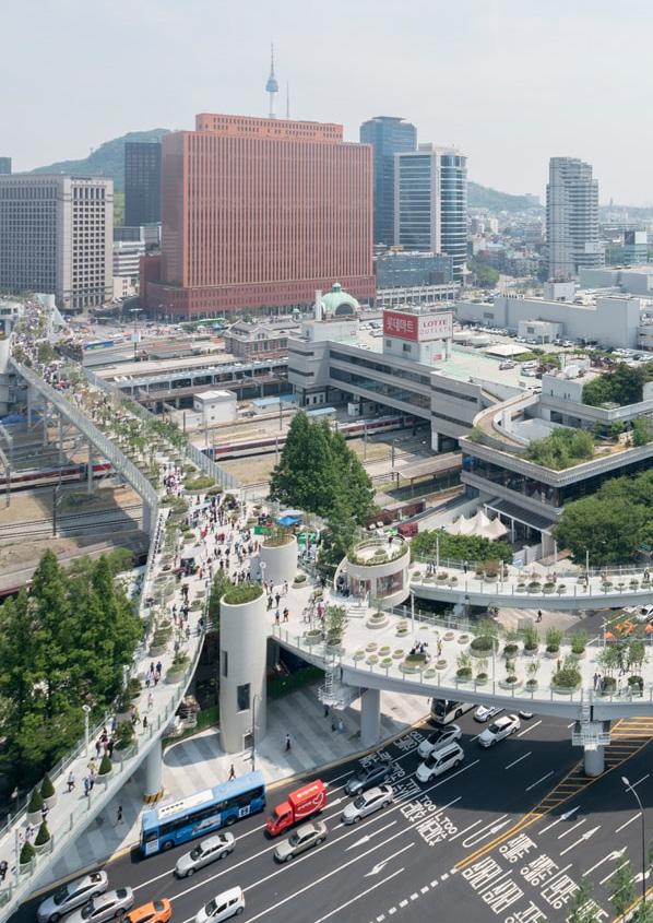
Seoullo 7017 occupies a 983-metre-long former inner-city highway at the heart of Seoul, now reborn as a ‘plant village’ showcasing Korea’s richest diversity of native flora. Approximately 645 movable containers, each planted with trees, shrubs or flowers, collectively support around 228 species and sub-species from 50 botanical families. In total, roughly 24,000 plants have been installed, many of which will reach full stature over the next decade. Since winning the commission in May 2015, Dutch practice MVRDV has led the transformation, adopting an approach based on planting almost exclusively in these containers to overlay a living matrix of Korean vegetation onto the 16-metre-high steel and concrete structure.5.1
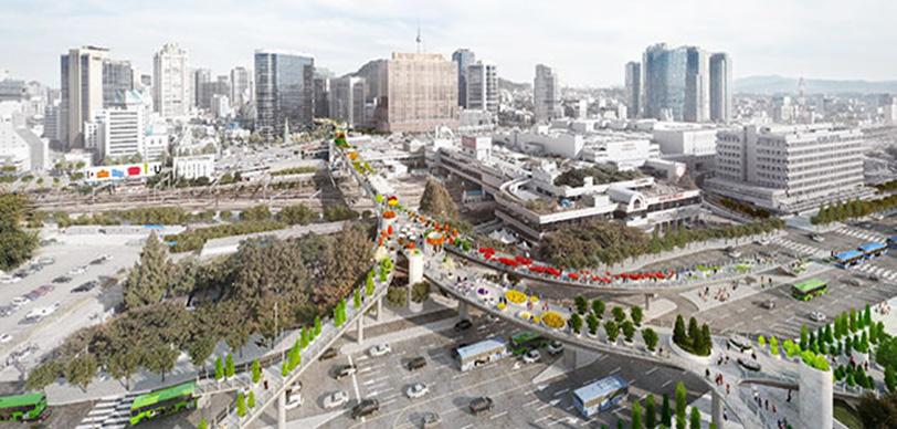
The Seoul Station Overpass was completed in 1970 to address the traffic congestion that arose as the population increased during Seoul’s urban development, which had begun in the 1960s. At that time, under an economic growth policy centred on the automotive industry, overpasses were regarded as essential infrastructure for alleviating traffic problems, which were a by-product of development.5.2
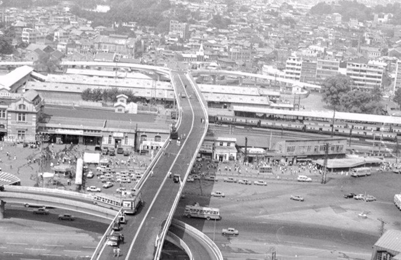
However, safety concerns emerged in the late 1990s, and entering the 2000s, overpasses were criticised for causing excessive vehicular inflow, damaging the cityscape, and intensifying the disconnection between areas. In particular, continuing disputes over the safety of the Seoul Station Overpass played a decisive role in the public opinion that it should be demolished. After several specialised safety inspections, it was graded “D,” which was so serious that many people believed demolition was inevitable because of the overpass’s deterioration and the high cost of maintenance.5.3
Around this time, a different paradigm of urban regeneration began to spread domestically and internationally. Whereas previous urban development had focused on demolition and reconstruction, the concept of urban regeneration aimed to maintain existing assets while preserving the city’s context. The Special Act on the Promotion and Support for Urban Regeneration, enacted in 2013, marked a major turning point in urban policy. Under this trend, the Seoul Metropolitan Government began actively reviewing regeneration projects that would utilise ageing infrastructure.5.4 Within that context, the idea emerged: Could a deteriorated overpass that seemed destined for demolition be brought back to life through a reversal of expectations? Seoul Station Overpass’s transformation into a park, named “Seoullo 7017,” became a representative example of putting this idea into practice.
5.1.2 An abrupt shift from a demolition plan to transforming it into a park
Seoul Station Overpass had already been slated for demolition around 2002. This approach remained the basic plan from the administration of Mayor Myung-bak Lee (2002-2006) into the early period of Mayor Se-hoon Oh (2006-2011), when alternative transport routes and expanded road networks around the Seoul Station area were also being considered.
However, in 2014, Mayor Won-soon Park (2011-2020), who had proposed the regeneration of overpasses during the Seoul mayoral election, was re-elected, and the idea of converting the overpass into a park rapidly gained prominence. This approach aimed not simply to tear down a deteriorated overpass, but to preserve its existing spatial context, while turning it into a pedestrian-focused green area that could become both a symbol of urban regeneration and a landmark in the city centre.5.5
Although it was considered a positive step that aligned with the global trend of urban regeneration, the policy shift took place within a very short timeframe from June 2014 (when Mayor Park Won-soon was re-elected) to May 2017 (when Seoullo 7017 opened) and was therefore somewhat controversial. During this period, the High Line in New York, whose final section opened in September 2014, was gaining worldwide attention for its success, and the concept of repurposing an abandoned railway into a cultural and artistic park attracted popular interest. 5.6 After visiting New York, Mayor Park emphasised the vision of a “Seoul version of the High Line” when talking about the plan to turn the Seoul Station Overpass into a park.
However, there was a significant difference between the two examples. The High Line in New York was an abandoned railway that had already ceased operations, so it had a relatively small impact on surrounding transport networks and logistics. On the other hand, the Seoul Station Overpass was still in active use with tens of thousands of vehicles passing every day, located in the heart of the city, where traffic congestion was serious. This raised questions about whether it was truly feasible to immediately convert a road with high traffic volume into a pedestrian zone. There were also concerns that a facility already in such poor condition would require such extensive rebuilding that it might cost more to renovate than to demolish it entirely. In contrast to the New York High Line, which spurred surrounding development after its completion, much of the urban regeneration around Seoullo had already been completed prior to its opening.
Despite the concerns, the full-scale promotion of the park development policy was driven by the policy value of creating new urban spaces. The Seoul Station area, functioning as a major transport and logistics hub in Seoul, had been assessed as declining because the adjacent commercial districts (Namdaemun Market, Jungnim Dong, Seogye Dong and others) were never connected and remained isolated due to the elevated road. This happened because the elevated road cut across ground level space, interrupting pedestrian flows in favour of vehicular traffic. If the overpass were converted from a road for vehicles into one for pedestrians, it could provide a green network linking nearby areas, which might bring in more visitors and revitalise local commerce.5.7
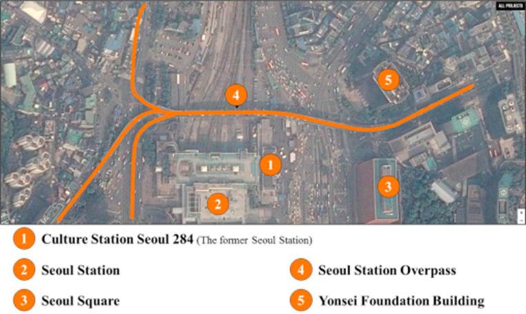
Moreover, incorporating diverse cultural events and public art exhibitions into the park development process raised expectations that this structure could become a cultural space for the city, rather than merely remain a physical bridge.From the perspective of urban regeneration, transforming an ageing structure into a new type of space endowed Seoul Station Overpass with considerable symbolic significance. Furthermore, as noted above, Seoullo was conceived within a context of already completed urban regeneration, allowing it to immediately serve as a connective element within the city fabric, unlike the High Line. In addition, the geographic advantage of being located in front of Seoul Station, one of the city’s principal gateways, ensured that any successful outcomes of this urban regeneration policy would be readily apparent to outside observers. This factor further enhanced the policy’s appeal. Seoullo is not merely a destination but an essential link within Seoul’s primary pedestrian corridors, functioning as a vital conduit that sustains and enhances everyday foot traffic. Moreover, Seoullo’s undulating, curved form provides far more diverse spatial sequences and design opportunities than the essentially flat High Line.5.8
Immediately after the decision was made to transform the overpass into a park, merchants and residents in the vicinity mounted strong opposition. In particular, the Namdaemun Market Merchants Association expressed concerns that reducing vehicular traffic would lead to transport inconveniences and complicate logistics, which might diminish customer numbers and weaken commercial vitality.Another complication arose from the fact that several public institutions, including Seoul Station, the entity managing Seoul Station, the Cultural Heritage Administration and KORAIL, owned and managed different parcels of land around the overpass. Although the Seoul Metropolitan Government organised various public participation bodies such as the Citizens Committee, the Overpass Walkers Group and the Urban Regeneration Support Centre in order to facilitate communication, criticisms emerged because the main course of change towards park development was already taken for granted before opinions from residents and experts were gathered.5.9
The policy implementation system was another source of concern. In the case of New York’s High Line, a community organisation was formed on its own initiative, successfully attracting private sponsorship and then receiving institutional support from city and federal authorities. This bottom-up governance model was a key factor in its success. In contrast, with Seoullo 7017, the design of pedestrian routes, planting plans and operational methods were carried out under the leadership of the Seoul Metropolitan Government, which limited both the scope for public participation and restricted the possible methods of funding.5.10
In order to examine these criticisms in more depth, an analysis was conducted of the image of Seoullo 7017 reflected in public opinion. A big data survey was undertaken to investigate current public sentiment in greater detail, seven years after the Seoullo 7017 initiative was introduced.
This study conducted an image analysis of public opinion on Seoullo 7017 by examining various media reports and internet resources. The principal issues and keywords related to Seoullo 7017 were identified, and the relationships between these keywords were explored. They were then compared with the findings of The Seoul Institute (2025).5.11 However, of The Seoul Institute (2025) research focused only on the period from January to December 2017, which encompassed the months immediately before and after the opening of Seoullo 7017. This meant that direct connections with the recent major theme of sustainability in the field of architecture were limited.
In order to address these limitations, the present study used Sometrend, which is a big data analysis tool for social media. Sometrend is based on the SOFIA Platform, an artificial intelligence and big data technology developed by Vibe Company. It integrates 58 types of raw data, 71 types of knowledge bases, and 60 types of artificial intelligence and big data modules. It adopts explainable artificial intelligence, which enables the rapid analysis of extensive amounts of data, supported by access to the largest volume of social media data in South Korea.
Sometrend collects and analyses data from social media platforms such as Twitter, online communities, blogs, Instagram, YouTube, and news articles. In particular, it includes documents generated on about seven thousand community websites. Blogs include leading power blogs and highly active sites, while Instagram content is gathered from accounts with a high number of followers in order to ensure reliable data. The advantage of collecting a large amount of data is that it allows for a more refined analysis of shifting public perception. The results of this study indicate that residents and citizens were dissatisfied with the Seoullo design (see Appendix 3).
ZONE A
ZONE B
C
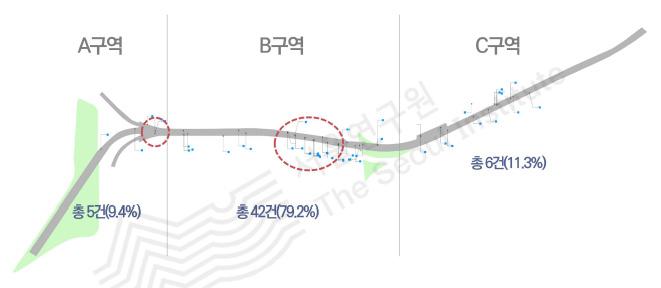
Total: 5 instance (9.4%)
Total: 42 instance (79.2%)
Total: 6 instance (11.3%)
Figure 5.4 shows where Locations of City-Viewing Behaviour
ZONE A
ZONE B
C
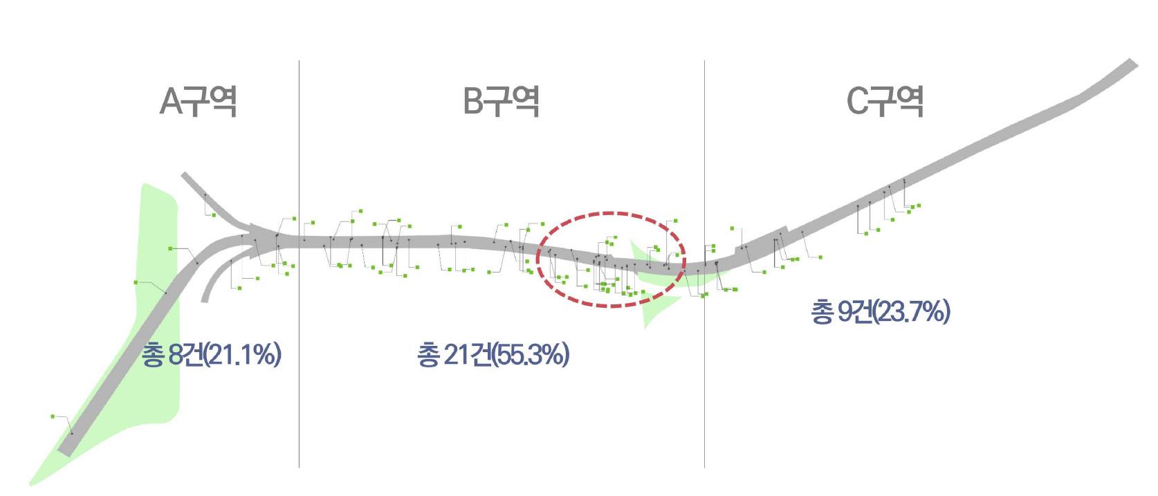
Total: 8 instance (21.1%)
Total: 21 instance (55.3%)
Total: 9 instance (23.7%)
Figure 5.5 shows where Locations of Plant-Observation Behaviour
ZONE A
ZONE B
C
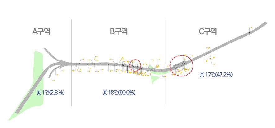
Total: 1 instance (2.8%)
Total: 18 instance (50.0%)
Total: 17 instance (47.2%)
Figure 5.6 shows Locations where cultural and experiential activities were observed
Area with the Highest Number of Stops
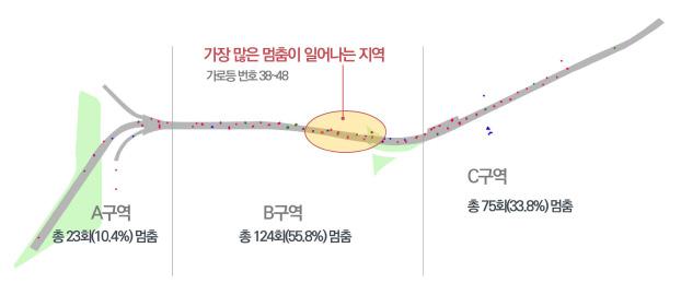
Total: 23 instance (10.4%)
124 instance (55.8%)
75 instance (33.8%)
Despite being directly connected to Seoul’s pedestrian network and located adjacent to a major transport hub, Seoullo 7017 has experienced a noticeable decline in public use and attention since its opening. This contrasts sharply with the New York High Line, which continues to maintain consistent levels of engagement and popularity. The decline in performance may be partly attributed to MVRDV’s highly flexible design strategy. Although botanically rich, the design lacks a clear and coherent spatial structure that effectively guides visitors’ perception and movement throughout the site.
In response to these challenges, this study selects Zone A, the western ramp entrance, as the primary location for intervention. This area consistently shows the lowest levels of engagement across all observed behaviours, including plant observation, city viewing, walking, and stopping. Architecturally, it is one of the least developed and most uninviting sections of the walkway. The steep incline, visual openness, and lack of spatial articulation make it difficult for visitors to feel welcomed or oriented. Given that this zone also serves as a major access point, it represents a strategically significant opportunity to demonstrate the potential of the proposed design methodology.
Rather than attempting to address the entire site, the intervention focuses on transforming the most unresolved and challenging segment into a more structured and meaningful spatial sequence. Through calibrated use of rhythm, framing, and spatial thresholds, the design seeks to reintroduce clarity, engagement, and anticipation. This targeted example serves to prove the viability of the ideogram-based system under the most demanding conditions. The same logic can then be extrapolated to other parts of the walkway, offering a broader framework for enhancing the overall spatial experience of Seoullo 7017.
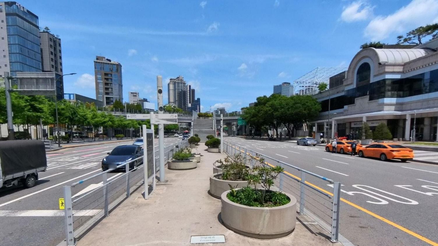
Figure 5.8 View from the entrance of Zone A. Located adjacent to Seoul Station, this access point presents a visually cluttered impression due to the mixture of planting containers and guardrails, with limited wayfinding clarity.
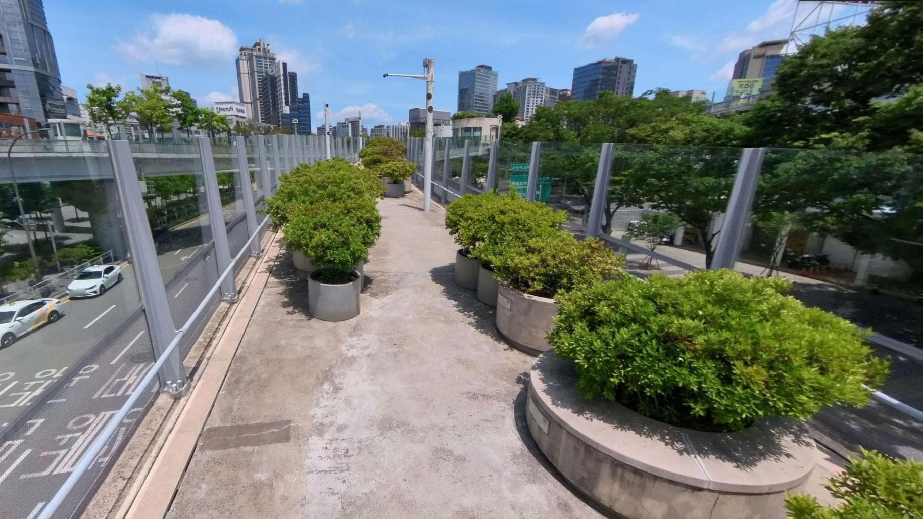
Figure 5.9 Perspective facing towards the central area from within Zone A. The dense arrangement of planters on the sloped walkway reduces visual openness and fails to establish clear rhythm or directional flow, resulting in a diminished user experience.
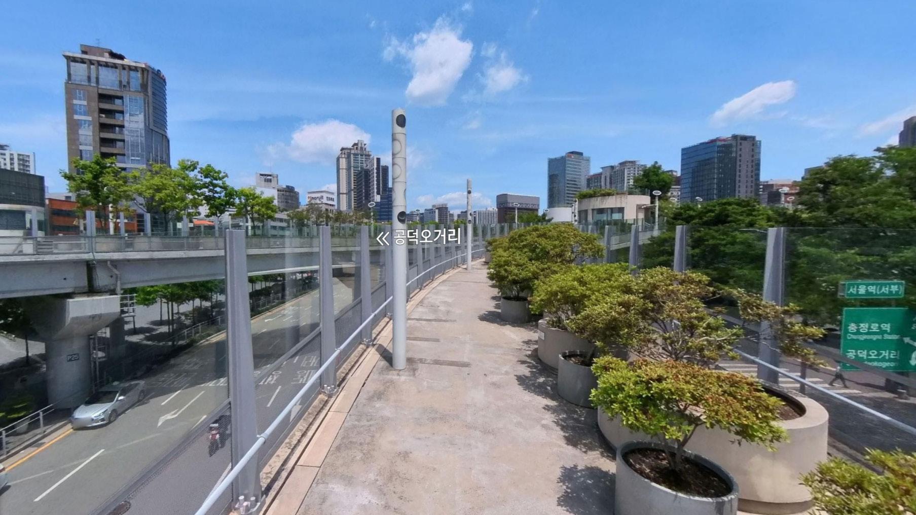
Figure 5.10 Central pedestrian section in Zone A. Planters are irregularly distributed along the walkway, disrupting circulation and limiting opportunities for pausing or interaction. This area reveals a missed opportunity to enhance spatial engagement and user comfort.
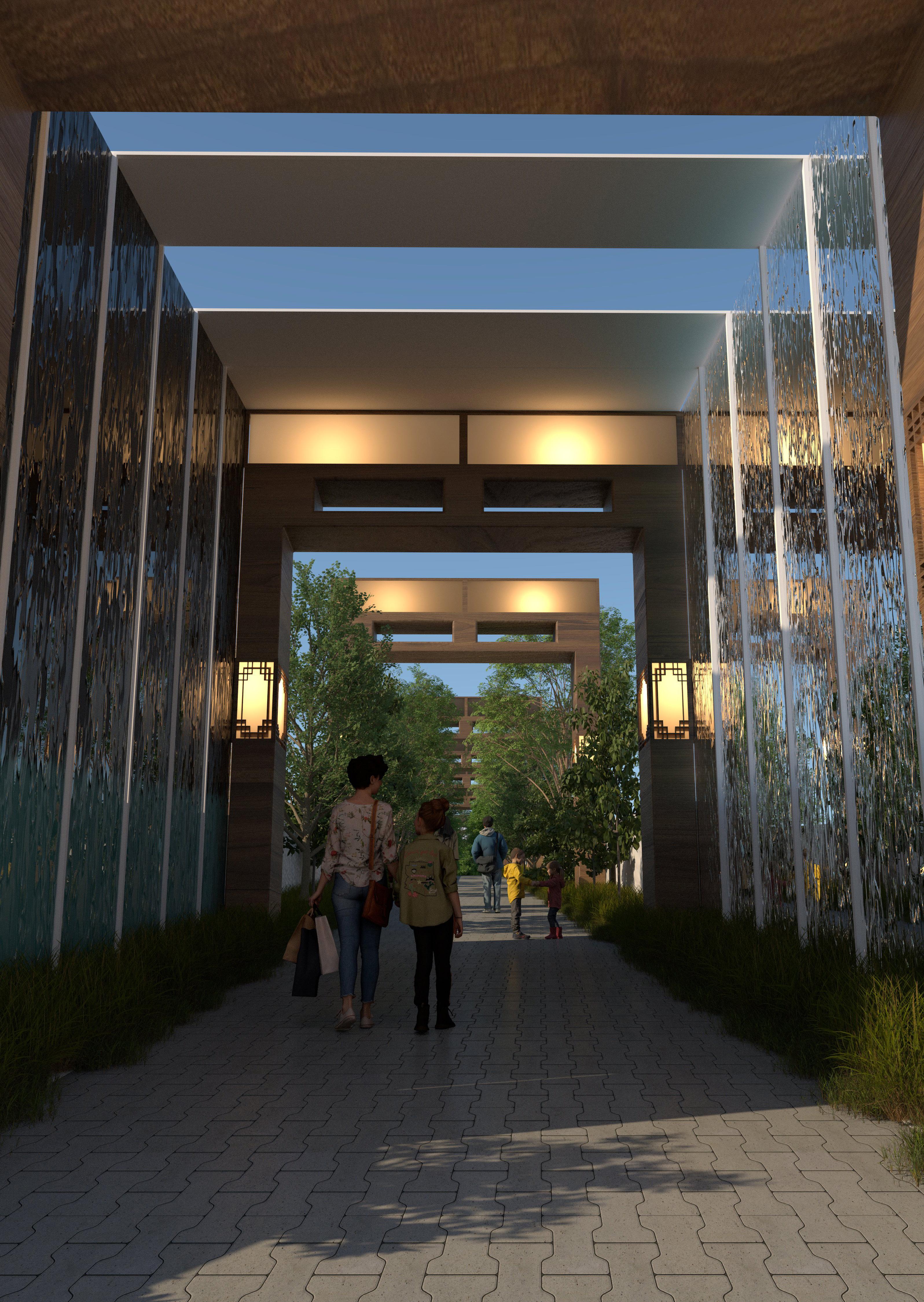
The five transferable principles identified in earlier chapters may be applied directly to contemporary regeneration schemes such as Seoul’s Seoullo 7017. Each intervention on the former overpass can be understood as an enactment of one or more of the following rules.
In the case of Seoullo 7017, the most urgent task is to establish a clear threshold between the surrounding urban fabric and the elevated park. Unlike many other linear parks, which clearly signal departure from the city through lifts, stairs or steep ramps, Seoullo’s gentle incline offers little sense of transition. For this reason, key entry points should include architectural elements such as framed openings, canopy structures, or vertical markers that function as portals or gateways. These features provide a moment of perceptual separation from the city, reinforcing the continuity of the park’s central spine and allowing visitors to recognise that they have entered a distinct spatial realm.
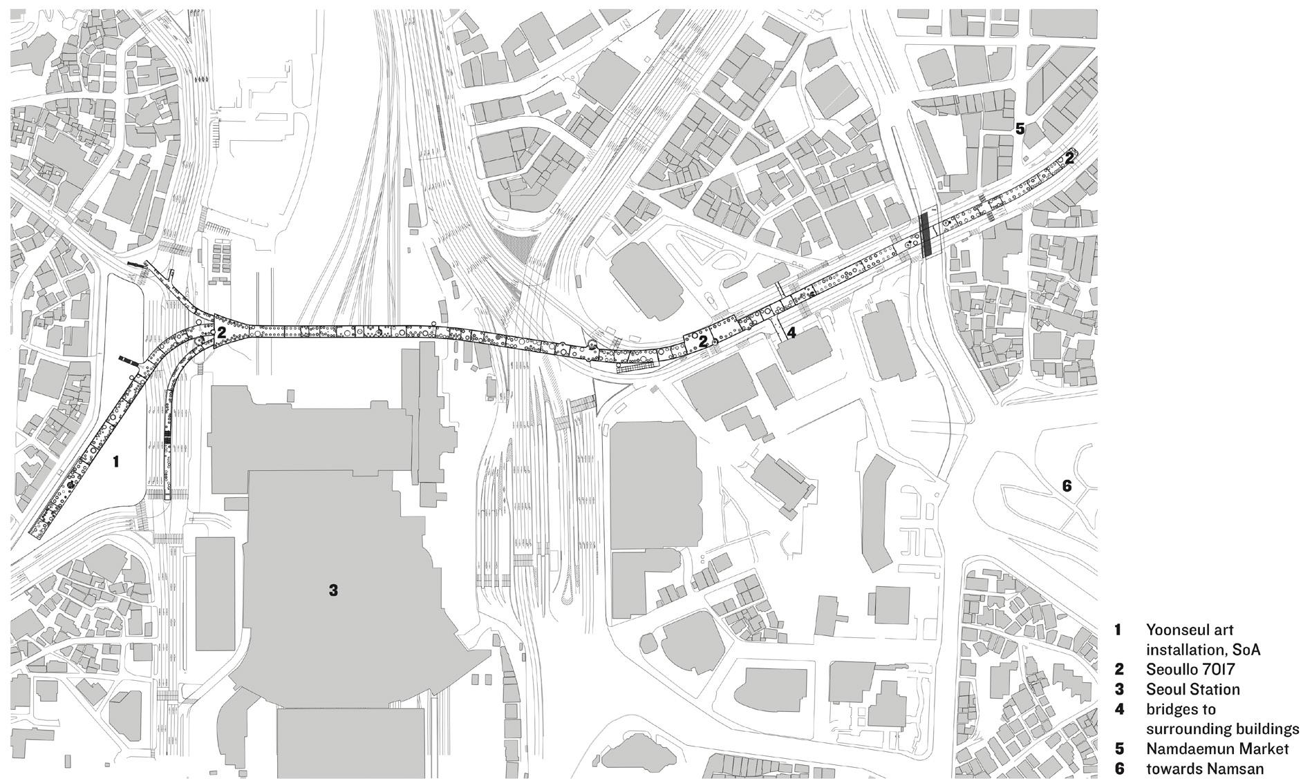
Figure 6.1 shows the current Seoullo’s plan, which will be the spine of this framework
Once the spine has been secured, the next step is to carefully regulate how visitors enter and perceive the elevated route. Introducing additional access points at strategic nodes, such as the railway station, can further clarify the transition from city to park and enhance the visibility of threshold moments.
Within Seoullo, visibility can be managed by using planting, low screens, or gently curved forms to restrict the field of view to approximately 30–50 per cent. This range preserves curiosity while avoiding disorientation caused by excessive exposure.
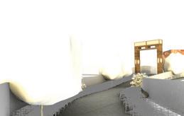
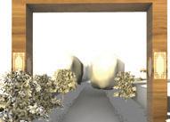
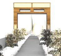
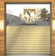
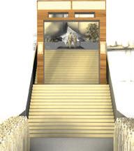
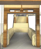
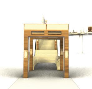
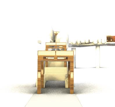
Figure 6.2 presents suggested ideograms overlaid on a map of Seoullo 7017, specifically focusing on Zone A and shows the location of the shaded tunnel at the beginning, which is coloured green.
Shaded tunnels placed at the beginning of the route and before each major opening can alternate spatial compression and expansion, establishing a rhythmic sequence and heightening the dramatic impact of spatial progression. The ideogram (Fig. 6.2) at the beginning of this section illustrates how these interventions manage sightlines and choreograph the visitor’s unfolding experience.
Vertical rhythm along Seoullo 7017 is articulated through the repeated use of smaller-scale architectural elements, such as planting columns, lighting towers, and resting pavilions. These features are spaced at regular intervals that correspond to a comfortable walking rhythm, visually punctuating the route and offering opportunities to pause, reorient, or reflect.
In addition, the surrounding high-rise buildings within the urban context naturally serve as ambient vertical reference points. Although these are not part of the designed intervention, they contribute to the perception of verticality and help frame the linear sequence, supporting the overall sense of spatial direction and progression.
At the entrance of Seoullo, visitors pass through narrow spatial conditions such as tunnels or underpasses, followed immediately by garden-like open spaces or terrace-style platforms. These moments serve to create a psychological sense of separation from the urban context. The alternation between narrow and open zones produces visual contrast and spatial tension, making each unfolding space feel more dramatic and deliberate.
Seoullo’s current lightweight modular system allows for incremental additions such as art installations, seating clusters, and seasonal plantings. This modularity and openness provide a high degree of flexibility, but they can also limit the ability to produce deliberate and precise spatial effects. The current layout lacks strong thresholds, clearly framed sequences, and calibrated sightlines, resulting in a weakened spatial narrative and reduced long-term user engagement and coherence.
Therefore, instead of simply repeating mobile, relocatable structures, it is more desirable to design and implement clearly anchored and fixed spatial elements. This is not merely a gesture of flexibility, but a spatial strategy that respects the visitor’s movement while strengthening orientation and sense of place. This approach is closely aligned with the spatial evolution observed at both Castle Howard and Buseoksa Temple.
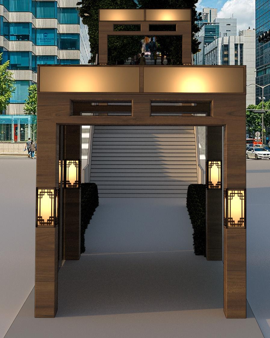
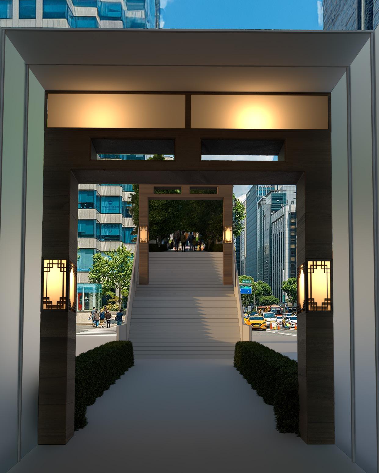
To give substance to the underlying system, a set of rendered views (Figures senting a finished design, these images demonstrate how the ideogrammatic a visitor’s field of vision is gradually shaped through calibrated changes in enclosure the elevated route. While the precise architectural treatment may vary in material multiple directions at a later stage.
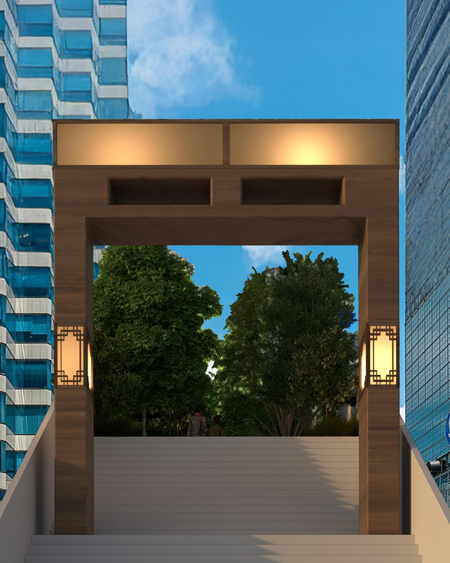
route.
(Figures 6.3 – 6.5) begins to add flesh to the bones of the proposal. Rather than preideogrammatic framework could be translated into spatial form. The sequence shows how enclosure and exposure, marking a perceptual threshold between the city and material or form, this example illustrates how the system could be developed in
This dissertation set out to address the persistent difficulty of representing lived experience in landscape. It first identified the limitations of conventional plans, sections and photographs, explaining why the movement remains central to memorable design. media rarely convey the way a visitor actually encounters space. A critical review of previous, more abstract techniques revealed valuable insights but also highlighted gaps. Drawing selectively on those precedents, a refined methodology was developed that remains both flexible and replicable.
The method was then applied to two contrasting case studies, Castle Howard in North Yorkshire and Buseoksa Temple in Korea. By tracing the linear sequences that structure movement through each site, the analysis clarified how thresholds, framed views and moments of concealment or revelation are orchestrated to guide perception. A set of ideograms distilled these findings into a concise visual language, making the hidden organisational “spines” of complex environments legible to designers, historians and the public.
Attention subsequently turned to contemporary practice. Elevated walkways and rail-to-trail parks have become a defining urban phenomenon in the twenty-first century. Although a full redesign of Seoul’s Seoullo 7017 lay beyond the formal remit of this dissertation, the framework demonstrated its value by pinpointing where strengthened gateways, calibrated sightlines and phased enhancements could improve the visitor experience.
Taken together, the research produces a transferable toolkit for reading, illustrating, and ultimately shaping linear landscapes. Future work may apply the method to additional sites, expand the ideogram library, and collaborate with practitioners to translate these insights into built-in forms. The evidence gathered here suggests that careful attention to sequence can deepen public understanding and raise spatial quality, confirming that the choreography.
In concluding this dissertation, one critical reflection emerges from the analysis of Buseoksa Temple and Castle Howard. Initially, one might assume that these two architectural compositions from entirely distinct cultural backgrounds and historical contexts, Korean and Western, respectively, would demonstrate considerable differences. However, through this comparative study, a surprising degree of commonality between these seemingly unrelated cases has been uncovered. This suggests that underlying structural principles might transcend cultural boundaries, offering a potential resolution to the perceived conflict between Korean and Western architectural traditions identified by Lee.
As an international student studying architectural design in a foreign cultural environment, this discovery holds particular significance. It suggests a practical and conceptual approach to addressing potential conflicts and dilemmas in international practice, highlighting common underlying frameworks that are universally recognisable despite superficial differences. Indeed, this insight serves as an important springboard for my future work as a designer, clarifying substantive issues regarding cultural and architectural integration.
Moreover, this study highlights that traditions, as understood and articulated by historians, often represent matters of interpretation rather than absolute truths. This interpretative flexibility provides opportunities to identify and leverage deeper universal structures, such as linear conceptual frameworks, which appear consistently across diverse cultural and temporal contexts. Thus, rather than perpetuating a division, this understanding offers a powerful and constructive way forward, enriching both the theoretical perspective and practical methodologies within architectural design.
Section 01
Introduction
Section 02
Literature Review
1.1 Stephens, G. and Stokes, J. (2024). The ‘original’ High Line is in Paris — here’s why you should walk it. [online] Travel. Available at: https://www.nationalgeographic.com/travel/article/high-line-paris-walking?utm [Accessed 2 Apr. 2025].
1.2 Camden Highline (n.d.). Camden Highline. [online] Camden Highline. Available at: https://www.camdenhighline.com/ [Accessed 5 Apr. 2025].
Design team: James Corner Field Operations with architects vPPR.
1.3 The design team acknowledged that while some individuals had benefited from the outcomes of the scheme, others had been disadvantaged by processes entirely beyond their control.
Corner, J. and Diller Scofidio + Renfro (2015). The High Line : Foreseen, Unforeseen. London: Phaidon ; New York, N.Y.
1.4 André Rogger (2007). Landscapes of taste : the art of Humphry Repton’s Red Books. London: Routledge, pp.192
1.5 André Rogger (2007). Landscapes of taste : the art of Humphry Repton’s Red Books. London: Routledge. pp.193
1.6 Gordon Cullen, The Concise Townscape, Architectural Press, Oxford 1961
1.7 Camden Highline is a proposed elevated urban park in London, designed by James Corner Field Operations in collaboration with architects vPPR. The project aims to transform a disused railway viaduct between Camden Town and King’s Cross into a 1.2 km-long green walkway. Camden Highline (n.d.) The Design. Available at: https://www.camdenhighline.com/design
2.1 Turner, T. (2015). James Corner interview: the High Line and Intimate Immensity –Landscape Architects LAA. [online] Landscapearchitecture.org.uk. Available at: https://www.landscapearchitecture.org.uk/james-corner-interview-aboutthe-high-line/ [Accessed 27 Apr. 2025].
2.2 Corner, J.M. and Maclean, A.S. (2000). Taking Measures across the American landscape. New Haven ; London: Yale University Press.
2.3 The design team acknowledged that while some individuals had benefited from the outcomes of the scheme, others had been disadvantaged by processes entirely beyond their control.
Corner, J. and Diller Scofidio + Renfro (2015). The High Line : Foreseen, Unforeseen. London: Phaidon ; New York, N.Y.
2.4 Corner, J.M. and Maclean, A.S. (2000). Taking Measures Across the American Landscape. New Haven; London: Yale University Press, pp. 21–22, Chapter 3: The American Landscape at Work.
2.5
Corner, J.M. and Maclean, A.S. (2000). Taking Measures Across the American Landscape. New Haven; London: Yale University Press, pp. xvii–xix, Introduction.
2.6 Corner, J.M. and Maclean, A.S. (2000). Taking Measures Across the American Landscape. New Haven; London: Yale University Press, pp. 3–13, Chapter 1: The Measure of America.
2.7 Johnson, H.B. (1976). Order Upon the Land. Oxford University Press, USA.
2.8 The San Andreas Fault is a right-lateral strike-slip fault with an accumulated offset of at least 350 miles since its formation about 15–20 million years ago. It can shift up to 2 inches (50 mm) per year, although the movement varies by segment and sometimes releases strain abruptly in large earthquakes. Any survey point to the west of the one shown in Figure 5 on the other side of the fault will, therefore, constantly move relative to it.
U.S. Geological Survey (2016). The San Andreas Fault - VI. Movement. [online] Usgs.gov. Available at: https://pubs.usgs.gov/gip/earthq3/move.html.
2.9 Aporia. (n.d.). Collins English Dictionary. Available at: https://www.collinsdictionary.com/dictionary/english/aporia (Accessed: 3 March 2025)
Definition:
Logic & Philosophy : a difficulty encountered in establishing the theoretical truth of a proposition, created by the presence of evidence both for and against it
2.10 Corner, J.M. and Maclean, A.S. (2000). Taking Measures Across the American Landscape. New Haven; London: Yale University Press, p. xii, Preface.
2.11 Min, A. and Lee, J.-H. (2019). A Conceptual Framework for the Externalization of Ecological Wisdom: The Case of Traditional Korean Gardens. Sustainability, 11(19), p.5298. doi:https://doi.org/10.3390/su11195298.
2.12 First recorded in English as ecology in 1875. Oxford University Press (n.d.). Ecology, n. In: Oxford English Dictionary. [online] Available at: https://doi.org/10.1093/OED/6977061619.
2.13 Min, A. and Lee, J.-H. (2019). A Conceptual Framework for the Externalization of Ecological Wisdom: The Case of Traditional Korean Gardens. Sustainability, 11(19), p. 5298. See pp. 3–5 for discussion on historical background.
Section 03
Methodology
2.14 Throughout this dissertation, ‘Le Nostre’ is adopted following Franklin Hamilton Hazlehurst’s spelling, rather than the commonly used ‘Le Nôtre’, to maintain consistency with the cited reference and to avoid confusion. Hazlehurst, F.H. (1980). Gardens of Illusion. Vanderbilt University Press (TN), p. 17.
2.15 Hazlehurst, F.H. (1980). Gardens of Illusion. Vanderbilt University Press (TN), p. 19.
2.16 Hazlehurst, F.H. (1980). Gardens of Illusion. Vanderbilt University Press (TN), p. 25 - 28.
2.17 Lee, S. (2017). The Identity of Korean Architecture. Dongnyeok. p. 506-509
2.18 Lee, S. (2017). The Identity of Korean Architecture. Dongnyeok. p. 72-81
2.19 Lee, S. (2017). The Identity of Korean Architecture. Dongnyeok. p.152-166
2.20 Lee, S. (2017). The Identity of Korean Architecture. Dongnyeok. p.280-289
2.21 Lee, S. (2017). The Identity of Korean Architecture. Dongnyeok. p.22-43
Section 04
Case Studies
3.1 Kubovy, M. (1986). The psychology of perspective and Renaissance art. Cambridge : Cambridge University Press, p.pp 154 - 158.
3.2 Kubovy, M. (1986). The psychology of perspective and Renaissance art. Cambridge : Cambridge University Press, p.pp 154 - 158.
3.3 Christopher Ridgway & Robert Williams, eds., Sir John Vanbrugh and Landscape Architecture in Baroque England, 1690-1730, Sutton, 2000 Chapter 8 by Giles Worsley ‘After ye Antique’ Vanbrugh, Hawksmoor and Kent. This confirms the importance of Castle Howard by Sir John Vanbrugh as the start of the English Landscape movement, proceeding William Kent, p.152. Also Neil Levine Modern Architecture: Representation and Reality, Yale University Press, 2009 pp 16-17
4.1 Song, J. (2007).부석사의 공간구조에
[A study on visual communication through the spatial structure of Buseoksa].
4.2 Hong, B. (2010). 9-11세기 중반 부석사 무량수전 영역의 건축계획과 구 성요소 [Architectural planning and compositional elements of the Muryangsujeon precinct at Buseoksa in the mid-eleventh century]. Journal of the Architectural Institute of Korea (JAIK), 27(9), pp.231–240.
4.3 Buddhism in Korea arrived from China (and ultimately India), bringing with it temple and pagoda designs. Rather than simply duplicating foreign models, Koreans adapted them to local conditions, materials, and construction practices. During the Three Kingdoms period and Unified Silla (57 BC–AD 935), this synthesis produced distinctive landmarks such as Bulguksa and Seokguram. Although policies toward Buddhism varied under Goryeo and Joseon rule, a uniquely Korean Buddhist architectural tradition continued to develop, reflecting a creative blend of outside influence and local innovation.
4.4 Kim, N. (1994).부석사 외부공간
[A study on the correlation of component elements for the exterior space in Buseoksa Temple]. Journal of the Architectural Institute of Korea (JAIK), 15(1).
4.5 Christopher Ridgway & Robert Williams, eds., Sir John Vanbrugh and Landscape Architecture in Baroque England, 1690-1730, Sutton, 2000 Chapter 8 by Giles Worsley ‘After ye Antique’ Vanbrugh, Hawksmoor and Kent. This confirms the importance of Castle Howard by Sir John Vanbrugh as the start of the English Landscape movement, proceeding William Kent, p.152. Also, Neil Levine Modern Architecture: Representation and Reality, Yale University Press, 2009 pp 16-17
4.6 Neil Levine Modern Architecture: Representation and Reality, Yale University Press, 2009 pp 16-44
4.7 Neil Levine Modern Architecture: Representation and Reality, Yale University Press, 2009 pp 24-26
4.8 Christopher Ridgway & Robert Williams, eds., , Sir John Vanbrugh and Landscape Architecture in Baroque England, 1690-1730, Sutton, 2000 Chapter 8 by Giles Worsley ‘After ye Antique’ Vanbrugh, Hawksmoor and Kent. p142
4.9 Neil Levine Modern Architecture: Representation and Reality, Yale University Press, 2009 pp 41-44
4.10 Richard Hewlings Ripon’s Forum Populi in Architectural History Vol. 24 1981 p 39
Section 05
Seoullo 7017
4.11 Herzog, T.R. and Bryce, A.G. (2007). Mystery and Preference in Within-Forest Settings. Environment and Behavior, 39(6), pp.779–796. doi:https://doi. org/10.1177/0013916506298796.
5.1 Hong, Y. (2018). Actual condition of Seoullo 7017 overpass regeneration project based on field surveys. Frontiers of Architectural Research, [online] 7(3), pp.415–423. doi:https://doi.org/10.1016/j.foar.2018.06.007. The Seoul Metropolitan Government (2017). .[시민의 서울②] 서울역 고가의 변신 이 시작된다 > 내 손안에 서울 > 서울이야기 > 시민소통 > 정보소통광장 [online] Seoul.go.kr. Available at: https://opengov.seoul.go.kr/mediahub/22104598 [Accessed 4 April 2025].
5.2 Yung, C.E., Kang, C. and Kim, K. (2018). A Comparative Analysis of Public Participation Process in Urban Regeneration: Focused on ‘Seoullo 7017’ and ‘Mapo Culture Tank’ Cases. Korean Comparative Government Review, 22(2), pp.165–189. https://doi.org/10.18397/kcgr.2018.22.2.165
5.3 Lee, H. (2018). 7017 서울로7017 이용자의 인식 및 행태에 관한 연구 [A Study on the Perceptions and Behaviours of Seoullo 7017 Users]. [Thesis (or Dissertation)] Available at: https://s-space.snu.ac.kr/handle/10371/142624.
5.4 The Seoul Metropolitan Government (2017). .[시민의 서울②] 서울역 고가의 변신 이 시작된다 > 내 손안에 서울 > 서울이야기 > 시민소통 > 정보소통광장.[online] Seoul.go.kr. Available at: https://opengov.seoul.go.kr/mediahub/22104598 [Accessed 4 April 2025].
5.5 Yung, C.E., Kang, C. and Kim, K. (2018). A Comparative Analysis of Public Participation Process in Urban Regeneration: Focused on ‘Seoullo 7017’ and ‘Mapo Culture Tank’ Cases. Korean Comparative Government Review, 22(2), pp.165–189. https://doi.org/10.18397/kcgr.2018.22.2.165
5.6 Corner, J. and Diller Scofidio + Renfro (2015). The High Line: Foreseen, Unforeseen. London: Phaidon ; New York, N.Y.
5.7 Hong, Y. (2018). Actual condition of Seoullo 7017 overpass regeneration project based on field surveys. Frontiers of Architectural Research, [online] 7(3), pp.415–423. doi:https://doi.org/10.1016/j.foar.2018.06.007.
5.8 Han, Y. J., & Lee, J. W. (2023). “Seoul Station Overpass Greening Project, Seoullo 7017: Success or Failure?”. Korean Journal of Policy Analysis and Evaluation, 33(3), 209–233
Section 08 Appendices
5.9 Jung, G. (2017). ‘7017, 서울로7017, 설계-디자인-편의성 모두 낙제’... 빅 데이터로 여론 보니 [Seoullo 7017 flunks on design, aesthetics and convenience… big data reveals public sentiment]. [online] . Available at: https:// www.meconomynews.com/news/articleView.html?idxno=5756 [Accessed 2 May 2025].
5.10 Yung, C.E., Kang, C. and Kim, K. (2018). A Comparative Analysis of Public Participation Process in Urban Regeneration: Focused on ‘Seoullo 7017’ and ‘Mapo Culture Tank’ Cases. Korean Comparative Government Review, 22(2), pp.165–189. https://doi.org/10.18397/kcgr.2018.22.2.165
5.11 The Seoul Institute (2025). Study on Citizen Usage of Seoul 7017 and the Transformation of the Surrounding Area. [online] Si.re.kr. Available at: https://www. si.re.kr/node/59754 [Accessed 27 Feb. 2025].
8.1 Kim, B. (1995). Buseoksa. Daewonsa; Hong, J.-D. (1997). “A Study on the Utilisation of Perspective Methods in Architectural Spaces: Focusing on Buseoksa in Yeongju,” Journal of the Architectural Institute of Korea, 17(2), pp. 479–485
8.2 Kim, B. (1995). Buseoksa. Daewonsa; Hong, J.-D. (1997). “A Study on the Utilisation of Perspective Methods in Architectural Spaces: Focusing on Buseoksa in Yeongju,” Journal of the Architectural Institute of Korea, 17(2), pp. 479–485
8.3 Hong, J.-D. (1997). “A Study on the Utilisation of Perspective Methods in Architectural Spaces: Focusing on Buseoksa in Yeongju,” Journal of the Architectural Institute of Korea, 17(2), pp. 479–485
8.4 Hong, J.-D. (1997). “A Study on the Utilisation of Perspective Methods in Architectural Spaces: Focusing on Buseoksa in Yeongju,” Journal of the Architectural Institute of Korea, 17(2), pp. 479–485
8.5 The Seoul Institute (2025). Study on Citizen Usage of Seoul 7017 and the Transformation of the Surrounding Area. [online] Si.re.kr. Available at: https://www. si.re.kr/node/59754 [Accessed 27 Feb. 2025].
8.6 The Seoul Institute (2025). Study on Citizen Usage of Seoul 7017 and the Transformation of the Surrounding Area. [online] Si.re.kr. Available at: https://www. si.re.kr/node/59754 [Accessed 27 Feb. 2025].
8.7 The Seoul Institute (2025). Study on Citizen Usage of Seoul 7017 and the Transformation of the Surrounding Area. [online] Si.re.kr. Available at: https://www. si.re.kr/node/59754 [Accessed 27 Feb. 2025].
Section 01 Introduction
Figure 1.1 Corner, J. and Diller Scofidio + Renfro (2015). The High Line : Foreseen, Unforeseen. London: Phaidon ; New York, N.Y.pp.384-385
Figure 1.2 André Rogger (2007). Landscapes of taste : the art of Humphry Repton’s Red Books. London: Routledge.p.192
Figure 1.3 André Rogger (2007). Landscapes of taste : the art of Humphry Repton’s Red Books. London: Routledge.p.193
Figure 1.4 Shepherd, J.C. and Jellicoe, G. (1966). Italian Gardens of the Renaissance.
Figure 1.5 Shepherd, J.C. and Jellicoe, G. (1966). Italian Gardens of the Renaissance.
Figure 1.6 Gordon Cullen, The Concise Townscape, Architectural Press, Oxford 1961
Figure 1.7 Gordon Cullen, The Concise Townscape, Architectural Press, Oxford 1961
Figure 1.8 Gordon Cullen, The Concise Townscape, Architectural Press, Oxford 1961
Section 02 Literature Review
Figure 2.1 Corner, J.M. and Maclean, A.S. (2000). Taking measures across the American landscape. New Haven; London: Yale University Press. P. 52. Fig.10
Figure 2.2 Corner, J.M. and Maclean, A.S. (2000). Taking measures across the American landscape. New Haven; London: Yale University Press. P.53 Fig.11
Figure 2.3 Johnson, H.B. (1976). Order Upon the Land. Oxford University Press, USA.
Figure 2.4 Corner, J.M. and Maclean, A.S. (2000). Taking measures across the American landscape. New Haven; London: Yale University Press. p.57 Fig.15
Figure 2.5 Corner, J.M. and Maclean, A.S. (2000). Taking measures across the American landscape. New Haven; London: Yale University Press.p.14
Figure 2.6 Corner, J.M. and Maclean, A.S. (2000). Taking measures across the American landscape. New Haven; London: Yale University Press. p.88 Fig.43
Figure 2.7 Corner, J.M. and Maclean, A.S. (2000). Taking measures across the American landscape. New Haven; London: Yale University Press. p.52 Fig.10
Figure 2.8 Corner, J.M. and Maclean, A.S. (2000). Taking measures across the American landscape. New Haven; London: Yale University Press. p.101 Fig.53
Figure 2.9 Corner, J.M. and Maclean, A.S. (2000). Taking measures across the American landscape. New Haven; London: Yale University Press. p.101 Fig.53
Figure 2.10 Corner, J.M. and Maclean, A.S. (2000). Taking measures across the American landscape. New Haven; London: Yale University Press. p.86 Fig.41
Figure 2.11 Corner, J.M. and Maclean, A.S. (2000). Taking measures across the American landscape. New Haven; London: Yale University Press. p.87 Fig.42
Figure 2.12 Corner, J.M. and Maclean, A.S. (2000). Taking measures across the American landscape. New Haven; London: Yale University Press. p.171 Fig.116
Figure 2.13 Corner, J.M. and Maclean, A.S. (2000). Taking measures across the American landscape. New Haven; London: Yale University Press. p.147 Fig.96
Figure 2.14 Corner, J.M. and Maclean, A.S. (2000). Taking measures across the American landscape. New Haven; London: Yale University Press.p.125 Fig.74
Figure 2.15 Min, A. and Lee, J.-H. (2019). A Conceptual Framework for the Exter-nalization of Ecological Wisdom: The Case of Traditional Korean Gar-dens. Sustainability, 11(19), p.5298. doi:https://doi.org/10.3390/ su11195298.
Figure 2.16 Min, A. and Lee, J.-H. (2019). A Conceptual Framework for the Exter-nalization of Ecological Wisdom: The Case of Traditional Korean Gar-dens. Sustainability, 11(19), p.5298. doi:https://doi.org/10.3390/ su11195298.
Figure 2.17 Hazlehurst, F.H. (1980). Gardens of Illusion. Vanderbilt University Press (TN). Plate. 6
Figure 2.18 Hazlehurst, F.H. (1980). Gardens of Illusion. Vanderbilt University Press (TN). Plate. 6
Figure 2.19 Hazlehurst, F.H. (1980). Gardens of Illusion. Vanderbilt University Press (TN). Plate .8
Figure 2.20 Hazlehurst, F.H. (1980). Gardens of Illusion. Vanderbilt University Press (TN).Plate .9
Figure 2.21 Hazlehurst, F.H. (1980). Gardens of Illusion. Vanderbilt University Press (TN).Plate .10
Figure 2.22 Hazlehurst, F.H. (1980). Gardens of Illusion. Vanderbilt University Press (TN).Plate .11
Figure 2.23 Hazlehurst, F.H. (1980). Gardens of Illusion. Vanderbilt University Press (TN).Plate .12
Figure 2.24 Hazlehurst, F.H. (1980). Gardens of Illusion. Vanderbilt University Press (TN).Plate .13
Figure 2.25 Hazlehurst, F.H. (1980). Gardens of Illusion. Vanderbilt University Press (TN). Plate .14
Figure 2.26 Hazlehurst, F.H. (1980). Gardens of Illusion. Vanderbilt University Press (TN). Figure.5
Figure 2.27 Hazlehurst, F.H. (1980). Gardens of Illusion. Vanderbilt University Press (TN).Figure.6
Figure 2.28 Hazlehurst, F.H. (1980). Gardens of Illusion. Vanderbilt University Press (TN).Figure.7
Figure 2.29 Hazlehurst, F.H. (1980). Gardens of Illusion. Vanderbilt University Press (TN). Figure.8
Section 03 Methodology
Figure 2.30 밤이 (2023).주상관매도 [online] Brunch Story. Available at: https:// brunch.co.kr/@moesan402/162 [Accessed 4 April 2025].
Figure 2.31 서울역사박물관 (2021).태학계첩(太學稧帖) | 유물 > 소장유 물정보 > 지정문화유산 | 서울역사박물관.[online] Seoul.go.kr. Available at: https://museum.seoul.go.kr/www/board/NR_boardView. do?bbsCd=1126&seq=20140421080000017&sso=ok#layer_exhibit [Accessed 2 April 2025].
Lee, S. (2017). The Identity of Korean Architecture. Dongnyeok. p. 163
Figure 2.32 By the Author
Figure 2.33 By the Author
Figure 2.34 Maeili (2017). 매일아이와 행복한 세상. [online] 매일아이 . Available at: https://www.maeili.com/cms/contents/contentsView.do?idx=6220&categoryCd1=13&categoryCd2=3&categoryCd3=0&reCome=1&gubn= [Accessed 2 January 2025].
Figure 2.35 Lee, S. (2017) The Identity of Korean Architecture. Dongnyeok , p.249 Redrawn by the Author
Figure 2.36 Lee, S. (2017) The Identity of Korean Architecture. Dongnyeok , p.271 Redrawn by the Author
Figure 3.1 Transport for London | Every Journey Matters (2019). FOI request detail. [online] Transport for London. Available at: https://tfl.gov.uk/corporate/transparency/freedom-of-information/foi-request-detail?referenceId=FOI-0525-1920.
Figure 3.2 Transport for London (2019). Tube. [online] Transport for London. Available at: https://tfl.gov.uk/maps/track/tube.
Figure 3.3 By the Author
Figure 3.4 By the Author
Figure 3.5 By the Author
Section 04 Case Studies
Figure 3.6 By Professor Michael Stacey
Figure 3.7 MVRDV (n.d.). MVRDV - Seoullo 7017 Skygarden. [online] www. mvrdv.com. Available at: https://www.mvrdv.com/projects/208/seoullo-7017-skygarden.
Figure 4.1 By the Author
Figure 4.2 By the Author
Figure 4.3 By the Author
Figure 4.4 By the Author
Figure 4.5 Ideograms by the author and Photographs taken by Professor Michael Stacey
Figure 4.6 Ideograms by the author and Photographs taken by Professor Michael Stacey
Figure 4.7 By the Author
Figure 4.9 By the Author
Figure 4.10 By the Author
Figure 4.11 By Professor Michael Stacey
Figure 4.12 By Professor Michael Stacey
Figure 4.13 By Professor Michael Stacey
Section 05
Seoullo 7017
Figure 5.1 The Seoul Metropolitan Government (2017).[시민의 서울②] 서울역 고 가의 변신이 시작된다 > 내 손안에 서울 > 서울이야기 > 시민소통 > 정 보소통광장 [online] Seoul.go.kr. Available at: https://opengov.seoul. go.kr/mediahub/22104598 [Accessed 4 May 2025].
Figure 5.2 Treepla. (2018).서울로 7017은 왜 성공한 것 같지 않지? [online] Treepla. Available at: https://treepla.net/magazine/?bmode=view&idx=2141503
Figure 5.3 Hong, Y. (2018). Actual condition of Seoullo 7017 overpass regeneration project based on field surveys. Frontiers of Architectural Research, [online] 7(3), pp.415–423. doi:[https://doi.org/10.1016/j. foar.2018.06.007] (Fig. 1)
Section 06 Implementing the Framework
Figure 5.4 The Seoul Institute (2025). Study on Citizen Usage of Seoul 7017 and the Transformation of the Surrounding Area. [online] Si.re.kr. Available at: https://www.si.re.kr/node/59754 [Accessed 27 Feb. 2025].
Figure 5.5 The Seoul Institute (2025). Study on Citizen Usage of Seoul 7017 and the Transformation of the Surrounding Area. [online] Si.re.kr. Available at: https://www.si.re.kr/node/59754 [Accessed 27 Feb. 2025].
Figure 5.6 The Seoul Institute (2025). Study on Citizen Usage of Seoul 7017 and the Transformation of the Surrounding Area. [online] Si.re.kr. Available at: https://www.si.re.kr/node/59754 [Accessed 27 Feb. 2025].
Figure 5.7 The Seoul Institute (2025). Study on Citizen Usage of Seoul 7017 and the Transformation of the Surrounding Area. [online] Si.re.kr. Available at: https://www.si.re.kr/node/59754 [Accessed 27 Feb. 2025].
Figure 5.8 Naver (2025). Naver Street View image of [online image] Captured by author using Naver Maps. Available at: https://map.naver.com/ [Accessed 11 April 2025].
Figure 5.9 Naver (2025). Naver Street View image of [online image] Captured by author using Naver Maps. Available at: https://map.naver.com/ [Accessed 11 April 2025].
Figure 5.10 Naver (2025). Naver Street View image of [online image] Captured by author using Naver Maps. Available at: https://map.naver.com/ [Accessed 11 April 2025].
Figure 6.1 ArchDaily. (2017). Seoullo 7017 Skygarden / MVRDV. [online] Available at: https://www.archdaily.com/882382/seoullo-skygarden-mvrdv
Figure 6.2 By the Author
Figure 6.3 By the Author
Figure 6.4 By the Author
Figure 6.5 By the Author
Section 07 Conclusion
Section 08
Appendices
Figure 8.1 Corner, J. and Diller Scofidio + Renfro (2015). The High Line: Foreseen, Unforeseen. London: Phaidon ; New York, N.Y.
Various Municipal Governments (2025). Official web pages for selected linear parks not listed in the High Line book. [online]
Available at:
https://www.hannover.de/ – Mittellandkanal, Kattenbrookpark, Germany
https://www.dublincity.ie/residential/parks/dublin-city-parks/visit-park/dodder-park – Dodder Park, Ireland
https://www.dublincity.ie/residential/parks/dublin-city-parks/visit-park/lansdowne-valley-park – Lansdowne Valley Park, Ireland
https://www.pmb.ro/ – Liniei Park, Romania
https://www.grandconcourse.ca/ – Grand Concourse, Canada
https://meewasin.com/ – Meewasin Trail, Canada
https://www.ville.quebec.qc.ca/ – Parc linéaire de la rivière SaintCharles, Canada
https://www.laurentides.com/en/ptit-train-du-nord – Le P’tit Train du Nord, Canada
https://vancouver.ca/ – Strathcona Linear Park, Canada
https://www.kashmar.ir/ – Seyyed Morteza Linear Park, Iran
https://intramuros.gov.ph/ – Plaza Moriones, Philippines
https://www.camaligan.gov.ph/ – Camaligan River Park, Philippines
https://iloilocity.gov.ph/ – Iloilo River Esplanade, Philippines
https://www.mountbarker.sa.gov.au/ – Stirling Linear Park, Australia
https://www.marion.sa.gov.au/ – Sturt River Linear Park, Australia
https://www.transport.nsw.gov.au/ – The Goods Line, Sydney, Australia
https://www.cityofadelaide.com.au/ – Torrens Linear Park, Australia
(Accessed: 11 April 2025)
Figure 8.2 By the Author
Figure 8.3 By the Author
Figure 8.4 By the Author
Figure 8.5 By the Author
Figure 8.6 By the Author
Figure 8.7 By the Author
Figure 8.8 By the Author
Figure 8.9 By the Author
Figure 8.10 By the Author
Figure 8.11 By the Author
Figure 8.12 By the Author
Figure 8.13 vaiv.kr (2021). Sometrend – Social Sentiment Analysis. [screenshot] Captured by author from: https://some.co.kr/analysis/social/reputation [Accessed 4 Feb. 2025].
Figure 8.14 The Seoul Institute (2025). Study on Citizen Usage of Seoul 7017 and the Transformation of the Surrounding Area. [online] Si.re.kr. Available at: https://www.si.re.kr/node/59754 [Accessed 27 Feb. 2025].
Figure 8.15 The Seoul Institute (2025). Study on Citizen Usage of Seoul 7017 and the Transformation of the Surrounding Area. [online] Si.re.kr. Available at: https://www.si.re.kr/node/59754 [Accessed 27 Feb. 2025].
Figure 8.16 The Seoul Institute (2025). Study on Citizen Usage of Seoul 7017 and the Transformation of the Surrounding Area. [online] Si.re.kr. Available at: https://www.si.re.kr/node/59754 [Accessed 27 Feb. 2025].
Figure 8.17 The Seoul Institute (2025). Study on Citizen Usage of Seoul 7017 and the Transformation of the Surrounding Area. [online] Si.re.kr. Available at: https://www.si.re.kr/node/59754 [Accessed 27 Feb. 2025].
André Rogger (2007). Landscapes of taste : the art of Humphry Repton’s Red Books. London: Routledge.
‘Aporia.’ (n.d.). In: Collins English Dictionary. [online] Available at: https://www.collinsdictionary.com/ dictionary/english/aporia [Accessed 3 Mar. 2025].
밤이(2023). 주상관매도 . [online] Brunch Story. Available at: https://brunch.co.kr/@moesan402/162 [Accessed 4 Apr. 2025].
Camden Highline (n.d.). Camden Highline. [online] Camden Highline. Available at: https://www.camdenhighline.com/ [Accessed 5 Apr. 2025].
Corner, J. and Diller Scofidio + Renfro (2015). The High Line : Foreseen, Unforeseen. London: Phaidon ; New York, N.Y.
Corner, J.M. and Maclean, A.S. (2000). Taking measures across the American landscape. New Haven ; London: Yale University Press.
Gordon Cullen, The Concise Townscape, Architectural Press, Oxford 1961
Hazlehurst, F.H. (1980). Gardens of Illusion. Vanderbilt University Press (TN).
Han, Y.J. and Lee, J.W. (2023). Seoul Station Overpass Greening Project, Seoullo 7017: Success or Failure? Korean Journal of Policy Analysis and Evaluation, 33(3), pp.209–233.
Herzog, T.R. and Bryce, A.G. (2007). Mystery and Preference in Within-Forest Settings. Environment and Behavior, 39(6), pp.779–796. doi:https://doi.org/10.1177/0013916506298796.
Hewlings, R. (1981). Ripon’s Forum Populi. Architectural History, 24
Hong, B. (2010). 9-11세기 중반 부석사 무량수전 영역의 건축계획과 구성요소 [Architectural planning and compositional elements of the Muryangsujeon precinct at Buseoksa in the mid-eleventh century]. Journal of the Architectural Institute of Korea (JAIK), 27(9), pp.231–240.
Hong, J.-D. (1997).건축공간에서의 원근기법 이용에 관한 연구: 영주 부석사를 중심으로 [A study on the utilisation of perspective methods in architectural spaces: focusing on Buseoksa in Yeongju]. Journal of the Architectural Institute of Korea (JAIK), 17(2), pp.479–485.
Hong, Y. (2018). Actual condition of Seoullo 7017 overpass regeneration project based on field surveys. Frontiers of Architectural Research, [online] 7(3), pp.415–423. doi:https://doi.org/10.1016/j. foar.2018.06.007.
Iwan Baan (2009). The Highline, New York - James Corner Field Operations, Diller Scofidio + Renfro Highline | Iwan Baan. [online] Iwan.com. Available at: https://iwan.com/portfolio/james-corner-field-operations-diller-scofidio-renfro-highline/? [Accessed 27 Apr. 2025].
Jeong, Y. (2019)두 돌 맞은 ‘서울로 7017’, 직접 가보니... ‘두 번 갈 곳은 못 된다 [Seoullo 7017 Marks Its Second Anniversary… After a Visit, ‘Not a Place You’d Go Twice]. 시사경제신문 [online] Available at: https://www.sisanews.kr/news/articleView.html?idxno=39932 [Accessed 2 Feb. 2025].
Johnson, H.B. (1976). Order Upon the Land. Oxford University Press, USA.
Jung, G. (2017).서울로7017, 설계-디자인-편의성 모두 낙제’... 빅데이터로 여론 보니 [Seoullo 7017 flunks on design, aesthetics and convenience… big data reveals public sentiment]. 시장경제. [online] . Available at: https://www.meconomynews.com/news/articleView.html?idxno=5756 [Accessed 2 May 2025].
Kim, B. (1995).부석사[Buseoksa]. Daewonsa.
Kim, N. (1994). 부석사 외부공간 구성요소의 상관성에 관한 연구 [A study on the correlation of component elements for the exterior space in Buseoksa Temple]. Journal of the Architectural Institute of Korea (JAIK), 15(1).
Kim, T. (2018).혈세 먹는 하마…‘서울로 7017’ 일년째 전시행정 [A money pit devouring taxpayer funds… ‘Seoullo 7017’ mired in a year-long showpiece administration controversy]. 뉴데일리 [online] [New Daily]. Available at: https://www.newdaily.co.kr/site/data/html/2018/05/17/2018051700080.html [Accessed 2 May 2025].
Kubovy, M. (1986). The psychology of perspective and Renaissance art. Cambridge : Cambridge University Press, p.pp 154 - 158.
Lee, B. and Lee, H. (2014).부석사 무량수전의 앙서형 초각에 관한 연구 [A study on the Angseo-type carving at Buseoksa Muryangsujeon]. Journal of the Architectural Institute of Korea (JAIK), 31(1), pp.87–94.
Lee, H. (2018). 7017서울로7017 이용자의 인식 및 행태에 관한 연구 [A Study on the Perceptions and Behaviours of Seoullo 7017 Users]. [Thesis (or Dissertation)] Available at: https://s-space.snu.ac.kr/ handle/10371/142624.
Lee, H., Choi, J., Kim, M., Hwang, J. and Choi, J. (2000).한국전통건축 목구조 자료모델링에 관한 연구: 부석사 무량수전 공포를[A study on wooden construction data modelling of Korean traditional architecture: focusing on the gongpo bracket of Buseoksa Muryangsujeon] 중심으로 Journal of the Architectural Institute of Korea (JAIK), 20(2), pp.593–596.
Lee, J. (2014). 삼국시대(三國時代) [online] Aks.ac.kr. Available at: https://encykorea.aks.ac.kr/Article/E0026481.
Lee, S. (2017). The Identity of Korean Architecture. Dongnyeok.
Levine, N. (2009). Modern Architecture: Representation and Reality. New Haven and London: Yale University Press.
Maeili (2017).매일아이와 행복한 세상[online]매일아이 Available at: https://www.maeili. com/cms/contents/contentsView.do?idx=6220&categoryCd1=13&categoryCd2=3&categoryCd3=0&reCome=1&gubn= [Accessed 2 Jan. 2025].
Min, A. and Lee, J.-H. (2019). A Conceptual Framework for the Externalization of Ecological Wisdom: The Case of Traditional Korean Gardens. Sustainability, 11(19), p.5298. doi:https://doi.org/10.3390/ su11195298.
MVRDV (n.d.). MVRDV - Seoullo 7017 Skygarden. [online] www.mvrdv.com. Available at: https://www. mvrdv.com/projects/208/seoullo-7017-skygarden.
Oxford University Press (n.d.). Ecology, n. In: Oxford English Dictionary. [online] Available at: https://doi. org/10.1093/OED/6977061619.
Park, J. (n.d.).고려(高麗). [online] encykorea.aks.ac.kr. Available at: https://encykorea.aks.ac.kr/Article/E0003424.
Ridgway, C. and Williams, R. (eds.) (2000). Sir John Vanbrugh and Landscape Architecture in Baroque England, 1690–1730. Stroud: Sutton Publishing.
Seoul Metropolitan Government (2017). Seoullo 7017 Future Operation Plan Presentation Materials. [online] Urban Regeneration Headquarters, Seoul City. Available at: https://www.aurum.re.kr/Research/ PostView.aspx?pid=9939.
Seoul History Museum (2021). 태학계첩(太學稧帖) | 유물 > 소장유물정보 > 지정문화유산 | 서 울역사박물관 [online] Seoul.go.kr. Available at: https://museum.seoul.go.kr/www/board/NR_boardView.do?bbsCd=1126&seq=20140421080000017&sso=ok#layer_exhibit [Accessed 2 Apr. 2025].
Shepherd, J.C. and Jellicoe, G. (1966). Italian Gardens of the Renaissance.
Song, J. (2007).부석사의 공간구조에 의한 시각 커뮤니케이션 연구 [A study on visual communication through the spatial structure of Buseoksa]. Journal of the Architectural Institute of Korea (JAIK), 13(1), pp.117–123.
Songsong (2017)서울역 고가 공원(서울로), 오픈전에 가봤어요 [online]트리플래닛. Available at: https://treepla.net/magazine/?bmode=view&idx=2141503 [Accessed 9 Apr. 2025].
Stephens, G. and Stokes, J. (2024). The ‘original’ High Line is in Paris — here’s why you should walk it. [online] Travel. Available at: https://www.nationalgeographic.com/travel/article/high-line-paris-walking?utm [Accessed 2 Apr. 2025].
The Seoul Institute (2025). Study on Citizen Usage of Seoul 7017 and the Transformation of the Surrounding Area. [online] Si.re.kr. Available at: https://www.si.re.kr/node/59754 [Accessed 27 Feb. 2025].
The Seoul Metropolitan Government (2017). [시민의 서울] 서울역 고가의 변신이 시작된다 > 내 손안에 서울 > 서울이야기 > 시민소통 > 정보소통광장. . [online] Seoul.go.kr. Available at: https://opengov.seoul.go.kr/mediahub/22104598 [Accessed 4 May 2025].
Transport for London (2019). Tube. [online] Transport for London. Available at: https://tfl.gov.uk/maps/ track/tube.
Transport for London | Every Journey Matters (2019). FOI request detail. [online] Transport for London. Available at: https://tfl.gov.uk/corporate/transparency/freedom-of-information/foi-request-detail?referenceId=FOI-0525-1920.
Turner, T. (2015). James Corner interview: the High Line and Intimate Immensity – Landscape Architects LAA. [online] Landscapearchitecture.org.uk. Available at: https://www.landscapearchitecture.org.uk/ james-corner-interview-about-the-high-line/ [Accessed 27 Apr. 2025].
U.S. Geological Survey (2016). The San Andreas Fault - VI. Movement. [online] Usgs.gov. Available at: https://pubs.usgs.gov/gip/earthq3/move.html.
vaiv.kr (2021). (Sometrend). 썸트렌드 [online] (Sometrend) 썸트렌드 - 소셜 긍부정 분석 Available at: https://some.co.kr/analysis/social/reputation [Accessed 4 Feb. 2025].
vPPR (n.d.). vPPR — Camden Highline. [online] vppr.co.uk. Available at: https://vppr.co.uk/camden-highline/ [Accessed 5 Apr. 2025].
Yung, C.E., Kang, C. and Kim, K. (2018). A Comparative Analysis of Public Participation Process in Urban Regeneration: Focused on ‘Seoulro 7017’ and ‘Mapo Culture Tank’ Cases. Korean Comparative Government Review, [online] 22(2), pp.165–189. doi:https://doi.org/10.18397/kcgr.2018.22.2.165.