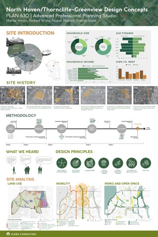
North Haven/Thorncliffe-Greenview Design Concepts PLAN 630 | Advanced Professional Planning Studio Mehar Imran, Robert Wisla, Nupur Nishad, Rabita Islam
SITE INTRODUCTION
HOUSEHOLD SIZE
AGE PYRAMID
1 person 26%
4 persons 16%
1 person 20%
12%
3 persons 18%
THORNCLIFFEGREENVIEW
NORTH HAVEN
3 persons 16% 2 persons 32%
2 persons 46%
0-14
0-14
15-24
15-24
25-39
25-39
40-54
40-54
55-69
55-69
70-84
70-84
85+
85+
30
HOUSEHOLD INCOME
Project Site
North Haven
1953
Farming & ranching dominate areas land use - creeks remain natural
Thorncliffe develops in flatter areas 4 t h and Centre St. are extended north
20
15
10
5
0
5
10
15
20
25
Thorncliffe-Greenview
Owners
Renters
Thorncliffe
Greenview
100 80 60 40 20 0
0
1957
25
OWN VS. RENT
200000+ 150,000 to $199,999 125,000 to $149,999 100,000 to $124,999 80,000 to $99,999 60,000 to $79,999 40,000 to $59,999 20,000 to $39,999 Under $20,000
SITE HISTORY
Thorncliffe-Greenview
Nor th Haven
5+ persons 4% 4 persons
5+ persons 10%
5
10
15
1962
1969
Lower North Haven and Greenview near completion
Construction begins on Upper NH and realigning Nose Creek into a straighter course
North Havens
Calgary
20
2023
1984
Construction completes on Skyline West Industrial Park and Northeast Thorncliffe
Community slowly densifys along Centre St. and Nose Creek fully straightened
METHODOLOGY Site Visit January 22
Community Workshop March 7
Site Visit April 9
Final Presentation April 16 WE ARE HERE
Project Initiation
1 Presentation to Steering Committee February 26
PHASE 1
PHASE 2
PHASE 3
“There are no good housing options for seniors.”
FINAL REPORT
Final Design
2 Presentation to Steering Committee March 20
WHAT WE HEARD “Most parks are just mowed grass lawns with little activation.”
Concept Design Revision
Conceptual Design
Neighbourhood Site Analysis
Open House April 18
PHASE 4
PHASE 5
DESIGN PRINCIPLES
“ To just exit and enter by car in the North Haven Community is such a hassle.”
Diverse Options for Diverse Needs
Concentrated Development
Complete Streets
Cultivate Community Identity
Equitable Connections to Nature
Accessible to all Ages and Incomes
SITE ANALYSIS LAND USE
MOBILITY
LAND USE BYLAW ZONING C-C1 - Commerical, Community 1 C-COR2 - Commerical, Corridor 2 C-COR3 - Commerical, Corridor 3 C-N2 - Commerical, Neighbourhood 2 C-R1- Commercial - Regional 1 District S-CI - Special Purpose, Community Instiution
PARKS AND OPEN SPACE
OPEN SPACE TYPOLOGY DC - Direct Control
S-CRI - Special Purpose, City + Regional Infrastructure S-CS - Special Purpose, Community Service S-FUD - Future Urban Development
I-G - Industrial, General M-C1 - Multi-Residential, Contextual Low Profile
S-R - Special Purpose, Recreation
M-CG - Multi-Residential, Contextual Ground Oriented
S-SPR - Special Purpose, School, Park + Community Reserve S-UN - Special Purpose, Urban Nature
M-X2 - Multi-Residential – Medium Profile
ALDEA CONSULTING
R-CG - Residential, Grade-Oriented Infill
Playground
Outdoor Recreation
Linear Corridors
Nose Creek
School Grounds
Ecological Landscape
Dog Park
Neighbourhood Parks
Abandoned Golf Course
Vision Zero
North Haven/Thorncliffe-Greenview Design Concepts PLAN 630 | Advanced Professional Planning Studio Mehar Imran, Robert Wisla, Nupur Nishad, Rabita Islam
KEY STRATEGIES
PARKS AND OPEN SPACES
CONNECTIVITY
URBAN FORESTRY
ACTIVATION
Enhance connectivity by supporting development that
Support a healthy urban forest by prioritizing tree
Activate
strengthens physical and social access to green spaces,
maintenance,
culturally
promoting clear pedestrian and cycling routes between open
spaces
destinations
and that
reinforcing foster
parks
well-being,
and
Advance naturalization by supporting native plantings
including
and creek daylighting in underutilized spaces to
promoting new plantings in underserved areas to
Indigenous placemaking, age-appropriate amenities,
strengthen biodiversity and ecological connectivity,
everyday
advance ecological resilience, climate adaptation, and
and seasonal flexibility to foster social gathering,
while ensuring regular maintenance of creek and
environmental
equitable access to nature across the neighbourhood.
accessibility, and community engagement across
stormwater infrastructure to manage flood risk and
pocket parks, recreational hubs, and creek corridors.
foster community identity and engagement for all ages.
as
protecting
existing
canopy,
and
stewardship, and quality of life.
parks
through
NATURALIZATION
responsive
diverse,
inclusive,
programming,
DESIGN INTERVENTIONS 1 Creek transition underground
ALLEYWAY CONNECTION
2 Park oriented development 3 Pedestrian bridge 4 Daylight creek into park 5 Pedestrian ramp
1 Weir Barriers to slow flow of water 2 Improved seating
Wild Bergamot
Smooth Blue Aster
Western Yarrow
Blue Flax
Common Gaillardia
Rough
Nuttall’s
Tufted
Hairgrass
Saltgrass
Hairgrass
AFTER
Prairie Coneflower
BEFORE
EGERT’S PARK
3 Low maintenance grass areas
1 Cyclist pump track 2 Mini skateboard park 3 Play equipment rentals 4 Pop-up event plaza area
LAYCOCK PARK
5 EV charging stations in parking lot 6 New picnic shelters and fire pits 7 Miyawaki forest plantings
ALDEA CONSULTING
AFTER
9 Natural teraccing
BEFORE
8 Improved seating with downtown views
North Haven/Thorncliffe-Greenview Design Concepts PLAN 630 | Advanced Professional Planning Studio Mehar Imran, Robert Wisla, Nupur Nishad, Rabita Islam
MOBILITY
OPPORTUNITY
BIKE INFRASTRUCTURE
STREETSCAPE INFRASTRUCTURE
BIKE INFRASTRUCTURE
DESIGN INTERVENTIONS
Opportunity for multimodal pathway Lack of safe sidewalk
PLAN
NORTHMOUNT DR NW
NORTHMOUNT DR NW
Proposed Design
RECOMMENDATIONS Prioritize cycling access to key destinations, including schools, parks, transit, and neighbourhood services. Provide protected dedicated lane to create a continuous and accessible bicycle network within the community. SECTION A
Narrow Sidewalks Opportunity of development along the corridor
Lack of Sidewalks
Lack of Tree Canopy
Parking lot facing the street
STREETSCAPE
PLAN
BEAVER DAM RD NE CENTER ST N
SECTION C BEAVER DAM RD NE
RECOMMENDATIONS
Improve the pedestrian network of sidewalks and bridges by providing continuous safe sidewalks which connects destinations and places. Strengthen the connection between greenspaces and improve connectivity within green spaces through paved pathways. Enhance streetscape safety and comfort through lighting, street furniture
CENTER ST N Proposed Design
BEAVER DAM RD NE
and public realm upgrades.
SECTION B
TRAFFIC CALMING MEASURES
JOHN LAURIE BOULEVARD INTERSECTION Large intersection for crossing
Narrow Sidewalks
Wide turning angle
Wide Intersection
A
NORTHMOUNT DR NW
A
NORTHMOUNT DR NW
B
NORTHMOUNT DR NW
Proposed Design
PLAN- D
B
D
E
NORTHMOUNT DR NW
PLAN-E
ALDEA CONSULTING
Proposed Design
VIEW
Proposed Design
North Haven/Thorncliffe-Greenview Design Concepts PLAN 630 | Advanced Professional Planning Studio Mehar Imran, Robert Wisla, Nupur Nishad, Rabita Islam
LANDUSE | RESIDENTIAL
Accessible for All
Transit Oriented
NEW LAND USE
URBAN SCALE
Flexable Development
C-C1 - Commerical, Community 1
No Scale Modifier Limited (Max 3 Storeys) Low-Modified (Max 4 Storeys) Tall (Max 12 Storeys)
I-G - Industrial, General
C-COR2 - Commerical, Corridor 2
S-CRI - Special Purpose, City + Regional Infrastructure S-CS - Special Purpose, Community Service
C-COR3 - Commerical, Corridor 3
S-R - Special Purpose, Recreation
M-CG - Multi-Residential, Contextual Ground Oriented
C-N2 - Commerical, Neighbourhood 2 C-R1- Commercial - Regional 1 District S-CI - Special Purpose, Community Instiution
S-SPR - Special Purpose, School, Park + Community Reserve S-UN - Special Purpose, Urban Nature
M-X2 - Multi-Residential – Medium Profile
M-C1 - Multi-Residential, Contextual Low Profile
High (Max 16 Storeys) Municipal Parks Schools and Recreation Space Boundary
R-CG - Residential, Grade-Oriented Infill
DESIGN INTERVENTIONS
LIMITED (MAX 3 STOREYS)
MID (MAX 6 STOREYS)
HIGH (MAX 16 STOREYS)
PICTURE: LANCIA HOMES
Picture: Best Calgary Homes, Bridgeland
Picture: Elite Formwork, Ellinsworth
Thorncliffe Rec. Centre Parking Lot Facing West
56th Ave.
6
1
BEFORE
Taylor Crescent NE
5
Underutilized Lot
Undesirable pedestrian experience
4
Centre St.
Lack of Tree Canopy
Mixed-Use Building Hub
2 Urban Canopy Dedicated Tactile Pathway
3
TOD BIRDS EYE MASSING VIEW 1 Existing Thorncliffe Recreation Centre
4 Parking Lot Entrance
2 Thorncliffe Recreation Centre Expansion
5 Outdoor Patios
3 Manmade Wetland
6 Bike Lanes
AFTER
TRANSIT ORIENTED DEVELOPMENT
56th Ave. Bike Lane
RECOMMENDATIONS Encourage the increase of residential density along key transit connected corridors. Utilize underutilized municipal lands and vacant open space to create new affordable housing throughout the community. Focus mixed-uses and higher density adjacent to or within 600 metres of high capacity rapid transit stations.
Underutlized real estate
Unpaved alley creates mud dirt
Unwelcoming pedestrian access
BEFORE
E .N St
Trollinger St NE
h 4t
2 3 1
5 3
Mixed-Use building providing better use of land
4
Trelle Dr. NE
Improved pedestrian access
Travis Pl NE Paved alley for better access 6
56th Ave. NE
1 Tactile Pathways
3 Benches
5 Seniors Housing
2 Community Gardens
4 Connector Trail
6 Bike Lane
ACCESSIBLE DEVELOPMENT BIRDS EYE MASSING VIEW
AFTER
ACCESSIBLE FOR ALL
Trelle Dr NE Alley Facing West
RECOMMENDATIONS Encourage the utilization of under-used open space and future development areas in the community for mixed-use one stop shop facilities for all ages. Amending the CG-1 zone to allow for the addition of small modular ancillary dwelling units. Incorporate diverse ability focused design across the community including extended crossing times for pedestrian crossings, tactile surfaces for visually impaired, and landscaping that is not a hindrance for movement.
14th St. Looking North
BEFORE
Norquay Drive
14th St. NW
Under Utilzation of Land Large street able to accommodate more traffic
2
1
N o rt h
c ot
e
.N Dr
Mixed-Use Buildings
W
Urban Forest
3
Potential future bike connections
AFTER
FLEXABLE DEVELOPMENT
Close to major amenities
North Haven Dr.
1 Calgary Winter Club
2
Pocket Park Upgrades
3
Widened Sidewalks
Wider Sidewalks
FLEXIBLE DEVELOPMENT BIRDS EYE MASSING VIEW RECOMMENDATIONS Provide a Floor Area Ratio bonus for developers who dedicate at least 20% of the building’s total square footage to true live-work units. Implement a 50% reduction in required on-site parking for live-work units, recognizing that residents/employees are the same person and are located near transit.
ALDEA CONSULTING
North Haven/Thorncliffe-Greenview Design Concepts PLAN 630 | Advanced Professional Planning Studio Mehar Imran, Robert Wisla, Nupur Nishad, Rabita Islam
LANDUSE | NON-RESIDENTIAL KEY STRATEGIES
EDGE ACTIVATION
GRAIN REFINEMENT
CONNECTIVITY
Shape active, mixed-use edges that
Enable a finer, more adaptable urban
Strengthen neighbourhood connectivity by
prioritize people over vehicles, with
fabric
incremental
aligning pedestrian routes with desire lines,
street-facing
animated
intensification, supporting subdivision,
integrating green streets and buffers, and
frontages, and opportunities for social
layered building forms, and mid-block
supporting
enterprise and courtyard activity, while
connections that introduce gathering
industrial areas, commercial nodes, and
allowing building form and height to
spaces,
parks into a cohesive, accessible network.
respond to topography and context.
frontages over time.
entrances,
through
local
arts,
and
active
1 Before + After
Potential pedestrian traffic
adaptable
edges
that
link
2 Street View
Underutilized wall
Underutilized wall
Potential pedestrian traffic
48 AV EN W
11
AV EN DR IVE
EDGE ACTIVATION
Vehicle view blocks frontage
Vehicle view blocks frontage
NO RT HH
3 Courtyard View
3
22
NORTH HAVEN SCHOOL
0
7.5
15
30
60 m
5 Before + After
NORTHMOUNT DR NW
1 Patio Space
2 Mid-Block Connection
3 Underground Parkade
4 Raised Crossing
Large parcel
4 4
11
Waste and servicing adjacent park
4TH ST NW
GRAIN REFINEMENT
55
2 3
3
Curb cuts limit accessibility
11 33
0
12.5
25
50
100 m
2 Parcel Reconfiguration
3 Before + After
1
Unprotected Unfiltered water watershed
Desire path
33
BE
AV E
NE
Visual clutter
1 Multi Use Pathway
Property Line
4TH ST NE
Property Line
IL RA
T OT
FO
RD
ER
DA M
Sidewalk disconnect
DE
CONNECTIVITY
R
2
Creek Bed 13m
MCKNIGHT BLVD NE 0 25
ALDEA CONSULTING
100
200 m
Naturalized Space 20m
Multi-Use Pathway 6m
Industrial Setback 14m 0
2.5
5
10
20 m