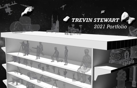
TREVIN STEWART 2021 Portfolio
Chadwick Arboretum North This project focused on creating a detailed maintenance regime for OSU’s Chadwick Arboretum North. The goals of my maintenance regime were to reduce emissions caused by mowing, improve biodiversity on the site, and create a unique and aesthetically appealing site through simply varying mowing techniques.
Trevin Stewart
M>A>C @ Chadwick Arboretum
• • • •
The +
Reduce emissions from mowing Increase amount of plant growth on site Increase biodiversity Offer an interesting aesthetic that challenges conventional mowing practices
Note: Mowing is still done to allow movement throughout the site to continue and to keep the park from looking abandoned, overrun, or uncared for. In still mowing, it makes it clear that the patterns and changes from conventional mowing are intentional. Targeted species: The target of the increased biodiversity is primarily pollinator plants, as they serve to both help the ecosystem while often being ornamental. Some plants in this list may not be pollinators but provide some other benefit to the ecosystem. In trimming, try to allow these plants to flourish by trimming growth around them, but not trimming these. The exception to this is if they begin to crowd out all other species, then trim them back or remove them. This list is meant to provide an idea of plants to look out for based upon their existence in other parts of the site but is not meant to be a comprehensive list. If species outside of this list are found that are also beneficial to the local ecology, they should be treated the same as these species. • • • • • •
Queen Anne’s Lace White Clover Goldenrod Devil’s beggarticks Dandelion Canada lettuce
The Arrow
The T
Use: A mix of fertilizer and sedum seeds should be filled roughly ¼”- ½” into the Arrow-ator and left to sit. The Arrow-ator itself can be moved once the fertilizer mix is filled into it. This will encourage both a faster growth of the grass under the fertilizer, and hopefully a strong sedum that can withstand some foot traffic. Try to use specific sedum based on the direction, for example use a Red Carpet for the northbound and eastbound rows and Summer Snow for the southbound and westbound rows.
Sloping Prairie:
Rules:
Spring:
Rules:
Summer:
Rules:
Summer:
•
Mow North – South or South – North whenever possible
•
•
Reduce mowing frequency to roughly once every week and a half
•
A path is to be considered roughly the width of the mower
•
Reduce mowing to roughly once every week and a half, or until grass reaches roughly 6” in height, whichever comes first
Follow the curve of the berm using two turns, keeping mow paths at roughly the same elevation through the cut. Try to keep the turning points and angle the same for every row.
Mow East to West, and North to South. Skip a row between each mowed row, allow those squares to grow through the year.
•
•
Mow roughly once a week, increase frequency if grass is growing quickly enough to reach roughly 6” between mows.
•
Mow down entirety of Berm for a fresh start on the first and second mow
•
A row is to be considered roughly the width of the mower
Path’s should be straight, outside the mowing of the circle
•
•
Starting at the third mow, skip one row starting from the West, and add another row every other mow until you reach the top of the berm.
•
Any plants that cannot be managed by a mower or string trimmer (woody plants) should be removed as they are found
Use a string trimmer to trim down patches that are getting overgrown after mowing. No more than 25% of patches should be trimmed in one go, focusing on the most overgrown.
•
•
Pick 1-2 secondary paths to leave unmown every mow. These paths should be mowed with the next mow. Only one of these paths may be the same in next mow
Canada goldenrod should be allowed to grow, but not dominate the area
Canada goldenrod should be allowed to grow, but not dominate the area
Pick around 5 sections of the grid, from 3-9 squares, of varying interest to maintain differently. These will be used to create two different types of spaces, grown and mown.
•
•
•
Any plants that cannot be managed by a mower or string trimmer (woody plants) should be removed as they are found
The O
Tool: The Directionator’s These tools are meant to be used to create suggestive one-way paths throughout the park like the one-way paths we find in stores during COVID-19. Once the first mow of this ordinance is done, use the Arrow to make rows one-way paths through the site, determined by the installer, dependent on the manifestation of the mow patterns for the year. Then use the T and the + to dictate intersections as needed throughout the year. The O should be used to designate social distancing for seating. As its diameter is 3’, either spacing one apart or directing visitors to sit one apart will do.
The final part of the project was dedicated to producing a novel tool design that would be used on the site. The tool was meant to be unique, and was more meant to challenge the idea of the typical maintenance tool than to be something entirely practical. While several iterations of the tool were designed, only one prototype was constructed.
Field North of Wet Channel:
Berm:
Maintenance Ordinance
Goal: To reduce the amount of mowing done on site in order to:
One of the features of this project is that the regime to be written out in an ordinance, something that could be provided to the caretaker to give them instructions on how to care for the space to create the desired effects. Rather than designing a site to be strictly managed in one specific way, the ordinance allows for some variation in maintaining the site, allowing it to grow and adapt over time.
•
Connect mowed rows with an East – West mow to allow for movement between rows
•
Use these connection mows to target unwanted species
•
A row is to be considered roughly the width of the mower
•
Canada goldenrod should be allowed to grow, but not dominate the area
•
Any plants that cannot be managed by a mower or string trimmer (woody plants) should be removed as they are found
Invasive and harmful species should be removed, ex:
•
•
Starting from the third mow and at the top of the berm, only mow every other row moving east. If there are unwanted species, mow over them and make a connection to the neighboring row
Invasive and harmful species should be removed, ex: • Amur Honeysuckle
Summer: •
•
Continue regiment from spring, reduce mowing frequency to roughly once every week and a half
•
Poison Ivy
•
American Pokeweed
•
Buckthorn
Begin to use a string trimmer to trim down the rows that have been left to grow as needed
•
Focus trimming on rows east of the top of the berm
•
Mow roughly once a week, increase frequency as needed if grass gets too long to walk through comfortably
Amur Honeysuckle
•
Poison Ivy
•
American Pokeweed
•
Garlis Mustard
Fall:
Fall:
•
Buckthorn
•
•
•
Purple Loosetrife
Stop mowing on a strict schedule, instead aim to mow when the grass gets to be roughly 6” in length
•
Reed Canary Grass
•
•
Knotweed
Lessen trimming throughout the season, allow unmown rows to grow through the end of the season
•
•
Try to pick roughly a 50/50 mix of grown spaces and mown spaces
•
Grown spaces should be based around areas of ecological interest while mown spaces should target unwanted species
•
If a space is dedicated grown, stop mowing the rows going through the zone. Still maintain a walkable edge around the grown zone, but otherwise let it grow and develop, only interfering to remove destructive or noxious plants.
Spring:
•
•
•
•
Allow unmown patches to grow through the season, remove only unwanted species
Stop mowing on a strict schedule, instead aim to mow when the grass gets to be roughly 6” in length Reduce trimming throughout the season, goal should be no more than 10% of patches are trimmed at once
•
If a space is dedicated to mown, begin to keep it mown with the rows. These spaces are intended to provide inhabitable spaces for people, while also offering an interesting way to manage unwanted species. These zones may change and develop throughout the year as diversity changes.
• •
Total mowed area should never be more than 25% of the prairie
Invasive and harmful species should be removed, ex: • Amur Honeysuckle •
Poison Ivy
•
American Pokeweed
•
Garlis Mustard
Fall: •
Remove scheduled mowing, only mow when the grass of the paths reaches roughly 6” in height
•
Begin to choose a secondary path to leave unmown with every mow, and do not mow them again until spring
•
Exception for paths: they may detour around areas with interesting or biodiverse growth as needed, but should return to their straight direction when possible, and as in-line with the previous straight section as possible
•
Keep these paths mowed throughout the season, mowing roughly once a week
Spring: •
Mow three circles of varying sizes, one with one rotation of the mow, one with two rotations, and one with three. Aim for at least one of these circles to receive shade throughout the day
•
Connect the circles with straight mown paths that continue through the circles to the edge of the prairie on either side
•
Pick at least 3 secondary paths that connect the paths going through the circles with each other, the edge of the prairie, or both
Plan of Arboretum - Post Ordinance 25’
50’
75’
Section A Berm + North Field Key
Sloping Prairie
Taller, more overgrown
Milkweed, Prickly Lettuce
Shorter, grassy growth
Giant Ragweed, Spear Thistle
Extra-Diverse Ecology
Smooth Ironweed, Horseweed
Shorter, ground covers
Canada Goldenrod, Green Foxtail
Section B
Berm
A B
North Field
Berm Renderings
Sloping Prairie
THE TOOL
As I was creating more confined spaces during the era of social distancing, it felt appropriate that my tool design address that. Inspired by the one-way aisles of retailers in 2020, the goal of the tool is to fertilize a The Directionators section of grass to cause it to grow in a shape, helping direct people through the space in a safe way.
Step 1: Tool Placement
The Directionator is put into place and filled with an even layer of fertilizer.
The +
The T is used to direct visitors that a 4-way intersection is coming up in areas it may be more difficult to see all paths.
Step 2: Soil Absorption
The Directionator is removed and the fertilizer is left to be absorbed.
The Arrow
The Arrow suggests direction on paths to encourage social distancing in the newly confined areas.
Step 3:Accelerated Growth The areas where the fertilizer was applied should begin to see much faster growth.
The T
The T is used to direct visitors that a 3-way intersection is coming up in areas it may be more difficult to see all paths.
Step 4: Overgrown Directions The directions should be able to stand out throughout the season due to their fast growth.
The O
The O is used to create ground seating that is socially distanced. By having a 3’ diameter, a circle spaced by another circle allows visitors to be comfortably distanced.
Tuttle Park
A BOAT LAUNCH The goal of this project was to create a feature to be added to Tuttle Park. As the site had an area dedicated to a boat launch, I chose to improve on it. Through making an interesting aesthetic, these poles provide seating, boat racks, and a trellis space for plant growth.
As the curves between poles were all unique, creating a trellis structure between them became rather complex. To manage this, I developed a Grasshopper script to create a trellis between two curves, which is show above.
Tuttle Park
Proposed Axon
AN ADAPTED RIDGELINE As another improvement to the park, I proposed converting the currently empty ridge into a space for the park and neighborhood. By adding layers to the ridge in a stepped fashion it’s possible to create a lot of unique spaces and views to add to the park. The features added to the ridge are primarily focused on providing seating, with some of it dedicated to leisure, some to private seating areas, and some to large spaces to allow room for collaboration. A key driver for this design was its positioning inside a flood zone. Accordingly, it had to be carefully designed to not influence flood levels, as well as to withstand a possible flood.
Design Iterations
Proposed Section Playing Field
Wooded Park Viewing Platform Collaboration Hallway
500YR Flood Line
Collaboration Plaza
Movable Tables and Chairs Step-Style Benches
EXISTING REC. CENTER
100YR Flood Line
Existing Section
Tuttle Park
A HOUSING SOLUTION
The final addition to the park was an area dedicated to providing housing. The goal of these units was to provide a unique living space that is more focused on vertical integration as it scales a roughly 30’ ridge set into the forest of the park. The units would be split into duplexes, with the top box acting as an entry way for both sides.
3RD FLOOR
2ND FLOOR
1ST FLOOR
PUBLIC SPACE
N
COMMUNITY GATHERING AREA
Ridgeline
Form Studies
Shipping Container As Precedent
50'
50'
Total Size per Unit = 2,250 ft²
15'
45'
Example Floor plan The Theory The sizing for the units were inspired by shipping containers, following a recent trend in re-purposing old containers into shops and houses. Through stacking the different layers in different ways, it’s possible to create many unique spaces in the voids it creates. This allows for balconies of varying sizes for different activities that can be unique to each unit.
Preliminary Work Tackling housing was a new concept to me for this project, especially with the unique challenge posed by the steep ridgeline. It took many rough sketches before I decided on the approach I did. Climbing the ridge seemed like a much easier goal than trying to adapt the ridge to the needs of the housing. One key thing I wanted to focus on was allowing these units to each have a secluded feeling, even though they’re duplexes. By following a simple rule for windows on the north and south sides of the units, the sides facing each other, it would provide views of the forest without forcing views of your neighbor.
North Side Windows
South Side Windows
OSU’s Golf Course An Ecological Redesign
As golf has lost popularity through the years courses have begun to close at an alarming rate. This poses a unique opportunity, as golf courses often have special zoning rules applied to them it would likely be easy to adapt those rules to another unique situation, such as a zone dedicated to promoting local endangered species. As golf courses typically have very strict regiments of care and intensive drainage networks, they’re the perfect site to promote both prairie growth and reforesting with little terraforming or redesign. Because of this, this project was focused on restoring the population of American Bison, Karner Blue Butterflies, and Rusty Patch Bumble Bees. Some endangered plants, the Sugarberry, Scaly Blazing Star, and Little Bluestem, were key to promoting these species’ repopulation.
Riparian Perspec-
Existing Section
One goal of the site was to daylight the large drainage system that was installed into the golf course and use it to create a riparian for the Sugarberries.
Blind Perspective
Terraformed Section Regrowth Section
Final Section Another goal in the site design was to integrate people through the site and allow them to see the ecology without disturbing it. Accordingly, a blind had to be developed specifically for the site. A rendering of the view from the site as well as a section of it help to illustrate how a sunken tunnel would be used to get visitors close to the Bison
Blind Section
Ecological Study
Below is a diagram illustrating the relationships between the different species we’d plan to integrate in the site.
Bison Prairie Axon
Riparian Axon
Pollinator Prairie Axon To the right are some axonometric drawings to better illustrate some important features of the site. The Bison Prairie is an example of the zone the Bison would inhabit, as well as the blind dedicated to circulation. The Riparian Axon is an example of the day-lit drainage area after it’s reforestation. The Pollinator Prairie Axon is an example of prairie space dedicated to strictly pollinators, and providing some space for people to visit and sit while at the park.
Collision Bend - Cleveland
FIT FISH
Fit Fish is a redesign of a parking lot along the Cuyahoga River in Cleveland, OH. The goals of this site were to provide a free outdoor space for people to work out while creating a smaller section of the river dedicated to becoming a spawning ground for Rainbow Trout and Walleye to help boost their populations. Different zones were dedicated for different work out activities, each in an attempt to create a unique and memorable place to get healthy. Some of the stream created on site was dedicated to room for water sports and activities, while some of it was restricted to the spawning ground for Walleye and Rainbow Trout.
Modeling Fit Fish
Models to help illustrate the plan for Fit Fish were created using a CNC mill, which allowed for precise details relating to the elevation changed made to the site.
Construction of Models
The construction of these models to a high degree of accuracy was made possible by using publicly available GIS data. The contours from this data were taken and run through a Grasshopper script in Rhino to turn them into a mesh. The buildings were then extruded to their proper heights using Google Earth to measure, and finally this was all complied in the CNC’s software to formulate cut paths.
A Landform of Wood
This project was done with the intention of portraying a landform through the use of wood. It was done in two stages, the first being a model of sticks and the second being an iteration of the stick model using planks instead. I approached this project in a unique way, with far more planning than normal. As I didn’t want to waste wood by making it solid I planned out my model ahead of time by making a plan market with elevation heights and then adapting that into individual sections. These sections allowed me to determine how many different sized pieces I’d need, collect the pieces, assemble them into sections, and then assemble the sections to produce the final model.
The Planar Model
Because of the careful planning I’d used in creating the stick model, it was very easy for me to adapt it to a planar one. I scanned my sectional drawings and loaded them into Autocad to trace. These traces were then used to laser cut precise sections. The flexibility of the laser-cutter allowed me to add in unique features that I couldn’t have done otherwise, like the cavern and archway.
A Collection In Space
An Internet of Things This project was done with two goals, to explore the vast amount of free 3D models available and to develop my skills with rendering using Vray for Rhino. A Collection in Space is just that, a collection of free 3D models envisioned upon a shelf drifting through space. Aboard the Ship is a model of my desk envisioned upon a ship and populated with models from the Collection. Where it began is a diorama also created using models from the Collection, though it uses solely models provided by NASA. While not dedicated to any practical design, I found this project to be very fun, unique, and intriguing. It gave me a chance to refine some of my skills with these programs while exploring a creative idea, which I greatly enjoyed. I admit, it feels like a cheat to use color solely for this page, but it’s a piece of work that truly lost a lot of detail in black and white, so I chose to leave it as it originally was.
Aboard the Ship
Where it Began
An Example of Photoshop
A Daily Routine
These projects are primarily art related, but were essential to developing skills in Photoshop. Mapping Ephemerality is a collage done with the goals of showing the temporal nature of the site. From the passing of animals to the passing of planes, it tries to capture what it feels like to be at the site in a still image. A Daily Routine was focused on showing multiple steps and movement through the overlaying of many pictures and their blending. It’s simply a visualization to the steps of making tea. Rendering a Model was done with the goal of adding context to a theoretical landform designed and modeled in Rhino.
Mapping Ephemerality Rendering a Model
5th and Forsythe, Columbus This project involved creating rough construction documents for a proposed redesign of the unused elementary school found at 5th and Forsythe.
The school would be repurposed into apartments. The sports field would be dedicated to a learning center neighboring a plaza lined with a retention swale. The parking lot would be dedicated to an outdoor pavilion and open yard. There would be space dedicated to “flex” parking for events. This parking would be a large open field with many parking spaces constructed using mesh-like supports to prevent cars from suffocating the grass there.
Plan
Construction Pictured are drawings explaining the construction of some of the features on site.
Preliminary Work
This project was given with precise requirements for the size of different zones throughout the site. Due to this, it took several iterations done to help decided how to fit it all within the dedicated space. As much of the grading on site was changed, it was also important to figure out how the contours that illustrated that would appear and what these changes would do to the site.
W. Broad + S. Belle, Columbus This project was done in a City and Regional Planning class I took to further my understanding of zoning regulations. The focus of the project was to provide a development plan for a large parking lot neighboring Columbus’ Veterans Museum and Memorial. The goal was to transform a largely unutilized parking lot into a shopping center that would provide many amenities to the neighborhood while finding out what rules this development would have to follow. This ranges from anything from usage of the space, setbacks from the road, building design, to even the materials used to construct the building. This project was done through picking zones and the design of the space followed by drafting a thorough Planned Unit Development that would be submitted to the city for review before the project would be pushed further.
Context Map
Proposal Map
Trevin Stewart CRP 3600
Planned Unit Development
Prof. Ezell 3 March 2020
FINAL PUD ZONING TEXT SUBAREA A: Subarea A is comprised of 2,900+/- square feet located in the southern portion of this site plan. This subarea will accommodate the development of Broad Street’s building design and ground floor requirements set in the Columbus Downtown Design Guidelines adopted in July of 2013. 1. Permitted Uses: The ground floor of the building found in this subarea shall be used for retail spaces, such as restaurants, coffee shops, bars, salons, etc. The upper floors of this building will be used for office space.
b. Design: The final designs of the buildings in this subarea shall be approved as part of a final development plan. c. Exterior Materials: Permitted primary and secondary materials for buildings in this subarea are as follows, following the provided materials in the Columbus Downtown Design Guidelines: i. Primary Materials: Permitted primary cladding materials shall include: 1. Brick
2. Design Intent: The preliminary plan for this sub area is intended to reflect commitments
2. Additional materials determined acceptable by the Planning and
and development standards/details. A detailed site plan with building elevations shall be submitted for final development plan approval. 3. Density, Lot, and Setback Commitments:
Zoning Commission ii. Secondary Materials: Permitted trim materials shall include:
a. Number of Units: There shall be a maximum of 3 retail storefronts on the ground
1. Composite Trim
floor for this area. The maximum units of office space are dependent on the
2. Metal Trim
allowances of FAR made by the city’s planning board.
3. Additional materials determined acceptable by the Planning and
b. Lot Coverage: Maximum lot coverage within this subarea will be 100%.
Zoning Commission.
c. Setbacks: i. Broad Street: There shall be a maximum of 0’ setback facing broad street
iii. Roofing Materials: Permitted roofing materials shall include: 1. 25 year or better dimensional asphalt shingles, minimum 240
as required in the Columbus Downtown Design Guidelines. Exception to
this will be a connection path that will cut through the building to make
lbs./square weight
pedestrian access to the site easier.
2. Metal standing seam
4. Access, Parking, and Pedestrian Commitments:
3. EPDM roofing
a. Minimum Parking: The minimum parking for this space will be determined by the FAR allowances given to the site by the city’s planning board, as it cannot be
d. Lighting:
determined until the amount of office space allotted is determined. There shall be
i. Street lighting, if used, shall be attached to the building at a height no
a minimum of 4 spaces/1000 square feet of building area. If a garage is required,
greater than 18 feet. Fixtures and their colors and spacing shall be
parking spaces within the garage shall count toward the minimum parking
approved at time of final development plan. Street lighting shall be
requirement. Final locations of exterior parking spaces shall be approved as part
consistent in height, color, and appearance throughout the subarea.
of the final development plan, but shall not appear in subarea A. b. Access Points: i. Primary Vehicular Access: PVA to and from this subarea shall be provided from Broad Street through a drive that connects to the lot found on the northern end of the site, outside of subarea A. The drive will be a minimum of 22 feet and will serve multiple subareas within this site. ii. Primary Pedestrian Access: PPA shall be through an outdoor hallway cut through the building found in subarea A. This access shall serve all other subareas of the site as the primary access. 5. Architectural Standards: a. Minimum building height: Buildings in this subarea shall be no less than five stories, as determined by the Downtown Design Guidelines. Maximum height shall be determined by the FAR allowances given to the site by the city’s planning board.
ii. Lighting of entry features and any additional proposed lighting shall be provided and approved at time of final development plan. 6. Signage Commitments: a. It is the intent for signage to be consistent in character along the frontage of Subarea A. b. Signage within this subarea shall be provided as set forth below. A signage package shall be submitted for review and approval by the Planning Commission as part of a final development plan for this subarea. i. Subarea A signage shall include signs identifying retail spaces that are attached to the building. c. Additional signage shall be in accordance with the code standards with specifications provided with the final development plan. 7. Utilities: All new utility lines and wiring shall be placed underground. Utility easement locations and widths shall be determined in the final development plan for this subarea.
This project was done in a class as a collaboration with COTA and the Neighborhood Design Center. The goal was to design and create a small modular parks that could be placed at bus stops in the hopes of creating more public spaces. This is another project that simply lost too much in transferring to black and white, so it got a pass too.
4th & Innis Parklet Proposal Servicing the Reeb-Hosack Community and COTA Line 8 Riders
Native American Center Mural Eight & Sand Tavern
Site View from across street
RESIDENTIAL COMMERCIAL
COTA LINE 8
Reeb-Hosack and Hungarian Village Communities
Plan View
48"
Columbus City Context
Permeable
96"
Planters
120.0"
6"
24"
24"
24"
24"
Impermeable
5’x 8’ Accessibility Corridor
12" 24" 12"
36"
72"
48"
Section Views
Measured Plan Sight lines
Circulation
ADA Accessibility
Drainage
Bus Stop Parklets - Columbus Along with designing a layout and purpose for the parklet, we were tasked with figuring out its construction as well. While the option was available to acquire prebuilt furniture, my group decided to figure out our own construction so we could create a more unique parklet. We stuck to simple shapes to allow it to be modular in case the design needs to be adapted to a different shape in the future.
*The constructed parklet you see here is not the one designed by my group. We were only able to get permitted to do one parklet over winter a test, the rest will be constructed in the spring.