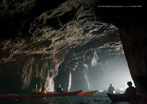
Irish Sea Kayaking Association Issue 69 Winter 2026
Treasna na dTonnta
Treasna na dTonnta #69 Page xii
Editorial ISKA News: Fiona Trahe ISKA Chairperson Book Review: Chasing Tides - Round Ireland by Kayak. A journey on a shoestring in the days before smartphones, by Pat Rogers. Sue Honan Technique: Tides and Trip Planning – John Dempsey If you want to turn, look at your stern: Why your body beats your paddle. – John Murray Environment: Coral Beaches – Sue Honan Ireland Circumnavigation News: Sue Honan Location: Kayaking to a drowned village – Sennan O’Boyle to come Arctic Expedition - Pauline Jordan – to come Troubled Waters: something from either Barbara Monda or Jon Hynes, to come Dave Cooney – An appreciation by Dave Walsh.
Above: Three Sisters Co Kerry, Donal Glackin Facing page: Croaghaun Cliffs Achill Co Mayo, Donal Glackin Front cover: Owey Island Co Donegal, Donal Glackin Back cover: Crab island near Doolin after storm Eowyn, Donal Glackin
ISKA News, Fiona Trahe ISKA Chairperson 1 Book Review: Chasing Tides by Pat Rogers, Sue Honan 3 Ireland Circumnavigation News, Sue Honan 4 Location: Kayaking to a drowned village, Sennan O’Boyle 6 Technique: Tides and Trip Planning, John Dempsey 10
Treasna na dTonnta #69 Page 1
Technique: Greenland rolling, John Murray 15 Troubled Water: Situational awareness, Dr. Barbara Monda 18 Environment: Coral Beaches, Sue Honan 24 Fred Cooney, an appreciation, David Walsh 30 Location: Nordkapp Expedition, Pauline Jordan 34
EDITORIAL
Welcome to Treasna na dTonnta 69.
Downpatrick Head Tunnel, Donal Glackin
What a year! From what seemed like never ending rain in the early part of the year, to endless sunshine and calm seas for the summer. Ireland’s coastline never looked so good under the blocking high that settled over us. TnadT would not be what it is without paddlers submitting articles and photos, wait! I tell a lie—TnadT would not be what it is without your humble editor collaring people and asking them for content. Folks, we are the land of saints and scholars, poets and storytellers but you’d never know it from the extreme modesty of the paddling community. The articles in this issue are brilliant, but no one volunteered until nabbed with the exception in this issue of John Demspey and John Murray, the legends! So this is a polite request to get over ourselves to write something for TnadT and offer it in. If you can write it on Facebook, or post on Instagram, please send it in to TnadT as well, it will not be refused! ISKA would love to see a second issue each year develop from your experiences and paddles. Rant over. I was thrilled to get a sneak preview of Pat Rogers’ book Chasing Tides—Round Ireland by Kayak. A journey on a shoestring in the days before smartphones. You can read the review on page 4. In short buy this book! We were all enthralled by Pauline Jordan’s missives from her Arctic expedition over the summer, I am grateful she was able to delve deeper into the trip for TnadT. Sennan O’Boyle had a different kind of expedition to the land before time, or at least the land before Blessington Lake reservoir covered it over. Read his evocative account of a kayak trip to a drowned village on page 6. John Murray transformed my relationship with
Treasna na dTonnta #69 Page 2
ISKA NEWS
rolling in a way only he can. Returning from shoulder replacement meant that I was really in my head about it all and keen to not to put pressure on my joints. You can read his philosophy about the roll and pick up some critical tips in his article in the Technique section. I think I would trust John Demspey to plan a kayaking trip to the moon! His thoughtful, detailed and clear article on trip planning and tides is on page 10. Whether you have experience or have not yet progressed to planning your own sea kayak journeys, this is well worth the read. Thanks John! A sentence from a paper on situation awareness by Outdoor Risk Lab’s Dr. Barbara Monda made me think. ‘Studying situation awareness sheds light on why even skilled paddlers sometimes struggle when stepping into leadership roles.’ We do not have space to reproduce the full paper in TnadT but Dr. Monda kindly gave permission to reproduce an extract. It is food for thought and I encourage you to find the full paper and others. Connemara is a biodiversity hotspot and its coral beaches are unique and precious. I do a deep dive into what makes them special in Environment on page 24. The photos people sent in really make a difference to TnadT, thank you to, Tess Glanville, Donal Glackin, Tom Sawyer and Caroline Schofield for answering the call! Oileáin needs no introduction, it was the first of its type and gave rise to many other kayak guidebook we use today. Fred Cooney was instrumental in its inception. Fred sadly passed away this year. His close friend David Walsh writes an appreciation l
It’s great to see TnadT up and running again after a break in 2025. Thanks a million to Sue Honan and Adam May for pulling it all together. 2026 was a good year for ISKA with meets in Streamstown, North Mayo, the Antrim Causeway coast and the Aran Islands. The weather played along in most cases and after years of hoping, we finally got the conditions to bring the Clare meet to Inis Oírr and Inis Meáin. Thanks to John Dempsey, Steve Smith, Conor Smith, Rob Scanlon and all the others who helped to make those meets possible. Alongside that we continued to focus on upskilling our members, with Nana Luke doing a wonderful job as training officer, organising eight training courses for a wide variety of skills and Steve Smith adding leadership skills training. Thanks to Sarah McCarthy for her Trojan efforts in bringing the ISKA Symposium to Bantry this year, giving us an opportunity to paddle the beautiful West Cork coast. Behind the scenes, Eoin Flood has been working on our website, moving us to a new forum which will eventually simplify admin. (Note, you have to re-register if you want to post something) It’s been a turbulent few years for ISKA (don’t mention the CI word). Following up on some of the members concerns the committee affiliated to Canoeing Ireland, enabling organisers and leaders of our events to be covered by their club insurance.
Paddle safe and enjoy the sea, Sue Honan 2026
Treasna na dTonnta #69 Page 3
Many ISKA members are already CI members through other clubs, those who are not can now avail of the club discounted rate if they choose to join CI (which is optional). As before, reliance on insurance is not what keeps us safe—it’s the care we take when on the water together. The habits we’ve practised for over 30 years—taking individual responsibility while sharing our understanding of the sea and weather conditions and looking out for each other—continue to be the cornerstone of ISKA. There‘s plenty more to do on the committee and as usual, there will be several vacant positions to be filled next year. Watch the forum for details, please consider stepping up to help ISKA thrive and attend the AGM which will be held online a month after the Symposium. Lastly a thought for ISKA members who passed away in the last 12 months; Eddie Murray, Eoin McCarney and Fred Cooney who was a founder member of ISKA. Ar dheis Dé go raibh a n-anamacha uaisle l Fiona Trahe, ISKA Chair
BOOK REVIEW
Chasing Tides - Round Ireland by Kayak. A journey on a shoestring in the days before smartphones. Pat Rogers.
This is Pat Roger’s daily account of his sea kayak journey around Ireland paddling a Nordkapp-inspired design built by Mark Downey—once owned by Harry Whelan—which had a fixed skeg (no joke when tracking over long crossings), with a borrowed radio and an early Nokia. Pat describes his journey starting at Toe Head with a friend Jimmy O’Toole who was completing his own circumnavigation from a previous year and then paddling solo from Killary where Jimmy finished his trip. In the days when they had to rely solely on the RTÉ weather sea area and weather forecasts, paddling was a much riskier undertaking. Especially when he had to give the borrowed radio back. 1997 was a bad summer and they had several long weather bound breaks, they had 5 days paddling in the first 19! I am a bit wary of books like this, all too often
CIRCUMNAVIGATION NEWS
they become repetitive logs of the daily minutiae of expedition life which, let’s face it, can be pretty boring at times. Pat has avoided this nicely; each short chapter begins with a map, drawn by Tina Reed, (who also painted the cover) showing the location with a few stats of the day or section covered. It is a nice easy read, and you feel like you are with him experiencing the journey as he chats in a relaxed and friendly style. Scattered throughout are pages from his diary, observations of sea life, his own life events, commentary on life, mentions and anecdotes about well-known people in the Irish outdoor community, and the stunning places he paddled. Having stopped at many of the same spots on my own circumnavigation it was nice to reminisce a little bit with him as I read. I liked his early anecdote from a friend that packing a kayak is like ‘un-delivering a baby’, which I am sure will resonate with many paddlers. This is definitely a book to have on your shelf. Pat has self-published this book which will be available at the Symposium and also at ChasingTides.ie and on Amazon l
Treasna na dTonnta #69 Page 4
Mick O’ Meara 20 Day record! There have been several groups and individuals circumnavigating Ireland these past two years. The jewel in the crown for 2026 (and perhaps years to come) has to be Co. Waterford based paddler Mick O’Meara’s (pictured right) smashing of his own 23-day record set in 2015 by three days. He went round unsupported anticlockwise, departing Ballintoy Co. Antrim at 11am on July 12th returning on July 31st at 10am, an eyewatering 20 days. Paddling a Kirton Inuk, Mick once again had a tough battle on the east coast. Congratulations Mick! The race is on however, as Olympic sprint paddler Sebastian Szubski (who paddled around GB in 35 days last year) is up for the challenge in 2027. Mick has already said that 20 days can be beaten, it is the weather that will decide.
Solo circumnavigator Damian Furlong raises over €21,000 for St. Francis Hospice. East Coast Sea Kayak Club and Cormorant Kayak Club paddler Damian Furlong (pictured left with supporters) also took advantage of the fine weather. Paddling in a Taran 16 clockwise taking 35 days including 5 weather days. He trained well beforehand and made good progress from the start, with some big wind days and an 80km day. His last day was a long one as he battled Bf5 headwinds in the dark to earn that champagne! Congratulations Damian and support team! You can read his log with preparations, diary and routes at his website kayakcamino.wordpress.com
Richard Skelly and Damian Hamill 2025 The dynamic duo of Drogheda based paddler Richie Skelly and Co. Down based paddler Damian Hamill battled the wind, rain and fog clockwise (and anticlockwise!) around Ireland last year. Paddling SKUK/NDK Explorers they left Drogheda on May 28th and returned triumphant on July 26th. They were a tactical team, starting clockwise they were making good progress and reached Seafield in Co. Clare, however, the weather turned against them so they switched to an anticlockwise track on the east coast. A total of 49 days paddling, with another 10 weather days on top of that. Tough going! Richie says: “The most memorable part of the trip for me was when we rounded Mizen head in total fog, we had to heavily rely on our compasses and timings, this was somewhat unnerving as we could hear the thunderous roar of waves breaking against the headland.” Well done Richie and Damian! l
Treasna na dTonnta #69 Page 5
Photograph Sennan O’Boyle
Treasna na dTonnta #69 Page 6
LOCATION
“1940, 3rd March 10am. The Poulaphouca Dam was closed and the lake begins to fill…” Sennan O’Boyle recalls a paddle back in time.
Six and a half thousand acres of land had been cleared to make way for the reservoir and 76 houses slowly disappeared beneath the floodwaters. I visited one of them 78 years later in September 2018. The Met Éireann Summer 2018 Analysis details how Ireland experienced severe widespread drought, driven by prolonged high-pressure systems and intense heatwaves from late May to mid-July.
and knowing I couldn’t get away quickly in the kayak, I played the Wicklow accent card—easily done when you are actually from Wicklow! They were two of the nicest lads you could meet way out in the sticks. A very enjoyable chat, big intertest in the sea kayak—the main point of conversation, although I decided not to broach the possibility of a poitín purchase perchance. Another evening I spotted a big fishing float and found a long piece of line attached. On pulling it in so that no wildlife might get entangled, I found a dead two-foot long Pike. I didn’t know it wasn’t fully dead until later! I’m now solo 200m offshore with a big fish to deal with. Add a sharp knife to this mix and the potential for ‘incident’ is high. So I left the pike off with about 10 metres of line
Hy Brasil in Blessington Lake While on patrol, the Wicklow division of An Garda Air Support Service noticed the ruins of a homestead and piece of farm machinery ( a mowing bar) on a piece of land that had previously been submerged. A photograph in the paper spiked my interest, and I decided to try and find it. We’re talking ‘needle in a haystack’ here as the photo was cropped to show only the remains of the homestead and no shoreline or other background. I often kayaked on the lake, training, practising night navigation, and generally enjoying the mountain scenery and getting away from it all. Some corners and inlets are isolated and on one previous visit I had a brief ‘Deliverance-type’ moment as I was eating lunch; two men emerged out of the forest behind me carrying shotguns. Thinking I was close to an illicit poitín still
and started kayaking to the shore to deal with it. Glancing behind, it had pendulum-ed up to the surface and was now surfing the wave behind me grinning. Flashbacks to an Alaskan trip when Eddie O’Shea’s trolling line caught a fish which pendulum-ed up to the surface as we kayaked along. Two eagles swooped down to rob it, making us think we were going to be attacked! As it turned out, they would have been welcome to the grotesque-looking, bony, inedible fish that looked like it was about to explode having been brought up from about 200 feet. Back to Ireland. I am now in a kayak beside a 2 foot high grassy bank, wondering how to release a not dead pike off the hook when it just dropped off and swam away! Thankfully no fingers were harmed. I digress but the scene is now set. I had a stunning, sunny, breathless day to go looking for this low-lying
Treasna na dTonnta #69 Page 7
island against a low-lying backdrop. I really didn’t expect to find this ‘needle’ in such a big lake, but there it was in front of me after about 90 minutes ‘sneaking and peeking’. My luck was in! There had been clues during the previous halfhour. I saw newly emerged ditches, granite gate posts, fields, tree trunks and what looked like old potato ridges in one field. I’m definitely in the zone now of being ‘78 years back in time’. I was born in 1956, so I was thinking I was only 16 years out of sync. A bit Manchán here, getting in touch with the past. I landed respectfully, thinking of past generations. The mowing bar told its own story, a child’s shoe told another, the photos tell it best. I figured out where the welcoming kitchen might have been, sparked up my volcano kettle and had a contemplative cup of tea, the first in 78 years in this special place. I wondered what that ‘last cup of tea’ conversation might have been. As the flood waters slowly rose some farmers were very slow to leave their homesteads. One story is told of a farmer who refused to go and was eventually rescued off the roof of his home. Once the homesteads were abandoned, they were demolished, some with dynamite seemingly and some of the soon-to-be-covered bridges were blown up. My only regret was not having a drop of whiskey to toast past generations of the Miley family who owned this particular property. The drought which exposed these ruins was long and intense. The recent 2026 drought did not reduce the level of the lake enough to expose these ruins once more. Perhaps at a future date I’ll drop back in to the Miley’s for a catch-up cup of tea. I will make sure to have a ‘Deoch an Doras’ with me this time l
Photograph An Garda Síochána
Treasna na dTonnta #69 Page 8
Photograph Sennan O’Boyle
Treasna na dTonnta #69 Page 9
TECHNIQUE
Tides and Trip Planning John Dempsey
Before any sea kayaking trip, you should check what the tide is doing. You look up the tide tables and find out when the high water is. What does this tell you? It tells you how far down the slip or beach you will have to carry your kayak before launching, or if a particular rock garden will be exposed or covered. You also need to know about local tidal streams—when the tide starts and stops flooding or ebbing—because that is what decides if your trip is easy or difficult. It would be simple if the tide started ebbing at high water and started flooding at low water. However, tidal streams are rarely that simple. Spring and Neap Tides Most of Ireland’s coast gets two high tides and two low tides roughly every 24 hours and 50 minutes—not a full day, which is why the tide is about fifty minutes later each day than it was the day before. This rhythm comes from the pull of the Moon, with the Sun adding a smaller pull of its own. Twice a month, around new and full moons, the Sun and Moon line up, and their pulls combine, giving you the biggest tidal ranges of the month—spring tides. In between, around the first and third quarter moon, the two pulls partly cancel out, giving you the smallest ranges—neap tides. This matters beyond the size of the rise and fall: a bigger range generally means faster tidal streams, so a crossing that’s easy on a neap tide can be a serious proposition on a spring. Between one high water and the next low water (or vice versa), the sea’s height doesn’t change at a steady rate—it starts slow, speeds up through the
Figure 1: Spring and Neap Tides (image generated using Google Gemini)
Figure 2: The Rule of Twelfths
Treasna na dTonnta #69 Page 10
middle, and slows again near the end. The rule of twelfths is a simple way to estimate the height at any point. If the six hours between HW and LW are roughly split into six hourly steps, for each hour, the tide height changes by 1/12, 2/12, 3/12, 3/12, 2/12, and 1/12 of the full range, in that order. So, in the first hour off high water, you only lose a twelfth of the range; by the third hour, you’re losing three-twelfths in that hour alone—the fastest the level ever moves; by the sixth hour, it’s barely changing again as it settles into low water. Half of the change in the tide height happens in the third and fourth hours. For a paddler, that’s the practical use: you can work out roughly how much water you’ll have over a rock garden, or how far you’ll be carrying your kayak down the slip, at any point in the cycle—not just at HW or LW themselves. Tidal Streams So far, this has all been about tide height—how far the water rises and falls. For a sea kayaker, the more useful question is often different: which way is the water itself moving, and how fast? That movement is called a tidal stream, and it’s a separate thing from the rise and fall of the tide. A stream can run at several knots even somewhere the tide only rises a meter or two—and it’s the stream, not the height, that decides whether your paddle is a fast, easy paddle or a long fight against the current. As the tide rises, the stream generally floods; as it falls, the stream generally ebbs. It’s natural to assume the stream simply follows the tide—flooding while the water rises, ebbing while it falls, and turning exactly at high and low water. In some places, that’s roughly true. But it isn’t a rule, and it catches people out: paddlers who plan around it
can end up fighting a stream that hasn’t turned yet, or missing a fast, favourable one that already has. Slack water—the short pause before the stream reverses—can fall well before high or low water, well after it, or occasionally right on it, depending entirely on where you are. Knowing which of those applies to the stretch of coast where you want to paddle is one of the most useful pieces of local knowledge a sea kayaker can have. For example, Oileáin (Walsh, 2014) states that the main offshore tidal stream on the west coast floods north from Galway HW -03:20 until Galway HW +03:05. And that this offshore tidal stream makes itself felt where the land projects to meet it, including at Slyne Head. Think about those numbers for a minute. The north-going stream is still running, close to full strength, right through high water and on for another three hours afterwards. If you’d planned to paddle out to Slyne Head and you assumed slack water was at HW, you would get a surprise. Consider another example: Dalkey Sound on the south side of Dublin Bay. Oileáin states that the tide floods through Dalkey Sound until Dublin HW -02:00. In other words, the tide starts ebbing two hours before high water. The same “slow-fast-fast-slow” shape that governs how fast the height changes also governs the stream—but measured from slack water, not from HW or LW. The 50/90 rule is a quick way to estimate the speed of a tidal stream as it ebbs and flows between periods of slack water: at the end of the first hour after slack, the stream reaches about 50% of its maximum rate; by the end of the second hour, about 90%; for the third and fourth hours, it’s running at or near its full rate; then it eases back through 90% and 50% again heading into the next slack.
Treasna na dTonnta #69 Page 11
Figure 3: The 50/90 Rule
Figure 4: Tide Race (Image generated using Google Gemini)
Figure 5: Overfalls (credit: Isleofjura.scot)
Most sea kayaking takes place close to shore, where things are more complicated. According to Oileáin, “it is widely accepted that tidal streams inshore in the shallows turn before tidal streams offshore”. In addition, there are headlands, islands and shallows to contend with. Tide Races and Overfalls A tide race forms wherever a headland forces a moving tidal stream to squeeze into a smaller space than it had further back. The volume of water trying to get past has to keep moving; it cannot just pile up. So, where the coast pinches the flow, the water simply has to speed up to get through. An overfall forms where moving water passes over a sudden change in depth—a shoal, a submerged ridge, a shelving bank—rather than around an obstruction on the surface. As the current runs up over the shallower ground, the same volume of water is forced through a thinner layer, so it speeds up and gets pushed upward, disturbing the surface directly above the shoal—short, steep, often breaking waves, even in otherwise calm conditions. The key practical difference from a race: an overfall doesn’t need a headland at all. It can appear in open water wherever the chart shows a bank or a sudden shoaling, which is exactly why reading the depths on a chart matters as much as reading the coastline. A tide race is often also an overfall because the seabed around the headland is also shallow. Oileáin is an invaluable guide for information about tidal streams at the headlands, islands and shallows around the coastline. It is written explicitly with sea kayakers in mind. After checking the tide times, sea kayakers should consult it for information about tidal flows.
The Vanishing Tide Something strange happens to the tide as it crosses from the south coast into the Irish Sea. Along the south coast, the flooding tide runs from west to east. Ballycotton and Carnsore Point are approximately 125km apart. High water in Carnsore Point is approximately 34 minutes after high water in Ballycotton. Rosslare and Dublin are also approximately 125km apart. However, high water in Dublin is approximately 6 hours after Rosslare high water. It isn’t only the timing of the tides that goes strange. The tidal range at Rosslare is less than 2m, while at Fishguard, it is more than 4m. Similarly, the tidal range at Dublin is approximately 4m, while at Liverpool it is over 8m. To understand what is going on here, imagine you are holding a glass of wine and swirling it around. The swirling of the glass forces the wine away from the centre of the swirling motion. A bulge of wine rises on one side of the glass with a trough on the opposite side. The bulge and trough rotate around the glass, causing the height of the wine on the side of the glass to increase and decrease. However, the height of the wine in the centre of the glass stays the same. The Earth’s rotation forces water in the oceans and seas to behave like the wine in the swirling glass. At the centre of the ocean/sea, there is an amphidromic point, a point around which the tides rotate. The further a point is from an amphidromic point, the higher the tide is. In the Irish Sea, there is an amphidromic point close to Cahore Point (see Figure 6). In the figure, the lines are cotidal lines—lines joining every place experiencing high water at the same moment. The cotidal lines are relatively close together between Rosslare and Dublin,
Treasna na dTonnta #69 Page 12
Figure 6: Amphodromic Points around the British Isles (from Hashemi, M. R., Neill, S. P., & Davies, A. G. (2015). A coupled tide-wave model for the NW European shelf seas. Geophysical & Astrophysical Fluid Dynamics, 109(3), 234–253. https://doi.org/10.1080/03091929.201 4.944909)
Figure 7: Tide Chart for Courtown
while they are relatively far apart between Ballycotton and Carnsore Point. This explains the differences in the high tide times. In the figure, colour is used to indicate the size of the tidal range. The tidal range increases as you move away from the amphidromic point. This is similar to how the wine climbs the side of the swirling glass, climbing higher from the centre of the glass. On a spring tide, the tidal range at Courtown, close to Cahore Point, is less than 1m. This is the vanishing tide. However, this does not mean there is no tidal flow at Cahore Point. Figure 6 illustrates the effect of the moon on the tide in the Irish Sea. At Cahore Point, this effect is very weak. However, the tide is affected by many other components, including the sun. With the moon’s effect so weak here, the sun’s own effect is no longer masked by it. As a result, there can be more than two ‘high tides’ in a single day, as happened for a few days around the August 2026 full moon (see Figure 7). Tidal Stream Atlases For anything beyond a single well-documented spot, the primary source is the official tidal stream atlas. These are published as a set of charts—usually thirteen—one for each hour before and after high water at a fixed reference port, covering a whole sea at once rather than one location at a time (see Figure 8). Each chart shows arrows across the water: the arrow’s direction is the way the stream is running for that hour, and the pair of numbers beside it—11,19, for example—gives the rate in tenths of a knot at neaps and at springs, so that reads as roughly 1.1 knots at neaps, rising to 1.9 at springs. To use one, you need the high-water time at the atlas’s reference port for the day you’re paddling,
Treasna na dTonnta #69 Page 13
Figure 8: Tidal Stream for the Irish Sea at Dover HW -04:00
work out how many hours before or after that you’ll actually be on the water, and pick the matching chart. It’s more setup than checking a single tide table, but it gives you the whole sea for that hour, not just one headland. For the Irish Sea, the relevant volume is the Admiralty Tidal Stream (Great Britain. Hydrographic Department, 2012) Atlas Irish Sea and Bristol Channel (Great Britain. Hydrographic Department, 1992). Oileáin and a tidal stream atlas do different jobs, and are worth using together. Oileáin gives specific, place-by-place information; for example, exactly when a particular headland’s stream turns, in plain language. A tidal stream atlas gives you the whole sea at a glance for a given hour, which is what you actually need when planning a crossing rather than checking a single point. Marine Charts Marine charts are the natural complement to a tidal stream atlas, adding a level of local detail that the atlas alone cannot provide. Where an atlas shows the broad pattern of tidal streams across a wide area, a chart reveals the specific effects of headlands, shallows and rocky ground on the flow, marking where tide races and overfalls are likely to occur. Charts also carry tidal diamonds—lettered symbols linked to a table giving the direction and rate of the tidal stream at that precise point, hour by hour, relative to high water at a reference port. Used alongside a tidal atlas, tidal diamonds let a paddler check conditions at specific pinch points along a route rather than relying on the general picture alone. The chart extract of the waters between Rosslare and Tuskar Rock (Great Britain. Hydrographic Department, 2012) in Figure 9 illustrates this well: it captures the tide race and
overfalls that can develop off the Greenore Point, and the overfalls at The Bailies, west of Tuskar Rock. The tidal diamonds (circled above) show just how strong and variable the streams become through that stretch—a useful reminder of why careful chart study is essential before making that crossing. So back to where this article started: the tide table’s high-water time is where trip planning begins, but not where it ends. It tells you about the beach and the rock garden—but the water moving under your hull follows its own logic, shaped by headlands, sounds, shoals, and even a whole sea behaving as one rotating system, in ways no single number can capture. The tools to close that gap are freely available—Oileáin for the stretch of coast you’re actually paddling, a tidal stream atlas for the wider picture, and a marine chart for a detailed view of the ocean/sea—and using them is what turns “the tide looked fine on paper” into a paddle that goes the way you planned it. If you want to learn more about tides, sea kayak navigation and trip planning, Sea Kayak Navigation (Ferrero, 2007) is an excellent place to start l Bibliography • Ferrero, F. (2007). Sea Kayak Navigation. Caernarfon, Gwynedd, UK: Pesda Press. • Great Britain. Hydrographic Department. (1992). Admiralty Tidal Stream Atlas Irish Sea and Bristol Channel. U.K. Hydrographic Office. • Great Britain. Hydrographic Department. (2012). Admiralty Chart 2049: Old Head of Kinsale to Tuskar Rock. UK Hydrographic Office. • Walsh, D. (2014). Oileáin - The Irish islands guide (Second ed.). Caernarfon, Gwynedd, UK: Pesda Press. Retrieved August 26, 2026, from https://oileain.online/
Treasna na dTonnta #69 Page 14
Figure 9: Marine Chart for Rosslare and Tuskar Rock
TECHNIQUE
Why your body beats your paddle John Murray Rolling Coach
There is a swear jar at the Greenland Games held in Qaqortoq. The swear word in question is ‘boat’. If you are heard using this word instead of kayak, you must put your money in the jar. The ‘boat’ almost caused a portion of Inuit hunting heritage to become extinct. How many times have you said, “I am going for a paddle” ? We are not only kayakers, but paddlers, paddle buddies, he or she is someone I paddle with. Maybe to our English speaking brains, the words ‘paddle’ and ‘boat’ are just easier to skim over than words like ‘kayak’. Words matter though. Physics tells us, every action has an equal and opposite reaction. When you put the paddle in the water and apply pressure, the kayak moves for you. It’s hardly rocket science. But how over-reliant are we on the paddle itself ? What makes the kayak go forward, or back, or roll up from a capsize? We do. The paddle is an extension of what we do and how we move that helps us get from Point A to Point B; from upside down to right way up. What if there was a better way? What if we looked at the physics and broke it down to make how we move more ergonomic, to help us dance with the waves in the kayak rather than making it more work than it needs to be? We have all seen that kayaker who is disgustingly good in the kayak. They turn their head and all of a sudden the kayak turns elegantly, in contrast to our first days on the water where turning 180 degrees meant countless sweep strokes on one side and the turning circle of a small planet.
Treasna na dTonnta #69 Page 15
What makes it easy is what we do with our bodies and where we place them. Many years ago, I remember hearing an instructor tell a woman she wouldn’t be able to roll a kayak because she “didn’t have the upper body strength” I haven’t asked Sue about my language in this article but that is absolute HORSE SHIT! (Ed: agreed!) For a start, words matter! Be encouraging! and secondly, physics. If you feel the paddle when you roll, you are working too hard! Paddling styles vary from paddle to paddle. With the euro-blade we become used to the initial catch, feeling the paddle grab the water near your feet, and having a constant pressure until it releases near your seat. With Greenland paddles, when used correctly, there is zero catch when we place it into the water near the knee, only feeling it almost pulling you over you over as it sweeps back behind you lifting water as it moves. Two very different tools doing similar work in a different way. Neither is wrong. But neither of them are doing the work; you are. I want to focus on two different skills to make my point. One of course is rolling, it is me after all. I remember a conversation with James Manke on Lough Erne last year about turning in huge surf conditions. How was he able to turn a 5m sea kayak with a Greenland paddle on the Class 5 and above rapids in the Grand Canyon. He said, “if you want to turn, look at the stern” Every action has an equal and opposite reaction. What does looking at the stern of the kayak do to unlock your kayak and make it turn? Weight distribution is the answer. By turning your body and head, you shift your weight to one side of the kayak or other.
Turning your body to the left, your weight falls to the right side of the kayak and edges the kayak for you, by trimming forward or back you can dial up or down the amplitude of the turn. Then, we can use the paddle to assist our body position to make it even more effective. Try this in your kayak. Static first and then moving. • Choose a side (practice both) Left or Right. • Shift your weight to one side of the kayak. Weight on the right, turn to the left, weight on the left, turn to the right. • Turn your upper body as much as you can to that side and look towards the stern. See what your weight does. • Holding this position use your opposite knee to dial up or down the amount of edge.
Photographs Tom Sawyer
Now it’s time for the Bow Rudder. You are going to steer with your elbow and not the paddle. Imagine you have a sticker on your blade and you want to apply it to the bow of the kayak. Give it a tap and then push the paddle down into the water. Now to turn your kayak like a house fly. Push your lead elbow forward while you sit rotated. It is that easy. Now rolling. Forget the paddle. It is doing less than nothing if you roll correctly. Ninety nine percent of your roll is below the deck! Do we want to fight or float? Jonathan Ryder did a great talk at an event we were at about how our environment and our senses are impacted by capsizing a kayak. I’m upside down, I am probably cold but mostly I can’t breathe. So we rush and fight to get back to the surface and the one thing that gives us some feedback in the fight is… the paddle. The feeling that if it is grabbing water and feels like it is doing
Treasna na dTonnta #69 Page 16
something, we in turn are doing something. There is an easier way. Think of your set-up position for a roll. Nose close to the foredeck. Arms reaching desperately to get close to the surface trying to negotiate a sweep or C2C manoeuvre. Do you want to know the magic of hand rolls, straight jacket rolls and rolling with a 5kg brick? It’s not starting with your nose on pressed against the other side of the plastic from your knees! Go back to the Bow Rudder, if you want to turn, look at the stern. If you rotate your shoulders and relax your head out at the side of the kayak, your face will come to the surface. If you are really bendy, you may actually be able to get your mouth out of the water and breathe. A huge misconception when rolling a kayak is that you are rolling yourself up to that seated position you were in before you started your controlled drowning manoeuvre. You aren’t. You are heavy and floppy and not a very efficient thing to roll. You are pulling the kayak under you with your legs and the squishy bit inside just comes along for the ride. So! This is how to roll a kayak in 3 easy steps: 1. Get to the side of the kayak and use the knee on that side to pull it down so your face is closer to the surface. Rotate towards the stern. Flat shoulders float. 2. Bring the paddle to your collar bones and leave it there. Do not sweep. 3. Use both of your legs to drive the kayak off you. The End. Practice that on land on a mat and then in the water with friends. If you want to dance with the water, stop thinking about getting feedback from your paddle l
Treasna na dTonnta #69 Page 17
TROUBLED WATER
The Three Levels of Situation Awareness
Understanding SA requires breaking down how a leader processes information in dynamic, moderate-to-advanced water environments. The Three Levels of Situation Awareness
The Three Levels of Situation Awareness
Understanding SA requires breaking down how a leader processes information in dynamic, moderate-to-advanced water environments.
The following is an extract from the Outdoor Risk Lab whitepaper Seeing, Understanding, Forecasting, Applying Situation Awareness to Sea Kayak Leadership by Dr. Barbara Monda MBA, PhD who is a researcher and consultant specialising in Enterprise Risk Management (ERM), Risk Governance and Risk Appetite. She is the founder of the Risk Governance research centre and lectures in ERM, corporate finance and business valuation. As an active sea kayak leader and coach in Italy, she is dedicated to combining her professional expertise in risk management with her passion for sea kayaking to foster a more analytical and resilient safety culture within the sea kayaking community. Outdoor Risk Lab is a multi-disciplinary research lab dedicated to advancing safety, decision-making, and risk management strategies for outdoor professionals and enthusiasts. The paper is part of a series of technical publications by the lab aimed at fostering analytical honesty and systemic resilience in high-stakes leadership. It can be accessed at https://www.outdoorrisklab.org/
Level 1: Perception — Capturing the Raw Data Treasna na dTonnta #69 Page 18 Level 1 SA is the baseline of the entire cognitive chain. It involves detecting critical
Level 1: Perception—Capturing the Raw Data Level 1 SA is the baseline of the entire cognitive chain. It involves detecting critical environmental, physical, and human variables through sensory perception— sight, hearing, touch, and kinesthetics. In sea kayaking, Level 1 is simply about gathering raw, uninterpreted data from the sea and the group. Rather than just scanning the horizon, a sea kayak leader operating with high Level 1 SA is constantly sweeping the environment for subtle sensory inputs: • Meteorological and Oceanographic Cues: Noticing a slight drop in air temperature, a shift in wind direction across the face, a subtle change in swell period, or distant white water forming over a submerged reef. • Seamanship Cues: Hearing the distinct lowfrequency roar of swell striking a hidden cliff line around a headland before it enters the direct field of view. • Human Cues: Observing a subtle deterioration in a group member’s paddling posture, a drop in stroke rate, or a change in vocal tone and group chatter. • Without accurate perception at Level 1, subsequent decision-making is built on a flawed foundation.
Scenario: Navigating a Rocky Headland in Deteriorating Conditions Level 1 Failure (Target Fixation & Missed Cues): A leader is guiding a group along a wave-battered cliff coast toward a headland as visibility drops. Fixated entirely on reading a deck compass and checking a digital chart plotter, the leader succumbs to “target fixation” and fails to maintain situation awareness. Suddenly, a dense fog bank swallows the group, wiping out all visual landmarks. Simultaneously, the group is caught off-guard by breaking seas over an unseen submerged reef. In the chaos and zero-visibility, the trailing paddler—whom the leader had also failed to notice dropping behind—capsizes on the rocks, instantly plunging the group into a high-risk, multicasualty rescue in heavy surf. Level 1 Success (Active Sensory Scanning & Proactive Fix): In the same scenario, the leader maintains a continuous sensory sweep. They notice the damp shift in wind indicating incoming fog and hear the distinct roar of water crashing against the reef ahead. Catching these raw cues early prompts the leader to halt the group immediately in a sheltered eddy behind a rock outcrop. Safe from the surf, the leader verifies the team is tight, reassesses the route to bypass the reef at a safe distance, and prepares the group for fog navigation before visibility is lost, completely neutralizing the crisis.
Treasna na dTonnta #69 Page 19
Level 2: Comprehension—Synthesizing Meaning Perceiving a cue is useless if you cannot interpret what it signifies. Level 2 SA is about making sense of those raw cues. It combines multiple Level 1 observations with personal experience and seamanship to build an accurate picture of what is happening right now. It answers the fundamental question: “What does all this information mean right now?” In sea kayaking, comprehension requires integrating environmental mechanics with human capability: • Connecting Environmental Variables: You observe an onshore wind picking up (Level 1 cue) and notice that the tide has just turned to ebb out of an estuary (Level 1 cue). Level 2 comprehension synthesizes these two distinct facts into a single, critical operational reality: you are currently in a wind-against-tide scenario that is generating steep, breaking seas. • Connecting Human Variables: You notice a paddler who has become unusually quiet and is repeatedly adjusting their jacket (Level 1 cues). Level 2 comprehension interprets this pattern not as simple shyness or gear adjustment, but as early-stage hypothermia or cold-induced anxiety.
Scenario: Crossing an Open Tidal Sound Level 2 Failure (Confirmation Bias & Misinterpretation): During an open crossing, a leader perceives that the ocean swell has grown significantly larger and that the tide has begun to ebb against the wind (Level 1 perception). However, because the morning forecast predicted benign conditions, the leader interprets the large waves merely as “harmless groundswell leftover from yesterday.” Driven by confirmation bias, the leader pushes the group forward into the sound. Within minutes, the interaction between the accelerating ebb current and the shoaling seabed transforms the swell into steep, short-period breaking seas. The group is caught unprepared in a severe sea state, leading to panic, capsizes, and an emergency retreat in chaotic conditions. Level 2 Success (Accurate Mental Model Synthesis): In the same scenario, the leader integrates the increased wave height with their knowledge of local bathymetry and current direction. They correctly comprehend that the ebb tide accelerates through this specific sound, actively steepening the waves into hazardous features. Recognizing the present reality, the leader immediately reorganises the group into a tight formation, briefs the team on the upcoming rough water, and adjusts the trajectory to cross through a deeper, less turbulent channel, keeping the group safe and in full control.
Level 3: Projection—Anticipating the Future Level 3 SA represents the pinnacle of cognitive risk management. It is the ability to project the future dynamics of both the environment and the group over short-to-medium time horizons (15, 30, or 60 minutes into the future). Level 3 SA allows leaders to transition from being reactive (responding to crises as they happen) to being proactive (altering course before a crisis materializes). This aligns directly with the empirical findings of Collins et al. (2020) in their study on sea kayaking guides: while most leaders perceive immediate hazards (Level 1), the primary point of failure in real-world leadership occurs at Level 3—the inability to accurately forecast how environmental variables and group fatigue will compound 30 to 60 minutes into the future. The sea environment is constantly changing. What is safe right now may become a trap in half an hour due to rising tides, shifting winds, or cumulative physical fatigue. Level 3 SA relies on calculating these trajectories in real time: • Environmental Projection: Realizing that while a narrow passage between islets is currently passable, lingering in the area on a falling tide will expose a shallow, rocky reef at the exit within 20 minutes, trapping the group inside or forcing a portage. • Human Projection: Calculating that if a struggling group member continues paddling into an increasing force 4 headwind at their current pace, their physical energy reserves will be completely depleted 20 minutes before reaching the shelter of the headland, creating an unavoidable towing situation in open water.
Treasna na dTonnta #69 Page 20
Scenario: Timing a Beach Landing on a Rising Tide Level 3 Failure (Plan Continuation Bias): A leader approaches a designated shingle beach for a planned lunch stop. Conditions are currently moderate (Force 3 wind, 1-metre swell). The leader sees the breaking waves (Level 1) and comprehends that landing is currently manageable for the group on the lower foreshore (Level 2). However, they fail to project how the rising tide will interact with the steeper shingle slope over the next hour. Driven by “plan continuation bias”—the desire to stick to the schedule—they land the group. As the tide rises onto the steeper section, the wave dynamic changes, creating a heavy dumping shore break that turns a manageable landing into a stressful, high-risk re-launch at the water’s edge. Level 3 Success (Proactive Risk Projection): In the same scenario, the leader observes the current conditions (Level 1) and comprehends that landing is presently manageable (Level 2). However, they accurately project that within 45 minutes, the rising tide will reach the steeper shingle slope, transforming the manageable surf into a heavy dumping shore break. Even though the beach appears inviting right now, the leader anticipates the future hazard and proactively decides to divert to an alternative sheltered cove nearby, executing a smooth, drama-free landing and lunch stop.
Cognitive Traps and Heuristics in Dynamic Environments Even experienced leaders can suffer from cognitive overload or fall victim to heuristic traps that degrade higher-level SA: • Plan Continuation Bias: The unconscious tendency to stick with an initial plan despite changing environmental indicators or deteriorating group capability (often reinforced by the sunk cost fallacy, where the effort already invested makes the leader reluctant to alter course). • Attentional Narrowing (Tunnel Vision): Under high stress or heavy cognitive workload, a leader’s focus shrinks to immediate, localized obstacles (Level 1), causing them to miss peripheral cues (Level 2) and sacrifice future projection (Level 3). • Outcome Bias: Evaluating the quality of a past decision purely based on its final outcome rather than the rigour of the decision process itself (e.g., concluding in a debrief that a risky gap crossing was “safe” simply because no capsizes occurred). This creates a false sense of security that corrupts future Level 3 mental models.
Implications for Guide Training & Safety Practice Recent empirical research into sea kayaking leadership (e.g., Collins et al., 2020) provides crucial insights into how SA functions in the field, shedding light on why even skilled paddlers struggle when stepping into leadership roles. 1. From Personal Paddling to Systemic Guiding (The Cognitive Shift) Candidates entering guide or leadership training are typically competent personal paddlers with well-established Level 1 Situational Awareness—they can readily perceive swell, wind, and coastal hazards for themselves. However, a critical cognitive bottleneck occurs during the transition from personal paddling to leadership. When managing a group, the guide’s cognitive load increases drastically, causing Level 2 (comprehension) and Level 3 (projection) SA to collapse. The guide stops anticipating future scenarios and becomes trapped in purely descriptive, reactive observations. Guide training must therefore explicitly bridge this gap, training leaders to shift from individual environmental perception to systemic, group-level projection. 2. Bridging the Gap: Technical Ability vs. Tactical Competence A key finding in empirical SA evaluations is that while novice leaders often possess adequate technical skills (boat control, stroke mechanics), their tactical skills are frequently lacking. Tactical competence—such as positioning prior to entering rock-hops, timing group movements between wave sets, and maintaining continuous lines of sight—is entirely dependent on Level 3 SA (predicting how environmental forces and group dynamics will interact over time). To turn technical paddlers into tactical leaders, training must shift away from static risk checklists and focus on developing dynamic mental models.
Treasna na dTonnta #69 Page 21
Practical Takeaways for Leaders and Coaches Understanding Endsley’s model elevates Situation Awareness from a vague concept to an actionable, teachable skillset. As highlighted by Collins et al. (2020), effective training must move beyond simple visual scanning by embedding contextual, metacognitive prompts directly on the water—continually asking: What do I see? What does it mean? What will happen next? For coaches and group leaders, the true value of this model lies in its application: it provides a structured method to train cognitive skills with the same discipline we apply to physical strokes. Here is how leaders and coaches can actively operationalize Endsley’s three levels on the water: 1. Structured SA Interrogations (In-Flight Coaching & Self-Prompts) In leadership training and on-water coaching, coaches and leaders should actively integrate structured SA interrogations (as highlighted by Collins et al., 2020). By using targeted prompts on the water, coaches can explicitly train a candidate’s cognitive process, moving them sequentially from raw observation to future planning: • Level 1 Interrogation (Perceive): “What specific changes did you notice in the surface texture of the water or the wind direction as we rounded that headland?” • Level 2 Interrogation (Comprehend): “What does that change in water texture tell us about the seabed bathymetry and current interaction underneath us right now?” • Level 3 Interrogation (Project): “If the wind increases by 5 knots over the next 45 minutes as forecasted, how will this landing site evolve, and what will our alternative exit options be?”
By forcing trainees to articulate these steps out loud during pauses in the trip, coaches help them transform passive observation into an active, structured habit. 2. Managing Cognitive Bandwidth Through Task Delegation Assigning routine operational tasks to competent group members—such as directing an experienced paddler to handle a standard rescue or manage a tow line—is a universally recognized best practice in sea kayak leadership. The rationale behind keeping a leader free from hands-on execution lies in the cognitive consequences of direct physical involvement. The primary risk when getting directly involved in a task is task fixation (or tunnel vision), where focus narrows so completely around the immediate job that even critical Level 1 environmental cues—such as a subtle drift towards a rocky lee shore—go entirely unnoticed. While an accomplished leader might execute a rescue while maintaining visual awareness of their surroundings, Endsley’s model reveals the hidden cognitive cost. Even when basic sensory signals reach the senses (Level 1), the bandwidth required to synthesize their meaning (Level 2) and project future consequences (Level 3) is severely degraded while physically engaged in execution. Delegating routine operational tasks offloads lowlevel sensory monitoring, directly preserving the leader’s primary cognitive bandwidth. This free mental space is precisely what allows a leader to operate at Level 3, maintaining the macro-level “big picture” projection required for safe trip management.
3. Building Shared Situation Awareness In multi-leader teams, guided groups, or peer-paddling environments, safety relies not just on individual SA, but on Shared Situation Awareness (SSA). Grounded in Mica Endsley’s team cognition model (1995) and applied to high-risk environments by Gareth Lock (2019), SSA simply means that everyone in the group shares a compatible picture of what is happening and what comes next. A single leader’s SA—no matter how sharp—is of limited use if it stays locked inside their head, though for very different reasons depending on group structure: • In multi-leader or peer environments: Individual SA is insufficient because tactical execution is shared. Without shared SA, co-leaders cannot execute backup plans seamlessly, nor can they spot and correct a peer’s cognitive blind spots or heuristic traps. • In guided groups: Individual SA is insufficient because group members need operational predictability. If a leader holds accurate SA but fails to communicate where the group is going and why, members experience environmental shifts—such as sudden changes in sea state, swell, or wind—as chaotic threats, raising anxiety, hesitation, or non-compliance during critical manoeuvres.
Treasna na dTonnta #69 Page 22
To build appropriate SSA in practice, leaders must recognise how it shifts based on who they are paddling with: • Symmetrical SSA (Multi-Leader & Peer Environments): Requires overlapping, highly detailed tactical agreement. Peers and co-leaders must explicitly agree on environmental triggers, hazard margins, and delegated roles. • Asymmetrical SSA (Guided Groups): Does not require group members to process the leader’s full risk matrix. Instead, the leader establishes practical alignment by translating complex Level 3 projections into clear operational intent—ensuring members understand what is happening, why, and what specific action is required of them right now. To build this shared picture on the water, leaders can use Cognitive Modelling—thinking out loud. Before committing to a dynamic marine feature (a tide race, surf zone, or headland crossing), the leader explicitly states their three-level thought process: “I am seeing steep, chaotic waves forming over that shoal (Level 1). The ebb current is accelerating against the wind (Level 2). I project that in 20 minutes this channel will be fully breaking, so we are keeping tight, moving now, and taking the southern line (Level 3)” l
Photograph Caroline Schofield
Treasna na dTonnta #69 Page 23
Photograph Emer O’Boyle
When is sand not sand?
Treasna na dTonnta #69 Page 24
When it’s Maërl.
ENVIRONMENT
Coral Beaches Sue Honan
In the West of Ireland, when the Atlantic wind and swell are too big to paddle, one of many sheltered spots to launch a sea kayak is at the beautiful Trá an Dóilín (Coral Strand) in Co. Galway. Located on the eastern shore of Greatman’s Bay in the heart of the Connemara Gaeltacht, it is a nook in an otherwise bare, captivating, windswept place where, in the mist, grey Connemara ponies do a passable impression of unicorns and the fiery montbretia dares not grow too high along the stone walls. When I first landed, as soon as my kayak slid up the golden-yellow beach, it felt and sounded different – not gritty or sandy, but crunchy. Looking closely, I was intrigued to see not sand but what appeared to be fragments of coral mixed with tiny pieces of stone, and bits of shell. I had stumbled upon one of just a handful of beaches in Ireland whose fabric is a biogenic gravel called Maёrl! What is Maërl? Now imagine a seaweed. What is in your mind? I’ll guess something green, floppy, a bit slimy, maybe attached to a rock, probably a kelp or wrack swaying in the water. Am I right? Now let’s think again. Imagine a bony seaweed; now we have Maërl! French naturalist Madame Marie Lemoine first coined the word in 1910. Maërl has been studied in the west of Ireland for more than a century, when Arthur Disbrowe Cotton took part in the Clare Island survey [Rabbit Hole alert! The Clare Island Survey (1909–1911) was a pioneering, multidisciplinary scientific study of Clare Island, located off the west coast of Ireland in County Mayo. It was led
by the renowned Irish naturalist Robert Lloyd Praeger; over 100 experts from across Europe visited the island.] Although it looks like coral, Maërl is a hard purple/ pink/red calcified seaweed that grows branching, brittle skeletons called Rhodoliths. Maërl grows on the seabed in dense mats, known as a maërl matrix. This living carpet is a mix of both living and dead maërl. While some remain attached to the seabed, other fragments become detached and roll along, forming a complex tangle of life. The living maërl grows on top of the entangled debris because it needs light to photosynthesise. Maërl needs crystal-clear water; if it is covered by sand or cloudy water, it will die. When Maёrl dies, its bright pink colour fades to white. Over time, waves crush and wash these bleached, fragile skeletons ashore, which accumulate in stunningly white “coral beaches” or “coral strands”. Living maërl provides diverse microhabitats and nursery areas for a range of fish and invertebrates, including brittle stars, queen scallops (Aequipecten opercularis), the soft clam (Mya arenaria), sea urchins (Psammechinus miliaris), crustaceans and sea cucumbers. Where is Maërl found? Maërl beds are found in just a few locations on the West and South coasts of Ireland, e.g. Connemara and Galway Bay, Bantry Bay, Kenmare Bay (where it is extracted for use as a soil conditioner, animal and human food supplements and filtration), and Roaringwater Bay. Galway Bay has the greatest concentration; about 8 million tonnes! Maërl is extracted in Bantry Bay. An exploratory dredging licence was granted to Celtic Sea Minerals for pump-dredging a maximum of 5,000t per
Treasna na dTonnta #69 Page 25
Living Maërl. Photo credit: Michael Guiry
Dead Maërl Rhodoliths from Mannin Bay Co. Galway: Shane McElligott
annum from this bed. Maërl is also found in Scotland, Cornwall, France (Brittany), Spain, Malta, Norway, the Arctic, Mexico and off the Brazilian coast.
Distribution of 50 km squares containing maërl beds in the OSPAR maritime area, based on OSPAR T&D database (2018)
Maërl grows where tidal flow keeps the water clear. This chartlet of Greatman’s Bay shows 2kn on the ebb. Source: Memory Map. Facing page: Keem Bay, Donal Glackin
What is maërl used for? In the past fishermen in Brittany would harvest maërl, spreading it on their soil as fertiliser, making maërl a prized commodity. However, Maërl extraction caused beach erosion after more than 500,000 tons were taken every year just north of the Glénan Islands. The resulting pit filled with surrounding sediments, causing the beaches (which are composed of maërl) to recede. Commercial extraction was banned in Brittany in 2001, but there is a cultural festival, Fête du Maërl, which happens every four years. Maërl is a Keystone Species Maërl is a keystone species, one that holds an ecosystem together by providing shelter, living space, breeding grounds, nursery beds and food for hundreds of other species. Consequently, Maërl beds are among the most biodiverse marine habitats in the world and are protected by the EU’s Habitats Directive as Special Areas of Conservation. Maërl beds were one of the seven priority marine habitats when the Nature Restoration Law (NRL) was passed by the European Union in 2024. Kilkieran Bay is an example. There, maërl on the seabed is shaped by the 2.5kn currents into 2m high underwater ridges. The Gravel Sea Cucumber loves this environment; over 300/m2 have been recorded here. Maërl is long-lived and slow-growing. Individual maërl nodules grow about 1mm per/year or less, but the accumulated beds may be up to 8000 years old, forming an environmental archive. Just like tree rings,
Treasna na dTonnta #69 Page 26
scientists read maërl to identify changes in ocean salinity, acidity and temperature, allowing for insights into past environmental and climatic conditions. Not only that, since maërl is a calcified algae, its body is full of carbon, making maërl beds incredibly important carbon sinks—as long as they are not disturbed. Maërl is threatened! One of the main threats to maërl is ocean acidification, linked to human induced (anthropogenic) climate change. High levels of carbon dioxide react with water increasing ocean acidity. If you placed an egg in a glass of vinegar, the calcium-rich eggshell would begin to soften. This is exactly what happens to maërl (and other shelly creatures) when the sea is acidified. Scientists have predicted that if the rising acidity of oceans is not controlled, maërl beds in Ireland could disappear in the next 100 years. Other threats to maërl habitats include: waste water, aquaculture, fisheries and extraction. The most important of these are bottom trawling and extraction, both of which lead to clouds of sediments smothering the beds. It is ironic that bottom trawlers cause the destruction of the very habitat that supports their fisheries. There is nothing sustainable in either industrial fishing or harvesting maërl beds that take thousands of years to grow. Ireland is protecting its maërl. Ireland is working to protect its maërl beds. The Marine Research Institute in Galway is mapping maërl beds with projects such as Infomar. The aim is to make available as much information as possible in the event of more extensive harvesting, so that we can assess the environmental impact statements that will be necessary prior to harvesting licences being granted l
Treasna na dTonnta #69 Page 27
Treasna na dTonnta #69 Page 28
Above: Mizen Head, Caroline Schofield Facing page: Rockabill, Caroline Schofield
Treasna na dTonnta #69 Page 29
Fred Cooney and Oileáin Born 28.08.1943, died 11.04.2026. David Walsh
Fred was always the ‘engine room’ of the whole Oileáin project. Fred’s early life wasn’t easy and nor was his final few years, but the bit in between was a blast, which is where my perspective lies. He worked hard, made some money, children, and then adventures, more or less in that order. His multi-faceted adventuring included sea kayaking after a lucky break brought him and me together in a swimming pool in Cabra, Dublin in about 1990, two middle aged men, in our 40s. Neither had any inkling we would become two peas in a pod for the next 20 years and more. That evening, each was convinced they knew the other, but try as we might, we never did discover the link that may have joined us previously. Our
experiences of youth had been poles apart, and we never ever sorted it out. In that pool each of us was attempting (and failing miserably) to learn the ‘eskimo roll’, a process involving the canoeist turning the canoe upright again after a capsize, an important skillset for any canoeist, but essential altogether for going to sea. We discovered common ambitions, and slowly became friends. Our first ever trip away was a widely coveted then unexplored rock-climbing venue, plainly visible but utterly inaccessible from land—Owey Island in Donegal. We roped in Paul Butcher, who was an expert canoeist and wanted to learn to climb. Fred at that time also did some climbing (he later took climbing more seriously), so he bought a campervan especially for the occasion and came along. The first ever rock routes at the now renowned climbing venue followed, the June weekend 1991. We complemented each other and a pattern developed. I did the dreaming and scheming and plotting and planning, Paul was tasked with keeping us alive, and Fred made the ambitions happen. He was very hands-on, practical, and he could operate or maintain and repair anything. Unimaginable to me, he preferred a fiddly petrol MSR stove to the handy gas Trangia. I think it was 1992 we threesome set out from Clifden for Belmullet, intending to not set foot on the mainland before we got there. It seemed then (and actually it is) a magical itinerary. With decent weather it is very manageable, maybe in say a week or so, and would punctuate anyone’s life experience. It did ours. One incident of many on that trip was when we failed to find a landing on an uninhabited less well known island halfway between two big inhabited well known islands, and it was that disappointment that begat the whole
Treasna na dTonnta #69 Page 30
Oileáin project. Wouldn’t it be nice to know even that the landing is in a cove halfway along the south side. It could be a great convenience to the next people coming along this way, maybe save a lot of effort? When ISKA was founded by about 40 people led by Ursula MacPherson on the June bank holiday weekend 1992 in Gartan OEC in County Donegal, we three, as well as Fred’s two sons Mark and Brian, were ‘in the room’. Fred then owned what was termed I think a ‘lifestyle company’, he oversaw a team of people providing a service, in which everyone had a place and there was a place for everyone. Therefore with planning and notice he could designate off-time. I too was flexible, being self employed, just go, and take the hit. Paul was hybrid, a carpenter and a medical technician, so what he needed was short notice. All this meant we chose the weekend, the week, whatever, and we went. Downside was we had to be lucky with the weather and my feeling is we were, mostly. Our favourite times, selfishly my choice I freely admit, because I had four young children, were the week immediately after the beginning of, and the week immediately before the end of, the national school holidays, so it suited. I reasoned that nobody would notice I was missing. Fred was great in his canoe, always very strong and with great stamina, heedless of cold or discomfort, and though afraid of absolutely nothing he never went looking for trouble. He always thought safety first, last, and everywhere in between. My fondest memory of him was while attempting the Cliffs of Moher out of Liscannor, and when we reached the open water at Hag’s Head I was bricking it and I said so. He never spoke, just turned on a sixpence and
All photography courtesy David Walsh
Treasna na dTonnta #69 Page 31
homeward we went. It didn’t bother him at all he didn’t get another notch that day on his belt, there was zero disappointment, and he enjoyed the bit we did do. You’d have to explain to him why anyone might find that a bit odd, even if later he indicated he’d actually been comfortable enough with the sea state. The difference with Fred was he enjoyed doing these things, while others sometimes more enjoy having done them, an unsubtle difference. But notches on our belts did start appearing. We visited every corner of Ireland. Tuskar Rock is a tricky expedition, both getting there with the tides the way they are, and the landing too. We had the right day for the journey out to Fastnet, making it quite manageable even if quite long, but even then the landing was bothersome. Unprecedented before or since, we sought lodgings on Cape Clear on the return for no reason other than exhaustion. Tory, just get the conditions OK on the way out and be patient waiting for the same again on the return. Despite all we did on the Antrim coast, Rathlin we visited on the ferry. Being in the right place at the right time is key to sea-going in small boats, so luck is a factor. Fred loved to camp, especially way out there, the Inishkeas and the Saltees and lots of places in between. His favourite campsite was MacDaras, but isn’t it everyone’s? Most memorable maybe was just opposite the bumper cars, at the Bray Head end of the beach / Promenade. We were in the act of cruising the Irish Sea from Fred’s Wexford homeplace at Courtown to his home homeplace being Howth. 44 hours shore to shore utilising a split shift spring tide, two nights / three days, and great fun. Skangers spotted us in the wee hours but Fred frightened them away. But sometimes the challenge is to redefine the term “camp“, which on the likes of
Inishnbro or the Great Skellig is a sleeping bag rolled out on a rock or some hard place, and your fingers crossed. On the one hand he loved remote unheard-of places like “Charlie’s island” Inishvickillaun, Scariff, Dursey, High, Turk or Tuaisceart, but every bit as well as that, he would totally enjoy spending a whole week getting to know the sheltered inner islands of Clew Bay, south Conamara, or Roaringwater. So long as there was the sea and the sky and the fresh air, he wasn’t fussy. It wasn’t just the 100s of Irish islands big and small and near the shore and far out there that Fred and I shared together, he was first up on any list for any trips abroad I ever dreamed up. We both got into sea kayaking for the love of Ireland, its coastline and its islands offshore,
proud of it. We crossed the Straits of Gibraltar, south tip of Europe to north tip of Africa, which really tickled his fancy. We went back to the northwest of Greenland together in 2007 for a different experience, no objective as such beyond just being there, a holiday as much as a trip, and Fred enjoyed it as such and as much, or more. Cape Horn 2008 inevitably suggested itself and it was costly and time consuming and very far away and whatever, but as always he was first on the short list. We didn’t know it then, but we’d just peaked. But looking back... Formal Training. I had come to canoeing from climbing, where in the 1980s technical qualifications were anathema to the broader community, but Fred soon introduced me to the idea of formal training,
and there’s enough there you’d think to last anyone a lifetime, but faraway places were calling out to us as well. I had known the south Greenland area from a youthful climbing experience and rounding Cape Farewell 2004 was an obvious handy-to-get-to substitute for Cape Horn, just add icebergs. In hindsight I think that was the neckiest of all the adventure outings either of us ever did, whether on the sea or in the mountains, and I know Fred was very
assessment and accreditation of his and my personal skills as canoeists. Sacrilege? Fred couldn’t see my problem. One of his children was training as an instructor in canoeing and needed a couple of guinea pigs to bring along, train from grade A to grade B, as part of the instructorship programme. So we went with it. Fred hated it and I loved it. We signed in and went to Limerick University where I thought the tuition
Treasna na dTonnta #69 Page 32
was superb but Fred labelled the whole qualifications nonsense as “the cheese in the mousetrap“. I never met anyone who felt Fred was lesser in any way for not having this personal proficiency certificate, that instructorship qualification, or the other leadership badge. He was what he was, proud, and always respected. Mistakes? We made a few. Theoretically the worst ever was at the Saltees, a mile and a half off Kilmore Quay. In a pea-soup we left the harbour to veer hard left into a strong left-right stream, but long story short, and me the navigator so mea culpa, the stream was actually flowing right-left (and we never looked at available lobster pot buoys) so that almost six hours later we landed on Little Saltee, two kilometres out.
From a more practical perspective, rock hopping a mile or so off Tranarossan Beach near Downings in County Donegal wasn’t wise, in April 1995, and we were ‘all in’, in cold water, the worst conceivable situation for a kayaking group, nobody upright and dry in their boat to bring back order to things, and Fred’s boat badly holed below the waterline. We managed.
Proud moments? We went “all in” several times under controlled circumstances, usually exiting some hard rock offshore bit of real estate, where there is no other way, say Eagle Island or the Tearaght or almost any lighthouse or other rugged island, where it’s the only way. We did things differently to the generation of sea kayakers that preceded us, from a systemic perspective, for instance those hard rock departures, and also we always always helped each other in and out of boats on difficult shores or storm beaches or even just steep slipways. 1980s SOP was do it yourself. A whole group might approach a landing which, be it easy or challenging, every individual would land, solo, unaided. Logically someday you’ll need to, so I can see the point, but it grated, and we just didn’t buy it. We thought they thought they were canoeists—on the sea, where we felt we were sea-goers, in canoes. Personal relationships. Fred and I fought, almost like family, relentlessly but always forgiving. Fred was stuck in his ways worse than anyone I ever came across, from the brand of marmalade to the type of toast to the time of bedtime or getting up. Nothing could disturb his expectations. I am told I am difficult myself, but I suspect my informants are only teasing? We spent so much time cheek by jowl, things inevitably got strained and I well remember the denouement, on a pier outside Sneem, where we snarled and hurled abuse at each other, before eventually came the rapprochement. Long story short it was agreed I’d buy my own campervan. It worked. We got on much better after we stopped sleeping together. The end-game. When Fred could no longer join the islanding expeditions, the whole project necessarily became the poorer for that. Nobody else was ever, or is, or will ever likely be, quite as interested in such odd
Treasna na dTonnta #69 Page 33
work. Spending a couple of days reporting on a group of islands about which is and which isn’t worth the attention of the passing recreational user, is a thing most paddlers are surely grateful somebody is at, save them the effort, but they don’t want to be at it themselves? Fred and I loved it, but easy to see why others might value our efforts but surely not want to put in the hard yards themselves. Nowadays I am always alone out there, so of necessity the work is very curtailed, mostly in sheltered backwaters, the islands smaller and flatter and closer to shore, sometimes even joined at low water (shush...), good weather only, everything easier and safer to get to and from. But the sea is still green and the sky is still blue, and by definition the places it brings me are still entirely new to me, my Van Rouge is still parked up on some remote pier for the all important um thráthnóna, so the mission still goes on. The only remaining question really is, is he watching...
Photography Pauline Jordan
A 350-kilometre sea-kayaking expedition from the Russian border to Nordkapp Pauline Jordan
That evening, at 8pm, we finally put the kayaks on the water. The midnight sun gave us the freedom to paddle late into the night, and we took full advantage of it. Six hours and 30 kilometres later, at 2:45am, we landed at Buyøynes, tired but exhilarated. Porpoises and seals had accompanied us, while sea eagles circled overhead. It was a spectacular beginning, but the Barents Sea was about to remind us of who was in charge. The following days became a lesson in expedition judgement. Strong winds and heavy seas made our planned route around the exposed headlands of Hamningberg, Makkaur and Berlevåg unrealistic, so we switched to an alternative route through Barentshavet
Bugøynes became our home for another day while the wind raged outside our tents. Fortunately, being stormbound in a small Arctic fishing village is not the worst place to be stuck. Known locally as “Little Finland” because of its Finnish heritage, Bugøynes is also famous for king crab fishing. For us, it provided an opportunity to explore the village, sample the local cuisine and meet some of the people who live there as we frequented its restaurants and shops.
When the Barents Sea Says No Our plan for northern Norway was simple, launch close to the Russian border and paddle west along the Barents Sea to Nordkapp. The reality, as we soon discovered, was rather more complicated. In the Arctic, the map may tell you where you want to go, but the weather decides whether you get there. Our original launch point, Grense Jakobselv, had to be abandoned when the forecast refused to cooperate, so we moved west and eventually found a little shelter at Ropelv. Before launching, we visited Grense Jakobselv, the remote point where Norway meets Russia. Standing there and looking across the narrow river into Russia was a surreal introduction to the expedition. There were no dramatic border fences or walls, just a forested landscape, military patrols and a growing sense that we were a very long way from home.
Fjord towards the Tana River. When a possible weather window appeared, we launched from Bugøynes to test the conditions, but it didn’t take long to realise the window had closed. With Force 5 to 7 winds and breaking seas building around us, we turned around and headed back to safety. Turning back is never easy. When you’ve travelled a long way to undertake an expedition, there is a natural temptation to push on, particularly after spending hours waiting for a suitable weather window. However, today’s conditions left little room for debate and the collective decision was made to return to Bugøynes. Looking back, it was one of the more important decisions of the trip. A successful expedition is rarely about how much discomfort you are willing to endure. More often it comes down to recognising when conditions are simply telling you to wait.
Treasna na dTonnta #69 Page 35
Eventually, the wind eased and we were back on the water, heading up Varangerfjorden towards the Tana River. With a gentle Force 2 to 3 westerly behind us, the day was everything we had hoped expedition paddling would be. Mountains and coastline stretched into the distance while dolphins, puffins, cormorants, terns and sea eagles provided a constant reminder of how rich this remote Arctic environment is. Conditions were so good that we even detoured around Storskjær Island, a tiny lighthouse island covered in birdlife. After six hours on the water, we landed, pitched the tents and fired up the Trangias. There is something deeply satisfying about expedition food after a long day of paddling. Perhaps it is the effort, the salt air or simply
the fact that you are hungry enough to eat anything, but dinner always tastes better outdoors. The following day was considerably less comfortable. As we completed the second half of Varangerfjorden, the headwind steadily strengthened, bringing rain and temperatures of around six degrees. It felt remarkably like a wet December day in Ireland, except that this was June and we were several hundred kilometres inside the Arctic Circle. There was nothing to do but keep paddling. After nearly six hours, we reached our take-out, where friends of our expedition leader Hugo were waiting with hot tea and hot chocolate. We had rarely been so pleased to see a cup of tea. From there, we travelled overland to Tana Bru, where we exchanged the Barents Sea for the Tana River. The change was extraordinary. After the exposed coastline, the river seemed almost impossibly peaceful, winding through green valleys beneath distant snowcovered mountains. It is also a landscape with a deep human history, having been central to Sámi life for generations. For two days the river carried us gently downstream, allowing tired shoulders a welcome break from battling wind and swell. It revealed a side of Arctic Norway that few visitors ever see, and one that contrasted sharply with the rugged coastline we had left behind. The only drawback was the mosquitoes, which appeared to have been waiting specifically for us. As the Tana widened, we eventually reached its estuary and returned to the sea. Our camp at Lille Molvik was another reminder of the region’s changing fortunes. Once a small fishing community dependent on cod, it had gradually been abandoned as life in these remote settlements became increasingly difficult. Weathered buildings remained scattered along the shore, and there
was something slightly haunting about landing there. You could look at the remains and imagine families living and working in a place that now felt completely deserted. That evening we had our first whale sighting. It surfaced briefly before disappearing, leaving us wondering what else the Barents Sea might have in store. By now we were beginning to understand that every weather window had to be used wisely. The next morning began beautifully, with sunshine, light winds and an ebbing tide helping us out of Tanafjorden. For the first ten kilometres we paddled in our thermals, enjoying the rare luxury of genuine warmth. Then, as we committed to a 16.5-kilometre crossing, the mountains changed the conditions dramatically. Force 5 plus winds funnelled down towards the sea, turning what had looked like a straightforward crossing into a hard slog. One of the striking features of paddling in northern Norway is just how localised conditions can be. A benign forecast is no guarantee of an easy day when mountains, fjords and cold air combine to create their own weather systems. More than once during the expedition we found ourselves dealing with conditions that bore little resemblance to those predicted. After four hours, we reached the far shore and continued towards Finnkongkeila. Once an important seasonal fishing station and part of the old Pomor trading network, Finnkongkeila was destroyed during the German retreat from Finnmark in 1944 and never rebuilt. Today, little remains except foundations, fishdrying structures and the unmistakable feeling of a place where lives were once lived. The weather pinned us down once again and we spent another day drying gear, resting tired bodies and studying forecasts while waiting for an opportunity to move. Eventually, late at night,
Treasna na dTonnta #69 Page 37
a window appeared and we launched at 1am, which sounds like a ridiculous time to begin a sea-kayaking day until you remember that Arctic summer does not really do darkness. We hugged the coastline towards Omgang in calm conditions while fog slowly settled around us. Then the whales arrived. Suddenly they seemed to be everywhere, surfacing around the kayaks as we moved north. Most kept a sensible distance, but one or two appeared far closer than was comfortable. I love seeing whales from a sea kayak; however, when several tonnes of whale surfaces beside you, “squeaky bum time” is probably the most accurate technical description.
After stopping for food at Omgang, we faced a 16-kilometre crossing to Gamvik. Thick fog closed in, the coastline disappeared and the world became a mixture of grey water and grey sky. We were now relying on compass bearings rather than visual navigation, while a maze of low reefs lay somewhere ahead of us. It was one of those moments when the expedition stopped feeling like an adventure holiday and became a serious navigation exercise. Eventually, we reached Gamvik,
where the local supermarket was open at 7am and operated on an honesty system. You scanned your own purchases, paid honestly and left, something almost unimaginable by Irish standards. After the crossing, hot food and coffee at an actual table felt like luxury. A few kilometres further on, we reached Slettnes Lighthouse, the northernmost mainland lighthouse in the world. Our hosts greeted us with coffee and biscuits, followed by hot showers and discounted rooms for the night. After days of camping, wet gear and mosquitoes, a proper bed felt like winning the lottery. The following day provided another reminder of why complacency has little place in Arctic paddling. For the first 19 kilometres, everything was working in our favour: sunshine, following seas and a helpful tide. We stopped for lunch beneath towering cliffs at Kjøllefjord and, encouraged by the conditions, decided to attempt a 22-kilometre crossing to Sværholt. Two kilometres into the crossing, the Barents Sea changed its mind. Cloud rolled in, the wind swung and the sea became a messy quartering chop. The rhythm we had enjoyed all morning disappeared and the crossing became four hours of hard work. By the time we reached Sværholt, another abandoned fishing settlement destroyed during the German retreat, we were reminded once again that progress here could never be taken for granted. Passing its graveyard after such a difficult day was a sobering reminder of how challenging life must have been for the communities that once depended on this coastline. By now, Nordkapp was within striking distance. The following morning there was a real sense of anticipation. The forecast was favourable, the boats were packed quickly and Nordkapp was finally within reach. Three hours later, we saw it. Nordkapp rises
Treasna na dTonnta #69 Page 38
307 metres above the Barents Sea and has long been regarded as the symbolic end of Europe. Technically, nearby Kinnarodden is further north, but that does not diminish the drama of arriving at Nordkapp by sea kayak after two weeks of expedition paddling. The feeling was not simply about reaching a geographical point. It was about everything that had happened along the way, the storms that had stopped us, the decisions to turn back, the freezing headwinds, the river journey, the fog, the whales, the abandoned villages and the countless hours spent paddling a fully loaded kayak through an extraordinary landscape. And, of course, the people. Catriona Woods, Orlagh Deegan, Stephen Hannon and expedition leader Hugo Salamonsen from Nordkapp Adventure, who shared every paddle stroke of the way. Their camaraderie, decision-making, paddling skills and good humour were as important to the success of the expedition as the weather windows and the navigation. There was still one final four-hour paddle back to Kamøyvær, Hugo’s home village and our expedition base. When we finally landed, it was hard to believe that the journey was over. Fourteen days. Eleven days paddling. Three days stormbound. 350 kilometres. The Barents Sea gave us an expedition that tested our paddling, navigation, patience and judgement. It also gave us something much harder to measure, the privilege of travelling through a landscape that few people ever experience from sea level. When you eventually reach your destination, tired, wind-battered and probably covered in mosquito bites, you realise that the real achievement was never the line you drew on the map. It was everything that happened between the two ends of it l
An Fear Marbh, Tess Glanville
Treasna na dTonnta #69 Page 39
Discovery, Peer & Explorer award training and assessments Rolling clinics River skills training & assessments
087-9177386 @caraghoutdoors
Treasna na dTonnta #69 Page 40
Notes for Contributors and Guidelines Treasna na dTonnta is produced by the Irish Sea Kayaking Association edited by Sue Honan.
Sherkin Island
Kayaking Tours
Kayaks & Camping Kit Suppliers
From €60
We are grateful to the following paddlers who kindly contributed to this issue and provided photos: • • • • • • • • • • • • •
An Garda Síochána John Dempsey Donal Glackin Tess Glanville Sue Honan Pauline Jordan Dr. Barbara Monda John Murray Emer O’Boyle Sennan O’Boyle Tom Sawyer Caroline Schofield Adam May
Half Day / Full Day Tours No Experience Necessary All Equipment Provided Expert Local Guide Bespoke Tours Fully Insured
IN ROUGH WATER, ROCK HOPPING AND SURFING
Rebel Kayaks
Aquarius Kayaks
Reed Chillcheater
East Pole Paddles
Gearlab Outdoors Paddles
Robens Camping
Open 9am Daily
Riverbend Adventures
Contact Roger 086 389 9900 info@riverbendadventures.ie
Book Today - Explore Tomorrow
Tel: 089 279-9187 www.H2oSeaKayaking.com
COACHING
+353 (0)87 418 5840
info@adventurekit.ie
riverbendadventures.ie
Notes for contributors: • • • •
•
Treasna na dTonnta welcomes articles and photos. Send as word document. There is no need to format the document. Please send photos in high resolution. Credit the photographer and name those visible in the photo with their permission. Have fun writing! Thank you.
Caoimhe Connor
Sue Honan
Jon Hynes
Joe Rogan
We have the expert guides who will help you choose the correct equipment!
Canoeing Ireland Courses from Level 1 to Level 5 Canoeing Ireland Courses from Level 1 to Level 5 Safety & Rescue Training - Sea Kayak Surfing Safety & Rescue Training - Sea Kayak Surfing
Coastal & Advanced Tours Coastal & Advanced Tours
Caoimhe, Sue, Jon and Joe are SKUK Brand Ambassadors working with Paddle and Pitch and they are expert guides who will help you choose the correct equipment! When it comes to outdoor activities like Sea Kayaking, having the right equipment is crucial for safety as much as pleasure. Our team have spent countless hours testing and using our proven products in all conditions. know what works and what Jon Hynes, one of our They experts, pictured here atdoesn’t. Mizen Head.
info@westcoastkayaking.ie info@westcoastkayaking.ie Treasna na dTonnta #69 Page 41
By following our advice, you can enhance your kayaking experience and ensure your safety. We are kayakers who only use proven, tried and trusted quality equipment. There’s a reason why most of the top paddlers/coaches use NDK kayaks! We always recommend you try out your kayak choice from our demo fleet before you buy! To book simply contact Roger on 086 3934283 - 087 9073057 Email roger@paddleandpitch.com www.paddleandpitch.com