IL
RN
ES
S
L EU R
RIV
E
R
Rock Springs Campground (E. Myrtle Creek TH)
R
Jaoquin Miller Campground & Horse Trail ek
Sil Cr e e k
Po i s o n
ver
Idlewild Campground
28
Cr e e k A
E
E
78
31.1
RIVER
R
RO
CK
W
IL
DE
MA
L
EU
R
RIV
LOOP
E
Em
EE
YH
R M
T
E R
17.7
5 4 .9
S
DE
N O G
LOOP
R S
AT E
O
U
R
C
M
M
E
UT
RO
E
E
O
R
U
O
T
E ST
21. 5
S T
AL
ON TI NA
SH N
S
IG L R
EL
V E
AV
GR A
T N
Willow Creek Hotsprings & Campground
O
O R E G O N
N
U
T
E
M
C A N Y O N
Trout Creek Mountains
205
TA IN
U
16
NTRY
U
.8
COU
A
M
O
9.9
95
LO S
KC
47
B
TR IL
TE
EB
B A C
O
M 62.5
GO
T
AY
U
S
U
E
E
G RE
A
N
TE
A
SH
D
RE
E R
W
P
ING
15
O
D
S
B
PR
S
DESERT
RD
O N
ESS
SCE N I C
HART
O LV
OREG
Y
N
D
V E
C
TS
T
IN
Frog Spring (Alvord Desert Public Access)
DERN
AIN
N
A A
Alvord Hotsprings
WIL
MOUNT
EU
E UT
RO
R U
O T
E ST
S T
A
L L
RIVER
TR A I L
R
C
E Y
N
V A
AI
A
O
DO
HO
E
H
Mickey Hot Springs
9748 �t
NT
N E R
S
P
(too hot for soaking)
OU
RY
E
W A R
Y
South Steens Campground
VE
L U RO
S H E L
GR A
E
F
G
H
I
J
17 K
L
R
E
EL
S
Jackman Park
U NCampground TR Y B YW A
205
Y
.8
HART
NTRY
AV
Mann Lake
Fields
COU
GR
CO
O
L
IG
RY
CK
C
B
T
BA
IS
S
N
W
R S
AT E
O M
IA D
62.5
G
RE
TE N
A
AL ON
T
TI
N
N
N
M
NA
14 D
D
V A
AIN
U
EE
N
MOUNT
N
E
O
ST
GO
HART
G
52 .1
U
T
OR E
C A N Y O N
Trout Creek Mountains
J
ON
D
I A Rtrails, R Your guide to vistas, T T 8030 �t campgrounds, historic sites & 18 McDermitt 4 mi in Harney County. adventure
S I
EG
M O U N T A I N S ESE
IN H
I S B
E Y
N’
E
Willow Creek Hotsprings & Campground
O
205
TA
G
EG
L L
RK
k
V A
S
FO
ee
STEENS MT
47
78
S
E
Y
Fish Lake Campground
T
RE
B
O R E G O N
N
R
FU
GE
W
O
A
C
Page Springs Campground
ER
N E R
ES
RT H
Cr
S
P
140 Winnemucca 154 mi
S
M
U
O
R
ES
IL
18
13
L
D
A
Lakeview 17 mi
6
6352
Frenchglen AI
LO
R
W A R
RN
NO
lf
N
LO
RE
THE
LO
F
T
T R
8014 �t
EB
U
N
RT
Hart Mountain Hot Springs & Campground
9.9
U
E
C O
D
TAI N EWR A TR N E R MOUN
IL
UTE
P
K B A C
RT
TR A
Fields
D
Diamond
O
DESERT
S
B
S
DE S E
O N
ESS
SCE N I C
ING
O
SE
T Frog Spring (Alvord Desert Public Access)
OREG
RY
DERN
VE
Y
D
PR
D E
T
O
E
C
TS
EGON
12
Round Barn State Historic Site
Krumbo Reservoir
(too hot for soaking)
Mileage
D
37.
O
CA
WIL
C
L
N
B
HO
OR
16
AY
O
DO
AIN
A
15
N
HARNEY BASIN
5 0 .4
N
IS
L
S H E L
Cameron Sanders
R VO
D
V A RO
A
30.1
95
Outdoor Recreation Map
Scale: 1:599,200
H I G H
AI
T
W
W
Joey Hamilton
HART
140 Winnemucca 154 mi
harneycounty.com
Lakeview 37 mi
34 .5
NT
ER
LO
IL
T W A R N E R MOUN
Milky Way over the high desert
M OTO R I Z E D
Unpaved Road
L
HARNEY HIGH DESERT Buena Vista Overlook
Local/USFS Road
9748 �t
Malheur NWR Historic Sod House Ranch
Diamond Craters
ROUTE
Alvord Hotsprings
17
Y
T
N
.2
OU
ES
T
A
205
S
M
D
CA
R
8014 �t
A
E
Land Sky Water Soul
( D RY )
S
IN
N O N - M OTO R I Z E D
47
14
H
The Narrows
HARNEY LAKEBED
REFUG
Mickey Hot Springs
ROUTE
State Highway
78
South Steens Campground 13
TRAIL
U.S. Route
395
H
Malheur Wildlife Refuge Visitor Center
Winter Powersports
Winery & Brewery
AY
A
S
Fire Lookout
Lodging
12
S
P
A
E
MA
D
LH
R EU
MALHEUR L A K E B E D ( D RY )
WILDLIFE
ONAL
26
50.4
G H
N
Y B YW
Swim
Walk & Run
NATI
k
TR
EE
Sporting Goods
Hunt & Fish
Jackman Park CO U NCampground
THE
LEARN MORE
ee
CK
Scenic Drives
Hot Spring
U
205 Cr
ST
BA
TO
r
52 .1
N
Rock Hounding
Historic Site
E
31.1
. 6Powersports
Rock Climbing
Hike & Backpack
E
Crane
Road & Gravel Bike
Grocery
T
AL
local businesses and non-profits. Printed by Ram Offset in Jackson County, Oregon, 2024.
Restaurant/Bar
Golf Mann Lake
Warm Springs Reservoir
R Crystal Crane Hotsprings R O U T Eof Land 78 from Association; with participation Bureau Management, United States Forest Service, and
Moon Reservoir
Quiet Snowsports
395
STINKINGWATER MOUNTAINS
20
Map produced by Travel Oregon, Harney County Chamber of Commerce, Eastern Oregon Visitors
ve
STEENS MT
78
Sil
T
E
E
E
Y
Gas Station
Hart Mountain Hot Springs & Campground
Lakeview 17 mi
Day Use
49
Equestrian
Fish Lake Campground
Hines
S
Sage Hen Hill Rest Area
Powerboating
Dark Sky
R
Page Springs Campground
5280
Point of Interest
Convenience Store
Disc Golf
L
H I
LO
P
G FU
Riley
Paddle Sports
Camp
C
11
Lakeview 37 mi
T
Cabin Rental
10
O
Radar Hill OHV Area 2 4 .0
N NatureEViewing
N
Mileage
11
25.5
S
U
O
M
N
U
O
Junt
Burns
Mountain Bike
Airport
O
30.1
RE
17
I G S B
Unpaved Road
16
9
Visitor Information
Frenchglen AI
Chickahominy Reservoir
LEGEND
O N’
Local/USFS Road
N
T R
R
I
S
N
O
34. 6
Buchanan 47
8
M OTO R I Z E D
D E
28
Bend 67 mi
Glass Butte
Krumbo Reservoir
ROUTE
9 7811
E
Diamond
HARNEY BASIN
N O N - M OTO R I Z E D
RT
7
20
Scale: 1:599,200
RT SE
41
6352
ROUTE
State Highway
DE S E
D
EG
U.S. Route
8
C r e ek
Buena Vista Overlook
TRAIL
EGON
N
Winter Powersports
Winery & Brewery
R
Po i s o n
Diamond Craters
R
Lodging
K
Wo
( D RY )
O
Walk & Run
SS
The Narrows
Fire Lookout
Hunt & Fish
J
e
Hot Spring
VE
380
Cr
Swim
Prineville 44 mi
Cr e e k
Sporting Goods
Historic Site
SEASONS 16
ver
Scenic Drives
7
I
Sil
Rock Hounding
63
RI
Rock Climbing
H
conditions at TripCheck.com Harney Seneca County is known for its REFUG T S E R O long winter and short growing F E H NAL 4 TIO 15 67 Summer can be hot and dry (it is season. Expect snow and wintry NA Malheur Wildlife Refuge 14 37 R the high desert after all!). Travel conditions to start early in fall Poison Creek Reservoir Visitor Center EU Malheur River Trail R H 68 L with extra water, sunscreen and a and linger late into spring. Be A 17 M 10 Rock Springs Campground 69 7171 �t Snow Mountain Lookout fire tool, which can be as simple as prepared with proper traction Malheur NWR Myrtle Creek Trail (E. Myrtle Creek TH) Historic Sod House Ranch RIVER 5 a shovel. Fire risks change quickly. tires as suggested or required. 6698 �t 395 43 Beulah Reserv Some 37. 31 roads may not be Delintment Lake Campground 6 Yellowjacket Campgroundmaintained during the winter. Plan ahead and check current Emigrant Creek Campground 47 .3 47 campfire and driving regulations at 45 Falls Creek Jaoquin Miller Campground nt a r Chukar Park Ca ig Campground & Horse Trail Cra�t Cabin Trail wildfire.oregon.gov Plan ahead and check current Drewsey ek O 6 Buck Springs Campground Round Barn State Historic Site Idlewild Campground
3 4 .5
395
MALHEUR L A K E B E D ( D RY )
WILDLIFE
AL ATION
HARNEY LAKEBED
Permits are required for forest products including firewood, post or pole cutting, Christmas trees and commercial mushroom harvesting. Special recreation permits are required for group events, competitive events, and commercial activities such as guiding. Overnight fees are charged at the Bureau of Land Management (BLM) and U.S. Forest Service expanded amenity campgrounds. Hunting and fishing licenses permits can be purchased online with the Oregon Department of Fish and Wildlife. Boater requirements and permits can be purchased online with the Oregon State Marine Board.
Road & Gravel Bike
Hike & Backpack
OR
47
3
DAY
k
MA
Restaurant/Bar
Grocery
15
7367 �t
JOHN
ee
Golf
Cr
Gas Station
N
Permits & Passes L H E U R
. 6Powersports
Quiet Snowsports
Equestrian
14
RIV E R
r
49
Disc Golf
13
DAY
G
Burns, Hines, Accessible by highways from Baker City 45 mi Crane 7 Frenchglen, Fields, it’s important to any direction, Harney County is Austinand Junction 395in rural, rugged southeastern be prepared for long distances Oregon. Many starting off a trip to between services and amenities. the Harney high desert come Prairie Cityfrom Depending on the time of year, small stores may not yet be open Bend, a 2.5-hour trip from the John Day west or from Boise, a263.5-hour trip for the season. Cell service can MO be very spotty non-existent. from the east. Wherever you’re Nor UM Mount Vernon E N maps (prefrom, Harney County is well worth Travel with detailed T Canyon City downloaded or detailed paper the drive! S T R A WB 9038 �t ER maps) of the areas you wish to RY .1 M W I 62 and bring extra supplies. While25 there are small townsO U N T A I N explore LD ER N throughout the county including E 16
FORK
ve
Powerboating
Day Use
47
N
SOUTH
205
Sil
Point of Interest
Dark Sky
78
JOH
Crystal Crane Hotsprings
RO UTE
Crane
Paddle Sports
Convenience Store
395
UR
F
Dayville
S TO
Nature Viewing
Camp
12
26
54.
N
Sage Hen Hill Rest Area
GETTING THERE
H96 mi Pendleton AL
19
1
Logistics: Harney County
E
2
Cabin Rental
11
D
9
T
17.7
T S
Mountain Bike
Airport
10
C
M
S
5280
Hines
7
Warm Springs Reservoir
E
Visitor Information
B
Prineville 48 mi
Moon Reservoir
9
STINKINGWATER MOUNTAINS
20
EU
25.5
Burns
24.0
LEGEND
6
Juntura
Radar Hill OHV Area
Riley
R
20
34 .6
A
Chickahominy Reservoir
Glass Butte
EU
Buchanan 47
8
H AL
M
Bend 67 mi
20
RI
Chukar Park Campground
Drewsey
Cra�t Cabin Trail
e
Em
k
ant
Boise 91 mi
ee
ig r
3
Cr
Falls Creek Campground
. 47
Cr
47
5
Beulah Reservoir
lf
395
31
Wo
43
6698 �t
4
VE
Myrtle Creek Trail
w illo W
DE
Most available toilets are vault-type toilets and can be found at camping and day-use areas. Some areas may not have close access to public toilets. Travel toilets or human waste bags including WAG Bags (Waste Alleviation and Gelling bags) are encouraged to avoid littering or contaminating natural areas. Please plan for your personal needs between long distances. Bull y Creek PRINT or PRE-DOWNLOAD MAPS With a simple search on the BLM or U.S. Forest Service websites you can download or print maps and guides for the places you want to visit. Some maps are georeferenced and can be used with Avenza. Stop by the local BLM or U.S. Forest Service office to purchase detailed area maps.
MA
Malheur River Trail
3
O M Destination by Design TOILETS
17
41
18
I
RK
14
Poison Creek Reservoir
Snow Mountain Lookout
45
16
H
Yellowjacket Campground
7
E
Hiker along the Oregon Desert Trail in the Steens Mountain Wilderness
68
Emigrant Creek Campground
Buck Springs Campground
N
FO
37
R EU
7171 �t
ER
15
5
6
62
LD
Please do your part to preserve these beautiful places for future generations. Please be respectful of wildlife and give them space. Travel E I onDdesignated trails and roadways. Please do not disturb artifacts or 7811 other cultural S N resources. Please camp in already disturbed areas. Group Ilimited A mi size is to 12 in Steens Mountain Wilderness.Ontario Check out41 land N T manager websites for more specific area information, or visit the local O N R land manager offices. U
W
O U N TAIN WI
2
26 WILDERNESS & DESIGNATED AREAS
RT H
O
T
NO
TI NA
When you get here, you can visit the Harney County Chamber of Commerce, Harney County Historical Museum, or local land manager office for in-person guidance. C r e e k Check in advance for hours of operation. ow l l i W
CK
Y M
Seneca
FOREST
NAL
EN
9038 �t
16
R
67
Delintment Lake Campground
RR
.1
Sandy Henderson
Spread Goodwill
M
BE
63
VE
H AL
AW
M
SS
Burrowing Owl in Malheur
Share your knowledge with others if it’s helpful. Support the community— eat, drink, shop and stay local. Stop by cultural centers to learn our history and 69 relationship to place.
STR
NU
RO
47
25
RI
Let someone know where you’re headed and when you plan to be back. Tuck some cash in your pocket for park fees (that help maintain our natural spaces).
Canyon City
7367 �t
DAY
Don’t Forget
MO
1
• blm.gov/office/burns-district-office • fs.usda.gov/malheur • fws.gov/refuge/malheur
26
JOHN
Prineville 44 mi 4
Greet fellow adventurers and spark a conversation. Check in at a visitor center, ranger station and/or local business to learn from the locals, grab a map and gather local insight.
Stay on designated trails and areas to 380 the landscape. protect Don’t take anything home but your trash—and please, please take your trash with you. Make wildfire prevention a top priority.
John Day
RIV E R
Cree k
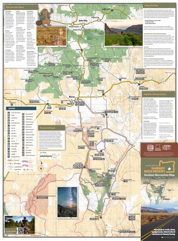
This map highlights the natural wonders of Harney County’s high ver t Ri urn scenic desert and the endless recreation opportunities available.BEnjoy drives, wildlife viewing, hiking, biking, motorcycling, horseback riding and more! Because of its large size, Harney County has nearly limitless opportunities for adventure. They cannot all be detailed here. Check out land manager websites for more specific area information:
Mount Vernon
Say Hello
Keep It Natural
DAY
FORK
3
N
Ald er
M
Using This Map
Prairie City JOH
L
7
Austin Junction
Dayville
SOUTH
If you’re lucky enough to spot wildlife, use your zoom lens and observe from afar. Share trails with others. Know who manages the land you access and what the rules and regulations are.
Check conditions. Pack your Ten Essentials. Got the right shoes for the terrain? Water? Cell phone? You may not always have coverage, so take a picture of the trail map or bring one with you. Consider hiring a guide.
K
Baker City 45 mi
7 395
Experiencing the quiet, aweinspiring beauty of nature can not only uplift your spirits, it can improve your health. Think of Oregon’s vast outdoors as your place to relax and recharge.
Be Respectful
Be Ready
J
GR
2
7
I
Enjoy Yourself
Know 26your limits and when to stop for the day. Follow the signs; they’re there to tell you important stuff like how to avoid injuries and not get lost.
Prepare before you head out, consider what you want to see and experience, your group’s physical abilities and what’s realistic to do in the time you have. Can you visit off peak to avoid crowds?
1
H
Pendleton 96 mi
CONNECT
Make Smart Choices
G
IA
CARE
F
RY
PREPARE
E
19
Prineville mi Out There Take 48 Care Plan Ahead
D
E
C
E
B
OR
A
K
L
S
McDermi t
L
Central Oregon Film Office M Fort McDermitt
Indian Reservation
Land Sky Water Soul
Nature Viewing
E
O
R
Diamond
Local/USFS Road
G
AI
S
P
N
Destination by Design
N
IN
EE
S
95
M Mickey Hot Springs
AL
ON
L L
TI
NA
D
W
O
S
NTRY
MOUNT
GR A
R
T W A R N E R MOUN
L
9.9
R
O
EB
EL
V E
W
U
CK
Y M
26
P
RO
E
HART
RIV
9038 �t
▶ Alvord Desert playa
Located far from cities and major towns, Harney’s high desert has very low light pollution and is 13 a superb place to witness the wonder of the dark, night sky. Plan your next trip during the phases of a new moon for an especially dark sky.
▶ Trout Creek Mountain Loop
▶ Diamond ▶ Alvord Desert
U
T
OR
EG
Soaking pool at Alvord Hotsprings
AV
RY
T
TA
ES
N
E
Hot Springs
ON
IN
S
S
R
VE
L
EU
R
RIV
E
Wo
lf
RIVER
ee
VE
R
k
Em
R
e
EU
M
Po i s o n
Cr e e k
54.
9
17.7
C r e ek
RIVER
R
EU
E
A
EE
YH
W
DE
N
GE RID
MCCOY
Kiger Gorge Overlook
East Rim Overlook Steens Summit
ER ES
Wildhorse Lake Overlook
D
South Steens Family Campground
T
STE
13
ENS
Little Blitzen Overlook
9748 �t
T 21.5
B
IG
Overlook. Limited snowmobiling Anglers be sure to followPike Oregon Creek Trailhead is allowed only on the north loop Department of Fish and Wildlife road to Kiger Overlook. Off-road guidelines. snowmobile use is not permitted. For safety, gate keys are only Campgrounds are available all issued to groups of 2 or more. along the Byway. Page Springs Campground is located 3 KNOW BEFORE YOU GO: Weather miles east of Frenchglen and and temperature conditions on is open year-round. Fish Lake Steens Mountain are dynamic. Campground is open midBe prepared! Storms can June to October. Jackman Park develop quickly, and overnight Campground, located near temperatures can plummet. Kiger Gorge Overlook and open
▶ Riddle Brothers Ranch National Historic District ▶ Sod House Ranch
IN
S
Joey Hamilton
Hiking Expect many options for walking, running, hiking, and backpacking in this diverse landscape. From easy close to town trails, to long rugged mountainous trails or smooth uninhabited roads.
Visit Steens Mountain in the winter or spring for snowshoeing, cross-country and backcountry skiing. Visitors may check out a gate key from the Burns District BLM for access to the snowline on the north loop. The road is marked with snow poles up to Kiger
Destination By Design
Snow is possible any time of year. Weather conditions can vary widely by elevation. The Steens Loop Tour Route can open for the season as early as mid-June and remain open through October, but this depends on yearly snow accumulation and road conditions. The road is maintained gravel, but wash boarding is common. Vehicles with good tire tread and reasonable clearance are encouraged. LEARN MORE: blm.gov/office/ burns-district-office
▶ Myrtle Trail
Fishing There are many streams, creeks, rivers and lakes that make for good fishing if the year is wet. Expect the selection of fish to be mostly trout species, though there are crappie and largemouth bass in some locations. Some lakes are stocked with legal trout and some rivers are catch and release only. Check regulations at specific sites. ▶ Yellowjacket Lake ▶ Delintment Lake ▶ Krumbo Reservoir ▶ Silvies River
▶ Mann Lake Recreation Site
▶ Delintment Lake Trail
mid-June to October, offers tent camping (no RVs). South Steens Campground offers family and equestrian campgrounds from mid-May through November. An RV Park, Steens Mountain Wilderness Resort, is located at the north entrance to the Byway, 3 miles east of Frenchglen.
Enjoy a long horseback ride through the forest or a multi-day excursion in mountainous terrain.
▶ Chickahominy
▶ Malheur River Trail One of many Steens Loop Tour Route’s incredible vistas
Equestrian
▶ Moon Reservoir
▶ Idlewild Trail
R
EL
▶ Peter French Round Barn
▶ Krumbo Reservoir
▶ Craft Cabin Trail
L
AV
▶ The Narrows
▶ Burns Pond
▶ Steens Mountain Wilderness
V E
GR
▶ Wagontire
▶ Fish Lake
▶ Myrtle Creek Trail
GR A
RY
▶ Double O
▶ Chickahominy (motorized)
NTRY
A
E
T
▶ Drewsey
▶ Emigrant Creek
COU
TR
TA
N
▶ Buchanan
▶ Warm Springs Reservoir (motorized)
▶ Hines Nature Trail
M
Milkyway over the Alvord Desert
Most lakes in Harney County are reserved for non-motorized boats only, with the exception of a couple sites. Be sure to check regulations at specific sites and follow Oregon State Marine Board rules for both motorized and nonmotorized boats.
S
E
LO
R
S It is worth an overnight stay on the Alvord Desert. This area has some of the
EB
L
IN Camping is permitted on the Alvord Desert though it is recommended to camp near the edges. Vault toilets and a dumpster are available at the Frog Spring public access. Be sure to tie down and secure all possessions as high winds are common. Watch for storms. Precipitation can make the playa surface undrivable. Please help preserve this unique landscape and do not drive on or near dunes, wet areas, or vegetation.
▶ South Steens
Boating
O
U
S
T
U
9.9
P
V E
TA
The AlvordH Desert is a vast lakebed at the eastern base I J of Steens Mountain. Depending on soil moisture levels, hiking, and driving are allowed on the playa surface. The Alvord Desert is one of the largest playa lakes in Oregon at about 12 miles long and 7 miles wide.
▶ Jackman Park
R
Jackman Park Campground
Big Indian Overlook Steens Equestrian Campground Little Blitzen Trail 95& Big Indian Trail
O
N
E R
GR A
N
M
E
▶ Riley Store
▶ Big Indian Gorge & Little Blitzen Gorge Trails
▶ Falls Creek
ALVORD
62.5
GO
D
S
IL
NTRY
DO
E
▶ Lawen
▶ Alvord Desert
▶ Emigrant Creek
8757 �t
A
E
E
M
SH
S
Y
G
S T
A
IN
A
TOU
S
U
O T
ST
TR A I L T
RO R
Roc
G
E
E R
E UT
re
k C
N
O
M
EE
W
R S
AT E
R
T
C
E R
M
D EO S
IA
D
E
E
O
S GH
RE
U
RE
O N
MOUNT
YH
LOOP
TR A I L
E UT
RO R U O
T E ST
S T
A
62.5
TE
N A
AL ON
TI NA
AIN
21.5
R S AT E R
M
E Y
A
W
12
15
B
HART
O
O
OREG
ESS
SCE N I C
E
O
C
E
L L
LV
RD
Alvord Hotsprings
DERN
Y
COU T
▶ Harney City
▶ South Steens Campground
S
V A
E
BY
ES
N E R
N
T
WIL
RY
E
W A R
R
UT
RY
Fish Lake Campground
D
From(toojust about anywhere inR I the Harney basin one can hot for soaking) 14 M see the 30-mile long, impressive Steens Mountain, reaches 9,747 feet. Managed by the Bureau of Land ERT D E S which Management, the Steens Mountain is one of the most dramatic and steep fault-blocks in North America.
15
N
VE
IG S H E L
U
Throughout Harney County there are remnants of old homesteads, historic ranches, railroad tracks and once bustling towns. Buildings that were once important stops for the people now stand as decaying ghost towns and some only exist in history books. Check out these ghost towns and stop at any remaining businesses in the area to learn about the history.
▶ Yellow Jacket Lake
E
R
NT
RG
IL
OU
GO
W
C
KIGER
C
A
AI
O
B HART
9.9
O
D
SE
IN
E
NT
C
L
S
T
IL
LO C
A
N
E
D
Mickey Hot Springs
9748 �t
OU
IS
L
N
E R
A
Willow Creek Hotsprings & Campground
H
D
GO .8
DE
11 K
6389 �t
RO
South Steens Campground
TA
T
S
P
A
14 Y
G
Jackman Park
U NCampground TR Y B YW A
UN
challenging trail and not for the The Steens Mountain Back Country faint of heart. The switchback trail Byway, also called the Steens Loop Frog Spring (Alvord Desert Public Access) Central Oregon Film Office Public Access to the Avlord at Frog Spring Tour Route, is a 59-mile loop offering descends 1200’ in just over a mile. 205 The Steens Rim Run is a highEnjoy your time on the East darkest skies in North America. breathtaking views from the road. altitude 10k for runners or walkers Steens Tour Route but please Astronomy enthusiasts can enjoy Open typically from mid-June to of all ages and is held annually in come prepared. This gravel road views of the Milky Way Galaxy. November, one can drive the Byway 16 .8 16 47 August. is known to cause flats; check your Time your visit with a meteor finding many areas along the way to spare! shower for an unforgettable park and walk short distances to take 95 Y W Cycling and OHV enthusiasts come experience. in the spectacular views, such as the AY 95 Willow Creek Hotsprings & Campground from all over to challenge their LEARN MORE: blm.gov/ Wildhorse Lake Overlook. abilities with the high altitude, rough Alvord Hot Spring is a natural hotFieldsprograms/national-conservation17 UTE terrain and breathtaking views. Take spring.R OBecause they are on private lands/oregon-washington/ The Steens boasts many wildflowers 17 note, cycling and OHV use is allowed alvord-desert-wsa land, a soak in the hot springs in summer and beautiful changing O OR U EG T fall. Watch for marmot, only on roads. All trails are within depends on availability leaves in ON E designated wilderness and are and comesOwith a fee. The commonly seen along the rimrock, D RE E GO O MUse O U N T A closed I N S to Y Oof N A Nvariety O R E G O Nand C S bicycles and OHV. IL small campground has a a wide birds. E U A N R Trout Creek Mountains N TR T 205 8030 �t small store with amenities.D binoculars to search the craggy 18 M O aU N soak T AinIthe N S ESE Trails within Enjoy long terrain for big game like antelope, IL McDermitt 4 mi Steens Wilderness A R TR T are open to equestrian use. The hot springs while watching deer, bighorn sheep and elk. Drive 8030 �t 18 Fort McDermitt G H I J K bestLoptions are the BigMIndian and the nightF sky. Check out slowly and watch for wild Kiger Indian cD McDermitt 4 mi Reservation Blitzen Gorge Trails. Both www.alvordhotsprings.com mustangs. Enjoy viewing the floraM ermitt CreeLittle k trails begin near South Steens for more information. and fauna, but please be respectful K L M Fort McDermitt Campground. Spend the night in the and keep your distance. Indian McDermi Reservation tt Cr Desert gorges or at South Steens Equestrian North of the Alvord eek Campground. Want to try horseback is the Mickey Hot Springs. Enjoy easy day-hikes like the riding? The Steens Mountain Guest Soaking is not allowed, Wilderness Nature Trail and Ranch takes reservations. as water temperatures Blitzen River Trail at Page Springs are dangerously high. or the Levi Brinkley Trail at Riddle The Blitzen River is home to Enjoy unique geothermal Ranch. Backpackers enjoy Big impressive redband trout. Artificial features including mudIndian and Little Blitzen Gorge flies and lures only (no bait allowed); pots, vents, small geysers, Trails, both departing from South two fish per day with only one and colored pools. Please Steens Campground. Pike Creek over 20”. Visitors to Fish Lake be cautious as the ground is a beautiful trail on the east side Campground can catch stocked can be unstable. For of Steens Mountain with remnants rainbow trout or brook trout. Harvest their safety, pets are not of historic mining operations. is allowed, but motorboats are not. allowed. Wildhorse Lake is the most V A
RE
D
S TR
THE
EB G
S
T
O
O N
ESS
U
B
ER
W
OREG
DERN W RIALI L
47
140O R E G O H N OT A N Y OO U N SP C RIN KC GS Trout Creek Mountains B A C Winnemucca 154 mi 205
N
N
LO
Alvord Hotsprings Frog SpringHot (Alvord Desert Public Access) Hart Mountain Springs & Campground
8014 �t
EE
ES
T
N P A
U
ST
M
DESERT
D
OR
Historic Sites
▶ Joaquin Miller Horse Camp
▶ Fish Lake
Mann Lake Recreation Site
W
52 .1
CO
B
.2
E
CK
IN
Levi Brinkley Trail & Riddle Brothers Ranch Historic Site
26
(too hot for soaking)
Fish Lake Campground BA
TA
TLO
STEENS MT N
Mickey Hot Springs
CA
AI
A
LV
P
E
MO
UN
Y
LO
UG
▶ Steens Mountain Wilderness
▶ Delintment Lake
▶ Page Springs 7426 �t
CA
F RE
D
NT
O
E
Y
Mann Lake
Page Springs Campground
5 0 .4
9748 �t
OU
Fields
R
L
H I G H
M
Y
N
E
WA
AY
South Steens Campground
78
BY
Y B YW
Frenchglen AI
MO
IC
TR
O
T R
13
S
O
H
205
SCE N
Fish Lake Campground N 30.1 Mileage BA CK Jackman Park CO Campground UN
RT
n
D E SERT
O
Local/USFS Road
N
SE
C
T
N O N - M OTO R I Z E D
D E
95
N
T N ALVORD DESERT and Surrounding Hot Springs ROUTE
S
U
A
IN
Krumbo Reservoir
O
S
P
H
D
I G S B
Mann Lake
A
E
N’
T
M OTO R I Z E D
Unpaved Road
.2
N
Y
ROUTE
age Springs Campground State Highway
26
U
TRAIL
E
L ek
EG
Scale: 1:599,200
R
12
R
C
N
HI
N
E
Cyclists riding thePowersports Skull Gravel Bike Race in the Malheur National Forest Winter
U.S. Route
OR
Joaquin Miller Horse Camp is located 19 miles north of Burns on HWY 395 deep in the Malheur Forest. These horse camp sites are O roomy with steel corrals and are large enough to accommodate Diamond HARNEY BASIN O Cameron Sanders trailers. Joaquin Miller Horse Trail leaves directly from camp and S
S
STEE
RIVER
ON
Buena Vista Overlook
O
Winery & Brewery
STEENS
GH
Fire Lookout Walk & Run
odging
Page Springs Campground & Blitzen River Trail
6
HI
Swim
I G S B
Hunt & Fish
N’
Hot Spring Krumbo Reservoir
10
EG
EG
O Sporting Goods
Historic Site
37.
Frenchglen Hotel State Heritage Site
Fish for a variety of trout at Emigrant Creek, Silvies River,Site Round Barn State Historic Craters Delintment LakeDiamond or Yellowjacket Lake. Hunting for large game D is common in much of the Malheur National Forest. 6352 N
78
R
Scenic Drives
Diamond
Frenchglen
E
IA
3 4 .5
D
k
Rock Climbing
Hike & Backpack
7 mi
HARNEY LAKEBED
OR
ee
395
T
UR
6352
O
RT
R E F to U GMyrtle National Forest Road #31 is paved Creek Trail #308 E O Wildlifehikers, Refuge mountain bikers and trailhead. This trailMalheur welcomes Visitor Center The Narrows equestrians to explore the 8-miles one way hike through old Malheur NWR 11 Historicpine Sod House Ranchtalus slopes and Myrtle Creek. growth ponderosa forest, Mile markers on trees are viewable.
Road & Gravel Bike
Grocery
DE S E
HE
L A K E B E D ( D RY )
WILDLIFE
AL
( D RY )
Rock Hounding
7 mi
ON NATI
OR
LOOP
S
Cr
Restaurant/Bar
▶ Malheur National Forest
54.
N
9
17.7
T
M
S
r
Golf
ve
Gas Station
N
D
STEENS MOUNTAIN WILDERNESS and Frenchglen
Sil
Disc Golf
L MA
Quiet Snowsports
▶ Malheur National Wildlife Refuge
Cr
Cr
ver
Diamond Craters
Joey Hamilton
17
MA
S
Sil
4
Day Use
Many species of migratory birds can be seen almost anywhere in the Harney basin. Pronghorn, antelope and mule deer can be seen in large numbers all over Harney County. Bears, cougars and turkeys also live here.
16
k ee Cr
RN
k
Powerboating 9 . 6Powersports Round Barn State Historic Site
Nature Viewing
RK
ee
Dark Sky
Equestrian
6
Point of Interest
▶ Malheur National Forest
15
w illo W
DE
FO
AIN
RI
Cr
S
Convenience Store
▶ Domingo Pass
▶ Steens Mountain Wilderness
D
M
GR
IL
RT H
DAY
NO
SS
N
lf
E I D 7811 S N I A N T O N R U I O M
LO
W
L D62 ER
DO
Wo
JOHN
MALHEUR NATIONAL FOREST and the southern Blue Mountains
O U N TAIN WI S H E L
2
▶ East Steens Tour Route
Dark Sky Viewing
Enjoy a long soak in the naturally hot mineral bath at one of the O M O U N T A I N S ESE C A N Y O N O R E G O N N IL established sites. Or enjoy viewing 47 U A E 5 3 Trout Creek Mountains Ontario 41 mi 16 R R N T T 205 natural hot springs that still exist 8030 �t 6698 �t 18 18 63 Beulah Reservoir in their natural state. Be cautious HO 140 U TS McDermitt 4 mi O PR around unmaintained hot springs. ING KC S 16 154 mi B A C Winnemucca To be considered a hot spring, the mi VE Boise 91 mi SenecaB R 380 water temperature must reach at A C D E F G H to a large network Iof J K L M Fort McDermitt there is access you can adventure on the Devine Idlewild Campground is 17 miles Indian McDermi FOREST least 122°F (50°C). They should be Reservation tt Cr L forest maintenance roads. Summit Loop Trail for a primitive north of Burns and has a nice eek H I 4 ONA approached with great caution. R I Chukar Park Campground T 15 67 Cra�t Cabin Trail NA hike through the forest. A covered variety of trails. Campsites are Drewsey These springs can far exceed the UR 6 E 14 Bull 37 LH R pavilion can be reserved and Delintment Lake Campground is mostly private and spaced away boiling point of water. Hot springs y Poison Creek Reservoir A U M nd E Creek Malheur River Trail R H 68 have been known to cause severe 20 is popular for weddings and close to the shore of Delintment from each other, nestled into L 28 17 .6A 34M burns and death. Keep a distance reunions. Lake and offers campers a beautiful the trees and undergrowth. The Rock Springs Campground 69 7171 �t Snow Mountain Lookout from the edge of hot springs as the morning sunrise. Located in tall paved road provides a convenient Myrtle Creek TrailJuntura (E. Myrtle Creek TH) ground around the hotspring may ponderosa pines, camp sites offer 5 LEARN MORE: fs.usda.gov/malheur opportunity for a casual stroll not be solid. We don’t want the 6698 �t 395 43 Beulah Reservoir good visibility of the lake. The road through the campground. Or awe of this experience to be ruined Buchanan 31 Delintment Lake Campground by an accident. 7 to the campground is conveniently Yellowjacket Campground Boise 91 mi Emigrant Creek Campground 47 3 paved for trailers and RVs. Fishing . 47 ▶ Crystal Crane Hot Springs for trout is convenient from the 45 Falls Creek Jaoquin Miller Campground t n a RI r Springs&Reservoir Chukar Park Campground Warm g S T I N K I N G W A T E R i Campground Horse Trail ▶ Alvord Hot Springs 20 Cra�t Cabin Trail Drewsey ek shore or from the U R floating dock. 6 Buck Springs Campground MOUNTAINS HE L MA ▶ Mickey Hot Springs (can’t soak) Idlewild Campground H 20 28 AL 34 .6 Yellowjacket Lake Campground ▶ Twin Hot Springs is located a short walk from Juntura ▶ Willow Hot Springs 8 Yellowjacket Lake. The road to the 41 campground is conveniently paved Buchanan TO UR for trailers and RVs. Campsites have 7 Crystal Crane Hotsprings RO UTE 78 Camping 31.1The Malheur National Forest is large at 1.7 million acres! As a part of the Blue Mountain Range, the forest spans a good view of the lake. Fishing 25.5 47 Warm Springs Reservoir STINKINGWATER access is available from the shore 20 The Harney County Campgrounds are found all over through three counties including Harney County and hasBurns a wide variety of natural wonders. MOUNTAINS Crane around most of the lake. For a nice Harney’s high desert, often near Chickahominy Reservoir H 20portion is managed by the Emigrant Creek Ranger RadarStation. Hill OHV Area From Burns, head north on HWY 395 and expect a AL lakes and rivers. Camping here 9 walking opportunity continue 5280 ass Butte 2 4 .0 flat grasslands S is typically first-come first-serve, dramatic transition as you begin to leave the of the Harney basin. You will find yourself winding T south on road NF-3745 along Hines E 8 E meaning they are not available Riley through Devine Canyon and suddenly entering the dense forest. Cameron Sanders Yellowjacket Creek. Brandon McMullen Mid-June Snowfall on Snow Mountain USFS Road MALHEUR Sage Hen Hill Rest Area to reserve in advance. Camping L A K E B E D ( D RY ) TO END E fees are reasonable. Amenities UR REFUG Crystal Crane Hotsprings RO UTE 78 E Moon Reservoir Mule deer, pronghorn antelope, elk, badger, coyote, bear and are typically vaulted toilet(s), 31.1 Visitor Information Malheur Wildlife Refuge and water (drinking or noncougar are some of the animals who live in this forest. A variety Mountain Bike Visitor Center Crane drinking), fire rings with grates Airport of birds call this place home including ravens, eagles, jays and Nature Viewing 10 and picnic tables. During freezing 9 ur NWR Cabin Rental turkeys. Rattlesnakes live here too make sure to give them 205 temperatures, campgrounds will ic Sod House Ranch RIVER Paddle Sports space. Camp shut off water. 37. MALHEUR
Rock Springs Campground
▶ Diamond Loop Tour Route
COU
A
TR
IL
EU
5.1
RR
RO
▶ Steens Mountain Back Country Byway
IG
T
L
BE
▶ Radar Hill OHV Area
B
HART
N
E R
MA
r eW ek
11 ▶ Steens Mountain Back Country Byway ▶ High Desert Discovery Scenic Byway ▶ Diamond Craters Auto Tour Route ▶ Blitzen Valley Auto Tour
GO
D
S
B
RK
RCA
a quiet, relaxing day winding through an old Ponderosa pine forest or pursue an adventure on a rough and rugged mountain road.
RE
O N
ESS
SCE N I C
S
FO
FORK
17
lly S T
R
Harney county is a dual-sport motorcyclists paradise with miles and miles of uncrowded roads. Please follow Oregon OHV rules. No off-road travel is permitted within the Steens Mountain Cooperative Management & Protection Area.
O
Y
OREG
E
RY
L
ES
k ee Cr
RN
w illo W
DE
DERN
VE
AIN
C
L
IL
RT H
SOUTH
Malheur River Trail
10 You can drive for hours and see
R I V Emore R wildlife than people. Enjoy
WIL
IS
IL
V A
A
W
NO
SS
E
V A
N
LO
R
CK
N E R
AI
T
T
ER
NT
ES
CA
RO
W A R
OU
D
E Y
M
A
the narrow channel between a store, a dance hall, blacksmith A trip to the Harney County Gary Kegel Cranes on the Malheur National Wildlife Refuge 9748 �t DESERT place to start your wildlife viewingD Malheur and Harney Lake that is Offering some of the best birding shop, a schoolhouse and other Historical Museum can help EN 2 OR eek adventure including the Refuge the only way to cross when the in the Pacific Northwest, expect to buildings. Today theCrclosed store The Diamond Craters Outstanding The Diamond Craters is Tyou understand the history of LV w o l A l i W office, Visitor Center and Nature lakes are full. see a variety of birds in migratory sits about a mile north of the managed by the Bureau of Land the area. Settlers and ranch Natural Area, sharing a border The towns in Harney’s high desert are proud 7 N DE S E Ald REGO Alvord Hotsprings e A B C D ER T F town site at the edge G H I J Kgeese, L M 26 r O Store. Depending on the season, season including white original of Management. No restroom tycoons left behind remnants with the Malheur Wildlife Refuge, to be small, tight-knit communities. Expect Cree 7 BE 15 k 9038 �t T RR the Visitor Center may be closed Harney City once had three long-legged sandhill cranes, HWY 78 about 18 miles east of facilities or other amenities are of their challenging way of life. is a truly spectacular place. Ancient a friendly gesture like a wave while driving Y M Hart Mountain Hot Springs & Campground Pendleton 96 mi Baker City 45 mi 7 Othe 19 nod around Frog Spring (Alvord Desert Public Access) U Nhighway 62 and T A I N orWa Ismile but brochures are still available. saloons, a post office, two graceful tundra swans and elegant Burns. available, so prepare ahead for Abandoned homesteads and volcanic lava flows blanket 23 on LD mi D E ER I The George Benson Memorial mercantile stores, a church and a northern pintails. Summer your personal needs. Points of ghost towns can be viewed square miles (17,000 acres) town. Austin Junction 7811 205 er �t N S Riv N is 8014 395 I rnt u B E Museum is open daily. The Refuge A jail. Harney City was the original attracts shorebirds, sandpipers The Narrows known for its interest are marked. Wear good across the area. You will notice of rolling hills, making for an 3 Ontario 41 mi 16 N T O 30 has day-use areas and restrooms. location of the county seat that and yellowlegs. Late summer and Store, Bar & Grill and RV Park, shoes, watch your step and beware most ghost towns are about incredible self-guided experience. This is an open-range county! Cattle N 26 R U 1 Malheur Lake is closed to the public, was eventually won by Burns. early fall many cranes gather, and but it was once an important of rattlesnakes. miles away from the next town I Follow the Diamond Craters Auto outnumber people fourteen to one. You 16 .8 Dayville 47 O Prairie CityAll that remains of the city is a but wildlife on the lake can be seen as water recedes, ibis, gulls, terns, stop between Frenchglen and along all the highways. Do not Tour Route in your vehicle and may encounter a “traffic jam” on roadways M J H N from designated viewing areas. barn on private property and the pelicans, ducks, geese and herons Burns. John This town once had many DOWNLOAD BROCHURE: blm.gov/ explore the many volcanic features anytime spring through fall when cattle are disturb or Otrespass Day D A Y on private RIV E R 95 Y W Roadways cut through animal’s cemetery. begin to crowd the remaining pools. businesses including two26 hotels, visit/diamond-craters-outstandingincluding craters and vents, cinder moved to better foraging areas. Drive slowly property. AY Willow Creek Hotsprings MO natural migratory paths, so please a general store, a schoolhouse, natural-area cones, spatter cones, lava tubes, and cautiously through cattle and watch & Campground NU H THE 4 Vernon 15out for the cow pies! There is a car wash in M Fields be aware and drive with caution, The Refuge Headquarters is located and at least three saloons. The town of Lawen was once Mount a driblet spires, a graben and waterEN 2 Cr e e k 17 T especially at dawn or dusk. by MalheurU Lake and is a great The Narrows is named after bustling town of 1007367 people with Canyon filled maar. Burns. City 14 TE �t B illow Lakeview 17 mi u
reek Reservoir
OHV (Off-highway vehicle)
Nearly14 any location in Harney County!
(too hot for soaking) 21.5
52 .1
T
A
D
U
E E
TN BWildlife The Malheur National Refuge, managed by AC Jackman Park KC O U Campground N the U.S. Fish & SWildlife Service, provides 187,757 acres of TR TE Y B Y Y protected habitat EtoN Sover 340 differentW Atypes of birds, 58 different species of mammals other wildlife. Southand Steens Campground
H
A
O
STEENS M
SH
1
E
5 0 .4
TE
GE
G H
M Learn more about Paiute Tribe’s historyOand NU current endeavors: burnspaiute-nsn.gov/. M
LO
P
U EF
Fish Lake Campground
H I
Lakeview 37 mi
14
YH
O
G
Mann Lake
Page Springs Campground
62.5
R
26
W
U
E Y
E
O
E
L
r ive nt R Bur
RE
Mileage
T R
R
T
D
N
Frenchglen
N
O
RT
E ES
U
N O N - M OTO R I Z E D
30.1
C O
ROUTE
Unpaved Road
ST
47
M OTO R I Z E D
S T
State Highway
ROUTE
E
A
78
Krumbo Reservoir
Cree k
.2
U.S. Route
Ald er
M
Scenic Drives
12
LEARN MORE: fws.gov/refuge/ malheur 26
395
L
T R7A I L
I G S B
K
N’
Winery & Brewery J
O
O
Winter Powersports
T
HARNEY BASIN
EG
Scale: 1:599,200
R
Walk & Run
Lodging
RO
UT
D
Fire Lookout
Hunt & Fish
At the Historic P Ranch one can visit the remnants of a historic ranch site. The large barn has been structurally restored and is a 78 remnant of the Peter French cattle Sempire. N
TR A I L
6352
O
The Narrows RV Park is a convenient place to stay, offering RV sites, cabins and tent sites. A variety of amenities are available at the store, and the Jackalope Bar & Grill offers great eats. T
O
Buena Vista Overlook
Swim
Hot Spring
D
IA
Historic Site
N
M
Sporting Goods
R
Diamond Craters
Scenic Drives
Hike & Backpack
C
Grocery
Round Barn State Historic Site
S
Rock Hounding
E R
R S AT E
Rock Climbing
DE
( D RY )
3 4 .5
395
54.
Malheur NWR Historic Sod House Ranch
Road & Gravel Bike
Golf
E
Take a self-guided driving tour on the Blitzen Valley Auto Tour. At 42 miles long, the Auto Tour Route on Center Patrol Road has nineteen interpreted stops. The Virtual Visitor Center with the Friends of the Malheur has all the info you’ll need to begin your visit.
N
The Narrows
HARNEY LAKEBED
Restaurant/Bar
Gas Station
13
M
R EU
REFUG
Malheur Wildlife Refuge Visitor Center LOOP
Quiet Snowsports
Disc Golf
H AL
ONAL
NATI
k
4
9 . 6Powersports
Equestrian
The Burns Paiute people are committed to the wellness of their ancestral lands. Tribal members are active in their traditions and community. Please be respectful and Prairiethe City obey the law by not disturbing any cultural artifacts or historical land/sites.
ee
10
Cr
Powerboating
Day Use
11 Indigenous people of Harney County, the Northern Paiute, have a rich history and familial connection to the land. Northern Paiute people have lived here since time immemorial and traditionally maintained approximately 3.3 million acres of ancestral 12 lands reaching beyond Oregon’s eastern and 7 H I southern borders. The Burns Paiute Tribe currently has 442 enrolled members with 142 people calling the Reservation 7 their Baker City 45 mi home. Austin Junction
G
HIGH DESERT
Dark Sky
MALHEUR L A K E B E D ( D RY )
WILDLIFE
RECREATING IN HARNEY COUNTY 9
Buena Vista Ponds is also a convenient location to view wildlife, as is Krumbo Reservoir. At the reservoir you can fish for rainbow trout and largemouth bass, hike and kayak. A fishing 37. 6 deck is available and conveniently paved to the parking area, along with a boat ramp and picnic tables.
r
Harney’s high desert can give you the space you need to reconnect with nature, self and family. With more square miles than the state of Maryland, Harney County stretches across diverse landscapes including quiet lakes in dense forests, ancient lava beds and vast dry lake beds.
ve
Point of Interest
Convenience Store
Crystal Crane Hotsprings
RO UTE
31.1
205
Sil
HARNEY Paddle Sports
Camp
UR
MALHEUR WILDLIFECrane REFUGE and Diamond Craters Outstanding Natural Area
Mountain Bike
Cabin Rental
TO
E
9
8
S
78
Moon Reservoir
Airport
E
N
Sage Hen Hill Rest Area
LEGEND Visitor Information
E
9
T
17.
Hines
Riley
OR
8
Cycling There are thousands of miles of rough and rugged gravel roads to bike in this part of the state. The Dirty Freehub, Bikepacking.com, and Ride with GPS are all great resources to help you explore these vast landscapes be it day trips or month long rides.
▶ Fish Lake ▶ Donner Und Blitzen River ▶ Rattlesnake Creek
Snow Sports Winter can be an exceptionally beautiful time of year to visit Harney’s high desert, although we recommend coming well-prepared as many roads and campgrounds are closed for the season. During winter you can find snowshoeing, cross-country skiing and snowmobiling to be uncrowded and peaceful. The Oregon State Snowmobile Association can be a helpful resource for snowmobilers: www.oregonsnow.org ▶ King Mountain ▶ Idlewild Campground
Bikepacking through Big Sand Gap, Alvord Desert
Cameron Sanders