
INSIDE
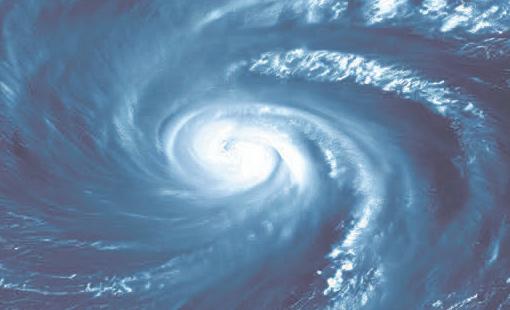
Experts say Atlantic season likely to be quieter than usual. PAGE 6
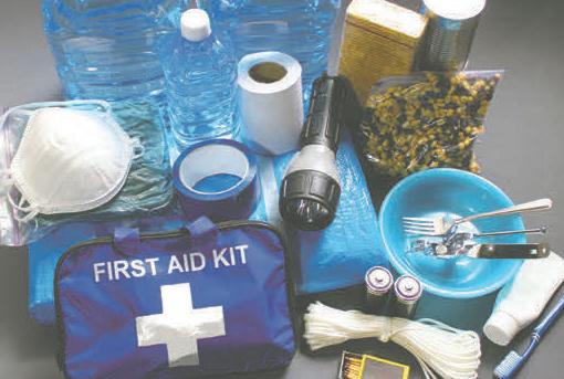
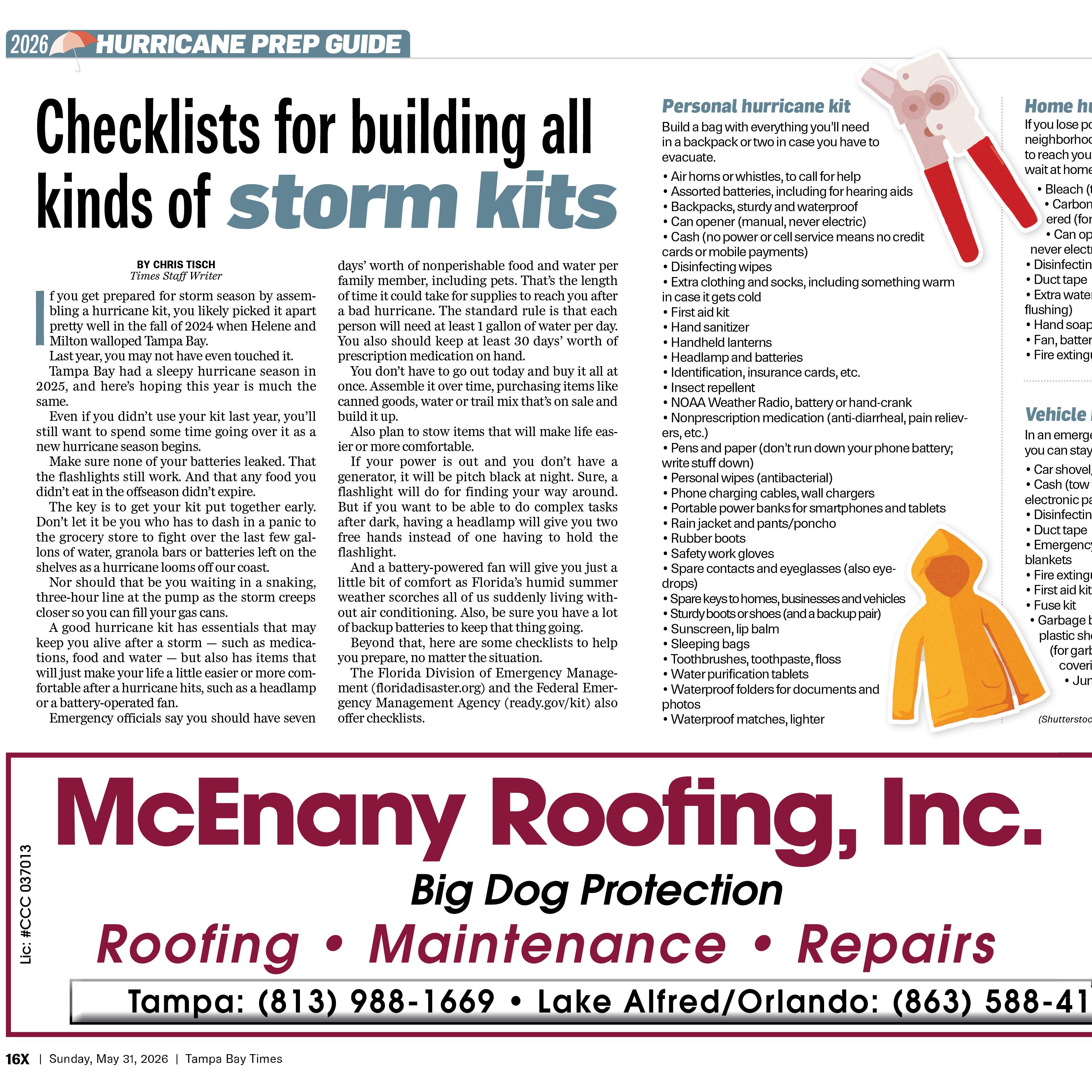
Checklists to help assemble kits for all kinds of storm situations. PAGE 16

Experts say Atlantic season likely to be quieter than usual. PAGE 6
Checklists to help assemble kits for all kinds of storm situations. PAGE 16
What does a ‘super El Niño’ mean for hurricanes in Florida? PAGE 20

BY CHRISTIAN BLAUVELT Times Staff Writer
The Tampa Bay area breathed a collective sigh of relief over a quiet 2025 hurricane season. Many residents and businesses needed the reprieve while still recovering from the one-two punch of hurricanes Helene and Milton the previous year. But anyone affected by those storms will never forget them. Most will make certain they’re never unprepared again.
The Tampa Bay Times is here to help with our hurricane updates throughout the 2026 season. Make certain you’re signed up to receive the Times’ storm alerts on your mobile and desktop devices.
Since the St. Petersburg Times delivered its famous headline “Tropical storm sweeps city — Rumor: Pass-a-Grille wiped out” on Oct. 26, 1921, we’ve been there covering these storms. And we do so not as outsiders looking in, but as members of the very commu-
nity we’re covering. We ride out the storm just as you do, and, like so many of you who suffered property damage and loss, in 2024, we lost our century-old St. Petersburg home at 490 First Ave. S. when a crane crashed into it during Hurricane Milton.
Our hurricane updates are signposts that we’re in this with you. And they’ll keep you informed in what can be the middle of a chaotic, rapidly unfolding situation.
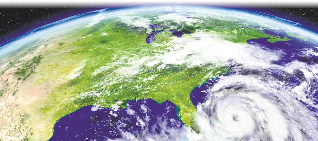
Here’s hoping it’ll be a quiet hurricane season: Colorado State University predicts 13 named storms this season, six of them hurricanes, and two of them major hurricanes, a “somewhat below-average season.” The reason may be due to an unusually active El Niño cycle in the Pacific Ocean this year. Generally, when that occurs, resulting in a much warmer Pacific, the Atlantic is less conducive to developing hurricanes. It’s expected those El Niño conditions will remain through the end of the year. For
what it’s worth, when the opposite happens in the Pacific and La Niña results in cooler conditions there, the Atlantic then experiences a more active hurricane season. May those predictions for 2026 come to pass. But here’s all you need to stay informed, just in case.
Visit tampabay.com/hurricane throughout the season for tips on how to prepare, tracking info on the latest storms and more. We also have guides for how to build your hurricane kit, a roundup of all the most important public service phone numbers, websites and social media handles, lessons for seniors about evacuating, and reader testimonials about their own strategies for facing storms in the past.
See ALERTS, 4X
If a storm has been named and it appears to be heading for Tampa Bay, we’ll be posting news stories, evacuation updates, videos, photos and more on all our social media feeds through landfall and beyond. Connect with us at these accounts:
facebook.com/tampabaycom
x.com/TB_Times
instagram.com/tampabaytimes
tiktok.com/@tampabaytimes
youtube.com/TampaBayTimes



Hillsborough County
Hillsborough County emergency information: HCFLGov.net/StaySafe
Phone (general information, nonemergencies): 813-272-5900
Hillsborough Storm Hotline (active only during a storm): 833-HC-Storm (833-427-8676)
Sign up for Hillsborough County Emergency Alerts: HCFLGov.net/HCFLAlert
Find your evacuation zone: tinyurl.com/HillsZones
Find your nearest shelter: tinyurl.com/HillsShelters
Register for a special needs shelter and transportation: tinyurl.com/HillsNeeds
Disaster guide: tinyurl.com/HillsGuide
Hillsborough County Flood Zone viewer: tinyurl.com/HillsFloods
City of Tampa hurricane information: tampa.gov/hurricane
Sign up for Alert Tampa: tampa.gov/alert-tampa Facebook: facebook.com/HillsboroughFL, facebook.com/CityofTampa
X: @HillsboroughFL, @CityofTampa
Instagram: @hillsboroughfl, @cityoftampa
YouTube: @hillsboroughfl, @CityofTampa
Nextdoor: tinyurl.com/HillsND, tinyurl.com/TampaND
Pinellas County emergency information, including how to look up your evacuation zone, sign up for Alert Pinellas, download the Ready Pinellas app, find shelter options and understand storm surge: pinellas.gov/emergency-information
To register for a special needs shelter:
Visit pinellas.gov/special-needs, or call 727-464-3800 to update or request a form.
To prepare pets: pinellas.gov/petprep
To look up your flood risk: floodmaps.pinellas.gov
Pinellas County information line: 727-464-3000 / TDD 727-464-4062
Pinellas County Emergency Management: 727-464-3800
County information center (during emergencies only): 727-464-4333
Pinellas County live chat: bit.ly/PinellasChat
City of St. Petersburg hurricane information: tinyurl.com/SPhurricane
Facebook: facebook.com/PinellasGov, facebook.com/StPeteFL
X: @PinellasGov, @PinellasEM, @stpetefl
Instagram: @pinellasgov, @stpetefl
YouTube: @PinellasGov, youtube.com/StPeteTV
Nextdoor: tinyurl.com/PinellasND, tinyurl. com/StPeteND
Pasco County
Pasco County Emergency Management, including evacuation zones: bit.ly/4aryRgu
Phone: 727-847-2411
Live chat: MyPasco.net
Disaster guide: tinyurl.com/PasGuide26
Alert Pasco: tinyurl.com/AlertPasco
If the county orders an evacuation, find shelters at: MyPasco.net
Facebook: facebook.com/PascoCounty
X: @PascoCountyPIO
Instagram: @pascocountygov
YouTube: @PascoCountyGovernment
Nextdoor: tinyurl.com/PascoND Hernando County
Hernando County Emergency Management: hernandocounty.us/em
Phone: 352-540-6426
Find your evacuation zone: tinyurl.com/HernandoZones
Sign up for Alert Hernando: AlertHernando.org
Facebook: facebook.com/ HernandoCountyEM
X: @HernandoCo_EM
Instagram: @hernandoeoc
YouTube: @HernandoCountyGovernment
Power outage maps
Duke Energy: outagemap. duke-energy.com
Tampa Electric: tampaelectric. com/poweroutages
Withlacoochee River Electric
Cooperative: withlacoochee. outagemap.coop
Get ready for the storm
Federal Alliance for Safe Homes: flash.org
Federal Emergency Management Agency: fema.gov
FEMA Hazard Mitigation Assistance Grants: fema.gov/grants/mitigation
Florida Division of Emergency Management: floridadisaster.org
Florida Special Needs Registry: tinyurl.com/FLNeeds
Insurance Institute for Business & Home Safety: ibhs.org
MySafeFlorida.org: mysafeflorida.org
National Hurricane Center storm tracker: nhc.noaa.gov
Tampa Bay Regional Planning Council: tampabayprepares.org
Flood links
Federal Emergency Management Agency flood maps: tinyurl.com/FEMAFloods
Florida Division of Emergency Management: floridadisaster.org/knowyourzone Pinellas County homebuyer special flood hazard areas information: tinyurl.com/PinellasFloods National Flood Insurance Program: floodsmart.gov
Public safety updates
Hillsborough County Sheriff’s Office: facebook.com/HCSOSheriff, x.com/HCSOSheriff
Tampa Police Department: facebook.com/TampaPD, x.com/TampaPD
Pinellas County Sheriff’s Office: facebook.com/pinellassheriff, x.com/SheriffPinellas
St. Petersburg Police Department: facebook.com/StPetePD, x.com/StPetePD
Pasco County Sheriff’s Office: facebook.com/pascosheriff, x.com/PascoSheriff
Hernando County Sheriff’s Office: facebook.com/HernandoSheriff, x.com/HernandoSheriff
Florida Department of Transportation: facebook.com/MyFDOTTampa, x.com/MyFDOT_Tampa Live road conditions: fl511.com
Live traffic cameras: tinyurl.com/FDOTCameras
continued from 2X
Then, if a hurricane seems to be heading our way, this will also be the destination for evacuation orders and emergency notices. For after the storm, we’ll also have a guide to post-hurricane hazards you might face in its wake. When Milton hit in 2024, we had five hurricane go-teams deployed in the field from Siesta Key to Zeph-
yrhills, reporting on the landfall and its aftermath from rental SUVs. Many of our editors huddled at a hotel in Wesley Chapel to make sure we kept publishing all the latest. And did we ever, even when that hotel lost power: We published a new update to our tampabay.com live blog of the hurricane coverage an average of every 12 minutes. We made all of our updates on hurricanes Helene and Milton free to access, taking down our paywall temporarily as a public service.
And Times staffers scrambled overnight to bring you a special “Extra” section to our e-newspaper the morning after Milton, with a story that the news department’s managing editor at the time, Michael Van Sickler, edited with his computer plugged into the SUV of data editor Langston Taylor.
We don’t just expect you to
come to our website during a hurricane: We’re happy to come to you, via email news alerts sent directly to your inbox and push notifications you’ll get on your phone’s lockscreen. For the latter, you’ll need to download our Tampa Bay Times app, either from your favorite app store or from tampabay.com/times-apps. You will need to enable alerts from our app in your phone’s notification settings. Find all of our newsletters at
tampabay.com/newsletters and be sure that you’re signed up for our email news alerts for the most up-to-date reporting at tampabay. com/newsletters/breaking-news/. And sign up for our DayStarter newsletter, sent out each morning around 6:30 a.m., for a onestop roundup of all the news from the previous day. It’s the digest you need to get caught up.
Contact Christian Blauvelt at cblauvelt@tampabay.com.







BY MICHAELA MULLIGAN Times Staff Writer
Ahead of hurricane season’s start, storm experts have already weighed in on how this season could unfold.
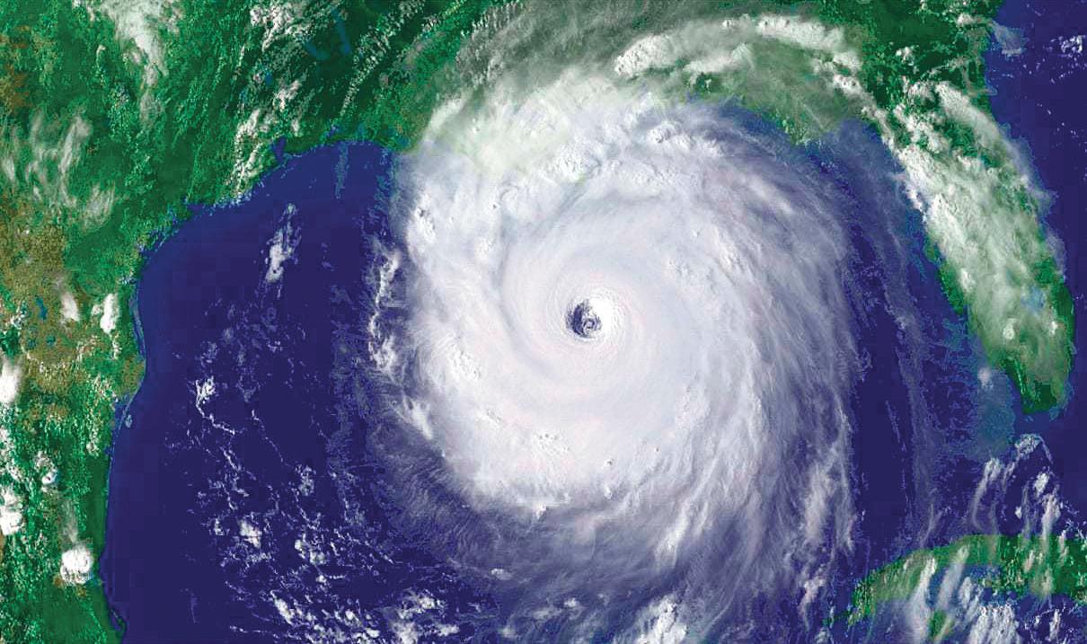
Across the board, experts agree that the Atlantic hurricane season, which begins Monday, is likely to stir up less tropical activity than usual. The conclusions stem from a near-certain El Niño arriving over the next few months.
And it could be one for the record books.
The predictions are a beacon of hope for Floridians who endured brutal tropical activity in 2023 and 2024. And while it’s good news for the storm-weary region, it’s far from a surefire bet that Florida will be hurricane-free this year.
While unveiling an early-season outlook, experts from the National Oceanic and Atmospheric Administration stressed preparedness despite the likelihood of fewer storms this year.
“Even though we’re expecting a belowaverage season in the Atlantic, it’s very important to understand it only takes one,” said Neil Jacobs, the agency’s administrator.
The National Oceanic and Atmospheric Administration released its early-season forecast — largely considered the gold standard — on May 21.
Hurricane experts are anticipating a 55% chance of a below-normal season, a 35% chance of a near-normal season and a 10% chance of an above-normal season.
The outlook is not far off from another forecast released in April by storm experts at Colorado State University.
Colorado researchers released an outlook calling for 13 named storms, of which six are expected to become hurricanes and two could punch up to major hurricane strength.
A typical hurricane season has 14 named storms, seven hurricanes and three major hurricanes.
Phil Klotzbach, a senior research scientist involved in the forecast, previously told the Tampa Bay Times that the outlook is an information tool, not a preparedness tool.
“We stress that all coastal residents
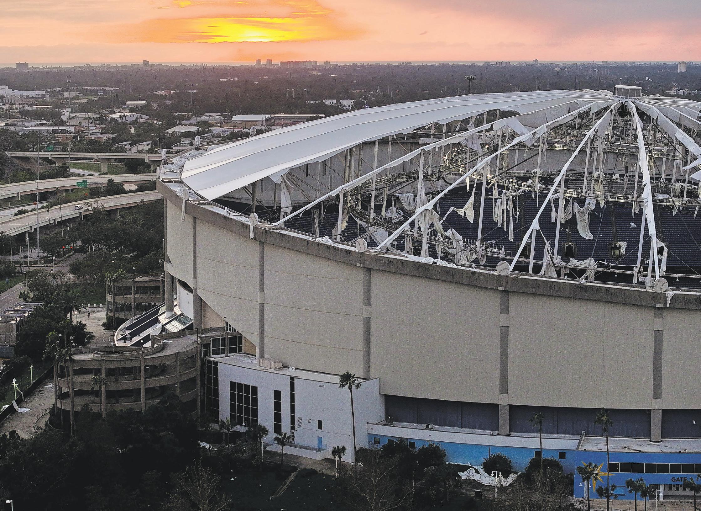
“Even though we’re expecting a below-average season in the Atlantic, it’s very important to understand it only takes one,” says Neil Jacobs, the National Oceanic and Atmospheric Administration’s administrator. (DIRK SHADD | Times, 2024)
prepare the same for every hurricane season regardless of seasonal forecasts,” Klotzbach wrote.
A major ingredient behind the forecast is an aggressive El Niño expected to arrive during the hurricane season. El Niño conditions typically tamp down Atlantic activity by boosting wind shear that tears up storms trying to develop.
The coming atmospheric shift could bring a “super El Niño,” according to most models. At least one model expects it to be record-breaking.
Experts cautioned it was too early to tell just how strong it may be. Forecasts this early in the year can be more inaccurate than later outlooks that will be updated as the season progresses.
“And Tampa should pay attention to the fact that 2023 was a year anticipated to be similar to this year,” he said.
That was the year Hurricane Idalia struck Florida’s Big Bend region as a Category 3 storm, bringing with it up to 12 feet of storm surge. Idalia also devastated many low-lying areas of Tampa Bay with storm surge.
An El Niño is not a guarantee that the region will be storm-free, Jeff Masters, a writer at Yale Climate Connections, previously told the Times.
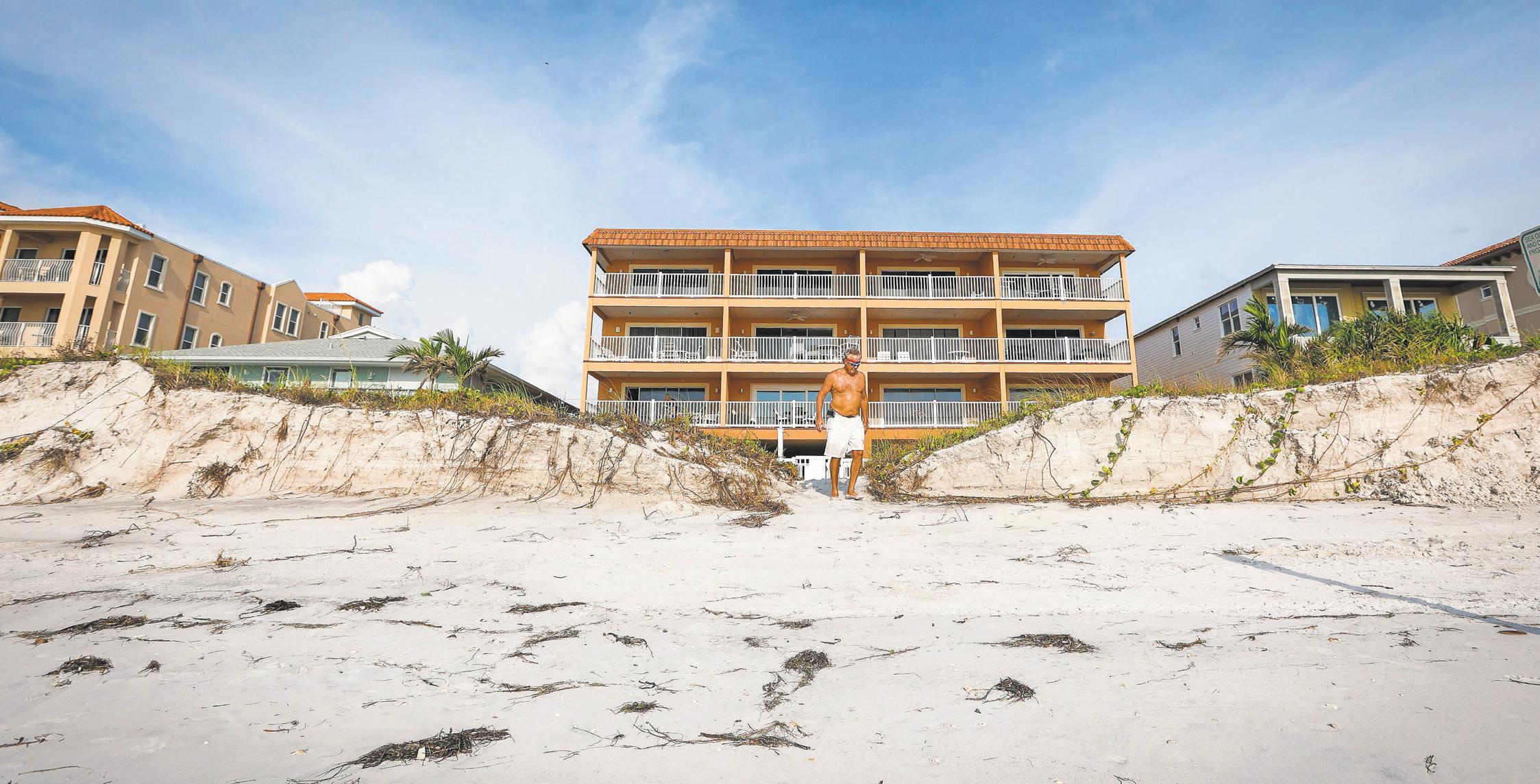
Experts caution that the hurricane season predictions were similar the year Hurricane Idalia struck Florida’s Big Bend region as a Category 3 storm, bringing with it up to 12 feet of storm surge. Idalia also devastated many low-lying areas of Tampa Bay with storm surge. (CHRIS URSO | Times, 2023)
continued from 6X
Forecasters also look to sea surface temperatures when developing earlyseason outlooks.
Federal officials said earlier this month that temperatures in the Atlantic are expected to be slightly warmer than normal, and that the Gulf of Mexico is still warm after no storms traversed its waters last year.
Balmy waters can fuel developing storms, and can lead to storms rapidly growing stronger.
“The stronger the El Niño, the more it tends to dominate,” Klotzbach said in April. “That’s why 2023 was so noteworthy.”
Despite the competing factors — a strong El Niño and warmer waters —
experts still expect a below-normal year. However, officials say El Niño is less likely to dismantle quick-developing storms that form in the Gulf of Mexico and are more likely to threaten Tampa Bay.
“Most of the effects of an El Niño are deep in the tropics ... you could get the storms in the Gulf that have the short awareness times,” said Matthew Rosencrans, a lead hurricane season forecaster with the National Weather Service.
There’s always a possibility that Florida could see a landfalling storm in any given season. But along with the possibility of fewer storms this season, there is a lowered chance of a major hurricane making land-
fall along a U.S. coast, according to Colorado researchers.
The university estimates there is a 32% chance of a landfalling major hurricane along the U.S. coastline, down from the typical 43% chance.
The university also estimates the probability of a named storm, hurricane or a major hurricane falling within 50 miles of East Coast and Gulf Coast states.
This year, those numbers fell below the climatological average.
However, Florida still had the greatest probability of a named storm, hurricane or major hurricane falling within that distance, with a 74% chance, 43% chance and 21% chance, respectively.
Preparing for the storm season while skies are still blue and hurricanes are a faroff thought is key, federal officials said.
Source: National Oceanic and Atmospheric Administration
From coastal residents in danger of storm surge to inland areas that could contend with flooding rains or rising rivers, overall, residents should be ready for the hurricane season — whatever it may bring.
Times staff writers Jack Prator and Max Chesnes contributed to this report. Information in this story appeared in previous Times news stories.
The Tampa Bay Times launched the Environment Hub in 2025 to focus on some of Florida‘s most urgent and enduring challenges. You can contribute through our journalism fund at project.tampabay.com/donate/.
Contact Michaela Mulligan at mmulligan@tampabay.com. Follow @Michaela_Mull.
BY MAX CHESNES | Times Staff Writer
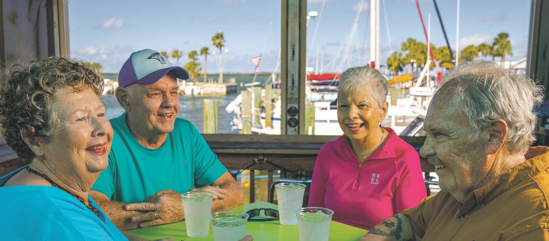
Thirteen days brought us two storms and countless lessons in 2024. • Whether it was a clearer understanding of your home’s flood risk, a preferred hurricane snack, or the importance of friends and family, Tampa Bay’s experience with Helene and Milton taught each of us something new. • Ahead of the start of a new hurricane season, we asked Tampa Bay Times readers to share the most important lessons they learned during a storm season that’s now etched in our region’s collective memory as one of the worst in decades. • Your responses, taken together, underscore a community that has emerged from the other side of repeated natural disasters wiser, stronger and more gracious to those around them. • As we enter a new storm season, what lessons did you learn in 2024? Here’s what you had to say.





Pay attention to surges and tides, don’t assume you are not going to flood if you are not directly on the water.
— Patsy Stills, Clearwater
Prepare for water in house by raising expensive furniture a minimum of 12 inches above floor. Seal toilets and shower drains to prevent septic backup into house.
— Paul Hauck, Hillsborough County
Keep your lithium batteries away from potential flood areas. Our e-bikes caught on fire and burned down our house.
— Amber Valente, Treasure Island
The big Lowe’s buckets that are $5/piece are a cheap way to raise furniture. The big vacuum seal bags are great for storing clothes and keeping them dry.
If water got in and the walls are wet, start taking the Sheetrock out immediately 2 feet above the water line in order to prevent mold.
— Kelly Kenson, Dunedin
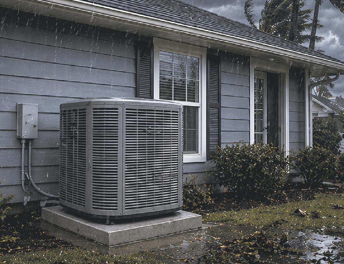
I elevated my A/C condenser after last year’s hurricane season. We live in a D evacuation zone and have never had to evacuate in 35 years. We had so much rain last year in three storms and so much standing water in the yard, the condenser was dangerously close to being flooded.
— Mindy Bacon, Palm Harbor
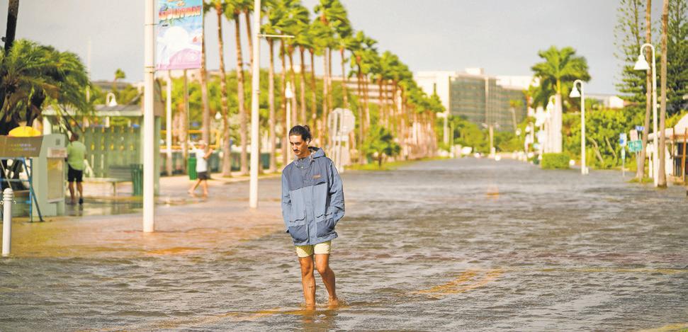
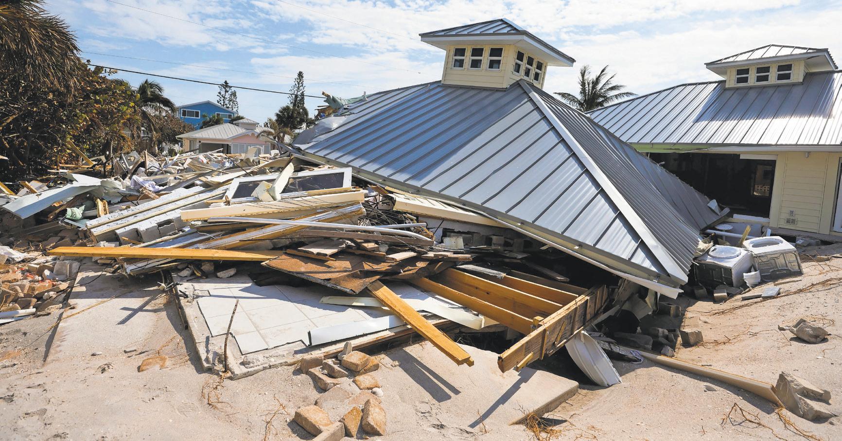
Water surged into streets and homes during the 2024 season, even in areas that hadn't experienced flooding previously. (MARTHA ASENCIO-RHINE | Times, 2024)
We learned how incredibly easy it can be to be wiped off the grid, physically and digitally. Between Helene and Milton there was no power, no water, no service, no gas, no places taking cards/cash only, food was scarce.
— Kristen DeTroia, Riviera Bay, St. Petersburg
I've lived in Pinellas County 41 years, and the 2024 season reinforced that the storms are getting bigger and stronger than ever before. Climate change is real!
— Linda J. Smith, Pinellas County
We had been flooded twice before, but never expected anything this serious — 31 inches of bay water in our home. Everything ruined. I knew climate change was encroaching, but never expected it to be so dramatic so fast.
— Elizabeth Riggs, Gulfport
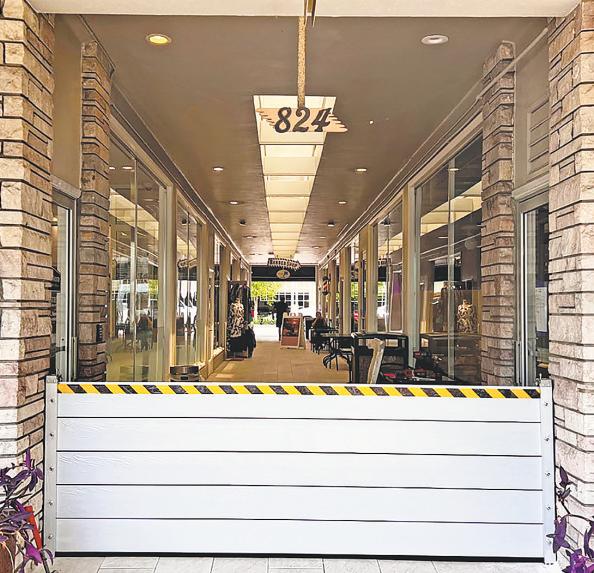
Even though our house is outside of any flood zones, we still got 2 feet of water in the front yard and water almost got in the house. We’ll need to sandbag the doors in addition to putting the shutters up.
— Nick Underwood, Central Oak Park, St. Petersburg
I will not buy or rent first floor anymore.
— Laynara De Oliveora, South Tampa
People act like 10-foot elevation is a magical number even though it isn’t. I've learned to live where I am. I have to fully accept this as a part of life or move to higher ground.
— Amanda White, St. Petersburg
The trauma and uncertainty of riding out the storm was something I never want to experience again.
— Sharon Henry, Wellswood
My biggest lesson was that I tried to keep working throughout. Afterwards, I realized that the stress of the storms had really impacted me. I realized later that I should have taken off some time to recover, but I tried to keep working and my work suffered because of the stress.
The storms took their toll and next time I will try to take time off to recover mentally.
— Alexandra Furnari, Wesley Chapel
I didn’t know that you can lose everything within a few hours and you can’t do anything about it. That’s what I learned from Helene and Milton.
— Phil, St. Petersburg
See LESSONS, 14X

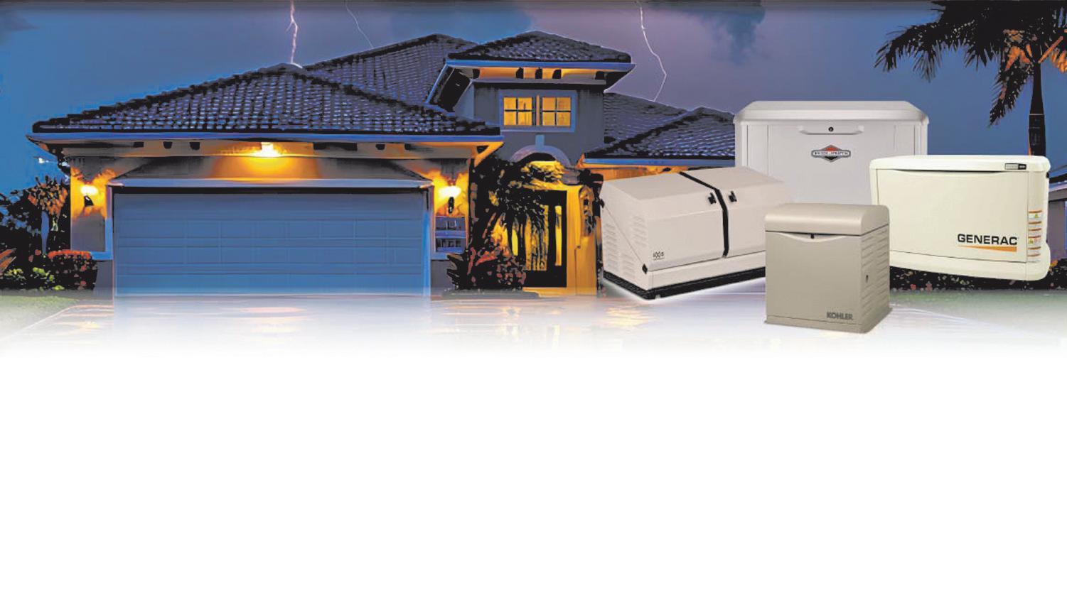










The one thing that I think we need is to purchase a generator. Since we are in the highest area in Pinellas County, we didn’t flood. But we did lose power for a few days.
Gary Sirmons, St. Petersburg
If you are out looking for a new generator, consider a generator that takes propane instead of gasoline. Propane tanks are easier to store than liquid gasoline, making the fire danger less.
— Luis Santana, Tampa Bay Times photojournalist
I will have a generator and will keep several extra cans of gas.
— Bri Margolis, Southeast Seminole Heights
More gas reserves. We keep 15 gallons of gas backup for our generator. We’re not in a flood zone and stay in place; 15 gallons gives us three days and after that we need to replenish. This year we have five 5-gallon containers and will have more in reserves.
— Vaun Perez, Kenneth City
Have a dual or tri-fuel generator for when the gasoline runs out. And Xanax.
Bonnie Agan, St. Petersburg
Next year, all of the meat in the fridge and freezer will be
removed prior to evacuation. We lost power and all of the meat rotted, had to get a new fridge. That was the ... WORST. The smell, oh my God. Never again.
— Anonymous, Bartlett Park
Ensuring my three weeks-plus of my dog’s refills are taken care of! ... It was very hard to fill it because clinics were understandably inundated with big-time emergencies. ... It’s one of those things you really don’t think about when you’re evacuating despite your best efforts.
— Lauren Fielder, Seminole Heights
Document what is in each room with a video. Send copies of all your insurance info, driver’s license, etc. to an out-ofstate contact or put in the cloud.
— Lauri Ingham, Largo
Do not trust store websites two days out from the storm making landfall. They are lying to you about having battery-powered lamps and flashlights. There are no battery-powered lamps or flashlights anywhere.
— Shauna Muckle, Tampa Bay Times reporter
We chose to invest in tree-trimming and removal instead of storm shutters after what we saw last year. For homes that didn’t flood, it seems like trees were the overwhelming cause of damage.
— Jay Preble, Safety Harbor
1. Take a weekend at the end of June to restock/purchase what you need for a hurricane so you’re not scrambling at the same time as everyone else.
2. Don’t let yourself eat all the non-perishables
as a snack before any actual storm hits.
— Ana Underwood, Central Oak Park, St. Petersburg
I learned that my husband and I have an extremely solid relationship (that was never in doubt but those few weeks/ months just proved we could survive a zombie apocalypse!). Friends and family were our true heroes.
— Jennifer Lumm, Dunedin
I learned the value of people over things: that friends, family and total strangers will help you move when you put a call for help on Facebook. People will choose to be kind, to help, to make a horrific situation that no one should have to go through less traumatic.
— Deborah Kelley, Town ’N Country
The best way to survive a hurricane is to band together.
— Rufus del Valle, Terrace Park
A version of this story was previously published in the Tampa Bay Times.
The Tampa Bay Times launched the Environment Hub in 2025 to focus on some of Florida’s most urgent and enduring challenges. You can contribute through our journalism fund at project. tampabay.com/donate/.
Contact Max Chesnes at mchesnes@tampabay.com. Follow @MaxChesnes.













Getting your pet microchipped will help ensure you’ll be reunited with Fido or Kitty if you’re separated. Keep your microchip contact information up to date. Make sure your pet is also wearing a tag with your current contact information. Some shelters accept pets, but you’ll still need to pack their gear. The CDC has a pet emergency kit checklist at tinyurl.com/PetStormList.
• Blanket
• Cat litter, newspaper, paper towels
• Crate or sturdy carrier
• Disposable litter trays for cats
• Disposable bags for pet cleanup
• Extra collar with updated pet tag, contact information
• Extra leashes
• Medications (30-day supply)
• Medical records
• Muzzle
• Pet first aid kit
• Pet food (seven-day supply)
• Pet microchip (keep updated)
• Pet toys

• Portable food and water bowls
• Puppy pads
• Recent photos of pets (in case you’re separated)
• Service animal supplies
• Treats
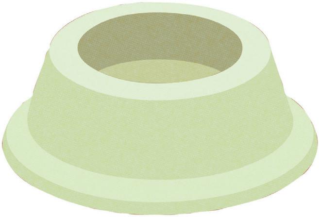
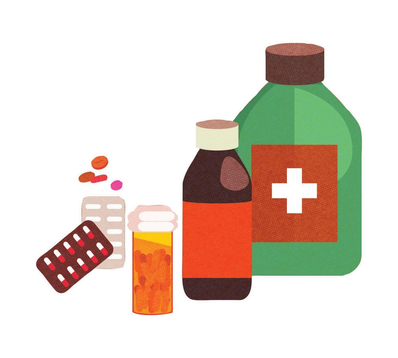
You can buy a first aid kit or build one yourself.
• Allergy medication
• Aloe
• Antacid
• Anti-diarrheal medication
• Antihistamine cream
• Antiseptic agent
• Antiseptic wipes
• Aspirin, pain-relievers
• Burn relief spray
• Cotton balls/swabs
• Eyewash
• First aid manual
• Hand sanitizer
• Hypoallergenic adhesive tape
• Instant cold compress
• Latex gloves
• Laxative
• Moistened towelettes
• Mosquito repellent
• Petroleum jelly
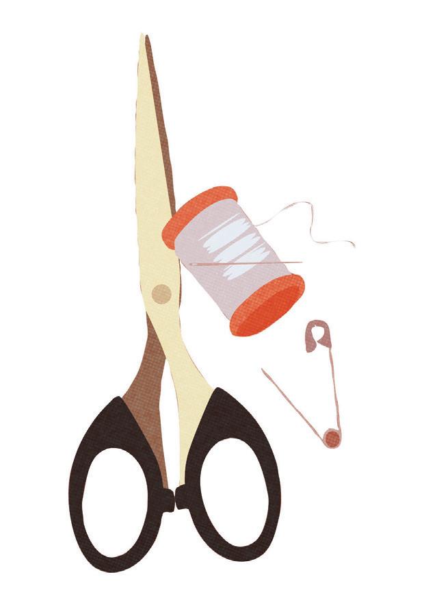
• Safety pins
• Sewing needle
• Scissors
• Soap






A version of this story was previously published in the Tampa Bay Times.
The Tampa Bay Times launched the Environment Hub in 2025 to focus on some of Florida’s most urgent and enduring challenges. You can contribute through our journalism fund at project. tampabay.com/donate/.
Contact Chris Tisch at ctisch@tampabay.com. Follow @christisch1.

BY JACK PRATOR, MAX CHESNES AND MICHAELA MULLIGAN Times Staff Writers
Hurricane experts piecing together what the upcoming storm season may hold for Florida have been looking for clues in an ocean thousands of miles away.
In May, federal scientists said it’s more likely than not that an El Niño will form in the Pacific Ocean by peak hurricane season. The weather pattern, which is unfavorable to Atlantic hurricanes, should persist through the end of the year, they said.
The prediction could bode well for Floridians who were spared last year after a string of major storms walloped the Gulf Coast in 2023 and 2024.
Researchers at Colorado State University, a leading hurricane forecaster, said they are anticipating a “somewhat below-average” season, largely due to the likely presence of a strong El Niño. Its potential strength is
still up for debate, experts said.
The coming atmospheric shift could bring a “super El Niño,” according to most models. At least one model expects it to be record-breaking.
But experts said it was too early to tell — spring forecasts of this weather cycle are historically inaccurate.
“El Niño is coming. But how strong, how quickly, and how it then relates to how quickly the shear comes in ... is more of the big question,” Phil Klotzbach, a senior research scientist involved in the Colorado State University forecast, said in a presentation in April.
The year-to-year global climate pattern unfolds in three phases: El Niño, La Niña and a neutral stage.
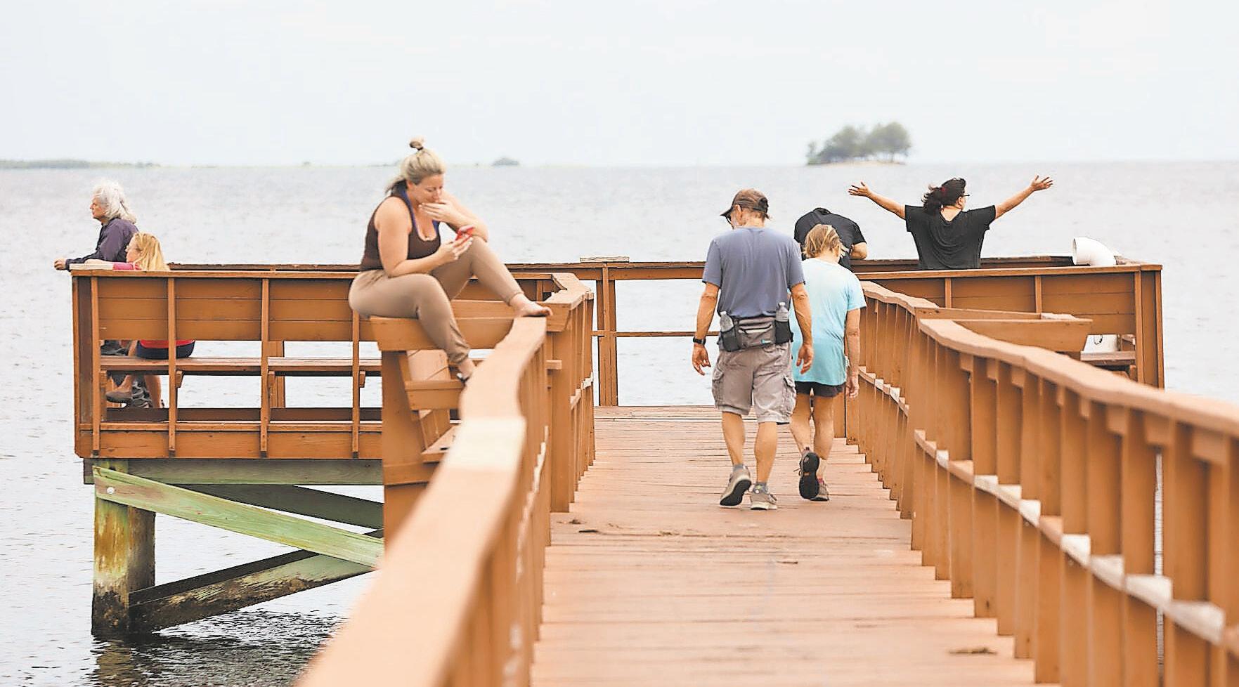
People congregate on a community pier overlooking St. Joseph Sound off Crystal Beach in August 2024. The pier was destroyed the following month by Hurricane Helene. Forecasters believe this year’s hurricane season may be slightly below normal for storms because of a strong El Niño.
The cycle corresponds to changes in sea surface temperatures in the Pacific Ocean that affect weather across the globe.
Forecasters at the federal Climate Prediction Center said La Niña had transitioned to neutral conditions in April. The center assigned 82% odds to the emergence of an
El Niño sometime between May and July. By winter, forecasters expect a 96% chance that the weather pattern will form and persist into next year.
See WEATHER, 21X


























Peak hurricane season typically runs mid-August to mid-October, with the bulk of activity flaring up toward the end of the season.
Hurricane seasons that coincide with El Niños typically have increased vertical wind shear that tears down hurricane strength. A stronger El Niño typically means stronger wind shear.
Forecasters have compared the upcoming season to previous ones in 2006, 2009, 2015 and 2023, when a strong El Niño and warm water temperatures worked against each other. In three out of four of those seasons, hurricane activity was below average.
But 2023 turned out to be the fourthmost-active Atlantic hurricane season on record. Hurricane Idalia grazed the Tampa Bay area, bringing devastating flooding to low-lying communities.
“Having an El Niño is no guarantee that you’re going to not see a storm that’s going to hit you, and Tampa should pay attention to the fact that 2023 was a year anticipated to be similar to this year,” said Jeff Masters, a writer at Yale Climate Connections and former Hurricane Hunter meteorologist with the National Oceanic and Atmospheric Administration.
Since 1950, only five El Niño cycles have reached “super” status for a three-month period, Masters said.
While “super” is far from a technical term, it typically refers to an El Niño that carries water temperatures that are 3.6 degrees Fahrenheit warmer than average.
“The westerly winds we’re seeing now are as strong as we’ve ever seen, if not stronger,” Masters said in April. “So that’s a strong signal that we’re going to be looking at El Niño this fall.”
A European model is forecasting average sea temperatures in the Pacific would be close to 4 degrees Fahrenheit above normal later this year, resulting in a potential record El Niño for August through October, according to Jeff Berardelli, chief meteorologist at WFLA News Channel 8.
That could mean the Caribbean remains “bone dry” during peak season — welcome news that would possibly fend off hurricane formation — but the region eventually becomes wetter and stormier as winter arrives, he said in a video posted on social media.
“Relatively speaking, the Pacific is going to outweigh and suppress the Atlantic during hurricane season, so we’ll probably see a somewhat — cross your fingers — inactive hurricane season,” he said.
But El Niño-La Niña cycles are hard to predict this early. Federal researchers are wary of what they call the spring predictability barrier, when they come up against a lull in forecast accuracy. The fog typically
lifts by summer, and outlooks for the rest of the year become more clear.
While the latest federal outlook is showing a strong chance that an El Niño will soon arrive, a lot can still change. “When you’re in a period of very rapid change, forecast models aren’t going to be very reliable about what’s happening next,” Masters said.
El Niño flexes its muscles most on storms that are developing later in the hurricane season, which tend to spin up in the Caribbean, according to Klotzbach, the Colorado State University researcher.
An El Niño typically gets stronger the longer it drags on. That means it could cut a hurricane season short.
With a strong El Niño likely in the cards, higher wind shear could ramp up toward the season’s end, which might help deteriorate stronger storms before they have a chance to grow into major hurricanes.
Storms forming in the Gulf tend to be less affected by an El Niño than storms forming in the Caribbean and in the tropical Atlantic, Klotzbach said.
“There isn’t a huge reduction expected in storms forming in the Gulf,” he said. “But when you get a moderate-strong El Niño, it does reduce the frequency of storms forming in adjacent regions (like the Caribbean) that then track into the Gulf.”
Klotzbach cautioned in April that just because a strong El Niño is being forecast, it’s “not a slam dunk” that could guarantee fewer hurricanes. It depends on the timing of when it arrives. He pointed to the 2004 hurricane season: That year, a weak El Niño began in August, but its delayed arrival meant an above-average spate of storms, including four hurricanes that affected Florida: Charley, Frances, Ivan and Jeanne.
As hurricane experts frequently point out, it only takes one landfall to devastate a community.
A previous version of this story ran in the Tampa Bay Times.
The Tampa Bay Times launched the Environment Hub in 2025 to focus on some of Florida‘s most urgent and enduring challenges. You can contribute through our journalism fund at project.tampabay.com/donate/.
Contact Jack Prator at jprator@tampabay.com.
Contact Max Chesnes at mchesnes@tampabay.com. Follow @MaxChesnes.
Contact Michaela Mulligan at mmulligan@tampabay.com. Follow @Michaela_Mull.
Here’s how to read them
BY MICHAELA MULLIGAN Times Staff Writer
Another hurricane season is upon us, and that means TVs and phones could soon light up with colorful graphics of cones and swirly storms.
Over the past couple of years, forecasters have been fine-tuning an experimental cone that emphasizes watches and warnings, as well as the risk of coastal and inland impacts. This year, that cone will become the go-to.
And that means there is room for a new experimental cone, which will be introduced this year.
The experimental cone will be shaped slightly differently. The National Hurricane Center expects the tweak in shape will lead to a storm’s center falling within the cone more consistently.
From year to year, the hurricane center adjusts official forecasts and graphics. We’re here to break down those changes and offer
a few friendly reminders of what to know before the start of hurricane season.
Ahead of a storm, the National Hurricane Center issues watches and warnings to areas that could feel its force. These advisories act as a guide for residents to understand their risk.
But keeping them all straight, especially in times of emergency, is daunting.
Forecasters break down watches and warnings into three risk categories: storm surge, tropical-storm-force winds and hurricane-force winds.
Storm surge is typically the biggest threat to people and property along coasts. In Pinellas County, 12 people drowned in Hurricane Helene‘s storm surge in 2024.
The hurricane center places an area under a storm surge watch when danger-
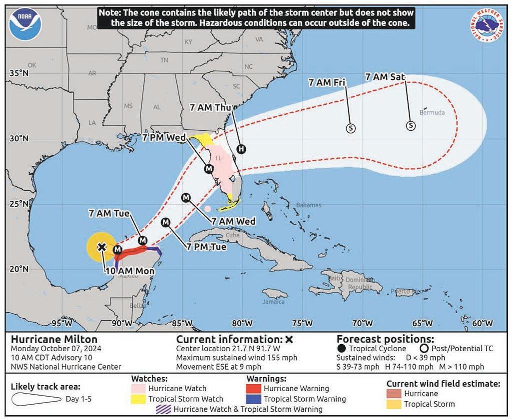
A screenshot from the National Hurricane Center shows how an experimental cone will appear during a storm. The storm’s center is expected to fall within the experimental cone 90% of the time. (National Hurricane Center)
ous, life-threatening water inundation is possible, generally two days before rising waters could arrive.
A storm surge warning is issued about 36 hours before forecasters expect a life-threatening surge will occur. During this warning, the hurricane center says to check for evacuation orders from local officials.

Storm surge watches and warnings are not shown on a track forecast. Instead, they receive their own graphic.
While surge warnings highlight the threat of water, tropical storm and hurricane warnings focus on wind threats.
Forecasters issue a hurricane watch when hurricane conditions — wind speeds of 74 mph or higher — are possible within a specific area. They are generally issued within two days before tropical-storm-force winds are likely to arrive.
When your home is under a hurricane watch, that’s when officials say you should begin storm preparations and review evacuation plans.
A hurricane warning is issued when hurricane conditions are expected within 36 hours or less, and it means it’s time to finish preparations and hunker down — or evacuate should local officials advise you to do so.
A tropical storm watch is issued when winds of 39 to 73 mph are possible in an area. A warning is issued when tropical-storm-force winds are expected. These watches and warnings follow the same timelines as hurricane watches and warnings.
See MAPS, 23X






























Forecasters can issue watches and warnings in any hurricane center update. And they can issue “potential tropical cyclone” advisories up to three days in advance.
A potential tropical cyclone is a disturbance that hasn’t become a tropical storm or hurricane yet, but could bring those conditions to land.
The main purpose of the latest cone is to have watches and warnings take precedence over the size and location of the storm.
Any hurricane or tropical storm watch or warning issued by the hurricane center will be depicted on the graphic.
The latest iteration of the cone went through an experimental phase in 2024 and 2025. Feedback from users and social scientists supported the changes, the hurricane center wrote in a products and services update this year.
“We think that this going to be a better representation of both the coast-
al and inland wind risk for tropical cyclones affecting the United States,”
Robbie Berg, the warning coordination meteorologist for the hurricane center, said during an April webinar.
With the new cone, areas under a hurricane watch are shaded in pink, while those under a tropical storm watch are in yellow. Communities swathed in red are under a hurricane warning, and those in the blue are under a tropical storm warning.
As an example, the hurricane center uses a forecast cone that was issued for Hurricane Milton on Oct. 8, 2024.
The Tampa Bay area is shaded in red — a hurricane warning — while areas south of Tampa Bay are shaded in a combination of blue and pink, denoting a tropical storm warning and hurricane watch, respectively.
Another detail to remember: The cone is far from foolproof.
The cone is based on an average of the product’s last five years of errors. Forecasters expect a storm will remain within the cone roughly 60% to 70% of the time.
Berg previously emphasized that the cone is not a “risk product.” It does not showcase how strong winds are, for example.
“You really have to focus on those watches and warnings.”
The hurricane center’s experimental cone this year will look slightly different than the one we’re used to seeing.
The current cone is used by creating circles, which leads to the center of a storm falling within the cone about 67% of the time.
The new cone will be more of an oval shape, and will have the storm’s center falling within that cone 90% of the time.
“Meaning that there is only a 10% chance that the storm center will move outside of that oval,” Berg said.
“We’re trying to capture more of the risk where the center of the storm could move.”
The newest experimental cone will be a supplement, not a replacement.
“The benefits we see is that it is going to more accurately reflect the true forecast track errors,” Berg said.
A version of this story was previously published in the Tampa Bay Times.
Contact Michaela Mulligan at mmulligan@tampabay.com. Follow @Michaela_Mull.























BY JACK PRATOR Times Staff Writer
Much of Mark Fulkerson’s work starts after a catastrophic storm has passed and its rain has ceased.
As a chief engineer for the Southwest Florida Water Management District, he spends the weeks following a hurricane documenting high-water marks and measuring how closely the agency’s flood maps match up against real flooding.
When Hurricane Milton made landfall as a Category 3 storm in October 2024, it dropped near-record rainfall on the Tampa Bay area and swamped homes along the region’s many rivers and lakes.
Fulkerson found that many of the squiggles darting across flood maps his agency has spent decades developing lined up quite accurately with floodwaters reported during and after Milton’s deluge.
Still, the storm season of the century took many Tampa Bay residents by surprise.
“I hope it’s the flood event of my career,” Fulkerson told the Tampa Bay Times in an

interview last year. “I hope we don’t have another one like it.”
He got his wish last year, after the 2025 hurricane season passed without incident in Florida. But now, a very different problem faces the region: A historic lack of water.
“We had below-average rainfall last wet season last summer,” he told the Times in May. “A lot of the rivers that I study, they didn’t even really rise that much. It’s the craziest thing.”
“It’ll take more rain than normal this year to fill them back up,” Fulkerson added.
But even after a drought, a powerful hurricane this season could cause the rivers to swell again.
Here are some tips water managers, researchers and forecasters say could help prepare for future river floods:
Even days after Hurricane Milton made landfall, many rivers and creeks around the region still hadn’t crested. The delayed

flooding surprised residents who thought they had been spared from devastating floodwaters, only to have the rain catch up to them later.
Water levels along rivers and lakes often lag weeks or months behind other coastal and inland areas after powerful storms due to natural hydrological processes. Geography, like the elevation around a home and the depth and shape of a river, dictates how and when a water body will flood following extreme rain.
Milton set records for river heights in the Tampa Bay area. At its peak, the Hillsborough River rose above 38 feet and shattered a 2017 record by nearly 4 feet, according to a water gauge at Morris Bridge.
The Withlacoochee River crested at 19.7 feet nine days after Milton made landfall, according to a water gauge near its headwaters. It was the highest water level recorded there in 90 years.
sive rainwater from Milton, Fulkerson said. Saturated wetlands in Big Cypress Swamp caused flooding in Land O’ Lakes and Wesley Chapel.
About 25% of the water management district’s jurisdiction is made up of wetlands, Fulkerson said. They absorb and store rainwater. Levels often fluctuate during Florida‘s wet and dry seasons. When those wetlands fill up, runoff has to find an alternate path.
Water has three places to go. It can soak into the ground, filling the aquifer — which serves as Florida‘s main drinking water supply — and raising the water table. Runoff might drain to rivers that rise and cause flooding along their banks. Or water flows across the land and collects into a low-lying area called a closed basin.
“It’s got nowhere to drain after that,” Fulkerson said.
After three months of above-average rain during the summer of 2024, the region’s ground was saturated with water. Milton’s deluge pushed watersheds to their brink.




The heaviest of Milton’s rain fell in the Green Swamp — vast wetlands stretching across Polk, Lake, Sumter, Hernando and Pasco counties that serve as the headwaters for four major waterways: the Withlacoochee, Hillsborough, Ocklawaha and Peace rivers.


The upstream deluge carried floodwaters down the rivers and flooded communities.
Cypress Creek, a major tributary of the Hillsborough River, crested at a record high of 15 feet four days after landfall. Water levels stayed high for weeks, shocking longtime Pasco residents.
The Cypress Creek wetland basin, which serves as the drain-off for the surrounding developments, was overwhelmed by exces-
The National Water Prediction Service provides a tool that identifies water levels in rivers across the country. If you zoom in on Florida, you’ll find little dots lighting up the entire state.
Each dot color represents the river’s flood stage: Green (no flooding), yellow (action), orange (minor flooding), red (moderate flooding) and purple (major flooding).
Like tidal gauges that measure coastal water levels, each river has different heights at which flooding can occur.
See RIVERS, 25X


The tool also provides a forecast for future river heights: A blue line shows observed water levels, while a dotted purple line shows the water level forecast.
But river flooding is difficult to predict, according to researchers.
“Trying to predict how high a river will get, there are different aspects that kind of can complicate some of those predictions,” said Katherine Serafin, a coastal geographer and assistant professor at the University of Florida, in an interview last year.
Where exactly the rain will fall, its timing, how many bands of rain a tropical system will bring and how fast the rain will move over land are estimated to forecast flood risks.
The river’s depth is often an overlooked factor, Serafin said. Submerged debris from past storms may fill up a riverbed, causing it to rise more quickly than expected.
The river gauge site also displays current flood warnings imposed by the National Weather Service — shown on a tab under the specific river gauge — laying out hazards and further flooding details.
Original floodplain maps used by the Federal Emergency Management Agency to set flood insurance rates were first developed in the 1980s, Fulkerson said. Development in Florida has boomed in the decades since, making many of those calculations outdated.
One of Swiftmud’s longest-running projects has been to update them: Over the past 25 years, the agency has made new renderings of flood maps for more than 130 watersheds, making up 75% of the district.
“The hope is that residents are aware when they buy property, they know what they’re getting,” Fulkerson said.
The flood maps take into account factors like elevation, soil type and land use.
Driven by gravity, water drains to the lowest point it can reach and pools there. Sandy soils drain more quickly than dense clay.
Knowing what the ground beneath and the topography around your home are like can help evaluate flood risk.
Fulkerson said previous flooding is another big indicator of risk.
“A lot of areas that we saw flooded (during Hurricane Milton), they flooded in the past,” he said. “Whether we lived here or not, it’s happened.”
An influx of new Floridians moving to the
area has also contributed to a lack of flood awareness.
“One thing that I heard from a lot of the residents is just not having any clue it could happen,” he said. “You lose a lot of that historical knowledge, too, when people sell, or people pass on.”
Driving around the region six months after Milton, Fulkerson still saw pockets of standing water in places where it normally wouldn’t pool.
Now, more than a year later, lake, river and aquifer levels are the lowest in about a decade. Sparse, scattered showers and a quiet hurricane season last summer meant less rain made its way into natural water stores.
It’s reminded Fulkerson of conditions just before a particularly nasty storm season.
“The last time our lakes were this low and our rivers this dry was back in late-May 2017,” he said. “Of course, that year, Hurricane Irma came in September and caused extreme flooding in our region’s river systems.”
While that doesn’t mean history will repeat itself this year, Fulkerson said it highlights how unpredictable rainfall and flood-
ing can be across the Sunshine State.
“One of two things is going to happen,” he said. “We could be in a multiyear drought. If we don’t materialize a lot of rain this summer, we’re going to be even tremendously lower next dry season. ... Or, we could get a lot of rain, and we could have more water than we know what to do with.”
Storms bringing a deluge to dry soil often cause water to roll off the ground and create flooding, according to Fulkerson. On the flip side, it only takes a few heavy rains to saturate the soil, which can exacerbate flooding atop soggy ground.
Because summer rains hadn’t started as of mid-May, it was too soon to tell what will be in store.
“What we know for sure is we’re going to need more rain this summer just to get back to where people are used to,” he said.
A version of this story was previously published in the Tampa Bay Times.
The Tampa Bay Times launched the Environment Hub in 2025 to focus on some of Florida‘s most urgent and enduring challenges. You can contribute through our journalism fund at project.tampabay.com/donate/
Contact Jack Prator at jprator@tampabay.com.






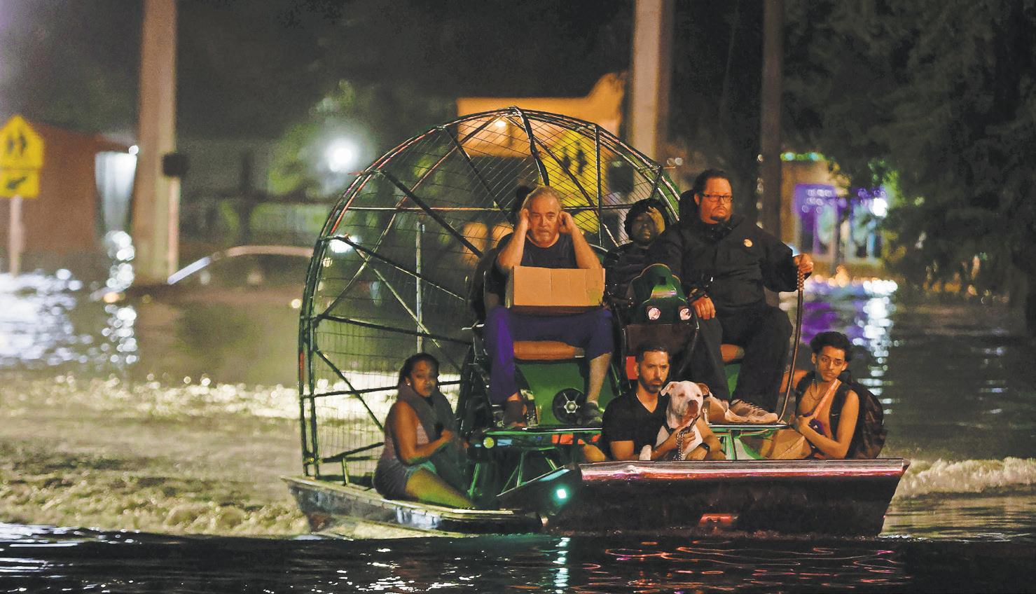
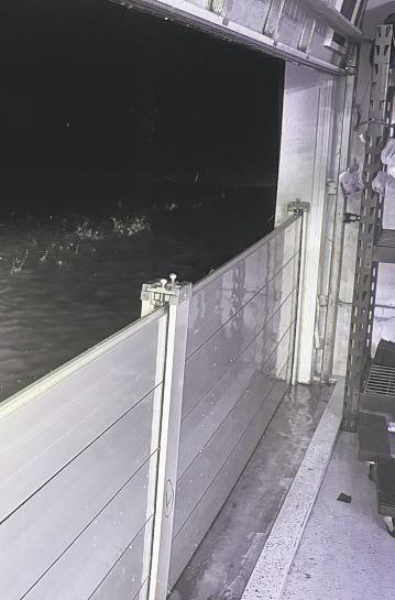
In Tampa Bay, there are just a few feet of difference between low and high tides, which is less than in other coastal parts of the country. That means whatever weather occurs that day will play a more important role in determining if a high tide will cause flooding here. Flooding can also occur without a weather system, though it’s less common. (LUIS SANTANA | Times, 2024)
TBY MICHAELA MULLIGAN Times Staff Writer
he prospect of water pushing into homes and businesses is a heavy weight on the minds of Tampa Bay residents ahead of storms.
In 2024, 14 people around Tampa Bay drowned during Hurricane Helene from dangerous storm surge, and thousands of homes were damaged from coastal water or flooding rains during Hurricane Milton.
While guidance from the National Hurricane Center and emergency managers is king ahead of storms, it’s helpful to have a few extra tools in the belt. One of those is watching real-time and future water levels.
A website from the National Oceanic and Atmospheric Administration provides data on tide gauges across portions of coastal Tampa Bay. And another resource from the National Water Prediction Service shows where river flooding is possible.
The information, while far from the only piece in the larger puzzle that is hurricane preparation, gives residents another way to evaluate the risk to their homes and lives.
To be clear: These tools are a supplement to personal decision making (like planning to move your car to higher ground, or packing your car ahead of evacuations), but if officials tell you to evacuate, you need to leave.



mer senior scientist at the National Oceanic and Atmospheric Administration, previously told the Times.
This is also around when “king tides,” or higher-than-normal tides, can occur.
In 2023, Hurricane Idalia skirted the coast of Tampa Bay just hours before a king tide. Had the storm arrived about six hours later, its surge likely would have been about 2 feet higher, Gary Mitchum, associate dean at the University of South Florida College of Marine Science, previously told the Times.
In Tampa Bay, there are just a few feet of difference between low and high tides, which is less than in other coastal parts of the country. That means whatever weather occurs that day will play a more important role in determining if a high tide will cause flooding here.
Flooding can also occur without a weather system, though it’s less common.
The National Oceanic and Atmospheric Administration has tidal stations across the country. In Tampa Bay, a number of those sites are concentrated along the coastal waters of Pinellas and Hillsborough counties.
We’ve gathered what to know about rising water and how to access a sampling of the data surrounding it.
Let’s break down the basics.
Tides are influenced by the sun and the moon. When the tallest part of a wave reaches a coast, that’s high tide. The opposite, the lowest, is low tide.
The difference in these heights is called a tidal range.
Weather patterns can also influence tides. Strong wind and rain can lead to higher-than-expected tides, Virginia Dentler, an oceanographer for the National Oceanic and Atmospheric Administration, previously told the Tampa Bay Times.
Tampa Bay tends to see its highest tides of the year around late summer and early fall — coincidentally around peak hurricane season. Around this time, water levels grow by about 8 or 9 inches from what is typically recorded in winter and spring.
“When you have warmer waters, ocean water expands, and so it increases in elevation along the coast,” Gregory Dusek, a for-
Because Tampa Bay has a port system, there are more tidal gauges in the surrounding waters, Dentler said. However, more northern areas of Tampa Bay, like Pasco County and beyond, are without these gauges.
Dentler said tide stations are typically added onto preexisting structures, like Pier 60 on Clearwater Beach.
The administration’s Tides & Currents website links to its tide stations, which include information like water levels, wind speeds and observed barometric pressure.
When a storm is incoming, Dentler suggests looking to the administration’s Coastal Inundation Dashboard.
“It’s our real-time product,” Dentler said.
Pinpoints on a map show where tide stations are located. Once a user clicks on their desired location, that station’s observed water levels pop up.
Stations give real-time water level data and will show when minor flooding (in yellow), moderate flooding (in red) and major flooding (in pink) are possible.
The lines on the graph depict three possible water levels: predicted water levels, observed water levels and forecast water levels.
The dark blue line shows water level predictions oceanographers made a year in advance. The red line shows where water levels currently are. The light blue line shows the forecast guidance, which inputs external weather forces such as high winds.
The forecast guidance line is the best bet in knowing how high water levels may reach during a storm, Dentler said.
All stations have different heights at which flooding can occur. In St. Petersburg, for example, minor flooding can happen at a little less than 3 feet.
Most of the highest water levels recorded by NOAA’s tide monitoring station in St. Petersburg occurred during hurricanes.
Of the top five highest water levels, three have occurred since 2020.
Helene took the crown in 2024, when water height reached 6.31 feet — dethroning a nearly 40-year record. During Helene, observed water levels reached more than 2 feet higher than the record set during Hurricane Elena in 1985.
Just like coastal areas, inland residents of Florida are no strangers to flooding.
When Hurricane Milton made landfall on



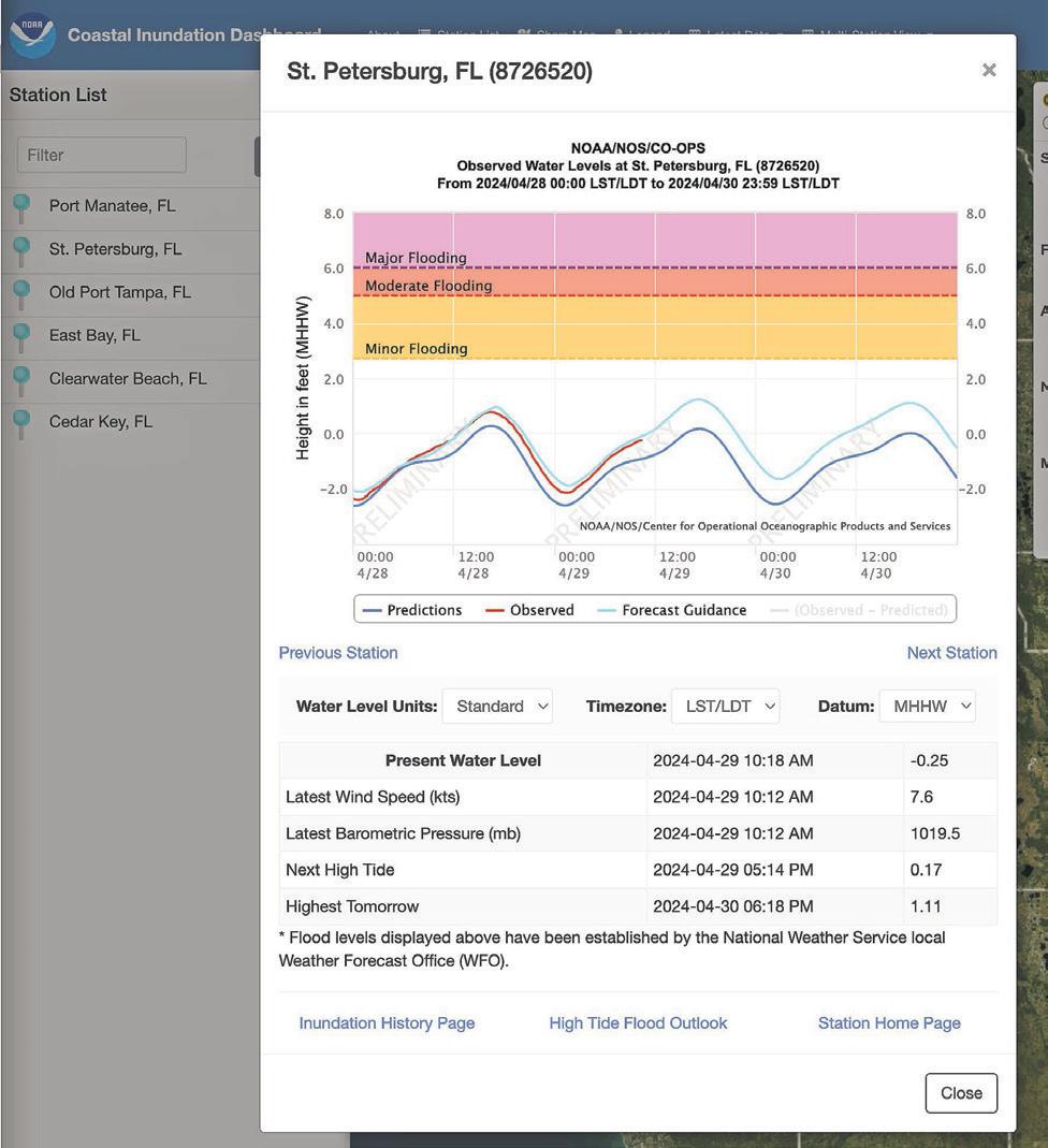
A screenshot of the St. Petersburg observed water levels under the Coastal Inundation Dashboard shows real-time tide data in late April 2024. (National Oceanic and Atmospheric Administration)
Florida’s west coast in 2024, it was the third storm to do so in a few months. The waterlogged ground and Tampa Bay’s infrastruc-


ture were unable to handle the record rainfall.
Rivers are a particular kind of beast. Water levels along rivers and lakes often lag weeks or months behind coastal areas after storms due to natural hydrological processes.
According to the U.S. Geological Survey, river forecasts are made by the National Water Prediction Service, which is under the National Weather Service.
The tool found at water. noaa.gov can show gauges for these sites. A caveat: There are lots of buttons and drop-downs to play with on this site, and water levels are just one aspect.
On one of its most basic levels, clicking on the dots displayed on the site will show a water body’s current information and a forecast, if available.
A dot corresponds with an observation, while a square corresponds with a forecast. Each colored dot or square corresponds with a water gauge and its flood level
(either observed or forecast). For example: green (no flooding), yellow (action), orange (minor flooding), red (moderate flooding) and purple (major flooding).
In May, a graphic found on the National Water Prediction Service product showed the Ochlockonee River in Georgia, near the Florida border, was expected to reach the “action” stage soon. This is the stage when meteorologists or other officials should start prepping for possible higher water levels. The subsequent stages warn of worsening flooding threats.
• For information on tides: tidesandcurrents.noaa.gov
• To find the Coastal Inundation Dashboard: bit.ly/49ExTQw
• For information on rivers: water.noaa.gov.
A version of this story was previously published in the Tampa Bay Times.
The Tampa Bay Times launched the Environment Hub in 2025 to focus on some of Florida‘s most urgent and enduring challenges. You can contribute through our journalism fund at project.tampabay.com/donate/.
Contact Michaela Mulligan at mmulligan@tampabay.com. Follow @Michaela_Mull.








BY EMILY L. MAHONEY Times Staff Writer
Among the Tampa Bay locals who were killed during the historic 2024 hurricane season, many shared a tragic trait in common: They were over 60 years old. Most lived in mandatory evacuation zones but didn’t leave. Some also had mobility issues, such as needing walkers to get around.
Jeff Johnson, the state director for AARP Florida, which advocates for people over the age of 50, said that in addition to physical hurdles, older adults also may have a harder time emotionally with leaving their home and not knowing what it’ll look like when they come back. After living somewhere for decades, possibly filled with items that represent friends and family who have passed away, the process can be difficult. But it’s important to heed mandatory evacuation calls.
Johnson noted that even if residents think they’re safe from storm surge on an upper floor of a condo high-rise, they need to consider what it would be like to live there without any power or water for days, including if the elevators go out in tall buildings. Some people of all ages might need help evacuating, too, because they lack transportation or the financial means to book a hotel room.
For people who need help evacuating ahead of a hurricane, there are resources available.
Residents who rely on medication, oxygen or power-dependent medical equipment can add their names to the state’s special needs registry before a hurricane looms. That registry, run by the Florida Department of Health in coordination with local governments, is at snr. flhealthresponse.com. Emergency managers said the registry ensures that first responders have key information about vulnerable residents who may need help.
PINELLAS COUNTY: County officials encourage residents who have medical needs, lack transportation, or need help walking or getting out of bed to register for the county’s special needs program. Residents can ask their home health care provider about registering or do so online at pinellas.gov/ special-needs. You can also request a form by calling Pinellas County Emergency Management at 727-464-3800.
HILLSBOROUGH COUNTY: Special needs residents should register at the state health department website above, according to county officials. The Hillsborough County Stay Safe webpage at hcfl.gov/residents/ stay-safe includes real-time shelter locations, evacuation zones, evacuation levels and the latest live updates. For assistance, the county’s main information line is 813-272-5900. Residents can also call the storm information line when emergency staff is activated: 833-427-8676.
PASCO COUNTY: Residents with special needs can find information on registering, plus a short video on how to register, at mypas.co/SpecialNeeds. The county has also created a brochure with the relevant information, links and phone numbers, which can be found at bit.ly/3Rf1BFz.
Kevin Guthrie, the director of Florida’s Division of Emergency Management, said residents can also call 800-729-3413 with questions about evacuation orders or for assistance getting out.
Times staff writer Justin Garcia and Times/Herald staff writer Romy Ellenbogen contributed to this report.
A version of this story was previously published in the Tampa Bay Times. The Tampa Bay Times launched the Environment Hub in 2025 to focus on some of Florida’s most urgent and enduring challenges. You can contribute through our journalism fund at project.tampabay.com/donate/.
Contact Emily L. Mahoney at emahoney@ tampabay.com. Follow @mahoneysthename.

Times Staff Writer
Some of the most dangerous hurricane hazards occur after a storm has passed.
Standing water, fires and downed power lines are just a few of the perils Tampa Bay residents need to be aware of as they emerge from or return to their homes. Here are some tips to protect yourself.
Water and electricity do not mix, Tampa Electric spokesperson Mary Lou Carn previously told the Tampa Bay Times. Here are a few tips to avoid electrical fires.
VEHICLE FIRES: Over a three-day period as Helene passed Florida in 2024, at least 93 vehicles caught fire in Pinellas County. In Tampa, a fire broke out at the Tesla dealership on Florida Avenue, according to a Hillsborough County spokesperson. The fire occurred in a battery pack removed from the vehicle, and the vehicle had been subjected to floodwaters.
Residents with electric vehicles, e-bikes or golf carts are asked to park them in areas where they will not be exposed to saltwater, and people should avoid driving through standing water.
Any lithium-ion battery that has been exposed to water should not be thrown away in normal trash. Battery manufacturers have specific disposal instructions.
Electric vehicles exposed to saltwater should be moved at least 50 feet away from homes, as they run the risk of causing fires in the days following the initial exposure. The vehicles may need to be towed to a dealership after the storm.
DOWNED
Downed power lines can carry electric currents strong enough to cause death. Driving over or touching a downed power line — or things that touch a downed power line — could lead to serious injury or death.
You should assume that all downed lines are live.
“Lithium-ion batteries, such as those in electric vehicles, including golf carts and electric bikes, pose a fire risk after being exposed to saltwater,” Pinellas spokesperson Kelsey Grentzer previously wrote in a statement.
See HAZARDS, 30X
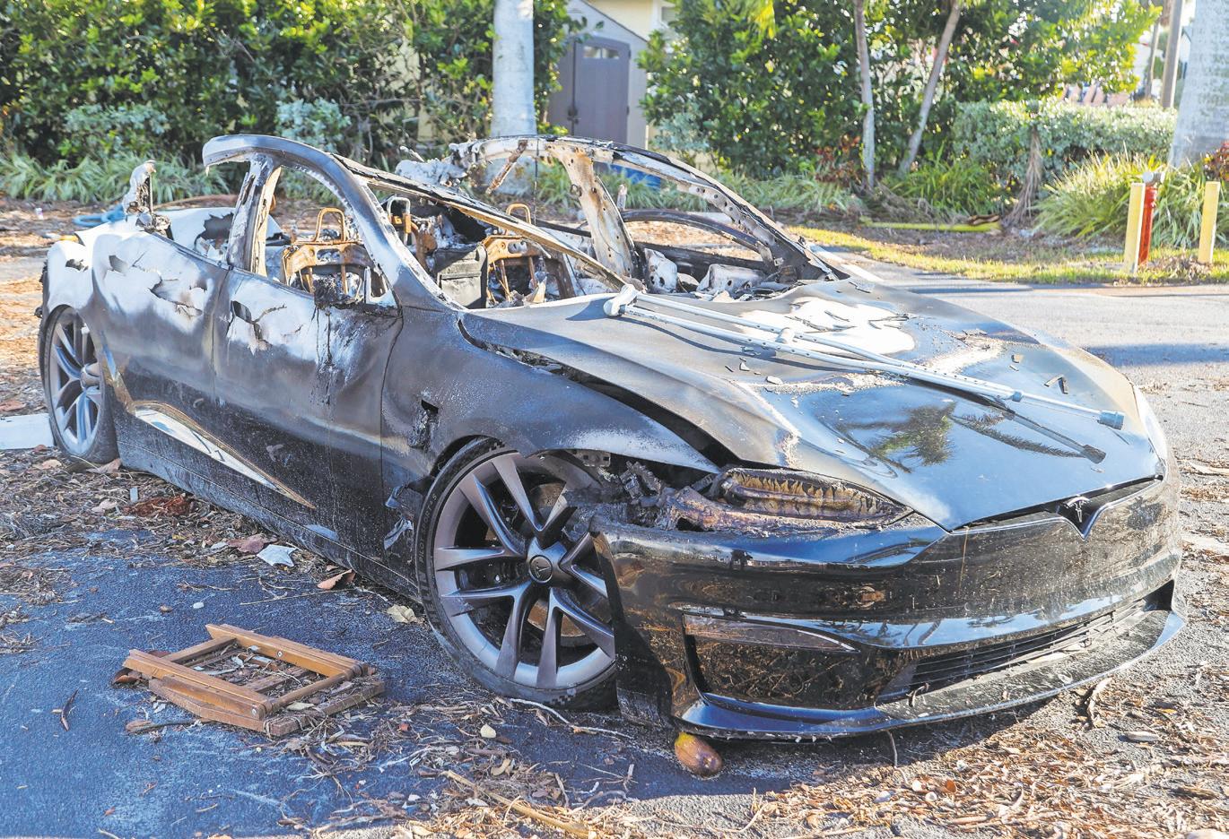
Electric vehicles exposed to saltwater should be moved at least 50 feet away from homes, as they run the risk of causing fires in the days following the initial exposure. (DIRK SHADD | Times)







BREAKERS/ELECTROCUTION: Carn told the Times previously that residents evacuating — particularly those in flood zones — should turn off their main breaker. Carn also said it’s essential to make sure hands are dry and not to be standing in any water when touching any electrical item. Florida Power and Light Co. recommends turning off breaker switches one by one and turning them back on one by one after power is restored. FPL also warns against touching the electric meter.
TREE LIMBS: If tree limbs land on your house or vehicle during a storm, certified arborist Jacob Heredia of Lumber Jake’s Tree Service advises against the urge to try to remove them yourself.
Instead, he told the Times previously, people should take pictures of the destruction from the ground and then call someone who regularly deals with tree removals.
It could prevent both injuries and additional damage.
“Branches will often crack, and there’s lots and lots of pressure we can’t see,” Heredia said. “If you disrupt the pressure ... you can have that piece roll or disconnect from the tree.”
The end result could be dislodging not only the branch, causing it to fall, but also creating a new set of problems for the structure it landed on.
“You can further damage something that might have been superficial, but now there’s a hole,” Heredia said. “There’s absolutely ways to realize further damage by trying to clean something up.”
GAS LEAKS: Tampa Electric’s Carn said if you smell rotten eggs or a sulfur-like smell, it can signal a gas leak. Carn urges residents to call 911 and the electric company.
The Florida Division of Emergency Management recommends that if one smells something like a gas leak, avoid using “any sources of ignition, such as cell phones, cigarettes, matches, flashlights, electronic devices, motorized vehicles, light switches or landlines.”
GENERATORS: Generators should be operated in well-ventilated areas, not inside homes or garages. Carn said portable generators should be kept away from doors, windows and air conditioning intakes. Generators should also stay dry. Florida’s Poison Control Centers recommends keeping generators at least 20 feet away and installing battery-operated carbon monoxide detectors near all sleeping areas.
A version of this story was previously published in the Tampa Bay Times.
The Tampa Bay Times launched the Environment Hub in 2025 to focus on some of Florida’s most urgent and enduring challenges. You can contribute through our journalism fund at project. tampabay.com/donate/