6 minute read
History

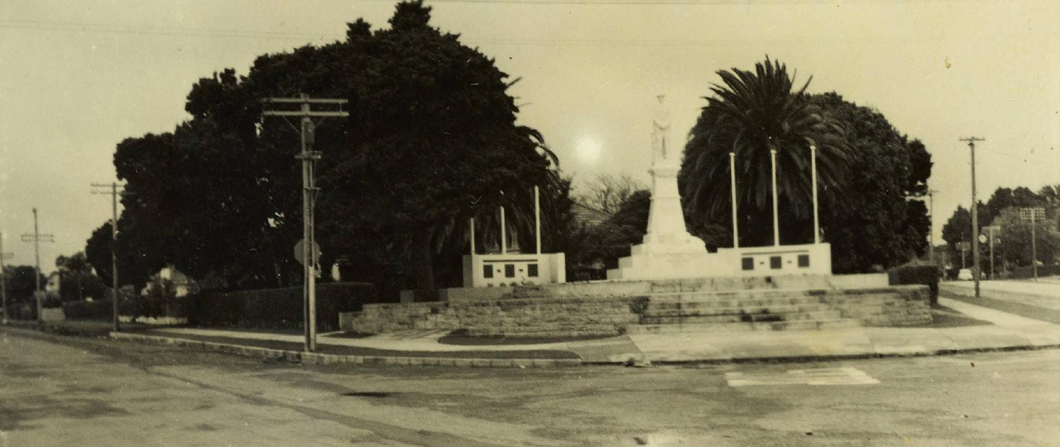
Papakura War Memorial, 1957.
Courtesy of Bruce and Wilma Madgwick, Auckland Libraries Heritage Collections Footprints 07300
Built on rich heritage
Housing around Papakura, Takanini, Drury and surrounds continues to mushroom with thousands of new homes either underway or in the pipeline for completion in the next few years.
While modern apartments, terrace houses and affordable housing together with attractive estates bring new life and wealth to the south, it is timely to remember the district has rich Maori and European settler histories.
The name, Papakura is a Maori word believed to have originated from ‘papa’, meaning earth or flat and ‘kura’ meaning red, reflecting the rich, fertile soil upon which the community was founded.
The tangata whenua of the area dates back many centuries, before European colonisation and hapu can trace their whakapapa back to the Tainui waka.
There was a time when several pa stood across the region including at the western end of the Paerata ridge, while another stood above the plain east of Papakura at Red Hill, strategically placed to control the inner reaches of the harbour and north-south routes east to the Clevedon area. Two other pa sites were at the mouth of Slippery Creek which was associated with settlements and cultivations.
The influential Maori presence, includes the Marae at Umupuia in the east (sometimes called Duder’s Beach). That particular Marae is the Mana Whenua Marae of the Ngai Tai iwi of Umpuia and Tamaki Makaurau and it has a unique place in the area’s history.
In addition to the land’s cultural and economic value to tangata whenua, the area, particularly further south and to the west, has long been in agricultural and horticultural use especially as one draws closer to Bombay and Pukekohe before heading west.
Also an early frontier settlement, the first Europeans made their home in these southern reaches of Auckland some 150 years ago under what was then the Waikato Immigration Scheme. Many of those original 4000 immigrants, tempted by the offer of free land, settled in the wider Papakura area and also further south in the Franklin district. They came mostly from the United

Drury Potter and Clayfire Works, 1907.
Photo courtesy Auckland Libraries Heritage Collections JTD-22G-00997-2
HISTORICAL PLACES OF INTEREST
AREA’S FIRST SHOP

F.E. White’s newly built shop on the Great South Road, Manurewa, ca 1909.
Courtesy of Manurewa Historic Society, Auckland Libraries Heritage Collections Footprints 01211
Kingdom and the Cape Colony, leaving behind families and everything familiar to them.
After a long sea voyage, they then faced long delays before even setting foot on ‘their’ new land with most living in disused army barracks, tents, or shacks.
In particular, Drury’s development as a colonial settlement focused on the Great South Road, accommodation and rural services while the Papakura area once featured coal, clay and kauri gum industries. Adjacent sources of employment, apart from Auckland city, included the former Kingseat and Ravensthorpe Hospitals, Middlemore Hospital, the freezing works at Otahuhu-Westfield and, later, the Glenbrook Steel Mill.
The New Zealand War, principally in Waikato, impacted on the whole area and all peoples, but colonial and imperial camps and specific events were more localised.
Military camps were also established in the district during the Second World War: these included the New Zealand military camp on the northeast side of Papakura and United States Army camps near Pukekohe.
However, all this is but a snapshot of the district’s background, yet, hopefully, it forms a springboard for exploring further because, there is some fascinating reading for those who wish to delve into the past. According to the recollection published in 1969, of long-time local identity and butcher, Charles Crawford Munro, the above photo shows Manurewa’s first purpose-built shop:
“When I joined the late Mr Charles Hawthorn and founded the butchery business of Hawthorn and Munro, Ltd, in 1906, I drove a hawking cart to Alfriston and Brookby, and later through Papakura, Manurewa, Alfriston and back to Clevedon through Armdore.
“An Englishman, Mr Fred White, kept the Alfriston store on the corner opposite the school ... Mr White, an ambitious and persistent man, with plenty of energy but no money, persuaded the Martin [brothers] to build him a store on the corner of the Great South Rd and Hill Rd, but this was no more than the boxed-in end of the verandah of a five-roomed house. White, who had bigger ideas, eventually got them to build a proper store on the site where Bryant’s store now stands ...” ‘
The building in the photograph is the latter [purposebuilt] store, situated on the eastern side of the Great South Road, opposite the future site of the Manurewa Post Office. Hawthorn & Munro later bought a section alongside White’s original house, where they built the township’s second shop and first butchery.

St George Street, Papatoetoe, ca 1925.
Courtesy Papatoetoe Historic Society, Auckland Libraries Heritage Collections Footprints 05416
Changing face of Manukau
For many years the wider Manukau district was mostly rural with settlement escalating after the Second World War. The 50’s, 60’s and 70’s saw development of suburbs such as Manurewa, Hillpark, Totara Heights and later The Gardens plus other new subdivisions now escalating throughout Takanini and Papakura.
With the amalgamation of Manukau County and Manurewa Borough in 1965, Manukau City was formed but it wasn’t until New Zealand-wide reorganisation of local government in 1989 that Manukau City absorbed Papatoetoe City and Howick Borough but lost some land to the newly formed Papakura District.
Then, on November 1, 2010 Manukau City Council was abolished and the governed area was amalgamated into the Manukau, Howick, Manurewa-Papakura, and Franklin wards of the new Auckland ‘SuperCity’.
New infrastructure saw the completion of the southwestern motorway from Manukau to connect with the north-western motorway via the new Waterview tunnel. Continuing works on the Southern Motorway has seen changes at the Takanini junction with road widening between Takanini and Papakura. A 4.5km cycle and pedestrian walkway has been built between Papakura and Takanini and, now, the motorway from Papakura to Drury is being widened to three lanes each way. There have been added improvements to State Highway 20B making access to the airport easier than ever.
The name Manukau, from the Manukau Harbour west of the city, is of Maori origin, and means ‘wading birds’ although it has been suggested that the name of the harbour was also sometimes rendered as Manuka, meaning a ‘marker post’.

Aerial view of East Tamaki, 3 June, 1949. Taken looking west to south from Sandstone Road towards Papatoetoe.
Courtesy GeoSmart Ltd, Auckland Libraries Heritage Collections Footprints 06055
Peace tree still stands
Schools may be places of formal learning but when the Reverend W.C. Wood planted an acorn in the Papakura School grounds on July 19, 1919, as a contribution to the local peace celebrations after the First World War, the school yard took on new meaning.
This ‘peace oak’ was intended not so much as a war memorial but as a symbolic commemoration of peace and victory.
The tree and accompanying plaque can still be seen near the north-western boundary of what is now Central Park, within view of the Papakura-Karaka First World War memorial.

A GROWING COMMUNITY
Auckland’s southernmost metropolitan city centre, Papakura is expanding rapidly. A new wave of housing, including many apartments, which are attracting young professionals, has seen rail and bus services extended and new community facilities come into play. The shopping centre encompasses a wide range of retail shops focused on fashion, food and fitness, health and beauty plus professional and trade services all easily accessed. For families keen to live, work and, plays within an active community, Papakura is attracting new residents and businesses – come and join them! Check it all out at www.papakura.co.nz


Phone 09 298 8996
JU1981
