
3 minute read
History ��������������������������������


Pukekohe – a frontier township, ca 1885.
Photo Auckland Library Heritage Collections Footprints 02371
Drawing on the past, forward thinking
Aucklanders have seen the light – Pukekohe and the surrounding Franklin district (part of the SuperCity) offers a wonderful lifestyle on the rural fringe, but still within cooee of Auckland’s CBD.
New housing developments have mushroomed from Drury through Paerata to Pukekohe as well as to the northwest around Karaka, Kingseat and Patumahoe then out to Glenbrook and Waiuku, while both Pokeno and Tuakau in the south continue to burgeon.
Although growing rapidly, Franklin is by no means a new settlement. In fact, it has a rich Maori and European history. Proximity to the Manukau Harbour and two portages (one between the Manukau and the Tamaki River and the other between the Waiuku arm, Awaroa River and the Waikato River) were once major drawcards in the development of the area for both Maori and, later, colonial settlers.
The close proximity of the Karaka shore to Weymouth, across a narrow part of the harbour’s tidal arm, made it a well-used waterway, a superhighway of its day.
In addition to the land’s cultural and economic value to tangata whenua, the area has long been in agricultural and horticultural use and land around Pukekohe still has concentrated areas of market gardening.
Once principally associated with the railway, dairying and Wesley College, Paerata now includes Paerata Rise, a recent estate featuring thousands of houses, which is becoming well established since its first homes went under the hammer in 2018.
Close to the Southern Motorway, Drury began life as a colonial settlement focused on the Great South Road, accommodation and rural services. Much more recently, the Auranga housing estate and Drury South project are well underway seeing the area grow substantially.
The first immigrant farmers arrived in Franklin in the early 1840s, but the region was occupied long before then by Maori tribes. Maori settlement dates back centuries, with hapu able to trace their whakapapa
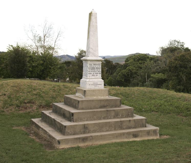
Memorial at Alexandra Redoubt
back to the Tainui waka.
For many years, the Karaka, Pukekohe and Opaheke landscape was one of wetlands, creeks and bush, supplying natural resources to Maori. Scattered throughout the region were papakainga (settlements), urupa (burial grounds) and vast areas of cultivation with foot tracks skirting swamps, including from Maketu to Paparata and Tuamata to Tuakau.
Official records and accounts by church missionaries and kaumatua confirm tangata whenua living around Pukekohe were its sole custodians until the mid-19th Century when new settlers began to set down roots.
European crops, fruit and livestock rearing were added to the established fishing industry. Dressed and undressed flax were other common local commodities. Trade between iwi and settlers was brisk and relations good until disputes about land ownership and possession created a crisis.
The district did not escape conflicts, from the Musket Wars’ period of the early 19th Century and the New Zealand Wars of the mid 1800s, during which a major battle was fought at Pukekohe East in 1863. When tensions increased throughout the district, much of the Pukekohe area was abandoned, apart from military outposts. Growth didn’t reoccur until years later.
There is much more to recount about the district’s past. We hope this quick snapshot will encourage budding historians to dig deeper, because there is some fascinating reading to be experienced in order to better understand our present as we chart our shared future.
Franklin was a New Zealand territorial authority between Auckland and the Waikato Plains. In 2010, it was divided between Auckland Council and Waikato and Hauraki districts in the Waikato Region. However, locals on both sides of the council borders still share much in the way of history and contemporary lifestyle.
KEY PORTAGE
Atranquil scene on the Awaroa River, near Otaua, 1898. A dinghy is moored in the calm waters of the narrow, winding stream. Given the low-lying nature of the land, the trees seen lining the banks in the photo below are probably moisture-loving kahikatea.
The Awaroa River was an important link for Maori travellers in the portage between the Waikato River and the Manukau Harbour. It continued in use after European settlement began and a village called Purapura (or Pura Pura) flourished near the watershed of the Awaroa during the late 1850s, linked to Waiuku by a well-travelled cart track. The portage was also used briefly for the transport of military supplies during the early stages of the Waikato phase of the New Zealand Wars, but it fell into disuse after the conflicts ceased due to the development of the Great South Road.
Reproduced by courtesy of Waiuku Museum Society, 149.


