TIMBRE — LANDSCAPE ARCHITECTURE + DESIGN
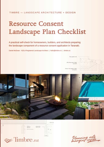
Resource Consent Landscape Plan Checklist A practical self-check for homeowners, builders, and architects preparing the landscape component of a resource consent application in Taranaki. Daniel McEwan · NZILA Registered Landscape Architect | hello@timbre.nz | timbre.nz
P larngninins ginnsoidtee ma
Why Landscape Plans Get Sent Back A landscape plan is one of the smaller documents in a resource consent bundle — but it's also one of the most common reasons an application gets a Section 92 request for further information, which stalls your timeline by weeks. Councils are assessing your landscape plan against the same core questions almost everywhere in New Zealand: is it to scale, does it show what's there now versus what's proposed, are the plant species and quantities specified, and does it address any trees, boundaries, or site features the district plan protects. This checklist walks through what most territorial authorities expect on a landscape plan submitted with a resource consent application. It's a self-check tool, not a substitute for reading your specific council's district plan requirements — every district plan differs slightly, and some activities (heritage sites, protected trees, coastal or flood-prone land) trigger extra requirements.
How to use this checklist: Work through it before you lodge, ideally before you even finalise the plan -catching a gap here is far cheaper than catching it after a planner sends a request for further information. If you're working with a draftsperson or architect on the wider application, this is the section they'll usually expect a landscape architect to supply or review.
Timbre Landscape Architecture + Design
timbre.nz
Page 2
1. Plan Basics & Presentation The fundamentals that make a plan legible and assessable - most rejections happen here, not in the design itself. North point clearly shown
Scale bar and stated scale — typically 1:100 or 1:200 for standard residential sites; larger sites (over ~1500m²) may require 1:200 or 1:500 Site address, legal description, and lot/DP number matching the rest of the application Existing site boundaries and dimensions, matching the survey/title plan Existing vs proposed clearly distinguished — different linework, hatching, or a clear legend Building outlines shown — footprint of existing and proposed structures, decks, driveways, and hard surfacing
Date and revision number on the plan — councils will ask which version is current if this is missing.
Site size
Typical scale
Standard residential section
1:100
Larger residential / lifestyle block
1:200
Sites over ~1500m²
1:200 to 1:500 (check council guidance)
Timbre Landscape Architecture + Design
timbre.nz
Page 3
2. Existing Site Context What's already there — councils need this to judge what effect the proposal has on the existing environment. Existing trees and vegetation shown, including canopy driplines where retention is proposed nearby
Any notable, heritage, or scheduled trees identified — check your council's district plan schedules before finalising Existing significant natural features noted — wetlands, watercourses, banks, or notable topography Existing ground levels / contours shown where the site has any slope
Location of easements, rights of way, and services (power, telecommunications, stormwater, wastewater) that may constrain planting or hard landscaping Any known archaeological sites or heritage items flagged, if applicable to the property.
Where this trips people up Homeowners often assume "landscape plan" means only the proposed planting - but councils are assessing the plan as a before-and-after. If existing vegetation, significant trees, or site features aren't shown, a planner can't confirm whether the proposal actually protects or removes them, which is a common trigger for a further-information request.
Timbre Landscape Architecture + Design
timbre.nz
Page 4
3. Proposed Landscape Treatment The core content most people think of as "the landscape plan" - this is where plant schedules and specification detail matter most. Areas to be landscaped clearly delineated and dimensioned All proposed sealed / hard surface areas shown and dimensioned (driveways, paths, patios, parking) Areas to be grassed or lawned identified separately from garden bed areas
Plant schedule included, specifying: species (botanical name), quantity, planting size (e.g. PB3, PB8, grade), and spacing Height and spread at maturity noted for each species - especially important near boundaries, driveways, and sightlines Any screening or shelter planting intended to mitigate visual or wind effects clearly identified as such
Fencing shown — type, height, materials, and an indication of visual permeability if relevant to boundary or safety requirements Retaining walls, if any, shown with height and material.
Where this trips people up A common gap is submitting a plan with plant symbols but no schedule — councils generally can't assess effects (shading, screening, mature bulk) without knowing what a symbol actually is, what size it's planted at, and what size it becomes. If your plan only shows shapes with no accompanying table, expect a request for further information.
Timbre Landscape Architecture + Design
timbre.nz
Page 5
4. What Council Planners Are Actually Assessing Beyond the checklist items, this is the underlying logic most councils apply when reviewing a landscape plan. Does the plan integrate existing landscape features into the new design, rather than simply clearing the site? Is the layout and planting design of a reasonable standard, and in scale with the proposed development? Are plant sizes at time of planting and at maturity clearly stated, so effects can be judged over time, not just on day one? Is there a clear timing / staging for when the landscape plan will be implemented and maintained relative to the build? Does the design and planting location support public safety — sightlines at vehicle crossings, lighting, and visibility are common concerns
A note on timing conditions Many consents are granted with a condition requiring landscaping to be completed within a set period after the building is occupied (commonly 3–6 months, but check your specific consent conditions). Build this into your plan narrative so the timing is clear to the assessing planner up front.
Timbre Landscape Architecture + Design
timbre.nz
Page 6
Final Sense-Check Before You Lodge Run through this short list one more time immediately before submission: Does the plan match the scale and format your specific council requests? (check their resource consent guidance page or call their duty planner) Are all measurements consistent with the site plan and architectural drawings elsewhere in the application? Is the plant schedule complete, legible, and cross-referenced correctly to the plan symbols? Has anything protected — trees, heritage items, significant natural features — been correctly identified and addressed? Is the plan dated, numbered, and does it match the revision referenced in your written assessment of effects?
This checklist reflects common requirements drawn from New Zealand district plans and the Resource Management Act 1991 Schedule 4. Requirements vary between councils (New Plymouth District Council, Stratford District Council, and South Taranaki District Council may each specify different scales, formats, or additional information). Always confirm current requirements with your specific council before lodging. This is general guidance, not a substitute for professional advice on your specific site or application.
Want your landscape plan prepared or reviewed? Timbre prepares resource consent landscape plans as a fixed-fee deliverable for homeowners, builders, and architects across Taranaki — sized to what your council actually requires, first time.
hello@timbre.nz | +64 21 769 779 | timbre.nz
© Timbre Landscape Architecture + Design
Not for resale or redistribution
Page 7