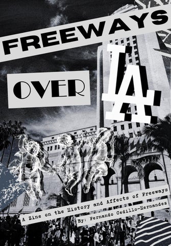
s y a w e e r F
OVER
ways e e r F cts of e f f A and ndez a y n r r e o H t dillo he His e t C o n d o rnan A Zine By: Fe
Freeways are a leftover of redlining in the modern day; today, they plague communities around them with cost, isolation, and health issues, but let's begin with their origin and how they harmed communities then:
"Residential Security Map of Los Angeles" (1939) overlayed with “A Parkway Plan for the City of Los Angeles and the Metropolitan Area” (1941).
Los Angeles used the Home Owner’s Loan Corporation (HOLC) maps to transform its landscape. By utilizing HOLC’s "hazardous" ratings, the city justified where massive infrastructure and urban renewal projects would take place. The image above is of two overlaid images one of "Residential Security Map of Los Angeles" and over it the “Parkway Plan for the City of Los Angeles and the Metropolitan Area” this layering is meant to serve as a direct comparison of the influence of HOLC maps over LA freeways, most of where these parkways are placed are over or around lesser graded areas. The 1939 HOLC Residential Security Map of Los Angeles served as the first source of what to destroy. These maps were appraisals that measured the risk of loan payback by looking at the quality of the neighborhood, but this also included the racial makeup of the area; specifically, multi-racial zones were given lesser grades. The 1941 Proposed Parkway System Map then used these graded areas as a guide for construction. Because redlining prevented residents from obtaining loans to maintain their properties, the city viewed the resulting lack of investment as an opportunity to label these neighborhoods as ‘slums’ and thus gave the city the legitimacy to go through with slum clearance. By planning these parkways to go through Grade D areas, the city saved money and targeted populations who had the least amount of power to fight back.
Targeted Communities and Displaced Lives Redlining changed Los Angeles by forcing marginalized communities into “hazardous” sections of the city. Because of racially restrictive covenants, diverse groups were often pushed together into the degraded zones. As Genevieve Carpio writes: “both Mexicans and Jews were regularly excluded from housing tracts by racially restrictive covenants. This shared form of discrimination resulted in the formation of multiracial neighborhoods in Los Angeles” (Carpio 186). When the city proceeded with its 1941 freeway plan, these communities bore the brunt of the violence. The photographs below, “Speedway Eviction,” “Camping Days for LA Evictees,” and “83 year old woman evicted,” all taken from around the mid 1940s, sourced from Calisphere, depict the reality of this displacement. The photographs capture these evictees, the Bonas, Tanner, Duvall, Alldredge, and Sonia families watching as they are evicted, Mike Salinas and his daughter at a trailer camp after being evicted, and Margaret Voze praying for a new home after her eviction. This displacement was a form of wealth extraction that took what little these families had. This pattern was not unique to Los Angeles but was replicated across the state. In her book Race for Profit, Keeanga-Yamahtta Taylor explains that the federal government believed “deteriorating housing stock and ‘inharmonious’ racial groups within American cities made them too risky for the risk-averse real estate and banking industries. The new legislation induced private sector involvement by removing said risk” (Taylor 8). In California, "removing the risk" often meant the physical removal of the people themselves. Camping Days for LA Evictees (1945)
83 year old woman evicted (1945)
Speedway Eviction (1947)
AFTERLIVES INSURANCE:From Maps to Codes Redlining did not disappear with the Fair Housing Act. It simply transformed. Today, the "hazardous" labels of the 1930s are replaced by geographic risk profiles. “East LA had double the rates of Santa Monica because of the stereotype that ‘these are Mexicans and they don’t care about their cars, they drink too much, they don’t have garages because they rent them out to other people, and so they leave their cars on the street” (Olivares 209). The legal basis for this is found in California Insurance Code § 11628, the Rosenthal Auto Insurance Nondiscrimination Law. While this law claims to prohibit discrimination based on location, it contains a specific loophole. It states that “differentiation in rates between geographical areas shall not constitute unfair discrimination” (Cal Ins Code § 11628, 1). This provision allows insurance companies to use ZIP Code data to justify higher premiums in formerly redlined areas. By using these legal geographic distinctions, insurers continue to extract wealth from communities of color.
ISOLATION: The Barrier The afterlives of redlining are manifested in the freeways of America. Freeways built through Grade D neighborhoods were designed to move people through communities rather than into them, which created a state of isolation for those living in their path. These highways act as physical barriers, meant to bridge suburbia to urban areas, but in turn isolating residents from economic opportunity. "Freeways were constructed as barriers between predominantly white and predominantly Black neighborhoods; severance was the feature, not the bug" (Millard-Ball et al. 687). This design legacy continues to define urban life today, as modern data reveals that "barrier effects are most pronounced in communities of color" (MillardBall et al. 686).
HEALTH: Risk and Affects Freeways aren’t just concrete pillars of straight path; they are major roadways that let gasoline cars through every single day. Even their construction is a pollutant to the neighborhoods around them. Below are just some of the consequences freeways bring to the communities around them: “People who live, work or attend school near major roads appear to have an increased incidence and severity of health problems associated with air pollution exposures related to roadway traffic including higher rates of asthma onset and aggravation, cardiovascular disease, impaired lung development in children, pre-term and low-birthweight infants, childhood leukemia, and premature death” (EPA 1). “Studies indicate that residing near sources of traffic pollution is associated with adverse health effects... These associations are diminished with distance from the pollution source” (DPH 1). “In the late night and early morning hours, cold traffic pollution drifts much farther than during the day, and can extend more than a mile downwind from the freeway” (Barboza). Below is a side-by-side comparison of two maps: on the right, 1960's population density, and on the left, 2000's population density. Comparing them, we see that the population around freeways has remained relatively similar, with high population density around these parkways showing us the effects described are still consequential to many people today.
the d e m o o ave d e they? h y a v rd ha yeste day, or f o to en The m ilies of fam
TAKE ACTION The image on the previous page is a collage. This collage is a layered history of Los Angeles. I started with a base from the 1800s to show the city’s roots, then stacked a 1930s view and a 1982 skyline on top to show how much has changed over a century. But the two photos that stand out the most lie at the bottom, the photo “Outline freeway route” and “500 families facing eviction.” By putting the men who planned the freeways directly above them, telling the families they displaced, it shows the human side of this paveover. The collage serves as a visual aid to show how the city of Angels was reshaped by just a few men who, with pens, that drew lines on maps and bulldozed over generations of families. But what can we do today? The consequences of redlining plague us today with freeways; they force communities to pay more just for living near one, they isolate people, preventing them from entering or leaving, and finally, they pollute the air and cause real and persistent harm to the people near them. The freeways we have today seem to be permanent, but we have groups actively calling for the outright demolition of them to prevent any further expansion of them. Check them out at: https://www.streetsforall.org/initiatives/destruction-for-nada https://americawalks.org/freeways-fighters-america-walks/ Other ways you could get involved are by mobilizing, spreading this Zine, or even making your own. You could inform yourself and those living near freeways about the racial history in which they were created and the adverse effects they are now having on the populations around them. Another way to further prevent health risks to communities around freeways is stopping the use of cars by using public infrastructure, such as the Metro, which offers trains, buses, and even bikes. You can make this world just a little better. This fight is a hard one, fighting against historical injustices manifested through concrete pillars that continue separating and harming communities is daunting, but through continued advocacy, mobilization, and public infrastructure, we can possibly move on from these reminders of redlining and into a healthier and cleaner future.
Bibliography Carpio, Genevieve. "Unexpected Allies: David C. Marcus and His Impact on the Advancement of Civil Rights in the Mexican American Legal Landscape of Southern California." In Jewish Identities in the American West: Relational Perspectives, edited by Ellen Eisenberg, 1-28. Waltham: Brandeis University Press, 2022. https://muse.jhu.edu/book/102119. Taylor, Keeanga-Yamahtta. Race for Profit : How Banks and the Real Estate Industry Undermined Black Homeownership / Keeanga-Yamahtta Taylor. The University of North Carolina Press, 2021. Home Owners’ Loan Corporation (HOLC). "Residential Security Map of Los Angeles." September 30, 1939. In Mapping Inequality: Redlining in New Deal America, edited by Robert K. Nelson, LaDale Winling, Richard Marciano, Nathan Connolly, et al. American Panorama: An Atlas of United States History. https://s3.amazonaws.com/holc/tiles/CA/LosAngeles1/1939/holc-scan.jpg Los Angeles Herald Examiner. "Camping days for L.A. evictees." Photograph. December 3, 1945. Los Angeles Herald Examiner Photo Collection. Los Angeles Public Library. Accessed via Calisphere. Permalink: https://calisphere.org/item/b58dcd3dab2213a66715e6737cdb76f2/ Transportation Engineering Board. A Parkway Plan for the City of Los Angeles and the Metropolitan Area. Map. Los Angeles: City of Los Angeles, 1941. Metro Transportation Library & Archive. https://libraryarchives.metro.net/dpgtl/trafficplans/1941_parkway_plan_city_los_angeles_ metropolitan_area.pdf "83 Year Old Woman Evicted." 1945. Los Angeles Public Library Photo Collection, Los Angeles Public Library. Calisphere, calisphere.org/item/63bd4925a9dba164ccadb919d41cf883/ "Speedway Eviction." 1947. Los Angeles Public Library Photo Collection, Los Angeles Public Library. Calisphere, calisphere.org/item/5df6d2aed27ee2d5f2041a884d0b9b95/ Father Luis Olivares, a Biography: Faith Politics and the Origins of the Sanctuary Movement in Los Angeles. The University of North Carolina Press, 2018. Project MUSE, https://muse.jhu.edu/book/60220. “500 Families Facing Eviction.” 1945. Los Angeles Public Library Photo Collection, Los Angeles Public Library. Calisphere, calisphere.org/item/c68be0f02479591e6b39f552a8925e09/ “Early City Views (1800s).” Water and Power Associates, waterandpower.org/museum/Early_City_Views%20(1800s)_Page_1.html “Harbor Freeway the Downtown Los Angeles Skyline.” 1982. Los Angeles Public Library Photo Collection, Los Angeles Public Library. Calisphere, calisphere.org/item/65330b803abcd284bd2e0929f552a4f7/ “LACHS Photo Database.” Los Angeles City Historical Society, www.lacityhistory.org/lachs-photo-database “Outline Freeway Route.” 1957. Los Angeles Public Library Photo Collection, Los Angeles Public Library. Calisphere, calisphere.org/item/ecd6be430417e3a1de90b9187601f940/ Department of Public Health (DPH). Recommendations to Minimize Health Effects of Air Pollution Near Freeways. Los Angeles County, 2019. "LexisNexis: Cal Ins Code § 11628." Deering's California Codes Annotated, 2025. MMillard-Ball, A., Silverstein, B., Kapshikar, P., Stevenson, S., & Barrington-Leigh, C. (2025). Dividing Highways: Barrier Effects and Environmental Justice in California. Journal of Planning Education and Research, 45(3), 686-699. Barboza, Tony "Freeway Pollution Travels Farther Than We Thought." Los Angeles Times, 2026. O’Flaherty, Sandra, Andrea Osgood, and Lara Regus. Is Los Angeles More Crowded Than New York? Using GIS to Compare Population Density in Los Angeles & New York. Livable Places