1 minute read
Catch Basin Design in Paved Area


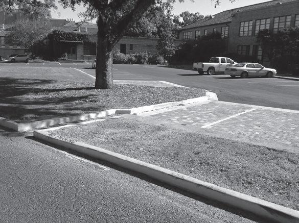
Figure 12.9-B was taken of an expanse of pavement within a larger central campus quadrangle. The area outlined with a dashed line is in effect a small watershed where any water that falls within the dashed area flows toward a central point where a catch basin has been constructed. The purpose of the catch basin is to carry the water underground in pipes to a nearby storm water system (part of a city’s storm water infrastructure).
Once the designer has created a paved area, consideration will be given to subdividing the area into smaller quadrants or watersheds to handle surface drainage. By doing this, the designer creates the feeling of a level, rather than sloping, paved area. The number and area dimensions of quadrants can vary. See Figure 12.10-A.
Advertisement
The arrows in Figure 12.10-B indicate the desired surface flow of storm water. The arrows within the dashed area show that water is intended to flow toward a catch basin located in the center of the quadrant. The designer would establish an elevation for the perimeter that would most likely be the same throughout the entire perimeter.
Figure 12.10-a Step One
Perimeter Elevation A
Figure 12.10-B Step Two