Galax Creekside Small Area Plan

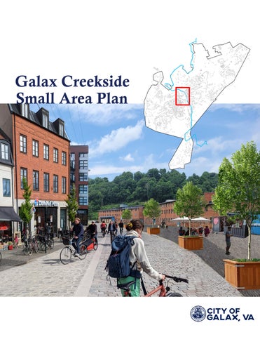
The redevelopment of the Vaughan Furniture Building into a mixed-use and residential development presents significant opportunity for the City to build on that momentum and invest in the Creekside area to create a vibrant, mixed-use neighborhood.
This plan defines the study area, describes the current conditions, then defines a vision for the area and uses functional use diagrams, a conceptual site plan, and illustrative renderings to describe the potential development. The plan also makes detailed zoning recommendations to achieve the desired development, and describes development techniques and potential funding sources.
When adopted by the City Council, this plan will be an amendment to the City’s Comprehensive Plan. Standing alone or as part of the Comprehensive Plan, this document can be used to:
• Convey the City’s vision for the area to residents and property owners
• Invite property owners and developers to help make the vision a reality
• Guide public investment to support the envisioned development
• Apply for funding and grants to implement the plan

When adopted, this plan will become an amendment to Galax’s adopted Comprehensive Plan and will supersede any recommendations therein for the planning area. The Regional Rural Long Range Transportation Plan, created in coordination between the Virginia Department of Transportation and the Mount Rogers Planning District Commission denotes safety deficiencies on Route 58 / E. Stuart Drive within the planning area. The Mount Rodgers Planning District Commission published a Housing Study in November 2022, indicating a need for more housing stock within the area.

This plan can be distilled into five key elements, or Big Ideas. Each Big Idea will have multiple steps, but when imagining the plan’s purpose, it’s helpful to have shorthand.
1 2 3 4
This document describes the City’s vision for the area, of a vibrant, mixed-use neighborhood, and can be used to engage residents, garner support, find funding, and guide development.
Rather than acquiring property or acting as developers, the City should create an environment in the Creekside area that is conducive to developing the envisioned area. The City should invest in the necessary infrastructure to support residential, commercial, and industrial development at a high density. The Vaughan Building redevelopment should be the first rezoned property in the area.
The city should phase the further zoning and infrastructure improvements mentioned in this plan in timing with the Vaughan Building’s completed redevelopment. This staggered approach can help create an anchor for the area and attract further investment.
As new development is attracted to the Creekside area, continue to follow the small area plan as a reference for decision-making. New development should ensure that its design and layout compliment the intended level of activity and feeling of the area.



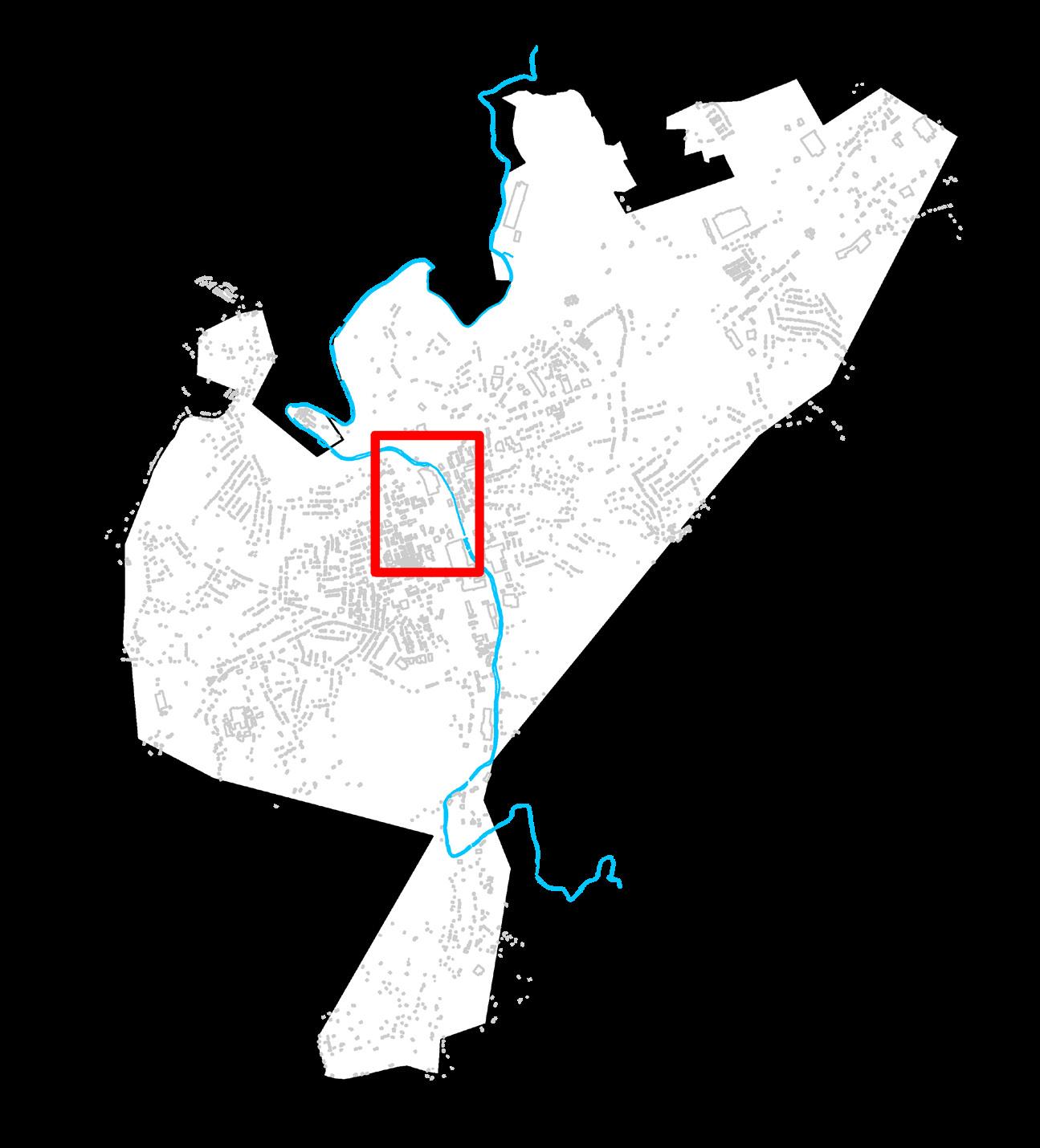
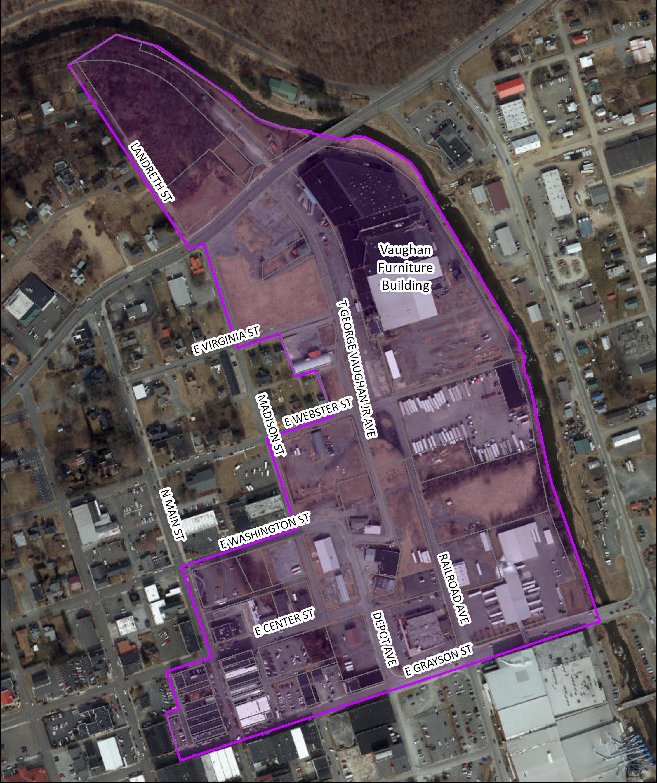
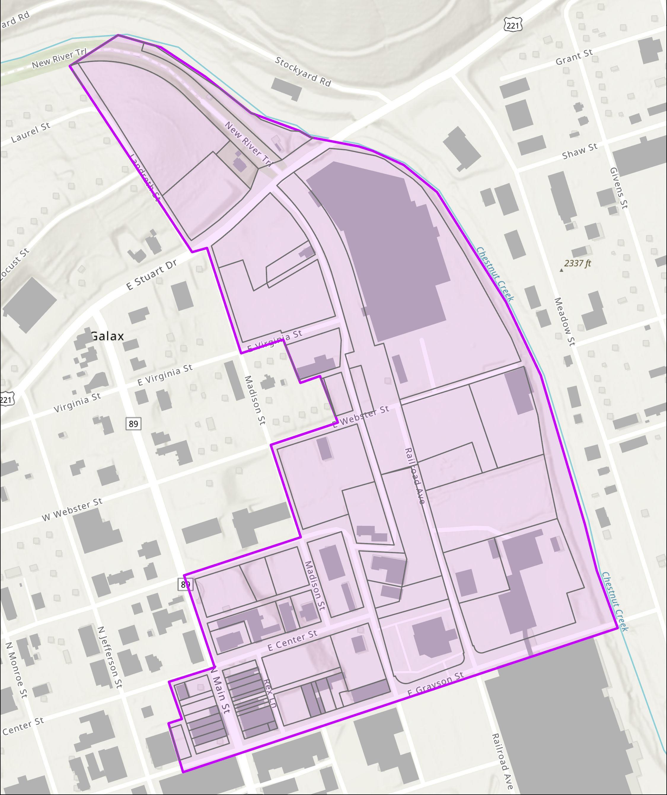
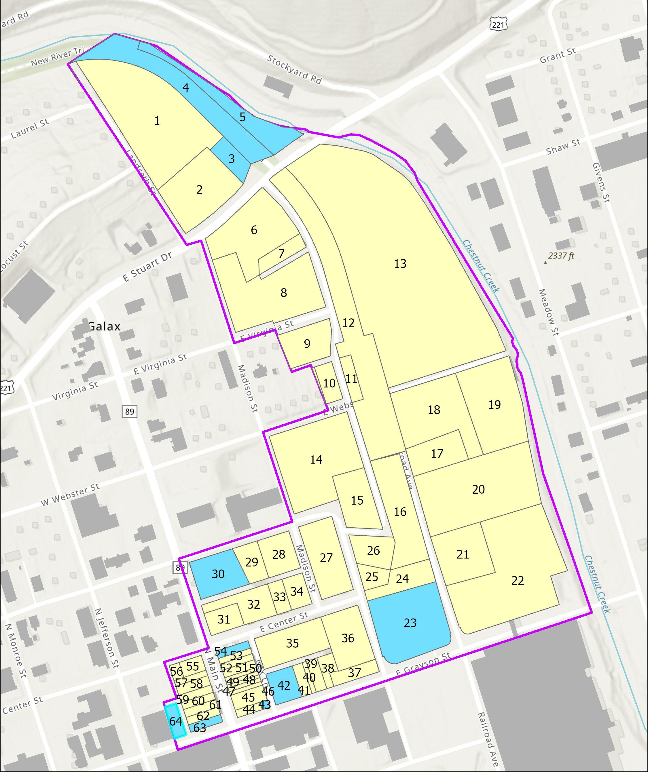
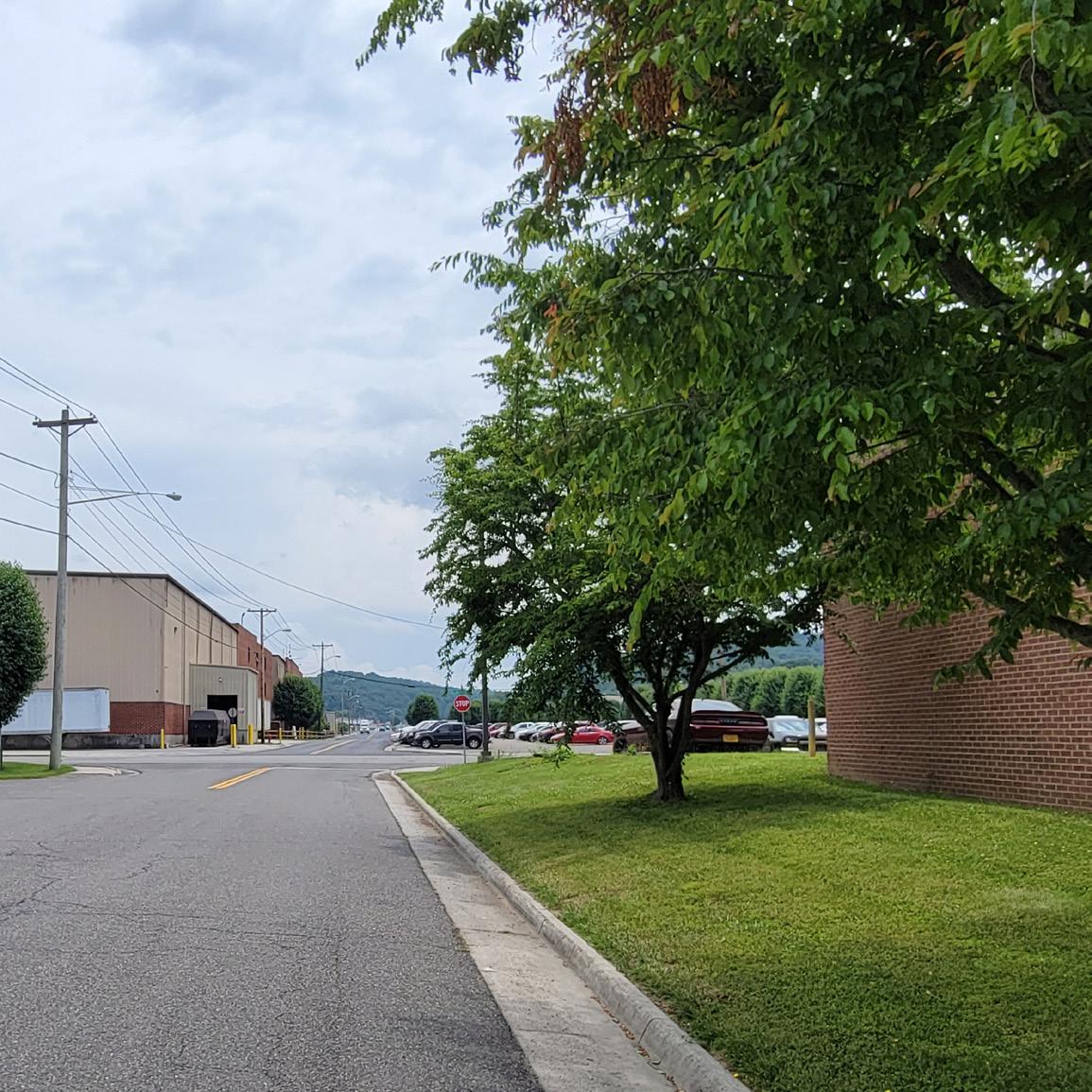
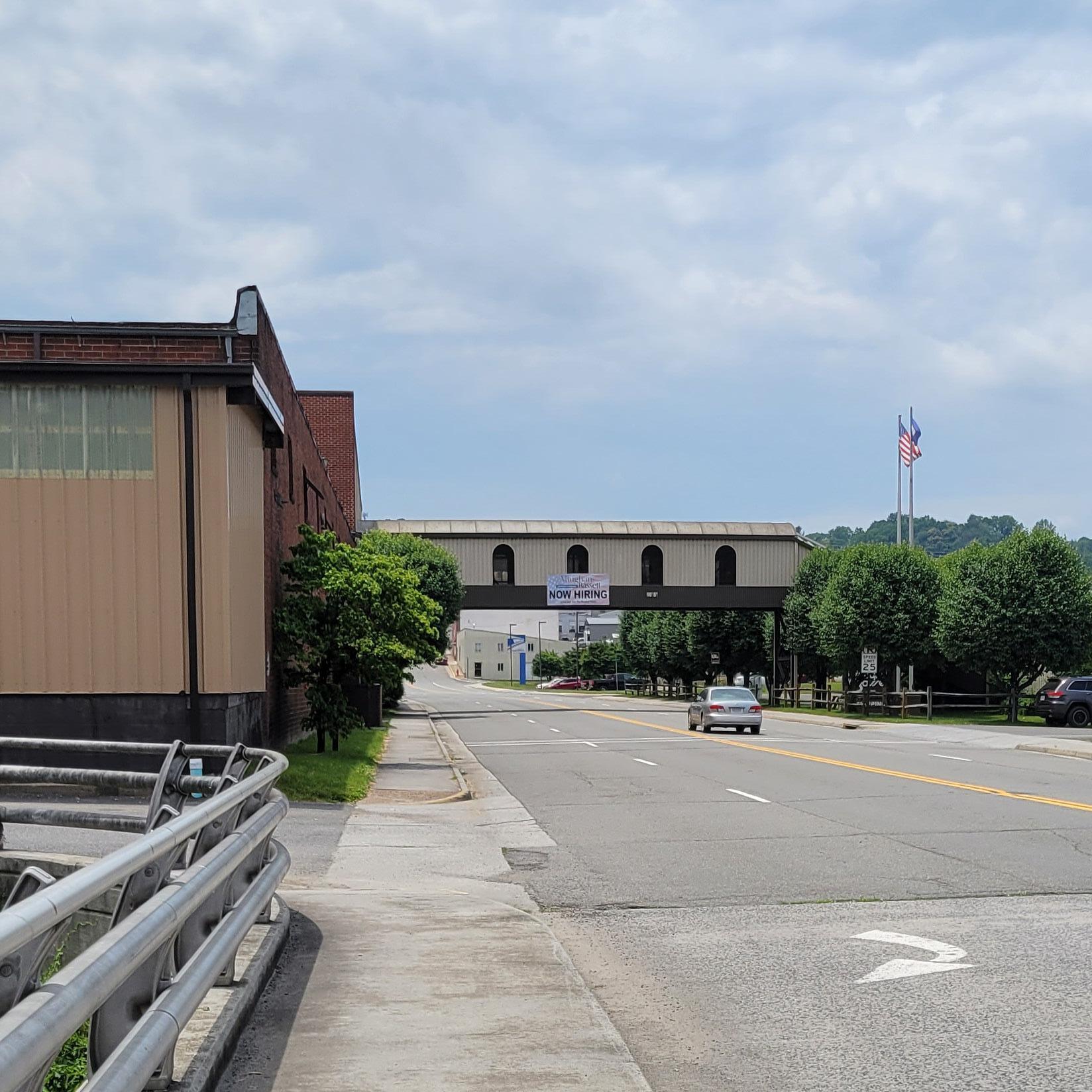
The study area is located in the center of Galax, north of downtown.
At its northern extent, the study area includes the New River Trail Head State Park, as well as all parcels bounded by Chestnut Creek to the east, Grayson Street to the south, and a combination of Main, Madison, and others to the west.
The study area was determined by the project team walking the area and noting building character, topography, and potential connections. (Please see the following page for study area boundary map.)
The maps on the following pages show base conditions including property lines and ownership, public utilities, zoning, environmental concerns, and potential connections.
Base conditions will be used to inform the plan’s recommendations by providing an accurate picture of the area as it exists now at the time of this study.
The Future Land Use map will provide the basis for amending the City’s Zoning Ordinance and Official Zoning Map. These zoning changes will be one of the most important tools the City can use to make sure the plan comes to fruition and future development fits the intent and character the plan envisions.
This document includes a Future Connections map which indicates where connections between the Creekside area, Downtown, and other parts of the City. The map and corresponding recommendations also take into account where major auto entrances to the neighborhood should be, and which areas should be limited to cars and made safer for bicycles and pedestrians.
This document shows land use recommendations for the Creekside Small Area Plan in three parts:
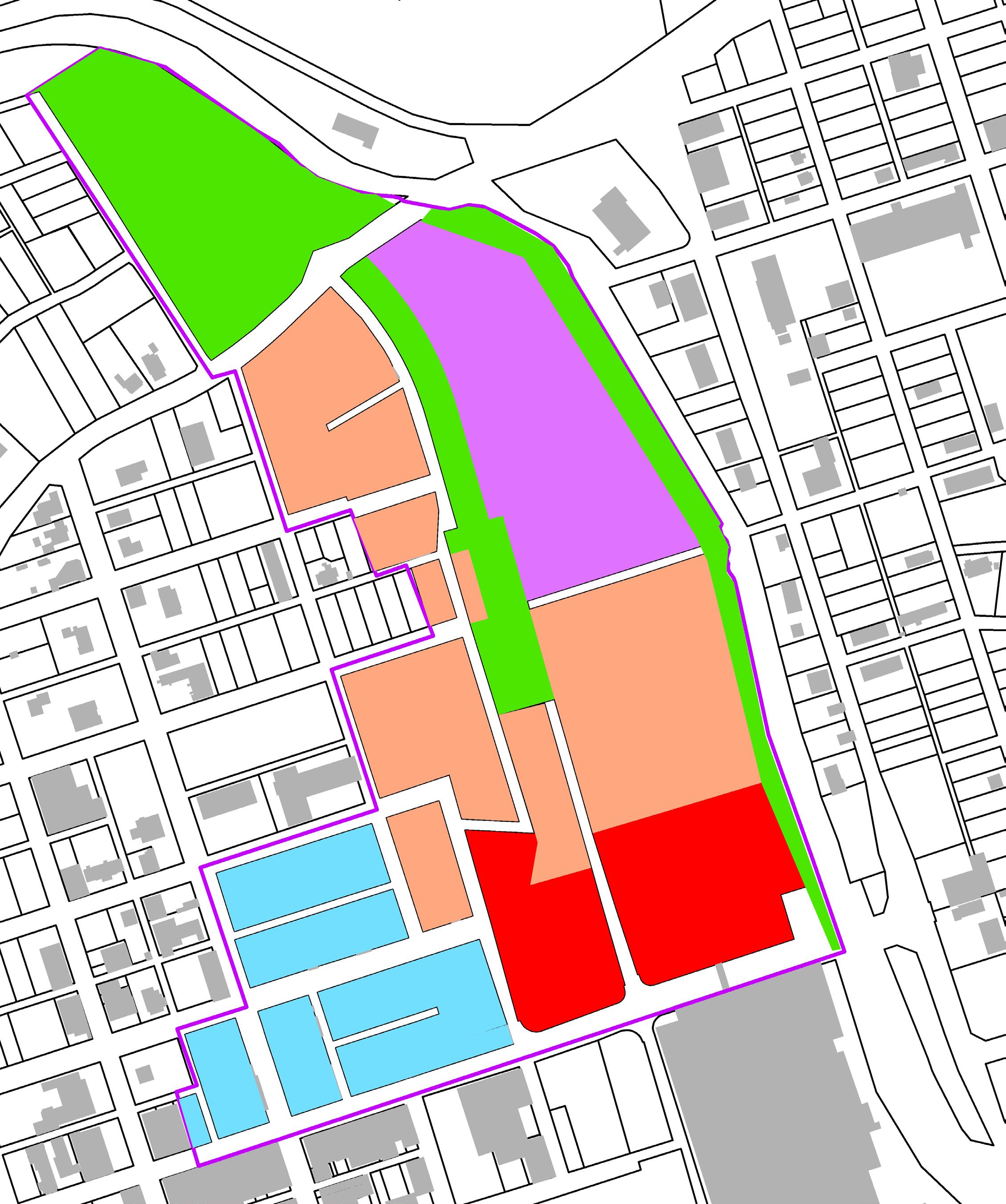
The Functional Use Diagrams show Future Land Use as generalized areas on a map and is also broken out by separate category with a category description on its own page.
When this plan is adopted, the Future Land Use for this area will supplant the Future Land Use in Galax’s adopted Comprehensive Plan.
This plan uses collaged images to show what the Creekside area might look like. The images are meant only to inspire and help the reader imagine what the area might look like; they are not literal recommendations on what should happen on a given piece of property.
Source: Summit Design & Engineering 2022
The General Business District “provides a framework for a strong nucleus of the commercial community, in which each business can enhance other business and where all the amenities of downtown can be provided.”
General commercial uses, such as restaurants, offices, retail stores, and banks are allowed by-right in the B-2 district. Public and semi-public uses are also permitted in the B-2 district. Public billiard halls, bowling alleys, dance halls, wholesale distribution, and storage warehouses are among the conditional uses for the district. Apartments are allowed with a conditional use permit, both on the second floor and on the first floor not fronting designated streets.
The B-2 district regulations require all structures to be a minimum of 10 feet from any street right-of-way. Structures are limited to 60 feet in height.
The Industrial Heavy District “is designed to provide areas suitable for this type of industrial development which can be compatible with adjacent commercial and residential areas.”
Permitted uses in the M-2 district include truck terminals, various manufacturing operations, sawmills and planing mills, meat processing, off-street parking, and public utilities. Less intense industrial uses allowed by-right in the Industrial Light (M-1) district are also permitted in the M-2 district. Sand and gravel operations, crushed stone operations, and communication toward are allowed in the M-2 district with a conditional use permit.
The M-2 district regulations require that parcels be at least 10,000 square feet in area with enough space to allow for the turning, loading/unloading, and parking of commercial trucks. Structures in the M-2 district must be set back 20 feet from any street right-of-way and 20 feet from any property line fronting a residential zone.
Source: City of Galax
There is one type of wetland within the Small Area Plan boundary: a small strip of riverine wetlands that is Chestnut Creek and its banks.
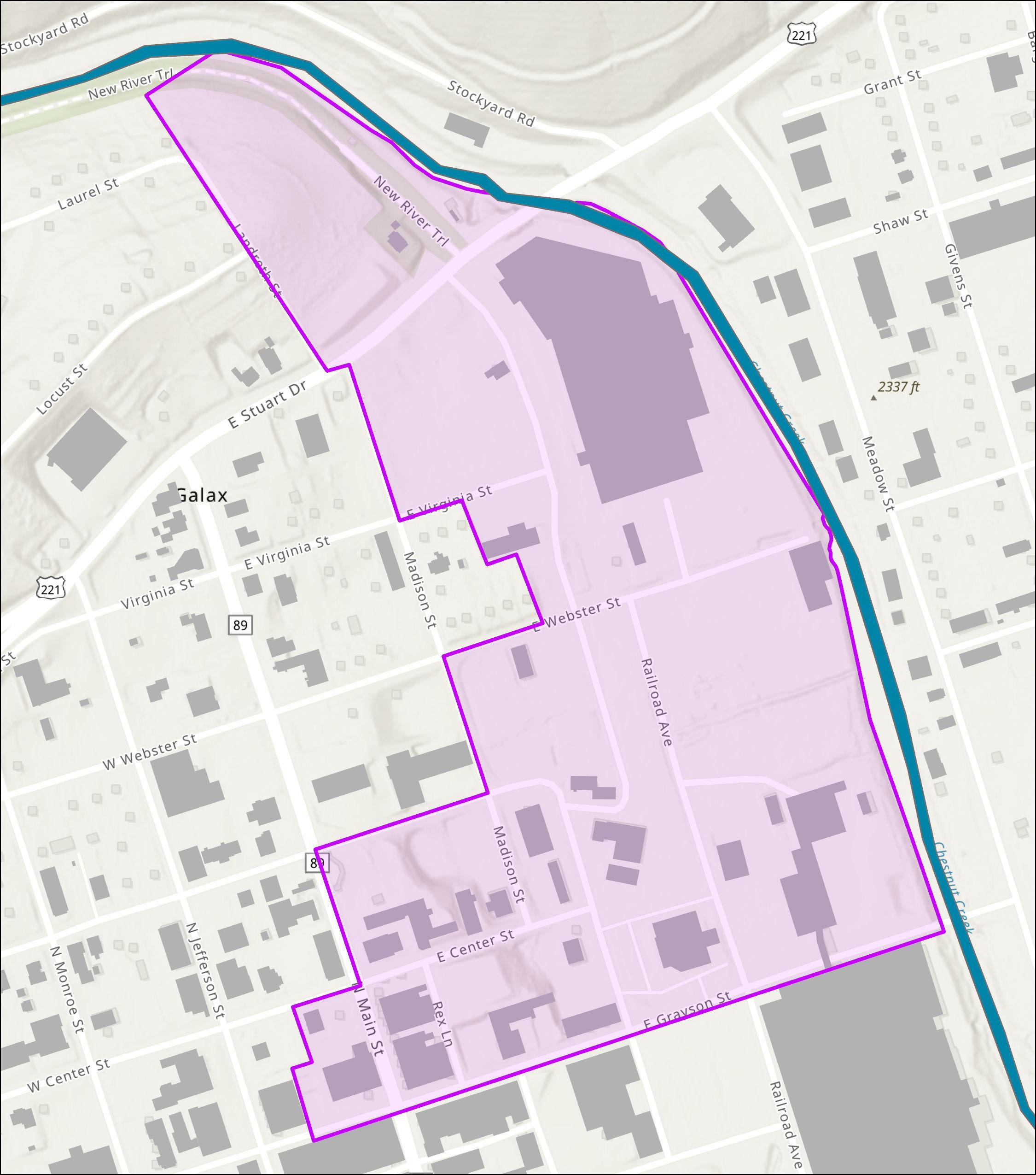
Source: ESRI, National Wetlands Inventory
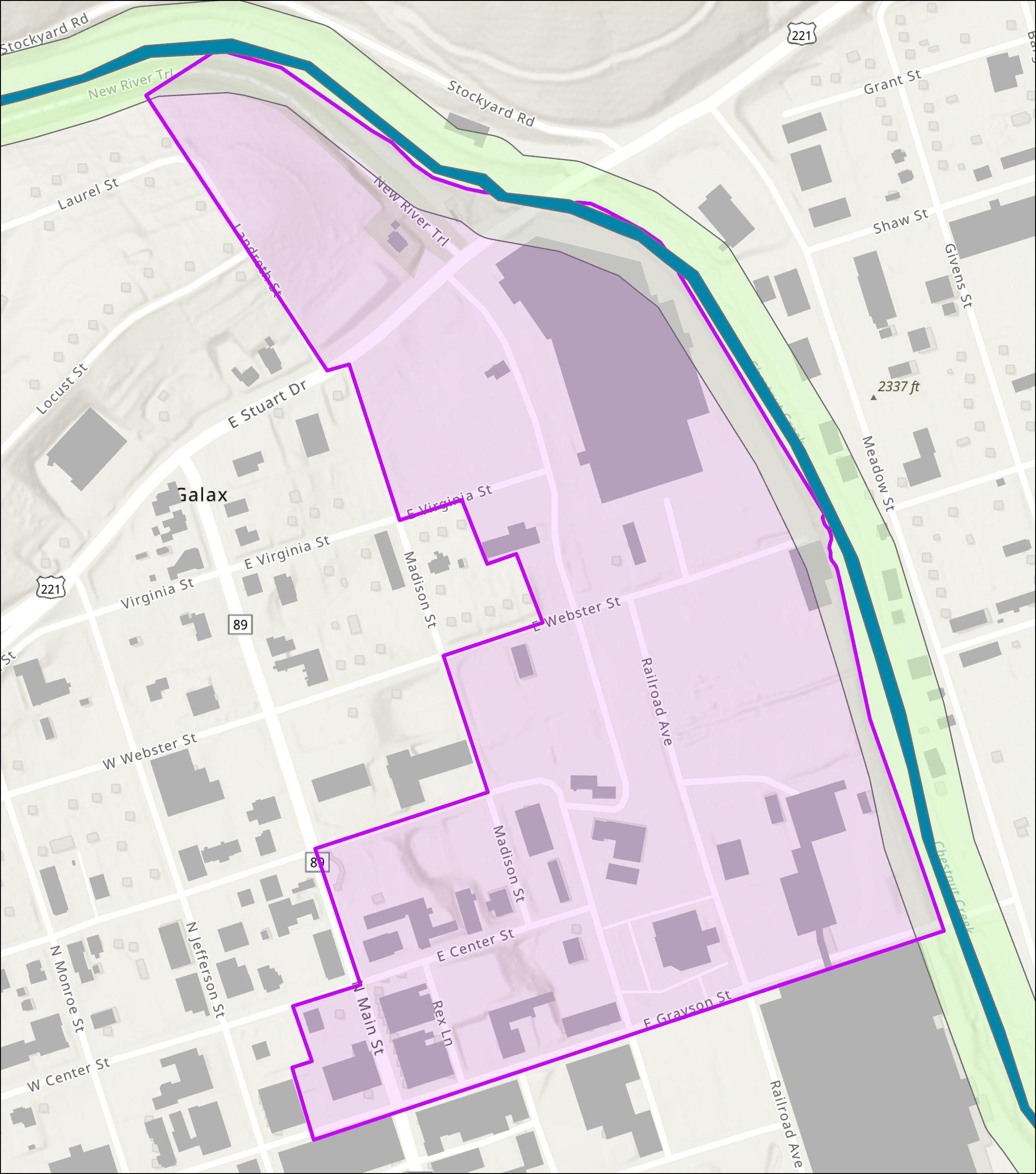
The map below shows the riverine wetlands buffered by the 100’ in which it is prohibited to build by the Code of Virginia and regulated by the Virginia Department of Environmental quality. This map is for planning purposes only; wetlands should be assessed before any construction begins.
Source: ESRI, National Wetlands Inventory
The map below shows the floodplain, according to the Federal Department of Emergency Management’s Flood Insurance Rate Map (FIRM). The floodplain is comprised of the floodway (below, hatched) and the floodway fringe (below, orange and blue). Much of the study area is affected by potential flooding and regulations.
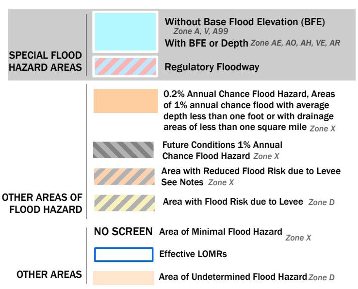
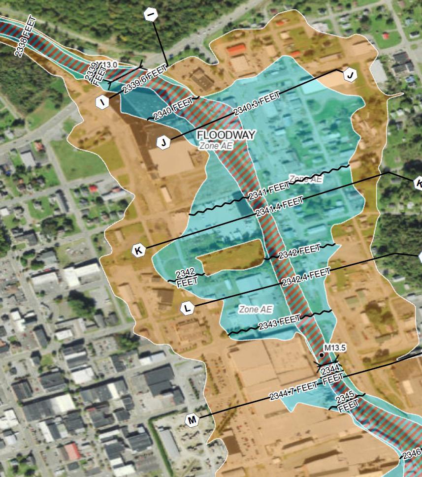
Source: FEMA’s National Flood Hazard Layer (NFHL) Viewer
Galax maintains its own stormwater infrastructure, as shown below on this map. There is flooding in the area. The stormwater system is decades old in many cases and would need significant upgrades to minimize flooding.
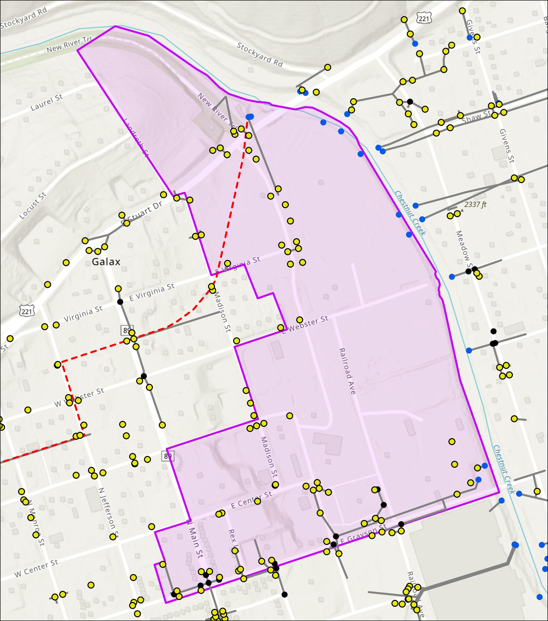
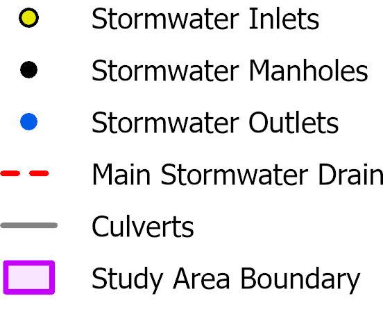
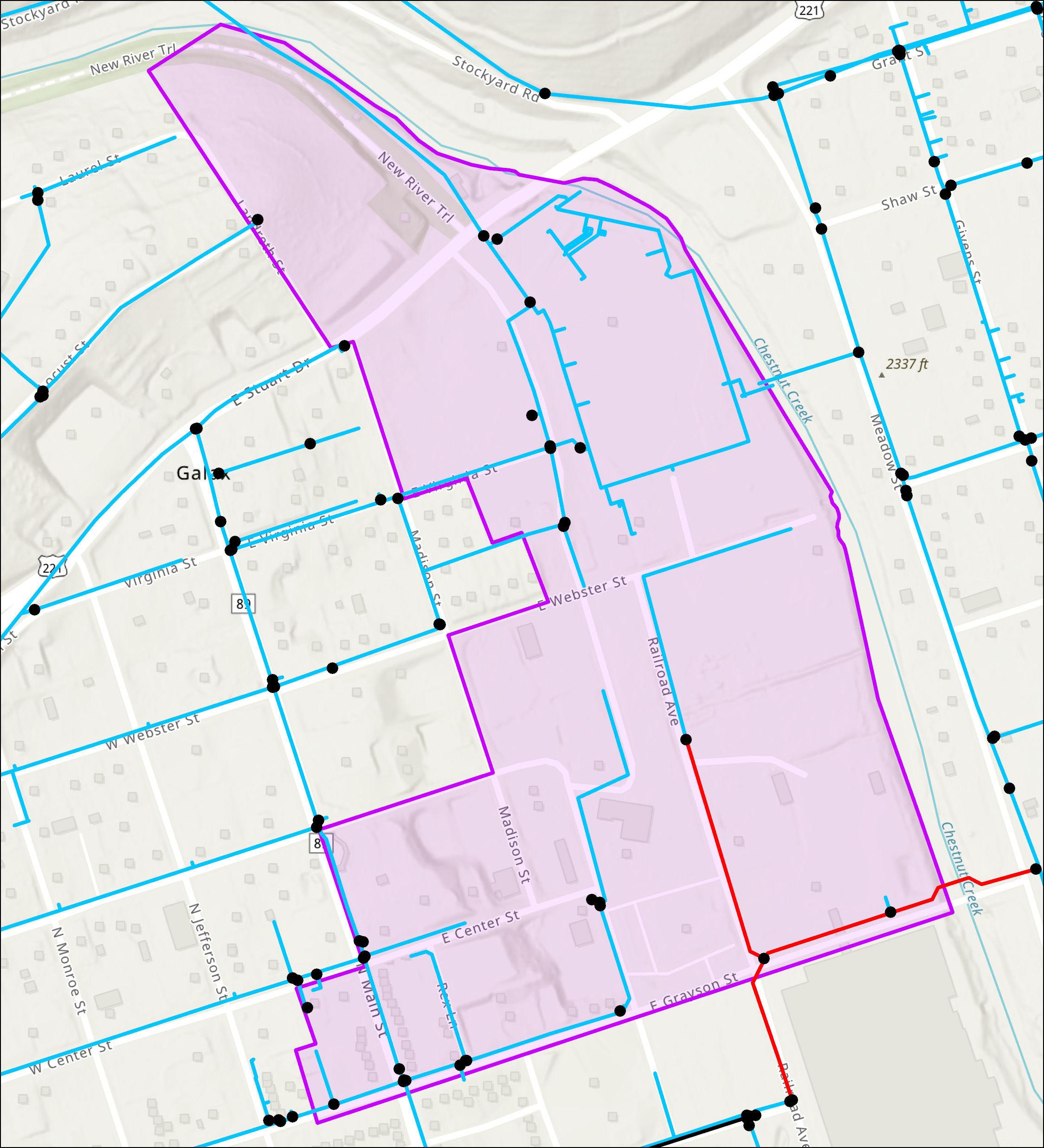
Galax maintains its own municipal water infrastructure, as shown below. The source of Galax’s drinking water is Chestnut Creek and its tributaries. The smaller tributary streams are outflows of springs located in southern Carroll and Grayson Counties.
There is lead pipe and leaded joints in this area that would need significant upgrading for a residential development.
Source: City of Galax
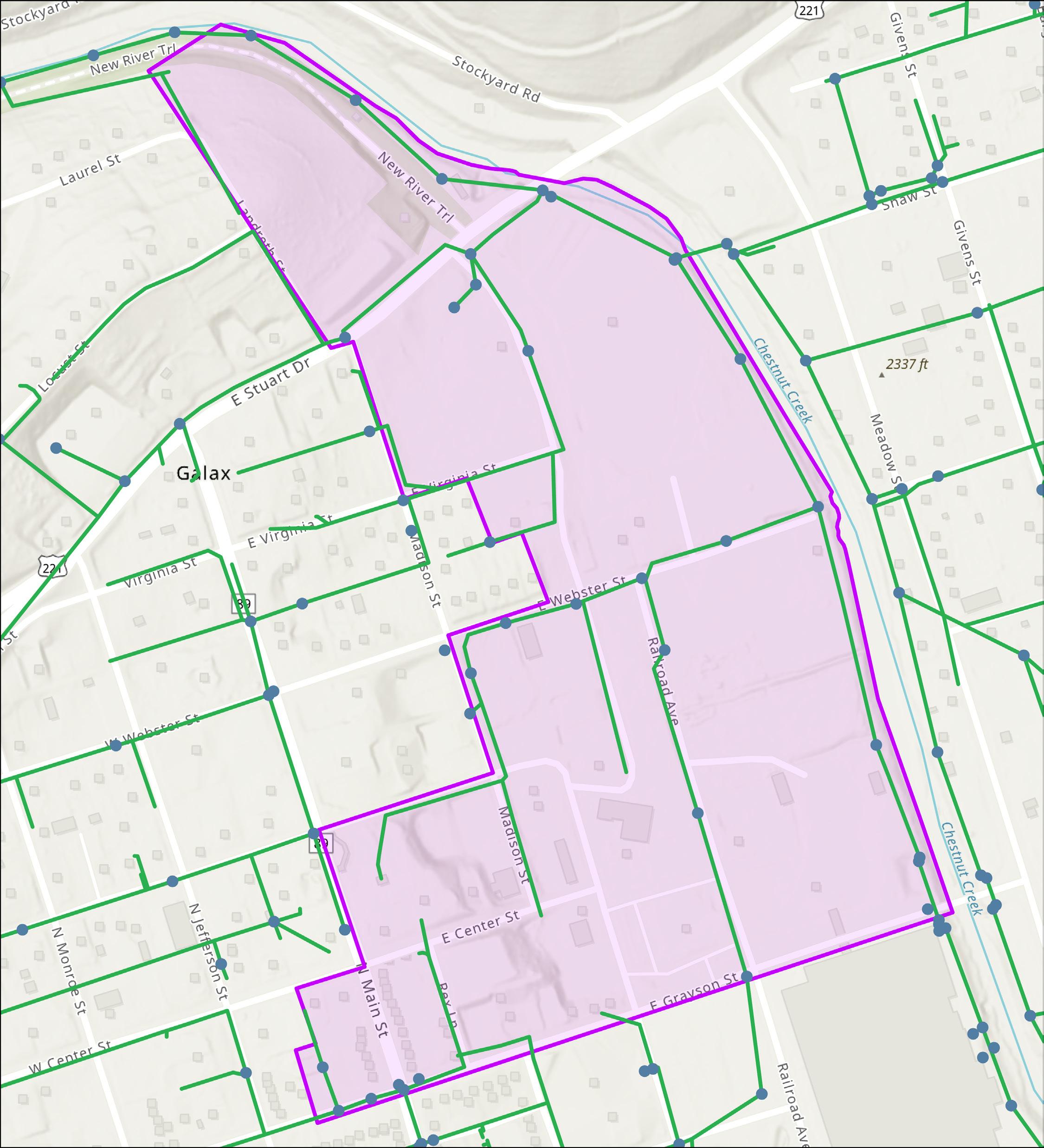
Galax maintains its own municipal sewer/wastewater infrastructure, as shown below on this map.

The Virginia Department of Transportation (VDOT) tracks Average Annual Daily Traffic (AADT) on several roads in the study area, as shown below. Route 58/East Stuart Drive has the highest traffic, with an average of 12,000 vehicles passing per day, making it hazardous for pedestrians to cross the street.
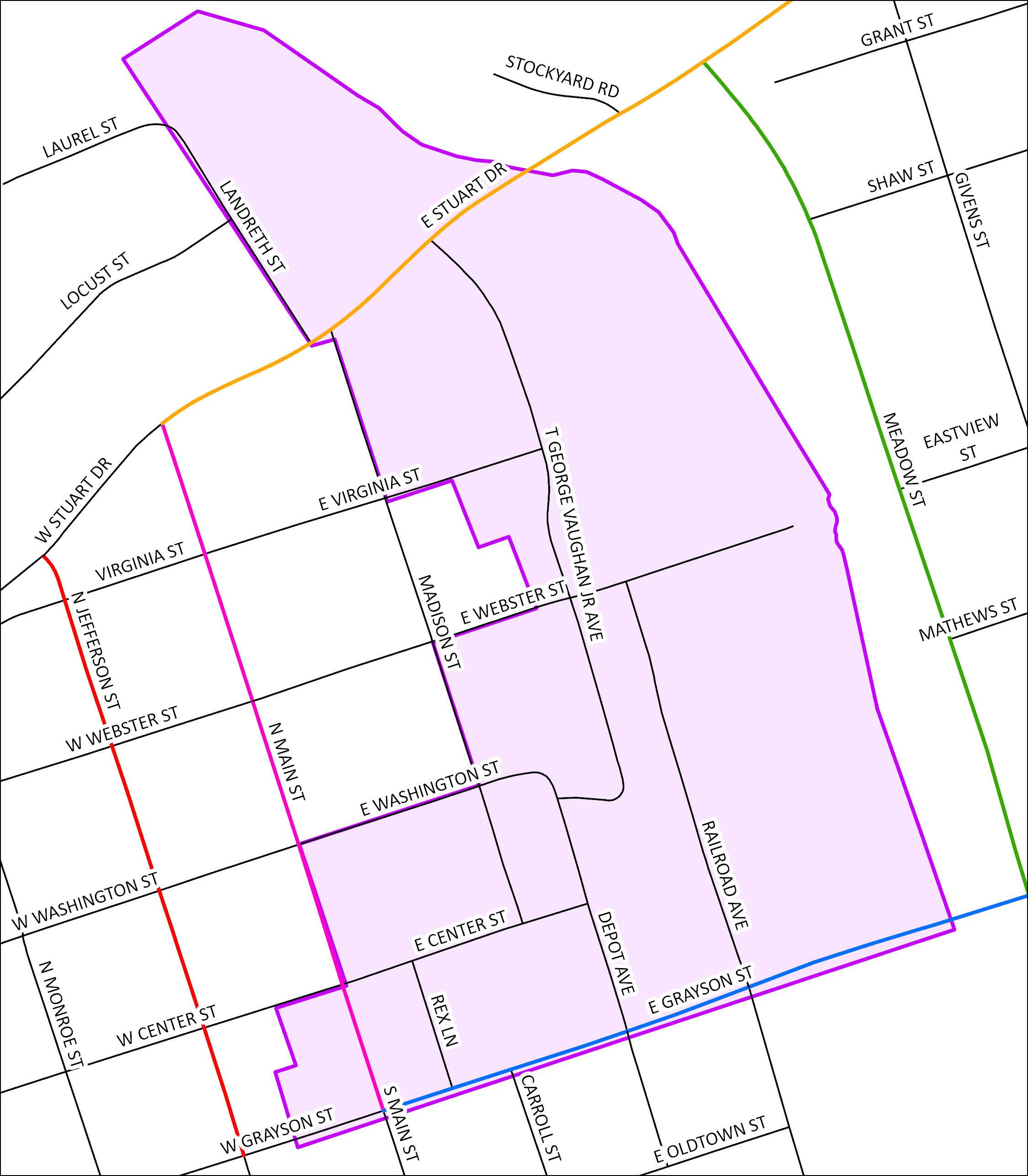
2,600 vehicles per day
870 vehicles per day
12,000 vehicles per day
Source: Virginia Dept of Transportation
7,000 vehicles per day
1,900 vehicles per day
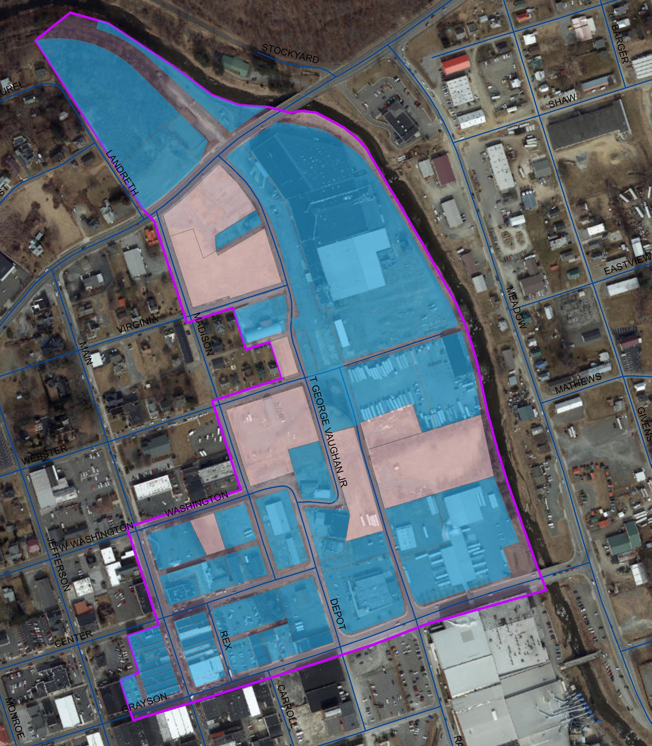
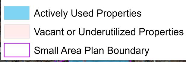
Many properties in the study area are vacant or underutilized and represent good opportunities for redevelopment.
The Virginia Department of Environmental Quality (DEQ) maintains records of incidents and facilities that may pose risks to water quality, soil quality, and/or air quality. The Creekside area was formerly home to several industrial facilities utilizing hazardous materials. In preparation for potential redevelopment of the former T. G. Vaughan Furniture Plant, a consultant completed a two-phase Environmental Site Assessment (ESA) Report. In completing the report, the consultant sampled subsurface vapors, bored and sampled soil, installed monitoring wells, and sampled groundwater. The Phase II Report was released on August 31, 2020.
While the environmental concerns on the site are relatively minimal for a facility of its age and nature, several potential hazards on the site or in the general area were been identified, including underground storage tanks (USTs), volatile organic compounds (VOCs), and chlorinated volatile organic compounds (CVOCs). These recognized environmental conditions (RECs) include:
• 2,000-gallon diesel UST at the Buford Crockett site, formerly belonging to McKnight Oil Company lacks of closure documentation for the tank.
• Permanently out-of-use 12,000-gallon heating oil UST appears to remain at the former Wonderknit Score Board facility.
• Extensive long-term use of VOCs at the T. G. Vaughan Furniture Plant
• Potential for vapor encroachment conditions (VECs), toxic chemical vapors released from contaminated soil and/or groundwater, due to the history of petroleum USTs, the longterm use of VOCs at the property, and the detection of CVOCs in groundwater.
Subsurface impacts to soil and groundwater were detected during the ESA; however, they appeared to be limited in extent. Given the limited scope of contaminant detections and the City of Galax water supply (no groundwater use), the consultant did not call for additional characterization or remediation at the former T. G. Vaughan Furniture Plant site.
VOCs in the soil vapor and in the groundwater were detected at relatively shallow depths across the site, and groundwater was detected between 8’ and 13’ below the ground surface. These factors should be considered when planning any excavation or development construction at the site.
Overall, the ESA Report highlights that redevelopment of the former T. G. Vaughan Furniture Plant site is feasible using best construction practices with general monitoring of known environmental conditions. The City should pursue Department of Environmental Quality or other grant awards that will fund the investigation of other former industrial sites in the area to document any potential contaminated brownfield sites.
In 2025, the Creekside Galax area is known as one of the most exciting places to be in Virginia.
The neighborhood is vibrant, and filled with restaurant options, night life, various housing options, and myriad things to do.
Imagine a neighborhood where people don’t just live and commute to jobs elsewhere, the live and work in professions ranging from artists to welders to small-scale furniture makers. People come from all over Virginia, North Carolina, and beyond because Creekside is a great place to start a new business and join a community at the same time.
Visitors come to the area to make a day or a weekend, and are drawn from the New River Trail, through Creekside, and into Downtown.
There are shady, landscaped routes, welcoming parks, benches for resting, and bike share options for those who didn’t bring their bike with them.
The Creekside area has the potential to bring new life and vibrancy to Galax, provided there is the right mix of uses. When the Vaughan Furniture Building is redeveloped into apartments, it will provide an anchor and potential customers for new businesses. Instead of providing housing just for people to commute elsewhere, the mission is to have a wide mix of opportunities to grow a business, to recreate, to shop, and to rediscover Galax and be part of this exciting new phase.
The Creekside area’s future development will be guided by the following Core Principles:
• Integrated mix of uses
• Diverse housing types
• Rental and ownership opportunities
• Inclusive of all ages
• Quality public spaces
• Bicycle and Pedestrian friendly
• Well-connected to downtown and trail
• Active recreation
• New/small business friendly
• Quality design
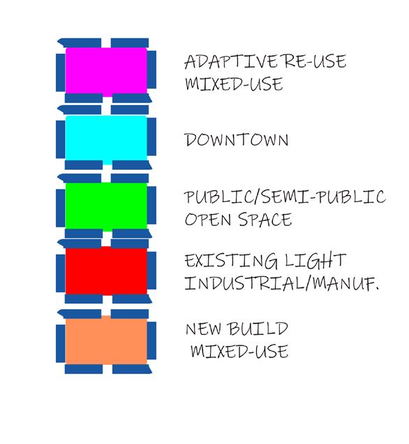
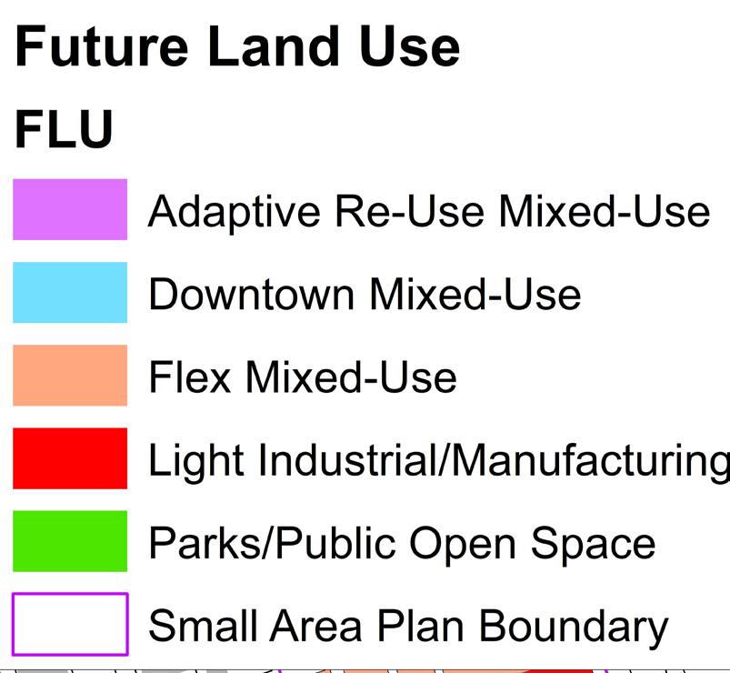
The following pages contain general ideas of what land uses and activities should go where, as displayed in simple shapes. After the map showing all uses, each subsequent page shows separate uses with area descriptions.
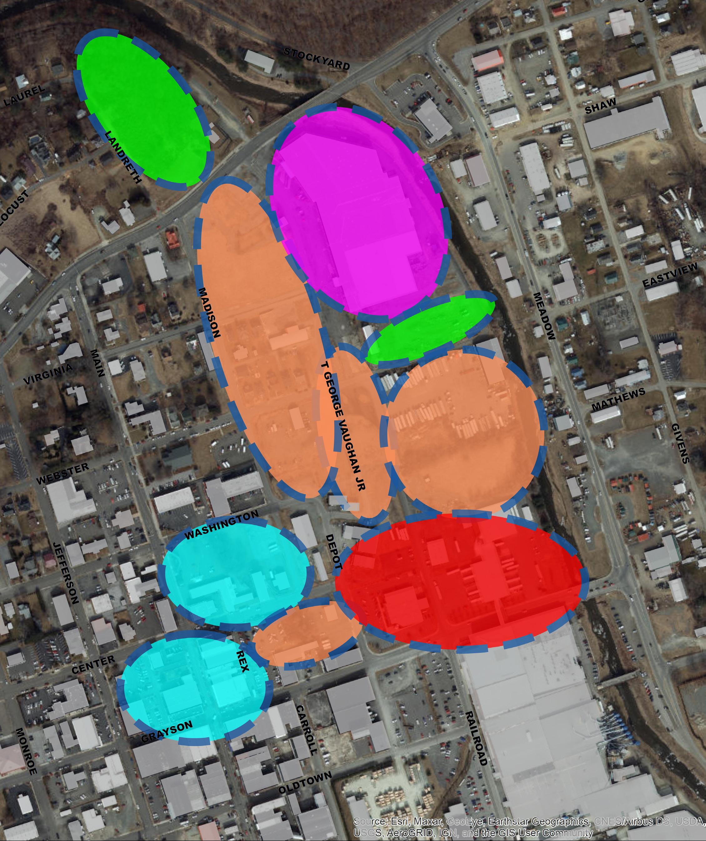
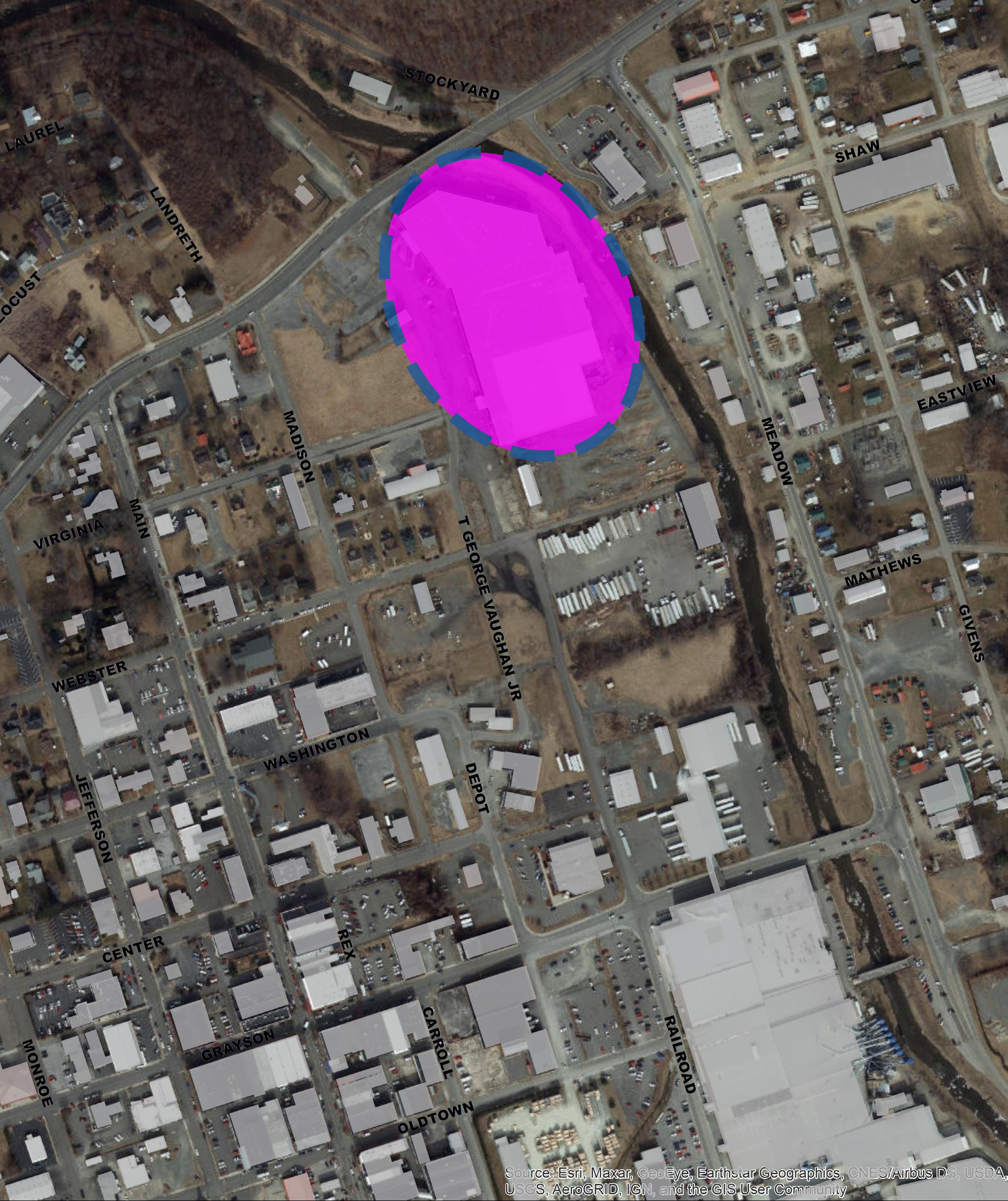
The redevelopment of the Vaughan Furniture building will be the center of activity for the Creekside area and the catalyst for other growth and economic activity.
The redevelopment will likely be predominantly residential, with some mixed-use component.
The new housing units will bring an influx of new residents to the Creekside area, enlivening the formerly vacant building and its environs.
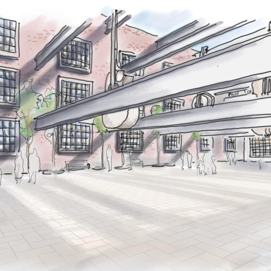
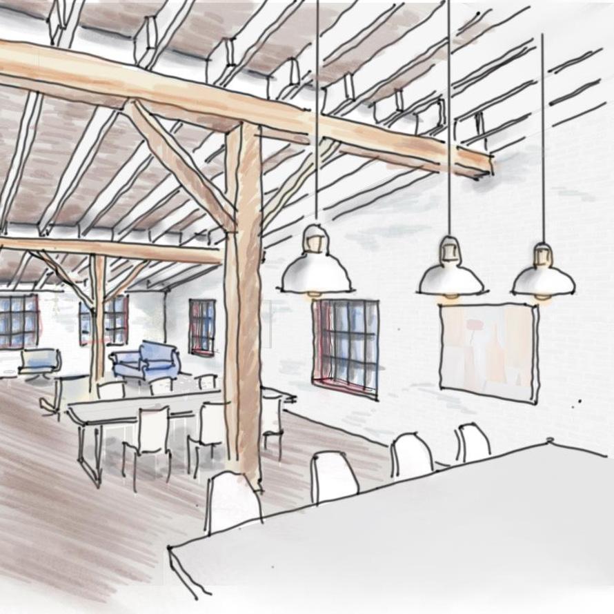
In addition to the Vaughan building, which is the only parcel in this Future Land Use category in the planning area, the City should encourage any other property owner of a historic manufacturing building in the vicinity who wishes to redevelop to consider adaptive reuse to build on the existing character of the area and Galax’s history.
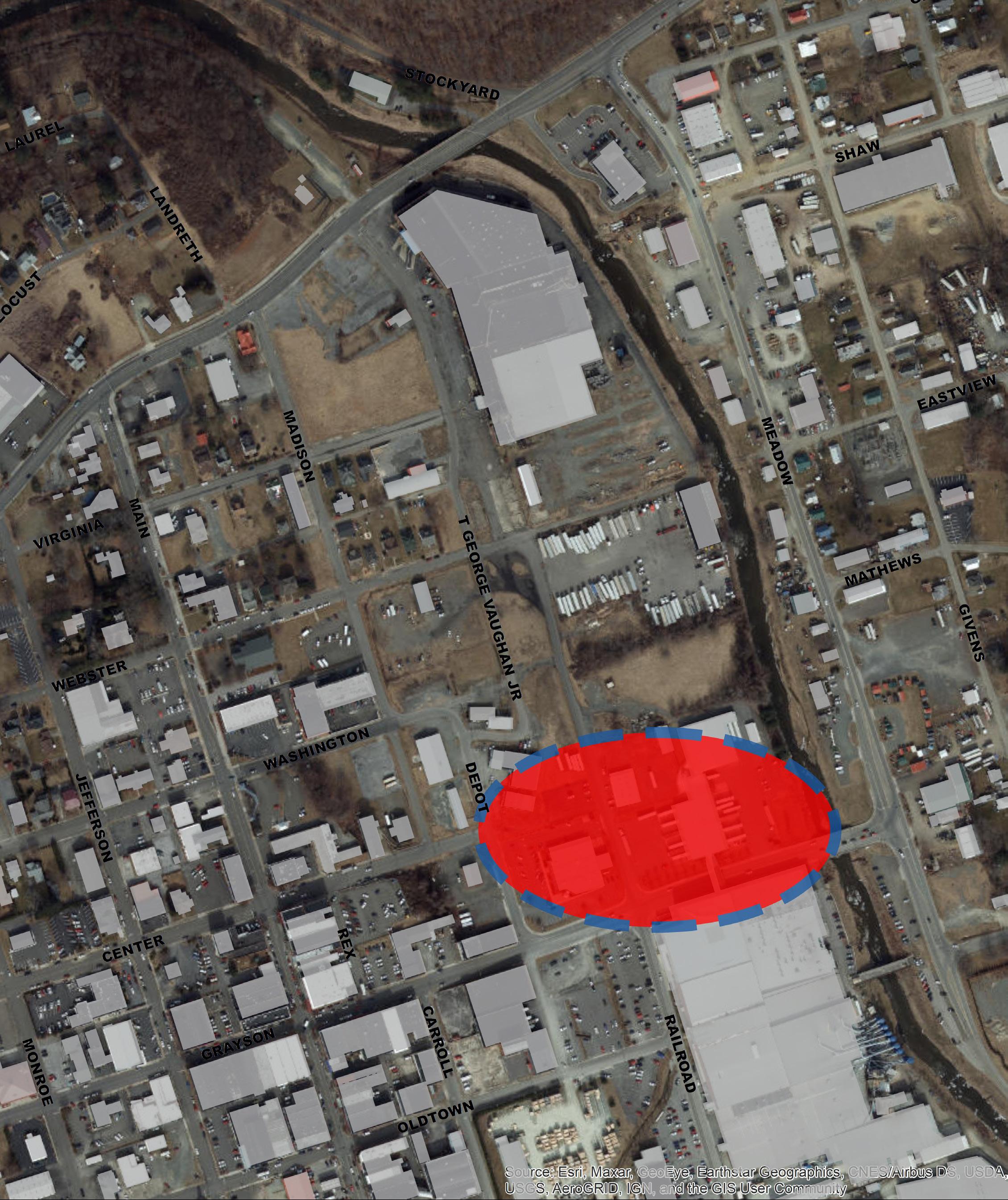
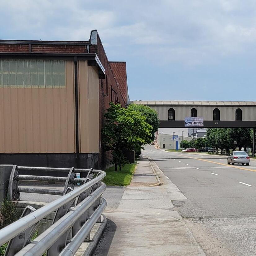
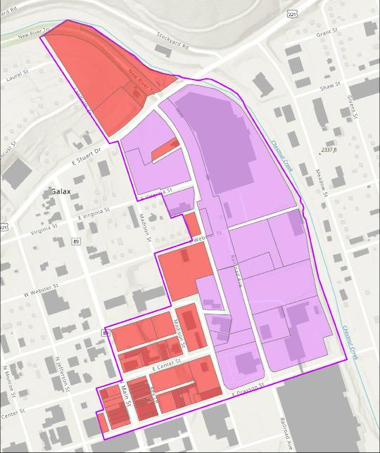
The red area on the map indicates thriving manufacturing/light industrial uses which are currently the anchors in the area and which should be able to integrate with the new land uses and activities as they develop.
As the area develops, it is essential that a symbiosis between the existing manufacturing uses and new residential and commercial uses is created.
This document, the vision it represents, and the community support it receives will be the first step in ensuring that new uses are compatible with existing uses. From the beginning, it’s important for all stakeholders to understand that this is intended to be a mixed-use district with a variety of uses. The City will further emphasize this with the creation and application of a new mixed-use zoning district.
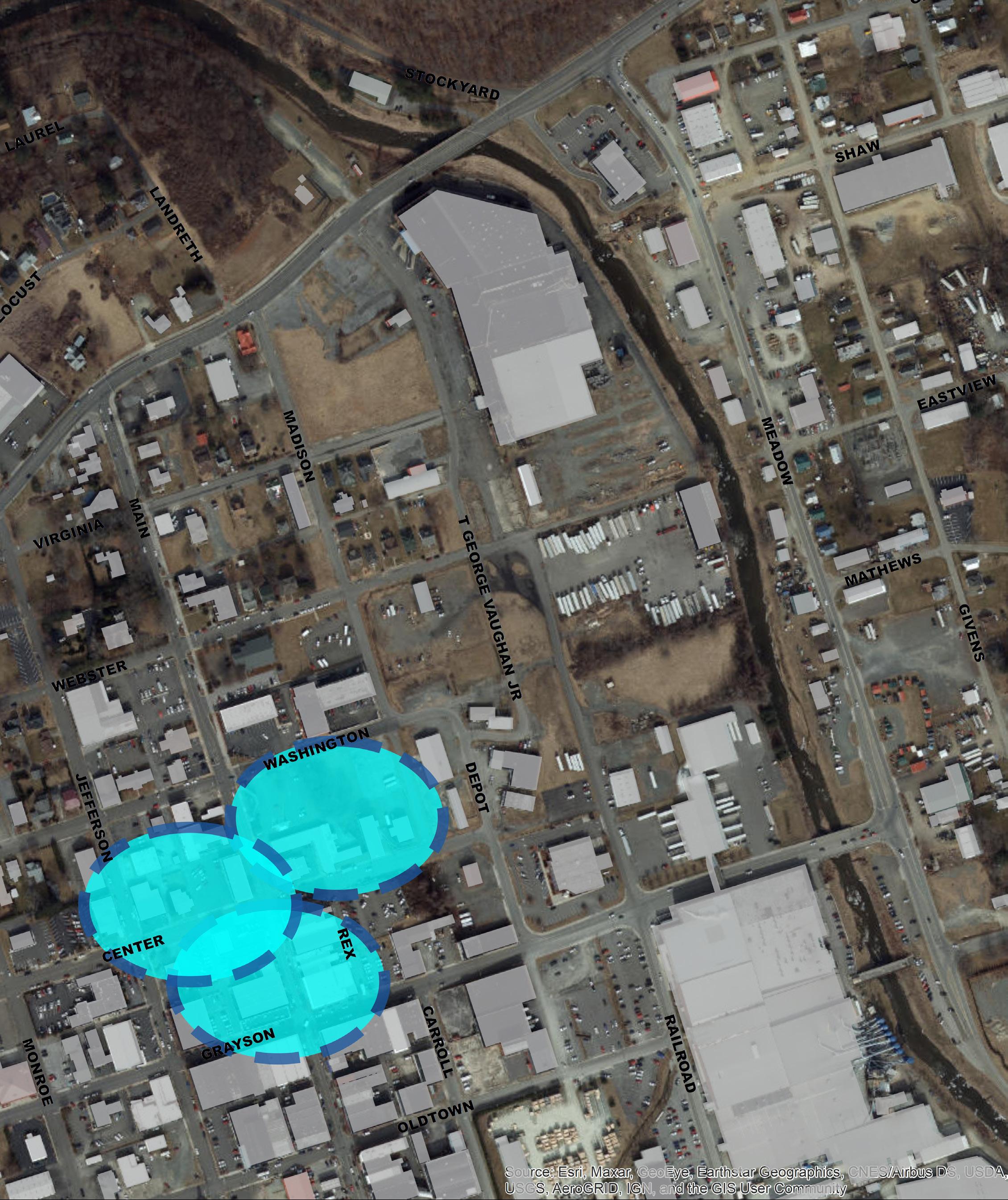
The blue shapes on the map indicates the area of Galax’s Downtown. Increased population, traffic, retail, and dining options in the Creekside area will also mean a boon for Downtown, bringing more visitors, customers, and diners to existing businesses, and creating the demand for more.
Imagine a Downtown where current businesses thrive, vacant storefronts are filled, and new restaurants, shops, and offices create a vibrant mix of opportunities.
The sidewalks are filled with outdoor cafe seating, with people on their lunch breaks and visitors alike. Trees provide shade, making Downtown pleasant, even on hot days.
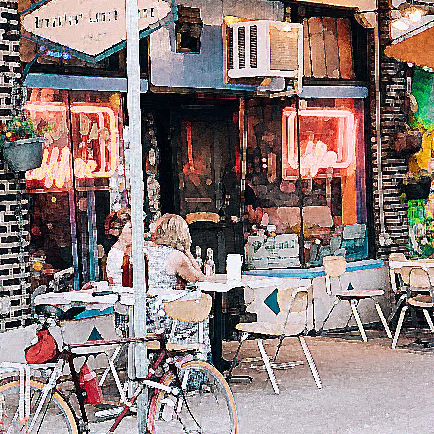
A bike share program provides bikes for anyone who wishes to ride on a hourly basis, making it easy to move from Downtown to Creekside and back. This plan recommends adding bike share stations both downtown and at the New River Trail entrance, allowing people to easily move between the two areas.

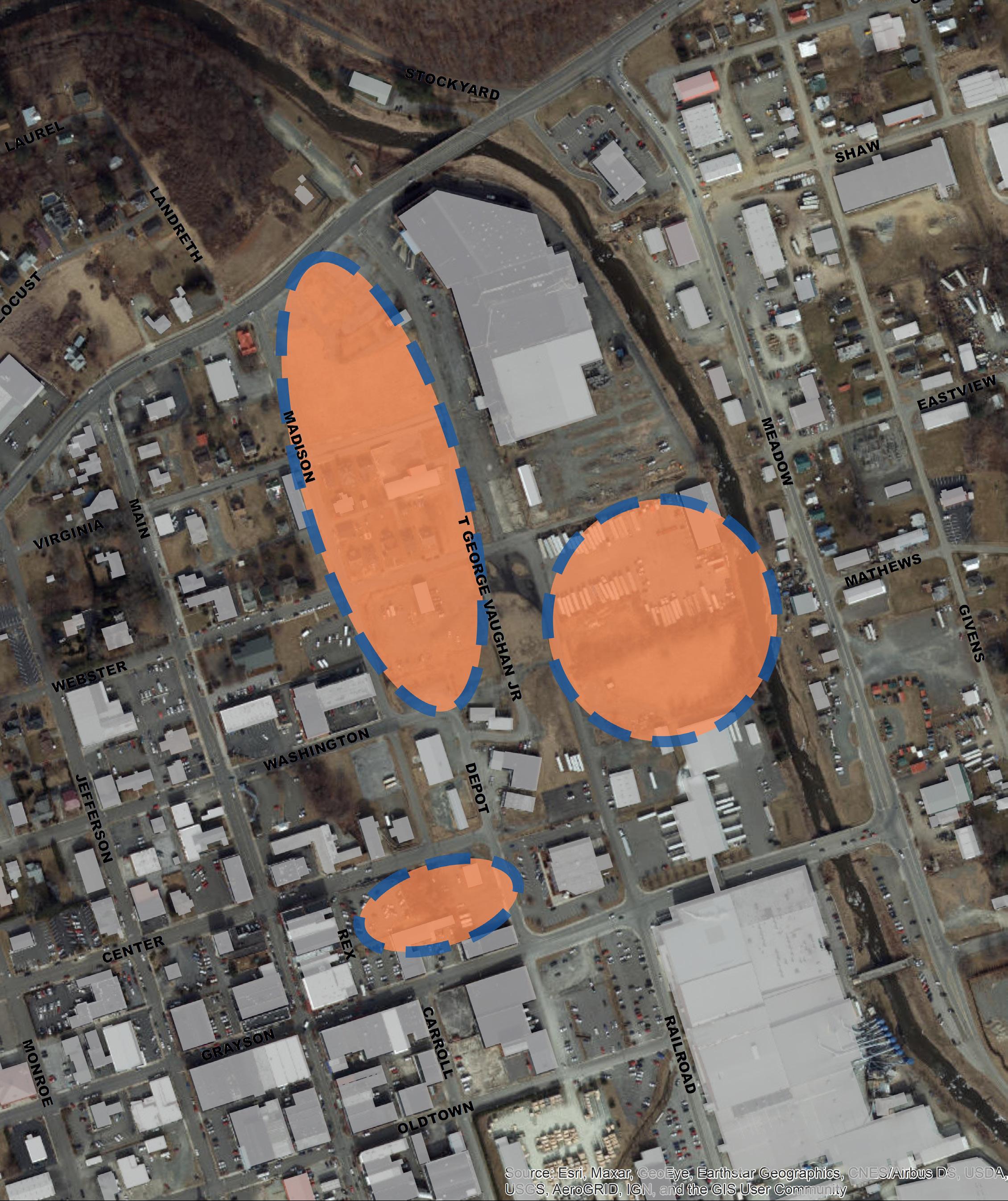
In the Creekside area, there are many parcels that are either currently vacant or currently underutilized. This presents a significant opportunity for new development.
The areas with this potential are labeled as New Mixed-Use.
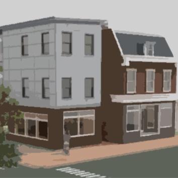
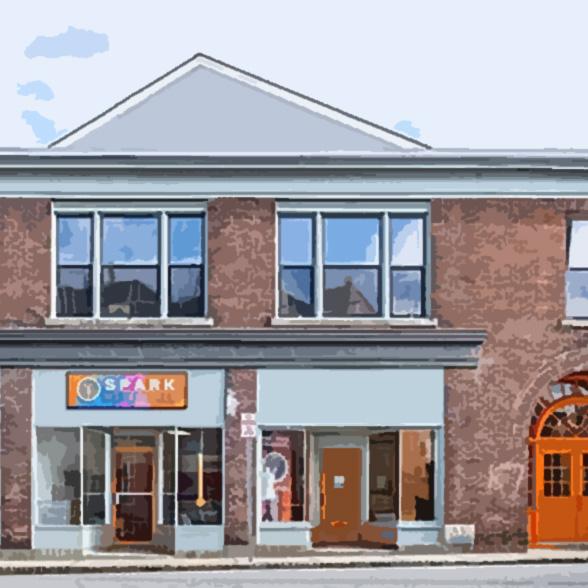
In general, there are two types of mixed-use: vertical and horizontal. Vertical means that there is a mix of uses in one building, most often with a commercial use on the first floor and residential units above. Horizontal mixed-use means that there is a mix of uses in one area, without there necessarily being more than one use in a building. Both are appropriate in the Creekside area and future zoning changes should reflect a desire to have both.
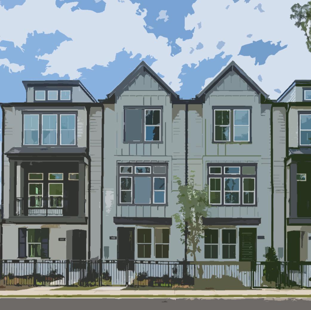
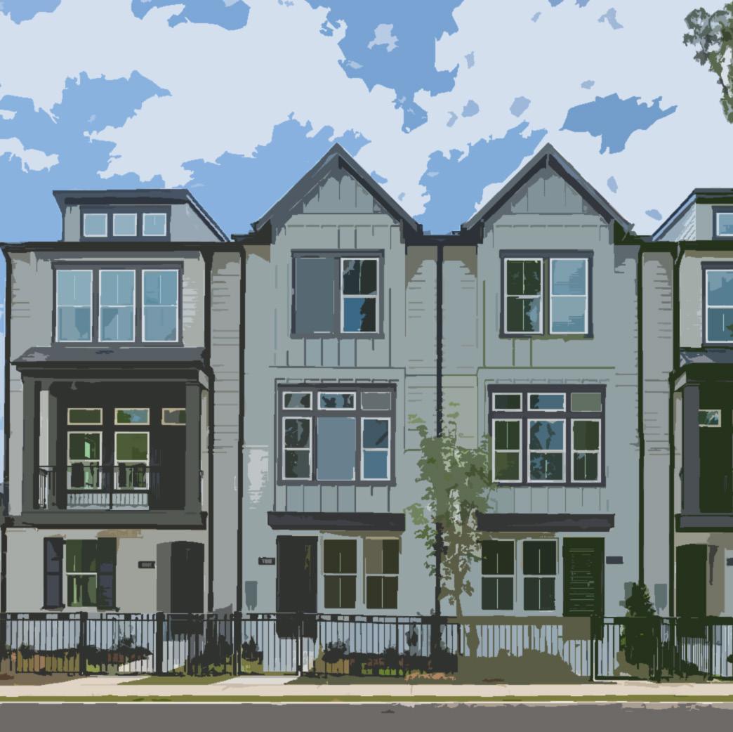
As the area develops, it is important that there is a variety of types of housing. Apartments and rental units offer one type of opportunity, but town homes and condominiums offer home ownership opportunities, providing continuity and a depth of community, as well as homes appealing to people in all phases of life. Changes to the Zoning Ordinance should make a variety of housing types possible.
In addition to housing, a real, livable mixed-use neighborhood should have plenty of things to do, places for visitors to stay and for residents to work, shop, and have fun! Hotels, convention centers, and recreational uses are also appropriate in this area.
This area has the potential to be a haven for new businesses and for opportunities that can’t be found elsewhere in Galax or in the state. Imagine a place where people will move just to have a place where they can open a business and live near their work, where many business owners share resources, residents have myriad opportunities for patronizing small businesses, eating at restaurants, sampling the products of breweries or distilleries, and being part of something original and energetic.
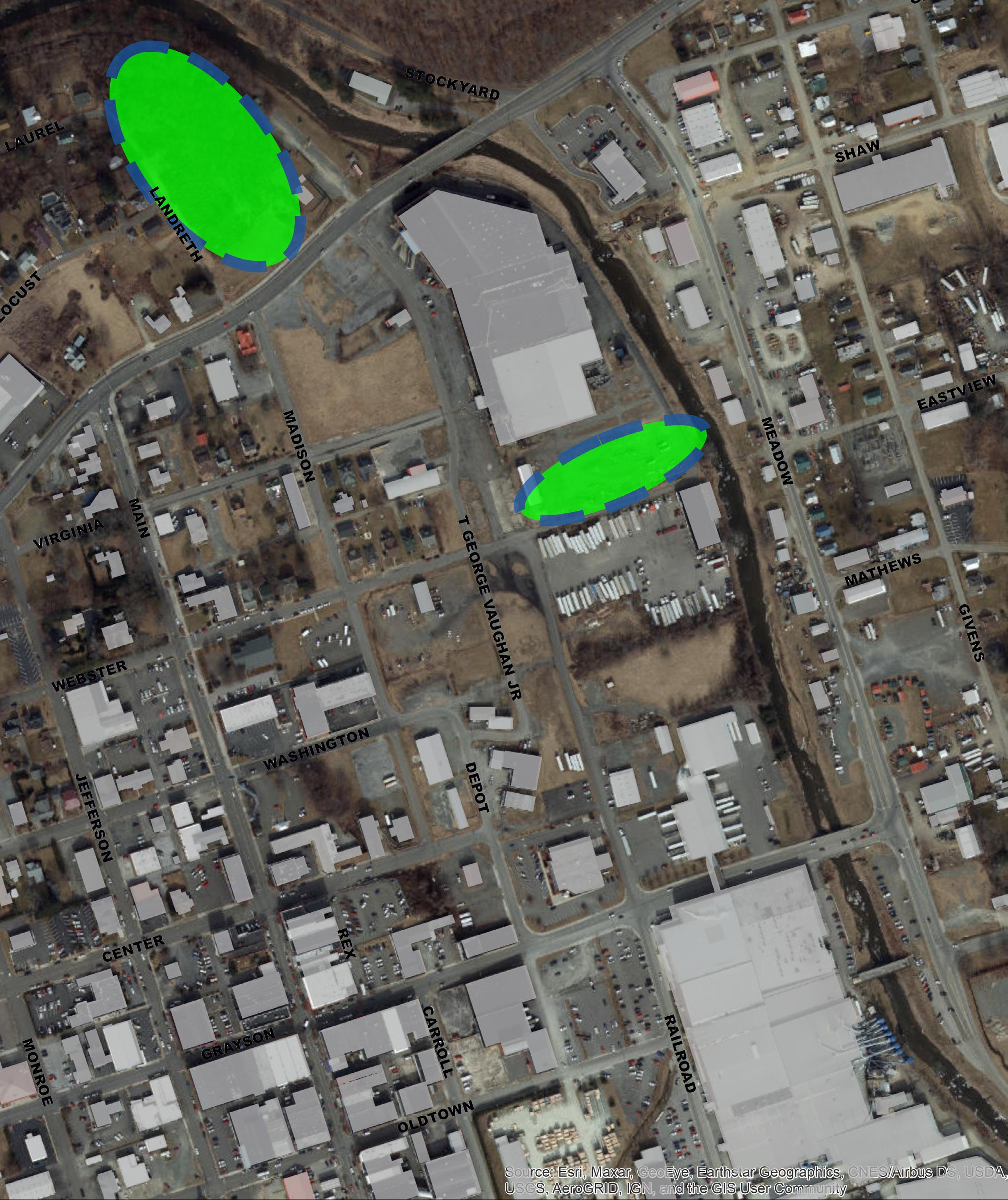
Green open space is critical to the success of any neighborhood and any City.
Green open space provides a place for public gathering, relaxation, and recreation. It is a draw for residents and visitors alike. It reduces impervious surface and cools an area, especially when filled with trees which provide shade, beauty, and habitat.
There are already plans to expand the New River Trailhead to the entire area shown in dark green north of Route 58, and there is potential for a new public or semi-public green open space on the Vaughan Furniture building parcel.
In the event that the developer of this building wishes to use the area indicated as parking or as green space for residents only, the City should consider acquiring some currently vacant land to create public open space. The City can also provide green space in the form of landscaped rights-of-way, park benches, and street trees.
Public restrooms should be located on public land and capacious enough to meet the needs of increased numbers of visitors.
Good public open space is inviting, with amenities like park benches or seating areas, interpretive signage, landscaping and shade trees, and varied opportunities for active or passive recreation. With well-designed public open space, the Creekside area will send a message to residents and visitors alike that they are welcome to stay and enjoy themselves.
A bike share station should be placed in one of these two areas to accommodate anyone who wishes to rent a bike to travel from the New River Trail trailhead to Creekside or Downtown, or vice versa. A bike share station at the trailhead would open up the trail to novice bikers who might not travel with bikes or own bikes, but would be curious to explore the trail by bicycle.
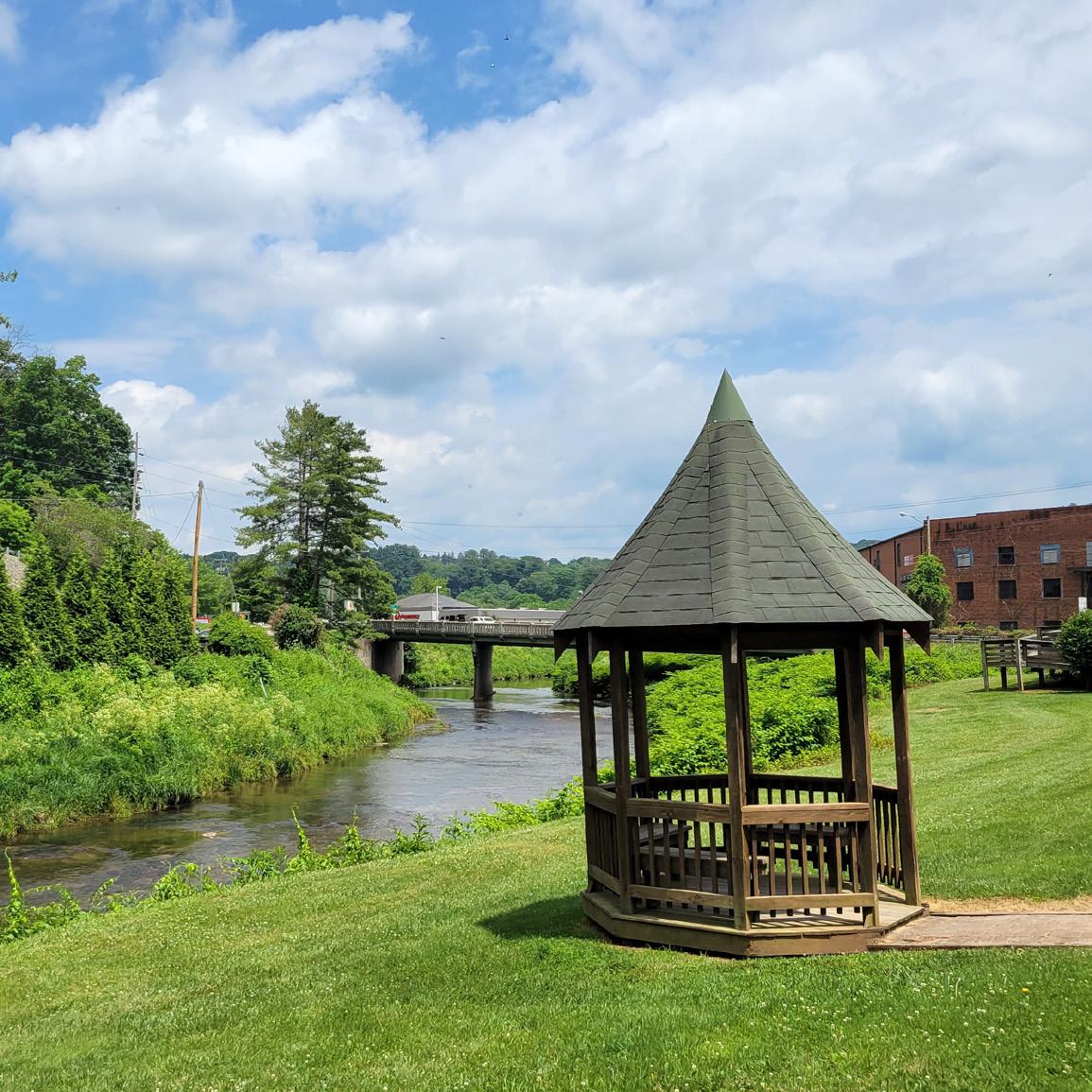

The redevelopment of the Vaughan Furniture building into residential units is a huge opportunity for the Creekside area and for Galax as a whole. However, it’s important to take existing, productive businesses in mind when envisioning what the future of the area looks like. The existing businesses in the area manufacture furniture, sell flooring, operate auction houses, and more.
When the Vaughan building is redeveloped, there will be a continuum of uses, with recreation, parks, and housing on one end and continuing manufacturing on the other. It’s essential to the success of this development that all uses are integrated with one another and any potential conflict points are addressed.
Potential conflicts generally arise when new uses are introduced to a residential neighborhood, which
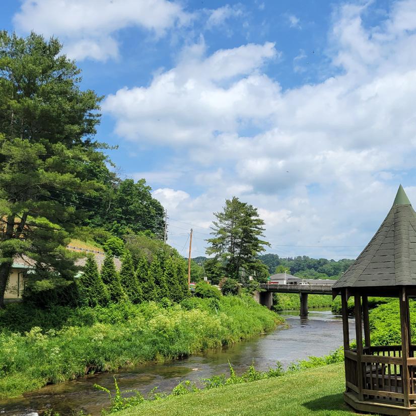
should be minimized when residential is added to an existing light industrial area. However, there may still be the potential for conflict regarding traffic, chemical spills or fires, or other unintended events.
Having residents, existing business owners, and new business owners on the same page with the vision for the neighborhood should go a long way to proceeding with understanding.
Other programmatic and design considerations, such as minimizing noise from manufacturing after business hours and adhering to robust landscaping standards will also help to create cohesion and ensure that disparate uses can exist in harmony.
Source: Summit Design & Engineering 2022
Source: Summit Design & Engineering 2022
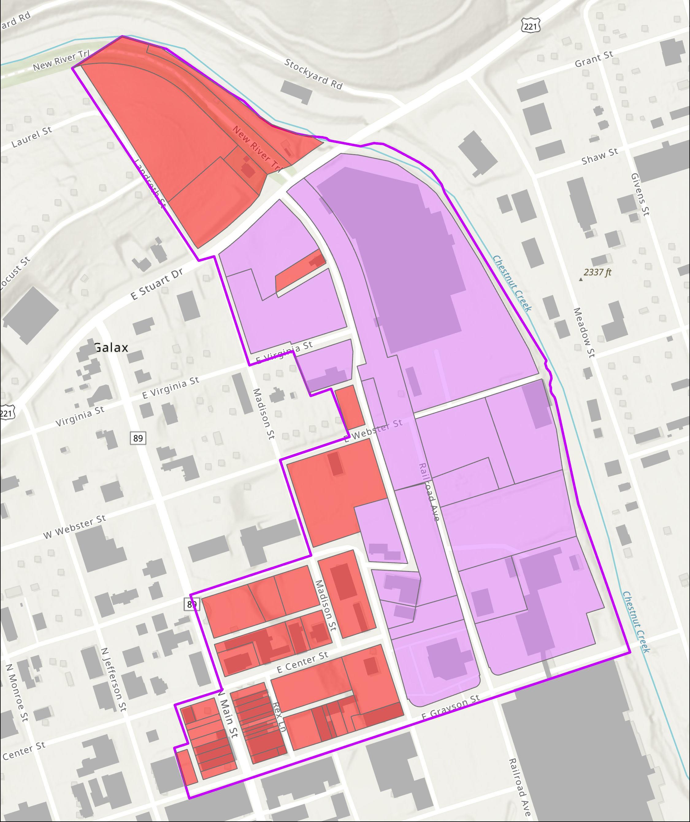
Every parcel in the study area is currently zoned either General Business (B-2) or Heavy Industrial (M-2), as shown on the map on the opposite page.
The General Business (B-2) district’s purpose is to “provide a framework for a strong nucleus of the commercial community, in which each business can enhance other businesses and all the amenities of downtown can be provided.”
The Industrial Heavy (M-2) district’s purpose statement reads: “This district, containing both existing and planned heavy industrial operations, is designed to provide areas suitable for this type of industrial development which can be compatible with adjacent commercial and residential areas.”
The current zoning is not conducive to the creation of a mixed-use project that blends residential, commercial, and industrial uses. The following section outlines the changes to the Zoning Ordinance and Zoning Map that will need to be made to implement the plan.
In order to achieve the desired outcomes for the Creekside area, both the Zoning Ordinance and the Official Zoning Map will need to be changed. It should be noted that in order to support the redevelopment of the Vaughan Building successfully, these changes should be timed after the completion of the redevelopment to build momentum. The individual components of these changes should include:
1. Create a new, mixed-use zoning district
2. Apply this district to most of the Creekside area
3. Amend the B-2 district
4. Amend Sec 160-10 to add definitions of new uses
5. Amend development standards that affect new district
A new zoning district should be created, permitting a wide variety of uses, ranging from residential to light industrial, which can exist in harmony with one another and with the existing industrial/ manufacturing uses. This district should be applied to the largest portion of the Creekside area.
The new district should have the following permitted principal uses:
Apartments (above other permitted principal uses)
Condominiums
Townhomes
Small-scale meeting and convention centers
Retail stores
Grocery stores
Offices
Restaurants
Breweries/cideries/distilleries
Maker spaces
Live/work spaces
Indoor urban agriculture
Repair shop (including bike repair, etc)
Artist studios
Galleries
Furniture manufacturing
Community garden
Small scale for-profit agricultural production
Aquaculture/aquaponics/hydroponics
Greenhouse for production and/or retail
Performance space/theater/assembly hall
Public utilities
Public or semi-public uses
Parks/public open space
Places of worship
Recreational activities
Woodworking shop
Welding or machine shop
Banks
Personal service (hair, nails, etc)
Hotels and inns
Printing and copying
Dog or pet grooming
Massage therapy studio
Medical or dental office
Veterinary hospital
DIY workshop spaces
Co-working spaces
Boat ramps
Recreational uses including but not limited to splash pads
The new district should have the following accessory uses:
Outdoor dining space
Sidewalk cafe tables
Roof-mounted solar panels
Accessory dwelling units for SF and 2F homes
The new district should restrict drive-up and drivethrough uses:
In addition to the new list of permitted and accessory uses, the following elements should be added to the new district:
• Reduced or non-existing parking minimums, encourage shared parking agreements
• Strict landscaping standards for parking lots
• Open space requirements for multi-family or mixed-use developments
Other elements of new district:
Add form-based elements such as:
• Vertical articulation
• Facade fenestration
• Screened services
• Sidewalks installed or upgraded with all new development
District should have strict parking standardsscreening, location, entrances
District should have strict landscaping standards
District should have open space requirements for new multi-family and mixed-use developments
Do not add parking minimums in new district. Note in the plan that parking should be encouraged to be shared among businesses (especially if apartments
provide parking, then new businesses who may cater to new residents should not have to provide parking for people who may likely walk).
The following changes should be made to the existing B-2 zoning in the downtown area, which will ensure that the character of new development is conducive to redevelopment of a walkable downtown area:
• Remove “fast food” as a permitted use, or change the definition to remove drive through windows
• Define “recreation”
• Add “public open space”
Remove 10’ setback from street ROW. Definition of street ROW includes sidewalk, and all new districts need to have buildings that are built to sidewalk.
Sec 160-143 - Amend to make exception for new district (if not all districts)
Sec 160-146 - Create exception for all of these districts - 6’ maximum, and no fences in front yards, or between buildings and the street. No walls shall be permitted between the rear yard of any building and the public open space at Chestnut Creek.
Sec 160-149 (fences) - Add exception to this for new district. It may be appropriate to have structures facing creek or otherwise accessible from back of apartment complex, between complex and river. Examples might be recreational/community center/ club house, outdoor kitchen, sports facility, or other accessory use.
Sec 160-151 (# principal and accessory buildings per lot) - Amend to provide for more than one principal building, or more than one accessory building
Sec 160-154 (fences required) - Exempt new district from (C)(2) - do not require fences, especially not in
front yards
Sec 160-154 (E) - Exempt new district from requirement of buffer between two-family, multifamily and non-residential uses and “less intensive uses.” (Townhomes, being Single-family or Two-family, there is no need to require that there is a buffer between them. This would not prohibit a developer from creating one if they believe it would be best.)
Sec 160-154(F) - Exempt new district from any parking minimums, but add that shade trees (“large trees” in 160-154(K)(1) are preferred or required in parking areas
Sec 160-154(J) - Remove “mulch,” at least for new district. Replace with “or other pervious ground cover.”
Sec 160-158 (off-street parking) - Remove all parking minimums for any use in the new district.
Change to new mixeduse district
Retain existing B-2 zoning, with edits to district, if needed
Retain existing M-2 zoning, with edits to district, if needed
Connections in and out of the Creekside area are important because they affect how people use the neighborhood, how safe they feel, and how welcome other City residents feel coming to the neighborhood.
In order to be successful the neighborhood must be inviting to people on foot or on bicycles as well as in cars, care must be paid to separating the modes as clearly as possible so everyone can move freely and safely. It will also be necessary to accommodate truck traffic for existing businesses, and ensure from the beginning that this does not create a conflict. Careful routing and separating bicycle and pedestrian from car and truck traffic will ensure that various activities can exist in the same area with little conflict.
The New River Trail should be extended to pass under the Route 58/Chestnut Creek bridge, along the creek to Felts Park.
Note that rainfall causes Chestnut Creek water levels to rise, making the enhanced bike/pedestrian crossing over Route 58 is necessary to provide access after rainfall.
Enhanced pedestrian and bicycle crossing from trailhead and park
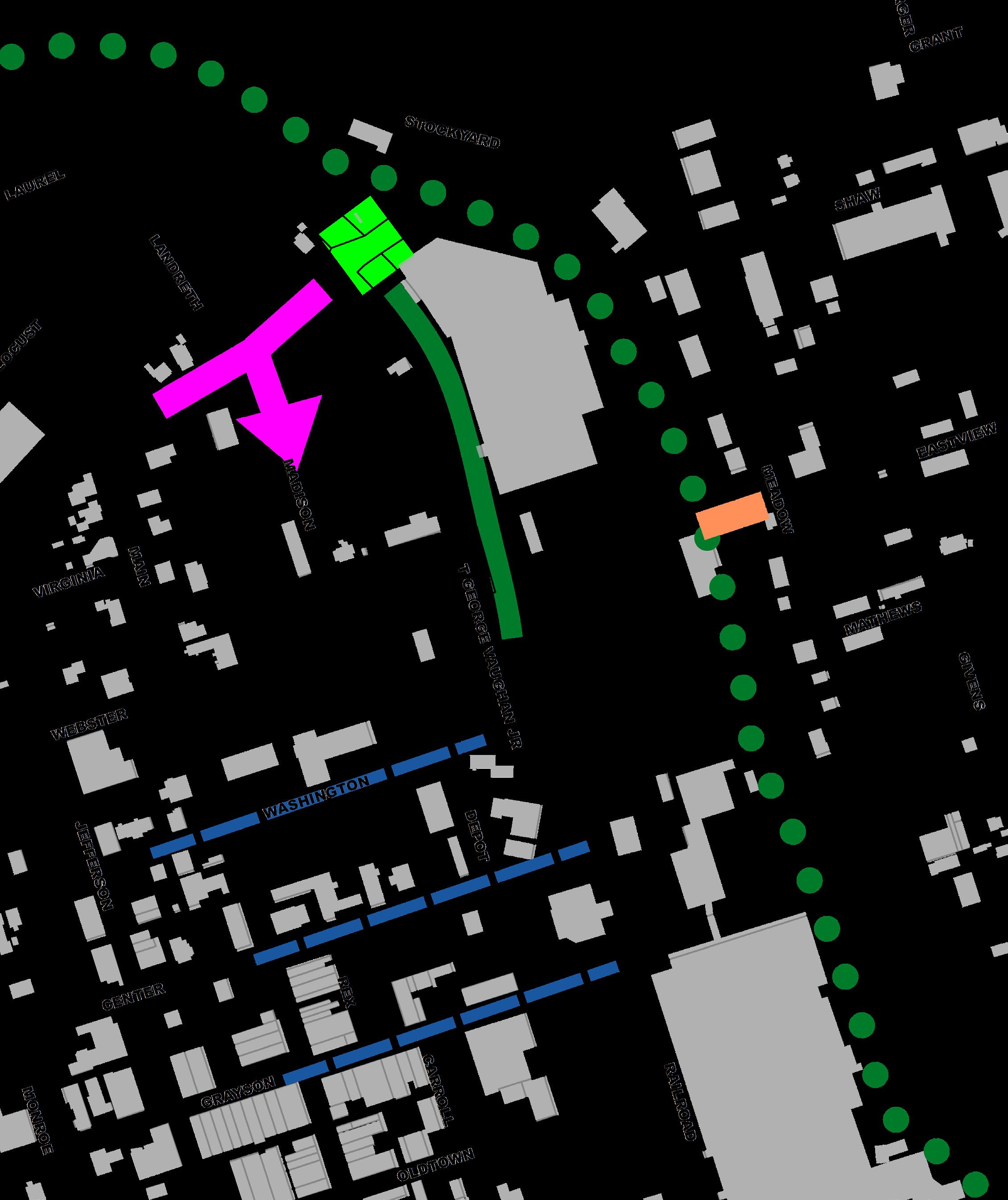
Primary entrance to site from Rte 58
Multi-modal connections to downtown (pedestrian, bicycle, and automobile)
Source: Summit Design & Engineering 2022
Extended New River Trail, under Rte 58 bridge over Chestnut Creek, extending to Felts Park
Enhanced pedestrian and bicycle connections to downtown (sidewalks, landscaping, bike lanes, with traffic calming measures)
The following list provides sources of funding to assist in implementing the small area plan:
The redevelopment of the Galax Creekside District has great potential, and the project may be eligible for funding from the Virginia Department of Housing and Community Development and other organizations. This report outlines information on several applicable funding sources, including eligible activities and requirements.
Community Development Block Grant (CDBG) funding can be utilized to support thoughtful, innovative economic development activities in the Creekside District. Activities supported by this program include “small-scale manufacturing, job creation, and unique business plans.” Projects that will have a significant regional impact are eligible for up to $1.25 million in CDBG assistance through the Economic Development & Entrepreneurship Fund. Job creation must be clearly documented, and CDBG participation will be limited to $35,000 per job created.
This fund covers a wide array of activities, but one example that may be applicable to the Creekside District is the development of a “maker space” where community members can access shared tools and materials to learn new skills, work toward professional certifications, complete passion projects, and build community through hands-on collaboration. A maker space could also be part of a “multi-purpose community center.” The fund can also be used to support loan funds for Economic Restructuring activities (may require the completion of an Economic Restructuring Plan per DHCD standards).
The Industrial Revitalization Fund (IRF) is designed to help localities leverage local and private resources to achieve market-driven redevelopment of industrial structures, catalyzing long-term employment opportunities and ongoing physical and economic revitalization. In addition to IRF funding allocated by the General Assembly, there is $22.5 million for FY24 through American Rescue Plan Act (ARPA) funding. The maximum award for projects funded through General IRF funds is $1 million; the maximum award for projects funded through the ARPA allocation is $5 million. IRF funding requires a 1:1 match.
The local government may apply directly for funding to use on publicly owned property or on behalf of a for-profit or non-profit entity for privately owned property. Localities may designate a redevelopment authority or another similar organization for project administration and implementation. DHCD will issue an IRF grant if the property is publicly owned, the property is privately owned with an option for purchase by the local government, or the property is owned by a not-for-profit, tax-exempt entity. DHCD will issue an IRF grant/loan if the property is owned by a private, for-profit entity, and the end-use will be owned by a private, for-profit business. IRF grant/ loans may be funded as grants to the applicant local government or redevelopment authority, who will in turn make a loan to the private, for-profit entity.
The IRF fund can be used for a variety of redevelopment activities, including acquisition, rehabilitation, or repair of structures. Demolition and removal of blighted structures is also eligible for IRF funding. Funding may not be used solely for acquisition or demolition unless the locality has committed other redevelopment funds for the property. The IRF program is targeted toward vacant and deteriorated properties. Projects may include multiple adjacent and/or adjoining properties. The intent of the IRF program is to fund shovel-ready projects that can spark private investment and job creation. DHCD funding priorities are listed below.
• Clear relationship to a local or regional economic development strategy
• High degree of blight and deterioration to be addressed.
• Project readiness.
• Project with clear end use.
• End use will have a clear and significant community economic impact.
• High Economic Distress in project locality.
• Other considerations.
Applicability to Galax Creekside Redevelopment.
Development in the Galax Creekside study area may be invigorated by DHCD funding to rehabilitate formerly industrial structures in need of repair or provide funding for businesses that will grow the local workforce. A key element of a successful application is regional collaboration, ensuring that proposals align with the strategic goals of the Blue Ridge Crossroads Economic Development Authority (BRCEDA). Given the industrial past of the Galax Creekside study area, the development of small-scale manufacturing and/or artisan businesses may be a strong proposal for funding. Similarly, a proposal that uses Galax’s reputation as the home of “Old Time” music may be a strong contender. Regardless of the project type, the creation of long-term jobs and the provision of community benefits should be the foundation of any proposal.
Eminent domain - https://law.lis.virginia.gov/ vacode/title55.1/chapter19/section55.1-1906/
Redevelopment plans - https://law.lis.virginia.gov/ vacode/title36/chapter1/section36-51/
Acquiring land - https://law.lis.virginia.gov/vacode/
title15.2/chapter18/section15.2-1802/
Public purpose for eminent domain - https://www. ccim.com/cire-magazine/articles/developers-mustestablish-public-purpose-justify-eminent-domain/
NC Procedures for Acquiring Property - https://ced. sog.unc.edu/2016/03/follow-procedures-prior-toacquiring-property-for-redevelopment/
Economic development and entrepreneurship fund -https://www.dhcd.virginia.gov/sites/default/files/ Docx/cdbg/cdbg-program-design.pdf
https://dhcd.virginia.gov/sites/default/files/Docx/ cdbg/economic-development-fact-sheet.pdf
2022 CDBG Application Guidelines - https://www. dhcd.virginia.gov/sites/default/files/Docx/cdbg/ cdbg-competitive-application-guidelines-2022.pdf
Industrial Revitalization Fund - https://www. dhcd.virginia.gov/sites/default/files/Docx/irf/irfprogram-design.pdf
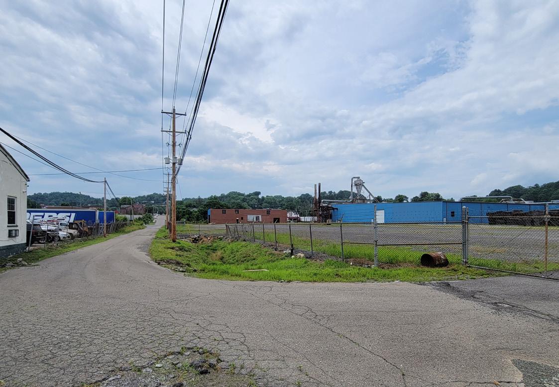
The facing page shows a conceptual rendering of what the Creekside area might look like when fully developed.
Please note: this is entirely conceptual and does not represent an intention on the part of the City to obtain or redevelop property.
The site plan shows redevelopment representing the following important concepts:
• New development should mimic the building scale of Galax’s historic downtown and a humanscale, pedestrian-friendly environment
• New development should adhere to a traditional block system
• To achieve this, existing parcels may need to be consolidated and re-subdivided
• Parking lots should be heavily landscaped, including trees, to provide shade, slow stormwater entering Chestnut Creek, and create a welcoming environment to residents and visitors
• When possible, parking lots should be shared between residences and businesses to reduce the number of spaces required in the area
• When possible, parking should be provided in the center of the block
• Larger scale buildings should use facade articulation and varied materials to mimic a pedestrian-scale environment
• A pedestrian/bicycle bridge should be provided over Chestnut Creek to connect new residents to the brewery and other amenities in the Bottom
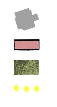
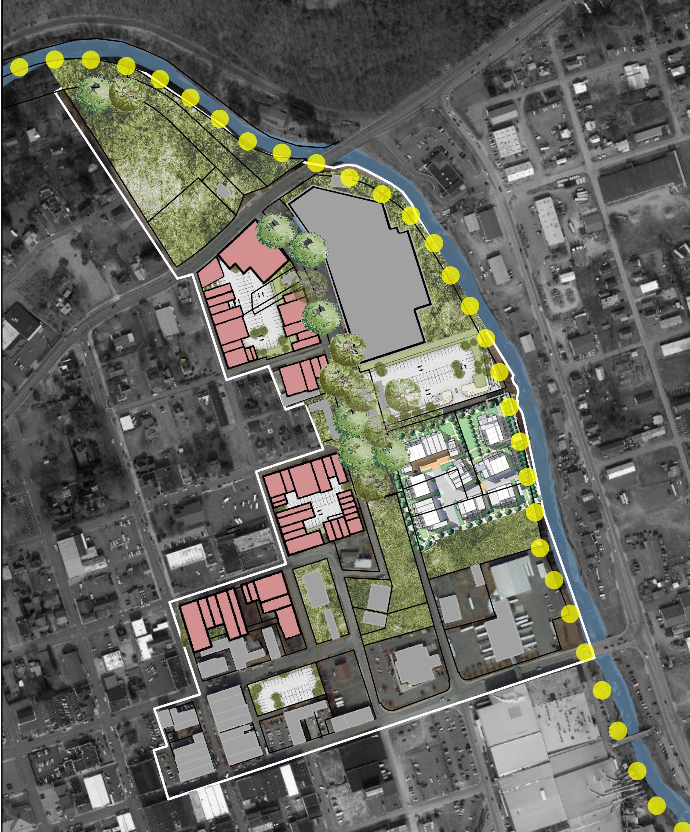
New pedestrian bridge over Chestnut Creek, location for a kayak launch, dog park, or other amenities.
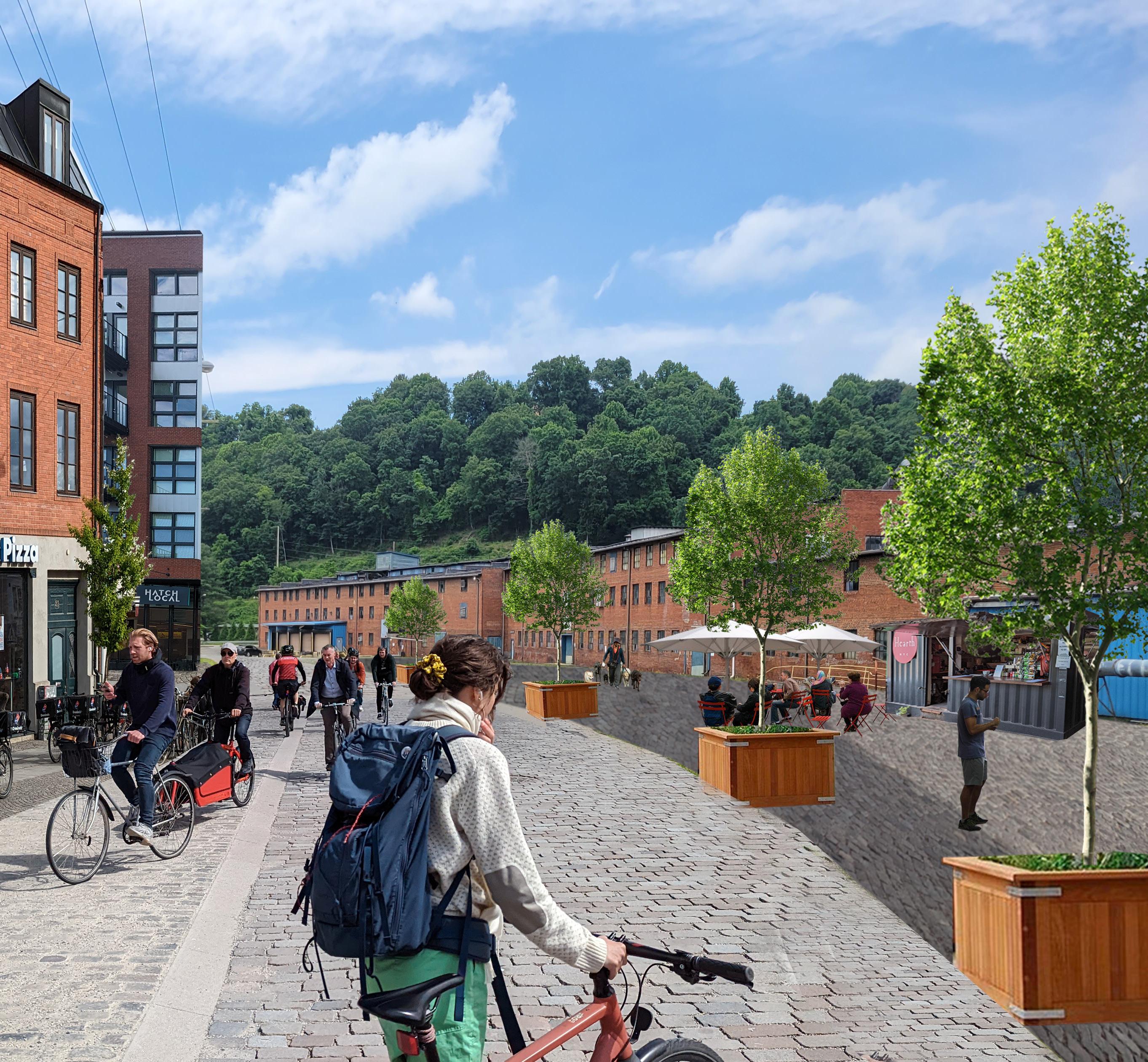
The following pages show images of what the Creekside area might look like.
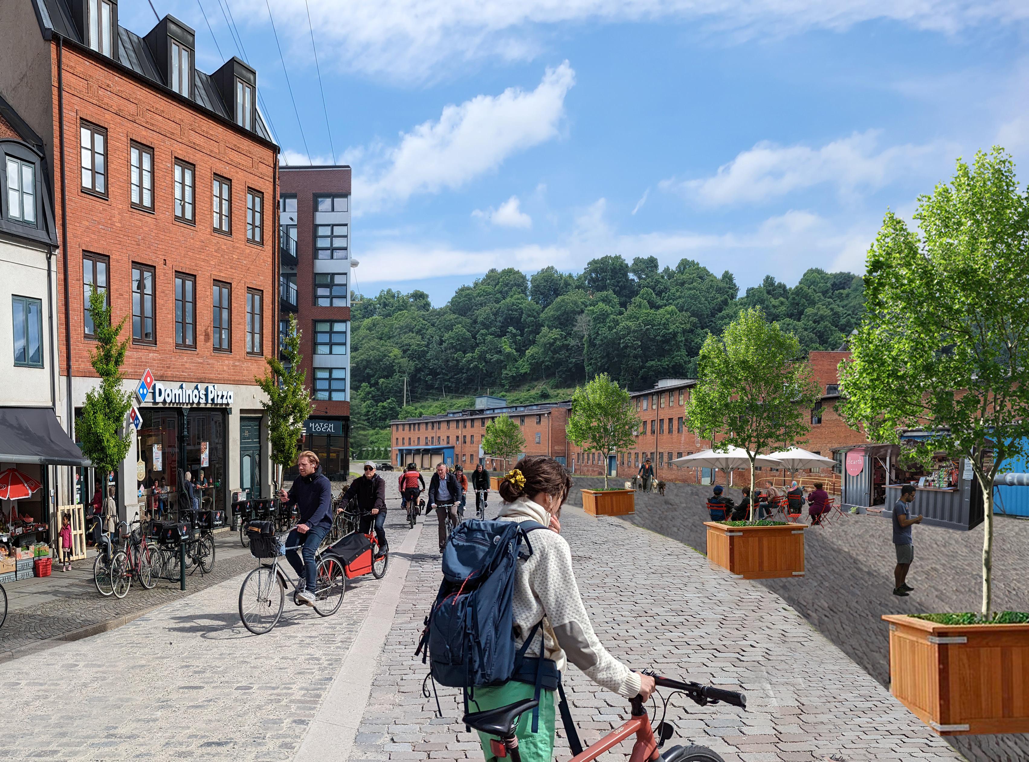
The first rendering, to the right, shows T. George Vaughan Jr, Ave as a pedestrian and bicycle boulevard.
Note the new, vertical mixed-use buildings with retail and businesses on the ground floor and apartments above, and the new boutique hotel with an active lobby and perhaps restaurant on the ground floor.
Tree planters provide a safe environment for travelers as well as shade and attractive greenery.
Pop-up restaurants in shipping containers provide more options and activity, and outdoor seating allows residents and visitors to sit outside and enjoy the environment.
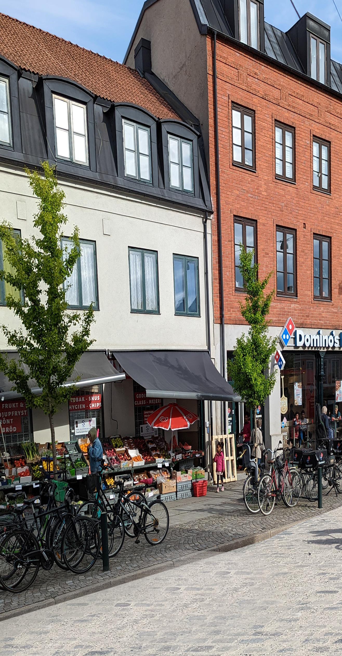
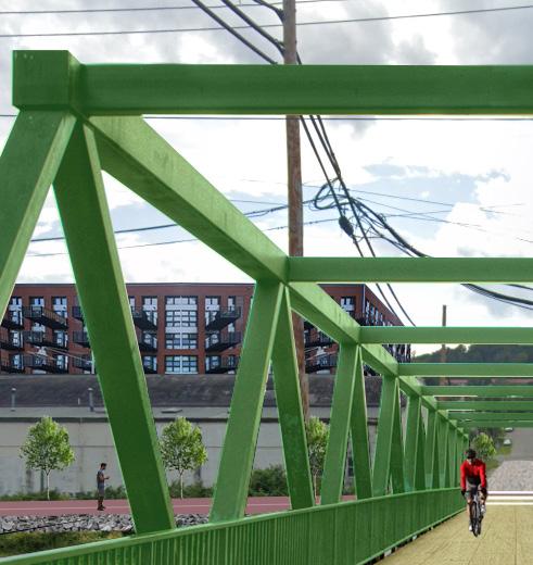
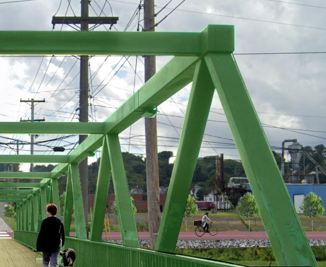
This rendering, from E. View Street looking across the creek into the Creekside area, shows a potential pedestrian bridge across Chestnut Creek.
This bridge will be an important element to provide access to the brewery, residential areas, and other amenities in the Bottom area.
Note also the extended New River Trail in the background!
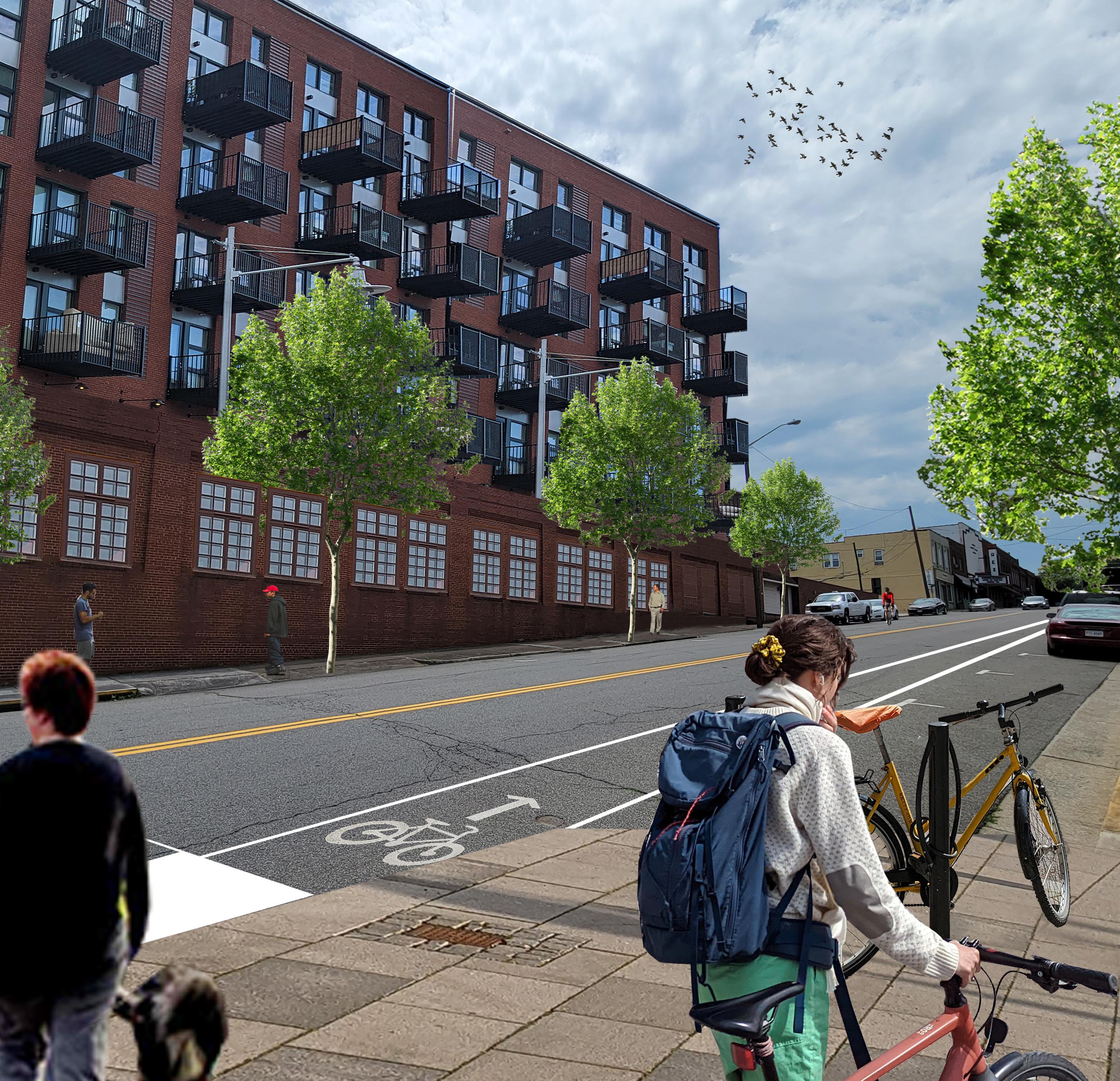
This rendering shows Grayson Street, looking uphill to Downtown.
The existing, building, currently with boarded windows and an unwelcoming facade, could be expanded vertically, keeping the character of the historic building while providing many residential units. Commercial uses could be housed on the ground floor.
Widened sidewalks, bike lanes, bump outs, and street trees all add to a more welcoming, bicycle and pedestrian friendly environment.
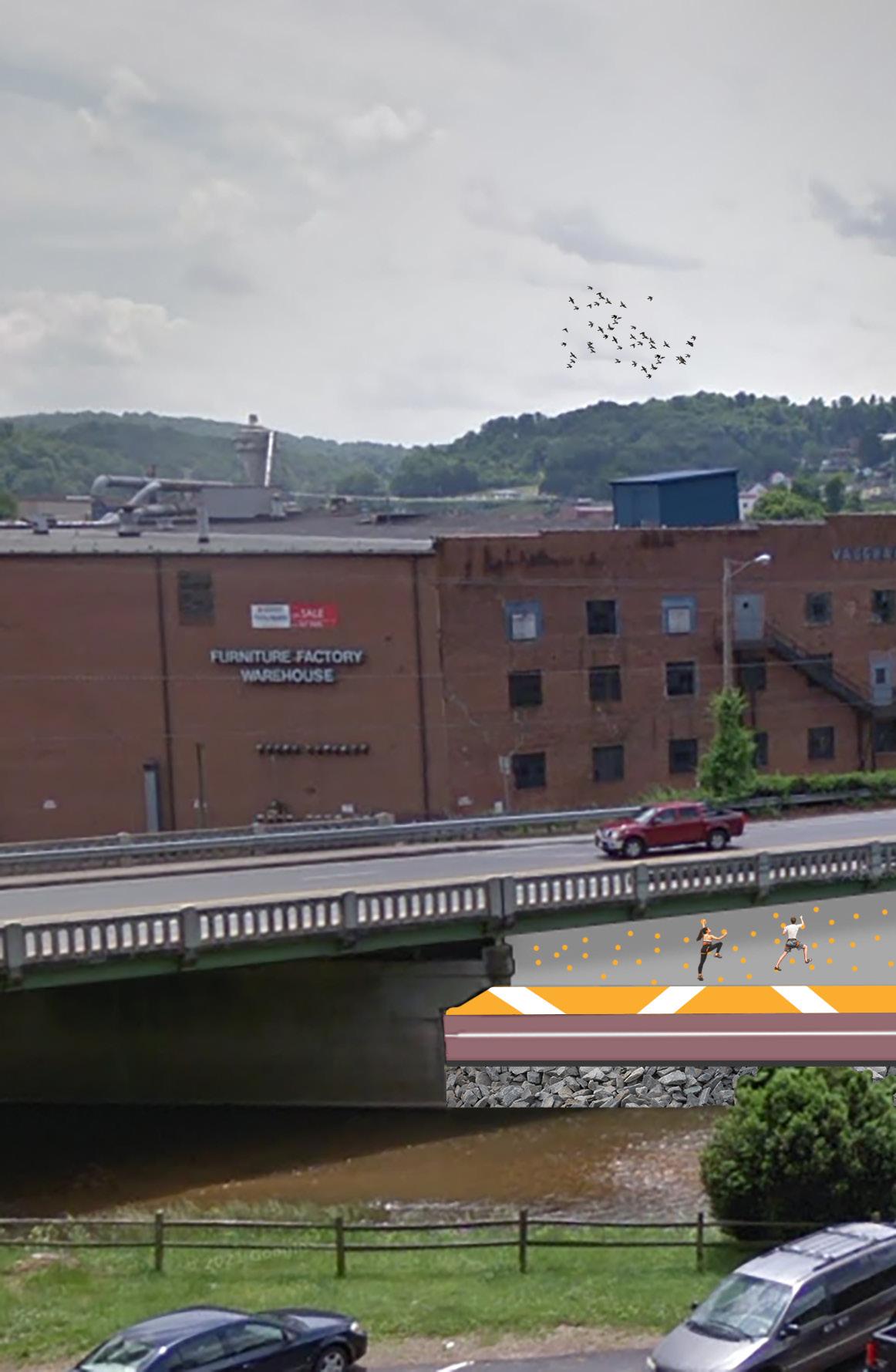
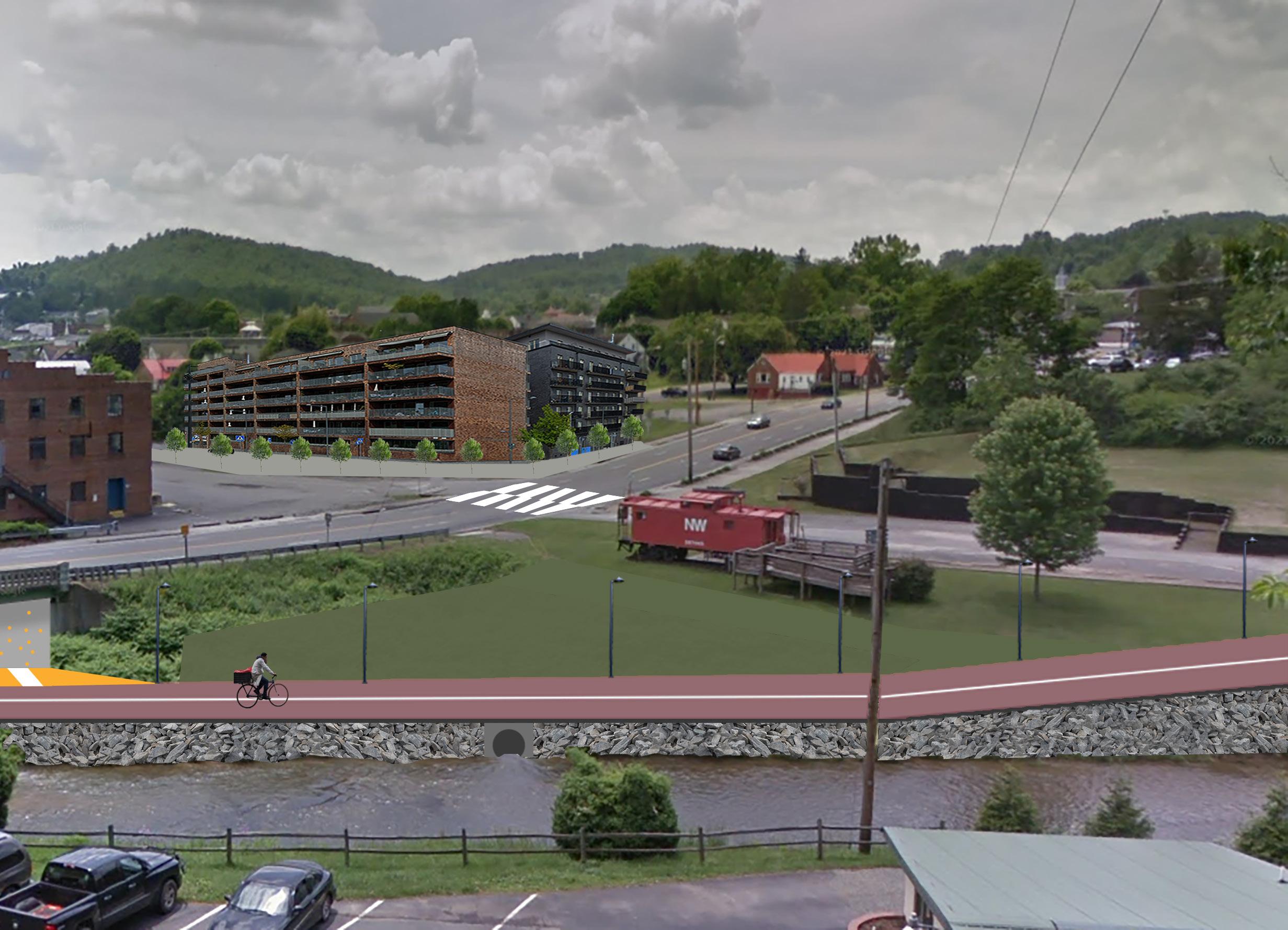
This rendering shows a view of the extended New River Trail, extending under the bridge, providing access to the Creekside area.
Additional amenities are envisioned, including a climbing wall on the bridge pylons.
Extending the trail into the Creekside area and to downtown is an essential element of this small area plan and the successful development of the area.
Note the additional vertical mixed-use buildings in the background.