2025-08-21 Combined Comp Plan FINAL 1_202509101611362819
FXBG FORWARD! Comprehensive Plan
June 24th, 2025
This page intentionally left blank.
Acknowledgements
City Council
Kerry P. Devine, Mayor
Charlie L. Frye, Jr., Ward 4
Jannan W. Holmes, At-Large
Will B. Mackintosh, At-Large
Jason N. Graham, Ward 1
Jonathan A. Gerlach, Ward 2
Susanna R. Finn, Ward 3
Timothy P. Duffy, Ph.D.*
Planning Commission
David Durham, Chair
Carey Whitehead, Vice Chair
Dugan Caswell, Secretary
Mary-Margaret Marshall
Joseph Winterer
Jane McDonald
Thomas Johnson
Kenneth Gantt*
Adam Lynch*
City Staff
Timothy J. Baroody, City Manager
Mike Craig, Director of Community Planning & Building
Kate Schwartz, Principal Planner - Historic Resources & Urban Design
Bailey Thompson, Community Development Planner
Josh Crump, Principal Planner
Josh Summits, Director of Economic Development & Tourism
Chuck Johnston, Director of Community Planning & Building*
* - Former
Prepared by Stantec + Summit Design & Engineering
Photo sources are the City of Fredericksburg unless otherwise noted
Appendix A: Transportation Projects Database Appendix B: Public Open Space Database
Welcome to FXBG Forward!
This comprehensive plan is a long-range policy document designed to guide the City of Fredericksburg towards the future that stakeholders imagine.
This plan is unique among comprehensive plans for several reasons. First, a reader familiar with Fredericksburg’s previous plans (or with comprehensive plans in general) will notice how succinct this plan is. Rather than creating a list of all tasks and all subjects that residents and stakeholders care about, this plan focuses on priorities and tasks that can be reasonably be accomplished during the planning period. While most of the recommendations are related to the physical fabric of the city (buildings and horizontal infrastructure), some policies and strategies focus on non-physical aspects of the city.
This paring down and simplification is deliberate and key to the ability of the comprehensive plan to be:
1. Reflective of the city as a whole
2. Used by a wide variety of Fredericksburg stakeholders - not just City officials!
• Non-profit organizations applying for a grant.
• Developers trying to figure out where best to build or what to build on a given parcel.
• People thinking about moving here, or debating whether to stay here, for example, after graduating from University of Mary Washington or a local high school or when they retire.
3. Implementable and trackable
• It includes an action plan that defines near-term steps for implementing the plan.
• It lives on a website for ease of access and to facilitate interactive features where people can follow along and provide feedback.
• It provides a clear set of directives for staff to facilitate the types of stewardship and development envisioned in the plan.
4. Complementary to sector-specific plans and strategies created and used by public agencies, including City Council’s Strategic Plan, the City’s Economic Development Strategic Plan, the Fredericksburg Schools strategic plan, the Parks and Recreation Plan, transportation master plans, regional plans, etc. The comprehensive plan helps structure the relationship among these plans and their policies and strategies, cutting across sectors; the sector-specific plans provide more detail on shorter-term and more programmatic interventions.
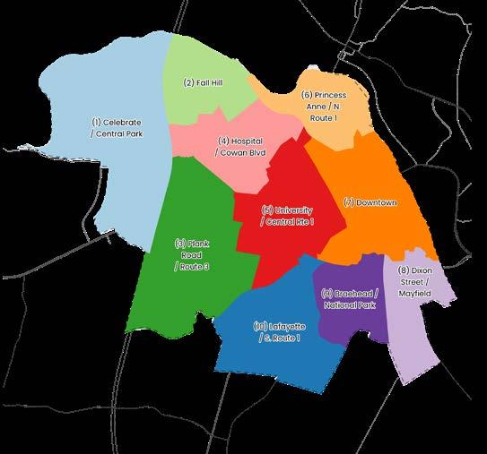
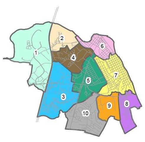
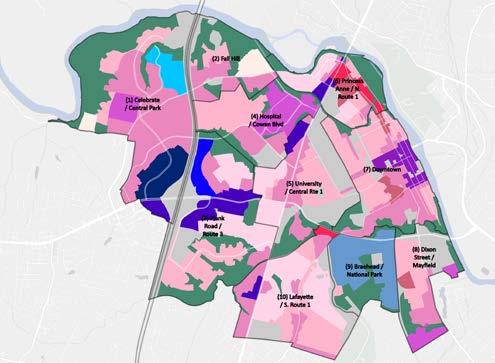
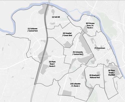
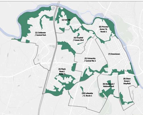
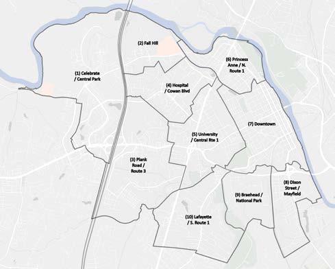
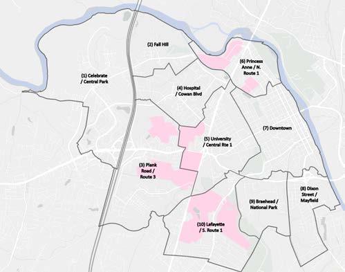
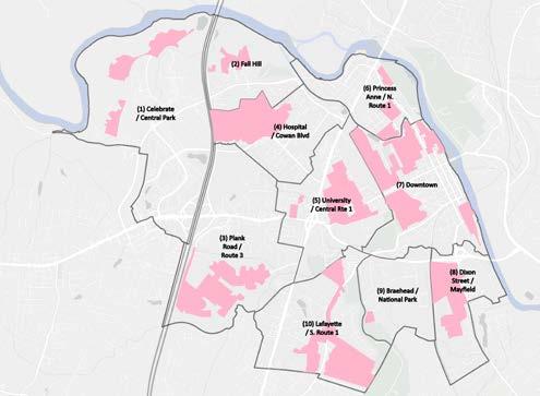
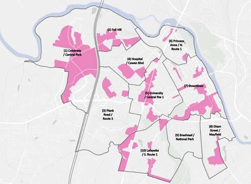
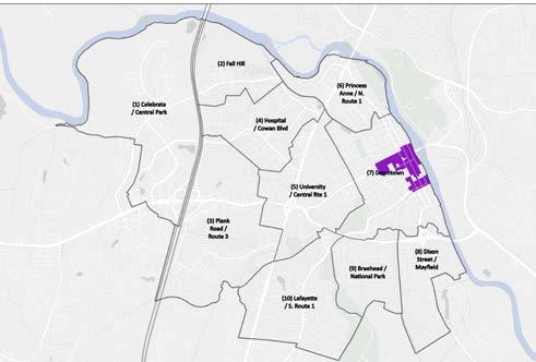
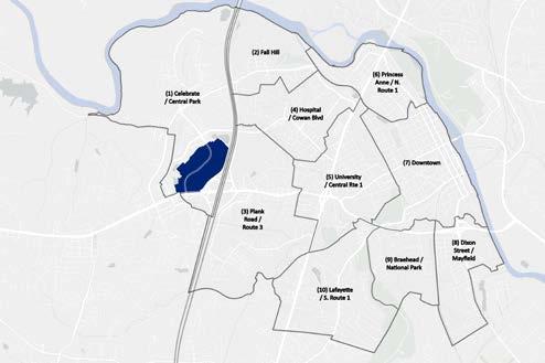
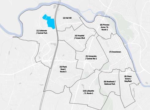
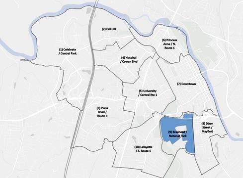
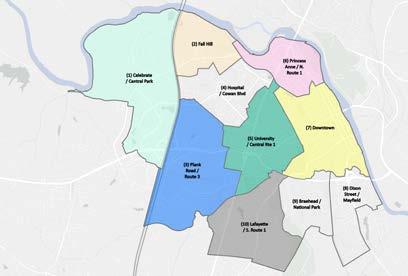
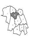
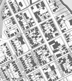
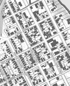
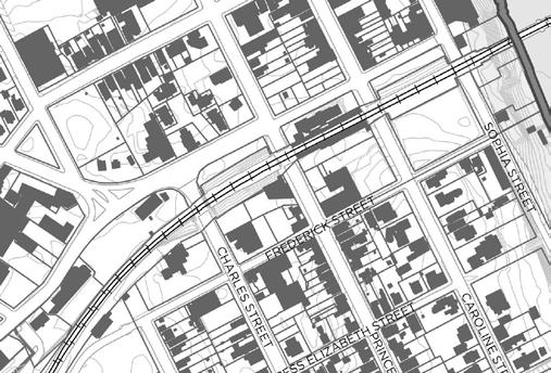
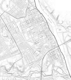
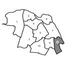
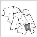
Second, this plan is unique because the City’s government, supported by residents and other stakeholders, has done a great deal of planning for different neighborhoods and districts in the form of Small Area Plans (SAPs). Beginning in 2017 and continuing as of this writing in 2025, SAPs have been completed for seven out of ten Planning Areas in Fredericksburg, with one SAP in process and two more on the horizon.
Source: City of Fredericksburg
A great deal of thought has been put into the future that each of these areas will grow into. The SAPs address and set parameters for economic vitality, land use mix, access and transportation, scale of construction, and enhancement of the natural environment. Each of these SAPs has been the subject of extensive public input and has been approved by City Council. This citywide comprehensive plan builds on the small area plans, incorporating them into a citywide framework.
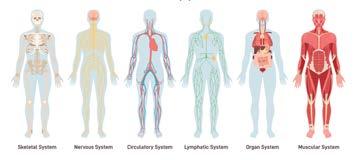
The Plan focuses on systems in recognition of the fundamental connection between the physical environment, community services, economic opportunity, and the health and well-being of Fredericksburg’s residents. Like a body’s vascular or nervous system, urban systems are the connecting tissue that extend throughout the city and bring the different neighborhoods and districts together, helping Fredericksburg function as a whole organism. The systems can draw inspiration from the city’s core urban DNA, which gave rise to Fredericksburg’s downtown. The systems covered by this comprehensive plan include Walkable Centers, mobility, social and cultural systems, economics, and the natural environment. The quality of these systems, derived from the planning in this document, directly impacts public health.
This plan, rather than changing the land use recommendations from the Small Area Plans, focuses on what brings all those areas together into a thriving city: how heritage and cultural resources undergird the city’s vibrancy and built form; the way people and goods flow from place to place; how neighborhoods are at once unique functioning places and exist as part of the city as a whole; the evolution of a vibrant local economy that benefits
all residents; how housing for all residents, existing and new, can be created and maintained; and how vibrant open spaces can open the door to healthy lifestyles, a healthy natural environment, and dynamic community life.
This comprehensive plan consists of the vision statement, goals, chapters on citywide systems (Urban Design and Community Fabric, Mobility, Public Open Space, Housing, Historic Preservation, Public Facilities and Services, Economic Development, and Environment), that are included as part of this core document. The Small Area Plans also form an integral part of the comprehensive plan, are incorporated by reference into this document and are located in the document’s appendix.
The plan also provides the overarching policy framework for sector-specific citywide plans such as transportation plans, open space plans, park master plans, historic preservation plans, local economic development strategies, etc. It is intended that those sector-specific plans will be conceived and will serve their purpose under the umbrella of the comprehensive plan, even as they pursue their specific goals and objectives.
The tools for implementation of this comprehensive plan include the City’s Capital Improvement Plan, Transportation Improvement Plan, zoning code (including form-based code), and other development regulations in effect.
This comprehensive plan, like all others in Virginia, is required and given authority by the General Assembly in accordance with Article 15.2, Chapter 22, Section 2223 et seq.
Small Area Plan Areas
Vision
As a foundational element of the preparation of this plan, the City of Fredericksburg engaged stakeholders and community members to understand how they see the future of the city. The engagement process included three citywide community meetings, two neighborhood meetings, four pop-up events, 19 focus groups, and an online survey. Fredericksburg’s vision for its future as a city, a community of people, and a local economy is:
Fredericksburg is the cultural and economic hub of a fast-growing east coast metropolitan region. The city is a model of urban life that nourishes and enriches its residents while promoting economic vitality, historic integrity, environmental sustainability, and cultural vibrancy. Our diverse community enjoys a high quality of life enhanced by neighborhoods that are safe, accessible, and interconnected. It is a place that works for everyone; a place where people want to be!
Goals
Fredericksburg’s five goals for this comprehensive plan cut across all the systems described in the following chapters.
Community
Fredericksburg seeks to preserve and enhance the sense of community experienced by its residents. Our residents are aware of our history and how it shaped the community of Fredericksburg today. Our walkable communities offer residents the opportunity to mingle in public and semi-public spaces, which fosters personal connections among neighbors. Our institutions are engaged and connected to all voices in the community and civic life. Community well-being is a focal point, especially regarding sensitive or developing portions of the population. Programming of social and cultural events, a touchstone of high-quality community life, provides additional opportunities to build community networks.
Equity
Fredericksburg embraces equal opportunity for all its residents to find employment, secure housing, and benefit from City services. The city embraces and promotes diverse housing and business development options that meet the needs of all socioeconomic segments of the population. By raising awareness of the inequities of the past, the city clears social and community space for people to come together on equal terms. A robust, connected open space network provides all residents with a connection to nature and recreation. The City works with its private and nonprofit partners to provide social services to households and individuals in need.
Sustainability
Fredericksburg’s historic and new walkable centers provide residents the opportunity to live a lower-carbon lifestyle. The compact urban form of the walkable centers includes housing types that have a smaller carbon footprint. Redevelopment of and infill within aging urban fabric revitalizes those portions of the city with the infusion of new economic and civic life. Rehabilitating and preserving existing housing stock supports stability, affordability, and environmental stewardship. The extensive bicycle and pedestrian infrastructure give people the chance to shop and commute without emitting greenhouse gases. Land uses and mobility improvements produce a connected multi-modal grid that takes the next step toward freedom from automobile dependence. The City’s core infrastructure and public services are prepared to meet the needs of future citizens and economic opportunities.
Resiliency
Fredericksburg stands ready to cope with the challenges associated with climate change, including flooding and frequent, intense storm events. City facilities and services advance toward a vision of 100% renewable energy. Our robust emergency preparedness system helps save lives. Our adaptive economic and regulatory framework permits new, environmentally sustainable opportunities within the city to support the quality of life of the citizenry and fiscal sustainability of the jurisdiction. Education and career training supports a skilled and innovative workforce. The City works with infrastructure agencies to harden and modernize critical infrastructure and minimize the duration of service cuts caused by natural hazards.
Historic Preservation
The foundation for Fredericksburg’s vibrancy is its historic urban fabric: the buildings, streetscapes, neighborhoods, cultural touchstones, and authentic places that set the stage for the community to grow. Preservation is an essential part of the city’s physical, environmental, economic, and cultural evolution—the continued building of a community that capitalizes on its greatest assets and embraces its physical and cultural diversity and diverse perspectives on the past. Preservation is not restricted to the downtown Historic District; no square inch of the city lacks cultural and historic significance. The City uses its historic features as the blueprint for new vibrant places, while protecting the tangible connections our historic fabric provides. The City seeks to uncover the full breadth of its history to bring its people together.
Urban Design & Community Fabric
Context
Fredericksburg’s development pattern reflects its deep historical roots, evolving from a colonial-era town into a modern small city with a mix of historic neighborhoods, commercial districts, and prominent institutions. The city’s traditional urban form, centered around a compact and walkable downtown, has long been a defining feature, with a gridded street network, a strong connection to the Rappahannock River, and a distinct sense of place. The sense of place and walkability are inherently resilient in terms of disaster preparedness, social connectivity, and community health.
Over time, growth and infrastructure expansion have introduced auto-oriented development patterns, particularly along commercial corridors and in outlying areas, creating a contrast between historic walkability and newer, car-dependent environments.
This plan transitions Fredericksburg toward a more connected, walkable, and cohesive urban form, drawing upon the historic development patterns that fostered greater accessibility, strong neighborhood ties, and a vibrant public realm. The following section outlines how the proposed comprehensive plan builds upon Fredericksburg’s existing urban fabric, preserving and reinforcing its historic character while guiding future growth toward a more cohesive, connected, and pedestrian-friendly city.
The City as a System
Fredericksburg’s urban design framework is structured as a city of systems, integrating various elements that shape how neighborhoods, infrastructure, and open spaces function together. Rather than focusing solely on individual land use plans, this comprehensive approach emphasizes the interconnected nature of the city—like how the human body’s various systems work together to sustain life.
At the core of this framework are Walkable Centers, corridors, and open spaces, each playing a distinct role in linking the city’s districts while reinforcing Fredericksburg’s historical character and future development goals. These systems ensure that the city functions as a cohesive whole, connecting residents, businesses, and institutions through shared infrastructure, mobility networks, and public spaces. The comprehensive plan builds upon established Small Area Plans (SAPs), integrating them into a broader citywide strategy that aligns economic development, transportation, preservation, housing, and environmental sustainability.
Rather than altering neighborhoodspecific plans, this framework unites them through policies that address mobility and connectivity, economic growth, historic preservation, and environmental stewardship. By focusing on these systems,
DESIGN &
Fredericksburg supports a more walkable, vibrant, and resilient urban environment where neighborhoods maintain their unique identities while contributing to the city’s overall development. The following sections detail how Walkable Centers, corridors, and open spaces function as key components of this interconnected citywide system. The City employs a formbased code within its SAPs to regulate development, ensuring that new growth aligns with the city’s historic character, walkability, and urban design principles. These codes emphasize the physical form of buildings and public spaces rather than just land use, fostering cohesive, pedestrian-friendly environments tailored to each district’s unique context. While the SAPs provide localized frameworks for specific neighborhoods and corridors, this comprehensive plan integrates them into a unified, citywide vision, ensuring consistency across all areas. By weaving together these individual plans, the comprehensive plan creates a holistic guiding document that reinforces connectivity, balances growth with preservation, and shapes a more cohesive, well-designed urban fabric.
Walkable Centers in Fredericksburg: Enhancing Community and Connectivity
Fredericksburg’s Walkable Centers encompass a mix of neighborhoods, commercial hubs, and institutional spaces that balance historical preservation with modern urban design and accessibility. Each center has its own characteristics and challenges, addressed through initiatives outlined in the city’s Small Area Plans. These centers are grouped into three categories—regional, citywide, and
community centers—based on their size, function, and role within the community.
All the Walkable Centers will provide essential services and amenities that contribute to the quality of life for nearby residents, people coming from across town, or visitors from the metropolitan area and beyond. Consistent strategies for mobility, open space, and housing guide their growth, ensuring alignment with small area plans while supporting the city’s broader urban design framework. These strategies aim to foster pedestrianfriendly, walkable, and mixed-use environments that reflect the goals of balanced development and connectivity.
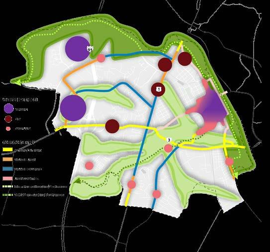
The following strategies establish a cohesive and interconnected framework across different scales and intensities, allowing each Walkable Center to play a vital role within its neighborhood while contributing to Fredericksburg’s overall character and growth. Map 2 is a diagrammatic key. It illustrates relationships between Walkable Centers, mobility corridors, and open space networks that will be further described at a systems level in the following sections with an eye towards the steps necessary to continue to foster a connected, vibrant, and sustainable urban environment. These systems are described in even more detail within each Small Area Plan.
Framework for Future Development
Regional Centers
Examples:
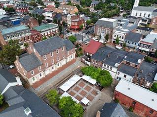
• Downtown (Area 7): This center is anchored by Fredericksburg’s historic core. Where it all started, our living, breathing Downtown accommodates the resident population, a dynamic workforce, and tourists that visit Downtown for the unique experiences it provides.
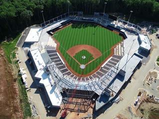
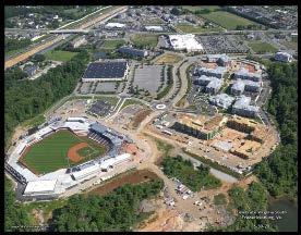
• Stadium / Celebrate Virginia South (Small Area 1): This center is anchored by the Fredericksburg Nationals Stadium, the City’s convention center, and adjacent hotels. The area also offers significant riverfront natural features and recreational amenities.
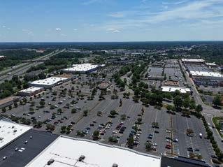
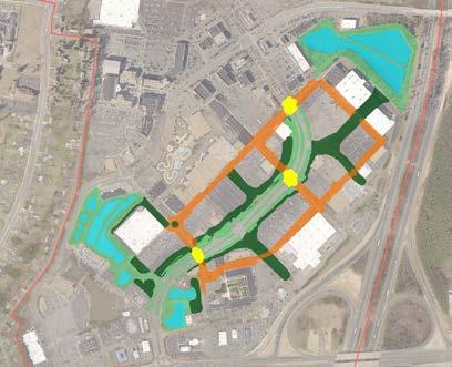
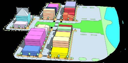
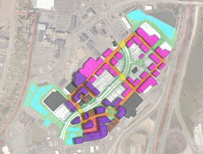
• Central Park (Small Area 1): The City’s regional shopping center remains a strong destination for retail, restaurant and office activity. Planning in the short and mid-term is to continue to enhance that activity while beginning to lay the framework for a long-term transition of the area to the City’s second major mixed-use core.
Inherited character:
Varies by Walkable Center. Downtown, with its concentration of historic resources, urban fabric, and mobility networks, offers up an urban DNA that can be replicated in a modern way in Central Park, an area currently mass-graded with large single-story buildings. The attempts to reestablish and protect natural systems in regional centers have produced mixed results. The Central Park and Stadium areas have more area (i.e., height and intensity) to grow based on configuration of the land and the capacity of adjacent mobility networks. Sensitive archaeological and natural areas can be found adjacent to the river.
Mobility
• The transportation network in these areas should be calibrated to serve both the resident population and regional / national / international tourists.
• Prioritize multi-modal connectivity by providing and enhancing nonautomobile transportation modes.
• Integrate micro-mobility with transit, improving first/last-mile connectivity, and differentiating routes for cars versus pedestrians and cyclists. Enhance bike/ pedestrian-friendly streets with complete street designs and interconnected networks. The transportation network in these areas should be calibrated to serve both the resident population and regional / national / international tourists.
• Maintain a focus on major transportation initiatives, including the community interface with Interstate 95 in Small Area 1, a potential new crossing over the River, traffic calming (either by retrofit or by updated design standards), and multi-modal connections.
Open Space
• Feature a diverse set of large, medium, and small gathering spaces within Walkable Centers (including plazas and pocket parks) that contribute to the diversity and inclusiveness of Fredericksburg’s citywide open space network.
• Provide and protect tree-lined streets to enhance the public realm and generate environmental benefits.
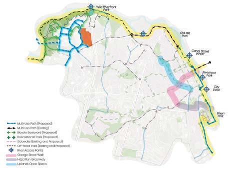
• Prioritize connections to regional open spaces, including the Uplands Open Space Network and the Riverfront.
Housing
• Promote a diversity of mediumto high-density housing types, ranging from 3-plexes and 4-plexes to small apartment buildings and housing incorporated into vertical mixed-use development.
• While newer regional Walkable Centers are not anticipated to include single-family housing, townhouses and single-family detached houses may be appropriate in the established Downtown due to the contextbased requirements of the Historic District.
• Taller buildings (residential or other) can be concentrated in Walkable Centers to facilitate a transition towards existing lowerheight neighborhoods nearby.
• In balanced housing typology considerations, consider the needs of residents and tourists. Consider solutions that allow for economic development and tourism, while maintaining Fredericksburg’s sense of community.
City Centers
Examples:
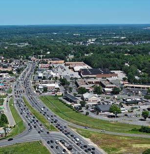
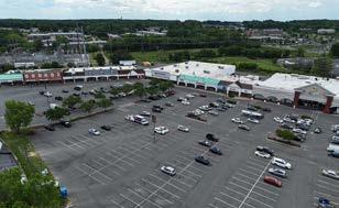
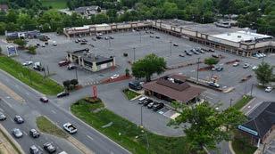
• Westwood / Greenbrier (Small Area 3): Centered on the Route 3 Corridor, this area includes some of the city’s earliest local and regional shopping centers. Recent trends and the market study associated with the area plans indicate that these centers are likely to change uses in the next planning horizon as big box retail activity shifts to Central Park. The older centers have large impervious surfaces with limited green infrastructure / stormwater control.
• The Brain Power Area (Small Area 5): Situated near the University of Mary Washington and Mary Washington Healthcare, this district combines residential neighborhoods with unique industrial and commercial uses. It also features character structures that add to its charm and potential.
• Fredericksburg Shopping Center / Canal Quarter Gateway (Small Area 6): Serving as the northern gateway to the city via the Rappahannock River, this area includes established neighborhoods and is rich in “character structures.” Aging shopping centers and the Maker District fall under the City’s Form-Based Code, which provides the regulatory framework for future redevelopment.
• The Canal Quarter Maker District (Small Area 6): Centered on historic Route 1 (Princess Anne street), the Canal Quarter Maker District was one of the City’s first automobile oriented corridors. Old filling stations and repair shops mix with larger historic industrial uses as well as some of the City’s first shopping centers close to the US Route 1 bypass. The Quarters’ historic block pattern, mix of uses, varied character and lot pattern bridge the City’s preand post- automobile heritage.
Inherited character:
Typical suburban commercial fabric from the mid-20th century, especially in the shopping centers, including mass-graded sites, large singlestory buildings, and extensive surface parking areas. Natural systems and tree canopy were degraded by this development. Adjacency to areas with older historic fabric, character structures, and distinct residential neighborhoods is typical. The Canal Quarter Maker District exemplifies both of these types of fabric with some larger vacant / underutilized parking lots but with the historic use / building / lot / block patterns that, when replicated in redevelopment, can restore a human-scaled environment. Opportunities for sensitive growth are based on adjacency to neighborhoods and placement within older arterial transportation networks.
Mobility
• Apply urban design standards that establish a block network and parallel grid of streets as larger auto-oriented shopping centers are redeveloped.
• Provide safe, multi-modal connections across major thoroughfares as a priority.
• Incorporate alleyways, complete streets, and protective barriers for bike and pedestrian pathways.
• Monitor the City’s Form-Based Code as it is used to regulate new development, ensuring that appropriate public and private frontages (streetscapes and building envelopes) enhance the public realm while contributing to walkability and connectivity.
Open Space
• Focus on plazas and pocket parks that are connected by pedestrian and bike facilities.
• Frame formal open spaces and adjacent streets with continuous building frontages to create a sense of enclosure and outdoor “living rooms” that foster sense of place and vibrancy.
• Enhance connectivity by aligning multi-modal facilities (i.e., bike/ car lanes, transit stops, connected sidewalk networks) with open space improvements as redevelopment occurs. Enhance gateway improvements with signage, public art, and landscaping. Focused improvements along primary arterial frontages will further enhance the area’s appeal and functionality.
Housing
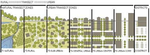
• Review and calibrate transect standards to align with the housing context of the Walkable Centers.
• Review building types (particularly related to permitted building heights) and unit-per-acre/required mixed-use provisions to align zoning permissions with envisioned redevelopment.
• Accommodate diverse options, including apartment buildings and smaller-scale housing types (i.e., 3-plexes to 6-plexes). Options that provide homeownership like courtyard townhomes and twoover twos should be considered in transition areas.
• Explore incentivizing the historic preservation of character structures through creativity in zoning regulations.
• Consider the development of “preapproved plans” for historically appropriate housing types especially in transition areas around the edges of the center. Single-family detached homes and townhouses should be limited in these centers area.
Community Centers
Examples:
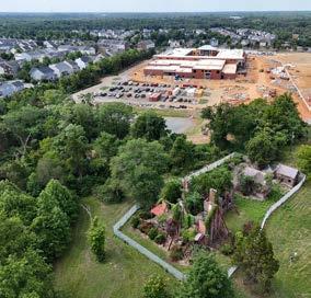
• Idlewild / Downman (Small Area 3): This new urbanist neighborhood features a new middle school, a major historic site (the Downman House, quarters, smokehouse, and dairy), preserved open spaces, and recreational trails. It also includes a small commercial area with live-work units.
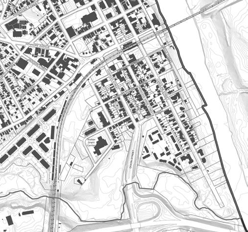
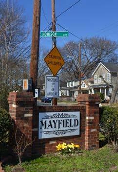
• Mayfield / Dixon Street (Small Area 8): Dixon Street / Mayfield is home to a historic neighborhood, Dixon Park (including the Doris Buffett Pool), Mayfield Community Center, neighborhood commercial uses, and institutional facilities like churches. While pedestrian infrastructure exists or is planned, safety concerns persist, particularly for crossings along Dixon Street near commercial areas and Dixon Park.
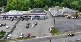
• US Route 1 Center (Small Area 10): Serving as a southern gateway into the city, the area is characterized by aging car dealerships and strip shopping centers. This area has limited pedestrian infrastructure, homogeneous land uses, and an outdated service road design.
• Central Lafayette Walkable Urban Place (Small Area 10): This area includes several aging commercial centers serving established neighborhoods that were built largely without pedestrian facilities.
• Alum Spring Maker District (Small Area 10): community center is a legacy industrial area with a sign maker, office, wholesale, and storage uses adjacent to a newly developed residential area. It is located at the intersection of historic Route 1, the Blue and Grey Parkway, and the VCR Trail along its path to Alum Spring Park.
Inherited Character:
Architectural character varies from center to center, but most are adjacent to or incorporated in established residential areas. These centers benefit from access to the regional street network and serve as a key feature of and transition to adjacent residential areas. Street grids (whether older or newly developed), nearby parks and natural areas, and connections into regional bicycle, pedestrian, and open space networks provide the energy to sustain the variety of neighborhood serving and employment centered uses appropriate in these centers.
Mobility
Emphasize local mobility and accessibility for residents across all modes. This effort should focus on the following guidance.
• Establish future increments of Fredericksburg’s grid of streets (i.e., the Courtland Drive Connector in Paul’s Village Center in Small Area 10).
• Plan, prioritize, and implement major connections in the pedestrian and bike network (i.e., reviewing the proposed alignment for the Gateway Boulevard Shared Use Path in Small Area 3 and completion of the Dixon Park Connector in Small Area 8). Traffic calming and alleyways support connectivity to mixed-use centers and broader systems and should emphasize safety and connectivity between uses (i.e., adding lighting to Dixon Street, both in Small Area 8).
• Finally, focus on the interface of these centers along major transportation routes is needed, specifically along Lafayette
Boulevard and US Route 1 in Small Area 10.
Open Space
• Create community focal points (e.g., a plaza or green) as redevelopment occurs in core areas of each Walkable Center.
• Invest in public open spaces, historic sites, and links to those facilities with pedestrian and bike connections (i.e., connecting the interpretation of the Downman Site, the middle school, and the regional centers to the north via the shared use path network in Small Area 3). Focus on improving pedestrian safety, enhancing neighborhood connectivity, and creating amenity-rich, central gathering places (i.e., the Dixon Park to Mayfield Community Center traffic calming project in Small Area 8).
• Identify ways to incorporate green infrastructure into larger open spaces to help meet the City’s TMDL MS4 needs.
Housing
• Apply Form-Based standards that support a variety of housing types as redevelopment occurs.
• Small-scale, attached housing and townhouses are most appropriate transitional areas adjacent to existing neighborhoods, while higher density housing (i.e., small apartment buildings) should be concentrated at the core of the Walkable Center.
• Review lot standards and consider pre-approved plans to provide historically appropriate housing types and the opportunity for homeownership.
• Consider the compatibility of infill housing to ensure it accomplishes neighborhood preservation and affordability goals using techniques like Neighborhood Conservation Districts and / or Pre-approved Plan Programs.
Implementation / Regulation / Transects
The comprehensive plan serves as a vision for the city’s future development. Implementation of this vision is guided by the City’s zoning ordinance and Form-Based Code, which uses consolidated transects to maintain consistency across development areas. By consolidating clear, form-based standards throughout the community, the plan ensures that new growth aligns with the city’s urban design goals while preserving walkability and connectivity. Making broader use of form-based standards in the future will directly support the walkability and vibrancy desired by the community.
The framework established in this chapter leads directly to objectives, policies, and strategies that guide implementation, providing a structured approach to realizing key concepts. This ensures that development, preservation, and mobility initiatives are conducted in a way that strengthens the city’s character, enhances public spaces, and fosters a more cohesive and sustainable built environment.
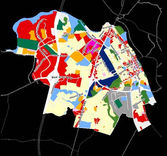
Existing Land Use
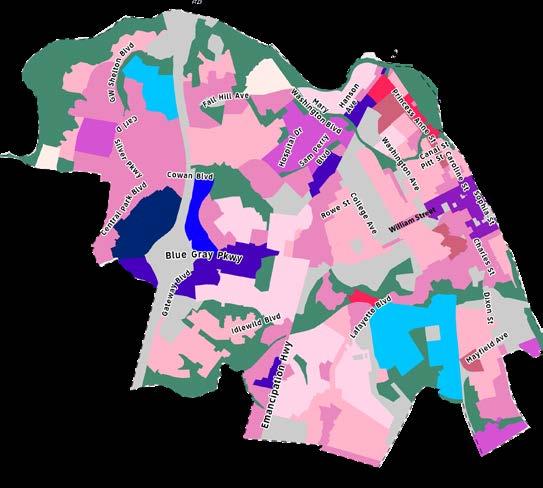
Future Land Use
Objectives
Create Walkable Centers: Enable the development of a set of mixed-use walkable centers that operate at different geographic levels (regional-, city-, and community-level centers).
Open Space Connections: Connect Walkable Centers and neighborhoods with open space networks and multi-modal, pedestrian-friendly streets.
Walkability: Build complete streets and maximize opportunities for people to adopt a walkable lifestyle.
Neighborhood Conservation: Preserve the high quality of life in existing residential neighborhoods.
Focus on Form: Allow existing neighborhoods to expand and modernize while protecting their building form, architectural detail, and tree-lined frontages.
Mobility for All: Right-size vehicular mobility and move towards freedom from car dependency.
Policies and Strategies
To achieve Fredericksburg’s vision for sustainable growth and vibrant neighborhoods, we need policies that promote mixed-use Walkable Centers and redevelopment of key corridors. Mixed-use development in these centers can balance commercial, residential, and public space needs while enhancing mobility and accessibility. These centers can be tailored to serve neighborhood, citywide, and regional roles, encouraging social engagement and economic vitality. By transforming corridors into complete streets with integrated transportation options, the city can ensure seamless connectivity between neighborhoods and key destinations.
Regulatory tools such as form-based codes can guide the creation of cohesive, human-scaled urban spaces, ensuring that new developments fit within the character of surrounding neighborhoods while supporting the broader framework for citywide growth. Improvements to citywide open space, mobility and public facilities systems will be planned to support and to benefit from the emergence of the new Walkable Centers. Policies
1. Establish a vision for Walkable Centers then permit it to be built through development codes.
2. Provide connectivity to Walkable Centers from adjacent neighborhoods and connect neighborhoods citywide.
1.a. Amend the zoning code to allow sufficient density and dwelling units and height per acre in Walkable Centers to support their function as either neighborhood, citywide, or regional centers.
1.b. Review form and design codes to create a unified citywide urban design program.
1.c. Streamline the land use entitlements process to empower landowners to undertake the types of developments envisioned in the plan more efficiently and with fewer administrative obstacles.
1.d. Review and refine frontage and open space standards to produce high-quality urban fabric.
2.a. Prepare an access and open space plan for each Walkable Center.
2.b. Review and update development regulations in and around Walkable Centers to prioritize pedestrian and bicycle connectivity and safety over vehicular traffic.
3. Promote a variety of housing options in new Walkable Centers.
3.a. Provide flexibility in housing arrangement, focus on smaller unit types, and explore pre-approved plans for diverse housing types.
3.b. Review historic development patterns and building types, identify where they were deemed non-conforming, and repermit them.
5. Plan the development of the citywide open space network to as a means to integrate existing, new, and redevelopment.
5.a. Ensure high-quality formal open spaces are provided and activated within Walkable Centers.
5.b. Evaluate the inclusion of parks and open spaces in the City’s Capital Impacts Study.
5.c. Ensure that new development and redevelopment projects reinforce and connect to the Uplands and Riverfront Open Space Networks.
4. Develop new public facilities to serve new residents in Walkable Centers.
4.a. Use and regularly update the Capital Impact study to incorporate school board capital planning into land use decisions on major projects.
MOBILITY
Enhancing Mobility & Placemaking
The corridors of Fredericksburg are essential conduits for mobility that connect neighborhoods, businesses, and regional destinations. They also play a critical role in shaping the city’s character, blending functionality with placemaking. Each of the four corridor types described below is designed to meet specific transportation needs while fostering a sense of community and accessibility. Some streets already meet these descriptions; others will have to grow into them in the future. Each corridor type has the potential to contribute to the city’s vibrant and interconnected urban environment.
1. Gateway/Entryway Corridors
Gateway or Entryway corridors serve as the critical transition between the region’s auto-dominant transportation networks and Fredericksburg’s pedestrian-scaled urban fabric. As primary entry points to the city, these corridors accommodate high volumes of through traffic, with a primary focus on automobile and transit mobility. They feature wide rights-of-way (typically 120 feet or more), enhanced landscaping, automobile-scaled lighting, and prominent gateway elements like public art and entryway signage. While pedestrian facilities are provided, they are often set back or integrated into adjacent developments, with crossings concentrated at key intersections. Safety measures include grade separated pedestrian crossings where appropriate, high-visibility crosswalks, pedestrian refuges, signals, and ample warning signage.
2. Walkable Boulevards
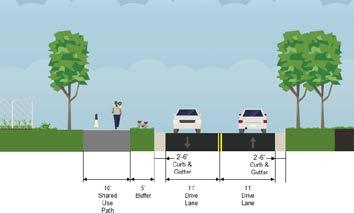
Walkable Boulevards are vital for connecting Walkable Centers across the city. Balancing pedestrian and automobile needs, these corridors typically feature a shared-use path on one side and a sidewalk on the other. With moderate rights-of-way (generally 80 to 120 feet), they emphasize access management, strategically locating pedestrian crossings with signals and crosswalks at all intersection legs. A landscaped and lighted central median typically divides these boulevards, enhancing both safety and aesthetic appeal while supporting longer-distance mobility for all users.
3. Walkable Urban Streets
Walkable Urban Streets are appropriate for areas where high travel volumes intersect with compact, walkable blocks. Designed to prioritize safety and accessibility, these streets have moderately wide rights-of-way (typically 70 to 90 feet), robust pedestrian facilities, and coordinated intersection spacing. Pedestrian-scaled lighting ensures visibility, and traffic-calming measures support safe and efficient multi-modal travel. Safe and convenient pedestrian crossings are strategically located, creating a network that integrates seamlessly with surrounding land uses.
4. Urban Main Streets
Urban Main Streets are the city’s most pedestrian-active corridors, connecting thriving walkable urban districts. These “complete streets” are designed to accommodate multiple modes of travel, including transit vehicles and bicycles, while prioritizing pedestrian mobility. With sidewalks up to 10 feet wide, frequent crosswalks, on-street parking, and pedestrian-scaled lighting, they create a safe and inviting environment. Traffic-calming measures, integrated hardscaping, and street trees contribute to a dynamic streetscape that supports both through movements and local access. Travel lanes are optimized for multi-modal functionality, ensuring that Urban Main Streets support vibrant hubs of activity.
Functional Classification
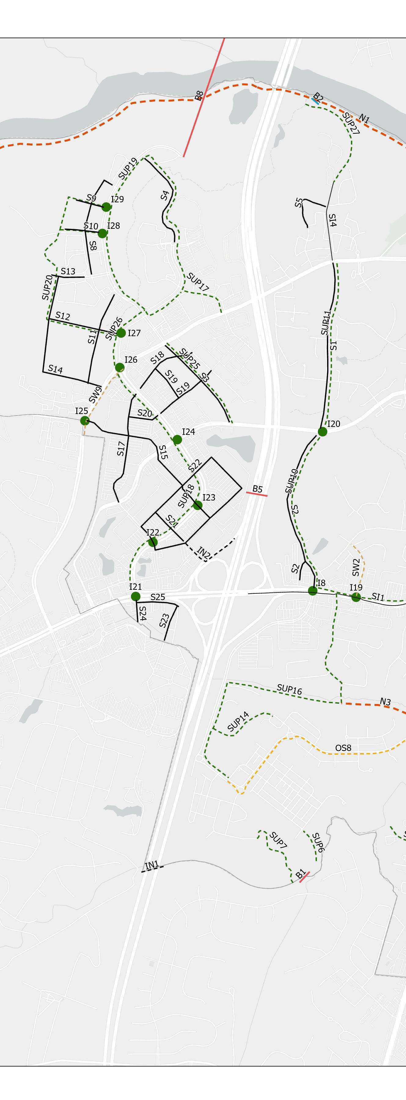
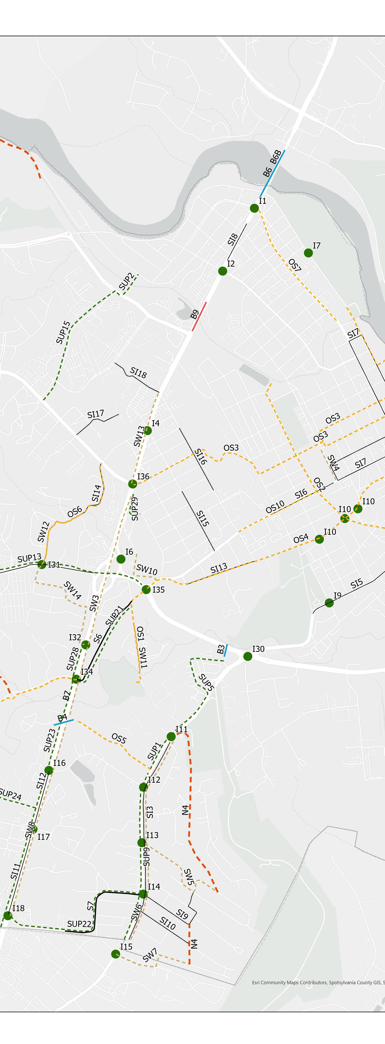
Future Mobility Improvements
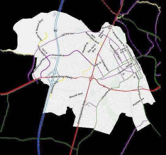
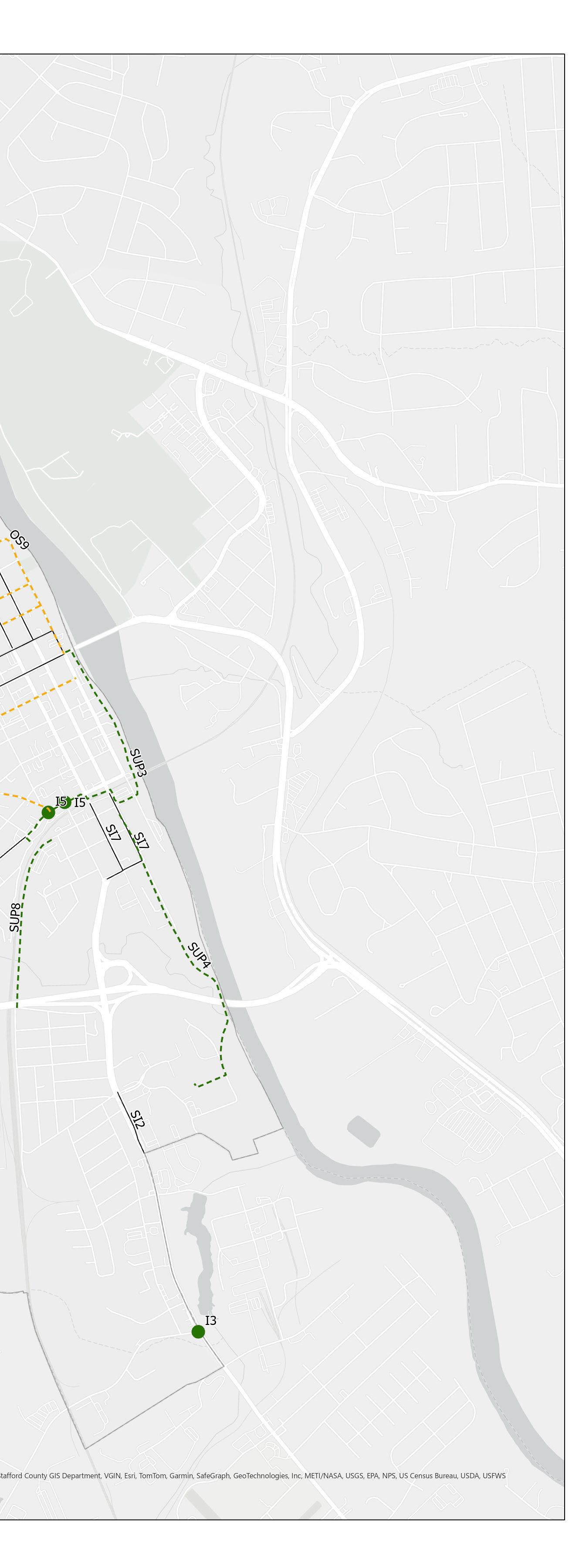
Map 5: Functional Classification of Major Roads
Map 6: Future Mobility Improvements
Context
Fredericksburg’s transportation network grew and evolved alongside the transformational technological advances of the last three centuries. The original town plan was a grid of public streets feeding a river port and a canal network that bypassed the Rappahannock Falls, thereby providing access to the western portions of the state. As mobility evolved, elements were added to the system – first a railway and train station, and then a more robust highway network that culminated in Interstate 95. Each of these evolutions changed the movement of people, goods, and services along with Fredericksburg’s landscape and place in the regional system.
Today Fredericksburg has a solid foundation of multi-modal transportation options that enables internal, external, and regional connections. The transportation system provides for sustainable and accessible walking, biking, and transit, in addition to people driving private cars. Much of this success was achieved through the city’s original grid, which served as the DNA-like template for growth in some adjacent areas of the city. In the second half of the 20th century, however, a lot of land was developed without sidewalks and with fewer interconnections in the street network, making these areas— and the people living in them—more automobile-dependent. The personal automobile became the primary mode of transportation in this suburban development pattern, not only in the newer areas of Fredericksburg, but also in neighboring Spotsylvania and Stafford Counties, as well as other similar suburbs across the USA.
The Fredericksburg region has been one of the fastest growing in the country in recent years. As growth has occurred, local arterial highways (US Route 1, State Route 3) and Interstate 95 have grown, been reconfigured, and taken on additional functions. This evolution has been critical to the continued functionality of the region’s auto-dependent environment, but now faces significant challenges, including congestion. Sprawling land use patterns and a lack of connection between developments require over reliance on a handful of main roads (Route 208 in Spotsylvania, Route 17, and Route 610 in Stafford) which are now rendered impassable at peak times. Expanding these roads is untenable from a cost and benefit perspective; it would not address the underlying lack of connectivity and would create further barriers for non-auto users.
In recent years, there has been a resurgence of interest in making compact, mixed-use communities with good pedestrian and bicycle infrastructure. The old way of citymaking has come full circle, creating the possibility of replicating the early settlement patterns and multi-modal transportation networks in Fredericksburg’s emerging and future Walkable Centers.
This chapter focuses on the next phase of evolution of the city’s transportation networks. The first part of the chapter focuses on the vision for this evolution. The second part presents the transportation projects database. Updating and expanding the transportation networks is complex and expensive. State and Federal funding sources are a key opportunity for network expansion and retrofit where necessary. The transportation projects database is prioritized as a road map to continued investment and incremental improvement of the city’s transportation network.
Project recommendations are developed through a network of local, regional and statewide planning processes. FAMPO’s Transportation Demand Model and Long Range Transportation Plan is one tool used to identify congestion or connectivity issues. VDOT’s Strategically Targeted Affordable Roadway Solutions and Smartscale project pipeline programs are another means to identifying congestion and safety issues that need improvement. The City’s Small Area Planning process also uses focused analysis area by area within the City to identify safety, congestion, or mobility issues that need attention. Additionally, the city works with community members to identify needed projects through planning processes as well as through partnership with focus groups like the Pathways Committee or the regional Bicycle and Pedestrian Advisory Committee.
Walk/Bicycle
The city is well connected by sidewalks and has a robust pathway network that provides safe and separate connections for people walking and bicycling. Since the 2015 Comprehensive Plan was adopted, the Chatham Bridge Improvement project added a shared-use path for pedestrians and bicyclists and connected the bridge path with the Belmont-Ferry Farm Trail in Stafford County and now plan to replicate these connections on the Falmouth Bridge. City residents note the need for more of these connections among trails, which also supports a high number of recreational trail users as opposed to bicycle commuters. In 2019, the City conducted a feasibility study on developing a bikeshare program and in the same year passed a local ordinance regulating shared e-bikes and e-scooters.
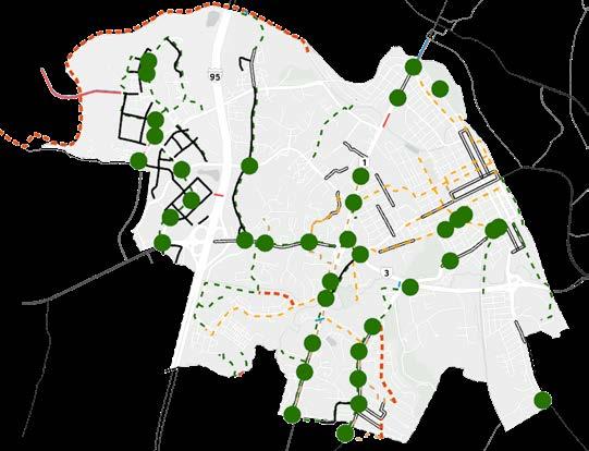
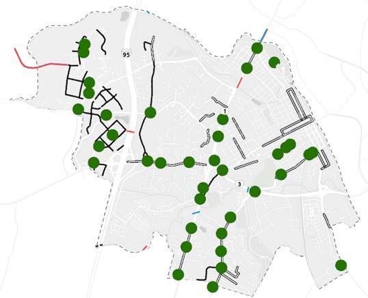
Future Bicycle and Pedestrian Improvements
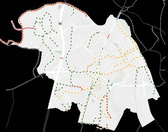
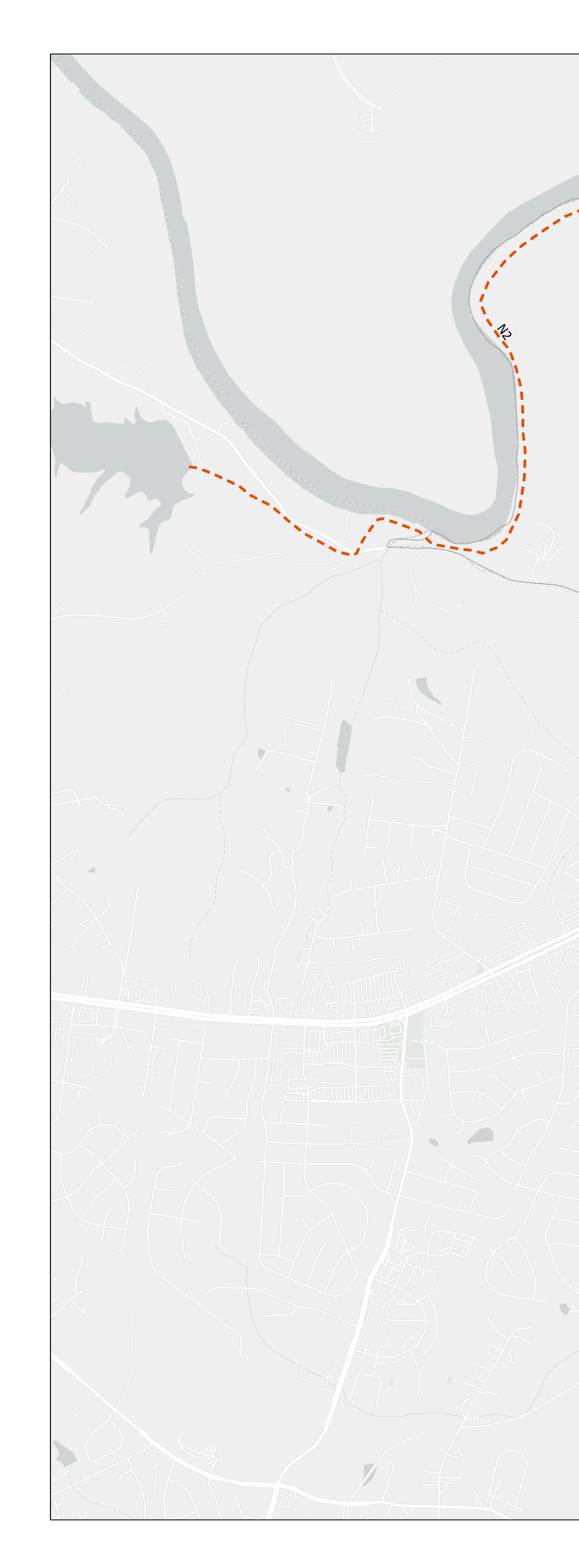
Map 7: Future Pedestrian and Bicycle Improvements
Transit
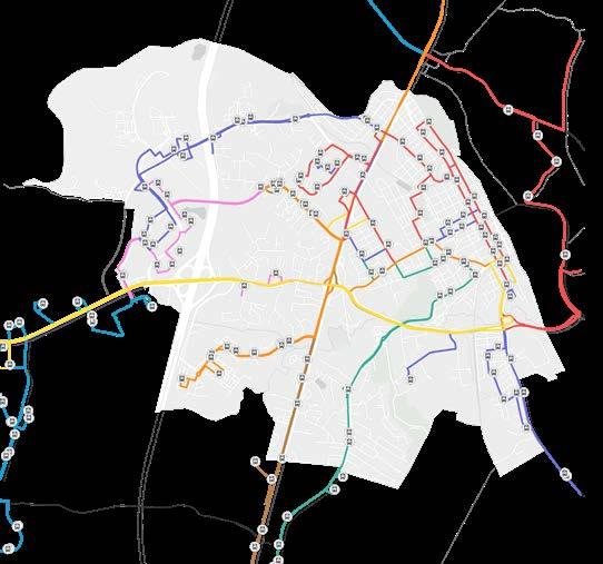
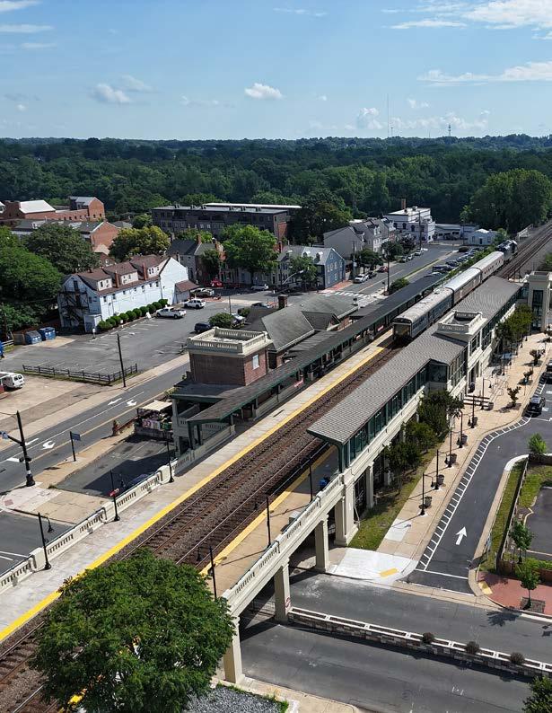
The regional transit agency, which in 2023 rebranded from FRED Transit to FXBGO!, operates routes that serve Fredericksburg, Spotsylvania, and Stafford. The University of Mary Washington Eagle Express connects the University population to key destinations. Fredericksburg is also home to a train station that is served by two rail services: Amtrak, providing multiple daily trains to several major East Coast cities, and Virginia Railway Express (VRE), offering weekday rush hour service to and from Washington, D.C.
Map 8: FXBGO! Routes and stops
Drive
In addition to the transit service and trails, Fredericksburg is connected to the region through Interstate-95 (I-95), State Route 3, and US Route 1. The one I-95 interchange in Fredericksburg at Route 3 was subject to safety improvements that reduced vehicle merging and weaving patterns.
Electrification and Technology
In 2021, the City partnered with Virginia Clean Cities on the release of the “Electric Vehicle (EV) Charging Infrastructure Projection and 10% Deployment Scenarios” report, which identified the number of chargers needed to meet 10% EV deployment in the city, proposed charger types and locations (with a focus on equitable EV charging station access), and compiled an inventory of existing charging stations. The City’s website provides information about public EV charging and tax incentives for EVs. Recently, Fredericksburg City Public Schools received a $3.5 million grant from the Environmental Protection Agency’s Clean School Bus program to purchase ten new electric school buses. At the state level, the 2020 VDOT “Connected and Automated Vehicle (CAV) Program Plan” outlines the CAV Program’s plans and actions to prepare Virginia’s roadways for the deployment of CAVs.
Objectives
Local Connectivity: Ensure system-wide consistency in the accommodation of multiple modes and overall connectivity.
Regional Connectivity: Promote integration into the regional transit and transportation networks and participate in the evaluation of new major regional infrastructure like interstate access, updates to State Route 3, and a potential new Rappahannock River crossing.
Planned Local Roadway Improvements
Street Grid: Continue to seek to expand the street grid, extending connections between developments and across arterials.
Electrification: Electrify both older and newer areas of the city with automobile- and bicycle-charging facilities.
Equity: Focus on historically under-served and overburdened areas of the city.
Up to Date Parking: Continue the development of a contemporary parking policy.
Advanced Technology: Work towards US DOT targets for connected vehicle communications infrastructure.
Policies and Strategies
1. Create complete streets in new and existing communities that work for all transportation modes.
1.a. Revise complete streets standards and guidelines to include traffic calming performance standards and metrics for standardizing implementation.
1.b. Execute the pavement condition study and develop a right-of-way Asset Management Strategy to add complete street elements or traffic calming during the repaving process.
1.c. Package sidewalk retrofits in older neighborhoods and pursue funding.
1.d. Investigate new concepts in street design and include them in standards if appropriate.
1.e. Assess and implement FAMPO’s Safety Action Plan.
1.f Continue the multi-departmental effort to coordinate and harmonize planning processes and outputs, including with the Planning Commission, to provide for a streamlined implementation process for multi-modal projects and engineering studies.
1.g Employ an approach to the public right-of-way that more equally balances the needs of pedestrians, bicyclists, transit users, and motor vehicle operators citywide, while prioritizing the safety and convenience of non-automobile modes (pedestrians, bicyclists, transit users) within designated Walkable centers and the Corridors connecting them.
2. (Continued)
2. Adopt a Traffic Calming policy to establish a process for requesting traffic calming and a toolbox of standard measures.
2.a. Implement traffic management strategies including intersection geometry and signal timing.
2.b. Prioritize and proactively implement traffic calming in designated Walkable Centers, connecting Corridors, neighborhoods experiencing documented cut-through traffic, and near sensitive areas like schools and parks.
3. Expand the street grid by implementing new segments, improving crossings at key intersections, and instituting traffic calming.
2.c. Adopt and apply a toolkit of traffic calming measures (such as, but not limited to, narrower lanes, raised crossings, speed tables, etc.) with categorical definitions of potential application (residential streets, long unbroken straightaways, proximity to sensitive receptors, high pedestrian areas).
2.d. Continue the focus on updated, more robust standards for pedestrian infrastructure requirements including all way crosswalks at intersections and incorporation of asphalt art along roadways and within intersections where appropriate
2.e Integrate the implementation of prioritized traffic calming projects into the City’s Capital Improvement Plan (CIP), annual budget process, and routine maintenance / repaving schedules to ensure dedicated resources for construction.
3.a. Complete the Downtown Traffic Engineering Study and implement the findings.
3.b. Design, pursue funding for, and implement connector projects including the Courtland Drive Connector, the Downtown Connector, and Gateway Boulevard
3.c. Install safe, at-grade, multi-modal connections at key intersections with a view to overcoming barriers such as arterial roads. Accommodate pedestrian / bike facilities in the redesign of the Falmouth Bridge.
3.d. Identify and implement solutions for loading and service activity off-street and in alleys, where possible.
3.e. Require that developers include network plans and maintain or enhance street grid connectivity for new developments, especially in locations identified in the Small Area Plans and the Transportation Projects Database.
4. Improve bicycling infrastructure for all types of bicycle use and for all ages and abilities.
4. (continued)
5. Support public transit’s long-term viability by promoting development patterns that integrate land uses and multiple modes of travel.
4.a. Promote bicycle racks, bicycle lockers, and bicycle sharing at key destinations including new public and private projects.
4.b. Use on-street bike facilities to fill in gaps and pair them with traffic calming / safety measures.
4.c. Complete construction of the VCR Connector, Dixon Park Connector, and Idlewild Connector shared use paths.
4.d. Shift the proposed route of the Gateway Boulevard Shared Use Path to better connect adjacent neighborhoods, commercial areas, and the new middle school. Work with VDOT and FAMPO to preserve and expand the funding allocated to the project.
4.e. Continue to work with the Pathways Committee on maintaining and implementing bicycle and pedestrian projects and update the Transportation Projects Database.
4.f. Implement the on-street bike plan for connecting the Chatham Bridge to Heritage trail and connecting the train station, via Caroline Street, to the Dixon Park connector, as proposed in the Downtown Traffic Engineering study.
4.g. Use alternative funding sources with an emphasis on utilizing the Safe Routes to School funding program for project design and implementation.
5.a. Upgrade the FXBGO! levels of service incrementally to strengthen transit connections among existing and new Walkable Centers when they develop.
5.b. Add transit capacity, where and when feasible, and maintain a Real Time Transit Information System.
7. Participate in regional vision setting for the next major automotive infrastructure investments.
6. Enhance train station’s function by maintaining and expanding bus service, bicycle facilities, passenger services, and amenities.
6.a. Develop a station area plan that includes the creation of a Mobility Hub that continues to add services and connectivity to extend the station area’s centrality.
8. Develop parking policies that are appropriate for an active downtown and the protection of residential areas.
7.a. Continue work with institutional and regional partners like FAMPO, VDOT, Stafford County, and Spotsylvania County on the planning for new access to and from Interstate 95, potential new river crossings, extension of the VCR Trail to the west, the replacement of the Falmouth Bridge, and the next iteration of State Route 3.
7.b Advocate for a formal seat on regional committees.
8.a. Update the 2017 Downtown Parking Plan to revisit and reestablish priorities for parking focusing on both on-street and off-street policies.
8.b Develop data on parking demand, current use, and the cost of provision to match policy with present challenges and to support future growth, especially around the train station.
8.c. Develop time-sensitive loading areas through regulation and enforcement.
8.d. Monitor and mitigate parking supply conflicts, especially within residential areas.
9. Incorporate electric vehicle (EV) planning considerations into development codes and standards, including minimum standards for EV chargers in new parking facilities.
9.a. Perform EV readiness assessment to identify future public charging infrastructure needs with a focus on serving users without dedicated offstreet parking.
9.b. Develop EV charging policies including zoning ordinance modifications to accommodate charging in new development and policies for retrofitting existing historic fabric with charging opportunities on private property and in the public right-of-way.
9.c. Evaluate city’s ability to meet targets established in U.S. DOT National V2X Deployment Plan, which sets goal that 85% of signals in top 75 metropolitan areas should be equipped with connected vehicle communications by 2036.
PUBLIC OPEN SPACE
An Open Space System
Fredericksburg’s open space network is a fundamental component of the citywide framework, integrating parks, trails, and natural areas into the broader systems of mobility, environmental sustainability, and community identity. Functioning as both neighborhood amenities and citywide assets, open spaces enhance recreation, ecological resilience, and connectivity between local and regional destinations. While individual Small Area Plans provide localized recommendations, this plan unifies those efforts, particularly through the Riverfront and Uplands Open Space Network, to ensure a cohesive and continuously improving system. Guided by objectives, policies, and strategies, this framework prioritizes accessibility, incremental investment, and strategic funding to expand and enhance open spaces. By aligning with the City’s broader urban design goals, Fredericksburg’s open space network fosters a resilient, healthier, more connected, and sustainable community.
Context
This chapter addresses the vital role of parks, trails, and natural areas in fostering a healthier, more active, and resilient community for the people of Fredericksburg. Opens spaces are vital to the City organism: green areas help the city breathe, environmental features filter nutrients before water is discharged downriver, open spaces grow together like synaptic connections fostering epiphany and restoration. Open spaces function as both local amenities that enrich neighborhood recreation and community well-being and as integral components of the city’s environmental and mobility systems. While each Small Area Plan provides tailored recommendations for specific neighborhoods, this chapter builds on the systematic concepts illuminated in those focused chapters: the Riverfront and the Uplands Open Space Network. The purpose of this chapter is to strengthen the cohesiveness of those concepts to continue the incremental improvement of the city’s open space networks as both critical system components and connections helping convey residents to both local and regional amenities.
Aligned with other elements of the citywide framework, Fredericksburg’s open space network combines citywide and localized guidance to enhance accessibility, support public health, and strengthen environmental resilience across the city. The objectives, policies, and strategies outlined here ensure that Fredericksburg’s open spaces contribute meaningfully to the City’s broader goals, creating a vibrant and connected community for all.
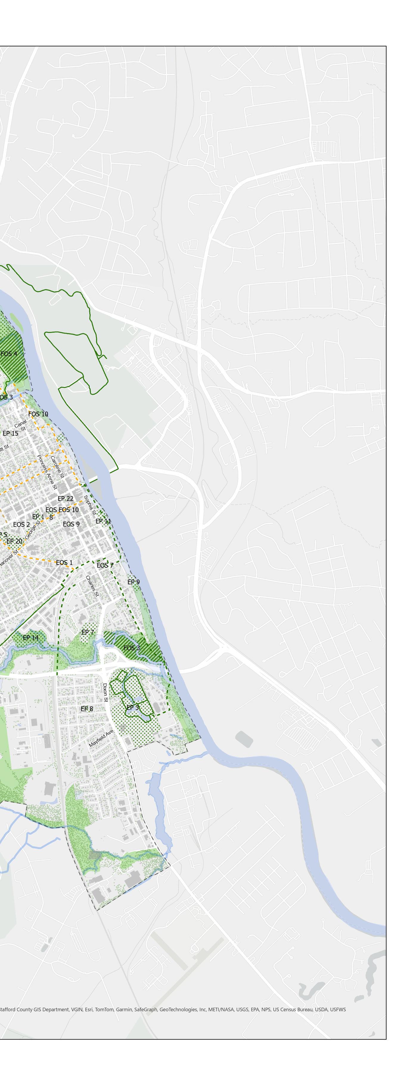
This chapter focuses on the next evolution of the city’s public open space network. The first part of this chapter focuses on the vision for the next iteration of this network. The second part is a public open spaces database. Updating and expanding the open space networks is complex and expensive. State and Federal funding sources are a key opportunity for network expansion and retrofit where necessary. The Open Space database is prioritized as a road map to continued investment and incremental improvement of the city’s open space networks. Projects within the database are likely to be advanced through further master planning by the City’s Parks and Recreation Department.
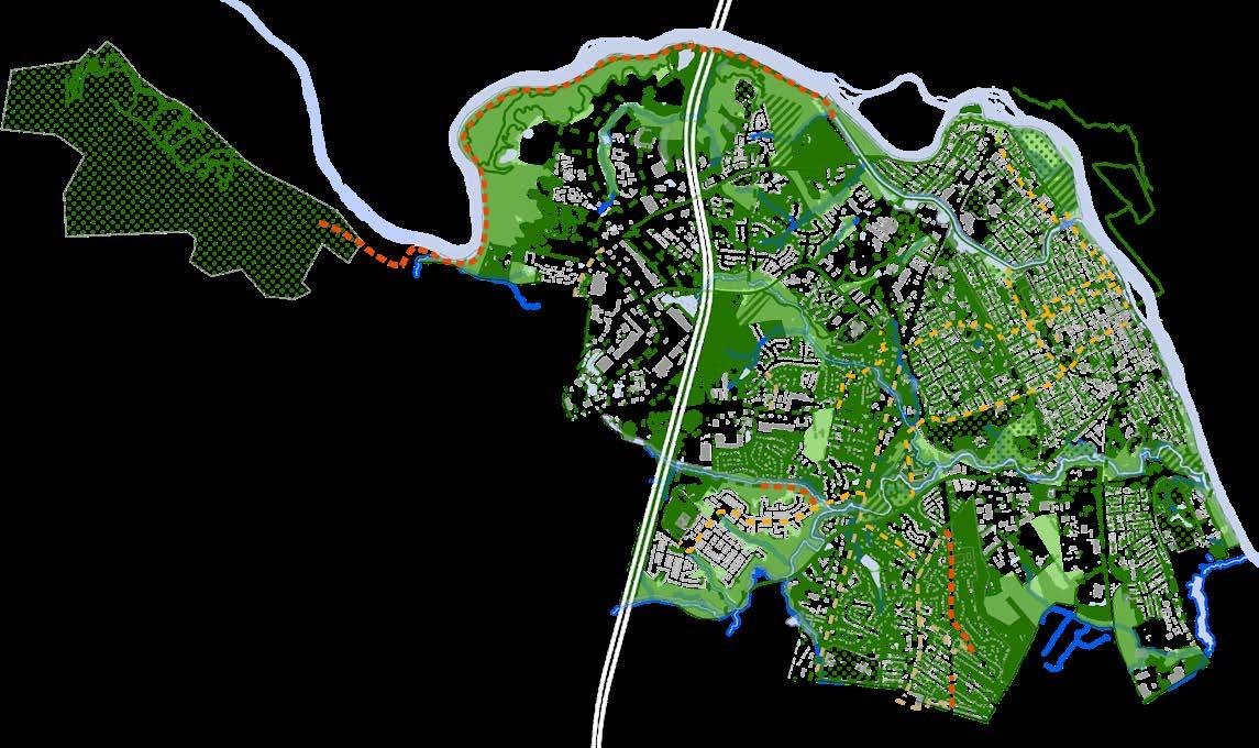
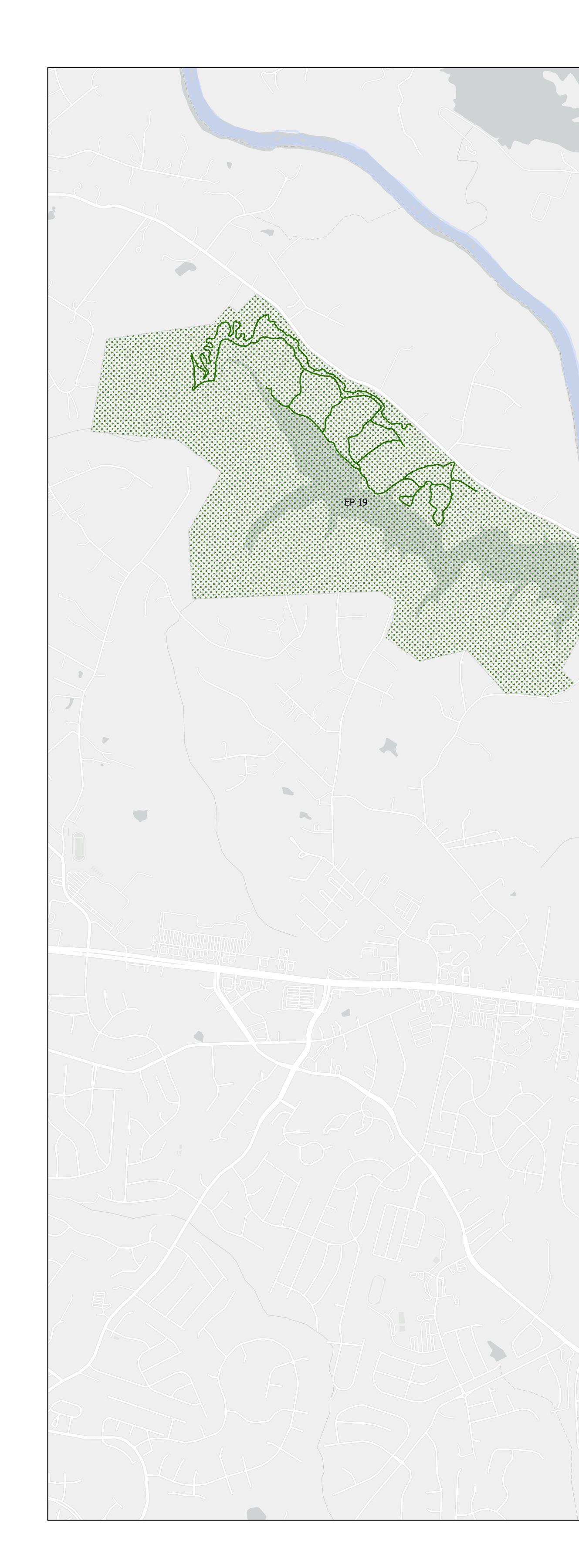
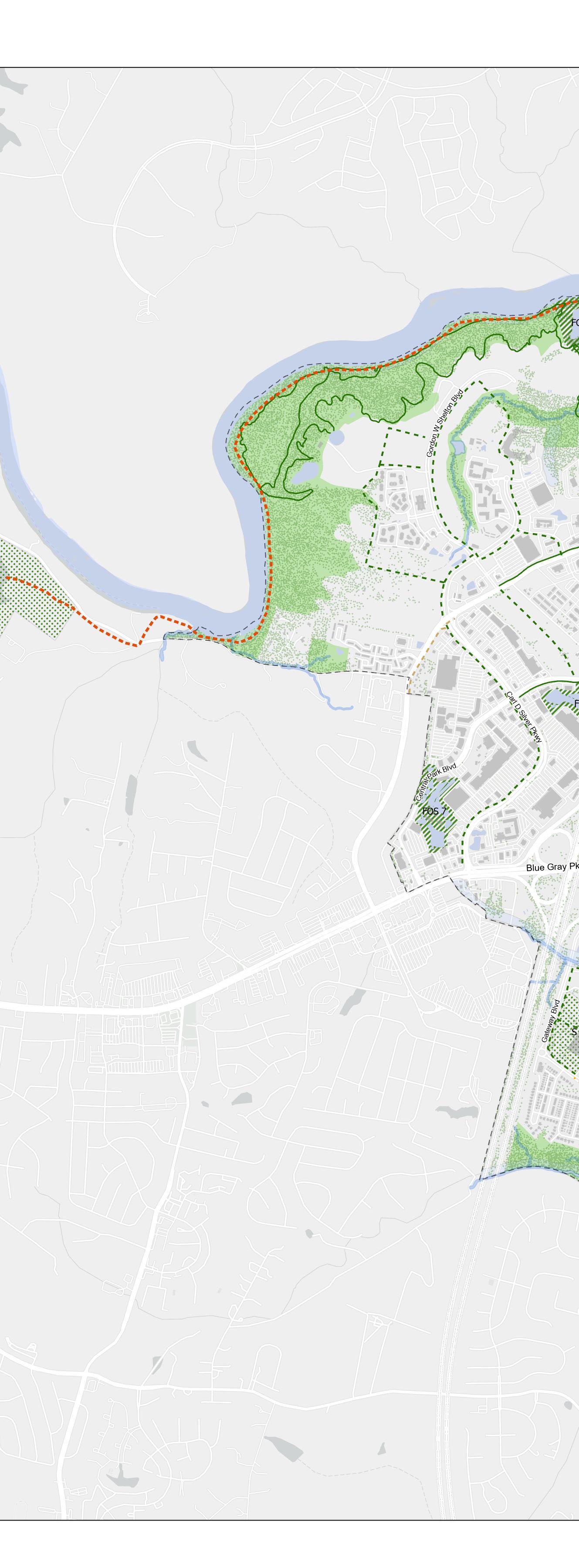
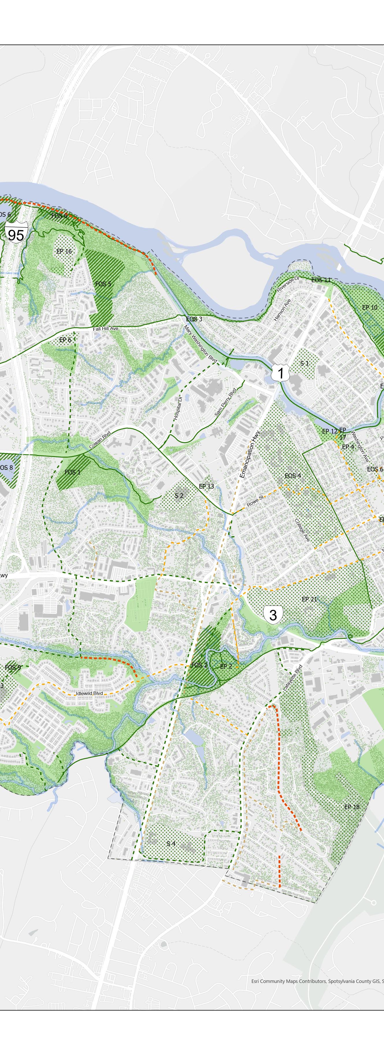
Map 10: Uplands and Open Space with Riverfront Open Space
Objectives
Site Specific Master Planning: Continue to upgrade existing active parks through Parks and Recreation’s master planning program.
Partnerships: Incrementally activate the city’s wealth of unique open spaces starting with passive recreation by utilizing support from non-profit groups.
Next Generation Open Spaces: Work with the Recreation Commission to systematically prioritize the next generation of public open spaces, to keep the Public Open Space Database up to date and pursue implementation.
Sports Tourism: Evaluate the potential for Sports Tourism at City facilities such as Dixon Park, Virginia Credit Union Stadium, Sunshine Ballpark, and Snowden Park and continue to implement programmatic recommendations.
Safe Access: Improve multi-modal connectivity to and within open spaces, ensuring safe access by walking, biking, and transit from nearby Walkable Centers and along key Corridors.
Green Streets: Integrate green infrastructure into the redevelopment of key Corridors, transforming them into “green streets” that combine open space, stormwater management, and complete streets principles.
Green Design: Refine regulatory policies to encourage the inclusion of open spaces within urban and neighborhood developments, fostering cohesive, accessible green spaces that support holistic community growth and environmental resilience.
Policies and Strategies
Achieving Fredericksburg’s vision for a connected and resilient community requires policies that advance a cohesive open space network throughout the city. Parks, trails, and natural areas within this network will provide accessible recreational opportunities and environmental benefits, supporting sustainable growth and enhancing community well-being. By strategically linking open spaces to meet neighborhood, citywide, and regional needs, the City can foster a network that promotes social engagement, active lifestyles, and climate resilience. Transforming key corridors into “green streets” with integrated parks, trails, and green infrastructure will strengthen connectivity and improve access to open spaces across neighborhoods. Regulatory tools will encourage the inclusion of accessible, connected green spaces in new developments, ensuring these areas align with the broader citywide framework while preserving neighborhood character. The following policies and strategies will guide Fredericksburg in achieving these open space goals, supporting a vibrant, unified community.
1. Review regulations and design guidelines to ensure they produce accessible and usable open spaces especially in Walkable Centers and along corridors.
1.a. As more projects are built using the City’s form-based code, review the “General” and “Formal” Open Space requirements to ensure they produce well positioned interconnected green spaces.
1.b. Expand incentives, such as density bonuses or expedited permitting, for projects that include formal open spaces, such as plazas, pocket parks, and trails that exceed the minimums requirements.
1.c Create a Public Institutional and Open Space zoning district and apply it to public lands and open spaces.
2. Link the Uplands and Riverfront Open Space networks via multi-modal access to neighborhoods and Walkable Centers.
2.a. Develop and expand pedestrian and bicycle infrastructure leading to major parks, open spaces, and along corridors to ensure safe, easy access from surrounding neighborhoods including adding additional lighting and security features along pathways and other Upland Open Space links.
3. Engage and partner with conservation groups, non-profits, and other departments to protect, enhance, and appropriately activate open spaces along the Riverfront.
2.b. Partner with non-profits such as the Fredericksburg Area Trails Alliance on the activation of public open spaces.
2.c. Coordinate with FXBGO-Fredericksburg Regional Transit to enhance public transportation to parks and Walkable Centers.
2.d. Build envisioned links within the Uplands and Riverfront Open Space Networks as shown in the Small Area Plans and Public Open Space Database using green buffers, linear parks, landscaped medians, and public art. Convert excess asphalt into public plazas.
3.a. Continue to improve riverfront access, environmental protection, and conservation of public open space along the river in partnership with conservation groups.
3. (continued)
4. Promote diverse recreational opportunities in open space.
3.b. Identify Riverfront access points and Water-Dependent Facilities in the Public Open Space Database to ensure that recreational activity has a minimal footprint on sensitive environmental features.
3.c. Explore how existing Riverfront areas balance conservation with their function as regional recreational tourism generators (including fishing, hiking, mountain biking, and other outdoor recreational activities) and incorporate the findings in the master planning efforts for Butler-Brayne (future), Wild Riverfront (future), Hazel Run (future), and Motts Run parks.
4.a. Include flexible-use spaces within parks that accommodate various recreational activities, such as open fields for sports, picnic areas, and event spaces for community gatherings.
4.b. Identify spaces that support Fredericksburg’s emergence as a sports tourism destination including for roller hockey.
4.c. Continue to program and develop organized recreational activity, seasonal events, and outdoor programs, like guided nature walks, fitness classes, and community festivals, to encourage yearround engagement with the city’s parks and open spaces.
5. (continued)
5. Identify Destination Parks in the Public Open Space Database and upgrade public amenities to enhance their utility.
5.a. Provide essential amenities, including restrooms, picnic shelters, and water fountains, within major parks to enhance comfort and encourage longer stays in Destination Parks.
5.b. Increase park accessibility by installing additional ADA-compliant pathways, seating areas, and recreational facilities, making open spaces more welcoming for all residents.
5.c. Add additional lighting and security features in parking areas and along pedestrian access points to improve safety and extend usable hours, particularly in high-traffic areas.
6. Align the citywide open space network with Walkable Centers.
5.d. Balance local access, green infrastructure and parking needs within regionally desirable Destination Parks. Minimize the conversion of park space to formal parking in parks, especially when located in existing neighborhoods.
6.a. Design “formal” open spaces within or adjacent to Walkable Centers to reinforce the center’s role as gathering places for social interaction.
6.b. Establish key corridors as connective greenways with continuous multi-modal pathways and dense street trees.
6.c. Integrate small parks, plazas, and green spaces into new / redevelopment especially within Walkable Centers to create accessible recreational opportunities for residents and businesses.
6.d. Incorporate green infrastructure elements, such as bioswales and permeable surfaces, into street and park designs within Walkable Centers to improve environmental resilience.
BACKGROUND AND DEMOGRAPHICS
Introduction
It is important that a comprehensive plan is based on reliable, up-to-date data and a realistic understanding of where the community is before making recommendations about the future.
The following chapter is an update of relevant data points as of the summer of 2024.
With an area of 10.5 square miles, Fredericksburg is located midway between Washington, D.C. and Richmond, Virginia. The City is part of the George Washington Regional Planning District (Planning District 16), which includes Fredericksburg and four nearby counties: Caroline, King George, Spotsylvania, and Stafford. The City is the regional center for administration, professional services, finance, higher education, medicine, and commerce.
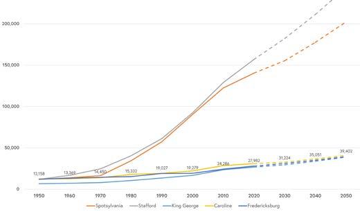
Using data from the Weldon Cooper Center for Public Service (University of Virginia) and the U.S. Census, Figure 1 shows historical and projected population of the City of Fredericksburg and its neighbors. Growth was nearly constant over the second half of the 20th century. Since 2000 the growth rate has increased, reaching 2.02% per year on average over the period 2000-2022. However, growth in the region has exploded particularly in Spotsylvania and Stafford Counties from the 1980s to the 2010s. These trends are expected to continue. Population is expected to continue to grow in the City at about 1.1% annually over the next 25 years. The projected growth rate is moderate, not high. The projected population of 39,402 in 2050 represents a 41% increase over the estimated 2022 population (28,757). The comprehensive plan will address the ways that Fredericksburg will accommodate the increase of about 10,600 people over that period.
Regional Population Growth, 1950-2050 (projected)
Population
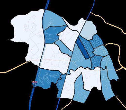
The map below shows Fredericksburg’s population density per acre by Census Block Group. A Census Block Group is a geographic area that the U.S. Census Bureau uses to publish demographic data. They are generally drawn to represent areas ranging from 600 to 3,000 people.
Population Density per Acre by Census Block Group
The table below shows that most of the population growth in the George Washington Region is taking place in the surrounding counties, not in the City of Fredericksburg. This reflects the ongoing expansion of suburban development down the I-95 corridor in recent decades and the availability of land for low-density development in the counties.
Regional Population, 2010-2050
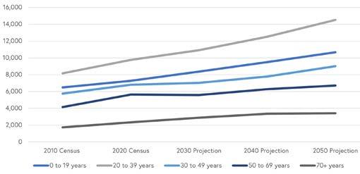
The following charts present Fredericksburg population data by age cohort. The fastest growing cohort is 20-39 years of age, which corresponds to an increase in young families with children in the city. The most senior age group (>70 years) is growing this decade but is expected to flatten out by 2040. The number of people in the 50-69 year age group is projected to be constant this decade, but grow modestly after 2030.
Population Growth by Age Cohort
Fredericksburg’s population is growing at 1-2% per year.
Source: Weldon Cooper Center for Public Service
Source: Weldon Cooper Center for Public Service
45
For planning purposes, it is helpful to have an understanding of how Fredericksburg’s population may change over time. However, projections should be viewed as offering a general idea of trends, rather than an indication of exact numbers.
The chart above was created using data from the University of Virginia’s Weldon Cooper Center for Public Service, which is the most commonly-used data source for population projections in Virginia. The Weldon Cooper Center’s methodology for projections is contractually required with the Commonwealth of Virginia to provide projections that are uniformly applied to all localities in Virginia with high quality input data that is universally available. The projections must also be guided by rigorous demographic and statistical standards, and carefully tested against census data. The results of the testing must find that the method produces reasonable, consistent projections at both the locality and state levels.
The Center advises that projections come with varying degrees of uncertainty depending on the span of years projected, with 2040 being more uncertain than projections for 2030, and the size of the geography itself. Unanticipated events, such as cultural, economic, natural/environmental, or political events are difficult to foresee and quantify. Projections are also developed by making assumptions about the future for various purposes that are logical and credible. Different projections may reflect differing assumptions that yield different results.
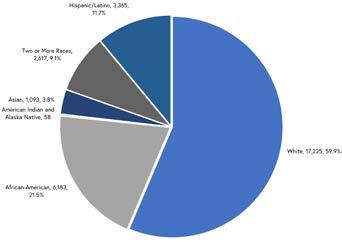
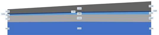
Over the 2020-2040 period, Fredericksburg is projected to become more diverse as the Hispanic and Asian populations grow quickly. The White population is expected to be constant at around 15,000, while Whites as a share of the total population will decrease from 50% to 39%.
Diversity Source: U.S. Census (Population Estimates July 1, 2022)
Economy
Fredericksburg and the George Washington Region are located at the southern edge of the WashingtonArlington-Alexandria Metropolitan Statistical Area (MSA). With Washington, D.C. at its core, this MSA is largest federal employment hub in the country. The MSA has a population of 6.33 million, making it the seventh largest in the USA. In 2022 the total economic output of the MSA was $660.6 billion. The top three economic sectors by employment in the MSA are 1) Professional, Scientific, and Technical Services, 2) Public Administration, and 3) Health Care & Social Assistance.
The close proximity of Fredericksburg to the Washington-Arlington-Alexandria MSA generates employment opportunities for Fredericksburg residents and enables some MSA workers to relocate to Fredericksburg without changing jobs. This is increasingly true following the COVID pandemic, with the rise in remote work.
Housing
The housing data in the tables and figure below compare Fredericksburg to the four counties in the George Washington Region (Planning District Commission 16). Fredericksburg households are on average smaller than those in the surrounding counties, reflecting the high number of students in the city as well as the historic tendency for families to locate in the suburbs. (As shown in the age group analysis above, however, the increase in young families in Fredericksburg is bucking that trend.)
Homeownership rates in Fredericksburg are lower at 39% than those in PDC 16 (75%-82%). This is typical of other “College Cities/Towns” throughout Virginia. However, housing costs in the city — whether for rental housing or homeownership — are comparable to those in the four counties, but household incomes are lower on average. This suggests that housing affordability is a bigger challenge in the city.
Reflecting the denser settlement patterns in the historic center, population per square mile in Fredericksburg is about 9 times higher than the average across the four counties.
When compared to select communities from Planning District Commission 8, Fredericksburg’s Median Value is more similar. However, on the following page, the local Median Household Income is revealed to be more comparable to localities in less affluent areas of Virginia.
Context
Selected communities for comparison include Salem, Charlottesville, further west and south in the State, and Manassas, and Fairfax City, part of Planning District Commission 8 in Northern Virginia. With a Median Household Income more similar to other parts of Virginia and home values on the previous page showing prices similar to Northern Virginia, there is the indication of an affordability problem for local residents looking to purchase a home in the community.
The table below compares educational attainment for the population aged 25 and older in Fredericksburg to the economic region, state, and country. Fredericksburg’s population is highly educated. Educational attainment in the George Washington Region is comparable to that in the Commonwealth of Virginia.
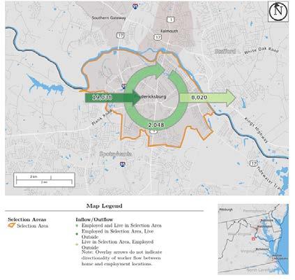
More than three-quarters of workers living in Fredericksburg commute to jobs outside the city, primarily to Northern Virginia and Washington D.C. Fredericksburg is also a strong regional employment center in its own right, with about 19,000 people commuting from outside to jobs in the city. Table 7 shows existing commuting patterns. The table below shows the top ten places where commuters to Fredericksburg come from.
Where Do Fredericksburg’s Workers Come From?
Fredericksburg 50 Largest Employers
1.
2.
3.
4. City of Fredericksburg
6. Wegmans Store #07
7. Rappahannock Area Community Services Board
8. Rehab Hospital of Fredericksburg
9. Compass Counseling Services
10. OS Restaurant Services, Inc.
11. U.S. Department of Veterans Affairs
12. U.S. Department of Commerce
21. Fun Land Opco LLC
22. L 3 Communications Corp
23. Global Dimensions LLC
24. Morrison Management Specialists
25. Red Lobster & The Olive Garden
26. Cracker Barrel Old Country Store
27. Labor ReadyMid-Atlantic, Inc.
28. The Wood Company
29. Mercedes-Benz Of Fredericksburg
30. Morrison Crothall Support
31. Great Hill Solutions LLC
32. U.S. Department of Defense
33. Sedona Taphouse
34. Best Buy
35. U.S. Department of Agriculture
36. Kohl’s Department Stores
37. BJ’s Restaurants and Brewhouse
38. Fredericksburg Christian School
39. ECC Enterprises Holding Company
40. Falls Church Medical Center
41. McDonald’s
42. Brocks Riverside Grill
43. Chick-Fil-A At Central Park
44. Giant Food
45. Hughes Home Inc
46. VDOT
47. T J Maxx
48. Starbucks Coffee
49. Resilience Counseling And Social
50. Spring Hills Home Care
Unemployment Rate
The table below shows the unemployment rate in Fredericksburg since 2013. The rate is highest in 2013 at 7.6% as it was dropping from impacts of the U.S.-wide recession that started in 2008. The rate steadily dropped from the 2013 to 2020, when it spiked during the COVID pandemic. It has since dropped to a very low 3.0%, reflecting the ample employment opportunities in the city and the region.
Source: Virginia Employment Commission, Economic Information & Analytics Division
Military Bases
Local military bases create employment opportunities and have ripple effects in the city economy. For example, Marine Corps Base Quantico is home to over 26,927 military, civilian, student, and contractor personnel. Its impact on the local economy has been estimated at $5.8 billion. With an operating budget of approximately $1 billion, Naval Surface Warfare Center Dahlgren employs approximately 3,900 civilians, 900 military, and over 3,700 badged contractors. Over 44,000 military personnel are trained in joint and combined arms training at Fort Walker; the local economic impacts attributable to the garrison are estimated at $93.2 million. The mission of these facilities includes research and development, strategic combat planning, and training for the armed forces and several Federal law enforcement agencies.
Sources:
(1) Marines Website. Marine Corps Installations National Capital Region Marine Corps Base Quantico Fast Facts 2022. Retrieved April 2024. https://www.quantico.marines.mil/Home/About/
(2)CNIC Website. About NSF Dahlgren. Retrieved April 2024. https://ndw.cnic.navy.mil/Installations/NSA-South-Potomac/Installations/NSFDahlgren/About/
(3) Army Website. Economic Impacts of Fort AP Hill – Growing the Military Mission in Virginia, May 2018. Retrieved April 2024. https://home. army.mil/walker/application/files/1115/4021/7144/Fort_A.P._Hill_Economic_Impact_Assessment.pdf
Source: Virginia Employment Commission, Economic Information & Analytics, Quarterly Census of Employment & Wages (QCEW), 4th Quarter (October, November, December) 2023.
Summary of Findings
Demographics
Annual average population growth rates in Fredericksburg were 2.02% over the period 2000-2022. The population is expected to continue to grow at about 1.1% annually over the next 25 years. The projected growth rate is moderate, not high. The projected population of 39,402 in 2050 represents a 41% increase over the estimated 2022 population (28,757). The comprehensive plan will address the ways that Fredericksburg will accommodate the increase of about 10,600 people over that period.
Over the 2020-2040 period, Fredericksburg is projected to become more diverse as the Hispanic and Asian populations grow quickly. The White population is expected to be constant at around 15,000, while Whites as a share of the total population will decrease from 50% to 39%.
Most of the population growth in the George Washington Region is taking place in the surrounding counties, not in the City of Fredericksburg. This reflects the ongoing expansion of suburban development down the I-95 corridor in recent decades and the availability of land for low-density development in the counties.
Schools
According to the University of Virginia’s Weldon Cooper Center’s data for projected school enrollment, between school years 2024-2025 and 2028-2029, the Fredericksburg school system could see a “stable” growth rate of students. During the same period, high schools will see a moderate increase of 0.6%, while elementary and middle schools will see a slight decline in student populations. Accurate school enrollment projections are difficult, due to the COVID pandemic, which disrupted enrollment levels and had more students enrolling in full time virtual options. Projections typically rely on the local birth rate and previous years enrollment in order to predict future totals. School enrollment is subject to many variables, which results in considerable volatility in projections compared to jurisdictions outside of the I-95 corridor or localities not impacted by state-wide trends. School enrollment projections should be considered as part of an on-going review of school capital and capacity needs in close partnership with the City school system. This effort would occur via periodic updates of the City’s Capital Impact Study.
Economics
Fredericksburg and the George Washington Region are located at the southern edge of the WashingtonArlington-Alexandria Metropolitan Statistical Area (MSA). With Washington, D.C. at its core, this region is largest federal employment hub in the country. The MSA generates employment opportunities for Fredericksburg residents and enables some MSA workers to relocate to Fredericksburg without changing jobs. This is increasingly true following the COVID pandemic, with the rise in remote work.
Home ownership rates in Fredericksburg are lower at 39% than those in PDC 16 (75%-82%). Housing costs in the city — whether for rental housing or homeownership — are comparable to those in the four counties, but household incomes are lower on average. This suggests that housing affordability is a bigger challenge in the city.
More than three-quarters of workers living in Fredericksburg commute to jobs outside the city, primarily in Northern Virginia and Washington D.C. Fredericksburg is also a strong regional employment center in its own right, with about 19,000 people commuting from outside to jobs in the city.
Additionally, local military bases create employment opportunities and generate economic ripple effects in Fredericksburg’s economy.
HOUSING
Context
Housing access is one of the most acute problems faced by City of Fredericksburg residents today. Even under today’s modest population growth rates, effective demand for housing has increased in recent years with rising household incomes. But the supply of housing is not keeping up with the increase in demand. As a result, prices have been going up quite sharply in the past four years; according to the Fredericksburg Association of Realtors, median sales prices in the city have increased 21% since 2020, while mean asking rents have gone up 25%.1 The affordability challenges are particularly acute for workforce households and low- to moderate-income individuals.
To meet rising housing demand, about 2,400 new housing units are needed in the greater Fredericksburg region every year for the next 25 years.2 Since there is little vacant land left within city limits for greenfield housing development, the primary option available to Fredericksburg for increasing housing supply is to redevelop existing, under performing (usually commercial) properties as housing or as mixed-use. At the same time, maintaining and strengthening the existing housing stock, including through rehabilitation, is key to preserving housing supply.
Fredericksburg residents appreciate their high quality of life and the character of the existing neighborhoods that provide it,
which is a consistent theme in the dialogue that accompanies any redevelopment proposal. Moving forward, there are two main housing concepts that warrant specific focus.
1. The first is how to maintain and enhance existing neighborhoods to bolster that quality of life. Architectural and urban fabric continuity, multi-modal mobility, car-light lifestyles, and quality amenities and services (most notably a successful school system) are all critical components that are often cited during community meetings.
2. The second is how new housing replicates and builds on those core components of a quality community. The impacts of new housing development depend largely on the form that it comes in. Small-scale unit types in compact, mixed-use neighborhoods are formally consistent with traditional urban environments, such as downtown. They also generate less traffic than new development in auto-dependent districts because people in walkable districts can use other modes of transportation, such as walking and biking.
1 Fredericksburg Area Association of Realtors (FAAR) / HDAdvisors, “Fredericksburg Area Housing Gap Analysis,” December 2024. The median sales price was reported at $499,999, while the average asking rent was $1,725.
2 FAAR/HDA, 2024.
Recent experience in small cities like Fredericksburg suggests that providing more housing options expands the financial availability of housing, thereby making housing attainable to more people. Over time, a variety of housing was built in the City that is often missing from more recently developed urban and suburban areas. Duplexes, Tri-plexes, courtyard attached and detached houses, and small-scale multifamily development are all part of Fredericksburg’s existing housing landscape. When a variety of historic housing typologies are included at a scale consistent with downtown Fredericksburg they can also help implement the proposals for walkable urban centers set out in the previous chapter.
Objectives
Preservation: Preserve the character of the City’s older neighborhoods by recognizing and maintaining their functional design.
Revitalization: Encourage the ongoing revitalization of existing neighborhoods while strengthening anti-displacement efforts.
Variety of Housing: Promote diversity of housing options, including housing typologies that fit in low-rise and mid-rise walkable mixed-use neighborhoods, such as the valued housing typologies prevalent in pre-WWII neighborhoods.
Homeownership: Stimulate homeownership and the types of housing that provide that opportunity.
Opportunity: Increase opportunities for lower and lower-middle income households to access affordable housing.
Housing Supply: Facilitate regional housing production to improve affordability in partnership with adjacent counties.
Affordable Housing: Strengthen the policy framework for retention of existing affordable housing, including robust maintenance policies and discouragement of demolition-byneglect.
Community: Enhance sense of community through the use of public gathering spaces, transportation to and from third places, and social and cultural programming.
Policies and Strategies
The key to expanding housing access across all socioeconomic segments of the population is to offer diverse housing options. Small-scale housing such as three-plexes, four-plexes and small apartment buildings can be produced at a lower cost than singlefamily housing and traditional large apartment buildings with structured parking. As set forth in approved small area plans, small-scale attached housing can be developed in a way that is consistent with the scale and intensity of existing and planned neighborhoods, whether it involves infill housing downtown or new housing in walkable urban centers.
1. Promote the development of smallscale housing types in new and existing Walkable Centers.
2. Incorporate historical fine-grained neighborhood uses that reestablish third / civic spaces
1.a. Update the City’s form-based and traditional development regulations to explicitly permit and encourage the replication of historic built forms in walkable urban centers. Key features to replicate include block sizes and layouts, alleys, lot sizes and shapes, public frontages, building orientation, and building types.
1.b. Review public frontage and building form standards in to ensure that new housing is human-scaled and street-facing.
1. c. Strengthen the incentives for preserving defined “historic buildings” through redevelopment. This could include removing limits on dwelling units per acre.
1.d. Identify and remove the regulatory barriers and also explore incentives to encourage the development of contextbased, human-scaled multifamily small housing types (including smaller units and condominiums) where appropriate.
2.a. Evaluate and refine the Neighborhood Commercial Overlay District and apply it to new areas as appropriate.
2.b. Review use and performance standards to minimize conflicts between existing and emerging commercial activity and neighborhoods.
3. Promote the development and retention of more affordable and workforce housing.
3.a. Develop an incentive zoning program for affordable and/or workforce housing with an emphasis on achieving a diversity of housing types within the same development.
3.b Monitor existing affordable housing communities and work with them to extend their participation in affordable housing programs as they near the expiration of their current terms.
3.c. Explore innovative approaches to providing housing and funding, including evaluating the feasibility of tools such as land banks or community / housing trust funds.
4. Support assistance programs to people experiencing homelessness
4.a. Work with the Continuum of Care, partner organizations and non-profits to provide supportive housing and community outreach.
4.b. Raise citizen public understanding of the true impacts and risks associated with homeless shelter and supportive housing development.
5. Encourage neighborhood preservation, rehabilitation, and revitalization, while discouraging displacement.
5.a. Expand awareness of the City’s Emergency Home Repair, Removal of Architectural Barriers, and Direct Homeownership Assistance programs through the Community Development Block Grant Program.
5.b. Increase awareness of senior citizen property tax abatement programs.
5.c. Expand the availability of Federal and State Historic Tax Credits through the survey and designation of eligible areas.
5.d. Encourage the creation and / or retention of additional adult and child daycare centers.
5.e. Consider Neighborhood Conservation Districts to ensure older residential areas continue to be distinctive and attractive, each with its own shared identity, history, and sense of place.
5.f. Encourage housing that facilitates aging in place, universal design principles, and proximity to necessary services as identified in the Community Health Assessment especially for seniors.
6. Monitor housing production and availability to evaluate and adjust housing strategies on an on-going basis.
6.a Partner with regional agencies like the Fredericksburg Area Association of Realtors to periodically refresh data on regional housing needs.
6.b Track housing development to understand available housing supply in relation to all income brackets.
6.c Pursue a housing study to identify new or adjusted policies to provide housing for identified under-served populations.
HISTORIC PRESERVATION
Context
In Fredericksburg, preservation is no mere homage to the past—it is integral to the future. Be it the introduction of a new building thoughtfully designed or the careful preservation of historic windows on a house generations old, these dynamic actions contribute something essential to Fredericksburg’s future. The acclaimed historic sites that speak to the presence of the Washington family and other Revolutionary leaders remind us that Fredericksburg is a rare city whose history reverberates across the national landscape. The concentration of historic sites and buildings spanning thousands of years demonstrates the breadth of the city’s history, from its indigenous roots, well beyond the Revolutionary and Civil Wars, through the Industrial Revolution, into the Age of Automobile and the Civil Rights Movement. All these stories and sites contribute to Fredericksburg’s character as an historic place.
The desire to preserve our historic built environment, and recognition of the benefits, has typically been readily recognized in Fredericksburg. Any logo or image of the city capitalizes on its historic skyline, railroad bridge, or both. However, gaps exist in resources for maintenance, and properties are in need of focused investment strategies. Preservation is essential to the future growth and prosperity of Fredericksburg and must continue to be a critical factor in planning for urban growth, stewardship of the City’s resources, and building an equitable future.
In Fredericksburg, preservation is a core community value and a dynamic philosophy for change. In this city, preservation is a forward-thinking ethic embraced by a community committed
to retaining a distinctive identity rooted in (but not limited by) its history, the sites, buildings, landscapes, views, natural resources, and sense of place that define its character and make it both uniquely livable and highly marketable. Preservation can be a tool for equity, giving voice and visibility to those forgotten in the traditional historic focus.
The preservation ethic in Fredericksburg accommodates changing values, recognizing that each generation wishes to express itself to both the past and the future. It seeks the convergence of private rights and public values by using both incentives and fair enforcement of law and regulation. It recognizes that consistency and predictability are essential to attract investment in the community.
Fredericksburg is designated as a Certified Local Government through Virginia’s state historic preservation office, the Department of Historic Resources. This classification requires a local historic preservation ordinance, a program of regular identification of buildings and sites, and an Architectural Review Board. Fredericksburg’s first Historic District ordinance dates to 1968 and, today, nearly one thousand sites and buildings are protected by the ordinance under the ARB’s purview. An archaeological ordinance, requiring investigation as a part of land development projects, has been in place since 2021. Through small area planning efforts, more buildings outside of the downtown core continue to be recognized, with emphasis on incentivizing their preservation and adaptive reuse.
Historic Preservation Assets
Map 11: Historic Preservation Assets
A view from the Fredericksburg Bus Depot Along the 500 Block of Princess Anne Street, 1965
Source: The Free Lance Star
The Kenmore Coffee Warehouse Renovated in 2019
Source: City of Fredericksburg
Objectives
High-Quality Documentation: Increase efforts to document Fredericksburg’s historic and cultural resources, encompassing tangible and intangible heritage.
Telling a Full Story: Expand historic preservation efforts to capture Fredericksburg’s social, cultural, and economic history, focusing on diverse narratives and underrepresented communities.
Incentivization: Improve awareness and expand access to preservation tools and incentives, including modifying or expanding current incentive programs.
Keep Historic Buildings in Use: Utilize policies, incentives, and education to ensure maintenance and adaptive reuse of historic buildings citywide.
City Leadership: Implement best practices to ensure preservation is integral to city governance and the stewardship of the public realm.
Policies and Strategies
To maintain and enhance historic preservation efforts, Fredericksburg can implement a range of strategies that make preservation accessible, engaging, and economically viable. Expanding financial incentives, such as tax credits and grants, and providing outreach on these can support property owners in maintaining historic buildings, while promoting adaptive reuse of historic structures to serve modern needs, promote revitalization, and support local businesses. Preservation-friendly zoning and digital documentation efforts can further protect the historic areas and make heritage resources more accessible. Community engagement initiatives, such as storytelling programs, educational outreach, and heritage tourism can help deepen residents’ connection to Fredericksburg’s diverse history. Fredericksburg is uniquely positioned with a wide range of preservation and cultural resource community partners, including the National Park Service, University of Mary Washington, Fredericksburg Area Museum, Historic Fredericksburg Foundation, Inc., Washington Heritage Museums, and others. Collaboration will continue to be a critical path for moving preservation initiatives forward.
1. Strengthen documentation efforts to ensure the identification, maintenance, and protection of historic assets, and incorporate survey and identification of historic resources in all planning initiatives.
1.a. Develop a programmatic survey procedure using state standards to ensure consistency and regular updates to known resources.
1.b. Provide support for neighborhood resource surveys and the creation of pattern books, guidelines or similar reference documents that provide guidance on architectural styles and appropriate treatments for maintenance, repair, and alteration.
1. c. Expand the non-regulatory National Registerlisted Historic District to create access to Federal and State tax credits for property owners rehabilitating contributing buildings.
1.d. Incorporate cultural significance as a criterion for evaluation in survey and designation to ensure that intangible heritage, cultural practices, or other representative aspects are recognized.
1.e. Expand the inventory of historic resources with a focus on inclusion of diverse places that are culturally significant, not just those associated with well-known historical figures or exhibiting high-style architecture.
2. Annually assess the community’s progress, conduct outreach, and support the preservation culture within the community.
2.a. Expand the use of the Architectural Review Board as an advisory resource as authorized by the City Code.
• Implement broader communication and outreach to the public.
• Invite subject matter experts to advise and coordinate with the ARB.
• Review implementation of comprehensive plan and other strategic goals on an annual basis.
2.b. Identify and engage with a broad range of community partners to advocate for preservation, conduct outreach, and provide practical support for preservation within the community.
• Implement interpretive tools to tell the stories of underrepresented groups, including African Americans, Native Americans, women, and immigrant groups, particularly in places where no extant buildings or physical features remain. Identify and implement interpretive means beyond those already in place, incorporating public art, digital technologies, and multimedia installations.
• Provide resources for industry partners so that they will understand both the essentials of the city’s history and the critical role preservation plays in generating revenues and supporting property values. Efforts may include workshops, charrettes, lectures, or other events.
Policies and Strategies are continued on the next page.
2. (continued)
3. Emphasize diverse stories and the recognition of underrepresented resources to work toward telling the full story of Fredericksburg’s past and building an equitable future.
2.c. Provide education to property owners and training for ARB members on the standards that govern the ARB review process as they relate to both alterations to existing buildings and new construction within the district. Recognize that best practices evolve over time and that City staff, the ARB, and the community will need to be kept current on changes.
2.d Encourage grassroots action by building relationships with neighborhood groups and with community residents and stakeholders interested in preservation.
3.a. Develop standard procedures for interpretive media, including the wayside panel program, for both creation and ongoing maintenance.
3.b. Update the research priorities for archaeological investigation and implement public education initiatives associated with archaeological findings.
3.c. Seek training and educational opportunities for staff and Architectural Review Board members on equity in preservation.
3.d. Update Historic District Design Guidelines to balance the evaluation of cultural significance with building integrity when evaluating alterations to buildings in the Historic District; avoid undervaluing buildings associated with underrepresented communities due to modest design or limited physical integrity.
3.e. Complete the design and installation of a public memorial at the former site of the Auction Block at Charles and William Streets.
3.f. Complete the rehabilitation of the Idlewild outbuildings and partner with the FAM to operate and program the site.
4. 4. Encourage the maintenance and adaptive reuse of historic buildings to preserve and celebrate their historical significance.
4.a. Form adaptive reuse task forces focused on challenging historic sites, prioritizing locations like the Old Stone Warehouse.
4.b. Pursue adaptive reuse of the Renwick Courthouse by soliciting redevelopment proposals and addressing needed maintenance.
4.c. Update guidelines to support the City’s transition to renewable energy and encourage the sensitive incorporation of resilient and energy efficient solutions in new construction, adaptive reuse, and building maintenance projects. Recognize the embodied energy and passive design principles in historic structures.
4. (continued)
5. Improve the standards of preservation practice within City government.
4.d. Prioritize the use of Community Development Block Grant programs for home repair, accessibility improvement, and down-payment assistance programs to encourage continued ownership and maintenance of existing older housing stock.
4.e. Preserve existing buildings, including naturally occurring affordable housing, by supporting property maintenance efforts.
• Evaluate the reinstitution of the rental inspection program.
• Support the community maintenance team, fire marshal, building division and other City staff by fostering cross-departmental relationships and training on historic buildings.
• Explore the creation of systems, such as a community land trust or incentives, for the acquisition and redevelopment of vacant, abandoned, and taxforeclosed properties to bring these places back into use and prevent demolition by neglect.
4.f. Permit flexibility in use and residential density standards for identified historic structures to incentivize their adaptive reuse.
5.a. Develop programs and resources to educate City staff and ARB on best practices for historic preservation, including training on the identification of archaeological resources and creation of a maintenance handbook for historic properties. Engage SOI-qualified area professionals to support training and education.
5.b. Increase the diversity of ARB appointees, staff, working groups, and any others impacting the preservation of historic resources to decrease implicit biases in decision-making and assessment of resources.
5.c. Establish a process for regular maintenance and assessment of the condition, use, and status of Cityowned historic properties.
5.d. Explore opportunities to reach community members whose voices have not traditionally been included in preservation initiatives by offering a variety of formats for public input and outreach.
PUBLIC FACILITIES & SERVICES
Context
The City of Fredericksburg, sometimes in collaboration with other government offices, provides a broad range of public services to residents, including education, election administration, recreation, legal services, and social services. The City also helps to coordinate among many other not-for-profit human services providers active in Fredericksburg.
The City is responsible for providing the facilities through which municipal services are delivered. Through the capital improvement planning process, the City and its agencies anticipate and plan for the delivery of necessary public facilities. The comprehensive plan provides the physical framework and individual siting recommendations for future public facilities. Many of the City’s public facilities are historic resources and require careful, continuous stewardship as well as considerations of access and interpretation.
Fredericksburg has a strong commitment to providing high quality education to local students, but there may be opportunities to explore new and innovative ways to enrich the learning of future generations. Social services buildings, libraries, community centers, fire stations, utility services, schools, trash collection, public works, fleet management, and police stations all provide residents with essential services and can generate civic pride. Some of these facilities have traditionally been seen and used as single-use structures, but in recent years, many localities have found that shared-use facilities can be economical and efficient.
The provision of adequate public facilities and services, in an efficient and effective manner, to all City residents is a key organizing principle for the City government. The City government seeks to provide elevated levels of service in two ways: Firstly, City departments and affiliated agencies undertake a cycle of prioritization, strategic and master planning, followed by focused implementation either through operational or Capital Improvement processes. Secondly, as development or redevelopment is proposed, the City requires applicants to provide the resources necessary to ensure their proposals consider adequate public facilities and services including transportation and mobility, public safety, schools, and parks.
Public Facilities
City services as well as City-supported state services are provided from locations throughout Fredericksburg (see table below). The table does not list schools, parks, court buildings, or the downtown library. These types of facilities are listed in their respective sections of this chapter. The City recognizes that City Hall, various administrative functions, the library, the courts, and many other public facilities are properly located in downtown Fredericksburg. Since the City’s founding years, Fredericksburg’s government center has been the Princess Anne Street corridor; maintaining the courthouse’s downtown location is important to maintaining a healthy community. These public functions help to bring residents and visitors into the historic urban core, where they support services and local businesses.
Facility Function
City Hall (715 Princess Anne St.)
City Shop (1000 Tyler Street)
City administration, Treasurer, Commissioner of the Revenue
Public Works, Traffic Division, Vehicle Maintenance
Community Center (408 Canal Street) Parks and Public Facilities Administration
Department of Social Services (608 Jackson Street) Social Services
City Center (601 Caroline Street) Fire Dept. Admin, Commonwealth’s Attorney, City Attorney, Information Systems, Voting Registrar
Fire Stations (601 Princess Anne St.; 101 Altoona Dr.; 3340 Fall Hill Ave - Proposed Fire Station #3 ) Emergency Services, Hazardous Materials Team
FREDericksburg Regional Transit (1400 Jefferson Davis Highway) City and regional bus service
FRED Maintenance Facility (Bowman Center) Maintenance operations for FRED buses
Parking Deck (100 Wolfe St.)
Public parking facility with 285 spaces
Police Station (2200 Cowan Blvd.) Police services, Crime prevention, Animal control
Water Treatment Plant (Mott’s Run Reservoir) Waterworks
Public Schools
Fredericksburg maintains a commitment to excellence in its public education system, which is fully accredited. According to the University of Virginia’s Weldon Cooper Center’s data for projected school enrollment between school years 2024-2025 and 2028-2029, the Fredericksburg school system could see a “stable” growth rate of students. During the same period, high schools will see a moderate increase of 0.6%, while elementary and middle schools will see a slight decline in student populations. An increase in the elementary and middle school capacity is currently underway. A relocated Walker Grant Middle School is anticipated to open in the fall of 2025 in a new building at 2201 Idlewild Boulevard. The school building at 1 Learning Lane (previously Walker Grant Middle School) is to be renovated to serve as a third elementary school named Gladys West Elementary School. The projected increase in the high school population has led to plans for an addition to James Monroe High School at its current location 2300 Washington Avenue.
School Address
Hugh Mercer Elementary 2100 Cowan Boulevard
Lafayette Elementary 3 Learning Lane
Gladys West Elementary (Planned opening 2025)
Walker-Grant Middle 6-8
James Monroe High 9-12 (Addition planned)
Walker Grant Center Special Programs
1 Learning Lane
2201 Idlewild Boulevard
2300 Washington Avenue
210 Ferdinand Street
Accurate school enrollment projections are difficult, due to the COVID pandemic, which disrupted enrollment levels and had more students enrolling in full time virtual options. Projections typically rely on the local birth rate and previous years’ enrollment to predict future totals. School enrollment is subject to many variables, which results in considerable volatility in projections compared to jurisdictions outside of the I-95 corridor or localities not impacted by state-wide trends. School enrollment projections should be considered as part of an on-going review of school capital and capacity needs in close partnership with the City school system. This effort would occur via periodic updates of the City’s Capital Impact Study.
Library
The Central Rappahannock Regional Library (CRRL) provides library services to Fredericksburg and three counties. Its Fredericksburg branch is located at 1201 Caroline Street. There are two branches each in Stafford and Spotsylvania Counties and three branches in Westmoreland County.
The Fredericksburg branch, located in the 1909 Lafayette School, accommodates a growing collection, to serve an expanding regional population, and incorporates new user technology that allows a range of new services. The Fredericksburg branch also has several special collections, including a law library, a talking book collection from the National Library for the Blind, and the Virginiana Room, which contains materials on genealogy and local and state history. The library also provides special programs such as live homework help, interlibrary loan, notary services, assistive services, and services related to the Alliance for Literacy. Additionally, the Library operates an Idea Space consisting of maker programming, technology certifications, and innovative training at 1614 Princess Anne Street.
Water Capacity
Fredericksburg’s source of water is the Motts Run Reservoir, which came online in 2000. The Treatment capacity at the Motts Run plant is currently permitted for an average daily demand of 12 million gallons per day (MGD), to serve both the City and County needs. Fredericksburg is presently allowed 5 MGD of that amount. The plant is currently under construction for an expansion to an average day capacity of 24.0 million gallons per day. The City’s allocation with the completed expansion is 7.0 million gallons per day. The Motts WTP expansion is estimated for
completion by 2029. The City’s water use has ranged between 2.5 to 3.5 MGD for the past 10 to 15 years, despite substantial new development. This consistent usage is due to water conservation, low flow fixtures, as well as attention to the integrity of water distribution lines. The City’s water use is also only 60 percent of the currently available allowance of 5 MGD. The current expansion project will allow for capacity increases and system growth, in the near future, for both the City and Spotsylvania systems.
Sewer Capacity
Fredericksburg has one wastewater treatment facility with a permitted average day capacity to treat 4.5 MGD. This plant currently treats an average daily flow of 2.5 to 2.8 MGD. An additional average daily flow of 1.5 to 1.8 MGD is pumped from the City influent pump station to Spotsylvania County for treatment at their wastewater plants (FMC and/or Massaponax). This flow represents Spotsylvania’s sewer flows through the City conveyance system and is not treated by the City.
The City’s wastewater treatment plant permitted capacity will be increased to 6.0 MGD upon completion of the current Nutrient Upgrade and Expansion Project. The anticipated expansion completion is January 2030. The upgrade increases the City’s treatment capacity to an average flow of 6.0 MGD while providing enhanced nutrient removal (nitrogen and phosphorus) processes in compliance with the Chesapeake Bay Nutrient, State Water Control Law, and Virginia Pollution Discharge Elimination System (VPDES) Permitting Regulations. In 2023 the City analyzed its main sewer interceptors to determine present or future capacity issues. The analysis determined the
necessity to upgrade pump stations and interceptors to meet future sanitary flows. It also identified the need to undertake a sanitary sewer masterplan to set the foundation for pro-rata programs to offset the cost of capacity improvements.
In 2022 the City conducted an assessment of the sewer system to determine the extent of stormwater inflow and infiltration into the network. The study identified areas where the repair, rehabilitation, or replacement of maintenance holes and/ or sewer lines is warranted to significantly reduce inflow and infiltration. Reduction in sanitary sewer collection system inflow and infiltration is required under the Virginia Pollutant Discharge Elimination System (VPDES) permit. The Public Works Department has developed an ongoing Capital Improvement process for systematically working through this effort, which will continue through fiscal year 2029.
Solid Waste and Recycling
Fredericksburg provides refuse collection service to City residents, with one collection per week. The City’s Department of Public Works disposes of this refuse at the Rappahannock Regional Landfill, located in Stafford County. The regional landfill consists of approximately 800 acres of land, of which 64 acres have been exhausted as landfill space and 74 acres are permitted for current and future land fill activity. An analysis done in 2014 has determined that the landfill has approximately 53 years of disposal capacity remaining. The remaining acreage is used for operations or consists of buffers, park/preservation areas, wetlands, and floodplain. Recycling activities to meet the state goals involves a joint venture with Stafford
County, through the Rappahannock Regional Solid Waste Management Board (R-Board). The R-Board operates and maintains the Regional Landfill as well as several Recycling Centers, one of which is in the Battlefield Industrial Park. Since its formation in 1987, the R-Board has consistently exceeded the requirements of applicable regulations and in 2007 the Virginia Department of Environmental Quality recognized the Regional Landfill as an Exemplary Environmental Enterprise.
Police
The Fredericksburg Police Department is a full-service law enforcement organization that provides continuous protection to the community. It is divided into four divisions: Emergency Communications, Patrol, Detective, and Support Services. Each division is commanded by a Captain or Director and a Deputy Police Chief oversees operations of the Patrol and Detective Divisions. All divisions report directly to the Chief of Police. The department has been awarded full accreditation by the Commission on Accreditation for Law Enforcement Agencies. The Police Headquarters is located at 2200 Cowan Boulevard.
Rappahannock Regional Jail
The Rappahannock Regional Jail is located at 1745 Richmond Highway in Stafford County. It serves the City of Fredericksburg as well as the Counties of King George, Stafford, and Spotsylvania. The facility houses convicted criminals who are jailed for a period of up to 12 months and serves as a temporary confinement facility for inmates awaiting trial or sentencing to a more permanent location. The regional jail board was founded in 1968 and has done an exceptional job in meeting regional needs. The current facility opened in 2000 and was expanded in 2006. It is now 379,000 square feet in size and has a capacity of 2,000 inmates. The average daily inmate population, however, is 1,100 people. The Rappahannock Regional Jail is staffed by 372 employees.
Fire and Rescue
The Fredericksburg Fire Department provides fire protection to the entire City. The Department consists of four divisions, as follows:
• Fire Administration – This group oversees daily operations, support services, training, and emergency management.
• Fire Prevention – Fire Marshals administer the Statewide Fire Prevention Code and work with other City staff to review development projects.
• Fire Suppression – This group consists of the firefighters who respond to alarms, public service calls, motor vehicle accidents, gas leaks, and other emergency calls. This division consists of three platoons, which provide firefighting and medical assistance capabilities. Each platoon consists of a Battalion Chief, Captain, two Lieutenants and nine Firefighters/ Emergency Medical Technicians/ Paramedics.
• Emergency Medical Services (EMS) – This group consists of firefighter/ paramedics who respond to injuries, illnesses, auto accidents, falls, heart attacks, vehicle or building fires, public service and other emergency calls. EMS staff operate two ambulances at the Advance Life Support Level all hours of the day and night, throughout the year. The Fredericksburg Rescue Squad (a separate volunteer agency) also responds to EMS calls as their staffing and time permits to help cover the volume of incidents that occur daily.
The main fire station is at 601 Princess Anne Street and a secondary station at 101 Altoona Drive, with administrative offices located at 601 Caroline Street. A third fire station (Fire Station 3) is planned to be constructed at the intersection of Wicklow Drive and Fall Hill Avenue. The location was determined by evaluating efficiency in response times and mileage.
The Insurance Services Office (ISO) is an independent company that analyzes data about communities nationwide and assigns a Public Protection Classification (PPC) number related to risk. Class 1 represents an exemplary fire suppression program while Class 10 indicates an area that does not meet even minimal standards. The City’s PPC rating is Class 3, which indicates the City Fire Department meets high standards in communications, department function, available water supply, and risk reduction efforts as defined through prevention, education, and investigation.
Court System
Judicial administration is located in downtown Fredericksburg, along Princess Anne Street. In 2014, the Civil and District Courts moved to a newly constructed courthouse. Several sites had been studied for construction of this major facility, but the City recognized it needed to keep its new courthouse in the urban core and undertook the design challenge to develop a court building that met all contemporary standards and fit within the historic center of downtown Fredericksburg. The Juvenile and Domestic Relations Court is in a separate building nearby. The location of the individual courts along with their primary function is detailed in the table below.
When the Circuit Court moved out of its 1852 building at 809 Princess Anne Street, the historic courthouse designed by noted architect James Renwick became vacant. The City is exploring options for its reuse. The City has evaluated conditions at the courthouse complex, identified rehabilitation and maintenance needs, and, with the assistance of a citizen working group, developed reuse priorities and a path for potential public-private partnership.
Public Health Services
The Rappahannock Area Community Services Board (RACSB) provides community-based services for mental health, intellectual disabilities, substance use disorder treatment, and early childhood intervention. The RACSB serves the citizens of Fredericksburg as well as the counties of Caroline, King George, Spotsylvania, and Stafford. It provides emergency services, short-term residential care, day support programs, and residential services for people who need special living arrangements to sustain them in the community.
The Fredericksburg Health Department provides both medical and environmental services. Medical services provided to economically disadvantaged individuals address communicable diseases, child health needs, maternal health needs, family planning, and dental health. Medical services for all citizens consist of foreign travel immunization, community education, vital records, maternal and infant care coordination, and Medicaid. Environmental services include regulating activities related to water supply, wastewater treatment, and institutions responsible for public health such as restaurants, day care centers, and adult homes.
Social Service Programs
The Fredericksburg Department of Social Services (FDSS) provides services in accordance with federal, state, and local regulations for the residents of the City. The FDSS is a provider of critical safety net services to the most vulnerable in our community. FDSS offers programs along the entire human service continuum to include nutrition, health, child welfare, disabled and elderly advocacy and
protection, and self-sufficiency for families. The table below outlines the specific programs the Fredericksburg Department of Social Services administers.
FDSS’s customer-centered approach is exemplified in their mission, “Helping People Triumph over Hardships, to Promote Healthier Futures within Our Community.”
FDSS partners with many other Fredericksburg City Departments and community organizations. In Fredericksburg, these organizations include the Rappahannock Area Community Services Board, Healthy Generations, Lloyd Moss Free Clinic, and many others. The Fredericksburg Regional Continuum of Care, organized under the George Washington Regional Commission, coordinates services to systematically reduce the incidents of homelessness through rapid rehousing, permanent supportive housing, and the provision of supportive services.
Telecommunications Towers
The City of Fredericksburg accommodates and promotes the growth of wireless telecommunications while limiting potentially adverse visual impacts of the necessary towers. To encourage use of the best possible sites and to discourage unnecessary proliferation, the City has identified the following sites and existing structures as the preferred locations for new or altered telecommunications towers. The suitability of a tower locating on the individual site will require additional review regarding proposed construction type, viewshed, and screening:
Preferred Site: Location:
City/Courtland Water Tank 123-127 Ashby Street
City/Powhatan Water Tank 1521 Powhatan Street
City Shop 1000 Tyler Street
James Monroe High School 2300 Washington Avenue
Gladys West Elementary / Lafayette Elementary 1 &3 Learning Lane
Hugh Mercer Elementary School site (Cowan Boulevard) 2100 Cowan Boulevard
Wastewater Treatment Plant 700 Beulah Salisbury Road
Kingdom Family Worship Center 400 Kingdom Way
Old Mill Park and adjacent Cityowned land 1901-2201 Caroline Street
Dominion Energy Substation 1401 Powhatan Street
National Guard Armory site (Jefferson Davis Highway) 1700-1702 Emancipation Highway
Central Park (Shopping Center) 1340 Central Park Boulevard
Mary Washington Hospital medical campus The campus bounded by Sam Perry Blvd and Hospital Drive
Safe and Stable Families Grant, Safe Sleep program, Parent Education Program
University of Mary Washington campus The campus bounded by Hanover, Sunken, and College Ave.
Virginia Visitor Center/Rest Area off Interstate-95 Mile Marker 132 - Interstate 95
City Center 601 Caroline Street
Verizon Building 901 Prince Edward Street
Objectives
Education: Improve public school facilities to enhance educational quality and increase economic competitiveness.
Green Design: Prioritize green infrastructure in the design and upgrade of public facilities.
Connectivity: Keep core services in the Downtown and consider the opportunity to incorporate new public facilities into emerging Walkable Centers.
Capital Impacts: Maintain established levels of service as larger new development and redevelopment occur through the continued use and update of the Capital Impacts Study.
Preservation: Ensure that best preservation practices are implemented in the stewardship of public facilities with historic and cultural significance.
Efficiency: Encourage redevelopment and infill projects within existing service boundaries and expand the economic impact of facilities investments by combining uses in the same building.
Riverfront: Continue to preserve and enhance the city’s waterfront to contribute to residents’ quality of life and the tourism experience.
1. Enhance educational opportunities and services.
2. Annually assess the community’s progress, conduct outreach, and support the preservation culture within the community.
1.a. Complete the construction of the Idlewild Middle School, the renovation of Gladys West Elementary School.
1.b. Work with the Fredericksburg Public Schools on:
• Regular bi-annual updates to the City’s Capital Impact Study to ensure adequate planning for future school capacity needs.
• Identifying opportunities to develop the workforce of the future and pursue them.
• Increasing the school system’s ratings in the Virginia Department of Education’s School Quality Profile.
• Focusing on teacher retention.
2.a. Pursue fossil fuel free policies and actions as new facilities and services are planned.
2.b. Continue the pilot program replacing older streetlights, park lighting, and public facility lights with LED fixtures and expand to other areas of the city as appropriate.
Policies and Strategies
Policies and Strategies are continued on the next page.
3. Plan for the delivery of new and improved public facilities in keeping with the development of walkable urban places.
2.c. Add EV charging stations to public facilities as resources allow and continue to shift the City vehicle fleet to electric vehicles.
3.a. Keep existing public services in the downtown area, as appropriate.
3.b. Take into consideration during capital improvement planning for public facilities the anticipated population increases in new and expanded Walkable Centers.
3.c. .c. Seek out development styles that contribute to walkability and alternative methods of transportation.
3.d. Identify ways to provide for or permit housing types available to public employees especially in walkable urban places.
4. Maintain levels of service and adequate facility capacity.
4.a. Complete Fire Station #3.
4.b Maintain and regularly update the Capital Impacts Study to ensure large developments or redevelopment provide the necessary resources to ensure the provisions of adequate public safety services in accordance with level of service criteria established by the Commonwealth or the City and consider adding parks to the Capital Impact Study.
5. Enhance outdoor facilities at public schools in support of sports tourism.
5.a. Evaluate the condition of school sports fields and facilities to determine improvement needs.
5.b. Procure new equipment as needed to increase the quality of school sports facilities.
6. Identify and pursue opportunities to develop shared-use facilities.
7. Strengthen preservation and maintenance of public facilities.
6.a. Assess the conditions of City owned facilities and determine the feasibility of adopting shared-use agreements where appropriate.
6.b. Seek partnerships with organizations throughout Fredericksburg to establish shared-use agreements within specific City owned facilities.
7.a. Assess the structural conditions of City owned facilities and develop a deferred maintenance plan and budget.
7.b. Continue to support efforts to modernize and upgrade facilities whenever appropriate while meeting preservation goals.
7.c. Develop preservation plans for public facilities that are historic resources that include needed tasks, routine maintenance checklists, and annual assessment. Develop partnerships for long-term care of historic resources.
7.d Continue the study of City-owned properties and facilities and develop plans for their reuse or conveyance to non-profit or private groups.
ECONOMIC DEVELOPMENT
Context
Fredericksburg’s economy is driven by a mix of industries, including tourism, retail, higher education, medical, and government services. The city’s downtown is a unique regional asset that directly contributes to the identity of “FXBG” and serves as a vital economic engine for the city. It represents the past, present, and future of the city as a walkable, historic district where residents and visitors can live, work, play, and shop in a concentrated area.
Beyond downtown, important economic areas include the Route 3 and Route 1 corridors, featuring a mix of retail, office, medical, hotels/motels and light industrial businesses. While these businesses are valued, the corridors also present challenges for the City. Many sections contain aging strip-style commercial development with high vacancy rates and/or blight, outdated infrastructure, and a lack of pedestrian-friendly design.
Over the past quarter century, the Central Park/Celebrate Virginia area, as defined in Small Area 1 Plan, has experienced significant economic growth and development, becoming a regional hub for commercial activity and entertainment. It includes several destination commercial establishments, including a Wegmans grocery store, the Fredericksburg Convention Center, and the Virginia Credit Union Stadium, a multi-purpose stadium that serves as the home for the Fredericksburg Nationals, a minor league baseball team. The stadium also hosts a variety of community athletic and social events, adding to the area’s appeal.
In early 2025, the City Council adopted a Technology Overlay District in the
north-western portion of the City. The Technology Overlay District is intended to encourage data center campuses and related uses.
Given the limited land available for new economic development projects in the city, the community should recognize the importance of utilizing its remaining land effectively while supporting its current businesses and citizens. The success of downtown should serve as an inspiration in providing new walkable urban areas that are inspired by the forms of the past. These areas can generate new business opportunities for entrepreneurs while also creating the kinds of mixeduse, amenitized neighborhoods that can attract knowledge economy workers. This policy can create destinations and places of interest not only for new residents but also for existing Fredericksburg residents.
Overall, Fredericksburg is focused on fostering a dynamic and resilient economy that provides diverse opportunities for its residents and businesses. The City aims to create a thriving economic landscape by building on its strengths, addressing challenges, and embracing new possibilities. Map 13 is a diagrammatic key of the systematic types of economic development opportunities present in the City of Fredericksburg. Tourism opportunities (including outdoor activity along the Riverfront as well as experiential shopping and dining in the City’s Walkable Urban Places), the presence of major institutions and the industrial park, redevelopment opportunities in the City’s aging shopping centers, as well as the new opportunities in the western portions of the City highlight Fredericksburg’s bright economic future.
Objectives
Revitalization: Rehabilitating and/or adaptively reusing aging shopping centers or hotel/ motel conversions to create mixed-use developments could create more vibrant and attractive economic destinations for businesses to come to Fredericksburg.
Enhance Economic Competitiveness: Implement strategies to improve the city’s business climate and attract investment.
Cultivate a Skilled Workforce: Partner with educational institutions and industry to develop vocational training programs and apprenticeships that prepare residents for indemand jobs. Expand the availability of workforce housing to attract and retain talent in Fredericksburg.
Expand Tourism: Broaden the range of tourism experiences, such as sports tourism, to attract a wider variety of visitors and increase visitor spending.
Diversification: Build upon Fredericksburg as a destination, enhancing opportunities for a variety of interests and attractions to reduce reliance on any single industry and enhance resilience to economic fluctuations.
Investment: Increase promotion of existing businesses and explore expansion of low interest loan and grant programs to support repair and rehabilitation for existing businesses with special focus on addressing blight and preserving historic properties.
Policies and Strategies
1. Enable the development of an environmentally sensitive Technology Campus including data center development in the North End of Area 1.
1.a Evaluate an effluent reuse water system and work with future end users to develop the system.
1.b Explore alternatives for backup power generation for data centers including natural gas micro-grids.
1.c Monitor the state regulatory process of transmission line extensions and route selection and work to minimize impacts especially to environmentally and culturally sensitive areas.
2. Broaden tourism offerings in Fredericksburg. 2.a. Use a gap analysis and regional benchmarking to identify direction for future tourism development.
2.b. Explore opportunities to develop sports tourism facilities and attract sporting events, such as creating a new tourism zone in or near Dixon Park.
2.c. Develop targeted marketing campaigns to attract new visitor audiences.
4. Promote the revitalization of existing commercial/industrial areas.
3. Promote a mix of land uses in new Walkable Centers to boost economic development.
3.a. Attract retail businesses, including food & drink establishments, to new walkable mixed-use centers.
3.b. Encourage the redevelopment of underutilized shopping centers into active, mixed-use centers.
3.c. Implement form-based code regulations that facilitate pedestrian-friendly environments.
5. Build upon Fredericksburg’s existing neighborhood strengths to attract knowledge industry firms and employees.
4.a. Explore the possibility of incorporating uses such as breweries, sports entertainment centers, or museums into destination retail areas.
4.b. Provide incentives for existing businesses to expand, repair, or adaptively reuse existing buildings.
4.c. Encourage the adaptive reuse of historic buildings citywide as a means of preservation and as a driver for economic growth and revitalization.
4.d As part of the Small Area Plan process, review existing industrial zones to evaluate their long-term suitability and explore potential for revitalization or adaptive reuse consistent with City goals.
5.a. Foster walkable urban, mixed-use centers throughout the city to permit the mixture of office, retail, and residential uses.
5.b. Develop or strengthen partnerships with private sector and non-profit organizations to boost knowledge industry-related investment.
5.c. Identify and market specific target sectors within the knowledge industry.
5.d. Support the development of co-working spaces and business incubators/resource hubs to foster innovation.
5.e. Attract business by promoting Fredericksburg’s housing, walkability, and high quality of life.
6. Partner with Fredericksburg’s schools to develop vocational training programs to enhance opportunities for students.
6.a. Evaluate the infrastructure improvements schools would need in order to offer in-house career technical education programs.
6.b. Partner with firms, industries, and higher education that could offer apprentice programs through Fredericksburg schools to increase employment in trades and other fields.
7. Diversify the City’s economic base to reduce reliance on any single industry and enhance resilience to economic fluctuations.
7.a. Identify and attract businesses in emerging and high-growth sectors.
7.b. Support the growth of small businesses and entrepreneurship.
7.c. Promote Fredericksburg as a business-friendly, historically diverse, and architecturally unique location with a diverse economy.
8. Enhance the City’s economic competitiveness.
8.a. Promote the Economic Development Authority as a resource to assist potential businesses in for the permitting and licensing process.
8.b. Offer incentives for new businesses to locate in Fredericksburg.
8.c. Invest in infrastructure improvements to support business growth.
9. Cultivate a skilled workforce.
10. Implement a comprehensive economic development strategy focused on investment in historic preservation.
9.a. Partner with regional educational institutions to develop training programs aligned with industry needs.
9.b. Support apprenticeship and internship programs to provide hands-on experiences.
9.c. Attract and retain talent through initiatives that improve quality of life (i.e., streamlining zoning and permitting processes for childcare centers, daycares, Pre-K programs, after-school programs, etc.)
9.d. Support the development of new attainable housing in a variety of types that uses the city’s beloved neighborhoods as a blueprint for form, walkability, open space, and connectivity.
9.e Engage with major local employers (e.g. the University of Mary Washington and Mary Washington Healthcare) to understand their workforce housing needs and explore potential partnership strategies.
10.a. Expand or modify the existing real estate tax exemption program to encourage greater use for rehabilitation projects. Conduct outreach to ensure public awareness of the program.
10.b. Create a citywide economic impact study to quantify the value of historic preservation in Fredericksburg and provide direction in the development of incentives.
10.c. Develop a package of preservation incentives beyond traditional tax credits which could include transfer of development rights, low-interest loans, exemptions for historic buildings, abatement for compatible infill construction, public-private partnerships, business/tenant attraction, fee assistance to promote combining multiple tax credit/ incentive programs.
10.d. Encourage the Economic Development Authority, in collaboration with the Architectural Review Board to include best preservation practices and the reinstatement of building patterns and uses that have been interrupted by past regulations as a factor in their decisions to invest in the Historic District and beyond. Ensure EDA decisions and investments support preservation goals rather than work against them.
11. Facilitate targeted redevelopment efforts in key areas.
11.a. Explore the feasibility and potential structure of a community-based development corporation or similar entity focused on facilitating complex redevelopment projects, such as those envisioned for aging commercial corridors and centers, including the long-term vision for Central Square.
ENVIRONMENT
Context
Fredericksburg’s environmental character is shaped by its unique history and geography. From its origins as a small, walkable network of gridded streets on the shores of the Rappahannock River, the city has expanded through a series of annexations. Pre-World War II, these annexations involved incorporating existing urbanized areas developed prior to automobile dominance and in a way that facilitates a uniquely sustainable lifestyle light on fossil fuel consumption. For example, the urban triangle bounded by Blue and Gray Parkway, US Route 1, and the Rappahannock River is served by a comprehensive network of sidewalks.
The annexations of 1955 and 1984, however, took in land with different characteristics. Some of these lands had already been developed into a sprawling, suburban pattern without sidewalks or modern stormwater drainage systems. Other areas were either undeveloped, under agricultural use, or included special natural features like Smith Run and Hazel Run. Most of Fredericksburg’s subsequent urban growth has taken place in these annexation areas. This predominantly suburban part of the city has critical environmental and public-serving systems that must co-exist and meet objectives that do not always align.
This diverse development pattern presents both challenges and opportunities. Fredericksburg still has extensive undeveloped areas with robust natural systems;a variety of policies are in place to
protect and manage them appropriately. The city has two primary open space systems, the Uplands Open Space Network and the Riverfront, as identified in the Area Plans. These open spaces are vital for the ecological health of the city and provide residents and visitors with access to nature within the city’s ten square miles. Furthermore, the city has a vibrant downtown as well as emerging Walkable Centers that maintain a strong connection to our shared urban history, including through widespread use of sustainable, human-scale development patterns.
Moving forward, fostering environmental resilience within the city is paramount. Environmental resilience is the ability of the natural and built systems (i.e., streams, forests, open spaces, parks, stormwater, utility infrastructure, buildings, etc.) to withstand, recover and continue to function after natural disasters or other environmental stresses. Fredericksburg’s geography, its location along the Rappahannock River, and its varied development history combine to provide ecological benefits while at the same time posing environmental challenges. In the face of climate change, we can improve the City’s ability to adapt, reduce our emissions of greenhouse gases, and promote equity within Fredericksburg that can enhance its quality of life, strengthen its economy, and create a more equitable and thriving community for present and future generations.
Natural Systems
The Rappahannock River
The Rappahannock River originates at a spring in the Blue Ridge Mountains and flows east, for 185 miles, to the Chesapeake Bay. It is the longest free-flowing river in Virginia and is designated as a state scenic river from its origins in Chester Gap all the way to Fredericksburg, a stretch of approximately 86 miles. To the west, this waterway is typical of the streams that course through the farmland of the Virginia Piedmont, while to the east the river flows quietly through the flatter Tidewater region. The middle section of the river, west of the fall line, has remained fairly primitive, primarily through ownership of its riparian lands by the City of Fredericksburg. These riparian woodlands also represent a significant wildlife habitat. The Rappahannock River is the primary source of drinking water for the City, feeding the Mott’s Run Reservoir. The City recognizes that the forested riparian lands provide substantial environmental benefits that protect the river’s water quality and placed its holding of 4,232 acres, over five upriver jurisdictions, in a conservation easement in April, 2006.
Identified challenges related to the Rappahannock River’s water quality include siltation and nutrient loading from development as well as agriculture in the upriver watershed. The specific issues related to the river and its many tributaries include contamination from Escherichia Coli, low pH, fish contaminated with PCBs, and dissolved oxygen.
The Virginia Institute of Marine Science created the Shoreline Change Data mapping tool, which identifies areas of low to very low erosion levels and very low accretion levels along the Rappahannock River. New disturbance along the shorelines of the Rappahannock River and perennial tributaries should be limited to water-dependent activities and shoreline stabilization projects permitted by State regulations.
Wetlands
Wetlands are transitional lands between terrestrial and aquatic ecosystems. These areas provide critical habitat for aquatic and terrestrial plants and animals, assist in stormwater management, and help protect water quality by absorbing and filtering sediments and pollutants. Wetlands within the City are identified through a site-specific delineation and on the U.S. Fish & Wildlife Service, National Wetlands Inventory.
Wetlands are further classified as tidal or non-tidal and are regulated through the City’s Wetland Overlay District, Chesapeake Bay Overlay District, the Virginia Erosion and Stormwater Management Program Regulations, along with applicable state and federal codes.
The map on the following page shows their identified locations in Fredericksburg.
Wetlands and Flooding
Map 14: Wetlands and Flooding
Regulated Flood Zones
Building on floodplains can increase flood hazards in areas beyond the encroachment because such development reduces the flood-carrying capacity of the floodplain and increases the damage potential for immediate and downstream neighbors. Flood Insurance Rate Maps (FIRMs) are one tool that communities use to know which areas have the highest risk of flooding. The City’s FIRMs were updated by the Federal Emergency Management Agency (FEMA), effective April 5, 2023. Areas within the 1 percent annual chance of flood hazard (formerly known as the 100year floodplain) and 0.2 percent annual chance of flood hazard (formerly known as the 500-year floodplain) were generally reduced along the Rappahannock River, but expanded within the Hazel Run and Smith Run tributaries. The regulated floodway was established and better defined in many areas. These changes are the result of updated topographic studies, scientific assumptions, updated hydrologic models and methods, and land cover changes since the previous mapping in 2007.
The City participates in the National Flood Insurance Program and updated its Floodplain Overlay District regulations in 2023, consistent with state and federal requirements. The update maintained the higher freeboard requirement that requires the first finished floor elevation to be at least 18 inches above the base flood elevation, exceeding the 12-inch minimum. Floodplain regulations apply to all publicly and privately owned lands that are identified as the Special Flood Hazard Areas (SFHA) on the FIRMs or as included in the Flood Insurance Study (FIS), which is provided to the City by the FEMA. The SFHA is comprised of the floodway and floodway fringe. Development in the floodway is
largely prohibited, to avoid increasing flood heights and restricting the passage of floodwater. Development within the floodway fringe is allowed as long as it will not adversely affect the environment or cause a hazard to human safety, as controlled through City’s Floodplain Overlay District Ordinance, Title 44 of the Code of Federal Regulations, Building Codes, and other applicable regulations.
Chesapeake Bay Preservation Areas
In 1988, the Commonwealth of Virginia enacted the Chesapeake Bay Preservation Act to ensure proper land use management at the jurisdictional level, with the intent to improve the quality of water entering the Bay. The City identified Chesapeake Bay Preservation Areas within the City limits and incorporated measures to protect water quality in its zoning, subdivision, and erosion and sediment control ordinances.
The Chesapeake Bay Protection Areas are classified as Resource Protection Areas (RPAs), Intensely Developed Areas (IDAs) or Resource Management Areas (RMAs). These areas have been identified and mapped using tools such as the US Geological Survey topographic quadrangle maps, perennial stream determinations and natural terrain features. All Chesapeake Bay Preservation Areas are identified as components of the City’s Chesapeake Bay Preservation Overlay District in the City Code.
Resource Protection Areas (RPAs) are those lands which have an intrinsic water quality value. In their natural condition, these lands remove, reduce, or assimilate sediments, nutrients, and potentially harmful or toxic substances in runoff
Chesapeake Bay Preservation
entering the waterway. Such areas include tributary streams, tidal shorelines, tidal wetlands, and certain non-tidal wetlands. These RPAs are sensitive to significant degradation and must include a vegetated buffer of at least 100 feet landward of a water body with perennial flow in which development is largely prohibited. These areas include:
Tributary Streams. The City has designated the Rappahannock River and Hazel Run as tributary streams, to serve as the base line for RPAs within the City limits. These perennial streams are regulated by the State Water Control Board. Adjacent lands which could influence water quality, if disturbed, are regulated by the City as RPAs and/or RMAs.
Map 15: Chesapeake Bay Preservation Areas
Tidal Shoreline. The City’s designated tidal shorelines have been identified from Deep Run to the area above Scott’s Island (using the National Oceanic and Atmospheric Administration’s Nautical Chart 12237). From Scott’s Island to the fall line, wetlands have been identified using the National Wetlands Inventory Map (Fredericksburg Quadrangle). The City seeks to avoid disturbing these tidal shorelines, but will consider water-dependent activities and shoreline stabilization permitted by State regulations.
Tidal Wetlands Overlay. The City has slightly more than four miles of tidal shoreline, but only about 1⁄4 acre of vegetated tidal wetlands. The preferred land use is avoidance, but if avoidance is not possible then steps need to be taken to minimize all potential impacts.
Non-Tidal Wetlands Overlay. Non-tidal wetlands are inundated or saturated by surface or groundwater at a frequency and duration sufficient to support vegetation adapted for life in saturated soils. Due to their characteristic hydrology, these areas are useful as protected features that contribute to overall water quality protection.
Resource Management Areas. If improperly developed, RMAs have the potential to significantly diminish the functional value of an RPA. The lands designated as RMAs in the City are those areas sensitive to any disturbance, especially the removal of natural vegetation. Those areas include floodplains, highly permeable soils, highly erodible soils and steep slopes, and certain other non-tidal wetlands. Development is not prohibited in an RMA, but does require cautious development practices and tree preservation to the extent possible.
Intensely Developed Areas. Designation of some lands as Intensely Developed Areas (IDAs) recognizes that there are areas with little natural environment remaining within what would otherwise be designated preservation areas. In these instances, development and redevelopment that complies with the performance criteria of the Chesapeake Bay Preservation Overlay District is permitted. The City has identified several IDAs. The first is the section of the Rappahannock River RPA that extends from the Falmouth Bridge to the City Dock (with the exception of existing waterfront parks). The second IDA is the Hazel Run RPA that courses through the industrial park. The third and fourth IDAs are on North Hazel Run, behind existing commercial and residential development. The IDA designation allows redevelopment to continue, but within guidelines that encourage reduction of impervious areas and reestablishment of the RPA.
Soils
Five major soil types make up the majority of Fredericksburg.
Urban land-Udults complex, smooth soils makes up the majority of City soils at 30 percent (2,072 acres). This classification refers to areas disturbed by human activity (urban land) and soils with a high clay content and a tendency to be wet, particularly during the winter months. This category can include shrink-swell soils.
Dystrudepts soils, sloping to steep, is the second highest category at 13.35 percent (896 acres) and are characterized by being acidic, loamy, and often found in forested areas. Soils with acid sulfate can degrade concrete, metal, and other building materials and preclude vegetation from being able to take
hold after a site has been developed. These types of soils occur naturally, but are sometimes uncovered when land is graded and otherwise disturbed for construction.
Faceville-Varia Complex, 2-15 percent soils, registers in third at 10.55 percent (708 acres). It is sloping to moderately sloping, very deep, well-drained loamy soil, with moderate permeability and low shrink swell potential. This soil is not hydric.
Kempsville gravelly sandy loam, 2-15 percent slopes, and Louisburg sandy loam, 7-50 percent slopes, together comprise approximately 11.48 percent (770 acres). These are highly permeable soils. Highly permeable soils can lead to ground instability, especially in steep slope areas, because of the rapid movement of water through it. Highly permeable soils also allow pollutants to move rapidly into groundwater, potentially contaminating water resources.
To address potential impacts to buildings and underground infrastructure during and after construction where shrink swell and highly acidic soils are present, the City requires the submittal and review of geotechnical reports with site plan applications. Additionally, the City’s Soil Testing Policy requires testing in conjunction with building permit applications to guide builders to identify and remediate soils with active acidity and account for soil movement with building foundations. Proper attention to these conditions, prior to construction, can avoid immediate and long-term problems.
Highly permeable soils and slopes in excess of 25 percent or greater are identified as “unbuildable lands” in the City Code and density allowances are reduced to discourage the development of these
soils. Further, the City Code prohibits new septic tank use in general.
The map on the following page shows the location of the City’s various soil types.
Physical Constraints to Development
The City’s natural systems are sensitive. Maps 14, 15, and 16 include information about drainage and floodplain networks including wetlands, habitat, vegetated buffers to environmental features, and underlying soil conditions. These maps show how these features function at the Citywide system level. The individual Small Area Plans take a focused look at these features in addition to steep slopes and the tree canopy that connects them to identify and designate key preservation areas as the T-1 Preservation Transect. These areas are not suitable for standard development. Each Small Area Plan specifies the types of activity that is appropriate in T-1 areas some of which relate to recreation, River access, waterdependent facilities etc.
Some natural system features in Maps 14, 15, and 16 are not included in the T-1 Preservation area. When development is proposed on properties near these features then City Codes require additional review and mitigation or offset from sensitive features as appropriate.
Urban Systems
Urban Tree Canopy
The City contains several areas of significant woodlands. The stream valleys at Smith and Hazel Runs consist of mature forest cover, including some trees older than 100 years. The wooded bluffs along the Rappahannock River also consist of mature cover as does the old Virginia Central Railway corridor. Many other areas of the City have a more modest level of tree cover, but the cumulative effect is substantial, with positive impacts to the community. Tree cover helps to improve water quality, conserve energy, lower city temperatures, reduce air pollution, enhance property values, provide wildlife habitat, facilitate social opportunities, and provide general aesthetic benefits. As development has occurred in the City, tree canopy has changed. Tree canopy has declined over the last half-century especially in the annexed portions of the City as new shopping centers, public facilities like schools, and neighborhoods have been developed. Minimal landscaping requirements were in place as some of these facilities developed resulting in portions of the City that have little tree cover.
More recently, modern landscaping and specimen tree protection standards were adopted in 2013 and updated in 2024 to require infill and redevelopment projects to plant more trees on-site, in parking lots, and along streets. The City created a new City Arborist position in 2022. Additionally, 10,000 trees were planted between the years 2008 and 2023 through a partnership between, the City partnered and the nonprofit organization Tree Fredericksburg.
The result is a young urban canopy, less than 17 years old, in more recently developed parts of the city. Several large wooded properties will develop within the City limits. Tree canopy management, emphasizing redevelopment and adaptive reuse of historic structures, preservation of critical areas in the T-1 Transect, and working with the City Arborist to develop maintenance plans for existing trees as well as targeted replanting areas for new tree canopy are all strategies to maintain a healthy tree canopy.
Streams, Urban Drainage, and Flood Risks
Fredericksburg’s location along the Atlantic Seaboard fall line results in a varied topography. The City’s elevation ranges between 280 feet above sea level at its highest reaches to less than 10 feet above sea level along the tidal portion of the Rappahannock River. The City’s landscape is drained by a number of streams, the historic canal system, and closed conduit drainage pipes. These primary water channels ultimately carry stormwater and runoff to the Rappahannock River.
Floods occur naturally and can happen almost anywhere. They may not even be near a body of water, although riverine is the most common mapped source of flooding in the city. Heavy rains, poor drainage, and even unmanaged construction projects potentially lead to added flood risk.
Stormwater drainage is a persistent problem and concern for the City and its residents. Outdated development practices in older neighborhoods and first and second generation shopping centers provide inadequate stormwater management systems conveying runoff from impervious surfaces such as roadways, parking lots, and buildings. The resulting increased flows throughout the watershed have the potential to create localized flooding and cause stream bank erosion within natural channels such as Smith Run, Hazel Run, and their tributaries to the Rappahannock River. An 11-acre stormwater pond in Central Park, as well as the Smith Run Pond near the Great Oaks Subdivision have been designed to address the issues in the Smith Run watershed. As development and redevelopment continues within these watersheds, modern stormwater management regulations will help to reduce the associated runoff and pollutants. Efforts such as stream restoration and bank stabilization are also tools available to address erosive conditions.
Localized drainage problems occur in neighborhoods that were annexed and built prior to current erosion, sediment, and stormwater regulations or in areas where systems are undersized. Many of these areas are identified in the small area plans and programs like the Virginia Conservation Assistance Program (VCAP) are available to assist with public and private stormwater and erosion control projects.
As the city continues to develop, modern stormwater management practices and technical criteria will better address runoff quantity and quality. Stream restoration, bank stabilization, retrofitting of outfall protection, updating and retrofitting City owned stormwater facilities may help improve urban drainage conditions. In accordance with the 2011 Regional Green Infrastructure Plan effort, the City instituted additional Volume Control Area criteria, requiring the removal of the first onehalf inch of runoff from new impervious areas. The City’s Erosion and Stormwater Management Program regulations were updated in June of 2024, in accordance with State regulations, and maintained the additional Volume Control Area criteria.
The city’s drainage network consists of a variety of facilities and systems all of which together are a critical component to a resilient community. The drainage network requires regular review, especially as they age, to determine necessary upgrades, maintenance issues, and changes in function or adequacy due to changes in the city’s climate.
Municipal Separate Storm Sewer System (MS4)
Polluted stormwater runoff impairs the quality of natural water bodies. Runoff flows over land and through storm sewers and is often discharged into local waterways before pollutants can be filtered out through natural processes. Uncontrolled, this water pollution is harmful to fish, wildlife, aquatic habitat, and water supplies. Discharges from municipal separate storm sewer systems (MS4s) are regulated under the Clean Water Act, the Virginia Pollutant Discharge Elimination System (VPDES) General Permit for Discharges of Stormwater from Small Municipal Separate Storm Sewer Systems (MS4s), the Virginia Stormwater Management Act, and the Virginia Stormwater Management Program. In compliance with these regulations, local governments are required to address stormwater, through upgrades to existing facilities and construction of new stormwater management measures.
Fredericksburg’s Municipal Separate Storm Sewer System (MS4) collects and conveys stormwater that ultimately discharges into the Rappahannock River and its tributaries. The MS4 network includes roads, drains, catch basins, curbs, gutters, ditches, man made channels, and storm drains within publicly owned lands. Conventional stormwater management measures address stormwater; however, stormwater management in older portions of the City may be compromised, ineffective, or nonexistent. The MS4 program requires the City to implement measures to achieve reductions in discharged pollutants, for compliance with water quality requirements.
The City promotes stormwater management compliance through programs, permits, and projects that include installation of new stormwater facilities and the retrofitting of existing stormwater management systems. These aspects support the broader MS4 program to achieve the following six minimum control measures: 1.
6.
The MS4 regulations require the City to meet Total Maximum Daily Load (TMDL) pollutant reductions for City developed lands. The MS4 permit’s Chesapeake Bay TMDL Action Plan describes the measures the City will undertake to meet the MS4 pollutant reductions. Some of the measures include street sweeping, retrofits to existing stormwater management facilities, stream restorations, and development of additional pollutant reduction measures.
Virginia Erosion and Stormwater Management Program
Stormwater runoff is a natural process accommodated by a system of streams, rivers, and water bodies. In a natural state, stormwater infiltrates into the ground and is absorbed by trees, grasses, and wetlands, thereby reducing pollutants loads and the overall surface flow of the
water. Construction of impervious surfaces, like asphalt parking lots and buildings, inherently increases pollutants and stormwater runoff, which may exceed the capacity of receiving channels, streams, and waterbodies resulting in degraded natural channels.
Stormwater management addresses both the quality and quantity of the excess runoff, to protect the land from pollutants, erosion, and flooding. State and local land development regulations are structured to minimize complications of runoff by mimicking or improving upon the pre-development conditions. Similarly, the quality of the runoff must meet regulatory standards that reduce nitrogen, phosphorus, sediment and other pollutants in the runoff. Management techniques, known as best management practices, are designed encourage infiltration and adequately control runoff volumes.
Remediation of Brownfields
Fredericksburg is a community that has experienced human activity for nearly three centuries. Historic land uses have included weapons manufacturing, iron forges, water powered mills, and factories. Some of these places may have some level of contamination (copper, lead, zinc, mercury, etc.) and the City has worked diligently with property owners and investors to ensure that any contaminants are identified and remediated before development or redevelopment occurs. The term brownfield refers to an industrial site that may be contaminated. Once cleaned up, though, such a site can be redeveloped.
Some of the older brownfield sites are within the historic areas of the City, while certain entryway corridors have older service stations that might have issues with petroleum hydrocarbons. Table 5-3 shows the areas targeted for the use of available public funding to identify possible contaminants. Remediation of sites confirmed to be brownfields helps to remove known health hazards and return the land to productive use.
Several petroleum pipelines run through the upriver watershed from which Fredericksburg obtains its water supply. Pipeline ruptures caused immediate problems when Fredericksburg had an in-stream reservoir. All water supply reservoirs have since been established on tributaries, but the following pipelines still cross the Rappahannock River upstream of the water intakes at Hunting Run, Motts Run, and Rocky Pen Run:
– The Colonial pipeline consists of two parallel lines, 32 and 36 inches in diameter, running 5,500 miles from Texas to New York. They have a capacity to move over 100 million gallons of petroleum product per day. The pipeline passes through the Mine Run watershed, where two breaks have occurred. They also cross beneath the Rapidan River, Mountain Run, and the Rappahannock River.
– A Columbia Gas pipeline carries natural gas beneath the Hazel and the Rappahannock Rivers.
– The Transcontinental Gas line also runs from Texas to New York, crossing beneath Mountain Run and the Rappahannock River.
– The Commonwealth Gas pipeline runs between Culpeper County and Fredericksburg, through Orange and Spotsylvania Counties. The pipeline runs beneath the Rapidan River, LaRoque Run, and Motts Run.
– Another pipeline carrying fuel from Texas to New York passes under the Rappahannock River at Fredericksburg, under the railway bridge.
A rail line traverses Fredericksburg and carries passenger traffic as well as freight. Historically, train cars, including some containing propane gas and other sensitive materials, have been stored on the tracks close to city neighborhoods. Additionally, train engines idle on the tracks in those areas. The City is actively working with CSX to eliminate these issues around residential neighborhoods.
Underground fuel storage tanks exist in older neighborhoods that were developed before heating appliances changed to more modern electric and gas systems. Underground tanks also exist in commercial locations. The Fire Department regulates the removal or abandonment in place of underground storage tanks by permit. When tank removal or abandonment is conducted, the Fire Department verifies that all materials are carefully pumped out to minimized pollution into the groundwater and drainage systems. Once emptied, the tanks are either pulled out of the ground and properly disposed of or they are filled and capped in place.
Septic tanks can also be a source of pollution. There are approximately 30 lots utilizing septic tank systems. City Code requires new buildings to connect to public water and sewer. In very rare cases, where public utilities are not available, a waiver may be granted to allow for the use of well and septic. All well and septic facilities must obtain permits through the Fredericksburg Health Department and Environmental Services. Approval is based on the proposed systems and the suitability of soils, after site specific evaluations are performed. In all cases, the City enforces a septic pump out program, requiring septic tanks to be pumped out every five years.
Area Near Hazel Run
Creosote
Objectives
Resiliency: Strengthen the city’s resilience to natural hazards.
Climate Change Mitigation: Reduce the emission of greenhouse gases in the city.
Environmental Justice: Striving for everyone to have the right to the same environmental protections and benefits, including meaningful involvement in policies that shape the community.
The River: Preserve and protect the Rappahannock River corridor and watershed with a focus on the quality of these areas and their natural functions.
Open Space Networks: Focus on linking the Uplands Open Space Network and the Riverfront using multi-modal facilities and green infrastructure to functionally connect the city in a way that reduces dependence on fossil fuels.
Sustainable Urban Fabric: Maximize the positive environmental impacts of historic assets, features, and design practices.
The Greenest Buildings: Sensitively retrofit existing historic buildings and identify sustainable historical design practices that can be applied to new development to ensure long-term stewardship of the built environment.
Policies and Strategies
The City can strengthen environmental resilience and sustainability by expanding conservation practices and protecting and promoting unique features in the city. An integrated approach to strengthening the city’s resilience to natural hazards and reduction of greenhouse gas emissions involves the protection of resources, implementation of green infrastructure, and sustainable planning. Features like green roofs, green open spaces, and urban forests can mitigate the impacts of flooding, heat, and other climate-related events and impacts. Nature-based solutions can manage and absorb stormwater and encourage connection of green spaces within the community. Promoting energy efficiency in buildings and use of renewable energy sources can further decrease greenhouse gas emissions, thereby creating a more resilient and sustainable community. This strategy ensures the community can be better prepared for natural hazards, while contributing to climate change mitigation.
1. Manage and protect key natural and riparian landscapes and wildlife corridors.
Policies and Strategies are continued on the next page.
2. Promote resiliency in the face of natural hazards by strengthening water management systems through capital improvements, partnerships, and public education.
1.a. Continue to implement the Watershed Property Maintenance Plan that protects the city’s upriver lands, with emphasis on tree protection, reducing encroachments, minimization of nonpoint source pollution, preserving historic resources, and identifying key land parcels for acquisition.
1.b. Establish and manage critical natural areas within T-1 land use designations by promoting protection of these places as buffers to natural disasters with special focus on conservation of lands around the Vermont Ridge project (in Areas 3 and 4), Deep Run (in Areas 8 and 9), and along the Riverfront portions of Areas 1 and 2.
1.c. Support efforts to control or reduce invasive species in existing open spaces and parks.
1.d. Extend the Rappahannock River’s scenic river designation.
2.a. Complete the City’s on-going water and sanitary sewer masterplan and implement the recommendations including the development of a “pro-rata” program for capacity improvements.
2.b. Continue to evaluate and then implement sewer interceptor updates, with special attention to where they coincide with major tributaries to the Rappahannock River.
2.c. Evaluate data center water reuse systems and consider the location of these facilities in existing utility corridors.
2.e. Partner with local non-profits to develop a pilot program for outreach, awareness, and support for private property owners to utilize Virginia’s VCAP program, including in the Braehead Woods Area 10. Expand the pilot program to other areas of the city as appropriate.
2.f. Evaluate overland relief impacts of storm events.
2.g. Evaluate the feasibility of hardening infrastructure networks against flooding.
2.h. Prioritize on-going efforts to modernize the function of the historic Rappahannock Canal including evaluating its potential to meet water quality goals for the City’s MS4 program.
2.i. Participate in the Virginia Conservation Network and encourage homeowners to capture runoff on their property.
2.j Participate in the update of the Regional Water Supply plan.
3. Identify modern and nature-based solutions that can enhance the water quality of the Rappahannock River and its tributaries.
3.a. Continue the implementation of the City’s statemandated Total Maximum Daily Limit (TMDL) / Municipal Separate Storm Sewer System programs:
• Implement improvements to “Pond D” to add water quality treatment to the facility.
• Implement stream restoration in the tributaries to Hazel Run within the City-owned open spaces adjacent to the Idlewild neighborhood.
• Evaluate the next phase of improvement to further the achievement of water quality goals, including exploration of future stream restorations.
3.b. Identify recurring funding programs within the Capital Improvement Plan (e.g., the annual Culvert Replacement Fund) and explore co-benefits or green infrastructure concepts that can be implemented as programmed projects are constructed.
4. Promote the use of green infrastructure on private and public property, including in an interconnected system of natural areas.
4.a. Explore opportunities to add green infrastructure and urban green spaces (see the Virginia Conservation Assistance Program (VCAP) as a resource).
4.b. Develop an Urban Forestry Plan to identify and catalog areas of high-quality tree cover and determine the benefits of those areas to the community. Through that planning effort, establish priority replanting areas for the City’s Specimen Tree Mitigation Program. Expand the maintenance program for best practices of tree care.
4.c. Continue the Parks and Recreation Department’s site-specific master plans and implement environmentally sensitive upgrades such as the modernization of the bathroom building in the floodplain at Old Mill Park and relocating the entrance to Alum Spring Park so that vehicular traffic no longer fords Hazel Run.
4.d. Implement the Uplands Open Space and Riverfront Networks as part of a larger system of connected natural areas. Take these networks into account when evaluating (re)development plans and as a guide for public improvements.
4.e. Explore opportunities for linking wildlife corridors and environmentally sensitive areas.
4.f. Evaluate and implement the use of green infrastructure practices such as bio-retention swales and rain gardens. Consider connecting them to the traditional stormwater drainage network, especially within upland areas identified in the Small Area Plans.
5. Strengthen the city’s readiness to manage climate change and hazard-related emergencies by implementing existing plans, prioritizing historic assets, and continuing to partner with local and regional stakeholders.
5.a. Maintain the City’s “StormReady” community designation as well as the City’s Emergency Operations and Hazard Mitigation Plan.
5.b. Review the prioritization of public facilities and assets during a natural hazard and prioritize historic and archaeological resources.
5.c. Partner with local organizations to raise awareness within the community about how to prepare for environmental crises.
5.d. Participate in the regional planning efforts to update the Hazard Mitigation Plan (HMP) on a 5 year cycle (including reference of the remediation of brownfields) and ensure that the HMP meets all resilience planning criteria.
6. Pursue reduction of the City’s carbon footprint by applying sustainable design practices to new development and redevelopment, including using the historic sustainable DNA to guide modern walkable development.
6.a. Continue the implementation of sustainable design practices such as:
• Maximize the number of people who can adopt a walkable lifestyle.
• Promote the development of smaller dwelling units in compact, walkable centers.
• Promote the use of complete streets to enable non-car transportation modes (transit, bicycles, walking).
• Support infill, adaptive reuse, and redevelopment within key corridors and Walkable Centers.
• Identify sustainable historical design practices that can be applied to new development to ensure long-term stewardship of the built environment.
6.b. Promote the transition from furnaces to heat pumps for housing units to promote energy efficiency.
6.d. Facilitate electrification of transportation and buildings including evaluating solar panel installations on new or existing civic buildings.
7. Evaluate development regulations and develop incentives to implement sustainable practices.
7.a. Review the City’s Unified Development Ordinance to identify areas where standards exceed or fall short of realistic sustainable practices including but not limited to:
• Review the City’s lighting ordinance to identify areas of conflict with the required site and safety lighting, especially at building entrances, under gas station canopies, and around ATMs.
• Review stormwater regulations to ensure the City’s codes reflect up to date state standards for water quality and quantity treatment as well as floodplain management.
• Identify opportunities to enhance incentives for historic preservation, adaptive reuse of “character structures,” affordable housing, and compact development within key corridors and Walkable Urban Places.
8. Strengthen environmental justice in planning and project development activities.
7.b. Engage the Clean and Green Commission to evaluate existing sustainability policies and recommend new ones.
8.a. Consider the Virginia DEQ Environmental Justice information to evaluate the major capital projects as appropriate.
8.b. Use community engagement to gather input from community members, especially those from historically burdened communities.
8.c. Continue to implement the Community Development Block Grant Program.
8.d. Continue the mitigation of conflicts between rail corridors, industrial uses, and residential areas including focus on sound mitigation and facility security.
9. Preserve Notable Historic Skylines
9.a. Ensure the integrity of Downtown Fredericksburg’s signature historic skyline and visual connections between key historic resources by incorporating preservation of viewsheds into citywide, small area, and neighborhood planning initiatives.
PART II: SMALL AREA
PLANS
Fredericksburg’s land use plan translates adopted policies into the community’s desired development pattern. It establishes the City’s vision and expectations for how land will be used. Every parcel of land within the City carries a land use designation. This Plan defines the full set of land use categories and then maps them.
This Part II outlines the overall land use plan and identifies specific planning areas:
Section 1: Land Use Plan
Section 2: Small Area Plans
Background
Fredericksburg’s Land Use Plan reflects both existing land use patterns as well as the goals for future land use. It is the foundation for decision making when land is zoned for specific uses.
Historic and Existing Land Use Patterns
Fredericksburg’s current land use patterns are a direct result of its changing transportation links. The older parts of the City, including the historic central business district, are oriented to the Rappahannock River and the railway. Later development became concentrated along major roadways. Construction of Interstate-95 linked the City firmly with the Northern Virginia- Washington D.C. area.
The City’s annexation pattern illustrates Fredericksburg’s response to the changing transportation routes, upon which any community depends. The original 1728 town expanded twice before the Civil War with a clear focus on the Rappahannock River. The post-war industries still relied on the river and the railway as connections to the larger economy, but new roads, beginning in the early twentieth century, began to alter the economic focus. U.S Route 1 initially passed through town, but newer highways deliberately bypassed urban areas. This new concept allowed through-traffic to flow better, but also drew commercial activity and housing construction away from the urban core. Annexations in 1951 and again in 1955 were efforts to gain control of intersections where economic development could become part of the City’s tax base. The last annexation occurred in 1984, when the City gained approximately 4.4 square miles from Spotsylvania County, including three full quadrants of the interchange at Interstate- 95 and State Route 3 and a portion of the fourth quadrant.
Figure 1 Downtown FreDericksburg’s traDitional street griD
SECTION I: LAND USE PLAN GENERAL GUIDE
Overview
lanD use Plan anD revitalization
This Comprehensive Plan designates 10 areas for small area plans, to more effectively evaluate specific conditions and to make clear recommendations for land use within the City of Fredericksburg. In this manner, the general land use principles described in this Plan can be translated into clear policies. Most of the City’s small areas are designated as revitalization areas as defined in Virginia Code 15.2-2303.4, as having:
Significant structure age, which indicates that revitalization is necessary with structural improvement or replacement. A property may be well maintained in terms of cleanliness and security, however the physical elements of buildings (including, roofs, windows, doors, heating/ventilation/air conditioning facilities) have a functional life span and require periodic replacement.
A low percentage of vacant residential parcels, which shows that most residential development will be in the form of redevelopment/revitalization. However, vacant commercial areas are typically adjacent to existing commercial projects and have a low-intensity suburban character. This would also indicate the potential for revitalization.
Large surface parking areas on commercial land, which have revitalization opportunities for the evolution of a suburban pattern of development into a more urban, mixed-use pattern. Broad expanses of surface parking result in fragmented and inefficient development patterns that should be redeveloped so as to create complete communities that are walkable and robust.
In addition, these areas are served by mass transit, include mixed use development as an allowed land use, and are planned to allow for a commercial density of at least 3.0 Floor Area Ratio in a portion thereof.
area Planning
Full-scale small area plans look in detail at the neighborhood specific issues regarding land use, access and mobility, environmental and open space resources, historic resources, and evaluates the appropriateness for revitalization. These small area plans create a thorough understanding of land use patterns, transportation, and community services. These plans help to understand community networks both within these neighborhoods and their connectivity to the City as a whole. As the small area plans are completed, the Comprehensive Plan will be updated to reflect this progress.
The schedule for this planning process is as follows with adoption of completed plans to follow:
2017 Area 3 - Route 3 (adopted 10.24.2017)
2019 Area 6 - Princess Anne Street/Route 1 (north) (adopted 2.12.2019)
2020 Area 7 - Downtown (adopted 9.8.2020) and Area 2 - Fall Hill Avenue (adopted 10.27.2020)
2022 Area 1 - Celebrate Virginia/Central Park (adopted 1.25.2022)
2023 Area 10 - Lafayette Boulevard/Route 1(south) (adopted 9.10.2024)
2025 Area 5 - University/Route 1(central) (adopted 5.13.2025)
2025 Area 8 - Dixon St./Mayfield
2026 Area 4 - Hospital/Cowan Boulevard
2026 Area 9 - Braehead/National Park
Map 1 Planning areas
Transects as planning tool
The small area plans use the concept of “Transects” in forming policy. Transects are a framework that represents the character of our physical environment. It is based upon an organizing tool used originally by ecologists to explain the material progression of habitats from the ocean to the mountains. Within the context of human settlement, Transects are a framework that identifies a range of habitats, from the most natural to the most urban.
These categories include standards that encourage diversity. The forms and uses found within these transects overlap reflecting the gradation of human communities. Transects integrate environmental and zoning methodologies, to support both social habitats and natural ones. Transects zones help to codify similarities in the built environment and direct more seamless transitions from one zone to another.
Each segment in the transect, lends itself to the creation of zoning categories. Transects are most useful for navigating the interconnectedness of use and form. The addition of form based planning elements to the Unified Development Ordinance, UDO, will, in combination with land use zoning districts, implement the Transect designations in Fredericksburg.
transects in FreDericksburg
On the following pages, each Transect is identified by its specific traits of Character, Building Types, Frontages, Commercial Activity, Pedestrian Activity, Building Height, and type of Public Space, as well as the most appropriate Uses within each Transect Zone. These are the elements that are most responsible for the delivery of neighborhood character and move beyond the assumption that meeting the quantitative requirements of land use and zoning are enough to deliver a healthy human environment.
The Transect ideal is calibrated specifically to Fredericksburg’s small area plans. Each Transect is defined on the following pages. Specific details concerning appropriateness, transitions, and the gradation of form should always defer to the protection and support of the neighborhoods.
As of 2020, four neighborhoods have undergone intensive small area planning efforts. As planning continues, the remainder of the City will be added to the General Land Use Map with transect designations.
DescriPtive
anD PrescriPtive
The use of a Transect based land use designation is both descriptive of current development patterns and prescriptive of desired future development. Where appropriate, the Transect designation is protective of established neighborhoods with rules regarding form that preserve the character. This prevents change in development by describing and aligning with existing patterns. The Transect tool is also used to prescribe areas for desired future development and redevelopment. Transects are established to be permissive and incentivizing to this type of endeavor. Today, property within Fredericksburg is largely built, with a few notable exceptions. While describing these locally-specific Transects, the parameters are also predictive; they prescribe the size, type and character of future infill and redevelopment efforts that will occur through the process of revitalization within these areas.
How to aPPly tHe transects
The Transect Map is a depiction of the City divided into zones identified by their character, scale, and land use. Consulting this map is the “first stop” in evaluating the appropriateness of future projects. These transect designations will specifically bolster supplementary toolkits and regulations as it suits specific neighborhood revitalization opportunities. The small area plans also highlight key details of the transects form based design as it affects specific neighborhoods.
Over the next few years, the following chapter will be amended to include an in depth analysis for each of the 10 small areas within the City recognizing the opportunities for each and identifying existing historic resources, open space and environmental resources, and addressing issues relating to access and mobility.
TRANSECT ZONES
T-3
T-4
T-5
T-1
Calibrated Transect Zones in Fredericksburg to Date
T-6
Transects
Small Plan Areas
1. Celebrate Virginia/Central Park (2022)
2. Fall Hill (2020)
3. Plank Road/Route 3 (2017)
4. Hospital/Cowan Boulevard (2026)
5. University/Route 1 (central) (2025)
6. Princess Anne Street/Route 1 (north) (2019)
7. Downtown (2020)
8. Dixon Street/Mayfield (2025)
9. Braehead/National Park (2026)
10. Lafayette Boulevard/Route 1 (south) (2024)
TRANSECT ZONES
Transect Zones - by Building Type Matrix
The Transect tool below diagrams how the Transect is applied to residential housing types and commercial buildings. The generalized zone definitions below describe their typical urban character, calibrated to the particular conditions of Fredericksburg: settlement pattern and density, residential makeup (form and type), thoroughfare types, and forms of open spaces. In addition, Civic Zones and T-1 (Natural) Zones are used to describe land use patterns, but are not included in this table, as they do not permit residential/commercial uses.
Rural zone consists of sparsely settled woodlands and natural areas. The balance of the land shall be left in its natural state with limited clearing for lawns. Additional planting shall consist of native species requiring minimal irrigation, fertilization and maintenance. Buildings that cannot be connected to public utilities should only be permitted by special approval.
Sub-Urban-Edge Zone consists of low density residential areas with single family detached homes. Planting is a significant component of this zone, in a combination of regular and naturalistic. Setbacks are relatively deep. Blocks are regular shaped and reflect the terrain. Most streets have curbs and sidewalks, and roads wind to incorporate topography and landmarks.
Sub-Urban Zone consists of primarily low-to-medium-density residential areas with some opportunity for semi-detached and supplementary commercial activity; corner stores or live/work homes. Planting is a combination of regular and naturalistic. Setbacks are moderate and regular. Blocks are regular shaped. Most streets have curbs and sidewalks.
General-Urban Zone consists of medium density in a vertical and horizontal mix of uses. May consist of a wide range of building types: detached, semi-detached, and attached houses, small apartment buildings, as well as mixed use buildings and commercial structures. Setbacks and landscaping are variable. A tighter network of streets with curbs and sidewalks define medium-sized blocks.
General-Workplace Zone consists of medium density office and employment environment, with retail and/or service and a residential mix of uses. Access and visibility are paramount to tenant success, but careful consideration must also be paid to the pedestrian environment.
T-5c
General-Urban Maker Zone consists of medium density residential uses, including multi-family, mixed use, attached, multi-unit, and single family homes where appropriate, mixed with commercial and production spaces. Landscaping and setbacks focus on creating a walkable network of blocks with enhanced pedestrian facility concentrated in designated nodes of neighborhood activity.
T-5c
Core-Maker Zone consists of a higher density diverse mix of uses including mixed use, multi family, commercial, and production spaces designed around the existing building fabric and infrastructure. Blocks and setbacks along the corridor are irregular with landscaping, building enclosures, and pedestrian enhancements concentrated within designated nodes. Third spaces throughout the area unify the district.
Urban Core consists of a high density of both a horizontal and vertical mix of uses to accommodate retail, office, a variety of housing types. Emphasis in this transect is on defining the public realm with building facades. Form and architectural compatibility should control the intensity of use.
Core-Corridor Zone consists of higher density mixed uses to accommodate retail, offices, attached and multifamily housing, as well as typically auto-oriented commercial uses. Access and visibility are paramount to tenant success, but careful consideration must also be paid to the pedestrian environment. Blocks reflect an urban character with regular street trees and plazas.
Core-Workplace Zone consists of a higher density office environment, with retail and/or service and a residential mix of uses Access and visibility are paramount to tenant success, but careful consideration must also be paid to the pedestrian environment.
Modern Urban Core consists of a high density of vertically integrated uses to accommodate retail, office, and multifamily housing. Emphasis in this transect is on defining the public realm with building facades. Blocks should provide shared parking opportunities. Street provide multimodal access.
mixeD-use builDing commercial builDing aPartment builDing single-Family attacHeD
Stand alone structures containing one housing unit with front, side, and rear yards, generally fronting on a street.
Takes the form of a single family detached dwelling with front, rear, and side yards, generally fronting on a street or open space, 2-4 unit buildings, typified as in-law suites, duplexes, triplexes, and quadplexes and may have associated out-buildings with accessory dwelling units.
Townhomes and in line structures, each unit with its own entrance fronting on streets and open space generally with only front and rear yards with side yards on end units. and may have variation in design and form.
5 or more units in a single structure. Generally common entrance for all units. Usually fronts on a street or open space.
Typically offers some type of retail, office, or civic frontage with office, hotel, or residences above. Mixed use buildings have minimal side yards and higher requirements for forming a street wall. Office, retail, or production functions.
T-4m
T-5
T-6
T-4w
civic transect zone
The Civic Zone consists of public spaces and civic structures. The Civic Zone designation is focused on recognizing sites that include public institutional uses. Large scale changes are not intended or encouraged. Limited future infill and reconstruction is allowed, but only in like kind. Improvements should focus on enhancing connectivity to other zones. This transect is expressed through the Public, Institutional and Open Space zoning district.
CHARACTER Civic institutional uses of varying scaled and building types.
BUILDING TYPE Civic.
FRONTAGE Varies.
COMMERCIAL ACTIVITY None.
PEDESTRIAN ACTIVITY Moderate.
BUILDING HEIGHT 1-3 story maximum.
PUBLIC SPACE Schoolyards, Parks and Squares.
USE Civic use only; public activities.
t-1 PreserveD oPen sPace transect zone
This T-1 Zone consists of open space and is focused on the protection of currently preserved or planned open space. Large scale changes of use are not intended or encouraged. Improvements are focused on enhancing the public access, enjoyment and utilization of these naturalistic spaces or to offer public services. This transect is often expressed through a public recreational open space and environmental (PROSE) zoning district.
CHARACTER Natural environment, naturalistic plantings
BUILDING TYPE Limited out-buildings permitted.
FRONTAGE Varies.
COMMERCIAL ACTIVITY None.
PEDESTRIAN ACTIVITY Moderate.
BUILDING HEIGHT 1-3
PUBLIC SPACE Parks, greenways, historic cemeteries.
USE Active and Passive Recreation Only.
Route 3
Route 1
I-95
t-2 rural transect zone
The T-2 Rural Zone consists of woodlands. Single family detached homes are sparsely settled in woodlands and natural areas. The balance of the land shall be left in its natural state with limited clearing for lawns. Additional planting shall consist of native species requiring minimal irrigation, fertilization and maintenance. Buildings that cannot be connected to public utilities should only be permitted by special approval.This transect is characterized as 2-4 units per acre with up to .3 commercial Floor Area Ratio. This transect is typically expressed through the R-2 zoning districts.
CHARACTER Sparsely settled single-family detached homes on large lots in woodland and natural areas.
BUILDING TYPE Single-family detached
FRONTAGE Varies
COMMERCIAL ACTIVITY None.
PEDESTRIAN ACTIVITY Low
BUILDING HEIGHT 1 -2 story
PUBLIC SPACE Woodland, natural areas, and trails
USE Residential Only.
t-3e sub-urban eDge transect zone
This T-3e Zone consists of single family homes. The T-3e Zone designation is focused on the protection of current neighborhood stability. Large scale changes are not intended or encouraged. Limited future infill and reconstruction is allowed, but only in like kind. Improvements are focused on enhancing connectivity to other zones and in ensuring appropriate - and compatible in scale - transitions to more intense zones. This transect is characterized as 2-4 units per acre with up to .3 commercial Floor Area Ratio. This transect is typically expressed through the R-2 and R-4 zoning districts.
CHARACTER Subdivisions; sub-urban residential communities.
BUILDING TYPE Single Family detached buildings with limited out-buildings permitted.
FRONTAGE Varies; typically generous setbacks and front yards.
COMMERCIAL ACTIVITY None.
PEDESTRIAN ACTIVITY Low to moderate.
BUILDING HEIGHT 1 -2.5 story maximum.
PUBLIC SPACE Schoolyards, Parks and Greenways.
USE Residential Only.
t-3
sub-urban transect zone
This T-3 Zone currently consists of a mix of single family homes and townhouses, with a scattering of cluster homes compatible in scale to single family homes, and very limited ground floor commercial use. Infill and redevelopment opportunities are limited to the intended mix of types listed below. Improvements are focused on enhancing connectivity to other zones and in ensuring appropriate transitions to more intense zones. This transect is characterized as with up to 4-8 units per acre and up to .5 commercial Floor Area Ratio. This transect is often expressed through the R-4, R-8, and PD-R zoning districts.
CHARACTER Mixed house types in sub-urban neighborhoods with an emphasis on single family homes.
BUILDING TYPE Single-family detached, semi-detached, and attached homes and live/work units may also be appropriate if consistent with neighborhood patterns.
FRONTAGE Typically modest setbacks – often including front yards and occupied by porches.
COMMERCIAL ACTIVITY Minimal.
PEDESTRIAN ACTIVITY Moderate.
BUILDING HEIGHT 1-3 story maximum.
PUBLIC SPACE Schoolyards, Parks, Greens, Squares, Trails and Playgrounds
USE Predominantly Residential.
*Home occupation office, live/work retail where approved by underlying zone.
t-4 general-urban transect zone
T-4 zones exist with a horizontal mix of uses ranging from commercial property types, to attached and multi-family residential buildings. Mixed use developments are also appropriate in this zone. Improvements are focused on encouraging development, infill, and redevelopment in a sustainable, integrated, and walkable pattern. This transect is characterized as up to 8-16 units per acre with a commercial Floor Area Ratio of up to .5 to 1.0. This transect is often expressed through the R-8, R-12, PD-R, CT, CH, and PD-MU zoning districts.
CHARACTER Generous mix of uses at the ground level, mostly residential above and adjacent in an urban form.
BUILDING TYPE Commercial buildings, attached and multifamily residential buildings, and multi-story mixed-use buildings permitted.
FRONTAGE No setbacks required - buildings should shape public realm.
COMMERCIAL ACTIVITY Medium to High.
PEDESTRIAN ACTIVITY Medium to High
BUILDING HEIGHT 1-3 stories with 4 stories appropriate under special review; taller buildings transitioning to lower buildings at borders of the T-3e zone. Buildings immediately adjacent to T-3e zones should be of a compatible height to existing neighborhood structures.
PUBLIC SPACE Streets, Squares, Greens, and Plazas.
t-4m general-urban maker transect zone
T-4 maker zones are designed to foster the new creative and urban production economy by providing opportunities for individuals to grow both workplace and homestead designed around existing neighborhood heritage. These areas are encouraged to grow through infill and redevelopment in a sustainable, integrated, and walkable pattern. These areas contain a healthy mix of uses including residential forms of all scales as well as commercial and production buildings. These buildings, and the infrastructure necessary to support their redevelopment, are an integral part of the character of the neighborhood. Incentives for preserving the existing building stock and for creating affordable and workforce housing are encouraged. This may be achieved through a transfer of development rights program to be explored further within the small area plans. These areas are defined by corridors to facilitate industrial activity, nodes designed around pedestrian comfort, and third spaces to foster public activity. This transect is characterized as up to 8-16 units per acre with higher densities possible under special review and with a commercial Floor Area Ratio of 1.0 to 1.5. This transect is often expressed through the Creator Maker zoning district.
CHARACTER Development of varying forms to support creative uses, vibrant walkable nodes for pedestrian activity, and third spaces for public activity. Development is designed around existing historic fabric to set the form and supports the infrastructure and architecture necessary to facilitate maker uses .
BUILDING TYPE Residential buildings of varying forms as well as multi-story mixed-use and commercial buildings permitted along with production facilities with infrastructure to support maker uses. Reuse of existing building stock is encouraged at all opportunities.
FRONTAGE Buildings are encouraged to shape the public realm within designated nodes but may vary along corridors with specific building placement respecting sight lines to contributing buildings
COMMERCIAL ACTIVITY High - Production and Sales
PEDESTRIAN ACTIVITY High
BUILDING HEIGHT 1-3 stories with 4 stories appropriate under special review; with appropriate transitions where areas meet single family detached neighborhoods.
PUBLIC SPACE Squares, greens, parks, and playgrounds.
USE Mixed residential, commercial, and production opportunities.
t-4w area-core workPlace transect zone
T-4w transect areas are large parcels suitable for mixed-use development with core commercial workplace uses and focused, medium density commercial activity. This transect is characterized as up to 8-16 units per acre with a commercial Floor Area Ratio of up to .5 to 1.0. This transect is often expressed through the PD-C, PD-R, and PD-MU zoning districts.
CHARACTER Commercial with mixed-use and residential opportunities. Strong expectation for cohesive character.
BUILDING TYPE Both single-use and multi-use buildings supporting either a horizontal or vertical mix of uses.
FRONTAGE Varies and buildings should shape public realm..
COMMERCIAL ACTIVITY Workplace, with additional service and retail for direct support of tenant.
BUILDING HEIGHT 1-4 stories with additional height potentially appropriate under special review.
PUBLIC SPACE Parks, plazas, courtyards, and roof gardens.
USE A mix of uses centered on a commercial workplace. Proposed developments should have a minimum overall use mix of 75% - 25%. The correct use mix will be determined at time of General Development Plan.
t-5m area core maker transect zone
T-5 maker zones are designed to foster the new creative and urban production economy by providing opportunities for individuals to grow both workplace and homestead designed around existing neighborhood heritage. These areas are encouraged to grow through infill and redevelopment in a sustainable, integrated, and walkable pattern. These areas contain a healthy mix of uses including residential forms of all scales as well as commercial and production buildings. These buildings, and the infrastructure necessary to support their redevelopment, are an integral part of the character of the neighborhood. Incentives for preserving the existing building stock and for creating affordable and workforce housing are encouraged. This may be achieved through a transfer of development rights program to be explored further within the small area plans. These areas are defined by corridors to facilitate industrial activity, nodes designed around pedestrian comfort, and third spaces to foster public activity. This transect is characterized as up to 12-24 units per acre with higher densities possible under special review and with a commercial Floor Area Ratio of 1.0 to 3.0. This transect is often expressed through a Maker zoning district.
CHARACTER Development of varying forms to support creative uses, vibrant walkable nodes for pedestrian activity, and third spaces for public activity. Development is designed around existing historic fabric to set the form and supports the infrastructure and architecture necessary to facilitate maker uses.
BUILDING TYPE Residential buildings of varying forms as well as multi-story mixed-use and commercial buildings permitted along with production facilities with infrastructure to support maker uses. Reuse of existing building stock is encouraged at all opportunities.
FRONTAGE Buildings are encouraged to shape the public realm within designated nodes but may vary along corridors with specific building placement respecting sight lines to contributing buildings
COMMERCIAL ACTIVITY High - Production and Sales.
PEDESTRIAN ACTIVITY High
BUILDING HEIGHT 1-4 stories with 5 possible under special review; with appropriate transitions where areas meet single family detached neighborhoods.
PUBLIC SPACE Courtyards, Plazas, Roof Gardens, and Squares
USE Mixed residential, commercial, and production opportunities.
1 I-95
t-5c area-core corriDor transect zone
This T-5c Zone currently includes typically auto-oriented commercial uses but is appropriate for redevelopment due to its major corridor access and the availability of mass transit. Redevelopment will create a sustainable and urban development pattern that may include upgraded commercial uses, higher density multi-family development and single family attached homes to buffer adjoining single-family neighborhoods, as appropriate. This evolution must include improvements to access and mobility, especially at corridors, appropriate transitions, and improvements to the entry sequences along arterials. Here, access and visibility are paramount to tenant success, but careful consideration must also be paid to the pedestrian environment. Properties in this zone are likely to remain in their current state in the near term with interim improvements encouraged. This transect is characterized as up to 12 -20 units per acre with a commercial Floor Area Ratio of up to 1.0 to 3.0 as appropriate with adjoining land uses and within a redevelopment scenario. This transect is often expressed through the R-12, PD-R, PD-MU, and CH zoning districts.
CHARACTER Vibrant, walkable and concentrated retail and commercial ground plane with potential for housing above creating a healthy mix of uses in an integrated urban form.
BUILDING TYPE Mixed, single-use and multi-use buildings; commercial, retail and residential.
FRONTAGE Varies.
COMMERCIAL ACTIVITY High.
BUILDING HEIGHT 2-5 stories; with taller buildings transitioning to lower buildings at borders of the T-3e zone. Buildings immediately adjacent to T-3e zones should be of a compatible height to existing neighborhood structures.
PUBLIC SPACE Streets, courtyards, plazas, and roof gardens.
USE Mixed-use, commercial, and residential
I-95
t-5w area-core workPlace transect zone
T-5w transect areas are large parcels suitable for primarily commercial workplace uses with large scale development with a mix of uses, and focused, high density commercial activity. This transect is characterized as a commercial Floor Area Ratio of up to 1.0 to 3.0 and up to 12-30 units per acre. This transect is often expressed through the PD-C, PD-MC, and CH zoning districts.
CHARACTER Predominantly commercial with some mixed use and residential opportunities. Strong expectation for cohesive character.
BUILDING TYPE Commercial, retail and residential with Mixed, single-use and multi-use buildings
FRONTAGE Varies.
COMMERCIAL ACTIVITY Workplace, with additional service and retail for direct support of tenant.
BUILDING HEIGHT 4-8 stories.
PUBLIC SPACE Parks, plazas, courtyards, and roof gardens.
USE Predominately commercial workplace with up to 10% of total gross square footage for residential permitted. The correct metric will be determined at time of General Development Plan.
t-5 urban transect zone
The T-5 transect identifies Fredericksburg’s downtown commercial core. The core contains a healthy mix of horizontal and vertically mixed-use buildings and densely developed blocks. Setbacks are minimal, defined by the blockface, and enhanced by landscaping where appropriate. The T-5 transect has continuously busy sidewalks and a variety of housing opportunities. The Retail Priority Area is the heart of historic Fredericksburg’s commercial legacy. The Priority Area is designated within T-5 to identify the blocks where targeted efforts to promote and retain true retail frontage should occur.
The form of development should control the intensity of use in this transect. The T-5 Transect is characterized by up to 36 units per acre by-right with higher densities possible under special review. A commercial floor area ratio (FAR) of up to 3.0 is appropriate. This transect zone should be expressed through the Commercial Downtown Zoning District.
CHARACTER Vibrant and walkable because of concentrated retail and commercial ground plane. Housing and variety will further enhance viability and commercial activity.
BUILDING TYPE Reused buildings; Mixed single-use and multi-use buildings; commercial, retail, and residential.
FRONTAGE Setbacks are minimal, defined by the blockface, and enhanced by landscaping where appropriate.
PEDESTRIAN ACTIVITY High.
COMMERCIAL ACTIVITY High.
BUILDING HEIGHT 2-4 stories.
PUBLIC SPACE Streets, courtyards, plazas, squares, and roof gardens.
USE Residential, cultural, entertainment, and mixed-use but predominantly commercial on the ground floor.
t-6 moDern urban core
The T-6 Modern Urban Core identifies Fredericksburg’s regional commercial district, located near the intersection of Interstate 95 and State Route 3, which are the City’s most traveled roadways. Concentrated development must be accompanied by transportation options that reduce the vehicular volume within the district such as public transit combined with an integrated pedestrian and cycling network. Open spaces of varying character should provide points of focus throughout. Density expectations for residential, commercial, and mixed-use development will be determined by proposed development plans. The Transect is expressed through the Planned Development - Commercial and Planned Development - Mixed Use zoning districts. General Development Plans for planned projects in these categories should be constructed with form based code elements compatible with the City’s Form Based Code Appendix.
CHARACTER A balanced, high-density, vertically mixed urban environment with improved transit options, complete pedestrian infrastructure, and usable open spaces.
BUILDING TYPE Mixed single-use and multi-use buildings; commercial, and retail. Residential uses should be prioritized in vertically mixed-use buildings.
FRONTAGE Setbacks are minimal with wide sidewalks and canopy street trees, with an abundance of entryways fronting onto the street / sidewalks.
PEDESTRIAN ACTIVITY High.
COMMERCIAL ACTIVITY High.
BUILDING HEIGHT 4-12 stories.
PUBLIC SPACE Streets, courtyards, plazas, squares, and roof gardens.
USE Mixed-use but predominantly commercial on the ground floor.
sPecial Districts - sPecial tourism anD events District
The Special Tourism and Events District is an area with buildings that by their function, disposition,or configuration cannot conform to one of the twelve normative transect zones.
The Special Tourism and Events District is designated to meet community needs whenever the uses are not applicable in the transect zones. In this area, large scaled entertainment venues and associated visitor facilities: hotels, visitor centers, and restaurants are considered. Buildings and spaces for assembly shall be sited within close proximity to each other as an integrated whole, rather than sparse across the area and separated by large parking fields. Parking requirements should be minimized and shared wherever possible.
CHARACTER Large open air or interim venues for gatherings with overflow capacity.
BUILDING TYPE Entertainment venues and supportive uses.
FRONTAGE Dependent on surrounding uses.
PEDESTRIAN ACTIVITY Moderate to High
COMMERCIAL ACTIVITY Moderate to High.
BUILDING HEIGHT Variable.
PUBLIC SPACE Streets, plazas, squares, and roof gardens.
USE Predominantly commercial entertainment, tourism, and recreational activities.
sPecial Districts - inDustrial general
Industrial-General – The general industrial category allows for manufacturing, wholesale and limited ancillary retail uses, warehousing, offices, and distribution facilities. These districts are located where they can be served by adequate transportation access..
SECTION 2 - SMALL AREA PLANS
Background
The Land Use Plan incorporates ten planning areas, to more readily address specific conditions and to make clear recommendations for each area. Each of these areas is focused around major corridors within the City and the residential neighborhoods that support them. Each area has a distinct and identifiable character with varying land use objectives. Specific area plans are able to more effectively implement the goals, policies, and initiatives in this Comprehensive Plan. As the area plan process progresses, area plans will be updated to incorporate transect and form based analysis.
The planning areas and the year devoted to their review are identified here.
1. Celebrate Virginia/Central Park (2022)
2. Fall Hill (2020)
3. Plank Road/Route 3 (2017)
4. Hospital/Cowan Boulevard (2026)
5. University/Route 1 (central) (2025)
6. Princess Anne Street/Route 1 (north) (2019)
7. Downtown (2020)
8. Dixon Street/Mayfield (2025)
9. Braehead/National Park (2026)
10. Lafayette Boulevard/Route 1 (south) (2023)
LAND USE PLANNING AREA 1: CELEBRATE VIRGINIA / CENTRAL PARK
General Character
Area 1 Central Park/Celebrate Virginia is the City’s largest planning area. The majority of Area 1 is made up of 1,200 acres north of US Route 3 (Plank Road) and west of Interstate 95. In addition, 25 acres of Area 1 are located southwest of the Fredericksburg I-95 interchange with US Route 3. This planning area was annexed into the City in 1984. It is bordered on the north and west by the Rappahannock River and Stafford County, on the south and west by Spotsylvania County, and on the east by the rest of the City.
Access to Area 1 is primarily by car from arterial and collector streets such as State Route 3 (including access from interchange 130 on Interstate 95), Carl D. Silver Parkway, Central Park Boulevard (which becomes Cowan Boulevard to the east), River Road, and Fall Hill Avenue. Internal circulation is often cited as a challenge. Most businesses and residential areas are individual land bays branching off the arterial road network with limited cross connections. Regional connectivity resulting from direct access to Interstate 95 has driven much of the land use development in Area 1 over the last forty years. The most prominent development pattern is large format box commercial. Area 1 has also proven suitable for regional tourism destinations like the Fredericksburg Exposition and Convention Center and the Fredericksburg Nationals Baseball Stadium.
Most parcels within Area 1 range between 1.5 and 20 acres in size. Commercial buildings are typically single story rectangular boxes with flat roofs. Multifamily residential buildings are generally arranged as three to four story walk-ups surrounded by surface parking. The arrangement and scale of use coupled with the organization of use into isolated pods creates a utilitarian auto-dependent environment. The result is that potential synergies created by the proximity and scale of land uses (and the attractiveness of a wealth of nearby natural amenities) are unrealized. The development pattern forces people into their cars.
Area 1 is likely to undergo the most substantial change of any planning area in the City over the next twenty years. Substantial economic and market shifts will test the viability of the existing built environment. Technological and transportation changes will alter the way land uses are organized and may even alter the basic tenets of “using” land as its is now understood it. To chart a course into the future for this area, many lessons are taken from the community, from the input gathered at the on-site charrette, and also from the City’s own history.
Area 7 Downtown, the City’s other “core,” provides the quintessential “experiential” urban environment that today’s consumers want in a character-rich, walkable and historic commercial core. At its root, Downtown is the opposite paradigm of Area 1. Parcel sizes rarely reach half an acre. Buildings are typically multi-story. Land use is clustered in a way that provides a vibrant synergy. These aspects have proved sustainable over many decades. As Area 1 evolves, the principles behind these aspects should be used to inform what a more sustainable future can be within Area 1.
Area 1 is uniquely situated at the entrance to the City from Interstate 95. Thirty years ago that location sparked the development of regional “retail power center” that enabled the City to capture distinction in an emerging big-box retail economy. Since, this segment of the retail market has become increasingly saturated, especially along Interstate 95. Evolving interest in experiential retail, entertainment, and walkable urban spaces will spur the regeneration of Area 1 to capture a new market distinction. This evolution of Area 1 will not happen overnight. Incremental steps would permit a mix of uses, create a synergy of activity, and establish a “place.” Existing infrastructure can be upgraded and modified to create a more sustainable transportation network. Challenges, such as diversified parcel ownership and complicated legal relationships crossing parcel boundaries must be recognized and will require a community approach to enact change. However, with a shifting market and development paradigm, substantial land and infrastructure, Area 1 retains its great potential to serve as one of the key pieces of the City’s urban fabric.
The Challenges
Development in Area 1 was primarily designed for a single use retail market that is now evolving due to changes in shopping habits, the development of several competing regional shopping centers, and the desire for an experiential multiple use precinct.
The Rappahannock Riverfront (inclusive of the adjacent environmental network) within Area 1 is wild and spectacular with many intact upland features including tributary streams, wetlands, and connective tree canopy. However, these areas have limited accessibility and, especially in the upland areas, are subject to nearby development pressure.
The transportation network in Area 1 is oriented towards a select few major arterial highways, which concentrate traffic creating confusion, congestion, and the reinforcement of a disparate land use pattern. The use of autos will remain primary, but transportation modes should become more diverse.
It is difficult to walk, bike, or ride transit around Area 1 due to a combination of existing single use development patterns, a transportation network designed primarily to move a high volume of automobiles at a high rate of speed, and limited transit service with infrequent service.
Area 1 is one of the principal gateways to the City, yet it remains undistinguished other than by traffic and commercial signage.
Existing developments have much potential based on their location, access to Interstate 95, and sufficient room to build upon vacant land / underutilized parking lots. However, disparate ownership patterns and a lack of amenities or cohesive public open spaces require a strong vision to create momentum and incentive for individual property owners with potentially the public in partnership to participate in the Area’s evolution.
Area 1 is separated from the rest of the City by Interstate 95, has had a relatively short lifespan as a physical part of the City, and has been built out as a series of independent developments predicated on automobile traffic.
The Opportunities
Area 1 contains viable parcels viable for new and redevelopment and is uniquely situated for continued commercial as well as a variety of other uses. Existing buildings can be repurposed or replaced for new non-residential employment uses as the economy continues to evolve. Several portions of Area 1 are contiguous and malleable, are free of natural or man-made barriers, and have the potential for dynamic economic evolution into a sustainable modern urban core. The existing infrastructure (street volume and utility services) in place is one of the City’s greatest assets.
The Area 1 Rappahannock Riverfront can be better preserved and accessed through protection and transitional land use patterns in the uplands adjacent to the River. Sustainable access and use of the Riverfront can be enhanced by working closely with community and institutional partners to strengthen natural trail connections, guide passive recreation, and to create a Wild Riverfront Park using the existing access from Wicklow Drive.
The existing street network has the potential for greater connectivity by adding new streets as infill development occurs and upgrading selected drive aisles within shopping center parking lots to complete streets.
There is sufficient under-used right-of-way as well as surplus surface parking that can be repurposed into a cohesive network of multi-use paths and to provide room for circulation and bus stops for expanded transit service.
The City has completed a branding process and is ready to implement a new system of Gateway signage and monumentation.
Integration of Area 1 into the remainder of the City through multi-modal transportation connections and a more urban development pattern will better connect Area 1, and its current and future residents, into the rest of the City.
A Unique Challenge and Opportunity
The primary tool in accomplishing the goals of transect land use policies is through zoning regulations. Approximately 880 acres of the 1200 acres in Area 1 are in the Planned Development-Commercial Zoning District. Planned development districts are a planning tool developed in the late 20th century as an alternative to traditional regulatory zoning districts with lists of specific permitted uses as well as setback and height limits. Planned development districts typically provide for ‘good planning’ through performance objectives with general parameters for height and density (expressed in floor area rations [FAR] for commercial uses and units per acre for residential uses). These elements are expressed through general development plans that are tailored to each site.
Planned development districts work well when applied in a “general” way. Planned development districts as traditionally designed do not work well in encouraging redevelopment or more fine-grained development that is designed to accommodate changes in use over time. This is especially true for sites like Central Park, where the general development plan was established under single ownership and after that parcels are sold and easements and other complex multiparty development agreements are put in place. Permitting a development to evolve under this system leads to repeated multiple lengthy review processes and requires complicated agreements between different ownership groups without predictability as to outcome.
A more effective zoning tool is a blending of a traditional planned development zoning district, addressing the ‘what’ aspects of development (permitted uses and special uses), and a form based code, addressing the ‘how’ aspects through bulk and size standards as well as arrangement of uses. The addition of a form based code provides the design elements to guide a renewal of General Development Plans. The City’s Planned Development Zoning Districts should evolve to include form based code and other mixed-use elements.
The Area 1 Small Area Plan includes an overall transect plan and regulating plans. Read together, these elements should form the basis for new form based code elements to be incorporated into Planned Development Zoning Districts or implemented by individual landowners as they propose new development or redevelopment projects. More description regarding the overall phasing of residential project components and the mitigation of the proposal’s impacts on public facilities and services follow in the Market Analysis section.
Market Analysis
T he Citywide 2018 Market Analysis prepared by the City’s Area Plan consultant, Streetsense, assessed the potential for several market categories for the succeeding five years. The Market Analysis’ findings are a snapshot of market conditions at the time of its production. Since its publication, the COVID-19 Pandemic substantially impacted the local and national economy. The data in this section is thus supplemented by information from the Fredericksburg Area Association of Realtors provided in 2020, and the on-going analysis of residential absorption in the City’s Status of Land Use Annual Report. An updated Market Analysis will be included as part of the 2022 / 2023 Comprehensive Plan update. The COVID-19 Pandemic may increase the pace of the trends and will continue to impact the economy in new ways. Several of those trends are identified in the sections below.
Residential - As of 2021, the Weldon Cooper Center anticipates that the City will grow by 9,000 people over the next twenty years. Failure to address this anticipated residential demand will increase housing costs, constrain the local consumer market for commercial goods and services, and encourage unnecessary congestion by separating living from
other daily activities.
Some of the residential demand will be met through infill in the more urban areas west of Interstate 95. However the City’s infill policies in those areas are geared toward permitting gentle increases in density utilizing missing middle housing, accessory dwelling units (potentially), and other similar methods in concert with existing character rather than wholesale increase in mass, scale, and intensity of existing neighborhood and commercial areas. Area 1 is not only uniquely situated to absorb the bulk of the City’s anticipated residential growth but also needs that residential growth to stabilize and feed its portions of the City’s commercial market. The City has nearly absorbed and occupied all of the new units that were in the development pipeline in the ‘teens. The result of that constrained supply is an unaffordable increase in the cost to purchase housing or rent housing within the City limits.
The current market for residential use in Area 1 is currently suppressed by the existing zoning. No additional residential is permitted in the Planned Development – Commercial areas of Central Park (due to restriction in the General Development Plan) or Celebrate Virginia South (based on a maximum level of development permitted in that zoning district that has been reached). New residential use above what is permitted currently by-right should be permitted as a component of the developments within Area 1, however it should, generally, require an approval through a special use permit.
The special use and rezoning processes are the appropriate vehicle to ensure the project utilizes the concepts within the Small Area Plan. New projects should align with the transect and regulating plans for Area 1. They should mitigate their impacts on public facilities and services. They should identify commercially viable land within and adjacent to the project boundary. Commercial use should be mixed-into the project as appropriate and different uses should be functionally integrated through a network of streets and blocks. Projects should be phased so that a balance between commercial and residential use is maintained. Residential components should include a variety of housing types and that variety may be achieved through different unit types (such as single family homes or multifamily) or through a variety of market segments (such as senior housing, condominiums, or other market types).
The City should consider a variety of adjustments to the Planned Development districts to permit additional residential use over existing limits by special use permit in accordance with the Unique Challenge and Opportunity on the previous page. An overall cap on the amount of residential permitted by special use permit should be established as part of that process. Additionally, the City should adopt a T-5C Transect Map for the portions of Area 1 south of State Route 3 to require adherence to the Form Based Code if residential development is proposed in that area.
Finally, emerging trends such as the proliferation of telework and on-line shopping infrastructure should continue to be monitored. These trends have changed the nature of residential use. The home is now also often a point of sale and a place of work, which yields additional local tax revenue.
Retail - The 2018 Market Analysis identified that the City supports almost 2.5 million square feet of retail space through spending from local and regional customers of which, Area 1 has approximately 2.2 million square feet. The Market Analysis identified that this represented a significant oversupply of retail. On-line sales have provided some new competition for these use, but the proliferation of super-regional big box anchored shopping centers have had more impact in limiting the City’s ability to draw from a regional customer base. Area 1’s retail offerings are in need of reposition. Adding hotel, residential, entertainment, recreational, and offices uses would a build an adjacent customer base with a regular and reliable source of demand. This repositioning would strengthen Area 1 and bring an equilibrium that supports the overall vision of the city as a place to live, work, visit, and play. Additionally, traditional retail boxes are already beginning to be modified to accommodate a focus on distribution of products from increased on-line sales and to put more emphasis on drive-through or curb pick up points of sale.
Hospitality - The 2018 market study found that hotel occupancy rates in Fredericksburg had recently reached a healthy 65% suggesting that the market is stabilizing as the occupancy rates continue to rise. Area 1 is well-positioned to capture hospitality demand based on the accessibility from regional roadways in the post-COVID market especially as entertainment and tourism uses are added to Area 1.
Office - The city’s recovering office market is limited by competitive clusters in neighboring jurisdictions and the slow growth of office-generating employment industries. The COVID Pandemic will also continue changing the office market through the normalization of work from home activities. However, Fredericksburg’s location along Interstate-95 is an advantage, further amplified by the Atlantic Gateway infrastructure project that will extend Express Lanes to Fredericksburg and add I-95 capacity across the Rappahannock River. Modest new office development and Buildto-Suit opportunities may continue as the market absorbs, demolishes, and repurposes the existing office inventory. If the City can leverage points of market distinction and competitive advantage, while diffusing or mitigating any site conditions that may hinder development potential.
Transect Map
The transect map illustrates the zones used to identify current settlement and commerce patterns and to direct new development, infill development, or redevelopment within Area 1. This is based on the existing and anticipated future built environment. Area 1, which is served by public transportation, includes opportunities for revitalization with integrated mixed-use and some areas for higher density development. Area 1 consists of six standard transect zones and one special district.
T-1 (PRESERVED OPEN SPACE) This T-1 Zone is focused on the protection of currently preserved or planned open space. Particular attention should be paid to protecting environmental areas, steep slopes, and the tree canopy connecting these sensitive features adjacent to the Rappahannock Riverfront together. Large scale changes of use are not intended or encouraged. Improvements are focused on enhancing the public access and enjoyment of these natural spaces. Recreational activities should be managed through responsible partnerships with community and institutional organizations that promote awareness of the Riverfront as an important asset of the city and protect the history and environmental sensitivity of the area.
T-2 (RURAL ZONE) The 21 acres shown as rural zone consists of a large lot single family subdivision with limited access and utility services. The water and sewer on these lots is provided through individual well and septic systems. No additional subdivision in this area should be permitted.
T-3 (SUB-URBAN) The T-3 Sub-Urban Transect in Area 1 contains transitional areas between the ecologically sensitive river fringe and more developed areas. New development in this area should focus on transitional residential uses that adhere to existing topography and use creative design to protect existing environmental features. Recreational amenities in these developments should be a mix of passive spaces such as greens and trails that integrate the development into adjacent natural areas and formal /active spaces like parks, squares, and playgrounds. The boundary between the T-3 and T-4 Transects is generally located at the limits of gravity sanitary sewer service. Within Area 1, new development should be implemented through the Planned Development - Residential zoning district or as a component of a larger Planned Development - Mixed Use project. Alternatively, a technology campus(es) may be considered. During this process, viewsheds from the Rappahannock River should be evaluated in addition to the standard impact analysis.
T-4 (GENERAL URBAN) The T-4 General Urban Transect in Area 1 consists of the most concentrated commercial use in the City as well as some newly developing mixed-use and residential neighborhoods. The character of these areas varies between individual land bays developed in a suburban arrangement around large roadways and a more cohesive network recently implemented between Fall Hill Avenue and Cowan Boulevard with a gridded network of streets and blocks set up to extend to the west as new development occurs. The T-4 Transect in Area 1 is suited for commercial, mixed-use, and residential developments that should increase in intensity as they approach the existing Interstate 95 interchange. As new and redevelopment occurs it should be molded into a sustainable, integrated, and walkable pattern with a mix of medium and high density housing types and a connective network of open spaces made up of greens, squares and plazas. The regulating plan concepts for the North, Central, and South End described on the following pages should be referred to when evaluating the layout, access, and levels of inter-connectivity of a proposed project. There is also an alternative opportunity for a technology campus(es) within the North End.
T-4W (WORKPLACE MIXED-USE) The T-4w Workplace Mixed-Use Transect in Area 1 consists of an undeveloped parcel adjacent to Celebrate Virginia South. The eastern 50 acres of the parcel is adjacent to several collector roadways in the City and can support a new commercial core. Commercial uses should include workplace components. The property can support a mix of additional uses. The western portions of the property contain substantial environmental features and mature tree canopy that connect them that should be protected. The upland areas in the T-4w Transect are an appropriate location to cluster development at some intensity in order to protect those sensitive areas. T-4W may be appropriate in other portions of Area 1 that currently are shown as a T-4 or higher Transect. A Comprehensive Plan Amendment applying it to other properties may be included as part of a Planned Development rezoning.
T-5C (AREA CORE) This T-5c Zone consists of the area located southwest of the Interstate 95 / Route 3 interchange. Several old hotels and restaurants in this area were demolished in the 2010’s. The result is that a large portion of this Transect is vacant land. Redevelopment should include a diverse set of uses that should be arranged in a way that ties the area into the redevelopment occurring at the Spotsylvania Mall. A variety of open spaces including the reestablishment of environmental features as well as more formal spaces like courtyards and plazas are appropriate. Access and visibility are paramount to tenant success, however, the intersection of Mall Court, Plank Service Road, Carl D. Silver Parkway, and State Route 3 carries a high volume of traffic and includes many complex movements as vehicles access the nearby interstate. Access to and from this area must be coordinated with adjacent development and regional road plans to ensure that the transportation network in the area sufficiently carries additional proposed traffic.
T-6 (MODERN URBAN CORE) The T-6 Modern Core transect identifies Fredericksburg’s modern regional commercial district. Concentrated development must include integrated transportation options including transit, pedestrian, and bicycle facilities. Minimal building setbacks should compliment and enhance wide sidewalks lined with street trees along selected drive-aisles. Formal open spaces such as courtyards, plazas, squares, and roof gardens should be integrated into redevelopments providing points of focus. Density expectations for residential, commercial, and mixed-use development will be determined by proposed development plans and the mitigation of their impacts on public services and facilities. New form based elements should be developed to guide future development in the T-6.
SPECIAL TOURISM AND EVENTS DISTRICT
The Special Tourism and Events District includes the Fredericksburg Nationals Stadium, the Fredericksburg Expo and Convention Center, and the adjacent hotels and commercial areas within North End. Buildings and spaces for assembly should be designed as an integrated whole. Formal open spaces including plazas, squares, and roof gardens should be integrated into the District. Pedestrian friendly streetscapes should connect formal open spaces and different uses to create a cohesive destination for visitors.
CIVIC The Civic Transect in Area 1 includes the land likely needed for a future interchange from Interstate 95 and the extension of the City’s Wild Riverfront Park.
Area 1 Regulating Plan
For the purposes of clarity, Area 1 has been divided 1 into four regulating plans - the Riverfront, the North End, Central Area and South End. The general character of each is described, and specific challenges and solutions are identified in the following regulating plans. The overall map on the previous page provides a reference map showing how the specific solutions tie together across Area 1.
The Riverfront consists of open space along nearly two-and-a-half miles of the Rappahannock River frontage, currently and to be continued to be used for hiking and mountain biking trails. Most of this frontage is permanently preserved and special attention should be paid to gaps in the protection.
North End includes regional commercial destinations and entertainment uses, residential development, local commercial and office development, and large vacant parcels. Water, sewer, and transportation infrastructure in the North End was built to serve a land use concept that has changed over time and is expected to continue evolving. The infrastructure in this area needs upgrading.
The North End includes the Special Tourism and Events District made up of the Fredericksburg Nationals Stadium, the Fredericksburg Expo and Convention Center, and the adjacent hotels and commercial areas within Celebrate Virginia South.
Central Area primarily consists of retail and auto-centric commercial uses. Recent additions to the area include car dealerships, multifamily, and attached housing bringing a larger number of residents to the neighborhood and creating an emerging grid of public and private streets. This area also includes suburban strip-center retail with significant land area covered in surface parking lots. Access patterns are largely based off singular driveways off the arterial road network rather than a hierarchical circulation network. Sidewalks are present in some places, but the area is dominated by the automotive scale. There are currently no public open spaces and the private ones are disconnected and under-utilized.
South End currently consists of retail space, mainly made up of big and medium-box retail anchors, some dating to the mid-1990’s, within a suburban strip-center configuration. A significant portion of the land area is covered in surface parking lots. The South End has similar internal access and open space issues as the Central Area. However, the location of the South End at the City’s major interchange with Interstate 95 provides this area with some of the greatest potential for the next level of economic development in the City.
The South End includes the Central Square Focus Area. The Central Square focus area will remain a modern urban core for the City.
Breaking Area 1 down into four zones allows focus on specifics relative to each. The overall map categorizes the various solutions into three groups to reinforce the bigger picture: Open Space and Recreation, Access and Mobility, and Special Districts and Infrastructure.
Open Space and Recreation elements are colored green on the overall map. These improvements include recreational trails, special recreational areas such as the Quarry, and Lake Area Enhancements. Many of these features are an extension of the Wild Riverfront Park outlined in Area 2. These elements should be implemented as part of adjacent development or redevelopment or as capital improvements by the City.
Access and Mobility elements are colored red (for street improvements), gold (for trail improvements), on the overall map. These improvements include new streets, street conversions, multi-use trail locations, intersection improvements, an additional interstate ramp, and a new interstate interchange. Street and street conversions should primarily be implemented as part of adjacent development or redevelopment. The multiuse trails and intersection improvements should be implemented with adjacent development or redevelopment but also may be considered as capital improvements by the City or as transportation elements in regional or statewide plans. A focus section on the City’s interface with Interstate 95 follows this map.
General Infrastructure are colored purple on the overall map on the adjacent page. These improvements include gateways and the Celebrate Virginia South Pump Station. Gateways should be coordinated by the City to apply the City’s branding initiatives.
CarlD.SilverPkwy FallHillAve
GordonW. SheltonBlvd.
Regulating Plan: Interstate 95 and a New River Crossing
Interstate 95 forms the eastern boundary of Planning Area 1. Access to and from Interstate 95 is a major factor in determining appropriate land use and the future design of public infrastructure within the Area. Access to the Interstate is a major driver of the economic potential of Area 1, but without careful management could create undesirable levels of congestion and environmental degradation. The City’s current sole access point to Interstate 95 is at State Route 3, which also carries a substantial amount of regional east-to-west traffic. Alleviating pressure on State Route 3 and Interstate Exit 130 are of primary regional importance. This focus area contains a mix of local, regional, and state projects and the following items should be considered to make sure these projects remain coordinated as they move through separate approval and funding processes.
Collector and Distributor Interstate Lanes. Interstate 95 is being reconfigured to have three through lanes and three collector / distributor lanes in each direction The Virginia Department of Transportation completed the three south bound lanes between Route 17 in Stafford County and State Route 3 in 2021. Construction began on the three north bound lanes in 2021 with completion in 2024. Collector / distributor lanes are intended to alleviate demand on the main Interstate through lanes. They also provide the potential opportunity for additional access points between City land and the Interstate.
New River Crossing. A potential river crossing should be explored regionally. The crossing should be located where it will have the minimal disruption to the Riverfront Area. The crossing should be multi-modal and accommodate a separated shared use path. Consideration should also be given for maintaining access to the Riverfront Area by nature trails or other appropriate and environmentally sensitive treatments. The River Crossing will relieve congestion on Interstate 95 and State Route 3.
Two of the City’s most valuable resources are the Riverfront and the Special Tourism and Events District (see pages 11-19 and 11-20). The location of the interchange will be between these two amenities. A grade separated pedestrian / bicycle connection, whether improved or natural, should be maintained to ensure that the stadium and the future Wild Riverfront Park remain tied together.
The planning and development of transportation improvements should avoid sensitive environmental features including streams and steep slopes amongst others as much as possible. Any impacts should be mitigated as part of the project.
Additional Interstate Access. The Interstate 95 collector / distributor lanes that allow more frequent access points to the Interstate than along the same stretch of the main Interstate through-way. Direct access to the Central Square or another portion of the South End of Area 1 would help spur economic revitalization within the Central Square Area. Exploration of an access should be pursued in partnership with the Virginia Department of Transportation, to determine the viability of additional access, the type of access, and the location of limited access limits and other features that would affect the use and reuse of property with the South End.
Additional East / West Network Connection. A transit, bicycle, and pedestrian bridge over Interstate 95 should connect the South End and the future Gateway Boulevard east of Interstate 95. The Interstate serves as a significant barrier to east / west connectivity in the City, which results in a concentration of trips and congestion on State Route 3. Adding this connection provides an additional critical link in the City’s pedestrian, bicycle, and transit networks in addition to enhancing the dispersion of local automobile traffic.
Gateway Features. Implement Gateway features at the primary entrance to the City at the exit 130 interchange with Interstate 95.
Additional consideration - Viewsheds and Sound Walls. Views to and from the interstate for commercial projects should be a consideration during the review of development projects adjacent to the interstate. For commercial and mixed-use projects, a balanced approach should be taken to ensure appropriate visibility is provided for economic success. The architecture of buildings, locations of service areas, frequency of signage, and presence of landscaping should be considered when evaluating a viewshed. For residential projects, noise attenuation should be provided if adjacent to the interstate right-of-way.
Cowan Blvd.
CarlD.SilverPkwy FallHillAve
GordonW. SheltonBlvd.
GordonW. SheltonBlvd.
Regulating Plan: Transit
FRED Regional Transit provides bus service for the City of Fredericksburg, Spotsylvania County, and Stafford County. FRED completes its own strategic planning as part of its unique mission, organizational, and funding structure. The data in this section comes from the 2017 Transit Development Plan. FRED is updating its strategic plan in 2021-22. The purpose of this section of the Area 1 Plan is to identify the areas where the FRED system intersects with the land use and regulatory plans developed within this Small Area Plan. Area 1 is projected to add business, entertainment, employment, and residential uses. Also, the focus areas identified later in this plan (the Special Tourism and Events District on page 11-18 and the Central Square concept on pages 11-22 / 11-24) will require high capacity transit service to realize their potential. The concepts identified below should be used as a touchstone to join FRED strategic planning with the City’s vision for a more vibrant and sustainable Area 1 to ensure that FRED Transit retains sufficient capacity within the infrastructure network to accommodate increased demand for its services.
Existing Routes:
Existing Bus Routes. There are two standard bus routes currently serving Area 1. F1 (shown in red) connects FRED Central, residential areas along Cowan Blvd., Spotsylvania Towne Center, and Central Park. F4 (shown in green) connects the Downtown, FRED Central, the Hospital, residential areas along Fall Hill Ave., Celebrate Virginia, and Central Park. Both routes run Monday through Friday and generally operate between 7:30 AM and 8:30 PM.
Existing Eagle Express Routes. FRED operates three routes in partnership with the University of Mary Washington. The routes focus on connecting the University to Area 1 and the Downtown, but also available for general ridership. E1 (shown in pink dots) and E2 (shown in yellow dots) run at the end of the week / weekends throughout the day and evening. E2 Late Night (shown in orange dots) runs on Friday and Saturday nights until 1 AM.
Transit Boulevards:
Cowan Blvd. and Fall Hill Avenue. Cowan Boulevard and Fall Hill Avenue are major collectors that provide east - west connectivity throughout the City. The existing bus routes serving the substantial shopping and employment opportunities in Area 1 run on either Fall Hill Ave. or Cowan Blvd. Each should be designated high capacity transit corridors for the City due to their ability to connect Area 1, Mary Washington Hospital, the University of Mary Washington, the Downtown, the Creative Maker Districts, and the residential areas within the City along these corridors. Virginia Railway Express feeder routes currently run part way up Cowan Blvd. As growth in Area 1 occurs, VRE Feeder service should extend along these routes.
Additional East / West Network Connection. A transit, bicycle, and pedestrian bridge over Interstate 95 should connect the South End and the future Gateway Boulevard east of Interstate 95.
Carl D. Silver Pkwy. Carl D. Silver Parkway is a critical north/south link for transit vehicles operating west of Interstate 95. Carl D. Silver Parkway within Area 1 should be designated as a high capacity transit corridor. Carl D. Silver and Gordon W. Shelton should be explored as a regional transit route in conjunction with the planning for a new River Crossing. As transit use increases in the area, consideration should be given to utilizing the outer lanes of Carl D. Silver as bus-only-lanes.
Major Trip Generators:
Special Tourism and Events District. Transit service should be extended into the Special Tourism and Events District. Transit circulation should be planned so that it may run separate from automobiles queuing for parking. Service times and headways should provide efficient transportation to stadium and convention center events. Accessible shelters and pedestrian connections should also be considered. A “hotel connector” should also be considered to connect hotels, tourism destinations, institutions, shopping and entertainment uses throughout the rest of the City.
Central Square. The Central Square focus area should become the modern and urban core for the City. Transit service will be a critical component necessary to ensure that the land use in that area reaches its potential. FRED should be a partner in any economic development plans developed for the Central Square. Service should be planned both to and from the Central Square and consideration should be given to creating a satellite transfer location with accessible shelters and pedestrian connections to serve as a transfer point for service lines running in the western portion of the City and in Spotsylvania County.
Cowan Blvd.
CarlD.SilverPkwy FallHillAve
To The Rappahannock
Regulating Plan: Watersheds
Area 1 has three distinct watersheds. The northern portions of Area 1 generally drain directly into the Rappahannock River via small streams. South of Fall Hill Avenue, much of Area 1 drains through two connections under I-95 into a network of streams that becomes Smith Run. Smith Run is a major tributary to Hazel Run. The southwestern portions of Area 1 feed into a network of streams that also add to Hazel Run. Surface asphalt is one of the predominant features of Area 1 today. 85% of the land within Central Park is currently covered in surface asphalt. Issues related to excessive surface parking are paramount within Area 1.
In general, the City should evaluate the maximum parking standards to ensure that the appropriate infrastructure is in place to adequately treat the quantity and quality of stormwater runoff, especially where maximum parking allocations are exceeded. Additionally, the City should review their standards for overflow parking, especially in regards to entertainment uses that may have a a high peak demand for parking that occurs relatively infrequently throughout the year. Temporary materials, like stone surfacing, and appropriate landscaping should be considered for use in overflow parking areas in place of additional required asphalt. The following watershed focus should be used as developments and land use in the Area evolves:
The immediate Rappahannock River shed:
Several stream protection and conservation areas were established to allow for the grading of the land for the proposed Celebrate Virginia South development. These areas are both to the west immediately adjacent to the Rappahannock River as well as along the main stream running through the development to the east.
Construction within the Celebrate Virginia South development is on-going. Within this watershed, the primary goal should be the preservation of streams, steep slopes, wetlands, and other environmental features as well as the tree canopy that connects them within the sensitive areas designated T-1 Preserved Open Space.
The Smith Run shed:
To The Rappahannock To Smith Run
The Central Park portion of the Smith Run watershed contains some of the largest, most underutilized surface asphalt areas within Area 1. The large asphalt fields are drained by intricate piping systems leading to a single large stormwater facility at the intersection of Cowan Boulevard and Interstate 95. A significant portion of Central Park drains into Smith Run. The Smith Run shed feeds into a downstream, in-stream regional storm water facility called “Pond D” (see the Area 3 Plan).
As sites redevelop, property owners should use innovative stormwater techniques leading to and including the “Lake Area” (defined on page 11-22) to increase the retention within Area 1 towards the goal of retaining the 100 year storm event.
The City should consider establishing a watershed improvement plan to review the current functionality of “Pond D” and to identify any improvements necessary to the facility.
The Hazel Run shed:
The remainder of Central Park and the portions of Area 1 south of State Route 3 drain into a series of tributaries that become Hazel Run. The main Hazel Run tributary within Area 1 forms the border with Spotsylvania County. Portions of the stream have been placed in underground pipes. Illustrated by the purple crosshatch, this area of the stream is designated as an “Intensely Developed Area” under the City’s Chesapeake Bay Preservation Act, meaning that it lost its natural buffer areas. Additionally, the Mall site, which drains to this feature, was developed without stormwater quantity or quality controls. Consideration should be given to a coordinated effort between property owners, Spotsylvania County, and the City to provide innovative techniques to treat the quality and quantity of stormwater discharging from surrounding sites. Similarly, as sites redevelop within this area, innovative stormwater techniques should be utilized to help improve the health of the Hazel Run system while still permitting the redevelopment of the area into a more compact urban form.
The tributary crosses under Interstate 95 where it runs through large City-owned open spaces in and around the Idlewild neighborhood. According to Friends of the Rappahannock, the Hazel Run system is the most impacted stream network within the City. The City should explore a watershed improvement plan to review the need for environmental restoration within the Hazel Run system.
GordonW. SheltonBlvd.
Regulating Plan: North and Riverfront
The majority of the North End was master planned as "Celebrate Virginia," which as of 2021 includes a regional expo center, several hotels, some multifamily apartments, and other commercial uses of various sizes. It also includes the multi-purpose stadium that is the home of the Fredericksburg Nationals baseball team. Some existing townhome and single family homes make up the southernmost portion of the North End, with the remainder being either vacant or part of the environmentally sensitive riverfront.
tHe nortH enD cHallenges
The land use plan for the North End has shifted over the last forty years. The four parcels making up the 544 acre area now know as Celebrate Virginia South were zoned in the late 1980s as the never developed “Overlook” and “River’s Edge” mixed-use projects that included a total of 2,025 residential units and +/- 400,000 square feet of commercial use. In the 1990’s those projects were rezoned to Planned Development - Commercial to support a “World Village” shopping element and later a Kalahari Water Park. As of 2021, within Celebrate Virginia South, +/ - 600,000 square feet of commercial use (including the 115,000 square foot Fredericksburg Expo and Convention Center) and a 5,000 seat baseball stadium was developed on 78 acres of land, 1,193 multifamily units were developed on 54 acres of land, and 149 acres have been preserved as open space.
The infrastructure for Celebrate Virginia South is now approximately 20 years old and over that time some needed upgrades have been identified. Gordon Shelton Boulevard and Carl D. Silver Parkway both have six lanes at different locations within the North End and are emblematic of a transportation network designed to move a high volume of automobiles at high speeds. Integration of existing uses was a secondary consideration and now needs to be reestablished, particularly if mixed-use land development including residential is proposed. Similarly, utility infrastructure must be evaluated and upgraded as development continues. Much of the infrastructure in Celebrate Virginia South was financed through a special service tax district. Non-payment of the special tax associated with this district has led to tax sales of properties in Celebrate Virginia South in 2019 adding more owners to the area.
Due to its location and ability to be served by infrastructure, the North End may alternatively be a viable site for a technology campus that includes the development of data centers. Up to four electrical substations located outside of any Resource Protection Area with ample buffering designed to serve the proposed technology campus(es) could be included. Data Center uses are typically secure facilities with limited through access. The City Council may consider the vacation of the existing Gordon W. Shelton Boulevard to accommodate a technology campus within the North End.
tHe nortH enD solutions
For mixed-use land use scenarios, increase mobility options for residents and visitors. Create an interconnected network of multi-use paths specifically for pedestrians and cyclists. Enhance the trail so that it is both a transportation feature and contributes to the North End’s network of open spaces. Link that system into the City’s existing trail network. .
Upland developments west of Gordon Shelton Boulevard should be integrated through a trails network especially where environmental areas or other sensitive features preclude typical street grid connections.
A multi-use path network should be established to convey bicyclists through the North End and also connect residents and visitors into the existing trail network, especially as new residential developments are proposed.
The Fall Hill Avenue Trail was extended to the west via the Riverside Manor Connector project to incorporate neighborhoods such as Riverside Manor into the City’s multimodal network.
Recreational trails should integrate the east and west sides of the North End and the Riverfront Area.
New streets should be utilized to create a secondary network integrating new and redevelopment together into a more cohesive system. This will improve congestion, air quality, overall health, and public service response rates.
New development west of Gordon W. Shelton Boulevard should be linked through a secondary street network where not precluded by conservation easements or environmental features The streets should form blocks similar to the existing pattern around Willow Lane and Haven Terrace.
Carl D. Silver Parkway should be extended northward as a four lane divided roadway (including sidewalk and a multi-use path) to Gordon W. Shelton Boulevard.
A new intersection on Carl D. Silver Parkway between Fall Hill Avenue and Gordon W. Shelton Blvd. will be needed for access to GPIN 7769-47-1903 (known as the Rappahannock HP tract) at the time of its development. A roundabout should be analyzed in that location as well as the Fall Hill Trail extension’s crossing of Carl D. Silver Parkway. Other intersection improvements highlighted should be implemented to manage conflicts between different modes of surface transportation. Upgraded pedestrian links between the North End and Central Area are highlighted in the Central Area section.
The needs of technology campuses differ from those of traditional mixed-use land development. Particularly, the security needs of the campus and limited traffic preclude the need for enhanced mobility connectivity. However, access to recreational opportunities in the Riverfront area should be a design consideration.
The existing Celebrate Virginia South Pump Station is at or near its capacity. As new developments are proposed, their impact on that facility must be evaluated. The analysis should also consider the capacity of the sanitary sewer trunk lines leading to the City’s treatment plant. Technology campuses should utilize water reuse systems instead of potable water for permanent cooling. Developments should pay their share of the cost to upgrade the facility if need be. The City should establish a Water and Sewer Improvement Program to ensure that new development covers the costs of expanding public infrastructure.
The Stadium, Expo Center, associated hotels, and nearby commercial businesses should be integrated into a Special Tourism and Events District. (See the next page)
GordonW. SheltonBlvd.
tHe riverFront
Area 1 includes nearly two and a half miles of Rappahannock River frontage, currently used for hiking and mountain biking trails. The frontage is a prominent piece of a Citywide system constituting the Rappahannock River’s most urban interface on its route from the Blue Ridge Mountains to the Chesapeake Bay. Most of the property directly bordering the river from Interstate 95 to Culpeper County is owned by the City of Fredericksburg and is protected by conservation easements. Environmentally sensitive features, including areas of steep slopes, streams, wetlands, and the existing tree canopy connecting them extend eastward beyond what is protected onto private property. Similarly, the lands adjacent to the Rappahannock have a long history. Sensitive artifacts, including Native American sites, homesteads, battlefield features, and remnants of the Rappahannock Canal system are still present. Adjacent to the North End west of Interstate 95, the Rappahannock River was designated by the Virginia Department of Conservation and Recreation as a “Scenic River”.
tHe riverFront solutions
Complete the Riverfront Trail link from Mott’s Run Reservoir to Dixon Park within Fredericksburg. Work with the owner of GPIN 7769-47-1903 to provide for a recreational trail connection adjacent to the River on that site.
A Wild Riverfront Park is envisioned along the river frontage straddling Areas 1 and 2 and is discussed primarily in the Area 2 Small Area Plan. The Wild Riverfront Park should include river access, pedestrian and bicycle trails, and programming of activity. The Rappahannock Quarry should be included in the Wild Riverfront Park. The City should accomplish this vision through a partnership with a non-profit organization like Friends of the Rappahannock or the American Canoe Association or as a state park.
Create limited additional access to open spaces and trails in balance with the preservation of the Rappahannock Riverfront. Additional recreational access points to this area should be limited to the areas generally designated as “recreational trails”. Recreational trails should remain natural and any modification to the terrain necessary to build the trails should be accomplished through limited disturbance. Any new recreational trails should be publicly accessible. The Area 1 Riverfront contains a substantial amount of recreational trails that are frequently used. Consideration should be given to separating hiking and biking activity with signage and mapping similar to what was created around Mott’s Run.
Conserve and preserve environmentally sensitive areas. Cluster development in uplands if necessary.
The Special Tourism and Events District includes the Fredericksburg Nationals Stadium, the Fredericksburg Expo and Convention Center, and the adjacent hotels and commercial areas within Celebrate Virginia South. The existing buildings were developed as individual sites linked together by the arterial road network. Better integration of these uses is needed to tap unrealized synergy in the District. The following tools are basic infrastructure improvements that can tie these sites more strongly together. In addition, formal open spaces, public art and other amenitization should be applied in the District to continue to enliven the area.
This District designation should be used to attract additional regional tourism draws and to fund streetscape, lighting, signage, public art, and other cohesive improvements. Temporary uses and seasonal events should be encouraged to locate within the District.
There are 1,265 parking spaces located in and around the Exposition Center and Stadium arranged as a large shared parking area. The volume of asphalt is currently a distinctive feature of the District, yet current parking rules cap the occupancy of the stadium substantially below what the building and fire code regulations would permit. The Exposition Center and the Stadium will continue to be major regional draws and under current transportation conditions, a high volume of parking will be needed for large events. However, on a typical day the asphalt will be vacant and, as transportation conditions continue to evolve, will be less necessary.
The use of existing asphalt should be shared as much as possible as additional uses or larger events occur within the District. Use of excess lanes on Carl D. Silver Parkway should be considered for temporary on-street parking, which would be reevaluated at the time an interstate interchange is built to the North.
Temporary parking areas should be permitted with non-paved, non-erosive surfaces to provide for overflow parking in existing cleared portions of the District.
Modifications to stadium parking requirements to permit higher occupancy should be explored. Reduced car storage requirements should apply where circulation for ride-share vehicles separate from traffic parking at the stadium is provided and advertised and / or where transit service exists in accessible proximity to the stadium.
The District is adjacent to the Central Park commercial center, a collection of commercial uses in Celebrate Virginia, and residential uses to the west and to the south. The City’s trail system currently runs in front of the District along Fall Hill Avenue. New multi-use paths should be developed through the District and the rest of the North End to create a density of multi-use trail paths and connections.
Recreational paths should be built to retain and enhance connections between the District and the Wild Riverfront Park and other recreational activities along the Riverfront. Signage and potential trail heads should be created to reinforce the connection between these amenities.
tHe sPecial tourism anD events District
Photo credit to Charlie Sarratt, Photographer - SkySite Images
Carl D. Silver Pkwy Fredericksburg Exposition Center Fall Hill Avenue
Regulating Plan: Central Area
Central Area consists primarily of a mix of retail, office, and auto-centric commercial uses with some more recently developed residential uses. This area is dominated by suburban strip-center retail with significant land area covered in surface parking lots. The area’s auto-centric character lacks clarity, compounded by a single, large road running through it rather than a hierarchical circulation network. Sidewalks are present in some places, but need to be better connected and the pedestrian network needs to be completed.
tHe central area cHallenges
The access pattern in the Central Area is dominated by the Carl D. Silver Parkway, a six-lane arterial roadway, and Fall Hill Avenue and Cowan Boulevard, both four-lane collector roads. Funneling the majority of the traffic onto these roads concentrates traffic congestion and, in addition, there is limited opportunities for mobility through the site. The area needs a new vision to better incorporate transit, cyclists, and pedestrians. Open spaces, while present, are underutilized and need to be better integrated into the built environment.
tHe central area solutions
Increase mobility options by developing new trail links. A multi-use trail should be created on the west side of Carl D. Silver Parkway to create a strong north south multi-use link throughout Area 1. The other should be developed in accordance with the extension of Gordon W. Shelton Blvd. to link the Fall Hill Avenue Trail and the Cowan Boulevard Trail.
GordonW. SheltonBlvd.
Extend the Central Area Grid. Establish new complete streets as new development occurs. Use the streets to arrange new development into a network of blocks extending the pattern established by the residential developments at the eastern end of the Central Area. The street and block pattern should extend into Central Park as it redevelops. Gordon W. Shelton Blvd. should be extended as a four lane divided street between Cowan and Fall Hill Ave.
Upgrade selected drive aisles by turning them into complete streets. Prioritize parallel parking, sidewalk connectivity, and street tree planting. Connect the streets into the surrounding transportation network, specifically at the future extension of Shadmoor Drive, Islip Lane, and the Fall Hill / River Road intersection.
Additional pedestrian links are necessary across Fall Hill Avenue to integrate the North End and Central Area. They should be implemented at Fall Hill Avenue’s intersections with Carl D. Silver Parkway (on the south west side of the intersection) as well as River Road. The functionality of the Cowan Boulevard / Carl D. Silver Parkway intersection should be evaluated as new development is proposed focusing on level of service, turn lane function, and pedestrian access.
Enhance the Lake Areas. In the Central Area, existing open spaces are generally clustered around stormwater facilities that would benefit from increased access and maximization of their recreational potential. Expand the open space around the lakes where appropriate particularly where they can replace surplus asphalt. Strengthen connections throughout Area 1 by utilizing trails, pedestrian connections, or other linear facilities. Build on existing landscaping and recreational amenities. Provide programming for these areas, especially as they grow.
Establish Water and Sewer Improvement Programs. The City should establish Water and Sewer Improvement Programs for the Smith Run and Hazel Run sewer sheds to ensure development pays for any necessary capacity improvements.
aDDitional central area Form baseD concePts
Horizontal or vertical mixed-use is appropriate in the Central Area. Highway oriented commercial uses are appropriate along Fall Hill Avenue, Carl D. Silver Parkway, and Cowan Boulevard. Other non-residential uses including distribution uses and maker type uses may be viable alternatives for existing shopping center buildings in the short term. Residential and mixed-uses should be expected as redevelopment and infill occurs and will provide the additional rooftops needed to maintain locally oriented commercial uses in the area. The competing needs of these uses should be factored into Form Based Regulations developed in accordance with the following principles:
Urban Fabric Standards - Redvelopment in the Central Area should be made walkable by utilizing a street and block pattern. Block widths and street locations should align with existing roads or with existing commercial driveways in Central Park. Formal open spaces should be included in new and redevelopment and should be arranged in a way that they form a network of green spaces and a purposeful respite from the built environment.
Frontage Standards - Public frontages will vary due to the variety in purpose of the existing and future roads within the Area. Automobile oriented frontages may be located along arterial and collector streets and should include shared use paths and transit stops as appropriate. Private frontages should be made up of a cohesive building envelope. Building fronts should have the frequency of entrances and facade transparency necessary to actively engage streets and sidewalks. Parking should be carefully located and shared to the greatest extent feasible.
Building Type Standards - Buildings within the Central Area may vary in height, scale and mass. Storefronts should be concentrated at key nodes with active recreational, entertainment, or other similar uses. Buildings should be constructed in materials that are both durable and sustainable.
CarlD.SilverPkwy FallHillAve
Regulating Plan: South End
The South End currently consists of large and medium-box retail anchors with more highway oriented commercial uses located along the Interstate 95 and State Route 3 frontages. A significant amount of the land area in the South End (including 85% of the 300 acre Central Park development) is dedicated to surface parking lots. So much land is dedicated to surface parking in the South End that much of it is rarely used and is not cost effective to maintain. Scattered stormwater management ponds and environmental areas are embedded within the shopping center but are typically located behind buildings with minimal visibility.
tHe soutH enD cHallenges
The South End sits at the intersection of Interstate 95 and State Route 3. Other than location, the area has little to distinguish it among other regional shopping opportunities along I-95. The excessive amount of surface parking represents an underutilization of some of the most valuable land in the City. The large-format layout is especially challenging, as customers visiting multiple stores need to drive their car from each stop to the next, often by exiting out onto the main arterial.
tHe soutH enD solutions
Pursue a vision for a ‘Central Square’ concept. The Central Square Focus Area would reconfigure retail offerings into a distinctive and concentrated, newly-viable retail center with a walkable scale and a comfortable character. The Central Square should become a walkable urban place.
Upgrade drive aisles by turning them into complete streets. Support multiple transportation modes throughout Area 1. Prioritize sidewalk connectivity, street tree planting, and, where feasible, parallel parking.
Investigate the efficiency of Carl D. Silver Parkway. As land use and transportation technology evolves, evaluate the use of existing lanes and consider utilizing excess pavement for alternatives such as transit.
Establish new streets through the properties south of US Route 3. Coordinate a revised traffic pattern with Spotsylvania County. The Mall Court circulation pattern needs some focus. Additional study should investigate the appropriate travel direction south of US Route 3, movements at the intersection, and the locations of connections to the ring road around the mall. A network of streets should be incorporated into any new development south of Route 3 including a second connection to the Mall Ring Road to the east.
Extend a trail on the west side of Carl D. Silver Parkway to create a strong north south multi-use link throughout Area 1. Many canopy trees were planted during the original development of Central Park and they are now reaching maturity. Preserve the mature trees by shifting the trail west and running it over surplus parking.
Enhance the Lake Areas. In the South End, the open spaces generally exist around stormwater facilities. Some are amenitized and would benefit from programming. Others are substantial, but lack connection to surrounding buildings and sidewalk networks and would benefit from increased access and maximization of their recreational potential. They should be expanded where appropriate to replace surplus asphalt and their existing connectivity and strong landscaping should be built upon.
Evaluate the functionality of intersections. Focus on level of service, turn lane function, and pedestrian access.
Establish Water and Sewer Improvement Programs. The City should establish Water and Sewer Improvement Programs for the Smith Run and Hazel Run sewer sheds to ensure development pays for any necessary capacity improvements.
tHe central square Focus area
The Central Square Focus Area is an incremental evolutionary approach to retrofitting the City’s main 1990’s era regional shopping center. The future of the “retail power centers” developed in the late ‘80s and ‘90s is one of the sectors of the economy most rapidly evolving. A variety of qualitative aspects will change over the next 5 to 10 years – and into the future. These trends (including the recent pandemic) indicate that retail square footage will diminish and retail success will become more dependent on things other than automobile convenience. This will be most visible in Central Park, which should evolve into a more sustainable part of the City, while continuing to support shopping access and convenience for its citizens.
The purpose of the Focus Area is to provide a vision for implementation of short-, middle-, and long-term opportunities. This policy plan is designed to outline the infrastructure that needs to be preserved or upgraded as new uses are implemented into the Central Square area. Sought-after uses should provide a synergy for existing commercial uses, whether they be entertainment uses that attract new customers or hospitality, office, or residential uses that provide a local demographic to support the levels of commercial use envisioned in this area.
The following four pages contain diagrams illustrating the policies to achieve a balanced and sustainable Central Square. The diagrams are conceptual and illustrate opportunities to enact these policies where they exist. The first two, open space expansions and critical infrastructure, particularly are meant to highlight existing features of the area that should be preserved, expanded and modified as infill development, changes in use, and repurposing of existing buildings occur. The second two, illustrating form elements for redevelopment and a vision for the future, should serve as a guide for public and private investment as the Central Square evolves into an intense, vibrant, experiential, walkable urban place.
CarlD.SilverPkwy
GordonW. SheltonBlvd.
central square -
oPen sPace, green inFrastructure, critical connections, anD intersection access Points
In the short term, Central Park should continue to offer shopping convenience and remain a place that accommodates larger-format and national tenant types (quick service restaurants, large format shopping outlets, e.g.). New nonresidential infill and creative reuse of the Central Square should be encouraged. Buildings, tree canopy, open spaces, and additional uses should be encouraged to be built over existing underutilized asphalt areas. As infill occurs, however, valuable assets should be preserved and enhanced. These assets are Open Space, Green Infrastructure, Critical Connections, and Intersection Access Points. The attached diagrams represent concepts that should be integrated into redevelopment and infill as it occurs.
Open Space --- The lighter green color on the above diagram illustrates the location of the different types of existing open space within the Central Square. Typically, open space comes in two forms: the Lake Areas (explored earlier in this document) and parking lot or corridor landscaping. Substantial planting occurred with the original development of Central Park. Much of those plantings have thrived and now provide a substantial landscape.
Green Infrastructure --- The darker green color represents opportunities to expand on the existing open spaces. The substantial landscaping along Carl D. Silver Parkway should be preserved and expanded, especially where this plan contemplates a new bike / pedestrian trail on the north side of Carl D. Silver Parkway. New central park areas, landscaping, innovative stormwater areas, and other green space types should also expand along secondary access points or over excess parking areas to create green links throughout the Central Square. Sidewalks and other pedestrian improvements should be included in the planning for these links.
Critical Connections --- The orange color represents the access aisles that currently interconnect the different land bays, creating the Square in Central Square. The location of these connections may shift as infill occurs, however, their connectivity and general configuration are critical elements to preserve. They will form the skeleton from which a more walkable urban future will evolve.
Intersection Access Points --- The yellow color delineates the most critical intersection between the Central Square and Carl D. Silver Parkway. These intersections need careful attention as redevelopment occurs. They must be adequately sized to handle increased automobile access, but also must include sufficient pedestrian infrastructure to ensure Carl D. Silver isn’t a barrier to walk and bike-ability throughout the Square. Pedestrian signalization should be added to the legs of the intersections where they are missing and the crosswalks themselves should be enhanced with material changes or other methods to increase their visibility and differentiation from the travel lanes.
T he current land use in the Central Square will evolve. During the transition between the short and mid-term that will mean two things. Retail and restaurant uses currently dominate this area. The buildings and sites housing these uses are expected to evolve. Their current configuration is based on a high turnover, heavy parking business model where all sales occur within the store at a cash register. As the short term becomes the mid-term, these buildings will be adapted to an emerging retail / service economy where dine-in restaurants replace on lot parking with drive-throughs and retail uses replace parking with facilities geared towards last mile distribution. Mandatory off-street parking requirements in these areas should be kept to a minimum and the priority for site design and development as these changes occur should be pedestrian and vehicular safety and retaining and expanding landscaped open spaces.
The Central Square is part of the T-6, Modern Urban Core, that establishes a diversity of uses typically found in an urban core and the form or development pattern for such uses. It is anticipated that in this area a more urban pattern of development will develop over time. As property owners pursue the redevelopment their sites for entertainment, residential, office, or hospitality uses they are encouraged follow the prescribed form outlined below. This form (in addition to the mitigation of impacts on public facilities) would be used to evaluate the appropriateness of a project in place of more traditional measures such as setback, residential density, commercial floor area ratio, etc.
Urban Fabric Standards - The South End is relatively flat land with a mix of medium and large parcels that are suitable for reconfiguration into a more urban form: Blocks should be the primary organizing principle with new development, however, consideration should be given to creative development patterns that concentrate development around formal open spaces. Access upgrades should focus on the evolution of select drive-aisles into complete streets. Intersection improvements should focus on providing safe passage to bicycle and pedestrian traffic across Carl D. Silver Parkway. Open spaces should vary, with more natural greens and parks woven around the existing Lake Area transitioning to more urban squares and plazas.
Frontage Standards - Public and private frontages will vary due to the variety in purpose of the existing and future roads within the Area. Visible and easily accessible parking should be developed at the human scale and set in a pleasant well landscaped environment if not consolidated with a structured parking plan. The primary purpose of the Carl D. Silver frontage should remain providing vehicular access along with visibility to car storage. Complete streets should be incorporated into the development and designed as walkable, pedestrian streets, with emphasis on providing an active entertainment / retail storefront environment. Buildings within this area should front the new streets and infill should be encouraged to reduce paved surfaces. If not managed carefully, built in or structured parking could produce dead zones on the street. If located along a primary or secondary street within the Central Square, the first floors of structured parking should contain storefronts or other uses that maintain the continuity of the building envelope.
Building Type Standards - Within the Central Square, overall building height and setback would be secondary to a variety of building heights and building types. Building fronts should engage streets, sidewalks, and formal open spaces (like plazas and squares) that should be prominent features of redevelopment. Storefronts and marquees should be developed along the main Central Square to provide a density of active / destination entertainment and retail uses. Building materials should be both durable and sustainable.
A substantial contraction of large format big box retail that can be supported within Area 1 is expected, based on current demographics and market dynamics. Retail use will still be a viable component of the Central Square, but it would be repositioned into a more experiential, urban form. Concentrating this retail in the South End creates multiple opportunities: to right-size retail offerings to match today’s market; to repurpose remaining land area; to introduce additional uses into the mix; to create a contiguous and programmable open space area; and to upgrade the placemaking aspects of the new Central Square to encourage pedestrian activity and elevate the “experience” within the center.
Phase I ---Phase I focuses on the repurposing of existing superfluous surface parking. Currently, property owners find little value in maintaining acres of rarely used surface parking lots that are therefore breaking down. Infill buildings (shown in pink) would enliven the Southern End and replace dead space, without the need to add any additional parking at all. The establishment of an urban fabric, consistent walkable frontages, and an active building envelope would be key to turning the automotive oriented landscape into a destination where people live, shop, and assemble in third spaces, parks, squares, and gardens all designed in a connected network.
Phase II --- Phase II occurs as the City of Fredericksburg matures over time. The value of the existing land at the City’s interstate interchange, the visibility, and access it provides creates a market for the most intense form of development in the City. Traditionally in urban design, building heights should equate to the width of the main right-of-way serving an area - in this case the 130 foot wide Carl D. Silver Parkway. Vertical mixed-use, hotel, office, retail, and residential uses are combined in buildings up to twelve stories tall (shown in purple). Structured parking (shown in brown) should be provided as part of the development plan. Buildings should be developed in accordance with proportional urban amenities such as plazas and roof top uses. “Existing” buildings (shown in dark grey) constitute remaining box style retail.
Due to the amount of available infrastructure existing within the site, redevelopment on the scale proposed within Phase I may occur naturally over time. The level of development envisioned in Phase II would require enhanced transit service, potential new access points from Interstate 95, structured parking, and a substantial investment in urban amenities such as plazas. The City should pursue a public private partnership, including the economic development authority or other similar groups or tools, to support this level of reinvestment in the City.
This vision is provided to provide a context for the amount of long term change anticipated within this area. The current use and arrangement of land use within the Central Square has been a huge positive for the City in terms of providing convenience and daily needs for City residents and regional shoppers. It generates a tremendous amount of tax revenue for the City and the purpose of providing this vision is to provide a vision for how to reposition this area to remain an economic powerhouse over time.
Historic Resources
Due to its recent development, Planning Area 1 does not include historic structures, but it does include a large number of Civil War sites as well as remains of an early 19th century canal along the river. The uplands include a scattering of archaeological sites that have either been left intact in designated protection areas or formally investigated, with reports filed with the Virginia Department of Historic Resources. Of special interest is the site known as Banks Ford (at the western edge of the City), which was decisive terrain during the Civil War. The City owns the land on both sides of this crossing, which includes not only the ford itself, but two nearby pontoon bridge sites, a canal and its locks, wartime roads, and related earthworks. This planning area was also a battleground on May 4, 1863, but the tactical terrain has been considerably altered.
TaBLe 11-1 Historic resources in Planning area 1
SiTe NaMe periOD OF SigNiFiCaNCe DeSCripTiON OWNerSHip
Bank’s Ford, Scott’s Ferry
Used since earliest settlement, Civil War features
Three crossing points, roads, earthworks, canal and locks City
Taylor’s Canal, Rappahannock Navigation Built in 1830’s Canal and locks, evidence of a dam City
Confederate Defenses Civil War
Confederate encampment
Quarry
Extensive earthworks on slopes overlooking river Private (VOF Easement)
Civil War Hut holes near Fall Quarry Run Private
Possibly Antebellum origins, used into 20th Century Stone Quarry Private
Evaluate the conversion of excess travel lanes in Celebrate Virginia South to other facilities including transit, bicycle, pedestrian, or on-street parking.
Evaluate the efficiency of Carl D. Silver Parkway between State Route 3 and Cowan Boulevard.
Convert the exterior lanes along Carl D. Silver Parkway between Hospitality Lane and Jackie Robinson Way to on-street parking.
Develop a system of multi-use paths in the North End in conjunction with new development.
Develop a multi-use path on the west side of Carl D. Silver Parkway. Preserve the existing street trees along the street.
Work with partners to improve and add to the natural recreational trails within the Riverfront Area.
Implement the Wild Riverfront Park. Pursue a partnership with a non-profit organization like Friends of the Rappahannock, the American Canoe Association, or the Virginia Department of Conservation and Recreation to obtain the historic Rappahannock Quarry property.
Implement, expand, and program Lake Area Enhancements as redevelopment occurs.
Develop a Sewer Improvement Program for the CVAS Pump Station.
Where designated, require the construction of street connections as new development occurs.
Require the upgrade of drive aisles to complete streets as redevelopment occurs. Emphasize the preservation of existing and addition of new canopy street trees where needed.
Coordinate with FRED to expand service to the Special Tourism and Events District.
Conduct feasibility studies for high capacity transit that include evaluating designated routes and identifying accessible pedestrian networks.
Identify areas for satellite transit transfer locations within the Major Trip Generators in Area 1. Evaluate the area to ensure appropriate and accessible shelters and transportation network connections are adequately planned.
Establish Water and Sewer Improvement Programs. The City should establish Water and Sewer Improvement Programs for the Smith Run and Hazel Run sewer sheds to ensure development pays for any necessary capacity improvements. regulations
Evaluate, develop, and employ land use, parking, and transportation infrastructure policies and programs that incentivize the reduction and right sizing of Area 1 land devoted to parking.
Review the City’s maximum parking, overflow parking, stormwater, and landscaping ordinances. Ensure that they reflect best practices to limit stormwater runoff and ensure healthy watersheds.
Review the City’s Planned Development Zoning District regulations and update them:
Immediate As Resources Permit Ongoing
• Add Form Based elements;
• Consider permitting additional residential use in the Planned Development districts by special use permit. Provide an overall cap on the amount of additional residential approvable by special use permit.
• Review maximum heights in the Planned Development Districts and adjust them in accordance with the transects where additional height may be appropriate.
• Review the permitted uses within the Planned Development districts to ensure that modern workplace uses are permitted as part of an appropriate land use mix.
• Review standards requiring mixed use in the Planned Development districts to ensure that mixed use standards are consistent and enforceable and that they will lead to balanced phasing of the residential and commercial components of projects.
Rezone land dedicated to to preservation, open space, and civic uses to a Public, Institutional and Open Space zoning district.
Update the parking requirements for stadiums to permit full occupancy of the stadium where alternative transportation is planned.
Public Facilities anD organizations
Create a Special Tourism and Events Incentive District for the area around the Expo Center Stadium in the North End. Master plan improvements and implement them.
Review gaps in riverfront access and preservation. Pursue closing those gaps.
Work with the Economic Development Authority to identify the appropriate entity to undertake economic development partnerships such as the Central Square. Formulate a framework to move forward with the Central Square project.
Immediate As Resources Permit Ongoing
SMALL PLAN AREA 2: FALL HILL AVENUE
General Character
Planning Area 2, 430 acres, is bounded by Interstate-95 on the west, the Rappahannock River on the north and east, and the Fall Hill corridor to the south. Fall Hill Avenue, a major collector, serves as its spine. In the Spring of 2017, it was reconstructed as a four-lane controlled-access street with sidewalk and multi-use path on the north side. This area has over 125 acres of public open space, approximately 75 acres of private natural area, and almost a mile of Rappahannock River frontage. It is primarily residential with a mix of housing types. Limited commercial businesses in this area require residents to travel some distance to access daily goods and services. The area has limited undeveloped land suitable for development due to the prevalence of sensitive historic and environmental features. The goals for the area are to protect the integrity of the natural areas, expand multi-modal access, and improve the livability of the residential areas in terms of housing and neighborhood quality.
Challenges
The residential neighborhoods, while near the river, lack connection to the resource and are not well integrated into the surrounding natural environment.
City-owned land containing natural resources has limited accessibility for residents and visitors.
Many of the commercial and residential structures in the area are at an age where modernization and property investment to key building elements and systems are needed. This includes Central Park Townhomes, a majority renter-occupied neighborhood, with property maintenance, connectivity, and community investment challenges.
The small aging storefronts on Fall Hill Avenue are zoned Commercial Highway. Existing and proposed commercial development with automobile centered uses can have negative impacts on adjoining residential neighborhoods.
Much of the infrastructure built with the original Bragg Hill development in the 1970’s prior to the land’s annexation from Spotsylvania County never complied with City development standards and has aged poorly. One key issue is the status of Roffman Road was constructed on City owned right-of-way, but the road improvements have never been accepted for public maintenance due to their poor original construction.
The realignment of Fall Hill Avenue left vacant or underutilized public right-of-way along this key frontage.
Interconnectivity within neighborhoods and connection to Fall Hill Avenue are incomplete making safe pedestrian access difficult.
Undeveloped land has sensitive environmental features and significant topography that limit new development.
Opportunities
Develop City parks accessible from Fall Hill Avenue on the natural areas on the uplands overlooking the Rappahannock River. After the construction of I-95 bridges, a “wild riverfront park” should be developed at the bank to provide access to the river, building on the natural and historic resources of the area.
Connect a Riverside Trail running the length of the City’s river frontage from Mott’s Run to Dixon Park through the natural and scenic areas of the river within Area 2 creating a key link in a full river frontage system.
Leverage public investment and community programming to spur private reinvestment for strengthened residential communities.
Protect established residential neighborhoods from intense commercial development, through transitional uses and design standards that minimize adverse impacts
Work with local associations and institutions to improve infrastructure and utilities to address neighborhood quality and advance economic mobility for residents.
Vacate and consolidate unused right of way from the road realignment of Fall Hill Avenue for possible redevelopment of neighborhood serving commercial uses at a small scale. In the short term, use this City-owned land for community programming and open space.
Plan for Gateway Boulevard to be extended from State Route 3 to Fall Hill Avenue, including a multi-use path to create a North-South pedestrian and bicycle link, aligning with Wicklow Drive, and connecting to the Riverfront.
Protect environmentally sensitive lands through clustering of residential development.
Market Analysis
Area 2 is not an area of great commercial intensity and large scale change of land use is not envisioned. Moderate scaled incremental growth of single family, semi-detached, and attached homes may be appropriate where clustered to protect environmentally sensitive areas. Area 2 currently has modest retail development, approximately 10,000 square feet, situated between Wicklow Drive and Roffman Road. There is some capacity to reposition the commercial space to provide a broader range of neighborhood goods and services. A small office park is located to the south of Fall Hill Avenue tenants medical offices associated with its proximity to Mary Washington Hospital. The majority of developed land in this area is dedicated to residential land use. Of the nearly 1,000 units, the majority are rental apartments and townhomes in six main developments.
Area 2 Transect Zones
Transects
The transect map illustrates current settlement and commerce patterns, and directs the character and intensity of new development, infill development or redevelopment within small area Area 2. The transect map for Area 2 was developed after studying the existing and potential future built environment. Area 2, which is served by public transportation, includes opportunities for revitalization with integrated mixed-use and some areas for higher density development.
Area 2 contains four standard transect zones and a civic transect.
Area 2 Transect Zones
T-1 (PRESERVED OPEN SPACE) This area contains preserved or planned open space. In Area 2, this includes the steep slopes, dedicated park land, and deeded open space to the north of Fall Hill Avenue. Development is not intended in this area, but improvements to better access natural amenities are appropriate. Large parcels of land dedicated to the City for open space to the north of Fall Hill Avenue should be formalized into Butler Brayne Park. South of Fall Hill Avenue, City-owned open space is currently heavily wooded with steep slopes and streams. Fall Hill Professional Park is bounded by privately-held open space protecting steep slopes and streams. Better connectivity between these natural areas and nearby neighborhoods is encouraged.
T-2 (RURAL) The majority of this 50 acres is under conservation easement with the Virginia Department of Historic Resources containing the 1790 Fall Hill House, the ancestral home of the Thorton family, as well as Civil War earthworks. The easement allows for development of four single-family homes but restricts vehicular access to any new parcels to not more than two driveways accessing Fall Hill Avenue.
T-3 (SUB-URBAN) This area includes the single-family neighborhood Riverwalk and some flat developable parcels north of the Central Park Townhomes. Development here should appropriately transition between the existing townhomes and the adjacent natural areas. Connectivity to these areas should be provided through pedestrian and vehicular access linking Roffman Road and Wicklow Drive in a manner that is conscious of the safety and character of existing adjacent neighborhoods. Consideration can be given to alternative access patterns including the vacation of the vacant portion of the Roffman Road / Bakersfield right-of-way for unique proposals meeting institutional / affordable housing, environmental preservation, or enhanced open space goals, which will have limited vehicular traffic.
T-4 (GENERAL URBAN) In Area 2, this zone currently consists of a horizontal mix of uses, with some commercial, as well as medium residential density developments. The Crestview, Weston Circle, and Wicklow Apartments are affordable housing financed by the Low-Income Housing Tax Credit program and the Heritage Park Apartments is a project-based section 8 community. For this reason, social equity should be at the forefront for planning-based decisions in the area. The Central Park Townhomes is an established townhome community that is predominately renter occupied. The neighborhood has locational advantages but has infrastructure and connectivity issues dating back to its original development. The ownership and infrastructure quality issues manifest in an overall low level of private reinvestment, despite property owners efforts to keep up their holdings.
The Kingdom Family Worship and Family Life Center, located off Bragg Hill Drive, serves as a community anchor. The realignment of Fall Hill Avenue created undefined open areas along the Fall Hill Avenue frontage, which negatively impacted the accessibility of the small storefronts and commercial properties. Vacating this excess right-of-way could create opportunities for commercial redevelopment between Roffman Road and Wicklow Drive. This could be undertaken as part of a larger redevelopment and reinvestment strategy with the Central Park Townhomes and commercial property owners to create greater mobility and more open space amenities for residents as well as for the businesses.
CIVIC Opportunities for expansion of I-95 should be careful to mitigate and minimize impact on adjoining neighborhoods, environmental features, and open spaces. Snowden Park and a future Fire Station 3 site are south of Fall Hill Avenue. Snowden Park provides basketball courts, gardens, and playgrounds. Investments in ball fields should be made in the area (for example at Sunshine Ball Park) to replace the ball field at the site of Fire Station 3. The Sunshine Ball Park on Wicklow Drive is a City-owned public amenity developed for programmed outdoor recreation. Construction of the extension of Gateway Boulevard through this area should improve the access to and quality of the facilities in this park. The green space between Roffman Road and Bragg Hill Drive should be improved and integrated as an amenity for the neighborhood. At the river, a Wild Riverfront Park serves as a launch point for recreational activity in the area.
Additional Notes on a Neighborhood Center within T-4 in Area 2
Property Consolidation
Potential Infill Redevelopment
Alley
Vehicle Access
Existing Multi-Use Path
Proposed Sidewalk
Proposed Pedestrian Lighting
Completed Sidewalk (CDBG)
Completed Lighting (CDBG)
Neighborhood Center Site Description
Evaluate Ped. Crossing Safety
Improved Pedestrian Crossing
Snowden Park
Proposed Open Space
Proposed Fire Station 3
Area 2 contains a mix of land uses that meet many daily needs of local residents. The Area 2 Neighborhood Center has a unique wealth of existing assets located in close proximity to naturally occurring affordable housing. Many of the existing commercial structures and residences require upgrade, investment, and ongoing maintenance to be able to meet the contemporary standards.
Much of this neighborhood was developed in the 1970’s prior to being annexed by the City in 1984. Consequently, the infrastructure in this area has not been raised to City standards and is in need of improvement. More recently, the City and State invested in this area with the redevelopment of Fall Hill Avenue and extension of the City’s trail network through Area 2. Investment in services, infrastructure, improvements, and utilities (both public and private) should be a focal point of the energy spent in Area 2. Opportunities exist for local Home Owner’s Associations and institutions to partner with the City to maximize the size and impact of continued investment through joint initiatives With combined public and private focus and energy the Area 2 Neighborhood Center could be one of the most desirable residential communities in the City. Investment and improvements should address the following needs in this area:
Invest in Public and Private Utilities and Multi-Modal Access: Prioritize safe and convenient pedestrian access throughout this area, especially in connecting the northern and southern sides of Fall Hill Avenue.
Use grant funding and other resources to improve access and mobility throughout the neighborhood. Sidewalks and lighting should be constructed along Roffman Road to safely connect the existing housing to the bus stops, trails, commercial areas and parks along Fall Hill Avenue. A sidewalk and lighting gap between Harris Court and Fall Hill Avenue was constructed in 2023 using the City’s Community Development Block Grant.
Work with Home Owner’s Associations or Property Managers to bring deficient streets into conformance with City street standards to include curb, gutter, sidewalks, and lighting.
Upgrade the pedestrian infrastructure at the Bragg Hill Drive and Wicklow Drive’s intersections with Fall Hill and evaluate existing and potential new mid-block Fall Hill Avenue pedestrian crossings to maximize safety and convenience, ensure adequate crossing times, and raise pedestrian visibility.
As new development and redevelopment are proposed, evaluate water and sewer pump capacity and identify any necessary upgrades to those systems.
Modernize Neighborhood Commercial: The existing commercial buildings between Roffman Road and Wicklow Drive are undersized for modern commercial use. They were configured to front on Fall Hill Avenue’s previous alignment. The change in road alignment altered automobile access and left excess right-of-way that could be put to better use. The upgrade in Fall Hill Avenue, the future connection of Gateway Boulevard, the current condition of structures, and the presence of vacant residual City-owned property make this area a unique opportunity for commercial redevelopment.
Combine the aging shopping center with the excess right-of-way to create a 2 acre redevelopment parcel.
Reconfigure the orientation of the site in accordance with good urban design principles:
Utilize form based code elements to ensure buildings front onto Fall Hill Avenue and transition appropriately to adjacent neighborhoods. Enhance the corridor landscaping along Fall Hill Avenue.
Move access points and parking to the rear and buffer it appropriately from adjacent homes.
Pursue grants and incentives to prioritize community business ownership as the center redevelops.
Upgrade
Open Spaces and Expand Community Services:
Utilize City owned land between Roffman Road and Bragg Hill Drive as a public open space including seating, outdoor dining, public art or historic interpretation, enhanced landscaping, trail amenities, or other recreational improvements to create more community space for formal and informal gathering serving as a community third space.
Upgrade the eastern portions of Snowden Park with temporary improvements designed to be responsive to the future construction of Gateway Boulevard. Expand the parking supply by adding a gravel parking area. Consider community gardens, court sports or other recreational improvements that can be rearranged if necessary in the future.
Construct Fire Station 3 at the intersection of Wicklow Drive (extended) and Fall Hill Avenue. Interim use of this area with temporary programming associated with Snowden Park should be allowed.
Explore public and private partnerships to bring needed community services to the area including after-school events, childcare, sports and wellness activities, and other programs.
Invest in a ball field in the area, for example at Sunshine Ball Park.
Neighborhood Residential Reinvestment: The Central Park Townhomes, Bragg Hill, is an established townhome community of independently-owned homes. Their small square footage, often less than 1,000 square feet, make these units a natural source of affordable housing in the City. A comprehensive reinvestment strategy should be generated to ensure equitable design in the short-term and long-term displacement prevention. Community participation and collaboration will be key to the successful planning efforts:
Short-term- Through community partnership, conduct neighborhood enhancement activities including cleanups and public space improvements. Consider reestablishing and applying the Rental Inspection Program to address housing quality. Promote CDBG programs to assist qualified households with necessary home repairs and homebuyers with downpayments to promote owner-occupancy.
Long-term- More creative strategies for neighborhood transformation should be explored and pursued. Development of these programs should include local Home Owner’s Associations and other neighborhood institutions. Any strategies should boost neighborhood investment and grow inter-generational wealth by offering residents affordable homeownership opportunities. To preserve the naturally occurring affordable housing, the City may pursue a range of incentives to balance building maintenance, upgrade, financial profitability, while maintaining affordable rents and unit sales prices. Community development organizations could explore acquisition to preserve affordability through special loan and equity fund. Opportunities may include the creation of a community land trust to maintain ownership and community oversight along with homeowners.
Access and Mobility
A number of improvements were included with the widening of Fall Hill Avenue. Among them was the construction of a separated multi-use path, which created a key safe east-west pedestrian route over Interstate 95 for residents to reach daily needs. Some points of conflict between vehicles and other travel modes still exist, especially through the neighborhood and at Fall Hill Avenue crossings. Public improvements within Area 2 aim to advance connectivity for the small area and larger City systems.
Vehicular River Access
Existing Multi-Use Path
I-95 Impact Area
Future I-95 Interchange
Roffman Road Extended
Proposed Multi-Use Path
Sidewalk Expansion
Lighting Improvements
New Road Construction: New development in Area 2 should be interconnected through all modes of travel.
Gateway Boulevard Extended - Gateway Boulevard is planned to extend from US Route 3 to Fall Hill Avenue. This street, once complete should align with Wicklow Drive.
Wicklow/Roffman Connection - New development behind the Central Park townhomes should complete the existing right-of-way linking Roffman Road and Wicklow Drive. Consideration can be given to alternative access patterns including the vacation of the vacant portion of the Roffman Road / Bakersfield right-of-way for unique proposals meeting institutional / affordable housing, environmental preservation, or enhanced open space goals, which will have limited vehicular traffic. This will create a further connected community.
River Access - Completing physical improvements to I-95 required the upgrade of a graveled access road off of Wicklow Drive. This road should continue to connect the neighborhood with riverfront resources. Continuing the multi-use path from Gateway Boulevard along Wicklow Drive to the Rappahannock River will create a multi-modal system for entire City to access this community asset.
I-95 Expansion - The Area 1 plan calls for an interchange to the west of I-95. Expansion, whether in right-ofway or infrastructure, should take precautions to reduce impacts to adjoining neighborhoods, environmentally sensitive lands, and open space.
Network Completion: Area 2 includes only a few publicly dedicated and maintained streets. Several of these streets are lacking in full sidewalk facilities but are heavily traveled on foot. Improvements to these streets are needed to accommodate all residents and improve safety for all modes of travel.
Wicklow Drive - This street is the primary access for the Riverwalk neighborhood and the Sunshine Ball Park as well as the Central Park Townhomes. Currently, this street has between fifty and sixty feet of right-of-way, but has incomplete pedestrian facilities Many walking paths are visible along the street demonstrating use and need for improved walking facilities. The only sidewalks currently present are along Riverwalk Drive, leaving a quarter of a mile without facilities. The future extension of Gateway Boulevard to Fall Hill Avenue will align with Wicklow Drive. Continuing the Gateway multi-use path along Wicklow will link this neighborhood to the larger trail system and connect the rest of the City to Wild Riverfront park and open space amenities in this area. The eastern side of the Wicklow Drive, Fall Hill Avenue, and Gateway Boulevard intersection should be configured for a 10 foot wide shared use path.
Bragg Hill Drive - Sidewalks and lighting should be constructed along this street to safely connect the existing housing with the community’s basketball courts, the Kingdom Family Worship Center as well as bus stops, trails, commercial areas and parks along Fall Hill Avenue.
Roffman Road - This street was originally developed in the 1970’s but due to deficiencies in the construction has never been accepted for local maintenance. It is the central access for the Central Park Townhomes and currently only has sidewalk on one side, though both sides are needed to safely bring people to the Fall Hill Avenue trail from the neighborhood. The Central Park Townhomes Home Owner’s Associations and the City should look work together to bring the street into conformance with City street standards to include curb, gutter, sidewalks, and lighting.
Access for New Development: Little development is expected along the northern frontage of Fall Hill Avenue outside of the neighborhood center. Four single-family homes permitted under current conservation easements could be built within the T-2 zone on Fall Hill Avenue. Should new homes be constructed, they should share access from Fall Hill Avenue to limit disruption to primary East/West traffic and limit potential point of conflict. Any new development located along the Canal should be accessed from the roundabout.
Public Transportation: This area is served by mass transit. FRED bus routes primarily travel along Fall Hill Avenue and make stops within nearby apartment complexes. Not all bus stops throughout Area 2 are complete with shelters and improvement of these facilities should be pursued. Ongoing evaluation of bus routes should be completed to ensure routes and stops are best serving residents and visitors to the area. This may include transportation access to the wild riverfront park.
Riverside Trail Route: This designation identifies the different trails that together make up a cohesive trail along the City’s Riverfront stretching from Mott’s Run to Dixon Park.
Trail Route from Motts Run To Dixon Park
and Open Space
ParklanD
Snowden Park - This City-owned park is located on 25 acres south of Fall Hill Avenue. The acreage is envisioned to include multiple uses such as a future fire station, approximately 2.5 acres of structured recreational activity (ie. playgrounds, court sports, and gardens), and natural areas on the southern and western portions of the property. The extension of Gateway Boulevard should maintain the park facilities including parking.
Fall Hill Riverside Park/Butler Brayne Park - Develop a City Park accessible from Fall Hill Avenue that protects the natural areas of the uplands overlooking the Rappahannock Area. Automobile access and parking should be limited to the Fall Hill Avenue frontage. Park elements here should be naturalistic embracing the wooded nature of the topography and in fact embracing it as an amenity. Potential applications could include ropes courses, adventure sites, camping opportunities, and other environment-based experiences. Features in this park should maximize interaction while minimizing intervention in the natural environment. This area is an opportunity to work with FredTrails and other groups to expand the City’s inventory of off-road natural trails.
Sunshine Ball Park - Improvements to the Sunshine Ball Park should focus on improving access to this amenity. This is a publicly owned but privately managed facility. Parking for this facility should be a shared resource for expansion of access to the riverfront. Invest in ball fields at Sunshine Ball Park.
Wild Riverfront Park - City-owned land adjacent to the Rappahannock River in this area provides an opportunity to access the river and interact with this resource where it is designated a state scenic river. There are existing flat areas, remnants of prior quarrying activities, near the riverfront that could be used for parking and services for those visiting the riverfront and quarry. Educational opportunities for this area would highlight both historical and environmental learning opportunities. A river access point should be included in this area.
A suspended pedestrian bridge, under I-95, could be constructed along with expansions to connect the Fredericksburg riverfront trail with the planned Stafford County Rappahannock River Scenic Trail. This would provide an inter-jurisdictional pedestrian link across the river connecting two trail systems. Unlike other crossings, where pedestrian facilities are accommodated with other modes of transit, this crossing would become a destination and feature in its own right and serve the entire river region.
trails
Off-Road Trails - The natural landscape throughout Area 2 contains a series of mountain bike trails. The City should continue to partner with groups to maintain existing trails and expand the network. Natural trails should be expanded to better connect the Butler-Brayne Park. Opportunities to formalize these trails as an established amenity should be pursued as the ability for such outdoor recreation within the City in close proximity to the River, is unparalleled.
Multi-Use Paths - The multi-use path along Fall Hill Avenue is an invaluable asset for both multi-modal access and recreation. This trail connects the Canal and Heritage trails with the venues and events in Celebrate Virginia. A cross connection is needed to complete trail access to Wild Riverfront Park. A multi-use path continues from the Gateway Boulevard extension through Fall Hill Avenue and down Wicklow Drive to the River. This creates a near complete loop both through the City and along its scenic and urban waterfront.
environmental Facilities
Steep slopes and streams - Protecting these areas is paramount. The upgrade or establishment of new environmental facilities in these sites should be explored during privately led development. Implementing policies and planning infrastructure aimed at achieving the City’s Environmental Protection goals will remain an on-going process and opportunities to incorporate these areas into the City’s public facilities for stormwater management should be considered.
Rappahannock Canal - Investigate opportunities, working with the Army Corps of Engineers, for ecological restoration and stormwater attenuation to make it a more suitable environment for water quality and recreational use. This is also an opportunity to implement the Chesapeake Total Maximum Daily Load Plan.
Additional Notes on a Wild Riverfront Park in Area 2
Pedestrian Promenade
Vehicle Acecess
Pedestrian Bridge
River Access
Parking Area
Community Facility
Repair Stream Crossing
Safety - Improvements to this area must include additional safety efforts. This should include expanded signage and river gauges educating visitors about river safety. Improved vehicular access could also include a dedicated area for waterfront safety management to improve visibility and response time for safe use of the river and the trail assets.
Stormwater requirements related to park improvements including a parking lot or visitors center, could be satisfied through on-site Stormwater Best Management Practices (BMP’s) to reduce stormwater runoff and nutrients. Appropriate measures for the park could involve installing permeable pavement, bio-retention like rain gardens, infiltration, or rooftop disconnects like rain barrels.
Historic Resources
Planning Area 2 contains the brick mansion called Fall Hill (built c. 1779) and a collection of associated outbuildings. This high ground provided tactical advantages during the Civil War and a variety of Confederate earthworks are extant.
Historic resources in Planning area 2
SiTe NaMe periOD OF SigNiFiCaNCe DeSCripTiON OWNerSHip
Fall Hill House Built c. 1790 Brick dwelling with outbuildings; Civil War earthworks Private
Embrey Dam (site) Built 1910, removed 2003 Concrete abutments City
The Rappahannock River offers significant value to the City as a whole and in this area, Wild Riverfront Park will complete the system of riverfront amenities from Mott’s reservoir to City Dock. The open spaces and trails systems provide not only a physical link, but community identity and a place to celebrate a whole host of City events. It is uniquely positioned to provide connections to a variety of natural resources found nowhere else in the region. This area is rich with history and immeasurable natural beauty, yet remains unrealized. Park features must ensure proper balance with the sensitive and environmental features to prevent degradation of the riverfront.
Access - The I-95 bridge construction has offered a valuable resource by formalizing the access road to the area from Wicklow Drive. Continued improvements to this access should include a multi-use path that will tie this resource into the larger City trail system. This access road should remain an option for vehicles to allow persons of all mobilities to access the park. Cut-outs within the cliffs, a vestige of historic quarrying activities, should be repurposed as parking for visitors to the area.
Facilities- The park and its proposed facilities are large and flexible enough to provide gathering spaces for small informal groups to large community events. Areas along the Rappahannock River can be enhanced with targeted improvements that upgrade the existing open spaces and provide greater access and use to the existing natural and scenic resources of the City. Proposed updates should support a stronger connection to natural water systems, embrace the historic events of this area, and concentrate improvements among open spaces where functions can be shared, and compliment those amenities already in place. Amenities in this area should include a facility developed through a public-private partnership to serve as a visitors center for education, meetings, events, concessions, and other resources. This park could incorporate the Rappahannock Quarry.
Trail Head - This area is a natural link to established mountain bike trails. The grade here also should reconstruct a water access point for river recreation. A pedestrian link beneath the either the existing I-95 bridge supports or under the new bridges currently under construction would connect the Fredericksburg trails into the larger regional network in Stafford County.
Crib Dam (site) Built 1850’s, removed 2003 Stone abutments, canal lock, and spillway City
Rappahannock Canal Built 1830’s Canal, stone bridge abutment at Fall Hill Avenue City
Revitalization
The reconstruction of the Fall Hill Avenue corridor has created a significant change in the landscape of the area. In the future, the planned extension of Gateway Boulevard from the south to the intersection of Fall Hill Avenue and Wicklow Drive will significantly improve access and visibility in this area and will create new opportunities for revitalization.
The area has many residential neighborhoods. The Central Park (Bragg Hill) Townhome neighborhood is overwhelmingly renter-occupied and these homes require ongoing maintenance associated with their occupancy. Heritage Park on the south side of Fall Hill Avenue adjacent to I-95 was constructed 45 years ago. While reasonably well maintained, they have the issues associated with older structures. The livability and character of the area would be greatly improved with the revitalization of these developments. Several apartment complexes were constructed using Low Income Housing Tax Credits. As the financing affordability requirements expire for these communities, they should be encouraged to refinance to continue serving low-income households.
With limited opportunity for greenfield development, new activity in the area will focus on revitalization. This section of the City is designated as a revitalization area that encompasses mass transit, includes and provides for mixed use development, and allows for a density of 3.0 floor area ratio in commercially zoned areas. Commercial density, higher than allowed by-right, should be allowed only as a Special Use and when any negative impacts of such additional density are addressed, such as traffic and parking congestion and the massing and scale of the project. In this small area, commercial zoning is currently limited to the north side of Fall Hill Avenue between Wicklow Drive and Roffman Road immediately adjacent to townhouse development. Impacts on this residential area should be carefully considered before a special use permit is approved for higher commercial density. New development here should incorporate form based code elements with transitional zones and appropriate buffers. 81% of Area 2’s residential structures were built before 1980. Once structures reach an age of 30 to 40 years, their mechanical systems, roofing systems, and other structural elements are need of updating or replacement, an indicator of the need for revitalization. In addition, the reconstruction of Fall Hill Avenue realigned the road to the south in front of the existing 1.29 acres of Highway Commercial Zoning, which is occupied by structures dating from the 1970s. The shift created an additional .84 acres that could be added to the current commercial property and foster redevelopment of the entire two acres.
raPPaHannock r Quarry Q to staFFord county trails
Implementation
inFrastructure
Complete the street network on Bragg Hill Drive, Roffman Road, and Wicklow Drive with the addition of necessary pedestrian infrastructure including sidewalks and lighting.
Vacate unused right-of-way from the realignment of Fall Hill Avenue to create a more cohesive site with a safer pattern for auto circulation using the side streets.
Ensure the extension of Gateway Boulevard includes a multi-use path to safely cross Fall Hill Avenue connecting to the existing trail, and continuing to the riverfront.
Evaluate and pursue needed infrastructure improvements needed within the neighborhood center including lighting, water and sewer system upgrades. Bring the publicly-owned streets up to City standards to include curb, gutter, sidewalk, and lighting.
regulations
Rezone Commercial Highway zoned land to a more appropriate mix to support and transition to nearby neighborhoods
Rezone publicly held land and preserved open space categorized as Civic or T-1 to a public, recreational, open space, and environmental zoning district (PROSE).
Protect environmentally sensitive land by clustering and future development in the area away from these features.
Public Facilities
Implement the Chesapeake Total Maximum Total Daily Load Plan, identify and study possible locations for updated, create additional open spaces, create upgrade required best management practices, and reduce the amount of nutrients in storm water runoff.
Advance plans for Butler Brayne Park that preserve the forested character of the area while allowing for experience based recreation for all ages.
Through public-private partnerships, develop a “Wild Riverfront Park” accessible by all modes that links visitors with the scenic riverfront providing both historic interpretation and environmental interaction. This partnership should maintain oversight in the future of the park to ensure park improvements respect the sensitive environmental nature of the riverfront.
Continue to improve the Sunshine Ball Park and Snowden Park.
Design and construct Fire Station 3, located at the intersection of Wicklow Drive (extended) and Fall Hill Avenue, to provide emergency response service to the surrounding areas and to improve the citywide response capacity.
SMALL PLAN AREA 3: PLANK ROAD/ROUTE 3
General Character
Located on the western side of Fredericksburg, just east of I-95. The area serves an entrance to the City with high visibility and direct access from the interstate and points west. The Area is predominately three lower-density residential neighborhood zones (single family homes primarily) with some medium density multi-family use bisected by Plank Road/Route 3, a regional auto-oriented thoroughfare, lined with regional shopping offerings. This thoroughfare and the highway interchange create a vast area with a generic identity. While the retail offerings are generally well-used, the strip centers are characterized by large impervious surface parking, aging buildings, and are in need of revitalization with aesthetic improvements.
The Challenges
The Plank Road/Route 3 corridor suffers from severe traffic congestion. This problem is only exacerbated by superfluous site entrances and complex merging requirements. These elements together severely limit opportunities for pedestrian activity along or across it. The corridor currently exists as a major division for residents to its north and south. Despite the plentiful open space and water channels that weave throughout Area 3, the current trails do not connect directly into the larger, Citywide trail network. Large privately owned undeveloped parcels require careful planning to ensure appropriate development occurs to respect the current pattern of development and uses the land for the highest and best use. The Idlewild/Downman house ruin is in danger of total collapse without appropriate and timely intervention. The impervious automotive environment increases the amount of storm water runoff and excess nutrients flowing from the site into the Rappahannock River, and ultimately into the Chesapeake Bay.
The Solutions
Simplify the travel and safety lanes and entrances along Route 3 and add a permanent median to limit left turn lanes to address traffic congestion along Route 3.
Similarly, a fully connected trail system could benefit multiple modes of transport, connecting residents to local destinations without traveling along Route 3.
Extend Gateway Boulevard north of Route 3 to add north/south travel options and incorporate pedestrian and biking trail along the entire length to offer residents preferred options for mobility.
Integrate additional, simple, but well-connected network of off-road trails into the neighborhoods to allow for continuous, inter-parcel movement options. Improve pedestrian access to Route 3 with opportunity to include full pedestrian crossings at Mahone Street (improved), and midway down Route 3 across from the Greenbrier Shopping Center, to better connect north and south neighborhoods. These crossings should allow for safe-crossing (crossing signals, sufficient timing, medians and safe landing points).
Use the new extended Gateway Boulevard to promote the undeveloped parcels North of Route 3 as an opportunity for a large scale workplace campus development.
If deemed appropriate, construct, a new elementary school at the entrance to the Idlewild community to enhance education services. A new school adjacent to the Idlewild neighborhood should be pedestrian accessible for the neighborhood and serve the community with access to facilities and recreation space.
Transform the Idlewild/Downman House as a regional outdoor event space that supports the new elementary school with shared parking facilities, if deemed appropriate through a feasibility study.
Provide a vehicle and pedestrian bridge across I-95 to connect Central Park and a Gateway work center. Also provide pedestrian access across I-95 to continue the Spotsylvania Towne center and adjacent vacant property of the City to the Idlewild community.
Finally, the Route 3 corridor should be enhanced with gateway elements and enhancements to create a feeling of arrival for those entering the City.
Market Analysis
Based on a 2016 market analysis, there is no additional demand for new retail development. The total amount of existing retail space in this area simply cannot be supported by the amount of expenditures reasonably available to it. The ability for these centers to maintain their viability is greatly limited by the immense competition from nearby Central Park and Spotsylvania Towne Centre, both regional commercial hubs. This contributes to a current and future oversupply of retail that will subsequently drive down retail lease rated and drive up vacancy. The market study states that the current mix of discount retailers are appropriate economically for this space, as well as an option for a mix of street-activating, non-retail uses. More details concerning the specifics of this area’s market analysis can be found in the market study.
Transects
The Transect Map illustrates current settlement and commerce patterns, and directs the character and intensity of new development, infill development or redevelopment within Neighborhood Area 3. The Transect Map for Neighborhood Area 3 was developed after studying the existing and potential future built environment. Neighborhood Area 3, which is served by public transportation, includes opportunities for revitalization with integrated mixed-use and some areas for higher density development.
Approximately 100 acres of underdeveloped parcels in the northwest corner of Area 3 offers opportunity for major changes and large-scale new developments in the long term. Along Route 3, change is expected to occur at a smaller scale - through incremental redevelopment, infill projects and similar efforts. Small Area Plan 3 consists of seven hierarchical Transect Zones:
Area 3 Transect Zones
T-1 (PRESERVED OPEN SPACE) This area contains preserved or planned open space. The expanded area of open space along Cowan Road and the Smith Run Trail reflects an ongoing research effort into the historic significance of the ridge. This Civil War related history, combined with the challenging natural topography, making development inappropriate in the area, are the reasons for this expansion. However, streets and utility connections through the property would be appropriate.
T-3E (SUB-URBAN EDGE) There are several stable and mostly built, low density residential neighborhoods within Small Area 3 that are classified as T-3E; Altoona, Huntington Hills, and Idlewild Estates to the south of Route 3 and Great Oaks and Oak Hill Terrace to the north. All future infill and development within these neighborhoods should follow the form and use outlined in the T-3E discussion. To protect these areas, neighboring development should be completed with careful consideration to create appropriate transition especially where these neighborhoods meet with T-5c zones. This is imperative for the protection of the neighborhoods.
T-3 (SUB-URBAN) The Idlewild neighborhood is designated as a T-3. It contains a mix of house types and scales including both attached and detached single family housing. The neighborhood has a strong inclusion of public shared open space and values their connection to the designated trails as part of the T-1 space surrounding the neighborhood.
T-4 (GENERAL URBAN) In Area 3, this Zone currently consists of some higher density residential development, Kendalwoods and River Woods apartments, which will need revitalization as the buildings age. Medium density residential development, such as the Governor’s Row townhouse project, and a mix of other uses provides transition between protected Great Oaks neighborhoods to the purely commercial highly trafficked main corridor of Plank Road. The 45 acres undeveloped parcels, (east of Gateway Boulevard Extended) is encouraged to develop into a sustainable, integrated, and walkable pattern with a mix of medium and high density housing types. This residential development is necessary to support the vision for an adjoining workplace urban center.
Map
T-5C (AREA-CORE) Route 3 corridor currently exists as local and regional neighborhood serving retail. This includes the Gateway Village, Westwood, and Greenbrier shopping centers as well as the Westwood office complex. These large scale shopping center and strip shopping developments with pad sites may soon outlive their economic value. Interim improvements are necessary but when future long term redevelopment occurs, it should more fully embrace a mix of uses including residential. This area is suitable for 3.0 commercial Floor Area Ratio and mixed use development. Large developed parcels under single ownership are encouraged to be revitalized in a more sustainable and urban pattern. Good planning practice encourages the retrofit of the Route 3 suburban strip, including adaptive reuse of existing structures, the replacement of structures, development of large parking lots, and the revitalization of natural systems on previously developed land. The Route 3 commercial strip is a prime candidate for retrofitting with up-graded commercial, office, and high density residential development. As this redevelopment occurs special attention must be paid to respect the transition to protective T-3E neighborhoods including Oak Hill Terrace to the north of Route 3 and the Altoona subdivision to the south. Development in the T-5C zones must ensure appropriate and compatible in scale transitions to these less intense zones. This commercial strip suffers from competition from Central Park and the Spotsylvania Towne Center. This competition, in combination with the Internet economy, has resulted in the loss of anchor retail tenants, the backfilling of retail space with less-dominant retail uses, and vacant retail spaces.
aDDitional notes on t-5c reDeveloPment anD revitalization in area 3
USE/BUILDING TYPE: As redevelopment is considered for end-of-term shopping centers, multi- and mixed-use projects should be the target succession strategy. Retail along with Residential are the primary uses promoted in this area, with office and civic uses permitted. Building types can be a mix of use and house types that transition to types reflective of surrounding neighborhoods. The primary corridor frontage along Route 3 warrants a large continued commercial role in redevelopment scenarios.
PLACEMENT: Taller buildings built along primary frontages in Area 3 should form the public realm while buildings along existing residential fabric should reflect that adjoining setback, orientation, and scale. Redevelopment on this corridor warrants a combination of build-to-line and varying setback from property lines to create the best opportunity for a gateway entrance corridor.
HEIGHT: Buildings here should reflect a primarily 2-5 story building height tapering in height to appropriately transition to adjoining residential neighborhoods.
PARKING: The majority of parking should be incorporated in the middle of blocks with some visible parking on main frontages for commercial uses. Shared parking and reduced parking requirements are expected.
TRANSITIONS: Transitions from intense use (along Route 3) to adjoining residential areas should be made carefully, with appropriate buffers and neighborhood serving connections and access. Continuing existing roads as travel ways through redevelopment forms a connected block and street pattern that better transitions between the more intense commercial core and the adjoining single family neighborhoods.
site DescriPtion
The goal for the redevelopment of this older suburban strip shopping centers is threefold:
Right size retail space available along Route 3 while maximizing development opportunity to incorporate residential uses in an urban form.
Capitalize on proximity of nearby neighborhoods and customers by enhancing connectivity internally, reducing the necessity for automobile travel and congestion along Route 3 thereby supporting the commercial activity along the core.
Encourage a more sustainable development pattern for under-utilized sites by incorporating residential uses of varying forms.
This sample design includes these form based elements in an opportunity for total redevelopment and revitalization of this T-5c shopping center in Area 3. This is intended to be illustrative of the goals for redevelopment not confining to this design or site.
T-5W (AREA-CORE WORKPLACE) An extension of Gateway Boulevard will create an important north/south connection from Route 3/Plank Road to Fall Hill Avenue. This T-5w Transect Zone, (±55 acres) along the western edge of extended Gateway Boulevard, has high visibility and direct access from/to I-95. As the gateway to the City, this property is a valuable asset, and should provide a unique opportunity to attract a high-quality, office/institutional tenant or a developer of commercial space to Fredericksburg. This Transect Zone – due to its major corridor access and the availability of mass transit - is appropriate for revitalization, with a mix of uses, and limited, higher density commercial activity up to 3.0 commercial Floor Area Ratio. Planned Development Commercial or Planned Development Residential may be the appropriate zoning districts to actualize this gateway work center.
aDDitional notes on t-5w DeveloPment anD aDjoining t-4 in area 3
USE/BUILDING TYPE: Work place/commercial; residential/multifamily, small apartment buildings, cluster homes, town homes for the creation of an integrated gateway work center.
PLACEMENT: Taller buildings front onto Gateway Boulevard and planned open spaces. The dual entry strategy of work places should be used here, facing the street/open space, as well as creating easy entry from the parking areas. This site warrants a overall block structure to enable multiple types of residential, all oriented to create a street edge. This site warrants a combination of build-to-lines for work places and consistent minimal setbacks for residential types from road rights-of-way.
HEIGHT: As noted in the Transect Map, work place buildings to the west of Gateway Boulevard should consist primarily of 4-8 stories with T-4 residential buildings to the east of Gateway Boulevard having 2-4 stories to transition to the two story homes in the adjacent neighborhoods.
PARKING: Commercial parking (west) should be located as a buffer along the I-95 edge, and incorporated in the middle of blocks. Commercial uses require some visible parking to survive, and visible parking spaces are important where supportive (retail, service) uses are located. Residential parking is located off a rear alley system. Shared parking and reduced parking requirements are expected.
TRANSITIONS: Utilize street facades to shape Gateway Boulevard corridor; residential buildings to taper toward the eastern edge of property.
site DescriPtion
The goal for the development of this large property is threefold:
Maximize the highly visible and easily accessed, large property on I-95 to attract a high-quality, office/institutional tenant or a developer of commercial space to Fredericksburg.
Create an integrated, walkable community with planned relationships, connections, and open spaces to elevate the potential neighborhood experience.
Maximize the development value of the property, while considering and respecting its context, including the use and size of the neighbor parcels.
The sample form based design, on the next page, addresses all of these elements to maximize opportunity for development. This serves as an illustrative representation of a potential development scenario in this T5-W transect designated area. All effort should be made to create an integrated walkable live work center. Structured parking, common greens, and building defined streetscape are all to be encouraged.
CIVIC In area 3, Civic designation is most appropriate for a large parcel south of Route 3 and to the east of Gateway Boulevard. This is publicly owned land and is the site of the Idlewild/Downman house ruins and is a suitable location for potential future school development. Any development here must benefit the neighborhood regarding access to the site and shared use of amenities. There is also an opportunity to expand the Fire Station use within Area 3. A new
iDlewilD scHool
This civic property is the home of Fredericksburg’s new middle school, to be completed in the fall of 2025. The playgrounds and playfields at this school would be a tremendous asset to this community in the non-school hours and every effort should be made to create community availability. The school site is tied into the surrounding neighborhood as well as the adjacent Idlewild / Downman House site by nature trails and the planned extension of the Gateway Boulevard Shared use path to the north of the site.
iDlewilD/Downman House ruin
The historic Downman House was built in 1859 as a high style of example of the Gothic Revival architecture. In April 2003, a fire destroyed most of the interior and collapsed the roof. The gables and the exterior walls are still intact and are currently held up with an external structure. While full reconstruction of the house would be a costly challenge, the building would have significant value as a “permanent ruin”. Stabilizing the building envelope will preserve the history of the site and will allow for a cultural/civic use for the building shell.
In addition to the main house, there are several other buildings in the complex that add to the complete history of the site. They include Quarters, a Dairy Building, and a Smokehouse. The structures are in varying states of disrepair, but retain sufficient integrity that they may be restored at different levels. The Architectural Review Board approved plans in 2025 to use “ghost” structures to reset the roof and stabilize the remaining walls of the Smokehouse and the Dairy building. The Quarters building is also planned for stablalization. Improvements to the grounds include safe and decorative fencing for the site, connecting the grounds into the existing trail system, adding plantings, and installing site signage.
Completion of the interpretive project will proceed through partnership with local non-profits including the Fredericksburg Area Museum. Once complete, the site will serve as a cultural resource, an outdoor recreational area, and could be included as part of an outdoor performance or event venue with regular community and regional access.
PLACEMENT: School building with primary facade and main pedestrian access facing Idlewild Boulevard, and centered on Hampton Street intersection.
HEIGHT: 1-3 stories.
PARKING: Parking should be minimized. Accessed within the bus drop-off and used as a buffer between the school and I-95. Create a minimally disruptive, forested-lane loop road up to the Downman House to allow parking along its length.
TRANSITIONS: Transitions should be considered to buffer existing homes that back up to the school yard and playing fields.
access , mobility, anD Public Facilities
accesseD by mass transit
This area is currently served by mass transit with bus routes serving the Idlewild neighborhood and the shopping along Route 3. Future development should continue to incorporate mass transit
imProvements to Plank roaD/route 3
To reduce traffic congestion and confusion along Plank Road the roadway should be standardized with three thru-lane alignment in each direction, permanent raised medians to normalize the turning movements, and a reduction of curb cuts along Plank Road. The V-DOT Stars Plan provides details for these improvements. Inter-parcel connectivity will reduce movements required along Route 3. Safe at grade pedestrian crossings are key. Corridor improvements should include updated lighting and simplification of overhead signage and power lines to create a more memorable view shed for drivers.
imProvements to i-95/route 3 intercHange
Improvements to east north and south ramps are under construction. South bound express lanes are funded and North bound express lanes are planned. Additional right of way may be needed for North bound express lanes in this area.
crossing i-95
city gateway element at i-95 anD Plank roaD Fredericksburg’s entry point could be further enhanced with gateway signs on Plank Road after crossing I-95, as well as on I-95 for north and south bound travel.
imProveD trail network
The construction of the middle school in 2024-2025 included implementation of trail and sidewalk connections in that portion of Area 3. Additionally, since the original planning period in 2017 an alternative alignment for the main north-south trail has been conceptualized based on work with the Pathways Committee. VDOT, and FAMPO to pursue funding for the improvement. A new alignment should utilize existing trail corridors where possible. Additional trails are proposed to complete the existing trail system. Further expansion of this system will allow for more interparcel movement options. Multiple options for residents to utilize off-road transportation systems will reduce the overall car traffic on the roads. The updated conceptual network of trails and connections includes:
Future redevelopment along the west side of I-95, adjacent to Spotsylvania Towne Center should include a pedestrian crossing over 95. This would allow neighborhoods to access the regional shopping without traveling first onto Route 3. With the development of Gateway Blvd, a vehicle and pedestrian crossing should connect a future Gateway work center to the Central Park area.
city gateway element at i-95 anD Plank roaD Fredericksburg’s entry point could be further enhanced with gateway signs on Plank Road after crossing I-95, as well as on I-95 for north and south bound travel.
comPletion oF gateway blvD From route 3 to ill avenue
The completion of this road will provide an important north/south connection just east of I-95. This new road will allow access to the development parcels astride the road, and should reduce the congestion on Plank Road, and regionally to Carl D. Silver Parkway and Route 1 as well. Also, this road construction should provide area for a continuous, off-road pedestrian and bike trail along its length.
connectivity imProvements
In order to increase connectivity as sites redevelop along the Route 3 corridor, increased east-west mobility should be implemented whenever possible. Additional east-west roadway connections could help relieve pressure and ease congestion on Route 3 if there were more ways to move between neighborhoods parallel to the Highway, especially for shorter trips from neighborhood to neighborhood. An example of a new connection is shown as a recommendation in the redevelopment of shopping centers that currently occupy large parcels along Route 3. Connections of this type should be accommodated in the specific design for any redevelopment plan.
PeDestrian equitable intersection at maHone street
crossing i-95
Greenway trails to connect to existing crossing at Route 1; A north-south connection through Idlewild to Altoona Drive; Completed trail connection to the Smith Run Trail across the Vermont Ridge Battlefield property. Crossings over I-95
Continuous, multi-use trail along Gateway Boulevard, through the area north of the middle school, connecting to Altoona Drive (where it can be located on-street), crossing at Mahone Street, and rejoining Gateway Boule
The existing at-grade north/south pedestrian crossing at Mahone should be the focal point for a north/south pedestrian crossing of Route 3. The crossing should be designed to serve the entire Neighborhood Area including shifting the alignment of the proposed Gateway Boulevard Shared Use Path to this intersection as well as implementing or enhancing pedestrian refuges mid-crossing, landing areas on the north and south sides, and be timed to allow a comfortable crossing for pedestrians. Supplementary crossings should occur at other intersections such as at Gateway Boulevard and at the signalized intersection serving the Westwood and Greenbrier centers.
Future redevelopment along the west side of I-95, adjacent to Spotsylvania Towne Center should include a pedestrian crossing over 95. This would allow neighborhoods to access the regional shopping without traveling first onto Route 3. With the development of Gateway Blvd, a vehicle and pedestrian crossing should connect a future Gateway work center to the Central Park area.
Historic Resources
No historic dwellings have fully survived in this small plan area. However, there is a historic railway bed (that has become the Virginia Central Railway Trail), considerable battlefield terrain from May 4, 1863 (known as Vermont ridge), and an extensive Confederate winter encampment. The fire-damaged antebellum Downman House (Idlewild) is individually listed in the National Register of Historic Places, and is the only home remaining of several historic properties that once dotted this area. The National Park Service interprets its Fredericksburg holdings as the battleground of December 13, 1862. A second battle of Fredericksburg occurred on May 3, 1863 across this same ground and additional fighting took place in this area on May 4. The City of Fredericksburg has begun to interpret the events of the second battle of Fredericksburg within its trail system and this effort will continue.
Virginia Central Railway Antebellum Graded railway bed with stone culverts City
Downman House (Idlewild)
Antebellum, Civil War Brick Gothic Revival mansion, built 1859; Lee’s HQ on 4 May 1863 City
Confederate winter encampment Civil War Hut holes near Hazel Run City
Smith Run Battlefield Civil War Representative site City
Vermonter’s Ridge 1863 Site of the 6th Vermont counterattack during the Battle of Salem Church Private
Open Space and Environmental Resources
The Environmental Facilities highlighted on the map are specific areas where new or retrofitted stormwater facilities may be located. Examples in Area 3 include the Smith Run Pond, medians and green spaces adjacent to Route 3, and some of the village of Idlewild Ponds. These areas are designated because they meet the criteria established by a high level planning survey factoring in the size and character of drainage areas, the age and / or adequate presence of existing stormwater infrastructure, location and concentration of stormwater outfalls, and the general land ownership pattern of this area. The upgrade or establishment of new environmental facilities in these sites should be explored during privately led redevelopment, site plan, or land use application process. The highlighted areas should also be considered conceptual public facilities shown on the Comprehensive Plan in accordance § 15.2-2232.A.
Implementing policies and planning infrastructure aimed at achieving the City’s Environmental Protection goals will remain an on-going process. The conceptual environmental facilities will be further refined through the development and implementation of the required Chesapeake Bay Total Maximum Daily Load Action Plan. The Plan will form the basis for future updates to this Environmental Facilities section.
Hazel Run forms the southern boundary of this planning area, which is also the south City limit. Its headwaters are in Spotsylvania County west of I-95. Inadequate stormwater management has increased flooding and erosion along this waterway. Appropriate erosion and sediment control and stormwater management are needed upstream, to protect the environmental quality of this waterway, which flows through an attractive area of steep slopes and rock outcroppings that are scenic features of the Virginia Central Railway Trail. Just south of Route 3/William Street is North Hazel Run, which also has inadequate stormwater management upstream. It too is an undeveloped natural corridor with scenic values, but also drainage issues.
North of Route 3/William Street, Smith Run drains a large watershed and also suffers from stream bank erosion. A large regional stormwater pond has been established on this stream, but continued implementation of best management practices and low impact development are needed to reduce the risk of flooding, with its attendant damage.
TaBLe 11-12 environmental resources witHin Planning area 3
NaMe SiZe DeSCripTiON
Hazel Run/Virginia Central Railway Corridor/ Downman House (Idlewild)
151 acres (City-Owned: 125 in City; 26 in Spotsylvania County)
Natural stream valley; historic railway, battlefield, Confederate encampment, historic house
North Hazel Run 12 acres (City-owned) Natural stream valley
Smith Run battlefield 11 acres (City-owned) Natural area; battlefield
TaBLe 11-13 Historic resources in Planning area 3
SiTe NaMe periOD OF SigNiFiCaNCe DeSCripTiON OWNerSHip
Revitalization
The dominant existing development along Plank Road is a series of strip shopping centers and free-standing businesses developed in the 1970 and 1980s. The strip centers include retail, service, motel, and office uses, but contain no residential use. To the south is a neighborhood developed in the 1970s and a newer community developed in the 2000s. To the north are apartments from the 1970s and single family homes built in the 2000s. Additional single family homes, townhouses, and apartments built in 1980s are found along Route 1. The development form of Plank Road is suburban in nature, characterized by buildings that are set back from the landscape they dominate; the commercial buildings are the dominant spatial figures in the development, as opposed to public roadways or public parks or spaces. The buildings tend to be dedicated to a single use with development that is almost entirely auto-dependent, involving large surface parking lots surrounding the buildings. Land bays are connected by driveways or roads.
Area 3 has 80% of its commercial area devoted to surface parking. This percentage indicates a low intensity suburban land use pattern with a ready potential for redevelopment and revitalization with infill development into a more intense urban pattern. Only 10% of the Area 3’s residential structures were built before 1980, however, these older dwellings are concentrated in a 100 unit single family and a 187 unit apartment neighborhoods. Once structures reach an age of 30 to 40 years, their mechanical systems, roofing systems, and other structural elements are need of updating or replacement, an indicator of the need for revitalization. Further, less than 1% of lots in the residential portion of this area are vacant. While there is vacant land zoned for residential uses in the area, it is generally planned for more intensive development. Revitalization of neighborhoods will be focused on existing units
This section of the City is designated as a revitalization area that encompasses mass transit, includes and provides for mixed use development, and allows for a density of 3.0 floor area ratio in commercially zoned areas in a portion thereof. Commercial density, higher than allowed by-right, should be allowed only as a Special Use and when any negative impacts of such additional density are addressed, such as traffic and parking congestion and the massing and scale of the project. In this small area, commercial zoning is currently established along Route 3 and is adjacent to single family and multi-family development. Impacts on these residential areas should be carefully considered before a special use permit is approved for higher commercial density.
Sm all Area Plan - Plank Rd/Rout e 3
Revital izati on Analy sis
Area 3 Map 5 area 3 revitalization
Implementation
inFrastructure
Implement the VDOT Stars program to reduce traffic congestion and improve safety on Route 3 by creating three continuous lanes, adding a permanent median to limit left turns, encouraging inter-parcel connectivity, and reducing superfluous curb cuts.
Improved pedestrian safe-crossing across Route 3 to better connect north and south neighborhoods: include full pedestrian crossings at Gateway Blvd., include full pedestrian crossings connecting the Greenbrier and Westwood Shopping Centers, include crossing signals, sufficient timing, medians and safe landing points.
Improve infrastructure along Route 3 by reduce clutter of highway-oriented signage, overhead power lines and other disruptive vertical infrastructure in order to provide a more memorable view shed for drivers.
Obtain right-of-way and construct Gateway Boulevard from Route 3 to Fall Hill Avenue.
regulations
Rezone Commercial Shopping Center land to Commercial Highway
Create a Public, institutional, and open space zoning district and zone publicly held land and preserved open space into this PIOS district.
Develop the Chesapeake Bay TMDL Action Plan as part of the Comprehensive Plan.
Revisit the PD-C and PD-R regulations for clarity of use in T-5w transects.
Public imProvements
Incentive the redevelopment of shopping centers, investigate and consider development of special revenue districts, to facilitate revitalization and construction of necessary public infrastructure.
Create a trails extension plan to ensure greater multi-modal options focusing on connecting neighborhoods to the commercial core, safe crossings at major intersections, increasing access to existing trails and open space amenities, and for crossing I-95 to connect the community across this barrier.
Continue stabilization efforts at the Downman House site and pursue funding for stabilizing the buildings, restoring the grounds and gardens, and integrating the space into the middle school site.
Complete the middle school on the Idlewild site.
Enhance Route 3 as a City entry by incorporating gateway elements including wayfinding, welcome signage, and branding opportunities along high visibility locations.
Consider the establishment of a Vermont Ridge memorial park.
As Resources Permit
LAND USE PLANNING AREA 4: HOSPITAL/COWAN BOULEVARD
Setting
Planning Area 4 (Map 22) extends from Interstate-95 to the U.S. Route 1 Bypass (Jefferson Davis Highway). The MWH Medicorp/Mary Washington Hospital medical campus is a substantial presence, with access from the U.S. Route 1 Bypass and Cowan Boulevard. When Fall Hill Avenue is widened from a two-lane to a four-lane road, it will be linked to Mary Washington Boulevard, providing another access route to the medical campus. The remainder of the Cowan Boulevard corridor is primarily residential, with a small commercial component.
Opportunities
Support the continued development of the MWH Medicorp/Mary Washington Hospital medical campus and surrounding supportive services.
Protect the integrity of historic resources, including Civil War sites, and establish a series of wayside exhibit panels along the Cowan Boulevard multi-use trail.
Preserve the environmental integrity of the Smith Run valley.
Preserve the aquatic resources and adjacent natural lands of the Rappahannock Canal,Snowden Pond, Snowden Marsh, and other wetland resources.
Plant substantial numbers of trees along Cowan Boulevard, to calm traffic and to provide shade along existing trails and sidewalks.
Protect established residential neighborhoods from existing and proposed commercial development, through transitional uses and design standards that minimize adverse impacts.
Figure 2 mary wasHington HosPital entrance
Existing Land Use
This planning area includes significant multi-family residential development along Cowan Boulevard as well as the Mary Washington Hospital campus. Mary Washington Hospital is a full service facility that serves the entire region. The hospital is the largest employer in the region.
TaBLe 11-16 lanD use summary For Planning area 4
Cowan
Cowan Boulevard Police Station Government
Cowan Boulevard
Cowan Boulevard
Environmental Factors
This planning area is characterized by highly erodible soils, moderate to steep slopes, highly permeable soils, the Rappahannock Canal, and several wetlands. Environmentally sensitive areas include the Rappahannock Canal, Snowden Pond, Snowden Marsh, and several unnamed tributaries and ponds. The Smith Run valley is an area of mature woodlands that extends across several private properties where residential apartments front on Cowan Boulevard. When these properties were developed, the City allowed the existing densities in return for dedicated open space along the stream. This protected natural area abuts City properties that are similarly protected.
TaBLe 11-17 Preservation areas in Planning area 4
Snowden Marsh and Snowden Pond 6.6 acres Sensitive natural areas Zig-zag trenches 5.0
Historic Resources
Planning Area 4 contains a variety of Confederate earthworks as well as the historic Snowden mansion. This Federal period dwelling, originally known as Stansbury, is a Greek Revival building on a rise overlooking the Rappahannock Canal, just east of Mary Washington Hospital. The original structure, built c. 1815, partially burned and was rebuilt, in 1926, replicating the original dwelling. Snowden currently houses the executive offices of Mary Washington Healthcare.
TaBLe 11-18 Historic resources in Planning area 4
SiTe NaMe periOD OF SigNiFiCaNCe DeSCripTiON OWNerSHip
Zig zag trenches Civil War Distinctive Confederate earthworks City
Huger’s Battery Civil War Earthen double gun pit Mary Washington Healthcare
This planning area is characterized by a substantial medical campus as well as significant residential development along Cowan Boulevard. The Mary Washington Healthcare medical campus continues to grow and is already well served by Cowan Boulevard, Mary Washington Boulevard, Sam Perry Boulevard, and Hospital Drive. The terrain is relatively flat on the plateau where Cowan Boulevard is located, but drops off to the northeast. Continued development will include additional offices and medical related facilities.
TaBLe 11-19 lanD use Potential in Planning area 4
SuB pLaNNiNg area SiZe CurreNT ZONiNg reCOMMeNDeD uSe
4A 4.76 acres R-8, Residential
Commercial-Transitional/ Office 4B Various parcels in medical campus Commercial transitional Institutional
4C 10.55 acres R-16, Residential
sub Planning area 4a
Commercial-Transitional/ Office, High Density Residential
This 4.76-acre parcel is adjacent to the Mary Washington Healthcare medical campus and zoned for residential uses. It is bisected by a stream valley, with steep slopes and will require a substantial amount of earth moving before any development is possible. There is a Confederate gun pit and a trench on a hill at the western side of the parcel, but there are no legal protections in place for these historic features.
sub Planning area 4b
The Mary Washington Healthcare medical campus is a 46-acre tract that is substantially developed. There are still several parcels, however, that remain vacant and which will be developed as offices/medical facilities.
sub Planning area 4c
This 10.55-acre parcel is behind the Monticello Apartment complex, with access is to Cowan Boulevard.
Infrastructure
roaDs
Mary Washington Boulevard (extended) – This four-lane divided roadway provides access to Mary Washington Hospital from the U.S. Route 1 Bypass (Jefferson Davis Highway). It will be extended as a four-lane divided road to connect with Fall Hill Avenue, west of the Rappahannock Canal.
Gateway Boulevard (extended) – A new four-lane divided road is planned to extend from State Route 3 to Fall Hill Avenue. A portion of this roadway has been built as Mahone Street, in the neighborhood known as the Preserve at Smith Run. This two lane street will eventually be two lanes of a four lane facility, with bicycle/pedestrian facilities along either side.
High Occupancy Vehicle/Toll Lanes on Interstate-95 –
The HOV/HOT lanes under construction in Northern Virginia will be extended as far as Exit 126, south of Fredericksburg. This project is funded through the Virginia Department of Transportation and anticipated to be under construction between 2021 and 2025.
trails
There are three trails in this planning area. Cowan Boulevard includes a bicycle/foot trail, the Rappahannock Canal is a bicycle/foot route, and Sam Perry Boulevard connects these two routes with its own pedestrian links.
traFFic calming
There is a traffic circle where Sam Perry Boulevard and Mary Washington Boulevard intersect, near Cowan Boulevard.
TaBLe 11-20 transPortation summary For Planning area 4
prOJeCT LOCaTiON DeSCripTiON Mary Washington Boulevard extension
Between Mary Washington Blvd. (existing) and improved Fall Hill Avenue Four-lane divided road, to connect Mary Washington Blvd. to Fall Hill Avenue Gateway Boulevard (extended)
Between State Route 3 and Fall Hill Avenue Four-lane divided road, with bicycle /pedestrian facilities
Interstate-95 HOV/HOT Lanes
Garrisonville Road (Stafford) to Exit 126
Construct high occupancy vehicle/toll lanes
Land Use Planning Area 5:
University / Central U.S. Route 1
Setting
Area 5 is a distinctive location within Fredericksburg. Notably, the area encompasses U.S. Route 1, which serves as a commercial spine and a location for community services, including retail, dining, and office options. Vibrant, established neighborhoods extend from U.S. Route 1, anchoring Area 5 as places that support multiple housing options. In addition, Route 3 provides a direct connection west to I-95 and the City’s regional shopping district. To the east, Route 3 provides connectivity to the Downtown area and riverfront amenities.
Area 5 is home to two major institutional partners. The University of Mary Washington (UMW) has approximately 3,700 students and 1,000 employees and owns 34% of the land in Area 5. Further, Area 5 is adjacent to Mary Washington Hospital. Approximately 2,700 people work at the hospital.
As Fredericksburg continues to evolve, Area 5 will play a significant role in its future. This document is intended to serve as a plan to guide the preservation, growth and continued vibrancy of Area 5. This Small Area Plan includes a review of existing challenges and opportunities as well as market potential. From there, the Plan sets a vision for the future land use in the area as well as the characteristics of the Area’s physical form.
Challenges
Area 5’s neighborhood housing is aging with most structures now over 60 years old.
Area 5’s neighborhoods are a mix of religious uses or UMW-affiliated institutional uses. These uses attract many attendees from outside Area 5 neighborhoods and generate traffic and parking demand.
Area 5 is bisected by the City’s two non-interstate primary arterials, U.S. Route 1 and Route 3, which are a barrier to bike and pedestrian mobility.
The existing U.S. Route 1 / Route 3 interchange is geographically constrained, carries a substantial volume of traffic and has safety, volume, topographic, and geometric issues.
The Eagle Village shopping center has some vacancy and excessive underutilized parking areas.
When U.S. Route 1 was built in 1946 it bisected the far west end of the City’s urban block grid. The remnants of the grid intersect with U.S. Route 1 with a frequency and at an angle that results in access and safety issues.
A concentration of commercial buildings built within Area 5 between 1946 and 1974 have retained their distinctive historic character and integrity. They are generally smaller than modern commercial spaces, have limited area on-site, and adaptive reuse may be challenging due to contemporary redevelopment standards.
Area 5 has natural resources and open spaces but they are disconnected. Alum Spring Park in particular, while much loved, has limited amenities and the sole parking facility require visitors to ford Hazel Run.
The neighborhoods west of U.S. Route 1 are suburban in character, lack pedestrian facilities, and walkable connections across U.S. Route 1 and Route 3.
Opportunities
Retain the character and diversity of housing typologies to meet future residential housing needs.
Limit expansion of institutional uses within the interior of neighborhoods and work with existing uses to better manage parking demand at peak times.
Enhance connections between the suburban portions of Area 5 to the west and the urban portions of Area 5 to the east through safe crossings of U.S. Route 1 and Route 3, interconnected greenways / open spaces, and new multi-modal connections.
Build the proposed Downtown Connector to replace several problematic ramps at the U.S. Route 1 and Route 3 interchange and as an east-west connection across U.S. Route 1 for cars, buses, bicycles, and pedestrians.
Encourage the creation of mixed-use, employment-focused, walkable development within the “Brain Power Area,” to revitalize Eagle Village and surrounding fabric as a community activity hub, while retaining the existing neighborhood serving grocery store use and post office use.
Work with VDOT to advance existing STARS recommendations along U.S. Route 1.
Designate character structures where they exist in a concentration can form the backbone of an incentive program to foster their preservation as development pressure in Area 5 increases.
Link, protect, and expand green corridors and open spaces enhances the quality of life for residents and the character of commercial areas. Expand Alum Spring Park and provide a new access point off U.S. Route 1. Utility corridors can also serve as green buffers between land uses.
Evaluate the western neighborhoods for potential sidewalk or on-street bike and pedestrian elements to expand the City’s walkable urban fabric west across U.S. Route 1.
Market Analysis
Fredericksburg is expected to grow by approximately 1,112 households between 2020 and 2028. Area 5’s growth is projected to increase modestly over this period, with approximately 9% of the City’s households residing within it. Due to demographic shifts, the number of traditional collegeaged students will decline in 2025. The 2008 economic recession caused a decline in U.S. birth rates. Therefore, in 2025, there will be fewer 18-year-olds available to attend college. Like many higher-education institutions, University of Mary Washington is anticipating this demographic shift.
Existing Assets
• Primary land uses: Residential, retail, dining, institutional, and office. Major utilities are also within Area 5, such as the Smith Run sewer interceptor, the Dominion Power Substation, and the “Pond D” stormwater facility.
• Parks / open space: Alum Spring Park, VCR Trail, Rappahannock Canal Path, and Powhatan Park. Additional parks and trails are located nearby.
• University of Mary Washington: 3,700 students and 1,000 employees
• Diverse neighborhoods: Approximately half of the units in Area 5 are single-family detached. 70% of homes were built over 50 years ago.
There has been little new residential development in Area 5, with less than 2% of the housing units constructed after 2010.
Residential Outlook
• Area 5 offers a central location in the City close to job generators, I-95, and the Downtown.
• Single-family homes in Area 5 will increase in value and become less affordable over time.
• Because many residents already rent in Area 5 (due to its proximity to the Mary Washington Hospital and UMW), it is well-positioned to be a multi-family investment area (along U.S. Route 1).
• Mixed-use development has potential if a site can be assembled and sufficient density is allowed.
• Improvements in the pedestrian and bike infrastructure will enhance the area’s marketability for residential.
Commercial Outlook
• With an average of 33,000 vehicles per day and a central location, U.S. Route 1 is a strong retail and eat/drink investment location.
• Cowan Station will offer new office and retail space on U.S. Route 1 at the Olde William Street intersection.
• Streetscape and crosswalk improvements would help improve the appearance and function of U.S. Route 1, and would help overcome the strip commercial character along that corridor.
• Central Park and newer retail/restaurant investments west of I-95 create competition. This is where most corporate and long-term tenants are locating. Commercial activity within Area 5 is more likely to occur in areas where placemaking creates a unique “experience”.
• Opportunities for neighborhood serving commercial uses exist and should be focused on adaptive reuse, particularly within the Village Transition Area.
Area 5 Transect Zones
CIVIC The Civic transect consists of public spaces and civic structures. The Civic transect designation is focused on recognizing sites that include public and private institutional uses, such as the UMW campus, the Battleground Athletic Complex, and a portion of the Fredericksburg and Spotsylvania National Military Park. Several churches are located within Area 5, particularly in College Heights. The largest religious use is the St. Mary of the Immaculate Church campus. A Public, Institutional, and Open Space (P.I.O.S.) zoning district that is focused on government/institutional services and preserves open space within Area 5 and throughout other planning areas would aid in preserving the character of these areas.
T-1 Preserved Open Space The T-1 transect is focused on the protection of currently preserved or planned open space. Improvements are focused on enhancing public access, enjoyment, and utilization of these naturalistic spaces or to offer public services. The T-1 transect is applied to Alum Spring Park and surrounding natural open space along Hazel Run and Smith Run.
T-3E Sub-Urban-Edge The T-3E transect consists of large-lot, single-family homes located west of U.S. Route 1 in the Westwood and Westmont neighborhood. The T-3E residential areas west of U.S. Route 1 include larger lots, wider/ curvilinear streets with ditch sections, and limited pedestrian facilities. The T-3E transect designation is focused on the protection of existing neighborhoods. Large-scale changes are not intended or encouraged. Limited future infill and reconstruction are allowed, but only in like kind.
T-3 Sub-Urban The T-3 transect in Area 5 consists of historic residential fabric containing a mix of single family homes, attached homes, and other housing types. The residential areas east of U.S. Route 1 are comprised of narrower lots, curb and gutter, and robust pedestrian facilities. Infill in these areas is on-going and should be facilitated where it matches existing historic character.
T-4 General-Urban The T-4 transect along the central areas of U.S. Route 1 includes a horizontal mix of uses ranging from commercial property types, to attached residential buildings. Commercial, residential, and mixed-use infill developments are appropriate in this zone. Infill and redevelopment should be encouraged in a sustainable, integrated, and walkable pattern consistent with the historic block pattern. Frontage repair and reconstruction of a consistent building envelope are important as most developments along Route 1 currently include parking areas in front of buildings with services (trash collection, delivery areas) in the rear. There is lack of clear pedestrian connectivity between adjacent uses. This transect is characterized by 1-4 stories with a transitional building height step down where adjacent to the T-3 and T-3E transect.
T-5C Core-Corridor The T-5C Core-Corridor transect is currently comprised of auto-oriented commercial uses but is appropriate for redevelopment due to its major corridor access and the potential for expanded mass transit. Redevelopment will create a sustainable and urban development pattern that may include upgraded commercial uses, a variety of housing types including attached and multifamily homes. This evolution should include improvements to reestablish a network of blocks, provide better access and mobility especially at corridors, appropriate transitions to surrounding neighborhoods, and improvements to the entry sequences along arterials. Access and visibility are paramount to tenant success especially for commercial uses, but careful consideration must also be paid to the pedestrian environment. See more detail on page 11(5)-8.
Area 5 Historic Foundation
Area 5 bridges the City’s urban Downtown and its suburban areas to the west. This transition is clearly visible in Area 5’s urban fabric as well as in its history and character. The bulk of construction within Area 5 spanned the twentieth-century, and through its remaining historic fabric, is very much a representation of the technological, mobility, and economic evolutions that took place during that time frame.
The history of Area 5 has a role to play in its future. The following tools—land use focus areas—identify opportunities apparent in this unique urban fabric. The opportunities include recommendations for regulatory / zoning reform (ie. Neighborhood Conservation Districts) and incentive-based preservation tools (ie. character structure designations and pre-approved plans). They also include redevelopment guidelines to heal inefficient underutilization of core fabric currently arranged in aging twentieth-century development patterns (ie. the Brain Power Area concept).
Neighborhood Conservation Districts - Additional Notes on T-3 and T-3E Neighborhoods
Neighborhoods within Area 5 are diverse in terms of development pattern, lot configuration, and architectural character, exhibiting an evolution of residential planning methods. Much of College Heights was developed between the 1920s and 1960s and has the markings of older urban fabric—traditional block patterns, on-street parking, sidewalks, and street trees in the public frontage, and around 15% of the lots containing housing types other than single-family. The Westwood and Westmont neighborhoods are representative of the next era of residential development in the City—they have larger lots, with larger predominantly single-family buildings, in a curvilinear development pattern with on-street parking but without sidewalks and street trees.
Residents have expressed interest in applying new regulatory tools to ensure the long-term preservation of community character and provide greater predictability during infill and redevelopment of properties. This character is best preserved by recognizing and replicating successful elements from the past—such as permitting a variety of housing types in older neighborhoods in a tree-lined, walkable environment—and planning appropriately for the future. For instance, implementing appropriate policies to provide opportunities to age in place or include affordable housing in existing residential areas. A solution to be considered in the Area 5 neighborhoods illustrated on the map is a cutting-edge Neighborhood Conservation District (NCD). The emphasis of a NCD is to focus on the form of high-quality urban neighborhoods while providing a venue to achieve modern housing goals.
An NCD is a zoning tool for right-sizing regulations to recognize the quality of existing urban fabric through providing additional regulation for the height, scale, and overall layout of infill development. These regulations can be carefully crafted and refined to address community issues related to building form in order to ensure the desired development outcomes within residential neighborhoods, including naturally occurring affordable housing. NCDs can be enforced by staff or by an architectural review board. Actions subject to NCD review may include new construction, large additions, demolition, and changes in unit type or count. These overlay districts work best when consistent neighborhood character can be determined and regulated. This tool must be requested and endorsed by the neighborhood and its property owners and would be considered an enhanced zoning tool that may include the following elements:
• Building Width Averaging - Intent: Ensure new house widths conform to existing houses on a block. Description: This tool limits the width of new houses to a maximum of the average width of existing homes on a block.
• Building Scale – Intent: Ensure the footprint, massing, and height of new buildings is consistent with neighborhood characteristics. Description: Applicable to new construction or to large building additions, it ensures new construction is compatible with the prevailing scale and articulation of historic buildings in the neighborhood context. Accessory buildings and additions should appear secondary to the main building in scale and design.
• Minimum Façade Transparency - Intent: Ensure that the front façades of new houses include a minimum amount of windows. Description: This tool requires that the ground story of new houses do not include blank facades— front facades with no windows—and would resemble the design of most existing houses in the surrounding context. This tool could also be applied to the upper stories of new houses if desired, and could include the orientation of windows as well.
• Required Façade Features - Intent: Ensure that new houses include street-facing entries, porches, raised foundations or other context-based façade features. Description: This tool would require new houses to follow the regulating lines of the surrounding context and ensure continuity of the streetscape. A garage door does not count as a front door for this tool and the appropriate setback or location of garage doors may also be considered.
• Context-Based Housing Arrangement and Affordable Housing - Intent: Identify and preserve opportunities to calibrate uses and density based on the historic context and the provision of affordable housing. Description: Historic neighborhoods are places that often meet a community’s density, diversity, and affordability goals through human-scaled development. NCDs identify existing housing typologies—such as single-family, duplexes, triplexes, small apartment buildings, and accessory dwelling units—and allow them in neighborhood-calibrated, context-based infill development. NCDs allow for changes in unit type or count where existing buildings are preserved or compatible infill is developed, supporting the continuation of diverse housing opportunities and the provision of affordable housing.
Pattern Books and Design Guidelines
Pattern Books and Design Guidelines can be used as descriptive and educational tools to supplement the code-based NCD standards. Such documents can be used to establish expectations, goals, values, and qualities by which projects are evaluated in design review. In many examples, neighborhood history, common architectural features, and suggested maintenance or design considerations are included. However, unless adopted by the locality as part of the NCD standards, compliance with such guidelines is not compulsory.
Village Transition Areas
Areas north of Cowan Boulevard along U.S. Route 1 comprise an eclectic mix of development, including long-standing community staples such as Allmans Bar-B-Que, the Lawrence A. Davies Transit Center, and other one to two-story buildings that would form a unique, walkable district. The Village Transition Area will serve as a transition between future higher-intensity development in the “Brain Power Area” and primarily residential areas. Due to its adjacency to the University and existing neighborhoods, these areas also could provide walkable commercial, entertainment, and service uses for the people living in the area. The following are key site planning and site development principles for the Village Transition area:
Brain Power Area
• Encourage infill development, which should create a cohesive building envelope and focus on development quality.
• Provide streetscape improvements along U.S. Route 1 and side streets, including street trees, public art, sidewalk/intersection improvements, underground utilities, and area wayfinding. Ac tivate building frontages where possible and include elements such as outdoor dining. Orient buildings toward U.S. Route 1 and side streets while locating parking at the sides and rear.
• Reduce curb cuts and permit excess and/or disruptive car storage and asphalt areas to transition to usable public spaces (whether temporary or permanent).
• Permit building heights of 3-4 stories with compatible transi tions adjacent to residential neighborhoods created by gradu ally reducing architectural variations. Use development types such as town houses and house-scale multi-family buildings as transitional buildings between commercial and lower density existing res idential areas.
• Incorporate landscape and fence buffers where commercial properties abut residential uses and incorporate alleys that provide access to existing and proposed uses into the fabric to reorient vehicular access patterns to the rear of buildings.
• Pre-approved building types for infill projects. should provide a range of options that are contextually
Area 5 is home to a unique opportunity to create a live-workplay destination. It is located between two of the city’s largest employers: 1) UMW, which is a major educational institution, and 2) Mary Washington Hospital, a major medical facility with educational programs. It is adjacent to U.S. Route 1 and a power transmission / distribution substation. It is not adjacent to established residential neighborhoods, though it is close enough to serve as a walkable regional center for the
The Brain Power Area is positioned such that it could include a variety of land uses. These could include light manufacturing “maker spaces,” retail, office, restaurants, and housing. When considering future land use decisions about the area several key considerations should be made:
Support the continuation of the neighborhood-serving grocery store, U.S. post office, and the fitness center as illage.
propriate to the existing historic character. These high-quality architectural plans come with contingent building and site development approval. Each plan would carefully consider current zoning regulations, typical lot configu rations, standard construction techniques, and market conditions and focus on older forms of development such as duplexes, triplexes, small apartment buildings, and small mixed-use buildings that were commonly developed in the older urban areas of the City.
CHARACTER STRUCTURES
Twenty-four structures have been identified as contributing to the historic context of the U.S. Route 1 corridor in Area 5. These structures typify the post-World War II era between 1946 and 1974, between the 1946 completion of the U.S. Route 1 Bypass and the 1973 oil embargo and a general reduction in new construction in the area. Additionally, they have retained their architectural integrity. The Architectural Review Board developed the list of structures and are included in the local inventory of historic places. Inclusion in this inventory lowers the hurdles inherent for the adaptive reuse of these structures. It permits flexibility in use and development standards and allows them to qualify for the historic structure parking exemption that eliminates legal and regulatory pressure to demolish existing structures for additional car storage. Where appropriate, adaptive reuse of character structures should be a consideration in permitting increased residential density in conjunction with sight-line setbacks and a preservation plan.
Market the area as an attractive location for medical and/ or research and development uses that support the needs of Mary Washington Hospital and UMW.
Consider light manufacturing/ “maker spaces” uses that take advantage of the proximity to the power substation including uses similar to the existing silicon chip manu-
The following are key site planning and site development
Implement short-term property improvements that encourage the existing property owners to continue facade upgrades and install landscaping along the edges of the property to improve the character along U.S. Route 1. Consider activating vacant storefronts for arts, culture, and community uses.
Consider long-term, incremental redevelopment of the site that gradually replaces older non-historic buildings with newer, more efficient commercial space and housing options. As redevelopment occurs, focus on updates
Implement a walkable grid of streets to break up the large block sizes and provide additional active buildprovide clear pedestrian routes to the surrounding pedestrian network. Facilitate a ser-
vice alley to serve commercial buildings both internal to the site and those that front Snowden Street. Orient buildings toward Eagle Village Drive and future internal streets. Locate parking at the rear and/ or sides of buildings. Visually buffer parking that is visible to U.S. Route 1. Encourage active ground floor uses that support surrounding neighborhoods, the hospital, and the university (such as cafes, etc.).
Enable future development patterns that are compatible with the scale and height of Eagle Landing (starting at four to five stories above grade) and, due to the area’s unique location and disposition, permit taller heights, larger floor area ratios, and unit-per-acre metrics than the typical Commercial Highway zoning district. Integrate open space within future revitalization and development projects with connections to surrounding areas. As the shopping center revitalizes, consider the addition of a central formal open space that will serve as an attractive anchor for new development and add to the diversity of open space options in the area. Replace the old service Route 1 with a combination of pedestrian facilities and green space.
Village Transition Area
Area 5 Mobility
Area 5 is at the geographic center of the City and contains the transition between the City’s urban and suburban fabric. These areas are often separated by physical barriers such as U.S. Route 1 and Route 3. The City’s transportation network needs enhancement to overcome these barriers to provide a more inter-connected environment.
The existing traffic-related concerns in Area 5 present a variety of diverse challenges to road users’ mobility. The section discusses various recommendations and improvements to address congestion and mobility concerns. These will focus on improving safety and connectivity for non-vehicular users, reducing congestion, and vehicular traffic safety. Two initial strategies are to coordinate with VDOT to explore opportunities for potential signal timing optimization, focusing on improving operations during I-95 incident management, crossing U.S. Route 1 and exploring transit-oriented opportunities for FXBGO, especially as service is planned to become more robust in the future.
Eagle Village / College Avenue
Evaluate the College Avenue / U.S. Route 1 / Eagle Village Drive intersection for turning capacity, level of service, and pedestrian safety, including crosswalks connecting all corners of the intersection. Identify needed improvements and pursue them through grant or local funding programs.
Eagle Village Drive is a private street connecting Mary Washington Hospital to U.S. Route 1 through the Eagle Village shopping center. In 2024, the hospital proffered that they would dedicate the street to the public if the shopping center owner also committed to the dedication. As part of shopping center redevelopment, consider the improvement of Eagle Village Drive to public street standards facilitating a dedication.
Explore formalizing the connection between Cowan Boulevard and the “Brain Power Area”.
Augustine Avenue Smart Scale Project
Support the completion of the Augustine Avenue SmartScale recommendations at Powhatan Street and Augustine Avenue to address vehicular safety concerns by prohibiting minor street movements across U.S. Route 1 and closing the western Snowden Street entrance from U.S. Route 1. Once the Smart Scale project is complete, pursue a pedestrian crossing at this location with safety countermeasures such as flashing beacons and a pedestrian refuge island facilitating safer pedestrian crossing across U.S. Route 1.
Route 3 West to U.S. Route 1 North Smart Scale Project
Support the completion of the Route 3 West to U.S. Route 1 North SmartScale recommendations at the Route 3 / U.S. Route 1 interchange.
Downtown Connector
Address capacity and safety issues at the Route 3 / U.S. Route 1 interchange by competing an Operational Safety Analysis Report and submitting a funding application for the design and construction of the Downtown Connector. The Downtown Connector is proposed to be a two-way connection that will provide enhanced local east-west mobility, address capacity and weaving issues at several of the interchange ramps, and reroute William Street and downtown Fredericksburg-bound traffic from interchange to eliminate safety and sight-distance issues as well as vehicular weaving and merging conflicts. The potential street connection would extend from Idlewild Boulevard at the U.S. Route 1 intersection to the Route 3/William Street intersection. The development of the connection will require city coordination with the National Guard Armory, UMW, and VDOT.
Westmont Neighborhood
Implement signal timing improvements at the Beverly Drive / Route 3 intersection to minimize vehicular delay (currently over 3 minutes per vehicle).
The southeast access to U.S. Route 1 through Beverly Dr. is perceived as unsafe by drivers due to conflicting high-speed southbound vehicles and inadequate gaps to complete the maneuver. In coordination with the National Guard Armory, evaluate removing the U.S. Route 1 southbound U-turn lane and median break at Beverly Drive and installing a southbound U-Turn lane at the U.S. Route 1 and Idlewild Boulevard intersection.
Neighborhood Traffic Calming
Consider traffic calming measures to address pedestrian safety on streets, notably along Stafford Avenue, College Avenue, Hanover Street, and Keeneland Road. The VDOT traffic calming guide for neighborhood streets details guidance on both non-intrusive and intrusive measures to lower vehicle speeds on neighborhood streets without restricting access. Non-intrusive measures include pole-mounted speed display signs along above mentioned streets. Roadway intrusive measures physically constrain vehicles to pass over, through, or around obstructions on the roadway include speed tables, raised crosswalks, and curb extensions. The following concepts should be considered in the evaluation:
• A crosswalk and other traffic calming measures across Hanover Street at the UMW recreational fields to enhance pedestrian safety.
• The Keeneland Rd. and Westwood Dr. roadways within the Westwood neighborhood of Area 5 experience speeding and cut-through traffic between Route 3 and Cowan Blvd. Additionally, there are safety and sight distance issues reported at the intersection of Keeneland and Falling Creek Drive.
• Potential enhancements at key pedestrian intersections along Stafford Avenue and College Avenue to include raised crosswalks with a focus on an enhanced crosswalk at William and Stafford.
William Street Corridor
Implement on-street parking on the south side of William Street to provide traffic calming and additional parking capacity in the St. Mary’s area. Focus on site distances especially along private driveways in facility planning and implementation.
The portion of William Street between College Avenue and Kenmore Ave is a direct pedestrian and bicycle link from College Heights, UMW, and the further west portions of the City to the Downtown. The 2017 Pathways Plan includes the University of Mary Washington Connector, which encourages UMW to provide a wider sidewalk and more cohesive pedestrian route when the rework of the retaining wall is warranted along the north side of William Street. There is also a need to identify a bicycle route within this corridor. These efforts are complicated by the scale of construction required to rework the retaining wall along William Street, UMW’s ownership, and the volume of vehicular traffic on William Street. The City, the Pathways Committee, and UMW should develop a revised concept for enhancing the pedestrian and bicycle routes leading from the Downtown up William Street to its intersection with College Avenue. This may include widened sidewalks, designated bicycle routes, signs, markings, street lights, and street trees, or other measures to enhance safety or awareness for pedestrians and bicyclists along William Street.
Sidewalk Infill
Increase pedestrian connectivity throughout Area 5 by providing safe and continuous sidewalks to fill in gaps in the network. Identified gaps include:
• From the end of Cowan Station to William Street along Olde William Street.
• From the College Heights Pool to Alum Spring Park along Greenbrier Street.
• From Dameron Court to Route 3 along Keeneland Road, Woodland Road, and Westwood Drive.
• From Cowan Boulevard to College Avenue along U.S. Route 1.
Shared Use Path Network
Beverly Drive Connector. Extend the shared use path along the west side of U.S. Route 1 to Beverly Drive.
Downtown Connector. Incorporate a shared use path with the design and construction of the Downtown Connector to create a multi-modal link from the neighborhoods. The shared use path associated with this project connects the central / western areas of the City to the Downtown along William Street. This project requires an additional level of study the quantify the level of improvement at each connecting intersection, which will be pursued in 2024 / 2025.
Vacating Old Right-of-Way Stubs
Portions of Area 5 were originally subdivided by the Fredericksburg Development Company in 1891. The subdivision included the platting of public rights-of-way, some of which are now unsuitable for use as true streets. These “paper streets” have limited value for vehicular connection and should be considered for incorporation into redevelopment projects where they are used for or in conjunction with enhanced pedestrian connections, buffering, green spaces, or environmental preservation areas, such as the Utility Nature Corridor.
Stitching Together The Uplands Open Space Network
The City’s Uplands Open Space Network is a network of formal and informal green areas. It is primarily used by City residents who walk or bike to these spaces from their homes as well as regional residents who utilize the large urban parks, recreational trail system, and unique open spaces that are unavailable outside the City’s unique fabric.
Area 5 is at the heart of it all and is positioned to create a critical link in the Uplands Open Space Network first identified in the Area 7 Small Area Plan, see page 11(7)-17. Area 5 is a bridge between the Urban and Suburban portions of the City. Shared use paths, bicycle boulevards, greenways, and expanded open spaces are appropriate connective tissue in this environment. Opportunities to expand and stitch together the Uplands Open Space Network include:
Potential Alum Spring Park Expansion
Alum Spring Park is a major recreational amenity in Area 5. It is located on 21 acres of City-owned land between Hazel Run and the VCR Trail. The Park is a valued community asset, has picnic pavilions, playgrounds, hiking trails, a dense tree canopy, and unique geological features and cultural resources. However, Park access is through a neighborhood and a ford of Hazel Run. Parking is limited and can not be adequately expanded.
UMW owns adjacent undeveloped land that could support the Alum Spring Park expansion. Expansion should address existing issues. For example, resituating vehicular access to the Park to Route 1 will remove park- bound vehicular traffic from Greenbrier Drive, the ford at Hazel Run, and provide a more suitable vehicular entrance and parking area. Additionally, the Downtown Connector will serve as a greenway extension of the Uplands Open Space Network to the neighborhoods west of U.S. Route 1. Any potential cultural resources identified during the design phase of the Connector should be incorporated into the design and interpreted in the expanded park.
The expansion of the park boundary would also permit the repositioning and expansion of park amenities in alignment with the currently underway Parks and Recreation Department’s Alum Spring Park Master Plan. To determine opportunities to convey portions of the UMW-owned land to the City, ongoing collaboration between UMW, the Virginia National Guard, and the City is required.
Utility Nature Corridor
An existing power easement creates a linear nature/wildlife corridor between the College Heights neighborhood and U.S. Route 1. Protect natural resources along the power easement and encourage the development of supplemental vegetated buffers along these areas as adjacent development occurs, particularly between commercial and residential areas.
Links in the Uplands Open Space Network
Work with the National Park Service and UMW to encourage pedestrian connectivity and a strong open space link between the National Battlefield Park, the UMW Battleground Athletic Facility, and the UMW Campus.
Encourage UMW’s Performing Arts Center to be designed so that it serves as a community connection for the Campus, the Downtown, and the Battlefield.
Implement the Pathways Plan’s East West Connector from Rowe Street at its intersection with the Cowan Boulevard Shared Use Path to UMW. Work with UMW to incorporate the Heslep Amphitheatre, then complete the Bicycle Boulevard along Cornell Street to Washington Avenue.
Complete the sidewalk network along Olde William Street south of Cowan Station to provide additional pedestrian options within the Open Space Network.
Connect the Open Space Network Across the Blue Gray Parkway:
Prioritize and enhance the pedestrian crossing at Route 3 as part of the Downtown Connector project.
Focus on the pedestrian connectivity at the new entrance to expanded Alum Spring Park. Include a signalized pedestrian crossing across U.S. Route 1 at the Downtown Connector’s intersection with Idlewild Blvd.
Work with UMW to enhance the Campus Walk as a part of the broader pedestrian / open space network connecting the east and west sides of the City.
Consideration should be given to how soft improvements including but not limited to art, monumentation, a naming strategy, or historic resources interpretation elevates connections into unified pieces of the Uplands Open Space Network.
Infrastructure
Advance the Smart Scale projects at Augustine Avenue and the Route 3 west to U.S. Route 1 north interchange.
Procure and complete an Operational Safety Analysis Report for the Downtown Connector project, including safety modifications to the intersection of Beverly Drive and U.S. Route 1. Once complete, apply for funding for design and construction of the improvement.
Evaluate identified intersections in Area 5 to identify beneficial changes in signal timing or needed capacity / Level of Service improvements.
Work with UMW and the National Guard on obtaining UMW’s parcel adjacent to Alum Spring Park and U.S. Route 1.
Extend the existing / funded network of shared use paths by extending the Idlewild Connector north to Beverly Drive and building the Downtown Connector. Pursue the grade-separated VCR shared use bridges over U.S. Route 1 and Route 3.
Identify an appropriate funding program to introduce sidewalks into developed City neighborhoods that lack pedestrian facilities. Apply for funding to implement the sidewalks identified in this Area plan as well as other existing Area Plans like Area 10.
Evaluate traffic calming along key streets especially where residential areas abut UMW facilities or commercial areas.
Work with UMW on enhancing the pedestrian network in key places such as along College Avenue, the William Street corridor, and where the new Performing Arts building is proposed.
Develop a systematic approach for linking and enhancing the Uplands Open Space Network in both Area 5 and Area 7 including safety / mobility improvements, public art, historic interpretation, and landscaping.
Regulations
Explore tools to address neighborhood infill issues including, cutting-edge Neighborhood Conservation Districts that address mass and scale issues as well as any mismatch between existing neighborhood uses and the underlying zoning.
Develop pattern books and pre-approved plans to incentivize infill development designed within the established urban fabric and architectural context.
Develop the next iteration of the City’s form-based code and apply it to the Village Transition Area.
Review the incentives available to buildings identified on the City’s local inventory of historic places to evaluate whether they should be enhanced.
Rezone publicly-held land and preserved open space categorized as Civic or T-1 to a Public, Institutional, and Open Space zoning district (P.I.O.S.).
Rezone the Commercial Shopping Center zoned parcels within the “Brain Power Area” to Commercial Highway to apply & activate T-5C Core Corridor form based code regulations.
Evaluate the “Brain Power Area” for increased height, floor area ratio, and unit-per-acre metrics as part of a review of T-5C shopping center revitalization efforts. Adopt the findings into the UDO.
LAND USE PLANNING AREA 6: PRINCESS ANNE STREET/ROUTE 1 (NORTH)
General Character
Area 6, located on the northside of downtown is one of the key gateways into Fredericksburg. This area is home to distinct commercial corridors, strong neighborhoods, and natural and historic resources. The area is bounded by the Rappahannock River and the Rappahannock Canal, both of which provide amenities, trails, and views that are a key part of the neighborhood’s identity. These primarily single-family neighborhoods are stable and walkable communities. They maintain a high degree of architectural integrity and are a strong example of early and mid-20th century workforce housing. The area is home to the City’s James Monroe High School, which moved to the area in 1952 with a new facility built in 2006.
In the 20th Century, this area became defined by three key corridors, Princess Anne Street, US Route 1, and Fall Hill Avenue. The area is home to the City’s historic 19th-century Mill District, which includes the Silk Mill (1889) Washington Woolen Mills(1909), and Germania Mills(1936). This area originally served as the City’s industrial center fueled by the Rappahannock River and Canal. When Princess Anne Street became US Route 1 in 1926, the corridor burgeoned with mid-20th century highway-oriented businesses including hotels, motor courts, diners, and automobile service stations. When Jefferson Davis Highway, the new US Route 1, opened in 1946, new commercial development including Lee Plaza and the Fredericksburg Shopping Center grew along the modern highway. Fall Hill Avenue developed as a medical corridor, surrounding the former Mary Washington Hospital (1949-1995) at 2300 Fall Hill Avenue. The medical facilities and support offices that clustered around the hospital created a significant employment center.
The three key corridors represent distinct phases of development that are each approaching their next cycle of evolution. Today, Princess Anne Street’s existing land use regulations do not efficiently permit this evolution in the corridor. The automobile-focused commercial development on Route 1 is approaching the end of these buildings’ physical life cycle and must respond to a change in retail habits. After the hospital relocated out of the area in 1995, Fall Hill Avenue, once a cohesive medical complex, was left with underutilized buildings and associated parking lots that now create gaps in the fabric of the neighborhood.
The goal of the small area plan is to guide the next phase of area evolution and redevelopment of these corridors that best supports and compliments the surrounding neighborhoods while developing in a modern and sustainable fashion.
The Challenges
Corridors within the area face a changing economic environment and must adapt to the next generation of economic evolution.
The existing structures along the corridor run a full spectrum of form, scale, and setback that do not consistently conform to the current overlay district.
Original and new entrepreneurs wanting to develop small sites struggle to meet multiple regulatory requirements. The expertise and cost required for redevelopment in the corridor limits opportunities for small-scale redevelopment.
Businesses along Route 1 face a changing retail market with increased pressure from regional shopping destinations in addition to on-line shopping. The market study indicates the area is currently oversupplied with retail and the area will need to rightsize existing offerings. The physical buildings of these shopping centers are nearing the end of their life cycle and will soon require redevelopment.
Along Fall Hill Avenue, the medical and office facilities, once prominent in the area, have since relocated and have left blocks of parking lot and empty office buildings. Underutilized, these resources break neighborhood continuity.
Residential neighborhoods have strong form, unique architectural character, and a diverse mix of affordable housing types, may conflict with current trends in infill development including modern (larger) housing sizes.
The northern gateway into the City is not attractive, presenting a cluttered and confusing entrance to the City that does not enhance City’s character.
The Rappahannock Canal and other area environmental features require attention to both ensure these elements are accessible recreational facilities and to meet environmental and stormwater regulations.
Current transportation infrastructure are vestiges of commercial and institutional land use patterns no longer desired for this area. The remaining asphalt configuration results in increased speeds extending into residential areas.
Residents of the area lack a centralized community space and third spaces that foster neighborhood interaction. The commercial corridors in the area are expansive and not conducive to walkability both in infrastructure and distance. Route 1 also creates a significant barrier to pedestrian activity effectively separating large neighborhoods to the west from local serving retail along Princess Anne St.
The Solutions
Create and promote a maker district in the area to foster the new creative/urban production economy by providing incentives to preserve historic buildings and by reducing barriers to individuals and companies looking to start and expand businesses along the corridor.
Increase housing opportunities specifically geared for low and moderate income households, seniors, and students through incentive zoning and other programs.
Preserve natural and historic features that define the character of the district. Develop a transfer of development rights program to preserve these features while enabling appropriate development.
Ease the burden of redevelopment for new and expanding businesses by simplifying regulatory barriers and merging the Princess Anne Corridor Overlay guidelines into the maker district
Permit, both the types of buildings and infrastructure that foster production activities to grow and expand where appropriate.
Advance opportunities to increase multi-modal travel within the area by reducing the speed of vehicles in residential neighborhoods and increasing comfort for pedestrians by including bicycle and pedestrian equitable design in transportation projects.
Implement the Chesapeake Bay Total Maximum Daily Load action plan and ensure the continued quality and maintenance of the Rappahannock Canal and other environmental features.
Improve the Route 1 corridor with gateway elements and enhancements to create a welcoming sense of arrival for those entering the City from the north.
Explore opportunities to improve travel along Route 1 including creating consistent widths and travel lanes, vacating excess right of way as necessary, and closing superfluous and unsafe access points.
Evaluate the conversion of one-way streets, Washington Ave., Fall Hill Ave., and Maury St. back into two-way streets to slow traffic through neighborhood streets and increase pedestrian safety and comfort while maintaining traffic flow and on-street parking.
Identify regulations that conflict with the specific character and diversity of neighborhoods and develop solutions that maintain the livability and affordability of Fredericksburg’s unique residential areas including preserving the pattern of missing middle housing. Guard existing architectural character with pattern books and / or conservation districts when property owners determine that additional regulations are appropriate for their neighborhood.
Establish corridors, nodes, and third spaces within the maker district. Public improvements create uniformity along the corridor allowing for variation in building form, Nodes create pedestrian scaled areas of activity defined by the building form. Third spaces unify the district.
Expand opportunities informal and formal community spaces including the possible conversion of the 1839 Kitchen dependency to a Northside community center.
Market Analysis
Area 6 currently has an excessive amount of retail space compared to local demand, but there is potential for a better quality of retail development. As the population of the area has increased in size and income, the retail located within it has not responded accordingly. Particularly along Route 1, outdated retail centers should be redeveloped into vibrant interconnected mixed-use nodes. The market will better support this reuse before the development of new space. Within this area, there is demand for urban infill town homes as well as apartments and senior housing centered around desirable neighborhood assets. Additional density within the neighborhood will also increase support for the total amount of retail that can be supported and is necessary for the evolution of commercial activity along the Princess Anne Corridor. There also may be demand for a boutique hotel. This analysis summarized the findings of a 2016 area market study completed by Streetsense as part of the 2016 Area 6 small area planning effort.
CIVIC (Within Area 6, there are two areas of civic use, James Monroe High School and the Heritage Trail Gateway Park at the entrance to the canal path. These are large scale City serving resources that are outside of the standard transect in their form and placement. James Monroe High School includes a number of specialized facilities that should be maximized by opening them to the general public when not in use by school programming. Currently, high school students park in the adjacent neighborhoods creating conflict with residential neighbors. Students should be encouraged to park in the provided lot.
T-1 ( PRESERVED OPEN SPACE) Area 6 is bounded on the north by the Rappahannock River. Many properties that border the river as well as portions of Old Mill Park remain in a natural state with native plantings and riparian areas. Land adjacent to the River is within the floodway. To protect the floodway no development should be considered here. Alternatives to development, such as transfers of development rights, should be provided. The Rappahannock Canal and associated trails surround area 6 are recreational and environmental features with the capacity to expand stormwater facilities to improve environmental quality with their reversion to a more natural state.
T-3E (SUB-URBAN EDGE) The Normandy and Riverside neighborhoods composed of the Fairgrounds (1939) subdivisions and Normandy Village (1955) subdivisions, on the western side of Route 1, are categorized as T-3E. These neighborhoods have maintained their character as smaller, affordable, owner occupied homes from the mid-20th century. They are well maintained and with a high degree of architectural integrity. This neighborhood is enhanced by river views and associated trail amenities. This connection should be maintained. These neighborhoods, however, are isolated from shopping opportunities by Route 1. Another neighborhood, Elmhurst (1935) to the east of Route 1, so named for the historic Elmhurst house (1871) it surrounds, contains single family homes with large lots and setbacks. All future infill and development should follow the form within these neighborhoods. With support from the majority of residents, these neighborhoods would benefit from the creation of a neighborhood pattern book or a character/conservation district. To further preserve the character, the neighborhood may request to work with the City on a comprehensive property maintenance review program. The City should consider refunding and applying the Rental Inspection program in this area to address housing quality. Current densities in these neighborhoods range from 3 to 8 units per acre.
T-3 (SUB-URBAN) In Area 6, neighborhoods on the east side of Route 1 made up of Bruilles (1923), Doswell Field (1924) and Elwood City (1935) subdivisions are categorized as T-3. These neighborhoods have a tight network of connected streets of primarily small lot single family detached housing with an additional mix of residential types with densities that far exceed the existing zoning. These neighborhoods are well established and walkable. The majority of the neighborhood homes were built in the early and mid 20th century and future infill should reflect this character with single family detached and semi-detached homes of a similar scale and form. Townhomes are not currently found within these neighborhoods and are not appropriate for future development. With support from the majority of residents, these neighborhoods would benefit from the creation of a neighborhood pattern book or a character/conservation district. To further preserve the character, the neighborhood may request to work with the City on a comprehensive property maintenance review program. The City should consider refunding and applying the Rental Inspection program in this area to address housing quality. Current densities in these neighborhoods range from 8 to 18 units per acre.
T-4 (GENERAL URBAN) The T-4 Zone currently consists of a horizontal mix of uses, with a range of commercial property types, converted residences and some low and high density residential. In this area, T-4 zones serve to buffer the Normandy Village and Riverside neighborhoods from Route 1 providing a transitional scale of commercial and residential development. T-4 commercial uses could easily transform to support higher density residential development as demand increases. Semi-detached and attached single family housing may both be appropriate. Future development is encouraged to transition to the form found across the street front. Continued commercial development should continue to support the neighborhood.
T-5C (AREA CORE CORRIDOR) The Route 1 corridor, currently exists as local neighborhood serving retail. This area is a prime candidate for retrofitting with up-graded commercial, office, and high density residential development. With proper access, compatible design, and the right mix of uses, this area is suitable for 3.0 commercial Floor Area Ratio and Mixed Use development. Good planning practice and market analysis encourages the retrofit of the Route 1 suburban strip, including adaptive reuse of existing structures, the replacement of structures, development of large parking lots, and the revitalization of natural systems on previously developed land into interconnected vibrant mixeduse nodes. This will require an update to the current zoning to allow commercial highway form based zoning opportunities. This area is also appropriate to receive additional density through a transfer of development rights program. With proper access, compatible design, and the right mix of uses, this area is suitable for 3.0 commercial Floor Area Ratio and Mixed Use development. Redevelopment should effectively transition to abutting single family neighborhoods and to adjacent open space.
Transect Map
T-4M (GENERAL URBAN MAKER)
The T-4 maker zone currently consists of two main corridors of commercial activity connected by larger, primarily vacant, inner-area parcels. The Fall Hill Avenue corridor is a former medical hub with large scale commercial buildings and parking lots that define the corridor’s character and shape the streetscape. These include the 2300 Fall Hill Avenue building the former Mary Washington Hospital, (1949-1995) and its parking and outbuildings, and the adjoining PNC Bank building and its parking lots, (1975). These parcels are poised for redevelopment, all of which are encouraged to evolve into a more sustainable, integrated, and walkable fabric. Princess Anne Street, is defined by small scale commercial and retail structures dating to the mid 20th century. Contributing structures are encouraged to be reused and are ideal for creative commercial and making uses. Redevelopment should transition appropriately to neighborhoods. New development should respect the form established by the neighborhoods and contributing structures along the corridors. Parcels containing contributing structures should be sending areas for development rights in order to incentivize preservation.
This demonstrates one option for revitalization opportunities in this area.
Additional Notes on a Maker District in Area 6
wHy a maker District in t4-m anD t5-m?
The establishment of a maker district expands the City’s policy toolkit to foster the evolution of the aging Route 1 corridor. Creating a unified district to foster a new creative/urban production economy would be a strong response to the redevelopment challenges affecting the area. It would enable local purveyors to produce the goods they sell and distribute throughout the region. This new district should compliment downtown activities and include incentives to preserve historic structures and natural features while reducing barriers for both small scale entrepreneurs and larger companies looking to start and expand businesses along the corridor. This encourages more employment and apprenticeships in growing fields. This new type of district will respect the variations of form found in the existing patterns of development with special attention paid to structures deemed critical to district identity. The district will grow the area as both workplace and homestead for a cohesive neighborhood supporting a wide range of activity. To encourage this evolution, appropriate incentive programs should be explored including a targeted property acquisition program, facade grants, small business loans, and an expansion of the arts and cultural district.
Both the T4-M and T5-M are characterized with maker uses the areas are in two levels of density in order to create a viable scale of maker uses with appropriate transitions to adjacent single family neighborhoods.
corriDors, noDes, anD tHirD sPaces
The form of any future maker district in this area will thrive when built around its existing character. The Maker District should contain both automobile and pedestrian environments, public, and third spaces to include plazas, courtyards, and green spaces that serve as informal community spaces. The corridor will retain a mix of large scale facilities with varying setbacks in order to utilize truck infrastructure and automobile architecture necessary for commercial and production uses. Meanwhile, within concentrated nodes existing buildings shape the public realm and uniform public improvements would enhance the pedestrian environment. Parks, playgrounds, squares, greens, plazas, roof gardens, and courtyards, could potentially evolve out of existing asphalt and car storage to create places for people. The conversion of these areas should not be mandated, but rather encouraged as a means to generate the type of unifying nodes of human scaled activity that are currently missing from the corridor. This mix of corridor, node, and third spaces, the public spaces beyond home and work for community and entertainment, will create a district that supports the essential elements of a strong neighborhood.
Historic anD environmental resources
In Area 6, the Princess Anne Street and Fall Hill Avenue corridors feature distinctive characteristics including a mix of unique historic structures and an urban form that contribute to a vision for a maker district. 30 structures have been identified as contributing to the character of the corridors. These all date to a period of significance for the neighborhood linked to the area’s boom at the expansion of the highway system in the mid-20th century. Sight lines to these structures are to be considered when identifying appropriate frontages for redevelopment and infill. The preservation of these structures should be encouraged by transfer of development rights and sight-line setbacks to allow development to occur in appropriate locations while ensuring the continued preservation of the identified character defining structures. This program should also be used to transfer development potential from the environmentally sensitive areas found within the floodway. Areas suitable for sending development rights are calculated for the density allowed on any parcel containing a contributing structure or environmentally sensitive area. Receiving areas outlined may receive this development potential on any parcel within the outlined area provided that the redevelopment of that site does not result in the demolition of or loss of integrity for any contributing structure, or impact of any environmentally sensitive areas.
T-5M(AREA CORE MAKER) This area benefits from a close proximity to downtown, only one mile to the south, and vibrant adjoining neighborhoods and as such has the potential to be the core of a 21st-Century maker district serving both the neighborhood and region. This area is characterized by early industrial and mid-20th century highway commercial buildings with distinct architectural character and features essential to support maker production. This zone currently consists of auto-oriented commercial uses that are poised for evolution to a greater mix of uses including residential. Large developed parcels under single ownership are encouraged to redevelop into a mixed use pattern. Improvements to the entry sequence at Route 1 should create a welcoming gateway into the district and City. Consideration for access and mobility, especially at corridors, will be essential in future transportation initiatives. New development should transition appropriately to any adjacent low density residential. Parcels containing contributing structures within this area are suitable to be sending areas for development rights in order to incentivize preservation.
Housing
New and existing residential uses will be key for successful redevelopment in this maker district area. The Market Study indicated demand for increased housing opportunities in the amenity-rich area. Small single-family detached and semi-detached homes as well as town homes and multi-family housing are all appropriate within the T-4m areas. Within T-5m areas, higher density development would be appropriate where it was similar in form to existing character structures Residential demand and redevelopment presents an opportunity to expand the supply of affordable housing, through incentives, building upon the heritage of the area as a affordable neighborhoods for the City’s workforce. Additional opportunities for senior and student housing should also be encouraged. Housing should retain a balance with commercial uses in the district.
Character Structures
TDR - Receiving Areas (90 acres)
TDR - Sending Areas (30 acres)
Environmental and Open Space
The Environmental Facilities highlighted on the map below are specific areas where new or retrofitted stormwater facilities may be located. Examples in Area 6 include the Rappahannock Canal, medians and green spaces adjacent to Route 1, and areas in Old Mill Park. These areas are designated because they meet the criteria established by a high level planning survey factoring in the size and character of drainage areas, the age and/or adequate presence of existing stormwater infrastructure, location and concentration of stormwater outfalls, and the general land ownership pattern of this area. The upgrade or establishment of new environmental facilities in these sites should be explored during privately led redevelopment, site plan, or land use application process. Special care must also be taken to protect steep slopes and natural grades wherever possible. The highlighted areas should also be considered conceptual public facilities shown on the Comprehensive Plan in accordance § 15.2-2232.A.
Implementing policies and planning infrastructure aimed at achieving the City’s Environmental Protection goals will remain an on-going process. The conceptual environmental facilities will be further refined through the development and implementation of the required Chesapeake Bay Total Maximum Daily Load Action Plan. The Plan will form the basis for future updates to this Environmental Facilities section.
Old Mill Park is a valuable open space resource in this small area. As popularity of this asset facilities should be evaluated to gauge the improvements needed to enhance the facility and to increase visitor capacity.
TaBLe 11-27 environmental areas in Planning area 6
NaMe SiZe DeSCripTiON
Old Mill Park 60 acres
Riverside Drive Park 13 acres
Character Structures
Potential Common Areas and Third Spaces Activity Nodes
Jefferson Davis Hwy 2/3 acres (approx) Environmental treatment
Inventory of Historic Places
National Bank Kitchen (1839)
C.W. Wilder and Co. Silk Mill (1889)
Washington Woolen Mills Pants Factory (1909)
Billiards hall (1909)
Embrey Power Plant (1910)
Motel (1957)
2404 Princess Anne St (1919)
Burgess Service Station (1922)
Hotel Stratford(1926) Hotel Wakefield (1928)
2401 Princess Anne (1929)
2415 Princess Anne St. (1930)
Dowling Mills (1936)
2105 Princess Anne St (1939)
Coca Cola Bottling Co. (1939)
Inter-State Ice Co. (1939)
Kenmore Hosiery (1947)
1900 Princess Anne St (1948)
1919 Princess Anne St (1948)
2600 Princess Anne St (1948)
Mary Washington Hospital (1949)
Payne Motor Court (1950)
Blanton Motor Co. (1952)
316 Bridgewater (1954) Carl’s Ice Cream (1954) Monroe Motors (1954)
Jeff Davis Hwy (1955)
Diner (1955) Auto Parts (1956)
Itemarco Corp. Station (1956)
2301 Fall Hill Ave (1959)
Hardee’s (1965)
2501 Fall Hill Ave (1964)
2401 Fall Hill Ave (1975)
Historic Resources
Planning Area 6 includes remnants of Fredericksburg’s early industrial history in the Old Mill Historic District and also reflects the city’s 20th-century evolution in the automobile-oriented landscape of the Princess Anne Street/US Route 1 corridor including several neighborhoods with strong architectural integrity Several mills, mill sites, and two canals that served water-powered facilities are still present, though the lower canal, along the river, is now dry. These sites reflect the city’s river-oriented industrial pattern from the mid-18th century through the early 20th century. Roadside commercial structures displaying Moderne and other mid-20th-century architectural styles, including the c.1953 Carl’s Ice Cream Stand, reflect the transformation of American culture and commerce brought about by the automobile. Carl’s Ice Cream Stand is individually listed in the National Register of Historic Places, as is the c.1871 Elmhurst residence, which lends its name to the surrounding residential neighborhood.
TaBLe 11-28 Historic resources in Planning area 6
Old Mill Historic District 1740s-1960s Numerous mills and mill sites, lower canal City and private
Rappahannock Canal 1830s-1960s Navigation canal converted to raceway City
Falmouth Ford Washington- Rochambeau Route River crossing, camp sites in Old Mill Park State and City
Elmhurst 1871 Brick dwelling with distinctive cupola Private
Thorton-ForbesWashington Cemetery 1749-1909 Family cemetery Private
National Bank Kitchen Dependency 1839
Residential Neighborhoods 1924-1955
Carl’s Ice Cream Stand 1947-1953
U.S. Route 1 and Fall Hill Avenue corridors* 1930-1950
Federal-style dependency structure relocated from 900 Princess Anne St in the 1950’s Private
Early to mid-20th century single family workforce neighborhoods displaying a range of architectural styles Private
Moderne-style roadside ice cream stand with distinctive rooftop signage Private
Early to mid-20th century roadside businesses displaying a range of architectural styles Private
*The historic resources identified as the Route 1 corridor include the structures identified as contributing to the character of the Maker District. Additionally, two other resources, the Quarles building, 1979, and the Economy Food mart, 1914, also represent this mid-century era of significance.
ACCESS AND MOBILITY
mass transit
The Princess Anne Street corridor and surrounding neighborhoods, as well as the neighborhoods to the west of Route 1 area, are currently accessed by mass transit through the FRED regional bus system. Future development in this small plan area will continue to benefit from this system.
one way Pairs
With the relocation of the hospital in 1995 and the reconstruction of the High School in 2006 set back from the street, the one way pair of Washington and Fall Hill Avenues was no longer warranted. Double travel lanes on one way streets encourage increased speeds through neighborhoods. The pair in Area 6 was converted from one-way streets back into two-way streets in 2023. The outcomes of the conversion should be monitored to identify any additional improvements needed and to evaluate the outcome of the project.
imProvements to route 1/jeFFerson Davis Hwy
Improvements to Route 1/Jefferson Davis Highway within this area involve multiple measures to ease traffic congestion, reduce mobility confusion and ensure safe pedestrian crossings. Route 1 should have a consistent 90 ft right of way allowing for landscaped medians, sidewalks, as well as pedestrian refuges. Corridor improvements should also include intersection improvements. These recommendations are contained in the VDoT STARS, Strategically Targeted Affordable Roadway Solutions, program.
intersection imProvements at Fall Hill ave
The Fall Hill Avenue/Route 1 intersection is addressed n the STARS program in response to congestion. The plan would increase the number of turning lanes on both Fall Hill and Route 1 to improve stacking and allow for a more effectively timed intersection. This includes two turning and two through lanes on Route 1. Fall Hill Ave from the west would feature a double turn lane to Route 1 North. All intersection improvements must also consider pedestrian equity. Safety should be integrated into the intersection with obvious and accessible pedestrian access and signaltiming to allow a comfortable crossing.
intersection imProvements at Princess anne st
Also recommended in the VDoT STARS program are intersection improvements to the City’s northern gateway at the intersection of Princess Anne Street and Route 1. This would involve multiple steps: reducing turning movements on to and off of Route 1; vacating under-utilized roadways; and clarifying turning movements. These positive steps would improve the experience of this important entryway and reduce area congestion amplified by an abundant number of curb cuts and turn options at Fredericksburg’s entry point. These improvements would also protect Hanson Ave. as a neighborhood street encouraging alternate connections to Fall Hill Ave. This new road configuration will clarify and elevate this entry point for drivers and pedestrians alike. Improving this intersection will also include closing the access of Van Buren St and Freedom Lane to improve safety at their intersection with Princess Anne St.
gateway imProvements at Princess anne st
Any improvement of the intersection should create an important “pocket park” as a visually significant entry feature incorporating the 1839 Kitchen Building, into a northside community center; provide a development site for such a cat alyst project that could create a valuable “first impression” to the City; and have the potential to improve property values within the area. Together, road and land use improvements and a comprehensive wayfinding strategy (including signage and monumentation) would enhance the eastern entryway into Fredericksburg. Enhancing this northern gateway to the City, which is highly visible to travelers on the Route 1 corridor, will provide a distinctive and appealing sense of arrival. Additionally, Freedom Lane should be abandoned as a roadway but maintained as City property and enhanced with landscaping. This area would create opportunities for commuter and community facility parking. It would also serve as a beneficial resource during the eventual reconstruction of the Route 1 bridge.
vacating excess roaDways
Vacating Amaret Street between Route 1 and Charles St. would reduce confusion and could create opportunities for larger redevelopment efforts at the gateway to the City and allow for a widening of Route 1. Vacated areas should be included as part of comprehensive redevelopment that incorporates the significant contributing structure (1947 Kenmore Hosiery building). One block long streets including Race and Elm Streets should be treated as internal to larger redevelopment with possibility for vacation.
SiTe periOD OF SigNiFiCaNCe DeSCripTiON OWNerSHip
connection to river View corridors and access to the Rappahannock River should be maintained and enhanced by creating pedestrian crosswalks at Princess Anne Street and Germania and Bridgewater Streets. This clarifies preferred crossing at throughto-river intersection. These vistas and connections to trails and parks support the lifestyles of the residents of these neighborhoods.
Revitalization
Revitalization opportunities in Area 6 have been analyzed in accordance with VA Code Section 15.2-2303.4. The area’s potential for revitalization is based on the existence of surface parking, relative structure age, and a low percentage of undeveloped parcels. Large surface parking areas on commercial land having revitalization opportunities for the evolution of a suburban pattern of development into a more urban, productive, mixed-use pattern. Broad expanses of surface parking result in fragmented and inefficient development patterns that should be revitalized so as to create complete communities that are livable and robust. Significant structure age, indicates that revitalization is necessary with structural improvement or replacement. A property may be well maintained in terms of cleanliness and security, however the physical elements of buildings (including, roofs, windows, doors, heating/ ventilation/air conditioning facilities) have a functional life span and require periodic replacement. A low percentage of vacant residential parcels, showing that most residential development will be in the form of redevelopment/ revitalization. Commercial areas that are vacant are typically adjacent to existing commercial projects and have a low-intensity suburban character. This would also indicate the potential for revitalization. Revitalization of older commercial areas and shopping centers may take many forms, including renovation, demolition, and re-building, beautification, and landscaping projects, economic incentives for new businesses, and the addition of residential or mixed-use components. Areas that are located along major state highways, (e.g., Route 1 Business (Princess Anne Street) and the Route 1 Bypass (Jefferson Davis Highway) have long served as commercial centers and can continue to do so, as long as they are connected to walkable and accessible residential neighborhoods.
The current primary zoning designation within Area 6 along Route 1 and Princess Anne Street is Commercial Highway, with Shopping Center Commercial also along Route 1 south of Fall Hill Avenue. These districts also permit residential development at a density of 12 units per acre. The dominant existing development along Route 1 is a series of strip shopping centers and free-standing businesses developed in the 1960, 70s, and 80s. Along Princess Anne Street, the businesses are predominantly free-standing and date from the 1920s though to 1970s. The strip centers and free-standing businesses along Route 1 Bypass include retail, service, motel and office uses, but contain no residential use, whereas the Princess Anne Street corridor also include some residential uses mixed in. To the south is a single-family neighborhood developed in the 1930s, 40s and 50s. To the north are single family homes built in the 1950s and 60s.
The commercial development form of Route 1 is suburban in nature, characterized by buildings that are set back from the landscape they dominate; the commercial buildings are the dominant spatial figures in the development, as opposed to public roadways or public parks or spaces. The free standing businesses on Princess Anne street have a somewhat more urban character with some structures closer to the street. However, the buildings in both corridors tend to be dedicated to a single use with development that is almost entirely auto-dependent, involving large surface parking lots surrounding the buildings. Land bays are infrequently connected by driveways or roads.
These commercial strips have been subject to intense competition from commercial strip development further south on Route 1, on Plank Road, as well as Central Park on the west side of I-95. This competition, in combination with the Internet economy, has resulted in a limited range of anchor retail tenants, the backfilling of retail space with less-dominant retail uses, and vacant retail spaces. However, these areas are still heavily traveled and have the potential for higher-quality commercial uses.
The former Mary Washington Hospital (1949-1995), PNC Bank (1975), and associated large areas of surface parking lots are located east of Route 1 on Fall Hill Avenue. As 2300 Fall Hill Avenue, the former hospital, remains in use for medical offices. Adjacent to the previous hospital is the rebuilt James Monroe High School, which was completed 10 years ago, and should be able to serve as an anchor for new Area 6 residential and commercial uses.
This section of the City is designated as a revitalization area that encompasses mass transit, includes and provides for mixed use development, and allows for a density of 3.0 floor area ratio in some commercially zoned areas in a portion thereof. Commercial and residential density, higher than allowed by-right or by TDR, should be allowed only as a Special Use and when any negative impacts of such additional density are addressed, such as traffic and parking congestion and the massing and scale of the project. In this small area, commercial zoning is currently established along Route 1 and Princess Anne Street and is adjacent to single family development. Impacts on these residential areas should be carefully considered before a special use permit is approved for more intensive uses. Area 6 has 43% of its commercial area devoted to surface parking. This percentage indicates a low intensity suburban land use pattern with a ready potential for redevelopment and revitalization with infill development into a more intense urban pattern. Ninety percent (90%) of the area’s residential structures and 75% of its commercial structures were built before 1980. Further, only
approximately 1% of lots in the residential portion of this area are vacant. With limited other vacant residential land in the area, any new development will be in the revitalization of existing units or the addition of new units within the Maker district.
Potential strategies and tools for revitalizing the commercial corridors in Area 6 include but are not limited to:
The transfer of development rights (TDR) from sending properties that have architectural or historical significance to potential receiving areas in need of revitalization
Protecting and enhancing the character of the neighborhoods through the creation of pattern books and conservation districts.
Economic redevelopment incentives and grants through opportunity zones, Economic Development Authority, and other sources.
A potential special tax district that could fund a revitalization program for these corridors that would include landscaping, facade improvements, lighting, and signage.
The creation of a new strategic properties acquisition fund to purchase and obtain easements on historically significant structures with an eye toward their rehabilitation and reuse.
The City should pursue one or more of these strategies as appropriate to incentivize the preservation of character defining features spurring both redevelopment along the corridors and protection in the residential neighborhoods.
Implementation
inFrastructure
Reduce congestion and improve safety by implementing the VDOT STARS program with improvements for vehicle circulation at the Route 1 and Princess Anne and Route 1 and Fall Hill Intersections. Increase pedestrian equity along and across Route 1 with multi-modal path and including full pedestrian crossings at Fall Hill Avenue and Princess Anne Street, crossing signals, sufficient timing, medians, and safe landing points.
Monitor the completed conversion of one-way streets, Washington Ave., Fall Hill Ave., and Maury St. back into two-way streets to slow traffic through neighborhood roads and increase pedestrian safety and comfort while maintaining traffic flow and on-street parking.
Allow the sections of streets to create more development-friendly blocks with a useful pattern for circulation. Specifics include, Amaret St., Freedom Lane, Race St., and Elm St.
regulations
Establish a maker district to spur redevelopment along the Princess Anne Street and Route 1 corridors promoted and led by a central organization of merchants and creators. Rezone the area to a maker zoning to merge existing corridor design guidelines, and new form based elements to support the vision of the district.
Evaluate incentive programs to improve the creation and expansion of creative businesses within Area 6 including targeted building acquisition, facade grants, small business loans, and the expansion of the arts and cultural district.
Develop a transfer of development rights program to incentivize the preservation of contributing structures and the protection of floodway.
Establish a program to incentivize the creation of affordable housing units.
Rezone publicly held land and preserved open space categorized as Civic or T-1 to a public, recreational, open space, and environmental (PROSE) zoning district.
Simplify zoning regulations for more compatibility between zoning districts and to ensure uses are compatible with existing patterns within neighborhoods. Reassign residential zoning districts to be more consistent with the pattern of development.
Rezone Commercial Shopping Center property to Commercial Highway.
Implement the Chesapeake Bay Total Maximum Daily Load Plan, identify and study possible locations for updates, create additional open spaces, create or upgrade required best management practices, and reduce the amount of nutrients in the storm water runoff.
Public Facilities
Improve the entry sequence from southbound Route 1 to Princess Anne Street and provide opportunities for gateway improvements at this important entry to the City including way finding, welcome signage, branding opportunities, and a repurposing of the 1839 kitchen dependency into an entry feature that serves the community.
Evaluate a targeted streetscape program to include street lights, pedestrian improvements, and street trees within nodes while gateway elements along corridors will provide an improved entry experience.
Maintain and enhance view corridors to the Rappahannock River by emphasizing the connection between the neighborhood and the river with improved pedestrian connections.
Immediate As Resources Permit Ongoing
LAND USE PLANNING AREA 7: DOWNTOWN
General Character
Planning area 7 includes the historic City Core, adjacent residential neighborhoods, and several distinct commercial areas on key entrance corridors. This planning area is the oldest part of the City. The historic buildings and streetscapes create walkable urban fabric that lends great value to the City as a whole. These assets are irreplaceable and foster an integrated community that meets all daily needs in a sustainable fashion.
Area 7 serves not only as the downtown for the City but for the entire region. To that end, the planning for the small area has been done with three levels of users in mind: residents of area 7, local visitors, and out-of-town tourists.
Area 7 is diverse in many aspects. Available transportation infrastructure allows people to walk, bike, ride the train, or use vehicles. The area accommodates many land use markets including varying scales of commercial, office, retail, industrial and production uses. The full spectrum of residential opportunities are integrated throughout the area and supports all stages of living while providing meaningful housing choice.
The wealth of open spaces enmeshed throughout area 7 are invaluable resources for the community. The Rappahannock riverfront synergizes with the Downtown core. Area 7 also contains a series of plazas, pedestrian improvements, and civic spaces ranging from small parks and plazas to the Fredericksburg National Battlefield. Together, this open space network links the Heritage Canal Path and the Virginia Central Railway Trail. Area 7 encompasses natural spaces including Hazel Run and City owned acreage at the stream’s confluence with the Rappahannock River.
The Challenges
The riverfront area is disconnected, overgrown with invasive species, and is primarily used for car storage and is therefore underutilized.
Pedestrian, bicycle, and transit networks, while strong, require upgrade and extension to complete the network.
Demolition by neglect affects many historic properties due to several forces including disinterest in reinvestment despite the economic return of a well preserved structure as well as the expense and challenge of maintaining a historic property to a high standard.
Businesses face a changing market environment and must adapt to the next generation of economic evolution. Existing regulations prove challenging for small scale entrepreneurs to create modern businesses and should be simplified wherever possible.
The current patchwork of zoning districts constrains healthy adaptive reuse in the core, contributes to incompatible development in surrounding areas, and increases legal and regulatory pressure to demolish existing structures.
Current parking regulations prioritize inefficient car storage over meaningful placemaking, leading to large swaths of asphalt disrupting urban character and applying pressure to demolish structures to provide parking.
Residential neighborhoods in Area 7 have strong form, unique architectural character, and a diverse mix of affordable housing types. New development adjacent to these neighborhoods may create conflicts between commercial and residential land uses.
Existing one-way-pair-traffic patterns were designed to move cars quickly through the City, which creates volume and speed issues negatively impacting residential areas and smaller commercial corridors.
Fredericksburg’s unique urban amenities, parks, farmer’s market, and open spaces draw local and regional users as well as national visitors. These assets must be upgraded to enhance the City’s quality of life and to enhance the visitor’s tourism experience.
The Opportunities
Activate the riverfront creating a unified cultural and recreational corridor on the east side and an urban edge on the west side of Sophia Street.
Prioritize the human scale by expanding bicycle and pedestrian corridors, increasing pedestrian streetscapes and nodes, and facilitating the East Coast Greenway for bicycles across the Chatham Bridge and through Downtown.
Accommodate the expansion and upgrade of the City’s train station as a transportation hub and welcome center for tourists and travelers. Work with rail and transit stakeholders to establish the railway station area with opportunities for multimodal integration and provide additional parking for rail users with direct access from the Route 3 Dixon interchange.
Protect historic resources through careful adaptive reuse of existing buildings and appropriate new construction. Support redevelopment that respects historic form and embraces architectural creativity in accordance with the Historic District guidelines.
Encourage Area 7’s commercial land use to evolve. Expand Creative Maker Districts along north Princess Anne Street and in the Jackson Warehouse District. Work with Fredericksburg Virginia’s Main Street to develop an appropriate mix of businesses that keep downtown a viable urban center.
Identify emerging walkable urban spaces (including the proposed Creative Maker Districts as well as those on William Street, Lafayette Boulevard and around the Train Station) and right size zoning and development standards to nurture appropriate infill and incremental growth. Where appropriate, evolve zoning districts to incorporate the best of density and form based codes. Use these codes to protect established residential neighborhoods from commercial development, through transitional uses and design standards that minimize adverse impacts.
Modify existing parking requirements to implement the SmartCode standards calibrated for the City to balance the need for car storage with a strong building envelope and meaningful open space.
Promote residential and mixed-use development in corridors and the downtown core. Protect the existing variety of “missing middle” housing types within neighborhoods. Evaluate an Accessory Dwelling Unit ordinance that permits existing neighborhoods to evolve to meet the changing housing needs. Evaluate the conversion of a portion of one-way streets back into two-way streets to slow traffic through neighborhoods increasing pedestrian safety and comfort while maintaining traffic flow and on-street parking.
The public realm should be upgraded and new opportunities to activate the riverfront, link and expand the uplands open spaces, and maximize the use of civic spaces should be explored and funded.
Market Analysis
Area 7 has unique urban fabric, which creates the opportunity for destination oriented and experiential non-residential uses. The historic core should be a “retail priority area” and the vibrant collection of food and beverage service establishments should be encouraged to expand. Area 7 has a unique office market where older buildings are renovated for sole proprietorships. Their prevalence is an indication that the office market in Area 7 has the potential to expand, especially by providing professional and flex office space near the municipal office core. Targeted enabling legalization of maker / light production uses will encourage the adaptive reuse of character structures originally designed to suit those uses. Hotel and historic lodging opportunities are present in Area 7, especially adjacent to the historic core. Residential housing, especially infill projects compatible with the surrounding fabric, are an important way to stabilize historic structures and the aging corridors leading to the historic core. The existing stock of missing middle housing prevalent in Area 7 should be protected and used as a template for compatible, sustainable infill. Bringing these structures into a conforming status will allow for their continuation of use and form.
Transect Map
The transect map illustrates the zones used to identify current settlement and commerce patterns and to direct new development, infill development, or redevelopment within Area 7. This was developed after studying the existing and anticipating the future built environment. Area 7, which is served by public transportation, includes opportunities for revitalization with integrated mixed-use and some areas for higher density development.
Area 7 consists of six standard transect zones.
CIVIC Within Area 7, the civic transect consists of public spaces and civic structures. This designation is focused on recognizing sites that include public institutions where large scale changes are not intended or encouraged. Improvements should focus on integrating these assets to and through their adjoining neighborhoods to serve as community assets. Improvements to these areas should include upgrades to Market Square and expansion of Executive Plaza as an accessible community resource with pedestrian oriented seating, interactive elements, and the ability to accommodate innovative voting. The Farmers Market should be able to expand to an all season venue within the Fredericksburg Rescue Squad should they ever relocate from their William Street location. Reuse of the Renwick Courthouse and other publicly held assets into private facilities of community use may be allowed as conditions change.
T-1 (PRESERVED OPEN SPACE) Environmentally sensitive areas, natural parks and fields, the canal, and the floodway outside of the core downtown are categorized as T-1. Large scale changes of use are not intended or encouraged. Improvements are focused on enhancing the public access, enjoyment and utilization of these naturalistic spaces or to offer public services. The floodway should be protected as a natural resource.
T-3 (SUB-URBAN) The neighborhoods surrounding the Downtown are categorized as T-3. These neighborhoods have a tight network of connected streets of primarily small lot single family detached housing with a strong mix of residential types. Existing densities routinely exceed the existing zoning. Current densities in the T-3 neighborhoods range from 4 to 20 units an acre. These neighborhoods are well established and walkable. Missing middle housing types are prevalent throughout these areas and the mixture of these forms create a cohesive neighborhood for all stages of living. Allowing accessory dwelling units is one option to continue this pattern of appropriate incremental growth. The building mix in the T-3 Zone are compatible in form and scale to single family homes with some ground floor commercial use in some areas. Infill housing should reflect this pattern. Much of these areas were designed around alleys and reclaiming and maintaining these resources will continue to support the neighborhood. One-way-pairs through these neighborhoods lead to increased speeds and pedestrian discomfort. Their reversal to two-way should be considered to improve neighborhood livability. Improvements are focused on enhancing connectivity to other zones and in ensuring appropriate transitions to more intense zones. With support from the majority of residents, the creation of a neighborhood pattern books or character/conservation districts should be explored to permit neighborhood residents to craft their own regulations to ensure surrounding infill development is architecturally compatible.
T-4 (GENERAL-URBAN) This T-4 Zone currently consists of a range of uses including commercial, mixed-density residential, and some vertical mixed-use. In Area 7, T-4 areas are typically found on key corridors leading to and from the downtown with more intense use patterns. Improvements in these areas should focus on encouraging infill and redevelopment to conform to a sustainable, integrated and walkable pattern. The pedestrian realm should be maximized and, where feasible, existing asphalt may be converted into streetscapes and formal open spaces. Current zoning in these areas could potentially create development in conflict with the surrounding neighborhoods. The Commercial Downtown zoning district should shrink and the patchwork of other districts in these areas should be simplified to allow a cohesive mix of uses. A new form based, mixed-use zoning district should be developed to regulate the appropriate scale and mass of infill development. This new district should be compatible with the surrounding neighborhoods, which have an existing residential density of between 4 and 20 units per acre.
T-4M (GENERAL-URBAN-MAKER) T-4M Zones consist of a horizontal mix of uses, with a range of commercial property types, and mixed-density residential. The existing Canal Quarter is an extension of the Maker District located north of the Rappahannock Canal in Neighborhood Area 6 and should be extended down Princess Anne Street. The District consists of small-to-medium scale businesses next to and interspersed among smaller single family homes within this corridor. The Wolfe Street Warehouse District is made up of historic structures originally designed for warehouse and production uses. A variety of the buildings within the T-4M are historic or designed for the incorporation of machinery, and the adaptive reuse of these structures is a priority. The pedestrian realm in the T-4M zones should be maximized and, where feasible, existing asphalt may be converted into streetscapes and formal open spaces. More discussion can be found in the discussion on walkable urban places on the following pages.
T-5 (AREA CORE) The T-5 Zone identifies Fredericksburg’s Downtown commercial core. The core contains a healthy mix of horizontal and vertically mixed-use buildings, densely developed blocks, continuously busy sidewalks, and a variety of housing opportunities. Setbacks are minimal, defined by the blockface, and enhanced by appropriate landscaping. The Retail Priority Area is the heart of historic Fredericksburg’s commercial legacy. The Priority Area is designated within T-5 to identify the blocks where targeted efforts to promote and retain true retail frontage should occur. The pedestrian realm should be maximized and, where feasible, existing asphalt may be converted into streetscapes and formal open spaces. Within the T-5 transect and the Old and Historic Fredericksburg Overlay District, evaluate the elimination of artificial density caps to permit historic development patterns to control the intensity of use to ensure that historic resources have ample opportunity for functional adaptive reuse.
Walkable Urban Places
In addition to the Downtown core, Lafayette Boulevard, Jackson-Wolfe Maker District, Train Station District, William Street Corridor, Princess Anne Street extension of the Canal Quarter Maker District, and the Sophia Street Corridor, are accessible by foot and have the unique potential for increased pedestrian activity. These areas contain established patterns of development that grew organically out of their placement at the intersection of neighborhoods and historic transportation corridors. They contain the type of fabric that envelopes the pedestrian, creates an unique and accessible civic realm and attracts residents as well as tourists. Their location gives them commercial viability and their adjacency to modern open spaces gives them the unique ability to absorb residential density while maintaining livability. They are built around a strong pedestrian network with plenty of public infrastructure including on-street parking. These conditions make them desirable areas for incremental upgrade, which will be a step towards a more sustainable future.
General Policies: Strategies to upgrade the placemaking in these districts should focus on the adaptive reuse of historic buildings and fabric. The prioritization of the human over the automobile scale, and the restoration of public third spaces. In certain areas character structures that are emblematic of the history of an area and retain their integrity have been identified.
Infill: The adaptive reuse of existing buildings should be prioritized especially where key structures are identified as typifying the character of the area. Infill development is encouraged. Infill should create a cohesive building envelope and should focus on form and quality of development. Infill buildings illustrated in this document are intended to identify a desirable and compatible level of infill that may occur in these areas.
Access and Mobility: Converting excess and / or disruptive car storage and asphalt areas to plazas and outdoor seating should be encouraged without requiring additional parking for those areas. In this effort, reorienting or consolidating vehicular access patterns to utilize alleys to access parking in the rear of buildings where feasible will create a more unified street-front that is ultimately safer for pedestrian and driver and may, in some cases, add on-street parking spaces. Safe crossings at key intersections to link these places with other amenities is key.
Parking: In all of these areas, parking standards should be right sized to appropriately balance parking demand and vehicle circulation to permit the pedestrian realm to be larger than areas dedicated to automobile circulation and storage. These areas should be included in opportunities for expanding the public parking supply. At the same time, shared or public opportunities to expand centrally located parking should be investigated. The parking strategies called for within this area plan to evolve transportation and transit are particularly relevant within Area 7.
Six walkable urban places within Area 7 are identified as below.
Locations Legend:
William Street Corridor
Lafayette Boulevard
Sophia Street Corridor
Jackson - Wolfe Maker District
Canal Quarter Maker District
Train Station District
Alley Repair
Improved Pedestrian
Traffic Calming and Alignment
Frontage Repair
Vehicle Entrance / Exit
Character
Infill Building Third Spaces
William Street Corridor Third Spaces
Potential Infill Building
Improved Pedestrian Crossing
Frontage Repair
Alley Repair
Vehicular Entrance/Exit
Traffic calming and alignment
William Street between Sunken Road and Kenmore Avenue is a key walkable corridor connecting the University of Mary Washington to the Downtown and currently exists with a mix of uses. A planned University of Mary Washington performing arts center at Sunken and William, if built, would add an additional anchor.
Policies For streetscaPe anD inFill
The adaptive reuse of existing buildings should be prioritized. Infill development is encouraged where it may create a cohesive building envelope. The focus should be form and quality of development rather than standard zoning bulk measurements. Along the streetscape, entrances should be consolidated to restore the frontage. This new frontage should provide a continuous sidewalk with pedestrian scaled street lights and street trees.
Policies For cars
The access patterns along William Street should be reconfigured to better separate the pedestrian and vehicle realms. Intersection improvements capable of eliminating the need for turning lanes should be added to William Street's intersections with Littlepage and Kenmore Streets. Turning lanes could then be replaced with on-street parking. Access to and from parking areas should be reoriented to existing alleys. The alleys should be restored where need be. Residential uses adjacent to the alley should be permitted to add taller fencing, walls, or other improvements to serve as a transition to the alleys.
The Lafayette Street corridor is a mixture of zoning districts including Light Industrial, Commercial Highway, Commercial Transitional Office, and Residential-2 and is also the subject to a Design Overlay district. The existing base zoning standards conflict with the character goals of the Overlay district. The different zoning districts should be consolidated into a neighborhood commercial oriented set of form-based regulations, that both support and appropriately transition to the surrounding neighborhoods while creating a welcoming corridor to the historic downtown. The district should adhere to the goals established for T-4 zones in Area 7.
Policies For streetscaPes
The Lafayette Boulevard corridor would benefit from improved pedestrian infrastructure. The addition of concentrated crossing areas along the Boulevard would improve the corridor's safety and usability. These crosswalks should align with key destinations, including the FRED bus stops, and connections to the VCR trail across Lafayette, the Battlefield Visitor Center, Willis, Weedon, and Jackson Streets. These connections would provide convenient and desired routes as well as access to uses on the north side of the street. Establishing continuous curbs where possible by reducing the number and width of curb cuts that cross the sidewalks, will also increase safety and provide additional on-street parking areas.
William Street Corridor
Sunken Road
Sophia Street Corridor
Sophia Street is the link between the historic riverfront and central business where the urban core meets the riverfront. It should operate as a recreation corridor linking parks and river amenities in a cohesive fashion that serves both residents and visitors alike.
urban eDge Policies
The west side of Sophia Street constitutes the urban edge, while the east side of the street, between Hanover and Wolfe Streets is being developed as Riverfront Park. Continuous sidewalks and pedestrian street lighting should be added to weave the fabric of the existing core together with the Riverfront park and planned Riverfront Activation. Brick sidewalks and pedestrian-scaled lighting should be completed along the west side of the street. The east side of the street should contain a planting strip with street trees in addition to the sidewalk.
Sophia Street has low areas in the floodplain and floodway. As the border between the River and the Downtown core, Infill and redevelopment should transition to the riverfront, be environmentally resilient, and be compatible and sensitive to its historic context.
riverFront corriDor Policies
The activation of Sophia Street begins is a multi-level set of interactive opportunities along the Downtown waterfront. Once there, visitors will be greeted with framed views to the Rappahannock, programmed open spaces, and a handful of ways to engage the water itself. Sophia Street should be the center for program and activity on the Riverfront. Programs involving street closures currently held on Caroline or Princess Anne Street should take place on Sophia Street. Installing and maintaining native plants on the riverfront ensure health of the river and should be maintained. Selective clearing within the beacon ‘view zone’ could emphasize the visual connection to the waters’ edge.
Light beacons placed along the waterside of Sophia cap key perpendicular streets and create a large-scale sculptural lighting feature along the waterfront that invites the community to engage with the waterfront. These beacons should be visible both along and across the river. The beacons should be coordinated with the City’s branding efforts to tie the City together visually and also to orient visitors.
A bank trail will provide a low-profile but highly impactful experience along the length of Downtown and serve as the path for the East Coast Greenway into and through Downtown. This path will mainly run along the water’s edge from Amelia Street to Frederick Street, connected in places on the top of the slope. Trail-heads should serve as an integrated naturalized play area.
Providing more access, both physically and visually, to the Riverfront will enhance the Riverfront experience and allow the community to take advantage of the asset that is the river. The historic Canal Street wharf should be formalized as a City park, but interim improvements should ensure safe pedestrian access through the site to access the riverfront.
City Dock Park, restoring the historic ferry crossing connecting to Ferry Farm, and creating an access location on Scott’s Island will integrate newly provided and updated water-use access into the river activation strategy.
This incremental approach builds upon a base of the City’s existing infrastructure (road framework, sidewalks, bridges, city parks), provides easy access, and draws residents, visitors, and community members
Canal Quarter and Wolfe St Warehouse District
wHy exPanD anD create a new creative maker District?
The Canal Quarter extension presents an opportunity to create a unified district along Princess Anne Street north of the Downtown core. Between Area 6 and Area 7, this District has a unique history and a diversity of urban fabric that can accommodate a variety of uses and building forms. The Wolfe St Warehouse District is a distinctive location within the historic Downtown core. Expanding the maker district concepts to these areas is part of a larger strategy to permit aging commercial areas to develop into a new creative/urban production economy. To encourage this evolution, appropriate incentive programs should be explored including a targeted property acquisition program, facade grants, small business loans, and an expansion of the arts and cultural district. Existing buildings within these areas are specifically suited for creative maker and light industrial uses. When combined with residential and commercial uses, these properties have a unique potential for more productive land use.
noDes anD tHirD-sPaces
The form of any future maker district will thrive when built around its existing character. Within concentrated nodes existing buildings shape the public realm and uniform public improvements would enhance the pedestrian environment. Permitting reduced or shared parking options will enable parks, playgrounds, squares, greens, plazas, roof gardens, and courtyards, to evolve out of existing asphalt and car storage to create places for people. New plazas and outdoor seating areas should not require additional parking. The conversion of these areas should not be mandated, but rather encouraged as a means to generate the type of unifying nodes of human scaled activity that are currently missing from the corridor.
Historic resources
60 structures have been identified as contributing to the character of these two districts. These all date to a period of significance for the neighborhood linked to the area’s boom at the expansion of the highway system in the mid-20th century. Several policies should be explored to incentivize the preservation of these structures.
Within the Canal Quarter (the extension of the Maker District identified in the Area 6 Plan from the Rappahnnock Canal south to the 1300 block of Princess Anne Street), the preservation of these structures should be encouraged by expanding the transfer of development rights program listed in the Area 6 Small Area Plan. The Transfer of Development Rights program would permit the sale and transfer of development rights from a sending parcel in exchange for permanent preservation of a designated “character structure” on that parcel. The rights may then be transferred to the adjacent receiving areas in Area 6. Due to the small and narrow lot patterns, the Canal Quarter south of the Canal should only send development rights to the receiving areas designated within Area 6.
In both the Canal Quarter and the Wolfe St Warehouse Districts, policy amendments should lower the hurdles inherent for the adaptive reuse of defined character structures. flexibility in use and development standards through the implementation of a Creative Maker District will support the retention of character structures in this area. Applying the historic structure parking exemption to designated buildings will eliminate legal and regulatory pressure to demolish existing structures for additional car storage. Flexibility in residential density limits is one appropriate strategy for the preservation and rehabilitation of designated historic structures. Sight-line setbacks and preservation plans should be deployed in conjunction with increases in residential density to ensure the structures continue to contribute to their architecturally unique urban fabric.
Wolfe
wolFe
Train Station District
Roundabout
Repair
Reconfiguration
tHe train station area
Pedestrian/Cyclist Passage Improved Pedestrian Crossing Vehicle Entrance/Exit Train Station Location
The train station is an important asset, and the addition of a new third track will bring new activity to the growing station. The expansion of the train station and upgrades to its network systems are discussed on page 11(7)-25. This section focuses on the future land use in the Train Station Area. The Train Station Area was a component of the 1991 Railroad Station Area Plan. That Plan has guided the land use in the Train Station Area over the last thirty years and has been updated here to reflect the evolution of the Downtown and use of the Train Station as a regional transit hub.
Policies For lanD use anD inFill
The 1991 Plan envisioned parking lots in the Railroad Station Area being transformed. At that time, the Railroad Station Overlay District was applied to encourage residential and office infill in an appropriate urban form.
The Railroad Station Overlay District has since been modified and is incompatible with recent adaptive reuse projects, including the renovation of the Kenmore Coffee Warehouse and Janney-Marshall Building. These properties were removed from the Overlay in order to facilitate the adaptive reuse of the historic structures. The mix of zoning and overlay districts within the area should be replaced by a new form based code (neighborhood commercial and residential) that will permit compatible infill while serving as an appropriate transition in intensity from the Downtown to the adjacent neighborhoods.
The mixed use development ratios currently included in the zoning ordinance for this area are unrealistic as exemplified by their numbers in the last two developments. More appropriate standards and densities are needed to support development and adaptive reuse in the area. Commercial use should be prioritized along Lafayette Blvd. on the ground floor to support train passengers and create street vibrancy connecting the area to the downtown and nearby maker district.
Most of the land in the Train Station Area is dedicated to automobile storage and circulation. 55% of the 9 acres of private land within the Train Station Area is asphalt. Lafayette Blvd. is between four and five lanes and lacks pedestrian crossings at key intersections. Sidewalks are lacking and are interrupted by wide vehicular entrances. Surface parking in the area is under occupied but accounts for double the amount of building floor area and meaningful open space combined.
This area is most suited for sustainable multi-modal living but is out of balance. The train station’s connection to the Downtown and visitors’ views upon arrival are hindered by the predominance of vacant parcels and parking lots immediately surrounding the train station. The engineering and design focus in the Train Station Area should shift to better balance automobile infrastructure with buildings and meaningful open space.
Public spaces, third-places, and other meaningful open spaces should be prioritized where they provide stronger connections to the Downtown:
Consolidate and eliminate vehicle entrances where viable.
Ensure that new roundabouts at Kenmore and Charles Streets enhance circulation and safety while safeguarding pedestrian comfort to travel along and cross Lafayette Blvd.
Extend brick sidewalks and pedestrian street lights from the Downtown through the Train Station Area on Princess Anne, Caroline, and Sophia Streets as detailed in the Upgrade Pedestrian Corridor section of the Area 7 Plan.
Formalize the City owned parcel adjacent to the Janney-Marshall Building (called Trestle Park by nearby residents) as a City park. Regarding the section of green space north of the concrete wall, adjacent to the access lanes and parking, flexibility may be needed for a future new and expanded Train Station and access lanes. however, the green space and its healthy tree canopy are an asset that should be maintained for now, and as much as possible in the future Train Station expansion.
Preserve areas along the river for future incorporation into the Bankside Trail proposed in the Expand Bicycle Corridors section of the Area 7 Plan.
Connect the Triangle Park between Prince Edward Street and Kenmore Avenue to the City fabric.
Infill development should be a priority in the Train Station area.
Along Lafayette Boulevard, mixed use buildings should be permitted to expand the Downtown building envelope. New structures on Prince Edward Street should be compatible with the neighborhood on Wolfe Street and appropriately transition to historic structures on Lafayette Blvd.
Conduct a feasibility study for acquisition and renovation of the 1910 train station for passenger use.
To support infill on existing parking lots, develop parking policies for a more efficient use of land:
Prioritize a new parking deck between Caroline, Sophia, and Frederick Streets should support local residents daily needs, office development within the Train Station Area, and commuter parking. The deck should be sensitive in design to the neighborhood.
Implement programs to permit existing asphalt to be more efficiently used as described in the Evolve Motorized Transportation and Transit section of this Plan.
Right size parking and development standards as described in the Evolve Motorized Transportation and Transit section of this Plan.
Train Station District
Historic Resources
Historic properties within Area 7 are celebrated, but a variety of methods should be used to recognize these additional resources and increase access to tools for their preservation. Additional strategies recommended include:
Adaptive Reuse: A substantial amount of historic structures integral to the city’s historic character are located outside the local Old and Historic Fredericksburg District overlay. The adaptive reuse of these buildings is encouraged by transect-based policies, especially in the T-5, T-4M transects, and in the William Street, Princess Anne Street, and Lafayette Boulevard corridors. The reuse of historic structures should be incentivized through increased residential density and transfer of development rights, where appropriate.
Form-Based Design: Within the T-5 transect, there is a conflict between existing historic patterns of development and modern density-based zoning. Historic buildings often exceed required density rules rendering them non-conforming under current codes. The form of the building as regulated by the Architectural Review Board should manage the intensity of the land use rather than an artificial density number. Along Lafayette Boulevard and Princess Anne Street, design guidelines should evolve into form based codes to more clearly require infill development and redevelopment to fit into established architectural and development patterns. Additional form-based design components should be developed for the T-4M zone focusing on character-defining features and form.
Historic Property Maintenance: In order to reduce the incidence of demolition-by-neglect, property maintenance enforcement should be focused on Downtown historic structures to ensure that these highly significant places are not lost. Additionally, use of the Virginia Rehabilitation Code encourages building-specific solutions during adaptive reuse projects to help buildings come back into use rather than remain vacant. Restaffing the City’s Rental Inspection Program will also counter-act demolition by neglect. Expansion of the City’s rehabilitation tax exemption program could facilitate residential and commercial renovation projects. Expanding the offerings for façade grants and building loans will assist owners in completing necessary maintenance and repairs.
District Recognition: This planning area includes the Old and Historic Fredericksburg District (OHFD) and many other areas of historic importance. The western boundary of the Historic district includes properties on both sides of Prince Edward Street.
National Register District: The existing National Register District was established in 1971 and the local Old and Historic Fredericksburg Overlay District was established in 1972. National Register District designation provides for recognition of historic character and the use of incentives for rehabilitation. It is not a regulatory tool. The National Register District is proposed to be expanded to create access to Federal and State tax incentives for property owners.
Local Old and Historic Fredericksburg District: The local OHFD encompasses the historic downtown core and several other notable sites. These include the Fredericksburg Gun Factory site, Original Walker-Grant School, Stearns House, and the commercial core and surrounding neighborhood. The western boundary of the Historic includes properties on both sides of Prince Edward Street.
Neighborhood Districts: With neighborhood support, conservation districts and pattern books can be created and implemented in neighborhood areas to encourage the use of best practices in preservation design.
Historic Corridors: Properties on the Lafayette Boulevard, William Street, and Princess Anne Street corridors should be added to the local inventory of historic structures to make them eligible for incentives when being adaptively reused.
TaBLe 11-32 Historic resources in Planning area 7
SiTe NaMe periOD OF SigNiFiCaNCe DeSCripTiON OWNerSHip
Historic Fredericksburg
National Register District
Historic continuum, 1728 to present
Downtown business district, neighborhoods, cemeteries Private and City Fredericksburg and Spotsylvania National Military Park Civil War
Washington Avenue
Historic District (12001500 blocks) Late 19th- early 20th century
National Cemetery, Sunken Road, battlefield terrain Federal
Residential neighborhood with distinctive public mall and monuments Private and City
Maury School Built 1919, expanded 1929 and 1936 Former school, now condominiums Private
Stratton House Built 1855
Rowe House Built 1828
Wolfe Street
Warehouse District Late 19th - early 20th century warehouses
Brick house on Littlepage Street, battlefield landmark Private
Brick house on Hanover Street, battlefield landmark Private
Collection of warehouses and industrial buildings Private
Virginia Central Railway Civil War, Reconstruction Historic railway bed with trail City
Lafayette Blvd. Corridor Late 19th - early 20th Century
Cohesively designed neighborhood of folk Victorian houses Private
Historic Districts
National Register District - Eligible for Rehabilitation Tax Credits
Expansion of National Register District - Future Area Eligible Rehabilitation Tax Credit
Existing Local Historic District (area regulated by the Architectural Review Board)
Enhance the Uplands Open Space Network
Area 7 contains a diverse collection of open spaces that are upland from the Riverfront. The Uplands Open Space Network is primarily used by City residents who walk or bike to these spaces from their homes as well as residents of the region who come to the City to utilize the large urban parks, recreational trail system, and unique open spaces that are unavailable outside the City’s unique fabric. Linking the separate open spaces together through soft improvements, art, monumentation, a naming strategy, or a path will elevate the whole system into a sizable entity. Identifying opportunities to expand the Network ensures that as the City grows, so do its open spaces and recreational opportunities.
Existing Trails
Uplands Open Space Network
and Open Space
Linking the Uplands Open Space Network: Washington Avenue, Memorial Park, Maury Park and third spaces through the Jackson + Wolfe Warehouse Maker District create a green link from the Heritage Trail Canal Path to the VCR Trail. This link should be enhanced by:
Evaluating opportunities for formalized gathering spaces, accommodations (like electrical services) for future events, upgraded seating, and more complex play / climbing structures in Memorial Park and the Cossey Botanical Park area. Explore stabilization and improvements to the Mary Washington Monument
Adding corridor lighting along the Washington Avenue Mall to make it a safer lit corridor.
Implementing the Fredericksburg Cemetery Sidewalks, listed on page 134 of the Pathways Plan, to add brick sidewalks, enhanced tree planting, and wooden barriers along the cemetery wall between Lewis Street and William Street.
Improve the northern William Street sidewalk between Kenmore and Washington Avenue for pedestrian safety.
Expanding the George Street Walk: The George Street Walk connects the riverfront, Hurkamp Park, the Farmer's Market, and the War Memorial and should be extended to the Fredericksburg Battlefield.
Excess paved areas within the right-of-way (i.e. the triangular intersections of George and Hanover and Hanover and Littlepage) should be converted to public plazas with hardscape and landscaping. The City owned triangle at the intersection of Hanover and Kenmore should also be utilized for public purposes.
Historical interpretation and public art should be strategically incorporated into the route. These aspects inform visitors along their journey, and provide residents with places for respite and meet-up locations along the walk.
The entrance to Maury Stadium along George Street should be upgraded, well lit, and incorporated into the Walk.
Expanding the Uplands Open Space Network: A new Hazel Run Trail should connect the southern end of Caroline Street into the Virginia Central Railway Trail and into the Fredericksburg National Cemetery through Willis Street. Environmental constraints and water quality standards may require this trail to remain natural.
The Cobblestone Park should be upgraded to be more visible from the Virginia Central Railroad Trail. Upgrades to the park should make it a safer more open environment where feasible.
The open spaces adjacent to the Walker Grant Center should be upgraded for better utilization. Space exists to expand existing recreational and community programs at the Center in addition to upgraded play areas, community gardens, event spaces, or formal amenities like a dog park.
The Downtown Greens community garden should be linked to the Walker Grant Center and Hazel Run Trail as a “gateway” to the Hazel Run Trail and Park (discussed below).
A Hazel Run Park should be established along the City owned acreage at the southern end of Caroline Street adjacent to the Rappahannock River. The park should emphasize its natural, waterfront setting and include naturalized play elements combined with passive-entertainment options. This would connect downtown open space amenities and Dixon Park.
Access and Mobility
Upgrade Pedestrian Corridors
Area 7 is a densely developed, visually-stimulating, highly-walkable series of neighborhoods within and around the City’s historic core. Established corridors carry people through the area but additional infrastructure is needed to bind key destinations together.
Phase 1 - Brick Sidewalk and Streetlight Expansion: The expansion of brick sidewalks and street lighting in Downtown would complete the network of pedestrian-focused streetscape improvements. Filling the identified gaps would create a cohesive experience for visitors and residents alike.
Grant funds should be pursued to fill in existing gaps in the T-5 brick sidewalk and pedestrian street light network. Procurement and engineering should occur as soon as feasible.
Phase 2 - Brick Sidewalk and Streetlight Expansion: Streetscape upgrades should occur around the edges of the T-5 transect and in adjacent emerging walkable urban places to bind existing building envelopes together and connect on-street pedestrian activity. These improvements should be implemented as private redevelopment occurs. The City may also consider pursuing grant funding or capital improvements funding to make the upgrades as part of an expansion of public infrastructure.
The Liberty Place and William Square Blocks contain two significant redevelopment sites. The plans for these redevelopments should include brick sidewalks and pedestrian scaled lighting along all adjacent frontages.
The south western portion of T-5 (including Princess Anne Street from Charlotte Street south to Dixon Street) and the blocks within the Train Station Area are primary pedestrian areas connecting the Downtown to adjacent urban fabric. The area consists of a patch work of brick and concrete sidewalks and includes several potential redevelopment sites. Brick sidewalks, street trees, and pedestrian scaled lighting should be added to make this area a cohesive, safe, and lit corridor for pedestrians.
Corridor Lighting Expansion: Area 7 contains a near complete sidewalk network and an intricate network of bicycle infrastructure. However, few sidewalks or paths are sufficiently lit for nighttime use outside of the central Downtown core. People otherwise inclined to walk or bike will choose driving into Downtown at night because they feel safer. Key pedestrian and bike routes should be lit for safe evening travel. Due to the nature of this type of infrastructure, the City may consider pursuing grant funding or capital improvements planning to make the upgrades as part of an expansion of public infrastructure:
William Street is the primary east/west pedestrian connection between the University of Mary Washington and the Downtown. The road experiences heavy walking traffic. Pedestrian lighting should continue west of Prince Edward, on to the planning area boundary.
Princess Anne Street is the primary access to Downtown from the north and south. Pedestrian lighting should illuminate its length through Area 7. In addition to the improvements listed in #3 above, pedestrian lighting should be a priority on the road length north of William Street.
Hanover Street is an important extension of the George Street Walk to the northern entry to the Battlefield. Improvements include pedestrian lighting from War Memorial Park down to the battlefield and on (outside Area 7) through the University of Mary Washington campus.
Cornell Street, Lewis Street, and Fauquier Street are envisioned in the Pathways Plan as a bicycle boulevard connecting the University with the Downtown. Pedestrian lighting should be added along Lewis Street where pedestrian traffic between Kenmore, Washington Avenue, and the Rappahannock Library is likely to join in with cyclists.
North Caroline Street and Sophia Street should be upgraded to a bicycle boulevard connecting the Bank Trail to the Heritage Trail along the Riverfront. Pedestrian lighting should be added to the route.
Jackson Street, Lafayette Boulevard, and Frederick Streets are corridors carrying bicycle and pedestrian traffic from neighborhoods through walkable urban places, and into the core Downtown. Pedestrian lighting should be added to these routes.
Pedestrian Activity Areas: Area 7 contains several emerging walkable urban places that need appropriately scaled infrastructure to maintain a vibrant pedestrian atmosphere. As regulatory codes for these places are modified, consideration should be given to permitting wide sidewalks, requiring street trees, and incorporating appropriately scaled street lights. These areas are discussed in more detail in each focus area.
Ongoing evaluation of the Pedestrian Environment: Evaluation of the pedestrian realm for needed safety improvements should be a continuing effort for corridors and crossings in Area 7.
Pedestrian Corridors
Expand Bicycle Corridors
The City’s trail and pathways network provides a robust bikeable network ready for its next upgrade. The network provides functional transportation alternatives for residents, recreational opportunities for the regional population, and opportunities for historical interpretation and connection to cultural resources for the locals and tourists alike.
Planned Shared Roadways
Bicycle Boulevard Expansion
Pedestrian/ Cyclist Passage
Proposed Mayfield Connector
Proposed Dixon Park Connector
Proposed Bankside Trail
Old Stone Warehouse
Existing Off-Street Trails
Battlefield Park Connector
Expand the Off-Street Trail Network : The City's off-street trail network approaches the Downtown Core, but is need of expansion. The following improvements will create the next generation of links in the City's off-street trail network, and will provide an opportunity to connect more areas of the City.
The Mayfield Connector along the Railroad will link the Mayfield, Airport, and Canterbury neighborhoods to the Downtown core. The project is envisioned by the Pathways Plan to be constructed in conjunction with the construction of a potential access road from State Route 3 to the Virginia Railway Express parking lots.
The Dixon Park Connector is a proposed 2,500 linear foot multi-use trail starting in the Downtown at the south end of Caroline Street and tying into the existing Dixon Park trail network. The trail provides an opportunity to route a significant portion of the East Coast Greenway through the City on off-street trails, provides inter-neighborhood connectivity and opens up new sections of the City's riverfront for exploration and enjoyment by residents, recreators, and tourists alike.
The Bankside Trail is a proposed off-street 3,250 linear foot shared use trail starting at Amelia Street and ending at Frederick Street. The trail will tie into the proposed Chatham Bridge Trail and provides a substantial opportunity for historical interpretation and adaptive reuse of the City owned Old Stone Warehouse at 923 Sophia Street. Implementing the trail requires easement acquisition from property owners along the route. This would serve as the off-road desired route for the East Coast Greenway.
Expand Bicycle Boulevards : Bicycle boulevards are bicycle routes on streets that have a relatively low volume of vehicular traffic, which allows bicycles to have some level of on-street travel priority. Bicycle Boulevards are designated by signs and pavement markings, well-lit intersections marked on all approaches by high visibility crosswalks, and strategically deployed traffic calming. Bicycle boulevards should provide connections to the proposed Bankside Trail, the Canal Path, the Heritage Trail, and the Virginia Central Railway Trail.
Cornell Street, Lewis Street, and Fauquier Street are envisioned in the Pathways Plan as a bicycle boulevard connecting the University with the Downtown.
Prince Edward Street provides a link between the Canal Path and the VCR Trail. Prince Edward Street and Jackson Street connect to Frederick Street through a proposed railroad tunnel toward the Riverfront, City Dock Park, Sophia Street and the proposed Bank Trail.
North Caroline Street and Sophia Street should be upgraded to a bicycle boulevard connecting the Bank Trail to the Heritage Trail along the Riverfront. The boulevard continues south along Caroline Street to connect to the Dixon Park Connector.
Implement Shared Roadways : Shared roadways and Bicycle Boulevards are components of the City's Pathways Plan approved in 2018. Shared roadways are used when there is insufficient right-of-way for any type of separate bicycle lane and are designated by Sharrows.
The Kenmore Connector is proposed to be a bicycle route along Kenmore Avenue to link the VCR Trail and the Heritage Trail Canal Path.
Hanover and George Street are proposed as an East-West Connector in the Pathways Plan. Lafayette Boulevard east of Jackson Street is proposed as a connection between the VCR Trail and Sophia Street in the Pathways Plan.
The Battlefield Park Connector consists of intersection improvements at Willis Street and Lafayette Boulevard needed to link the VCR Trail to the Battlefield.
East Coast Greenway: The East Coast Greenway is the urban cycling version of the Appalachian Trail, heavily focused on cyclists. Along its route from Maine to Florida, the Greenway will cross the Rappahannock River on the Chatham Bridge and continue on to Spotsylvania County.
The greenway is designated to travel along Sophia Street to Rocky Lane and out Dixon Street. Dixon Street should be investigated for potential improvement as a bikeway. As future trails are developed, the greenway should be redesignated along the Bankside and Dixon Park Connection Trails.
Evolve Motorized Transportation
Mobility in Area 7 is a system of transit, vehicular, pedestrian, and bicycle users working together. Improvements to motorized systems aim to create a functional integrated multi-modal network that ensures safety for pedestrian and driver alike. Refinement of transit, trolley, and parking strategies provide meaningful transportation choice while linking users with key destinations.
Existing Trolley Line
Existing Downtown Parking District
Proposed Downtown Parking District
Existing Public Parking
North Princess Anne and Caroline
Amelia and William Streets
South Princess Anne and Caroline
Evaluate Intersection Safety
Convert One-Way Pairs to Two-Way Streets: In the 1960s, several of Fredericksburg's main streets were converted to one-way pairs with limited stop movements to facilitate through traffic. Today, by-pass highways have reduced the need to funnel traffic through the City. However, the remaining system continues to foster high speeds through residential areas and along the William Street corridor. The conversion of paired, one-way streets back into two-way streets should be pursued to improve pedestrian safety and preserve the character of Downtown by slowing traffic particularly in residential areas, and to improve accessibility to homes and businesses. These streets were built as two-way streets and remain two-way outside of the Downtown core. Increasing safety and decreasing speed is paramount to walkability and economic viability within the Downtown core. The City should pursue an engineering study to plan appropriate improvements, develop a pavement markings plan, and provide a cost estimate to implement the traffic conversion. Particular attention should be paid to the effents traffic pattern changes may have on parking, visibility, and speed. This study should evaluate the potential to remove access to Princess Anne Street from Dixon Street.
Transit: Enhance Fred Transit service to provide increased frequency and longer service hours to improve access to the Downtown core without increasing the need for parking.
Existing Trolley Line: Make the Downtown trolley a permanent circulator and create a marketing campaign to increase ridership and connect Downtown visitors to parking facilities and attractions. Increase the frequency of operations to weekends in the spring and fall, coordinate to provide service during major Downtown events, and advertise its availability to visitors. Limiting the stops to outer destinations will ensure access and limit wait times, which is a problem during popular events.
Connect the Downtown and Parking: Facilitate use of existing Downtown parking through measures to advertise and market access, availability, and location. Branding or naming the city's publicly available lots will help the public identify and utilize the lots. Initiate a Fredericksburg parking website and app to provide real-time availability and pricing.
Parking Regulatory Strategies: Consider adoption of alternate methods to regulate parking within the core and deploy these strategies in the T-4, T-4M, and T-5 Transects to ensure that parking is strategically placed, accessible, and supports other modes of transportation.
Modify existing parking requirements to adhere to the SmartCode transect based standards as calibrated for the City of Fredericksburg.
Modify the existing method of calculating shared parking to implement the SmartCode "Shared Parking Factor" as the appropriate calculation for shared parking.
Right-size design standards related to parking circulation and driveway areas and prioritize the pedestrian realm over the vehicular realm.
Creatively expand the public parking supply: increasing total curb length (reduce/consolidate driveways) to add on-street parking and explore strategic acquisition of existing large parking lots for public use.
Expand the Downtown Parking District to include Area 7's the William Street walkable urban place and the Creative Maker Districts. Permit the fee-in-lieu purchase of parking spaces for the second 50% of spaces required within the District, but increase the required rate for that second 50%. Expand the use of the funds to transit and bicycle infrastructure as well as structured parking.
Develop a Downtown Parking Bank where public and private spaces may be leased akin to a shared use parking plan to make most efficient use of existing asphalt.
Make outdoor seating areas that provide meaningful urban plazas that enhance the walkable environment from parking requirements.
Continue to monitor the supply of parking and explore other opportunities for expanding the public parking supply.
Loading and Delivery: Evaluate the effectiveness of existing loading and delivery on William, Amelia, Caroline, and Princess Anne Street. Develop a system wide approach to handling loading and delivery as needs and technology evolve.
Expand The Train Station and The Rail System
The City’s Train Station served as a critical regional transportation center since before the Civil War and witnesses a large volume of freight traffic (CSX Railroad), intercity passenger traffic (Amtrak), and commuter traffic (Virginia Railway Express). It has grown considerably since the Railroad Station Area Plan in 1991 which conservatively estimated that ridership could reach 371 daily commuters at full operation. 900 daily commuters now depart from the station every day. VRE is embarking on a series of short term (2020-2025) and long term (2025–2040) improvements in the corridor that will increase daily ridership to 25,000 by 2025, an increase from the 19,000 daily statewide ridership of today. The proposed long term improvements, including an additional rail bridge across the Potomac River, four tracks from the Potomac to Alexandria, and the addition of a third track along the corridor between Richmond and Alexandria will accommodate a daily ridership up to 43,000 by 2040. According to Virginia’s Statewide Rail Plan the Fredericksburg Train Station handles 120,275 inter-city rail boardings and alightings annually, which is the fourth most in the Commonwealth (behind Richmond, Lorton, Alexandria, and Charlottesville). Those passengers ride on one of the 13 to 14 Amtrak trains stopping in the City on a daily basis. Virginia’s Statewide Rail Plan estimates that annual inter-city passenger boardings and alightings at Fredericksburg’s Train Station will increase by 44% to 170,496 by 2040.
Train Station Expansion: The City’s Train Station will experience a significant increase in usage over the upcoming years for both short-term commuter trips on the Virginia Railway Express and long-term inter-city passenger trips. This will require an expansion of the Train Station itself and improvements to the infrastructure around the station. Improvements must be coordinated with the City’s transit and transportation systems. This growth will include the construction of a third track through the City and construction of a new rail bridge across the Rappahannock River. This should occur within the existing CSX owned right-of-way. The City Council supported the location of the third track in October, 2017 with comment on upgrades to both the station and rails. Previous planning has considered relocating the train station to nearby blocks, but this is disadvantageous for both the City and train riders. The City should work with VRE, CSX, and Amtrak to ensure the following are incorporated into the construction of the third track and expansion of the Train Station:
Maintain the station’s location between Princess Anne and Caroline Streets to preserve the station’s connection to the main commercial streets, provide for the best circulation pattern, and take advantage of existing infrastructure.
Refurbish the viaducts at track level, by removing the track ballast, repairing the concrete, and installing a weatherproof membrane that will preclude water intrusion and subsequent damage from freeze-thaw cycles.
Construct two sound walls, the first approximately 1,500 feet long on the east side of the tracks opposite an existing sound wall on the west side of the tracks, and the second approximately 4,000 feet long along Railroad Avenue, from the Blue and Gray Parkway to the Fair Grounds.
Provide for grade separated pedestrian access from existing rail parking areas on the west side of Charles Street to the existing or any extended rail passenger platform.
Ensure a new rail passenger station and related parking structure are compatible with their historic downtown setting and that the station includes restrooms and visitor orientation space.
Acquire property along the south edge of the station to enable the best redesign of the new station and its access.
Enhance access to the station for persons with disabilities.
Incorporate lighting and audio visual system improvements into new construction or expansion of the station.
Multi-Modal Station Access: Upgrade access to and around the station starting with transit service. There are currently three dedicated FRED Transit routes that serve the train station with a combined average monthly ridership of 1,000 trips. FRED Transit and FAMPO are currently undertaking a study to provide more integrated service to the Train Station to include ridership and lessen parking demand in proximity to the train station. Better integrating transit with the Train Station will lead to a more sustainable transportation system over time.
Create a multi-modal access point along Lafayette Boulevard suitable for use by FRED Transit vehicles.
Create a pedestrian link with appropriate signage from the multi-modal access point directly to the Train Sta- tion’s platforms.
Support regional efforts to improve the overall transit system serving the train station. Specifically, support the integration of satellite parking lots into the transit system, adding additional routes leading to the train station, and decreasing headways for service.
Create a dedicated waiting area to ride hailing vehicles in the vicinity of the Train Station.
Provide for expanded bike storage at the City’s Train Station.
Create a new pedestrian / bicycle tunnel under the tracks at the west end of Frederick Street to enable cyclists coming off the east end of the VCR trail to access the waterfront and the Train Station without competing with car and bus traffic.
Train Station Parking: In the near term, the majority of riders will continue to access the station by personal automobile. An increase in centralized publicly-accessible parking should be pursued where appropriate. According to FAMPO studies, current train parking is at 95% capacity, including overflow lots. To ensure more efficient circulation of vehicles and minimizing through trips within neighborhoods the following policies should be followed:
Work with VRE to construct new structured parking between Sophia and Caroline Streets. To ensure an efficient use of the parking supply pricing should accommodate short-term daytime parking needs of VRE riders and should be a source of shared parking for City residents, visitors to the Downtown and waterfront, and should be used to support office and residential development in the Train Station Area.
Develop a new parking garage on the existing VRE parking lots. Create an agreement with VRE to permit long term parking associated with inter-city passenger rail trips within the garage.
Build a new direct access to the VRE parking lots from the Blue and Grey Parkway and Route 2 in conjunction with the construction of the deck
Tourism: The train station is an asset to the City and Downtown not just for residents to travel but for out-of-town tourists to visit the City. Modifications are needed to make this station a fully accessible resource for visitors.
Install pedestrian oriented signage and wayfinding to provide a welcoming experience and direct those arriving by train.
Evaluate opportunities to partner with Amtrak to staff the station to both sell tickets and operate as tourism support.
Work with Economic Development and Tourism to encourage visitors by train and to market the City for riders traveling along the rail corridor.
Revitalization
This section of the City is designated as a revitalization area that encompasses mass transit, includes and provides for mixed use development, and allows for a density of 36 units per acre and 3.0 floor area ratio in commercially zoned areas. Commercial density, higher than allowed by-right, should be allowed only as a Special Use and when any negative impacts of such additional density are addressed, such as traffic and parking congestion and the massing and scale of the project. In this small area, downtown commercial zoning allows 3.0 floor area ration by right, however commercial zoning currently established along Lafayette Boulevard could allow such higher density as a special use. This area along Lafayette Boulevard is adjacent to single family development. Impacts on these residential areas should be carefully considered before a special use permit is approved for higher commercial density. 89% of the Area 7’s residential structures and 85% of its commercial structures were built before 1980. Once structures reach an age of 30 to 40 years, their mechanical systems, roofing systems, and other structural elements are need of updating or replacement, an indicator of the need for revitalization. Further, approximately 4% of lots in the residential portion of this area are vacant. With limited other vacant residential land in the area, virtually all new development will be through the revitalization of existing units.
Small Area Plan - Downtown Revitalization Analysis
Area 7
Implementation inFrastructure
Evaluate the conversion of portions of the one-way Princess Anne Street and Caroline Street and Amelia Street and William Street pairs to two-way traffic.
Expand the trolley circulator to better connect the City’s Walkable Urban Places with public parking.
Expand the off-street shared path network by constructing the Bankside Trail and the Dixon Park Connector.
Develop a new roadway connection from the Blue and Gray Parkway to the Virginia Railway Express parking lots and build the Mayfield Connector shared use path as part of the project.
Expand the City’s brick sidewalk and streetscape improvement programs to better connect the Downtown with the Train Station District and the Sophia Street Corridor through grants or capital funds.
Expand pedestrian lighting along major pedestrian corridors through grants or capital funds.
Evaluate the potential for an expanded network of bicycle boulevards on City streets. Where feasible, design and construct improvements. Implement the shared roadways listed for Area 7 in the Pathways Plan.
Explore the expansion of transit service to and a transit center at the Train Station to create shorter headways between transit trips.
Work with the community to develop a focused Train Station Area infrastructure plan. Set a short term and long term implementation strategy. regulations
Establish a maker district to spur adaptive reuse within the Canal Quarter and Jackson + Wolfe Warehouse areas. Rezone the area to a maker zoning to merge existing corridor design guidelines, and new form based elements to support the vision of the district.
Develop a Transfer of Development Rights program to incentivize the preservation of character structures.
Evaluate the size and functionality of the Commercial Downtown zoning district by evolving the existing density based rules where they contradict the historic pattern of development and shrinking the district where appropriate.
Right size development standards in the Walkable Urban Places to better balance the pedestrian realm with the requirements for automobile infrastructure.
Evaluate incentive programs to improve the creation and expansion of creative businesses within Area 6 including targeted building acquisition, facade grants, small business loans, and the expansion of the arts and cultural district.
Develop a form based Neighborhood Commercial and Residential zoning district to regularize the existing patchwork zoning in corridors and to serve as an appropriate transition in form between more intense areas and residential areas.
Rezone publicly held land and preserved open space categorized as Civic or T-1 to a public, recreational, open space, and environmental (PROSE) zoning district.
Evaluate existing ordinances to ensure they adequately protect the City’s existing stock of non-conforming missing middle housing and evaluate an Accessory Dwelling Units ordinance to ensure City neighborhoods can continue to evolve to meet modern housing needs.
Public Facilities
Expand the George Street Walk and evaluate the conversion of irregular intersections along the walk to pedestrian plazas.
Link uplands open-spaces.
Establish a Hazel Run Nature Trail and Park.
LAND USE PLANNING AREA 8:
STREET/MAYFIELD
Setting
Planning Area 8 (Map 28) is bounded by the railway to the west, Hazel Run to the north, the Rappahannock River to the east, and the City/County line to the south. This area includes residential neighborhoods, Dixon Park, and the fairgrounds. Road corridors include the Blue and Gray Parkway and Dixon Street (State Route 2/17).
Opportunities
Construct a community center at Dixon Park.
Expand Dixon Park toward the river, when the municipal wastewater treatment plant is decommissioned and removed. Consider a new boat ramp in that location.
Continue to develop appropriate screening between the Mayfield neighborhood and the railway corridor.
Continue to work with CSX to minimize hazardous materials kept near the Mayfield community.
Enhance Dixon Street as an entryway to the City, through additional street trees and other suitable landscaping.
Plant trees along neighborhood streets that will provide shade and plant trees along Railroad Avenue to continue to screen the neighborhood from rail activity.
Protect established neighborhoods from existing and proposed commercial development, through transitional uses and design standards that minimize adverse impacts.
Existing Land Use
Planning Area 8 is characterized by several residential neighborhoods, the agricultural fairgrounds, and the recreational complex called Dixon Park. The municipal wastewater treatment plant is also in this planning area, adjacent to the river. The Dixon Street corridor, State Route 2/17, has a variety of commercial and industrial uses.
Dixon Street Lincoln Terminal and other industries Industrial Various parcels
Dixon Street Surgi-Center of Central Virginia Medical 42,000 square feet
Dixon Street Municipal treatment plant Government 20 acres
Dixon Street Dixon Park Recreational 37 acres
Dixon Street Mayfield Residential 200+ single family homes
Dixon Street Airport and New Kent Subdivisions Residential 209 single family homes
Environmental Factors
Hazel Run constitutes the north boundary of this planning area and the stream valley merits special attention and protection. The southern portion of the planning area is traversed by a tributary to Deep Run and there are extensive areas of adjacent wetlands. The Rappahannock River constitutes a portion of this area’s eastern boundary and is undeveloped except for the municipal wastewater treatment plant and remnants of the old FMC plant.
TaBLe 11-35 Preservation areas in Planning area 8
10 lanD use Planning area 8: Dixon street/mayFielD
NaMe
City-owned riparian land 22 acres Riverfront land at Hazel Run Historic Resources
The northern portion of the planning area was a Civil War battleground, but the terrain has been much altered by the Blue and Gray Parkway and residential development. During the war years, a dwelling at what is now 1100 Dixon Street was a prominent landmark, known then as the Ferneyhough House. The existing frame building appears to have been built on the original foundation, but has deteriorated beyond economical repair.
TaBLe 11-36 Historic resources in Planning area 8
Ferneyhough House (Sligo) site (1100 Dixon Street) Ante-bellum Frame dwelling on historic foundation Private Powell-Toombs-HicksParcell-Davis Cemetery 1895-1935 Cemetery at corner of Myrick and Summit Streets Private Land Use Potential
The Mayfield neighborhood has opportunities for infill development. Similarly, the Dixon Street corridor includes several sites with commercial infill potential. The Agricultural Fairgrounds property is also zoned for industrial uses.
The City is exploring the feasibility of developing a joint wastewater treatment plant in partnership with Spotsylvania County. If this effort results in the abandonment of the existing municipal treatment plant, an expansion of Dixon Park to the Rappahannock River becomes possible. This expansion could provide the potential location for a new State boat ramp and other recreational improvements.
TaBLe 11-37 lanD use Potential in Planning area 8
SuB pLaNNiNg area SiZe CurreNT ZONiNg reCOMMeNDeD uSe
This 27.5-acre tract includes frontage on Lansdowne Road. The site includes wetlands and is a challenge to develop. The recommended land use is industrial, with due attention to the wetlands.
sub Planning area 8b
This small parcel is surrounded by Dixon Park and has a deteriorating house with a driveway to Dixon Street. The site was a battlefield landmark, but the existing house appears to be a post Civil War dwelling, constructed on an older foundation. The proposed use has been Commercial, but access to the house is awkward from the busy Dixon Street. A better use is as part of Dixon Park, which would allow the Dixon Street driveway to be closed and the property accessed from Dixon Park.
sub Planning area 8c
This 7-acre parcel is at the corner of Dixon Street and Lansdowne Road. It is cut by stream channels, which has made it difficult to develop. Recommended land use is industrial.
sub Planning area 8D (Dixon street corriDor)
This section of Dixon Street is a two lane road within Spotsylvania County that is entirely inadequate for the existing traffic. Within the City limits, this road is a fourlane divided road to the Blue and Gray Parkway. The section in Spotsylvania County is planned for improvements to a four-lane roadway, but not until the year 2036. The west side of the road is within the City limits, but only a narrow strip has commercial zoning.
Infrastructure
roaDs
This planning area is well served by Dixon Street as well as the Blue and Gray Parkway. There are no needed improvements to these roadways within the City limits, but as the four-lane Dixon Street extends into Spotsylvania County it drops to a two-lane roadway, which is inadequate for existing traffic when the fairgrounds are in use. Plans are in place to improve an additional four miles of Dixon Street/State Route 2/17 in Spotsylvania County to a four-lane roadway, but funding is not anticipated to be available until 2036-2040. An alternative route is already in use along Lee Drive through the Fredericksburg and Spotsylvania National Military Park. The National Park Service is increasingly concerned about adverse impacts of so much cut-through traffic to park visitors and is considering making Lee Drive a one-way road, to ensure visitor safety. Since this park road was never meant to function as part of the area’s road network, improvements to State Route 2/17 need more immediate attention and funding.
An additional issue with State Route 2/17 concerns access to and from the Airport Subdivision. There is a short link called George Coghill Road that connects the subdivision to Route 2/17, which would benefit from a deceleration lane on the main road.
trails
Pedestrian access between downtown and Mayfield/Dixon Park is in place along excellent sidewalks lining both sides of Dixon Street. A riverside trail between lower Caroline Street and Dixon Park is contained in the Fredericksburg Pathways Plan (2006), but this route encoun-
ters a host of natural obstacles that will be very costly to overcome. Since the pedestrian connection is well established, with a safe crossing over Hazel Run, the riverside route does not have a high priority for implementation. More trees should be planted along the sidewalks, to make them more inviting to pedestrians.
traFFic calming
Because of the congestion issues on Dixon Street (Route 2/17), Airport Avenue experiences a high degree of cut-
Figure 3 entrance to tHe mayFielD community
SiZe DeSCripTiON
SiTe NaMe periOD OF SigNiFiCaNCe DeSCripTiON OWNerSHip
LAND USE PLANNING AREA 9:
Setting
Planning Area 9 (Map 29 includes the City’s industrial park as well a large portion of the Fredericksburg battlefield administered by the Fredericksburg and Spotsylvania National Military Park. The industrial park is flat, with extensive wetlands. The National Park property consists of a low ridge that drains to the east. The Blue and Gray Parkway defines the north edge of this planning area and the CSX Railway runs along its eastern edge.
Opportunities
Provide for appropriate commercial development along the Blue and Gray Parkway.
Continue to develop the City/Battlefield Industrial Park.
Explore potential land use alternatives for the industrial park, but recognize that the existing road network within the industrial park would require extensive redesign and that any new development would also have potential visual impacts on the adjacent National Park.
Respect the battlefield lines of sight.
Work with the National Park Service to provide a safe pedestrian crossing across Lafayette Boulevard at Lee Drive.
Existing Land Use
The City’s heavy industrial uses are located in the City/ Battlefield Industrial Park, but a significant part of that area (84 acres) is still in agricultural use.
TaBLe 11-38 lanD use summary For Planning area 9
COrriDOr DeVeLOpMeNT TYpe
Blue
Environmental Factors
There are areas of wetlands within the City/Battlefield Industrial Park that must continue to be protected. Hazel Run must also be protected when drainage is addressed in the industrial park. This planning area also includes components of the Fredericksburg and Spotsylvania National Military Park.
TaBLe 11-39 Preservation areas in Planning area 9
NaMe SiZe DeSCripTiON
Fredericksburg and Spotsylvania NMP 61.61 acres (20.64ac within Area 9)
Braehead 75 acres
Battlefield terrain
Battlefield terrain, house under preservation easement, and agritourism
Historic Resources
Planning Area 9 includes a portion of the Fredericksburg and Spotsylvania National Military Park that is accessed by a Park road called Lee Drive. Within the Park boundary is the Braehead mansion, which is privately owned but protected through a preservation easement held by the Virginia Department of Historic Resources. Most of Planning Area 9, including the land within the National Park, was also a battleground on May 3, 1863, during the second battle of Fredericksburg. The National Park Service, however, does not interpret this second battle.
TaBLe 11-40 Historic resources in Planning area 9
SiTe periOD OF SigNiFiCaNCe
Old Grain
Blue
DeSCripTiON OWNerSHip
Road Civil War Antebellum road City
F-burg and Spotsylvania NMP Civil War Wooded terrain, earthworks Federal
Braehead Civil War 1850’s dwelling Private
Infrastructure
roaDs
The road network of the City/Battlefield Industrial Park has two points of entry, at the Blue and Gray Parkway along its northern boundary. Further access is blocked by the railway corridor to the east and by the National Park to the west. There have been discussions about opening a connection to the south, to Lansdowne Road in Spotsylvania County. This route has never been included in any roadway plans, neither regional nor local, as it would compromise the function of the Blue and Gray Parkway. The appropriate route for north-south travel is State Route 2/17, rather than through the industrial park.
The other north-south road in this planning area is Lafayette Boulevard, to be widened to a four lane divided road, with bicycle/pedestrian facilities. This road touches the Fredericksburg and Spotsylvania National Military Park at Lee Drive, but all rights of way will be accommodated without impacting the National Park.
Within the National Park, Lee Drive provides access for park visitors, but because of the inadequacy of roads like State Route 2/17 in Spotsylvania County, Lee Drive gets used by local commuters, which creates a safety hazard for park visitors. The Park Service has full authority to make Lee Drive a one-way route, which would properly address safety concerns. Such a step, though, would impact State Route 2/17 and accelerate attention to widening that two lane road to a four lane road in Spotsylvania County, to meet the four lane divided road that already exists within the City limits.
trails
The existing and planned trails in Planning Area 10 are located on the west side of Lafayette Boulevard although the East Coast Greenway has been proposed to connect to Spotsylvania County by way of Lee Drive, within the Fredericksburg and Spotsylvania National Military Park. The National Park Service’s tour route along Lee Drive is already heavily used by cyclists and pedestrians and the Park Service staff is concerned about ensuring the safety of the growing number of cyclists and pedestrians, within the context of this roadway continuing to absorb an increasing volume of local cutthrough traffic.
As noted above, the long-term traffic solution to cut-through traffic on Lee Drive is an improved State Route 2/17 that more readily serves local traffic needs. Within the National Park, a one- way traffic pattern on Lee Drive would enhance pedestrian/cyclist safety, especially if the East Coast Greenway is allowed to extend along that route. The City staff and the National Park staff have determined that a pedestrian crossing south of a proposed traffic roundabout on Lafayette Boulevard would provide for maximum safety, for bringing cyclists and pedestrians across Lafayette Boulevard.
Where trails cross roadways at-grade, the long term plan is to provide for bridges that will separate the vehicle route from the pedestrian/cycling route. A bridge is needed and planned for the at-grade crossing of the VCR Trail at the Blue and Gray Parkway. Another bridge would potentially be desirable where the City trail network will connect to the National Park, across Lafayette Boulevard, but a facility of that magnitude will entail full discussion with the National Park Service.
traFFic calming
A traffic circle will be built along Lafayette Boulevard, at Lee Drive. This facility will accommodate the development west of Lafayette Boulevard and also provide access to Lee Drive, within the Fredericksburg and Spotsylvania National Military Park.
TaBLe 11-42 transPortation
summary For Planning area 9
prOJeCT LOCaTiON DeSCripTiON
Lafayette Boulevard
Blue and Gray Parkway to the south city limit
Roundabout/ Traffic calming Lafayette Blvd. to Lee Drive
VCR Trail bridge
Lafayette Blvd. and the Blue and Gray Parkway
Widen to a 4-lane divided road, with bicycle/ pedestrian facilities
Establish roundabout
Construct a bicycle/ pedestrian bridge over the highway
Figure 4 inDustrial Park DeveloPment
LAND USE PLANNING AREA 10: LAFAYETTE BOULEVARD/ROUTE 1 (SOUTH)
Setting
Planning Area 10 consists primarily of the neighborhoods off Lafayette Boulevard and Route 1 (Emancipation Highway) between Route 3 (Blue & Gray Parkway) and the southern border of the City. Commercial activity within Area 10 is found along the Route 1 corridor and on Lafayette Boulevard in Commercial Centers.
With the adoption of the Area 10 Plan, the boundaries of Planning Area 5, 7, 9, and 10 were updated. The shift in the boundary was warranted by the change of use and character in the area due to the recent construction of the Telegraph Hill and Fredericksburg Park neighborhoods. These neighborhoods were constructed on what was previously a quarry and industrial zoned commercial properties. The boundary shift altered Area 10 to include the Alum Spring Commercial Center, the Telegraph Hill and Fredericksburg Park subdivisions, and the National Park Service land west of Lee Drive, which was previously located in Planning Area 9-Braehead/National Park. Additional Planning Area 9 land north of Route 3 and west of Lafayette Boulevard is now designated into Planning Area 5-University/Central Route 1 and Planning Area 7-Downtown.
Challenges
• Area 10’s central “public space” consists of two transportation corridors, Lafayette Boulevard and Route 1 (between the VCR Trail and the City’s southern border), both of which are primarily designed to move automotive traffic through the Area.
• Area 10 shares segments of its border with large open spaces (such as Fredericksburg’s Alum Spring Park and the National Park System’s Battlefield Park), but lacks usable accessible open space within walking distance of most of the neighborhoods.
• There is limited mobility within Area 10 due to a lack of sidewalks and other pedestrian infrastructure as well as a constrained street network.
• Neighborhoods and commercial areas lack transportation connections, which forces most trips to depend on either Lafayette Boulevard or Route 1.
• Many of the commercial centers are aging, underutilized, and in need of better connection to local neighborhoods. There is a lack of character for Lafayette Boulevard and Route 1 to differentiate the transportation and economic purpose of each.
• Many neighborhoods within Area 10 were built before modern drainage / environmental regulations were in place leading to collection points of flooding and inadequate drainage.
Opportunities
• Lafayette Boulevard should serve local traffic, transit, and mobility to existing commercial centers and neighborhoods while Route 1 should be the main route for through trips made by cars and commercial trucks.
• Pursue the completion and connection of sidewalk and shared use path networks along Lafayette Boulevard, safe routes to the schools in the southern portions of the area, along Courtland Drive and Learning Lane, as well as a shared use path “greenway” to replace the service road remnants along the west side of Route 1.
• Design and pursue funding for a new multi-modal east-west route connecting Courtland Drive and Learning Lane.
• Review the zoning regulations to limit new subdivision in portions of the Braehead Woods, Twin Lake, and Fox Run subdivisions. Enhance cluster single-family development standards to include a moderate density increase and requirements for formal open spaces like parks, playgrounds, courtyards, and plazas.
• Update the zoning regulations in designated Walkable Urban Places to ensure a neighborhood serving set of uses are permitted along with appropriate form-based design controls. Establish a Creative Maker District in the Alum Spring Commercial Center, within Area 10 parcels north of Alum Spring Road.
• Implement a Public, Institutional, and Open Space (P.I.O.S.) zoning district that is focused on government/institutional services and preserves open space within Area 10 and throughout other planning areas within the City. Within Area 10 rezoning to the proposed P.I.O.S. zoning district would be appropriate at the Lafayette Upper Elementary School, Walker-Grant Middle School, VCR trail, NPS Battlefield Park, and other T-1 transect zones.
• Develop access points to existing green spaces, including the play areas around the existing schools, and tie them into the existing pedestrian network.
• Create stormwater control treatments and explore using the Dominion Energy Easement as a greenway and develop a strategic evaluation program for existing culverts and drainage structures in Area 10. Pursue funding through the Virginia Conservation Assistance Program (VCAP).
Market Analysis
Area 10 is predominantly comprised of developed residential land uses where limited change is anticipated. Area 10’s residential character makes it an attractive and competitive area for infill residential development, especially as pedestrian and bicycle infrastructure is completed.
There are four commercial nodes within Area 10 that are situated for a variety of infill uses, which are later identified as Walkable Urban Places. There is some capacity to reposition existing commercial space to provide a broader range of neighborhood goods and services.
Many existing industrial uses / structures are present in the portion of Area 10 adjacent to northside of Alum Spring Road, which is appropriate for a flexible style of zoning that permits creative and maker type uses that can blend fit into a diverse mix of uses that includes residential use.
Several large scaled car dealerships are present along Route 1 within the Area. As land values increase, there is the potential for area dealerships, especially the vacant and poorly situated ones, to relocate and transition to new uses.
Area 10 Transect Zones
CIVIC Civic designations in Area 10 include the Fredericksburg National Battlefield and the Lafayette Elementary and Walker Grant Middle School sites. The Walker Grant Middle School is planned for renovation into a fourth elementary school for the City, scheduled to open for the 2025 school year. This would occur after the completion and opening of the new middle school within the Idlewild neighborhood. The National Park Service maintains and controls access to the adjacent Lee Drive component of the NPS National Battlefield Park. Coordination should continue with the NPS to provide appropriate access to and recreational use within the National Battlefield Park. Additionally, downzoning of the NPS properties to a P.I.O.S. zoning district will be consistent with other NPS property holdings.
T-1 ZONES T-1 within Area 10 is relatively limited and is concentrated mostly around the Virginia Central Railway Trail. There are some additional sensitive land at the pair of lakes in the Twin Lake neighborhood and around the tributary to Hazel Run at the south western edge of Area 10.
T-3E SUB-URBAN-EDGE ZONES There are several mid-20th century, low density residential neighborhoods in the Area including the Braehead, Confederate Ridge, Fox Run, Springwood, and Twin Lake subdivisions. These neighborhoods contain larger lots and were built without curbs or sidewalks, which are comparable to other R-2 Residential parcels within the City. The majority of Area 10 neighborhoods were built prior to modern drainage and environmental regulations resulting in some of the houses being located within or adjacent to sensitive natural drainage areas.
T-3 SUB-URBAN ZONES Area 10 includes a variety of neighborhood areas within the T-3 Sub-Urban Transect. Neighborhood areas in the southern portion of Area 10 were platted and built within Spotsylvania County prior to annexation into the City in 1955. These areas have lot sizes more consistent with areas closer to the Downtown, but do not have curbs or sidewalks. The Telegraph Hill subdivision in the northern portion of Area 10 was built in the 2020’s and has curb and sidewalks. The T-3 Areas generally abut neighborhood centers or other commercial areas along Lafayette Boulevard. Within the T-3 areas, infill development should be implemented, where appropriate, see page 11(10)-5 for further detail. Infill within these areas would be appropriate in the form of Accessory Dwelling Units. Development on these adjacent parcels should use transitional use types and forms with clustered single-family developments, such as cottage courts, to serve as an appropriate buffer to the established neighborhoods.
T-4 GENERAL-URBAN ZONES Several garden apartment complexes, townhome developments, and locally oriented commercial centers are located within Area 10 and are classified as T-4. These areas include the Wellington Woods, Wellington Lakes, Kings Mill, and Cedar Ridge garden apartment complexes and the recently completed Fredericksburg Park townhouse neighborhood. The commercial centers classified as T-4 include the Central Lafayette and Southern Lafayette Walkable Urban Places.
T-5M CORE-MAKER ZONES This area is characterized by a variety of industrial, outdoor storage, and office uses in industrial style buildings. The area is situated between a new townhouse residential area to the south and the gateway to the downtown in the north. Parcel sizes range from a quarter acre in size to just under four acres. The unique mixed characteristics of this area make it appropriate for a creative approach to redevelopment where a variety of uses including potentially both residential and maker types. Redevelopment should incorporate a consistent public and private frontage as what has been developed across Alum Spring Road, best exemplified by Form-Based Code Frontage Type E along Alum Spring Road. Also, the existing industrial parcels should be rezoned to the Creative Maker-5 District.
T-5C CORE-CORRIDOR ZONES The T-5C Core-Corridor Zone has multiple commercial uses that are primarily auto-oriented, but given its connectivity to Route 1 and the presence and potential for increased connectivity of mass transit, it is suitable for redevelopment. As redevelopment occurs on T-5C parcels, frontages on Emancipation Service Road, Townsend Boulevard, Kind Street, and Dunning Mills Road should adhere to Form-Based Code Frontage Type E. See page 11(10)-10 for further detail.
Area 10’s residential subdivisions are primarily comprised of single-family homes on a variety of lot sizes developed between the late 1930s and the 1970s; however, newly built single-family and townhouse developments have been constructed along both Lafayette Boulevard and Route 1 in the last twenty years. Area 10 will continue to be attractive for Fredericksburg residents due to its proximity to Downtown and nearby regional employment centers. These house-scale neighborhoods are not expected to change significantly in the future. However, a variety of housing options should be available to residents of Area 10 to support aging-in-place, minimize displacement, and ensure more affordable housing types are available to protect the area’s diversity. Additionally, planning for additional green infrastructure will build on the existing architectural character of these areas to ensure new development is an enhancement.
HOW TO PROTECT EXISTING CHARACTER
The Braehead, Fox Run, and Twin Lake residential properties should be down-zoned from Residential-4 to Residential-2 to be consistent with current density and lot size, which will prevent further subdivision in these areas that could compound the access and drainage issues associated with existing conditions of these neighborhoods. In these areas, there is a correlation of lot sizes greater than 30,000 sq. ft.
For house-scale residential neighborhoods in Area 10, and elsewhere in the City, consider developing a pattern book of community-approved building designs for new construction and major additions with sample facade treatments, site plans, and floor plans. The pattern book should be used to explore pre-approved plans for different types of infill housing. Doing so would expedite the permitting process for homeowners, provide more predictable outcomes for neighbors, and encourage a level of use appropriate for the vision of the area.
The pattern book should also be the basis for a Neighborhood Conservation District if so desired by the residents of different areas. A Neighborhood Conservation District is intended to protect more modest neighborhoods, especially those experiencing increased development pressure or extensive demolition. Rehabilitations of existing buildings and small-scale additions or demolitions are exempted from review, and the focus of oversight is infill construction.
The Residential Neighborhoods map on the previous page shows a “redevelopment / infill” area. This area is appropriate for a variety of housing types including accessory dwelling units, cottage courts, duplexes, and others. If a pattern book is developed for this area it should include this variety of housing types.
ADJUSTING DEVELOPMENT STANDARDS TO CALIBRATE DESIRABLE INFILL
Single-family detached homes make up a large portion of Area 10’s housing stock and there is a desire in the community for additional single-family use. Building new single-family homes under current development standards requires a substantial amount of land and a high capital investment due to the current ordinance’s large lot sizes and requirements for lot street frontage. Opportunities for infill single-family detached units should be expanded in newly developing areas (not existing neighborhoods) using the following:
• The bulk, lot, and density regulations for cluster single-family development should be updated for the R-4 zoning districts. Setbacks, lot sizes, and lot arrangement standards should be adjusted to permit creative arrangements of infill single-family housing that emphasize protection of existing environmental features or the creation of central usable open spaces like courtyards. Access, alley, and parking standards should be reviewed to minimize the amount of impervious asphalt surface required per lot. These modifications should be pursued for newly developing areas utilizing cluster development not existing neighborhoods.
• Apply Form-Based Code like Formal Open Space standards to infill development consisting of multiple units and reduce buffer widths / setback requirements between residential uses - regardless of building type.
• On-site stormwater detention for new development projects should be required for all infill.
KEEPING UP WITH THE NEW FUNCTIONS OF THE “HOME”
• The modern home is now the main point of sale for on-line shopping as well as a place of business for many whom more often than not work from home. In residential-only areas that lack neighborhood serving retail, consider applying the Neighborhood Commercial Overlay District to facilitate more neighborhood serving commercial uses on corner lots. The standards associated with the Neighborhood Commercial Overlay District should be reviewed and modified as necessary to ensure that there remains a balance between opportunity and impact.
Additional Notes on the Central & Southern Lafayette Walkable Urban Place
Similar recommendations from the Area 7- Downtown plan through the Walkable Urban Places concepts are applicable within Area 10. This concept should be applied to the commercial centers with Area 10. The two along Lafayette Boulevard include:
1. The Central Lafayette Walkable Urban Place lies at the core of Area 10’s residential area. This location has the potential to incrementally evolve into a mixed-use district that is well-connected to adjacent residential neighborhoods and provides additional community-oriented commercial services (such as small shops, restaurants, and other amenities). Adding residential development and public open space could help sustain future business at this location by increasing the resident population and the number of visitors to this area.
CENTRAL LAFAYETTE WALKABLE URBAN PLACE
2. Straddling the Fredericksburg and Spotsylvania County border, the Southern Lafayette Walkable Urban Place is part of a larger commercial center with small offices, a local grocery store, and other neighborhood-supporting amenities. Located at the southern edge of Area 10, Southern Lafayette Walkable Urban Place functions as a gateway into Fredericksburg from Spotsylvania County. This area is already established as a community destination, and diversifying the site with new commercial infill and public realm improvements will add further vibrancy to the area.
PLACEMAKING & ACTIVATION
Lafaye�e Upper Elementary School
Lafaye�e Upper Elementary School
• Apply the City’s Form-Based Code to regulate the intensity of use based on the mass and scale of proposed building, and that require the application of transitional zones to new buildings so that they are designed around attractive frontages and incorporate formal open space.
• Enable future development patterns that are compatible with the scale of surrounding residential uses, encourage compatible transitions in building heights adjacent to residential neighborhoods through gradual reductions in building height or architectural variations, and active building frontages along Lafayette Boulevard and Olde Greenwich Drive and locate parking at the sides and rear of the buildings.
Walker-Grant Middle School
Walker-Grant
Middle School
• Ensure a diverse mix of residential product types at various price points (e.g., townhomes, duplexes, small lot single-family, cottage courts, and house-scaled apartment buildings. etc.) to help meet additional housing needs for the area.
Learning Ln
• Encourage existing property owners to continue façade improvements and permit the temporary use of parking lots, for activities such as outdoor festivals, farmers markets, and other community-centered events.
WALKABLE URBAN PLACE SITE DEVELOPMENT
Redirect access patterns to reduce pressure on Lafayette Boulevard and implement a walkable grid of streets as part of the future redevelopment of the area. Use the grid to break up the large block sizes.
Employ frontage repair to appropriately manage vehicular access while providing the opportunity for streetscape landscaping as well as landscaping along the edges of the property. Require active building fronts along pedestrian scaled frontages.
As shopping centers revitalize, encourage the addition of central open spaces that will serve as an anchor for new development and add to the diversity of open space options in the area. Incorporate formal open spaces and enhanced streetscapes as landscape buffers where commercial properties abut residential uses.
Pursue funding for the pedestrian improvements and changes to Lafayette Boulevard discussed in more detail on page 11(10)-9. Focus on providing enhanced pedestrian crossings at key intersections to reconnect the land uses on the east and west side of Lafayette Boulevard.
WORK ON A WALKABLE URBAN PLACE THAT CROSSES MUNICIPAL BOUNDARIES
To simplify redevelopment efforts in this Walkable Urban Place, the City should consider a joint corporate boundary line adjustment with Spotsylvania County using existing property lines of the Walkable Urban Place’s parcels north of Olde Greenwich Drive. Doing so would ensure cohesive development pattern while providing the City and Spotsylvania County with more coordinated control over streetscape and sidewalk improvements within their respective jurisdiction along Olde Greenwich Drive.
Partner with FAMPO and Spotsylvania County on regional transit and active transportation improvements.
Additional Notes on Lafayette Boulevard
Schools
Walkable Urban Places
Parks & Open Space
Area Plan Boundary
Residential Lafayette St. Section
Center Lafayette St. Section
Existing Trail
Future Trail Connection to Bridge
Bridge Pedestrian Crossing
Kensington Connector
Future Lafayette Blvd. Trail
Existing Sidewalk
Future Corridor Sidewalk
Future Neigh. Sidewalk
Residential Traffic Calming
Enhanced Pedestrian Crossings
Existing Bus Stops
Courtland Dr. Intersection Imp.
Courtland Drive Extension
Future Greenway
Future Vehicular Connection
EXISTING ROADWAY CHARACTER
The Lafayette Boulevard corridor is the primary conduit for residents of Area 10 between Route 1 and Route 3. It also serves as a connector into downtown Fredericksburg and the VRE train station for more regionally focused travelers. This combination of traffic creates congestion along the corridor can inhibit access onto Lafayette Boulevard. Existing issues related to access management and an observation that vehicle speeds on the corridor can exceed the speed limit leads to decreased safety for all users.
CHANGE THE STREET CHARACTER
Lafayette Boulevard should be emphasized as a neighborhood-oriented, safe, and walkable pedestrian corridor. An essential to fulfilling the vision for Lafayette Boulevard is the inclusion of streetscape improvements that accentuate the distinct character of various corridor segments through enhanced pedestrian infrastructure, landscaping, contextual street furniture, signage, and other elements. Lafayette Boulevard should evolve from its previous vision as a six-lane automobile through-way to a facility focused on local traffic and multi-modal mobility using the following strategies:
Within the Central Lafayette Walkable Urban Place, remove the center left-turn lane, add on-street parking to both sides and include curb extension at pedestrian crossing locations. Implementation should occur through state and federal funding programs and/or as redevelopment opportunities present themselves. Street furniture (such as benches and bike racks), street trees, pedestrian/street lighting with placemaking elements such as banners, and public art as part of streetscape enhancements should be incorporated to reinforce the Walkable Urban Places as community gathering spaces.
Along residential portions of the corridor adjacent to the Walkable Urban Places, incorporate planted medians, including pedestrian refuge islands, that improve pedestrian crossings at key locations. Planted medians increase safety for pedestrians, contribute to the sense of place, and reduce the roadway width, thereby helping to reduce vehicular speeds.
• Along the corridor, explore reducing the speed limit to a rate that’s suitable to the characteristics and geometry of the corridor once those geometric changes are made consistent with state and national design standards. Relocate utility lines underground in select locations, particularly as redevelopment occurs. Increase intersection turning movement safety at the Route 3 and Lafayette Blvd. intersection.
COMPLETE THE MULTI-MODAL NETWORK
Fund the design and construction of a grade separated crossing of Route 3 for the VCR Trail.
Pursue funding to complete the sidewalk network on the eastern side of Lafayette Boulevard. Consolidate redundant driveways as part of future sidewalk construction projects to reduce vehicular conflicts with pedestrians.
Create new sidewalks linking existing neighborhoods into the City’s multi-modal network, construct speed tables to increase neighborhood traffic calming, and create street connections where possible to enhance general mobility.
Complete the “Kensington Pedestrian Shared-Use Path Connector” between St. Paul Street and Twin Lake Drive. Pursue funding for the completion of the Lafayette Boulevard Shared Use Path from Twin Lake Drive to the southern corporate limits of the City.
Prioritize Lafayette Boulevard as a transit corridor to decrease headways (currently at one hour) and find opportunities for increased transit efficiency to increase ridership and reduce vehicles on the corridor.
ROUNDABOUT AT LAFAYETTE BLVD., RAMPART DR. AND LEE DR.
The roundabout on Lafayette Boulevard at Fredericksburg Park that began operation in May of 2021 has a unique characteristic in that the northbound approach is a long and steep downgrade as it approaches the roundabout. In an effort to slow drivers down approaching the roundabout, a reverse curve (S-curve) was included in the design to produce a safer entry speed to the roundabout. Observation of the conditions of the roundabout should continue with a consideration of a future engineering study for mitigation measures such as advanced and/or flashing signing, dynamic speed limit signs, transverse rumble strips, lighting, or geometric changes especially to the northbound approach.
Additional Notes on the T-5C Core-Corridor
The western side of Route 1 is dominated by automobile dealerships and associated uses. The parcels containing these uses range from multiple acres to less than an acre in size.
The size and arrangement of these parcels make them well suited for redevelopment as land use demand in the area changes. For commercial uses, access and visibility are paramount to tenant’s success, but careful consideration must also be paid to the pedestrian environment. Proposed blocks would reflect an urban character with regular street trees and plazas.
Establishing a mixed-use center at this location takes advantage of the site’s high visibility from Route 1, its proximity to the VCR Trail, and the proximity of neighborhoods to the east. The following elements should be considered to realize this vision for the Route 1 Commercial Center:
PLACEMAKING AND ACTIVATION
• Adopt transect and frontage maps to activate Commercial Highway Form Based Code Standards
Through the T-5C Transect designation, enable and encourage the incremental transition of commercial uses, such as car dealerships, to community-supporting uses, including neighborhood services, restaurants, and housing.
Ensure appropriate transitions to the scale of surrounding residential uses and integrate open space within future revitalization and development projects. Ensure future residential development between the ends of Dunning Mills Road and Kind Street incorporate formal open space into infill projects that utilize cluster development while protecting existing topography.
SITE DEVELOPMENT
Create additional open space and trail connections to the VCR Trail by remodeling the vehicular service road on the west side of Route 1 to a complete urban street with a mixed-use trail. Pursue funding for this concept through state and federal programs. Additionally, create east-west trail connections to the VCR that connect to a mixed-use trail along the west side of Route 1.
Embed new greenway dimensional standards for Commercial Center parcels lining Route 1 to ensure proper greenway implementation. These standards should be mapped like other frontages and could include additional provisions to install amenities such as seating areas, wayfinding and special plantings.
Consider the future of transit when redevelopment occurs in this Commercial Center. Bus stops should be centrally located, amenitized, and well lit.
Develop a grid of interconnected streets to maximize internal site circulation, provide frontage for ground floor uses, and parking/loading access. The existing service road along Route 1 should be redesigned with a urban street focus. This would include on-street parking and a planned greenway, which is the combination of a shared-use path with vegetation features, such as rain gardens or street tree plantings. For streets in the vicinity of the Route 1 Commercial Center and within the T-5C Transect, as redevelopment occurs, FormBased Code Frontage Type E should be applied. Vehicular traffic along the service road could be designed to facilitate one-way or two-way traffic.
• Orient active ground floor uses toward streets, open space / trails, and active retail areas.
Walkable Urban Places
Conceptual Infill
ConceptualFormalOpenSpace
Area Plan Boundary
Bridge Pedestrian Crossing
AccessandMobilityGrid(FormBasedCodeFrontageTypeE)
Frontage Repair
EnhancedPedestrianCrossings
Existing Bus Stops
VCR Trail
Kind St. VCR connection
Route 1 Shared Use Path Greenway Improvements
Area Plan Boundary
Urban Boulevard
Median Closure
Main Corridor Intersection
StreetLightExpansion(AutoScale)
Street Light Expansion (Ped. Scale)
Bridge Pedestrian Crossing
Existing VCR Trail
Route 1 Shared Use Path
Kind St. Connector Shared Use Path
Future Corridor Sidewalk
SpringwoodDr.Bike/Ped.Connector
Enhanced Pedestrian Crossings
CourtlandDr.PedestrianConnection
Courtland Dr. Extension
Existing Bus Stops
Route 1 is a VDOT Principal Arterial that traverses through Area 10. The existing character of the corridor is auto-oriented, featuring site development with parking in the front and buildings far from the street. The right-of-way is relatively generous and as the area continues to evolve, a cohesive, pedestrian, and bike-friendly corridor will be needed. The following elements should be studied for implementation to improve the overall character of the Route 1 corridor:
TRANSPORTATION VOLUME
Continue capacity improvements along Route 1 within and outside of Area 10 to provide beneficial impacts in easing traffic demand on Lafayette Boulevard. Specifically, partner with FAMPO and VDOT to focus on the Route 1 and Route 3 interchange. Develop designs to fix bottlenecks and eliminate problematic movements, especially for the movement of traffic northbound on Route 1 heading into downtown via William Street.
Improve access management along the corridor. Eliminate non-standard median cross overs and consolidate turning movements to three key intersections: Route 1 / Twin Lake Drive, Route 1 / Confederate Boulevard, Route 1 / Learning Lane. Along Route 1, the Twin Lake Drive intersection installation of pedestrian crossings should be implemented across Route 1, the Confederate Blvd intersection should be redesigned to promote and focus turning movements, and the Learning Lane intersection should include pedestrian crossings when the planned shared use path is installed. Connection of the service lane on the east side of Route 1 to Confederate Blvd. should be restricted to reduce intersection congestion and vehicular traffic should be routed to the northern Route 1 intersection.
Along with improvements to the Route 1 intersection at Confederate Ridge Boulevard, a study closing the median crossings of Route 1 at Wellington Lakes Drive and Devonshire Drive should be considered to limit left turn movements. A right turn in and right turn out movement may be preserved, but left turns onto Route 1 should be routed to the Confederate Ridge Boulevard. intersection. Connection between Wellington Lakes Drive and Confederate Ridge Boulevard should be studied to occur with Route 1 improvements. The area of the intersection should be aligned to reduce conflicts through the closing of the service lane connection.
EMANCIPATION GREENWAY AND SHARED USE PATH
Work with VDOT to evolve the service lane on the west side of the corridor as revitalization efforts occur. Utilize the service lane as a greenway connection. The greenway should include a shared use path connecting the planned path from Spotsylvania County to the VCR Trail. Additionally, a connection from the greenway to the VCR trail should be implemented utilizing Kind Street. Wayfinding signage and public art should enhance the character of future greenway connections.
A MULTI-MODAL CORRIDOR
Ensure future bus stops are located in highly visible locations. Enhance transit stops with shelters, benches, and transit shelters to encourage use. Incorporate recommendations within the Transit Strategic Plan.
Partner with FAMPO and VDOT to fund a grade-separated VCR trail crossing at the Route 1 and Kings Mill Drive intersection. As part of that process, review the need for the traffic signal at that location for signal removal to improve traffic flow along the corridor.
SAFETY THROUGH ENVIRONMENTAL DESIGN
Route 1 needs upgrades to ensure as new users locate along the corridor that there are elements in place to make Route 1 a safe and comfortable environment. The corridor is envisioned to become an urban boulevard consisting of a consistent canopy, a sense of enclosure, and memorable character along Route 1. This will be achieved by implementing sidewalks, street trees, crosswalks, and lighting to increase pedestrians’ safety and improve the corridor’s visual quality:
Automobile scaled street lights (generally between 20 and 40 feet tall) and pedestrian scaled street lights (generally between 12 and 20 feet tall) should be placed compatible with street tree spacing and intersection locations.
The corridor is envisioned to become an urban boulevard consisting of planting beds with native, low-maintenance plants and large trees placed approximately 40 feet on-center. Plantings should not negatively affect vehicular sight lines, pedestrian and bicycle clearances, safety, and security.
Overhead utilities should be underground as part of on-going streetscape and private development projects.
Additional Notes on Courtland Drive to Learning Lane
Courtland Drive should be renovated and connected to Learning Lane to establish another east-west connection in the study area and to provide better access to the schools. Area 10 residents presently have to either enter through Learning Lane off of Route 1 or through Pender Street in Spotsylvania County between the schools and Lafayette Boulevard. The present traffic pattern makes it challenging for school buses to enter and exit onto Lafayette Boulevard. There are also limits to multi-modal access to the schools as there is no pedestrian network in the vicinity of the schools.
An engineering study should be determined to delineate the improvements necessary to create these connections including a focus on the realignment with Hillcrest Drive and potential traffic control requirements at the intersection with Lafayette Boulevard. The study should also review travel pattern changes within the area associated with a new connection, develop a complete streets concept for the new connection and Learning Lane, associated changes to the Route 1 and Learning Lane intersection, review school related traffic control devises, and multi-modal connections to the connecting network. An example section of what Courtland Drive could look like, including a 10 foot shared-use path, the location of the Courtland Drive improvements, and connection to Learning Lane is shown in the diagrams on the previous page.
Below are a list of performance goals for a Courtland Drive connector project:
• Street features (ie. lane widths and intersection configuration) that prioritize local traffic and pedestrian safety.
• Utilize local road standards to provide residents within enhanced mobility while prioritizing the pedestrian scale and regulating vehicular speeds for increased safety.
• Emphasizing pedestrian facilities to provide a dedicated safe route to school for walking and biking.
• Minimizing right-of-way impacts on adjacent properties and environmental impacts.
• Permit residential infill/redevelopment that fronts onto Courtland Drive through subdivision of existing lots.
SAFE ROUTES TO SCHOOL
Safe Routes to School (SRTS) is a program that promotes walking and bicycling to school through infrastructure improvements, enforcement, safety education, and incentives to encourage walking and bicycling to school. The SRTS Program is federally administered through the Virginia Safe Routes to School Program with the purpose to:
• Enable and encourage children, including those with disabilities, to walk and bicycle to school.
• Make bicycling and walking to school a safer and more appealing transportation alternative, encouraging a healthy and active lifestyle from an early age.
• Facilitate the planning, development, and implementation of projects and activities that will improve safety and reduce traffic, fuel consumption, and air pollution near schools.
Fredericksburg is a compact city that is ideal for walking and bicycling. In Area 10, many families live close to the Learning Campus comprising Lafayette Upper Elementary School and Walker-Grant Middle School. The Learning Campus provides educational and recreational/park space for the surrounding area. However, there are no clear, safe, and accessible routes to these facilities. In coordination with Fredericksburg City Schools, the City should coordinate with Virginia Safe Routes to School Local Technical Assistance Coordinators (LTACs) to establish an SRTS program. Projects within the Area 10 plan that may be applicable for funding include the following:
Infrastructure projects within the Area 10 plan that would likely benefit from a SRTS program include the following:
• Multi-modal improvements along Courtland Drive connecting to the school.
• A new multi-use connection between Courtland Drive and Learning Lane.
• Safety/connectivity improvements along Lafayette Boulevard and Route 1 to surrounding neighborhoods.
Green Infrastructure Regulating Plan
Schools
Walkable Urban Places
Parks & Open Space
Area Plan Boundary
Braehead Focus
Future Greenway
Rte1Stormwater Focus
LafayetteStormwater Focus
Swale and Ditch Improvements
ConceptualStream Restoration
RECREATION
Area 10 has significant and diverse recreational amenities, including the VCR Trail, Alum Spring Park, and the NPS Fredericksburg National Battlefield Park. In addition to these citywide/regional resources, Area 10 is enriched with opportunities to add small-scale social gathering places, including community gardens, farmers’ markets, playgrounds, and neighborhood pocket parks. As Area 10 continues to evolve, efforts should be made to equitably provide parks and green spaces with universal accessibility throughout the entire planning area.
Existing play and recreational amenities are located at the Learning Lane Campus, which currently is comprised of Lafayette Upper Elementary School and Walker-Grant Middle School. The City should continue working with Fredericksburg Public Schools to enhance recreational offerings at school sites.
Greenways are paths designed for walking and biking and also improve the natural environment. They provide opportunities for outdoor recreation and safe access to area amenities as well as opportunities for additional stormwater infrastructure. Future greenway connections along utility easements that incorporate green infrastructure such as permeable pavement, conveyance systems, and bioswales are preferred. Coordination with Dominion Energy and property owners within the existing transmission line easement would be required and a determination on property rights and access feasibility, would be desired when designing a greenway. Greenways are used to increase accessibility from residential areas to local and nearby regional recreational amenities such as the VCR Trail, Alum Spring Park, NPS Fredericksburg National Battlefield Park, schools, and commercial centers. Within Area 10, planning for future greenways must be coordinated with Spotsylvania County to reduce unwarranted crossings of Lafayette Boulevard and Route 1.
Opportunities to add additional pocket parks within neighborhoods should be considered as land acquisition opportunities are available or development is proposed. Pocket parks should be located in high-visibility areas with easy access by foot, bike, or car. Parks should incorporate seating, shade pavilions, restrooms, and landscaping. Open lawns, tot lots, interpretive signage, bike racks, benches, lighting, and pet waste stations should also be considered.
GREEN INFRASTRUCTURE AND STORMWATER
Many of the Area 10 neighborhoods are affected by localized saturated conditions during heavier rain events. There are varied characteristics throughout the area that contribute differently to the issue. There is a need for collective measures between the City and its property owners to improve the management of stormwater runoff in the area. A variety of strategies are presented that can assist the City and the residents of Area 10 in reducing localized issues and improve management of stormwater runoff in the area. Care should be applied with the design of any of these neighborhood scale upgrades as they should not detract from the character and uniqueness of the community when implemented.
In the upper portions of drainage sheds, vegetated swales and grass channels are preferred. This will encourage infiltration, which provides both a quality and quantity improvement within downstream conveyance areas. Such improvements include colocation of infiltration swale and ditch improvements, as well as rain water harvesting, curb side rain gardens, bioswales, or additional linear facilities. Suitable locations for these improvements, with traffic calming elements, include the connection of Courtland Drive to Learning Lane, and along Hillcrest Drive, as well as Lafayette Elementary and Walker-Grant Middle Schools. Similarly, as any parking areas are redeveloped, a switch to alternative pavement should be considered to allow for more infiltration. Much of the west side of Lafayette Boulevard and Route 1 are open ditch. As improvements are constructed, curb and gutter and a closed drainage system should be included. This would be an opportunity to collect and direct the runoff into retention/detention facility to improve conditions downstream.
Another set of strategies applies to the portions of Area 10 that convey stormwater throughout the drainage area. The conveyance areas in Braehead Woods have been a focus of City and neighborhood residents. The Timmons Group completed a study in 2019 for Braehead Woods in response to local citizen concerns. This study presented several recommendations including reconstruction of culverts and installation of step pools downstream of Braehead Drive. A review of existing culverts and ditches within the Braehead Woods neighborhood may be conducted to develop a maintenance schedule to clear leaves and debris and to determine the need for the replacement/resizing of culvert pipes. Implementation of any identified improvements would require additional detailed engineering and analysis and, as they are likely to occur on private property, coordination of funding applications and construction. The City supports private property owners pursuing these improvement funds and provide expertise in evaluating and implementing applications. These improvements could include the upper reaches of the conveyance area behind between Morningside and Kinloch Drives. These techniques could be applied in other sub-drainage sheds with similar characteristics in other portions of Area 10.
In addition, the open character of the land under the Dominion Energy easement, creates an opportunity for a larger coordinated set of step pools and / or stream restoration to slow down the rate of stormwater flow and to increase stream sinuosity. The Dominion Energy easement is also opportunity for native grasses, bioswales, or rain gardens. The City supports coordination between Dominion Power, Private Property Owners, the George Washington Regional Commission, and other agencies to explore improvements in the area.
Implementation
mobility inFrastructure
Implement changes to Lafayette Boulevard including:
Engage in engineering and design necessary to implement the changes to the Boulevard in the Central Walkable Urban Places area and the residential areas to the north.
Complete the funded Smart Scale sidewalk projects along the Boulevard.
Apply for funding for the Shared Use Path along the west side of the Boulevard.
Enhance multi-modal mobility within the neighborhoods east of the Boulevard by designing and funding sidewalk improvements on main pedestrian routes and considering new inner-connections between Hillcrest Drive and Farrell Lane.
Implement changes to Route 1 including:
Complete the engineering and design necessary to turn the existing service road on the west side of Route 1 into a greenway with a shared use path.
Embark on a beautification program for Route 1 that includes landscaping and public art.
Work with Dominion Power to bury utility lines and add street lighting to Route 1.
Pursue improvements to the Route 1 / Route 3 interchange, specifically focusing on the flow of north bound to east bound traffic heading towards the Downtown.
Focus on access management, consolidating median crossovers, and eliminating geometrically substandard intersections along Route 1.
Create a new east-west connection between Lafayette and Route 1 and provide a safe multi-modal route to the schools including:
Embark on an engineering / design study to align Courtland and Hillcrest Drive and provide for appropriate intersection control.
Design and pursue funding for the modernization of Courtland Drive and its extension to Learning Lane.
Develop a shared use path connecting the Lafayette Boulevard Trail to the schools and continuing to the intersection of Learning Lane to connect with the Route 1 Trail.
Continue pursuing the City wide update of Confederate / Civil War street names, such as Confederate Boulevard, Stonewall Drive, and Forrest Avenue.
green inFrastructure anD stormwater management
Advance green infrastructure planning, resiliency, and sustainability concepts in Area 10 including:
Engage Braehead Woods residents to develop a “Watershed Improvement District” and support the development of concepts such as stormwater conveyance improvements, step pool sequencing, and a systematic approach to culvert maintenance and upgrade.
Design the conversion of ditch sections to vegetated swales or other stormwater filter / infiltration facilities in the upland areas of existing neighborhoods, in new road projects, and in school improvements.
Partner with Dominion Power and local residents to establish a greenway with a nature trail. Support the development of potential stormwater management facilities and / or stream restoration within the transmission line easement and adjacent conveyance areas on the east side of Lafayette Boulevard.
Evaluate Route 1, Lafayette Boulevard, the school sites, and conveyance areas within Area 10 for potential stormwater treatment upgrades.
regulations
Rezone identified areas from Residential-4 to Residential-2 Zoning District to prevent further subdivision, reduce impervious surfaces, and to preserve the existing character of the neighborhoods.
Rezone existing industrial parcels within the Alum Spring Commercial Center to the Creative Maker-5 Zoning District and apply Form-Based Code regulations and Frontage Type E along Alum Spring Rd.
Apply Form-Based Code regulations and Frontage Type E to the T-5C Transect parcels within the Route 1 Commercial Center.
Develop and implement the Public, Institutional, Open Space zoning district (P.I.O.S.) to preserve and promote open space in Civic and T-1 transects under local, state, and federal ownership.
Right size development standards in the Walkable Urban Places to better balance the pedestrian realm with the requirement for automobile infrastructure.
Create a Pattern Book for infill development, new residential development, accessory dwelling units, and multifamily types.
Apply the Neighborhood Commercial Overlay District to the residential areas within the T-4 Transect.
Work with Spotsylvania County to develop a joint corporate boundary line adjustment in the Southern Lafayette Walkable Urban Place area.