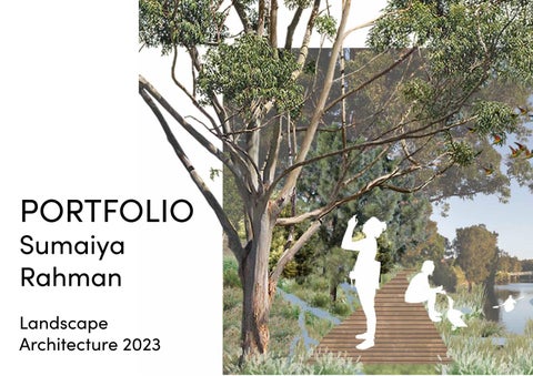
PORTFOLIO Sumaiya Rahman
Landscape Architecture 2023
Acknowledgment I would like to acknowledge that this document was created on the land of the Gadigal and Bidjigal peoples who traditionally occupied the Sydney coast. In the spirit of respect and gratitude, I acknowledge the traditional custodians of the land upon which my landscape designs take root. I pay our respects to the Elders past, present, and emerging, and recognise their enduring connection to the land, waters, and community. As a landscape architect, I strive to work harmoniously with the environment, drawing inspiration from the wisdom embedded in the cultural and ecological heritage of this land.
Sumaiya Rahman As a landscape architect student, it is my duty of care to advocate for the environment, promote for sustainable design practices, and protect vulnerable and endangered ecological communities. Experience
References
Turf Design Studios
Contact Email: Sumaiyar100@hotmail.com Mobile: 0411055679
2022-Present • Selecting appropriate planting schemes for landscape designs • Presenting and sharing team development applications • Analyse and select appropriate planting for project designs • Utilise 3D and adobe programs to present Ideas and design solutions • Collaborate with team in landscape design to create the best outcome for outdoor spaces
Bras N Things
Education
2018-Present
University of New South Wales Bachelor of Landscape Architecture
• Measuring and applying Key Peformance Indicators • Providing a personal and memorable shopping experience for customers • Creating coaching logs and Leading team to excel in current incentives • Applying current campaigns through visual merchandising • Analysing key performance indicators and applying
2020-2024 WAM:78
University of New South Wales Bachelor of Secondary education and Fine Arts
2018-2020 WAM: 68
Ashleigh Duncan Bras N Things Bondi Store Manager 0411600682 Ciara Lamberton Bras N Things Sydney City Store Manager 0413222454
Proffesional Skillls
St Catherine’s School Waverley
2012-2017 Higher School Certificate ATAR: 73
Lumion
Adobe Suite (Indesign, Photoshop, Illustrator)
AutoCad
Revit
Sketchup
AI Generative Processes
CONTENTS
Titles
No.
Design Studios
6
Along the Water
7-10
The Nest
11-14
Cycle Carnival
15-16
Hand Drawing
17
Wareamah
18-20
Herbariam Sketches
21
Design Documentation
22
Cycle Carnival Project Documentaion
23-24
Interests
25
DESIGN STUDIOS Design studios within the Bachelor of Landscape Architecture degree is an integral aspect of the course. Within studio classes I am challenged with real sites to test, analyse and formulate design solutions which holistically take into account people, ecologies, place and the landscape.
Landscape Studio 7 3rd Year Term 3 2023
Along the Water Transforming Campsie into a vibrant oasis, Along the Water revitalises the Cooks River and surrounding streets, breathing new life into the community. This innovative design introduces water to Campsie’s streetscape, reducing Urban Heat Index by absorbing, evaporating, and transporting heat, resulting in lower air temperatures and decreased energy consumption. The project extends community green spaces, weaving water streams along pathways, bringing movement and vitality to Campsie’s streets. Native Eucalypts line the streams, creating a cooling canopy, and capturing grey water enhances sustainability. Day-lit into streets, this water journey filters stormwater, contributing to a beautiful, cool parkland, forming a blissful oasis along the path to the Cooks River.
4
13
12 11 14 10
3 2
1
9
1. PROPOSED STREET DESIGN 2. TASKER PARK PLAYGROUND 3. CANTERBURY LEISURE & AQUATIC CENTRE 4. RAILWAY 5. BASKETBALL COURT 6. PONDS 7. MULTI USE SPORTS FIELD 8. RIVER BOARDWALK 9. SOUTH CYCLE & PEDESTRIAN BRIDGE 10. NORTH CYCLE & PEDESTRIAN BRIDGE 11. RAILWAY RUNOFF GARDENS 12. AQUATIC CENTRE STAFF ACCESS 13. TASKERPARK NORTH 14. AQUATIC CENTRE CAR PARK
5
6 8
7
CURRENT URBAN HEAT INDEX 5-6 ° ABOVE TEMP 9-12 ° ABOVE TEMP
7-8° ABOVE TEMP
PERMIABILITY STUDY
Along the Water focuses on decreasing Campsie’s Urban Heat Island index. This design was successful in increasing permeability through the focus of six key typologies.
31%
BEFORE
46%
AFTER
Focused Typologies PATHWAYS
TRANSPORT LINKS
WATERWAYS
EXISTING DRAINAGE
CANOPY
GREEN SPACE
Along the Water in Section
CYCLEWAY
TWO LANE ROAD
PLANTING BUFFER FOR STORM WATER OVERFLOW
FILTERATION PLANTING PERMIABLE PAVING TASKER PARK POND
STREETSCAPE
INTERGRATED STREET SWALE
DEEP SOIL FOR LARGE TREE CANOPY
DRAINAGE CONDUIT
COOKS RIVER EXISTING FICUS MACROPHYLLA
CANTERBURY LEISURE & AQUATIC CENTRE
RIVER BOARDWALK
STREAM TO POND
DECO GRAVEL PATH
PARKLAND
TIMBER POND BRIDGE
Along the Water in Detail 1. PROPOSED STREET DESIGN 2. BASKETBALL COURT 3. EXISTING SPORTS SHED 4. TIMBER POND BRIDGE 5. CYCLEWAY 6. PEDESTRIAN PATH 7. RIVER BOARDWALK 8. PEDESTRIAN & CYCLIST BRIDGE
8
5
2
1 3
6 7
4
1:500 @A1
Street Angophora costata Banksia spinulosa E Robusta E slaigna E tereticornis Leptospermum polygalifolium Lomandra longifolia Themeda australis
Pond Filteration Planting
Wetland/River Edge
Azolla pinnata Baumea artoculata Juncus kraussii Lemna disperma Phragmites australis
Acacia falcata Adiantum aethiopicum Asplenium australasicum Banksia spinulosa Calochlaena dubia Casuarina Glauca Danthonia tenuior Dianella revoluta E Robusta E slaigna E tereticornis Lomandra longifolia Melaleuca nodosa Pharagmites australis Themeda australis Viola hederacea Wahlenbergia gracilis
Landscape Studio 5 & 6 3rd Year Term 1 & 2 2023
The Nest The Nest is an ecological haven for people and ecological communities to call Angus their own home and nest. The Nest is an adaptive landscape which works with floodlines and riparian zones to integrate with residents lifestyle. The Nest is a proposed nature reserve and medium density housing suburb which works with current and historical landscapes to rehabilitate, restore and recognise.
Green loop + Cycleway
Meatworks ponds and buffer zone
Amphitheatre Nesting lookout
Mounded Lawn Space Riparian Conservation one + Major Bird Migration area
Riparian Integration Zone Nature play Ecological Research + Community Hub
School Community Gardens Medium Density Housing Commercial/Retail Floodline Trees
Town centre + Central park
Curlew Sandpiper Aus migration period: August -November
Angus’s current fauna state analysis Migratory birds, including vulnerable species like the Eastern Curlew, nest in Angus from August to April, making it a preferred habitat. The listed animals and amphibians exemplify the endangered species in Angus, highlighting the importance of habitat creation and conservation for species protection. Eastern Curlew Aus migration period: August -November
White-throated Needletail Aus migration period: October to April
Vulnerable Ecological community mapping
Gang-Gang Cockatoo Endangered
Spot-tailed Quoll Endangered
Giant Burrowing Frog Vulnerable
Yellow-bellied Glider Vulnerable
Proposed Green Corridor Strategy
Green and Blue Infrastructure Strategy The Nest Masterplan integrates green and blue infrastructure systems, crucial for Angus’s landscape centered around South and Eastern Creek. The proposed strategies emphasize Angus’s landscape importance, underscoring the necessity for adaptive and sustainable design. These strategies build on historical ecological communities to reduce area’s urban heat index.
Proposed Ecological Communities
Current Green space opportunities
Alluvial Plains woodland
Riparian Zoning of Angus
Broad-leaved Iron Bark Forest Plan: street tree comparison wealtheasy street angus (a) & Wyngard street marsden park 1 in 100 Year Flood
Forest Red Gum Grassy Woodland Plan: Marsden Park North Urban Heat Index map
Hydrology of Angus
The Nest in Detail
Woodland and Riparian Section
Streetscape Section
Landscape Studio 4 2nd Year Term 2 2022
Cycle Carnival Cycle Carnival is a cycling playground carnival of bumps, turns and spirals to create kinetic connection between user and bicycle. The goal is to create a space of excitement and delight.
Section across cycle track and water feature
Section across lawn and cycle track
Sketchup Model Perspectives
HAND DRAWING
Hand drawing has been integral to my journey as a landscape architecture student, offering a tactile connection to the design process. It provides a quick and creative exploration of concepts, fostering spontaneity and problem-solving. Beyond precision, it enhances spatial understanding. Hand-drawn visuals, with their warmth and authenticity, effectively communicate design intent to my lecturers and collaborators. This skill, balancing technology with manual artistry, has become a cornerstone, shaping a holistic and intuitive approach to my landscape architecture practice.
Wareamah (Cockatoo Island) Context Plan
Wareamah (Cockatoo Island) Plan
Landscape Studio 2 1st Year Term 3 2021
Wareamah Studio Project To repair and weave Wareamah to its origins. However, to also acknowledge the displacement of the island and settlement histories that have taken place. Therefore, interlocking and unpeeling the beauty of two stories.
Northern Appron Plan
Site history and texture analysis
East to West section with focus on landform Rusted steel arches provide shape
within the sky plane and connects with site’s industrial history. It also provides the native vegetaion with something to climb on to give the appearance
Steps up to the top of some undulations enables visitors to be placed within the landscape.
North to South section A fire pit is placed in the middle of site to create a space to feel secure along with company. The centred fire pitt reflects the Aboriginal women who used to gather on the island from different locations.
East to West section Sandstone path connects to the material used during the convict era of the island. The path weaves in and out through the steel thresholds.
The slipway crane will be engulfed by vegetation taking over the structure.
Playful use of undulating landfom creates interest on the ground plane connects human to the earth which is lifting from the ground
The tiered sandstone seating placed at the end of the site design amoungst Wareamah natives to provide a look out space onto the slipway and surrounding suburbs.
Wareamah Native planting list Sporobolus creber Xanthorrhoea australis Lomandra longifolia Smilax glyciphylla Tecomanthe hillii Carpobrotus glaucescens euchiton sphaericus Goodenia paniculata Hypericum gramineum Ficinia nodosa
Lavandula angustifolia
Banksia integrifolia
Asplenium australasicum
Herbariam Sketches 1st Year Term 3 2021
DESIGN DOCUMENTATION
In my landscape architecture studies, understanding the significance of meticulous design documentation details is paramount. These details serve as the backbone of our projects, ensuring clarity and precision in implementation. As a student, honing this skill not only cultivates a sense of professionalism but also prepares me for the real-world demands of conveying intricate design elements. Accurate documentation not only communicates ideas effectively but also lays the groundwork for seamless execution, a crucial aspect in transforming concepts into tangible, sustainable landscapes.
Landscape Documentation 2nd Year Term 2 2022
Cycle Carnival Project Documentaion
Water Feature Section Detail
Design Documentation Section, Plan and 3D of Stair Detail
IN MY SPARE TIME..
Photographic & Indoor Horticulture Interests
Contact Email Sumaiyar100@hotmail.com
Mobile
0411055679