

Published by the Deutsche Gesellschaft für Internationale Zusammenarbeit (GIZ) GmbH
Registered offices
Bonn and Eschborn, Germany
Sustainable Urban Mobility- Air Quality, Climate Action and Accessibility (SUM-ACA)
B-5/2, Safdarjung Enclave
New Delhi-110029, India
T 011-49495353
https://www.giz.de/en/projects/sustainable-urban-mobility-air-quality-climate-protection-and-accessibility-sutaca
As at June 2026
Commissioned by Federal Ministry for Economic Cooperation and Development (BMZ), Germany
Political Partner
Ministry of Housing and Urban Affairs (MoHUA), Government of India
Implementation Partners
Surat Municipal Corporation (SMC), Sitilink
Responsible
Manjunath Sekhar, Project Director, SUM-ACA
Project Coordinator
Krishna Desai, Technical Advisor, SUM-ACA

Project Team
GFA Consulting Group GmbH: Hendrik Jaschob, Project Backstopper ;Zohra Mutabanna, Team Lead; Nilesh Prajapati, Technical Expert
Design and Layout
Design Co:Lab
Photo and Map Credits
GIZ;GFA;Avian Media Private Limited
Citation
GIZ (2026). Integrated Mobility Plan for Surat. SUM-ACA. New Delhi, India.
Disclaimer
Maps in this document are for informational purposes only and do not imply recognition of boundaries or regions. GIZ does not guarantee their accuracy or completeness and accepts no liability arising from their use.
On behalf of the German Federal Ministry for Economic Cooperation and Development (BMZ)
Copyright
All rights reserved
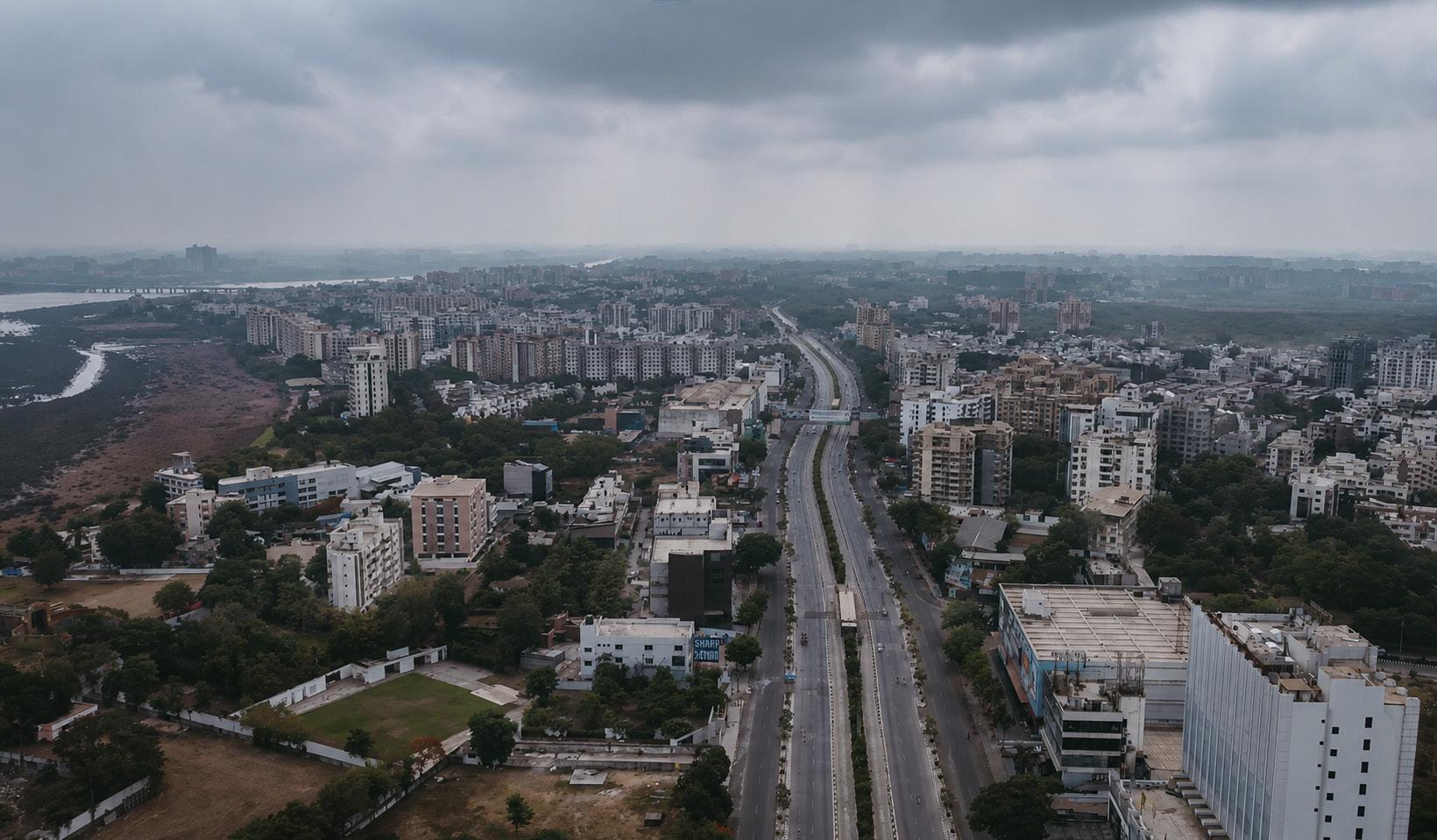
Envisioning Surat as a future ready and efficient mobility city with integrated public transport, smart mobility systems, and sustainable transport networks that support economic growth, low emission transition, and urban liveability”

Manjunath Sekhar Project Director, SUM-ACA GIZ
Urban mobility plays a critical role in shaping economic efficiency, environmental sustainability, and overall quality of life in cities. As one of India’s fastest-growing economic centres, Surat is witnessing rapid urban expansion, increasing travel demand, and evolving mobility needs that require an integrated and sustainable transport strategy.
The Integrated Mobility Plan (IMP) for Surat provides a comprehensive and action-oriented roadmap for transforming the city’s transport system. It moves deliberately away from piecemeal interventions, bringing coherence to existing policies, ongoing initiatives, and future proposals alike, all anchored around the goals of inclusion, safety, and climate resilience. The IMP provides a unified roadmap that aligns infrastructure development, mobility services, policy direction, and institutional coordination to support sustainable urban mobility in the city.
Prepared under the Sustainable Urban Mobility – Air Quality, Climate Action and Accessibility (SUM-ACA) project, as part of the Indo-German Green Urban Mobility Partnership, the plan aligns with national priorities on sustainable urban transport and supports broader goals related to climate action, accessibility, and improved public health outcomes.
The preparation of the IMP has followed a structured and evidence-based approach involving mobility assessments, review of existing plans and policies, field observations, identification of system-level gaps, and extensive stakeholder consultations. Engagement with Surat Municipal Corporation (SMC), Surat Sitilink Limited (SSL), Surat Urban Development Authority (SUDA), Gujarat Metro Rail Corporation (GMRC), and other relevant agencies has ensured that the plan reflects local priorities and institutional requirements. The plan builds upon Surat’s strengths, including its Bus Rapid Transit System, city bus services, and ongoing transition towards electric mobility, while addressing challenges related to multimodal integration, public transport ridership, road safety, and nonmotorised transport infrastructure.
The plan follows a clear result-driven approach, translating mobility challenges into prioritised interventions across immediate, short-term, and long-term horizons. As a dynamic planning tool, the IMP supports coordinated implementation and continuous improvement, providing a roadmap towards a more liveable, equitable, resilient, and people centred mobility future for Surat.
The IMP adopts an outcome-oriented and indicator-based framework that enables systematic performance monitoring, gap identification, and evidence-based decision-making across key mobility sectors.
Surat’s mobility context is shaped by its rapid economic growth, strong industrial base, and continuous in-migration. As one of India’s leading centres for textiles, diamonds, and emerging industrial sectors, the city has experienced significant spatial expansion, particularly towards industrial hubs and peripheral areas. This growth has increased travel demand, trip lengths, and pressure on existing transport infrastructure. While the city benefits from a well-developed road hierarchy and a comparatively advanced public transport system including BRTS and city bus services with a growing electric fleet there remains a high dependence on private vehicles, particularly two-wheelers, along with a strong reliance on intermediate public transport for last-mile connectivity.
The IMP builds on these existing strengths while addressing critical gaps in areas such as public transport usage, first- and last-mile connectivity, active mobility infrastructure, parking management, road safety, and climate responsiveness. The plan outlines key strategic goals, including developing a climate-resilient and transit-oriented mobility network, expanding reliable and integrated public transport systems, promoting safe and walkable streets, advancing inclusive and gender-responsive mobility, and strengthening institutional and financial capacity for sustainable transport development. A comprehensive set of priority projects has been identified through a methodological and inclusive process involving Surat Municipal Corporation, Surat Sitilink Limited, and other stakeholders. These projects represent a balanced mix of infrastructure upgrades, digital and data-driven solutions, policy reforms, and community-focused interventions. They are designed to deliver measurable outcomes within the programme timeline while establishing a foundation for long-term mobility transformation.
The IMP outlines a phased roadmap comprising immediate actions, short-term improvements, and long-term strategic initiatives. Key focus areas include:
• strengthening multimodal integration,
• enhancing public transport capacity and frequency,
• expanding electric mobility,
• improving walkability and cycling infrastructure,
• implementing inclusive last-mile solutions,
• and advancing digital mobility platforms such as integrated ticketing and Mobility-as-a-Service systems.
Institutional strengthening, capacity building, and development of coordinated governance mechanisms are also central to ensuring effective implementation.
Overall, the IMP provides a cohesive and forward-looking roadmap that integrates infrastructure, policy, technology, and institutional reforms. By adopting a phased and data-driven approach, Surat is well-positioned to transition toward a sustainable, efficient, and citizen-centric mobility system that supports economic growth, enhances liveability, and aligns with national and global sustainability goals.
Green Mobility Zone
Plan and Policy , Surat
Depot Solarization and Second Life
Battery,Surat
PBS System Rationalization
Green Climate Bond,Surat
Gender Lab , Surat
ETM Pilot,Surat
122.8 tCO2e emissions avoided annually
Cr Green Bonds issued
400 m of street improvements proposed
1.2KM
8 increase in access to public bicycle sharing projected dedicated cycle track and 7 km of painted cycle lanes proposed for implementation
165 Government officials including 40 women trained
1310 bus drivers trained
Figure
Figure
Abbreviation Definition
AMRUT
Atal Mission For Rejuvenation and Urban Transformation
APIs Application Programming Interface
BAU Business as Usual
BESS
BEST
Battery Energy Storage Systems
Brihanmumbai Electricity Supply and Transport
BMTC Bangalore Metropolitan Transport Corporation
BMZ
Bundesministerium für wirtschaftliche Zusammenarbeit und Entwicklung (Federal Ministry for Economic Cooperation and Development)
BoQ Bill of quantities
BRTS
Bus Rapid Transit Systems
CBD Central Business District
CMP Comprehensive Mobility Plan
CMUBS CM Urban Bus Service Scheme
CNG Compressed Natural Gas
CO Carbon Monoxide
CO2 Carbon Dioxide
CPO
Charging Point Operators
CS Complete Street
CSCAF Climate Smart Cities Assessment Framework
DAU Directorate of Urban Affairs
DISCOM Distribution Company
ETMs Electronic Ticketing Machine
EV Electric Vehicle
FAME Faster Adoption and Manufacturing of (Hybrid &) Electric Vehicles
GCC Gross Cost Contract
GDCR General Development Control Regulations
GHG Greenhouse Gasses
GIDC Gujarat Industrial Development Corporation
GIZ Deutsche Gesellschaft für Internationale Zusammenarbeit (German Society for International Cooperation)
GMZ Green Mobility Zone
GoG Government of Gujarat
GPCB Gujarat Pollution Control Board
GPS Global Positioning System
GTFS General Transit Feed Specification
HC Hydrocarbons
HH Household
IPT Intermediate Public Transport
IT Information Technology
ITDP Institute for Transportation and Development Policy
ITS Intelligent Transport Systems
KPI Key Performance Indicators
LAPs Local Area Plans
LCS Low Carbon Scenario
LCMP Low Carbon Comprehensive Mobility Plan
LOS Level of Service
LVC Land Value Capture
M&E Monitoring And Evaluation
MaaS Mobility as a Service
MoHUA
Ministry of Housing and Urban Affair
MoUD Ministry of Urban Development
NBFC Non-Banking Financial Company
NCAP
NCC
National Clean Air Programme
Net Cost Contract
NDC Nationally Determined Contributions
NDMA
NEBP
National Disaster Management Authority
National Electric Bus Programme
NMT Non-motorised transport
NOx Nitrogen Oxides
NULM National Urban Livelihood Mission
NUTP National Urban Transport Policy
OEMs Original Equipment Manufacturer
PIU
Project Implementation Unit
PM Particulate Matter
PM E -DRIVE
PM Electric Drive Revolution in Innovative Vehicle Enhancement
PPP Public Private Partnership
PT Public Transport
PWD
RMC
RRL
RMTS
RTO
RUDA
RWA
SDGs
SDMC
Public Works Department
Rajkot Municipal Corporation
Rajkot Rajpath ltd.
Rajkot Mass Transport Services
Regional Transport Office
Rajkot Urban Development Authority
Resident Welfare Association
Sustainable Development Goals
Street Design and Management Cell
SJMMSVY Swarnim Jayanti Mukhya Mantri Shaheri Vikas Yojana
SPV
Special Purposes Vehicle
SRTS Safe Routes to School
SUM-ACA
Sustainable Urban Mobility – Air Quality, Climate Action and Accessibility
SURE Specifications for Urban Road Execution
SVNIT Sardar Vallabhbhai National Institute of Technology, TCO Total Cost of Ownership
tCO2e Tonnes of Carbon Dioxide Equivalent
TDM
Travel Demand Management
TOD Transit Oriented Development
UMTA
UNEP
UBS
UMTA
Unified Metropolitan Transport Authority
United Nations Environment Programme
Urban Bus Specifications
Unified Metropolitan Transport Authority
VGF Viability Gap Funding
VKT Vehicle Kilometres Travelled
VRU Vulnerable Road User
Located on the banks of Tapi River and near the coast, Surat’s history is embedded into an era of more than 600 years and known as a bustling port city with maritime trade. In recent years, Surat faces several challenges with regards to rapid urban growth, expansion, economic development and migration, as the city’s attractivity has only grown. With mobility having become one of the major aspects in urban development, The Integrated Mobility Plan (IMP) will serve as a strategic instrument to ensure that ongoing, proposed, and future initiatives are interconnected, mutually reinforcing, and aligned with a unified vision for integrated urban mobility.
The document is being developed under the Sustainable Urban Mobility – Air Quality, Climate Action and Accessibility (SUM-ACA) initiative. As part of the Indo-German Green Urban Mobility Partnership (GUMP), SUMACA extends technical and strategic support to selected cities across India to foster efficient, inclusive, and lowcarbon mobility systems. Within this broader framework, the IMP for Surat outlines a clear pathway for sustainable mobility transition anchored in local development priorities and strengthened through international collaboration. A key feature of the plan is its outcomeoriented structure, which enables systematic performance tracking, impact assessment, and identification of critical gaps within the urban mobility ecosystem.
The IMP proposes a comprehensive portfolio of actions, ranging from immediate measures to short and longterm projects, spanning public transport enhancement, promotion of active mobility, universal accessibility, adoption of clean and low-emission technologies, and institutional strengthening. These interventions are designed to function
cohesively, supporting the development of an integrated, equitable, and climateresponsive transport system for Surat. Through this adaptive and evidencebased approach, the IMP sets a clear strategic direction for the city’s mobility future, building on existing plans while aligning with global best practices in sustainable urban transport.
Initiated under the framework of IndoGerman Development Cooperation, the Sustainable Urban Mobility – Air Quality, Climate Action and Accessibility (SUM-ACA) initiative, aligns with India’s National Determined Contributions (NDCs) under the Paris Agreement and the 2030 Agenda for Sustainable Development, and particularly aims at the SDGs of Sustainable Cities and Communities, and Climate Action. SUM-ACA employs a multi-actor, multipronged strategy, working with local governments to develop contextually relevant, socially equitable, climatefriendly, and innovative solutions. This collaborative approach emphasizes capacity development, knowledge sharing, and the formalization of best practices once technical cooperation concludes.
Furthermore, SUM-ACA seeks to strengthen linkages between environmental quality and climate change concerns by establishing clear connections between existing transport and environmental policies, institutional and individual capacities, data collection methodologies, and potential health outcomes.
The performance of the SUM-ACA project is evaluated against five module indicators and respective output
M1 | SUM Strategies
M2 | Data
M3 | National Guidelines
M4 | Capacity Development
M5 | Air Quality and CO2
Focuses on launching three specific green mobility strategies across multiple states and heavily polluted cities.
Standardizes data-driven planning in 8 cities to ensure transit systems are gender-sensitive and inclusive
Highlights a unified national policy by MoHUA to cut CO2 emissions and improve city air quality.
Targets training for urban transport decision-makers, aiming for 30% female participation to drive green projects.
Sets a target to cut transport emissions and traffic air pollution by 30% by the year 2030.
Output 1: The Indo-German Green Urban Mobility Partnership (GUMP) is supported
Connects the project's urban mobility inputs to major international climate events like the COP conferences.
Tracks the deployment of results-oriented city-level mobility strategies across specific sector ministries.
Output 2: Evidence-based data on climate action, air pollution control and access to urban mobility has been improved
Establishes standardized baseline rules for measuring traffic patterns and greenhouse gas emissions.
Deploys digital tools and applications to collect reliable field data for better transit planning.
Output 3: Processes for the implementation of integrated mobility plans are demonstrated
Publishes official, integrated urban mobility planning manuals tailored specifically for Indian cities.
Implements and tests international-standard transport planning procedures across specific pilot cities.
Output 4: The institutional and personal capacities of national, state, and local actors for the realisation of integrated mobility, including green recovery, are strengthened
Upgrades the internal capacity of 10 institutions to better handle air quality and green recovery.
Ensures training is effective, aiming for a 85% success/utility rate among 3,000 participating professionals.
Figure 1: SUM-ACA Objectives and Outcomes
indicators as listed below:
The duration of the SUM-ACA project is for four years (2022-2026). The project is being implemented across five Indian states and respective cities namely, Kerala (Cities: Kochi & Trivandrum), Karnataka (Cities: Hubli-Dharwad & Mysore), Orissa (Bhubaneswar & Rourkela), Meghalaya (Shillong) and Gujarat (Surat & Rajkot).
The implementation of output indicator 3 “Processes for the implementation of integrated mobility plans”, aims to strengthen the competence of urban actors for the planning and implementation of integrated mobility plans (IMPs). The primary pillar of the output indicator is to enhance the capacity of urban stakeholders to effectively plan and implement integrated mobility plans (IMPs). The project aims to support intersectoral transport planning which emphasizes on the inclusion of vulnerable groups such as women and people with disabilities Intended outcomes serve the purpose of restoring the attractiveness of public transport and increase accessibility through intermodality.
India’s national transport policies and programmes consistently promote an integrated, inclusive, and climateresponsive approach to urban mobility, thereby providing a strong foundation for cities to prepare Integrated Mobility Plans (IMPs).
The Ministry of Housing and Urban Affairs, through the National Urban Transport Policy, establishes a clear
shift from vehicle-centric planning to a people-focused approach, prioritising public transport, non-motorised mobility, equitable road space allocation, and integration of land use with transport planning. These principles directly support the development of comprehensive and coordinated mobility frameworks. The Comprehensive Mobility Plan Toolkit further strengthens this direction by providing structured methodologies for data-driven planning, multimodal integration, scenario assessment, and outcome-based evaluation. It guides cities to move beyond isolated infrastructure projects toward holistic mobility ecosystems supported by measurable performance indicators. National initiatives such as the FAME India Scheme, PM e-Bus Sewa, and PM E-Drive reinforce these policy objectives by supporting clean mobility, fleet modernisation, and electric vehicle adoption. While programmatic in nature, these initiatives inherently require coordinated planning across transport, energy, and urban governance systems further underscoring the need for integrated mobility planning.
Collectively, these national frameworks signal a clear expectation that cities move toward comprehensive, systemwide mobility planning rather than fragmented, project-based interventions. The Integrated Mobility Plan is therefore directly informed by these policy principles, technical guidelines, and investment priorities. It translates national objectives such as decarbonisation, accessibility, safety, and efficiency into a locally contextualised roadmap, ensuring alignment with India’s broader commitments on sustainable urbanisation, air quality improvement, and climate action.
Program / Guideline
National Urban Transport Policy (NUTP)
Comprehensive Mobility Plan (CMP) Toolkit / Guidelines
FAME I & II (Faster Adoption and Manufacturing of Electric Vehicles)
Objective
• Promote people-centred mobility
• Prioritises public transport, walking, and cycling as the backbone of urban mobility
• Encourages integrate landuse & transport
• Advocates for clean and sustainable mobility
• Pushes for institutional strengthening
• Provide standard methodology for mobility planning, including data collection, modelling, LOS benchmarks, and scenario analysis
• Focuses on shifting trips from private vehicles to public transport, walking, and cycling
• Details project prioritisation framework for short-, medium-, and long-term interventions.
• Strong national push for EV adoption, especially in public and shared transport
• Focus on demand incentives
• Support for charging infrastructure
• Promotes energy-efficient, low-emission mobility
Establishes the core philosophy for IMPs. Cities are encouraged to shift from vehicle-centric projects to integrated, multimodal solutions, embedding PT, NMT, safety, and demand management into every planning stage.
To be considered as the technical backbone of IMPs by defining the process, required datasets, modelling tools, and prioritisation framework; ensures uniformity and evidence-based decisionmaking across cities.
Encourages IMPs to integrate EV transition strategies, including fleet conversion plans, charging infrastructure needs, depot readiness, and TCObased financial evaluation for e-mobility investments.
Program / Guideline
PM e-Bus Sewa
PM E-Drive / National EV Infrastructure Programmes
Objective / Focus
• Introduce 10,000+ electric buses via PPP models with central support for operations & depots
• supports depot infrastructure, charging and power infrastructure (behind-the-meter power, substations etc.)
• Scale up public charging networks and enable widespread EV use.
• Encourage private-sector participation in charging infrastructure
• Demand incentives for EV adoption, Subsidy for e-2W/e-3W buyers (on battery capacity)
The Integrated Mobility Plan (IMP) for Surat has been developed to provide a cohesive and actionable roadmap for transforming the city’s transport ecosystem into one that is integrated, inclusive, safe, climate-resilient, and future ready. It moves beyond fragmented or stand-alone interventions by establishing a structured framework that connects vision, strategy, evidence, and implementation into a unified and outcome-oriented mobility system.
Guiding principles of the IMP
• Enable an Integrated Multimodal System: Facilitate seamless
Influences / Supports for Integrated Mobility Planning (IMP)
Shapes IMPs to address modern e-bus deployment needs such as route rationalisation, depot electrification, accessibility standards, operational contracting structures, and cost optimisation.
Emphasize IMPs to plan for charging corridors, public charger locations, grid augmentation, energy demand projections, and private sector participation models, thus making electrification a structured part of city mobility planning.
integration across public transport modes, non-motorised transport (NMT), intermediate public transport, and emerging electric mobility solutions, with a clear focus on moving people rather than vehicles.
• Ensure Universal Accessibility: Ensure equitable, safe, affordable, and barrier-free mobility for all user groups, including women, children, senior citizens, persons with disabilities, and other vulnerable groups.
• Advance Climate-Responsive Mobility: Support energy-efficient, low-emission, and environmentally sustainable transport solutions aligned with national and state climate and sustainability commitments.
• Strengthen Institutional Capacity: Strengthen the technical and institutional capacities of city
agencies for coordinated planning, implementation, monitoring, and data-driven decision-making.
• Enable Phased Implementation: Enable a prioritised, measurable, and time-bound approach for implementing mobility projects across immediate, short-term, and long-term horizons
• Integrate Plans and Projects: Consolidate ongoing, proposed, and future initiatives under a single, coherent mobility framework to ensure synergy and avoid duplication.
• Adopt a Pillar-Based Monitoring Framework: Define strategic pillars and measurable performance indicators to track progress and support evidence-based policy decisions.
• Identify Gaps and Strategic Priorities: Assess existing initiatives against defined mobility pillars to highlight service gaps, infrastructure deficits, policy needs, and institutional constraints.
• Structure Implementation Roadmap: Categorise proposals into immediate, short-term, and longterm actions to support systematic and phased execution.
• Promote User-Centric and Sustainable Modes: Prioritise safe, affordable, and accessible transport options, particularly walking, cycling, and public transport, to improve overall quality of life.
Through these guiding principles and objectives, the IMP will function both as a long-term strategic vision document and as an operational blueprint to guide Surat toward a more liveable, inclusive, and sustainable urban mobility future.
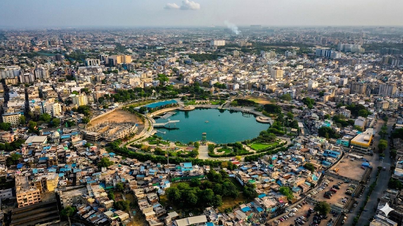
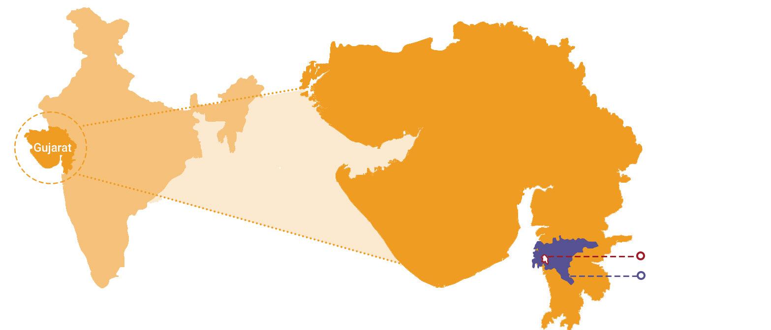
Surat is one of India’s fastest-growing urban centres and a major economic powerhouse of Gujarat with 446 sq. km of area. With a population exceeding 6 million and a rapidly expanding urban footprint, the city continues to experience significant growth in mobility demand, infrastructure needs, and environmental pressures. Spanning a large municipal area and supported by robust industrial and commercial activity, Surat is well connected to major cities across India through road, rail, and air networks. The
city is governed by the Surat Municipal Corporation (SMC), which is responsible for civic administration, infrastructure development, and service delivery. Urban planning and development functions are undertaken in coordination with the Surat Urban Development Authority (SUDA). Public transport services, including city buses and Bus Rapid Transit System (BRTS), are operated under Sitilink, which is a dedicated institutional mechanism (SPV) established by the city.
average and 1.8 times higher than the
Major industrial clusters such as Sachin GIDC, Pandesara GIDC, Hazira Industrial Area, and Katargam have played a pivotal role in attracting investment and generating large-scale employment. Sachin GIDC alone accommodates over 2,250 industrial units and provides employment to more than 300,000 workers, while Pandesara remains one of the country’s largest textile processing clusters. The presence of large industrial establishments in Hazira, along with thousands of small and medium textile and diamond units across the city, has made Surat a major destination for migrant workers from across Gujarat and states such as Uttar Pradesh, Bihar, Odisha, and Rajasthan. Surat’s textile industry operates approximately 600,000 power looms, over 450 textile processing units, and more than 700 textile markets, collectively employing well over one million workers across weaving, processing, trading, logistics, and ancillary activities. The diamond industry contributes another 800,000 workers, with Surat processing nearly 90% of the world’s rough diamonds. A significant proportion of this migrant population resides in peripheral and newly developing areas including Kosad, Udhna, and Amroli, where comparatively affordable housing and proximity to industrial zones influence settlement patterns. In addition, Surat experiences a substantial floating population, with daily commuters travelling from surrounding towns and peri-urban areas for employment, trade, education, and
The rapid expansion of economic activity and continuous in-migration have contributed to sustained population growth and urban sprawl. This growth has intensified demand for housing, water supply, sanitation, and particularly mobility infrastructure. Increasing trip
lengths between residential peripheries and industrial or commercial centres have placed significant pressure on the transport network. As a result, strengthening and integrating
public transport, improving last-mile connectivity, and promoting sustainable mobility solutions have become critical priorities for ensuring Surat’s continued economic vitality and urban liveability.
Owing to sustained in-migration, particularly of single and working-age individuals employed in the textile and diamond sectors, household demographics in Surat reflect a relatively compact family structure. As per the Comprehensive Mobility Plan (2018), the average household size in 2016 was approximately 4.2 persons per household, indicating a mix of nuclear families and shared rental accommodations commonly observed in migrant-dominated neighbourhoods. However, this figure represents only a demographic snapshot and does not fully capture the evolution of Surat’s population structure over time. Between 1991 and 2011, Surat experienced one of the highest urban growth rates among Indian cities, with population increasing from approximately 1.5 million to 4.5 million. While a significant portion of this growth was driven by in-migration associated with the city’s textile, diamond, and industrial sectors, natural population growth also contributed to overall demographic expansion.
Vehicle ownership patterns highlight, around 85% of households in the city
owned at least one motorised vehicle as per the Metro DPR (2016). The household travel survey conducted in 2016 indicated that vehicle ownership stood at approximately 273 two-wheelers and 23 four-wheelers per 1,000 population. The dominance of two-wheelers reflects their affordability, flexibility, and suitability for short urban trips, which are characteristic of Surat’s travel patterns. Rising motorisation levels have significantly influenced the city’s mobility dynamics by expanding access to employment opportunities and improving connectivity between residential areas and industrial clusters. The ability to travel longer distances efficiently has expanded the effective labour catchment area of major employment centres such as Sachin, Pandesara, and Hazira, contributing to economic productivity and supporting Surat’s continued industrial growth. Nevertheless, without corresponding investments in public transport and non-motorised transport infrastructure, continued growth in motorisation may result in increased congestion costs, reduced travel efficiency, higher fuel consumption, and adverse environmental impacts.
The distribution of vehicle ownership across income groups demonstrates a clear correlation between income levels and motorisation rates, with higherincome households owning multiple vehicles, while lower-income groups rely more on shared and intermediate public transport modes.
This increasing motorisation with the urban populations rising motorisation
has important implications for land use patterns in the context of urban expansion, the general use of public space, congestion in traffic, parking demand, road safety, and environmental sustainability, thereby reinforcing innovative solutions to address the needs for strengthening alternative forms of public transport and sustainable mobility systems in the city overall.
Figure 3: Household Income vs Vehicle Ownership
Source: Surat Metro Detailed Project Report (DPR), 2018
The successful advancement of sustainable urban mobility initiatives in Surat depends on strong coordination among across multipleseveral institutions functioning on various
governance, including at municipal, regional, and state levels, along with active and inclusive participation from transport operators and private sector stakeholders. Mobility outcomes in Surat are shaped not only by agencies directly managing transport systems, but also by those responsible for spatial planning, infrastructure provisioning, enforcement, energy supply, and financial approvals.
To ensure clarity in roles and responsibilities,better understand the actor network and to guarantee the best possible stakeholder engagement process, a structured stakeholder mapping exercise was carried out to identify key public and private institutions influencing mobility planning, implementation, regulation, and service operations within the city. The assessment highlights that the Surat Municipal Corporation (SMC) plays a pivotal role in urban road management, complete street development, nonmotorised transport (NMT) infrastructure, and parking regulation.
In parallel, the Surat Urban Development Authority (SUDA) significantly influences mobility patterns through land-use planning and development control regulations. Public transport services, including city bus and BRTS operations, are managed by Surat Sitilink Limited (SSL), which directly impacts service coverage, operational quality, and ridership levels. State-level departments, such as the Urban Development
Department, provide overarching policy direction, funding approvals, and project clearances. Regulatory and enforcement bodies, including the Regional Transport Office (RTO) and Traffic Police, shape vehicle growth, licensing, compliance, and road safety outcomes. Additionally, private operators, vehicle manufacturers, auto-rickshaw unions, and charging infrastructure providers play complementary roles in strengthening service delivery, enabling clean mobility transitions, and improving last-mile connectivity.
Recognising these interconnections is essential for defining leadership structures, establishing coordination mechanisms, and designing effective implementation pathways under Surat’s Integrated Mobility Plan. The stakeholder assessment also informs consultation strategies, institutional strengthening measures, and capacitybuilding efforts required to ensure coherence between land-use decisions, transport investments, and operational performance.
Very High – Leads mobility initiatives, manages city roads and public spaces
High – Determines road standards, geometry, and corridor design
High – Ensures compliance, manages congestion, and enforces parking control
High – Influences motorisation trends and public transport authorisations
Very High – Guides state mobility agenda and investment decisions
High – Shapes travel demand through zoning and development planning
Very
The urban mobility status provides an overview of Surat’s existing transport system and mobility conditions, including the structure of the road network, public transport availability, travel patterns, accessibility, and key infrastructure characteristics. This baseline assessment helps identify current strengths, emerging pressures, and priority areas for improvement within the city’s mobility ecosystem.
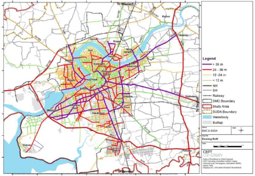
The road network in Surat follows a hierarchical structure based on the rightof-way (RoW) width of roads, which helps organise traffic movement and improve connectivity across the city. Arterial roads, having widths greater
than 36 m, form the primary transport corridors and account for about 10% of the total road network. These roads carry high traffic volumes and connect major activity centres and regional routes. Subarterial roads, with widths ranging from 24 m to 36 m, constitute about 9% of the network and serve as important links between arterial roads and major urban areas. Collector roads, which are 12 m to 24 m wide, make up around 25% of the network and distribute traffic from subarterial roads to neighbourhood streets.
The largest share of the network comprises local roads, which are less than 12 m wide and account for about 56% of the total road length, primarily providing access within residential and local areas. This hierarchical structure supports efficient traffic distribution and accessibility within the city.
According to the Surat CMP (2018), the per capita overall trip rate (PCTR) in 2016 was 1.60 trips per person per day. When walking trips are excluded, the trip rate reduces to 0.96, while the motorised trip rate stands at 0.93. The public transport trip rate is very low at 0.02, indicating limited reliance on formal public transport systems during that period. In contrast, the intermediate public transport (IPT) trip rate is relatively higher at 0.12, reflecting the strong dependence on auto-rickshaws and shared auto services for daily travel and last-mile connectivity. In terms of mode share, two-wheelers dominate urban travel, accounting for
about 35.6% of total trips, followed by walking at 40.3%, which remains significant due to the city’s compact urban form and mixed land use. The bus and rail share remains very low at around 1.4%, indicating limited reliance on formal public transport. As per CMP report, the western and south-western parts of the city show higher motorised trip rates due to higher income levels, whereas the south-eastern areas exhibit higher non-motorised transport usage, largely because of worker settlements near industrial areas with shorter travel distances.
The city’s public transport system is heavily dependent on a bus-based mass transit framework supported by rapid transit corridors and an expanding electric bus fleet. The Bus Rapid Transit System (BRTS) forms the backbone of the network, spanning approximately 119 km and operating with a fleet of 450 buses, catering to an average daily ridership of 1.22 lakh passengers. Complementing the BRTS, the City Bus Service operates across a 418 km network with 425 buses, serving nearly 75,000 passengers per day and ensuring wider connectivity across residential,
commercial, and peripheral areas of the city.
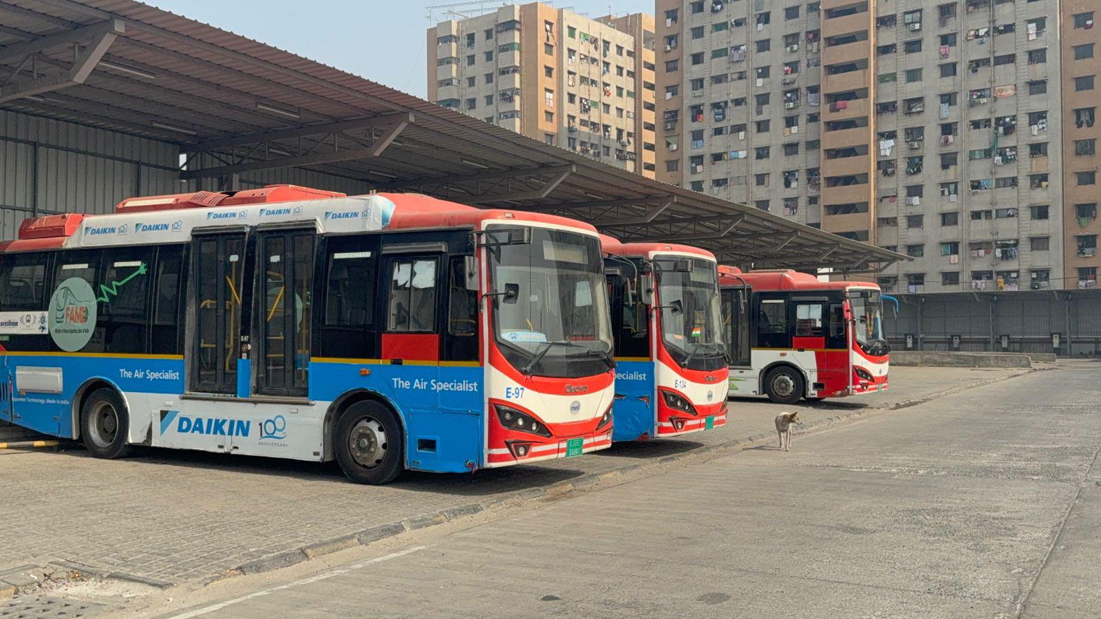
A key transition underway in the public transport system is the shift toward electric mobility. Currently, 450 electric buses are operational, all deployed within the BRTS network. To further strengthen sustainable mobility, the city plans to induct an additional 600 electric buses under the PM E-DRIVE scheme, which will significantly expand the electric fleet. With these additions, the city has set an ambitious target of achieving 100% electrification of the bus fleet by the end
of 2026–27, positioning itself as a leader in green public transport.
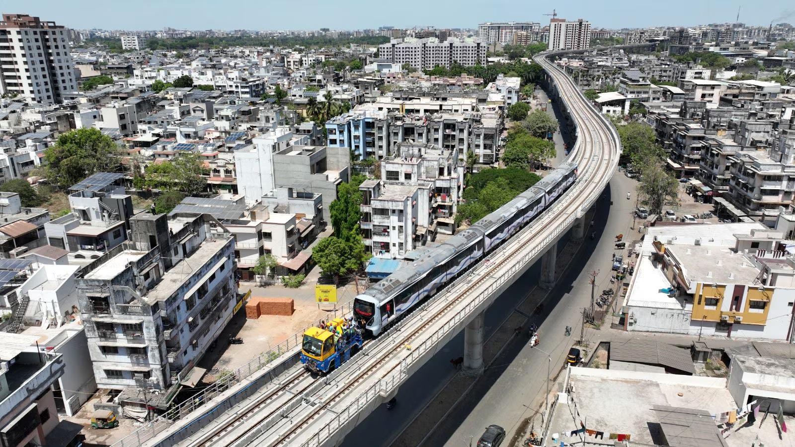
Surat is also notable for being the first city in India to implement a single-ticket travel system across different public transport modes. Through the Automated Fare Collection System (AFCS), passengers can travel seamlessly on both city buses and BRTS using a single ticket, improving convenience and integration. Looking ahead, the city is further strengthening its mass transit infrastructure with the construction of two metro corridors covering about 41 km, which are expected to become operational by 2027. The metro corridors were identified based on the Comprehensive Mobility Plan (CMP) after evaluating multiple alignment options.
To support this transition, substantial infrastructure has been developed. The city has established six modern e-bus depots, with two additional depots under construction to accommodate the growing fleet. Among these, the Althan Depot stands out as India’s first joint OEM facility, where buses from multiple manufacturers Olectra and JBM operate from the same depot, showcasing an innovative operational model. In parallel, the city is expanding its EV charging ecosystem with a long-term vision of 500 charging stations, of which the first 50 fast-charging stations have already been installed at strategic locations to support the growing electric mobility network.






Overall, Surat’s public transport system reflects a strong model of institutional coordination and network integration. The BRTS, city bus services, and upcoming metro system are being planned as complementary components of a wider multimodal transport network, aimed at improving accessibility, connectivity, and mobility across the city.
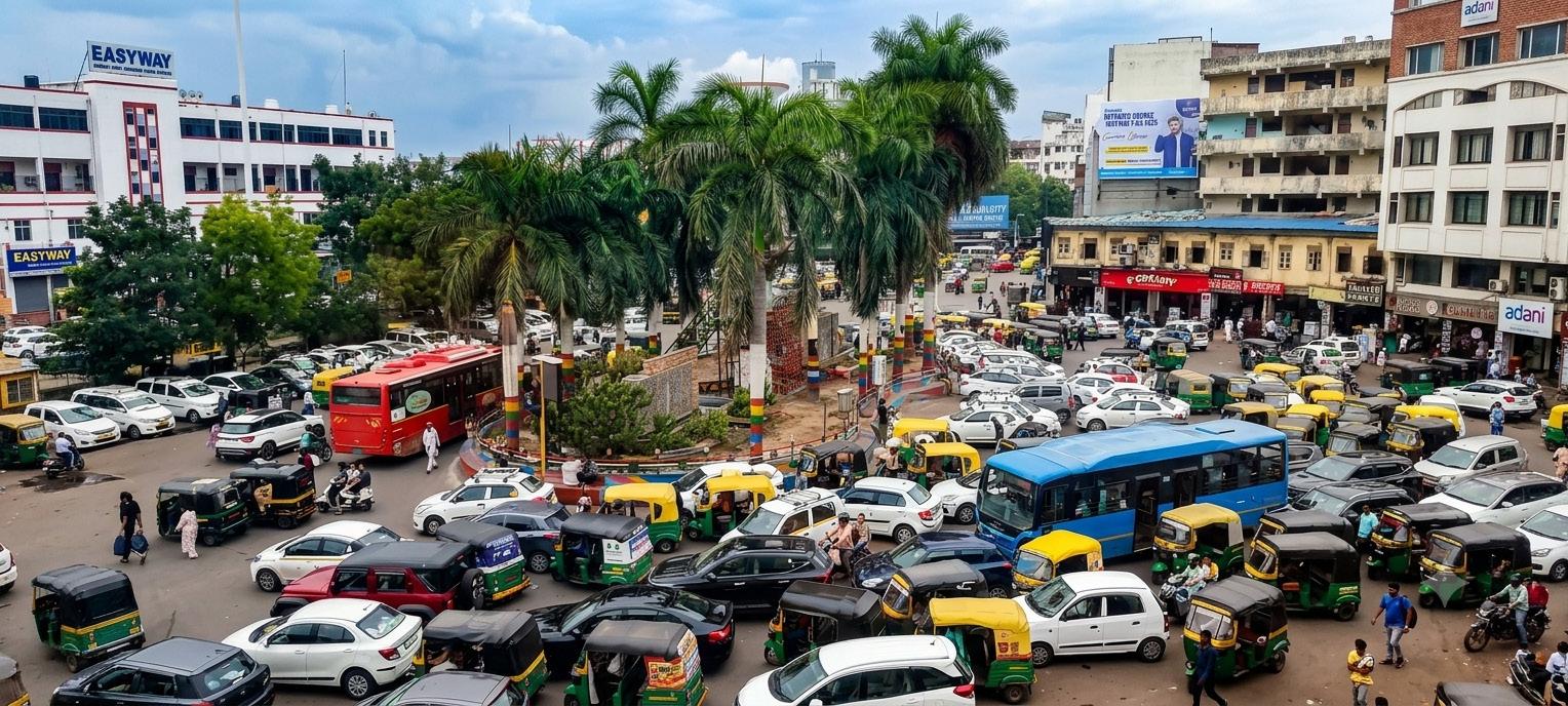
Intermediate public transport in Surat is dominated by auto-rickshaws, which play an important role in providing lastmile connectivity and serving areas with limited bus access. As highlighted in the CMP, the city has around 38,000 registered auto-rickshaws, many of which operate on fixed routes with distancebased fares. Approximately 8.6 lakh trips are made daily by auto-rickshaw, and around 52 shared auto-rickshaw routes have been identified across the city. While IPT offers high frequency, flexible operations, and wider spatial coverage compared to formal bus services, the system remains largely unorganised. Key challenges include overloading, poor vehicle quality, congestion, weak integration with formal public transport,
and increased pollution levels.
Surat has also experienced a significant increase in motorisation over the past two decades. According to data from the Surat Regional Transport Office (RTO), registered vehicles increased from around 10 lakh in 2000 to nearly 30 lakh in 2023, reflecting rapid growth in vehicle ownership. In the last five years alone, vehicle registrations have grown at an estimated annual rate of around 9%. Two-wheelers account for the largest share of this increase, followed by fourwheelers and three-wheelers.
Between 2000 and 2023, the total number of registered private vehicles reached approximately 30 lakh, of which nearly 24 lakh were two-wheelers and around 5 lakh were four-wheelers. The average annual growth rate of private vehicles is estimated at around 7%, indicating a growing dependence on personal motorised transport. This trend places increasing pressure on road capacity, parking supply, traffic management, air quality, and the overall sustainability of Surat’s urban mobility system
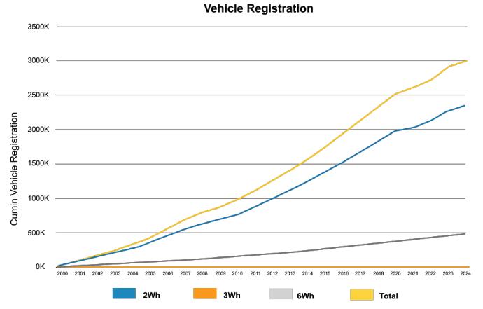
8: Cumulative Vehicle Growth by Modes
Source: RTO, Surat and Vahan dashboard
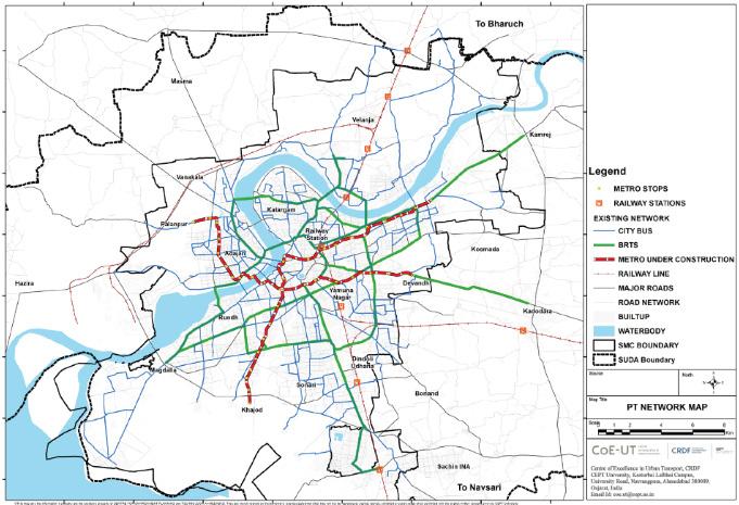
Figure 9: Integrated public transport network in Surat (2024)
Source: CoE-UT, CEPT & CMP
A range of sustainable mobility and urban transport initiatives are already being undertaken in Surat, creating a strong foundation for the development and implementation of an integrated mobility framework for the city. These initiatives are led primarily by the Surat Municipal Corporation (SMC) and Sitilink
Ltd., in coordination with various state and national agencies. While multiple initiatives are at different stages of planning and implementation, the city demonstrates a proactive approach towards improving accessibility, public transport integration, and sustainable mobility.
Table 4: Existing Initiatives or works in Surat
Highlights
• Transportation is identified as a critical component for disaster response, but severe weather events, particularly floods, can significantly disrupt the mobility network. Flooding may cause road pavement failures, blockage of key routes due to water or debris, and damage to bridges, which can halt transportation links.
• During major flood events, such as the 2006 flood, there is a risk of damage to transport assets including buses and municipal vehicles, and authorities may enforce the temporary closure of bus services and vehicular movement in affected areas to ensure public safety.
1 Surat Disaster management plan (2025)
• Damage or obstruction of major roads severely affects the mobilization of emergency response teams and the movement of essential supplies such as food, medical aid, and relief materials.
• To restore mobility quickly, the disaster management plan outlines standard operating procedures including rapid removal of debris, clearing fallen trees, and pumping water from underpasses and flood-affected roads to reopen critical routes.
• Traffic police play a key role in regulating movement, creating green corridors for emergency vehicles, and preventing congestion that could delay rescue and relief operations.
• The plan also highlights a lack of sufficient alternative high-capacity routes, which increases the vulnerability of the city’s transport network during major disasters.
2 Surat Clean Air Action Plan (2021)
• The transport sector is a major contributor to local air pollution, with heavy trucks and commercial vehicles being the primary source of vehicular PM emissions, while two-wheelers (over 76% of personal vehicles) contribute significantly to Hydrocarbon (HC) and Carbon Monoxide (CO) emissions due to their large numbers.
• Severe traffic congestion is observed on major arterial corridors such as Katargam Main Road, Surat–Kadodara Road, and the old walled city, further aggravated by heterogeneous traffic conditions where slow-moving and fast-moving vehicles share the same road space.
• Ongoing infrastructure projects, heavy vehicle movement, poor road conditions, and unpaved shoulders contribute to slower traffic movement and resuspension of road dust, which significantly increases PM levels, particularly around congested corridors and major intersections.
• Despite the presence of BRTS and city bus services, the share of public transport remains relatively low, highlighting the need for better route density, improved accessibility to stops, and stronger multimodal integration.
• The city also faces infrastructure and management challenges, including limited dedicated facilities for Non-Motorised Transport (footpaths and cycle tracks), inefficient traffic management at key intersections, and insufficient organised parking, leading to illegal roadside parking and reduced road capacity.
• Additionally, there is a lack of specialised air quality monitoring at traffic hotspots, which limits the ability to assess real-time exposure of commuters to transportrelated pollution.
• The report identifies the transport sector as a critical driver of air pollution in Surat, particularly regarding fine particulate matter and nitrogen oxides.
• At Surat city Level, Transport is responsible for 30% of PM2.5 emissions, 12% of PM10, and a dominant 85% of NOx emissions. It also accounts for 62% of Carbon Monoxide (CO) emissions in the city.
3 Source Apportionment Study (2021)
• Transport impacts air quality more severely in winter, contributing 15–23% to ambient PM2.5 levels, compared to only 6% in summer. This seasonal difference is due to calmer winter conditions and lower mixing heights that trap local tail-pipe emissions.
• Under a Business as Usual (BAU) scenario, transportrelated NOx emissions are expected to decrease by 2030 due to the introduction of BS-VI norms, but PM levels from associated road dust are projected to rise with increasing vehicle numbers
4 CMP 2046 (2018)
• outlines a vision for a "Connected, Accessible, Safe, Smart, and Sustainable" mobility system for Surat by 2046.
• The CMP focuses on:
• Achieve a targeted shift of 50% of all motorized trips to public transport (Metro/BRTS/CBS) and sustainable NMT modes by 2046.
• prioritize the development of dedicated and safe networks for pedestrians and cyclists to serve as the backbone of the mobility system, especially for "firstand-last-mile" connectivity.
• Create a hierarchical, grid-based network that physically and operationally integrates Metro, BRTS, city buses, and Intermediate Public Transport (IPT) via seamless interchanges.
• implement a Transit-Oriented Development (TOD) approach, directing high-density, mixed-use development within the catchment areas of major mass transit corridors to maximize transit use.
• Ensure mobility services that are accessible, equitable, and safe for all residents, regardless of socioeconomic background or ability.
• The plan identifies specific occupations and demographics in the transport and outdoor labour sectors as being at "High Risk" for heat-related illnesses (such as heat exhaustion and heatstroke).
5 Surat Heat wave plan (2018)
6 Surat Resilience Strategy (2017)
• Auto-rickshaw drivers and helpers.
• Tempo and other transport workers.
• Traffic police personnel (due to mandatory outdoor duty).
• People traveling on roads (including pedestrians and cyclists).
• The report designates Connectivity & Mobility Services and Regulation as its first strategic pillar, identifying it as a major urban stressor.
• The absence of robust public buses led to the rise of auto-rickshaws (para-transits), which, while providing essential mobility, are often unorganised, overloaded, and contribute significantly to pollution.
• The city suffers from a lack of authorised parking, leading to illegal parking under bridges and on footpaths. Furthermore, existing footpaths are frequently encroached upon by vendors or food joints, compromising pedestrian safety.
• There is a noted lack of traffic sense among citizens, and a reputation for "rash and careless" driving
7 Development Plan – 2035 (Second Revised, 2017)
• Between 2001 and 2011, Surat saw a significant 103% increase in registered personalized vehicles, particularly two-wheelers.
• Intense mixed land use and unauthorized street parking on narrow roads have resulted in extreme traffic congestion, noise, and air pollution, especially in the core areas of Surat (e.g., Surat Fort area).
• The city's reliance on informal intermediate public transport (autorickshaws) highlights the current inadequacy of formal public bus services and safe infrastructure for pedestrians and cyclists.
• The DP-2035 envisions a more sustainable, efficient, and well-connected urban future for Surat, prioritizing public transit and non-motorized options to reduce congestion and improve overall quality of life.
Following below are the key findings related to mobility sector from the review of the existing initiatives and reports of Surat:

Urban Growth and Travel Demand in Surat
Surat has emerged as one of India’s fastest-growing urban and industrial centres, with rapid expansion in population and built-up areas significantly increasing travel demand. The Surat Development Plan 2035 reports a 103% rise in registered personalised vehicles between 2001 and 2011, indicating a strong shift toward private motorised transport, particularly two-wheelers that dominate daily trips. This rapid motorisation has placed increasing pressure on the city’s road network, leading to congestion on several key corridors.
The Surat Clean Air Action Plan identifies major congestion hotspots along corridors such as Katargam Main Road, Surat–Kadodara Road, and the historic walled city area, where heterogeneous traffic, infrastructure works, and poor road conditions slow movement and contribute to road dust and particulate

Surat has made notable progress in strengthening its public transport system through the Bus Rapid Transit System (BRTS) and the city bus network operated by Surat Sitilink Limited, with BRTS corridors forming the backbone of urban mobility and city buses providing feeder connectivity and city-wide coverage. However, the Comprehensive Mobility Plan for Surat indicates that the share of formal public transport in total trips remains relatively limited compared to private vehicles and intermediate public transport.
The Surat Clean Air Action Plan also highlights the need to improve ridership through better route coverage, accessibility to stops, and integration between transport modes. At the same time, gaps remain in pedestrian and cycling infrastructure; the Surat Resilience Strategy notes that footpaths are often discontinuous or encroached upon, while dedicated cycling infrastructure is limited. Despite these challenges, walking continues to play an important role for short trips due to the city’s compact and mixed-use urban form, making improvements in pedestrian infrastructure and last-mile connectivity essential for a more balanced and inclusive mobility system.

The transport sector plays a significant role in the environmental challenges of Surat, particularly in relation to air pollution. The Surat Source Apportionment Study identifies transport as a major contributor to urban emissions. Pollution levels are often higher during winter months when atmospheric conditions limit dispersion of pollutants. The Surat Clean Air Action Plan further notes that congestion, heavy vehicle movement, and the resuspension of road dust along busy corridors significantly contribute to particulate pollution. In addition to air quality concerns, climate resilience is increasingly important for urban mobility planning.
The Surat Disaster Management Plan highlights that extreme events, such as heavy rainfall and flooding,s can disrupt the transport network by damaging road surfaces, blocking key corridors, and affecting bridges and underpasses, sometimes requiring temporary suspension of bus services and traffic restrictions. The plan emphasises the need for rapid restoration of mobility through coordinated actions such as debris clearance, pumping water from flooded underpasses, and establishing emergency corridors for relief and rescue operations.
Mobility systems in Surat also have direct implications for public health and occupational safety. The Surat Heat Wave Action Plan identifies several transport related occupations and road users such as auto-rickshaw drivers, transport workers, traffic police personnel, pedestrians, and cyclists as particularly vulnerable to heat stress during extreme temperatures. Similarly, the Surat Resilience Strategy highlights mobility and connectivity as a key urban stressor, pointing to challenges including informal intermediate public transport services, illegal parking, encroached footpaths, and unsafe driving behaviour that affect the safety, efficiency, and inclusiveness of the transport system.
Addressing these concerns requires integrated mobility planning that combines improved street design, stronger public transport systems, road safety measures, and climate-responsive infrastructure.
The Integrated Mobility Plan (IMP) for Surat is prepared within the planning framework defined under the SUMACA project, which provides cities with a structured approach to identify, coordinate, and implement mobility strategies in a cohesive and outcomeoriented manner. The framework enables the city to align ongoing initiatives, policies, and infrastructure investments under a shared vision while translating broader mobility objectives into practical and measurable actions.
Mobility plays a central role in Surat’s economic growth, social inclusion, and environmental sustainability. Efficient and reliable transport systems enable workers to access employment centres, connect students to educational institutions, and support the movement of goods across the city’s extensive industrial and commercial networks. Improved accessibility also strengthens
connections to healthcare facilities, markets, public services, and other essential urban opportunities. Affordable and dependable mobility options are particularly important for low- and middle-income households, as they reduce travel costs, expand access to jobs and services, and support more equitable participation in urban life. Beyond these economic and social benefits, well-designed mobility systems also contribute to public health, road safety, and overall urban liveability.
Safer streets help reduce crash risks, while improved walking and cycling infrastructure encourages active travel, reduces exposure to traffic-related pollution, and creates more peoplefriendly public spaces. At the citywide level, integrated mobility improves connectivity between residential areas, employment hubs, commercial centres, and public institutions. It also enhances
productivity by reducing travel time and supporting more efficient movement of people and goods. In this context, mobility is not merely a system for movement. It is a critical enabler of sustainable urban development, supporting Surat’s transition towards a more inclusive, productive, liveable, and low-emission urban future.
While Surat already has several mobilityrelated policies, plans, and initiatives in place, these are often implemented through different departments, agencies, and programmes. This can lead to fragmented decision-making, overlapping efforts, and gaps in implementation. The Integrated Mobility Plan (IMP) addresses this challenge by providing a unified strategic framework that brings existing policies, infrastructure investments, and future mobility initiatives under a shared vision for the city.
Rather than replacing earlier planning documents, such as the Comprehensive Mobility Plan for Surat or the Surat Development Plan 2035, the IMP serves as an integrating framework. It consolidates multiple sectoral strategies and ensures that mobility interventions are planned, prioritised, and implemented in a coordinated manner. The framework enables the city to identify priority corridors and areas, define key
interventions, sequence projects across short-, medium-, and long-term phases, and establish measurable indicators to monitor progress and outcomes. The IMP also responds to emerging trends and priorities in urban mobility, including electric mobility, digital ticketing, intelligent transport systems, data-driven traffic management, and climate-resilient infrastructure. By linking transport planning with land-use development, environmental objectives, and resilience strategies, the plan supports more efficient use of urban space while improving accessibility, safety, and mobility for all users.
Overall, the Integrated Mobility Plan provides Surat with a comprehensive roadmap to strengthen its mobility system. It focuses on improving public transport services, enhancing pedestrian and cycling infrastructure, managing traffic and parking more efficiently, supporting cleaner mobility technologies, and reducing environmental impacts from the transport sector. Through its alignment with broader development, climate, and resilience strategies, the IMP supports Surat’s transition towards a mobility system that is efficient, inclusive, climate-responsive, and capable of supporting long-term sustainable urban growth.
The preparation of the Integrated Mobility Plan (IMP) for Surat followed a structured methodology that integrates lessons from national and international best practices while adapting the approach to the city’s specific mobility challenges, travel patterns, and urban growth dynamics. The methodology included analysing existing mobility conditions, reviewing relevant policies and plans, identifying key transport issues, and developing strategic interventions to improve accessibility, sustainability, and efficiency across the city’s transport system. The key steps in the methodology are outlined below:
including the Comprehensive Mobility Plan for Surat, the Surat Development Plan 2035, the Surat Clean Air Action Plan, the Surat Disaster Management Plan, the Surat Heat Wave Action Plan, and the Surat Resilience Strategy.
In addition, the review examined mobility initiatives and operational plans related to the Bus Rapid Transit System (BRTS) and city bus services operated by Surat Sitilink Limited, including aspects such as network expansion, fleet operations, and service integration. This review process established a common baseline for the IMP by providing a comprehensive understanding of existing strategies, infrastructure investments, and institutional responsibilities. By grounding the IMP within Surat’s current plans and initiatives, this step ensures that future recommendations build upon ongoing efforts, avoid duplication, and remain practical and implementable within the city’s institutional and operational context.
The preparation of the Integrated Mobility Plan (IMP) for Surat began with a structured review process aimed at developing a clear understanding of the city’s existing mobility planning and implementation framework. As part of this process, key statutory and sectoral documents were compiled and reviewed,
The nine pillars of the Integrated Mobility Plan (IMP) provided the analytical framework for assessing the transport system of Surat, covering aspects such as accessibility, safety, sustainability, institutional capacity, and multimodal integration. For each pillar, defined indicators guided the assessment process and ensured alignment with the city’s long-term mobility vision. The evaluation began with a review of key planning documents including the Comprehensive Mobility Plan for Surat, Surat Development Plan 2035, and the Surat Clean Air Action Plan to establish a baseline understanding of mobility conditions and previous recommendations.
This was complemented by data collection across departments to compile
information on transport infrastructure, public transport services, institutional roles, project implementation, and mobility performance indicators, including inputs related to the BRTS and city bus system operated by Surat Sitilink Limited. Stakeholder discussions with officials from planning, engineering, transport, and related departments further helped validate the information and provided
insights into operational challenges and institutional gaps. All quantitative and qualitative inputs were then consolidated within the IMP assessment framework structured around the nine pillars, enabling a systematic evaluation of the city’s current mobility performance and identification of key areas requiring improvement.
Based on the structured review and assessment process, the Integrated Mobility Plan (IMP) for Surat undertook a systematic gap identification exercise across all IMP pillars. This pillar-wise assessment enabled a clear and evidence-based understanding of the city’s mobility challenges, moving the analysis beyond general observations toward a more diagnostic and actionoriented approach. Existing policies, infrastructure, services, and institutional arrangements were evaluated against the objectives of a safe, inclusive, efficient, and climate resilient urban mobility system.
The assessment identified several critical gaps, including limited modal integration, uneven public transport accessibility
in certain growth areas, constraints in pedestrian and cycling infrastructure, and the need for stronger institutional coordination across agencies. Spatial analysis further highlighted highdemand corridors and expanding urban areas where improvements in public transport connectivity, safe pedestrian infrastructure, and last-mile access are required. The analysis also considered user-centric aspects, recognising the mobility needs of vulnerable groups such as women, children, elderly citizens, persons with disabilities, and informal sector workers. This systematic gap assessment formed the basis for developing targeted and implementable strategies under the IMP, ensuring that proposed interventions directly address identified challenges while supporting Surat’s long-term vision of integrated, sustainable, and inclusive urban mobility.
Building on the gap identification exercise, the Integrated Mobility Plan (IMP) for Surat translated the identified needs into a project development process which has been prepared for implementation. Potential interventions were conceptualised to address gaps across each IMP pillar while remaining aligned with the city’s institutional capacity, existing initiatives, and policy directions outlined in documents such as the Comprehensive Mobility Plan for Surat. Projects were evaluated and prioritised based on multiple criteria, including implementation readiness, availability of land and right-of-way, funding feasibility, inter-agency coordination requirements, and their potential to deliver measurable mobility improvements.
• Immediate actions – high and quick impact projects.
• Short-term – initiatives requiring preparatory work, pilots, or institutional alignment.
• Long-term – larger infrastructure or systemic integration projects. This structured approach enables the IMP to move from analysis to implementation with a clear and realistic roadmap, balancing quick improvements in mobility with long-term transformation toward a more integrated, efficient, and sustainable transport system for the city.
Extensive, inclusive, and participatory stakeholder consultations were conducted throughout the preparation of the Integrated Mobility Plan (IMP) for Surat. These consultations were designed to ensure that the plan reflects not only technical assessments, but also the institutional realities, operational experiences, and practical priorities of the agencies responsible for planning and delivering urban mobility services.
The consultation process involved key institutional representatives and implementing agencies, including Surat Municipal Corporation and Surat Sitilink Limited, and was carried out at multiple stages of the planning process. These engagements provided a platform to present interim findings, validate identified mobility gaps, and jointly discuss feasible response strategies across the different IMP pillars. Stakeholders contributed inputs on ongoing initiatives, operational challenges, funding opportunities, institutional capacities, administrative priorities, and implementation constraints.
The participatory nature of the process helped ensure that the proposed recommendations were grounded in Surat’s local context and aligned with existing programmes, available resources, and realistic implementation timelines. It also enabled the refinement and prioritisation of proposed projects by incorporating agency-level knowledge, operational insights, and practical considerations related to feasibility and phasing.
Importantly, the consultations helped build institutional ownership of the IMP by clarifying roles and responsibilities, strengthening inter-agency coordination, and creating a shared understanding of the city’s mobility priorities. This collaborative approach supported consensus-building among stakeholders and established a common commitment to the phased and effective implementation of the proposed mobility initiatives.
The final recommendations of the Integrated Mobility Plan (IMP) for Surat were developed through an iterative assessment process that ensured both technical rigor and local relevance. A pillar-wise evaluation aligned with the IMP framework enabled a clear understanding of the city’s existing mobility ecosystem, performance gaps,
and institutional constraints, drawing insights from city specific existing key planning documents. The final recommendations were formulated by integrating these analytical findings with inputs from stakeholder consultations and institutional reviews.
Building on the identified gaps and priority action areas, the recommendations translate strategic objectives into clearly defined and implementable actions aligned with the IMP pillars and outcome indicators. This structure ensures a clear
linkage between identified challenges, proposed interventions, and the expected mobility outcomes. Importantly, the IMP is designed as a continuous and adaptive planning process with mechanisms for monitoring, evaluation, and periodic review, enabling the city to track progress and respond to emerging mobility needs. Collectively, these recommendations position the IMP as a practical roadmap guiding Surat toward resilient, and sustainable urban mobility
Through the Integrated Mobility Plan (IMP) framework assessment, Surat can develop a comprehensive understanding of its existing mobility conditions, identifying both strengths and key gaps across different transport pillars. This structured assessment supports more informed and evidence-based decisionmaking by helping the city prioritise interventions where the impact on accessibility, safety, and sustainability will be greatest.
The framework also promotes stronger coordination among departments by linking objectives related to land use, transport planning, environmental sustainability, and governance within a common performance structure. At the same time, it introduces measurable
indicators that enable the city to monitor progress, guide phased project implementation, strengthen funding proposals, and enhance transparency in planning and decision-making, ultimately supporting a more coordinated and longterm approach to developing an efficient, inclusive, and sustainable urban mobility system.
The chart below presents an assessment of Surat’s urban mobility system based on the Integrated Mobility Plan (IMP) framework. The assessment provides a structured overview of the city’s current
Figure 16: IMP Framework assessment of Surat’s urban mobility system
mobility performance across the nine thematic pillars of the IMP.
Each axis of the radar chart represents one pillar of the framework, while the plotted values, ranging from 0 to 1, indicate the current level of performance or institutional maturity under that pillar.
Higher scores reflect stronger systems, policies, implementation capacity, or institutional readiness. Lower scores indicate areas where further improvement, targeted investment, stronger coordination, or policy support is required.
From the assessment, Surat shows relatively stronger performance in the following pillar of the assessment framework
• Equity, Inclusion & Informal Sector,
• Climate-Resilient & Compact Urban Growth
• Governance,
• Financing & Monitoring
This reflects the city’s efforts to incorporate inclusive approaches within urban development, recognise the importance of the informal sector in mobility, and strengthen institutional processes related to planning, financing, and monitoring of urban initiatives.
The stronger performance in climateresilient and compact urban growth suggests that disaster preparedness, land-use planning, urban expansion management, and resilience considerations are gradually being integrated into Surat’s development framework. These strengths provide an important foundation for advancing a more integrated and sustainable mobility system.
Moderate performance is observed in Public and Shared Transport Systems and Climate and Environmental Sustainability. Surat has already developed important public transport assets, including the BRTS and city bus network, and is preparing for further multimodal integration through upcoming metro services. However, there remains scope to improve service coverage, operational efficiency, physical and digital integration between modes, passenger information, and first- and last-mile connectivity.
Similarly, environmental sustainability is increasingly reflected in the city’s mobility planning, but further action is required to reduce transport-related emissions, promote cleaner vehicle technologies, improve energy efficiency,
and strengthen the link between mobility interventions and air quality outcomes.
Priority areas requiring focused intervention
Relatively lower performance is observed in the following four aspects below:
• Active Mobility,
• Parking and Travel Demand Management,
• Road Safety,
• Digital Integration.
These areas represent important opportunities for improvement within Surat’s mobility ecosystem.
Strengthening walking and cycling infrastructure will be essential to support short-distance trips, improve first- and last-mile connectivity, and make streets safer and more inclusive for all users. Similarly, effective parking management and travel demand measures can help reduce pressure from private vehicles, improve the use of street space, and support greater public transport use.
Road safety also requires focused attention through safer street design, junction improvements, traffic calming, better enforcement, and targeted measures for vulnerable road users. In addition, digital integration remains a key area for future development, including integrated ticketing, real-time passenger information, open mobility data, datadriven traffic management, and smart mobility platforms.
Overall, the radar chart functions as a diagnostic tool within the IMP framework. It provides a structured baseline for understanding Surat’s current mobility strengths and gaps and helps identify the pillars that require priority attention. This assessment forms the basis for subsequent gap identification, project prioritisation, and the development of phased interventions to support a more integrated, efficient, inclusive, and environmentally sustainable urban mobility system.
Figure 17: Pillar wise no of indicators against scores in IMP framework assessment
The above chart presents a detailed interpretation of the number of indicators for each score category under each of the nine thematic pillars. This shows Digital Integration to have the maximum low scores, followed by Active Mobility, Public and Shared Transport, Road safety and Climate Sustainability with the lowest scores.
To translate the nine pillars within a measurable planning framework, the urban mobility system of Surat was evaluated using a structured indicatorbased assessment under the Integrated Mobility Plan (IMP) framework. Each pillar was further detailed through a set of indicators that capture different dimensions of the mobility ecosystem, including transport infrastructure, quality and coverage of public transport services, safety conditions, environmental performance, institutional capacity, financial mechanisms, and the use of digital technologies in mobility management. These indicators were interpreted in the context of
Surat’s urban characteristics such as rapid population growth, expansion of residential and industrial areas, rising vehicle ownership, and the city’s increasing focus on climate resilience and sustainable development.
The evaluation of Surat’s performance against these indicators was based on multiple sources of evidence, including departmental data, operational information related to the city’s bus and BRTS services managed by Surat Sitilink Limited, on-ground observations of transport infrastructure and street conditions, consultations with relevant departments, and review of major planning documents such as the Comprehensive Mobility Plan for Surat. Where applicable, the assessment also considered service benchmarks, implementation progress of existing initiatives, and compliance with policy guidelines. Through this systematic process, the assessment offers a comprehensive picture of Surat’s current mobility conditions, identifies areas where systems are functioning well as well as sectors that require improvement, and establishes a baseline for defining targeted strategies and phased interventions under the IMP.
Surat has increasingly begun integrating climate resilience and compact urban growth principles within its urban development and mobility planning framework. Strategic policy initiatives such as the draft Net-Zero Climate Resilient City Action Plan and earlier lowcarbon mobility planning efforts recognise the interrelationship between urban form, transport demand, and climate impacts. These documents highlight the importance of compact development, proximity-based access to services, and reduced transport emissions as part of the city’s long-term sustainability vision.
The city’s Disaster Management Plan also identifies the importance of maintaining mobility networks during flood events, which historically affect
• Surat has prepared a draft NetZero Climate Resilient City Action Plan, which establishes a strategic framework for reducing emissions and strengthening climate resilience across sectors including mobility.
• Earlier mobility planning exercises recognise the relationship between land use patterns, travel demand, and transport emissions, providing a foundation for integrated planning.
• The city’s Disaster Management Plan includes provisions for maintaining mobility infrastructure during flood events, acknowledging the importance of transport connectivity during disasters.
• Accessibility to essential services such as healthcare and public amenities has been examined
Surat’s urban transport infrastructure. However, the assessment indicates that despite the presence of strong policy intent, urban expansion in several peripheral areas continues to occur faster than the provision of integrated mobility infrastructure and compact landuse planning. This is largely due to rapid population growth, industrial expansion, and increasing housing demand, which drive development into new areas before transport and public infrastructure can be adequately planned and delivered. As a result, areas that experience growth dynamics still lack coherent street hierarchy, walkable block structures, and climate-responsive design features. Strengthening the integration of spatial planning, mobility infrastructure, and climate resilience measures will therefore be critical for achieving compact and resilient urban growth.
• Peripheral urban expansion continues in several corridors where public transport and compact urban structure have not yet been fully integrated. Integration between urban development planning and mobility infrastructure implementation remains partial, particularly in newly developing areas.
• Older areas of the city (city centre) exhibit irregular street networks, constraining walkability and climate-resilient infrastructure upgrades.
• Climate-responsive design elements such as shaded walkways, heat-mitigation landscaping, and permeable surfaces are not systematically embedded in street infrastructure projects.
• Mobility infrastructure
within climate action planning exercises, supporting proximitybased urban development approaches.
• Published reports and documents emphasise the need to align mobility infrastructure with expanding urban areas.
considerations are not consistently incorporated to demonstrate climate resilience planning.
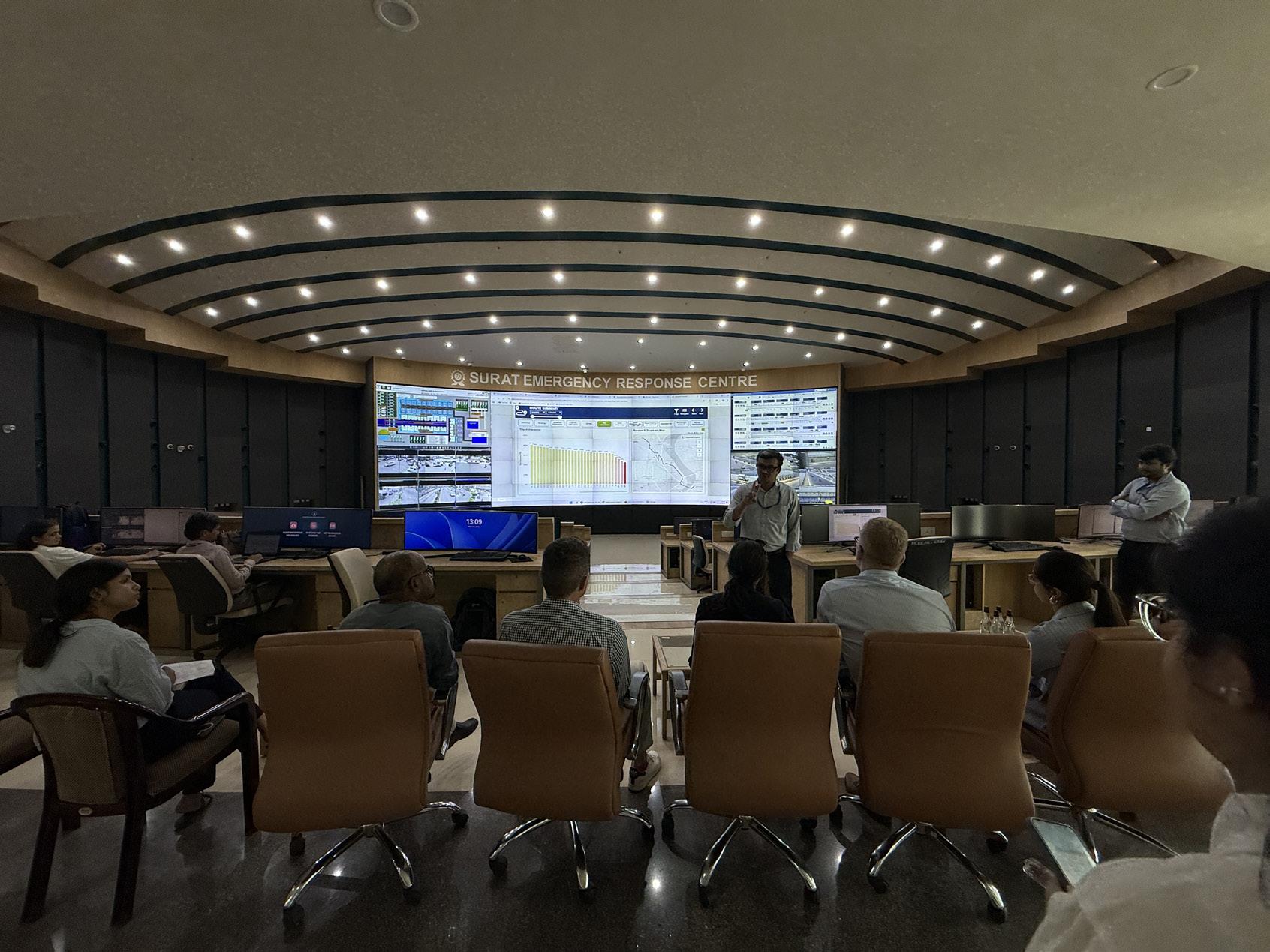
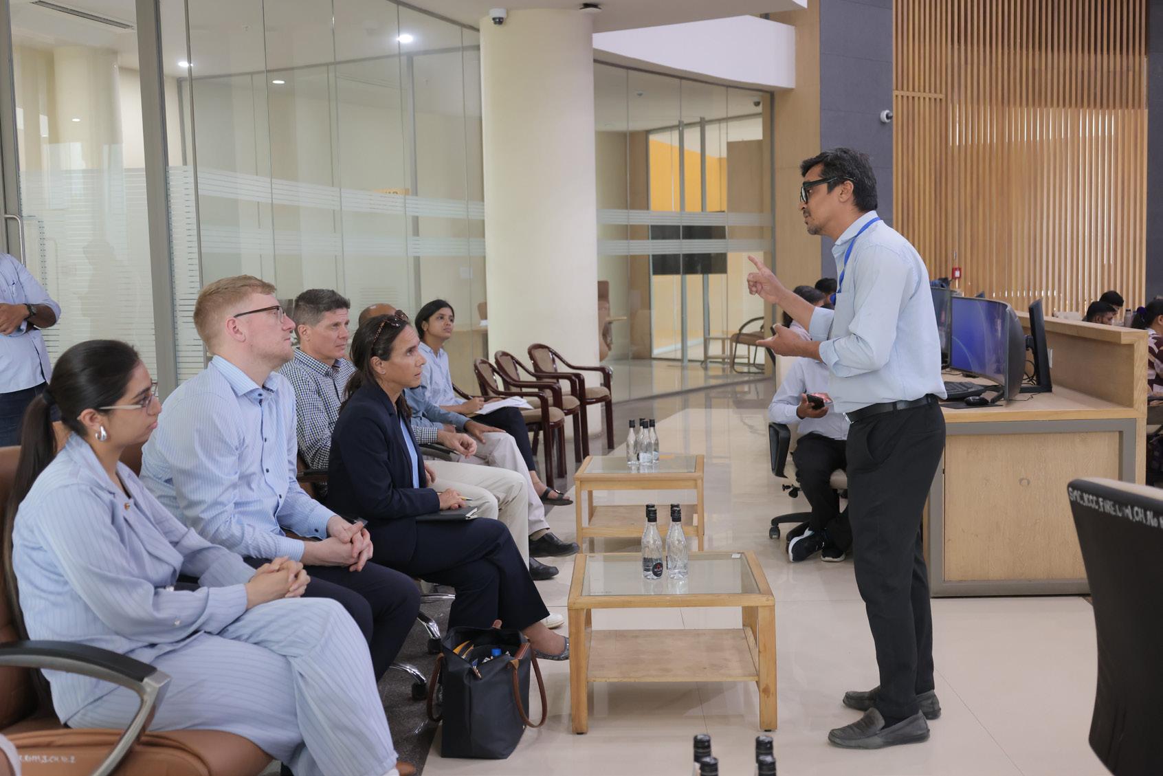
Surat’s public transport ecosystem is anchored by the Bus Rapid Transit System (BRTS) and city bus services operated by Surat Sitilink Limited. Together, these systems form the backbone of the city’s organised public transport network and cater to a significant share of daily travel demand. Investments in real-time passenger information systems at BRTS stations, CCTV surveillance, structured station facilities, and affordable fare structures have improved service reliability, passenger safety, and accessibility for a wide range of commuters.
However, despite these improvements, the assessment indicates that public
• Operates a structured BRTS and city bus network with 875 buses, forming the primary backbone of organised public transport.
• BRTS stations include Real-Time Passenger Information systems displaying expected bus arrival times to improve reliability.
• Availability of CCTV surveillance and lighting systems at BRTS stations enhance safety and security.
• Supports accessibility for frequent commuters through daily travel passes (Suman pass at INR 30).
• Services are managed by a special purpose vehicle (Surat Sitilink Limited) under SMC, strengthening operational management.
• Continuous investments are made in bus depots and terminals to support service expansion, including existing and 600 expected new e-buses.
transport coverage remains uneven, particularly in rapidly expanding peripheral areas and emerging growth corridors. Multimodal integration between BRTS, city buses, intermediate public transport, walking, cycling, and other mobility services is still evolving. This limits the system’s ability to provide seamless end-to-end connectivity and fully respond to the needs of Surat’s growing metropolitan population.
Strengthening service coverage, improving feeder connectivity, enhancing physical and digital integration, and aligning public transport planning with urban expansion will be essential to increase ridership and reinforce public transport as the preferred mode for daily mobility.
• Public transport coverage remains limited in some peripheral growth areas, leading to increased reliance on private vehicles.
• Integration between BRTS, city bus routes, and intermediate public transport services is still limited. Last-mile connectivity to major transit stations is inconsistent across several parts of the city.
• Service network optimisation is required to better align public transport routes with evolving travel demand patterns.
• Multimodal integration and passenger interchange infrastructure remain underdeveloped in several locations. Specifically at Surat railway station and bus station of GSRTC.
Walking is a critical component of daily mobility in Surat, particularly for shortdistance trips and for accessing public transport services. While pedestrian infrastructure is available along several arterial roads, its quality, continuity, and accessibility vary considerably across the city. In many locations, footpaths are discontinuous, poorly maintained, narrow, or obstructed by encroachments and parked vehicles, reducing pedestrian safety, comfort, and universal accessibility. Street lighting along major corridors contributes to improved nighttime safety, although several smaller internal streets still require better illumination.
Surat has also introduced a Public Bicycle Sharing system, with 1,126 bicycles and 123 docking stations across the city. This provides an important foundation
Assessment Highlight
• Several major arterial corridors in the western part of the city, include basic footpath infrastructure, enabling pedestrian access to transit and neighbourhood destinations.
• Street lighting coverage across major roads supports safer pedestrian movement during evening hours. As per SMC website, total streetlights in the city are 1,44,468.
• As per CMP, walking remains a common travel mode for short trips and access to public transport.
for promoting cycling as a sustainable mobility option. However, dedicated cycling infrastructure remains limited in most parts of the city, and the absence of continuous and protected cycling lanes restricts the potential of cycling as a safe and practical mode for everyday travel.
Although walking continues to account for a significant share of daily trips, Surat requires a more systematic approach to active mobility planning. This includes comprehensive street design standards, pedestrian and cycling policies, universal accessibility guidelines, and a connected network of safe footpaths, crossings, cycling corridors, and public bicycle sharing access points. Strengthening these elements will be essential to improve walkability, support first- and last-mile connectivity, and make active mobility a viable and inclusive part of Surat’s urban transport system.
• The city lacks to follow formal street design guidelines prioritising pedestrian and cycling infrastructure.
• Footpaths are not continuous along several corridors in the central and eastern part of the city, reducing walkability. Also, Pedestrian infrastructure is often obstructed by encroachments or poorly maintained.
• PBS system and cycling infrastructure are largely unutilized across most parts of the city.
• Safe pedestrian crossings and traffic calming measures remain limited in most of the locations.
Surat’s mobility ecosystem includes a significant presence of informal and intermediate transport services, particularly shared auto-rickshaws, which complement the formal public transport network by providing flexible and affordable last-mile connectivity. These services are especially important in areas where BRTS and city bus coverage is limited, where service frequencies are insufficient, or where users require more direct and adaptable travel options. In this sense, informal and intermediate transport services help fill important accessibility gaps within the city’s mobility system and should be understood as an integral part of everyday urban mobility rather than as a parallel or purely problematic sector.
At the same time, the informal and intermediate transport sector presents important challenges related to service quality, fare transparency, passenger safety, vehicle standards, integration with formal public transport, and accessibility for persons with disabilities, elderly users, women, and other vulnerable groups. Universal accessibility features are currently concentrated mainly within the formal BRTS system, particularly at stations and in selected buses, while feeder and last-mile services remain less accessible and less standardised. This creates a disconnect between accessible trunk services and the first- and last-mile links that many passengers depend on to complete their journeys.
Addressing these challenges requires engagement with both formal and informal mobility stakeholders. On one hand, discussions with auto-rickshaw unions, shared mobility operators, and driver groups can help identify practical measures to improve service quality, fare transparency, safety, and basic accessibility. On the other hand, formal public transport agencies need to assess where gaps in coverage, frequency, affordability, and integration are pushing users towards informal services. A more balanced approach would therefore focus on coordinated integration rather than displacement, including designated feeder routes, interchange points near BRTS and bus corridors, digital visibility of IPT services, fare coordination, accessibility improvements, and clear operating standards.
Similarly, street vending and other informal economic activities should be managed through an inclusion-oriented approach. Surat’s street vending policy provides an important basis for organising vending activity within public spaces, but implementation should balance livelihood protection with the need to maintain safe, continuous, and universally accessible pedestrian movement. Overall, the priority should be to integrate informal mobility and street-based economic activity into the city’s planning framework in a way that improves accessibility, protects livelihoods, and supports a more inclusive and functional urban mobility system.
• Shared auto-rickshaw services provide widespread last-mile connectivity across the city areas. Such informal transport services play a key role in supporting affordable mobility options.
• A street vending policy has been introduced to regulate informal sector activities in public spaces.
• Gender-responsive transport planning (safety audits, gender disaggregated data) is not institutionalised.
• Universal accessibility infrastructure is limited primarily to BRTS stations only and not extended system wide. Specifically lags along city routes.
• Integration of informal transport services into formal mobility planning frameworks remains limited. No structured programme for improving lastmile connectivity in low-income settlements.
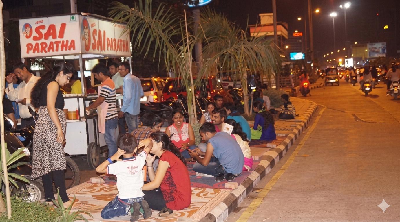
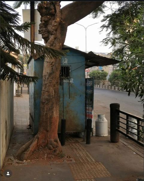
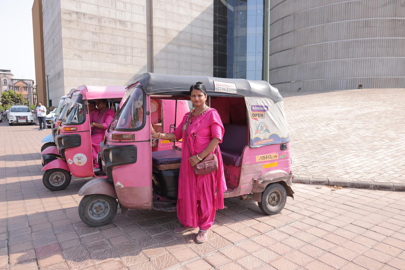
Surat has made notable progress in improving the environmental sustainability of its public transport system, particularly through the electrification of its bus fleet. Electric buses now form a significant share of the city’s public transport operations, helping reduce tailpipe emissions, improve local air quality, and support the transition towards cleaner urban mobility.
The city has also begun integrating sustainability measures into transport infrastructure. Facilities such as the Althan bus depot, which incorporates renewable energy elements, demonstrate Surat’s efforts to link public transport operations with cleaner energy systems. These initiatives are well aligned with the city’s
• Citywide transport emissions are recognised within the NetZero Plan. The report has also identified vulnerability along mobility as well.
• A large proportion of the public bus fleet is electric, supporting low-emission urban mobility. Also, Renewable energy infrastructure has been incorporated within transport facilities such as bus depots at Althan.
• Prepared and adopted Surat’s EV and Green Mobility Policy 2025.
• City wide 50 charging stations have been established to support transition to EV vehicle ownership amongst citizens. Charging at SMC owned stations is at an affordable rate of INR 14 per unit + GST.
broader climate and resilience objectives and provide a strong foundation for further low-emission mobility planning.
However, while public transport electrification represents an important step forward, a more comprehensive approach is needed to address emissions from the wider transport sector. Private vehicles, intermediate public transport, freight movement, and overall travel demand continue to contribute to congestion, energy consumption, and air pollution. Future efforts should therefore expand beyond fleet electrification to include demand management, cleaner freight strategies, EV charging infrastructure planning, parking regulation, mode shift to public and active transport, and stronger integration of mobility planning with climate action.
• Comprehensive strategies addressing transport emissions beyond public transport electrification remain limited. i.e. Congestion management measures are absent to reduce potential emission savings.
• Growth in private vehicle ownership continues to increase overall transport emissions.
• Environmental monitoring systems specific to the transport sector remain underdeveloped. Air-quality data is not systematically linked to mobility planning decisions.
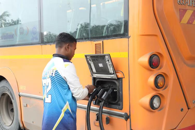
Rapid growth in private vehicle ownership has placed increasing pressure on Surat’s road space, parking supply, and traffic management systems. The city has recognised the need for a more structured approach and has prepared a city-level parking policy to regulate onstreet parking, optimise parking supply, and improve the use of public road space. In addition, multi-level parking
bridges, and in dense neighbourhoods. This reduces effective carriageway capacity, disrupts traffic flow, affects pedestrian accessibility, and contributes to congestion and unsafe street conditions.
At present, parking management is still largely focused on providing additional parking supply rather than actively managing demand. Broader travel demand management measures, such as congestion pricing, dynamic parking
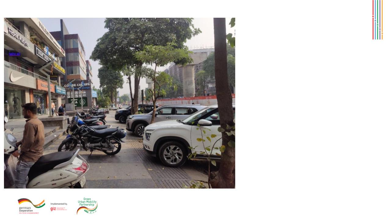
• Citywide parking policy is formally notified in 2018
• Implementation and enforcement of the parking policy remain limited. Parking supply and management systems remain fragmented across different areas of the city.
• On-street parking continues to reduce available carriageway width and affect traffic flow, leading to slow vehicle movement in peak hours.
• No comprehensive travel demand management strategies are currently in place.
Surat demonstrates relatively strong institutional capacity in the management of urban infrastructure and public services. Public transport operations are managed by Surat Sitilink Limited, a dedicated special purpose vehicle responsible for operating both BRTS and city bus services. This institutional arrangement enables focused management of service planning, operations, fleet deployment, and passenger-oriented improvements within the formal public transport system.
Transport infrastructure development in Surat is supported through a combination of municipal resources, state government programmes, national urban development schemes, and projectbased funding. This provides the city with a comparatively strong foundation for implementing mobility-related investments, including public transport improvements, road infrastructure,
parking facilities, and clean mobility initiatives.
However, the assessment indicates that coordination across departments responsible for land-use planning, transport infrastructure, traffic management, climate action, public space, and urban development remains limited. As a result, mobility-related decisions are not always fully integrated with broader urban growth, environmental sustainability, and resilience objectives.
In addition, structured monitoring systems for tracking mobility performance indicators and evaluating long-term outcomes are still evolving. Strengthening inter-departmental coordination, institutionalising regular performance monitoring, and developing data-driven review mechanisms will be essential to ensure that future mobility investments are well aligned, measurable, and responsive to Surat’s long-term sustainable mobility goals
• A dedicated SPV (Sitilink) manages public transport operations, improving institutional focus on service delivery. The city has demonstrated institutional capacity in implementing largescale transport infrastructure such as BRTS.
• Transport infrastructure projects are supported through municipal, state, and national funding programmes.
• State-level financial are available under CMUBS program to support VGF in bus operation; strengthens sustainability.
• No formal Unified Metropolitan Transport Authority (UMTA)-like structure for integrated planning, resulting in Transport, traffic police, urban planning, and road agencies operating in silos. Institutional coordination across departments responsible for mobility, planning, and climate initiatives remains limited.
• A dedicated mobility financing mechanism for long-term infrastructure investments does not yet exist. Land Value Capture (LVC) and TOD-based financing tools not deployed.
• Monitoring systems for tracking mobility performance indicators and outcomes require strengthening. Lack of tracking KPIs (ridership, emissions, safety, service quality).
• Limited in-house technical capacity for transport modelling and data analytics. The staff has in-sufficient knowledge on Transport related planning for effectively plan, operate and manage their work.
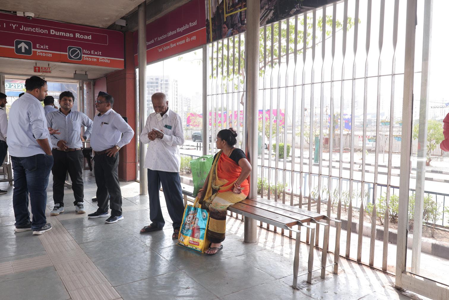
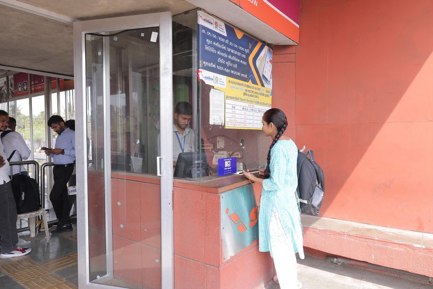
Road safety remains a major challenge as Surat experiences increasing traffic volumes and mixed traffic conditions across many corridors, specifically along BRTS routes. While certain safety features such as CCTV surveillance and lighting have been incorporated within BRTS stations and corridors, broader road safety interventions across the city’s street network remain limited.
• Safety infrastructure such as CCTV and lighting has been installed at BRTS stations, at various junctions and at most of the city streets.
Infrastructure such as safe pedestrian crossings, traffic calming measures, and systematic road safety audits are not consistently implemented. In addition, comprehensive systems for collecting and analysing road crash data remain underdeveloped, making it difficult to implement targeted safety improvements. Strengthening road safety planning and infrastructure will therefore be essential for protecting vulnerable road users and improving overall mobility outcomes.
• No dedicated road safety cell within SMC with defined accountability and targets.
• Crash data is not systematically analysed to identify high-risk corridors.
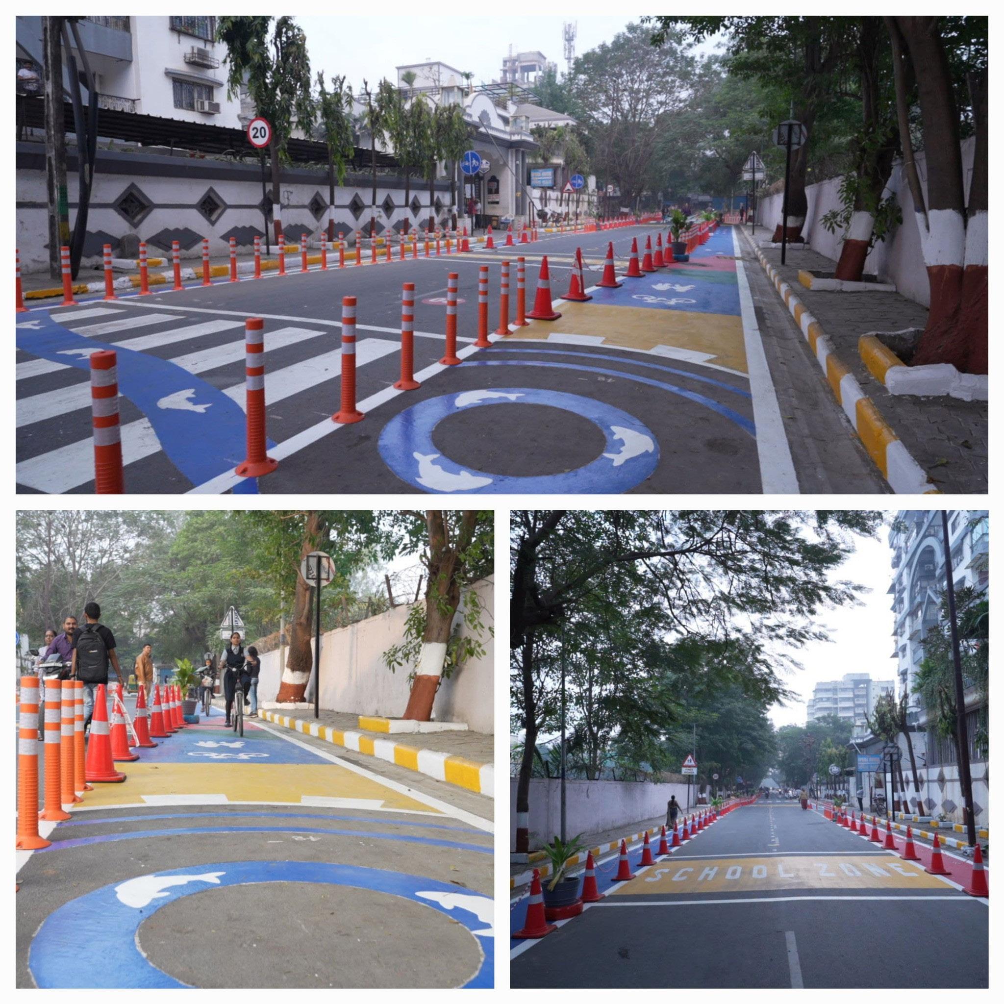
Digital integration is becoming increasingly important for Surat as the city expands its public transport network, manages rising travel demand, and prepares for a more connected multimodal mobility system. At present, digital technologies supporting mobility management are still at an early stage of integration.
Certain digital elements have already been introduced within the public transport network, including real-time passenger information displays at BRTS stations. These systems help improve passenger information, service transparency, and predictability, particularly for users of the formal public transport system.
However, broader digital integration across Surat’s urban mobility ecosystem
• The city has launched the Surat Sitilink app to purchase tickets digitally. City also offers a 20% discount on Adult and Child tickets, booked online through application.
• E-Bus are equipped with ITS systems and are operational in buses. Real-time passenger information systems have been implemented at BRTS stations, improving service transparency.
remains limited. Key components such as a unified mobility application, integrated ticketing across modes, open mobility data systems, GTFS/GTFSRT datasets, digital traffic management tools, and interoperable platforms for public transport, IPT, parking, and emerging mobility services are not yet fully developed or integrated.
Strengthening digital mobility systems will be essential for enabling datadriven planning, improving operational efficiency, enhancing passenger convenience, and supporting better coordination between agencies and modes. Over time, expanded digital integration can help Surat move towards a more responsive, transparent, and user-friendly mobility system that supports seamless multimodal travel across the city.
• No open-data mobility platform (GTFS/GTFS-RT not publicly accessible).
• Limited use of predictive analytics for route optimisation and service planning. Advanced analytics for demand prediction not institutionalised.
• Weak interoperability between transport operations, enforcement, and planning databases. Absence of mobility dashboard for transparency and monitoring.
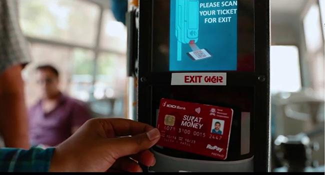
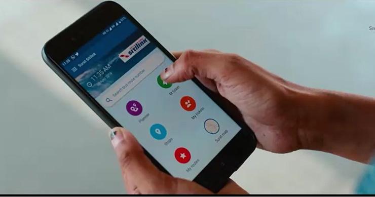
Strategic goals provide the link between the diagnostic assessment of Surat’s mobility system and the formulation of practical, phased interventions under the Integrated Mobility Plan. They translate the findings of the IMP assessment into a clear set of citywide priorities that can guide investment decisions, institutional coordination, and long-term mobility transformation.
Surat requires clearly defined strategic mobility goals emerging from the IMP assessment and the detailed gap identification process undertaken across the nine mobility pillars. The assessment highlighted several systemic challenges, including uneven implementation of mobility initiatives, fragmented institutional coordination, and limited integration between transport planning and broader urban development strategies.
While Surat has made significant progress through initiatives such as the BRTS and city bus services operated by Surat Sitilink Limited, as well as various climate and environmental initiatives, many of these efforts continue to function as sectoral programmes rather than as part of a unified, outcomeoriented mobility framework. The city’s transport ecosystem involves multiple agencies, including the municipal corporation, public transport operators, traffic police, planning authorities, and state-level institutions. However, these agencies often work in parallel rather than around shared performance targets. In the absence of common and measurable goals, mobility initiatives risk remaining project-driven and corridorspecific, rather than contributing to a
comprehensive and integrated citywide mobility system.
As Surat continues to expand towards peripheral growth corridors and emerging residential and industrial areas, clear strategic mobility goals are essential to align public transport expansion, active mobility infrastructure, parking management reforms, climate commitments, road safety measures, and digital mobility systems with the city’s long-term development trajectory. Establishing a coherent set of citywide goals will also help integrate the priorities identified in key planning frameworks, including the Comprehensive Mobility Plan, Clean Air Action Plan, Disaster Management Plan, Heat Action Plan, and Climate Resilient City Action Plan.
These goals will enable Surat to prioritise investments more effectively, improve coordination between departments, strengthen monitoring and accountability mechanisms, and enhance readiness to access state and national funding opportunities for sustainable mobility initiatives. Most importantly, a structured goal-oriented framework will help the city transition from fragmented project-based interventions towards an integrated, performance-driven mobility system that supports inclusive access, environmental sustainability, climate resilience, and long-term urban liveability.
In this context, the strategic goals defined under the IMP serve as the foundation for identifying priority interventions, sequencing projects, and monitoring progress towards a more efficient, equitable, low-emission, and futureready mobility system for Surat.
1
Build a ClimateResilient, TransitOriented and Compact Mobility Network
2 Expand Reliable and Integrated Public Transport Connectivity Across the City (Digitization and Multimodal Integration)
Integrate climate resilience, compact growth, and mobility planning so that future transport investments support sustainable urban expansion. This goal focuses on linking mobility planning with disaster management, climate vulnerability assessments, and land-use planning to guide development toward dense, well-connected neighbourhoods rather than car-oriented peripheral expansion. This goal addresses the findings identified in the Clean Air Action Plan and Source Apportionment Study for air quality, while also responding to findings from the Disaster Management Plan and Heat Action Plan that highlight transport network disruptions during floods and the exposure of workers and commuters to extreme heat.
Outcome - Climate-resilient transport corridors and depots, critical mobility action during disaster event, transit-oriented neighbourhood development along major corridors, improved street-network connectivity in emerging growth areas.
Strengthen the coverage, reliability, and integration of Surat’s public transport system by improving service frequency, expanding bus coverage to peripheral and low-income areas, and integrating intermediate public transport and last-mile connectivity services. This goal also focuses on structured route planning, multimodal integration with major regional transport hubs including upcoming metro, and to improve accessibility for workers and daily commuters. This goal also responds directly to findings from the CMP and Development Plan that highlight the low share of public transport despite existing BRTS infrastructure
Outcome - Higher public transport mode share, expanded service coverage in peripheral areas, seamless integration between BRTS, buses, metro and IPT, and improved commuter experience through digital ticketing and realtime information.
3 Create Safe, Walkable and Active Mobility Networks Across the City
Transform Surat’s streets into safe and inclusive public spaces by prioritising pedestrians and cyclists through continuous footpaths, protected cycling infrastructure, and improved junction safety. This goal responds to the CMP vision of developing a strong pedestrian and cycling backbone for the city’s mobility system, while also addressing the Clean Air Action Plan and Resilience Strategy findings that highlight poor pedestrian infrastructure, encroached footpaths, and unsafe mixed traffic conditions.
Outcome - Continuous and accessible footpaths, safer junctions and crossings, expanded cycling infrastructure, and improved first- and last-mile connectivity to public transport.
4 Institutionalise Inclusive, GenderResponsive and Equitable Mobility Planning
Ensure that transport systems and mobility infrastructure are inclusive, safe, and accessible for women, vulnerable populations, and informal sector workers. This aligns with the CMP’s equity objectives and addresses the social inclusion gaps identified in city assessments.
Outcome - and vulnerable groups, gender-responsive planning embedded in mobility projects, accessible transport infrastructure for elderly persons and persons with disabilities.
5 Mobilise Innovative Financing and Institutional Capacity for Sustainable
Strengthen the city’s ability to finance and scale sustainable mobility initiatives through innovative funding mechanisms, institutional strengthening, and long-term investment strategies. The aim is to ensure availability of finance for the implementation of mobility projects aligned with climate goals, public transport expansion, and inclusive urban development.
Outcome - Diversified funding sources, stronger inter-
The interventions and project portfolio under the Integrated Mobility Plan (IMP) for Surat are structured as a response to the citywide gap assessment across the five strategic mobility goals, ensuring that actions address systemic challenges rather than isolated projects. The phased time horizon is Immediate (Led by GIZ with support of SMC/Sitilink/MoHUA), Short-Term (Led by City – 0 to 3 years), and Long-Term (Led by City – 3+ years); allows the city to first implement quick
wins and pilots, then scale successful interventions across corridors and neighbourhoods, and undertake longterm structural reforms. This approach balances readiness, impact potential, and institutional capacity while strengthening core mobility systems, digital governance, and long-term sustainability. This phased approach aligns mobility investments with key city reports such as the Surat Comprehensive Mobility Plan 2046, the Surat Clean Air Action Plan, and the Surat Disaster Management Plan. Together, the roadmap supports a structured transition toward an integrated, resilient, and people-centric urban mobility system for Surat.
Table 6: Immediate, Short and Long term Recommended projects against focused goals
No Goals
1 Build a ClimateResilient, TransitOriented and Compact Mobility Network
Immediate (Led by GIZ with support of SMC/Sitilink/MoHUA)
• Prepare guidelines for developing Green Mobility Zones
• Climate Risk and Road Safety Risk Dashboard
• Deployment of 100 kW Solar PV with 224 kWh battery system
Short Term (0–3 years, Led by SMC/ Sitilink)
• Climate vulnerability mapping of transport corridors and depots
• Assessment of climate resilience of mobility infrastructure
• Integrate CMP proposals and resilience consideration into Disaster Management Plan revisions
• Develop Local Area Plans incorporating
Long Term (3+ years, Led by SMC/Sitilink)
• Prepare transport investment prioritisation framework based on emissions and climate risk reduction
• Develop low-emission freight and delivery hubs plan
• Adopt a citywide compactgrowth and climateresilient mobility policy
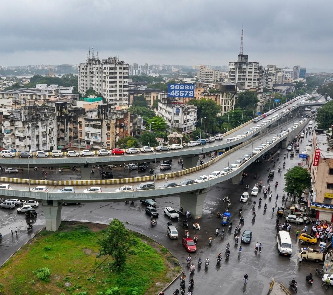
No Goals
Immediate (Led by GIZ with support of SMC/Sitilink/MoHUA)
Short Term (0–3 years, Led by SMC/ Sitilink)
Long Term (3+ years, Led by SMC/Sitilink)
• Increase buses and route rationalization in city routes and BRT corridors
2 Expand Reliable and Integrated Public Transport Connectivity Across the City (Digitization and Multimodal Integration)
• Pilot with Android ETM to enhance ticketing experience and improve conductor efficiency
• Implement network redesign focusing on high-frequency corridors
• Initiate electrification of IPT services (E-autos)
• Create digitized PT network integrated with GTFS
• Establish unified digital ticketing/ payment system
• Fully integrated multimodal public transport system with unified operations and fare policy
• Citywide smart mobility platform supporting planning and enforcement information systems
• Open data platform and mobility data sharing protocols
• Full MaaS integration across mobility modes
• Integrated ITS, adaptive signals and
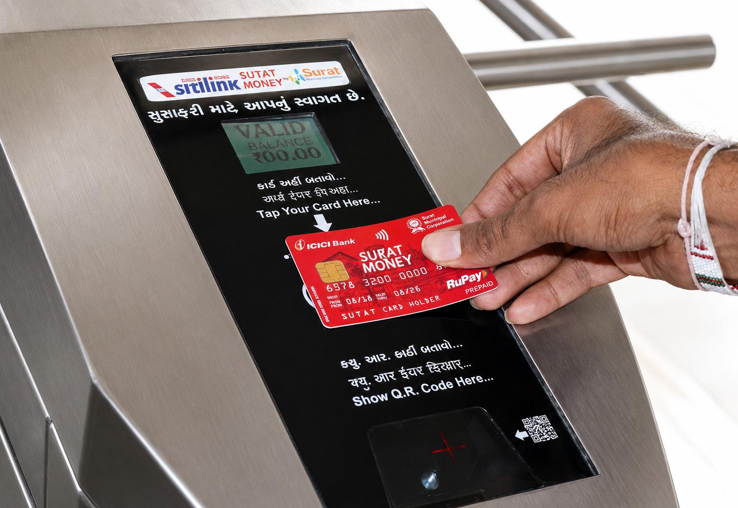
No Goals
Immediate (Led by GIZ with support of SMC/Sitilink/MoHUA)
3 Create Safe, Walkable and Active Mobility Networks Across the City
• Revamp PBS system supporting firstand last-mile connectivity
Short Term (0–3 years, Led by SMC/ Sitilink)
• Implement priority complete streets along BRTS or Metro stations
• Secure cycle parking or PBS system at stations and terminals
• Prepare citywide NMT Master Plan integrated with PT coverage
• Junction-level pedestrian safety improvement plan
Long Term (3+ years, Led by SMC/Sitilink)
4 Institutionalise Inclusive, GenderResponsive and Equitable Mobility Planning
• Establishment of Surat Gender and Inclusion Lab
• Conduct Gender Sensitization Trainings
• Identify job roles to enhance Women’s Participation in Logistics and Transport sector
• Develop gender-focused mobility plans for peripheral industrial areas and hubs
• Institutionalise monitoring of accessibility and gender-specific needs in public projects
• Introduce women-led e-auto fleet programme
• Gender and inclusion audits of streets and PT
• Implement street-grid and connectivity improvement projects
• Implement pedestrian-only streets in older areas
• Corridor-level safe street redesigns with black-spot rectification
• Citywide inclusive mobility policy ensuring affordability and safety for all
• Integrate universal accessibility and gender considerations in all public infrastructure projects
No Goals
5
Mobilise Innovative Financing and Institutional Capacity for Sustainable Mobility
Immediate (Led by GIZ with support of SMC/Sitilink/MoHUA)
• Floating Green Bonds of INR 200 crore
Short Term (0–3 years, Led by SMC/ Sitilink)
• Implement pilot projects from the Clean Air Climate Action Plan
• Develop IMP monitoring and evaluation framework
• Inter-departmental mobility coordination cell
• Strengthen transport planning capacities
Project prioritization is a critical step in translating the Integrated Mobility Plan from a strategic framework into an actionable implementation roadmap. It helps identify which interventions should be taken forward first, based on their relevance, feasibility, expected impact, institutional readiness, and alignment with Surat’s sustainable mobility objectives.
A structured and iterative process was adopted to identify priority projects for the SUM-ACA programme, integrating stakeholder consultations, technical assessments, and ongoing capacitybuilding supported by national and international exposure visits. This process ensured that the selected projects were not only technically sound, but also grounded in local needs, institutional capacities, funding opportunities, and practical implementation conditions.
Through this prioritization process, the IMP establishes a focused set of mobility interventions that can deliver early benefits while laying the foundation for longer-term transformation. The selected
Long Term (3+ years, Led by SMC/Sitilink)
• Net-zero mobility roadmap aligned with city climate goals
• Operationalise non-farebox revenue opportunities
projects provide a practical pathway for strengthening public transport, active mobility, digital integration, road safety, climate-responsive mobility, and institutional coordination across Surat.
Inclusive and participatory stakeholder consultations formed a central part of the project prioritisation process for Surat. These consultations ensured that the selection of priority interventions was grounded in the city’s institutional and operational realities, while also reflecting the broader goals of sustainable, accessible, and climate-responsive urban mobility.
Continuous consultations were conducted with a wide range of stakeholders across government departments, transport agencies, planning institutions, and the private sector. Key departments engaged included the Engineering Department and the Town Planning, Roads, Traffic,
and Environment Cells of Surat Municipal Corporation. Discussions also involved Surat Sitilink Limited, the transport operating agency responsible for the city’s BRTS and city bus services, as well as Surat Urban Development Authority, whose planning jurisdiction extends beyond the municipal boundary and plays an important role in guiding peri-urban growth, regional connectivity, and future expansion corridors.
In addition to formal government agencies, consultations were held with private and informal transport stakeholders, including auto-rickshaw operators, shared mobility providers, and local transport associations. Their participation helped contextualise mobility challenges related to lastmile connectivity, service affordability, route flexibility, and the integration of BRTS, city bus, and intermediate public transport systems. This inclusive approach helped ensure that the planning process considered not only institutional priorities, but also the everyday mobility needs of users and service providers.
Stakeholder discussions also highlighted key operational and infrastructure challenges, including congestion along major corridors, limited public transport accessibility in rapidly expanding peripheral areas, and the need to improve pedestrian and cycling
emerged as important considerations for future planning.
Overall, the breadth of stakeholder engagement strengthened the relevance, ownership, and implementation feasibility of the proposed interventions. By incorporating perspectives from public institutions, transport operators, private actors, and informal service providers, the consultation process helped shape a set of priorities that support Surat’s transition towards a safer, more inclusive, accessible, climate-resilient, and sustainable urban mobility system.
The process of identifying priority projects began with a series of scoping meetings with key departments of Surat Municipal Corporation and the city’s public transport operator Surat Sitilink Limited. These discussions aimed to build a shared understanding of the existing mobility landscape in Surat, including ongoing initiatives, institutional roles, and strategic objectives related to public transport, road infrastructure, and non-motorised mobility. The SUM-ACA team presented preliminary intervention areas emerging from the IMP framework, while stakeholders highlighted operational challenges such as funding limitations, coordination across multiple departments, and institutional capacity constraints. These inputs helped shape the initial longlist of potential focus areas
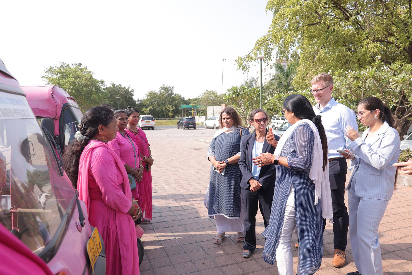
Following the preparation of the initial longlist, the potential projects were assessed through a structured screening process. The evaluation considered criteria such as alignment with the city’s sustainable mobility objectives, feasibility within existing institutional and financial frameworks, potential impact on improving accessibility and public transport efficiency, and contribution to climate resilience and road safety. To further refine the longlist, thematic working sessions were conducted with officials and engineers from key departments of Surat Municipal
Corporation and the city’s public transport operator Surat Sitilink Limited. These sessions involved detailed technical deliberations on the proposed interventions, including discussions with the Town Planning, Roads, Traffic, and Environment Cells. The discussions focused on assessing local readiness, institutional capacity, implementation feasibility, and alignment with ongoing city initiatives. This stage helped refine the intervention areas and narrow the longlist to a smaller set of priority options that were both strategically relevant and grounded in the operational realities of
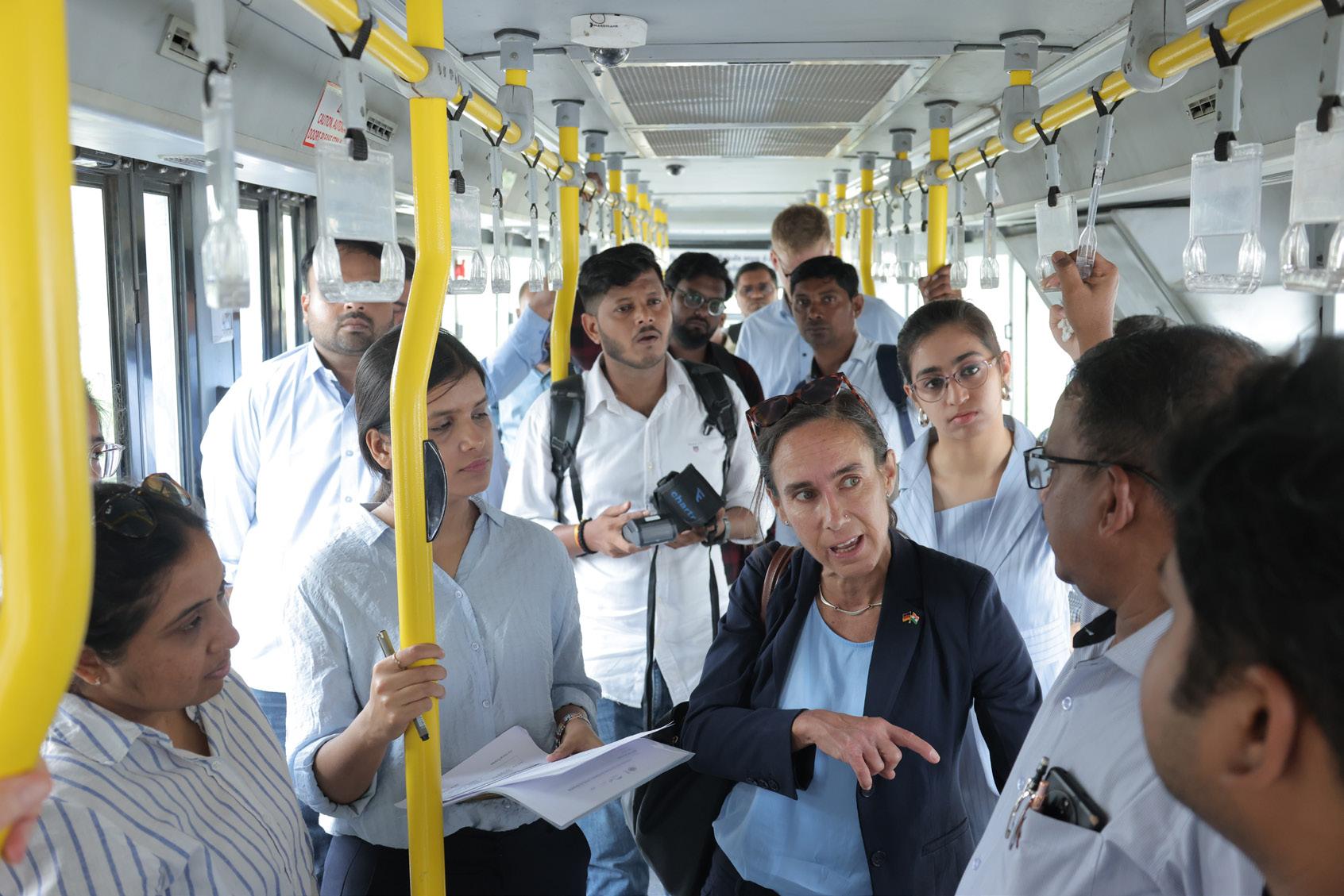
Over the course of the SUM-ACA programme, stakeholder perspectives evolved through participation in capacitybuilding programmes, peer-learning workshops, and exposure visits. These engagements played a key role in shaping the city’s final priorities.
• Public Transport Modernisation and Electrification: Visits to Bangalore Metropolitan Transport Corporation in Bengaluru and Brihanmumbai Electric Supply and Transport in Mumbai provided hands-on exposure to advanced bus operations, depot management
practices, crew scheduling systems, electric bus integration, and digital fleet monitoring. These learning experiences strengthened the interest of stakeholders in Surat in improving bus operations, route planning, and preparedness for large-scale fleet electrification.
• Roundtable discussion on Green Mobility Zone: A roundtable discussion was organised with stakeholders from KfW Development Bank, Gujarat Metro Rail Corporation, Surat Municipal Corporation, Surat Sitilink Limited, and the SUM-ACA team to explore the potential for developing a Green Mobility Zone around the Adajan Gam Metro Station in Surat. The
discussion focused on opportunities to create a transit-oriented, lowemission mobility zone that prioritises public transport, walking, and cycling, while improving lastmile connectivity to the metro station.
• Exposure Visit to OSRTC and CRUT: An exposure visit was organised to Odisha State Road Transport Corporation and Capital Region Urban Transport in Bhubaneswar. The visit to OSRTC focused on gaining insights into the performance and operational efficiency of the fare collection system deployed using Androidbased Electronic Ticketing Machines (ETMs), including aspects related to real-time data capture, revenue management, and operational monitoring. The interaction with CRUT provided an opportunity to understand their gender-focused mobility initiatives, particularly the deployment of women-operated e-autos to strengthen first- and lastmile connectivity, as well as their approach to collecting and utilising gender-disaggregated mobility data to inform inclusive transport planning.
• Launch of Gender Lab and Panel discussion on Transformation of Urban Mobility through Gender Responsive Approach: A dedicated event was organised in Surat to launch the Surat Gender and Inclusion Lab, including the unveiling of its vision, mission, and logo. The launch was followed by a panel discussion on “Transformation of Urban Mobility through GenderResponsive Approaches,” that focused on integrating genderresponsive approaches in urban mobility planning, emphasising inclusive transport design, improved safety, and enhanced accessibility for women and vulnerable user groups.
• Visit to Chennai Gender Lab and MTC: An exposure visit was organised to the Chennai Gender and Policy Lab within the Greater Chennai Corporation and the Metropolitan Transport Corporation in Chennai to understand institutional approaches for integrating gender in urban mobility planning. The visit provided insights into how the Gender and Policy Lab works across departments to improve women’s safety and accessibility in public spaces and transport through research, policy support, capacity-building, and infrastructure recommendations. The interaction with MTC highlighted the implementation of the Vidiyal Payanam Thittam (Women’s Free Bus Travel Scheme), which enables free travel for women on ordinary buses to enhance mobility, access to employment and services, and overall safety. The visit also provided insights into the use of genderdisaggregated data, perception studies, and collaborative institutional mechanisms to strengthen gender-responsive mobility planning.
• Workshop on Gender Inclusion & Transport planning: The key objectives included introducing global perspectives on gender mainstreaming in urban planning, sharing frameworks for conducting gender-sensitive transit infrastructure audits, and discussing key challenges related to safety, accessibility, and inclusivity in public transport systems. The workshop also highlighted strategies for improving public transport efficiency through route rationalisation and better service planning.
• Roundtable discussion on Women Inclusion in transport and logistic: Aim is to identify suitable and sustainable job roles for women across the public transport and
logistics sectors, with the objective of expanding women’s workforce participation in traditionally maledominated domains. As part of the study, consultations have by discussions with private logistics stakeholders.
This stage ensured that the prioritised projects reflected not only theoretical feasibility but also a practical understanding of how successful mobility
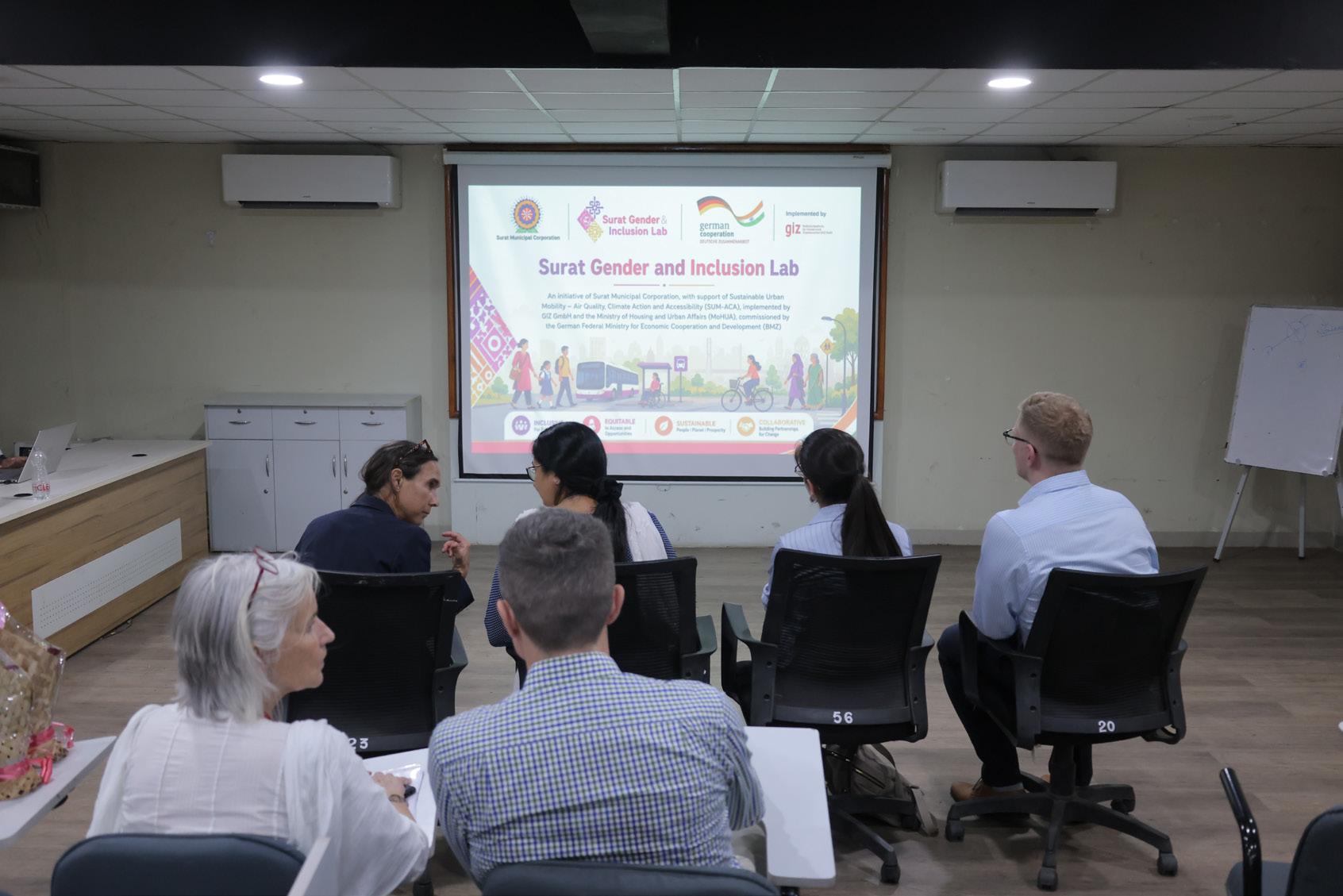
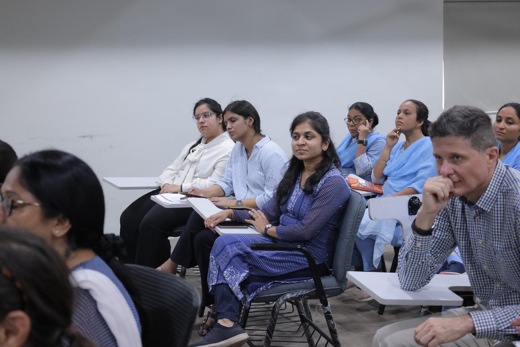
The final set of priority projects was defined through strategic discussions with senior leadership from Surat Municipal Corporation and Surat Sitilink Limited. These discussions provided an opportunity to review the proposed interventions from the perspective of Surat’s long-term mobility vision, institutional priorities, political commitments, and practical implementation capacity.
The leadership-level deliberations helped identify projects that were not only technically relevant, but also feasible, timely, and aligned with the
city’s broader development agenda. Key considerations included administrative readiness, availability of resources, institutional responsibilities, expected impact, and the potential for scaling or replication under future mobility programmes.
The involvement of senior leadership was critical in securing strong administrative support, clear institutional ownership, and the resource commitment required for implementation. This high-level buy-in provides an important foundation for the effective delivery of priority interventions under the SUM-ACA programme and for sustaining momentum beyond the initial project period.
A strong and coordinated financing approach is essential for translating the Integrated Mobility Plan (IMP) for Surat from a strategic framework into implementable projects. Given the scale and diversity of proposed interventions, mobility financing will need to be planned across multiple sectors, agencies, and implementation phases.
Implementing the IMP in Surat will require sustained, strategic, and wellcoordinated financial investments. The proposed interventions span transport infrastructure improvements, intelligent transport systems, public transport strengthening, clean mobility transition, parking management, active mobility, road safety, and inclusive mobility initiatives. Delivering this portfolio of projects will require a diversified and well-structured financing strategy.
To support these initiatives, Surat will need to mobilise resources through a combination of municipal budgets, state and national schemes, private sector participation, development finance, and innovative funding mechanisms. The city already has access to a range of financing channels at municipal, state, national, and international levels that can support investments in urban mobility infrastructure, service delivery, and climate-responsive transport solutions.
A clear mapping of proposed IMP interventions to suitable funding sources will be critical to ensure implementation readiness. This should include identifying which projects can be financed through existing public budgets, which require convergence with state or central schemes, and which may be suitable for public-private partnerships, landvalue capture, climate finance, or other innovative financing instruments.
Overall, a structured funding strategy will
enable Surat to prioritise investments, reduce financing gaps, improve coordination between agencies, and ensure that mobility projects are implemented in a financially sustainable and out
Under the Government of Gujarat’s flagship Swarnim Jayanti Mukhya Mantri Shaheri Vikas Yojana, Surat has received significant financial support for urban road infrastructure. These allocations have contributed to activities such as road widening, construction of new road links, and improvements in overall urban connectivity. Such investments play an important role in upgrading the city’s street network and strengthening lastmile accessibility, which aligns closely with the objectives of the Integrated Mobility Plan to promote accessible and climate-resilient mobility.
For public transport operations, the city benefits from the Chief Minister Urban Bus Service Scheme, which provides Viability Gap Funding (VGF) to municipal corporations operating city bus services through public–private partnership models. This financial support enables agencies such as Surat Sitilink Limited to maintain and expand bus operations despite revenue shortfalls, thereby ensuring the continuity and reliability of public transport services for residents of Surat.
Surat has benefited from financial and programmatic support from the Government of India through national initiatives promoting electric mobility and clean public transport. Under the Faster Adoption and Manufacturing of Electric Vehicles Phase II scheme and newer programmes such as PM eBus Sewa and PM E-DRIVE, the city is strengthening its transition towards cleaner bus-based public transport. As part of this effort, Surat has been allocated 600 electric buses under the
PM eBus Sewa programme, which will significantly expand the electric public transport fleet.
These national and state-level funding streams are complemented by annual financial support provided by Surat Municipal Corporation to Surat Sitilink Limited. These allocations help meet operational expenditures, enable service improvements and facilitate the development of supporting infrastructure such as depots and charging facilities.
The city has also utilised a range of dedicated infrastructure funding programmes to upgrade its mobility network. Financial support from schemes such as the Swarnim Jayanti Mukhya Mantri Shaheri Vikas Yojana and the Smart Cities Mission has been used to strengthen road infrastructure and improve facilities for non-motorised transport. In addition, resources from the National Clean Air Programme have been directed towards measures aimed at reducing air pollution at major traffic congestion points, including traffic management improvements and mobilityrelated interventions that contribute to better air quality. The city has also tapped funding from the Gujarat CSR Authority to implement a programme that provides financial support to women for purchasing electric autorickshaws, thereby promoting women’s participation in the transport sector while
also encouraging the adoption of clean mobility solutions.
Alongside these investments, the city benefits from technical assistance provided by ICLEI South Asia, C40, WRI, CEPT University and GIZ. These partnerships have supported the city in advancing climate-resilient urban planning, emissions reduction strategies, and sustainable mobility initiatives, while also strengthening its capacity to access climate finance and development assistance.
Taken together, national, state, and local funding sources provide a strong financial base for implementing the Integrated Mobility Plan in Surat. These include national initiatives supporting electric mobility and public transport expansion, state-level urban infrastructure and bus service support programmes, and local investments through allocations from Surat Municipal Corporation. Alongside financial resources, the city also benefits from international technical assistance that strengthens planning capacity, supports data-driven decision-making, and advances climate-resilient mobility strategies, thereby improving project design and enhancing the city’s ability to access climate and development financing. Together, these combined financial and technical resources create a strong enabling framework for implementing sustainable and inclusive mobility improvements in the city.
The projects were deliberated in detail with key city stakeholders, including the municipal corporation and Sitilink, OEMs, and were jointly identified to support mobility improvements in Surat. As the collaboration progressed, interventions were refined based on evolving city priorities, funding opportunities, and ground-level needs where some initiatives were explored in depth
through studies, others were piloted to test innovative solutions, and several were implemented in coordination with city agencies. This flexible and phased approach ensured that interventions remained responsive to actual mobility challenges while simultaneously strengthening institutional capacity and inter-agency coordination, ultimately contributing to a strong, practical, and future-ready project pipeline for advancing Surat’s sustainable, inclusive, and climate-resilient mobility agenda.
1 Deployment of 100 kW Solar PV with 224 kWh second life battery system at Althan Depot
2 Establishment of Surat Gender and Inclusion Lab
3 Floating Green Bonds of INR 200 crore
4 Pilot with Android ETM to enhance ticketing experience and improve conductor efficiency
5 Prepare guidelines for developing Green Mobility Zones
6 Conduct Gender Sensitization Trainings
7 Revamp PBS system supporting first- and last-mile connectivity
• Reduce energy costs and carbon footprint of depot operations through renewable energy integration.
• Demonstrate circular economy by utilising second-life EV batteries for energy storage.
• Create an institutional platform to integrate gender and inclusion into mobility planning.
• Support policy design, pilots, and capacity building for inclusive transport systems.
• Mobilise dedicated climate finance for sustainable mobility and infrastructure projects.
• Strengthen the city’s financial capacity for largescale green investments.
• Digitise fare collection for improved operational efficiency and transparency.
• Enable real-time data collection for service planning and monitoring.
• Define framework for low-emission or restrictedvehicle zones in high-density areas.
• Improve air quality and promote non-motorised and public transport usage.
• Build awareness among transport staff on gender-sensitive service delivery.
• Improve safety, behaviour, and inclusivity in public transport systems.
• Strengthen last-mile connectivity to public transport hubs through shared cycling.
• Increase accessibility and reduce dependence on motorised modes.
8 Climate Risk and Road Safety Risk Dashboard
9 Identify job roles to enhance Women’s Participation in Logistics and Transport sector
10 Resilient Transport Infrastructure Strengthening Initiative
11 Fully integrated multimodal public transport system with unified operations and fare policy
12 Route rationalization in city routes and BRT corridors
13 Implement Green Mobility Zone along high footfall metro stations
14 Digitize PT network integrated with GTFS and prepare data sharing protocols
15 Full MaaS integration across mobility modes
16 Junction-level pedestrian safety improvement plan
• Develop a data-driven platform to monitor climate and safety related vulnerabilities for mobility.
• Support informed decision-making for resilient and safer transport planning.
• Expand employment opportunities for women in transport and allied sectors.
• Promote gender equity in traditionally maledominated mobility services.
• identify high-risk transport corridors based on its exposure to climate hazards and undertake prioritisation of interventions for implementation.
• To design and execute targeted infrastructure strengthening and climate adaptation measures to improve resilience, safety, and operational continuity of the mobility network.
• Enable seamless travel across buses, BRTS, metro, and IPT systems.
• Improve user convenience through unified ticketing and coordinated services.
• Optimise routes to improve coverage, reduce redundancy, and enhance frequency.
• Align services with demand patterns and emerging urban growth areas.
• Restrict polluting vehicles and improve walking, cycling, and last-mile connectivity around identified station.
• Combine public transport with clean mobility options, charging infrastructure, and better public spaces.
• Standardise public transport data for better planning and interoperability.
• Enable real-time passenger information and open-data ecosystem.
• Provide a single digital platform for planning, booking, and paying across modes.
• Enhance user experience and encourage shift to sustainable transport.
• Identify and redesign high-risk intersections for pedestrian safety.
• Reduce accidents through improved crossings, signals, and traffic calming.
17 Introduce women-led e-auto fleet programme
• Promote clean and inclusive last-mile mobility services.
• Generate livelihood opportunities for women in transport sector.
18 Gender and inclusion audits of streets and PT
19 Inter-departmental mobility coordination cell
20 Operationalise nonfarebox revenue opportunities
• Assess infrastructure and services for accessibility and safety gaps.
• Inform inclusive design improvements across mobility systems.
• Strengthen coordination among agencies involved in urban mobility.
• Enable integrated planning, monitoring, and implementation of projects.
• Identify alternative revenue streams such as advertisements and land value capture.
• Improve financial sustainability of public transport systems.
The prioritisation process helped translate Surat’s broader mobility vision into a focused set of implementable projects under the SUM-ACA initiative. These projects were selected to respond to the city’s immediate mobility needs while also laying the groundwork for longer-term improvements in accessibility, integration, sustainability, and institutional capacity.
Following extensive stakeholder consultations, a set of priority mobility projects has been identified for implementation under the SUM-ACA initiative in Surat. These discussions were carried out in close coordination with key city institutions, including Surat Municipal Corporation (SMC) and Surat Sitilink Limited (SSL), together with the SUM-ACA technical team.
The project selection emerged through a structured and participatory process that considered city priorities, available funding avenues, institutional capacity, technical feasibility, implementation readiness, and alignment with ongoing initiatives. This approach ensured that the selected projects are locally relevant, strategically positioned, and supported by strong institutional ownership for
effective execution.
The agreed set of interventions represents a well-balanced portfolio. It combines infrastructure improvements to enhance accessibility, digital and data-driven mobility solutions, policy and guideline development for citywide scalability, and community-focused initiatives aimed at improving public transport coverage, frequency, reliability, and user experience.
These projects are expected to deliver tangible and measurable outcomes within the SUM-ACA timeframe, while also creating a strong foundation for Surat’s long-term integrated, inclusive, and sustainable mobility agenda. The final list of priority projects has been agreed with the SMC team and is ready for further initiation, detailing, and implementation.
Together, the prioritised interventions provide Surat with a practical implementation pathway that connects strategic planning with on-ground action and supports the city’s transition towards a safer, more accessible, climateresponsive, and people-centred mobility system.
Project 1
Objective
Deployment of 100 kW Solar PV with 224 kWh second-life battery system at Althan Depot
This pioneering initiative transitions Surat’s bus depots to clean energy by integrating rooftop solar with second-life EV battery storage, reducing grid dependence and promoting circular economy practices. Aligning with the Clean Air Action Plan, it enhances transport infrastructure resilience during power disruptions and serves as a replicable model for renewable public transit across India.
Technical Assessment & System Design (SUM-ACA)
• Conduct energy demand assessments, evaluate solar and second-life battery feasibility, and design the optimal system configuration and grid interaWction.
• Prepare lifecycle financial models, calculate carbon savings, and develop a technical implementation roadmap.
• Undertake procurement, installation, and commissioning while coordinating with the DISCOM for all grid connectivity approvals.
Scope of work
Potential Benefits
• Manage operations, maintenance, and performance monitoring for the system, covering the solar PV for 1 year and the BESS for 8 years.
Implementation & Operations (SMC/Sitilink)
• Facilitate access to depot data, energy consumption records, and site conditions.
• Coordinate with OEM for integration with e-bus charger
• Integrate learnings into scaling renewable energy across other depots.
• Ensure operation, maintenance, and performance monitoring of the system (2nd year onwards for SolarPV system)
The project will reduce electricity costs and carbon emissions from depot operations while improving energy reliability during peak demand and outages. It will demonstrate an innovative model of integrating renewable energy with second-life batteries, aligning with Surat’s climate resilience and clean energy goals. Additionally, it strengthens financial sustainability of public transport operations by reducing long-term energy expenditure.
Probable Timeline 6 months – 1.5 year
Lead Agency Support Agency Stakeholders
Key Agencies and Implementation Mode
Funding
SMC, Sitilink Technical Experts and GIZ DISCOM (DGVCL), OEMs
• Technical support, funding and site installation monitoring/commissioning from GIZ
• O&M through SMC Budget for 2026/27
Objective
Scope of work
To institutionalise gender-responsive and inclusive mobility planning in Surat by establishing a dedicated Gender and Inclusion Lab within city systems, drawing from the experience of the Greater Chennai Corporation. The lab will aim to enhance safety, accessibility, and affordability for women and vulnerable groups, while mainstreaming inclusive and gender-sensitive approaches across all mobility and public space planning through research, capacity building, policy support, and awareness initiatives. The activities focuses on embedding inclusion principles into all mobility projects in line with CMP findings.
Framework Development & Pilot identification (SUM-ACA)
• Develop operational framework for the Gender and Inclusion Lab.
• Identify priority mobility challenges affecting vulnerable groups and design pilot interventions (safe access routes, inclusive PT services, etc.).
• Develop toolkits for gender audits and inclusive planning.
• Support capacity building and stakeholder engagement.
Institutionalisation & Operations (SMC)
• Establish and operationalise the lab within city structure.
• Allocate staff, resources, and institutional mandate.
• Integrate inclusion parameters into project planning and DPRs.
• Coordinate with departments, NGOs, and community groups.
• Implement, monitor and scale successful pilot interventions.
Potential Benefits
The lab will enable structured and continuous focus on inclusive mobility, improving safety and accessibility across transport systems. It will help address CMP-identified gaps related to gender and vulnerable groups, while building institutional capacity for equitable planning. Over time, it will lead to improved public transport usage and enhanced social inclusion in urban mobility.
Probable Timeline 1 - 3 years
Key Agencies and Implementation Mode Lead Agency Key Agencies and Implementation Mode Stakeholders
Sitilink, Technical Experts and GIZ Daily commuters, RWA, NGOs, Traffic Police
• Technical support from GIZ (Operational Framework)
Funding
• Implementation through SMC Budget for 2026/27
Objective
To mobilise dedicated financial resources for sustainable and climateresilient mobility projects by issuing green bonds. The project aims to strengthen Surat’s financial capacity to implement large-scale interventions aligned with climate goals, including clean transport, resilient infrastructure, and low-emission mobility systems.
Structuring & Pipeline Development (SUM-ACA)
• Identify eligible mobility projects aligned with green finance criteria.
• Support preparation of green bond framework and certification requirements.
• Assist in documentation and compliance with regulatory standards.
• Lead bond issuance process and stakeholder engagement.
• Ensure regulatory compliance and reporting mechanisms.
• Develop financial structuring, risk assessment, and investor strategy.
• Allocate funds to identified projects and monitor utilisation.
• Establish transparency and impact reporting systems.
Potential Benefits
Green bonds will unlock significant funding for mobility projects, reducing dependence on traditional funding sources. It will enhance Surat’s position as a climate-forward city while enabling faster implementation of key infrastructure and sustainability initiatives.
Probable Timeline 1 - 2 years
Key Agencies and Implementation Mode
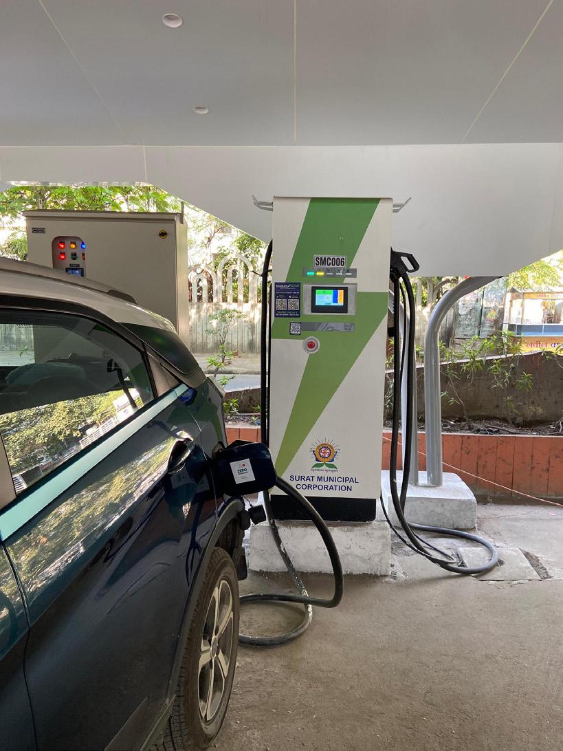
Sitilink, Technical Experts and GIZ
Financial institutions, Regulators, CBI
Technical support from GIZ (Green Bond Framework) Implementation through SMC Budget
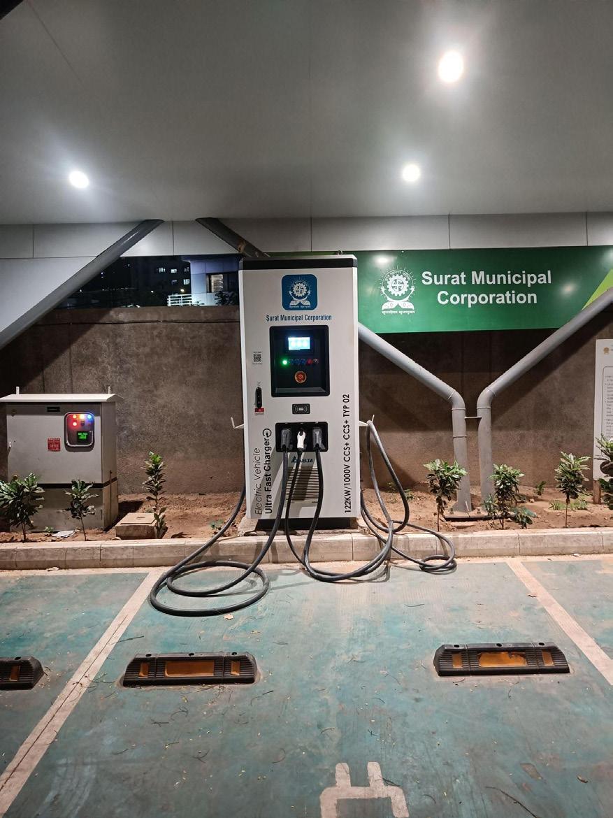
Project 4
Objective
Scope of Work
Pilot with Android ETM to enhance ticketing experience and improve conductor efficiency
To enhance operational efficiency and ease of operations for Sitilink and its conductors, the project proposes the introduction of Androidbased Electronic Ticketing Machines (ETMs). It aims to streamline fare collection, minimise revenue leakages, and enable real-time data generation for better service planning and monitoring. A three-month pilot will be conducted with 60 devices, during which conductors will receive hands-on training to effectively use the advanced ETMs, thereby improving their productivity and overall service delivery.
System Design & Pilot (SUM-ACA)
• Assess existing ticketing systems and operational challenges.
• Design ETM system architecture and integration requirements.
• Pilot deployment on selected routes and evaluate performance.
• Procure and deploy ETM devices across buses.
• Train conductors and operational staff.
Deployment & Operations (Sitilink)
• Integrate ETM with backend systems and digital platforms.
• Monitor performance and scale implementation.
Potential Benefits
The project will improve revenue transparency, reduce manual errors, and enable data-driven decision-making. It enhances commuter convenience through faster ticketing and supports integration with future digital mobility platforms. The findings will help Sitilink for future scaleup and city-wide deployment.
Probable Timeline 6 – 9 months
Lead Agency Support Agency Stakeholders
Key Agencies and Implementation
Mode
Funding
Sitilink
SMC, Technical Experts and GIZ
• Technical support from GIZ (Funding for pilot)
OEMs, Conductor agency
• Implementation through SMC Budget for city wide scaleup
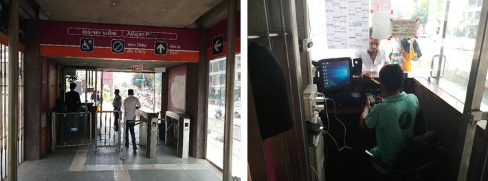
Objective
To develop a regulatory and planning framework for implementing Green Mobility Zones (GMZs) in high-density transportation hubs in Surat including metro stations, BRTS stations, and multimodal integration points. The project aims to reduce vehicular emissions, improve air quality, and prioritise sustainable modes of transport. The plan focuses on a pilot GMZ along the Metro Line 2 corridor, particularly around Adajan Gam Metro Station, to assess the effectiveness of targeted interventions in enabling sustainable mobility transitions and enhancing urban liveability. Strategies are structured across short-, medium-, and long-term timeframes, combining infrastructure improvements, policy measures, and behavioural interventions such as enhanced pedestrian and cycling infrastructure, better public transport integration, regulation of polluting vehicles, and promotion of cleaner modes like e-cycles and electric IPT, ensuring a phased and comprehensive approach to achieving GMZ objectives.
Policy & Planning (SUM-ACA)
• Baseline assessment of traffic, emissions, air quality, and existing mobility conditions
• Stakeholder consultations and delineation of GMZ boundaries around key transport hubs (Metro, BRTS, multimodal points)
• Design of short, medium, and long-term mobility strategies
• Preparation of regulatory and policy guidelines for GMZ implementation
• Conceptual urban design and street improvement plans for pilot areas
• Phased implementation roadmap with timelines, costs, and funding options
• Mobility and emissions modelling to assess impact of proposed interventions Adoption & Implementation (SMC)
• Notify and enforce Green Mobility Zones.
• Coordinate with traffic police, metro authority and enforcement agencies.
• Conduct awareness campaigns and stakeholder engagement.
• Identify locations for the implementation
Potential Benefits
The project will directly contribute to improving air quality, reducing congestion, and promoting sustainable transport modes. It aligns with findings of the Clean Air Action Plan and supports transition to lowemission urban mobility.
Probable Timeline 1 - 2 years
Lead Agency Support Agency Stakeholders
Key Agencies and Implementation Mode
Funding
SMC
Sitilink
Technical Experts and GIZ
Daily commuters, Traffic Police, GMRC, KfW, GPCB
• Technical support from GIZ (Preparation of guideline)
• Implementation through SMC Budgets
Objective
Scope of Work
To improve the quality, safety, and inclusivity of public transport services in Surat by building awareness and capacity among transport staff (drivers & conductors) and operators on gender-sensitive service delivery. The project aims to address behavioural gaps and inclusion assessments, ensuring that mobility systems are welcoming and safe for women and vulnerable users.
Training Design & Capacity Building (SUM-ACA)
• Develop gender-sensitisation training modules tailored for transport staff.
• Conduct training for drivers and conductors.
• Identify key behavioural and service gaps through stakeholder consultations and discuss during training session using case studies
• Prepare training manuals and scaling strategy.
Implementation & Institutionalisation (SMC/Sitilink)
• Scale across all public transport services and conduct regular training programs for drivers, conductors, and frontline staff.
• Integrate training into standard operating procedures.
• Monitor effectiveness and incorporate feedback.
Potential Benefits
The project will improve commuter experience, especially for women, by addressing behavioural issues and enhancing service quality. It will contribute to increased public transport usage and support broader goals of inclusive mobility planning.
Probable Timeline 6 months
Lead Agency Support Agency Stakeholders
Key Agencies and Implementation Mode
Sitilink, SMC
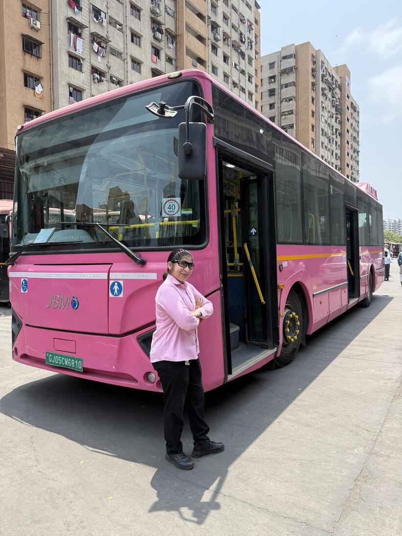
Technical Experts and GIZ
Technical support from GIZ (Training module) Future scale up through Sitilink Budgets
OEMs, Conductor agency
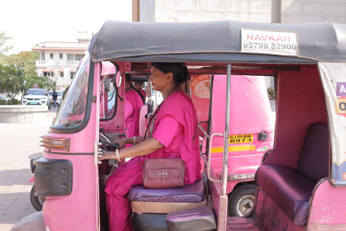
Project 7 Revamp PBS system supporting first- and last-mile connectivity
Objective
Scope of Work
To strengthen first- and last-mile connectivity by revitalising the existing PBS system and integrating it with public transport networks. The project aims to increase accessibility to BRTS, bus, and metro systems, while promoting non-motorised transport as a viable mode.
System Redesign & Planning (SUM-ACA)
• Assess existing PBS performance and utilisation patterns.
• Identify gaps in coverage and integration with PT nodes.
• Develop improved station network, pricing, and operational model.
Implementation & Operations (SMC)
• Upgraded PBS infrastructure.
• Manage, monitor usage and service performance.
Potential Benefits
The project will enhance accessibility to public transport, reduce short private vehicle trips, and improve overall mobility efficiency. It supports CMP goals of increasing NMT share and reducing congestion.
Probable Timeline 6 month – 1 year
Key Agencies and Implementation Mode
Funding
Lead Agency Support Agency Stakeholders SMC
Technical Experts and GIZ Private operator
• Technical support from GIZ (Recommendation note)
• Implementation through private operator
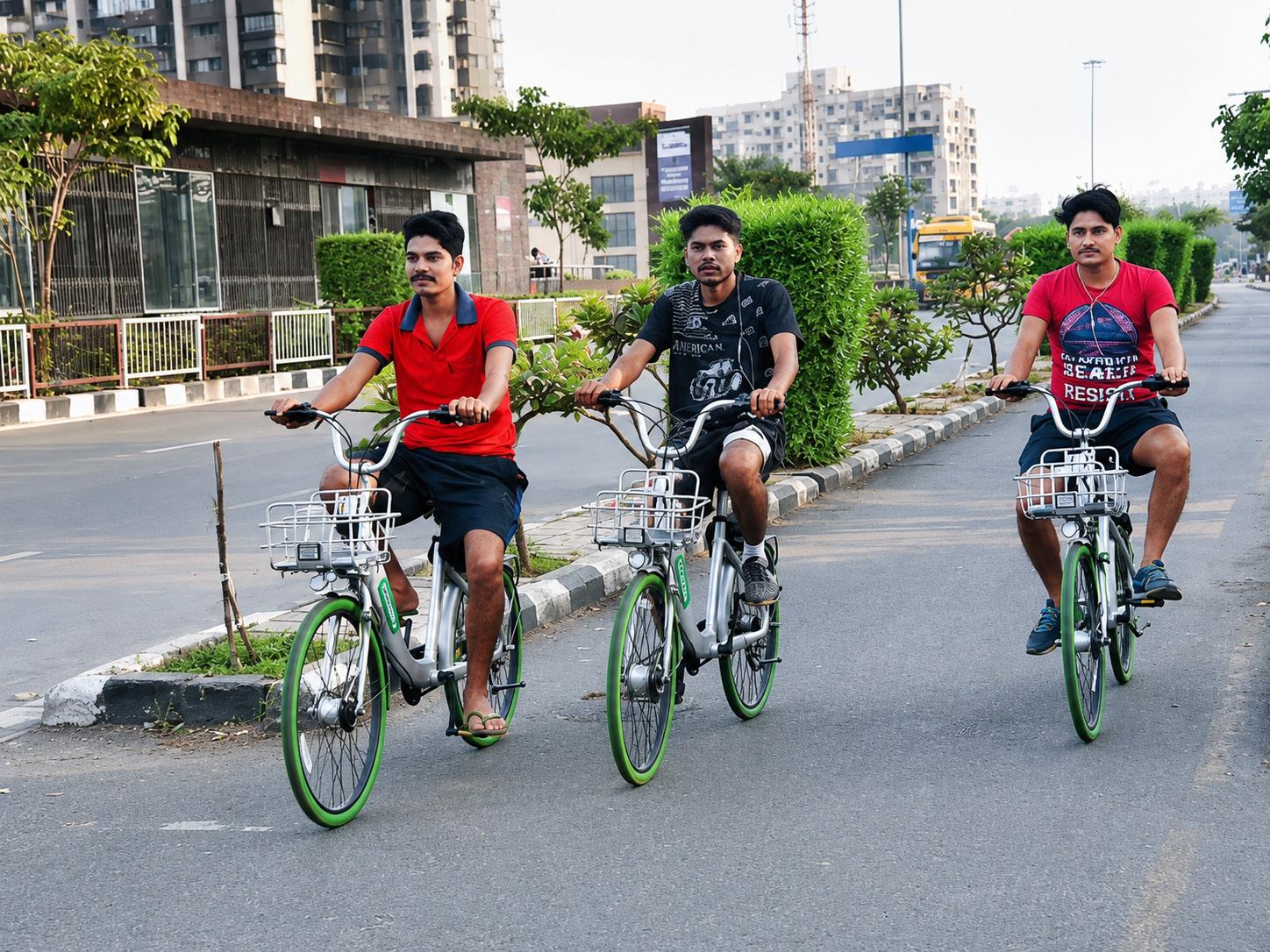
Objective
To establish a unified, data-driven platform for monitoring climate risks and road safety vulnerabilities across the mobility network in Surat, the project aims to support informed decision-making and prioritisation of interventions. The initiative will develop an interactive dashboard that visualises the impact of climate hazards such as high temperatures, flooding, and heavy rainfall on the city’s transport systems, while also mapping road safety risks for cyclists, pedestrians, and motorcyclists along key corridors. The platform will further identify and highlight critical infrastructure affected by climate events, enabling city agencies to proactively plan, prioritise, and implement resilient and safe mobility interventions.
Dashboard Development & Integration (SUM-ACA)
• Data collection and integration from multiple sources (climate, transport, road safety, infrastructure)
• Identification and mapping of key climate hazards (high temperature, flooding, heavy rainfall)
• Assessment of vulnerability of transport infrastructure to climate risks
• Road safety analysis for different user groups (pedestrians, cyclists, motorcyclists) along key corridors
Scope of Work
• Design and development of an interactive dashboard for data visualisation
• Development of indicators and metrics for climate resilience and road safety
• Scenario analysis to support planning and decision-making
• User interface design for ease of access by city officials and stakeholders.
Operationalisation & Use (SMC)
• Integrate dashboard into planning and decision-making processes.
• Update data regularly and ensure inter-departmental access.
• Use insights for prioritising investments and interventions.
Potential Benefits The dashboard will enable proactive planning, improve safety outcomes, and enhance resilience of transport systems. It directly addresses gaps in data-driven governance
Probable Timeline 1 – 2 years
Lead Agency Support Agency Stakeholders
Key Agencies and Implementation
Mode
Funding
SMC
Technical Experts and GIZ Sitilink, GPCB, SSCDL
• Technical support from GIZ (Dashboard preparation)
Objective
Scope of Work
To increase women’s participation in the transport and logistics sector in Surat by identifying suitable job roles and enabling pathways for employment, the project aims to address existing gender gaps in workforce participation through a structured and evidence-based research approach. The initiative will involve comprehensive secondary research and discussions with stakeholders (government officials, private operators, training institutes, and women workers) in Surat to assess current trends, barriers, and best practices related to women’s employment to understand on-ground challenges and opportunities.
Assessment & Strategy (SUM-ACA)
• Secondary research on women’s participation in transport and logistics (trends, barriers, best practices)
• Mapping of existing policies, schemes, and institutional frameworks supporting women’s employment
• Stakeholder consultations with government agencies, operators, industry bodies, training institutes, and women workers
• Identification of suitable and safe job roles across the transport and logistics value chain
• Assessment of skill requirements, training gaps, and certification needs
Implementation & Promotion (SMC)
• Collaborate with industry and training institutions.
• Facilitate skill development and placement programs.
• Integrate findings into city employment initiatives.
Potential Benefits
The project will promote economic inclusion and diversify workforce participation, contributing to equitable mobility systems.
Probable Timeline 6 months
Lead Agency Support Agency Stakeholders
Key Agencies and Implementation Mode
Funding
SMC, Sitilink Technical Experts and GIZ OEMs, Conductor agency, IPT operators, SHGs, Traffic Police
• Technical support from GIZ (Recommendation note)
While the SUM-ACA project in Surat is centred around a defined set of priority interventions aligned with its scope and timeline of the SUM-ACA project, several additional initiatives identified through stakeholder consultations could not be taken up within the current phase of implementation. These initiatives will need to be advanced independently by the Surat Municipal Corporation and Surat Sitilink Limited through appropriate programmes, funding avenues, and institutional partnerships.
SMC and Sitilink should prioritise these initiatives based on their strategic importance, readiness for implementation, and availability of financial and technical resources, ensuring sustained progress toward the city’s integrated and sustainable mobility
vision. For effective execution, the city shall actively leverage relevant State and Central Government schemes, allocate dedicated municipal budgets, and explore opportunities for convergence with ongoing urban development initiatives. Additionally, partnerships with multilateral and international agencies can be pursued for technical assistance, while innovative financing mechanisms such as public–private partnerships (PPP), green financing, and value capture tools may be adopted wherever feasible.
The tools, frameworks, standards, and technical insights developed under the SUM-ACA engagement will serve as a strong foundation to guide the planning and rollout of these future initiatives. This approach will enable Surat to maintain momentum beyond the SUMACA timeframe, ensure continuity in implementation, and progressively achieve its long-term mobility goals through a phased, well-coordinated, and resource-supported strategy.
Objective
The Resilient Transport Infrastructure Strengthening Initiative focuses on the implementation of targeted measures to address climate vulnerabilities in transport infrastructure, particularly those exposed to hazards such as flooding, extreme heat, and heavy rainfall. It aims to prioritise high-risk corridors and assets and execute resilience interventions that enhance safety, durability, and operational continuity, ensuring that the mobility network remains functional and reliable under changing climate conditions.
• Prioritisation of climate-vulnerable transport corridors and assets
• Detailed assessment of infrastructure exposure to flooding, extreme heat, and heavy rainfall
• Preparation of resilience improvement plans and designs and implementation of targeted infrastructure interventions (drainage improvements, heat-resilient materials, elevation, etc.)
Scope of Work
Potential Benefits
• Integration of climate-resilient design standards into ongoing and upcoming projects
• Coordination with relevant departments/agencies for execution of works
• Pilot implementation on selected high-risk corridors
• Development of standard operating procedures for climateresilient infrastructure maintenance and monitoring of intervention performance during climate events
The project will strengthen the resilience of Surat’s transport infrastructure by enabling targeted implementation of climate adaptation measures across high-risk corridors. It will improve the operational continuity of mobility systems during extreme weather events, reduce damage and maintenance costs, and enhance overall commuter safety and comfort. Additionally, the initiative will support more efficient allocation of resources through prioritised interventions and establish a foundation for long-term, climate-resilient infrastructure planning, contributing to a more robust and sustainable urban mobility network.
Probable Timeline 1 - 2 years (pilot sites) + ongoing implementation
Lead Agency Support Agency Stakeholders
Key Agencies and Implementation
Mode
Funding
Sitilink
Technical Experts, SMC – Disaster Management Committee
SMC, OEMs, Metro Authority, Auto union
SMC internal resource and budget + Global Climate Resilience funds
Objective
To establish a seamless and user-centric public transport system in Surat by integrating multiple modes including BRTS, city bus services, metro, and intermediate public transport (IPT) under a unified operational and fare framework. The initiative aims to eliminate fragmentation across systems, enable smooth transfers, and provide a consistent and affordable travel experience. It will strengthen institutional coordination, optimise service planning, and promote a shift from private vehicles to public transport, supporting Surat’s vision of efficient, low-carbon, and inclusive urban mobility.
• Assess existing public transport systems, including BRTS, city buses, metro, and IPT, to identify operational, physical, and fare integration gaps.
• Develop a unified operations framework covering route planning, scheduling, service coordination, and interchange management across modes.
• Design and implement a common fare policy, including integrated ticketing, fare capping, and transfer benefits.
• Introduce interoperable ticketing systems such as smart cards and mobile-based payments across all modes.
• Plan and upgrade multimodal interchange hubs to ensure seamless physical connectivity and passenger movement.
• Establish institutional mechanisms for coordination among multiple agencies and operators.
• Integrate passenger information systems to provide real-time, multimodal travel information.
• Monitor system performance, user experience, and financial sustainability, and refine integration strategies over time.
Potential Benefits
The project will significantly improve commuter convenience by enabling seamless travel across different transport modes with a single ticketing and fare system. It will reduce travel time, minimise transfers hassles, and enhance reliability, leading to increased public transport ridership. By optimising operations and improving coordination, the system will achieve better resource utilisation and financial efficiency. Overall, Iit will contribute to reduced congestion, lower emissions, and a more sustainable & and integrated urban mobility ecosystem. in Surat
Probable Timeline 1 – 5 years
Lead Agency Support Agency Stakeholders
Key Agencies and Implementation
Mode
Sitilink
Technical Experts, KfW
Metro Authorities, GSRTC, Daily commuters, Industrial associations, Traffic Police, IPT operator
Funding SMC internal resource and budget + PPP (for technology systems)
Objective
To optimise and streamline the public transport network in Surat by rationalising city bus routes and BRT corridors based on demand patterns, travel behaviour, and network performance. The initiative aims to reduce route overlaps, improve service coverage in underserved areas, enhance frequency on high-demand corridors, and strengthen multimodal integration with metro and IPT systems. It will improve operational efficiency, reduce travel time, and enhance overall reliability and attractiveness of public transport.
• Analyse existing city bus and BRTS routes, including ridership trends, load factors, route overlaps, and operational performance.
• Identify gaps in service coverage, particularly in newly developed areas, peri-urban zones, and high-growth corridors.
• Redesign routes to minimise duplication between BRT and city bus services while improving feeder connectivity to BRT and metro stations.
• Optimise route hierarchy (trunk, feeder, and last-mile services) to ensure efficient network structure.
• Revise service frequencies, schedules, and fleet deployment based on demand patterns and peak-hour requirements.
• Integrate revised routes with IPT and NMT networks to strengthen last-mile connectivity.
• Implement updated routes and schedules with proper public communication and awareness campaigns.
• Monitor performance post-implementation and refine routes based on user feedback and operational data.
The project will improve accessibility and reliability of public transport by ensuring that services are aligned with actual travel demand across the city. It will reduce redundancy, optimise fleet utilisation, and lower operational costs while improving service frequency and coverage. Enhanced feeder connectivity to BRT and metro systems will strengthen multimodal integration and increase ridership. Overall, the initiative will contribute to reduced congestion, improved commuter experience, and a more efficient and financially sustainable public transport system in Surat.
Probable Timeline 8 – 12 months
Lead Agency Support Agency Stakeholders
Key Agencies and Implementation Mode
Sitilink
Technical Experts SMC, OEMs
Funding SMC internal resource and budget
Objective
Scope of Work
Building on the GMZ guidelines prepared for Surat, the initiative focuses on city-wide implementation to enhance first- and last-mile connectivity and promote low-emission, people-friendly environments around high footfall metro stations. It aims to operationalise the GMZ framework by prioritising pedestrians, cyclists, and clean mobility modes such as e-autos and e-buses, while regulating private vehicle usage within station influence areas. The project aims to improve accessibility, reduce congestion and emissions, and create safe, vibrant public spaces that support seamless integration
• Identify high footfall metro stations and delineate station influence zones based on ridership and land use characteristics.
• Conduct on-ground assessments to evaluate pedestrian movement, traffic patterns, parking demand, and encroachment issues.
• Prepare detailed design plans for Green Mobility Zones including pedestrianisation, cycling infrastructure, organised IPT stands, and traffic calming measures.
• Introduce access management strategies such as restricted vehicle entry, designated drop-off zones, and parking regulation.
• Integrate zones with public transport systems (BRTS, city bus, metro) and shared mobility options.
• Implement signage, wayfinding systems, and public realm improvements (lighting, seating, landscaping).
• Coordinate with traffic police and relevant departments for enforcement and operations.
• Monitor performance and user behaviour to refine and upscale.
Potential Benefits The project will significantly improve accessibility and commuter experience around metro stations by creating safe, walkable, and well-organised environments. It will reduce congestion and emissions in high-density areas, promote modal shift toward public and nonmotorised transport, and strengthen multimodal integration. It will enhance urban public spaces, support local economic activity, and contribute to Surat’s broader goals of sustainable, low-carbon, and people-centric mobility development.
Probable Timeline 1 – 4 years
Lead Agency Support Agency Stakeholders
Key Agencies and Implementation
Mode
Funding
SMC
Technical Experts, Surat Sitilink Limited (SSL), Metro authorities, Traffic Police, local vendors and commuters, IPT operators, RWAs
SMC internal resource and budget + PPP (for public realm elements)
Project 14
Objective
Digitize PT network integrated with GTFS and prepare data sharing protocols
To develop a standardised and fully digitised public transport data ecosystem in Surat by integrating all transit services including BRTS, city buses, and metro into a General Transit Feed Specification (GTFS) compliant format. The initiative aims to enable real-time passenger information, support data-driven planning, improve operational transparency, and facilitate seamless integration with journey planning applications and future MaaS platforms.
• Compile and standardise route, schedule, stop, and fare data across all public transport modes.
• Develop GTFS static feeds for all services and ensure compatibility with national and global standards.
• Establish GTFS-realtime feeds incorporating vehicle tracking and live service updates.
• Integrate data systems with existing ITS platforms and passenger information systems.
Scope of Work
Potential Benefits
• Develop and implement data sharing protocols, including policies on data access, security, and interoperability across departments and external stakeholders.
• Enable integration with third-party applications (e.g., journey planners, mobility platforms).
• Build internal capacity for data management, updating, and maintenance.
• Ensure regular updates and quality checks to maintain accuracy and reliability of data.
The project will significantly enhance passenger experience by enabling access to accurate, real-time public transport information, reducing uncertainty and wait times. It will support better planning and operational decision-making through reliable data insights, while also enabling integration with digital mobility solutions. Improved transparency and accessibility of data will encourage innovation, strengthen system efficiency, and contribute to a more user-friendly and technologically advanced public transport system in Surat.
Probable Timeline 9 month – 1 year
Lead Agency Support Agency Stakeholders
Key Agencies and Implementation Mode
Sitilink Technical Experts
Funding SMC Internal resources and budget
SMC, Metro authorities, IT service providers, OEMs
Objective
Scope
To develop a comprehensive Mobility-as-a-Service (MaaS) ecosystem in Surat that digitally integrates all available mobility options including BRTS, city buses, metro, intermediate public transport (IPT), and shared mobility onto a single unified platform. The initiative aims to provide seamless journey planning, booking, and payment services, enabling users to access multimodal transport through a single interface. It will enhance convenience, promote modal shift away from private vehicles, and support the city’s transition toward a smart, efficient, and user-centric mobility system.
• Assess existing digital systems, ticketing platforms, and data availability across all transport modes.
• Design MaaS platform architecture integrating journey planning, ticketing, payment systems, and real-time information.
• Integrate GTFS and real-time data feeds from BRTS, buses, metro, and other mobility providers.
• Enable unified payment systems including smart cards, mobile wallets, and digital ticketing.
• Onboard multiple mobility service providers, including IPT and shared mobility operators.
• Develop user-friendly mobile and web-based interfaces for trip planning, booking, and payments.
• Ensure interoperability with existing ITS systems and future digital mobility initiatives.
• Establish governance, data-sharing frameworks, and operational protocols for platform management.
• Launch pilot implementation and scale up based on user feedback and system performance.
Potential Benefits
The MaaS platform will significantly improve commuter convenience by enabling end-to-end trip planning, booking, and payment across multiple transport modes through a single interface. It will reduce dependency on private vehicles by making public and shared mobility more accessible and attractive. The system will enhance operational efficiency through better demand insights and data analytics, while also supporting integrated fare systems and service optimisation. Overall, it will strengthen Surat’s digital mobility ecosystem, improve user experience, and contribute to sustainable, low-carbon urban transport.
Probable Timeline 2 – 3 years
Lead Agency Support Agency
Stakeholders
Key Agencies and Implementation Mode
Funding
Sitilink Technical Experts
SMC, Metro authorities, IPT operators, private mobility providers, IT partners
SMC internal resources and budget + PPP (technology platform)
Objective
To enhance pedestrian safety and reduce road accidents at highrisk intersections in Surat by implementing targeted, design-led interventions. The initiative aims to address critical safety gaps identified in accident prone locations by improving crossing facilities, visibility, traffic calming, and junction design. It will prioritise vulnerable road users such as pedestrians, elderly, children, and persons with disabilities, while supporting safer and more walkable urban environments.
• Identify high-risk junctions and accident blackspots using traffic police data, accident records, and field assessments.
• Conduct detailed road safety audits to assess pedestrian movement, conflict points, traffic behaviour, and infrastructure gaps.
• Prepare junction-level design improvement plans including safe pedestrian crossings, refuge islands, curb extensions, and signal timing improvements.
Scope of Work
Potential Benefits
• Introduce traffic calming measures such as raised crossings, speed tables, lane narrowing, and improved signage and markings.
• Enhance visibility through better street lighting, signage, and removal of visual obstructions.
• Ensure universal accessibility through barrier-free design features such as ramps and tactile paving.
• Implement pilot interventions at selected junctions and scale up based on performance.
• Coordinate with traffic police for enforcement and behaviour management measures.
• Monitor safety outcomes and refine interventions based on accident data and user feedback.
The project will significantly reduce road accidents and fatalities at critical junctions by improving pedestrian safety and minimising conflict points between vehicles and vulnerable users. It will enhance walkability, improve accessibility, and create safer public spaces, encouraging more people to walk and use public transport. The initiative will also support compliance with road safety standards and contribute to Surat’s broader vision of a safe, inclusive, and peoplecentric mobility system.
Probable Timeline 1 – 3 years (Pilot + Scale up strategy)
Key Agencies and Implementation
Funding SMC internal resources and budget
Objective
Under the proposed Gender and Inclusion Lab in Surat, initiatives such as the introduction of a women-led electric auto (e-auto) fleet should be undertaken to promote inclusive and sustainable last-mile connectivity. This intervention aims to enhance safe and reliable mobility options for women commuters while simultaneously creating livelihood opportunities for women. It also supports the transition towards clean, low-emission transport systems by integrating e-autos with existing public transport networks, aligning with the broader goal of embedding gender-responsive and sustainable mobility solutions within the city
• Identify high-demand routes and public transport nodes (BRTS, metro stations, terminals) for deployment of e-auto services.
• Develop an operational framework including route allocation, fare structure, and service integration with public transport.
• Facilitate procurement and financing mechanisms for e-autos through subsidies, loans, or partnerships.
• Mobilise and onboard women drivers through targeted outreach and partnerships with NGOs and skill development agencies.
Scope of Work
Potential Benefits
• Provide training programs covering driving skills, customer service, safety protocols, and financial literacy.
• Establish designated pick-up/drop-off points and integrate services with multimodal hubs.
• Develop branding and awareness campaigns to promote women-led services.
• Monitor service performance, safety outcomes, and user feedback, and scale the programme accordingly.
The project will enhance last-mile connectivity while creating safe and reliable travel options, particularly for women commuters. It will generate employment opportunities and empower women economically, while also contributing to reduced emissions through electric mobility. Integration with public transport will improve overall system accessibility and support a modal shift toward sustainable transport.
Probable Timeline 1 year (pilot + initial expansion)
Lead Agency Support Agency Stakeholders
Key Agencies and Implementation
Mode
SMC, Sitilink Technical Experts, Traffic Police, RTO RWAs, NGOs, financial institutions, women’s groups, IPT operator
Funding SMC internal resources and budget
Objective
Under the proposed Gender and Inclusion Lab in Surat, systematic gender and inclusion audits of streets and public transport systems should be undertaken to assess and enhance inclusivity, accessibility, and safety. The initiative will focus on identifying critical gaps affecting women, the elderly, children, and persons with disabilities, and translating these insights into actionable recommendations. These audits will support the integration of inclusive design principles into mobility planning and implementation, ensuring that urban transport systems are equitable, safe, and responsive to the needs of all user groups.
• Identify priority corridors, public transport systems, and public spaces for conducting audits.
• Develop an audit framework covering parameters such as safety, accessibility, lighting, signage, and user experience.
• Conduct on-ground assessments and stakeholder consultations, including feedback from diverse user groups.
• Identify critical gaps in infrastructure, service delivery, and safety conditions.
• Prepare recommendations for inclusive design improvements, including universal accessibility features.
• Integrate findings into ongoing and upcoming mobility and infrastructure projects.
• Establish monitoring mechanisms to track implementation of recommendations.
• Build institutional capacity for incorporating gender and inclusion perspectives in planning processes.
Potential Benefits
The project will improve safety, comfort, and accessibility of mobility systems for all users, particularly vulnerable groups. It will support inclusive urban planning, enhance public transport usability, and contribute to increased ridership. The initiative will also strengthen compliance with universal accessibility and gender-sensitive design standards.
Probable Timeline 6 – 9 months (establishment) + ongoing operations
Lead Agency Support Agency Stakeholders
Key Agencies and Implementation
Mode
Funding
SMC, Sitilink Technical Experts
NGOs, community groups
SMC internal resources and budget + technical assistance from development agencies
Objective
To establish a dedicated institutional mechanism in Surat for improving coordination, planning, and execution of mobility-related initiatives across multiple departments and agencies. The initiative aims to address fragmentation in decision-making by creating a centralized platform for integrated mobility planning, ensuring alignment between transport, traffic management, urban planning, engineering, and enforcement functions. It will support efficient project implementation, data-driven governance, and achievement of the city’s long-term sustainable mobility goals.
• Establish a formal Mobility Coordination Cell within the municipal structure with a clearly defined mandate, reporting framework, and decision-making authority.
• Identify and onboard all relevant departments and agencies, including transport, traffic police, urban planning, engineering, and public transport operators.
• Define roles, responsibilities, and standard operating procedures (SOPs) for inter-departmental coordination and collaboration.
• Set up systems for regular coordination meetings, joint reviews, and integrated decision-making processes.
• Develop a centralised data-sharing mechanism and digital platform for tracking mobility projects, performance indicators, and progress updates.
• Facilitate coordination for planning, approvals, and implementation of cross-sectoral mobility projects such as multimodal integration, street redesign, and safety improvements.
• Monitor key performance indicators (KPIs) related to mobility, including ridership, safety, and service efficiency.
• Ensure alignment of mobility initiatives with city-level plans such as CMP, Smart City proposals, and climate action strategies.
• Build institutional capacity through training and knowledgesharing to strengthen integrated mobility governance.
Potential Benefits
The project will significantly improve governance efficiency by reducing institutional silos and enabling coordinated decisionmaking across departments. It will accelerate project implementation timelines, minimise duplication of efforts, and ensure better utilisation of resources. The coordination cell will also support integrated and data-driven planning, leading to more effective mobility solutions and improved service delivery. Overall, it will strengthen Surat’s institutional capacity to manage complex urban mobility systems in a cohesive and sustainable manner.
Probable Timeline 6 months (establishment) + ongoing operations
Lead Agency Support Agency Stakeholders
Key Agencies and Implementation
Mode
Funding
SMC, Sitilink Technical Experts
SMC internal resources and budget
SUDA, RTO, Traffic Police, daily commuters, IPT operators, Metro authority
Objective
To strengthen the financial sustainability of public transport systems in Surat by systematically identifying, structuring, and operationalising non-farebox revenue streams. The initiative aims to reduce dependence on fare revenues by leveraging transport assets such as stations, depots, buses, and land parcels for commercial use, while ensuring that service quality and affordability are maintained. It will support long-term viability and expansion of public transport services through diversified and stable revenue sources.
• Conduct a comprehensive assessment of existing transport assets, including BRTS corridors, bus terminals, stations, depots, and vehicle fleets, to identify revenue potential.
• Identify and prioritise non-farebox revenue streams such as advertisements (on buses, shelters, and stations), station branding and naming rights, retail and commercial space development, transit-oriented development (TOD), and land value capture mechanisms.
Scope of Work
Potential Benefits
• Develop a policy and regulatory framework outlining permissible revenue streams, pricing strategies, and private sector participation models.
• Structure PPP models and prepare standard bidding documents and contracts for various revenue opportunities.
• Engage private partners, advertisers, and developers through transparent procurement processes.
• Implement and manage revenue-generating initiatives across selected assets, ensuring proper monitoring and compliance.
• Establish a dedicated system for tracking revenue performance and optimising strategies over time.
• Integrate non-farebox revenue planning into long-term public transport and infrastructure development strategies.
The project will enhance the financial resilience of Surat’s public transport systems by diversifying revenue sources and reducing reliance on farebox income. It will enable improved service quality, maintenance, and system expansion without placing excessive financial burden on municipal budgets. Additionally, it will unlock the economic potential of transport infrastructure, attract private investment, and contribute to more sustainable and self-sufficient urban mobility operations.
Probable Timeline 6 – 12 months (initial operationalisation) + ongoing scaling
Key Agencies and Implementation
Mode
Funding
Lead Agency Support Agency Stakeholders
Sitilink
Technical Experts SMC, OEMs
SMC internal resources and budget + Self-sustaining (revenue-based model) + PPP
Over the course of the SUM-ACA engagement, a wide range of mobility initiatives have been conceptualised and progressed at different stages in Surat, reflecting the city’s strong institutional capacity and prior investments in public transport and urban infrastructure. Several priority actions such as digital improvements in ticketing systems, initial work on public transport data standardisation, planning for route rationalisation, gender-focused initiatives, and pilots around clean mobility and electrification have either been initiated or are moving toward implementation. These efforts are already contributing to enhanced commuter experience, improved operational efficiency, and a gradual shift toward more inclusive and sustainable mobility systems. In parallel, key institutional and policy-level initiatives, including the development of integrated multimodal systems and establishment of coordination mechanisms are being advanced to strengthen governance frameworks and long-term financial sustainability of the transport system.
At the same time, several strategic programmes and frameworks have been identified and discussed with the municipal stakeholders, with draft concepts and approaches prepared for further action. These include initiatives such as the Open Mobility Data and Digital Public Transport Platform, Integrated Smart Ticketing and MaaS ecosystem, Climate-Resilient Mobility Infrastructure Assessment, exploration of non-farebox revenue strategies and Inclusive Mobility. Additionally, consultations around clean mobility transitions, electrification of IPT and bus fleets, and development of low-emission and green mobility zones have laid the groundwork for scaling sustainable transport interventions
across the city. While these initiatives are at varying stages of readiness, they collectively require further institutional anchoring and implementation support from SMC and Surat Sitilink Limited to translate into on-ground impact.
Looking ahead, a comprehensive set of short to long term priority actions has been identified to be undertaken over the next 0–5 years. These include implementation of the Seamless Multimodal Mobility Integration Programme for Surat, High-Frequency Public Transport Network Transformation Programme, and Citywide Public Transport Capacity Enhancement Programme to strengthen the backbone of public transport. Parallel efforts such as the Public Bicycle Sharing Expansion for First and Last Mile Connectivity, Citywide Active Mobility and Walkability Master Plan, and Safe Junctions and Pedestrian Priority Improvement Programme will enhance accessibility and safety for non-motorised users. Institutional strengthening through the Integrated Urban Mobility Coordination Platform, Urban Mobility Planning Capacity Development Programme, and Citywide Mobility Performance Monitoring Framework will improve governance and data-driven decision-making. In addition, initiatives like the Inclusive Electric Shared Mobility Transition Programme (E-Autos), Women-Led Electric Shared Mobility Initiative, and Inclusive Transit Hub Street Economy and Shared Mobility Zones will support inclusive and last-mile connectivity, while programmes such as the Renewable-Powered Public Transport Infrastructure Programme and Clean Air and Low-Emission Mobility Pilot Programme will advance the city’s climate and sustainability goals.
In the long term, Surat is well-positioned to scale multiple other initiatives into comprehensive, citywide transformations, which includes advancing the Surat Net-
Zero Urban Mobility Transition Roadmap, expanding the Citywide Electric Public Transport Expansion Programme, and implementing the Compact, TransitOriented and Climate-Responsive Urban Growth Policy to align land use with mobility. Large-scale initiatives such as the Citywide Street Network Connectivity Improvement Programme, Pedestrian Priority Market Streets Programme, and Citywide Accessible Footpath Improvement Programme will significantly improve urban liveability. The city can further strengthen its economic and environmental resilience through the Sustainable Urban Freight and Clean Logistics Hubs, Transit-Oriented Parking Reform Programme, and Urban Travel Demand and Vehicle Restraint Strategy. On the digital front, full deployment of the Integrated Smart Mobility Management Platform for Surat and Mobility-as-a-
Service (MaaS) Ecosystem for Surat will enable seamless, data-driven, and user-centric mobility services across all modes.
Together, the ongoing, proposed, and long-term initiatives form a comprehensive and forward-looking mobility roadmap for Surat. This integrated approach not only strengthens public transport systems and promotes active mobility, but also embeds climate resilience, inclusivity, financial sustainability, and digital innovation at the core of urban mobility planning. By advancing these initiatives in a phased and coordinated manner, Surat can position itself as a leading example of a clean, efficient, safe, and people-centric urban mobility system aligned with national priorities and global sustainability goals.
The 2022 baseline vehicular emission inventory for Surat was prepared using a bottom-up methodology, taking into account the registered vehicle population, average daily Vehicle Kilometres Travelled (VKT), fuel efficiency, fuel consumption, and standard emission factors. The findings show that petroloperated two-wheelers account for the highest share of total emissions due to their large numbers, while dieseldriven four-wheelers and three-wheelers are major contributors to particulate matter (PM) and NOx emissions. This baseline reflects a mobility system that is still largely reliant on private motorised vehicles, even though the city has a comparatively stronger public transport network and a gradually increasing share of electric vehicles.
The 2030 projections are derived from anticipated vehicle growth trends and
incorporate a set of strategic interventions aimed at transforming urban mobility patterns. These include a shift towards public and non-motorised transport (NMT), increased adoption of electric vehicles (EVs), reduction in vehicle kilometres travelled (VKT) through demand management strategies, and the implementation of complete, safe, and accessible street networks. Based on past trends, emission factors, and the expected outcomes of planned mobility initiatives, estimates for future travel demand and VKT were developed to evaluate emission reductions relative to the 2022 baseline.
As per secondary research and stakeholder consultations, the transition to electric mobility is expected to progress steadily. Assuming the city achieves about 50% of its EV adoption targets, supported by enabling measures such
as solar-powered depot infrastructure and charging ecosystems, electric vehicles are projected to constitute around 15% of new vehicle registrations across segments of four-wheelers, threewheelers, and two-wheelers by 2030.
The city’s ongoing investments in metro infrastructure and bus service augmentation are being complemented by a series of on-ground interventions under the SUM-ACA programme, which together strengthen public transport (PT) accessibility, efficiency, and user experience. Initiatives such as the deployment of a 100 kW Solar PV system with a 224 kWh second-life battery at Althan Depot, piloting of Android-based Electronic Ticketing Machines (ETMs), and the development of data-driven dashboards for operations enhance service reliability and operational performance. At the same time, the establishment of the Surat Gender and Inclusion Lab, gender sensitisation training, and efforts to increase women’s participation in the transport sector contribute to making PT systems more inclusive and user oriented. Complementary measures such as the issuance of INR 200 crore Green Bonds, development of Green Mobility Zone (GMZ) guidelines, and improvements to first- and last-mile connectivity through Public Bicycle Sharing (PBS) further
While initial projections from metro and city mobility plans indicate a high potential shift towards PT, evidence from similar systems suggests that only about 50% of projected demand is typically realised. Accordingly, a calibrated estimate has been adopted. By 2030, around 8% of trips from four-wheelers and 22% from three- and two-wheelers are expected to shift to PT, with an additional 2% shift to metro. The supporting SUM-ACA interventions particularly GMZs, PBS improvements, and system integration through MaaS are expected to unlock the major demand for shift to PT and Metro by improving accessibility, safety, and convenience.
On the non-motorised transport (NMT) side, interventions such as GMZ implementation, safer street design, and PBS strengthening create favourable conditions for walking and cycling, especially for short-distance trips. While these measures have the potential to shift a large share of sub-1 km trips if implemented citywide, a phased rollout by 2030 suggests a more realistic NMT shift of around 20% of trips from 3W and 2W, supported by improved infrastructure, safety, and inclusivity.
In parallel, the city’s commitment to implementing the Integrated Mobility Plan (IMP) recommendations provides a structured pathway to scale these impacts. Key proposed initiatives such
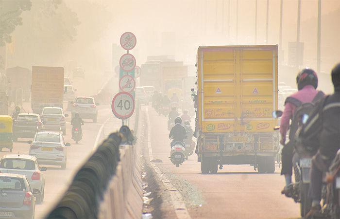
as resilient transport infrastructure strengthening, development of a fully integrated multimodal public transport system with unified operations and fare policy, and route rationalization across city and BRT corridors will significantly improve public transport attractiveness. The implementation of Green Mobility Zones around high footfall metro stations, digitization of the public transport network using GTFS standards, and full Mobility-as-a-Service (MaaS) integration will further streamline user experience and system efficiency. Additionally, targeted interventions such as junctionlevel pedestrian safety improvements, introduction of women-led e-auto fleet programmes, and conducting gender and inclusion audits of streets and public transport systems will enhance safety and accessibility. Institutional measures including the formation of an interdepartmental mobility coordination cell and operationalisation of non-farebox revenue mechanisms will strengthen
governance and financial sustainability. Together, the execution of SUM-ACA initiatives and the phased implementation of IMP recommended projects create a robust ecosystem that enables the projected modal shift, EV adoption, and VKT reduction. These combined efforts form the foundation for achieving significant emission reductions by 2030 while advancing Surat’s vision of a sustainable, inclusive, and resilient urban mobility system. The projections for 2030 suggest notable reductions in major air pollutants and carbon emissions across most of the vehicle categories. Levels of PM, NOx, CO, and hydrocarbons are expected to decrease significantly due to cleaner technologies, improved vehicle performance, and reduced dependence on private vehicles. Overall greenhouse gas emissions (tCO2e) are also projected to decline, contributing to better air quality and supporting the city’s broader climate and sustainability objectives.
A Diagnostic and Strategy-Enabling Tool for Indian Cities
Developed under: GIZ SUM-ACA Project
Sustainable Urban Mobility – Air Quality, Climate Action and Accessibility GIZ India | Ministry of Housing and Urban Affairs (MoHUA)
2025
India’s cities face compounding mobility challenges: rapid urbanisation, worsening air quality, rising motorisation, and deepening inequities in access to transport. Planning instruments such as Comprehensive Mobility Plans (CMPs) are extensively prepared, yet implementation has frequently been constrained by an over-reliance on travel demand forecasting and infrastructure-led approaches that do not adequately address systemic inefficiencies, institutional fragmentation, or emerging climate imperatives.
National-level policies have progressively widened the mandate for urban mobility planning. The National Clean Air Programme (NCAP, 2019) requires 122 nonattainment cities to prepare action plans linking mobility interventions to air quality targets. The Indo-German Green Urban Mobility Partnership (GUMP), signed in 2019 is a collaboration between the Ministry of Housing & Urban Affairs (MoHUA) and the German Federal Ministry for Economic Cooperation and Development (BMZ) to support and encourage environment friendly sustainable urban transport projects — supported by EUR 1 billion in concessional KfW lending for sustainable mobility infrastructure. It is in this context that the Integrated Mobility Plan (IMP) Evaluation Framework has been developed under the GIZ’s SUM-ACA project (Sustainable Urban Mobility – Air Quality, Climate Action and Accessibility), implemented in partnership with MoHUA. The framework is a diagnostic and strategy-enabling tool designed to shift city planning from predicting future demand to understanding current system performance and enabling cities to identify targeted, implementable interventions that serve equity, climate, and air quality objectives simultaneously.
This chapter documents the methodological basis of the IMP Evaluation Framework — the principles that shaped its design, the structured process through which it was developed, and the logic by which its nine dimensions and forty parameters were derived. Transparency of methodology is central to the credibility of the framework as a comparative assessment instrument.
The development of the IMP Framework is anchored in four core principles that define its scope, structure, and applicability.
The framework was constructed through a seven-step process that moves from a review of global and national frameworks through to validation against real city
conditions. Each step produced a discrete methodological output that informed the next stage of development.
Table 2.1 Guiding Principles of the IMP Evaluation Framework
Guiding Principle
City-Scale Measurability
Outcome-Oriented Structure
Systems-Based Approach
Alignment with Policy and Practice
Description
Indicators are designed to be measurable using secondary datasets — CMPs, Smart City systems, ITMS data, GIS layers, and administrative rds — ensuring applicability across cities without requiring primary data collection.
The framework focuses on mobility outcomes — accessibility, safety, inclusion, and emissions reduction — rather than isolated infrastructure provision.
Urban mobility is evaluated as an integrated system linking land use and urban form, public and informal transport systems, active mobility networks, digital ecosystems, and governance and financing structures.
Indicators and scoring logic are derived from the CMP Toolkit and Service Level Benchmarks (MoHUA), SUMP Guidelines (EU), ITDP, WRI, and World Bank toolkits, and the GIZ MaaS Readiness Framework.
Table 2.2 Methodological Flow for Development of the IMP Evaluation Framework
Step Description
Step 1
Review of global and national frameworks (SUMP, CMP, SLB, ITDP, WRI, World Bank, GIZ)
Step 2 Translation of outcomes into system-level dimensions
Key Output
Identification of core mobility outcomes
Definition of 9 functional mobility pillars
Step 3 Identification of parameters within each dimension Distinct performance areas and intervention levers
Step 4 Development of measurable indicators for each parameter City-scale, coverage-based metrics
Step 5 Integration of cross-cutting themes (climate, inclusion, digital)
Step 6 Development of scoring system (1–5 maturity scale)
Mainstreamed across all parameters
Standardised evaluation framework
Step 7 Validation and iteration using real city data Refinement for applicability and robustness
The review encompassed the EU Sustainable Urban Mobility Plan (SUMP) Guidelines (2nd ed., 2019); MoHUA’s Comprehensive Mobility Plan (CMP) Toolkit (2014) and Service Level Benchmarks (2012); ITDP’s Complete Streets Workbook and Women & Transport toolkit; World Bank Urban Transport Benchmarking; WRI India Low Emission Zones toolkit; GIZ MaaS Readiness Level for India (MRLI, 2021); and India’s National Clean Air Programme (2019), ClimateSmart Cities Assessment Framework 2.0 (2020), and National Disaster Management Authority guidelines. This breadth of review ensures that the framework captures global best practice while remaining grounded in India’s regulatory and institutional context.
The nine dimensions (pillars) of the IMP Framework are derived through a structured translation of SUMP thematic areas, CMP Toolkit guidance, and complementary practitioner frameworks into operational system components relevant to the Indian city context. Each dimension represents a distinct system lever — a domain where targeted interventions can produce measurable improvements in mobility outcomes. Together, the nine dimensions ensure that the framework captures both physical and institutional aspects of urban mobility.
The table below summarises how each dimension was derived, the source frameworks it draws on, its conceptual basis, and how it was adapted for the Indian context.
Table 2.3 Derivation of the Nine IMP Framework Dimensions and Their Adaptation to the Indian Context
IMP Dimension Derived From Conceptual Basis Adaptation for Indian Context
ClimateResilient & Compact Urban Growth
Public & Shared Transport Systems
Active Mobility (Walking & Cycling)
Equity, Inclusion & Informal Systems
SUMP (Accessibility, Environment), CMP Toolkit, TOD Policy
SLBs, CMP Toolkit, SUMP (Efficiency)
SUMP (Accessibility, Quality of Life), ITDP
SUMP (Inclusion), World Bank, ITDP
Integration of land use and mobility to enable accessibility
Service performance, accessibility, and reliability of PT systems
Walking and cycling as core modes
Expanded to include climate resilience and ecological continuity
Includes fare integration, MaaS, and multimodal performance
Includes universal access, child safety, and gender-sensitive design
Inclusive mobility across all user groups
Explicit inclusion of IPT and the informal sector
Climate & Environmental Sustainability
Parking & Travel Demand Management
Governance, Financing & Monitoring
Road Safety
SUMP (Environment), NCAP, CSCAF
SUMP measure packages, ITDP, WRI
SUMP implementation steps, NUTP
SUMP (Safety), MoRTH, IRC
Digital Integration GIZ MaaS, DMAF, NCMC
Emissions reduction and environmental performance
Demand management and behaviour change
Institutional and financial capacity
Reduction of fatalities and injuries
Digital enablement of mobility systems
Includes EV transition, air quality zones, and resilience
Focus on parking pricing and vehicle restraint mechanisms
Includes UMTA, funding mechanisms, and data systems
Includes school safety and gender safety perception
Elevated as standalone dimension for Indian Smart City context
Three cross-cutting themes — gender and social inclusion, climate and air quality, and digital integration — are mainstreamed across dimensions rather than isolated as standalone topics. Gender and inclusion considerations appear within Pillars II, III, IV, and VII. Climate and air quality objectives are embedded in Pillars I, V, and VI. Digital integration is both elevated as a standalone dimension (Pillar IX) and referenced within governance and monitoring parameters (Pillar VII).
For each of the nine dimensions, parameters were selected on the basis of three criteria: city-scale measurability using secondary datasets; conceptual alignment with the dimension’s mobility outcomes; and policy grounding in at least one national or international reference standard. This section documents the derivation logic and source frameworks for each parameter set, providing a traceable audit trail from source frameworks to adopted metrics.
This dimension was designed to assess the scale, intensity, and pattern of urban development, and the extent to which these dynamics are aligned with sustainable mobility and climate resilience objectives across six parameters. The selected parameters examine three interrelated concerns: (i) urban form and its interface with mobility systems, (ii) the accessibility outcomes of that urban form, and (iii) the resilience of the city’s development and mobility systems to climate and disaster risks. The parameter set was intentionally limited to aspects assessable at city scale using statutory plans, GIS-based land use and network data, CMPs, and state policy documents.
Parameter
Resilient Urban Growth
SUMP (Accessibility, Environment); NDMA; CSCAF; CMP Toolkit
Integration of Mobility with City Planning
Service Proximity
Street Network
Structure & Connectivity
CMP Toolkit; SUMP; TOD Policy
SUMP; CMP Toolkit; accessibility planning approaches
ITDP Complete Streets; CMP Toolkit; walkability and permeability principles
Disaster Risk Management NDMA; CSCAF; SUMP environment/resilience logic
Climate Mitigation
NCAP; FAME; climate action and low-carbon mobility frameworks
Whether urban growth is being contained and directed toward existing serviced areas, while safeguarding ecological systems and reducing unsustainable outward expansion
Extent to which statutory land use planning and mobility planning are mutually reinforcing
Degree to which populated areas have essential services (schools, markets, healthcare) within walking distance, reducing motorised trip dependence
Whether the city has a coherent street hierarchy and interconnected network that supports walkability, permeability, and bus penetration
Whether mobility infrastructure planning is aligned with flood, heat, and emergency access considerations
Whether the city has adopted targets and measures for transport-related GHG reduction through modal shift, electrification, and low-carbon strategies
Policy intent and evidence of contained growth
Policy alignment
Coverage (%) –services within 15 min / 1 km walk
Composite –policy presence + % coverage indicators
Policy / coverage
Policy / coverage – GHG targets, EV, modal shift
This dimension was designed to assess the scale, intensity, and pattern of urban development, and the extent to which these dynamics are aligned with sustainable mobility and climate resilience objectives across six parameters. The selected parameters examine three interrelated concerns: (i) urban form and its interface with mobility systems, (ii) the accessibility outcomes of that urban form, and (iii) the resilience of the city’s development and mobility systems to climate and disaster risks. The parameter set was intentionally limited to aspects assessable at city scale using statutory plans, GIS-based land use and network data, CMPs, and state policy documents.
Network Coverage Service Level Benchmarks (MoUD, 2012); CMP Toolkit (2014)
Service Frequency & Reliability
Real-Time Service Integration
SLBs (2012); Urban Bus Specifications UBS-II, MoUD (2013)
AIS-140 ITS Standard, MoRTH (2018); GIZ MaaS Readiness Level for India (2021)
Affordability SLBs (2012); World Bank Urban Transport Benchmarking (2014–16)
Gender & Safety World Bank Gender Responsive Urban Mobility Toolkit (2022); ITDP Women & Transport (2017)
Physical Integration
Commuter Responsive Planning
National TOD Policy, MoHUA (2017); UMI Multimodal Integration resources (2016–18)
World Bank Urban Bus Toolkit; CMP Toolkit (2014)
Accessibility to public transport – ensuring spatial equity of coverage
Service quality as a primary driver of ridership – frequency and on-time performance
Seamless and informed journeys through real-time passenger information and fare integration
Economic access – ensuring public transport is financially accessible to lower-income households
Inclusive mobility – creating environments where women feel safe and can travel independently
Seamless multimodal transfers – ensuring stations function as connected mobility hubs
Adaptive service planning – routing and scheduling adjusted to actual ridership and equity needs rather than fixed forecasts
% population within 500m bus stop / 1km rail station
Average headway; % on-time; buses per lakh population
% fleet with RTPI; fare / service integration presence
Monthly pass as % of bottom-40% household income
Policy presence + user perception of safety
% major transit stations with multimodal access planning
Policy / process presence – route review mechanisms
This dimension assesses the extent to which cities support walking and cycling as primary modes for short-distance travel, recognising their critical role in improving accessibility, reducing emissions, and enhancing public health. Parameters focus on network continuity, inclusivity, and safety rather than isolated infrastructure provision. The emphasis on universal access and personal security reflects the need to create environments usable by all user groups, including children, elderly persons, and women. Together, these parameters evaluate whether active mobility is treated as a systematic, network-level priority.
Table 2.6 Parameter Derivation Framework for Pillar III: Active Mobility (Walking and Cycling)
Parameter
Continuity & Connectivity of NMT Networks
ITDP Complete Streets Workbook (2016)
Universal Access Harmonised Accessibility Guidelines, MoHUA (2021); World Bank Gender Toolkit (2022)
Personal Security World Bank Gender Responsive Urban Mobility Toolkit (2022)
Network continuity –walking and cycling infrastructure must be uninterrupted to be usable, especially for commuting and school trips
Inclusive design – streets must be usable by children, elderly, and differently abled persons
% arterial corridors with continuous footpath / cycle lane ≥1 km
Safety and comfort – lighting and active frontages are essential for women, children, and vulnerable groups to use streets at all hours
Programme existence / coverage of barrier-free infrastructure
% streets with adequate lighting + eyes-on-street proxy
This dimension recognises that urban mobility in Indian cities is deeply shaped by socio-economic disparities and the prevalence of informal systems. Parameters were selected to assess whether mobility systems are inclusive of low-income populations, informal settlements, and non-formal transport services such as intermediate public transport (IPT). The inclusion of street vending policy and universal accessibility reflects the need to balance mobility efficiency with livelihoods and equitable access to public space. These parameters evaluate whether cities are moving towards a mobility system that is socially inclusive and reflective of ground realities.
Table 2.7 Parameter Derivation Framework for Pillar IV: Equity, Inclusion and Informal Systems
Parameter
Low-Income Access
Derived From Conceptual Basis Adopted Metric
CMP Toolkit (2014); World Bank Accessibility & Inclusion (2015–22)
Alternative Mobility (IPT)
Street Vendors & Informal Use Policy
National TOD Policy (2017); UMI Multimodal Integration (2016–18)
Street Vendors Act (2014); National Policy on Urban Street Vendors (2009)
Accessibility for Differently Abled Harmonised Accessibility Guidelines (2021); World Bank Toolkit (2022)
Spatial equity – ensuring informal settlements and low-income areas are not mobility-excluded
First / last mile access – IPT fills the gap where formal PT does not penetrate
Livelihood inclusion –vending around transit hubs must be regulated to coexist with pedestrian and NMT flows
Universal mobility –fleet and stations must be compliant with accessibility standards
% informal settlements linked to public transport services
Availability – safe, affordable, appaccessible IPT services
Policy presence / enforcement and designated vending zones
% compliant fleet and stations
Across five parameters this dimension evaluates the extent to which urban mobility systems contribute to climate mitigation, air quality improvement, and environmental sustainability. Parameters focus on measurable transitions such as fleet electrification, renewable energy integration, and emission control, while capturing broader policy responses such as low-emission zones and congestion management. The inclusion of resilient infrastructure ensures that environmental sustainability encompasses not only mitigation but adaptation to climate risks such as flooding and extreme heat. Parameters collectively reflect the dual objective of reducing environmental impact while ensuring system continuity.
Table 2.8 Parameter Derivation Framework for Pillar V: Climate and Environmental Sustainability
Parameter
Low-Emission Fleet Share
Renewable Integration
Air Quality Integration
Emission Compliance & Congestion
Resilient Infrastructure
Derived From Conceptual Basis Adopted Metric
FAME II (2019); EV Charging Guidelines, MoP (2022)
CSCAF 2.0 (2020); EV Charging Guidelines (2022)
NCAP (2019); WRI Low Emission Zones Toolkit (2021)
NCAP (2019); WRI LEZ Toolkit (2021)
NDMA Urban Flooding Guidelines (2010); CSCAF 2.0 (2020)
Clean mobility transition – fleet electrification is the primary lever for transportrelated air quality improvement
Energy sustainability – depots and stations powered by renewables reduce the life-cycle carbon of transit assets
AQ improvement –mobility plans must explicitly target hotspot areas with clean mode priorities and vehicular restrictions
Emission compliance and traffic performance as joint indicators of fleet quality and network efficiency
Climate resilience –transport infrastructure must be designed / retrofitted to withstand flooding, heat, and storms
% fleet on low-emission technology (e-bus, CNG, hybrid)
% depots and stations powered by renewable energy
Policy / coverage – LEZ, pedestrianisation, vehicular restrictions
BS-VI compliance (%) + peak V/C ratio on arterial corridors
% corridors, depots, and terminals with climate-resilient design
This dimension addresses the need to manage travel demand rather than continuously expand road capacity. Parameters were selected to evaluate whether cities are adopting policy instruments that discourage excessive private vehicle use and promote sustainable modes. Parking management is treated as a primary lever given its direct influence on travel behaviour. Broader vehicle restraint measures capture regulatory and fiscal interventions such as congestion pricing and lowemission zones. Together, these parameters assess whether cities are treating demand management as a core mobility strategy rather than an optional add-on.
Table 2.9 Parameter Derivation Framework for Pillar VI: Parking and Travel Demand Management
Parking Policy ITDP On-Street
Parking Management Toolkit (2016); GIZ Parking Management for Small & Medium Towns (2023)
Private Vehicle Restraint ITDP Taming Traffic (2021); WRI India Low Emission Zones Toolkit (2021)
Demand management –parking supply and pricing directly shape private vehicle use decisions
Policy presence / demand-based pricing enforcement
Behaviour change – fiscal and regulatory instruments must disincentivise car use alongside PT improvement
Policy presence / coverage – congestion pricing, LEZ, levies
This dimension evaluates the institutional and financial foundations required to deliver sustainable mobility systems across six dimensions. Parameters were selected to assess whether cities have the institutional structures, funding mechanisms, and monitoring systems necessary for effective planning and implementation. Given the fragmented governance landscape in Indian cities, particular emphasis is placed on the presence of coordinated authorities such as UMTAs or SPVs. The inclusion of financing tools and data systems reflects the importance of long-term financial sustainability and evidence-based decision-making.
Table 2.10 Parameter Derivation Framework for Pillar VII: Governance, Financing and Monitoring
Institutional Framework (UMTA / SPV)
Funding & O&M Mechanisms
NUTP (2014); Metro Rail Policy (2017)
Value Capture Finance Policy (2017); NUTP (2014)
Land Value Capture / TOD Financing
Monitoring & Data
TOD Policy (2017); Value Capture Finance Policy (2017)
DMAF 2.0 (2020); SUMP Guidelines (2019)
Coordination capacity –empowered, cross-agency authority is the prerequisite for integrated planning
Financial sustainability – dedicated revenue streams ensure longterm operation without annual budget uncertainty
Financing integration – land-based instruments recover mobility investment costs from development that transit enables
Evidence-based planning – a mobility dashboard with KPIs enables adaptive management and performance accountability
Policy presence –statutory authority with financial autonomy
Finance mechanism presence –dedicated revenue streams
Finance mechanism presence –LVC instruments in use
Monitoring system and dashboard presence
Institutional & Stakeholder Coordination
SUMP Guidelines (2019)
Capacity Building SUMP Guidelines (2019)
Multi-agency coordination – regular forums with PT agencies, civic bodies, and civil society are necessary for integrated planning
Institutional capacity – staff competency in transport planning directly affects quality of plan preparation and implementation
Process / outcome – number of inter-institutional meetings per year
Process / outcome – proportion of staff with transport planning competency
This dimension treats road safety as a core outcome of urban mobility systems rather than a standalone sectoral issue. Parameters focus on measurable safety outcomes — fatalities and serious injuries — as well as proactive measures such as black spot treatment and school safety programmes. The inclusion of both outcome and intervention-based indicators ensures that cities are evaluated on their current safety performance as well as their efforts to improve it. This approach aligns with global Vision Zero frameworks while remaining grounded in Indian data availability and institutional practice.
Parameter
Fatalities & Serious Injuries
Derived From Conceptual Basis
Road Accidents in India, MoRTH (2023); IRC SP:88 (2010)
Black Spot Management
School & Child Safety
MoRTH Circular (2015 / 2019); IRC 131 (2022)
Safety outcomes – the ultimate measure of a city’s road safety performance is the rate of death and serious injury among road users
Risk reduction –targeted treatment of identified crash hotspots is the most cost-effective safety intervention
WRI India Safe Access to Schools (2016–21); World Bank Gender Toolkit (2022)
Child safety – school zones require dedicated measures because children are among the most vulnerable road users
Annual fatalities per 100,000 population, disaggregated by mode
% identified black spots treated through infrastructure or enforcement
% schools with Safe Access to School plans implemented
This dimension captures the growing role of digital systems in enabling integrated, user-centric mobility services. Parameters were selected to evaluate not only the availability of digital infrastructure but its integration, governance, and adoption by users. This includes policy readiness for data sharing, platform integration through MaaS and NCMC, and the availability of open data systems such as GTFS. Digital Integration is elevated as a standalone dimension — rather than embedded within governance — to reflect the central role of ITS and MaaS platforms in India’s Smart Cities Mission context and the GIZ MaaS Readiness framework.
Parameter Derived From Conceptual Basis
Policy & Regulatory Readiness
NDSAP (2012); NCMC Guidelines (2019–20)
Digital System Integration (MaaS)
Data Infrastructure & Availability
GIZ MaaS Readiness Level for India (2021); NCMC (2019–20)
DMAF 2.0 (2020); NDSAP (2012)
Digital governance –enabling policies on open data, interoperability, and secure payments are prerequisites for MaaS and ITS at scale Policy presence – open data mandates, interoperability frameworks, digital payment standards
Platform integration – a unified MaaS platform aggregating modes for trip planning, booking, payment, and feedback
Data availability – open, standardised datasets (GTFS, GTFS-RT, open APIs) are the foundation of third-party and MaaS platform access
Platform existence and rate of adoption by users
% transport operators providing open, standardised data feeds
Digital Travel Behaviour
GIZ MaaS Readiness Level for India (2021); ITDP Transport4All (2023)
User adoption – digital infrastructure is only effective if users actively use it for trip planning and ticketing
% PT riders using digital tools (apps, smart cards) at least weekly
The IMP Evaluation Framework comprises nine thematic pillars and forty parameters. Each pillar captures a distinct system lever required to achieve sustainable mobility outcomes, collectively encompassing both physical and institutional dimensions of urban mobility. The table below provides a summary view; detailed parameter derivation is presented in Section 2.4.
The 40 parameters span infrastructure coverage, service performance, policy adoption, institutional mechanisms, financing arrangements, and digital maturity — ensuring that no critical system component is overlooked. Each parameter is assessed on a standardised 1–5 maturity scale documented in Section 4.
The IMP Evaluation Framework adopts a five-point maturity scale (1–5) to assess each parameter in a consistent and comparable manner across all dimensions. The scoring system is designed to capture the progression from intent to fullscale implementation, recognising that cities may be at different stages of policy development, pilot implementation, and system-wide adoption.
1 No Intent
2 Only Intent
3 Progressing
4 Partly Achieved
5 Achieved
The parameter is absent from policy, planning documents, or implementation. There is no evidence of consideration in the city’s mobility framework.
The parameter is acknowledged in plans, policies, or strategies, but there is no evidence of implementation or operationalisation.
Initial implementation has begun through pilots or limited interventions, typically covering ≤30% of the city or system. Efforts are fragmented or not yet institutionalised.
The parameter is institutionalised and implemented across a significant portion of the city (~30–70% coverage), but gaps remain in consistency, quality, or system integration.
The parameter is fully implemented and mainstreamed across the city (≥70% coverage or system-wide adoption), supported by robust institutional, operational, and monitoring mechanisms.
While the scoring scale is standardised, assessment thresholds are calibrated to the type of metric used for each parameter:
• Coverage-based parameters: Evaluated using percentage thresholds — population coverage, network extent, or fleet share. The score 3 / Progressing threshold corresponds to ≤30% coverage; score 5 / Achieved requires ≥70%.
• Policy-based parameters: Evaluated based on the existence, statutory integration, and enforcement of policies. Score 2 reflects a drafted or notified policy with no evidence of implementation; score 5 requires policy fully embedded in regulatory and planning systems.
• Performance-based parameters: Evaluated using benchmarks — headways, on-time performance, affordability ratios, or fatality rates — derived from Service Level Benchmarks, SUMP Guidelines, and sector-specific standards.
• Process-based parameters: Evaluated based on institutional mechanisms, frequency of stakeholder engagement, and evidence of decision-making structures. Score 5 requires regular, institutionalised forums with demonstrated outcomes.
Each pillar score is calculated as the sum of its constituent parameter scores expressed as a proportion of the maximum possible score for that pillar. This produces a normalised pillar score (0–1) that enables cross-pillar comparison and radar chart visualisation:
Pillar Score = Σ (Parameter Scores) / (Number of Parameters × 5)
Pillar scores above 0.70 indicate broad achievement of that dimension’s objectives. Scores between 0.40 and 0.70 indicate partial achievement. Scores below 0.40 signal significant system gaps requiring priority attention in the city’s Integrated Mobility Plan.
Each score must be supported by evidence from secondary data sources. The ‘Comments / Notes of Evidence’ column in the framework spreadsheet captures the specific data source, document reference, or contextual note underpinning each score. Typical sources include:
• Statutory plans — Development Plans, Master Plans, zoning regulations, notified mobility policies
• Public transport authority records — service data, fleet registers, ridership, operational performance
• GIS and spatial data — accessibility analysis, network coverage, land use patterns
• Government reports — air quality data (CPCB / SPCB), accident records (MoRTH), disaster management plans
• ITS and digital systems — GPS tracking data, GTFS feeds, ticketing systems, RTPI platforms
• User surveys and studies — perception of safety, affordability assessment, gender-disaggregated travel data
Detailed scoring examples for each parameter — translating the generic 1–5 scale into context-specific thresholds and source references — are provided in the Scoring Examples sheet accompanying the IMP Evaluation Framework spreadsheet tool.
The IMP Evaluation Framework departs from conventional transport planning approaches in five important respects, each of which directly addresses a documented gap in the current practice of urban mobility planning in Indian cities.
Innovation
Supply-Led Diagnostic Approach
Mainstreaming of Climate and Air Quality Objectives
Description
Rather than forecasting future demand and sizing infrastructure accordingly, the framework diagnoses existing system performance and identifies where current supply falls short of equitable, sustainable service delivery. This enables faster and more targeted interventions without requiring years of primary data collection.
Air quality improvement and climate resilience are integrated as core planning objectives across multiple pillars, directly linking mobility interventions to NCAP targets, GHG reduction commitments, and climate adaptation requirements. This makes the framework uniquely suited to cities preparing Clean Air Action Plans alongside Comprehensive Mobility Plans.
Recognition of Informal Mobility Systems
Gender and Accessibility as Structural Requirements
The framework explicitly incorporates intermediate public transport (IPT), street vending, and informal sector workers as integral components of the mobility ecosystem rather than peripheral elements. This reflects the operational reality of Indian cities and ensures that planning responses are grounded in existing travel patterns.
Gender-sensitive design, safety measures, and accessibility for differently abled users are embedded across multiple pillars rather than treated as add-on considerations. This reflects the SUM-ACA project’s commitment to socially balanced mobility planning and aligns with GUMP’s equity objectives.
Scalable, Comparable Assessment
The standardised 1–5 scoring system enables comparison of mobility system maturity across cities and over time. This supports evidence-based prioritisation, benchmarking against peer cities, and monitoring of progress towards national and GUMP targets.
The IMP Evaluation Framework draws on the following primary policy, technical, and practitioner references:
1. MoHUA (2014) National Urban Transport Policy. Government of India.
2. MoUD (2012) Service Level Benchmarks for Urban Transport – Methodology & Manual. Government of India.
3. MoHUA (2014) Comprehensive Mobility Plan (CMP) Toolkit. Government of India.
4. MoHUA (2017) National TOD Policy. Government of India.
5. MoEFCC / CPCB (2019) National Clean Air Programme (NCAP). Government of India.
6. MoHUA (2021) Harmonised Guidelines and Standards for Universal Accessibility in India. Government of India.
7. MoHUA (2020) ClimateSmart Cities Assessment Framework 2.0. Government of India.
8. MoRTH (2018) AIS-140 Intelligent Transport Systems (Vehicle Tracking). Government of India.
9. MoRTH (2023) Road Accidents in India. Government of India.
10. EU / Rupprecht Consult (2019) Guidelines for Developing and Implementing a Sustainable Urban Mobility Plan, 2nd Edition. ELTIS.
11. ITDP (2016) Complete Streets: Planning & Design Workbook. ITDP India.
12. ITDP (2017) Women and Transport in Indian Cities. ITDP India.
13. WRI India (2021) Creating Low-Emission Zones in Indian Cities. WRI India.
14. World Bank (2022) Toolkit for Enabling Gender Responsive Urban Mobility and Public Spaces in India. World Bank.
15. GIZ (2021) MaaS Readiness Level for India (MRLI). Deutsche Gesellschaft für Internationale Zusammenarbeit (GIZ) GmbH.
16. GIZ (2023) On-Street Parking Management for Small and Medium Towns. GIZ GmbH.
17. NDMA (2010) National Guidelines on Urban Flooding. National Disaster Management Authority.
18. MoHUA (2017) Metro Rail Policy. Government of India.
19. MoUD (2017) Value Capture Finance Policy Framework. Government of India.
20. Street Vendors (Protection of Livelihood and Regulation of Street Vending) Act (2014). Government of India.
21. MoRTH Circular: Protocol for Black Spot Identification and Rectification (2015 / 2019). Government of India.
22. IRC 131 (2022) Guidelines for Identifying and Treating Blackspots. Indian Roads Congress.
23. WRI India (2016–2021) Safe Access to Schools. WRI India.
24. NPCI (2019–2020) National Common Mobility Card (NCMC) Specifications. National Payments Corporation of India.
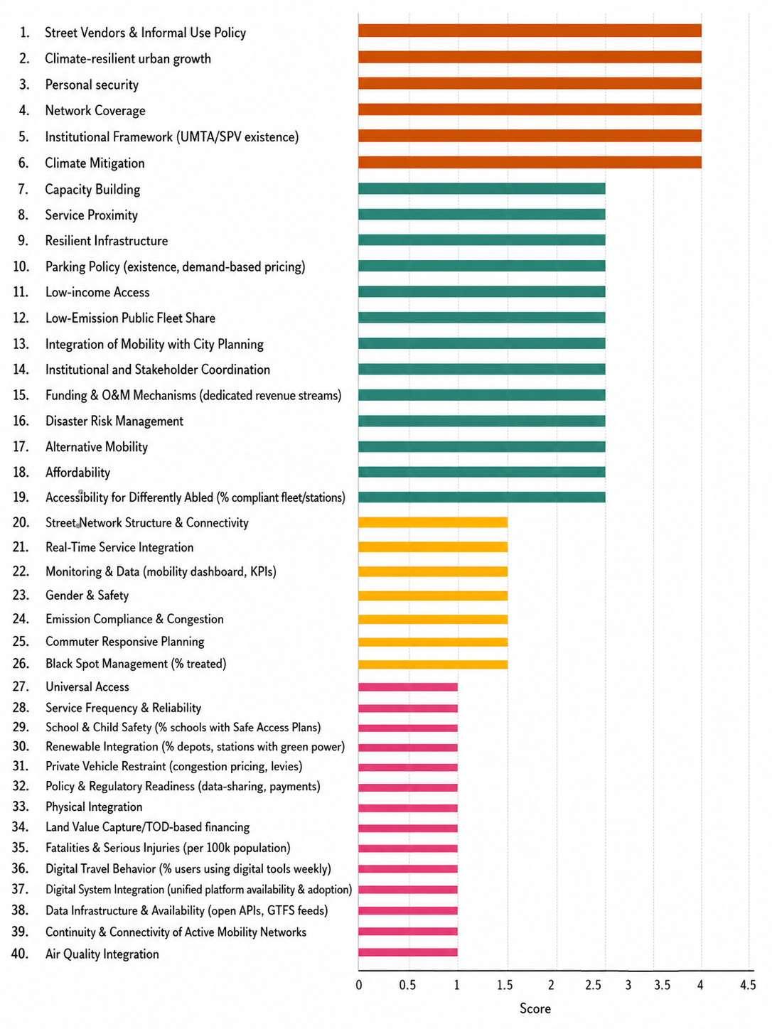
37: Graph showing Pillar wise score in Surat IMP
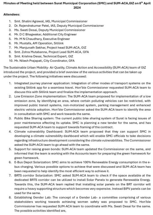
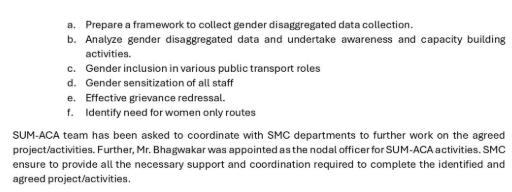
Technical support, funding and site installation monitoring/ commissioning from GIZ and O&M through SMC Budget for 2026/27
Technical support from GIZ (Operational Framework) and Implementation through SMC Budget for 2026/27
Technical support from GIZ (Green Bond Framework) and Implementation through SMC Budget
Technical support from GIZ (Funding for pilot) and Implementation through SMC Budget for city wide scaleup
Technical support from GIZ (Preparation of guideline) and Implementation through SMC Budgets
Technical support from GIZ (Training module) and Future scale up through Sitilink Budgets
Technical support from GIZ (Recommendation note) and Implementation through private operator
12 Route rationalization in city routes and BRT corridors
13 Implementation of Green Mobility Zones at High Footfall Metro Stations
14 Digitize PT network integrated with GTFS and prepare data sharing protocols
15 Full MaaS integration across mobility modes
16 Junction-level pedestrian safety improvement plan
17 Introduce women-led e-auto fleet programme
18 Gender and inclusion audits of streets and PT
19 Inter-departmental mobility coordination cell
20 Operationalise non-farebox revenue opportunities
SMC internal resource and budget
SMC internal resource and budget + PPP (for public realm elements)
SMC Internal resources and budget
SMC internal resources and budget + PPP (technology platform)
SMC internal resources and budget
SMC internal resources and budget
SMC internal resources and budget + technical assistance from development agencies
SMC internal resources and budget
SMC internal resources and budget + Self-sustaining (revenue-based model) + PPP
To operationalise Surat’s Integrated Mobility Plan (IMP) in a structured, outcomedriven manner, the identified priority projects have been strategically aligned with five overarching city-level mobility goals. These goals reflect Surat’s vision of advancing a resilient, inclusive, and future-ready urban mobility system:
• Build a Climate-Resilient, Transit-Oriented and Compact Mobility Network
• Expand Reliable and Integrated Public Transport Connectivity Across the City (Digitisation and Multimodal Integration)
• Create Safe, Walkable and Active Mobility Networks Across the City
• Institutionalise Inclusive, Gender-Responsive and Equitable Mobility Planning
• Mobilise Innovative Financing and Institutional Capacity for Sustainable Mobility
The prioritised projects have been mapped against these strategic goals to ensure a coherent and integrated approach to implementation in Surat. Each project contributes to one or more of these focus areas, enabling the city to simultaneously address infrastructure gaps, service delivery improvements, institutional strengthening, and sustainability objectives. This alignment ensures that individual interventions are not implemented in isolation but collectively contribute toward achieving broader mobility outcomes.
Furthermore, measurable performance indicators and tangible targets have been identified for each project to track progress and evaluate impact over time. This results-oriented framework will support data-driven decision-making, enhance accountability among implementing agencies, and ensure that investments translate into visible improvements in accessibility, safety, efficiency, and environmental performance. Overall, this structured approach provides a clear roadmap for Surat to transition toward a more connected, inclusive, low-carbon, and resilient urban mobility system.
Table 8: Key Projects, aligned Goals achieved and Measurable indicators/Targets
No Project
1 Deployment of 100 kW Solar PV with 224 kWh second-life battery system at Althan Depot 1, 5
2 Establishment of Surat Gender and Inclusion Lab 4
3 Floating Green Bonds of INR 200 crore
4 Pilot with Android ETM to enhance ticketing experience and improve conductor efficiency 2, 5
5 Prepare guidelines for developing Green Mobility Zones 1, 3
6 Conduct Gender Sensitization Trainings 4
7 Revamp PBS system supporting first- and lastmile connectivity 2, 3
8 Climate Risk and Road Safety Risk Dashboard 1, 5
9 Identify job roles to enhance Women’s Participation in Logistics and Transport sector 4, 5
10 Assessment of climate resilience of mobility infrastructure
11 Fully integrated multimodal public transport system with unified operations and fare policy
12 Route rationalization in city routes and BRT corridors 2
13 Implement Green Mobility Zone along high footfall metro stations 1, 3
• 100% operationalization of the plant
• Reduction in operational energy cost for OEM
• Dedicated lab operational
• Identified pilot initiatives
• Mapping of Inclusion metrics integrated into planning
• INR 200 Cr mobilised
• 100% funds allocated to identified sustainable mobility projects
• Annual reporting framework established
• 100% deployment of agreed ETMs
• conductors trained and equipped for operation
• Reduction in revenue leakage
• Guidelines adopted by SMC
• Scale up zones identified
• Integration with city planning regulations
• 100% frontline PT staff trained
• 20–25% increase in women ridership
• Increase in PBS ridership
• Coverage at all major PT hubs
• Improved first/last-mile share
• Integrated dashboard operational
• Climate-risk zones identified
• Action plan prepared to increase women workforce participation
• Defined job roles across sectors
• 100% critical corridors assessed
• Risk-based prioritisation framework prepared
• Single ticketing system operational
• 30% reduction in transfer time
• Increase in PT ridership
• 20–25% increase in ridership
• 10% reduction in wait time
• Improved service coverage
• 5+ station areas redesigned
• Reduction in vehicular congestion
• Increase in walk/NMT share
14 Digitize PT network integrated with GTFS and prepare data sharing protocols 2, 5
15 Full MaaS integration across mobility modes 2, 5
16 Junction-level pedestrian safety improvement plan 3
17 Introduce women-led e-auto fleet programme 4, 1
18 Gender and inclusion audits of streets and PT 4
19 Inter-departmental mobility coordination cell 5
20 Operationalise non-farebox revenue opportunities 5
• 100% PT routes digitised
• Real-time tracking for majority fleet
• Open data integration enabled
• Unified mobility platform operational
• 50% PT users onboarded digitally
• Integrated payments across modes
• 30% reduction in pedestrian accidents
• 100% identified blackspots improved
• 500+ women-led e-autos deployed
• Improved last-mile connectivity coverage
• 100% major corridors audited
• Implementation of audit recommendations
• Cell operational with defined structure
• Monthly inter-departmental reviews
• Improved project implementation timelines
• 15–20% revenue from non-fare sources
• PPP models implemented
• Increased financial sustainability
(2nd
1
2 Service Frequency & Reliability Service performance
Headways >20 min, unreliable, <10 buses per lakh
Headways 10–15 min, ~70% ontime, 20<30 buses per lakh Headways <10 min, >85% on-time, >50 buses per lakh
3 Real-Time Service Integration Integration presence No integration Partial integration - upto half of the conditions are met Full real-time integration
National Clean Air Programme (NCAP), MoEFCC/CPCB (2019) – cpcb.nic.in; ClimateSmart Cities Assessment
Framework 2.0, MoHUA (2020) – smartnet.niua.org
Service Level Benchmarks for Urban Transport—Methodology & Manual, MoUD (2012) –urbanmobilityindia.in; CMP Toolkit, MoUD/MoHUA (2014) – urbanmobilityindia.in
Service Level Benchmarks for Urban Transport—Methodology & Manual, MoUD (2012) –urbanmobilityindia.in; Urban Bus Specifications (UBS-II), MoUD (2013) – iutindia.org
AIS-140 – Intelligent Transport Systems (Vehicle Tracking), MoRTH (2018) – morth. nic.in / bis.gov.in; GIZ –MaaS Readiness Level for India (MRLI) (2021) –transformative-mobility.org
4
5
Service Level Benchmarks for Urban Transport—Methodology & Manual, MoUD (2012) –urbanmobilityindia.in; World Bank – Urban Transport Benchmarking/Handbook (2014-2016) – worldbank.org
World Bank – Toolkit for Enabling Gender Responsive Urban Mobility & Public Spaces (India) (2022) – worldbank.org; ITDP – Women and Transport in Indian Cities (2017) – itdp.org
MoHUA – National TOD Policy (integration around stations) (2017) – mohua.gov.in; UMI – Multimodal Integration (Conference resources) (2016–2018) – urbanmobilityindia.in
Urban Bus Toolkit (World Bank/ PPIAF) (2007/2011) – ppiaf. org / ppp.worldbank.org; CMP Toolkit, MoUD/MoHUA (2014) – mohua.gov.in
ITDP – Complete Streets: Planning & Design Workbook (2016) – itdp.in
Harmonised Guidelines & Standards for Universal Accessibility in India, MoHUA (2021) – mohua.gov.in; World Bank – Toolkit for Enabling Gender Responsive Urban Mobility (2022) – worldbank.org
World Bank – Toolkit for Enabling Gender Responsive Urban Mobility (2022) – worldbank.org
CMP Toolkit, MoUD/MoHUA (coverage to vulnerable areas) (2014) – urbanmobilityindia. in; World Bank – Accessibility & Inclusion (Urban) (2015–2022) – worldbank.org
MoHUA – National TOD Policy (integration around stations) (2017) – mohua.gov.in; UMI – Multimodal Integration (Conference resources) (2016–2018) – urbanmobilityindia.in
Vendors Act, Government of India (2014)
National Policy on Urban Street Vendors (2009) – dcmsme.gov.in
Harmonised Guidelines & Standards for Universal Accessibility in India, MoHUA (2021) – mohua.gov.in; World Bank – Toolkit for Enabling Gender Responsive Urban Mobility (2022) – worldbank.org
FAME II Notification (2019) – dhi.nic.in / meity.gov.in; Charging Infrastructure for EVs – Guidelines & Standards, MoP (2022) – powermin.gov.in
CSCAF 2.0 – ClimateSmart Cities, MoHUA (2020) –smartnet.niua.org; Charging Infrastructure for EVs –Guidelines & Standards, MoP (2022) – powermin.gov.in
National Clean Air Programme (NCAP) (2019) – cpcb.nic. in; WRI – Creating LowEmission Zones in Indian Cities (2021) – wri-india.org
National Clean Air Programme (NCAP) (2019) – cpcb.nic. in; WRI – Creating LowEmission Zones in Indian Cities (2021) – wri-india.org
NDMA Guidelines on Urban Flooding (2010) – ndma. gov.in; CSCAF 2.0, MoHUA (2020) – smartnet.niua.org
ITDP – On-Street Parking Management: An International Toolkit (India) (2016) – itdp. org / itdp.in; GIZ – On-street Parking Management for Small & Medium Towns (2023) –transformative-mobility.org
ITDP – Taming Traffic: Strategies to Reduce Traffic & Pollution (2021) – itdp.org; WRI India – Creating LowEmission Zones in Indian Cities (2021) – wri-india.org
National Urban Transport Policy (NUTP), MoUD/MoHUA (2014) – mohua.gov.in / iutindia. org; Metro Rail Policy, MoHUA (2017) – mohua.gov.in
Value Capture Finance Policy Framework, MoUD (2017) –mohua.gov.in; NUTP, MoUD/ MoHUA (2014) – mohua.gov.in
National TOD Policy, MoHUA (2017) – mohua.gov.in; Value Capture Finance Policy Framework, MoUD (2017) – mohua.gov.in 4 Monitoring & Data (mobility dashboard, KPIs)
Data Maturity Assessment Framework (DMAF) 2.0, MoHUA (2020) – smartnet. niua.org; EU SUMP Guidelines (2019) – eltis.org
institutional/ stakeholder meetings a year Primary assessment 6 Capacity Building Process/ Outcome There is no transport planner in the team
The team has limited transport planner, or the staff has experience of working for more than 3 years The team has transport planner, or the staff has experience of working for more than 5 years Primary assessment
Road Accidents in India, MoRTH (2023) – morth.nic.in; IRC:SP:88 – Manual on Road Safety Audit (2010) – irc.gov.in
2
MoRTH Circular: Protocol for Black Spot Identification/ Rectification (2015/2019) – morth.nic.in; IRC:131 –Guidelines for Identifying and Treating Blackspots (2022) – irc.gov.in 3
WRI India – Safe Access to Schools (SATS) / Safe Access Manual (2016–2021) – wri-india.org; World Bank –Toolkit for Enabling Gender Responsive Urban Mobility (2022) – worldbank.org
National Data Sharing & Accessibility Policy (NDSAP) (2012) – dst.gov.in / data. gov.in; NCMC – NPCI
Specifications/Guidelines (2019–2020) – npci.org.in
– MaaS Readiness Level for India (MRLI) (2021) – transformativemobility.org; NCMC – NPCI
Specifications/Guidelines (2019–2020) – npci.org.in
DMAF 2.0, MoHUA (2020) –smartnet.niua.org; NDSAP (2012) – dst.gov.in
GIZ – MaaS Readiness Level for India (MRLI) (2021) – transformative-mobility. org; ITDP – Transport4All: Analysis of Survey Findings (2023) – itdp.in
Sustainable Urban Mobility - Air quality, Climate Action, Accessibility (SUMACA) is a project jointly implemented by Deutsche Gesellschaft für Internationale Zusammenarbeit (GIZ) GmbH and the Ministry of Housing and Urban Affairs (MoHUA), Government of India, commissioned by the German Federal Ministry for Economic Cooperation and Development (BMZ). The project objective is to enable national, state and municipal institutions to promote climate and environmentally friendly, low emission and socially balanced urban mobility systems. The project is part of the Green Urban Mobility Partnership between Germany and India.
Deutsche Gesellschaft für Internationale Zusammenarbeit (GIZ) GmbH
B-5/2, Safdarjung Enclave
New Delhi -110029, India
T: 011-49495353
E: info@giz.de
W: www.giz.de/India