



Published by the Deutsche Gesellschaft für Internationale Zusammenarbeit (GIZ) GmbH
Registered offices
Bonn and Eschborn, Germany
Sustainable Urban Mobility- Air Quality, Climate Action and Accessibility (SUM-ACA)
B-5/2, Safdarjung Enclave
New Delhi-110029, India
T 011-49495353
https://www.giz.de/en/projects/sustainable-urban-mobility-air-quality-climate-protection-andaccessibility-sut-aca
As at June 2026
Commissioned by Federal Ministry for Economic Cooperation and Development (BMZ), Germany
Political Partner
Ministry of Housing and Urban Affairs (MoHUA), Government of India
Implementation Partners
Meghalaya urban Development Agency (MUDA); Government of Meghalaya
Responsible
Manjunath Sekhar, Project Director, SUM-ACA
Project Coordinator
Rana Anwar Amani, Technical Advisor, SUM-ACA
Project Team

GFA Consulting Group GmbH:
Hendrik Jaschob, Project Backstopper; Zohra Mutabanna, Team Lead; Faraz Ahmad, National Project Coordinator; Shristi Mehra, Jr. Technical Expert
Design and Layout
StudioPOD
Photo and Map Credits
GIZ, GFA
Citation
GIZ (2026). Integrated Mobility Plan for Shillong. SUM-ACA. New Delhi, India.
Disclaimer
Maps in this document are for informational purposes only and do not imply recognition of boundaries or regions. GIZ does not guarantee their accuracy or completeness and accepts no liability arising from their use.
Copyright
All rights reserved.
On behalf of the German Federal Ministry for Economic Cooperation and Development (BMZ)

The preparation of the Integrated Mobility Plan for Shillong has been a collaborative effort, made possible through the guidance, cooperation, and valuable contributions of multiple institutions, departments, stakeholders, and community representatives.
The Deutsche Gesellschaft für Internationale Zusammenarbeit (GIZ) GmbH expresses its sincere appreciation to the Urban Affairs Department, Government of Meghalaya, for its guidance, support, and continued cooperation throughout the preparation of this report. GIZ also gratefully acknowledges the support extended by the Directorate of Urban Affairs, Meghalaya Urban Development Authority, Shillong Municipal Board, and the Urban Mobility Cell for providing necessary data, technical inputs, and institutional coordination.
GIZ further acknowledges the contributions of key departments and agencies, including the Traffic Department, Public Works Department, Department of Tourism, Department of Education, and the Ministry of Housing and Urban Affairs, for their inputs, cooperation, and engagement during the course of the study.
The role of the Zonal Task Committee in facilitating stakeholder consultations and supporting project prioritisation is also duly recognised. GIZ also extends its appreciation to community representatives, including Dorbar Shnongs, as well as academic institutions, civil society organisations, and mobility operators, whose insights and participation have been instrumental in shaping a context-responsive and inclusive mobility framework for Shillong.
The participation of individuals who contributed through surveys, consultations, and stakeholder interactions is also sincerely acknowledged. Their inputs have enriched the understanding of local mobility needs and helped ensure that the plan reflects the aspirations, challenges, and priorities of Shillong’s residents.
This report reflects a shared commitment to advancing a more accessible, inclusive, safe, climate-resilient, and sustainable urban mobility system for Shillong.


Manjunath Sekhar Project Director, SUM-ACA GIZ
Urban mobility plays a critical role in shaping economic efficiency, environmental sustainability, and overall quality of life in cities. Mobility planning in Shillong requires a contextsensitive approach due to its hilly terrain, compact urban form, and strong dependence on walking and intermediate public transport.
The Integrated Mobility Plan (IMP) for Shillong provides a comprehensive and action-oriented roadmap for transforming the city’s transport system. It moves deliberately away from piecemeal interventions, bringing coherence to existing policies, ongoing initiatives, and future proposals alike, all anchored around the goals of inclusion, safety, and climate resilience. The IMP provides a unified roadmap that aligns infrastructure development, mobility services, policy direction, and institutional coordination to support sustainable urban mobility in the city.
Prepared under the Sustainable Urban Mobility – Air Quality, Climate Action and Accessibility (SUM-ACA) project, as part of the Indo-German Green Urban Mobility Partnership, the plan aligns with national priorities on sustainable urban transport and supports broader goals related to climate action, accessibility, and improved public health outcomes.
The preparation of the IMP has followed a structured and evidence-based approach involving mobility assessments, review of existing plans and policies, field observations, identification of system-level gaps, and extensive stakeholder consultations. Engagement with Shillong Municipal Board, Directorate of Urban Affairs, Department of Transport, Government of Meghalaya, Meghalaya Transport Corporation, Traffic Police, and other relevant agencies has ensured that the plan reflects local priorities and institutional requirements. The plan builds upon Shillong’s strengths, including its walkable urban form and extensive intermediate public transport network, while addressing challenges related to congestion, road safety, accessibility, public transport integration, and climate resilience.
The plan follows a clear result-driven approach, translating mobility challenges into prioritised interventions across immediate, short-term, and long-term horizons. As a dynamic planning tool, the IMP supports coordinated implementation and continuous improvement, providing a practical roadmap towards a more liveable, equitable, resilient, and people centred urban mobility future for Shillong.
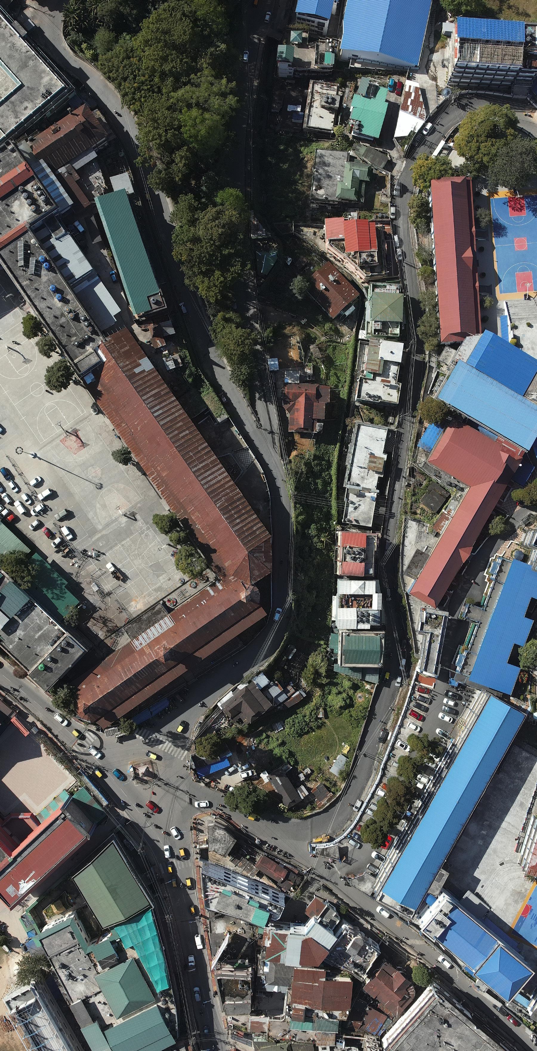
A people centered mobility planning for Shillong that enhances walkability, strengthens public transport, and promotes sustainable, accessible, and safe, movement within its unique hill urban environment
The Integrated Mobility Plan (IMP) for Shillong is envisioned as a strategic and action-oriented framework to guide the city towards a more integrated, inclusive, safe, and climate-resilient urban mobility system. Developed under the Sustainable Urban Mobility – Air Quality, Climate Action and Accessibility (SUM-ACA) project, the IMP provides a unified roadmap to align existing policies, ongoing initiatives, and future mobility investments within a coherent and data-driven planning framework.
Shillong’s mobility context is shaped by its compact urban form, hilly terrain, and highly centralised activity core. While short trip lengths and a strong reliance on walking present inherent advantages, rapid motorisation, limited road capacity, and increasing dependence on private vehicles and intermediate public transport have led to congestion, safety concerns, and declining system efficiency. Fragmented infrastructure, inadequate pedestrian facilities, weak public transport coverage, and unregulated parking further exacerbate these challenges.
To address these issues, the IMP adopts a structured, parameter-based methodology involving review of existing plans, multi-dimensional assessment across nine mobility pillars, identification of critical gaps, and development of prioritised interventions through stakeholder consultations. This approach enables Shillong to transition from isolated, project-based interventions to a coordinated mobility ecosystem supported by measurable outcomes and continuous monitoring.
The assessment highlights key gaps in public transport systems, active mobility infrastructure, equity and accessibility, climate-responsive mobility, and digital integration. In response, the IMP defines five priority goals: strengthening public and shared transport systems; enhancing walking and cycling networks; improving accessibility for vulnerable groups; establishing robust governance and financing mechanisms; and enabling digital integration for efficient mobility management.
A set of priority projects has been identified across immediate, short-term, and long-term horizons, combining infrastructure improvements, policy reforms, institutional strengthening, and digital solutions. These interventions focus on scaling pilot initiatives, improving street design and safety, expanding public transport services, integrating informal modes, and building data-driven governance systems.
Overall, the IMP serves as a comprehensive and adaptable framework that integrates planning, implementation, and monitoring. It positions Shillong to address its current mobility challenges while advancing towards a people-centric, low-carbon, and efficient urban transport system aligned with national priorities and global best practices.
Safe Neighbourhood Plan
Public Transport Action Plan_Roadmap to 2054
Safe Routes to School (SRTS) Programme
Pedestrian Wayfinding System for Shillong
Public Transport – Ticketing App and Journey Planner
Paid Parking App - Pilot
Impact assessment study for reimagining streets.
50%
23,000
18.6%
GOVT OFFICIALS
65 CHILDREN to benefit from improved accessibility to schools
50+
GOVT OFFICIALS
7300+
ECS PARKING LAKH in pedestrian–vehicular conflict points at major junctions engaged in planning processes trained on sustainable mobility trained on sustainable mobility managed digitally per day in revenue generated through the parking and ETM ticketing pilots.
70
850 REDUCTION NEWS JOB CREATED CITIZENS
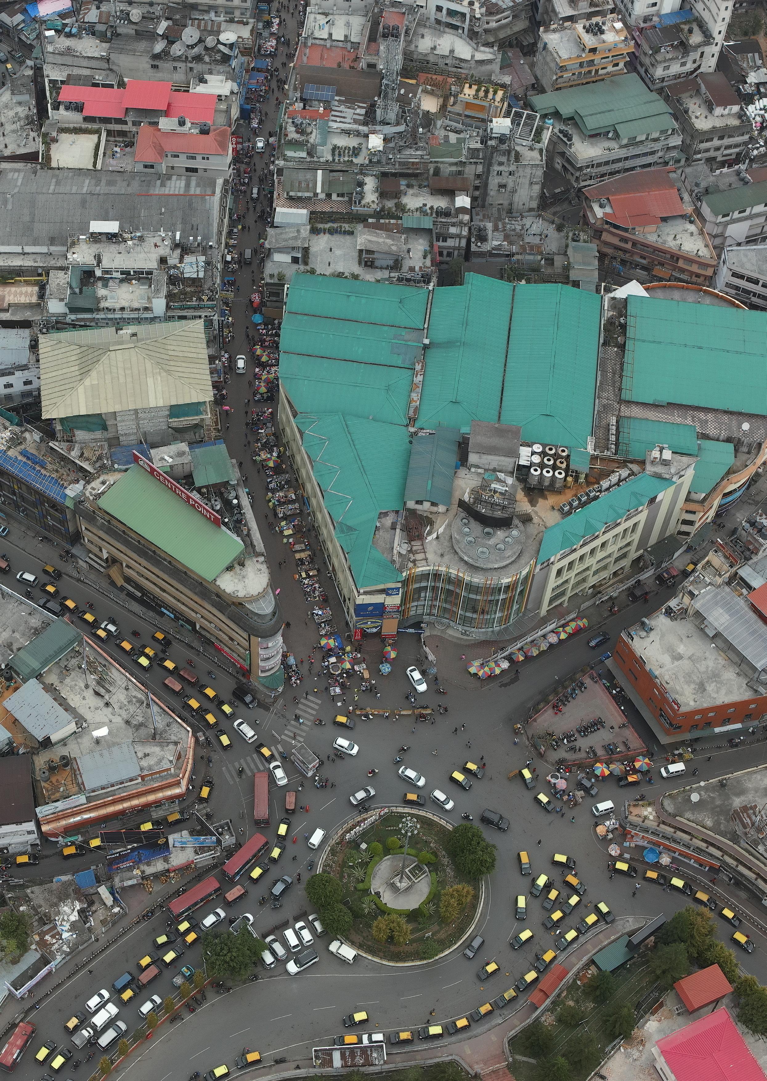
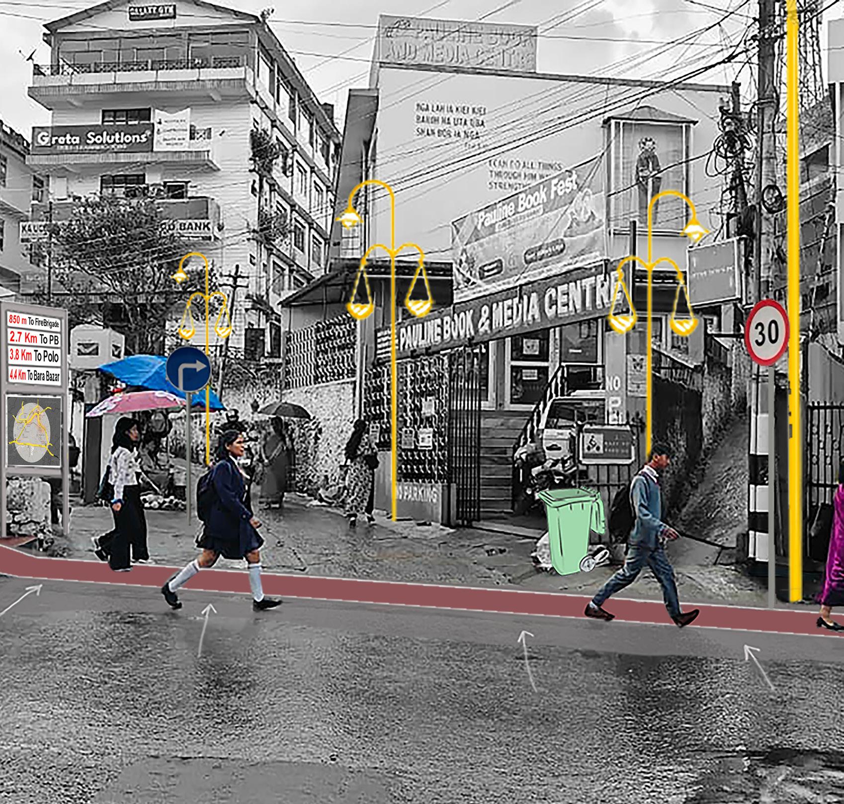
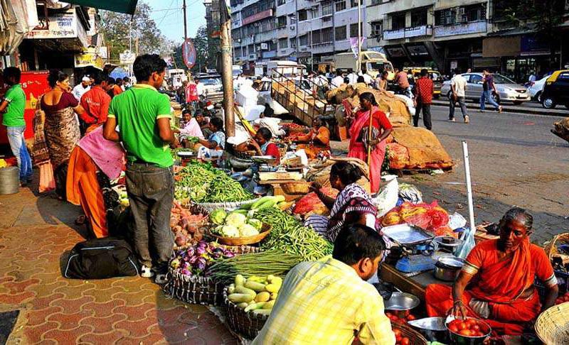
Fig. 1. Image showing streets of Shillong 21
Fig. 2. SUM-ACA Objectives and Outcomes 22
Fig. 3. Figure 2: Vision of IMP Shillong 25
Fig. 4. Objectives of IMP Shillong 26
Fig. 5. Map showing regional context of Shillong 28
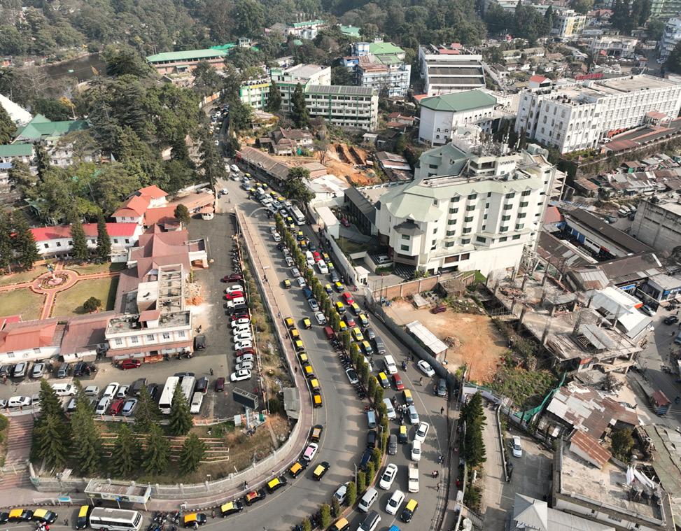
Fig. 6. Image showing one of the busiest streets, Soso Tham Road in Shillong 29
Fig. 7. Map showing the Municipal wards along 30
Fig. 8. : Snapshot of the challenges as highlighted in Shillong
Comprehensive Mobility Plan, 2024 33
Fig. 9. Stakeholder mapping for Shillong for the immediate projects proposed 37
Fig. 10. Methodology followed for Shillong IMP 38
Fig. 11. : Key urban and mobility issues 41
Fig. 12. : Initiatives by the Government of Meghalaya to enhance the liveability of the city 43
Fig. 13. Nine Pillars of the IMP Assessment framework 44
Fig. 14. Overall score of 9 pillars of IMP Framework 60
Fig. 15. Fitness icon Milind Soman joined Meghalaya Chief Minister Conrad K. Sangma to launch Shillong’s Public Bicycle Sharing (PBS) system, branded as “Ride Shillong” 66
Fig. 16. Summary of the stakeholder consultation essential for project prioritisation 70
Fig. 17. Junction Improvement design at Don Bosco Square 75
Fig. 18. Proposed Street section near Don Bosco Point at Laithumkhrah Main Road 75
Fig. 19. Scenario based modelling for PT Action Plan 76
Fig. 20. Concept of the Logo that was selected for the Wayfinding program 77
Fig. 21. North-Eastern Hill University (NEHU) students involved in the survey activities and walkability workshop for the Wayfinding program 77
Fig. 22. PBS launched by the Government of Meghalaya 78
Fig. 23. School painting the streets under the ‘Reimagining Streets’ initiative 79
Fig. 24. The upgraded IGP Junction features improved channelisation of vehicular and pedestrian movement 79
Fig. 25. Parking Pilot in Mission Compound, Shillong 80
Fig. 26. Safe Routes to School Workshop with St Mary’s School 82
Fig. 27. Traffic Police demonstrating signages to the students 82
Fig. 28. Snapshot of the Bus ticketing app being developed by the Urban Affairs Department 83
Fig. 29. Comparison of Before and After score of the 9 Pillars 90
Abbreviation Definition
ABMZs Area Based Mobility Zones
API Application Programming Interface
BBIN Bangladesh-Bhutan-India-Nepal
BS-VI Bharat Stage 6
CCTV Closed Circuit Television
CMP Comprehensive Mobility Plan
DUA Directorate of Urban Affairs
DPR Detailed Project Report
ETM Electronic Ticketing Machine
EV Electric Vehicle
FAME Faster Adoption and Manufacturing of (Hybrid &) Electric Vehicles
FSI Floor Space Index
GCC Gross Cost Contract
GHG Greenhouse Gasses
GIS Geographic Information System
GIZ Deutsche Gesellschaft für Internationale Zusammenarbeit (German Society for International Cooperation)
GoM Government of Meghalaya
GTFS General Transit Feed Specification
GUMP Green Urban Mobility Partnership
IMP Integrated Mobility Plan
IPT Intermediate Public Transport
KPI Key Performance Indicator
LEZs Low emission Zones
LoS Level of Service
LCV Light Commercial Vehicle
MaaS Mobility as a Service
MTS
Meghalaya Transport System
MoHUA Ministry of Housing and Urban Affairs
MUDA Meghalaya Urban Development Authority
NCAP
NCC
NDC
NEHU
NHAI
NIP
National Clean Air Programme
Net Cost Contract
National Determined Contribution
North-Eastern Hill University
National Highway Authority of India
Neighbourhood Improvement Plan
NMT
Non-Motorised Transport
NUDM the National Urban Digital Mission
NUTP
O&M
PM E-Drive
PPP
PT
PWD
National Urban Transport Policy
Operation and Maintenance
PM Electric Drive Revolution in Innovative Vehicle Enhancement
Public Private Partnership
Public Transport
Public Works Department
RFP Request for Proposal
RTPI
SASCI
SBM
SDG
Real Time Passenger Information
Special Assistance to States for Capital Investment
Shillong Municipal Board
Sustainable Development Goal
SRS Safe Routes to School
SUM-ACA
TCO
TOT
TU
UAD
Sustainable Urban Mobility – Air Quality, Climate Action and Accessibility
Total Cost of Ownership
Transit Oriented Transportation
Tactical Urbanism
Urban Affairs Department
UMC Urban Mobility Cell
UMTA
Unified Metropolitan Transport Authorities
Shillong’s urban mobility system is under increasing pressure from rapid motorisation, limited road capacity, complex terrain, and a growing mismatch between travel demand and available transport options. While multiple plans, policies, and pilot initiatives have sought to address these challenges, the absence of a unifying framework has often resulted in fragmented implementation and missed opportunities for integration. An Integrated Mobility Plan (IMP) is therefore critical for Shillong to align projects, policies, and institutions under a shared mobility vision that is responsive to the city’s unique context.
This strategy document has been developed under the Sustainable Urban Mobility – Air Quality, Climate Action and Accessibility (SUM-ACA) project, being implemented jointly by the Ministry of Housing and Urban Affairs (MoHUA) and GIZ India under the Indo-German Green Urban Mobility Partnership (GUMP). Through SUMACA, MoHUA in collaboration with GIZ, supports selected Indian cities in advancing inclusive, low-carbon, and people-centric mobility systems. In this context, the IMP for Shillong translates national policy priorities and international cooperation into a locally grounded roadmap, reflecting the city’s terrain, growth patterns, institutional capacities, and socio-economic realities.
This strategy document has been developed under the Sustainable Urban Mobility – Air Quality, Climate Action and Accessibility (SUM-ACA) project, implemented as part of the Indo-German Green Urban Mobility Partnership (GUMP). Through SUM-ACA, GIZ, in partnership with the Ministry of Housing
and Urban Affairs (MoHUA), supports Indian cities in advancing mobility systems that are inclusive, climate-responsive, accessible, and people-centred. The Integrated Mobility Plan (IMP) for Shillong translates these broader national priorities and international cooperation objectives into a locally relevant and actionable framework. Grounded in a comprehensive assessment of the city’s mobility challenges and opportunities, the plan responds to Shillong’s unique topography, urban growth dynamics, travel patterns, institutional context, and socio-economic characteristics. It provides a strategic roadmap to guide future mobility investments and policy interventions, while promoting sustainable, equitable, and resilient urban development.
A defining feature of the Shillong IMP is its parameter-based and outcomeoriented framework, which enables a systematic assessment of the city’s mobility ecosystem and helps identify critical gaps across infrastructure, services, planning, and governance. Based on this assessment, the IMP proposes a set of coordinated interventions categorised into immediate actions, short-term priorities, and longer-term strategic measures. These interventions span public transport, active mobility, road safety, accessibility, clean mobility, and institutional strengthening, and are designed to work in complementarity. Collectively, they aim to support Shillong’s transition towards a safer, more accessible, and environmentally sustainable urban mobility system - one that is datadriven, aligned with existing plans, and adaptable to future needs.
Initiated under the framework of IndoGerman Development Cooperation, the Sustainable Urban Mobility – Air Quality, Climate Action and Accessibility (SUMACA) project, aligns with India’s National Determined Contributions (NDCs) under the Paris Agreement and the 2030 Agenda for Sustainable Development, and particularly aims at the SDGs of Sustainable Cities and Communities, and Climate Action. SUM-ACA employs a multi-actor, multi-pronged strategy, working with local governments to develop contextually relevant, socially equitable, climate-friendly, and innovative solutions. This collaborative approach emphasizes capacity
development, knowledge sharing, and the formalization of best practices once technical cooperation concludes. Furthermore, SUM-ACA seeks to strengthen linkages between environmental quality and climate change concerns by establishing clear connections between existing transport and environmental policies, institutional and individual capacities, data collection methodologies, and potential health outcomes. The performance of the SUMACA project is evaluated against five module indicators and respective output indicators as listed below:
M1 | SUM Strategies
M2 | Data
M3 | National Guidelines
M4 | Capacity Development
M5 | Air Quality and CO2
Support cities and states in creating sustainable, low carbon urban mobility strategies
Improve use of integrated climate, air quality, and mobility data for evidence-based planning
Develop national guidelines for integrated, climate-resilient urban mobility planning
Train decision-makers and professionals in sustainable and inclusive mobility practices
Reduce transport emissions and improve urban air quality through sustainable mobility measures
Output 1: The Indo-German Green Urban Mobility Partnership (GUMP) is supported
Position GUMP as a global platform for advancing green urban mobility
Develop three city/state-level sustainable mobility strategies
Output 2: Evidence-based data on climate action, air pollution control and access to urban mobility has been improved
Create a national framework for collecting air quality and mobility behaviour data
Establish 15 digital tools for integrated mobility planning and data management
Output 3: Processes for the implementation of integrated mobility plans are demonstrated
Prepare 8 integrated mobility plans through stakeholder-led planning processes
Pilot interdepartmental coordination models in 5 selected cities
Output 4: The institutional and personal capacities of national, state, and local actors for the realisation of integrated mobility, including green recovery, are strengthened
Train 30 professionals through climate and mobility-focused capacity-building programs
Equip 3,000 professionals with practical sustainable mobility implementation skills
Fig. 2. SUM-ACA Objectives and Outcomes
The duration of the SUM-ACA project is for four years (2022-2026). The project is being implemented across five Indian states and respective cities namely, Kerala (Cities: Kochi & Trivandrum), Karnataka (Cities: Hubli-Dharwad & Mysore), Orissa (Bhubaneswar & Rourkela), Gujarat (Surat & Rajkot) and Meghalaya (Shillong).
The implementation of Output Indicator 3 “Processes for the implementation of integrated mobility plans”, aim to strengthen the competence of urban actors for the planning and implementation of integrated mobility
plans (IMPs). The primary pillar of the output indicator is to enhance the capacity of urban stakeholders to effectively plan and implement integrated mobility plans (IMPs). The project aims to support intersectoral transport planning which emphasizes on the inclusion of vulnerable groups such as women and people with disabilities Intended outcomes serve the purpose of restoring the attractiveness of public transport and increase accessibility through intermodality.
India’s national transport policies and flagship programmes consistently call for integrated, people-centred, and climate-aligned mobility planning, recognising that fragmented, projectby-project interventions are insufficient to address complex urban mobility challenges. For cities like Shillong, characterised by limited road space, hilly terrain, growing motorisation, and high dependence on informal and intermediate modes, the need for an Integrated Mobility Plan is even more critical.
While existing plans such as the Comprehensive Mobility Plan (CMP) provide important technical inputs, cities increasingly require a strategic framework that goes beyond diagnostics to align investments, institutional roles, and implementation timelines across sectors. An IMP fulfils this role by connecting national policy
intent with city-level action, ensuring that public transport, walking and cycling, road safety, clean mobility, and land-use considerations are planned in an integrated and coordinated manner. The preparation of the Shillong IMP is therefore firmly anchored in India’s national urban transport and electric mobility ecosystem. Policies such as the National Urban Transport Policy (NUTP) and guidance tools like the CMP Toolkit establish the philosophical and technical foundations for integrated planning, while programmes such as FAME, PM e-Bus Sewa, and national EV infrastructure initiatives actively shape investment priorities. Together, these frameworks signal a clear expectation for cities to adopt comprehensive mobility planning approaches, within which the IMP for Shillong draws its principles, methodologies, and implementation logic.
Policy / Programme Key Objectives
National Urban Transport Policy (NUTP)
Comprehensive Mobility Plan (CMP) Toolkit / Guidelines
• Promote people-centred mobility
• Prioritise public transport, walking, and cycling
• Integrate land use and transport planning
• Encourage clean and sustainable mobility
• Strengthen urban transport institutions
Establishes the core philosophy of IMPs, encouraging cities to move away from vehicle-centric projects towards integrated, multimodal solutions that embed public transport, NMT, safety, and demand management at all planning stages.
FAME I & II (Faster Adoption and Manufacturing of Electric Vehicles)
PM e-Bus Sewa Scheme
• Standard methodology for mobility planning
• Data collection, modelling, LOS benchmarks
• Scenario analysis and mode shift focus
• Framework for short-, medium-, and long-term projects
Serves as the technical backbone for IMPs, defining processes, datasets, modelling tools, and prioritisation frameworks, ensuring evidence-based and uniform decision-making across cities.
PM E-Drive / National EV Infrastructure Programmes
National Climate and Air Quality Commitments (NCAP, India’s NDCs)
• Promote EV adoption, especially in public and shared transport
• Demand-side incentives Support charging infrastructure
• Reduce emissions and energy consumption
• Deploy 10,000+ electric buses through PPP models
• Central support for operations and depots
• Charging and power infrastructure support
• Scale up public charging networks
• Enable widespread EV adoption
• Encourage private-sector participation
• Incentives for e-2W and e-3W adoption
Encourages IMPs to integrate EV transition strategies, including fleet conversion, charging infrastructure planning, depot readiness, and total cost of ownership (TCO)-based evaluation of e-mobility investments.
Shapes IMPs to address modern e-bus deployment requirements, such as route rationalisation, depot electrification, accessibility standards, operational contracting models, and long-term cost optimisation.
Reinforces the need for IMPs to plan charging corridors, public charging locations, grid augmentation, energy demand projections, and public–private participation models, making electrification a structured part of urban mobility planning.
• Reduce air pollution and GHG emissions
• Promote low-carbon urban development
Strengthens the role of IMPs as implementation tools for climate and air quality goals, particularly through mode shift, clean mobility adoption, and demand management strategies.
The Integrated Mobility Plan (IMP) for Shillong presents a shared vision for a mobility system that is peoplecentric, inclusive, climate-responsive, and sustainable. It provides a strategic framework to guide the development of safe, accessible, efficient, and integrated transport systems that are tailored to Shillong’s unique urban context, characterised by its hilly terrain, compact urban form, walkable neighbourhoods, and evolving mobility needs.
Recognising that mobility challenges are interconnected and cannot be effectively addressed through isolated interventions, the IMP adopts a holistic and integrated approach to transport planning. It establishes a common
direction for policy-making, infrastructure development, service improvements, and institutional coordination, enabling stakeholders to work towards a shared set of outcomes.
The plan articulates a set of guiding principles and strategic objectives that will inform future mobility investments and interventions. These principles seek to ensure that transport systems not only improve the movement of people and goods but also contribute to broader city goals, including sustainable urban development, climate resilience, road safety, public health, social inclusion, economic vitality, and an enhanced quality of life for all residents and visitors.
Shillong IMP acts as an unified, people centric, and climate-responsive mobility framework
Translate National Mobility Policies into City Action Integrated Projects, phasing & Institutions
Converting national urban transport policies into a clear, Shillongspecific mobility roadmap that guides projects, investment, and reforms.
Aligning ongoing initiatives, future investments, and institutional roles into one coordinated, citywide mobility framework
Supporting a shift towards public transport, walking and cycling, improved road saftey, and climate-resilient urban mobility for all.
Fig. 3. Figure 2: Vision of IMP Shillong


Establish an integrated mobility vision aligned with urban development, climate action, and public health goals.
Prioritise people-centric mobility, with walking, cycling, and public transport as the backbone of the city’s transport system.
Scale neighbourhood and corridor-level pilots into replicable citywide mobility solutions.
Improve road safety and street design standards through safe street design, traffic calming, and junction improvement.
Enable a structured transition to clean and low-carbon mobility, including electric public transport and shared mobility.
Strengthen public transport service quality, accessibility, and multimodal integration.
Promote data-driven mobility planning and performance-based decision-making.
Establish an integrated mobility vision aligned with urban development, climate action, and public health goals.
Together, these objectives provide the foundation for a practical and outcomeoriented mobility roadmap for Shillong. They guide the identification and prioritisation of interventions, support coordinated and phased implementation, and help ensure that future investments deliver tangible benefits for citizens while advancing the city’s vision of a safer, more accessible, inclusive, low-emission, and resilient urban mobility system.
Fig. 4. Objectives of IMP Shillong
Located in India’s North-Eastern Region, Meghalaya occupies a strategic position between Assam to the north and northeast and Bangladesh to the south and southwest, with wider linkages to Bhutan and Nepal through the BBIN corridor. With a population of approximately 3 million, the State functions as an important gateway for cross-border trade, cultural exchange, and regional movement within the eastern subcontinent. At the heart of Meghalaya lies Shillong, the State capital and its principal urban centre. Popularly referred to as the “Scotland of the East”, Shillong is situated in the East Khasi Hills district at an altitude of about 1,496 metres above sea level on the Shillong Plateau. Established in 1864 under British administration, the city was initially developed as a cantonment and administrative headquarters for the United Khasi and Jaintia Hills. Shillong later became the provincial capital of Assam in 1874, and following the formation of Meghalaya in 1972, it assumed its present role as the State capital. Over time, the city evolved into a regional centre for governance, education, tourism, sports, and culture, blending historic character with growing urban aspirations.
Shillong’s urban form is deeply influenced by its geography and climate. High rainfall, steep slopes, narrow valleys, and ridgelines have shaped a city of compact neighbourhoods, organic street patterns, and limited road hierarchies. Movement has historically followed terrain rather than rigid grids, resulting in neighbourhoods that are walkable, closely knit, and dependent on a few primary corridors. This has produced an urban structure where daily life unfolds at a human scale, with short distances between homes, schools, markets, parks, and places of worship.
The city’s settlement pattern reflects multiple layers of history. Indigenous Khasi communities organised their habitations around shared open spaces, social institutions, and pedestrian paths. British-era planning introduced institutional precincts, cantonment layouts, and arterial connections. Postindependence growth added organic commercial streets and residential expansions. Together, these layers have created a hybrid urban fabric - traditional yet evolving, pedestrianoriented yet under increasing motorised pressure.
Legend
Municipal Boundary
National Highway
Major Distric Road
Primary Roads
Military Area
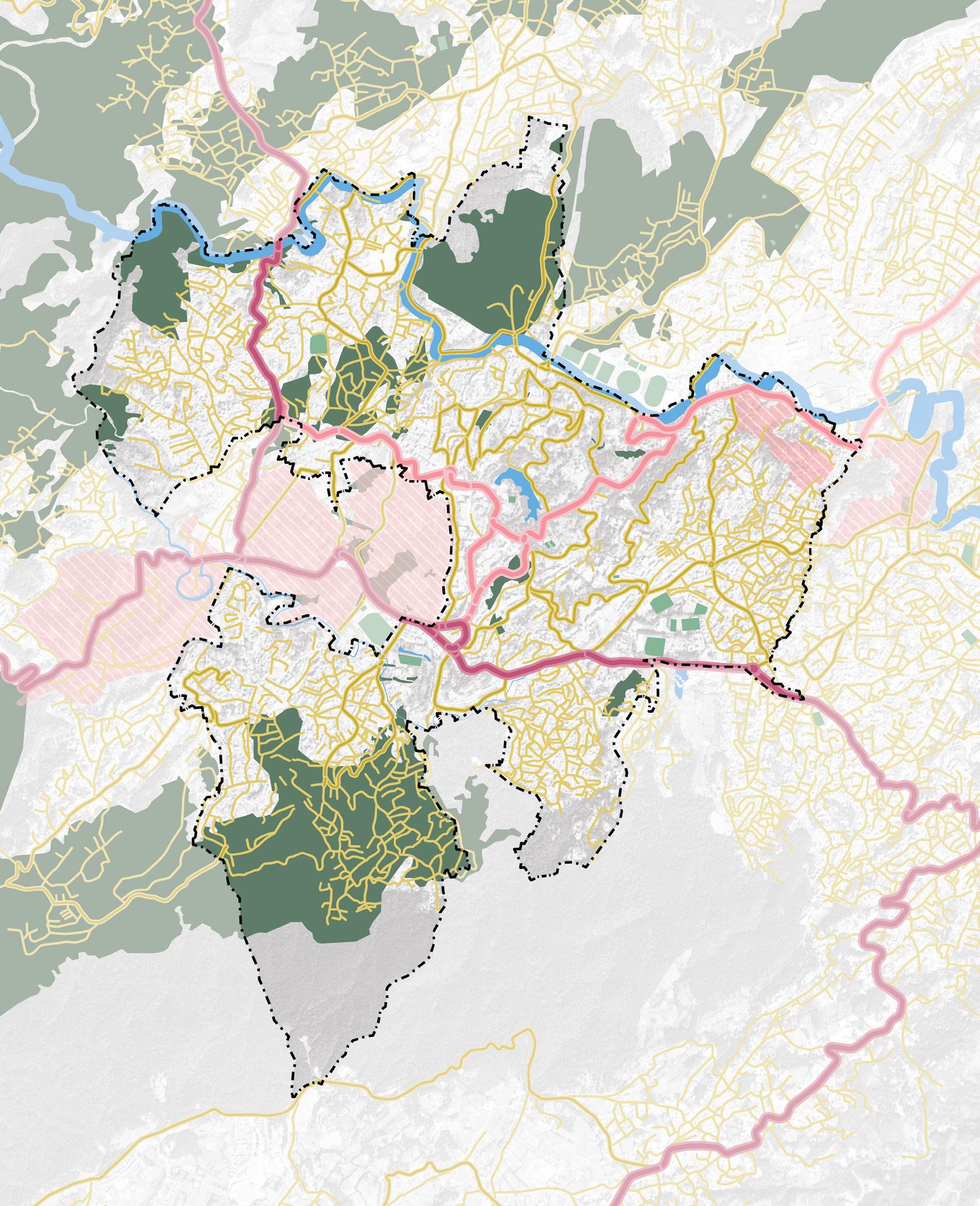
Shillong’s regional connectivity reinforces its importance within the Northeast. The city is connected to Guwahati (103 km) via NH-6 and NH40, linking it to Assam and mainland India. NH-44 extends connectivity toward Tripura and Mizoram, while other corridors support movement toward Nagaland and Manipur. Within Meghalaya, Shillong connects east–west through routes to Tura, Nongstoin, Nongpoh, Jowai, Khliehriat, and Mawkyrwat, enabling administrative
and economic exchange across districts. Multi-modal links further enhance accessibility - Umroi Airport (30 km) provides direct air connectivity to cities such as Kolkata, Dibrugarh, and Agartala, while Guwahati International Airport (123 km) serves as the main national and international gateway. Helicopter services connect Shillong with Guwahati and Tura, and rail access is provided through Guwahati Railway Station (100 km).
Area under Municipal Board Shillong Municipal Board: 10.1 Sq.Km(27 wards)
Total Population (Census 2011) 1,43,229
Total Projected Population (2021) 1,57,552
Sex Ratio (Census 2011) 1,045 females per 1,000 males
Literacy Rate (Census 2011) 87.8%
Workforce participation rate 42.79% (Census 2011)
Population density 1559 person/ Sq.KM (Projected 2021)
Major economic activities Government services, education, tourism, trade, small-scale manufacturing
Municipal Board Area 10 Sq Km
Table. 1. : Details of Shillong city
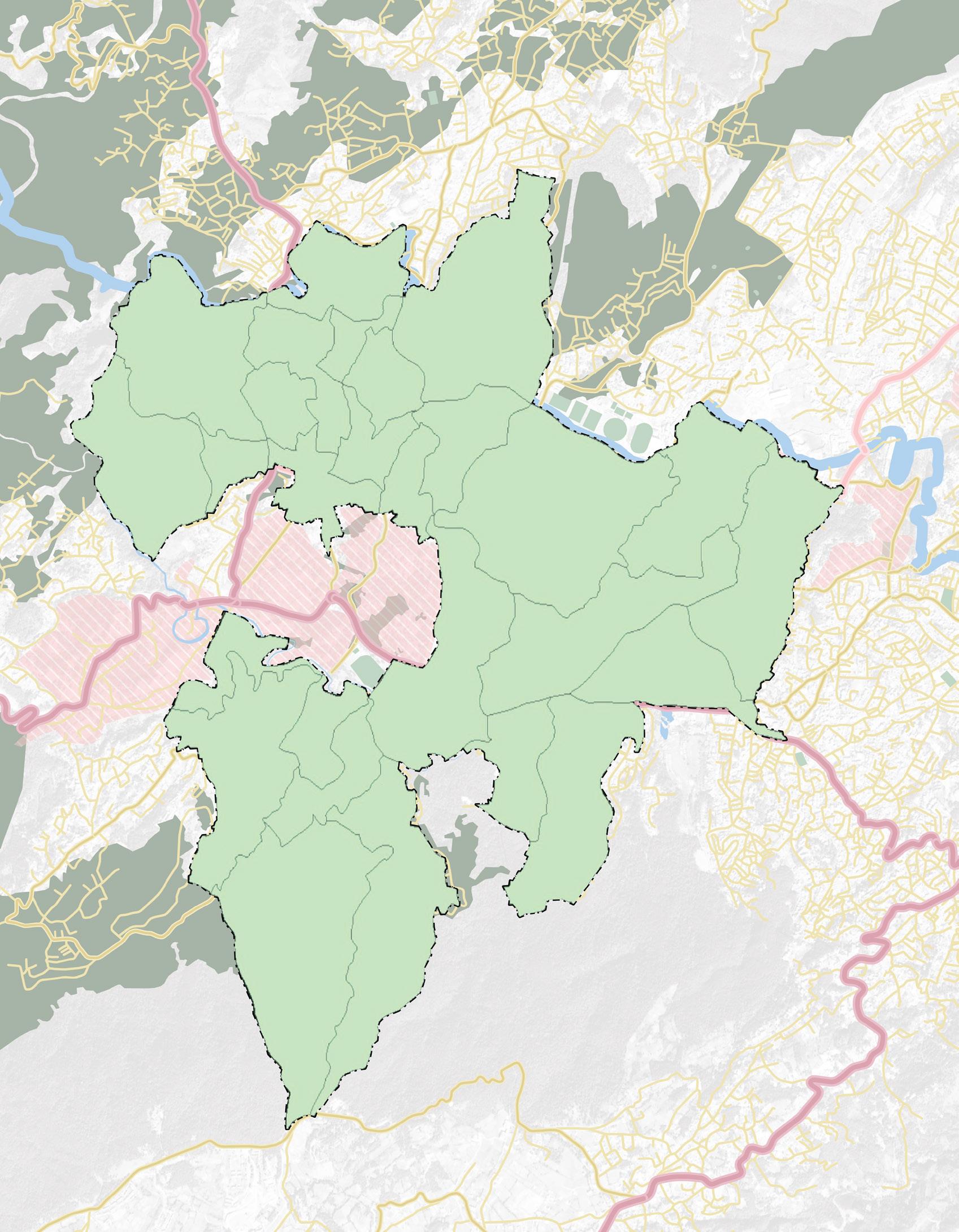
1. Laitumkhrah Ward No. 1
2. Laitumkhrah Ward No. 2
3. Laitumkhrah Ward No. 3
4. Laitumkhrah Ward No. 4
5. Malki Ward No. 5
6. Malki Ward No. 6
7. European Ward No. 7
8. European Ward No. 8
9. Police Bazar Ward No. 9
10. Jail Road Ward No. 10
11. Jail Road Ward No. 11
12. Mawkhar Ward No. 12
13. Mawkhar Ward No. 13
14. Jaiaw Ward No. 14
15. Jaiaw Ward No. 15
16. Jaiaw Ward No. 16
17. S.E. Mawkhar Ward No. 17
18. S.E. Mawkhar Ward No. 18
Fig. 7. Map showing the Municipal wards along
Municipal Boundary
National Highway
Major Distric Road
Primary Roads
Military Area
19. Mawprem Ward No. 19
20. Mawprem Ward No. 20
21. Mawprem Ward No. 21
22. Kench’s Trace Ward No. 22
23. Kench’s Trace Ward No. 23
24. Laban Ward No. 24
25. Laban Ward No. 25
26. Lumparing Ward No. 26
27. Lumparing Ward No. 27
The Comprehensive Mobility Plan for Greater Shillong Planning Area (CMP, 2025) provides the primary evidence base for this IMP. The CMP proposed 24 new bus routes in addition to 12 existing SPTS routes, footpath development across 508 km of road network in three phases, and a multi-nodal development strategy connecting centres at New Shillong Township, Mawkhanu, Laitkor, and Umroi. Its Sustainable Urban Transport scenario targets a PT mode share of 27.6% and a 42% reduction in PM2.5 by 2054.
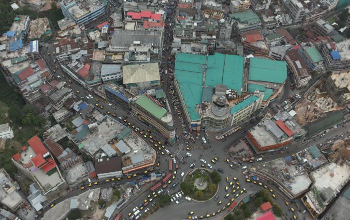
Shillong’s formal administrative boundary, the Shillong Municipal Board (SMB), covering 10.1 sq km across 27 wards, represents only a fraction of its functional urban footprint. The Greater Shillong Planning Area (GSPA), which
forms the basis for mobility planning, covers 288.5 sq km across parts of East Khasi Hills and Ri Bhoi districts. It comprises the Municipal Board (9.44 sq km), the Cantonment Board (1.9 sq km), ten census towns (58.3 sq km), and 54 surrounding villages (218.1 sq km). Based on CMP 2025 projections, the GSPA population in 2024 stands at 5,17,342, of whom approximately 1,49,437 reside within the municipal boundary, 2,33,811 in the census towns, and 1,22,355 in the villages. While institutional responsibilities are anchored in the SMB, the majority of residents generating daily trips live outside municipal limits. Planning for mobility in Shillong therefore requires a planningarea perspective rather than a purely municipal one.
Shillong’s mobility challenges stem from its highly centralised urban core and hilly topography. Commercial, institutional, and service activities are concentrated within a constrained geographic area, while steep slopes and narrow road networks limit opportunities for road expansion and efficient public transport operations, resulting in persistent congestion and pressure on key corridors.
Formal public transport in the Greater Shillong Planning Area (GSPA) remains limited, covering less than 20% of the road network and accounting for only 7% of daily passenger trips. In contrast, private vehicles and intermediate public transport (IPT) together comprise 94% of all motorised travel.
The Shillong Public Transport Service (SPTS) currently operates four notified routes, with about 30 buses, having an average ridership of 250 passengers per bus per day, the system caters approximately 7,500–8,000 daily passengers, well below the estimated demand of 47,009 passenger trips projected across the proposed 11-route network.
Similarly, the SSPTS maxi cab service operates at a limited scale, with only about 20 of its 99 vehicles in service at any given time. Operating three days a week within the municipal core and offering no Sunday services, it provides only partial coverage of local mobility needs. Together, SPTS and SSPTS serve a catchment of approximately 43.85 sq km just 33% of GSPA’s builtup area, leaving large parts of the urban area without formal public transport access.
This shortfall is not only a service delivery challenge but also a question of spatial equity. In the absence of adequate formal transport, residents rely heavily on IPT services. An estimated 5,200 taxi permits have been issued across GSPA, serving roughly 32,000 daily commuters. While IPT offers a relatively affordable alternative to private vehicle ownership, services are characterised by the absence of fixed schedules, limited off-peak availability, inadequate accessibility, and inconsistent safety standards. One-third of users report waiting more than 30 minutes during non-peak periods.
• Movement is core-driven, with most trips converging toward Police Bazar, IGP, Bara Bazar, Dhanketi and adjoining inner-city corridors
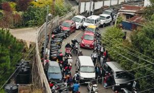
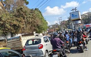
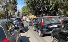
• Street space is highly contested, shared simultaneously by moving vehicles, parked cars, pedestrians, vendors, and public transport stops
• Private vehicles and IPT dominate daily travel, while public transport plays a limited role
• On-street parking demand exceeds supply, especially in the inner wards, reducing effective carriageway width
• Pedestrian infrastructure remains fragmented, with discontinuous, narrow, or degraded footpaths
• Safety perception is declining, particularly for vulnerable users such as children, elderly pedestrians, and caregivers
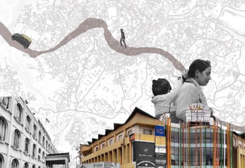
Indicator Key Data
Municipal Wards 27 wards
Implication for the City
Dense core wards attract citywide movement
Municipal Population ~1.45 lakh 1,57,552
(Projected 2024)
Major Activity Concentration
High daily trip generation within limited road space
Police Bazar, Bara Bazar, IGP, Polo, Dhanketi
Peak-Hour Average Journey Speed 17 kmph
Peak-Hour Running Speed 23 kmph
Peak Traffic Periods 8:30–11:30 hrs; 16:00–20:00 hrs
Public Transport Passenger Share 7%
Private + IPT Passenger Share 94%
Vehicular Share by Mode 99% private & IPT
Parking Trend Cars > Two-wheelers
High Parking Utilisation Areas
Barik Point, Lady Hydari Rd, Anjalee Cinema Rd
Roads with Footpaths 9%
Typical Footpath Width < 1.8 m
NMT Users Walking to Work 51%
Average Trip Length 2.5 km
Avg. Education Trip Length 3.1 km
Average Travel Time 30 minutes
User Satisfaction with Road Conditions 18% satisfied
Population Making Regular Trips 93%
1,045 females per 1,000 males
Strong dependency on core city areas
Indicates heavy congestion and delays
Delay largely due to stoppages and conflicts
Overlap with school and work trips
Low reliance on formal public transport
High pressure on neighbourhood streets
Limited road capacity for mixed traffic
Increasing car ownership
On-street parking demand exceeds supply
Severe gap in pedestrian infrastructure
Not suitable for safe walking
Assured daily pedestrian demand
Favourable for walking and NMT
High student walking exposure
Delays within short distances
Indicates urgent improvement need
High daily mobility intensity
Table. 2. Facts and figures on the challenges of Shillong Urban and Mobility challenges
Despite these pressures, Shillong remains a walking-oriented city. Short trip distances, strong education-based travel, and a compact settlement pattern encourage walking as a primary mode. However, the growing mismatch between how people move and how streets are designed has led to increased pedestrian–vehicular conflict, unsafe crossings, and discomfort, especially during school and office peak hours. Between 2015 and 2021, Meghalaya recorded 1,893 road accidents resulting in 1,349 deaths — a fatality rate of 71 per 100 accidents. Even as crash frequency declined, severity worsened, pointing to faster speeds, heavier vehicles, and limited emergency response in hilly terrain. In Meghalaya, a road accident is more likely to kill than to injure.
TOTAL ACCIDENTS (2015-21)
1,893 7 Years Of Complete Data
TOTAL FATALITIES
1,349 Deaths recorded
AVERAGE FATALITY RATE
71% deaths per 100 accidents
TOTAL INJURED
2,096 persons injured
Effective implementation of the Integrated Mobility Plan for Shillong will depend on coordinated action across a broad and well-aligned stakeholder ecosystem. Given the city’s complex terrain, compact urban structure, community-led governance traditions, and growing mobility pressures, institutional coordination and inclusive participation are essential for translating the IMP from a strategic framework into implementable action.
• Urban Affairs Department,
• Directorate of Urban Affairs,
• Shillong Municipal Board,
The implementation of the IMP is anchored in a multi-stakeholder ecosystem involving government departments, statutory authorities, academic institutions, community representatives, civil society organisations, and private mobility operators. Core decision-making and implementation responsibilities lie with the listed stakeholder below:
• Meghalaya Urban Development Authority,
• Urban Mobility Cell,
• and the Zonal Task Committee.
The core institutions will be further supported by sectoral agencies such as the Traffic Department, Public Works Department, Department of Tourism, Department of Education, and MoHUA, the range of stakeholder to support development and implementation even increases. Their involvement will be critical for aligning mobility interventions with road infrastructure, traffic management, tourism development, school mobility, urban planning, and national policy priorities.
Community leadership through the Dorbar Shnongs (Headmen) will play an important role in ensuring local ownership, neighbourhood-level coordination, and responsiveness to community needs. Academic institutions,
schools, civil society organisations, mobility operators, and cycling groups can further contribute through research, outreach, pilot initiatives, awarenessbuilding, and citizen engagement.
Together, this institutional framework provides a strong basis for coordinated planning, inclusive participation, and effective implementation of Shillong’s urban mobility transformation agenda. By clearly defining roles, strengthening inter-agency collaboration, and engaging communities throughout the process, the IMP can support a mobility system that is more accessible, context-sensitive, sustainable, and responsive to the needs of Shillong’s residents and visitors.
HIGH
LOW
INTEREST
LEGEND: STAKEHOLDER TYPE
CENTRAL GOVERNMENT
STATE/PARASTATAL AGENCIES
LOCAL GOVERNMENT
PRIVATE SECTOR
HIGH
ACADEMIA/TRAINING INSTITUTION
INTERNATIONAL AGENCIES
CIVIL SOCIETY/THINKTANKS
Fig. 9. Stakeholder mapping for Shillong for the immediate projects proposed
The preparation of the IMP for Shillong followed a structured methodology that integrates lessons from national and international best practices while tailoring the approach to the city’s unique terrain, mobility challenges and opportunities. The key steps in the methodology are outlined below:
Review of Existing plans and City initiatives
Identify system gaps and stratergies
Project prioritisation through stakeholder consultation & funding mechanism 1 3 5 2 4 6
Priority project details and timelines
Assessment of the city through IMP framework
outcomes and impact of the projects
Fig. 10. Methodology followed for Shillong IMP
The preparation of the Integrated Mobility Plan (IMP) for Shillong followed a structured, pillar-based methodology that combines review of existing plans, assessment of the current mobility system, identification of gaps, stakeholder consultations, project prioritisation, and outcome assessment. The methodology was adapted to Shillong’s specific urban context, including its hilly terrain, compact
urban form, limited road capacity, strong walking culture, dependence on intermediate public transport, and climate-related vulnerabilities.
The IMP framework is structured around nine core mobility pillars, which provide the technical basis for assessing the city’s mobility system and identifying priority interventions. These pillars are:
• Climate-resilient and compact urban growth
• Public and shared transport systems
• Active mobility, including walking and cycling
• Equity, inclusion, and informal sector integration
• Climate and environmental sustainability
• Parking and travel demand management
• Governance, financing, and monitoring
• Road safety
• Digital integration
These pillars were applied as an analytical framework to assess Shillong’s existing mobility conditions in a comprehensive and comparable manner. Each pillar was examined through relevant indicators covering policy readiness, infrastructure availability, service quality, institutional capacity, user needs, implementation status, and environmental performance. This helped move the analysis beyond isolated transport issues and enabled a more systematic understanding of how different parts of the mobility system interact.
The methodology followed six key steps:
1. Review of existing plans and city initiatives
The process began with a review of relevant city, state, and national policies,
planning documents, and ongoing initiatives. This included existing mobilityrelated plans, urban development proposals, climate and resilience strategies, public transport initiatives, street improvement projects, and institutional arrangements. The purpose was to understand what has already been planned or implemented, identify overlaps and gaps, and ensure that the IMP builds on existing work rather than duplicating it.
2. Assessment of the city through the IMP framework
The second step involved assessing Shillong’s current mobility system using the nine IMP pillars. Available data, stakeholder inputs, field observations, and institutional information were
mapped against the pillar indicators. This assessment examined issues such as public transport coverage, walking conditions, road safety, parking pressure, accessibility for vulnerable groups, informal transport services, climate resilience, digital readiness, and governance capacity.
The pillar-based assessment helped establish a structured baseline of the city’s mobility performance and highlighted areas where systems are relatively strong, partially developed, or weak.
3. Identification of system gaps and strategic needs
Based on the assessment, system gaps were identified under each pillar. These included physical infrastructure gaps, such as missing footpaths or unsafe junctions; operational gaps, such as limited public transport coverage or poor service integration; policy and institutional gaps, such as unclear responsibilities or weak coordination; and digital or datarelated gaps, such as limited monitoring systems.
The gap analysis also considered spatial and user-specific dimensions, including underserved neighbourhoods, vulnerable road users, women, children, elderly persons, persons with disabilities, and communities dependent on walking or shared transport.
4. Project prioritisation through stakeholder consultation and funding assessment
The identified gaps and potential interventions were discussed with key stakeholders through consultations and working sessions. These discussions helped validate the findings, assess institutional readiness, understand
implementation constraints, and identify projects that are technically feasible and locally relevant.
Funding availability and implementation pathways were also considered during this stage. This helped prioritise projects that could be taken forward under SUMACA, as well as those requiring future city, state, or national support.
5. Preparation of priority project details and timelines
The prioritised interventions were then translated into project concepts with indicative objectives, scope, implementation responsibilities, timelines, and expected outputs. This step ensured that the IMP moves from diagnostic assessment to actionable project planning.
Projects were organised across immediate, short-term, and longterm time horizons to support phased implementation and allow the city to combine quick-win interventions with longer-term structural improvements.
6. Assessment of expected outcomes and impacts
The final step involved linking proposed interventions to expected mobility outcomes and broader development impacts. These include improved accessibility, safer streets, better public transport integration, reduced congestion, lower emissions, stronger institutional coordination, and improved resilience of the mobility system.
By connecting each project to the relevant IMP pillars and outcome indicators, the methodology enables monitoring of progress over time and supports adaptive decision-making during implementation.
Shillong’s rapid growth has outpaced its infrastructure capacity. While the Shillong Municipal Board (SMB) accounts for only 34% of the city’s population, it attracts ~60% of all intra-city trips, housing key commercial, educational, and administrative functions. The city faces mounting challenges across physical infrastructure, social services, and mobility, exacerbated by hilly terrain, land acquisition constraints under the Sixth Schedule, and fragmented jurisdiction.
PEDESTRIAN SAFTEY AND EXPOSURE
LOCALISED CONGESTION AND CONFLICTS
LAND AND OWNERSHIP CONSTRAINTS
BEHAVIOURAL AND CULTURAL USAGE PATTERNS
LACK OF HIERARCHICAL SPACE ALLOCATION
Fig. 11. : Key urban and mobility issues
Recognising these challenges, the Government of Meghalaya is actively implementing a range of mobility and safety reforms, while several additional initiatives are currently being introduced or planned
Recognising these challenges, the Government of Meghalaya is actively implementing a range of mobility and safety reforms, while several additional initiatives are currently being introduced or planned.
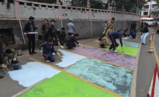
MEGHALAYA URBAN PARKING POLICY 2025
Re-imagining streets initiative have been launched an effort to redesign street sections, rationalize jumctions, and improve public space through Tactical Urbanism (TU)
A Structured framework to regular onstreet and off-street parking in urban areas, reduce congestion, and generate revenue.
MEGHALAYA STREET VENDORS SCHEME 2023
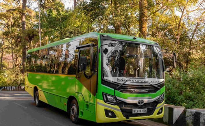
CITY BUS FLEET AND TICKET APP
Introduction of a formal, reliable public transport system for shillong with integrated ticketing app
A Structured framework to regular onstreet and off-street parking in urban areas, reduce congestion, and generate revenue.

MY CITY CAMPAIGN AND CLEAN SHILLONG 2027
A community-driven initiative launched in Meghalaya to clean, beautify, and reimagine urban spaces and to make shillong the cleanest and sustainable city in North-East by 2027
Shillong Comprehensive Mobility Plan
Expansion of dedicated school transport services with convenient user app caretakers
Strategic, long-term framework designed to improve Shillong’s urban transportation
The Integrated Mobility Plan for Shillong is structured around a nine-pillar framework that reflect the full spectrum of urban mobility - from land-use integration and street design to public transport, safety, clean mobility, governance, and digital systems - ensuring that planning moves beyond isolated projects towards a cohesive, outcome-driven strategy. This pillar-based approach ensures that mobility planning moves beyond isolated infrastructure projects and instead considers the transport system as an interconnected network of services, streets, institutions, users, and environmental outcomes. It is particularly relevant for Shillong, where mobility challenges are shaped by hilly terrain, limited road capacity, compact urban form, strong dependence on walking and shared transport, and increasing pressure from motorisation.
Each pillar is defined through a set of measurable parameters [JH20.1] [RA20.2][FA20.3]that guide assessment and decision-making. These parameters help evaluate the current status of Shillong’s mobility system in terms of policy readiness, infrastructure availability, service quality, accessibility,
institutional capacity, implementation progress, environmental performance, and user needs. They also provide a common basis for comparing performance across different mobility dimensions and identifying where the city performs well, where systems are partially developed, and where critical gaps remain.
The assessment parameters serve three main purposes. First, they establish a structured baseline of Shillong’s current mobility conditions. Second, they support the identification of physical, operational, institutional, financial, digital, and policyrelated gaps. Third, they help translate these gaps into targeted interventions, priority projects, and measurable outcomes under the IMP.
By applying this framework, the IMP creates a clear link between assessment, gap identification, project prioritisation, and implementation monitoring. The nine pillars therefore function not only as a diagnostic tool, but also as a decisionmaking framework to guide Shillong towards a more integrated, inclusive, safe, low-emission, and climate-resilient mobility system.
1. Climate-Resilient & Compact Urban Growth
Integrated land use, street networks, service proximity, disaster resilience, and low-carbon growth into a compact, walkable, and climate-resilient.
2. Public & Shared Transport System
Delivering high-coverage, frequent, affordable, safe, and integrated public and shared transport services for all users.
3. Activity Mobility (Walking & Cycling)
Building continious, safe, accessible, and well-lit walking and cycling networks as the foundation of everyday mobility.
4. Equity, inclusion & informal sector
Ensuring inclusive access to mobility for low-income communities, informal workers, women, children, and persons with disabilities.
5. Climate & Environment Sustainability
Transition ing to low-emission, energy-efficient, air-quality-sensitive, and climate-resilient transport systems.
6. Parking & Travel Demand Management
Managing private vehicle use through parking reform, pricing, regulation, and dermand restraint measures.
7. Governance, Financing & Monitoring
Strengthening institutions,financing, data systems, and capacity for long term mobility delivery and accountability.
8. Road Safety
Achieving safe streets through crash reduction, black spot treatment, and child-safe scholl access.
9. Digital Integration
Enabling integrated digital mobility through open data, MaaS platforms, smart payments, and real-time information.
Fig. 13. Nine Pillars of the IMP Assessment framework
To translate the nine pillars into a measurable planning framework, Shillong’s mobility system was assessed through a structured, indicator-based evaluation approach. Each pillar is defined through a set of carefully selected parameters that reflect infrastructure readiness, service quality, institutional capacity, safety performance, environmental impact, and digital maturity. These parameters were assigned appropriate weightages based
on their relevance to Shillong’s urban form, terrain, travel behaviour, and policy priorities. The city’s performance was then evaluated against each indicator using a combination of primary surveys, departmental data, field audits, and stakeholder consultations. This approach enables an objective assessment of current conditions, identifies critical gaps and strengths across the mobility ecosystem.
Shillong’s performance under ClimateResilient & Compact Urban Growth reflects a city with strong structural advantages (compact form driven by terrain) and growing policy maturity on resilience and climate action. The city has moved beyond generic master planning by adopting a Risk-Informed, GIS-based Master Plan approach, which explicitly brings vulnerability and mitigation measures into urban growth decisions. Alongside this, Shillong has articulated
Assessment highlights:
the intent to align mobility strategies with statutory planning through the Shillong Urban Mobility Policy, which calls for integration with the CMP and the GISbased Master Plan to ensure a cohesive city vision. However, the assessment also indicates that several actions remain at the DPR / proposal stage, and key outcomes, like service proximity and systematic climate monitoring - need stronger implementation focus.
• Compact, terrain-constrained urban form supports walkable blocks and network permeability (a natural advantage for short trips and transit access).
• Policy alignment is visible and moving into implementation through linked actions on public transport improvement, NMT upgrades, street design, and vendor management (as reflected in your score and comments).
• Risk-informed planning is in place via the Risk-Informed GIS-based Master Plan for Shillong, creating a formal basis to integrate flood/landslide/heat considerations and safeguard ecological systems in growth decisions.
• Climate mitigation intent exists at the state level, including the Meghalaya Electric Vehicle Policy (2021) and related enabling measures that support a low-carbon transition.
• Earlier strategic directions also appear in Shillong’s Smart City Proposal, which emphasises integrated public transport, pedestrian/NMT improvements, and reduction of private vehicle use - reinforcing compact, people-first growth objectives.
Key gaps:
• Service proximity is only moderate (~40% within 15-minute walking access[MD1.1]), indicating uneven distribution of essential services and/or barriers in pedestrian access.
• Implementation lag: multiple initiatives show policy intent and DPR readiness but require scaling into a citywide programme (beyond pilots/corridors) with time-bound targets.
• Transport-climate monitoring is still evolving while policies exist, the city needs clearer systems for transport emissions baselining, tracking, and target-setting tied to mobility investments.
Shillong’s public transport system remains small-scale and peripheral to daily mobility, with the city relying heavily on walking and intermediate public transport (IPT) such as shared cab and maxis [JH22.1][AF22.2]to meet demand. The policy direction is clear - Shillong’s Urban Mobility Policy positions MUDA as the anchor institution and calls for stronger coordination and implementation capacity - but the current service footprint, operations, and passenger-facing systems have not yet matured into a dependable citywide network. This pillar therefore shows a classic “policy intent > service reality” situation: affordability exists, but coverage, reliability, integration, and service planning systems lag behind.
Current formal public transport in Shillong comprises three distinct services: SPTS buses (MUDA-operated,
4 notified routes, ~30 buses deployed daily from a fleet of 90); SSPTS maxi cabs (SMB-operated, 217 sanctioned, 99 operational, ~20 active on road); and MTC/ASTC intercity services from ISBT Mawlai.
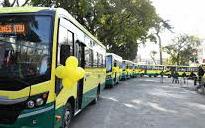
In addition, the Shillong has procured 35 diesel AC buses of which 19 have been flagged off in February of 2026. With these buses the city has also piloted Electronic Ticketing along with Passenger information system giving the commuters an experience to track buses real time.
The informal IPT layer of shared taxis (~5,200 permits), auto-rickshaws, and private shared cabs that carries approximately 32,000 commuters per day and constitutes the functional backbone of daily mobility for most residents outside the four SPTS corridors.
Assessment highlights:
• Institutional mandate exists: Shillong’s Urban Mobility Policy explicitly proposes MUDA-led delivery and a dedicated entity within MUDA for coordination and implementation - an enabling step for formal PT strengthening.
• Affordability is a relative strength: the city’s PT fare being unchanged for long periods (as your assessment notes) keeps entry costs low for usersimportant for equity in access.
• E-mobility enabling policy exists at state level: the Meghalaya Electric Vehicle Policy (2021) includes incentives for electric buses, creating an enabling environment for future fleet modernisation.
• Public transport has been attempted as a city service: Shillong has operated city bus services under public agencies historically, indicating institutional precedent even if performance has been inconsistent.
• City-level action planning discussions have been initiated through governmentled deliberations on urban mobility recommendations for Shillong (useful groundwork for PT reform).
Key gaps:
• Very low formal network reach: the system does not function as a backbone service and only serves about 12% of the population, limiting PT as a practical choice for most trips.
• Service quality deficit: fleet availability and operations are inadequate for dependable frequency and reliability, reducing ridership potential and trust in the system.
• No passenger-facing digital layer: absence of RTPI / passenger information, integrated journey planning, and modern ticketing limits usability and system transparency (especially for new users).
• Weak multimodal interchange: PT is not designed around integrated station access (walk + IPT + feeder logic), resulting in last-mile friction and poor transfer experience.
• Limited-service planning capacity: lack of an institutionalised route/service review mechanism and data-led scheduling constrains the city’s ability to adapt services to demand over time.
• Safety and inclusion at PT nodes is inadequate: limited lighting, surveillance, and gender-responsive amenities undermine off-peak safety and reduce ridership confidence-especially for women and vulnerable users.
• Key findings from this pillar are threefold. First, formal network reach is critically low: SPTS routes cover less than 20% of GSPA road network, and the combined bus-and-maxi-cab catchment reaches only 33% of the builtup area. Second, the operational model is fragmented: nine entities operate the diesel fleet under NCC while the new electric fleet operates under GCC, creating inconsistent service standards. Third, the revenue trajectory is unsustainable: system income has fallen from ₹13–14 lakh/month at inception to ₹3–4 lakh/month. Annual Viability Gap Funding of approximately ₹12 crore is the estimated net system support requirement for the proposed 2026 service plan.
Shillong’s active mobility system shows clear intent but limited network performance. While the city has initiated corridor-level improvements through the Reimagining Streets Initiative and embedded NMT upgrades in the CMP and Local Area Plans, the current network lacks continuity, universal accessibility, and street-level safety at scale. Despite a compact urban form that naturally supports short trips, only a small share of arterial roads (~10%) currently provide footpaths on one or both sides, and even fewer offer continuous (≥1 km), minimum 2 m-wide pedestrian or cycling facilities.
Assessment highlights:
As a result, walking remains common by necessity rather than by design, and cycling uptake is constrained by safety and connectivity gaps.[JH25.1][FA25.2]
The CMP documents a pedestrian footfall of 2.1 lakh per day at Police Bazar alone, with peak-hour volumes of 6,600. Despite this demand intensity, only 9% of roads in GSPA have footpaths, most under 1.8 m wide and unpaved. The CMP proposes footpath development across 508 km in three phases: 160 km in Phase I on major arterials, 140 km in Phase II on outer roads, and 128 km in Phase III on village and ring roads.
• Strategic initiatives exist: Projects like the Reimagining Streets Initiative and inclusion of NMT improvements in CMP and local area plans signal prioritisation of active mobility at policy and project levels.
• Compact urban morphology supports walking and cycling potential, with trip distances often short for key daily activities.
• Some pedestrian infrastructure interventions have been implemented on select arterial corridors, providing visible proof of change and a foundation for scaling
Key gaps:
• Low network continuity and coverage: only ~10% of roads have footpaths on one or both sides, and a much smaller proportion meet the standard of continuous (≥1 km), ≥2 m-wide footpaths/cycle lanes - preven[MD3.1]ting safe, end-to-end walking and cycling trips.
• Poor universal accessibility: no citywide programme or mandate is being implemented to deliver barrier-free streets (ramps, tactile paving, accessible crossings), resulting in poor accessibility for children, senior citizens, and persons with disabilities.
• Inadequate personal security on streets: street lighting and CCTV coverage are insufficient and require major improvement, undermining perceived and actual safety - especially during off-peak hours and on longer walking routes
Shillong’s mobility landscape exhibits mixed performance on equity and informal sector integration. While the city has made important progress in acknowledging street vendors and informal economic uses through policy, access for low-income and marginalised groups to formal transport remains limited. A significant proportion of informal settlements (~25%) lie outside reliable connections to public transport, reinforcing dependency on informal and intermediate modes.[MD4.1] Although shared taxis and IPT services fill this gap to some extent, these services tend to be unregulated, cost-inefficient, and unreliable - especially for short trips and in non-commercial areas - thereby underscoring persistent inequities in mobility access. Meanwhile, universal accessibility for differently abled users is severely lacking, with negligible compliance in fleet or public space design, indicating that mobility systems are not yet inclusive by design.
Considering only about 12% of the population has access to public transport, mobility exclusion in low-
Assessment highlights:
income and informal settlements is therefore not only a transport issue. It reflects wider spatial and social inequalities linked to settlement location, housing affordability, infrastructure access, and the uneven distribution of public services. Addressing these gaps will require both the expansion and improvement of formal public transport services and structured engagement with informal and intermediate transport providers. This includes exploring better route integration, fare transparency, service standards, safety measures, accessibility improvements, and designated interchange points.
Universal accessibility remains a major gap across the mobility system. Compliance with accessibility standards in fleet design, public spaces, footpaths, crossings, transport stops, and passenger facilities remains limited. As a result, persons with disabilities, elderly users, children, caregivers, and other mobility-constrained groups continue to face barriers in accessing safe and independent mobility
• Inclusive street vendor policy: Shillong has published a street vendor policy that recognises the role of informal economies and introduces sensitive relocation and designated vending zones, enabling coexistence with pedestrian and NMT flows while reducing obstruction and safety risks.
• Shared transport filling service gaps: IPT and shared taxi services provide widespread informal mobility options where formal public transport is limited, especially in residential and peri-urban localities
• Low-income access to formal PT remains limited: Only about 25% of informal settlement populations are connected to formal public transport services, reflecting spatial equity gaps and limited-service outreach.
• Alternative mobility is unreliable and costly in practice: Shared taxi/IPT services - while widely used - are often uncomfortable, relatively expensive per km, and inconsistent in non-commercial areas, undermining their role as equitable feeder mobility.
• Accessibility for differently-abled users is minimal: There is poor universal accessibility across public spaces and transport systems, with low-floor buses, ramps, tactile paving, auditory signals, and priority seating largely absent or inconsistent - limiting mobility options for elderly and differently abled residents.
• Lack of formal integration of informal modes: While vendor policy exists, there is still no comprehensive strategy to integrate IPT, rickshaws, or shared services into the formal mobility network with regulation, safety standards, or equitable pricing.
• Need for inclusive public space management: While a street vending policy exists, stronger implementation is required to balance livelihood protection with safe, continuous, and universally accessible pedestrian movement.
• IPT modes carry most of the motorised daily trips but operate largely outside the regulatory framework. The CMP’s IPT survey documents 5,200 taxi permits in GSPA, with operators covering 60 km per day across 10 trips and carrying about 32,000 passengers per day. The average trip cost of ₹75 represents a non-trivial daily expenditure for lower-income households. No digital platform exists for IPT discovery, fare transparency, or safety reporting. The result is a mobility system that is available to most residents but equitable to few.
Shillong has made visible progress in embedding air quality and climate considerations into its statutory planning framework, through its Shillong’s Urban Mobility Policy 2024 and the Comprehensive Mobility Plan 2025, but the transition to a low-emission and climate-resilient mobility system remains at an early stage of implementation. [JH31.1][FA31.2]The city’s Master Plan and Comprehensive Mobility Plan include policy interventions for air quality improvement, congestion management, and clean mobility prioritisation, signalling a strong planning intent.
At the same time, the on-ground transition of fleets, depots, and transport infrastructure towards low-emission technologies and renewable energy remains limited. While proposals for electric buses are in place, the current share of low-emission public and municipal vehicles is still under 5–10%, and renewable energy integration at transport assets is minimal.[MD32.1] [JH33.1]
Assessment highlights:
Shillong’s environmental context— characterised by high rainfall, cloud cover, and limited direct sunlight—also presents unique challenges for renewable energy deployment, particularly solar. However, the city’s inclusion of freight terminals, logistics corridors, and resilient transport infrastructure in the Master Plan and CMP reflects an understanding of the need for climate-resilient mobility systems that can withstand flooding, landslides, and extreme weather events[JH34.1]. The assessment therefore reflects a city with strong policy direction and planning readiness, but one that now requires structured implementation pathways for fleet transition, clean energy integration, and performance-based emissions monitoring.
• Air quality and low-emission planning embedded in statutory documents: The Master Plan for Shillong and the Comprehensive Mobility Plan (CMP) include policy interventions for clean modes, congestion management, pedestrianisation, and vehicular restrictions in sensitive and high-activity areas.
• State-level enabling framework for electric mobility: The Meghalaya Electric Vehicle Policy (2021) provides incentives for electric buses, shared mobility, and charging infrastructure, creating an enabling environment for fleet electrification.
• Proposals for electric bus procurement in place: City-level discussions and project preparation are underway for transitioning the public bus fleet to electric buses under national schemes.
• Climate-resilient transport infrastructure planning: Truck terminals, freight corridors, and major transport facilities have been integrated into the Master Plan and CMP with a view to improving logistics efficiency and climate resilience.
• Policy push for BS-VI compliance: Policy-level initiatives exist to promote BS-VI compliant vehicles and improve emission standards across freight and passenger fleets.
Key gaps:
• Low-emission fleet penetration remains limited: Less than 5–10% of the total public and municipal fleet currently operates on low-emission technologies, indicating an early-stage transition.
• Renewable energy integration is negligible: Depots, terminals, and stations are not yet powered by renewable sources, and rooftop solar or solar carports are not widely adopted due to climatic constraints and limited deployment models.
• Lack of transport-sector emissions accounting: There is no structured system for measuring, monitoring, and reporting transport-related GHG emissions at the city level to track climate targets.
• Congestion and emission performance remain weak on major corridors: Average peak-hour speeds and V/C ratios on arterial roads reflect persistent congestion, undermining air quality and fuel efficiency benefits.
• Climate-proofing standards need operationalisation: While resilience is embedded in plans, design standards for flood-, heat-, and storm-resilient transport infrastructure require formalisation and citywide application.
• Shillong’s position as a city where motorisation is still at an earlier stage than most Indian metros create a genuine leapfrogging opportunity. The CMP’s scenario modelling shows that under the Sustainable Urban Transport scenario with technology interventions, the city can achieve a 42% reduction in PM2.5 and a 41% reduction in CO2 relative to business-as-usual by 2054. The enabling conditions are partially in place: the Meghalaya EV Policy, the GCC model for e-bus procurement, and the CMP’s freight corridor proposals all provide pathways that other cities had to develop retroactively.
Parking and travel demand management are relevant for Shillong, where limited road space, hilly terrain, and growing private vehicle ownership place increasing pressure on the urban mobility system. A more structured approach to parking is therefore essential to improve traffic flow, reclaim street space, and support a shift towards more sustainable modes of transport.
Shillong’s approach to parking and travel demand management is currently in a transition phase, with the city moving from largely unregulated curbside parking towards a more structured, demand-based framework. The city has initiated planning for a formal Parking Policy that proposes the classification of parking zones into Commercial and Non-Commercial areas, signalling an important shift towards systematic
Assessment highlights:
parking management. However, onground conditions continue to reflect high dependence on private vehicles, with widespread irregular on-street parking by four-wheelers encroaching on carriageways and footpaths, reducing effective road capacity and worsening congestion.
Concluding, the successful implementation of the Parking Policy will be essential to manage demand, improve enforcement, and ensure more efficient use of scarce road space. Linking parking management with public transport improvements, pedestrian infrastructure, and broader travel demand measures can help Shillong reduce congestion, improve accessibility, and move towards a more people-oriented and sustainable mobility system.
• Parking Policy under preparation: Shillong is in the process of framing a citylevel Parking Policy that will divide parking zones into Commercial and NonCommercial areas, laying the groundwork for demand-based regulation.
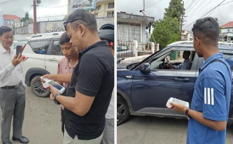
• A digital parking pilot using Electronic Ticket Vending Machines (ETVMs), implemented in August 2025 under an 80:20 revenue-sharing arrangement with the Dorbar Shnong, was subsequently scaled citywide, establishing a community-led digital parking management model
• Recognition of parking as a mobility challenge: Parking is formally acknowledged as a citywide issue affecting congestion, street safety, and walkability.
• Policy intent for regulated curbside management: The proposed zoning approach creates a basis for introducing differentiated pricing, regulation, and enforcement strategies in high-demand areas.
Key gaps:
• Irregular on-street parking dominates road space: Widespread four-wheeler parking along carriageways reduces effective road width, disrupts traffic flow, and compromises pedestrian safety.
• No demand-based pricing yet operational: While the policy is under planning, dynamic or location-based parking pricing has not yet been implemented to manage peak demand.
• Absence of private vehicle restraint instruments: There are currently no congestion charges, workplace parking levies, or low-emission zones to actively discourage excessive private vehicle use.
• Weak enforcement and digital systems: Parking management is not yet supported by digital enforcement, occupancy monitoring, or integrated payment platforms.
• Limited integration with public transport and NMT improvements: Parking reform is not yet explicitly linked to mode shift strategies or reinvestment into sustainable mobility.
Strong governance and sustainable financing are essential for translating Shillong’s mobility vision into coordinated and implementable action. Given the city’s complex institutional landscape, limited road capacity, and growing mobility pressures, effective coordination across departments will be critical to ensure that transport planning, infrastructure delivery, operations, enforcement, and monitoring are aligned.
Shillong demonstrates strong institutional intent and participatory governance practices, with recent efforts focused on formalising mobility governance structures and strengthening interagency coordination. The city needs to take a significant step by institutionalising an Urban Mobility Cell, to serve as a nodal body for coordinating transport planning and operations across departments. This aligns with national guidance on Unified Metropolitan Transport Authorities (UMTAs) and reflects a move towards more structured, accountable, and integrated mobility governance.
Assessment highlights:
Financing mechanisms and land value capture instruments have also been embedded within the CMP, signalling long-term intent for sustainable funding of mobility systems. However, performance monitoring systems and formal capacitybuilding programmes are still evolving and need operationalisation. Overall, Shillong has an important institutional foundation for integrated mobility governance, but this now needs to be translated into operational systems, dedicated capacities, and sustainable financing mechanisms. Strengthening these elements will help ensure that mobility interventions are coordinated, measurable, financially viable, and responsive to the city’s long-term development needs.
• Institutional framework to be established: An Urban Mobility Cell needs to be institutionalised, providing Shillong with a formal coordination mechanism for multi-agency transport planning and operations.
• Strong stakeholder coordination: A Zonal Task Committee is in place, with consultations held every two months, ensuring continuous engagement with citizen groups, PT agencies, and line departments.
• Financing and O&M mechanisms integrated in CMP: The CMP embeds dedicated funding approaches for public transport and NMT systems, including provisions for O&M sustainability.
• Land Value Capture and TOD-based financing recognised: The CMP integrates land-based financing instruments (e.g., betterment levies, premium FSI, transit-adjacent land monetisation) to support mobility investments.
• Monitoring roadmap initiated: Proposals for a citywide mobility monitoring dashboard and KPI framework are in place, laying the foundation for performance-based governance.
Key gaps:
• UMC requires statutory empowerment and financial autonomy: While the Urban Mobility Cell is yet to be institutionalised, it also needs formal statutory powers, dedicated budgets, and clear mandates to function as a true coordinating authority.
• Performance monitoring is not yet operational: The mobility dashboard and KPI framework remain at the proposal stage; there is no live system to track ridership, reliability, emissions, and safety.
• Dedicated revenue streams need activation: CMP-identified funding tools (transport cess, advertising, green finance) require formal notification and implementation to ensure long-term O&M sustainability.
• Land value capture instruments need regulatory embedding: TOD and LVC tools must be operationalised through development control regulations and projectlevel structuring.
• Capacity building is ad hoc: Training exists but needs to be formalised into a continuous professional development programme for planning, operations, and contract management.
Road safety is a critical priority for Shillong, where hilly terrain, constrained road widths, mixed traffic conditions, seasonal visibility challenges, and rising motorisation create complex safety risks for all road users. Improving safety will require both targeted infrastructure interventions and stronger behavioural, enforcement, and monitoring measures.
Shillong’s road safety performance reflects a mix of systematic identification of risks and ongoing challenges in implementation and structured safety programming. The city has made important strides by officially documenting road crash black spots and recognising safety as a priority in planning processes. These efforts align with national goals under the National Road Safety Policy and local strategies to improve street safety. However, outcome indicators such as fatalities and serious injuries remain a concern, influenced by seasonal conditions (e.g., foggy winters) and frequent rash driving by twowheelers, while child and school safety initiatives are still in early consultation stages with stakeholders.
The CMP documents 2,154 road accidents in Shillong between 2018 and 2024 (through March), resulting in 187 fatalities. The fatality rate declined from 12% in 2018 to 7% in 2023. A notable structural trend is the decoupling of accident frequency and fatality severity after 2017: total accidents fell 57% between 2015 and 2021, but the fatality rate per 100 accidents nearly doubled from 36 to 77 — fewer crashes are occurring, but each one is becoming deadlier. This points to speed, vehicle type mix, and road surface changes as drivers of lethality independent of crash frequency, and underscores the need for infrastructure-based safety interventions beyond awareness campaigns.
This could include safe access plans around schools, traffic calming measures, improved crossings, schoolzone signage, awareness campaigns, and stronger coordination between education authorities, traffic police, schools, and local communities. Overall, while Shillong has taken important steps towards identifying and acknowledging road safety risks, the next priority is to
translate this into a systematic road safety programme. This should combine black spot treatment, safer street and junction design, targeted enforcement, school safety measures, seasonal risk management, and regular monitoring of crash data to create safer mobility conditions across the city.
Assessment highlights:
• Extensive black spot identification: Fatalities and serious injuries per 100,000 population remain moderate (score 3/5), indicating that documentation has not yet translated into consistent, approximately 90% of officially recognised road crash black spots within Shillong have been documented, demonstrating a strong data foundation for targeted safety interventions and aligning with best practice safety audit processes.
• Awareness of seasonal safety risks and key user groups: Local safety analyses recognise foggy winter conditions and two-wheeler behaviour as key contributors to crash incidence, pointing to contextualised understanding of road safety dynamics.
• Policy alignment with national priorities: Shillong’s safety discourse mirrors objectives from the National Road Safety Policy (2010) and subsequent national programmes emphasising crash reduction, vulnerable road user protection, and safe infrastructure design
Key gaps:
• Moderate safety outcomes: Despite identification efforts, fatalities and serious injuries per 100,000 population remain moderate (score 3/5), indicating that documentation has not yet translated into consistent, wide-scale mitigation across high-risk corridors.
• Implementation of black spot treatments needs acceleration: Although black spots are identified, systematic infrastructure redesign, enhanced signage, enforcement, and engineering treatments must be scaled up to reduce crash frequency and severity.
• Child and school safety underdeveloped: Safe Access to School Plans are not yet widely prepared or implemented; current efforts are still in consultation stages with schools and stakeholders, delaying action on pedestrian infrastructure, traffic calming, and supervised crossing systems near educational zones.
• Vulnerable user protection is limited: Beyond black spot identification, there is no comprehensive programme targeting pedestrians, cyclists, and twowheelers through design improvements, speed management, or protective street infrastructure.
Digital mobility systems are becoming increasingly important for Shillong as the city seeks to improve public transport reliability, strengthen traffic management, and enable more user-friendly mobility services. At present, the city shows clear policy-level readiness for digital transformation, but implementation remains at an early stage.
Shillong’s digital integration readiness reflects a planning‐level recognition of digital mobility systems but limited onground deployment and user adoption to date. Key statutory documents such as the Comprehensive Mobility Plan (CMP) and the Master Plan for Shillong acknowledge the importance of digital tools, open data standards, and integrated mobility platforms for future service delivery and transport management. However, while the policy framework recognises digital integration, actual implementation of systems like real-time passenger information (RTPI), open data
feeds (GTFS/GTFS-Realtime), unified MaaS platforms, and smart ticketing remains largely aspirational.
Similarly, user adoption of digital travel tools (e.g., apps, smart cards, online payments) is still low due to limited services and lack of digital payment infrastructure in formal transport services. This points to a city that is conceptually ready for digital mobility transformation but requires focused implementation pathways to realise these systems at scale. Going forward, strengthening digital integration should be treated as a core enabler of Shillong’s mobility transformation. Developing standardised transport data, real-time information systems, digital payment options, and integrated user platforms will help improve passenger convenience, support evidence-based planning, and create a more transparent, efficient, and responsive mobility system.
Assessment highlights:
• Policy recognition in planning instruments: Digital integration is articulated in Shillong’s Master Plan and CMP, emphasising interoperable transport data systems, smart ticketing, and ITS adoption as future priorities.
• Platform and data standards in vision documents: Both plans recognise the need for common data standards and platform interoperability (e.g., MaaS, open APIs), laying an important foundation for future digital ecosystem development.
• Foundational digital momentum: Broader state initiatives on e-governance and digital services in Meghalaya provide a supportive environment for mobility digitalisation, aligning with national programmes such as the National Urban Digital Mission (NUDM) that encourages digital integration in urban services.
Key gaps:
• Policy to practice gap in digital systems: Although digital integration appears in plans, no unified MaaS platform, real-time information system, or integrated ticketing system has been implemented for Shillong’s transport network.
• Absence of open data infrastructure: Transport operators (public and private) currently do not provide open or standardised operational data (e.g., GTFS, APIs) that would allow real-time feeds and third-party MaaS development.
• Low user adoption of digital tools: Smart card usage, mobile ticketing, and digital trip planning tools are limited, reflecting both low service availability and lack of integrated digital payment options within the formal transport network.
• No live performance dashboard yet: The conceptual presence of digital integration has not translated into a citywide dashboard or real-time KPI tracking system, restricting data-driven decision making.
To present a consolidated view of Shillong’s mobility performance, the city was assessed across the nine pillars of the Integrated Mobility Framework using a weighted, indicator-based scoring methodology. Each pillar was evaluated based on policy readiness, institutional capacity, infrastructure coverage, service quality, and implementation maturity.
The resulting scores are normalised on a scale of 0 to 1, where a higher value indicates stronger system readiness and delivery capability. The composite assessment provides a comparative snapshot of strengths, gaps, and priority areas for intervention, and forms the analytical basis for project prioritisation under the Integrated Mobility Plan.
Parking & Travel demand management Public & Shared Transport Systems
Climate-Resilient & compact Urban growth Digital Integration
Equity, Inclusion & Informal Sector
From the visual assessment, it is evident that Shillong demonstrates relatively stronger performance in areas such as the listed below:
• Parking & Travel Demand Management,
• Governance, Financing & Monitoring,
• and Climate-Resilient & Compact Urban Growth.
These pillars reflect the city’s growing policy maturity, institutional coordination mechanisms, and structured planning approach towards managing limited road space, compact urban form, and multi-agency mobility governance.[JH36.1][FA36.2]
In contrast, the city records comparatively lower scores in:
• Active Mobility (Walking & Cycling),
• Public & Shared Transport Systems, Equity, Inclusion & Informal Sector, and Climate & Environmental Sustainability.
These pillars are critical for reducing dependence on private vehicles, improving everyday accessibility, strengthening public transport as the backbone of urban mobility, and enabling a transition towards low-emission and inclusive transport systems. The lower score indicates the need for improving the public transport and active mobility infrastructures. [JH37.1][FA37.2]
Moderate performance is observed in Digital Integration and Road Safety, indicating the presence of planning intent and early initiatives, but with significant
scope for scaling implementation and system-wide adoption.
Overall, the radar chart functions as a diagnostic tool within the IMP framework, providing a consolidated snapshot of Shillong’s mobility strengths and structural gaps. It establishes a clear evidence base for prioritising interventions that strengthen peoplecentric mobility, expand public transport coverage, enhance walkability and safety, and embed climate and equity objectives into the city’s future mobility investments.
The assessment of the nine mobility pillars indicates that while several foundational elements such as policy intent and institutional arrangements are emerging, not all pillars require equal levels of intervention at this stage. The analysis clearly shows that public transport systems, active mobility, and climate and environmental sustainability exhibit the most significant performance gaps and therefore demand focused and immediate attention. In addition, cross-cutting deficiencies related to lowemission fleet integration, congestion and parking management, data-driven monitoring, and safety for school children and vulnerable users further reinforce the need for a targeted rather than diffuse intervention strategy.
Recognising these priorities, the Integrated Mobility Plan adopts a consolidated strategic approach, focusing on a subset of pillars that can deliver the maximum mobility, safety, and climate benefits for Shillong. Concentrating interventions around these focus areas allows the city to efficiently utilise financial and institutional resources, accelerate implementation, and create visible improvements in everyday mobility outcomes.
Based on this strategic assessment, the IMP defines the following five priority goals for sustainable urban mobility in Shillong:
1.Public & Shared Transport Systems: Develop a digitally enabled, EV-ready Public Transport system, supported by a well-integrated intermediate public transport (IPT) network
2.Active Mobility (Walking & Cycling): Strengthen active mobility networks to enable at least 30% of daily trips to be made through walking and cycling
3.Equity, Inclusion & Informal Sector: Prioritise underserved and vulnerable user groups, with a special focus on school children
4. Governance, Financing & Monitoring: Establish a formal and empowered institutional mechanism for urban mobility planning and delivery
5. Digital Integration: Transition towards digital governance of mobility services, including real-time monitoring, integrated ticketing, data management, and performance-based decisionmaking.
These five goals are structured across three implementation timeframes. The immediate horizon (2026) deploys existing and procured assets, 35 diesel electric buses, 55 electric buses under PM e-Bus Sewa, the Parking ETM pilot, pedestrian wayfinding, and the Urban Mobility Cell, to deliver early visible improvements while institutional systems are being established. The short-term horizon (2027–2030) scales pilots into programmes: expanded bus network, complete streets, PBS scaleup, and NCC-to-GCC contract transition. The long-term horizon (2031–2054) addresses structural system reform: the Shillong City Transport Undertaking, full fleet electrification to 285 e-buses and 126 e-maxi cabs on 28 routes, a PT mode share target of 18.6%, and a citywide digital mobility platform. The PT Action Plan (Annexure 2) provides the full technical roadmap for the public transport component.
The Chapter 6 is structured directly around these five goals and three timeframes. Each project is linked to the pillar gap it addresses, the funding channel through which it can be advanced, and the institutional anchor responsible for delivery.
The gap assessment shows that Shillong’s key mobility challenges are concentrated around the performance of public transport, the lack of safe and continuous walking and cycling networks, and limited accessibility for underserved users, particularly school children. These gaps are further compounded by inefficient use of street space and unmanaged parking, contributing to congestion and safety risks, and by the absence of integrated digital
systems for passenger information, fare management, and performance monitoring. While initial steps have been taken towards institutional coordination, the city still lacks a formal, fully empowered mobility management mechanism capable of planning, operating, and scaling integrated mobility services. Addressing these gaps requires focused interventions aligned with the five strategic mobility goals rather than dispersed actions across all pillars.
Public & Shared Transport Systems Urban Mobility Policy, CMP Limited fleet, depots, term signals
Active Mobility (Walking & Cycling) CMP + Reimagining Streets Only ~10% roads with footpaths Fragmented, unsafe corridors Pilot-led delivery
Equity, Inclusion & Informal Sector Street Vendor Policy
Governance, Financing & Monitoring
Gap Moderate/ Establishing Strong/ Established Goals identified
Table. 4. Gaps identified after assessing the 5 goals

The project portfolio under the Integrated Mobility Plan has been developed as a direct response to the citywide gap assessment across the 5 goals. Rather than proposing standalone or isolated interventions, the IMP adopts a system-building approach - where neighbourhood pilots, corridor upgrades, institutional reforms, and digital systems are scaled into citywide programmes. The strategy focuses on three parallel tracks:
• Scaling proven pilots and tactical interventions into permanent city programmes,
• Strengthening core mobility systems such as public transport, walkability, safety, and parking management, and
• Building long-term institutional and digital capacity to sustain service delivery and performance monitoring Projects are categorised into Immediate, Short-Term, and Long-Term phases based on readiness, impact potential, and implementation feasibility. Immediate projects largely build upon ongoing city initiatives and SUM-ACA pilots; shortterm projects expand these into corridorand area-level programmes; and longterm projects focus on structural system reforms and network-scale investments. Together, these form a coherent roadmap for Shillong’s transition towards a peoplecentric, low-carbon, and inclusive urban mobility system.
5 Goals Identified
Immediate project (GIZ + MoHUA) Short Term projects (Cityled) Long Term projects (City-led)
• Adding new Bus Fleet (AC Diesel)
Public & Shared Transport Systems
Active Mobility (Walking & Cycling)
• Public Transport Action Plan, 2054
• Shilong city bus app and journey planner
Equity, Inclusion & Informal Sector
• Pedestrian Wayfinding System
• Public Bicycle Sharing System for electric bicycles
• Street redesign and Junction Improvement plans
• Impact Assessment of Reimagining Streets initiative
• Safe Routes to School Initiatives
• Neighbourhood Improvement Plans
• Street design improvement- focus on safety security and accessibility, especially for School children
Governance, Financing & Monitoring
Digital Integration
• Setting up an Urban Mobility Cell
• Strengthening Bus Operations and Capacity Building
• Paid Parking ETM App - Pilot
• A common digital platform for payment of fare & ticket booking for Buses
• ETM based app for ticket collection in Buses
• Formation of Urban Mobility cell
• Converting the Public Transport contract from NCC to GCC
• Public Transport Wayfinding System
• 20-mins neighbourhood plans
• Scaling up the PBS and adding Bicycles and docking stations
• Signalised Junctions and Street Improvement Plans
• 20 Low emission Zones (LEZs)
• Procurement of new Bus fleet (Electric buses)
• Unified Public Transport Authority for Greater Shillong
• 30% Mode share for Public Transport
• 30% Private trips in Shared Mobility
• Transit-Oriented & Area-Based Mobility Zones (ABMZs)
• Cycling lanes in New Shillong township
• 30% Road Space Allocation for NMT Users
• Community Oriented Land Pooling Scheme
• Development control of Vending Spaces
• Relocation of Vendors from major commercial zones to a dedicated space
• Workshops and Handholding exercises for the Bus Operators and Fare Collection Agency
• Journey planner including walk trips
• New and improved PT Bus Stops with integrated Real Time Monitoring
Table. 5. Projects proposed post evaluating the gaps identified
• Regulatory and operational integration of IPT
• New and regulated IPT fleet to complement the Public Transport service within the city
• Dedicated Urban Mobility Fund for Shillong
• Setting up a Shillong Decongestion Committee
• Integrating the NMT, IPTs, shared mobility to the city’s Public Transportation
• Real-Time City Mobility Command & Control Centre
Project prioritisation under the Integrated Mobility Plan for Shillong was guided by a structured and continuous stakeholder consultation process, ensuring that proposed interventions were grounded in the city’s institutional realities, operational capacities, and on-ground challenges. Consultations were initiated early in the project through a visioning workshop, which brought together key departments and city stakeholders to collectively identify priority mobility challenges, opportunities, and potential project directions.
A central role in the consultation process was played by the Zonal Task Force constituted by the Urban Affairs Department, which includes representatives from multiple city zones and relevant line departments. This committee functions as a key decisionmaking platform for urban and mobilityrelated matters in Shillong. Through structured discussions with the Zonal Task Force, priority projects were shortlisted, overlaps between initiatives were resolved, and pending decisions related to design, implementation, and coordination were addressed.
In parallel, regular review meetings and consultations were held with the
Director and Joint Director, Urban Affairs Department, to guide strategic decision-making, align projects with departmental priorities, and resolve policy-level and institutional issues. To strengthen technical capacity and build consensus on street transformation approaches, a Street Design Workshop was conducted with city engineers and architects, who are responsible for planning and approving street and junction designs. This workshop not only supported capacity building but also directly informed the identification and refinement of several street-level and active mobility projects.
As project concepts evolved and moved towards implementation, the need for institutional strengthening and operational capacity building became more apparent - particularly in areas such as public transport planning, service operations, and contract management. These consultations helped shape both the project portfolio and the supporting institutional reforms, ensuring that the prioritised initiatives are realistic, implementable, and aligned with Shillong’s long-term mobility goals.
Early visioning workshop to identify priority mobility challenges and project directions
Zonal Task Force consultations to shortlist projects and resolve inter-departmental decisions
Regular reviews with Director and Joint Director, Urban Affairs for strategic alignment
Street Design Workshop with engineers and architects to build capacity and shape projects
Periodic consultations to identify instituitional and capacity-building needs
Fig. 16. Summary of the stakeholder consultation essential for project prioritisation
The Integrated Mobility Plan (IMP) for Shillong adopts a multi-tiered funding framework that combines central government support, state government investments, and local-level financing mechanisms. This approach ensures financial sustainability, institutional ownership, and continuity of projects across immediate, short-term, and longterm horizons.
A significant share of priority projects under the IMP are aligned with centrally sponsored schemes and national urban mobility programmes. Funding and technical assistance are leveraged through initiatives such as SASCI (MoHUA), PM e-Bus Sewa, FAME and national e-mobility programmes, and other urban transport reform schemes. These programmes
support public transport systems, electric bus deployment, climateresilient infrastructure, street redesign, institutional strengthening, and capacity building. Central funding plays a catalytic role by reducing upfront capital costs, standardising technical frameworks, and accelerating implementation of city-scale mobility reforms.
The Government of Meghalaya, through the Urban Affairs Department, Directorate of Urban Affairs, and allied line departments, provides critical funding for projects that require sustained operational support and regulatory implementation. State-funded initiatives include Comprehensive Mobility Planning, public transport fleet augmentation (AC diesel buses),
The Government of Meghalaya, through the Urban Affairs Department, Directorate of Urban Affairs, and allied line departments, provides critical funding for projects that require sustained operational support and regulatory implementation. State-funded initiatives include Comprehensive Mobility Planning, public transport fleet augmentation (AC diesel buses),
parking policy development and enforcement, street vending regulation and relocation, road safety programmes, and institutional capacity building. State funding enables the scaling up of pilot initiatives into citywide programmes and ensures alignment with state-level urban development and transport priorities.
parking policy development and enforcement, street vending regulation and relocation, road safety programmes, and institutional capacity building. State funding enables the scaling up of pilot initiatives into citywide programmes and ensures alignment with state-level urban development and transport priorities.
Immediate projects are being implemented by GIZ in partnership with the Government of Meghalaya and the city of Shillong under the SUM-ACA project. These initiatives focus on on-ground delivery, pilot implementation, and demonstration projects, providing proof-ofconcept for priority mobility interventions. The immediate projects are designed to address
critical gaps in public transport planning, street design, active mobility, road safety, parking management, and digital systems, while simultaneously strengthening institutional capacity within the city. These projects help build technical confidence, establish operational models, and generate evidence to inform scaling up.
Project 1 Neighbourhood Improvement Plan
Classification Immediate
Description
The Shillong Neighbourhood Improvement Plan presents a comprehensive, people-first transformation of one of Shillong’s most institutionally dense and movement-intensive areas. Anchored by schools, hospitals, government offices, heritage precincts, and public parks, the neighbourhood experiences high pedestrian volumes, school-related traffic peaks, parking spillover, and safety challenges across a 22 km street network. The plan responds by shifting focus from isolated fixes to a coordinated, area-based approach that integrates mobility, safety, public space, and heritage conservation.
Guided by the SASCI reform framework, the plan demonstrates how seamless transit, safe streets, digital mapping, climate-resilient infrastructure, and local economic activation can be delivered simultaneously at the neighbourhood scale. Supported by a Joint Action Plan, phased implementation, and a robust monitoring framework, this neighbourhood becomes a replicable model for Shillong - showing how data-driven design, tactical urbanism, and cross-departmental coordination can transform everyday streets into safe, legible, and vibrant urban environments.
• Complete Street designs
• Junction redesign and traffic calming
Scope of work
• Universal access upgrades
• Pedestrian safety improvements
• Women and child safety infrastructure
Status/ Timeline Submitted under SASCI reforms to MoHUA in December 2025 -Completed
Key Agencies and Implementation
Funding Central funding under the Special Assistance to States for Capital Investment (SASCI) scheme for Implementation
Table. 7. Project 1: Neighbourhood Improvement Plan
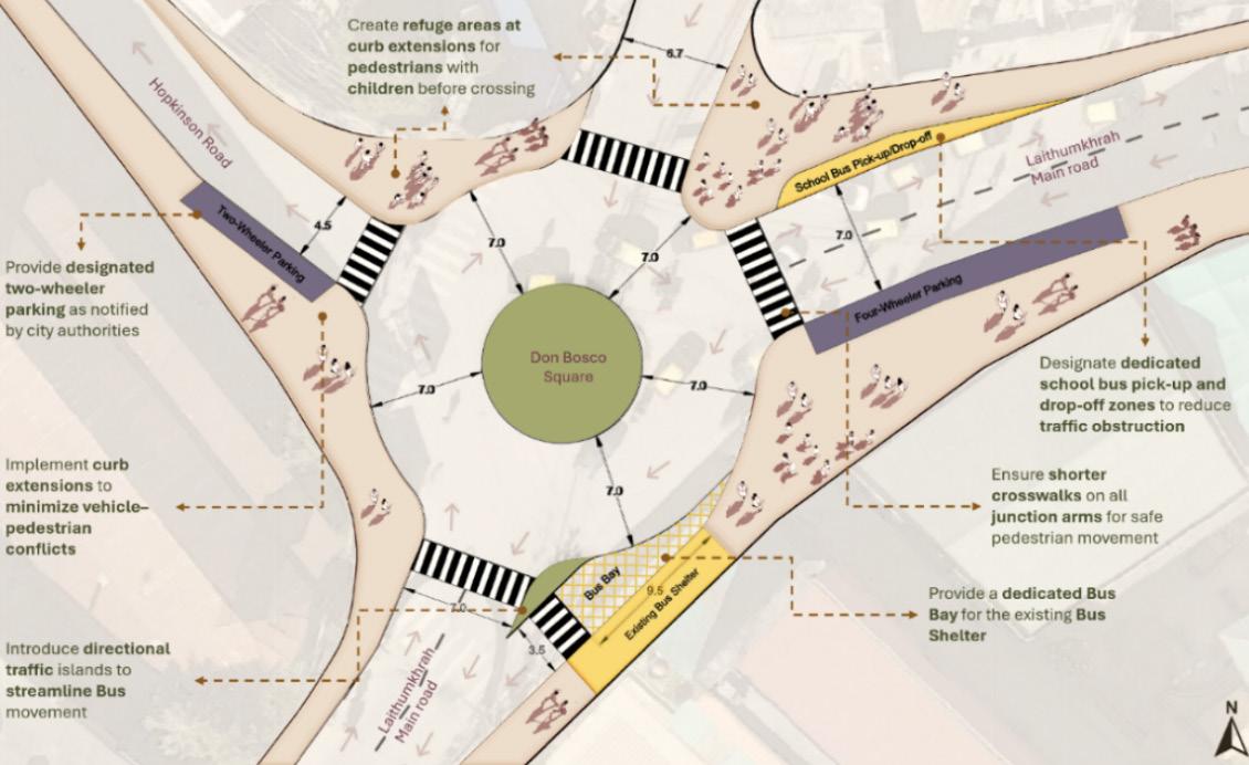
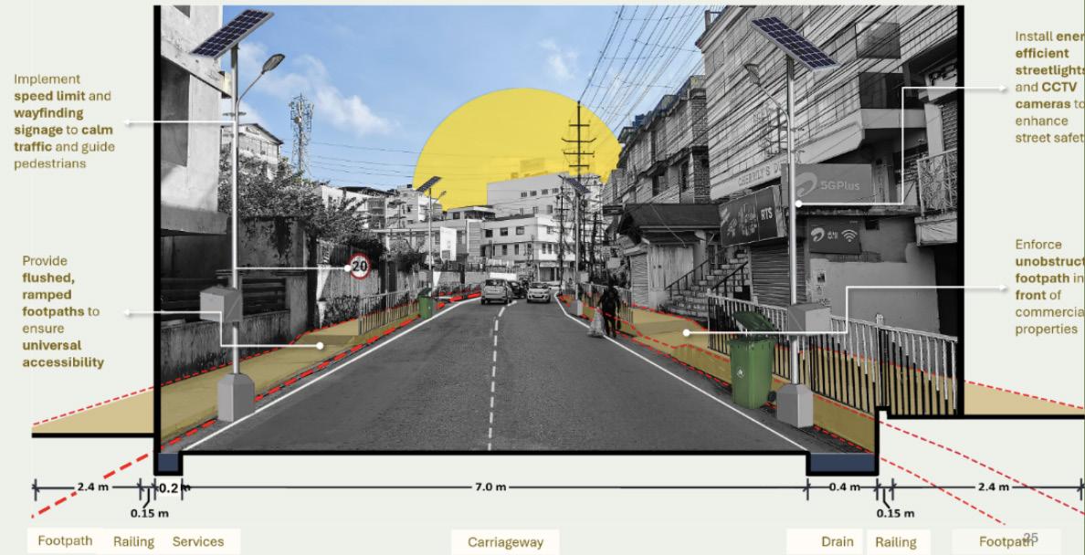
Project 2 Public Transport Action Plan, 2054
Classification Immediate
Description
Scope of work
MUDA along with Urban Affairs are procuring new Bus fleet in Shillong, in view of this preparation of a long-term public transport roadmap outlining phased fleet expansion, route rationalisation, depots, terminals and service reforms. The objective is to establish public transport as the backbone of Shillong’s mobility system.
• Network planning
• Fleet transition roadmap
• Depot and terminal planning
• Operations and contracting model
Status/ Timeline First report to be submitted February 2026 - Under Progress
Key Agencies and Implementation Mode
Tourists Residents Government officials
School/College students
Bus Operators
Fare Collection agency
Funding GIZ funded project
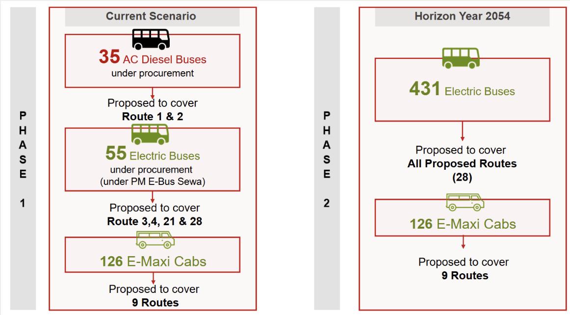
Project 3 Pedestrian Wayfinding System
Classification Immediate
Description
Scope of work
Shillong’s steep gradients, dense institutional clusters, and network of informal shortcuts make walking both essential and challenging. As the city expands NMT infrastructure, a legible and intuitive Wayfinding System is needed to help pedestrians navigate confidently, reduce dependence on verbal directions, and create a recognisable, citywide identity for walking.
• City branding and signage identity
• Wayfinding maps and routes
• Pilot installation of signage at select locations
• Universal design standards
• Wayfinding strategy for Shillong
Status/ Timeline
Key Agencies and Implementation Mode
Conceptualisation, surveys and branding -Completed Consultant finalisation -Undergoing
Lead Agency Support Agency Stakeholders
UAD
Tourism Department
SMB GIZ Tourists Businesses Residents
Funding GIZ funded project
Table. 9. Project 3: Pedestrian Wayfinding System
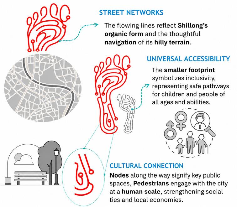
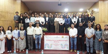
Project 4 Public Bicycle Sharing (PBS)
Classification Immediate
Description
Scope of work
Status/ Timeline
The Urban Affairs Department began exploring ways to promote Non-Motorised Transport (NMT) and diversify short-distance mobility options. With technical support from GIZ India, the city introduced electric bicycles as a practical, terrain-friendly solution. The Public Bicycle Sharing (PBS) system is designed for short urban trips, tourist circulation, and everyday mobility, operating through a simple app-based rental system and supported by trained personnel to assist new users.
• 20 electric cycles
• Docking stations at city landmarks
• User feedback and demand assessment
• Scaling strategy
Pilot launched August 2025
Scale-up under consideration
Lead Agency
UAD
Key Agencies and Implementation Mode
Support Agency Stakeholders
Tourism Department GIZ
Shillong Cycling Association Tourists Residents
Funding GIZ funded project
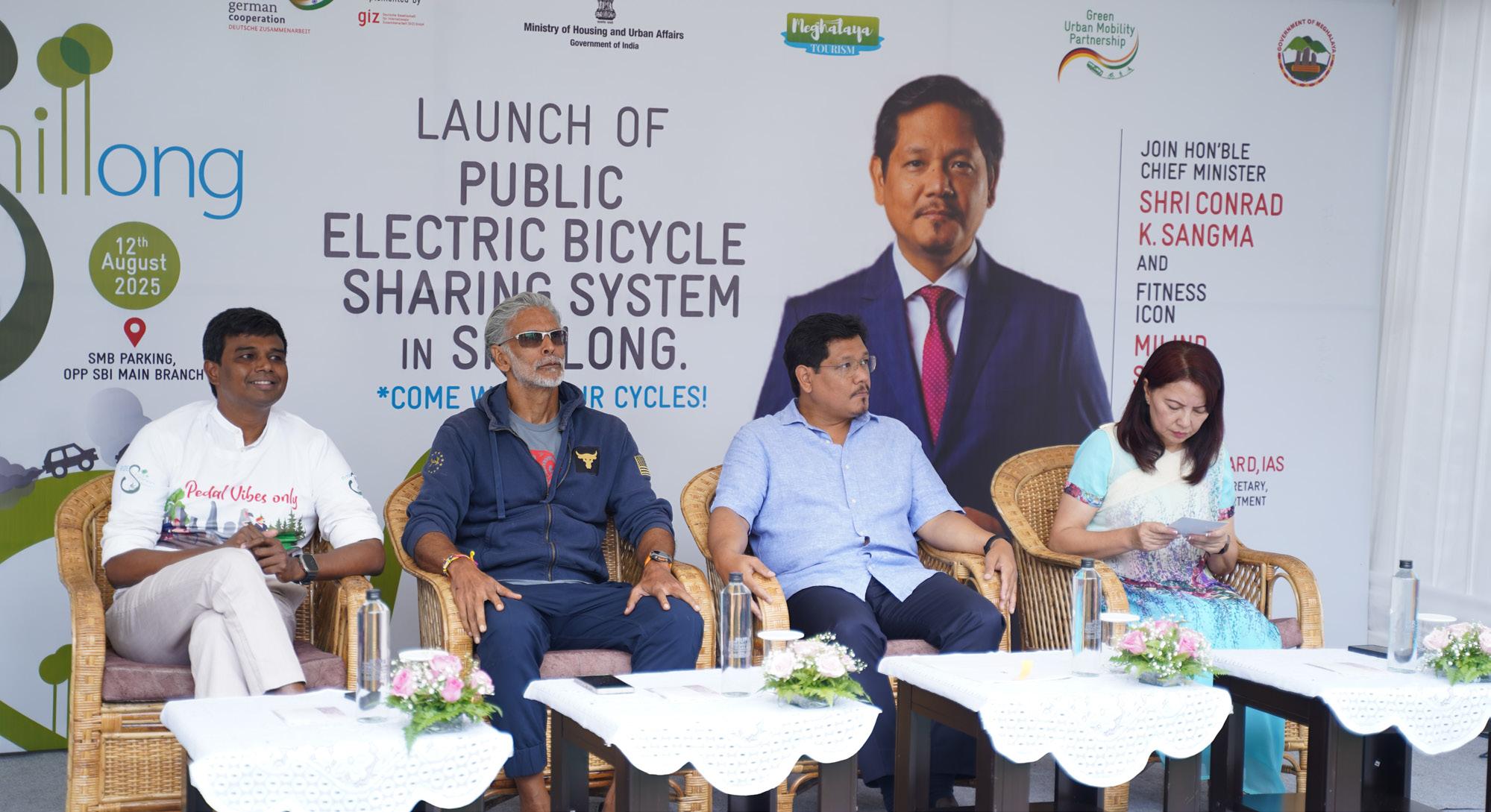
Project 5 Impact Assessment of Redesigning Streets
Classification Immediate
Description
Scope of work
Re-imagining Streets, an initiative by Urban Affairs Department, initiative, where Tactical Urbanism (TU) is used to test geometric corrections, pedestrian facilities, and safety enhancements before permanent construction. To address these issues, a combined Tactical Urbanism + Junction Redesign pilot was carried out at the major corridor.
• Walkability audits
• Safety impact analysis
• User perception surveys
• Design recommendations
Status/ Timeline Submission of the Impact Assessment and Recommendations to the departmentCompleted
Lead Agency
Key Agencies and Implementation Mode
UAD
SMB
Support Agency Stakeholders
GIZ
Scout Guides
Funding GIZ funded exercise – Surveys and Evaluation
Table. 11. Project 5: Impact Assessment of Redesigning Streets
Schools/Colleges
Residents Street Vendors
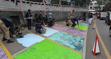
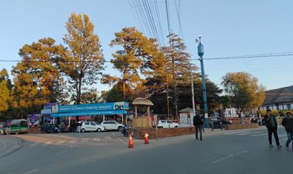
Project 6 Paid Parking ETM App – Pilot
Classification Immediate
Description
Scope of work
This project involves the development and pilot implementation of a city-grade digital parking management system to regulate on-street parking and optimise curbside space usage in Shillong’s commercial and high-demand areas. The system is built around an ETM-based Parking App enabling digital ticketing, QR-based payments, time-based billing, real-time enforcement, and backend revenue reconciliation. The pilot initiated from Mission Compound – an older locality in Shillong.
• Parking app
• Digital payments
• Enforcement systems
• Citywide scale-up strategy
Status/ Timeline Pilot Parking – Completed
Lead Agency Support Agency Stakeholders
Key Agencies and Implementation Mode
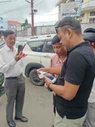
State funded – UAD, GIZ support in the Pilot ETMs
12. Project 6: Paid Parking ETM App – Pilot
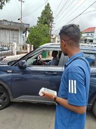
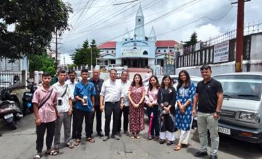
Project 7
Strengthening Bus Operations and Capacity Building
Classification Immediate -Short term
Description
Post-launch operationalisation of city bus services will be supported through focused capacity building of the Urban Mobility Cell, bus operators, and the fare collection agency, covering service planning, route rationalisation, timetable optimisation, contract management, and performance monitoring. This will be complemented by the deployment of modern digital fare systems (ETMs, mobile and QR-based ticketing, backend revenue reconciliation) and performance-based operator contracts with defined KPIs, enabling a professional, data-driven and passenger-oriented public transport system for Shillong.
• Operator RFPs and contracts
• Fare collection systems
Scope of work
Status/ Timeline
Key Agencies and Implementation Mode
• Service planning framework
• Capacity building programmes
Contract Support – Completed
Capacity Building – Ongoing
Lead Agency Support Agency
Funding GIZ funded project under SUM-ACA timeline
Stakeholders
Tourists Residents
Government officials
School/College students
Bus Operators
Fare Collection agency
Project 8 Safe Routes to School (SRTS)
Classification Immediate
Description
Scope of work
In Shillong, the SRTS programme is being implemented as a key community-engagement pillar of the neighbourhood plan. Alongside technical interventions in streets and junctions, the programme directly involves students, teachers, and parents from schools in Don Bosco neighbourhood to ensure that improvements reflect the lived experience of daily users. The approach shifts school mobility planning from a top-down exercise to a participatory process, where insights from children become meaningful inputs for government decision-making.
• Walking infrastructure audits
• Street re-design
• Travel Diaries by students
• Road safety demonstration by traffic police
Status/ Timeline Conducted SRTS workshops with the St Mary’s & DBTS -Completed
Key Agencies and Implementation Mode Lead Agency Support Agency Stakeholders UAD Shillong Traffic Police
Funding GIZ funded project
Table. 14. Project 8: Safe Routes to School (SRTS)
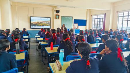
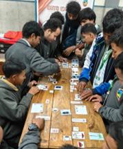
Project 9 Integrated Ticketing App & Journey Planner
Classification Immediate
Description
Scope of work
To respond to increasing demand and worsening congestion, the Government of Meghalaya has procured 35 new AC buses and 50 electric buses to expand Shillong’s public transport network and relieve peak-hour congestion. Following this, a mobile ticketing app and journey planner - enabling digital tickets, passes, real-time bus tracking, and user convenience has also been developed. This app will help commuters’ pre-book their tickets and has been incorporated with online payment methods.
• Mobile app and ETM integration
• Route planning engine
• Fare integration
• Passenger information system
Status/ Timeline Ticketing App - Completed
Journey Planner - Completed
Lead Agency Support Agency Stakeholders
Key Agencies and Implementation Mode
Tourists Residents Government officials
School/College students
Bus Operators
Fare Collection agency
Funding GIZ funded project under SUM-ACA timeline
Table. 15. Project 9: Integrated Ticketing App & Journey Planner
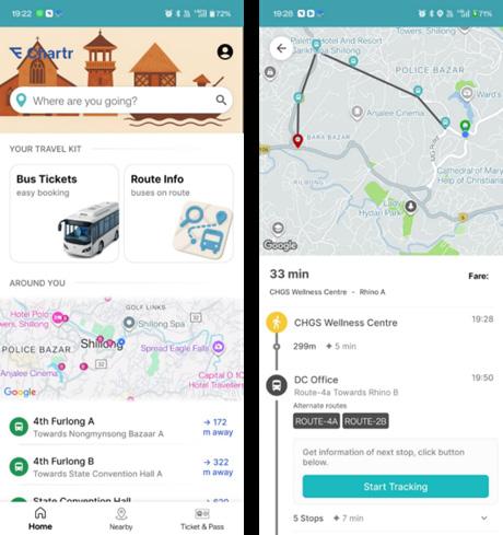
28. Snapshot of the Bus ticketing app being developed by the Urban Affairs Department
Short-term projects represent initiatives that extend beyond the SUM-ACA implementation period and are led by the city, with GIZ providing continued technical and advisory support. These projects focus on scaling up successful pilots, operationalising new systems, and institutionalising reforms across the city. GIZ’s role in this phase includes strategic guidance, planning support, capacity building, and technical
20-Minutes Neighbourhood Plans
Project 10
review, enabling the city to take ownership of implementation while maintaining alignment with integrated and sustainable mobility principles. Short-term projects typically involve citywide rollout of public transport improvements, parking management systems, active mobility networks, road safety programmes, and institutional strengthening measures.
20-Minutes Neighbourhood Plans
Classification Short-term
Description
Scope of work
This project involves the preparation and implementation of 20-minute neighbourhood plans for selected areas of Shillong, adapting the global 15-minute neighbourhood concept to the city’s hilly terrain, dispersed urban form, and walking conditions. The plans aim to improve access to daily needs - such as public transport, schools, markets, healthcare, public spaces, and local services - within a comfortable 20-minute walk or short public transport trip, by reorganising street networks, public spaces, and service distribution at the neighbourhood scale.
Identification of priority neighbourhoods; neighbourhood-level mobility and access audits; mapping of service catchments and gaps; proposals for street redesign, traffic calming, pedestrian connectivity, public transport access, and last-mile integration; coordination with land-use and development control norms; preparation of implementation-ready action plans with phasing and cost estimates.
Status/ Timeline
Key Agencies and Implementation
2 - 3 years – proposed for phased preparation and implementation following successful pilots under neighbourhood improvement initiatives
Dorbar
Funding
Tourists
Residents
MUDA
School/Colleges
State Funded – Urban Affairs Department / SMB; potential convergence with central schemes (SASCI, AMRUT, Smart City components) and support through local community participation for stewardship and maintenance.
Table. 16. Project 10: 20-Minutes Neighbourhood Plans
Project 11 Formation of Urban Mobility cell
Classification Short-term
Description
Scope of work
The Urban Mobility Cell (UMC) has been institutionalised under the Meghalaya Urban Development Authority (MUDA) as per the Shillong Urban Mobility Policy, 2024, to serve as the dedicated agency for planning, managing, and monitoring public transport services in Shillong. The Cell was formally notified on 25 June 2025 and has been created to address long-standing gaps in institutional capacity, fragmented responsibilities, and limited manpower that previously constrained the city’s public transport system.
Reviewing of existing NCC contracts, designing a GCC-based contracting framework suitable for both diesel and electric bus operations, defining service-level agreements and performance indicators, restructuring operator payment and incentive mechanisms, integrating fare collection and revenue management systems under city control, and supporting the transition process including tendering, contract finalisation, and operational rollout.
Status/ Timeline Completed
Key Agencies and Implementation Mode
Bus Operating Agencies
Fare Collection Agency
ITS/IT vendors
UMC Members
Funding State-funded (MUDA) for establishment, staffing, and operations
Project 12 Conversion of Public Transport Contract from NCC to GCC
Classification Short-term
Description
Scope of work
This project involves transitioning Shillong’s public transport service model from the existing Net Cost Contract (NCC) to a Gross Cost Contract (GCC) framework, in line with the city’s planned fleet expansion. With 35 new AC diesel buses already procured and 55 electric buses proposed under the PM e-Bus Sewa scheme, the shift to GCC is required to ensure service reliability, operational control, and financial sustainability as the system scales. The new contract structure will enable the city to retain fare and revenue control while paying operators on a performance-linked basis.
Reviewing of existing NCC contracts, designing a GCC-based contracting framework suitable for both diesel and electric bus operations, defining service-level agreements and performance indicators, restructuring operator payment and incentive mechanisms, integrating fare collection and revenue management systems under city control, and supporting the transition process including tendering, contract finalisation, and operational rollout.
Status/ Timeline
Key Agencies and Implementation Mode
2–3 years - contract transition aligned with phased induction of new diesel and electric buses.
Lead Agency
MUDA Bus Operators Fare Collection Agency
Funding
Support Agency Stakeholders
UAD Tourists Residents Government officials
State Funded – MUDA; Central support under PM e-Bus Sewa for electric bus operations; technical advisory support for contract restructuring.
Table. 18. Project 12: Conversion of Public Transport Contract from NCC to GCC
Project 13 Relocation of Vendors to Dedicated Vending Zones
Classification Short-term
Description
Scope of work
This project involves the relocation and rationalisation of street vendors and hawkers from major commercial and congested zones in Shillong to designated, organised vending zones, in accordance with the Street Vendors (Protection of Livelihood and Regulation of Street Vending) Act, 2014 and the Meghalaya Street Vendors Scheme. It aims to strike a balance between preserving vendors’ livelihoods and enhancing street safety, pedestrian accessibility, and urban order by reducing encroachments on footpaths and carriageways in high-activity areas such as Khyndailad and around Civil Hospital. Recent efforts have already seen successful relocations to new vendor zones that offer formal space and basic facilities for vendor operations.
The scope includes conducting comprehensive vendor surveys and mapping, classification of vending zones, design and preparation of designated vending spaces with basic amenities, stakeholder consultations (including vendor associations), legal processes for recognition and vending certificates, phased relocation planning, and support for livelihood transition into the new zones.
Status/ Timeline Initiated - phased implementation ongoing with initial relocations completed and additional vendor zones being developed.
Key Agencies and Implementation Mode
Funding
Lead Agency Support Agency Stakeholders
UAD SMB
MUDA Police Department
Businesses
Vendors
SMB
State Government funding under the Street Vendors Scheme and city infrastructure budgets; potential convergence with central mobility and urban development schemes; funding for vending zone infrastructure and support mechanisms.
Project 14 Low Emission Zones (LEZs)
Classification Short-term
Description
Scope of work
This project involves the identification and implementation of Low Emission Zones (LEZs) in selected school zones, residential neighbourhoods, and high pedestrian activity areas in Shillong, as envisaged in the Shillong Urban Mobility Policy. The initiative aims to reduce vehicular emissions, improve local air quality, and enhance road safety by regulating the entry and movement of high-emission vehicles in sensitive areas. LEZs will prioritise walking, cycling, public transport, and clean vehicles, particularly around schools and neighbourhood centres with high exposure of children, elderly, and vulnerable users.
The scope includes identification of priority LEZ locations (school zones, neighbourhood centres, hospital areas), traffic and emission baseline assessment, definition of vehicle restriction and exemption criteria, design of traffic calming and access management measures, installation of signage and road markings, integration with parking and enforcement systems, stakeholder consultations with schools and local communities, and preparation of an implementation and monitoring framework.
Status/ Timeline
Key Agencies and Implementation Mode
2–3 years - proposed for phased implementation starting with pilot LEZs around selected school zones
Dorbar Shnongs Residents Traffic Police Vehicle Association
Funding
State Government funding through urban development and environment budgets; potential convergence with central clean air and climate-related schemes; support through parking revenues and enforcement-based collections.
Project 15 New and Improved Bus Stops with Integrated Real-Time Information
Classification Short-term
Description
Scope of work
Status/ Timeline
This project focuses on the upgradation, standardisation, and expansion of public transport bus stops across Shillong, with the integration of Real-Time Passenger Information (RTPI) systems. The city has already initiated surveys to assess existing bus stops - identifying locations requiring full redevelopment, partial renovation, or basic bus stop signage. As part of the first phase, bus stops along Route 1 have been identified and model designs prepared, establishing a template for citywide rollout. The project aims to improve passenger comfort, accessibility, visibility of the public transport system, and reliability of information.
The scope includes citywide bus stop audits and classification, preparation of standard bus stop design typologies (full shelters, upgraded stops, signage-only stops), integration of real-time arrival displays and route information, universal accessibility features, lighting and safety elements, and phased implementation starting with priority routes.
Ongoing - surveys underway, Route 1 bus stops identified, model designs prepared, phased implementation in progress.
Lead Agency
Key Agencies and Implementation Mode
Funding
Stakeholders
Residents Tourists
IT Agencies
Bus Operators
Fare Collection Agency
State Government funding for infrastructure upgrades; potential convergence with central public transport and digital mobility schemes; support through advertising rights and integration with public transport operations budgets.
Long-term projects reflect Shillong’s aspirational mobility vision and are intended to be implemented over a longer planning horizon. These initiatives require significant policy reform, capital investment, inter-agency coordination, and behavioural change, and are closely linked to the city’s growth trajectory, climate commitments, and land-use strategies. Longterm projects include structural public transport reforms, large-scale electrification, demand
management measures, integrated land-use and mobility interventions, and advanced digital mobility systems. While these projects may be at varying stages of conceptualisation, they provide a clear direction for future investments and ensure that near-term actions remain aligned with Shillong’s long-term mobility goals.
The outcome assessment was carried out by re-evaluating the nine mobility pillars (Annexure 1) against the identified priority projects, assessing how each pillar’s performance would improve if the proposed initiatives were implemented as planned. The same set of indicators and parameters used in the baseline assessment were
applied to ensure consistency and comparability. Each project was mapped to the relevant pillar(s) and evaluated for its expected impact on coverage, service quality, institutional strength, safety, and sustainability outcomes. The detailed indicators, metrics, and scoring methodology used for this assessment are provided in Annexure 2.
Climate & Environmental sustainability Climate-Resilient & compact Urban growth
The outcome assessment indicates a significant positive shift across all nine mobility pillars when the priority projects are considered in aggregate. The most notable improvements are observed in Public & Shared Transport Systems, Active Mobility (Walking & Cycling), and Governance, Financing & Monitoring, reflecting the strong emphasis placed on strengthening public transport operations, improving pedestrian and cycling infrastructure, and institutionalising
mobility governance through the Urban Mobility Cell and supporting systems. These gains highlight the role of targeted, implementation-ready projects in addressing long-standing structural gaps in Shillong’s mobility ecosystem.
Substantial improvements are also projected in Parking & Travel Demand Management, Road Safety, and Equity, Inclusion & Informal Sector, driven by initiatives such as the dynamic citywide parking pricing system, Safe Routes
to School, Low Emission Zones near schools and neighbourhoods, and the formalisation and relocation of street vendors. Together, these interventions are expected to reduce congestion,
The Integrated Mobility Plan establishes Shillong’s strategic direction; the next phase is ensuring that it translates into tangible improvements on the ground.
The first priority is strengthening the Urban Mobility Cell (UMC) as the institutional anchor for implementation. This requires completing its staffing structure with dedicated personnel for planning, operations, and monitoring, while providing it with a formal coordination mandate across MUDA, SMB, UAD, the Traffic Police, and the Dorbar Shnong network. Capacity building should be embedded within the UMC’s annual work programme through regular, structured training and knowledge exchange. Without a functional and adequately staffed UMC, implementation risks remaining dependent on individual champions rather than institutional systems.
The second priority is scaling up initiatives that have already demonstrated their value. The public bicycle sharing system should expand beyond its current single station into a citywide network capable of generating meaningful ridership and connectivity benefits. Similarly, the pedestrian wayfinding pilot should be extended across key pedestrian corridors, public spaces, and transport
improve safety outcomes, and enhance access for vulnerable user groups, particularly pedestrians, children, women, and informal-sector workers.
interchange points. Moving from pilot projects to citywide programmes will require clear procurement mechanisms, operational protocols, and sustained institutional ownership, with the UMC playing a central coordinating role.
Third, bus fleet electrification must evolve from vehicle procurement to system-wide transition. The 55 e-buses being introduced under PM e-Bus Sewa represent an important first step, but longterm transformation will require a phased electrification strategy for the entire SPTS fleet. This should be accompanied by a comprehensive charging infrastructure plan covering depot requirements, grid readiness, maintenance systems, and operational planning. Electrification succeeds when vehicles, infrastructure, and operations are planned together.
Finally, a robust monitoring and evaluation framework should be institutionalised under the UMC. Defined indicators, clear responsibilities, regular reporting mechanisms, and a publicfacing dashboard will enable progress to be tracked transparently and course corrections to be made when needed. This is what transforms the IMP from a planning document into a living framework that can respond to Shillong’s evolving mobility needs.
A Diagnostic and Strategy-Enabling Tool for Indian Cities
Developed under: GIZ SUM-ACA Project
Sustainable Urban Mobility – Air Quality, Climate Action and Accessibility GIZ India | Ministry of Housing and Urban Affairs (MoHUA) 2025

India’s cities face compounding mobility challenges: rapid urbanisation, worsening air quality, rising motorisation, and deepening inequities in access to transport. Planning instruments such as Comprehensive Mobility Plans (CMPs) are extensively prepared, yet implementation has frequently been constrained by an over-reliance on travel demand forecasting and infrastructure-led approaches that do not adequately address systemic inefficiencies, institutional fragmentation, or emerging climate imperatives.
National-level policies have progressively widened the mandate for urban mobility planning. The National Clean Air Programme (NCAP, 2019) requires 122 nonattainment cities to prepare action plans linking mobility interventions to air quality targets. The Indo-German Green Urban Mobility Partnership (GUMP), signed in 2019 is a collaboration between the Ministry of Housing & Urban Affairs (MoHUA) and the German Federal Ministry for Economic Cooperation and Development (BMZ) to support and encourage environment friendly sustainable urban transport projects — supported by EUR 1 billion in concessional KfW lending for sustainable mobility infrastructure. It is in this context that the Integrated Mobility Plan (IMP) Evaluation Framework has been developed under the GIZ’s SUM-ACA project (Sustainable Urban Mobility – Air Quality, Climate Action and Accessibility), implemented in partnership with MoHUA. The framework is a diagnostic and strategy-enabling tool designed to shift city planning from predicting future demand to understanding current system performance and enabling cities to identify targeted, implementable interventions that serve equity, climate, and air quality objectives simultaneously.
This chapter documents the methodological basis of the IMP Evaluation Framework — the principles that shaped its design, the structured process through which it was developed, and the logic by which its nine dimensions and forty parameters were derived. Transparency of methodology is central to the credibility of the framework as a comparative assessment instrument.
The development of the IMP Framework is anchored in four core principles that define its scope, structure, and applicability:
The framework was constructed through a seven-step process that moves from a review of global and national frameworks through to validation against real city conditions. Each step produced a discrete methodological output that informed the next stage of development.
Table 2.1 Guiding Principles of the IMP Evaluation Framework conditions. Each step produced a discrete methodological output that informed the next stage of development.
Guiding Principle
City-Scale Measurability
Outcome-Oriented Structure
Systems-Based Approach
Alignment with Policy and Practice
Description
Indicators are designed to be measurable using secondary datasets — CMPs, Smart City systems, ITMS data, GIS layers, and administrative rds — ensuring applicability across cities without requiring primary data collection.
The framework focuses on mobility outcomes — accessibility, safety, inclusion, and emissions reduction — rather than isolated infrastructure provision.
Urban mobility is evaluated as an integrated system linking land use and urban form, public and informal transport systems, active mobility networks, digital ecosystems, and governance and financing structures.
Indicators and scoring logic are derived from the CMP Toolkit and Service Level Benchmarks (MoHUA), SUMP Guidelines (EU), ITDP, WRI, and World Bank toolkits, and the GIZ MaaS Readiness Framework.
Table 2.2 Methodological Flow for Development of the IMP Evaluation Framework
Step 1 Review of global and national frameworks (SUMP, CMP, SLB, ITDP, WRI, World Bank, GIZ)
Step 2 Translation of outcomes into system-level dimensions
Identification of core mobility outcomes
Definition of 9 functional mobility pillars
Step 3 Identification of parameters within each dimension Distinct performance areas and intervention levers
Step 4 Development of measurable indicators for each parameter City-scale, coverage-based metrics
Step 5 Integration of cross-cutting themes (climate, inclusion, digital) Mainstreamed across all parameters
Step 6 Development of scoring system (1–5 maturity scale) Standardised evaluation framework
Step 7 Validation and iteration using real city data Refinement for applicability and robustness
The review encompassed the EU Sustainable Urban Mobility Plan (SUMP) Guidelines (2nd ed., 2019); MoHUA’s Comprehensive Mobility Plan (CMP) Toolkit (2014) and Service Level Benchmarks (2012); ITDP’s Complete Streets Workbook and Women & Transport toolkit; World Bank Urban Transport Benchmarking; WRI India Low Emission Zones toolkit; GIZ MaaS Readiness Level for India (MRLI, 2021); and India’s National Clean Air Programme (2019), ClimateSmart Cities Assessment Framework 2.0 (2020), and National Disaster Management Authority guidelines. This breadth of review ensures that the framework captures global best practice while remaining grounded in India’s regulatory and institutional context.
The nine dimensions (pillars) of the IMP Framework are derived through a structured translation of SUMP thematic areas, CMP Toolkit guidance, and complementary practitioner frameworks into operational system components relevant to the Indian city context. Each dimension represents a distinct system lever — a domain where targeted interventions can produce measurable improvements in mobility outcomes. Together, the nine dimensions ensure that the framework captures both physical and institutional aspects of urban mobility.
The table below summarises how each dimension was derived, the source frameworks it draws on, its conceptual basis, and how it was adapted for the Indian context.
Table 2.3 Derivation of the Nine IMP Framework Dimensions and Their Adaptation to the Indian Context
IMP Dimension
Climate-Resilient & Compact Urban Growth
Public & Shared Transport Systems
Active Mobility (Walking & Cycling)
Equity, Inclusion & Informal Systems
Derived From Conceptual Basis Adaptation for Indian Context
SUMP (Accessibility, Environment), CMP Toolkit, TOD Policy
SLBs, CMP Toolkit, SUMP (Efficiency)
SUMP (Accessibility, Quality of Life), ITDP
SUMP (Inclusion), World Bank, ITDP
Integration of land use and mobility to enable accessibility
Service performance, accessibility, and reliability of PT systems
Walking and cycling as core modes
Inclusive mobility across all user groups
Expanded to include climate resilience and ecological continuity
Includes fare integration, MaaS, and multimodal performance
Includes universal access, child safety, and gender-sensitive design
Explicit inclusion of IPT and the informal sector
Climate & Environmental Sustainability
Parking & Travel Demand Management
Governance, Financing & Monitoring
Road Safety
Digital Integration
SUMP (Environment), NCAP, CSCAF
SUMP measure packages, ITDP, WRI
SUMP implementation steps, NUTP
SUMP (Safety), MoRTH, IRC
Emissions reduction and environmental performance
Demand management and behaviour change
Institutional and financial capacity
Reduction of fatalities and injuries
GIZ MaaS, DMAF, NCMC Digital enablement of mobility systems
Includes EV transition, air quality zones, and resilience
Focus on parking pricing and vehicle restraint mechanisms
Includes UMTA, funding mechanisms, and data systems
Includes school safety and gender safety perception
Elevated as standalone dimension for Indian Smart City context
Three cross-cutting themes — gender and social inclusion, climate and air quality, and digital integration — are mainstreamed across dimensions rather than isolated as standalone topics. Gender and inclusion considerations appear within Pillars II, III, IV, and VII. Climate and air quality objectives are embedded in Pillars I, V, and VI. Digital integration is both elevated as a standalone dimension (Pillar IX) and referenced within governance and monitoring parameters (Pillar VII).
For each of the nine dimensions, parameters were selected on the basis of three criteria: city-scale measurability using secondary datasets; conceptual alignment with the dimension’s mobility outcomes; and policy grounding in at least one national or international reference standard. This section documents the derivation logic and source frameworks for each parameter set, providing a traceable audit trail from source frameworks to adopted metrics.
This dimension was designed to assess the scale, intensity, and pattern of urban development, and the extent to which these dynamics are aligned with sustainable mobility and climate resilience objectives across six parameters. The selected parameters examine three interrelated concerns: (i) urban form and its interface with mobility systems, (ii) the accessibility outcomes of that urban form, and (iii) the resilience of the city’s development and mobility systems to climate and disaster risks. The parameter set was intentionally limited to aspects assessable at city scale using statutory plans, GIS-based land use and network data, CMPs, and state policy documents.
Resilient Urban Growth
Integration of Mobility with City Planning
Service Proximity
SUMP (Accessibility, Environment); NDMA; CSCAF; CMP Toolkit
CMP Toolkit; SUMP; TOD Policy
SUMP; CMP Toolkit; accessibility planning approaches
Street Network Structure & Connectivity
Disaster Risk Management
Climate Mitigation
ITDP Complete Streets; CMP Toolkit; walkability and permeability principles
NDMA; CSCAF; SUMP environment/resilience logic
NCAP; FAME; climate action and low-carbon mobility frameworks
Whether urban growth is being contained and directed toward existing serviced areas, while safeguarding ecological systems and reducing unsustainable outward expansion
Extent to which statutory land use planning and mobility planning are mutually reinforcing
Degree to which populated areas have essential services (schools, markets, healthcare) within walking distance, reducing motorised trip dependence
Whether the city has a coherent street hierarchy and interconnected network that supports walkability, permeability, and bus penetration
Whether mobility infrastructure planning is aligned with flood, heat, and emergency access considerations
Whether the city has adopted targets and measures for transport-related GHG reduction through modal shift, electrification, and low-carbon strategies
Policy intent and evidence of contained growth
Policy alignment
Coverage (%) –services within 15 min / 1 km walk
Composite –policy presence + % coverage indicators
Policy / coverage
Policy / coverage – GHG targets, EV, modal shift
This dimension was designed to assess the scale, intensity, and pattern of urban development, and the extent to which these dynamics are aligned with sustainable mobility and climate resilience objectives across six parameters. The selected parameters examine three interrelated concerns: (i) urban form and its interface with mobility systems, (ii) the accessibility outcomes of that urban form, and (iii) the resilience of the city’s development and mobility systems to climate and disaster risks. The parameter set was intentionally limited to aspects assessable at city scale using statutory plans, GIS-based land use and network data, CMPs, and state policy documents.
Network Coverage
Service Frequency & Reliability
Real-Time Service Integration
Service Level Benchmarks (MoUD, 2012); CMP Toolkit (2014)
SLBs (2012); Urban Bus Specifications UBS-II, MoUD (2013)
AIS-140 ITS Standard, MoRTH (2018); GIZ MaaS Readiness Level for India (2021)
Affordability
SLBs (2012); World Bank Urban Transport Benchmarking (2014–16)
Gender & Safety World Bank Gender Responsive Urban Mobility Toolkit (2022); ITDP Women & Transport (2017)
Physical Integration
Commuter Responsive Planning
National TOD Policy, MoHUA (2017); UMI Multimodal Integration resources (2016–18)
World Bank Urban Bus Toolkit; CMP Toolkit (2014)
Accessibility to public transport – ensuring spatial equity of coverage
Service quality as a primary driver of ridership – frequency and on-time performance
Seamless and informed journeys through real-time passenger information and fare integration
Economic access – ensuring public transport is financially accessible to lower-income households
Inclusive mobility – creating environments where women feel safe and can travel independently
Seamless multimodal transfers – ensuring stations function as connected mobility hubs
Adaptive service planning – routing and scheduling adjusted to actual ridership and equity needs rather than fixed forecasts
% population within 500m bus stop / 1km rail station
Average headway; % on-time; buses per lakh population
% fleet with RTPI; fare / service integration presence
Monthly pass as % of bottom-40% household income
Policy presence + user perception of safety
% major transit stations with multimodal access planning
Policy / process presence – route review mechanisms
This dimension assesses the extent to which cities support walking and cycling as primary modes for short-distance travel, recognising their critical role in improving accessibility, reducing emissions, and enhancing public health. Parameters focus on network continuity, inclusivity, and safety rather than isolated infrastructure provision. The emphasis on universal access and personal security reflects the need to create environments usable by all user groups, including children, elderly persons, and women. Together, these parameters evaluate whether active mobility is treated as a systematic, network-level priority.
Table 2.6 Parameter Derivation Framework for Pillar III: Active Mobility (Walking and Cycling)
Parameter
Continuity & Connectivity of NMT Networks
ITDP Complete
Streets Workbook (2016)
Universal Access
Personal Security
Harmonised Accessibility Guidelines, MoHUA (2021); World Bank Gender Toolkit (2022)
World Bank Gender Responsive Urban Mobility Toolkit (2022)
Network continuity –walking and cycling infrastructure must be uninterrupted to be usable, especially for commuting and school trips
Inclusive design – streets must be usable by children, elderly, and differently abled persons
Safety and comfort – lighting and active frontages are essential for women, children, and vulnerable groups to use streets at all hours
% arterial corridors with continuous footpath / cycle lane ≥1 km
Programme existence / coverage of barrier-free infrastructure
% streets with adequate lighting + eyes-on-street proxy
This dimension recognises that urban mobility in Indian cities is deeply shaped by socio-economic disparities and the prevalence of informal systems. Parameters were selected to assess whether mobility systems are inclusive of low-income populations, informal settlements, and non-formal transport services such as intermediate public transport (IPT). The inclusion of street vending policy and universal accessibility reflects the need to balance mobility efficiency with livelihoods and equitable access to public space. These parameters evaluate whether cities are moving towards a mobility system that is socially inclusive and reflective of ground realities.
Table 2.7 Parameter Derivation Framework for Pillar IV: Equity, Inclusion and Informal Systems
Low-Income
Access
CMP Toolkit (2014); World Bank Accessibility & Inclusion (2015–22)
Alternative Mobility (IPT)
Street Vendors & Informal Use Policy
National TOD Policy (2017); UMI Multimodal Integration (2016–18)
Street Vendors Act (2014); National Policy on Urban Street Vendors (2009)
Accessibility for Differently Abled Harmonised Accessibility Guidelines (2021); World Bank Toolkit (2022)
Spatial equity – ensuring informal settlements and low-income areas are not mobility-excluded
First / last mile access – IPT fills the gap where formal PT does not penetrate
Livelihood inclusion –vending around transit hubs must be regulated to coexist with pedestrian and NMT flows
Universal mobility – fleet and stations must be compliant with accessibility standards
% informal settlements linked to public transport services
Availability –safe, affordable, app-accessible IPT services
Policy presence / enforcement and designated vending zones
% compliant fleet and stations
Across five parameters this dimension evaluates the extent to which urban mobility systems contribute to climate mitigation, air quality improvement, and environmental sustainability. Parameters focus on measurable transitions such as fleet electrification, renewable energy integration, and emission control, while capturing broader policy responses such as low-emission zones and congestion management. The inclusion of resilient infrastructure ensures that environmental sustainability encompasses not only mitigation but adaptation to climate risks such as flooding and extreme heat. Parameters collectively reflect the dual objective of reducing environmental impact while ensuring system continuity.
Table 2.8 Parameter Derivation Framework for Pillar V: Climate and Environmental Sustainability
Low-Emission Fleet Share
Renewable Integration
FAME II (2019); EV Charging Guidelines, MoP (2022)
CSCAF 2.0 (2020); EV Charging Guidelines (2022)
Air Quality Integration
Emission Compliance & Congestion
Resilient Infrastructure
NCAP (2019); WRI Low Emission Zones Toolkit (2021)
NCAP (2019); WRI LEZ Toolkit (2021)
NDMA Urban Flooding Guidelines (2010); CSCAF 2.0 (2020)
Clean mobility transition – fleet electrification is the primary lever for transport-related air quality improvement
Energy sustainability – depots and stations powered by renewables reduce the life-cycle carbon of transit assets
AQ improvement – mobility plans must explicitly target hotspot areas with clean mode priorities and vehicular restrictions
Emission compliance and traffic performance as joint indicators of fleet quality and network efficiency
Climate resilience – transport infrastructure must be designed / retrofitted to withstand flooding, heat, and storms
% fleet on low-emission technology (e-bus, CNG, hybrid)
% depots and stations powered by renewable energy
Policy / coverage – LEZ, pedestrianisation, vehicular restrictions
BS-VI compliance (%) + peak V/C ratio on arterial corridors
% corridors, depots, and terminals with climate-resilient design
This dimension addresses the need to manage travel demand rather than continuously expand road capacity. Parameters were selected to evaluate whether cities are adopting policy instruments that discourage excessive private vehicle use and promote sustainable modes. Parking management is treated as a primary lever given its direct influence on travel behaviour. Broader vehicle restraint measures capture regulatory and fiscal interventions such as congestion pricing and lowemission zones. Together, these parameters assess whether cities are treating demand management as a core mobility strategy rather than an optional add-on.
Parking Policy ITDP On-Street Parking Management Toolkit (2016); GIZ Parking Management for Small & Medium Towns (2023)
Private Vehicle Restraint ITDP Taming Traffic (2021); WRI
India Low Emission Zones Toolkit (2021)
Demand management –parking supply and pricing directly shape private vehicle use decisions
Policy presence / demand-based pricing enforcement
Behaviour change – fiscal and regulatory instruments must disincentivise car use alongside PT improvement
Policy presence / coverage – congestion pricing, LEZ, levies
This dimension evaluates the institutional and financial foundations required to deliver sustainable mobility systems across six dimensions. Parameters were selected to assess whether cities have the institutional structures, funding mechanisms, and monitoring systems necessary for effective planning and implementation. Given the fragmented governance landscape in Indian cities, particular emphasis is placed on the presence of coordinated authorities such as UMTAs or SPVs. The inclusion of financing tools and data systems reflects the importance of long-term financial sustainability and evidence-based decision-making.
Table 2.10 Parameter Derivation Framework for Pillar VII: Governance, Financing and Monitoring
Institutional Framework (UMTA / SPV)
Funding & O&M Mechanisms
NUTP (2014); Metro Rail Policy (2017)
Value Capture Finance Policy (2017); NUTP (2014)
Land Value Capture / TOD Financing
Monitoring & Data
TOD Policy (2017); Value Capture Finance Policy (2017)
DMAF 2.0 (2020); SUMP Guidelines (2019)
Coordination capacity –empowered, cross-agency authority is the prerequisite for integrated planning
Financial sustainability – dedicated revenue streams ensure longterm operation without annual budget uncertainty
Financing integration – land-based instruments recover mobility investment costs from development that transit enables
Evidence-based planning – a mobility dashboard with KPIs enables adaptive management and performance accountability
Policy presence –statutory authority with financial autonomy
Finance mechanism presence –dedicated revenue streams
Finance mechanism presence –LVC instruments in use
Monitoring system and dashboard presence
Institutional & Stakeholder Coordination
SUMP Guidelines (2019)
Capacity Building SUMP Guidelines (2019)
Multi-agency coordination – regular forums with PT agencies, civic bodies, and civil society are necessary for integrated planning
Institutional capacity – staff competency in transport planning directly affects quality of plan preparation and implementation
Process / outcome – number of inter-institutional meetings per year
Process / outcome – proportion of staff with transport planning competency
This dimension treats road safety as a core outcome of urban mobility systems rather than a standalone sectoral issue. Parameters focus on measurable safety outcomes — fatalities and serious injuries — as well as proactive measures such as black spot treatment and school safety programmes. The inclusion of both outcome and intervention-based indicators ensures that cities are evaluated on their current safety performance as well as their efforts to improve it. This approach aligns with global Vision Zero frameworks while remaining grounded in Indian data availability and institutional practice.
Fatalities & Serious Injuries
Road Accidents in India, MoRTH (2023); IRC SP:88 (2010)
Black Spot Management
School & Child Safety
MoRTH Circular (2015 / 2019); IRC 131 (2022)
WRI India Safe Access to Schools (2016–21); World Bank Gender Toolkit (2022)
Safety outcomes – the ultimate measure of a city’s road safety performance is the rate of death and serious injury among road users
Risk reduction – targeted treatment of identified crash hotspots is the most cost-effective safety intervention
Child safety – school zones require dedicated measures because children are among the most vulnerable road users
Annual fatalities per 100,000 population, disaggregated by mode
% identified black spots treated through infrastructure or enforcement
% schools with Safe Access to School plans implemented
This dimension captures the growing role of digital systems in enabling integrated, user-centric mobility services. Parameters were selected to evaluate not only the availability of digital infrastructure but its integration, governance, and adoption by users. This includes policy readiness for data sharing, platform integration through MaaS and NCMC, and the availability of open data systems such as GTFS. Digital Integration is elevated as a standalone dimension — rather than embedded within governance — to reflect the central role of ITS and MaaS platforms in India’s Smart Cities Mission context and the GIZ MaaS Readiness framework.
Parameter Derived From Conceptual Basis Adopted Metric
Policy & Regulatory Readiness
Digital System Integration (MaaS)
NDSAP (2012); NCMC Guidelines (2019–20)
Data Infrastructure & Availability
GIZ MaaS Readiness Level for India (2021); NCMC (2019–20)
DMAF 2.0 (2020); NDSAP (2012)
Digital governance –enabling policies on open data, interoperability, and secure payments are prerequisites for MaaS and ITS at scale
Platform integration – a unified MaaS platform aggregating modes for trip planning, booking, payment, and feedback
Data availability – open, standardised datasets (GTFS, GTFS-RT, open APIs) are the foundation of third-party and MaaS platform access
Policy presence – open data mandates, interoperability frameworks, digital payment standards
Platform existence and rate of adoption by users
% transport operators providing open, standardised data feeds
Digital Travel Behaviour
GIZ MaaS Readiness Level for India (2021); ITDP Transport4All (2023)
User adoption – digital infrastructure is only effective if users actively use it for trip planning and ticketing
% PT riders using digital tools (apps, smart cards) at least weekly
The IMP Evaluation Framework comprises nine thematic pillars and forty parameters. Each pillar captures a distinct system lever required to achieve sustainable mobility outcomes, collectively encompassing both physical and institutional dimensions of urban mobility. The table below provides a summary view; detailed parameter derivation is presented in Section 2.4.
The 40 parameters span infrastructure coverage, service performance, policy adoption, institutional mechanisms, financing arrangements, and digital maturity — ensuring that no critical system component is overlooked. Each parameter is assessed on a standardised 1–5 maturity scale documented in Section 4.
The IMP Evaluation Framework adopts a five-point maturity scale (1–5) to assess each parameter in a consistent and comparable manner across all dimensions. The scoring system is designed to capture the progression from intent to fullscale implementation, recognising that cities may be at different stages of policy development, pilot implementation, and system-wide adoption.
1 No Intent
2 Only Intent
3 Progressing
4 Partly Achieved
5 Achieved
The parameter is absent from policy, planning documents, or implementation. There is no evidence of consideration in the city’s mobility framework.
The parameter is acknowledged in plans, policies, or strategies, but there is no evidence of implementation or operationalisation.
Initial implementation has begun through pilots or limited interventions, typically covering ≤30% of the city or system. Efforts are fragmented or not yet institutionalised.
The parameter is institutionalised and implemented across a significant portion of the city (~30–70% coverage), but gaps remain in consistency, quality, or system integration.
The parameter is fully implemented and mainstreamed across the city (≥70% coverage or system-wide adoption), supported by robust institutional, operational, and monitoring mechanisms.
While the scoring scale is standardised, assessment thresholds are calibrated to the type of metric used for each parameter:
• Coverage-based parameters: Evaluated using percentage thresholds — population coverage, network extent, or fleet share. The score 3 / Progressing threshold corresponds to ≤30% coverage; score 5 / Achieved requires ≥70%.
• Policy-based parameters: Evaluated based on the existence, statutory integration, and enforcement of policies. Score 2 reflects a drafted or notified policy with no evidence of implementation; score 5 requires policy fully embedded in regulatory and planning systems.
• Performance-based parameters: Evaluated using benchmarks — headways, on-time performance, affordability ratios, or fatality rates — derived from Service Level Benchmarks, SUMP Guidelines, and sector-specific standards.
• Process-based parameters: Evaluated based on institutional mechanisms, frequency of stakeholder engagement, and evidence of decision-making structures. Score 5 requires regular, institutionalised forums with demonstrated outcomes.
Each pillar score is calculated as the sum of its constituent parameter scores expressed as a proportion of the maximum possible score for that pillar. This produces a normalised pillar score (0–1) that enables cross-pillar comparison and radar chart visualisation:
Pillar Score = Σ (Parameter Scores) / (Number of Parameters × 5)
Pillar scores above 0.70 indicate broad achievement of that dimension’s objectives. Scores between 0.40 and 0.70 indicate partial achievement. Scores below 0.40 signal significant system gaps requiring priority attention in the city’s Integrated Mobility Plan.
Each score must be supported by evidence from secondary data sources. The ‘Comments / Notes of Evidence’ column in the framework spreadsheet captures the specific data source, document reference, or contextual note underpinning each score. Typical sources include:
• Statutory plans — Development Plans, Master Plans, zoning regulations, notified mobility policies
• Public transport authority records — service data, fleet registers, ridership, operational performance
• GIS and spatial data — accessibility analysis, network coverage, land use patterns
• Government reports — air quality data (CPCB / SPCB), accident records (MoRTH), disaster management plans
• ITS and digital systems — GPS tracking data, GTFS feeds, ticketing systems, RTPI platforms
• User surveys and studies — perception of safety, affordability assessment, gender-disaggregated travel data
Detailed scoring examples for each parameter — translating the generic 1–5 scale into context-specific thresholds and source references — are provided in the Scoring Examples sheet accompanying the IMP Evaluation Framework spreadsheet tool.
The IMP Evaluation Framework departs from conventional transport planning approaches in five important respects, each of which directly addresses a documented gap in the current practice of urban mobility planning in Indian cities.
Innovation
Supply-Led Diagnostic Approach
Mainstreaming of Climate and Air Quality Objectives
Description
Rather than forecasting future demand and sizing infrastructure accordingly, the framework diagnoses existing system performance and identifies where current supply falls short of equitable, sustainable service delivery. This enables faster and more targeted interventions without requiring years of primary data collection.
Air quality improvement and climate resilience are integrated as core planning objectives across multiple pillars, directly linking mobility interventions to NCAP targets, GHG reduction commitments, and climate adaptation requirements. This makes the framework uniquely suited to cities preparing Clean Air Action Plans alongside Comprehensive Mobility Plans.
Recognition of Informal Mobility Systems
Gender and Accessibility as Structural Requirements
The framework explicitly incorporates intermediate public transport (IPT), street vending, and informal sector workers as integral components of the mobility ecosystem rather than peripheral elements. This reflects the operational reality of Indian cities and ensures that planning responses are grounded in existing travel patterns.
Gender-sensitive design, safety measures, and accessibility for differently abled users are embedded across multiple pillars rather than treated as add-on considerations. This reflects the SUM-ACA project’s commitment to socially balanced mobility planning and aligns with GUMP’s equity objectives.
Scalable, Comparable Assessment
The standardised 1–5 scoring system enables comparison of mobility system maturity across cities and over time. This supports evidence-based prioritisation, benchmarking against peer cities, and monitoring of progress towards national and GUMP targets.
The IMP Evaluation Framework draws on the following primary policy, technical, and practitioner references:
1. MoHUA (2014) National Urban Transport Policy. Government of India.
2. MoUD (2012) Service Level Benchmarks for Urban Transport – Methodology & Manual. Government of India.
3. MoHUA (2014) Comprehensive Mobility Plan (CMP) Toolkit. Government of India.
4. MoHUA (2017) National TOD Policy. Government of India.
5. MoEFCC / CPCB (2019) National Clean Air Programme (NCAP). Government of India.
6. MoHUA (2021) Harmonised Guidelines and Standards for Universal Accessibility in India. Government of India.
7. MoHUA (2020) ClimateSmart Cities Assessment Framework 2.0. Government of India.
8. MoRTH (2018) AIS-140 Intelligent Transport Systems (Vehicle Tracking). Government of India.
9. MoRTH (2023) Road Accidents in India. Government of India.
10. EU / Rupprecht Consult (2019) Guidelines for Developing and Implementing a Sustainable Urban Mobility Plan, 2nd Edition. ELTIS.
11. ITDP (2016) Complete Streets: Planning & Design Workbook. ITDP India.
12. ITDP (2017) Women and Transport in Indian Cities. ITDP India.
13. WRI India (2021) Creating Low-Emission Zones in Indian Cities. WRI India.
14. World Bank (2022) Toolkit for Enabling Gender Responsive Urban Mobility and Public Spaces in India. World Bank.
15. GIZ (2021) MaaS Readiness Level for India (MRLI). Deutsche Gesellschaft für Internationale Zusammenarbeit (GIZ) GmbH.
16. GIZ (2023) On-Street Parking Management for Small and Medium Towns. GIZ GmbH.
17. NDMA (2010) National Guidelines on Urban Flooding. National Disaster Management Authority.
18. MoHUA (2017) Metro Rail Policy. Government of India.
19. MoUD (2017) Value Capture Finance Policy Framework. Government of India.
20. Street Vendors (Protection of Livelihood and Regulation of Street Vending) Act (2014). Government of India.
21. MoRTH Circular: Protocol for Black Spot Identification and Rectification (2015 / 2019). Government of India.
22. IRC 131 (2022) Guidelines for Identifying and Treating Blackspots. Indian Roads Congress.
23. WRI India (2016–2021) Safe Access to Schools. WRI India.
24. NPCI (2019–2020) National Common Mobility Card (NCMC) Specifications. National Payments Corporation of India.
Annexure 1
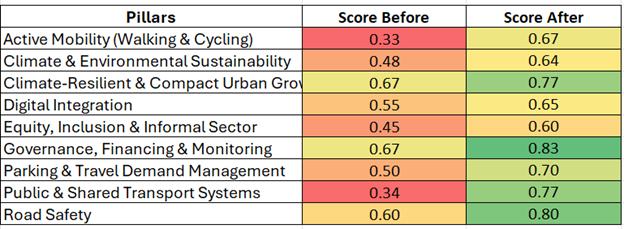
Annexure 2
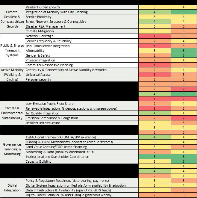
Sustainable Urban Mobility - Air quality, Climate Action, Accessibility (SUM-ACA) is a project jointly implemented by Deutsche Gesellschaft für Internationale Zusammenarbeit (GIZ) GmbH and the Ministry of Housing and Urban Affairs (MoHUA), Government of India, commissioned by the German Federal Ministry for Economic Cooperation and Development (BMZ). The project objective is to enable national, state and municipal institutions to promote climate and environmentally friendly, low emission and socially balanced urban mobility systems. The project is part of the Green Urban Mobility Partnership between Germany and India.
Deutsche Gesellschaft für Internationale Zusammenarbeit GmbH
A-2/18, Safdarjung Enclave
New Delhi, 110029, India
T: + 91 11 49495353
E: info@giz.de
W: www.giz.de/India