




A Guidebook to initiate and implement Safe Routes to School programs in Indian cities
Publishedby:
Deutsche Gesellschaft für Internationale Zusammenarbeit (GIZ) GmbH
Registeredoffices
Bonn and Eschborn, Germany
Green Urban Mobility Innovation Living Lab (GUMILL)
B-5/2, Safdarjung Enclave
New Delhi – 110029 India
T 011-49495353
F 011-49495391
E: suid.india@giz.de I www.giz.de/india
OfficerResponsibleforCommission
Manjunath Sekhar
Head, Green Urban Mobility Innovation Living Lab
mailto:manjunath.sekhar@giz.de
Contributors(inalphabeticorder)
Ankit Bhargava (Sensing Local), Devrishi Bharadwaj GUMILL (GIZ), Harpreet Singh (Road Safety Auditor), Nithya Gowda (Sensing Local), Sobia Rafiq (Sensing Local), Sristi Mehar (GIZ), Vidhya Venkatesan (Sensing Local),
Editinganddesign
Sensing Local
Acknowledgements
Mr BS Prahalad, Chief Engineer – Bruhat Bengaluru Mahanagara Palike (BBMP)
Mr M N Anuchet IPS, Joint. Commissioner of Police (Traffic), Bengaluru City
Ms Sushma, Assistant Engineer - BBMP
Ms Sonal Kulkarni, Chief Research and Innovation Officer – Directorate of Urban Land Transport (DULT)
Ms Shreya Satish, Assistant Urban Planner -DULT
Ms Nivetha K, Assistant Urban Designer - DULT
Contact
GIZ is responsible for the content of this publication.
On behalf of the German Federal Ministry for Economic Co-operation and Development (BMZ)

India’s cities are facing a pressing need to make school commutes safer and healthier for children. As urban congestion grows and air quality worsens, the safety of students traveling to and from school has become a major concern for both parents and communities. The Safe Routes to School Program was created to directly address these challenges. This initiative focuses on improving the safety and environment around schools by engaging three vital groups school administrations, local communities, and government authorities. Together, they work to design and implement measures that ensure safe, accessible, and clean routes for children, relieving the everyday concerns of parents while promoting healthier travel options
The toolkit also champions a shift towards active mobility encouraging and educating children to walk or cycle to school as a means to not only improve their health and well-being but also to contribute to reducing traffic congestion and pollution in cities. By promoting these modes of travel, we can instil a sense of responsibility in the younger generation, fostering a lifelong commitment to sustainable transport choices. Beyond infrastructure improvements, it advocates for a behavioural change in how children and their families should perceive commuting. The program seeks to embed sustainable habits early in life, helping young citizens develop a deeper appreciation for environmentally friendly transport options. Thus, creating a ripple effect that can reshape urban mobility patterns over time, making walking and cycling a preferred choice for future generations.
As cities grow, their mobility systems must evolve to meet the changing needs of their populations. The Safe Routes to School Program Toolkit provides practical guidance for stakeholders—parents, schools, urban planners, and local governments on how to collaboratively design and implement safer routes for children.
This resource reflects the society’s collective commitment to fostering active mobility and cultivating a culture of safety and sustainability in India’s cities. By placing children at the heart of this transformation, we can inspire a new generation to embrace sustainable transport solutions that benefit not just today, but for years to come. With this document, stakeholders can explore ideas and strategies laid out and contribute to shaping a safer, healthier, and more sustainable urban future for the young commuters and future citizens.
Manjunath Sekhar Head, Green Urban Mobility Innovation, Living Lab (GIZ)
1.1 Setting the context
1.2 About SRTS
1.3 Using this Guide
2.1 About RASTE
2.2 Why should schools adopt the RASTE Program?
2.3 Activities under RASTE
2.4 Implementing RASTE
3.1 About SSZ
3.2 Objectives of the SSZ
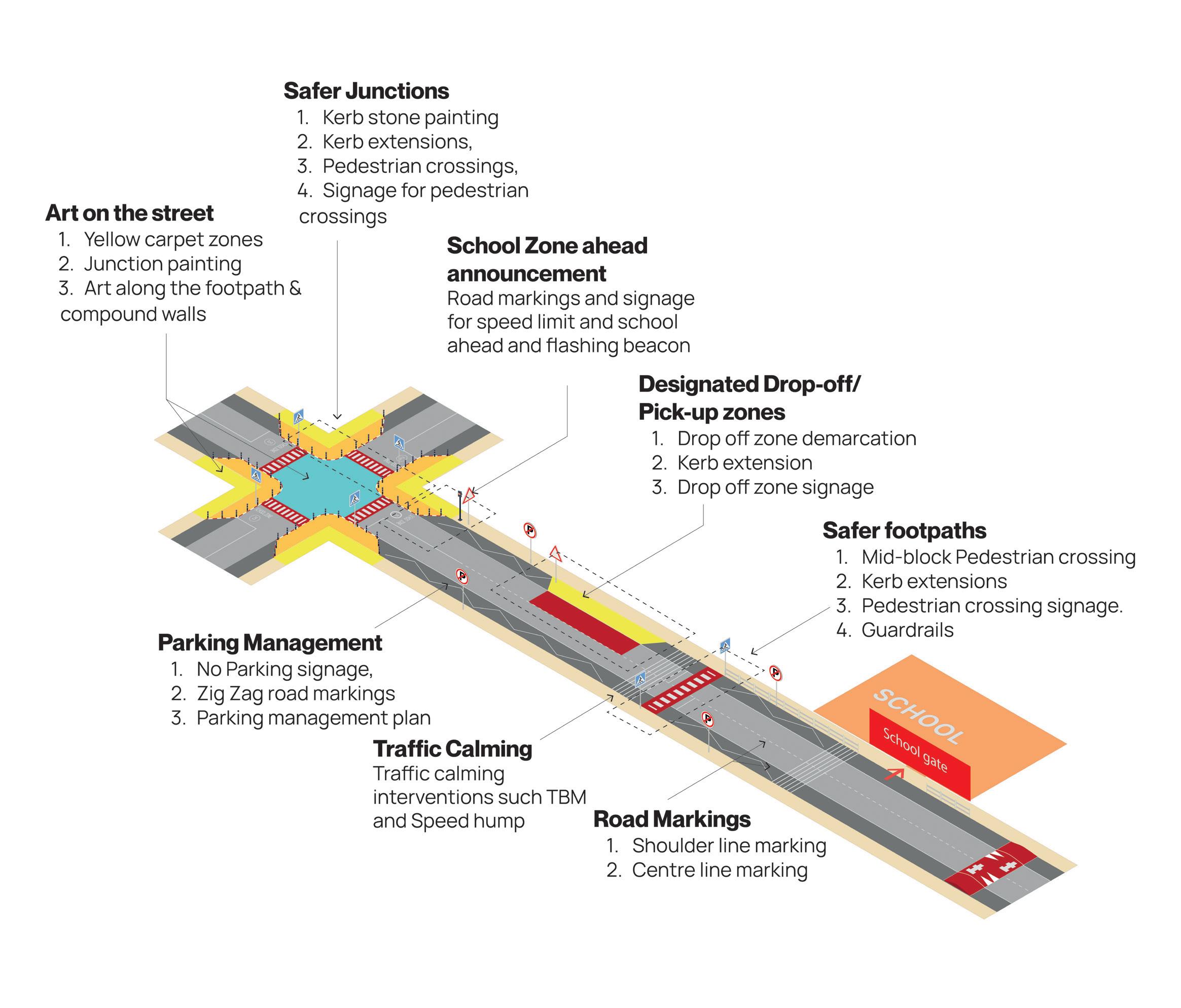
3.3 Overview of Interventions
3.4 Implementing SSZ
3.5 Stakeholder Roles & Responsibilities
4.1 Annexure I: Show of Hands Survey
4.2 Annexure II: Parents’ Survey
4.3 Annexure III: School Survey
4.4 Annexure IV: Activity Calendar
4.5 Annexure V: IRC Sources
4.6 Annexure VI: Junction Survey
4.7 Annexure VII: SAZ Survey
SRTS - Safe Routes to School
RASTE - Reimagining Active School Transit Experiences
SSP - Safe School Precinct
SDG - Sustainable Development Goals
CBO - Community Based Organisation
PTA - Parent Teacher Association
SAZ - School Access Zone
SPZ - School Proximal Zone
TZ - Transition Zone
IRC - Indian Roads Congress
ECS - Equivalent Car Space
RWA - Residents Welfare Association
ULB - Urban Local Body
Table 1: Alignment with SDGs
Table 2: Goals of the SRTS program
Table 3: Education activities under RASTE
Table 4: Encouragement activities under RASTE
Table 5: Enforcement activities under RASTE
Table 6: Evaluation methods and outcomes of the RASTE Program
Table 7: Locating interventions within the SSZ
Table 8: Junction audit form
Table 9: SAZ audit form
Table 10: Quantities Sheet
Table 11: Evaluation and outputs of the SSZ Program
Table 12: Stakeholder roles & responsibilities
Figure 1: Demarcation of Safer School Zone, Source: IRC:SP:32 (draft)
Figure 2: Interventions within SSZ
Figure 3: Interventions at safer junctions
Figure 4: Interventions at safer footpaths
Figure 5: Road markings within the SSZ
Figure 6: Interventions at the Drop-off / Pick-up zone
Figure 7: Parking management within the SSZ
Figure 8: School zone ahead and speed limit announcement within the SSZ
Figure 9: Art on the street within the SSZ
Figure 10: Traffic calming interventions within the SSZ
Figure 11: Corner block school entry
Figure 12: Mid-block school entry
Figure 13: Framework for prioritisation of issues
Figure 14: Indicative layout of interventions
Figure 15: Junction type 1 detailed drawing
Figure 16: Junction type 2 detailed drawing
Figure 17: Drop-off zone detailed drawing
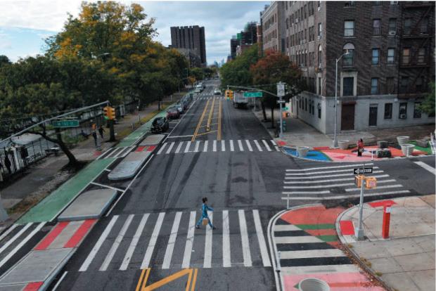
Image 1: 190th Street, Upper Manhattan. Source: DOT, NYC, revista110.online
Image 3: School Streets Blenheim Primary School. Source: Leeds.gov.uk
Image 2: Macombs Rd at University Ave, BX. Source: Almond Zigmund for DOT, NY
Image 4: Bankhead Primary School. Source: Glasgow.gov.uk
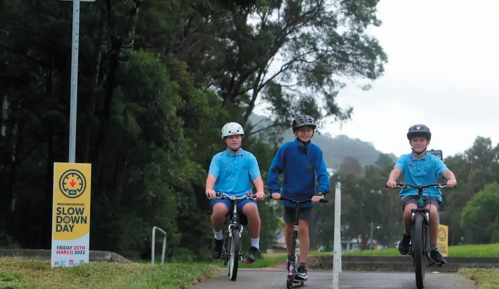
Image 5: Slow down day. Source: Sylvia Liber
Image 7: Primary School, Rushbrooke, Cobh, Co. Cork. Source: Cobh Tidy
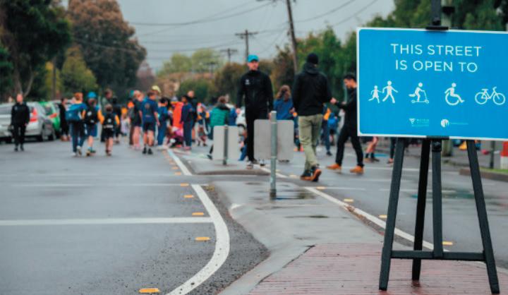
Image 6: Open street, Merri-bek City Council. Source: victoriawalks.org.au
Image 8: Kilcullenbridge road, Ireland. Source: kilcullenbridge.blogspot.com
Image 9: Source: toolsofchange.com
Image 10: Collingwood, Canada. Source: collingwoodtoday.ca
Image 11: Road Safety Week. Source: Kennedy High The Global School
Image 12: Traffic awareness rally at Chennai. Source: The News Minute
Image 13: Safety sarathy. Source: letstagon.com
Image 14: Road safety at St. Claret School. Source: claretschooltoday.com
Image 15: Source: lot.dhl.com
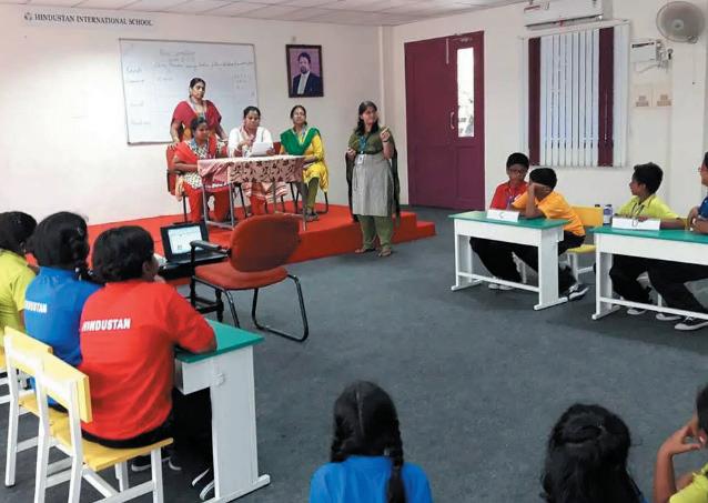
Image 16: Quiz Competition. Source: Hindustan Schools
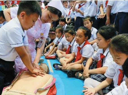
Image 17: Source: xinhuanet.com
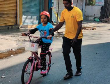
Image 18: Bicycle training program. Source: DULT
Image 19: Source: roadsafety.fia-grants.com
Image 20: Emission footprint mapping. Source: Sensing Local
Image 21: Source: stockpicturesforeveryone.com
Image 22: Source: Muskaan Foundation for Road Safety
Image 23: Source: ahlconpublicschool.com
Image 24: Awareness of Traffic Rules for School Source: transport.gov.lk
Image 25: Source: Timesofindia.indiatimes.com
Rapid growth in Indian cities has resulted in intensifying vehicular traffic leading to crowded streets and intersections. In this context, safety of children during their commute to and from schools has become a pressing concern for parents, school administrations and children alike.
Tackling this issue requires a multi prong approach. There is a need to improve the infrastructure across footpaths and carriageways and influence behaviour change in both pedestrians and vehicle drivers to reduce conflict as well as better management of school induced traffic around school gates. Additionally, educating children about road safety and sustainable mobility is a vital investment in their future, helping them become responsible road users.
Safe Routes to School (SRTS) is a global initiative promoting safe, convenient, and active transportation for students travelling to and from schools. It focuses on improving pedestrian and cyclist safety, reducing traffic congestion, and enhancing community health and wellbeing. SRTS is more than just about reaching a destination; it’s about ensuring their journey is enjoyable, safe, and healthy at every stage. SRTS initiative began in Denmark in the 1970s with the “Skolegade” (School Street) project, which aimed to create safer routes for children walking or biking to school. Since then, SRTS programs have expanded worldwide, including parts of Europe, Australia, New Zealand, Canada and the United States, with its comprehensive approach to road safety and active transportation, influencing education curriculums, city plans and city budgets.
Goals Enhance Safety on walking and biking routes.
Increase Accessibility for all children, including those with disabilities.
Promote Active Transportation by encouraging more students to choose walking and biking over using motorised transport, contributing to healthier lifestyles.
Reduce Traffic Congestion around schools and create safer drop-off and pickup zones.
Improve Air Quality by supporting eco-friendly transportation options.
Foster Community Engagement through collaborative efforts between schools, families, and local organisations to build stronger community ties.
Educate on Road Safety to teach essential road safety skills and responsible behaviours as pedestrians and cyclists.
Advocate for sustainable transport infrastructure and policies that support active mobility and road safety in the longterm.
There are 5 primary components to the SRTS program called the ‘5 Es’. Each of the Es, plays a vital role in fostering a safe and supportive environment for school children.
Assessing current conditions, identifying areas for improvement and tracking the impact and effectiveness of the program. Evaluation is an overarching element that features in all the other 4 Es.
Teaching students, parents, and community members about safe transportation practices and the benefits of active commuting.
Promoting walking and cycling through events, incentives, and community outreach to make these activities more appealing.
Ensuring that traffic laws and safety rules are followed to protect students and reinforce safe behaviours.
Implementing infrastructure changes, such as better footpaths, crosswalks, bike lanes, and traffic calming measures, to enhance safety.
There are three key stakeholders for an SRTS program - school management, local communities (neighbourhoods), and local government. The benefits for each of them are listed below -
Schools can leverage the SRTS Program to cultivate vibrant, inclusive environments promoting safe and active journeys. The program offers numerous benefits, such as reduced traffic congestion around schools and safer and more efficient drop-off and pick-up zones.
A calmer traffic environment will also enhance students’ focus and academic performance. Furthermore, by promoting responsible travel habits, the program can foster positive behaviours and attitude change in students as future citizens. A strong commitment to road safety and active transportation will also boost the school’s reputation as a conscious institution.
SRTS programs can help improve the overall quality of life in communities by addressing issues like traffic jams, rampant haphazard parking, unsafe walking conditions, and reduction of air pollution. The local community’s role is crucial in identifying and reporting unsafe conditions (including encroachments on footpaths and poor walkability) and sustaining behavioural change, especially towards pedestrians and cyclists.
Urban Local Bodies hold the keys to ensuring the success of an SRTS program. Allocating budgets and channelling non-lapsable funding towards such programs are essential to enabling decentralised impact to make cities safer for the most vulnerable - children. Further, enforcement of parking regulations and ensuring the rights of pedestrians and cyclists also require the proactive involvement of the government.
SRTS is in alignment with the UN’s Child Health Initiative (CHI), launched in 2016, which advocates for “Safe and healthy journeys to school to reduce emissions and exposure to air pollution, enable active transport, and ensure safe roads” along with Sustainable Development Goals 3, 4, 11, and 13. In addition it is also in alignment with the resolution A/RES/74/299 “Improving global road safety”, proclaiming 20212030 as the Decade of Action for Road Safety, with the ambitious target of preventing at least 50% of road traffic deaths and injuries by 2030.
Goal #4
Ensure inclusive and equitable quality education and promote lifelong learning opportunities for all
Target 4.7: By 2030, ensure that all learners acquire the knowledge and skills needed to promote sustainable development, including, among others, education for sustainable development and sustainable lifestyles, human rights, gender equality, promotion of a culture of peace and non-violence, global citizenship and appreciation of cultural diversity and culture’s contribution to sustainable development.
Goal #3
Ensure healthy lives and promote wellbeing for all at all ages

Goal #13
Take urgent action to combat climate change and its impacts
Target 3.9: By 2030, substantially reduce the number of deaths and illnesses from hazardous chemicals and air, water and soil pollution and contamination.
Target 13.3: Improve education, awareness-raising and human and institutional capacity on climate change mitigation, adaptation, impact reduction and early warning.
Goal #11
Make cities and human settlements inclusive, safe, resilient and sustainable
Target 11.2: By 2030, provide access to safe, affordable, accessible and sustainable transport systems for all, improving road safety, notably by expanding public transport, with special attention to the needs of those in vulnerable situations,women, children, persons with disabilities and older persons.
Target 11.3: By 2030, enhance inclusive and sustainable urbanisation and capacity for participatory, integrated and sustainable human settlement planning and management in all countries
Target 11.7: By 2030, provide universal access to safe, inclusive and accessible green and public spaces, in particular for women and children, older persons and persons with disabilities.
The U.S. is among the most active countries implementing the Safe Routes to School program. The program was established in 2005 as a federally funded initiative, and many states and localities continue to fund and support it through state and local funding even after federal funding was cut in 2012. The program focuses on infrastructure improvements, safety education, and encouragement programs. Some cities like New York, Portland, and San Francisco continue to have comprehensive SRTS programs.
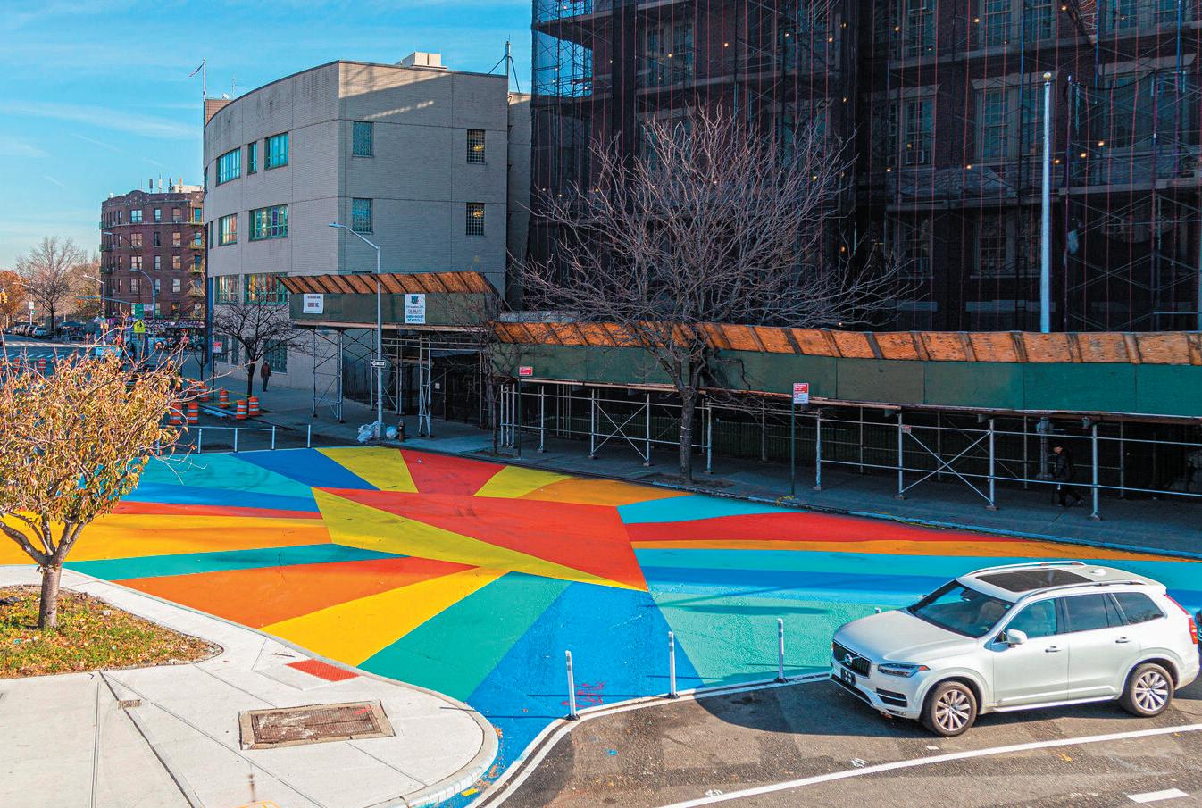
The UK has implemented various SRTS initiatives under different names, such as “Walking Buses” and “Bikeability.” These programs are part of broader efforts to promote active transit to schools. Local authorities in the UK often fund these initiatives through transport and health budgets, often supplemented by national grants. London and other major cities such as Leeds, Glasgow, etc., have implemented successful programs, often integrated with broader transportation and environmental initiatives.
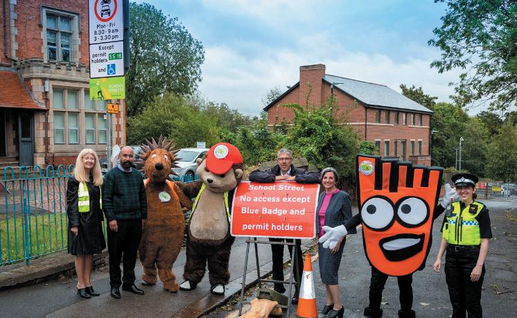
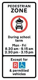

Australia has adopted SRTS programs in various states, focusing on improving infrastructure, education, and community engagement. Funding typically comes from state government budgets for transport and education, supplemented by local government contributions. States like Victoria and New South Wales continue to support SRTS through local government initiatives. The “Walk Safely to School Day” and other similar programs have been successful in increasing awareness and participation. Active school programs in Melbourne and Sydney continue to improve infrastructure and support behaviour change activities for walking and cycling.
Various EU countries have implemented SRTS programs under different names, often as part of broader sustainable mobility initiatives. Countries like Denmark, the Netherlands, and Germany continue to support SRTS programs as part of their commitment to sustainable transport. Ireland has been one of the most active countries in implementing SRTS across different towns and cities through the initiative of the Department of Transport and the support of the Department of Education. It is operated by the Green-Schools Programme in partnership with the National Transport Authority (NTA) and the local authorities.
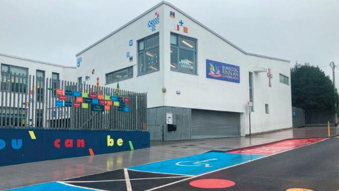
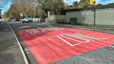
Canada has implemented SRTS programs integrated with broader active school travel initiatives. Provinces like Ontario and British Columbia have ongoing programs supported by local and provincial governments. Funding sources include provincial government programs, local government contributions, and non-profit partnerships. Ontario’s SRTS program has been recognized for its comprehensive approach, including infrastructure improvements, education, and community engagement.
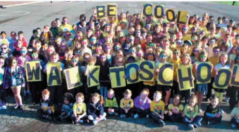
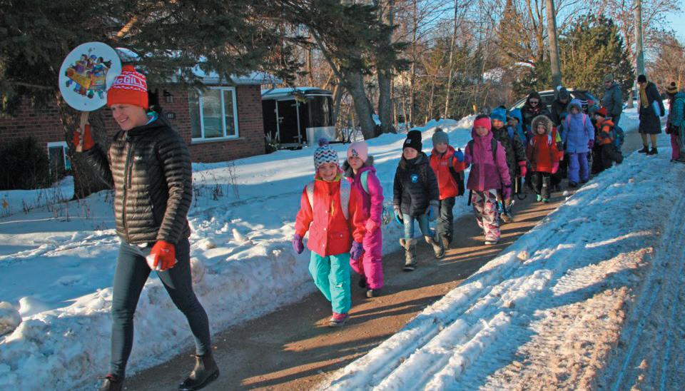
Following the 5 Es approach, the guide has been split into two main parts.
Part A: Reimagining Active School Transit Experiences (RASTE) deals with the first 3 Es - Education, Enforcement and Encouragement within the school premises to foster sustainable mobility choices and build a better understanding of road safety among students.
Part B: Safer School Zones (SSZ) deals with Engineering streets and junctions to improve the safety of students commuting to and from schools.
The 5th E: Evaluation cuts across both Raste and SSZ.
An SRTS program can use a combination of education, encouragement, enforcement and engineering centric activities to help achieve their goals. Every community, school or government organisation that takes the lead may follow a custom approach suitable to their unique needs. The next section further elaborates Steps to implementing an SRTS Program.
Reimagining Active School Transit Experiences (RASTE)
- This looks at implementing activities linked to Education, Encouragement and Enforcement
Safer School Zone (SSZ) - This guides interventions under Engineering
Implementing an SRTS program begins with identifying key stakeholders, including parents, teachers, and community members, and students to form a core group. The involvement of students in decision-making is crucial to understand their needs and preferences.
Once the team is in place, a comprehensive plan to implement RASTE activities and SSZ interventions needs to be created. Additionally, fostering collaboration with local organisations and authorities can support implementation. During roll out, it is important to continuously evaluate and monitor the program for its progress and success.
The following are the first 4 steps for initiating SRTS in a school.
A
Launch the program B
C
Evaluate the baseline
Create the plan D
Implementing an SRTS program begins with identifying key stakeholders, including parents, teachers, community members, and students to form a core team which will be responsible for the program’s planning and implementation. The involvement of students in decisionmaking is crucial to understand their needs and preferences.
An indicative list of stakeholders is listed in the table below.
SCHOOL
• Principal and other administrators
• Students
• Teachers
• Parents (PTA/PTO reps.)
LOCAL COMMUNITY
• Neighbourhood or community association members
• Local businesses or association members
• Local pedestrian, bicycle and safety advocates
• Citizen volunteers such as Traffic Wardens (if applicable)
• Representation from the MLA or the Ward Councillor’s office
• Urban Local Body
• Local ULB Engineer (Roads)
• Traffic police
• State or local pedestrian and bicycle coordinator such as Bicycle Mayor*
• Other experts such asTransportation or traffic engineers, planner, public health professional
• CBOs
• Funding organisations
*Bicycle Mayor is a voluntary position by an active citizen working on improving cycling in a city. It is present across several cities in India
Once the team is in place, a kick-off meeting needs to be conducted to help everyone understand the SRTS program and align on its larger objectives for the school.
The core team must also evaluate whether planning for a single school or a network of schools at a neighbourhood scale is strategically advantageous. A multi-school approach is particularly relevant where the induced traffic of one school affects the other, or there are cobenefits to another school because of interventions at one.
Global case studies recommend launching the SRTS program formally via a public event or sending information memos to all the stakeholders, particularly the parents, whose support is essential to operationalising the program in a school. Such gestures encourage participation and ownership over time.
The next step is to initiate a baseline capturing mobility patterns of school children, challenges they face, transport services provided by the school and traffic management taking place.
Three recommended surveys for base-lining are-
i. Show of hands survey
ii. Parent survey
iii. School survey
It must be noted that a fourth survey is proposed at the initiation of the Safer School Zone program to do a detailed street and junction field audit.
The baseline data from the 3 surveys mentioned above is to serve as a guide towards:
• Identification of program activities relevant to the school
• Support measuring of progress and impact after intervention
• Providing evidence to request/advocate for permissions, cooperation or funding with relevant stakeholders, particularly the government agencies
The show of hands survey is an easy to use, interactive survey to capture how many students of a given grade walk, cycle, car pool, take the bus, or use private transport and capture shifting trends over time.
Frequency: Multiple times in a year.
A class teacher(s) can build the initial baseline for at least five days during the time of taking attendance. It can be repeated regularly as deemed fit to assess variations due to seasons or other factors.
Mode: Conducted in the classroom by teachers. May be filled in a digital or manual form. An indicative format is given in Annexure I.
Data: Mode of transport used by a student to come to school and go home from school.
Expected outcomes:
• Mode Distribution: Understanding the dominant modes of travel among students to and from the school and their apprehensions if any.
• Pattern Identification: Detecting changes in travel behaviour based on season, weather, or day of the week.
• Build consciousness: Engage with students on the issue of sustainable transit to school and the difference they can make through individual actions.
Impact on the SRTS program:
• Targeted Interventions: Helps in tailoring interventions to specific needs of the students and the school.
• Data-Driven Planning: Provides a foundation for planning infrastructure improvements and awareness programs.
• Impact of interventions: If conducted regularly, it can help track modal shifts and changes in the behaviours of students.
Parents’ survey is designed to understand a student’s daily commute to and from school from the parent’s perspective. The idea is to capture information such as distance travelled daily, mode of transport used, challenges incurred in using sustainable modes of transportation and willingness to shift, if currently not using them.
Frequency: One-time.
Mode: To be filled by parents. May be a digital form or entered manually during sessions like a parent-teacher meeting.
Data:
• Profile of the student: grade, gender.
• Distance from home to school.
• Typical mode of travel to and from school.
• Comfort level of parent to allow their child to walk, bicycle or ride the bus.
• The grade, parents will allow their child to walk, bicycle, or ride the bus/metro to school.
An indicative format of the survey is provided in Annexure II. Further, it is important to note that given the sensitive nature of the data, the school administration ought to be the sole custodian of this information. Anonymised analysis should be shared with the other stakeholders.
Expected outcomes:
• Travel insights: Detailed information on travel modes and distances.
• Parental concerns: Identifying specific safety or security concerns.
• Mode choice Analysis: Understanding the factors influencing the travel mode choice, like convenience, distance, or perceived safety.
Impact on the SRTS program:
• Engagement with parents/guardians: Fostering a community-focused approach to improving school routes.
• Safety Improvements: Provide evidence for selection of priority issues to be tackled via an SRTS program.
This survey is aimed at doing a preliminary assessment of the school environment and traffic management strategies undertaken by the school administration to streamline vehicular and pedestrian traffic at the pick-up and drop-off times. This survey will assess the environment directly outside the school. This assessment can be undertaken by the core team and done with the aid of parents and students. A sample survey is provided in Annexure III.
Frequency: One-time
Mode: Filled in by the school administration in digital or manual format.
Data:
• School drop-off and pick-up timings for different grades.
• Parking capacity available inside the school and street parking required outside the school for cycles, 2 wheelers, 4 wheelers, buses etc.
• Transport services provided by the school for students.
• Traffic management done by the school - Drop-off / pick-up, crossing guards, parking etc.
• Nature of traffic and level of safety experienced on the access road to the school.
Expected outcomes:
• School environment overview: Understanding current state of the environment such as traffic flows, parking around the school, existence of pedestrian facilities and infrastructure etc.
• Existing traffic management: Understanding practices currently followed in order to manage vehicular and pedestrian movement as well as areas of conflict and challenges.
Impact
• Understanding need for interventions proposed under SRTS program.
• Traffic management planning: The findings from this survey can directly inform the future of traffic management for the school.
Once the baseline surveys are compiled, the core team must use this information to inform the identification of goals for setting up the SRTS program. Listed below are 5 key indicative goals which link back to concrete actions that can be undertaken under the RASTE and SSZ program. The process for creating and implementing a RASTE and SSZ is further detailed in Part A and Part B of this report respectively.
Goal 1
Goal 2
Goal 3
Cultivate conscious citizens who understand the environmental impact of transportation choices.
Empower parents, students and other stakeholders for safe commuting to and from school.
Enable a conscious shift towards sustainable transportation modes by fostering a culture of active commuting among students, teachers, and parents for a safe and healthier lifestyle.
Education
Education
Encouragement
Goal 4
Goal 5
Support the development of safe walking and cycling infrastructure to make sustainable modes of transport more fun, attractive and accessible.
Help reduce traffic congestion and vehicle emissions around schools, contributing to cleaner air and a healthier environment.
Enforcement
Engineering
Enforcement
Engineering
2.1
The Reimagining Active School Transit Experiences (RASTE) program aims “to empower schools with the tools and knowledge to promote active mobility among students, revitalising cycling and walking to school for safer, healthier communities.”
This is achieved through three essential elements:
The program’s goal is to catalyse behavioural change among students, parents, teachers, and stakeholders, fostering a culture of responsibility, awareness, and active mobility. RASTE also seeks to help schools reclaim their role as agents of change, imparting invaluable lessons in road safety, instilling a sense of civic responsibility, and cultivating a generation of conscientious citizens. Given that urban mobility challenges across India are similar, the principles and practices espoused by RASTE offer a blueprint that schools nationwide can emulate and adapt to their local contexts.
2.2
» Vulnerable Age Group: Young children are often smaller and less visible to drivers, making them more susceptible to traffic accidents. Their understanding of road safety may be limited, which increases their risk when navigating busy streets.
» Building Lifelong Habits: Teaching road safety and the importance of sustainable mobility early helps instil responsible behaviour that will last a lifetime. By learning essential rules and developing good habits, children become more confident and capable as pedestrians, cyclists, and eventually drivers. These early lessons create a strong foundation for their future interactions with traffic.
» Peace of Mind for Parents and Staff: Knowing that children understand how to move safely around traffic contributes to a safer school environment and alleviates concerns about their well-being during travel.
2.3
This guidebook includes 35 activities grouped under Education, Encouragement and Enforcement. Based on the goals set earlier in section 1.4/D, a school can select appropriate activities for designing their RASTE program.
Education activities are closely linked with encouragement and precede in terms of sequence of engagement in order to reduce risk to injury. They cater not just to students but also include engaging with the neighbourhood. The 23 educational activities are categorised into 5 groups based on different modes and outcomes that can be selected based on a school individual context.
Some sub-groups may require special attention, such as families who do not speak English as a first language, individuals with vision, hearing or mobility impairments, and families with low incomes. These groups are often overlooked. Therefore, it is imperative to create an outreach and engagement strategy alongside the educational activities.
S No Category
i Awareness building
ii Art and creative learning
SRTS Workshop
Road Safety Workshop
Awareness and Educational Videos
Neighbourhood Awareness Campaigns
Drawing and Colouring Poster Making
Making Using Street Signs
Create a Superhero
iii Individual and group games
• Exposure to the program
• Understanding one’s own travel behaviour patterns and impact
• Familiarising students and ensuring retention of vocabulary and key concepts related to SRTS through interactive learning
iv Skilling and training
v Interactive workshops and events
Word Search and Crossword
Essay Writing
Quiz
Debate
Role-play
Road Sign Card Games
Treasure Hunt
Golden Hour First Response Road Safety Drills Cycle School
Road safety vlogs
Emission Footprint Mapping
Low Pollution Maps
Design a Safe Street Road Safety Symposium
• Teaching self reliance and equipping children with the skills required for their safety
• Self-learning hands-on activities for a deeper understanding of impacts and solutions
Awareness Building activities focus on a basic introduction to the SRTS and its benefits through key technical concepts within road safety, understanding sustainable transportation, and reducing air pollution through better transportation choices. It is targeted towards all relevant stakeholders and can be anchored by subject matter expert(s) to ensure a solid foundation on the topic.
Suggestive activities:
Activity
SRTS Workshop
Road safety workshop for private and shared transport drivers
Awareness and educational videos
Neighbourhood awareness campaign
Target audience
Anchored by
Students (1st-12th Std.), Parents/ Guardians, Teachers Expert(s)
Parents/Guardians, Private Van/Auto/Bus Drivers Expert(s)
Students (1st-12th std.) Teacher(s)
Neighbourhood/General public Teacher(s),
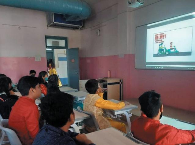
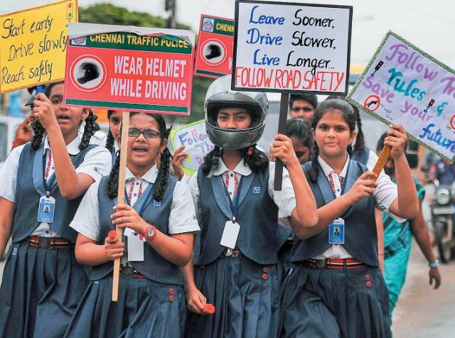
Art and creative learning activities serve as powerful tools for self-expression and for others to understand the children’s perspectives and perceptions of aspects such as their daily school commutes, their sense of safety, and even their ideas for change.
Suggestive activities:
Activity Target audience
Drawing and colouring activities
Create your Superhero
Poster making
Making and using street signs
Anchored by
Students (Nursery - 4th std.) Teacher(s)
Students (Nursery - 4th std.) Teacher(s)
Students (5th-12th std.) Teacher(s)
Students (5th-12th std.) Teacher(s)
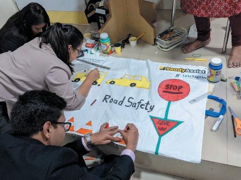
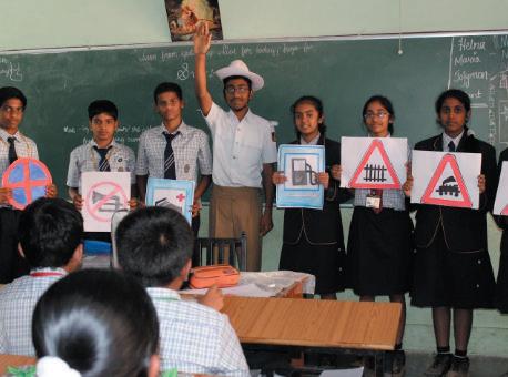
Children learn best through play. Individual and group games can be conducted as standalone activities on topics like road safety, walking, and cycling, or they can be woven into existing school’s routine activities, such as debates and quizzes, as thematic elements.
Suggestive activities:
Activity
Word search and crossword
Theme or Scenario-based essay writing
Quiz
Debate
Role-play
Road sign card games
Treasure Hunt
Target audience Anchored by
Students (1st-7th std.) Teacher(s)
Students (5th-12th std.) Teacher(s)
Students (5th-12th std.) Teacher(s)
Students (8th-12th std.) Teacher(s)
Students (1st-12th std.) Teacher(s)
Students (1st-12th std.) Teacher(s)
Students (1st-7th std.) Teacher(s)
Skilling and Training activities target capacity building of students in safe walking, cycling and emergency response skills during these activities, anchored by subject matter expert(s). Through these interactive activities, students will gain confidence, learn self-reliance, and the ability to respond calmly and competently in crises.
Suggestive activities:
Activity
Road Safety Drills
Golden hour - first response training
Cycle School
Target audience Anchored by
Students (1st-12th std.)
Students (5th-12th std.)
Students (5th-12th std.)
Expert(s)
Expert(s)
Expert(s)
Interactive workshops offer a mix of learning concepts where students of all ages/class groups can delve into aggregating challenges, and co-creating solutions, through a more hands-on experiential learning process. Some of these activities can help students learn about different perspectives about decision making while designing for road safety. A few of these activities can help students understand air pollution and look for better solutions. The other activities enable their creative thinking through designing their ideal street. In addition, a year-end showcase of SRTS student projects can provide a platform for students to present their work and receive feedback.
Suggestive activities:
Activity
Emission footprint mapping
Low pollution routes
Design your safe street
Road safety vlogs
Road Safety Symposium
Target
Students (5th-12th std.)
Students (5th-12th std.)
Students (5th-12th std.)
Students (5th-12th std.)
Students (5th-12th std.)
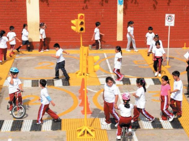
Anchored by
Teacher(s)
Teacher(s)
Teacher(s)
Teacher(s)
Teacher(s)
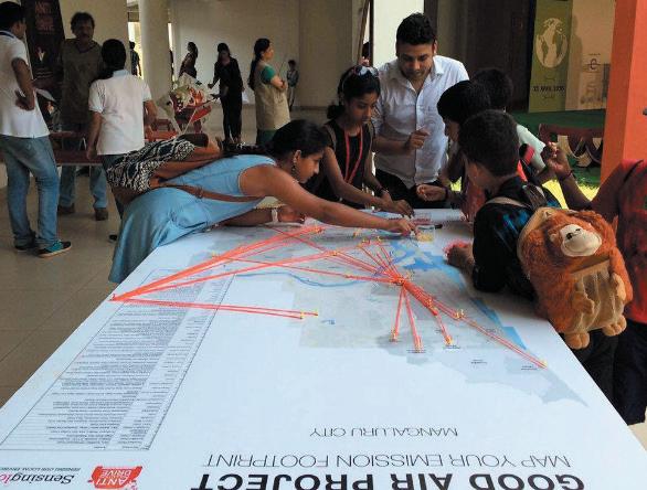
Encouragement strategies are about generating excitement and interest in walking and bicycling. Special events, contests and ongoing activities provide ways for parents and children to discover, or re-discover, that walking and bicycling are doable and fun.
Encouragement activities also play an essential role in moving the overall SRTS program forward because they build interest and enthusiasm, which can buy support for changes that might require more time and resources, such as constructing a new footpath or cycle lanes.
In brief, encouragement activities can be:
• Quick and easy to start.
• Executed with little funding.
• Organised by parents, students, teachers or community volunteers.
• Involve all children, including children with disabilities.
• Offer teachable moments to reinforce safe walking and bicycling behaviours.
S No Category Indicative Activities Outcomes linked to SRTS
1 Behaviour Change Walk to School Cycle to School
• More children walking and bicycling to and from schools
• Encouragement of healthy and active lifestyles
2 Competitions and incentives Design your bicycle helmet
Active mobility leader board
Road Safety Pledge
SRTS appreciation day
The goal of behaviour change related activities is to nudge small independent or collective actions to influence current perceptions and habits.
Suggestive activities:
Walk to School
Cycle to School
Students (5th-12th std.)
Students (5th-12th std.)
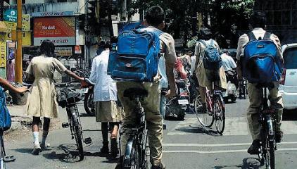
Anchored by
Teacher(s)
Teacher(s)
The activities here aim to encourage students, parents, and private vehicle users by recognising their efforts in choosing sustainable commuting options and safe cycling and driving practices through incentives.
Suggestive activities:
Activity
Design your bicycle helmet
Active mobility leader board
Road safety pledge
SRTS appreciation day
Target audience
Students (1st-7th std.)
Students (5th-12th std.)
Students (All)
Parents/Guardians, Private Van/ Auto/Bus Drivers

Anchored by
Teacher(s)
Teacher(s)
Teacher(s)
Teacher(s)
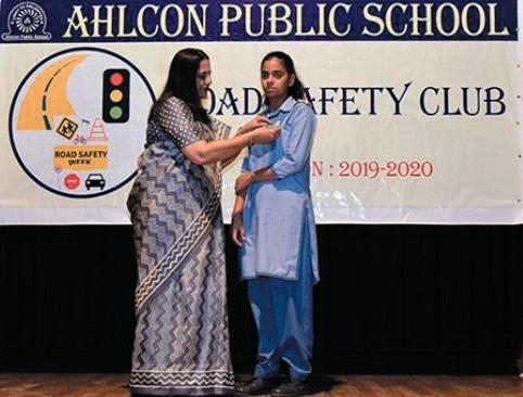
The main goal of Safe Routes to School (SRTS) enforcement strategies is to deter unsafe behaviours by drivers, pedestrians, and bicyclists and to encourage all road users to obey traffic laws and share the road safely. Enforcement is one of the complementary strategies that SRTS programs use to enable more children to safely walk and bicycle to school. However, enforcement used alone will not have a long-term effect.
Schools must utilise a combination of enforcement and engineering to address the specific needs of their schools and achieve long-term results. Enforcement activities includes students, parents, crossing guards, school personnel, and neighbourhood watch programs, all of which work in conjunction with the municipal and law enforcement agencies.
S No Category
1 Student and Parent Groups
Indicative Activities
Student Safety Patrol
Crossing Guard Program
2 Audits and Checks Road Safety Audits
Footpath Safety Audits
Helmet Checks
School Clean-up Drives
Outcomes linked to SRTS
Increased bicycle, pedestrian and traffic safety
Decreased traffic congestion
The following activities are aimed at increasing road safety. Schools can establish internal and external patrol teams working together to manage traffic during school peak hours. The teams can be supported by minor infrastructure improvements outside the schools, like designated pick-up/drop-off zones, pedestrian crossings, and traffic calming measures.
Activity Target audience
Anchored by Student Safety Patrol Students (8th-12th std.)
Crossing Guard Program Teachers, Parents/Guardians
Teacher(s)
Teacher(s)
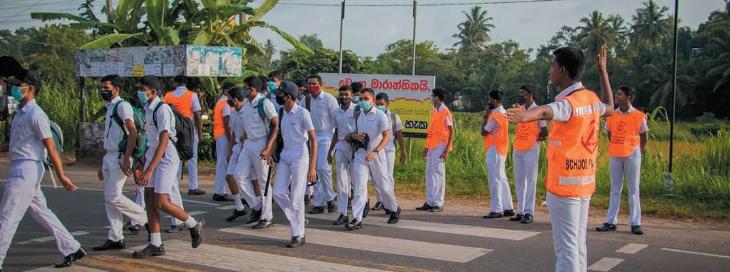
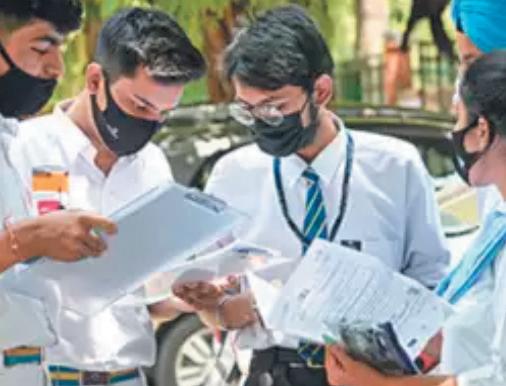
The Audit and Checks activities are crucial to identifying hazards and recommendations for solutions from the children’s point of view. These activities are also helpful in raising awareness amongst students and foster a stronger sense of community responsibility.
Activity
Footpath safety audit
Road safety audit
Safety gear checks
School zone clean-up drives
Target audience
Students (5th-12th std.)
Students (5th-12th std.)
Students (1st-12th std.)
Students (5th-12th std.)
Anchored by
Teacher(s)
Teacher(s)
Teacher(s)
Teacher(s)
2.4 Implementing RASTE
Creating an activity calendar
A Supporting and tracking the program
B
C
Evaluating the impact of the program
Based on the goals selected in your plan (see 1.4/D), identify the 3 Es (Education, Encouragement and Enforcement). Based on this, the core team can populated a long list of the potential activities to implement. This list, along with the school’s annual calendar will form the basis for the mapping of activities to create the Activity Calendar (Annexure IV: Activity Calendar).
Once the list of activities is finalized, the core team’s next task is to map these activities to the school’s annual calendar. This responsibility involves considering which activities can be integrated within the curriculum, and which ones need to be extracurricular activities and implemented at special events. The team’s role in this process is key to the successful implementation of the activities.
The team will review the selected activities along with the school management and finalise a comprehensive calendar using the provided template. This calendar will formally incorporate the school’s annual activities alongside the SRTS initiatives, facilitating efficient planning and execution. To streamline the process, smaller teams within the core group will be formed to organise and support specific activities.
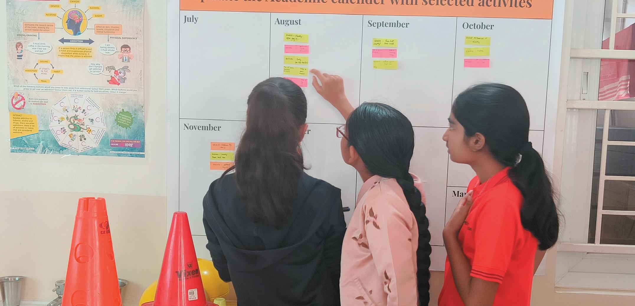
Once the plan is created, implementation must be closely tracked across various activities. It is vital for the Core Team to consider how to sustain energy and interest in the program so that children continue to walk and bicycle to school safely. Key strategies for keeping the program going include:
• Identifying additional program champions: Install a leader board as a school to track local champions who walk / cycle to school. Additionally, they can be awarded for their efforts to sustain their action.
• Letting people know about the successes: Get visibility for activities through local media and school communications and publicise the activities. Making the work fun and positive makes it more likely that people will want to continue and others will want to become involved.
• Encouraging policy changes: These might be school, neighbourhood or local government policies that support children walking and bicycling to school. For example, local departments may promote new school construction within walking and bicycling distance of residential areas. Traffic police may provide and support Student Safety Patrols or the Crossing Guard Programs.
• Creating a permanent committee: A permanent committee within the PTA means that SRTS will continue to receive attention and energy.
• An SRTS program has the potential to improve walking and bicycling conditions near a school and spread interest into other parts of the community. Core teams that persist in their efforts and make measurable improvements based on their evaluation will be rewarded with safer places for children to walk and bicycle and more children choosing safe routes to school.
After the program begins, careful monitoring will help identify the activities that are increasing the number of children safely walking and bicycling to school. Setting reasonable expectations about what the program can do will help build its impact narrative. By knowing the starting point, RASTE programs can set specific and reasonable objectives. Some of the key reasons to evaluate the program are:
• Making sure that the underlying problem is identified so that proper strategies to address the problem are picked. This can be done through conducting the baseline surveys that are detailed out in 1.4/C
• Identifying changes that will improve the program. Part of evaluation is monitoring what happens throughout the life of a project so that mid-course corrections can be made, if needed, to improve chances of success.
• Determining if the program is having the desired results. This is a primary purpose of any evaluation and can be used to inform funding sources, the media, and the public to help build support for SRTS.
Some key methods to track impact linked to each of the activity categories and outcomes are listed below.
Category Outcomes linked to SRTS Evaluation methods
Awareness building Exposure to the program
Understanding one’s own impact and behaviour patterns
Art and creative learning
Individual and group games
Skilling and training
Interactive workshops and events
Familiarising students and ensuring retention of vocabulary and key concepts related to SRTS through interactive learning
Self reliance and equipping children with the skills required for their safety
Self-learning hands-on activities for a deeper understanding of impacts and solutions
Develop a post session evaluation form to understand how many students have understood the concepts
Track the number of exposures the students have had to these concepts
Based on the outcomes such as better learning/understanding, you can tailor to implement more of a certain type of activity over others
Evaluate how confident children are to walk and cycle on the streets within the schools neighbourhood
Increased participation of students in these activities indicates their high interest levels and potential change of behaviours
ENCOURAGEMENT ACTIVITIES
Behaviour Change
Competitions and incentives
More children walking and bicycling to and from schools
Encouragement of healthy and active lifestyles
ENFORCEMENT ACTIVITIES
Student and Parent Groups
Audits and Checks
Increased bicycle, pedestrian and traffic safety
Decreased traffic congestion
Table 6: Evaluation methods and outcomes of the RASTE Program
Increase in the number of children walking and/or cycling to school
Conduct perception surveys to understand how safe students feel walking and cycling within the school vicinity
Positive government response to support and improve the conditions around the school
Measure congestion, air pollution, etc. using sensors and other equipment
3.1
The Safer School Zone (SSZ) program targets re-designing pedestrian infrastructure and traffic management to create safe environments for children to commute to and from school by improving road safety, minimising pedestrian vehicular conflict and enforcing speed limits.
The program is developed in alignment with the standards prescribed in Draft IRC:SP:32Guidelines for Safer Commute to Schools and other related IRC codes.
Three zones around a school together define a SSZ. The first is the School Access zone (SAZ), a 100m road segment on either side of all school gates. It is the focal point of maximum interventions and the highest level of enforcement. Second is the School Proximity zone (SPZ), which is 150m - 500m around the school. Here speed limits are expected to be curbed below between 20 - 30 km/hr. Lastly is the Transition Zone (TZ) that is situated on the periphery of the Proximity zone, marked as an area where traffic is meant to slow down to the required speed limit in the SPZ.
Expressway
Arterial Road
Sub-Arterial Road
Collector road
Senior School
Middle School
Primary School
Bus Stop
Metro Station
Proximal Zone Boundary
Roads in Proximal Zone
School Access Zone
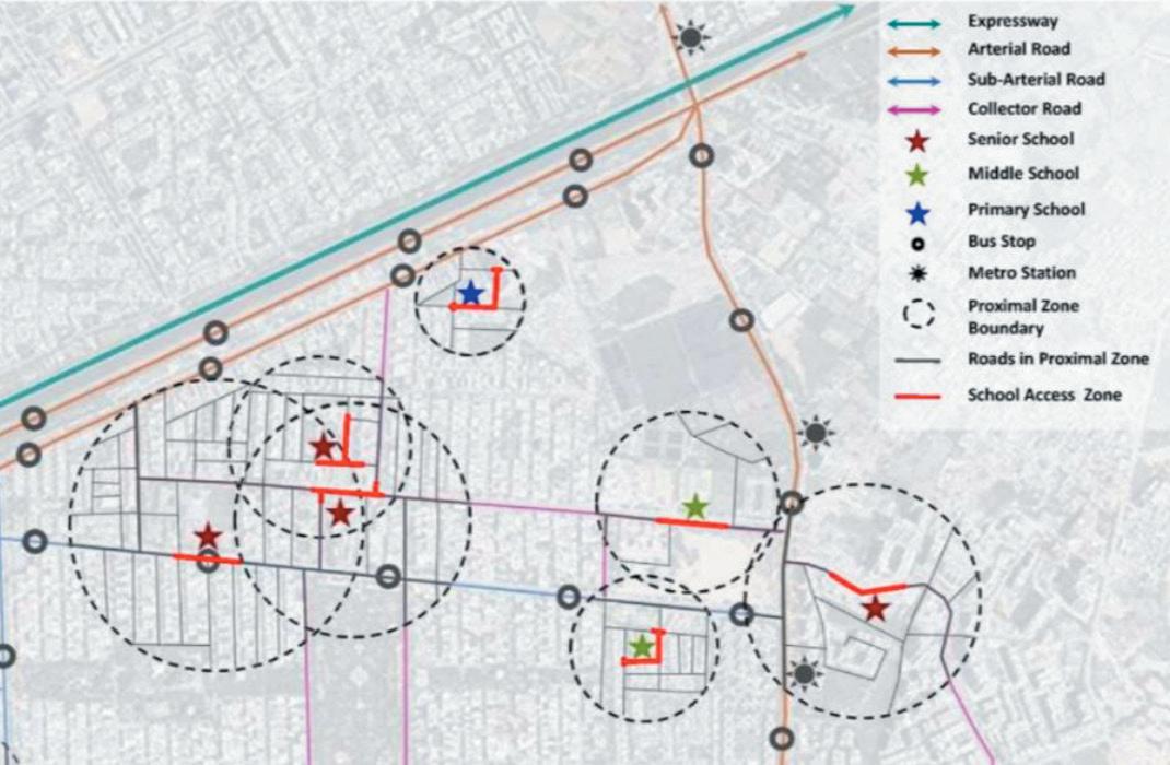
Figure1:DemarcationofSaferSchoolZone,Source:IRC:SP:32(draft)
3.2
Streamlining safer movement for children by minimising pedestrianvehicular conflict.
1. 2. 4. 5.
Communication of presence of school zones and its restrictions.
Enabling safe alighting and boarding of children through demarcating designated drop-off and pick-up zones near schools.
Traffic calming measures to actively reduce speed.
3.
Ensuring obstruction and encroachment-free footpaths and lines of sight to increase the visibility of children to motorists.
The IRC:SP:32 suggests 23 interventions across junctions and road segments. Given the interventions in the SSZ are most effective when they are planned as a system complementing each other, they are also grouped into 10 clusters. The implementation of each cluster plays a role in fulfilling each of the 5 objectives mentioned above. This section gives more detail on each of these interventions and the objectives they fulfill.
An easy guide of interventions and their standards in reference to the respective IRC codes is provided in Annexure V.
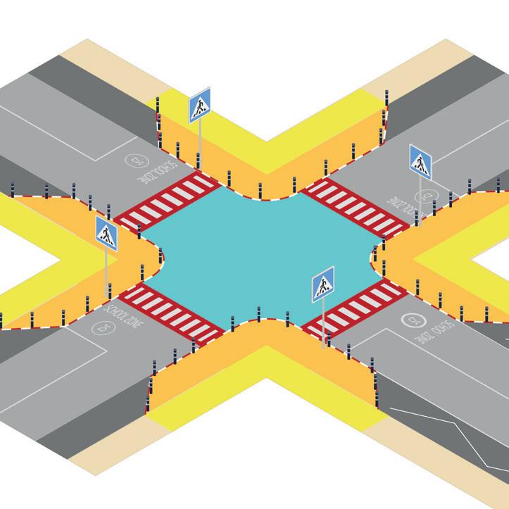
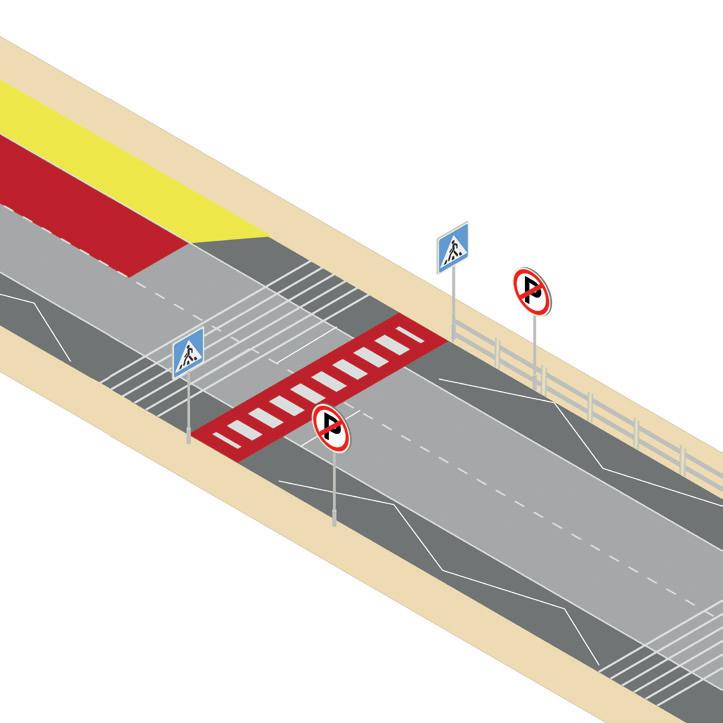
Kerb stone painting
Kerb extension
Pedestrian crossing signage
Pedestrian crossing
Kerb extension
Pedestrian crossing signage
Guardrails
Mid- block Pedestrian crossing
Figure 3,4:Interventionsatsaferjunctions(top),Interventionsatsaferfootpaths(bottom)
1. Guardrails on footpaths leading to the school gate
• Purpose: Guard rails are needed to avoid spillover of school children walking to the school onto the carriageway and protect them from traffic accidents. This is implemented near school gates as the pedestrian traffic at these junctures are high.
• Specifications: Guardrails should be of 700 - 1000mm height and erected from the nearest pedestrian crossing to the school gate ~ 20 - 50m. Ref: Section 5.4.2, IRC:SP:32.
2. Pedestrian crossings with kerb extensions on intersections and mid blocks
• Purpose: Kerb extensions allow for higher congregation of pedestrians before crossing, they also create visibility of oncoming traffic.
• Specifications: Minimum width of the pedestrian crossing should be 3m. Ref: Section 6.7, IRC:103. The pedestrian crossing should be painted in red and white, where red
All midblock crossings and intersections should have kerb extensions with kerb ramps that create access and visibility to the pedestrian crossings. Ref: Section 6.2.3,6.7.2, IRC:103.
3. Signage for pedestrian crossing
• Specifications: The sign should be erected on both approaches to an uncontrolled pedestrian crossing. Ref: Section 15.27, IRC:67
4. Maintaining clear footpaths on streets
• Specifications: All footpaths must have a clearance of 1.8m in width and 2.2m in height clear of obstructions both horizontally and vertically. Ref: Section 6.1.3, IRC:103
5. Refuge islands wherever applicable to enable safer crossings
• Purpose: Refuge islands allow for pedestrians to pause while crossing roads, in the case of children, the speed of walking may vary from that of an adult causing a need for pause points along the crossing.
• Specifications: Standalone refuge islands to be provided on roads with ROW less than 12 m, with minimum width of refuge island being 1.2m. Ref: Section 5.4.4, IRC:SP:32.
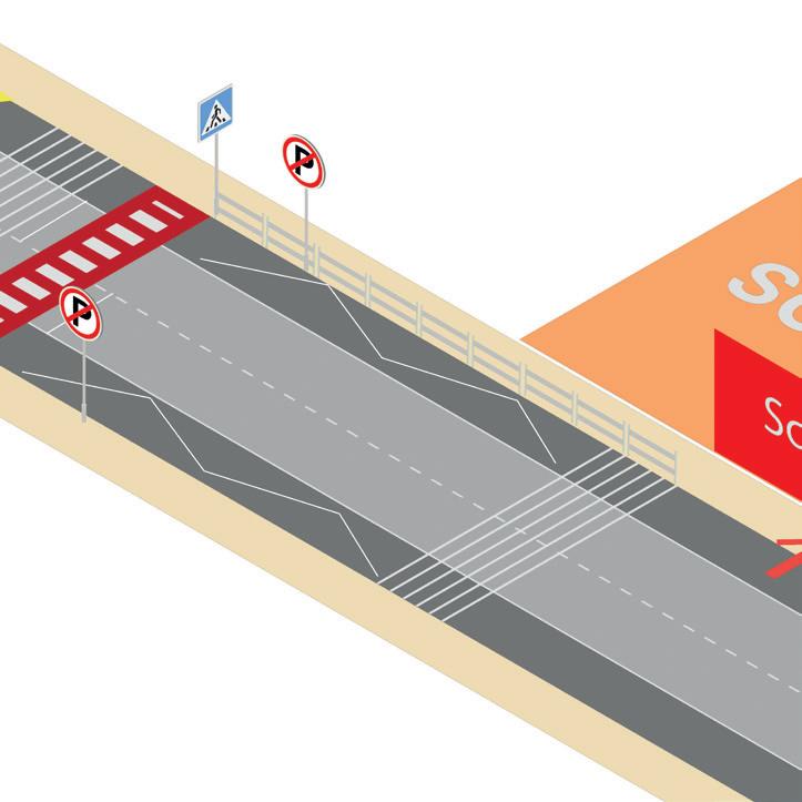
Shoulder line marking
Centreline marking
6. Centreline & Shoulder line marking
• Specifications: Centreline on each 2 way street above 7m carriageway will have LM02 specification of centreline marking and LM24 at the road edge, At intersections LM24 will be executed to delineate no overtaking Ref: Table 4.3, IRC:35 replaces the grey portions of the typical crossing. Ref: Section 5.4.3, IRC:SP:32. Midblock crossing to be placed at 20m from the school gate. Ref: Section 5.4.3, IRC:SP:32.
Drop-off zone signage
zone
7. Drop-off zone demarcation
• Purpose: Drop-off zones clearly demarcate the halting and parking areas within the SAZ to allow for organised pick-up and drop-off.
• Specifications: Bus drop-off zones need to be 4m wide and be designed as one ways in clockwise direction. Private vehicle drop-off zones can be 2 - 4ECS in length, with 4 being the longest. A clear of 2m is required on the footpath adjacent to drop-off zones. Ref: Section 5.3.2, IRC:SP:32
8. Signage for drop-off zone
• Specifications: To be provided at every drop-off zone. Ref: Section 5.3.2, IRC:SP:32
Traffic Management Plan
• Purpose: A traffic management plan ensures a seamless flow of traffic devoid of blockages and accidents. This can be done through creation of one-ways or traffic blocking.
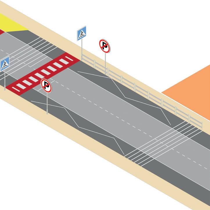
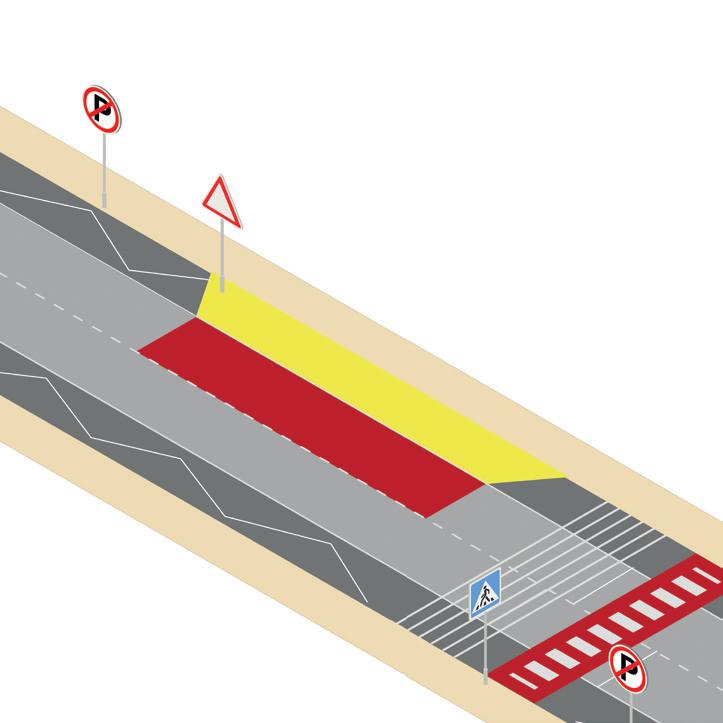
• Purpose: Parking enforcement along the SAZ helps in ensuring there are no vehicles parked within the SAZ reducing congestion.
• Specifications: To be provided along the SAZ and at intersections to enforce no parking. Ref: Section 5.10, IRC:SP:32, Section 14.8.5, IRC:67
• Specification: Transition zones to have zig zag markings to alert motorist of pedestrian crossing to slow down. This also needs to be present at no halting and no parking zones to alert motorists. Ref: Section 5.10, IRC:SP:32, Zig-Zag Road markings No Parking Signage
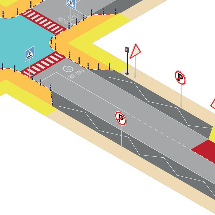
Beacons
School Zone ahead + speed limit signage
School Zone ahead + speed limit road markings
13. School zone ahead signage
• Specification: To be located at the edge of the TZ, threshold of TZ with SPZ, threshold of SPZ and SAZ. The signage should also mention distance to School. Ref: Section 5.8, IRC:SP:32
14. School zone ahead road marking
• Specifications: To be painted at the SAZ in an elongated manner. Ref: Section 5.87, IRC:SP:32 , Table C1, IRC:35
15. Beacons
• Purpose: Beacons call for attention to signage in junctions and road segments where there is excessive traffic and visual noise.
• Specifications: Flashing yellow beacons to be provided wherever school signage will not be noticeable due to traffic. It is to be located at entry of SAZ and at every midblock pedestrian crossing in SPZ. Ref: Section 5.9, IRC:SP:32
• Specification: To be located at the edge of the TZ, threshold of TZ with SPZ, threshold of SPZ and SAZ. The signage should also mention distance to School and speed limit within the SAZ. If speed limits are time specific, then signboards should have supplementary signboard mentioning timings and corresponding speeds. Ref: Section 5.8, IRC:SP:32
17. Speed limit road marking
• Specifications: To be painted at the SAZ in an elongated manner. Ref: Section 5.87, IRC:SP:32 Ref: Table C1, IRC:35
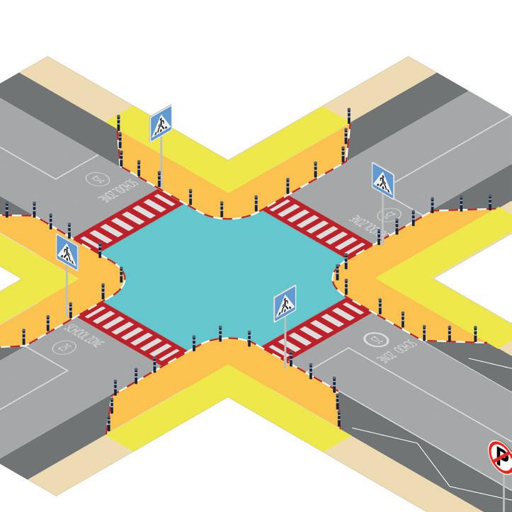
Painting on intersections
18. Yellow carpet zones
• Purpose: Yellow carpet zones create more visibility to pedestrians and also create the ‘nudge effect’ encouraging children to stay within the zone. Hence, regions near junctions and schools need to be identified and painted in proportion with the size of the congregation. Ref: Section 6, IRC:SP:32
19. Painting on intersections
• Purpose: Painting the centre of junctions with vibrant murals creates identifying elements around SSZ for quick recognition.
Art along the compound walls of the school
• Purpose: Compound walls along schools in the SAZ can be painted to create visibility and call attention to the school zone. Ref: Section 5.13, IRC:SP:32
• Purpose: Table top crossings in SAZ can be painted with colourful patterns to make it more vibrant and encourage usage by children. Ref: Section 5.7, IRC:SP:32
• Removal of any obstructions at intersections that can block visibility of children.
• All parking to be discouraged within SAZ, particularly on roads adjacent to schools, during school hours. If present, it must be parallel parking and not perpendicular/ angular parking.
• Parallel parking lane can be a maximum of 2m, same width to be used for 2 wheeler and bicycle parking.
• No double lane parking within the school zone, this includes SAZ, SPZ, TZ.
• Supplementary boards for parking signage need to be present for displaying any time specific parking restrictions.
• All road side vendors within the SAZ to be relocated to at least 50 m away from the school entrance gates.
• Consecutive vending zone to be spaced 50m apart in SAZ and 30m apart in SPZ.
• Vending zone can only be provided within 2m of ROW without encroaching on footpath.
• Ref: Section 5.10, 5.11, IRC:SP:32
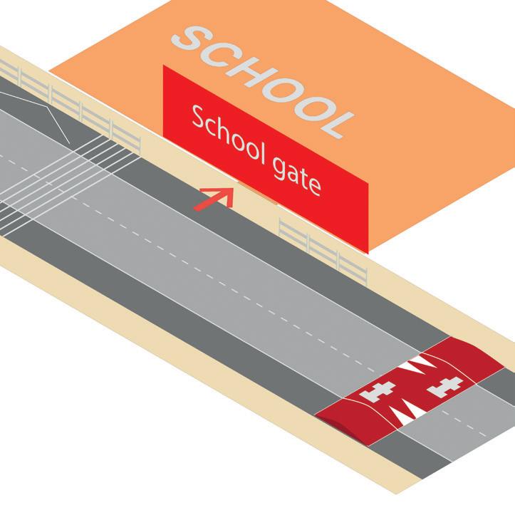
• Purpose: TBM is a gentler method for traffic calming providing minor physical and visual cues for vehicles to slow down.
• Specifications: One set of bar marking (TM 08) comprises 6 bars of 300 mm wide and 15mm high to be applied across the full width of the carriageway Ref: Section 2.3.3.4, IRC:99
• Specifications: Speed breakers are to be painted in red and white in chequer block pattern with BM05 road marking. The same treatment to be followed for sloped sections of table top crossings in school zones Ref:Section5.7,IRC:SP:32,Fig3.1,IRC:99
A
Mapping a safer school zone
B
Conducting street and junction surveys
C
Selection and detailing of interventions
D
Creating a traffic management plan
E
Consensus building for action
F
G 3.4
Creating detailed drawings
Evaluating the SSZ Program
A school access zone is 100m of road segment on both sides of all entry gates of a school. If there is an intersection 100m from either side of the entry gates of the school, the SAZ will extend to 30m beyond the intersection. Further, for schools below the primary level (nurseries), the shortest route from the nearest transit point to school entry will be considered part of the SAZ. The SAZ can be of two typologies depending on the school’s location within its urban block.
As per IRC 99, the SAZ speed limit has to be curbed to 25 Kmph. The Draft IRC:SP: 32 provides further nuance about speed limit restrictions based on road hierarchy.
The corner block school typology typically contains one/all of the school gates at the corner of an urban block, ~20m from an intersection. The SAZ of such schools is 100m of roads on all sides of the intersection.
In a mid-block school typology, the school exists in the middle of the block, thus making the road along the school gate the SAZ, demarcated 100m on each side of the gate.
The proximal zone is demarcated as the area of 150 - 500 m radius around the school gate determined by the road hierarchy and the grade level of students in the school as detailed in IRC:SP: 32. The School Proximal Zone (SPZ) is the region where most of the students congregate
The speed limit in the SPZ has to be regulated between 20 - 30 Kmph depending on the road hierarchy, varying between a local road to an arterial road.
The transition zone is the predefined road length leading to the SPZ. All roads within the SPZ will have a transition zone. Transition zones are crucial to allow vehicles to reduce their speeds as they approach the proximal and school access zones.
The length of the transition zone of each road depends on the road hierarchy and existing speed limit, varying between 20 -70m between the local road and arterial road. This is further detailed in IRC:SP:32.
Locating interventions within the SSZ
The table below also showcases where the intervention clusters are expected to be situated across the three zones - School Access Zone(SAZ), School Proximal Zone (SPZ) and Transition Zone (TZ).
Safer junctions
footpaths
Road Markings
Designated Drop-off/ Pick-up zones
Parking Management
School Zone ahead announcement
Calming
Table 7: Locating interventions within the SSZ
Before planning a Safer School Zone, there is a need to conduct 2 detailed field audits - at junctions, and the SAZ, to document existing infrastructure, encroachments and obstructions for pedestrians and vehicles, and to measure road and footpath widths. Students above 9th grade may participate in this exercise as well.
The following sections detail out the parameters that need to be measured in these two field audits.
The junction audits need to be conducted across all junctions within the SAZ and SPZ and attributes of all legs of a junction should be recorded individually. Survey forms of the junction audits are given in annexure VI.
S.No
1 Does this road lead to the school? Y/N
2 Are there clearly marked pedestrian crossings on the road? Y/N
3 Are there pedestrian signals to cross the road? Yes - 1 side Yes - 2 sides No
4 Are there refuge islands on the roads? Y/N
5 Select the signage that are present 1. Pedestrian crossing 2. Speed limits 3. School Zone ahead 4. Others if any
6 Are there any obstructions to the line of sight of motorists/ pedestrian before crossing? Y/N - If yes, Parking, Vending, Junction box, Transformers, Signage, Others
7 Are there any traffic calming interventions at the intersections? Transverse Bar Markings, Speed Hump, Both, Neither
8 Are there road markings of speed limits and school zones present on the road? Y/N
9 Condition of Shoulder Asphalt/ Dirt/ Broken - 1 side/ 2 sides
10 Condition of Footpath Good/ Needs maintenance/ Broken - 1 side/ 2 sides
11 Width of Shoulder (in m)
12 Width of Footpath (in m)
The SAZ audit needs to be conducted on the whole stretch of the SAZ. Survey forms of the junction audits are given in annexure VII.
1 What is the SAZ Typology? Corner block / Midblock School
2 Are there crossing supervisors as part of the school safety patrol team?
3 Are there designated pedestrian entry/exit points at the school gate?
4 Are there drop-off/ pick-up zones? Designated, Managed, Both, Neither
5 Is parking prevalent on the road?
6 Are there traffic blocking measures/ restriction taking place in the SAZ? Y/N - Description if required
7 Is there a midblock crossing present? Y/N
8 Are refuge islands present at the crossing? Y/N
9 Are guard rails present along the footpath? Y/N
10 Are traffic calming measures present? Transverse Bar Markings, Speed hump, Both, Neither
11 Select the signage that are present
Pedestrian crossing
Speed limits
School Zone ahead
Drop-off/ Pick-up zone
Others if any 12 Are flashing beacons present?
13 Are road markings present? School ahead, speed limit, zig zag marking, None of the above
14 Are there encroachments on the footpath? Y/N - If yes, Parking, Vending, Junction box, Transformers, Signage, Others
15 What is the direction of traffic One way, Two way
This process entails three engagements with all respective stakeholders.
• Reflecting on the analysis of baseline surveys to understand existing commuting trends.
• Documentation of challenges and ideas for solutions.
• Understanding individual priorities for interventions towards creating a plan for safer school zones.
The success of an SSZ Plan depends on consensus building around solutions and recognising their feasibility on the ground. Hence, this guide proposes a prioritisation framework, evaluating the perceived ‘importance’ of an intervention and the likely ‘feasibility’ to execute.
Feasibility refers to the ease of acquiring permissions, presence of community support, or government involvement that may be essential for implementing interventions or enforcing/ maintaining them over time. The idea is that if an intervention is considered important to the stakeholders for implementation, and it also requires high community involvement it becomes a priority intervention, but if this involvement is not feasible, the intervention may need to be de-prioritised.
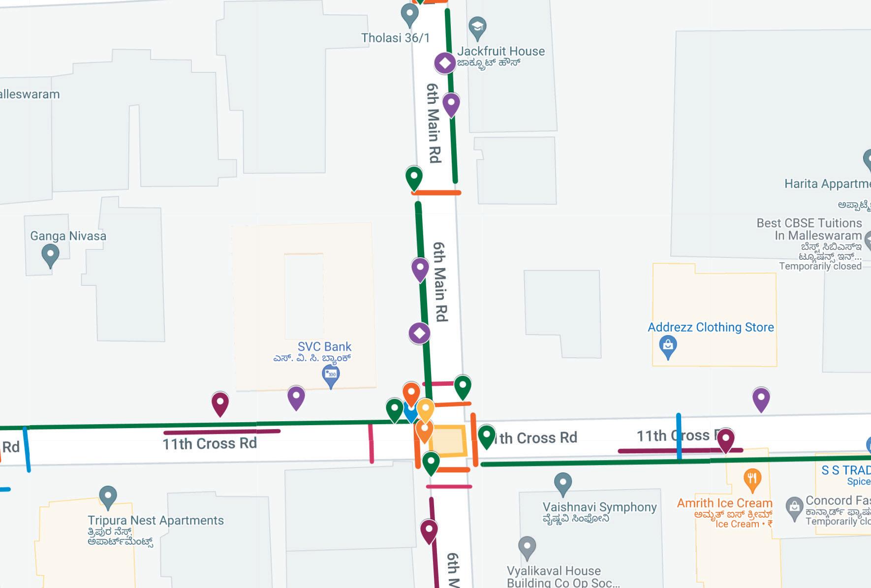
Taking into consideration the data from the detailed street and junction surveys, indicative layouts must be prepared for each school to visualise the SSZ plan spread across the three zones, which will further aid consensus building and support vetting on ground.
If this exercise is being undertaken by the core committee, simple hand drawn maps or maps made on Google My Maps can be done as shown in the figure below. This reference was prepared for Vidya Mandir School in Malleswaram, Bengaluru.

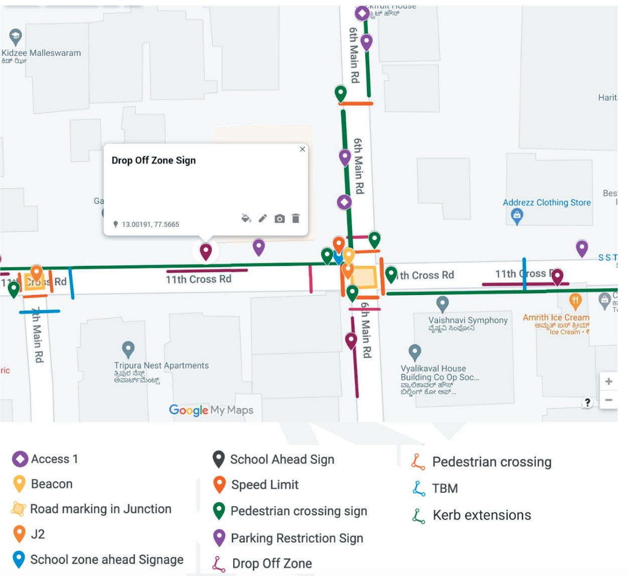
The indicative plan needs to be vetted on the ground, checking potential locations of individual interventions against considerations such as - proximity to existing infrastructure, space required on the carriageway, shoulder or footpath, clear lines of sight, and negotiation needed to remove present encroachment and obstructions. This exercise needs to be done with government officials. Once confirmed, the number of individual interventions can be documented in a quantities sheet shown in the following section.
A: Safe Junctions
1 Kerb extensions
2 Kerb stone painting
3 Pedestrian crossings
4 Signage for pedestrian crossing
B: Streamlining pedestrian flow
5 Midblock Pedestrian crossing
6 Kerb extensions adjacent to the crossing
7 Pedestrian crossing signage.
8 Guardrails
C: Designated Drop-off/ Pick-up zones
9 Drop-off zone demarcation
10 Kerb extension adjacent to drop-off zone
zone
E: School Zone ahead announcement
15 Road markings for speed limit and school ahead
16 Signage signalling school ahead and speed limit
J - Junctions
D - Drop-off Zones
Quantities sheet
F: Traffic Calming
17 TBM and Speed hump
G: Road Markings
18 Shoulder line marking
19 Centreline marking
H: Art on the street
20 Yellow carpet zones - painting on footpaths near intersections and school gates
21 Painting on intersections to demarcate Safer School Zones
22 Art along the compound walls of the school
23 Table top crossing painting
J - Junctions
D - Drop-off Zones
Table 10: Quantities Sheet
The quantities must be calculated using the measurements from respective IRC codes mentioned in section 3.3. The rates are bound to vary from city to city and must be derived from the respective city’s schedule of rates. For the purpose of implementation, the interventions are grouped as per the type of work that follows the format of a typical bill of quantities:
• Signage - Pedestrian crossing, No Parking, Drop-off/Pick-up zone, School zone signage, Speed limit signage
• Painting including road and walls - Yellow carpet zone, Intersection painting, Wall painting
• Road markings - Pedestrian crossings, Centreline marking, Shoulder line marking, Zig zag marking for no parking, School ahead marking, Speed limit marking
• Site construction - Kerb extensions, Refuge islands, Raised pedestrian crossings
Due to several limitations, such as budgets, delays in permissions, conflicts on the ground, or lack of consensus about the effectiveness of a solution, it may not be possible to fully implement the SSZ plan all at once. In such a case, several strategies can be applied:
a. Use of tactical interventions over permanent
Tactical interventions will cost less and may last a shorter period. They are suitable to test ideas and evaluate designs to build evidence for permanent interventions.
b. Using a phase wise approach
Considering the six objectives of SSZ (section 3.2), the logic of clusters (section 3.3), and the priorities arrived at through consultations, the SSZ plan may be proposed for implementation over multiple phases. Phasing can be done by geographies such as focussing on SAZ first or targeting some severe issues over others. This strategy will help avoid building incomplete and ineffective systems.
c. Incorporating SSZ interventions under city wide schemes
Another strategy is to identify other infrastructure projects within the city/ neighbourhood under which certain interventions from SSZ can be incorporated. For example, certain junctions and roads stretches under the SAZ can be improved under a metro transit project if they fall within the boundaries of the first-mile and last-mile connectivity of the transit line.
In addition to the physical infrastructure, there is a need to create a traffic management plan to enforce vehicular behaviours in one-ways or blocking traffic, parking restrictions, dropoff and pick-up zones, etc. The execution of the plan may be done by traffic police, traffic marshals at the schools, and/or by the crossing guard program, which consists of teachers, parents, and school students. The traffic management plan should also include the removal of obstructions and encroachment in the SAZ to avoid traffic jams.
Typically, the stakeholders in an SSZ are members who are already meant to be a part of the school core committee - which includes school management, students, parents, residents living in the SAZ, local RWAs, local traffic police authorities, and local governing bodies/ elected representatives. It must be noted that the SSZ program can be anchored and led by the school or ULB, but it requires both stakeholders to work in close sync to achieve impact. It is important for the anchor of the program to engage with all the stakeholders and build consensus.
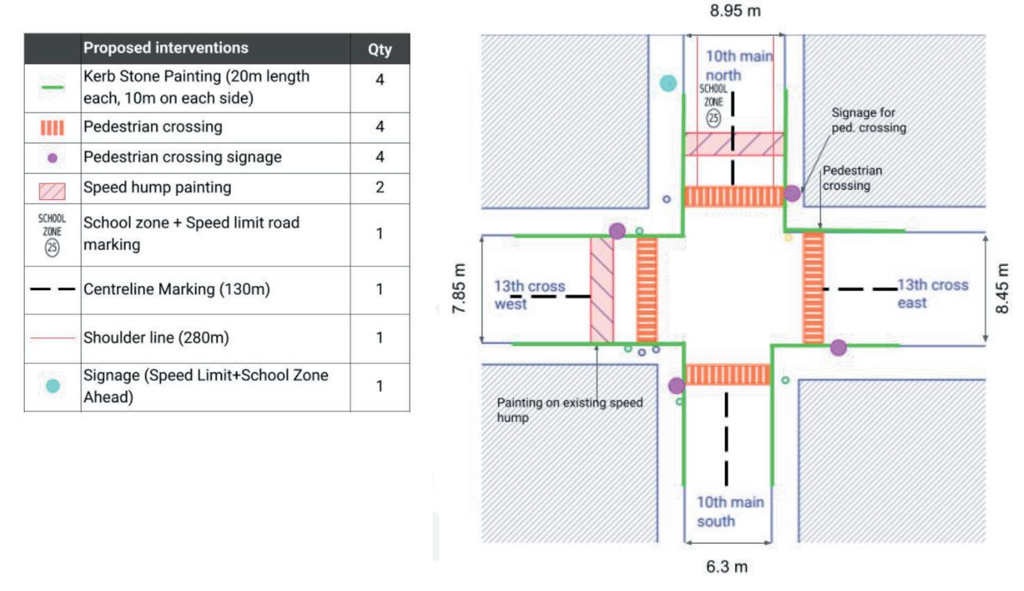
The following is an example of drawings of the SAZ from the proposed SSZ plan for MES Kishore Kendra, 10th main, Malleswaram, Bengaluru.
Junction 1: 10th main X 13th cross
Figure 15: Junction type 1 detailed drawing
Junction 2: 10th main X 15th cross
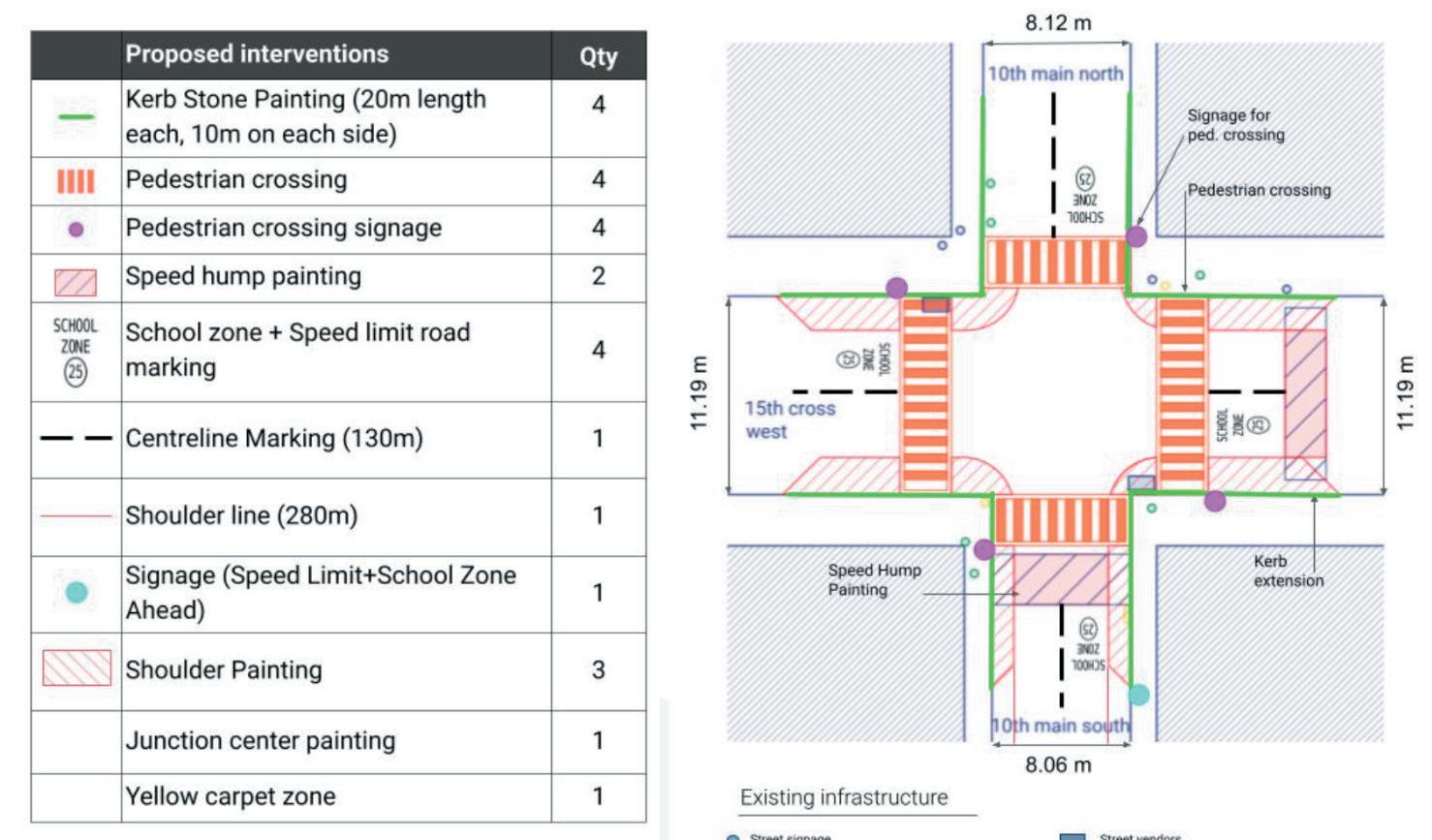
16: Junction type 2 detailed drawing
Drop-off zone: 10th main
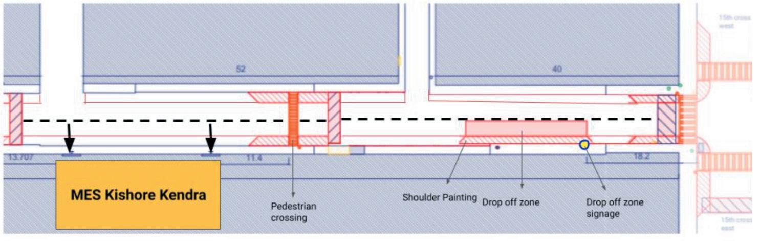
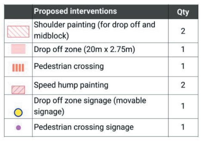
17: Drop-off zone detailed drawing
Streamlining safer movement for children by minimising pedestrian-vehicular conflict.
Enabling safe alighting and boarding of children through demarcating designated drop-off and pick zones near schools.
Ensuring obstruction and encroachment-free footpaths and lines of sight to increase the visibility of children to motorists.
Communication of presence of school zones and its restrictions.
Traffic calming measures to actively reduce speed.
Safe and standardised pedestrian infrastructure such as footpaths and crossings.
Delineated drop-off and pick-up zones.
1. Post implementation junction & SAZ survey. (quantitative survey)
2. Perception survey rating safety during crossing of roads, walking to school and walking to/from drop-off zones. (qualitative survey)
Removal of encroachments and obstructions near crossings and drop-off zones.
Standard signage and road markings in the SSZ.
TBM and speed humps near crossings and school gates.
3. Documenting traffic related accidents and conflicts in the SSZ. (quantitative survey)
4. Enumerate students taking active transit modes to school. (quantitative survey - Show of hands survey from Annexure 1 may be used)
5. Speed monitoring through pneumatic tubes. (quantitative survey)
The following chart maps the roles and responsibilities of all the stakeholders in a SSZ plan. The chart follows the RASI template, each role R,A,S & I are described below:
Directly responsible to accomplish the task.
Has approval or authority over a task.
Is supporting the task (generally through activities that allow the overall goal to be accomplished).
Stays informed about the task – although this is not passive, and those in the [I] column have an obligation to stay up to date.
Date:
Teacher name:
Weather: Rain/ Hot/ Overcast
Grade:
School: No. of students in class:
*Surveyneedstoberepeatedtwiceeveryday:Morning&Evening
Other (please mention each)
Date:
Teacher name:
Grade:
School:
1 Please mention the gender of your child. Boy / girl
2 Which grade is your child studying in?
3 How far does your child have to travel to reach their school?
4 On a typical day, how does your child travel to school (select the mode used for longest distance and maximum number of days):
5 On a typical day, how does your child return from school (select the mode used for longest distance and maximum number of days):
6 If you stay within 2km from the school and your child does not walk, bicycle or ride the bus, will you be comfortable allowing your child to use these modes to school?
7 If no, please select the reason(s)
8 At which grade would you allow your child to walk, bicycle, or ride the bus/metro to school.
Less than ½ km
½ km to 1 km
1 km to 2 km
More than 2 km
Walk
Bicycle
Public bus
Metro
School Bus
Private van / shared auto
Parent / guardians two wheeler
Parent / guardians four wheeler
Walk
Bicycle
Public bus
Metro
School Bus
Private van / shared auto
Parent / guardians two wheeler
Parent / guardians four wheeler
Yes / No
Multiple trips/stopovers to come from home to school
Multiple trips/stopovers to reach home from school
Quality of footpath infrastructure
High volumes of traffic
Crime and violence
Weather
Traffic speeds on school routes
Lack of adult companions (especially when small)
Lack of traffic personnel at junctions
Lack of provision of parking space and security of cycles near the school
Date: School:
1 What are the school's opening timing for different grades
2 What is the period when drop off and picks generally happen?
3 Does the school arrange any form of transport for the students? If yes, mention the mode Yes / No mode: .........……
4 What is the parking capacity inside the school compound Cycle parking 2 wheelers 4 wheelers
School bus School Vans
5 What is the amount of street parking space required by the school outside
6 Is there any other traffic management measures taken by the school? Plans could include separate entry gates for different access modes.
7 What is the percentage of parents who come to drop off their children to school?
8 Is there a designated drop off location
9 Does the school permit pick-up / drop-off inside the school compound?
10 Does the school supervise drop-off, if so who is involved?
11 Is there any traffic management undertaken during pickup and drop-off? If yes by whom?
Parents
School teachers
Marshals / Security guard
Student volunteers
Traffic police
Marshals / Security guard
Parents
School teachers
Student volunteers
12 Do students have to cross a parking lot / driveway to access school? Yes / No
13 Is there someone who supervises crossing near the school? If yes, by whom ?
Traffic police
Marshals / Security guard
Parents
School teachers
Student volunteers
14 Do you have shaded waiting areas for children to be picked up? Yes / No
16 Do you observe heavy automobile traffic around the school? Yes / No
17 Have you observed or heard of an accident near the school? Yes / No
18 Does the school have playground within the compound? If not, how far is the playground from the school? Yes / No
Distance .......... m
19 If the playground is far from the school, how do the students travel to the playground?
20 Do students walk to any of these during school hours? Playground
Library
Bakery / convenience store
^ Daily
* Repeats every month ** Repeats once in 2 months Others: Parents, Teachers, Private Van/Auto/Bus Drivers, Community
^ Daily activity
Repeats every month ** Repeats once in 2 months Others: Parents, Teachers, Private Van/Auto/Bus Drivers, Community
^ Daily activity
* Repeats every month
** Repeats once in 2 months
Others: Parents, Teachers, Private Van/Auto/Bus Drivers, Community Month:
^ Daily activity
* Repeats every month
** Repeats once in 2 months Others: Parents, Teachers, Private Van/Auto/Bus Drivers, Community
^ Daily activity * Repeats every month
** Repeats once in 2 months
Others: Parents, Teachers, Private Van/Auto/Bus Drivers, Community Month:
^ Daily activity
* Repeats every month
** Repeats once in 2 months
Others: Parents, Teachers, Private Van/Auto/Bus Drivers, Community
Guardrails - Ref: Section 5.4.2, IRC:SP:32.
Pedestrian Crossing - Ref: Section 6.7, IRC:103., Ref: Section 5.4.3, IRC:SP:32.
Kerb Extension - Ref: Section 6.2.3,6.7.2, IRC:103.
Pedestrian crossing signage - Ref: Section 15.27, IRC:67
Footpath - Ref: Section 6.1.3, IRC:103
Refuge island - Ref: Section 5.4.4, IRC:SP:32.
Centre line marking - Ref: Table 4.3, IRC:35
Drop-off zone marking - Ref: Section 5.3.2, IRC:SP:32
Drop-off zone signage - Ref: Section 5.3.2, IRC:SP:32
No Parking signage - Ref: Section 5.10, IRC:SP:32, Section 14.8.5, IRC:67
Zig-Zag Road marking - Ref: Section 5.10, IRC:SP:32,
School zone ahead signage - Ref: Section 5.8, IRC:SP:32
School zone ahead road marking - Ref: Section 5.87, IRC:SP:32 , Table C1, IRC:35
Beacons - Ref: Section 5.9, IRC:SP:32
Speed limit signage - Ref: Section 5.8, IRC:SP:32
Speed limit road marking - Ref: Section 5.87, IRC:SP:32 Ref: Table C1, IRC:35
Yellow carpet zones - Ref: Section 6, IRC:SP:32
Enforcement considerations - Ref: Section 5.10, 5.11, IRC:SP:32
Junction Name:
1 Does this road lead to the school?
2 Are there clearly marked pedestrian crossings on the road?
3 Are there pedestrian signals to cross the road?
4 Are there refuge islands on the roads?
5 Select the signage that are present Pedestrian crossing Speed limits School Zone ahead Others if any
6 Are there any obstructions to the line of sight of motorists/ pedestrian before crossing?
7 Are there any traffic calming interventions at the intersections on the roads?
8 Are there road markings of speed limits and school zones present on the road?
Address: School:
Yes/NoIf yes, Parking, Vending, Junction box, Transformers, Signage, Others
Pedestrian crossing Speed limits School Zone ahead Others if any
Yes/NoIf yes, Parking, Vending, Junction box, Transformers, Signage, Others
Pedestrian crossing Speed limits School Zone ahead Others if any
Yes/NoIf yes, Parking, Vending, Junction box, Transformers, Signage, Others
Transverse Bar Markings Speed Hump Both, Neither Transverse Bar Markings Speed Hump Both, Neither Transverse Bar Markings Speed Hump Both, Neither
Pedestrian crossing Speed limits School Zone ahead Others if any
Yes/NoIf yes, Parking, Vending, Junction box, Transformers, Signage, Others
Transverse Bar Markings Speed Hump Both Neither
11 Width of Shoulder (in m)
12 Width of Footpath (in m)
Date:
School: SAZ Road: Gate no:
*Auditneedstoberepeatedateveryroadthereisaschoolgate
At the School Gate
1 What is the SAZ Typology? Corner block Mid block School
2 Are there crossing supervisors as part of the school safety patrol team? Yes/No
3 Are there designated pedestrian entry/exit points at the school gate? Yes/No
4 How many access gates are present at this road?
At the SAZ stretch
4 Are there drop-off/ pick points? Designated Managed Both
Neither
5 Is parking prevalent on the road?
6 Are there traffic blocking measures/restriction taking place in the SAZ?
Yes/No
Yes/No
Description:
7 Is there a mid-block crossing present? Yes/No
8 Are refuge islands present at the crossing? Yes/No
9 Are guard rails present along the footpath? Yes/No
10 Are traffic calming measures present? Transverse Bar Markings
Speed hump
Both Neither
11 Select the signage that are present Pedestrian crossing
Speed limits
School Zone ahead
Drop-off/ Pick-up zone
Others if any
12 Are flashing beacons present?
13 Are road markings present?
14 Are there encroachments on the footpath?
15 What is the direction of traffic
Yes/No
School ahead
Speed limit, Zig zag marking
None of the above
Yes/NoIf yes, check the following:
Parking
Vending
Junction box
Transformers
Signage
Others
One way
Two way