

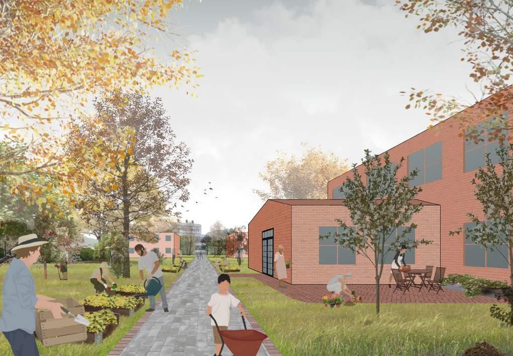

Prague 11 District
CENTRAL STEM, a connecting spine by Camilla Basile
Chodov Metro Station Area
Bridging Prague by Joanna Kopacz-Gruzlewska
Meet me by the forest! by Luize Eglite
From Lot to Life by Niusha Sadat Nabil
Opatov Metro Station & Central Park Area
Prague Eleven by Charlotte Pietschmann
The soft movement of South City by Erik Ivanoff
Step 1: Opatov Station into Opatov Square by Filip Stojanovski Kutlesovski
CONNECTING OPATOV by Greta Gram
Re-Introducing Centrální Park by Kathrin Buschhardt
REVITALIZACE by Kelly Yang
Looking Forward Backwards by Rina Zetterqvist
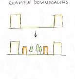
Downscaling Prague 11 by Saga Dalhammar
Framing the Block by Sophia Spock
Growing Háje by Assar Swanberg
The Opatov Street by Axel Leksell
Social movement by Binyou Wang
HÁJE = HOME! by Clara Hammer
Dynamic Dynamos by Erik Henckel
Generations of Prague 11 - an urban childhood by Hanna Lundell
Around the Corner by Juliette Isaacs
From roads to realms by Lovisa Öquist
Transitional spaces by Ruth Zaragoza Chinchayan Barreto
Everyone’s neighborhood by Sofia Del Stabile
Háje Ahoj by Vincent Tuma Fischer
SUDes Team:
Andreas Olsson
Architect SAR/MSA
Course Leader, SUDes
School of Architecture, Lund University
Teresa Arana Aristi
Architect SAR/MSA - Urban Designer
Lecturer, SUDes
School of Architecture, Lund University
Guest Lecturers:
Dominik Landkammer, Office of Territorial Support, IPR Prague
Flavio Janches, Architect PhD, Professor, University of Buenos Aires
Jiří Deyl, Architect/Urban Planner, IPR Prague
Jonna Ekholm, Architect /Urban Designer, Gehl
Judita Eisenberger, Urban Planner & International
Relations Specialist, IPR Prague
Karolína Suchá, Landscape Architect, IPR Prague
Martin Špičák, Architect, IPR Prague
Mateusz Mastalski, Henning Larsen
Michal Lehečka, Anthropictures
Michaela Janečková, Architect / Architectural Theorist, Paneláci
Nellie Stenvall, FOJAB
Peter Siöström, Associate Professor, LTH, Lund University
Pontus Wirf, RADAR arkitektur & planering
Rozalie Kašparová, Architect/Urban Designer, STUDIO
BISTRO
Simon Sjökvist, Architect, COBE
Vojtěch Benedikt, Sustainable Mobility Specialist, IPR Prague
Wouter Verleure, Landscape Architect/Urban Designer, IPR Prague
Zdeňka Havlová, Architect & Head of Office City analysis, IPR Prague
Assar Ekander Swanberg, Sweden
Axel Leksell, Sweden
Binyou Wang, China
Camilla Basile, Italy
Charlotte Pietschmann, Germany
Clara Hammer, Sweden
Erik Henckel, Sweden
Erik Ivanoff, Sweden
Filip Stojanovski Kutlesovski, Macedonia
Greta Gram, Sweden
Hanna Lundell, Sweden
Joanna Kopacz-Gruzlewska, Poland
Juliette Isaacs, Australia
Kathrin Buschhardt, Germany
Kelly Yang, Canada
Lovisa Öquist, Sweden
Luize Eglite, Lithuania
Niusha Sadat Nabil, Iran
Rina Zetterqvist, Sweden
Ruth Zaragoza Chinchayan Barreto, Peru
Saga Dalhammar, Sweden
Sofia Del Stabile, Italy
Sophia Spock, USA
Vincent Tuma Fischer, Sweden
Guest Critics:
Daniel Wasden, Kristianstad Municipality
Mateusz Mastalski, Henning Larsen
Rozálie Kašparová, STUDIO BISTRO
Simon Sjökvist, COBE
Vojtěch Benedikt, IPR Prague
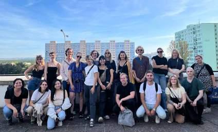
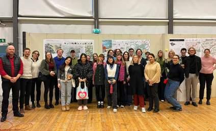
During the autumn term of 2023, students at Lund University, School of Architecture participated in the advanced course ‘Sustainable Urban Dynamics’ (ASBN31) and its complementary theory course ‘Sustainable Urban Dynamics - Theory and Tendencies (ASBN41), focusing on creating a sustainable vision for the Prague 11 District. The aim of the design course was to challenge the misconceptions about large housing estates built in the Modernist era, especially when comparing the conditions of these areas within Western Europe and Central Eastern Europe.
Students focused on questions for the development of the city’s fringe, Prague 11 district’s borders – both mental and physical- and strategies to revitalize housing estates as part of an urban transformation for the post-socialist cities, while paying attention to the site’s unique characteristics and adapting to the needs of the community. These themes were explored throughout the whole semester in various seminars, guest lectures, and project tutorials with the goal that each student explores and presents a ‘context sensitive’ urban design proposal for the transformation of the assigned district. The design process was separated into several parts - analysis, strategy, and individual design - combing both the group and individual work of the students.
A one-week study trip to visit the site was organized in combination with a four-day intensive workshop, in collaboration with Vojtěch Benedikt and Karolína Suchá from the Prague Institute of Planning and Development (IPR), who acted as the juries for the competition format. Upon finalizing the workshop, the students spent eight weeks developing their individual design proposals.
This course booklet presents a summary of the design site, workshop and introduces a brief presentation of 24 unique individual design proposals as a result of this semester’s design studio.
For further information on the course and the International Master’s Program please visit our website at https://www.lunduniversity.lu.se/study/sustainable-urban-design-mastersprogramme-TASUD.
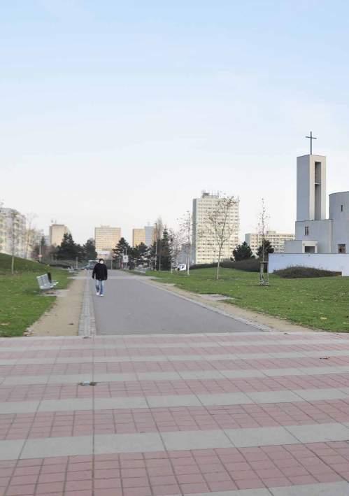
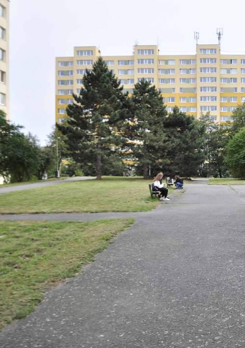
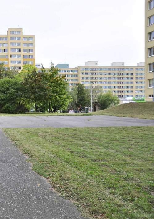
It’s the third year that the Urban Dynamics course’s focus was the city of Prague, in the Czech Republic. The students were tasked with the urban regeneration and renewal of the Jižní Město or “South City” area, Prague’s largest housing estate, in the Prague 11 District.
Around 80,000 people live in this area, which highlights how different the large housing estates are perceived in the Easter European countries compared to the West. Even though it is considered to be a suburb located in the city’s fringe, the district has a very strategic location, surrounded by great landscape features – forests, lakes and streams- and excellent accessibility to public transportation, which makes it a great place to live.
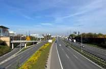
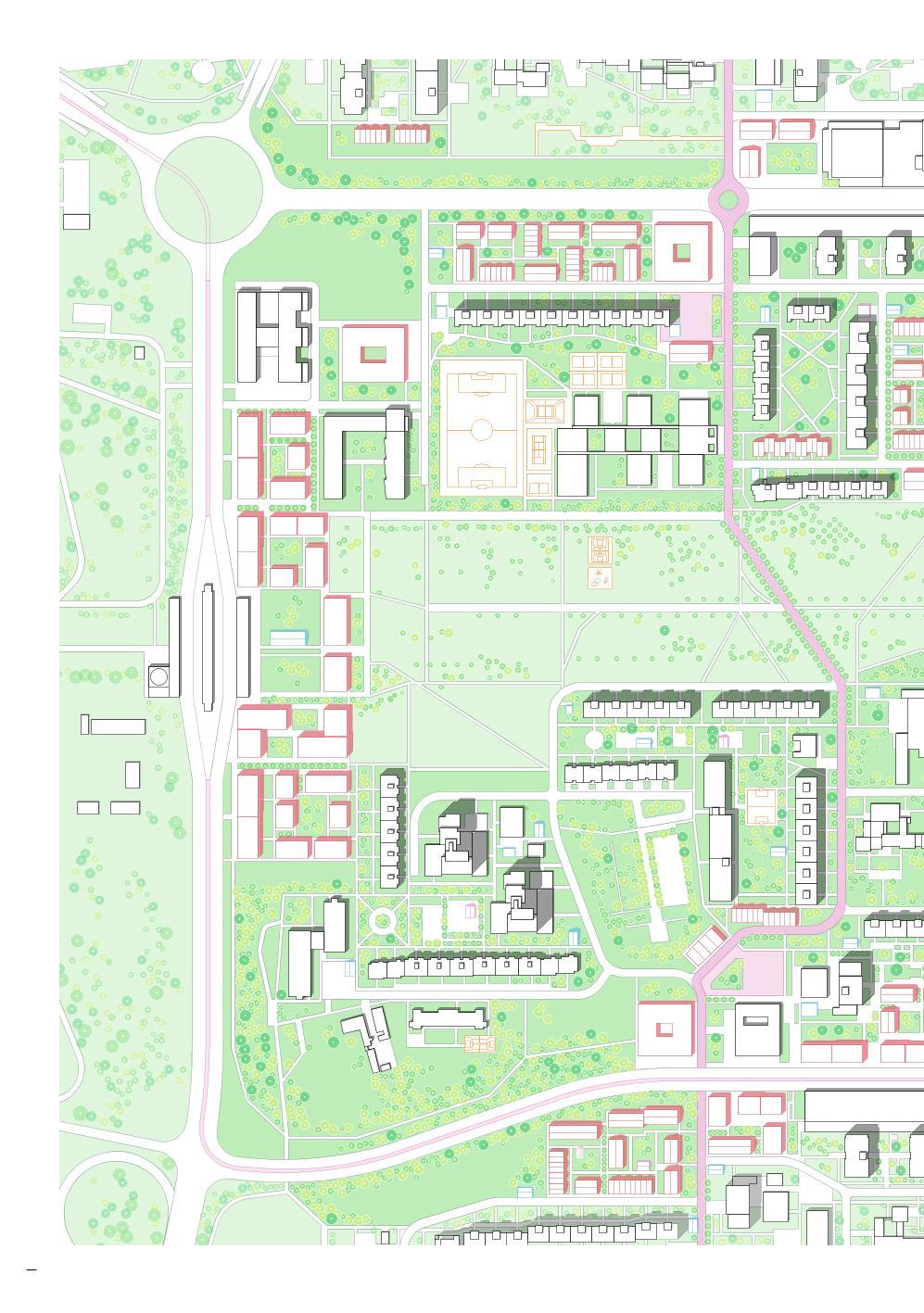
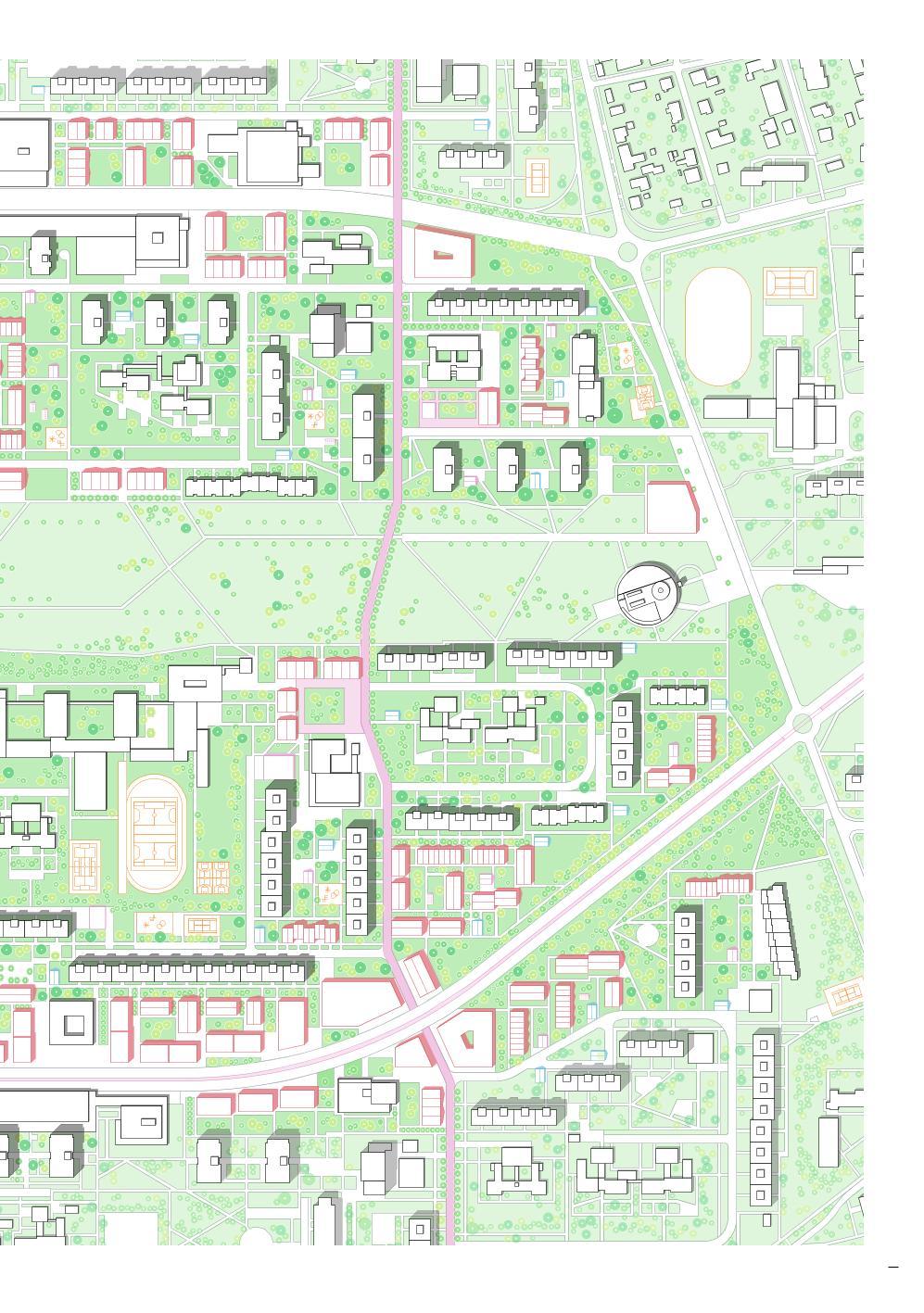
This municipal district is located eight kilometers south-east from the city center, with the D1 highway running through the area and dividing it in two, with few underpasses and tunnels for pedestrians and cyclist. The road network and infrastructure has caused the different neighborhoods to be disconnected, thus forming individual islands that encourage the use of private cars. The same can be said of the built form, with big, prefabricated panel buildings “panelák” – like the large housing estates Jižní Město 1 & 2- placed in the middle of vast under-utilized green areas which do not mix with the single-family housing areas, creating very homogenous islands. Prague 11 is served by Roztyly, Chodov, Opatov and Háje stations, the final four stops on the southern end of Line C of the Prague Metro and the areas around these stations have been identified by the Prague Institute of Planning and Development (IPR), in their Metropolitan Plan, as areas of transformation.
The Central Park located, as its name suggest, in the middle of the district, is an important asset that can become an important generator for the area. The students were encouraged to use the existing qualities of the area, to enhance and improve the quality of life for the existing and future residents.
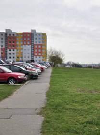
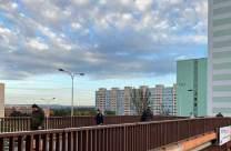
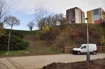
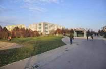
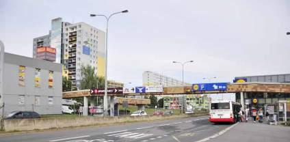
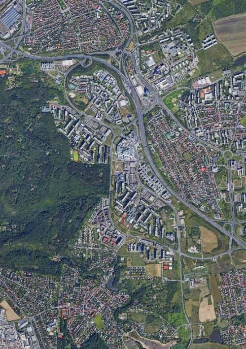
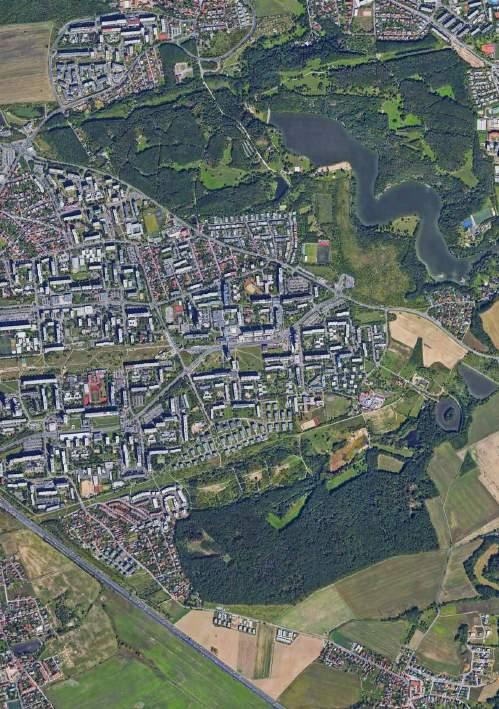
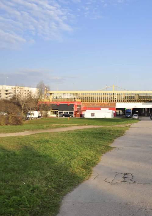
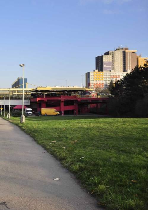
From an overall perspective to embracing Prague 11’s potentials
The aim of the four-day workshop, CONCEPT PLAN, was to give the students the opportunity to use the knowledge they acquired on Prague 11 district in the first weeks of the course, and turn it into a concept plan that answers the question: what happens when vision meets reality?
Taking into consideration the group work done in the first phases, and the possible future development areas already suggested, students worked together to develop a master plan of Prague 11 District that goes into the specifics of location, connections, wayfinding, and landscape systems.
The assignment was carried out as a competition format, with the proposals being presented to Vojtěch Benedikt and Karolína Suchá as guest juries from the Prague Institute of Planning and Development (IPR), who selected a winner and a runner-up at the end of the workshop.
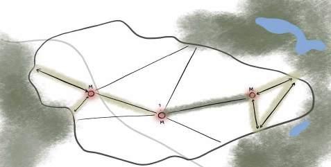
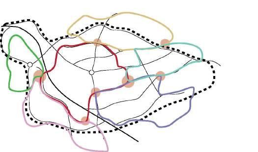
Metropolitan node - the inbetween

● Create scale by breaking blocks
● New interation spaces
● Cultural centers
● Commercial areas
● Create spaces to stay in the green areas
● Create a green path between the new uses
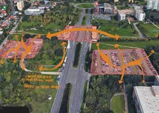
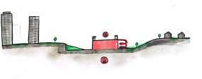
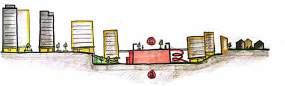
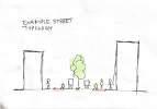
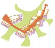
Transitional spaces

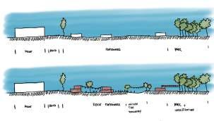
Section- before
Section - after
The semester schedule was broken down into 5 parts, each ending in student presentations. The 6th and final part concluded the semester and provided the students a chance to improve and reflect upon their work. This structure allowed for the students to focus on specific components of their projects and design process as well as get feedback on a consistent basis.
In general, the structure worked from the large over-arching scale of globalization towards the development of design details within the final project. Each 3-week period required the students to go one step further in the development of their projects, while at the same time bringing with them knowledge from their previous explorations. Through the guest critics comments and weekly individual tutorials, each student work grew in depth and detail in an attempt to tackle the challenges posed by the site and the course requirements.
For the first time in their studies, each student had the opportunity to choose their own design site within the Prague 11 District. After doing an in-depth research and mapping of the district and its context within the city - first in groups and after individually - they framed the key issues to be addressed and the opportunities for the future development of the area, according to their personal reflections.
As the students were one step closer to doing their thesis semester, in which they have complete freedom when it comes to deciding a design site, they were asked to draw out the area that interested them the most, based on their own conclusions after Phase 03. The end product is wide range of solutions to transform this post-socialist district into a more sustainable and livable place within three overall transformation areas, the northern Chodov area, the Opatov metro station area with the Central Park and the Háje metro station area.
Therefore, the student projects presented in this booklet have been organized in the same way, stating with the Chodov area and ending with Háje area. It is our hope that all the hard work and energy from the students can be translated in the next pages and you can be inspired by their designs.
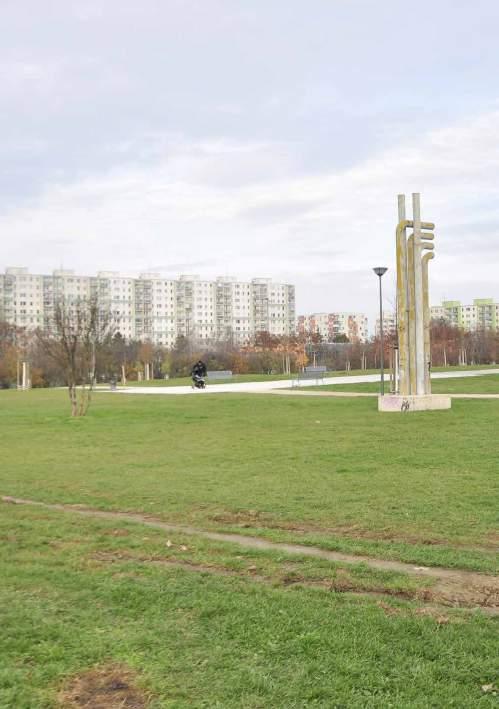
Camilla Basile, Italy
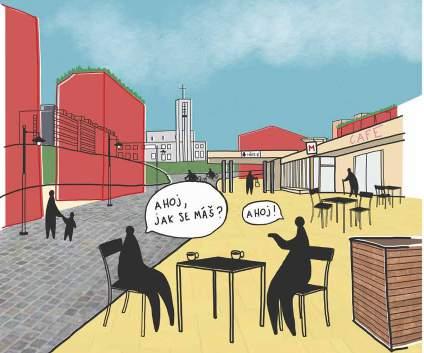
SKETCHED VISUALISATION OF HÁJE METRO STOP
“The aim is to make the district safer for everyone!”
As the title “Central Stem: a connecting spine” may anticipate, my project is based on two main strategies: the main central spine (the “stem”) and the neighbourhood attractions (the “flowers”).
The first one aims to activate, densify, add more functions, and connect the green areas and the metro stops already present in Prague 11, while the second aims to create attractive interactions spots, involve and include the whole community, define the human scale, while keeping the quiet aspect of the current neighbourhoods.
More into details, the central spine’s goal is to resemble city streets, making them as pedestrian friendly as possible, restricting car use, while still keeping most of them accessible to public transport.
Going towards the same direction, the neighbourhood attractions strategy’s goal is to create a more various
community by attracting more young people in the area, working on the generational gap resulted from the analysis.
Mapping out the existing neighbourhoods and making sure to keep the functions that already make the locals happy, I planned the interventions throughout a timeline of four phases.
I set up a toolbox for the interventions on four different levels (users, landscape, functions, streetscape) to help explaining the timeline in a more concrete way and on a bigger scale that could include the whole Prague 11.
The aim of these interventions is to make the district safer for everyone by having pedestrian focused streets and less wide empty spaces, more sustainable by decreasing car dependency and making public transportation more efficient, and diverse by attracting different kind of people and introducing new functions, building a stronger local community.
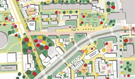

DETAILED PLAN OF HÁJE METRO STOP


SECTION OF OPATOVSKÁ STREET


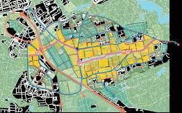


Joanna Kopacz- Gruzlewska, Poland
SECTION THROUGH THE BRIDGE
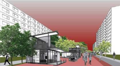
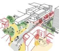
PERSPECTIVE VIEW SPACE BETWEEN BUILDINGS
“We need to build bridges, not walls.”
Prague 11 is a fascinating district of the Czech capital, characterized by a high population rate and strong visual identity of post-socialis modernist residential buildings.
Although embraced by genuine forests, the city demonstrates rather monotonous and mostly unarranged greenery within living areas, offering only few parks and places to hang out. Highly developed network of public transport provides very effective connections to the capital centre. Nevertheless the stops seem to be isolated and perceived as unsecure by the inhabitants.
A large amount of various amenities meets requirements of a comfortable life however most of them are inaccessible due to car overloaded and unwalkable streets.
Another factor hindering the pedestrian attendance is low building density connected with abundance of massive outdoor parking lots.
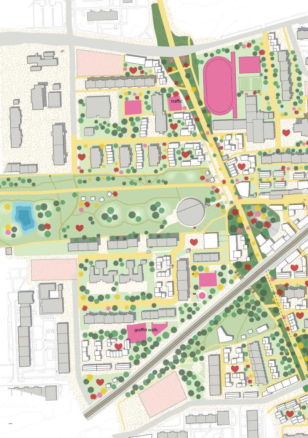
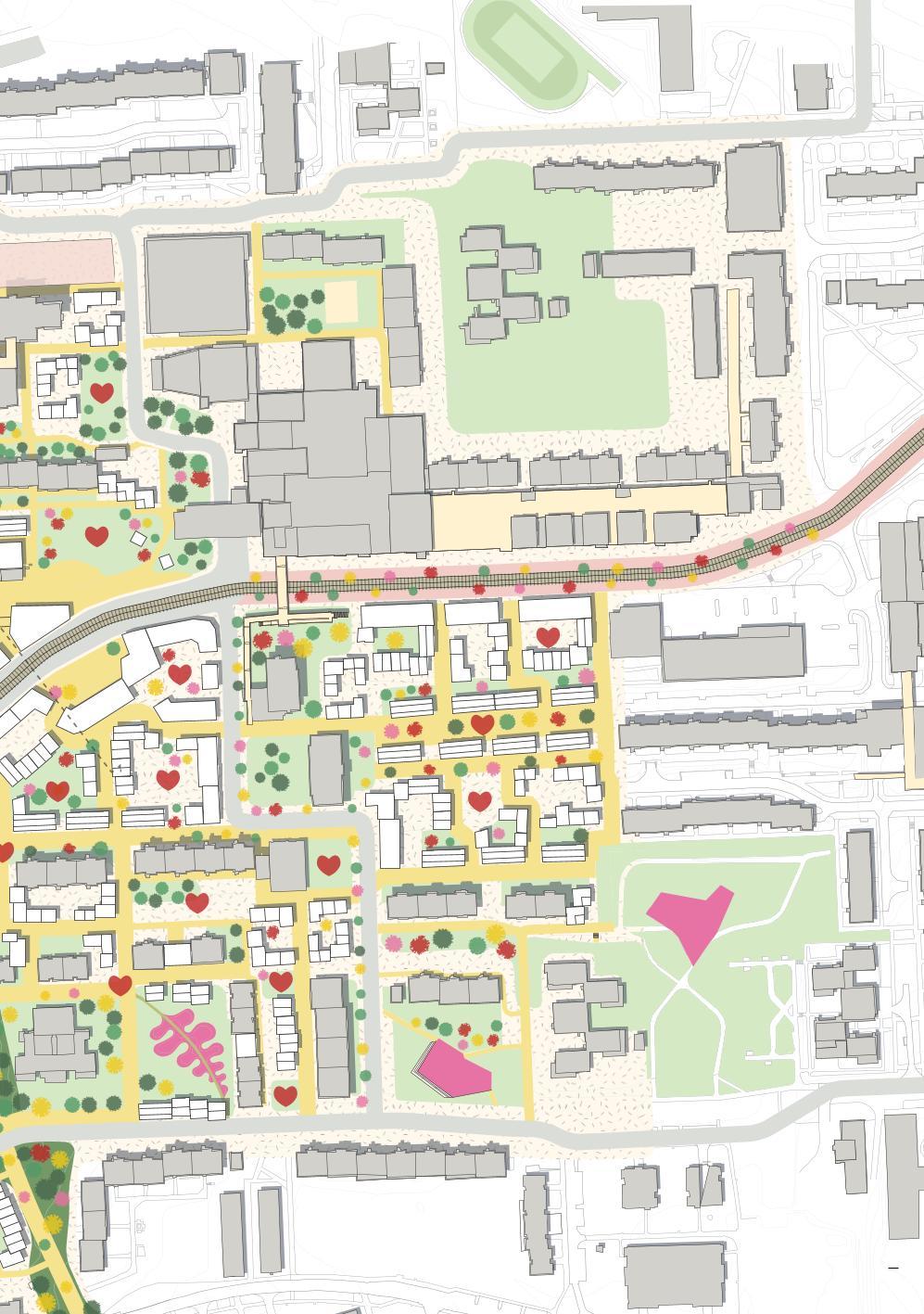
My main goal assumes enhancing social and environmental sustainability of the area by establishing two new connections: one of them between the dominating two commercial hubs and the second joining sport facilities and recreational spots in the forest.
The connections perceived as sequences of experiences aim at empowering pedestrian and cycling mobility and promoting public modes of transport.
The first connection requires transformation of Rysaveho street, reduction of 4 lanes into 2 ones, replacing outdoor parking lots by parking houses combined with service and residential functions and densification of both street sides.
The second connection utilizes the existing bridge over the highway as an element on a pedestrian path running through spots of diverse functions: sport, parks, residential, office and commercial.
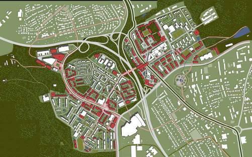
MASTERPLAN
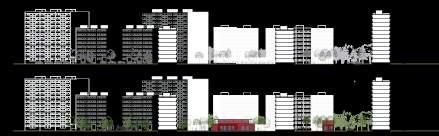
SPACE BETWEEN BUILDINGS BEFORE INTERVENTION
SPACE BETWEEN BUILDINGS AFTER INTERVENTION
Nature Public transport Amenities
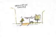
Monotonous surrounding, Lack of orientation
Tram line implementation, Sport facilities
Car domination, Commercial hubs, High voltage
SWOT ANALYSIS

Connections
CONCEPT EXPLANATION


Densification possibilities Car traffic disposition
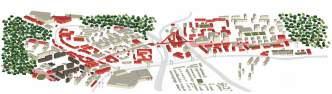
INTERVENTION TOOLS
Luīze Eglīte, Latvia
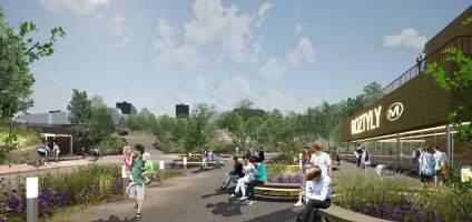


“Roztyly,
Horní Roztyly and Starý Spořilov neighbourhoods have earned to have a safe, accessible and sustainable meeting point!”



As one of the most populated areas in Prague - Prague 11 can use its historical side and land potential to improve. Although this kind of post-soviet time sites are not so attractive for nowadays modern society with needs of modern materials, modern courtyard design, modern technologies, modern way of living, they have their own unique identity, memories, stories to tell and it can be romantic too.
For the area between the Chodov and Roztyly metro stations I see a very big potential that hasn’t been used yet. It has very weak pedestrian connections and a lot of the site is given to large parking lots, these factors also make the area feel unsafe for the residents. But developing this area for benefits as for new residents as the existing ones, transforming parking lots into efficient land use and gathering 3 housing areas together by the biggest forest that is the closest to Prague center.


Roztyly would become more sustainable in many ways: decreasing the need to go by car if there is the needed service just by the corner, transforming parking lots for more efficient land use for people and landscape, increasing the attractiveness of walking and biking and accessibility to public transport, as well as engaging residents with the forest and recreational area, being respective of existing green areas.
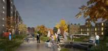
VIEW TO THE TRANSFORMED MAIN ROAD IN UPPER ROZTYLY BETWEEN EXISTING THE LARGE SCALE HOUSING AREA AND BUILT UP PARKING PLOTS.
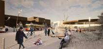
VIEW TO THE NEW SQUARE IN UPPER ROZTYLY WITH THE NEW BUS ROUTE, MOBILITY HOUSE AND EXISTING ADMINISTRATIVE BUILDINGS

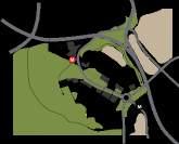
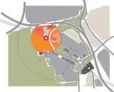
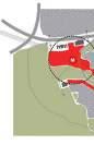
New main routes for residents New connections to meet all 3 neighbourhoods
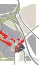
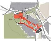
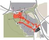
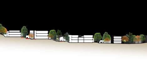
Niusha Sadat Nabil, Iran
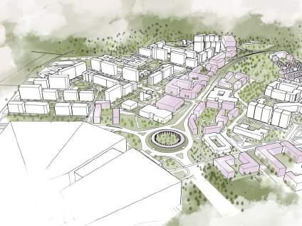
“From
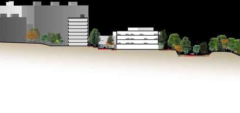
Lot to Life” aspires to serve as a model for innovative urban planning. perspective of the Rysaveho Street
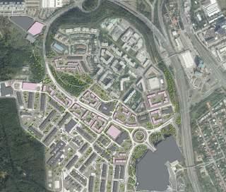
My project, titled “From Lot to Life,” revolves around a transformative approach to urban development in Prague 11. The core of this initiative lies in the conversion of conventional parking lots into dynamic and purposeful structures, reimagining the use of these spaces within the district. By incorporating innovative designs, such as parking houses, into the urban landscape, the project aims to address both functional and environmental aspects.
The transformation of parking lots into multifunctional buildings aligns with the broader goals of sustainable practices. This approach not only optimizes land utilization but also contributes to reducing environmental impact, potentially mitigating concerns related to air pollution and enhancing green spaces. The integration of parking houses is a key element, providing a solution to the challenges posed by extensive parking space usage in the district.
Moreover, this initiative goes beyond mere infrastructure changes. It envisions a comprehensive enhancement of the quality of life for residents in Prague 11. By introducing functional and aesthetically pleasing structures in the place of traditional parking lots, the project seeks to create a more vibrant and livable urban environment. The focus is on fostering a sense of community, promoting sustainable mobility, and improving overall well-being.
In essence, “From Lot to Life” aspires to serve as a model for innovative urban planning, showcasing how the transformation of parking spaces can be a catalyst for positive change. The project’s holistic approach aims to inspire similar initiatives, not only within Prague 11 but also as a replicable and scalable model for urban development in other contexts.
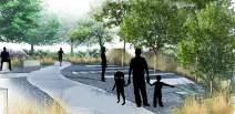


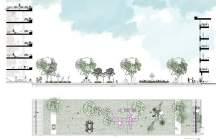
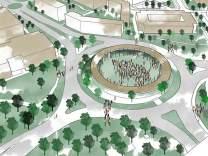
Opatov Metro Station Area & Central Park - Design
Charlotte Pietschmann, Germany
PERSPECTIVE
“This project transforms weaknesses into strengths,
highlights existing qualities through small measures and thereby creates a lively neighbourhood!”
In developing my design, I focused on two main goals.
On the one hand, the aim was to create a well defined pedestrian and bicycle oriented street network. At the same time, the wide open spaces should be broken down to introduce a smaller scale. This should also be supported by the densification with a variety of typologies and vegetation. At the same time, there is a lack of variety in uses within the area. Therefore my design introduces different uses, especially workplaces as well as shops and services.
The second goal is to create enhanced community neighborhoods. The number of residents, the size of the residential buildings and the lack of various uses both inside and outside the area creates a sense of anynomity and a lack of community spirit. This can be supported by activating the open spaces through various forms of uses and the
introduction of neighborhood centers and communal facilities, which can contribute to a lively neighborhood.
The main element of my concept is a toolbox that I used as the starting point for my design, but can also be applied to other areas in Prague Eleven. I
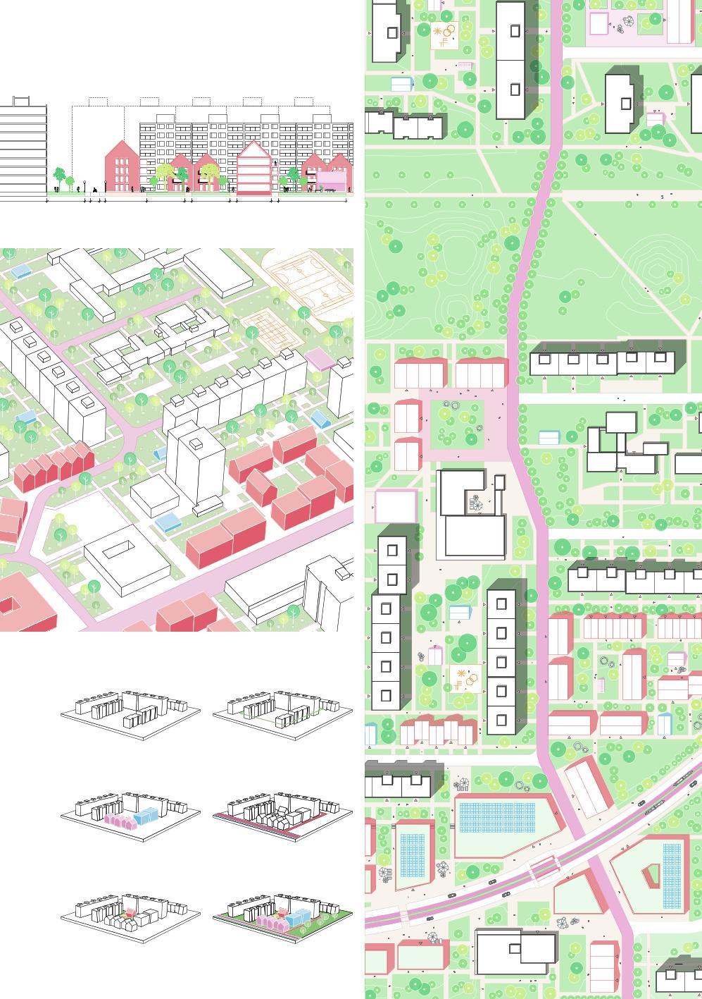
ADD BUILDINGS
STRENGTHSEN COURTYARDS
Erik Ivanoff, Sweden
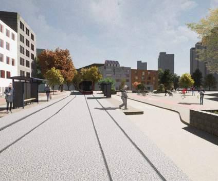
PERSPECTIVE OVER OPATOVSKA
“The term “soft movement” suggests a focus on community, sustainability, and a gentler lifestyle.”
Reflecting on the analysis of Praha 11, and later travelling to the actual site, it is clear that the district has a lot of qualities. Its proximity to the metro connecting to central Prague, its green parks, the surrounding green landscapes with forests and lakes, and its people feeling a sense of pride and connection to the site. However, Praha 11 also faces significant challenges. The district grapples with monotone architecture, complicating pedestrian navigation and understanding of spatial connections and hierarchies.
Another important aspect is the vast open spaces between the buildings, primarily used for parking and big lawns, which creates a lack of connectivity between the built structure and the streets. The main roads of the district today are primarily regarded as transport corridors prioritizing motorized vehicles. As a result, the streets of Praha 11 are seen as obstacles for
humans rather than connectors that support a sustainable public everyday life.
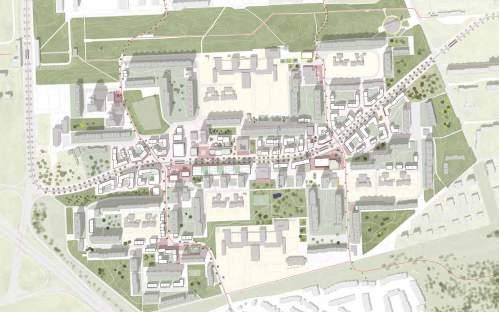
The proposed vision for the district revolves around implementing higher densification along the new tram line and Hviezdoslavova road. Simultaneously, smaller interventions are recommended as one moves further from these central points.
Public cores are established around existing amenities and strategically near public transport and paths that connect different neighborhoods of the district. The overarching goal is to transition Praha 11 from a space emphasizing hard values to a vibrant area that seamlessly connects public spaces, fostering a softer lifestyle conducive to everyday sustainable movement for the district’s residents.


Filip Stojanovski Kutlesovski, Sweden (Macedonia)
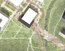
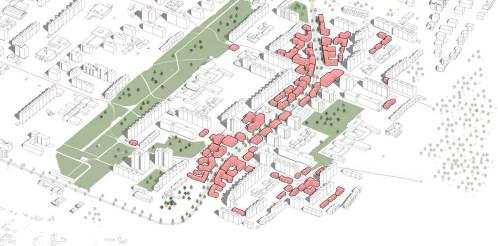
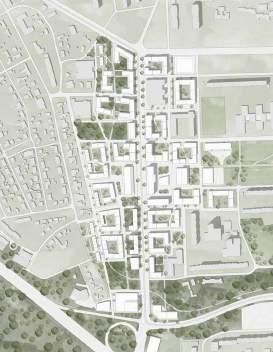
DETAIL PLAN over the new Opatov Square (1:1000)
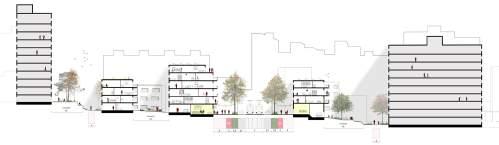
“My project aims to respect and improve the existing by filling in the gaps with connecting middle grounds, in this case the new Opatov Square”
Prague 11 is a district with a lot of potential. Part of it is thanks to the connectivity with the well-planned network of public transportation with bus routes, a future tram line, and four metro stops that connect the district to the center of Prague. Another part is its proximity to large nature parks and forests. However, the district’s drawback is the absence of attractive nodes and an abundance of humanscale structures, creating a fragmented landscape resembling islands of varying scales.
The proposed concept focuses on both central metro and future tram nodes, transforming them into vibrant public centers. By addressing height contrasts, filling gaps between structures, and prioritizing human-scale spaces along the tram street, the plan aims to revitalize the district. Emphasis is placed on enhancing existing green spaces, particularly Central Park, developing connectivity with
nature parks, and improving overall accessibility.
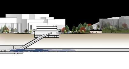
The project phasing begins with enhancing the central metro stops and creating a central nature path in Central Park. Subsequent steps involve establishing a pedestrian street loop around Central Park and framing the tram street, connecting it to surrounding green spaces. The focal point in this project is therefore the Opatov metro station, Central Park, and the connecting area. The proposed “Step 1: From Opatov Station to Opatov Square” envisions a transformation from a transient, noisefilled checkpoint to a dynamic space for community interaction, relaxation, and nature appreciation. The design integrates public buildings, a flexible open space with a stage, and a nature area, providing a versatile environment for various activities and events throughout the seasons.
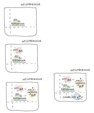
CONCEPT DIAGRAM & THE DIFFERENT DEVELOPMENT PHASES
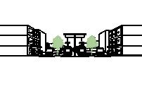
SEQUENCE SKETCHES 1-4
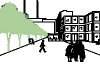
“- by making it into the of Jižní Mesto.”
My aim is to make the area feel more as a whole by connecting the two sides and to make Chilská road less of a barrier and more of an urban boulevard. To do this it’s important to pay attention to the characteristics of the two sides. To develop the characteristics yet introducing new morphologies that could act as a link between the east and the west neighborhoods. I have used the perimeter block structure as a foundation for the plan. It has been a method to introduce more of a gradient between public and private by introducing the missing middle as semi-private/semi-public.
Preserve green – How to keep as many trees, and other valuable green areas, as possible while densifying? In the project I kept areas of rich green and linked them through a green corridor.
Flexibility and adaptability – Mixed-use areas and plan for a long life-cycle.
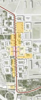
Connections – Well connected to existing neighborhoods with main focus on Opatov station and its surroundings. Clear orientation – An area that is easy to navigate in and safe to move around in.
Movability – Different scales of streets and paths together with different types of transportation. Focusing on sustainable transportation as walkability, cycling and public transport with Opatov as a transportation hub and introducing the tram.
Public and green network – Increase communal and restorative qualities and place making.
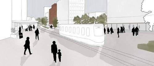
PERSPECTIVE 1 - OPATOV STATION



“Centrální Park is the heart of Prague 11”
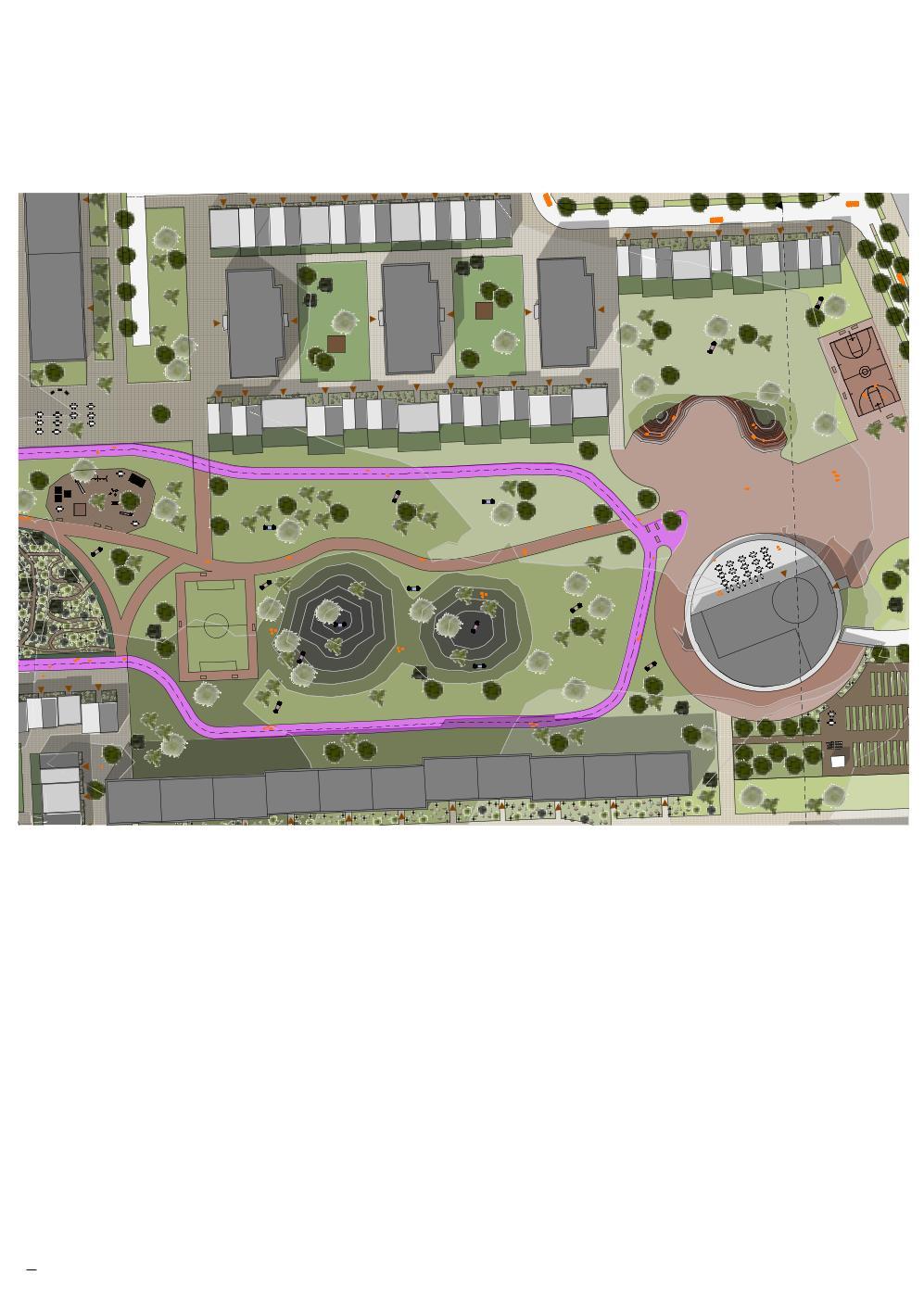
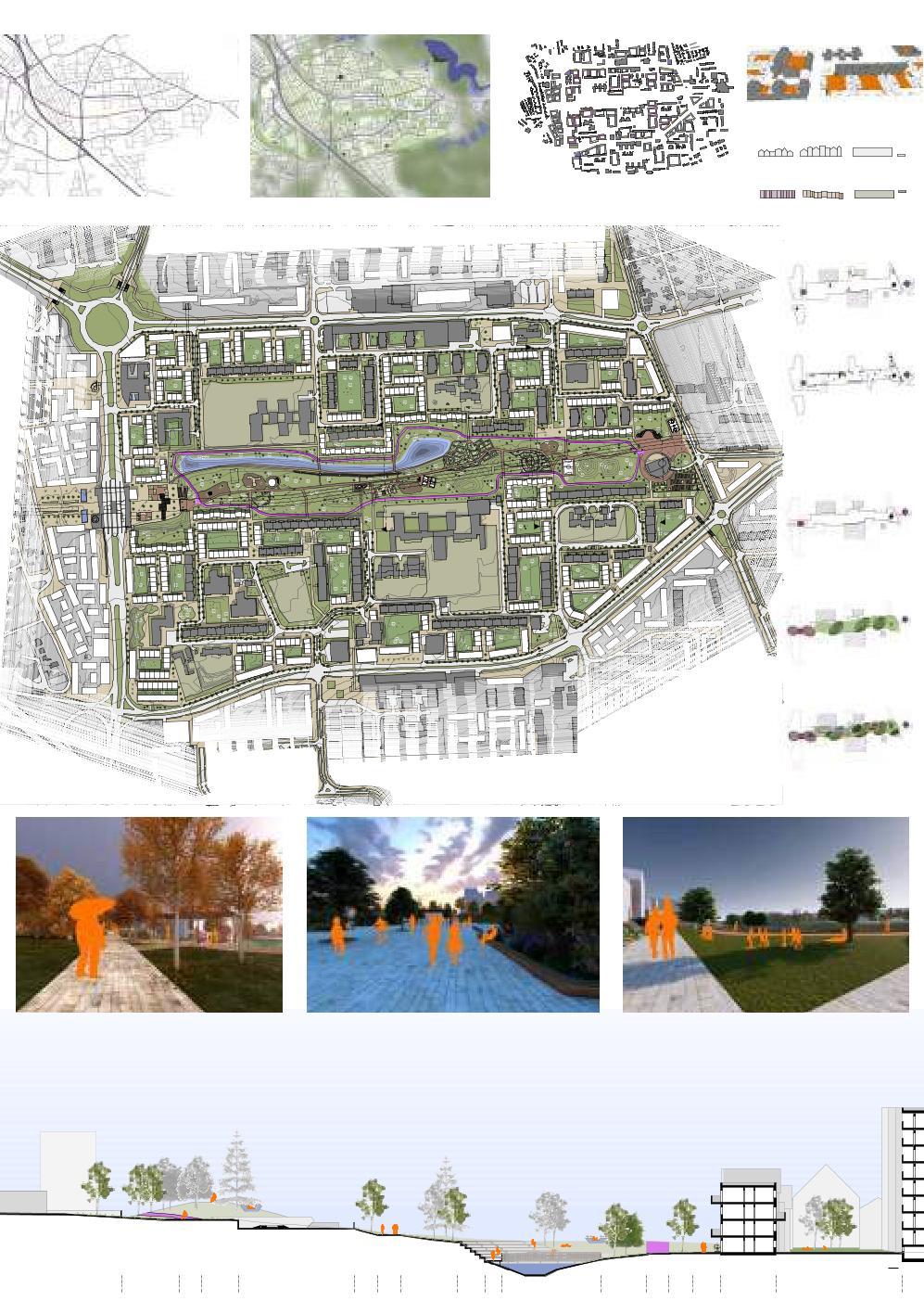
Prague 11 is a district located in the southwestern end of Prague. It is easy reachable by the red Metro line within 20 minutes from the city center. In this district is the biggest shopping mall in Czech Republic, this attracts many people to come to this area. Since Prague 11 is located on the outskirts, it is surround by park and nature reserves. Besides being surrounded by forests and lake, which is a great generator to live in and come to Prague 11, the district has a lot of grass area and public spaces. A lot of this green space is under used or just leftover space. The biggest one public area is Centrální Park located between the last two stops of the Metro. This park has not many trees, due to bad soil. Therefore there is the opportunity to clean the soil and create a park with more shading and more variety in activities. The topography of this park is an advantage for water management. By redefining the park with new activities, changes to the topography and how
the enter the park, the park becomes more of an magnet. Since there are the nature parks around Prague 11,it gives the opportunity to make it to an activity park. The houses currently build around this park are built in a way that there is not much difference between private or semi-private. Also looking at the houses around the park, they are 13 storey tall, really long and don´t define the border of the well. One Solution could be by building rowhouses on the edge so that the park has more structure and its scaled down from the tall building in the surrounding area. Another opportunity is densifying. Since the build structure is mostly tall and long prefabricated houses, they are not formed around a courtyard. By adding new houses and therefore creating a block structure, each “block” would have their private inner courtyard and it would strengthen the community within the building.
Kelly Yang, Canada
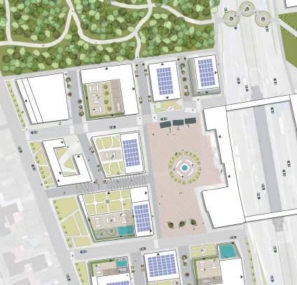
Detailed Urban Plan 1:500
“The aim of my project is to solidify Opatov Station as a contemporary urban center for the
inhabitants of Prague 11 and revitalize the area for more dynamic and interactive programming”
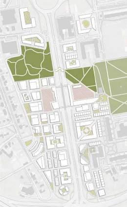
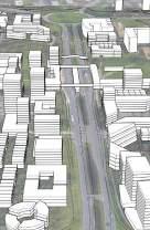
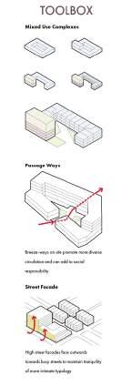
In the city of Prague, the district of Prague 11 is distinctly unique in character given its socialist history and dense residential population. Its prominent block housing and barren parkscapes are all products of a social order that has long since passed and no longer reflect the needs of the current population. During my research I have found potential in the area around Opatov Station; the locality and context of the site boasts impressive features that can easily become one of the most prominent places in Prague. According to a study, it would appear that there are large clusters of concern that concentrate along the
stretch of land between Opotav and Haje. Ironically, this is also where the collective sentiment of a neighborhood centrum lies, this indicates that there is currently a gap between the site’s reality and what people’s expectations of what the site’s potential is. My project will focus on the area surrounding Opotav as a first step towards a largescale call for revitilization along busy transit corridors and aims to improve feelings of safety, locality, and social responsibility.
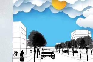
Rina Zetterqvist, Sweden
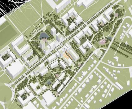
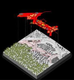
AXONOMETRY
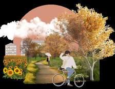
“Think not of a forest in the city, but of a city in the forest.”
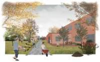
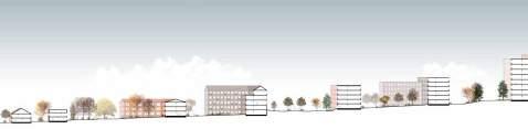
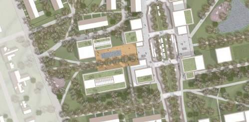
My vision for Opatov draws inspiration from the historic landscapes. Historically the district has been forested, cultivated farmland and urban development, but never all at once. My project is about finding common ground and collaboration, where no use excludes the other, but instead provides mutual benefits. Where wilderness, cultivation and urban development can coexist to create a sustainable enriched neighborhood.
Presently there is some car parking and contaminated soil in Opatov that would need remediation. There is also an issue with maintenance and the matter of natural succession. Nature needs time to establish itself and find a balance. For these reasons I suggest a progression that in the first phase focuses on establishing a foundation from which the development can grow over time. This would mean little to no maintenance, implementing blue infrastructure, planting native
species of trees and wildflowers, soil remediation helped by establishing new growth - planting detoxifying and nitrogen fixing plants. This will give nature a head start and be a not so harsh first step towards introducing new development to the locals. I imagine the following urban development to be very considerate and respectful of the natural environment and to blend in with the landscape.
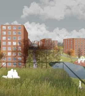
VISUALISATIONS
WEST-EAST SECTION, BRIDGING TYPOLOGIES
Saga Dalhammar, Sweden
Strategic Urban Plan
“My project focuses on the first phases of transforming a cityit’s a possible first step for many of the other student’s ideas of transformation.”
AREAS FOR DENSIFICATION
BUILDINGS IN POOR CONDITION SUITABLE FOR REDEVELOPMENT
FOCUS AREAS
I wish to transform old and unused buildings, mapped above, within the insides of the neighbourhood in order to increase mixed-use with simple and cost-effective means. Included in this is the idea of incentivizing housing co-ops and local organisations like churches to manage their surrounding land. This will lower management costs for the city, and allow local actors to develop the neighbourhood according to the needs of residents.
I want to encourage mixed-use and residential appropriation of the neighbourhood. Within the next couple of years, I wish to redevelop the streets to make them more attractive to residents, and restructure the parking system. This, along with a new tram line, will hopefully incentivize public transport use and decrease the need for car ownership amongst Prague 11 residents. Three years in the future, I want to begin the process of densification, first by resident surveys, temporary spatial
structures, and citizen participation, and then by beginning the construction process. Through beginning the process on a lower scale, I also hope to gain more residential support for further densification in the future.
When redeveloping the existing panel housing, the public sphere is expanded into the entrance floor of the surrounding buildings, abandoned buildings get a new life, and parking is concentrated rather than being spread out across the road. These are somewhat simple means, but together they have a large effect on the street.
This way, the neighbourhood takes an initial step towards rejuvenation by utilizing the existing street structure and built environment.
Sophia Spock, USA
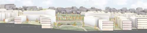
PERSPECTIVE
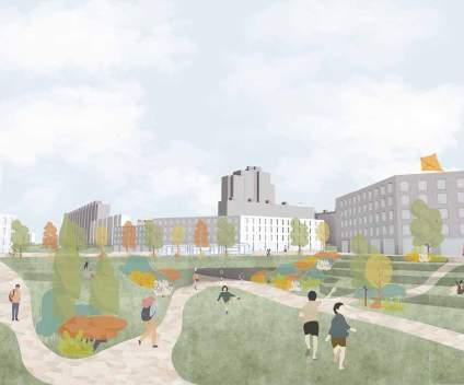
“How can new developments be placed strategically to create accessible connections and defined places in Prague 11?”
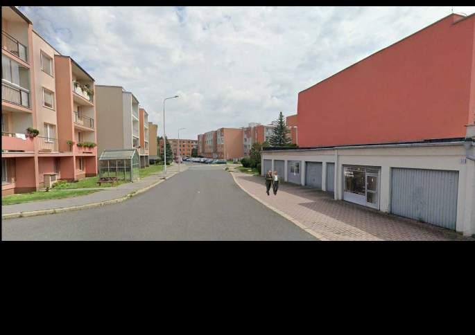
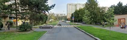
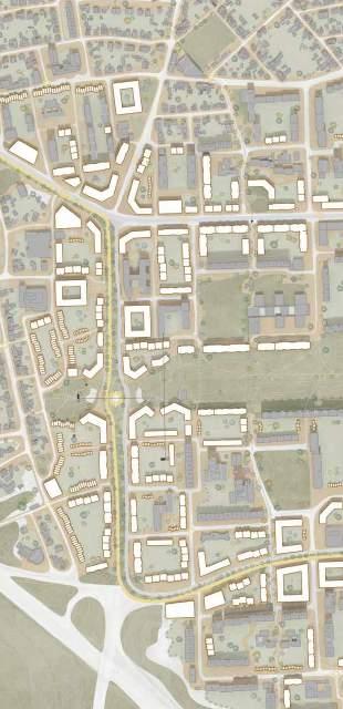
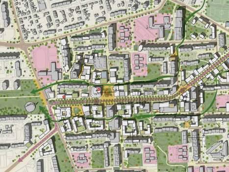
Framing the Block explores this by focusing on new developments around Opatov Station. By developing here, the vision improves connection to greater Prague, helps Prague’s housing demand, and introduces activities like shopping, daycare, markets, and seasonal events within the district. This development will begin in underutilized areas like surface parking lots to maintain as much quality green space as possible. In doing so, it will define the public spaces for the district and private spaces for the block residents by strategically placing new buildings to frame the street front and park boundaries. This block structure is not limited to new development, but will instead begin by reframing the existing buildings to define existing, edited, and new block structures throughout the district.
By introducing a neighborhood block scale similar to the single-family blocks found throughout Prague 11, and defining key streets and green spaces
within the developed block structure, Framing the Block also connects uses within the district. Adjustments to roads throughout the district (such as seasonal streets that encourage interaction, tree-lined streets linking parks, or roadways with dedicated bicycle and public transit lanes) will increase mobility and access to a greater diversity of typologies for all residents within Prague 11. This will reduce car dependency by making the area more walkable, limit residential sprawl by focusing development around the metro stations, and enhance rather than replace existing places. Through this, Framing the Block improves accessibility by providing clear links between places and defines the public streets and private courtyards to encourage lasting community use throughout Prague 11.
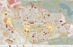
ANALYSIS PLAN
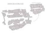
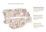
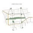
Masterplan
“transform a modernistic satellite city into an integrated and thriving part of the Prague urban fabric”
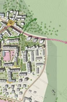
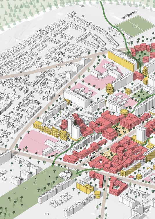
The transformation of Jižní Město, a refurbishment with sustainability in focus.
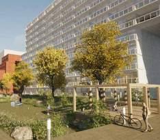
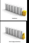
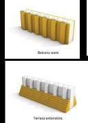
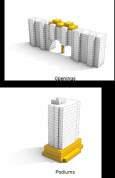
Giving the residents of today improved qualities of life is the first step. Interventions such as adding new accessible entrances to the outside and extensions that provide more living space. Courtyards transfered in ownership and caretaking from no-one to the local residents fills in a missing layer of spaces that residents feel connected to.
Streetscapes would be transformed with sustainable mobility, landscape functions and urban life as the priorities. No more through traffic through what could be a courtyard or a urban space. New buildings and renovations that defines key streets and improves the connections between the inside and outside. In the core of Háje, along the new tram line, a central boulevard fit for the 21st century is laid out, connecting
the central park with the Hostivar forest. One street back you’ll find the green backstreets making the grand nature spaces closeby easier available.
New functions completes Háje and gives residents from all over Prague a reason to visit Jižní Město. Layering different functions and scales in new buildings providing cultural, educational and sportive functions to the centre of Háje, a gift and resource for new and current residents. Expanding local services with more workplace opportunities, local businesses and qualitative destinations that make up a neighborhood complete with everything a city should offer.
Axel Leksell, Sweden
“From
Opatov Road, the realm of cars, to Opatov Street, a walkable main street and connector of Prague 11”
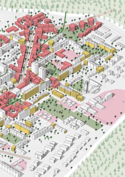
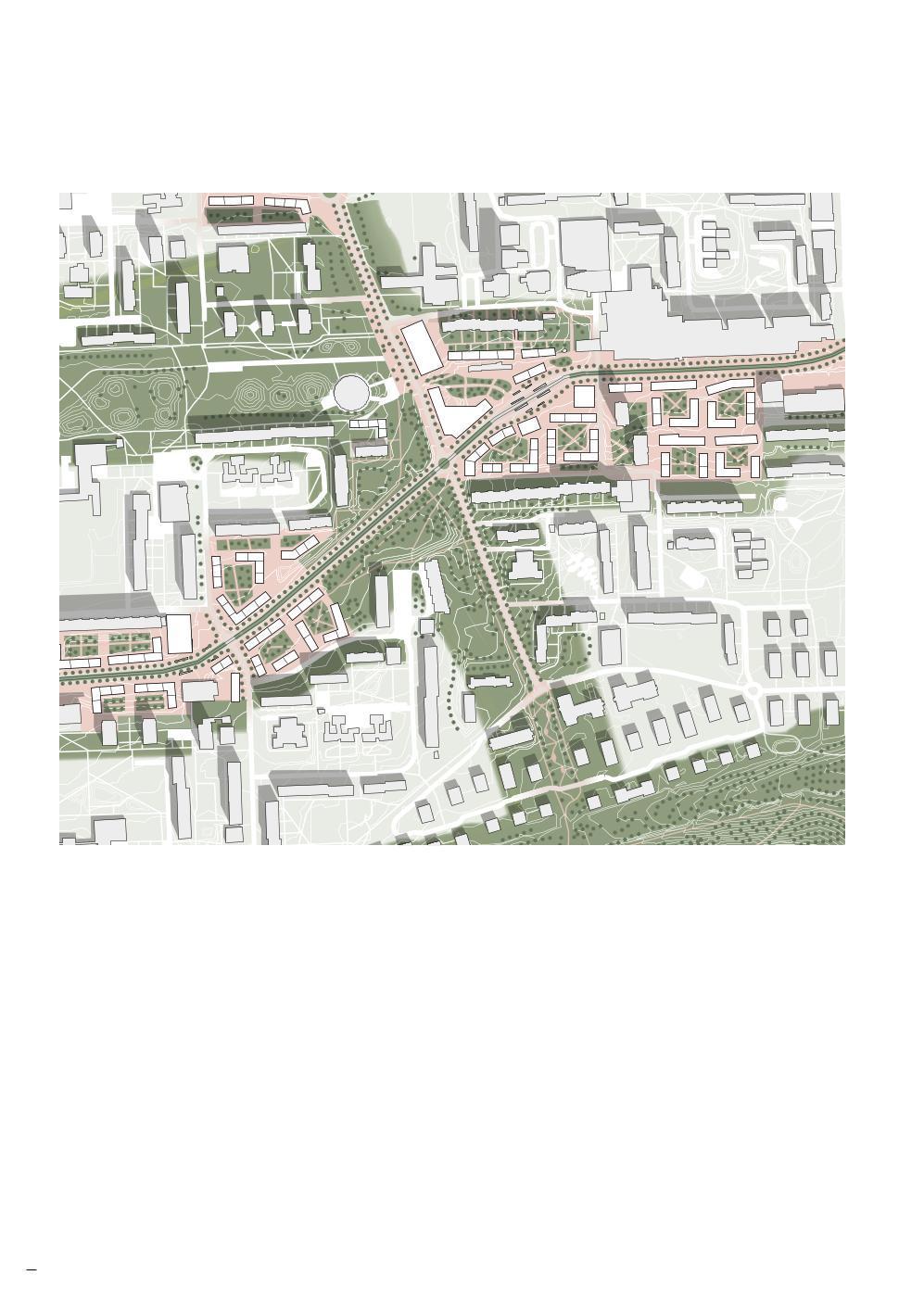
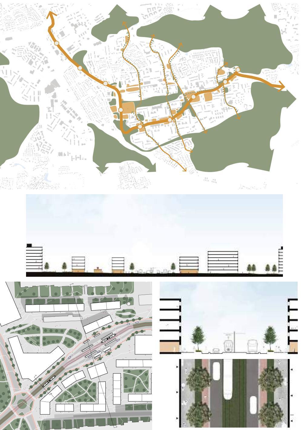
Prague 11 is a district with both strengths, like its proximity to nature and efficient metro and bus connections, and weaknesses, mainly the overwhelming car dominance and lack of quality greenery inwards.
This project addresses these issues with a main focus on the Opatov Road - a major barrier in the district. It is redeveloped to prioritize a future tramline and soft mobility, shifting the hierarchy from car dependency to more sustainable transport options. Greenery is interlaced with the street network and underused plots are densified, creating a varied and active streetscape. These plots consist mainly of empty lawns and parking lots, spaces that today are underused.
Connecting roads undergo a similar redevelopment, evolving into green corridors for biodiversity and pedestrian accessibility to the main street and public transit.
The Opatov Road will with these actions transform into the Opatov Street, from being a barrier to a connecting element and the establishment of the district’s new main street.
Binyou Wang, China
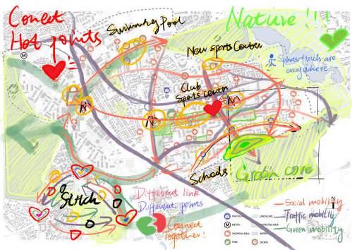
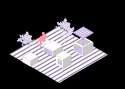
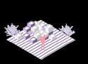
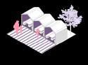
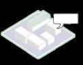
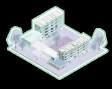
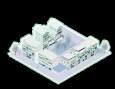
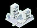
The keyword of the whole site is social movement, and this main theme and keyword is reflected in all levels of the design!
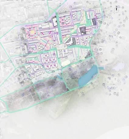
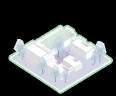
After analysing the current site in the previous phase, the main strategy of this design is to activate the site and achieve sustainable development by linking the hotspots in the site through the landscape as the main means, and by linking the elements of traffic, function and architecture together to form the dynamics of the society.
Clara Hammer, Sweden.
“... a city district that can thrive.”
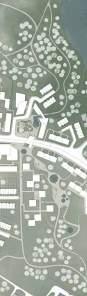
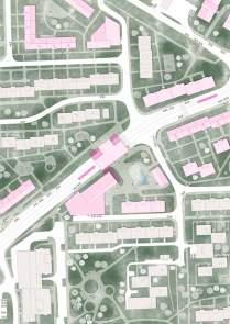
Prague 11 is one of few districts in Prague where the city’s inhabitants can have access to water, apart from the river, Vltava. The Hostivařská Přehrada reservoir was the starting point of the concept for this project which aims to improve the accessibility for citizens to this unique resource. I wanted to try working with these changes, not against them.
A large part of why residents are often critical of new developments in their area is because the new development relies on the existing parts for many functions and the network gets overloaded. This was an important part for me so I would like my project to give back to the people living in Prague 11, and Háje specifically. By adding development around the tram the street can become safer for those crossing it and give everyone a better system of transport.
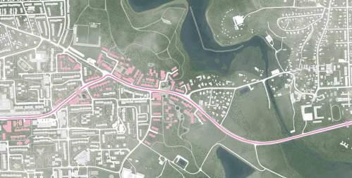
The concept is divided into two topics, water sensitive design and transitoriented development. Prague 11 is the end station for Metro C, the red line, and is surrounded by districts which have no access to the metro such as Prague 15, Prague 22, Prague-Petrovice and many others. This project aims to increase connectivity between these districts by adding a tram line which services the outskirts of Prague.
Prague 11 currently consists mainly of housing, meaning most inhabitants leave the district for work or extracurricular activities. To tackle this I want to make Háje, and Prague 11 as a whole, more than just a home. I want to transform Háje to some thing that is almost self sustaining, a city district that can thrive.By concentrating on blue and green I hope to create a more lively and active district which can connect to the rest of the city through what they have in common as well as their differences.

Visualisation of the Park Link.
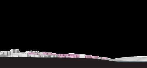
Erik Henckel, Sweden
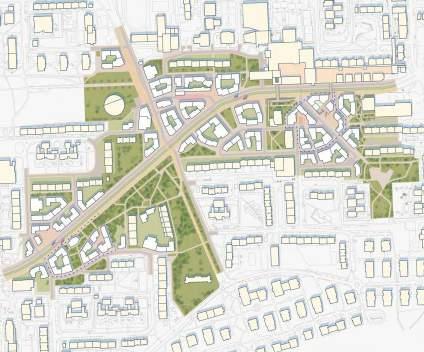
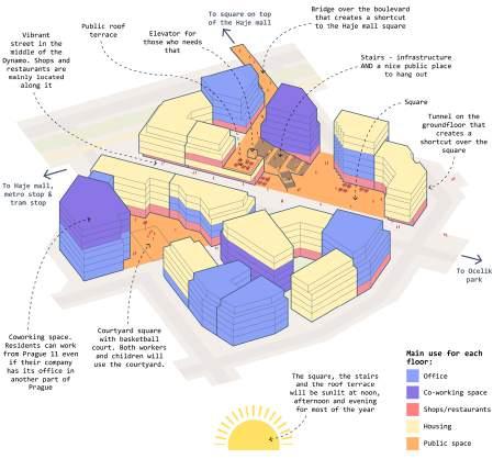
“Dynamos: Office clusters that do not become empty of people at the end of the working day. They have more functions - they are dynamic”
Prague is a growing city and needs more housing and the Prague 11 district is a neighborhood that can be densified to make this possible. Prague 11 needs more workplaces if it is to be, as today there is mainly housing and people need to go to other parts of the city for work. The idea behind the proposal ”Dynamic Dynamos” is to develop Prague 11 with housing and mixed-use buildings but also focus on new workplaces around existing metro stations and new tram stops.
To create more workplaces, office clusters are suggested, as offices are a type of workplace that does not negatively affect liveability as much as other types of workplaces can. The offices are arranged in clusters because it has positive effects as it enables more companies to share resources, for example large meeting rooms, and for the employees to meet other people at other companies. However, office clusters, especially if they are large,
can lead to neighborhoods or entire neighborhoods that are empty of people during evenings and weekends, which is not desirable.
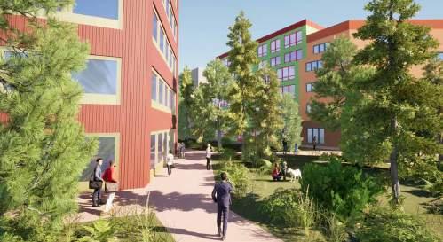
The proposal is based on developing office clusters with a concept that makes them more dynamic. The clusters should have mixed uses, not just offices, and should have features that make people want to come to them and stay in the clusters. There shall be public places in the clusters and the soft mobility infrastructure should steer the movement of people to and through the clusters. The clusters will then, if all this is done, function as generators/dynamos for the surrounding neighborhood and not be empty of people.
Hanna Lundell, Sweden
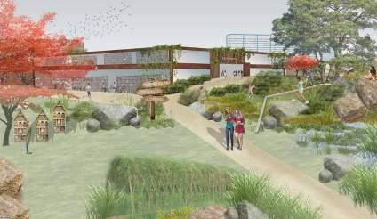
“Let
the children paint the future for Prague 11 in Hajé area.”
The majority of the population of Prague II moved to this area when it was newly built in the 1970s. Which means that the present population of the area today is aging and new generations will inhabit the area.The project focuses specifically on the area around Hajé metro-station in Prague 11. This project tries to emphasize what a new era of Prague 11 can look like. The strategies that is purposed to be implemented is safe and soft mobility, community actions, define & diversify greenery and missing middle. These strategies will together work for more activation with both indoor and outdoor activities and broaden the sense of what kind activities are needed in terms of age and gender. By defining and higher the quality of the greenery its increasing biodiversity and will
clarify public and private. Safer mobility means changing the present hierarchy from caruse to pedestrian & bicycle friendly, and increasing access to public transport. Lastly, missing the middle is about downscaling the present highrise building to enhance humanscale but at the same time keep the present identity and character of the area. By inviting the perspective and interpretation of child adaptation we will not only meet the target group itself but also invite a larger majority of people.
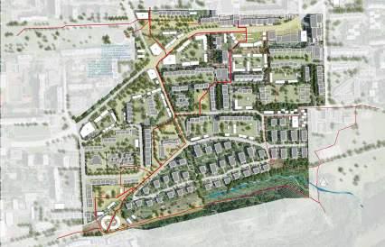
MASTERPLAN
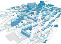
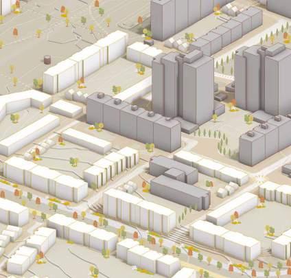
AXONOMETRY - HAJÉ AREA


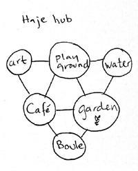
DIAGRAM - FUNCTIONS, GREENSPACES & MEETINGSPOTS
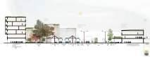
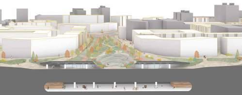
SECTION - MOBILITY CENTER
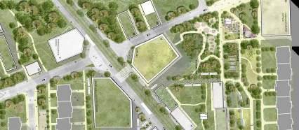
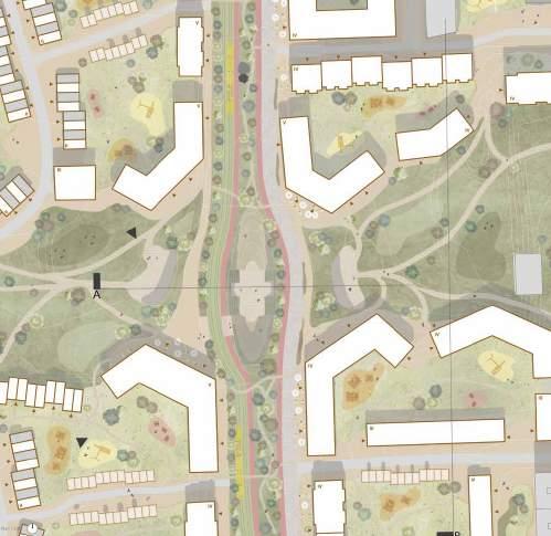
DETAILED PLAN, LIBRARY - CULTURAL SQUARE
Juliette Isaacs, Australia
a a
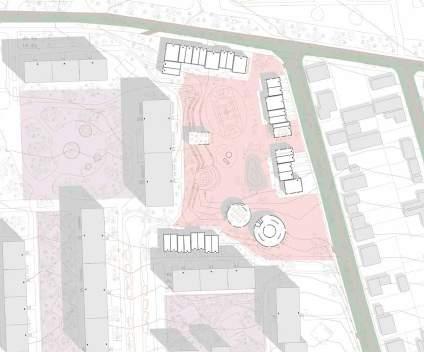
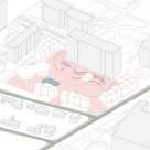
DETAILED PLAN OF COMMUNITY HUB
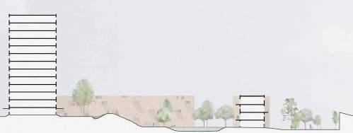
“Social sustainability became my focus on this project through the creation of ‘third places’ for the residents of Prague 11”
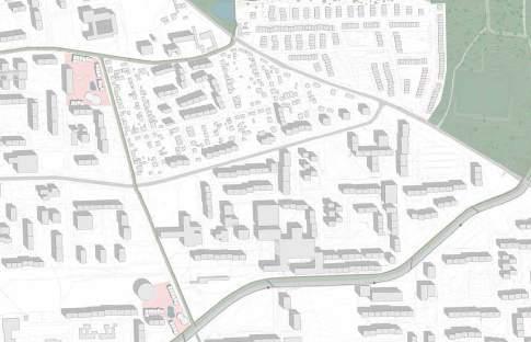
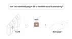
What particularly caught my attention from my small glimpse into the site was my perceived lack of social interactions among the residents, along with a deficiency in urban design that could facilitate such connections. Social sustainability and in particular social well-being and quality of life became my focus on this project. While researching, the term ‘third places’ came to my attention. This is a place where people choose to spend their time outside their first place (home) and second places (their work). Third places are familiar public places where you regularly connect with other known and unknown people over shared interest or activities. These can be public or semi public spaces.
Why? My goal is to establish a strategy to strengthen the social connections within the community which will lead to retention of residents in this housing estate long-term. Breaking this down into qualitative aspects, I’m hoping
to achieve an overall strategy where residents have a range of social and optional activities around the corner. This approach will result in a more socially sustainable and liveable urban environment for the residents of Prague 11.


Lovisa Öquist, Sweden
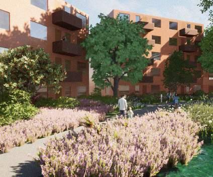
“The concept is to strengthen the movement within the area in favor of a sustainable, inclusive mobility that not only supports movement but also transforms the notion of the streetscape to the core of public life and in that way adds value to the everyday life of people living in Praha 11.”
The historical context of the post-soviet time as a whole in the Czech Republic gives an understanding of the different layers of Praha 11 when it comes to for example the typology of the built form and the traffic separated design. When visiting the area, above all, three main aspects caught my attention. First, the way cars are dominating, both visually and in terms of space. There is a movement and atmosphere prioritized by cars. Secondly, the huge and many times undefined green areas that often are perceived as barriers. Finally, the unclear space hierarchy. The understanding of private and public and the way to orient is difficult to grasp.
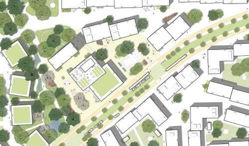
Three identified existing main streets are programmed and transformed –the tram line, the bike street and the green corridor. Focusing on activating ground floors, creating attractive public spaces and enhancing the green as well as increasing shared space and adding mixed functions and scale, the missing
link that is very much characterizing the area today – the link between buildings and streets – can be created. The tram line is characterized by active ground floors, mixed-use functions and sustainable mode of transportation. The bike street is transformed for a slower tempo, yet prioritizing the possibility to travel fast and safely by bike. The green corridor works as a strong, green connection by adding more green to the already green spaces and programming parts of the corridor with for example urban farming, water features and recreational activities. Along with densification of existing void spaces, these can be transformed to more lively and inviting public spaces where the people and nature – not the cars – are in focus.
Ruth Chinchayan Barreto, Peru
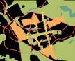
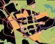
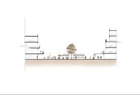
“My vision for those new streets is to reverse the idea of parking streets and create exclusively pedestrian paths with new activities “
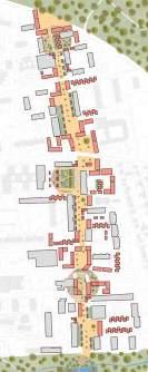
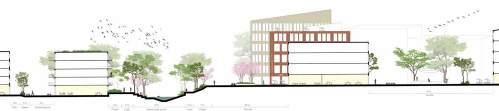
Based on the lack of scale and connections between the different building typologies with the streets, I started identifying the main disconnected urban elements.
That was the relation between singlefamily and multifamily housing, in which the users of the first case are not used to being outdoors as often as the multifamily ones. This is because they travel by car and the houses have everything they need inside (garden, swimming pool, etc).
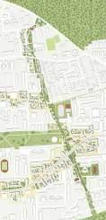
So as a second step, I identified potential paths that could connect them with the public areas and parks from the zone, and improve the interactions between them and other districts.
I picked those paths based on the number of parking lots and streets with a higher width than 12 m (because of the sensation of emptiness and the possibility of building or changing


things without disturbing the inhabitants).
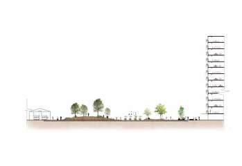
Currently, those streets have huge dimensions and are surrounded by buildings higher than 10 floors, so people avoid being on the streets because of the lack of human scale, mixed uses and a bad microclimate design.
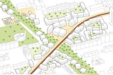
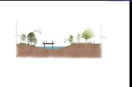
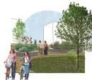
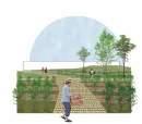
So my vision for those new streets is to reverse the idea of parking streets and create exclusively pedestrian paths in 2 specific zones with new activities that will be main nodes not only for locals but also for visitors.
Finally, these new elements will be included in different scales creating transitions and a new shape on the street. This would be trough a toolbox that considers the vertical and horizontal aspects of the urban environment.
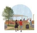
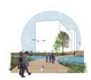
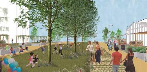
Sofia Del Stabile, Italy
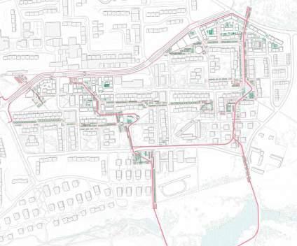
STRATEGIC PLAN 1:2000
“How people move around and actively participate in public life depends mostly on the quality and safety of public spaces”
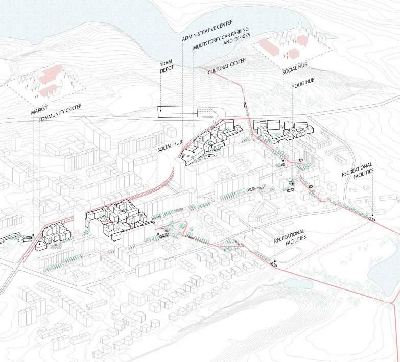
South of Háje neighborhood represents the last piece of urbanized land before the Hostivař - Záběhlice Natural Park and the Milíčovský Forest. It is located within an apparent strategic triangle characterized by txhe above-mentioned nature reserves and the last metro stop. Potentially, with the proposed tramway connection along Opatovská street and the addition of pedestrian/ friendly connections to the district’s east and west, this triangle could come to fruition, ushering a new urban paradigm.
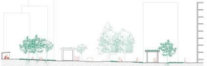
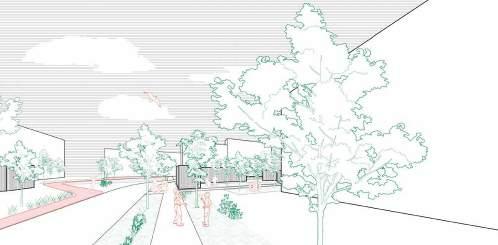
My vision is therefore focused on promoting an interconnected and live neighborhood that attracts and invites people to enjoy the multiple local potentials with a peculiar attention on reducing the car dependency and improving the slow mobility. Roads supporting soft mobility increase road safety and improve the quality of movement of people. The new inbetween buildings will be a pedestrian-
bike friendly space able to gather people offering different activities and qualitative recreational spaces, implementing the sense of community and safety.
The improvement of public spaces by connecting and assigning qualities to them, together with the improvement of the soft mobility network, reducing car dependency and parking lots, is aimed at promoting a sustainable urban model remarkably careful at gathering communities in a safe and enjoyable city.
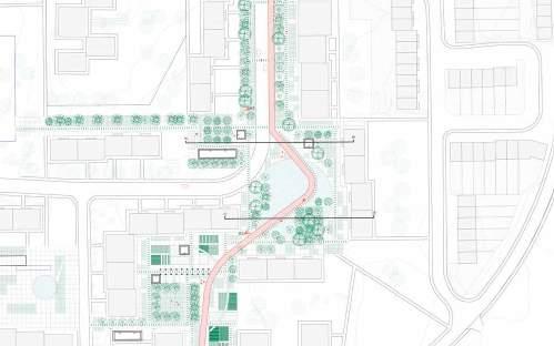
DETAIL PLAN 1:500
Vincent T. Fischer, Sweden
















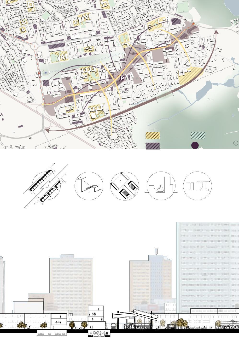
“Deescalate private transportation alongside densification and paving for soft mobility” PICTURE DESCRIPTION



Embarking on the revitalization of Praha 11 and Háje unveils the complex challenges and promising opportunities in this post-communist city district. Dominated by iconic panelaky buildings, towering residential structures that have contributed to its status as the third most densely populated district in Prague, the area faces visible impacts of its communist past. The district’s reliance on cars is evident in traffic congestion and vast parking spaces, exacerbated by the concentrated work opportunities mainly within Westfield Chodov.
To address these challenges, Háje Ahoj focuses on strategic densification around the panelak buildings, dispersing work opportunities across the district, and repurposing parking lots creatively. The initiative involves engaging residents through a thoughtful design strategy that enables gradual adaptation and decision-making, fostering a sense of community identity.


Prioritizing pedestrian-friendly streets, especially around Haje station, promotes safer access and reduces car dependency over time. By over time phasing out the car from opatovska street and making new connections The project aims to transform open areas, largely municipally owned, into vibrant, cared-for spaces that enhance the overall quality of life. By promptly initiating an improvement program with financial incentives for residents, envisioning a district that not only meets its housing needs but also thrives as a distinct and sustainable community.

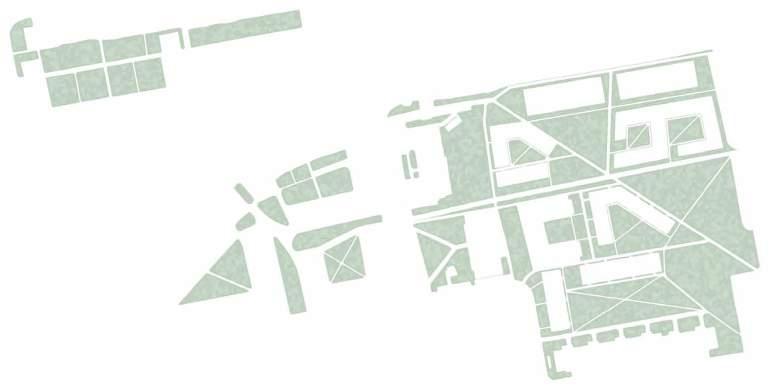

Blockformation and placement strategy
Sustainable Urban Design Master’s Program
School of Architecture
Lunds Tekniska Högskola
P.O. Box 124, 221 00
Lund, Sweden
https://www.lunduniversity.lu.se/study/sustainableurban-design-masters-programme-TASUD
Lund University
P.O. Box 117, 221 00
Lund, Sweden
www.lunduniversity.lu.se
Prague Institute of Planning and Development (IPR)
http://en.iprpraha.cz/
Published January 2024