If it’s July, it must be time for le Tour de France!
Like always, this years tour is fabulous watching and like many, I have my phone plugged into the race stream on a daily basis, which has proven to make any project meetings a tad more difficult. We are also in the process of moving into a new office after some 17 years, not to mention the 18 students who recently arrived from everywhere for our annual Canto opera training support. A typical restful July is not in the cards this year!
We’ve launched a new Authors Index on SubTel Forum Magazine and our website—a searchable directory that allows readers to easily find articles by contributor. It’s a great way to spotlight industry voices and access expert insights from across the subsea cable community. Click here to check it out!
We’re gearing up to print new editions of the 2025 Submarine Cable Map for two major industry events: Submarine Networks World (Singapore, September) and IWCS Forum 2025 (Pittsburgh, October). These exclusive maps highlight global subsea system advancements and are distributed directly to key decision-makers across the industry. Want your logo featured? Now’s the time to secure your ad space and gain high-visibility placement. Click here to secure your spot!
The updated SubTel Forum Online Cable Map is now live—featuring a sleeker interface, faster performance, and improved usability across all devices. Inspired by the
historical theme from the printed SubOptic cable map, the new design delivers a visually rich, intuitive experience that bridges past and present subsea infrastructure. Special thanks to ACS and WFN Strategies for coming aboard as premier sponsors. Explore the map here.
Interested in sponsoring the Online Cable Map? Contact Nicola Tate to learn more.
SubTel Forum was honored to present the Excellence in Industry Awards at SubOptic 2025 in Lisbon—recognizing exceptional contributions across the submarine cable sector. Since 2010, these awards have celebrated the best in thought leadership, innovation, and impact, spotlighting individuals and organizations shaping the future of global connectivity. This year’s honorees exemplify the cutting edge of subsea communications, and we were proud to acknowledge their achievements at the industry’s premier global gathering.
Congratulations to Andy Palmer-Felgate, Rafiah Ayandipo, and Quynh Nguyen on their well-deserved recognition!
SubTel Forum is proud to support UC Berkeley’s new Global Digital Infrastructure Certificate, a pioneering academic program focused on the physical backbone of the internet—submarine cables and data centers. Offered in partnership with the Berkeley Center for New Media, SubOptic Foundation, and iMasons, the program runs from June through August and brings together students from around the world to explore sustainability, resilience, and global equity in digital infrastructure.
Now, students are invited to submit research articles for publication in Submarine Telecoms Forum and Data Center Dynamics. A panel of industry and academic experts will select standout work that showcases the voices shaping the future of global connectivity.
The 55th Submarine Cable Almanac will be published in August featuring the latest global cable system data. The next edition arrives in November—interested in sponsoring? Contact Nicola Tate.
Thank you as always to our awesome authors who have contributed to this issue of SubTel Forum. Thanks also for their support to this issue’s advertisers: Fígoli Consulting, International Wire & Cable Symposium, Submarine Networks World 2025, and WFN Strategies. Of course, our ever popular “Where in the world are all those pesky cableships” is included as well.
Good reading and vive le tour – Slava Ukraini STF


Wayne Nielsen, Publisher
A Publication of Submarine Telecoms Forum, Inc. www.subtelforum.com | ISSN No. 1948-3031
PRESIDENT & PUBLISHER: Wayne Nielsen | wnielsen@subtelforum.com | [+1] (703) 444-2527
VICE PRESIDENT: Kristian Nielsen | knielsen@subtelforum.com | [+1] (703) 444-0845
ANALYTICS: Kieran Clark | kclark@subtelforum.com | [+1] (540) 533-6965
SALES: Nicola Tate | ntate@associationmediagroup.com | [+1] (804) 469-0324 subtelforum.com/advertise-with-us
DESIGN & PRODUCTION: Weswen Design | wendy@weswendesign.com
DEPARTMENT WRITERS:
Aidé Cabrera, Amina Ibrahim, Andrés Fígoli, Caroline Crowley, Federica Tortorella, Iago Bojczuk, Kieran Clark, Landry Moyou, Nicola Tate, Philip Pilgrim, and Wayne Nielsen
FEATURE WRITERS:
Alex Vaxmonsky, Anders Ljung, Andy Palmer-Felgate, Derek Cassidy, John Hibbard, Kieran Clark, Kitch Kennedy, Kristian Nielsen, Lynsey Thomas, Magda Abdelkader, Nicole Starosielski, Paul McCann, Philip Pilgrim, Quynh Nguyen, Rafiah Ayandipo, Robert Brumley, Rune Jensen, Tony Frisch, and Wayne Nielsen
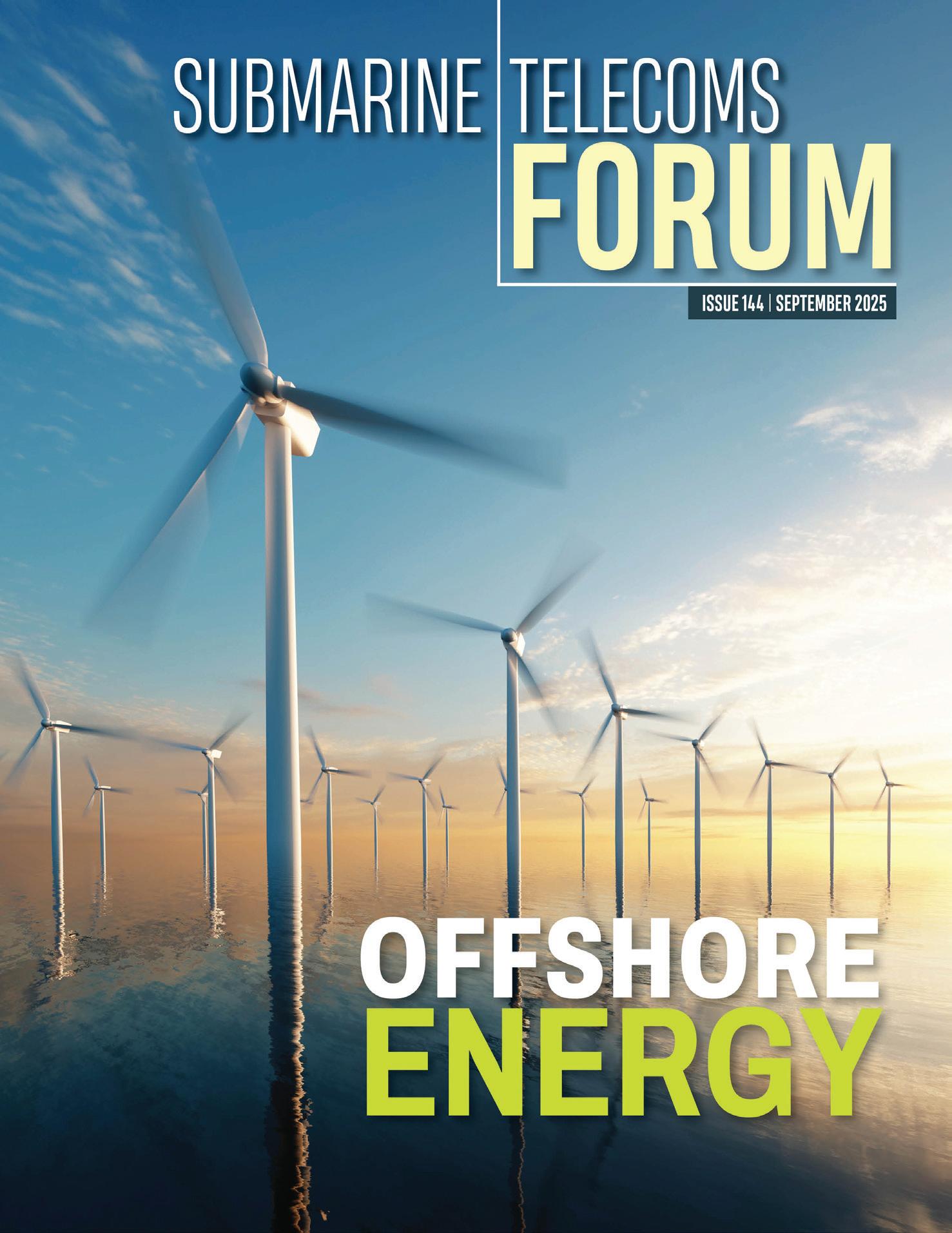
NEXT ISSUE: September 2025 – Offshore Energy featuring IWCS Cable & Connectivity Industry Forum ‘24
AUTHORS INDEX: https://subtelforum.com/authors-index
MAGAZINE ARCHIVE: subtelforum.com/magazine-archive
Submarine Telecoms Forum, Inc. www.subtelforum.com/corporate-information
BOARD OF DIRECTORS: Margaret Nielsen, Wayne Nielsen, Kristian Nielsen and Kacy Nielsen
Contributions are welcomed and should be forwarded to: pressroom@subtelforum.com.
Submarine Telecoms Forum magazine is published bimonthly by Submarine Telecoms Forum, Inc., and is an independent commercial publication, serving as a freely accessible forum for professionals in industries connected with submarine optical fiber technologies and techniques. Submarine Telecoms Forum may not be reproduced or transmitted in any form, in whole or in part, without the permission of the publishers.
Liability: While every care is taken in preparation of this publication, the publishers
cannot be held responsible for the accuracy of the information herein, or any errors which may occur in advertising or editorial content, or any consequence arising from any errors or omissions, and the editor reserves the right to edit any advertising or editorial material submitted for publication.
New Subscriptions, Enquiries and Changes of Address: 21495 Ridgetop Circle, Suite 201, Sterling, Virginia 20166, USA, or call [+1] (703) 444-0845, fax [+1] (703) 349-5562, or visit www. subtelforum.com. Copyright © 2025 Submarine Telecoms Forum, Inc.
ISSUE 143 | JUNE 2025

EXCELLENCE IN INDUSTRY RECOGNIZED AGAIN: SUBTEL FORUM AWARDS PRESENTED AT SUBOPTIC 2025
Recognizing top SubOptic innovators
By Wayne Nielsen

REVOLUTIONIZING ROUTE SURVEYS WITH LOW-CARBON, UNCREWED PLATFORMS: INSIGHTS FROM THE 2024 NORTH ATLANTIC DEEP-WATER SAILDRONE DEMONSTRATION
Uncrewed survey revolutionizes deep water By Andy Palmer-Felgate and Kitch Kennedy
By Quynh Nguyen
Multi-domain


By Magda Abdelkader EMERGING TRENDS AND APPLICATIONS OF UNREPEATERED SYSTEMS IN REGIONAL SUBSEA NETWORKS
Unrepeatered cable systems' rising relevance
By Tony Frisch, Anders Ljung and Lynsey Thomas
Creating Subsea Infrastructure In Egypt To Enable Global Connectivity

COMPETING OR COMPLEMENTARY?
The Evolving Relationship Between LEO Satellites and Submarine Cables in the Pacific! By John Hibbard and Paul McCann
THROUGH ICE AND ISOLATION
Laying the Foundations for the Arctic’s Connected Future By Rune Jensen

Balancing Control and Innovation in Subsea Cable Management By Kristian Nielsen
Subsea cable archaeology across the Atlantic
By Derek Cassidy and Philip Pilgrim
A Sustainable Future For Suboptic 2025: A Review from the Student & Young Professionals Track
WHERE IN THE WORLD ARE ALL THOSE PESKY CABLESHIPS? Follow the missions of cableships crucial to undersea connectivity.
Regulatory Charges For Submarine Cables: Towards A Fair Model
the career movements in the
developments in the submarine telecom world
Regional Systems: A Snapshot of Where We Are and Where We Are Headed
CORNER Find out about advertising opportunities to connect with our specialized audience

The most popular articles, Q&As of 2019. Find out what you missed!
Welcome to an exclusive feature in our magazine, where we explore the captivating world of SubTelForum.com, a pivotal player in the submarine cable industry. This expedition takes us on a detailed journey through the myriad of resources and innovations that are key to understanding and connecting our world beneath the oceans.
mapping efforts by the analysts at SubTel Forum Analytics, a division of Submarine Telecoms Forum. This reference tool gives details on cable systems including a system map, landing points, system capacity, length, RFS year and other valuable data.
CONNECTING THE DEPTHS: YOUR ESSENTIAL GUIDE TO THE SUBTEL FORUM DIRECTORY
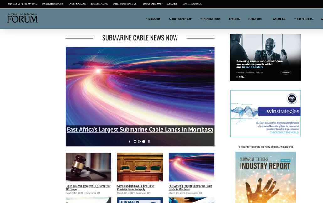
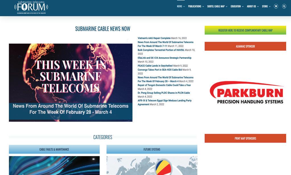
Keep on top of our world of coverage with our free News Now daily industry update. News Now is a daily RSS feed of news applicable to the submarine cable industry, highlighting Cable Faults & Maintenance, Conferences & Associations, Current Systems, Data Centers, Future Systems, Offshore Energy, State of the Industry and Technology & Upgrades.
Submarine Cable Almanac is a free quarterly publication made available through diligent data gathering and
Submarine Telecoms Industry Report is an annual free publication with analysis of data collected by the analysts of SubTel Forum Analytics, including system capacity analy sis, as well as the actual productivity and outlook of current and planned systems and the companies that service them.
In our guide to submarine cable resources, the SubTel Forum Directory shines as an essential tool, providing SubTel Forum.com readers with comprehensive access to an array of vetted industry contacts, services, and information. Designed for intuitive navigation, this expansive directory facilitates quick connections with leading vendors, offering detailed profiles and the latest in submarine cable innovations. As a dynamic hub for industry professionals, it fosters community engagement, ensuring our readers stay at the forefront of industry developments, free of charge.
2024 marks a groundbreaking era for SubTel Forum with the launch of its innovative app. This cutting-edge tool is revolutionizing access to submarine telecommunications insights, blending real-time updates, AI-driven analytics,
The online SubTel Cable Map is built with the industry standard Esri ArcGIS platform and linked to the SubTel Forum Submarine Cable Database. It tracks the progress of
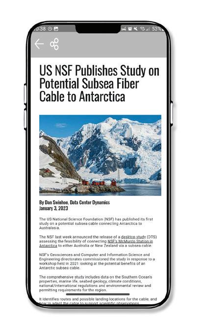
and a user-centric interface into an indispensable resource for industry professionals. More than just a technological advancement, this app is a platform fostering community, learning, and industry progression. We encourage you to download the SubTel Forum App and join a community at the forefront of undersea communications innovation.
Our journey begins with the News Now updates, providing daily insights into the submarine cable sector. Covering everything from the latest technical developments to significant industry milestones, this feed ensures you’re always informed about the latest trends and happenings. It’s an essential tool for professionals who need to stay on top of industry news.
Dive deeper into the world of submarine communications with our curated collection of articles and Q&As. These insightful pieces offer a comprehensive look at both the history and current state of the industry, enriching your understanding and providing a broader perspective on the challenges and triumphs faced by submarine cable professionals.
• Submarine Cable Almanac: This quarterly treasure trove provides detailed information on global cable systems. You can expect rich content including maps, data on system capacity, length, and other critical details that sketch a vivid picture of the global network.
• Submarine Telecoms Industry Report: Our annual report takes an analytical approach to the industry, covering everything from current trends to capacity analysis and future predictions. It’s an invaluable resource for anyone seeking to understand the market’s trajectory.
• Online SubTel Cable Map: An interactive tool mapping over 550 cable systems, perfect for digital natives who prefer an online method to explore global connections.
• Printed Cable Map: Our annual printed map caters to those who appreciate a tangible representation of the world’s submarine fiber systems, detailed in a visually appealing and informative format.
Explore the Submarine Telecoms Forum Magazine Archive, a comprehensive collection of past issues spanning 23+ years of submarine telecommunications. This essential resource offers insights into project updates, market trends, technological advancements, and regulatory changes. Whether researching industry developments or seeking

expert analysis, the archive provides valuable perspectives on the technologies and trends shaping global connectivity.
Our Authors Index is a valuable tool for locating specific articles and authors. It simplifies the process of finding the information you need or following the work of your favorite contributors in the field.
• Data Center & OTT Providers Report: This report delves into the evolving relationship between cable landing stations and data centers, highlighting trends in efficiency and integration.
• Global Outlook Report: Offering a comprehensive analysis of the submarine telecoms market, this report includes regional overviews and market forecasts, providing a global perspective on the industry.
• Offshore Energy Report: Focusing on the submarine fiber industry’s oil & gas sector, this report examines market trends and technological advancements, offering insights into this specialized area.
• Regional Systems Report: This analysis of regional submarine cable markets discusses capacity demands, development strategies, and market dynamics, providing a detailed look at different global regions.
• Unrepeatered Systems Report: A thorough examination of unrepeatered cable systems, this report covers project timelines, costs, and operational aspects, essential for understanding this segment of the industry.
• Submarine Cable Dataset: An exhaustive resource detailing over 550 fiber optic cable systems, this dataset covers a wide range of operational data, making it a go-to reference for industry specifics.
SubTelForum.com stands as a comprehensive portal to the dynamic and intricate world of submarine cable communications. It brings together a diverse range of tools, insights, and resources, each designed to enhance understanding and engagement within this crucial industry. From the cutting-edge SubTel Forum App to in-depth reports and interactive maps, the platform caters to a wide audience, offering unique perspectives and valuable knowledge. Whether you’re a seasoned professional or new to the field, SubTelForum.com is an indispensable resource for anyone looking to deepen their understanding or stay updated in the field of submarine telecommunications.
BY KIERAN CLARK
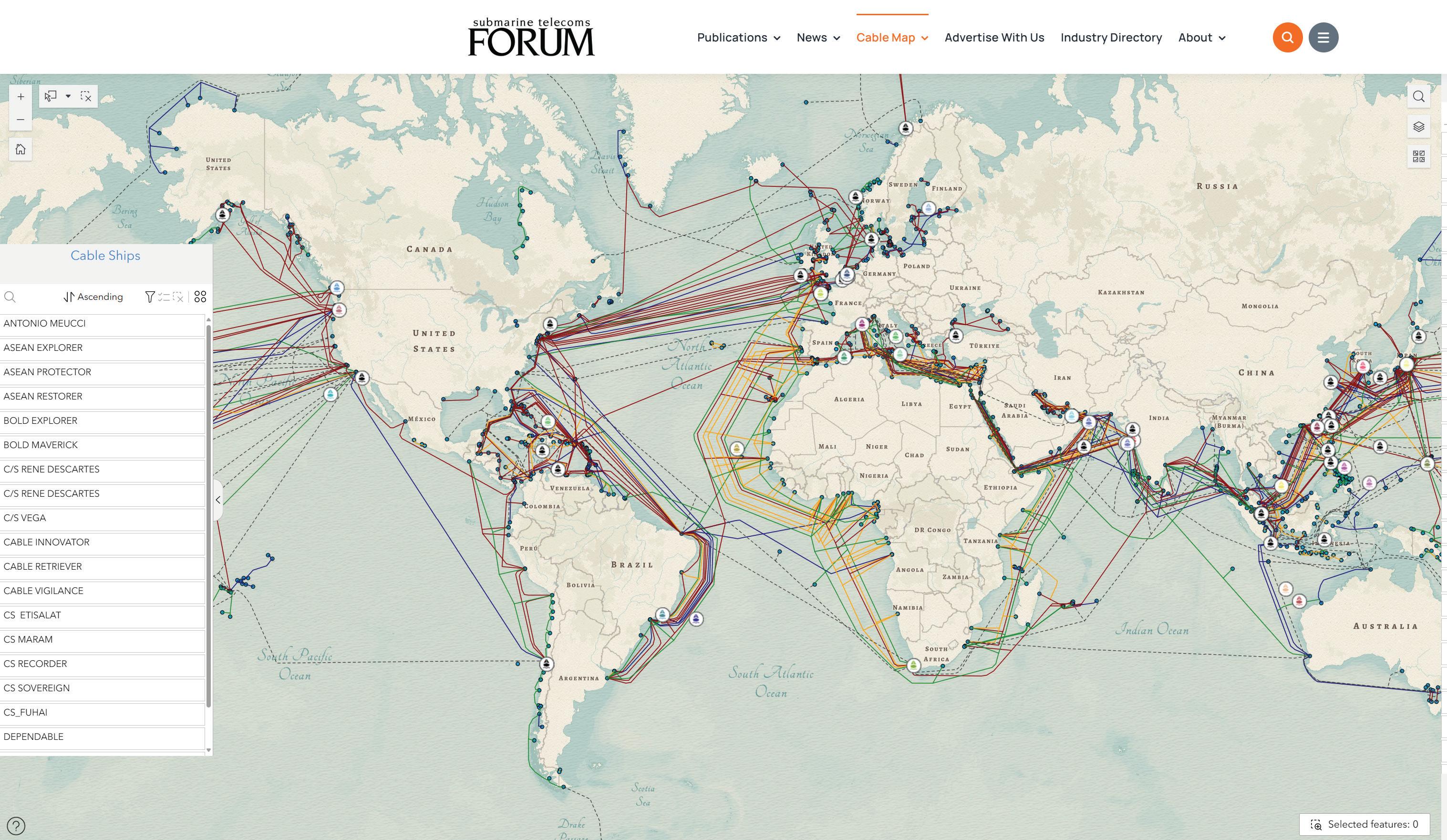
The SubTel Cable Map— powered by Esri’s ArcGIS platform—offers an interactive and detailed way to explore the global network of submarine cables. This indispensable resource provides information on over 440 existing and planned systems, more than 50 cable ships, and upwards of 1,000 landing points. Connected directly to the SubTel Forum Submarine Cable Database and integrated with our News Now Feed, the map enables real-time tracking of industry activity and cable-specific news coverage.
Submarine cables serve as the foundation of global digital infrastructure, carrying more than 99% of international data traffic. These systems enable the seamless connectivity the world depends on—from personal communication to enterprise operations. Without them, modern, highspeed global communication simply wouldn’t be feasible.
Our analysts continually update the map using verified data from the Submarine Cable Almanac and valuable input from industry contributors. This ensures a timely and accurate picture of the subsea cable landscape, spotlighting the latest deployments and developments. As we approach the end of the year, map updates may slow during the holiday season, but our commitment to delivering reliable insights remains unchanged.
We’re proud to feature Alaska Communications Systems and WFN
Submarine cables serve as the foundation of global digital infrastructure, carrying more than 99% of international data traffic. These systems enable the seamless connectivity the world depends on—from personal communication to enterprise operations.
Strategies as the current sponsors of the SubTel Cable Map. Additional sponsorship opportunities are available—offering high-visibility placement for your logo and a direct link to your organization. It’s a great way to align your brand with global connectivity and the future of the submarine cable industry.
We invite you to explore the SubTel Cable Map and gain a deeper understanding of the vital role submarine cable systems play in our interconnected world. As always, if you are a point of contact for a system or company that requires updates, please email kclark@subtelforum.com
We hope the SubTel Cable Map proves to be a valuable resource for you, offering insight into the continually evolving submarine cable industry. Dive into the intricate network
Here’s the list of systems updated since our last issue:
that powers our global communications today. Happy exploring! STF
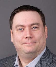
KIERAN CLARK is the Lead Analyst for SubTel Forum. He originally joined SubTel Forum in 2013 as a Broadcast Technician to provide support for live event video streaming. He has 6+ years of live production experience and has worked alongside some of the premier organizations in video web streaming. In 2014, Kieran was promoted to Analyst and is currently responsible for the research and maintenance that supports the Submarine Cable Database. In 2016, he was promoted to Lead Analyst and his analysis is featured in almost the entire array of Subtel Forum Publications.
JULY 21, 2025
Newly Added Systems:
• AAE-2
• GlobalConnect Baltic
• Sol
• TGN-IA2
• Updated Systems:
• Celia
• MANTA
• SEA-ME-WE 6
• Sihanoukville-Hong Kong (SHV-HK)
• Southern Cross Tasman Express (SX-TX)
• Sydney-Melbourne-Adelaide-Perth (SMAP)
Do you have further questions on this topic?
BY KIERAN CLARK
The SubTel Cable Map has long served as one of the submarine telecom industry’s most comprehensive, web-based resources. Built on ArcGIS Experience Builder, this interactive application offers real-time visualization of global subsea cable systems, including active, planned, and historic routes. With industry professionals, researchers, and policymakers relying on the platform for reference and analysis, usability and performance are paramount.
Over the past several weeks, we’ve rolled out a significant series of updates to the map’s user interface and data structure. These improvements focus on navigation, clarity, and ease of access, helping users locate and filter the information they need faster and more intuitively.
This article walks through the major updates to the map and offers a look at the kinds of refinements we’ll continue to make based on user feedback and evolving data needs.
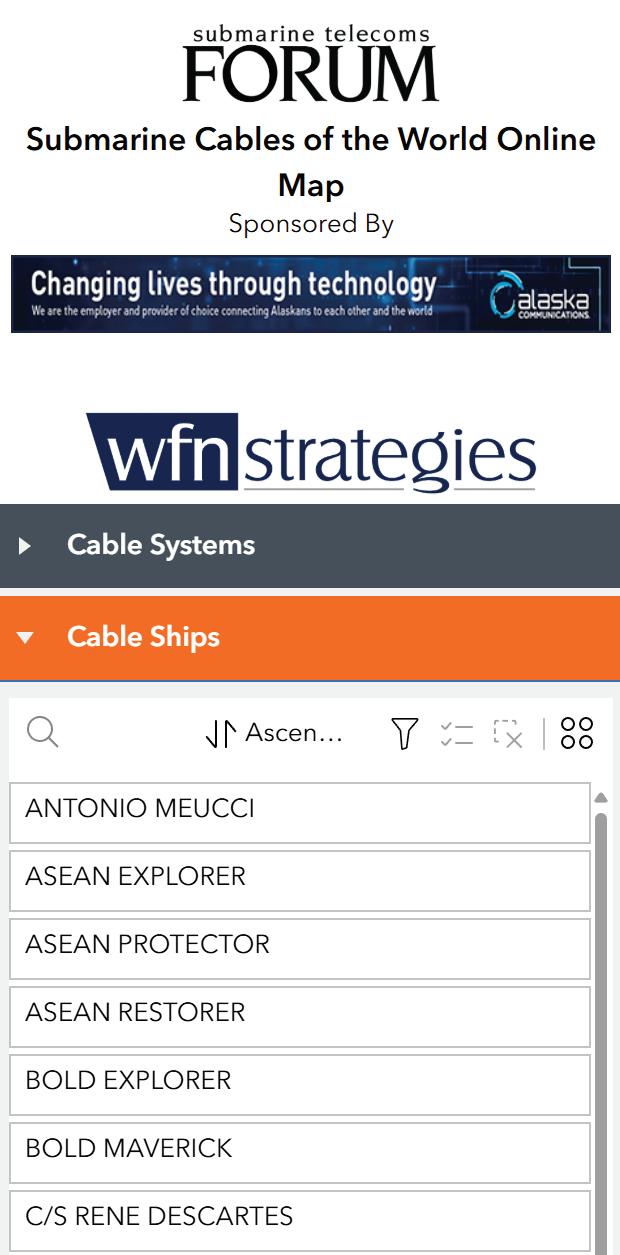
One of the most visible improvements is a complete restructuring of the map layout. Previously, key interface panels were spread across multiple sections of the screen, including a side-by-side arrangement that often made the experience feel cramped—especially on smaller screens or in embedded environments.
In the new version, we’ve introduced a vertical accordion layout that consolidates all supporting tools into collapsible headers. The Cable Ships list, for instance, now lives inside its own accordion tab rather than occupying a fixed sidebar. This design shift drastically reduces visual clutter and provides users with more uninterrupted map space by default, while still offering detailed supporting
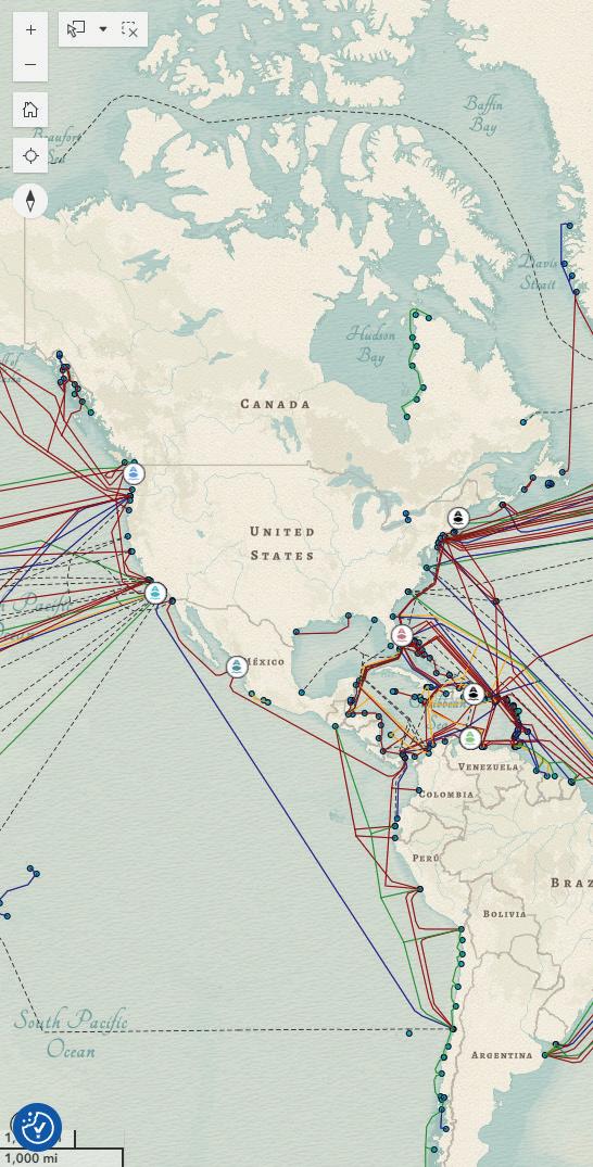
data when desired.
We also deployed the map as a full-screen embedded experience on a dedicated blank page of the SubTel Forum website. By stripping away the WordPress header, footer, and scrollbars, we allow the ArcGIS app to use 100% of the browser window—no more accidental scrolling or loss of navigation context.
The core Cable Systems list received a major upgrade as well. Users can now sort entries in four different ways:
• Cable Name (Ascending)
• Cable Name (Descending)
• Cable RFS (Ready for Service) Date (Ascending)
• Cable RFS Date (Descending)
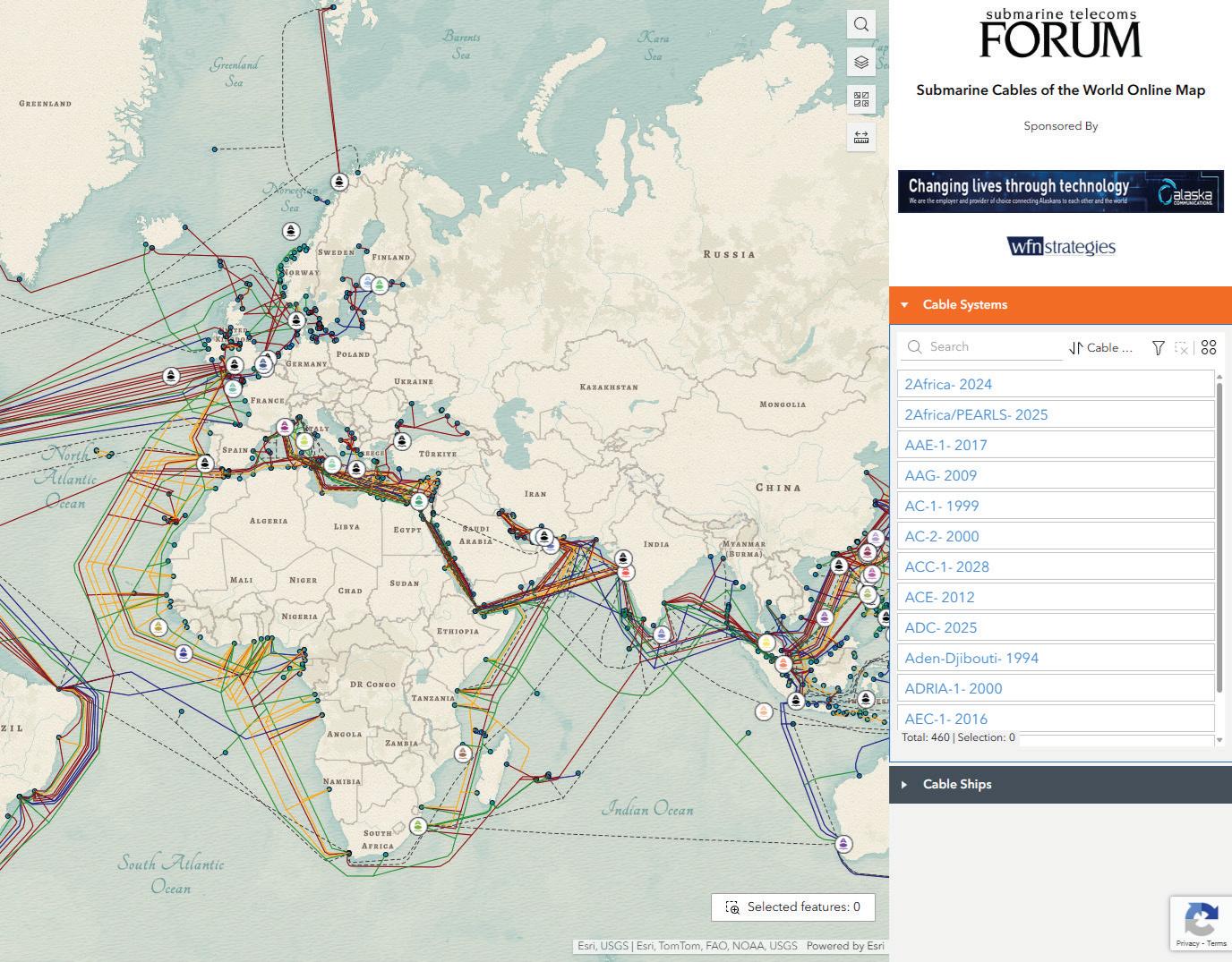
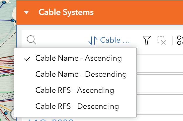
Previously, entries could only be viewed in a static, alphabetical list. Now, users can tailor the sort order to fit their research workflows—whether they’re scanning by name or organizing cables chronologically for historical review.
We also expanded the search box to be far more robust. In addition to matching cable names, the new system
now allows partial match searches for owner, supplier, and installer fields. This small change dramatically improves discoverability for users tracking infrastructure by organization or vendor.
To better support visual analysis of deployment status, we added a new Planned Status field to the dataset. This field classifies systems as either:
• “In Service” – for systems currently operational (Planned = 0), or
• “Planned” – for future deployments (Planned = 1)
This change came from user feedback: the raw binary values used in the previous attribute table weren’t immediately intuitive. By creating a readable, calculated field for planned status, we made the dataset easier to interpret and filter.
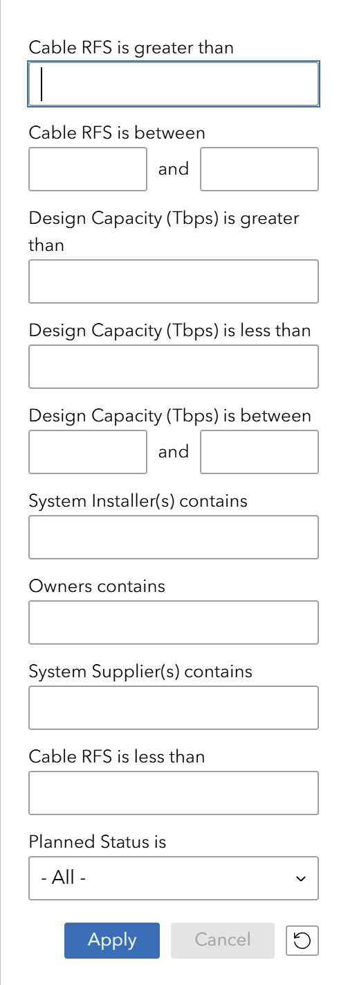
The Planned Status field is now used across both the filter panel and the cable list display. Users can toggle between operational and planned systems in a single click, enabling faster comparative assessments or visual breakdowns for reporting.
Perhaps the most powerful change of all comes in the form of a fully redesigned filtering system, accessed via the familiar funnel icon. The previous implementation offered only basic search functionality, with limited support for precise querying. The new version introduces advanced multi-field filters, organized cleanly by data type and purpose. Most importantly, these filters are combinable, allowing users to apply multiple criteria at once without writing queries or exporting data.
Users can now filter global cable systems using criteria such as:
• Cable RFS:
» Greater than
» Less than
» Between two dates
• Design Capacity (Tbps):
» Greater than
» Less than
» Between two values
• Affiliated Entities:
» Owner(s)
» System Installer(s)
» System Supplier(s) (all via substring match)
• Service Status:
» In Service
» Planned
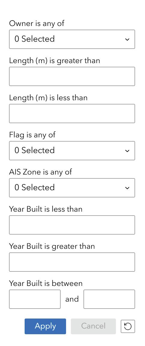
The Cable Ships layer includes its own set of dedicated filters, allowing users to isolate vessels based on:
• Ownership (multi-select dropdown)
• AIS Zone (multi-select dropdown)
• Flag State (multi-select dropdown)
• Length (m):
» Greater than
» Less than
• Year Built:
» Greater than
» Less than
» Between two years
These filters now work in tandem, giving users the flexibility to zero in on specific systems and vessels that meet highly specific criteria. For example, a user might find all planned systems with over 60 Tbps of capacity and then compare them to cable ships built after 2015 operating in a specific AIS zone.
The updated interface also includes smart behaviors like auto-clearing stale filters, preventing conflicting query states, and live previews of filtered results before applying them.
Altogether, the new system brings the filtering experience more in line with what users expect from modern SaaS platforms—powerful, responsive, and intuitive.
In tandem with these interface upgrades, we undertook a comprehensive audit of the core cable dataset. Dozens of field entries were reviewed for consistency and formatting, particularly:
• Normalizing inconsistent vendor names
• Ensuring valid RFS values across records
• Verifying system lengths, where available
• Removing legacy null fields from the view layer
This data cleanup reduces user confusion and increases the reliability of search results and analytics based on the attribute table. More importantly, it lays the groundwork for future enhancements, including the possible addition of regional grouping tags and interactive system profiles.
While these upgrades already make the SubTel Cable Map more useful and usable, we are always looking to improve. Two general areas are under active consideration:
1. Custom Data Views: We recognize the value of giving users the ability to generate clean, printable or exportable map views for use in reports and presentations. While this functionality is not currently implemented, we are exploring lightweight ways to support this in the future without overcomplicating the user experience.
2. Optional Live Layers: We’ve also begun experimenting with optional overlays for dynamic data—such as active ship locations, planned outages, or cable landings under construction. These layers would not be visible by default, but could be toggled on for users who want to monitor real-time events against the global cable map.
Both of these ideas are still in early stages, and we welcome feedback from users about which capabilities would provide the most value.
This release represents the most significant update to the SubTel Cable Map in several years. With a clearer layout, faster filtering, smarter search, and meaningful attribute enhancements, the platform is now better equipped than ever to serve as a daily reference tool for anyone working in the submarine telecom space.
As always, we invite users to explore the updated map, try out the new features, and let us know what’s working— or what could work even better. STF
KIERAN CLARK is the Lead Analyst for SubTel Forum. He originally joined SubTel Forum in 2013 as a Broadcast Technician to provide support for live event video streaming. He has 6+ years of live production experience and has worked alongside some of the premier organizations in video web streaming. In 2014, Kieran was promoted to Analyst and is currently responsible for the research and maintenance that supports the Submarine Cable Database. In 2016, he was promoted to Lead Analyst and his analysis is featured in almost the entire array of Subtel Forum Publications.
BY CAROLINE CROWLEY, IAGO BOJCZUK, AIDÉ CABRERA, AMINA IBRAHIM, LANDRY MOYOU, AND FEDERICA TORTORELLA
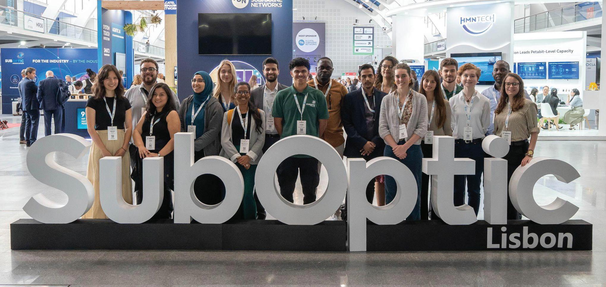
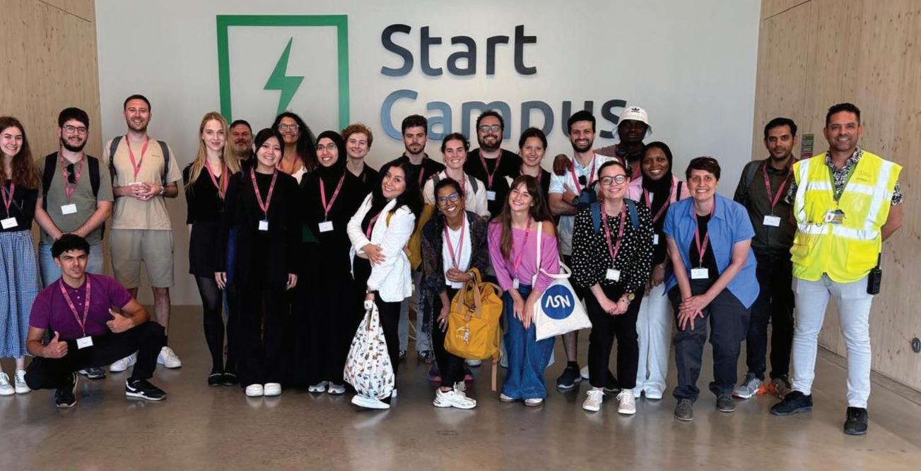
This year at SubOptic 2025 in Lisbon, Portugal, the conference halls gained fresh faces and new energy. Thanks to the inaugural Student & Young Professionals Track, sponsored by the SubOptic Association and welcomed warmly into the main program, attendees could rub shoulders with rising members of the submarine telecoms industry at the world’s longest-running and most comprehensive industry event. The Track brought together more than twenty students and early-career professionals from over 15 countries, spanning disciplines from telecom engineering and maritime operations to environmental science and internet governance.
Over the course of the conference, participants immersed themselves in expert-led masterclasses, roundtables, research presentations, and field visits to local internet infrastructure sites. Highlights included tours of host company Alcatel Submarine Network’s cable-laying vessel Ile de Sein and the EllaLink Network Operations Center. Staff from Start Campus also welcomed the youth track to tour their 1.2GW AI-ready Sines Data Center, a pioneer in sustainable digital infrastructure solutions with seawater-based cooling and high energy efficiency. Organized and facilitated by Student & Young Professional Coordinator Iago Bojczuk, the new track offered participants a meaningful way to engage with and contribute to the broader conference dialogue. “Attending SubOptic 2025 has been a
transformative experience that deepened both my academic curiosity and my professional ambition,” said Landry Moyou, a graduate student pursuing a master’s degree in Enterprise Digital Architecture at Télécom ParisTech. “I came to the conference with a strong technical foundation, but what I found at SubOptic was much more—a global ecosystem of infrastructure builders, innovators, and strategists engaged in rich, forward-thinking discussions about the future of connectivity.”
Despite backgrounds in a wide range of disciplines, members of the Track are coming together for this month’s article with a common focus on one area repeated throughout the SubOptic proceedings: sustainability. Members presented their own work
on the topic: Hesham Youssef, a senior transmission engineer at Telecom Egypt, with “Metrics for Cable Landing Station Sustainability,” and Tochukwu Egesi, a PhD candidate at the University of Cape Town, with “The Potential Use of On-Site Renewable Power for Cable Landing Station.” These contributions draw on research developed by the Sustainable Subsea Networks team over the past three years and were made possible through academic-industry collaboration. They reflect the value of ongoing exchanges between companies and researchers, the importance of data sharing, and a growing commitment to deeper cooperation between industry professionals, academia, and broader society.
The headliner session, starting off the



first day of the conference, was the Second Suboptic Congress on Subsea Cable Sustainability, following the First Suboptic Congress in Bangkok 2023. But this year, the Congress presented their years of research in the original format of a detective play. Young professionals joined seasoned industry leaders onstage to investigate the lifecycle of a subsea cable in “The Case of the Missing Emissions,” following a cable from its coastal landing station back to its factory.
Kicking off this year’s conference, the Congress set the stage for a series of discussions on the current and future state of the submarine cable industry as new technologies, climate concerns, and geopolitical events produce global impacts. In this article, Student & Young Professionals Track coordinator Iago Bojczuk and Track participant Caroline Crowley give their key takeaways from SubOptic 2025, joined by Track members Amina Ibrahim and Aidé Cabrera, who share their thoughts on visiting Start Campus’ sustainable Sines AI-ready Data Center.
Attending SubOptic 2025 in Lisbon felt like returning to a conversation
that has been slowly maturing over the past few years. I kept thinking back to the First Congress on Sustainability in Bangkok in 2023. Back then, there was energy and intent, but no real framework for addressing these issues systematically or collaboratively. That gathering marked a shift. But in Lisbon, the tone felt different. The urgency had deepened, not just around sustainability on its own, but around how it’s now tangled up with broader forces — geopolitical instability, regulatory pressures, and the growing challenge of balancing technological growth with social responsibility. It became clear to me that sustainability isn’t a separate agenda anymore. It’s part of every serious conversation about the future of digital infrastructure.
As someone who studies digital infrastructures across Global South contexts, I have often looked at these systems through the lens of inequality and asymmetry. But here, surrounded by engineers, policymakers, executives, and researchers, I found myself listening differently. What mattered to me was not just the technical debates but the quiet signals of institutional culture—who gets heard, how collaboration is framed, and where the boundaries of responsibility are drawn. One of those moments came in the remarks
of Professor Nicole Starosielski of UC Berkeley, during the Second Congress of Sustainability, who observed that the push for sustainability is shaped by company values and customer expectations, but also that when organizations work in isolation, they run the risk of duplicating efforts and losing on the progress they could otherwise achieve. That idea stayed with me. It reminded me that sustainability, if it is to be meaningful, requires a shift in mindset. It cannot simply be about checking boxes or adopting greener practices in isolation. It must be phased and based on a multilateral approach: it must involve shared tools, shared language, and shared responsibility.
Throughout the conference, a lot of the talks and side conversations circled back to a common question: What does it mean to work in this industry given the state of the world right now? That came into focus during the session called “Shifting Tides: Geopolitics and the Subsea Cable Industry.” The speakers—Mike Constable, Mike McGovern, and Catherine Creese, moderated by Kent Bressie—dug into the geopolitical pressures that are actively reshaping the sector. McGovern, a director at Alcatel Submarine Networks (ASN), pointed out how the industry suddenly gained visibility during the pandemic,
when subsea cables were recognized as essential infrastructure. But even with that recognition, there’s still a clear gap between political awareness and the actual capacity to act. As Constable from Infra-Analytics put it, permits are still slow, policies differ wildly from country to country, and decisions keep getting pushed back. For me, that all pointed to something deeper: sustainability isn’t just a matter of improving technology. As many of the discussions at SubOptic 2025 suggested, it’s about rethinking how the different layers of the sector interact: how companies share data, how they build trust, and how they make decisions that look ahead rather than just respond to crises.
Furthermore, this disconnection between institutional capacity and technological progress came up again and again, especially in conversations about governance, responsibility, and long-term sustainability. Catherine Creese, from the U.S. Navy, made a particularly striking point when she said, “Every government and every agency acts differently,” referring to how states engage with the subsea cable industry. It was a sharp reminder of how fragile institutional memory can be. If we don’t capture what’s been learned and pass it on, we risk ending up with systems that are technically advanced but institutionally brittle. Kent Bressie, chair of HWG’s international practice, echoed a similar concern: “Sometimes there’s a view that there’s a lot of information collection but not enough information sharing,” he says. I keep coming back to that line when I think about the role of technology companies and the weight of their social responsibility. It gets at the heart of a
much larger challenge—how to make sustainability not just a stated goal, but a practice that lasts, that’s built into the fabric of how this industry operates across time and borders.
As the event came to a close, I found myself thinking about what comes next. The industry is changing. It is not just facing external pressures; it is also absorbing new kinds of talent—people who are entering with very different expectations, values, and concerns. Many of us care deeply about the climate crisis and want to build and shape our careers in meaningful ways that are good for the planet and for the legacy we want to leave behind. And we are also asking difficult questions about artificial intelligence and its growing demands on infrastructure: rather than just accessing the latest technology, we, as young people, are also invested in shaping the future. As we start to incorporate new minds into this space, we have an opportunity to reshape the culture of the industry itself. We must create room for their questions, support their ideas, and acknowledge that the infrastructures of the future will need to be not only
faster and more secure, but also more broadly accessible, more sustainable, and organized in sustainable ways.
To me, and as we continue to shape the discourse of sustainability, it is about building practices that can sustain collective learning, that can adapt to changing regulatory climates, and that can make room for those who have historically been kept at the margins of these conversations. That is what I carried home from Lisbon. And that is where, I believe, the work must continue.
Attending SubOptic 2025 provided me the opportunity to see how sustainability is being incorporated in real-world technology and infrastructure, not just for environmental benefit but for the continuation of the industry as a whole. The field’s vision of resilience is evolving, growing from cable redundancy to long-term innovation and inclusion of new perspectives. As a student of sustainable economies and environmental policy, I was excited to see the variety of tech-
nological and operational approaches to preparing the industry for future challenges, including climate change.
The conference demonstrated how industry leaders are rethinking traditional models of resilience during a more complex era of marine operations. With the seabed becoming increasingly congested with legacy cables, offshore wind development, and deep-seabed mining contracts, the future of durable cable systems may rely less on building out redundancy and more on smarter, more cooperative route planning. Building cable route resilience may now involve not just additional routes, but careful collaboration and the recovery of decommissioned cables. The practice of cable recycling –to clear seabed space, lower cable systems’ carbon footprint, and reduce the need for raw materials – appeared as a solution for multiple speakers.
In addition to new methodologies, new technologies debuted at booths and presentations throughout the week. Members of our youth track attended a demo of the Climate Change Node, part of Alcatel Submarine Network’s SMART Cable system, designed to record environmental data in real time. Hitting the model node with a hammer to simulate seismic activity and blowing it with a hair dryer to represent seabed temperature change, we got to see the dual role this infrastructure can play in enabling global connectivity while also contributing to safety systems and climate science.
The emphasis on sustainability also stood out as a key pillar during presentations on the future of maritime operations and cable maintenance. I particularly enjoyed the discussion on autonomous route surveying by Meta’s Andy Palmer-Felgate and Saildrone’s Captain Kitch Kennedy, presenting Sail-
drone’s “Surveyor.” This sail-equipped, uncrewed vessel is piloted remotely, capable of three months or 10,000 kilometers of autonomous operation. The design reduces greenhouse gas emissions by 98% compared to conventional crewed vessels, while improving crew safety, reducing costs, and keeping critical survey work going in an era where fewer workers are opting for months at sea. Technological solutions for industry and climate resilience appear key, especially given the aging of cable installation fleets, a topic emphasized by several speakers throughout the week.
The variety in approaches to resilience, as well as panels on new workforce development, mentorship, and DEI, struck me as a sign of an overall adaptive perspective on the future of industry. It was encouraging to see presentations surprise even the most long-time attendees of SubOptic. As a new face in the field alongside twenty other members of the Student & Young Professionals Track, I left Lisbon confident that the industry can find innovative ways to maintain its personnel and infrastructure networks in the long term.
Before visiting Start Campus and learning about the EllaLink system in Sines, Portugal, I had not thought much about data centers, cable landing stations, and their cooling systems. I knew they used a lot of energy, but I never realized how critical and innovative their cooling systems could be, especially with sustainability in mind.
As part of the SubOptic 2025 Student & Young Professionals Track, I had a unique chance to see how these systems work firsthand. What I discovered completely changed my view of what sustainable infrastructure can look like in the digital age.
One fascinating thing I learned at Start Campus was that seawater can be used for data center cooling. At first, it seemed almost too simple or impossible to use cold water from the ocean to absorb heat from data centers. But when we looked closer at the system, I understood how smart and intentional the engineering is.
Seawater can be pumped from the ocean, reducing the need for high-energy pumps and lowering the site’s overall emissions. The system features a closed-loop heat exchange design, which means the saltwater does not mix with the sensitive cooling fluids or internal infrastructure. Instead, it flows through corrosion-resistant pipes made from materials like titanium or stainless steel, protecting both the facility and the surrounding environment.
The discharge system is also carefully designed to minimize ecological impact, returning water to the ocean in a way that avoids disturbing marine ecosystems. This approach isn’t just a clever use of local resources; it’s a wellthought-out sustainability strategy.
This design doesn’t rely on air conditioning units or mechanical systems that waste a lot of electricity. Instead, it effectively takes advantage of the ocean’s natural cooling properties, prioritizing renewable and environmentally responsible solutions.
Coming from Tanzania, where access to this level of infrastructure is still growing, it was both inspiring and humbling to see sustainability in action. It made me think critically about the longterm effects of the systems we build and the choices we make as engineers.
We often hear terms like green data center or net-zero infrastructure, but being there in person and seeing the pipes and systems gave those concepts real meaning. It was no longer just about words; it became about practical, local, and intelligent solutions that balance performance with care for the earth.
What struck me most was that this is not some future innovation; it’s happening now. Start Campus is developing the whole 1.2 GW campus with a PUE (Power Usage Effectiveness) of
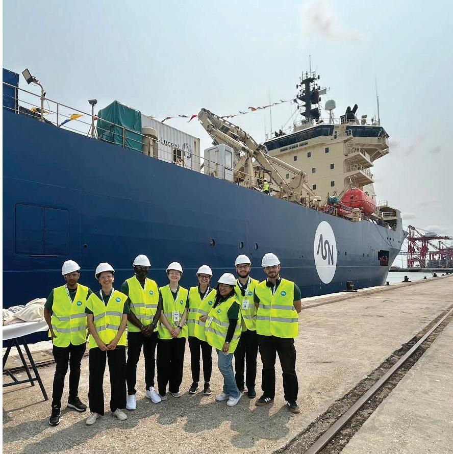
just 1.1, an impressive efficiency for such a large-scale facility. They’re powered by renewable energy and aiming for net-zero emissions. Similarly, EllaLink’s infrastructure has sustainability in its design from the beginning.
In contrast, many other parts of the world still rely on traditional cooling methods, which often use massive amounts of freshwater for evaporative cooling or depend on electricity systems. This visit showed me that it is possible to do better, and that we must.
Also, one unexpected highlight during our tour of Start Campus was meeting Freddy, the autonomous robot that navigates the facility like a futuristic assistant. Freddy is not just a robot;
he plays a real role in maintaining the data center’s performance. From environmental monitoring to equipment inspections, Freddy shows how automation is shaping the future of sustainable infrastructure. Watching him glide through the facility while we were leaving made me think about how robotics and AI will continue to integrate into the operational core of submarine cable and data network ecosystems.
My visit to Sines reminded me that sustainability does not always mean high cost or advanced technology. Sometimes it means using what nature provides in smart, respectful ways. Seawater cooling is one of those solutions. Now, whenever I think
of subsea cable systems, I will also consider the land-based infrastructure that supports them and how we can improve it for the planet.
Overall, as a young engineer, this experience left a strong impression on me. It made me realize that infrastructure is not invisible. The systems behind the internet data centers, cables, and landing stations have physical, environmental, and social effects. Understanding and addressing those impacts is part of our responsibility as future leaders in this industry.
In my role as an Optical Communications Engineer, I focus on pursuing three core objectives: achieving greater capacity, higher transmission speeds over increasingly longer distances, and broader geographic coverage. This ensures global populations are better connected and can access the benefits of worldwide communication. We operate in a landscape where companies, societies, and governments increasingly pursue digital transition to meet sustainable development goals. Consequently, telecommunications serves as an enabling industry, allowing other sectors to achieve sustainability targets.
With nearly four years in this field, I viewed global connectivity through satellite systems, terrestrial fiber networks, and submarine cables, all serving as bridges for information exchange. Yet a critical piece was missing from this vision: data centers. These facilities centralize computing resources to operate digital services while guaranteeing data availability, scalability, and security. Their strategic importance became undeniable
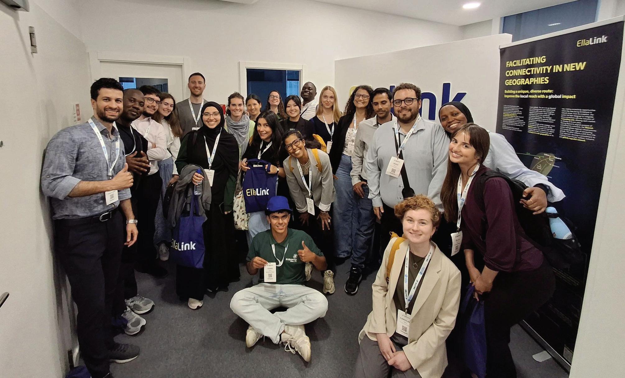
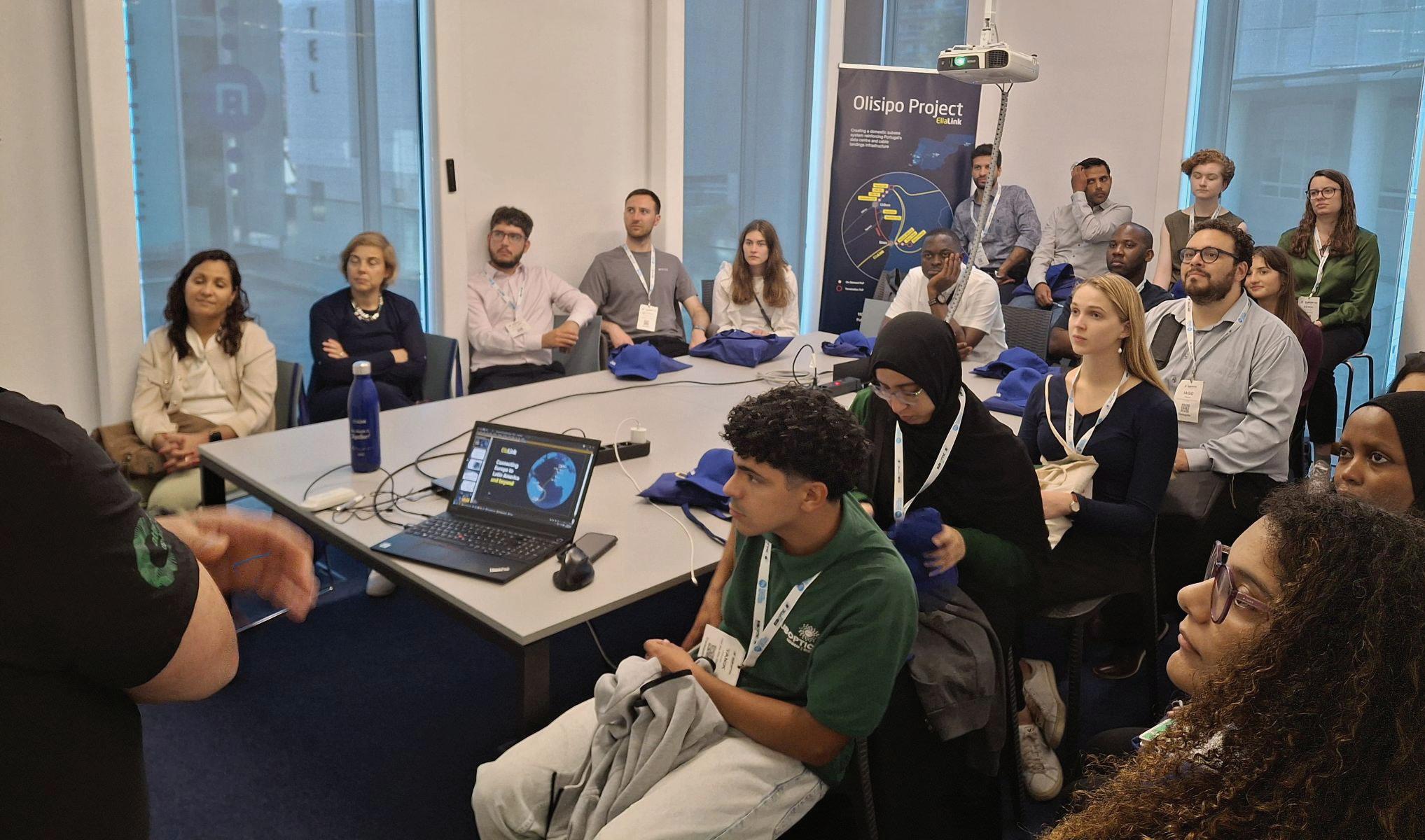
post-pandemic, with the industry now growing at 10% annually.
To complete this understanding, nothing surpassed experiencing a data center firsthand. Listening to engineers explain operations at Start Campus proved invaluable, particularly learning how they host sustainable facilities.
This visit sparked deep reflec-
tion and a closer examination of my region. Across Latin America, Brazil, Mexico, and Chile lead in data center deployment. Notably, my country is experiencing robust growth in this sector, fueled by surging demand from fields like AI and cloud computing. Mexico’s strategic advantages – proximity to the U.S., lower construction costs, and regulatory flexibility – allow
its role as a connectivity bridge between North and Latin America. Yet this expansion amplifies critical infrastructure and sustainability challenges.
Querétaro, a preferred data center hub, has severe water stress and pressures operators to adopt alternative cooling systems and renewable energy to mitigate environmental impact. Meanwhile, Mexico’s national grid (77% fossil-fuel-dependent) faces overloading, creating clear opportunities for sustainable power solutions.
By contrast, Chile confronts a different obstacle: transmission and distribution networks operating at 3x current demand capacity. This necessitates urgent infrastructure upgrades to capture wasted energy and enable redistribution. Despite regional variations, a common imperative emerges: establishing multidisciplinary forums (industry-academia-government-community) to align technological development with ecological preservation through coordinated action and knowledge exchange.
Later, SubOptic 2025 demonstrated our industry’s active pursuit of minimal environmental impact –from decarbonization and optimized cooling (like Start Campus’ Sines facility), to low-emission fuels and HVO, to submarine cable recycling. Telecom is not just an enabling industry. Our sustainability quest is underway, and will continue evolving and encouraging the finding of specific solutions for each region.
I extend my gratitude to SubOptic, Start Campus, ASN and EllaLink teams for showcasing their sustainable achievements. Most importantly, thank you for enabling me and 22 other young professionals to propose solutions and join this critical conversation.
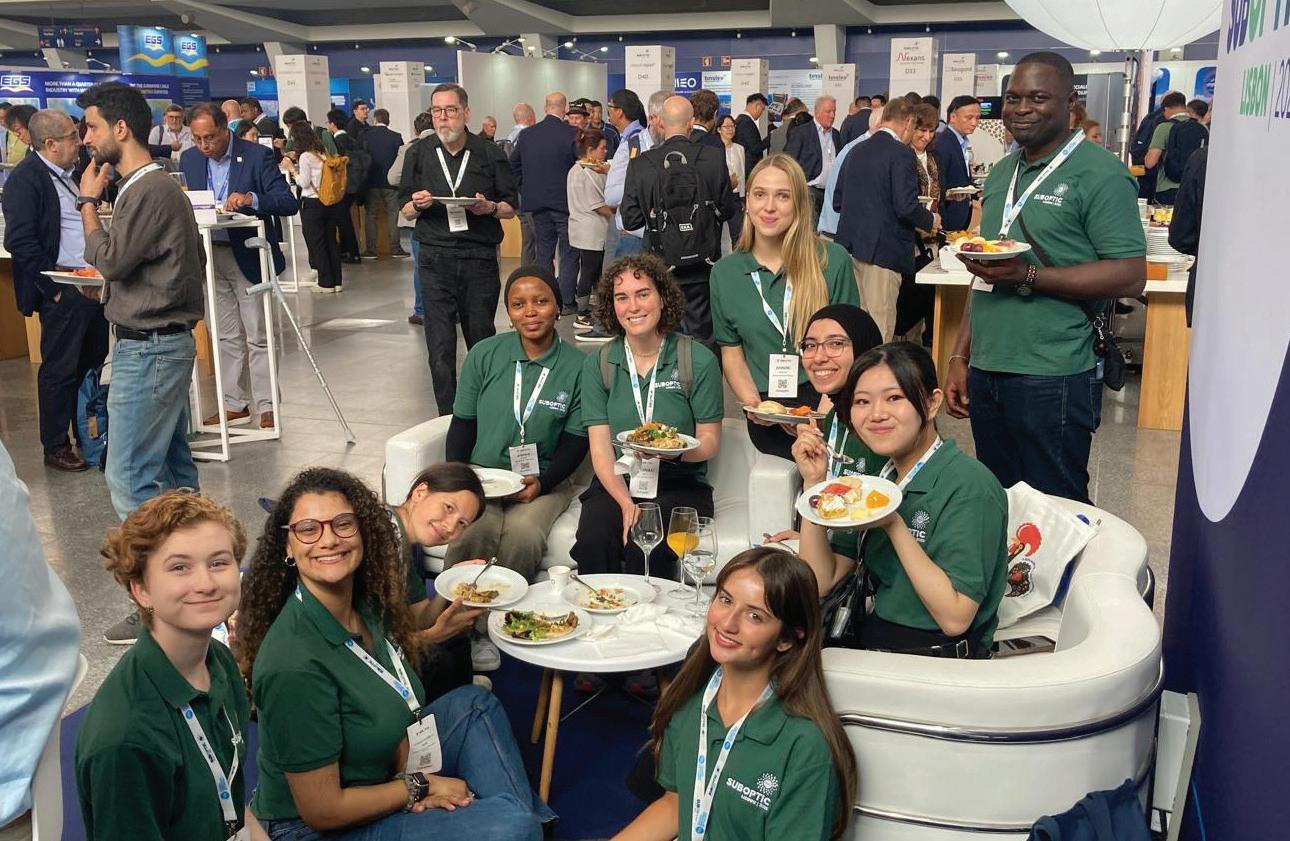
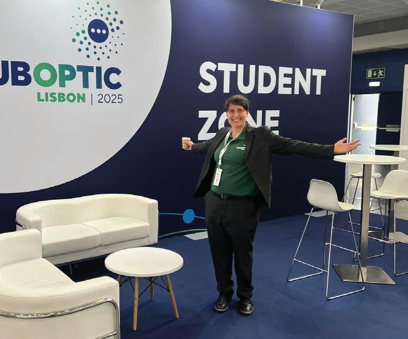
At SubOptic 2025, our team was delighted to see a forward-looking focus echoed across the masterclasses, panels, roundtables, and networking sessions packed into the four days of the conference. Speakers highlighted the need to incorporate new technologies and welcome new approaches into an industry situated in the middle of complex global challenges. Encouraging for our group in particular was the willingness we saw to develop young and diverse talent, from the shoutouts the Student & Young Professionals Track received on the main conference stage, to the
many seasoned professionals who visited the student zone to swap insights and introduce us to their work.
That commitment to fostering the next generation of leaders was equally evident beyond the conference halls, particularly during the site visits that showcased cutting-edge, sustainable infrastructure in action. At the Start Campus Sines Data Center, the team warmly demonstrated the future of digital infrastructure and its dedication to sustainability. As Fernando Borges Azevedo, Start Campus’s Head of Connectivity, put it, “These site visits are more than just tours – they are moments that bridge
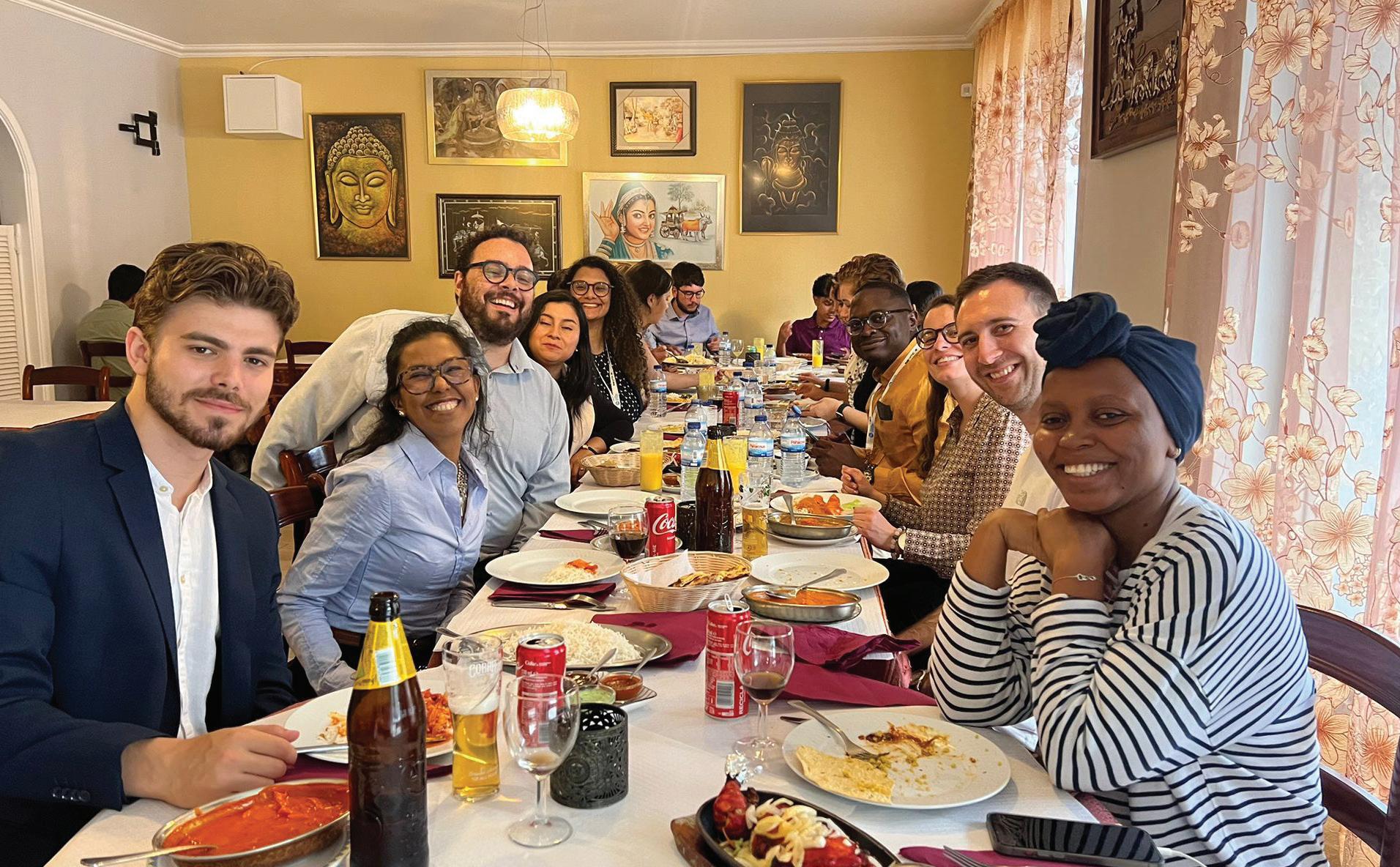
ambition with understanding. When young professionals witness sustainable digital infrastructure in action, like our seawater-cooling system and AI-ready design, it turns abstract goals into tangible impact. If we want to build a truly sustainable and future-proof subsea sector, it starts with inspiring the next generation to lead it.”
As we enter and continue our work within the submarine cable and broader telecommunications sectors, we carry with us energy, enthusiasm, and global perspectives as emerging professionals from around the world. SubOptic 2025 did more than showcase what the industry is working on, it invited us to be part of it. This sense of inclusion and momentum has reinforced our commitment to shaping an industry proving itself capable of staying resilient and sustainable. As Track participant Federica Tortorella emphasized: “I am grateful for this opportunity and happy to see great professionals who genuinely invest time and resources to help the next generation to fit in this amazing and particular industry!” Similarly, Moyou remarks: “SubOptic
has strengthened my motivation to help shape a more equitable, resilient, and sustainable digital future—and I hope to carry this spirit forward in both my studies and career.” We are excited to continue building on these conversations and relationships in the years ahead, and we look forward to reconnecting with this growing global community at SubOptic 2028 in Cape Town, South Africa. STF
This article is an output from a SubOptic Foundation project funded by the Internet Society Foundation.

IAGO BOJCZUK is a Ph.D. candidate in the Department of Sociology at the University of Cambridge, UK, and the Student and Young Professional Coordinator for the SubOptic 2025 conference. His research focuses on the sustainability and governance of digital infrastructures, including subsea cables, data centers, and satellites.

encouraging women and young people into the STEM world. Currently, she collaborates with the Diversity, Inclusion & Belonging (DIB) working group at SubOptic, where she participates in the Spanish Mentoring Program.

AMINA IBRAHIM is a Technical Consultant at Vodacom Tanzania PLC with over 2 years of experience in the Network department. She specializes in managing customer queries, troubleshooting technical issues, and supporting client integration for MW, Fiber, and LTE technologies. As a Sponsored Student/Young Professional, she is passionate about technology and actively pursues continuous learning and professional growth.

MOYOU NGANDJON CARREL LANDRY graduated in telecommunications Engineering in 2018 from the Catholic University of Central Africa. With several years’ experience, he has worked on 2G, 3G, and 4G network deployment and optimisation projects with Alcatel-Lucent and has held positions with Orange. Since September 2024, he has been pursuing a specialised master’s degree at Telecom Paris, focusing on subjects such as 5G, cloud, IoT and also developed a keen interest in submarine cable systems.

CAROLINE CROWLEY is an undergraduate student at the University of California, Berkeley, pursuing a degree in Environmental Economics and Policy. She works as a research assistant with the SubOptic Foundation’s Sustainable Subsea Networks team. Her work analyzes the policies regulating digital infrastructures, particularly data centers, and their impacts on local economies and electrical grids.

AIDÉ CABRERA is a Telecom Engineer with 4 years of industry experience. Focused on Optical Networks, she is a Pre-sales Engineer at Nokia, running projects across Mexico and Latam. She is passionate about
FEDERICA TORTORELLA is a lawyer from the Dominican Republic with a Master’s in Risk Management. She has been actively involved in the Internet governance ecosystem and currently serves as a member of the Caribbean Youth Advisory Board at SubOptic Foundation. Her work is focused on policy and regulatory developments related to domain names and Internet infrastructure, with a strong interest in fostering multisectoral collaboration in favor of a resilient and sustainable Internet ecosystem.
BY KIERAN CLARK
The global subsea cable network—the invisible backbone of the internet—relies on a small fleet of specialized vessels for cable installation, inspection, and maintenance. These cable ships play a vital role in ensuring connectivity between continents, yet their operational patterns remain difficult to interpret. Most tracking is based on AIS (Automatic Identification System) data, which shows where ships are and how fast they’re moving, but offers little direct information about what the vessels are actually doing.
This article presents the latest results from a geospatial analysis of cable ship movement using 7,360 AIS-derived data points collected between 1 May and 30 June 2025. Building on our previous methodology, this analysis identifies where cable ships cluster, how their behavior varies across global regions, and what their proximity to infrastructure might reveal about their roles—whether conducting cable repairs, deploying new systems, or simply waiting on standby.
The AIS dataset was compiled at six-hour intervals, generating a consistent view of vessel locations, movement speeds, and identities. Points where ships remained slow or stationary for extended periods were flagged as likely idle events. These idle points were then classified using a proximity-based model: if a ship remained within 50 kilometers of a known cable depot or factory for more than 24 hours, a projected classification was applied:
• Installation if near a factory
• Maintenance if near a depot
• Unclassified if no infrastructure was nearby or conditions were inconclusive
If both a depot and factory were within range, installation was prioritized—based on historical trends suggesting factory-adjacent sites (e.g., Calais or Kitakyushu) are more commonly used for system deployment rather than repairs.
The 50 km threshold accounts for both geolocation uncertainties in infrastructure coordinates and positional drift in AIS data, which may not consistently reflect specific berth positions or anchoring locations. This range offers a reason-
able margin for association without excessive overreach.
This type of spatial classification mirrors practices in other industries. In freight logistics, analysts use vehicle proximity to warehouses to infer loading and staging activity. In fisheries management, vessel clustering near reefs and breeding zones helps indicate effort. The benefits—ranging from situational awareness to predictive resource planning—are equally applicable to cable fleet operations.
By applying this methodology to cable ships, we gain a clearer picture of where activity is concentrated, how it aligns with infrastructure, and what behavioral patterns may be emerging over time. The following sections explore these insights in detail, beginning with a global activity map and updated behavioral breakdown.
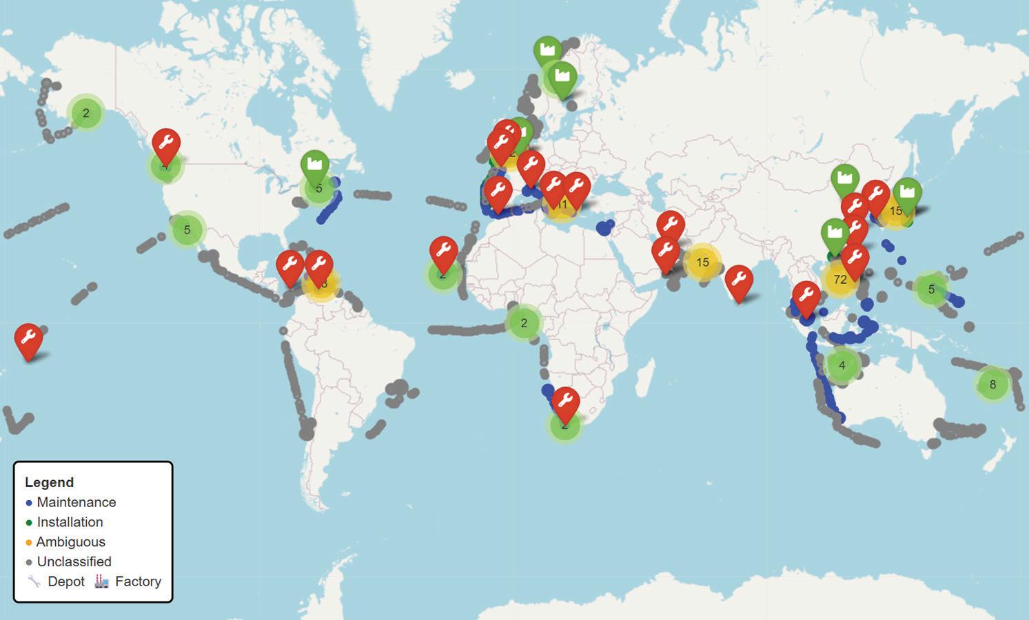
To establish a geographic baseline for cable ship behavior, this analysis begins with a spatial overview of 7,360 AIS-tracked data points collected between 1 May and 30 June 2025. These points represent vessel locations where ships were either stationary for extended periods or operating at low speeds near known cable infrastructure. The map below displays the global distribution of these idle events,
offering a visual reference for assessing where cable ship activity is concentrated.
Each point is color-coded according to the projected activity classification applied during post-processing:
• Blue: Projected Maintenance Activity
• Green: Projected Installation Activity
• Gray: Unclassified Activity
In addition, infrastructure reference points are indicated with iconography:
• Wrench icon: Cable Depot
• Factory icon: Cable Factory
Several high-density clusters are immediately apparent. South and Southeast Asia continue to show elevated levels of projected maintenance activity, particularly around the Singapore Strait, Manila, and the Java Sea. This pattern reflects both the heavy concentration of subsea infrastructure in the region and the number of regional depots.
New for this reporting period, East Asia displays a notably strong presence of both installation and maintenance behaviors—especially around Shanghai, Busan, and Kitakyushu—reinforcing the region’s role as a hub for both repairs
and new buildouts.
In the North Atlantic, concentrated clusters are again visible near Calais, the UK’s south coast, and the Canary Islands. Meanwhile, Northern Europe and the Eastern Mediterranean remain consistent staging zones for both classified and unclassified behaviors, suggesting continued demand for regional fault response and system work.
Other visible concentrations appear in the Bay of Bengal, Gulf of Oman, West Africa, and northern South America, each showing either isolated installations or depot-linked maintenance events. The South Pacific, particularly east of Papua New Guinea and around eastern Australia, shows several dense tracks of unclassified or maintenance points.
Overall, the geographic layout of observed behaviors reinforces the role of infrastructure adjacency in shaping idle patterns. These spatial signatures serve as the foundation for further analysis in the following sections, including behavior classification, regional variation, and facility proximity.
With the spatial footprint established, the next phase of analysis focuses on interpreting the likely purpose behind cable ship behavior. Each of the AIS-based data points was categorized into one of three projected activity types—Maintenance, Installation, or Unclassified—based on proximity to known infrastructure and post-idle vessel routing patterns.
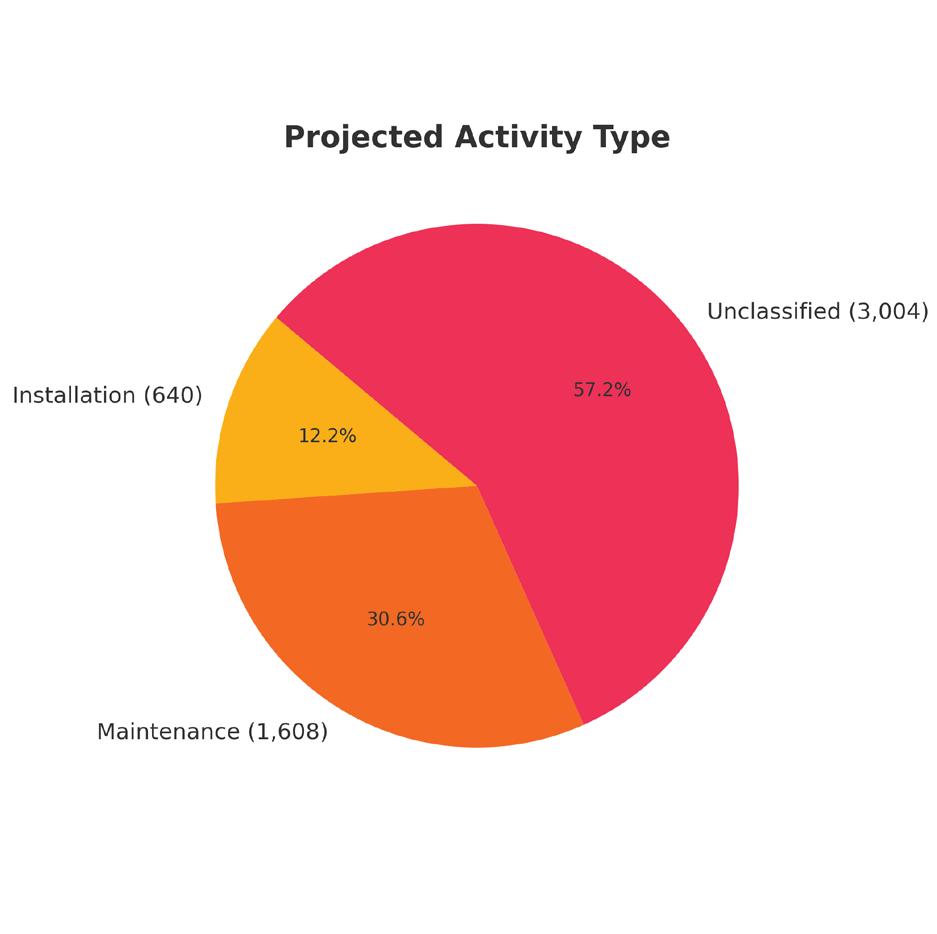
The classification results for May–June 2025 are as follows:
• Maintenance: 1,608 data points (30.6%)
• Installation: 640 data points (12.2%)
• Unclassified: 3,004 data points (57.2%)
These categories reflect inferred behavior based on location and movement—not direct vessel reporting. Ships linked to projected maintenance activity typically remained near cable depots and exhibited movement patterns indicative of fault response, port returns, or nearshore positioning. In contrast, ships classified under installation activity more often staged near cable factories or dispersed along deepwater cable corridors, aligning with long-haul buildout missions.
While installation accounts for a smaller portion of the dataset, its footprint is more geographically distributed— consistent with its episodic and project-based nature. By contrast, maintenance activity remains more frequent, more nearshore, and more spatially concentrated—particularly around established depot hubs. This pattern reinforces the
notion that a steady baseline of maintenance operations underpins global subsea network reliability.
The ongoing dominance of maintenance-linked idling— nearly one-third of all idle points—highlights the constant demand for cable repairs, inspections, and response readiness as systems age and traffic volumes increase. These operations depend heavily on depot infrastructure and vessel availability within high-density cable regions.
Finally, the high proportion of unclassified points (57.2%) continues to underscore a key limitation of AIS-derived analysis: the absence of structured activity metadata from vessels. Without explicit reporting of mission type or status, inference remains the only path to behavioral insight. Still, the patterns that do emerge through classification offer a valuable window into the operational scope and logistics of the global cable ship fleet.
After establishing a global overview and a behavioral classification framework, the next step is to examine how projected cable ship activity varies by region. To do this, data points were grouped by AIS Zone—a standardized geographic reference field derived from vessel tracking metadata. For each zone, projected activity types were aggregated to evaluate regional patterns in maintenance, installation, and unclassified behavior.
The visualization reveals strong regional distinctions across all three activity types.
As in previous periods, Southeast Asia and the East Asia region dominate in total idle records, with East Asia
now showing the highest absolute volume of classified points. Both regions reflect mixed activity profiles, but with notable gains in installation-linked presence, especially near Japan, Korea, and eastern China. These areas are home to multiple cable factories and feature recurring deployment-related idling.
North East Atlantic and North Sea zones also rank highly, continuing to reflect depot-supported maintenance cycles near major European ports like Calais, Brest, and Lowestoft. This region remains a perennial hub for service continuity operations.
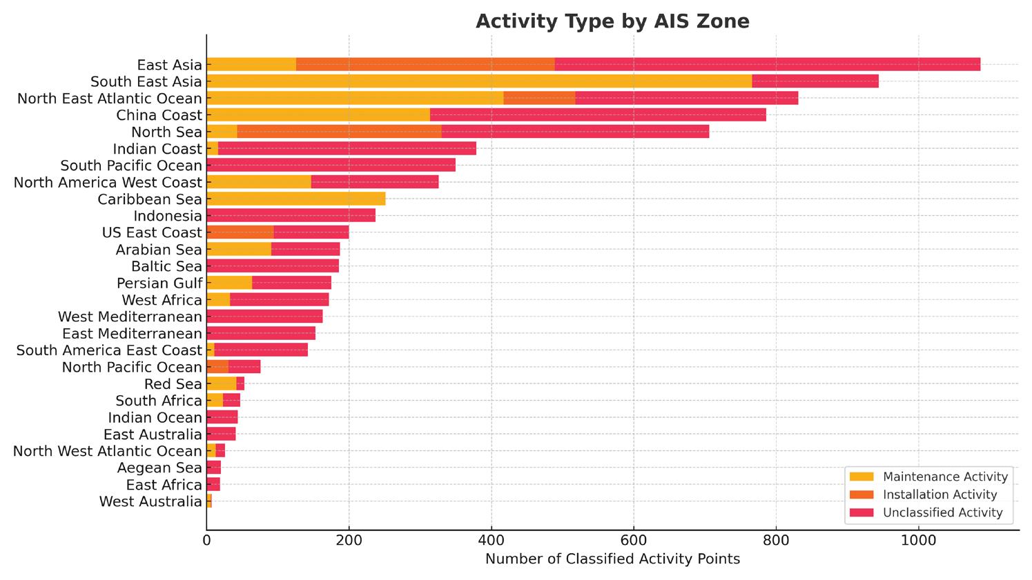
On the other end of the spectrum, areas like the Caribbean Sea, Persian Gulf, and Arabian Sea show a more balanced distribution between maintenance and installation—often tied to hybrid support roles for aging legacy systems and regional buildout corridors.
In contrast, unclassified behavior remains dominant in less-instrumented regions. West Africa, South America, and portions of the Indian Ocean exhibit high shares of vessel activity where infrastructure proximity or movement context is insufficient to infer a clear purpose. These zones highlight continued data opacity in locations underserved by regional depots or real-time reporting structures.
The zonal view reinforces two key takeaways:
• Maintenance activity remains both more frequent and spatially concentrated, largely tracking with the global depot network.
• Installation activity is more episodic and distributed across fewer zones, reflecting its project-by-project operational model.
Together, these patterns provide insight into how infrastructure distribution, cable age, and fleet positioning shape regional workloads. They also underscore the opportunity for enhanced classification via integration of project metadata or AIS message extensions to reduce the volume of unclassified behavior in future datasets.
In addition to geographic clustering, cable ship behavior can also be examined through its relationship with nearby infrastructure—specifically depots and factories. These facilities play a central role in shaping vessel movement patterns. Depots act as staging and mobilization points for fault response and routine maintenance, while factories support cable loading and the initiation of installation campaigns.
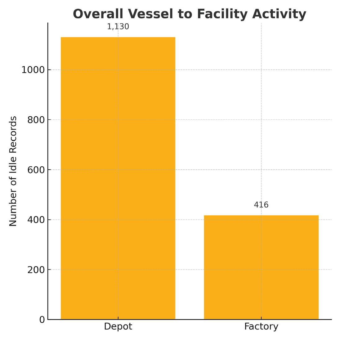
To explore this relationship, each AIS-tracked idle data point was evaluated for proximity to a known facility. If a vessel remained within a defined radius of a depot or factory for over 24 hours, the nearby location type was recorded. The resulting distribution is shown below.
The updated proximity analysis shows:
• Depot-associated idle records: 1,130
• Factory-associated idle records: 416
This means vessels were 2.7 times more likely to be found idling near a depot than near a factory—a strong signal that maintenance continues to dominate vessel operations. This outcome is consistent with previous classification findings: most projected maintenance activity occurred in depot-adjacent waters, while installation behavior—though less frequent—was linked to isolated, factory-side staging events.
The contrast also reflects the differing operational rhythms. Depot presence is cyclical and frequent, as ships return for restaging, resupply, or immediate fault response.
Factory adjacency, by comparison, tends to be episodic: ships only linger there when gearing up for system deployments, and their paths diverge quickly once operations begin.
This facility-based view reinforces the strategic significance of well-distributed depot coverage across major cable corridors. Regions lacking nearby depots may suffer from longer repair delays, increased vessel transit burden, or clustering of idle ships in less optimal fallback locations.
In total, the infrastructure proximity analysis provides a complementary lens to regional and behavioral classification: it highlights not only where vessels go, but why they tend to remain—and how facility placement shapes operational readiness and mission efficiency across the fleet.
This analysis presents a current global snapshot of cable ship behavior using AIS data, focusing on how vessel locations, projected activities, and infrastructure proximity intersect across 7,360 observed data points collected between 1 May and 30 June 2025. By classifying idle periods into maintenance, installation, and unclassified categories—and mapping them across geographic regions and infrastructure types—we can identify several enduring patterns.
Maintenance activity continues to account for the largest identifiable share of classified behavior, and remains strongly correlated with depot proximity. These operations cluster around aging systems and fault-prone corridors—particularly in areas with dense subsea infrastructure. By contrast, installation behavior is less common but more geographically dispersed, often observed near factory-adjacent staging zones or long-haul deployment routes. Together, these patterns emphasize the strategic role of depot coverage and factory logistics in shaping vessel presence and mission timing.
The updated zonal and facility analysis reaffirms the significance of regional hubs such as East Asia, Southeast Asia, and the North Atlantic corridor, where vessel concentration and infrastructure overlap are most visible. These areas anchor both sustained maintenance cycles and episodic deployment campaigns.
Yet, a persistent challenge remains: 57.2% of records remain unclassified. This reflects the continued limita-
tions of AIS-based inference, especially in regions lacking infrastructure density or post-idle trajectory clarity. Without standardized reporting mechanisms or access to mission-level metadata, vast portions of vessel activity must still be interpreted indirectly.
Overcoming this barrier will require a renewed industry push toward better data transparency. If vessel operators consistently shared operational context—whether through structured AIS message extensions, port call declarations, or anonymized project logs—the value of behavioral analysis could expand significantly. Such collaboration would support improved forecasting, faster response coordination, and more efficient fleet utilization—all of which are critical to maintaining the resilience of global subsea connectivity. STF
KIERAN CLARK is the Lead Analyst for SubTel Forum. He originally joined SubTel Forum in 2013 as a Broadcast Technician to provide support for live event video streaming. He has 6+ years of live production experience and has worked alongside some of the premier organizations in video web streaming. In 2014, Kieran was promoted to Analyst and is currently responsible for the research and maintenance that supports the Submarine Cable Database. In 2016, he was promoted to Lead Analyst and his analysis is featured in almost the entire array of Subtel Forum Publications.


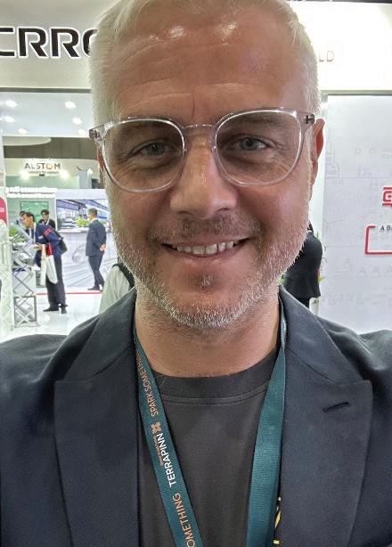
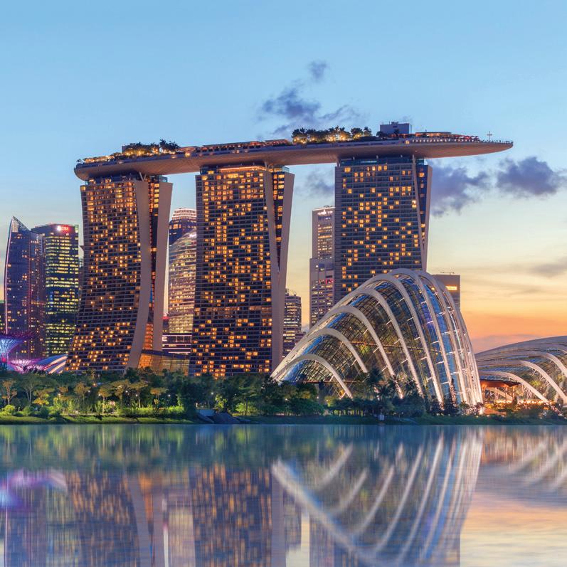
As the global submarine cable sector continues to evolve at an unprecedented pace, few events serve as a clearer signal of what’s ahead than Submarine Networks World (SNW). Organized by Terrapinn, SNW brings together top decision-makers, innovators, and infrastructure builders shaping the future of global connectivity. With Submarine Networks World 2025 on the horizon, we sat down with Adam Ball, General Manager at Terrapinn Asia, to discuss this year’s focus, industry trends, and what lies ahead for the event—and the ecosystem it supports.
1.
CAN YOU INTRODUCE SUBMARINE NETWORKS WORLD 2025 AND EXPLAIN THE CORE MISSION BEHIND THE EVENT?
Submarine Networks World takes place every year here in Singapore in September and only focuses on the
subsea industry. The event is the only ‘one-stop shop’ where it is possible to meet with all the components required to create or facilitate a cable project. The core mission is to stay No.1 and that requires continuous improvements across the event, to be brave where possible with the conference content and not to be afraid to try new approaches. We can always ‘do better’ and that is our headspace each and every year.
2.
HOW DOES SNW 2025 DIRECTLY ENGAGE WITH AND IMPACT THE GLOBAL SUBMARINE CABLE MARKET?
SNW provides a platform for the industry to meet and do business. The event attracts the entire value-chain and therefore can add value to any cable project or company that attends or participates. By increasing the global reach and ensuring more and more persons/ companies attend is the only impact we can have on the
industry. What takes place directly onsite, or as a result of meetings that take place onsite, is purely down to those working in the industry itself.
3.
WHAT KEY INNOVATIONS IN SUBMARINE CABLE SYSTEMS OR EMERGING APPLICATIONS WILL TAKE THE SPOTLIGHT THIS YEAR?
AI and all aspects of how it affects the industry is impossible to ignore. How to accommodate for AI, utilize AI, what are the new applications for AI - it is seemingly the root of all change right now and will be for some time.
4.
WHAT ARE THE PRIMARY REASONS BEHIND SNW’S CONTINUED RELEVANCE AND GROWTH IN THE TELECOMMUNICATIONS SPACE? WHAT KEEPS THIS EVENT AT THE CENTER OF THE CONVERSATION?
Whilst other events have focused on scale, at SNW we focus on sustainable growth. It’s a very basic mindset of understanding why the industry comes to the event and every year this must be delivered without exception.
There is no reason to move away from solely focusing on having the ‘right people’ in the room and increasing the value proposition with more of the ‘right people’ being in the room each and every year.
5.
HOW IS SNW HELPING DRIVE DIVERSITY, EQUITY, AND INCLUSION ACROSS THE SUBSEA AND TELECOM INDUSTRIES?
The ‘Free for Under 25’ initiative is growing each year whereby any company that has bought a pass or package can bring an employee aged 25 or under to the event without having to purchase a pass. We openly encourage companies to bring more than 1 person as the true change in the make-up of the industry will only come from the next generation.
6. AS SNW APPROACHES, HOW IS SNW SETTING ITSELF APART OR COMPLEMENTING THE BROADER CONFERENCE CALENDAR?
SNW sets itself apart from other conferences by shying away as little as possible from the various ‘elephants in the room’ and so any attendee can expect presentations and panels on the main talking points of the last 12 months. Cable security, The Red Sea, OTT and private
cable operator relationships, geopolitics… all the main topics everyone is talking about but more importantly what everyone isn’t openly talking about at other events. Add in the constant of ‘Singapore in September’ then there isn’t any scuppering of the conference calendar by changing dates, or creating regional spin-offs to further saturate an already busy schedule. Like our long-term relationship with PTC – they are every January, SNW is every September, and all other events can fight it out between them for the period in between.
7.
HOW IS SNW EVOLVING TO MATCH THE ICT SECTOR’S ACCELERATING DIGITAL TRANSFORMATION AND GROWING SUBMARINE INFRASTRUCTURE DEMANDS?
The growing demand is reflected in the conference content. For instance, the topic of AI. SNW would be some way behind the curve to have an AI specific theatre, or even an AI specific session. With subsea cables having to deliver AI (and everything that comes with it) to meet the needs of the global population, you will find AI appearing in almost every theatre and every session in some form of talking point.
8.
WHAT ARE THE MOST PRESSING CHALLENGES SNW CURRENTLY FACES, AND HOW IS TERRAPINN PREPARING TO MEET THEM?
The challenge of refreshing the event where possible each year, whilst not losing the reason why persons attend the event, along with always looking to grow the attendee levels from what is a relatively small industry –remains the constant overall challenge.
We have little to no margin for genuine error in this respect but have to keep expanding our approach, always thinking and being open to trying new ideas. STF
ADAM BALL is General Manager of Terrapinn responsible for the management of Submarine Networks World since 2018. He is an experienced sales leader with a proven track record in both London and Singapore. Coupling an affable nature with outstanding influencing and communication skills, he has directly formed and maintained long-term business relationships of integrity and success across a variety of high value/high profile products and services.
1. Paul Clark, MD, Asia, Terrapinn
2. Abdullah A. Alghonaimi, VP Wholesale Operations, Mobily
3. Rayan Alsaedi, Senior Advisor, Digital Infrastructure and Communication Deputyship, MCIT (Kingdom of Saudi Arabia)
4. Hasnain Ali, Director Permitting & Regulatory Affairs, Pioneer Consulting
5. Senior representative, Nokia
6. Dr. Stephen J McCombie, Professor of Maritime IT Security, NHL Stenden University of Applied Sciences
7. Jurgen Hatheier, Vice President International CTO, Ciena
8. Mark Brownscombe, Senior Director – Commercial & Sales Ops, Ooredoo
9. Anup Gupta, President – India and SAARC, APTelecom
10. Ivan Skenderoski, Managing Partner, Salience Consulting
11. Alpheus Mangale, Group CEO, SEACOM
31. Michael Ruddy, Director of International Research, Terabit Consulting
32. Andy Palmer-Felgate, Acting President, NASCA
33. Senior representative, Digital Realty
34. Tom Janssen-Manning, Operations Program Manager, Submarine Networks APAC, Google
35. Oli Pope, Managing Director, Route Position
36. Sophie Wright, Technical Program Manager, Google
37. Philippe Recco, ACE MC Chairman, Orange
38. Rohitash Bhaskar, Head International Infrastructure, Batelco
39. Senior representative, IMDA
12. Cynthia Mehboob, PhD Scholar | Department of International Relations, The Australian National University
13. Eckhard Bruckschen, CTO, IOEMA Fibre Ltd
14. Felipe Yasuda, Telecommunication Engineer, Angola Cables
15. Senior representative, HMN Tech
16. Geraldine Le Meur, Director, GreenLink Marine
List of Speakers
40. Philip deGuzman, Senior Director, Pioneer Consulting
41. Vinay Nagpal, President, InterGlobix
42. Diego Teot, Head of OTT, Media & Telco, Retelit
43. Majed Almaghlouth, GM Digital & OTT Partners & Sales Management, Mobily
44. Tim Parker, Chief Growth Officer, Assured Communications
45. Aurelien Vigano, SVP, International Infrastructures, Orange
46. Carlos Casado, VP of Sales, Telxius, Northern Region
47. Senior Representative, Bermuda Business Development Agency
48. Julian Rawle, Associate, Cambridge MC
49. Nadya Melic, VP – Product & Marketing, FLAG
1. Paul Clark, MD, Asia, Terrapinn
17. Giuseppe Valentino, VP Product Management, Backbone & Infrastructure Solutions, Sparkle
50. Russ Matulich, CEO, RTI Advisors
2. Abdullah A. Alghonaimi, VP Wholesale Operations, Mobily
18. Tony Mosley, Director of Business Development, Ocean Specialists
19. Senior representative, Fiberhome
31. Michael Ruddy, Director of International Research, Terabit Consulting
51. Prenesh Padayachee, Group Chief Digital and Operations Officer, SEACOM
3. Rayan Alsaedi, Senior Advisor, Digital Infrastructure and Communication Deputyship, MCIT (Kingdom of Saudi Arabia)
32. Andy Palmer-Felgate, Acting President, NASCA
20. Senior representative, Nokia
4. Hasnain Ali, Director Permitting & Regulatory Affairs, Pioneer Consulting
21. Haitham Zahran, Head of Global Subsea Cable Business, PCCW Global
5. Senior representative, Nokia
22. Vlad Ihora, SVP Global Sales, EllaLink
23. Andy Bax, Senior Partner – Digital Infrastructure, Cambridge MC
24. Senior representative, Nokia
6. Dr. Stephen J McCombie, Professor of Maritime IT Security, NHL Stenden University of Applied Sciences
25. Diego Matas, COO, EllaLink
7. Jurgen Hatheier, Vice President International CTO, Ciena
26. Ben Cooper, Partner - APAC, Cambridge MC
27. David Simarro, Head of Sales EMEA, Telxius
8. Mark Brownscombe, Senior Director – Commercial & Sales Ops, Ooredoo
28. Joel Ogren, CEO, Assured Communications
9. Anup Gupta, President – India and SAARC, APTelecom
10. Ivan Skenderoski, Managing Partner, Salience Consulting
29. Graham Evans, Vice Chairman, ICPC
11. Alpheus Mangale, Group CEO, SEACOM
30. Jorge Andrade Santos, Head of International Wholesale, Altice
12. Cynthia Mehboob, PhD Scholar | Department of International Relations, The Australian National University
13. Eckhard Bruckschen, CTO, IOEMA Fibre Ltd
14. Felipe Yasuda, Telecommunication Engineer, Angola Cables
15. Senior representative, HMN Tech
16. Geraldine Le Meur, Director, GreenLink Marine
17. Giuseppe Valentino, VP Product Management, Backbone & Infrastructure Solutions, Sparkle
18. Tony Mosley, Director of Business Development, Ocean Specialists
19. Senior representative, Fiberhome
20. Senior representative, Nokia
21. Haitham Zahran, Head of Global Subsea Cable Business, PCCW Global
22. Vlad Ihora, SVP Global Sales, EllaLink
23. Andy Bax, Senior Partner – Digital Infrastructure, Cambridge MC
24. Senior representative, Nokia
25. Diego Matas, COO, EllaLink
26. Ben Cooper, Partner - APAC, Cambridge MC
27. David Simarro, Head of Sales EMEA, Telxius
28. Joel Ogren, CEO, Assured Communications
29. Graham Evans, Vice Chairman, ICPC
30. Jorge Andrade Santos, Head of International Wholesale, Altice
31. Michael Ruddy, Director of International Research, Terabit Consulting
32. Andy Palmer-Felgate, Acting President, NASCA
33. Senior representative, Digital Realty
34. Tom Janssen-Manning, Operations Program Manager, Submarine Networks APAC, Google
35. Oli Pope, Managing Director, Route Position
36. Sophie Wright, Technical Program Manager, Google
37. Philippe Recco, ACE MC Chairman, Orange
38. Rohitash Bhaskar, Head International Infrastructure, Batelco
39. Senior representative, IMDA
40. Philip deGuzman, Senior Director, Pioneer Consulting
41. Vinay Nagpal, President, InterGlobix
42. Diego Teot, Head of OTT, Media & Telco, Retelit
43. Majed Almaghlouth, GM Digital & OTT Partners & Sales Management, Mobily
44. Tim Parker, Chief Growth Officer, Assured Communications
45. Aurelien Vigano, SVP, International Infrastructures, Orange
46. Carlos Casado, VP of Sales, Telxius, Northern Region
47. Senior Representative, Bermuda Business Development Agency
48. Julian Rawle, Associate, Cambridge MC
49. Nadya Melic, VP – Product & Marketing, FLAG
50. Russ Matulich, CEO, RTI Advisors
51. Prenesh Padayachee, Group Chief Digital and Operations Officer, SEACOM
52. Ubaid Younus, Network Investment Manager – APAC, Meta
53. Isabelle Paradis, President, HOT Telecom
54. Alan Mauldin, Research Director, TeleGeography
55. Senior representative, Sustainable Subsea Networks
56. Ashish Ahuja, Founder & CEO, Sloka Partners
57. Bill Marra, CCO, Cinturion
52. Ubaid Younus, Network Investment Manager – APAC, Meta
33. Senior representative, Digital Realty
53. Isabelle Paradis, President, HOT Telecom
54. Alan Mauldin, Research Director, TeleGeography
34. Tom Janssen-Manning, Operations Program Manager, Submarine Networks APAC, Google
55. Senior representative, Sustainable Subsea Networks
35. Oli Pope, Managing Director, Route Position
56. Ashish Ahuja, Founder & CEO, Sloka Partners
36. Sophie Wright, Technical Program Manager, Google
57. Bill Marra, CCO, Cinturion
37. Philippe Recco, ACE MC Chairman, Orange
58. Byron Clatterbuck, CEO, Cross Pacific Data Networks
38. Rohitash Bhaskar, Head International Infrastructure, Batelco
59. Todd Rahimi, Founder & Director, Lambda Consulting LLC
39. Senior representative, IMDA
60. Vincent Gatineau, SVP Subsea Infrastructure Development, EllaLink
40. Philip deGuzman, Senior Director, Pioneer Consulting
61. Richard Norris, Senior Director, Sales Engineering, Ciena
41. Vinay Nagpal, President, InterGlobix
62. Lucenildo Junior, Chief Technology Officer, Angola Cables
42. Diego Teot, Head of OTT, Media & Telco, Retelit
63. Senior representative, HMN Tech
64. Bertrand Clesca, Partner, Pioneer Consulting
43. Majed Almaghlouth, GM Digital & OTT Partners & Sales Management, Mobily
65. Didier Dillard, CEO, Orange Marine
44. Tim Parker, Chief Growth Officer, Assured Communications
66. Tom Morris, Director, Route Position
45. Aurelien Vigano, SVP, International Infrastructures, Orange
67. Mike Constable, Principal, Infra-Analytics
46. Carlos Casado, VP of Sales, Telxius, Northern Region
68. Laurent Campagne, Senior Consultant, AQEST
47. Senior Representative, Bermuda Business Development Agency
69. Piush Agarwal, VP, Submarine Cable Partnership Development & Global Sourcing, Reliance Jio
48. Julian Rawle, Associate, Cambridge MC
70. Mohamad Izani Bin Karim, Group Head Subsea Business Development, Telin
49. Nadya Melic, VP – Product & Marketing, FLAG
71. Ravindra Bajpai, Director Engineering and Projects, FLAG
50. Russ Matulich, CEO, RTI Advisors
72. Pal Beres, VP, Strategic Projects, Azertelecom International
73. Ana Nakashidze, CEO, Azertelecom International
51. Prenesh Padayachee, Group Chief Digital and Operations Officer, SEACOM
74. Antonius Daryanto, Senior GM Technology & Development, Super Sistem
52. Ubaid Younus, Network Investment Manager – APAC, Meta
75. Mike Cunningham, CEO, Crosslake Fibre
53. Isabelle Paradis, President, HOT Telecom
76. Adrian Moss, Head of Submarine Cable Investments, Reliance Jio
54. Alan Mauldin, Research Director, TeleGeography
77. Keir Preedy, CEO, Solomon Islands Submarine Cable Company
55. Senior representative, Sustainable Subsea Networks
78. Chris George, Principal, SELF Infrastructure
56. Ashish Ahuja, Founder & CEO, Sloka Partners
79. Waleed A. Alnashwan, Director Product Marketing, Mobily
57. Bill Marra, CCO, Cinturion
80. Dion Kristadi Leksono, VP Subsea Project Orchestration, Telin
58. Byron Clatterbuck, CEO, Cross Pacific Data Networks
81. Marshall Jahja, Co-Founder & CMO, Super Sistem
59. Todd Rahimi, Founder & Director, Lambda Consulting LLC
82. Adi Kusma, President Director, Biznet Networks
60. Vincent Gatineau, SVP Subsea Infrastructure Development, EllaLink
83. Abdul Rahman Ansyory, Chief Technology Officer, Telin
61. Richard Norris, Senior Director, Sales Engineering, Ciena
84. Ian McLean, Director – South East Asia & Oceania, APTelecom
62. Lucenildo Junior, Chief Technology Officer, Angola Cables
85. Senior representative, ESCA
63. Senior representative, HMN Tech
86. Kristian Nielsen, Chief Revenue Officer, WFN Strategies
87. Hugh McGarry, Strategy & Projects Director, Solomon Island Submarine Cable Company
88. Stuart Blythe, Partner, Baker Botts
89. Jayne Stowell, Managing Director, Jayne Stowell Advisory
90. Elina Noor, Senior Fellow, Asia Program, Carnegie Endowment for International Peace
91. Robert Pepper, Senior Fellow, Global Digital Inclusion Partnership
92. Shaiju Cheruvathur, Director, Product Line Management, Ciena
93. Takeshi Kawasaki, Director – Network Services, NTT
94. Mamy Traore, CEO, GUILAB
95. Jonny Lundin, Head of Operations, NORDUnet
96. Alasdair Wilkie, Chairman, ACMA
Day 1
09:00 Organisers Welcome Paul Clark, Managing Director – Asia, Terrapinn
09:10 Keynote Panel: The Red Sea Roundtable
6 economic zones, 6 top-tier speakers – a ‘first for subsea’ panel (By invitation only)
1. Abdullah A. Alghonaimi, VP Wholesale Operations, Mobily
2. Rayan Alsaedi, Senior Advisor, Digital Infrastructure and Communication Deputyship, MCIT (Kingdom of Saudi Arabia)
Moderator: Hasnain Ali, Director Permitting & Regulatory Affairs, Pioneer Consulting
10:10 Title Sponsor Presentation Senior representative, Nokia
10:30 Guest Keynote Presentation
Dr. Stephen J McCombie, Professor of Maritime IT Security, NHL Stenden University of Applied Sciences
10:50
Refreshments Break sponsored by Phoebe
11:30 Guest Keynote Presentation TBC
11.50 Platinum Sponsor Presentation
12:10 Global Projects Showcase
Jurgen Hatheier, Vice President International CTO, Ciena
1. Fibre In Gulf (FIG) – Mark Brownscombe, Senior Director - Commercial & Sales Ops, Ooredoo
2. Bagha-1 - Anup Gupta, President – India and SAARC, APTelecom
3. Chile – Antarctica Cable – Ivan Skenderoski, Managing Partner, Salience Consulting
4. SEACOM 2.0 - Alpheus Mangale, Group CEO, SEACOM
14:20
14:40
Threats & Threat Detection
Emerging threats to subsea cables: A techno-security overview
Cynthia Mehboob, PhD Scholar | Department of International Relations, The Australian National University
Lunch sponsored by Phoebe & Cable Poster Session sponsored by RTI Advisors
SMART becoming ‘the standard’?
Eckhard Bruckschen, CTO, IOEMA Fibre Ltd
Presentation Senior representative, HMN Tech
Identifying issues before they happen –safeguarding a nations critical infrastructure through detection and monitoring
1. Geraldine Le Meur, Director, GreenLink Marine
2. Giuseppe Valentino, VP Product Management, Backbone & Infrastructure Solutions, Sparkle
3. 4. Silver+
Moderator: Tony Mosley, Director of Business Development, Ocean Specialists
15:20
15:40
Asset Protection
ICPC Update
Graham Evans, Vice Chairman, ICPC
16:00
PANEL:
Coping with Capacity – what’s next in cable technology to meet the demand for ‘more, more, more’?
1. Senior representative, Fiberhome
2. Senior representative, Nokia
3. Haitham Zahran, Head of Global Subsea Cable Business, PCCW Global
4. Vlad Ihora, SVP Global Sales, EllaLink
Moderator: Andy Bax, Senior Partner – Digital Infrastructure, Cambridge MC
Refreshments Break sponsored by Phoebe
CLS Case Study
Felipe Yasuda, Telecommunication Engineer, Angola Cables
PANEL:
‘Not just a CLS’ – the ongoing evolution of the cable landing station
1. Senior representative, Nokia
2. Diego Matas, COO, EllaLink
3. Ben Cooper, Partner - APAC, Cambridge MC
4. David Simarro, Head of Sales EMEA, Telxius
Moderator: Joel Ogren, CEO, Assured Communications
Permitting & Regulation DC
‘One-Stop Shop’ permitting in Portugal?
Jorge Andrade Santos, Head of International Wholesale, Altice
Data centre demand as a driver in submarine investment
Michael Ruddy, Director of International Research, Terabit Consulting
Sponsor Presentation Andy Palmer-Felgate, Acting President, NASCA Senior representative, Digital Realty
16:20 PANEL:
‘The unmanned army’ – USV, UAV, AI… are ‘the machines’ taking over?
1. Tom Janssen-Manning, Operations Program Manager, Submarine Networks APAC, Google
2. 3. 4. Silver+
Moderator: Oli Pope, Managing Director, Route Position
PANEL:
Taking the pain out of permitting – surely it doesn’t have to be all that bad… does it?
1. Sophie Wright, Technical Program Manager, Google
2. Philippe Recco, ACE MC Chairman, Orange
3. Rohitash Bhaskar, Head International Infrastructure, Batelco
4. Senior representative, IMDA
Moderator: Philip deGuzman, Senior Director, Pioneer Consulting
PANEL:
Dynamic DC - how are bricks and mortar remaining fluid to meet the changing needs of the subsea industry?
1. Vinay Nagpal, President, InterGlobix
2. Diego Teot, Head of OTT, Media & Telco, Retelit
3. Majed Almaghlouth, GM Digital & OTT Partners & Sales Management, Mobily 4. Silver+
Moderator: Tim Parker, Chief Growth Officer, Assured Communications
09:20 Keynote Panel:
Day 2
Connecting the Caribbean – a sudden surge in subsea activity
1. Aurelien Vigano, SVP, International Infrastructures, Orange
2. Carlos Casado, VP of Sales, Telxius, Northern Region
3. Senior Representative, Bermuda Business Development Agency
4. Silver+
Moderator: Julian Rawle, Associate, Cambridge MC
10:00 Keynote Panel:
Building with speed, building at scale and driving down the cost to the customer – is a ‘Walmart Effect’ in connectivity becoming a reality?
1. Nadya Melic, VP – Product & Marketing, FLAG
2. Russ Matulich, CEO, RTI Advisors
3. Prenesh Padayachee, Group Chief Digital and Operations Officer, SEACOM
4. Ubaid Younus, Network Investment Manager – APAC, Meta
Moderator: Isabelle Paradis, President, HOT Telecom
10:40
11:00
TeleGeography Presentation:
11:40
12:00
AI as a driver in submarine investment
Michael Ruddy, Director of International Research, Terabit Consulting
Sponsor Presentation
12:20 PANEL: Beg, steal or borrow? The business case for independent cable operators in 2025
1. Ashish Ahuja, Founder & CEO, Sloka Partners
2. Bill Marra, CCO, Cinturion
3. Byron Clatterbuck, CEO, Cross Pacific Data Networks
4. Silver+
Moderator: Todd Rahimi, Founder & Director, Lambda Consulting LLC
Alan Mauldin, Research Director, TeleGeography
Break sponsored by Phoebe
Case Study: ‘Stitching the coastline’ with repeatered shallow water cable systems
Sponsor Presentation
PANEL:
Network design has flatlined whilst all other aspects are advancing. Where next for subsea systems?
1. Vincent Gatineau, SVP Subsea Infrastructure Development, EllaLink
2. Richard Norris, Senior Director, Sales Engineering, Ciena
3 Lucenildo Junior, Chief Technology Officer, Angola Cables
4. Senior representative, HMN Tech
Moderator: Bertrand Clesca, Partner, Pioneer Consulting
Piush Agarwal, VP, Submarine Cable Partnership Development & Global Sourcing, Reliance Jio
14:20
Pal Beres, VP, Strategic Projects, Azertelecom International
Ana Nakashidze, CEO, Azertelecom International
With records tumbling, what are the new benchmarks for optimised networks?
Mohamad Izani Bin Karim, Group Head Subsea Business Development, Telin
Making ships sustainable – how to avoid doing more harm than good
Senior representative, Sustainable Subsea Networks
Sponsor Presentation
PANEL:
‘The Cable Ship Conundrum’ – what is the solution?
1 Didier Dillard, CEO, Orange Marine
2 Tom Morris, Director, Route Position
3 Mike Constable, Principal, Infra-Analytics
4. Silver+
Moderator: Laurent Campagne, Senior Consultant, AQEST
Building a complete network with ¼ fiber – A case study
Ravindra Bajpai, Director Engineering and Projects, FLAG
Spectrum Sharing
Antonius Daryanto, Senior GM Technology & Development, Super Sistem
Sponsor Presentation
14:40
PANEL:
OTT’s build the trans-ocean highways, independent operators build the branches/by-ways – would a two tier system based on scale be a viable way forward?
1. Mike Cunningham, CEO, Crosslake Fibre
2. Adrian Moss, Head of Submarine Cable Investments, Reliance Jio
3. Keir Preedy, CEO, Solomon Islands Submarine Cable Company
4. OTT
Moderator: Chris George, Principal, SELF Infrastructure
15:20
PANEL:
Utilising AI for network optimisation between long distance connections
1. Jurgen Hatheier, Vice President International CTO, Ciena
2. Waleed A. Alnashwan, Director Product Marketing, Mobily
3. Dion Kristadi Kristadi, VP Subsea Project Orchestration, Telin 4. Silver+
Moderator:
Refreshments Break sponsored by Phoebe Government/Regional
15:40 Senior representative, ESCA
16:00
16:20
Change of Administration = Change of Heart?
Kristian Nielsen, Chief Revenue Officer, WFN Strategies
PANEL:
Cross-continent allegiances and alliances – can consistent commonalities create a ‘one world order’ for subsea cable policy?
1. Hugh McGarry, Strategy & Projects Director, Solomon Island Submarine Cable Company
2. Stuart Blythe, Partner, Baker Botts
3. Jayne Stowell, Managing Director, Jayne Stowell Advisory
4. Elina Noor, Senior Fellow, Asia Program, Carnegie Endowment for International Peace
Moderator: Robert Pepper, Senior Fellow, Global Digital Inclusion Partnership
Managing your most valuable asset
Sponsor Presentation
PANEL:
Increasing efficiency in network operations through AI - why is no one talking about it?
1. Shaiju Cheruvathur, Director, Product Line Management, Ciena
2. Takeshi Kawasaki, Director – Network Services, NTT
3. Mamy Traore, CEO, GUILAB
4. Silver+
Moderator:
17:00 End of Conference
17:15 Day 2 Drinks
PANEL: Indonesia, the world’s largest archipelago –complex considerations in construction
1. Marshall Jahja, Co-Founder & CMO, Super Sistem
2. Adi Kusma, President Director, Biznet Networks
3. Abdul Rahman Ansyory, Chief Technology Officer, Telin
4. Silver+
Moderator: Ian McLean, Director – South East Asia & Oceania, APTelecom
Case Study: Vietnam – 5 international cables, 5 international cables cut in 2024.
Sponsor Presentation
PANEL: The Arctic cable maintenance debate –making the seemingly impossible, possible?
1. Jonny Lundin, Head of Operations, NORDUnet
2.
3.
4. Silver+
Moderator: Alasdair Wilkie, Chairman, ACMA
Deploying a submarine cable system?
Your success depends on the right team.
At WFN Strategies, we provide access to over 150 highly qualified client representatives across 25+ countries—each pre-vetted, field-proven, and supported by our industry-leading Contractor Care Program.
From technical oversight to compliance management, our experts ensure your project stays on time, on budget, and on course.
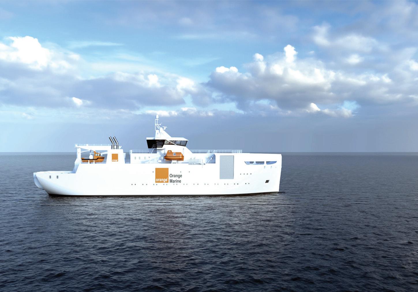
Ensure your next project has the right people in place.

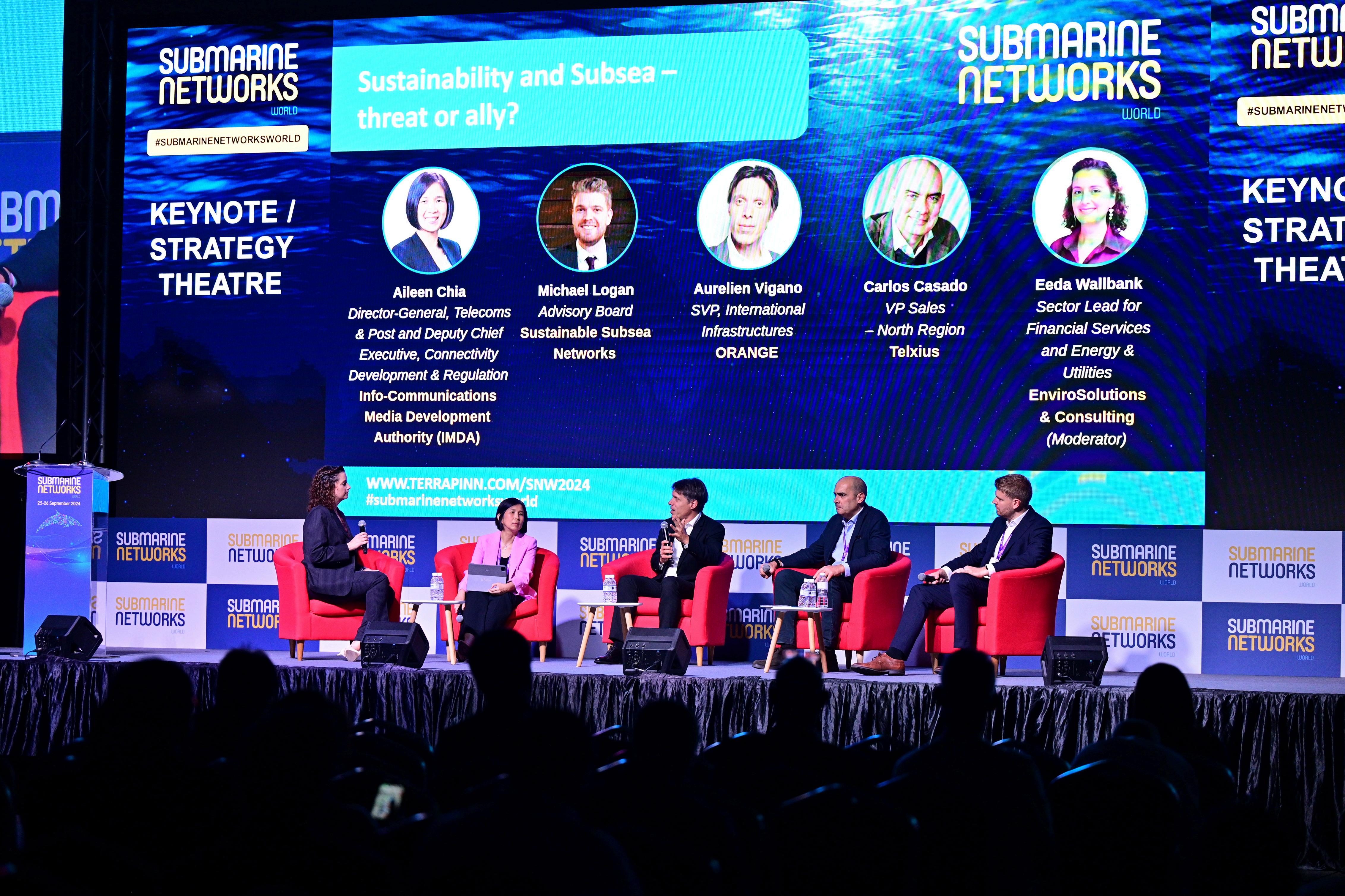
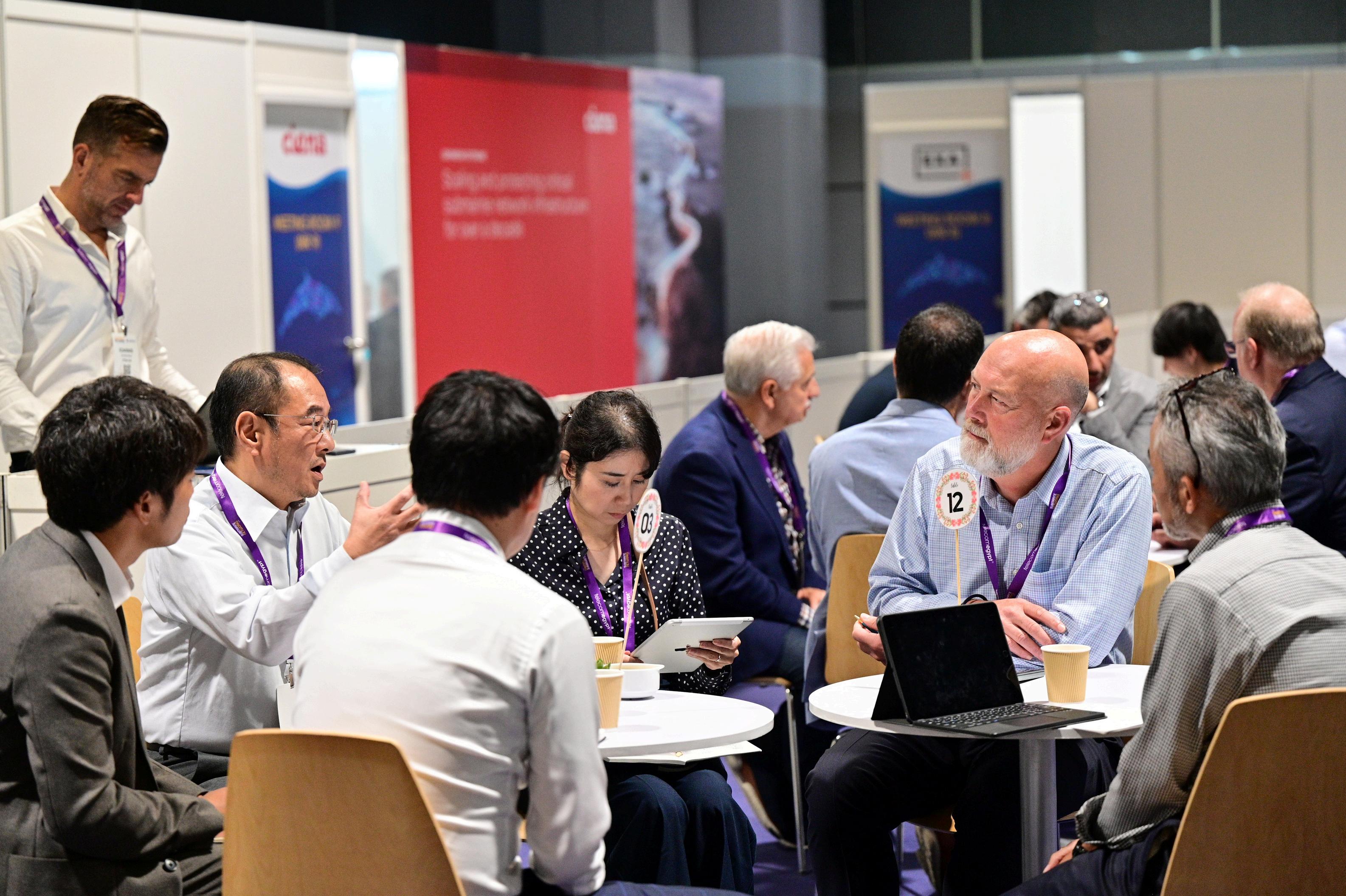

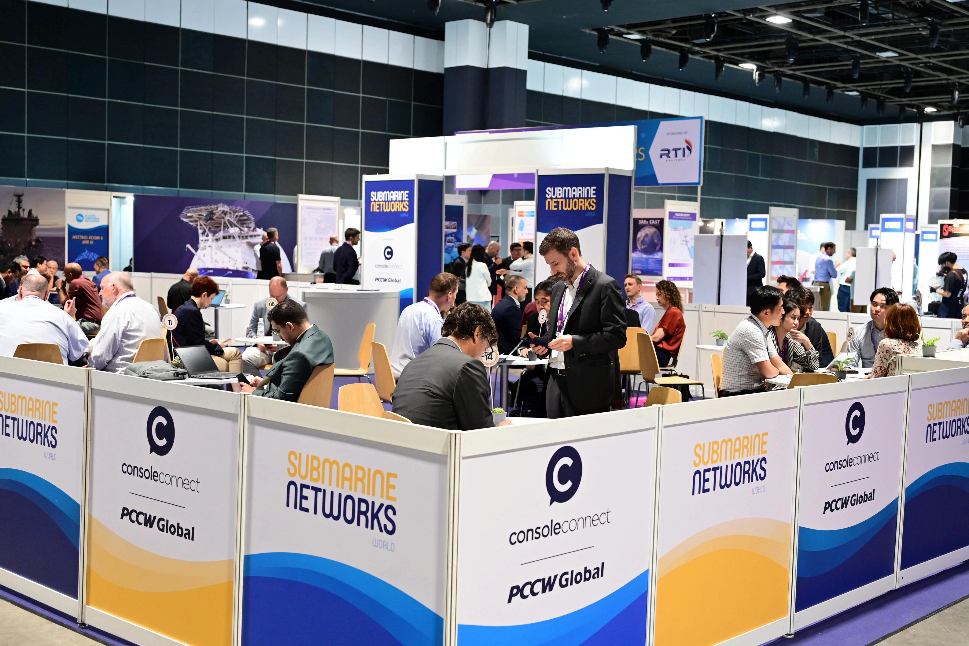
BY WAYNE NIELSEN, FOUNDER & PUBLISHER, SUBMARINE TELECOMS FORUM INC.

The submarine cable industry depends on clarity, precision, and leadership. SubOptic continues to provide an environment where these qualities are demonstrated. Held every three years, SubOptic gathers the people and ideas that drive the development of global communications infrastructure.
At SubOptic 2025 in Lisbon, SubTel Forum presented the Excellence in Industry Awards. These honors returned to the global stage after their initial debut at SubOptic 2010 in Yokohama. They remain the industry’s highest technical recognitions, awarded only to those whose work demonstrates exceptional insight and practical value.
The Excellence in Industry Awards were introduced in 2010 during SubOptic in Yokohama. Their purpose has never changed. These awards highlight individuals whose contributions elevate the entire profession. They reward research that is original, precise, and impactful.
The first honorees set a strong precedent. Craig Donovan received the Best Poster Presentation award for work on fiber system lifecycle assessment. Raj Mishra, Sergey Ten, and Rita Rukosueva were honored for technical leadership in low-loss, high-capacity optical fiber development.
Subsequent winners shaped the evolution of the field.
In 2013, Nicole Starosielski brought a sociotechnical lens to cable systems. In 2016, Paul Deslandes addressed fiber installation in developing markets. In 2019, awardees presented on reconfigurable wet plant applications, thermal management, and validation of new transmission technology. At SubOptic 2023 in Bangkok, the focus turned to carbon pricing, Arctic sensing, and hazard resilience. Each award cycle has reflected emerging trends. Each set of recipients has helped define the industry’s direction.
At SubOptic 2025, SubTel Forum presented awards in three categories. Each category recognizes a distinct form of excellence.
This award honors a presenter who demonstrated technical depth and clarity during a live session. The winning presentation advanced both knowledge and practical application. The speaker delivered complex material with discipline and precision.
• Recipients: Andy Palmer-Felgate and Kitch Kennedy
• Title: REVOLUTIONIZING ROUTE SURVEYS WITH LOW-CARBON, UNCREWED PLATFORMS: INSIGHTS FROM THE 2024 NORTH
DEEP-WATER SAILDRONE DEMONSTRATION
• Summary: This article details Meta and Saildrone’s successful 2024 North Atlantic demonstration of a low-emission, uncrewed survey platform capable of high-quality, deep-water bathymetric data collection, offering a sustainable and cost-effective alternative to traditional survey vessels.
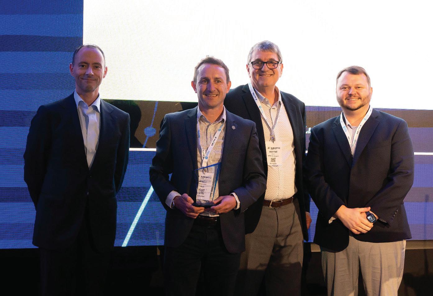
This award recognizes a presenter whose visual submission translated technical research into an accessible and relevant format. The poster delivered actionable insight. Its message was clear, organized, and compelling.
• Recipient: Rafiah Ayandipo
• Title: REVERSE SEPARATE SHORE END
• Summary: The paper introduces RSSE, a novel shore-end installation method that increases flexibility and reduces weather-related delays by pulling cable offshore from land rather than relying on vessel-based deployment.
This award is given to a professional who is new to the submarine cable industry. The work may have been submitted as either an oral or poster presentation. The winning submission demonstrated significant originality, strong execution, and future potential.
• Recipient: Quynh Nguyen
• Title: SUBMARINE CABLE END-OF-LIFE SCENARIOS: REUSE, RECYCLING, DISPOSAL
• Summary: The study evaluates the environmental, economic, and regulatory impacts of submarine cable reuse, recycling, and in-situ disposal, concluding that while reuse offers short-term benefits, recycling is the most sustainable long-term strategy.
Each recipient receives an engraved award and certificate. Their work is featured in this issue of SubTel Forum
The selection process for the Excellence in Industry Awards is highly competitive. Every abstract submitted to SubOptic is reviewed by at least ten independent experts. These experts are selected from a global panel of more than 80 reviewers, overseen by the SubOptic Programme Committee.
Acceptance into the SubOptic program is an achievement in itself. Recognition through a SubTel Forum award signifies work that stands out even among the best.
The historical record of award recipients provides more than recognition. It documents the changing nature of the industry. The focus has evolved from signal capacity to system resilience, from infrastructure hardware to data-driven operations.
Topics explored by past winners include lifecycle management, automated network design, fiber health monitoring, digital interfaces, and climate risk mitigation. Each winner has addressed pressing challenges. Each has presented results that inform future systems.
The Best Newcomer Presentation Award, in particular, highlights new talent entering the field. These professionals bring energy, creativity, and fresh perspectives. Their work signals future directions for engineering, policy, and investment.

The 2025 edition of SubOptic took place during a time of global transition. Network owners are rethinking sovereignty. Governments are updating security frameworks. ESG criteria are being incorporated into infrastructure procurement. Artificial intelligence is being introduced across operational layers.
The 2025 award winners did not avoid these issues. They addressed them directly. They offered models for carbon-aware systems. They presented new strategies for predictive resilience. They demonstrated how automation, regulation, and engineering can align.
These presentations will shape boardroom decisions, procurement evaluations, and regulatory frameworks. They will influence how networks are designed, protected, and governed.
SubTel Forum extends appreciation to the SubOptic 2025 Program Committee and all technical reviewers. The integrity of the awards process depends on their insight and impartiality.
We thank all presenters. Only a small number receive formal recognition. Still, every accepted submission contributes to the advancement of the field. The strength of this community lies in its willingness to share knowledge and challenge norms.
The Excellence in Industry Awards are not a ceremonial gesture. They represent an ongoing effort to highlight quality and raise the professional standard. SubTel Forum will continue this tradition at future SubOptic events. The awards will evolve with the industry. The mission remains unchanged.
To this year’s recipients, congratulations. To the wider community, thank you. The work continues. STF
WAYNE NIELSEN is the Publisher of Submarine Telecoms Forum and Managing Director of WFN Strategies. He has over 40 years’ experience documenting and supporting the growth of the global submarine cable industry.

In 2024, Meta and Saildrone collaborated to evaluate the capabilities of the 20-meter Saildrone Surveyor Uncrewed Surface Vehicle (USV) during a 26-day demonstration in the North Atlantic, covering 4,500 km (plus 2,000 km of transit) without any port calls or outside assistance. Conducted in June and July, the demonstration took place along previously surveyed cable routes, thus allowing for direct comparisons in terms of progress rates, line keeping, data quality, and coverage. Water depths ranged from 900 m to 5,500 m, with the latest Kongsberg EM304 MKII multibeam sonar used to capture seabed data over a swathe of up to 10 km in width. Metrics on fuel consumption and environmental impact demonstrated greenhouse gas emissions were more than 50 times lower than that of a conventional survey vessel over the same distance1. A Starlink satellite link was used for real-time data analysis and communications. This paper will discuss the advantages of Saildrone’s wind-assisted, unmanned platform, which could potentially revolutionize deep-water route surveying. It will also discuss the future developments necessary to meet the demands of subsea telecommunications projects.
Uncrewed Surface Vehicles have been deployed for over a decade to perform various marine data collection and surveillance operations. Their capability has until now been restricted to carrying relatively small payloads and low power
consumption sensors. This precluded them from observing the deep ocean seafloor. The Saildrone Surveyor is the first in a new generation of uncrewed surface vehicles (USV) engineered for deep-ocean mapping and environmental data collection. Measuring 20 meters (65 feet) in length, it stands as the largest USV in Saildrone’s fleet, designed to autonomously conduct extended offshore missions (of up to three months) while gathering high-resolution bathymetric data. Equipped with a Kongsberg EM 2040 and EM 304 multibeam sonar systems, an acoustic Doppler current profiler, and a suite of environmental sensors, the Surveyor canmap the seafloor to depths of up to 11,000 meters.
The Saildrone Mission Portal (Figure 2) is a web-based
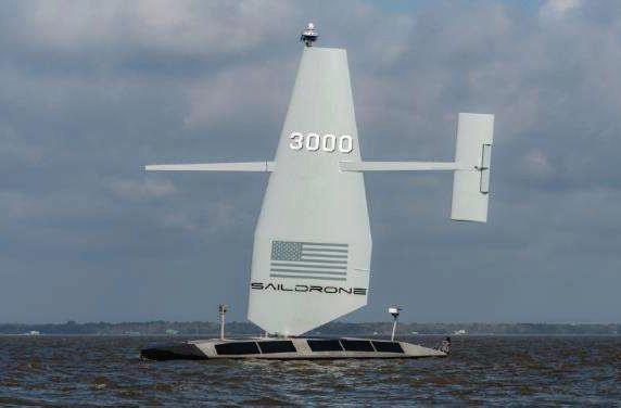
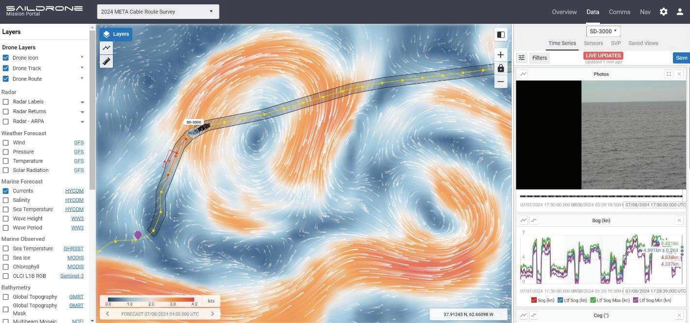
control center that enables pilots, hydrographic surveyors, and mission partners to monitor vehicle progress, view real-time data, and communicate with mission managers. Pilots track vehicle telemetry for drone health and environmental conditions and use radar, camera, and Class B AIS systems to assess maritime traffic. On- watch hydrographers have full access to the Kongsberg Seafloor Information System, allowing them to monitor data acquisition, adjust sonar settings for optimal performance, and provide feedback to pilots when features of interest are identified and require further investigation.
The objective of this demonstration was to assess the use of the Saildrone Surveyor USV for conducting deep-water cable route surveys, focusing on evaluating its current capabilities and identifying areas for future development to position it as a viable alternative to traditional deep-water survey vessels. The operational efficiency of
the Surveyor was assessed, including mission planning, navigation, data acquisition, and data processing through the Saildrone Mission Portal. Additionally, the demonstration analyzed the vehicle’s capacity to navigate complex underwater topographies and identify features of interest crucial for cable route planning.
The project also evaluated the operational sustainability and cost efficiency of using a wind- and solar-powered USV for extended offshore missions, considering its endurance, power management, and overall cost- effectiveness
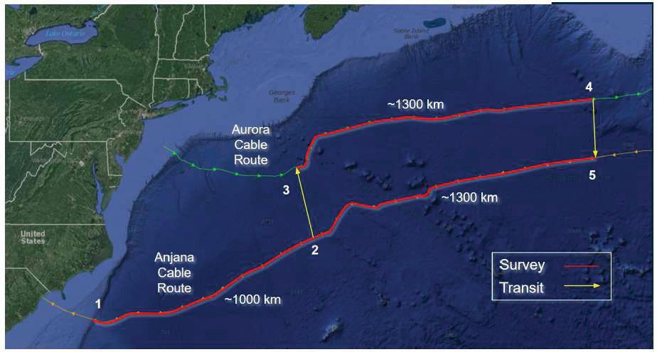
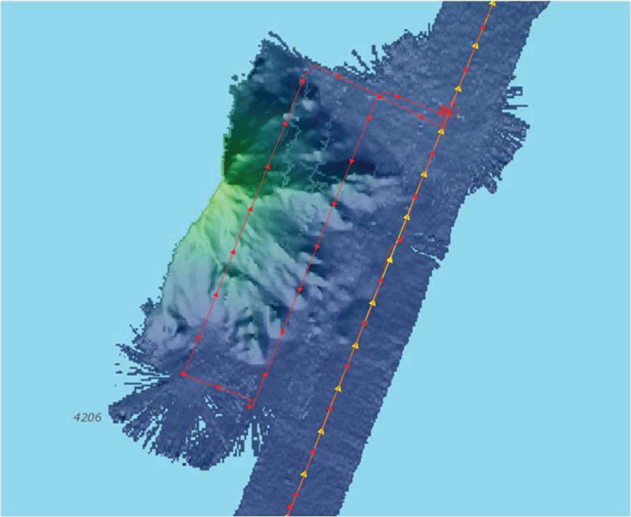
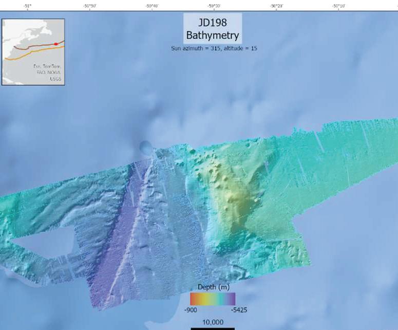
compared to traditional crewed survey vessels. The ability to minimize Health, Safety, and Environmental (HSE) risks associated with offshore operations, such as eliminating the need for an onboard crew, was a critical focus. The effectiveness of satellite connectivity and remote monitoring to maintain communication and ensure safety in challenging offshore environments was also assessed.
By analyzing these factors comprehensively, the objective was to gain a clear understanding of the Saildrone Surveyor’s present capabilities and identify advancements needed to establish it as a cost- effective, sustainable, and reliable solution for deep-water cable route surveys.
To design a demonstration that effectively showcases the capabilities of the Saildrone Surveyor, the North Atlantic was selected as the target region. This area is a critical zone for key telecommunications routes and presents a representative example of the challenging marine conditions often encountered during deep-water cable route surveys. The North Atlantic is characterized by frequently changing weather patterns, dynamic surface ocean currents, diverse seabed features, and typical trans-oceanic distances—making it an ideal test environment.
For a direct comparison of the Saildrone Surveyor’s performance against traditional crewed survey vessels, the demonstration focused on collecting bathymetric data along the established Anjana cable route and the recently surveyed Aurora route. These routes provided valuable reference data for comparative analysis, enabling a thorough evaluation of the Surveyor’s data quality, accuracy, and operational efficiency.
This project marks the first-ever uncrewed surface vehicle (USV) bathymetric survey conducted to support the development of a deep-water cable route. The primary goal of this trial was to collect deep-water bathymetric data to assess the Saildrone Surveyor’s capabilities and limitations in meeting Meta’s key objectives of data quality, coverage, and near-real-time accessibility. The results are provided in Table 1.
Table 1. Operational Objectives
Over 45 days, including pre- and post-survey transit and calibrations, the Saildrone Surveyor covered a distance of 7,500 km. Operating under both sail and motor-sail, its speed ranged from 2 to 8 knots, with an average speed of 3.8 knots. The diesel engine was used for both battery
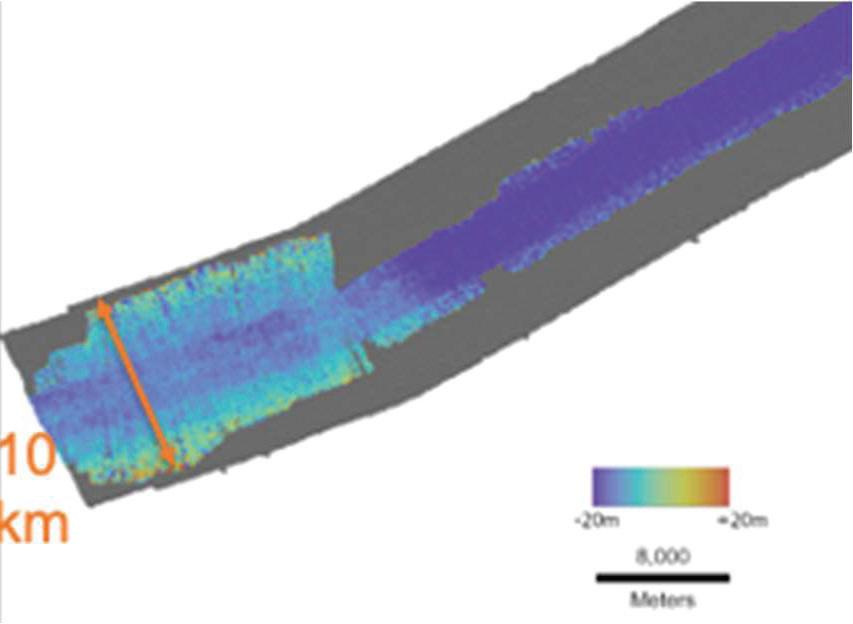
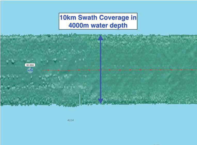
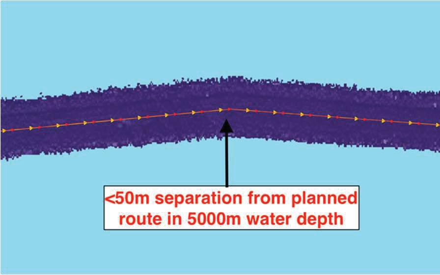
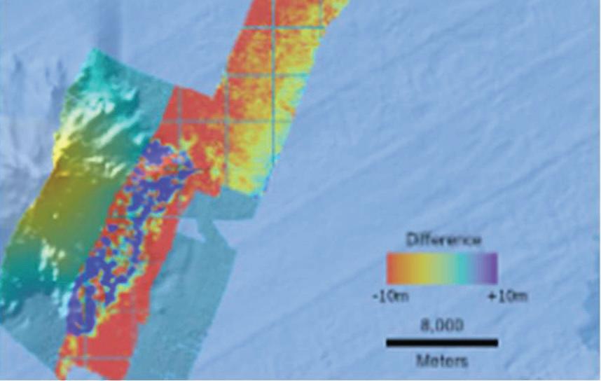
charging and propulsion, running for a total of 480 hours and consuming only 350 gallons of fuel. With a 600-gallon fuel capacity, the vessel had enough fuel remaining to survey approximately another 5,000 km.
A crucial aspect of cable route development is the ability to react in real time to investigate subsea features—such as seamounts and canyons—that could impact the optimal path. The Saildrone Surveyor’s Starlink connection enables near-real-time data download, allowing clients to evaluate the data and promptly request additional wing-line data collection if needed. Through the Mission Portal, clients can directly communicate with Saildrone’s piloting and bathymetry data collection team, enabling them to quickly re-task the vehicle to conduct targeted wing-line surveys for more detailed assessment of the feature. Figures 4 & 5 provide examples of wing-lines coordinated in real-time to investigate topographic features adjacent to the Aurora cable route.
During the initial trial run, swath width under sail proved to be the most efficient, achieving coverage equal to ~80% of legacy survey vessels and achieving a 10km swath at 4,000m depth. With the motor engaged the swath width was reduced by ~40% (Figure 6).
Post-survey, Saildrone made improvements to significantly reduce both the electrical and mechanical noise, resulting in the ability to achieve a 10km swath at 4km water depth both under sail and motor-sail. Additionally, the new propeller proved to be more fuel efficient and averaged 6 kts at 35% thruster. Figure 7 shows the swath coverage while testing, during which the vehicle propulsion configuration was switched from sail to motor-sail multiple times.
Throughout the course of the survey the vehicle was able to maintain track (red line) with a maximum 50m offset from the planned route (yellow line).
Data was subtracted from existing survey data on Anjana
and Aurora to produce ‘difference grids’. In ~5,000m water depth the Saildrone matched the baseline legacy data to +/10m in most areas (0.2%):
Saildrone partnered with RightShip to conduct a Greenhouse Gas (GHG) analysis following the 2023 guidelines established by the World Business Council for Sustainable Development (WBCSD) for quantifying avoided emissions. The study used the RV Geo Resolution, NOAA Ships Thomas Jefferson, and Okeanos Explorer as reference vessels, as they are equipped with representative sonar suites for deep-water surveying. The analysis estimated that deploying the Saildrone Surveyor instead of these traditional survey vessels could avoid 243.32 tons of CO₂ emissions, representing a 98% reduction in greenhouse gas emissions.
force. The next generation of professionals, who may seek a better work- life balance or prefer more stable, land-based roles, may find remote operations more appealing3. It also accommodates more experienced industry members whose personal circumstances—such as childcare, eldercare responsibilities, or physical disabilities—may limit their ability to work offshore. By offering flexible, remote work opportunities, the industry can retain experienced talent while also attracting new professionals who may not have considered maritime careers in a traditional offshore capacity. This shift not only expands the talent pool but also fosters a more inclusive and dynamic workforce for the future of offshore surveying and route development.
Beyond reducing Health, Safety, and Environmental (HSE) concerns, the use of uncrewed surface vehicles (USVs) like the Saildrone Surveyor brings significant benefits to the quality of life for hydrographic surveyors, cable route engineers, and client representatives. Traditionally, these professionals needed to spend extended periods at sea to collect and analyze data, often facing challenging and sometimes hazardous conditions. By leveraging USVs, they can now perform their work remotely from shore-based offices or home offices, reducing time away from family and minimizing the physical and mental strain associated with offshore deployments2
Deep-Water ASVs also open the possibly to use local survey assets or vessels of opportunity (mobilized with transportable survey equipment) to map the shallow water sections. This was not previously a viable option when the main survey vessel equipped with a deep-water sonar would reach the shallow water part at the beginning and end of each transoceanic crossing and could complete both scopes. This alternative approach further reduces the overall carbon footprint (by negating transits between projects) and creates opportunities for survey companies without deep-water capable vessels to complete in the subsea telecoms survey market. The Saildrone can be transported by sea and, as the Surveyor fleet grows, will be strategically pre-positioned, enabling efficient support for projects worldwide.
By leveraging USVs, they can now perform their work remotely from shore-based offices or home offices, reducing time away from family and minimizing the physical and mental strain associated with offshore deployments.
Additionally, reducing the need for at-sea deployments broadens access to these careers, making the field more inclusive and attractive to a larger and more diverse work-
The Saildrone Surveyor has proven itself capable of meeting the requirements for supporting deep-water cable route surveys. There are areas for future development that could further enhance its performance, expand its operational scope, and strengthen its position as the future of deep-water cable route surveying. By addressing these opportunities, the Surveyor could become an even more versatile and competitive alternative to traditional survey vessels.
During the course of the demo the Surveyor’s performance was primarily tested in conditions up to Beaufort
scale 4-5. Future testing in more severe weather conditions will help determine its resilience and expand its operational range in harsh environments.
The Surveyor demonstrated an impressive, unparalleled USV endurance powered primarily by wind and solar energy. This is sufficient for surveying all trans-oceanic cable route distances. Future advancements in battery technology, solar efficiency, and the potential integration of hydrogen fuel cells could significantly extend its capability by provid ing more power to support different payloads.
Moving Vessel Profilers are too heavy and power intensive to be well suited for conducting Sound Velocity Profiles from a USV. Incorporating expendable bathythermographs (XBTs) could enhance data quality and reduce time off survey to conduct SVP, particularly in complex environments. Additionally, advancements in software-based sound velocity modeling could also improve real-time corrections and data accuracy.
Collaborating with regulatory bodies to develop clear guidelines for USV operations in shared waters will ensure safe and lawful navigation, especially in high-traffic or restricted zones.
Through refinements in these areas, the Saildrone Surveyor can expand its operational versatility, extend its mission scope, and solidify its role as agroundbreaking solution for deep-water cable route surveying. STF


ANDY PALMER-FELGATE is a submarine cable engineer at Meta, supporting the technical delivery of major systems including HAWAIKI, JUPITER, and BIFROST. With prior roles at Vodafone and Nokia, he brings experience across engineering, client representation, and marine surveying. Andy holds degrees in Marine Geophysics and Ocean Science, is a certified hydrographic surveyor, and has published work on cable maintenance and network resilience.
RICHARD “KITCH” KENNEDY is an ocean technology innovator and program manager with over 20 years of experience in undersea cables, ocean mapping, and maritime operations. As Director of Program Management at Saildrone Inc., he leads efforts in autonomous ocean mapping to support sustainable marine infrastructure. A U.S. Naval Academy graduate and former Navy officer, Kitch brings deep expertise in hydrography, defense programs, and strategic maritime planning.
Improved command and control systems with advanced object avoidance using artificial intelligence (AI) and voice- over-IP (VOIP) communication via VHF could be employed to improve operations in areas of heavy maritime traffic, static gear fishing grounds, etc.
As USVs become more common, compliance with international regulations like the Collision Regulations (COLREGs) and local maritime regulations will be crucial.
REFERENCES
RightShip, “Saildrone GHG Emission Analysis – META Fiber Optic Cable Mission 2024”, 19 February 2025.
Bazazan, Ahmad et al.
“Physical and psychological job demands and fatigue experience among offshore workers.” Heliyon, Volume 9, Issue 6, e16441, June 2023.
Ardi, Cahyadi et al. “Talent attraction through flexible work anytime from anywhere.” Journal of Infrastructure, Policy and Development 2024
BY RAFIAH AYANDIPO
Reverse Separate Shore End (RSSE) is a novel shore end installation methodology designed to reduce operational risks associated with adverse weather conditions. Like the conventional Separate Shore End (SSE), RSSE does not require the cable lay vessel (CLV) on site during installation. However, RSSE differs in that the cable is pulled to a predetermined location offshore from a container or reel situated onshore. Decoupling the CLV schedule from the shore end operations increases flexibility, allowing installation to be planned for optimal conditions.
This paper introduces RSSE, highlighting its advantages and considerations for implementation. Insights from recent installations are discussed, providing a foundation for refining the methodology and successful implementation at varying landing sites. This paper aims to establish RSSE as a standard methodology for shore end installations.
Shore end operations cover the installation, testing and protection of submarine fibre optic cables from the beach manhole (BMH) to shallow water depths. The installation method depends on whether a cable lay vessel (CLV) is present during operations.
A Direct Shore End (DSE) involves pulling the submarine cable onshore directly from a CLV usually positioned at the 15-20m water depth (WD) contour. In contrast, a Separate Shore End (SSE) uses a shallow-draft vessel
that can safely operate in 3-5m WD. This vessel lays to the 15-20m WD contour after the cable is pulled ashore. The cable end is then temporarily secured to the seabed with a streaming arrangement (clump weight, rope, swivel, marker buoy and other rigging). SSE is typically used when the distance from the beach to the 15-20m WD contour is too long for an optimal DSE installation. The general limit for a DSE is 2,500-3,000m.
Shore End operations are the most weather sensitive phase of marine cable installation, with delays often caused by adverse weather conditions. To address this challenge, the Reverse Separate Shore End (RSSE) installation methodology – has been developed. It offers an alternative to DSE, where operational risks associated with adverse weather conditions can be reduced.
As with the conventional SSE methodology, RSSE does
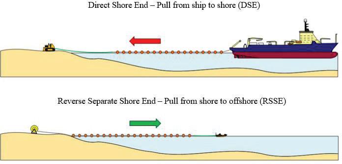
not require the CLV on site during shore end installation. However, RSSE differs in that the cable is pulled offshore from a container or reel positioned onshore, to a pre-determined location – typically in 15-20m WD.
The schematic for a conventional SSE will be similar to that of a DSE but with a shallow- draft vessel positioned closer to shore.
This methodology enables the CLV and shore end operation schedules to be managed independently. Shore end installation can be completed ahead of CLV arrival, avoiding the cost of delays to land, shore end and CLV teams. The increased scheduling flexibility allows operations to be planned outside unfavourable seasonal windows while also accommodating constraints at landing sites. Such constraints include beach closures during peak tourism periods and ecological activity like turtle nesting.
Unlike the conventional SSE, an RSSE operation does not need a shallow-draft vessel. This further reduces reliance on vessel availability, simplifies operations and avoids marine constraints associated with the additional vessel. As a result, claims for stand-by due to weather or permitting challenges are minimised and in most cases, avoided. Additionally, resource availability and utilisation are more predictable, improving overall project efficiency.
As with the other shore end methodologies, site specific conditions such as current, surf zone, environmental and seasonal restrictions and number of alter-courses (AC) in the cable route must be evaluated to determine RSSE suitability for a landing site. Additional factors include:
• Site access and space available – Requires a larger footprint for additional equipment, including a cable container, linear cable engine (LCE) and mobile crane, positioned close to BMH/headwall.
• Infrastructure - May not be suitable for landings through a horizontally directional drilled duct (HDD). Cable length to be installed must be weighed against HDD length and floats may need to be added offshore which will extend the operation.
• Cable shipping and handling – Decisions must be made on how the cable will be delivered to site and approach for handling it during installation.
• Logistics – Requires additional planning for transporting cable and installation equipment not typically used in DSE operations.
• Subcontractor experience – Familiarity with the RSSE methodology is a key factor in execution efficiency.
Weather limitations remain unchanged as the most weather sensitive aspect of the operation is still diving activities.
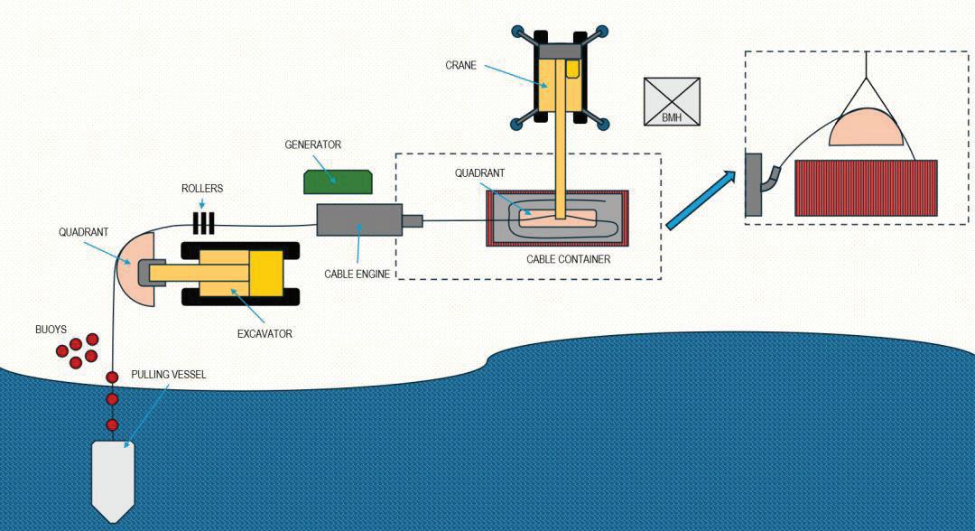
While RSSE requires additional land-based personnel and equipment, the cost is generally lower than those associated with CLV downtime. In comparison to a DSE, additional cable security is required as well as a jointing operation when the CLV recovers the cable. This is also the case for a conventional SSE.
The feasibility of early installation is dependent on permit availability, cable manufacturing schedule and timely delivery of materials to site.
As with a traditional shore end, a pre-lay survey is conducted before the cable landing to check for obstructions along the planned cable route. If present, AC points are marked and hold-back anchors installed.
See figure 2 for a standard RSSE landing site layout. The cable, delivered in a container or on a reel, is placed close to the BMH. A cable runway is then constructed, consisting of:
• Quadrant – Maintains the cable’s minimum bend radius as it exits the container and enters the LCE.
• Swan neck at LCE entrance - Further guides the cable into the LCE.
• Linear Cable Engine (LCE) - Aids cable payout and pull offshore by a workboat.
• Deadman anchor (DMA) – A quadrant attached to an excavator that may also act as a beach stopper and pivot point. This also removes the cable pivot point at the LCE exit.
• Cable rollers - Placed where required to guide the cable and reduce friction on the beach surface.
Once the cable end is pulled through the runway, a connection is made with a swivel and pulling line, allowing a workboat to begin pulling it offshore. Floats are attached from the beach as the boat moves offshore along the planned route. At the pre- determined offshore location, pulling is halted, and the cable end is attached to the recovery line/ streaming arrangement before being deployed to the seabed.
Afterward, the procedure follows that of a traditional shore end:
• Cable is positioned on AC points
• Floats are removed and the cable is lowered onto the planned route
• Post-lay survey is conducted with repositioning if necessary
• Cable is inserted into the BMH, tested and secured
• If within scope, articulated pipe protection is installed seawards from the beach, and burial or stabilisation with clamps is completed.
• Site reinstatement and demobilisation
• At a scheduled date after the shore end landing, the cable end will be recovered by the CLV and an initial splice completed before commencing lay-away.
Recent experience in implementing the Reverse Separate Shore End methodology has provided valuable insights into improving the approach to its execution. These lessons highlight aspects that influence operational efficiency and success of the installation.
A well-planned layout prior to the start of operations is vital. Positioning the cable container close to the BMH ensures easy access and cable manipulation into the manhole without need to relocate major equipment during the operation.
Preventing water ingress in the cable is critical. An end cap seal must be fitted to the offshore end of the cable. Failure to do so increases the time for the splicing operation when the CLV recovers the cable. The affected section would need to be stripped back as the cable core must be completely dry before proceeding with the splice.
A bottleneck for this methodology is the attachment of floatation on the cable. To speed up this part of the process, the cable may be elevated using rollers. Time taken can be further reduced by ensuring there is adequate space between the DMA and waterline, allowing multiple buoys to be attached simultaneously.
Finally, the optimal pull length has been determined to be 2km or less. This is dictated by the restrictions on pulling speed and daylight hours working window.
The RSSE methodology presents a viable alternative to the DSE, offering greater flexibility and reducing operational delays associated with adverse weather and the CLV schedule. While its implementation requires careful planning – particularly in site layout, cable handling and floatation attachment – recent experience has demonstrated that these challenges can be effectively managed. By incorporating lessons learnt from past installations, the methodology can continue to be refined, ensuring it remains a practical and efficient solution for shore end cable landing operations. STF

RAFIAH AYANDIPO is a certified PMP and PRINCE2 Agile Project Manager at ASN, leading subsea and terrestrial optical fiber deployments. With a background in chemical engineering from Imperial College London and experience at Equinor and BP, she combines technical expertise with agile leadership to deliver complex infrastructure projects efficiently.

BY QUYNH NGUYEN
ABSTRACT:
This paper compares three end-of-life (EoL) scenarios for submarine telecommunication cables – reuse, recycling, and in-situ disposal – across both deep-sea and shore-end segments. Environmental, socio-economic, and regulatory dimensions are analyzed using technical insights and stakeholder interviews. While reuse currently offers the highest sustainability and socio-economic value, it is inherently a temporary solution, as cables cannot be repurposed indefinitely. In the long term, cable recovery and recycling emerge as essential strategies for responsible lifecycle management. This study provides a framework for assessing EoL options and supports industry efforts toward more circular and future-ready subsea infrastructure.
As sustainability becomes a growing priority in the subsea telecommunications industry, the management of obsolete submarine cables at their end-of-life (EoL) is gaining unprecedented attention. Historically, the standard practice has been in-situ disposal, where retired cables are left unused on the seabed. However, with over 100,000 kilometers of new cables being installed annually – often along routes already occupied by older cables – the seabed is becoming increasingly congested. This spatial pressure is causing stakeholders to reconsider how they manage cables when they are no longer in use.
Emerging alternatives like reuse and recycling offer new
possibilities but also come with distinct environmental and socio- economic trade-offs. This raises a critical question: How can stakeholders assess which of these EoL scenarios is the most practical and sustainable, especially considering the unique challenges posed by deep-sea versus shore-end cable segments?
This paper systematically compares these EoL scenarios, focusing on environmental impacts and socio-economic considerations, thus supporting improved decision-making for the future of subsea telecom cable decommissioning.
So far, there hasn’t been a universally agreed-upon figure for the total length or quantity of cables laid since the dawn of the subsea industry. According to historical sources, approximately 3.7 million kilometers of subsea cables have been installed to date, comprising of about 25% telegraph cables, 10% coaxial cables, and 65% fiber-optic cables. These numbers may be conservative estimates, considering a potentially large but unknown number of military cables.
Recent technological advancements, coupled with the rapid growth in global data demand, suggest that submarine cable deployments will accelerate significantly. TeleGeography (2022) reported that popular routes such as the Trans-Atlantic will anticipate a 77-fold data growth in 2028 as compared to its 2015 baseline. With major cable manufacturers reporting constant order backlogs, this trend is likely to continue.
Although subsea cables occupy minimal space on the
seabed, geographic constraints limit viable routes and landing points. While some efforts are being made to diversify routes, these remain small-scale and have not yet provided a common solution for most cables. Consequently, seabed spatial congestion is a substantial and growing global issue, particularly in the Trans- Atlantic, Mediterranean, and Asian hubs such as Singapore.
While most experts agree that seabed congestion requires urgent and improved EoL management, opinions diverge on the severity of regulatory impacts. Marine service providers and cable operators tend to perceive regulations as increasingly restrictive, while permitting consultants often argue that current regulations have not significantly tightened or caused meaningful operational disruptions.
Regulatory frameworks governing subsea cable management vary significantly depending on the location of the cable segment, whether it is in the high sea, EEZ, or within the territorial waters.
For deep-sea cables, regulations remain minimal but are expected to become more stringent over the next decade. Currently, international governance primarily falls under the United Nations Convention on the Law of the Sea (UNCLOS). Ongoing negotiations related to the Biodiversity Beyond National Jurisdiction (BBNJ) treaty indicate that regulatory requirements will likely intensify. Additionally, subsea cables are receiving increasing attention within broader UN discussions such as UN One Ocean. Industry-led organizations such as the International Cable Protection Committee (ICPC), European Subsea Cables Associations (ESCA), alongside various subsea industry experts, are therefore actively participating in all of these discussions to represent and advocate for the industry’s shared perspective.
guidelines, and some have no clear regulatory framework at all.
There appears to be no clear correlation or coordination in regulatory approaches between neighboring countries, even those with similar economic ambitions. For example, two EU countries share similar goals of positioning themselves as data hubs. One implements stringent regulations and high permitting fees for landing points, while the other one offers more flexible terms and lower fees to attract cable owners. Nonetheless, the strategic geographical position of landing sites remains a more decisive factor for becoming a data hub than regulatory cost, as permits typically represent just 0.5% to 2% of total deployment costs.
Shore-end cables are subject to more localized regulations, which differ widely between coastal states. For instance, some countries like UK and France have established strict and clear regulations for both deployment and decommissioning, while others rely on non-binding guidelines, and some have no clear regulatory framework at all.
Among the three EoL scenarios, in-situ disposal - leaving cables permanently on the seabed - has historically been the most common practice, primarily due to its simplicity and low cost. However, this scenario is changing due to rising sustainability concerns. While many interview participants support reconsidering this practice, others remain hesitant, largely because of the ongoing uncertainty about the environmental impacts and regulatory obligations associated with cable removal.
Shore-end cables are subject to more localized regulations, which differ widely between coastal states. For instance, some countries like UK and France have established strict and clear regulations for both deployment and decommissioning, while others rely on non-binding
A minority of interview participants noted that, theoretically, out-of-service cables should not be left permanently on the seabed for several obvious reasons. However, in practice, challenging this scenario is nearly impossible, especially for much older cable systems. Two main barriers exist: first, older cable systems often make it difficult to identify the current owners responsible for their removal; second, cable owners frequently lack sufficient budget to finance removal operations. Consequently, the decision to remove older cables heavily depends on whether cable recyclers see enough profitability in recovering the cables. Shore-end cable removal is particularly challenging due to complex licensing requirements, high operational costs, and less attractive cable material compositions for recycling. Regarding regulations for deep-sea cables, governance
is primarily under UNCLOS. Currently, UNCLOS does not specifically address decommissioned cables, resulting in ambiguity and differing interpretations. Most interviewed experts consider deep-sea cables environmentally benign, arguing that leaving them in-situ does not violate UNCLOS as liability remains with the cable owners. However, some stakeholders counter that leaving cables permanently on the seabed might be classified as “ocean dumping”, which UNCLOS explicitly prohibits. Future clarity is expected through the BBNJ treaty, which will likely specify required actions for managing decommissioned cables in deep- sea environments. However, this treaty is still under negotiation and is not expected to take effect for another 5-10 years.
Shore-end regulations vary significantly by country. In some nations, there are no formal regulations; decommissioned shoreend cables simply remain in place, with cable owners often paying a reduced leasing fee until recovery. However, this fee is typically insignificant compared to potential profits from reselling landing sites, giving cable owners little financial incentive for immediate removal. Furthermore, very old cable systems – especially those dating back to the telegraph era – typically lack clear regulations, mainly due to difficulty identifying current owners. By contrast, countries with established regulations generally follow a straightforward “one-in, one-out” policy, meaning new cables must replace rather than add to existing ones. Countries with non-binding guidelines attempt to follow a similar principle but lack enforceable power to ensure consistent adherence. There remains significant uncertainty around the environmental implications of leaving cables permanently on the seabed. Current scientific evidence suggests that fiber-optic and coaxial cables are generally inert and unlikely to cause harm when left undisturbed over a long period of time. However, a recent study highlighted persisting uncertainties regarding the long-term degradation mechanisms of high-density polyethylene (HDPE) and low-density polyethylene (LDPE) sheaths on subsea cables exposed to seawater (Ghanadi and Padhye, 2024). Similarly, there is insufficient evidence about the degra -
dation of older telegraph cables, although some recovered cases may offer insights.
For shore-end cables, environmental benefits or harms from in-situ disposal depend heavily on local conditions. If cables are buried under sediment or already supporting marine life, leaving them untouched is generally considered beneficial or neutral— although the optimal time for leaving them in place remains unclear and requires ongoing monitoring. Conversely, cables lying exposed on the seafloor can be snagged, resulting in materials leaching into the marine environment. More empirical studies are necessary to reliably assess the environmental trade-offs of in-situ disposal for shore-end cables.
From a socio-economic standpoint, the only clear advantage of in-situ disposal for cable owners is the immediate cost savings from avoiding expensive removal operations, particularly at shore-end locations. Beyond that, the socio-economic implications remain uncertain.
From a socio-economic standpoint, the only clear advantage of in-situ disposal for cable owners is the immediate cost savings from avoiding expensive removal operations, particularly at shore-end locations. Beyond that, the socio-economic implications remain uncertain.
The reuse (or repurpose) scenario involves extending the operational life of subsea cables by redeploying them for a different purpose, system, or route after their initial use.
Reuse typically begins with a technical assessment. For a cable to qualify, it must have a low historical fault rate and sufficient spare cables and optical equipment available for future repairs. Determining practicality also depends on market demand and the broader system context – particularly whether reuse meets operational and financial goals.
In practice, shore-end reuse is often adopted when cable investors wish to avoid delays associated with obtaining landing permits for new installations, provided the existing shore-ends meet technical requirements. Another common situation is using retired shore-ends to connect smaller islands or coastal areas in shallow waters. This option often makes more economic sense than deploying entirely new cable systems, especially when shorter lengths are required. Deep-sea reuse usually occurs when budget constraints limit the feasibility of new builds, or when the objective is to connect remote areas with low data demands. Some
systems have also been repurposed for scientific research or environmental monitoring, providing value beyond commercial connectivity.
However, technological evolution raises questions regarding the future feasibility of reuse. Currently, industry fiber pair increase trends have capped around 24 fiber pairs within a cable core. While adding more pairs to the cables are technically possible, most experts do not foresee further increases in the next 5-6 years, primarily due to current backhaul infrastructure limitations.
Emerging cable core technologies, such as multi-core and hollow-core, could alter reuse dynamics, though precisely how and when these technologies might affect reuse feasibility remains uncertain.
Despite these limitations, most experts agree that reuse will remain valuable – especially in remote or underserved regions where new systems are not economically viable. Satellite internet solutions may be a strong competitor in some of these geographically challenging areas, but reused cables can still offer stable, long-term connectivity in many cases.
Regulatory requirements for reuse depend on jurisdiction and intended application. In national jurisdictions, reusing a shore-end cable in its existing location usually involves a simple ownership transfer, while relocating a shoreend cable for reuse elsewhere typically requires slightly more administrative paperwork. Industry organizations such as ICPC and ESCA also offer best-practice recommendations.
In the recycling scenario, decommissioned submarine cable systems are recovered and recycled into secondary raw materials or repurposed for other applications. This process typically involves specialized cable recycling companies, which either own or charter dedicated ships equipped to retrieve cables from the seabed and deliver them directly to recycling facilities. Most of these companies also operate their own recycling plants, allowing them to control the entire recovery and recycling process. However, the procedures for deep-sea and shore-end cable recycling differ significantly.
Deep-sea cable recovery is generally straightforward. A recovery vessel equipped with a winch, a bowl roller and other specialized gears sails out to the sea, retrieves the cables and transports them to recycling facilities. At these facilities, cable layers are stripped, materials are separated and then processed into secondary raw materials.
While extending the life of cables through reuse clearly conserves resources and reduces emissions, minor questions remain about energy efficiency and maintenance needs. In addition, some stakeholders caution that reuse solution for a decommissioned system may also be used to postpone responsibility for true end-of-life decisions – particularly when cable ownership is transferred as part of the repurposing process. While not a dominant view, this perspective reflects a broader industry concern that reuse should complement, not replace, long-term decommissioning planning.
Deep-sea cable recovery is generally straightforward. A recovery vessel equipped with a winch, a bowl roller and other specialized gears sails out to the sea, retrieves the cables and transports them to recycling facilities. At these facilities, cable layers are stripped, materials are separated and then processed into secondary raw materials. Since deep-sea cable materials are generally well-preserved and of extremely high quality, they have robust market demand once recycled. In contrast, recovering and recycling shore- end cables pose considerable logistical and processing challenges. Recovery operations require additional specialized vessels, vehicles, equipment, resources and energy. Heavily armored shoreends also require a more complex recycling process and additional waste treatment as compared to their deep-sea counterparts.
Recovery and recycling of telegraph cable systems are also challenging. Precisely pinpointing their current position on the seabed can be difficult, and once recovered, these cables often deteriorate rapidly, further complicating recycling efforts.
Recovery regulations are similar to those mentioned in reuse scenario, while recycling regulations of subsea cables primarily revolve around standard recycling facility operations. Recycling companies must adhere to local environmental, occupational health, and safety regulations. Beyond that, there are various guidelines that encourage ethical labor practices, transparency in sustainability reporting and avoidance of “greenwashing.” Most cable materials are
considered non-hazardous, requiring minimal additional regulatory oversight. However, coaxial cables and certain fiber- optic cables deployed before 1995 may contain trace radioactive elements within repeaters, requiring special handling licenses.
Environmental impacts of cable recycling vary significantly between deep-sea and shore-end cables. According to reports from cable recovery and recycling companies, recycling deep-sea cables has generally shown clear environmental benefits, as the energy required to recover and recycle these materials is far lower than extracting and processing virgin raw materials. However, there is an important threshold to consider: at what point—measured by cable length or material volume—does the environmental benefit of recycling clearly outweigh the energy and resource costs of recovery?
On the other hand, the environmental impact of shoreends in this scenario is far less predictable, thus requiring case-by-case assessments. Factors like cable burial depth, potential disruption to marine sediments, and the presence of marine ecosystems on the cables must all be considered.
In situations where cables are deeply buried or have become part of an established marine ecosystem, recovery could cause significant environmental disruption. These cases require careful evaluation to see the extension of the impact. When shore-end cables lie exposed on rocks without substantial marine growth and are not located within marine protected areas (MPAs), their recovery is likely to have negligible environmental effects.
Due to the wide variety of local marine conditions, universal guidelines are difficult to establish. Instead, recovery decisions should be based on site-specific
Environmental Impact Assessments (EIAs) and expert consultation with marine ecologists or environmental regulators. Additionally, recycling shore-ends require extensive processes as aforementioned.
Recent industry conversations around circular economy principles raise an important question: Are recycled submarine cable materials reintroduced into cable manufacturing or related industry applications, thus achieving true circularity? Currently, the answer is generally no – not yet. There are no widespread initiatives or strong collaborations between cable manufacturers and cable recyclers to reuse these recovered materials at scale.
Nevertheless, several cable manufacturers have expressed interest in sourcing recycled materials directly from cable recycling companies. Materials such as copper, steel, aluminum, and other metals from recycled cables can theoretically be recycled indefinitely without losing quality if separation and recycling processes are managed well. However, the idea of using recycled plastic in subsea cables raises serious concern among cable manufacturers. Integrating recycled plastic into cables intended for long-term deployment in the ocean remains an understudied area and is currently viewed as too risky by many manufacturers. That said, recycled plastic can still be used in manufacturing other land- based telecom-related equipment owned by cable manufacturers or cable owners, contributing to broader circularity goals. The industry’s discussions on the practicality and risks associated with using recycled materials, particularly plastics, require further technical study and cross-sector collaboration.
The socio-economic benefits of recycling subsea cables are extensive and present solid business opportunities for all involved stakeholders – particularly cable manufacturers, cable owners, and cable recyclers. Typically, recyclers purchase the rights to deep-sea cable sections, allowing owners to monetize retired assets while recyclers profit from the recovery of high- quality materials.
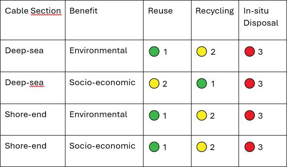
For shore-end sections, which are more complex and costly to remove due to permitting and logistics, recyclers are often compensated by cable owners – especially in jurisdictions that mandate removal.
This study compared three primary end-
of- life scenarios for submarine telecom cable systems, focusing on the distinct characteristics and challenges of deep-sea and shore-end segments. Findings were informed by technical research and interviews with stakeholders across the subsea cable industry.
The table below summarizes the consolidated results from all interviews, assigning each scenario a relative benefit ranking (1 = High, 2 = Medium, 3 = Low) of both environmental and socio-economic benefits for each cable segment.
The overall picture shows reuse as the most beneficial scenario as it extends the functional life of cable systems without the need for new materials, delivering cost savings, sustainability gains and operational advantages. However, it’s important to emphasize that reuse is only a temporary solution. Cables can only be reused for a limited period and must eventually be either recovered or disposed of. Some interviewees expressed concern that reuse may delay necessary planning for long-term recovery, suggesting treating it as part of the lifecycle, not the end of it.
Recycling emerges as the most viable long- term strategy, especially for deep-sea cables. For shore-ends, recycling scenario is more complex, thus requires further assessment on a case-to-case basis. All in all, as environmental responsibility becomes more important across the industry, the case for recycling continues to strengthen.
In-situ disposal is increasingly seen as a less favorable option. It provides little to no socio-economic benefit, and while deep-sea disposal currently appears benign, evolving environmental initiatives will continue to challenge the view in the coming years.
Across all interviews, the most popular suggestion for the future was for better management and record-keeping of cable ownership. As cables increasingly overlap across shared routes, the lack of a clear ownership registry delays operations and increases the risk of damage during recovery or redeployment. Improved coordination would reduce project delays and help operators fulfill good practice protocols - such as notifying cable owners before carrying out work that could impact their infrastructure. Another recurring request was for future-proof planning of decommissioning at the new cable investment phase. Most interviewed participants suggested investors set aside a decommissioning bond as part of the new cable deployment agreement. Some others worried the cost can become unrealistic after 25 years or more of asset lifetime but also noted that early consideration of the details is an important factor in selecting the best strategy in each case.
This study is based on a limited number of expert interviews and currently available data accessible to the author. Ongoing technological changes, as well as regulatory inconsistencies across jurisdictions, may shift the viability of EoL scenarios. Additionally, there is a significant lack of long-term environmental studies on the degradation of various cable types - particularly under different seabed and oceanic conditions. This makes it difficult to generalize environmental impacts, especially for legacy cables in highly variable marine environments.
To address these gaps, further research is needed in several key areas. These include the environmental impacts of in-situ disposal and the recovery and recycling of armored shore-end cables, which remain under- documented. Comparative studies on the energy efficiency and lifecycle emissions of reused versus newly deployed cable systems would also help quantify the true sustainability of reuse. Finally, greater investigation into circular economy pathways - particularly regarding plastics and non-metallic materials in cable systems - could reveal new opportunities for sustainable material reuse and industry innovation.
Looking ahead, the future of subsea cable decommissioning is likely to be more regulated, more transparent, and more collaborative. To accelerate this progress, industry stakeholders are encouraged to invest in improved sustainability reporting and data transparency, which are currently lacking. Collaboration between cable manufacturers and recyclers should be strengthened to explore scalable reuse of recovered materials. At the governance level, regional and global frameworks for coordinating cable recovery, including standardized permitting and compliance, will be essential. Equally important is the development and maintenance of shared registries of cable ownership, which would more efficient planning and minimize delays in operations due to unclear ownership records.
By embracing collaboration, improving data transparency, and embedding sustainability into design and decommissioning practices, the industry has a clear opportunity to lead the transition toward more responsible, circular, and future-ready end-of-life cable strategies. STF

QUYNH D. NGUYEN is Lead Environmental Officer at Oceanic Environmental Cables GmbH, where she supports life cycle assessment, carbon reporting, and sustainability efforts for subsea cable projects. With a background in environmental engineering and prior experience as a Carbon Accountant intern, she focuses on advancing green practices in the submarine telecom sector.
BY ROBERT BRUMLEY AND ALEX VAXMONSKY
As the world becomes increasingly digital, the importance of secure and reliable global communications infrastructure has never been more critical. Submarine cables form the backbone of international telecommunications, handling over 95% of intercontinental data traffic. Despite their significance, these cables are alarmingly vulnerable to natural disasters, accidental damage, geopolitical tensions, and increasingly, intentional sabotage. In response, the emergence of a compatible multi-domain data network presents a transformative alternative to traditional submarine cables. Laser Light Communications is the sole multi-domain data platform designed and built to serve the customer requirements of subsea cables.
Laser Light Communications and other hybrid developers are building next-generation satellite constellations in partnership with terrestrial communications providers, especially in 5G networking that promise high-speed, low-latency, and secure data transmission across multiple domains: space, air, sea, and land. This article delves into the benefits of a multi-domain All-Optical end2end global network which is synergistic with submarine cable requirments to meet the growing threats in geopolitically sensitive regions
like the South China Sea and the Eastern Mediterranean, or where maritime sabotage, piracy, and foreign surveillance are actively compromising cable infrastructure.
Submarine cables have always been susceptible to damage from natural disasters (earthquakes, tsunamis), fishing and anchoring activities, and technical faults. Recent years have seen an increase in politically motivated interference.
The South China Sea, one of the most geopolitically contested regions globally, is home to numerous submarine cables. With tensions rising between China, Taiwan, the United States, and ASEAN nations, the risk of intentional cable disruption has grown significantly. In 2023, several cables connecting Taiwan to the global internet were mysteriously severed. Similar incidents have occurred in the Eastern Mediterranean, raising alarms about state-sponsored sabotage.
Furthermore, piracy hotspots in the Gulf of Guinea and the Indian Ocean have also seen a rise in cable tampering. Pirates and non-state actors have realized the strategic value of these infrastructure points, targeting them for extortion, intelligence gathering, or disruption.
A multi-domain optical network converging an optical satellite constellation using optical inter-satellite links, as well as high-throughput spce2ground, ground2space service links, and a redefined low latency terrestrial network is the future of global data networking. This network offers several advantages:
Effective – 5 9’s – space-based optical networking requires spatially diverse optical ground stations – lots of them, depending on the satellite orbit and altitude. Data can be rerouted through real-time orchestration via satellites and open terrestrial nodes. In contrast to the fixed nature of submarine cables, point2point, this flexibility allows networks to bypass damaged or contested regions entirely, point2multi-point, maintaining continuity of service even during large-scale outages or physical sabotage.
Optical laser links are inherently more secure than traditional RF and fiber systems. They are less susceptible to interception and jamming. Since laser beams are narrow and require precise alignment, tapping or eavesdropping is considerably more difficult. For areas like the South China Sea, where adversaries such as China or Russia may attempt to surveil or compromise data streams, this optical architecture offers a robust countermeasure5. In addition, with the introduction of optical encryption throughout the converged network, including quantum – QKB – between ground stations, an all-optical network of networks becomes an advanced, high secure data platform.
Optical satellite networks are the only space-based infrastructure to meet the needs of subsea cable operators and their customers today. RF satellites are too limited in throughout and service links. Optical satellite networks can offer data rates exceeding 400G. When combined with proliferated, spatially diverse ground stations atop purpose-built low latency terrestrial networks significantly reduced latency can be achieved, especially when compared to traditional satellite systems, as photons in space travel faster than electrons in fiber. For financial, governmental, and military communications, this speed can offer a strategic edge. More importently, optical satellite only can serve as an equivalent service back-up to subsea systems, with ms cut-over potential, meeting SLA outage requirements.
Submarine cables that take years to plan, permit, and deploy along specifically-defined rights of way. Optical satellite constellations can dynamically provide multi-routes, overflying physical and regulatory impediments, with the potential of thousands of optional routes for less capex/ opex as a submarine cable. These virtual routes can be established rapidly and scaled incrementally by the customer themselves via a proprietary software portal.
The South China Sea is increasingly becoming a flashpoint for international tension. China’s expansive territorial
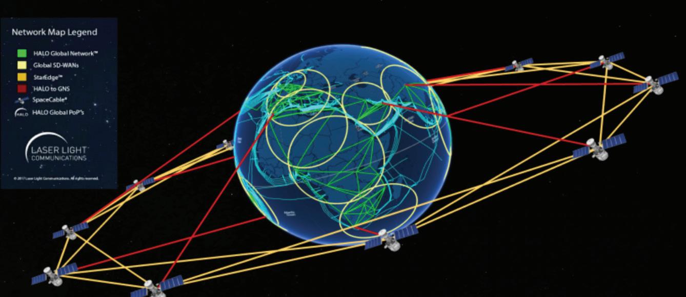
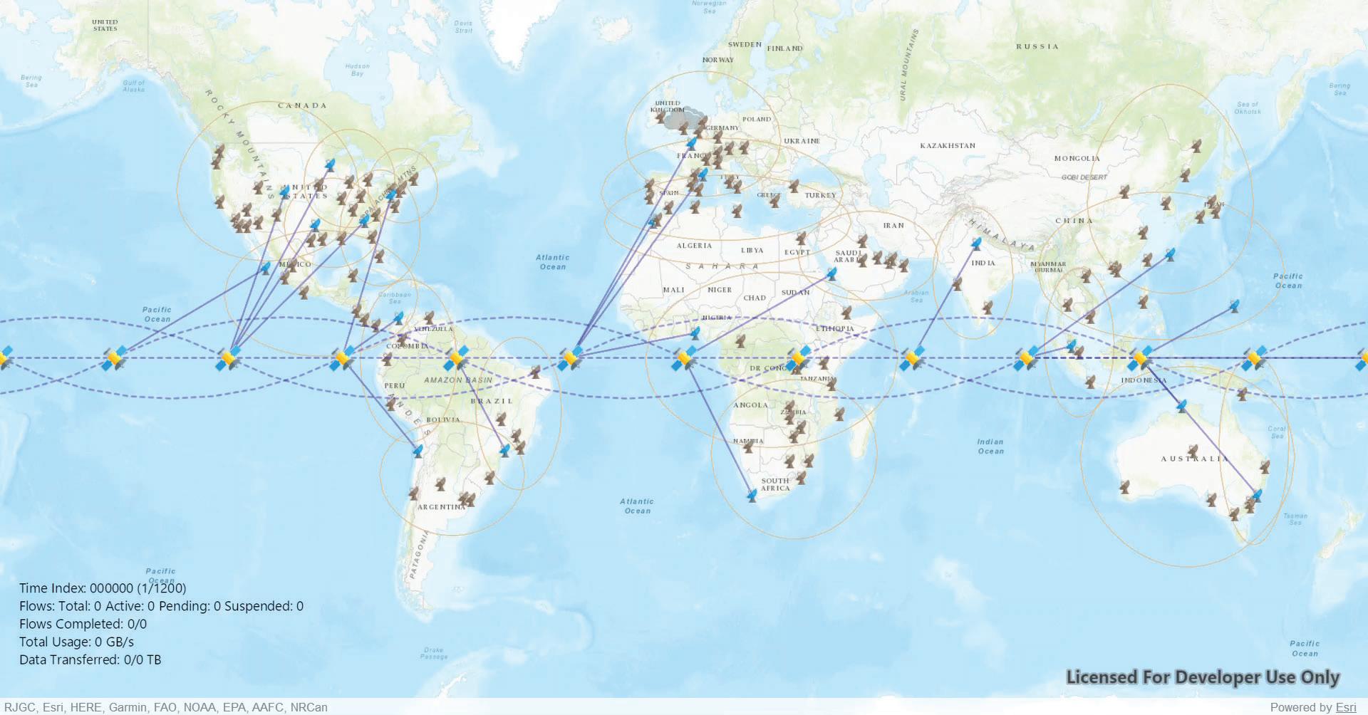
claims, bolstered by artificial island building and military deployments, put existing submarine cable routes at risk. Should conflict arise, fiber cables running through this region are prime targets for sabotage.
A multi-domain all optical network would allow bypassing these maritime chokepoints entirely. By routing data through optical satellite constellations positioned in neutral airspace or above international waters, states and corporations can maintain connectivity without relying on cables vulnerable to Chinese control.
Russia has announced plans to expand its surveillance and military presence in the Arctic, including monitoring the new Arctic Connect cable. With rising geopolitical stakes and the melting polar ice enabling new maritime routes, the risk of cable sabotage or surveillance here is real.
Optical satellite polar service planes can provide an alternative that doesn’t depend on physical seabed infrastructure, eliminating a key vulnerability and ensuring secure transpolar data routes that sidestep Russian-controlled territories.
Several African coastal nations rely heavily on just a few submarine cables. Recent outages due to anchor dragging and possible intentional damage off the coast of West Africa exposed the fragility of these systems. In regions plagued by piracy, these cables are high-value targets.
Multi-domain networks can support internet and telecommunications services in these vulnerable regions without relying on seabed infrastructure that is expensive to repair and easy to attack.
It is important to note that optical satellite systems need not a complete replacement for submarine cables. Cables still offer unmatched capacity over stable routes but a hybrid architecture that combines both systems with “cutover” orchestration software offers the best of both worlds: Peak Load Shifting: During periods of congestion or failure, optical networks can offload traffic.
Sensitive Data Routing: Classified, financial, or strategic communications can be directed through secure optical links.
Disaster Recovery: In the event of natural or human-induced cable failures, optical satellite and its terrestrial network provide an efficient backup path.
Geographic Flexibility: New regions or underserved areas can be connected quickly, supporting developmental goals.
Satellite, terrestrial and airborne laser communications can be impacted by weather conditions such as rain, fog,
and dust. Adaptive optics and hybrid RF-laser systems are mitigating these issues, ensuring continuity even in adverse conditions. Neither, however, are a 5 9’s service solution. They increase latency. They are not 100% solution. They are point2point orchestration operating systems – no scale potential. Only an all-optical satellite constellation, fully-integrated into its own terrestrial – low latency –physical network, managed by a combined patented optical orchestration software operating system can deal with the atmospheric conditions, completely, at scale.
Laser communications do not use traditional RF spectrum, thus it is unregulated by the ITU/NRA’s. Optical satellites, however, do need standard landing rights on a country-contry basis as do all satellites. The ITU is considering some global regulatory policies on the WRC 2027 agenda. Ultimately, international cooperation and standards will be forthcoming to ensure interoperability and avoid geopolitical friction. Until those global regulatory policies are set, space-based laser communications is unregulated. First to market with an all-optical satellite constellation will set those policies and standards.
Building any global satellite network involves high upfront capital, particularly for satellite launches and ground station infrastructure. Optical satellite infrastructure, however, is a lower capex/opex per GB per service area per PoP than RF satellites, and also global long haul subsea cable. However, as space launch costs decline and satellite manufacturing becomes more efficient, economies of scale are expected to bring costs down even further, making optical satellite the most efficient distribution platform for global data. .
not just an augmentation, but a strategic evolution of global communications infrastructure. They provide a way to protect data integrity, ensure redundancy, and maintain sovereign control over critical communication channels. Countries and companies that invest in this hybrid approach will be better equipped to face the future. Whether dealing with rising tensions in the South China Sea, Russian surveillance in the Arctic, or piracy in African waters, the resilience and flexibility of multi-domain laser based networks will prove invaluable.
The submarine cable industry stands at a crossroads. Continuing with business as usual in a world of rising geopolitical conflict, surveillance, and sabotage is no longer tenable. By integrating a multi-domain network such as Laser Light into their infrastructure strategy, stakeholders can safeguard global connectivity, secure critical data, and ensure continuity in even the most hostile environments. In an era where information is power and disruption can have cascading global consequences, the future of international communications lies not solely on the ocean floor but in the convergence of sea, sky, and space. STF
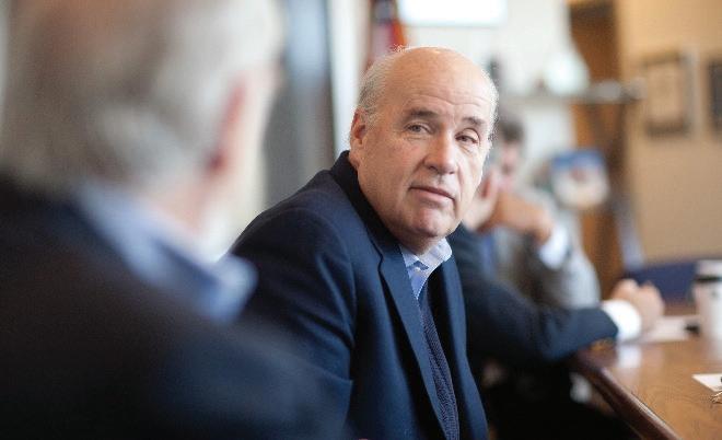
To realize full benefits, optical satellite must operate seamlessly with existing terrestrial and undersea networks. This requires standardization, protocol alignment, and multi-vendor cooperation, end2end. Consequently, it is more efficient and cost-effective to build both the optical satellite and terrestrial infrastructures together, as greenfields, rather than cobbling together inefficient, underperforming segments. .
As geopolitical risks escalate and digital connectivity becomes a matter of national security, the submarine cable industry must evolve. Multi-domain optical networks offer
ROBERT (BOB) BRUMLEY is the Chairman & Ceo of the Laser Light™ Companies. He brings extensive executive experience in the management and financing of early-stage ventures, particularly in aerospace, telecommunications and defense. In 2012, he was appointed as Senior Managing Director of Laser Light™ Communications, LLC, [www.laserlightcomms.com], and Laser Light Global, LTD (UK). Bob became the CEO for both firms in 2013. Laser Light™ intends on building, owning and operating the World’s 1st Elastic Optical Network – the HALO Global Network™ - which is designed as a +33Tbps global platform, consisting of next-generation optical satellites, fiber, subsea cable, and Edge data facilities, managed by its patented, proprietary AI software operating system. Laser Light’s intended purpose is to serve as a 21st Century global data services provider for commercial, civil science, and defense customers through the service mediums of space, terrestrial, subsea, and the Edge. Bob was a Presidential Appointee (Senate Confirmed) in the Reagan Administration, serving in both terms. Amongst his duties in the Reagan Administration was Executive Director of the Commercial Space Working Group of the NSC and EPC. He is a retired Lieutenant Colonel in the U.S. Marine Corps Reserve.
ALEX VAXMONSKY is the Founder of EdgeComms, a digital infrastructure company specializing in the convergence of datacenters, service providers, and web-scale content ecosystems. With a career rooted in both wireless and wireline environments, Alex brings deep expertise in strategic partnership development and the management of large-scale infrastructure deployments, including subsea and satellite systems. Under his leadership, EdgeComms has emerged as a forward-leaning firm focused on enabling next-generation connectivity and accelerating the monetization of edge services. His vision continues to shape how digital infrastructure is deployed and leveraged at the edge to meet evolving network demands.


BY TONY FRISCH, ANDERS LJUNG AND LYNSEY THOMAS
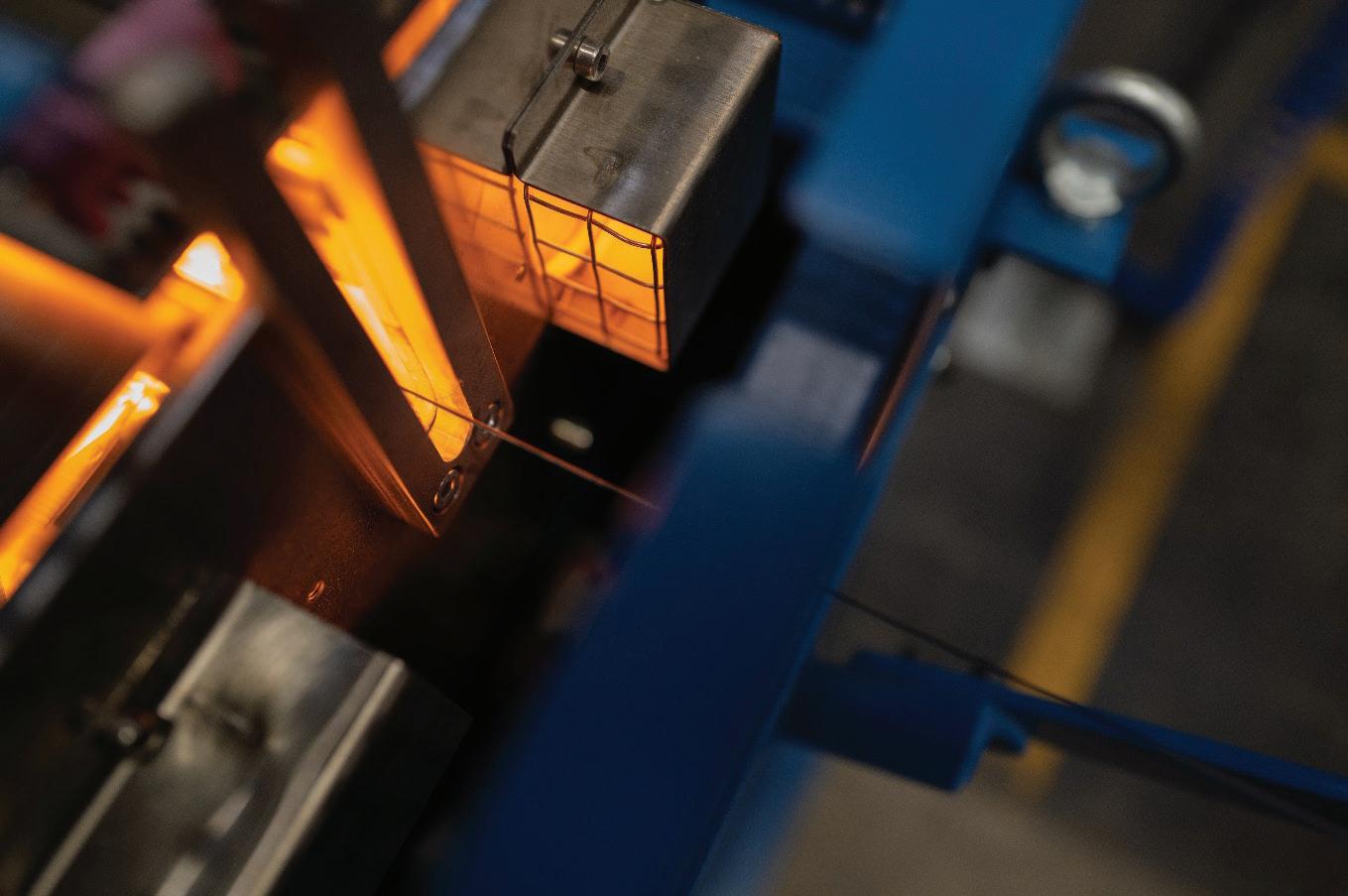
In the rapidly evolving world of global communications, the spotlight often shines on high capacity, repeatered transoceanic submarine cables linking continents on strategic routes. These massive projects, typically backed by tech giants (and to a lesser extent, international consortia) understandably attract attention due to their sheer scale, capacity and price. However, in the shadows of these goliaths lies an equally critical but often underappreciated element of the global connectivity puzzle: unrepeatered submarine cable systems. These cables are used to provide regional and inter-island links, cross rivers and bays, and deliver vital connectivity to offshore installations like oil rigs and wind farms. Unrepeatered systems, so named because they operate without powered signal amplification along their length, may lack the glamour of their repeatered counter-
Unrepeatered systems, so named because they operate without powered signal amplification along their length, may lack the glamour of their repeatered counterparts, but their simplicity, flexibility, and costeffectiveness make them indispensable to the digital infrastructure of many regions.
parts, but their simplicity, flexibility, and cost-effectiveness make them indispensable to the digital infrastructure of many regions. This article explores the technical, commercial, and economic value of unrepeatered systems, drawing on our extensive experience in offshore connectivity.
Unrepeatered submarine cable systems represent the oldest and most straightforward architecture in subsea communications. Historically, these were the first true “Open Systems” due to their passive nature. Unlike repeatered systems that rely on powered amplifiers, repeaters, spaced along the cable, unrepeatered cables transmit optical signals directly from one end to the other, often up to several hundred kilometres, without intermediate amplification (except in the case of
Remote Optically Pumped Amplifiers, ROPAs). This simplicity has always been a strength. Because there is no need for power-feeding equipment, these systems are easier to design, procure, and install. For the same reason, the cable is cheaper, as it requires little insulation and no additional copper or aluminium to improve electrical conductivity. They are also inherently robust and reliable, with no active components undersea that can fail. The absence of active subsea elements also enables deployment in a disaggregated model, where different parts of the system - cable, terminals, installers - can be sourced independently and customized to the specific requirements of each project without the need for complex optical specification or design, except where the span length or capacity requires more complex technology.
Unrepeatered systems play a crucial role across a wide range of sectors. In telecommunications, they are frequently used to create short, high fiber count links between neighbouring countries, regions, and islands - forming the backbone of regional connectivity. They are also used to extend global transoceanic systems inland or between key landing points, improving network connectivity and flexibility. Beyond telecoms, unrepeatered cables are widely deployed in offshore industries. In the oil and gas sector, they provide connectivity between onshore facilities and offshore platforms. Their passive design is particularly suited for environments where powered cables may create a safety concern, or where maintenance access is limited. Similarly, in offshore wind farms, unrepeatered fiber is often integrated into power cables, delivering essential telemetry and communications data. They also find increasing use in scientific applications, such as ocean observatories and seismic
monitoring, where reliability, low power consumption, and ease of deployment are critical.
The simplest systems require little more than low loss fibre and an enhanced transmit power supply to achieve unrepeatered spans of around 200 km: with the actual achievable distance depending on the capacity per fiber and the fiber attenuation. The length or capacity can be increased by adding Raman amplification and further extended by adding a ROPA. For the ultimate reach, more optical power can be supplied to the ROPA by using extra fibres which don’t carry traffic.
While adding Raman or a ROPA extends the reach and/ or capacity, it also adds complexity and cost, particularly when non-traffic fibres are needed. For any given design the capacity per fibre decreases significantly with distance – see the figure in the section on Technical Capabilities and Performance. The simple solution is to use more fibers but in some cases it may be better to use Raman or ROPA technology. In both cases the system cost will increase, and beyond a certain point a system with repeaters will be less costly. There may however be other factors which favour a complex unrepeatered system over a repeatered solution.
Many legacy unrepeatered links, installed decades ago to connect islands, offshore assets, and regional nodes, are now approaching the end of their operational lifespan. These aging systems, originally deployed with limited fiber counts and older-generation materials, are increasingly vulnerable to fiber degradation, mechanical wear, and shifts in network performance requirements.
Unlike repeatered cables, which often include active
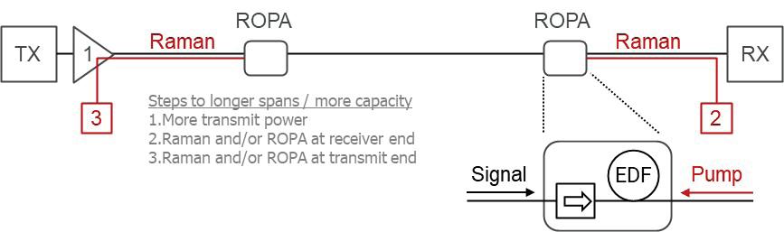
components subject to failure, unrepeatered systems are inherently passive and robust. However, even passive infrastructure has a finite lifetime, particularly in marine environments where repairs will gradually take their toll. As a result, numerous unrepeatered systems installed in the 1990s and early 2000s are now entering their decommissioning window, if they haven’t already surpassed it. The need for replacement is becoming especially pressing in regions where unrepeatered systems provide the only high-capacity physical connectivity, such as island nations, remote coastal towns, and offshore energy installations. In many cases, the original systems were designed for far lower bandwidth demand than what current digital applications require. With the explosion of cloud services, streaming media, and IoT applications in both consumer and industrial sectors, these legacy systems are no longer adequate, either in capacity or reliability. The next wave of unrepeatered systems will not only replace aging infrastructure but also introduce vastly improved technical capabilities due to increased fiber count and improved fiber properties. As unrepeatered systems reach retirement across critical sectors, from telecommunications to offshore energy and national infrastructure, the opportunity and necessity to deploy next-generation links is clear.
interconnects in Africa, and emerging digital infrastructure in South America and Southeast Asia.
With repeatered cable manufacturing and installation capacities under strain in today’s busy market, the fast-track nature of unrepeatered systems makes them an appealing option for time-sensitive deployments. In recent years, there has been a marked industry trend toward disaggregated submarine network design. This approach, which separates the procurement and integration of system components, aligns naturally with the architecture of unrepeatered systems. Because these systems lack complex components like powered repeaters or branching units, integration risk
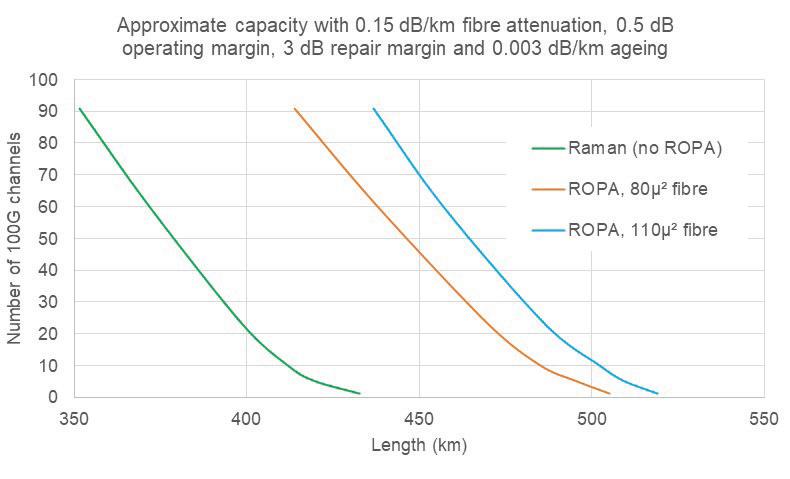
Despite their vital role, unrepeatered systems often escape notice. This is partly because many such installations, especially those supporting industrial or private infrastructure, are not publicly announced. Our analysis suggests that for every publicly disclosed unrepeatered system, there are likely five additional ones that are quietly deployed around the world. Europe dominates public reporting, particularly in the context of power systems and offshore energy. But significant activity also occurs in Southeast Asia, Africa, and the Pacific, where small-island nations increasingly demand robust but affordable connectivity solutions. Looking ahead, continued demand is expected from offshore wind projects in Europe and North America, power utility
is significantly reduced. This allows project developers to select the best vendors for each part of the system, achieving greater cost efficiency and design optimization. For smaller or more targeted projects, this modularity is a game changer, enabling faster implementation (through vessels of opportunity or outside work for maintenance vessels) and better alignment with local regulatory and environmental conditions by engaging regional expertise for key activities.
Unrepeatered systems have advanced significantly in recent years. Historically, fiber counts of 12 or 24 were typical. Today, it is not uncommon to deploy cables with 96, 144, or 192 fibers, multiplying the available capacity proportionally. Technological improvements in fiber attenuation and effective area have also extended the reach and data throughput of unrepeatered links. For instance, a 250
km link using standard fiber might carry around 18 Tbps per fiber pair. Using optimized fiber, that figure rises to 24 Tbps. Remote Optically Pumped Amplifiers (ROPAs), installed on the seabed at midpoints along the cable, can further extend reach up to 450 km while preserving high capacity.
In some advanced designs, a 450 km link using ROPA and large effective area fiber can carry over 100 x 100G channels—equivalent to 10 Tbps—on just a small portion of the available fiber. This creates enormous potential for dark fiber business models, where entire fiber pairs are leased to enterprise or carrier customers.
Unrepeatered systems often represent a particularly attractive option for network owners focused primarily on the sale or lease of dark fiber pairs, rather than managing active network equipment or selling capacity on a wholesale basis. In many regional markets, an economic model based on leasing entire fiber pairs to individual customers can be simpler and more commercially viable than dividing capacity or spectrum within fibers among multiple users. This approach reduces operational complexity and aligns well with customers seeking dedicated, uncontended fiber resources.
capacity. As the system length increases, however, this cost advantage diminishes. In recent times the cost of repeaters and repeatered cable have escalated. At around 400 km, unrepeatered solutions typically remain most cost-effective, but beyond approximately 450 km, the need for specialized fiber and signal conditioning increases, making repeatered designs typically more economical on a cost-per-bit basis, especially with increased fiber counts due to Spatial Division Multiplexing, SDM.
From a cost perspective, marine operations constitute a significant portion of any submarine cable project’s budget. Surveying, cable installation, burial depth, and environmental conditions all heavily influence project spend.
From a cost perspective, marine operations constitute a significant portion of any submarine cable project’s budget. Surveying, cable installation, burial depth, and environmental conditions all heavily influence project spend. It is reasonable to assume that the fundamental marine installation expenses for repeatered and unrepeatered systems of similar route characteristics are reasonably comparable. However, unrepeatered cables typically require less handling complexity since they do not involve installing, testing, or maintaining subsea repeaters, which can translate into schedule and risk reduction benefits.
Focusing on the hardware cost per terabit per second (Tbps) for the submerged portion of the system, unrepeatered designs demonstrate clear advantages at certain distances. For example, an unrepeatered system of around 300 km may have a substantially lower hardware cost per Tbps compared to a repeatered system designed for the same
That said, some customers may prefer to avoid repeaters altogether even at distances approaching 500 km. This is often the case in industries such as power utilities and pipelines, where fiber optic cables are integrated with power cables or installed as separate outriders primarily for telemetry and operational communications. In these cases, repeaters would complicate installation and operation. For these users, capacity requirements tend to be modest, and the primary objective is robust, low-maintenance connectivity rather than maximizing capacity per se. In these contexts, unrepeatered systems offer a practical and cost-effective alternative, providing sufficient capacity over distances up to around 500 km, while avoiding the complexities associated with powered subsea repeaters. The total capital expenditure for such unrepeatered solutions can be lower than that of repeatered counterparts, aligning well with the operational priorities and risk profiles of these industries.
In addition to technical and economic strengths, unrepeatered systems offer significant environmental and logistical benefits. Their simplified design reduces manufacturing and energy requirements, lowering the carbon footprint of deployment. Fewer subsea components mean less disruption to marine environments during installation. From a logistical standpoint, unrepeatered systems can often be manufactured and installed more quickly than repeatered cables. Shorter delivery timelines and smaller vessel requirements make them ideal for projects in remote or challenging locations.
Strategic Importance in National Infrastructure: As nations roll out broadband strategies and digital inclusion
programs, unrepeatered cables offer a practical and cost-efficient tool. They are particularly useful for connecting islands, remote coastal towns, and inland regions that lie near major submarine landing points. By extending connectivity from main networks inland or to nearby populations, unrepeatered systems help bridge the digital divide. They also play a role in public services - supporting healthcare, education, and emergency response - by ensuring that even remote communities have access to reliable communication networks. For governments and operators, the ability to deploy unrepeatered links rapidly and cost-effectively makes them an indispensable part of modern digital infrastructure planning.
A Quiet Backbone for Energy and Private Networks: One of the fastest-growing applications of unrepeatered cables is in the energy sector. Offshore wind farms, power interconnects, and hydroelectric facilities increasingly include fiber optics as part of their infrastructure. These cables serve both telemetry and communications needs, often installed as an outrider cable or integrated with power conductors. Given the sensitivity of these environments to electrical interference and the high cost of subsea maintenance, unrepeatered designs are a natural fit. They provide sufficient capacity for operational needs and avoid the complexity and risk of powered repeaters. In this way, unrepeatered systems become a hidden backbone of modern energy networks.
As digital infrastructure becomes increasingly decentralized and modular, unrepeatered systems are expected to play a larger role in supporting new architectures.
infrastructure is increasingly hard to overlook. Their low cost, rapid deployment, and technical reliability make them uniquely suited to regional connectivity challenges, particularly in remote geographies, offshore environments, and industrial contexts. As network architectures shift toward modular and disaggregated models, unrepeatered systems are proving not just complementary, but often essential to national and regional strategies. In this evolving landscape, continued investment in manufacturing capacity, system integration, and deployment capabilities will be critical. Suppliers, such as Hexatronic, with a long-standing focus on passive subsea infrastructure, supported by dedicated production facilities and regional expertise and Xtera, who can provide Raman and ROPA technology, are well-positioned to meet rising demand. As the broader industry embraces flexible, application-specific solutions, unrepeatered systems will remain an indispensable part of global digital expansion - quietly powering the next generation of connectivity. STF
TONY FRISCH started work at British Telecom’s Research Lab (BTRL). A move to Alcatel Australia gave him practical experience in testing and commissioning submarine systems. After this he was at Bell Labs working on terminal design and troubleshooting. This was followed by a return to Alcatel in France, where he worked in Subsea Technical Sales before moving to head Product Marketing. In 2004 he joined Azea (which was acquired by Xtera), initially managing Marketing and Proposals and then Wet-plant products. He is currently Xtera’s CTO.
As digital infrastructure becomes increasingly decentralized and modular, unrepeatered systems are expected to play a larger role in supporting new architectures. They are well-positioned to support inter-island and inter-regional connectivity, extensions of transoceanic landings, private and industrial networks, alternative energy and national broadband projects
We believe the next five years will see increased recog nition of unrepeatered systems not just as a niche tool but as a mainstream solution. As regional bandwidth demand continues to rise and the pressure grows to connect under served populations, unrepeatered systems offer a proven, scalable, and economically sound alternative.
Unrepeatered submarine cable systems may not make headlines, but their contribution to resilient, scalable digital
ANDERS LJUNG is the Business Manager Submarine Cable Solutions at Hexatronic in Hudiksvall, Sweden. Anders holds an MSc in Polymer Mechanics. Anders has been employed for 33 years in the fiber optic cable industry. More than twenty of these years he was in Ericsson’s organization where he held several managerial positions within sales, project management and manufacturing of fiber optic submarine cables. When Hexatronic acquired Ericsson’s telecom cable plant in 2013 Anders was employed in his current position with worldwide responsibility for Hexatronic’s fiber optic submarine cable portfolio.

LYNSEY THOMAS is a telecoms specialist who has been involved in the international subsea business since 1995. She has a keen interest in corporate strategy development, network planning, project management and solutions marketing. Lynsey is experienced as a board director & trustee, system supplier, network operator and is currently the CEO of LT Consulting. She has held senior leadership positions at Cable & Wireless, Apollo SCS, Xtera and SubSea Networks Ltd and serves as a board member for Cirion Technologies. She holds a Master’s degree in Engineering Science from Oxford University and is a previous columnist for The Guardian newspaper.
Highlighting the Technical Symposium, Supplier Exhibition™, and additional components that have established the IWCS Forum as the premier event for cable and connectivity technologies for the past 73 years, the 2025 IWCS Forum also features new components for trending developments in sustainability, artificial intelligence/machine learning, power delivery, and smart grid infrastructure. Join industry-leading wire and cable suppliers, manufacturers, and end-users to experience critical innovations and developments affecting the global cable and connectivity industry.
• Codes and Standards
• Fiber Manufacturing
• Materials Resilience & Durability
• Cable Sustainability & Recycling
• Micro-Cable Design & Installation
• Design and Testing for Copper Ethernet and PoE Cables
• Advances in Optical Fiber Coatings & Cable Materials
• Special Applications & Installations
• Fiber Cable Design, Qualification, Manufacturing and Reliability
• Hyperscale and AI Innovations for Data Centers
• Multicore Optical Fiber
Solutions for
and
BY MAGDA ABDELKADER

Being at the nexus of global digital infrastructure, Egypt occupies a pivotal position, offering access to both the Red Sea and the Mediterranean and connecting key regions across Asia, Africa, and Europe.
Telecom Egypt’s infrastructure has always been a key enabler for subsea systems accessing these waters, supported by its robust, cutting-edge infrastructure.
The increasing demand for building more subsea systems, coupled with the growing need for diversity, agility, and resiliency, has driven the evolution of Telecom Egypt’s forum of subsea infrastructure, facilitated by collaborations among major stakeholders in response to shifting market dynamics. Over the years, various challenges have shaped how this infrastructure has transformed.
This article explores the evolution of Egypt’s subsea infrastructure over time, delving into its comprehensive net-
work development, the expansion of subsea cable landing stations, terrestrial transEgypt crossings, and subsea routes. It examines the historical context, current advancements, and future prospects of Egypt’s subsea capabilities, underscoring the country’s pivotal role in fostering a more interconnected world. In response to increasing global bandwidth demands and the growing need for resilience and diversity in subsea cable systems, Egypt has continually transformed its infrastructure to address the challenges of the modern digital age.
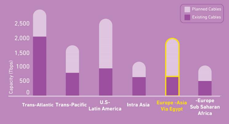
The digital landscape is undergoing a seismic shift, driven by an unprecedented surge in data consumption that is pushing the industry to explore innovative ways to accommodate growing demands. This shift toward ultra-high-capacity network architectures has spurred the

evolution of Egypt’s subsea infrastructure.
According to TeleGeography, global bandwidth is doubling approximately every two to three years, fueled by substantial investments in next-generation subsea cable systems. These next generation cables, once constructed along key routes such as the Europe-Asia route via Egypt, are expected to significantly increase potential capacity.
Several challenges have influenced the transformation of this infrastructure over the years, presenting both hurdles and opportunities for the industry. Historically, the limited number of subsea cables globally, coupled with significant cable outages—which, in some instances, caused complete communication blackouts in various countries—has highlighted the urgent need for constructing a more diverse and resilient network.
to reevaluate its strategies and focus on building even more robust and diverse systems.
Egypt’s geographic and historical significance makes it a crucial hub in global subsea cable networks. Since the advent of the telegraph subsea systems in the 19th century, Egypt has served as a key terrestrial connection point for the subsea cable segments in the Red Sea and those in the Mediterranean.
Today, Telecom Egypt’s subsea infrastructure continues to evolve to meet the dynamic demands of the industry, reinforcing its status as a vital enabler of global connectivity. Egypt’s strategic location along the shortest and most established intercontinental connectivity routes enhances its global significance.
The expansion of data center infrastructure in Egypt is attracting more connectivity, transforming the country from a mere meeting point for subsea cables into a destination for international traffic. This transformation is further enhanced by the presence of major content providers’ POPs, Public Cloud Regions, and Content Delivery Nodes (CDN).
As of mid-2025, Egypt has in service 14 subsea cable systems, 10 cable landing stations, and 10 terrestrial crossing routes. Over the years, Egypt has facilitated the landing of numerous subsea cable systems along its shores. Telecom Egypt invested in 10 of these systems, with 3 more under construction to meet its own growing demands as well as those of its local and global partners.
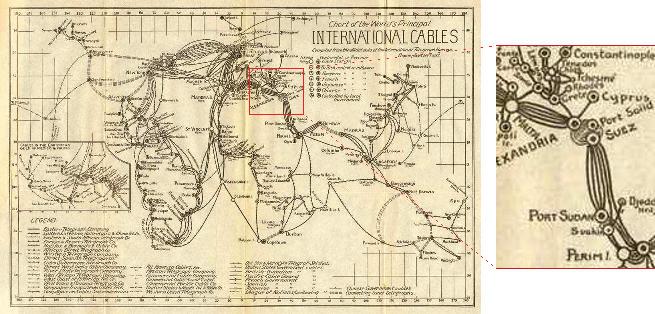
Recent geopolitical challenges, such as difficulties in laying cables in the southern Red Sea, have further emphasized the importance of establishing new international data highways. Additionally, rising costs and delays in the construction of the new cables have prompted the subsea industry
In 2010, Egypt had just 8 subsea cables, but this number is projected to triple to over 21 by 2028, driven by surging connectivity demands. Similarly, the country had only 5
cable landing stations and 6 crossing routes in 2010, both of which are expected to grow to 14 by 2028. This remarkable anticipated expansion in subsea cables, landing stations, and transEgypt crossing routes underscores Telecom Egypt’s expanding role in global telecommunications.
Over time, strategic investments have been made to build a resilient subsea infrastructure in Egypt, enabling subsea cable owners to optimise both their traffic and their network economics. This infrastructure ensures the lowest latency and the shortest possible transmission paths while simultaneously enhancing route diversity.
With an extensive 3,000 km coastline along the Red Sea and the Mediterranean, Egypt offers enhanced diversity in cable landing station locations. Substantial distances—ranging from 2 km to 275 km— separate these landing sites, ensuring geodiversity and resilience.
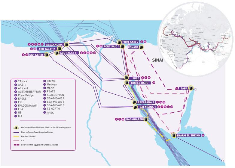
Egypt’s international infrastructure encompasses five cable landing stations on the Red Sea: Ras Ghareb, Zafarana 1 & 2, Hod El Dars and Suez, as well as five on the Mediterranean: Port Said, Alexandria, Abu Talat 1 & 2, and Sidi Kerir. This infrastructure is being extended towards the eastern side of Egypt towards the Sinai Peninsula. There are four planned cable landing stations: Sharm El Sheikh and Taba on the Red Sea and, Romana and a new one in Port Said (Port Said 2) on the Mediterranean.
Each cable landing station is linked to its counterpart on the opposite coast via at least two diverse fiber optic terrestrial routes. The establishment of a next-generation optical mesh network further enhances the resilience and efficiency of these routes, ensuring seamless connectivity between East and West.
The transEgypt crossing routes vary between well-secured motor highway corridors and paths along oil pipelines. One of the most secure crossings leverages the robust SUMED oil pipelines, ensuring that subsea cable systems run end-to-end, uninterrupted.
Contrary to some claims, subsea cable
systems do not cross the marine waterway of the Suez Canal. This is due to two primary reasons. First, it is economically unfeasible to interrupt the vessel traffic in the canal to build or maintain subsea cable systems. Second, and more importantly, marine surveys for cable systems intentionally avoid routes with heavy maritime traffic to preserve cables from risks such as anchoring or fishing activities. As a result, no subsea cable systems cross inside the Suez Canal. Notably, the 200-km “ICE” terrestrial crossing route is the shortest, fastest, and most reliable transEgypt route. It connects Suez and Port Said, running along the west bank of the highly secured Suez Canal and bypassing conventional public roads. This strategic positioning avoids disruptions that could arise from marine traffic in the
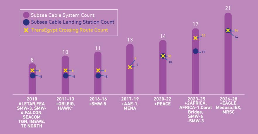

Suez Canal preserving the cables crossing, thus ensuring uninterrupted service.
On the same coast, landing points are interconnected using 1 + 1 redundancy or more. On the Red Sea, these terrestrial rings are supplemented by subsea festoon links between Ras Ghareb, Zafarana and Suez. Additionally, a new subsea link is planned between Sharm El Sheikh and Ras Ghareb, forming what is known as our “Red Sea Festoon.”
Over the past decades, numerous initiatives have attempted to establish diverse routes for transferring vast amounts of data traffic between continents. However, many have struggled to demonstrate reliability and readiness. Telecom Egypt has successfully translated ambitious plans into reality by developing diverse terrestrial routes. In particular, it has leveraged its landmass in the Asian continent—specifically the Sinai Peninsula—as an alternative seamless corridor bridging East and West. This advanced infrastructure connects to Egypt’s western network, reinforcing resilience and ensuring unparalleled network stability.
Legislative reforms have enhanced Egypt’s appeal as an international connectivity hub. In 2018, Telecom Egypt’s collaboration with the National Telecommunications Regulatory Authority (NTRA) resulted in a landmark 68% reduction in transit regulatory fees, making Egypt more attractive to global telecommunications players.
In early 2022, the introduction of the Licensed Landing Rights (LLR) model replaced the legacy NTRA activation fees, offering a business-independent, technology-neutral approach. This model allows cable owners to freely activate or upgrade systems without incurring additional costs tied to design capacity changes.
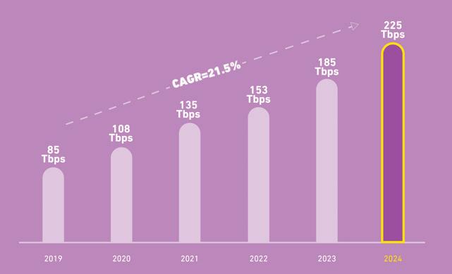
Source: Telecom Egypt
Telecom Egypt’s extensive international infrastructure currently enables over 90% of Eurasian and Eurafrican international traffic, with transiting capacity exceeding 270 Tbps to date. This figure has more than doubled in the past five years, growing at a compound annual growth rate of 21.5%.
The LLR model operates on a flat rate based on the number of fiber pairs at Red Sea landing stations, eliminating extra activation fees and adapting to evolving market dynamics. For added flexibility, the discounted per-activation model remains available for those who prefer it.
Additionally, the permit cycles for landing and maintaining subsea cables in Egypt from the marine side have been streamlined, providing cable owners with greater clarity, enabling more informed decision-making.
To meet the growing demand for route diversity in the Mediterranean basin and to enhance connectivity to Europe,
new entry points are being established via Durres in Albania and Crete in Greece, in collaboration with European operators. These entry points connect to the main PoPs in Europe, such as those in Budapest, Vienna, and Frankfurt, as well as numerous potential PoPs in Eastern Europe.
By building partnerships with more than 170 major global players, Egypt is connected to Europe through 18 diverse Mediterranean routes, strengthening both network resilience and connectivity, and facilitating expansion beyond the territory.
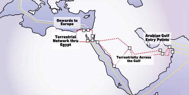
In the Red Sea, 17 diverse marine routes connect Egypt to Asia and Africa. These connections have facilitated the exploration of constructing alternative international traffic routing solutions to address challenges in the southern Red Sea region for subsea cables. Some of these initiatives are being developed in collaboration with Gulf partners to route international traffic through the Arabian Peninsula. A new high-capacity system across the Peninsula is under development, combining subsea and terrestrial segments to maximise redundancy, reliability, and connectivity.
To enhance flexibility and introduce more open infrastructure, Telecom Egypt launched WeConnect in 2023— an agile ecosystem that enables seamless cross-connections between various subsea systems landing at different stations across Egypt. Supported by a digital platform, WeConnect facilitates flexible network expansion, empowering global digital infrastructure across eastern and western networks.
Finally, collaborations with major global technology partners across the world—including transmission equipment and fiber optics suppliers, subsea cable builders, and maintenance authorities—play a pivotal role in building, upgrading, and maintaining state-of-the-art networks and solutions. These partnerships form a cornerstone of Telecom Egypt’s ongoing initiatives, aiming to unlock even more of Egypt’s potential in subsea cables by developing new projects and launching innovative products and services.
Telecom Egypt stands at a transformative juncture in the evolution of global telecommunications. With its strategic geographic location, extensive subsea infrastructure, and a legacy spanning over 170 years, the company is well-positioned to meet the ever-growing demands of the digital age.
Through collaboration with more than 170 global subsea owners—including hyperscalers and operators—and the adoption of proactive legislative reforms, Telecom Egypt is driving limitless growth in subsea connectivity. By addressing economic impacts on the global telecommunications community and leveraging innovative solutions to overcome challenges, such as those encountered in the Red Sea, the company is helping to shape the future of digital infrastructure.
Innovative solutions like the WeConnect ecosystem are tackling critical issues, including rising costs and delays in building new subsea cables. These solutions empower subsea cable owners to scale their assets effectively without requiring significant additional investments.
With its robust infrastructure and capacity to meet the demands of tomorrow’s global digital landscape, Telecom Egypt is committed to creating a more connected world. The company continues to be a cornerstone of the ongoing evolution of global data infrastructure, paving the way for a future defined by seamless and resilient global connectivity. STF

MAGDA ABDEL KADER is Senior Director of Global Subsea Cable Business and International Network Management at Telecom Egypt and Executive Committee Member at SubOptic. Magda has over 25 years of profound experience in the Subsea Cables domain. She is currently heading the global project business at Telecom Egypt throughout their life cycle from their planning and investments phases, their execution, their operation and maintenance and all the way to their retirement and dismantling. During her tenure, she had the opportunity to chair committees in multiple subsea systems from permitting, technical to O&M committees. She is a renowned figure in the industry and active member in the SubOptic and ICPC organizations.


BY JOHN HIBBARD AND PAUL MCCANN
More than 400 submarine cables manage 99% of global internet traffic, with private investors and major technology companies controlling over 40% of the market. These cables are susceptible to geopolitical tensions, natural disasters, and malicious attacks. Lower Earth Orbit (LEO) satellites provide faster internet services in underserved regions and can complement submarine cables to reduce infrastructure risks.
LEO satellites are gaining significant attention in the Pacific Region. In the market today, Starlink represents a transformative leap in satellite communication capabilities and is certainly disrupting both domestic and international service providers – offering unique low-latency, high-capacity, low cost broadband service – directly to the end consumers (bypassing the local retail service providers) or via Community Gateway solutions providing Gigabit level capacities for a modest capital cost and per unit megabit rates in the order of $US50 per month! The easy installation of LEO terminals makes them appealing to users, and their capacity can meet the needs of small populations. They offer significant advantages to outer islands, which are currently connected via domestic cable, microwave, or satellite.
Domestic cables are costly, and microwaves may not span the vast distances in the Pacific, making satellites an ideal solution. With other satellite service providers such as One Web, Kuiper, Guowang and other competitors soon entering the market, this presents both benefits and challenges for Pacific Island Countries (PICs). As LEO deployment continues, the balance between satellite vs submarine capacity demands may significantly alter.
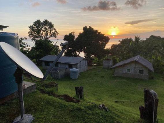
Submarine Cable developments continue throughout the region! By later this year, Nauru will receive its first cable, leaving Pitcairn (population ~50 people) as the only PIC without one. Many countries will have second cables for diversity, security, and connectivity, though not necessarily due to demand. Major pan-Pacific systems continue to develop, with further announcements still being made across the region
Submarine cables cost a significant amount to operate and maintain. Recovery of these costs occurs through traffic charges. While having one cable may enable the operator to have a competitive price against MEO and GEO satellites, it is a struggle to be competitive when you have a second cable as the cost rises with negligible additional traffic and minimal revenue increase. And now with LEO satellites becoming an available and real option for use in developing countries or outer island and areas of small population –cost recovery for submarine cable systems is becoming an ever-growing challenge.
The big issue arises on the principal island where one or more submarine cables land. Low priced satellite solutions direct to end consumers reduce the demand for capacity in the retail service provider or incumbent carrier local networks, effectively drawing away retail customers and indirectly reducing the traffic demand on the cable. This situation is real, and it is having significant impact in many PICs!
In Australia, where LEO satellites have the natural ability to service the remote areas, their capacity limitations and the existence of an extensive, robust domestic networks suggest they will be unlikely to win more than say 1% of the nation’s demand and therefore would be unlikely to significantly impact the existing submarine cable demand. But in the Pacific Islands, LEO service providers would only need to capture some of the few major enterprise customers in a country to secure a significant market share. In the Cook Islands, in which regulation has supported the widespread implementation of Starlink as a competitive service offering – LEO is said to have secured some 40% of the country’s international demand. This leaves just 60% of the previous demand for the existing submarine cable to achieve recovery of costs, which have not declined, thus requiring a substantial increase in capacity prices from the submarine cable company in order to maintain service. This negatively impacts the existing retail operator (in this case Vodafone) ability to effectively compete in providing cost effective end-user services, making the satellite option even more attractive.
Cook Islands is a country with a permanent population of 20,000 along with a significant temporary tourist population. It is composed of 15 islands with total land mass of 236 sq Kms spread over an ocean area of 2 million sq kms. With such demographics, it is understandable that it only has one domestic operator. While there are some fixed last mile connections, most of the consumer connectivity is via mobile. Prices to customers are considered reasonable for such a geography. However, there is desire to have some competition to ensure prices are as low as possible and as such the Government opened to skies to Direct-to-Home satellite services. What happens in future remains uncertain – revenue for development of Cook Island telecommunications services no longer stays within the country – will the LEO operators support such local developments?
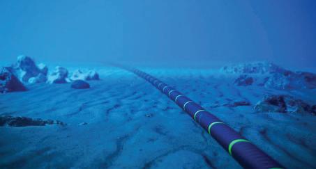
Submarine cables have some very attractive features. Being on the sea-bed, particularly the relatively benign sea-bed of the deep Pacific Ocean, regional cables offer security and a degree of immunity from cyclones. They concentrate connections through a node where traffic flows can be controlled and if needed monitored by the sovereign entity. While they have some overseas costs, most of the money stays in the country with the retail operator(s). They have vast potential capacity and a design life of 25 years. They have historically afforded much lower latency than satellite. Hence the reason why they have been so attractive as the preferred overseas connection for countries, both large and small.
Submarine cable development will continue to provide environmentally stable and very reliable solutions. They are not vulnerable to environmental events that can interfere with signal transmission, they do not have a limited lifespan (typically 10-15 years) and compared to satellites – even
with the advent of “laser” technologies – cables will continue to be more suitable for carrying higher bandwidths.
While both systems have their respective advantages and challenges, in terms of overall reliability—considering factors like environmental resilience, consistency of service, and lifespan—submarine cables are generally considered more reliable than satellite connections.
For the smaller nations and areas of the Pacific Region – LEOsats certainly look to be appropriate with their attributes of relatively simple implementation, lower cost for many and adequate capacity for most. However – the deployment of LEO services does not come without issues!
Despite the rapid advancement of satellite technology and its potential, it is probable that satellites and submarine cables will continue to coexist and complement each other, rather than one technology entirely supplanting the other.
country and the need for data management impact upon the economics and national security and hence a solution is needed to contain these downsides. With the right solution, it could be possible to have the best of both the satellite and submarine cable worlds.
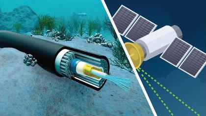
Because the end customer can contract directly with the overseas provider, money flows out of the country and in a PIC, this can create a significant issue. As the traffic goes directly offshore from the user, there is no scope for direct in-country legal intercept and monitoring of such communications, and hence this raises concern about data sovereignty, criminal activity and cybercrime. When one sees photos of all the scammers in Myanmar with their LEO antennas, one wonders whether the more impoverished Pacific Islands with high unemployment might become attractive to such nefarious activity? There is a strong argument that the traffic should be through a hub or gateway within the country in order to address concerns about data management and money retention. If such a hub is managed by the submarine cable operator, scope exists to develop a complementary use of satellite and cable to provide secure and cost effective international connectivity.
The risks for places like the Cook Islands with an “open skies” policy are significant. The erosion of market share by the retail operator and the higher unit cost of international capacity will mean that prices for local mobile connectivity will likely need to rise. The exit of dollars from the
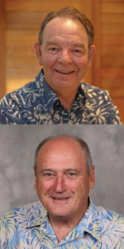
Despite the rapid advancement of satellite technology and its potential, it is probable that satellites and submarine cables will continue to coexist and complement each other, rather than one technology entirely supplanting the other. Various applications and circumstances will necessitate distinct solutions. We anticipate a future in which both satellites and submarine cables play integral roles in global communications infrastructure. STF
JOHN HIBBARD is CEO of Hibbard Consulting Pty Ltd. John has worked in the telecommunications industry for over 40 years, and for more than 30 has been associated with submarine cables. An Engineer by qualification, John worked for much of his career at Telstra finishing as Managing Director of Global Wholesale. John was the inaugural Chairman of Australia Japan Cable which he guided to a successful implementation.
Since 2001, John has been an independent consultant in his own company, Hibbard Consulting, involved in strategic and commercial aspects associated with the development and/or implementation of many international submarine cable projects across the Pacific including French Polynesia, Samoa, American Samoa, Tonga, Vanuatu, Solomons, PNG, Palau, FSM, and CNMI.
He was President of PTC from 2009 to 2012.
PAUL MCCANN is Managing Director of McCann Consulting International Pty Ltd. Paul has over 40 years network planning & development experience in telecommunications both in international and domestic arenas. Prior to returning to consulting in 2012, Paul spent over 8 years with Verizon in Asia Pacific, driving growth of Verizon’s network across Asia by developing & implementing plans delivering major operational cost reductions and improved service performance. Paul is now managing his own consulting business, specializing in development in the Pacific Region, where the core business focus is on “connectivity” with expertise spanning all aspects of planning and development for Satellite, Submarine cable and Domestic access technologies and business.
Paul is well known for his personable nature, his rapport with customers and his ability to deliver on time.
BY RUNE JENSEN

As global tensions rise and geopolitical priorities shift, the Arctic is commanding renewed attention. While it may seem remote and inhospitable, this region holds critical importance for international trade, defence strategy, and environmental observation. With nations racing to assert influence in the high north, one foundational need cuts across all domains: secure, resilient, high-capacity connectivity.
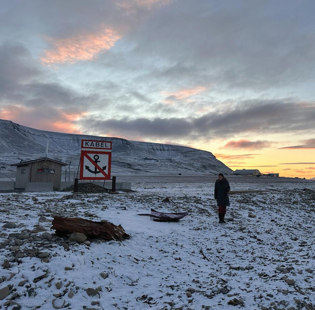
For two decades, Space Norway has helped establish the digital backbone of Arctic Norway through its fibre optic infrastructure. Now, with The Arctic Way project, we are reinforcing this commitment, future-proofing subsea communications to the strategic outposts of Svalbard and Jan Mayen. These efforts exemplify how regional systems in the submarine cable industry are transforming remote locations into globally connected hubs.
The Arctic’s strategic relevance dates back to the Cold War, but recent developments, due to climate change, shrinking sea ice, new shipping lanes, and resource exploration, are re-writing the region’s geopolitical script. Nations with Arctic interests are increasing their presence, not only for environmental monitoring or scientific research but also to secure access to rare minerals and emerging sea routes.
Svalbard and Jan Mayen play their part in Norwegian and NATO security and defence strategies and as well as providing bases for search and rescue operations taking place in these challenging Arctic environments.
Yet, while Svalbard has been connected via subsea fibre since 2004, Jan Mayen has long relied solely on satellite communications, limiting both capability and responsiveness.
It is therefore imperative that robust subsea fibre-optic communication cables are in place. Originally established in 2003, the current cables, providing essential links to the people of Svalbard, are nearing the end of their expected lifespan. These cables ensure that the population receives the same level of services typically found elsewhere in the world, despite their extreme northerly latitude. There is a need for a new subsea fibre-optic cable to be operational by 2028 to ensure this vital connectivity is maintained. Recognising the urgent need for a more robust and secure digital infrastructure in the Arctic, Space Norway launched The Arctic Way project: a next-generation subsea fibre-optic system linking the Norwegian mainland with both Svalbard and Jan Mayen.
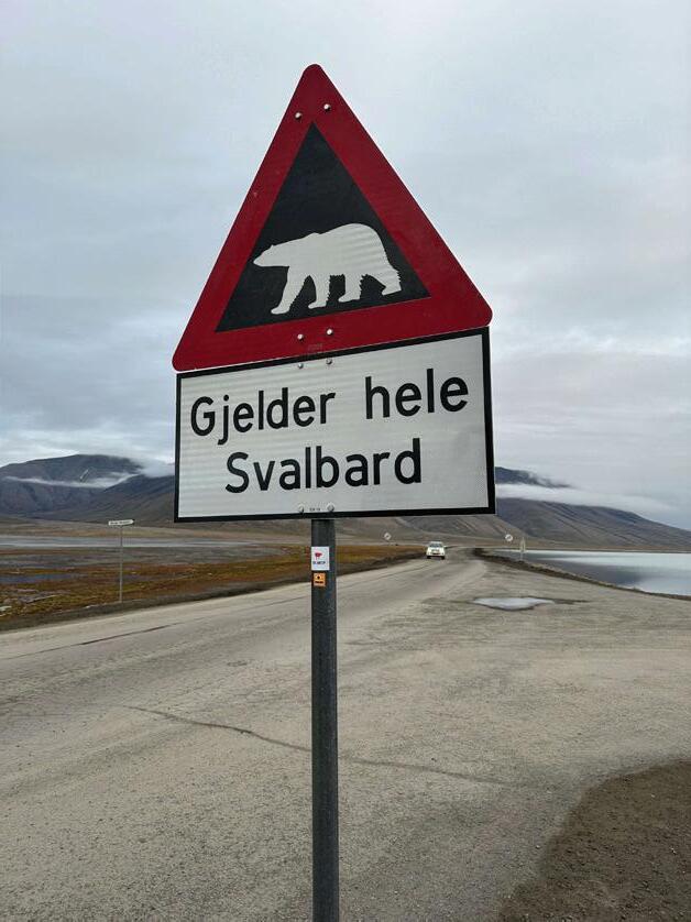
harshest environments. From Bodø, on Norway’s northern coast, the cable system runs 2,523 kilometres, branching mid-route to separately serve Svalbard and Jan Mayen.
This new system comprises:
• 27 optical repeaters
• 1 branching unit
• Three terminal stations: Bodø, Longyearbyen (Svalbard), and Jan Mayen
• A shared 500 km trunk line before splitting toward each destination
While many subsea systems focus on maximising data capacity, Arctic Way is designed for durability and service continuity. The system architecture enables a power feed from any of the three terminals, providing crucial failover capacity in an environment where access is limited and emergency repairs are still logistically complex.
The Arctic Way is a cutting-edge Open Cable System, purpose-built for operational reliability in one of the world’s
SubCom, a long-term partner and one of the most experienced players in Arctic cable deployment, was selected
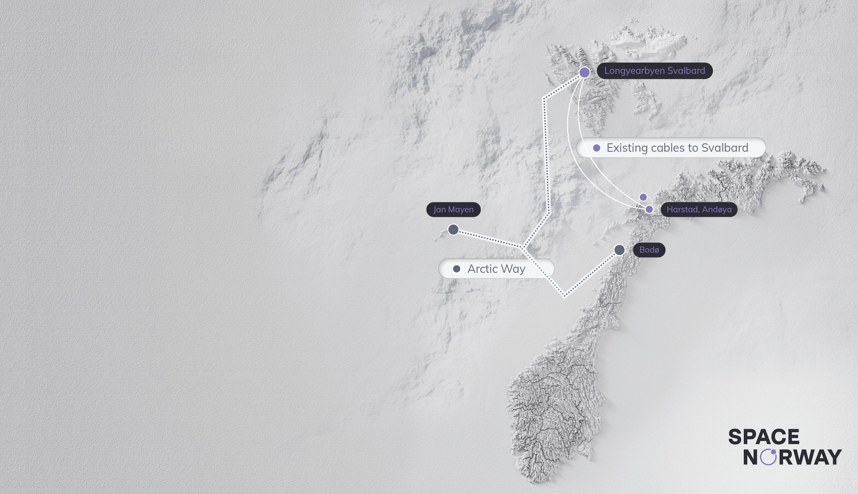
as the prime contractor following a competitive tender process. Their proven ability to execute in polar conditions will be vital as the project moves through marine surveys (2025), cable manufacture (2026), and installation (2027), with service launch set for 2028.
Deploying fibre in the Arctic is no ordinary undertaking. A narrow operational window, from May to September, dictates all marine activity. Beyond these months, harsh seas, icing risks, and polar nights make offshore work both dangerous and unpredictable.
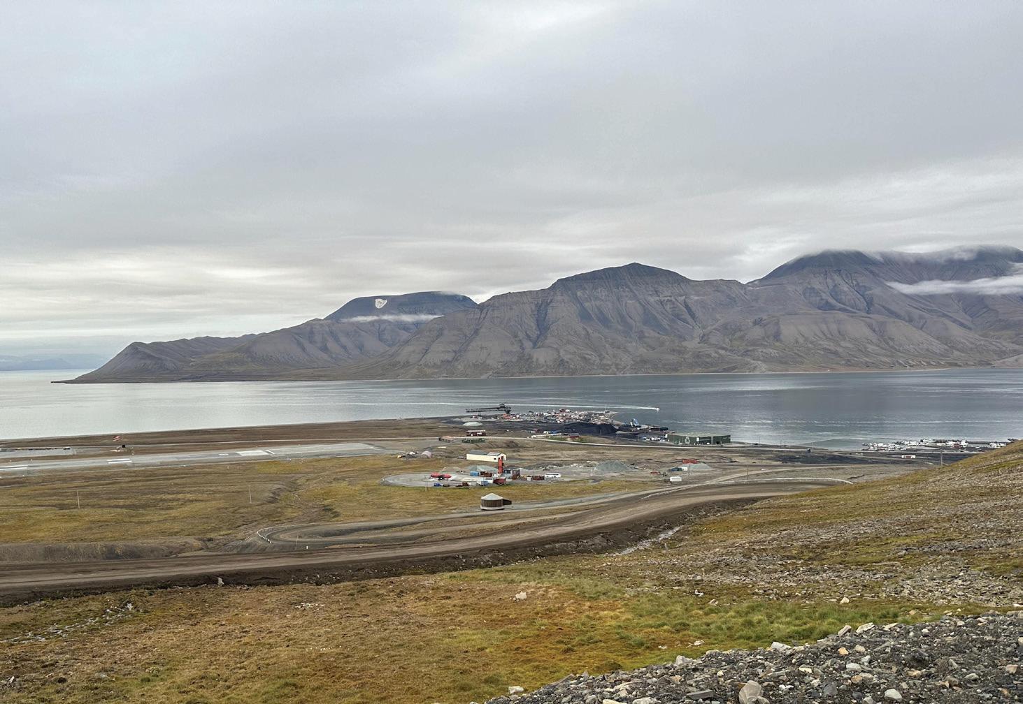
Logistics are particularly complex for Jan Mayen. The island has no harbour, no commercial air service, and all materials must be delivered via beach landings or secured through limited space on Norwegian military flights. This adds new layers of complexity in transporting personnel and equipment, demanding months of advance planning and the flexibility to adapt to sudden weather-related delays.
Despite these challenges, the Arctic Way team has remained on schedule. The marine survey campaign, set to begin this summer, will cover both Svalbard and Jan Mayen routes in a single mobilisation, an approach that lowers costs and minimises environmental disturbance.
Space Norway has a long history of Arctic innovation. In 2003, the company completed the world’s northernmost repeatered fibre system, connecting the Svalbard archipelago to the mainland via 1,400 km of dual-redundant fibre cable. That connection, still in operation today, revolutionised life in Longyearbyen, bringing modern digital services, enabling scientific research, and supporting one of Norway’s most strategic assets: SvalSat, the world’s largest satellite ground station for polar-orbit data.
As noted in the Norwegian Government’s Svalbard Report 2024, the fibre link provides “equally good e-commerce services as on the mainland through the virtually unlimited capacity of the cables.” This is no small feat in a region where temperatures can plunge below -30°C and months pass without sunlight.
With a technical service life of 25 years, the Svalbard fibre cables have been operational for 21 years, boasting an excellent track record with minimal service interruptions. The current service is guaranteed until 2028.
The fibre connection consists of two geographically separate cables that connect Longyearbyen with the mainland. The distance of approximately 1,400 km is roughly equivalent to the distance between Oslo and Paris. The cables are buried up to 2 meters in selected areas to protect against damage from fishing fleets’ bottom trawling or ship anchoring. The burial depth reaches down to 1,670 meters in an area just west of Svalbard, which was at the time the world’s deepest plowed fibre cable. Space Norway conducted a significant security upgrade of the connection during the period 2018–2020.
While Arctic Way is a regional system, its importance stretches far beyond Norway. The Arctic is warming. Trade routes are opening. Strategic competition is intensifying. Yet none of these developments can be managed or understood without connectivity that endures under pressure. With Arctic Way, Space Norway is ensuring that the world’s northernmost communities remain part of the global digital conversation, securely, reliably, and long into the future.
As previously written about in SubTel Forum Magazine,
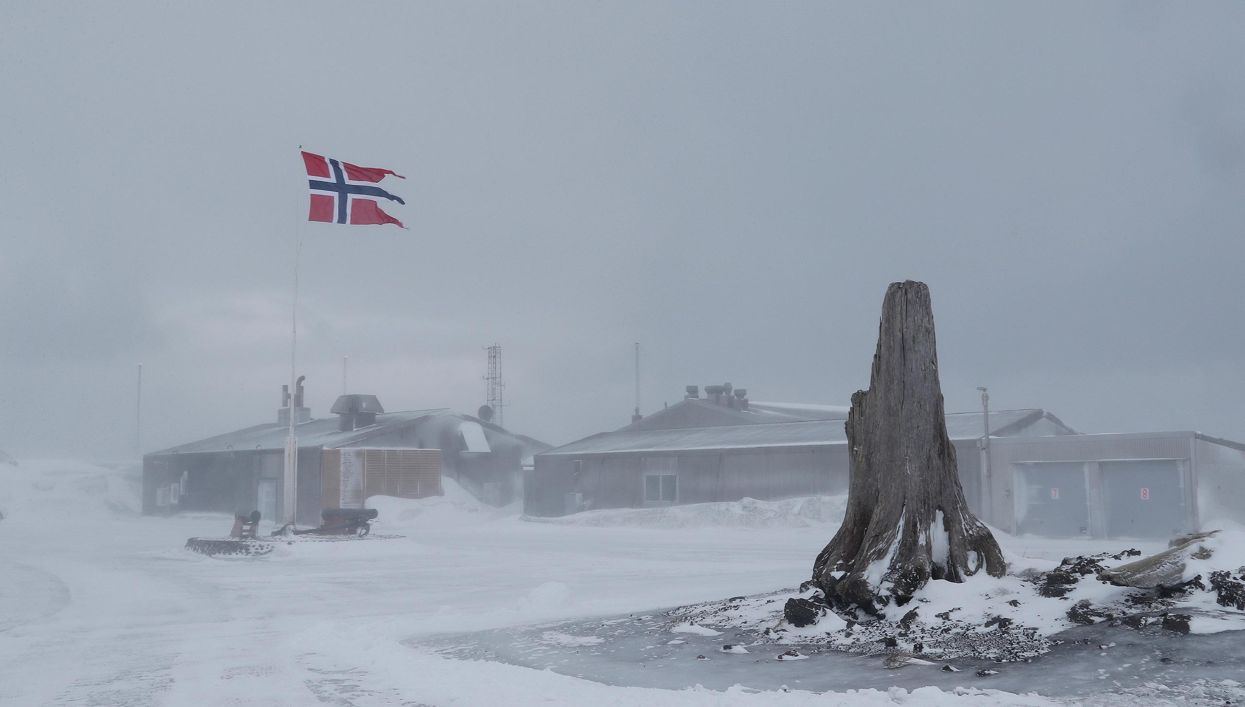
there are several initiatives planning to lay fiber cables in the Arctic. Space Norway is aware that several European players have collaborated to realise a Pan-Arctic Cable System (PACS) between Europe and Asia via the Arctic and North America. The ambition seems to be to have PACS ready for service by the early 2030s. This is an exciting and important project for increased connectivity between Europe and Asia without having to route traffic through the Middle East. Hopefully, experiences gained with Arctic Way will be beneficial for future projects.
www.spacenorway.com
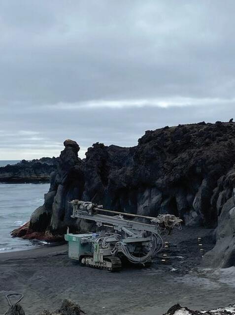
Space Norway is an innovative company that develops and provides communication and surveillance services to governments and businesses in an increasingly interconnected digital world. Space Norway offers commercial and public solutions for broadcasting, satellite communication, and data services.
The group owns and operates a fleet of satellites. Additionally, Space Norway owns and operates the Svalbard connection, a cable system that is vital for businesses and the population on Svalbard.
Due to harsh weather conditions and the challenges of transporting materials and equipment to Jan Mayen, Space Norway had to utilize the drilling equipment available from the Norwegian Armed Forces, as they are constructing a new station
The group is owned by the Ministry of Trade, Industry and Fisheries and operates under the Security Act.
• Space Norway is a leading satellite operator with a recognised position among government and commercial customers and partners. In addition, Space Norway owns and operates two subsea fibre-optic cables between Svalbard and mainland Norway. On behalf of the Norwegian Government, Space Norway will establish Arctic Way, a new subsea fibre-optic cable to Jan Mayen and Svalbard. Arctic Way is scheduled to be operational in 2028.
• Space Norway has a multi-orbit strategy for the ownership and operation of satellites in Highly Elliptical, Geostationary and Low Earth Orbit (abbreviated as HEO, GEO, and LEO, respectively).
• Space Norway has a significant portfolio of communication satellites, the THOR fleet and the Arctic Satellite Broadband Mission (ASBM). This fleet enables us to sell and deliver broadband communications in the Arctic, Europe, the Middle East, and the North Atlantic, as well as broadcast services in the Nordic countries and Europe.
• In the field of Earth observation, we operate the LEO satellites of the Norwegian Coastal Administration and the Norwegian Space Agency through our wholly owned subsidiary Statsat.
• New satellites due to be launched:
» The Application Development In Space (ADIS) satellite: This satellite is currently under development. ADIS is a highly flexible test platform that will pave the way for future capabilities. The satellite is scheduled to be launched in 2026.
» The MicroSAR radar satellite is also under development, and Space Norway is planning a constellation of satellites for ocean surveillance, with the first satellite to be launched in 2027.
» The THOR 8 satellite, ordered from Thales Alenia Space for launch in 2027, will replace THOR 5, THOR 6 and THOR 10-02. In addition, it will provide significant growth capacity in existing and new coverage areas.
» Space Norway has signed a contract with Starlink by SpaceX, becoming an Authorized Reseller of Low Earth Orbit (LEO) satellite services.
» Space Norway has also signed a signed a Term Sheet for Telesat Lightspeed Low Earth Orbit (LEO) connectivity solution. We are set to finalise the definitive agreements by the second half of 2025.
» Space Norway has also a large innovation department, which is important to secure new technology for the future.
Svalbard is a Norwegian archipelago in the Arctic Ocean. Svalbard consists of all the islands, islets and skerries between 74° and 81° north latitude and 10° and 35° east longitude. The largest island is Spitsbergen, while the highest mountain is Newtontoppen (1,713 m above sea level).
In all, around 2,100 people live on Svalbard. Longyearbyen is the largest settlement on Svalbard. Ny-Ålesund serves as a base for international Arctic research and environmental monitoring. In Hornsund in southwestern Spitsbergen is also a small Polish research station. There are also two Russian settlements on Svalbard, Barentsburg and Pyramiden, with approximately 460 people in total. (source: https://en.visitsvalbard.com/)
JAN MAYEN
Jan Mayen is a Norwegian volcanic island in the Arctic Ocean. It is one of the most isolated islands in the world, located northeast of Iceland and east of Greenland. The island has an area of 373 km2.
Jan Mayen has no permanent population, but it is home to a small number of Norwegian military personnel who
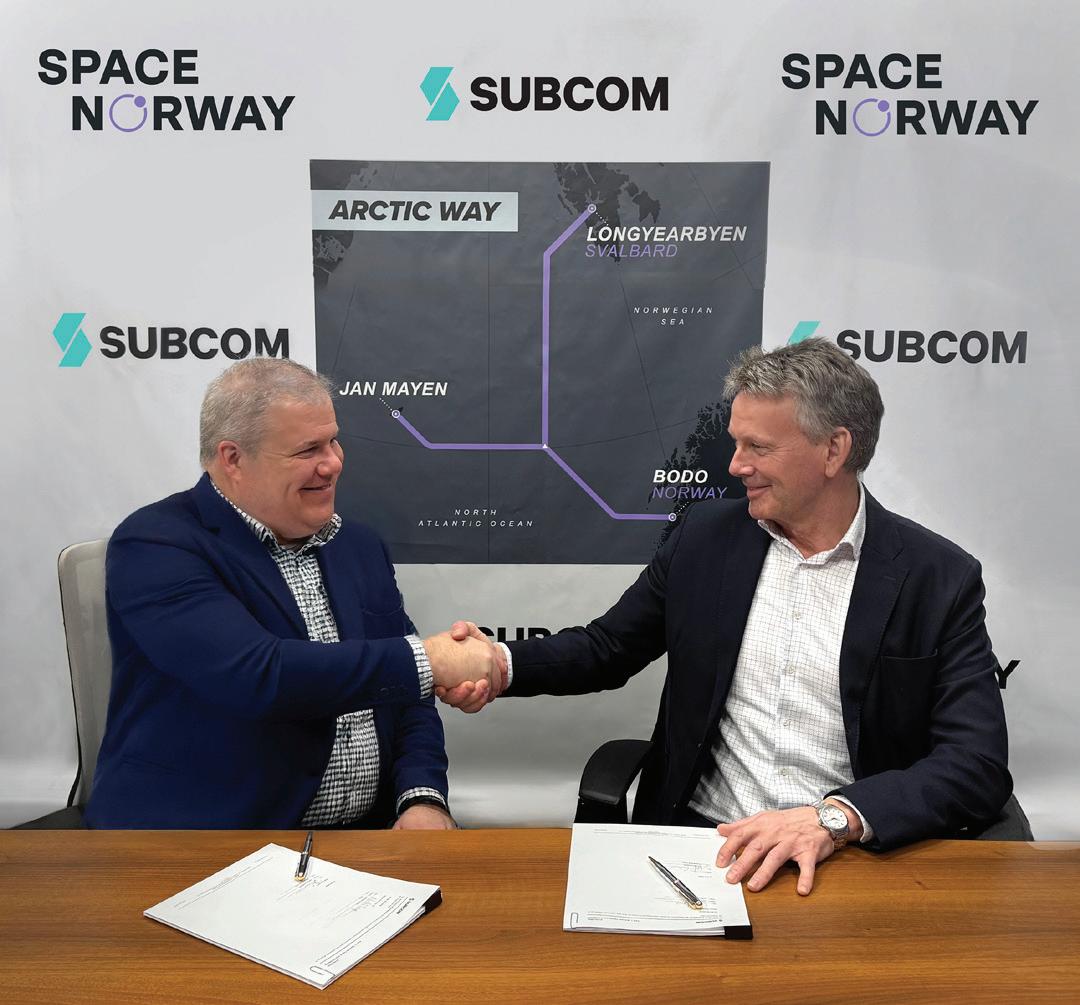
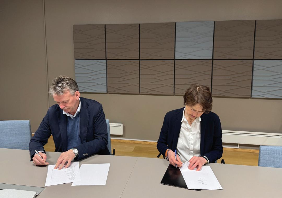
operate a weather station and other facilities on the island. Scientists and researchers can also apply to visit in order to study the island’s unique environment. Jan Mayen is a nature reserve, and access to the island is restricted. (source: https://jan.mayen.no/) STF
RUNE JENSEN is director for Space Norway’s Subsea Cable Systems. Before joining Space Norway, he spent two years on Svalbard as the Norwegian Polar Institute’s local manager in Ny-Ålesund. Before that he was a colonel in the Norwegian Armed Forces, where he held various positions in both national and international operations.
BY KRISTIAN NIELSEN
Subsea communication cables are the essential infrastructure behind global digital connectivity, carrying over 95% of international data traffic. As dependence on these cables grows, the debate intensifies on whether governments should nationalize this critical infrastructure to safeguard national security, or whether private investment should continue to drive innovation and efficiency. This paper examines both approaches through academic perspectives, particularly Stephen Kobrin’s research on nationalization and the findings of D’Souza & Megginson on privatization. Kobrin’s work emphasizes nationalization as a strategic move for governments seeking economic stability and control over essential sectors. However, it highlights the risk of reduced innovation, as seen in industries like oil, where state control often leads to inefficiencies. Conversely, D’Souza & Megginson argue that privatization typically results in enhanced performance, citing examples like Telmex in Mexico, which saw significant improvements post-privatization. The paper also explores how Public-Private Partnerships (PPPs) can provide a middle ground, combining the strengths of both models. Case studies like the Hawaiki Submarine Cable and the Coral Sea Cable System illustrate how PPPs enable governments to retain strategic control while benefiting from private sector innovation and investment. Ultimately, the hybrid PPP model offers a balanced approach to managing subsea cables, ensuring both national security and technological progress. This paper concludes that as global reliance on subsea cables intensifies, PPPs represent a sustainable solution for maintaining robust and secure communications infrastructure in the 21st century.
Subsea communication cables are the invisible backbone of the modern digital age. They carry over 95% of international data traffic, enabling everything from financial transactions to social media interactions. As global dependency on these cables intensifies, the debate over their management has gained prominence: Should governments nationalize these critical infrastructures to protect them, or should private investment continue to drive innovation and efficiency?
This article explores the complexities of managing subsea communications by examining academic insights from Stephen Kobrin and D’Souza & Megginson. We will delve into the potential benefits and challenges of nationalization and privatization and consider how Public-Private Partnerships (PPPs) can offer a balanced solution that leverages the strengths of both models.
Stephen Kobrin’s research in the 1980s provides a foundational understanding of why governments choose to nationalize industries. His studies show that nationalization is often a strategic decision driven by economic motivations, rather than political opportunism. It is typically selective, targeting industries of strategic importance, such as oil and telecommunications, where national control can significantly influence economic stability and security.
One of Kobrin’s key concepts is the ‘Domino Effect.’
During the 1970s, Libya’s decision to nationalize British Petroleum’s assets inspired a wave of similar actions across the Middle East. Countries like Algeria, Iraq, and Iran followed suit, driven by a desire to control their natural resources and assert economic sovereignty. These actions were not merely reactive; they were part of a broader strategic effort to increase state revenue and reduce foreign dependency.
Kobrin’s methodology was rigorous. He analyzed political and economic factors across a broad range of countries and industries from 1960 to 1980. By identifying patterns and outcomes of nationalization efforts, he highlighted how these actions align with broader national goals. His research suggests that governments may consider nationalizing subsea cables for similar reasons: to protect national interests, secure critical infrastructure, and reduce reliance on foreign entities.
While nationalization can increase state control over critical assets, it often comes at a cost—particularly to in-
novation. Several factors contribute to this decline:
Nationalized companies typically focus on stability and employment rather than risk-taking and innovation. In Venezuela, for example, after the nationalization of the oil industry in 1976, the state-owned company PDVSA initially maintained high levels of technical competence. However, over time, political interference and underinvestment in research and development (R&D) led to a significant decline in technological advancement. By the early 2000s, PDVSA’s exploration and production capabilities had deteriorated compared to its global peers.
State-owned enterprises (SOEs) often have less flexibility in decision-making due to bureaucratic structures. A study by the OECD on SOEs across various sectors found that these entities generally have lower productivity and innovation levels compared to private firms. The lack of competitive pressures and profit incentives reduces the urgency to innovate, leading to stagnation.
Decreased R&D Investment:
Nationalization frequently results in a decline in R&D spending as funds are redirected toward meeting state priorities. In the telecommunications sector in Latin America during the 1980s, state-owned companies were slow to adopt advancements like digital switching and fiber optics. The privatization wave in the 1990s led to a surge in innovation and infrastructure upgrades, highlighting the innovation gap during the period of state ownership.
Nationalized industries often prioritize strategic goals over profitability. In the Indian banking sector, for instance, nationalization led to an increased focus on financial inclusion and employment generation. While these are valuable social objectives, they were achieved at the expense of technological innovation and service improvement. These examples illustrate the complex trade-offs associated with nationalization. While it provides governments with greater control over critical industries, it often results in a decline in innovation and efficiency. For the subsea communications industry, where technological advancement is crucial for maintaining secure and reliable connections, these potential drawbacks are particularly concerning.
2.2 CASE STUDY: NATIONALIZATION OF THE LIBYAN OIL INDUSTRY
A prime example of nationalization is the Libyan oil industry in 1970. Driven by rising nationalism and a desire to control its resources, Libya nationalized British Petroleum’s assets, marking the start of a broader nationalization campaign across its oil sector. This move significantly increased state revenues and reduced foreign influence, allowing Libya to assert its economic sovereignty.
The impact was profound. Libya gained control over its most valuable asset and set a precedent that inspired other countries in the region, such as Algeria, Iraq, and Iran, to take similar actions. However, the nationalization of Libya’s oil industry also had drawbacks. The efficiency of the sector declined as state-owned companies lacked the technological expertise and management skills of their private predecessors. This led to decreased production capacity and strained relations with foreign investors and governments.
This case illustrates the double-edged sword of nationalization: while it enhances state control and revenue, it can also lead to operational challenges and reduced efficiency.
In contrast to Kobrin’s findings on nationalization, D’Souza & Megginson provide a compelling argument for privatization. Their analysis of 85 countries found that privatization often leads to significant performance improvements, particularly in utilities and telecommunications. Privatized firms tend to be more profitable, efficient, and innovative due to competitive pressures and a focus on profitability.
A notable example is the privatization of Mexico’s national telecommunications company, Telmex, in the 1990s. Before privatization, Telmex struggled with inefficiencies, poor service quality, and limited network coverage. However, after being sold to private investors, including Grupo Carso, led by Carlos Slim, Telmex underwent a remarkable transformation. The company invested heavily in expanding its network, improving service quality, and modernizing its infrastructure. Within a decade, the number of fixed telephone lines had nearly doubled from 6.4 million in 1990 to over 12 million by 2000.
This example illustrates the potential benefits of privatization: increased efficiency, better service, and greater investment in infrastructure. However, it also raises questions about accessibility and affordability, as privatized entities often prioritize profitability.
Public-Private Partnerships (PPPs) have emerged as a viable middle ground, blending the benefits of both nation-
alization and privatization. In the submarine cable industry, PPPs bring together the resources, expertise, and capital of private companies with the regulatory support and strategic oversight of governments. These partnerships are particularly effective for large-scale projects that require significant investment and have strategic importance.
PPPs enable governments to maintain a degree of control and influence over critical infrastructure while benefiting from private sector efficiency and innovation. They help share the financial and operational risks associated with these projects, which are often too large and complex for a single entity to manage alone.
The Hawaiki Submarine Cable is a 15,000-kilometer system connecting the United States, Australia, New Zealand, and several Pacific islands. This high-capacity cable was developed through a partnership between Hawaiki Submarine Cable LP, a private company, and several government entities. The New Zealand government, through its Crown Infrastructure Partners, invested in the project to ensure alignment with the country’s national broadband objectives. This collaboration was crucial, as existing trans-Pacific cables were nearing capacity. By securing a new route, New Zealand not only ensured redundancy but also enhanced digital resilience and security.
The Coral Sea Cable System links Australia with Papua New Guinea and the Solomon Islands. The Australian government played a pivotal role, contributing AUD 137 million—about two-thirds of the total cost—to the project. This investment ensured that the infrastructure would support secure and reliable internet access in the Pacific region while counteracting the growing influence of Chinese state-linked companies. By maintaining a stake in the project, Australia safeguarded its strategic interests and reinforced its commitment to regional connectivity.
The Dunant Submarine Cable, built by Google, offers a different perspective on public-private cooperation. This high-capacity transatlantic cable, connecting Virginia (U.S.) to France, was privately funded but required extensive coordination with the French government. Regulatory approvals and landing rights were facilitated by public authorities, ensuring that the project complied with national infrastructure priorities. Google’s
investment significantly accelerated deployment timelines and introduced cutting-edge fiber optic technology, setting new benchmarks in transatlantic data speeds. This case demonstrates that even privately led initiatives often rely on public-sector collaboration to navigate regulatory and geopolitical challenges.
The EllaLink Submarine Cable provides a direct connection between Europe and Latin America, linking Portugal, Brazil, Cape Verde, Mauritania, and French Guiana. Unlike traditional transatlantic systems that route through the United States, this 6,000-kilometer cable was strategically developed to enhance data sovereignty and improve direct connectivity between the two continents. The European Union and the Brazilian government played a role in supporting the project, ensuring its strategic importance. Private sector investment made it possible to integrate advanced data transfer technologies, benefiting cloud service providers, businesses, and research institutions. The EllaLink system showcases how PPPs can be leveraged to strengthen regional connectivity while aligning with national security objectives.
The SEA-ME-WE 6 submarine cable spans 19,200 kilometers and connects Southeast Asia, the Middle East, and Western Europe. This multinational project required cooperation between 14 major telecom providers and multiple national governments, ensuring cost-effective construction while addressing regulatory concerns. The cable is crucial for reducing congestion on existing routes, improving connectivity for digital economies, and strengthening network resilience. Governments in participating nations, including India, Egypt, and France, facilitated approvals and security measures to protect the infrastructure.
The Asia-America Gateway (AAG) Submarine Cable System, a 20,000-kilometer network connecting Southeast Asia with the United States, is another example of a successful PPP. Unlike single-nation projects, the AAG cable involves a consortium of both state-owned and private telecom companies, such as Telekom Malaysia and PLDT in the Philippines. Governments played an essential role in facilitating regulatory approvals and, in some cases, provided direct
investment to ensure the project’s feasibility. The AAG system is strategically vital, as it reduces reliance on other trans-Pacific cables, enhances regional connectivity, and fosters economic development in participating nations.
Beyond individual case studies, PPPs play a crucial role in ensuring the security and resilience of subsea cables. Governments are increasingly involved in cable projects to protect national security interests and mitigate cyber threats. The United States, for example, has intervened in projects like the Southeast Asia-Japan Cable to prevent foreign state influence over critical communication infrastructure. This growing awareness underscores the fact that subsea cables are not merely commercial assets but strategic components of global connectivity.
Looking ahead, PPPs are expected to play a vital role in shaping the next generation of subsea networks. Emerging technologies such as AI-driven cable management systems and quantum-secure communication networks will require substantial investment, research, and regulatory oversight. Public-private collaboration will be key to ensuring that these innovations are deployed securely and efficiently.
Public-Private Partnerships offer several key benefits in the submarine cable industry:
1. Risk Sharing: One of the primary advantages of PPPs is the distribution of financial and operational risks between the public and private sectors. This approach enables large-scale projects, such as the Coral Sea Cable System, which would be too risky for a single entity to undertake alone.
2. Access to Capital and Expertise: PPPs allow governments to leverage private investment and technical expertise. In the case of the Hawaiki cable, private sector efficiency in design, deployment, and maintenance was complemented by public support to ensure the project met national infrastructure goals.
3. Alignment with National Interests: Governments can ensure that submarine cable projects align with national security and economic development goals. The New Zealand government’s investment in the Hawaiki cable ensured that the project supported the country’s broadband objectives.
4. Enhanced Infrastructure Development: PPPs can accelerate the deployment of critical infrastructure, especially in underserved regions. The Asia-America Gateway improved connectivity for multiple Southeast Asian countries, fostering regional economic growth.
5. Strategic and Geopolitical Influence: By participating in submarine cable projects, governments can enhance their strategic influence in key regions. The Coral Sea Cable System is a clear example of how infrastructure development can also serve as a tool for geopolitical strategy.
As the global reliance on submarine cables continues to grow, AI-driven cable management systems and quantum-safe communications are becoming focal points for public-private collaboration. AI is being integrated into submarine cable systems to optimize network performance, predict maintenance issues, and prevent cyber threats. Future investments in quantum key distribution (QKD) will ensure that cables remain secure against emerging quantum computing threats. Governments and major private entities, such as Google and Microsoft, are actively exploring these technologies to protect long-term infrastructure resilience.
Beyond AI and cybersecurity, sustainability is becoming a crucial factor in submarine cable deployment. Many cable projects now prioritize environmental impact mitigation, energy-efficient landing stations, and the use of renewable energy for operations. Public-private collaborations are focusing on reducing the carbon footprint of subsea infrastructure while enhancing network capacity. Future PPPs are likely to incorporate green energy solutions, autonomous monitoring systems, and deep-sea ecological assessments to align with global sustainability goals.
Additionally, emerging trends indicate a growing interest in low-latency cables designed to meet the needs of cloud computing, edge data processing, and financial markets. These advanced cables require massive investment and precise regulatory coordination, reinforcing the need for long-term PPP models that balance economic feasibility with technological innovation.
The academic findings from Kobrin and D’Souza & Megginson provide valuable insights into the debate over nationalization versus privatization in the subsea communications industry. Kobrin’s research demonstrates that while nationalization can secure strategic interests, it often leads to operational inefficiencies and a decline in innovation. The case of Libya’s oil industry, where nationalization increased state control but eventually led to reduced efficiency and technological stagnation, validates Kobrin’s conclusions.
On the other hand, D’Souza & Megginson’s research shows that privatization enhances performance through
improved profitability, efficiency, and innovation. This is exemplified by the transformation of Mexico’s Telmex, which moved from being a state-owned entity with limited network coverage and poor service quality to a profitable, innovative company with widespread service improvements and infrastructure expansion.
These academic insights align with the outcomes of PPPs in the submarine cable industry. The Hawaiki Submarine Cable and the Coral Sea Cable System demonstrate how PPPs can effectively combine the strengths of both models. The New Zealand government’s investment in the Hawaiki cable ensured alignment with national strategic interests while leveraging private sector efficiency and innovation. Similarly, the Australian government’s involvement in the Coral Sea Cable System enabled the project to support regional security goals while benefiting from private sector participation.
These case studies validate the academic arguments, showing that a hybrid model—where public oversight is combined with private sector dynamism—can provide a balanced solution for managing critical infrastructure like subsea communications. As global dependency on subsea cables continues to grow, the decisions made today will shape the future of global connectivity and security. By adopting a hybrid model that integrates the strengths of both public and private sectors, we can ensure that this critical infrastructure remains robust, efficient, and secure for years to come. STF
KRISTIAN NIELSEN is based in the main WFN Strategies office in Sterling, Virginia USA. He has more than 17 years’ experience and knowledge in submarine cable systems, including Arctic and offshore Oil & Gas submarine fiber systems. As Chief Revenue Officer, he supports the Projects and Technical Directors, and reviews subcontracts and monitors the prime contractor, suppliers, and is astute with Change Order process and management. He is responsible for contract administration, as well as supports financial monitoring. He possesses Client Representative experience in submarine cable load-out, installation and landing stations, extensive project logistics and engineering support, extensive background in administrative and commercial support and is an expert in due diligence.
[1] D’Souza, J., & Megginson, W. L., “The Financial and Operating Performance of Privatized Firms during the 1990s,” The Journal of Finance, Vol. 54, No. 4, pp. 1397-1438, 1999.
[2] Kobrin, S. J., “Managing Political Risk Assessment: Strategic Response to Environmental Change,” University of California Press, 1982.
[3] Kobrin, S. J., “Political Risk: A Review and Reconsideration,” Journal of International Business Studies, Vol. 10, pp. 67-80, 1979.
[4] Megginson, W. L., Nash, R. C., & van Randenborgh, M., “The Financial and Operating Performance of Newly Privatized Firms: An International Empirical Analysis,” The Journal of Finance, Vol. 49, No. 2, pp. 403-452, 1994.

Communication Heritage BY DEREK CASSIDY AND PHILIP PILGRIM
This is a two-part article highlighting the exciting adventures of Derek Cassidy and Philip Pilgrim. They are both avid enthusiasts of historical submarine telecommunications and explore the beaches on each side of the Atlantic to find remnants of the past. Both have been fortunate in making important discoveries.
This article is a high-level presentation of some of their discoveries along with a little background. The initial intent was to make a photo-album-like “lite” single article but there is far too much information for that.
Part One will be presented by Derek and focus on Ireland, Part Two, will focus on Atlantic Canada
and appear in the next STF issue (July 20205). It will be presented by Philip.
PHILIP PILGRIM INTRO:
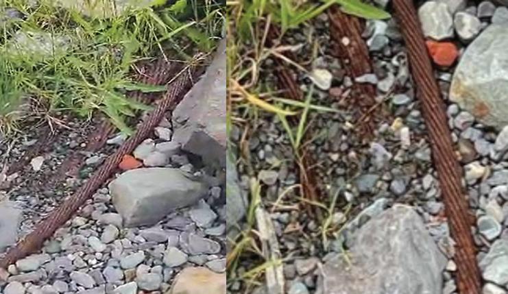
I’ll kick off this article by stating that I have known Derek since 2000. We first met in Plunket Malone’s office at the brand new 360 network’s Cable Landing Station and Data Centre in Clonshaugh, North Dublin. I remember it well. Derek dropped in to discuss network synergies between 360 Networks and BT Ireland. I was amazed at how progressive this was. Derek was, and still is, an enthusiastic & powerful motivator for anything that will
advance telecoms in Ireland. A true telecom visionary and projector of modern times, and a promoter of Ireland!
Derek and I both suffered through the dotcom bust, that affected the tech industries of the world, including Ireland and came out on the other side. We were tattered and torn but still working in the subsea environment. I returned to Canada in 2003, and we lost touch for a couple of years, but when reunited, we were surprised to find ourselves doing the same activity on each side of “the pond”: Submarine Telecoms Archeology. Though it is not really a science, as I think there are only two of us on the planet mad enough to do this, it is a fun hobby. One cannot beat a day walking along a beach, searching for long lost cable poking up or gutta percha flotsam snagged in the high tide debris line. Well, we must also give belated credit to a few good friends who listened to us enough to help us out by exploring beaches in their respective regions. They too found cables of the past!
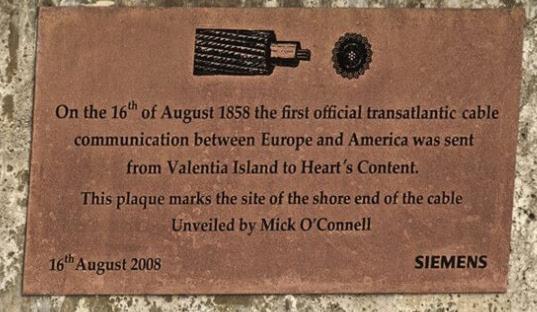
lead for the Valentia Transatlantic Cable Foundation. He is actively supporting their bid for World Heritage Status and is very involved with the Valentia Island Museum and Submarine Networks EMEA Advisory Board. On top of all his voluntary work, he has a full-time job and he is also completing his PhD in photonics in UCD Dublin.
For the past few years, we have chatted regularly to discuss our hobby. Derek suggested that we co-write an article for this May issue of Submarine Telecoms Forum. So, I agreed, then quickly thought of a way to make it
Derek is far more energetic than I and has been active in pulling together and organizing working groups [Irish Communication Research Group – ICRG] and participating in societies for subsea historical activities in Ireland and abroad, including the Heart’s Content-Valentia telegraph connection, and the Marconi 100th anniversary in Ballybunion in 2019. He also supports related contemporary subsea activities like cable protection in the Irish Sea. I have been fortunate to have been invited to participate in several projects organized by Derek. He also provides talks on his explorations and is very active as the technical

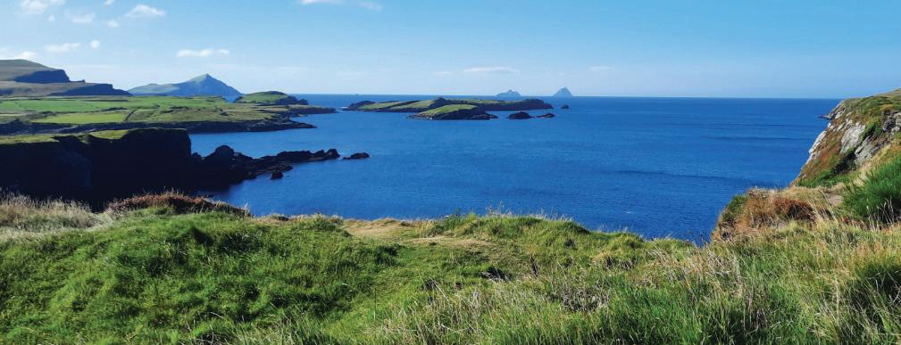
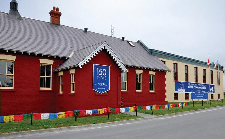
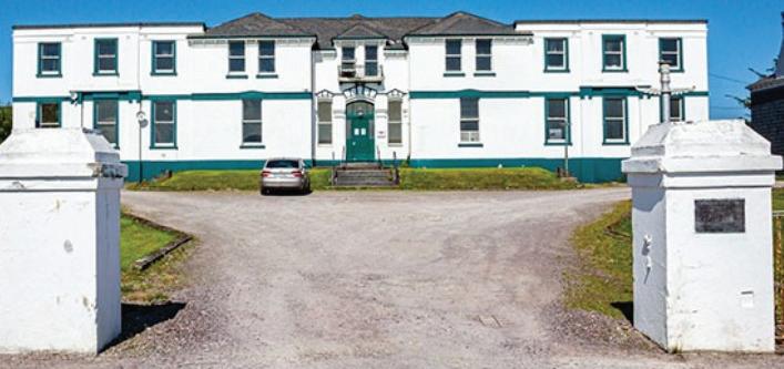
EZ PZ, due to time constraint, and a rare skeletal condition I have called lazy bones. With this lead in, welcome to our Submarine Archeology reflection, a review of how our two countries are united in a historical communication context. It is a collection of some of our historical findings on each side of the Atlantic. Hopefully you will enjoy it.
Well, enough of my babbling. I’ll let Derek have a turn and contribute to the introduction.
Well, it’s my turn now, Canada is lucky in that it cares for some of its historical communication artifacts and history. Here in Ireland, the historical communication past has been thrown out with the “bath water”, as they say, and very few artifacts remain. It is by doing active research in the Irish National Archives, Telecom Eireann [Eir] Archives, UK Archives in Kew and the UKHO archives in Taunton, talking to local communities and visiting
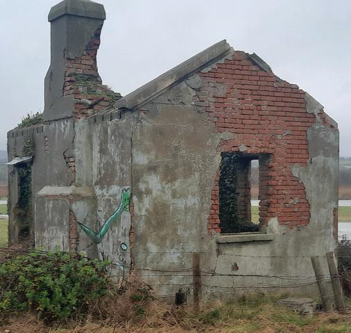
the long-lost cable stations, landing beaches and cable huts, that help bring Ireland’s past subsea history to life. Fortunately, Ireland is now seeing the benefit of its communication heritage alongside its other heritage portfolio. Historical research is very important, and Philip is very lucky in that the Canadian Government has kept everything where it was, for example Philip can put his hand on the original 1865 and 1866 trans-Atlantic Telegraph cables that come ashore at Heart’s Content, see figure 1. However, in Ireland we can only look at the original landing sites for the 1858, 1865 and 1866 trans-Atlantic Telegraph Cable, see figures 2, 3, and 4. It is a great pity that the historical heritage in Ireland associated with communications has not had the same respect or attention that buildings, art or engineering works receive for their historical importance. For example, there was a proposal by the Irish Government to recover all the old
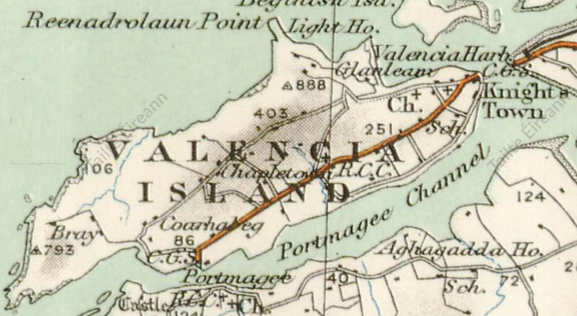
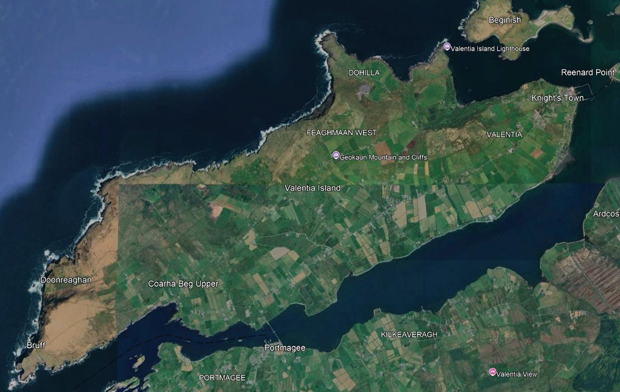
OOS cables, especially the telegraph cables so that the metals could be recycled. The ICRG raised concerns and objections against this proposal, along with other Heritage Societies and the Government project did not get off the ground as we challenged on the grounds of communication historical heritage and environmental issues.

But not to digress, as I said, we do not have any of the historical sites left that are taken care of, except for the Valentia Island Telegraph Submarine Cable Station, built in 1868, see figure 5. Other sites like the Newcastle Cable Hut, see figure 6, are still standing but it is in a very bad state, however the ICRG along with the new owners are working on a project to restore the cable hut to its former glory and make it into an interpretive center with a coffee shop and museum.
But before I continue, let me first talk about the two oldest remaining cable stations in the world, Valentia Island [1868] and Heart’s Content [1875] and their origins, location and establishment etc.
Valentia Island, see figure 7, situated on the southwest coast of Ireland, is remote. It is 373km from Dublin and 82km from Killarney, its nearest and largest town. Its link to the Irish mainland was via a boat service that was run by, and served, the local population. The largest town was Knightstown, which was designed and developed by Alexander Nimmo in the 1840’s and was laid out in a grid fashion. Its main road, Market Street, is in straight line with Reynard point. From here, a bridge was to be built, at a later date. The population of Valentia Island in the 1850’s was about 2,900. Knightstown would have had a population of about 240 but today the population on Valentia Island is around 658.
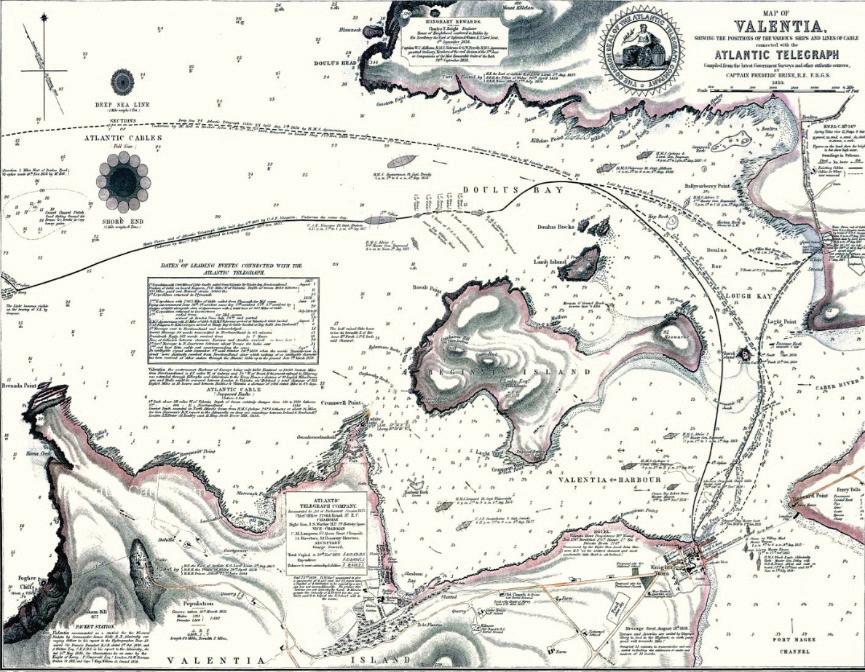
The islander’s life was based on a tenant farming live
style or being a labourer in the slate yard. The slate yard opened in 1816 and was owned by the Knight of Kerry. Its world-renowned slate was used in the UK House of Commons, British Library, Paris Opera House, and was awarded the recognition of International Union of Geological Sciences Heritage Stone, in 2024. Technology of any sort had not really reached Valentia Island. However, all this was about to change when the communication revolution started with the invention of telegraph in 1837. It took an-
other 20 years before the telegraph would reach Valentia, but when it did, little was it known that Valentia Island would be the birthplace of the Victorian Internet.
When Cyrus Field met with Fredric Gisborne in 1854 and the idea of the telegraph linking London and New York was proposed, a better and newer idea was born, and it was to connect Canada with Europe. The European terminus was to be selected and with the oceanic survey carried out by Lieutenant Maurey, US Navy, indicating the “Telegraph Plateau” and the closest landfall being the west of Ireland. The promotion of County Kerry, and especially Valentia, as the best place to land the cable, by the Knight of Kerry, Sir Peter Fitzgerald, 19th Knight of Kerry, (1808-1880). Whitestrand, Cahersiveen was selected as the eastern terminus of the telegraph cable while Bay Bulls Arm (now called Sunnyside), in Trinity Bay, Newfoundland was selected as the western terminus. The project to connect the old and new worlds got underway and in 1857 two attempts were made, but they were unsuccessful after the cable broke 330 miles [528Km] from shore. But during the winter of 1857, Charles T Bright successfully carried out the second recovery of a submarine cable (first was the June
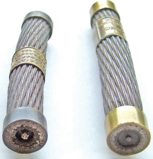
1856 recovery of the 1855 Gulf Cable STF #120 Sept. 2021). But it must be noted that Brights recovery was from off the continental shelf at over 3,500m depth and 330 miles whereas the 1855 cable recovery was from a depth of 400m and 25 miles of cable. In 1858 a third transatlantic attempt was made, which was successful and this time the cable was landed on Valentia Island, right beside what is now the RNLI Station. The plaque, as seen in figure 3 indicates the spot where the cable came ashore. Here it was laid underground in lead piping to the Slate Yard as seen in figure 8, where the telegraph hut was located and this in turn was connected to a temporary telegraph submarine cable going across Valentia Strand connecting to Cahersiveen and onwards to Killarney, see figure 9. However, tragedy struck when the cable failed within 30 days due to an electrical short, which was partly due to its storage on the Isle of Dogs/Plymouth between 1857-58, but primarily due to the ineptitude of Wildeman Whitehouse. However, there was another issue with the armoring twist, which is not possible in today’s submarine cables. The armoring twist of the 1858 trans-Atlantic cable manufactured by R.S. Newall was a left-hand twist, while the cable manufactured by
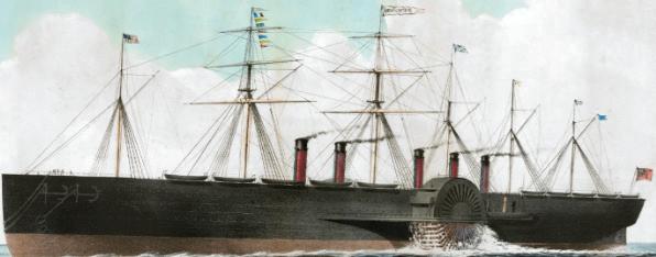
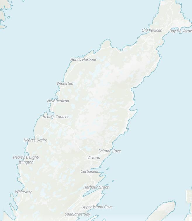
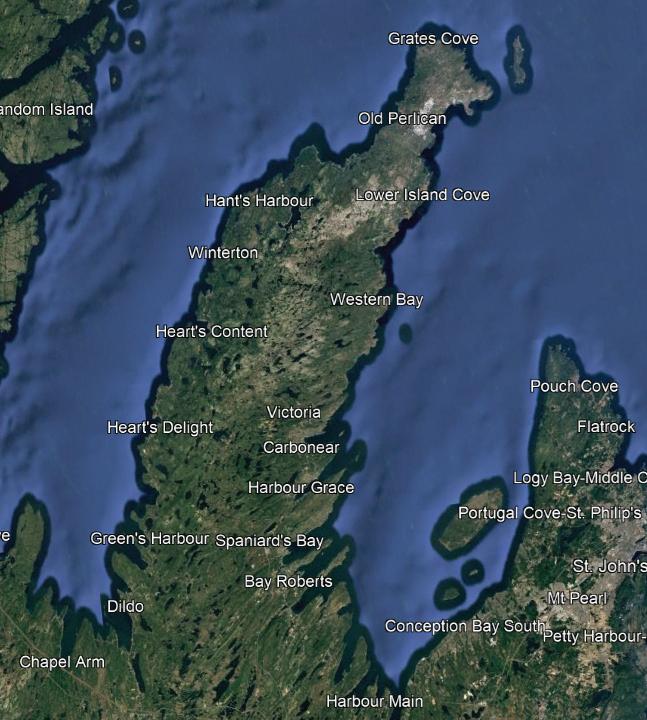
Glass-Elliot was a righthand twist, see figure 10. This would present problems when trying to connect the two cable sections together, but that will be discussed in another paper/article.
In 1865 a fourth attempt was made, but this time Foilhummerun Bay, on the west of the island was selected as the landing point. Instead of using two ships, as in the 1857-8 expeditions, a single ship, the SS Great Eastern was used, see figure 11. This ship was the largest in the world and designed by Isambard Kingdom Brunel. Unfortunately, this cable broke, approximately 660 miles [1056 Km] from Newfoundland and the location was recorded for the hope of recovery.
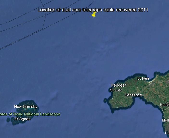
The 1866 expedition was also carried out by the SS Great Eastern and set sail from Foilhummerun Bay on the 13th of July 1866. This cable was successful, and it landed at Heart’s Content on the 27th of July 1866. This single event was just as historic as the landings on the moon as they started, what we now know as the internation financial and money markets and opened up the world to long distance telegraphy. It was also responsible in estab -
lishing the correct longitude and latitude across the Atlantic and especially across Europe to Canada helping to finally solve the issue of location and time on ocean voyages and international timekeeping, the azimuth is located on Valentia Island. The 1866 trans-Atlantic cable alone enabled society to establish correct timing across the continent or Europe.
Every year, I along with colleagues from the ICRG, carry out an exercise where we communicate directly with Heart’s Content via Morse code using historical telegraph keying equipment, celebrating the anniversary of the 1866 trans-Atlantic Cable connection. The two submarine cable stations communicate again in Morse code every year on the anniversary of the 1866 trans-Atlantic Telegraph Cable successful completion, and it has been recognized by the international organizations such as the UN, ITUT, UNESCO, ICPC and ESCA, hopefully might get Guinness Book of Records recognition which I know is in the pipeline.
Heart’s Content is a small fishing village on the east side of Trinity Bay, Newfoundland, see figure 12. Its main
source of living was fishing, and this was seasonal due to the harsh winter months. It is a small village with a few dwellings but its claim to fame is the landing position of the first successful Trans-Atlantic Telegraph Cable in 1866. However, it was not the only cable to land as many more cables landed here over the convening years. The cable station was built in 1875, replacing a temporary wooden structure (STF #122 Jan. 2022). And it is the second oldest cable station in the world that is still in use and is a working museum, just as Valentia Island Cable Station is.
Both Valentia and Heart’s Content are on their respective countries World Heritage tentative list and the Irish Communication Research Group is actively and heavily involved in pursuing and assisting Valentia Island in achieving World Heritage Status as is Philip on the Canadian side, with Heart’s Content.
But that’s not where the story ends, both Philip and I are engaged in historical communication heritage research and our goal is to try and preserve the past so that future generations can understand the awesome power of communication and its historical past. Ireland, just like Newfoundland, has established new submarine cable stations for the new optical submarine cables. However, the original landing points for telegraph submarine cables in Ireland are located in Ballinskelligs Co Kerry, Blackwater Co Wexford, Donaghadee Co Antrim, Greenore Point Co Wexford, Howth Co Dublin, Newcastle Co Wicklow, Valentia Island Co Kerry, Waterville Co Kerry and Whitehead Co Antrim. Donaghadee is noted as the first cable landing in 1852 followed by Howth, also in 1852. However, the first submarine cable to carry traffic, albeit for 3 days, was the Howth cable. It also must be noted that only Newcastle and Valentia have their respective cable landing stations/ huts still standing. Donaghadee is still used by BT but is a totally different cable station and landing point, the original is long gone and lost to history.
But let’s talk about the reason why I and Philip have become good friends and members of the Irish Communication Research Group, we have a deep interest in historical artifacts and when we get our hands on any that are from our communication past, we get very excited. I have always had an interest in communication history, submarine cable technology especially since I have been working in the industry since 1999. In the early 2000s my interest was sparked by seeing a chart of the Irish
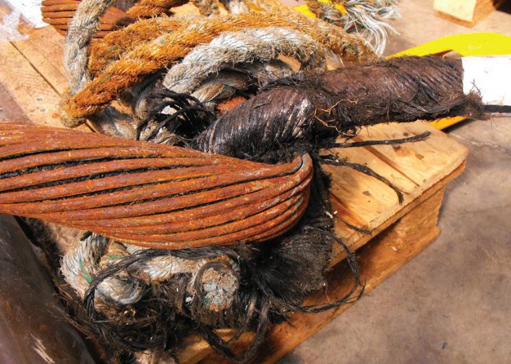
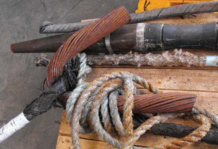
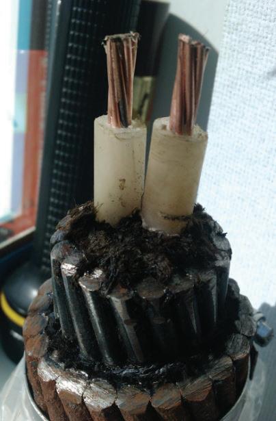
Sea and noticing that the old Newcastle telegraph submarine cables were still on the seabed. After many visits to the Royal Navy Hydrographic Office in Taunton Somerset England known as the UKHO and visiting archives across the British Isles I had built up a personal archive on the location of submarine cables and their landing sites etc. However, in 2011 my interest took a turn that would increase my drive and charge my interest ever since. I was on a submarine cable repair, about 47kms from Whitesands or Sennen Cove in Cornwall, as can be seen in figure 13.
We recovered the cable section that was damaged, and it was a huge surprise to see a dual core telegraph cable tangled
up with my optical submarine cable. The forces needed to unite these two cables together must have been enormous. Trawl doors do have a lot of kinetic energy but to cause this damage had more energy associated with it. It is my belief that the old telegraph cable was being recovered but not by normal means and in the process tangled up with my submarine optical cable and caused the damage. I now had an enthusiasm to find out why this happened, how it happened and to identify and research the details of the telegraph cable. This cable had two cores and was insulated by polyethylene. A search of cable routes had not produced any evidence of this telegraph cable in any list or documentation, it can be taken that this is a OOS military cable, the reason is that polyethene was discovered in the 1930s but only military cables were using the insulation long before commercial submarine cables and as this cable was not recorded it can be taken that it was an OOS Military cable. As you can see in figure 14, the telegraph submarine cable is wrapped around the optical submarine cable. In figure 15 you can see the tangled cables along with an optical joint and a section of modern optical submarine cable, all for comparison. Figure 16 is a prepared section of the unknown telegraph submarine cable or OOS military submarine cable. Now, from this point onwards I started to reach out to cable repair companies like Global Marine, ASN, Oceanic Environmental Cables and Subcom in the hope of getting examples of telegraph cables from the seabed. I have built up a good relationship with these companies both on an industry and working level and a personal level. They sometimes reach

out directly to me with offers of cable samples. I am in contact with the Irish Department of Marine and Communications [DECC] who update me with new developments in the subsea world. However, I also deal with the fishing industry as part of my day job, and they also come across cables and offer examples to me. Being in this position allowed me to use the industry to assist me in my hobby and my role within the ICRG to help promote our communication heritage. As can be seen from table 1, 2 and 3 below I have listed the telegraph, coaxial and optical submarine cables that I have managed to donate to museums etc. Although I have received a lot more cables than the ones listed, I carry out research on each cable I get, identify it and then prepare it for dona -
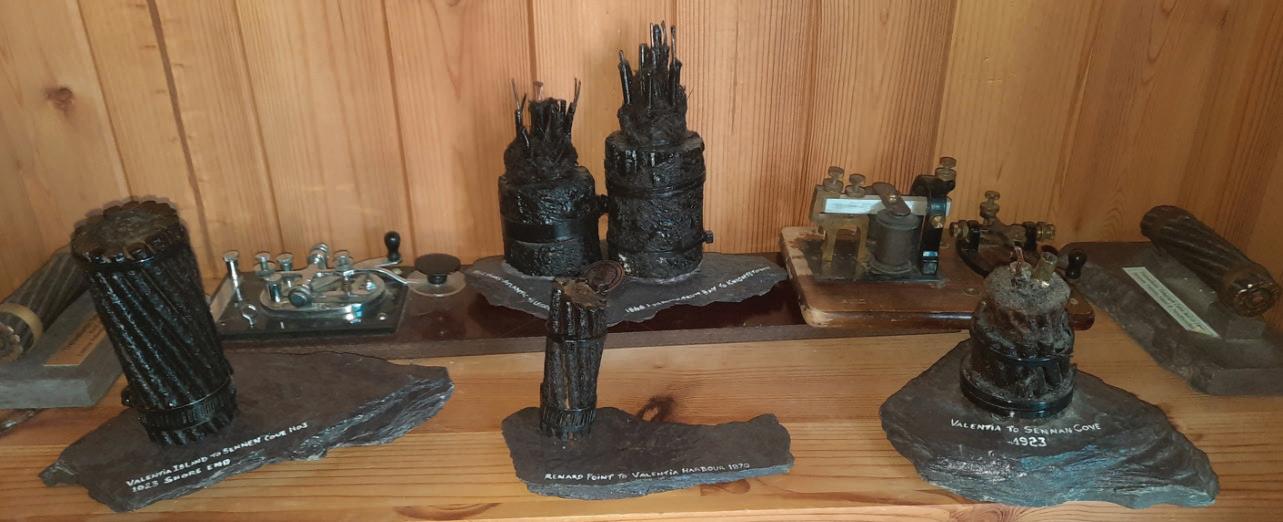
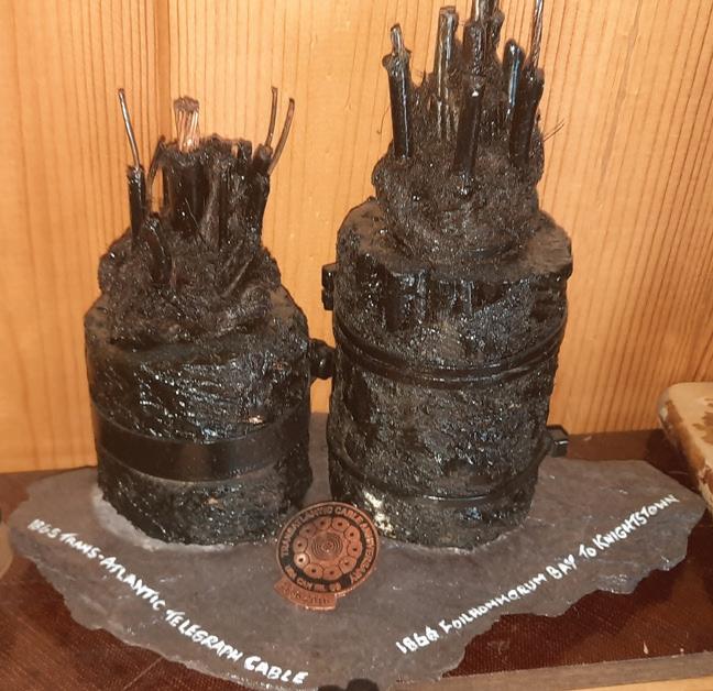
tion to various museums that cater for communication heritage like Valentia Island Cable Museum, Valentia Heritage Museum, Kerry County Museum, Porthcurno Submarine Cable Museum and the UKHO. However, as said I have only managed to donate some so far. I have also collected Coaxial and optical submarine cable samples which have also been researched, prepared and presented to museums. I have also
collected old telegraph keys, telegraph instruments etc. as seen in figure 17, which is an 1860s Mirror Galvanometer. Also in figures 18 to 21 are examples of submarine telegraph cables, telegraph keys, telegraph sounders and optical submarine cables.
In table 1 below I have listed the telegraph submarine cables that I have collected, prepared and donated to various museums etc. Although I have managed to collect a lot more telegraph cables, I have only managed to get the cables listed in table 1 sent out to museums. In table 2 I have listed the coaxial cables that have been researched, prepared and donated, again this list is only the donated cables as I have more to research, and table 3 is the optical cables, again only listing the donated ones.
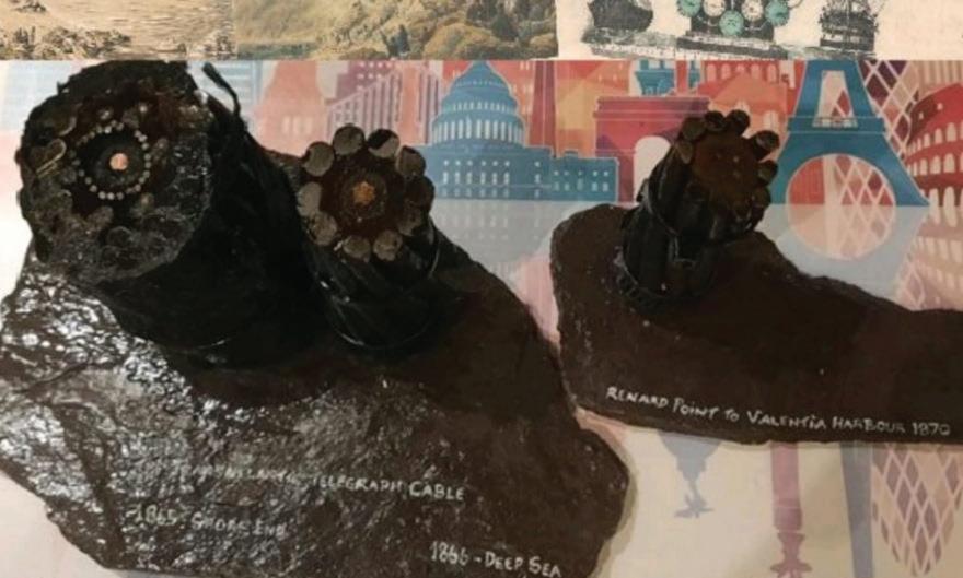
I am an avid collector of subsea cables, and I am waiting on samples of TAT-1 which I has been promised and a sample of the 1858 trans-Atlantic cable which another collector is sending me a sample. However, if I get a good enough sample size of TAT-1 and the 1858 cables I will prepare a piece of them for donation to a museum that will appreciate them.
During my research I have also come across may maps which I have received from BT Archives, Kerry County Council, UKHO, Irish National Archives and the archives in New York, UK [KEW] and Telecom Eireann [EIR] Archives. I have included some of these in figures 22 and 23 for information. I use these maps and charts [I use up to date navigable charts
as well which sometimes indicate OOS cables] to try and locate the landing points for each cable and to try and identify them. An example is the 1923 Valentia Island to Sennen Cove telegraph cable, which is the last cable to leave Valentia Island and the only cable to go the opposite side around Valentia past Portmagee Harbour, as can be seen in figure 23 below. I also include a picture of a prepared example of the 1923 Valentia Island to Sennen Cover cable as seen in figure 24.
Another cable that I found, one of the very few that I have seen still in place is the 1870 4-core telegraph cable connecting Valentia Island to the mainland. As this cable is still there,
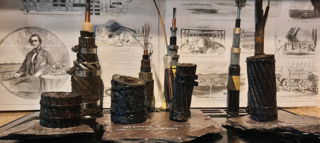
I have kept its location a secret as I fear people will go and recover it just for its metal, which is difficult to recover and a hazard to the environment and it will destroy an important piece of our communication heritage. However, samples that I have recovered, with agreement of the Irish Department of Heritage and Kerry Co. Council and the Heritage Council [No samples have been recovered from beaches but from the seabed by cable recoveries, route clearances, fishing and donated by other enthusiasts]. These samples have been prepared and donated to the Valentia Island Cable Museum, Valentia Heritage Centre, Porthcurno and the Royal Naval Hydrographic Office [UKHO] as they will respect its importance and display it as an historical artifact for people to enjoy and research.
Well, that’s all I can cover in this first part of our article on Two Worlds Connected-Communication Heritage. Philip will follow up on his contribution in two months. We will also continue with joint contributions. Upcoming topics will include: “Submarine Cable Repair” and “Cable Insulation and Design Innovation”. STF

1852 Aber Geirch (Nevin), Wales - Newcastle, Ireland
1852 Holyhead, Wales - Howth, Ireland
1865 Valentia, Ireland - Heart’s Content, Newfoundland
1866 Valentia, Ireland - Heart’s Content, Newfoundland
1869 Brest, France - St. Pierre - Cape Cod, USA
1870 Port Kale - Donaghadee, Ireland
1874 Porthcurno–Harbour Grace
1881 Canso, Nova Scotia - Whitesand Bay, Sennen Cove, England
1882 Canso, Nova Scotia - Whitesand Bay, Sennen Cove, England
1884 Dover Bay, Nova Scotia - Waterville, Ireland - Weston super Mare: Waterville, Ireland - Le Havre, France
Valentia Island Cable Museum
Valentia Island Cable Museum
Valentia Island Cable Museum, Valentia Heritage Centre, Porthcurno
Valentia Island Cable Museum, Valentia Heritage Centre, Porthcurno, Google Cable Museum
Valentia Heritage Centre, UKHO Taunton
Valentia Island Cable Museum, Porthcurno
Valentia Island Cable Museum, Valentia Heritage Centre, Porthcurno
Valentia Heritage Centre, Porthcurno
Valentia Island Cable Museum
Island Cable Museum, Valentia Heritage Centre, Porthcurno
1886 Aber Geirch, Wales - Newcastle, Ireland No 1 Valentia Island Cable Museum, Valentia Heritage Centre, Porthcurno
1892 Aber Geirch, Wales - Newcastle, Ireland No 2
1894
Dover Bay, Nova Scotia - Waterville, IrelandWeston super Mare, England - Le Havre France
1901 Azores - Waterville, Ireland
1905 Nova Scotia - Waterville - Weston super Mare
Valentia Island Cable Museum, Valentia Heritage Centre, Porthcurno
Porthcurno Cable Museum
Valentia Island Cable Museum
Valentia Island Cable Museum
1910 Waterville, Ireland - Weston super Mare, England Porthcurno
1918 Valentia, Ireland - Porthcurno, England
1923 Valentia, Ireland - Whitesands Bay, Sennen Cove, England
1930s Dual Core Military Cable
1938 Aber Geirch - Howth No 3
DEREK CASSIDY is doing a part-time PhD in the field of Optical Engineering which covers Photopolymers, Self-Written Waveguides, and Wavelength manipulation/Opto-Electronics with UCD under Prof. John Healy and Prof. John Sheridan. He is a Chartered Engineer with the IET/UK Engineering Council-Engineers Ireland and Past-Chair and Committee Member of IET Ireland. He is Chair of the Irish Communications Research Group, Advisory Board Member of Submarine Networks EMEA/World and member of numerous standards committees on Optical Engineering under the umbrella of the IEEE and
1898 Aber Geirch, Wales - Newcastle, Ireland No 2
Future Networks. He is also currently researching the Communication History of Ireland. He is a member of SPIE, OPTICA, IET, IEEE, Engineers Ireland, ACMA, ICPC and ESCA. He holds patents in Mechanical and Design Engineering and author of over 30+ papers on Photonics, Submarine Cable Technology, Communications and Optical Engineering. He has been working in the telecommunications industry for over 30 years managing submarine networks DATE
Valentia Island Cable Museum, Valentia Heritage Centre
Valentia Island Cable Museum, Valentia Heritage Centre, Porthcurno
Valentia Heritage Centre, Valentia Island Cable Museum, Porthcurno, UKHO Taunton
Valentia Heritage Centre, Valentia Island Cable Museum, Porthcurno
Valentia Heritage Centre, Valentia Island Cable Museum, Porthcurno
Table 1: List of telegraph cables recovered from the seabed, researched, prepared and donated to museums
and technical lead on optical projects, both nationally and internationally with BT. He is technical Lead for Valentia Transatlantic Cable Foundation and the Valentia Island World Heritage Bid. Derek holds the following Degrees: BSc (Physics/ Optical Engineering), BSc (Engineering Design), BEng (Structural/Mechanical Engineering), MEng (Technology & Policy Development and Forensic Engineering), MSc (Optical Engineering) and Higher Diploma in Cybersecurity.

PHILIP PILGRIM is the Subsea Business Development Leader for Nokia's North American Region. 2021 marks his is 30th year working in the subse a sector. His hobbies include "Subsea Archaeology" and locating the long lost subsea cable and telegraph routes (and infrastructure). Philip is based in Nova Scotia, Canada.
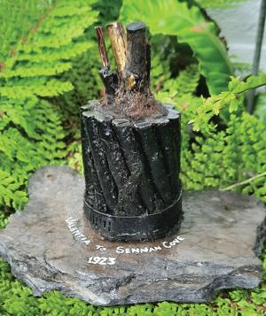
1947 Holyhead - Dollymount 1 & 2
1950 Port Kale - Donaghadee 6 & 7
1954 Aberdeen, Scotland - Bergen, Norway
1961 CANTAT A: Oban, ScotlandHampden, Newfoundland
1988 Holyhead, Wales - Portmarnock, Ireland BT-TE-1
1988 TAT 8: Tuckerton, New Jersey - Widemouth Bay, England - Penmarch, France
1994 CELTIC: England - Ireland
1995-6 TAT 12/13: Rhode Island, USA - Porthcurno, England - Penmarch, France - Shirley, New York
1999 ESAT 1: Whitesands Bay, England - Kilmore Quay, Ireland
1999 ESAT 2: Ainsdale Sands, England - Dublin, Ireland
2000 TAT-14
2011 CeltixConnect
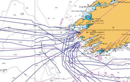
Valentia Heritage Centre, Valentia Island Cable Museum, Porthcurno
Valentia Heritage Centre, Valentia Island Cable Museum, Porthcurno
Valentia Island Cable Museum
Valentia Island Cable Museum, Porthcurno
Valentia Heritage Centre, Valentia Island Cable Museum
Valentia Heritage Centre, Porthcurno
Valentia Heritage Centre, Valentia Island Cable Museum, Porthcurno, UKHO Taunton
Valentia Heritage Centre, Valentia Island Cable Museum, Porthcurno, UKHO Taunton
Valentia Heritage Centre, Valentia Island Cable Museum, Porthcurno, UKHO Taunton
Valentia Heritage Centre, Valentia Island Cable Museum, Porthcurno
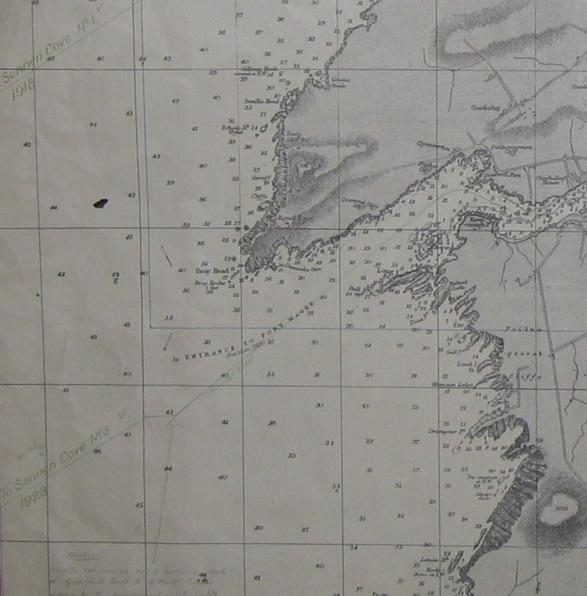
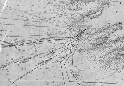
Every Author. Every Article. Instantly Searchable.

A New Era of Discoverability Has Arrived

Total Unique Authors: 770
Total Tags: 276
TOP 5 TAGS BY ARTICLE COUNT:
Network Operations & Management –943 articles
Technology – 820 articles
Risk & Safety Management – 720 articles
Project Management – 670 articles
Regions & Countries – 508 articles
BY PHILIP PILGRIM
The subject of this Back Reflection is a strange business case from Cyrus Field promoted in England in early 1856 to entice steamship owners to partake in the Atlantic Cable project. I stumbled across this nugget while researching. It comes from the online digital archives of Memorial University. The business case was re-printed in the Patriot newspaper on June 9, 1856 [Figure 1].
The business case is most unusual as it is a large step backwards from Field’s 1854 grandiose announcement of a project to telegraphically connect London to NYC using an Atlantic Telegraph Submarine Cable. “Connecting the Old World with the New”. Also, the business case was not new. It was first projected by Frederic Newton Gisborne in 1850. By early 1852, the same business case founded the companies: Newfoundland Electric Telegraph Association and the New York and Galway Steamship Company (Tebbetts, Holbrook, Gisborne). They failed in 1853 and Cyrus Field “picked up the scraps” in early 1854.
When Field pivoted, and publicly announced the new business case, it was February 1856 and the Atlantic Cable project was not going so well. He was just starting the third year of the project.
The critical path for Field’s Atlantic Cable was to connect the western most point in Europe (Ireland) with the Eastern most point in North America (Newfoundland). At this time, there was telegraphic communication from
London to Ireland however, Field still had to reach the eastern most point in North America, Newfoundland. Further to this, his first attempt to lay a cable to Newfoundland, in 1855, failed in spectacular fashion. It was observed and reported worldwide through newspapers, magazines, and books
On the heels of the 1855 cable failure, Field faced terrestrial network challenges: the length of the working network to NYC was too short. It only reached Baddeck, Nova Scotia. Field was still constructing the terrestrial network across Newfoundland and through Cape Breton, N.S. Approximately 800 km remained to complete.
Field’s plan for 1856 was to complete these terrestrial routes and to lay a new submarine cable to Newfoundland across the Gulf of St. Lawrence (aka the “Gulf Cable”). This would be the first significant submarine telegraph cable in North America. It would be approximately 120km in length and connect the island of Newfoundland to the Nova Scotia (continental North America). Once this
cable was laid and the terrestrial paths completed, he could start his revised business plan of connecting the Old World with the New by using steamships across the Atlantic.
Hindsight is 20/20 so we can lookback and see that from late 1856 (after the successful Gulf Cable lay and terrestrial completions), Cyrus Field’s revised business case was successfully executed for the next 10 years! During this time, the Gulf Cable and

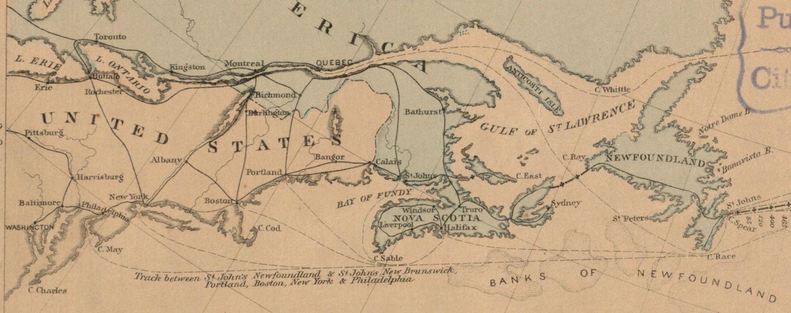
terrestrial path across Newfoundland carried all telegraph traffic to Europe via steamship intercepts and landings in Ireland and in Newfoundland.
Only for the short one month window, in August 1858, did Field’s Atlantic Cable operate and replace the transatlantic steamships. The revised business plan started by Gisborne and completed by Field worked perfectly!
Field’s revised business plan, published in February 1856 from London is transcribed and follows, but first I must digress.... SUBOPTIC!
I had the privilege to attend SubOptic in Lisbon this year and pass out samples of the Gulf Cable (mentioned above) and also sections of the wire from the terrestrial Pole Line across Newfoundland. These were parts of the telecom workhorses that connected the Old World with the New from 1856 to 1867.
I had promised this SubTel Forum’s article would describe their
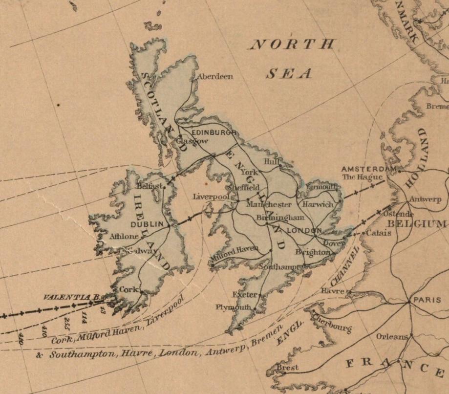
cable samples, so like Field, I will pivot and not feel too guilty. The next Back Reflections article, in September 2025, will have more details (and pictures) on the 1856 Gulf Cable (including descriptions of the lay and how the samples were discovered).
In the meantime, I hope this article is a sufficient prelude that exposes the great significance of the scraps of metal I shared.
We fulfill our promise of publishing today, the statement of Cyrus W. Field, Esq., on the advantages of making St. John’s a Port of Call for Ocean Steamers. We can add nothing to the lucid and able statement of Mr. Field, but commend it to the attention of our readers:
Of some of the advantages attendant upon making St. John’s, Newfoundland, a Port of Call for Transatlantic Steamers.
By a slight examination of a chart of the North Atlantic Ocean, it will be seen that Newfoundland occupies a very important position between Europe and America, not only in reference to its south-eastern terminus, Cape Race, the point which all steamers desirous of making short passages endeavor to sight, but also due to its commanding position at the mouth of the Gulf of St. Lawrence, and its consequent value to the nation controlling its vast and hitherto only partially known resources.
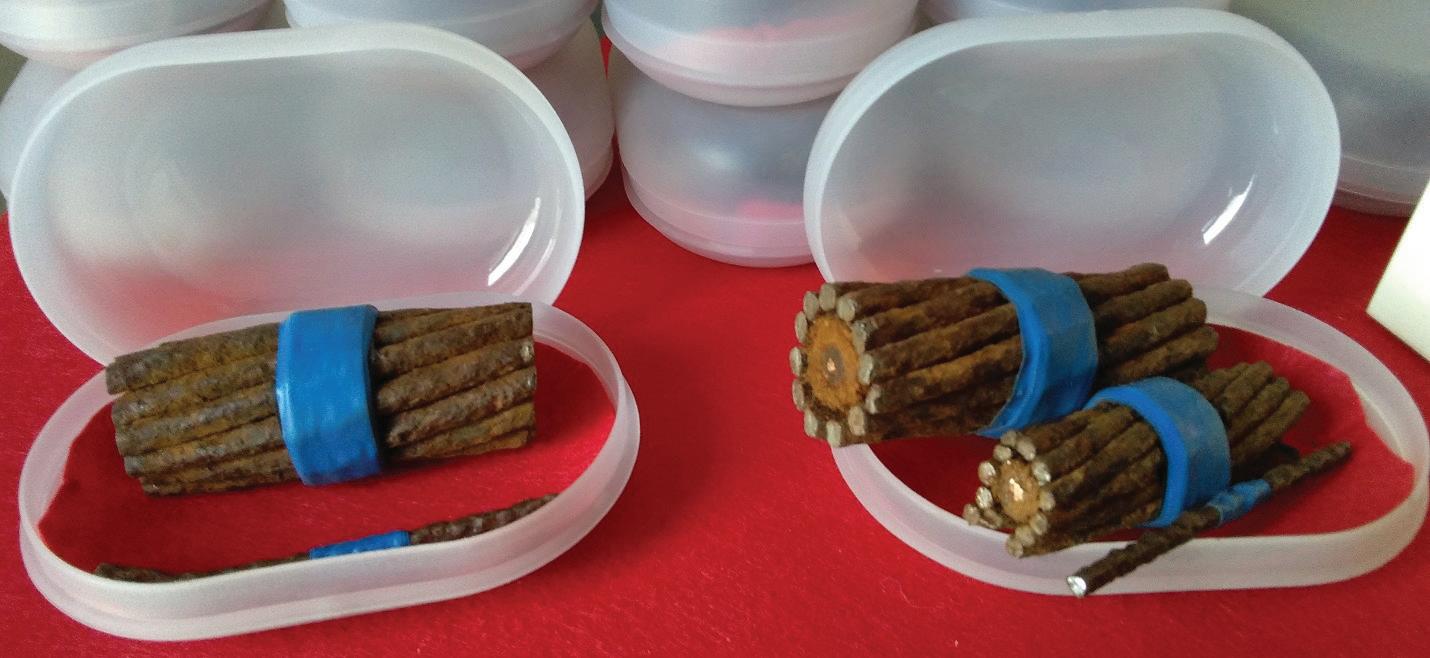
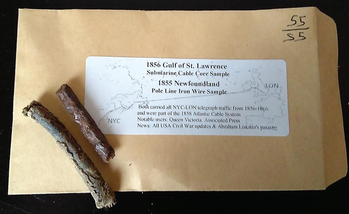
That portion of its eastern shore which extends northwards from Cape Race to Cape St. Francis, being more particularly interesting in reference to Transatlantic Steam Navigation, requires but a brief description to prove its advantages over any other part of the American seaboard as a point
of approach. This part of the coast throughout its entire length has a fine bold shore, without rocks or shoals of any description to endanger vessels making the land, while the existing lighthouse on Cape Spear, and the superior one to be erected this year on Cape Race, can be seen at a great dis-
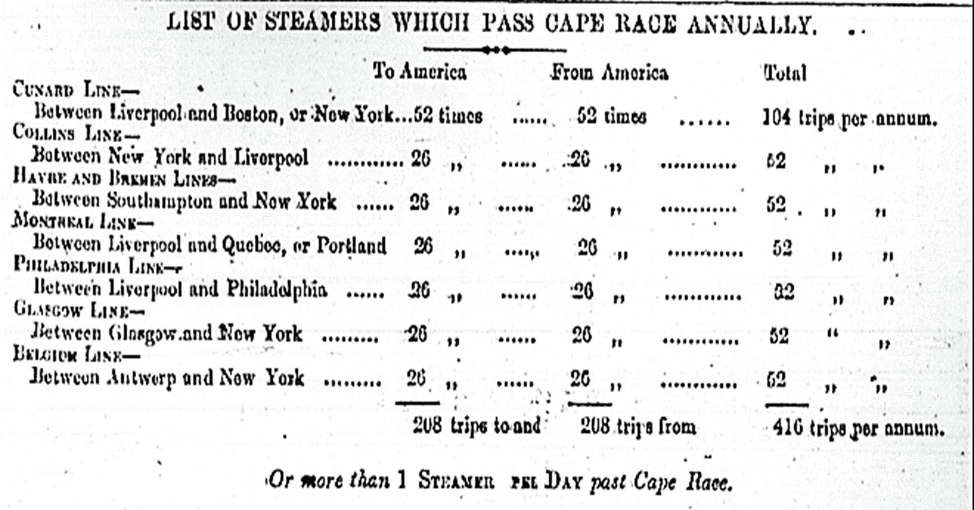
tance—and in clear weather light the entire coast between the two Capes.
The evidence of experienced mariners proves the eastern shores of Newfoundland to be much more free from fogs than most parts of the North American coast. It is only when the wind varies in the unusual quarter between east and south that the heavy sea fog from the Great Banks drifts in upon the land; and then it is so common to find clear weather within a mile of the shore, that persons well acquainted with the navigation of Newfoundland run boldly through the fog, the safe nature of the coast justifying the practice.
May, June, and July are the months when fogs prevail, and they are noto-
riously more frequently encountered south and west of Cape Race than north and east of that point. Halifax Bay is particularly subject to them, and although the entire coast of Nova Scotia is beset with reefs and hidden dangers, the Cunard steamers have hitherto experienced no difficulty, and but little delay, in making port in consequence of thick weather.
There are eight harbors between Cape St. Francis and Cape Race, a distance of about 90 miles, into which vessels of any size can enter easily and anchor safely. St. John’s, the most northerly, with a population of about 27,000, is the chief commercial depot and capital of the colony.
The harbor of St. John’s possesses
the advantages of being ample and land-locked; of having great depth of water, with very little rise and fall of tide; thus enabling the largest ships to enter and leave at all hours. The entrance is free from rocks or hidden dangers, and so short that a steamer can reach her wharf within half a mile of the broad Atlantic. There is an excellent harbor light, and during the present year a wharf will be constructed, and machinery erected for the express purpose of coaling ocean steamers in the most rapid manner. There is also an 18-pounder gun fired every half-hour at the harbor’s mouth when the weather is foggy.
In the months of March and April, the northern ice floats past the eastern
shores of Newfoundland, frequently reaching 40 degrees of north latitude, equally obstructing vessels bound to Halifax, Boston, and St. John’s. In fact, during April, it not infrequently happens that vessels making the southern passage meet with great obstruction, while the ocean northeast of Cape Race is free from ice; the floes having gone rapidly by to linger in lower latitudes, where the southern currents detain them, often for a considerable time.
The Custom House returns show the arrival and departure of vessels to and from St. John’s during every month in the year, and in the memory of the oldest citizen, the harbor has been known to freeze entirely over only on two occasions; thus proving the comparative mildness of the climate, which is in fact less severe by several degrees than Halifax or Boston, consequent upon Newfoundland being entirely surrounded by salt water.
The great circle sailing line for ocean steamers between the English Channel and New York, when drawn across the chart, almost intersects the harbor of St. John’s, and in the event of vessels ever being prevented from approaching this port due to floating ice, the harbor of Trepassey, eleven miles southwest of Cape Race, would be available, as it would be freed from obstruction by the same wind which would block the eastern shore. It is therefore proposed to have equal facilities for coaling steamers in this latter port, so that captains may rely with confidence upon being supplied at either place during any season of the year.
The average detention of a steamer in the harbor of St. John’s would not exceed two hours, in consequence of the perfect arrangements for rapid coaling. The extra distance to be run in making port would not exceed twenty miles in and out, or two hours of additional time—making four hours in total—a trifling period compared to the gain in speed which would ensue from steamers departing with less coal and in lighter trim, and to the increased amount of income from extra freight room.
Nothing, however, can add more to the importance of St. John’s as a port of call than the establishment of the line of electric telegraph between St. John’s and New York, which will be completed this summer—supplying news, both political and commercial, between the American continent and all Europe, from three to five days in advance of any other present means
of communication, and thus enabling the British Government to exchange telegraphic dispatches in cypher with its colonies of Newfoundland, Nova Scotia, Prince Edward Island, New Brunswick, and Canada, and with its Minister at Washington, at least twice a week several days in advance of the mails.
The American Government can also, by these arrangements, very materially anticipate its present means of communication with its Representatives at the European Courts.
The steamers belonging to existing Transatlantic lines already pass Cape Race no less than 416 times during the year, independent of incidental passages, as per the following list:-[Table 1]
Very many of the foregoing steamers could be intercepted and communication held with the without causing detention (in case that they did not
desire to touch in at St. John’s.) by having a small steamer stationed off Cape Race, thus gaining additional time in the receipt and delivery of the more important telegraphic dispatches and mails to and from Newfoundland.
The time must arrive when Newfoundland will become the place from which many sailing vessels will receive “orders” from their owners and consignees. The vast trade of the St. Lawrence and the great inland lakes now floats past its ports, and it is but reasonable to suppose that when shipowners can rely upon the prompt and safe delivery of their dispatches, many vessels crossing the North Atlantic will there receive “final orders” for their destination. St. John’s will then become the storehouse of the Gulf, and add greatly to the remunerating traffic of ocean steamers entering her port with regularity
The port charges of St. John’s are remarkably light—being £4 for pilotage for vessels over 300 tons, and the light dues, although 6d. per ton once a year, would in all probability be rescinded in favor of ocean steamers.
Good Scotch coal can now be furnished to steamers at a cost not exceeding 16s. per ton from the wharf, and fresh provisions as cheaply as in Boston or New York.
It remains only but to show the amount of business which may reasonably be expected to accrue to the first line of steamers which will call regularly at St. John’s for mails, passengers, and telegraphic dispatches
• The local Government would probably agree to pay an annual bonus to any Government which will make
St. John’s a port of call semi-monthly during ten months of the year.—a bill to that effect having once actually been passed, say £3,000
• The number of cabin passengers to and from Europe direct, and via Halifax average now 300 per annum, making at £20 each £6,000
• Passengers to and from the British Provinces average now 200, making at £4 each £800
• Passengers to and from the United States direct, say 200 at £6 each £1,200
• Steerage passengers not included in the above statement, to and from Europe, say 200 at £5 each £1,000
• To which must be added an increase of at least 50 per cent by the substitution of direct steam communication £6,000
• Probable amount of freight for dry goods to St. John’s per annum, say 1,500 tons at £6 per ton £4,500
• Probable grant from the British Government, as they now pay £4,100 for carrying the mails between Halifax and St. John’s £6,000
• Add to which, that the “New York, Newfoundland, and London Telegraph Company,” are willing to pay a postage of one dollar upon every message brought from or conveyed to Newfoundland, for transmission across their lines, which upon the very moderate estimate of 500 messages only for each trip once a fortnight during the year, would yield the sum of £5,200
Making a total of or nearly £1,300 sterling per round voyage for the local business of St. John’s, to which must
be added an additional sum of at least £1,500 sterling for extra freight carried each voyage between Europe and America from the diminished amount of coal required when starting.
It is anticipated that at least one of the Telegraph Companies in Great Britain will make arrangements to deliver and receive dispatches off Cape Clear or Cork, thus shortening the time on the European side fully one day, and as any first-class steamships now plying between Europe and America can easily make the run from Cape Clear to St. John’s during moderate weather within six days, we should thus have a diminution of at least from four to five days in the receipt of intelligence, and as we have clearly shown that it is manifestly to the interest of ocean steamers to make St. John’s a port of call, it is to be hoped that it is only necessary to call the attention to the foregoing important facts, in order to receive their cooperation in securing to the great boon of bringing the old and new worlds into such immediate and friendly proximity.
Cyrus Field
London, February 1856 STF
PHILIP PILGRIM is the Subsea Business Development Leader for Nokia's North American Region. 2021 marks his is 30th year working in the subse a sector. His hobbies include "Subsea Archaeology" and locating the long lost subsea cable and telegraph routes (and infrastructure). Philip is based in Nova Scotia, Canada.
BY ANDRÉS FÍGOLI
Regulatory fees serve several purposes: to compensate states for the use of their maritime space, to ensure environmental protection, and to support administrative processes related to the protection of submarine cables, including instances of conflict with other new seabed infrastructure. However, these fees are often not adapted to the realities of the submarine cable industry, resulting in delays in permits for installation and repair, unpredictable financial obligations that hinder long-term planning, or even discriminatory practices that may violate international treaties.
In this article, we will analyse the main types of regulatory charges that affect any installation of submarine cable systems, how these charges interact with current market trends, and finally propose a way towards a more equitable treatment of all stakeholders. Special emphasis will be placed on considering the current market gaps between telecommunication companies and OTTs.
It is well known that there are two main types of regulatory charges in the submarine cable industry. Those collected by the local authority that issues the permit for the installation of the submarine cable within its jurisdictional waters, and the others that are related to the use of such a system, usually paid to the national telecommunications entity.
This scheme may vary with the countries, both permits combined into a single one, payment to only one
entity or other variables, but for the purpose of this article we will maintain this differentiation in order to analyse each revenue source and its rationale.
In addition, there are other charges to be taken into account, both during the installation phase of the submarine system and during its operation, such as payments to environmental authorities for the granting or renewal of the environmental permit, customs duties on the import of cables and their spare parts, as well as other charges that are beyond the scope of this article. Strictly speaking, regulatory charges are only those imposed by the national telecom regulator, but in the context of this article we will consider all those paid to any government agency in accordance with a national legal framework.
For each installation permit or use of the seabed, countries use different methods to calculate regulatory fees, including:
• Flat fees: Standard amounts applied universally, regardless of cable length or total capacity. They can be applied per system or per segment (e.g. two segments of the same system reaching the same cable landing station).
• Length-based fees: Charges based on the length of the cable within a country’s territorial or exclusive economic zone (EEZ). The longer the cable, the higher the fee.
• Total design capacity-based fees: Charges determined by the technical specifications of the entire cable
system (e.g. number of fibre pairs) or its design capacity, the maximum theoretical capacity that such a submarine cable can carry.
Each model has its drawbacks. Flat fees do not take into account differences in cable length or potential use (e.g. a 2002 submarine cable may pay the same as a newer system with 16 fibre pairs), or where there are two segments reaching the coastal country (e.g. a branch may not be treated differently), while length-based fees do not take into account the economic benefit of higher capacity systems.
In some cases, the charge is calculated against the area it occupies, including the protection zone up to half a nautical mile on either side of the cable, as this is considered to be an area reserved for such infrastructure. In others, it is not an area but only the length of the submarine cable in kilometres, also multiplied by a fixed factor.
Other nations have also decided to charge for cables crossing their EEZ without landing on their territory. It is therefore always advisable to obtain a local legal opinion before carrying out survey activities to assess the amount of regulatory fees that will be paid over the next 25-30 years. Indeed, this is a good reason to change the cable route before it affects the business case, and in-house counsel should be ready to raise a red flag before it is too late to re-route.
We believe that in all these cases there should be proportionality with respect to the actual use and benefits
derived from the marine areas. Ideally, there should be a hybrid model combining the following 2 factors:
• Length of cable: Fees based on the physical footprint of the cable. If there is a protection zone granted by the coastal state, such an area should not be included in the calculation as it is in fact an obligation of the coastal state to protect its own digital sovereignty, even though in most cases a private investment is involved.
• Total design capacity: Additional charges for higher capacity systems. This would ensure that operators who benefit more from the use of the seabed contribute proportionately without penalising smaller projects.
In addition, the quantum should optionally allow for the loss of tax revenue due to the reduction in fish catches, if any, for this new cable route. This is one of the most significant revenue losses for the government, especially given the well-known global crisis in the fishing industry due to overfishing and inefficient management of resources. Projections based on historical data from the past decade can guide these estimates, ensuring that fees are both fair and data-driven, especially if the fishing zone moves towards the cable zone or further away from it.
Above all, governments would demonstrate transparency and cooperation by providing clear guidelines and the rationale for how fees are calculated. Over the 25-30-year lifespan of the subsea system, regulatory fees could be adjusted based on losses in the fishing
industry and the overall capacity of each submarine cable system.
Other tax incentives should also be tied to the cable owner dedicating a fibre for SMART repeaters provided that the scientific data is shared with the coastal state. This approach would encourage the submarine cable industry to effectively allocate resources to these dual-purpose systems especially if local governments support their business case with real practices rather than altruistic promises.
The main method of calculation may be one (or a combination) of the following:
• Flat fees or revenue based: Standard amounts or percentages applied universally depending on the services to be provided (wholesale or retail services) and their range (up to the landing station or also in the hinterland).
• Design Capacity-based fees: Fees determined by the technical specifications of the cable system (e.g.
Other nations have also decided to charge for cables crossing their EEZ without landing on their territory. It is therefore always advisable to obtain a local legal opinion before carrying out survey activities to assess the amount of regulatory fees that will be paid over the next 25-30 years.
The second major regulatory fee is the one related to obtaining a telecommunications licence or authorisation to provide the service in the submarine cable. While the installation licence is typically issued by an executive authority or ministry (e.g. transport, maritime affairs, industry, economic affairs) and is related to tendering and maintenance, the telecommunications licence is usually granted by the telecom regulator entity and focuses on the activity or services provided with this submarine infrastructure.
number of fibre pairs), as also indicated above.
• Capacity Usage fees: Charges based on the use of capacity (lit capacity) and not taking into account spare capacity.
Each of the three has its constraints and limitations, with an endless list of sub-types and various methods of application. Much would depend on the telecoms policy of the local government, whether it aims to develop a universal service plan to promote interconnectivity in remote areas, or to boost a particular sector of the telecoms industry.
BY ANDRÉS FÍGOLI
However, the current submarine cable industry has changed dramatically in the last 5 years with the emergence of OTTs and further transformations are expected in the future. What used to be a consortium of telecommunication companies installing subsea systems to carry their end-users’ traffic between countries has now evolved into giant hyperscalers connecting data centres with their own intercontinental infrastructure. They may process local data in these data centres, or operate as regional hubs, reducing the scope for local traffic management at their physical locations.
The question then arises as to how much benefit a country that hosts such OTT data centres and submarine cables really receives when these are mainly focused on managing and processing traffic from other countries or are for the hyperscaler’s internal use. What started 15 years ago as a joint effort by OTTs in consortiums with telecom companies, is now turning into a wholly owned investment by the former, with less capacity in their megaprojects dedicated to national traffic and more reserved for their internal use.
At this point it is worth recalling that international connectivity, as one of the pillars of national digital sovereignty strategies, involves securing diverse and efficient means of maintaining as many terrestrial, satellite and submarine links with other nations as possible. Therefore, those submarine systems that dedicate some of their
current capacity to domestic traffic should be incentivised by offering lower regulatory charges in one of the three models described above.
This new approach would encourage higher-capacity systems to serve the needs of a landing country as well and not just a hyperscaler’s own business. Otherwise, the continuation of the same old regulatory practices would
The basis for calculating the regulatory fees for both installation and operating licences should be updated to reflect current trends in the sector.
create a de facto barrier to entry for telecom companies, which clearly do not have the same economies of scale as an OTT to match the investment required to install such mega-projects.
The basis for calculating the regulatory fees for both installation and operating licences should be updated to reflect current trends in the sector. The installation fee should take into account the length of a submarine telecommunication system, requiring states to grant protection zones with-
out additional payment. Furthermore, the calculation should be based on the total design capacity of the cable system and the loss of taxation revenue from fishing catches in the same areas, thus providing an additional reasonable justification for its application.
Whatever model is adopted for the operating licence, there should be incentives to pay reduced regulatory charges when submarine cables manage national traffic where cable landing stations are located. This would ensure that the coastal state prioritises the real needs of its end-users.
In conclusion, fair regulatory charges are essential for supporting a robust national digital sovereignty plan. By adopting a proportional, transparent and efficient regulatory framework, local governments would have the flexibility to adjust these regulatory charges frequently based on objective data with an evidence-based rationale, which would promote a more equitable distribution of the burden among all stakeholders. STF
ANDRÉS FÍGOLI is the author of the book “Legal and Regulatory Aspects of Telecommunication Submarine Cables” and is the director of Fígoli Consulting, where he provides legal and regulatory advice on all aspects of subsea cable work. Mr. Fígoli graduated in 2002 from the Law School of the University of the Republic (Uruguay), holds a Master of Laws (LLM) from Northwestern University, and has worked on submarine cable cases for more than 20 years in a major wholesale telecommunication company. He also served as Director and Member of the Executive Committee of the International Cable Protection Committee (2015-2023).

IN THE DYNAMIC REALM OF CORPORATE ADVANCEMENTS, THIS MONTH SPOTLIGHTS A SERIES OF NOTABLE TRANSITIONS AMONG INDUSTRY LEADERS.

FELIX SEDA was promoted to Chief Revenue Officer at NJFX in June 2025. He has spent nearly a decade with the company, most recently serving as General Manager, and continues to lead strategic growth for the organiza tion and its ecosystem.
GLENN HOVERMALE was appointed Director of Client Representation at WFN Strategies in June 2025. This new leadership role follows nearly four years of distinguished work as Route Engineer & Marine Coordinator at the firm.
These transitions underscore the vibrant and ever-evolving nature of the industry, as seasoned professionals continue to explore new challenges and avenues for impactful contributions.
WACS Cable Fault Slows South Africa Internet
Meta to Expand Malbec Subsea Cable to Southern Brazil
Libya Launches Medusa Subsea Cable
Angola Cables, MEO Wholesale Solutions Unite To Link Atlantic
BW Velora Debuts Sustainable Data Center Projects
Cyta Acquires Data Centre to Boost Regional Infrastructure
Telecom Egypt Completes Two Landings of Subsea Cable System
GlobalConnect Unveils Baltic Sea Cable Plan
Australia, PNG Plan New Subsea Cables
Liberty Networks Boosts Network with MANTA Subsea Cable
U.S. House OKs Study of Africa Cable Link
Trans-Caspian Submarine Cable Desktop Study Completed
VodafoneThree Merger Plans Subsea Cable for Shetland Islands
SubCo Lands SMAP Cable in Perth
SHV-HK Cable to Be Installed in Hong Kong Waters
Four Subsea Cable Operators Join Forces to Build AAE-2
Curaçao’s Aquatel Joins Celia Subsea Cable Project
Chile, Google Launch Humboldt Connect JV
Southern Cross, ASN, OMS Ink SX-TX Deal
Aquatel Signs Agreement for CELIA Submarine Cable
Tata Communications Launches TGN-IA2 Cable
East Micronesia Cable Lands in Kosrae
InfiniVAN Plans 15M USD Baler Cable Landing Station
Antigua Joins Regional Cable Project CELIA
Telconet Picks Vertiv for Colombia CLS
WSIS Panel to Tackle Subsea Cable Resilience
Aging Subsea Cable Fleet Needs a $3B Upgrade – Report
Louis Dreyfus Armateurs Acquired by InfraVia
Ciena: Submarine Cables Fuel Data Center Boom
WFN Names Glenn Hovermale Director of Client Representation
APTelecom Selects Wyse Group for Capital Push
Chinese Captain Jailed for Cable Sabotage in Taiwan
Camtel’s Performance Under Review – Again
Dialog Axiata Commits $100M to Sri Lanka Infrastructure
SubCom First to Deploy 1M Kilometers of Cable
Submarine Cable Almanac Issue 54 – Out Now!
Telxius, Ciena Achieve 1.3 Tbps Atlantic Record
Ekinops Upgrades Submarine Cable for Global Caribbean Network
NetIX Doubles Capacity on EllaLink Cable
AARNet, Cisco Trial 400Gbps Over Indigo
BW Digital, Ciena Hit 1.2 Tb/s on Hawaiki
[Reprinted Excerpts from SubTel Forum’s 2024/25 Submarine Industry Report]
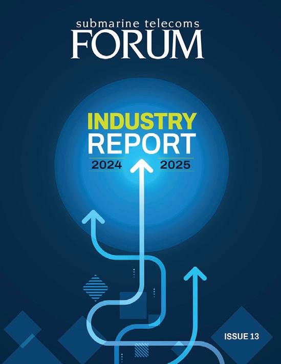
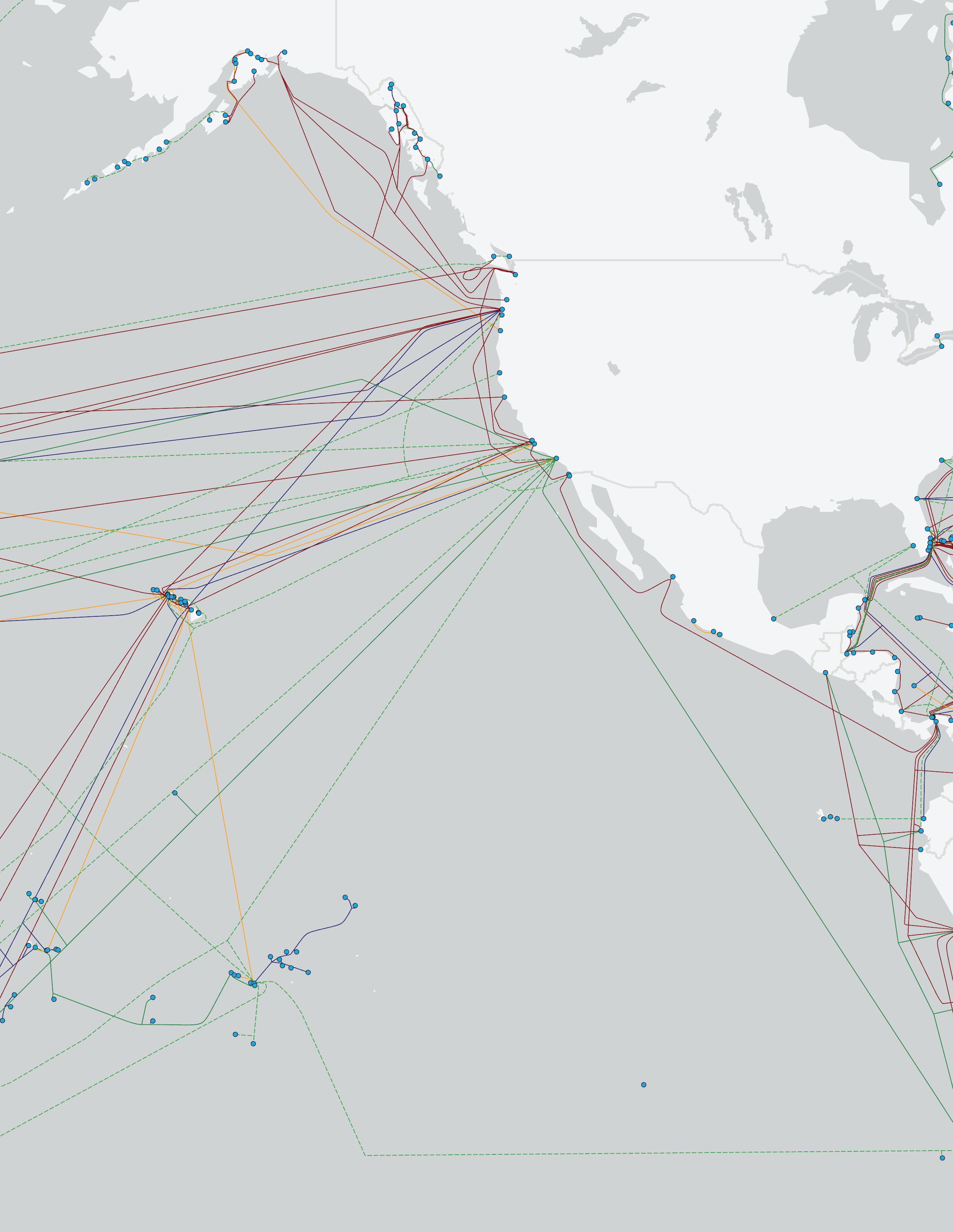
Current Systems: 83 Capacity: 1109 Tbps
Planned Systems: 14
Planned Capacity: 552 Tbps
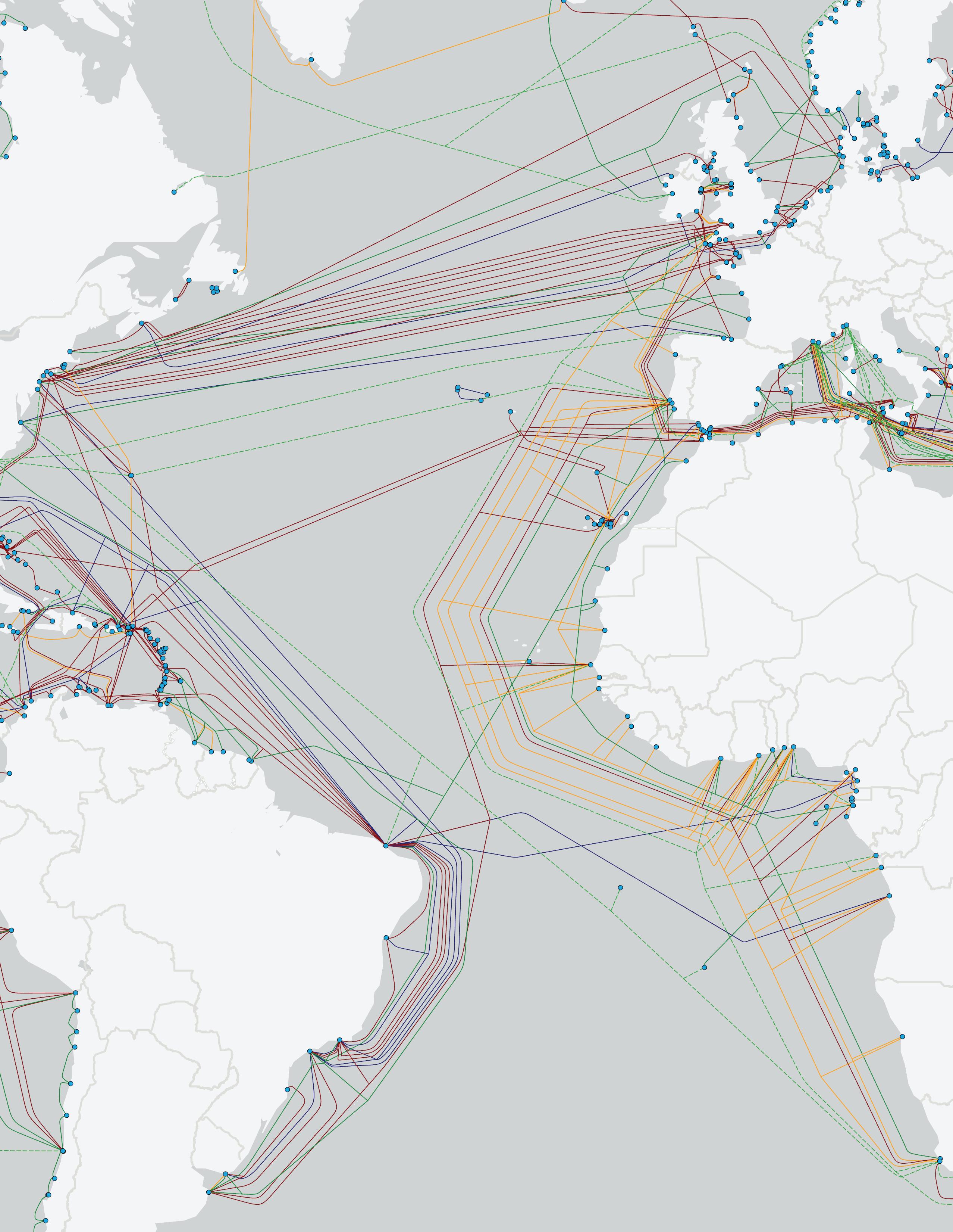
The Americas region has continued its steady growth in submarine cable systems, a trend that has been observed since the early 1990s. The region expanded from 62 cables in 2016 to 89 cables by 2023, reflecting a consistent rise in infrastructure to meet growing connectivity demands across the continents.
Over the past few years, the Americas have seen a steady increase in cable deployments, with the number of systems increasing to 89 by 2024. This growth is in line with the region’s historical trend of adding approximately two systems per year. However, projections for 2025-2029 show a potential leveling off, with moderate growth continuing into the late 2020s.
While this projected flattening may suggest that the region’s need for new infrastructure is stabilizing, it could also reflect the region’s response to existing system upgrades rather than new system deployments. The forecast indicates that by 2029, the Americas could have as many as 100 systems in operation, but much of this growth is likely to be driven by system upgrades and capacity expansions rather than brand-new deployments.
This slower rate of increase may also point to potential challenges such as regulatory hurdles, political instability, and economic constraints, particularly in regions like South America. Despite these factors, the consistent addition of systems highlights the region’s strategic importance in global connectivity, as major data routes pass through or originate from the Americas.
In terms of kilometers of cable added, the region’s growth
continues to reflect a stable increase. Since 2016, the number of kilometers added annually has steadily risen, reaching 279,000 kilometers in 2024. However, much like the system count, the future projection shows a tapering growth curve, with moderate increases expected through 2029.
The annual addition of kilometers has hovered around 257,000 from 2021 to 2023, before spiking to 279,000 in 2024. This likely represents the completion of major longhaul systems or key upgrades to existing cables. The forecast for the next five years, however, suggests that growth will stabilize again, with incremental additions each year.
Environmental and logistical challenges across the Americas continue to play a role in these trends. The geographical diversity of the region, which spans polar regions to the tropics, means that some projects face longer timelines due to complex installation processes. Moreover, hurricane risks in the Caribbean and Gulf of Mexico further complicate installation and maintenance efforts, requiring companies to build resilient systems capable of withstanding natural disasters.
As of 2024, 62.5% of the planned systems in the Americas have reached their CIF (Cable in Force) milestone, a significant improvement over last year’s 43%. This means that 5 out of the 8 planned systems have made substantial progress and are either completed or nearing operational status, while the remaining 3 systems (37.5%) are still in various stages of development.
This increased CIF rate is a positive indicator of the region’s ability to push through challenges, such as political instability in parts of South America, fluctuating
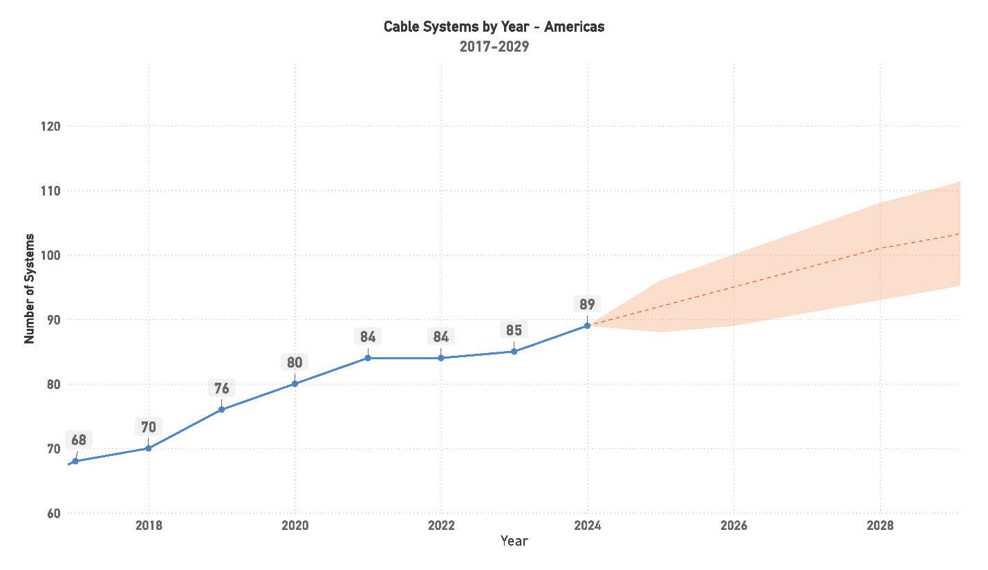
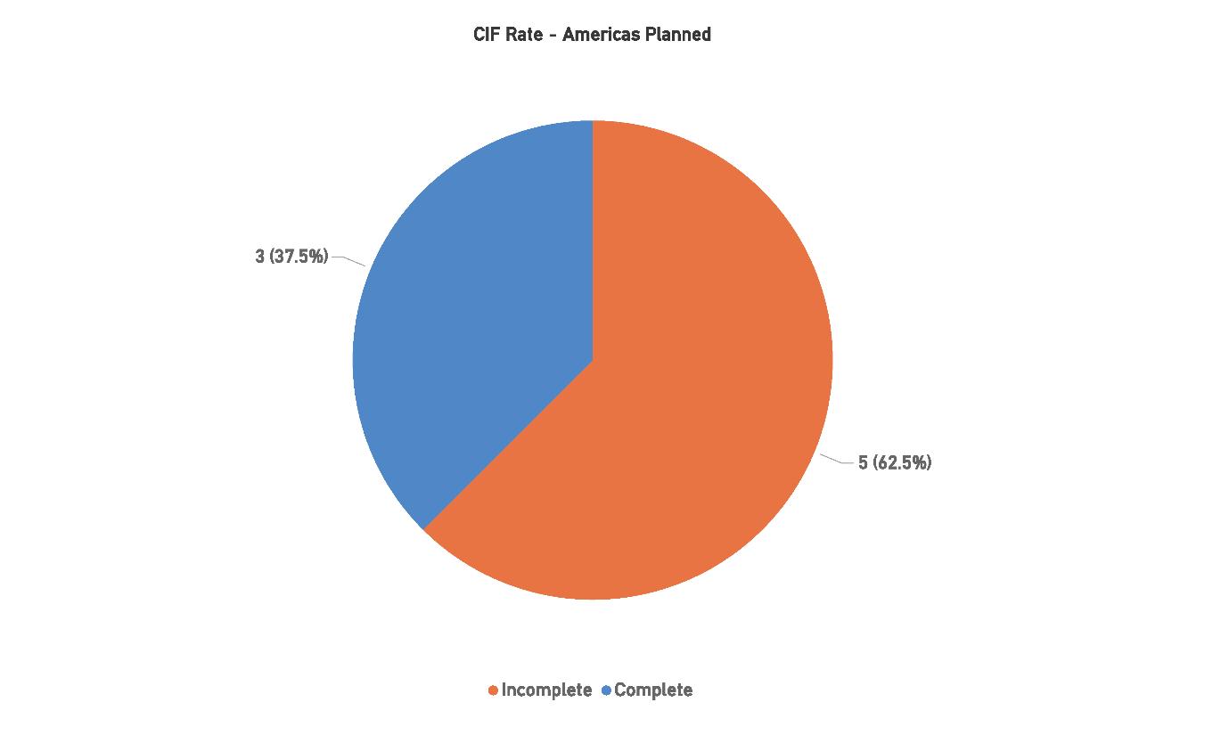
economic conditions, and environmental hazards. However, the 37.5% of systems still incomplete highlight the hurdles that remain. The development of these remaining systems may face delays related to financing or regulatory approvals, particularly in markets where the political landscape is less stable.
The outlook for the Americas region remains optimistic, with a steady stream of projects in the pipeline. Despite the slower overall growth in new systems and kilometers added,
the region’s increasing CIF rate demonstrates that projects are moving forward at a consistent pace, ensuring that the region remains a crucial player in global telecommunications.
The Americas region continues to be a cornerstone of global submarine cable connectivity, with a steady trajectory of growth in both cable systems and kilometers added. The data shows a consistent rise from 62 systems in 2016 to 89
by 2024, with projections pointing to the region potentially crossing 100 systems by the end of the decade. Despite the region’s slower growth compared to past years, it remains a key player in the global telecommunications landscape, driven by growing demand for bandwidth and the increasing importance of resilient infrastructure.
Future growth in the Americas is expected to come from a mix of new system deployments and upgrades to existing infrastructure. The projected moderate increase in cable systems from 2025-2029 suggests a focus on enhancing capacity and ensuring redundancy on key routes. With many major routes already established, future investments will likely focus on improving latency, increasing data transfer capabilities, and diversifying routes to mitigate risks from natural disasters and other disruptions.
Four significant challenges impact the region:
1. Regulatory and Political Instability: While North America remains stable, political uncertainty in parts of South America—particularly Brazil and Argentina—could complicate or delay future submarine cable projects. Changing regulations, shifting political priorities, and fluctuations in government policies create an environment of unpredictability, which can slow down system approvals, financing, and timelines. As future projects navigate this environment, building strong partnerships and ensuring compliance with local regulations will be crucial to maintaining progress.
2. Environmental Risks: The Americas face significant natural disaster risks, particularly in regions prone to hurricanes, earthquakes, and volcanic activity, such as the Caribbean and the Pacific coastlines. These environmental challenges threaten both the installation and longterm integrity of cable systems. Going forward, designing systems with greater resilience and investing in diverse routing strategies to avoid high-risk zones will be critical. Future projects must also consider the rising impact of climate change, which could increase the frequency and severity of natural disasters affecting submarine cables.
3. Economic Factors: The economic outlook in parts of Latin America, particularly regions affected by inflation, currency volatility, and access to capital, poses a
challenge for future investments in submarine cable infrastructure. Financing issues could delay projects or raise costs unpredictably, making it harder to secure long-term commitments. However, demand for improved connectivity remains strong, and addressing economic challenges will require robust financial planning, diversified funding sources, and partnerships with international stakeholders.
4. Geographical Diversity and Logistical Complexities: Spanning vast geographic distances and diverse ecosystems, the Americas region presents unique logistical challenges. The construction and maintenance of cables must account for varying environmental conditions, from the icy waters of the Arctic to the dense rainforests of the Amazon. This geographical diversity requires complex coordination between multiple stakeholders, including governments, environmental regulators, and infrastructure developers. Future cable routes in ecologically sensitive regions like the Amazon will need careful planning to minimize environmental impact, which could slow down approvals and increase project timelines.
The future of submarine cable development in the Americas looks cautiously optimistic. With a strong base of existing infrastructure and a steady stream of planned projects, the region is poised to maintain its role as a crucial hub for global data traffic. However, to continue this momentum, the region must address a range of challenges—from political and economic instability to environmental and logistical hurdles.
The increasing CIF rate of planned systems shows that despite these challenges, projects are still progressing. As the region prepares for future growth, a focus on resilience, regulatory compliance, and environmental sustainability will be essential. Navigating these obstacles will determine the region’s ability to keep up with global demand for faster, more reliable connectivity.
In conclusion, while growth may slow compared to previous years, the Americas are set to remain a key player in the global submarine cable industry. The region’s ability to overcome its unique challenges and capitalize on its geographic advantages will shape the future of its infrastructure and its role in connecting the world’s data networks. STF
Current Systems: 105
Capacity: 1161 Tbps
Planned Systems: 19
Planned Capacity: 1039 Tbps
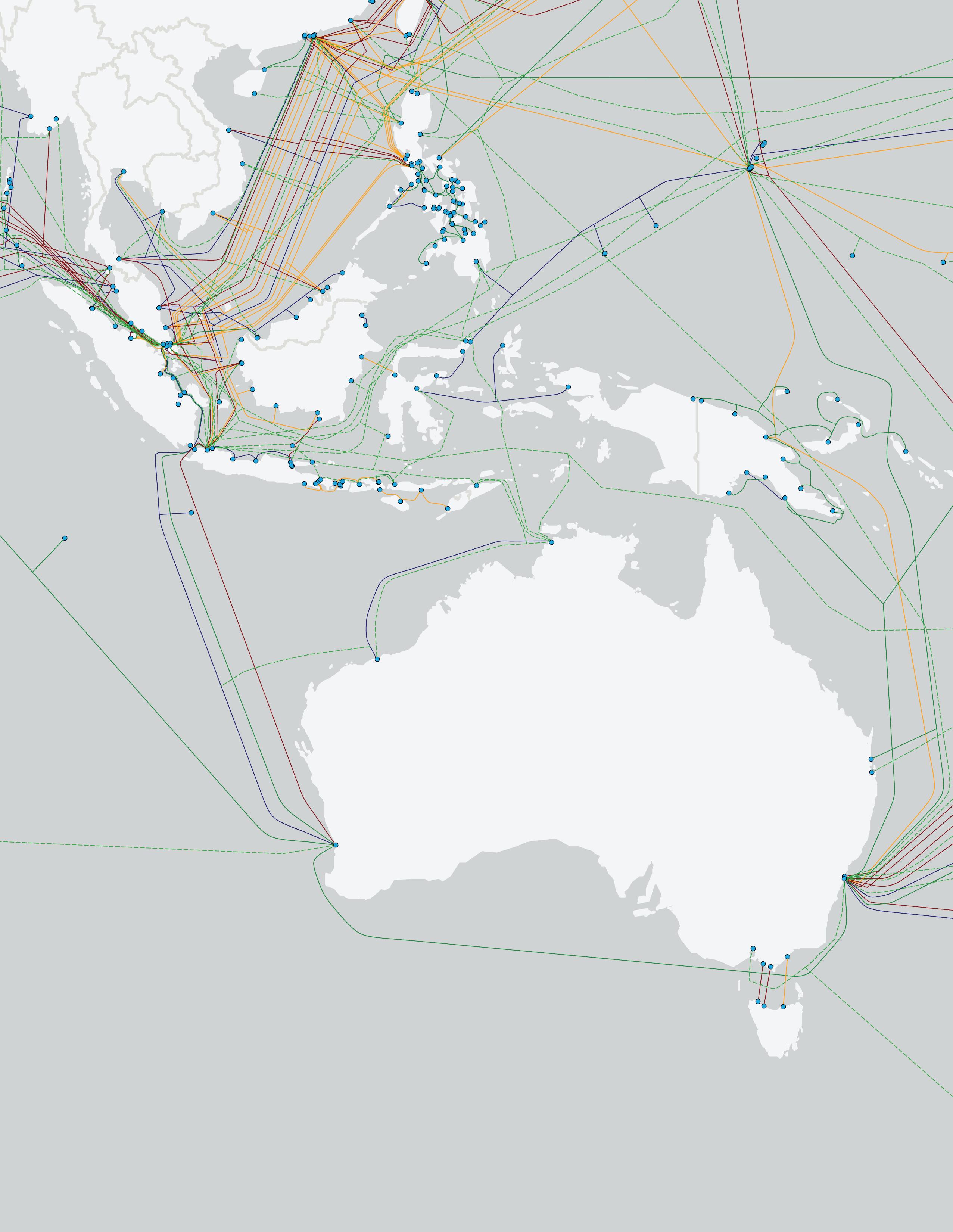
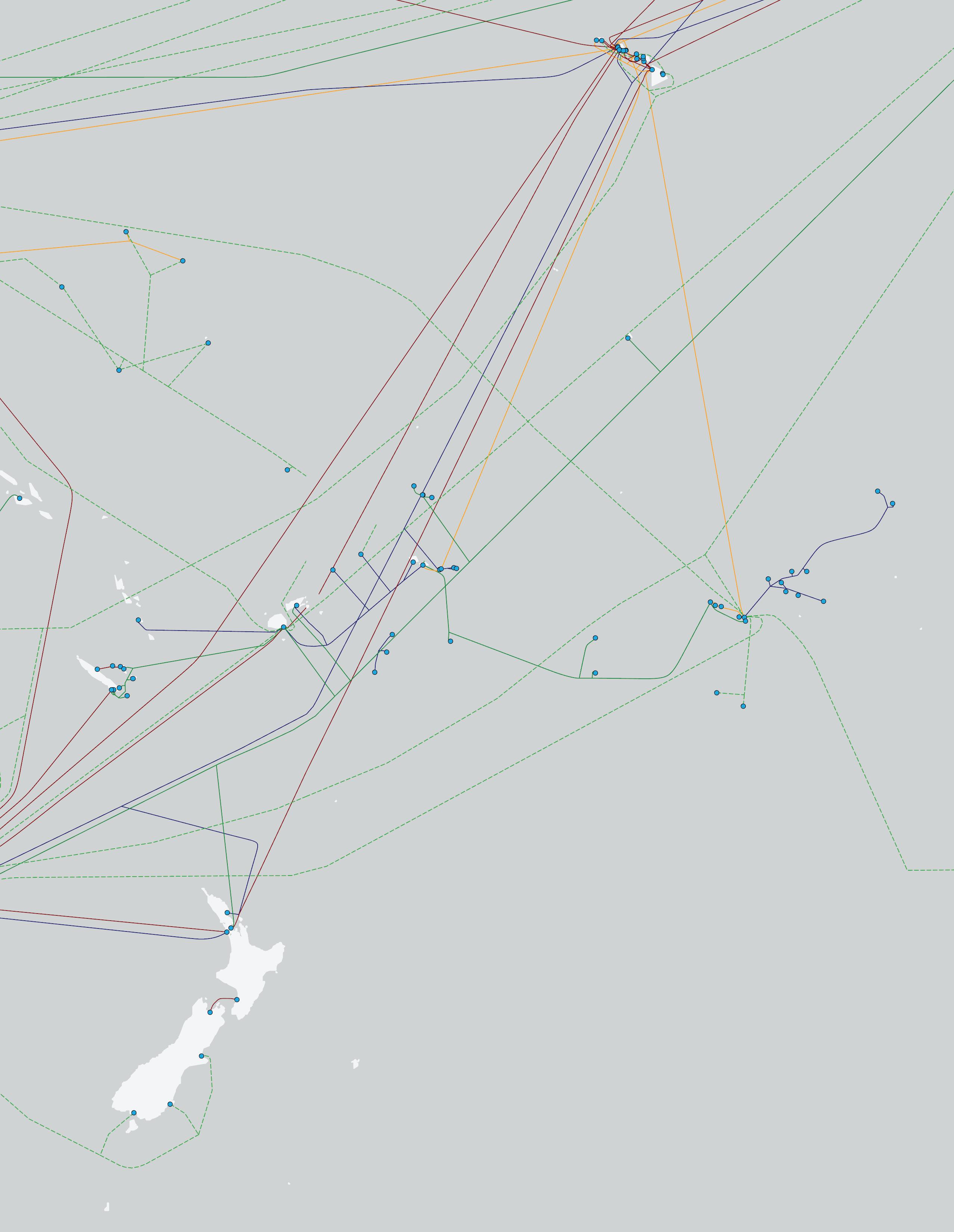
The AustralAsia region has experienced consistent growth in submarine cable systems over the past several years. Starting with 75 cables in 2017, the region has expanded to 113 cables by 2024, reflecting the region’s ongoing investment in its connectivity infrastructure. AustralAsia remains one of the most active regions globally, driven by the digital expansion of key markets like Australia, Indonesia, and the broader Southeast Asian region.
The growth of cable systems in the region has been driven largely by rising demand for international bandwidth, the rapid adoption of mobile services, and the expansion of Hyperscaler data centers. The region has consistently added systems each year, and by 2029, AustralAsia is projected to reach over 140 systems, showing that there is still considerable growth potential in this part of the world.
Emerging markets in Southeast Asia continue to be strong drivers of this growth, with countries like Indonesia, Singapore, and Hong Kong playing critical roles as hubs for new submarine cable deployments. These markets have also seen substantial investments in data centers, which further necessitate the development of new cables to accommodate the growing data traffic. Despite this ongoing expansion, the projected moderate growth into the late 2020s suggests that the region’s market may be stabilizing, reflecting a maturing market rather than the aggressive growth spurts seen in previous decades.
In terms of kilometers of cable added, the AustralAsia re-
gion saw steady growth through 2024, with 401,000 kilometers of cables added. Since 2016, the region has maintained a strong upward trajectory in total cable kilometers, growing from 274,000 in 2017 to over 400,000 kilometers in 2024. This growth is expected to continue through 2029, though at a slower pace as the market stabilizes.
The significant spike in kilometers added in 2024 likely reflects the completion of several long-haul systems connecting parts of AustralAsia other regions. The forecast suggests that the total kilometers added each year will taper off slightly through 2029, reflecting a more mature market where upgrades and capacity expansions may take precedence over entirely new systems.
AustralAsia faces specific logistical challenges when it comes to expanding cable systems, as the region spans a wide array of geographical landscapes, from the remote islands of the Pacific to the densely populated hubs of Southeast Asia. This geographical diversity introduces complexities in installation and maintenance, which may contribute to the slower projected growth. Moreover, environmental factors like earthquakes and tsunamis in the Pacific Ring of Fire further complicate the installation and maintenance of systems in this region.
As of 2024, 50% of the planned systems in the AustralAsia region have reached their CIF milestone, marking an improvement over last year’s figure. Of the 10 planned systems, 5 have been completed or are nearing operational status, while the remaining 5 systems are still in the development stages. This represents a significant improvement compared to last year’s numbers, indicating that the region
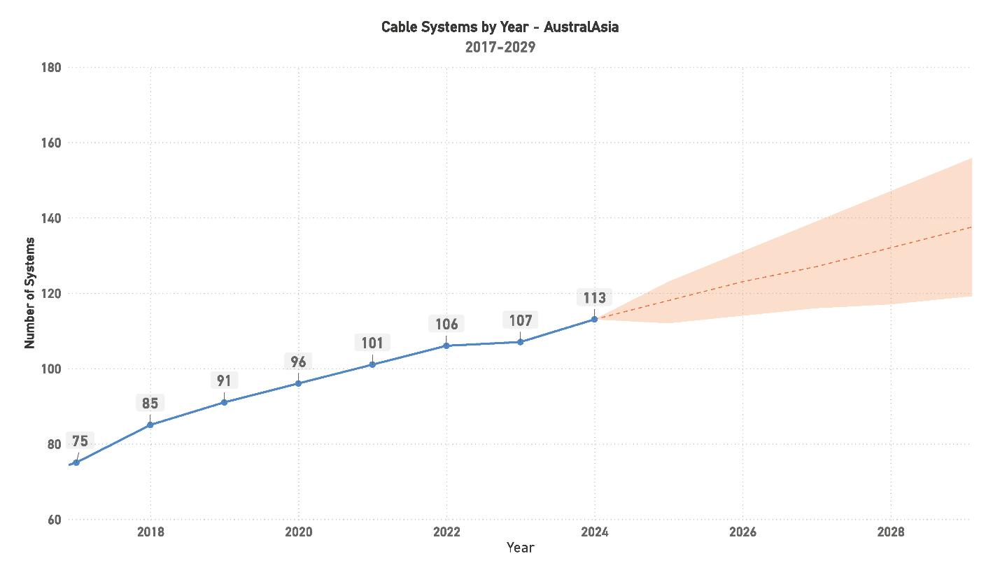
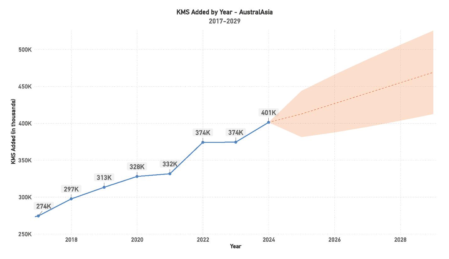
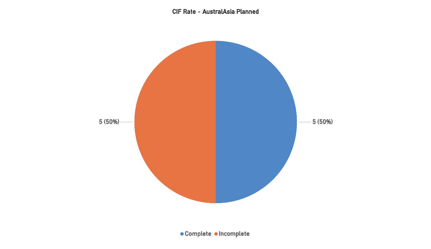
has made substantial progress in pushing through challenges such as regulatory hurdles and financing difficulties.
The remaining 50% of systems that have not yet reached the CIF milestone suggest that certain projects may still face delays, particularly those in more remote or logistically challenging areas. Despite these challenges, the ongoing development of these systems highlights the region’s continued focus on maintaining and expanding its submarine cable infrastructure to meet the demands of a growing digital economy.
The AustralAsia region continues to be one of the fastest growing and most active markets for submarine cable systems globally. With 113 systems in place by 2024 and projections indicating further growth, the region is well-positioned to remain a key hub for international connectivity, driven largely by the ongoing digital transformation of Southeast Asia. Markets such as Indonesia, Singapore, and Hong Kong are likely to remain crucial drivers of growth, while Australia
plays an increasingly prominent role in connecting the region to both North America and Europe.
Future growth is expected to focus on both the deployment of new long-haul systems and upgrades to existing infrastructure to enhance capacity and ensure redundancy. With many major systems already in place, the projected increase in cable kilometers and system count from 2025 to 2029 suggests a focus on improving latency, expanding data transfer capabilities, and increasing system resilience.
Four challenges impact the region:
1. Regulatory and Political Instability: While most Southeast Asian countries continue to encourage infrastructure investment, some regions may still experience political challenges that could delay cable deployments. Regulatory changes or shifts in government policies in countries like Indonesia and the Philippines could affect the pace at which new projects are approved and funded.
2. Environmental Risks: The AustralAsia region faces significant environmental risks, particularly earthquakes, tsunamis, and volcanic activity due to its location in the Pacific Ring of Fire. These natural hazards pose a considerable threat to both the installation and maintenance of submarine cable systems. Designing systems with greater resilience to these risks will be critical as the region continues to expand its infrastructure.
3. Economic Factors: The economic outlook for the region remains positive, but fluctuations in global markets or changes in the investment environment in key markets
could impact future deployments. In particular, rising inflation rates and fluctuating currency values in emerging markets could introduce uncertainty into long-term financing for new systems.
4. Geographical Diversity and Logistical Complexities: AustralAsia’s geographical diversity presents a logistical challenge for deploying new cable systems, particularly in remote island nations or sparsely populated regions. The coordination required between multiple countries, environmental regulators, and local governments can slow down approvals and increase the cost of projects, especially in ecologically sensitive regions.
The AustralAsia region remains a critical market for submarine cable development, with a strong base of existing infrastructure and several planned projects in the pipeline. With growth continuing through 2029, the region’s ability to address challenges such as political instability, environmental risks, and logistical complexity will be essential to sustaining its role as a global connectivity hub.
While the pace of growth may slow somewhat compared to previous years, the increasing CIF rate and projected growth in both cable systems and kilometers added demonstrate that AustralAsia is well-positioned to meet the region’s growing demand for bandwidth and international connectivity. The future of the region will be shaped by its ability to navigate regulatory environments, design resilient systems, and leverage its geographic position to maintain its competitiveness in the global submarine cable industry. STF
Current Systems: 199
Capacity: 1920 Tbps
Planned Systems: 23
Planned Capacity: 2348 Tbps
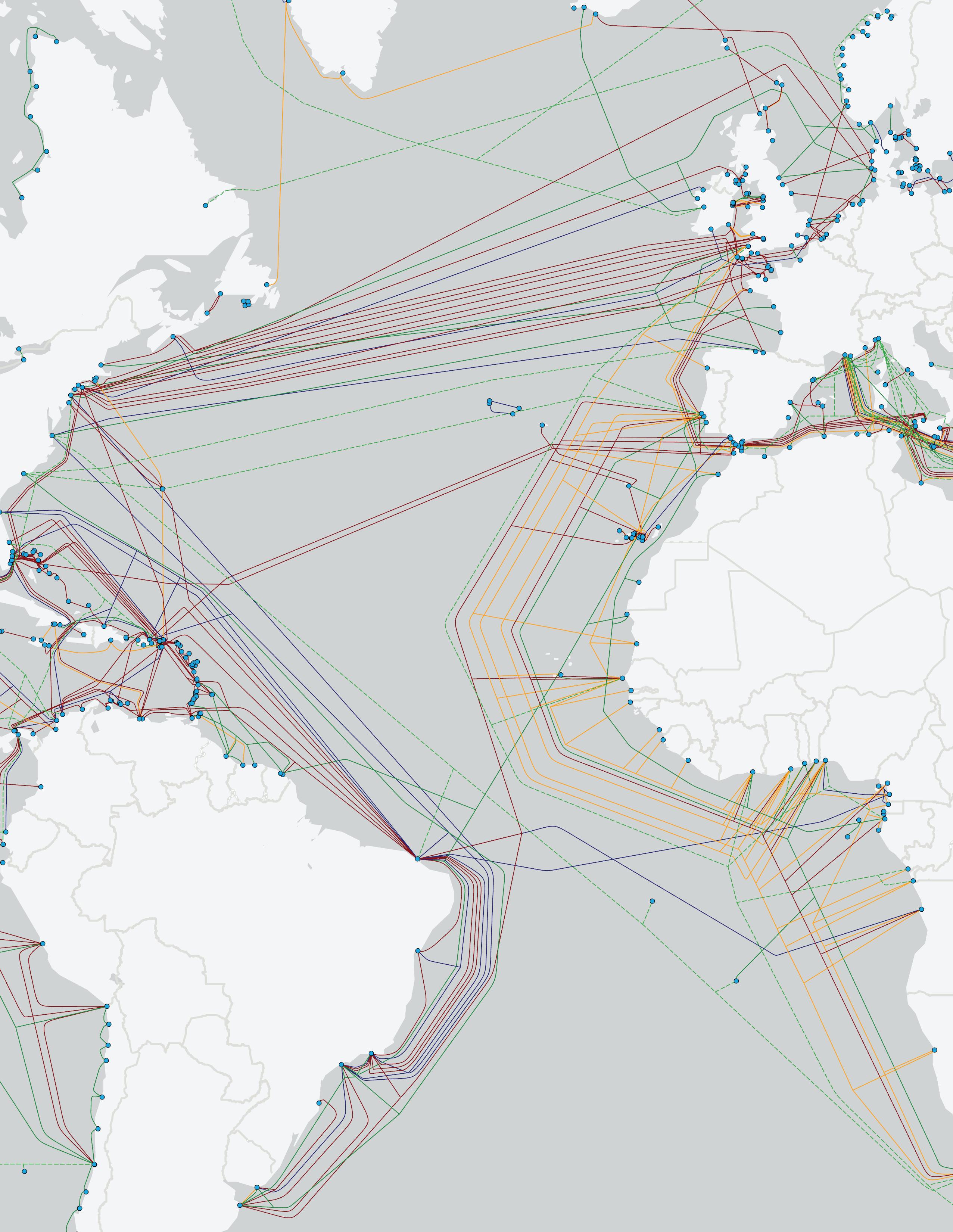
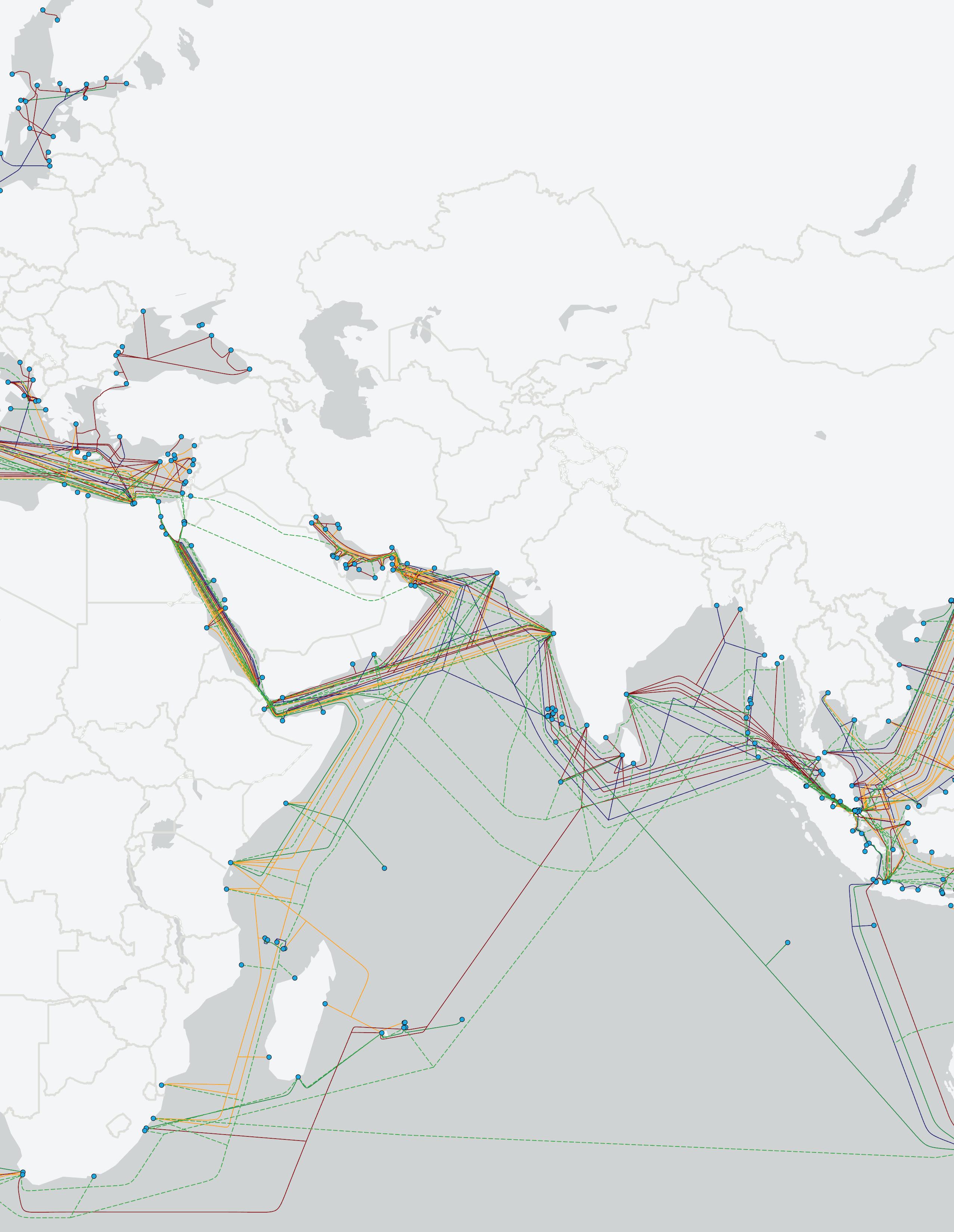
The EMEA region, comprising Europe, the Middle East, and Africa, continues to show consistent growth in submarine cable systems. Known for its strategic importance, particularly due to the Mediterranean Sea and the Suez Canal, EMEA remains one of the most stable areas for cable deployments globally. As of 2024, the region boasts 209 cable systems, up from 172 in 2017.
The steady rise in the number of systems underscores the region’s importance in maintaining and enhancing global connectivity. EMEA has consistently added around five new systems each year since the early 2000s, contributing to its reputation for stability. The region also plays a critical role in linking Europe with Africa and the Middle East, particularly through key systems like SEA-ME-WE, ACE, and WACS, which connect multiple continents.
These intercontinental systems, which span tens of thousands of kilometers, complement smaller regional systems that link countries within Europe or across Africa. Although the pace of growth in system numbers appears stable, it is expected to continue gradually, reaching approximately 240 systems by 2029. This growth reflects the increasing demand for bandwidth, driven by the expansion of data centers and the rise of Hyperscalers in the region.
In terms of added kilometers, the EMEA region has seen a significant uptick in recent years, with the total cable length growing to 457,000 kilometers by 2024. This sharp rise is largely driven by several long-haul systems deployed
between Europe, Africa, and the Middle East, many of which are part of ambitious projects aimed at boosting connectivity across underserved regions.
Since 2020, the region has seen substantial growth in kilometers added, particularly in 2024, when it saw a jump from 373,000 kilometers to 457,000. This growth is expected to continue at a slower pace through 2029, as the region focuses on completing and upgrading existing systems while laying new long-haul cables. Much of this expansion can be attributed to major projects like 2Africa, which will dramatically increase bandwidth and capacity across the continent, particularly in Africa’s western and southern regions.
The forecast suggests that EMEA will remain a focal point for cable deployment due to its strategic geographic location. However, the region faces several challenges that could slow the pace of growth, including political instability and economic uncertainty, particularly in parts of the Middle East and Africa. These challenges may delay projects or complicate system upgrades.
As of 2024, 60% of the planned systems in the EMEA region have reached the Contract in Force (CIF) milestone, a moderate improvement over last year’s 42%. Of the 10 planned systems, 6 have achieved CIF status, with 4 still in progress. This suggests that, while the region is advancing steadily, it faces ongoing obstacles that could hinder full project completion.
Political instability and economic factors continue to affect project timelines, particularly in the Middle East and parts of Africa. Despite this, the improvement in the CIF rate reflects a strong commitment to pushing through challenges

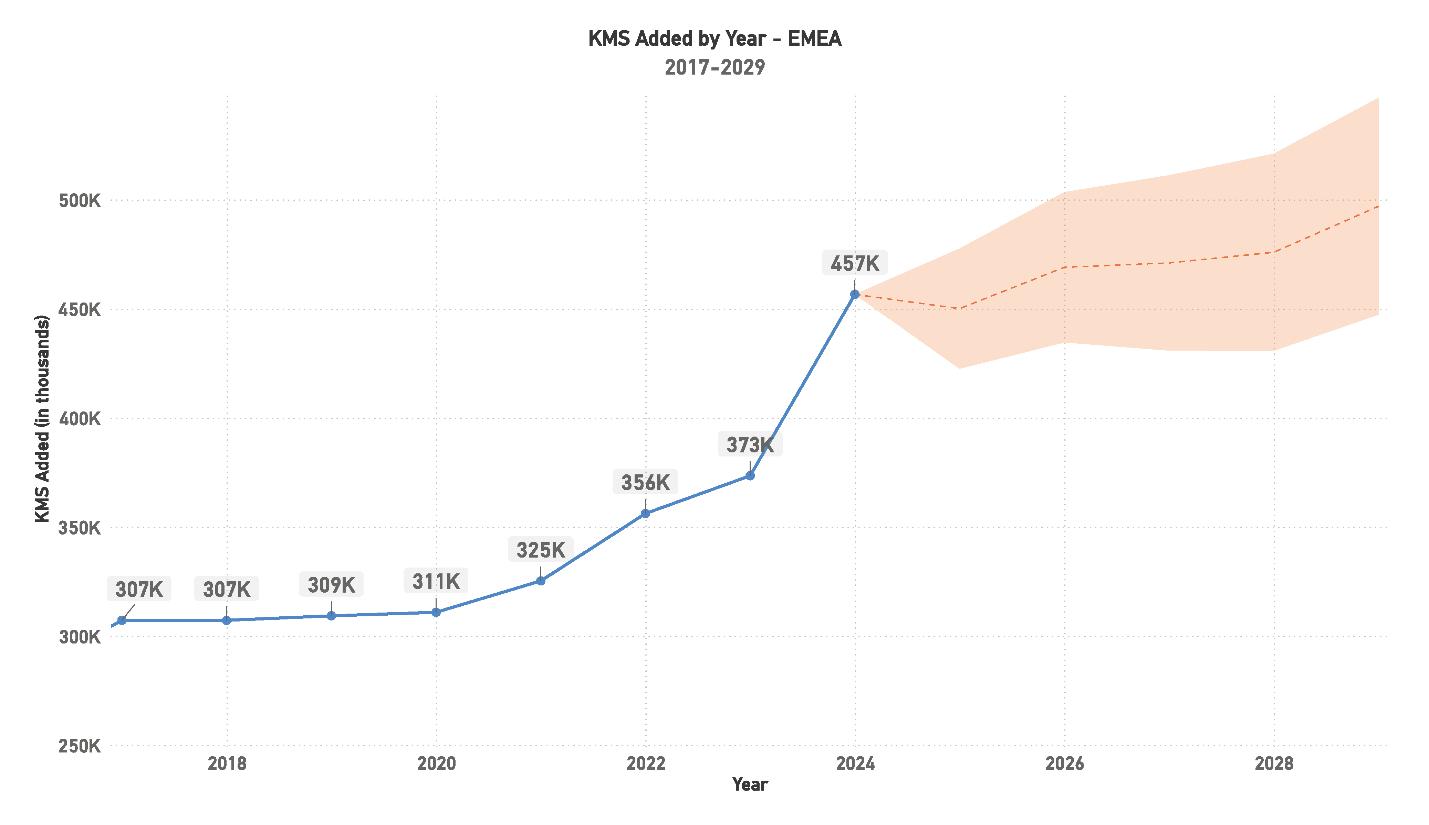
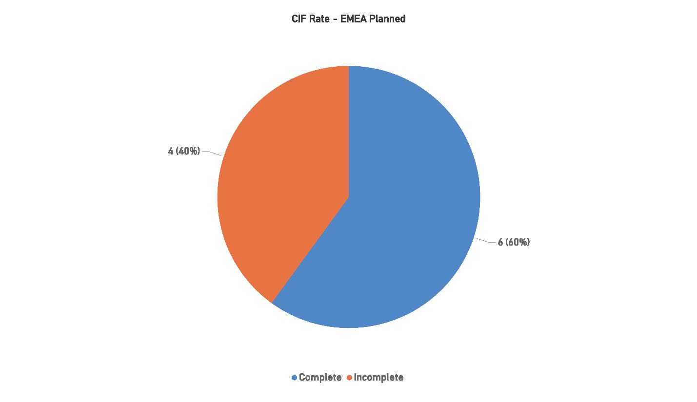
and maintaining steady development. The EMEA region’s progress in completing planned systems showcases its resilience, but the incomplete systems signal that challenges remain.
The EMEA region continues to be a critical player in the global submarine cable market, with growth driven by both regional and intercontinental systems. By 2024, the region
will have reached 209 systems, and the forecast indicates it could surpass 240 systems by 2029. This growth highlights EMEA’s strategic importance in linking Europe, Africa, and the Middle East to other global regions.
Future growth in EMEA will likely be fueled by a combination of new system deployments and upgrades to existing infrastructure. The region is increasingly focused on improving connectivity across underserved areas in Africa and the Middle East, while ensuring stable and high-capacity routes
to Europe. Projects such as 2Africa and Equiano will be crucial in achieving this goal, providing much-needed bandwidth to rapidly developing regions.
Four challenges impact the region:
1. Regulatory and Political Instability: Political instability in the Middle East and parts of Africa presents ongoing challenges to submarine cable deployment in the EMEA region. Regulatory changes and inconsistent government policies in countries like Egypt, Nigeria, and South Africa can slow project approvals, financing, and construction, impacting timelines for new systems and upgrades.
2. Environmental Risks: The EMEA region is geographically vast, encompassing diverse environments that can complicate cable deployment. Coastal areas along Africa and the Mediterranean are particularly vulnerable to natural disasters such as floods and storms, which can disrupt installations and damage existing cables. Designing resilient systems capable of withstanding these risks is crucial for maintaining uninterrupted connectivity in the region.
3. Economic Factors: While Europe remains economically stable, parts of Africa and the Middle East face economic uncertainty that could affect the financing and long-term viability of submarine cable projects. Inflation, currency volatility, and access to capital are all factors that could delay system completions, particularly in countries with
less developed financial markets.
4. Geographical Diversity and Logistical Complexities: Spanning three continents, the EMEA region presents logistical challenges for submarine cable projects. Coordinating deployments across multiple countries with different regulatory environments can slow approvals and increase costs. Additionally, installing cables in remote areas of Africa or across politically sensitive regions like the Suez Canal adds layers of complexity to project management.
The EMEA region remains a stable and strategic hub for submarine cable systems, with a long history of consistent growth and development. While the region faces several challenges—including political instability, economic uncertainty, and environmental risks, it is well-positioned to continue expanding its submarine cable infrastructure through 2029. The growing CIF rate, which has improved to 60% in 2024, shows that projects are advancing despite obstacles. As EMEA looks to the future, its ability to navigate these challenges while continuing to build new systems and upgrade existing ones will determine its success in meeting the region’s growing demand for international connectivity. In particular, the expansion of cable systems across Africa and the Middle East will play a critical role in bringing the benefits of high-speed connectivity to underserved populations, helping to drive economic growth and digital transformation. STF
Current Systems: 34
Capacity: 387 Tbps
Planned Systems: 8
Planned Capacity: 1441 Tbps
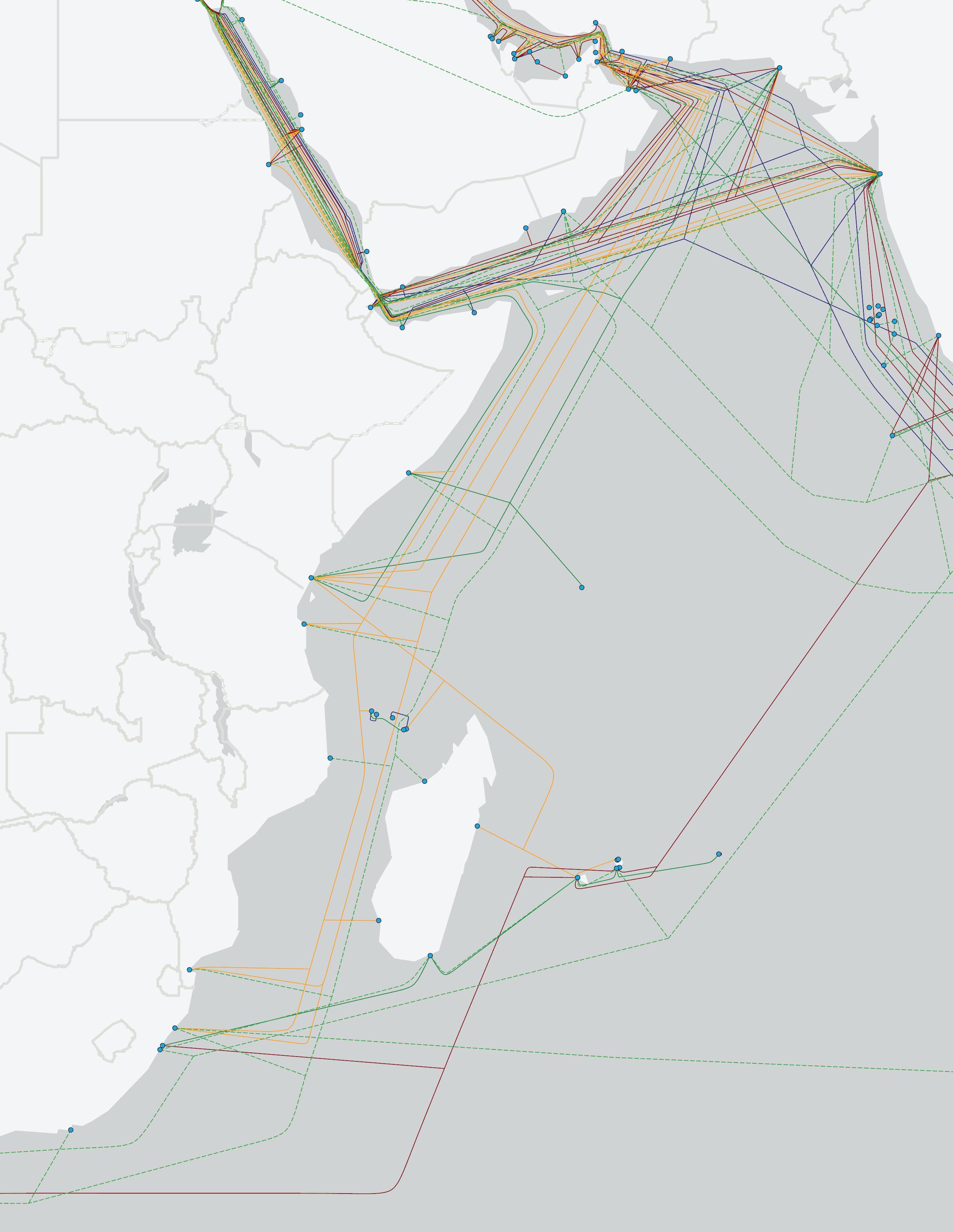
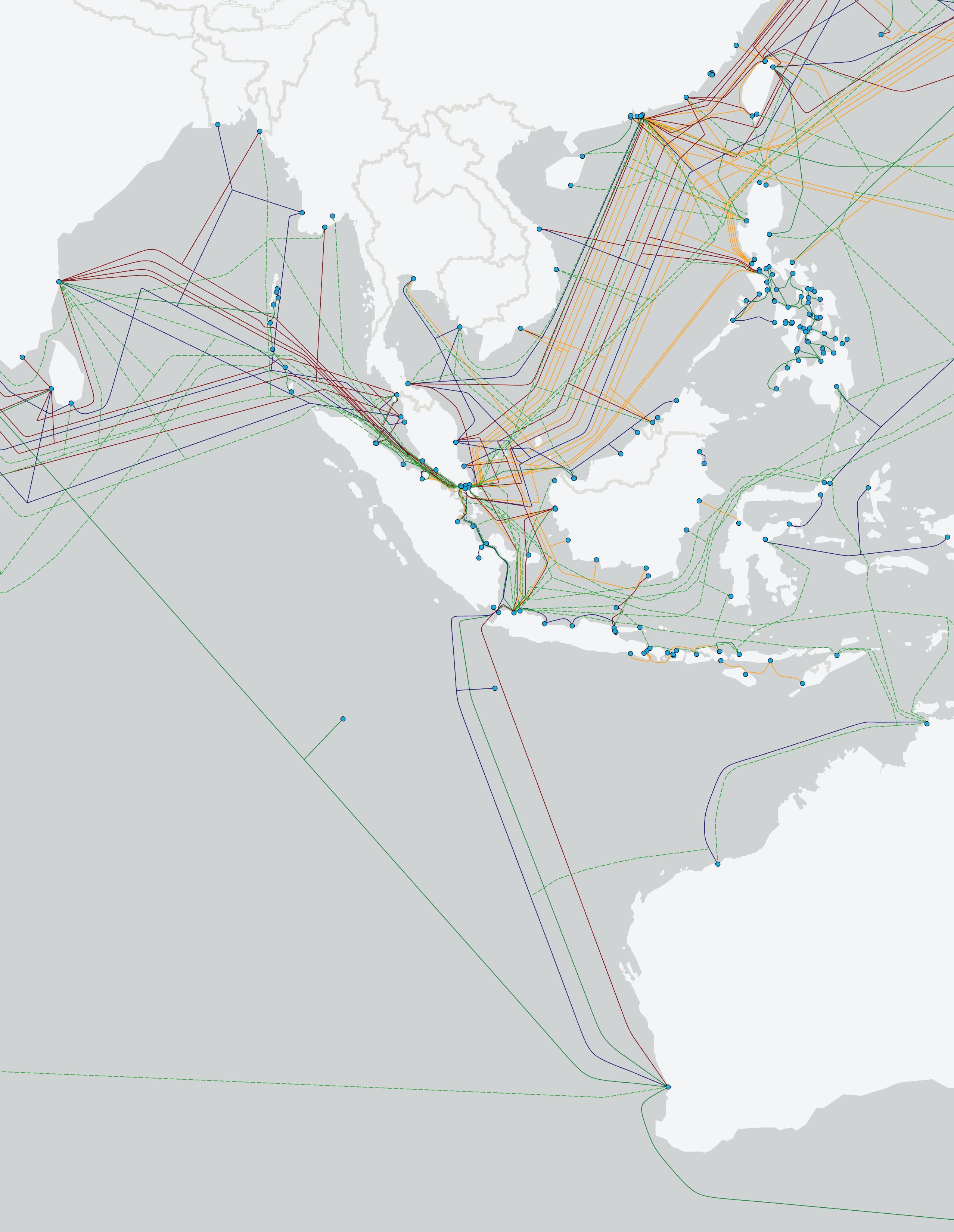
The Indian Ocean region has maintained consistent growth in submarine cable systems since its recovery from the early 2000s downturn. Despite being a smaller region geographically, its position as a critical junction between the EMEA and AustralAsia corridors ensures its strategic importance in global connectivity. As of 2024, the Indian Ocean region has 39 cable systems in place, a steady increase from 28 systems in 2017.
This growth reflects a stable trend of development in the region, with a focus on enhancing trans-regional connectivity. Key systems, including SEA-ME-WE 3, 4, and 5, and AAE-1, have driven much of this development. The region has experienced sporadic surges in system deployments, with notable peaks in 2006-2007, 2009, and 2015-2017, driven by trans-regional systems that enhance connectivity between Europe, Africa, the Middle East, and AustralAsia. On a more local scale, smaller systems have primarily connected India with the Middle East or Southeast Asia.
The pattern of development in the Indian Ocean region has been characterized by “feast-or-famine” cycles, with the number of systems added varying from year to year. For example, after a hiatus in 2018, the region saw the addition of two systems each year from 2019 to 2022, and an exceptional five systems were added in 2023.
In terms of kilometers added, the Indian Ocean region has seen a sharp rise in cable length, reaching 303,000 kilometers in 2024, a significant increase from 227,000 kilometers
in 2020. This surge reflects the region’s importance as a critical pathway between Asia and Europe, as well as its growing role in connecting AustralAsia and Africa.
From 2019 onwards, the region consistently added systems each year, with the exception of 2023, which saw a spike in cable installations. For the period 2024-2028, seven systems are planned, with the potential to add approximately 130,000 kilometers of cable. This projected growth indicates that demand for trans-regional connectivity, particularly between Asia and Europe, remains high, and the region is well-positioned to meet this need.
Notably, Australia’s demand for greater route diversity on its western coast and the increasing connectivity requirements between Asia and Europe will likely drive system development in the coming years. Hyperscalers are also exploring potential routes from the United States to India, which could further stimulate growth in the region beyond 2028.
As of 2024, 50% of the planned systems in the Indian Ocean region have achieved the Contract in Force (CIF) milestone, showing solid progress compared to last year’s rate. Of the six planned systems, three are complete, while the remaining three are still in development. This improvement reflects the region’s ability to push through political and economic uncertainties, particularly in Europe and the Middle East.
Many of the planned systems in the Indian Ocean region serve as “passthroughs,” connecting East Asia with the Middle East and Europe. These systems are essential for improving route diversity, but competition remains intense as several projects aim to achieve their target Ready for Service
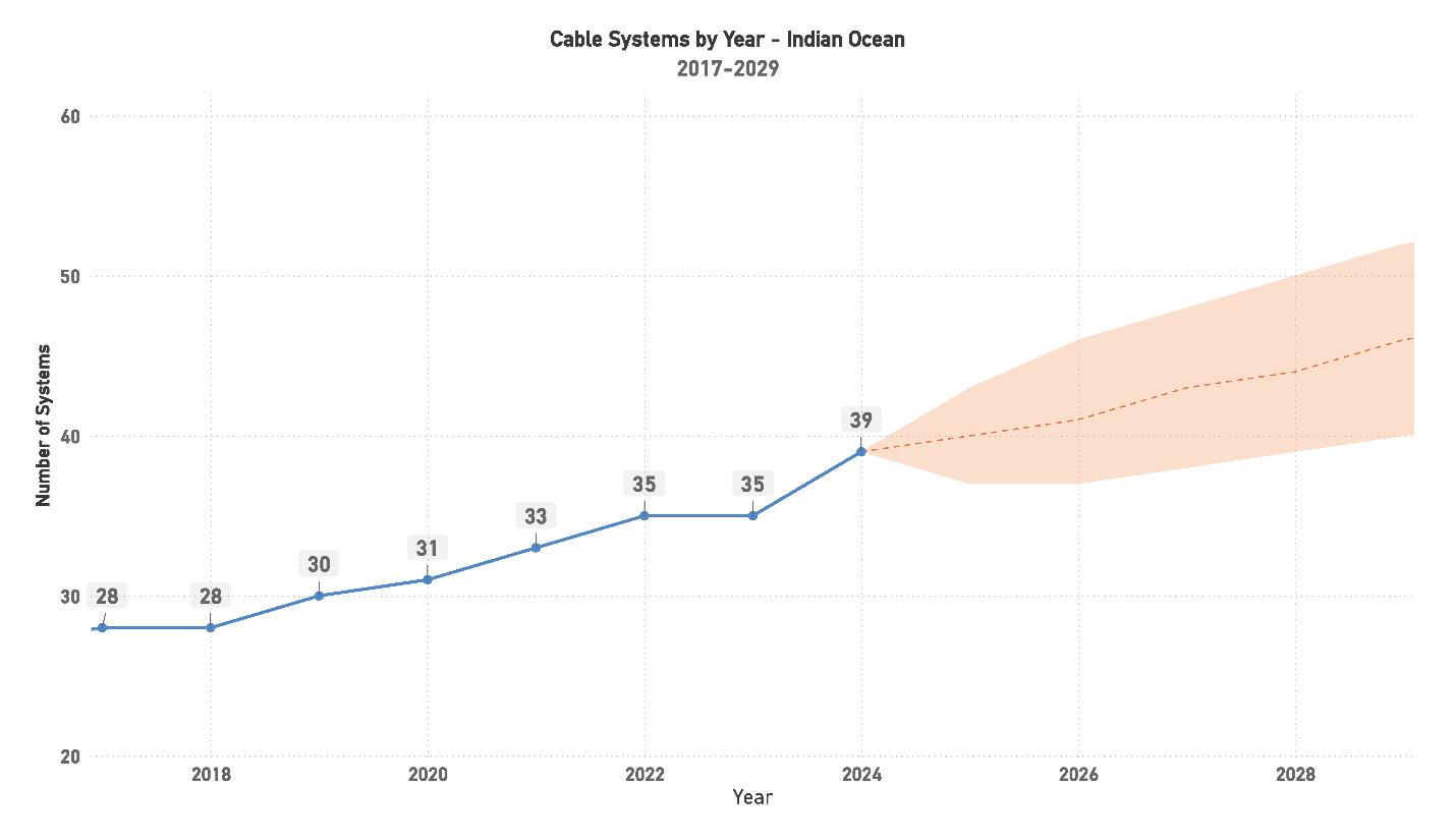

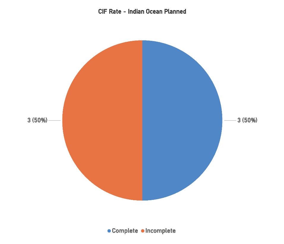
(RFS) dates. While political instability and economic volatility in parts of Europe and the Middle East present challenges, the steady progress of CIF milestones is a positive indicator of the region’s resilience.
The Indian Ocean region is poised for continued steady growth, building on its established role as a trans-regional junction between Europe, Africa, the Middle East, and Aus-
tralAsia. By 2024, the region will have 39 systems in place, with projections suggesting that the number could reach around 50 systems by 2029. This growth is driven by a combination of local systems serving India’s connectivity needs and larger, trans-regional systems enhancing connectivity between Europe, Asia, and AustralAsia.
Future development in the Indian Ocean region will be characterized by a continued focus on expanding route diversity and meeting the growing demand for high-speed,
high-capacity connectivity. As the region remains a key player in global submarine cable routes, maintaining momentum in new system deployments will be critical to keeping pace with the rising demand for data transfer across continents.
Four challenges impact the region:
1. Regulatory and Political Instability: The political and economic instability in parts of Europe and the Middle East continues to pose challenges for system development in the Indian Ocean region. Securing project approvals and financing in politically volatile regions can lead to delays, impacting timelines for new systems and upgrades. Nevertheless, the region has shown resilience in advancing projects despite these challenges.
2. Environmental Risks: While the Indian Ocean region is not as prone to environmental disasters as other regions, systems traversing certain areas must still account for the risk of cyclones, storms, and undersea seismic activity. These risks can impact both the installation process and the long-term reliability of submarine cables, making the design and routing of resilient systems essential for minimizing potential damage.
3. Economic Factors: The region’s economic health, particularly in parts of the Middle East and Africa, continues to fluctuate. Currency volatility and inflation in some markets could delay system deployments or raise project costs unpredictably. However, the growing demand for trans-regional connectivity and investments by international
players, such as Hyperscalers, is likely to continue driving economic opportunities for submarine cable projects.
4. Geographical Diversity and Logistical Complexities:
The Indian Ocean region spans a wide range of geographies, from densely populated urban centers in India to remote island nations. Coordinating cable installations across such diverse areas requires careful planning and the collaboration of multiple stakeholders, including governments and environmental agencies. Additionally, the competition between several planned systems seeking to serve similar routes introduces logistical challenges for developers aiming to achieve early RFS targets.
The Indian Ocean region is set for steady, if somewhat sporadic, growth over the coming years. With 39 systems expected to be operational by 2024, the region is well on its way to solidifying its role as a key trans-regional hub. The increasing CIF rate indicates that projects are advancing, despite the political and economic hurdles that continue to complicate the development process.
Future system development will likely be driven by the need for route diversity and higher capacity connections between Europe, Asia, and AustralAsia. As demand for reliable, high-speed connectivity continues to rise, the Indian Ocean region will remain a critical pathway for global data traffic. Its ability to navigate logistical challenges, regulatory issues, and competition between systems will shape the success of future developments and ensure that it remains a vital player in the global submarine cable market. STF
Current Systems: 3
Capacity: 60 Tbps
Planned Systems: 3
Planned Capacity: Not Announced
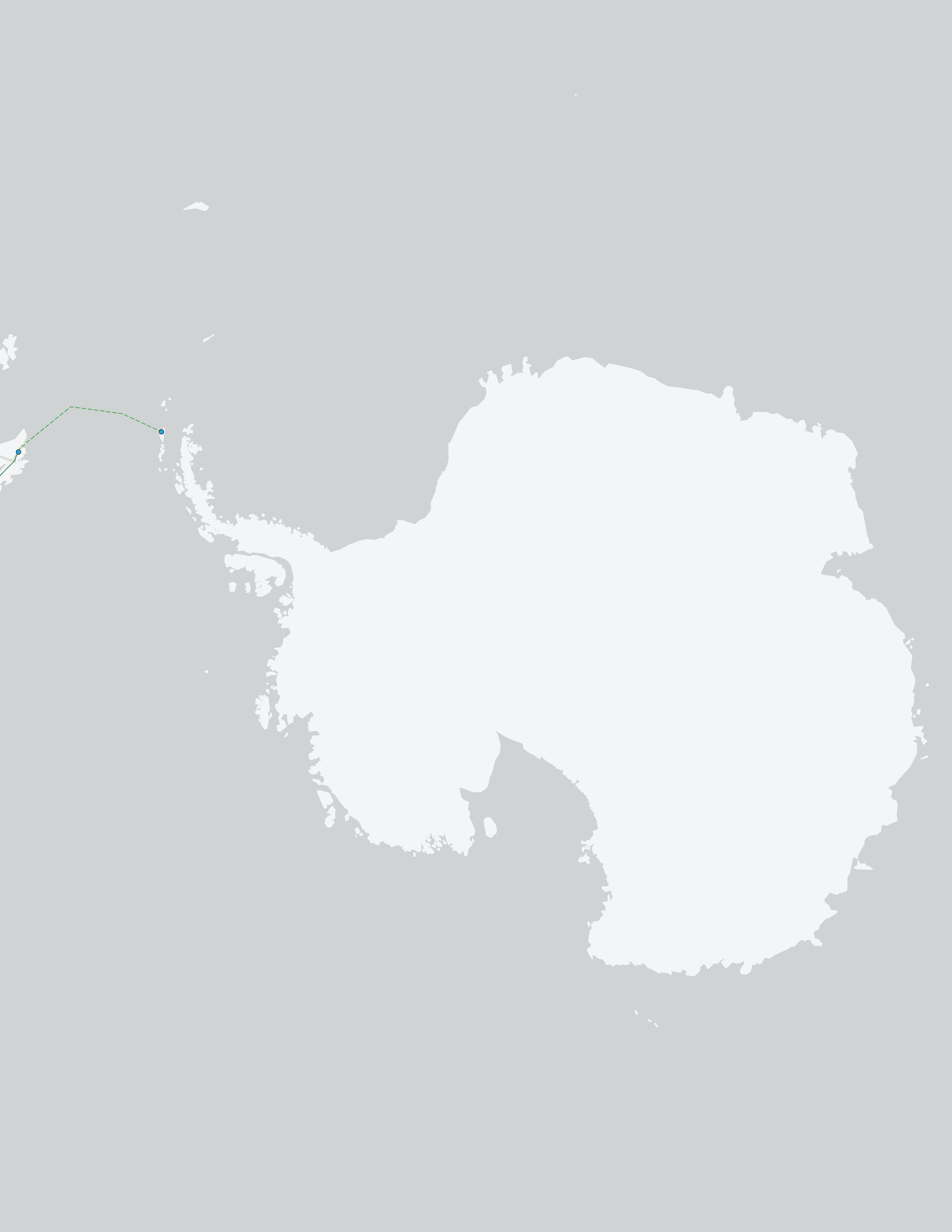
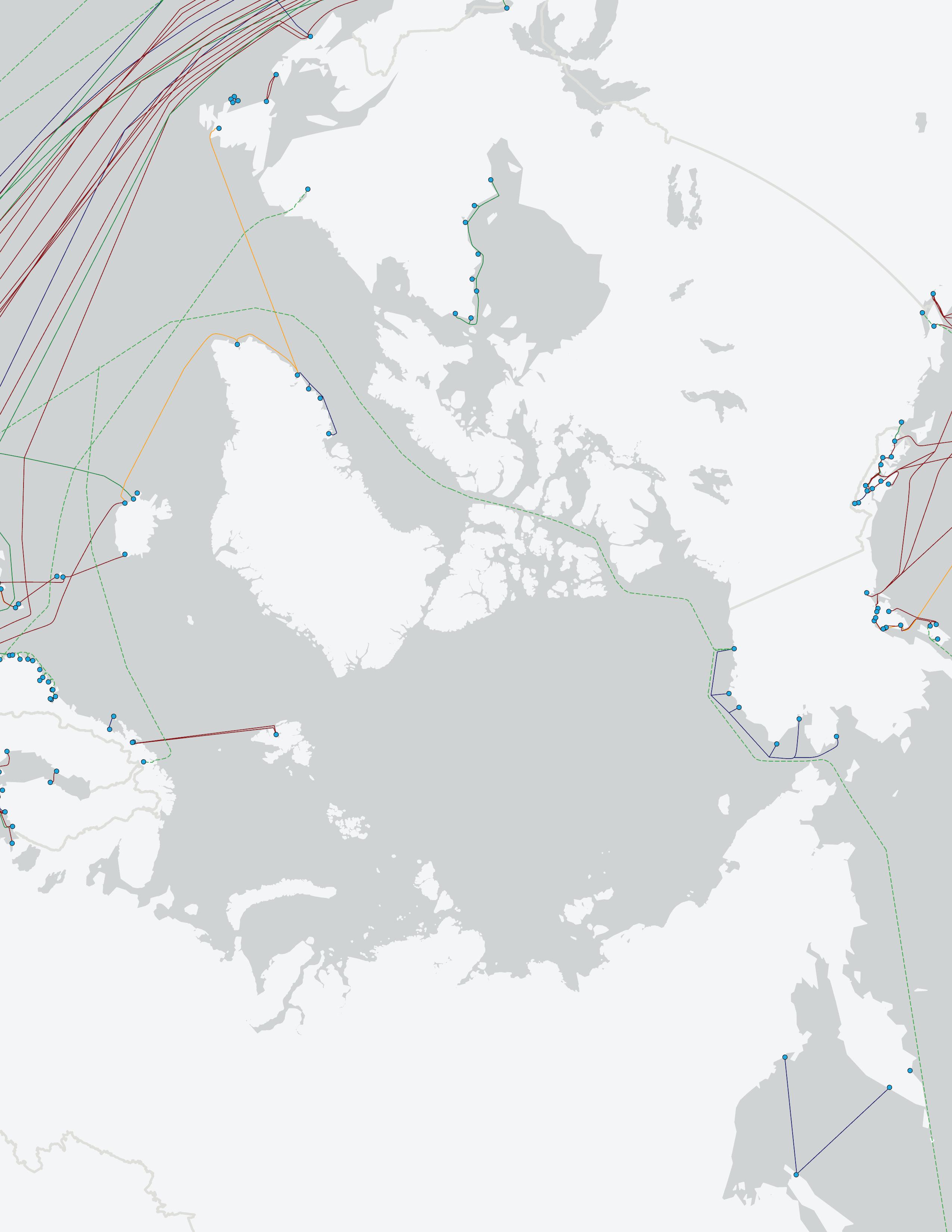
The Polar region has seen limited but impactful developments, primarily highlighted by the groundbreaking installation of the Quintillion Subsea system in 2017. This system, spanning 1,200 kilometers with six landing points, marked the first full Polar submarine fiber system in industry history, breaking new ground for future projects in this challenging region.
Since the introduction of the Quintillion Subsea system, interest in Polar projects has grown, driven by the potential to reduce latency between Europe, North America, and Asia. While the total system count remains modest at three as of 2024, the future of this region holds promise for strategic route expansions, especially as the need for faster trans-regional connectivity intensifies. The recent developments provide critical proof of concept, demonstrating that fully Polar systems are viable, though they face unique operational challenges.
The primary challenges to expanding submarine cable networks in this region are the limited construction windows due to extreme weather, remote geography, and the high costs associated with working in such conditions. These factors inevitably slow down development timelines and increase overall project costs. However, the strategic benefits of shorter routes through the Polar Circle keep driving interest in this region.
As of 2024, three additional Polar systems are planned, representing a strategic effort to expand the region’s connectivity. A critical goal for these systems is to offer
shorter, more direct routes between Europe and Asia, bypassing traditional, more politically and geographically unstable regions.
Current projections show these systems adding approximately 6,000 kilometers of submarine cable to the Polar region by 2024, a significant milestone given the challenges of working in the Arctic. Future systems are aimed at reducing data transmission distances between Europe and Asia from approximately 20,000 kilometers to 14,000 kilometers, potentially cutting latency in half. This reduction in latency offers a major competitive advantage for businesses and organizations dependent on rapid, reliable connectivity between continents.
The region’s development progress, as measured by CIF (Contract in Force), has been slow, with none of the three planned systems yet reaching CIF status. This is reflective of the inherent challenges in the Polar region, where extreme environmental conditions and high project costs continue to pose significant barriers to progress.
While the lack of CIF systems highlights the difficulties, there is still optimism in the industry. Beyond 2027, exploration is underway for a project connecting research bases in Antarctica to either South America or New Zealand. This project, potentially backed by government initiatives, could help overcome the commercial viability challenges that have hindered past efforts. Establishing high-capacity, low-latency fiber connections to Antarctic research stations would be a major boon to scientific collaboration and data-sharing capabilities.
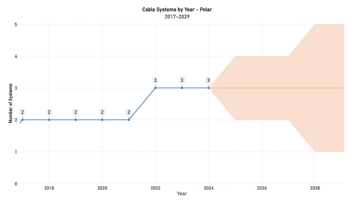
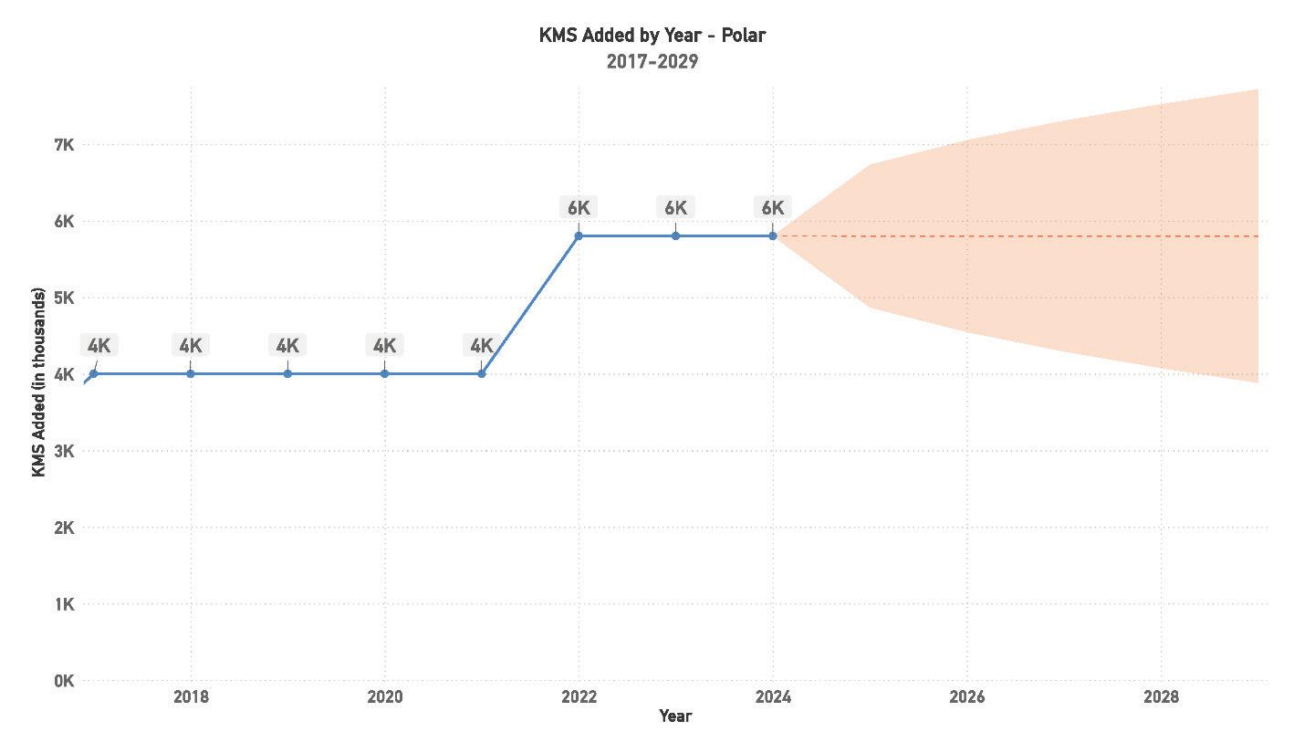
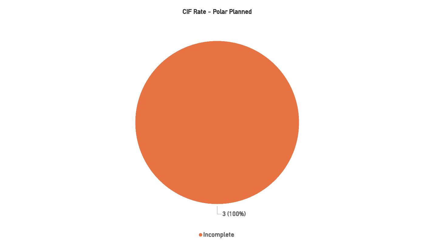
The Polar region presents both significant opportunities and challenges for future submarine cable development. The potential to create ultra-low-latency routes between Europe, North America, and Asia by bypassing traditional routes through the Middle East and North America positions the region as a key player in future global connectivity. However, the extreme environmental conditions, high project costs, and political complexities continue to pose substantial bar-
riers to growth. While some ambitious projects are planned, the lack of CIF milestone progress reflects the inherent difficulties of operating in such a harsh and remote region. Looking ahead, the success of projects like Quintillion Subsea has proven the feasibility of Polar systems, but the region’s future growth will depend on sustained investment, technological innovation, and international collaboration. Government-backed initiatives and research-driven projects could spur further development, particularly with interest in
Antarctic connections, but the timeline for widespread commercial deployment remains uncertain. Ultimately, the Polar region’s role in global connectivity will depend on overcoming these significant obstacles while harnessing its strategic advantages.
Six challenges impact the region:
1. Extreme Environmental Conditions: The Polar region’s harsh climate and extreme weather conditions, including severe cold, ice cover, and long periods of darkness, make installation and maintenance of submarine cable systems difficult. These conditions limit the available time windows for construction, often leading to prolonged project timelines and higher operational costs. Furthermore, the remote geography of the region makes it challenging to access and deploy equipment.
2. High Project Costs: Due to the logistical and environmental challenges, developing and maintaining submarine cable systems in the Polar region is significantly more expensive than in other regions. Specialized equipment, vessels, and personnel are required to work in such a hostile environment, and insurance premiums for such projects are typically higher due to the associated risks.
3. Limited Infrastructure: Unlike more developed regions, the Polar region lacks established infrastructure to support large-scale submarine cable deployments. This includes the absence of existing data centers, energy sources, and supporting transport infrastructure in remote areas. As a result, Polar projects often require substantial initial investment in both undersea and terrestrial infrastructure, making commercial viability more difficult.
4. Political and Regulatory Hurdles: The Polar region is subject to complex international laws and agreements, as multiple countries lay claim to parts of the Arctic. Navigating these political waters can be challenging, as disputes over territorial claims may delay projects. For example, projects that pass through Russian territory require nav-
igating strict political regulations, which can slow down system approvals and complicate planning.
5. Uncertain Demand: While the Polar region offers the potential for significantly reduced latency on transcontinental routes, the demand for such routes is still developing. Current market demand may not yet justify the high costs of building and maintaining such systems, particularly when alternative, well-established routes exist. Ensuring long-term demand will be crucial to the success of future Polar submarine cable projects.
6. Limited R&D and Experience: Submarine cable development in the Polar region is still in its infancy compared to other regions, and there is a relative lack of research and experience in managing the unique challenges posed by the Arctic environment. The limited number of existing systems means there is still much to learn about the long-term viability and maintenance requirements of these cables under extreme conditions, such as ice floes and permafrost.
The Polar region continues to present unique opportunities and challenges in the submarine cable industry. Although its growth has been limited compared to other regions, the potential for significantly reducing latency between Europe, North America, and Asia, while bypassing politically unstable regions, makes it an attractive target for future developments. Continued interest from both government-backed and private initiatives indicates that the Polar region will remain a focal point for specialized submarine cable projects over the coming decade.
As infrastructure in this area evolves, we can expect to see increased focus on research, scientific collaboration, and data transfer enhancements, particularly as further routes to the South Pole are explored. The success of these projects will depend on overcoming the region’s harsh conditions, and sustained investment will be crucial for long-term viability. STF
Current Systems: 19
Capacity: 970 Tbps
Planned Systems: 4
Planned Capacity: 782 Tbps
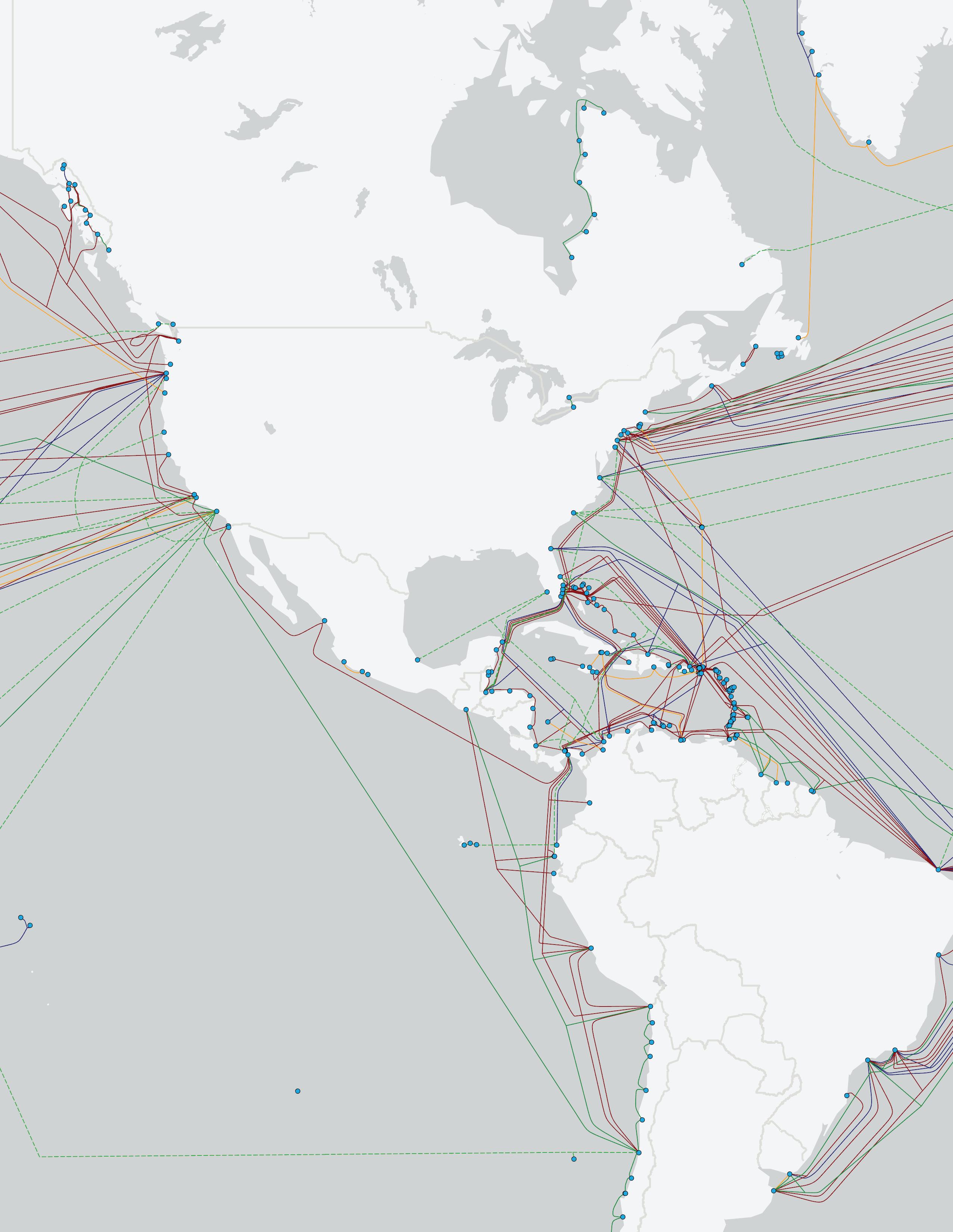
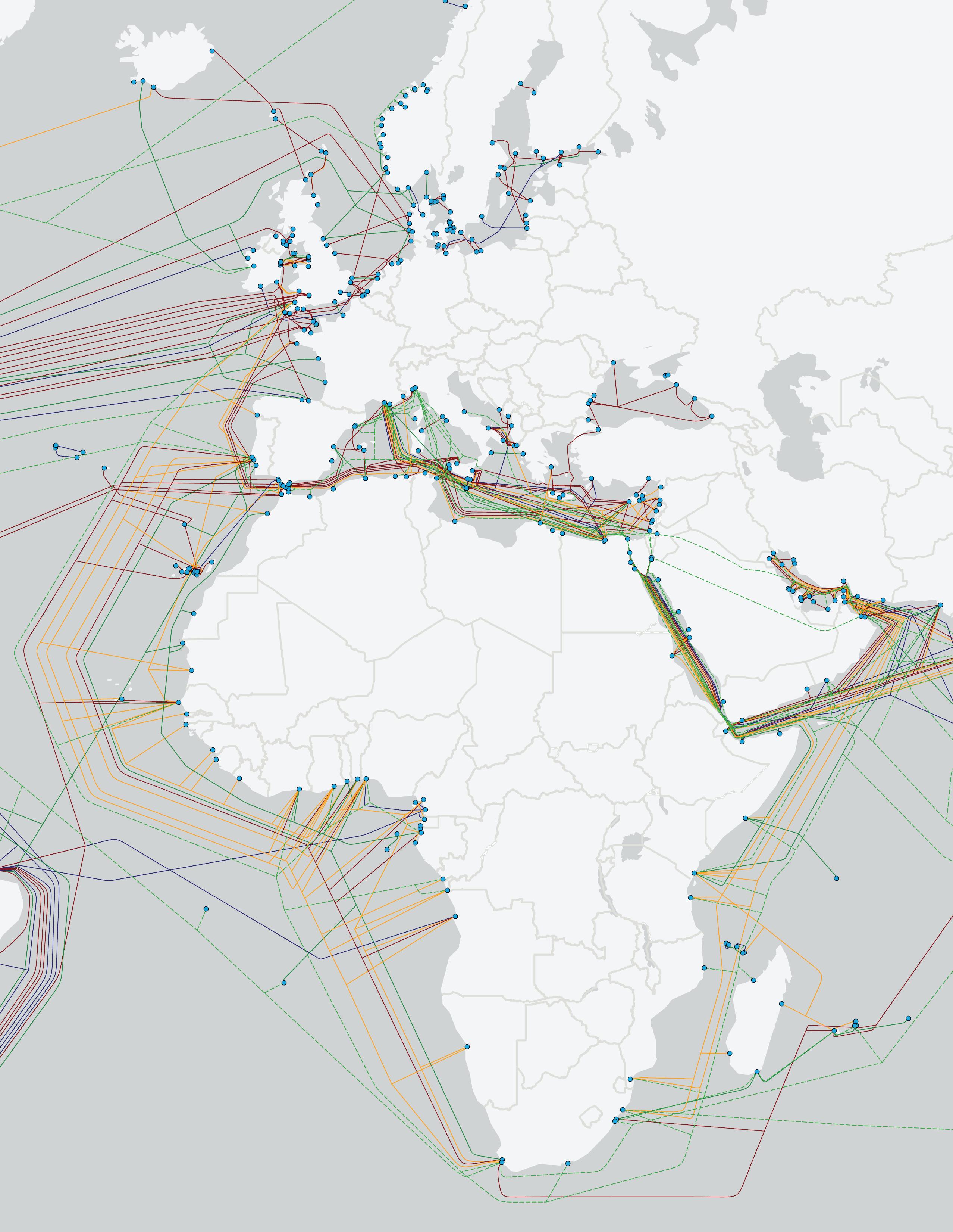
The Transatlantic region remains a crucial corridor for global data traffic, connecting North America and Europe. The region has experienced steady growth since the mid-2010s, driven by the increasing demand for bandwidth and the expansion of Hyperscaler companies like Google, Microsoft, and Facebook. As of 2024, the Transatlantic region has 19 cable systems, up from 12 systems in 2017. This expansion has been fueled by both new deployments and system upgrades to accommodate higher capacity and improved latency.
The steady rise in the number of systems reflects the region’s strategic importance, with key systems like MAREA, Dunant, and Grace Hopper contributing to transatlantic connectivity. These systems have helped reduce latency and increase capacity, particularly between the U.S. East Coast and Europe. While much of the historical focus has been on traditional routes such as New York to London, new systems are also exploring alternative landing points, like Amitié’s connection between the U.S. East Coast and France.
Despite its growth, the Transatlantic region faces some of the same challenges as other global submarine cable markets. Aging infrastructure remains a concern, with many older systems needing to be replaced or upgraded to meet the increasing demand for data transfer. Additionally, the cost of laying new cables and the complex regulatory environments on both sides of the Atlantic continue to present hurdles for system development.
In terms of future growth, the Transatlantic region is projected to continue expanding, although at a slightly slower
rate compared to past years. By 2029, the number of systems is expected to surpass 25, driven by ongoing demand for higher capacity and route diversity. The region remains vital for Hyperscalers seeking to connect their U.S. and European data centers with fast, reliable connectivity.
From 2017 to 2024, the region saw consistent growth in cable kilometers, rising from 108,000 kilometers in 2017 to 157,000 kilometers by 2024. Much of this growth has been driven by high-capacity Hyperscaler systems, which prioritize speed and efficiency to meet the needs of their data centers. Looking ahead, additional cable kilometers will be added, particularly as new routes like the Amitié cable are completed. By 2024, 50% of the planned systems in the Transatlantic region have reached the CIF (Contract in Force) milestone, with the remaining systems still in development. This relatively slow progress reflects the financial and regulatory challenges inherent in the region, particularly for non-Hyperscaler systems. Projects that are not backed by large technology firms face greater hurdles in securing financing and navigating regulatory approval processes on both sides of the Atlantic.
While the CIF rate shows steady progress, competition among cable developers remains strong. Several systems are racing to meet their Ready for Service (RFS) dates, with developers focused on improving route diversity and enhancing connections between underserved regions. Systems planned for the next five years include new routes connecting South America, Africa, and Europe, which could shift the balance of transatlantic connectivity.
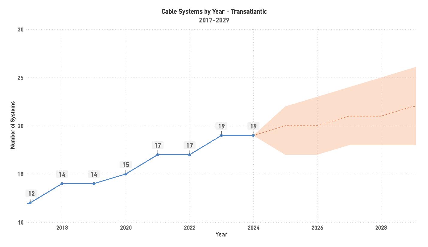
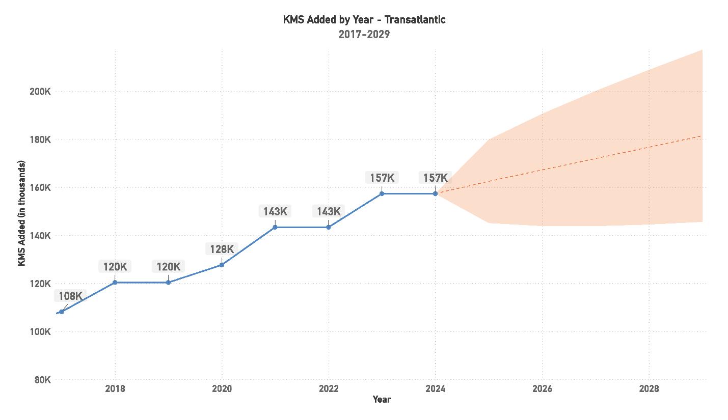
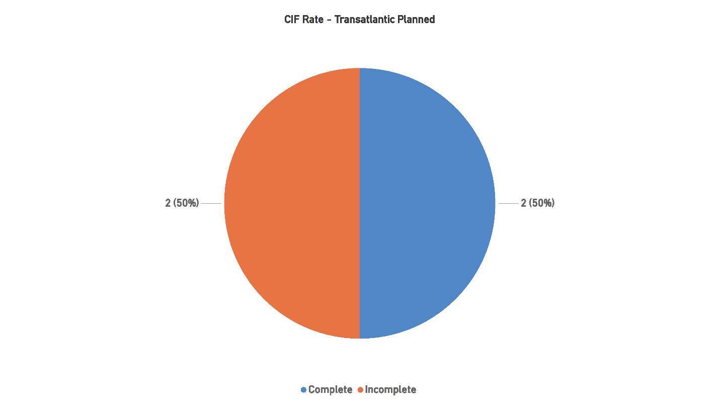
The Transatlantic region will continue to play a vital role in global data traffic, fueled by the need for high-capacity, low-latency connections between North America and Europe. While the number of systems is projected to grow steadily, the region’s focus is shifting toward enhancing route diversity and optimizing system performance. This trend will be particularly influenced by Hyperscalers, who are driving much of the new infrastructure development to support their
growing global data center networks. Future growth in the region will likely center on balancing the need for new deployments with upgrading aging systems, many of which are nearing the end of their operational lives. Navigating the complexities of regulatory environments across jurisdictions and securing financing, especially for non-Hyperscaler-backed projects, will remain significant challenges. Despite these hurdles, the region’s strategic importance ensures it will continue to see investment and
development, with an emphasis on building more resilient and efficient systems that can meet the increasing demand for transatlantic data transmission.
Five challenges impact the region:
1. Regulatory and Political Complexities: Varying regulations between North America and Europe pose challenges for submarine cable development, particularly regarding data privacy, cybersecurity, and environmental protections. These differing policies can introduce delays and create additional legal hurdles, complicating the approval process for new systems.
2. Aging Infrastructure: With many of the region’s older systems approaching the end of their lifecycle, there is a pressing need for upgrades and replacements. This transition must be carefully managed to ensure consistent capacity and performance, especially as demand continues to grow.
3. Environmental Factors: Although the Transatlantic region is relatively stable compared to other regions, deepsea risks such as seismic activity and external threats like fishing gear or shipping routes remain a concern. Environmental restrictions around landing stations also influence system planning and deployment.
4. Competition Among Developers: The competitive landscape in the Transatlantic region is fierce, with multiple developers seeking to serve similar routes.
Independent developers often face tough competition from Hyperscalers, both in securing financing and in meeting market demand. Navigating this competition will be critical for smaller players looking to achieve their deployment goals.
5. Financial Challenges for Non-Hyperscaler Systems: Securing financing is particularly difficult for projects not backed by major technology firms, which makes it challenging for smaller developers to move forward with planned systems. This financial uncertainty can slow development and delay the deployment of critical infrastructure needed to keep pace with global data demands.
As the Transatlantic region evolves, its strategic significance as a core link between North America and Europe ensures its continued relevance in the global submarine cable industry. Future growth will focus on both increasing route diversity and upgrading existing systems to meet the region’s growing bandwidth needs. Hyperscaler-driven developments will dominate, with an emphasis on faster, more efficient links to critical data centers. While financial, regulatory, and competitive challenges may slow the pace of system deployment, the demand for enhanced connectivity across the Atlantic will drive ongoing investment. The region’s future lies in its ability to navigate these hurdles while embracing innovation in cable system design, ensuring it remains a key player in the global data ecosystem. STF
Current Systems: 15
Capacity: 742 Tbps
Planned Systems: 9
Planned Capacity: 1112 Tbps
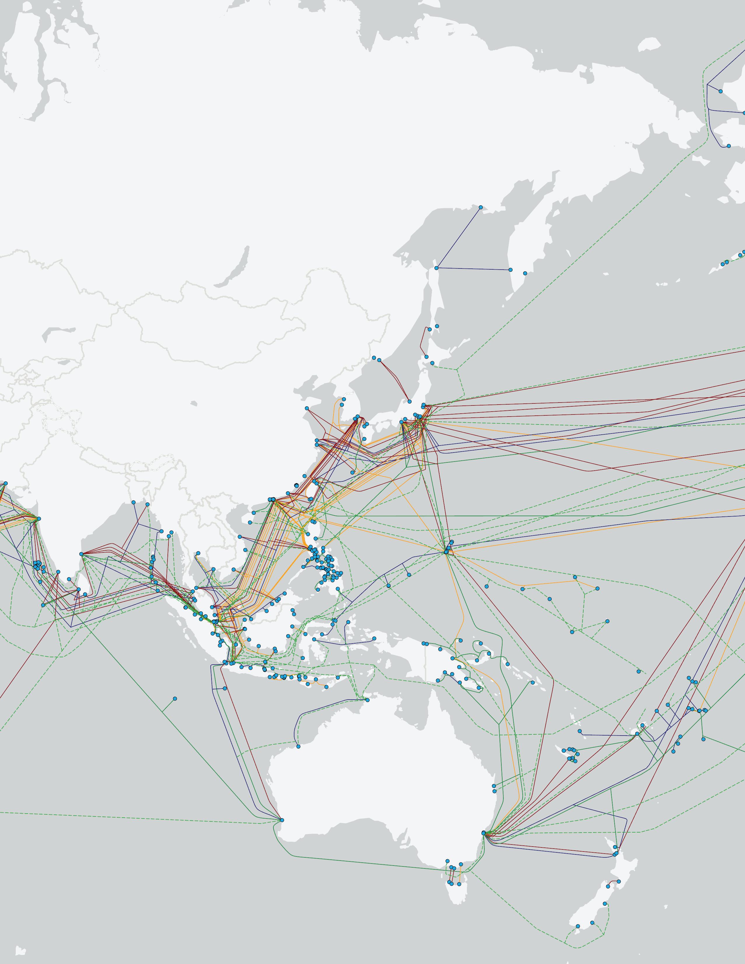
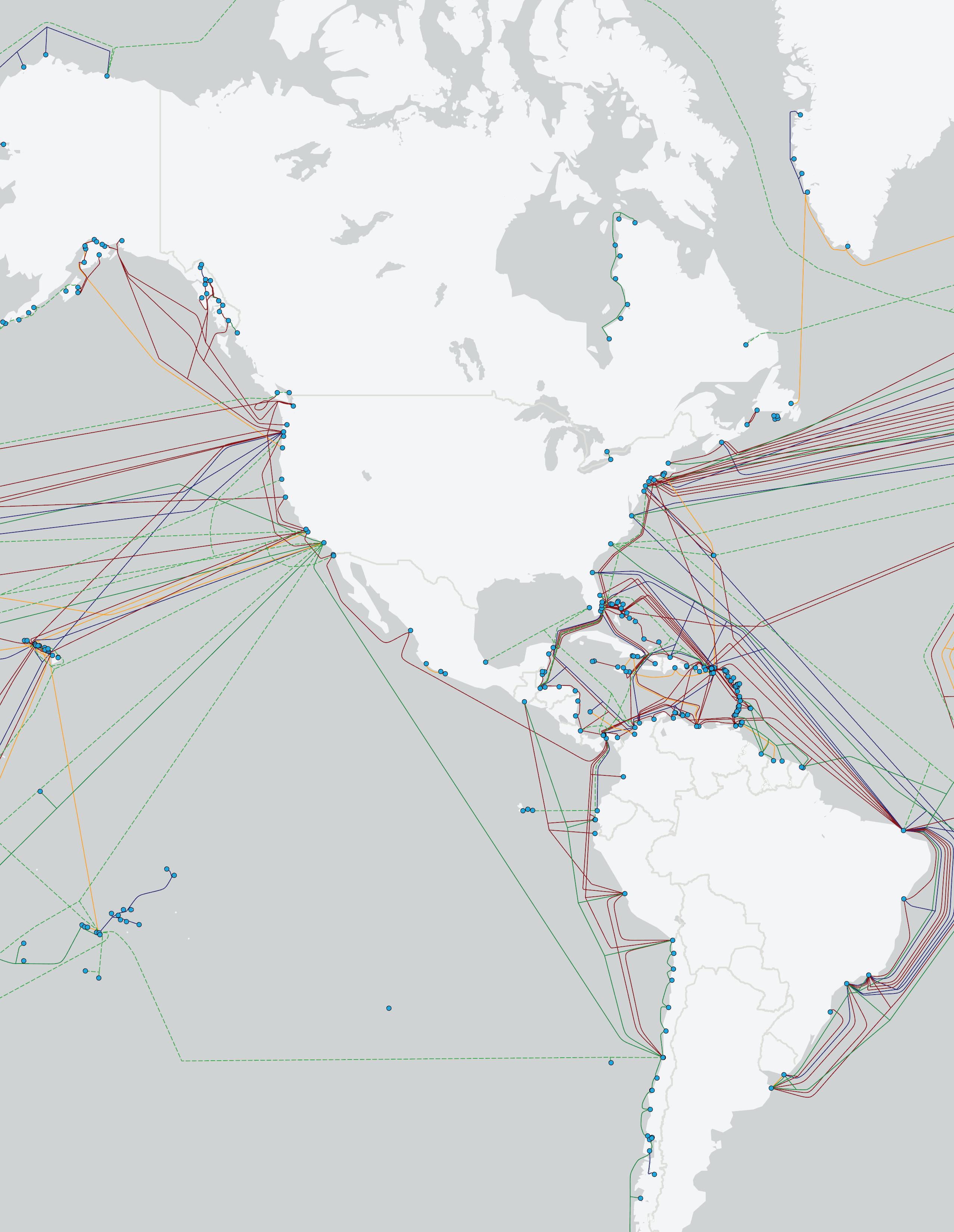
The Transpacific region has steadily grown in significance as a crucial link between North America and Asia, driven by the need for high-capacity, long-distance data transmission across the Pacific Ocean. As of 2024, the region boasts 17 operational cable systems, up from 10 systems in 2017. This growth has been supported primarily by Hyperscalers like Google, Microsoft, and Facebook, who are seeking to meet the increasing demands for bandwidth and low-latency connections between the U.S. West Coast and key data centers in East Asia.
The region’s growth has been steady but measured, with new systems coming online annually since 2017, except for brief pauses in 2019 and 2021. Notable systems include Hawaiki, JUPITER, and Curie, which have dramatically increased capacity while offering alternative routes to traditional North America-to-Japan pathways. Despite the complexities of installing systems across such long distances, the Transpacific region has managed to maintain its position as a key driver of global data traffic. However, aging infrastructure and the cost of laying new systems continue to present challenges for system upgrades and new deployments.
Looking forward, the Transpacific region is poised for continued growth, with an expected 20 systems in place by 2029. Hyperscalers remain the driving force behind this expansion, as they look to secure more direct, resilient routes for their global data centers. The demand for additional capacity and route diversity continues to fuel the need for new
systems, especially as existing cables near the end of their operational lifespans.
From 2017 to 2024, the region added substantial cable kilometers, rising from 179,000 kilometers in 2017 to 275,000 kilometers by 2024. This reflects both the length and complexity of Transpacific systems, which frequently exceed 15,000 kilometers per system. With the planned systems set to bring the total kilometers close to 320,000 by 2029, the region remains vital for supporting the massive data traffic flowing between North America and Asia. Additionally, the push for greater route diversity and shorter latency routes is expected to shape future developments.
As of 2024, 66.67% of the planned systems have achieved the Contract in Force (CIF) milestone, a solid improvement over the previous year’s CIF rate. This progress highlights the growing interest in securing financial backing for new systems, particularly from Hyperscalers who continue to dominate the Transpacific market.
However, competition remains fierce among cable developers, with several systems vying for similar routes across the Pacific. The CIF milestone progress indicates that while funding and regulatory hurdles have been successfully navigated for many planned systems, others continue to face challenges in securing the necessary resources to move forward.
The Transpacific region will remain vital to global data networks, with growing demand for low-latency, high-capacity connections between North America and Asia
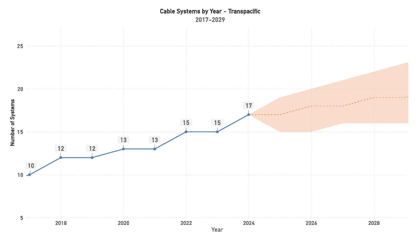
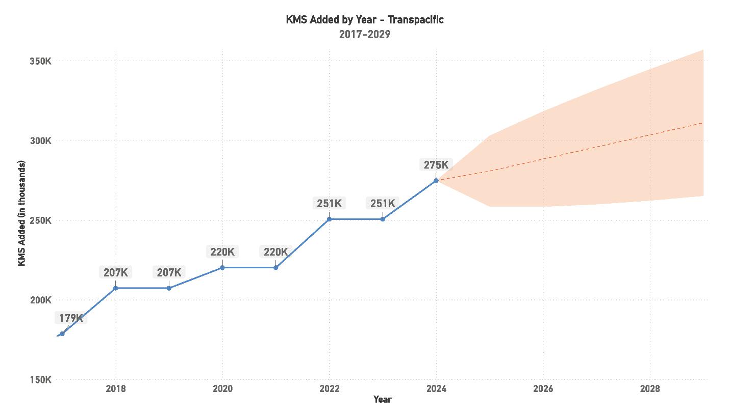
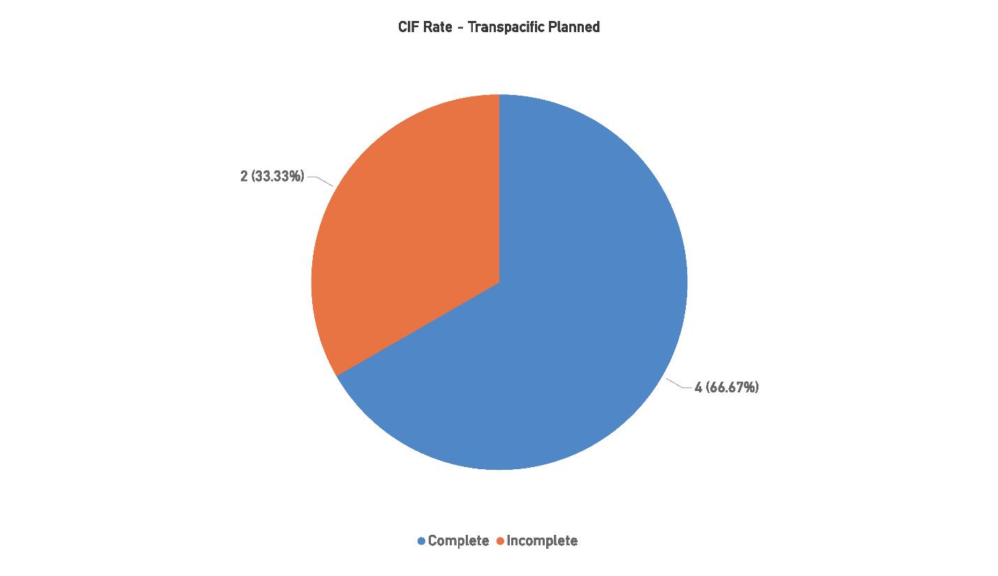
driving continued investment. The number of systems is projected to grow steadily, but the focus will increasingly shift toward optimizing performance, enhancing route diversity, and addressing the challenges of aging infrastructure. Hyperscalers will continue to be the primary force behind these developments, with new deployments centered around improving the reliability and speed of data transfer across the Pacific.
Future developments in the region will focus on balancing
new system deployments with the need to upgrade older systems, many of which are nearing the end of their operational lives. Regulatory hurdles, particularly those related to data privacy, cybersecurity, and environmental considerations, will continue to complicate the deployment process. Despite these challenges, the region’s strategic importance ensures that it will remain a focal point for investment, particularly as global data demands continue to rise.
Five challenges impact the region:
1. Regulatory and Political Complexities: The differing regulatory environments in North America and Asia introduce significant delays and challenges for submarine cable development. Compliance with various data privacy, cybersecurity, and environmental regulations often results in extended approval times and increased project costs.
2. Aging Infrastructure: Many of the region’s older systems are approaching the end of their operational lifespans, creating a need for upgrades and replacements. This creates a challenge for maintaining capacity and performance during transitions to newer systems.
3. Environmental Risks: The long cable lengths required for Transpacific systems increase the risk of environmental factors like deep-sea earthquakes, undersea landslides, and damage from shipping or fishing activities. Additionally, environmental regulations around landing stations pose planning challenges.
4. Competition Among Developers: With multiple systems vying to serve similar routes, competition between developers can be intense, especially for those not backed by Hyperscalers. These developers often face greater difficulties in securing financing and market share.
5. Financial Uncertainty for Non-Hyperscaler Systems: Securing funding is especially difficult for systems that
lack Hyperscaler backing, with independent developers facing challenges in navigating both financial and regulatory environments. This can lead to delays in achieving key milestones, such as the CIF status.
The Transpacific region is set for sustained growth, driven by increasing global data demands and the ongoing need for enhanced connectivity between North America and Asia. While the number of systems is expected to rise modestly in the coming years, the emphasis will be on developing new routes and upgrading aging infrastructure to ensure the region remains competitive. Hyperscaler investments will continue to dominate, with new systems focusing on optimizing speed, efficiency, and resilience.
Looking ahead, the Transpacific region will remain a key corridor for global data transfer, though regulatory challenges and competition among developers may temper the pace of new deployments. The region’s future success will depend on its ability to navigate these hurdles, secure financing for non-Hyperscaler-backed systems, and maintain the capacity to meet growing bandwidth demands. Despite these challenges, the Transpacific region’s strategic role ensures that it will remain a critical component of the global submarine cable landscape. STF
BY NICOLA TATE
Welcome to the latest advertising and marketing tips! SubTel Forum is one of the very few websites and publications that attracts so many “movers and shakers” in the subsea telecommunications world and in this issue I am going to focus specifically on getting the most value for your advertising dollar with SubTel Forum. I have included three recommendations below based on the desired level of involvement and potential advertising budget. I recognize this is quite self-promotional, but it’s a great way to quickly learn about SubTel Forum offerings.
A great starting point is featuring your company on the SubTel Forum website via banner ads and on the SubTel Forum Directory (a directory of companies that supply the industry). The SubTel website banners receive hundreds of thousands of impressions per year and an average click rate of .77%, and the directory receives more than 5800 visitors a year. This combination starts at $2,699 (3 months of banner ads and 1 year on the directory).
If your budget allows for more involvement I recommend ensuring your company is featured on the printed cable maps that SubTel products and distributes at the major events (PTC, Submarine Networks EMEA, IWCS Cable & Connectivity Forum). More than 4,500 of these high quality printed maps are distributed and are sure to be hung in offices across the world.
In addition to the printed maps, SubTel Forum produces six issues a year of Submarine Telecoms Forum magazine. With an average read time of over 8 minutes and more than 1,000 unique reads per issue it’s the go-to for industry analysis, information and news, and a great way to engage in branding and share your expertise. Feature your company on the printed map and in full page placements for all six issues of Submarine Telecoms Forum magazine for $13,530, or $7,650 if you prefer quarter page placements.
If you would like to make a big splash, drive more leads and inquiries, or just to maximize your industry presence, I recommend all of the items
above PLUS get involved in SubTel Forum’s Annual Industry Report and the four issues of Quarterly Almanac. These special features feature 2-page spread positions that make a big impact.
Inclusion in these special issues, plus the Submarine Telecoms Forum magazine, printed cable map, a full year of banner advertisements and the online directory delivers a ton of value at $28,030.
If you have an interest in learning more, please reach out. This is a great time to plan for 2026! For those of you that read all the way to this closing paragraph – mention this “Advertiser’s Corner” for a 10% discount on any of these packages booked before November 1, 2025! STF

Originally hailing from the UK, NICOLA TATE moved to the US when she was just four years old. Aside from helping companies create effective advertising campaigns Nicola enjoys running (completed the Chicago marathon in 2023 and will be running in the Berlin marathon in 2024), hiking with her husband, watching her boys play soccer, cooking, and spending time with family.

Submarine Telecoms Forum is the leading digital platform for the submarine cable industry, offering a dedicated e-magazine, daily news, and streaming video content. We serve over 150,000 users across 125 countries, providing free, comprehensive insights into submarine telecom cable and network operations. As a trusted source for information, we ensure you stay informed and connected in the fast-paced world of submarine telecommunications.



United States (30.1%)
France (13.22%)
United Kingdom (11.23%)
South Africa (10.47%)
Singapore (7.11%)
India (6.78%)

Japan (6.1%)
Australia (5.48%)
Germany (5.46%)
Philippines (4.05%)
THE DECISION MAKERS: 64.28% of the SubTel Forum audience are either the final decision maker or have a high influence on the final purchase. 35.72% are involved in making purchasing recommendations.
DEEP INDUSTRY EXPERIENCE: 85.72% of the SubTel Forum audience have greater than ten years of industry experience.
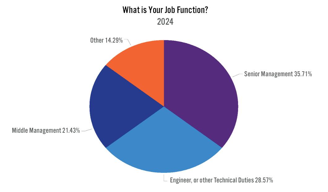
SubTel Forum, the premier publication in the submarine telecoms industry, stands out with:
• An average of more than 1,000 unique reads per issue and an average read time of more than 8 minutes.
• Two Months Exposure & Endless Archiving:
SPONSO R SHIP BENEFITS W ITH SUBTEL FO R UM :
• Video Embedding:
• Social Media Shoutouts:
• Dedicated Email Campaign:
A R T & V IDEO R EQ U I R EMENTS :
• Print Ads:
• Video Ads: •
EDITORIAL CALENDAR:
January 2025: Global Outlook and SNW EMEA preview
March 2025: Finance & Legal and ICPC preview
May 2025: Global Capacity and SubOptic preview
July 2025: Regional Systems and SNW World preview
September 2025: Offshore Energy and IWCS preview
November 2025: Data Centers & New Technology and PTC preview
The SubTel Form Almanac, released quarterly,is a key reference for the submarine cable industry. Each issue showcases major international systems with detailed pages featuring system maps, landing points, capacity, length, and RFS year, among other data.
QUA R TE R LY DO W NLOADS & EXPOSURE :
• Each issue averages about 850 unique reads, 215 clicks, and a greater than 24 minute read time.
• Three months of exposure plus permanent archiving.
SPONSO R SHIP BENEFITS :
2 PAGE SPREAD 11” x 17”
A R T & V IDEO R EQ U I R EMENTS :
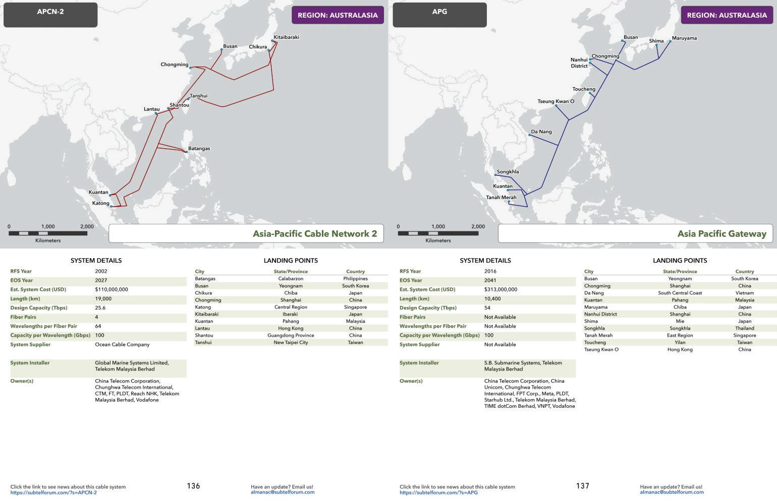
The SubTel Forum Annual Report offers the latest, comprehensive data on the submarine fiber market, analyzing system capacity, productivity, and industry outlook. The yearly Industry report typically generates more than 2700 unique reads with an average read time of more than 11 minutes.
ANNUAL PRICE: $3,200
SPONSO R SHIP BENEFITS :
• Two-page Spread Ad.
• Social media acknowledgement.
• Press release and mailer acknowledgement.
:
• Two-page Spread: 17” W x 11” H, 300 dpi in PDF or JPG.
• Optional video: include a blank box for overlay; no size restrictions.
LOCK IN NO W FO R 20 2 5 !
• Global Overview
• Capacity
• Ownership Financing Analysis
• Supplier Analysis
• System Maintenance
• Cable Ships
• Hyperscalers and The Evolution of Submarine Cable Ownership
• Special Markets
• Regulatory Outlook
• Regional Analysis and Capacity Outlook
This new directory is designed for industry professionals to locate companies that provide products or services to the submarine telecom cable and network operations sector. Engage the more than 150,000 users across 125 countries that consume Submarine Telecoms Forum’s e-magazine, daily news, and streaming video content.
• Starting at $599/year
Learn more, customize your campaign, or place an order by contacting Nicola Tate at [+1] 804-469-0324 or ntate@associationmediagroup.com
Limited Availability:
Wide Distribution:
Over 4,500 copies shared at key industry events including PTC (January 2025), Submarine Networks EMEA (Februray 2025), and IWCS Cable & Connectivity Forum (October 2025), ensuring a year-long exposure. Additionally, an updated print-ready PDF cable map will be available for all sponsors.
ANNUAL PRICE: $4,500
SPONSO R SHIP PERKS :
• Comlimentary Web Banner on News Now feed
• Social Media shoutouts
• Acknowledgement in press releases and mailers
• In addition to the print copies that you may pick up during key industry events you can secure a print-ready PDF to print copies for staff and customers. Updated quarterly!
Add a special printing for SubOptic 2025 happening June 2025. $1,750 additional cost for annual sponsors or $3,500 for the single printing.
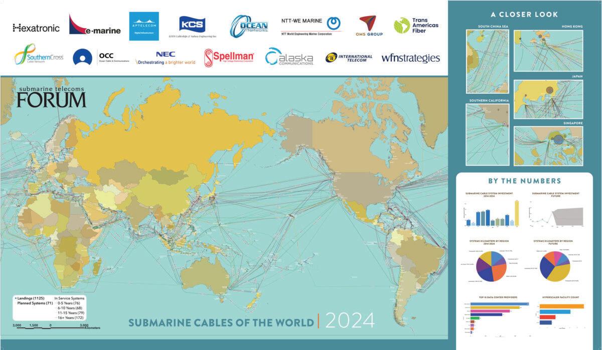
• • • • • QUARTERLY PRICE: $3,000
SPONSORSHIP BENEFITS FO R THE SUBTEL FO R UM ONLINE C A BLE M A P :
• Duration:
• Visibility:
•
• Social Media Recognition:
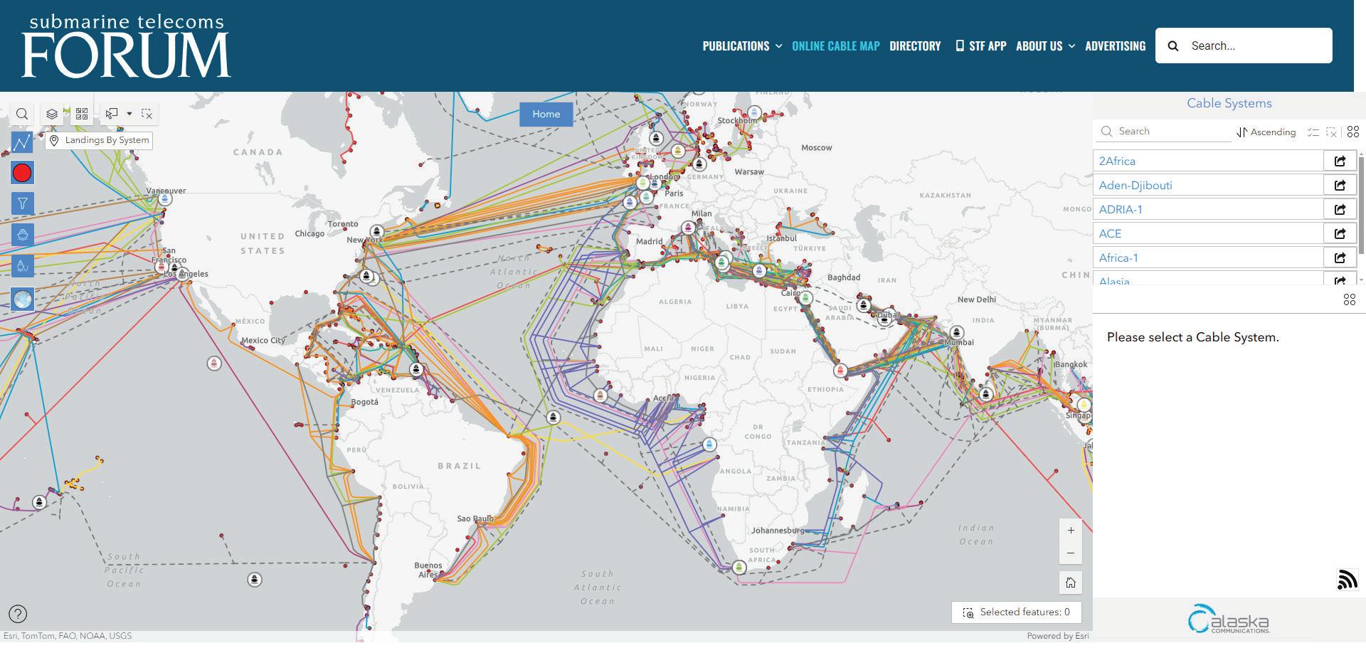
Learn more, customize your campaign, or place an order by contacting Nicola Tate at [+1] 804-469-0324 or ntate@associationmediagroup.com