MAJOR USER INTERFACE UPGRADES FOR SUBTEL CABLE MAP BY KIERAN CLARK
INTRODUCTION: A SMARTER, SHARPER CABLE MAP
The SubTel Cable Map has long served as one of the submarine telecom industry’s most comprehensive, web-based resources. Built on ArcGIS Experience Builder, this interactive application offers real-time visualization of global subsea cable systems, including active, planned, and historic routes. With industry professionals, researchers, and policymakers relying on the platform for reference and analysis, usability and performance are paramount. Over the past several weeks, we’ve rolled out a significant series of updates to the map’s user interface and data structure. These improvements focus on navigation, clarity, and ease of access, helping users locate and filter the information they need faster and more intuitively. This article walks through the major updates to the map and offers a look at the kinds of refinements we’ll continue to make based on user feedback and evolving data needs.
CLEANED-UP INTERFACE: LESS NOISE, MORE MAP
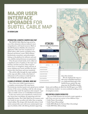
One of the most visible improvements is a complete restructuring of the map layout. Previously, key interface panels were spread across multiple sections of the screen, including a side-by-side arrangement that often made the experience feel cramped—especially on smaller screens or in embedded environments. In the new version, we’ve introduced a vertical accordion layout that consolidates all supporting tools into collapsible headers. The Cable Ships list, for instance, now lives inside its own accordion tab rather than occupying a fixed sidebar. This design shift drastically reduces visual clutter and provides users with more uninterrupted map space by default, while still offering detailed supporting
10 SUBMARINE TELECOMS FORUM MAGAZINE
data when desired. We also deployed the map as a full-screen embedded experience on a dedicated blank page of the SubTel Forum website. By stripping away the WordPress header, footer, and scrollbars, we allow the ArcGIS app to use 100% of the browser window—no more accidental scrolling or loss of navigation context.
NEW SORTING & SEARCH CAPABILITIES
The core Cable Systems list received a major upgrade as well. Users can now sort entries in four different ways: • Cable Name (Ascending) • Cable Name (Descending) • Cable RFS (Ready for Service) Date (Ascending) • Cable RFS Date (Descending)