
Iran my first London Marathon last month. Having lived in the UK years ago I expected the “usual” April cool, rainy weather, but just in case I planned for two other scenarios, including a warm Virginia spring day. And as the day approached I watched as the temperatures slowly climbed higher and higher until the early morning of the race I received a text from the organizers suggesting this may not be a good day for a PR. Needless to say but a warm, sunny spring day which is wonderful for touring is not so ideal for a long run; so, like many I ran simply to enjoy and complete, and of course earn that coveted finishers’ medal. The best laid plans… often go awry!
We mentioned it last issue, but it bears repeating: the new SubTelForum.com is live. With a sleek design, improved navigation, real-time trending topics, and curated Editor’s Picks, it’s built for sharper insights and a smoother experience—on any device. Click here to check it out!
We’ve launched a new Authors Index on SubTel Forum Magazine and our website—a searchable directory that lets readers easily find articles by contributor. It’s a new way to spotlight industry voices and access expert insights. Click here to check it out!
The exclusive SubOptic ’25 Submarine Cable Map is printed and headed to Lisbon, showcasing subsea tech milestones and advancements. Next editions will debut at
Submarine Networks World (Singapore) in September and IWCS Forum 2025 (Pittsburgh) in October. Want your logo featured? Click here to secure your spot!
Our updated Online Cable Map is now live featuring a sleeker interface, faster performance, and enhanced usability across all devices. Built using the historical theme featured in the printed SubOptic cable map, the updated design offers a visually rich, intuitive experience that connects past and present global infrastructure. Interested in sponsoring the Online Cable Map? Contact Nicola Tate.
SubTel Forum is once again honored to present the Excellence in Industry Awards at SubOptic 2025—recognizing outstanding contributions across the submarine cable sector. Since 2010, these awards have highlighted the best in thought leadership, innovation, and impact, celebrating individuals and organizations shaping the future of global connectivity. This year’s honorees represent the cutting edge
of subsea communications, and we’re proud to shine a spotlight on their achievements at the industry’s premier gathering.
SubTel Forum is proud to support the University of California, Berkeley’s new Global Digital Infrastructure certificate program—an unprecedented academic initiative focused on the multifaceted world of submarine telecommunications. As the program’s official industry thought partner, we’re contributing editorial resources, decades of archival content, and a platform for emerging voices through our Big Talk essay competition. It’s a meaningful step toward cultivating the next generation of subsea cable leaders, and one we believe will shape the future of our industry.
The 54th Submarine Cable Almanac will be published in May featuring the latest global cable system data. The next edition arrives in August—interested in sponsoring? Contact Nicola Tate.
Thank you as always to our awesome authors who have contributed to this issue of SubTel Forum. Thanks also for their support to this issue’s advertisers: Angola Cable, APTelecom, Fígoli Consulting, FLAG, Hexatronic, Southern Cross, Starboard Marine Intelligence, SubOptic 2025, and WFN Strategies. Of course, our ever popular “where in the world are all those pesky cableships” is included as well.
Good reading and see you in Lisbon –Slava Ukraini STF


Wayne Nielsen, Publisher
A Publication of Submarine Telecoms Forum, Inc. www.subtelforum.com | ISSN No. 1948-3031
PRESIDENT & PUBLISHER: Wayne Nielsen | wnielsen@subtelforum.com | [+1] (703) 444-2527
VICE PRESIDENT: Kristian Nielsen | knielsen@subtelforum.com | [+1] (703) 444-0845
ANALYTICS: Kieran Clark | kclark@subtelforum.com | [+1] (540) 533-6965
SALES: Nicola Tate | ntate@associationmediagroup.com | [+1] (804) 469-0324 subtelforum.com/advertise-with-us
DESIGN & PRODUCTION: Weswen Design | wendy@weswendesign.com
DEPARTMENT WRITERS:
Alice Shelton, Andrés Fígoli, Anup Gupta, Caroline Crowley, Ella Herbert, Kieran Clark, Nicola Tate, Philip Pilgrim, and Wayne Nielsen
FEATURE WRITERS:
Angelo Gama, Derek Cassidy, Geoff Bennett, Italo Godoy, Joel Ogren, Kieran Clark, Kristian Nielsen, Magnus Angermund, Nicole Starosielski, Patricio Boric, Rob Cash, Stuart Barnes, and Wayne Nielsen
NEXT ISSUE: July 2025 – Regional Systems featuring Submarine Networks World 2025 Preview
AUTHORS INDEX: https://subtelforum.com/authors-index
MAGAZINE ARCHIVE: subtelforum.com/magazine-archive
Submarine Telecoms Forum, Inc. www.subtelforum.com/corporate-information
BOARD OF DIRECTORS:
Margaret Nielsen, Wayne Nielsen, Kristian Nielsen and Kacy Nielsen
Contributions are welcomed and should be forwarded to: pressroom@subtelforum.com.
Submarine Telecoms Forum magazine is published bimonthly by Submarine Telecoms Forum, Inc., and is an independent commercial publication, serving as a freely accessible forum for professionals in industries connected with submarine optical fiber technologies and techniques. Submarine Telecoms Forum may not be reproduced or transmitted in any form, in whole or in part, without the permission of the publishers.
New Subscriptions, Enquiries and Changes of Address: 21495 Ridgetop Circle, Suite 201, Sterling, Virginia 20166, USA, or call [+1] (703) 444-0845, fax [+1] (703) 349-5562, or visit www. subtelforum.com.
Copyright © 2025 Submarine Telecoms Forum, Inc.
Liability: While every care is taken in preparation of this publication, the publishers cannot be held responsible for the accuracy of the information herein, or any errors which may occur in advertising or editorial content, or any consequence arising from any errors or omissions, and the editor reserves the right to edit any advertising or editorial material submitted for publication.


By Joel Ogren

By Geoff Bennett

By Kristian Nielsen

Kieran Clark
By Patricio Boric and Italo Godoy
Gama

The most popular articles, Q&As of 2019. Find out what you missed!
Welcome to an exclusive feature in our magazine, where we explore the captivating world of SubTelForum.com, a pivotal player in the submarine cable industry. This expedition takes us on a detailed journey through the myriad of resources and innovations that are key to understanding and connecting our world beneath the oceans.
mapping efforts by the analysts at SubTel Forum Analytics, a division of Submarine Telecoms Forum. This reference tool gives details on cable systems including a system map, landing points, system capacity, length, RFS year and other valuable data.
CONNECTING THE DEPTHS: YOUR ESSENTIAL GUIDE TO THE SUBTEL FORUM DIRECTORY
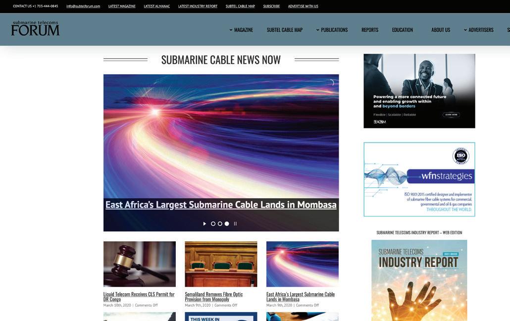
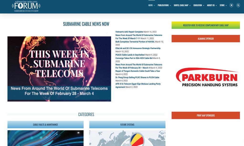
Keep on top of our world of coverage with our free News Now daily industry update. News Now is a daily RSS feed of news applicable to the submarine cable industry, highlighting Cable Faults & Maintenance, Conferences & Associations, Current Systems, Data Centers, Future Systems, Offshore Energy, State of the Industry and Technology & Upgrades.
Submarine Cable Almanac is a free quarterly publication made available through diligent data gathering and
Submarine Telecoms Industry Report is an annual free publication with analysis of data collected by the analysts of SubTel Forum Analytics, including system capacity analy sis, as well as the actual productivity and outlook of current and planned systems and the companies that service them.
In our guide to submarine cable resources, the SubTel Forum Directory shines as an essential tool, providing SubTel Forum.com readers with comprehensive access to an array of vetted industry contacts, services, and information. Designed for intuitive navigation, this expansive directory facilitates quick connections with leading vendors, offering detailed profiles and the latest in submarine cable innovations. As a dynamic hub for industry professionals, it fosters community engagement, ensuring our readers stay at the forefront of industry developments, free of charge.
2024 marks a groundbreaking era for SubTel Forum with the launch of its innovative app. This cutting-edge tool is revolutionizing access to submarine telecommunications insights, blending real-time updates, AI-driven analytics,
The online SubTel Cable Map is built with the industry standard Esri ArcGIS platform and linked to the SubTel Forum Submarine Cable Database. It tracks the progress of
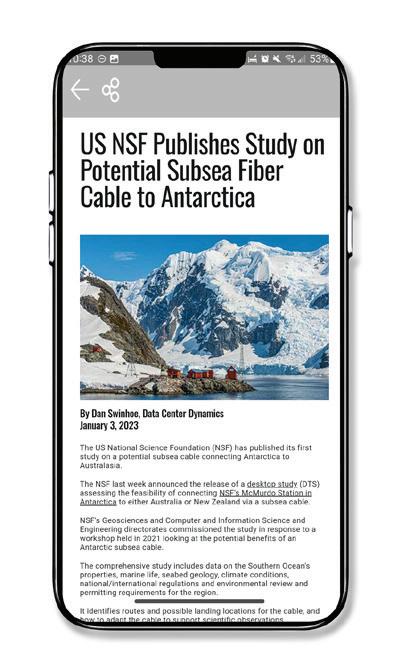
and a user-centric interface into an indispensable resource for industry professionals. More than just a technological advancement, this app is a platform fostering community, learning, and industry progression. We encourage you to download the SubTel Forum App and join a community at the forefront of undersea communications innovation.
Our journey begins with the News Now updates, providing daily insights into the submarine cable sector. Covering everything from the latest technical developments to significant industry milestones, this feed ensures you’re always informed about the latest trends and happenings. It’s an essential tool for professionals who need to stay on top of industry news.
Dive deeper into the world of submarine communications with our curated collection of articles and Q&As. These insightful pieces offer a comprehensive look at both the history and current state of the industry, enriching your understanding and providing a broader perspective on the challenges and triumphs faced by submarine cable professionals.
• Submarine Cable Almanac: This quarterly treasure trove provides detailed information on global cable systems. You can expect rich content including maps, data on system capacity, length, and other critical details that sketch a vivid picture of the global network.
• Submarine Telecoms Industry Report: Our annual report takes an analytical approach to the industry, covering everything from current trends to capacity analysis and future predictions. It’s an invaluable resource for anyone seeking to understand the market’s trajectory.
• Online SubTel Cable Map: An interactive tool mapping over 550 cable systems, perfect for digital natives who prefer an online method to explore global connections.
• Printed Cable Map: Our annual printed map caters to those who appreciate a tangible representation of the world’s submarine fiber systems, detailed in a visually appealing and informative format.
Explore the Submarine Telecoms Forum Magazine Archive, a comprehensive collection of past issues spanning 23+ years of submarine telecommunications. This essential resource offers insights into project updates, market trends, technological advancements, and regulatory changes. Whether researching industry developments or seeking

expert analysis, the archive provides valuable perspectives on the technologies and trends shaping global connectivity.
Our Authors Index is a valuable tool for locating specific articles and authors. It simplifies the process of finding the information you need or following the work of your favorite contributors in the field.
• Data Center & OTT Providers Report: This report delves into the evolving relationship between cable landing stations and data centers, highlighting trends in efficiency and integration.
• Global Outlook Report: Offering a comprehensive analysis of the submarine telecoms market, this report includes regional overviews and market forecasts, providing a global perspective on the industry.
• Offshore Energy Report: Focusing on the submarine fiber industry’s oil & gas sector, this report examines market trends and technological advancements, offering insights into this specialized area.
• Regional Systems Report: This analysis of regional submarine cable markets discusses capacity demands, development strategies, and market dynamics, providing a detailed look at different global regions.
• Unrepeatered Systems Report: A thorough examination of unrepeatered cable systems, this report covers project timelines, costs, and operational aspects, essential for understanding this segment of the industry.
• Submarine Cable Dataset: An exhaustive resource detailing over 550 fiber optic cable systems, this dataset covers a wide range of operational data, making it a go-to reference for industry specifics.
SubTelForum.com stands as a comprehensive portal to the dynamic and intricate world of submarine cable communications. It brings together a diverse range of tools, insights, and resources, each designed to enhance understanding and engagement within this crucial industry. From the cutting-edge SubTel Forum App to in-depth reports and interactive maps, the platform caters to a wide audience, offering unique perspectives and valuable knowledge. Whether you’re a seasoned professional or new to the field, SubTelForum.com is an indispensable resource for anyone looking to deepen their understanding or stay updated in the field of submarine telecommunications.
BY KIERAN CLARK
The SubTel Cable Map, built on Esri’s ArcGIS platform, offers a dynamic and interactive way to explore the global network of submarine cable systems. This essential resource provides detailed information on over 440 current and upcoming cable systems, more than 50 cable ships, and over 1,000 landing points. Directly connected to the SubTel Forum Submarine Cable Database and integrated with our News Now Feed, the map gives users real-time insights into the industry, allowing them to view current and archived news related to each cable system.
Submarine cables are the backbone of global communications, carrying over 99% of the world’s international data. These cables connect continents and enable the seamless connectivity we rely on for everything from daily communications to critical business operations. Without this vast network, fast, efficient communication between countries and continents would not be possible.
Our analysts work diligently to keep the SubTel Cable Map up to date with data from the Submarine Cable Almanac, along with valuable feedback from users. This ensures a comprehensive and accurate view of the industry, highlighting both the latest deployments and key updates. As the year draws to a close, updates to the map may slow slightly as we move into the holiday season, but our commitment
Submarine cables are the backbone of global communications, carrying over 99% of the world’s international data. These cables connect continents and enable the seamless connectivity we rely on for everything from daily communications to critical business operations.
to delivering timely, reliable information remains as strong as ever.
We also want to highlight that a sponsor slot is currently available for the SubTel Cable Map. Sponsorship offers an excellent opportunity to showcase your organization to a global audience, with your logo prominently displayed on the map and linked directly to your company’s offerings. This is a unique chance to demonstrate your commitment to global connectivity and support for the submarine cable industry.
We invite you to explore the SubTel Cable Map and gain a deeper understanding of the vital role submarine cable systems play in our interconnected world. As always, if you are a point of contact for a system or company that requires updates, please email kclark@subtelforum.com
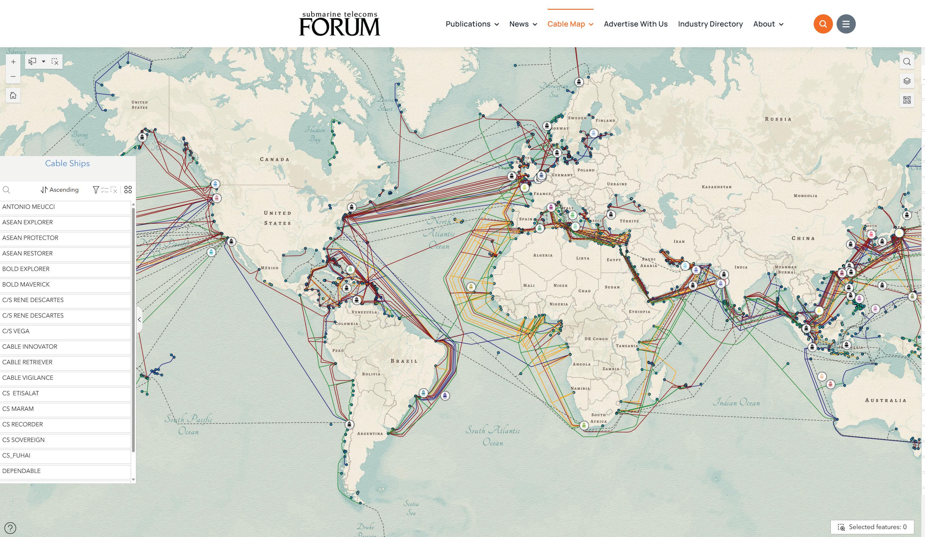
Below is the full list of systems added and updated since the last issue of the magazine:
We hope the SubTel Cable Map proves to be a valuable resource for you, offering insight into the continually evolving submarine cable industry. Dive into the intricate network that powers our global communications today. Happy exploring! STF
KIERAN CLARK is the Lead Analyst for SubTel Forum. He originally joined SubTel Forum in 2013 as a Broadcast Technician to provide support for live event video streaming. He has 6+ years of live production experience and has worked alongside some of the premier organizations in video web streaming. In 2014, Kieran was promoted to Analyst and is currently responsible for the research and maintenance that supports the Submarine Cable Database. In 2016, he was promoted to Lead Analyst and his analysis is featured in almost the entire array of Subtel Forum Publications.
Do you have further questions on this topic?
MAY 19, 2025
Newly Added Systems:
•E2A
•Pan-Arctic Cable System (PACS)
• Tusass Connect 1
Updated Systems:
•Asia Link Cable (ALC)
•ANDROMEDA
•Arctic Way Cable
•Australia Connect Interlink
•EMC West-1
•EMC West-2
•Honomoana
•Leif Erikson
•Project Waterworth
•Sydney-Melbourne-Adelaide-Perth (SMAP)
BY CAROLINE CROWLEY AND ELLA HERBERT
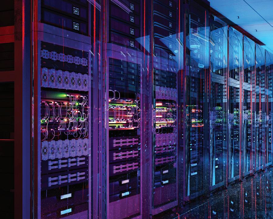
Power is one of the most significant constraints and enablers of data center growth today. It’s also a touchpoint for digital infrastructure’s community impacts. While there have historically been an array of reasons for opposition to data centers, from noise, land use, and unequal levels of local benefit, the energy issue is now a growing concern.
Despite complaints from residents, data center development remains sought after in many communities due to the billions in tax revenue they produce (PwC 2023). However, the disparity between power demand and grid capacity poses challenges for both data centers and residents. Data centers are critical infrastructures that are only becoming more important as we shift to a digital economy, and utilities are struggling to catch up. This dynamic has significant implications for data center and community relationships as concerns grow over who will foot the bill for this investment. Recent moratoriums and a push for increased regulation in the sector reflect a strain between data centers and the communities they reside in.
Sustainability adds to this another layer of complexity: will the new infrastructure that data centers require aid or inhibit clean energy goals? As development plans are made to accommodate our progressively digital society, will environmental considerations be at stake? In this article from Sustainable Subsea Networks,
a research initiative of the SubOptic Foundation, we track the connections between energy usage, data center growth, and community concerns, and pay attention to their ramifications across the digital infrastructure sectors.
Recent pushback for data center development is increasingly tied to limited electricity supply and subsequent price impacts. In some computing hubs around the world, grid capacity issues have slowed data center expansion, either due to government action or lack of infrastructure. Without careful and active management by utilities and industry members, the explosive growth of data centers can strain the grid and
lead to community resistance.
For instance, Northern Virginia, the largest data center hub in the world, is facing power constraints (Telegeography, 2024). Dominion Energy, the largest utility in the state, issued a warning in 2022 that it may not be able to meet power demands in Ashburn, Virginia (Judge, 2022). Since then, it has nearly doubled its data center capacity under contract and increased its forecasted spending until 2029 by 16 percent (Skidmore, 2025). In the face of electricity strain, Virginia is spending more and more to keep up with demand.
In contrast, Dublin, Ireland serves as an example of a different government reaction to data center demand outpacing grid capacity. The city issued seven system alerts in a year, starting
in December 2020, due to the shrinking gap between electricity needed and electricity produced (Swinhoe, 2022). Due to concerns about power shortages, the state-owned transmission operator EirGrid issued a de facto moratorium on data center development in the city of Dublin from 2022 until 2028. For them, the moratorium was a way to alleviate the pressure on the grid despite the outcry from the data center industry. Dublin had faced significant community opposition to data centers and had protests against data centers even after the effective ban (Riaz, 2022).
Amsterdam is another European hub that issued a moratorium on data centers. In 2019, it suddenly banned all new data center developments, primarily due to concerns around space. While the moratorium has since been lifted, hyperscale facilities are still banned in most of the Netherlands, and the government cited a lack of power capacity as a reason (Gooding, 2024). There appears to be a general discrepancy between the trend toward large hyperscale facilities in the data center industry and the dwindling availability of power in data center hubs.
Singapore’s 2019 moratorium was a result of concerns over the resource consumption and energy demand of data centers (Soares, 2024). While they temporarily halted data center construction, they eventually created a roadmap for sustainable data center development. Their main concerns were focused on environmental damage and water consumption, but the substantial electricity demand drove government action.
Data center capacity constraints can also delay housing projects. In West London, data centers were named as the reason for insufficient electricity capacity for new housing developments by a Financial Times Article (Financial Times, 2022). This appeared to be a grid
management problem – developers did not accurately anticipate the amount of power that would be required by incoming data centers. However, the media coverage of the event highlights how the strain on the grid negatively impacts communities and can lead to frustration with data centers as a result.
While these cases are complex and result from a variety of factors, concern over data center power usage played a role in restrictive action or negative sentiment against the sector. These cases reveal the importance of building relations with residents in data center hubs and working to ensure local communities find tangible benefits in the data centers that may require hefty investments in electrical infrastructure.
Utility rate increases from increased data center demand may be passed on to residents. Data centers are a primary driver in the growth of electricity demand – taking up 3% of global draw, according to the latest IER Report – and are cited as the primary driver of electricity demand growth in the United States (IER, 2025). The infrastructure needed to accommodate this new demand will require significant investment, which can play a role in rate increases for residential and high-energy use customers. This is a cause for alarm for residents and may cause the overall tide to turn against data center development, as seen by some new proposed legislation in Virginia.
For instance, Virginia House Bill 1601 would require sound and resource-use assessments, as well as a study on the impact on parks, historic sites, and forestland for any new high-energy use facility. It recently passed both chambers of the Virginia General Assembly but was delayed by
one year by the governor. Senate Bill 1047 would have called in the Department of Energy to investigate the effects and benefits of a data center demand response program; it passed both chambers but was also vetoed. Another proposed bill would have required the State Corporation Commission to evaluate every proposed project over 100 MW and determine whether the state’s utilities could supply its demands (Willams Mullen, 2025). While these bills failed, their proposition and support highlight the significance of local pushback to the growing data center industry (Gooding, 2025).
Virginia’s utilities have also come under scrutiny. A bill was just passed requiring the State Corporation Commission to evaluate if Dominion Energy’s classifications of utility customers are reasonable (HB2084). Subsidies for data centers, funded by taxpayer dollars, may also be a source of dissent for residents. If local communities feel data centers do not benefit them and are a financial burden, they may think their tax money should be redistributed to other sectors.
In a recent development, Dominion Energy proposed new rates in April of 2025 that would include “base rate increases of $8.51 per month in 2026 and $2.00 per month in 2027” and an additional “$10.92 monthly fuel rate increase” for typical residential customers (Dominion Energy, 2025). Inflation, new natural gas builds, and rising demand are all cited as justifications
for these price increases, but data centers could face public blame given the controversy thus far.
In the court of public opinion, data centers are fighting a battle on both sides with–facing limitations with grid capacity that could increase electricity rates and isolation from the communities they reside in. Proactive and collaborative efforts are needed with both utility infrastructure and community relations for any solution that includes continued growth.
And solutions vary. Government oversight can help minimize community impact, especially when it comes to price hikes. By limiting the ability of utilities to overcharge customers or reworking the historically discounted electricity rates granted to data centers, legislation can keep local changes in check. This is especially key in instances where large corporations like Google, Meta, and Amazon begin developments in smaller residential areas. For instance, California’s proposed Senate Bill 57 would establish a special rate structure for data centers in order to limit cost shifts to residents and small businesses (CA 57). Utilities are able to take the first step as well. New forms of Power Purchasing Agreements (PPAs) and rate structures can reallocate costs for new energy infrastructure away from residents living near data center hubs. Last year, American Electric Power of Ohio proposed that new data center campuses agree to a 10-year commitment to pay at least 90% of monthly electricity costs up front, regardless of final usage (AEP Ohio, 2024).
Clashes between utilities and data center power demands are a wellknown issue throughout the industry. Our team witnessed this during recent conversations at Data Center Dynamics in New York this past March. One
specific conversation about potential improvements in data center demand revolved around “duplicate demand.”
As noted by Jerri Negash, a senior associate at the Emerald Strategy Group, this occurs when a data center is searching for the same quantity of power as a colocation data center that could lease capacity to them.
By limiting the ability of utilities to overcharge customers or reworking the historically discounted electricity rates granted to data centers, legislation can keep local changes in check.
A possible solution to this conflict that is being explored is data centers bringing their own power to the table in the face of a deficit. However, issues arise from the high concentration of skilled labor needed, the long-term management of the infrastructure, and changing relationships with the grid. Overall, there appears to be a missing link between data centers and utility operators that could be further amplified by new data-center-owned power developments. With a potential hike in prices on the horizon, community engagement is more crucial than ever.
The sustainability of the electricity being used to power data centers plays a growing role in local opinion
as well. Many large data center companies have ambitious net-zero and ESG goals. However, in the scramble to keep up with demand, both utilities and data center companies may struggle to pivot to renewable energy in time. As a result, there have been several cases of data center demand spurring the continuation and expansion of fossil fuel energy sources.
Northern Virginia’s “Data Center Alley” is predicted to house “nearly half (45%) of new data center electricity demand through 2035.” Furthermore, the grid operator in the region,110 PJM Interconnection, has moved to delay the planned retirement of Brandon Shores and H.A. Wagner power plants by four years, from May 31, 2025, to May 31, 2029, due to local grid reliability concerns (Talen Energy, 2025). PJM cited “unprecedented” data center growth as a primary driver of load growth in its Reliability Analysis (PJM Interconnection, 2023).
In Omaha, where two large data centers are operated, a coal plant projected to close in 2023 was extended until 2026. The utility claimed there was not enough clean energy to support demand, and residents were quick to blame the data centers since they occupy two-thirds of the projected growth in demand (Halper, 2024).
Entergy and ExxonMobil are building up natural gas infrastructure specifically for data centers (Skidmore 2025). While an improvement from coal, natural gas emissions remain quite significant. Building large amounts of natural gas infrastructure rather than renewables is contrary to the environmental goals necessary to limit global warming.
In the coming years, this environ-
mental progress may slow, at least in the United States. A recent executive order as part of the U.S. “national energy emergency” aims at expanding the output and export of coal, postponing the retirement of older coal plants. The order specifically cites the need to power “artificial intelligence data centers” as part of its motivation and also temporarily suspends previous requirements for these plants to reduce emissions of toxins (The White House, 2025).
It is important to recognize that data center owners also hold significant potential to contribute positively to sustainability. As infrastructure expands to keep up with demand, data centers could also spur more investment in renewables. Many large companies are already doing this through Power Purchase Agreements (PPAs), but their progress could be counteracted by utilities retaining power plants to stay on track with demand. While some key players are increasingly prioritizing sustainability, the sector as a whole may still face challenges in sustainable energy development as a result of grid capacity limits.
But location is everything. The siting of generation facilities is crucial, with impacts to communities dependent on placement in regions with varying demographics and demand. Clean energy developments are not necessarily being put in high-demand areas. At a company-wide level, data center businesses may meet their own net-zero goals by emitting in certain communities and offsetting with clean energy infrastructure in others – thus contributing to an environmental justice problem.
For example, residents in Omaha face high rates of health problems from the pollution of fossil fuel plants that are not alleviated by renewable contracts in Europe. While data centers have a large potential positive impact through PPAs, these PPAs can have a larger impact if they are strategically placed in communities that do not have a significant pre-existing renewable sector.
As global weather patterns change and extreme temperature spikes become more common, high-power draw from residences to data centers could also present additional strain on local grids.
Areas dependent on electric cooling and heating to maintain safe indoor temperatures put residents at risk should cooling for computing come to compete with residential needs. This possibility has been highlighted in Texas after the rolling blackouts of the 2021 winter storm Uri. Proposed legislation would require data center developers to pay a grid connection fee, develop a voluntary program that pays large users like data centers to reduce consumption during periods of grid strain, and allow administrators to require data centers to switch to backup generators or curtail power usage during temperature swings (Hao, 2025).
The stakes are high in Northern Virginia and around the world. Data center growth could strain the grid, raise utility prices, and counteract sustainable development. If community resistance to data center growth grows, there could be a shift to new locations for development, as seen by the new proposed regulations in Virginia and moratoriums in hubs across the world.
If internet infrastructure development is to advance in these places, developers and communities must be on the same page. Engaging with the communities in which the digital infrastructure resides is crucial now more than ever.
There have been many attempts to remedy the community engagement disconnect in place across the data center industry. One sector that plays a growing role is consulting, with community engagement becoming a service provided by various companies with data center clientele. company working to resolve the conflict between data centers and opposition from local communities is the sustainable consulting firm ERM. In their work to help data center developers gain local support, they emphasize the importance of identifying and considering the individuals and groups that are impacted by data center development (Mullard, 2024).
In a recent article, Boston Consulting Group also identified community engagement as a barrier to data center growth (Lee, 2025). They outlined a potential solution of working with utilities and regulators to design equitable power rates that shield residents from price hikes and less reliable power. Proactive engagement with communities was also suggested as a path for action.
Improvement in community engagement is an industry-wide target, and there are currently awards and scorecards that aim to incentivize internal improvement in this sector. Data Center Dynamics includes Community Impact as an award category and aims to evaluate where data centers have become “true stewards of the community they serve.” DataCloud is another organization with an Excellence in Community Engagement award. Academia can also play a role as
a mediator, as shown by the work of the MIT Renewable Energy Facility Siting Clinic. Classified as a “public service center,” it acts as both a connection point and a source of advising for industry, government, and citizen stakeholders. In addition to its mediation and research work for clients, the organization hosts open-attendance forums and an open-access course on resolving clean energy siting disputes.
While there are many new and proposed avenues to address the need for community engagement, there remains much work to be done. As data center demand continues to climb, the grid will need to expand to keep up. If the price of expansion is passed onto residents who do not gain any benefits from data centers in their communities, more pushback could be seen in the form of regulations and even moratoriums. As the industry faces its power capacity problems, we believe the issue is more than just a technical one. It should also be considered from a sustainability and community engagement perspective. Collaboration with academia, third-party groups, utilities, and community members could help forge a way forward that benefits all stakeholders.
At this crucial moment in the climate fight, new infrastructure plans are a fork in the road to a sustainable society. We ask: is it possible for the data center industry to play an active role in steering development toward a greener future that prioritizes local communities? STF
This article is an output funded by the Internet Society Foundation.

CAROLINE CROWLEY is an undergraduate student at the University of California, Berkeley pursuing a B.S. degree in Environmental Economics and Policy. She works as a research assistant with the
SubOptic Foundation’s Sustainable Subsea Networks team. Her work analyzes global, national, and local policies regulating the environmental sustainability and resilience of digital infrastructure.

ELLA HERBERT is an undergraduate student at the University of California, Berkeley, pursuing her B.S. in Environmental Science. She is currently a research assistant for the SubOptic Subsea Sustainable Networks team, focusing on data center sustainability by exploring metrics, industry trends, and publications within the field of telecommunications.
REFERENCES:
AEP Ohio. (2024, May 13). AEP Ohio files plan to secure grid resources for data centers, protect residential customers. [Press Release] https://www.aepohio.com/ company/news/view?releaseID=9539#:~:text=Under%20 the%20proposal%2C%20data%20centers%20would%20 be%20required,service%20territory%2C%20especially%20 in%20the%20Central%20Ohio%20region.
California Legislature (2025) SB 57: Electrical corporations: tariffs. Legislative Information System. https://legiscan.com/CA/text/SB57/id/3044106
Dominion Energy. (2025, April 1). Dominion Energy Virginia proposes new rates to continue delivering reliable service and increasingly clean energy [Press release] https://news.dominionenergy.com/press-releases/pressreleases/2025/Dominion-Energy-Virginia-proposesnew-rates-to-continue-delivering-reliable-service-andincreasingly-clean-energy/default.aspx
Financial Times. (2022, July 28). West London faces new homes ban as electricity grid hits capacity. https://www. ft.com/content/519f701f-6a05-4cf4-bc46-22cf10c7c2c0
Good, Q., Neumann, J., Scarr, A., Cross, R. J., Frontier Group, Environment America Research & Policy Center, & U.S. PIRG Education Fund. (2025). The surging environmental and consumer costs of AI, crypto and big data. Retrieved from https://publicinterestnetwork. org/wp-content/uploads/2025/01/Big-data-centers-bigproblems-January-2025.pdf
Gooding, M. (2024, August 22). The ongoing impact of Amsterdam’s data center moratorium. Data Center Dynamics. https://www.datacenterdynamics.com/en/ analysis/the-ongoing-impact-of-amsterdams-data-centermoratorium/
Gooding, M. (2025, January 20). Legislation proposed in Virginia to regulate data centers, ease grid concerns. Data Center Dynamics. https://www.datacenterdynamics.com/ en/news/virginia-data-center-laws/
Halper, E. (2024, Oct 12). Big tech’s data centers keep coal alive in omaha. The Washington Post Retrieved from https://www.proquest.com/newspapers/big-techs-datacenters-keep-coal-alive-omaha/docview/3115602739/se-2
Hao, C. (2025, March 28) Texas Senate propose new regulations to protect the power grid from huge data center demand growth. Houston Chronicle. Retrieved from https://drive.google.com/ file/d/1WqpzFZ2YzwZtEpTd5F-VZcyT4wlosKWI/ view?usp=sharing
International Energy Agency. (2025). Electricity 2025. In Gas, Coal and Power Markets (GCP) Division & International Energy Agency, Electricity 2025. https://iea. blob.core.windows.net/assets/0f028d5f-26b1-47ca-ad2a5ca3103d070a/Electricity2025.pdf
Judge, P. (2022, July 29). Dominion Energy admits it can’t meet data center power demands in Virginia. Data Center Dynamics. https://www.datacenterdynamics.com/en/ news/dominion-energy-admits-it-cant-meet-data-centerpower-demands-in-virginia/
Lee, V., Seshadri, P., O’Niell, C., Choudhary, A., Holstege, B., & Deutscher, S. A. (2025, February 5). Breaking barriers to data center growth. BCG Global. https:// www.bcg.com/publications/2025/breaking-barriers-datacenter-growth
Mullard, Z (2024, January 17) Partnering with communities in data center development. . ERM. https:// www.erm.com/insights/partnering-with-communities-indata-center-development/
PJM Interconnection. (2023, December 5).Item 15 - Reliability Analysis Update 2022 Window
United States. Data Center Coalition. https://static1. squarespace.com/static/63a4849eab1c756a1d3e97b1/t/ 65037be19e1dbf4493d54c6e/1694727143662/DCCPwC+Impact+Study.pd
Prince William County Government. (DPA202100020: Data Center Opportunity Zone Overlay District Comprehensive Review. https://www.pwcva.gov/ department/planning-office/data-center-overlay-districtcomprehensive-review
Riaz, A. (2022, November 16). Protest against lifting ban on data centres in South Dublin amid blackout fears. Irish Independent. https://www.independent.ie/regionals/dublin/ dublin-news/protest-against-lifting-ban-on-data-centresin-south-dublin-amid-blackout-fears/42149470.html
Skidmore, Z. (2025, February 14). Dominion Energy nearly doubles data center capacity under contract to 40GW. Data Center Dynamics. https://www.datacenterdynamics.com/ en/news/dominion-energy-nearly-doubles-data-centercapacity-under-contract-to-40gw/
Skidmore, Z. (2025, January 11). Diversity of power - the biggest data center energy stories of 2024. Data Center
data-centers-the-end-of-the-road/ Talen Energy Corporation. (2025, January 27). Talen Energy, Other Parties Reach Reliability Must Run Settlement Agreement for Brandon Shores and H.A. Wagner Power Plants [Press release]. Talen Energy Corporation.
TeleGeography. (2024). State of the Network 2024. https://www2.telegeography.com/hubfs/LP-Assets/ Ebooks/state-of-the-network-2024.pdf
The White House. (2025, April 8). Reinvigorating America’s Beautiful Clean Coal Industry and Amending Executive Order 14241. Retrieved from https:// www.whitehouse.gov/presidential-actions/2025/04/ reinvigorating-americas-beautiful-clean-coal-industryand-amending-executive-order-14241/ Virginia General Assembly. (2025). HB2084: Public utilities; SCC to determine if using reasonable classifications of customers. Legislative Information System. https://lis.virginia.gov/bill-details/20251/ HB2084

BY KIERAN CLARK
The global subsea cable network—the invisible backbone of the internet—relies on a small fleet of specialized vessels for cable installation, inspection, and maintenance. These cable ships play a vital role in ensuring connectivity between continents, yet their operational patterns remain difficult to interpret. Most tracking is based on AIS (Automatic Identification System) data, which shows where ships are and how fast they’re moving, but offers little direct information about what the vessels are actually doing.
This article presents the results of a geospatial analysis of over 7,500 AISbased data points, focused on identifying where cable ships gather, how their behavior varies by region, and what their proximity to infrastructure might reveal about their operational roles. The goal is not just to observe where ships are located, but to interpret the likely purpose of that presence—whether conducting cable repairs, deploying new systems, or awaiting assignment.
AIS data was collected at six-hour intervals, creating a consistent global dataset of vessel locations, speeds, and identities. Points where ships moved slowly for extended periods were flagged as potential operations or staging events. To understand what may have been happening during those periods, each data point was compared against a global list of known cable depots and cable factories.
If a ship remained within 50 kilometers of a depot or factory for more than 24 hours, it was assigned a projected classification:
• Installation if near a factory
• Maintenance if near a depot
• Unclassified if no infrastructure was nearby or conditions were inconclusive
• Installation was prioritized if both a factory and depot were in range, based on two factors: the understanding that some factories can supply spare cable for repairs, and the assumption that when a ship is located near a factory-adjacent area—such as Calais—it is more likely preparing for a new installation than conducting a repair
The 50 km proximity threshold was chosen to account for uncertainty in infrastructure coordinates and minor inaccuracies in AIS-reported vessel positions. Some facility
coordinates are approximate, and vessel paths may not consistently align to specific berths or harbors, especially when drifting at low speed. A 50 km radius offers a reasonable balance—close enough to indicate likely association, but broad enough to avoid false exclusions.
This type of spatial behavior analysis is widely used in other sectors. In the logistics industry, for example, analysts routinely map vehicle dwell times near distribution centers to infer unloading, refueling, or staging activity. In fisheries management, vessel clustering patterns near known reef or spawning zones are used to monitor effort and enforce quotas. The benefits of such approaches include better situational awareness, performance monitoring, and resource allocation—all of which are applicable to cable fleet management. By applying this method to cable ships, we can begin to build a clearer picture of where global operations are concentrated, how they relate to infrastructure, and what behavior patterns emerge over time. The following sections explore the results of this analysis in detail, beginning with a geographic overview of ship activity worldwide.
To establish a geographic baseline for cable ship be-
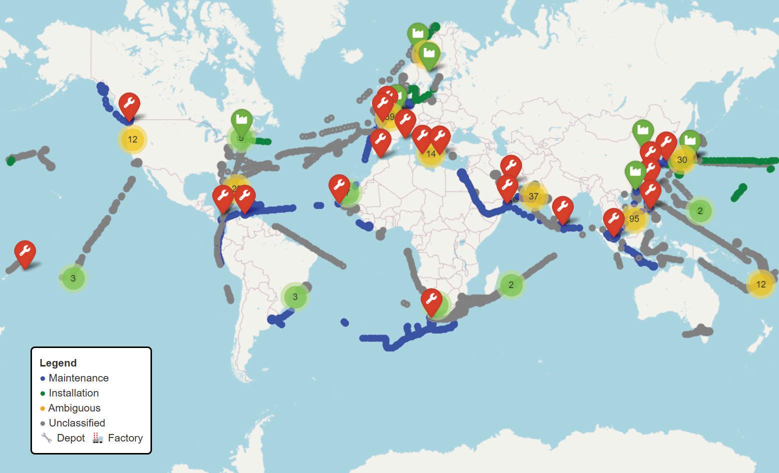
havior, this analysis begins with a spatial overview of over 7,500 AIS-tracked data points from multiple vessels. These points represent locations where vessels were stationary for extended periods or operating within proximity to known infrastructure. The map below displays the global distribution of these data points and provides a visual reference for assessing where cable ship activity is concentrated.
Each point is color-coded according to the projected activity classification applied during post-processing:
• Blue: Projected Maintenance Activity
• Green: Projected Installation Activity
• Gray: Unclassified Activity
In addition, the map includes infrastructure reference points:
• Wrench icon: Cable Depot
• Factory icon: Cable Factory
Several areas of high-density data points are visible. South and Southeast Asia show a high concentration of points associated with projected maintenance activity, frequently in the vicinity of cable depots. Similar patterns are present in the Eastern Mediterranean and along parts of the North Atlantic, where data clusters are also observed
near known depot locations. East Asia displays a mix of classifications, with both installation and unclassified points appearing in nearshore zones, some of which are adjacent to cable factories.
Other areas with visible concentrations include the Bay of Bengal, the Western Indian Ocean, and segments of West Africa and Northern Europe. These distributions suggest repeated presence of cable ships in these regions during the timeframe captured by the AIS dataset.
The geographic layout of observed behaviors serves as a foundation for further analysis. It establishes where ship activity occurs most frequently and offers spatial context for interpreting the classifications and facility relationships explored in subsequent sections.
With the spatial footprint established, the next phase of analysis focuses on interpreting the likely purpose behind cable ship behavior. Each of the 7,608 AIS-based data points was categorized into one of three projected activity types—Maintenance, Installation, or Unclassified—based on a combination of infrastructure proximity and post-idle vessel trajectory.
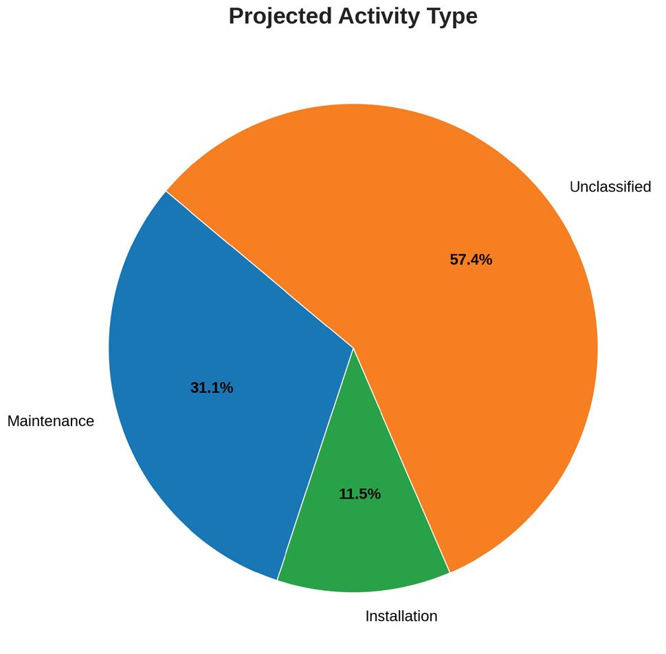
The classification results are summarized as follows:
• Maintenance: 2,363 data points (31.1%)
• Installation: 876 data points (11.5%)
• Unclassified: 4,369 data points (57.4%)
These categories reflect inferred behavior rather than direct reporting. Ships associated with projected maintenance activity typically remained close to depots and displayed routing patterns consistent with return-to-port cycles, nearshore operations, or repeated positioning within known service areas. In contrast, ships associated with projected installation activity were more likely to operate at greater distances from shore, sometimes staging near cable factories or dispersing into deeper ocean corridors following idle periods.
While installation behavior accounts for a smaller share of the dataset, its pattern is more dispersed geographically and often tied to specific cablew corridors or newly built infrastructure. This reflects the episodic and project-based nature of installation missions. By contrast, maintenance activity represents a larger and more sustained operational footprint, suggesting a continuous global demand for cable repairs, inspections, and service continuity.
The observed trend—where maintenance activity is both more frequent and generally located closer to shore—has important implications. Maintenance missions appear to anchor around existing infrastructure nodes, particular-
ly depots, and demonstrate less variability in geographic spread. This concentration implies a persistent, foundational workload underpinning subsea connectivity: the routine detection, mobilization, and resolution of faults.
As subsea cable systems age and traffic demands grow, the need for responsive maintenance capacity remains constant. The presence of these vessels in predictable locations, operating with high frequency, reinforces the ongoing operational burden of keeping the global internet running. It also emphasizes the strategic role of depot locations and resourcing in enabling rapid response.
The large proportion of unclassified points—over half of the dataset—underscores the limitations of AIS-based inference when metadata or standardized vessel reporting is unavailable. However, the patterns that do emerge from classifiable behavior provide valuable insight into the scale, structure, and distribution of global cable ship operations.
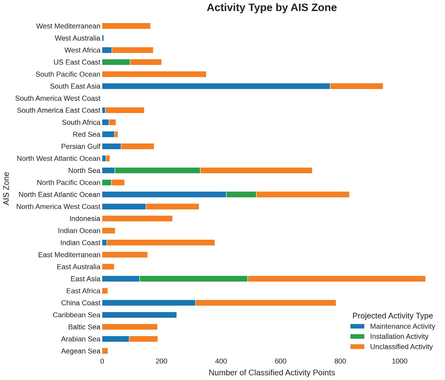
After establishing a global overview and a behavioral classification framework, the next step is to examine how projected cable ship activity varies by region. To do this, data points were grouped by AIS Zone—a standardized geographic reference field derived from vessel tracking metadata. For each zone, projected activity types were aggregated to evaluate regional patterns in maintenance, installation, and unclassified behavior.
The visualization highlights substantial variation between regions. In many zones—particularly those encompassing the Bay of Bengal, South China Sea, and Eastern
Mediterranean—maintenance activity accounts for the majority of classified points. These zones include a high number of nearshore operations, often clustered around depots or major cable landing regions. This aligns with observed industry practices, where densely cabled regions with aging infrastructure exhibit consistent maintenance demands.
Other zones, such as East Asia and parts of the Western Pacific, show a greater proportion of installation activity relative to maintenance. These zones often correlate with factory-adjacent points or shipping routes associated with long-haul buildouts. While installation behavior is less frequent overall, it appears more geographically distributed and less tightly clustered than maintenance, consistent with its role in long-distance cable deployment.
The Unclassified category remains significant across nearly all zones. In some regions—particularly Northern Europe, West Africa, and sections of the Indian Ocean— unclassified activity comprises the majority of data points.
This reflects the difficulty of assigning operational context in areas where vessels are present but infrastructure proximity is insufficient or follow-on routing is inconclusive.
These regional breakdowns offer two primary takeaways. First, maintenance activity is both more prevalent and more spatially concentrated, particularly in areas with robust infrastructure networks and fault-prone systems. Second, installation activity is more episodic and spread across fewer zones, indicating a more project-specific footprint. Together, these patterns help explain how operational demands differ geographically and suggest where infrastructure support may need to be strengthened to match observed behavior.
This zonal view also reinforces the importance of improved classification practices. In regions with high levels of unclassified activity, access to more granular vessel logs or project metadata could significantly enhance interpretability and forecasting capabilities.
In addition to geographic clustering, cable ship behavior can also be examined through its relationship with nearby infrastructure—specifically depots and factories. These facilities play a central role in shaping vessel movement patterns. Depots serve as staging and mobilization points for fault response and routine maintenance, while factories support cable loading and the initiation of installation campaigns.
To explore this relationship, each AIS-tracked data point was evaluated for proximity to a known infrastructure location. When vessels were stationary within defined radii of a depot or factory, the location type was recorded. The resulting distribution is shown below.
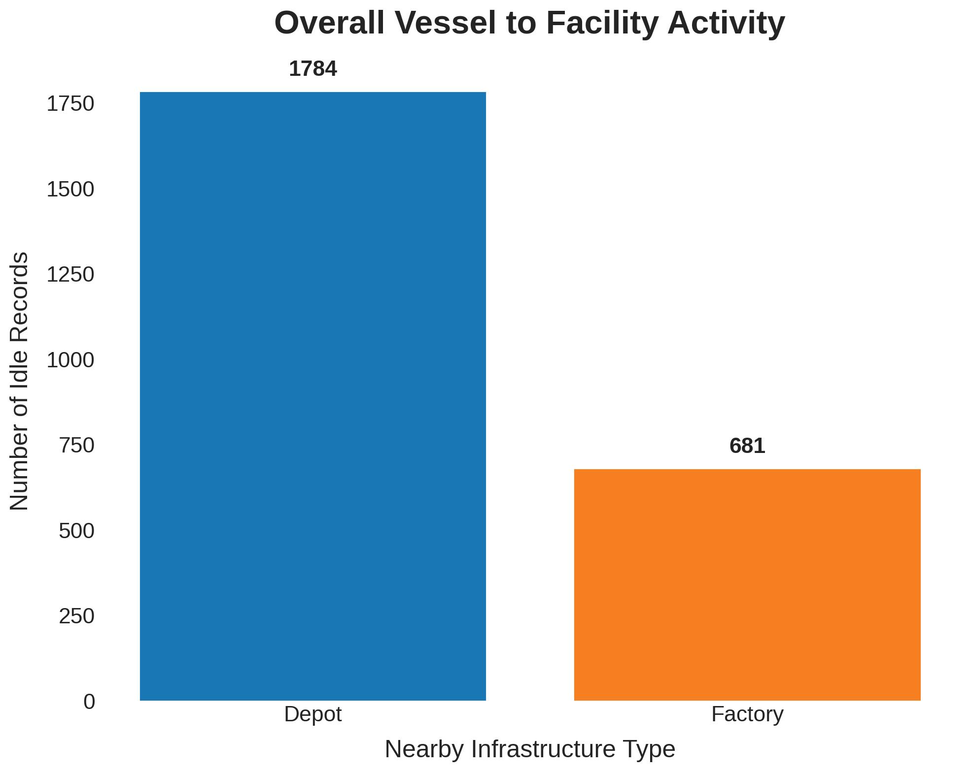
The majority of data points classified by infrastructure proximity were associated with depots. This indicates that vessels were significantly more likely to remain near depot locations than near factories during periods of inactivity or low-speed movement. Factories accounted for a smaller— but still meaningful—portion of the dataset.
This pattern is consistent with the earlier classification analysis. Projected maintenance behavior was more frequently observed near depots, while projected installation behavior—though less common—was more often associated with factory-adjacent staging. The skew toward depot proximity further supports the conclusion that maintenance comprises the bulk of cable ship operational time, and that depots serve as key hubs for recurring vessel activity.
In contrast, factory-adjacent points tended to be more dispersed and less repetitive, reflecting the episodic nature of cable manufacturing and deployment projects. Ships did not typically linger near factories unless preparing for installation, and their presence in these areas did not occur as consistently or predictably as with depots.
This facility-based view helps explain both the operational logic behind vessel positioning and the infrastructure demands of different mission types. It also reinforces
the importance of maintaining well-distributed depot coverage across high-density cable corridors. Regions lacking nearby depots may see longer fault response times, increased vessel transit delays, or clustering of idle behavior at suboptimal locations.
In total, the infrastructure analysis adds another layer of interpretive clarity: cable ship behavior is not only regionally defined, but also shaped directly by the availability and function of nearby support facilities. Identifying and addressing gaps in this coverage could improve both response efficiency and fleet utilization.
This analysis presents a global view of cable ship behavior using AIS data, focusing on how vessel locations, projected activities, and infrastructure proximity interact across 7,608 observed data points. By classifying behavior into maintenance, installation, and unclassified categories— and mapping these across regions and facility types—it is possible to draw several consistent patterns.
Maintenance activity accounts for the largest identifiable share of behavior and is more likely to occur near depots, in areas with frequent fault management or aging cable systems. Installation behavior, while more geographically
dispersed, appears less frequently and is more commonly observed near factories or staging locations. The map and zone breakdowns reinforce the importance of regional hubs, especially in South and Southeast Asia, the Eastern Mediterranean, and East Asia, where infrastructure and recurring vessel presence overlap.
However, more than half the dataset—57.4% of points— remains unclassified. This reflects a broader industry challenge: much of the vessel behavior data captured via AIS lacks the metadata or reporting standards necessary to confidently determine operational purpose. The absence of explicit activity tagging, mission status, or routine reporting means that large volumes of movement must be interpreted indirectly.
Improving this situation will require better data structures and collaboration. If vessels or operators consistently provided operational context—either through standardized AIS extensions or shared project metadata—the interpretive value of this analysis could increase significantly. Such improvements would support more accurate forecasting,
more efficient fleet utilization, and stronger alignment between infrastructure location and vessel behavior.
As the global communications ecosystem becomes more dependent on reliable, high-capacity subsea systems, the need to understand and plan around cable ship operations will grow. Insights from AIS data already highlight key behaviors and infrastructure dependencies. With better data and classification methods, these insights can evolve into proactive tools for the industry—supporting everything from maintenance resourcing to long-term strategic planning.
STF
KIERAN CLARK is the Lead Analyst for SubTel Forum. He originally joined SubTel Forum in 2013 as a Broadcast Technician to provide support for live event video streaming. He has 6+ years of live production experience and has worked alongside some of the premier organizations in video web streaming. In 2014, Kieran was promoted to Analyst and is currently responsible for the research and maintenance that supports the Submarine Cable Database. In 2016, he was promoted to Lead Analyst and his analysis is featured in almost the entire array of Subtel Forum Publications.
Click here to view the entire 2024-2025 Industry Report
[Reprinted Excerpts from SubTel Forum’s 2024/25 Submarine Industry Report]
CAPACITY
The global demand for data continues to drive substantial growth across major submarine cable routes. From 2020 to 2024, several key trends have emerged that highlight both the opportunities and challenges within the submarine fiber industry.
Transatlantic routes were the only ones to experience
growth in 2023, adding 132 Tbps of capacity. In contrast, other major routes like the Transpacific and AustralAsia saw a year of stagnation before bouncing back strongly in 2024. The Transpacific route is projected to add 384 Tbps in 2024, while AustralAsia will add 284 Tbps, showcasing the increasing focus on routes that connect the Asia-Pacific region with other global markets.
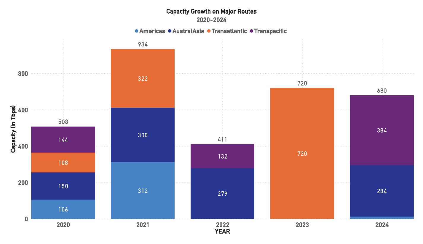
The Americas saw a modest increase in 2024, adding only 12 Tbps. This slower growth trend contrasts with the significant capacity additions seen in previous years, signaling a potential plateau in demand across this route or a shift in investment focus toward other regions.
Overall, the capacity growth between 2020 and 2024 highlights the ongoing need for new cable systems and capacity upgrades, particularly in the Asia-Pacific region. The push towards higher-capacity systems, such as those utilizing 400G wavelengths and increased fiber pair counts, remains essential to keeping pace with the world’s ever-growing data transmission requirements.
Additionally, as the industry continues to expand, balancing supply and demand for submarine cable capacity will be a critical factor in determining the future growth trajectory. Ensuring that systems are not only built but also optimized for future scalability will be key to meeting the ongoing demand for data transmission.
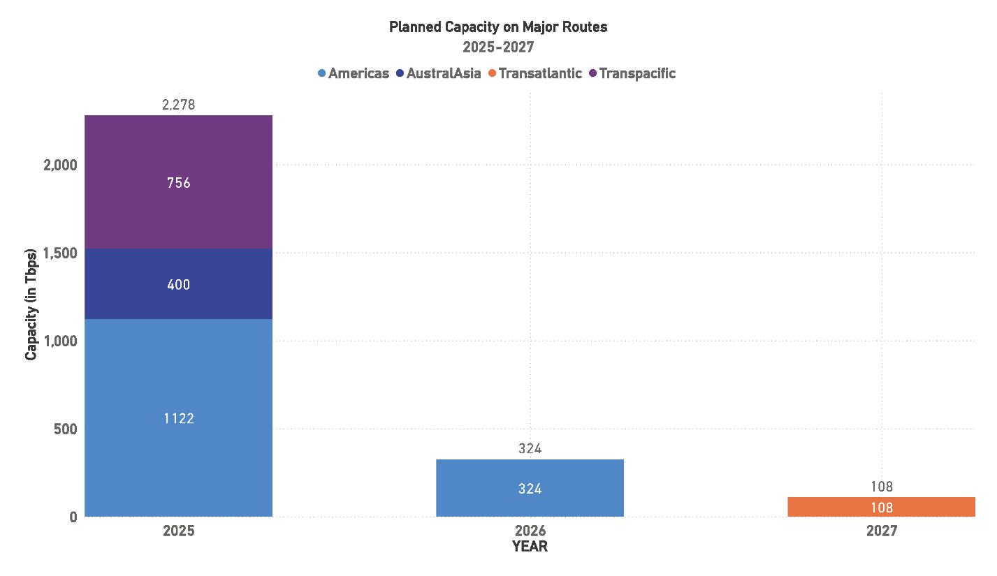
Looking ahead, the submarine cable industry is poised to experience significant capacity growth across several key routes by 2025. The Americas route is expected to see the most substantial increase, with 1,122 Tbps of capacity projected to be added. The Transpacific route will follow closely behind with 756 Tbps, while AustralAsia will see an addition of 400 Tbps. This strong capacity growth underscores the industry’s focus on bolstering connectivity across these high-demand regions.
Interestingly, planned capacity additions decrease sharply in the following years. In 2026, only 324 Tbps of capacity is expected to be added on the Americas route, a significant decline from the previous year’s growth. Similarly, 2027 projects a modest increase of 108 Tbps on the Transatlantic route. This suggests that while there is substantial growth on the horizon, much of it will be concentrated in 2025, with a slower rate of new capacity coming online in the subsequent years.
These projections reflect the submarine cable industry’s current development pipeline, which, while impressive in the near term, shows signs of tapering off in the medium term. However, it is important to note that many planned systems have not yet finalized their capacity specifics, meaning there is potential for these numbers to grow as new systems are announced or existing projects reach more advanced stages of development. The adoption of advanced technologies like 400G wavelengths and high fiber pair count systems will continue to play a pivotal role in meeting the ever-increasing global demand for data transmission.
While these figures are substantial, they also indicate the need for continued investment in new systems beyond 2025 to maintain momentum and support future global data growth. The industry will need to focus on ensuring that announced systems are brought to completion and that future projects address both regional connectivity needs and global demand. STF
Since 2020, improvements in data collection have significantly enhanced the accuracy of lit capacity reporting for submarine cable routes, with the average lit capacity now around 61 percent of total design capacity. This reflects growing demand from cloud services, 5G networks, and streaming platforms.
Although the Federal Communications Commission (FCC) has anonymized reporting, reducing visibility at the individual cable level, the overall accuracy of the data has improved. The industry now receives reliable totals for regional and route-level capacity. While this data only covers cables that touch the U.S., as a significant center of the internet, trends observed here often shape broader global patterns.
As the demand for data transmission continues to grow, particularly with the widespread adoption of cloud services, 5G networks, and streaming platforms, it becomes more critical to monitor and project lit capacity with greater accuracy to ensure that submarine cable infrastructures can meet future needs.
The Americas region has experienced substantial growth in recent years, with total capacity along major routes nearly quadrupling from 233.5 Tbps in 2016 to 803.5 Tbps in 2020. This surge reflects the increasing demand for data transmission capacity across North, Central, and South America, driven largely by the rise of cloud services, data center expansions, and the growing adoption of digital services in Latin America.
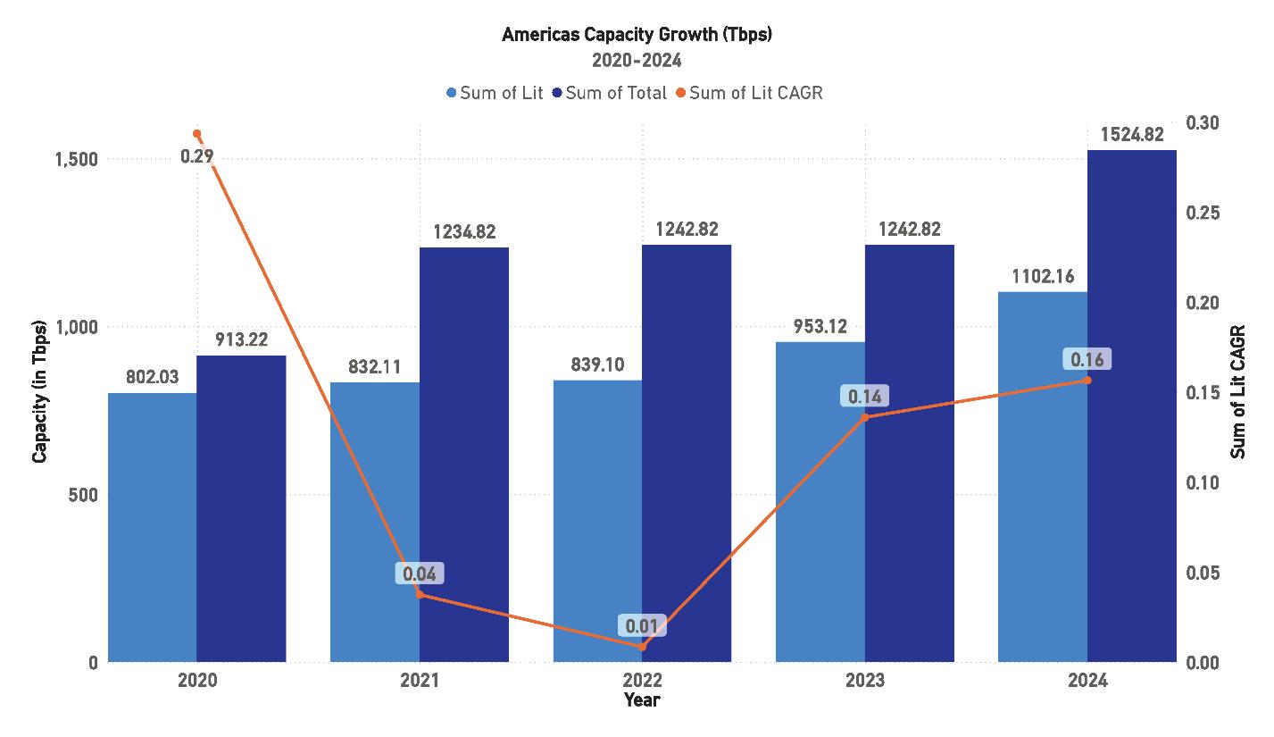
From 2020 to 2024, the Americas region has continued to experience significant capacity growth, although the pace has fluctuated. In 2020, total capacity was 913.22 Tbps, with lit capacity at 802.03 Tbps. By 2024, total capacity is expected to reach 1,524.82 Tbps, with lit capacity projected to grow to 1,102.16 Tbps. However, the Compound Annual Growth Rate
(CAGR) for lit capacity shows significant variability during this period. In 2020, the lit capacity CAGR was 29%, but it dropped sharply to 4% in 2021, before rebounding to 16% by 2024.
This volatility in CAGR suggests that while the Americas region is still expanding its total capacity, the pace of lit capacity growth is subject to fluctuations due to economic and political factors, particularly in Latin America. The region has struggled with underutilized capacity, and much of the growth has been concentrated in the United States, where demand remains high. Emerging markets in Latin America have yet to fully realize their potential as major drivers of new system growth, largely due to ongoing economic instability and political challenges.
Hyperscalers have played a key role in driving new capacity growth in the Americas, particularly along North-South routes connecting the United States with key markets like Brazil, Chile, and Argentina. However, many new systems built by Hyperscalers are primarily for their own use, limiting the capacity available for broader market consumption. While these systems are critical for supporting cloud services and data center traffic, they do not necessarily translate into higher lit capacity across the region unless the broader market begins to utilize these resources more effectively.
Looking forward, lit capacity in the Americas is projected to continue its upward trend, but the rate of growth is expect-
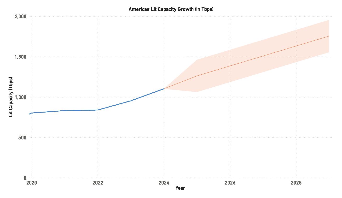
ed to slow compared to earlier years. By 2028, lit capacity could reach anywhere between 1,700 Tbps and 2,000 Tbps, depending on regional demand and the extent to which unlit capacity is utilized. The slower growth reflects a combination of factors, including a potential overbuilding of capacity in recent years and the economic and political uncertainties facing key markets in Latin America.
Brazil, Argentina, and Chile have traditionally been the main drivers of new system demand in Latin America, and these markets remain critical for the region’s long-term capacity needs. However, growth in these areas has been
slower than anticipated, largely due to economic constraints. The potential for further growth is there, particularly as Hyperscalers continue to expand in South America, but the full realization of this capacity may take longer than expected.
Much of the new bandwidth expected to be in place by 2025 will likely be concentrated on routes serving the East Coast of the United States, where demand continues to grow. While this offers opportunities for North American operators, it may not significantly benefit markets further south unless broader economic recovery and political stability are achieved in Latin America. The region’s future capacity
growth will depend on how effectively existing infrastructure is utilized and whether new investments are made to expand system capacity.
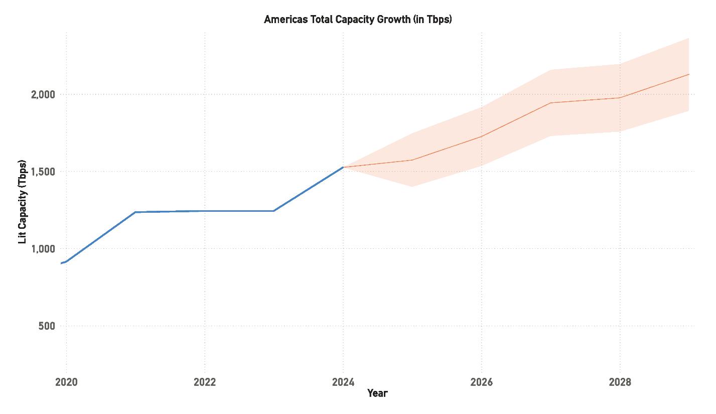
The total design capacity in the Americas region is expected to grow steadily, with projections suggesting it will reach between 2,000 Tbps and 2,500 Tbps by 2028. This growth is driven primarily by new system builds, upgrades to existing systems, and the increasing demand for data transmission across both North and South America. By 2025, total capacity is expected to reach 1,524.82 Tbps, while lit capacity is anticipated to rise to 1,102.16 Tbps, representing a significant increase over previous years.
However, despite this robust growth in total capacity, the region continues to face challenges in utilizing this capacity effectively. Much of the existing infrastructure remains unlit, with operators hesitant to invest further until demand materializes more fully. This has created a situation where the region has ample potential capacity, but its actual usage remains constrained by external factors, including the pace of economic recovery and technological adoption in Latin America.
The long-term outlook for the Americas remains positive, particularly as demand for data transmission grows in both the North and South. However, the region will need to address the current underutilization of capacity and ensure that future growth is supported by investments in infrastructure and technology to meet the needs of emerging markets.
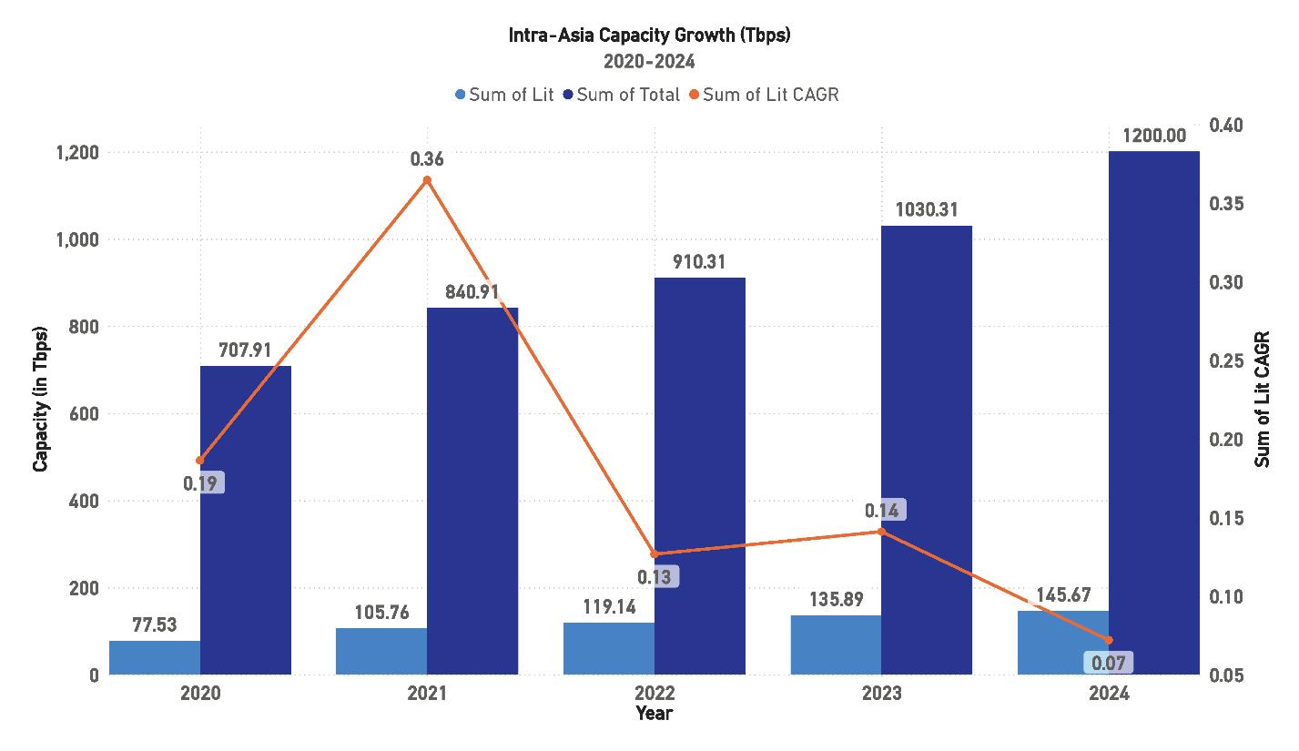
From 2020 to 2024, the Intra-Asia route experienced moderate growth in design capacity. In 2020, total capacity reached 707.91 Tbps, with lit capacity at 77.53 Tbps. By 2024, total capacity is expected to rise to 1,200 Tbps, while lit capacity is projected to grow to 145.67 Tbps. However, the Compound Annual Growth Rate (CAGR) for lit capacity has seen a significant drop during this period. The CAGR for lit capacity was 36% in 2021, but by 2024 it is expected to fall to just 7%.
This fluctuation in growth can be attributed to the irregular nature of infrastructure development in the region. Largescale projects, such as new submarine cable systems, are not developed annually, and the region’s capacity expansion is often tied to the completion of major builds. As a result, growth tends to occur in bursts rather than at a steady pace. Additionally, the relatively low lit capacity as a percentage of total design capacity suggests that there is still significant
room for growth, particularly as more traffic is routed through Southeast Asia’s emerging markets.
Growth along the Intra-Asia route is contingent on significant infrastructure builds that connect major hubs across Asia and Southeast Asia, a development that does not occur annually. The Intra-Asia region has seen periodic surges in capacity growth, driven largely by the need to connect emerging markets in Southeast Asia with established hubs like Singapore, Hong Kong, and Tokyo. However, this growth has been slower and more variable than on other major global routes, reflecting the complexity of building infrastructure in this diverse region.
Despite these fluctuations, the outlook for the Intra-Asia region remains positive, with capacity projected to continue increasing over the next few years. However, the region’s ability to meet growing demand will depend on the timely completion of new systems and the ability of operators to fully utilize the available capacity.
Looking ahead, lit capacity along the Intra-Asia route is expected to grow steadily, with projections indicating that it could reach 200 Tbps by 2028. This growth will be driven by increased demand for connectivity within Asia as well as rising traffic between Asia and other global regions, particularly the United States and Australia. As data consumption
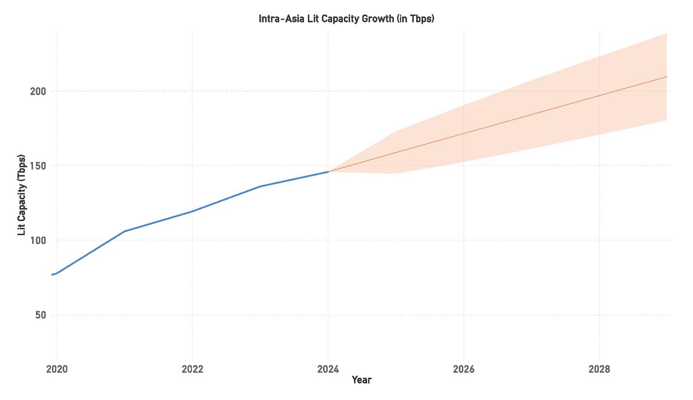
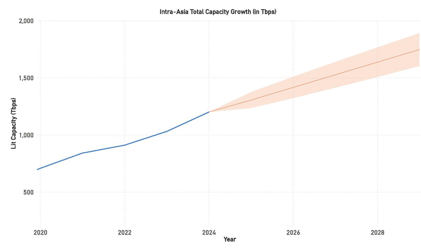
and cloud services continue to expand in markets like India, Indonesia, and Vietnam, the region is poised for substantial growth in both lit and total capacity.
In addition to the new cable systems being developed, technological advancements such as 400G and higher fiber pair counts will also contribute to capacity expansion. These new systems will provide the region with the infrastructure needed to handle future traffic demands, particularly as more data-intensive services, such as 5G and cloud computing, take hold in Asia. However, the region will need to overcome challenges related to regulatory issues and geopolitical tensions, which have the potential to delay the completion of
new systems and impact overall growth.
Total design capacity in the Intra-Asia region is expected to continue its upward trajectory, with projections suggesting that it could reach between 1,500 Tbps and 2,000 Tbps by 2028. This represents a significant increase over current levels, reflecting the region’s growing importance as a hub for global data transmission. By 2025, total capacity is expected to reach 1,200 Tbps, with lit capacity anticipated to rise to 145.67 Tbps.
However, as with other regions, the challenge for Intra-Asia will be ensuring that this capacity is fully utilized. Much of the existing infrastructure remains underutilized, and operators will need to focus on maximizing the use of
available capacity to meet future demand. This will require ongoing investment in both infrastructure and technology, as well as close collaboration between governments, telecom operators, and tech companies to ensure that the region’s capacity needs are met.
The long-term outlook for Intra-Asia is positive, with demand for data transmission expected to grow as emerging markets continue to develop and more traffic is routed through Asia. However, the region’s growth will depend on its ability to address the challenges posed by infrastructure development, regulatory hurdles, and geopolitical risks.
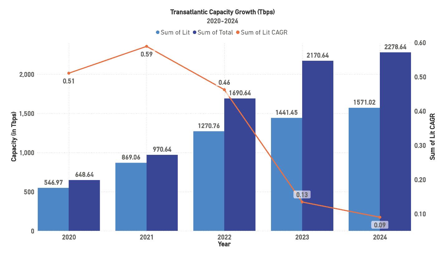
Transatlantic Capacity Growth, 2020-2024
Transatlantic routes are among the most competitive globally, particularly those connecting the major economic hubs of New York and London. These routes facilitate traffic between the highly developed economies and technology markets of North America and Europe, playing a crucial role in sustaining the global digital economy.
From 2020 to 2024, the Transatlantic region has seen strong growth in both lit and total design capacity. This growth is being driven by a surge in demand for data transmission, particularly as more businesses and consumers rely on cloud services, 5G networks, and streaming platforms. The region has historically been a critical corridor for global internet traffic, and this trend continues to hold true.
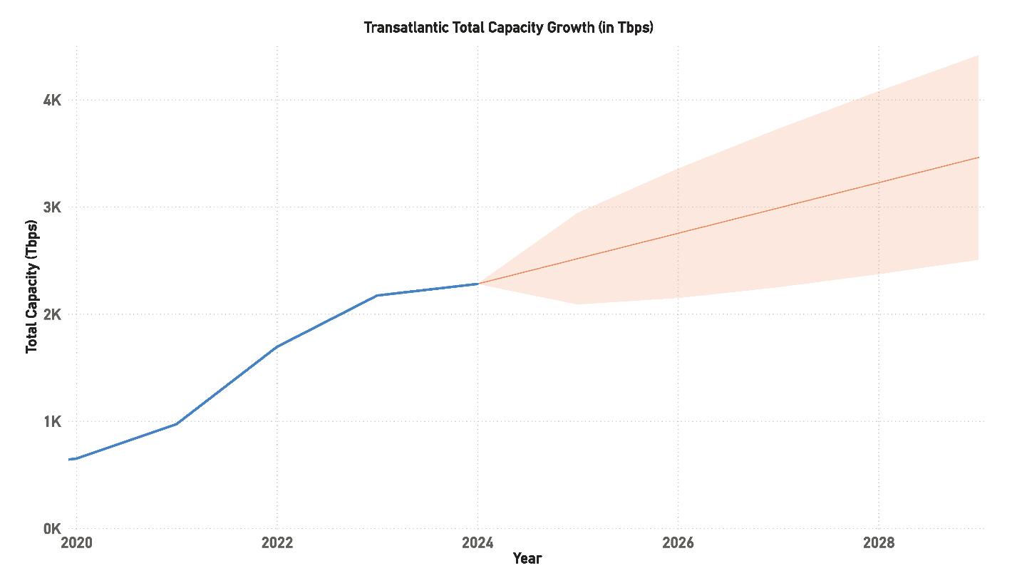
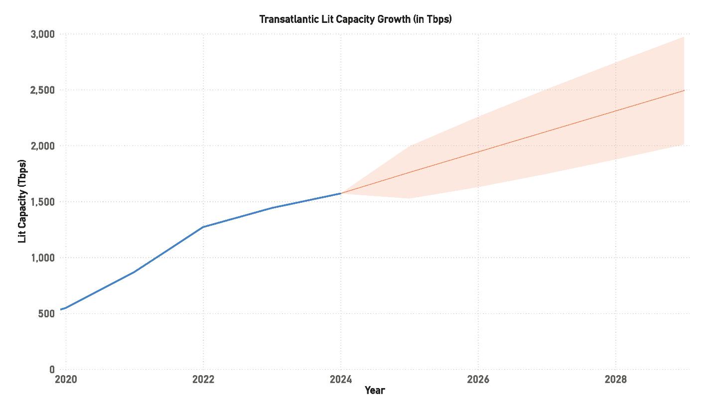
As of 2024, total capacity has reached 2,278.64 Tbps, while lit capacity has grown to 1,571.02 Tbps, representing a significant increase over previous years. This rise in capacity indicates that cable operators and stakeholders are working to keep pace with the ever-growing demand. However, the Compound Annual Growth Rate (CAGR) for lit capacity has slowed over the past few years. In 2021, the CAGR was at a peak of 59%, but it has since declined to 9% by 2024. This suggests that while capacity expansion is ongoing, the rate of lit capacity growth is stabilizing after the substantial surge seen in the early 2020s.
This leveling off of the CAGR could indicate a more measured approach to future upgrades and deployments,
as cable operators seek to avoid overbuilding. However, it also highlights the importance of closely monitoring capacity trends to ensure there is enough room for future growth. The region’s reliance on these cables means any shortfall in capacity could have significant implications for global internet traffic. Although the total capacity is growing, the industry must ensure that the amount of lit capacity keeps pace with demand. If not, there could be risks of bottlenecks or congestion in the future, particularly as new data-intensive applications and services continue to emerge.
Looking ahead, lit capacity in the Transatlantic region is projected to continue its upward trajectory, though at a slower rate than the rapid growth seen between 2020 and 2022. The forecast suggests that lit capacity could reach anywhere from 2,500 Tbps to 3,000 Tbps by 2028. While this represents a slower growth rate compared to previous years, it still points to a steady expansion of capacity to meet the evolving needs of businesses and consumers.
One of the key drivers behind this growth is the increasing reliance on cloud-based services and platforms, which require massive amounts of data transmission across international borders. Additionally, as more industries adopt digital transformation strategies, the need for reliable and fast data transmission continues to grow. The widespread adoption of 5G networks, which enable faster internet speeds and more efficient data transfer, is another critical factor in this capacity expansion.
However, despite these positive trends, there are risks on the horizon. The growth of lit capacity is expected to slow, which could mean that future capacity needs may outpace what is available, especially if demand continues to rise at
its current rate. If this happens, there could be regional disparities in the availability of high-speed internet, with more developed markets benefiting while underserved regions struggle to keep up. As such, it is essential for stakeholders in the submarine cable industry to plan for both short-term needs and long-term growth to avoid any disruptions or limitations in global connectivity.
The total design capacity of the Transatlantic region is also projected to continue growing over the next several years, with estimates ranging between 3,500 Tbps and 4,000 Tbps by 2028. This growth is driven by the continued introduction
of new submarine cables, many of which are utilizing the latest advancements in cable technology. Systems with higher fiber pair counts, such as those using 16 to 24 fiber pairs or more, and cutting-edge technology like 400G, are contributing to the rapid expansion of overall capacity.
In the short term, this suggests that the industry is wellequipped to meet the current demand. However, over the longer term, there is still some uncertainty about whether the rate of new cable installations and upgrades will be enough to keep up with growing global data traffic. The increasing deployment of new cables over the next few years is a positive
sign, but if the rate of new installations starts to slow down, it could lead to potential capacity shortfalls in the longer term, especially as new technologies and applications emerge.
Despite this uncertainty, the forecast remains generally optimistic. The current pipeline of planned cable projects indicates that the industry is actively working to meet the growing demand. However, the ongoing challenge will be to ensure that capacity expansions keep pace not only with current demand but also with future innovations that may require even more bandwidth. Continued investment in new systems, upgrades to existing cables, and close collaboration among stakeholders in the industry will be crucial to ensuring that the Transatlantic region remains a vital and competitive corridor for global data transmission.
In the Transpacific region, Hyperscalers are also extending their infrastructure, mirroring trends seen in the Transatlantic area. These systems serve as vital links connecting the economies of the United States and Canada with Australia and East Asia.
From 2020 to 2024, the Transpacific region saw steady capacity growth, driven by the ongoing demand for cloud services, data centers, and connectivity between North America, East Asia, and Oceania. This region is highly competitive, with major Hyperscalers like Google, Amazon, and Microsoft playing key roles in building new systems to handle increasing data traffic.
In 2020, the total capacity was 589.30 Tbps, with lit capacity reaching 464.56 Tbps. By 2024, total capacity is projected to reach 1,485.30 Tbps, with lit capacity growing to 902.76 Tbps, reflecting a steady upward trend in system usage. However, the CAGR for lit capacity has seen a noticeable decline. Starting at 78% in 2020, the CAGR has fallen sharply to 12% by 2024. This decrease in the CAGR mirrors trends seen in other major cable routes, such as the Transatlantic, where capacity growth is beginning to stabilize after the initial boom period of the early 2020s.
Despite the slower CAGR, overall capacity continues to increase, and
the region’s reliance on these routes is only set to grow. With Hyperscalers heavily invested in expanding their infrastructure, the Transpacific region is poised to maintain its role as a critical link between major economies. However, the rapid decline in CAGR suggests that capacity upgrades and expansions may need to keep pace with the long-term growth in data demand to avoid potential capacity shortfalls. Without continued investment in new systems and upgrades, the region could face bottlenecks, especially as demand for faster and more reliable data transmission increases.
Looking ahead, lit capacity in the Transpacific region is expected to continue growing steadily, though at a slower pace than in the early 2020s. Projections suggest that lit capacity could range from 1,500 Tbps to 1,800 Tbps by 2028. This steady rise reflects ongoing demand from cloud services, 5G networks, and data-heavy applications, which continue to drive traffic across the Pacific.
Hyperscalers remain the key players in this region, driving both new system builds and system upgrades. As more businesses shift to cloud-based solutions and expand their global presence, the demand for high-capacity, low-latency routes across the Pacific will continue to grow. However, the gradual decline in CAGR suggests that future growth may be more measured, with operators focusing on optimizing existing systems and gradually expanding capacity through system upgrades.
That said, there remains a risk that future capacity needs may not be fully met if the pace of new system builds slows down or if upgrades do not keep pace with increasing demand. Given the strategic importance of this region for global internet traffic, any delays or disruptions in capacity expan-
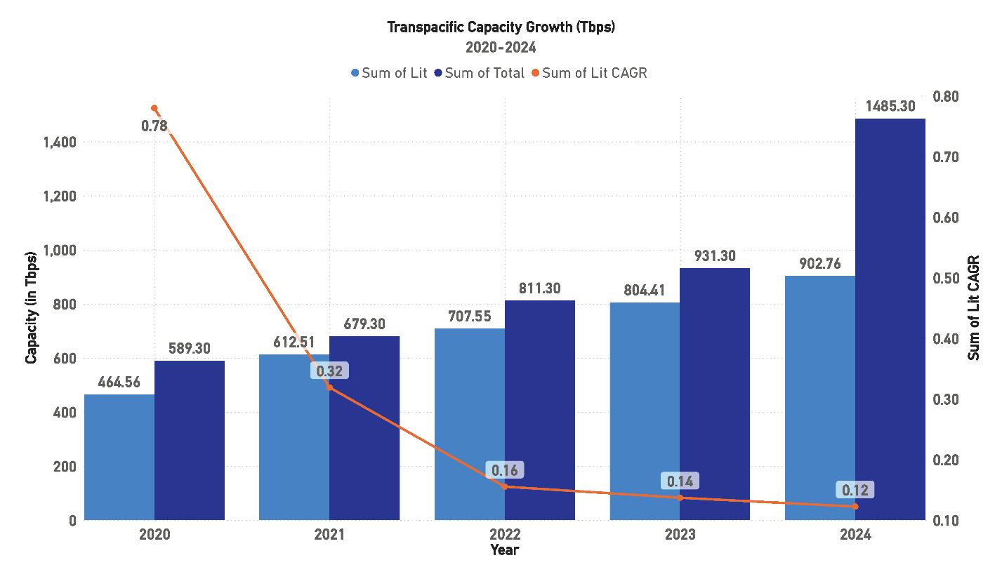
sion could have significant implications for the broader digital economy. Therefore, stakeholders must carefully monitor both short-term and long-term capacity trends to ensure that supply keeps pace with demand.
Total design capacity in the Transpacific region is expected to continue rising, with projections ranging between 3,000 Tbps and 4,000 Tbps by 2028. This reflects the sustained demand for high-capacity routes linking North America with East Asia and Oceania. New submarine systems, such as those employing high fiber pair counts (16 or more) and advanced technologies like 400G, are expected to contribute significantly to this increase.
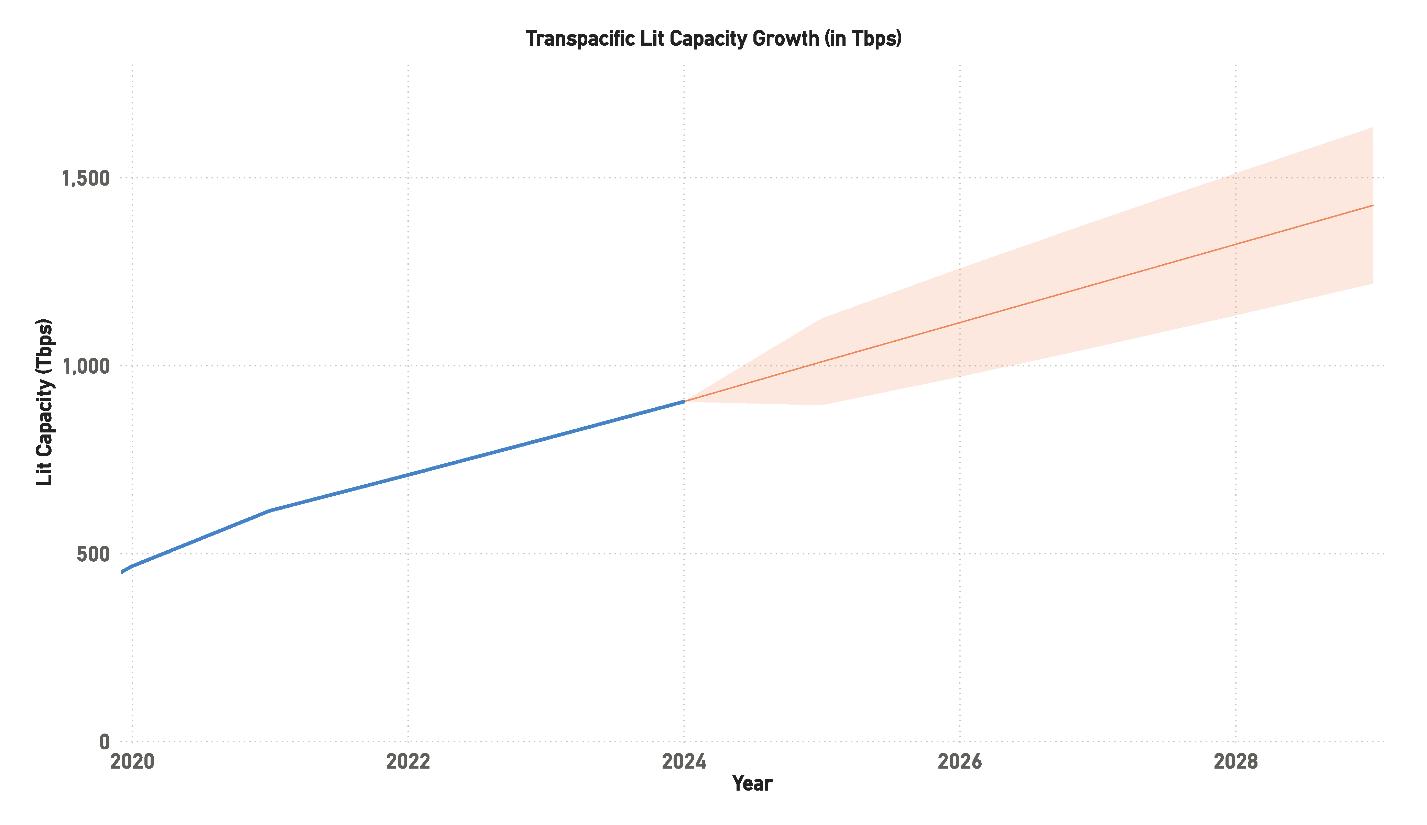
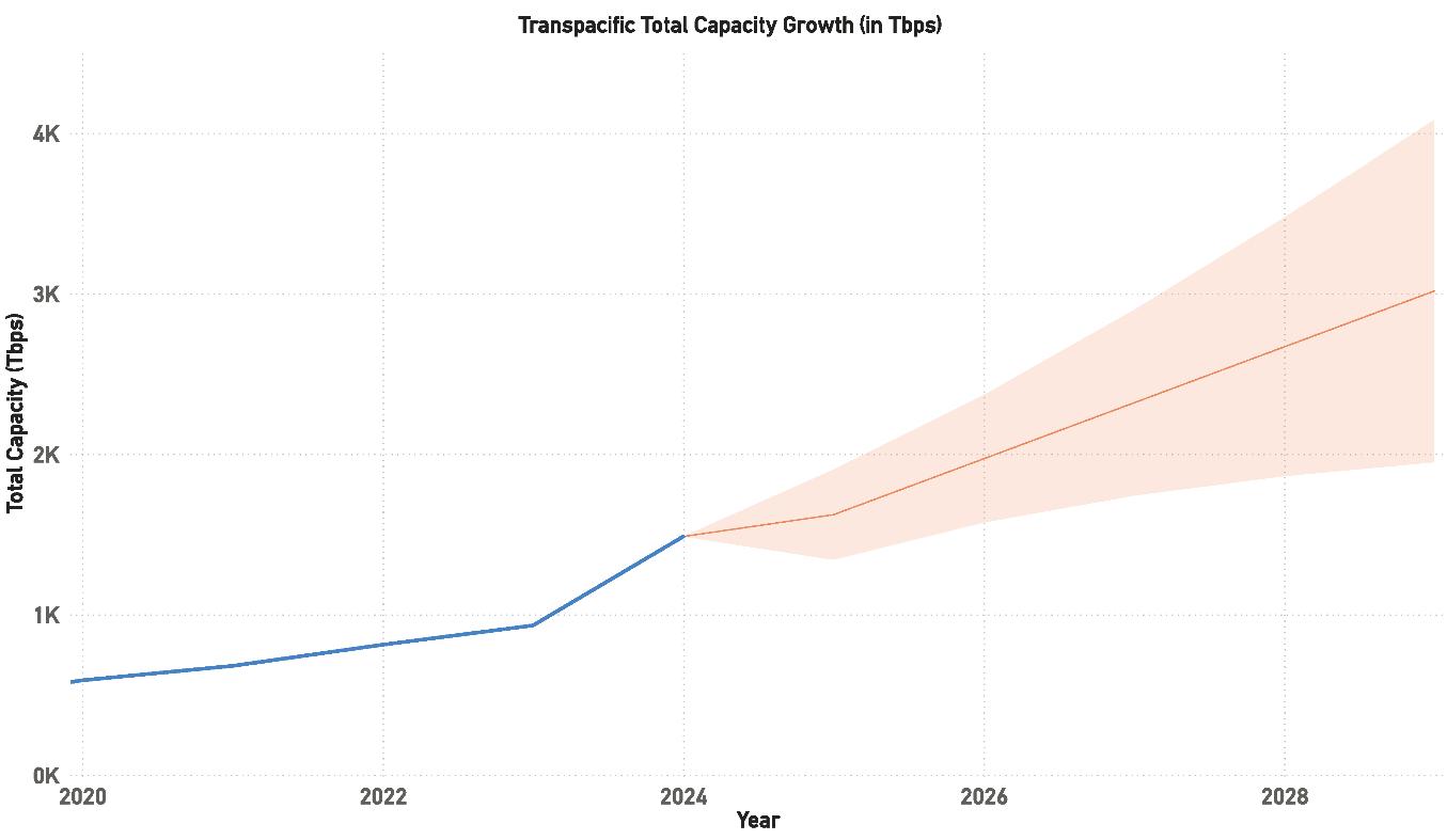
The Transpacific region’s strategic importance cannot be overstated. It not only serves as a critical conduit for data traffic between major economic regions but also plays a vital role in ensuring global internet stability. As demand continues to grow, operators will need to invest in both new systems and system upgrades to meet future capacity requirements. While the current growth trajectory appears strong, it is crucial that the region continues to see steady investment to avoid any potential capacity constraints in the future.
In the long term, the outlook remains positive, with capacity projections suggesting that the region will continue to be a major player in global data transmission. However, the ongoing challenge will be ensuring that the pace of system development and upgrades keeps up with the exponential growth in data traffic. Close collaboration between Hyperscalers, telecom operators, and other key stakeholders will be essential to maintaining this growth and ensuring that the region remains competitive on the global stage.
BY ANUP GUPTA
Many of us have grown up with limited means and, for anyone who grew up with not very much, have built an inherent ability to find ways of making things happen. Having limited resources at one’s immediate disposal in no sense requires that one’s ambition must be curtailed, or that one is undeserving of success. It simply redefines one’s journey to such success. The path will inevitably be steeper than for some others, demanding innovative thinking and a relentless willingness to push through the thorns that invariably block the routes. For countless individuals and, as we shall see, for entire regions of the world, this resourceful navigation of adversity is not just a tactic—it’s a way of life, even in the digital world of today.
That mindset, the relentless pursuit of objectives that can only be attained by overcoming scarcity of resources, has shaped a lot of us. And it shapes how we see the world of global connectivity. Because there are countries, entire regions, that feel a lot like that kid looking at others with a discerning and longing eye. Full of ambition, bursting with potential—but left waiting while the rest of the world moves forward. This is not in any sense because they lack the will, rather because they were never part of the plan, a plan into which they had no input. Why? Well, it often boils down to a rather unglamorous reality: they are not conveniently located “en route”, on
the shiny global fiber optic highways. The big telecom players and cable builders are often laser-focused on what they call “key markets.” These are, presumably, the places where the data traffic is high and every terabyte is worth its weight in gold – or per-
The big telecom players and cable builders are often laser-focused on what they call “key markets.” These are, presumably, the places where the data traffic is high and every terabyte is worth its weight in gold – or perhaps just where the return on investment looks a bit more straightforward on a spreadsheet.
haps just where the return on investment looks a bit more straightforward on a spreadsheet. To put it simply, they’re not on the express route of cable builder investments. They are on the byroads, the meandering country lanes—underserved, underfunded, and, often, underestimated.
This creates a classic, almost frustrating, “chicken and egg” scenario. The cable builders, those seeking to collect and deliver large volumes of traffic, quite reasonably, need robust, reliable local digital infrastructure before they will commit significant resources to a new market. This is fair enough. But then you have the in-country infrastructure operators, those who need to provide the in-country networks, build the cable landing stations and data centers. To justify the colossal investment required to build that local infrastructure, they in turn often need a commitment from an anchor tenant, which is most often, a large traffic player who has already decided that the local infrastructure is not to its satisfaction, to make the local numbers work. Catch 22 anyone?
So, the hyperscalers wait for the infrastructure, and the infrastructure waits for the hyperscalers. And while this polite, financially prudent standoff continues, entire populations remain underserved. They are stuck peering through the shop window of the digital age, able to see the possibilities but unable to fully participate. The irony is that the demand is there and is real. History has shown that there is tremendous untapped potential in these markets. Not only is the customer base enormous, but these markets are full of are intelligent, eager and ambitious people who are only in need of the right tools—such as bandwidth and infrastructure—to reach their potential. And remember,
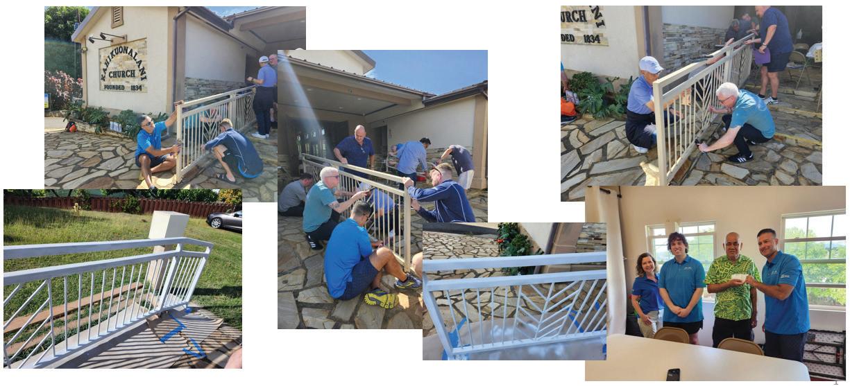
there is a reason why broadband internet access is considered to be a human right. People should not be left behind just because they live in a location that is relatively difficult or relatively expensive to build a cable to. They have a right to have the same opportunities as people who live where there are submarine cables in abundance.
But the traditional models and risk assessments often stutter to a halt, deeming these markets “too complex,” “too risky,” or simply “not next on the list.” The result is a never-ending cycle where potential remains untapped and the digital divide, rather than shrinking, often grows wider. But as it is said—when you’re used to being left out, you learn how to get in.
At APTelecom, we have taken this philosophy to heart. We have encountered and addressed this very challenge, this chicken-and-egg conundrum, by refusing to accept that “it can’t be done.” We believe in creating bespoke solutions that unlock the unique potential of these over-
looked geographies, ensuring win-win outcomes for everyone involved. This is about rolling up our sleeves and finding ways to make those crucial connections happen, therefore unlocking a world of opportunities for the people who populate these geographies.
Where some see small markets with little economic incentive to invest in, APTelecom sees artists and musicians waiting for an opportunity for their creations to reach a broad, appreciative audience. We see the hungry minds of children embracing Science, Technology, Engineering and Mathematics (STEM) educational opportunities and a future career devoted to improving the lives of the people in their communities. We see workers studying online to improve their employment opportunities. We see women being empowered to start their own online businesses.
Consider the Pacific Islands. On paper, most models would tell you it can’t be done—too small, too remote, too expensive. But if you stop at “can’t,” you miss the point. With the Central
Pacific Cable (CPC), we helped bridge the gap by unlocking grant funding, pulling together partners who believed in the long game, and finding creative ways to deliver real connectivity where none existed before. It was not easy— but we are not in the business of easy. We don’t look for the perfect business case. We make the business case we are presented with work. And the result will be a network that will allow thousands of people living on remote Pacific islands to have reliable and affordable high-speed internet access. A network that will allow them to follow their talents and their passions to make improvements to the conditions of their communities, for themselves and for their future generations.
The Central Pacific Cable and the broader Pacific Cable Initiative, will provide connectivity to many islands. APTelecom is proud to be part of this effort. In particular, we are proud to be bringing the first ever submarine cable connectivity to the island nation of Tuvalu.
Then there is Bangladesh. A country on the rise, but one where traditional telecom strategies tend to stumble. So, what did we do? We adapted. We didn’t show up with a fixed playbook. We showed up with our ears open and we listened. We aligned with local partners. We flexed our business models. The result? Commercially viable infrastructure that is not only technically sound, but also commercially sustainable in the long term.
In these very different, but equally underserved regions, our intervention has been about more than just laying cables or building data points, it has been about recognizing the immense, often latent, value within these markets. It’s about understanding that being “underserved” is a temporary state, not a permanent condition. By applying a bit of that old-school ingenuity, building lasting partnerships, and a encouraging a vision to look beyond the most obvious routes, we’re proving that these markets are not just deserving of connectivity, but are poised for incredible growth once the first sniff of it is within their reach. It’s about changing the narrative, one connection at a time, proving that with the right approach, no ambition is too big, and no market is truly out of reach.
In both cases, our approach was about unlocking value in places that had been, not so much completely overlooked for far too long, but not sufficiently well understood. It was about recognizing that being underserved is a condition—not a destiny. When APTelecom looks at a market, we do not see “landing points.” We do not see lines and dots on a map. Well, we do, we must—but we also see individuals, communities of people
with the talent and ambition to make things better and who are entitled to a place at the table. People who will not be left behind because the conventional thinking says they must.
APTelecom backs up its words with actions. As noted earlier, we are bringing the first submarine cable into Tuvalu. This will bring reliable, highspeed internet access to the islands for the first time, providing a wealth of opportunities to the people of Tuvalu. As part of APTelecom’s broader Corporate Social Responsibility efforts, we also announced our support for the Tuvalu Fou Church of Hawaii, one of the largest Tuvaluan congregations outside the islands. This initiative aligns with our commitment to giving back to the communities we serve, both commercially and philanthropically.
During the Pacific Telecommunications Conference in Hawaii in January 2025, APTelecom donated volunteer hours and a financial contribution to the Church, a key community center for Tuvaluans in the United States. This partnership underscores our commitment to the Tuvaluan community, to help strengthen this vital community hub. APTelecom employees gave their time and sweat to improve the church building, providing benefits to the congregation and emphasizing our dedication to the Central Pacific Initiative. Together, we continue to build not just stronger networks, but stronger communities.
We don’t build networks because the spreadsheet says yes. We build because people need access. And where others see risk, we see the same thing a lot of us saw growing up: opportunity hiding behind a bigger challenge than others see elsewhere.
There no longer is any reason to
say, “we can’t build there because it is too difficult or too expensive.” It is important to recognize that a solution that works for the Central Pacific or Bangladesh can’t just be transplanted to another market. Each situation is unique and requires its own solution. APTelecom did not take the CPC concept and try to apply it to Bangladesh. That wouldn’t have worked. We had to, and did, find a new solution that works in Bangladesh. But the point is that there always is a solution. There has to be. The stakes are too high to give up when we are talking about a community of people in need of opportunities. They can’t be left behind. We can find a solution.
So, in summary: underserved doesn’t mean undeserving. It means one must push harder for the door to open. And we’re here to change that—one cable, one partnership, one bold solution at a time. STF
ANUP GUPTA is President (India and SAARC) for APTelecom. Anup has seasoned and versatile experience of more than 24 years in the global telecom industry spanning across Asia, Africa Middle East and Europe. He possesses a strong track record of working on large and complex global telecom projects that have direct impact on market efficiencies and customer satisfaction.
Anup has helped businesses penetrate new geographies and markets and enhance revenues across verticals. He has significant achievements in creating innovative go-to-market strategies, building sustainable businesses, driving transformation and synergies. He is an industry leader with valuable relationships across the globe, across business segments. Anup has worked on multiple submarine cable projects in Asia and Africa through the lifecycle of the business.
He was earlier the VP and Business Head for Africa and Europe for Airtel, where he was responsible for developing and executing a strategy to maximize business profitability and enhance customer satisfaction for their global portfolio of voice, data and submarine cable services. Post that he also served as the Chief of Sales and Marketing for a submarine cable company in Mauritius, helping them establish their business. Anup holds a Bachelor’s Degree in Science and is a Postgraduate in Business Management.
Lisbon, Portugal | 2-5 June 2025
Organised by: Hosted by:
• Masterclasses on 6 key topics
• Keynotes on the impact of AI and the future of our industry
• Over 100 oral paper presentations
• 100 posters in networking poster session
• Congress on sustainability
• Networking events and Gala Soiree
• By the industry, for the industry
Tickets are selling fast. Get yours now www.SubOptic2025.com

CAN YOU INTRODUCE THE SUBOPTIC CONFERENCE AND SHARE THE CORE MISSION OF THE CONFERENCE?
Run by the SubOptic Association, the SubOptic conference is the leading international event for the global submarine telecommunications industry. Held every three years, with the venue rotating between continents globally, it serves as a vital forum for industry professionals, including operators, suppliers, developers, component manufacturers, marine suppliers and policy makers, to collaborate, share insights, and discuss the challenges facing our community together with the innovations shaping the future of subsea communications.
SubOptic provides a platform to:
in the cloud. Key topics that will be addressed within the huge amount of content presented and available to attendees:
• The adoption of new technologies, laws, working practices and attitudes required to address our rapidly changing digital landscape.
• The rise of Artificial Intelligence, increasing security requirements, environmental and geopolitical change, bring with them a requirement for development, standardization and flexibility.
• As society’s dependency on the Internet continues to grow, the pressure to provide reliable, sustainable and high-capacity subsea networks means today, more than ever, we must evolve and protect our critical infrastructure.
• Promote technical excellence and operational best practices.
• Address emerging technologies, geopolitical influences, and environmental sustainability.
• Build collaborative networks to drive progress across the global subsea ecosystem.
Looking more specifically at SubOptic 2025, the theme is What’s on the horizon? Future proofing our digital landscape. The intent is to set a challenge to the subsea community to look ahead and determine how best to address the variety of in-coming demands on land, at sea and
The SubOptic conference has been running for over 35 years. When the first conference was held in Versailles in 1986, optical submarine cables were in their infancy. The World Wide Web was on a drawing board and the driver for submarine systems was purely voice traffic. We have since introduced optically amplified systems, using the full bandwidth of the C-band spectrum
for traffic with individual channel bit rate capacities of 1Tb/s and more: an increase in capacity of more than 1,000 times each year. This has been achieved by collective intelligence and innovation within the global submarine industry. Every three years, the SubOptic conference gath ers these innovators and developers together to plot the next three years and beyond, in three main areas:
Lisbon, Portugal | 2-5 June 2025
• Technical Papers and Panels: The conference showcases groundbreaking research and innovations, setting the tone for future developments in system design, maintenance, and data capacity.
What’s on the horizon?
• Trend Forecasting: The conference often introduces emerging technologies and strategies, shaping investment priorities and technical roadmaps.
POLICY AND REGULATORY INFLUENCE
Future proofing our digital landscape
• Global Dialogue: SubOptic fosters conversations between industry leaders, governments, and regulatory bodies, helping shape policy frameworks that impact international connectivity.
• Sustainability Focus: It emphasizes environmental best practices, encouraging sustainable cable deployment and maintenance standards.
Organised by:
NETWORKING AND COLLABORATION
• Industry Partnerships: The event catalyzes new partnerships, joint ventures, and strategic alliances among key players in the market.
• Cross-Sector Engagement: It connects stakeholders from telecom, cloud, finance, and technology sectors, expanding the submarine cable ecosystem.
3. HOW DOES THE SUBOPTIC CONFERENCE FOSTER THE SHARING AND PROMOTION OF NEW DEVELOPMENTS IN SUBMARINE OPTICAL FIBER TECHNOLOGIES?
The core content of the conference is the presentation of industry papers in either oral sessions or during the poster session. A Call for Papers (CfP) is released approximately a year before the conference to all players in the industry to submit an abstract for review. The CfP covers all aspects of the industry grouped into different topic areas and encourages anybody with something to share to submit. A clear demonstration of how the CfP process facilitates the SubOptic conference in fostering the sharing and promotion of new developments can be seen in the statistics which show a significant
Hosted by:
• And in 2025 we received 239 abstracts from 102 different companies/bodies
• A 45% increase in just two conference cycles.
4. WHAT KEY INNOVATIONS IN SUBMARINE CABLE TECHNOLOGY OR APPLICATIONS WILL BE HIGHLIGHTED AT SUBOPTIC 2025?
For the 2025 conference the Call for Papers was released in May 2024 inviting abstracts on any topic related to the submarine cable industry from initiatives on apprenticeships to development of the latest high speed digital signal processor chip. The most popular topics on which abstracts were submitted and scored highly in peer review are:
• Multi-Core Fibre
• Petabit Cables
• Sensing Technologies
• Legal aspects of Supply Contracts
• Evolution of CLS and DC Architecture and Infrastructure
• Advancements in all aspects of Marine Operations
5.
WHAT DO YOU CONSIDER THE PRIMARY FACTORS BEHIND THE SUBOPTIC CONFERENCE CONTINUED SUCCESS IN THE TELECOM INDUSTRY?
SubOptic’s success as a global conference lies in its unique standing as an event created for the industry, by the industry. Organized by industry professionals and driven by a not-for-profit trade association, it reflects the real needs, challenges, and aspirations of the global submarine cable community. All content comes from the industry. Nobody pays to speak at SubOptic. There is no company marketing or overt publicity within the oral and poster presentation content. Every abstract is peer-reviewed by an expert committee of at least eight members, judging each abstract ‘blind’ - reviewers are not aware of the author or affiliation. These are all factors that make the SubOptic conference unique, lead to its strong legacy, its very high level of technical content, and commitment to collaboration, all which have made it the leading forum for innovation, dialogue, and progress in subsea communications.
6.
HOW IS SUBOPTIC DRIVING DIVERSITY AND INCLUSION WITHIN THE SUBMARINE CABLE AND TELECOM SECTORS?
The SubOptic Association sponsors a number of cross-industry Working Groups. The Diversity, Inclusion and Belonging (DIB) Working Group has been running since 2019 with the objective of fostering a more equitable and diverse industry by empowering underrepresented talent, driving inclusive policies, and shaping a culture of belonging in the submarine cable sector.
The Working Group launched its first mentorship programme in 2021 with 25 mentors and mentees and doubled this to over 50 in the second edition. A Spanish language mentorship programme has also been established.
The DIB Working Group has sponsored one of the winners of the European Submarine Cable Association (ESCA) NextGen Awards with a Prize to attend SubOptic 2025.
7.
WHAT ARE
CURRENTLY FACING THE SUBMARINE CABLE INDUSTRY AND HOW IS THE CONFERENCE ADDRESSING THEM?
One of the most significant challenges faced by the submarine cables industry (and one much discussed
at previous conferences) is the need to recruit new and younger talent into the industry. The SubOptic Association founded the SubOptic Foundation in 2021 as a charitable organization focused specifically on this challenge. The Foundation’s educational initiatives aim to inspire and prepare the next generation of subsea telecom professionals. These programmes include the WAVE regional/local language symposia, which serve as an introduction to the industry, and will shortly introduce the Global Digital Infrastructure (GDI) certificate, the first undergraduate certificate in partnership with the University of California, Berkeley (UCB) and Infrastructure Masons (iMasons).
Concerning the 2025 conference, the SubOptic Association is sponsoring 15 students to attend the conference. This was initially an idea coming out of the SubOptic Foundation WAVE events held during 2024-2025 and SubOptic agreed to fund 2-3 young people from each WAVE event to attend the conference, with travel, accommodation and registration expenses all covered. The students will attend the conference sessions, with activities outside the conference specifically defined for them.
The initial idea gathered momentum and has now been transformed into a full Student Track being organised by Iago Bojczuk, the Student and Young Professional Coordinator for the conference. The Student Track runs over an extended period 2-7 June including a trip to Sines Start Campus and Data Centre. SubOptic is extremely grateful to Iago for taking this idea to the next level and well beyond.

Through the Sustainable Subsea Networks (SSN) initiative, run by the University of California, Berkeley and the SubOptic Foundation, the industry has come together to spotlight sustainable innovation and encourage lifecycle thinking. At SubOptic 2023 in Bangkok, the First SubOptic Congress on Sustainability was held and the first Sustainable Subsea Networks Map was released. The SSN team also provide an update on their activities regularly in SubTel Forum magazine.
In Lisbon, the recent activities of the SSN initiative and the SubOptic Global Citizen Working Group will be showcased in the Second SubOptic Congress on Subsea Cable Sustainability which will focus on the advanced,
industry-wide collaborative develop ments in subsea cable sustainability in an original format at SubOptic 2025: The Detective Story.
SubOptic 2025 also provides a forum for collaboration between stakeholders to develop circular practices, such as recycling decommissioned cables, adopting renewable energy sources, and improving supply chain sustainability. By integrating these themes into its programme, SubOp tic 2025 helps drive industry-wide progress towards more responsible, circular practices.
Lisbon, Portugal | 2-5 June 2025
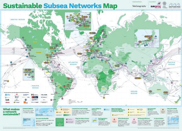
What’s on the horizon?
Future proofing our digital landscape
Organised by: Hosted by:
9. AS SUBOPTIC ‘25 APPROACHES, WHAT EXCITING NEW FEATURES OR CHANGES CAN ATTENDEES EXPECT THIS YEAR?
New for the 2025 conference will be a series of ‘Introducing Sessions’. These are designed to start at base level on a topic and provide a grounding in the subject for new members of our community or for those wishing to learn a new area of the industry. Subjects that will be covered include Transmission Principles, Power Budgets, Contracting, Optical Networks, Marine Route Planning & Survey and Marine Installation. We will also be holding two workshops addressing permitting and marine operations.
engineer and was elected a Fellow of the UK Institute of Engineering and Technology (IET) in 2000.
Alice has been heavily involved in the SubOptic conference for the last five conference cycles, as Papers Chair in 2013, Programme Chair in 2016 and on the Organising Committee for 2019, 2023 and 2025 cycles. In 2019 she was elected to the Executive Committee of the SubOptic Association and in 2023 was nominated Vice President of the Association.
10. LOOKING AHEAD, WHAT’S NEXT FOR SUBOPTIC AS IT CONTINUES TO SHAPE THE FUTURE OF GLOBAL COMMUNICATIONS?
SubOptic is advancing its mission to shape the future of global communications through a range of impactful initiatives. These include projects led by our Working Groups as well as the second phase of our Ma-
SubOptic 2025 is the twelfth conference to be organized under the SubOptic banner and will mark the 39th anniversary of the first event which took place in Versailles in 1986. The conference has been held four times in Europe, each time in France. Portugal is the first European country other than France to host a SubOptic conference. Lisbon is an obvious choice for the 2025 conference though, a dynamic hub for international submarine cables, where systems from Europe, Africa and America meet and where the ongoing investment in infrastructure and future submarine connectivity is significant.

The SubOptic Association Executive Committee has entrusted the overall programme development to Lynsey Thomas, Lynsey Thomas Consulting, as Chair of the Programme Committee. Together with Eduardo Mateo, NEC, as Papers Chair, they have developed a programme with an impressive range and depth of content. The presentation of papers, either oral or poster, has always been at the heart of the conference programme; it is an opportunity for everybody in the industry to contribute and participate in the conference and to share knowledge in the spirit of collaboration on our submarine cable infrastructure. The four-day programme will feature over 100 technical and commercial paper presentations, plus a variety of other interesting sessions. Keynote speakers, panel discussions, workshops and round table debates will all focus on important and timely topics
within the submarine cable industry. SubOptic has always made educational opportunities for its attendees a priority in planning the content for the conference programme. A rich set of masterclass sessions before the official opening of the conference will reflect on the latest topics of interest to the conference attendees whether they be technical, commercial or regulatory. Another topic of particular relevance will be covered in the plenary panel ‘Shifting Tides: Geopolitics and the Subsea Cable Industry’.
New to the 2025 conference will be the Introducing Sessions. These are designed to start at base level on a topic and provide a grounding in the subject for new members of our community or for those wishing to learn a new area of the industry. The conference will also feature updates from SubOptic’s Working Groups (each focused on a specific topic of interest to the industry), a presentation by ICPC and a new installment of TeleGeography’s renowned ‘MythBusters’ series.
SubOptic has sponsored cross industry, collaborative Working Groups studying topics of interest to the submarine
cable industry since 2008. The findings of these Working Groups have histor ically been presented during SubOptic conferences as the Working Group cycle works between conferences. This material is often still relevant today and can be downloaded by members of the SubOptic Associa tion from the SubOptic website www.suboptic.org.
Following the Bangkok conference in 2023, seven Work ing Groups were launched for the 2023-2025 cycle.
All seven Working Groups will present at the SubOptic 2025 conference.
Lisbon, Portugal | 2-5 June 2025
The Global Citizen Working Group Nicole Starosielski will lead The Second SubOptic Congress on Subsea Cable Sustainability gress will showcase advanced, industry-wide collaborative developments in subsea cable sustainability in an original format at SubOptic: The Detective Story.
What’s
the
Featuring an all-star cast of industry leaders, Missing Emissions follows students from around the world as they track down the truth about subsea cable sustainability. On the way, they run into trouble with metrics at the cable landing station, get to the bottom of cable ship fuel usage, and finally discover the true emissions of a subsea cable. A story about collaboration, made with SubOptic Working Group members across the industry, The Case of the Missing Emissions will introduce the first shared carbon footprint and lifecycle model of a subsea cable–with principles for a sustainable sub sea network and future pathways to sustainable action.
Organised by: Hosted by:
This event follows on the First SubOptic Congress in Bangkok, an event that made subsea history as the first international gathering of members from across sectors and around the world to discuss metrics for sustainability in the subsea cable industry.
Five Working Groups will be updating on their progress in oral presentations on Monday afternoon after the Masterclass sessions.
Network Element Naming Working Group chaired by Pascal Pecci and Jean-Pierre Blondel - A sound naming strategy is an important asset for a project and a network all along its life, from primary inception down to its operation and maintenance. Ideally, the naming should be friendly, logical and robust against changes. Some harmonization of naming guidelines would be useful for the industry and this is the objective of the working group.
Spectrum Sharing Working Group chaired by Richard Norris - This session will summarise the work completed by the spectrum sharing working group with details on their white paper which will be released at the conference together with their spectrum allocation tool.
• Harmonizing Network Element Naming – Guidelines for the industry
• Spectrum Sharing Principles and Guidelines
Keynote speakers generally kick-start the conference days and these sessions are historically very well attended. At SubOptic 2025 we will have three keynote speakers.
Professor Maximiano is Chair of ANACOM and Co-Chair of ITU’s International Advisory Body for Submarine Cable Resilience.
With her extensive expertise in behavioural economics, public policy and regulation, as well as her leadership in the ITU’s Submarine Cable Resilience initiative, Professor Maximiano will offer invaluable insights into the future of the industry.
HENRY AJDER - AI INNOVATION AND DEEPFAKE DISRUPTION: NAVIGATING THE GENERATIVE REVOLUTION
Henry Ajder is a Deepfake Cartographer and Founder, Latent Space Ventures. In this keynote, Henry will deliver actionable insights on the transformative impact of generative AI, covering:
• The future of connectivity and interconnectivity
• The rising demand fordata centres and digital infrastructure
• The challenges and opportunities of AI-driven disruption
DEAN BUBLEY - BROADER HORIZONS FOR FUTURE CONNECTIVITY: FROM THE USER TO THE DATACENTRE TO THE AI DEVELOPERS
Dean Bubley is a Telecoms, Technology and Futures Analyst.
Dean’s keynote will explore the top-level changes occurring in networks and connectivity –not just subsea, but in access networks, wireless, and inside homes and enterprises. Ultimately, transport, subsea and wholesale business models are all driven by applications, end-users’ demands and Internet/compute architectures. But how do they all tie in to each other? What are the dependencies and frictions? What is the pivot-point for technology or regulation that could change this bigger picture?

TeleGeography’s MythBusters is back, and this time, it’s LOUDER than ever! We’re cranking up the amplifiers to 11 and resurrecting some of the most popular submarine cable myths we’ve tackled since 2013. We’ll see if our pseudo-scientific assessments still hold up.
But fear not, cable groupies, we’re not just playing the old tunes! We’ll be dropping a few fresh, new myths into the mix (hopefully, these won’t be like those new songs fans groan at while waiting for the classics to be played). Join us for a hilarious revisit of our iconic confirmations and face-melting busts.


SubOptic Association recently signed a Memorandum of Understanding (MOU) with ICPC to strengthen the relationship going forward. The intention is to increase the visibility and reach of both SubOptic and ICPC actions for the global subsea industry and to enhance opportunities for collaboration. SubOptic is delighted to have Ryan Wopschall, General Manager of ICPC, and John Wrottesley, Operations Manager for ICPC, speaking at SubOptic 2025. The title of their presentation is Cable Protection Now and into the Future: An ICPC Perspective. Ryan and John will be providing updates on ICPC’s activities over the last year as well as a forward-looking view on the year to come. This will include highlights of our Montreal Plenary, our recent publication with UNEP-WCMC, a summary of our government engagement on cable security and resilience including the ICPC/ITU Advisory Body, and a summary of where we think the industry is headed in the next 5 years regarding cable protection.
The Call for Papers was launched in May 2024 and abstracts submitted until the end of October. The conference cycle to the 2025 conference is unusually only two years as the 2023 conference was delayed one year due to the pandemic. We were thus pleasantly surprised when the portal for submission closed to find we had 239 abstracts submitted.
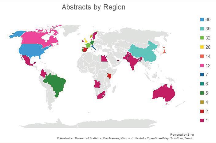
The Papers Chair for SubOptic 2025 is Eduardo Mateo, NEC. The first role of Papers Chair is to nom inate the Vice Chairs for each of the topic areas; for the 2025 cycle we nominated two Vice Chairs for each of the topic areas. The Vice Chairs then assemble an expert panel of reviewers for their topic area, who together with the Vice Chairs are responsible for the peer reviews of all submitted abstracts. As in previous years, all reviewers ranked their papers with no indication about the author or the company to ensure a fair process.
Lisbon, Portugal | 2-5 June 2025
Thanks to the high quality of paper submissions, we are once again presenting three parallel paper tracks that will dive deep into a variety of critical topics, as well as a largescale poster session that will showcase the latest research and innovations.
The 239 abstracts were from 102 different companies/ entities in 30 different countries. Some statistics on the abstract submissions are shown below.
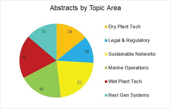
Iago Bojczuk
Organised by: Hosted by:
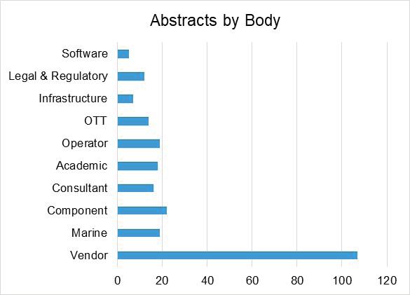
also to equip students and young professionals with the tools, networks, and insights necessary to thrive in a globally interconnected digital world. This is more than just a conference experience: it’s an on-ramp to leadership in one of the most critical sectors of the global digital economy! STF
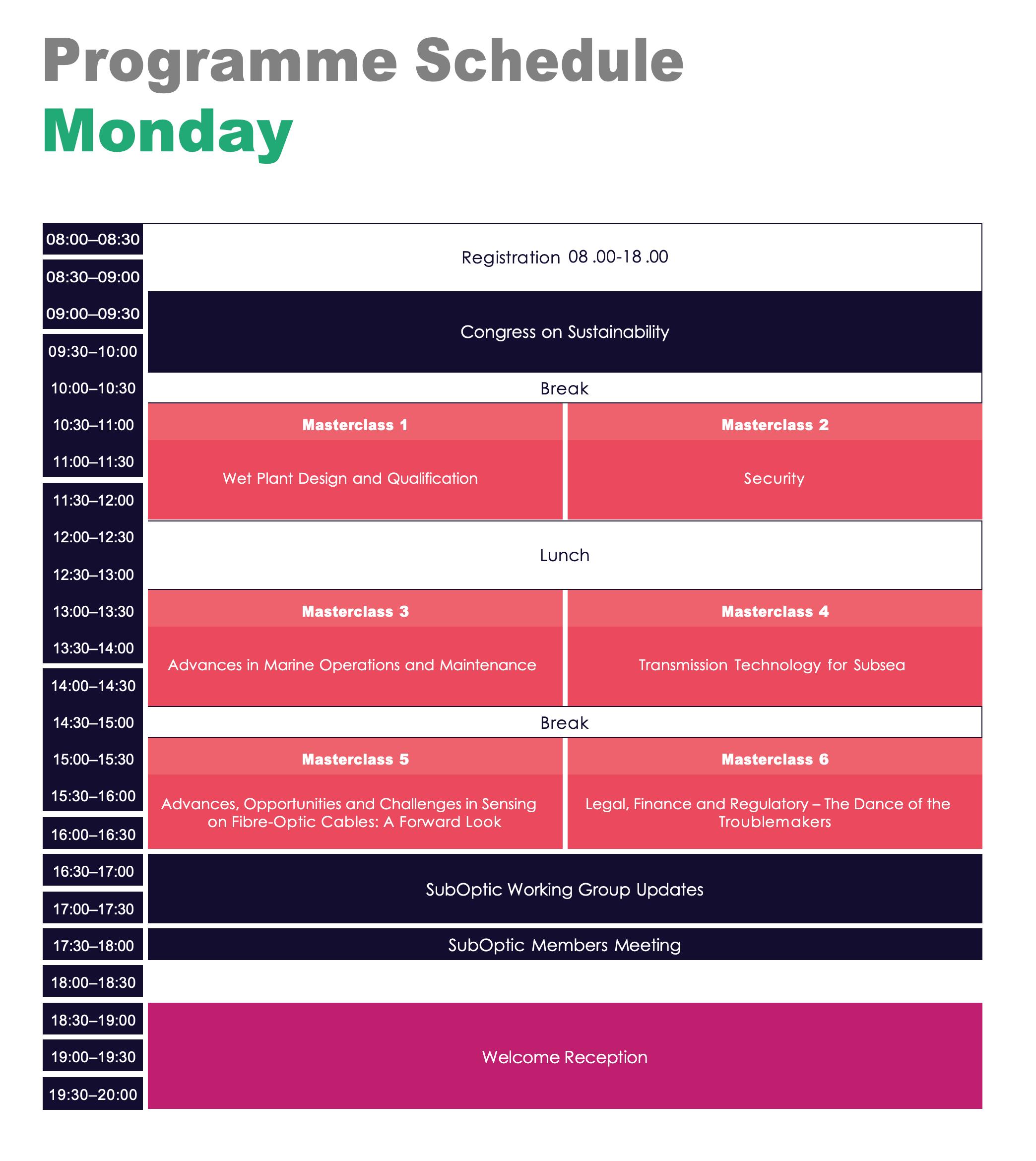
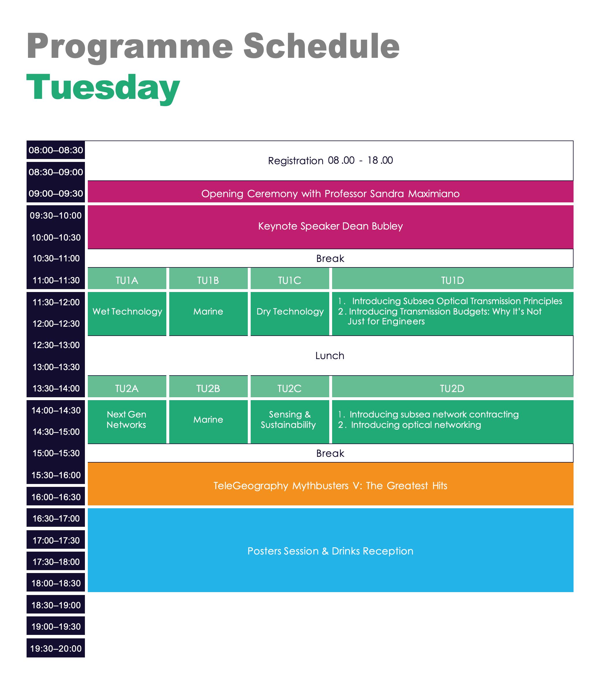
What’s on the horizon?
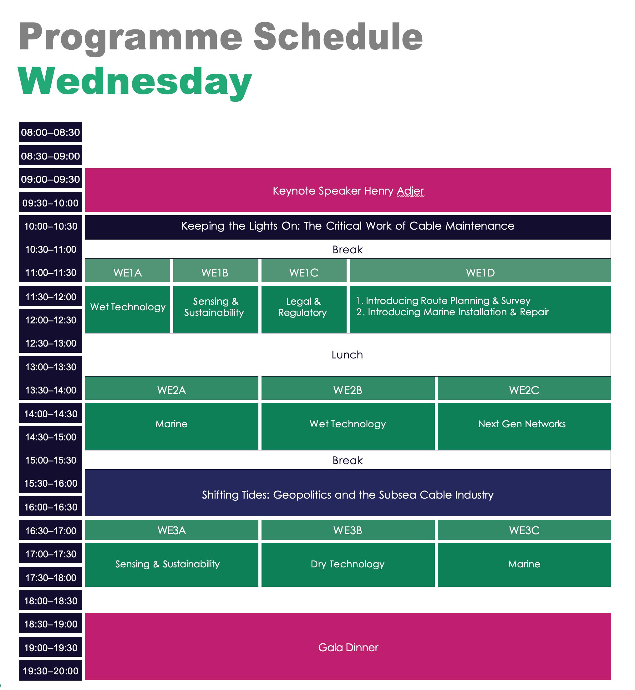

n an industry where precision matters and resilience is tested by the deepest seas, excellence is more than a virtue—it’s a necessity. SubOptic is where the global submarine cable community gathers every three years to exchange ideas, unveil new technology, and set the tone for the future. But it is also where we take a moment to recognize the people behind that progress—those individuals and teams whose work truly stands out.
The SubTel Forum Excellence in Industry Awards, returning to the stage in Lisbon this June, are the premier accolades that celebrate those contributions. These honors are not handed out casually—they are earned through rigorous peer review, extraordinary technical merit, and a shared commitment to advancing the subsea telecommunications profession. Since their inception at SubOptic 2010 in Yokohama, these awards have come to symbolize the highest level of recognition in our field.
The path to a SubTel Forum Excellence in Industry Award begins long before the SubOptic stage lights go up. Hundreds of abstracts are submitted for review, each one reflecting a different angle on the submarine cable ecosystem—optical systems, marine installation, regulatory trends, network operation, sustainability, and more.
Each abstract is reviewed by at least ten independent experts from a global panel of 80 to 100 reviewers, all coordinated by the SubOptic Programme Committee. The competition is intense, and acceptance into the program— either for oral or poster presentation—is a badge of distinction on its own.
From this competitive pool, the top-performing authors
are ultimately recognized across three categories:
• Best Oral Presentation Award – Celebrates the author of an oral presentation that demonstrates exceptional technical clarity, innovation, and depth.
• Best Poster Presentation Award – Awarded to a presenter whose visual presentation brings forward new insights, research, and practical relevance in a compelling and accessible format.
• Best Newcomer Presentation Award – Honors an emerging professional (new to the industry) whose presentation— oral or poster—reflects significant promise, originality, and impact.
Each winner receives a commemorative engraved award and certificate and is featured in the post-event issue of Submarine Telecoms Forum.
Over the years, the SubTel Forum Excellence in Industry Awards have become a time capsule of industry focus areas and a predictor of future leadership. The awardees not only represent the present—they often shape what’s next.
The list of past awardees is a rich timeline of the submarine cable industry’s evolution—one that traces the arc of both technological development and global expansion. Each year’s winners serve as bookmarks in the story of this industry. They represent both technical excellence and the spirit of discovery.
• Best Poster Presentation: Craig Donovan – “A Life Cycle Assessment Of Fibre Optic Submarine Cable Systems”
• Best Oral Presentation: Raj Mish ra, Sergey Ten, & Rita Rukosue va – “Ultra Low Loss and Large Effective Area Fiber for Next Generation Submarine Networks”
SUBOPTIC
• Best Poster Presentation: Andy Palmer-Felgate – “Marine Maintenance in the Zones – A Global Comparison of Repair Commencement Times”
Lisbon, Portugal | 2-5 June 2025
• Best Oral Presentation: Elisabeth Rivera Hartling –“Using Coherent Technology for Simple, Accurate Performance Budgeting”
What’s on the horizon?
• Best Newcomer Presentation: Nicole Starosielski – “Surfacing: A Digital Mapping of Submarine Cables”
• Best Poster Presentation: Paul Deslandes – “The Challenges Of Fibre Optic Installation In Developing Markets”
• Best Oral Presentation: Alexei Pilipetskii, Dmitri Foursa, Maxim Bolshtyansky, Georg Mohs, & Neal S. Bergano –“Optical Designs For Greater Power Efficiency”
• Best Poster Presentation: Ian Watson, Leo Foulger, David Walters, & Peter Worthington – “Evaluation And Optimisation Of Thermal Management In High Power Repeaters”
Organised by: Hosted by:
• Best Oral Presentation: Priyanth Mehta, Andrzej Borowiec, Charles Laperle, Sandra Feldman, & Michael Reimer – “Validating Emerging Transmission Technologies On Submarine Cable Systems”
• Best Newcomer Presentation: Shreya Gautam, Richard Kram, & Jonathan Liss – “Application Interfaces For The Reconfigurable Wet Plant”
• Best Poster Presentation: Kristina Shizuka Yamase Skarvang, Steinar Bjørnstad, Robin André Rørstadbotnen, Kurosh Bozorgebrahimi, Jan Kristoffer Brenne, & Dag Roar Hjelme – “Comparing Sensitivity Of State Of Polarization Monitoring And Distributed Acoustic Sensing In The Svalbard Arctic Submarine Communication Cable”
• Best Oral Presentation: Michael Clare – “What Can We Learn About Volcanic Hazards For Subsea Cables From The 2022 Hunga Tonga-Hunga Ha’apai Eruption?”
• Best Newcomer Presentation: Nancy Cai – “Price Is Right: In(ternal)vesting In Carbon Pricing For Sustainable Growth”
evolution. We expect Lisbon’s honorees to confront urgent realities head-on: sustainability, automation, scalability, security. But also, we expect creativity—solutions that surprise, approaches that challenge conventional wisdom, and voices we’ve never heard from before.
The 2025 Excellence in Industry Awards Ceremony will take place at the Closing Ceremony of SubOptic on 5 June 2025. It’s more than just a handoff of trophies. It’s an affirmation of what this industry values: collaboration, insight, and a relentless drive to do better.
Whether you’re a returning veteran or a first-time participant, join us as we recognize those who are not only part of the conversation—but helping lead it. STF


• Global Overview
• Capacity
• System Ownership
• Supplier Analysis
• System Maintenance

• Cableships
• Market Drivers and Influencers
• Special Markets
• Regional Analysis and Capacity Outlook

BY DR. NICOLE STAROSIELSKI & WAYNE NIELSEN
As the world’s digital lifeblood pulses silently across seabeds, few outside the subsea cable industry understand the full complexity—or vulnerability—of our planet’s most important communication network. The global Internet depends on over 1.4 million kilometers of undersea cable. These unseen fiber routes, often taken for granted, form the foundation of everything from international banking, through corporate cloud and AI services, to social media.
Yet even as demand for submarine cable systems surges, a persistent industry challenge lingers: the talent gap.
In response, the University of California, Berkeley, is launching the world’s first university certificate in Global Digital Infrastructure (“GDI”) —a program designed to educate a new generation of experts in the technical, geopolitical, economic, environmental, and legal dimensions
of the global internet’s physical backbone. The Certificate was initially created to extend the SubOptic Foundation’s efforts to support education of the next generation of subsea professionals. It has since expanded to encompass data centers, facilitated through a partnership with Infrastructure Masons (iMasons) and Data Center Dynamics
Submarine Telecoms Forum joins this watershed moment for the future of digital infrastructure to provide a critical missing link in student education: the provision of accessible materials that introduce students to important concepts in the subsea industry, from its origin to today. As an industry thought partner, Submarine Telecoms Forum articles and maps will be made available to GDI students and researchers. The magazine will also launch another industry first: a magazine essay contest with an opportunity for publication.
Historically, education in digital infrastructure has been fragmented—spread across engineering schools, political science departments, and law faculties. What’s been missing is a cohesive, interdisciplinary curriculum that speaks to the full spectrum of submarine cable realities.
Launching in Summer 2025, the GDI certificate will offer three online courses open to students worldwide. These classes will provide foundational knowledge of subsea cables while also introducing students to the cutting edge of infrastructure design, policy, and geopolitics. They’ll ask students to grapple with real-world tradeoffs: How does the world balance national security with open internet ideals? How are
subsea cable networks developed while respecting environmental thresholds? How is equitable global access fostered while navigating commercial and sovereign interests?
This is more than an educational milestone—it’s an inflection point. One that brings together academia, industry, and policy in a shared effort to ensure the next generation is prepared for what’s ahead.
Since 2001, Submarine Telecoms Forum has chronicled the rise, reinvention, and reimagination of the subsea cable sector. We’ve told the stories of groundbreaking projects, geopolitical flashpoints, and technological breakthroughs. But the future demands more than coverage—it demands collaboration.
The University of California, Berkeley, is launching the world’s first university certificate in Global Digital Infrastructure (“GDI”) —a program designed to educate a new generation of experts in the technical, geopolitical, economic, environmental, and legal dimensions of the global internet’s physical backbone.
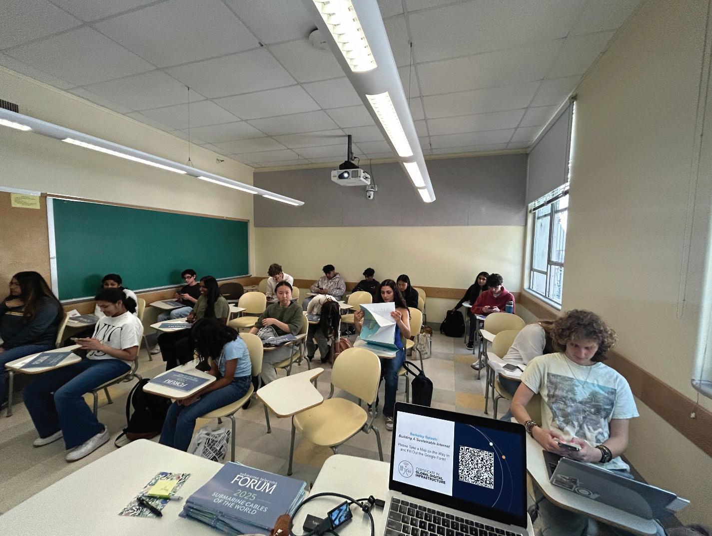
As an official industry thought partner, SubTel Forum will provide students and faculty with deep archives of industry intelligence, including:
• Access to all SubTel Forum Magazine and Industry Report issues since 2001
• Global submarine cable maps and visual tools
• Thematic editor ial assistance to align with contemporary infrastructure discourse
Most excitingly, SubTel Forum will host a dedicated student essay competition, The Big Talk, inviting students to articulate bold, multidimensional perspectives on the cable sector. Winning essays from each summer session will be published in our September 2025 “Back to School” issue—placing student thought leadership alongside global industry voices.
The program will offer hands-on opportunities for students to work directly in the sector—whether in cable planning, policy analysis, environmental compliance, or systems engineering.
The essay contest isn’t just academic fluff—it’s a platform for real-world engagement.
Students will be challenged to write 1,500–3,000-word pieces that explore the submarine cable industry’s current dynamics, future challenges, and global significance. Submissions will be judged by a joint academic-industry panel, ensuring both intellectual rigor and real-world relevance.
What’s different here is tone and purpose: The goal isn’t to regurgitate white papers. It’s to provoke, inspire, and shift perspective. Essays should tackle issues of risk, resilience, equity, innovation, and leadership. They should reflect the stakes—and the possibilities—of the infrastructure age. It’s called The Big Talk for a reason. We’re asking young writers to think big, write boldly, and take their place in the broader global dialogue about how the world connects.
Why now?
Because the industry is in flux. SubOptic 2025, set for Lisbon in early June, arrives at a moment of unprecedented tension and opportunity. Supply chains are tightening.
Regulatory regimes are evolving. The Arctic is opening. AI workloads are changing the physics of demand. National interests are colliding with global ambitions.
Amid this complexity, we don’t just need new cables—we need new minds.
The students who will pass through Berkeley’s program aren’t just future engineers or analysts. They’re the ones who will eventually draft the permitting frameworks, negotiate bilateral landing rights, design open-access networks, and lead sustainability initiatives.
To prepare them, the industry must do more than open the door—we must walk through it, sit down, and share what we’ve learned.
While the courses launch in 2025, planning is already underway for a Digital Infrastructure Internship Program beginning in 2026. Coordinated by UC Berkeley in partnership with the SubOptic Foundation, SubTel Forum, WFN Strategies, and others across the industry, the program will offer hands-on opportunities for students to work directly in the sector—whether in cable planning, policy analysis, environmental compliance, or systems engineering. Initial questions being addressed include:
• S hould internships be paid, for-credit, or both?
• W hich organizations—public, private, or NGO—are best positioned to mentor students?
• How can we ensure that internships are inclusive and accessible to students from all backgrounds and geographies?
If successful, the internship program could become a global model, helping to seed industry-ready talent at a time when competition for qualified personnel is heating up worldwide.
The vision behind this initiative is not about charity or image management—it’s about industry self-interest. Simply put, if we want an innovative, secure, and sustainable digital future, we must invest now in the people who will build it.
So we issue a challenge to the subsea sector: Be part of this.
• Offer guest lectures to these courses.
• Mentor a student.
• Host an intern.
• S ponsor essay prizes.
• Open your doors—and your minds—to the questions this generation is asking.
And if you’re a young professional or emerging scholar reading this: Know that your voice matters. The cable industry is no
longer a closed club. There is room at the table. Pull up a chair.
Perhaps the most radical idea in this partnership is also the simplest: that submarine cables are not just infrastructure— they are culture. They are the physical manifestation of our desire to reach across distance, to communicate, to trade, to learn, and to relate.
By making this industry more accessible to students from across disciplines—media studies, law, environmental science, computer science—we are expanding not just our workforce, but our worldview.
The cables we lay are only as powerful as the connections they foster. And the connections we build between generations, sectors, and regions may ultimately prove just as vital as the data we transmit.
There’s an old proverb: The best time to plant a tree was 20 years ago. The second best time is now.
This is our “now” moment.
The Global Digital Infrastructure certificate is a seed. With the right support—from this industry, from academia, from leaders across the public and private sectors—it can grow into a forest of opportunity, insight, and resilience.
Let’s make this a win not just for students, but for all of us who depend on a connected world.
The future is watching. Let’s build it—together. STF
NICOLE STAROSIELSKI is a Professor in the Department of Film and Media at the University of California, Berkeley, and one of the world’s leading researchers on the cultural and environmental dimensions of digital infrastructure.
WAYNE NIELSEN is the Publisher of Submarine Telecoms Forum and Managing Director of WFN Strategies. He has over 40 years’ experience documenting and supporting the growth of the global submarine cable industry.
What you can’t see can cost you millions
Which is why Starboard’s real-time alerts and predictive tools are essential for advanced detection of unseen: anchor damage | bottom trawling | suspicious activity request a demo


As Hexatronic Group continues its growth journey, Submarine Telecoms Forum sits down with Magnus Angermund, the newly appointed Head of Hexatronic Sweden, to discuss the company’s expanding role in the fiber industry. From offshore energy to the U.S. market, Magnus shares insights on Hexatronic’s strategic direction, commitment to innovation, and how the company stays close to its customers in a rapidly evolving landscape.

WITH NEW LEADERSHIP AT HEXATRONIC, WHAT CAN CUSTOMERS AND STAKEHOLDERS EXPECT?
Hexatronic has always been driven by a strong culture and a clear strategy, and that won’t change. Rikard Fröberg, our new Group President and CEO, shares the same values and vision that have propelled the company forward, and he is well-suited to guide us through the next phase of growth. While no major shifts are expected in the short term, we remain committed to continuous improvement, innovation, and keeping our customers at the center of everything we do.
One of Hexatronic’s strengths is our ability to grow sustainably. Over the years, we’ve made strategic investments in production capacity, strengthened our system offering, and expanded through acquisitions into new markets. Under Rikard’s leadership, we will continue along this path, ensuring that our fiber solutions, data center offerings, and
expertise in harsh environments remain best in class.
The US is a key growth area for us, and with the expansion of our fiber solutions business and the new production facility in South Carolina, we’re positioning ourselves to serve that market even better. The demand for fiber infrastructure continues to grow globally, and we are in a strong position to support this expansion while staying true to our core values of customer focus and innovation.
A LONG HISTORY
We have over three decades of experience in offshore connectivity, with more than 10,000 km of subsea fiber optic cables installed, including interconnect links and offshore wind farms. Our offshore business is an important part of what Hexatronic Sweden does. Since the late 1990s, the non-telecom offshore sector — including oil & gas and renewables — has accounted for nearly 50% of our submarine cable market. About half of this consists of standard armored cables for oil and gas solutions, while the other half involves fiber integrated with power cables, primarily for offshore wind farms and interconnect projects. While we don’t manufacture power cables ourselves, we work closely with those who do to ensure seamless fiber integration.
Looking ahead, we expect the offshore energy sector to catch up with the telecoms sector for us in the next five to ten years. We see increasing demand for subsea connectivity, particularly with the rapid expansion of offshore wind projects and interconnect networks. Many submarine power cable manufacturers are ramping up their production capacity to meet this demand. Right now, we are working on a large offshore project off the east coast of the UK and anticipate several more orders coming in from across Europe. At the same time, the telecoms market is beginning to recover after a period of slower growth due to global financial pressures. However, one challenge the industry faces is the limited availability of marine installation capacity (cable ships), which could impact deployment timelines.
While our submarine cables are a strategic part of our portfolio, Hexatronic Sweden is much more than that. We’ve been in fiber optic networks for over three decades, and we serve a wide range of markets beyond offshore connectivity. Looking at the whole of Hexatronic Group, we operate across three main business units: Fiber Solutions, Data Centers, and Harsh Environments. Fiber Solutions is our largest segment and covers everything from submarine cables to wireless and security applications. In Sweden, where we have a mature fiber-to-the-home (FTTH) market, we also play a significant role in access networks.
Beyond our products, we offer services that help customers maximize their investments. This includes training, field support, and expertise in designing and optimizing fiber networks. Our customers appreciate that we don’t just sell cables — we provide high quality end-to-end solutions that make installations faster, easier, and more cost-effective.
A big part of what makes us unique is our approach, as mentioned, we don’t just supply cables — we provide complete solutions. Our decentralised and customer-focused model allows us to understand our customers’ challenges and tailor solutions to meet their needs. That means reducing installation time, improving network reliability, and ultimately lowering the total cost of ownership.
One of our strengths is flexibility. For example, we can provide smaller subsea cable lengths and quick turnaround times, which is invaluable for customers with complex or time-sensitive projects. We also have a unique system
offering within Fiber Solutions, where we deliver the entire range of products needed to build a network — from design to installation support. This not only simplifies the process for our customers but also ensures quality and compatibility.
We’ve found that the right material and product choices can lead to significant cost savings. Even though fiber cable materials make up only about 10% of a project’s budget, wise choices in this area can have a big impact on the remaining 90% of the project costs and of course, delivery timescales too. Our expertise and support help customers make those key decisions.
The US is our single biggest growth market, and we see tremendous potential there. Our air-blown fiber solutions, including blown fiber cables like Viper and Stingray, have challenged the existing market and proven to be a game-changer for customers looking for faster and more efficient network builds.
To strengthen our presence, we are making investments in local production. Our facility in Clinton, South Carolina, will start manufacturing our industry-leading fiber optic cables in 2026. This move is about more than just scaling up — it’s about reinforcing our commitment to the US market. Customers want locally produced, Build America-Buy America (BABA) certified products, and we are delivering on that expectation.
With six production facilities across the US, we are now in a position to manufacture nearly all of the products we sell in the market. This investment not only helps us serve our customers better but also supports our long-term strategy of being a key player in the fiber infrastructure space.
We see growing interest in our solutions because they help customers reduce costs without sacrificing quality. As fiber deployment continues across North America, we’re excited to be at the forefront of that expansion, bringing innovative and efficient solutions to the market. I for one, cannot wait to see what the future holds for the Hexatronic Group. STF
MAGNUS ANGERMUND is an experienced executive and board member with a strong background in sales, marketing, and management within the fiber optics and telecommunications industries. Currently serving as Head of Deputy Head of Fiber Solutions EMEA and CEO of Hexatronic Sweden, he has been instrumental in driving business growth and market expansion since 2016. With a career spanning over two decades, Magnus has held leadership roles at EcoDataCenter, FTTH Council Europe, Enaco Sverige AB, and Fiberfront, among others. His expertise includes executive leadership, business development, and strategic marketing. He holds certifications from The Swedish Academy of Board Directors (Styrelseakademien) as a certified board member and has completed executive education programs at IFL Executive Education and IHM Business School.
BY DEREK CASSIDY

Over the last few days, the internet has exploded with people downloading the certain scenes that were originally streamed live across national and international news channels and then downloaded or streamed through ISP connections. People across the globe and even national neighbours are worried about what is next as the world seems to have been turned on its head. Old world allies and enemies seem to have revered positions and original alliances now seem to be falling apart. The internet alive with constant updates on what has changed, who said what and how does it affect the different societies, economies and nations across the globe. One man’s desire to change the running order and worry friendships has caused an increased demand in internet usage. The world is looking and listening to everything that
is happening, and this could only be possible due to submarine cable connectivity delivering national news across the globe, these last few weeks have never seen so much news consumption and with the aid of the subsea cable system this has been made possible.
However, the networks that are all common across the globe need communication connectivity to keep societies connected, see figure 1 below. These new digital enhanced networks are either upgraded to 100Gb+ backbone connectivity or in the process of being upgraded. Broadband connections across society are seen as a basic human right and many countries have either rolled out a broadband for all policy or are actively doing so, like Ireland, which the national government have given this task to a communications setup called National Broadband Ireland [NBI]
whose sole purpose is to build out an optical infrastructure enabling customer access capable of delivering download speeds of 500Mbs.
The constant flow of information and increased intrigue into what is happening has caused the internet to nearly explode. The internet, as we know it is still coming to terms with the upending of normal network deployments before the covid pandemic. With the increased use of hybrid working policies, see figure 2 below, putting pressure on the existing optical networks and with the increased access and use of the various Hyperscaler cloud platforms the integrity of submarine cable connectivity is of high importance. Making sure that their connection integrity is maintained and is of very high importance.
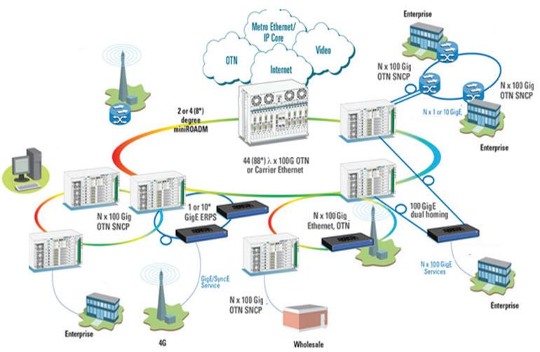
With the increased focus on submarine cable sabotage in the Baltic region, although most instances have been found to be accidental, and the deployment of NATO to protect and carry out surveillance activities under the following organisations. JEF [Joint Expeditionary Force], a UK led joint military force which includes the Baltic and Scandi-
navian states in partnership with NATO, has undertaken a programme to monitor all vessels in the Baltic region to carry out analysis on any submarine cable disturbance. The JEF partnership is primarily using artificial intelligence and mapping software to identify risks, it is not actually securing the cables, it is trying to identify and understand the risks and monitor the shipping channels to identify possible
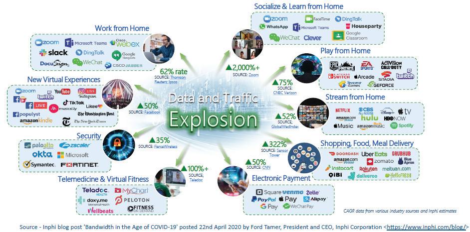
identifying factors, and vessels that may be of interest.
The European Union is also actively involved in trying to establish a common response to submarine cable security and has issued a joint communique called “Commission and the High Representative present strong actions to enhance security of submarine cables: Shaping Europe’s digital future”. Other local agreements between nations in the Baltic regions also exist but the vast majority of submarine cable breaks have been found to be accidental and not outright sabotage, although state actors are involved in this activity, it is hard to determine if they are in fact caused by this anti-society activity. However, it has to be noted that the protection of submarine cable systems is of high importance and unfortunately this is down to the submarine cable owner. It has been argued that government bodies should take a more proactive approach to monitoring and protecting these subsea cable assets, however, we have deregulated the telecommunications landscape. Before deregulation, state owned submarine cables deployed by the UK and/ or Irish Department of Post and Telegraphs or GPO, France Telecom, Deutch Telecom, Canadian Radio-Television and Telecommunications Commission (CRTC) and Bell [or AT&T] in America were responsible for international connectivity and therefore responsible for the deployment, protection, maintenance and operation of submarine cables that were connected to their respective nations. Consortiums between national state-owned telecommunication companies did undertake to build out submarine systems like the TAT, CANTAT and PTAT series of submarine cable systems that transversed the Atlantic Ocean. These systems would have had state protection as they were state owned, such
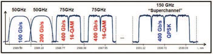
that they could have deployed national naval agencies to protect them in times of strife or national emergency, however in a normal working environment they would have only deployed their state-owned submarine cable repair vessels to repair a submarine cable. But using national and international assets like NATO, especially in the Baltic regions is seen as a joint international effort to protect the Baltic subsea cable assets from suspected sabotage and is not the norm.
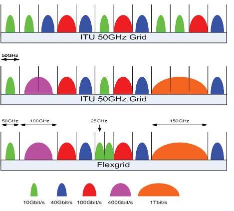
However, the old state-owned telecom or national incumbent are no longer in existence and hence since 1999 all existing submarine cables came under private ownership and new submarine cables were privately financed and owned by single or consortium parties of ownership. Since 2011 and the introduction of the Neutral Submarine Cable model this has opened the market to other telecom operators who originally did not have the finance to build their own international systems and so enabling them to lease dark fibres for international connectivity, without the headache of permits, licences and maintenance/ repair costs etc.
There have been many advancements in submarine cable design since the days of state-owned systems. New cables now look to capacity availability but are dependent on the fibre count that was possible at the time. Initially unrepeat-
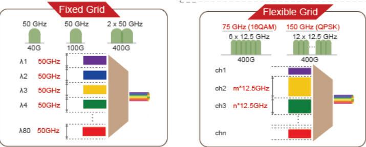
ed submarine cables had fibre counts between 12 and 48, which in 1999 was the highest available. Now unrepeated submarine cables can have up to 154 fibres such as CeltixConnect-1. Repeated cables that have regularly spaced amplifiers usually have up to 16 fibres but with new spatial division multiplexing [SDM] systems the fibre count can go up to 32 fibres and more. However, all these systems have one thing in common, providing as much capacity as possible and the means to pack as much data into every fibre pair possible. There are many optical channel grid spacing techniques in use such as fixed grid or flexgrid that enable the operators to build optical channel capacity into their systems by using these agreed grid formats within the available optical spectrum, see figures 3 and 4.
These two different methodologies use specific channel spacing or spectrum grid spacing between optical channels. Technically flexgrid allows for more capacity while using a small grid spacing while fixed grid uses a bigger grid spacing which can technically reduce capacity, see figure 5.

explosion in data across the networks and increased cloud activity, the need to have protected national and international protected networks is of vital importance. With this increased communication activity, the need to deploy diverse networks is very important. The older state-run subsea systems and some but not all newer systems, had diversity built into their network design. This idea of diversity or network data protection is a sure way to make sure that any submarine cable damage either accidental or sabotage will not disrupt communication traffic connectivity.
With the development of artificial intelligence and the
With the development of quantum networks and research being carried out between Ireland and the UK across the Rockabill submarine Cable, York University and euNetworks have shown that long distance quantum communication is possible. Although the Rockabill cable is a single submarine cable system with now mirroring diversity it is understood that the operators have built in their design a structure of agreed switching protocols with other submarine cable partners so that traffic can protection. Also, with a joint venture between telecom operators and universities in Ire-
land, the push is on to develop a working quantum communication network. This network has been deployed as a diverse ring topology network based on multiple 100Gb channel capacity across a switchable DWDM network. It was proposed in the initial designs that data protection was a priority and so diversity was built into the design model and network topology.
As with quantum computing/communications and artificial intelligence the need to have international connectivity is a must. The increased demand for Data Centres and the push to move the cable station design into the Data Centre footprint is seeing a lot of traction. The author has espoused this belief and presented on it at various submarine cable conferences. With the increasing growth of the Hyperscalers and their demand build of submarine cable infrastructure to cater for the increase in internet and AI services etc. their submarine cable designs have developed into single span systems. Although these systems are all spanning oceans and have become the dominant submarine cable deployment market, the data protection and switching mechanisms are not all that known, if they are protected at all. However, with a lot of cables in use they could easily just transfer traffic from one cable to another. This could easily be achieved between the routers, see figure 8 below. This can be achieved by costing out a network span. The cost of a link is based on the physical length, number of wavelengths, cost of installation etc. The usual link that is costed out is usually the dearest and most networks with Ethernet backbones will use least cost routing, which is what it says on the tin, using the cheapest link to carry the traffic. These links can also be setup up as link aggregation or LAG on the Ethernet routing topology to offer network and traffic diversity, which is quite common amongst telecom network operators. Although least cost routing in common in telephone traffic networks it is also used in ethernet routing as a protection mechanism. Figure 8 below is an example of two routers using the link aggregation protection scheme two enable it to switch traffic when one of the cable routes fail. By using the route costings added to the LAG protection scheme will allow for the best route to be used when both optical fibre routes are available. However, routers would technically not be directly connected to a submarine cable except through submarine line termination equipment [SLTE], but it is an example of the diversity or application protection.
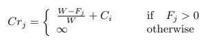
Where the following occurs

1. Ci is the cost of link j
2. Cri cost of link j with reference to the above formula
3. Fj is the number of wavelengths on link j
4. Bj is the number of backup wavelengths
Diversity or network protection, not DEI as has been prominent in the news lately, is a very important part of any telecom network. Over the last 25 years there have been submarine cable deployments that have no diverse links. Cable systems with only one connection between cable stations. Why is this so, is it down to the project budget not allowing a second diverse cable, is it intentional cable system design, or an over reliance on subsea cable routing, burial and deployment techniques, or relying on cable armouring for the protection. As we can see below the different armouring types of cable armouring from lightweight [no armouring] to rock armouring. The different types offer protection to the cable with respect to surrounding seabed
conditions.
However, relying on the cable design, routing or seabed burial techniques does lead to a false sense of security and perfect examples can be seen when one of the newer trans-Atlantic cables takes a hit, they lose the traffic across that cable. Same goes for the trans-Pacific and trans-Indian submarine cables. They are single leg systems that rely of submarine cable design and technology to enable their protection. Aggressive acts or accidental damage from fishing, anchors etc do not discriminate between submarine cables, if the anchor or trawl door manages to come into contact with the cable it will damage it. Having a diverse leg will help the traffic to switch.
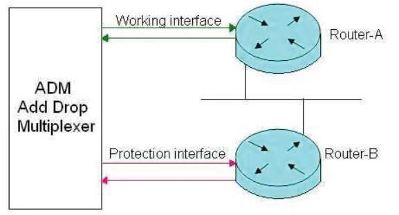
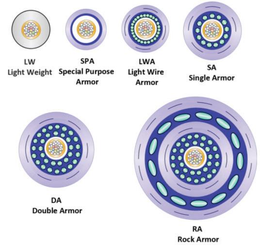
But this is not to say that most new systems are not diverse, a lot are but it still has to be acknowledged that diversity in the network does offer protection. Perfect examples are the recent submarine cable damage reports from the Baltic region where cables have been cut, albeit accidentally but some see as sabotage by a state actor. But these systems that failed also had no diversity and so internet and communication connectivity was lost, with a protected diverse network topology connectivity for these systems, it would have ensured that communication traffic was stable, enabling the repair process to get under way, without all the fanfare and finger pointing.
Examples of diverse cable systems, in my part of the world, would include the EXA trans-Atlantic cable system, Aqua Comms Irish Systems, Esat-1/2, Sirius North/South, Apollo, etc., see figure 10 of Apollo diverse network. Diversity, as already said, is an important part of any network so that traffic can carry a premium when sold to customers as they would always want that protection for their interna-
tional traffic portfolio. These are just examples of systems that employ diversity that protects the traffic in times of disruption. For example, the original TAT-1 and TAT-2 systems etc. were made up of two cables but not technically diverse as these submarine cable projects being the early long distance COAX submarine cables needed a second cable for transmit/ receive capability for voice. However, TAT-9, TAT 12/13 and TAT-14, being optical submarine cables, were diverse systems with the capability to switch traffic when required between each cable. These systems would use the terrestrial system or cable station SLTE, see figure 11, as the network switching scheme. Another switching mechanism is application aware switching. This uses the existing switching protocols and uses the best option per application being used. It has been used in DWDM switching schemes. However, some systems have both cables coming into the same cable station, but this may be down to project design or some political, budgetary or geographical design or limitations. But this is not very common and may be down to some limitation that the original design plan could not engineer out or could work with to deliver a diverse network. But it should be said that diversity in networks is a good
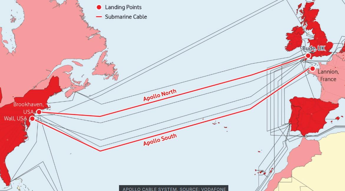
thing as it does offer good traffic protection. However, submarine cable route diversity by sharing traffic across multiple networks for traffic diversity, as something Seafibre Networks offered in the past across their neutral cable CeltixConnect
As we have seen there is a huge push towards artificial intelligence [AI] and a lot of the high-tech companies across the globe, such as Nvidia, Broadcom, Samsung, AMD, Intel and Qualcomm, to name a few have shifted production to AI chips due to the demand in AI networks and AI enabled Data Centres. The latter being one of the main drivers behind there being an increased number of Hyperscaler built submarine networks. AI is also seen as a huge driver in the new focus on US technical infrastructure with billions of dollars being spent on networks, Data Centres and manufacturing facilities and these are being touted as quick wins as major chip
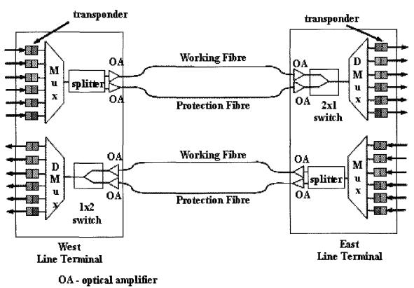
manufacturing firms invest billions of dollars in US to build new Data Centres and AI chip manufacturing facilities. It is evident that the increased demand for AI services that
the need for submarine cables with high capacity is a huge requirement. As can be seen in figure 13 below the development of submarine cables with next generation technologies such as spatial division multiplexing [SDM] and intelligent branching units [iBU] have been deployed over the last couple of years and being planned to carry this traffic internationally.
With the increased use of SDM and iBUs the submarine cable design can increase capacity and reroute traffic as per the demand etc as seen in figure 14 which gives a pictorial overview of the SDM cable in use. By using SDM, iBU technologies with proper route design, burial and of course proper cable armouring, submarine cables can have some sort of protection, however route protection should also be considered.
But with all these submarine cables and networks there is still one major driver that needs to be written into their designs and its diversity. However, as technology advances there is some protection built into the submarine cable design, pump farming, being a part of SDM architecture is a protection method for amplifier failure and cable armouring as per the surrounding environment.
As we can see from the table below the differences between non-SDM and SDM capable submarine cables. The one glaring difference is the available fibre count.
As the world communication technologies enter a new phase of AI and quantum driven systems, submarine cable deployments will play a huge part in their deployment and protection schemes across diverse networks are a priority.
Notwithstanding that diversity is a very important part of the network design, some national governments along with

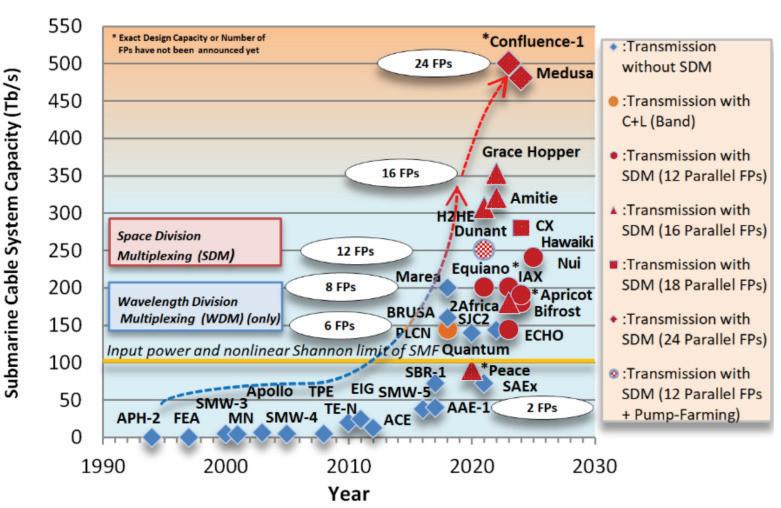
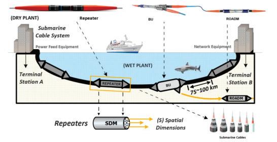
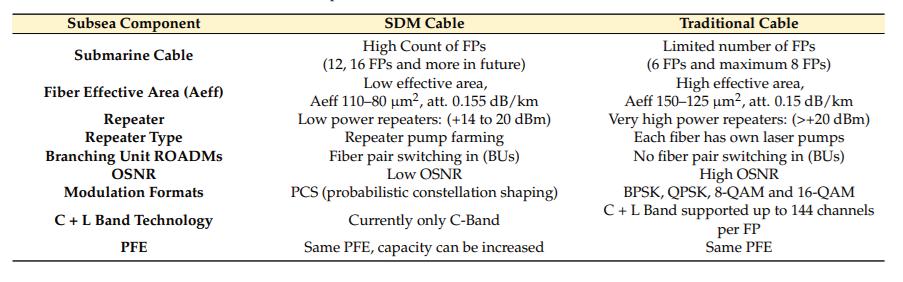
Table 1: Comparison between SDM and traditional submarine cables
https://innovationnewsnetwork.com/the-advancement-of-quantum-technology-in-ireland
the European Union have launched programmes to establish agreed protocols around the protection and security of submarine cables. So, it is early days yet when we talk about international protectional agreements for submarine cable systems, but until then, network operators will have to rely on their submarine cable design and monitoring systems. STF
DEREK CASSIDY is doing a part-time PhD in the field of Optical Engineering which covers Photopolymers, Self-Written Waveguides, and Wavelength manipulation/Opto-Electronics with UCD under Prof. John Healy and Prof. John Sheridan. He is a Chartered Engineer with the IET/UK Engineering Council-Engineers Ireland and Past-Chair and Committee Member of IET Ireland. He is Chair of the Irish Communications Research Group, Advisory Board Member of Submarine Networks EMEA/World and member of numerous standards committees on Optical Engineering under the umbrella of the IEEE and Future Networks. He is also currently researching the Communication History of Ireland. He is a member of SPIE, OPTICA, IET, IEEE, Engineers Ireland, ACMA, ICPC and ESCA. He holds patents in Mechanical and Design Engineering and author of over 30+ papers on Photonics, Submarine Cable Technology, Communications and Optical Engineering. He has been working in the telecommunications industry for over 30 years managing submarine networks and technical lead on optical projects, both nationally and internationally with BT. He is technical Lead for Valentia Transatlantic Cable Foundation and the Valentia Island World Heritage Bid. Derek holds the following Degrees: BSc (Physics/Optical Engineering), BSc (Engineering Design), BEng (Structural/Mechanical Engineering), MEng (Technology & Policy Development and Forensic Engineering), MSc (Optical Engineering) and Higher Diploma in Cybersecurity.
REFERENCES
https://nbi.ie
The Joint Expeditionary Force: https://jetnations.org https://digital-strategy.ec.europa.eu/en/news/commission-and-the-high-representativepresent-strong-actions-to-enhance-security-of-submarinecables https://aicgs.org/wp-content/uploads/2011/11/telecon.pdf https://en.wikipedia.org/wiki/Transatlantic-communications-cable
CeltixConnect-Sea Fibre Networks https://seafibrenetworks.com
“First time test of UK/Ireland quantum communication using underwater cable”, University of York, 2023.: https://york.ac.uk/news/research/quantum-communicatoionsunderwater-cable
Guijarro, Manuel; Ruben Gaspar; et al., "Experience and Lessons learnt from running High Availability Databases on Network Attached Storage" (Journal of Physics: Conference Series. Conference Series. 119 (4). IOP Publishing: 042015. Bibcode:2008JPhCS.119d2015G. doi:10.1088/1742-6596/119/4/042015, (2008).
Paximadis, K.; Uzunidis, D.; Tomkos, I. Toward SDM-Based Submarine Optical Networks: A Review of Their Evolution and Upcoming Trends. Telecom 2022, 3, 234–280. https://doi. org/ 10.3390/telecom3020015
Chart: Baltic Sea Cable Incidents Pile Up | Statista: https://statista.com/subsea-cabledamage-baltic-charts
https://submarinenetworks.com/en.systems/trans-atlantic/apollo
Drid,H., Cousin,B., Ghani, N., “Application-aware protection in DWDM optical networks”, WOCC, IEEE, (2011).
seafibre.createsend1.com/t/ViewEmail/j/53C36D914D033490: https://seafibrenetworks. com
https://reuters.com/technology
N/A, "Multidirectional Submarine Optical Branching Unit", Technical Disclosure Commons, (June 24, 2020) https://www.tdcommons.org/dpubs_series/3362
Paximadis, K.; Uzunidis, D.; Tomkos, I. Toward SDM-Based Submarine Optical Networks: A Review of Their Evolution and Upcoming Trends. Telecom 2022, 3, 234–280. https://doi. org/ 10.3390/telecom3020015
https://www.researchgate.net/publication/350927897
Paximadis, K.; Uzunidis, D.; Tomkos, I. Toward SDM-Based Submarine Optical Networks: A Review of Their Evolution and Upcoming Trends. Telecom 2022, 3, 234–280. https://doi. org/ 10.3390/telecom3020015
EU paper on submarine cable resilience 2024.pdf
VIGIMARE – Vigilant Maritime Surveillance of Critical Submarine Infrastructure: https://vigimare.com
Cassidy, D., “How can we secure or protect a submarine cable or is it down to network and component monitoring only?”, Subtel Forum, (2025).
Deploying a submarine cable system?
Your success depends on the right team.
At WFN Strategies, we provide access to over 150 highly qualified client representatives across 25+ countries—each pre-vetted, field-proven, and supported by our industry-leading Contractor Care Program.
From technical oversight to compliance management, our experts ensure your project stays on time, on budget, and on course.
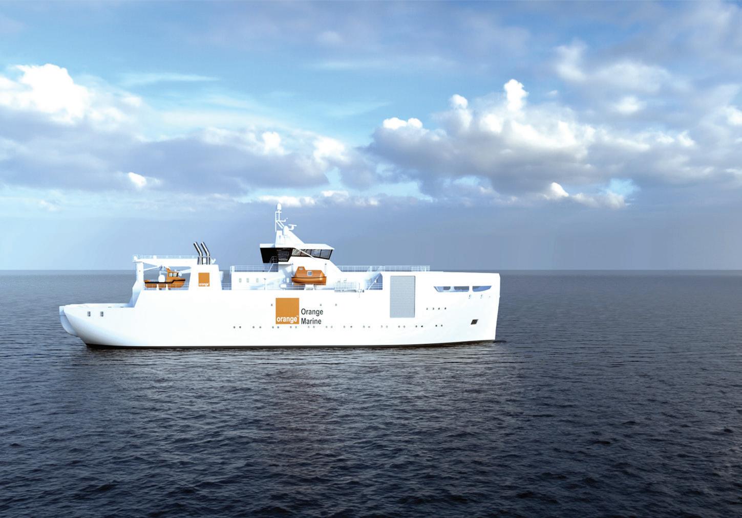
Ensure your next project has the right people in place. Contact

www.wfnstrategies.com
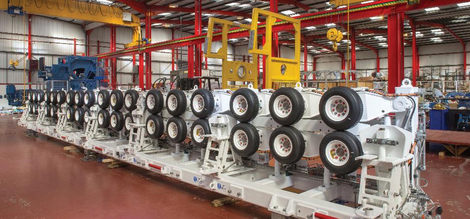
Parkburn has been at the forefront of the development of marine Telecoms cable lay and repair mission equipment since the late 1960s. The company’s pivotal role began when the British Post Office sought its expertise to design and manufacture a fast, safe, and efficient system for deploying and recovering subsea telephone communication cables, including large modules (repeater nodes). Both the Linear Cable Engine (LCE) and Capstan Drum Engine (CDE) technologies have since become industry standards.
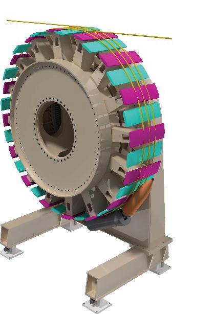
THE SELF-FLEETING CAPSTAN DRUM ENGINE (SFCDE)
Since 2012, Parkburn has been developing a self-fleeting cable drum concept that creates a natural helix for the cable as the drum rotates. The rationale behind this development was to
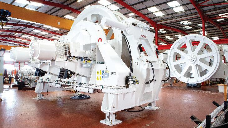
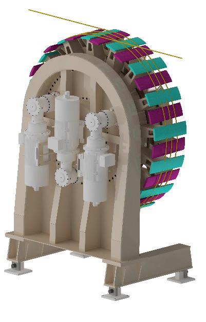
Design Element
improve the system design, allowing the cable to form a simple natural helix on the drum surface without the need for any form of external or internal mechanical assistance to push the cable into the required position across the drum face, therefore removing any possibility of friction induced cable damage or operator error.
Past Parkburn “industry standard” designs were based on a simple capstan drum, using fleeting knives and fleeting rings
Specification
OD (Ø) of Drum Ø4,600 mm
Width of Drum 1,300 mm
Natural Winch Helix (Rope Pitch) 188 mm
Number of Wraps 3
Line Speed
Drum
Safe Working Load (SWL)
8 knots (247 m/min)
(Example)
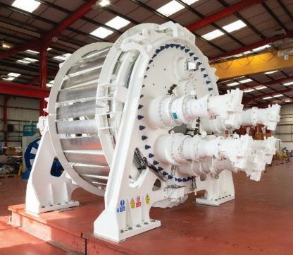
to control the position of the cable on the drum face. While this technology has and continues to prove exceptionally robust and reliable, the SFCDE removes the need for fleeting rings and knives & combined with a significant reduction of required services and moving parts, reduces weight, minimises operations manpower, lowers maintenance costs and reduces the required deck space.
The initial development targeted a general-purpose winch for use with synthetic fibre rope. The self-fleeting drum offers many advantages over current winch technologies, including conventional drum and capstan devices, by providing a progressive de-tensioning profile across the full wraps on the drum, minimising rope slip and fatigue. The self-fleeting capability removes the need for spooling devices at high loads, which are a common source of fatigue.
An initial 75t prototype proof-of-concept unit was designed and built, followed by a 150t production unit, which has been qualified by DNV. This unit was selected by MacGregor Cranes as the engine for their new FibreTrac crane, installed with 3,500m of rope; the world’s first fully DNV certified deep-water fibre rope crane.
The combination of lightweight synthetic rope and the capstan brings to market the first crane capable of delivering its full deck payload to maximum depth, limited only by the length of the fibre rope. The crane has been fully operational for the past two years, working for a major offshore contractor in the Gulf of Mexico, operating at depths to 3,000m.
A second, deck-based capstan drum engine system, capable of operating at depths to 6,000m, has also now been in operation for two years. Both systems have received excellent feedback from the end-users.
Over the past two years, Parkburn has tested a wide variety of telecommunications cable setups on the 75t prototype system in conjunction with clients, to ensure the system can handle the many combinations of fibre optic cables, repeater nodes, and connection hardware seen within the industry. Parkburn has now progressed from concept to completion of detailed design of a dedicated cable lay system, providing an open-sided device
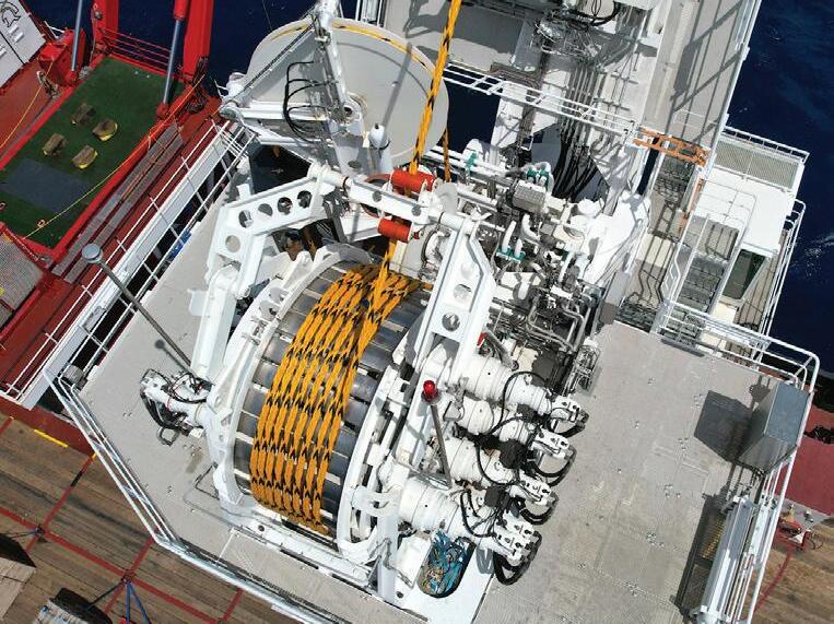
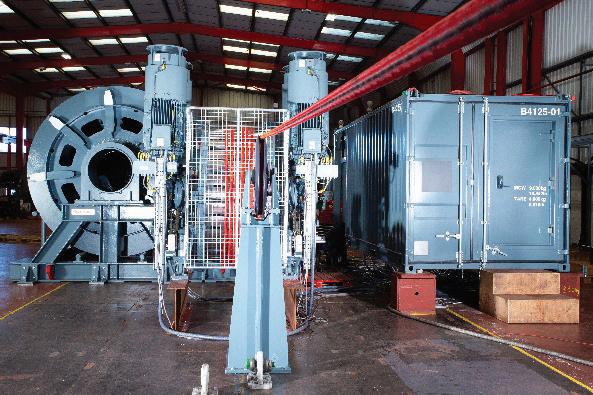
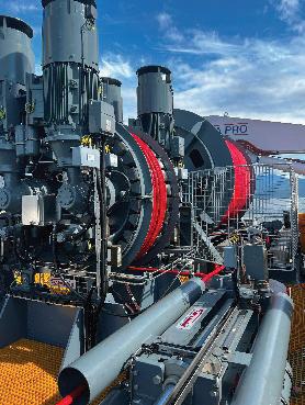
allowing the drum engine to be inserted into a laid spread at any point during operations for recovery and maintenance purposes.
By automating the fleeting process, the Parkburn cable drum engine minimises the need for manual handling, reducing the risk of accidents and injuries. This is particularly important in hazardous environments where safety is a top priority.
The latest self-fleeting cable drum engine represents a significant advancement in cable management technology. Its innovative proven design, simple control systems, and robust construction make it an ideal solution for a range of industries. By automating the fleeting process and providing progressive de-tensioning, the engine enhances operational efficiency, safety, and cable longevity, setting a new standard in the field of cable management. As technology continues to evolve, Parkburn remains at the forefront, delivering cutting-edge solutions to meet the demands of modern industry. STF
ROB CASH is Sales Manager and Site Manager at Parkburn’s Telford facility, with over 30 years of experience in submarine cable handling and marine deployment systems. Apprentice-trained at Dowty Boulton Paul, he advanced through roles in military and commercial aerospace before joining Dowty Precision Handling Systems in 1994. Following Parkburn’s acquisition in 2002, he became Business Development Manager. Rob was part of the team that delivered the world’s first all-electric cable handling system in 1999 and continues to lead innovation with Parkburn’s Self-Fleeting Capstan Drum Engine—a revolutionary, lowrisk solution for cable deployment and retrieval.
BY STUART BARNES
With another SubOptic looming on the horizon I reflect on my nearly 45 years in the industry and how rewarding it has been for me, my colleagues and the competition. Yes, I said it, the competition. As ASN’s Jean Devos once described it, the nature of our business is “coopetition”, and I cannot find a better way of describing an industry that has at times come together when confronting near existential challenges; extreme weather, Hydrogen, shark bite, geo-political threats past and present to name a few. It’s only now that I realise that I have had a ring side seat for the greatest optical show!
Towards the end of my PhD I got a call from STL, Harlow, asking if I would be interested in working with them. I was at the time completely ignorant of the importance of this quite small laboratory (< 500 people when I arrived). After a brief fireside chat, I was off and still oblivious to the stellar presence of Alec Reeves, Charles Kao and George Hockham on site. Alec whose work on Pulse Code Modulation (forerunner of digital) and Kao and Hockham inventors of fibre optic communications (for which Kao later received the Nobel Prize). STL was not a large firm, and I was thrown in at the deep end from day one. The industry was just transitioning from the last analogue systems into optical ones. This gave me the opportunity to spend time at the Southampton factory marveling at the sheer size of the facility, ignorant of the fact that I would be the technical manager there nearly a decade later. I was also unaware that the groundwork of Kao and Hockham would burgeon into a tsunami of effort in the UK and the rest of the world, as the potential benefits of their work rapidly caught the attention of technologists and governments.
My first few months in Harlow were in reality quite quiet, as I got used to working life during the day and writing up my PhD in the evenings and weekends. But I was hooked by the buzz around the site as it was rapidly becoming apparent that optical fibre communications was going to be the next big thing. Things changed up a gear when I moved across to the repeater group, under the leadership of Duncan Gunn. Here I should give a special mention to my “cellmate” John Crownshaw. You may not know the name, but many of you worldwide will have heard of his invention, the Crownshaw Clamp, as it was known internally. Up until this moment in time cables were terminated at joints, and repeaters were terminated in a crude manner. Now his wedge shaped termination is universally used. My other colleague was John Fothergill, who became Vice Chancellor at Leicester University later in life, such was the talent at STL!
My modest contribution to the repeater at that time was the formulation of Silver Zeolites, the hydrogen scavenger now in most sea cases. In addition to this I carried out the majority of the work on hydrogen at STL and within the broader STC businesses. For those of you who take today’s fibre for granted, hydrogen effects on early fibre and its potentially damaging effect on electronic circuits and electronic components presented near existential threats to fibre optics before it got really started. Why, because all the
optical cables strung alongside overhead electrical cables were failing on a daily basis. Again, there was a massive worldwide clamor to understand the problem, more coopetition, and a twofold solution. Less phosphorus doping (= reduced hydroxyl generation) and a choice of cable materials to minimize interstitial hydrogen. So those senior managers who were seeing this as the death of optics went back to their ivory towers and let us get on with developing cables and repeaters in peace. At least until sharks started biting cables that is! I have my own personal view on why sharks started attacking cables that differed from the public explanation, but the solution was both easy to realise (as it was used on all analogue cables) and has worked!
So onwards and more or less upwards. I moved on to take over a group developing several hydrospace cables, including replacing STC’s first generation commercial submarine optical cable, which in all truth was a bit of a dog. With the rest of the mechanical and electrical aspects of the cable sorted in the first iteration by Peter Worthington and John Russell, the team were able to come up with a compact multifiber core, which went on to be deployed in 200,000km of NL Cable as it was known.. After that success, I left submarine for a couple of years to head up STC’s optical and fibre development group. And then back again to submarine, firstly heading up the cable activity in Southampton and then on to Greenwich as Technical Director following the Alcatel acquisition from the rapidly collapsing Nortel. Returning to the theme of coopetition, one of the best pieces of work we undertook was the analysis of a vast database of cable faults to draft new plough burial guidelines. This involved my team in Southampton, Peter Mole’s team in Cable & Wireless and Seymour Shapiro’s in AT&T’s Bell Labs. We also defused a delicate issue thrown at us by BT regarding polarization mode dispersion. We did some really crazy stuff at times, stringing fibre out along the factory on Xmas day to measure the actual polarization mode dispersion (PMD). We also laid a kilometre of cable out at the demobilized US military base at Greenham Common to carryout real cable measurements to compare and contrast different fibre types. Their PMD was different in storage tanks!! Again, Peter Worthington was the hero of the day.
And onto the historic site of Greenwich. Famous for its links to telegraph cable manufacturing and the house of Samuel Enderby, whaling captain. Enderbyland, a vast tract of land in the Arctic was named after his grandson Charles Enderby. Here I was re-acquainted with the repeater and was pleased to oversee the manufacture of STC’s very first optically amplified repeaters (1R), as opposed to the previous
3R technology, wherein the signal was retimed, reshaped and regenerated. This was carried out as the Alcatel handover process was underway. And as part of this I was to move on yet again, this time to Paris as Assistant Technical Director of Optical Research, firstly under Jean Jerphagnon. Sadly deceased, a great man. The new person at the helm stepping into Jean’s big shoes was Marko Erman, who is now CTO of Thales.
Just when things were going swimmingly the death of my father, coupled with the invalidity of my mother, drew me home to the UK. After several months I was approached by another ex-submariner, Chris Lilly, and along with some bright sparks from Essex University we founded ilotron, an optical switching venture. Unfortunately, the telecom melt-down put paid to the initiative. So, with no money, no car and a worried family, I was very grateful to Atlas Venture for offering me a role as Entrepreneur in Residence, alongside my friend Scott White, a serial entrepreneur, who has gone on to achieve even greater things at Pragmatiq. Herer, we realized that there was an opportunity to upgrade single channel optical amplified links. Why the mainstream suppliers refused to plug the gap bamboozles me to this day, but they did, and Azea Networks was born! Even though we did pretty well, with decent sales money, supply was difficult and so we carried out a private-private merger with Xtera Communications. With a better financial climate, I was able to persuade the Xtera Board to build underwater plant for long haul systems alongside their undoubted strength in boosters for both aerial and unrepeatered submarine links. There were only a handful of people involved (Messrs. Winterburn, Powell, Webb, Ellison, Pelouch and Van Lochem being the main players) and with just a couple of million dollars we were able to progress to the sea trial phase. The benefits of experience and imagination!
It was not plain sailing though and despite good sales of the new long haul submarine product, elsewhere the business was flat and following a disappointing public launch on Nasdaq I was able to effect a Management Buy Out with my friend and current CEO Keith Henderson. Keith was someone I had known for 30 years from our time in Southampton, and we worked together at STC, ilotron and Azea prior to Xtera
So what lessons were learnt?
First and foremost you don’t need a lot of people to do great things. STL taught me this. When STC was picked up by Nortel STL grew like mad and though there were pockets of brilliance, particularly in Coherent Technolo-
gies, it became bloated and bureaucratic. What you need is smart, driven people, and the minimal amount of management - which doesn’t mean cutting corners.
My career weaved in and out of submarine. I enjoyed the ‘in’ bit more than the ‘out’ bit! This is a great industry and those in Lisbon should be grateful that their career paths headed in our direction. Finally, the industry, I guess because of its size compared to other great industries such as aeronautics, pharmaceuticals etc., has had a great capacity to come together to solve issues, particularly those near existential ones in the early years. I have been wracking my brain as to why this has happened. The only conclusion I can come up with is that the end customers, initially the PTT’s, and now the ISP’s, step in when anything threatening crops up and drive solutions for the common good. Thoughts on a postcard.
Footnote: STL Harlow disappeared after Nortel floundered on the rocks. The birthplace of fibre optics is celebrated on a small plaque on an adjacent roundabout. The cable factories in Newport and Southampton were flattened. The latter was initially used for housing scrap metal destined to be repurposed overseas. It is now an extension of the Cruise Line terminal. Part of Greenwich has been sold off. Thankfully Enderby House survived. STF

STUART BARNES was born in Worksop, England. He attended Retford Grammar School, Nottinghamshire, and went on to read Engineering at Queen Mary College, London. On completing his PhD at the same institution, he joined Standard Telecommunication Laboratories (STL) in Harlow in 1978. He held a number of senior research posts at STL prior to becoming technical manager of STC Telecommunication Cable in Newport, Gwent. After that, he became deputy technical director of STC Submarine Systems (now a part of Nortel), based in Southampton, becoming technical director in 1993, where he was based at the Greenwich facility. Following the acquisition by Alcatel of the submarine business, he moved back into research, becoming deputy technical director of Alcatel Recherche based in Marcoussis, France. After three years in France, he returned to the UK and founded ilotron, a privately funded optical switching start-up based on the Essex University campus in Colchester. ilotron foundered in the post bubble meltdown, and he went on to become an entrepreneur in residence at Atlas Venture, a $5 billion-funded tier one venture capital fund. At Atlas, he cofounded Az.ea Networks in 2001 (where he is CTO) along with Scott White (previously of Atmosphere Networks), Steve Webb, and Dave Winterburn. Azea Networks has received about $50 million in venture funding to date and makes transmission equipment for upgrading submarine transmission links. He is a visiting professor of electrical engineering at Southampton University and supports the industrial advisory initiatives of the School of Electronics and Computer Science. He also works closely with the School of Electronic Engineering at Aston University. He lives in London and Salisbury with his long-suffering wife and three children. In his spare time, he plays golf badly and supports Southampton FC.















BY JOEL OGREN
As we gather at SubOptic 2025 in Lisbon, a pivotal moment for the submarine cable industry, we stand at the crossroads of unprecedented digital demand and rapid technological evolution. Submarine fiber optic cables, the arteries of global connectivity, have undergone a remarkable transformation over the past decade. Yet, the future beckons with even greater challenges and opportunities.
As the CEO of Assured Communications, I am sharing my perspective on the evolution of global submarine cable capacity, the capacity demands anticipated by 2030, and the profound implications for cable manufacturers, data centers, hyperscalers, and network suppliers. This thought piece aims to spark dialogue and collaboration to ensure our industry continues powering the digital economy sustainably and resiliently.
Ten years ago, in 2015, the global submarine cable network was already a marvel of engineering, carrying over 97% of international internet traffic across nearly 1 million
kilometers of cable. The total global capacity of these systems was estimated at 100–150 terabits per second (Tbps), driven by cables like the Trans-Atlantic MAREA (initially designed for 160 Tbps) and the Asia-Pacific Unity cable (7.68 Tbps). These systems leveraged early coherent transmission technologies and dense wavelength-division multiplexing (DWDM) to maximize data throughput per fiber pair. However, the industry faced a lull in deployments post the early 2000s dotcom bubble, with investments focused on optimizing existing infrastructure rather than laying new cables.
Fast forward to 2025, and the landscape has transformed dramatically. According to TeleGeography, the global submarine cable network now spans over 1.5 million kilometers with more than 550 active or planned cables. Total global capacity has surged to an estimated 2,500–3,000 Tbps, a 20-fold increase in a decade. This leap is attributed to several factors:
• Technological Advancements: Innovations like Space-Division Multiplexing (SDM), multi-core fiber (MCF), and advanced coherent transponders have pushed perfiber-pair capacities from tens of Tbps to over 250 Tbps
on systems like Google’s Dunant cable. For instance, Ciena’s WaveLogic 6 Extreme technology enables 1 Tbps per channel over transpacific distances, reducing cost and energy per bit.
• Hyperscaler Dominance: Hyperscalers— Google, Amazon, Meta, and Microsoft—now drive nearly two-thirds of cable investments, owning or co-owning 59 international cables, up from 20 in 2017. Projects like Google’s Firmina (US to Argentina) and Meta’s planned 40,000-km global cable system exemplify this shift from traditional telecom consortia to hyperscaler-led deployments.
• Geographic Diversification: New cables have targeted high-growth regions, particularly Asia-Pacific (40% of global bandwidth demand) and Africa-Europe routes. Systems like EllaLink (Portugal to Brazil) and the East Micronesia Cable System have enhanced connectivity to underserved markets, reducing latency and boosting redundancy.
• Sustainability Focus: The industry has embraced sustainable practices, with initiatives like the Sub-Optic Foundation’s Sustainable Subsea Networks project promoting energy-efficient designs and lifecycle assessments.
• Edge Computing and 5G/6G: The proliferation of IoT devices and next-generation mobile networks will demand low-latency, high-bandwidth connections, especially in emerging markets.
• Digital Inclusion: Connecting the next billion internet users, particularly in Africa, South Asia, and Latin America, will require new cables and landing stations in underserved regions.
• Geopolitical Resilience: Rising concerns over cable sabotage (e.g., the 2022 Svalbard cable incident) and geopolitical tensions in areas like the South China Sea are pushing investments in route diversity, such as the Great Southern Route connecting Quad countries.
According to TeleGeography, the global submarine cable network now spans over 1.5 million kilometers with more than 550 active or planned cables. Total global capacity has surged to an estimated 2,500–3,000 Tbps, a 20-fold increase in a decade.
This capacity boom has been fueled by a 30% annual increase in global internet usage from 2017–2021, driven by streaming, cloud computing, and 5G adoption. However, as we look to 2030, the question is not whether we can sustain this growth, but whether we can scale fast enough to meet exponentially rising demand.
By 2030, global data consumption is projected to exceed 900 exabytes per month, more than tripling from 2025 levels, according to the Ericsson Mobility Report. This surge will be driven by:
• Artificial Intelligence (AI): AI workloads, particularly generative AI and machine learning, require massive data transfers between hyperscale data centers and edge inference nodes. Equinix estimates AI-driven traffic will necessitate cables with capacities in the petabit range.
To meet these demands, I estimate that global submarine cable capacity must reach 10,000–15,000 Tbps by 2030—a 4–5-fold increase from today. This projection aligns with Analysys Mason’s forecast of $9.8 billion in market growth by 2029, with trans-Pacific and intra-Asia-Pacific routes leading in cable length. Achieving this will require cables with individual capacities exceeding 500 Tbps, such as the planned Taiwan–Philippines–US cable using MCF technology.
The gap between current capacity and 2030 requirements poses both challenges and opportunities for key industry players. Below, I outline the implications for cable manufacturers, data centers, hyperscalers, and network suppliers, along with strategic recommendations.
Challenge: The demand for higher-capacity cables requires manufacturers like Alcatel Submarine Networks (ASN), NEC Corporation, and SubCom to push beyond current technologies. Multi-core fibers, which increase the number of cores within a single fiber, and SDM, which adds more fiber pairs per cable, are promising but complex to produce at scale. Additionally, geopolitical restrictions, such as U.S. sanctions on China’s HMN Technologies, are reshaping the competitive landscape, favoring Western manufacturers but increasing costs.
Opportunity: Manufacturers can capitalize on the $11
billion in planned cable investments from 2024–2026, particularly for hyperscaler-led projects. Sustainability is also a differentiator—cables designed with lower energy consumption and recyclable materials align with SubOptic’s sustainability goals and attract environmentally conscious clients.
Recommendations:
• Invest in R&D: Accelerate development of MCF and SDM technologies to achieve petabit-scale capacities. Collaborate with hyperscalers like Google and NEC, as seen in the Taiwan–Philippines–US project.
• Enhance Resilience: Design cables with advanced cladding and fault-tolerant systems to withstand natural hazards and sabotage, reducing repair costs (estimated at $1–3 million per incident).
• Scale Production: Expand manufacturing facilities in strategic regions like the U.S. and Europe to meet demand and navigate geopolitical constraints.
cable landing stations, particularly in Asia-Pacific and Africa, to reduce latency and attract hyperscaler tenants.
• Sustainability Focus: Adopt energy-efficient cooling and renewable energy sources to align with hyperscaler sustainability mandates, as demonstrated by Microsoft’s lifecycle assessments.
• Partnerships: Collaborate with cable operators to co-develop landing stations, ensuring seamless integration with submarine networks.
Challenge: Hyperscalers are now the primary investors in submarine cables, accounting for nearly a quarter of systems operationally deployed between 2019–2023. However, their dominance raises concerns about market consolidation, particularly in Europe, where initiatives like Gaia-X have struggled to compete. Additionally, hyperscalers face pressure to balance cost control with resilience, as cable disruptions (e.g., Red Sea cable repairs lasting eight weeks) can impact service delivery.
Moody’s Ratings predicts a 20% annual increase in data center capacity post-2028, but overbuilding risks loom if submarine cable infrastructure lags.
Challenge: Data centers, particularly hyperscale facilities, are the nerve centers of digital traffic, but their growth is constrained by connectivity bottlenecks. Moody’s Ratings predicts a 20% annual increase in data center capacity post-2028, but overbuilding risks loom if submarine cable infrastructure lags. Latency-sensitive AI workloads require direct access to high-capacity cables, as seen with Equinix’s MI1 Miami data center hosting the 648 Tbps TAM-1 cable.
Opportunity: Carrier-neutral colocation providers like Digital Realty can leverage their proximity to cable landing stations to offer low-latency cloud on-ramps and edge AI platforms. Data centers in emerging markets like Jakarta, Darwin and Johannesburg are well-positioned to tap into regional cable expansions.
Recommendations:
• Strategic Siting: Build or expand data centers near new
Opportunity: Hyperscalers can lead innovation by funding private cables with cutting-edge technologies, like Google’s 350 Tbps Grace Hopper cable. Their ability to partner across projects (e.g., Meta and Amazon on the HAVFRUE cable) enables cost-sharing and route diversification.
Recommendations:
• Diversify Routes: Invest in alternative routes, such as bypassing the Red Sea via terrestrial Middle East fibers or the Horn of Africa, to enhance resilience.
• Drive Innovation: Partner with manufacturers to pilot MCF and SDM cables, reducing cost per bit and enabling petabit-scale systems.
• Engage Regulators: Work with bodies like the International Cable Protection Committee (ICPC) to streamline permitting and advocate for international protections against sabotage.
Challenge: Network suppliers, including SLTE providers like Ciena and Nokia, must keep pace with the Shannon Limit, the theoretical maximum for data transmission over fiber. Upgrading existing cables with advanced transponders is approaching physical and economic limits, pushing suppliers to innovate wet plant technologies (e.g., optical repeaters and branching units). High capital costs and long project timelines also strain smaller suppliers.
Opportunity: The projected $30.5 billion submarine cable market by 2030 offers significant contracts for suppliers delivering high-performance wet plant systems. Technologies like wavelength-division multiplexing (WDM) and self-healing cable systems are in demand, particularly for Asia-Pacific deployments.
Recommendations:
• Focus on Wet Plant: Develop next-generation repeaters and amplifiers to extend signal reach and support higher fiber counts, as seen in fault-tolerant systems.
• Sustainability Integration: Incorporate energy-efficient designs to reduce the environmental footprint of submarine networks, aligning with industry trends.
• Collaborate with Hyperscalers: Partner with hyperscalers to co-design SLTE and wet plant solutions tailored to AI and edge computing workloads.
3. Resilience and Security: Geopolitical tensions and natural hazards underscore the need for redundant, secure networks. The United Nations Submarine Cable Advisory Group, established in 2024, offers a framework to protect critical infrastructure.
4. Investment in Emerging Markets: Expanding connectivity to Africa, South Asia, and Latin America will drive economic growth and digital inclusion. Public-private partnerships, like the East Micronesia Cable System, are models for success.
For cable manufacturers, data centers, hyperscalers, and network suppliers, the capacity gap is not a barrier but an opportunity to redefine global connectivity.
The journey from 2025 to 2030 will test our industry’s ability to innovate, collaborate, and adapt. At Assured Communications, we believe the following priorities will bridge the capacity gap:
1. Collaborative Innovation: SubOptic 2025 provides a platform to foster partnerships across manufacturers, hyperscalers, and suppliers. Working groups, like those under the SubOptic Association, can standardize MCF and SDM deployments, reducing costs and accelerating timelines.
2. Sustainability Commitment: As demand grows, so does our responsibility to minimize environmental impact. Initiatives like sustainable cable designs and lifecycle assessments must become industry standards.
As we stand in Lisbon, the hub of transatlantic and African connectivity, SubOptic 2025 is more than a conference—it is a call to shape the future. The submarine cable industry has achieved extraordinary growth over the past decade, but the path to 2030 demands bold action. By scaling capacity to 10,000–15,000 Tbps, embracing innovation, and fostering collaboration, we can meet the digital demands of AI, 5G, and global inclusion. For cable manufacturers, data centers, hyperscalers, and network suppliers, the capacity gap is not a barrier but an opportunity to redefine global connectivity. At Assured Communications, we are committed to leading this charge, and I invite you to join us in building a more connected, sustainable, and resilient world. STF
JOEL OGREN is the CEO and founder of Assured Communications (ASSURED). A retired U.S. Marine, Joel has over 38 years of experience working within the Information and Communications Technology industry in both public and private entities. Joel has spent much of his career working with and for various 3-letter agencies assisting in the development of the backbone of U.S. communication systems. Joel has managed the center for national and nuclear communications under the Bush Administration and advised on disaster planning and continuity communications. Joel was a Telecom SME at the Johns Hopkins University Applied Physics Laboratory, as well as a founding member of the leadership for the University of Hawaii Applied Research Laboratory. Transitioning to the commercial market, Joel has served as the COO for Ocean Networks managing the development of subsea fiber optic cable systems within the Pacific region, and has also served as a Managing Partner of GoTo Networks, focused on developing new submarine cable systems into underserved markets.
Leveraging his extensive experience within the telecom industry, Joel founded ASSURED in 2013 to connect the unconnected. He and his team are driven by the transformative power of connectivity for underserved and developing regions, working to develop innovative solutions to these complex challenges. Recognized as a trusted advisor in the mission-critical communications industry, Joel is known for his ability to deliver results when it matters most.
BY GEOFF BENNETT

The Suboptic conference and tradeshow comes but once every three years, and 2025 is our lucky year because, while some other conferences have succumbed to the “pay to play” approach, where sponsors simply pay to present uninspiring product pitches, the presentations at Suboptic actually still have interesting content. You also have access to some of the best minds in the subsea industry for one to one discussions.
With this in mind, I’d like to suggest three key questions you could ask the experts if you’re planning to attend the event. There will be one question for transponder vendors and two questions for wet plant vendors – but all three questions relate to scaling challenges for present and future submarine cable systems.
Question 1: What are your future plans for increasing capacity on submarine transponders? Is this still a focus, or are you looking at other scaling factors?
Background: Coherent transponders have been incredibly successful at delivering enhanced spectral efficiency over submarine cables in the past 15 years. The latest transponders are within 2 dB of the theoretical spectral efficiency limit (aka Shannon Limit) for uncompensated fiber pairs, and additional SE gains are getting extremely difficult to
achieve, while delivering comparatively little additional capacity. Moreover, the financial cost, size of transponders and electrical power consumption that would be required may not be the desired outcome for fiber pair operators. So, if spectral efficiency is no longer the focus, what are transponder vendors planning?
Question 2: What is your next technology step to deliver a transatlantic reach, 1 Petabit/s submarine cable?
Background: The highest capacity transatlantic cable today is Anjana, which will be able to support over 500 Tb/s total capacity across 24 fiber pairs. Anjana uses standard 17 mm cable which would normally be limited to 16 fiber pairs, assuming conventional 250 micron fibers are used. Trying to pack more 250 micron fibers than this into the limited dimensions of the cable compartment would introduce microbending losses. But Anjana uses 200 micron fiber – where the outer cladding thickness has been reduced in order to support more fiber pairs in the same diameter cable compartment. 200 micron fibers are common in terrestrial networks, but Anjana is the first transatlantic cable to use them. For most 17 mm cable designs, 24 x 200 micron fiber pairs is the maximum that can be supported without risking additional microbending losses. So what are the Wet Plant vendors planning for the next capacity leap –ideally to achieve a full 1 Petabit cable?
Question 3: Regardless of the next technology step, how will you increase the electrical power supply into the cable?
Background: Long distance submarine cables use optical amplifiers installed in repeater bottles that look like bulges in the submarine cable. These repeaters are typically spaced every 60 to 90 km along the cable, and draw power from the electrical conductor layer that is built into the cable. The only place we can introduce this power is at the ends of the cable, and so inside the Cable Landing Station the Power Feed Equipment (PFE) operators at extremely high voltage direct currents into the cable. The more fiber pairs, or fiber cores (for multicore fiber) in the cable – or if we light C+L bands, then the more power needs to be supplied to the repeaters. Today there are cables with 15,000 Volt DC supplies and the higher the voltage, the more likely there could be a short circuit (known as a shunt failure) between the conductor layer and the seawater outside the cable. We could use a lower voltage if we had a thicker conductor (with less DC resistance per kilometre). And we can reduce the likelihood of shunt failures by using thicker conductor. But…as I show in Figure 1, all of the cable functions are competing for space inside a fixed outer diameter – typically 17 mm.
In order to have a more detailed conversation about these questions let me expand on each of the issues in turn. We need to understand that, over the past 35 years or so, the submarine cable industry has achieved a huge success driving cable capacity evolution, and has exploited multiple technologies to enhance that capacity over time.
I’ve shown a summary of this progress in Figure 1, which has been adapted from the original seminal paper “Fiber-optic transmission and networking: the previous 20 and the next 20 years”, Peter Winzer, David Neilson and Andrew Chraplyvy of Bell Labs. There are four distinct technology generations: Time Division Multiplexing (TDM), Wavelength Division Multiplexing (WDM), Coherent and Space Division Multiplexiung (SDM).
For TDM, each fiber pair had a single wavelength and we increased capacity by increasing wavelength data rates (eg. from 2.5 Gb/s to 10 Gb/s). At some point Physics gets in the way and we hit a practical limit. So we figured out how to send different 10G signal on different colours of light over the same fiber, and WDM was born. But you can only squeeze so many WDM channels into the available spectrum. Then we figured out how to implement phase based modulation (which carries many bits per symbol) and coherent detection (which enables us to use advanced digital signal processing) to boost spectral efficiency. This was so successful that we start to approach the theoretical limits for fiber pair capacity, so we switch the emphasis to supporting as many fiber pairs as possible in the cable, and that’s what SDM is about.
So today we know that transponders are almost as good as they could ever be in terms of spectral efficiency. And it looks like the current designs of submarine cable are getting close to the maximum number of fibers. Let’s take a look at two more diagrams that chart the success of this industry.
In order to appreciate how successful transponder evolution has been we need to choose an old cable that has seen multiple generations of technology since it was deployed. Figure 3 shows this for the Apollo transatlantic cable, which was ready for service in 2003.
Apollo was designed to support 10 Gb/s direct detect transponders with 80 DWDM channels per fiber for a total of 800 Gb/s per fiber pair, 4 fiber pairs per cable and 3.2 Tb/s
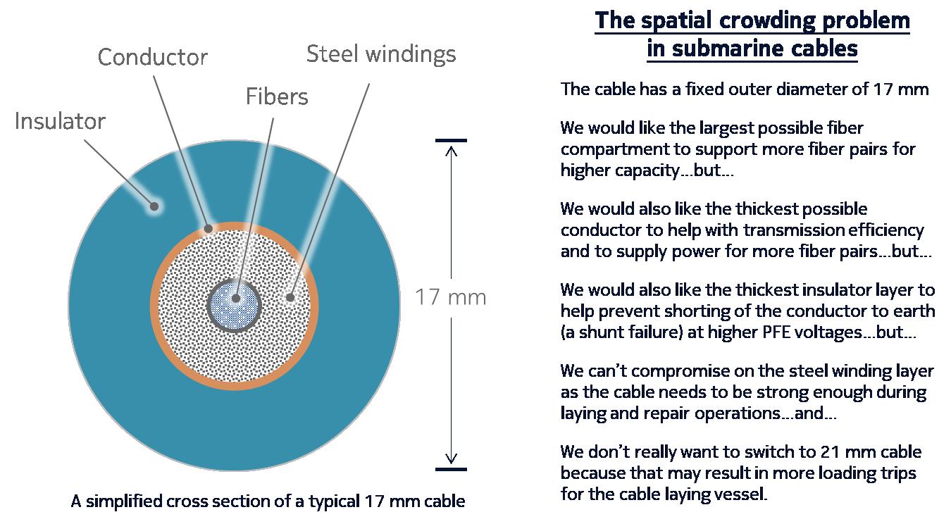
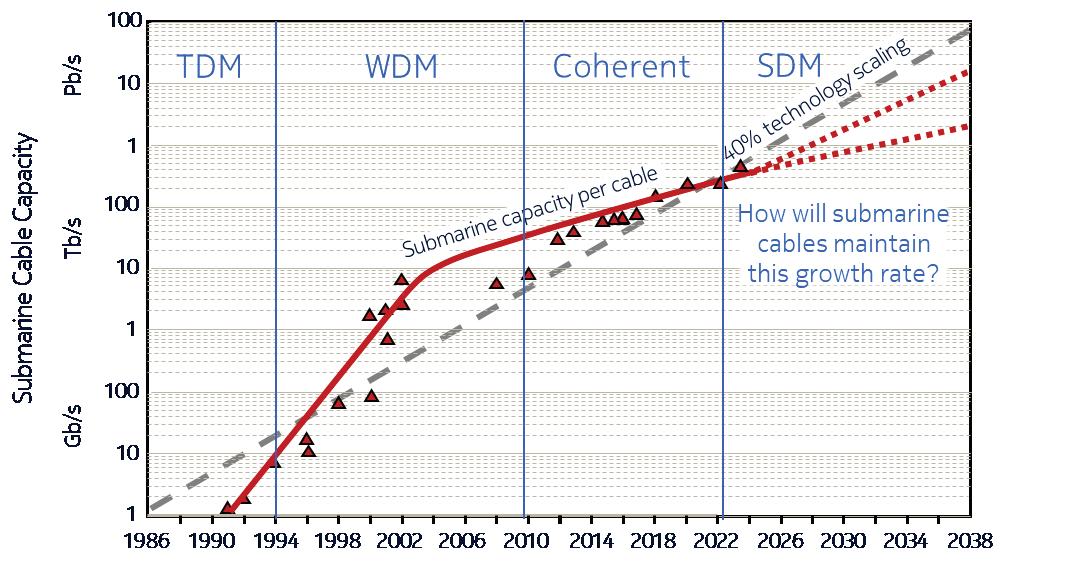
total for the cable. Over the 22 year operational life of Apollo this capacity was enhanced with several possible generations of coherent transponder, ultimately increasing total cable capacity by over 10X. Note that not all of these transponder generations were implemented on Apollo, but they would be available for other cable systems. For example, the blue shaded bar would have been a 40G coherent technology but, as far as I am aware, this was never deployed on Apollo as they went directly to 100G coherent from 10G direct detect.
The table on the right of Figure 3 shows a simplified taxonomy of coherent transponders by maximum wavelength data rate, and these generations are marked on the bars in the table. It’s important to understand that, once a cable is laid, the only way to enhance capacity is by upgrading the transponders at the ends of the cable. Any changes to the wet plant itself would be both impractical and uneconomical.
The 11 Tb/s limit for the latest transponders is caused by the fact that Apollo was designed well before coherent transponders existed and it is an example of a dispersion-managed cable. These types of cable were designed with alternating positive and negative dispersion fibers because the direct detect transponders of the day had a limited ability to compensate for chromatic dispersion in the transponder itself, so the cable had to do that job. However, the types of fiber needed for dispersion management have a higher nonlinear penalty because they have a lower effective area and are designed to maintain a low or zero dispersion. Both of these properties lead to higher nonlinear penalties, and this is what limits the overall capacity.
In order to get a higher capacity than Apollo the industry turned to a new, uncompensated cable design, using positive dispersion fiber.
The huge additional capacity that coherent transponders brought to the market had the effect of suppressing the need for new transatlantic cables until around 2014. This is when a new type of cable was deployed that was specifically designed for coherent transmission because it used all positive dispersion fiber. In Figure 4 I look at how the capacity of these new cables has evolved on the transatlantic route. High chromatic dispersion helps to mitigate nonlinear penalties and can be compensated in the coherent transponder. By 2018 the MAREA cable was ready for service, and it was designed without compromise for the ultimate in fiber pair capacity. In particular MAREA has:
• Positive dispersion fiber
• Very large effective area fiber (150 square microns)
• Unusually short repeater spacing (56 km)
These design decisions meant that MAREA has the best optical performance of any transatlantic cable, and I show a capacity of 26 Tb/s per fiber pair in Figure 4. MAREA has 8 fiber pairs for a total of 208 Tb/s for the cable.
Design options like short repeater spacing, dedicated backup pump lasers and high repeater power levels all have
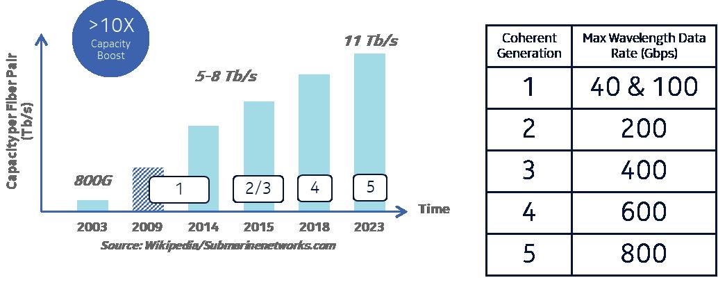
consequences in terms of power consumption. As a result, MAREA is limited to 8 fiber pairs.
Space Division Multiplexing is a cable design philosophy that allows for a (small) compromise on fiber capacity in order to economize on electrical power so that more fiber pairs can be supported. Figure 4 shows that the next cable after MAREA – which is Dunant – has 50% more fiber pairs, but a slightly lower fiber pair capacity. The cable capacity for Dunant, however, is almost 50% higher than MAREA. This is achieved in several ways, including backup pump sharing (“pump farming”) and longer repeater spacing (87 km vs 56 km). Dunant is also able to use a much less expensive fiber compared to MAREA.
The next cable, Amitie, has almost double the capacity of MAREA with twice as many fiber pairs. But with 16 fiber pairs Amitie reaches the maximum number of pairs that can fit into a standard 17 mm submarine cable design, assuming we’re using standard 250 micron outer diameter fiber. For the latest cable, Anjana, to support 24 fiber pairs it was necessary to move to 200 micron fiber. This type of fiber has been widely used in terrestrial networks for many years, but it’s new in subsea. Anjana is the first “half Petabit” transatlantic cable, although the estimate for fiber capacity is rather conservative.
24 fiber pairs at 200 microns will fill up a 17 mm cable. So where next?
While coherent processing and better cable design have delivered a stunning increase in optical performance, we’ve known since the late 1940s that any communication channel has a finite theoretical limit described by equations originally derived by Claude Shannon and his collaborators
at Bell Labs. Figure 5 shows a simplified version of the Shannon Equation – but don’t panic, it’s very straightforward. On the left hand side we have C representing the Capacity we’re trying to calculate and in this example it’s the total cable capacity. On the right hand side we basically have the product of three terms – P representing the number of fiber paths; B representing the amplified bandwidth of the fiber; and S/N as the Signal to Noise Ratio.
Transponder evolution tends to have a positive impact on SNR. Coherent detectors, for example, have far greater sensitivity than direct detectors, and can use all sorts of signal processing tricks to clean up the signal and reduce the noise.
For a given cable P and B “are what they are” – they are determined when the cable is designed and deployed. Apollo, for example, has 4 fiber pairs (P=4) and about a 4 THz amplifier bandwidth (B=4).
But future cable designs can manipulate these numbers. Most modern cables offer a 4.8 THz amplified spectrum, for example. And MAREA’s short repeater spacing results in a higher signal power and a lower noise.
SDM cables work on the P term – increasing the number of fiber pairs, or even the number of cores.
If transponders are approaching the Shannon Limit for capacity per fiber pair, how much capacity is left, and is it worth the effort it takes to get it? This is a good question, and the answer is likely to be driven by customer preferences. For the past few years we’ve seen a total focus on extracting more and more spectral efficiency from the fiber, with transponder form factors being changed to accommodate the power signal processing hardware needed. The
classic transponder market uses an “embedded” form factor – where physical characteristics, power consumption and heat dissipation of the transponder are all dealt with in a proprietary board design.
The next steps in transponder design could well be driven by a customer decision that the highest capacity is no longer the key requirement. Instead, if a simpler form factor, such as a pluggable transponder, could deliver most of the capacity at a lower cost, smaller form factor and easier deployment process then perhaps that would be a more attractive option.
Where embedded transponders are still preferred, perhaps an evolution to keep driving down cost per bit through lower power consumption, higher wavelength data rates, and more dense form factor would be attractive.
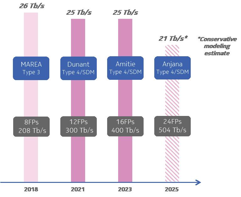
Both of these options could be combined with an ease of use and enhanced automation capability – especially taking advantage of Open Optical Networking standards with open APIs and Data Models to allow customization of operational deployment tools.
If Amitie has as many 200 micron fiber pairs as a 17 mm cable can support, then how would a wet plant vendor propose to create a 1 Pb/s transatlantic cable? It comes down to three possible options:
• Use dual core, uncoupled fiber
• Deploy C+L amplifiers
• Move from 17 mm cable to 21 mm cable to support more fiber pairs
All three options are quite possible using today’s technologies. 21 mm cables and C+L repeaters are already used in existing cables (although there is only one C+L cable). They both have drawbacks – with 21 mm cable occupying more space and weight in the cable laying vessel and C+L repeaters requiring more power per dB/Hz of gain because L-band amplification is less power efficient than C-Band on its own. Dual core uncoupled fiber exists commercially, and is currently being deployed in one branch of a cable in the APac region as a real world trial of the technology. What do the wet plant vendors you speak to say about each of these options? Do they have any other ideas for the next step?
SDM uses various tricks, like pump farming, to economize on electrical power in the cable. But is there a way to get more power than we do today into a cable? The simple answer is yes, but at what operational cost? There are many cables today that operate with 15 kV PFE, or lower voltages, and they still experience shunt failures as the insulation on the cable can be worn away by tidal movements or other sources of abrasion. Powering more fiber pairs (or cores) will need higher PFE voltages…but that means it’s more likely that there will be shunt failures. What does the wet plant vendor have in mind to deal with that issue? Moving to 21 mm cable would certainly give more room for thicker insulation, which lowers the risk of a short circuit; or thicker conductor, which means less of the PFE voltage is lost through conductor resistance. Do they have any other ideas?
Amongst the many tools available for cable capacity increase in the near term I think there are two that you are unlikely to hear in the context of near-term deployments. And these are:
• Deployment of Coupled Multicore Fiber
• Deployment of Hollow Core Fiber
Multicore fiber helps to solve the spatial crowding problem in the cable by designing more than one fiber core in each fiber. Assuming that each core has about the same capacity as a single core fiber, this would multiple the total capacity by the number of cores. Dual core (and possibly 4-core) fiber can operate as “uncoupled” waveguides. This means that there is little or no crosstalk between the cores, and so they can work with existing transponders. For more than 4 cores the fiber will always be “coupled”, which means that the signals from each core mix with other cores and get scrambled. It’s possible to build a new type of transponder based on a Multiple Input Multiple Output (MIMO) design, but this dramatically increases the complexity of the transponder and would be very costly to develop.
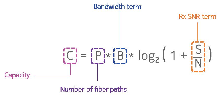
• Lack of amplification experience. HCF has not yet been deployed in amplified links (this may change soon). Experience of amplifier operation and performance would be essential before submarine operators would adopt the technology.
In the past coherent ASIC development costs were shared between the subsea and terrestrial markets, with common designs. But there does not seem to be a use case for multicore fiber (coupled or uncoupled) in terrestrial networks – it’s really a subsea thing. This means that there would be insufficient market potential to justify a custom MIMO ASIC just for the subsea market.
HCF is a fiber that is made of multiple, nested tubes of glass. So the light travels through a partial vacuum instead of through glass. This means that…
• The latency of transmission is 50% lower than silica core fiber
• There is almost zero non linear penalty
• There is little or no chromatic dispersion
• HCF can support very low attenuation across a very wide band of wavelengths
HCF could have a transformative effect on submarine cables…so why do I say you are unlikely to see it deployed in the short term?
• Ability to make it in quantity. So far HCF has been made in quantities of “tens of km”. It tends to be used to connect Data Centers for low latency applications and it’s likely to be very expensive. To be useful in submarine networks we’d need far higher volumes.
• Lack of ecosystem. Optical fiber is only one part of the ecosystem. What about connectors, splicing equipment, test sets and so on. All of these are still in development.
• What happens if the cable breaks? A hollow core fiber would literally suck in tens of kilometres of seawater if there was a cable break. It’s hard to see how such a break could be repaired economically.
By all means ask about HCF, but expect an answer along the lines of “in the distant future…maybe”.
I hope you have a great time at Suboptic this year. It really is the premier conference for technical information around submarine cables. I think the three questions I’ve suggested should give you a great starting point for technical conversations and, if you see me around the show floor or conference, please come and say hello! STF
GEOFF BENNETT is the Director of Solutions & Technology for Nokia, where his focus is Submarine Networking. He has over 35 years of experience in the data communications industry, including IP routing with Proteon and Wellfleet; ATM and MPLS experience with FORE Systems; and optical transmission and switching experience with Marconi, where he held the position of Distinguished Engineer in the CTO Office. Geoff is a frequent conference speaker, and is the author of “Designing TCP/IP Internetworks”, published by VNR.
How the Humboldt Cable is Redefining South America’s Global Reach

BY PATRICIO BORIC AND ITALO GODOY
In July 2019, Chile took a step toward building the first fiber-optic cable to directly connect South America and Asia, when the Transportation and Telecommunications Ministry signed a $US 3 million agreement with the Development Bank of Latin America (CAF) to finance a feasibility study for a trans-Pacific cable.
At that time, Chile’s telecommunications minister said that the cable would position the country as the gateway for data entry to the region and as an attractive location to establish data centers. Argentina, Brazil, and Ecuador have all expressed interest in the cable, the ministry said.
The overall objective of this study was to conduct a prospective study to determine the technical, legal, and economic feasibility required for constructing a submarine fiber optic cable between South America and Asia. The specific objectives of the study included aspects related to the implementation of an international submarine cable between South America and Asia, an analysis of economic viability through the determination of supply and demand, the identification of traffic sources supporting the project,
and an evaluation of the necessary regulatory framework. Additionally, the study focused on determining the optimal technical factors and the suggested route, along with an analysis of alternatives and the regional economic impact the initiative would have on connection quality and costs. Finally, the study proposed the integration of networks and markets in South America, the development of business and governance models, and the identification of potential landing countries and associated risks to present a profitable business case. Bids were received from eight international consortia, and the Chilean Undersecretariat of Telecommunications (Subsecretaría de Telecomunicaciones SUBTEL in Spanish, the state agency in charge of the process), awarded the contract to the consortium formed by the companies Telecommunications Management Group (TMG) and WFN Strategies LLC (WFN).
As part of the study’s deliverables, six possible routes across the Pacific from Chile to Oceania/Asia were analyzed, as shown in the attached figure.
Based on the results of that study, which included a
projection of traffic between the two continents for the next 20 years, considering the demand that will be generated by both users and different industries from the solutions that will be developed based on 5G, IoT, and AI technologies, the Chilean Government decided that the route to implement the Transoceanic Cable, instead of going directly to Asia, would go through New Zealand and to Sidney, Australia, corresponding to route 2a in the previous figure. In this way, this digital initiative would allow the country to connect with Oceania and indirectly access data from Asia. The Sydney route was evaluated as the most profitable option, as it involves fewer kilometers of optical fiber and because Australia is a major digital access point to the Asian continent, allowing capacity to be purchased to Asia instead of building it, making the project more economically attractive.
Once the feasibility study was completed, project execution was delayed by the COVID-19 pandemic, which forced a redefinition of budget priorities in Chile and other countries in the region. The project was resumed in 2022, and various options were explored to bring it to fruition until the Chilean government finally decided to sign an agreement with Google, which meant introducing some modifications to the initially chosen path, changing the original route to connect Chile, French Polynesia and Australia. In that way, the Humbold cable system has become part (sub-system) of Google’s Halaihai and Honomoana cable systems for its Pacific Connect Initiative. According to some press releases the full system capacity will be of144Tbps. Thus, in January 2024, the Desarrollo País agency (https://desarrollopais.cl/), a Chilean
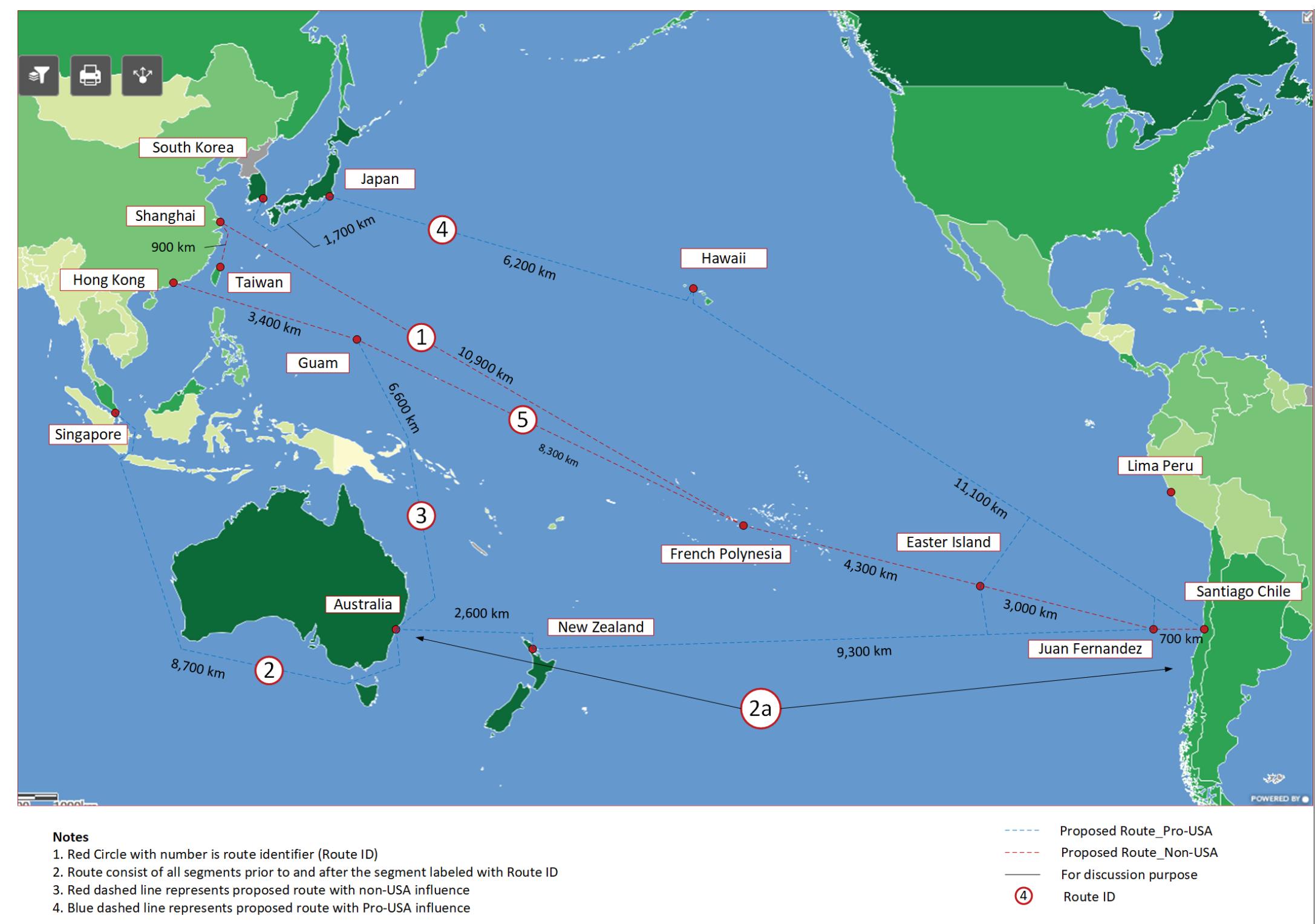
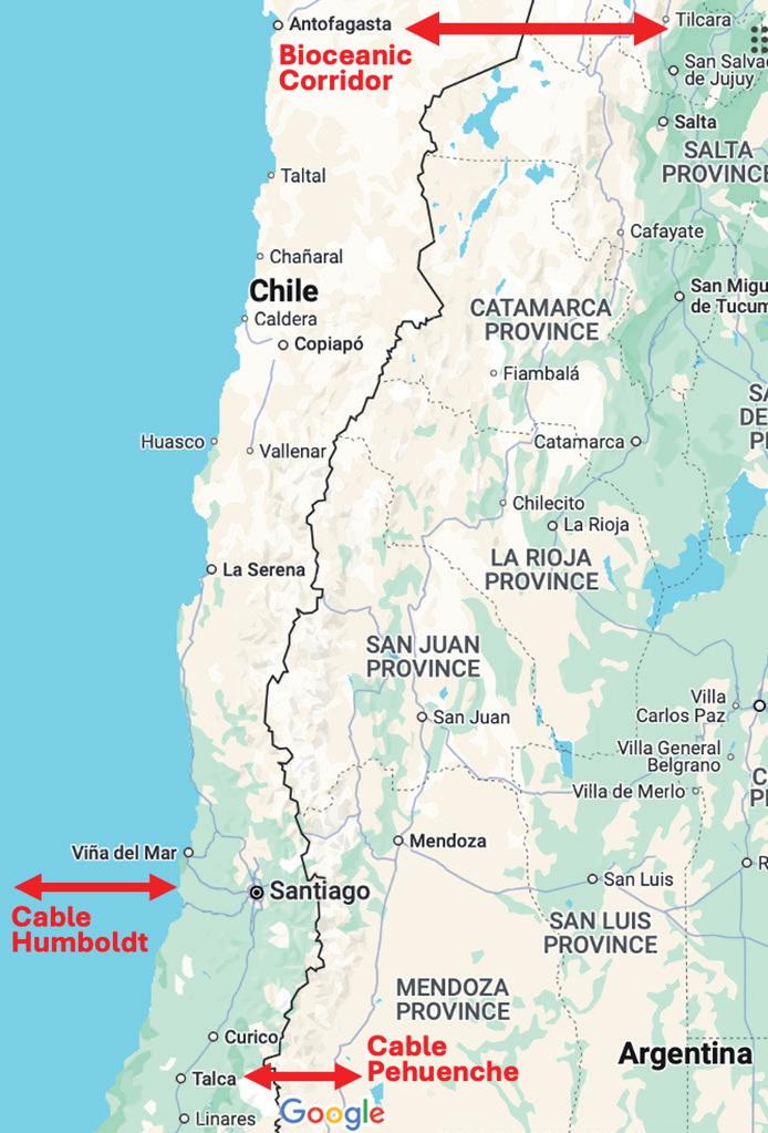
of a 14.800 kilometers submarine fiber optic cable that will connect Chile and Australia, and is expected to be ready for service in 2027.
The SPV between Desarrollo País and Google will be responsible for managing data transport capacity on this new underwater infrastructure, creating a direct and open international link between South America and Asia. This project was named Humboldt through a public poll, in honor of the German explorer and scientist Alexander von Humboldt.
The SPV between Desarrollo País and Google will be responsible for managing data transport capacity on this new submarine infrastructure, establishing a direct and open international link between South America and Asia. This strategic project will allow for the establishment of a new direct connection with Australia and Asia, thus strengthening Chile’s presence and participation in key global markets.
It is worth noting that the Humboldt cable system will provide end-to-end connectivity between the Valparaíso region (Chile) and Sydney (Australia), with a final capacity of 16 pair of fibers according to what has been published in different articles. Of them, Chile will have at least one pair of fibers of this cable for its exclusive use, and if demand warrants, this can be expanded to two pairs of fibers. Google will route its own traffic through the same system on the remaining 14 or 15 pairs of fibers in the cable.
state-owned corporation whose purpose is to promote infrastructure projects in an agile, efficient, long-term manner through public-private partnerships that allow for effective progress in the initiatives undertaken, and Google, which has invested in more than a dozen submarine internet cables with a total of more than 100,000 kilometers of cables, announced a strategic alliance to establish a Special Purpose Vehicle (SPV) for the construction and installation
For resilience reasons, the Humboldt cable landing point in the Valparaíso region will be located in a different area than the one currently used for existing submarine cables that reach Chilean territory. In addition, a complementary project is being considered to extend the mooring point in Chilean territory, passing through the capital, Santiago, and then to the Pehuenche border crossing. This will allow it to connect to Argentina via a route distinct from those existing between the two countries.
The importance of the Humboldt Cable System tran-
scends Chile’s national interest, regardless of its final configuration toward Oceania/Asia and its final destination in Sydney, Australia. It should serve as a South American gateway, looking toward Oceania and Asia, geographically distant places to the west but increasingly closer commercially and culturally, both for Chile and for other countries in South America and the Southern Cone.
Since the introduction of fiber optic communications in the early ‘90s, Chile has had a variety of operational optical routes with its neighboring countries, Argentina, Bolivia, and Perú. Over time, these networks have been updated, and new routes are constantly being built with more modern technology.
Thus, the development of new fiber optic cable systems, both submarine and terrestrial, continues in the region. Two new major terrestrial infrastructure projects will soon be built: the Bioceanic Road Corridor (see Fig. 2) between Antofagasta and São Paulo (3,248 km), Brazil, and the Paso Pehuenche Cable in Talca connecting to Argentina (400 km). Both projects will provide two new, modern and robust optical connections between Chile, Brazil, and Argentina, which will enable the expansion of the optical connection to São Paulo and Buenos Aires, respectively.
Regarding Chile’s domestic traffic, its origin/destination is in the city of Santiago, the country’s capital. The backhaul connection from the beach manhole to the data center in Santiago is currently being studied, including the alternative of building or leasing optical infrastructure.
Regarding the economic governance model and the network management center that will allow the operation, maintenance, and administration of the Humboldt cable system, these are decisions that the Chilean government is currently studying to choose the most appropriate option.
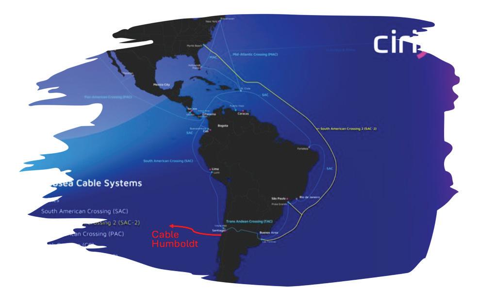
Finally, Chile is a coastal and seismic country, highly vulnerable to the devastating effects of tsunamis. The latest technology available allows for the detection of seafloor vibrations along the submarine cable route, which could warn of the presence of a tsunami.
The Humboldt Cable will thus be able to offer telecommunications and internet services between South America and Oceania/Asia, in the broadest sense of the project. Since there are one or two pairs of fibers that will be owned by Chile, it seems advisable to reserve one pair for Chile and the second pair for Brazil and Argentina and other intermediate countries, subject to the respective trade agreements. This possible traffic from the Humboldt Cable to Sao Paulo and Buenos Aires will depend on the terrestrial networks finally available within the continent.
A good example of integration is the Cirion network, see Fig.3, which connects Chile and Argentina, completing a South American ring. Other networks and companies have similar connections, creating a self-healing South American ring topology.
Regarding this aspect, as a SMART (Scientific Measurement and Reliable Telecommunications) system with factory-built sensors in the underwater repeaters has not considered for the Humboldt cable, it would be advisable for Chile to evaluate the technical feasibility and cost-benefit of introducing light into a lateral sector of the spectrum, and thus install a DAS (Distributed Acoustic Sensing) system that can power a tsunami protection system. STF

PATRICIO BORIC was born in 1951 in Punta Arenas, Chile. He got an electrical engineer degree in Universidad de Chile in 1978. He worked for ENTEL Chile since 1975 up to 2003 in different positions of the Operations Division of ENTEL. Since 2004 he owns Zagreb Consultores, a consultancy firm in telecommunications.

ITALO GODOY was born in 1960 in Rancagua, Chile. He got an electrical engineer degree in Universidad de Chile in 1988. He worked for ENTEL Chile during the 90’s and for Global Crossing from 2000 up to 2015. Now oriented to design, construction, operation and maintenance of optical networks, terrestrial and submarine. Since 2016 he owns Submarnet, a consultancy firm in telecommunications.


BY KRISTIAN NIELSEN
In the world of digital infrastructure, the idea of building a new fiber optic cable system—one that spans nations, links coastlines, and promises to reshape connectivity—can seem thrilling. The technical specifications are often clearcut: fiber counts, amplifier spacing, route topography, and latency models. But the commercial terrain? That’s murkier.
Before a single trench is dug or a permit is filed, project developers must confront a fundamental question: Will this system be used, and will it pay for itself?
Answering that question is as much an art as it is a science. It demands a blend of structured analysis, stakeholder insight, competitive benchmarking, and the kind of finan-
cial stress-testing that can make or break a project. These steps are what transform a concept from a spreadsheet into a viable, investable infrastructure play.
In this article, we take you inside a fictional—but entirely plausible—fiber project: Project Nyota. Set in a fast-growing African nation, the project aimed to stitch together the continent’s Atlantic and Indian Ocean coasts with a new terrestrial backbone. As investors circled and deadlines loomed, the team behind Nyota faced a challenge common to many in the telecom sector: how to validate demand, test financial assumptions, and define the system’s role in a crowded and evolving market.
What follows is a narrative reconstruction of how they did just that. Though the names and places are fictional, the methods, insights, and outcomes are rooted in real-world best practices. If you’re a developer, investor, consultant, or policymaker in the connectivity space, the story of Project Nyota offers a roadmap—one that might help you navigate your own unknowns with greater clarity and confidence.
In the spring of 2025, a mid-sized infrastructure development firm—let’s call them Delta Link—envisioned a bold new initiative: a terrestrial fiber optic backbone stretching from the Atlantic to the Indian Ocean, across the heart of a rising African economy. The proposed 2,000-kilometer route would link six major cities, cross remote terrain, and interconnect regional data centers with international subsea landings. It was ambitious. It was technically sound. But it was missing something critical: market certainty.
Thus began Project Nyota—a code-named feasibility effort to test the commercial viability of this proposed route. With investors waiting in the wings and construction timelines looming, Delta Link engaged a consulting team to conduct a thorough capacity study and market research campaign.
This is the story of how that team helped turn a speculative infrastructure proposal into a credible, investment-ready project.
Project Nyota came with a draft business plan—a spreadsheet-heavy dossier that modeled aggressive IRU sales, promising margins, and rapid return on investment. But as one of the consultants put it, “Numbers aren’t strategy— they’re stories that need editing.”
Within the first week, inconsistencies surfaced:
• The pricing structure used metro market rates even for rural spans.
• Revenue models assumed a 60% utilization rate in Year 1—an optimistic scenario in any emerging market.
• Ongoing costs omitted critical maintenance items, like remote generator support and route security in conflict-prone zones.
The first deliverable from the consulting team wasn’t a revised model, but a “Truth Table”—a structured grid separating validated assumptions from speculative ones. It became the roadmap for the rest of the study.
Next came an external scan. What other systems were operating, proposed, or under construction in the region?
The team compiled data from nine comparable projects— both terrestrial and submarine—and built a benchmark matrix for IRU rates, lease structures, and route configurations. A few key insights emerged:
• Coastal redundancy was overserved; inland diversity, undersupplied.
• Competitors had superior scale but lacked route resilience.
• New data centers under development in two interior cities presented emerging demand hotspots.
This wasn’t just pricing work—it was strategic positioning. Project Nyota’s inland alignment offered something unique: an opportunity for national route diversity and regional failover. That became the project’s value narrative: not just cheaper, but smarter.
Modeling is meaningless without market input. The consultants launched a stakeholder sounding campaign, engaging 15 entities across telecom, tech, energy, and government sectors. Each conversation focused on two questions:
1. “What would make you buy from a new entrant?”
2. “What would stop you?”
Key takeaways:
• Telecom operators craved route diversity but demanded latency guarantees and metro interconnection options.
• Cloud providers asked for hybrid dark fiber and colocation bundles.
• Energy firms saw potential for utility SCADA backhaul, but at much lower margins.
Even more revealing were the intangibles—perceptions of risk, trust in the sponsor’s delivery, and appetite for MoUs. One global bandwidth wholesaler summed it up: “You’ve got a promising route—but I need to see government permitting and anchor tenant traction before I put money on the table.”
That statement became a project milestone goal: Obtain three LOIs or MoUs before investor roadshows begin.
With refined assumptions and real-world demand signals in hand, the consulting team revised the financial model. But they didn’t stop there. They built a sensitivity dashboard, allowing the sponsor to toggle assumptions and watch the IRR respond in real-time.
Scenarios included:
• Lower-than-expected Year 1 IRU uptake
• Delayed permitting by six months
• Diesel price volatility affecting generator OPEX
Each scenario produced a clear message: the project could survive pessimistic cases, but only with phased deployment and early anchor commitments.
This stress-testing shifted internal conversations from “what’s the upside?” to “how do we protect the downside?”
Numbers validated, the focus turned to messaging. After all, infrastructure finance is part math, part myth-making. Investors want to see disciplined thinking—but also vision.
The consultants helped craft a narrative arc for investor briefings:
• The Problem: Bandwidth bottlenecks and lack of route diversity in a rapidly digitizing region
• The Opportunity: A transcontinental, protected path connecting two oceans and six major cities
• The Edge: Strategic inland route, ready market, phased CapEx, and high ESG alignment
• The Ask: $35 million in blended equity and grant funding for Phase 1
Supporting materials included:
• A polished 12-slide pitch deck
• A two-page executive memo
• A technical white paper with cost validation and demand curves
By this point, Project Nyota had graduated from idea to investment thesis.
The study didn’t just validate assumptions—it revealed unanticipated opportunities:
• A regional logistics hub expressed interest in capacity for supply chain digitization.
• A local ISP proposed co-branding last-mile services in the eastern corridor.
• A pan-African education initiative sought connectivity to remote universities, opening doors for development grants.
These weren’t in the original model. But they underscored an important lesson: market studies aren’t just gatekeepers—they’re growth engines.
Project Nyota’s success wasn’t just about hitting the right
numbers. It was about applying structure, humility, and curiosity to a problem that often gets rushed in the infrastructure space.
Key takeaways for future projects:
• Start with what you know—but rigorously challenge it. Don’t assume revenue; prove it.
• Validate pricing through triangulation—internal models, benchmarks, and stakeholder sentiment.
• Use sensitivity as a strategy tool, not just a risk analysis checkbox.
• Treat interviews as intelligence-gathering, not just “tick the box” outreach.
• Craft your findings into a compelling story, tailored for technical, financial, and policy audiences alike.
Six months later, Project Nyota had secured anchor tenant commitments, received a government-backed development grant, and entered final permitting for its first phase. Construction was scheduled to begin in early 2026.
More importantly, the sponsors now understood their market, their risks, and their path forward with clarity.
In an industry driven by bandwidth and buried cables, the real foundation is confidence—built not on ambition alone, but on data, dialogue, and disciplined thinking.
The techniques used in Project Nyota—validation grids, stakeholder matrices, sensitivity models—are replicable across the industry. Whether you’re laying cable through the Sahara, the Siberian tundra, or suburban sprawl, the questions are the same:
• Who wants what?
• At what price?
• When will they buy?
• And what could go wrong?
The answers, if earned through rigorous study, will light your path better than any route map.

KRISTIAN NIELSEN is based in the main WFN Strategies office in Sterling, Virginia USA. He has more than 17 years’ experience and knowledge in submarine cable systems, including Arctic and offshore Oil & Gas submarine fiber systems. As Chief Revenue Officer, he supports the Projects and Technical Directors, and reviews subcontracts and monitors the prime contractor, suppliers, and is astute with Change Order process and management. He is responsible for contract administration, as well as supports financial monitoring. He possesses Client Representative experience in submarine cable load-out, installation and landing stations, extensive project logistics and engineering support, extensive background in administrative and commercial support and is an expert in due diligence.

BY KIERAN CLARK
Access to knowledge is one of the most powerful tools in the submarine telecoms industry. Whether you’re tracking market trends, researching technology shifts, or simply trying to find that article you read years ago, having the right information at your fingertips matters.
Over the years, many in our community have asked us the same question:
“Is there an easy way to find every article by a specific author or company?”
Until now, the answer has been a frustrating not really. Readers had to dig through back issues manually, flipping pages and hoping the article they were looking for wasn’t buried too deep.
We took the first major step toward solving this problem in January with the launch of our Magazine Archive — a clean, visual catalog of all SubTel Forum issues since inception.
It provided a quick way to browse by year, open PDFs, and rediscover past content. But while the archive was a huge leap forward, it wasn’t enough. Users still needed a way to dive deeper — to search within those issues at the article level.
That’s what led us to the next evolution: the creation of a powerful, flexible, and fully searchable Authors Index — a tool designed to catalog every article, every author, every company, and every major topic covered in our magazine’s 20-year history.
This wasn’t a small undertaking. It required reimagining how our content is organized, extracted, and delivered. But the result is something we believe will change how readers engage with SubTel Forum — whether they’re doing in-depth industry research, exploring legacy systems, or just looking up a name from a past conference panel.
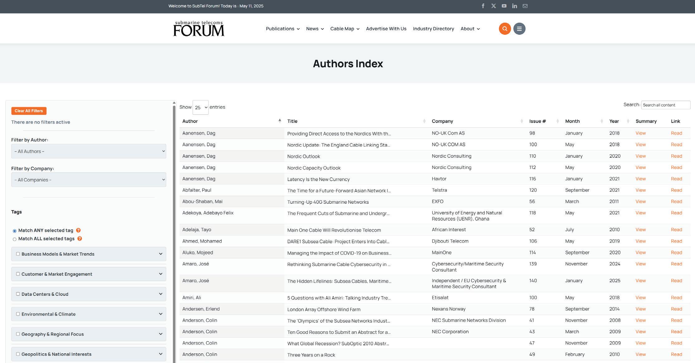
Creating the Authors Index was not just about building a feature — it was about solving a deeply human problem with the help of some very non-human tools.
The scale of SubTel Forum’s editorial history is immense. Over 140 magazine issues, thousands of pages, and more than a thousand individual articles — all created over two decades by hundreds of authors. Extracting and organizing that kind of data manually would have taken an entire editorial team months of tedious, error-prone work.
We knew we had valuable information locked inside each issue, but it was effectively invisible unless you knew exactly what you were looking for and had time to comb through PDFs. It wasn’t indexed. It wasn’t searchable. It wasn’t structured.
So the challenge became: how do we extract all of that information — article titles, authors, companies, start pages, keywords — in a way that’s fast, scalable, and accurate?
Rather than rely on brute force, we turned to AI.
We developed a multi-step pipeline that used custom Python scripts combined with OpenAI’s API to scan, parse, and process the full contents of every magazine issue. This wasn’t just basic OCR — we built a system that could:
• Identify article boundaries within varied issue layouts
• Extract authors, titles, and company names from inconsistent formatting
• Tag each article with relevant keywords and topics based on its content
• Automatically link articles to their location within each PDF
Of course, it wasn’t all automation. We built in human checkpoints and cleanup steps along the way to verify accuracy, correct formatting anomalies, and resolve duplicates. It was a true hybrid effort — leveraging AI to do the heavy lifting and editorial review to ensure trust and usability.
Once the data was extracted, we didn’t stop there.
We transformed the raw information into a web-based database using a custom WordPress plugin and frontend interface. This index isn’t just a dump of metadata — it’s a fully interactive tool. Users can filter by author, company, or tag, combine multiple filters, toggle search logic (AND/ OR), and even explore nested categories of tags.
It’s fast, lightweight, and requires no login or special access. Everything runs directly in your browser — no page reloads, no waiting.
Once the data was cleaned and processed, we set our sights on delivering an interface that went beyond a simple directory. The SubTel Forum Authors Index was built not just to list who wrote what — but to make it easy to explore over 20 years of magazine content in a meaningful, intuitive way.
At its core, the Index enables users to filter articles by author, company, and category, or search directly for a
name, term, or phrase. This means researchers can quickly find every article written by a specific contributor or trace how a topic like open cable systems has evolved across the years. It also means vendors and subject matter experts can review their published thought leadership, and students or analysts can deep-dive into specific industry themes without reading hundreds of full PDFs.
But the real power of the Index lies in its tagging system.
Each article was analyzed using a custom AI pipeline that interpreted the content and summary of every piece. Using the OpenAI API, we extracted a set of intelligent, contextually aware keywords — tags that reflect the meaning of the article, not just surface terms. This semantic tagging ensures far better discoverability than relying on author-supplied keywords or basic string matching.
From there, we organized these raw tags into a structured taxonomy of “uber tag” categories such as:
• Technology & Innovation
• Geopolitics & National Interests
• Investment & Finance
• Security & Resilience
This allows users to go beyond exact matches and explore thematically linked content even when different terminology is used.
Tags can be filtered using AND/OR logic, so users can zero in on articles that, for example, relate to both “Google” and “Pacific region” infrastructure, or browse everything related to “Legal & Regulatory” issues or “Cable Fault Response.” Tooltips throughout the interface make it easy to understand each option, and all columns are fully sortable and responsive.
The Index isn’t just a filterable spreadsheet — it’s a living research portal, and we’ve designed it to grow with our content while remaining intuitive for both casual visitors and power users.
The launch of the SubTel Forum Authors Index represents a major leap forward in making our magazine archives truly searchable and accessible. It’s the culmination of years of ideas, months of engineering, and a deep desire to give our readers, contributors, and the broader subsea community a better way to navigate our history.
But we’re just getting started.
We’re already working on next-phase improvements like dedicated author profile pages to track bios, affiliations, and full bibliographies — all linked from within the Index. In the near future, we plan to connect author data directly to our SubTel Industry Directory, another free resource that showcases hundreds of companies, key players, and solu-
Total Unique Authors: 770
Total Tags: 276
TOP 5 TAGS BY ARTICLE COUNT:
Network Operations & Management –943 articles
Technology – 820 articles
Risk & Safety Management – 720 articles
Project Management – 670 articles
Regions & Countries – 508 articles
tions in the submarine cable and connectivity space.
This Index is a tool for everyone — researchers, engineers, policymakers, marketers, students, and veterans of the industry. Whether you’re tracing innovation trends, citing foundational insights, or just exploring out of curiosity, the Authors Index is here to help.
And we want it to be as accurate and complete as possible. If you spot a missing attribution, an outdated company name, or want to update your own information, please reach out. Submissions and corrections are warmly welcomed — just email kclark@subtelforum.com
We hope you enjoy exploring the Index as much as we enjoyed building it. Let the digging begin. STF
KIERAN CLARK is the Lead Analyst for SubTel Forum. He originally joined SubTel Forum in 2013 as a Broadcast Technician to provide support for live event video streaming. He has 6+ years of live production experience and has worked alongside some of the premier organizations in video web streaming. In 2014, Kieran was promoted to Analyst and is currently responsible for the research and maintenance that supports the Submarine Cable Database. In 2016, he was promoted to Lead Analyst and his analysis is featured in almost the entire array of Subtel Forum Publications.
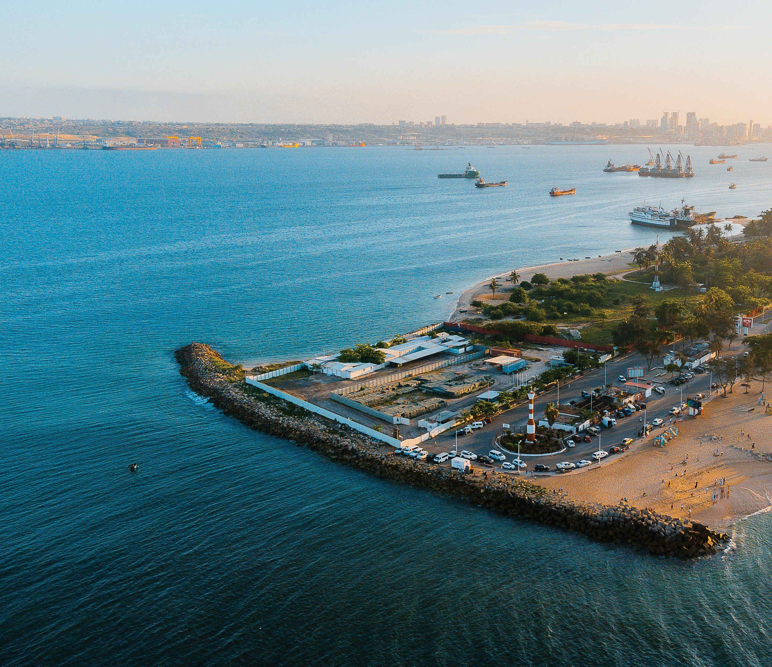
BY ÂNGELO GAMA
International network operator and digital services provider, Angola Cables’ vision to provide a robust subsea network bridging continents across the South Atlantic with low latency, high capacity routings has proved to be a well-orchestrated blueprint to accommodate the rapid growth in data traffic between Africa and the rest of the world – and secure the need for flexible redundancy routing options in
“Today, more than 70% of all direct traffic between Africa and the US runs through the Angola Cables network – and we have become Africa’s most interconnected network operator in Africa."
a global environment facing increasing regional conflicts and mounting geopolitical uncertainties.
Angola Cables CEO, Ângelo Gama said that the South Atlantic Cables System (SACS), which came online in September 2018, was the first high speed, low latency cable linking the African continent to South America and the USA, via the Monet Cable. This investment and strategy
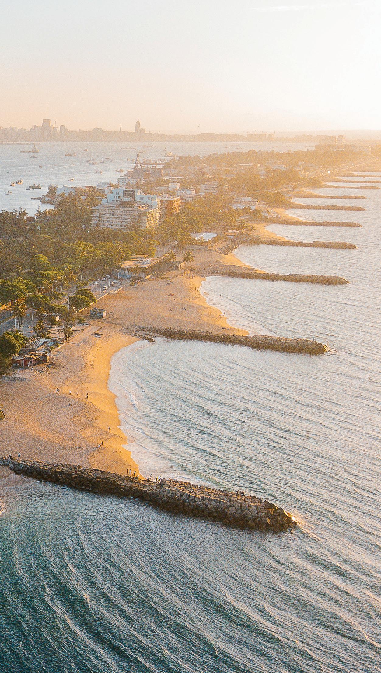
formed part of a broader vision to establish a reliable ‘Atlantic Ring’ network providing ‘South to South’ connectivity for data traffic and contents to and from Africa. “At the time, nearly all data transited via the ‘North to South’, West African Cable System (WACS) going through the UK and Europe resulting in higher latencies and often indirect or erratic routing tables,” said Gama.
The proof of concept, or more the thinking behind the convergence of cables in the South Atlantic using Angola as a strategic entry and exit point for traffic has played out well, maintains Gama. “Today, more than 70% of all direct traffic between Africa and the US runs through the Angola Cables network – and we have become Africa’s most interconnected network operator in Africa with SACS assuming an important role in Africa’s connectivity as an alternative
route in the event of cable disruptions in the West Africa or Red Sea.”
Angola is fast becoming the digital corridor to Africa as more international companies look to spread their investments and operations to markets across the continent. As a case in point, Angola Cables has seen traffic volumes peak at 18 448 Tbps, through its network point in Luanda. “The high volumes of data traffic and demand for cloud connectivity is indicative of the growing interest from businesses looking to engage in trade and commercial opportunities in Africa,” notes Gama. The expansion of local networks and the investments being made into new data centres and Internet Exchange Points (IXPs) is advancing digital connectivity. “Increasing the number of data centres, access to cloud nodes and digital hubs can realise the true business potential of Africa. “We along with our industry partners are making this happen because connectivity is critical to Africa’s future prosperity.“
This is also enabling economies across the continent find alternative sources of content from service providers and vendors across the world. Whether it be on-demand movie or music streaming services, gaming or online banking and finance applications, the digital landscape of Africa is evolving, and unlocking new opportunities for users, enterprises and African society as a whole.
Collaboration between the hyperscalers, carriers, other network operators and service providers is the catalyst to advance Africa’s access to and adoption of digital services. “Of the estimated 1.4 billion people living in Africa today, some 870 million people are still without internet or access to basic mobile services. As an industry we need to work together and do more to change this.”
Gama says that the construction and expansion of subsea cables have provided Africa with connections to the rest of the world. “Through our own subsea cable network and partner network arrangements with the likes of Equiano, EllaLink and through the West African Djoliba network, we have been able to provide Africa with direct routes to the USA, South America, Europe and Asia. The strategic partnerships, that we have developed gives us additional capacity and the flexibility to offer alternate redundancy routings in the event of cable breaks or disruptions.
Gama adds that the addition of new IXPs and pops to the Angolan Cables network is also helping to facilitate
large-scale network interconnections and the exchange of traffic, creating a source of fast, local, and cost-effective bandwidth for countries, companies and communities. Through its TelCables subsidiaries, the company is providing secure and cost-effective solutions from applications such as Clouds2Africa, to Network-as-a-Service giving businesses multiple options to broaden the scope of their operations and geographical footprint across borders and continents utilizing the robust, Angola Cables subsea cable network.
“Working together as an industry partners is essential if we are to realize the dream of a fully connected Africa,” reckons Gama, “sharing both infrastructure, resources and capacity will help in reaching our mutual goals. As the demand for digital services increases, we all have the shared responsibility to increase broadband access and further develop Africa’s data centre network to support the expansion of cloud computing and AI,” says Gama.
tion, cooperation and collaboration. Africa’s digital journey is just beginning. With investments in renewable energy to power data centers and public policies that can promote digital inclusion, the continent can look forward to exponential growth. “Together with our industry partners, other neutral carriers, network operators, content and service providers we can all play a part in strengthening economies and build a better future for all the citizens of Africa.” STF

ÂNGELO GAMA is the Chief Executive Officer of Angola Cables. Prior to his appointment as CEO, he was the Chief Technology Officer for the company, playing a critical role in developing and reengineering the global subsea network and related infrastructure to improve both the efficiencies and performance of the network.
Ângelo has a Degree in Electrical and Computer Engineering from Instituto Superior Técnico in Lisbon, Portugal and has also earned several certifications in business and project management -as well as ICT administration and process engineering.
As an Executive Director for the technical portfolio of Angola Cables, Angelo had responsibility for the management of all structuring projects and the development and implementation of the company’s technological innovation strategy.
According to Gama, Africa’s digital future though is not just about infrastructure, it’s about people and partnerships. It’s also about fostering deep connections through innova-
Under his curatorship, the company has successfully expanded its Points of Presence (PoPs) globally, bringing this number to 32 across 20 countries and on three continents. Ângelo also played a leading role in the successful trial of the first direct fibre optical link between Africa and the USA, a project that was undertaken in partnership with Nokia.

Every Author. Every Article. Instantly Searchable.

A New Era of Discoverability Has Arrived

Total Unique Authors: 770
Total Tags: 276
TOP 5 TAGS BY ARTICLE COUNT:
Network Operations & Management –943 articles
Technology – 820 articles
Risk & Safety Management – 720 articles
Project Management – 670 articles
Regions & Countries – 508 articles
BY PHILIP PILGRIM
This article centers on the two faults, and the five repairs, of the 1856 Gulf of St. Lawrence Cable.
I have included clippings of some of the many newspaper articles covering the repairs. These clippings present the story well and give insight into the research content that drives these historical Back Reflections articles. Hopefully you can follow along and enjoy reading the original news snippets as if you were “back in the day”.
In particular, the team at IT Telecom out of Montreal should enjoy this topic as this is the first repair in “their patch”. In recent years, IT Telecom has laid and repaired many cables in the Gulf of St. Lawrence and has probably picked up the 1856 and 1866 cables during route clearing operations.
BIG THANKS to IT Telecom for hosting the recent 2025 ICPC Plenary meeting in Montreal where the ICPC discussed many subjects related to cable protection. At the Plenary, Camino Kavanagh presented newly compiled historical cable fault data from the early era of submarine telecommunications. Yours truly is keen to dig in... now back to the story....
The “Gulf Cable” was one of the earliest, and longest, cables in North America. It was a major cable in the
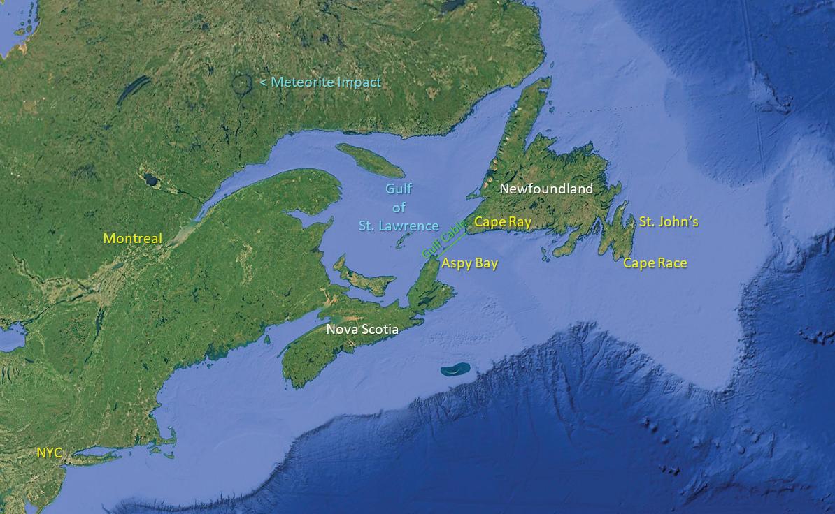
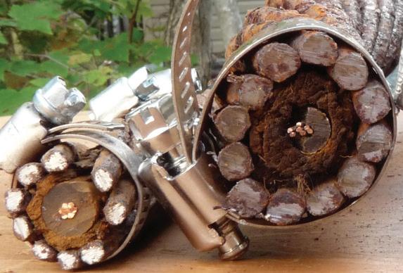
telegraph path connecting NYC to London from 1856 to 1866. This ten year window in time was when telegraph “stopped at the beaches” and ships carried the messages onward across the Atlantic Ocean. This Gulf Cable was also a key part of the transatlantic telegraphic cable system during the short life of the 1858 Atlantic Cable, and again, it was part of the 1866 transatlantic telegraphic cable system; for a short time... cue ominous music.
In the early days of telegraph, a
complete NYC to London transatlantic system required several submarine cables, and several terrestrial systems, to connect these two cities. The main three submarine cables needed were:
1. Transatlantic Cable (3,200 km)
2. Irish Sea Cable (100 km)
3. Gulf of St. Lawrence Cable (120km)
For completeness, there were also several shorter submarine cables needed in North America crossing “guts” and harbours.
When Cyrus Field took the reins from Frederic Newton Gisborne to telegraphically connect NYC with London in 1854, Ireland was already connected with the UK (1854 Howth-Anglesey Cable) so, Field only needed to build two of the three cables listed above. His practical team first focused on the shorter “Gulf Cable” to minimize both costs and challenges. Tackling the Gulf Cable first would be a wise “baby step” to prepare for the huge Atlantic Cable project.
In 1855, Field’s team attempted to lay a 3-conductor cable across the Gulf of St, Lawrence but ran into difficulties due to weather [STF #120 Sept. 2021]. The lay was abandoned.
of NYC. News was transmitted from NYC and over the 1856 Gulf Cable to the eastern-most point in North America, St. John’s, Newfoundland. The news was then shipped to Ireland from St. John’s, or transferred to ocean going vessels passing south of Cape Race, Newfoundland. Likewise, news from the UK and Europe was intercepted from ships passing by Cape Race and telegraphed over the 1856 cable and onward to NYC.
seriously upset the hopes for a continuous end-to-end telegraphic system. The failed cable also immediately delayed the international news by one day because a steam ship now had to ferry news across the Gulf of St. Lawrence. Fortunately for historians, the news agencies of the day reported on the cable outage and on the repair, as it was “high-tech” news of the day, and because it affected their readers.
The 1856 cable had a good trou-

In 1856 a new, and revolutionary, multi-stranded-copper-conductor cable was successfully laid in 1856.
• Shore End: 12 Armoured Wires (BWG #4, 6.0mm)
• Deep Water: 12 Armoured Wires (BWG #9, 3.8mm)
• Conductor: 7 Strands Copper (BWG #14, 2.1mm)
Although the monumental 3,200 km Atlantic Cable would require two more years to construct and lay, the shorter 1856 Gulf Cable was immediately put to use by the Associated Press
This Atlantic System’s Gulf Cable ran continuously from 1856 to 1866 except during 2 faults:
• 1857 Fault due to anchor
• 1865 Fault due to anchor
These faults were especially troublesome as the initial plan was for the 3,200 km Atlantic Cable to be laid in 1857. A broken Gulf Cable would
ble-free run of 8 years between faults. In 1865, the cable suffered a second fault near the same location. Again, it was disappointing as the second 3,200 km Atlantic cable was about to be laid in 1865, so the Gulf cable urgently needed to be repaired.
Details of the first repair of the

Gulf Cable are very limited. It occurred only 6 months after it was laid (July 10, 1856) and 4 months after, the NYC-Cape Race system began operating (Nov. 9 1856). The January failure was so close to the previous period of no cable across the Gulf that its impact to the news arrival in NYC was not significantly noticed by most.
I have only found two references to this fault: one is a modern historical website with a chronology of telecoms in Canada, the other is an 1862 newspaper article covering a court hearing of a dispute between the Union Bank and the New York, Newfoundland, & London Telegraph Company. A witness, Alexander M. MacKay, the chief engineer who replaced Frederic Newton Gisborne, states the electrical “current” passing through the cable ceased in January, 1857. The fault was later located in March of 1857, and repaired in June of 1857. The cable then continued trouble-free operation for many years that saw it work with the 1858 Atlantic Cable, and also through the American Civil War years. All telegraphic messages between North America and Europe passed through this cable and on the ships ferrying messages “across the pond”. Sadly, the death of President Lincoln passed through this cable. [STF # 128 Jan. 2023].
[Read Figures 1 & 2 now.]
There is little more on this repair. The modern website with historical data mentions the repair vessel to be the New York, Newfoundland, &
London Telegraph Company’s steamer, Victoria.
The cable failed for the second time on June 5th, 1865. All eyes of the world were on Newfoundland as the 2nd Atlantic Cable was soon to land. As well, the Associated Press, including the NY Times, and all readers were now impatient for immediate news from Europe. The Gulf Cable outage caused a 1 day delay in news arrival and was an unwanted inconvenience, perhaps akin to a slow internet connection of today.
[Read Figure 3 now.]
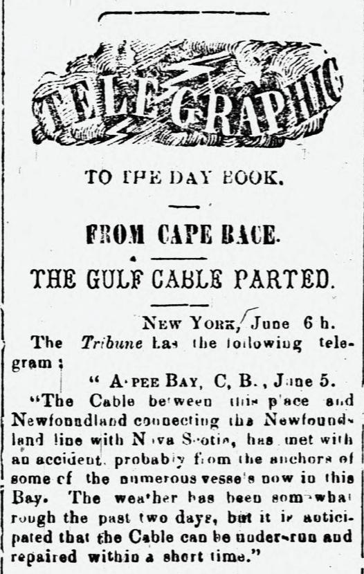
Sometime between June 5th and July 11th, Alexander MacKay attempted to locate the fault and repair
the cable, but he had no luck. In the July 11th newspaper article, it is reported that MacKay cut into the cable at 3 miles from the Nova Scotia shore end, and also at 3 miles from the Newfoundland shore end but could not locate the fault. It seems the fault locating technique applied by MacKay, or capabilities of his team was not as accurate, nor as successful as those developed over 10 years earlier in the UK as he seemed unable to discern at which end of the 120km long cable had a fault. He pulled up both ends and would have tested to shore over each 3 mile shore section, so the fault would be further out.
[Read Figure 4 now.]
Perhaps he was a friend of Cyrus Field, or perhaps he wanted publicity, regardless, one of the wealthiest men of New York, called “The King of Wall Street”, and the grandfather of Winston Churchill, offered the service of his newly built steam yacht to repair the Gulf Cable, Leonard Walter Jerome’s vessel was named the Clara Clarita.
[Read Figure 5 now.]
The NY Times reported on the full repair; from the ship departing (July 23), traveling to Nova Scotia (July
27), transiting to the fault (August 2), and returning to New York (August
17). Here are excerpts from nearly 160 years ago to follow along as all impatient NYC businessmen would have.
[Read Figure 6 now.]
The US Navy Engineer, William E. Everett led the repair. He was experienced with cable work as he was on the Niagara for the 1857 and 1858 Atlantic Cable trials and lays.

[Read Figure 7 now.]
Also, on board was Walter. O. Lewis, the superintendent of the Sandy Hook, N.J. to NYC telegraph line. Here is another amusing report of the Gulf Cable fault.
[Read Figures 8 to 14 now.]

It seems the Gulf of St. Lawrence cable repair was put on hold after the “almost successful” 1865 Atlantic Cable lay. That 2nd Atlantic Cable broke approximately 600 miles east of Newfoundland and the cable ship was unable to recover the broken end.
So, for the 14 months from June, 1865 to August, 1866, the Gulf Cable was out of service and the 1865 Atlan-
tic Cable’s western end was left disconnected on the ocean bottom.
In Figure 15, you can read that MacKay had a stab at repairing the cable before the new 1866 Atlantic Cable landed. He was unable to repair the cable with the equipment and vessel at hand, but he did find the cable to be in excellent condition. This gave hope that it still could be repaired. His observations conflicted with the statements of the Clara Clarita repair team a year earlier.
In 1866, just 2 days after the 3rd Atlantic Cable was successfully landed in Heart’s Content (July 27 1866), MacKay, now with a team of expert cable repairers, fault finding experts, and fault finding instruments from the Atlantic Cable Expedition set off to repair the Gulf Cable.
[Read Figures 15 to 18 now.]
Following the Lay of the 1866 Atlantic Cable, and the recovery and repair of the 1865 Atlantic Cable, there were now two transoceanic cables operating. The thought of running all of this international telegraph traffic over the single 10 year old Gulf Cable must have seemed too risky and perhaps a bottleneck.
It was decided to lay a new Gulf Cable, and in September of 1866, the cable lay began. The cable ship Terrible and cable ship Medway, fresh from the 1865 Atlantic Cable recovery, steamed to Port Aux Basques to start the lay. This new landing site was approxi-
mately 11 km south of Cape Ray, where the 1856 Gulf Cable landed. At that time, there was commentary in the newspapers about bypassing the problematic terrestrial route through the highlands of Cape Breton and laying a cable to PEI, or to Sydney, N.S.
Note: The cable was also used for scientific work to improve our understanding of the planet. Distances between locations increased in accuracy which in turn, improved anything referencing latitude measurements. This included maps/charts and time standards.
[Read Figure 19 to 25 now.]
Janet and I explored the landing sites in Newfoundland (Cape Ray) and in Nova Scotia (Aspy Bay). The beautiful landing site of the 1856 Gulf Cable in Nova Scotia was well preserved 11 years ago, however costal erosion and development has encroached on the site.
[Read Figure 26 to 33 now.]
Two cables came out of the bank at the beach at Aspy Bay, Nova Scotia. These present a mystery as they are

side-by-side in the same buried path to the cable hut, however one is the 1856 shore-end, and the other is the 1856 deep water cable. You can see these two cables in the 1954 photograph [Figure 26]. How did deep
water cable get pulled ashore? Perhaps during the 1866 repair, MacKay consumed the 12 miles of spare cable taken on board at Hearts Content and had to reuse some of the deep water cable that was recovered during the repair?
Another mystery: one would expect to see the 1856 shore-end and the 1866 shore-end coming out of the cable trench at Aspy, however there is no 1866 cable to be spied in the area. Perhaps, it landed elsewhere along the shore and further exploration is needed. We did see a factory sample of the 1866 cable in the local North Highlands Community Museum, so there is hope. The museum also displays a recovered section of the working 1856 cable (shore-end). Digression: We did find the 1866 cable in PEI [Figure 36] and records show that it was laid to PEI
by the Medway after it was laid to Aspy by the same vessel. There is only one reference that it was re-routed to Lloyd’s Cove but it is most likely an error as the cable was not long enough. It still should be in the area and pestering the fishermen.
In Cape Ray, there is an equally beautiful beach with majestic mountains in the background. We searched and found no evidence of any cable (1855 nor 1856) but enjoyed two nice days in the area in 2019 and in 2024. We hope to return!
Sadly, even today, Gulf Cables continue to be damaged. Here is a link to a Feb. 2025 article reporting on the last fault in the gulf and the repair by IT Telecom. It was cut clean with a tool.
https://www.cbc.ca/news/canada/ nova-scotia/bell-subsea-fibre-optic-cable-newfoundland-1.7461963
I am a happy camper as I just re-discovered a new cable!
[Read Figures 34 to 36]
In last minute research of the Gulf

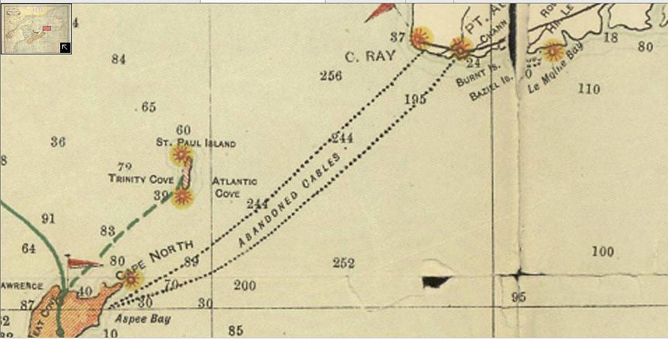
Cable repairs, I found an 1869 newspaper article stating that a new cable was laid from Cape Tormentine, New Brunswick to Cape Traverse, Prince Edward Island. Back in 2014, Janet found an interesting double-armoured cable on the beach in Cape Traverse [Figure 35], but we never could find a record of it. Perhaps this is the record we seek? The local fishermen hate that cable as they snag it often and lose all battles with it. There is very little information on this cable, so more research lays ahead to absolutely verify it.
In the same 1869 article, it mentions two additional repairs to the 1856 Gulf Cable that occurred in 1869 (one at each end of the cable), these repairs were completed after

the new cable was laid from NB to PEI. All of this work made for a very busy outing for the Merlin. In addition to the lay and two repairs, the cable ship’s crew also did health checks on the 1866 Gulf Cable and on the 1867 Placentia-North Sydney cable. It is clear that by 1869, cable testing, fault locating, and repairing had evolved to become rapid and dependable routines.
The 1867 cable mentioned above landed in Lloyd’s Cove, near North Sydney Nova Scotia. This cable bypassed the terrestrial route across Newfoundland and the Cape Breton Highlands route to Aspy Bay. These terrestrial routes suffered greatly from outages due to storms (wind & ice) and also forest fires. From 1867 and
onward, the Gulf Cables to Aspy were used only for local telegraph traffic and back-up. The newer cables (post 1866) bypassed the Gulf and landed at North Sydney, Torbay, then later at Canso & Dover, Nova Scotia.
In conclusion, over the 13 years from 1856 to 1869, the Gulf Cable
suffered a total of four faults, one at the Newfoundland end and three at the Nova Scotia End. All are assumed to be due to anchors. The 1856 Gulf of St. Lawrence Cable had an excellent run and perhaps transferred the most important news of those days. STF

BY ANDRÉS FÍGOLI
In submarine cable damage litigation, judges frequently question the exorbitant costs of maintenance operations. Surprisingly, from 30% and up to 70% of the total average repair cost (USD 1.5-2 million) stems from fuel expenses for vessel transit from port bases to fault locations, rather than the repair itself. This raises a critical consideration: Could alternative maintenance vessels in closer proximity have reduced fuel consumption and costs?
While claimants cite pre-existing maintenance contracts, defendants (typically fishing vessel operators or insurers) often counter that costs appear inflated. Geopolitical barriers exacerbate this issue by excluding cost-effective repair providers from the market, undermining both financial efficiency and sustainability goals. This article examines sustainability from two perspectives: environmental impact and market viability amid global distortions.
In this article, we will avoid mentioning any particular nation in order to avoid drawing attention to geopolitics. Talking too much about such issues will not improve the industry in any way.
Submarine cable repairs operate under two frameworks:
• Private agreements: Direct negotiations between cable owners and contractors.
• Club agreements: Collective terms negotiated by multiple cable owners.
Maintenance vessels, strategically stationed mainly in northern hemisphere ports or equatorial regions for rapid deployment, incur substantial fuel costs during transit. For example, a South Atlantic repair requiring vessel mobilization from the Caribbean may cost USD 2 million, with almost 70% allocated to fuel.
rine cable operators in remote regions. Fortunately, Chile’s unique seabed topography plays a crucial role in ensuring cable safety, with deep slope near the shore. Many submarine cables in the region have required minimal repairs. Their location in deep waters has provided a natural defence against external threats. Other southern hemi-
The lack of strategically located repair ports in the South is largely due to insufficient regional cable deployments, making it economically unviable to station dedicated repair vessels in these areas.
The lack of strategically located repair ports in the South is largely due to insufficient regional cable deployments, making it economically unviable to station dedicated repair vessels in these areas. Without a minimum number of cables to justify the cost, operators are left with limited and expensive maintenance options.
This dilemma is particularly evident in cases such as the new submarine cable projects in Chile. Even if a club agreement were to include them in its coverage, the need to mobilize vessels from distant locations would still result in significant costs. Finding an available construction vessel on the open market for urgent repairs is also an expensive alternative, further complicating cost management for subma-
sphere countries are not so lucky and face economically unviable solutions.
Geopolitical constraints severely limit cable repair supplier selection options. In some cable laying tenders, the difference between the bids can be more than 80% of the price quoted. The submarine cable maintenance market follows the same pattern, with a clear divide between “authorized suppliers” and those who are not.
Africa exemplifies this imbalance, with only three maintenance vessels: one in South Africa, one in Cape Verde (serving West Africa), and one in Oman (East Africa). Surely open-market competition could reduce
costs by reducing vessel time at sea, but at the same time subsea cable owners risk losing landing permits if they engage non-approved contractors. This creates artificial market barriers, prioritizing political compliance over operational efficiency.
While permit delays in jurisdictional waters (e.g. vessels awaiting approval at “mile 201”) are cited as cost drivers, these risks are often exaggerated. Operators typically forecast permit timelines accurately based on previous experiences and permanent contact with local authorities, and idle fuel consumption could be minimized through improved planning.
However, regulatory ambiguity in submarine cable governance enables stakeholders to shift blame rather than implement solutions. Usually, national governments are publicly exposed in submarine cable international forums for these permit delays, stringent customs processes and cabotage laws—forums in which of course they are not present—as if all the responsibility should be assigned to them. Indeed, it is easy to blame the absent.
Ageing maintenance fleets (averaging 20 years old) lack renewal incentives compared to thriving sectors like oil/gas or power cables. National strategies to build sovereign fleets (e.g., India, France, Japan) address geopolitical concerns but fail to resolve systemic inefficiencies. And is it realistic to
consider that each nation in the world should have its own cable maintenance ships? Discriminatory cabotage rules further distort competition.
End users ultimately bear the burden of these distortions through prolonged outages. The March 2024 West Africa multicable failure saw repairs delayed by two weeks, despite available contractors. Opaque explanations were given without too much detail, leaving end users in the lurch. Indeed, antitrust authorities should start scrutinizing this niche market to eliminate anti-competitive practices and to guarantee full digital sovereignty rights for its citizens.
command 90% market share on key routes through direct ownership or indefeasible right-of-use (IRU) agreements. Geopolitical restrictions compel OTTs to exclude certain cable maintenance contractors, forcing telecom operators into “captive customer” relationships with approved vendors. This imbalance stifles competition, as excluded providers cannot bid for repairs or even pressure authorized suppliers to lower prices.
Ageing maintenance fleets (averaging 20 years old) lack renewal incentives compared to thriving sectors like oil/gas or power cables. National strategies to build sovereign fleets (e.g., India, France, Japan) address geopolitical concerns but fail to resolve systemic inefficiencies.
Telecom companies increasingly risk marginalization, relegated to passive roles as landing station lessors. Meanwhile, OTTs exploit geopolitical tensions to expand market share in regions where traditional operators face financial or regulatory barriers.
Current industry sustainability reports, often financed directly or indirectly by OTTs, focus narrowly on landing station diesel use or the use of revolutionary hydrogen as fuel in cable maintenance vessels, ignoring the market constraints that leads to the current high and unnecessary emissions caused by cable repair vessel transit times. This omission contradicts Paris Agreement commitments and judicial scrutiny of fuel-related costs.
Over-the-top (OTT) providers
The impending High Seas Treaty (BBNJ Agreement) may enforce stricter sustainability standards for cable repairs in ecologically sensitive zones. However, greenwashing persists through industry-funded studies that obscure operational realities.
In May 2024, the International
BY ANDRÉS FÍGOLI
Tribunal for the Law of the Sea (ITLOS)1 rendered an advisory opinion confirming that anthropogenic greenhouse gas emissions pollute the marine environment and that States face obligations to prevent, reduce, and control such pollution and thus protect the sea from its effects. A similar opinion is expected by 2025 from both the International Court of Justice and the Inter-American Court of Human Rights.
This seems to be a collision course, one which needs to be addressed without delay to avoid unpleasant surprises for the submarine cable industry on the high seas in the future.
End users and NGOs are waking up to connectivity rights violations and sustainability failures. Class actions targeting energy sector climate plans (e.g. November 2024 European Union complaints) could inspire similar challenges for submarine cable operators.
If governments fail to ensure transparency and sustainability in the submarine cable industry, society should and will demand change. Users are no longer just consumers of connectivity; they are now informed actors who can put pressure on companies and regulators through public denunciations and class actions against connectivity providers or countries that fail to meet environmental and fair competition standards.
1. Advisory Opinion in Case No 31, ITLOS, 21 May 2024. Available at: https://www.itlos.org/fileadmin/itlos/documents/ cases/31/Advisory_Opinion/C31_Adv_Op_21.05.2024_orig.pdf
The World Bank 2024 report 2 emphasizes government roles in fostering competitive infrastructure markets—a principle applicable to submarine cable governance. States must assert digital sovereignty by enabling telecom operators to freely select contractors, aligning with national sustainability strategies.
tortions. Geopolitical barriers, ageing fleets, and OTT dominance create a vicious cycle where telecom operators subsidize inefficient practices while losing market relevance.
Governments must intervene through antitrust measures and treaty enforcement to ensure open competition and emission reductions. In
Governments must intervene through antitrust measures and treaty enforcement to ensure open competition and emission reductions. In the absence of reform, end users will increasingly challenge this stagnation through legal and advocacy channels.
In addition, the lack of genuine sustainable practices in the cable maintenance sector due to the dilemma of fuel overconsumption based on unnecessary vessel transit time also affects other parts of our industry and other maritime industries. In essence, until the scope of work for cable repair vessels is aligned with a more sustainable agenda, we will continue to see many emissions that could have been avoided.
The submarine cable repair market faces dual crises: environmental unsustainability and anti-competitive dis-
2. World Bank, Green Telecommunications: Policies and Practices for More Sustainable Networks - A Practitioner’s Guide (English). Washington, D.C.: World Bank Group. Available at: http://documents.worldbank.org/curated/ en/099121824172031430
the absence of reform, end users will increasingly challenge this stagnation through legal and advocacy channels. Sustainable market survival hinges on dismantling artificial barriers and aligning operations with global climate commitments—a task requiring urgent, coordinated action. STF
ANDRÉS FÍGOLI is the author of the book “Legal and Regulatory Aspects of Telecommunication Submarine Cables” and is the director of Fígoli Consulting, where he provides legal and regulatory advice on all aspects of subsea cable work. Mr. Fígoli graduated in 2002 from the Law School of the University of the Republic (Uruguay), holds a Master of Laws (LLM) from Northwestern University, and has worked on submarine cable cases for more than 20 years in a major wholesale telecommunication company. He also served as Director and Member of the Executive Committee of the International Cable Protection Committee (2015-2023).

IN THE DYNAMIC REALM OF CORPORATE ADVANCEMENTS, THIS MONTH SPOTLIGHTS A SERIES OF NOTABLE TRANSITIONS AMONG INDUSTRY LEADERS.
STEVE HOLDEN has joined Meta as Network Operations Engineer Infrastructure (Subsea) as of February 2025. He previously spent over 14 years at GMSL as Maintenance Account Director, following an earlier role managing ACMA & NAZ Agreements.
DEAN VEVERKA has been appointed Chairman & Director of the International Cable Protection Committee (ICPC) in April 2025. He continues to serve as CTO & VP Operations at Southern Cross Cable Network, a position he has held since 2004.
DOUGLAS (IRUNGU) NJENGA became Executive Committee Member of the ICPC in May 2025. He also serves as Director of Regulatory and Strategic Affairs at WIOCC Group and is a Board Member at ASEF Africa.
H. DEAN DALTON recently took on the role of Offshore Cable Supervisor at Blue Offshore in May 2025. Prior to this, he served as Onshore Export Cable Pull-In Site Manager at Keynvor Morlift Ltd for the Coastal Virginia Offshore Wind project.
These transitions underscore the vibrant and ever-evolving nature of the industry, as seasoned professionals continue to explore new challenges and avenues for impactful contributions.
Vietnam Internet Restored After APG Fix
Taiwan Charges Chinese Captain in Undersea Cable Case
Liberia to Relocate ACE Cable Landing Station
Liberia Works to Repair Undersea Internet Cable
India’s First International Subsea Cable Systems Conference
Dialog Axiata Enhances Sri Lanka Global Links
Lightstorm Completes RTI Cable Integration
Vietnam Activates ADC Submarine Cable Segment
Astound, AWS Expand Oregon Fiber Access
Digital Realty, Schneider Open Gateway in Southern Europe
Chennai Emerges as Data Center Powerhouse
APAC Data Center Market Sees AI Surge
Equinix to Expand Internet Access in Nigeria
Digital Realty, Schneider Electric Unveil HER1 Hub
Colt Expands U.S. Network via Apollo South
Flexential Announces Bifrost Cable Lands in Oregon
SAEx Cable Project Secures Major Funding
Pioneer Consulting Wins Caspian Cable Contract
South Africa’s Current and Future Undersea Cables Plan
Airtel Connects India With 100Tbps Submarine Cable
PLDT Splashes Out on Key Subsea Cable Routes
Work Begins on E2A Transpacific Subsea Cable
Odisha Plans Puri Submarine Cable Hub
ACE Gabon to Land Medusa Subsea Cable in Port-Gentil, Gabon
MoU Signed for Pan-Arctic Cable System
Ooredoo, ITPC to Land FIG Cable in Iraq
MANTA Subsea Cable Contract Finalized
PLDT Expands Capacity 33% With Apricot
ITIF Urges FCC to Cut Outdated Rules
European Telcos and Cable Firms Urge Security Cooperation
Google Cloud Opens Global Network for Enterprise WAN
Angola Cables, Megaport Interconnect in Key Cities
Seacom Bolsters Leadership with New CMO and CFO
GCX Rebrands to FLAG for Subsea Fibre
NTT Launches CS Vega II Cable-Laying Vessel
NTT Marine Expands Role in PH Submarine Cable Infrastructure
UK Government Urged to Clarify Undersea Responsibility
TRAI Chief Urges 10x Expansion of India’s Subsea Cable Infra
PLDT Launches Apricot Cable Station in Digos
Vocus Group Secures $3.34B TPG Deal To Enhance Fibre Network
FCC Proposes Cybersecurity Rules for Subsea Cables
Italy’s Sparkle Dives Into Subsea Fiber Sensing Project
BY NICOLA TATE
Welcome to the latest advertising and marketing tips!
In this issue I am going to cover a few advertising design tips for your digital advertising efforts, specifically banners. While my advice focuses on website banner design, this also applies heavily to e-newsletter banners as well.
1.STRUCTURE
You should always start your design efforts by considering the basic structure of every digital ad. The Interactive Advertising Bureau (IAB) recommends ensuring your ad is very distinguishable from normal web page content and has clearly defined borders.
2.SCREEN
Before you consider imaging, text, and a call to action make sure to keep in mind that website viewers are accessing sites through a multitude of devices. The exact breakdown of mobile to desktop usage varies widely by industry and the audience’s geographic location, but in most cases mobile visitors will represent anywhere from 3060% of all traffic. Designing ads that can resize well for mobile traffic may be worth consideration. This means less text and clearer imaging.
3.IDENTIFY
Again, before you consider imaging, text, and a call to action it is important to map out your goals for the campaign. Are you trying to raise awareness for a
specific service? Are you promoting your attendance at an event and want more booth traffic? Write a few bullets down of your desired outcomes and then distill them down to one goal. For example, “I want to see a 20% increase in booth registrations at the next event.”
4.CREATE
With your goal in mind, create a story of how you are going to entice website visitors that view your banner to take action. How will you get them to notice? How can you resonate with their needs to achieve your goals? If you are seeking to increase booth traffic at an event, create a story of an event attendee – they walk past your booth space, they engage with one of your team. What does this attendee learn? What might they achieve?
5.REFINE YOUR MESSAGING
Once you have a story it’s time to refine your message. Pare the story down to as few words as possible. Consider again the example of an event attendee and their experience. Perhaps their interaction with your team may lead them to your product, which enables them to be 20% more efficient. What can they do with that time? Is it spent with family? Is it spent generating more revenue? Regardless, you are now close to your messaging goal – the result of the desired action you’d like them to take. Perhaps the banner may say “Reduce time spent on X by 20% and increase your focus on Y.”
6.SHORT
Now that you have your concise
messaging you need to determine a very short call to action. What do you want the website visitor to do when seeing your ad? “Click to Register,” “Register Now,” “Pre-Register,” etc. Ensure the call to action stands out – a button or differentiated text is best.
7.IMAGING
Images can help to draw the eye away from the main website content; however they can take up a lot of space within the ad design. It is important that any image chosen is related to both your product or service and the industry. In many cases a human face will draw attention.
I hope you find these design tips helpful, and if you are seeking to put all of them into action there is simply no better place to facilitate connections and showcase your product or service than SubTel Forum properties. Contact me to find out the latest, most effective ways to make a connection. I am always happy to help you map out a campaign that will be effective and yield the best chance for conversions. STF

Originally hailing from
when she was just four years old. Aside from helping companies create effective advertising campaigns Nicola enjoys running (completed the Chicago marathon in 2023 and will be running in the Berlin marathon in 2024), hiking with her husband, watching her boys play soccer, cooking, and spending time with family.

Submarine Telecoms Forum is the leading digital platform for the submarine cable industry, offering a dedicated e-magazine, daily news, and streaming video content. We serve over 150,000 users across 125 countries, providing free, comprehensive insights into submarine telecom cable and network operations. As a trusted source for information, we ensure you stay informed and connected in the fast-paced world of submarine telecommunications.



United States (30.1%)
France (13.22%)
United Kingdom (11.23%)
South Africa (10.47%)
Singapore (7.11%)
India (6.78%)

Japan (6.1%)
Australia (5.48%)
Germany (5.46%)
Philippines (4.05%)
THE DECISION MAKERS: 64.28% of the SubTel Forum audience are either the final decision maker or have a high influence on the final purchase. 35.72% are involved in making purchasing recommendations.
DEEP INDUSTRY EXPERIENCE: 85.72% of the SubTel Forum audience have greater than ten years of industry experience.
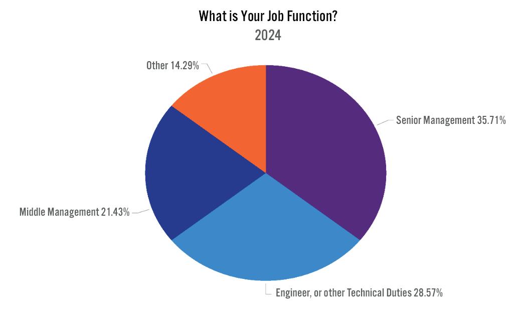
SubTel Forum, the premier publication in the submarine telecoms industry, stands out with:
• An average of more than 1,000 unique reads per issue and an average read time of more than 8 minutes.
• Two Months Exposure & Endless Archiving:
SPONSO R SHIP BENEFITS W ITH SUBTEL FO R UM :
• Video Embedding:
• Social Media Shoutouts:
• Dedicated Email Campaign:
A R T & V IDEO R EQ U I R EMENTS :
• Print Ads:
• Video Ads: •
EDITORIAL CALENDAR:
January 2025: Global Outlook and SNW EMEA preview
March 2025: Finance & Legal and ICPC preview
May 2025: Global Capacity and SubOptic preview
July 2025: Regional Systems and SNW World preview
September 2025: Offshore Energy and IWCS preview
November 2025: Data Centers & New Technology and PTC preview
The SubTel Form Almanac, released quarterly,is a key reference for the submarine cable industry. Each issue showcases major international systems with detailed pages featuring system maps, landing points, capacity, length, and RFS year, among other data.
QUA R TE R LY DO W NLOADS & EXPOSURE :
• Each issue averages about 850 unique reads, 215 clicks, and a greater than 24 minute read time.
• Three months of exposure plus permanent archiving.
SPONSO R SHIP BENEFITS :
A R T & V IDEO R EQ U I R EMENTS :
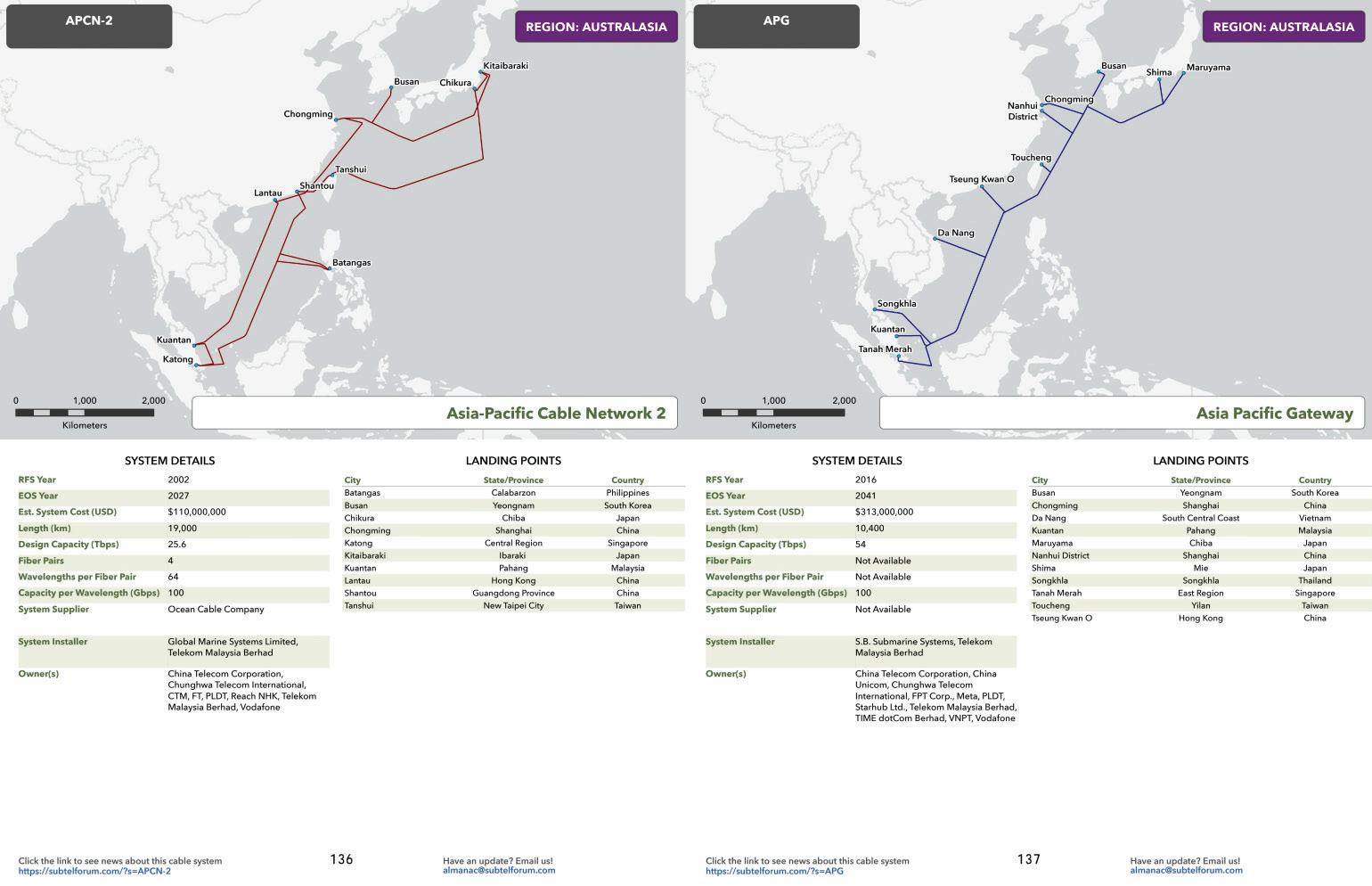
2 PAGE SPREAD 11” x 17”
The SubTel Forum Annual Report offers the latest, comprehensive data on the submarine fiber market, analyzing system capacity, productivity, and industry outlook. The yearly Industry report typically generates more than 2700 unique reads with an average read time of more than 11 minutes.
ANNUAL PRICE: $3,200
SPONSO R SHIP BENEFITS :
• Two-page Spread Ad.
• Social media acknowledgement.
• Press release and mailer acknowledgement.
:
• Two-page Spread: 17” W x 11” H, 300 dpi in PDF or JPG.
• Optional video: include a blank box for overlay; no size restrictions.
LOCK IN NO W FO R 20 2 5 !
• Global Overview
• Capacity
• Ownership Financing Analysis
• Supplier Analysis
• System Maintenance
• Cable Ships
• Hyperscalers and The Evolution of Submarine Cable Ownership
• Special Markets
• Regulatory Outlook
• Regional Analysis and Capacity Outlook
This new directory is designed for industry professionals to locate companies that provide products or services to the submarine telecom cable and network operations sector. Engage the more than 150,000 users across 125 countries that consume Submarine Telecoms Forum’s e-magazine, daily news, and streaming video content.
• Starting at $599/year
Learn more, customize your campaign, or place an order by contacting Nicola Tate at [+1] 804-469-0324 or ntate@associationmediagroup.com
Limited Availability:
Wide Distribution:
Over 4,500 copies shared at key industry events including PTC (January 2025), Submarine Networks EMEA (Februray 2025), and IWCS Cable & Connectivity Forum (October 2025), ensuring a year-long exposure. Additionally, an updated print-ready PDF cable map will be available for all sponsors.
ANNUAL PRICE: $4,500
SPONSO R SHIP PERKS :
• Comlimentary Web Banner on News Now feed
• Social Media shoutouts
• Acknowledgement in press releases and mailers
• In addition to the print copies that you may pick up during key industry events you can secure a print-ready PDF to print copies for staff and customers. Updated quarterly!
Add a special printing for SubOptic 2025 happening June 2025. $1,750 additional cost for annual sponsors or $3,500 for the single printing.
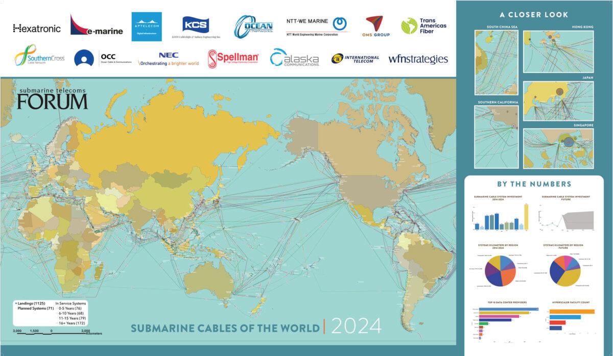
• • • • • QUARTERLY PRICE: $3,000
SPONSORSHIP BENEFITS FO R THE SUBTEL FO R UM ONLINE C A BLE M A P :
• Duration:
• Visibility:
•
• Social Media Recognition:
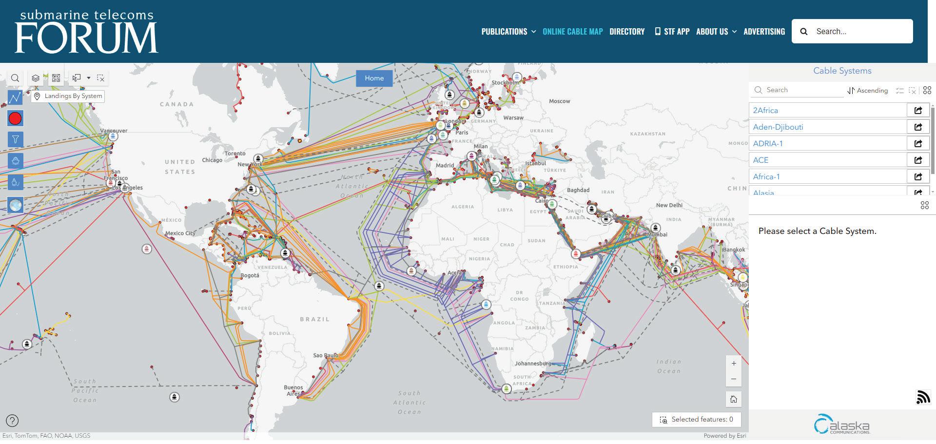
Learn more, customize your campaign, or place an order by contacting Nicola Tate at [+1] 804-469-0324 or ntate@associationmediagroup.com