5 minute read
Safer Roads, Connected Habitats

UNH-led research is helping New Hampshire reduce wildlife-vehicle collisions by identifying hotspots and enhancing animal-friendly crossings statewide
When the preferred routes of medium-sized and large animals intersect with roads, the results can be severe for both animals and drivers. Efforts to reduce the approximately 1,500 wildlife-vehicle collisions (WVCs) reported annually in New Hampshire have been limited by a lack of understanding of WVC hotspots — sections of road where WVC rates are particularly high. UNH research, funded by the NH Agricultural Experiment Station, shows that while knowing where WVC hotspots are is critical to tailoring better management practices, accounting for adjacent wildlife habitats and different animals’ interactions with roads is also key to lowering WVC risks.
“Reducing WVCs in New Hampshire is a two-part effort,” says Rem Moll, associate professor of natural resources and the environment. “We first need to identify the sites that present the biggest problems for drivers and wildlife. We then need to prioritize the most effective actions we can take despite limited resources, such as making existing structures like culverts and bridge underpasses more usable for animals.”
Research published in the journal Environmental Management focused on the role of connectivity — linkages that allow animals to move easily between habitats — in predicting WVC hotspot locations. Subsequent work monitored hotspots and assessed WVC mitigation strategies. Moll and Clara Dawson ’25G led the work in collaboration with Amy Villamagna of Plymouth State University.
The role of connectivity in collisions
Fueled by New Hampshire’s recent rapid population growth, wildlife connectivity has been impacted by the development of roads and buildings that can fragment previously continuous habitat. The researchers combined collision data with measures of connectivity across the Granite State to assess hypotheses regarding how connectivity, traffic volume, and habitat contribute to WVC frequency.
The findings emphasized that generalized connectivity models and maps currently do not provide sufficient nuance for predicting WVC hotspots. In fact, the results indicate that, in New Hampshire, greater connectivity did not lead to more active WVC hotspots as other studies had suggested it would. Instead, the highest WVC rates were observed at hotspots in areas with moderate connectivity, for reasons that are still being investigated.
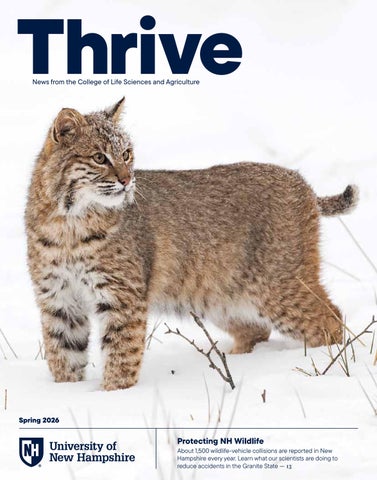
These differing results suggest that the ecosystem and habitat differences between rural and heavily fragmented landscapes play key roles in shaping hotspot occurrence and activity. Additional complexity can come from the number and diversity of animal species present within a landscape. For example, the movement behaviors of deer, bobcats, and porcupines differ, and these animals all seek different resources, so species-specific analyses are needed.
Monitoring hotspots and avoiding collisions
Once hotspots are identified in existing and planned infrastructure, what can be done to reduce WVC risks? Purpose-built wildlife corridors — bridges or underpasses constructed with surfaces resembling the surrounding countryside — are appealing, but their costs and land requirements make them unrealistic for New Hampshire. To understand cost-effective, landscape-appropriate strategies, Moll and his team have been investigating known hotspots to learn more about exactly why collisions happen at a high frequency at these specific locations. They also studied how adjacent culverts and small bridges can be modified and maintained as safe, wildlife-friendly crossing spots.
With support from the New Hampshire Department of Transportation, the researchers monitored 14 hotspots throughout the state, including the 125 corridor in Epping and Barrington, I-89 in Concord, and New Hampshire Route 110 near Berlin. Through two falls and one spring, they used wildlife cameras to capture deer, moose, gray and red fox, bobcat, coyote, black bear, raccoon, porcupine, and turkey movements. Prior research usually monitored only the crossing sites, such as at the bridges and culverts, but Moll and his team wanted a fuller picture of how wildlife interacts with roads.
“We developed a new approach that worked well, using cameras at the crossings themselves as well as at the roadsides and in adjacent habitats,” says Moll. “In some cases we didn’t record a species at the crossing but we saw a lot of them at the roadside, and they would have been missed entirely with a single camera. The situation indicates that the crossing needs to be more appealing to wildlife so they will use it.”
The early results indicate that there are several ways animals can be encouraged to use crossings that avoid putting themselves and vehicles in harm’s way. In culverts, a “critter shelf” can be added so that smaller animals are able to stay dry while passing through. Under bridges, streams can often be made shallower or the stream bed made more easily navigable by various animals.
“Low-cost, easily maintainable, and wildlife-friendly crossings are a win-win,” says Moll. “They provide more connectivity between habitats and more safety for animals, and they mean that fewer drivers will experience a potentially costly and dangerous collision.”
The New Hampshire Agricultural Experiment Station, which funded this research, has been an elemental component of New Hampshire's land-grant university heritage and mission since 1887. Our scientists manage more than 50 research projects at any one time, partner with state and regional farmers, growers, and producers, and collaborate with leading scientists worldwide to directly benefit New Hampshire and New England.