2027-2032
STRATEGIC PLAN
CORE MISSIONS Restoration of Water Resources and Ecosystems Flood Protection Water Supply Public Engagement and Administration
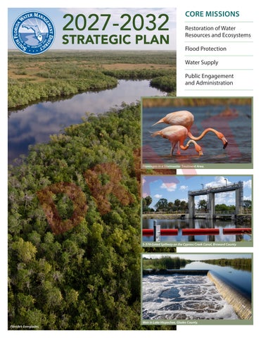
R D Florida’s Everglades.
T F A Flamingos in a Stormwater Treatment Area.
S-37A Gated Spillway on the Cypress Creek Canal, Broward County.
Weir in Lake Hicpochee, Glades County.
INTRODUCTION This document provides the South Florida Water Management District and the public it serves with a blueprint to successfully achieve balanced regional water resource management for the next five years and beyond. District resources are focused on the District’s core mission to safeguard and restore South Florida’s water resources and ecosystems while protecting communities from flooding and meeting the region’s present and future water supply needs. The commitments and strategies in this document will be put into action in order to make a positive and meaningful difference in South Florida.
Table of Contents
District Business Cycle . . . . . . . . . . . . . . . . . . . . . . . . . . . . . . . . . . . . . . . . . . . . . . . . . . 3 SFWMD Locations. . . . . . . . . . . . . . . . . . . . . . . . . . . . . . . . . . . . . . . . . . . . . . . . . . . . . . 4 CORE MISSION - Restoration of Water Resources And Ecosystems. . . . . . . . . . 5 u Goals, Strategies and Success Indicators. . . . . . . . . . . . . . . . . . . . . . . . . . . . . . 7
R D
Headquartered in West Palm Beach, the South Florida Water Management District (SFWMD or the District) is a regional governmental agency that oversees the water resources in 16 counties from Orlando to the Florida Keys. With a population of more than 9 million, this region covers 17,930 square miles (31% of the entire state) and includes vast areas of urban development, agricultural lands and conservation areas. Operating for over 75 years, the District is the oldest and largest of the state’s five water management districts. State legislation further divides the District into two taxing basins: the Big Cypress Basin includes all of Collier County and a portion of mainland Monroe County, and the larger Okeechobee Basin comprises the remaining area within District boundaries.
T F A
District Overview. . . . . . . . . . . . . . . . . . . . . . . . . . . . . . . . . . . . . . . . . . . . . . . . . . . . . . . 2
u Strategic Projects for Safeguarding and Restoring
District Overview
South Florida’s Delicate Ecosystem, table and map. . . . . . . . . . . . . . . . . . 8-9 CORE MISSION - Flood Protection . . . . . . . . . . . . . . . . . . . . . . . . . . . . . . . . . . . . . 10 u Goals, Strategies and Success Indicators. . . . . . . . . . . . . . . . . . . . . . . . . . . . 12 u Strategic Projects for Protecting South Florida’s Communities from
Flooding, Ensuring and Managing Water Flow, table and map. . . . . 13-14 CORE MISSION - Water Supply. . . . . . . . . . . . . . . . . . . . . . . . . . . . . . . . . . . . . . . . . 15 u Goals, Strategies and Success Indicators. . . . . . . . . . . . . . . . . . . . . . . . . . . . 17 u Strategic Projects for Ensuring Water for South Florida’s Communities,
water supply development projects table and map. . . . . . . . . . . . . . . . . . 18 u Strategic Projects for Ensuring Water for South Florida’s Communities,
water resource development projects table and map. . . . . . . . . . . . . . . . 19 SUPPORT MISSION - Public Engagement and Administration. . . . . . . . . . . . 20 u Goals, Strategies and Success Indicators. . . . . . . . . . . . . . . . . . . . . . . . . . . . 20
Ground Breaking, Major Milestones and Completed Projects . . . . . . . . . . . . 21 Link to Critical Wetlands List. . . . . . . . . . . . . . . . . . . . . . . . . . . . . . . . . . . . . . . . . . . 22 SFWMD 2024 Critical Wetlands List . . . . . . . . . . . . . . . . . . . . . . . . . . . . . . . . . . . . 23
A nine-member Governing Board sets the mission and provides overall direction for the entire District. Board members are appointed by the Governor, confirmed by the Florida Senate and generally serve four-year terms. The annual budget is funded by a combination of property taxes and other sources such as federal, state and local revenue, licenses, permit fees, grants, agricultural taxes, investment income and reserve balances.
The District is charged with safeguarding the region’s water resources today and for the future. This includes protecting water supplies and supporting water quality improvements in close collaboration with the Florida Department of Environmental Protection (DEP). The District also operates and maintains the Central and Southern Florida Project, one of the world’s largest water management systems. The District is made up of an extensive network of canals, levees, water storage areas, pump stations and other water control structures. This highly engineered system was built through one of the most diverse ecosystems in the world: the interconnected Greater Everglades Ecosystem, which the District is helping protect and restore. South Florida itself encompasses a mosaic of diversity from landscapes and habitats to people and cultures. The District strives to ensure that the public is informed and engaged, and that both local and regional perspectives are considered and incorporated into decisions and actions.
In addition to the headquarters complex in West Palm Beach, four Regulatory Service Centers and eight Field Stations provide assistance and operational support on water management related issues. This includes the Big Cypress Basin office which provides intergovernmental project support in Collier County.
OUR MISSION
To SAFEGUARD and RESTORE South Florida’s water resources and ecosystems, protect our communities from flooding, and meet the region’s water needs while connecting with the public and stakeholders. 2
DISTRICT BUSINESS CYCLE PUTTING THE PLAN INTO ACTION
Strategic Plan
E • MA ANC
Performance Metrics
ERFORM
EMENT G A N
Strategic Priorities • Success Indicators
•P
ISTRICT
•D
Strategic Plan
Annual Work Plan
Annual Budget
R D
Annual Work Plan
T F A Success Indicators: Quarterly, Annual & Water Year Metrics
SFER Vol. II Chapter 2
Fiscal Year Performance Accountability Report (Annual Work Performance)
The Strategic Plan…
The Strategic Plan is a key component of the South Florida Water Management District’s integrated business cycle. It establishes the overall policy direction and strategic priorities set by the Governing Board to carry out the District’s core mission responsibilities. Serving as the agency blueprint for long-term planning and implementation, the Strategic Plan provides overarching guidance in development of the annual budget and work plan and the success indicators used for measuring progress.
The District’s Strategic Priorities are: u Restoration of South Florida’s ecosystem,
including improvements of water flows and restored habitats u Regional flood protection provided by a
refurbished water management system u Achievement of water quality standards u Affordable and reliable water supplies u Public and private partnerships that help
stretch limited resources u Efficient and effective customer service
for the District’s taxpayers u Transparency to the public on the District Dredge Working on the C-23 Canal.
District’s priorities 3
SFWMD LOCATIONS
HEADQUARTERS s
3301 Gun Club Road West Palm Beach, FL 33406
s
Big Cypress Basin (Naples) 3875 City Gate Blvd. N.
s
Fort Myers 2301 McGregor Blvd.
s
Clewiston 2425 Hookers Point Rd.
s
Okeechobee 316 Northwest 5th St.
s
Fort Lauderdale 2535 Davie Rd.
s
Orlando 7345 Greenbriar Pkwy.
s
Homestead 2195 NE 8th S.
Miami 9001 NW 58th St. Okeechobee 1000 NE 40th Ave. St. Cloud 3800 Old Canoe Creek Rd.
s
s
Big Cypress Basin (Naples) 2660 N. Horseshoe Dr., Ste. 101A
s
FIELD STATIONS
s
SERVICE CENTERS
s
R D
District Headquarters, West Palm Beach
T F A West Palm Beach 801 Sansburys Way 4
CORE MISSION
RESTORATION OF WATER RESOURCES AND ECOSYSTEMS Safeguarding and Restoring South Florida’s Delicate Ecosystem South Florida is characterized by its unique, diverse ecosystems including: the Northern Everglades covering the Kissimmee River, Lake Okeechobee, Caloosahatchee River and St. Lucie River watersheds; and the Southern Everglades encompassing the watersheds south of Lake Okeechobee to the Florida Keys. A comprehensive effort is underway to protect and restore America’s Everglades and make our water resources more resilient – now and for future generations. New data demonstrates the success of restoration and resilience projects across our region – proving recent investments and momentum are working. We have celebrated over 90 ribbon cuttings, groundbreakings and major milestones on Everglades projects since January 2019.
HISTORIC AGREEMENT
u
u Everglades Agricultural Area (EAA)
Reservoir Project u Caloosahatchee (C-43) Reservoir u C-44 Reservoir and Stormwater
Treatment Area
T F A
In July 2025, the State of Florida and the U.S. Department of the Army reached a new landmark agreement to accelerate the restoration of America’s Everglades. Successes since the agreement was signed:
Key Comprehensive Everglades Restoration Plan (CERP) Projects
State of Florida groundbreaking of the Blue Shanty Flow Way, a crucial component of Everglades restoration in September 2025.
u Lake Okeechobee Watershed
Restoration Project
u Central Everglades Planning Projects –
North, South and New Waters
u Indian River Lagoon - South Components u Picayune Strand Restoration Project
U.S. Army Corps of Engineers ribbon cutting to celebrate the completion of the inflow/ outflow canal and the seepage canal at the EAA Reservoir Project in September 2025.
u Biscayne Bay Coastal Wetlands
u
State of Florida groundbreaking of the new inflow pump station at the EAA Reservoir Project in November 2025.
u Western Everglades Restoration Plan
u
CERP Framework - Implementing the agreement between the Department of the Army, Florida Department of Environmental Protection, and South Florida Water Management District regarding the Comprehensive Everglades Restoration Plan (CERP).
u
u
u
R D
Announcement in April 2026 - All federally funded contracts have been executed to expedite the completion of construction of the EAA Reservoir by 2029, five years ahead of the original timeline. This ensures that funding and resources will remain secured through project completion.
The South Florida Water Management District and the U.S. Army Corps of Engineers signed a first-of-a-kind agreement in July 2026 to advance construction of key Everglades restoration projects in South Florida. This agreement ensures federal funding will go to the State of Florida for key projects that will line up with the completion of the Everglades Agricultural Area (EAA) Reservoir by the U.S. Army Corps of Engineers. These key projects include the state construction of the final EAA Reservoir component (a seepage management pump station) and the Blue Shanty Flow Way Project, which unlocks a vital system to deliver more clean water south across Tamiami Trail and Florida Bay.
u Broward County Water Preserve Area
u Biscayne Bay Southeastern Everglades
Ecosystem Restoration
Foundation & Other Restoration Projects u Everglades National Park (ENP)/
South Dade Hydrologic Improvement (C-111 Detention Areas)
u Kissimmee River Restoration
u Improve Water Deliveries to Everglades
National Park - Phase II: Tamiami Trail Road Raising
u C-139 Annex Wetland Restoration - Phase II u South Dade Seepage Barrier u Picayune Watershed Water
Quality Project u Restoration Strategies and Clean
Water for America’s Everglades Northern Everglades and Estuaries Protection Program (NEEPP) u Brighton Valley Dispersed Water
Management Project u Bluefield Grove Water Farm u Scott Water Farm u Caulkins Water Farm u Lake Hicpochee Restoration u BOMA Flow Equalization Basin u Caloosahatchee Reservoir Water First-of-a-kind agreement signing at the Blue Shanty Flow Way Project construction site, July 21, 2026.
Quality Component Study 5
CORE MISSION
RESTORATION OF WATER RESOURCES AND ECOSYSTEMS Federal, State, and Local Partnerships In partnership with the U.S. Army Corps of Engineers (USACE), the District is implementing Comprehensive Everglades Restoration Plan (CERP) to improve the quantity, quality, timing, and distribution of water delivered to freshwater and coastal systems in South Florida. Taxpayers have invested $3.7 billion toward the acquisition of more than 255,000 acres required for CERP implementation, project construction, and science-based research and monitoring. The Kissimmee River and floodplain construction project was completed in partnership with the USACE and produced a functioning mosaic of wetland plant communities. The District acquired 100,000 acres for the restoration effort and conducts on-going scientific evaluations of the ecosystem response. Backfilling the C-38 canal was completed in three phases by the USACE. Continuous water flow re-established 24 miles of the river’s original course. Over the last 8 years the District has been directed to expedite the Everglades Agricultural Area (EAA) Reservoir Project. Construction began ahead of schedule on the Stormwater Treatment Area (STA), the state’s portion of the EAA Reservoir Project, in April 2020 and was completed in FY2024. The project will provide a significant increase in Southern Everglades Storage to reduce high-volume discharges from Lake Okeechobee to the northern estuaries and deliver increased clean freshwater south. Much of the District’s efforts in the Northern and Southern Everglades are guided by state law in the Northern Everglades and Estuaries Protection Program (NEEPP) Chapter 373.4595, Florida Statutes (F.S.) and the Everglades Forever Act, Chapter 373.4592, Florida Statutes (F.S.), respectively.These efforts consist of projects, programs, and cooperative initiatives.
R D
An extensive monitoring network is used to measure restoration progress and ensures that District science staff provides consistent environmental data to decision makers. The District recently expanded the existing monitoring network to transparently provide data on South Florida’s waterways to support projects, programs, and efforts.
The Restoration Strategies program was implemented to further improve water quality in the Everglades through expansion of the existing network of Stormwater Treatment Areas (STAs) and construction of Flow Equalization Basins (FEBs) to provide additional water storage and improve treatment performance. With implementation completed in 2025, more than 64,000 acres of STAs and 116,000 acre-feet of FEB storage are now operational and working to reduce phosphorus concentrations in water flowing to the Everglades. The program also includes sub-regional projects that provide additional water quality improvements in areas where phosphorus levels are elevated.
T F A
Restoration Strategies included a science plan that targeted the research and monitoring necessary to improve and optimize the performance of water quality treatment within the facilities. Additional projects south of Lake Okeechobee intended to further assist in managing flow and improving water quality continue to be implemented along with other sub-regional programs and habitat restoration. The USACE signed the Lake Okeechobee System Operating Manual (LOSOM) Record of Decision on August 12, 2024. This process took five years to complete. The South Florida Water Management District worked with the U.S. Army Corps of Engineers to ensure LOSOM was implemented in a manner that reduces harmful discharges into our estuaries, sends more water south to benefit the environment and meets the needs of our communities. The District participates in several interagency working groups that seek to achieve ecosystem restoration, stormwater, and flood protection improvements. Examples of these groups include the Charlotte Harbor Flatwoods Initiative, Loxahatchee River Preservation Initiative and Lehigh Headwaters Initiative. Projects developed by interagency working groups often complement restoration programs such as CERP and NEEPP.
In the Northern Everglades, state law directs the coordinating agencies, the DEP, the Florida Department of Agriculture and Consumer Services (FDACS), and the District to restore the health of Lake Okeechobee, its watershed, and the St. Lucie and Caloosahatchee River watersheds and estuaries, while continuing to balance flood protection, water supply, navigation and recreational needs. The District supports the coordinating agencies in implementing research, water quality monitoring, and providing technical support in hydrological and ecological evaluation and assessment methods needed to understand how the NEEPP is progressing. The District’s three Watershed Protection Plans provide a comprehensive road map of activities the District will undertake to fulfill its role in the Northern Everglades program areas. Strategies involving one or more of the three coordinating agencies include construction projects; alternative treatment technologies; local water quality projects; public-private partnerships; habitat restoration; and agricultural and urban harmful nutrient reduction programs. In the Southern Everglades, a combination of approaches including STAs and agricultural best management practices (BMPs) are in place to achieve compliance with the long-term phosphorus water quality standards established for the Everglades Protection Area. In the EAA and C-139 Basins, existing programs for implementing BMPs are a part of the overall strategy.
6
CORE MISSION
RESTORATION OF WATER RESOURCES AND ECOSYSTEMS Expanding Storage Opportunities, Improving Habitats, and Cleaning Water FUNDING SOURCES
Improved water storage, habitat restoration and water quality treatment in both the northern and southern reaches of the Greater Everglades Ecosystem are key to a healthy environment and strong economy. The natural environment will experience significant benefits as restoration projects come online and begin operating and delivering their desired results. The District is committed to identifying and implementing cost-effective and sustainable solutions to meet the region’s water quality and ecosystem restoration challenges. Specifically, the District will work collaboratively with DEP and FDACS over the next five years to develop a road map to meet the storage and treatment goals described in the BMAPs. The District provides natural resource protection and management while allowing compatible, multiple uses on select public lands in accordance with state law. The District primarily uses the Comprehensive Everglades Restoration Plan’s Integrated Delivery Schedule, Northern Everglades and Estuaries Protection Program, and funding opportunities to identify further restoration projects.
Restoration of Water Resources and Ecosystems
Ecosystem restoration supports the District’s efforts to increase resilience in the face of changing hydrologic and climate conditions, including sea level rise. In particular, the restoration of beneficial freshwater flows, as the main Everglades restoration goal, slows down saltwater intrusion, promoting more sustainable aquifer recharge rates, healthier freshwater habitats, estuaries and bays, enhanced water quality, more stable coastlines, reduced marsh dry-outs, and greater coastal resiliency. Ecosystem restoration also results in increased freshwater flows to and within the Everglades, higher flexibility and storage options to address water management seasonal needs, increased wetland acreage, and increased connectivity to coastal ecosystems.
T F A
24% Federal Revenues
19% District Revenues
55% State Revenues
2%
R D
Resiliency and Ecosystem Restoration
Fund Balance
Nubbin Slough Stormwater Treatment Area.
Restoration of Water Resources and Ecosystems: Goals, Strategies and Success Indicators Goal 1 – Expediting Restoration Results in the Everglades
STRATEGY 1.1 – Advancing Restoration of Water Resources and Ecosystems projects Success Indicators:
1.1.1
Complete project milestones to advance Key Everglades Restoration Projects
STRATEGY 1.2 – Implementing solutions to improve water quality treatment, reduce nutrient loads and reduce the potential for harmful algal blooms in the Northern Everglades
STRATEGY 1.4 – Utilizing regulatory permitting & compliance authority
Success Indicators:
1.4.1
STRATEGY 1.5 – Restoring native habitats through invasive species management and prescribed fire Success Indicators:
1.5.1
Annually sweep at least 250,000 acres of native habitat to manage invasive plant impacts through integrated pest management strategies
1.5.2
Investigate and implement efficient invasive plant control methods. Reduce herbicide use (lbs active ingredient/acre swept) by a total of 25% between 2020 and the end of 2027
1.5.3
Remove 1,200 Burmese pythons from Everglade Region annually. Expand adaptive management program to improve python detection and removal rates
1.5.4
Ensure 80% of the fire-maintained plant communities on District conservation lands are within the appropriate burn rotation
Success Indicators:
1.2.1
Establish and track a series of District milestones to meet the storage goals for the Northern Everglades watersheds
1.2.2
Measure District progress towards achieving nutrient reduction milestones for Northern Everglades projects
1.2.3
Reduced frequency of harmful algal blooms in Lake Okeechobee
STRATEGY 1.3 – Implementing water quality treatment solutions to reduce nutrient loading in the Southern Everglades
Encourage pre-application meetings for environmental resource permit applications to facilitate submission of complete applications
Success Indicators: Meet established Everglades Agricultural Area (EAA Basin) and C-139 Basin total phosphorus reduction requirements annually
STRATEGY 1.6 – Increasing and improving access and recreational opportunities on public lands consistent with ecosystem restoration goals
1.3.2
Continue progress toward meeting the Water Quality Based Effluent Limitation for the Everglades STAs
1.6.1
1.3.3
Continue progress toward meeting the Everglades Water Quality Standard Phosphorus criterion
1.3.1
Success Indicators: Provide public recreational opportunities on lands acquired by the District in accordance with state law, maintain a minimum of 80% (600,000 acres) of all fee-owned lands open for public recreation and provide hunting opportunities where such use is consistent with restoration goals 7
CORE MISSION
RESTORATION OF WATER RESOURCES AND ECOSYSTEMS Strategic Projects for Safeguarding and Restoring South Florida’s Delicate Ecosystem
R D
T F A 8
CORE MISSION
RESTORATION OF WATER RESOURCES AND ECOSYSTEMS Strategic Projects for Safeguarding and Restoring South Florida’s Delicate Ecosystem
R D
T F A 9
CORE MISSION
FLOOD PROTECTION Protecting South Florida’s Communities from Flooding, Ensuring & Managing Water Flow Tempering South Florida’s weather extremes of flood and drought was the impetus for the creation of the District in 1949. That principal directive continues today through effective operation, maintenance and management of the primary canals, water control structures, pump stations and District-owned public lands. In addition, proper coordination with local governments, water control districts, homeowners and private landowners assists with the continual operation of secondary and tertiary systems. When the regional Central and Southern Florida Project was designed in the late 1940s, its primary function was flood protection. Highly variable rainfall coupled with flat topography reinforces the need for effective flood protection for the more than 9 million residents of South Florida. The region receives 52 inches of rainfall per year on average, and approximately 75% of the region’s annual rainfall typically falls in the six-month period from May through October, when intense rainfall is common. Rainfall fluctuates annually and conditions move quickly between flooding and drought, and the region is extremely vulnerable to hurricanes and tropical storms. These weather extremes add to the challenges of water resource management and ensure Flood Protection remains a critical responsibility of the District.
R D
In addition to managing the region’s critical flood control system under increasingly extreme weather conditions, the District faces the challenge of an aging infrastructure network. The majority of the system’s components are more than 70 years old and require significant repair, replacement, or rehabilitation. The pace and scale of these needs far exceed currently available funding. Addressing this funding gap is a strategic priority, requiring continued efforts to maximize and prioritize existing resources while actively pursuing new and alternative funding sources to ensure the long-term reliability and resilience of the flood control system. Since the USACE’s construction of the public works project in the 1950s to 1970s, the District’s responsibilities as local sponsor of the flood
protection system expanded to emphasize various aspects of water resource management and address changing conditions. These include land development, extreme rainfall, sea level rise, and other climate change impacts. Today, the District operates and maintains more than 2,175 miles of canals, 2,130 miles of levees/berms, 915 water control structures, 620 project culverts and 98 pump stations. This system is continuously expanding as new restoration projects (ex. Stormwater Treatment Areas) and resiliency projects (ex. Coastal Structure Enhancements) are completed.
T F A
The District has a Cooperative Agreement with Collier County and has a Big Cypress Basin Board and Big Cypress Basin Service Center that manage a network of primary canals, water control structures and CERP pump stations providing flood control during the wet season and protecting regional water supplies and environmental resources from over-drainage during the dry season. The District has a Memorandum of Agreement with Lee County to perform hazardous tree removal projects within the county’s natural waterways and provide emergency flood control operations. Major flood protection responsibilities include planning, operations, maintenance, and refurbishment of system-wide infrastructure; vegetation management; hydrological data collection, flow determination, and basin management; and coordination with adjacent landowners, including 298 special districts, to identify and the reduce accumulation of obstructions that may impede water conveyance and District operations in canals and other water bodies. Improvements and upgrades to the District’s flood protection system include: automation; pump station repair, refurbishment, and new installations; water control structure repair, enhancement and replacement; levee inspections and repair; canal conveyance improvement, new or enhanced storage, detention and retention areas and associated nature based features.
G-56 Structure, Broward County.
10
CORE MISSION
FLOOD PROTECTION District’s Sea Level Rise and Flood Resiliency Plan The District is strongly committed to addressing the impacts of sea level rise, extreme rainfall, and other changing conditions affecting water resources and the environment. Current resiliency efforts focus on advancing scientific data assessment and research needs to ensure that planning and adaptation strategies are founded on the best available science, robust technical analysis, and risk-informed decision making. In addition, the resiliency efforts focus on developing and implementing comprehensive District-wide resiliency goals to mitigate and adapt to the challenges facing the District’s infrastructure and core functions from sea level rise, extreme rainfall and other changing hydrologic and climate conditions. The District is making infrastructure adaptation investments that are needed to continue to successfully fulfill its mission of safeguarding and restoring water resources and ecosystems, protecting communities from flooding, and ensuring an adequate water supply for people and the environment now and into the future.
throughout the entire District boundary that will no longer adequately provide flood protection, improvements are recommended to ensure adequate flood protection. These improvements are being integrated into the District’s Sea Level Rise and Flood Resiliency Plan for implementation, along with post-storm event project recommendations, Capital Improvement Plan project integration and other innovative strategies. The District’s Sea Level Rise and Flood Resiliency Plan sets a list of priority projects and strategies to ensure water management infrastructure and water resources can effectively adapt to sea level rise and flooding, while increasing community, economic, and ecosystem resiliency in South Florida. The plan is available at: sfwmd.gov/our-work/sea-level-rise-and-flood-resiliency-plan.
T F A FUNDING SOURCES Flood Protection
These efforts are carried out in collaboration and cooperation with regional, state and federal agencies, local and tribal governments, non-governmental organizations, universities, and the public, including:
R D
u Florida Department of Environmental Protection (DEP) u Statewide Office of Resilience
u Florida Flood Hub of Applied Research and Innovation u Florida Division of Emergency Management (FDEM) u U.S. Army Corps of Engineers (USACE)
u Federal Emergency Management Agency (FEMA) u U.S. Geological Survey (USGS)
3%
Federal Revenues 10% State Revenues
64% District Revenues 23% Fund Balance
Levee Maintenance.
The District’s goal is to ensure flood protection needs into the future. The District is assessing the flood management risks from compounding drivers (rainfall, high tides, groundwater and surge) and exacerbating factors such as land development, and other changing hydrologic and climate conditions. The results of these assessments support prioritization of investments and implementation of adaptive solutions which will ensure long-term resiliency and ensure flood protection needs are met into the future. The District accounts for sea level rise according to available projections advanced by federal agencies, including the National Oceanic and Atmospheric Administration (NOAA) and USACE as well as the Statewide Sea Level Rise Projections developed by the Florida Flood Hub for Applied Sciences and Innovation. Beyond sea level rise, the District is also estimating future extreme rainfall conditions and other future climate scenarios, based on the evaluation of existing climate model results in contrast to historic observation data. These observed datasets are being integrated into a set of water and climate resilience metrics to document and communicate trends and shifts in relevant water and climate data, informing the District’s resiliency efforts. A key piece of the District’s resiliency efforts is the Flood Protection Level of Service Program (FPLOS) and the ongoing C&SF Flood Resiliency Studies being developed in partnership with USACE. Through these flood risk management assessments, the District and its partners studies the canals, pump stations and other structures it operates. This ensures that they can provide the level of flood protection they were designed to under future conditions. Where the studies identify canals and/or structures
Canal Maintenance.
Structure Maintenance.
11
CORE MISSION FLOOD PROTECTION
Flood Protection: Goals, Strategies and Success Indicators Goal 2– Refurbishing, Replacing, Improving, and Managing the Components of Our Water Management System STRATEGY 2.1 – Implementing flood protection infrastructure Operations and Maintenance and enhancement projects Success Indicators:
2.1.1
Complete strategic flood control operations and maintenance projects according to established milestones, while ensuring major infrastructure refurbishments and enhancements address future resilience and adaptation needs.
STRATEGY 2.5 – Advancing adaptation strategies and infrastructure investments, in coordination with local, regional, state and federal partners, to continue to increase resiliency of its flood protection system and other mission critical services Success Indicators:
2.5.1
STRATEGY 2.2 – Assessing and operating the water management system to meet flood protection and water supply needs Success Indicators:
2.2.1
Maintain operating water levels within established target ranges to the extent that weather and climatological conditions allow
STRATEGY 2.3 – Coordinating with state/federal partners and assisting local governments to ensure operational readiness for optimal level of flood control by optimizing infrastructure maintenance, adhering to, or exceeding, industry standards and best management practices Success Indicators:
R D
2.3.1
Reduce the average risk rating of District infrastructure through structure inspections and improvements
2.3.2
Ensure that 90% of field station repairs are completed within one year of inspection reports
2.3.3 2.3.4
Resolve Right of Way unpermitted encroachments
2.3.5
Expend no more than 20% of field maintenance funds for unplanned work
Perform at least 80% of all field maintenance work activities as planned work; no more than 20% as unplanned
STRATEGY 2.4 – Assessing sea level rise and other changing hydrologic and climate conditions to support risk-informed decision making and determine potential impacts on the District’s mission Success Indicators:
2.4.1
2.4.2
2.4.3
2.4.4
Complete FPLOS Adaptation Planning (Phase II) Studies or equivalent (e.g. HMGP) on time and on budget and in close coordination with local governments and stakeholders
T F A 2.5.2
Advance the C&SF Flood Resiliency Studies, in partnership with USACE, to revisit the C&SF Project, with the goal of developing, evaluating and recommending flood risk management measures and adaptation strategies that provide flood resiliency in vulnerable areas served by the C&SF system, now and in the future, and proposing for inclusion in the upcoming Water Resources Development Act
2.5.3
Complete the annual update of the District’s Sea Level Rise and Flood Resiliency Plan and submit a list of projects to DEP for consideration into the Statewide Flood and Sea Level Resiliency Plan, and submit to the Governor, Legislators and DEP by Oct. 1
2.5.4
Complete District resiliency strategic project milestones, along with the identification and pursuit of funding alternatives to support implementation of the recommended adaptation projects, including enhancement of coastal structures, levees, canals, and other critical flood protection infrastructure, to ensure the long-term reliability and resilience of the flood control system through partnerships with State and Federal Agencies
STRATEGY 2.6 – Ensuring resilient connected systems for operations and communication. Maintain and enhance the District’s communications, control, and operational systems to ensure reliable, real-time data exchange, command capability, and operational readiness under all conditions, including emergencies. Strengthening SCADA and microwave infrastructure, enabling redundant operations, and leveraging technology to support both routine business functions and emergency response.
Establish key water and climate resilience metrics to document and communicate observed trends and shifts in relevant water and climate data, supporting the District’s flood resiliency planning efforts and risk informed decision-making and modernizing design standards
Success Indicators:
2.6.1
Maintain microwave network resilience and reliability through predictive maintenance, ensuring uninterrupted operations during normal and emergency conditions
Use new climate data to predict how extreme rainfall and other hydrologic and climate conditions may change in the future and compare these predictions to past hydrologic and climate patterns
2.6.2
Keep the SCADA system current by implementing SCADA system software upgrades (Evergreen)
2.6.3
Implement and maintain a secondary data center with full operational capability at a geographically separate location to ensure reliable and resilient flood control operations
2.6.4
Conduct an annual mode-switch test to validate full operational readiness of the secondary facility for complete system operations
2.6.5
Leverage advanced communications technology and best practices to ensure continuity of operations for both daily business functions and emergency response needs
Coordinate restoration, flood protection and water supply efforts to incorporate actions to address climate related impacts and promote resilience adaptation strategies, based on consistent scenario planning and regional modeling approaches Complete FPLOS Flood Vulnerability (Phase I) studies on time and on budget and in close coordination with local governments and stakeholders
12
CORE MISSION
FLOOD PROTECTION CORE MISSION STRATEGIC PROJECTS Strategic Projects for Protecting South Florida’s Communities from Flooding, Ensuring and Managing Water Flow
R D
T F A 13
CORE MISSION
FLOOD PROTECTION CORE MISSION STRATEGIC PROJECTS Strategic Projects for Protecting South Florida’s Communities from Flooding, Ensuring and Managing Water Flow
R D
T F A 14
CORE MISSION
WATER SUPPLY Ensuring Water for South Florida’s Communities Resiliency and Water Supply To support water supply plans, the District has several groundwater models that simulate current and future groundwater withdrawals and identify potential impacts on water resources, both for traditional fresh groundwater aquifer systems as well as the brackish Floridan Aquifer System (FAS). The District is currently developing the East Coast Surficial Model (ECSM), which is a density-dependent groundwater model. The ECSM will be able to explicitly simulate the effects of sea level rise and potential movement of the saltwater interface on the surficial groundwater system. The ECSM includes most of the Lower East Coast (LEC) planning region and the entire Upper East Coast (UEC) planning region and will be completed in 2026.
R D
Residential Development Leads to Increased Water Supply Needs.
T F A
In the State of Florida, water is a public resource. The District utilizes a variety of tools and technologies to help ensure a reliable and sustainable supply of water for South Florida’s environment, citizens, communities, and agriculture.
Water supply needs are continually evaluated by the District and appropriate programs are developed to achieve sustainable water resources and maintain related natural systems. Data, computer modeling and analysis are used to evaluate water source conditions for current and projected uses. Increasing development and population have resulted in higher demands for water supply over time and are projected to continue to increase into the future.
Planning for a growing water demand must be balanced while ensuring water remains available for natural systems. Changing climate patterns including: increased rainfall variability, sea level rise, increased evapotranspiration, and warmer air temperatures may affect future water supply demands and sources. This needs to be taken into consideration in water supply plans and future water supply vulnerability analyses. Freshwater aquifers in coastal counties remain vulnerable to saltwater intrusion. Therefore, coordinated efforts with local governments and other partner agencies are necessary to ensure sustainable water supplies.
For assessing longer-term evolving conditions, Water Supply Vulnerability Assessments will utilize the existing surface water model and the enhanced groundwater ECSM model. These models will be used to evaluate the effects of sea level rise and changing climate conditions (rainfall and evapotranspiration) on water supplies. The outputs of the model runs will identify potential impacts on water resources, water supply sources and areas the District needs to focus on. The identification of strategies and projects can increase water supply resilience. The Water Supply Vulnerability Assessment was initiated in 2024 and has a three-year estimated duration to complete. The Water Supply Vulnerability Assessment will look beyond the traditional water supply planning efforts and 20-year planning horizon. It will also incorporate additional climate scenarios and a longer planning horizon. This more detailed evaluation of the vulnerability of water supply sources can help inform the development of new projects and regional water supply strategies. These new projects will enhance South Florida’s water supply resiliency. This is part of an overall effort to help the District understand and plan around the complexities that factor into the current and future resilience of water supplies.
To meet Florida’s future water demands, the state’s water management districts are working with water users to best use the state’s traditional water sources while also promoting the development and use of alternative sources. Water supply management strategies include: sound planning and permitting; demand reduction through water conservation; development of alternative water sources such as new surface water storage, reclaimed water and desalination of brackish and saline water; and Everglades restoration. Data collection to monitor conditions and increase our knowledge of water resources is integral to the sustainability of these resources. The District conducts groundwater monitoring, and aquifer system research through installation and testing of new wells.
Glass of Water Being Refilled.
15
CORE MISSION
WATER SUPPLY Planning, Regulation and Conservation Water supply plans are updated every five years in collaboration with stakeholders in accordance with the statutory direction provided in Chapter 373, Florida Statutes. Based on at least a 20-year outlook, water supply plans include: water demand estimates and projections; an evaluation of regional water resources; identification of water supply related issues; and water resource and water supply development components, including funding and recommendations for meeting projected demands while sustaining water resources and related natural systems. Alternative water supplies, regional solutions, and water conservation are encouraged through strategies that include public outreach/ education, policy, voluntary efforts, and financial incentives. Water supply development projects that support the reuse of treated wastewater are included in regional water supply plans, and its beneficial use is encouraged with consideration to improve regional water quality. The District regulates and manages the consumptive use of water through consumptive use permits. These permits ensure that proposed uses are reasonable and beneficial, will not interfere with any current existing legal users and are consistent with the public interest. Rules protecting water for Florida’s natural systems and wetlands work to prevent harm that could result from over-pumping. In addition, the state’s water reservations authority allows water to be set aside in an ecosystem for the protection of fish and wildlife. Minimum flows and minimum levels are established at specific water resource locations to protect the water resource and/or ecology of those areas from significant harm due to further withdrawals. Associated recovery or prevention strategies are also developed for all minimum flows and levels.
R D
T F A
Effective planning and permitting, along with source diversification and water conservation, are key to ensuring that communities are less susceptible to water supply shortages. South Florida’s primary water supply challenges include: limitation on new storage areas, saltwater intrusion, changing hydrologic and climatic conditions, and a growing demand coupled with competing uses.
Biscayne Bay FPL Turkey Point Monitoring Well.
S191 Basin Innovative Water Quality Project.
Ongoing drought mitigation efforts are informed by regional assessments and the ongoing Water Supply Vulnerability Assessment, which is currently evaluating future drought scenarios and related risks, to guide proactive long-term planning and enhance the resilience of South Florida’s water resources and water supply sources. Finding and implementing cost-effective solutions to resource protection and water supply availability issues require a collaborative approach. The District collaborate with water utilities, water users, FDEP and other local, state and federal partners to ensure sustainable water supply. The FY2027 Five-Year Water Resources Development Program includes an estimated $4.56 billion of projected expenditures for Fiscal Years 2027-2031 for water resource development activities and projects. This Work Program is included as Chapter 5A in the 2026 South Florida Environmental Report, Volume II.
Taylor Creek Stormwater Treatment Area.
FUNDING SOURCES Water Supply
20% Federal Revenues
35% District Revenues
38% State Revenues
7%
Fund Balance
C-23 Discharge Diversion Canal.
16
CORE MISSION
WATER SUPPLY Planning, Regulation and Conservation Water Supply: Goals, Strategies and Success Indicators Goal 3 – Meeting the Current and Future Water Needs of Users and the Environment STRATEGY 3.1 – Developing and implementing regional water supply plans in coordination with local governments, utilities, stakeholders and the public Success Indicators:
3.1.2
Regional water supply plans will be updated on schedule and will identify sources and future projects to meet existing and future reasonable beneficial uses during 1-in-10 year drought conditions through 2050 while sustaining water resources and natural systems as required by F.S.
3.1.3
Ensure at least 75% of projected 2050 public water demand is met by planning region
3.1.4
Ensure public supply utilities are on schedule with needed projects to meet 2050 projected demands by reviewing annual utility status reports and Water Supply Facility Workplan
STRATEGY 3.3 – Encouraging development of alternative water supply projects to diversify water supply Success Indicators:
3.3.1
Provide financial support of AWS and water conservation projects through the Cooperative Funding Program
STRATEGY 3.4 – Promoting water conservation measures Success Indicators:
T F A
3.4.1
District-wide average annual uniform gross per capita water use public water supply is less than 135 gallons per capita daily
STRATEGY 3.5 – Utilizing regulatory permitting and compliance authority Success Indicators:
STRATEGY 3.2 – Planning for the region’s water resource needs with consideration of changing hydrologic and climate conditions, including sea level rise
3.5.1
Success Indicators:
STRATEGY 3.6 – Protect water resources of the State, and develop and implement projects and strategies, where appropriate, to maintain established minimum flows and minimum levels, and respective prevention and recovery plans, including projects detailed in the Water Resources Development Workplan and Everglades Restoration related efforts
3.2.1
R D
Monitor groundwater levels and establish key water and climate resilience metrics to document and communicate observed trends and shifts in relevant water and climate data, and use new data to estimate future conditions and develop a range of sea level rise and other hydrologic and climate scenarios, with consideration of Everglades Restoration effort, to evaluate strategies to slow saltwater intrusion and other water supply risks, supporting the overall District’s resiliency planning efforts and risk informed decision-making
3.2.2
Maintain and enhance saltwater interface groundwater monitoring network where appropriate; and expand variable density groundwater models to predict the extent and rate of inland movement of the saltwater interface
3.2.3
Incorporate sea level rise and other changing hydrologic and climate conditions as a part of advanced integrated water supply planning, with consideration of projected water demands and availability
3.2.4
Advance the Water Supply Vulnerability Assessment, utilizing the enhanced ECSM model for the Lower East Coast Region
Encourage pre-application meetings for water use permit applications to facilitate submission of complete applications incorporating water use conditions of issuance
Success Indicators:
3.6.1
Implement MFL Recovery and Prevention Strategy projects consistent with the District’s Annual Five-Year Water Resource Development Work Program
3.6.2
Complete water reservations, restricted allocation, prevention and recovery strategies, and minimum flow and minimum water levels analyses on schedule
3.6.3
Submit the Water Supply Development Workplan on schedule and implement projects and strategies, as detailed in the plan, and consistent with Everglades Restoration related efforts
Nubbin Slough Stormwater Treatment Area.
17
CORE MISSION
WATER RESOURCES DEVELOPMENT PROJECTS Strategic Projects for Ensuring Water for South Florida’s Communities
R D
T F A 18
CORE MISSION
WATER SUPPLY DEVELOPMENT PROJECTS Strategic Projects for Ensuring Water for South Florida’s Communities
R D
T F A 19
SUPPORT MISSION
PUBLIC ENGAGEMENT & ADMINISTRATION Delivering Efficient and Cost-Effective Services on Behalf of South Florida Citizens The District constantly looks for opportunities to implement strategies to improve operations, enhance fiscal efficiency, ensure public access and engagement, create more accountability and, most importantly, deliver the services and results that the public expects. Project and operational progress, along with overall organizational efficiency and effectiveness, are continuously measured and reported. Monthly financial statements are publicly presented at Governing Board meetings and posted online to clearly demonstrate how the District utilizes taxpayer dollars. By routinely collaborating with the public, state, and federal agencies, local governments, non-governmental organizations, community organizations and the business community, the District works to further leverage public dollars by identifying additional cost-saving strategies.
Public Engagement & Administration: Goals, Strategies and Success Indicators Goal 4 – Ensuring South Florida Taxpayers Receive Efficient and Effective Customer Service STRATEGY 4.1 – Focusing resources on core functions, minimizing administrative costs, and measuring performance Success Indicators:
4.1.1
Post monthly financial statements to the District’s publicly available website within 24 hours after each Governing Board meeting
4.1.2
Cost savings/avoidance realized through at least 35 competitive solicitations
4.1.3
Percent of Administrative Costs less than 15%
4.1.4
Complete required distribution of annual audit within 10 days after Governing Board acceptance and ensure posting on the District’s publicly available website within 10 days of acceptance
R D
FUNDING SOURCES
Public Engagement and Administration
T F A
STRATEGY 4.2 – Ensuring accountability, transparency, and public involvement in District decisions Success Indicators:
4.2.1
Document, assign and respond to 90% of public records requests within 14 days
4.2.2
Participated in a minimum of 3 outreach events to promote the District’s mission, the Small Business Enterprise program, and how to do business with the District
STRATEGY 4.3 – Employing and developing a high-quality workforce
Success Indicators:
6%
Fund Balance
94% District Revenues
4.3.1
Maintain workforce turnover rate at less than 6%
4.3.2
Foster a culture of safety awareness and preparedness across the District to enhance workplace safety and ensure compliance by providing comprehensive safety training and educational programs to employees
4.3.3
Ensure more than 90% of new hires are retained after the six-month probation period
4.3.4
Complete quarterly training events via e-learning, classroom and/or virtually that further develop employee and supervisor skills such as respect in the workplace, new supervisor training, and team building
4.3.5
Promote a healthy and engaged workforce by offering a range of wellness programs, health screening, and fitness activities aimed to support employees’ physical and mental well-being, improve overall health outcomes and enhance workplace productivity
STRATEGY 4.4 –Strengthening security across information and operational technology.
2026 Palm Beach Business MatchMaker Conference & Expo
Protect the District’s technology environment by implementing proactive, comprehensive security measures for both information technology (IT) and operational technology (OT) systems. Safeguarding critical infrastructure, securing data, reducing legacy risks, and ensuring that all employees and system users are prepared to recognize and respond to threats
Success Indicators:
4.4.1
Provide ongoing cybersecurity awareness and training for every agency employee and all users of District technology, with campaigns delivered quarterly
4.4.2
Achieve and maintain compliance with applicable federal, state, and industry cybersecurity standards
4.4.3
Conduct an annual incident response exercise simulating both cyber and operational disruptions to validate and enhance agency readiness
Human Resources Team
20
GROUND BREAKING SINCE 2019
# PROJECT 1 2 3 4 5 6 7 8 9 10 11 12 13 14 15 16 17 18 19 20 21 22 23 24 25 26 27 28 29 30 31 32 33
4 Indicates these projects have been completed. GROUND BREAKING
Caloosahatchee (C-43) Reservoir – Final Phase of Construction Bolles Canal Improvements EAA Reservoir Project’s Treatment Wetland STA 1W – Expansion No. 2 Biscayne Bay Coastal Wetlands - L-31E Flow Way Old Tamiami Trail Roadbed Removal Bluefield Grove Water Storage Farm Scott Water Storage Farm Central Everglades Planning Project (CEPP) South C-139 Wetland Restoration – Phase II C-139 Water Storage Basin (FEB) Raising Tamiami Trail (FDOT) Lake O Watershed – Aquifer Storage & Recovery Wells Everglades Nat’l Park Seepage Containment Wall – Phase I (8.5 SMA) El Maximo Ranch Northern Everglades Water Quality Project C-23/C-24 Treatment Wetland Everglades Nat’l Park Seepage Containment Wall – CEPP New Water C-23 Canal Estuary Discharge Diversion Project Taylor Slough Hydrologic Improvements EAA Reservoir ALJO Four Corners Rapid Infiltration Project Biscayne Bay Coastal Wetlands – Cutler Wetlands Central Everglades Planning Project (CEPP) North Western Everglades Restoration-South Features Clewiston Field Station Blue Shanty Flow Way Lake Hicpochee Phase II Groundbreaking EAA Reservoir Inflow Pump Station North New River Conveyance Canal Expansion Miami Canal Expansion C43 Water Quality Treatment and Testing Project C-23/C-24 North Reservoir C-23/C-24 South Reservoir
MAJOR MILESTONE SINCE 2019
COMPLETION YEAR (EST.)
2019 2019 2020 2020 2020 2020 2020 2020 2020 2021 2021 2021 2021 2021 2022 2022 2022 2022 2023 2023 2023 2023 2023 2024 2024 2025 2025 2025 2024 2025 2023 2025 2024
4 4 4 4 4 4 4 4 2033 2027 4 2030 2030 4 4 2026 4 4 4 2029 4 4 2032 2028 2026 2029 2028 2029 4 2028 4 2031 2032
RECENT ACCOMPLISHMENT
R D
#
PROJECT
34 35 36 37 38 39 40 41 42 43 44 45 46 47 48 49 50 51 52 53
Biscayne Bay and Southeastern Everglades Ecosystem (BBSEER) Boma Water Storage Basin (FEB) C-23/C-24 Interim Water Storage C-23/C-24 North Reservoir C-23/C-24 South Reservoir C-25 Reservoir and Treatment Wetland Loxahatchee River Watershed Restoration S-332B Pump Station Replacement Western Everglades Restoration-Remaining Features Lake O Watershed – Wetland Restoration Lower Kissimmee Basin Treatment Wetland EAA Reservoir Project Partnership Agreement Signed Faka Union Pump Station/Canal Plugging – Picayune Strand Wetland Restoration C-11 Water Storage Impoundment Lake Okeechobee Component A Reservoir (LOCAR) Final Feasibility Study and EIS Startup of Miller Pump Station – Picayune Strand Wetland Restoration Green Heart of the Everglades Landmark Agreement to Accelerate Everglades Restoration Signed EAA Seepage Pump Station and Blue Shanty Flow Way Project Partnership Agreement Lower Kissimmee Basin Stormwater Treatment and Recreation Area Project
54 55 56 57 58 59 60 61 62 63 64 65 66 67 68 69 70 71 72 73 74 75 76 77 78 79 80 81 82 83 84 85 86 87 88 89 90 91 92 93
PROJECT
Lakeside Ranch Treatment Wetland Bridging Tamiami Trail (FDOT) C-139 Wetland Restoration – Phase I Brighton Valley Dispersed Water Storage and Management Improved Water Deliveries for ENP (COP) and C-111 South Dade Project Lake Hicpochee Restoration – Phase I S-333N Structure for Everglades Nat’l Park Water Deliveries STA 1W – Expansion No. 1 STA 5/6 Improvements Allapattah Flats Wetland Restoration Bluefield Grove Water Storage Farm C-44 Reservoir and Treatment Wetland Caloosahatchee (C-43) Reservoir Water Quality Improvements Study Kissimmee River Restoration Old Tamiami Trail Roadbed Removal S-191A Pump Station Scott Water Storage Farm Everglades Nat’l Park Seepage Containment Wall – Phase I (8.5 SMA) STA 1E Improvements Taylor Slough Hydrologic Improvements Bolles Canal Improvements ALJO Four Corners Rapid Infiltration Project Caloosahatchee (C-43) Reservoir S-470 Pump Station Herbert Hoover Dike Rehabilitation EAA Reservoir Project’s Treatment Wetland Everglades Nat’l Park Seepage Containment Wall – CEPP New Water Partin Family Ranch Dispersed Water Storage and Management C-139 Water Storage Basin (FEB) El Maximo Ranch Northern Everglades Water Quality Project Lake Okeechobee System Operating Manual (LOSOM) Caloosahatchee (C-43) Reservoir Biscayne Bay – L-31E Flow Way Biscayne Bay Coastal Wetlands – Cutler Wetlands Picayune Strand Restoration Project Alum Treatment Facility at Caloosahatchee (C-43) Reservoir C43 Water Quality Treatment and Testing Project Cypress Creek Restoration Project with Ducks Unlimited North New River Conveyance Canal Expansion C-23/C-24 Stormwater Treatment Area C-23 Canal Estuary Discharge Diversion Project
T F A EAA Inflow Pump Station Groundbreaking. COMPLETION YEAR (EST.)
Began Planning Efforts Started Design Started Design Completed Final Design, Began Construction Completed Final Design, Began Construction Completed Final Design, Began Construction Authorized by Congress, Started Design Started Design Authorized in WRDA Began Real Estate Acquisition Began Initial Planning and Design Agreement Executed Began Partial Rehydration of Drained Wetlands Began Final Design Authorized in WRDA Began Using the Pump Station Completed Land Acquisition Signed by Governor DeSantis and Executed Agreement Executed Completed Land Acquisition
COMPLETED SINCE 2019 #
Governor DeSantis at the Removal of the Old Tamiami Trail Roadbed.
TBD 2028 2026 2031 2032 TBD TBD 2028 2024 TBD 2029 2021 2025 2028 2024 2025 2023 2025 2026 2026
C-25 Clearing and Construction.
YEAR 2019 2019 2019 2020 2020 2020 2020 2020 2020 2021 2021 2021 2021 2021 2021 2021 2021 2022 2022 2023 2023 2023 2023 2023 2024 2024 2024 2024 2024 2024 2025 2025 2025 2025 2026 2025 2026 2026 2026 2026
Landmark Agreement in Action - Accelerating the EAA Reservoir Project.
Picayune Strand Restoration Project Ribbon Cutting.
Additional accomplishments and performance metrics may be found within the South Florida Environmental Report Volume II, Chapter 2.
21
C-44 Reservoir Picnic Pavilion and Canal.
T F A Bald Eagle at Nubbin Slough STA.
R D
List of critical wetlands to be acquired using funds from the Land Acquisition Trust Fund In 2022, the Legislature enacted new legislation (i.e., Senate Bill 882) that requires the District’s strategic plan to include a list of critical wetlands to be acquired using funds from the Land Acquisition Trust Fund, in accordance with sections 373.036(2) (e) and 373.036(2)(f)5., Florida Statutes (F.S.). This Strategic Plan includes the District’s list of critical wetlands, which was adopted by the Governing Board on March 9, 2023. The list of critical wetlands is available on the District’s website at: SFWMD.gov/CriticalWetlands.
Construction at Green Heart of the Everglades.
Ron DeSantis, Governor
Get the latest information from SFWMD
SFWMD Governing Board
SFWMD Executive Management
Chauncey Goss, Chair Ben Butler, Vice Chair Ron Bergeron Sr. Thomas Hurley Charlie E. Martinez Charlette Roman Robert Spottswood, Jr. Jay Steinle
Drew Bartlett, Executive Director Visit SFWMD.gov and click on “Subscribe for Email Updates.” John Mitnik, Asst. Executive Director & Chief Engineer Jennifer Smith, Chief of Staff Connect with us on Facebook, X, Instagram, Sirena Davila, Regulation Director LinkedIn and YouTube. Lucine Dadrian, Engineering, Construction & Modeling Director Maricruz Fincher, General Counsel Candida Heater, Administrative Services Director Lisa Koehler, Big Cypress Basin Administrator Dr. Carolina Maran, Flood Control & Water Supply Planning Director Jill Margolius, Communications Director 3301 Gun Club Road Akin Owosina, Chief Information Officer West Palm Beach, FL 33406 Libby Pigman, External Affairs Director SFWMD.gov Jennifer Reynolds, Ecosystem Restoration Director Rich Virgil, Field Operations Director
Scott Wagner
Alexis A. Lambert, Secretary Florida Department of Environmental Protection
Learn more by signing up for the District’s emails.
22
R D
T F A 23
R D
T F A 24
R D
T F A 25
R D
T F A 26