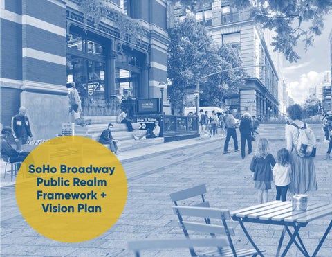
SoHo Broadway Public Realm Framework + Vision Plan
1
We Did This Together SoHo Broadway Initiative Board President - Brian Steinwurtzel, GFP Real Estate Vice President - Emily Hellstrom, Resident Treasurer - Richard Benenson, Benenson Real Estate Secretary - Katy Rice, Resident Margaret Baisley, Residential Representative Honorable Bill de Blasio, Mayor of New York City, Represented by Andrew Marcus, Department of Small Business Services Honorable Gale A. Brewer, Manhattan Borough President, Represented by Rosie Mendez James Cavello, Westwood Gallery Honorable Margaret Chin, Council Member District 1, Represented by Anthony Drummond Peter Davies, Resident Jared Epstein, Aurora Capital Associates Sharon Ermilio, Resident Paul Farr, Resident Warren Leshen, Crale Realty John Pasquale, Pasquale Management Jeannette Rodriguez, Nike Mary Rolland, Resident Gaston Silva, Vornado Realty Trust Ed Somekh, Resident Honorable Scott Stringer, Comptroller of New York City, Represented by Michael Stinson DJ Williams, Boxed Wholesale Ronnie Wolf, Resident Jason Vacker, Meringoff Properties Michele Varian, Resident Susan Wittenberg, Community Board 2
Staff Mark Dicus, Executive Director Frank Wessels, Director of Operations and Public Safety Brandon Zwagerman, Director of Planning and Engagement Sanjukta Hazarika, Intern Arvind Sindhwani, Intern
Consultant Team Street Plans (Prime Consultant) MIke Lydon, Principal Dana Wall, Senior Project Manager April Oh, Operations Manager Aren Castro, Project Designer Veronica Rivas Plaza, Project Designer Karp Strategies (Sub-Consultant) Rebecca Karp, Managing Principal & CEO Michaela Kramer, Analyst Zeineb Sellami, Analyst
SoHo Broadway Public Realm Task Force Richard Benenson, Owner, Benenson Equities* Gale Brewer, Manhattan Borough President* James Cavello, President, Westwood Gallery* Margaret Chin, New York City Council Member* Joseph D’Angelo, General Manager, NoMo SoHo Hotel Sharon Ermilio, Resident* Shelly Friedman, Partner, Friedman & Gotbaum Emily Hellstrom, Resident* Andrew Kahn, Executive Director, Cushman & Wakefield Clayton Moore, Director of Retail and Sales, Roman and Williams Guild Edward Pincar, Manhattan Borough Commissioner, NYC DOT Guy Pross, Vice President, JVP New York Katy Rice, Resident* Courtney Saavedra, General Manager, Bloomingdale’s Gaston Silva, Chief Operating Officer, Vornado Realty Trust* Nell Jocelyn Slaughter, Resident Brian Steinwurtzel, Co-CEO and Principal, GFP Real Estate* Jason Vacker, President and CEO, Meringoff Properties* Susan Wittenberg, Manhattan Community Board 2*
*SoHo Broadway Initiative Board Member
Table of Contents 06 Introduction 08 12 14
The SoHo Broadway District The Vision Plan Process Public Realm Principles
16
Vision + Goals
18 20
Our Vision Our Goals
22 Public Realm Framework + Vision Plan 24 The Framework Plan 30 31 64
The Vision Plan Key Moves: Four Priority Projects Streetscape Toolkit
74 Appendix 76 Public Input 86
Existing Conditions
Introduction
7
The SoHo Broadway District Introduction The SoHo Broadway Initiative (SBI) is the only business improvement district (BID) serving SoHo, an internationally renowned mixeduse and walkable neighborhood. The not-for-profit organization manages the neighborhood-focused BID along Broadway from Houston to Canal as well as the five intersecting cross streets of Prince, Spring, Broome, Grand and Howard. SBI uniquely represents residential and business stakeholders equally within the SoHo Broadway corridor and provides sanitation, public safety, planning, advocacy, and community engagement services. To allow for a more coherent approach, the SoHo Broadway Public Realm Framework + Vision Plan expands just beyond the SBI service area to include both sides of Crosby Street and Mercer Street (see map at right).
Ho
us to n
ce St
Sp
rin
Ho wa rd
St wa y
St
Ca n
al
St
SoHo Neighborhood Boundary Streets within Study Area Buildings within Study Area
Cr os by St
rce r
dS t
ad
eS t
Me
om
Bro
Bro
gS t
Gr an
8
St
Pri n
Why Develop a Public Realm Plan? Broadway is the most iconic street in one of New York City’s most recognizable neighborhoods: SoHo. Its transformation from a longstanding manufacturing zone into a thriving mixed-use district wasn’t the result of a master plan or a comprehensive re-zoning effort. The adaptation of the neighborhood’s storied cast-iron buildings into thriving art and cultural assets, famed live-work lofts, desirable office spaces, and destination retail spots occurred incrementally and over decades. While SoHo’s private realm (buildings and associated uses) continues to evolve, the District’s public realm (streets, sidewalks, and subway stations) has not only remained static, but is increasingly strained by the demands of a highly-desirable, heavily-trafficked, and dense mixed-use neighborhood. This lack of adaptation now threatens the Disrict’s long-term social and economic health. Without further action, lingering COVID-19 economic impacts (see next page), technological advancements, shifting citywide transportation paradigms, and increased operational demands will continue to exacerbate longstanding quality-of-life issues within the District. These issues include intense traffic congestion, with resulting noise and air pollution; inaccessible sidewalks and subway stations; pedestrian crowding; a lack of usable open space; and logistical challenges associated with servicing historic buildings with everevolving tenant needs. These challenges, along with others, underscore the need for the creation of SoHo’s first Public Realm Framework + Vision Plan.
Broadway is the most iconic street in New York City’s most recognizable neighborhood: SoHo.
9
COVID-19 The SoHo Broadway Public Realm Framework + Vision Plan is both well-timed and long overdue. The Plan was developed during the global COVID-19 pandemic, a period of unimaginable human loss and social upheaval across New York City. This unforeseen public health crisis bore down on the city in March 2020 and caused an immediate and precipitous decline in public life as SoHo’s offices, retail stores, and restaurants were shuttered — a few permanently. Thus, everything from the data collected to the existing conditions analysis, as well as the means and methods of public engagement, were impacted accordingly and must be understood in this context. That said, the pandemic showed New Yorkers that one of our city’s largest challenges - access to comfortable, usable public space - could be addressed almost instantaneously through the reallocation of street space from vehicles to people. Dubbed the Open Streets program, city streets now welcome outdoor dining, cultural programming, and physical activity where vehicles used to park or sit idly in traffic. Now that the New York City Department of Transportation has made this vital program permanent, neighborhoods across New York City can continue to enjoy a myriad of economic, social, and public health benefits while also investing with confidence in more permanent public space amenities that can be calibrated to the individual needs of each neighborhood.
10
Public Life: SoHo Broadway Public life revolves around the social and physical activity that takes place in everyday public spaces. Streets, sidewalks, bus stops, parks, and plazas are just a few examples. The comfort and quality of these spaces and the diversity of activities they foster is a key indicator of neighborhood vitality. Set against the District’s hisoric cast-iron architeture, SoHo’s diverse and dynamic public life is what makes SoHo, SoHo. Within one block a passerby may witness a photographer directing a street-side fashion shoot; a vendor selling hot dogs to a line of hungry shoppers; friends chatting enthusiastically on a buildings’ steps; and a jazz musician performing passionately for all who pass by. The neighborhood was immediately and negatively impacted by the COVID-19 pandemic. However the District’s magnetic street life has since returned as the neighborhood continues to recover. Indeed, pedestrian counts conducted in December 2020 vs. August 2021 show an 102% increase in footfall at the southeast corner of Broadway and Prince Street and an 187% increase at the northeast corner of Mercer Street and Spring Street (see pages 91-92 for more detail). As offices continue to re-open and tourism rebounds, this number will only continue to grow. Supporting the further recovery of SoHo’s energetic public life is not only at the heart of this Plan’s short-term goals, but it serves as the foundational principle behind enhancing SoHo Broadway’s role as the beating heart of New York City.
Set against the District’s historic castiron architeture, SoHo’s diverse and dynamic public life is what makes SoHo, SoHo. 11
The Vision Plan Process This Plan was developed between December 2020 and October 2021. The project scope was developed to further address longstanding public realm and quality-of-life issues that were discussed and documented within the Envision SoHo/NoHo report commissioned by the Department of City Planning, Manhattan Borough President Gale Brewer, and City Council Member Margaret Chin Despite the challenges imposed by COVID-19, the project team gathered input from 300+ stakeholders. The process included on-street intercept surveys in December 2020 and August 2021; digital survey dissemination; multiple focus group meetings; three Public Realm Task Force meetings; and periodic updates to the SoHo Broadway Initiative Board and Executive Committee as well as at SoHo Broadway Community Roundtable meetings. In addition, the project team undertook a robust data collection process that included extensive fieldwork and a review of available data streams to inform the Plan’s recommendations. Findings from both the engagement and data collection tasks are available in the Appendix (see page 74). There has never been a better time to rethink the SoHo Broadway District’s public realm, and this is the foundational document for doing so. Put simply, the goal of this Plan is to deliver the most compelling and inclusive street life in New York City.
12
Put simply, the goal of this Plan is to deliver the most compelling and inclusive street life in New York City.
What is a Vision Plan? As an urban planning exercise, vision plans begin with observing what works and what does not about a specific place - like SoHo Broadway - in order to ask the important question of “what do we want this place to become?” Vision plans then create guideposts for achieving the vision through a coherent framework of principles, goals, and priority projects that are intended to move the vision from pixel to pavement.
Broadway Vision
To be successful, vision plans must align and marshal organizational, political, cultural, and economic capital to service vision plan priorities. While this is never an easy or linear process, the rethinking and re-envisioning of the public realm to be more inclusive and dynamic is happening all across New York City. Now is the time to start that process for the SoHo Broadway District. This Vision Plan does not require City agency or Community Board approval. However, the Plan’s implementation will require City action to complete technical studies and policy changes, as well as community engagement with local stakeholders along the way. Naturally, each of these future tasks will be informed by the social, political, and economic realities of the day. Thus, SBI acknowledges this reality and looks forward to working together with all local community partners to ensure the District works well for everyone!
Vision plans create guideposts for achieving the vision through a coherent framework of principles, goals, and priority projects.
13
Public Realm Principles SoHo’s public realm is where public and private interests, local and global cultures, and trends old and new collide. The following eight principles guide the Public Realm Framework + Vision Plan, and they should be continually referenced as the Plan moves into the implementation process.
14
Safe
Comfortable
Inclusive
Dynamic
Beautiful
Connected
Creative
Resilient
15
Vision + Goals 16
17
Our Vision
SoHo Broadway is the beating heart of one of New York City’s most engaging, beautiful, human-scale, and walkable neighborhoods. The streets and sidewalks prioritize people first, creating comfortable, safe, and compelling public space that supports businesses, meets the needs of residents, and welcomes visitors from around the world.
18
19
Our Goals This Plan aims to create a more people-centric public realm, one that solves the District’s ongoing operational challenges while also creating a physical setting befitting of the neighborhood’s historical and cultural significance. The following five goals have been established to guide the Plan implementation. Specific recommendations for achieving these goals are detailed within the Framework + Vision Plan (see page 22).
1
Provide More Space for People • Increase the District’s sidewalk widths by at least 50%. • Convert Prince Street and Howard Street into pedestrian priority/car-free public spaces. • Increase the District’s available on-street seating capacity by 500%.
2
Streamline District Operations • Divert non-local vehicular trips away from the District; reduce regional vehicular traffic along Broadway and Broome Street by 66%. • Update curbside parking regulations to maximize access and efficient freight loading/unloading, waste removal, and building service operations; support the transition to cargo bikes and other low-impact vehicles. • Expand the number of trash and recycling receptacles available to the public along Broadway. • Increase SoHo Broadway Initative staff, services, and resources to properly manage and maintain expanded public space.
20
3
Support and Expand Cultural Activity • Encourage and promote the expansion of cultural programming within the District’s streets and sidewalks (e.g. art exhibitions, festivals, educational events). • Establish the District as an outdoor art gallery, featuring local and globally renowned artists. Target façades, vacant storefronts, light pole banners, trash cans, asphalt, seating, and other opportunity areas where art can continually breathe new life into the District’s public realm.
4
Increase District Greenery and Resilience • Using above-ground planters, increase the District’s tree canopy by 900%. • Leverage building façades, as well as interim and long-term streetscape overhauls to increase streetside plantings, pollinator habitat, and stormwater capture. • Reconstruct the District’s streets and sidewalks with a material palette that respects and reinforces the District’s built heritage.
5
Improve District Connectivity and Traffic Safety • Redesign Broadway so that it functions as a linear public space, giving priority to pedestrians, buses, and freight delivery. • Reduce traffic crashes by 75%. • Upgrade and complete the District’s bike network; strengthen southbound connections and close the Spring Street bikeway gap. • Retrofit the District’s intersections to be ADA-accessible. 21
Public Realm Framework + Vision Plan 22
23
The Framework Plan Introduction The SoHo Broadway District does not exist in isolation. The neighborhood sits within the center of Lower Manhattan and is bisected by Broadway, which runs from The Battery all the way to the northern tip of Manhattan and beyond. The area of Lower Manhattan pictured at right is defined by contiguous and particularly dynamic mixed-use, dense neighborhoods served by the most extensive subway system in the world. However, the regional use of otherwise local city streets to enter or exit the Holland Tunnel continues to deliver chronic and worsening traffic congestion, which is a significant drag on SoHo’s quality of life, public health, culture, and economy.
The Low-Traffic Neighborhood: A Design + Mobility Framework The Vision Plan is focused on delivering a generational investment in the District’s public realm. However, the vision will not be realized in full without reducing regional traffic. Committing to a “low-traffic neighborhood” framework will unlock more public space; streamline bus, freight, building service, waste, and emergency operations; and substantially improve the experience of living and working in, as well as visiting, SoHo. Achieving these outcomes will require leveraging political will to implement bold policy changes, such as diverting nonlocal traffic and adopting congestion pricing among other important policy changes needed to deliver a low-traffic neighborhood. At a larger scale, transitioning SoHo/Nolita/Little Italy/Northwest Chinatown into a contiguous low-traffic neighborhood will allow the District to be included in the City’s broader effort to reduce traffic and increase public space along Broadway, from Central Park to The Battery. First envisioned in 1969 by the Regional Plan Association (RPA), redesign efforts didn’t start in earnest until 2009. Since then, a series of temporary, interim, and permanent projects have continued to reduce traffic and reshape Broadway into a linear public space and sustainable mobility corridor that links many of New York City’s most dynamic neighborhoods and welcoming public spaces. 24
Committing to a “low-traffic neighborhood” framework will unlock more public space; streamline bus, freight, building service, waste, and emergency operations; and substantially improve the experience of living and working in, as well as visiting, SoHo.
25
Controlling Vehicular Volumes
Traffic Volumes Today
Reducing the amount of regional traffic moving through the District means establishing policy and physical design measures that discourage through travel so that neighborhood streets are primarily used for local access and emergency response. The top diagram at right illustrates relative traffic volume today, while the bottom diagram proposes a sharp reduction in neighborhood volumes as low-traffic neighborhood interventions and policies are carried out. . Many mitigation strategies exist, which are proven to be successful at reducing traffic in cities around the world. These include the following: • • • • • • • • • •
Advanced warning, information, and enforcement signs Banning left-turns One-way to two-way conversions Travel lane re-assignments (road diets) Cycling, walking, and public transport network investments Retractable bollards Pavement markings Material changes Automated enforcement/access regulation Traffic diverters and other traffic-calming interventions
While the exact mix of policy and physical intervention requires much more in-depth study and coordination, it should be noted that traffic diverters and other trafficcalming techniques have the potential to deliver other goals outlined in this Plan, such as increasing the District’s tree canopy, improving stormwater filtration, adding public seating, and achieving street safety benefits.
26
Low-Traffic Neighborhood Volumes
Project Delivery Framework This Vision Plan proposes the transformation of the SoHo Broadway District over a 20-year period. Realizing the full vision will require additional studies, detailed engineering and design work, building political support, ongoing stakeholder engagement, fundraising, data collection, and ultimately, years of streetscape reconstruction.
Ho
us to n
Pri n
ce St
Sp
Strategic Initiatives: Interim design or other physical design and policy changes that support/inform the Key Moves (1-10 years)
•
Tactical Projects: Public realm programming, demonstration projects, art installations, events, campaigns, (1 day-5 years, including recurring daily/weekly/monthly/annual initiatives)
•
Supporting Actions: Operational or regulatory changes that support all of the above (1-20 years)
This framework emphasizes the need to approach project development and delivery as an intentionally iterative process to test and refine the details of what may ultimately be delivered through the four Key Moves. Each one may be implemented as a standalone project or bundled together for efficiency, if resources allow.
Ca n
al
St
St .
Br oo
me
dS t
wa y
eS t
St .
St .
Gr an
rce r
om
Me
Bro
Cr os by
•
ce St.
gS t
Br oa d
Key Moves: Priority capital projects (10-20 years)
Pri n
rin
While that may sound daunting now, the recommendations are structured by the following Project Delivery Framework. •
St
Ho wa rd
SoHo Broadway Initiative Study Area SoHo Neighborhood Boundary Key Moves: Priority Capital Projects
A description and the visualization of each of the four Key Moves is found in the pages ahead and supplemented by a description of the Strategic Initiatives, Tactical Projects, and Supporting Actions. Finally, a Project Delivery Timeline sets expectations with high-level, order-ofmagnitude cost, and theoretical implementation timeline.
27
Project Delivery Framework This chart illustrates and details the core elements of an iterative and flexible project delivery framework.
TACTICAL PROJECTS
Project Leaders
SoHo Broadway Initiative | Community Partners
SoHo Broadway Initiative | NYC DOT
SoHo Broadway Initiative NYC DOT | NYC DDC | NYC EDC
SoHo Broadway Initiative | NYC Agencies | Community Partners
Low-cost, low-durability; materials may be borrowed or donated; little-to-no maintenance/stewardship required.
Low-medium cost, semi-durable materials balance design flexibility with maintenance and stewardship obligations.
High-cost, permanent materials that cannot be adjusted easily but require infrequent maintenance.
N/A
(time interval • cost)
Materials, Maintenance + Stewardship
Public Involvement
Design Flexibility
28
(1 day - 5 years • $)
STRATEGIC INITIATIVES
KEY MOVES
PROJECT TYPE
(1 - 10 years • $$)
(5 - 15 years • $$$)
Required and frequent before Optional before project Required; frequent before long-term implementation; implementation; implementation and frequent optional but helpful postrecommended during project during evaluation period. implementation. lifespan to gather feedback. High: Organizers expect project to be adjusted and removed within a short timeline, typically one weekend to one week
Moderate: Project may be adjusted, or it may be removed if it does not meet stated goals upon initial evaluation.
Low: Permanent capital upgrades are unlikely to be adjusted significantly once installed; learnings should inform future projects.
SUPPORTING ACTIONS 1 day - 20 years • $ - $$$)
Required and ongoing
N/A
29
The Vision Plan Introduction Imagine walking down Broadway, eyeing a store and crossing safely and conveniently to shop. Forget walking to the next intersection and weaving through standstill vehicular traffic blocking the crosswalk, only to backtrack to your destination. Sound appealing? Consider no longer having to roll your wheelchair or stroller off the curb into a slushy puddle because a curbless street design with modern drainage makes crossing the street seamless. Sound humane? Envision meeting a colleague over coffee under a flowering shade tree while a musician performs nearby at Little Prince Plaza. Your colleague’s voice (and lungs) aren’t overpowered by idling vehicles, and you now find outdoor meetings to be joyful and productive. Wouldn’t that be nice? Picture preparing a summer evening meal with your family and friends with windows wide open because there are no longer blaring horns from Holland Tunnel-bound traffic. Your Friday evenings are finally tolerable. Sound enjoyable? And just suppose you no longer have to double park your delivery truck, load up a handtruck full of heavy packages, and walk hundreds of feet to access a curb ramp. Doing your job becomes less stressful and more efficient thanks to reduced traffic, curbless street design, and dedicated loading zones. Sound fair? The Plan fundamentally changes how Broadway looks and functions. Changes on Prince and Howard Streets, Crosby and Mercer Streets, and Broome Street align with and support the transformational changes on Broadway. Implementing the four key moves described herein will result in a thriving District where streets and sidewalks are beautiful, functional, and inviting for people of all ages, abilities, and income levels; where residents are free from excessive noise and air pollution; and where businesses thrive as customers spend more time enjoying the District. 30
Envision meeting a colleague over coffee under a flowering shade tree while a musician performs nearby at Little Prince Plaza. Your colleague’s voice (and lungs) aren’t overpowered by idling vehicles, and you now find outdoor meetings to be joyful and productive. Wouldn’t that be nice?
Key Moves: Four Priority Projects
31
Key Move #1: Create More Space for People on Broadway
32
Defined Need
The public engagment process and existing conditions analysis underscore the need for two major improvements on Broadway: Create more space for people, and improve and streamline emergency vehicle, bus, freight, and for-hire-vehicle operations.
Broadway Vision
Broadway is a world-class, linear public space that meets the quality-of-life needs of residents; eases commercial office and retail operations; and continues to comfortably welcome visitors hailing from Brooklyn to Bangkok.
Key Goals • Reduce pedestrian delay, increase safety and comfort • Reduce vehicular noise and pollution • Increase streetside greenery and provide a robust tree canopy • Provide more fixed and movable seating along Broadway • Continuously celebrate SoHo’s art and architectural history
Key Actions
Ho
us to n
St
St
al
an C
La fay ett e
Bro
ad
wa y
6th Ave
• Remake Broadway into a curbless street, seamlessly linking the east and west sides of the street, from Houston Street to Canal Street • Divert all non-local vehicular traffic to the perimeter of the SoHo ‘superblock’ defined by Houston Street, the Bowery, Varick Street, and Canal Street • Update parking regulations to allow short-term freight, service vehicle, and for-hire vehicle parking only • Pilot the Broadway redesign with temporary and interim materials • Improve pedestrian-scale lighting
St
SoHo Broadway Initiative Study Area SoHo Neighborhood Boundary
33
Broadway: Existing Conditions (Looking North) 3
2
1
4
34
1
Bus Lane
3
Cobrahead Street Lights
2
Frequent Double Parking
4
Congested Sidewalks
Broadway: Interim Redesign (Looking North)
3
5 4
2
1
6
1
Busway
3
Loading Zone
5
Bike Corral
2
Seating
4
FHV Loading Zone
6
Vendor Kiosk
35
Broadway Long-Term Redesign (Looking North)
1
4
5
2
6
3
36
1
Bishops Crook Lamppost
3
Curbless Street
5
Planter Seating
2
Consolidated Bus Stop
4
Combined Waste Bins
6
Restored Vault Lights
Spatial Allocation: Broadway Implementing the full Broadway Vision will result in 71% more space for pedestrians.
41% 41%
59% 59%
17’ 17’
Broadway Broadway
30% 41% 70%59%
Existing
10’ 10’
12’ 12’
12’ 12’
11’ 11’
18’ 18’
Proposed
28’
6’
12’
6’
28’
Broadway
Vehicular Space Pedestrian Space Shared Space
37
Key Move #2: Share Crosby Street + Mercer Street
38
Defined Need
Current parking regulations leave Mercer Street and Crosby Street underutilized during weekday business hours and therefore available to provide neighborhood amenities and better manage curbside access across the District. The physical condition of both streets is deteriorating and would benefit from a streetscape overhaul/ restoration to deliver increased tree canopy, greenery, a dedicated bicycle facility, and ADA accessibility.
Mercer Street + Crosby Street Vision
Mercer Street and Crosby Street are beautifully restored low-traffic streets using a curbless design to create quiet, comfortable, and green spaces that also support streamlined curbside operations. Mercer Street provides a much needed southbound bikeway connection, filling key gaps in the network between Union Square and the Brooklyn Bridge/City Hall.
Key Goals
• Increase pedestrian comfort, safety, and accessibility • Honor the District’s history while delivering modern streetscape amenities - seating, lighting, tree canopy, bike parking, etc. • Provide hundreds of new commercial parking spaces for the District during weekday business hours • Improve southbound cycling access through the District
Key Actions
St
dwa
y
us to n
Ca n
ye tte St
La fa
Cr os by St
Me
rce r
St
Broa
• Work with residential and commercial stakeholders to determine service/operation needs that could be moved from Broadway to rear access ways along Mercer Street and Crosby Street • Collaborate with NYC DOT to update District parking regulations, providing hundreds of new weekday spaces for freight, service vehicle, and short-term pick-up and drop-off activity; add at least one additional bicycle parking corral or pod per block • Work with stakeholders to overhaul/restore the Mercer and Crosby streetscapes; implement a curbless street design that improves ADA accessibility and delivers more pedestrian amenities.
Ho
al
St
SoHo Broadway Initiative Study Area SoHo Neighborhood Boundary
39
7 5
3
6
1 4
40
2
1
Curbless Streetscape
3
Planters/Seating
5
Flexible Curb Lane
2
Southbound Bike Lane
4
Restored Vault Lights
6
Vehicular Access Lane
7
Long-term Bicycle Parking Pod
Spatial Allocation: Mercer Street + Crosby Street Implementing the vision for Mercer Street will yield 33% more space for pedestrians and cyclists; 51% of Crosby Street will become shared space.
51%
49%
Mercer Street (Existing)
12’
Mercer 36%
8’
10’
8’
51%
49%
Crosby Street (Existing)
12’
12’
8’
10’
8’
12’
Crosby
Mercer Street (Proposed)
64%
14’
6’
10’
8’
Mercer Vehicular Space
49% 51%
Crosby Street (Proposed)
12’
12’
8’
10’
8’
12’
Crosby
Pedestrian/Cycling Space Shared Space
41
Key Move #3: Pedestrianize Prince Street + Howard Street
42
Defined Need
The SoHo Broadway District, and the neighborhood at large, has very little usable open space for formal programming and passive use. Pedestrian congestion and delay is also a well-documented challenge, specifically along Prince Street between Mercer Street and Crosby Sreet where sidewalks are narrow and footfall is high. Finally, the noise at Prince Street and Broadway routinely exceeds acceptable levels.
Prince Street + Howard Street Vision
Prince Street, between Mercer and Crosby Streets, is a lively public plaza with seating, greenery, a cafe kiosk, and a light cadence of cultural programming. Subway entrances are less congested and people crossing Broadway no longer fear being hit by turning vehicles. Human voices and the occassional bicycle bell replace the honking and constant rumble of vehicular traffic that used to clog the corridor. Howard Street, between Crosby Street and Mercer Street, functions as an elegant ‘outdoor room,’ providing respite from Broadway’s thrum of activity. Movable and fixed seating, public programming, and enhanced greenery invite social activity and support nearby businesses.
Key Goals
Ho
St
dwa
y
us to n
Pr in
Broa
St
ce St
Key Actions • Work with NYC DOT to pedestrianize these blocks of Prince and Howard Street; start with short-term plaza demonstrations to evaluate any/all impacts; improve/extend plaza duration and amenity as resources allow • Work with all stakeholders to design and implement a streetscape redesign that improves ADA accessibility, lighting, and the tree canopy
Ca n
La fay ett e
St
Me rce r
• Increase the District’s supply of usable public space • Improve pedestrian comfort, safety, and accessibility • Reduce pedestrian/vehicular congestion and delay while ensuring essential operational access is maintained • Improve access to/from the Prince Street and Canal Street subway station entrances • Reduce noise levels
al
St
Ho wa rd St
SoHo Broadway Initiative Study Area SoHo Neighborhood Boundary
43
Prince Street: Existing Conditions (Looking West) 5
2 1
3
4
44
1
Bike Lane
3
Vehicle Travel Lane
2
Parking Lane
4
Narrow Sidewalk
5
Cobrahead Street Lights
Prince Street: Interim Plaza (Looking West)
4 2 3 1
1
Bike Lane
3
Asphalt Art Mural
2
Movable Tables and Chairs
4
Planters 45
Prince Street: Permanent Plaza Redesign (Looking West)
4
3
2
1
46
1
Streetscape Upgrade
3
Restored Vault Lights
2
Seating/Tree Planter
4
Bishops Crook Lightpoles
Spatial Allocation: Prince Street + Howard Street Implementing the vision for Prince Street will yield 66% more space for pedestrians and cyclists, and 108% more space for pedestrians along Howard Street.
40%
Prince Street (Existing)
60%
12’
Prince
6’
12’
8’
12’
6’
20’
Prince Vehicular Space
49%
Howard Street (Existing)
12’
12’
Prince Street (Proposed)
100%
51%
Howard 100%
10’
8’
12’
Howard Street (Proposed)
12’
12’
8’
26’
12’
Howard
Pedestrian/Cycling Space Shared Space
47
Key Move #4: Reclaim Broome as a Local Street
48
Defined Need
Broome Street is heavily congested by people driving vehicles to the Holland Tunnel. This results in intersections (especially Broadway) becoming impassable to pedestrians, bicyclists, buses, and vehicles traveling along Broadway. It also results in an undue amount of noise and air pollution.
Broome Street Vision Broome Street no longer operates as a tunnel on-ramp; rather it serves as a local street with expanded, usable public space, greenery, and cycling facilities that meet the needs of SoHo neighborhood residents, employees, and visitors. The curbless street design along Broadway extends along Broome Street between the east side of Crosby and the west side of Mercer.
Key Goals • Reduce pedestrian delay, increase comfort and safety • Reduce vehicular volumes, as well as noise and air pollution • Increase the tree canopy and streetside greenery • Provide a dedicated, westbound bikeway connection • Provide usable public space with amenities such as seating, bike parking, and public art • Streamline and support building access and operations
Key Actions
us to n
St
Br oo
St
Ca n
La fa
me
ye tte St
6th A venu e
• Divert all tunnel-bound traffic to the perimeter of the SoHo ‘superblock’ defined by Houston Street, the Bowery, Varick Street, and Canal Street • Reduce vehicular travel lanes from two to one; add a dedicated westbound bikeway linking Chrystie Street and Hudson Street, and reallocate remaining space, including the parking lanes for public realm amenities • Test long-term streetscape overhaul with interim design materials and programming • Update parking regulations to allow short-term freight, service vehicle, and FHV parking only
Ho
al
St
SoHo Broadway Initiative Study Area SoHo Neighborhood Boundary
49
Broome Street Broome Street: Today (Looking West)
Existing Conditions
4
3
1 2
50
1
Westbound Travel Lanes
3
Narrow Sidewalks
2
On-Street Parking
4
Interim Curb Extensions
Broome Street: Interim Redesign (Looking West)
5
1 1 2
6
4
3
1
Large Curb Extensions
3
Bike Corral
5
Freight Delivery Zone
2
Seating
4
FHV Loading Zone
6
Westbound Bike Lane
51
Broome Street: Long-Term Redesign (Looking West)
4
2
3
1
52
1
Curbless Streetscape
3
Planters/Seating
2
Corner Bollards
4
Bishops Crook Lightpole
Spatial Allocation: Broome Street Implementing the Broome Street vision will result in 140% more space for pedestrians and cyclists.
65%
16%
35 %
Existing
12’
11’
11’
Broome
11’
Proposed
84%
11’
13’
26’
6’
11’
26’
Broome
Vehicular Space Pedestrian + Cycling Space Shared Space
53
Strategic Initiatives
54
Strategic Initiatives Advancing these four initiatives will result in a SoHo Broadway District that provides more space for people while also streamlining building access and operations.
1
Update Curbside Regulations/Use A) Provide designated short-term parking spaces for freight/delivery and for-hire vehicles. Study and allocate the optimal number/locations per block in coordination with Strategic Initiative #3, without impacting primary goal of expanding usable public space.
G) Increase metered parking prices to more closely align with off-street parking rates; extend hours where rates apply to public parking at night and on weekends.
2
A) Work with DSNY, carting companies, property owners, and commercial tenants to develop and implement a District waste container storage and removal plan.
B) Move all metered parking off Broadway and onto Crosby Street, Mercer Street, and surrounding streets (See Key Move #2 for more details). C) Consolidate Broadway bus stop locations from six to three; designate one stop for MTA Express buses, one for MTA local/limited buses, and one for tour buses; work with MTA and NYC DOT to upgrade bus stop amenities.
3
F) Work with local businesses and property owners to convert existing curbside parking into increased art, greenery, public seating, and outdoor dining.
Coordinate Freight Delivery A) Partner with NYC DOT, freight carriers, property owners, and commercial tenants to create a District-specific freight management plan that optimizes for efficiency, pedestrian safety, and quality of life. Coordinate this task with Strategic Initiative #1.
D) Distribute at least two bicycle parking corrals or pods per block; ensure corral racks are able to accommodate freight cargo bikes. E) Close the Spring Street bikeway gap; advocate for the repaving of Spring Street and the conversion of the north curb lane, between Wooster Street and Broadway into a bicycle lane.
Streamline Waste Management
4
Pilot Street Redesigns with Interim Materials A) Follow any/all successful demonstration projects (see Tactical Project #1) by partnering with NYC DOT, the MTA, and other local and government agency partners to initiate longterm redesigns for Broadway, Broome Street, Prince Street, and Howard Street by using interim streetscape materials. Align pilot initiatives with recommendations #1 - #3 above and Supporting Action #1.
55
Tactical Projects
56
Tactical Projects These three Tactical Projects will help the District build momentum towards the implementation of the Key Moves.
1
Test Before You Invest: Nurture Long-Term Change through Short-Term Demonstration Projects Collaborate with local stakeholders and design partners to develop and test a number of short-term physical design, programming, and operational projects across the District. The goal of such efforts should be nurturing public life, celebrating the District’s history and culture, and testing the viability of interim and long-term Key Moves and Strategic Initiatives proposed within this Plan. Here are four ways to get started: A) Develop a ‘Sittable SoHo’ campaign that invites people to stop and sit/perch/lean upon the District’s many informal places to rest and take in the neighborhood’s history and lively street life. Such a campaign could be coordinated with a local non-profit cultural or historic preservation organization and designed to increase awareness of and appreciation for SoHo’s storied past and its exciting future. B) Implement pedestrianization demonstration projects supported by cultural programming along Prince Street and Howard Street; coordinate with Supporting Action #1 to evaluate the merits and drawbacks of each. C) Experiment with converting Broadway’s parking lanes to pedestrian space and/or closing one block at a time to through traffic (except buses); add cultural programming to communicate the value of providing more space for people.
D) Work with property owners and businesses to soften Broome Street. Opportunities include the addition of small-scale plantings, seating against building fronts and within the existing curb lane, organizing public events that incorporate the sidewalk, smallscale performances, art and mural installations, cafe seating, and more. Add temporary or seasonal seating on the sidewalk or in the curb lane on the north side of Broome, between Crosby and Broadway. The views of the District’s historic architecture are particularly captivating from this location, including a wonderful look at the ornate 12-story Silk Exchange Building. This view often inspires people to take photos and, therefore, should be embellished as a point of interest. 57
2
Transform the District into an Outdoor Gallery A) Continue to work closely with property owners, leading artists, and cultural organizations to continuously curate public art on blank walls, vacant storefront windows, bland sidewalks, bike racks, banners, and sidewalk and/or asphalt surfaces. Increase impact by aligning art installations with other District activations, projects, campaigns, and programming described in Tactical Move #1. B) Organize and curate events/programming that celebrate existing and future public art located throughout the District.
3
Manage + Divert Traffic A) Work closely with City agencies to trial the diversion and management of vehicular traffic away from the District. Focus first on decreasing vehicular demand along Broadway, Prince Street, and Broome Street. B) Work closely with City agencies to allocate traffic management resources (including NYPD traffic agents) at the Broome Street and Broadway intersection. Preserve safety and access for pedestrians, cyclists, transit riders, and people with physical or cognitive disabilities who struggle to cross the street during peak traffic periods; prioritize other intersections as needed.
58
C) Advocate for automated camera enforcement along Broadway and Broome Street to keep vehicles out of the Broadway bus lane and to discourage drivers from blocking crosswalks/intersections along both corridors. D) Continue to advocate for the implementation of congestion pricing; coordinate with Supporting Action #1 to evaluate benefits/impacts.
59
Supporting Actions
60
Supporting Actions These three supporting actions will be crucial in advancing all of the Key Moves, Strategic Initiatives, and Tactical Projects.
1
Build, Measure, Learn: Develop a Public Realm Data Collection and Evaluation Protocol A) Develop and implement a District-wide data collection and evaluation protocol. The protocol should be designed to help decision-makers understand the impact of programming, communications, and marketing activities, as well as the roll-out of physical demonstration, pilot, and capital projects. Both qualitative and quantitative tools (digital and analogue) should be used to identify key insights and trends. A summary of all findings should be made available to the Board of Directors on a periodic basis and be published within the SoHo Broadway Initiative’s annual report. B) Onboard a technology partner to help streamline and systematize the measurement and documentation of pedestrian, vehicular, and cycling movements at key intersections/locations; consider supplementing digital evaluation with a broader range of evaluation tools and metrics as resources allow.
2
Continue Stakeholder Engagement Efforts A) Incorporate Public Realm Framework + Vision Plan updates and engagement opportunities within ongoing digital and in-person marketing, communication, and community engagement efforts.
3
Increase Staff Capacity A) Whether through assessment or geographic expansion, implementing the recommendations in this Plan will require increased planning, management, and stewardship capacity.
61
District Operations Summary
This table provides an overview of existing operational policies, practices, and regulations as well as a summary of proposed changes to support the Four Key Moves outlined in this Vision Plan.
62
Operation
Existing
Proposed
Parking ~ 128 spaces on Broadway ~ 132 spaces on intersecting streets ~ 363 spaces on Mercer/Crosby
Broadway: 3-hr metered, M-F (7am - 6pm) commercial; $4/hr 2-hr metered, M-F (6pm -10pm); Sat (8am - 10pm); $4/hr, Su free Mercer/Crosby: No Parking M-F, 8am - 6pm; select hotel, commercial loading, and taxi relief zones Other Streets: see Appendix
Restrict parking on Broadway to short-term freight delivery, waste management, emergency service, and FHVs; raise rates to encourage turnover; shift Commercial Parking and night/weekend visitor parking to intersecting streets and Mercer/Crosby; coordinate and consolidate delivery schedules; seek “last mile” cargo bike solutions.
Commercial Waste
Coordinated by individual properties/businesses; front of house and back of house.
Coordinate pick-up timing district-wide; install “clean curb“ corrals wherever possible; install/service combined waste, recyling, organics system on-street for public use.
Residential Waste
M-W-F pick up; recycling Wednesday
Coordinate curbside waste pick-up times with Commercial; pilot time-of-day changes
Bike Parking
38 on-street rack spaces; high demand leads to ad-hoc parking (sign poles, railings, lights etc.)
On-street corrals, lockers, indoor options where feasible; ensure parking is adequate for e-cargo/e-delivery bikes.
Street Sweeping
N/A
Sweeping/cleaning to be increased; focus on sweeping intersecting streets within District; develop maintenance plan for new public spaces.
Bus Movement
10 MTA lines on Broadway, 3 private; Bus and RightTurn Only Lane: M - F (7am - 6pm)
Short-term: Expand hours to at least 7pm, add camera enforcement; Mid to long-term: Convert Broadway to a 24/7 busway
Bus Boarding / Alighting 9.2+ million annual trips on lines serving the SoHo Broadway District
West curbside, btwn Houston/Prince: SIM 1, SIM 3C, SIM 4C, SIM 33C, SIM 34 West curbside so. of Prince: M1, M1 Limited, M55 West curbside no. of Spring: Big Bus Tours, Gray Line West bus bulb, so. of Spring: M1, M1 Limited, M55, Topview Siteseeing West curbside, so. of Broome: X27, X28, SIM 1, SIM 3C, SIM 4C, SIM 33C, SIM 34 West bus bulb, so. of Grand: M55
Consolidate boarding/alighting locations from 6 to 4: Tour buses at one district-serving space stop; consolidate M1, M1 Limited, and M55 into two stops; consolidate regional/ express bus stops into one central location (ex. Spring).
Sidewalk Vending
Permitted per City regulations: No vending on Prince and Spring (S, Su: 9am - 7pm); informal vending curbside and sidewalk persists; See Appendix.
Physically designate clear vending space on each block with materials and signage to help guide expectations and faciliate management of the public realm.
For-Hire Vehicles (FHV)
Ad-hoc (curbside or double-parking)
Designate FHV loading spaces on each block
Vehicular travel
See Appendix for existing conditions
Filter all non-essential traffic away from District
Implementation Timeline
The table below outlines an “order of magnitude” funding and implementation timeline for the SoHo Broadway Initiative and partners to implement this Vison Plan.
Key Moves: Capital Projects
1 - 5 years
5 - 10 Years
10 - 20 Years
Cost ($ - $$$$)
1. Create More Space for People on Broadway
$$$$
2. Reclaim Broome as a Local Street
$$$$
3. Share Crosby Street and Mercer Street
$$$
4. Pedestrianize Prince Street and Howard Street
$$$
Strategic Moves 1. Update Curbside Regulations / Use
$
2. Streamline Waste Management
$$
3. Coordinate Freight Delivery
$
4. Pilot Street Redesigns With Interim Materials
$$$
Tactical Projects 1. Test Before You Invest: Nurture Long-Term Change Through ShortTerm Demonstration Projects
$
2. Transform The District Into An Outdoor Gallery
$$
3. Manage + Divert Traffic
$$
Supporting Actions 1. Build, Measure, Learn: Develop a Public Realm Data Collection and Evaluation Protocol
$
2. Continue Stakeholder Engagement
$
3. Increase Staff Capacity
$$
63
Soho Broadway Streetscape Toolkit The following concept drawings outline the different components envisioned for future streetscape improvements across the SoHo Broadway District.
64
Street Seats + Urban Planting Inspired by SoHo’s informal seating, the following street seats components seek to add flexible arrangements, pedestrian comfort, and greenery across the District.
Street Bench
Street Bench
metal base
wood slabs seating surface
Overview: Bench with a back rest for comfort. Configuration: Singular or placed end-to-end Application Context: Broadway | Mercer | Crosby
65
Seating + Planting
Movable Planter
Seating + Planting
small trees
seasonal planting
metal base
casters
wood slabs seating surface metal base
Overview: Planter on casters for flexibility Configuration: Singular or placed end-to-end Application Context: Broadway | Mercer | Crosby | Howard | Prince
66
low planting
Overview: Seating with planter provides shade and immediately beautifie sourrounding with plantings. Configuration: Singular Application Context: Broadway | Mercer | Crosby | Howard | Prince
ating + Planting
Seating + Planting
Tables + Chairs
wood table
small trees
low planting
wood seating surface
metal base wood slabs steps seating
Overview: Inspired by SoHo’s many steps and stoops; Allows for singular or social seating Configuration: Singular or end-to-end to create a bleacher effect. Application Context: Broadway | Howard | Prince
light metal frame
Overview: Movable tables and chairs, to be grouped as needed; may be paired with shade structures. Configuration: Free range! Application Context: Howard | Prince
67
Mobility The following three components aim to increase access and streetside comfort across the District.
Bike Parking Corral
DOT bike racks
Overview: Standard NYC DOT racks may be installed instreet to provide short-term bicycle storage. Configuration: Curbside, scalable based on demand Application Context: Broadway | Mercer | Crosby | Prince | Spring | Broome | Grand | Howard 68
Bike Parking Pod
Bus Shelter
canopy for shading code panel
glass panels for visibility green roof sliding doors
wood slab seating perforated box for bike visibility
Overview: A long-term bike parking solution that improves aeshetics and security. Configuration: Curbside | Plaza Application Context: Mercer | Crosby | Prince | Howard
wayfinding + bus schedule
Overview: Stainless steel and glass shelter with back rest for comfort. Configuration: Singular shelter unit, design may be expanded to accommodate demand. Application Context: Broadway 69
Waste Management
rash/Recycling Bins
Sidewalk and curb lane solutions for managing residential, commercial, and streetside waste.
Trash/Recycling Bins
Trash/Recycling Pods
pull-out door to allow trash + recycling pick-up easily
key fog rear rear pull access key fob, for collection access for
perforated box to hold containers
removal
color coded trash + recycling containers
foot container opener for front access
color coded trash + recycling
Overview: Streetside waste receptacles sort garbage, recycling, and organics. Configuration: Sidewalk, near intersections Application Context: Broadway | Mercer | Crosby | Prince | Spring | Broome | Grand | Howard 70
Overview: Curb lane or sidewalk waste and recycling solution for large volumes of residential or commercial waste. Configuration: Fixed size; sidewalk or curb lane Application Context: Broadway | Mercer | Crosby | Prince | Spring | Broome | Grand | Howard
Food Amenities
afe/Vendor Kiosk (fixed)
Fixed and mobile vendor kiosks designed to support small-scale entrepreneurs and to support public life within key locations.
Cafe/Vendor Kiosk (fixed)
Cafe/Vendor Kiosk (movable)
folding doors for shading
foldable counter for eating
folding doors for shading signage
Overview: Cafe/Vendor kiosk will strengthen the commercial activity and deliver more food options. Configuration: Singular, fixed size Application Context: Broadway | Prince | Howard
rubber wheels board for visible menus
Overview: Flexible/mobile vendor kiosks designed to strengthen commercial activity and deliver more food options. Configuration: Singular unit, mobile deployment Application Context: Broadway | Mercer | Crosby | Prince | Spring | Broome | Grand | Howard 71
Lighting Historic, contextual lighting for a District that features poor lighting.
Bishops Crook Lightpole
Overview: Bishops Crook lampposts will reinforce the District’s character and increase light quality. Configuration: Fixed size; regular intervals along sidewalk Application Context: Broadway | Mercer | Crosby | Prince | Spring | Broome | Grand | Howard 72
73
Appendix 74
75
Public Input The SoHo Broadway Public Realm Framework + Vision Plan process engaged more than 300 people between December 2020 and September 2021. Activities included administering two streetside intercept surveys (December 2020, August 2021); conducting two focus groups; disseminating a digital survey, participating in a community roundtable discussion facilitated by the SoHo Broadway Initiative, and working closely over a series of digital meeings with the SBI Board and Board Executive Committee. While each engagement method reached a different type and breadth of audience, all efforts sought to support the planning process by asking the same primary questions: • What are the critical issues impacting the SoHo Broadway Disrict’s public realm? • What are actionable strategies to address those issues and improve the District? In addition to the public engagement activities, three Public Realm Task Force meetings were carried out over the planning process. The Task Force was comprised of members of SBI’s Executive Committee, political leaders, City agencies, and members of the study area’s residential, business, and property owning communities. The Task Force served in an advisory role and acted as a sounding board for the planning process and the recommendations proposed within this Plan. Findings from key engagement activities is summarized herein, with an overall summary on pages 83-84.
76
The SoHo Broadway Public Framework + Vision Plan process engaged more than 300 people between December 2020 and September 2021.
Intercept Surveys
Where are you coming from today? (December 2020 vs. August 2021)
The five-question street intercept survey was administered on December 22, 2020 (51 responses) and again in August 2021 on the 3rd and 18th of the month (83 total responses). The goal of the intercept surveys was to connect to a wide and diverse audience of District visitors, including those who might not otherwise be reached by more targeted means of local engagement. The results show a District in transition from an initial to a mid-stage recovery from the panedmic. As a quick snapshot, 43% of survey respondents traveled from SoHo or another Manhattan neighborhood in in the 2020 survey versus 27% in the August 2021 survey. Similarly, 84% of respondents came from neighborhoods within New York City in 2020 vs. 67% in 2021. Both numbers are a reflection of abnormally low levels of regional, national, and international tourism experienced during the pandemic but also point to a slow return to pre-pandemic normalcy. Just over half arrived by subway and more than one in five arrived by car in the December 2020 survey; arrival by subway reached nearly 70% in the 2021 survey, while those taking cars declined to just 6%. Furthermore, while 80% of respondent traveled to the District for shopping in 2020, only 69% did in August of 2021 as more people find other reasons to visit and pass through.
27%
43%
Manhattan (2020)
Manhattan (2021)
84%
67%
New York City (2021)
New York City (2020)
How did you get here today? (December 2020 vs. August 2021) 2 0 2 0
51%
22%
10%
69%
6%
17%
2 0 2 1 77
70% of December 2020 intercept survey respondents (36 people) took issue with the District’s streets and sidewalks, noting sidewalk congestion, vehicular congestion, trash on the sidewalk, and storefront vacancy as major issues. When it came to future changes, intercept survey respondents were most interested in trash/recycling infrastructure, trees and streetside greenery, public seating, and public art. While all of the above issues were surfaced by respondents in August 2021, there was little consensus on what SoHo’s top public realm changes should be. The above is drawn from a small sample size and should not be construed as statistically accurate data. That said, it’s clear that the District is in transition and that a coherent approach to data collection is needed.
What brings you here today?
80%
Shopping (2020)
69%
Shopping (2021)
What is the biggest issue for SoHo’s streets and sidewalks?
2020
Sidewalk Congestion
2021
Sidewalk Congestion
What is a change you would like to see for SoHo’s streets and sidewalks?
2020
Containerized trash / recycling storage and more streetside greenery. 78
2021
Other; No Consensus
Focus Groups Two virtual focus groups took place during February 2021. The first engaged five members of the study area’s resident community, including both long-term and newer residents; and the second engaged five members from SoHo’s business community, including representatives from retail, office, hospitality, and real estate. The objective of the focus groups was to surface insights from local experts, providing added information about the context and reasoning shaping people’s perspectives. Participants were identified by SBI staff. The resident focus group shared their concerns about trash, sidewalk congestion, and vehicular congestion. They reminisced about the liveliness of the study area pre-pandemic and explained that the loss of people had not only made the area less exciting, but contributed to them feeling less safe as well. They were interested in seeing more trash, recycling, and composting containers/new trash systems, greater green space/green amenities, pedestrianization, more seating, markets, programming, decorations, and better bike infrastructure. Partipants noted that the introduction of some of these changes would need to consider the demands of specific locations/ properties and how public upgrades would function at different times of day, days of the week, and seasons of the year.
They reminisced about the liveliness of the study area pre-pandemic and explained that the loss of people had not only made the area less exciting, but contributed to them feeling less safe as well. They were interested in seeing more trash, recycling, and composting containers/new trash systems, greater green space/green amenities, pedestrianization, more seating, markets, programming, decorations, and better bike infrastructure.
The business focus group expressed concern about the lack of foot traffic on streets other than Broadway pre-pandemic, and cited the lack of footfall on all streets during the pandemic. Other concerns included vehicular congestion, lack of food options, and lack of direction on City regulations regarding uses of the public realm by businesses, especially related to the Open Restaurants program, benches, and bike parking. They spoke about their interest in bike amenities, wayfinding, signage, branding, markets, programming, pedestrianization, and the provision of more seating.
79
Digital Survey
Digital Survey Respondents
92%
The digital survey was disseminated between March 1st and March 14th, 2021. It consisted of sixteen questions and was shared via SBI’s newsletter, social media channels, and by Task Force members, Board members, and other local partners.
NYC Residents
67%
The objective of the digital survey was to reach a key demographic of people who live, work, and typically spend time in the District, as well as to receive a high volume of feedback. In total, 126 people responded to the survey. Respondents were overwhelmingly local to New York City, with two-thirds residing in Manhattan and nearly onethird within the District. A key takeway from the survey is that 94% visited the District at least once a month pre-pandemic and 33% on a daily basis, underscoring respondent familiarity with the District’s issues and opportunities.
Manhattan Residents
29%
District Residents
Respondents’ opinions shifted substantially when considering the public realm before and during the pandemic. More specifically, respondents expressed the most concern pre-pandemic for crowded sidewalks, traffic congestion, and the lack of open space. These concerns usurprisingly lessened during the pandemic as fewer people frequented the District; they were replaced by concerns with/for public safety, rising retail vacancies, and the unhoused. That said, as the negative impacts of the pandemic continue to recede, it is anticipated that many of the pre-pandemic concerns will re-emerge as priority issues in the District. Indeed, respondents indicated as much by sharing their interest in seeing short-term changes such as pedestrian-only street(s) during a certain time of day or season, wider sidewalks using temporary materials, adding more outdoor cafe seating and sidewalk amenities, and programming, such as establishing a farmers’ market. In the long-term, respondents desire changes such as permanently pedestrianized streets, sidewalk widening/replacement, streetscape overhauls, lighting improvements, and design features that improve accessibility to and within the District. 80
-
pre
c
mi
de
n pa
d-
mi
c
mi
de
n pa
Respondents’ Issues
Pre-pandemic
Pandemic
81
Digital Survey Short-Term Priorities Survey participants ranked the top five changes they would like to2see in the next 3-5 years. 3
1
1. Temporary Pedestrian-Only 28 pedestrian-onlyStreet(s) street(s)
2. Widen Sidewalks Using Interim Materials 20 wider sidewalks
3. Create More Outdoor 4. Add Sidewalk Amenities 10 sidewalk amenities Cafe Seating Planters, trees etc.) 16 outdoor seating (Benches, (seating, planters, flowerpots)
for cafes
using temporary materials
during a certain time of day or season
5
4
5. Coordinate a Weekly 9 Farmer’s farmer’sMarket market
Digital Survey Long-Term Priorities Survey participants ranked the top five changes they would like to see in the next 5-10 years. 2
1
1. Permanently Pedestrianized 38 permanently Streets
pedestrianized street(s)
82
4
3
2. Permanently Replace/ Sidewalks 25Expand sidewalks
3. Undertake Streetscape Reconstruction 23 streetscape
widening / replacement
overhauls
5
4. Complete Accessibility Upgrades 13 accessible design
5. Make Lighting Improvements 12 lighting improvements
Key Findings Across All Engagements Public engagement activities surfaced numerous key insights about the public and stakeholders’ needs and interests. The following nine items distill the major findings, from which the project team has developed the Framework + Vision Plan.
1
Expand Sidewalk Space
Sidewalk congestion was an issue surfaced in the intercept surveys, resident focus group, and digital surveys. 23% of intercept survey respondents chose it as the biggest issue facing the District’s streets and sidewalks; 73% of digital survey respondents listed it as a major problem pre-pandemic, and it was a much-discussed issue at the resident focus group. In both the resident focus group and digital survey, respondents noted that pedestrian congestion was a particular problem on Broadway. They expressed that the issue caused safety concerns for people entering and exiting subway stations, and led people to not want to use the Broadway entrance of their apartment buildings. For the business focus group, however, high pedestrian usage was seen more positively. Still, the business community was conscious about not wanting to add any more pedestrian congestion to Broadway.
2
Reduce Vehicular Congestion
3
Improve Waste Storage
No one wants to shop, socialize, live, work, or dine where drivers honk incessantly, interrupt conversations, spew exhaust, and make crossing the street physically impossible. While this is the current reality of the study area at certain hours of the day, engagement activities made clear that vehicular congestion is a major concern. Focus group participants shared that vehicular congestion creates problems of noise, safety, mental health, and disrupts outdoor dining. 43% of survey respondents choose vehicular congestion as a major issue facing the Corridor pre-pandemic. Participants pointed to the problem being particularly bad on Broadway and Broome and especially between Thursday and Sunday when cars make their way to and from the Holland Tunnel.
Trash piling up on sidewalks was listed in the digital survey by 22% of respondents as a major problem pre-pandemic, and 29% named it as a major problem during the pandemic. Participants noted that trash was not a major problem on Broadway but was an issue on surrounding streets. Resident focus group participants also noted that takeout food waste had become worse during the pandemic. Solutions to address trash were unsurprisingly suggested at a noteworthy rate - 16% respondents expressed interest in more trash infrastructure and resident focus group participants suggested solutions such as composting options and protocols for business to store trash and/or compress it before it is picked-up.
83
4
Celebrate the Neighborhood’s History: Art and Architecture
5
Provide Space for Community Gathering Through Programming and Design
84
Across several engagements, participants expressed SoHo’s history is a major benefit to the neighborhood. When digital survey respondents were asked to describe the study area, the term “historic” came up eight times. They were also asked to choose the three biggest benefits of the Corridor— 69% chose the character of cast-iron buildings and 72% chose the historic character of streets/sidewalks. In both focus groups, participants spoke about the important architectural and cultural history of the neighborhood. This appreciation was similarly reflected in participants’ suggestion for future changes. Focus group participants expressed interest in signage and programming, such as music events, block parties, markets, tours, and public dance performances that celebrate the neighborhood’s history and bring attention to photo-worthy locales on side streets.
In all engagements, participants expressed interest in using programming and design to support neighborhood visitors to gather, relax, and enjoy cultural experiences. 14% or 7 intercept survey respondents expressed interest in more public art in the District. Another 14% wanted to see more seating. Focus group participants expressed interest in regular programming and events and recommended adding more outdoor dining on Broadway and seating to surrounding streets. Resident focus groups, while excited about having more amenities, were cautious of the placement of urban furniture and suggested that the plan consider the proximity between 24/7 amenities and resident entrances. For digital survey respondents, more outdoor cafe seating, sidewalk amenities, and farmers’ markets were high priority short-term changes. There were conversations during the resident and business focus groups that discussed activating the streets off Broadway. Providing more amenity and programming was seen as a way to make streets such as Crosby, Mercer, Spring, Prince, Howard, and Broome more attractive, as well as alleviate pedestrian crowding on Broadway. Business focus group participants suggested using wayfinding, signage, and branding to help visitors navigate the entire District and draw attention to overlooked destinations. In both focus groups, participants wanted to see Crosby storefront entrances being utilized more successfully. However, resident focus group participants noted that trash (including human waste) is a problem on Crosby and would need to be addressed to make it a viable location for more social activity. Focus group participants also suggested amenities, such as temporary pedestrianization/open space, bike parking, and creating a destination to take tourist photos. Relatedly, when digital survey respondents were asked to locate where they would like to see the changes they had recommended, 38 respondents commented that they wanted to pedestrianize streets other than Broadway.
6
Pedestrianize Streets on a Temporary or Permanent Basis
7
Create a Bike-Friendly Environment
8
Create a Greener Corridor
9
Provide More Dining Options
Pedestrianization of streets was a popular suggestion across the focus groups and digital surveys. In both focus groups, participants expressed interest in the temporary pedestrianization of streets on a weekly or seasonal basis. They recommended using carfree streets for farmers’ markets, open space, or programming. Business focus group participants showed specific interest in pedestrianization on Crosby and Mercer on Sundays. When asked to rank the top five changes digital survey respondents wanted to see in the next 3-5 years, 28 people chose pedestrian-only street(s) during a certain time of day or season as their first choice. 38 digital survey respondents chose permanently pedestrianized streets as their top choice for a change in the next 5-10 years.
Interest in amenities that serve cyclists were expressed in the intercept survey and the focus groups. Three intercept survey respondents chose cycling amenities (including bike parking and lanes) as the change they were most interested to see in the study area. Both the resident and business focus group showed interest in changes that created a friendlier landscape for cyclists, including providing more bike parking options on cross streets.
Participants in the intercept survey, resident focus group, and digital survey noted the lack of greenery in the study area and made suggestions for adding street trees and flower planters. 16% or eight intercept survey respondents expressed that more greenery was the most important change they wanted to see in the corridor. Resident focus group participants suggested adding potted trees to Broadway and creating temporary green spaces on Mercer or Crosby using sod or astroturf. Sidewalk amenities and streetscape overhauls received favorable response among digital survey respondents, which included planters, flowerpots, landscaping, and street trees.
Participants in the business focus group and digital survey expressed that there are not enough food options in the study area. 30% or 38 of digital survey respondents noted that the lack of restaurants or eating establishments was a major issue pre-pandemic. The onset of the Open Restaurants program as well as establishing a food kiosk or legal vending within pedestrianized areas was seen as a near-term opportunity to bring more food options to the District.
85
Existing Conditions The Street Network
Ho
us to n
The District’s street network is defined by short east-west blocks (~220’ in length) and medium-to-long north-south blocks ( 365’-500’ in length). The former provides a high cadence of route choice that optimizes walkability while the latter facilitates a more continuous retail experience.
St
Pri n
ce St
Sp
rin
Finally, the street network is not just a conduit of movement, but provides the bulk of the District’s open space. Thus, streets are places that must support social activity, increase safety and access, and contribute to SoHo’s unique architecture and “sense of place”. The recent introduction of the Open Restaurants program has certainly helped to change the perception of what streets are for and bring unique elements to the street that support public life. 86
dS t
Ho wa rd
eS t
St
Ca n
al
wa y ad
om
Gr an
St
SoHo Neighborhood Boundary Street Hierarchy Buildings within Study Area
Cr os by St
Bro
Bro
From the transportation perspective, the study area’s hierarchy of one-way north/south and east/west “pairs” has historically focused on moving motor vehicles as efficiently as possible through the neighborhood. When examined more closely, each street plays a different functional role as it pertains to the movement of vehicles, pedestrians, cyclists, and goods. For example, Broadway plays both a regional and local role in moving vehicles, pedestrians and goods. However, at certain hours of the day it fails to do any of these things well. Mercer Street and Crosby Street have the potential to accommodate more freight and service access as well as become more comfortable for pedestrians, but current parking regulations and lack of pedestrian amenity limit their utility in the District’s current network. Fine tuning the District’s street network so the role each street plays services a greater whole is an important opportunity and a key recommendation of this Vision Plan.
Me rce r
St
gS t
Street Space Allocation How space is allocated is an indicator Broadway, the District’s of City priorities. Broadway, the District’s widest and busiest widest street, allocates just 41% of available space to the majority of street, allocates just users: pedestrians. The only other street 41% of available space in the study area that allocates less space for non-motorized use is Broome to the mjority of users: Street (35%). On the opposite end of pedestrians. the spectrum, Prince Street provides the most space to sustainable modes (60%), yet the sidewalks and westbound bike lane often feel too crowded to use comfortably. As one of the world’s premier mixed-use, urban destinations, it is imperative that the District’s streets maximize pedestrian comfort and ease of mobility, as well prioritize public transit and cycling as a means of providing efficient and safe access for visitors, employees, and residents. See the following page to better understand how space is allocated across each street in the study area, and refer back to the Vision Plan chapter to understand how space is re-allocated to walking, cycling, and public transport within each of the four Key Moves.
41%
59%
Broadway
17’
10’
12’
12’
11’
18’
Broadway
Vehicular Space Pedestrian Space
87
51%
51%
49%
49%
Mercer St
Spring St 40%
12’
8’
10’
8’
8’
10’
8’
12’
Crosby
Mercer
51%
12’
12’
60%
49%
65%
Prince St
35 %
Crosby St
Broome St 12’
12’
8’
10’
8’
12’
12’
11’
11’
11’
Broome
Crosby
48% 52%
51%
10’ 5’ 8’ 10’
Grand
Vehicular Space Pedestrian Space
8’
Howard St
9’
12’
Howard
13’
12’
8’
12’
Prince
Prince Street Prince Street provides the most space to sustainable modes (60%)
49%
Grand St
88
11’
6’
8’
10’
8’
12’
Public Life Survey What do people do in SoHo all day? The project team conducted a three-hour public life survey in March of 2021 to document and map the type of social and physical activities people engage in across the study area. Of course, our findings represent just one snapshot and should also be understood in the context of the winter season and the COVID-19 pandemic. The type and volume of social and physical activities will vary over the course of the day, week, and season.
Finally, the introduction of outdoor dining across the study area has sprouted new economic and social activity on the street. This recent addition has added a new dimension to local street life, but needs to be carefully woven into this mixed-use district.
us ton
Str e
et
Sp
rin
Cr os by Str e
Bro
Bro
gS tre
Broadway + Prince (Retail + Subway Access) et
et
ad
wa y
rce r
Str ee t
Lure Fishbar (Outdoor Dining)
Me
The survey revealed people using the District’s physical spaces in a number of ways, whether finding a surface to use for informal seating, shooting architectural or street fashion photographs, congregating outside a construction site for a coffee break, popping into a building alcove for a quick phone call, or finding a vantage point to observe SoHo’s vibrant street life. Unsurpisingly, the District’s subway entrances also drive a great deal of social activity as they serve as prime entry, entry, and meet-up points for visitors.
Ho
om
eS tre
et
La Mercerie (Outdoor Dining) Gr an
dS tre
et 20+ people
Ho wa rd
C an
al
Str e
et
St re
et
10+ people
5+ people 3+ people
89
Pedestrian Counts Pedestrian counts were conducted in December 2020 and August 2021 at the southeast corner of Broadway at Prince Street and at the east side of Mercer Street, just north of Spring Street. The counts were timed to capture peak weekend shopping and weekday lunchtime activity. While no counts were conducted in the District prior to COVID-19, pedestrian footfall may have declined by as much as 75%-90% at the height of the pandemic. A handful of local retailers in the District that measure foot traffic in and out of their stores, and were willing to report sales data, indicated that 2019 vs. 2020 foot traffic and receipts declined anywhere from 20%-78%. Thus, the four December 2020 counts established a baseline of mid-pandemic winter activity from which future counts could be compared, as pedestrian activity is a good proxy for understanding the economic health and recovery of a District that depends so heavily on pedestrian traffic. December 2020 counts, as expected, were much higher on the weekend as people began to resume in-person shopping during the holiday season. At the time, it was estimated that only 10% of office employees were reporting to their desks, which helps explain the wide gap between weekend and weekday counts. Compared to December 2020, August 2021 pedestrian counts showed an 145% increase in overall activity, demonstrating the neighborhood’s resilience and enduring appeal. It is expected that as tourism returns more fully, including welcoming international visitors, and offices establish more frequent in-person working patterns, footfall will only continue to increase as New York City continues its economic recovery. 90
The Compared to December 2020, August 2021 pedestrian counts showed an 145% increase in overall activity, demonstrating the neighborhood’s resilience and enduring appeal.
Broadway @ Prince (Southeast Corner) Combined, the number of pedestrians counted within the weekend and weekday periods increased 102% between December 2020 and August 2021 at the Broadway count location.
Broadway @ Prince (SE Corner) August 29
3200 3000 2800 2600 2400
Broadway @ Prince (NE Corner) 2000 1800
2200 2000
December 13
1800
1600
1600
1400
1400
1200
1200
1000
1000
800
800
700
December 15
600
700 600
400
400
200
200 2pm
3pm
4pm
11am
12pm
Weekend Vs. Weekday
December 2020
• 4,836 / 1,285 people counted Weekend / Weekday • 1,612 / 428 pedestrians per hour • 27 vs. 7 pedestrians per minute • 4,836 / 1,285 people counted • 73% weekday decrease • 1,612 / 428 pedestrians per hour
1pm
August 31
2pm
3pm
4pm
11am
12pm
1pm
Weekend Vs. Weekday
August 2021
• 8,916 / 3,439 people counted Weekend / Weekday • 2,972 / 1,146 pedestrians per hour • 50 /vs. 19 pedestrians per minute • 8,916 3,439 people counted • 61% weekday decrease • 2,972 / 1,146 pedestrians per hour
• 27 vs. 7 pedestrians per minute
• 50 vs. 19 pedestrians per minute
• 73% weekday decrease
• 61% weekday decrease 91
Mercer @ Spring (Northeast Corner) Combined, the number of pedestrians counted within the weekend and weekday periods increased 187% between December 2020 and August 2021 at the Mercer Street count location.
Mercer @ Spring (NE corner) 2000
2000
1800
1800
1600
1600
1400
1400
1200
1200
1000
1000
800 700
August 31
700
December 15
400
August 29
800
December 13
600
600 400 200
200 2pm
3pm
4pm
11am
12pm
1pm
2pm
3pm
4pm
11am
12pm
1pm
December 2020 Weekend Vs. Weekday
Weekend Vs. 2021 Weekday August
• 1,302 / 274 people counted walking
• 2,858 / 1672 people counted walking
Weekend / Weekday
• 1,302 / 274 people counted
• 434 / 91 pedestrians per per hour • 434 / 91 pedestrians hour • 7 / 1.5 pedestrians per minute
• 7 vs. 1.5 pedestrians per minute • 79% weekday decrease
• 79% weekday decrease
92
Mercer @ Spring (SE corner)
Weekend / Weekday
• 2,858 / 1,672 people counted
• 1,290 / 557 pedestrians per hour • 1,290 / 557 pedestrians per hour
/ 9 pedestrians per per minute • 22 vs.• 922pedestrians minute • 41% weekday decrease
• 41% weekday decrease
Sidewalk Network
Ho
us ton
Str e
et
SoHo Broadway’s sidewalk network connects all properties within the District and broader study area. Collectively, the sidewalks move more people walking than the streets move people driving. However, unlike the vehicular travel lanes, the sidewalks must also support and provide space for the delivery/pick-up of goods, sidewalk vending, construction staging and scaffolding, bicycle parking, trash/recycling storage, public seating, landscaping, cafe seating, street signs, street lights, bus stops, subway entrances, and building steps/encroachments.
Pri n
ce Str e
et
Sp
rin
gS tre
Str ee t
With so many operational demands alongside such high pedestrian demand, it’s no wonder sidewalk space is at a premium as fixed and temporal pinchpoints make walking unnecessarily uncomfortable and sometimes dangerous. Such conditions are exacerbated where sidewalks are less than 10’ in width, or where intrusions like scaffolding force people into temporarily constrained spaces.
Bro
Bro
Cr os by Str e
et
ad
Me
wa y
rce r
et
om
eS tre
et
So while the recent addition of interim curb extensions along the Broadway corridor have provided some relief, much more space must be given to people to do all the things they need and want to do within the District.
Gr an
dS tre
et
C an
al
St re
et
Ho wa rd
Average Width < 8’ 0”
Str e
et Average Width 8’ 1” - 10’ 0” Average Width > 10’ 1”
93
Public Seating SoHo Broadway is world renowned for its architecture, but remarkably, there are few formal places to sit, rest, and enjoy the District’s beauty and street life.
The map at right highlights sittable surfaces of all types across the District.
However, the lack of intentionally-designed seating means most people improvise by using the District’s surprisingly sittable architectural features: knee walls, ground-floor window sills, steps, and even standpipes provide imperfect but usable places to rest, take a phone call, eat a quick bite or talk to a perfect stranger. In total, there are three types of seating that have filled the void. 1) Informal: benches or other informal seating provided by a retail tenant or property owner 2) Architectural: sills, steps, and standpipes used by the sitting public 3) Service: restaurant/cafe seating The map at right highlights sittable surfaces of all types across the District that don’t require purchasing food or drink, and the following page illustrates the wide variety of options people avail themselves of when in need of a seat. Still, much of this seating is not comfortable for longer periods of time and its use underscores the need to add a lot more seating across the entire District, especially providing options for the elderly or those with physical mobility challenges.
94
Building Frontages conducive to sitting (informal/formal)
The District’s unique architecture allows for a variety of informal places to sit, lean, and rest, increasing SoHo Broadway’s comfort and usability
95
Tree Canopy
Ho
us ton
The SoHo Broadway District suffers from a lack of tree canopy, which is particularly noticeable in the summer as increasingly high temperatures make the streets and sidewalks uncomfortable for pedestrians.
et
ce Str e
et
Sp
Str ee t
rin
gS tre
et
Bro
et Cr os by Str e
ad
wa y
rce r
2. Broome, between Broadway and Mercer
Bro
om
Gr an
et
Ho wa rd
Str e
et
C an
al
St re
et
eS tre
et
dS tre
96
Pri n
1. Mercer and Houston
Me
Currently, there are zero trees along Broadway and only 41 trees within the Plan’s study area. Subsurface infrastructure (utilities, subway tunnels/ There are zero trees stations, sidewalk vaults etc.) make it challenging on Broadway and to install tree pits, rain only 41 trees within gardens, and any other the Plan’s study green infrastructure that requires space below the area. street’s surface. Thus, the majority of the 41 trees that do exist are placed within small- to medium-sized planters because they are located along narrow sidewalks, limiting the height and breadth of the tree canopy. Providing more sidewalk space will also provide space for a more expansive and continous tree canopy across the District.
Str e
3. Crosby, between Broome and Spring
Public Transportation
MTA Subway Network
Public transportation access is the lifeblood of the District’s economy; it provides tremendous convenience convenience to visitors, workers, and residents. Unlocking continued investment in the MTA transit system is a critical component for achieving many of the recommendations put forth in this Plan. Rail Two MTA stations servicing four subway lines are located directly below Broadway, at Canal Street and Prince Street. Another 8 stations and 14 subway lines are District-adjacent, or a short walk away. Together with the neighborhood’s low off-street parking supply, overall walkability, and dense mixed-use fabric, this rare level of transit access allows for a car ownership rate of under 20% among SoHo residents. Moreover, accessing the District’s many retail and cultural amenities is made easy for visitors traveling from various parts of Manhattan and the outer boroughs via the subway system. While systemwide subway ridership plummeted 70% at the height of the pandemic, ridership continues to return, recently reaching 50% of pre-pandemic levels. Improving the experience and accessibility of the transit system, and therefore encouraging straphangers to return, is of critical importance and will be a key indicator of economic health as the Disrict continues its recovery.
MTA Bus Network
Bus SoHo Broadway is also directly serviced by 11 local and express MTA bus lines. Of these 11, eight are express bus lines serving commuters from southern Brooklyn and Staten Island. These buses, as well as three tour bus companies, utilize the southbound bus lane on Broadway. Two large bus bulbs provide additional seating for passengers and make the boarding/alighting process easier and faster for bus drivers and passengers alike. That said, the bus lane is often so clogged with vehicular traffic that it is rendered ineffective, especially at peak hours when it is needed most. Improving bus speed, frequency, and service reliability is also of critical importance.
97
Cycling Network SoHo’s centrality makes it an easy neighborhood to access by foot and subway, but cycling remains challenging. The city’s bike network is not consistent, as dedicated space comes and goes along the same street. Such gaps in the network as well as the lack of a protected southbound link from points north makes accessing the District by bike intimidating for all but the most confident cyclist. With network upgrades happening adjacent to the neighborhood, but not within it, there will be even more need to ensure the District and neighborhood at large is better served. Bicycle Parking Readily available and secure short- and long-term bicycle parking is in very short supply across the District and neighborhood at large. There are only 38 short-term on-street parking spaces available within the District and no secure longterm spaces available to the general public. Bike theft is also a known issue that deters past and would-be cyclists. Longterm parking protected from the elements would be helpful for residents, retail employees, and office workers who spend 8 hours or more in the District each day.
Existing Bike Network
CitiBike Access The District is surrounded by CitiBike stations, however there is only one station available within the study area (west side of Mercer, just north of Spring). As the system continues to expand and ridership continually hits record highs, station size and density will need to increase. This will be especially true as new network links are added or existing ones upgraded.
CitiBike Station Protected Bike Lane Bike Lane Shared Use Lane
98
Motor Vehicles If you stand on the corner of Broadway and Broome between the weekday hours of 3pm and 7pm (and over the weekend too) you’ll come to only one conlusion: there are too many people driving cars and trucks through the District. Drivers making regional trips use Broadway and Broome as primary connectors to Holland Tunnel, which results in predictable gridlock each day. Intersections become jammed with vehicles from Delancey Street to the Tunnel’s entrance. Bus drivers are unable to use the bus lane at the very time it for which it was designed and often have their routes diverted/truncated because the congestion is so bad. Crossing the street on foot or in a wheelchair is either impossible or becomes inconvenient and dangerous as people squeeze between bumper-to-bumper traffic even when having the walk signal. Day in and day out those who live and work in the district are forced to endure impatient drivers blaring their horns, which based on one sample taken by the project team occurs every 15 seconds (240 times an hour). The result is an inhospitable, stress, and pollution-filled environment unbecoming of this world renowned, historic neighborhood.
The result is an inhospitable, stressridden environment unbecoming of this world-renowned, historic neighborhood.
Buses, delivery trucks, taxis/ride hail vehicles, emergency response vehicles, and local residents will require local access to the neighborhood, wresting still more space from through-traffic will greatly benefit the District, neighborhood, and city at large as it seeks to reduce its climate footprint, increase access to open space, and build a highly-desirable post-pandemic city where the needs of people walking, taking transit, and cycling are prioritized over unsustainable modes of transportation.
99
Traffic Counts Since 2011, New York State DOT (NYS DOT) vehicular traffic counts show a 20% decline in vehicular traffic within and immediately adjacent to the District through 2019. This includes a 30% drop in the number of vehicles traveling along Broadway (at Spring Street) following the installation of the bus lane. While the pandemic-induced decline in transit use and increase in traffic congestion threatens to reverse this positive trend, it should be noted that data collected in previous years demonstrates that the removal of vehicular space results in less driving, which ultimately leads to a higher quality of life for residents and far better daily experience for workers and visitors.
Vehicular Traffic
20%
(Between 2011 - 2019)
Streets
2011
Broadway @ Spring
2014
2015
2018
20,792
Crosby, between Broome + Spring
2,502
2,043
2019
% Change
% Truck Traffic
14,479
-30.36%
9%
2,041
-18.43%
6%
Mercer @ Bleeker
4,969
2,071
- 58.32%
5%
E. Houston @ Orchard
30,432
24,299
- 20.15%
5%
4,639
- 9.15%
5%
4,881
- .33%
6%
Prince Street @ Mercer
5,106
Spring @ Thompson
4,897
Broome @ Elizabeth
10,468
7,528
- 28.09%
5%
Grand @ Center
5,850
5,713
- 2.34%
8%
34,398
- 8.81%
12%
Canal @ Mercer Average % Change (2011 - 2019)
100
2016
37,598
- 19.52%
Traffic Crashes (2016 - 2021) The map illustrates five years of crash data recorded between June 2016 and June 2021. Ho
us ton
Larger, overlapping circles represent locations with a greater number of crashes, while the yellow circle signifies a crash that resulted in a fatality.
Str e
et
A total of of 175 crashes were reported over the five year period resulting in 188 injuries and one fatality as follows:
Pri n
ce Str e
• 54 cyclist injuries • 57 pedestrian injuries, 1 pedestrian fatality • 77 motorist injuries Str e
et
et
Sp
rin
1) Broadway/Prince (21 crashes) 2) Broadway/Spring (18 crashes) 3) Broadway/Canal (18 crashes) 4) Prince/Crosby (9 crashes) 5) Broadway, mid-block between Houston/Prince (8 crashes)
Bro
gS tre
et
Cr os by Str e
Bro
et
ad
Me
wa y
rce r
43% of all crashes occured at just five of the twenty seven intersections located within the study area. They are:
om
eS tre
et
Increasing street safety across the whole District is of critical importance, especially for people walking and cycling. Safety improvements should be prioritized at the the five locations where people are most at risk.
Gr an
dS tre
et
< = 2 Crashes 3-4 Crashes
Ho wa rd
5-7 Crashes > 8 Crashes
Str e
et
Fatal Crash
C an
al
St re
et
101
District Decibel Levels Ho
us ton
Pri n
ce Str e
et
Sp
et
ad
Cr os by Str e
Bro
om
dS tre
et
Ho wa rd
Str e
et
C an
al
St re
et
102
eS tre
et
Gr an
gS tre
et
Bro
Additionally, the project team measured honking at Broadway and Broome during rush hour and found that a driver lays on his or her horn every 15 seconds. All of this noise not only makes visiting Broadway less appealing, it has lasting psychological and physical health impacts and may serve as an economic recovery challenge as other Manhattan mixed-use districts (Flatiron District, Meatpacking District, Union Square District, Fashion District) continue to reallocate vehicular space to more favorable business and resident-friendly uses.
rin
wa y
Me
rce r
While just a sample, the planning team recorded an average decibel (dBA) level of 70.6 across the entire District. However, readings along Broadway were consistently in the 80-90 dBA range, with a peak reading of 98 dBA at the intersection of Broadway and Prince. Turn the page to see how each street in the District performed.
Str e
et
et
Research on the topic of sound and the damage it causes has found that readings below 70 dBA is generally considered safe. However, sustained exposure to sound at or above 85 dBA is more likely to damage hearing over time and is known to negatively impact quality of life for residents and mental health of workers who occupy the District for long stretches of time.
The project team measured honking at Broadway and Broome during rush hour and found that drivers lay on the horn every 15 seconds, or 240 times an hour. Str e
Heavy vehicular traffic not only generates air pollution but noise pollution too. Horn honking is a constant in the neighborhood, so the project team set out to sample how loud the study area is at rush hour on a Friday afternoon.
(West to East)
Canal Street Howard Street
Grand Street
Broome Street
Spring Street
Prince Street
Crosby
Broadway
Mercer
Crosby
Broadway
Mercer
Houston Street Jersey Street
Prince Street
Spring Street
Broome Street
Grand Street
Mercer
Broadway
Crosby
Mercer
Broadway
Crosby
Howard Street
Broome Spring
Houston Street
Howard Grand
Broadway
(West to East)
Crosby
Mercer
Crosby
Broadway
Mercer
103 Canal Street
Howard Street
Grand Street
Broome Street
Spring Street
Prince Street
Houston Street
Prince
Curbside Access The District experiences strong demand for curbside access during certain hours of the day, and days of the week. This includes demand for commercial vehicle parking, visitor parking, for-hire vehicle pick-up/dropoff, loading/unloading retail goods, food delivery, bus boarding/alighting, bicycle parking, and oudoor dining. Within the District, existing curbside parking regulations vary by street, block, and time of day/day of week (see page 93). During business hours, commercial vehicle parking and loading/unloading deliveries is in high demand. At night and on weekends the demand shifts further to visitors who are shopping/dining and the small percentage of residents who own vehicles (16%). Data collected during this planning process, including a block-byblock survey and time lapse video (See page 108-109) demonstrates a significant need to update curbside regulations to better facilitate present and future operational and access demands. Broadway, between Houston and Canal, has approximately 128 on-street parking spaces, which equals about 50% of the curbside space along Broadway. The other 50% is dedicated to bus boarding/alighting and no-parking zones to keep hydrants clear. The adjacent streets of Crosby and Mercer have a few specific zones for hotel loading, construction vehicle parking, or taxi relief, but because there are no bus operations, these streets have the capacity for nearly 450 on-street spaces that are not currently available for weekday use, between 8am and 6pm. The regulations yield a lot of unprogrammed street space during the weekday, invites illegal parking activity on Crosby/Mercer, and places a lot of curbside pressure on Broadway, a street with far fewer spaces and a higher diversity of competing demands.
104
A big opportunity exists to modernize parking regulations and pricing for how the District operates today, achieve more turnover through dynamic pricing, and to shift more service vehicle parking and commercial loading activity onto Mercer and Crosby so that more space for people and select vehicular operations can be provided on Broadway.
District Parking Regulations 1
No Parking (M-F 8AM - 6PM) Ho
2
wa
rd
Gr
an
d
B ro
om
e Sp
rin
g
Pri
nc
e
Ho
Ho
Gr
d an
B
m ro o
e
3 Hour Commercial 3 Parking No Midnight - 7AM
Sp
Ho
wa
rd
Gr
an
d
Broome 3h commercial M-F 8AM-6PM 2h M-F 6PM-10PM saturday 8AM-10PM e om B ro
d
B ro
om
e Sp
rin
g
Pri
nc
e
Broadway
Crosby
Crosby
Commercial Only
5 Pr
e inc
Ho
rd
Gr
an
d
B ro
om
e Sp
rin
g
Pri
nc
e
Mercer
Broadway
Broadway
Crosby
Crosby
Other Regulations Commercial Only 6
Spring 3h commercial M-F 8AM-6PM 2h M-F 6PM-10PM saturday 8AM-10PM g
wa
Mercer
Only
rin
an
No Parking Anytime
g rin
Sp
Gr
Broadway
2 Hour Metered
Howard 3h commercial 8AM-6PM 2h saturday 8AM-6PM
rd
Mercer
No Parking Monday - Friday 8AM-6PM d
wa
Mercer
No Parking Midnight - 7am r wa
No Parking Anytime
4
Pri
nc
Prince 2h 8AM-6PM except sunday
Ho
wa
rd
Gr
an
d
B ro
om
e
Sp
rin
g Pri
nc
e
Mercer No Standing Hotel Loading Zone
e
Mercer
Mercer
Broadway
Broadway
Crosby
Crosby Truck Loading Only M-F 8am - 6pm No Standing Hotel Loading Zone
Crosby
Crosby No Standing Hotel Loading Zone
Crosby Truck Loading Only Except Sunday
Crosby Truck Loading Only M-F 8am - 6pm No Standing Hotel Loading Zone No Standing Except Trucks Loading and Unloading M-F 8am - 6pm
Broadway 3h commercial M-F 7AM-6PM 2h M-F 6PM-10PM
Other Regulations
Crosby Taxi Relief Stand 1-Hour Limit M-F 8am - 6pm
Crosby Truck Loading Only M-F 8am - 6pm No Standing Hotel Loading Zone
105
Curbside Demand Following a close review of curbside parking regulations, the project team conducted a weekday parking survey to better understand parking utilization and behavior along Broadway, Mercer Street, and Crosby Street. Each street was analyzed at 9am, 12pm, and 3pm. Worth noting is the data does not include occupied “standing” vehicles that were observed on both Crosby/Mercer at most times.
Broadway Observations • Weekday regulations: 3-Hour Commercial, (7am - 6pm) • Available spaces (total): ~ 95 spaces (east curb); ~103 spaces (west curb) • Double-parked cars: 1 observed over all three walk-thrus (east curb) • Parking demand: Lowest at 9am, moderate at 12pm and 3pm; spaces observed to be available on each block during each count period; Only four total delivery vehicles observed parked against the curb during the observation period. • Key takeaway: Parking observations observed a lower than expected amount of illegal or double-parking, and a higher amount of available spaces than predicted. The observation time was limited to the three walkthrus, but the data collected shows a curb lane in high demand but with enough turnover to provide spaces for those in need.
106
Crosby Street Observations • Weekday regulations: No parking/standing (8am - 6pm) • Spaces not legally available: ~ 215 spaces • Illegally parked cars: 79 observed over three walk-thrus; Private
Mercer Street Observations • Weekday regulations: No parking/standing (8am - 6pm) • Spaces not legally available: ~ 225 spaces • Illegally parked cars: 74 observed over three walk-thrus; Private
vehicles are largest offender (not service or delivery)
vehicles are largest offender (not service or delivery)
• Parking demand: Highest on western curb, 80% availability; No delivery vehicles observed on east side, 18 on west side. • Key takeaway: A lot of unused space on Mercer Street could be utilized if curbside parking capacity was reduced on Broadway.
• Parking demand: Evenly split, highest demand observed between Houston Street and Prince Street • Key takeaway: A lot of unused space on Mercer Street could be utilized if curbside parking capacity was reduced on Broadway.
107
Broadway Time-Lapse, Between Prince/Spring
Time-lapse photography captured five days of imagery along Broadway. 12-hour weekday and weekend snapshots are depicted below.
108
Weekday: 6am
Weekday: 9am
Weekday: 12pm
Weekday: 3pm
Weekday: 6pm
Weekday: 9pm
Weekend: 6am
Weekend: 9am
Weekend: 12pm
Weekend: 3pm
Weekend: 6pm
Weekend: 9pm
109
SoHo’s Historic Streetscape Granite. Brick. Belgian block. Glass. Steel. Metal. Iron. Concrete. The District, and neighborhood-at-large, features timeless design elements arranged artfully with repeating materials, colors, and details. (see the following page for a handful of examples). Individually, these materials and design details embellish the District’s individual buildings. But collectively, they provide a cinematic quality to the streetscape, forming a larger whole that serves as an instantaneously recognizable backdrop for public life that people seek out from around the world. The combination is what makes SoHo, SoHo. Future changes to the neighborhood’s public realm should not mimic these historical details outright, but must also do more than give a passing nod to the Distict’s unique history. Instead, each design and material selection decision should be filtered through one simple question: Does it reinforce and extend what people love about the SoHo?
110
Materials + Details
111
Street Vendors
Ho
us ton
Str e
et
Legal and illegal street vending is a constant presence in the District. Vendors help animate the sidewalk and bring in-demand goods and food service. Vendor demand certainly validates the District’s commercial appeal, but it can also exacerbate congested sidewalk conditions. This is especially true near intersections where pedestrian crowding is most common. Constant enforcement is not realistic, so the provision of more sidewalk space alongside clearly marked legal vending areas would help ease the spatial impact on pedestrian comfort and flow.
FV
FT
GV GV FV
FV
FV
CO VI
D
Te
stTen
t
FV
FV
Pri n
ce Str e
TE
NT
st
et
GV
FV
FV
GV
GV
rce r
Sp
rin
Me
FV
FV FV
Bro
FV
ad
FV
et
e
FV
gS tre
et
Cr os by Str e
om
FV
wa y
Bro
Str ee t
FT
FV FV
Bro
om
GV
nt CO
te
eS tre
et
Te
VID
st
FV
Gr an
rce r Me
et
Cr os by
FT
FV
Ho wa rd
FV FV
KEY:
G
V
Legally located Illegally located
ad
Food Truck
Bro
FT
wa y
FV
General Vendor
C an
al
KEY:
dS tre
FV
GV
FV
GV
GV
Te VID
Food Vendor
FV
GV
CO
FV
GV
et
Food Vendor
GV
General Vendor
FT
Food Truck Legally located Illegally located
Str e
et
St re
FV
113