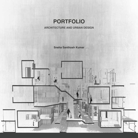
PORTFOLIO ARCHITECTURE AND URBAN DESIGN
Sneha Santhosh Kumar
EDUCATION AND WORK EXPERIENCE
Hello’ I believe in the ability of architecture and design thinking to effect good in the world. Upon realizing my abilities in drawing, imagination and love for monumental creativity,i started envisaging a career to become a highly qualified professional in architecture.I have been blessed with a variety of experiences and it has helped shape me into a highly skilled, thoughtful, and well-rounded designer. I believe in the power of holistical ideas paired with a multidisciplinary,research-based, and collaborative design process.My goal is to help better shape the built environment through the creation of beautiful, functional architecture,the communication of good ideas, and the development of sensible policy. I will continue to work, learn, and immerse myself in the field in order to achieve greater levels in my professional life.
2019 - 2022 (sept) (Apr)
MASTERS IN ARCHITECTURE AND URBAN DESIGN
2019 - 2022 (sept) (Apr)
Began as internship and worked as Junior Architect
2019 (Mar - Aug)
SUMMER INTERNSHIP
2018 - 2019 (Oct) (feb)
ARCHITECTURAL INTERNSHIP
2016 - 2017 (Oct) (feb)
ERASMUS STUDENT EXCHANGE PROGRAMME
2016 (June-Sept)
ARCHITECTURAL INTERNSHIP
2013 - 2018
BACHELORS IN ARCHITECTURE
Politecnico Di Milano, Milan, Italy
Fuzz Atelier, Milan, Italy
Dubai Cruise Terminal, Dubai, UAE
ASZ Architetti l SuperFutureDesign*, Dubai, UAE
Wroclaw University of Science and Techology, Wroclaw, Poland
F A Baker Architects and Consultants, Dubai, UAE
Gujarat Technological University 2011 - 2013
HIGHER SECONDARY EDUCATION Emirates English Speaking School, Dubai, UAE
COMMENDATIONS 2019
INVEST YOUR TALENT IN ITALY SCHOLARSHIP Sponsored by the Italian MInistry of Foreign Affairs, UNITALIA & Italian Trade Agency
2018
Acquired ranking in GTU Top 10 Students
SOFTWARE SKILLS Autocad
Photoshop
3Ds MAX
Illustrator
Revit
In-design
Sketchup
Rhinoceros 3D
Lumion
Grasshopper 3D
LINGUISTIC SKILLS Good command over English Language, both spoken and written Natural ability too read, write and speak Hindi, Malayalam and Gujarati. Learnt Arabic, German and Italian languages to read and speak moderately.
WORKSHOPS AND COMPETITIONS 2014 - Indian Architecture and CCB Design philosophies by Christopher Charles Beninger 2014 - ‘The Italian Approach to Urban Heritage Preservation’ by Prof. Giuseppe Cina, Department of Regional and Urban Studies, Polytechnic of Turin, Italy 2015 - Ways of creating sustainable Habitats by Ar. Priya Vakil 2016 - Digital Parametrics as a tool in form and Architectural character explorations by Ar. Dhanashreee Deshpande at BNCA, Pune 2017 - Exploring Urban street and furniure design by Ar. Priyank Shah, Southern California Institute of Architecture 2019 - Energy Within Environmental Constraints - HarvardX - ENGSCI137x 2019 - Sustainability in Architecture : An Interdisciplinary Introduction UPValenciaX - ISA201x
D.O.B : 07.07.1995 Nationlity : Indian Contact snehasanthosh@mail.polimi.it +39-3248935355 +971528107734 Address Dubai, UAE Visa Status Visa Status: Father sponsored UAE visa
CONTENT
01
02
03
Circulation of urban models: Quality of public spaces in the metropolis of Dubai
Community Living In A Heritage Engulfed Environment
Restoring Rocca Medioevale
04
05
06
Porta di Mare Green Village
Beyond Accessibility: Connecting the public spaces
Vadodara Heritage Walk
07
08
09
Module for Community living
Wroclaw Cultural Hub
Mu-table
Circulation of urban models
01
Quality of public spaces in the metropolis of Dubai Location : Dubai, UAE Type: Research oriented project Semester IV: Final thesis project
Abstract With an unprecedented growth across different dimensions of trade, commerce, and infrastructure development there was a heavy influx of migrants from the neighbouring South Asian countries. Dubai has grown several times its size when compared to its initial proportions during its primitive era. Massive urbanization has been distributed in disaggregate patterns that form a fractured urban morphology. Yet Dubai has managed to achieve a crafty hegemony among its contenders in the sub-continent for being modelled after its exceptional growth vision. Nevertheless, rhetorical circulation is a concept referring to the ways that ideas move through time and space. Our case could be an empirical understanding of the new-age transmission of urban models from place to place, within and from our primary subject, Dubai.
While the world witnessed an emerging example of urbanism in Dubai, its historical enclaves symbolised for its vibrancy and rich culture witnessed a contrasting fate. The public-private developers along with the rulers decided to revamp the whole neighbourhood into a contemporary, westernized district that attracts the affluent community. This thesis research will analyse the outcomes of the recent transformations in Dubai’s society and its urban morphology studying in-depth, both the criticism and exalt of urban development in Dubai. The circulation of Urban models would be analysed through case studies of Singapore and Kuala Lumpur, for being the cities closest to Dubai in terms of urban development and rate of expansion. Meanwhile, the study strives to provide insights on the possible tailored characteristics of urban models that could make the city more liveable. It concludes with a detailed survey of the evolution of public spaces and walkability within the urban models in Dubai.
Keywords: Circulation, Planning practices, Urban models, Urban change, Urban Replication, Urban policies, Land acquisition, Asian cities
• How did the metropolis of Dubai become a global model for the circulation of urban models? • How are the circulated urban models of public spaces perceived in Dubai? Have they been implemented successfully? • Have the urban models and policies been circulated in various contexts without adaptation? • What are the types of circulation of urban models seen in Dubai? The historical transformation of Downtown and Al Wasl
RESEARCH research QUESTIONS
questions
Circulation of urban modesl in Dubai revolves around
Standardisation of urban models Location map of case studies
Analysis of case study: Downtown Dubai
Analysis of case study: Downtown Dubai
Analysis of case study: Downtown Dubai
Downtown circulation
Parks & gardens
Dubai Parks & gardens
Dubai
Dubai
Towers & skyscrapers
Dubai
Shopping malls
Towers & skyscrapers
Towers & skyscrapers
Waterbody & canals
Waterbody & canals
Waterbody & canals
Dubai
Singapore Parks & gardens
Shopping malls
Shopping malls
Circulating drivers of spatial transformation Singapore Kuala Lumpur
Singapore Kuala Lumpur
Singapore Kuala Lumpur
Singapore Kuala Lumpur
Kuala Lumpur
Emergence of locally adapted urban models
Replication of urban models
Box park circulation
Citywalk circulation
U Walk
Adjan Walk Zawaya Walk
Qatar City Walk
Saudi Arabia
Boxpark, Dubai, 2011
Boxpark, Seoul, S.Korea (2018)
Boxpark, Shoreditch, London (2011)
Zawaya walk, Sharjah
UAE
Citywalk, Dubai
Adjan walk, Al Khobar
U-walk, Riyadh
Zawaya walk, Sharjah
Puma city, 2008
Boxpark Doha, Qatar (2021)
Observations made in Dubai Downtown, Citywalk and Box park
The observations and analysis in detail can be viewed here.
Quality analysis of public and pedestrian spaces Dubai Downtown
Quality analysis of public and pedestrian spaces Citywalk
Built mass in Downtown
Permanent blocks
Urban blocks
Built space analysis
Open space analysis
Urban blocks
Built space analysis
Open space analysis
Functional analysis
Mobility infrastructure analysis
Circulation Site plan
Functional analysis
Mobility infrastructure analysis
Site plan Built mass in context
Quality analysis of public and pedestrian spaces Boxpark Dubai
Outcomes of comparative analysis
User experience in Dubai Downtown, City walk and Boxpark
Temporary structures
Built space analysis
Functional analysis
Site plan
Open space analysis
Mobility infrastructure analysis
To understand the evolution of public spaces from Dubai downtown to City Walk and Boxpark, a social gravity indication is provided to understand the frequency and popularity of use of the public spaces in these 3 developments. While in the case of Dubai downtown, the indoor spaces such as shopping malls and Opera experiences heavy influx of visitors and tourists throughout the year in comparison to the dedicated public plazas in Dubai downtown and City Walk. City Walk is an experiential development encouraging pedestrian and cycling activities with various types of public spaces. Whereas Boxpark is an entire stretch of public realm that has been gaining popularity among visitors. Public spaces have been indicated on the maps based on a public opinion poll conducted on site and based on our personal experience of visiting the three sites of study. The enriched analysis has enabled to indicate a popularity of each public space among Dubai residents and tourists.
Outcomes of comparative analysis
Walkability in Dubai Downtown, City walk and Boxpark
Though dedicated walkways are present in all three cases, the comfort level varies considering the arid environment. Walking is made more experiential in City Walk as it is pleasant all year round. In downtown, the disconnected pathways with scarce urban furniture has a scope for improvement. In the case of Boxpark which functions as an independent unit, the absence of viable walkways from City Walk and Downtown plays an important role in its low number of users.
A local reconnection of urban models in Dubai strategies proposed
A simulation in Dubai The existing facilities in Dubai Downtown could be improved to enrich the experience of walking and cycling around the downtown.
Well-furnished pedestrian and cycling pathways making it an enjoyable boulevard along the key vehicular access to this development.
The central spine connecting Dubai downtown, City Walk and Boxpark could feature a range of activities such as green parks, children playgrounds, open spaces for outdoor leisure activities and games, cycling, walking, running, jogging, dine-out options.
An elevated pedestrian bridge or pedestrian underpass would be an ideal, safe, well-furnished connection to link the developments on the east and west side of the Sheikh zayed road.
Simulations of the proposed strategies
The new urban street can be designed to include several types of seating, children’s play areas, racks for private and shared bicycles, jogging tracks, open - air gyms with equipments, open air theatres for public performances, games and sports areas and many more. The temporary nature of this street would help to accomodate activites that would provide a comfortable environment to its users throughout its harsh weather as well.
Community living
02
In a heritage engulfed environment Location : Yazd, Iran Type: Community design based project Semester II: Architecture design studio
The City of Yazd is located in the middle of the Iranian plateau, 270 km southeast of Isfahan, close to the Spice and Silk Roads. It bears living testimony to the use of limited resources for survival in the desert. Water is supplied to the city through a qanat system developed to draw underground water. The earthen architecture of Yazd has escaped the modernization that destroyed many traditional earthen towns, retaining its traditional districts, the qanat system, traditional houses, bazars, hammams, mosques, synagogues, Zoroastrian temples and the historic garden of Dolat-abad.
The master plan for the resdiential project, along with the strategy for residential apartments, it has established a strong strategy for public spaces at each intersection of the axis as well as on all edges of the site. The major horizontal axis connecting the garden on the left to the highway on the other side of the site has been emphasised with a noticeable sized stretched out building with a boulevard to enrich the quality of the axis. Making it a formal public street with multpile spill over spaces on that stretch, to accomodate various public activities. This connectivity and public spaces form the basis for a homogeneous division of the site into 4 urban blocks.
Site Analysis
City Analysis
Masterplan
Visualization of the Urban Block
Ground floor Plan / Built Space
It can also be observed on this axonometric view of the project, the configuration of apartments and the public spaces are unique in each zone, which responds to the existing urban fabric. For example on the top-right - the more linear tissue corresponds to the recent city fabric Whereas in the south, the urban block has a courtyard centric design corresponding to the old city fabric. Also each urban block has a unique public space which caters to the demands of that residential zone and the neighbourhood.
Building 1
Building 2
Building 6
Building 3
Building 7
Building 4
Building 8
Building 5
Building 9
Building 10
Plots
The community residential project was initiated by designing several units to cater various user-groups depending upon the number of users and the age groups.
Ground floor
A unique urban block of residential units was designed on a 100x100m plot which would serve as a model design guideline for the whole project. This square plot is designed considering the exisitng site conditions, corner conditions, accessibility and exisitng open spaces.
Circulation Stairs
Apartment
Open space
Entrance
Entrance Type 1 Studio Apartment
1 Room Apartment
1 Room Apartment
Entrance Type 2
3D module (Entrance types)
2 Room Apartment
3 Room Apartment
Ground Floor
First Floor
Second Floor
Third Floor
The major road axis from the context has divided the site into 4 residential zones. The urban block on the left is the closest to the unesco heriatge garden. The ground floor of the project is dedicated to public activities and circulation. The stacked residential units above one another carves out shaded courtyards in the ground floor. These spaces have been designed to function as secured open spaces for children’s playgrounds and open air gatherings. The staircases are free standing structures which acts as the grid for the site around which the residential units are carefully designed.
Ground floor of this project is dedicated to public activities and circulation. The stacked residential units above one another carves out shaded courtyards in the ground floor. These spaces have been designed to function as secured open spaces for children’s playgrounds and open air gatherings. Facade of each side of the urban block is unique and it corresponds to the neighbouring structures, the sun direction and the wind direction. Each floor has been carefully deisgned to provide a fair balance of private living areas and public common spaces which are semi-covered to provide protection from the harsh Iranian climate.
Ground floor Section CC’
Section BB’
South-West Facade
First Floor
Second Floor
Third Floor
North-West Facade
Solid and Void Private and Public Third floor plan Types and Functions
Second floor plan
Section BB’
North-west facade
Ground floor plan
Section AA’
Section EE’
First floor plan
Public Building - Gym and Indoor sports
Visualization of the Urban Block and Open Spaces
Public Building - Study Hall
On the left are the drawings of the public buildings, which caters to different functions and has adorned a volume depending upon its location to subtly merge with the exisitng urban fabric. The public building in the top end of the site is a long cuboidal double storeyed structure with a basement floor providing spaces for activites like gym and indoor sports. It is a modern structure blending with the traditional Iranian style of perforated openings. The public building on the south end has a deformed mass comparatively as this corresponds to the existing old city fabric. The six volumes standing upright also adapts the iraning style of perforated openings to provide good ventilation. This structure provides roof to study rooms, seminar areas and terraces.
Restoring Rocca Medioevale
03
Location : Arquata del Tronto, Italy
Type: Architectural preservation and restoration project Semester II: Architectural preservation studio
The history and events of the Rocca are closely linked and inseparably merge with those of Arquata del Tronto, a municipality in the Province of Ascoli Piceno in the Marche Region of Italy. It has always been a border area and often disputed, with bitter battles and furious fights, between the cities of Ascoli Piceno and Norcia. After being contended for years between the two aforementioned cities, it was part of the Papal States since 1809 and until Italy was finally unified in 1870. With the last latest events in the region, this medieval fortress became a symbol of a territory hard hit by the earthquakes happened in the Central of Italy in 2016. But despite of the catastrophe, there is also the beautiful story of the affected municipalities, all proud of their cultural heritage and their historical centers, which are part of their identity. Therefore,it is important to make a rebirth of this territory, passing through the conservation of the Rocca and the recovery of the cultural heritage of the city.
Geographical Location
Historical Developments
Level of Building Destruction (post-earthquake)
Phase 1
Phase 2
The history and events of the Rocca are closely linked and inseparably merge with those of Arquata del Tronto, a municipality in the Province of Ascoli Piceno in the Marche Region of Italy. It has always been a border area and often disputed, with bitter battles and furious fights, between the cities of Ascoli Piceno and Norcia. After being contended for years between the two aforementioned cities, it was part of the Papal States since 1809 and until Italy was finally unified in 1870. With the last latest events in the region, this medieval fortress became a symbol of a territory hard hit by the earthquakes happened in the Central of Italy in 2016. But despite of the catastrophe, there is also the beautiful story of the affected municipalities, all proud of their cultural heritage and their historical centers, which are part of their identity. Therefore,it is important to make a rebirth of this territory, passing through the conservation of the Rocca and the recovery of the cultural heritage of the city.
Damaged buildings (small/medium damages) Damaged buildings (large damages) Collapsed or demolished buildings
Identification of Important Buildings Phase 3
Phase 4
Phase 5
Cultural heritage architecture (national value) Important architecture identified (regional value) War memorial Monumenti ai Caduti
Phase 1
Phase 2
Phase 3
The proposal consists of development in threephases and attempts to highlight the importance of pre-existing public and cultural heritage buildings in the village and reconnecting them with the Rocca in the reconstruction process. The proposal for the town is to transform the collapsed buildings into gardens with ruins as public and open spaces. Intervention proposal for the buildings which are moderately damaged is to provide scaffoldings to its facades, in order to guarantee a safe path of walk through the village during the reconstruction phase of Arquata del Tronto.
After the village is cleaned of the debris and is made safe for access by the people, a garden is proposed with a variety of shrubs, trees, urban furnitures, street lights and some preventive structures for the existing ruins. The idea is to replicate the geometry of damaged buildings, giving the visitors an augmented reality experience of the space, the shadows, the vibrance of the village that existed before the eathquake. Some plots are designed with 3 m high shrub walls with windows and doors, making it accessible to the interiors. While some plots have been designed with shrubs and seasonal plants visible to the visitors at eye level. Some are filled with carpinus cube trees to provide a visual connectivity with the surroundings. And completely accessible plots are also provided to walk through and feel the space. This is designed to avoid a monotonous continuous wall of tall green shrubs, which wouldn’t also lack the integration with the surrounding landscape.
Phase 1
Phase 2
Phase I Visualization of phase 2 development of the town
Visualization of phase 2 development of the town
Phase II
Some plots are designed with 3m high shrub walls with windows and doors, making it accessible to the interiors. While some plots have been designed with shrubs and seasonal plants visible to the visitors at eye level.
Phase III
Design for pathway to Rocca
South facade - existing
Design for pathway to Rocca
South facade - proposed
West facade- existing
West facade- proposed
Existing situation - level 4.7m
Existing Situation- level 0
Interior view of Rocca
Proposal - First floor plan
Existing situation - level 8.1m
Proposal - Ground Floor Plan
Interior view of Rocca
Proposal - Second floor plans
Visualization of the Rocca after restoration
Existing structure - 3D
Existing structure 3D section - A
Existing structure 3D section - B
Proposal 3D
Proposal - 3D section - A
Proposal - 3D section - B
Porta di Mare Green Village
04
Amenities and community living for the winter olympics Location : Milan, Italy Type: Urban community living design Semester I: Architectural design studio
“Porta di Mare” is an area located between the boundary of the consolidated city and the Vettabbia park. Porta di Mare’s abandoned green area has a total surface of 65 hectares and is included in South Milan Agricultural park. The proposal includes sustainable performance analysis during the decision-making process of the project, aiming to illustrate with it how new developments can embrace enviromantal desgin decisions. This project recommends to transform the site into a model for sustainable way of living and to accomodate the future residents for the winter olympics 2026 in complete timbe construction techniques. This proposal merges traditional Milanese urban and rural typologies to create a hybrid that balances the city and its natural surroundings.
Site and context analysis
Context relationship
Neighbourhood footprint
Green area footprint
Open spaces footprint
Public facilities
The project is designed to develop convertible buildings to cater for the mixed-use and residential activities devoted to host atheltes for the winter olympics 2026. Later, this will be used by local communities and associations in the neighbourhood. The masterplan is developed witha grid developed from an axis extended from the context. The public facilities are placed near the entrance of the site which can cater to the needs of the athletes and the usergroups in the neighbourhood. These mixed use buildings are connected with the surrounding residential area with a boulevard and promenade. The project later narrowed down to focus on the detailed constrcution design and building physics one selected building in both the categories.
Axis Grid
Boulevard and Promenade
Public Facilities
Shape
Modules
Influenced by the context
Modular system of structure
Patio
Corridors
To open up the mass and pro-
Open corridors that connect the modules with the secondary structure.
vide a central light-well.
Connection
Accesibility
To link the site with the context and public square.
Vertical accesibility : staircases and elevators
Alternating form
Facade
To obtain large punctures in the mass for cross-ventilation.
Vertical wooden shaders to protect the interior environment from solar radiation.
Envelope
Envelope
Cantilevered roof and canopies have been designed to provide shade to each facade of the structure.
Pitched roof that hosts solar panels.
Mixed-use building
Housing Footprint
Residential building
Mixed-Use Building
Residential Building
Plan
Typical Plan
Section AA’
Section AA’
East Facade
Elevations
Section CC’
Mixed-Use Building
Residential Building
The mixed-use building is designed with a large courtyard in the interior which acts as large light-well. The building is designed with alternating forms which will facilitate cross-ventilation through these large punctures in the building. The cantilevered roof and canopies have been designed to provide the required shade on each specific facades. The building is designed with alternating forms which will facilitate cross-ventilation through these large punctures in the building. The cantilevered roof and canopies have been designed toprovide the required shade on each specific facades. The building is composed of a structural frame of 5x5m consisting of wooden beams and columns.
The residential building is designed in modules of residential units and accesibility structure to facilitate the residential units. Open air corridors are designed to connect the five residential modules and the vertical accesibility of the building, which is facilitated by both stair and elevators at two points, equally accessible for all the units. Vertical wooden louvers is along the passage and the facade to protect the interior from direct solar radiations. The residential modules have been stacked next to each other in a lowrise apartment typology, which has been repeated throughout the plot corresponding to the sun and wind direction.
Details - section
Details - section
FOR 2030 STATIONS_PROPOSEDSTATIONS_PROPOSED FOR 2030
B+C
FM
arding ding at are are area a sible. le.
B+C
B+C
FM STATION_FARMERS OLD PT. ROMANA STATION_FARMERS MARKET OLD PT. ROMANA MARKET
E/E
E/E EVENTS/EXHIBITION SPACE EVENTS/EXHIBITION SPACE
OM
OM SPACES OPEN MARKET SPACES OPEN MARKET
B+C
B+C BOOKSHOP+CAFE SPACE BOOKSHOP+CAFE SPACE PUBLIC CENTERS
PUBLIC CENTERS
FM
STATIONS_PROPOSED FOR 2030 OLD PT. ROMANA STATION_FARMERS MARKET
Beyond Accessibility: E/E EVENTS/EXHIBITION SPACE P.TA ROMANA P.TAConnecting ROMANA AREA AREA
the public spaces
Location : Milan, Italy Type: Urban design project
NewSemester axes areI: usefull in Urban deisgn studio New axes usefulloninthe order to are intervent order to intervent on the “critical borders”. “critical borders”.
OM
OPEN MARKET SPACES
B+C
BOOKSHOP+CAFE SPACE
P.TA ROMANA AREA
PUBLIC CENTERS
GREEN AREAS OF INTERVENTION GREEN AREAS OF INTERVENTION
GREEN AREAS OF INTERVENTION
GREEN_PROPOSED FOR 2030 GREEN_PROPOSED FOR 2030
GREEN_PROPOSED FOR 2030
OPENING THE BOUNDARIES AXES InterventingAXES on “critical borders” to breaking boundaries and Working with vertical/horizontal axes to connect public spaces and GREEN AXES GREEN vertical/horizontal axesaccessible to axes connect public and Improving the existing greenery following the proposed axes. axes. making the area for the spaces users. make themgreenery accessible. ng with vertical/horizontal to connect public spaces and Improving the existing following the proposed
05
P.TA ROMANA AREA
GREEN Improving the existing greenery following the proposed axes.
cessible. hem accessible.
BOUNDARIES OPENING THE BOUNDARIES BOUNDARIES OPENING THE BOUNDARIES AXES BOUNDARIES OPENING THE BOUNDARIES AXES GREEN Highlighting the main boundaries that need to be open in order to Interventing on “critical borders” to breaking boundaries and Working with vertical/horizon theboundaries main thataxes need to be open in Interventing “critical borders” boundaries and Working withneed vertical/horizontal totoconnect Highlighting the main boundaries that to be open in axes order Interventing toopen breaking andVarious Working with axes to connectonpublic spaces and to breaking Improving the existing greenery following the proposed axes. Identifyingon the “critical boundariesborders” that needHighlighting to up to make the boundaries to intervene intovertical/horizontal theorder boundaries make the area accessible for the users. making the area accessible for the users. make them accessible. make the area accessible for the users. making the area accessible for the users. make them accessible. make the area accessible for the users. making the area accessible foraccessible the users. make them accessible. area more
New axes are usefull in order to intervent on the “critical borders”. The main issue is regarding The main issue is regarding New axes are usefull in the railway tracks that are the railway tracks that are order to intervent on the “cutting” in two the area “cutting” in two the area “critical borders”. making it less accessible. making it less accessible.
Establishing vertical and horizontal axis to improve accessibility
Improving and expanding the existing green zones along the axes
TheDecaying main issuerailway is regarding axes arecritical usefull in Identifying the Identifying to in New New axes areaxes usefull Identifying the railway tracks that areorder to intervent on the order to intervent on the yard divides the site connect the critical borders green spaces to “cutting” in two the area “critical borders”. “critical borders”. booundaries link making itinto less2accessible.
Guo Long, Koyuncu Tugce Nur, Santhosh Kumar Sneha E Crocetta M3
LAYERS OF INTERVENTION
New Axes NEW AXES
Lodi M3
PT. Romana
FM
Toscana
E
ANT BUILDINGS
NEW Spaces SPACES New
Via Brembo
E/E
C+B
oundaries
NEW AXES
Lodi M3
PT. Romana
OM
E/E
Green Zones GREENERY NEW SPACES
FM
Toscana
B+C
BEYOND ACCESSIBILITY: CONNECTING AND LIVING THE PUBLIC SPACES Via Brembo MASTERPLAN 1:5000 C+B
OM
The intervention strategy proposes four new public centres along with the imrovement of two existing ones which can be connected through five main new axes comprising of four vertical and one horizontal. Each axis has a precise beginning and arrival point to improve accessibility and connection. The left most vertical axis connecting Bocconi university area, the existing public centre, and the water channel on the south of the railway tracks, a new public space is proposed.
EXISTING
P.TARomana ROMANA GREENERY P.ta AREA
CYCLING CANAL
B+C
Crocetta M3
RAILWAY TRACKS
The axis continues to connect with the cultural and business zone near the railyard, by connecting the proposed railway station (station name) by the municipality along the existing tram station to the public zones identified near the residential area. Similary, an axis from Piazzale Lodi to Via Brembo is Group 1 Vittoria,to either sides of railway proposed to improve the Barbirato connectivity Chen Kan, tracks. Chen Siyu, Guo Long, Koyuncu Tugce Nur, open spaceKumar is expected Santhosh Sneha
In addition, this urban to become a Area central gathering place for the city which is always in need of more public landscapes. LAYERS OF INTERVENTION
CRITICAL BORDERS M3 STATIONS
Layers of Intervention
E
PUBLIC CENTERS ACTIVEPUBLIC GREEN BEYOND ACCESSIBILITY: CONNECTING AND LIVING THE SPACES
MASTERPLAN
PASSIVE GREEN
Planovolumetric 1:5000
n in order to
Existing EXISTING
Cycling CYCLING CANAL Canal RAILWAY TRACKS Railway tracks CRITICAL BORDERS Critical borders
PROPOSED Proposed
ACTIVE GREEN Active green PASSIVE GREEN Passive green
PROPOSED
Educational buildings
EDUCATIONAL/ CULTURAL AND BUSINENS RELEVANT BUILDINGS
NEW SPACES
Via Brembo
AXIS OF CONNECTIONS
C+B
Crocetta M3
OM
New cycling paths to improve accessibility
Stations_proposed for 2030 STATIONS_PROPOSED FOR 2030
OM
B+C
New axes are usefull in BOOKSHOP+CAFE SPACE Bookshop order to intervent+oncafe the “critical borders”. PUBLIC CENTERS
Public centres
GREENERY
GREEN Improving the existing greenery following the proposed axes. NEW AXES
Lodi M3
P.TA ROMANA AREA
PT. Romana
FM
Toscana
Green areas of intervention GREEN AREAS OF INTERVENTION GREEN_PROPOSED FOR 2030
LAYERS OF INTERVENTION
B+C
Old Pt. Romana station - farmers market AXES EVENTS/EXHIBITION Working with SPACE vertical/horizontal axes to connect public spaces and Events / Exhibition space make them accessible. OPEN MARKET SPACES Open market spaces
OLD PT. ROMANA STATION_FARMERS MARKET
E/E
AXIS OF CONNECTIONS
Toscana
Vertical / horizontal pedestrian connections to open the boundaries Vertical/horizontal pedestrian connections to open the boundaries CYCLING New cycling paths to improve accessibility
NEW AXES
PT. Romana
OPENING THE BOUNDARIES AXES E/C+B EDUCATIONAL/ CULTURAL AND BUSINENS RELEVANT BUILDINGS Interventing on “critical borders” to breaking boundaries and Working with vertical/horizontal axes to connect public spaces and making the area accessible for the users. make them accessible.
M3 stations M3 STATIONS FM OPENING THE BOUNDARIES E Interventing on “critical borders” to breaking boundaries and E/E PUBLIC CENTERS Public centres making the area accessible for the users.
E/C+B
Group 1 P.TA ROMANA AREA Barbirato Vittoria, Chen Kan, FM GREEN Chen Siyu, Improving the existing greenery followingGuo the proposed axes. Long, E/E Koyuncu Tugce Nur, Santhosh Kumar Sneha Lodi M3
Via Brembo
NEW SPACES
Visualization of the public space proposed near canal
Visualization of the public space proposed near the business district
Guo Long, Koyuncu Tugce Nur, Santhosh Kumar Sneha
FUNCTIONS P
The planovolumetric concentrates on the vertical connection of the green spaces between the north and south side of the railway line / motor highway. It has been linked by pedestrian and cycling paths as well as by providing new activities to the under-used green spaces. In order to improve the public spaces and its connectivity, the existing canal has been redeveloped to merge with the green and brown public spaces. A strong axis of green corridor is formed, which has been vibrantly designed to evoke its significance with activities to cater the needs of the user groups. The axis passes through by rejuvenating the abandoned buildings and making it future landmarks for public activities like café, museum, bookshop and gathering spaces. The pedestrian and cyclist focused corridor connecting all the public spaces is expected 1 to encourage all the people toGroup adapt walking Barbirato Vittoria, and cycling , while mitigating the current lack Chen Kan, of interaction with the nature and also by Chen Siyu, improving the quality of life and community Guo Long, living on a large scale. Koyuncu Tugce Nu
Playground
S1 Shelter 1 for sellers S2 Shelter2 for bicycle repair and bike parking
king
S3 Sunshading
A
Agricultural fields for residences.
BEYOND ACCESSIBILITY: CONNECTING AND LIVING THE PUBLIC SPACES PLANOVOLUMETRIC 1:2000
eatre
FUNCTIONS Playground
Shelter 1 for sellers P
e
Playground
C Sport courts such as basketball tennis and volleyball
B Skateboard area D Decks for sunbathing, sunset watching, picnic and urban furniture such as amphitheatre for residential meeting/events
MAIN PARK view AREA (of B +refurbished C-P ) Proposed abandoned building
R Adaptive-reused building for public usage such as library, concert/event hall
Sheltter 2 for bicycle repair & parking S1 Shelter 1 for sellers
Sunshading
CP Cycling path + walking/running paths S2 Shelter2 for bicycle repair and bike parking
S3 Sunshading
CANAL AREA ( D )
N New station
forresidences. residents A Agriculturalplots fields for BEYOND ACCESSIBILITY: CONNECTING Agricultural AND LIVING THE PUBLIC SPACES O Open area for event
PLANOVOLUMETRIC 1:2000 Planovolumetric
C Sportcourts courts such as basketball tennis Sports - basketball/tennis and volleyball
Proposed view of refurbished abandoned building
B Skateboard Area area Skateboard
Santhosh Kumar S
EVENTS/EXHIBITION SPACE ( N )
FUNCTIONS D Decksfor forpicnic/hangout sunbathing, sunset activities, watching, Decks P Playground Playground
Shelter 1 for S1 Shelter 1 forsellers sellers S2 Shelter2 for bicycle repair and & bike parking Sheltter 2 for bicycle repair parking S3 Sunshading Sunshading
picnic and urban furniture such as amphitheatre
amphitheatre for events/gatherings for residential meeting/events Adaptive - reuse of building - to
R Adaptive-reused building for public usage
such as library, concert/event hall library, concer/event hall
SECTION 2
Section 2
1
SECTION 3
SECTION 2
Agricultural forresidences. residents A Agriculturalplots fields for
CP Cycling path + walking/running paths
Cycling path + walking/running path 1
2
3
2
3
OPEN MARKET SPACE ( A )
C Sportcourts courts such as basketball tennis Sports - basketball/tennis and volleyball
B Skateboard Area area Skateboard
SECTION 1
N New station New station
Open area events O Open area for for event
SECTION 1 1 Section
SECTION 3 3 Section
06
Vadodara Heritage Walk Reconnecting the disappearing streets of Vadodara Location : Vadodara, Gujarat, India Type: Urban design project Semester VIII (B.arch): Urban design studio
The studio focused on street analysis and developing the street fostering the Smart City Vision of Vadodara 2030 by the Municipal Corporation, thus developing the street into sustainable without losing its heritage and cultural essence. The idea is to propose a tourist heritage circuit that will focus on urban space and street activities along the streets that will focus on enhancing the existing remains of heritage. The project focuses on developing a pedestrian friendly neighbourhood by diverting the existing vehicular traffic and promoting cyclists. The images on the left comprises of the analysis of Urban blocks, Road networks, the traffic patterns, street noise conditions and the existing greens. The images on the right is the visualization of the existing condition of the street which deprecates the aesthetics and value of the exisiting heritage of the city. And the following image if the visualization of the street post the urban regeneration project.
Mass and Void
Existing view of the street
Road network
Street Noise Condition
Existing green
Proposed Section
Proposed view of the street
Proposed Part A- views
0 lvl
-3 m lvl
-3 m lvl
Proposed Part A- Plans
Existing Condition
Proposed Part A- Section
Existing Condition
-6m lvl
-6m lvl
Proposed Part A- Section
Proposed Part A- Section
0 lvl
Proposed Part - B
Proposed Part - C
Plan at +3 lvl
Plan at 0 lvl
Plan at 0 lvl
Module for community living
07
Intergenerational community living space Location : Wroclaw, Poland Type: Housing design Semester VII (B.arch): Architecture design studio
This studio project focused on designing a new creative and sustainable community living space that can accomodate a set variety user groups. A housing module that incorporates various functions with a conscious approach towards achieving a sustainable physical environment, micro-climate, social and cultural context. Meanwhile making it a barrier free environment was one of the key concepts. the project was further enhanced with adapting few teachinques to conserve energy as well as produce energy from the renewable resources to make the community self-sustaining. Public spaces have been provided abundantly at each level without compromising the privacy of each resident. Location The project suggests a new urban internvention for the city of Wroclaw, poland.
1
2
3
4
Design idea and approach
Design concept
View 1
Massing and circulation Masterplan Arrangement
View 2
Design Concept
Concept 3D Massing
Community living spaces focusing on housing and activities spaces for individuals and families of various sizes. Each unit is designed to be self-sufficient in terms of energy generated from solar panels and roofs that support growing vegetation to help promote a sustainable lifestyle. Pathways, ramps and stairs help make an inter-connectivity between the units to become one large functional machine. A thoughtful play of housing units, voids and green spaces have been incorporated in the design to promote community living which can be an escape from the bustling city life.
Sectional view
Wroclaw cultural hub
08
A community hall for the city centre of Wroclaw Location : Wroclaw, Poland Type: Design oriented project Semester VI: Architectural design studio
The aim of this project was to design a vibrant multi-functional public space for the city of wroclaw. The building form is shaped to to allow maximum daylight penetration to the building from the North, by articulating the building form, creating a lush trait of greenery across the building roof and facade. The building forms and the spaces fosterr the ideas of freedom in working spaces and free-flor creative workshop zones to artists.
Isometric view of 10 floors Design concept
level 3
level 8
level 7 level 2
Continuity of urban streetscape
level 6
level 1
level G
level B
Exterior View- 2
level 5
level 4
Exterior View 1
Exterior View 2
Interior View
Exterior View 3
Exterior View 4
Street Elevation
Mu.Table is the community table which changes its shape acconding to your needs. It is composed by concrete volumes and metal frames with wooden decks. Tables and stools follow the same simple design, the stools can be hung under the table and the table itself can be rotated at 90 degrees. Very compact in its linear configuration you can easily turn its elements to create more private areas for you and your friends.
Mu-table
09
Location : Dubai, UAE Type: Design oriented project Internship
The concrete elements are fixed, the small one can be used as a device charging station and a public fountain, the big one is a flowerbox for a small tree which will make shadow and will make you contemplate the nature. It’s a modular system and many kind of aggregation are possible in different situation of space.
Thankyou
Sneha Santhosh Kumar +97152-8107734 +393248935355