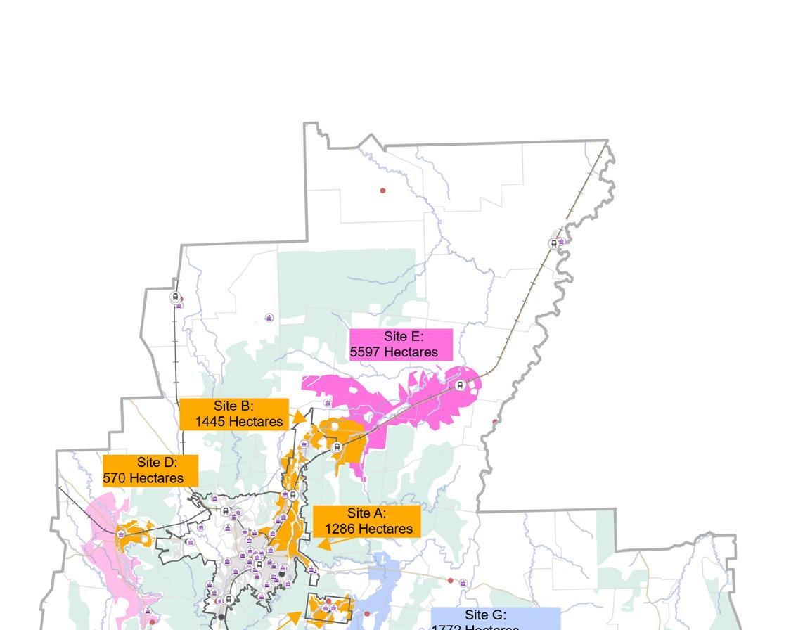
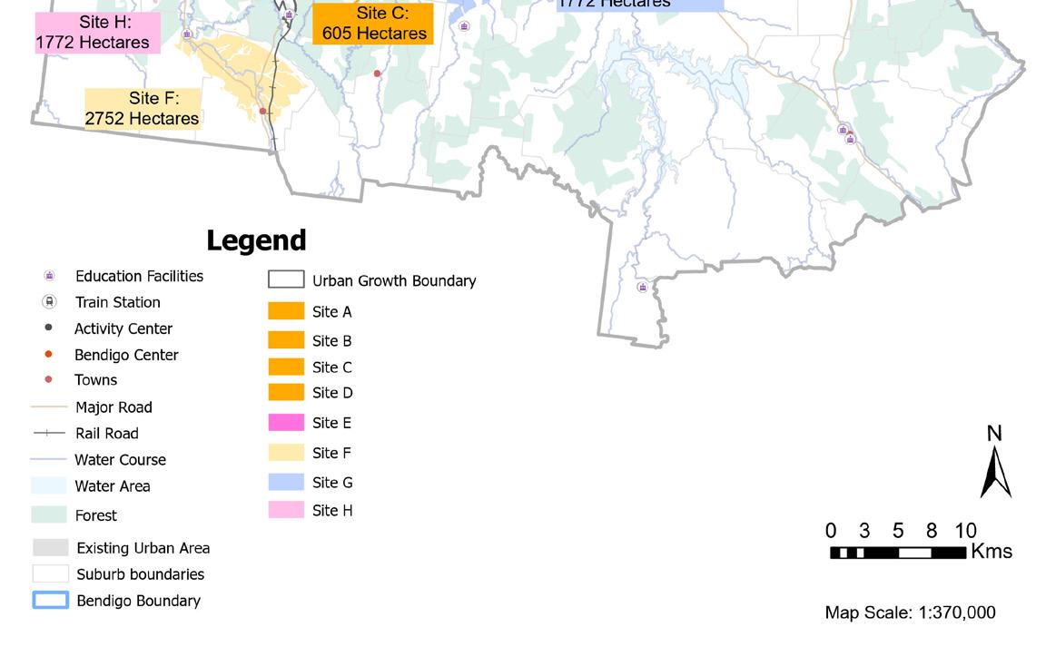
Future Residential Areas
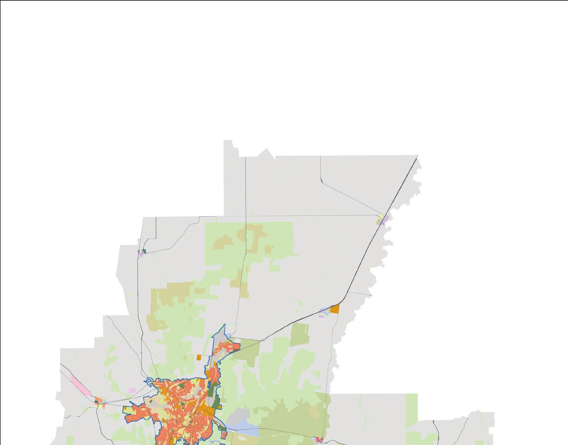
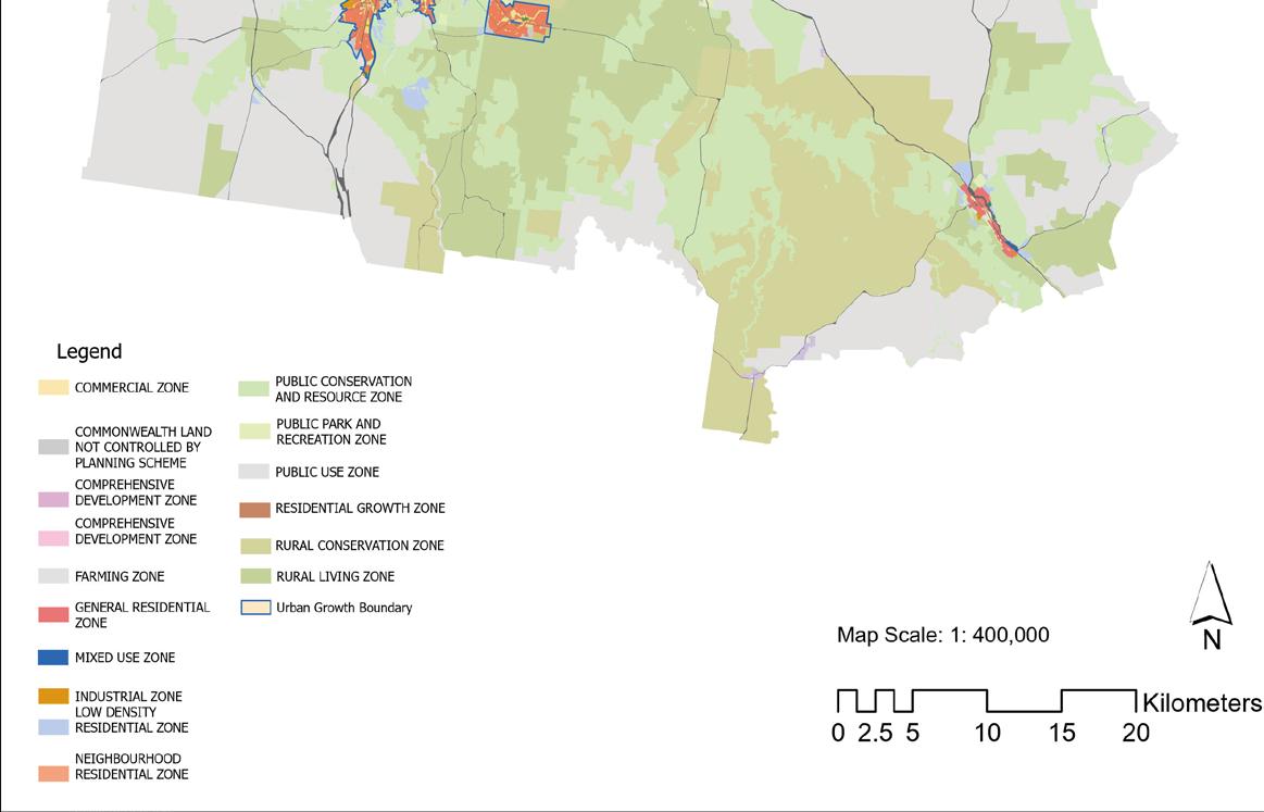
Planning zone distribution across Greater Bendigo
2. GIS Applications and Analytical Gaps
While Greater Bendigo City Council maintains sophisticated GIS infrastructure—such as the public POZI platform for visualising overlays and planning initiatives—the strategic application of GIS for land suitability evaluation remains notably limited. As Chen (2021) observes, despite various visionary frameworks promoting Greater Bendigo as a model of regional sustainability, there has been little systematic assessment of the physical landscape’s development capacity, and no comprehensive GIS-based land suitability analysis has yet been undertaken for the entire municipality. As Bolstad (2005) and Malczewski (2006) argue, spatial decision support tools are essential for reconciling competing priorities in urban planning.
This report addresses the identified analytical gap by employing a GIS-based weighted overlay analysis to evaluate land suitability for accommodating 38,000 new dwelling units across Greater Bendigo. By translating policy ambitions into quantifiable spatial criteria—integrating environmental constraints, infrastructure capacity, and strategic growth objectives—this method offers a replicable framework for operationalising planning theory. In doing so, it not only responds to the current absence of a comprehensive land-use suitability assessment but also demonstrates how spatial modelling can support long-term urban development planning and help align regional housing targets with on-the-ground feasibility.
Figure 2 illustrates the current planning zone distribution across Greater Bendigo, forming the spatial and regulatory framework that underpins development decisions. As the map shows, opportunities for higher-density growth are concentrated within and around the urban core, while rural conservation and farming zones restrict outward expansion to protect the broader landscape. This zoning context informs the land suitability analysis by delineating where development is currently permitted and where strategic rezoning may be required to meet future housing demand.
Figure 7. Bendigo Bushfire and Inundation Overlay Map in Greater Bendigo
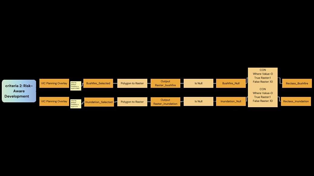
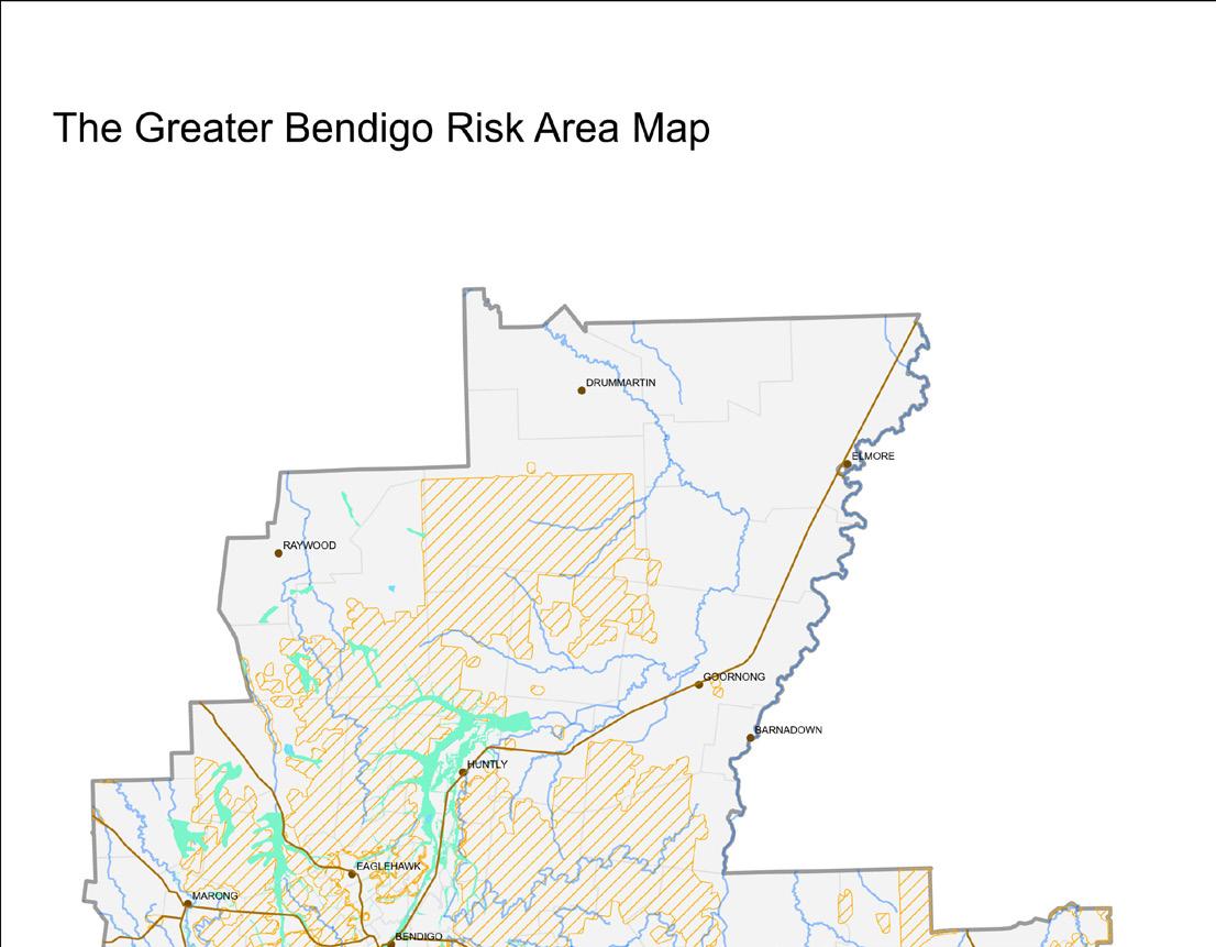
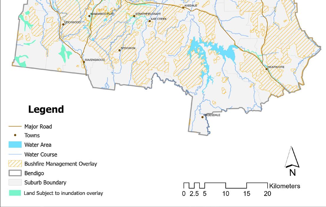
Figure 8. Reclassified Bushfire Constraints Map – Greater Bendigo
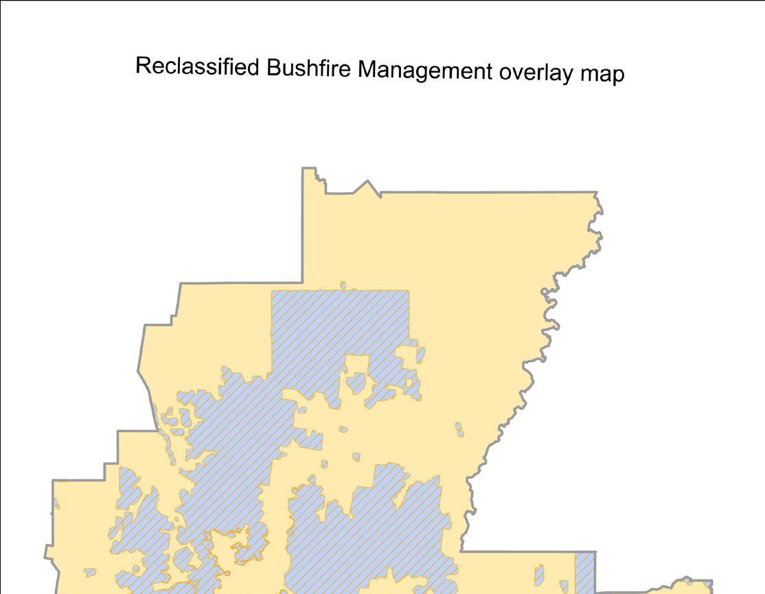
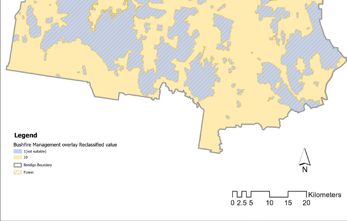
Figure 10.
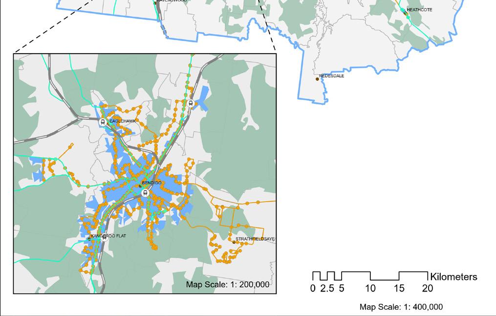
Public Transport and Road Network in Greater Bendigo
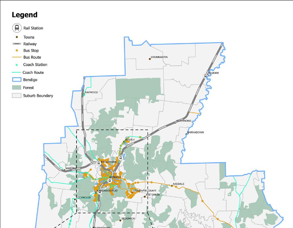
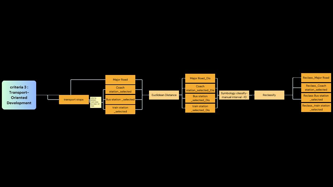
Figure 11.
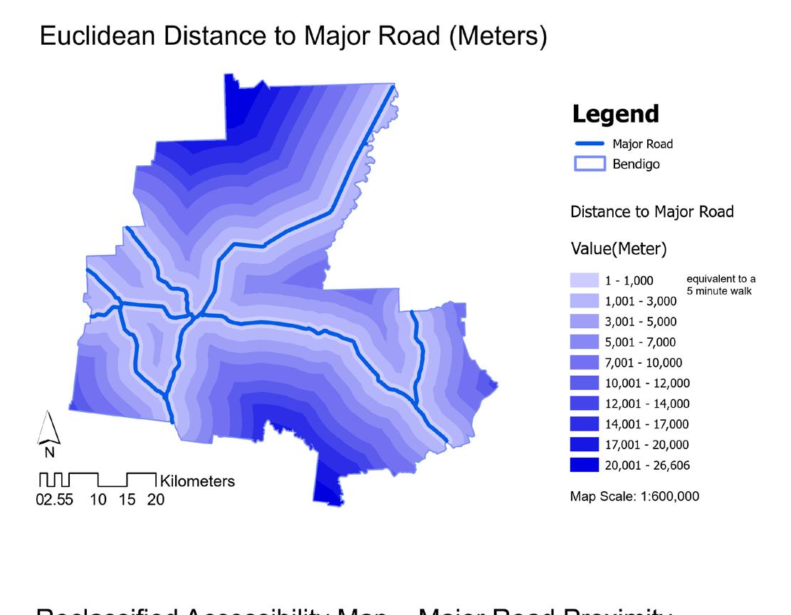
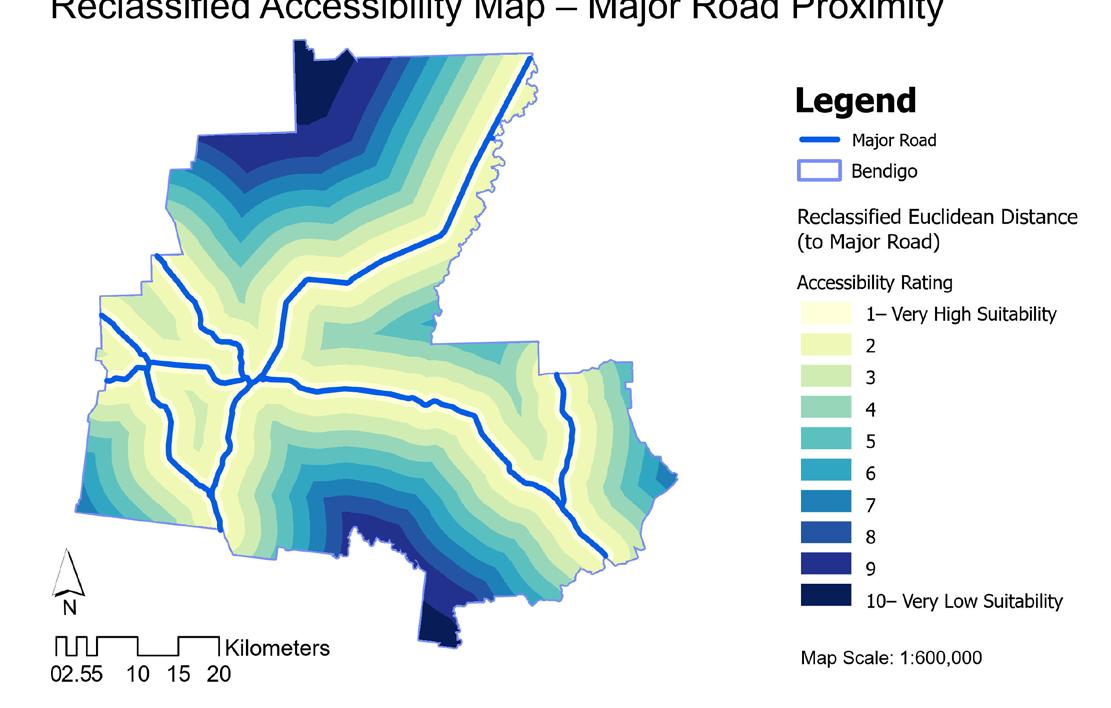
Euclidean Distance to Major Road (Meters)
Figure 12.
Reclassified Distance to Major Road (by values 1-10)
Euclidean Distance to Coach Stations (Meters)
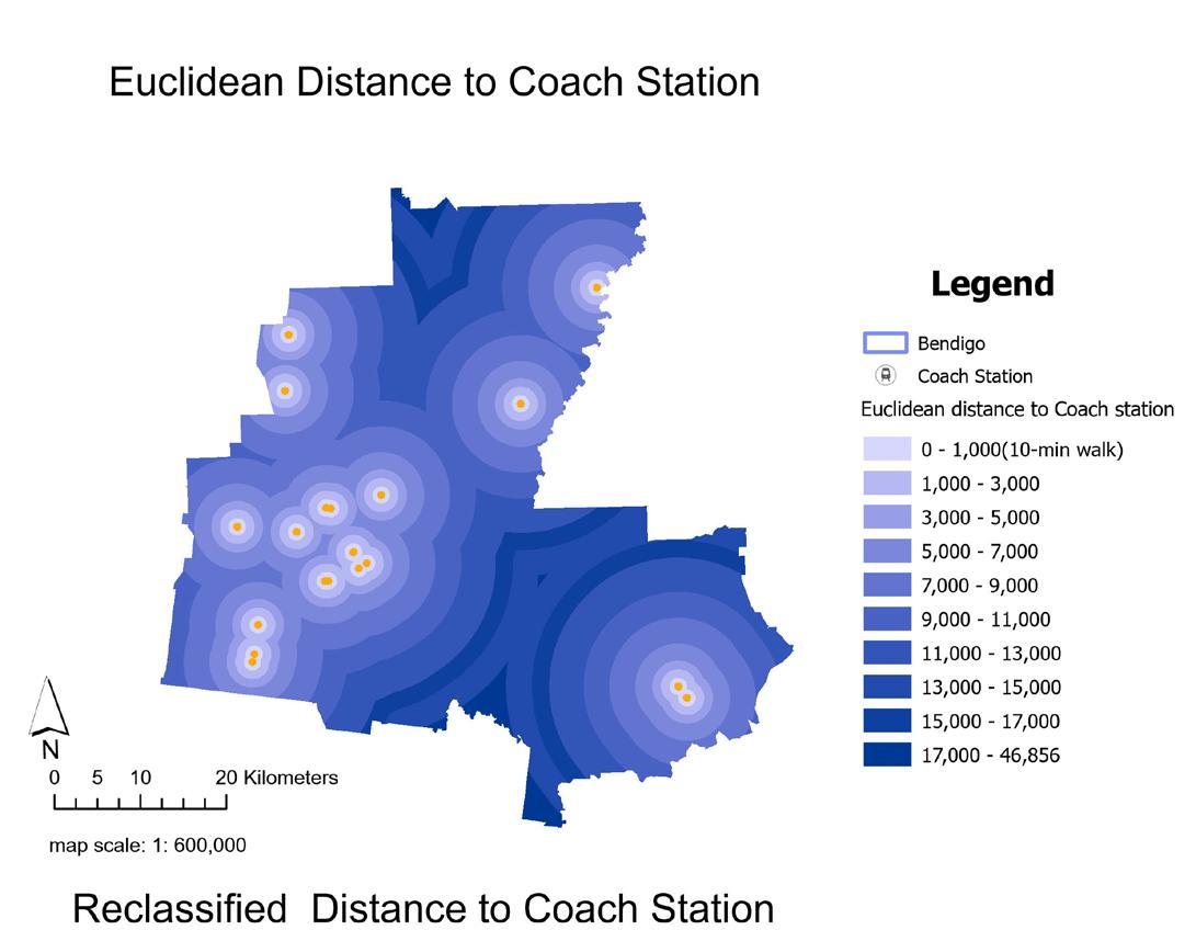
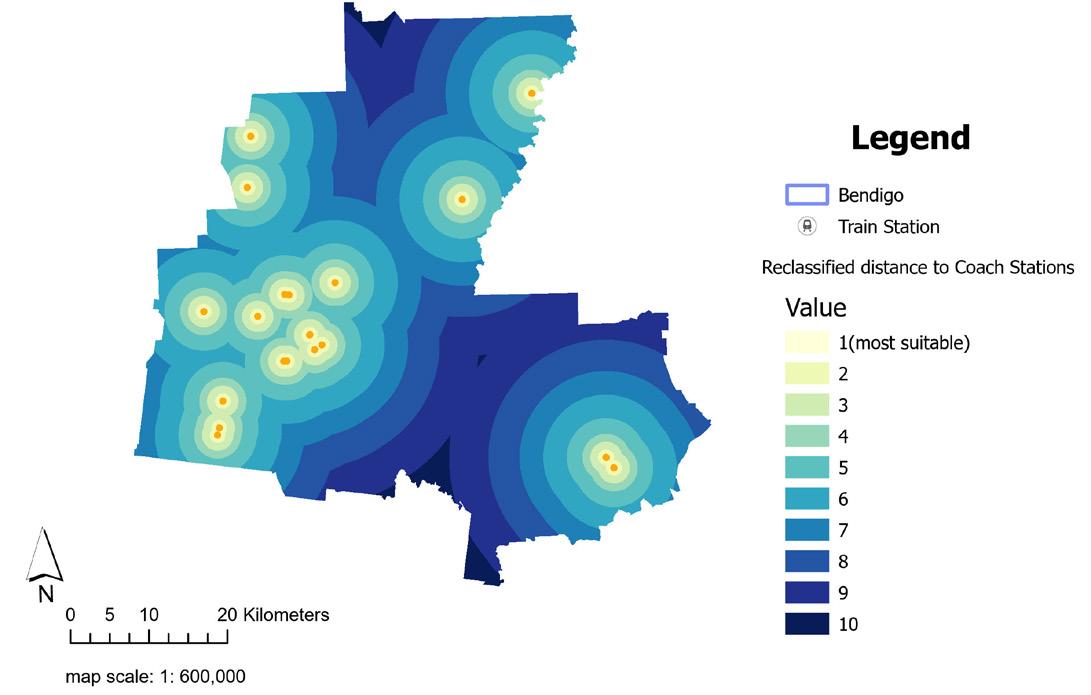
Figure 15.
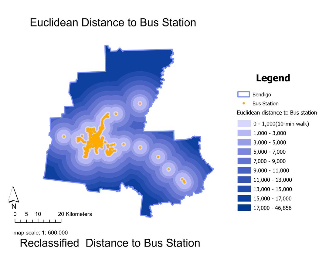
Euclidean Distance to Bus Stations (Meters)
16.
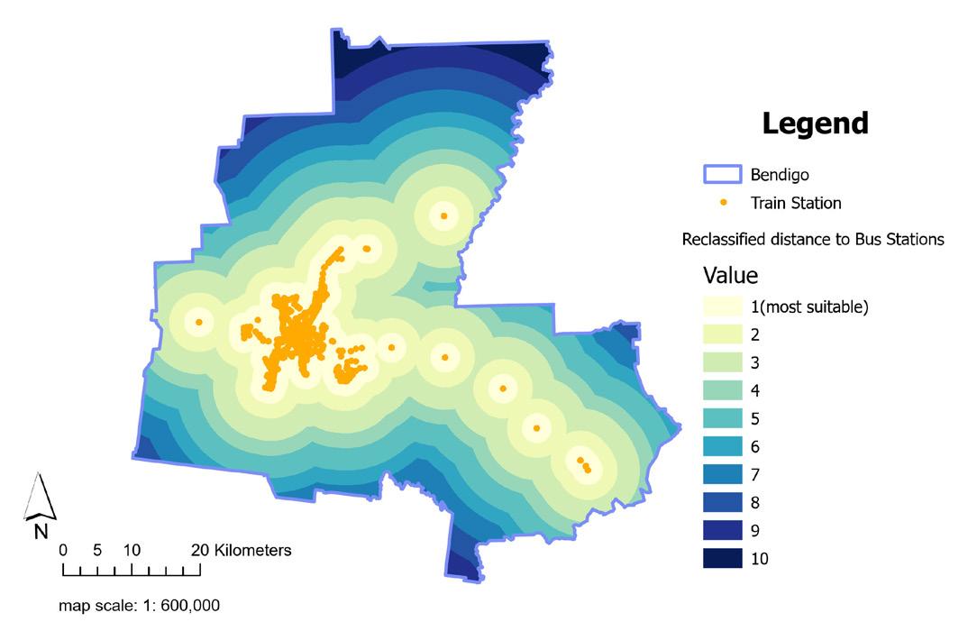
Figure 14. Reclassified Distance to Coach Stations (by values 1-10)
Figure
Reclassified Distance to Bus Stations (by values 1-10)
Figure 19.
Euclidean Distance to open space (Meters)
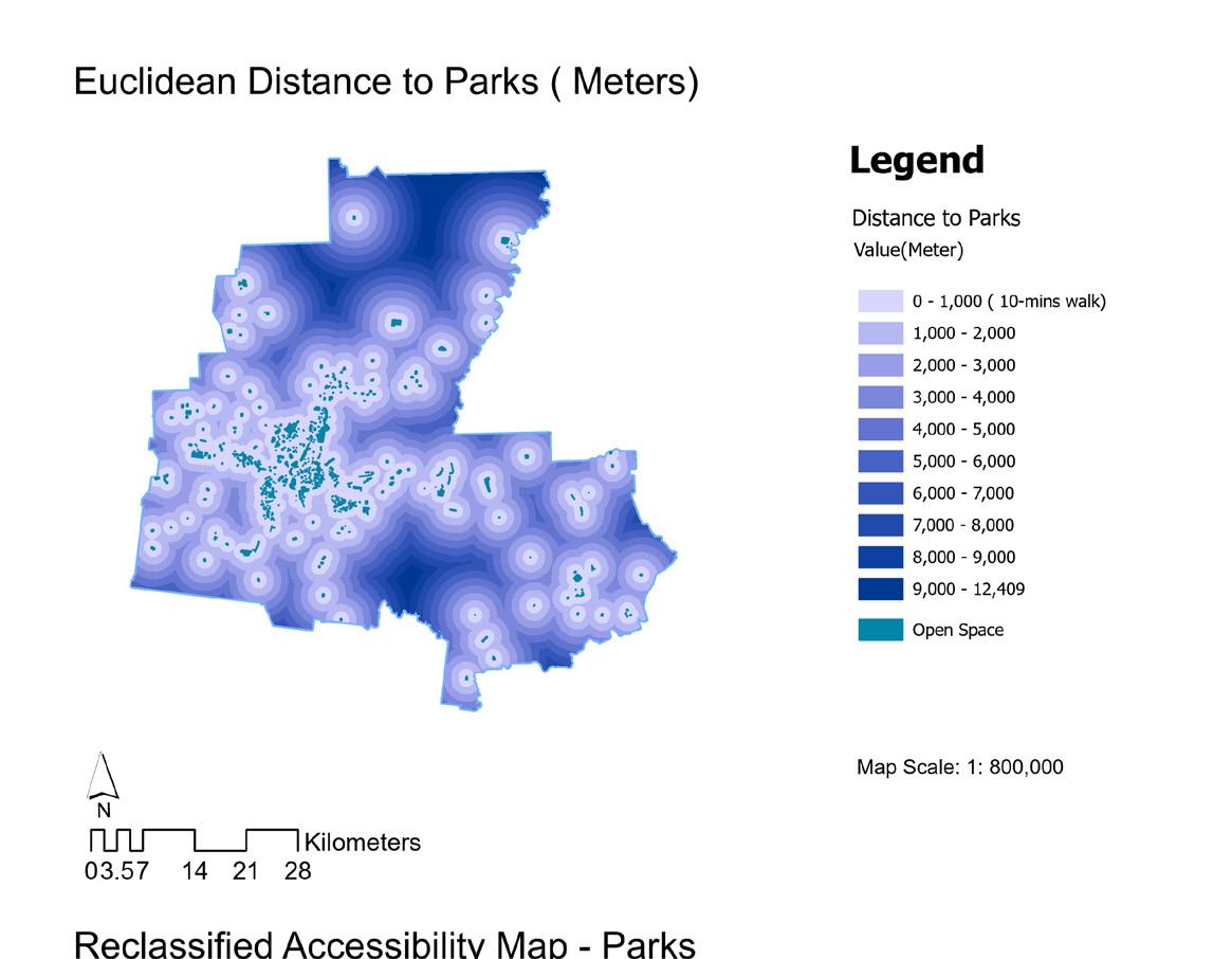
Figure 20. Reclassified Distance to open space (by values 1-10)
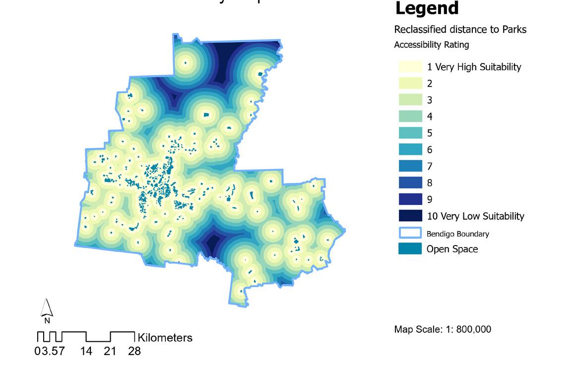
Figure 21.
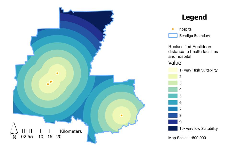
Euclidean Distance to health facilities and hospital (Meters)
Figure 22.
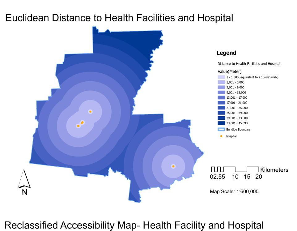
Reclassified Distance to health facilities and hospital (by values 1-10)
05.04
Consolidated Urban Growth
Burton, Jenks, and Williams' (1996) foundational analysis of the compact city establishes that development within existing urban boundaries and established towns maximizes infrastructure efficiency and promotes sustainable urban form. Burchell et al.'s (1998) comprehensive cost analysis demonstrates that sprawl development patterns impose significantly greater environmental and fiscal costs compared to consolidated growth, providing empirical evidence for avoiding leapfrog development. Dovey and Woodcock's (2015) research on Melbourne's intensification strategies further supports targeting medium-density areas, which can accommodate growth while maintaining neighbourhood character and optimizing infrastructure utilization.
This goal favours land within or adjacent to the Urban Growth Boundary (UGB), existing urban areas, and established towns, particularly those with medium-density development potential. Development in these locations maximises existing infrastructure efficiency, supports gradual intensification, and avoids leapfrog growth, which imposes greater environmental and fiscal costs. Clause 11.02 of the VPP supports this by encouraging growth within strategically planned settlements, ensuring that urban expansion in Greater Bendigo is infrastructure-efficient and aligned with both state and local planning strategy.
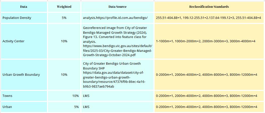
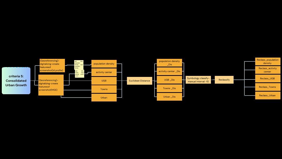
Figure 23.
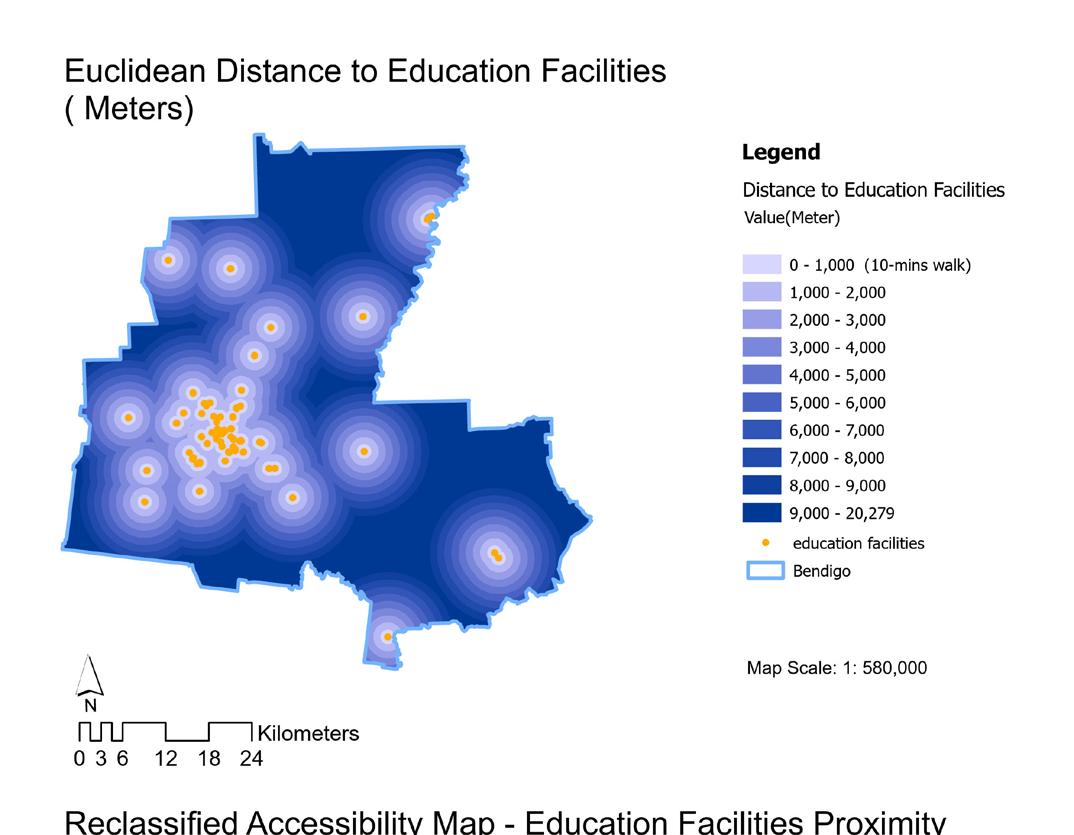
Euclidean Distance to Education Facilities (Meters)
Figure 24.
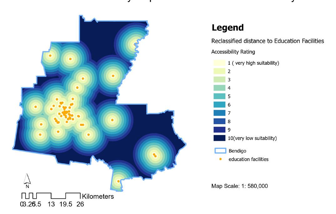
Reclassified Distance to Education Facilities (by values 1-10)
Activity Centers Map in Greater Bendigo
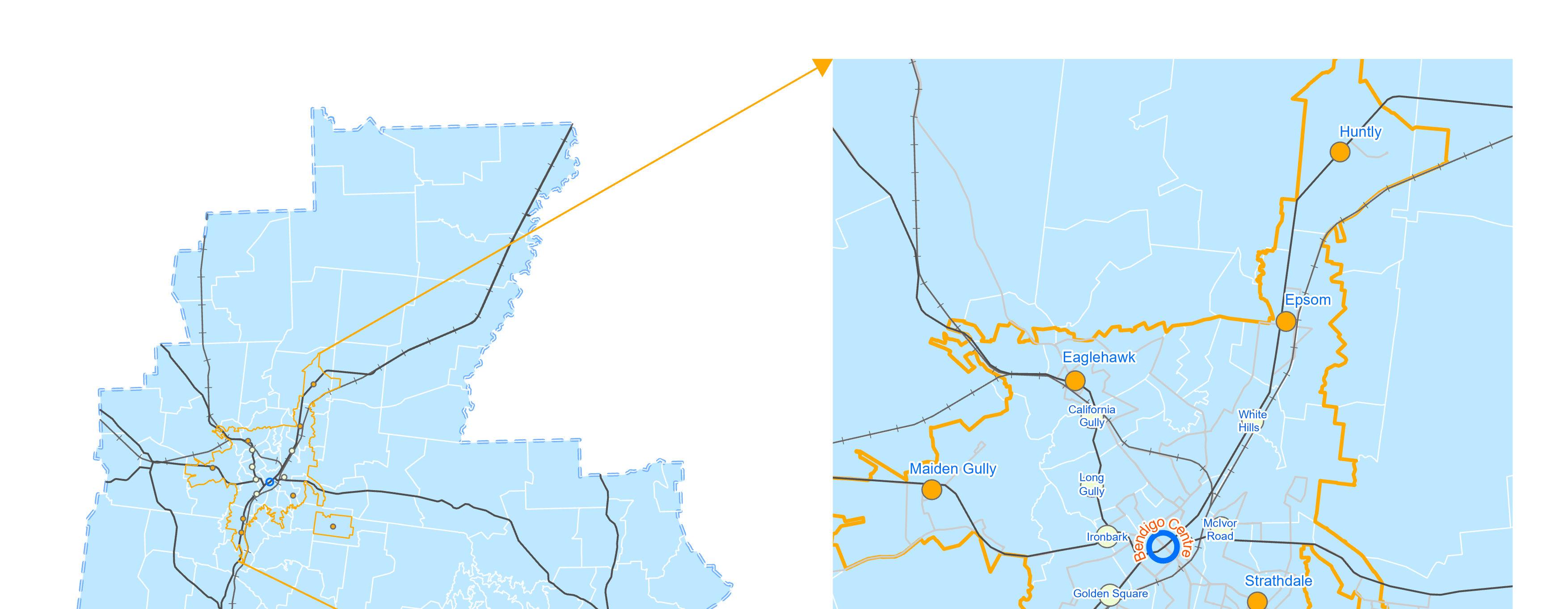
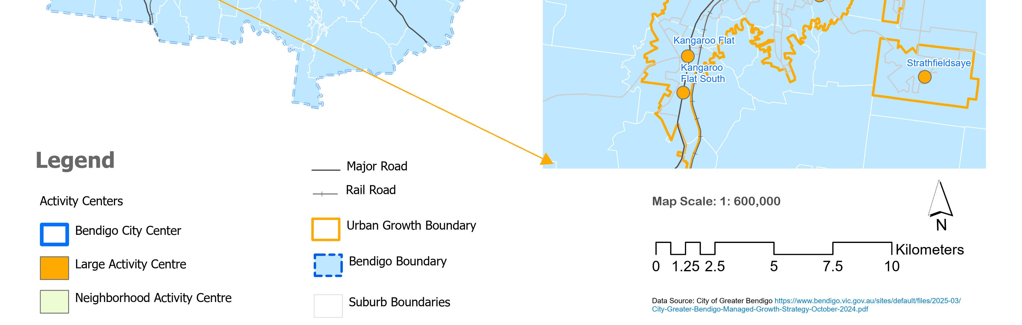
Figure 34.
Euclidean Distance to Urban areas (Meters)
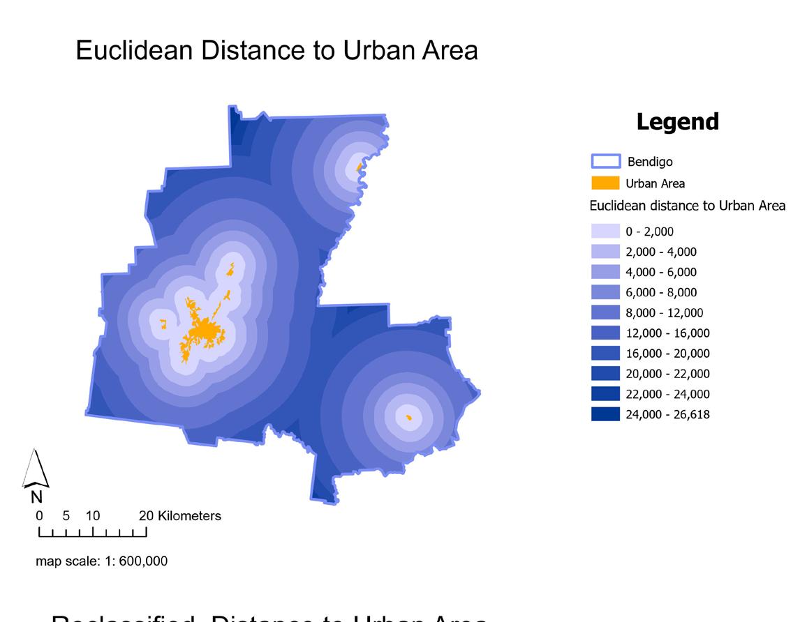
Figure 35.
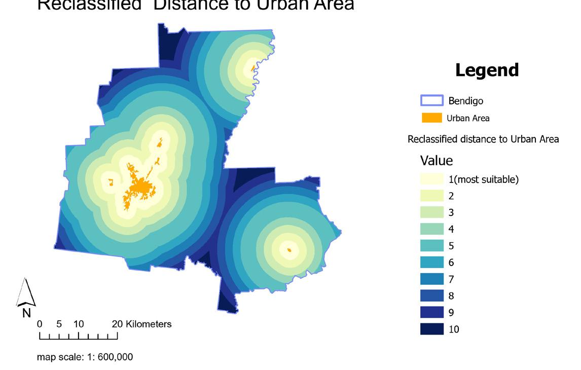
Reclassified Distance to Urban Areas (by values 1-10)
Weighted Overlay
Weight Distribution Rationale
Based on multicriteria decision analysis principles, this study adopts a suitability-oriented weighting approach (Collins, Steiner, and Rushman 2001). Eastman (1999) emphasizes that weight allocation should reflect the specific objective of the analysis, namely identifying the most suitable land for residential development. This approach aligns with Plan Melbourne 2017-2050's policy direction, which explicitly requires "facilitating new housing in established areas close to existing services, employment, and public transport to support compact and sustainable development" (Victorian Government 2017). The Greater Bendigo Council Plan 2021-2025 further emphasizes achieving sustainable growth objectives through strategic infrastructure investment.
36.
Weighted Overlay Result Map
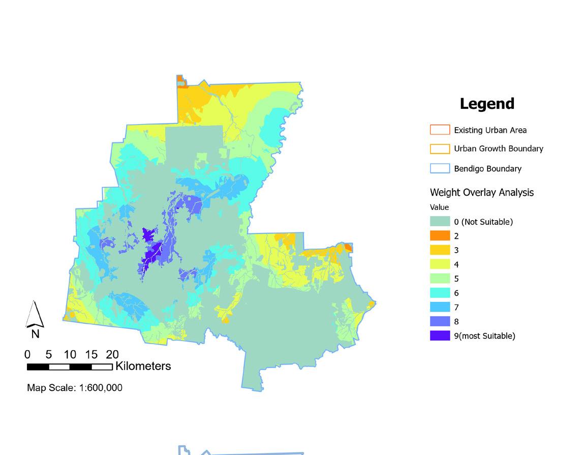
Figure 37. Suitable Growth Area Analysis Map
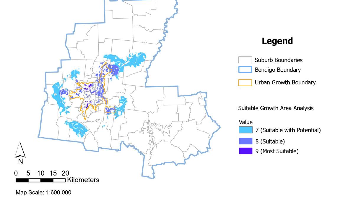
Figure 38. Values of 7,8,9 Selected