My name is Ahmad Utsman Siddiq. I’m bachelor's graduate of Urban and Regional Planning at Institut Teknologi Bandung. I’m a GIS Expert and Urban Planner who has own a number of experience on various activities and projects in the field transportation and urban planning. I have strong ability in making urban planning, analyzing spatial data and using GIS software to build a sustainable civilization.
@utsmansiddiq
www.linkedin.com/in/utsmansiddiq
lutfix4@gmail.com
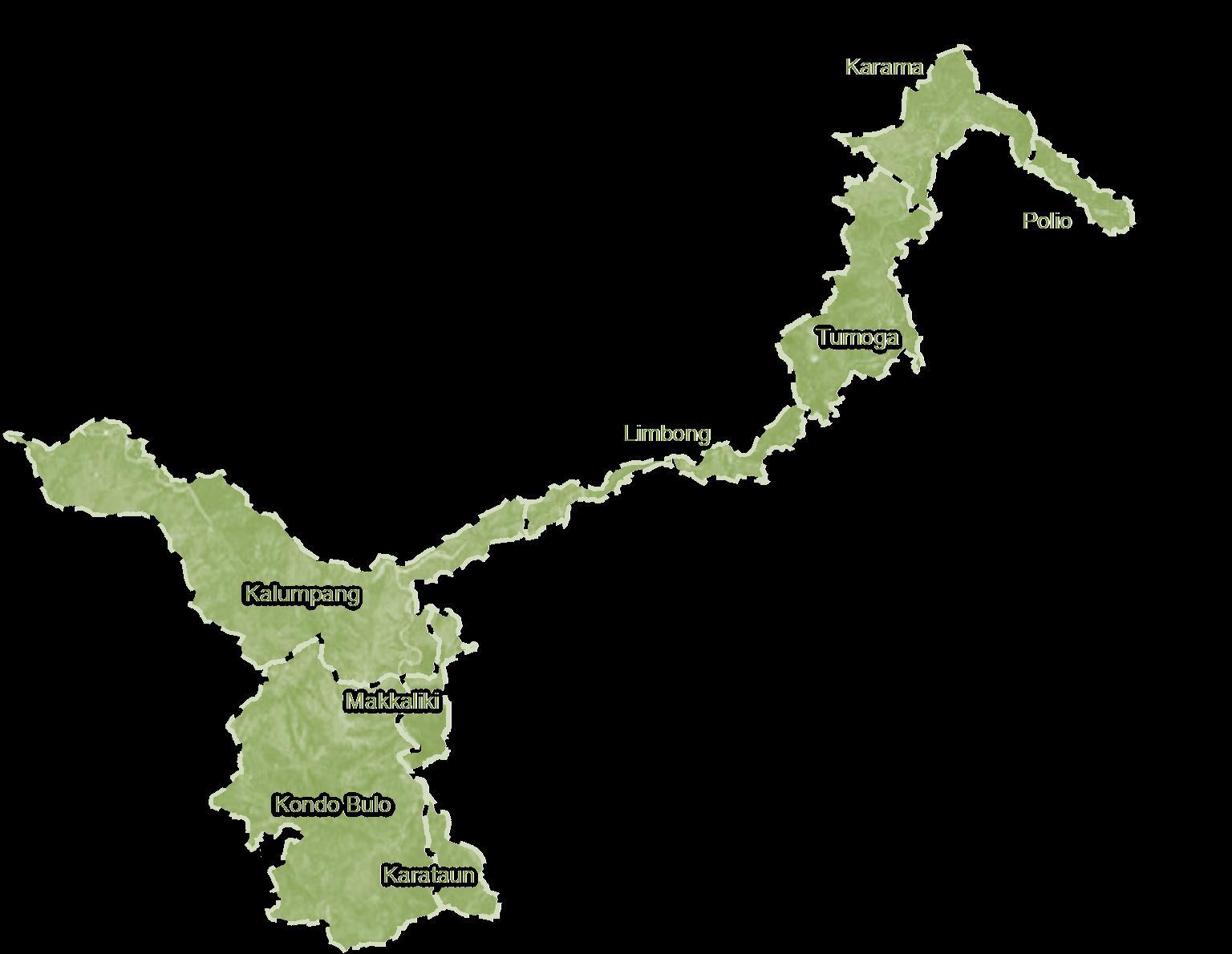
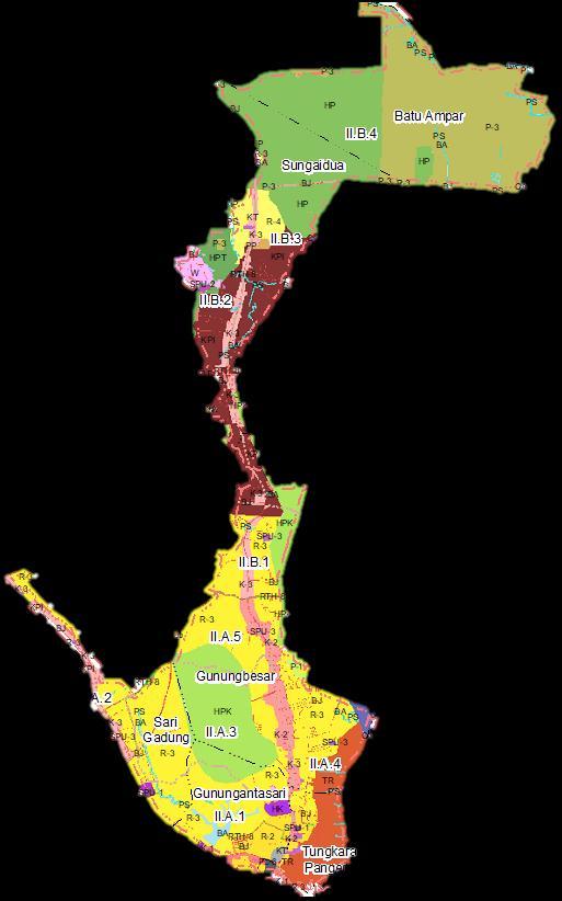
DetailedUrbanSpatial Planning andZoning(RDTR)
CITYSTRUCTUREPLAN
LANDUSEPLAN
Detailed spatial plans are made based on various urban analyses as stated in the technical guidelines from the Ministry of Agrarian Affairs and Spatial Planning. RDTR is an instrument that forms the basis for the implementation of business licensing in accordance with the mandate of the UU Ciptakerja which is able to accelerate the licensing and investment process to accelerateIndonesia's economicdevelopment.
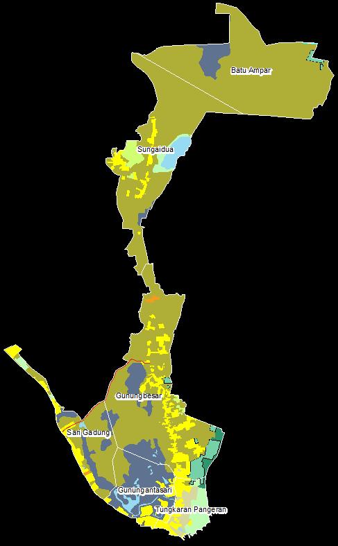
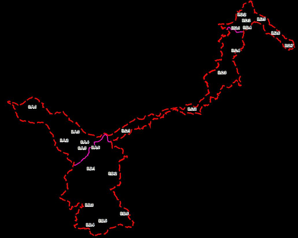
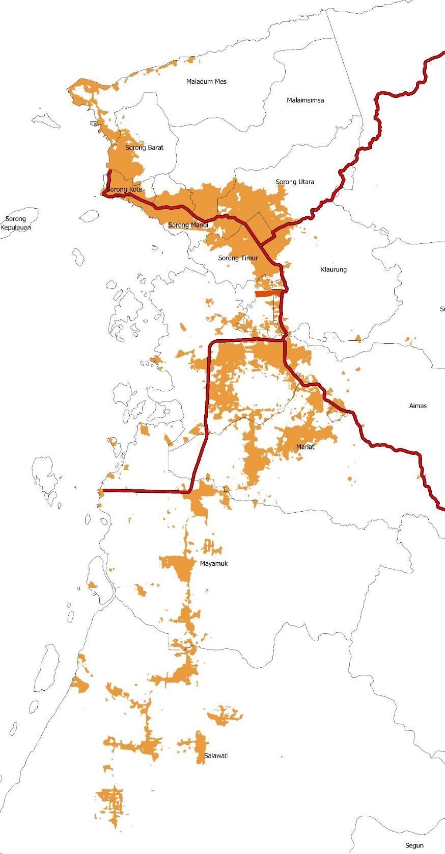
Sorong Regional Infrastructure Development Planning Concept: Polycentric Region
RegionalInfrastructure DevelopmentPlanning(RPIW)
Raja Ampat
Perkotaan Sorong
Pusat aktivitas pergerakan eksternal; Perdagangan dan Jasa; Dukungan Pariwisata Raja Ampat
KPP DOB
Pusat Pemerintahan dan Pelayanan Umum dan pusat pertumbuhan wilayah baru pasca DOB
Bangkitan Eksternal melalui Bandara & Pelabuhan
Aimas
Pusat Permukiman Pendukung Kegiatan Utama Perkantoran dan Industri KEK
KEK Sorong
Pusat Perekonomian Unggulan
Koarmada III
Pusat Permukiman Pendukung Kegiatan Pangkalan Militer
Bandara Baru Segun
Pusat aktivitas pergerakan eksternal baru
Koridor Perekonomian
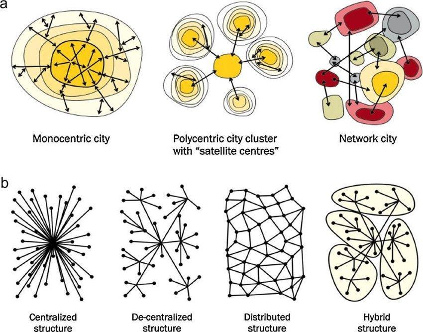
Modelled Urban Growth
RPIW is made in the framework of a regionalbased infrastructure planning approach which is the main task of BPIW. With this regional approach, infrastructure planning from various sectors can be integrated and synergized to form the main backbone of regional development.
Makbon
Manokwari
SpatialModelling
BaseMap
ModelledMap
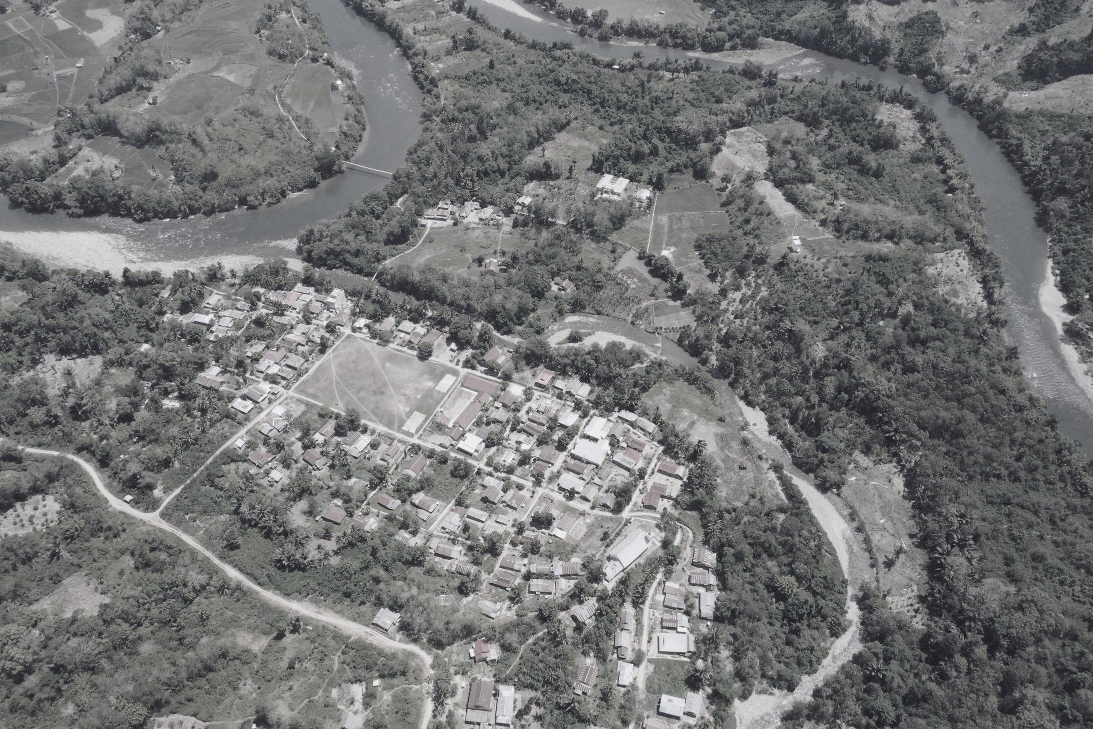
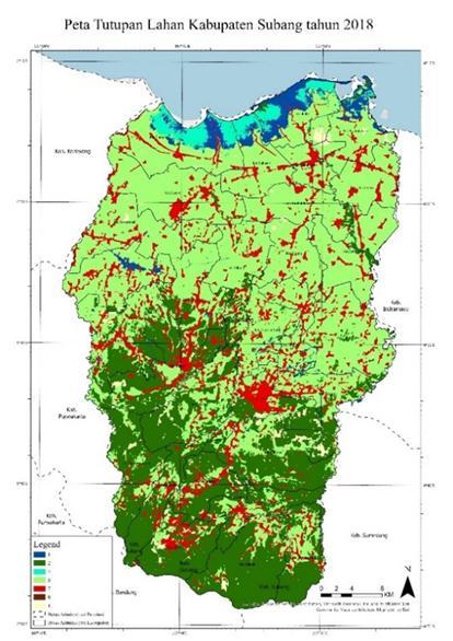
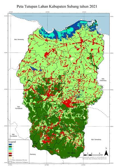
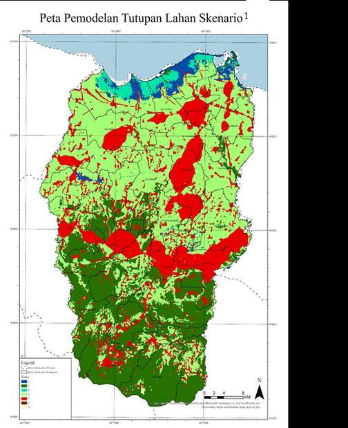
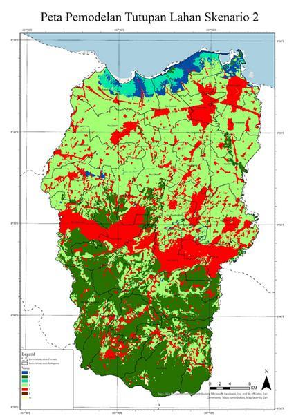
The study area of this modeling is Subang Regency. Spatial modeling was conducted by determining the driving factors of land cover change. Driving factors were determined using the AHP method. Based on the AHP results, it was identified that the distance factor from Patimban Port is the factor with the greatest influence with a score of 0.2365. The land cover development model was then validated using the total accuracy method and obtained an accuracy rate of 90%. Modeling was conducted using two scenarios, namely the business as usual scenario and the food security scenario where there is a limiting factor in the form of LP2B land. The results of the modeling showed that the scenario 2 model had higher conformity results with the existing spatial plan and showed smaller land changes to built-up land. This shows that development in Subang Regency willbe more sustainable if it is able to maintainLP2B land.
Land Cover 2018
Scenario 1 (2031)
Scenario 2 (2031)
Land Cover 2021
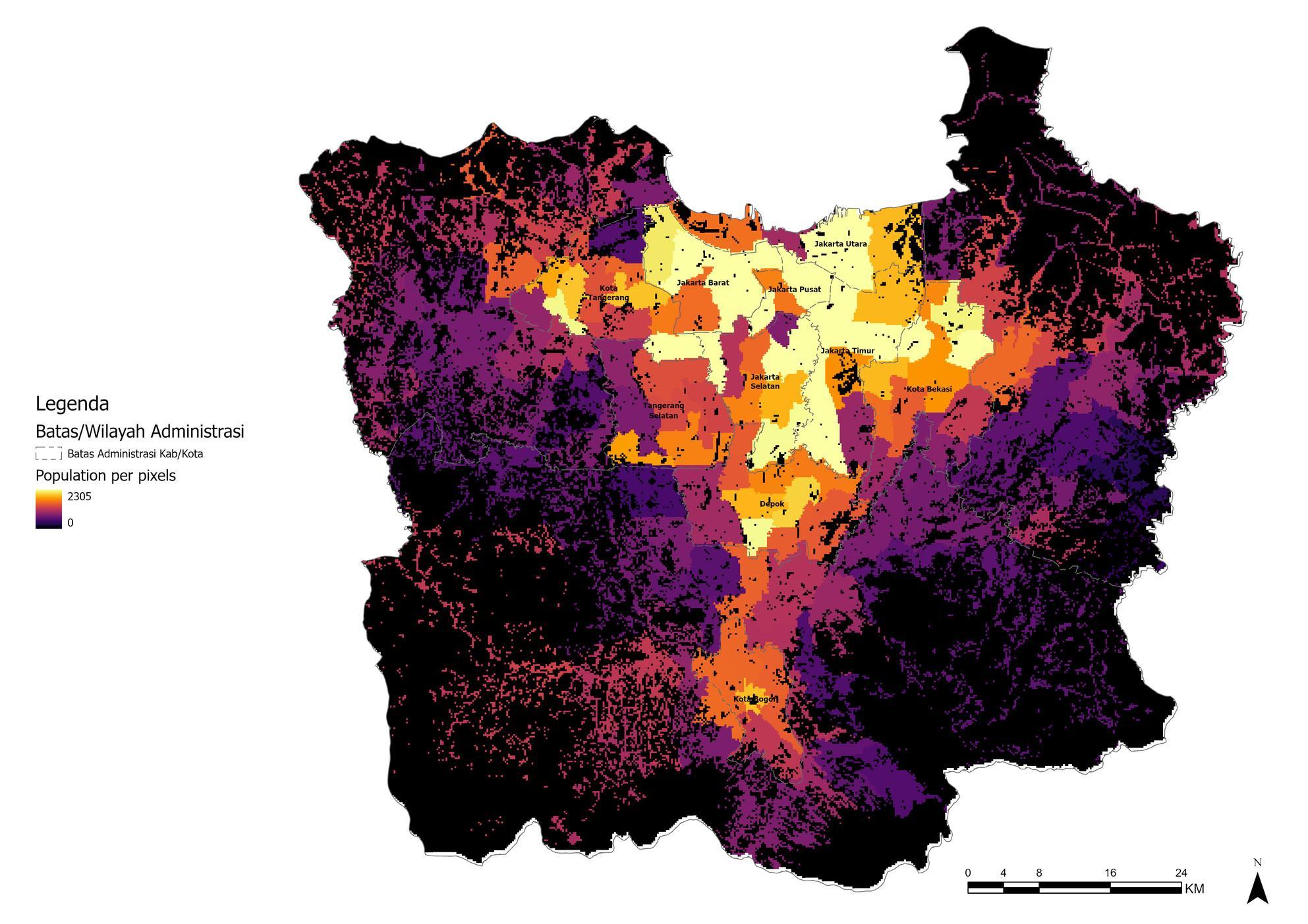
Population distribution modeling was conducted using the land cover database and the population of each sub-district. The total population was applied to the land cover with a pixel grid size of 200 x 200 meters. With this population distribution model, the real distribution of the population can be known so that the spatial planning process carried out in Jabodetabek can be implemented in a more appropriate and targetedmanner.
PopulationDistribution
SketchPlanningTransportation
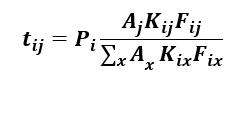
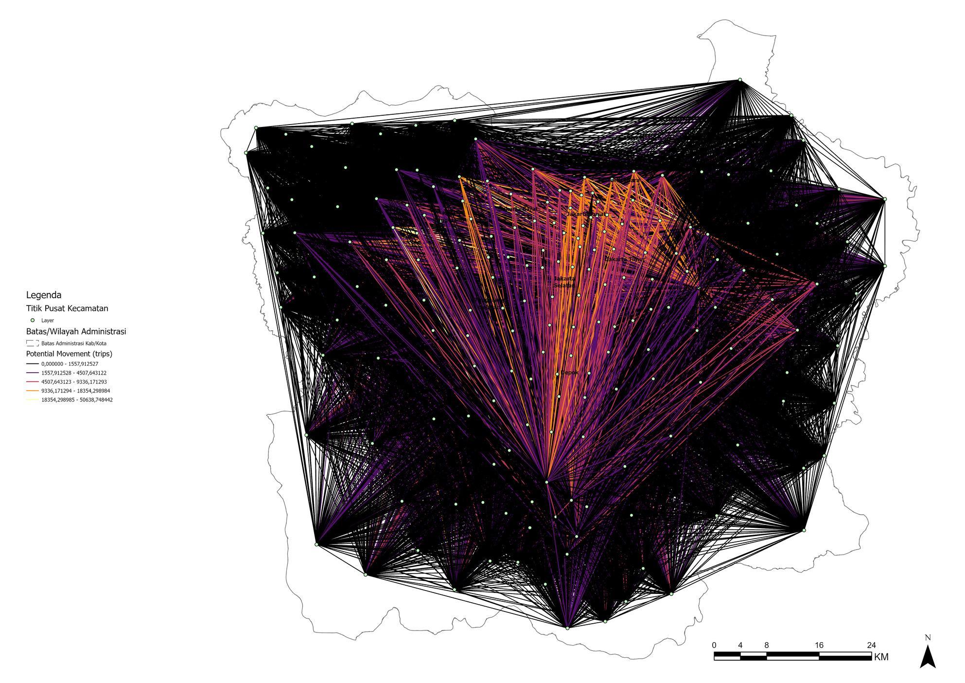
The origin destination matrix is determined using the four-step model. The first step of the four step model is to determine the intensity of trip attraction and trip production. Trip Attraction is determined by elaborating the number of residents per sub-district with the index of non-residential built land use which is the main destination in the movement of residents. Meanwhile, trip production is determined by elaborating the total population per sub-district with a residential land use index that becomes the main generation in populationmovements. After trip production and attraction are obtained, trip distribution is determined to fill in the OD matrix using the gravity model with the formula as follows
Based on the calculation of trip distribution, the movement pattern (OD) map is obtained. Working on the OD matrix using the sketch planning method is done by relying on the use of secondary data which is much more efficient and faster to do than conventional methods which require more time and large resources. This is very important for planners to make policies that are effective and responsive to transportationproblems.
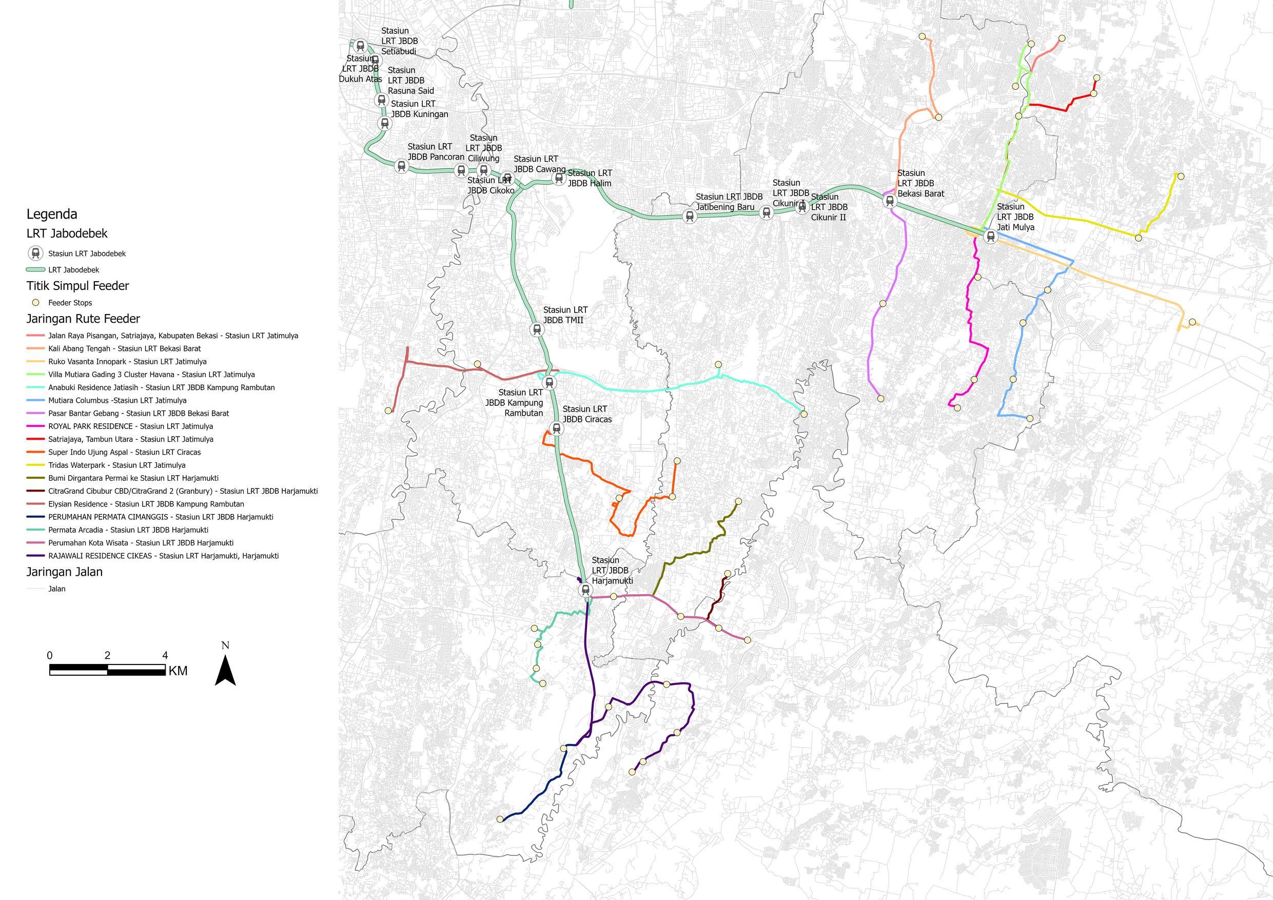
One of the current Jabodetabek transportation issues is the existence of transportation infrastructure in the form of LRT but has not been supported by strong feeder services. Therefore, a route is planned that connects residential points with LRT transportation nodes. Route planning is made using the best route method by Google Maps. The results of route planning are elaborated with the results of population distribution modeling to find out how much the fleet needs on each planned route.
RoutePlanning
StrategicEnvironmentalStudy(KLHS)
KLHS is a form of strategic action in guiding, directing, and ensuring that no negative effects on the environment and sustainability are considered together in spatial policies, plans and programs. KLHS is used to create a better regulatory system through the development of strategic and participatory stakeholder involvement. The preparation of KLHS substance is carried out by overlapping the substance of spatial planning with the results of the analysis of sustainable development issues. Thus, it can be known locations that have a critical level of environmental services and need further handling.
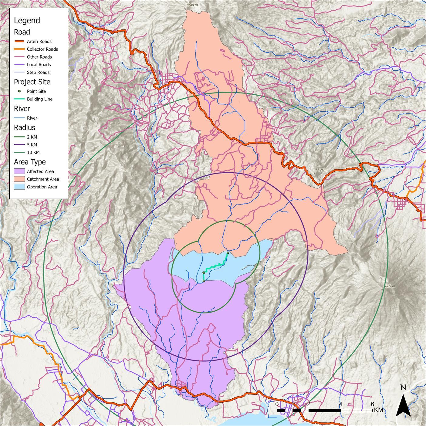
WaterCatchmentArea
Water catchment area (WCA) is used to determine the ecological boundaries of an area. The WCA was done using the Digital Elevation Model (DEM) database and the river flow network. The application used to operate the WCA preparation is GlobalMapper. The ecological boundaries obtained can then be used to determine the scope of the river area and can be a basic foundation in environmentalplanning of an area.
UrbanSpatialPlanningTrainingCertificate
Have attended training on spatial planning analysis techniques organized by Urbanesha (Nursakti Pratomoadmodjo, et al). With this training, I have several analytical techniques based on Urbanesha's advanced software, such as spatial modeling using LanduseSim software, hydrological modeling using UrbanRVM, population distribution modeling using UrbanPDE and so on as listedon the certificate.