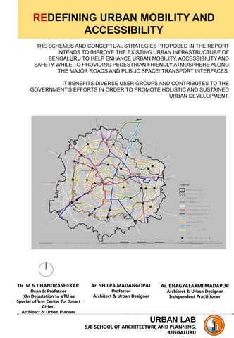
REDEFINING URBAN MOBILITY AND ACCESSIBILITY THE SCHEMES AND CONCEPTUAL STRATEGIES PROPOSED IN THE REPORT INTENDS TO IMPROVE THE EXISTING URBAN INFRASTRUCTURE OF BENGALURU TO HELP ENHANCE URBAN MOBILITY, ACCESSIBILITY AND SAFETY WHILE TO PROVIDING PEDESTRIAN FRIENDLY ATMOSPHERE ALONG THE MAJOR ROADS AND PUBLIC SPACE/ TRANSPORT INTERFACES. IT BENEFITS DIVERSE USER GROUPS AND CONTRIBUTES TO THE GOVERNMENT'S EFFORTS IN ORDER TO PROMOTE HOLISTIC AND SUSTAINED URBAN DEVELOPMENT.
Dr. M N CHANDRASHEKAR
Dean & Professor (On Deputation to VTU as Special officer Center for Smart Cities) Architect & Urban Planner
Ar. SHILPA MADANGOPAL Professor Architect & Urban Designer
Ar. BHAGYALAXMI MADAPUR Architect & Urban Designer Independent Practitioner
URBAN LAB
SJB SCHOOL OF ARCHITECTURE AND PLANNING, BENGALURU
REDEFINING URBAN MOBILITY AND ACCESSIBILITY CONTENTS PART-1 TWO LOCALITIES IN SOUTH BENGALURU AS CASE ILLUSTRATIONS HAVE BEEN ANALYSED TO PROPOSE SCHEMES AND CONCEPTUAL STRATEGIES WITH THE PURPOSE OF DEMONSTRATION. AS THE PROPOSALS ARE MODULAR IN NATURE, THESE STRATEGIES CAN BE USED IN OTHER LOCALITIES OF BENGALURU AS WELL WITH REQUIRED CONTEXTUAL MODIFICATIONS.
PART-2
CHOOL OF ARCHITECTURE AND PLANNING, BENGALURU
URBAN LAB
TWO TRANSPORTATION INTERFACES & ONE CAMPUS INTERFACE HAS BEEN SELECTED IN IN SOUTH BENGALURU AS CASE ILLUSTRATIONS TO PROPOSE SCHEMES AND CONCEPTUAL STRATEGIES WITH THE PURPOSE OF DEMONSTRATION. AS THE PROPOSALS ARE MODULAR IN NATURE, THESE STRATEGIES CAN BE USED IN OTHER INTERFACES OF BENGALURU AS WELL WITH REQUIRED CONTEXTUAL MODIFICATIONS.
PART-3 FEW MORE SUGGESTIONS HAVE BEEN SUGGESTED IN ORDER TO DECONGEST FEW TRAFFIC CONJESTIONS ON MYSORE ROAD BY COVERING THE RIVER VRISHABHAVATHI.
URBAN LAB
SJB SCHOOL OF ARCHITECTURE AND PLANNING, BENGALURU
PART-1
CONTEXT and BACKGROUND
POTENTIALCHALLENGES
POTENTIAL OPPORTUNITIES
BANGALORE METROPOLITAN CITY : MAPPING THE URBAN GROWTH
MOST DYNAMIC CITY
COSMOPOLITAN CULTURE
POPULATION GROWTH 20MILLION BY 2031
ABSENSE OF INTEGRATED URBAN MOBILITY PLAN
MODERATE CLIMATE
RICH HERITAGE
ECONOMIC GROWTH
SKILLED HUMAN RESOURCE
INCREASING PER CAPITA INCOME
UNREGULATED URBAN SPRAWL
ENVIRONMENTAL DEGRADATION
INCREASING NUMBER OF MOTORISED PERSONAL VEHICLES
INACCESSIBLE PUBLIC SPACES
KNOWLEDGE HUB
ACTIVE CIVIC PARTICIPATION
BUILT-UP AREA INCREASED BY 600%
LOW QUALITY OF URBAN LIFE
CHOOL OF ARCHITECTURE AND PLANNING, BENGALURU
URBAN LAB
OVER THE PAST SEVENTY YEARS, BANGALORE, THE CAPITAL CITY FAMOUSLY REFERRED AS SILICON VALLEY OF INDIA HAS TRANSFORMED FROM BEING A NON-DESCRIPT SMALL TOWN INTO METROPOLIS. URBAN MOBILITY and ACCESSIBILITY The current scenario of urban mobility of metropolitan area of Bengaluru is characterised by PUBLIC TRANSPORT USE AMONG MOST unplanned urban sprawl, declining POPULOUS CITIES share of public as well as nonmotorised transport, increased overcrowding due to motorization leading to fatalities, sheer neglect NO OF PER CAPITA TRIPS A DAY IN 2017 of public transport users, pedestrians and cyclists. The three major modes of transportation of the city (bus, metro & para-transit) operate PER TRIP CO2 EMISSIONS exclusive of each other resulting in (kg/day) non-coordinated and non-integrated service pattern of public transport system often leading to poor performance and irrational URBAN MOBILITYSJB SCHOOL OF ARCHITECTURE AND PLANNING, consumption of public resources. Source: InternationalINDEX Owing to these BENGALURU aspects, access to Energy Agency, CSE
URBAN LAB
CASE ILLUSTRATIONS
PART-1
TWO LOCALITIES IN SOUTH BENGALURU Two localities chosen in south Bengaluru are: 1. BILEKAHALLI (Ward no:188) & JP NAGAR (Ward no:177) 2. KENGERI (Ward no:159)
Bengaluru City Zone Map highlighted South zone
with
Source: BBMP
These two localities in south Bengaluru have been analysed to propose schemes and conceptual strategies with the IDENTIFIED POTENTIAL OPPORTUNITIES the purpose of demonstration. - Vibrant existence of natural & manmade features. - intriguing urban structure and diverse socio-economic demographics. - Options to create unique urban identity while augmenting the urban experiences and quality of life. - Strategic locations provide a fertile ground for the adoption of safe and reliable urban mobility options.
Bengaluru map showing significant price movements
Bengaluru City Ward Map with the highlighted Wards 159, 177 & 188
Source: Bangalore insite report
Source: www.mapsofindia.com
IDENTIFIED POTENTIALCHALLENGES • • • •
Unfavourable conditions and indistinct networks for efficient inclusive urban mobility. Lack of efficient first & last mile connectivity to various modes of public transport which in turn affecting the accessibility to public spaces. Intrusive urban infrastructure and uncoordinated urban elements leading to low quality urban public realm. Major public spaces and landmarks (natural & manmade) are being marginalised under the development pressure.
TWO SET OF STRATEGIES
SET-1 MICRO-MOBILITY MODES
SET-2 UUI- UNDERPASS INTERVENTIONS
Increasing the adoption of micro-mobility modes to feed mass transport which are currently available and planned in the future.
Interventions to utilise underground spaces through underpasses to connect the building basements to secondary roads facilitating ease of movement and reduction of congestion.
URBAN LAB
SCHOOLTHESE OF ARCHITECTURE ANDBE PLANNING, AS THE PROPOSALS ARE MODULARSJB IN NATURE, STRATEGIES CAN USED IN OTHER BENGALURU LOCALITIES OF BENGALURU WITH REQUIRED CONTEXTUAL MODIFICATIONS.
CHOOL OF ARCHITECTURE AND PLANNING, BENGALURU
Average price movements for different zones in Bengaluru
URBAN LAB
Source: Bangalore insite report
CASE ILLUSTRATION-1
PART-1
BILEKAHALLI (Ward no:188) and JP NAGAR (Ward no:177) Partial stretches of the two major arterial roads, BANNERGHATTA MAIN ROAD and JP NAGAR RING ROAD have ben considered for case TOWARDS JP NAGAR 4 PHASE illustration of Set-1 strategies. JAYADEVA JUNCTION
TOWARDS SARAKKI BILEKAHALLI Bannerghatta main road highlighted in the ward no:188
DOLLARS COLONY
IIM-B
TOWARDS GOTTIGERE BANNERGHATTA MAIN ROAD JP NAGAR RING ROAD LOCATIONAL
JP Nagar ring road highlighted in the ward no:177
DETAILS
CHOOL OF ARCHITECTURE AND PLANNING, BENGALURU
URBAN LAB
IDENTIFIED POTENTIALCHALLENGES • Unfavourable conditions and indistinct networks for efficient inclusive urban mobility. • Unfavourable conditions and indistinct networks for pedestrians/cyclists. • Lack of efficient first & last mile connectivity to various modes of public transport which in turn affecting the accessibility to public spaces. Accessibility in the urban fabric is the number of valued destinations that inhabitants can easily reach within their daily "commuting time budget".
URBAN MOBILITY The gap between the level of mass transit service and the needs of the community can create TRANSIT DESERTS. Access to places, activities and services is becoming increasingly difficult in terms of time, conveniences and cost. SJB SCHOOL OF ARCHITECTURE AND PLANNING,
URBAN LAB BENGALURU
PART-1
CASE ILLUSTRATION-1
BILEKAHALLI (Ward no:188) and JP NAGAR (Ward no:177) Partial stretches chosen: BANNERGHATTA MAIN ROAD – from GD Mara junction to IIM-B metro station (1.5 km) JP NAGAR RING ROAD- from GD Mara junction to JP NAGAR 4 PHASE GD MARA junction(1.0km) TOWARDS Delmia DELMIA JUNCTION JAYADEVA JUNCTION JUNCTION JP NAGAR 4 phase METRO STATION (under construction)
TOWARDS SARAKKI DOLLARS COLONY
BILEKAHALLI BUSTOP
HOOL OF ARCHITECTURE AND PLANNING, BENGALURU
URBAN LAB
BILEKAHALLI
TOWARDS GOTTIGERE
IIM-B METRO STATION (under construction)
BANNERGHATTA MAIN ROAD JP NAGAR RING ROAD
LOCATIONAL DETAILS OF THE CHOSEN TWO ARTERIAL ROADS
REDEFINING URBAN MOBILITY Urban mobility is all about offering widely accessible (spatially, socio-economically, all age groups and gender types) choices to urban dwellers for conducting their daily chores.
MICRO-MOBILITY Different micro-mobility options significantly reduce the physical footprint needed to move people over relatively short distances. ELEMENTS OF AN EFFICIENT MICROMOBILITY SYSTEM
URBAN LAB
SJB SCHOOL OF ARCHITECTURE AND PLANNING, BENGALURU
CASE ILLUSTRATION-1
PART-1
BILEKAHALLI (Ward no:188) and JP NAGAR (Ward no:177) Strategies for Augmenting Micro-Mobility to Existing and Proposed Mass Transit Facilities NMT (Nonmotorized Transport) Nodes – NMT nodes at various scales proposed for optimum utilization of the existing as well as proposed transportation resources to develop efficient feeder connections while providing the vital first and last mile connectivity.
ZONAL NMT NODES
LOCAL NMT NODES NEIGHBOURHOOD NMT NODES
Map showing the locations of NMT (Non-motorized Transport) Nodes at various scales The major implication of these NMT nodes is that they are immediately implementable with minimum investment along with the existing/proposed infrastructure and can permeate through the fabric of the area / neighbourhood with reduced environment pollution /carbon footprint (greener commuting).
CHOOL OF ARCHITECTURE AND PLANNING, BENGALURU
URBAN LAB
VIABLE COMBINATIONS OF DIFFERENT MICRO-MOBILITY OPTIONS WITH REGARD TO COMMUTING DISTANCES WITH RESPECT TO THE CHOSEN AREA
0.5km 1.0km
URBAN LAB 1.5km 2.0km Beyond 2.0km
Min 10Min 15AND Min PLANNING, 20 Min SJB SCHOOL OF5 ARCHITECTURE BENGALURU
PART-1
CASE ILLUSTRATION-1
BILEKAHALLI (Ward no:188) and JP NAGAR (Ward no:177) Strategies for Augmenting Micro-Mobility to Existing and Proposed Mass Transit Facilities
M
PUBLIC TRANSPORT HAS TO BE INTEGRATED INTO MICRO-MOBILITY NETWORKS THROUGH NMT NODES. THESE NMT NODES PROVIDE THE FOLLOWING FACILITIES AND ADVANTAGES:
SJB SCHOOL OF ARCHITECTURE AND PLANNING, BENGALURU
URBAN LAB
• Shuttle service pod between metro stations, major bus stops, transit nodes, etc. with integrated ticketing systems. • Better accessibility and connectivity of footpaths/cycle paths with transit stops augmenting safe and faster commuting. • Pedestrian /cycle facilities like secure parking, information regarding bus schedules / routes shall be developed using ICT interface. • NMT nodes act as counters for small scale visitor / tourist information center, renting bicycles / electric vehicles, various types of ticket booking, utility bill payments, etc. • Small scale conveniences / amenities to foster community interactions crafting public space • Temporal Pedestrianization Strategy can be used during special occasions and can be controlled through formal traffic orders.
NMT NODES INVOLVE TWO MAIN COMPONENTS: ACCESS
Strengthening the linkages among various micromobility options will augment their associated functions/activities responding to the context of the development. ADOPTION
People can adopt various modes easily as multiple options are available within the short and medium distances.
M
Conceptual map showing the locations of NMT (Nonmotorized Transport) Nodes
KEY PRINCIPLES SUPPORTING NMT NODES SAFETY, EFFICIENCY, RELIABILITY, PREFERNCE AND ADAPTABILITY Proposed NMT nodes at different functional levels cater to different micro-mobility options within the short and medium range distances while suiting most types of commuting choices, backgrounds and most importantly budgets. These attributes offer numerous choicesSJB to the commuters to have safe, efficient andPLANNING, reliable commute. Preference, SCHOOL OF ARCHITECTURE AND adaptability and transition would be convenient as the numerous choices are within the existing movement networks. BENGALURU
URBAN LAB
CASE ILLUSTRATION-1
PART-1
Strategies for Augmenting Micro-Mobility to Existing and Proposed Mass Transit Facilities Major spaces of NMT nodes are: DECISION SPACES-These spaces are located in the interchange zones or overlapping areas between decision spaces and movement spaces and present numerous opportunities for socioeconomic activities. MOVEMENT SPACES-Areas specially reserved for commuter's movement (boarding/alighting to public transport) and various elements related to physical-digital branding/advertising/information boards can be located adjacent to these spaces. OPPORTUNITY SPACES- Areas prioritising commuters decisions with regard to commuting. Includes integrated ticketing Conceptual key layout of NMT nodes kiosks, parking/drop off/pick up facilities for various micro-mobility modes. THE STRATEGIC LOCATIONS AND OPTIMUM SIZES OF ALL THE THREE TYPOLOGIES OF NMT NODES CAN BE DETERMINED BASED ON THE FOLLOWING KEY ATTRIBUTES. Accessibility parameters: • Pedestrian Bicycle, e-scooter, e-rickshaws and shared e-bikes access • Intermediate Para Transit (auto rickshaws, ride hailing taxis, shared vans, etc.) access • Public bus transport & Private modes access Branding NMT nodes through planning and design: • Flexible design, visual interaction & building branding for better imageability.
SJB SCHOOL OF ARCHITECTURE AND PLANNING, BENGALURU
URBAN LAB
BILEKAHALLI (Ward no:188) and JP NAGAR (Ward no:177)
City authorities can consider the following regulatory framework to improve the urban mobility landscape Sl. No.
1
Regulatory framework Adaptive regulation
This regulation can be quickly updated as the micro-mobility market evolves. Consideration for performance based criteria (rather than fixed & arbitrary caps on fleet sizes). City should begin by articulating its transportation goals and working to define metrics accordingly.
Outcome based regulation 2
3
Remarks
For ex: 1. If first & last mile challenges are paramount, assessing public transit ridership and the percentage of micro-mobility trips to & from a transit hub could be important. 2. If access to underserved communities is key, the proportion of trips originating from those areas of the city should be considered.
Regulatory test pits
3. If congestion is the concern, the key indicator might be the percentage of trips that otherwise would have been made in a private vehicle. City should plan and work with micro-mobility providers to test multiple approaches in various areas at different times while adjusting fees/incentive structures as well as varying regarding vehicle SJB SCHOOL OF ARCHITECTURE ANDrules PLANNING, parking / on-street riding to test the behaviours and results. BENGALURU
URBAN LAB
CASE ILLUSTRATION-2
PART-2 URBAN TRAFFIC ISSUE
Public road and interface between major city bus stands, railway stations are jam-packed by vehicles & people, creating a chaotic streets and becomes a accidental spots.
This concept can be applied to connect different modes of transportations to create multi modal transportation hub at various city levels, even at neighbourhood levels.
SJB SCHOOL OF ARCHITECTURE AND PLANNING, BENGALURU
URBAN LAB
There is a need for immediate implementations by authorities to bifurcate the vehicular and pedestrian circulations near these interfaces at various levels from ground negative to ground zero to ground positive levels.
HENCE WE ARE PROPOSING A VEHICULAR UNDERPASSES CONNECTING BASEMENTS OF TRANSPORTATION HUBS TO TAKE THE EXIT VEHICULAR DENSITY.
Ground Ground -ve Ground -ve
URBANUUI LAB URBAN UNDERPASS INTERVENTIONSSJB SCHOOL OF ARCHITECTURE AND PLANNING, BENGALURU
CASE ILLUSTRATION-2
PART-2 As city is growing, it is extremely difficult to manage the traffic and pedestrian density at the interface of road & generator buildings. Generator buildings can be like campuses, transportation hubs, other public building, which generates pedestrian & vehicular activities on road. Immediate junctions near the entrance of the public buildings will be highly crowded with vehicles and people, it disrupts the regular road vehicular movement. Hence there is a serious need to utilise underground spaces through underpasses to connect the public building basements to secondary roads or to provide the exit for the vehicles from underpass.
underpass interventions -
SJB SCHOOL OF ARCHITECTURE AND PLANNING, BENGALURU
URBAN LAB
This will reduce the burden of traffic and people spillover near the entrances of the transportation hubs or public buildings. This can be achieved by urban
uui
UNDERPASS CONNECTED TO PUBLIC BUILDINGS AT THE SAME LEVEL @ BASEMENT
U
U
I
URBAN LAB
UUI
SJB SCHOOL OF ARCHITECTURE AND PLANNING, RBAN NDERPASS NTERVENTIONSBENGALURU
CASE ILLUSTRATION-2
PART-2
SUGGESTION #1 KENGERI RAILWAY STATION AND ROAD INTERFACE
1
KENGERI RAILWAY STATION
2
KENGERI SATELLITE TOWN (NEW )BUS STATION
LEGEND
URBAN LAB
SJB SCHOOL OF ARCHITECTURE AND PLANNING, BENGALURU
1
RAILWAY PARALLEL ROAD
TERTIARY STREETS
OLD OUTER RING ROAD
2
2
SOUTHER RAILWAYS
U
U
I
URBAN LAB
UUI
SJB SCHOOL OF ARCHITECTURE AND PLANNING, RBAN NDERPASS NTERVENTIONSBENGALURU
CASE ILLUSTRATION-2
PART-2
SUGGESTION #1 KENGERI RAILWAY STATION AND ROAD INTERFACE
SJB SCHOOL OF ARCHITECTURE AND PLANNING, BENGALURU
URBAN LAB
EXIT ENTRY FROM THE BASEMENT OF KENGERI SATELLITE TOWN (NEW) BUS STATION, PROVIDES UNDERGROUND THOROUGHFARE VEHICULAR MOVEMENT TO RELEASE THE VEHICLES TO ORR. RAILWAY STATION
BUS STAND RAILWAY PARALLEL ROAD OLD ORR
SECTION
UUI CONNECTIONS
U
U
I
URBAN LAB
UUI
SJB SCHOOL OF ARCHITECTURE AND PLANNING, RBAN NDERPASS NTERVENTIONSBENGALURU
CASE ILLUSTRATION-2
PART-2
SUGGESTION #2 PEDESTRIAN CONNECTION ATTIUGUPPE METRO STATION - SATELLITE BUS STATION 2
1 ATTIGUPPE METRO STATION
SATELLITE BUS STANDBENGALURU-MYSORE
2
1
SJB SCHOOL OF ARCHITECTURE AND PLANNING, BENGALURU
URBAN LAB
UPCOMING STEEL FLYOVER BRIDGE
PEDESTRIAN STEEL FLYOVER BRIDGE CROSSING (UNDERCONSTRUCTION)
PEDESTRIAN ELEVATED WALKWAYS CONNECTING ATTIGUPPE METRO STATION TO SATELLITE BUS STATION ON MYSORE ROAD
ELEVATED CABLE STAYED WALKWAY BRIDGE CONNECTING DEEPANJALI NAGAR METRO STATION TO SATELLITE BUS STATION ON MYSORE ROAD.
U
U
I
URBAN LAB
UUI
SJB SCHOOL OF ARCHITECTURE AND PLANNING, RBAN NDERPASS NTERVENTIONSBENGALURU
CASE ILLUSTRATION-2
PART-2
SUGGESTION #3 CREATING A UNDERPASS WITH THE UTILISATION OF EXISTING SLOPE DIFFERENCE-BGS SUPER SPECIALITY HOSPITAL JUNCTION Campuses across the city have been grown several folds in terms of its capacity and intakes over a period of time to cater to the growing needs in Bengaluru. The immediate interface from the road to the entrances of coeducational campuses will be a chaotic junction during peak hours. Hence an UUI can be proposed in such junctions. In this case existing level difference has been taken as an advantage to
SJB SCHOOL OF ARCHITECTURE AND PLANNING, BENGALURU
URBAN LAB
connect the campus road to global road through UUI
Urban underpass intervention Vrishabhavathi river.
U
U
BGS Health and Education city. Existing road
I
Proposed road
URBAN LAB
UUI
SJB SCHOOL OF ARCHITECTURE AND PLANNING, RBAN NDERPASS NTERVENTIONSBENGALURU
CASE ILLUSTRATION-2
PART-2
SUGGESTION #3
SJB SCHOOL OF ARCHITECTURE AND PLANNING, BENGALURU
URBAN LAB
CREATING A UNDERPASS WITH THE UTILISATION OF EXISTING SLOPE DIFFERENCE-BGS SUPER SPECIALITY HOSPITAL JUNCTION
TOWARDS BGS
TOWARDS GLOBAL VILLAGE
U
U
I
URBAN LAB
UUI
SJB SCHOOL OF ARCHITECTURE AND PLANNING, RBAN NDERPASS NTERVENTIONSBENGALURU
CASE ILLUSTRATION-2
PART-3
SUGGESTION #4 COVERING THE VRISHABHAVATHI RIVER By covering the river top using RCC precast slabs, it can be effectively used as the road and it will help in decongesting the Mysore road in several stretches. Covering is suggested from raja Rajeshwari arcade till Kengeri lake.
LEGEND MYSORE ROAD
VRISHABAHAVATHI RIVER COVERE ROADS. DECONGESTED MAJOR TRAFFIC JUNCTIONS DR.VISHNUVARDHANA ROAD
1
GLOBAL VILLAGE ROADS
2
RAJA RAJESHWARI ARCADE ROAD
3
2 3
URBAN LAB
SJB SCHOOL OF ARCHITECTURE AND PLANNING, BENGALURU
1
U
U
I
URBAN LAB
UUI
SJB SCHOOL OF ARCHITECTURE AND PLANNING, RBAN NDERPASS NTERVENTIONSBENGALURU
CASE ILLUSTRATION-2
PART-3
By covering the river top using RCC precast slabs, it can be effectively used as the road and it will help in decongesting the Mysore road in several stretches. Covering is suggested from raja Rajeshwari arcade till Kengeri lake.
2 NEAR BENGALURU UNIVERSITY GATE
2
1
1 NEAR GOPALAN ARCADE
3
SJB SCHOOL OF ARCHITECTURE AND PLANNING, BENGALURU
URBAN LAB
3 NEAR MYLASANDRA BDA COMPLEX
LEGEND MYSORE ROAD
VRISHABAHAVATHI RIVER COVERED ROADS
DR.VISHNUVARDHANA ROAD
DECONGESTED MAJOR TRAFFIC JUNCTIONS
GLOBAL VILLAGE ROADS
U
U
RAJA RAJESHWARI ARCADE ROAD
I
URBAN LAB
UUI
SJB SCHOOL OF ARCHITECTURE AND PLANNING, RBAN NDERPASS NTERVENTIONSBENGALURU
CASE ILLUSTRATION-2
PART-3
3 2
1
FLOOD PREVENTION MEASURE DURING MONSOON. CREATING RECHARGE PITS AT REGULAR INTERVALS ALONG THE VRISHABAHAVATHI RIVER STRETCH •
IT HELPS IN COLLECTING THE RAINWATER DURING HEAVY MONSOON AND PERCOLATES INTO THE GROUND.
•
ESTABLISHING A NETWORK OF STORM WATER DRAINS FROM THIS RECHARGE PITS TO AVOID OVERFLOWING, DURING THE PERCOLATION TIME.
•
RIVER STRETCH SHOULD BE COVERED WITH RCC SLABS (WITH OPENINGS FOR THE WATER TO SEEP IN) TO BE USED FOR ROAD OR FOOTPATH EXTENSION
URBAN U
I
URBAN LAB
UUI
SJB SCHOOL OF ARCHITECTURE AND PLANNING, NDERPASS NTERVENTIONS- BENGALURU
URBAN LAB
SJB SCHOOL OF ARCHITECTURE AND PLANNING, BENGALURU
URBAN LAB at SJB School of Architecture and Planning (SJBSAP) is an interdisciplinary research and consultancy team to address the concerns and potentials on Urban related issues. URBAN LAB strongly believes in comprehensive approach to formulate solutions supported by holistic, inclusive and well-informed exploration. The team is comprised of professionals and academicians specializing in diverse professions with vast experience of dealing with several projects ranging from architecture, urban planning, urban design, landscape architecture, structural, project management and infrastructure planning of varied scale and nature. Team members of URBAN LAB, SJBSAP involved in the project
’REDEFINING URBAN MOBILITY AND ACCESSIBILITY’ Dr. M N CHANDRASHEKAR Dean & Research Head (On deputation to VTU) Special officer VTU, Center for Smart cities Architect & Urban Planner E-mail: csc@vtu.ac.in/ Chandra.mysore9@gmail.com Contact no: +91 9483974133/ 9483974133 Dr. M N Chandrashekar is an Architect & Urban Planner, based in Bangalore. After his B. Arch from Malnad College of Engineering (1997) and Master of Urban & regional Planning (2000), he obtained his Ph.D.in the area of ‘Planning and Design of New Towns’ from University of Mysore in 2005. He has worked with Bangalore Metropolitan Region Development Authority and played a key role in its ambitious ‘Integrated Townships’ Project which aimed at creating five sector specific townships around Bangalore. He has also studied Real Estate Finance at Schack Institute of Real Estate, New York University and works on raising capital for Real Estate projects in India along with his current position as Dean and Professor of SJB School of Architecture & Planning, Kengeri, Bengaluru. He was a founding member of the University School of Design, Mysore and has taught at BMS College of Engineering and BMS School of Architecture in the past. He currently serves as a member of Board of Studies and Examination of several institutions.
Ar. BHAGYALAXMI MADAPUR
SJB SCHOOL OF ARCHITECTURE AND PLANNING, BENGALURU
URBAN LAB
Architect & Urban Designer
E-mail: bhagya.chandgude@gmail.com Contact no: +91 99865 36685 Bhagyalaxmi Madapur, is currently an independently practicing Architect and Habitat Designer. She has over eighteen years of professional experience in the planning and design of varied architectural and urban design/planning projects of diverse nature and scale while being in different contexts. The work profile ranges from conceptualization, master plans, design development, architectural details to completion while effectively managing all resources. As a professional and academician, she has efficiently handled diverse set of responsibilities.
Ar. SHILPA MADANGOPAL Dean (In charge), Professor Architect & Urban Designer
E-mail: dean@sjbsap.edu.in/ shilpiarchitects2014@gmail.com Contact no: +91 9342576272
Shilpa Madangopal, is an architect & Urban Designer with an overall professional experience of more than twenty years, which includes architectural practice, academic experiences along with research experience. Her professional experience of twenty years included, Architectural Practice Planning and design of varied architectural projects such as residences, Interior projects (residential & commercial), Educational campuses, Office Buildings with green building as a special feature, and urban design/planning projects of diverse nature and scale. She has submitted Ph.D report to VTU, on building byelaws as a tool for sustainable built environment.
URBAN LAB
SJB SCHOOL OF ARCHITECTURE AND PLANNING, BENGALURU
URBAN LAB
SJB SCHOOL OF ARCHITECTURE AND PLANNING, BENGALURU
Ar. Praveen Dongare
Assistant professor Architect, Habitat Designer praveen@sustainurban.org Contact no.-+91 9449753550 Ar. Praveen Dongare is an practicing architect and an academician and holds masters degree in habitat design. Has ten years of experience in practicing architecture related to commercial , residence, interiors and industrial projects. He has experience of working in reputed firms which are involved in urban design and their proposal on bylaws, new schematic governance hierarchy, disaster management, On ground survey and exploration of issues.
THANK YOU FOR YOUR TIME AND CONSIDERATION
URBAN LAB
SJB SCHOOL OF ARCHITECTURE AND PLANNING, BENGALURU