SAYYOUNG CHANG
This portfolio presents a selected collection of projects that explore architectural thinking across multiple scales, from housing to urban infrastructure, with a particular interest in cultural and museum spaces. My work focuses on sustainability, materials, environmental systems, and energy-related challenges, investigating how the invisible forces of nature—such as light, climate, and environmental flows—can be organized architecturally to address contemporary social and climatic issues.
At the University of Michigan, these interests were further developed through research and design processes using analytical tools and environmental simulations, allowing conceptual ideas to be tested and translated into architectural proposals with spatial, cultural, and environmental significance.
Flow Housing in Morocco 2024, Climate-Responsive Housing 01 2021 - 2026
02 KEYS : Unlocking Density in Existing Suburban Blocks 2025, Collective Housing
Modular Straw Bale Housing for Refugees 2025, Modular Housing
03 City of Gravity and Utility 2023, Urban Spatial Research
04 Wind Flow Cooling Dam for Data Center 2025, Energy Infrastructure
05 Algae-Based Urban Energy Infrastructure 2025, Urban Ecological Infrastructure
07
06 Holding the Bow 2026, Meditation Retreat
A New Museum for Citizen Archivists 2024, Cultural Institution 08 Memory Sharing Museum 2021, Cultural Institution
Flow Housing in Morocco
2024
_ Academic work
_ 1st Prize Resilient Futures Design Competition
_ Developed from a 2020 study in ARCH 515: Sustainable Systems
Energy-saving and natural cooling systems
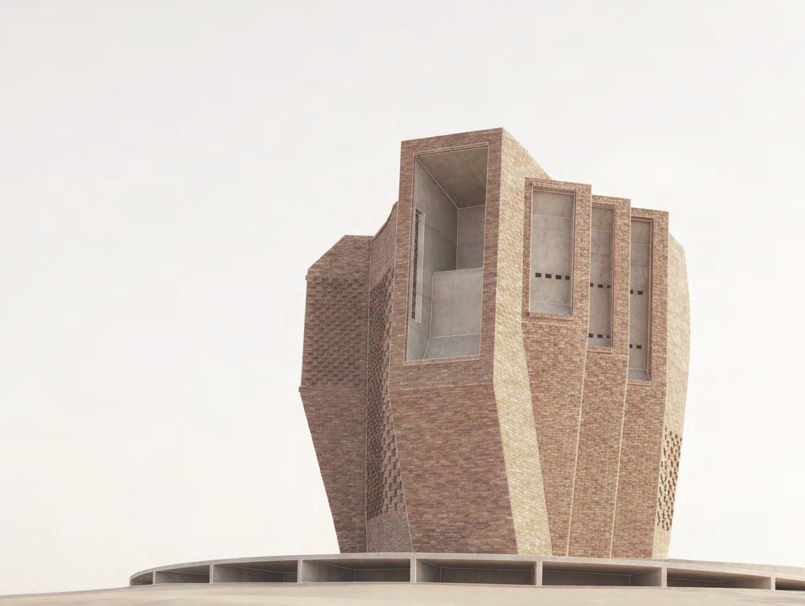
In desert-located metropolises, energy consumption is predominantly used to maintain cool spaces due to extreme climates. Particularly in old towns with traditional buildings, development is limited due to high costs and protective local aspects. This project proposes low-energy, large-family housing utilizing the abundant desert wind. It combines the Middle Eastern wind tower, designed for comfortable living in desert climates, with the Korean traditional ondol (underfloor heating system), reinterpreting traditional housing and expanding ecological justice, incorporating energy-saving and aesthetic considerations.
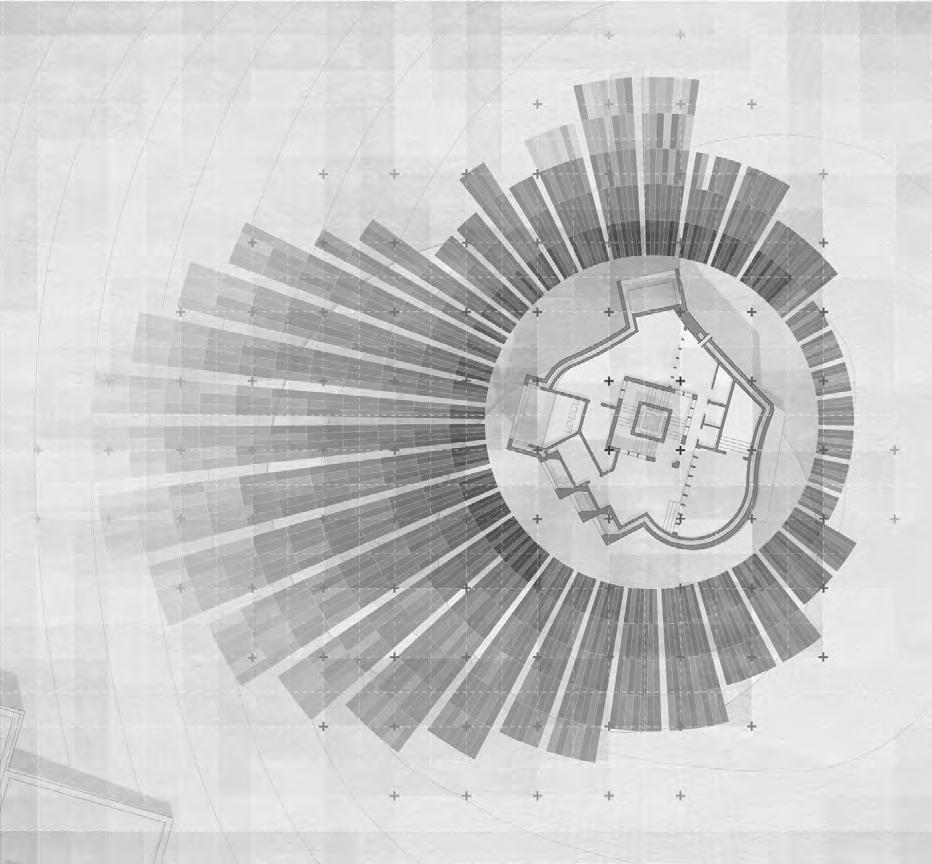

The ‘Flow Housing’ in Fez, a UNESCO World Heritage Site in Morocco, is built on the site through site investigation for visual continuity with surrounding traditional buildings and for sustainable and expansive use. The Wind Rose graph shows the wind distribution around the building in Fez. Based on this distribution, the position and size of the wind tower are determined, and the design is derived from analyzing the wind strength on each floor.
V = Windspeed (mph)
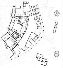
In researching to develop floor plans, similarities were discovered between the family units of the Middle East and those of ancient Korea, as well as their spatial configurations’ relationships. Although contemporary Korean family compositions and residential styles have changed significantly from the past, analyzing traditional Korean houses and comparing them with traditional Middle Eastern houses reveals a striking resemblance in spatial organization and hierarchy. (gender-specific spaces, communal spaces (mafraj), workspaces). Traditional Korean houses are horizontal, single-story buildings, while Middle Eastern ones are multi-storied.The project contemplates low-energy housing using wind, considering these similarities and differences.
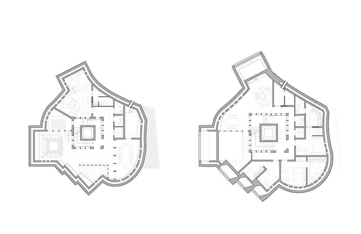
Floor (public area) a. mafraj
b. wind wall
c. dinning space
d. kitchen
e. rest room (guest)
f. guset room
g. wind tower
Floor (women's area)
a. living space
b. mafraj (women's)
c. main bedroom
d. bedroom
e. bath room (sauna) f. upper court g. wind catcher
2nd
5th
Combining systems from two cultures to overcome climate
The wind tower, which introduces cool air into spaces in desert climates, is combined with the Korean underfloor heating system for survival in cold climates. The incoming wind from the tower is directed to each floor’s ground space, maximizing ventilation and cooling effects. This project fuses two indigenous cultures, Korea and the Middle East, in their architectural environments and relationships with nature into a new system that naturally cools heat and plays a structural role in the residential unit. Three large wind inlets are strategically placed for optimal prevailing wind reception.
Today, the significance of energy is especially prominent, necessitating energy conservation. The system, known as Wind Tower or Wind Catcher, is installed at the top of the building. For centuries, wind towers have been widely used in the Middle East for building ventilation and cooling in hot, dry, or humid regions. The wind entering from the massive towers goes down to each floor’s ground space and deeper through the central column’s upward airflow. Below the underground wind path is a reservoir that traps water, utilizing its evaporative cooling potential to deliver cooler air to the building, and excessive water is collected for reuse. In cooler nights or winters, the wind tower is closed to conserve the incoming air layer for insulation.
wind tower(middle east cooling system) On-dol (Korean floor heating system)
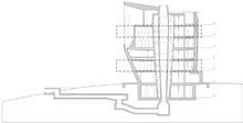
Vertical space organization considering family units and optimized wind intake
KEYS - Unlocking Density in Existing Suburban Blocks
2025
_ Academic work
_ Collaborative Project
_ Selected Individual Contributions Presented
_ What’s Next: A2 Housing Exhibition (SOM Foundation)
Key-Based Strategy for Suburban Densification
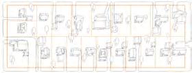
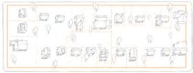
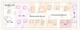
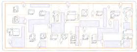
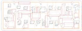
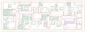
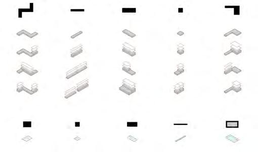
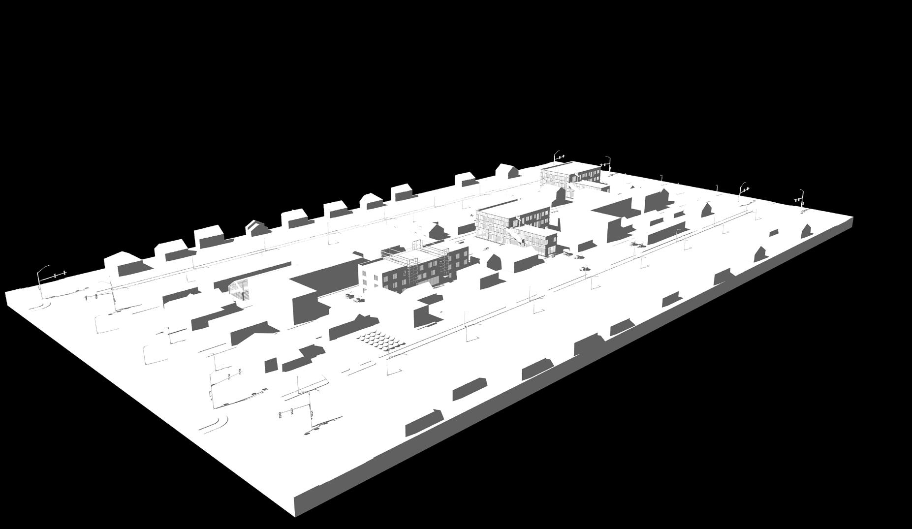
This project proposes a flexible densification strategy for low-density suburban neighborhoods, using Ann Arbor as a test site with broader applicability to similar contexts. The selected block consists of 21 individually owned parcels, where fragmented ownership and compensation mechanisms present major obstacles to conventional redevelopment. Rather than consolidating land or erasing existing houses, the project introduces a system of adaptable building “keys” that can be inserted, stacked, or interlocked in response to parcel boundaries, ownership conditions, and desired density. These keys function as modular typologies that accommodate multiple development scenarios while preserving the existing fabric. By combining adaptable housing units with a dedicated communal key, the strategy enables incremental densification that enhances livability, social interaction, and spatial continuity without relying on total land aggregation.
A Key-Based Strategy for Flexible Densification
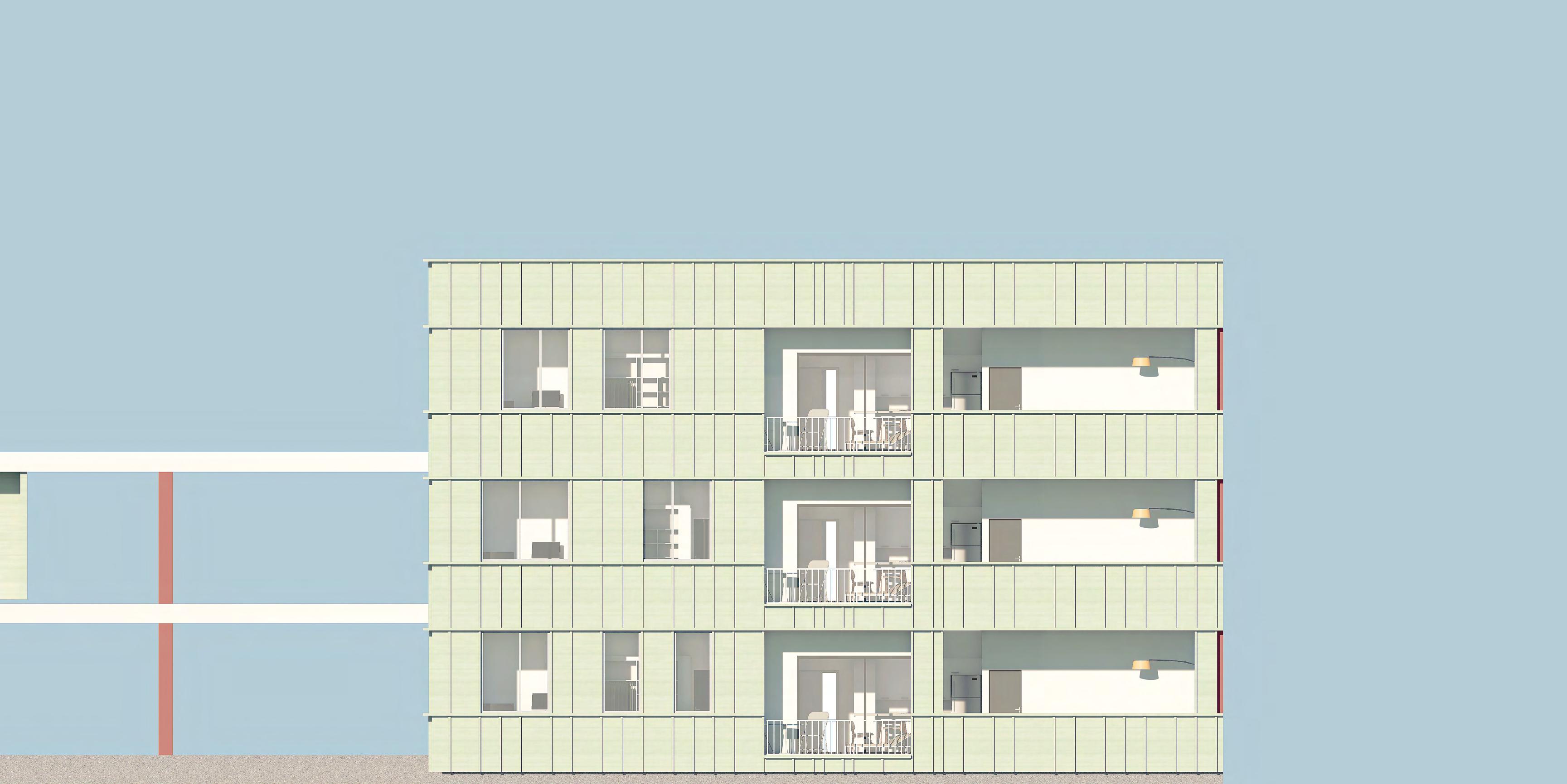
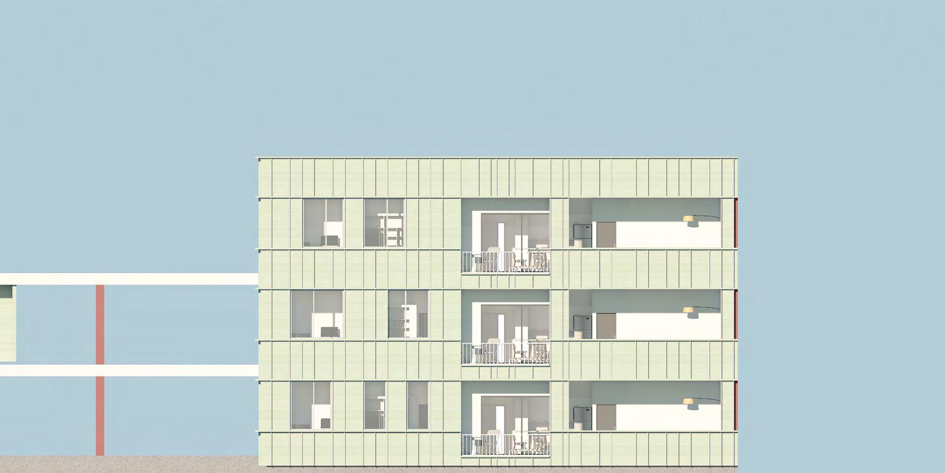
The “Key” strategy was developed to address fragmented ownership and underutilized spaces within the existing residential block. To determine the size and proportion of each key, all block dimensions and parcel conditions were analyzed to identify optimal building scales and forms that could fit between existing houses. Rather than relying on a single redevelopment model, the project defines multiple adaptable keys that respond to different infill conditions and land compensation scenarios. Through this system, 94,900 sq ft of additional residential floor area is introduced while preserving the existing buildings, resulting in a total of 135,600 sq ft within the block. In addition to residential keys, the system includes keys dedicated to shared green spaces, swimming pools, and recreational facilities, allowing housing and communal programs to be incrementally inserted. This approach enables multiple densification scenarios to coexist while maintaining spatial continuity, environmental quality, and neighborhood character.
City of Gravity and Utility
Is our city truly flat?
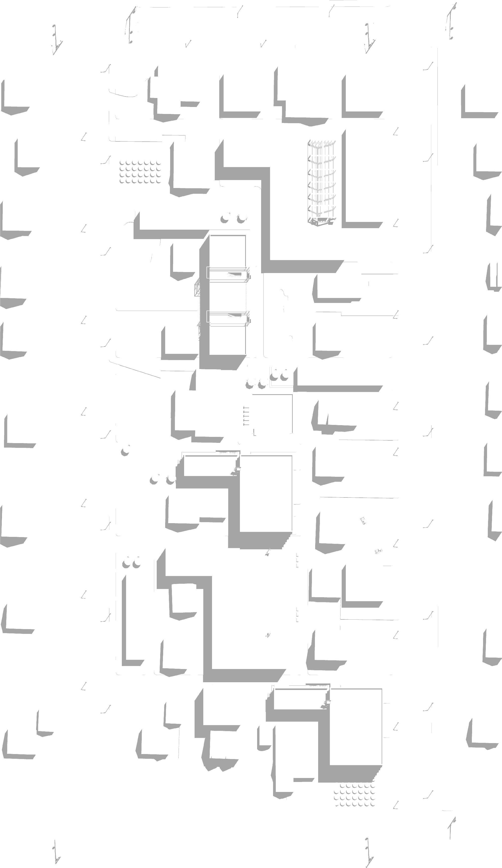
The project begins with the question, “Is our city truly flat?” When designing our current urban spaces, efficiency was prioritized, leading to the creation of cities based on the shortest possible paths. Fermat’s Principle of Least Time suggests that every action takes the shortest distance. While this principle explains the movement in most natural phenomena, it’s challenging to apply it directly to human activities. A city, being a habitat for human life, embodies a multitude of life activities. Although efficient urban design makes our lives convenient, it can overlook fundamental human behaviors. Can cities that ignore these innate behaviors truly be suitable for humans?
The drawbacks of efficiency-prioritized cities became starkly evident during the recent COVID-19 pandemic. Transportation systems designed for human convenience became optimal pathways for virus transmission. The pandemic also highlighted the importance of the “third place,” as emphasized by Ray Oldenburg. These third places, which I consider spaces of utility rather than efficiency, already exist in our cities, bringing satisfaction to urban dwellers. These spaces of utility create new variable paths, contradicting the notion of the city being flat.
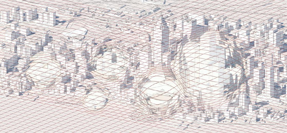
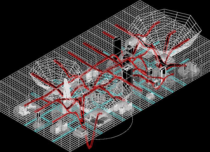
Humans in a city do not move along predetermined paths. For example, if moving from A to B, one might walk faster to avoid a landfill. Conversely, the pace might slow down near appealing green spaces or rest areas. This relationship between time and path cannot be explained merely by efficiency. To measure this relationship, the project considers eight key elements in the city (culture, administration, residential, commercial, business, greenery, production, education) and calculates the relationships between them using a gravitational model. Newtonian physics states that larger objects exert more gravity, and gravitational pull decreases with distance. This project adapts the Standard Gravity Model and Reilly’s Law of Retail Gravitation (originally limited to retail spaces) to derive the unique mass of each city space, termed as the Building Utility Mass ( ), and visualizes the invisible paths between these spaces.
City Space Unique Mass Extraction and Exploration of Invisible Paths
(Newton’s Gravitational Model) (Utility - Gravitational Model)
(Reilly’s Law of Retail Gravitation)
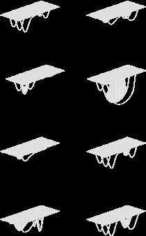
The Building Utility Mass( ) represents the degree of utilization and satisfaction a building provides in the city. A higher value indicates widespread satisfaction and use. The project calculates additional effects by using the utility mass of each urban element and their distances. Each element can attract or repel others, depending on their characteristics. In an attractive relationship (e.g., greenery-culture), the synergy can extend the range and increase the utility mass beyond the individual elements’ inherent mass. This overlap of elements can transform the city’s appearance.
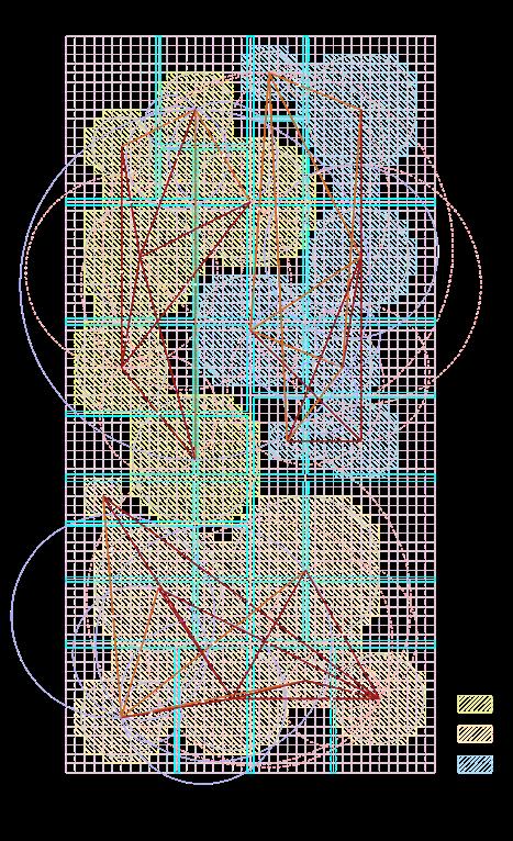
Recent concerns about sustainable development have emphasized the role and importance of parks in cities. To support such plans, it’s necessary to analyze the relationship between green spaces and surrounding urban elements. The study sets up a hypothetical city with eight elements, dividing it into three regions centered around three green spaces. The utility mass values of elements in each region help determine the hierarchy, suggesting possibilities for better urban composition.
Wind Flow Cooling Dam for Data Center
2025
_ Independent Project
_ Special Mention Re-construction Competition
_ Developed from a 2022
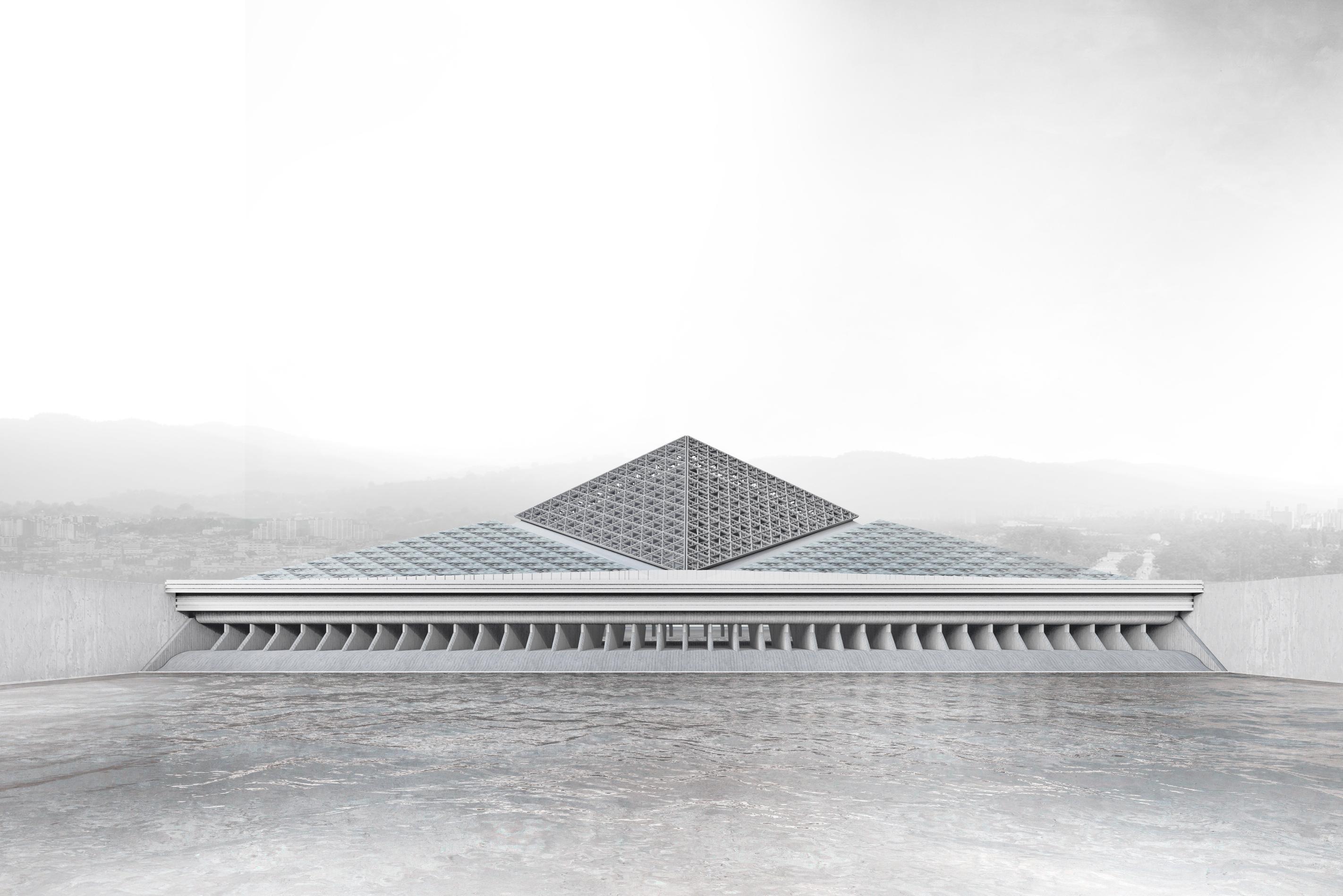
Reimagining the Dam: From Demolition Waste to Circular Architecture
Each building can represent conflicting languages or fields. However, sometimes, dual forms must combine to create new changes when faced with a problem. This project is a new proposal for such transformation. In October 2022, a fire in a data center in the heart of a Korean city led to an unprecedented incident, halting the daily life of the entire nation. As IT operations expand and businesses grow, the scale of necessary equipment increases dramatically. Especially with the advancement of AI technology, the amount of data to be processed is exponentially growing, making the expansion of data centers a critical issue. The most crucial aspect of a data center space is the technology to cool the heat generated by computers. Most large data centers, built far from urban areas due to relatively lower temperatures, also face significant energy consumption issues.
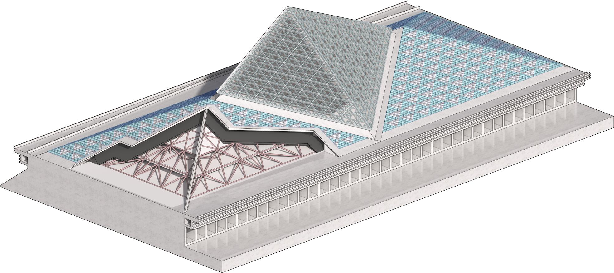
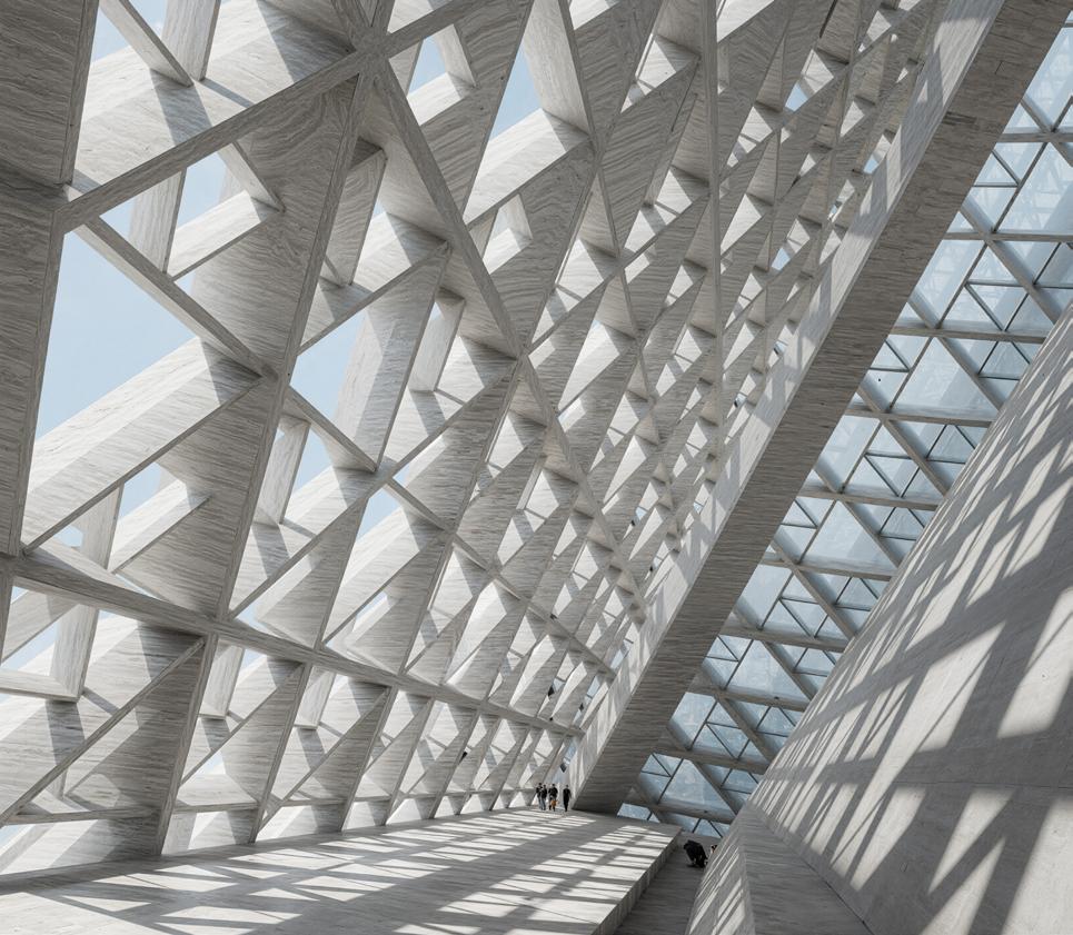
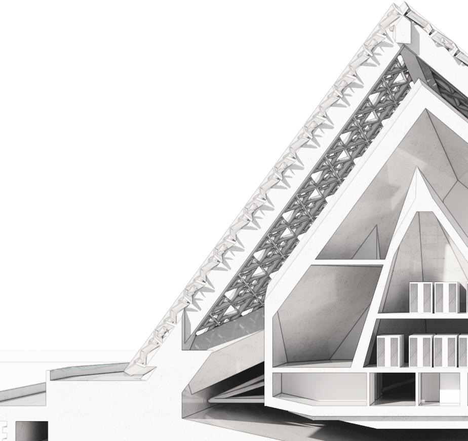
This proposal positions the Paldang Dam not as a structure slated for demolition, but as a valuable resource within a circular architectural system. Instead of removing it, the project places a large-scale data center atop the dam, reassembling the existing infrastructure into a new hybrid form. Because the facility must support the immense load of computing equipment, a triangular truss system—chosen for its ability to effectively distribute both vertical and lateral loads—is applied across the structural framework. This truss system forms the three pyramid-shaped data center volumes and allows the new infrastructure to stably anchor itself onto the dam’s massive body while maintaining structural independence and safety.
The microclimate surrounding the dam, particularly the wind and temperature shifts generated during gate operation, becomes an active component of the cooling system. Air flowing from the river is directed into the building for passive cooling, while the heat generated by servers is redistributed to the surrounding community as a secondary energy source. Situated upstream of the urban river system, the facility provides high-capacity, low-latency data processing with drastically reduced energy demand.
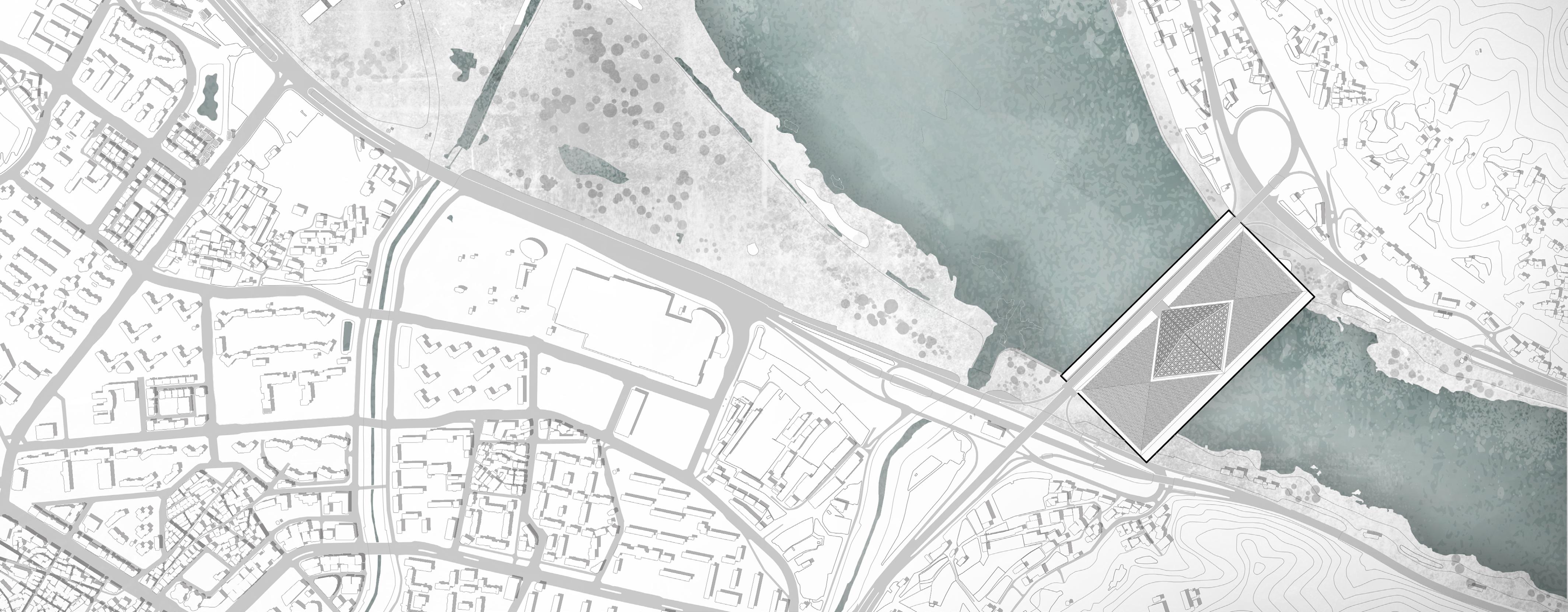
Reusing the Paldang Dam: A Circular Infrastructure Model for Data Centers
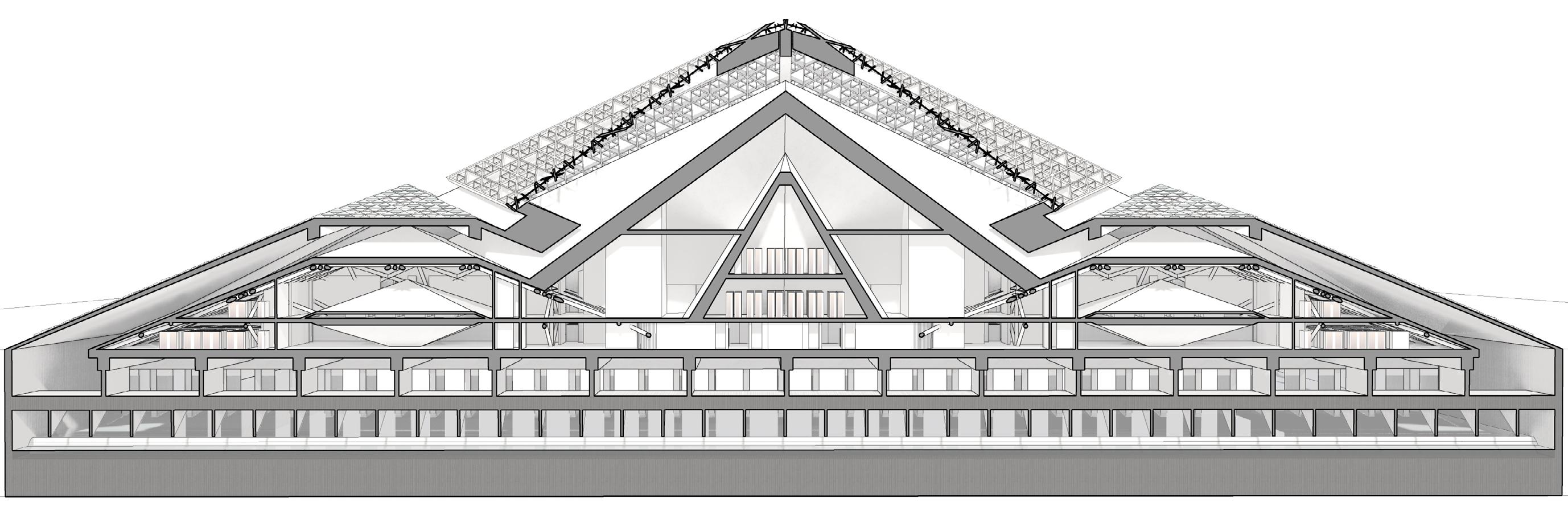
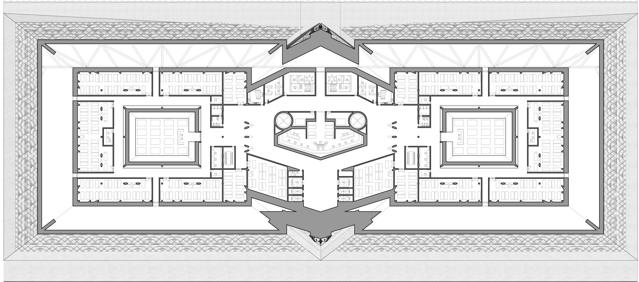
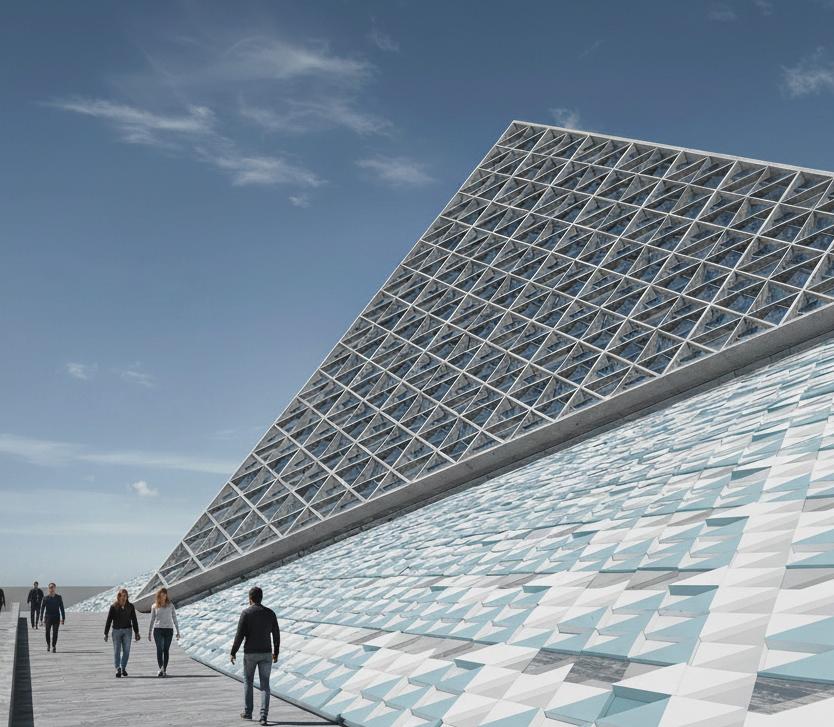
Dams and data centers differ completely in materials, functions, and operational logic. Rather than treating this contradiction as a limitation, the project reframes it as a source of architectural potential. The dam’s heavy, solid structure forms a stable base, while the pyramid-shaped digital infrastructure above introduces a new tension to the urban landscape. Much like Frankenstein’s reassembled body composed of disparate parts, this hybrid entity integrates material, form, and function to propose a new model of urban infrastructure.
Section
Plan(3rd floor)


7.
6.
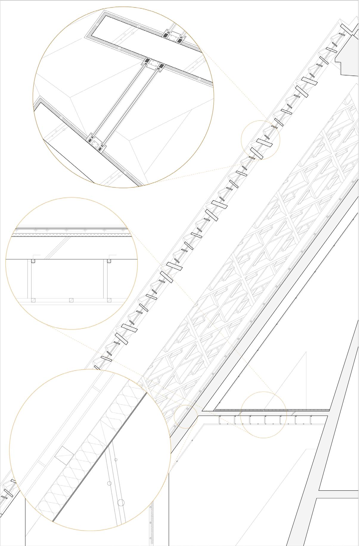
The project must support the immense load of computers necessary for a large data center. A triangular truss structure, chosen for its load-distributing capabilities, is applied to the overall design for constructing the three pyramid-shaped data centers on the dam.


18.


Dual Layer for Wind Influx
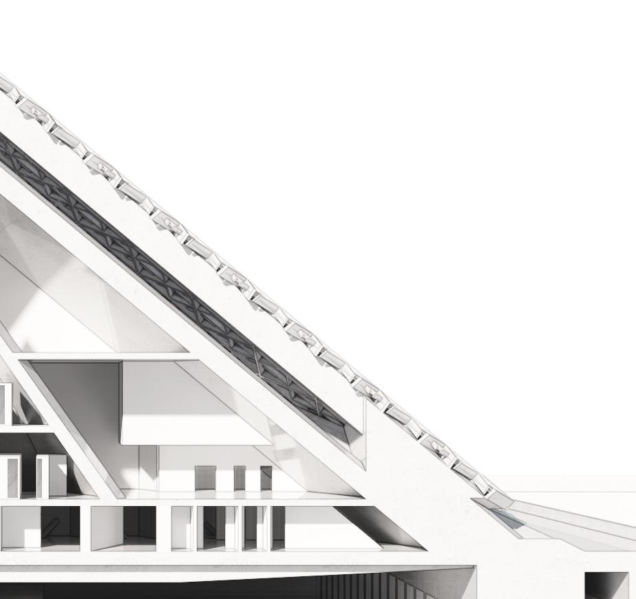
At the heart of the data center is a monumental triple-pyramid structure. A dual-layered space between the inner and outer shells draws river-generated wind into the building. As air moves through these layers, cooling efficiency is maximized, allowing the building to act as a self-regulating system where environmental forces and technological operations work in harmony.


8. Asphalt, 2 layers, 80mm
9. Polystyrene coating
10. Base gravel, 300mm
11. Water pipe, Ø30
12. Ferroconcrete(HE400B), 500mm
13. Color asphalt
14. Asphalt primer coating
15. Plywood, 21mm
Plaster, 25mm 17. Sheet metal plate, 1.5mm Nylon block, 75×50mm
Cavity insulation, 110mm
Water-repellent coating
Concret slab, 800mm
1. Aluminum sash
2. Polystyrene coating
3. Low-e glass, 2 layer, 12
4. Vacuum membrane, 25mm
5. Aluminum casting panel
Cellular glass insulation
Steel beam, 150mm
Algae-Based Urban Energy Infrastructure
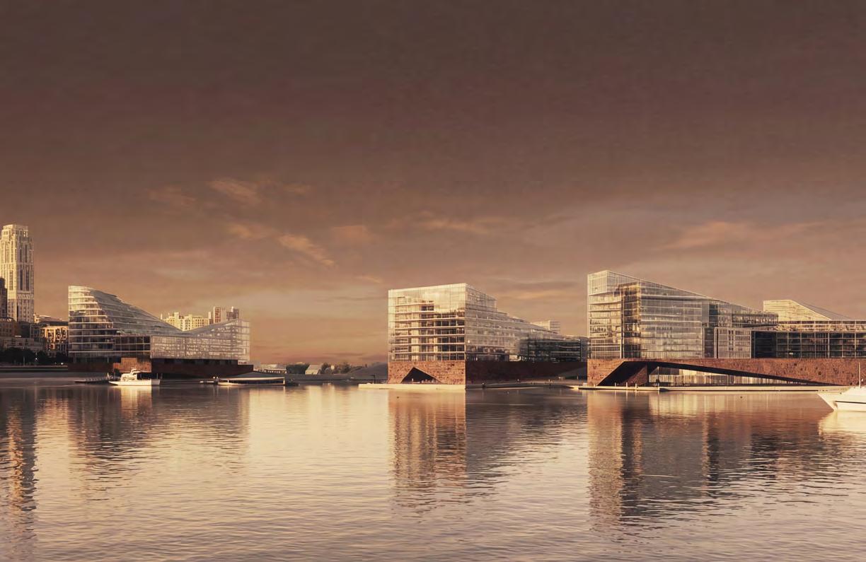
Reframing Energy Infrastructure as Urban Commons
In Boston, energy consumption is disproportionately high relative to local energy production, while essential energy infrastructure is often pushed out of sight and disconnected from daily urban life. This project proposes an urban–community integrated algae-based energy infrastructure that embeds energy production directly into housing and public programs along the East Boston waterfront. By combining algae cultivation, biodiesel production, and district heating with residential and communal spaces, the system enables localized energy cycles while restoring ecological and social connections to the waterfront. The project reframes energy infrastructure as a visible, shared urban asset, advancing environmental resilience and community equity through architectural integration.
Repairing the Waterfront Through Ecological Infrastructure
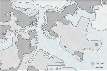
Boston faces a persistent imbalance between energy consumption and local production, while much of its essential energy infrastructure remains disconnected from everyday urban life. At the same time, the city’s waterfront—shaped by decades of industrial activity and port operations—has suffered environmental degradation, fragmentation, and restricted public access. This project proposes an algae-based energy infrastructure combined with shoreline restoration to reconnect the broken waterfront walkway and establish a continuous public edge between the city and the harbor. Rather than operating as a hidden or purely technical facility, the algae farm becomes a visible urban device that remediates pollution, produces energy, and integrates ecological processes into shared civic space, reframing infrastructure as an active interface between urban life and environmental systems.
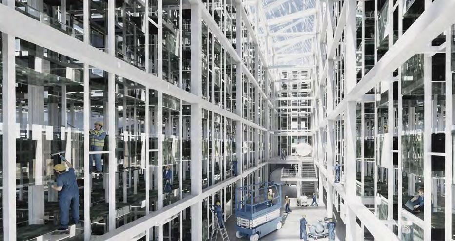
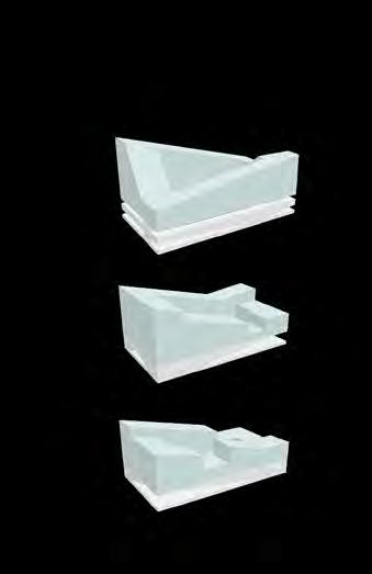
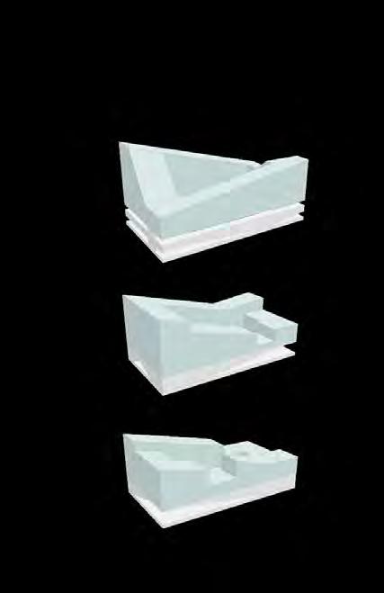
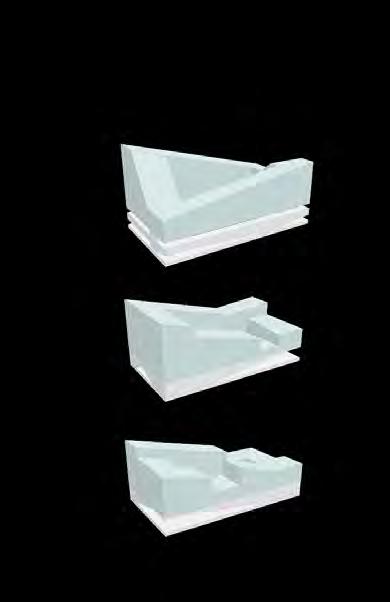
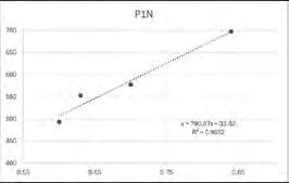
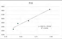
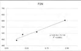
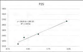
The building is largely composed of glass to support algae growth, making glazing selection critical in Boston’s cold climate. To balance solar access and thermal performance, four glazing systems were evaluated using en ergy simulation tools. While triple glazing offered the highest insulation, double low-E glazing proved optimal when solar transmittance, performance, and cost were considered together. Roof orientations and forms were further adjusted for each algae farm to maximize sunlight exposure based on site-specific conditions. Through this optimized glazing and roof strategy, a single algae farm can produce 240–360 tons of algae annually, yielding 120,000–180,000 liters of biodiesel—enough to provide winter heating for approximately 208 households.

South-facing Plane 2
North-facing Plane 2
South-facing Plane 1
North-facing Plane 1
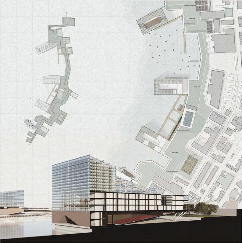
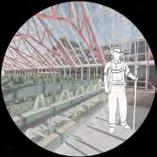
Unlike conventional infrastructure that is typically large-scale and isolated from daily urban life, this project places energy infrastructure directly within the East Boston waterfront. Because the algae farm becomes a visible and accessible part of the city, the design begins with an analysis of the local community—particularly East Boston’s large Latin and immigrant population, where a majority of households are renters with limited access to private amenities and cultural facilities. In response, the project integrates a range of community-oriented programs—including public recreation, shared food production, cultural and educational spaces, and maritime activities— that reflect the social and cultural needs of the Latin community. Closely linked to the algae system, these programs allow energy production, ecological processes, and everyday community life to coexist, enabling the infrastructure to settle into the waterfront as a shared civic landscape rather than a disconnected utility.
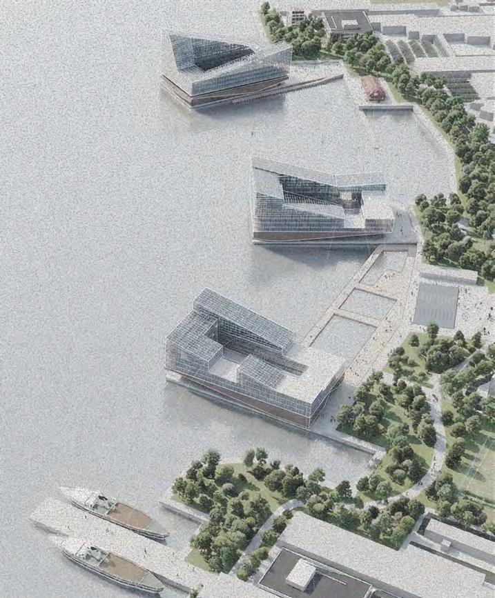
Placing Infrastructure Within Community Life
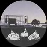
Community Cinema
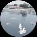
Community Boat Rental & Education Center
Community Greenhouse farm
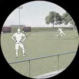
Soccer Field
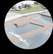
Outdoor Swimming Pool
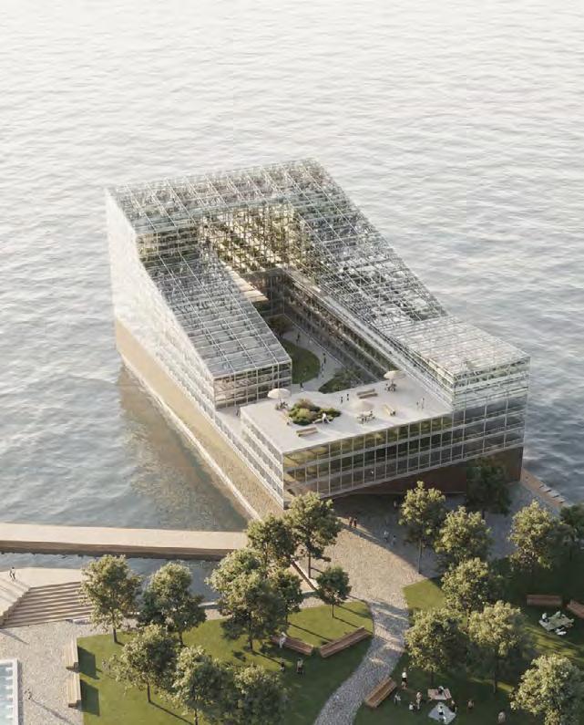
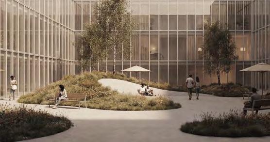
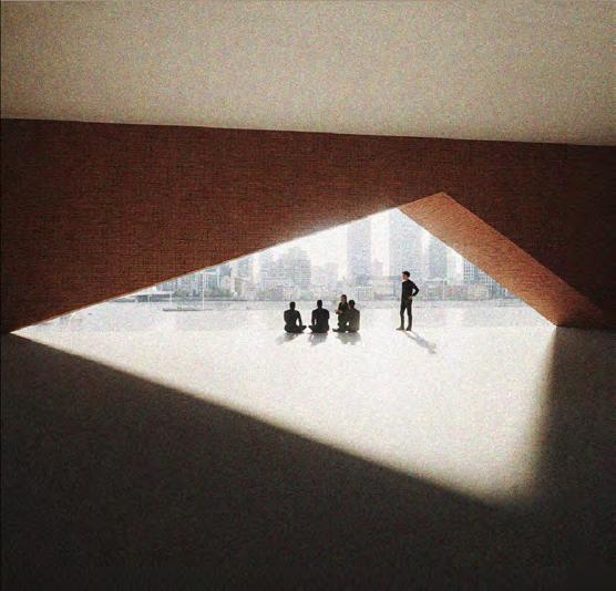
Transforming Infrastructure into a Place for Gathering, Light, and Reflection
Residential Community Garden
Algae-Based Energy Infrastructure at the Waterfront
Holding the Bow
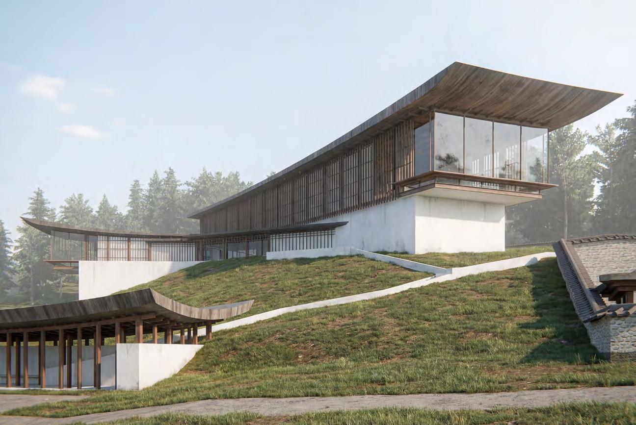
_ Competition Project _ Mental Health Retreat
An Architecture of Self-Cultivation
This project translates the spirit of Jipgungje Wonchik¹—the traditional principles of Korean archery—into architecture. Before releasing an arrow, one must first read the landscape, establish one’s center, and reflect inward. These attitudes inform the building’s placement, spatial organization, and circulation. Rather than treating mental health as a condition to be corrected, the project understands it as a process of re-centering. Through a looping circulation that repeatedly returns visitors to a central point, the architecture supports reflection, balance, and ongoing self-cultivation.
¹ Jipgungje Wonchik: Traditional principles in Korean archery defining the posture, focus, and mental discipline required before shooting an arrow.
1. Nature and Architecture — Harmony
2. Architecture of Center — A Lasting Foundation
3. Architecture of Landscape
The terrain is first observed, followed by an understanding of wind and environmental flow. After comprehending the natural formation and order of the land, architecture is placed in accordance with it. The building does not oppose nature, but settles within its flow.
Just as one steadies the body and posture, architecture must establish its center. By balancing front and back and carefully distributing weight, a stable structure is formed. Such centering creates a foundation intended to endure over time.
Architecture is oriented in response to the surrounding landscape. Mountains, sky, and natural elements are drawn into the space, connecting building and scenery. The landscape becomes not merely a backdrop, but an essential component of spatial composition.
4. Self-Cultivation
and Circulation
The approach path follows the slope and natural landscape, allowing the body to physically experience the terrain while inviting contemplation.
Through the reflective pond, visitors are invited to contemplate the self and gradually establish an inner center.
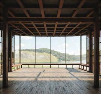
Functioning as a lookout toward the surrounding scenery, the space evokes a sense of openness similar to that felt when releasing an arrow.
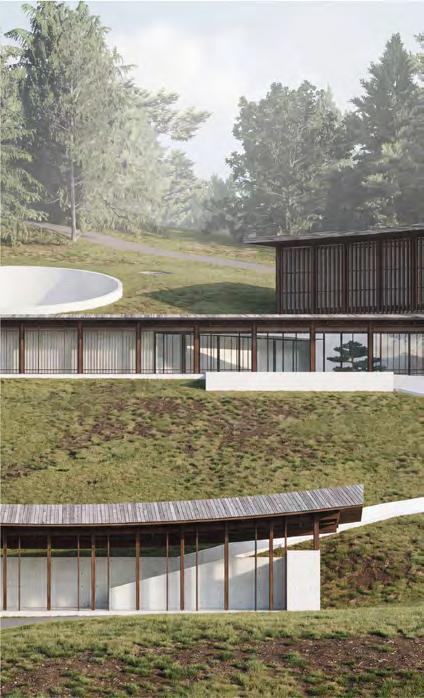
The building follows the natural flow of the terrain, and through gently curving roofs, a landscape that blends with nature is created.
Like the posture of drawing a bow, the building is placed in a natural alignment, and a concrete plinth secures a firm foundation on the slope.
Through framed openings, the surrounding natural scenery is drawn into the interior, allowing the space to merge with nature.
Traditional architecture is arranged so that interior spaces relate to one another visually and spatially. Through circular organization, it encourages reflection and inward awareness. This spatial order is closely tied to a cultivated way of life.
At the center of the building’s circulation, before ascending to the observatory, a space is created to look toward the sky and clear the mind.
The looping circulation encourages contemplation and self-reflection, allowing visitors to repeat the path according to their emotional state.
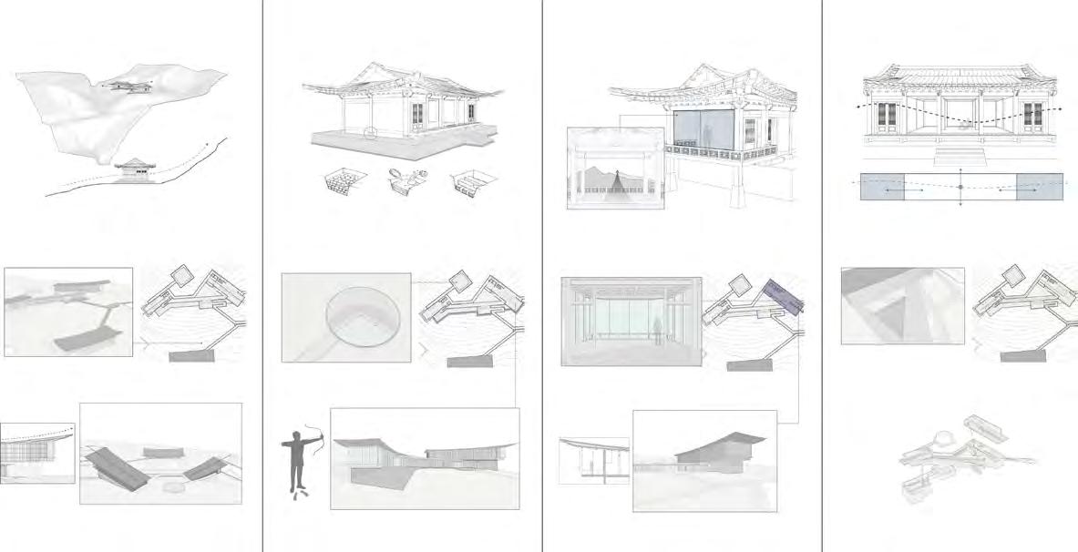
This building is conceived as a space for mental cultivation and inner restoration. Rather than treating mental health as a condition to be fixed, the project approaches it as a process of re-centering and self-alignment. In responding to a site surrounded by traditional architecture and natural landscape, the design began by examining the spatial principles of the Korean hanok. Traditional architecture is formed by reading the terrain, establishing a center, drawing the landscape inward, and organizing space through circulation.
These principles were found to share a structural similarity with the discipline of traditional Korean archery, which emphasizes awareness of environment, centering, orientation, and reflection. By integrating these two systems, the project derives four architectural principles—terrain, center, landscape, and circulation—forming a contemporary building that enables repeated return to one’s center through spatial experience.
1
2
3
²
³
Andong is one of the best-preserved centers of Confucian tradition in Korea, where scholarship, ritual practice, and traditional architecture have shaped a culture of self-cultivation. The site lies between Hwacheon Seowon¹ and Okyeonjeongsa²—historic places where scholars of the Joseon Dynasty studied classical texts and disciplined themselves.
In Confucian thought, social order begins with individuals who have established their inner center. Scholars known as Seonbi³ valued integrity and self-restraint, practicing study, contemplation, and archery as disciplines of the mind. When an arrow missed its target, reflection turned inward rather than outward. Surrounded by a curving river and mountains, the site forms a quiet contemplative landscape where nature becomes part of the process of cultivation. Within this context, the proposal establishes a new center between the two historic structures, connecting ground and sub-ground through a sequence of outward awareness and inward reflection.
for study and contemplation in nature












6
5
3
6
5
4
1st Floor
Okyeonjeongsa²
Jeongganmun (Main Threshold Gate)
Jeongdo (Path of Alignment)
Sushin Dawon (Tea Pavilion)
Path to Simgodae (Platform of Inner Discipline)
Access Passage to Gyeongsimji (Reflecting Mind Pond) 2nd Floor
1 Hwacheon Seowon
2 Sadae (Archery Terrace)
Simgodae (Platform of Inner Discipline)
Gyeongsimji (Reflecting Mind Pond)
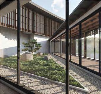
Jungjeong (Central Courtyard)
Connection to Jungjeong (Central Courtyard)
7 Connection to Retreat Quarters (Accommodation)
8 Seokjeon (Meditative Outlook Pavilion)
¹Seowon A Confucian academy of the Joseon Dynasty
Okyeonjeongsa A historic Confucian retreat pavilion used
Seonbi: Confucian scholars of the Joseon Dynasty
Banteok Matchum (Half-Lap Joint)
Naeoe Jumeokjang Matchum (Inner-Outer Mortise Joint)
Ssanggal Matchu (Cross-Locking Joint)
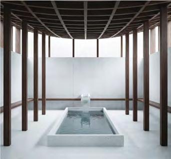
This space functions as a welcome center, where visitors cleanse their hands in water as a symbolic act of mental purification. It serves as a transitional space before entering the cultivation hall
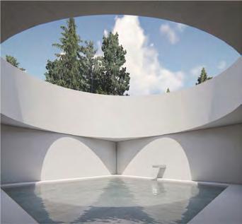
at the center of circulation, this space serves as a transitional moment to recalibrate the mind before entering
Jeongganmun (Main Threshold Gate)
Located
Seokjeon, framed by a small garden
Jungjeong (Central Courtyard)
A space for self-reflection through the mirrored surface of water. By confronting both the landscape and one’s reflection, it becomes a place to regain inner balance
Gyeongsimji (Reflecting Mind Pond)
This space serves as a place for meditation while facing the surrounding landscape. By opening the gaze toward nature, it becomes a quiet setting for contemplation
Seokjeon (Meditative Outlook Pavilion)
The building follows the slope, unfolding as an extension of the terrain. Open spaces extend the gaze toward nature, while enclosed spaces turn attention inward to encourage reflection
Architecture Along the Terrain
A New Museum for Citizen Archivists : Strata, Sedimentation, and the Spatialization of Memory
Academic Project
Project initiated in 2021
Museum / Cultural Institution
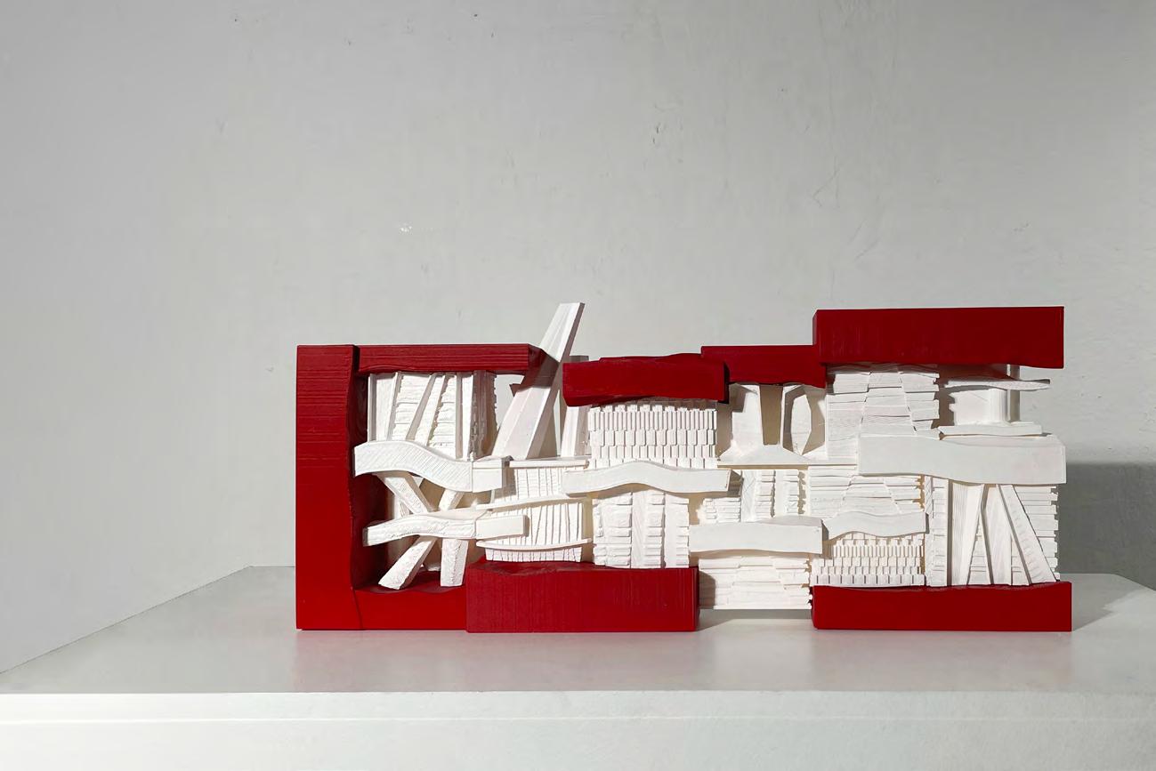
Excavating layers of time
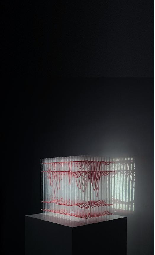
Mixed midea, Lacquer spray on 3D print / 19x6.2x8.5 in / 2019
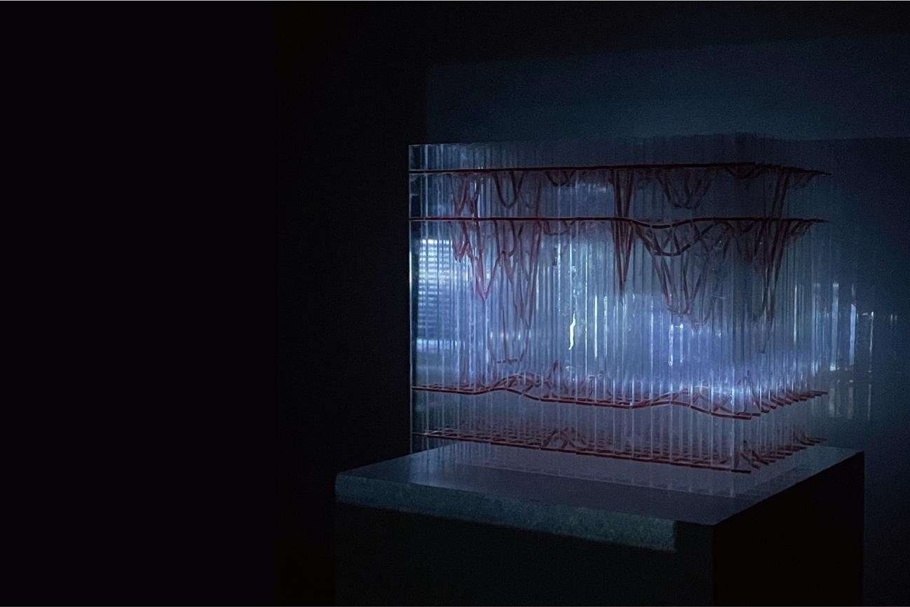
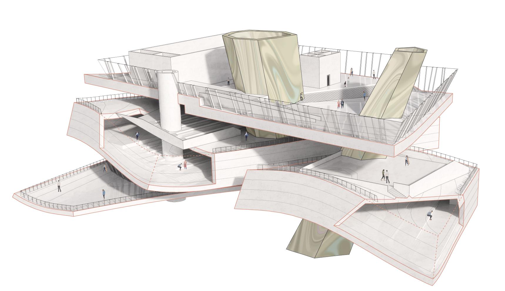
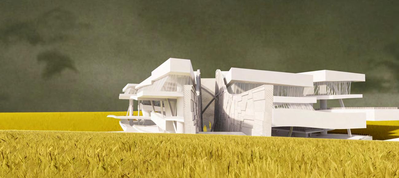
This museum is an architectural experiment that allows visitors to spatially experience the accumulation of memory and time. Human memory and geological strata share a common characteristic as materialized structures formed through the passage of time, and this project translates the excavation and exposure of previously unrecognized memories and buried strata into an architectural methodology. Rather than serving as a passive background, the strata are interpreted as active structures shaped by temporal pressure, rupture, and overlap, directly generating architectural space.
While conventional museums operate through a one-directional system of selection and interpretation, this museum functions as a participatory framework in which every visitor becomes both the subject and archivist of memory, continuously layering new memories onto the exposed strata. Moving through uneven floors and fragmented spatial sequences, visitors are prompted to recognize their own bodies and perceptions before focusing on exhibited artifacts. Through this process, the revealed strata and the accumulation of memory extend beyond exhibition, spatially visualizing how collective memory is formed within the urban context.
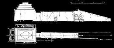
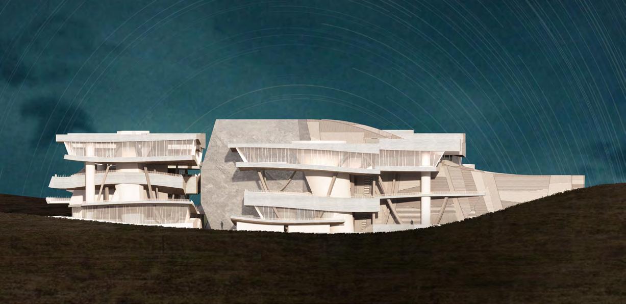
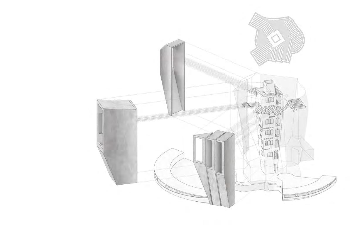
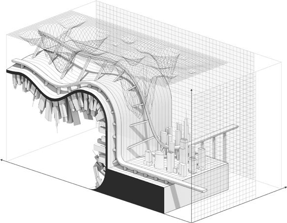
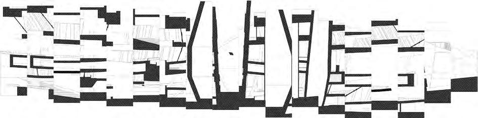
Spatializing Excavated Memory Through Architectural Strata

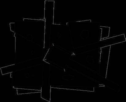
A Continuous Variation of Experience Across Sedimented Strata
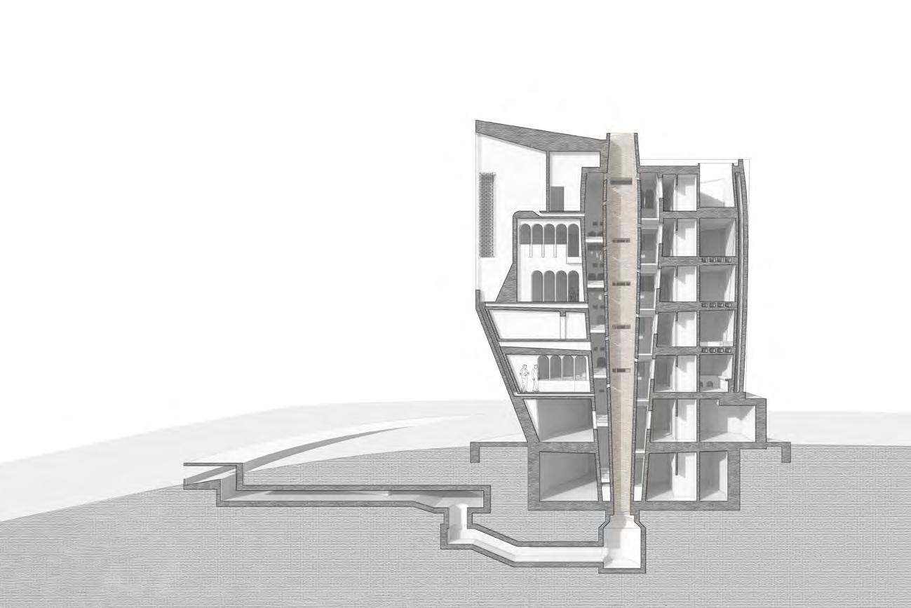
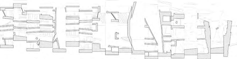
The project spatializes deep time through layered strata intertwined with human memory. Vertical drill voids cut across these layers, at times functioning as circulation paths and at others remaining open voids that connect different temporal depths. Through both movement and visual exposure, visitors experience memory not as a fixed narrative, but as a continuous expansion across space and time.
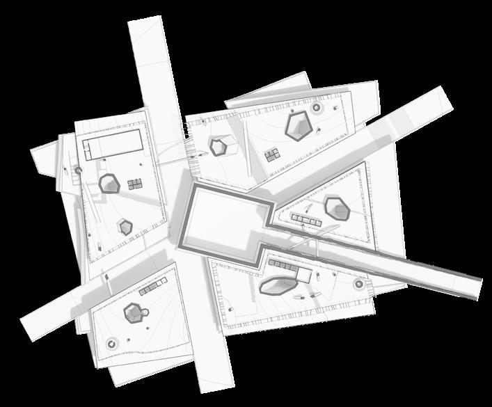
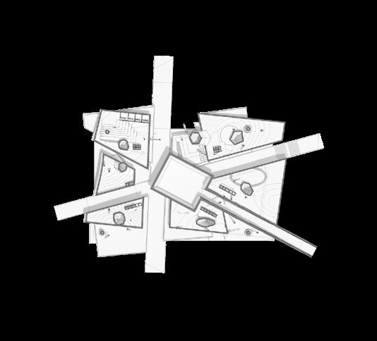
Strata/Excavation/Drill Holes/Axis
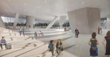
The main entrance, offering a view of the entire excavated pathway and sedimented strata along the urban axis, allows activities on elevated, transformed strata with object display spaces and various time layers penetrated by drill holes, inducing new emotions. Each stratum does not operate as a single surface but creates new memories through interaction via the drill holes.

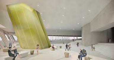
01. Shining drill hole and exhibition hall
Excavated pathway(main enterance)


Small performance hall
Memory Sharing Museum : A Shared Memory Archive for Citizen Archivists
_ Academic Project
_ 3rd Prize : Next Generation Cultural Space Competition _ Museum / Cultural Institution
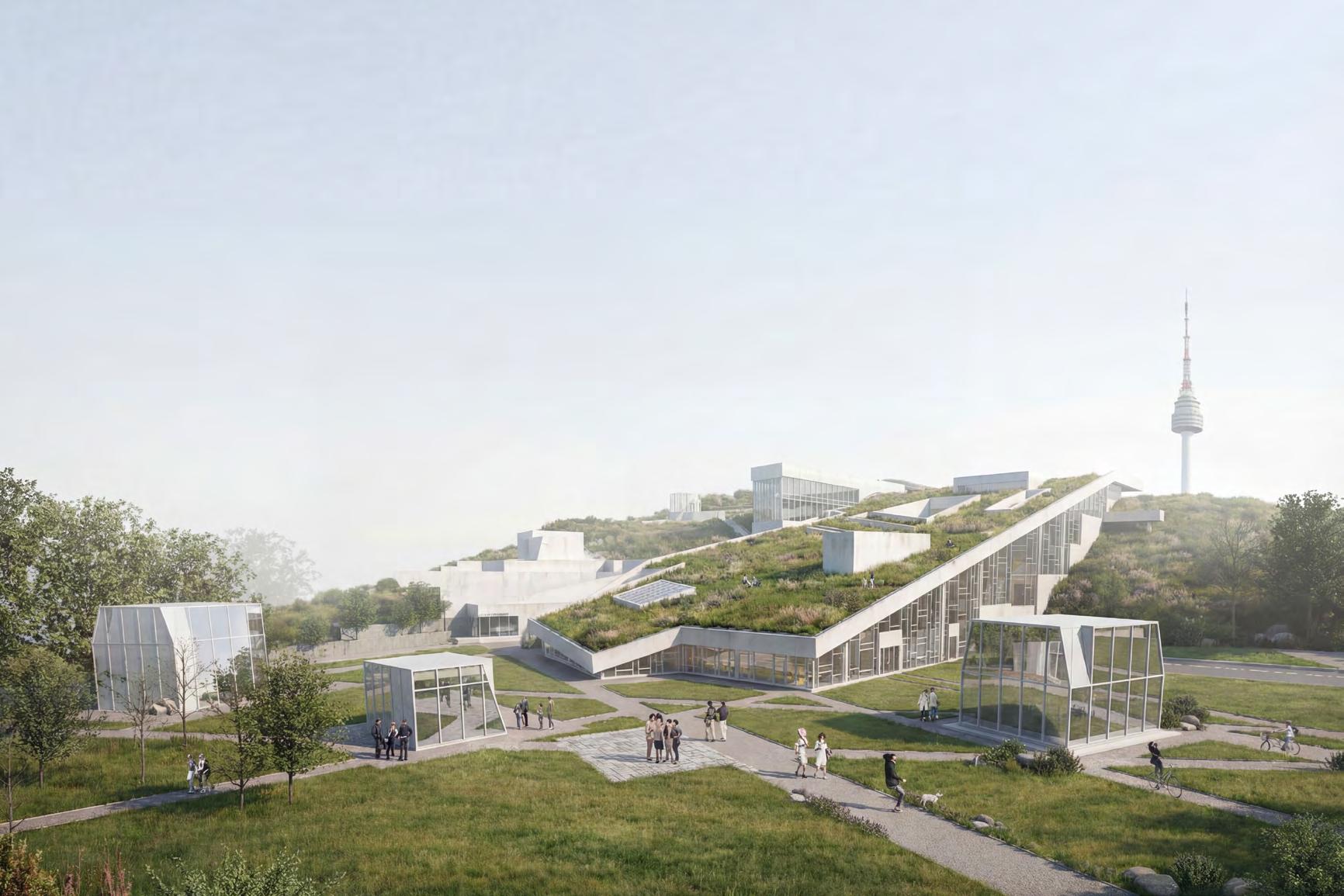
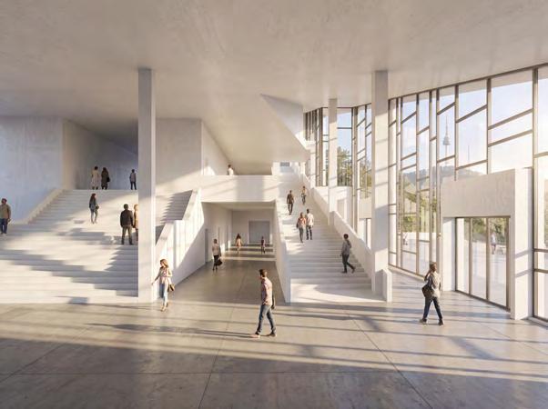
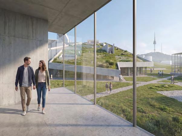
This project proposes a cultural space that spatially organizes the process through which personal memories are shared, accumulated, and expanded into collective memory. Located on a former military site in Yongsan, Seoul, the project reconnects fragmented urban memories by restoring the site’s sloped topography and establishing a spatial axis linking the city and the park. Through the participation of “citizen archivists,” who record and curate their own memories, the architecture creates a participatory archive where memory is continuously generated, stored, interpreted, and circulated.

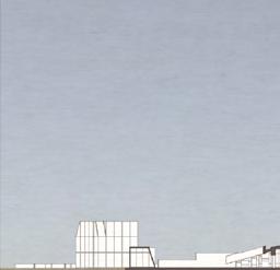
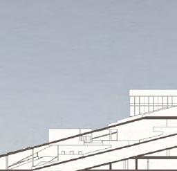
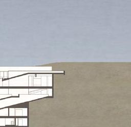
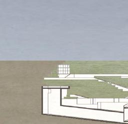
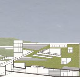
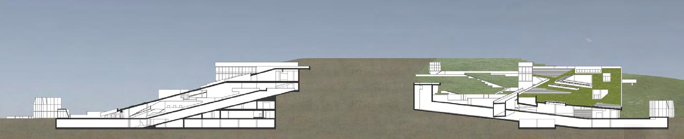

A network of axes organizes the project and reconnects the fragmented site. These spatial lines restore the sloped topography while extending connections between Haebangchon, the site, and Yongsan Park. Through these axes, the project links terrain, city, and landscape into a continuous spatial sequence.
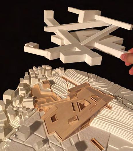
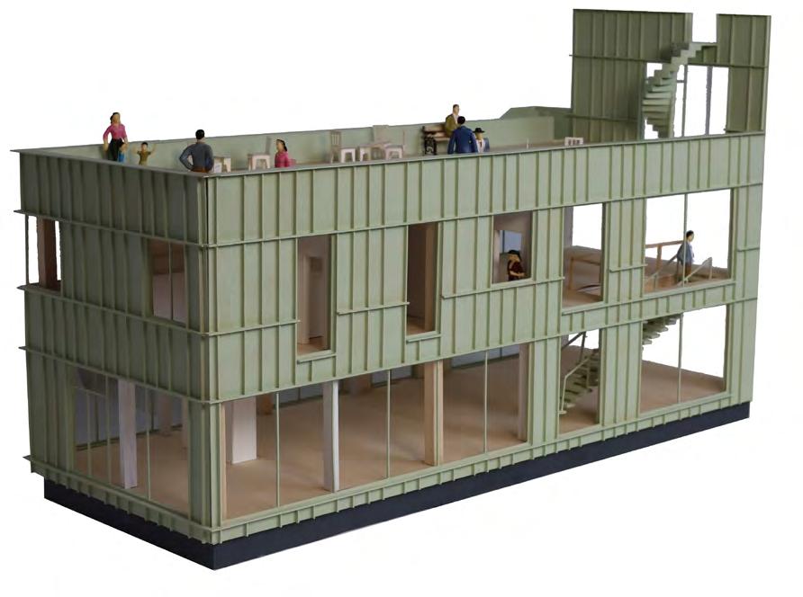
Physical Model (23.6 × 23.6 × 11.8 in) - Basswood and foam model showing the building massing and the internal axis concept
Memory Pocket - An event landscape located above the underground axis, hosting various public activities
Central Hall - A space where multiple axes converge, facilitating circulation across the steeply sloped site