Law 97 shapes Energy Inequities in NYC’s communities
Reclaiming Space and Identity in La Chacarita
Bridging Gaps in Micro-Mobility: Analyzing Accessibility, Safety and Equity in NYC
NYC Parking fines: An analysis of social and spatial relationships
Between the (Subway) lines: Analysing the Interplay of Different Transportation Systems in New York City Aamchi Mumbai
Understanding Social Resilience in Versova Koliwada
Mumbai Skywalk Project: An extension of everyday life
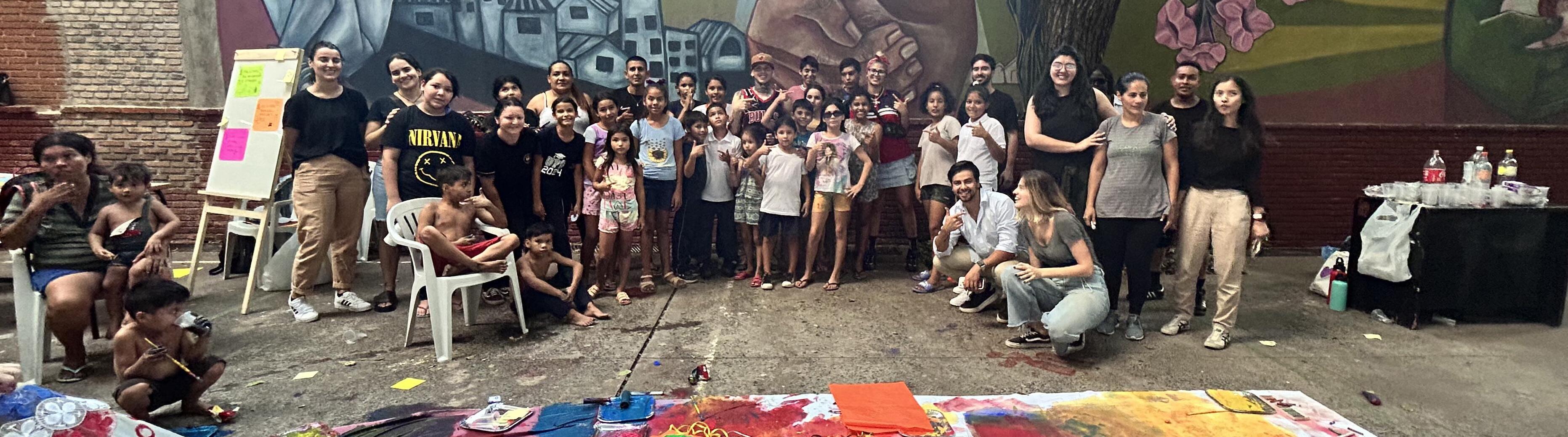
The work shown in this portfolio took a family to ideate, develop and visualise. Here are some of them, who helped us understand their lives, aspirations and struggles in Paraguay, Asuncion
The Cost of Exclusion
How Local Law 97 shapes Energy Inequities in NYC’s communities
Graduate Urban Planning Thesis, 2024 - 2025
Mentor: Emily Tolbert
Local law 97 (LL97) of 2019, a cornerstone of New York City’s Climate Mobilization Act, mandates significant greenhouse gas emissions reductions for large buildings (over 25,000 square feet), aiming for a 40% reduction by 2030, and 80% by 2050. While this policy is pivotal in advancing urban decarbonization, its design and implementation have raised concerns about exacerbating existing inequities across the city. The thesis investigates how LL97 shapes energy disparities by analyzing its socio-spatial impacts on disadvantaged communities excluded from compliance mandates.
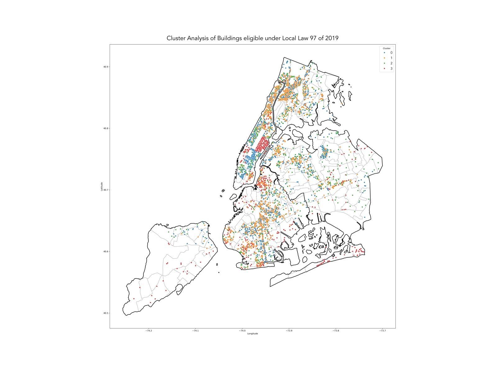
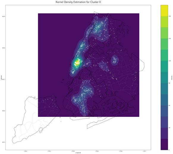
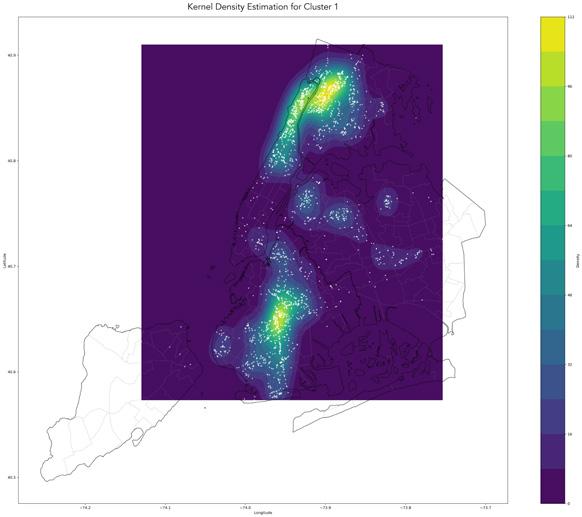
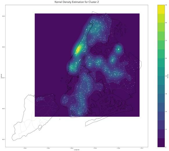
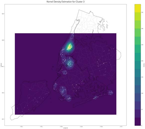
Using a quantitative approach, the study uses geospatial analysis of census tract level emissions data with socio-economic indicators and local law 97 complaince pathways of each eligible building to understand the new forms of spatial clustering around socio-energy injustice. The research highlights the emergence of new forms of spatial injustice, where environmental and economic benefits of decarbonization are unevenly distributed through developing a k-means cluster analysis model.
The four clusters are:
• Cluster 0: Newer Medium – High rise MixedUse Buildings in Diverse Neighborhoods
• Cluster 1: Older Smaller Residential-Use Buildings in Diverse Neighborhoods
• Cluster 2: Medium aged buildings in Less Diverse Neighborhoods
• Cluster 3: High-Efficiency Owned buildings in Predominantly White neighborhoods
This study argues for a reimagined policy framework that integrates targeted investments in disadvantaged neighborhoods, enhancing financial support for retrofitting projects, and community-driven planning processes to ensure inclusive participation in the energy transition. By addressing these gaps, New York City can achieve a more equitable low-carbon future while mitigating unintended consequences of climate policies. These findings contribute to broader discussions of energy justice and the need for spatially inclusive approaches to urban sustainability.
Bottom:
Table showing the center of a cluster analysis of all elibigble buildings based on their physical, demographic and energy data
Bottom: A map of all eligible buildings showing their cluster and geographical distribution
Cluster 0 Newer Medium-High Rise Mixed-Use in Diverse Neighborhoods
Cluster 1 Older, Smaller Residential in Low-Income Areas
Recognize as transition zones (opportunity & risk); require antidisplacement measures with new investments; use CDSV score to guide requirements.
Designate as Tier 1 priority; direct majority of resources/support; use Disadvantaged Communities Index and CDSV score for targeted, sufficient investment.
Leverage building capacity but share benefits with community; tie incentives (density bonuses, expedited permitting) to high energy standards and amenities for LMI residents; support property managers and commercial tenants.
Provide highest support (100% grants for deep retrofits); hyperlocal, culturally competent technical assistance; prioritize renters; low-interest loans/ subsidies for owners with affordability covenants.
Establish neighborhood climate councils with residents and business owners; councils negotiate CBAs and allocate retrofit funds to local needs.
Track emissions, energy performance, rent stability, business retention, displacement; require annual equity impact assessments and public dashboards.
Establish retrofit councils (tenants, orgs, experts) to select contractors, prioritize upgrades, monitor outcomes; participatory budgeting for local needs.
Cluster 2 Mid-Century in Moderate-Income Areas
Recognize as moderateneed; identify/prioritize vulnerable pockets (coops, Mitchell-Lama, public housing) using indices and local input.
Sliding-scale support; higher for seniors, disabled, low-income; enable co-ops/associations to pool for bulk retrofits; offer loan forgiveness/bonuses for energy savings and equity outcomes.
Focus on energy and social outcomes (heatrelated ER visits, air quality, energy burden); annual audits; enforce anti-displacement; disaggregate data by race, income, tenure.
Encourage retrofit cooperatives/ resident-owner committees; provide technical support/training; ensure vulnerable groups’ voices in decisions. Benchmark against citywide targets and Cluster 3; require annual reports (energy savings, participation, energy burden); tie incentives to equity outcomes.
Implement incometiered utility rates and bill assistance for LMI households; enable tenant participation in community solar/ shared savings to reduce costs.
Cap energy costs as % of income; heavily fund utility assistance; deploy mobile weatherization teams; prioritize community solar for renters/lowincome families.
Double rebates for income-qualified; prioritize smart submeters, community solar in mixed-income; ensure all eligible are enrolled in assistance; distribute upgrade savings equitably.
Cluster 3 High-Efficiency Owned in Affluent Areas
Recognize as low-need; focus on supporting citywide equity via crosssubsidies and innovation leadership.
Minimal direct aid; require contributions to Spatial Equity Fund (fines, NRECs from DACs); support for maintaining performance, sharing best practices.
Enlist as partners for citywide efforts (demonstration sites, peer-learning, climate reparations pilots funding projects in disadvantaged areas).
Prioritize transparency/ accountability; publish equity-adjusted emissions and embodied carbon for renovations; serve as benchmarks and be held accountable for equity contributions.
Require funding for tenant relief and community solar in high-burden areas via carbon offsetting; leverage resources/ leadership to share decarbonization benefits citywide.
Reclaiming Space and Identity in La Chacarita
Urban Planning Studio, 2024
Collaborators: Arimbi Naro, Mateo Alexander, Reina Dissa, Will Fainaru Callahan, Anisa Kharimah, Charlotte Boulanger , Nyadeng Mal, Tim Small, Benedetta von Palombini Mentors: Jose Vallejo, Ryan Devlin, Elizabeth Alvarez
Stakeholders: Pro Desarrollo, ChacaTours, Community Mem bers of LaChacarita, UN-DP, Habitat for Humanity
The project was conceived from an appreciation of lives led by the community of primarily Guarani speaking people of LaChacarita in a majority Spanish city of Asuncion to explore how their indigeneity, geography and history shape their modern lives. The work was a response to our client’s work on formalization of the economy as a way to sustainably develop the community and its economy.
By gaining a comprehensive understanding of the socio-cultural nature of LaChacarita through discussions with an extremely varied set of
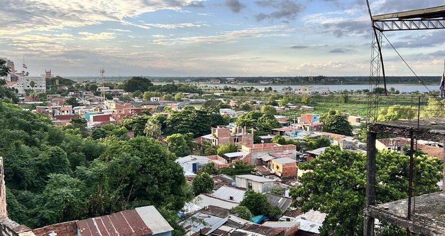
Aerial view of LaChacarita
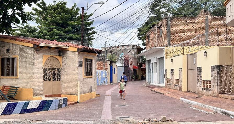
Streetscapes in LaChacarita
Quilt made by local craftswomen and populated by children of LaChacarita to explore their connections to the neighborhood
stakeholders from community members, musicians, children, historians, architects, journalists and planners. A participatory exercise was developed with the community to understand how they view their geography and its socio-cultural perceptions. This exercise became a base for further analysis and engagement with the community.
This exercise and through a critical analysis of our client’s work in economic formalization and our engagement with the community, the project focused on building community capacity to lead a decentralized social and economic development effort which focuses on leveraging the community’s cultural prowess to develop unique spaces and models to improve their lives in their own way without the typical top-down planning that is prevalent there through national and global planning efforts.
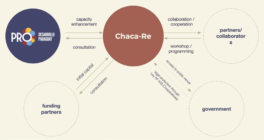
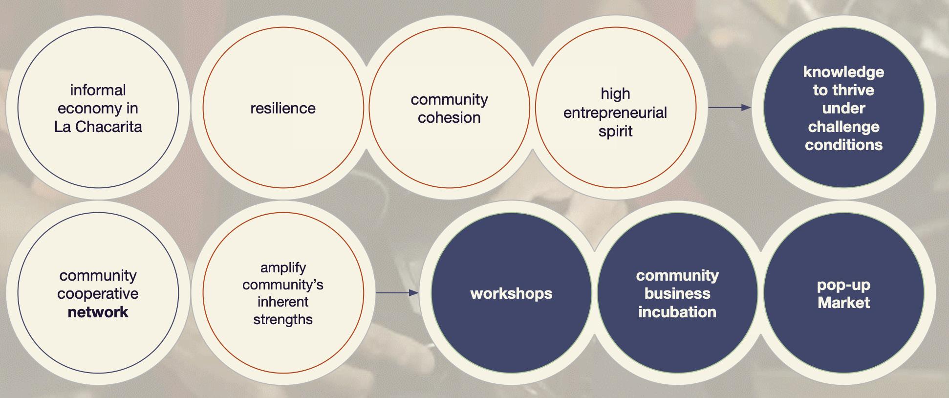
This was done through the development of the Red de Empoderamiento Chacarita (Chaca-Re) Chacarita Empowerment Network which acted as a collection of community interests and work in leveraging their cultural prowess through advocacy, social and economic outreach knowledge development and business development.
The goal of this network is to build on top of the community’s existing resiliency systems to not only survive but thrive as the socio-cultural powerhouse of Paraguay by gaining a comprehensive understanding of the socio-cultural nature of LaChacarita through discussions with an extremely varied set of stakeholders from community members, musicians, children, historians, architects, journalists and planners. A participatory exercises was developed with the community to understand how they view their geography and its socio-cultural perceptions. This exercise became a base for further analysis and engagement with the community.
This exercise and through a critical analysis of our client’s work in economic formalization and our engagement with the community, the project
focused on building community capacity to lead a decentralized social and economic development effort which focuses on leveraging the community’s cultural prowess to develop unique spaces and models to improve their lives in their own way without the typical top-down planning that is prevalent there through national and global planning efforts.
The goal of this network is to build on top of the community’s existing resiliency systems to not only survive but thrive as the socio-cultural powerhouse of Paraguay.
Right: Top to Bottom:
Chart showing how Chaca-Re can collaborate with the city to further the intersts of the community
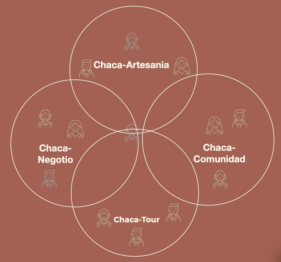
Organisational chart showing the decentralized roles and processes Bottom:
Chart showing how community highlights can be translated into actionalable spatial processes
Bridging Gaps in Micro-Mobility
Analyzing Accessibility, Safety and Equity in NYC
Introduction to Urban Data and Informatics
Collaborators: Husen Kharodiwala
Mentor: Anthony Vanky
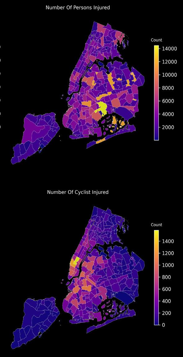
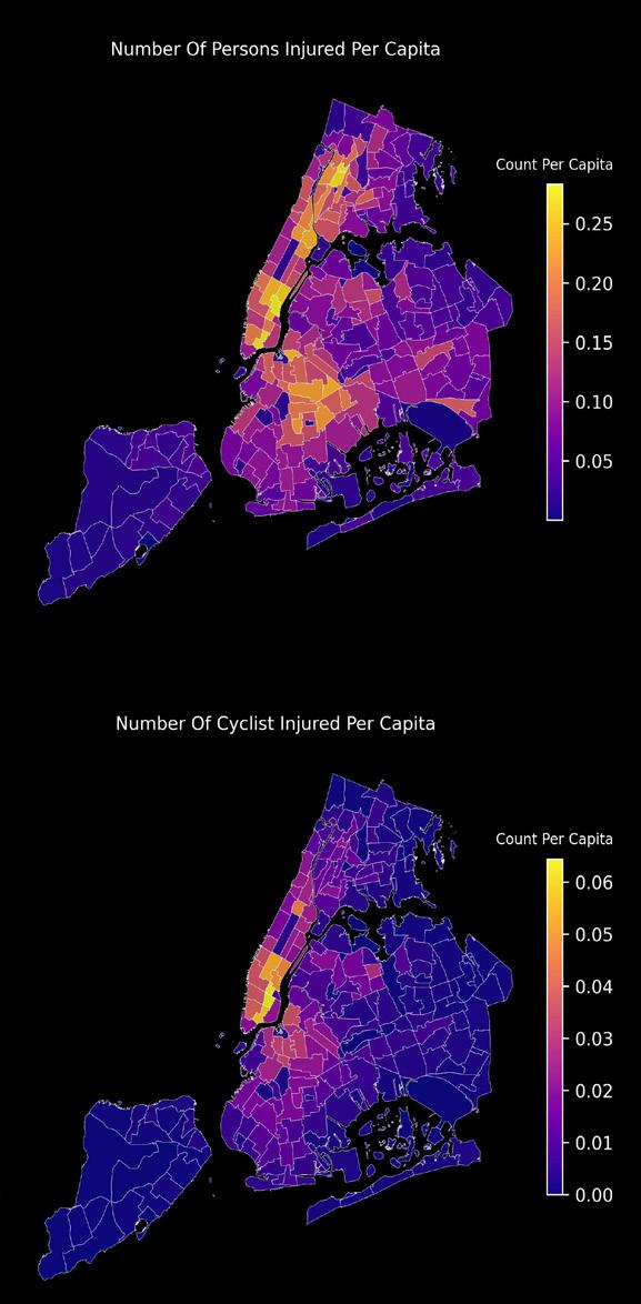
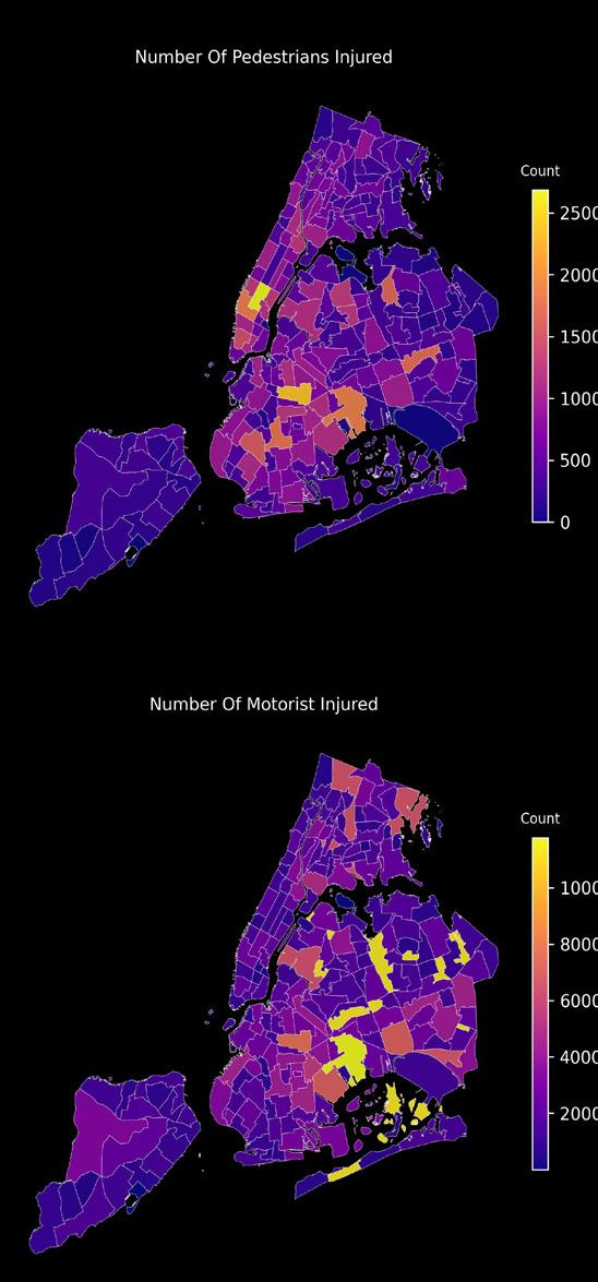
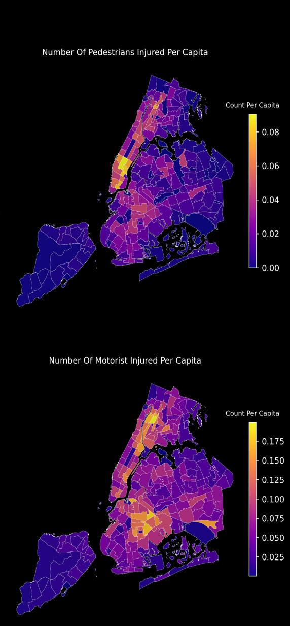
This project investigates micro-mobility patterns in New York City with a focus on understanding disparities in access to infrastructure, safety conditions, and the role of socioeconomic factors.
The study aims to uncover how access to dedicated infrastructure, such as bike lanes and pedestrian pathways, varies across different neighborhoods and how these variations correlate with demographic and socioeconomic factors like income levels and population density.
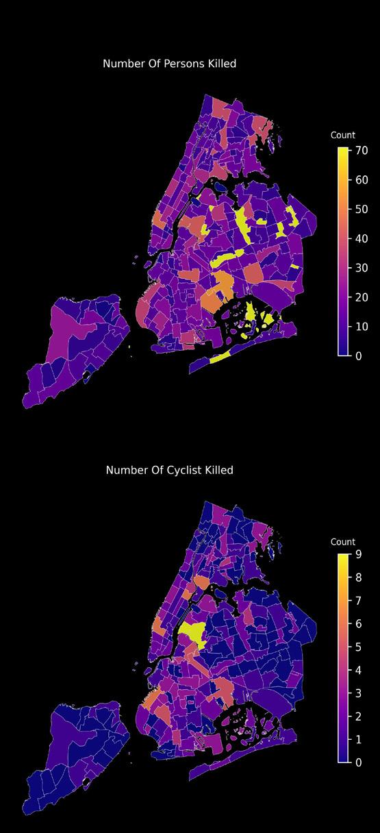
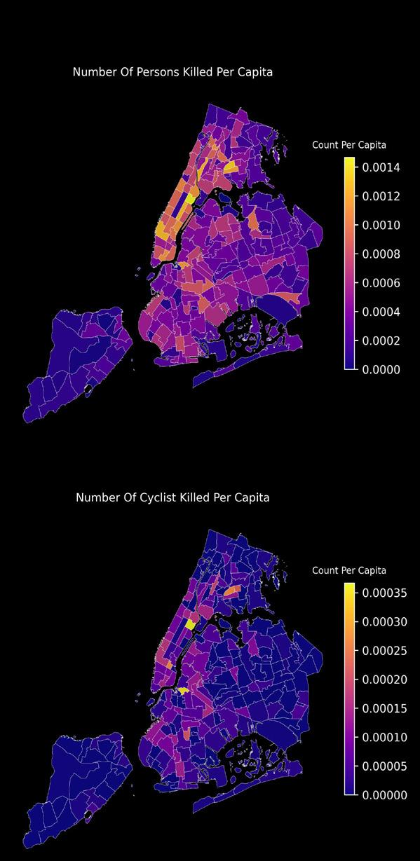
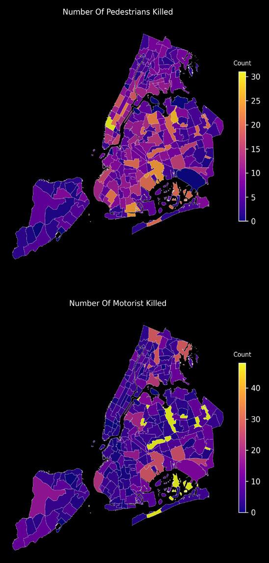
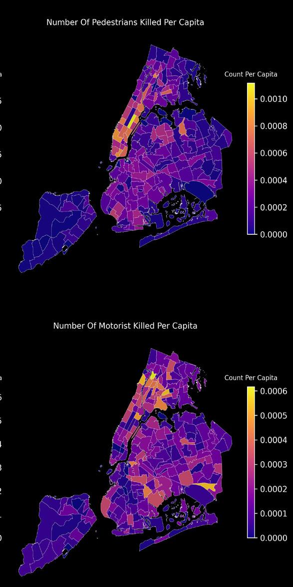
The project also examines how safety concerns, particularly related to traffic accidents, impact the use of micro-mobility options. By combining infrastructure data with safety and demographic information, the analysis highlights gaps in accessibility and identifies underserved areas that could benefit from targeted urban planning interventions.
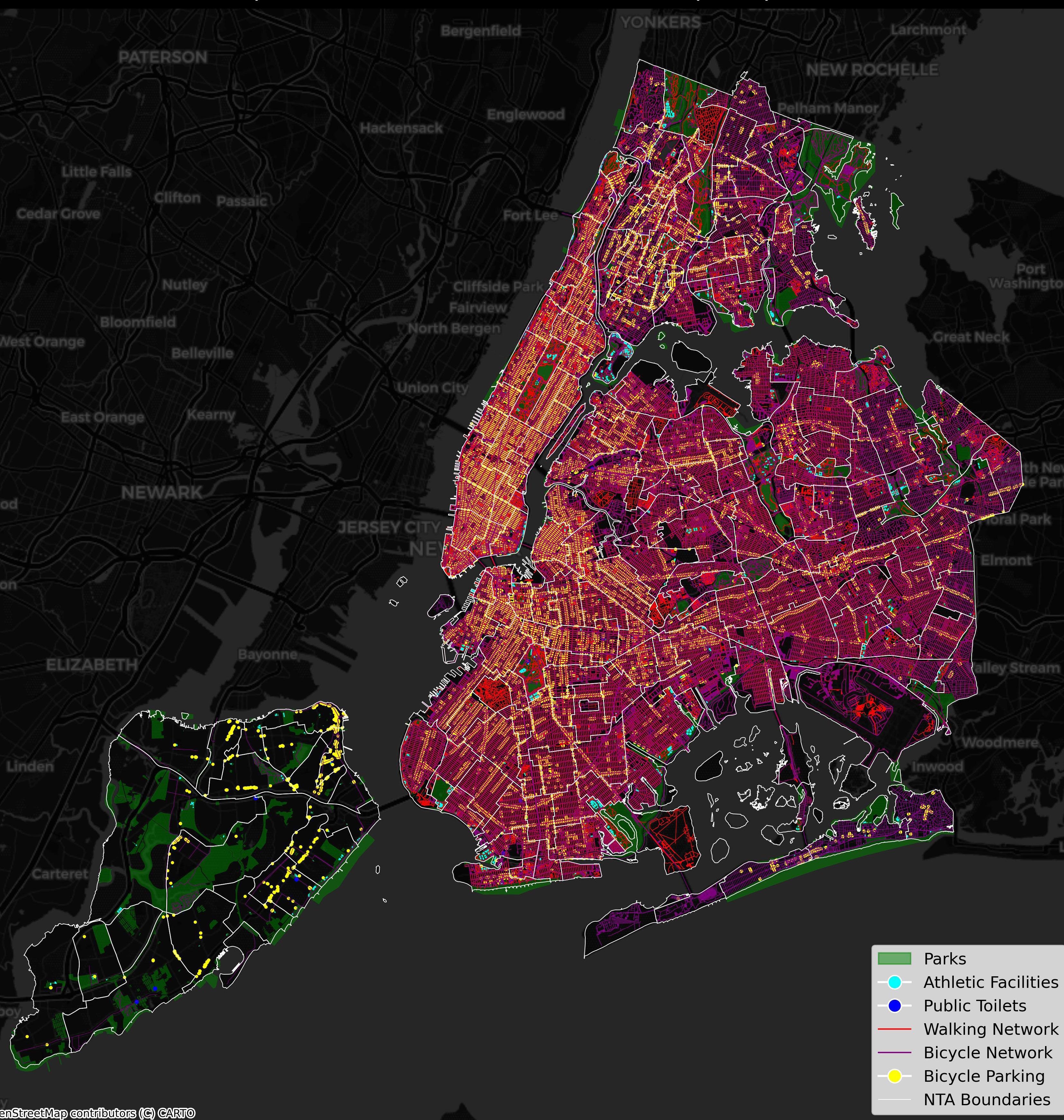
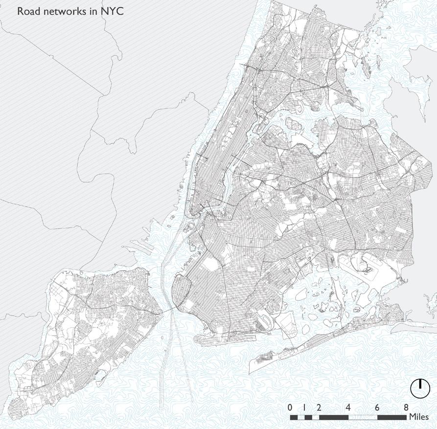
The goal is to provide actionable insights for policymakers, urban planners, and advocacy groups to promote equitable access to micro-mobility options.This study leverages about 10 publicly available data sets, including NYC’s bicycle and pedestrian networks, traffic collision records, and demographic datasets.
Right:
Map of Micromobility Infrastructure in NYC Next Page: Crash Chloropleth by category, Crash Chloropleth Maps Normalised by Population
NYC Parking fines
Social and Spatial relationships
Geographical Information Systems
Guide: Jonathan Stiles, James Pacienti
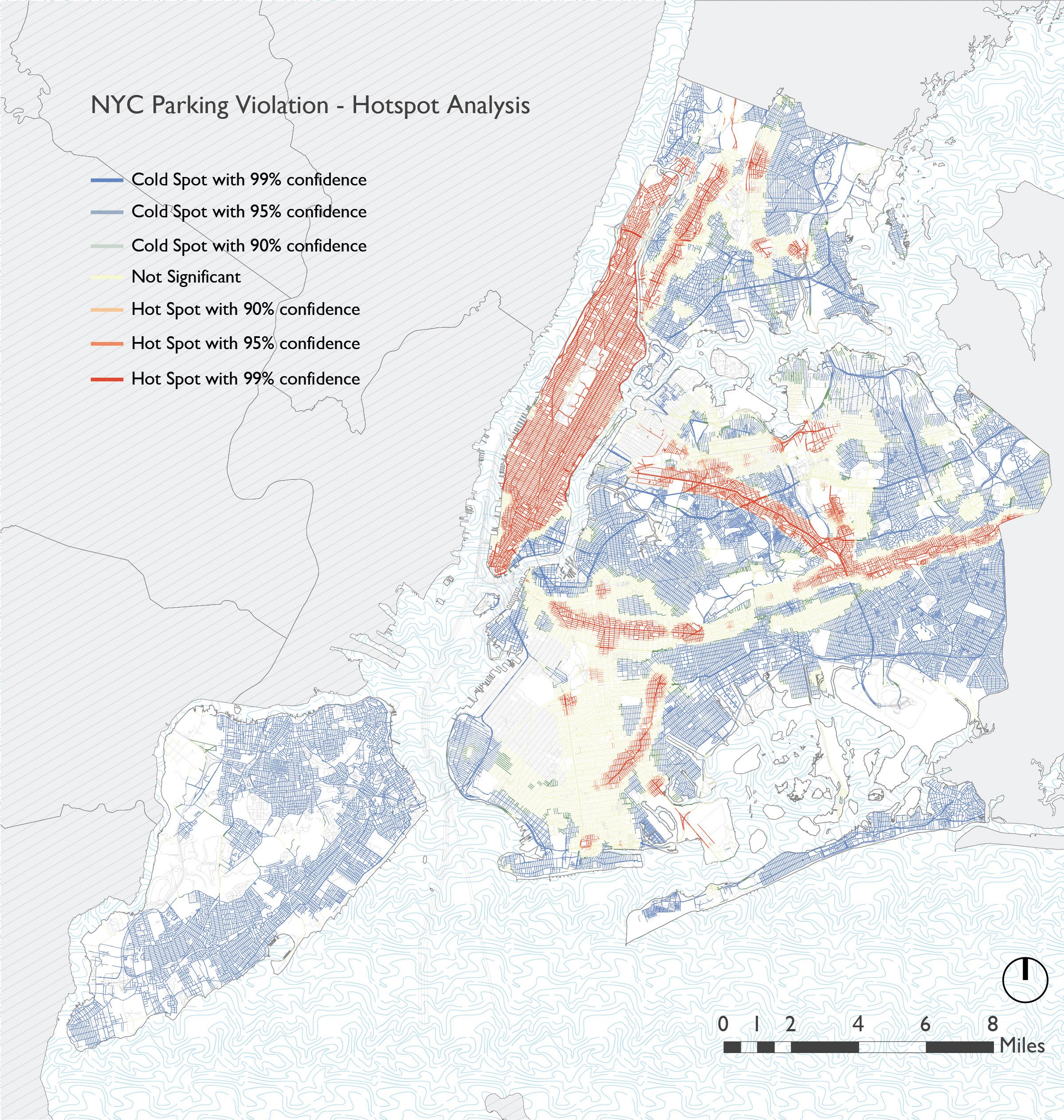
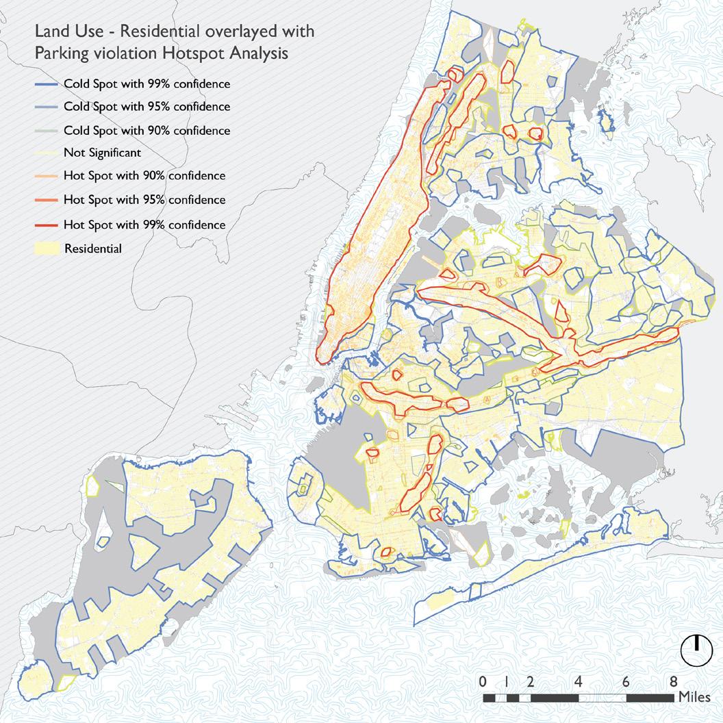
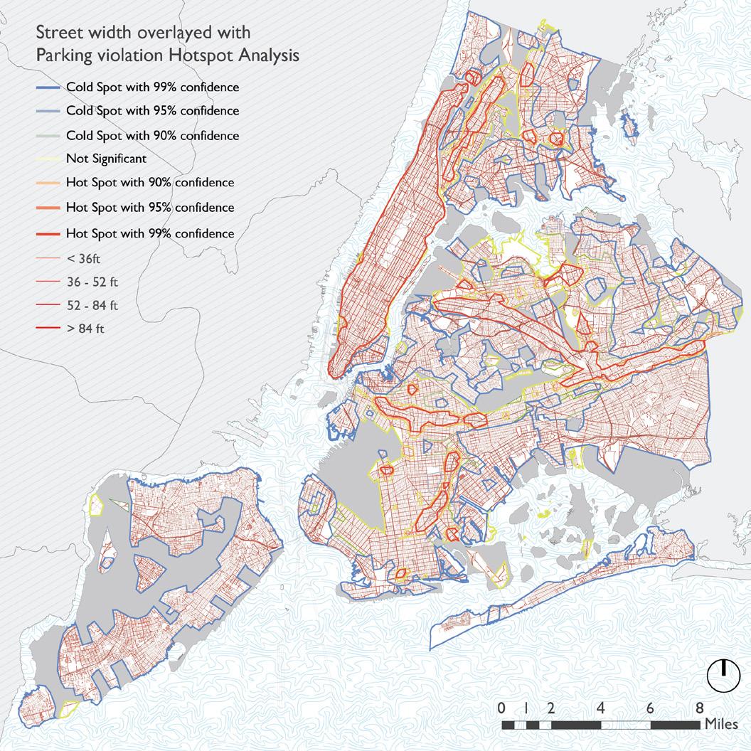
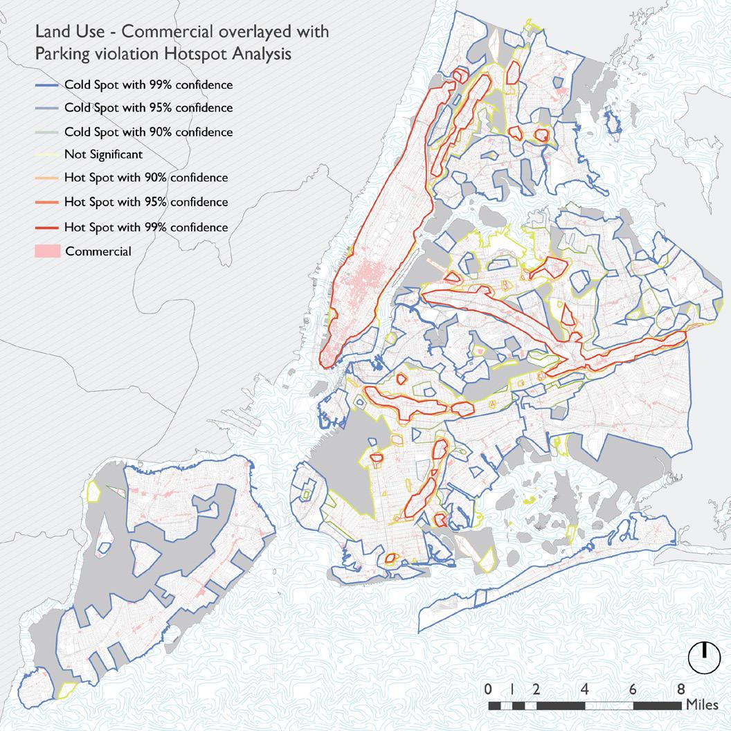
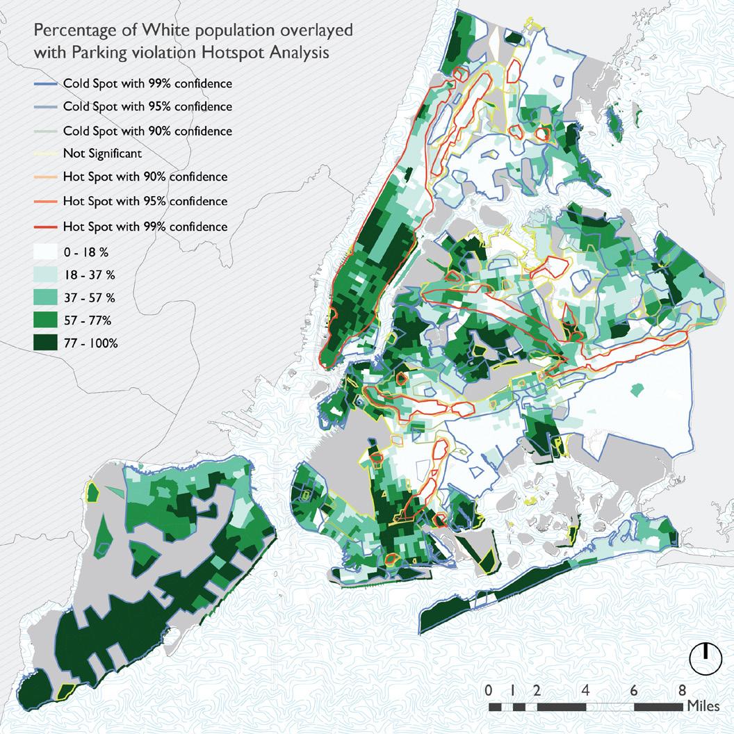
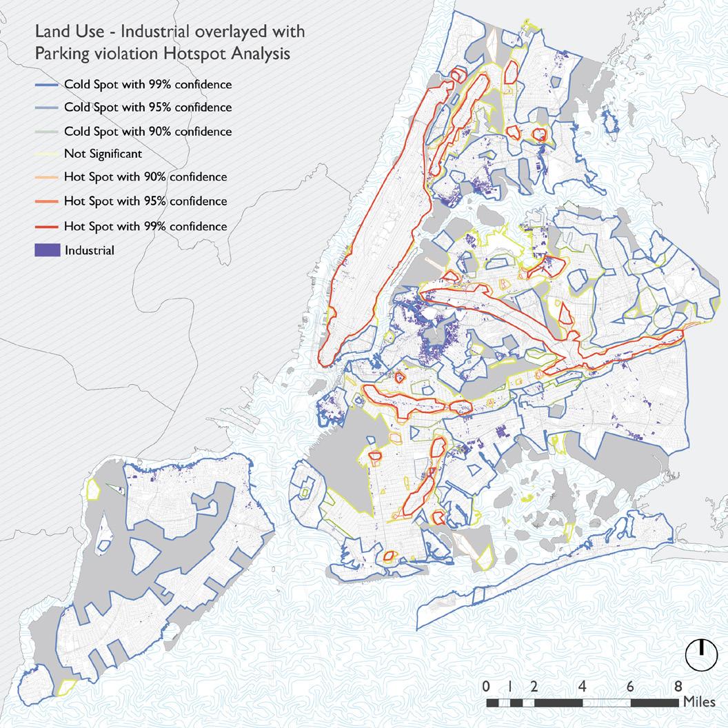
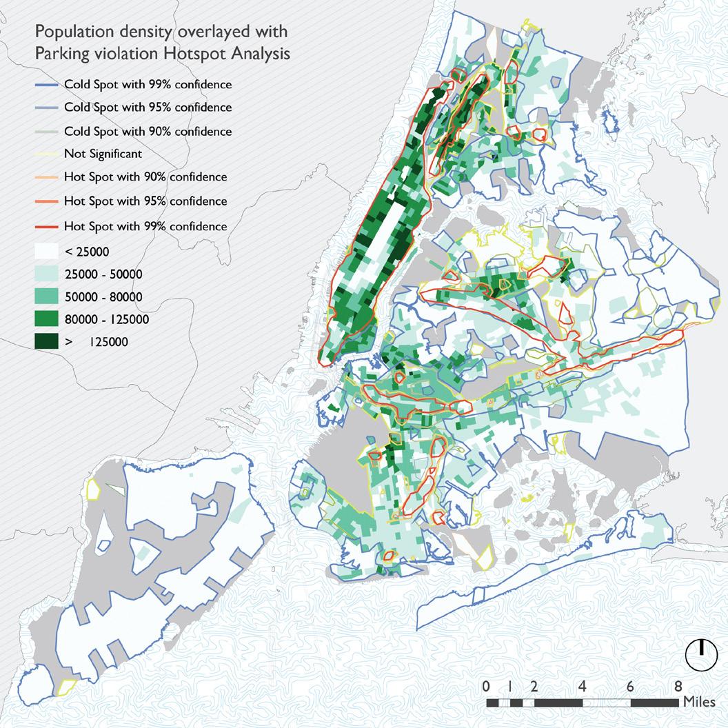
NYC has issued fines totalling over $500 million in 2022. Thew research is interested in understanding if there are any spatial and socio-cultural relationships between the geographic location of the fines and the physical characteristics of the neighbourhood. The parking violation fine data was corelated to census and ACS data to understand if there are any relationships. Linear regeression models were also devleoped to understand these relationships as well. Although the research.
Relationships were developed with Land use (Residential, Commercial and Industrial) as well as population density, race and street width to gain deeper understading of any relationships. The research is not exaustive and did not consider all relevant factors. The granualirity of the data is also not represented accurately as the maps present a surface level analysis of the data.
Right:
A map showing hotspot analysis of Traffic violations in NYC
Between the (subway) lines
Analyzing the Interplay of Different Transportation Systems in New York City
Advanced Spatial Analysis
Collaborators: Wenji Wang, Yang Zhou
Mentor: Jonathan Stiles
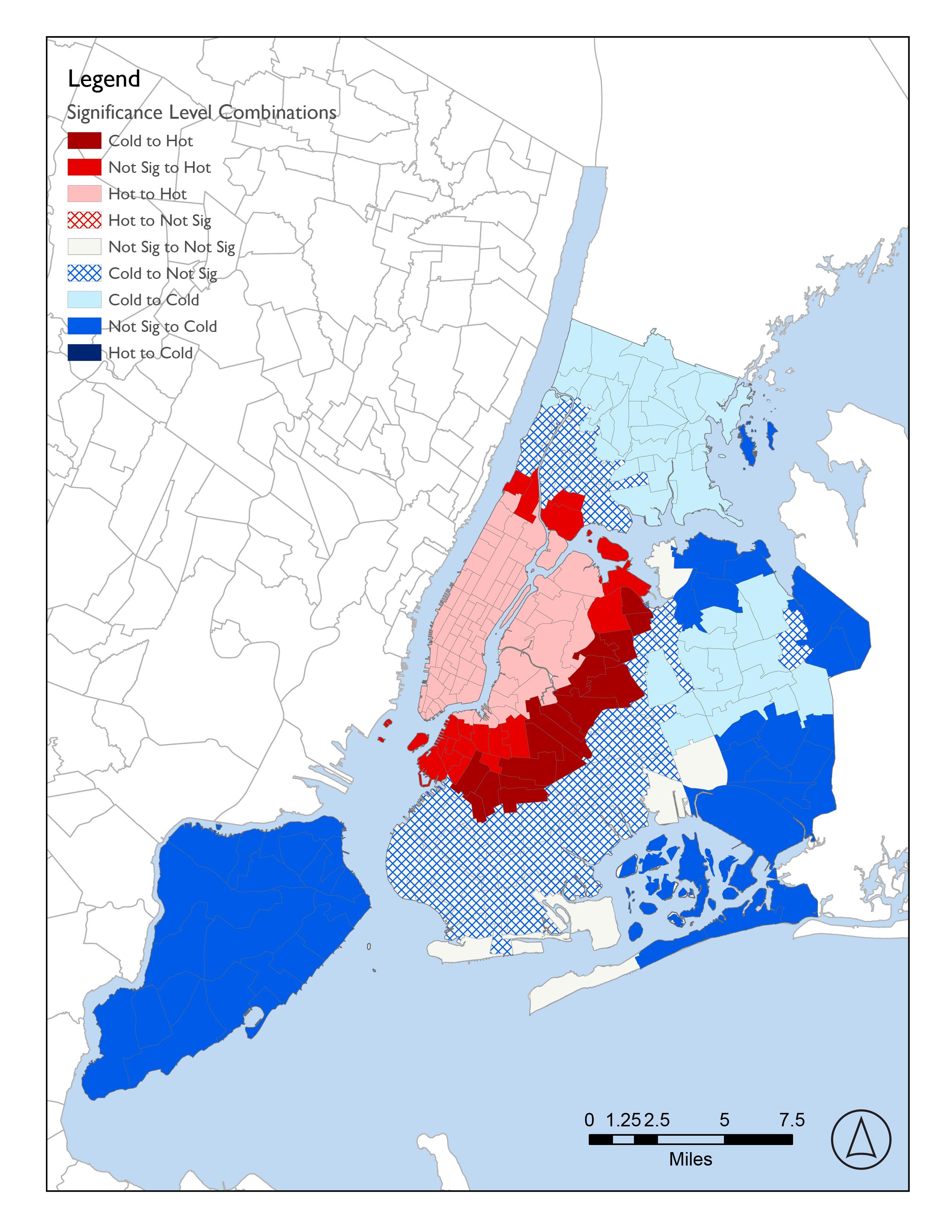
The project investigates the relationship of public transportation and taxi usage in New York City. This is done to understand what are the neighborhoods of oppurtunity to improve public transit use and to provide preliminary area specific recommendations through observational research. This comparative analysis helps undersand which neighborhoods have a higher cab use compared to public transit use. This helps us understand which neighborhoods have oppurtunities for improving public transit use in New York City.
This analysis shows that neighborhoods in the central business district (midtown and downtown manhattan, downtown brooklyn and queens along with long island city) and the outer boroughs are the primary areas of oppurtunity for improving public trasnit use.
The recommendations for these neighborhoods are very different from developing new infrastructure to upgrading infrastructure and increasing capacity in specific neighborhoods.
Right: A map showing comparative hotspot analysis of public transit use and taxi use in NYC
Mumbai, of the people, for the people, by the people Prototyping Urban Technology
Guide: James Pacienti
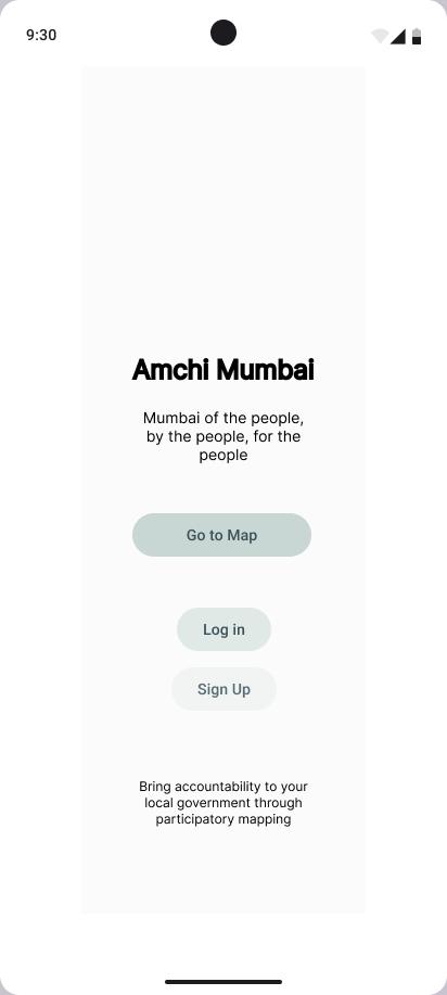
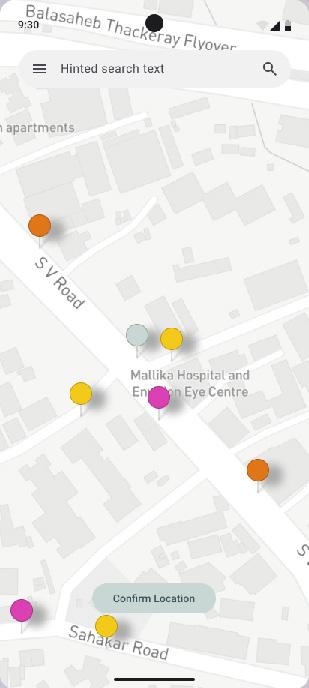
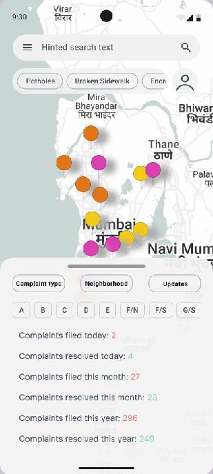
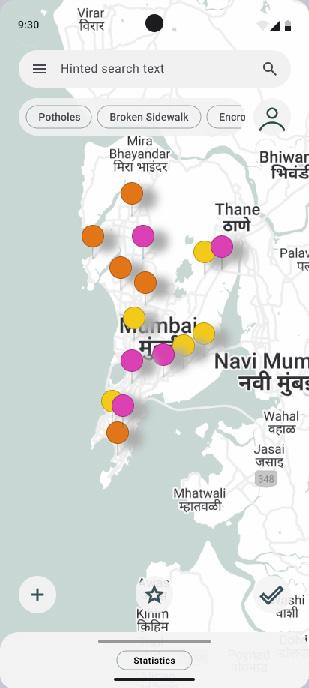
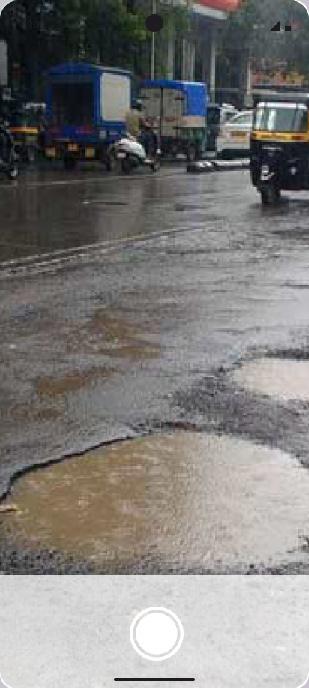
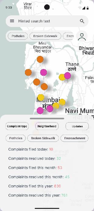
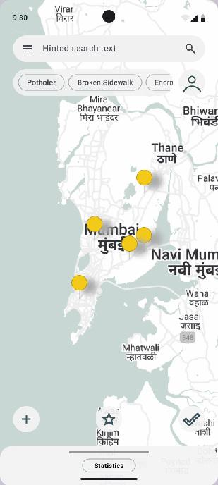
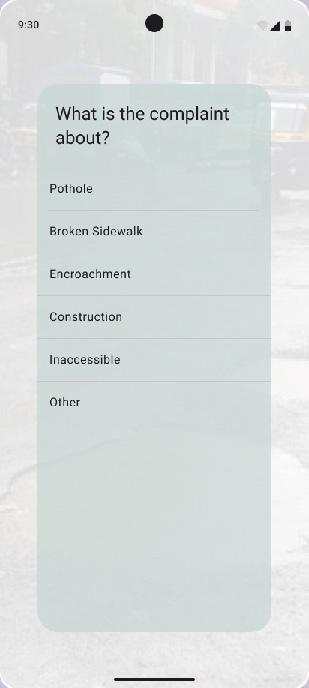
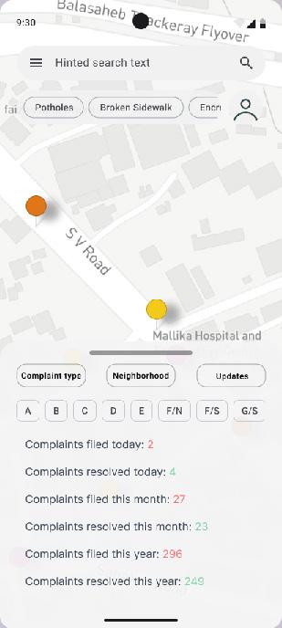
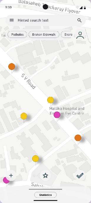
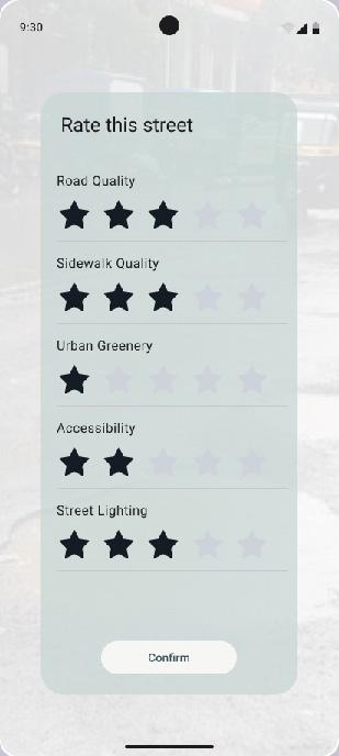
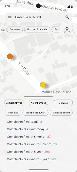
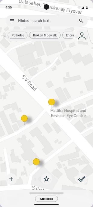
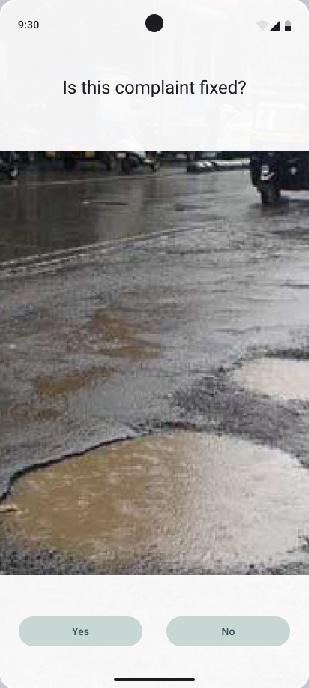
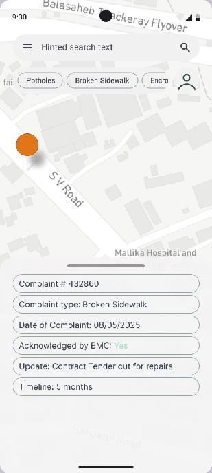
Mumbai has a significant challenge in ensuring accountability for the upkeep of everyday infrastructure. As part of the course, a moblie app along with a web-based platform was prototyped, which uses participtory mapping processes to identiy, verify and rate public infrastrcuture with the intent of having decentralised public accountability to the processes of the state.
The prototype focused on exploring this mechanism for urban mobility infrastructure, including roads, sidewalks, bridges, rail and metro infrastructure. It works through an active collaboration between the government and the public, with the public providing the government with real time information about the state of public mobility infrastructure in each community and verifying the government’s efforts to improve that.
The platform also supports an open data portal to provide information to community members and researchers about the state of mobility infrastructure in the city.
Aamchi Mumbai
Right: Snippets showing functionality of the mobile app
Mentors: Dr. Anita Deshpande, Neelima Ambedkar, Sonam Maske
Stakeholders: Kathiawadi Association, Koli Association, Fishing Association, PUKAR, Local Government
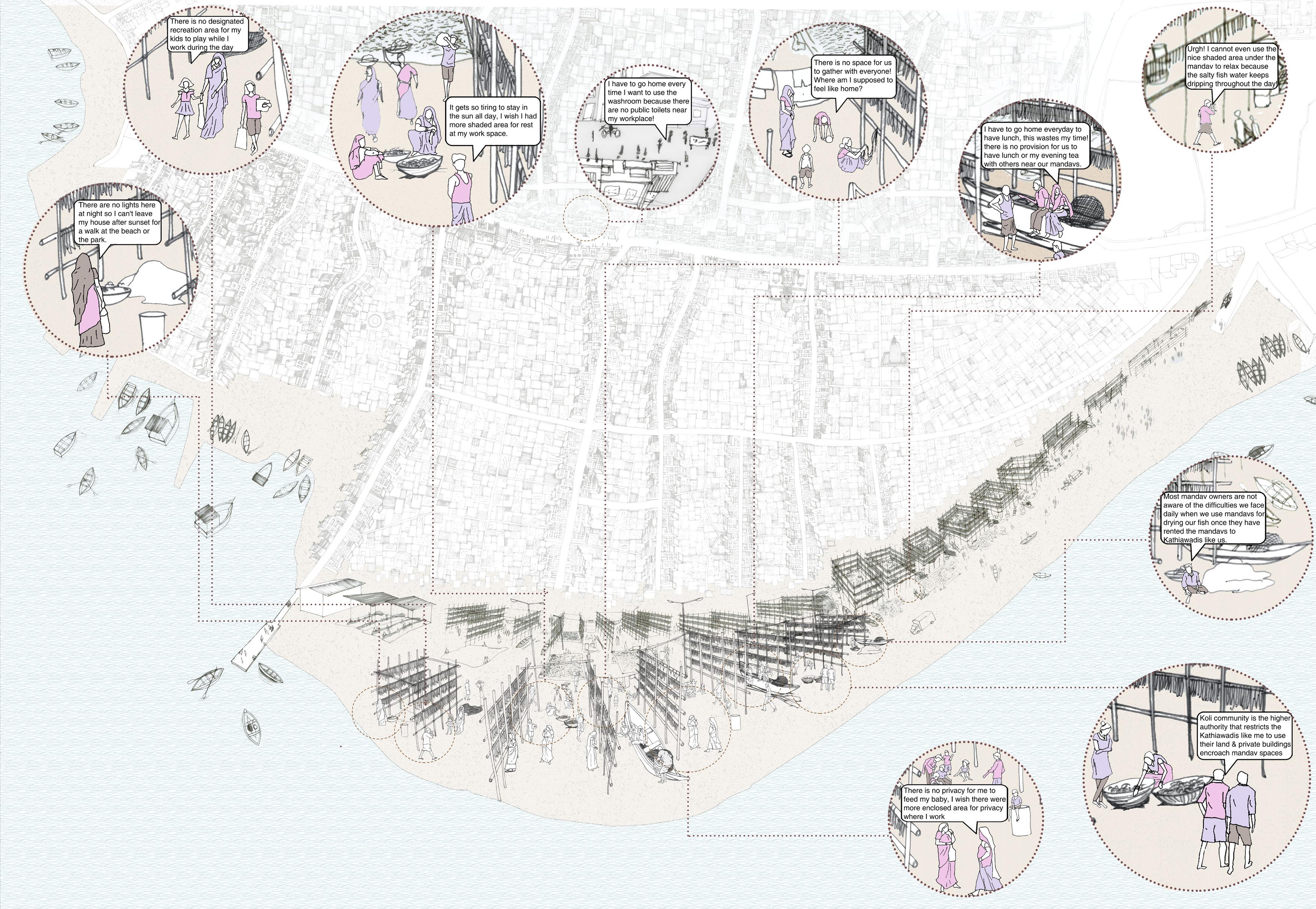
As part of a group of 9 architects interested in understanding Social Resilience, we interacted with the Kathiawadi Community, a marginalized community in an already marginalized fishing community in Versova Koliwada in Mumbai to attempt to understand their concerns and to use our skills as spatial designers and initiate placemaking exercises to explore the interdependencies of the communities living in the Koliwada.
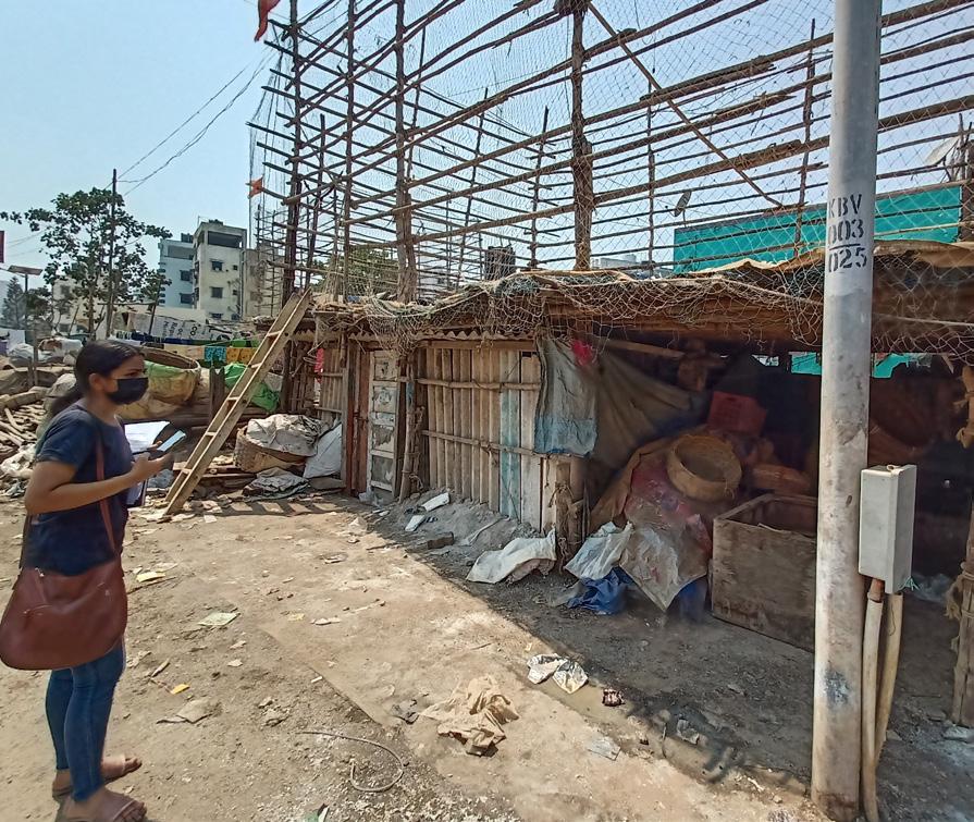
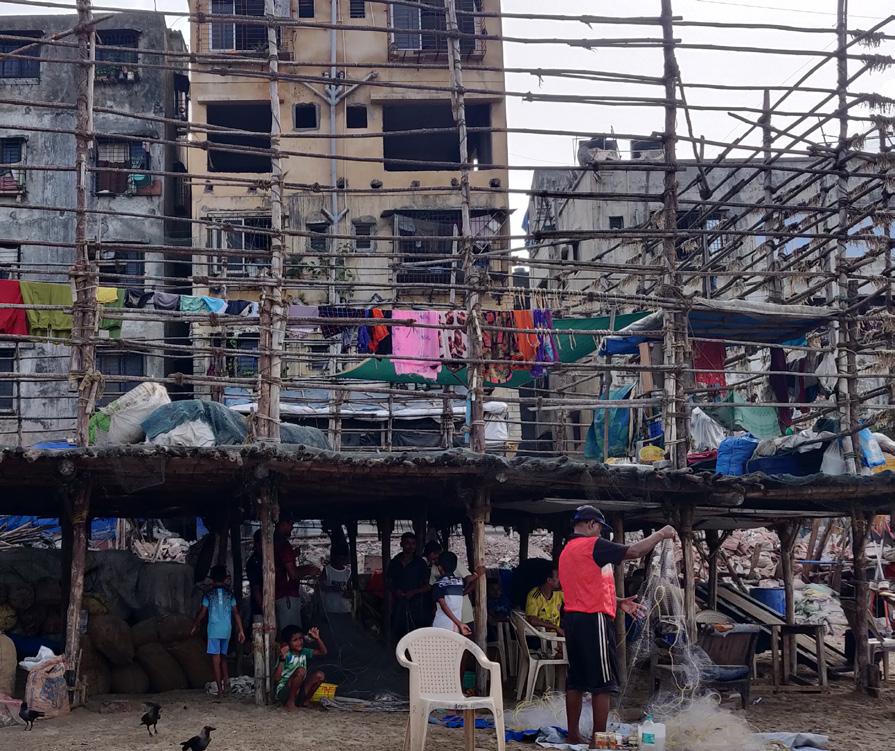
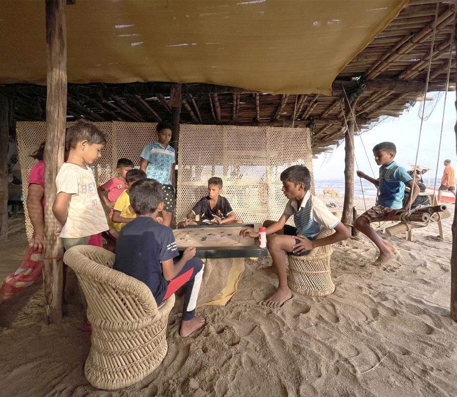
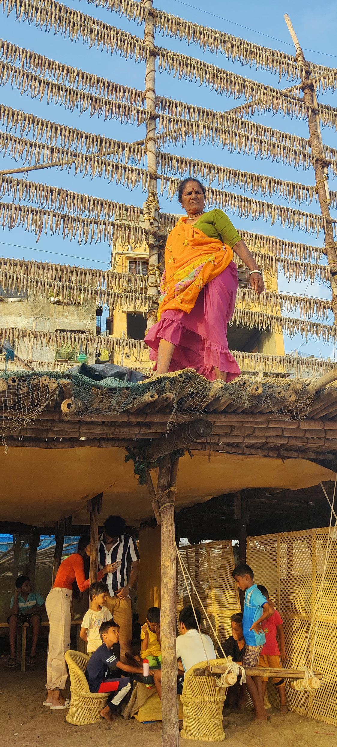
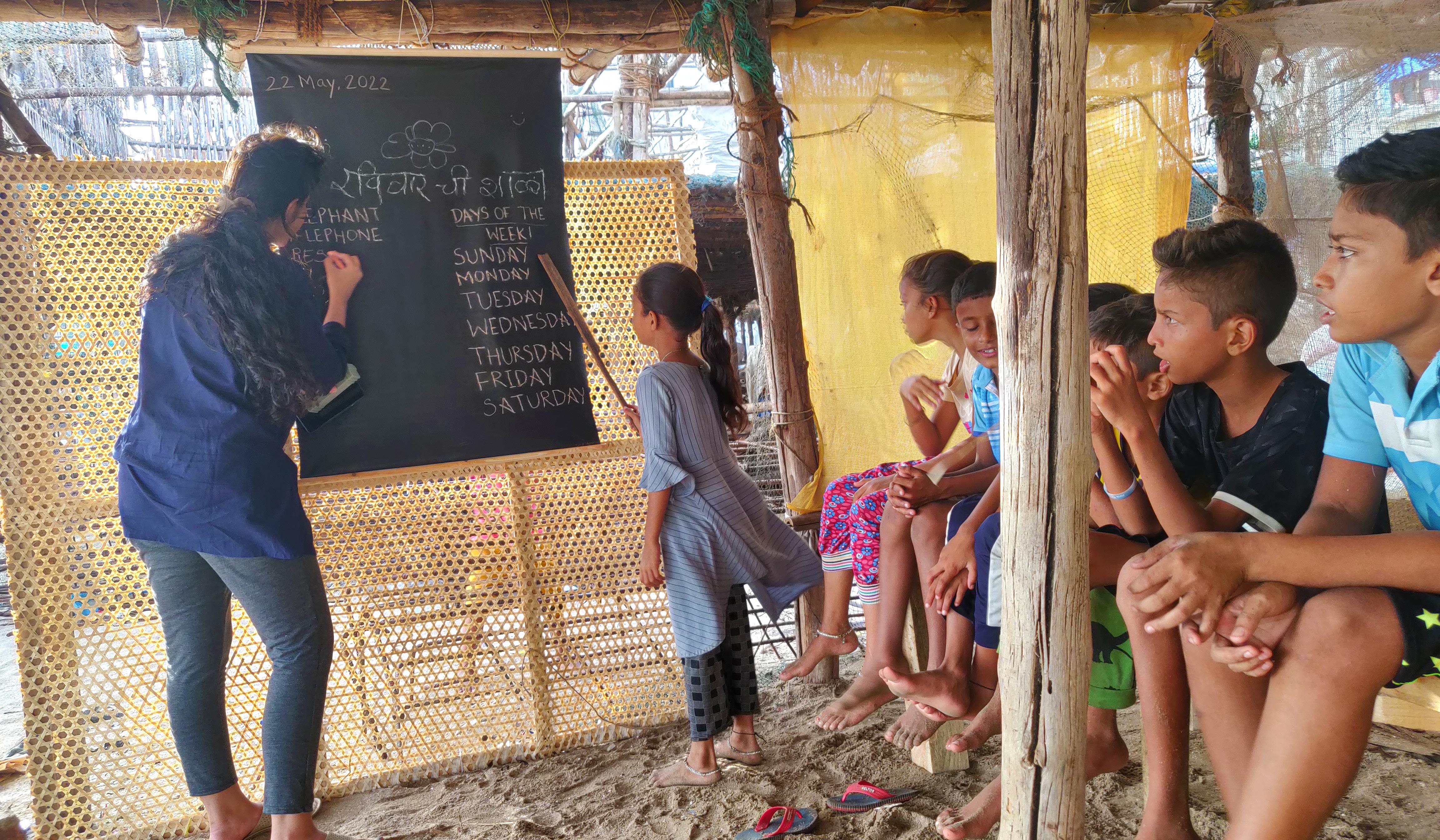
The placemaking exercise was triggered alongside the kathiawadi community within the koliwada. The fish-drying communities use stilted space of bamboo structures called mandavs for their daily work along the Versova beach edge. Thus, these spaces serve as their parcel of livelihood, workplace, leisure, and respite. However, today, they face significant economic, social and cultural vulnerability with the decline of their primary occupation.
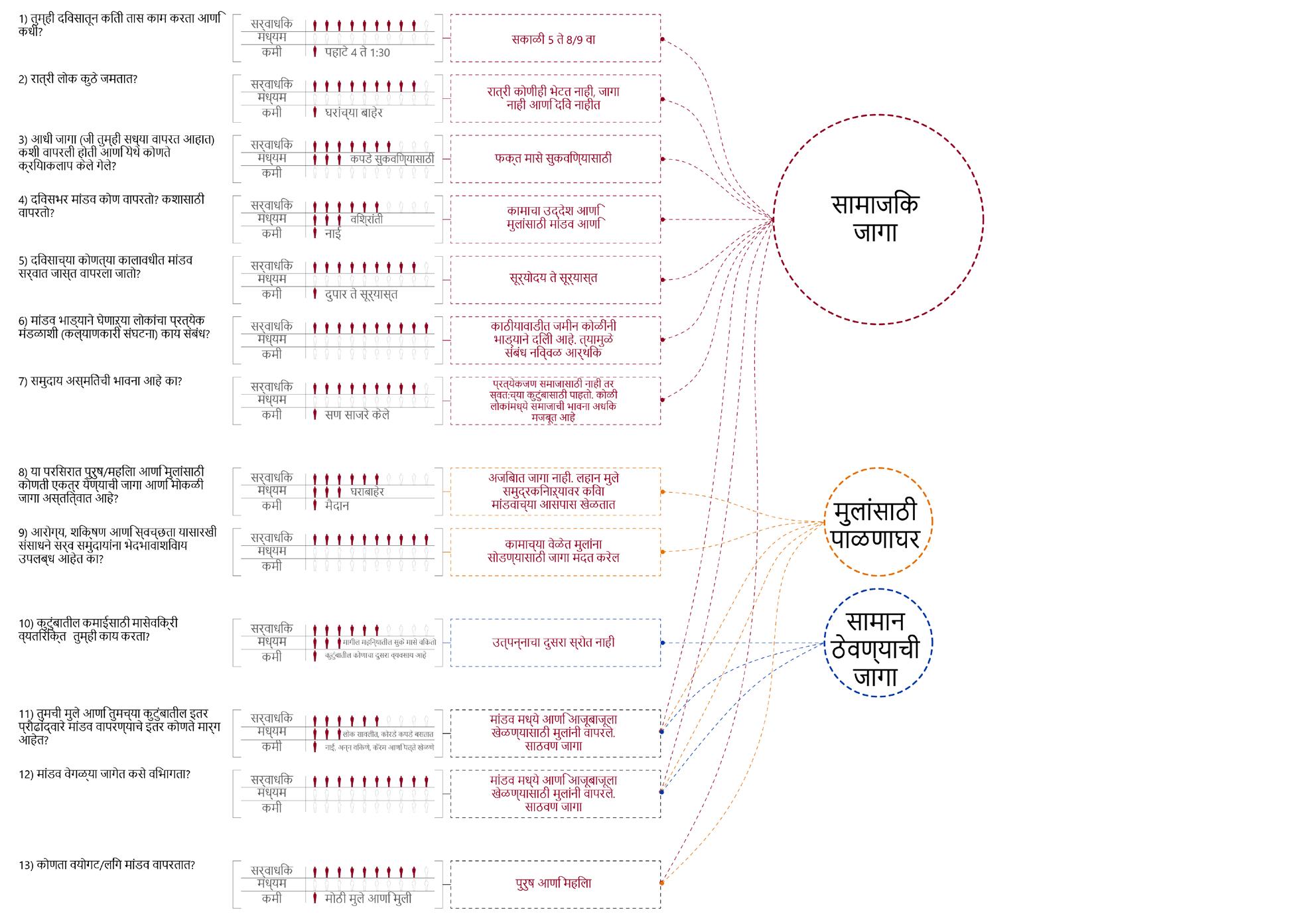
Their problems, concerns, challenges, and aspirations were understood through qualitative research with the kathiawadi and Koli community, which has a significant social, cultural, and economic stake in the region.
These interviews revealed that many people in the study had no space for social recreation after work outside their homes. Only some felt that mandavs
Conducting interviews on Site with the community
Existing space underneath a ‘Mandav’
A diagram showing the inferences made through interviews with the Kathiawadi and Koli communities
were used for functions apart from fish drying, and some also felt that kids use that space to play. Many felt that kids did not have sufficient spaces to play and for adults to relax. Through our research, we understood that these spaces were substantially underutilized and could act as strong social nodes.
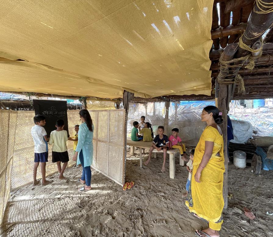
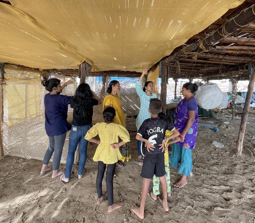
Through this research and its analysis, we developed a kit of parts using local materials to create a flexible framework that allows for opportunities for the community to create flexible spaces and programs. Then we could construct a prototype underneath a stilted mandav to create spaces for rest and recreation. This flexible space was used as a creche, portable school, and game room. The community well received this space.
As architects, through our academic discourse, we understood the importance of using design and placemaking as a tool for the betterment of the community.We have also understood the relationship that architecture has with how communities function through a more hands-on approach which has helped contextualize, much further, a lot of the principles we are taught in our architectural discourse. However, the rigor of research and the nature of relationships with community members required to complete a research project, alongside the necessary ethics and rules that must be followed, was understood in depth throughout this fellowship.
Top to Bottom:
The community space being used by the women and kids of the Kathiawadi community
Right:
The different activites happening above and underneath a ‘mandav’ are shown as a way to understand its importance.
Mumbai Skywalk Project
An Extension of Everyday Life Undergraduate Thesis
Guide: Pinkish Shah
The role of Infrastructure in nation-building is essential, and these projects have a substantial and longterm effect on not only the economics and mobility of the city but also on its sociocultural and environmental fabric. However, in practice, these projects are highly insular to their neighborhoods.
The thesis argues that this singular imagination of such projects within the context of a large urban city should be critically evaluated.
The thesis attempts to look past this singular imagination of Infrastructure through the lens of the Mumbai Skywalk Project.
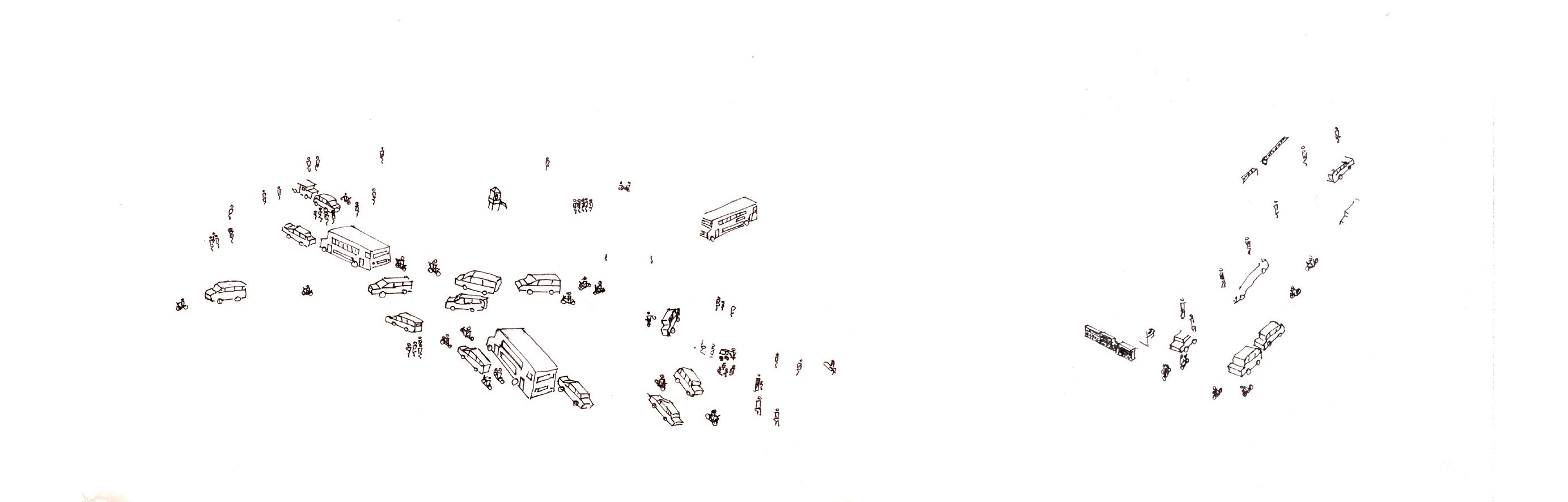
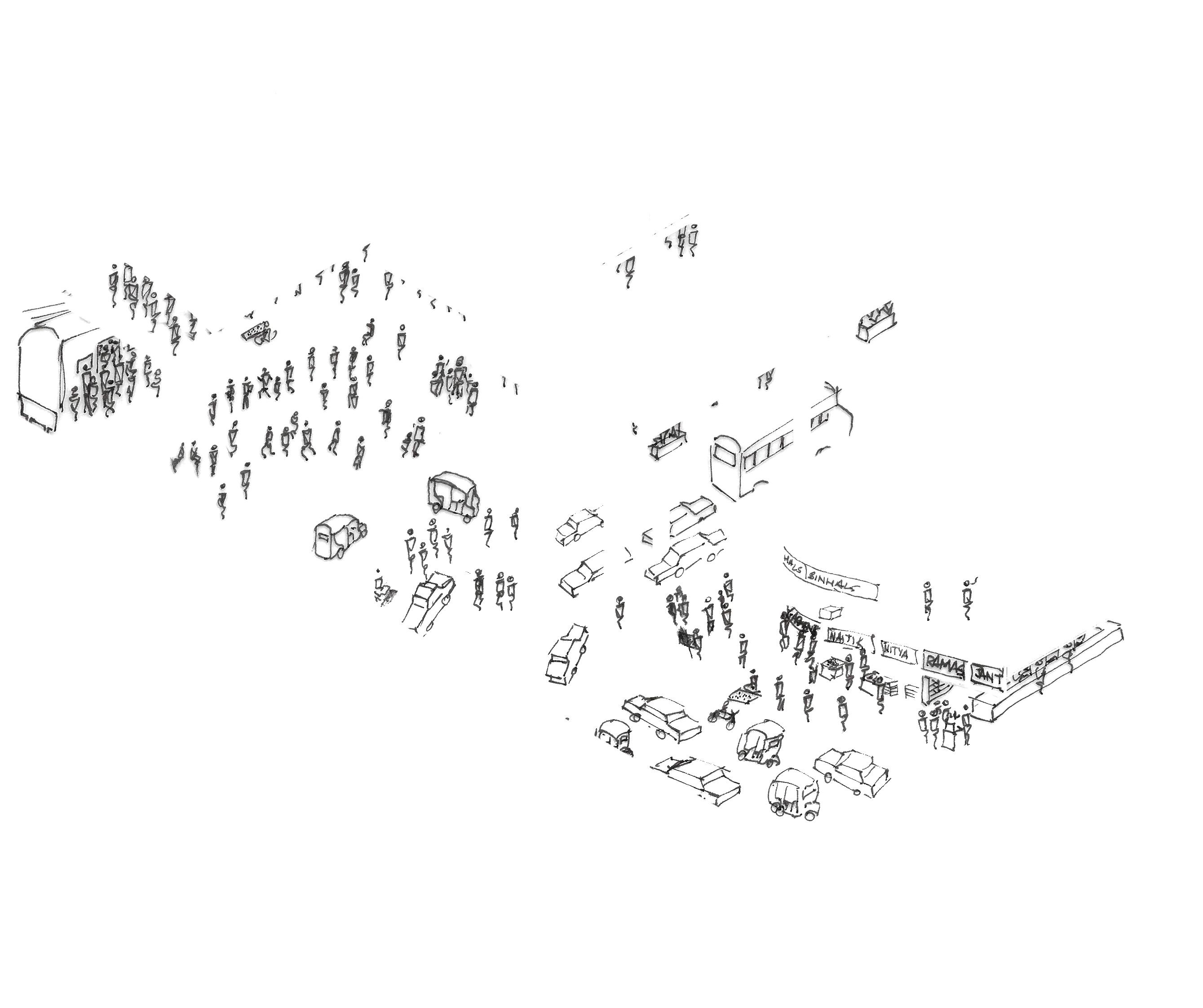
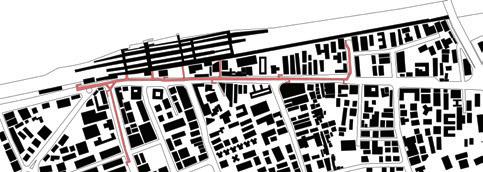
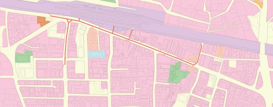
The MMRDA initiated the Mumbai Skywalk Project in 2007, and various organizations have constructed a total of 36 skywalks to date.These ‘skywalks’ connect railway stations to nearby important transportation nodes.
The thesis acknowledges the existence of these projects within their respective neighborhoods. It consciously attempts to carefully analyze these existing artifacts within their respective neighborhoods and provide alternative imaginations of these projects.
Rather than proposing a new system for the project, the thesis works with the existing Skywalks and
Axonometric views showing the relationship of the skywalks within their contexts in Borivali and Grant Road and the ways people interact and negotiate with these inserts.
Right:
works towards their reintegration within their neighborhoods. Through this research, the project works towards generating multi-level urban public space within the neighborhood. It provides alternatives to this singular imagination in the role of Infrastructure and the city.
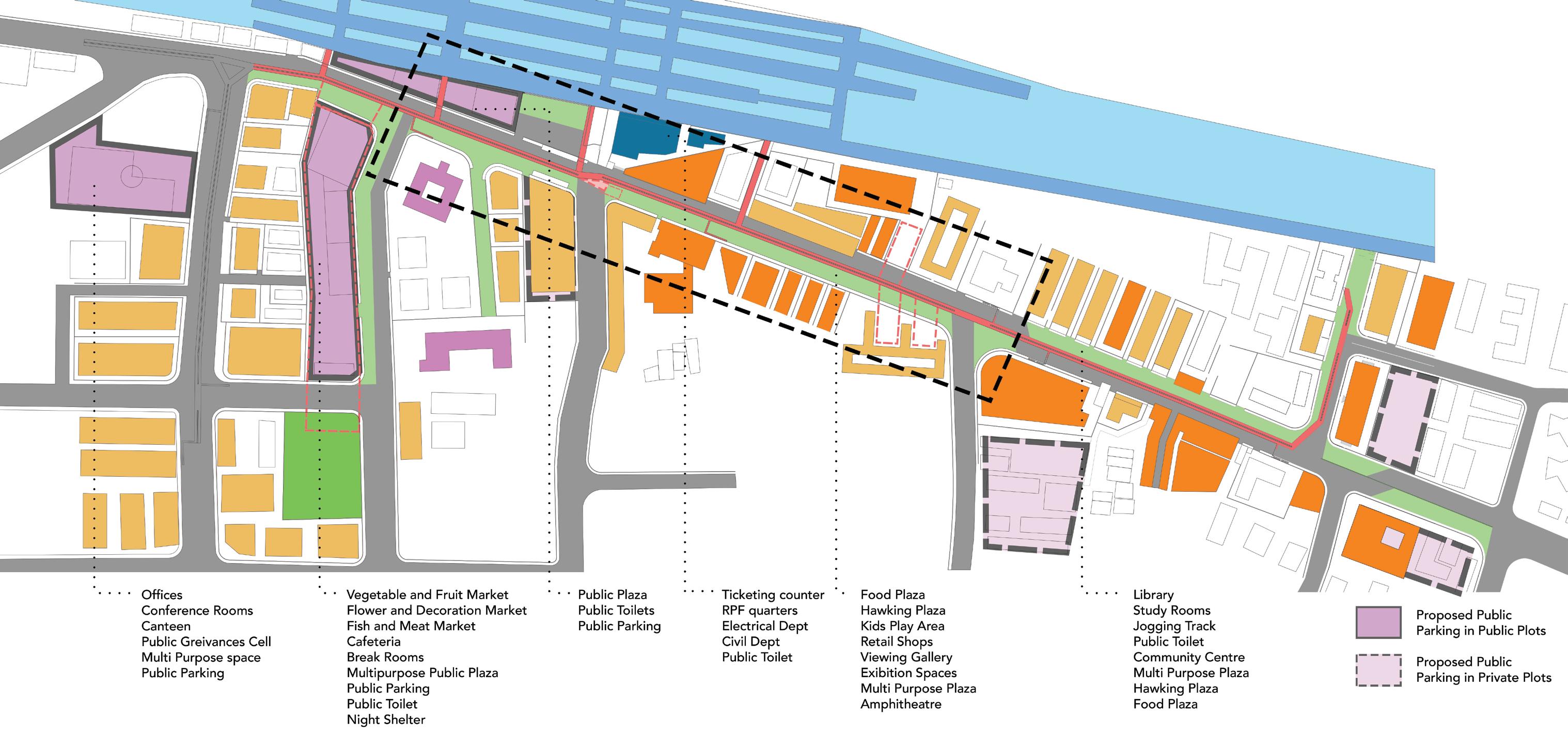
The thesis also ensures that strong programmatic connections are maintained with the community around the project. Developing pedestrian streets and creating urban community spaces attempts to create a social dialogue within the neighborhood.
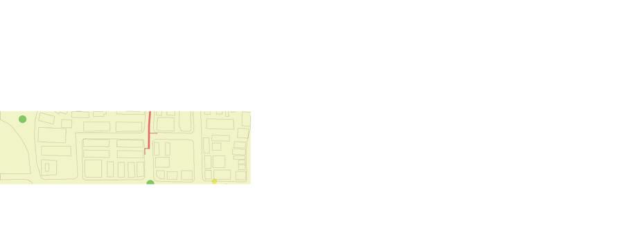
Figure Ground
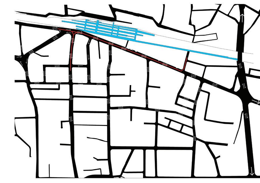
Transportation - Public Transit Movement Contour Plan
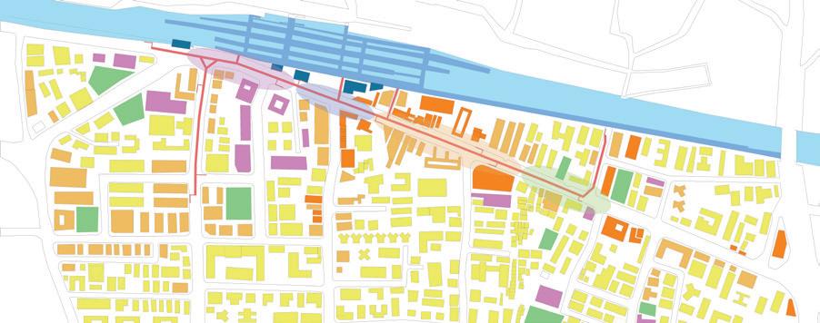
Land Use Plan
Bottom:
Master Plan of Borivali Skywalk redevelopment to promote pedestrian movement and promote multilevel urban plazas with informal and formal business around the skywalk
Transportation - Private Transit Movement Ownership Plan
RMA Architects
High-Rise Luxury Residential Housing in Mumbai
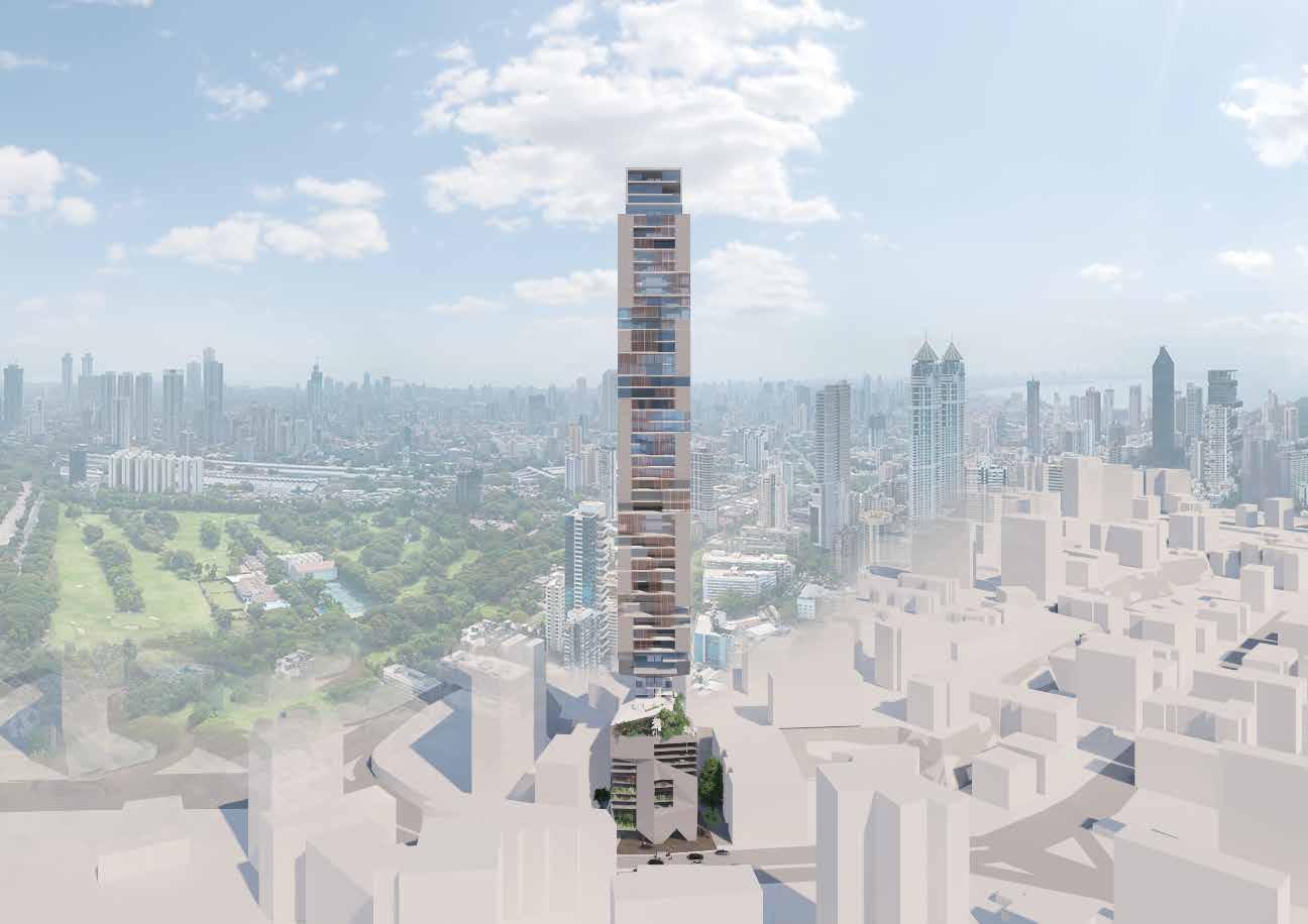
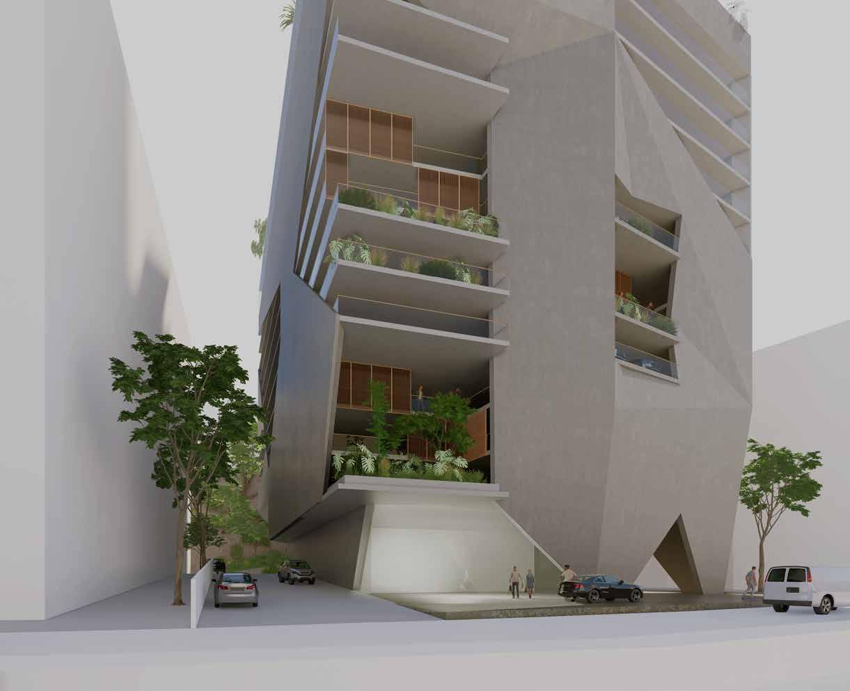
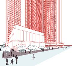
The project attempts to negotiate the Housing policy in Mumbai, primarily the instrument of FSI as a formgeneration tool. The project negotiates the scale of a high-rise building at the street level. It attempts to create a humane environment for not only the people residing in the building but also the service staff and the people who interact with the building from the outside.
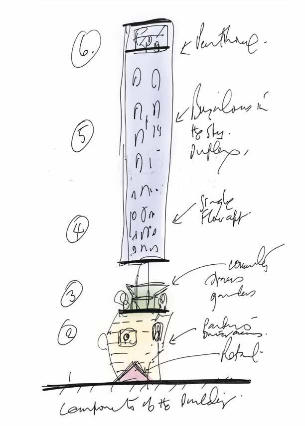
To achieve this, the building is imagined as a set of multiple buildings stacked on each other. Each building has a separate function but simultaneously allows for creating public social space. This is all attempted within the larger frameworks for the FSI regime.
View of podium from street level
Diagram showing the different parts of the building Sketch by Rahul Mehrotra
View of building form
Verma
Architecture Research Assistant
Mentor: Rohan Verma
Housing Policy in Mumbai has gone through several different forms. From the work of the Bombay Improvement Trust to the current Slum Rehabilitation Agency Scheme regime. These housing policies have significantly influenced housing development and its influence on the Social, Cultural, Economic, and Religious aspects of community life. The research attempts to document this through the lens of projects across multiple housing projects constructed across multiple housing policy regimes.
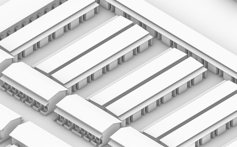
Housing Colony in Lallubhai Compound is a case study of the Slum Rehabilitation Agency (SRA). The project is a case study of develor driven construction of rehabilitaion housing in Mumbai post the liberalisation of the Indian economy which focuses on the economics of housing with complete disregard of quality of life.
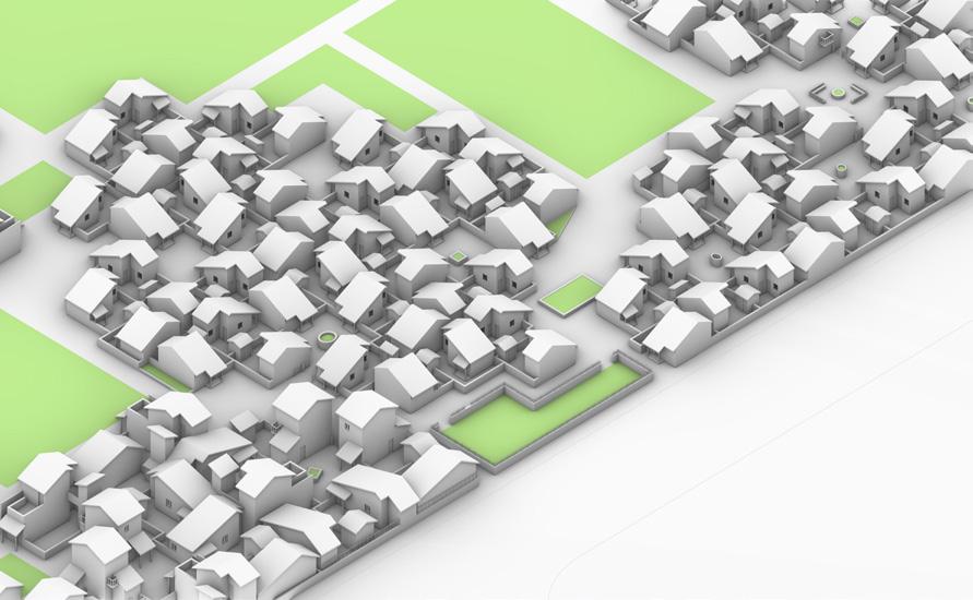
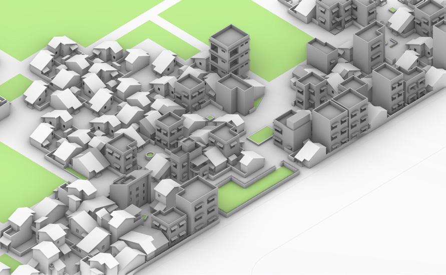
The Site and Services scheme in Charkop, developed under a program by the World Bank, and the Artist Village in Belapur, designed by Charles Correa, are examples of experimental housing schemes in Mumbai developed in MHADA and CIDCO respectively as examples of low-rise high-density housing projects in post independence India pre-liberalization. These projects allowed housing to be incremental, and people could keep building further based on their physical and financial requirements. The community operates within these projects in different ways depending on their form. Each project allows for a specific negotiation in Housing form regarding their in-crementality and shared social spaces.This leads to unique opportunities for Social, Cultural, Economic, and Religious aspects of community life in these Housing schemes.
Belapur housing form after incremental devlopment
Charkop housing form after incremental devlopment
Belapur housing form before incremental development
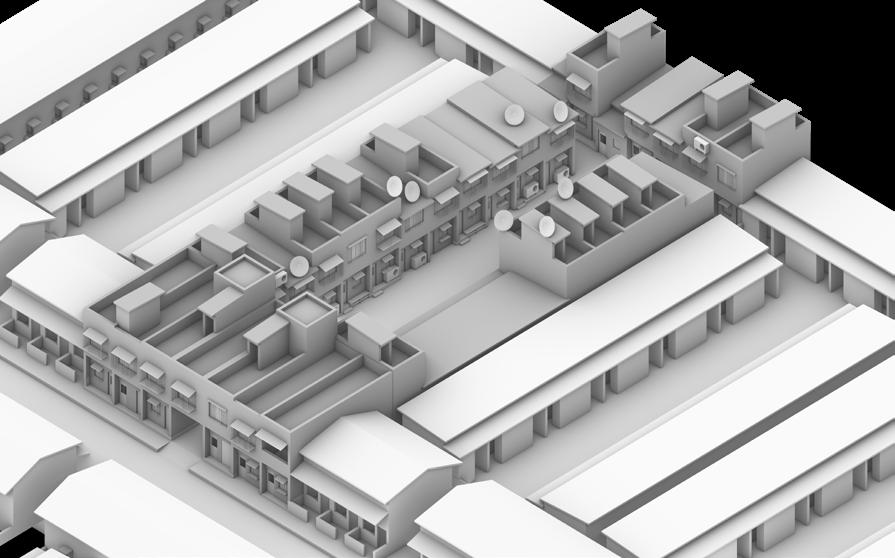
Lallubhai Compound housing form
Charkop housing form before incremental development
The studio intended to understand the spatial consequences of the Development Control Regulations (DCR) in Mumbai and to understand stakeholder negotiation as a means to propose recommendations to improve the spatial qualities of cities. The studio operated on the underlying understanding that each community/neighborhood has a unique stakeholder and priorities and requires unique solutions. Thus, the research was conducted through the lens of specific sites.
BDD chawls in Worli has been one of the earliest experiments of state housing initiated by the Bombay Improvement Trust in the 1920s. By developing a strong understanding of the DCR and identifying critical stakeholders for the site, a series of negotiations were conducted to understand the priorities of each stakeholder. These negotiations became the building blocks to form development. Proposals were developed from the perspective of each stakeholder.
These proposals are imagined as the formal priorities of each stakeholder. Understanding these formal priorities led to a consensus proposal after several negotiations between all stakeholders.The consensus
Demand 1
The design of the project should be done in such a way that it can be constructed using prefabrication construction methods to reduce costs through economies of scale. It will increase the pace of the project and allow for faster project completion.
BMC shall not allow the buildings to go highrise as this technique is unfamiliar in mumbai, and in case of fire the prefab construction dont work as an integrated structural unit
The feasibility of this construction depends on the transportation costs and challenges as the size and nature of the prefabricated units will be limited by the kind of transportation. Also, tenants will only be able to occupy units after the completion of the project as opposed to in-situ construction. The design of the unit and aesthetics should not be compromised because of limitations and reductions in costs as the scale of the project is large and it will serve as an image for the city as a whole.
Demand 2
The Commercial reservation should be leased to the Developer for 20 years to collect any revenue generated from it. 15% of the total project cost will be reduced from the MHADA tender
Mhada and Developer shall also take BMC tender (if floated) for its commercial space requirements for first priority and shall provide space accordingly at ready reckoner rates.
Existing commercial occupants shall be rehabilitated free of cost by MHADA and should be exempted from this policy.
Yes, more commercial and public infrastructure would help in cross subsidizing the development instead of speculative housing.
Guide: Sameep Padora, Vami Koticha,
MHADA BMC Pvt Developer Activist Resident
Right: Discussions were simulated to understand the perspectives of all stakeholers on site.
proposal is an understanding and compromise between all stakeholders for creating a valuable built environment. This system of negotiations through the consensus proposal is an alternate imagination of the urban form where each neighborhood has strong local principles and desires, and the urban form is constantly modified based on the needs and aspirations of the community.
The project did not attempt to create a resolved architectural design but rather engaged in understanding the more extensive stakeholder negotiations that dictate the formation of our built environment.
Shared semi-open space should be provided following the regulations of Refuge floor within the DCR .The Shared semi-open area provided within building line shall be accessible from common passage/ staircase.
Such shared spaces must be given free of FSI given the area is not exceeding 4% of Floor Area. These spaces can be combined between floors to form larger volumes.
Shared semi-open space should be provided following the regulations of Refuge floor within the DCR .The Shared semi-open area provided within building line shall be accessible from common passage / staircase.
They can be used for hosting small gatherings and daily community activities.
Proposals were made to the DCR to allow for the creation of shared community spaces