5 minute read
Driving sustainable and resilient agriculture with Earth Observation

Between geopolitical tensions threatening food supply and environmental issues, agricultural efficiency has been a particular priority for global governments. With the incredible foresight of satellite imagery, we can observe our planet’s surface and make up-to-the-minute conclusions about how best to protect it and help it thrive.
Wendy Carrera, Senior Manager of Digital & European Institutions at Airbus Defense and Space
As the world’s population grows, enhancing the efficiency and resilience of farming becomes increasingly important to our food security. Driven by global warming, the recent increase in extreme weather events (like flooding and drought) has put this under greater threat. And it’s been further compounded by Russia’s invasion of Ukraine – formerly one of the world’s largest grain producers.
While essential to the survival of the human species, agriculture can also be a driver of environmental degradation and deforestation, like in the Amazon, the Congolese, and Indonesian rainforests.
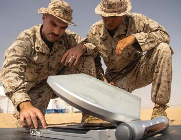
Increasingly, Earth observation is playing a crucial role in helping governments and private companies drive sustainable, resilient, and efficient agriculture by regularly capturing and delivering high-resolution imagery. Today’s commercial satellites can generate detailed images with up to 30cm resolution. What’s more, they boast extremely accurate geolocation – up to 3.5 meters to be precise. Thanks to this, anything spotted on an image can easily be mapped to a corresponding set of coordinates.
Monitoring Crops To Ensure Food Security
In areas of the world where food insecurity is an issue and most farming is done by small-scale producers, satellites can play a crucial role in monitoring domestic food production. The UN’s Food and Agriculture Organization’s (FAO) work in Afghanistan is a prime example of this.
Given the increasing desertification of the country, it’s crucial for an organization like the FAO to monitor irrigated crops like rice, so it can anticipate any shortages. Doing this on the ground is difficult, if not impossible, due to Afghanistan’s remote landscapes, unstable security situation, and small, scattered farming communities.
To solve this problem, the FAO turned to the Pléiades and SPOT satellites (as well as time series based on Sentinel 1, Sentinel 2 and Landsat 8) to gather imagery over seven provinces at key dates throughout the rice growth cycle. Based on these images, it was able to successfully estimate Afghanistan’s rice crop, with an error margin of less than 10 percent.
Democratizing Precision Agriculture
As well as simply monitoring crops, Earth observation can also be used to generate data and insights to help farmers optimize crop yields. As the world’s seventh largest agricultural yielder, the government of Türkiye attempted to do this at scale with an unprecedented monitoring program accessible to all the country’s agriculture stakeholders.
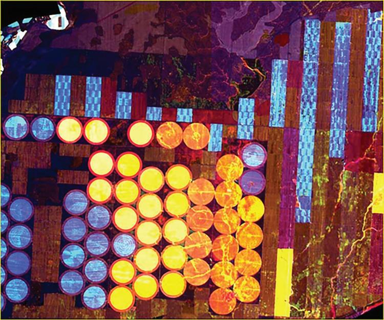
This unique programme, named TARBIL, gathers accurate, up-to-date, and comprehensive satellite imagery from SPOT 6/7 satellites across all production areas during the growing season. Satellite imagery is used in conjunction with ground information, collected by 15,000 sensors spread across the entire country.
Once images are collected, they’re ingested into a cloud-based platform for conversion into solid vegetation maps. Additionally, object-based classification is performed over the data to create level crop type maps and generate cultivated area statistics. These are continuously uploaded to the cloud, where farmers can access them to optimize pesticide, water, and fertilizer use – as well as enabling them to spot problems early. At the same time, the Turkish government can access data to monitor environmental protection, anticipate food shortages, forecast yields, and more.
Preventing Deforestation Caused By Agriculture
Multinational conglomerates in the fashion and FCMG sectors dominate much of global agriculture. Thanks to growing demand for crops like palm oil, cocoa, coffee, cotton, pulp and paper, the same companies are also indirectly responsible for a significant proportion of deforestation.
Most of these crops are sourced from third party suppliers, rather than grown by the conglomerates themselves. As such, it’s been historically difficult for companies to achieve full supply chain transparency and monitor their true environmental impact.
Again, Earth observation can play a crucial role in changing this, with the help of services like Starling, an endto-end digital platform that monitors deforestation. Created by Airbus and global non-profit Earthworm, the Starling online portal combines satellite-derived imagery of forest cover with supply chain data from users. Using both these data sources in tandem, companies can spot deforestation early and engage with suppliers to address the problem, or switch to a more sustainable alternative.
The Starling platform also is frequently used by government entities, like the Ivorian government’s forestry agency, SODEFOR. Thanks to the platform, SODEFOR can better address the pernicious issue of cocoa-driven deforestation. Since farmers initially only clear the forest floor to plant cocoa, with larger trees being felled once crops grow taller, it’s very difficult for authorities to spot this problem early – as it’s literally hidden beneath the tree line.
By using Starling, SODEFOR was able to quickly spot newly planted cocoa and put a stop to deforestation before it happened. How? Starling’s breakthrough technology (based on satellite imagery) can spot forest disturbance below the canopy level – rather than simply at the tree line. As a result, deforestation has decreased by around 60 percent in the Ivory Coast’s Cavally Forest.
Looking forward, Earth observation can play a crucial role in feeding our growing population in a way that also protects our environment.
Success will hinge on public-private sector collaboration, ensuring all stakeholders feel empowered to work with satellite-derived imagery.