architecture and urban design portfolio
Sara Marzio selected works 2019 - 2023
29.05.1998
Italian
Ostuni (BR)
Italy
Born in Ostuni (Apulia), after high school, I decided to move to Turin because I was attracted by the search for independence and the desire to discover the dynamic spirit of city life. This choice has allowed me to take part in some of the most important educational and professional experiences of my career in the world of architecture and urban design: two experiences abroad, learning two new languages, the Young Talents and the Alta Scuola Politecnica programs, the internship experience in Milan. I am passionate person, dedicated to the profession and willing to actively participate in teamwork.
sramarzio@gmail.com
+39 3389655099
WORKING EXPERIENCE
sep 2022 - present
Politecnico di Torino
As a teaching assistant, I worked in conjunction with tutors to organise lectures and materials over two courses in the fields of architecture and urban design.
mar 2022 - ago 2022
Stefano Boeri Architetti
I carried out two months of internship and four months of work collaboration at the firm, dealing with urban planning issues along the coast of Albania.

jun 2021 - oct 2022
Autostrada del Brennero S.p.A
I worked as a research student for the realisation of a systematic project for the A22 motorway and its service areas.
EDUCATION
sep 2020 - feb 2023
Alta Scuola Politecnica
School for high achieving students. Additional advanced multidisciplinary program for Architects, Urban Planners and Designers, parallel to the Master’s degree.
sep 2020 - feb 2023
Politecnico di Torino
Master’s degree in Architecture for the Sustainability Design.
oct 2017 - sep 2020
_grade 110 cum laude / 110
_meritorious thesis title
Politecnico di Torino
Bachelor’s degree in Science of Architecture.
2012 - 2017
Liceo Classico A. Calamo
School diploma in classical studies
_grade 110 / 110
_grade 97 / 100
Sara Marzio
architect // urban designer
INTERNATIONAL EXPERIENCES
sep 2021 - feb 2022
Universidad Politécnica (ETSAM)
Erasmus program of six months at the Escuela Técnica Superior de Arquitectura de Madrid, with lectures held entirely in Spanish.
feb 2020 - jul 2020
Universitat Rovira i Virgili (ETSA)
EU / YOUNG TALENTS program of six months at the Escuela Técnica Superior de Arquitectura in Tarragona, with lectures held entirely in Spanish and Catalan.
jul 2017 - ago 2017
Universidad de Málaga
Summer Spanish course of one month held by the University.
jun 2017 - jul 2017
University of Bath
Summer English course of one month held by the University.
DIPLOMAS AND CERTIFICATIONS
Alta Scuola Politecnica diploma
High achieving students diploma obtained during Master’s degree from Politecnico di Torino and Politecnico di Milano.
Young Talents diploma
High achieving students diploma obtained during Bachelor’s degree from Politecnico di Torino.
IELTS 7.5 - level C1
English language level certification obtained after IELTS examination.
SOFTWARE SKILLS
Autocad
Photoshop
Illustrator
Indesign
Archicad
Rhino
LANGUAGES
Italian native language
Qgis
Ms Office Sketchup
Cloud Compare
Cinema 4D Grasshopper
English professional knowledge Spanish limited work knowledge
INTERESTS
art photography cinema music sustainability graphic design
VALUES
punctuality sinergy and cooperation ecological awareness loyalty passion
Master’s final thesis // MENTION AS MERITORIOUS THESIS
year 2022 - 2023
Province of Lecce
AGRO-SYNAPSIS
strategic scenarios for territorial regeneration from Leverano to Porto Cesareo
Speaking of ‘agricultural synapses’ means starting from the key assumption that agriculture, especially in some specific territorial areas, not only plays a pivotal role in terms of productivity and income, environmental and social externalities and urban development, but is also potentially the bearer of synergies between spheres and multidisciplinary realities. The aim of the thesis is thus bidirectional: on the one hand, it attempts to rediscover and deepen the direct and latent connections that unite the field of rurality with the contemporary city, and on the other hand, it promotes territorial regeneration, starting from the emerging environmental and climatic fragilities underway. And it is precisely with the latter that the research area is grafted, in a place, Salento, where a bacterium such as Xylella Fastidiosa has disfigured the olive-growing landscape, generating a productive, social and spatial quality crisis. The AGRO-SYNAPSIS project aims to mend this rupture by creating synapses between production and innovation, rural and urban worlds, owners and farmers, and by restoring an overall image in which agro-environmental and spatial experimentation is the key element for the connection of the various parts that make up the area examined.
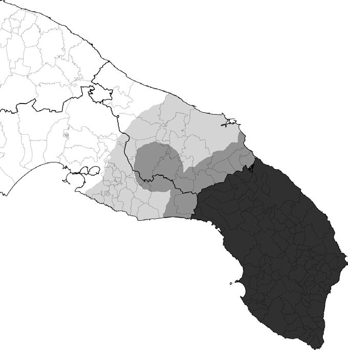
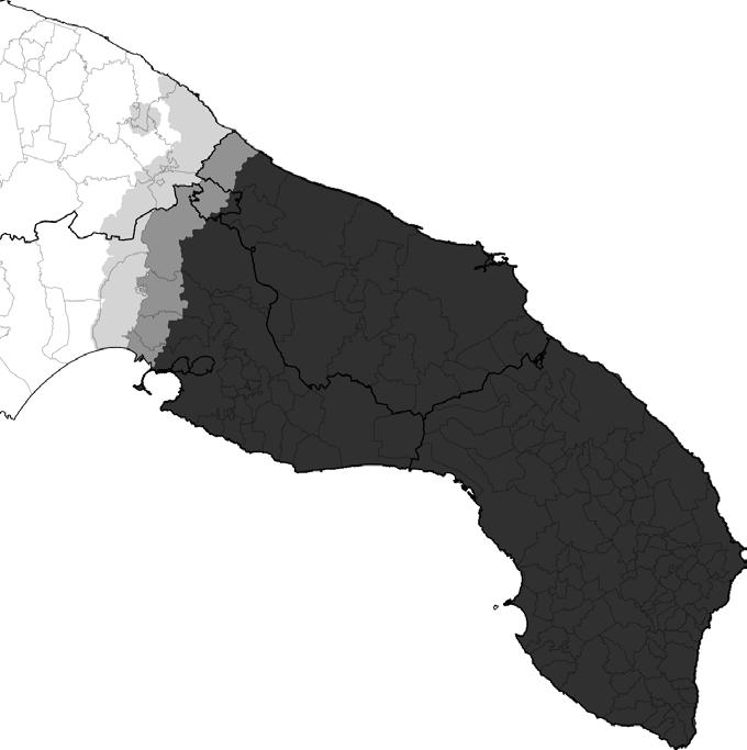
Xylella Fastidiosa is a bacterial plant pathogen transmitted by insect vectors that feed on the xylematic lymph, the main function of which lies in the transport of water from the roots to the leaves: when the bacteria colonise a plant, the xylematic vessels are thus clogged, giving rise to the processes of infection and decay. The first detection of the bacterium occurred on Apulian olive trees in the Salento area in October 2013, leading to the first report of Xylella in the European Union.
year 2022 year 2015 buffer zone buffer zone infected area infected area containment zone monitoring zone
THE PROGRESSION OF XYLELLA FASTIDIOSA
1
AGRO-SYNAPSIS Apulia, Italy
TERRITORIAL FRAMEWORK FROM LEVERANO TO PORTO CESAREO SALENTO TERRITORY
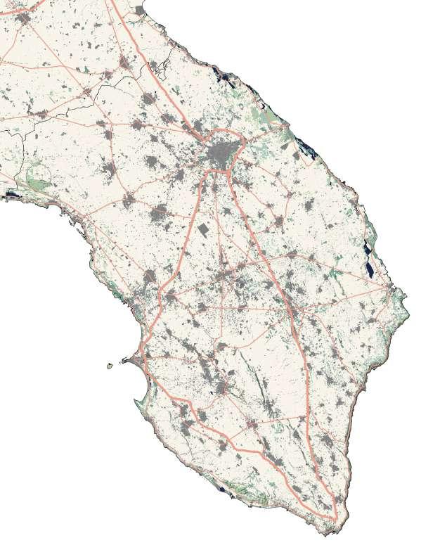
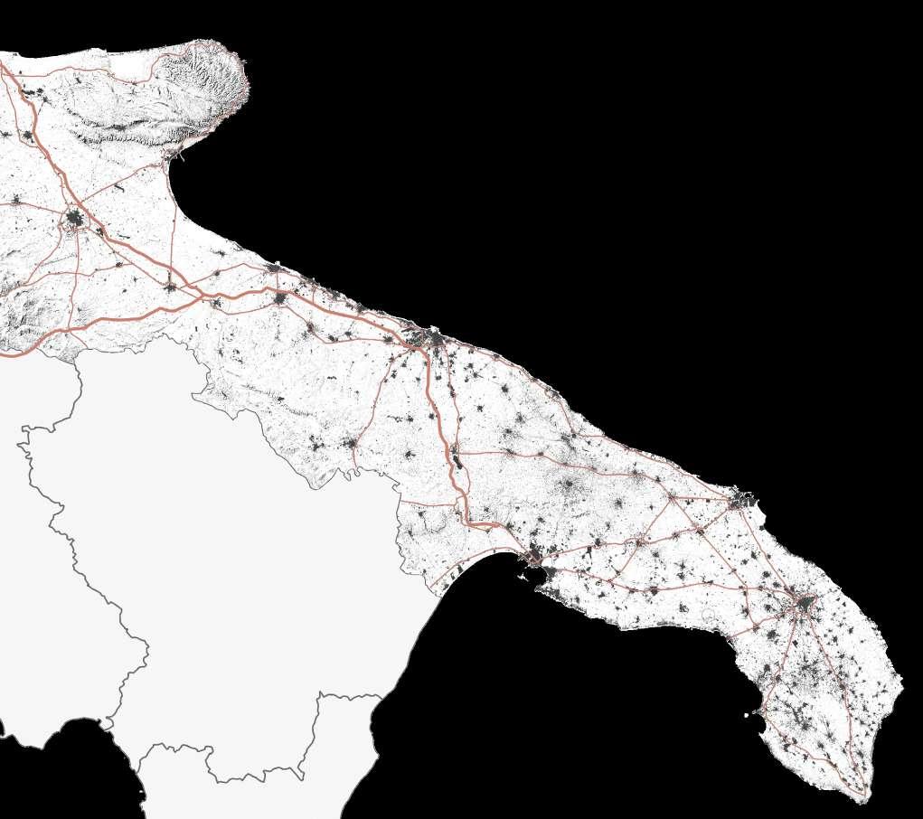
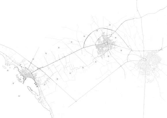
The settlement forms of the Apulian and, specifically, Salento territory have always reflected a way of life divided between urban concentration, within the small historic villages, whose expansion has often occurred in a disorderly and unregulated manner and rural diffusion, manifested by the extensive building heritage of masserie, trulli and country houses present in the landscape. These characteristics are inseparably linked to another key aspect, the agricultural production vocation, which, although with a strong landscape heterogeneity, is revealed extensively throughout the territory, presenting some unifying elements: from the arable and wine-growing sectors to traditional olive-growing.
WORKSITE
0 10km
wetlands and waters
wooded areas
natural green areas
pasture areas
beaches and dunes
cultivated surfaces

urban fabric
motorways
main roads
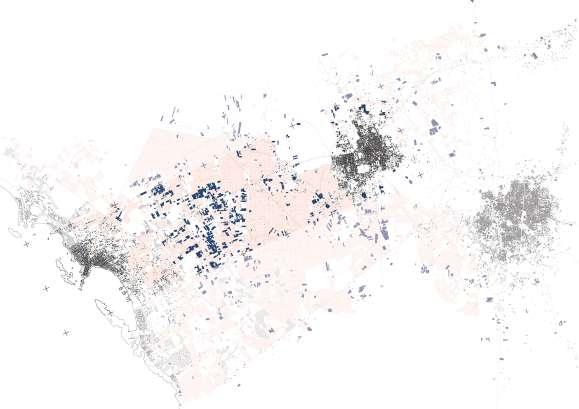
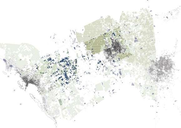
In relation to the subject of cultivated and natural landscape, the territory unfortunately presents a large gap: while on the one hand, agricultural areas compose a mosaic of arable and wine-growing crops, on the other hand, wooded areas are in a clear minority, also and above all as a result of the serious effects of Xylella and the drying up of olive groves. This, together with a vulnerability of the soil to flooding events and saline contamination, represent the main fragilities to be considered in the overall planning.
APULIAN REGION
0 20km
urban fabric
motorways
main roads
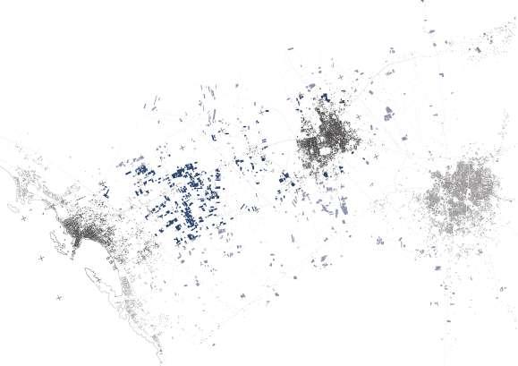
settlements and infrastructure
greenhouses for horticulture and floriculture
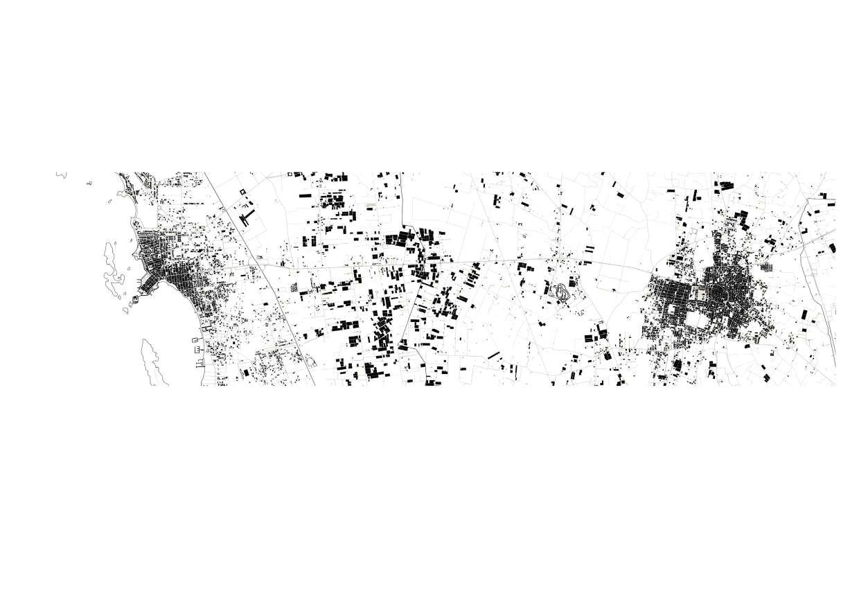
a territory made of greenhouses between vineyards, arable land and residual nature
arable areas
vineyards
wooded areas
greenhouses
the layers of viability

main roads
secondary roads
unpaved roads
railway line
the threat of Xylella
areas occupied by olive groves, infected by Xylella bacteria
pasture and uncultivated areas
greenhouses
Foggia BAT Bari
Brindisi Lecce Lecce Taranto
WORKSITE
EXPANSION OF NATURALITY AND ‘AGRICULTURALISATION’ OF THE URBAN TISSUE
with the aim of promoting urban resilience practices (Nature based Solutions) and the spread of naturalness through widespread greening, and to find a course of action for the management of urban vacancies with urban farming programmes and other temporary activities.
1.1. GREEN AND BLUE INFRASTRUCTURE

1.2

OWNER / FARMER RELATIONS
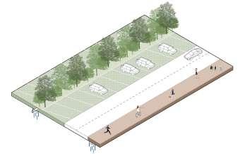
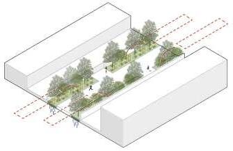
Build a network of green and blue infrastructure within the two urban centres to achieve ecological and environmental continuity with the surroundings and strategic stormwater management, consistent with the Piano per l’Assetto Idrogeologico.
mixed road and cycle paths with trees cycle path with trees
parking areas and intermodal places for green mobility
urban green areas and public and private vacant spaces
hydraulic hazard areas defined by the PAI green and blue infrastructure areas
green and blue linear infrastructures
urban tissue
main roads
NATURE BASED SOLUTIONS
floodable plaza and flexible systems depaving and rain gardens for water collection green car parks and urban reforestation
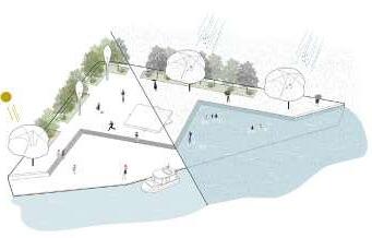
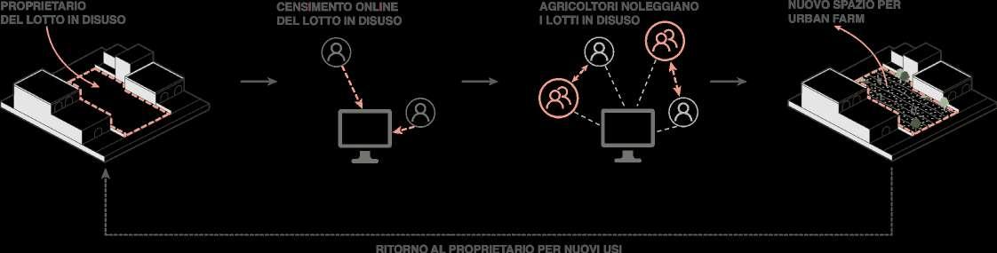
Define policies and programmes to promote urban regeneration, through the creation of a network of relationships between owners of disused lots and farmers, through the encouragement of leasing dynamics.
mixed road and cycle paths with trees cycle path with trees
parking areas and intermodal places for green mobility
vacant and uncultivated spaces of a public nature
vacant and uncultivated spaces of a private nature
urban tissue
main roads
ONLINE PLATFORM FOR SHARED KNOWLEDGE
owner of the unused lot mapping of the unused lot online
farmers rent the lot new space for urban farm
return to the owner for new uses
Copertino
0 1km
THE PERI-URBAN LANDSCAPE IN A RENEWED RELATIONSHIP OF CITY-COUNTRY
whose founding idea is based on the concept of creating synergies between the urban and peri-urban/rural tissues, through the definition of an ecological network to connect the elements of the landscape, a system of functional relations between productive and social activities based on circular economy network and sustainable practices for the settlement expansion of urban centres.
2.1 CIRCULATION AND ECOLOGICAL NETWORK
2.2 FUNCTIONAL CONNECTIONS
Emphasise the flow paths of the urban and peri-urban fabric, through the grafting of a consolidated ecological network of tree rows and diffusion of natural elements, to achieve a unified vision of city-countryside.
mixed road and cycle paths with trees cycle path with trees rural paths paths in the vineyards parking areas and intermodal places for soft mobility urban green areas and public and private spaces
cultural and historical heritage elements historical and cultural heritage areas wooded areas defined by the PPTR woodland areas pertaining to the PPTR renaturation sites (e.g. Vora delle Arche) places of heritage interest


TERRITORIAL SECTIONS
current state
PATHS IN THE VINEYARDS
Activate the peri-urban and rural landscape, creating synapses and functional connections with the two urban centres, based on compatible services consistent with the principles of the circular economy.
export of the product continuous and consolidated urban tissue discontinuous peri-urban tissue areas of greenhouses and horticultural farms district markets and flower markets widespread fruit and vegetable sellers farms, agritourisms and B&Bs established farms


CIRCULAR ECONOMY SYSTEM
areas of infected olive groves, available for explanting shops selling agricultural products and cooperatives shops producing and selling wooden furniture oil mills and oil sales shops colour factories (Colorificio Domus, Leverano) packaging production and sales shop (Leverpack, Leverano) oil mills and oil sales outlets
project state
0 1km
PATHS
RURAL
REGENERATION OF THE CULTIVATED LANDSCAPE AGAINST ENVIRONMENTAL RISKS
based on rethinking the post-Xylella landscape with a view to diversifying crops and enhancing biodiversity, and reducing the environmental impacts of greenhouses through the introduction of sustainable practices and new energy scenarios.
3 THE POST-XYLELLA LANDSCAPE
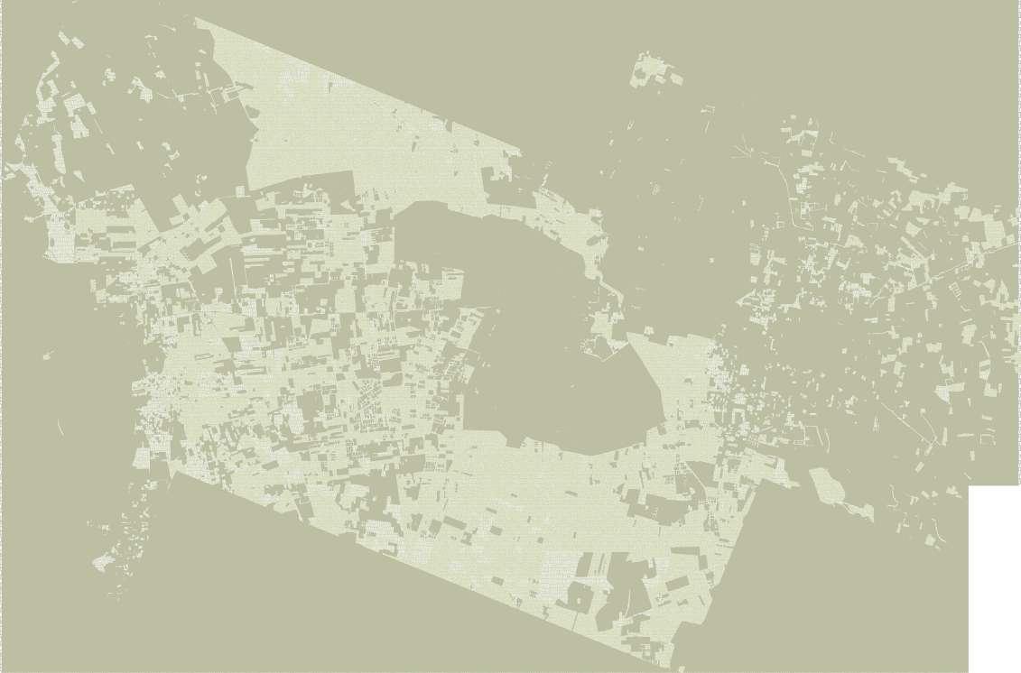
Counteracting the persistent fragility of the post-Xylella landscape and, in general, degraded by greenhouses and uncultivated areas, by reconverting these areas into places for experimenting with innovative species and fostering biodiversity.
mixed road and cycle paths with trees cycle path with trees rural paths paths in the vineyards
greenhouses and horticultural farms hydraulic hazard areas defined by the PAI elements of historical and cultural heritage
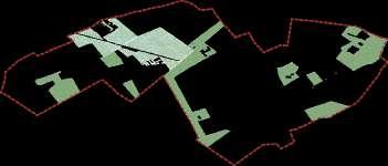
NEW MULTIFUNCTIONAL AGRICULTURAL PARK
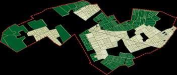
historical-cultural heritage areas
food forests
floodable forests
olive groves with new olive species experimental areas for the cultivation of exotic products mediterranean scrub polyculture with multi-species rows
layer 1 - traditional crops layer 2 - agricultural innovations layer 3 - reforestation
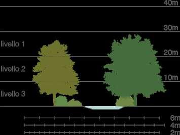

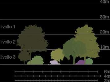
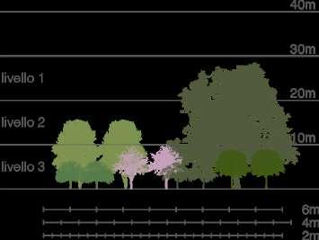
VEGETATION ANALYSIS


NEW OLIVE SPECIES 202 ha
POLYCULTURE 182 ha
layer 2
layer 1
Cipresso
Leccio
layer 2
Albero di Giuda
Alloro
layer 3
Lentisco
Ginestra
Rovo comune
Cisto rosso
Traditional arable
Vegetables and fruit
New crops
EXOTIC SPECIES 86 ha
FOOD FORESTS 45 ha
layer 1
Mango
layer 2
Palma da cocco
layer 3
Avocado
Papaya
Ananas
Pitaya
Lime
Crosne
Alchechengi
Yacón
FLOODABLE FORESTS 32 ha
MEDITERRANEAN SCRUB 28 ha
layer 1
Noce
Ciliegio
layer 2
Pero
Kaki
Gelso nero
Litchi
layer 3
Melograno
Melo
Agrumi
Fico
Mandorlo
Fico d’india
Susino
Albicocco
Pesco
Goji
Feijoa
Melocotogno
NEW OLIVE SPECIES 202 ha FOOD FORESTS 45 ha
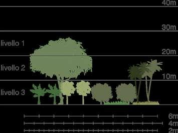
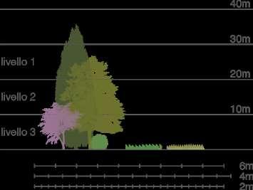
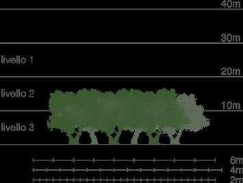
POLYCULTURE 182 ha EXOTIC SPECIES 86 ha


0 1km
FLOODABLE FORESTS 32 ha
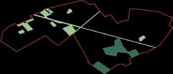
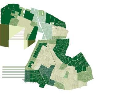
MEDITERRANEAN SCRUB 28 ha
2
Sughera
Acero
layer 3
Lentisco
Ginestra
Ligularia
Cistorosso
Liatris
Lobelia
Canna di palude
Rovo comune
Biancospino
layer 1
Roverella
Leccio
layer 2
Falso pepe
Carrubo
layer 3
Lentisco
Pruno
Cisto rosso
Quercia spinosa
Fico
Mirto
Cappero
Ginestra
Leccino Favolosa
layer 1 Olmo campestre Leccio layer
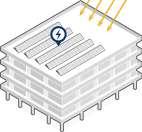
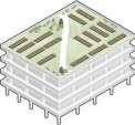
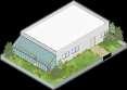
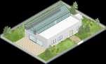

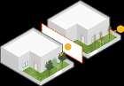
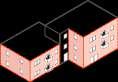
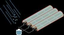


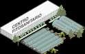
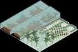
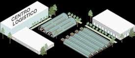
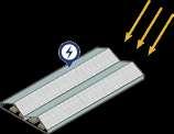
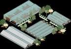
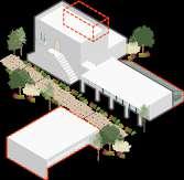
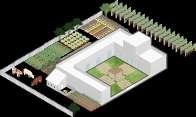
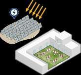
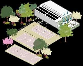
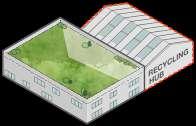
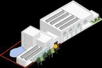
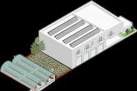
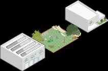
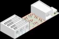
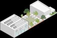
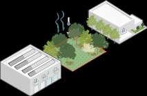
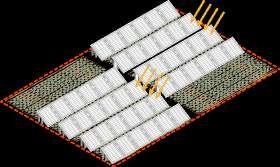
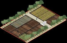
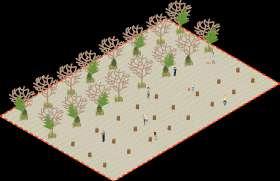
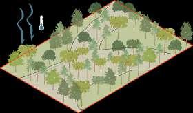
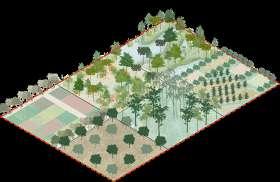
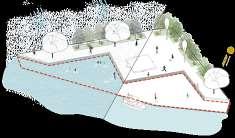
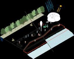
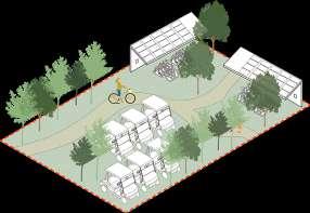
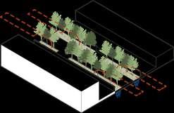
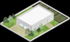
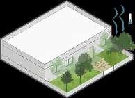
THE ABACUS OF OPERATIONAL TOOLS FOR TERRITORIAL REGENERATION BUILT ENVIRONMENT OPEN SPACES RESIDENTIAL GREENHOUSES MASSERIE PUBLIC BUILDINGS VACANT LOTS XYLELLA TERRITORIES SPACES OF URBAN RESILIENCE BACKYARDS
Province of Biella
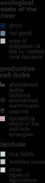

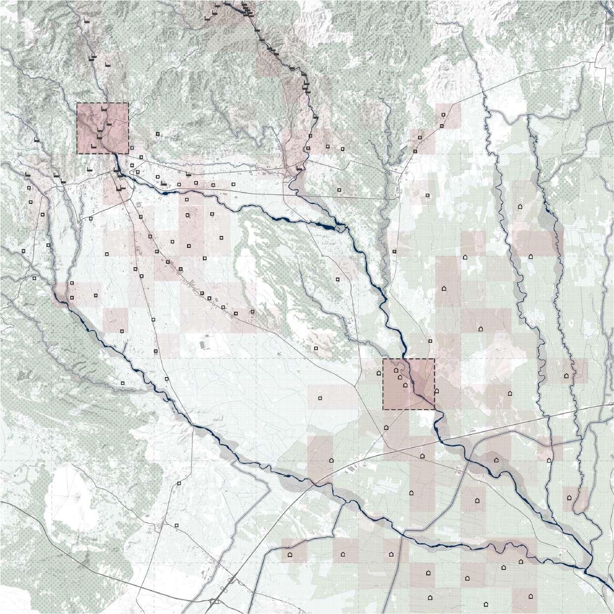
synergic landscapes activating the medial territory through a network of productive cell-hubs
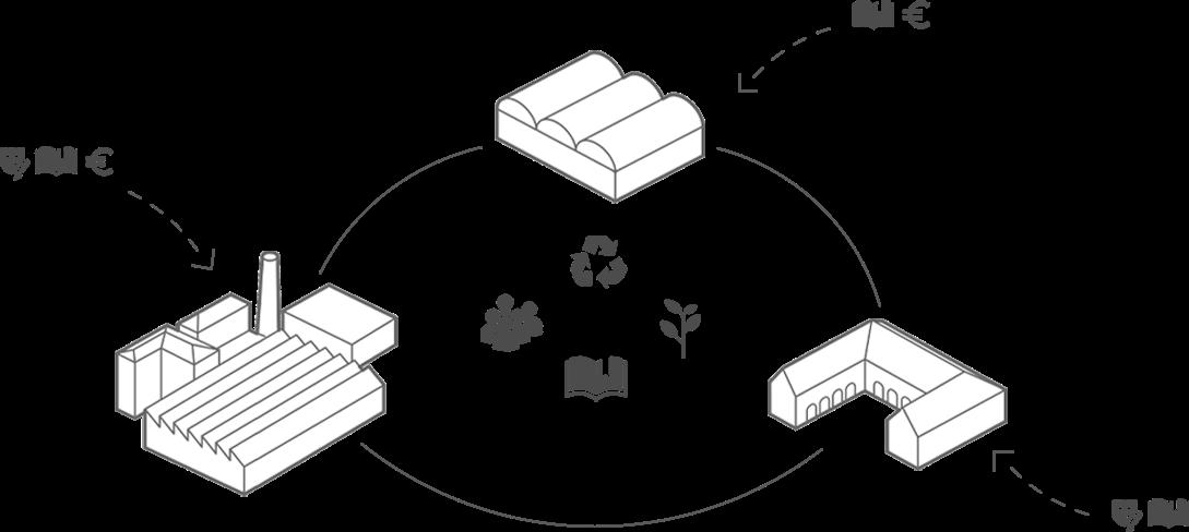
When thinking about the future of the Biellese territory, the goal of the project is to envision an interconnected area with a strong and sustainable network of diverse activities that, supported and enhanced by each other, create new economies: production can be therefore rethought through sinergy cell-hubs, where unused industries and cascine become the catalyst of the social transformation and the circular economy engine. The starting point for the identification of the possible areas of intervention was the recognition of the historical strongest production identity of the territory, based on the textile and rice production. While deepening the design approach to a closer scale, the recognition of the landscape as an infrastructure came as crucial due to the reconsideration of a vital element: the river. Due to climate change hazards, issuing the areas of interventions in case of flooding in the riverscape was the first step to understand how to keep the river’s central position, both spatial and functional, for its contribution in the production system, feeling it no longer as inaccessible and a threat and rethinking about it in a nature-based productive territory approach. To represent the two production sectors, it was decided to work on two distinct areas: one in Tollegno, a village widely known for its strong links with textile, and the other in Buronzo, a site characterised by large expanses of rice fields.
Atelier Urban Design // CLIMATE URBANISM year
2021
disused textile industry external inputs cultural influence education/innovation financial support cascine disused warehouse
BURONZO
TOLLEGNO
Tollegno (BI)
In view of the strong functional relationship with the river, in this area it was decided to, first of all, secure the zone in the vicinity against the risk of flooding, by extending the riparian zones and flooding rooms and applying an inflatable weir. Subsequently, the redevelopment of the three squares highlighted was planned, with the inclusion of activities aimed at sustainability.
inflatable rubber dam
the inflatable dam can be inflated only during the periods when the velocity of the river is high, strategically placed in the upper reaches of the river. this implementation could prevent further river related hazards in the area.
flooding rooms
use of the existing inclinations of the terrain would be exploited for the flooding areas in the zone of higher risk of flooding. during dry seasons a bike path would go through the area and it would be implemented with activities.
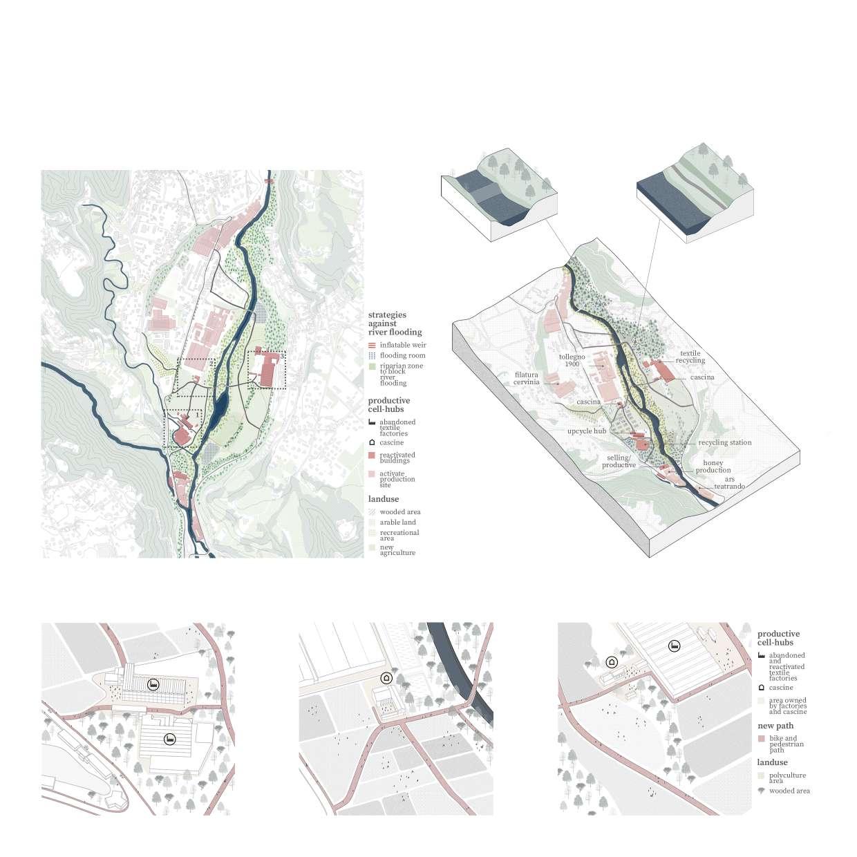
microphytes water purifying
microphytes are used for the purification of the water from possible nitrate hazards and general future river pollution.
flooding rooms
flooding areas would be excavated in the agricultural zones due to no bigger natural topography differences. they are placed in zones of higher flooding risks and having a ‘defensive’ role between the infrastructures and the river.
Buronzo (VR)
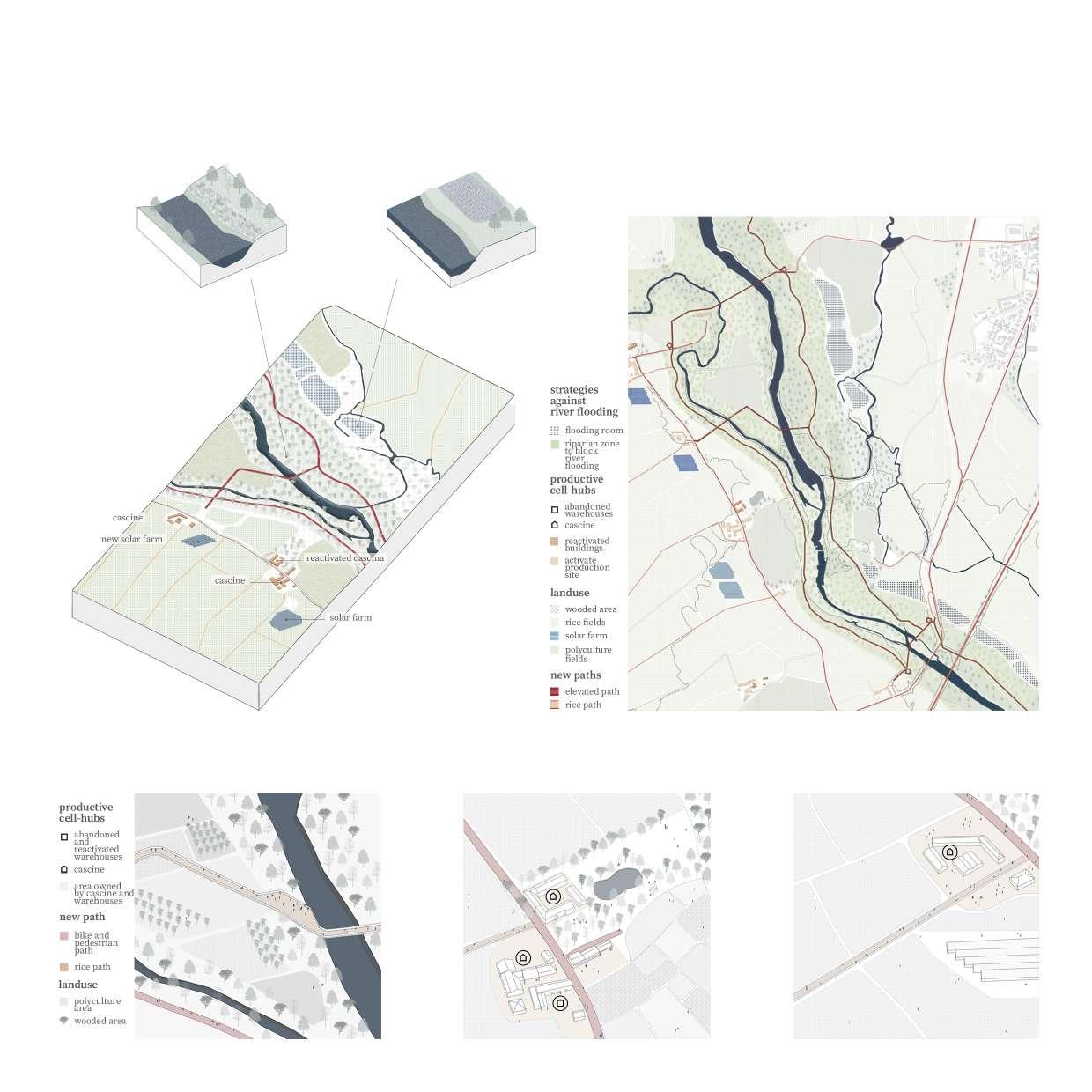
One of the most relevant issues in this area was the pollution of the river water, due to the presence of a high amount of nitrates. For this reason, it was decided to purify the water using microphytes and, later, to educate on agricultural production aspects, within the cell-hubs of the cascine and warehouses, with the construction of elevated paths, inside the rice fields.
1. upcycle hub / recycling station
1. new elevated path in rice fields 2. cascina / educational purpose
2. cascina and warehouse 3. cascina / polyculture area
3 1 2
3. rice path and cascina
2 1 3 500m 500m 250m 250m 0 0
TNA (A22) MSA
Brenner Motorway, Italy
ASP multidisciplinary project // Autostrada del Brennero S.p.A.
year 2021 - 2022
Brenner motorway
TNA (A22) MSA towards new architectures for the A22 motorway service areas
Generally speaking, motorway service areas are mostly seen as fast transit place, where to stop only if strictly needed. Yet, while the motorway persists as the main transport system, service areas still supply essential services and functions for travellers, disregarding many of the emerging issues such as the evolution of transportation, environmental awareness and new user needs. TNA (A22) MSA aims to propose an innovative vision for the transformation of the service areas along the Modena-Brennero A22 motorway. The challenge was duplex: to open and adapt the motorway to the territory - through intermodality and widening the user base - and to develop innovative technologies for the reduction of socio-environmental impacts. The project consisted of three steps: the interpretative maps and diagrams to provide a complete knowledge framework; a guidance abacus highlighting the key elements to consider when transforming any of the 22 service areas of the Brennero motorway, building a vision for the future of the motorway itself; finally, the design of three significant service areas assessed and put into practice the guidelines through real case studies.
3
Campogalliano Est MODENA 1st territorial macro-section (mst1) 2nd territorial macro-section (mst2) 3rd territorial macro-section (mst3) BRENNERO Po Est Povegliano Est Garda Est Adige Est Nogaredo Est Paganella Est Laimburg Est Isarco Est Plose Est Trens Est Campogalliano Ovest Po Ovest Povegliano Ovest Garda Ovest Adige Ovest Nogaredo Ovest Paganella Ovest Laimburg Ovest Sciliar Plose Ovest Trens Ovest
AXONOMETRIES OF THE 22 SERVICE AREAS
Plessi Museum Trens Ovest Trens Est Plose Est Plose Ovest Isarco Est Sciliar Ovest Laimburg Es Laimburg Ovest Paganella Est Paganella Ovest Nogaredo Ovest Nogaredo Est Adige Est Adige Oves Garda Est Garda Ovest Povegliano Est Povegliano Ovest Po Est Po Ovest Campogalliano Est Campogalliano Ovest 1306km + 37 km + 1306 km 313 km 1.1e/w 1.2e 1.2w 1.3e/w 2.1e/w 2.2e/w 2.3e/w 2.4e/w 3.1w 3.2e 3.3e/w 3.4e/w 2.5w 2.5e 1st territorial macro-section 2nd territorial macro-section 3rd territorial macro-section Campogalliano 1st territorial macro-section (1.1e/w) (1.2w) (1.3e/w) Po Ovest 1st territorial macro-section Povegliano 1st territorial macro-section Garda 2nd territorial macro-section Adige 2nd territorial macro-section Nogaredo 2nd territorial macro-section Paganella 2nd territorial macro-section Laimburg 2nd territorial macro-section Sciliar 3rd territorial macro-section Isarco 3rd territorial macro-section Plose 3rd territorial macro-section Trens 3rd territorial macro-section (2.1e/w) (2.2e/w) (2.3e/w) (2.4e/w) (3.2e) (2.5e/w) (3.3e/w) (3.1w) (3.4e/w)
Services to the person Services to vehicles
motorway lenght
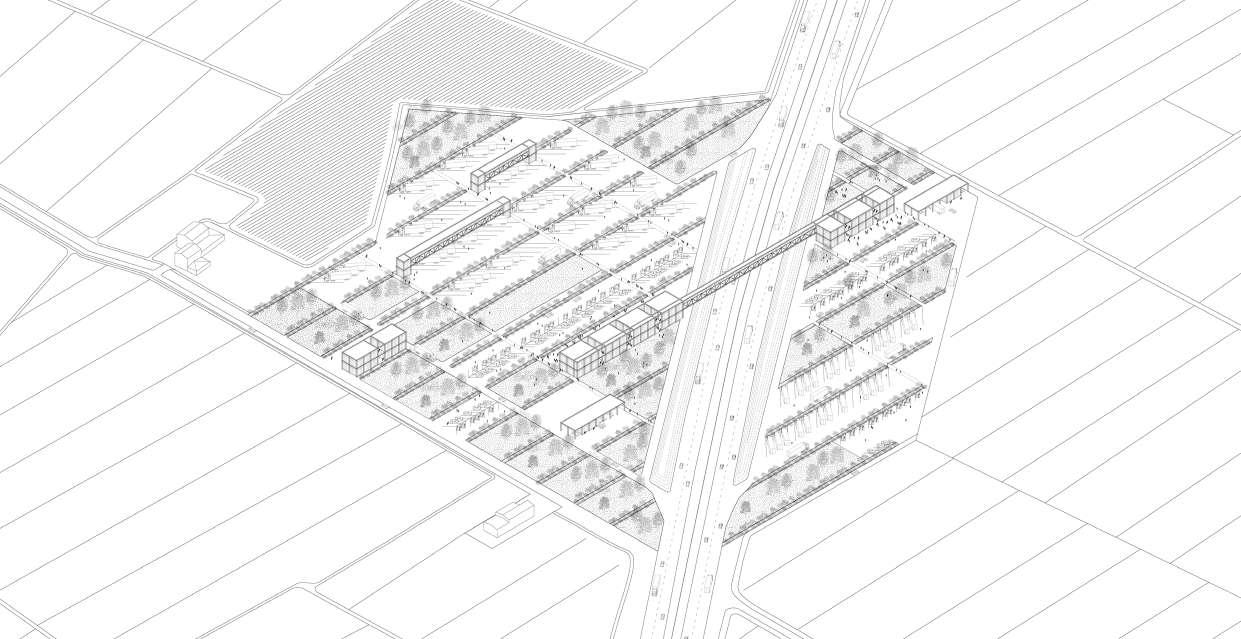
INNOVATIVE HUB FOR THE TERRITORY_CAMPOGALLIANO
entailing both traditional and new facilities, provided in relation to the fluxes that affect this section of the motorway and the way in which the service area adapts, in spatial terms, to variations in time, mobility and environmental values.
FLEXIBILITY DIAGRAMS

The landscape project is explicitly conceived as a process, designing the parking, the buildings and the vegetation trough an integrated approach, by studying the various stages of implementation and development in time, given the high pressure in terms of traffic fluxes applied to the service area and its consequent surface extension. This change of forms was analized in a short, medium and long term perspective.
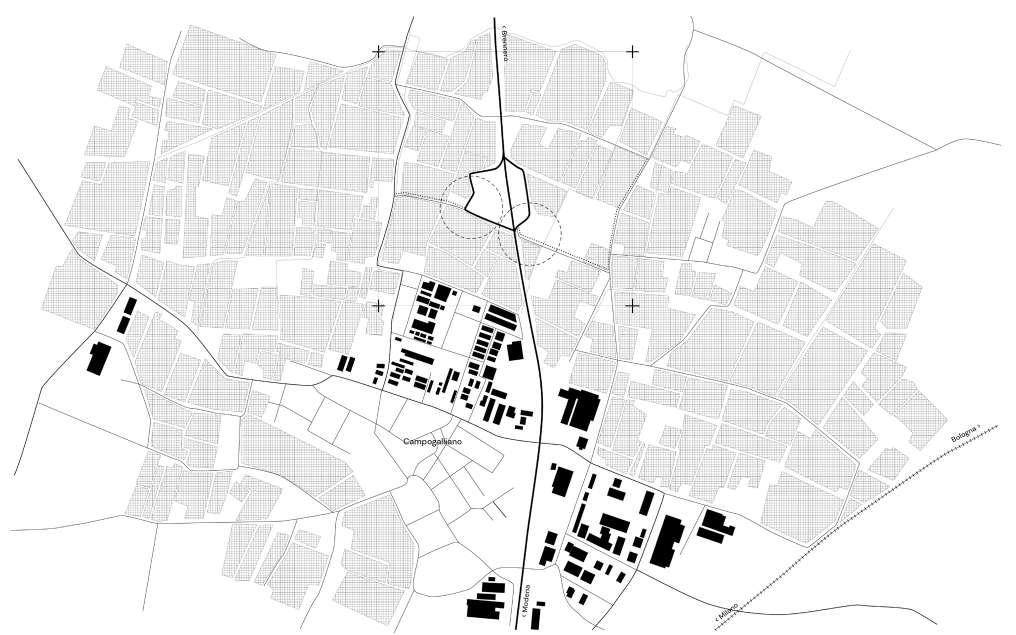
TERRITORIAL FRAMEWORK
GENERAL AXONOMETRY
architectural interventions and predisposition of the drainage system.
two long term scenarios medium term short term extension of the parking areas and of the service areas pavilion
renaturalization of the area through the planting of tree elements
dismission of parts of the parking areas and renaturalization
Sciliar Campogalliano Est MODENA
territorial macro-section (mst1) 2nd
macro-section (mst2) 3rd
(mst3)
Campogalliano Ovest Garda Ovest cycle paths railway rivers and canals industrial buildings agricultural areas motorway streets
1st
territorial
territorial macro-section
BRENNERO
3 km 2 km 1 km 0
1 logistic centre drone landing station 2 truck hotel 3 bar / restaurants sanitary facilities supermarket conference room 4 refueling stations - hydrogen - electric - traditional 5 walkaway 6 bar / restaurants sanitary facilities supermarket start-up incubator capsule hotel 1 2 3 4 5 6 4
SCENARIO FOR A HISTORIC SERVICE AREA_GARDA OVEST
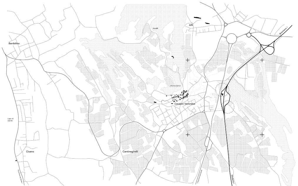
addressing the culture theme, regarding both conservation and restoration of the service area pavilions, enhancing and promoting its heritage value and characterizing main use, which exploits its inherent potential.
1st territorial macro-section (mst1)
2nd territorial macro-section (mst2)

Garda Ovest
3rd territorial macro-section (mst3) BRENNERO
A HISTORIC PROJECT
The original design of Garda Ovest, by Costantino Dardi, can be placed together with the most important works built along the Italian motorway system in the 1960s. The view by night was highlighted by the presence of a illuminated cube, as a guide for the overnight travellers. Now the architectural structure is in a degraded condition due to a lack of restoration works, so there is a need to carry out maintenance and, at the same time, incorporate new innovative activities.
NEW PERSPECTIVES
TERRITORIAL FRAMEWORK
short term restoration of the historic architecture and implementation of the open space.
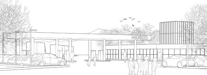
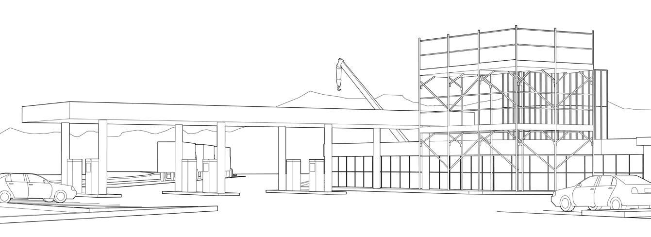
medium term establishment and opening of the ”Motorway Museum”.
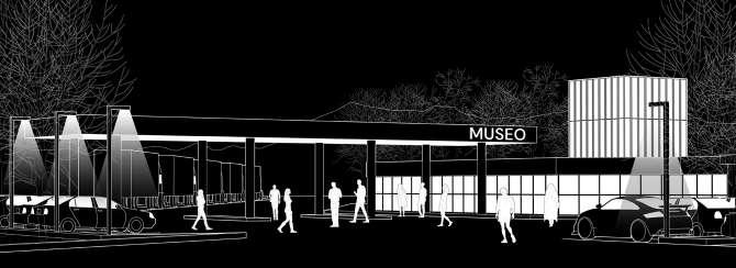
motorway streets
rivers and canals buildings of cultural and historical value
wooded areas
agricultural areas
long term with a future possible dismantling of traditional refueling, use of the canopy for cultural activities.
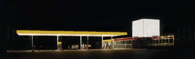
Sciliar Campogalliano Est MODENA
Campogalliano Ovest
3 km 2 km 1 km 0
(1971, Ph. Sistema Archivistico Nazionale)
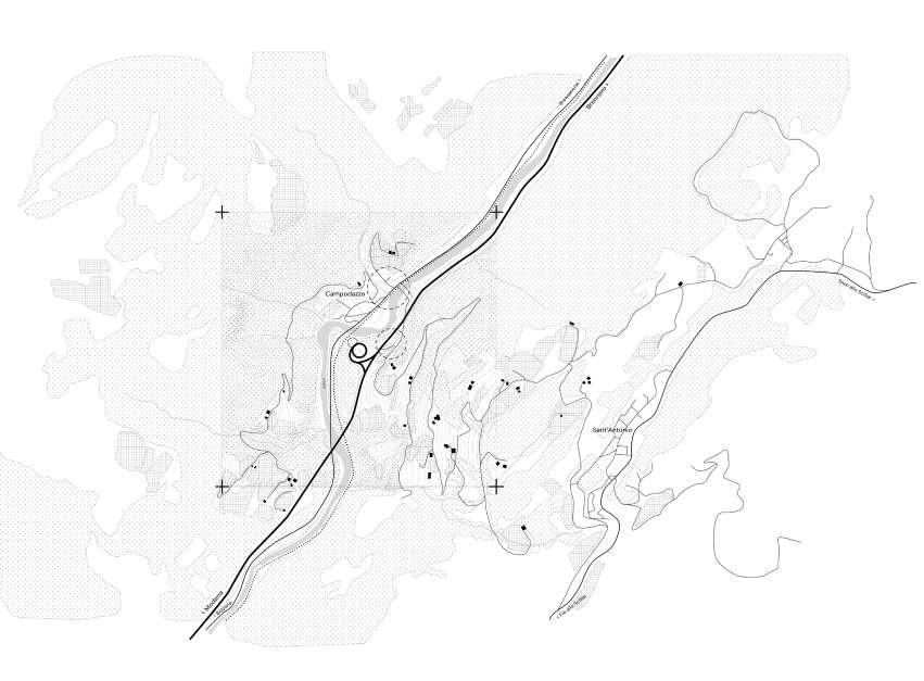
A PLACE TO ENJOY THE NATURAL LANDSCAPE_SCILIAR
tackling landscape issues, in terms of both enjoyment for the motorway users and integration with the surrounding, pursued through a dismission of the current service area and its dismission and repurposing.
1st territorial macro-section (mst1)
Campogalliano Ovest
TERRITORIAL FRAMEWORK
2nd territorial macro-section (mst2)

3rd territorial macro-section (mst3) BRENNERO
vineyards recapturing the inherent productive character of the site
motorway streets
cycle paths
rivers and canals
agricultural buildings
wooded areas
agricultural areas
3 km 2 km 1 km 0
depaving and clearings market activities promoting local products and renaturalisation of the site
wooded land nature settling the infrastructure element
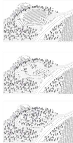
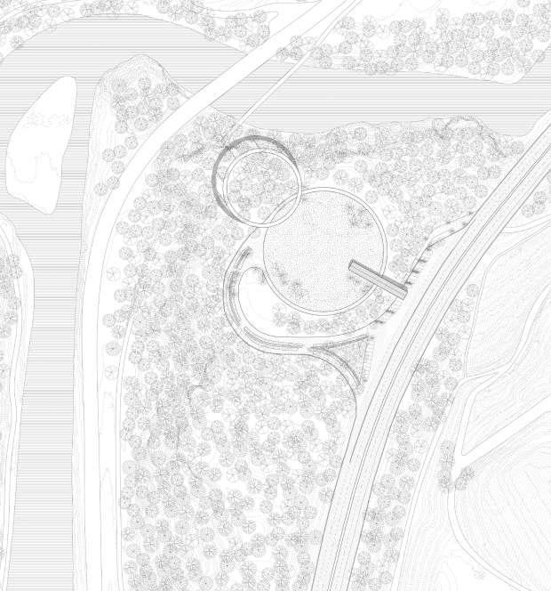
TERRITORIAL SECTION
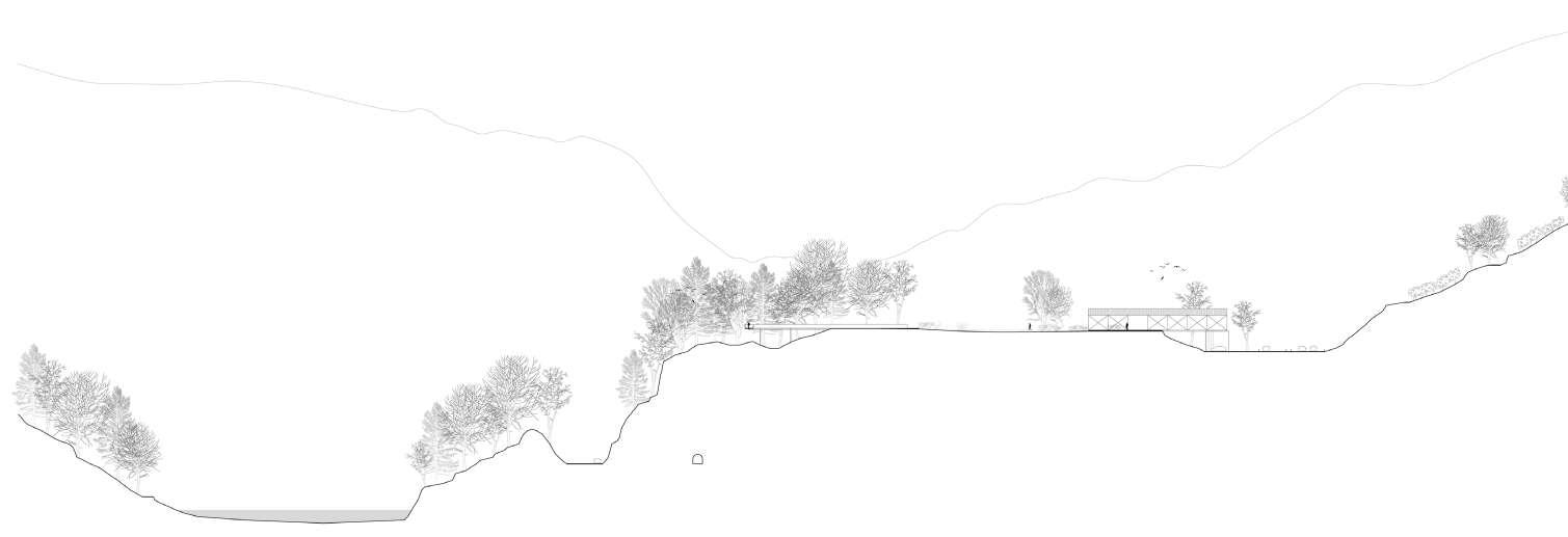
Garda Ovest Sciliar Campogalliano Est MODENA
PLAN VIEW FLEXIBILITY SCENARIOS
(t)re-connect Rome, Italy
Atelier of Architectural Sustainable Design // ENVIRONMENTAL TECHNOLOGICAL DESIGN

year 2020
Rome
(t)re-connect creating new or strenghtening existing connections on different scales
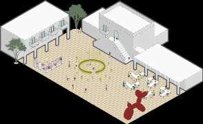
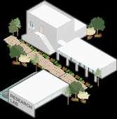
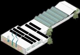
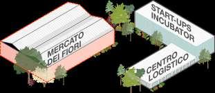
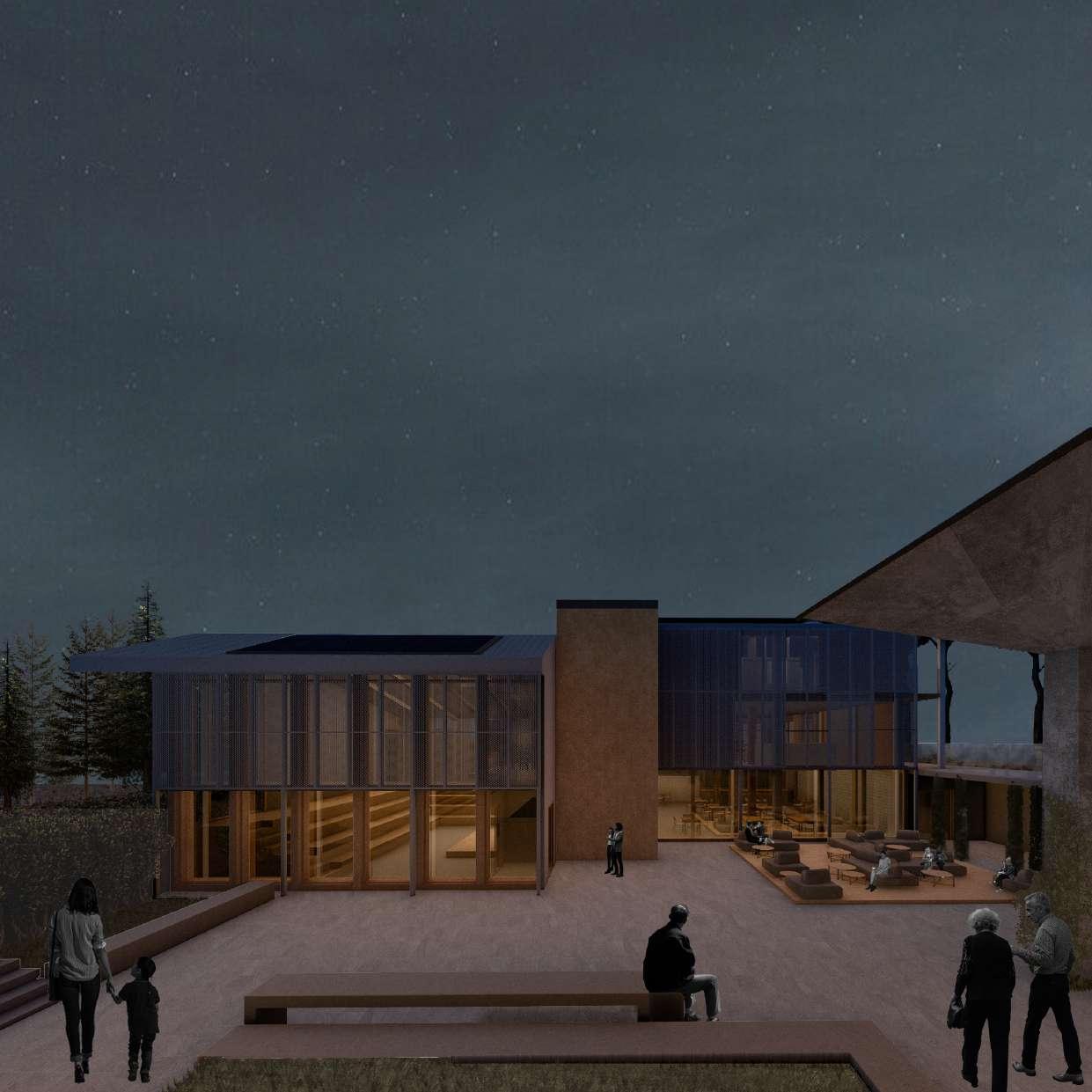
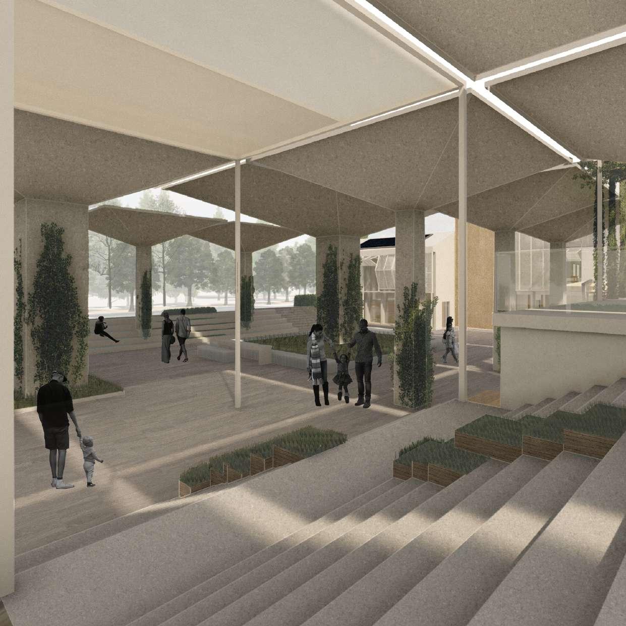
The project idea was to design a space that serves as a sort of gathering node of the neighborhood from a social, creative and economic point of view, by enhancing the accessibility and connections of the area. on an urban scale, it was planned a new network, also led by the principles of reinventing cities challenges; firstly, highlighting the presence of two existing bike paths, with the addition of a new bike sharing station and pedestrian-friendly routes. Then, reconverting the exceeding parking lots in space for rain gardens and greenery. From a cultural point of view, the project focuses on fostering a sense of community through different activities including social gatherings, agriculture and ‘kilometer 0’ food, workshops, exhibitions, sports and leisure. on a building scale, it has been attempted to reflect that same idea of the connections: firstly, creating the “three connected” spaces of the new building in the north, the central plaza and the new building in the east; secondly, in a smaller scale, designing the buildings themselves in a sort of triptych where the two main functional areas are joined, but also separated with a central block. What is more, this block serves as a vessel of horizontal and vertical connections. The plaza in the middle, which is an ode to the ex torre spaccata market with its existing pillars, was the inspiration for shaping and dimensioning the new additions, as their plans follow the modularity and the directions of the pillar roofs.
1. existing situation 2.
new
3.
4.
connecting
gathering spaces
new green mobility
biodiversity
4
PLANIVOLUMETRIC VIEW
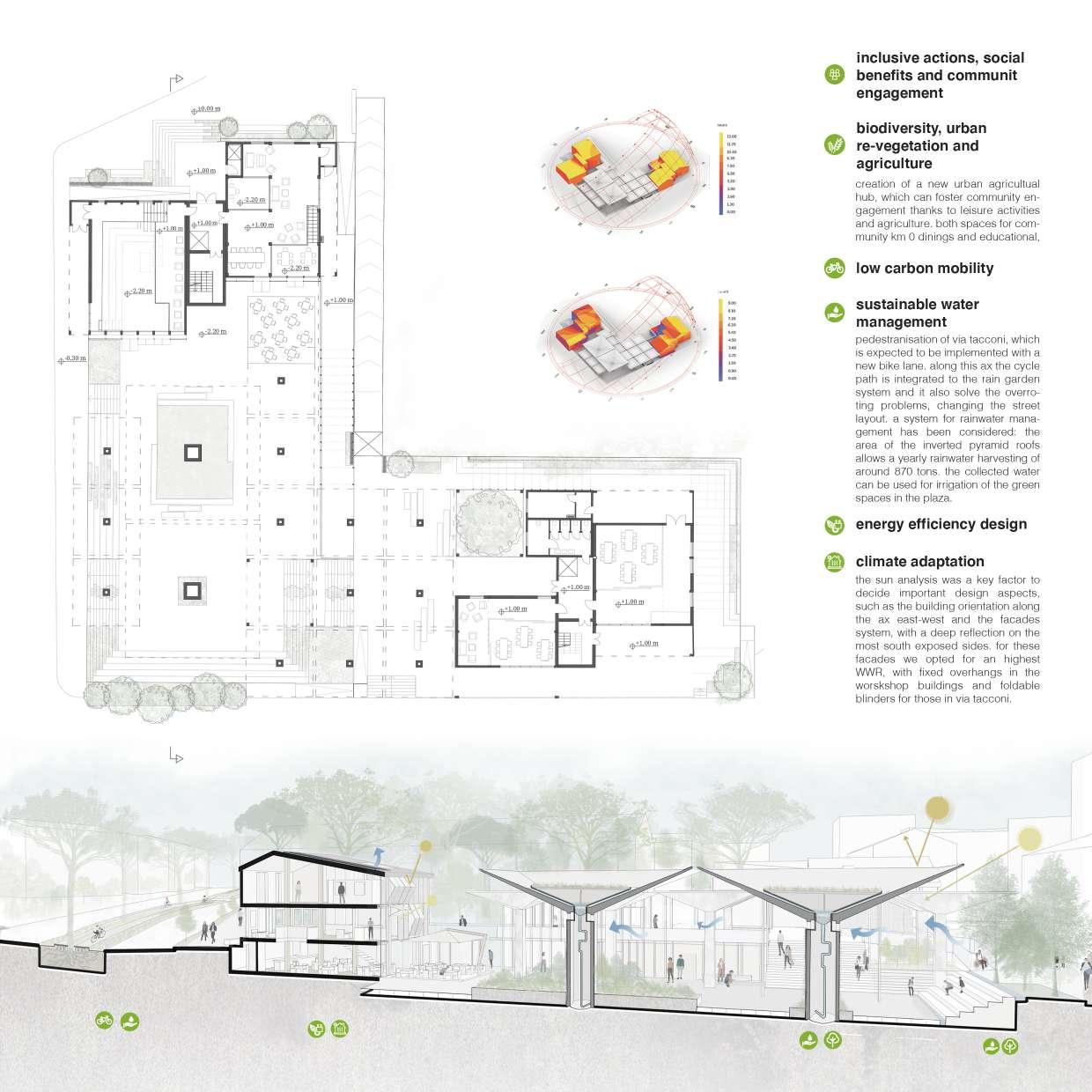
SHADOW
ANALYSIS
carried out with Ladybug, Grasshopper
21 of June, from 7th to 19th
Rome, Italy
21 of December, from 7th to 17th
Rome, Italy
CONSTRUCTION EXPLODED
DESIGN FOR DISASSEMBLY
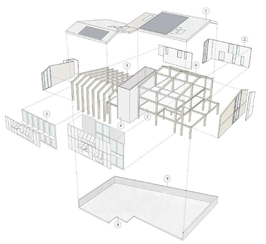
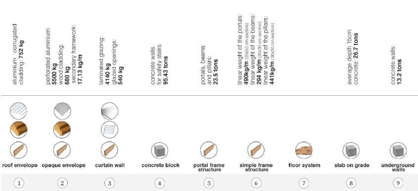
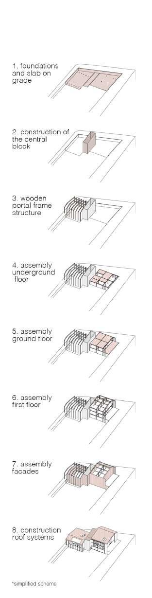
MATERIALS
5
Colonia Etroubles
Valle d’Aosta, Italy
SHADING SYSTEM ANALYSIS
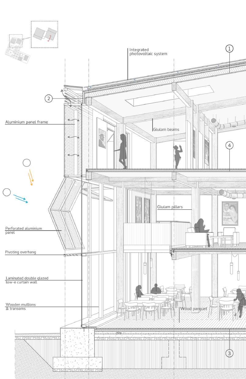
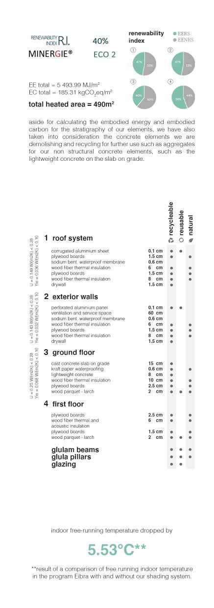
TECHNOLOGICAL SECTION
Etroubles (VDA)
Colonia Etroubles
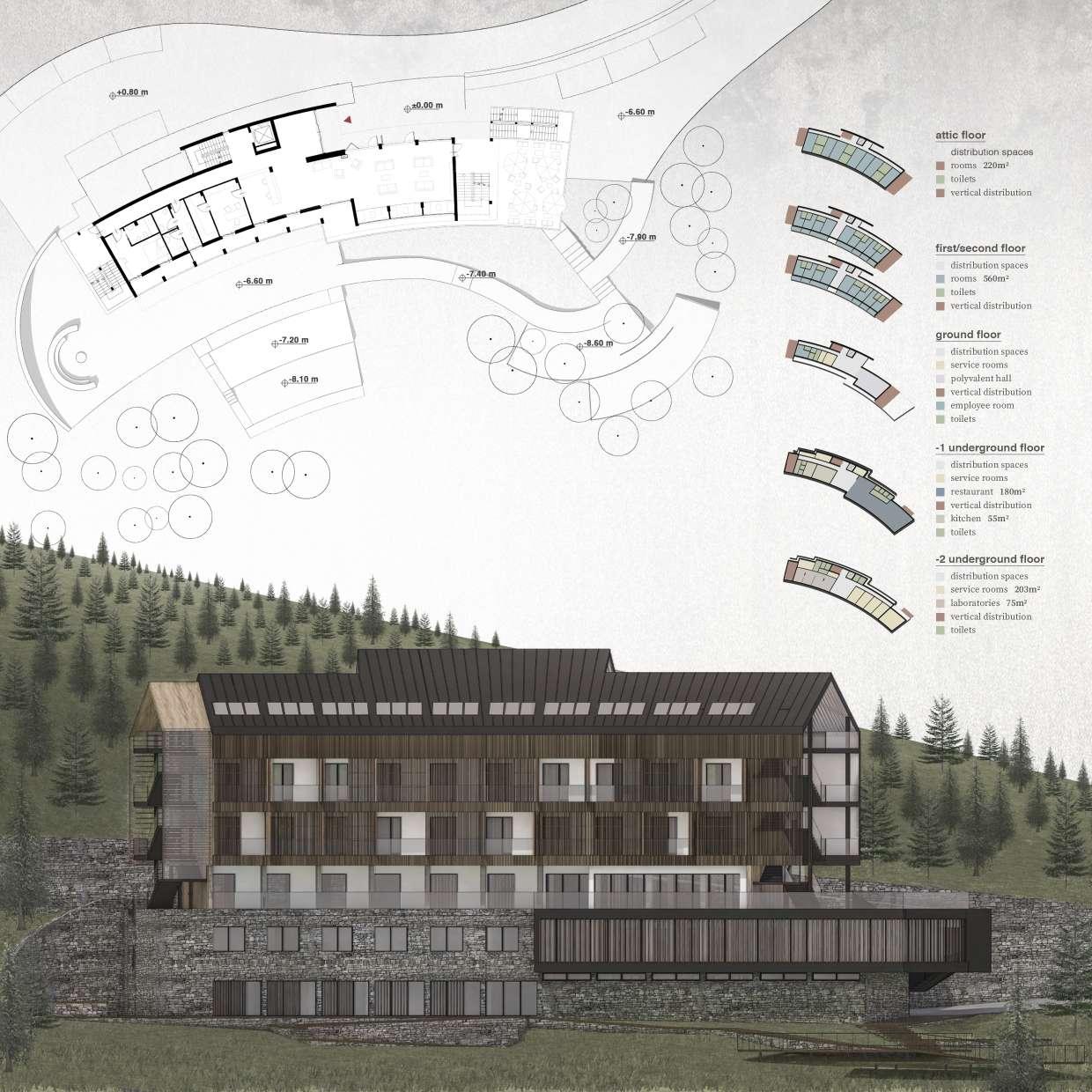
a community recreational space in a mountainous area
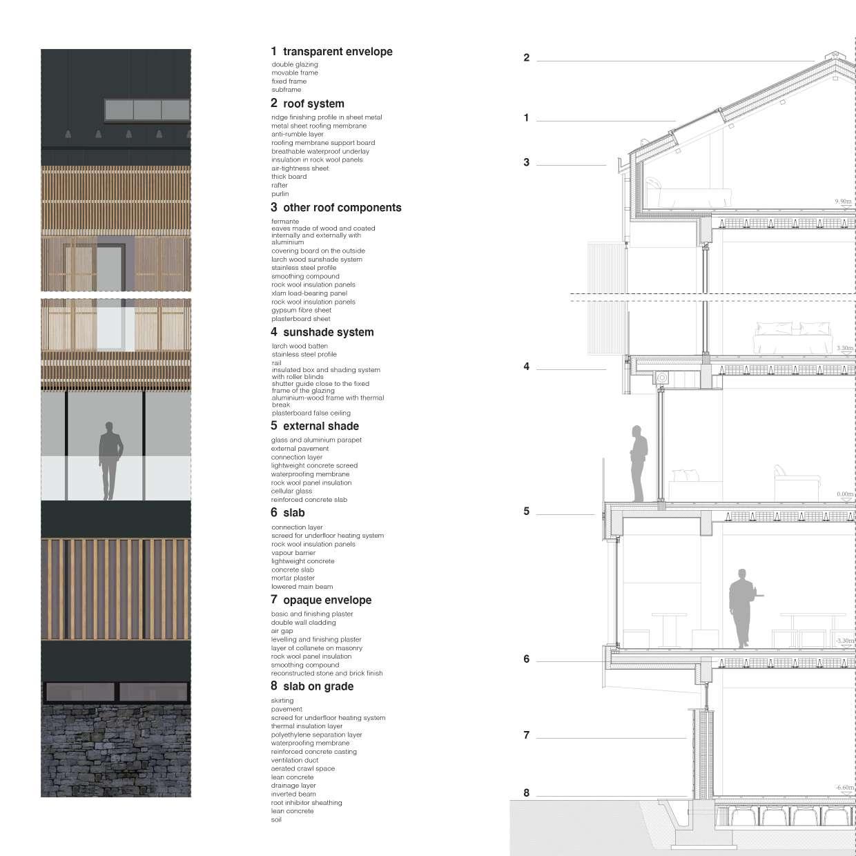
This project is a two-way attempt: on the one hand, to optimise the distribution of the interior spaces, enhancing what would today be unused spaces, and on the other hand, to seek a new design for the façade, while maintaining its deep connotations. emphasis is placed on the existing stone base and the central body, which, together with its overhang, acts as a link between the basement floors, connected to the outdoor space, and the floors above, intended for dormitories. The ultimate goal was conveyed by the idea of giving new life to an abandoned building, which can nourish the natural area around it and be a symbol of a place open to all, a recreational, educational and healing space, dedicated to inclusiveness and community. Observation of the architectural reality and its metric and photographic survey were pivotal elements in the search for a design language consistent with the existing building and suited to its structural and technological needs.
road system contour lines hydrography green areas acoustics

The infrastructure system of Etroubles is characterised by two different types of roads: on the one hand, the SS.27, which connects Italy to Switzerland; on the other, the various suburban roads, which link the building with the surrounding territory.
Etroubles is located almost in the valley, in an area characterised by lower slopes than the context in which it is situated. This represents a strong design potential, allowing easy connections between the building and its surroundings.
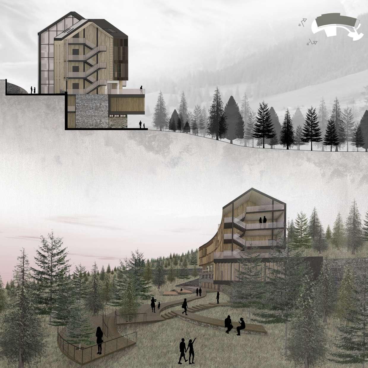
Several streams flow through the Etroubles area, one of which is the main tributary of the Dora Baltea; they are all fed by the glaciers above the surrounding mountains.
There are many green areas protected by the municipality of Etroubles, large areas, also present in the village, in which there are many itineraries to be covered on foot or by bicycle.
Etroubles is located in an isolated territory, the values of the immission limits are very low. The most relevant acoustic problem is the proximity of the SS.27, a busy road used by heavy vehicles.
Atelier of Technological Design // BUILDING IN THE BUILT ENVIRONMENT year 2019
ELEVATION AA’
ELEVATION BB’
EXPLODED AXONOMETRY
PLANIVOLUMETRIC VIEW
TECHNOLOGICAL SECTION
DETAILED ELEVATION
Atelier of Architectural Restoration // SUSTAINABILITY AND RESTORATION year 2021
Turin
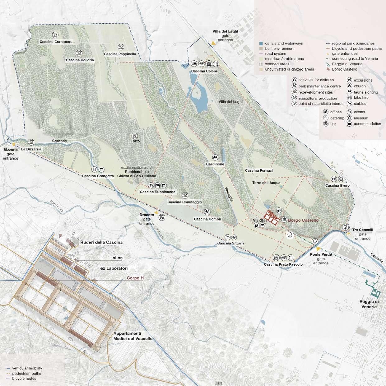
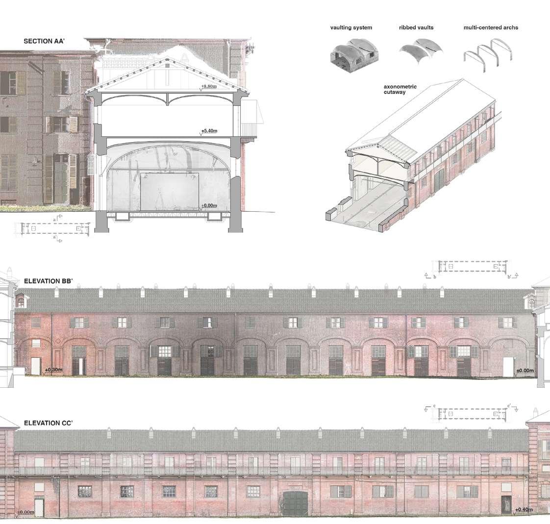
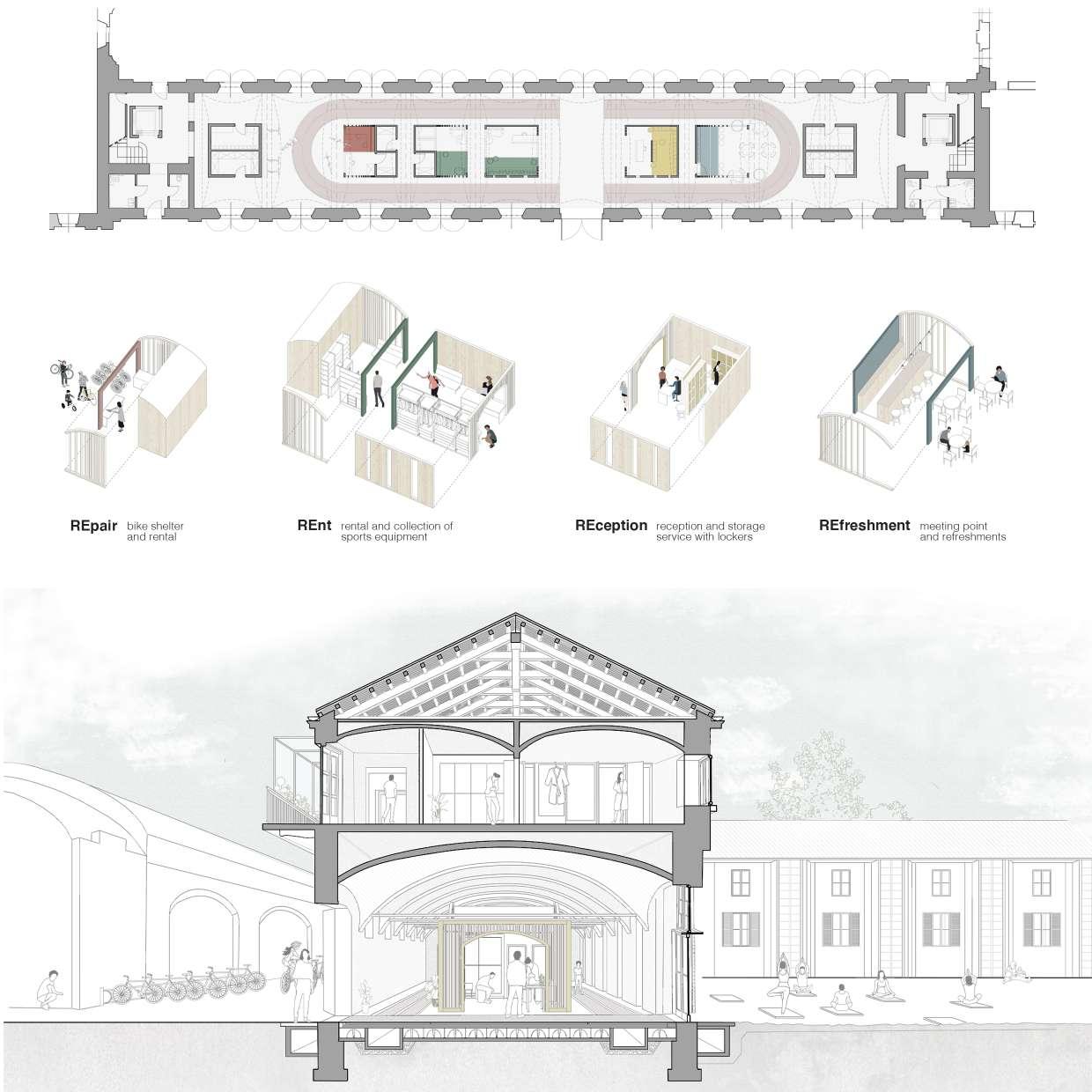
Borgo Castello in parco La Mandria survey, graphic rendering and design development inside the “corpo h” building
To work within a place steeped in history and identity, on an urban and social level, the first approach to the subject under examination was, in besides examining in an analytical way the connections that the park and the Borgo Castello have with the peri-urban space, to deepen the intrinsic characteristics of the building itself, from the distributive, formal and functional aspect. Once these data were analyzed, it was decided, therefore, to proceed to the metric and graphic survey of the so-called “corpo h”, a space used, in the past, to breed horses on the first floor and to host dormitories, in the second. The addition of simple modules, which follow the pre-existing vaulting system, allows the insertion of sports and recreational activities, accentuated, finally, by a paving design reminiscent of an athletic track. In this way, the athletes of the park enjoy services that are deeply useful to them, within a new and revisited landmark, such as the borgo castello and, in particular, the corpo h. the park and its administrative limits the park and the protected area
6
Borgo Castello Turin, Italy
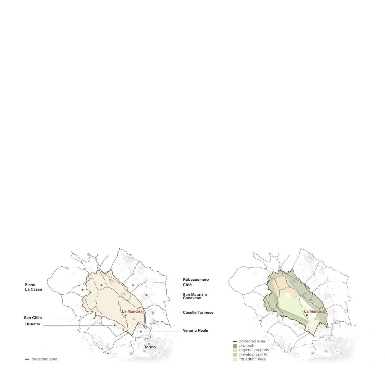
THE REGIONAL PARK OF LA MANDRIA
Established as a regional “Protected Area” in 1978, La Mandria park is one of the UNESCO world heritage sites.
Surveys carried out with a point cloud, processed on the software Cloud Compare and redrawn on Autocad
 Borgo Castello and Corpo H framework
sramarzio@gmail.com +39 3389655099
