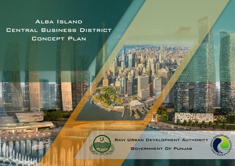
Alba Island Central Business District Concept Plan
Ravi Urban Development Authority Government Of Punjab
Ravi City Phase I Review
River Ravi
The CBD of Ravi City has been allocated to Zone 12, situated in the heart and centre of Phase I. The CBD is surrounded by 20 zones, allocated for mixed use, infill development, industrial, or agricultural use. All 20 zones will have easy accessibility into Zone 12, providing a central source for business and commerce to ensue.
Infill Development zones will be used fundamentally for housing and residential schemes.
Mixed use zones consist of brownspace sites to be separately sold to developers and used for their own purpose, in accordance with the Local Law of Ravi City. Mixed use sites, however, will strictly not be used for housing schemes.
The industrial zone will be used to house factories and industry. Modal villages will be used to house the agricultural land and businesses that were pre-existing in the area. These villages will be provided with updated and improved infrastructure.
Alba Island Proposal
Drawing 1: exploration of radial design The design of Alba Island required ease and efficiency of movement; minimization of congestion, and aesthetic appeal and beauty. The layout is a radial-grid hybrid system. There are four parks which act as nodes and congestion breakers. This disperses human traffic evenly across the island, whilst providing quick and efficient means of connectivity.
Drawing 3: Zonification of Alba Island Drawing 4: exploration of a grid system
Drawing 2: Exploration of a radial grid system with a single central node
Location Map
The location of Ravi City is sandwiched between the districts of Lahore and Sheikhupura, with the River Ravi as, both, the epicenter of the city, and the separation of districts. More specifically, Phase I splits the districts of Ferozewala and Shalimar, with the CBD located in the heart of Phase I. This provides an ideal location of the CBD as a central location for business, finance, and trade in both Lahore and Sheikhupura.
Connectivity to Surrounding Localities
The connectivity of the CBD with the existing surrounding infrastructure is integral to its success. Therefore, it has easy accessibility to all neighbouring cities such as Lahore, Sheikhupura, Sialkot, and Faisalabad- as well as Allama Iqbal International Airport- through the uses of GT Road, M2 and M11, as well as the Lahore Ring Road
Land Use Plan
The proposed zone (1451.57 Acres), named Alba Island falls in Phase I of RUDA jurisdiction that will serve as central business district
Proposed Uses for CBD
Public Sector (Red): Consisting of civic amenities, such as healthcare, emergency services, city councils, and civil services
Mixed Use (Purple): Consisting of Skyscrapers and Highrise buildings
Private Sector (Pink): Consisting of commercial, entertainment, and hospitality buildings
The CBD is separated into four sectors: Public Sector, Private Sector, Mixed Use, and Residential Sector
Residential Sector (Yellow): Consisting of high density residential buildings
Skyscrapers (54 Storeys)
The land use plan has been separated into six primary sectors: Skyscrapers Highrise Buildings Entertainment and Hospitality Commercial Use Buildings High Density Residential Civic Amenities Greenspaces
Skyscrapers and Highrise buildings surround the primary central point of the CBD, and are expected to house the main offices of large corporations and businesses. This cluster of skyscrapers and highrises will be the visual selling point of the CBD, emulating the modernity of the city.
Mixed Use Highrises (32 storeys)
The variety of mixed uses can include retail, commercial, offices, residential, entertainment, recreational, and public spaces The district of mixed use buildings will be separated both vertically and horizontally.
Hospitality & Entertainment (15 Storeys)
The hospitality and entertainment sectors of the CBD will occupy the majority of the CBD’s variety of cafe’s, restaurants, and eateries.
Precedents: cafe’s, restaurants, hotels, and resorts of various styles to attract a variety of people within the region
These sites will be a major selling point for businesses and leisure, allowing the locality’s office workers a convenient source of food, as well as providing a location for formal events and functions.
Civic Amenities & Public Buildings
The CBD has a ring of civic amenities which are close to the secondary centres and within close proximity to the primary centre. Public buildings such as hospitals, police and emergency services, as well as government buildings and services, will be easily accessible throughout the entirety of the CBD.
Precedents: Civil service/ emergency buildings and hospitals
Commercial Buildings (25 Storeys)
Commercial buildings such as malls and various shopping plazas are located closely to the residential sector of the CBD. The ease of access of the commercial buildings from the residential sector enables a greater likelihood of regular business and domestic commerce. Precedents: shopping malls/ plazas and high streets
High Density Residential (15 Storeys)
The residential sector of the CBD, whilst taking a small portion, is still well situated due to the efficient and effective connectivity of the whole CBD. The residential sector is well connected to surrounding greenspace, as well as the promenade- as well as being situated next to a secondary centre, allowing direct access to the primary centre and, thus, the entire CBD.
Total Percentage Breakup Total Central Business District-Area Development Program Proposed as per SDP Developable Land Uses Skyscrapper (Corporate Offices/Financial Hub) High Rise Mix Use (Res+Com) Commercial (Offices/Retail) High Density Residential Hospitality/Entertainment/Recreational Open Space/Parks Civic Amenties/Public Building/Utilities Roads
Total
Category
Developable
Developable Developable Developable Developable Non Developable Developable Non Developable
% Breakup
Area Acres
7%
90.2167
10%
128.881
6%
77.3286
7%
90.2167
10%
128.881
15%
193.3215
10%
128.881
35% 100%
451.0835 1288.81
The CBD in this proposal is considered as one whole entity, rather than two units separated by the expressway. Therefore, the % break up has been considered for the entirety of the island.
1288.81 Calculated as per CBD Proposal
Total Area Acres
% Breakup
82.91
6.43
166.48
12.92
86.41
6.70
91.35
7.09
123.58
9.59
265.90
20.63
134.41 306.95
10.43 23.82 97.61
Connectivity Hierarchy
400’ Expressway This road provides a crossing point through the CBD between Lahore and Sheikhupura. The road allows comfortable transportation of goods, and commute for workers between Lahore, Sheikhupura, and beyond.
150’ Boulevards These roads are the primary connection points between the inner and outer CBD. The width of the road provides ample room for lanes designated for public transport, and allow easy accessibility to all corners of the CBD.
100’ Main Roads These roads are the main connecting vessels throughout the CBD for vehicular transport. They can be arranged as one-way roads to create urban superblocks, or as two-way roads to allow ease of movement on either side.
80’ Secondary Roads These roads serve as a connection route for the residential and commercial region of the CBD. As motor vehicles, such as cars and bikes, are predicted to dominate the hierarchy of the road in this region, priority has not been given to public transport, therefore allowing the roads to be smaller in size.
75’ Spiral Roundabouts The use of spiral roundabouts enables a controlled movement and flow of traffic in 360 degrees. By connecting the Boulevards to large spiral roundabouts, it drastically improves the connectivity and efficiency of traffic flow throughout the entirety of the CBD.
25’ Alleyways and Pedestrian Access The CBD was designed with the pedestrian in mind over the use of motor vehicles. Therefore, the implementation of alleyways and granting pedestrians greater access throughout the entire CBD reduces the requirement for motor vehicles- the estimated approximate time to walk the diameter of the CBD being between 15-20 minutes. The use of alleyways also improves airflow throughout the entire CBD; along with the extensive placement of greenspaces and a greenbelt- this will allow the air to be cleaner, cooler, and generally more pleasant.
Precedents: The use of alleyways as navigational pathways in between negative spaces in Mediterrainean regions
Canals The canal system is one of the most important and central part of the CBD, as it ties the entire island together- both in the land mass, and with the river. The canal provides aesthetic appeal throughout the CBD as a water feature, as well as providing fresh water more inland for nourished soil. Additionally, the canal water acts as a protective barrier and cooling system from harsh heat; absorbing the Sun’s UV rays and evaporating into the air to provide constant breeze.
Benefits to Physical and Mental Wellbeing The canal system featured in the CBD passes through all the central points and is within close proximity to corporate office buildings and the residential sector. The water feature created by the canals adds an aesthetic appeal and enhances the natural ambience within the CBD, which will have large benefits to the mental wellbeing of the inhabitants of the CBD; both, as residents and workers, by decreasing stress levels. Additionally, the canal water reduces noise pollution, and creates an urban cooling effect by absorbing radiation by the Sun and creating a breeze in the process; thereby reducing the Urban Heat Island effect.
Precedents: aesthetic beauty created by canals in the streets of Amsterdam, Netherlands
Diagram showing the effect of a water source in an urban centre as a means of reducing Urban Heat Islands
Public Transport Path
The nature of the 150’ Arterial roads, connected with the Spiral roundabouts, provides a perfect route for a routine public transport system to be installed, by either buses or tram. The Path enables quick, easy, and convenient accessibility to all four secondary central areas.
Walkability Analysis the 20-Minute Neighbourhood By implementing alleys and prioritisng pedestrian accessibility, it minimises the resistance that usually befalls walking through an urban environment. Designing the CBD with walkability in mind, the radius of walking for 10 minutes from the centre expands to almost the entire island. The 5 minute walking radius of the primary and secondary centres, (AKA the pedestrian shed), partnered with efficient and accessible public transport, can help to reduce carbon emissions by 370,000 tonnes (Plan Melbourne, 20172050). Along with the extensive use of greenspace to provide aesthetic appeal and aid natural ventilation, this will significantly promote walking over vehicular transport. vvv
Greenspace Plan
The use and implementation of greenspace is of paramount importance within the CBD, as it serves multiple purposes. Studies show that prolonged exposure to greenspace promotes exercise, socialization, reduces noise and air pollution, improves immunity, and reduces risk of mental illness by 55% (Engemann, K. et al, 2019). The greenbelt surrounding the CBD edge provides and promotes clean air, as well as reducing the risk of flooding. The CBD has been designed so that there is a local greenspace or park within walking distance, in all locations.
Counteracting Urban Heat Islands The CBD has pedestrian avenues defined by trees. This provides aesthetic beauty and appeal on a human level, as well as functioning as shade from the heat and sunshine during peak hours, and separating air flow to provide natural ventilation on both a human level and a colossal scale through the buildings.
Promenade
Alba Island Promenade will open up the views of the river and integrate the character of the community with enhanced green spaces. On Promenade, Public activities and events, such as sidewalk cafes and street fairs will be installed. It will provide safe and engaging passage and reinforce the riverfronts as the public realm. Partial Back Fill and Complete back fill can be adopted for Alba Island.
Precedents: The experiences of walking along the promenades in Santa Monica, Frankfurt, and Blackpool
Placemaking
Multi-faceted approach will be adopted to the planning, design and management of public spaces that capitalizes on a local community's assets, inspiration, and potential, with the intention of creating public spaces that promote people's health, happiness, and well-being. Area along canals and River Promenade will be utilized in a way it will enhance the aesthetics, also, it will create a sense of place where people would like to spend their quality leisure time.
Building Density Map
25 storeys
32 storeys
54 storeys
North-West Facing
15 storeys
15 storeys
32 storeys
54 storeys
25 storeys
South-West Facing
15 storeys
High Density Residential along Promenade
Ample Open Space and Canal Network
Hospitality Uses along Promenade
Hospitality Uses along Promenade
Alba Island Skyline
400 Feet wide Connecting Phase-1 Zones
Central Park
Surrounding Skyscrapers
September 2022