SAGE MORRISON |







URBAN PLANNING PORTFOLIO















University of Cincinnati
College of Design, Architecture, Art, & Planning
LegacyCrossing-Taylor,Texas












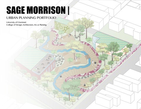
VacantLot[Re]Imagined-Over-the-Rhine


Table of Contents | 1 INTRODUCTION 2 About Me 3 Resume MICHAEL WATKINS ARCHITECT, LLC 5 Legacy Crossing - Taylor, TX 8 Taylor Heights 10 Bush Emeny 11 Additional Work OVER-THE-RHINE: A HEALTHY FINDLAY 14 Site Analysis 17 Master Plan 18 Implementation CLIFTON: HAMILTON AVENUE BRT CORRIDOR 20 Framing 21 [En]Vision 22 Impact SOUTH CUMMINSVILLE & MILLVALE 24 Neighborhood Analysis 27 Residential Typology 29 Neighborhood Impact EXTRA WORKS 32 Hand-drawn 33 Writing Sample The Commons - South Cumminsville
About Me |
Hello,
I am a 2nd year student at the University of Cincinnati. My major is Urban Planning & my minor is Environmental Studies.
My enjoyments in life come from traveling, playing instruments such as the piano, photography, designing, and interacting with the natural environment.

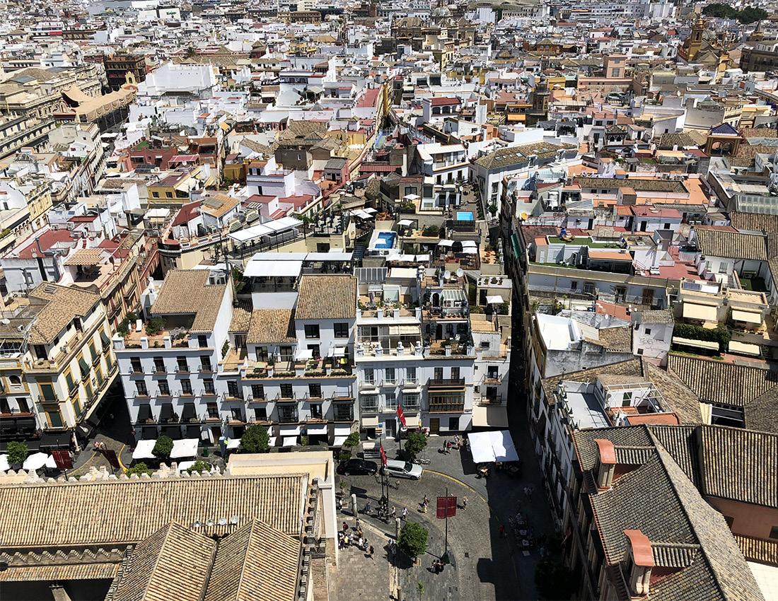
My interest in urban planning came from my travels to Europe and how differently cities are laid out and planned in different places with various backgrounds.
Phone Number
(513)417-9901
Email morri2sg@mail.uc.edu
LinkedIn linkedin.com/in/sageamorrison
Address 238 Klotter Avenue Cincinnati, Ohio 45219 Seville,Espana
2
SAGE MORRISON |
URBAN PLANNER
EDUCATION
University of Cincinnati
Cincinnati, Ohio
• College of Design, Architecture, Art, & Planning Class of 2026
• Bachelor of Urban Planning
• Environmental Studies Minor
• 3.82 GPA
Lebanon High School
Lebanon, Ohio
• Class of 2020
• 4.20 GPA
AWARDS
College
• National Co-op Ambassador Scholarship
• College of Design, Architecture, Art, & Planning Fall
2021 Dean’s List - Present
High School
• National Honors Society - 2 Years
• Academic Hall of Fame & Scholar Athlete
Community
• Otterbien: Opening Minds Through Art - Working with elderly on artwork projects
• ArtScape Lebanon: Art Empowerment - Unite & empower my community through the arts
INTERESTS
• Urban Design & Sustainability
(513)417-9901
morri2sg@mail.uc.edu
linkedin.com/in/sageamorrison
WORK EXPERIENCE
Michael Watkins Architect, LLC
Gaithersburg, Maryland
238 Klotter Avenue
Cincinnati, Ohio 45219
Full-time Co-op January 2023 - April 2023
• Revitalization & extension plans for existing communities
• Participating in urban design charrettes in Texas & Arkansas
• Preparation & editing of Master Plan & Planned Development
Standards Booklets
• AutoCAD, Photoshop, & Indesign
• Organizational skills
Kroger Starbucks
Lebanon, Ohio
Part-time Barista August 2020 - Current
• Training new baristas
• Customer connection
• Creating personalized hand-crafted beverages
SKILLS
Adobe Creative Cloud
• Photoshop, InDesign, & Illustrator
Microsoft Office Suites
• Word, Excel, & PowerPoint
Additional
• ArcGIS Pro & ArcGIS Online
• SketchUp Pro
• AutoCAD
Language
• Spanish
3
Michael Watkins Architect, LLC|
4
4
LEGACY CROSSING

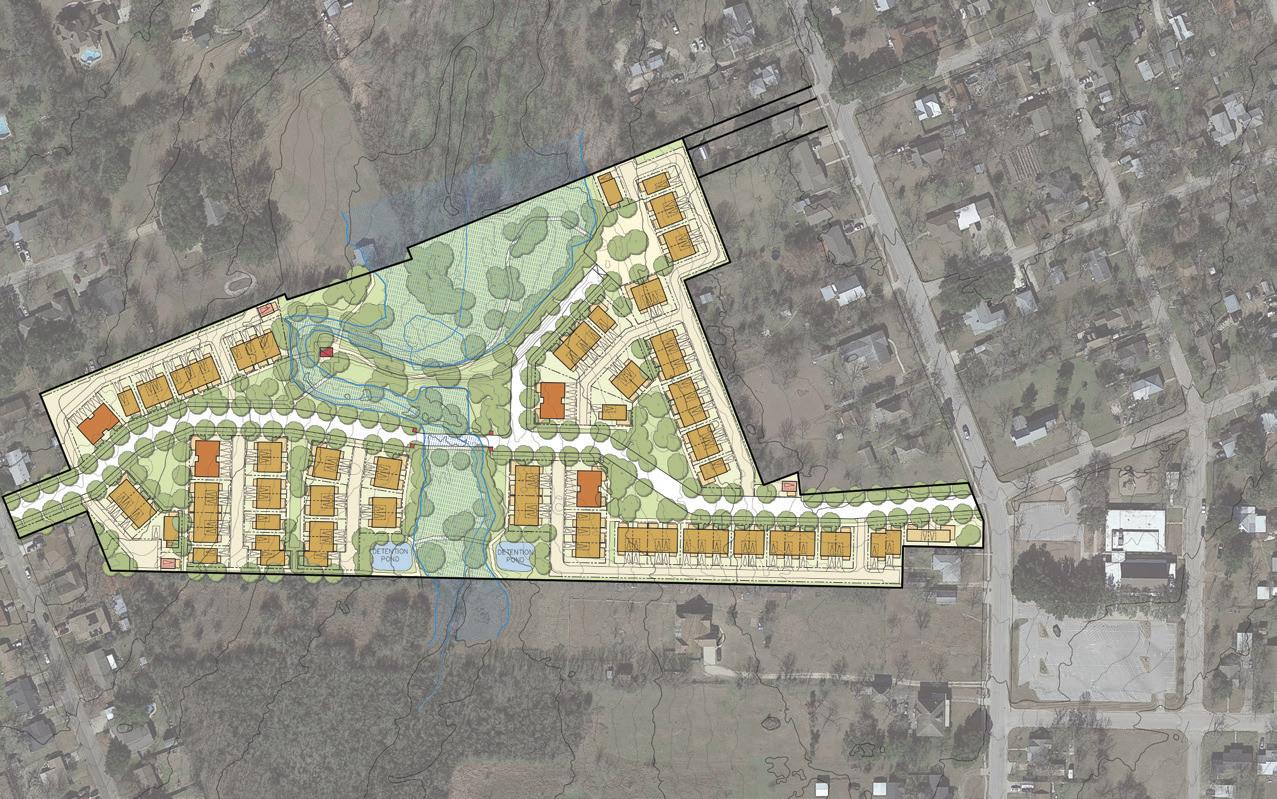
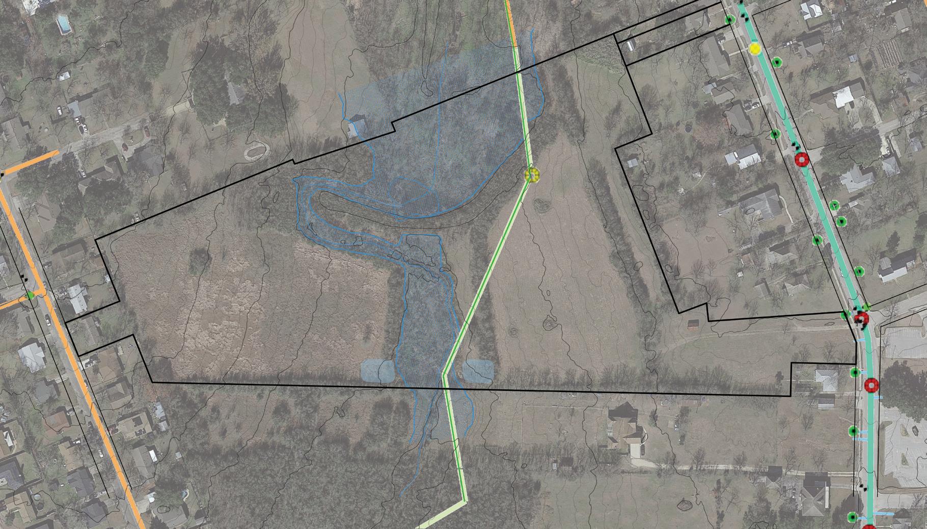
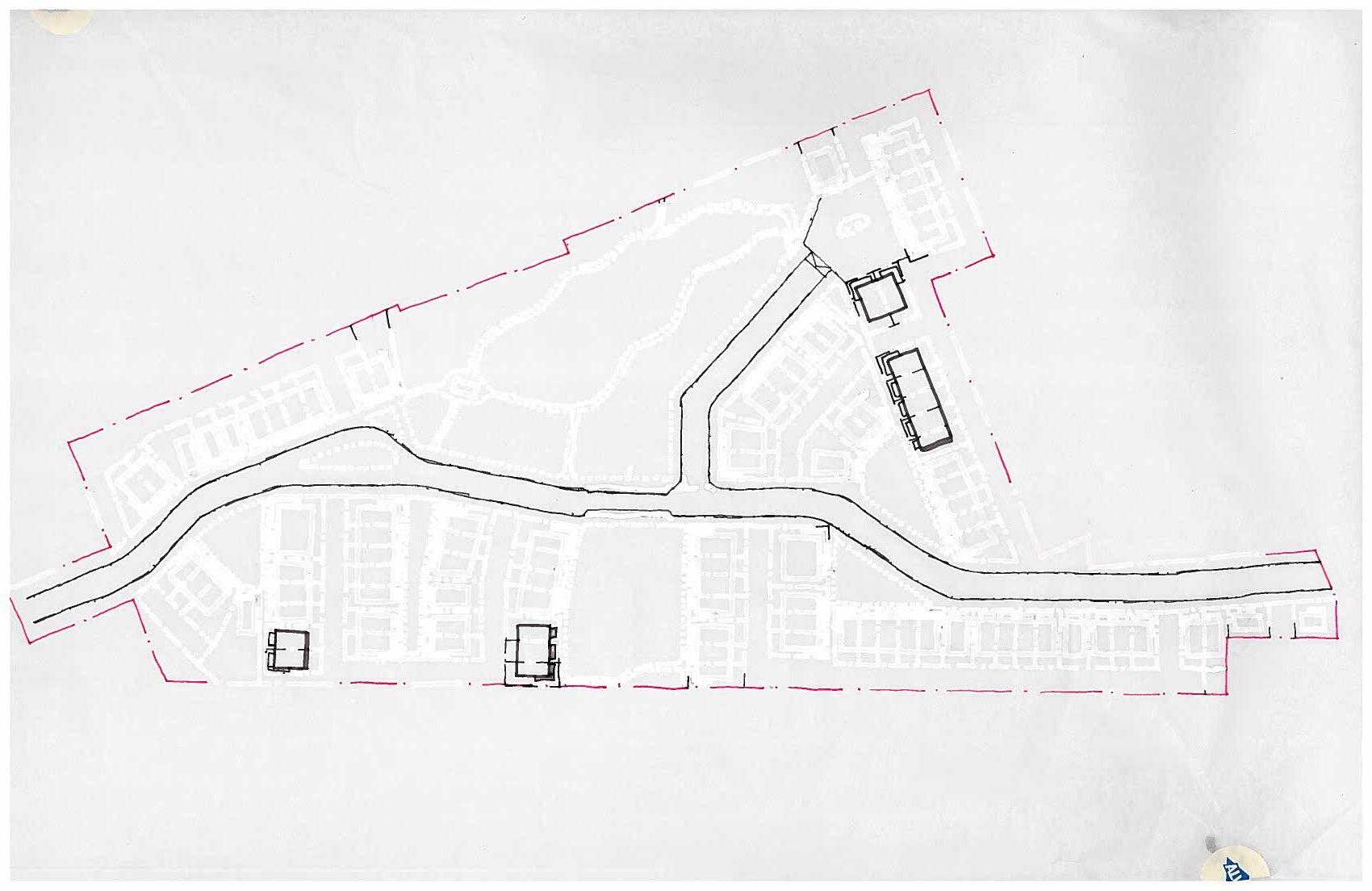
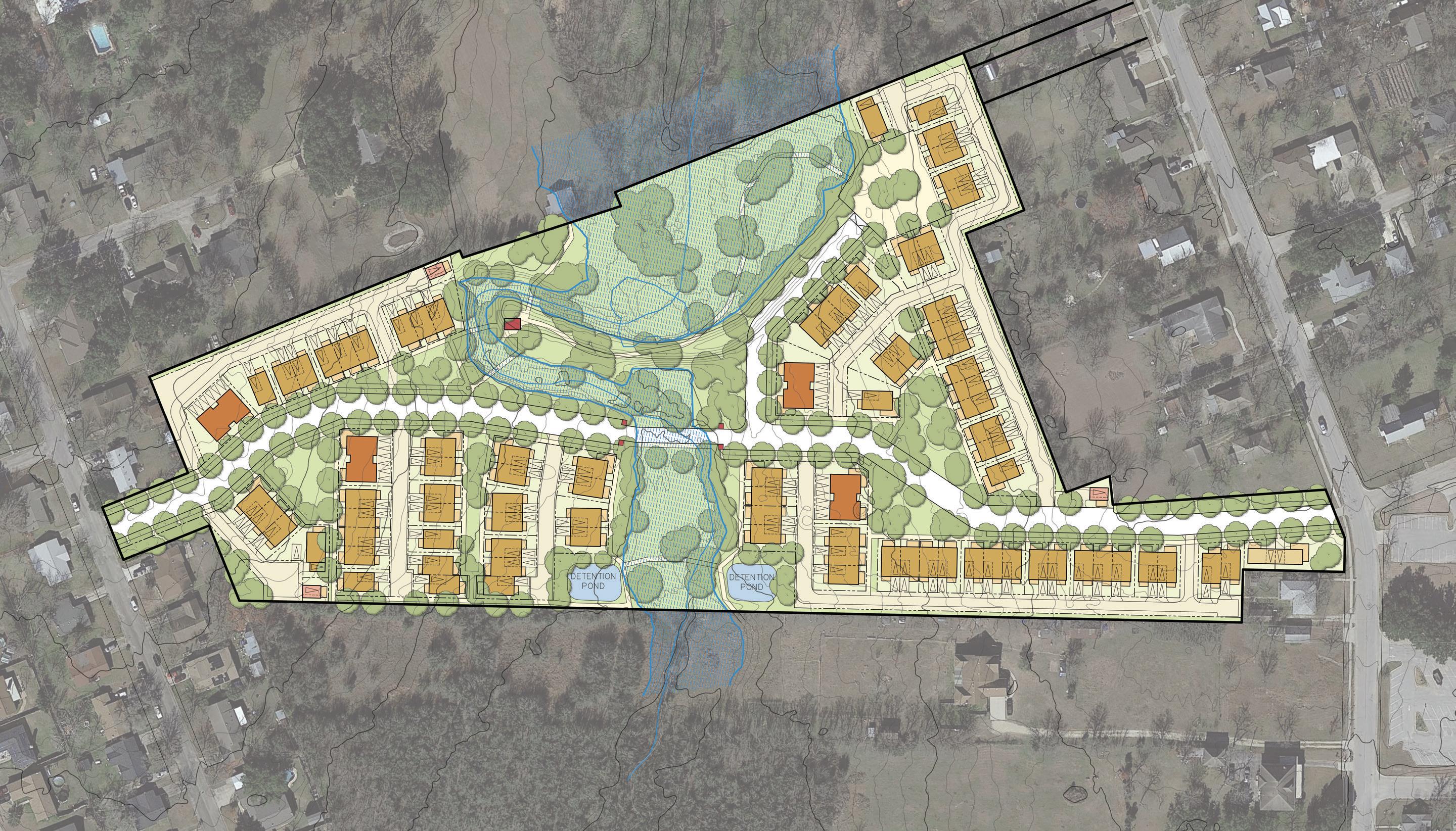
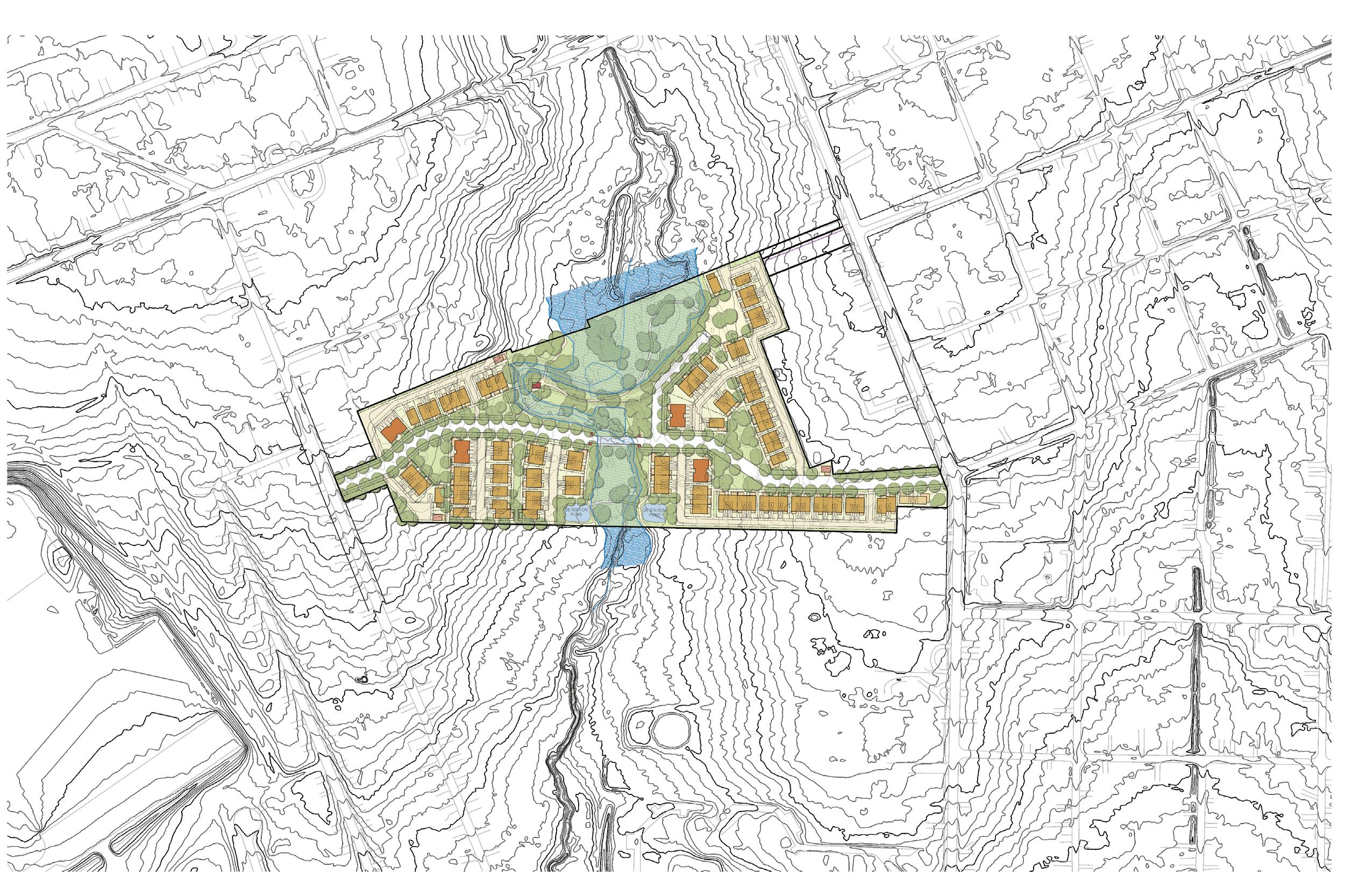
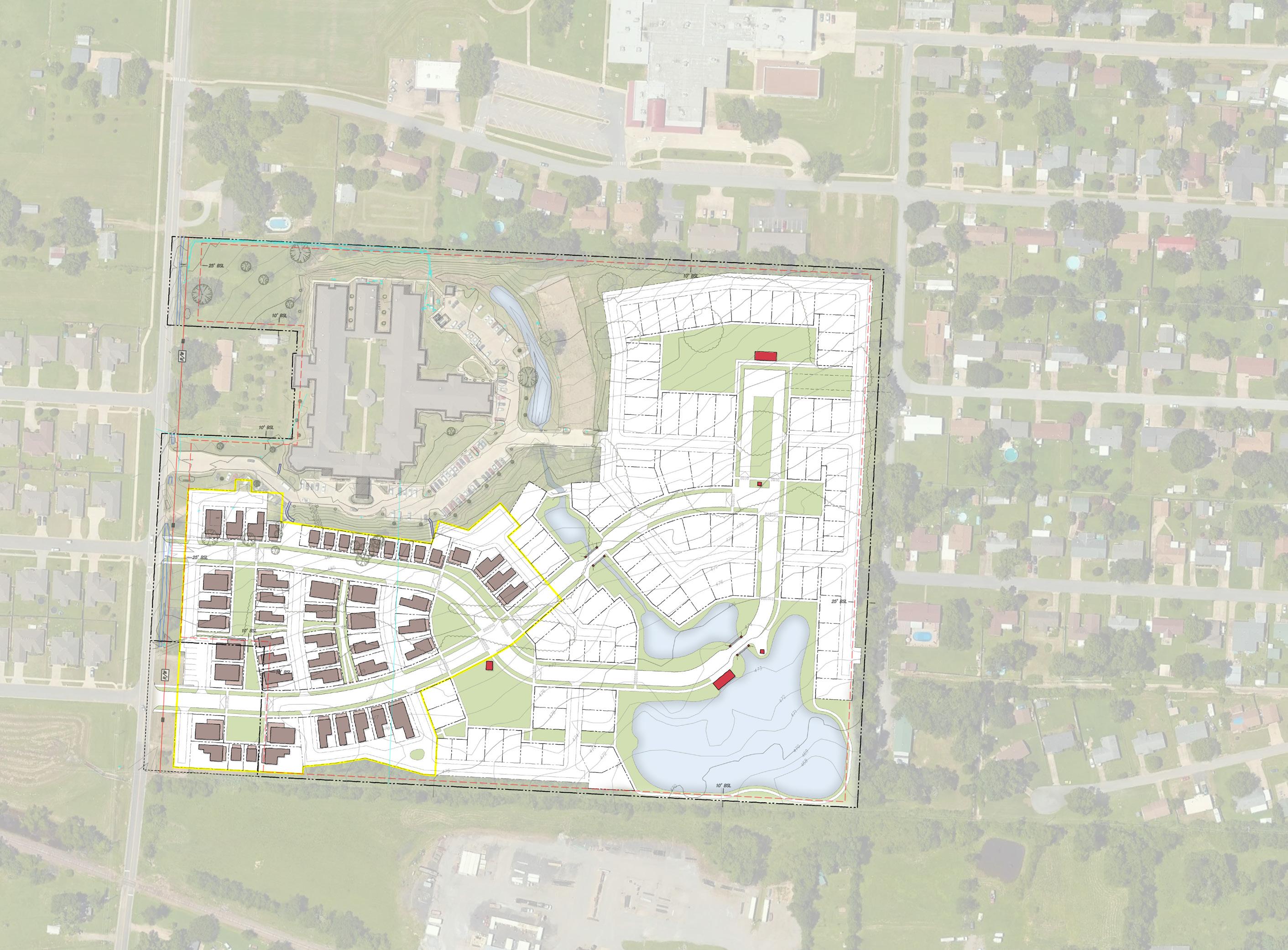
One of the great experiences I got to be apart of on my Co-op with Michael Watkins Architect was being able to go on Charrettes. Legacy Crossing in Taylor, Texas was the site and Master Plan that I worked on most. Within a week, this plan was almost finalized and ready to be created in AutoCAD and colored in Photoshop by myself with help from my co-workers.
5
April 25, 2023 Legacy Crossing Michael
The design is subject to change. Not for construction. A.3 W EXISTING CONDITIONS: SITE CONSTRAINTS MAP Key Site Boundary Contours (1-foot Intervals) Utilities (May be Ignored) Waterlines Floodplain 0 ft 60 ft 120 ft 240 ft N Sloan Street Debus Drive Lee Street CeceliaStreet Adams Street | Legacy Crossing CHARRETTE DRAWING EXISTING CONDITIONS
Watkins Architect, llc © 2023
MASTER PLAN WITH PROGRAM

6 | Legacy Crossing April 25, 2023
Crossing
Legacy
WMichael Watkins Architect, llc © 2023
B.3
The design is subject to change. Not for construction.
Sloan Street Debus Drive Lee Street CeceliaStreet Adams Street Program Units Single-Family (Detached) 9 Single-Family (Attached) 74 Four-Plex 16 2-Story Park-Under 2 3-Story Park Under 3 Total 104 Parking Required Spaces Per Unit 2 Units 104 Total Parking Required 208 Parking Provided Spaces In Garages 87 On Lots 106 On Street 96 Total Parking Provided 290 Difference + 82 MASTER PLAN WITH PROGRAM A A B C D Key Site Boundary Contours (1-foot Intervals) Floodplain 0 ft 60 ft 120 ft 240 ft N
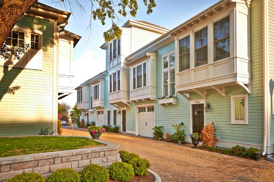
PRECEDENTS
| Legacy Crossing
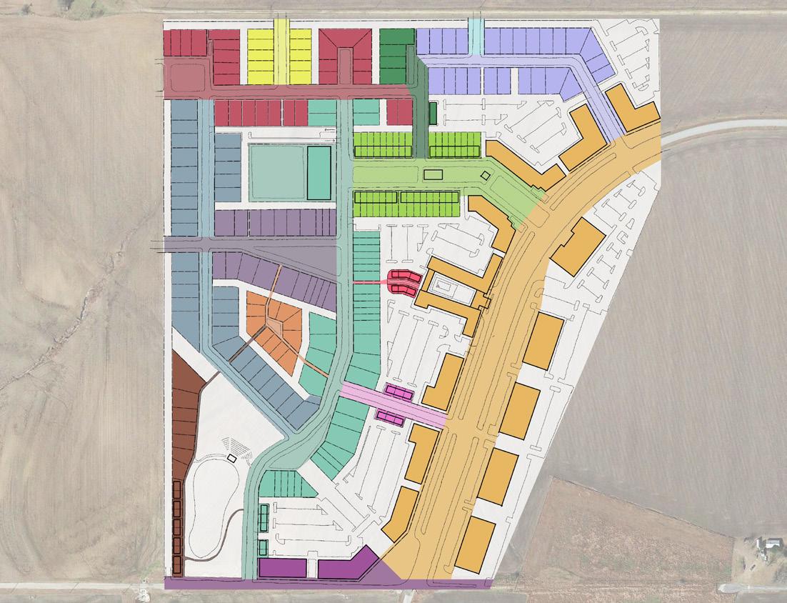
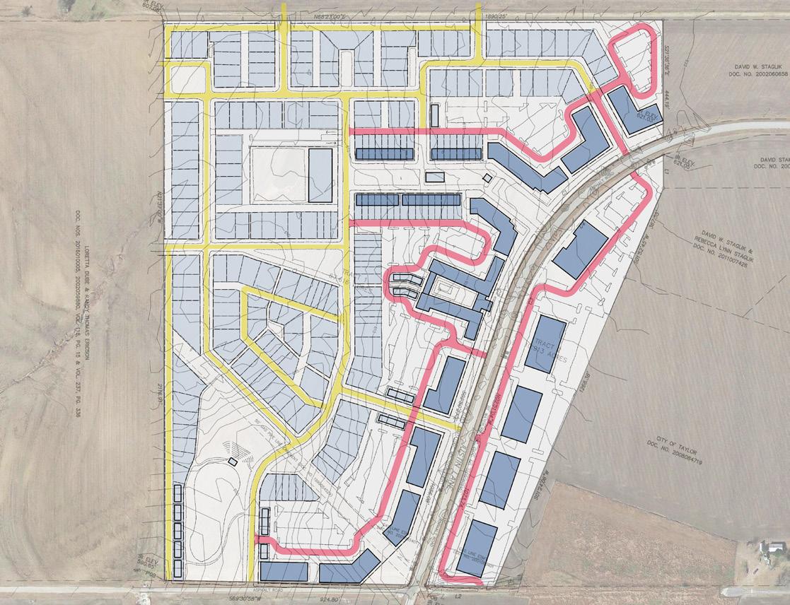
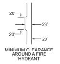
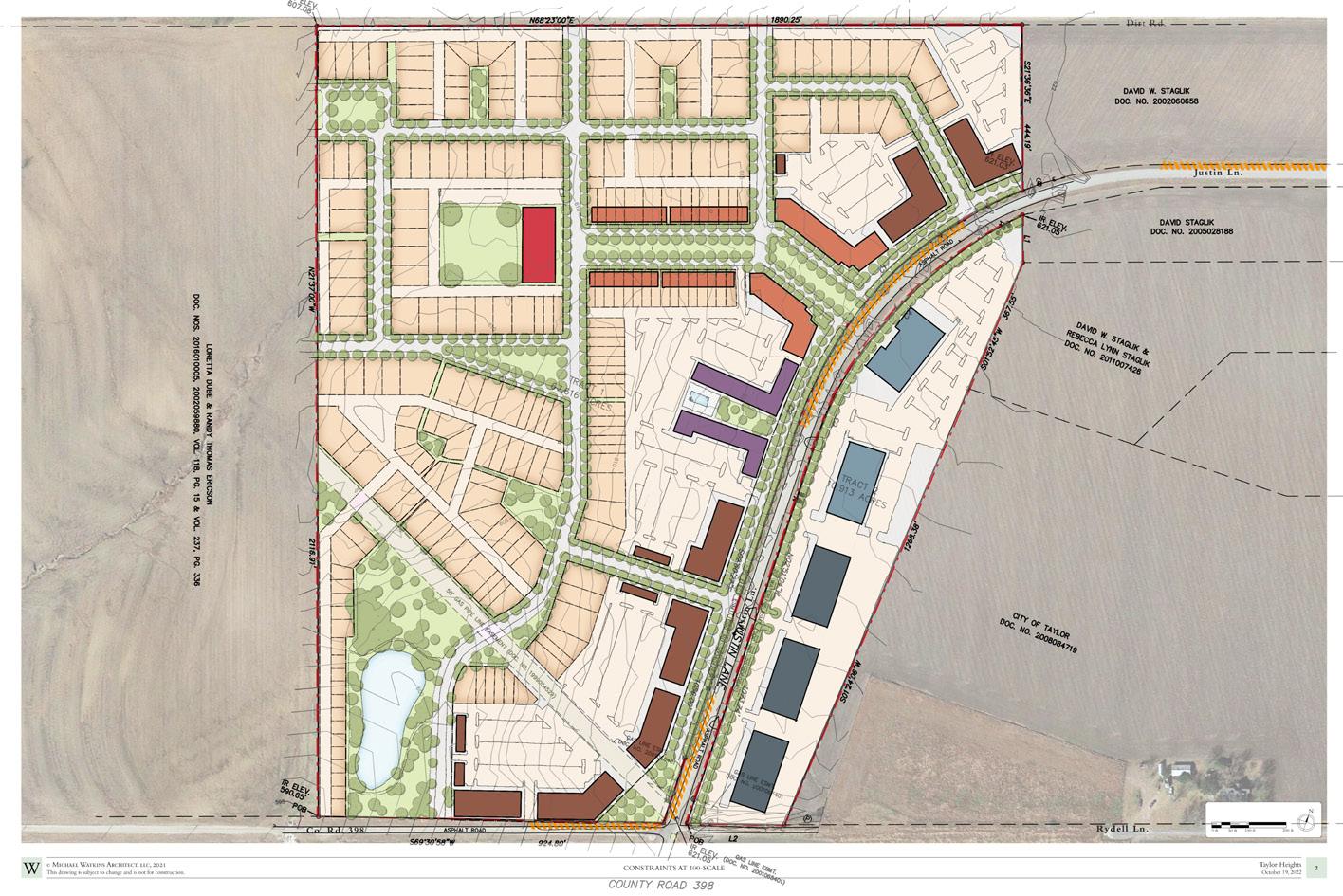
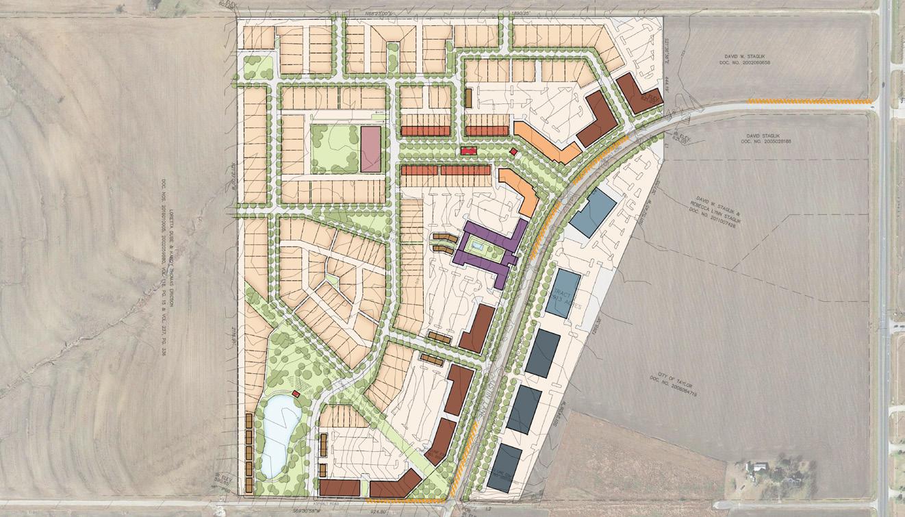
8 | Taylor Heights February 7, 2023 Taylor Heights W Michael Watkins Architect, llc © 2023 The design is subject to change. Not for construction. B.11 Thoroughfare Names and Addressing Key Street Street Street Street Street Street Street Street Street Street Way 1 2 3 4 5 6 7 8 9 10 J Way Way County Road 398 Justin Lane Sign ADDRESSING PLAN A B C D E I H K J G F L 11 13 12 1 2 3 4 5 6 7 8 9 10 J 1 4 4 5 5 6 10 11 12 13 2 11 13 13 C C C February 7, 2023 Taylor Heights W Michael Watkins Architect, llc © 2023 The design is subject to change. Not for construction. FIRE APPARATUS ACCESS DIAGRAM Fire Apparatus Access Notes Key 26-foot Fire Apparatus Access Road 20-foot Fire Apparatus Access Road Buildings over 30 feet Lots with buildings under 30 feet 1. Applicants understanding of the relevant standards from these fire apparatus access notes to be confirmed by the City of Taylor. 2. For buildings 30+ feet tall: Fire Apparatus Access Roads shall be 26 feet clear minimum. Fire Apparatus Access Roads shall be between 15 and 30 feet from the building. Fire Apparatus Access Roads shall provide access to one complete side of the building, as determined by the Fire Official. 3. Fire Apparatus Access Roads shall be 20 feet clear minimum for buildings less than 30 feet tall: 4. All Fire Apparatus Access Roads shall have an effective inside turning radius of 25 feet. 5. All Fire Apparatus Access Roads shall be a maximum distance of 150 feet from all portions of any building. 6. Where a fire hydrant is located on a Fire Apparatus Access Road, the minimum road width shall be 26 feet (7925 mm), exclusive of all shoulders see graphic below). Justin Lane JustinLane Street 1 Street 2 Street 5 Street 4 Street 5 Street 8 Street Street 7 Street6 Street 5 Street 4 Street 4 Street 10 Street 10 Street 1 Street 3 Street 9 A B C D E I H K J G F L ADDRESSING PLAN MASTER PLAN
February 7, 2023 Taylor Heights W Michael Watkins Architect, llc © 2023 The design is subject to change. Not for construction. B.1 MASTER PLAN Key Site Boundary Easement 2-foot Contours No Vehicular Access in this Zone Single-Family Att. & Det. Liner Townhouses 4-Story Apartments Strip Center Retail Live-Work Retail Day Care Hotel Flex Office Light Industry Civic Building 0 125 ft 250 ft 500 ft N Justin Lane JustinLane Street Street 2 Street 5 Street 4 Street 5 Street 8 Street 6 Street 7 Street6 Street 5 Street Street 4 Street 10 Street 10 Street Street Street 9
FIRE ACCESS PLAN
THOROUGHFARE TYPES
WMichael Watkins Architect, llc © 2023
The design is subject to change. Not for construction.
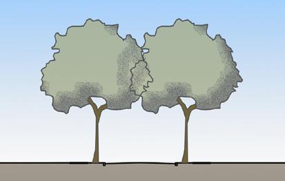
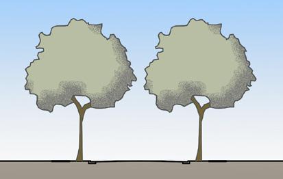
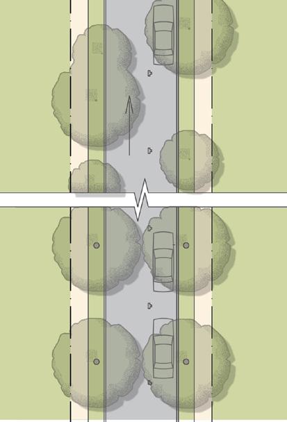
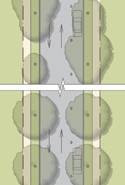
THOROUGHFARES: PRIMARY TYPES
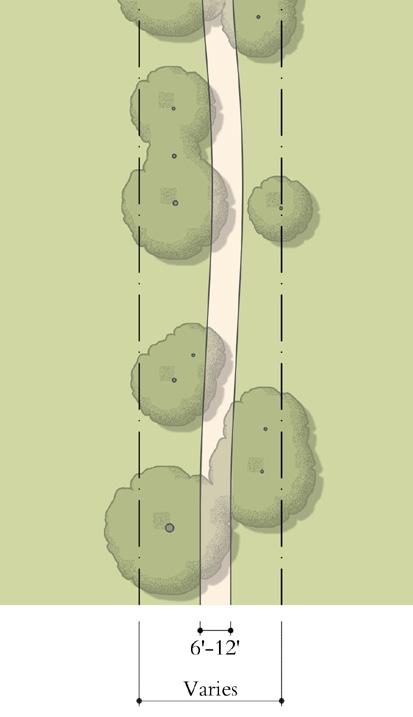
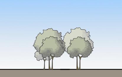
Taylor Heights
C.4
9 | Taylor Heights
February 7, 2023
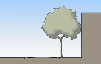
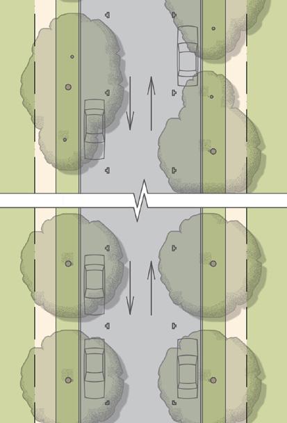
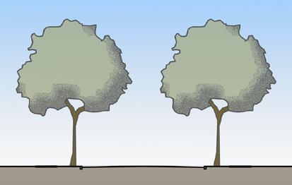
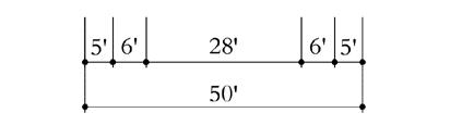
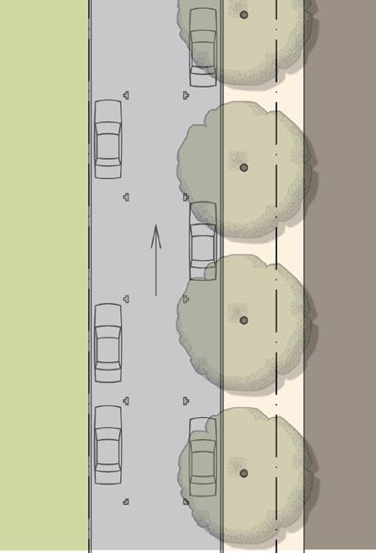
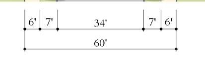
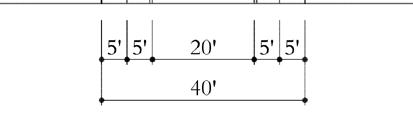
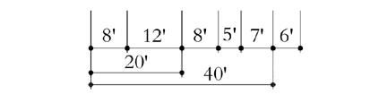
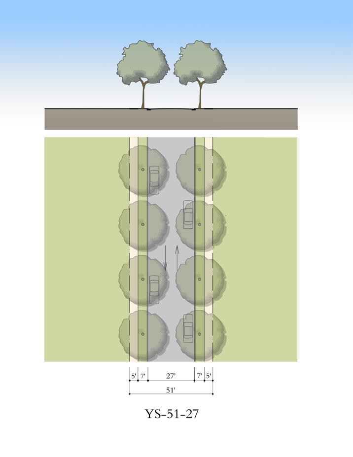
Thoroughfare Type Transect Zone Right-of-Way or Easement Width Pavement Width Movement Traffic Lanes Parking Lanes Pavement / Curb Curb Type Planter Type (includes curb if any) Landscape Type Walkway Type Fire Apparatus Access Notes Street T3, T4, T5, SD 50 ft. ROW 28 ft. Pavement Slow Movement Two-Way Traffic Parking on One Side 12 ft. Curb Radius Header Curbs 6 ft. Tree Lawn T3: Clustered / T4-5: Allee, 25 ft. o.c. 5 ft. Sidewalk Not provided on this thoroughfare. Street T3, T4, T5, SD 42 ft. ROW 20 ft. Pavement Slow Movement One-Way Traffic Parking One Side 12 ft. Curb Radius Header Curbs 6 ft. Tree Lawn T3: Clustered / T4-5: Allee, 25 ft. o.c. 5 ft. Sidewalk Not provided on this thoroughfare. Street T3, T4, T5, SD 60 ft. ROW 34 ft. Pavement Slow Movement Two-Way Traffic Parking Both Sides 12 ft. Curb Radius Header Curbs 7 ft. Tree Lawn T3: Clustered / T4-5: Allee, 25 ft. o.c. 6 ft. Sidewalk Up to 30 ft. This thoroughfare type overrides City standards for Neighborhood Avenue. Street T5, SD 40 ft. ROW 20 ft. Pavement, 14 ft Pervious Pavers Slow Movement One-Way Traffic Parking Both Sides 12 ft. Curb Radius Mountable, Header Curbs 6 ft. Tree Lawn Allee, 25 ft. o.c. 5 ft. Sidewalk Not provided on this thoroughfare. Street trees may be omitted to allow for a colonnade or arcade. ST-50-28 ST-42-20 Right-of-Way Width Pavement Width XX-##-## Thoroughfare Type RD Road ST Street CS Commercial Street LN Lane RA Rear Alley PT Path PS Passage ST-60-34 CS-40-28 42' 6' 6' PT-V-5 Path T3, T4, T5, SD ROW Width Varies N/A N/A N/A N/A N/A N/A Open Trees, ground cover, shrubs, lawn 5 ft. Sidewalk Not provided on this thoroughfare. This thoroughfare type will be privately owned and maintained.
FIRE ACCESS
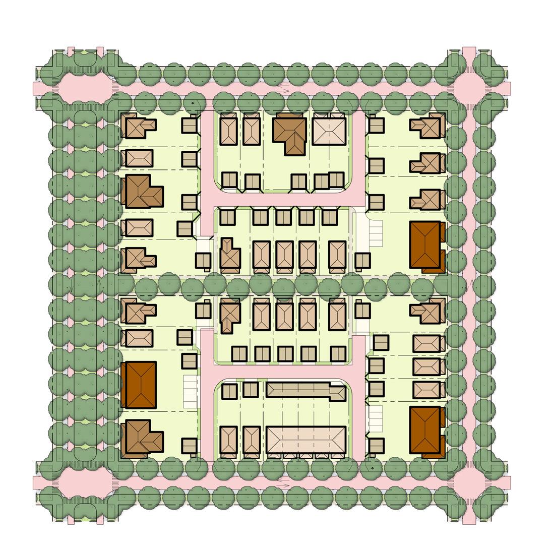
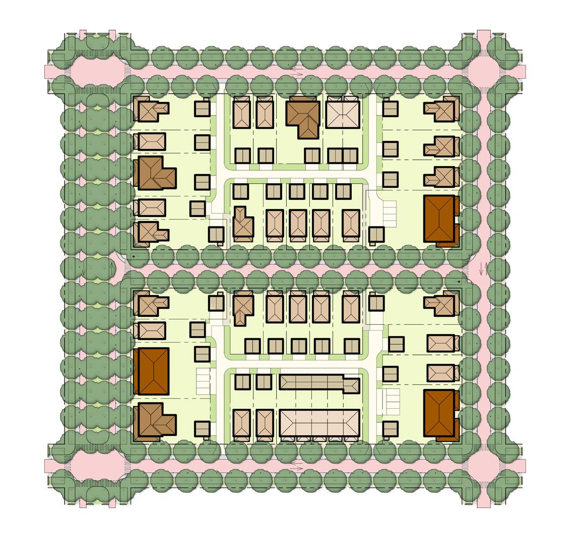
With Bush Emeny, MWA proposed two options for how fire trucks could access certain units.
Option 1: Shows the 20 ft. pavement with correct turning radius within alleyways. A pedestrian path is shown in replace of a street. A typical block is represented in the diagram.
Option 2: Shows 12 ft. of pavement within the alleys as to not allow fire to access units from there. Instead, they will access units from the street. A typical block is represented in the diagram.
By using AutoCAD and transferring the linework into Photoshop, I was able to achieve these “typical block” diagrams.
OPTION 1
OPTION 2
| Bush Emeny 10
ASHTON PLACE

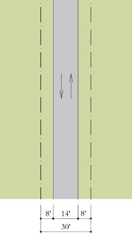
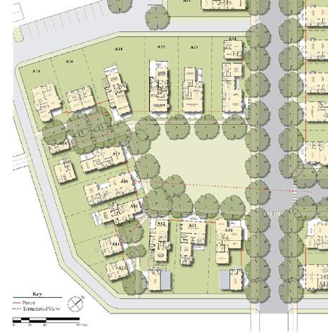
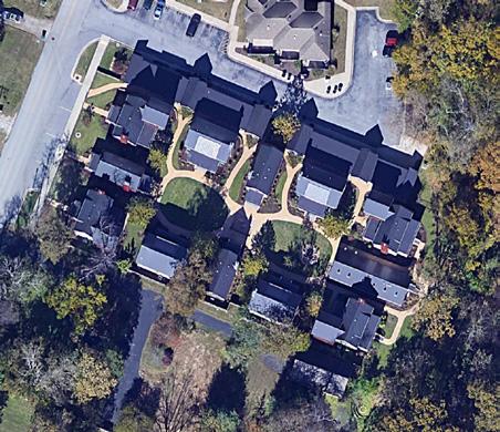
11 For scale: Heritage Village Cottage Court For scale: Black Apple Cottage Court 1.75 ac. 0.24 ac. 0.10 ac. REAR ALLEY RA-30-14 Strozier Ln.
Yukon
Fairbanks
Phase I Unit Count % Studio 16 31.4% One-bedroom 23 45.1% Two-bedroom 11 21.6% House of Three 1 1.9% Total 51 100.0% Parking Provided Parking Pads on “Lots” 2 Garages on “Lots” 37 On-Street 55 Total 94 Future Phases Unit Count % Studio 32 34.8% One-bedroom 48 52.2% Two-bedroom 12 13.0% House of Three 0 0.0% Total 92 100.0% Parking Provided Parking Pads on “Lots” 1 Garages on “Lots” 77 On-Street 55 Total 133 Total Unit Count % Studio 48 33.6% One-bedroom 71 49.7% Two-bedroom 23 16.1% House of Three 1 0.7% Total 143 100% Parking Provided Parking Pads on “Lots” 3 Garages on “Lots” 114 On-Street 110 Total 227 0 ft 50 ft 100 ft 200 ft N Property Line Phase 1 Boundary 2j 3 1j 1j 0a 0a 0a 0a 0a 0a 0a 0a 0a 1c 1c 1e 1e 1e 2j 1e 1e 1e 1e 0e 0e 0e 0e 2j 2j 2j 2j 2j 0e 1e 1e 1e 1e 1e 1e 1e 1e 1e 1e 1e 1e 1e 1e 2j 2j 2i 2i 0a 0a 0a 0a 1e 1e 1e 0c 0c 1e 1e 1e 1e 2j 2j 1e 1e 1e 1h 0e 0e 0e 1e 0a 0a 0a 0a 0b 1j 1e 1e 1e 0e 0e 0e 0a 0a 0e 0e 0e 2j 2j 2j 2j 1h 1h 1h 1h 1h 0e 0e 0e 0e 0e 0e 0a 0a 0a 0a 0a 0a 1e 1e 2j 2j 2j 1e 1e 1e 1e 1e 1e 1e 1e 1e 1e 1e 1e 1e 1e 1e 1e 1e 1e 1e 1e 1e 1e 1e 2j 2j 2j | Additional Work
13th St.
Dr.
Dr. Denali Way D. St.
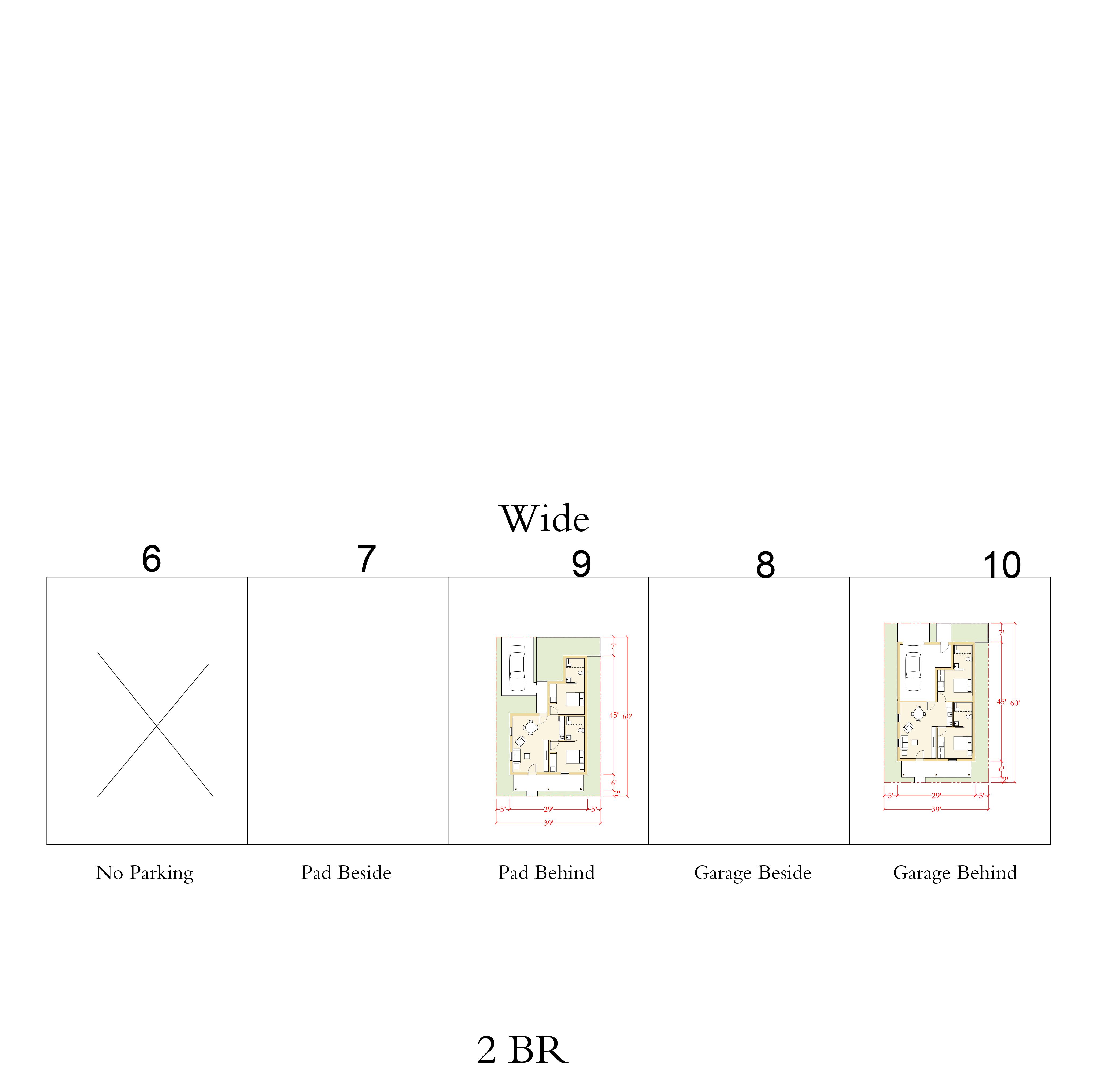
UNIT CONFIGURATIONS
60R-2P: Pad Behind, Two-bedroom Unit
60R-2G: Garage Behind, Two-bedroom Unit
"Lot" Area 2,340 SF Corner Potential Yes, 1 side, +5 ft. width
Attached Potential Yes, 29 ft. x 55 ft
40R-SP: Pad Beside, Studio Unit
"Lot" Area 1,140 SF
Corner Potential Yes, 1 side, +5 ft. width
Attached Potential Yes, duplex only While most configurations provide the likely required 10 ft. of building separation in the form of 5 ft. per side, this configuration provides all of the required separation on one side as a parking pad.
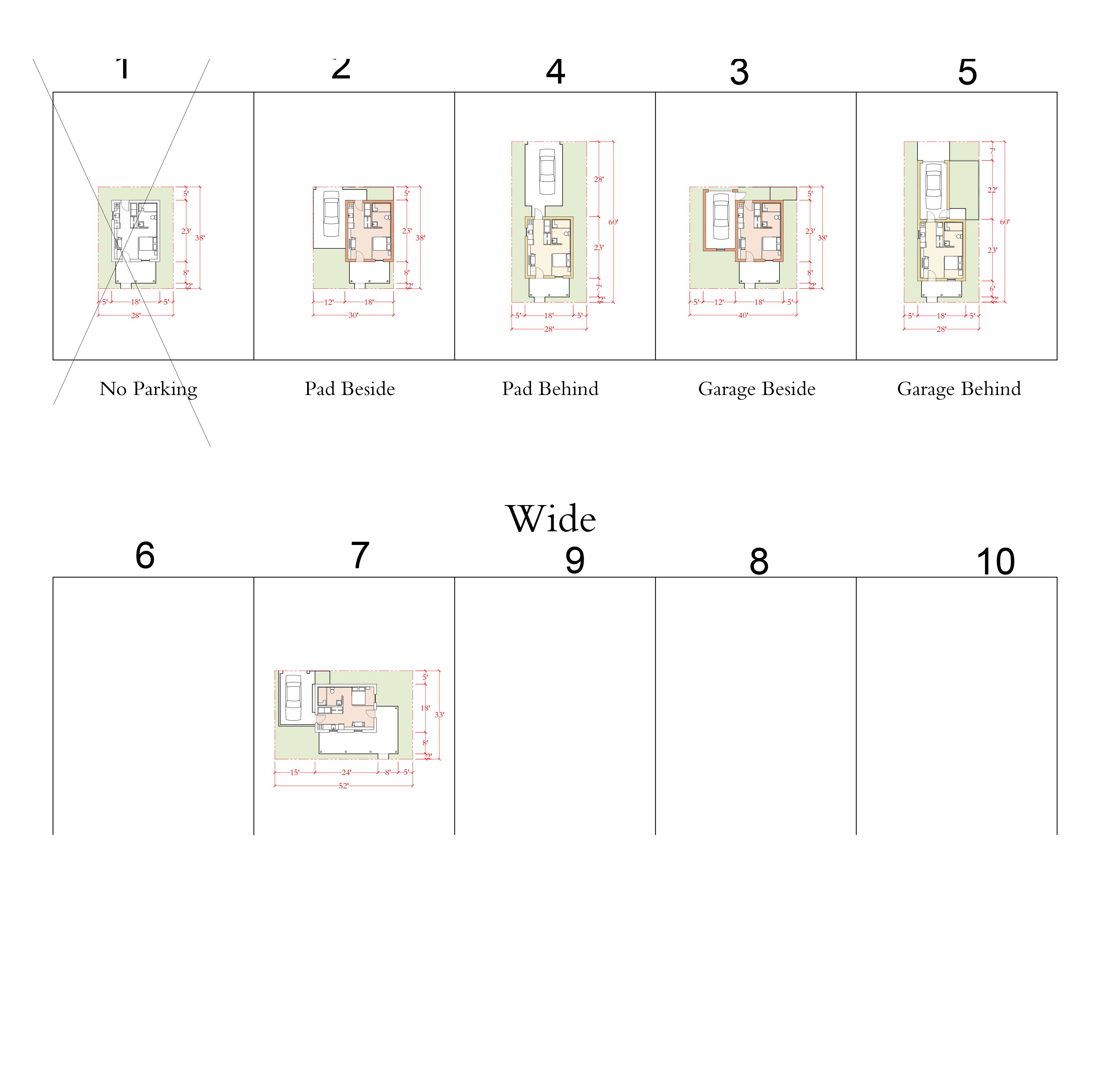
40R-SG: Garage Beside, Studio Unit
"Lot" Area 1,520 SF
Corner Potential Yes, 1 side, +5 ft. width
Attached Potential Yes, 30 ft. x 40 ft. Parking beside the studio unit is a slightly more inefficient use of infrastructure, however this configuration may prove useful where the normative depth is not achievable.
29
"Lot" Area 2,340 SF Corner Potential Yes, 1 side, +5 ft. width Attached Potential Yes,
ft. x 55 ft
| Additional Work
Over-the-Rhine: A Healthy Findlay|
13
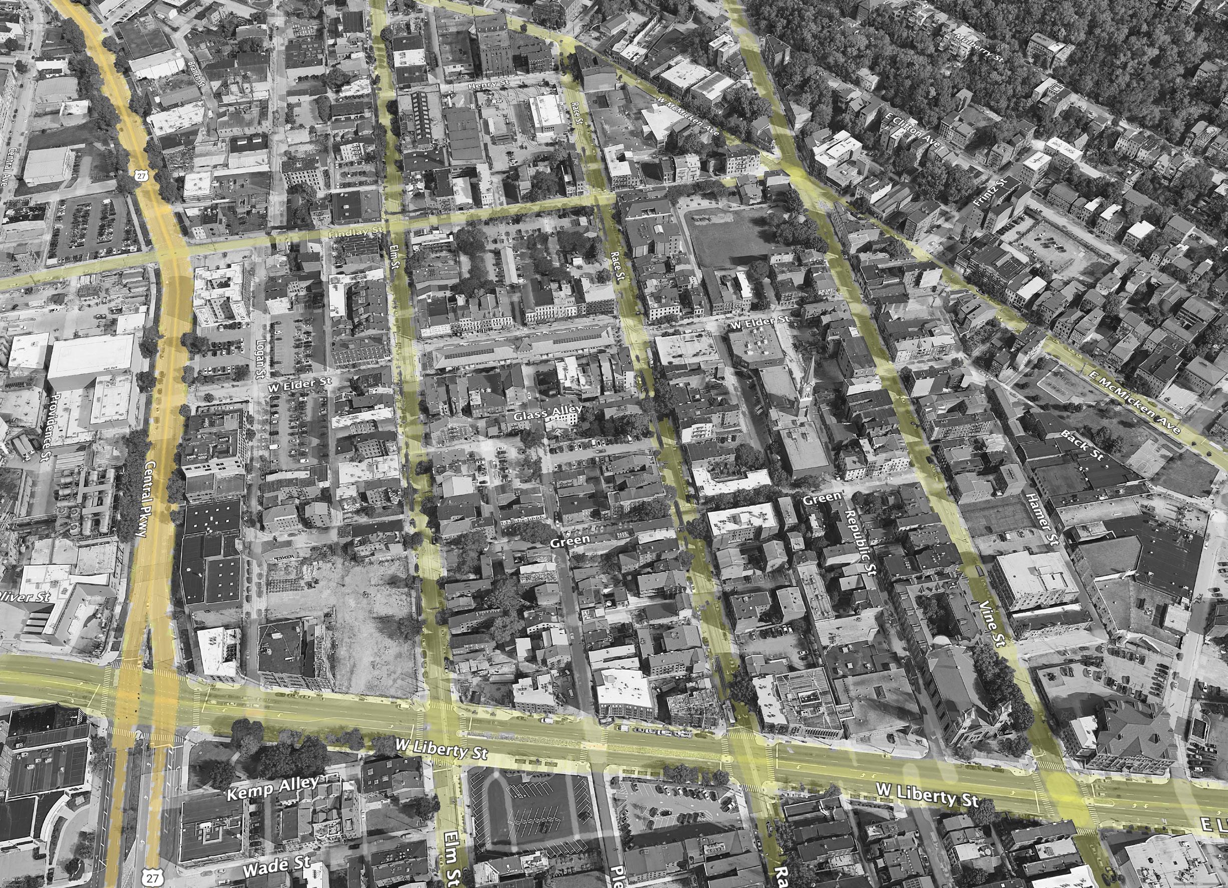
FOOD DESERT?
Given the topic of Ecology, we look deeper into Over-the-Rhine and its surrounding neighborhoods abundance of healthy and fresh food. Mapped out are all the restaurants (healthy vs. un-healthy), grocery stores and farmer’s markets to begin analyzing what truly is happening in OTR and how accessible those amenities are to the streetcar. OTR is the place to go for a night out, but it isn’t necessarily all healthy. Many places are bar and grill type places or fast food and when the restaurants are healthier, they’re only accommodating to the wealthier folk. There are many grocery stores in OTR, but only one that is large being the Kroger-on-the-Rhine so more could always be added. As for Farmer’s Markets, OTR is known for its Findlay Market open throughout the week offering local businesses and loads of fresh foods. This is the only Farmer’s market in the area though. Overall, more healthy options need to be added to OTR and especially surrounding neighborhoods with all income ranges in mind.
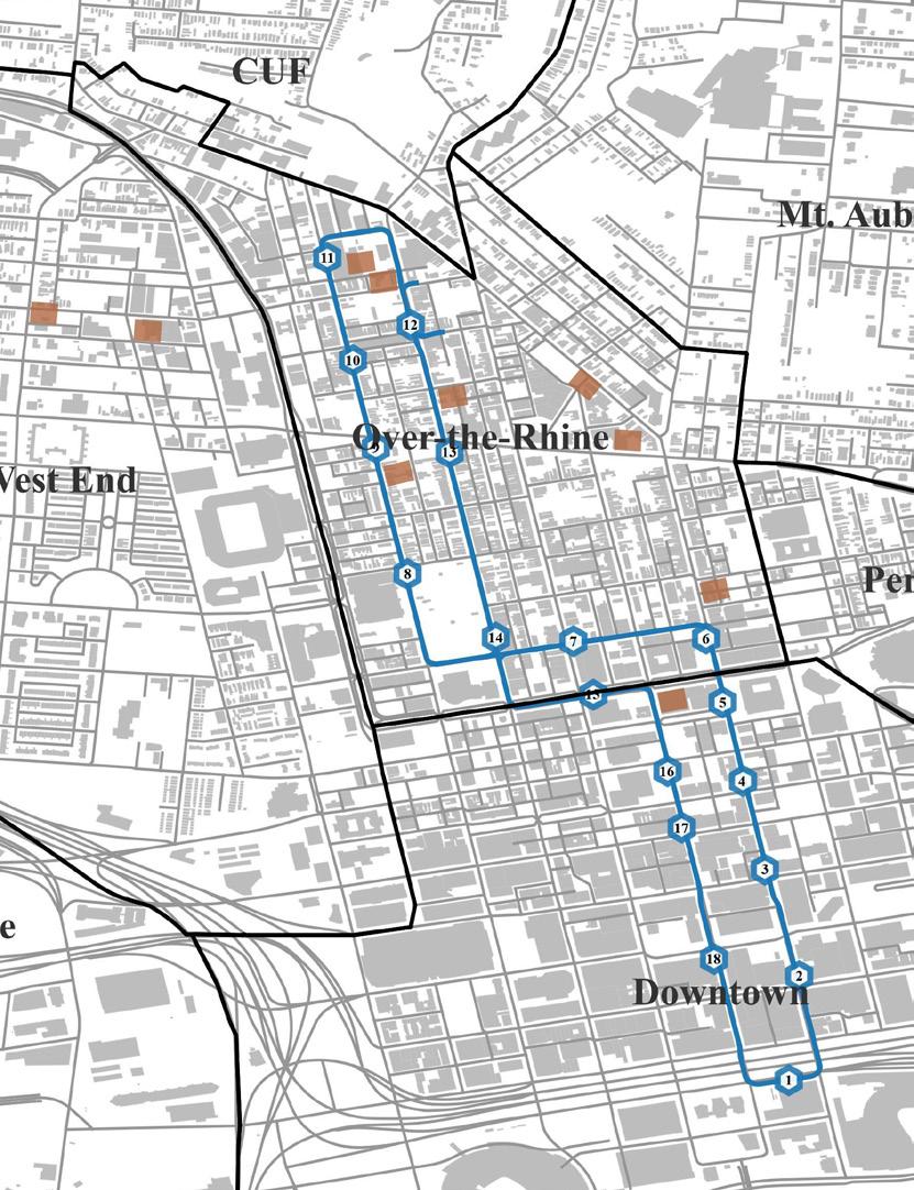
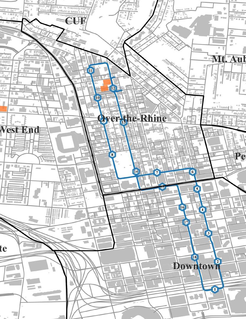
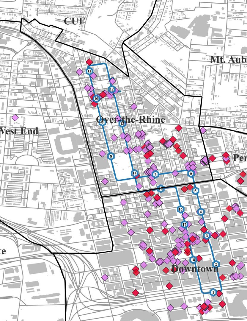
14 | Research Farmers Market Streetcar Route Street Building Neighborhood Boundaries Streetcar Stop Streetcar Route Street Building Neighborhood Boundaries Streetcar Stop Grocery Store Healthy Restaurant Un-healthy Restaurant Streetcar Route Street Building Neighborhood Boundaries Streetcar Stop RESTAURANTS GROCERY STORES FARMER’S MARKETS 0 250 500 m 0 250 500 m 0 250 500 m
GOOD URBANISM
GOOD VS. BAD URBANISM
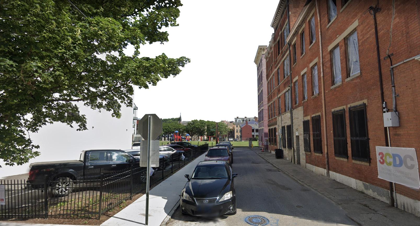
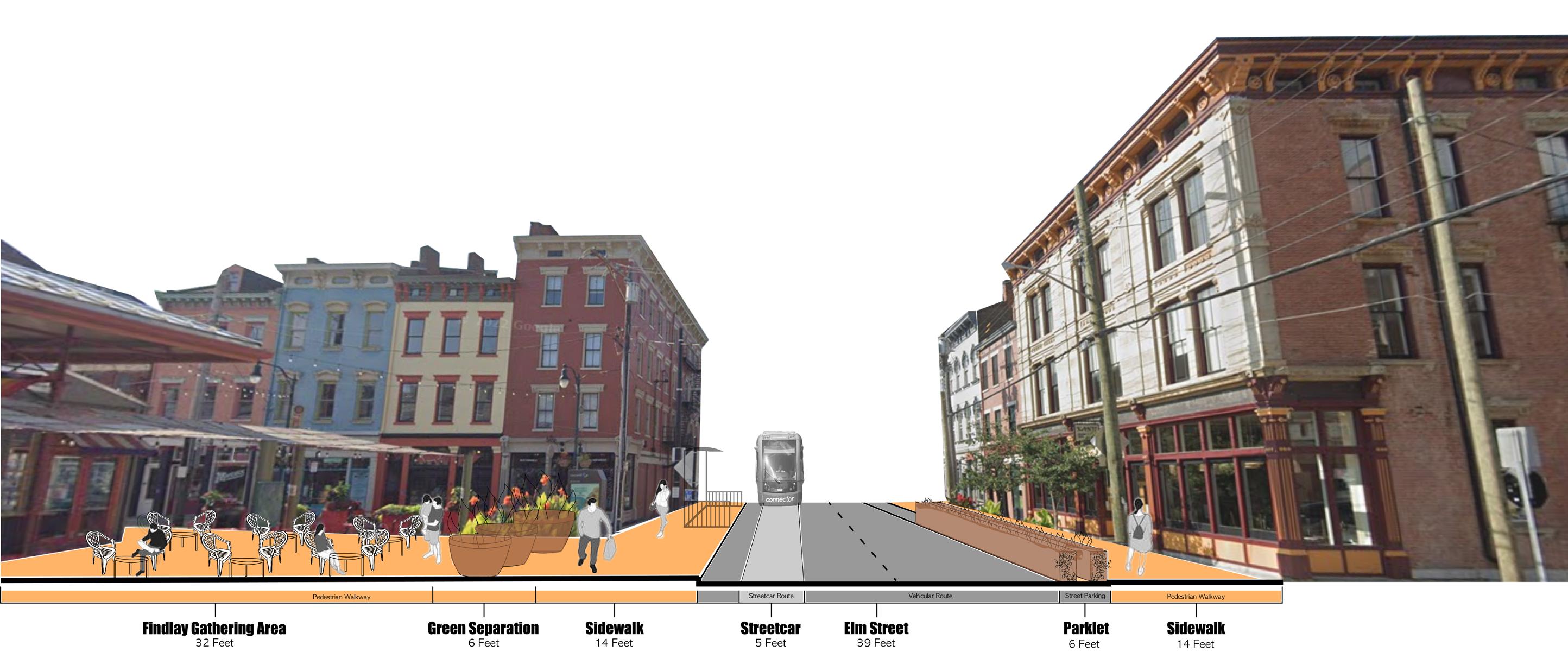
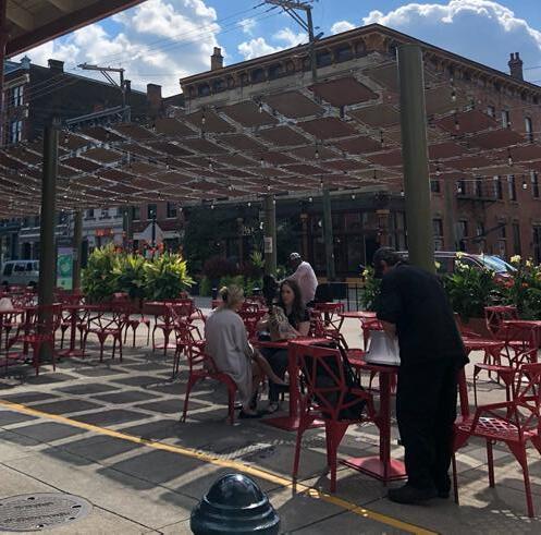
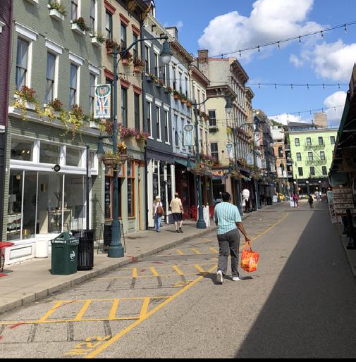
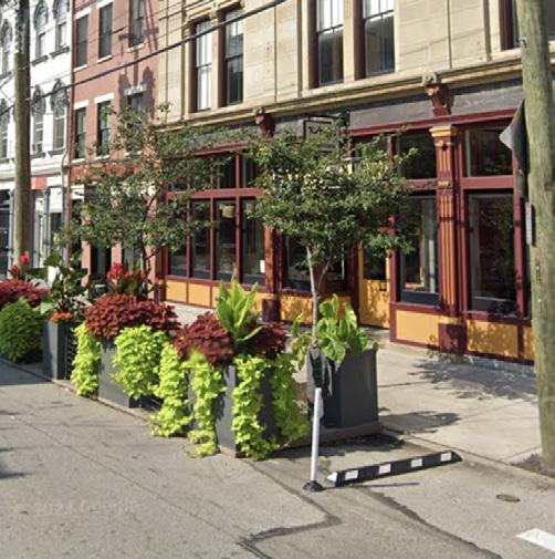
Good Urbanism is represented by a place being created for the pedestrian. Things like gathering spots, greenery, public transportation, local businesses, a lack of places for vehicles and much more can be associated with this.
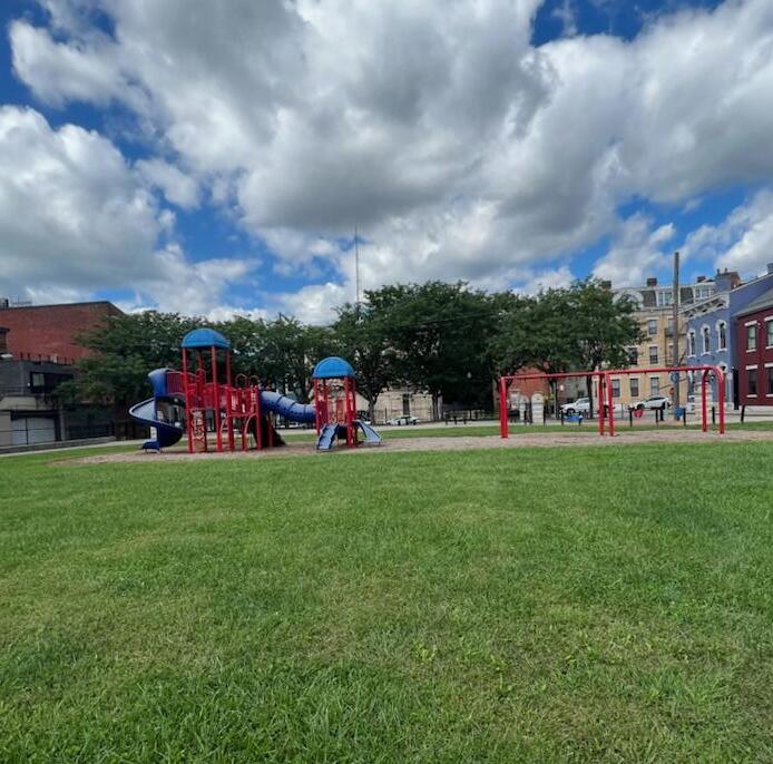
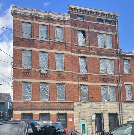
Bad Urbanism is represented by a place being vehicle oriented, vacant lots, a lack of greenery, a feeling of unsafety, unkept roadways & sidewalks, damaged buildings and more. As planners, we must find ways to create a safe environment thats walkable and allows access to the many things we need on a daily basis.
BAD URBANISM

| Site Analysis
Republic Street Sidewalk Sidewalk Parking Lot 20 Feet 33 Feet 7 Feet 7 Feet Pedestrian Walkway Parking Pedestrian Walkway Street Parking
15

| Site Analysis 16
MASTER PLAN
A HEALTHY FINDLAY
Findlay’s Friendly Biking
Living Fresh Green and the City
Legend
Proposed Trees
Proposed Green Space
Proposed Water feature
Proposed Green Roofs
Proposed Bioswale & Trailway


Proposed Bike lane
Proposed Bike Stations
Proposed Street Closure
Proposed Healthy Food
Proposed Green
Proposed Recreational Spaces
| Master Plan 17
PURPOSE



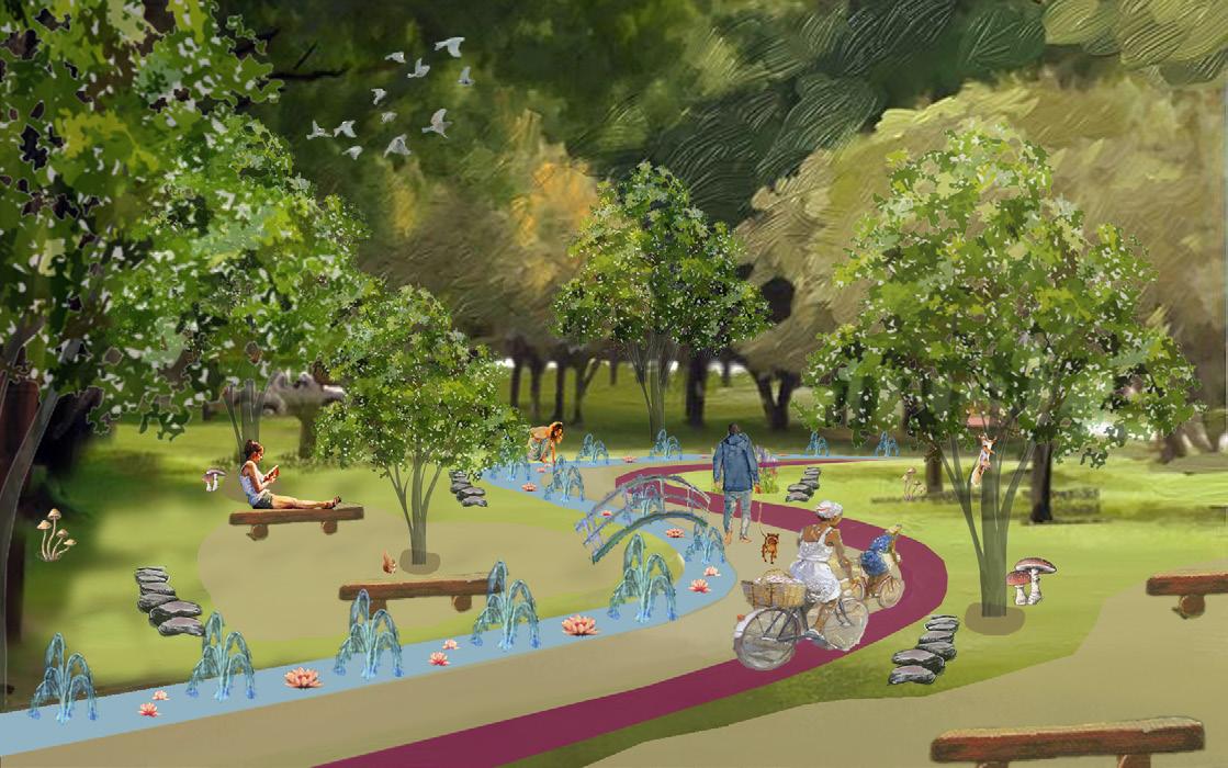
The purpose of “A Healthy Findlay” is to bring forth awareness of Over-the-Rhine’s community and how much needs to change if its going to continue to thrive.
















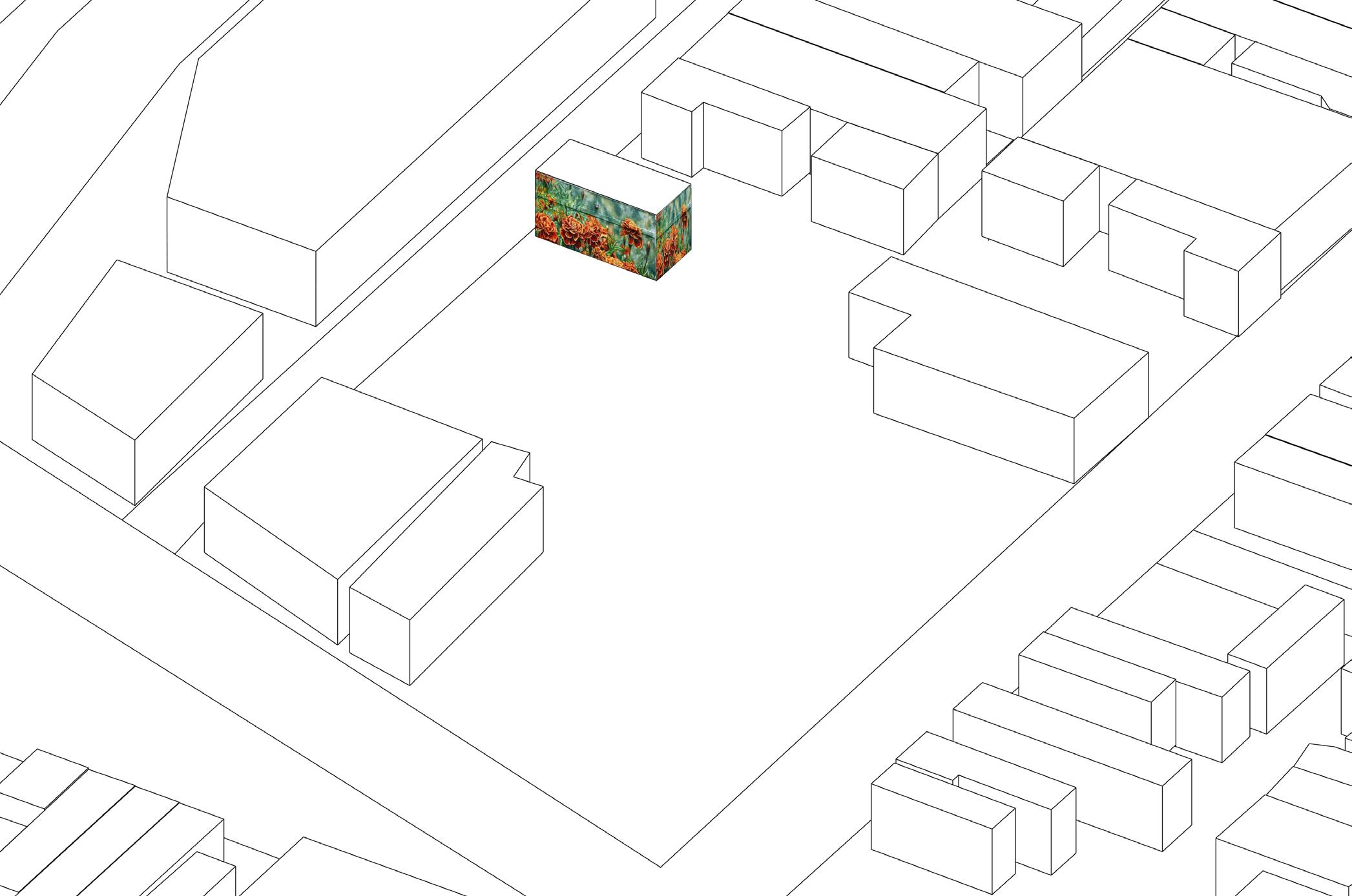
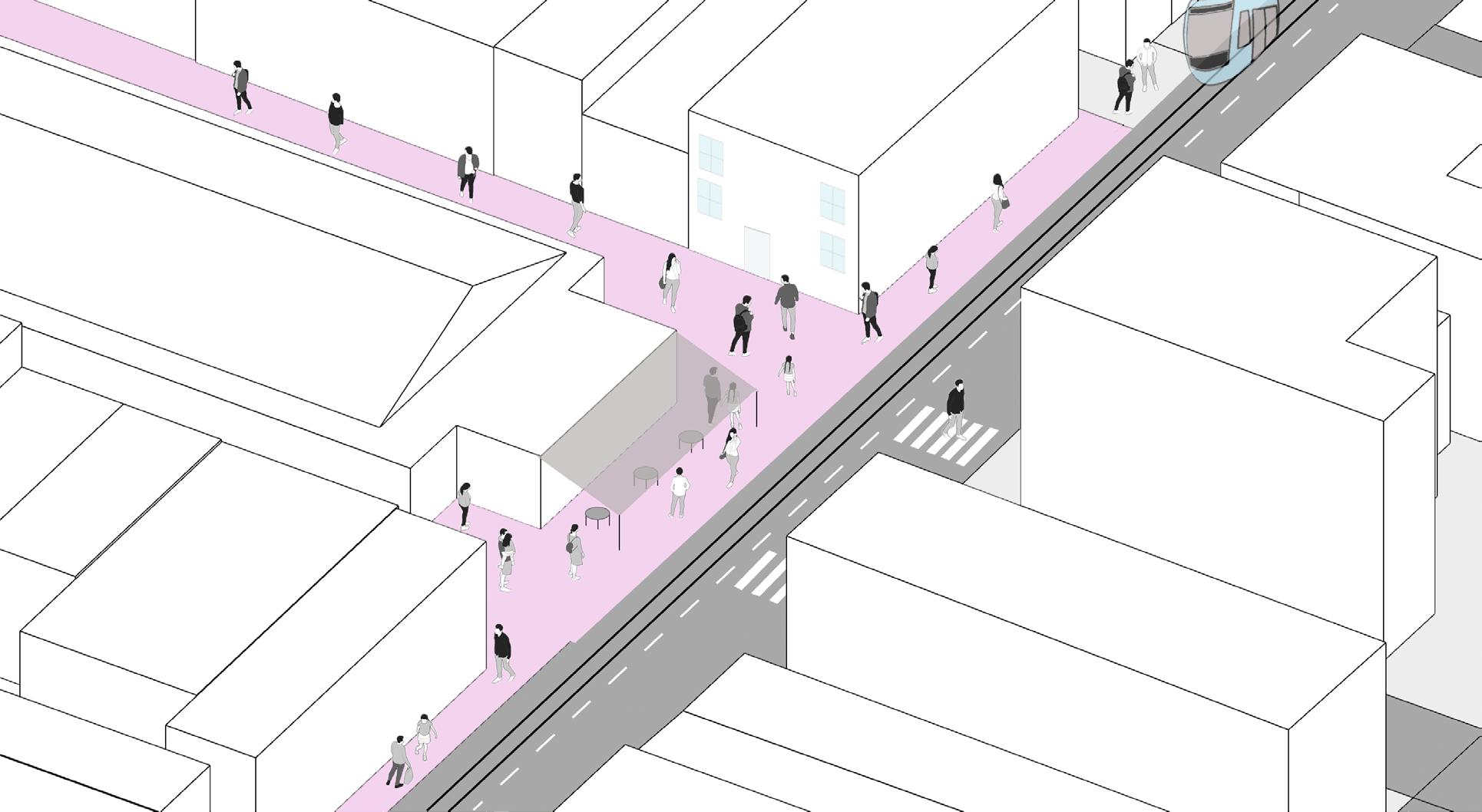
Focusing on a “Biker’s Paradise” that connects the community to Findlay Market and the proposed destination spots created, the “Living Fresh” portion activates more healthy activities like restaurants


18 12.5’ 8.5’ 21’ 23’ 65’ Sidewalk & Bike Path Sidewalk Parking Elm Street One-way | Implementation
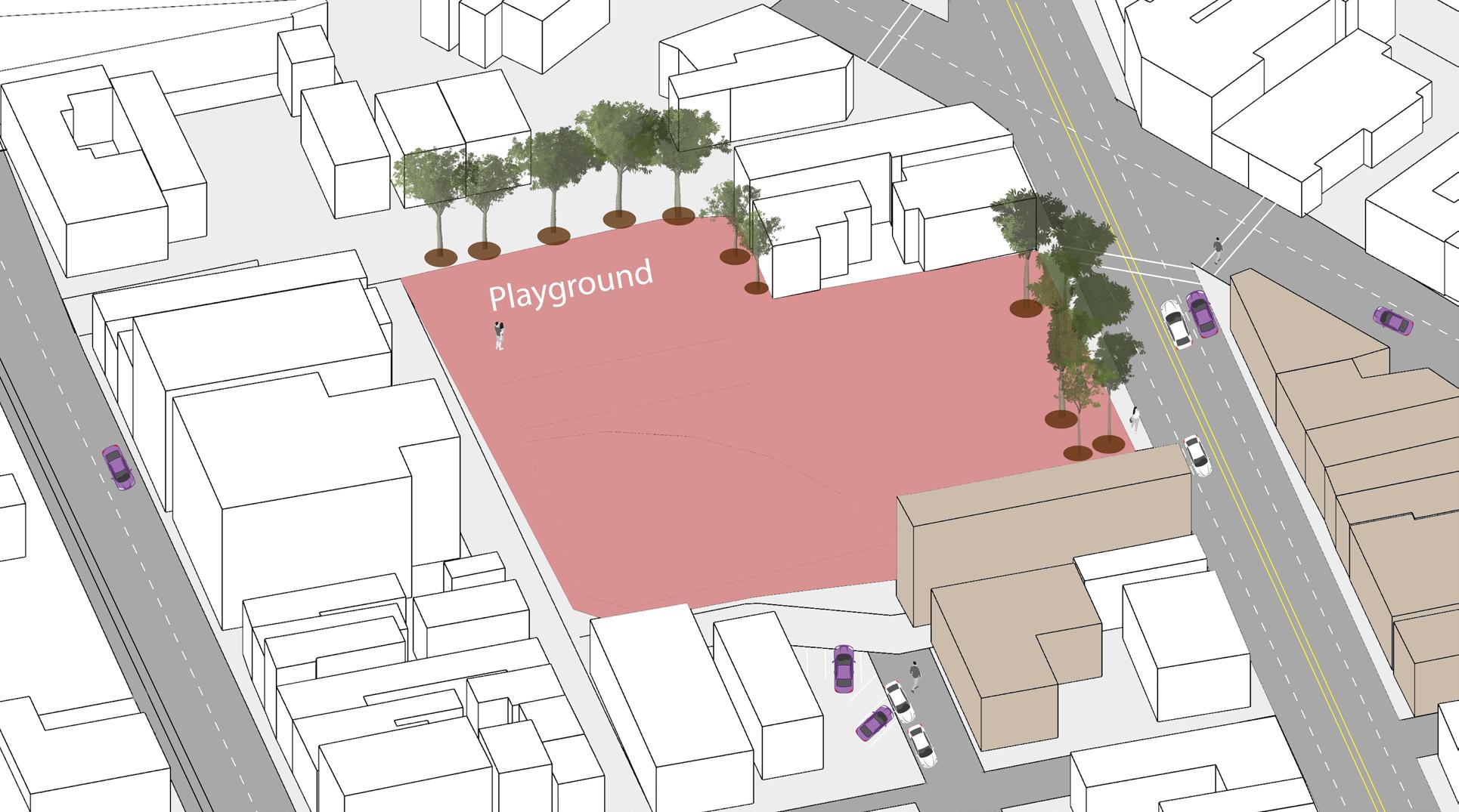
VACANT LOT [RE]IMAGINED CROSS-SECTION
Clifton: Hamilton Avenue BRT Corridor|
19
IMAGEABILITY
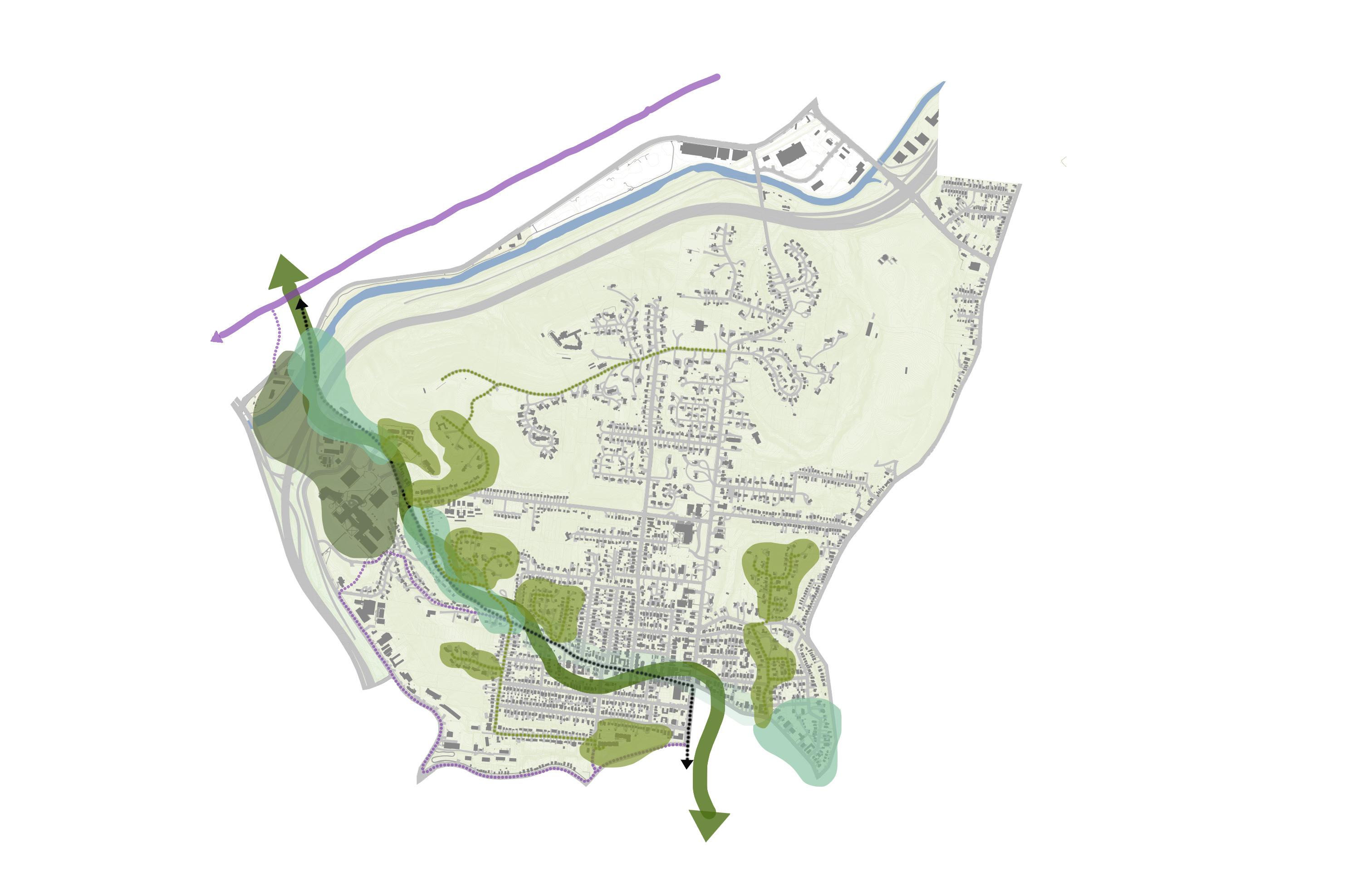
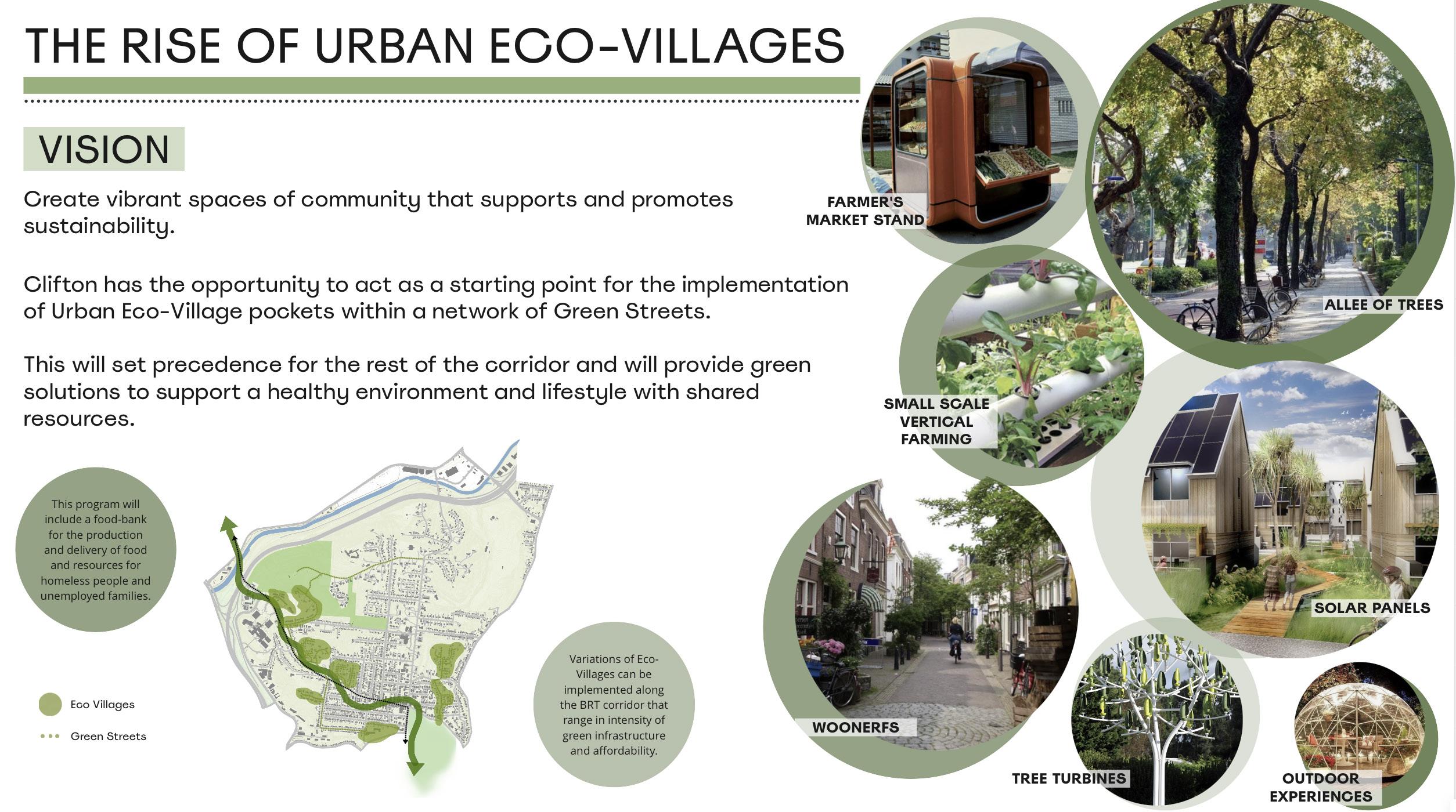
Bus rapid transit has been created to make strides toward lowering air emissions and automobile usage. We are looking to capitalize on this to create a more sustainable future for the Hamilton Ave corridor and the neighborhoods that reside along it with environmental stewardship in mind for ecological, economic, and social outcomes.
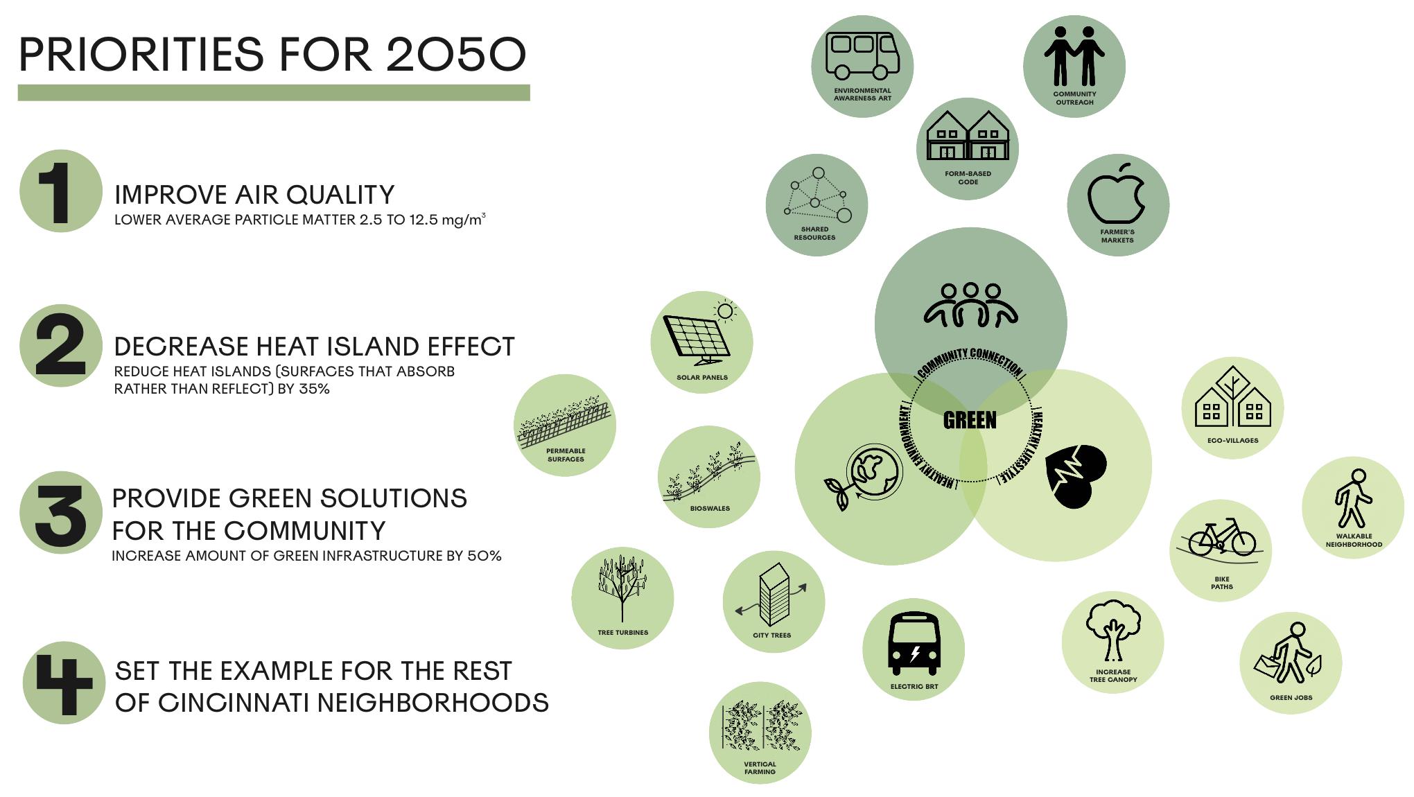
Our framework goes as follows: Disaster Vulnerability (heat islands, wildlife areas, and landslide probability), Stormwater Management (impervious surfaces and topographic analysis of slopes), and Health Impacts (air quality and tree canopy).
Moving forward and looking at the long-term vision of the BRT Corridor shows us just how great of an opportunity this is to improve the overall well- being of the environment and people along the corridor while focusing on implementing sustainable practices.
20 | Framing
CLIFTON AS A GREEN COMMUNITY
21 | [En]Vison
22 | Impact
South Cumminsville & Millvale |
23
GroupEffort:Sage,Kyra&Nasir
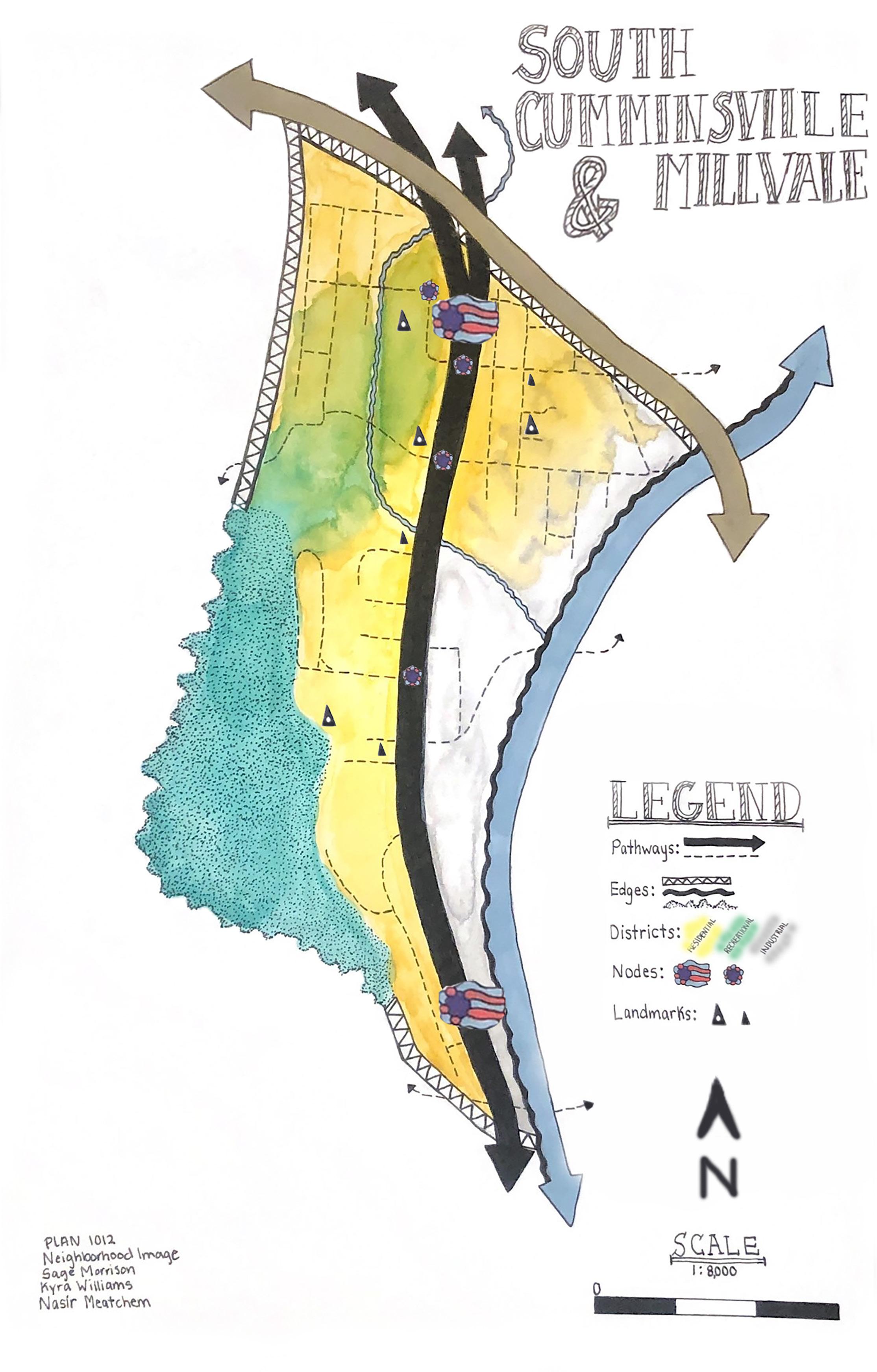
IMAGEABILITY
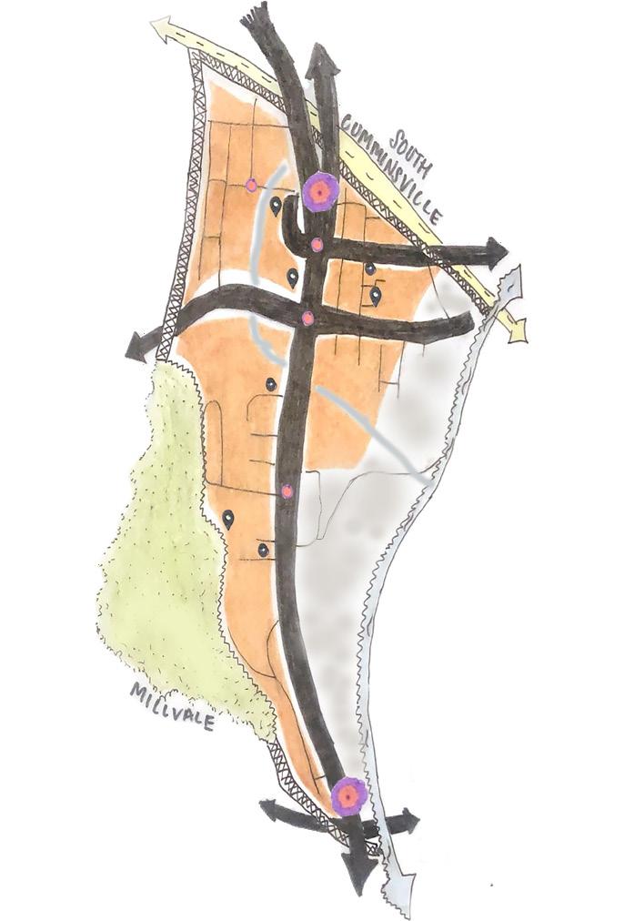
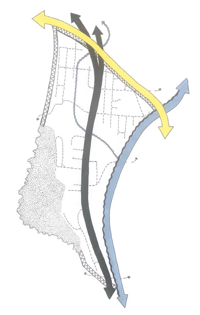
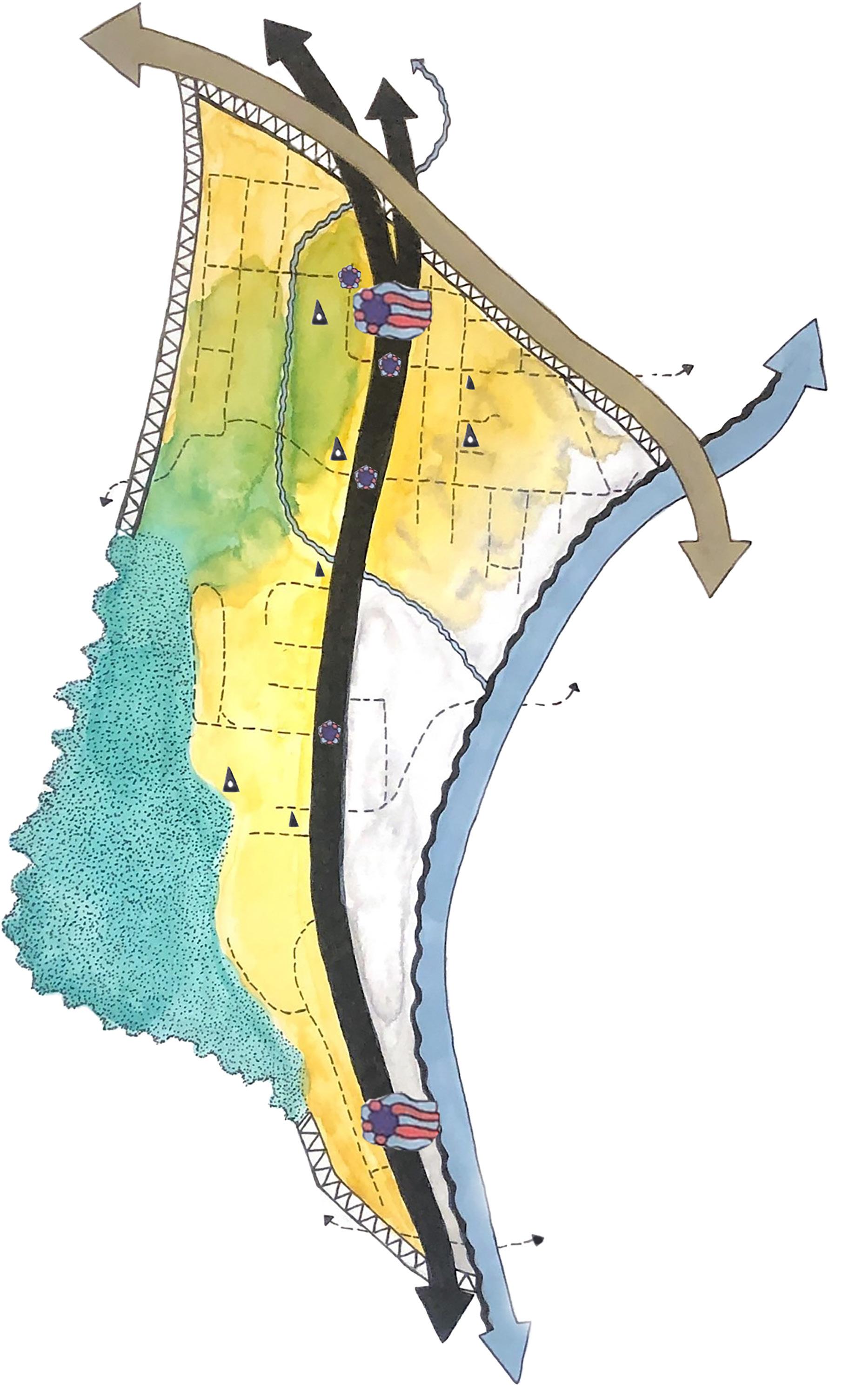
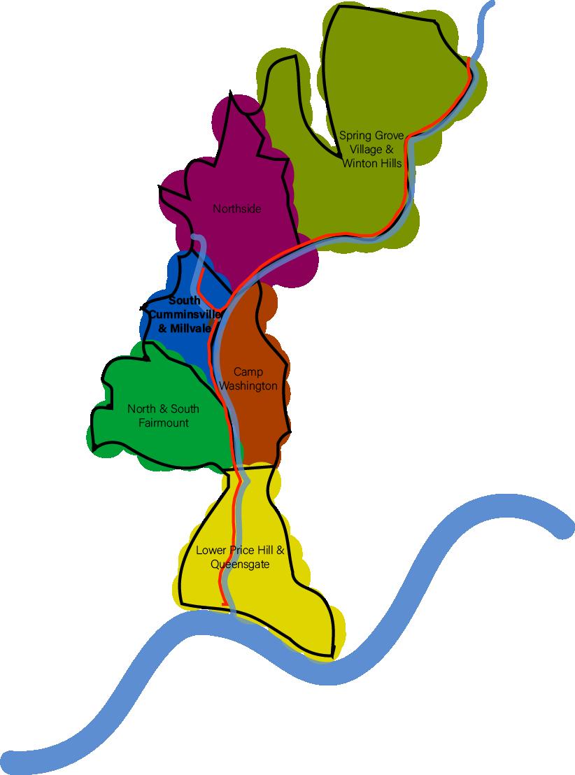
My group created our final imageability map for South Cumminsville and Millvale by1st making one of our own maps and then combining elements we all agreed upon in the end product. As you can see below, we started out with all major roads but ultimately decided it was best to represent the neighborhoods as connected by the major road Beekman Street. We changed I-74 from being yellow to brown to represent pollution from the highway. Lastly, we decided to use watercolor in our map to show just how blended the districts are.
24
| Neighborhood Analysis
TheCommons
EXISTING CONDITIONS
Vacant Lots
Mill Creek Community Based
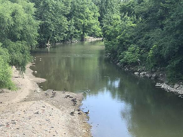
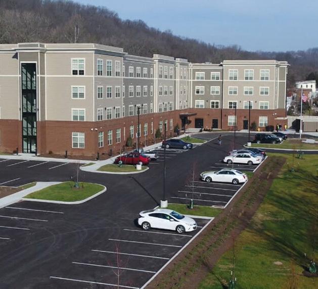
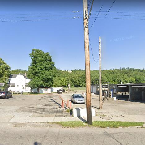
These neighborhoods are places that have been forgotten, yet through strong community and perseverance have gotten this far on their own. They haven’t been given the resources and opportunities others have but, they never stop pushing. Change is beginning, but it won’t happen overnight. The Commons is a new building that appeared in 2021 that offers 80 low-income housing to veterans and disabled people. It is the nicest building in South Cumminsville and shines light on what is to come in the future. Vacant lots are around every corner you go which need to be turned into helpful uses for the community. The Mill Creek stretches between the two neighborhoods, as well as others surrounding it and has been polluted for quite some time. Although these neighborhoods don’t have much, they’re extremely community oriented and hope for a brighter future that allows more funding.
25 | Neighborhood Analysis
STRENGTHS WEAKNESSES

OPPORTUNITIES
SWOT ANALYSIS
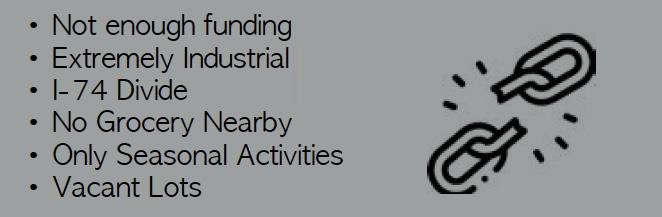
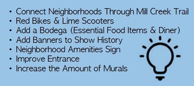
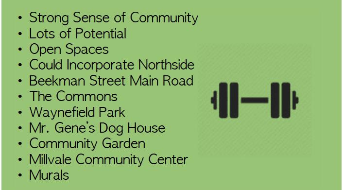
When you think of an enjoyable neighborhood filled with all your basic needs and amenities, surrounded by a community, what do you picture? South Cumminsville and Millvale combined has great potential. Currently, its known as the “forgotten neighborhood,” but this can and will change with time. Change for the better has already begun with places such as “The Commons” built in 2021. This leads us to believe there is room for growth. A SWOT Analysis was created that covers the Strengths, Weaknesses, Opportunities, & Threats in these neighborhoods.
THREATS
26 | Neighborhood Analysis
SKETCHUP MODEL
RESIDENTIAL ASPECT
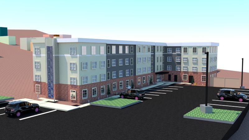
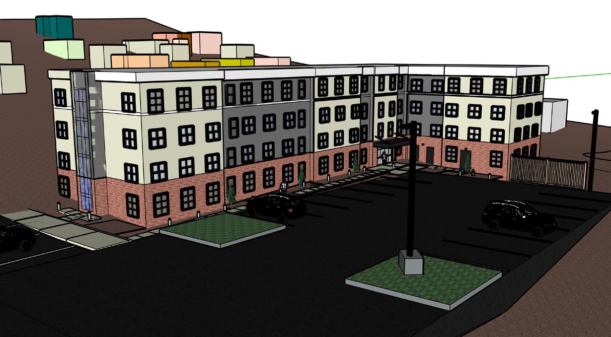
The specific area is focused around the improvements being made in the community. For too long, South Cumminsville and Millvale have been left behind and forgotten to where it became run down with little to no investment. Recently in 2021, this has changed. The Commons at South Cumminsville is a great start to the changes needed in these two neighborhoods, exactly why it was chosen to be modeled. It aided the community with 80 low-income housing opportunities for disabled people and service veterans. Much of South Cumminsville and Millvale is residential and is a place where generations of families live. There has not been a lot of help given to the community like other neighborhoods have. Creating more places like The Commons in the future years will bring forth life and make it come out of being the once forgotten neighborhood. This is only the beginning.
AFTER RENDERING
27 | Residential Typology
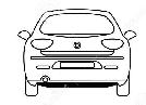
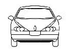
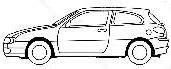
CROSS SECTIONS
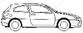
ELEVATION
| Residential Typology
28
CURRENT PROPOSALS
WAYNEFIELD PARK
ELEVATED TRAIL ACCESS RAILWAY
| Neighborhood Impact
29
CONNECTION

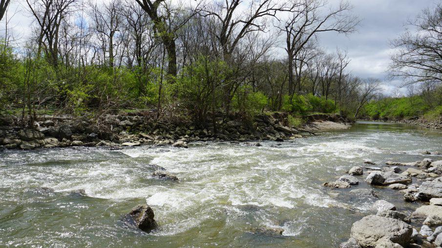
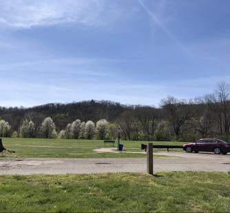
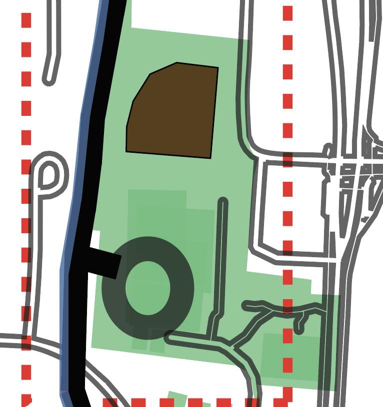
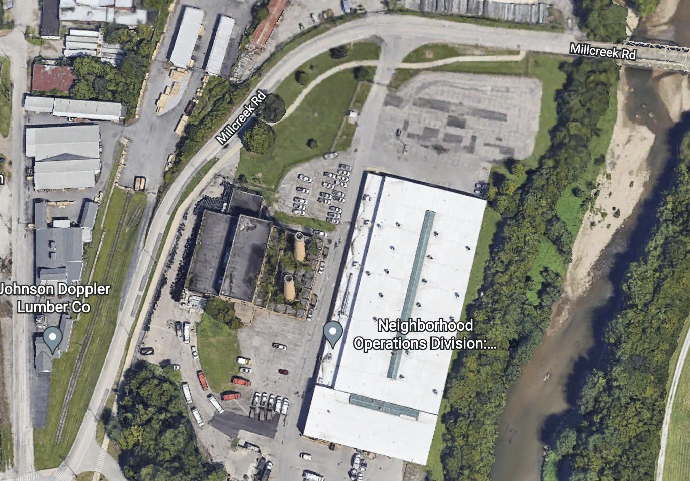
The neighborhoods along the Mill Creek overtime have forgotten just how important it is. The Mill Creek ables us to CONNECT each neighborhood. It is extremely important to find a way in doing this. In doing so, people from all around may visit the existing neighborhoods and bring attention to the more forgotten ones. Creating a walkable and bikeable trail elevated above the Mill Creek will allow this to happen, as well as bring many other benefits along with it. The Proposal shows where the elevated trail will go in South Cumminsville and Millvale with a bolded black arrow path. Two specific spots focused on were Waynefield Park and the un-used railway in the neighborhood. Not much is at the park and adding an entrance to the trail would be beneficial. Having a breakaway spot that goes onto the railway would be an interesting use of activity for all ages and would give insight to the neighborhoods past.
ADDITIONS TO TRAIL




| Neighborhood Impact
MILL CREEK TRAIL
HISTORY OF THE MILL CREEK The Mill Creek stream in southwest Ohio. It flows 28.4 miles (45.7 km)[1] southwest and south from its headwaters in Liberty Township of Butler County through central Hamilton County and the heart of Cincinnati into the Ohio River just west of downtown. The section of Interstate 75 through Cincinnati known as the Mill Creek Expressway. The Mill Creek Valley is remnant of the Deep Stage Ohio River from the days of the Last Glacial Maximum. The stream, with its water power and valley, were important to the development of Cincinnati. Then, for a time, the steep hillsides that surround the creek limited expansion and gave impetus to the free growth of surrounding communities that were over that barrier. Finally, inclined planes solved the problem, before highways and automobiles eliminated it. 30
Extra Works |
28
31
UC IMAGEABILITY
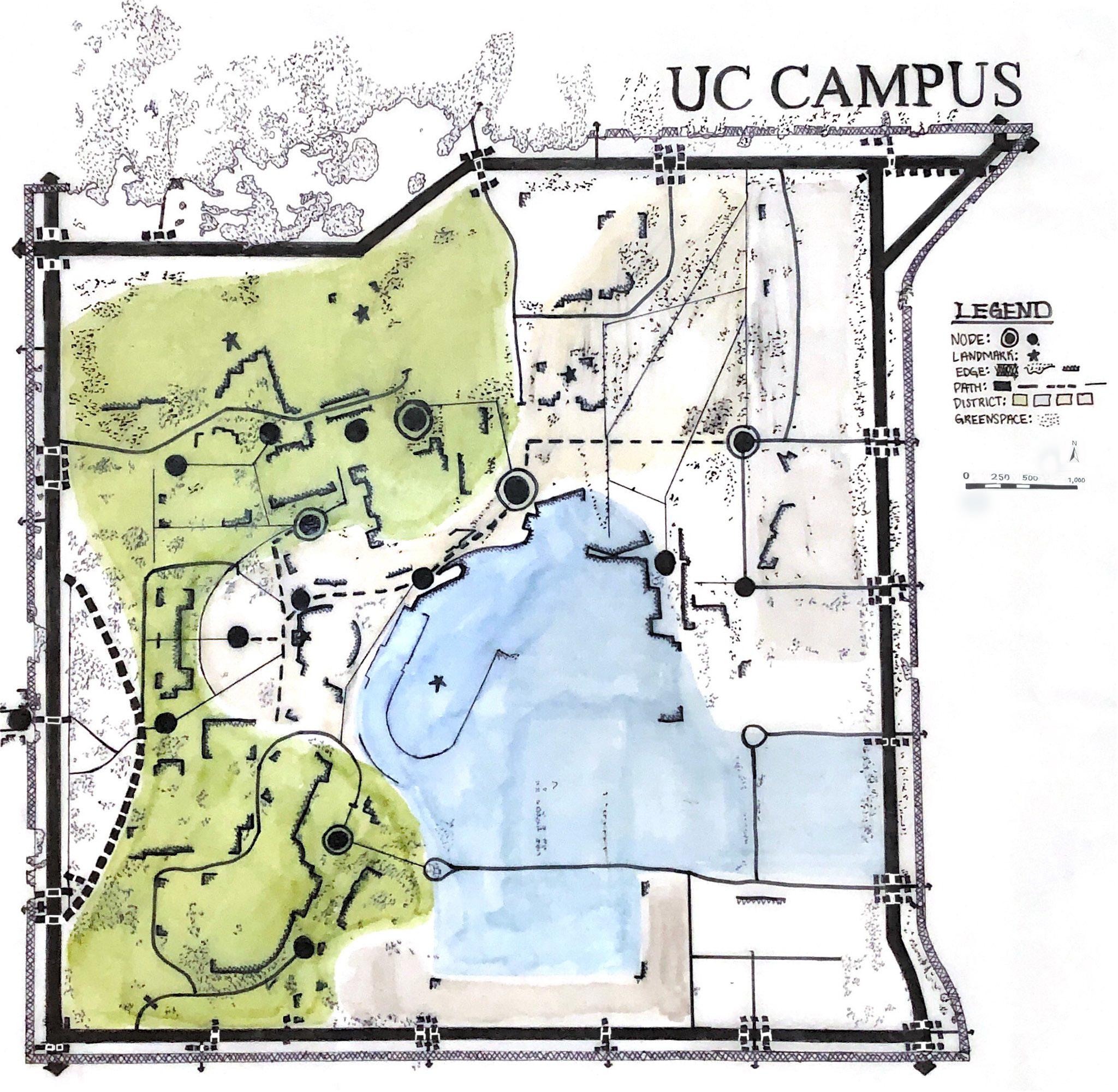
Another Imageability map, but this time it’s hand-drawn. I chose to show this map because it was one of the first maps I made my freshman year. Creating maps digitally is a lot easier but sometimes you can’t be as creative and flexible with it. Doing things, at least at the beginning, with a pen or pencil and paper brings a greater understanding to what you’re doing. It makes you think more.
| Hand-Drawn
32
MOHAWK AREA PLAN ANALYSIS
Since the start of the 21st century, the city of Cincinnati has been trying to revitalize its Over-the-Rhine urban core in the historic sense. After finalizing its comprehensive plan in 2002, the area of Mohawk was defined and goals for its area came into place. In 2018, a local historic district within Mohawk was brought about. Geographically speaking, the Mohawk area is narrow, almost like a hallway, that lies north of Overthe-Rhine and West End, south of CUF (the communities of Clifton Heights, University Heights, and Fairview), as well as Mount Auburn. Demographically speaking, the Mohawk area is quite small in size and is split halfway between multiple census tracts, making them overlap and thus gathering accurate data is laborious. Economically speaking, development in the Mohawk district has been led through incentives by Tax Increment Financing (TIF) and Opportunity Zones. These help to give financial support to infrastructure improvements and projects. Planning for improvements and projects focused on neighborhood benefits. Roadways, parking, lighting, sidewalks, and vacant buildings. Being established in 1792, a majority of its built environment dates back to the mid-late 1800's during industrialization. This resulted in the architectural styles of Greek Revival, Italianate, Second Empire, and Rundbogenstil that are still present today. The Mohawk area is described to be a Historic Brewery District with residential and commercial mixed-use land, as well as having industrial aspects. More and more plans for this area have been drawn up and comprised into the Mohawk Area Plan, so it is safe to say that the city is not starting from square one. The main priorities for this area plan are committed on revitalizing this historic neighborhood in ways as
of serving as a guide for decisions relating to the physical development of Mohawk's community. The visions for the Mohawk Area Plan are: 1. To develop Mohawk into a safe, assessable, and greatly connected neighborhood community (Connectivity), 2. Create a prosperous business district that provides revitalizing the neighborhoods historic elements (Economic Development), 3. Create a safe and attractable built environment for the experience of those who come to and live in the area (General Improvements), 4. Provide diverse housing for all levels of income (Housing), 5. Create an area open to ideas and collaborative thoughts to solve problems that arise (Big Ideas and Challenges).
When summarizing the Mohawk Area Plan, consideration of the amount of community involvement must be considered for how well the planning process played out in the end. To make improvements to a city or neighborhood, there must be community ideas brought into place. The people who live in the area call it their home and must have their own desires put above planners who are trying to implement change. Working together to create a beautifully planned outcome takes time and motivation, but with the right tactics and people, life will be brought to an area. The planning process consisted of community involvement meetings, as well as public outreach, spanning between 2016 all the way until 2019 when the approval of the plan came from the Cincinnati City Council. The Community, the City of Cincinnati, NonProfits, and Non-Governmental Organizations all joined together to make this a reality. Here’s how they did it.
| Writing Sample
33