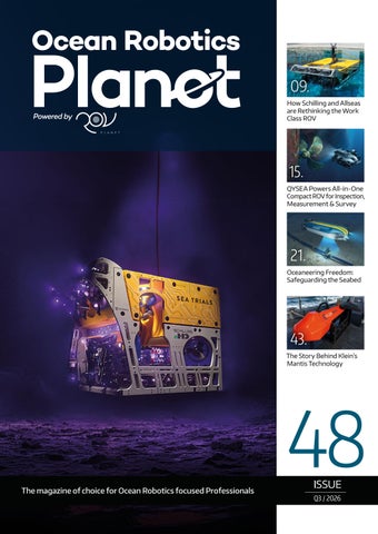
09. How Schilling and Allseas are Rethinking the Work Class ROV
15. QYSEA Powers All-in-One Compact ROV for Inspection, Measurement & Survey
21. Oceaneering Freedom: Safeguarding the Seabed
43. The Story Behind Klein’s Mantis Technology
48 The magazine of choice for Ocean Robotics focused Professionals
ISSUE Q3 / 2026
Seaeye Falcon
Empowering
The professional portable underwater vehicle. The Seaeye Falcon is the most versatile underwater electric robotic system in its class. Compact, powerful, and depth-rated to 300m or 1000m, it excels in demanding missions making it the trusted choice for critical underwater tasks worldwide. Learn more at: saabseaeye.com
FROM DISCOVERY TO DEPLOYMENT.
PERSISTENCE CHANGES WHAT’S POSSIBLE. Through long-endurance autonomous platforms, seabed systems, fuel cell-enabled power and partner-led integration, Cellula helps defence, commercial and research customers extend reach, reduce operational burdens and operate with greater confidence in complex ocean environments.
21-24 SEP
13–14 OCT
OCEANS 2026 MONTEREY
MARITIME ISR 2026 PORTUGAL
Presenting long-endurance marine autonomy for remote, data-intensive missions.
Presenting dual-use systems for subsea domain awareness.
Explore persistent marine autonomy
Precision Integration of Critical UUV Technologies
Advanced Sonar Optical Imaging Navigation Communications Power Systems Mission Software
As one company, Kraken Robotics and our global businesses deliver a comprehensive suite of sensors and payloads for every mission. From critical infrastructure monitoring to underwater exploration, our technologies provide the performance and reliability you need in the world’s most demanding underwater environments.
Learn More:
krakenrobotics.com
TABLE OF CONTENTS
ISSN 2755-239X EDITOR-IN-CHIEF Richie Enzmann
06. Events Calendar & Welcome to Ocean Robotics Planet 09. How Schilling and Allseas are Rethinking the Work Class ROV 15. QYSEA Powers All-in-One Compact ROV
CONTRIBUTORS Richie Enzmann, Ash Sheppard, Cassie Wilson, David Shea, Euan Paterson, George Galdorisi, Georgia Coward, Jennifer Presley, Jonathan Church, Dan Duval, Dr. Lee Willett, Marc Deglinnocenti, Nick Search, Todd Klesperis
21. Oceaneering Freedom: Safeguarding the Seabed 27. Protecting Vulnerable Energy Supplies 31. SAMS: Where Marine Robotics Meets Climate Science
SPECIAL THANKS TO Andy Freeman, Audrey Leon, Bill Mallin, Charlotte Sherwood, Curtis Lee, Gill Vosper, Guy Frankland, James Colebourn, Jeroen Romijn, John Benson, Karoll Audibert, Matt Bates, Pierre-Alexandre Caux, Rachael Reader, Rachel McAlpine, Richard Mills, Sarah Parker Musarra
34. Poster: Boaty McBoatface AUV 37. Into the Fjord: Inside the GIANT Expedition to Greenland’s Melting Frontier
43. The Story Behind Klein’s Mantis Technology 47. Integration, Innovation & the Future
of the Marine Technology Landscape
51. Broadening the Underwater Horizon: Uncrewed Systems Add Mass, Precision, and Reach to Subsea Surveillance
55. EUROATLAS Prepares Greyshark AUV for Production 59. Aquarius Reef Base: From Undersea Outpost to SpaceX of the Sea 62. The History and the Future of Work Class ROV Power 65. The 2026 Underwater Glider User Group (UG2) Workshop
W W W.O C E A N R O B O T I C S P L A N E T.CO M
SALES Nick Search, Natalie Souter DESIGN & LAYOUT Milan Farkas
for Inspection, Measurement & Survey
31.
COPY EDITOR Will Grant
BAS
Popoto Modem
Blueprint Subsea
Reach Robotics
Cellula Robotics
ROV Power Systems
DeRegt
RTsys
Digital Edge Subsea
Saab Seaeye
ecoSUB
SAMS
EUROATLAS
Silicon Sensing
General Oceans
SubCtech
Greensea IQ
TechnipFMC-Schilling
Klein Marine Systems
Tekmara
Kraken Robotics
Teledyne Marine
MARTAC
Teledyne Valeport
NOC
UG2
Oceaneering
U.S. Navy
OceanSight
VideoRay
QSTAR
Voyis
QYSEA
37.
47.
Front Cover Image: Courtesy of TechnipFMC / Schilling Robotics Poster Image: Courtesy of Nick Search / Ocean Robotics Planet
EVENTS CALENDAR 2026/27
SEPTEMBER
For more information about all events visit www.oceanroboticsplanet.com
AUV2026 Southampton, UK (1–3 September 2026)
UNMANNED MARITIME SYSTEMS TECHNOLOGY Arlington, VA, USA (14–16 September 2026)
INTERNATIONAL SUBMERSIBLE SYMPOSIUM Hamburg, Germany (15–18 September 2026)
MAST FOCUS FORUM Glasgow, UK (14–16 September 2026)
OCEANS – MONTEREY Monterey, CA, USA (21–24 September 2026)
WINDENERGY Hamburg, Germany (22–25 September 2026)
SUBMARINE NETWORKS – ASIA Singapore (23-24 September 2026) OCTOBER NOVEMBER
BREAKING THE SURFACE Vodice, Croatia (18-25 October 2026)
Paris, France (3-6 November 2026)
EURONAVAL OFFSHORE ENERGY
FEBRUARY
DECEMBER
Amsterdam, The Netherlands (24–25 November 2026)
WORKBOAT SHOW New Orleans, LA, USA (2-4 December 2026)
NAVYTECH Gothenburg, Sweden (2-4 February 2027)
SUBSEA EXPO Aberdeen, Scotland, UK (February 2027) APRIL
My name is Richie Enzmann. Allow me to welcome you all to the latest issue of Ocean Robotics Planet!
OCEAN BUSINESS Southampton, England, UK (6–8 April 2027)
UNDERSEA DEFENCE TECHNOLOGY Glasgow, UK (6–8 April 2027)
WELCOME TO OCEAN ROBOTICS PLANET! Dear Reader, A central theme of this issue is the transformation of the work-class ROV. Our feature on “How Schilling and Allseas Are Rethinking the WorkClass ROV” examines how 13 years of operational data led Allseas and TechnipFMC to challenge one of the industry's long-standing assumptions: that hydraulic power is the inevitable foundation of high-performance subsea vehicles. The resulting Schilling eHD combines electric propulsion with the proven HD platform, delivering greater usable power, finer control and a smaller vehicle footprint. Its development also points towards a broader change in how ROV performance is measured, with concepts such as "working bollard" offering a more realistic picture of what a vehicle can accomplish while flying, lifting, holding position and managing tools simultaneously. Just as importantly, extensive instrumentation opens the door to condition-based maintenance, improved reliability and potentially significant reductions in operating expenditure. Autonomy is also changing how we think about subsea infrastructure and surveillance. Oceaneering’s Freedom explores the potential for uncrewed systems to safeguard the seabed, while our feature on vulnerable energy supplies considers the growing importance of protecting critical offshore infrastructure. We examine how uncrewed systems can add mass, precision and reach to subsea surveillance – extending the scale and persistence of operations beyond what conventional approaches can easily deliver. That evolution is captured particularly clearly in Integration, Innovation and the Future of the Marine Technology Landscape, where David Shea of Kraken Robotics argues that the industry is changing the way it defines technological performance. For decades, progress could be measured in terms of individual sensors: greater sonar resolution, longer range, more accurate navigation or higher energy density. Today, however, the real measure is increasingly the effectiveness of the system as a whole – how reliably sensors, navigation, communications, power, software and autonomy work together to turn observations into actionable intelligence. As underwater surveillance becomes increasingly sophisticated, EUROATLAS is preparing its Greyshark AUV for production, while Aquarius Reef Base offers a fascinating glimpse into the future of sustained human and robotic activity beneath the waves. Elsewhere, SAMS demonstrates the powerful intersection between marine robotics and climate science, using robotic systems to observe and understand some of the most rapidly changing environments on Earth. Exploration remains at the heart of this issue as we take a closer look at Boaty McBoatface before heading into the fjords of Greenland with the GIANT expedition to witness research at the frontline of a melting Arctic. Across these stories, one theme is clear: the underwater horizon is expanding. Through greater autonomy, smarter integration and increasingly capable robotic systems, marine technology is enabling us to go further, stay longer and see more clearly than ever before. We hope you enjoy the issue! Best regards, Richie Enzmann
DETECT • CONTROL • SECURE
Courtesy of TechnipFMC
FROM HYDRAULIC PAIN POINTS TO ELECTRIC SUPER PERFORMANCE:
HOW SCHILLING AND ALLSEAS ARE RETHINKING THE WORK-CLASS ROV Richie Enzmann, Ocean Robotics Planet
For more than a decade, Allseas has been collecting operational and technical data from its ROV fleet. That data has revealed a persistent and costly problem: hydraulics account for a disproportionately large share of the fleet's operating expenditure. The issue is not simply the cost of hydraulic components. It is the combined cost of spare parts, oil and filters, hose replacements, and perhaps most importantly, the planned and unplanned maintenance labour required to keep hydraulic systems operational. That experience led Allseas to look beyond incremental improvements to conventional work-class ROVs and explore what electric propulsion could deliver.
"We have 13 years of data," says Pat Quakernaat, Unit Head ROV for Allseas. "The bigger chunk of all the OPEX cost was related to hydraulics."
That observation became one of the foundations for a collaboration between Allseas and TechnipFMC-Schilling Robotics to develop a hybrid-electric version of the proven HD work-class ROV platform: the eHD. The objective was ambitious: deliver greater performance in a smaller vehicle, reduce operating costs and meet the evolving demands of subsea operations.
A PARTNERSHIP BUILT AROUND A REAL OPERATIONAL PROBLEM The relationship between Allseas and Schilling did not begin with a decision to simply "go electric." It began with Allseas looking for something that the existing market was not quite providing. "We tendered for a vehicle on the market where we wanted more performance and it had to be as future proof as it could be," says Quakernaat. "The idea was to get more performance and to lower the OPEX cost and to be as future proof as we could be."
| 9
FROM HYDRAULIC PAIN POINTS TO ELECTRIC SUPER PERFORMANCE
Allseas evaluated the available manufacturers before identifying Schilling as the best fit. What followed was a three-year collaborative development programme that carried the project from tender to production. The commitment was ultimately demonstrated by an order for eight vehicles. For Schilling, the relationship provided something unusual: direct access to an experienced operator throughout the development process. That feedback loop was especially valuable during testing, turning observations into actionable improvements. Joint sea trials with Allseas strengthened the effort further, enabling both teams to share expertise and learn from each other's experience in the field.
TESTING THE VEHICLE WHERE IT ACTUALLY HAS TO WORK Schilling insisted on conducting sea trials during development. Before the first Allseas production vehicle was completed, Schilling used a prototype eHD, chartered a vessel and tested the system at approximately 3,800 metres. The objective was to validate performance under real subsea conditions, including, speed, flight control, hydraulic-tooling performance, cold starts and operation under pressure. Some conditions simply cannot be replicated in a test pool.
Courtesy of TechnipFMC
The trials delivered several important findings. The existing HD platform has a speed of approximately 3.15 knots. During trials, the eHD reached approximately 4 knots, exceeding expectations and opening new possibilities where speed and manoeuvrability matter. The team also verified the hydraulic tooling system’s performance at depth, including operation at approximately 125 litres per minute and 207 bar. Another critical area of testing was pipe tracking. Pipe tracker systems are particularly sensitive to electrical interference, making compatibility validation on a highly instrumented electric platform is an important engineering challenge. The eHD's electric system uses high-frequency switching, creating the potential for electromagnetic interference with sensitive survey equipment. The team used a pipe tracker and acquired a target, allowing them to assess the vehicle's ability to maintain the required attitude. While not a full commercial survey, the exercise demonstrated the platform’s potential.
Courtesy of TechnipFMC
Additionally, to maintain stable pitch, roll, and heading required for survey operations was confirmed. A pipe tracker mounted away from the centre of the ROV effectively behaves like a sail. Cross-currents can create forces that make the vehicle pitch or roll, degrading survey data. The combination of increased power, enhanced ROV control, and improved stability enable faster and more efficient survey operations.
THE TRIALS ALSO DEMONSTRATED SOMETHING LESS MEASURABLE BUT EQUALLY IMPORTANT: PILOT CONFIDENCE
Courtesy of TechnipFMC
10 |
"We were blown away by the performance," Hannah Schell, Engineering Project Manager at TechnipFMC Schilling Robotics, says. "But what was more exciting to me was talking to the operators, the pilots and the crew about how the vehicle felt to them, how it flew, how they controlled it. There was an excitement around this vehicle that was palpable."
WHY SMALLER MATTERS Performance was only part of the requirement. Allseas also wanted a smaller vehicle capable of operating in increasingly constrained environments, including decommissioning projects and shallowwater applications with strong currents. The goal was not simply to improve today’s ROV, but to prepare for a broader range of future works scopes.
MORE USABLE POWER For decades, horsepower has been one of the headline specifications used to compare ROVs. Electrification is challenging the assumption that horsepower alone defines an ROV’s capability. A 150 HP electric ROV can deliver performance comparable to a substantially higherrated hydraulic system. In the case of the eHD, the development team has demonstrated performance comparable with what would traditionally be associated with a 250 HP hydraulic vehicle.
Courtesy of TechnipFMC
The reason is efficiency. Hydraulic systems incur losses associated with generating, transporting and distributing hydraulic power. Those losses become especially significant when multiple thrusters compete for hydraulic flow. Electric thrusters operate differently. Drawing power from a common DC electrical bus, individual motor controllers regulate exactly how much power each motor requires. According to Schilling's testing, this eliminates many of the powersharing losses encountered by hydraulic systems. In some hydraulic power-sharing conditions, system losses can reach approximately 30%. With the electric architecture, those losses are reduced to the normal losses associated with the motor controllers and electric motors. The result is not simply more headline horsepower. It is more usable power.
Courtesy of TechnipFMC
MEASURING WHAT THE ROV ACTUALLY DOES: WORKING BOLLARD That distinction has led Schilling to look beyond traditional bollardpull measurements. A conventional bollard specification tells an operator how much force an ROV can produce in a particular direction. But many real subsea tasks require the vehicle to perform several things simultaneously. An ROV may need to lift a payload while also flying forward. It may need to counteract a current while maintaining position. It may need to hold a large tool while keeping its attitude stable. This is especially relevant for decommissioning, flying-lead operations, tooling deployment and survey work.
Courtesy of TechnipFMC
To better reflect real-work performance, Schilling uses the concept of “working bollard.” Rather than measuring maximum thrust in a single direction, the metric considers how much usable forward or lateral force remains when the ROV is simultaneously lifting, flying, or holding position. This provides a more realistic view of operational capability during complex subsea tasks.
BETTER AT THE TOP END AND MORE PRECISE AT THE BOTTOM The performance advantages of electric propulsion extend beyond maximum thrust. High-precision motor controls enable finer station keeping and smoother response around zero speed, giving pilots
Courtesy of TechnipFMC
| 11
FROM HYDRAULIC PAIN POINTS TO ELECTRIC SUPER PERFORMANCE:
greater control during delicate subsea operations. The result is improved positioning accuracy and more precise vehicle handling when small corrections matter most.
There are umbilicals, tethers, LARS systems, control vans, telemetry systems, handling equipment and extensive inventories of spare parts.
Beyond electrification, eHD represents a step change in capability, delivering 80% more payload capacity, 55% more tooling power, and 40% more bollard force than HD while expanding the range of work that can be performed subsea.
Schilling's approach to the eHD has therefore been deliberately evolutionary. The eHD is based on the established HD platform, and the operator experience remains familiar. From the topside console, the vehicle retains a common look and feel even though the underlying propulsion, electronics and control architecture have changed substantially. The same approach has been applied to infrastructure. Where there was no compelling reason to change something, Schilling kept it.
FROM MAINTENANCE SCHEDULES TO VEHICLE HEALTH The most significant long-term impact of electrification may not be propulsion at all. Electric systems are highly instrumented allowing operators to continuously monitor motor speed, current, temperature and other operating parameters. That creates a much richer picture of vehicle health than simply waiting for a component to reach a scheduled service interval. The data can be analyzed across individual components, vehicles, and fleets to build a detailed picture of system health. The results can be condensed into a vehicle "health score", helping operators determine when maintenance is actually required. This shift in maintenance philosophy could have a significant impact on OPEX. Allseas estimates that the potential OPEX reduction from electrification could be in the region of 40%, although this remains a target rather than a demonstrated fleet-wide result. The potential savings come from multiple sources: fewer hydraulic components, fewer consumables, reduced maintenance labour, less planned maintenance and fewer unexpected failures. The objective is to use components for as long as they remain demonstrably fit for purpose rather than replacing them simply because a predetermined interval has expired. Predictability becomes increasingly important at depth, where even a seemingly simple maintenance task can become a major operational event. Changing a hose is no longer just a technician replacing a component. The vehicle may need to be recovered from several kilometres below the surface, the maintenance performed, and the ROV relaunched and returned to depth. The downtime can quickly become measured in hours. That makes reliability important, but predictability may be even more valuable. If a component is nearing the end of its useful life, maintenance can be planned around the operation rather than the operation being interrupted by maintenance. The same data infrastructure also creates opportunities for remote support and, ultimately, over-the-horizon operations. Remote capability therefore provides more than a cost-saving opportunity. It creates operational resilience.
A TRANSITION WITHOUT THROWING AWAY THE EXISTING INVESTMENT One of the challenges facing any operator considering electrification is the investment already made in its existing fleet. Replacing an ROV can mean more than buying a vehicle.
12 |
According to Schilling’s development team, approximately 70% compatibility has been maintained across components, while systems such as telemetry, nodes, compensators and the serial communications backbone remain common. In addition, operators with existing HDs can swap in an eHD ROV with minimal changes to the topside equipment. For Allseas, that continuity extends to spare parts inventories, helping protect existing investments while reducing the disruption associated with introducing electric vehicles.
A NEW PLATFORM, NOT A ONE-OFF VEHICLE The eHD is not being developed as a stand-alone electric product. It shares the broader Hammerhead platform with the HD and UHD vehicles, providing operators familiarity while creating a path for continued development. For Schilling, the architecture establishes a modular foundation for future electric ROVs.
THE BIGGER SHIFT The eHD story is about more than replacing hydraulic thrusters with electric motors. It starts with a more fundamental question: what actually costs operators money and limits ROV performance offshore? The resulting platform combines higher usable propulsion performance with more precise control, improved power sharing, extensive instrumentation and the potential for condition-based maintenance. Just as importantly, it is designed to fit into an existing operational ecosystem rather than requiring operators to start over. As subsea work moves deeper, becomes more remote and demands longer periods of uninterrupted operation, the value of an ROV may be measured less by its headline horsepower and more by what it can actually accomplish offshore: how efficiently it uses power, how precisely it can be controlled and how confidently operators can predict its performance. That is ultimately the shift behind the eHD: moving from measuring an ROV by what it is rated to do to measuring it by what it can reliably accomplish in the field.
Empowering the Blue Economy Through Advanced Ocean Technology.
High resolution sonar system solutions for Mine Counter Measures and other military applications.
Advanced instruments used in oceanography and subsea navigation to help measure movement in underwater environments.
Adaptive robotic arms for intervention and control in offshore energy and modern naval landscapes.
Supporting ocean scientists, engineers and the maritime industries overall by providing underwater technology.
Mission-ready Hybrid ROV system with fully integrated sensors for fast deployment.
Robust, reliable underwater sensors for the planet’s harshest environments and most difficult applications.
Find out more
A COMPACT INDUSTRIAL ROV
FOR INSPECTION, MEASUREMENT, AND REPEATABLE SURVEYS
Underwater operations increasingly require more than visual confirmation. Across shipping, offshore energy, port infrastructure, aquaculture, and water facilities, operators need clear, stable, measurable, and traceable data to support condition assessment, maintenance planning, and repeat inspections. Designed for these requirements, QYSEA’s E-MASTER NAVI combines a compact ROV with adaptive stability control, intelligent imaging, modular mission tools, autonomous assistance, and structured post-mission processing to support advanced inspection, measurement, and survey within one rapidly deployable platform.
WHY E-MASTER NAVI: ONE PLATFORM, MULTIPLE MISSIONS At just 6.7 kg and rated to 200 metres, E-MASTER NAVI brings industrial capability into a highly portable platform. It can be transported, launched, and operated by one person in suitable conditions, while its compact hydrodynamic design and omnidirectional movement make it well suited to vessel hulls, submerged infrastructure, tank walls, and confined spaces where larger systems may be difficult to deploy or manoeuvre.
Operators can choose between onboard batteries for rapid, mobile missions and a direct power supply system for extended operations such as ballast-tank, reservoir, hull, and survey work. Its modular architecture also supports compatible manipulators, sonar, environmental sensors, measurement systems, sampling devices, and selected NDT tools. Together, these capabilities enable the E-MASTER NAVI to be deployed quickly and configured for a wide range of missions, beginning with the collection of clear, stable, and reliable inspection data.
01 | INSPECTION SEE CLEARLY, MAINTAIN CONTROL, CAPTURE BETTER EVIDENCE Inspection quality depends on more than camera resolution. Even a high-definition image loses value when the vehicle cannot maintain a consistent viewing position, water conditions reduce clarity, or the pilot must continually correct the ROV’s movement. E-MASTER NAVI combines 4K imaging with AI-assisted image dehazing and visual enhancement to improve visibility in turbid or low-contrast environments. These functions help reduce the visual effects of suspended particles and QY-PILOT Assisted Piloting with Intelligent Auto Cruise, Adaptive Stability, Distance Control & Collision Avoidance
| 15
QYSEA E-MASTER NAVI: ALL-IN-ONE COMPACT ROV SOLUTION
MISSION-READY Built for Rapid Deployment
LIGHTWEIGHT & PORTABLE 6.7 kg for Easy Transport
underwater haze, supporting clearer observation of coatings, welds, corrosion, biofouling, structural surfaces, and suspected anomalies. Its built-in Dual Q-DVL configuration provides the control foundation for reliable image capture. The forward-facing DVL supports wall-relative positioning, distance control, collision avoidance, and stable movement along vertical structures. The downward-facing DVL supports altitude control, bottom-relative station lock, and controlled movement over seabed environments and tank floors. By automatically correcting small changes in position and orientation, the vehicle can maintain a steadier viewing angle while the operator concentrates on the inspection task. These capabilities are directly relevant to vessel hulls, propellers, rudders, stern structures, sea chests, thrusters, anodes, coatings, and intake areas. In confined spaces such as ballast tanks, reservoirs, and water tanks, the vehicle’s compact dimensions and stable control allow it to work close to walls, floors, internal fittings, pipes, and other structural features. Hardware integration extends the inspection workflow further. Depending on mission configuration, operators can add compatible manipulators, imaging sonar, environmental sensors, probes, and selected NDT tools. The objective is not only to locate a possible issue, but to examine it from multiple angles, interact with the area where required, and collect additional condition data in real time.
16 |
DUAL Q-DVL | Station Lock, Wall & Bottom Tracking (Inertial Navigation System), Distance & Altitude Control
02 | MEASUREMENT TURN VISUAL FINDINGS INTO QUANTIFIABLE RESULTS Identifying an anomaly is just the first stage of an underwater assessment. Engineering and maintenance teams often need to understand its dimensions, shape, location, and development over time. E-MASTER NAVI’s measurement ecosystem enables operators to convert visual observations into measurable information. QY-MT 2D (Measurement Tool) supports the measurement of lengths, widths, distances, angles, and structural features using visual data and the ROV's built-in laser references. Measurements can be reviewed during the mission or processed after the dive, depending on the operational workflow and reporting requirements. For more complex geometries, QY-MT 3D (Digital Twin & Measurement Tool) uses continuous visual data to reconstruct underwater structures and environments as threedimensional models. These outputs can support dimensional assessment, surface review, spatial analysis, and documentation of irregularly shaped defects or objects. Instead of relying only on isolated still images, operators can retain a more complete representation of the inspected area. This is particularly useful when reviewing deformation, corrosion zones, damage profiles, marine growth, structural
QY-MT 2D | Real-time dimensional measurement of underwater targets
QY-BT | 2D & 3D bathymetric mapping for survey & analysis
QYSEA E-MASTER NAVI | Original 4K Footage
QY-MT 3D | 3D modelling & measurement for structural assessment
interfaces, or other conditions that are difficult to interpret from a single angle. QY-Mission uses visual tracking and spatial reconstruction to provide additional context and maintain continuity across the area being measured. The ROV can carry compatible sampling devices and environmental sensors, allowing operators to collect water-quality or other environmental data alongside visual observations during the same deployment. After recovery, recorded imagery, measurement points, routes, and mission data can be reviewed to validate findings, generate models and reports, and convert raw observations into structured, quantifiable information for engineering and asset-management teams.
03 | SURVEY NAVIGATE INTELLIGENTLY, MAP SYSTEMATICALLY, RETURN WITH CONFIDENCE Survey operations require more than controlled vehicle movement. The ROV must maintain a stable relationship with the surrounding structure or seabed while following a defined path and collecting reliable depth, position, and environmental data. QY-Pilot provides the real-time assisted piloting layer. Working with the Dual Q-DVL sensors and onboard IMUs, it enables the E-MASTER NAVI to maintain altitude or standoff distance and cruise steadily along hulls, tank walls,
seabeds, and other underwater structures. This adaptive control reduces continuous manual correction and supports smoother, more consistent survey coverage. QYSEA Position provides the navigation layer for route planning, positioning, and path recording, with solutions such as U-INS (Underwater Inertial Navigation System) supporting structured missions in environments where precise navigation is required. Using the collected route and depth data, QY-BT (Bathymetric Tool) generates two-dimensional profiles and three-dimensional bathymetric maps of seabeds, tank floors, sediment accumulation, submerged infrastructure, and other underwater environments. The result is a more systematic and repeatable survey process. By preserving routes, target areas, and mapped outputs, operators can revisit the same locations during future missions, compare changes over time, and build structured underwater records for condition monitoring, maintenance planning, and long-term asset management.
ONE PLATFORM ACROSS CRITICAL APPLICATIONS The same inspection, measurement, and survey framework can be applied across several core industries. For shipping and maritime operations, E-MASTER NAVI can support hull-condition assessment, propeller and rudder inspection, hull intake checks, coating review, biofouling
| 17
QYSEA E-MASTER NAVI: ALL-IN-ONE COMPACT ROV SOLUTION
TANK EVALUATION | 6-DOF Visual Inspection & Non-Destructive Testing
COMPACT TANK ACCESS | 345 mm wide for deployment through confined openings
HULL ASSESSMENT | Clear 4K observation of hulls, rudders & submerged structures
SMART MEASUREMENT | Centimetre-level measurement of anodes, anomalies & hull targets
assessment, and inspection of other submerged vessel components. Its stable imaging, measurement, and datarecording capabilities provide a foundation for qualified service providers to support UWILD inspection workflows and structure the evidence required for ROV-assisted in-water inspections. Final acceptance remains subject to the requirements of the relevant classification society, approved service supplier, vessel, and survey scope. For offshore energy and floating assets, including offshore vessels and FPSOs, E-MASTER NAVI can inspect ballast tanks and other water-filled internal spaces where diver access may be difficult or dangerous. Its compact deployment, stable control, direct-power capability, and modular tools are particularly valuable for extended operations within enclosed structures. For water facilities and infrastructure, the system can support inspections of reservoirs, tanks, intake structures, turbines, quay walls, piles, and other submerged port assets. In aquaculture, the same platform can support cage, net, mooring, seabed, and environmental observation tasks. Across these applications, the central benefit remains consistent: one compact ROV can be configured to inspect a structure,
18 |
CONFINED-SPACE NDT | Ultrasonic thickness measurement in tanks & enclosed structures.
QY-PILOT & QY-MISSION | Intelligent auto-cruise along vertical structures with spatial awareness and repeatable inspection paths
quantify its condition, survey the surrounding environment, and preserve the resulting information for post-mission analysis.
MORE THAN EYES BELOW THE SURFACE E-MASTER NAVI reflects the next stage of compact ROV development. Capability is no longer defined only by how deep a vehicle can travel or what its camera can capture, but by how effectively it can maintain control, navigate complex environments, interact with assets, quantify conditions, map surroundings, and preserve the results for future use. By combining portable hardware with proprietary intelligent control, enhanced imaging, modular mission tools, assisted navigation, measurement software, and post-processing workflows, E-MASTER NAVI allows small teams to complete tasks that once required multiple systems, larger mobilizations, or highly specialized resources. The result is more than underwater access. It is an integrated mission platform that turns each deployment into clearer inspection evidence, measurable findings, mapped environments, and repeatable data—helping operators move from simply seeing below the surface to understanding, documenting, and managing what lies there.
10th Anniversary
A Decade of Trust. A Future of Intelligence. 2016-2020 Expanding Access to Underwater Observation
2021-2025 Advancing Professional Underwater Operations
2026 & Beyond Building AI-Powered Underwater Task Systems
Environmental Understanding
Join Us at Upcoming Events
24 - 27 August 2026
#5660
Autonomous Mission Execution
Multi-Robot Collaboration
Learn More & Book a Demo
2 - 4 September 2026
#8210
ACOUSTICS | ROBOTICS | ELECTROMAGNETICS
THREE EXPERTISES FOR SUBSEA CRITICAL OPERATIONS INSPECTION & INTERVENTION
SEABED WARFARE
MINE CLEARANCE
ASW TRAINING & SONAR TESTING
rtsys.com
03-06 nov. 2026 PARIS
MEET US STAND F99
SAFEGUARDING THE SEABED HOW AUTONOMOUS SYSTEMS ARE RESHAPING CRITICAL NATIONAL INFRASTRUCTURE PROTECTION Ash Sheppard, Product Manager, Subsea Robotics Products and Services, Oceaneering
In January 2025, NATO launched Baltic Sentry, a new initiative aimed at strengthening the protection of critical undersea infrastructure following a series of incidents involving subsea communications and energy assets in the Baltic Sea. NATO leaders cited growing concerns around the security and resilience of critical offshore infrastructure and emphasized the need for improved monitoring, situational awareness, and response capabilities.
Oceaneering’s Freedom™ Unmanned Underwater Vehicle (UUV) performs a high-resolution sensor inspection of a subsea cable, identifying and mapping a cable-cutting device on the seafloor. (Courtesy of Oceaneering)
| 21
SAFEGUARDING THE SEABED
Since 2022, more than 20 incidents affecting subsea infrastructure have been reported in the Baltic region, drawing increased attention from governments, defense organizations, and infrastructure operators. Across the Indo-Pacific, cable disruptions continue to highlight the challenges associated with protecting infrastructure that spans vast and often remote areas of seabed. Taiwan alone experienced 27 disruptions to its subsea communication cables between 2018 and early 2023, underscoring the vulnerability of systems that underpin modern digital connectivity. The stakes are significant. According to the International Telecommunication Union (ITU), approximately 99% of international internet traffic is carried through submarine cables. Offshore pipelines, power interconnectors, and communications networks have become foundational infrastructure supporting economic activity, energy security, and global connectivity. These assets operate across remote regions of seabed that are difficult to monitor and even harder to protect. Damage may result from accidental vessel interaction, environmental conditions, unauthorized activity, or deliberate interference. The International Cable Protection Committee estimates that anchor dragging alone accounts for roughly 30% of submarine cable faults globally, leading to costly repairs and potential disruption of communications and energy networks. As reliance on subsea infrastructure continues to grow, improving awareness and understanding of activity around these assets has become an increasingly important priority for governments, operators, and asset owners.
THE CHALLENGE OF MONITORING WHAT YOU CANNOT EASILY SEE The strategic importance of seabed infrastructure is not new. What has changed is the growing recognition that these systems operate in remote and difficult-to-access environments where visibility is inherently limited. Historically, subsea inspection programs were developed to support asset integrity, maintenance, and operational reliability. Using vessels, remotely operated vehicles (ROVs), autonomous systems, and specialist personnel, operators have successfully monitored and maintained offshore assets for decades. However, these approaches were primarily designed to assess the condition of infrastructure rather than provide continuous awareness of activity occurring around it. As governments, defense organizations, and infrastructure operators place greater emphasis on resilience and security, the challenge is no longer limited to understanding asset health. Increasingly, it is about understanding activity in the surrounding environment and identifying unusual conditions before they become significant events. NATO's Baltic Sentry initiative and similar resilience efforts illustrate a broader shift toward improving awareness and protection of critical subsea assets. This requires a transition from periodic inspection toward persistent awareness.
22 |
Inside Oceaneering’s Onshore Remote Operations Center (OROC), where operators manage mission planning, uncrewed systems, surveillance feeds, and infrastructure monitoring from a unified interface. (Courtesy of Oceaneering)
UNDERSTANDING THE BASELINE Whether monitoring vessel traffic, acoustic conditions, environmental changes, or infrastructure performance, operators must first understand what normal looks like before they can confidently identify what is not. A vessel traveling along a known transit route may represent routine activity. The same vessel slowing unexpectedly near critical infrastructure may warrant additional investigation. Likewise, subtle changes in acoustic conditions may be insignificant on their own but become meaningful when measured against established operating patterns. Building this operational baseline allows organizations to focus resources on anomalies that warrant attention rather than treating every observation as a potential threat.
WHY COMMERCIAL ROBOTICS ARE BECOMING PART OF THE SOLUTION Until recently, achieving persistent seabed awareness at scale would have been technically challenging and economically prohibitive. Over the past several decades, the offshore industry has advanced autonomous vehicles, resident subsea systems, remote operations capabilities, and digital monitoring technologies to improve safety, reduce risk, and increase operational efficiency. These same capabilities are now creating new opportunities for infrastructure protection. Modern autonomous underwater vehicles can conduct detailed inspections with minimal human intervention. Resident systems allow robotic assets to remain subsea for extended periods, reducing dependence on vessel mobilization and enabling more rapid response. Oceaneering’s Onshore Remote Operations Centers (OROCs) extend the reach of specialized expertise by allowing pilots, mission planners, and technical specialists to support multiple assets and regions without the delays associated with offshore mobilization. When integrated with acoustic monitoring, surface surveillance, and advanced analytics, these technologies provide the foundation for a more persistent approach to seabed awareness and response.
High-level concept of operations illustrating how continuous residency and routine baselining enable assured access, with operators monitoring mission activity from the OROC (inset). (Courtesy of Oceaneering)
It is this convergence of sensing, robotics, residency, and remote operations that is driving new approaches to infrastructure protection. This is where the Subsea Infrastructure Inspection and Protection System (SIIPS) concept emerges.
A PRACTICAL FRAMEWORK FOR MODERN SEABED SECURITY While persistent awareness has become an increasingly important objective for infrastructure operators, achieving it requires more than any single technology. Effective protection depends on the ability to combine sensing, data interpretation, autonomous inspection, and response into a coordinated operational framework. The SIIPS brings these capabilities together into a layered approach designed to help organizations understand activity around critical infrastructure, investigate anomalies, and respond when required. SIIPS supports a more continuous view of both subsea and surface-domain activity. It transforms large volumes of operational and environmental data into actionable information. When unusual conditions are identified, the system provides a framework for investigation, assessment, and response. The concept follows a straightforward operational model: Define. Detect. Assess. Respond. First, operators establish an operational baseline by defining normal conditions across the infrastructure environment. Continuous monitoring and sensing technologies then help detect changes or unusual activity. Autonomous and remotely operated systems can be deployed to assess conditions and collect additional information, allowing operators to determine whether intervention is necessary. Finally, response activities can be coordinated using the most appropriate assets and expertise available.
By integrating sensing, robotics, residency, and remote operations into a single operational framework, SIIPS supports stronger situational awareness, faster investigation, improved safety, and more informed decision-making across complex subsea infrastructure networks.
LAYER 1: DISTRIBUTED ACOUSTIC SENSING AND SURFACE-SEABED MONITORING The first layer of SIIPS focuses on building broad-area awareness across key offshore regions. Through the potential use of fiber optic sensing, a distributed acoustic network can capture subtle variations along the seabed such as vibrations, pressure changes, or signs of interaction near critical assets. These sensing lines help establish a baseline profile so that anomalies are easier to identify. To complete the picture, radar and AIS feeds can be incorporated through Oceaneering’s Asset Monitoring Intelligence platform. Combining subsea and surface sensing provides a clearer understanding of vessel movements and other activity around important infrastructure. This blended monitoring approach supports earlier awareness and more targeted follow‑up when changes occur.
LAYER 2: AUTONOMOUS RESPONSE When something unusual is detected, SIIPS moves into detailed investigation using Oceaneering’s Freedom™ Unmanned Underwater Vehicle System (UUV) at its center. The Freedom™ UUV was developed and qualified through years of commercial offshore work. It is designed for complex inspection tasks and can hover, orbit, and fly at low altitude along pipelines and cables. This enables high‑quality imaging and effective change detection. Its eight-thruster
| 23
SAFEGUARDING THE SEABED
In a subsea infrastructure protection environment, speed of understanding can be just as important as speed of response. OROCs enable experts to assess data, investigate anomalies, oversee missions, and coordinate response activities in real time without the delays associated with offshore mobilization. Rather than dedicating specialized personnel to a single offshore campaign, experts can support multiple assets, projects, or regions simultaneously, allowing organizations to apply critical expertise where it is needed most. This flexibility improves situational awareness across distributed infrastructure networks while providing faster access to specialized knowledge when unusual activity or potential threats are detected.
Oceaneering’s Freedom™ UUV exits the Liberty™ Resident System to monitor subsea assets. (Courtesy of Oceaneering)
configuration gives it precise control for close work, and its modular sensor packages can be customized to support different mission needs. Operating in either tethered or autonomous mode, the Freedom™ UUV plans routes, avoids obstacles, and reacquires targets if conditions change. These capabilities support both the assess and respond phases of the SIIPS model.
LAYER 3: SUBSEA RESIDENCY
As part of the SIIPS concept, OROCs function as commandand-control hubs that connect sensing systems, autonomous vehicles, resident subsea assets, and operational stakeholders into a unified operational picture. Operators can plan missions, oversee vehicle operations, interpret incoming data, and coordinate investigation or response activities from a centralized location. By reducing the logistical constraints of offshore deployment, OROCs improve operational flexibility, enable more efficient use of specialized personnel, and support faster decision-making across large geographic areas.
DELIVERING HOLISTIC PROTECTION THROUGH PROVEN TECHNOLOGY Oceaneering’s operational history gives SIIPS a strong foundation. The concept brings together several important capabilities:
Long-term protection requires assets located close to the infrastructure they support. Oceaneering’s Liberty™ Resident System provides a subsea docking and charging station that allows AUVs and ROVs to remain underwater for extended periods.
ƀ Continuous or scheduled detection using acoustic and surface sensors
The Liberty™ Resident System supports power, communications, and secure data transfer from subsea to shore. It has logged more than 19,000 operational hours in commercial service, demonstrating the reliability needed for long-duration missions. Vehicles can launch from Liberty quickly, which removes delays tied to vessel mobilization and increases system readiness.
ƀ Reduced operational cost due to resident and autonomous robotics
This transition from vessel-based operations to subsea‑resident robotics helps reduce operating costs and improve overall safety.
ƀ Identification of intrusion or unusual activity near subsea assets
ƀ Improved safety through onshore operations ƀ Rapid response enabled by subsea-resident vehicles These elements show how commercial technologies can support the growing need for subsea infrastructure protection.
A PATH FORWARD
LAYER 4: REMOTE OPERATIONS FROM SHORE
The seabed will continue to grow in strategic importance. Nations rely heavily on subsea infrastructure, and the number of disruptions and deliberate attacks continues to rise. Reliable, scalable monitoring solutions will be essential.
The final layer of SIIPS is the command-and-control capability that connects sensing, robotics, and human expertise into a coordinated operational response. This role is fulfilled through Oceaneering's global network of OROCs. Hundreds of thousands of operational hours have already transitioned from offshore locations to these facilities, where ROV pilots, mission planners, and technical specialists can support operations from shore.
SIIPS provides a forward-looking approach built around Oceaneering’s established robotics, residency systems, and remote operations capability. Its layered structure supports persistent monitoring, effective investigation, and safer offshore operations. Through SIIPS, Oceaneering offers a practical option for organizations seeking to define, detect, assess, and respond across the seabed.
24 |
Subsea digital video recording and data management Reliable, easy-to-use digital video recording systems that help energy operators and contractors capture, manage and access critical inspection data with confidence. operations worldwide, our systems minimise downtime, simplify workflows and support informed decision-making.
TION, AND CONTROL.
FOR ALL TYPES OF DIVING AND ROV ACTIVITIES
DIGITALEDGESUBSEA.COM
ABILITY5mg T S N I BIAS 0.1º/hr, 0.001.05mg
OPERATING TE
MPER AT
DMU41 DMU11 40°C to + -
º/hr, < U41 DM 11 <10 U DM
URE
40°C 85° C to
+85 °C
RANDO
M WALK DMU 41 A : 0.02º/√ hr L: 0
.05m/s/√hr DMU 11 A : 0.40º/√h r L: <0.05m /s/√hr
siliconsensing.com
Visit us at INTERGEO STAND B5/ M040
PROTECTING VULNERABLE ENERGY SUPPLIES By Captain George Galdorisi, U.S. Navy (ret.)
The Strait of Hormuz is arguably the world's most critical waterway. The current Mideast crisis has caused wide swings in energy prices and surprised many. It should not. For decades various actions have caused uncertainty regarding passage through this narrow waterway.
A Devil Ray T38 surveils the waters near an oil rig. (Courtesy of Tommy Hancock)
| 27
PROTECTING VULNERABLE ENERGY SUPPLIES
The flow of oil from the Persian Gulf has faced major disruptions during key historical conflicts, primarily concentrated around the narrow Strait of Hormuz. From 1984 in 1988, during the Iran-Iraq war, those two nations began systematically targeting commercial shipping and oil infrastructure to cripple each other’s economies. Iraq attacked Iranian oil facilities on Kharg Island, while Iran retaliated by striking merchant vessels carrying supplies for Iraq’s allies. This led to the U.S. Navy launching Operation Earnest Will in 1987 to escort reflagged Kuwaiti tankers. In 2008, and again in 2012, Iran repeatedly threatened to seal off or close the Strait in response to Western sanctions and European Union oil embargos. In 2019, amid rising tensions over the collapsed nuclear deal, multiple oil tankers experienced mysterious explosions and seizures in the Gulf of Oman and near the Persian Gulf. Against this backdrop, it is fair to ask if this year‘s crisis in the Gulf, and especially in the Strait of Hormuz, is part of a continuum or a completely new threat. Most observers are on the side of declaring that this is something new and more threatening, noting that tanker traffic has plummeted dramatically, trapping scores of the vessels and creating the largest ever recorded monthly spike on global oil prices.
BACKGROUND In 2026, the threat of closing the Strait of Hormuz has become dramatically real. It has delivered a body blow to the world economy and continues to do so. More importantly, the country denying passage, Iran, seems to have found its trump card (no pun intended) that it can use at any time in the future by employing such weapons as plentiful and affordable aerial drones. Since the United States is a net energy exporter, many would think that the United States is immune to interruptions in the flow of oil and gas, through the Strait of Hormuz. However, due to the complexities of energy markets, including to the transport of energy in the United States from where it is refined to where it is needed, means that the United States is just as vulnerable as other nations. Said another way, despite the United States being the largest oil producer in the world, it is still exposed to the same price shocks as elsewhere, because oil is a globally traded and largely fungible commodity.
EXTANT VULNERABILITIES Increasingly, nations and energy companies are searching for, and extracting, legacy energy sources offshore, as well as undertaking new projects to harvest wind energy offshore. However, regardless of the type of energy being extracted or generated, those platforms that are offshore, especially oil rigs, oil and gas pipelines, and wind farms, are incredibly vulnerable to anyone who wants to attack these energy sources.
28 |
The sabotage of the Nord Stream gas pipelines that ran from Russia to Europe under the Baltic Sea in September 2022 garnered international headlines for an extended period. Most of the reporting of this event focused on speculation regarding who carried out this attack. However, what was lost in the search for a culprit was the vulnerability of these offshore energy sources to attack or other less insidious damage. As the world, and especially the United States, increases its dependence on offshore energy sources, there has not been a concurrent investment in resources that can be brought to bear to protect these multi-million-dollar platforms. It is increasingly clear that current methods of inspecting offshore energy resources such as oil rigs and offshore wind farms are ineffective. Given the enormous strides in the use of unmanned maritime vehicles in the past few years, it is long past time for the offshore energy industry to consider adopting these platforms to provide an enhanced level of security.
PROTECTING LEGACY ENERGY SOURCES The world’s energy needs will continue to be met primarily by oil and natural gas for years to come. Offshore energy production of these legacy energy sources has been increasing over the past decade and now stands at over twoand-a-half million barrels of oil and almost three trillion cubic feet of gas a day. For the United States, this massive production effort is sustained by hundreds of offshore drilling rigs, primarily in the Gulf of Mexico. The U.S. government has made a major commitment to extracting even more energy from beneath the oceans and seas. As one example, the U.S. Department of the Interior has opened 25 regions in the U.S. outer continental shelf to oil and gas exploration. Indeed, in February 2019, Phase 3 of the Atlantis Project commenced in an effort to create a tie back of eight new production wells. There is little question that the United States intends to accelerate its harvesting of oil and gas in the Gulf of Mexico as part of the Trump Administration’s America-First Offshore Energy Strategy. While offshore oil and gas companies have been proactive in ensuring the safety of their offshore platforms, more remains to be done. Using current technology, this is dull, dirty and dangerous work that impedes comprehensive inspections of these production rigs. Today, platform operators depend on divers and remotely operated vehicles (ROVs) to perform these inspections. This is good as far as it goes, but ROVs have a limited field of view, and putting divers in the water always involves substantial risk and increasingly high cost.
PROTECTING OFFSHORE ENERGY ASSETS Oil and gas companies do recognize the need to protect their expensive offshore platforms, but the technology they are using to do so is decades old, expensive, and is inherently dangerous. There is little evidence that, given the newness
of their industry, offshore wind farms owners are thinking about how to protect their expensive assets. Juxtapose this dependence on legacy offshore energy protection systems with the rapid production and use unmanned surface vehicles (USVs) today. These USVs are being fielded in both the military and civilian world. As these assets are put into the hands of operators, new and innovative ways are being generated to perform missions heretofore done by manned systems. One of the most prominent is that of protecting offshore energy sources. Much of the impetus to use unmanned surface vehicles for these kinds of civilian missions emerged from their use in military exercises, experiments and demonstrations. Spurred by the need to have USVs perform some of the dull, dirty and dangerous work previously performed by naval vessels, the U.S. Navy and Marine Corps have evaluated these platforms as candidates to perform a wide array of missions. After observing these USVs capably perform these military missions over many years, civilian users began to evaluate their use for non-military missions such as port and harbor security, environmental sampling and monitoring, navigation applications, hydrographic surveys, water quality monitoring, and mobile inspections of bridges, dams, oil platforms, and pipelines among others. While these missions are important, it is the last one that is both the subject of this article as well as the one that is most urgent.
A BEST-PRACTICES EXAMPLE While there are many number of capable and affordable unmanned surface vehicles either currently in the field or in various stages of design or production, I will focus on one platform that is a commercial-off-the-shelf (COTS) system that has been in use for almost a decade and that has been “wrung out” in a wide-variety of military and civilian events. Maritime Tactical Systems, Inc. (MARTAC), a Florida-based manufacturer of unmanned surface vehicles, has fielded a family of low-cost, rugged and adaptable MANTAS T12 and Devil Ray T24 and T38 unmanned surface vessels. Part of the attraction of using these USVs to inspect offshore oil and gas platforms, pipelines and offshore wind farms is that these unmanned surface vehicles have seen extensive use in military exercises, experiments and demonstrations, as well as hundreds of hours of use in a number of civilian missions ranging from commercial canal and dam hydrography, to commercial power plant inspections, to port and harbor security. This off-the-shelf technology can be used today to effect faster and more complete inspections of offshore oil and gas platforms, along with their surrounding bottom mounted pipelines, as well as offshore wind farms, while dramatically decreasing the need for human divers. Three primary missions where those responsible for oil rigs, pipelines, or offshore wind farms would utilize this USV technology include:
ƀ For surface investigation, the Devil Ray, which is already equipped with a Furuno DRS4D-NXT Doppler Radar and AIS, could also carry a SeaFLIR 280-HDEP Multi-Spectral Surveillance System. ƀ For underwater imaging, the Devil Ray can be equipped with Norbit iWBMS STX multi-beam sonar, a forwardlooking or side-scan sonar, or any of many other commercial-off-the-shelf underwater sensors. ƀ Since one of the early indicators of material failure of oil rig components involves oil and other material from the rig seeping into the surrounding water, the Devil Ray can be equipped with water-monitoring sensors to include Acoustic Doppler Current Profilers (ADCP), CurrentTemperature Depth (CTD) sensors, flourometers and other systems to detect changes in the water quality. In each of the above missions, a controller would have realtime camera, sonar and/or water quality visibility of the observations being made by the USV. While there are many ways to employ these USVs to protect offshore energy sources, one initial use would be for an operator to have a Devil Ray on patrol on a predictable pattern inspecting the asset above and below water. If the USV discovers an anomaly and links the video back in real-time, the operator will be alerted and can command the Devil Ray to linger in a particular area for more granular analysis. If this investigation uncovers an area of concern, then a diver can be deployed to make a repair.
PROVIDING COMPREHENSIVE SECURITY FOR OFFSHORE ENERGY SOURCES The same USV technology that is poised to assist the oil and gas and offshore wind farm industries is already being used to inspect critical infrastructure such as harbors, ports, inland waterways, dams, levees, canals, bridges and other infrastructure that cannot be safely or effectively inspected by humans. For example, a MANTAS T12 was used to conduct inspections of the Keokuk Dam and Energy Center, the Bagnell Energy Center, the Elkhart hydro dam, the Central Arizona Project canal and other infrastructure. The enormous investment that energy companies have made—and will continue to make—in offshore oil and gas rigs and offshore wind farms is one that these businesses must protect against failure, sabotage, or other hazards. Current means of inspecting these rigs are slow, costly and hazardous. Employing commercial-off-the-shelf USVs like the Devil Ray can enhance the ability to safely and effectively deliver energy to the world and dampen the impact of past and current disruptions of energy from the Persian Gulf.
The views expressed in this article are those of the author and do not reflect the official policy or position of the Department of Defense or the U.S. government. The appearance of U.S. Department of Defense (DoW) visual information does not imply or constitute DoW endorsement.
| 29
From Idea to Ocean. One Acoustic Platform. Every Tool. Development Software Defined Modem Our modem is software first, allowing you ultimate versatility APIs Control the modem from Python/C++ either on-device or remotely
MARIA SDK MARIA enables custom acoustic processing on our COTS hardware
Simulation & Testing
Deployment Popoto Discover Device discovery, network configuration, and software updates made simple Popoto Web Interface Any connected browser becomes a topside console for operating and monitoring your acoustic system
Popoto Virtual Ocean Test system performance in a simulated and configurable underwater acoustic environment Automation & Validation Use our APIs to automate repeatable tests and validate acoustic processing Development Kits Go from unboxing to field testing with minimal setup
Hardware Platforms Rugged, reliable, and powerful modems you can trust
info@popotomodem.com
www.popotomodem.com
(800)-541-6407
John Swinney the First Minister of Scotland visits SAMS (Courtesy of SAMS / Photo: Euan Paterson)
WHERE MARINE ROBOTICS MEETS CLIMATE SCIENCE Euan Paterson, SAMS Communications and Media Manager
On a quiet and idyllic peninsula in the Scottish west Highlands, an area better known for seafood, sailing and relaxing weekend breaks, a robotics revolution is taking place. The Scottish Marine Robotics Facility is located at Dunstaffnage, near Oban, within a nondescript warehouse on the shores of Loch Etive – at least it may look like that to the uninitiated.
But looks can be deceiving. Visitors to the ocean research charity that hosts the facility, the Scottish Association for Marine Science (SAMS), revel in the science they discover when entering the building and seeing the range of robotics systems on display. There are deep-sea Landers that can fall to the deepest part of the ocean to collect samples without succumbing to the extraordinary pressures – the only ‘Hadal-rated’ capability of its kind in the UK – through to Seagliders, a Teledyne Gavia and ROVs that patrol the water column. Elsewhere on the site, robotics engineers are working with drones and creating new autonomous capabilities through a retro-fitted kayak, or ‘Impyak’, which can be used to take samples and measurements in shallow water.
Courtesy of SAMS / Photo: Will Harvey
| 31
SAMS: WHERE MARINE ROBOTICS MEETS CLIMATE SCIENCE
Engineers from Unique Group with their ASV. (Courtesy of SAMS / Photo: Euan Paterson)
Courtesy of SAMS / Photo: Euan Paterson
Glider deployment (Courtesy of SAMS / Photo: Euan Paterson)
Glider deployment (Courtesy of SAMS / Photo: Euan Paterson)
This unassuming powerhouse of UK marine robotics is allowing scientists at SAMS to gain previously unattainable data and helping to answer some of the biggest questions in environmental science. Dr Phil Anderson, Senior Lecturer in Marine Climatology and Robotics at SAMS, said: “The UK in general, and Scotland in particular, is experiencing an exponential increase in interest in environmental robotics. Through the range of autonomous systems and array of expertise we have at SAMS, we’re finding that this technology is ready to answer some of the most pressing questions in science.
This large-scale ocean system transports heat from the Tropics to western Europe, before being cooled in the Arctic circle and returning to source. Measurements such as oxygen, temperature and salinity collected over many months by the gliders – the marathon runners of the robotics fleet – are providing crucial insights for SAMS oceanographers who are constantly improving climate models with this new and consistent data. The Seaglider’s ability to sample in the open ocean during the unforgiving winter months has revealed a year-round picture of ocean circulation that will ultimately help scientists to predict how the AMOC might change in the coming decades.
“I’ve seen a huge change in the adoption and use of these systems in marine science this past decade. The aware- As Dr Anderson explains, the location of SAMS is key to its ness of marine robotics capability is such that many of our ability to test and deploy these systems. researchers now consider such instruments as fundamental to their work. We are therefore using more robotics in our “The immediate access to the Atlantic Ocean and the relatively teaching [SAMS is a partner of the University of the Highlands quiet airspace we have in coastal Argyll is ideal for testing,” and Islands (UHI)] and run CPD courses for researchers, engi- he explains. neers, planners, landowners and environmental managers.” “Argyll is recognised as a unique environment for developing the SAMS is a key partner in the ambitious GIANT project – part next generation of instrumented mobile autonomous systems. of the UK Government’s Advanced Research and Invention Applications currently being developed include detecting invaAgency (ARIA) programme – which is using robotics to assess sive species, understanding coastal weather and wind flow, how melting freshwater from Greenland glaciers may be monitoring under-sea cables and sensing the changing oceans. affecting the large-scale ocean currents that dictate our climate. “The area’s general low population density, allied with the skills Meanwhile SAMS Seagliders are patrolling the north-east and expertise at centres like SAMS, offers a unique place in Atlantic, a key corridor for the large-scale currents that make which environmental scientists and innovators across the UK up the Atlantic Meridional Overturning Circulation (AMOC). and Europe can trial novel robotics ideas in the air and ocean.”
32 |
This reputation as a testing ground and training centre has been hard won but is well established within marine robotics circles. Robotics teams from across the globe have used SAMS as a base for testing airborne, surface and subsea systems in recent years. Limosaero, the company behind a unique solar-powered drone, capable of flights of up to 12 hours, carried out testing in airspace near to SAMS last May. Limosaero developed the sub-18kg aircraft to conduct surveys at low to medium altitudes – less than 10,000 feet – over a longer period of time than electric drones but needed a site in which to test new capabilities. The company sought the support of SAMS, given its technical expertise and close proximity to Oban Airport.
The GIANT project, which this summer conducted its major expedition to Greenland on board the RRS Sir David Attenborough, used SAMS expertise and experience with the Teledyne Gavia to map the glacier face and help give a picture of what’s happening in the seas off Greenland. During the mission, the Gavia will communicate with ecoSUBs to act as a surveying ‘swarm’. This ambitious undertaking was successfully tested in the bathymetrically diverse waters of the Scottish west coast, near to SAMS, further demonstrating its situation as the ideal training ground for subsea robotics, on the doorstep of the Atlantic Ocean.
Indeed, this combination of ideal training ground and range of skills and capabilities within SAMS has led to the development of training courses through the institute’s commercial arm, SAMS Enterprise. The courses come amid the rapid expansion of twin technologies of AI and robotics, which are transforming the way tasks such as survey work and species identification can be completed. This more applied research is already making a difference to the environment through supporting conservation and restoration efforts. Loch Melfort on the Kilchoan Estate, south of Oban, Argyll, has an ongoing oyster restoration project and is a sanctuary for the critically endangered flapper skate. A collaboration involving scientists and robotics engineers from SAMS, Unique Group and the University of Glasgow is conducting a major survey of the loch, following a successful trial of autonomous surface vehicles.
GIANT sea trials in the waters of the Scottish west coast (Courtesy of SAMS / Photo: Euan Paterson)
The aim of the survey is to use the marine robotics to accurately survey the loch in order to build a habitat suitability model, which will inform the most effective site for reintroducing European flat oysters. The model will also indicate where flapper skate are most likely to lay their eggs. Researchers on the project say a successful habitat suitability model for Loch Melfort, which has a shoreline measuring more than 22 kilometres, could pave the way for similar models to be built for similar habitats elsewhere. Meanwhile, on the nearby Loch Craignish, the SAMS team has provided UAV, remote sensing, image processing, and seagrass ecology expertise on the Green LiDAR project. The aim of the research project is to map the bathymetry of shallow waters and the elevation of boundary land. The loch site is a target site for active seagrass restoration and is already well understood through other traditional and/or complementary methods. The site offers an excellent opportunity for benchmarking and testing of the Green LiDAR initiative.
GIANT sea trials in the waters of the Scottish west coast (Courtesy of SAMS / Photo: Euan Paterson)
Dr Anderson said: “By the end of this decade we will have seen a huge change in how we collect data. The affordability and reliability of autonomous systems means that recording data in this way is very much the current direction of travel. “Those who are familiar with such systems and understand their strengths and limitations will be ideally placed to not just adapt to this change but help to develop and influence how robotics is used.”
SAMS team supporting the GIANT expedition on board the RRS Sir David Attenborough (Courtesy of the GIANT project / Photo: Stephen Waller)
| 33
Please check out our website on:
www.oceanroboticsplanet.com
Bathy2 Enhanced Capability Refined through real-world use, Bathy2 delivers greater precision, flexibility and usability with millisecond timing, advanced sound speed profiling, clearer visualisations, and enhanced performance in demanding marine environments. Learn more at www. valeport.co.uk/bathy2/
TRANSFORM YOUR CAPABILITY REAL-TIME IMAGING IN ALL CONDITIONS Oculus Multibeam Imaging Sonars
High resolution imaging in turbid water for improved situational awareness and target identification. Available in 375kHz to 3.0MHz. Depth rated to 500m, 1000m, or 4000m.
www.blueprintsubsea.com enquiries@blueprintsubsea.com
INTO THE FJORD INSIDE THE GIANT EXPEDITION TO GREENLAND'S MELTING FRONTIER by Nick Search & Richie Enzmann, Ocean Robotics Planet
As the RRS Sir David Attenborough departed Harwich on 16 July 2026, it marked the beginning of one of the UK's most ambitious climate research expeditions ever undertaken. Bound for a spectacular yet unforgiving fjord in the southeast of Greenland, the mission forms the opening chapter of the five-year GIANT programme – Greenland Ice sheet to Atlantic Tipping points from ice loss – a £20 million research initiative that aims to transform our understanding of how Greenland's glaciers are changing and what that means for the future of our climate.
Although GIANT will ultimately consist of two very different field campaigns, it is this first expedition that captures the imagination. For around 45 days, scientists, engineers and technicians aboard Britain's flagship polar research vessel are working around the towering face of Kangerlussuaq Glacier, deploying an array of cutting-edge autonomous vehicles and scientific instruments in a race against time. Their objective is simple: understand exactly how Greenland's glaciers melt beneath the waterline and determine whether scientists can detect the warning signs before rapid ice loss accelerates.
RRS Sir David Attenborough (Photo: Nick Search)
| 37
INTO THE FJORD: INSIDE THE GIANT EXPEDITION TO GREENLAND'S MELTING FRONTIER
Robotics equipment on board the RRS Sir David Attenborough (Photo: Nick Search)
A MISSION WITH TWO GOALS The GIANT programme has two overarching scientific ambitions. The first is to build a new UK Earth System Model capable of better representing how Greenland's glaciers interact with the surrounding ocean. The second is to develop an early warning system that can detect when critical changes in glacier behaviour are approaching. If successful, scientists hope to identify the processes that signal accelerating ice-sheet flow long before they become irreversible. Understanding these processes is becoming increasingly urgent. As warmer Atlantic waters enter Greenland's deep fjords, they erode glaciers from below, weakening the immense ice cliffs until they fracture and calve enormous icebergs into the sea. Predicting precisely when, where and how this happens remains one of the greatest challenges in climate science.
ONE PROGRAMME, TWO EXPEDITIONS GIANT is split into two distinct field seasons. The current expedition focuses entirely on the marine environment surrounding Kangerlussuaq Glacier on Greenland's southeast coast. Supported by the RRS Sir David Attenborough, scientists have approximately 30 days of intensive marine operations within the fjord, collecting an unprecedented volume of oceanographic and glaciological data.
Tidewater glacier fieldwork: The RRS Sir David Attenborough will lead operations at tidewater glaciers near Kangerlussuaq Fjord, deploying marine robots such as DriX, Gavia, and Autosub Long-Range (Boaty McBoatface) to map the glacier’s underwater face. Drones will survey the ice from above, while embedded robotic sensors track melting below the surface. (Courtesy of BAS / Photo: Ben Gilliland)
38 |
EcoSUB AUV (Photo: Nick Search)
The second expedition, scheduled for 2027, will move to Petermann Glacier in northwest Greenland. Unlike this year's campaign, there will be no research ship. Instead, scientists will operate directly on the glacier itself using ice-boring equipment, aerial drones and other surface-based technologies. Together, the two expeditions will provide complementary perspectives on how Greenland's glaciers respond to a warming climate.
THIRTY DAYS TO GET THE DATA Once the Sir David Attenborough reaches Greenland, the real work begins. Scientists have only a narrow operational window of roughly 30 days to deploy an impressive fleet of autonomous robotic systems in the melange of ice and icebergs close to the face of the glacier before weather and sea ice force them home. Among the most recognisable is Boaty McBoatface, the longrange autonomous underwater vehicle originally developed by the National Oceanography Centre. Equipped with an advanced Norbit multibeam sonar, this latest version can map not only the seafloor but also features above the vehicle, providing detailed views of the glacier's submerged ice face. Alongside Boaty is the compact EcoSub AUV, which measures water temperature and salinity while carrying multibeam sonar and optical sensors. Its relatively modest cost – around
Teledyne Gavia AUV (Photo: Nick Search)
Exail DriX USV docked in its launch and recovery cage (Photo: Nick Search)
$50,000 – makes it ideal for operating in the most hazardous areas close to the glacier's unstable mélange, where falling ice presents a constant risk.
Each robotic platform contributes a different piece of the puzzle, together building the most comprehensive picture yet of the hidden processes taking place beneath Greenland's glaciers.
The far more expensive Gavia AUV, valued at around $1.2 million, performs similar surveys but also measures water velocity, allowing scientists to understand how warm Atlantic water moves through the fjord. Because of its value, it will generally operate in less hazardous locations.
TURNING DATA INTO PREDICTIONS
Operating on the surface is the DriX USV (Uncrewed Surface Vessel), which continuously measures ocean currents, heat content, temperature and water movement while towing a compact CTD instrument that records conductivity, temperature and depth. Together, these measurements provide a detailed picture of the ocean conditions driving glacier melt.
Scientists use sophisticated numerical models to combine ocean observations, glacier measurements and atmospheric conditions into a single integrated picture of how the fjord operates.
Perhaps the most ingenious instrument of all is the Meltstake system. Delivered into position by a remotely operated vehicle, the device attaches itself directly to the submerged face of the glacier using two drilling arms. Once secured, sensors record how quickly the ice melts beneath the waterline – an area almost impossible for scientists to observe directly. When its work is complete, the drills retract and the unit uses its slightly positive buoyancy to float to the surface, where it is recovered by a rigid inflatable boat.
Collecting the data is only the first stage of the mission. Back aboard the Sir David Attenborough, a dedicated Data Suite is constantly processing the enormous stream of information arriving from every instrument, robot and sampling station.
One of the key questions concerns the warm Atlantic water flowing deep into the fjord. Researchers know this relatively warm water melts the glacier from below, carving an undercut "step" into the submerged ice face. As the cavity grows larger, the unsupported ice above becomes increasingly unstable before eventually breaking away in dramatic calving events. Understanding exactly how this process develops and identifying the earliest detectable warning signs lies at the heart of the GIANT project.
Petermann Glacier fieldwork: To the north on Petermann Glacier, the underwater vehicle Icefin will be lowered through a drilled access hole beneath the glacier’s floating tongue to study melting at the grounding line - the zone where ice begins to float. (Courtesy of BAS / Photo: Ben Gilliland)
| 39
INTO THE FJORD: INSIDE THE GIANT EXPEDITION TO GREENLAND'S MELTING FRONTIER
The bridge of the RRS Sir David Attenborough (Photo: Nick Search)
BUILDING THE FUTURE OF CLIMATE PREDICTION The current expedition represents only the first chapter of a much larger scientific effort. Data gathered this summer will continue to be analysed long after the Sir David Attenborough returns to the UK, feeding directly into improved Earth system models and informing the glacierbased expedition to Petermann Glacier next year.
Photo: Nick Search
For now, the researchers aboard the Sir David Attenborough have just 30 days in one of the world's most challenging environments to gather the evidence. Armed with an extraordinary fleet of robotic explorers and supported by scientists working around the clock, the GIANT expedition is bringing together technology, engineering and climate science on a scale never before attempted in Greenland.
Together, these campaigns aim to answer one of the defining scientific questions of our time: how close are Greenland's glaciers to major tipping points, and can we detect them before they are crossed?
Meltstakes with ROV: These first-of-their-kind instruments measure melting directly on the ice face at a tiny scale. Drilled in at 50-100m depths, their sensors recover how waters transfer heat to the ice. (Photo: Nick Search)
40 |
Autosub Long Range AUV (Photo: Nick Search)
Li-ion Ocean Power
Li-ion Underwater Power Solutions Highly reliable, efficient and safe Li-Ion batteries Made for harsh offshore and subsea conditions! SubCtech GmbH www.subctech.com
POWERING ELECTRIC INNOVATION BELOW THE SURFACE As the subsea industry transitions to electric systems to reduce environmental impact, we’re supporting the next generation of underwater technology with high-performance syntactic buoyancy solutions. For the development of Saab UK’s Seaeye SR20 electric work-class ROV (eWROV), designed as an alternative to traditional hydraulic systems with eco-responsibility in mind, we’re supplying Subtec® 3000 buoyancy material. Precision-machined to exact specifications and qualified for depths down to 3,000 metres, it delivers the precise weight distribution and stability required for reliable subsea operation.
DNV accredited • Full ocean depth • UK manufacturing
Discover the complete range of subsea buoyancy solutions from Base Materials.
base-materials.com
API17F certified
JOIN US
Cross-market focus: connect with leaders across oil & gas, offshore wind, maritime, CCS, hydrogen & renewables. Networking: meet peers, partners & industry experts.
Conference program: sessions on security, clean tech, circularity & renewable solutions. Innovators’ Area: dedicated space for startups & emerging solutions.
Get your tickets now OEEC.BIZ
Created and produced by
THE STORY BEHIND
KLEIN’S MANTIS TECHNOLOGY Dan Duval, Marketing Manager, Klein Marine Systems
The mantis shrimp is not the largest creature in the ocean, but it may be one of the mightiest and most remarkable. Known for its extraordinary vision, this small but formidable crustacean can detect details, contrast, and light characteristics that remain invisible to much of the animal world. In a complex underwater environment, it was built by nature to notice what others miss.
What is a Mantis? Agile, powerful, and built to see what others miss.
MANTIS Towfish prototype (Courtesy of Klein Marine Systems)
| 43
WHAT IS A MANTIS? THE STORY BEHIND KLEIN’S MANTIS TECHNOLOGY.
MANTIS data (Courtesy of Klein Marine Systems)
That same idea provides a fitting introduction to Klein Marine Systems’ MANTIS sonar technology. What makes MANTIS different from traditional side scan sonars is its ability to combine multichannel sonar architecture, dynamic focusing, dynamic aperture, high-bandwidth acquisition, and purpose-built processing in a single technology engine. The result is a system designed to maintain clearer, more useful imagery across changing mission conditions, rather than only under ideal survey conditions. In a traditional single beam side scan sonar, the system typically relies on one receiver channel per frequency per side. Because the sonar must wait for the acoustic pulse to travel out to its maximum range and return before pinging again, speed and range are closely connected. As the platform moves increasingly faster, coverage gaps between consecutive pings can occur. In simple terms, Klein’s multi-beam approach is really a multichannel approach. A longer array helps maintain coverage as the platform moves, while multiple channels allow the system to use dynamic focusing and dynamic aperture to support image quality across near and far ranges. MANTIS builds on that idea with an asymmetric multichannel design that can steer the beam along the direction of travel, helping the sonar remain more tolerant of platform motion during real missions. Dynamic focusing is one example of how MANTIS supports useful imagery across changing mission conditions. Rather than relying on a mechanically curved array optimized for a single range, dynamic focusing uses multiple receive channels
44 |
and processing to electronically adjust the focus across range. Combined with dynamic aperture, which uses different parts of the array as range changes, this helps support along-track resolution in both near and far ranges without forcing the system into a single ideal operating condition. MANTIS carries that multichannel approach forward with high-bandwidth acquisition and advanced transducer design. In practical terms, that means the system is designed to collect and process more detailed acoustic information while supporting the image quality, motion tolerance, and efficiency needed for modern undersea missions. Just as important, MANTIS advances the electronics behind the sonar, bringing increased channel capacity and processing power into a more efficient system architecture. These technical advances matter because the undersea industry is moving toward greater demand for high-quality data, faster decision-making, improved workflow, and more autonomous operations across UUVs, Uncrewed Surface Vehicles, or USVs, and towed systems. Simply collecting seafloor and underwater imagery is no longer enough. Modern operators need sonar systems that help them cover a wider area, maintain dependable image quality in real-world conditions, support faster data review, and turn undersea visibility into operational advantage. That need becomes even more important as sonar data moves into AI-enabled maritime intelligence workflows. Platforms such as StrateSea Technology’s FeatureLab, a Klein partner, are designed to help accelerate detection, classification, and decision-making through multi-sensor intelligence. For sonar systems like MANTIS, interoperability with this
type of software environment can help ensure that highquality acoustic data is not only collected but moved more efficiently into the mission-critical decisions that follow. For decades, Klein Marine Systems has helped lead the advancement of side scan sonar technology for defense, hydrographic, search and recovery, offshore energy, environmental, and scientific applications. From one-man-portable, single-frequency towfish systems to sophisticated synthetic aperture sonars, Klein’s mission has always been to help operators collect high-resolution data with confidence. With MANTIS, Klein is carrying that mission into a new era of undersea imaging. MANTIS is not a single product. It is an advanced sonar technology engine designed to deliver crisp, high-resolution, decision-ready imagery across changing operating conditions. Whether integrated into an Unmanned Underwater Vehicle (UUV) or configured as a towed sonar system from a vessel to an Uncrewed Surface Vehicle, MANTIS is focused on helping operators collect clearer, more useful information in environments where detail, consistency, and confidence matter. This matters because sonar performance is never evaluated in isolation. Range, resolution, speed, integration, and data quality are all parts of the same mission puzzle. A system that cannot maintain image quality while the platform is moving can slow the mission, reduce area coverage, and increase the time operators spend reviewing data afterward. For autonomous underwater vehicles, MANTIS UUV brings advanced undersea imaging to the changing demands of modern UUV operations. These platforms require sensor systems that work smoothly with onboard systems, support efficient missions, and deliver dependable information without constant human adjustment. MANTIS UUV is designed to support that need with onboard processing, Ethernet-based connectivity, and data formats that fit how operators actually work.
One is shaped for autonomous platforms, while the other is shaped for towed operations. Both point toward a common future where sonar systems are more capable, more missionaware, and better suited to the way undersea work is evolving. The comparison to the mantis shrimp is more than a name. The animal’s remarkable vision matters because it helps it respond quickly and precisely in a complex environment. For undersea operations, the challenge is different, but the principle is similar. Better information leads to better understanding, and better understanding supports decisions made with greater confidence. For defense and security applications, MANTIS can support mine countermeasure, route survey, and search missions. For commercial and offshore users, it can support subsea inspection, cable and pipeline survey, offshore wind operations, and general seabed mapping. For scientific, hydrographic, and environmental teams, it can support habitat mapping, seafloor analysis, and coastal monitoring. Across these applications, operators need dependable, repeatable data across large and often complex environments. The name MANTIS suggests precision, awareness, and agility. Those qualities align closely with the future of undersea sensing. As underwater platforms become more capable, the instruments need to go beyond simply collecting imagery. They must deliver clarity operators can trust. For Klein, MANTIS is truly a continuation of a technology story that began in 1969 and has been shaped by decades of proven side scan sonar performance. Today, that same technology mindset extends into the future of autonomous and towed undersea operations. Like its seafaring namesake, MANTIS is built around a simple but powerful advantage, the ability to see what others miss. In an industry where clarity matters, MANTIS is designed to help operators gain exactly that through clearer imagery, practical integration, and greater confidence beneath the surface.
For towed operations, MANTIS Towfish extends the same technology approach into a familiar and proven deployment model. Towfish systems remain important because they offer practical advantages in survey coverage, deployment flexibility, and operational control. The same technology direction is also informing the evolution of Klein’s established towed sonar family, including the 5000M and 5900M, as Klein applies MANTIS-related advancements to systems built for high-resolution survey and demanding operational use. By applying the MANTIS approach across towed configurations, Klein can support users who need advanced imaging performance while maintaining the same focus on clarity, coverage, and useful mission data. Together, the MANTIS UUV and MANTIS Towfish variants represent two paths from the same technology foundation.
| 45
T HE B AYONE T AUGV
The Only AUGV Built to Operate From the Seabed Through the Surf Zone Bayonet AUGVs are an autonomous, and rugged lineup of expeditionary robots engineered to operate in the harshest marine environments where no other vehicle can navigate.
CAPA BILITIES
Rapid Deployment by beach or ship.
Flexible Mission Payloads for operational efficiency. 3 Sizes: 150, 250, and 350 From a compact and attritable system to an all around endurance workhorse to a heavy payload beast. Vast Mission Capabilities from UXO and MCM reconnaissance and classification to onshore/offshore infrastructure and survey. Operated by Greensea IQ’s open architecture user interface, Bayonet Workspace that unifies unmanned systems, sensors, and mission tools in a single environment.
SEE HOW T HE B AYONE T AUGV WORKS
GreenseaIQ.com
+1.802.434.6080
sales@greenseaIQ.com
©2026 Greensea Systems, Inc. | Greensea® and EverClean® are registered trademarks of Greensea Systems, Inc.
UUV illustration showing the combined offering of Kraken and its global businesses (Courtesy of Kraken Robotics)
INTEGRATION, INNOVATION & THE FUTURE
OF THE MARINE TECHNOLOGY LANDSCAPE David Shea, Executive Vice President, Strategy and Growth, Kraken Robotics
For decades, progress of robotic platforms in the marine technology industry was measured largely by the performance of individual sensors. Can we increase the resolution and range of sonar? Can a navigation system deliver greater accuracy or lower drift? Can we increase the energy density of power systems?
As underwater vehicles have matured and their missions have become more demanding, the measure of performance has shifted from the individual sensor to the reliability, interoperability, and operational effectiveness of the complete system.
The subsea environment contains much of the critical infrastructure that our global economy depends upon – fiber optic subsea cables carry most of our communications, offshore energy pipelines and cables fuel our economies, and sea shipping routes enable global trade.
| 47
INTEGRATION, INNOVATION AND THE FUTURE OF THE MARINE TECHNOLOGY LANDSCAPE
of world leaders with complementary capabilities. With limited product overlap and strong alignment across technologies, customers, markets, and geographic reach, the combination expands what we can offer customers at a time of growing demand for integrated subsea capability. Now that we are operating under one roof, Kraken and its global businesses provide a uniquely broad portfolio of technologies spanning the entire underwater mission.
INTEGRATED, PLATFORM-AGNOSTIC SYSTEMS Sonardyne’s SPRINT-Nav family of subsea navigation systems (Courtesy of Kraken Robotics)
Few organizations can offer a complete underwater technology stack – from acoustic sensing and optical imaging to navigation, positioning, mission software, communications, power systems, and long-term monitoring.
Recent events have highlighted the fragility and criticality of this subsea infrastructure and the importance of timely, reliable subsea intelligence. The vulnerability of this infrastructure is no longer theoretical, particularly in today’s increasingly contested geopolitical environment.
Put simply, Kraken today provides the eyes, ears, heart, and brain that can help to transform a platform into a strategic subsea intelligence asset.
When low-cost mines shut down strategic waterways, global trade suffers. Whether caused by deliberate action, accidental damage, or natural events, the disruption of subsea cables and pipelines can affect entire regions. Monitoring, protecting, and powering critical infrastructure with accurate and timely subsea intelligence is a priority for national-security and economic interests alike. Governments and commercial operators are responding by increasing their investment in the subsea domain. At the same time, advances in autonomy, artificial intelligence, persistent sensing, and secure underwater communications are converging. This global demand for integrated and innovative subsea intelligence was a key factor behind Kraken Robotics’ recent acquisition of the Covelya Group, bringing together Kraken’s suite of subsea sonar and energy capabilities with those of Sonardyne, EIVA, Forcys, Voyis, and Chelsea Technologies. This transaction is different from many of the consolidations our industry has seen in the past – it is not a conglomerate absorbing a much smaller company, but rather a combination
Oil and gas pipeline imagery captured with Kraken Synthetic Aperture Sonar (SAS) (Courtesy of Kraken Robotics)
48 |
Increasingly, the conversations we are hearing from customers are not about a single sonar or navigation system. They're about solving end-to-end operational challenges. That may mean equipping a UUV for a mine countermeasures mission, inspecting critical underwater infrastructure over a large area, monitoring an offshore energy asset throughout its lifecycle, or rapidly collecting and interpreting data in a contested environment. By bringing together complementary capabilities across sensors, payloads, software, and services, we can help customers assemble the right system for each application. As one company, our clients will benefit from fewer integration risks, fewer vendors to coordinate, less engineering effort, faster deployment, and optimized size, weight, and power. Customers are also increasingly operating with diverse fleets of platforms and sensors, from AUVs, ROVs, USVs, and surface ships to stationary subsea installations. They can’t be locked into one platform – they need a combination of solutions best suited to their missions. This is why Kraken’s suite of sensors are platform-agnostic; we want customers to be able to achieve consistently
Solstice Multi-Aperture Sonar (MAS) and Voyis optical imaging payload on an Iver 4 UUV (Courtesy of Kraken Robotics)
An engineer working on sonar performance can now collaborate more readily with specialists in navigation, power, and communications. That creates opportunities not only to improve existing products, but also to develop entirely new system-level capabilities and field them quickly with our customers. Our goal is to bring together the agility and technical ambition of specialist companies with the resources, stability, and global reach of a larger organization – while preserving the determination to stand alongside our customers and behind our products in the field. Kraken Sub-Bottom Imager integrated on an EIVA Scanfish XL ROTV (Courtesy of Kraken Robotics)
WHAT COMES NEXT? Our first priority is to integrate effectively while continuing to meet our commitments to customers, partners, and employees. We are building a common culture in partnership with our employees, meeting with teams across the business to identify what works, what should change, and where we can collaborate closer to provide value to our customers. We will continue to develop our operations and teams around the world, especially in countries where we already have a footprint including the UK, Canada, Denmark, Germany, United States, and Australia.
Voyis imaging payload and SPRINT-Nav Mini integrated on an ROV (Courtesy of Kraken Robotics)
high-quality results across a wide range of platforms. Ultimately, the value of a sensor lies in the quality of the data it delivers and the decisions that data enables. With tightly integrated systems and software, we are helping customers turn data into understanding and understanding into action, more quickly and with greater confidence.
INNOVATION AT SCALE – WORLDWIDE Growth can create new opportunities, but it can also slow organizations down. Larger companies can become more siloed, more bureaucratic, and further removed from their customers. Our team prides itself on “eating our own cooking” – we use our own products in our service business every day, and we are determined to maintain a focus on agile innovation with demonstrated reliability as we grow.
We see significant opportunities to leverage investment in research and development across the organization to refine sensor fusion, develop precisely integrated mission systems, advance persistent subsea monitoring, and rapidly test new capabilities with our deep field expertise from our existing service operations. We believe the future belongs to open, interoperable systems that allow operators to select the right vehicle for the mission without compromising sensor performance. Successful organizations will combine sensing, autonomy, communications, analytics, and artificial intelligence into solutions that help operators understand the underwater environment faster and act with greater confidence. That is the organization we are building: technically ambitious, globally capable, and focused on solving some of the world’s most complex subsea challenges. And we are just getting started.
At approximately 1,200 employees, the combined organization has greater engineering depth, financial capacity, and global reach. At the same time, we intend to preserve the entrepreneurial thinking, technical creativity and customer focus that is ingrained into each of our employees. Our advantage has always been the ability to listen closely to customers, respond quickly, and solve difficult problems. Bringing these companies together gives our team access to operations in 10 countries, with over 50 years of history supporting our customers where and when they need it.
Kraken management team touring Sonardyne facilities (Courtesy of Kraken Robotics)
| 49
A maritime patrol aircraft, deployed on a NATO anti-submarine warfare exercise in the North Atlantic in 2026, conducts a low-level pass to tease out a submarine threat. NATO is building layers of surveillance capability, from seabed to space, to broaden maritime domain awareness – especially underwater. (Courtesy of Crown copyright/UK Ministry of Defence, 2026)
BROADENING THE UNDERWATER HORIZON UNCREWED SYSTEMS ADD MASS, PRECISION, AND REACH TO SUBSEA SURVEILLANCE AND DOMAIN AWARENESS, BUT MUST BRING ROBUSTNESS TOO, INCLUDING IN CONNECTIVITY. Dr Lee Willett, London
In April 2026, then-UK defence secretary John Healey revealed that UK and NATO assets had undertaken a month-long operation to surveil and deter multiple Russian underwater assets that were conducting a covert operation against NATO critical undersea infrastructure (CUI) in the Norwegian Sea.
Healey said the Russian assets had deployed into High North waters, but were quickly detected by NATO assets, before being monitored ‘round-the-clock’ by UK and other NATO forces as they sailed south. The Russian vessels apparently included an Akula-class nuclear-powered attack submarine (SSN), employed as a diversion; and underwater assets from Russia’s deep-sea research directorate (GUGI) that moved against CUI networks just outside UK exclusive economic zone waters.
GUGI’s core platforms include nuclear-powered submarines carrying specialist capabilities, including capacity to deploy uncrewed underwater vehicles (UUVs) that can operate on the seabed. NATO and its navies – especially those in the North Atlantic, Baltic, and Mediterranean regions – are facing a sustained underwater challenge they must rise to. The incident illustrated the key role the underwater domain – and surveillance of it – is playing in current, peacetime operations. In the event of major crisis and, even, conflict between NATO and Russia, the need to reinforce NATO forces from across the North Atlantic underlines again why the underwater battlespace is becoming decisive. Protecting such reinforcement across the trans-Atlantic sea lines of
| 51
BROADENING THE UNDERWATER HORIZON
The UK Royal Navy has been deploying UUVs like the Teledyne Gavia autonomous system onboard various platforms, as it seeks to build underwater domain presence, surveillance, and awareness. (Courtesy of Crown copyright/UK Ministry of Defence, 2024)
communication will require wide-area surveillance – especially underwater – delivered by a mass of robust, wellconnected sensors including those carried onboard maritime uncrewed systems (MUS). In the reported incident, while the Russian boats were monitored ‘24/7’, and then ultimately deterred from continuing their operation by NATO forces making it known they had been detected, the attempted incursion still underlined important elements regarding maintaining sustained maritime surveillance across a broad area. First, NATO’s adversaries continue to exploit the underwater domain’s covert nature, including to leverage asymmetric advantage from tactical to strategic levels. In response, NATO’s surveilling of their underwater activity must be underpinned by sustained, multi-domain sensing capacity. Second, as demonstrated in the operation, NATO navies clearly can conduct such sustained surveillance very capably, but may need to expand capacity in such capability to be able to deal with, and deter, multiple sustained underwater activities. Third, MUS can offer core capability on a scale that can in turn provide a ‘baseline’ capacity for such surveillance requirements, especially being able to meet what are termed the ‘3-D’ needs – dull, dirty, and dangerous presence and sensing tasks. The Russian operation and the NATO response, plus the fact that an adversary could conduct a larger operation on multiple axes, underlines the need for NATO navies to broaden and expand underwater maritime domain awareness (MDA) capability and capacity. Given NATO’s limited numbers of crewed assets available relative to the size of the alliance’s maritime area of operations (AOO), even given the collective forces provided by NATO’s navies, building the required MDA surveillance capability and capacity will be underpinned by generating – namely, building and deploying – MUS at scale.
52 |
HYBRID RESPONSE Many NATO navies are evolving their force structures into what is still a somewhat revolutionary approach, combining crewed and uncrewed platforms in an integrated, ‘hybrid’ force structure. In the underwater domain in particular, the broad concept for such ‘hybrid’ force structures is that the MUS – especially UUVs, but also uncrewed surface vessels (USVs) – provide the sustained, wide-area sensing, freeing up the crewed platforms to prosecute possible targets in particular areas. UUVs can be deployed to a particular region to conduct sustained sensing over a period of days, weeks, or months, for example across a maritime choke point (what is called a ‘dull’ task); or for a particular sensing operation in a particular place, perhaps to deal with an immediate threat (a ‘dangerous’ task). In both contexts, UUVs are a good platform with which to deploy sensors that can detect crewed submarines. However, adversary UUVs will present their own sensing challenge, largely due their smaller size compared to most submarines and to the different materials used in their manufacture. Enhancing sonars on submarines and UUVs alike will be important in detecting such UUVs. In the underwater MDA role, the USVs’ contribution is more indirect. They can be used to deploy UUVs or an organic underwater sonar (like a towed-array system), or to monitor surface traffic to identify adversary vessels that may be deploying assets underwater.
STRATEGIC RESPONSE NATO and its navies are taking both ‘top down’ and ‘bottom up’ approaches to building underwater MDA. The alliance itself is delivering much of the ‘top down’, strategic-level approach through pan-alliance concepts and strategies. The ‘bottom up’ approach is delivered in large part by the navies themselves.
NATO’s alliance-wide effort to improve MDA reflects another form of ‘hybrid’ activity. This is illustrated its strategic-level initiative, the Digital Ocean vision. According to the alliance, “Digital Ocean ... aims to enhance NATO’s maritime situational awareness [MSA] from seabed to space, by strengthening co-ordination between national and allied capabilities employed for maritime surveillance. It includes a broad range of assets, from satellites to autonomous systems below, on, and above the sea.” It must be stressed that a central element of the vision’s concept – and, hence, this further ‘hybrid’-style impact – is harnessing sensor and data capability and capacity from across the maritime community including commercial operators. The commercial contribution here can include shipping reporting unusual developments in daily patterns of life while conducting routine transits, or commercial UUVs deployed to maintain CUI sharing data on any irregular activities occurring around those sites. At a maritime strategic and military operational level, NATO and its navies view Digital Ocean as playing a central role in alliance deterrence and defence. In the latest iteration of the Alliance Maritime Strategy (published in October 2025), NATO underlined – as a key component of building such maritime deterrence and defence – the alliance’s need to “Enhance persistent MSA especially in the space and cyber domains, to improve real-time rapid response, in line with NATO’s Digital Ocean vision.” At the military operational level, another core piece of NATO’s new construct for building underwater MDA is being put in place. This is the (again) alliance-wide Allied Under Water Battlespace – Mission Network (AUWB-MN). Developed out of the NATO Smart Defence Initiative (SDI) anti-submarine warfare (ASW) barrier programme, AUWB-MN is designed to generate an architecture infrastructure to deliver underwater command-and-control (C2) capability; to enable integrated operations with and between crewed and uncrewed assets; to generate and share a common operational picture in the underwater domain; and to focus on supporting emergent tasks like data management and seabed operations. In July 2025, a consortium led by Swedish underwater systems company Saab Kockums was contracted to deliver AUWB-MN Phase 1 – a reference architecture providing modules, interface standards, and protocols to help generate commonality across participating NATO countries. Phase 2 – which will deliver a software and hardware test and reference environment set-up to validate national AUWB-MN implementations – is due to get underway in 2027, but is currently awaiting funding. Flowing out of NATO’s SDI programme but integrating national ASW sensing contributions, AUWB-MN illustrates the dual-track, ‘top down’/‘bottom up’ approach.
Perhaps the most notable example of a ‘bottom up’ approach to contributing to NATO’s wider MDA requirement is the UK Royal Navy’s ‘Atlantic Bastion’ underwater sensing construct. Designed to build capacity to prosecute both ASW and CUI threats across the North Atlantic, ‘Bastion’ is also split into two phases. The first phase, ‘Atlantic Net’, got underway formally in October 2025, with the programme seeking initially a mission partner to establish and operate an underwater C2 architecture, and using a technology demonstrator process to identify systems ready to deliver operational sensing capability in the water by the end of 2026. The RN is aiming to develop and deliver the full capacity of ‘Atlantic Net’ by the end of 2027: here, large numbers of UUVs are intended to be deployed around key strategic nodes like the Greenland-Iceland-UK (GIUK) Gap. Once ‘Net’ has been fully cast, Phase 2 – ‘Atlantic Bastion’ – will be put in place, with this phase spread more widely across the North Atlantic region and with the UUVs integrated with other uncrewed platforms like extra-large UUVs (XLUUVs) and ‘exquisite’ crewed ASW platforms like frigates, nuclear-powered submarines, and maritime patrol aircraft. Like AUWB-MN, ‘Atlantic Bastion’ is awaiting funding – in its case, to deliver Phase 1 fully. The UK’s Defence Investment Plan (published in late June 2026) is set to provide at least some of the required resource to support delivery of this phase. Such is the operational significance of ‘Atlantic Bastion’ that Canada and Norway have already publicly expressed interest in seeing how they could participate and contribute. Moreover, ‘Atlantic Bastion’ could also be integrated with AUWB-MN to provide a common sensing and C2 infrastructure across the North Atlantic.
CAPABILITY STEPS Beyond such programmes and architectures, the next steps in broadening NATO’s MDA capability includes adding capacity in the form of MUS numbers. The number of NATO and partner navies procuring ships for dedicated MUS operations – vessels that are broadly called ‘drone carriers’ – underlines the importance of building such MUS mass. These ships are often procured directly from the commercial offshore sector (as Australia, Denmark, and the UK have done) or can be built bespoke (as Portugal has done). Such MUS presence provides mass in deterrence and defence, including in a sensing perspective, to reinforce the focused, high-end contribution crewed platforms make. The trick for navies here is understanding the capabilities that both provide, and how each can optimally support the sensing and broader MDA requirements. For example, the sensing mass provided by MUS underwater is crucial to enabling the more exquisite, crewed platforms to execute on their requirements of providing the highest-end punch at the required place and time. This is the essence of a ‘hybrid navy’, and the central element of how to combine its two elements to deliver broader underwater MDA.
| 53
IMCA ME MEMBER
QSTAR ROV TRAINING CENTRE OPERATIONS
MODULES
Mission-Ready Training For
ROV Training Modules
Navies & Defence Forces
ROV Pilot Technician – Grade II
Search & Rescue (SAR) Teams
USBL/DVL Posi�oning & Underwater Naviga�on
UXO & EOD Units
ROV Fiber Op�cs
Offshore, Subsea & Diving Operators
Safety in High Voltage Electrical, Electronic & Hydraulic Systems
Marine Research Ins�tu�ons
ROV Sensors & Tooling
Wind Farm & Renewable Energy Operators
Work Class ROV Simula�on Training
COMPETENCE & CERTIFICATION Competence Assessment: RPT I, Senior & Supervisor
Opera�onal E-Learning Pla�orm
IMCA R002 Approved Training Programme
Hybrid & Onsite Training Program
Train Like You Operate. www.rovtrainingcentre.com rovtraining@qstar.es
EUROATLAS PREPARES GREYSHARK AUV FOR PRODUCTION AS NAVIES EYE LONG-ENDURANCE UNDERWATER SURVEILLANCE Richie Enzmann, Ocean Robotics Planet
EUROATLAS is advancing its GREYSHARK autonomous underwater vehicle (AUV) programme, with the batterypowered variant set to enter serial production later this year as European governments increase investment in longendurance underwater capabilities for infrastructure protection, mine countermeasures and anti-submarine warfare.
Speaking at UDT 2026 in London, Verineia Codrean, EUROATLAS's Head of Strategy and Partnerships, said the platform has been designed around high levels of autonomy, enabling it to conduct a wide range of missions independently while allowing human operators to intervene when required. "It's an asset that can work and operate on its own, and it can perform a variety of missions without a human in the loop," she said. "Human operators can still be brought into decisionmaking where necessary." Developed by EUROATLAS in partnership with EvoLogics and first unveiled at Euronaval 2024, GREYSHARK is intended as a multi-mission autonomous underwater platform capable of intelligence, surveillance and reconnaissance (ISR), critical
underwater infrastructure monitoring, mine countermeasures (MCM) and anti-submarine warfare (ASW). A key feature of the system is its ability to switch rapidly between mission profiles without recovery or physical reconfiguration. The vehicle can transition between different mission sets within seconds, allowing it to respond dynamically to emerging events. For example, an AUV tasked with monitoring subsea infrastructure could investigate suspicious activity before returning to its primary mission without external direction. The platform is also designed to reduce reliance on high-value crewed assets. GREYSHARK is available in two variants that share the same mission systems but differ in endurance.
| 55
EUROATLAS PREPARES GREYSHARK AUV FOR PRODUCTION
Courtesy of EUROATLAS
The 6.5-metre Bravo variant is powered by lithium-ion batteries and has an endurance of up to 5.5 days, with a maximum range of approximately 550 nautical miles at 4 knots. It has reached Technology Readiness Level (TRL) 8 and is completing its final operational trials ahead of service entry. Serial production of Bravo is scheduled to begin in late July or early August. The first production vehicles are being built for two undisclosed European governments under contracts signed in October 2025. The orders cover multiple systems, with deliveries expected to conclude by the end of 2026. The larger 8-metre Foxtrot variant uses hydrogen fuel cell propulsion to deliver significantly greater endurance, remaining submerged for up to 16 weeks and travelling as far as 11,000 nautical miles at 4 knots without refuelling or recharging. The platform is intended for persistent operations in remote environments such as the Arctic, where recovery opportunities may be limited. The Foxtrot prototype entered the water for the first time in April and is currently undergoing sea trials. Development is expected to conclude in 2027. The GREYSHARK platform integrates an advanced suite of navigation systems, including inertial navigation, Doppler velocity logging, hardened satellite navigation and underwater acoustic positioning. Combined with onboard AI processing, the vehicle performs automatic target recognition, adaptive mission planning, collision avoidance and
56 |
autonomous decision support in real time. Mission profiles can be modified dynamically in response to changing operational conditions while still allowing human operators to intervene whenever required. Both variants feature what the company describes as Level 5 autonomy, enabling them to operate independently or cooperatively as part of a swarm with minimal human intervention. Multiple GREYSHARK vehicles can cooperate using secure underwater acoustic communications, satellite links and military radio networks to distribute workloads, exchange sensor information and coordinate search patterns autonomously. Integration with modern combat cloud architectures further enables the sharing of real-time intelligence across naval, air and land domains, enhancing multi-domain situational awareness and accelerating operational decision-making. The vehicle's comprehensive sensor package combines electromagnetic detection, synthetic aperture sonar, forwardlooking sonar, multibeam echosounders, laser imaging and measurement systems, passive and active acoustic sensors, underwater imaging systems and environmental sensors. Sensor fusion and onboard processing provide operators with detailed situational awareness while supporting automatic detection, classification and monitoring of underwater threats and infrastructure. Designed with stealth in mind, GREYSHARK features a hydrodynamically optimised composite hull, flooded hull architecture to minimise sonar signature and a low-noise
EUROATLAS Greyshark at UDT2026 in London, UK (Photo: Richie Enzmann, Ocean Robotics Planet)
EUROATLAS Greyshark at UDT2026 in London, UK (Photo: Richie Enzmann, Ocean Robotics Planet)
electric propulsion system that reduces detectability during extended deployments. High manoeuvrability, including near-vertical diving capability and tight turning performance, enables effective operation in confined waters and challenging maritime environments. Current operating depth is rated at 650 metres, although EUROATLAS is aiming to increase this to 4,000 metres during the next phase of development. The system is designed for operations across diverse environments, from
Courtesy of EUROATLAS
high-biofouling waters to Arctic conditions, using specialised coatings and other adaptations to suit local operating environments. GREYSHARK has already completed open-water trials and participated in NATO's REPMUS maritime experimentation exercise in Portugal. It is currently taking part in multinational seabed security trials, including the SeaSec Data2Sea Challenge in Germany, before returning to REPMUS later this year as part of its continuing operational evaluation. EUROATLAS plans to expand production capacity to approximately 150 systems annually by the end of 2026. The programme comes amid growing European investment in autonomous underwater systems to counter threats to critical seabed infrastructure, with two European defence ministries reportedly investing close to €100 million in GREYSHARK systems capable of long-range and transoceanic operations.
EUROATLAS Greyshark AUV with the EvoLogics Quadroin AUV at EURONAVAL 2024 in Paris, France (Photo: Richie Enzmann, Ocean Robotics Planet)
| 57
2 0 2 6 MONTEREY, CA SEPTEMBER 21-24
100+ E X H I B I TO R S
500 T EC H N I C A L PA P E R S
1,000+ AT T E N D E E S
The OCEANS 2026 Monterey conference is for global maritime professionals to learn, innovate and lead in the protection and utilization of the world’s largest natural resource – our OCEANS. Visit us at monterey26.oceansconference.org/
AQUARIUS REEF BASE
FROM UNDERSEA OUTPOST TO SPACEX OF THE SEA By Todd Klesperis, CEO, Tekmara
Courtesy of XL Catlin Seaview Survey / The Ocean Agency
Aquarius Reef Base, once a humble habitat for marine scientists, is now the nerve center of a technological revolution beneath the waves – thanks to a legacy of NASA, US Navy, and NOAA partnerships, and a bold new future powered by Tekmara’s AI, satellite communications, and underwater data centers. The ocean’s “SpaceX moment” has arrived.
| 59
AQUARIUS REEF BASE: FROM UNDERSEA OUTPOST TO SPACEX OF THE SEA
Courtesy of XL Catlin Seaview Survey / The Ocean Agency
THE LIVING LEGEND: AQUARIUS REEF BASE’S STORIED PAST Nestled 62 feet below the surface off Key Largo, Aquarius Reef Base is the world’s only operational undersea research laboratory – a title it’s held since its construction in 1986. Originally commissioned by NOAA and designed with input from the US Navy, Aquarius has been the stage for over 150 missions, from coral reef science to astronaut training. NASA’s NEEMO program has used Aquarius since 2001 to simulate spaceflight and train astronauts – including the Artemis II crew – proving that the path to the stars sometimes runs through the sea. When NOAA’s funding dried up in 2012, Florida International University (FIU) swooped in to save Aquarius, launching the Medina Aquarius Program and expanding its research mandate. Today, Aquarius is a living, breathing testbed for the future of ocean technology.
TEKMARA: THE ARCHITECTS OF THE OCEAN’S DIGITAL FRONTIER If Aquarius is the ISS of the sea, Tekmara is its SpaceX – a disruptor bringing the digital revolution to the ocean floor. Here’s how Tekmara is transforming Aquarius from a research relic into the prototype for tomorrow’s underwater infrastructure:
SATELLITE COMMUNICATIONS: REAL-TIME, REAL DEEP Tekmara’s satellite communications suite, seamlessly integrated with Aquarius’s Life Support Buoy, delivers real-time global connectivity. Scientists and aquanauts can now email, video conference, and stream data from the seafloor as easily as from a city office. This communications backbone is the lifeline for remote operations, international collaborations, and mission-critical support.
AI AND EDGE COMPUTING: BRAINS BELOW THE SURFACE Tekmara’s proprietary AI systems are the brains behind Aquarius’s new capabilities. These AI modules autono mously control fleets of air, surface and underwater drones, process sensor data in real time, and enable group decision-
60 |
For decades, Aquarius has been a temporary home for aquanauts to live and work underwater. Its existence allows scientists to bypass the crippling time limits of traditional scuba diving and immerse themselves in the mysteries of the ocean. In 2013, FIU assumed operational control and ownership of Aquarius, establishing the FIU Medina Aquarius Program. Today, the university is upgrading Aquarius with new technological advancements and developing plans for Aquarius II. (Courtesy of FIU)
making among swarming vehicles. The addition of a subsea data center node – think Microsoft’s Project Natick, but with coral views – means Aquarius can analyze terabytes of data on-site, sending only the most vital insights to the surface. Edge computing at 62 feet: it’s not science fiction, it’s science fact.
DRONE SWARMING: ONE OPERATOR, 500+ DRONES, INFINITE POSSIBILITIES Here’s where Tekmara truly channels its inner SpaceX. Their swarming technology allows a single operator to command over 500 autonomous underwater vehicles (AUVs) at once. These drones, powered by AI-driven algorithms, can map the ocean floor, inspect infrastructure, and respond to emergencies in perfect synchrony. Each AUV is a node in a vast, intelligent network – self-arranging, self-correcting, and always mission-ready. Tekmara’s swarming system is to ocean robotics what Falcon 9 is to rocketry: scalable, reliable, and a game-changer for operational efficiency.
BUILDING THE OCEAN’S INFRASTRUCTURE: THE SPACEX ANALOGY Just as SpaceX democratized access to space with reusable rockets and commercial launches, Aquarius and Tekmara are laying the groundwork for a new blue economy. The vision? Distributed subsea data nodes, swarms of autonomous vehicles, and resilient digital infrastructure spanning the ocean floor. ƀ Subsea Data Nodes: Inspired by Microsoft’s Project Natick and China’s commercial deployments, underwater data centers slash cooling costs and bring compute power closer to coastal populations ƀ AUV Swarms: Affordable, AI-driven drones make deep-sea exploration and resource mapping scalable and accessible ƀ Edge AI: Local processing nodes enable real-time analytics, supporting everything from environmental monitoring to industrial operations. This is the infrastructure grid of the future—an oceanic internet of things, with Aquarius as its first node.
Aquarius 2 is designed to expand the scope and scale of human activity in the oceans. Fundraising is underway for this next-generation habitat that will have a modular design to accommodate scientific study, proprietary research, advanced training and community engagement. (Courtesy of FIU)
Artemis II Commander Reid Wiseman (lower left), along with other NASA and European Space Agency astronauts, swim outside FIU Aquarius during the NEEMO 21 training mission in 2016. Current Aquarius Operations Director Hank Stark (porthole left) also joined that mission. (Courtesy of NASA)
The collaboration with Tekmara is part of the future of Aquarius and underwater research habitats, which includes the development of Aquarius 2, as well as modular habitats that can be deployed all across the world. (Courtesy of FIU)
Courtesy of FIU
SECURITY AND ISR: FORTIFYING THE UNDERSEA FRONTIER
CONCLUSION: AQUARIUS – THE OCEAN’S FIRST DIGITAL OUTPOST
Of course, with great infrastructure comes great responsibility. Tekmara has equipped Aquarius with a suite of vessel detection and ISR (Intelligence, Surveillance, Reconnaissance) tools: high-definition cameras, multibeam sonar, and RF spectrum monitoring, all powered by AI analytics. These systems provide early warning, threat classification, and real-time situational awareness, ensuring that Aquarius remains a protected stronghold in the emerging ocean infrastructure network. The drone recharging happens at Aquarius as well. With multiple air assets being recharged this year and the future all domains.
Aquarius Reef Base has always been ahead of its time – a place where the boundaries between sea and space, science and engineering, blur. With Tekmara’s cutting-edge technology stack, Aquarius is now the prototype for a new era: an oceanic infrastructure grid as ambitious as anything SpaceX has built above the clouds. The future of the ocean is not just wet – it’s wired, autonomous, and intelligent. Aquarius, powered by Tekmara, is leading the charge. The sea, it seems, own launchpad.
AQUARIUS REEF BASE — LEGACY MEETS INNOVATION Era/Partner
Contribution/Role
Technological Leap
NOAA (1986–2012)
Original operator, coral research, habitat management
Undersea science
US Navy
Design input, saturation diving training
Human factors
NASA (2001–present)
NEEMO missions, astronaut training, analog space ops
Space-sea synergy
FIU (2013–present)
Rescue, Medina Aquarius Program, expanded research
Tech integration
Tekmara (Future)
Satellite comms, AI, data node, drone swarms, ISR
Ocean infrastructure
Courtesy of FIU
| 61
THE HISTORY AND THE FUTURE
OF WORK-CLASS ROV POWER ARCHITECTURES
PART I
Jonathan Church, ROV Power Systems Ltd
Looking at data across Work-class ROVs (or WROVs) over the past twenty years1, one thing stands out immediately. There has been no clear step change in thrust-to-power performance, at least from what is publicly stated in vehicle datasheets. Despite major advances in subsea systems, electrification, and power electronics over the same period, those gains have not translated clearly into improved thrust-to-power performance at the vehicle level. I think that observation points toward something far more nuanced, and ultimately far more interesting than a simple discussion around technological progress alone.
At an industry level, the market appears strangely conflicted for such a mature sector. If the data is broken down to the manufacturer level, distinct philosophies begin to emerge. Some have continued to push toward greater hydraulic capability and operational power, accepting of the associated efficiency penalties. Others have pursued electrification more aggressively, with a clear ambition toward compactness, controllability, and higher power density. Yet when viewed collectively, those individual trends largely disappear into a flat overall picture. There has been evolution, certainly, but not convergence. That tension between hydraulic and electric architectures sits at the centre of this two-part article. More specifically, I want to explain why thrust-to-power ratio is, in my view, one of the most important metrics for the future direction 1 The publicly available WROV dataset is relatively sparse, owing both to the small number of systems operating within the market and the long product life cycles involved. Operational life is often longer still, as operators continue to maintain, upgrade, and repair existing assets rather than replace them outright. This tendency has arguably been reinforced by prolonged market downturns and periods of industry uncertainty, including the 2014 oil price crash and the Covid era. As a result, this article draws not only on available data, but also on broader industry observations and engineering experience in an attempt to build a more representative picture of how WROV power architectures have evolved.
62 |
TYPICAL WROV THRUST TO POWER RATIO 2005 TO 2025
environmental scrutiny around offshore operations intensified. At the same time, broader industry pressure around energy efficiency and carbon reduction began to influence equipment development. Electrification increasingly became associated not only with technical improvement, but also with environmental responsibility and modernisation.
12
THRUST TO POWER RATIO
11 10 9 8 7 6 5 4 2004
2007
2010
2013
2016
2019
2022
2025
LAUNCH YEAR
of WROV power systems. I will also examine why, despite the enormous advances made in modern power electronics, even the manufacturers pushing hardest toward electrification are still struggling to fully realise the power density gains that should theoretically be available to them.
THE SHIFT TOWARDS ELECTRIFICATION For most of the history of WROVs hydraulic systems have dominated the market, and really, they still do. The traditional architecture is well understood across the industry. Large induction motor driven HPUs supply high-pressure oil through manifolds, valve-packs, piping, hoses, and rotary interfaces to hydraulic tooling and thrusters distributed throughout the vehicle. It’s a system architecture that has changed remarkably little over the past few decades. There are good reasons for that longevity. Hydraulic systems are robust, mechanically simple in principle, tolerant of harsh subsea conditions, and capable of delivering great instantaneous power. Operators trust them because they are proven, widely supported, and familiar. In an industry where downtime is extremely expensive, familiarity carries real value. Many systems currently operating offshore today are direct descendants of architectures developed decades ago (if not, the actual ones that were developed decades ago). The drawbacks, however, are substantial. Hydraulic systems are inherently inefficient (in comparison to electrical, one of the major loss mechanisms contributing to its relative inefficiency is the electro-mechanical interface at the swashplate in the HPU), particularly at partial loading. High pressure oil must circulate continuously throughout the vehicle regardless of demand, creating persistent idling losses even during low activity operations. Energy is lost across valve-packs, pressure drops, and fluid heating. Control resolution is also comparatively poor, especially when compared with modern electric drive systems. Beyond efficiency, hydraulic architectures introduce significant maintenance burden through seals, hoses, fittings, contamination management, and leak prevention. Following the Deepwater Horizon incident in 2010, the pressure to reduce subsea oil systems increased further as
For those manufacturers pursuing electrification within their WROVs, the first major step has typically been the move away from hydraulic thrusters toward electric propulsion systems, since propulsion represents the largest continuous hydraulic load onboard the vehicle. This alone can significantly reduce the amount of circulating high-pressure oil while improving controllability, responsiveness, and efficiency, although it does also introduce a number of technical compromises and architectural challenges which will be discussed in the second part of this article. The next major challenge is the removal of hydraulic tooling altogether through fully electric manipulators and work systems, but this is far more nuanced than simply replacing one technology with another. Questions around instantaneous power delivery, reliability, operational familiarity, maintainability, and system architecture all become important. Beyond that, there is still little consensus around what the ideal electrical architecture should actually look like, with manufacturers adopting very different approaches to electrification and creating an increasingly fragmented technological landscape. All that being said, the potential advantages of electrification are still upheld. Improved efficiency, removal of high-pressure oil systems, higher resolution control, better diagnostics, simplified and inherent condition monitoring, and greater compatibility with battery powered operation all become possible. In theory, it should also enable substantial improvements in overall power density. Whether the industry pioneers of electrification are fully realising that particular benefit, however, is a far more complicated question. The reader will have to hold onto that thought until the next article, for now I want to express the importance of thrust-to-power ratio.
THRUST-TO-POWER RATIO AS A METRIC FOR SUCCESS From initial observations, it would appear that maximizing thrust-to-power ratio has not been at the top of every manufacturer's priority list. In some cases, newer vehicles appear to deliver progressively lower relative performance with each generation, while many others remain broadly flat across decades, with only marginal improvements visible over time. One interpretation is that manufacturers have prioritised additional functionality, tooling capability, and payload capacity, accepting a gradual decline in thrust-topower ratio in the process. And yet, there is an interesting contradiction here. Open almost any WROV datasheet and the headline performance figures remain remarkably consistent: thrust, installed power, and vehicle weight. Clearly, the industry does care about these relationships, even if different manufacturers have chosen to optimise them differently.
| 63
THE HISTORY AND THE FUTURE OF WORK-CLASS ROV POWER ARCHITECTURES – PART I
None of this is to suggest that manufacturers have made the wrong trade-off. Modern vehicles are expected to do far more than their predecessors, and capability often comes with additional mass, complexity, and power demand. What I do believe, however, is that advances in modern power electronics should increasingly allow the industry to have both capability and efficiency. That’s precisely why thrust-to-power ratio remains such an important metric. It reflects far more than just propulsion performance. In many ways, it reflects the effectiveness of the entire vehicle architecture.
that improvements in individual components do not always translate into improvements at the vehicle level, and why the future of WROV power systems may ultimately depend less on electrification itself and more on discovering which architectures are capable of delivering the system-level benefits that modern power electronics have promised all along. TYPICAL WROV WEIGHT IN AIR 2005 TO 2025 7000
This becomes particularly interesting when viewed against the backdrop of modern power electronics. Improvements in inverter technology, motor drives, transmission architectures, and conversion efficiency should theoretically result in higher overall power density at the vehicle level. However, this is not immediately apparent when examining the latest generations of electric WROVs, where thrust-to-power ratios often appear little changed from those of their hydraulic predecessors. If those gains are not clearly visible at the vehicle level, then improvements made in one area are likely being offset elsewhere. In that sense, thrust-to-power ratio becomes more than just a performance metric. It becomes a useful way of assessing whether advances in power architecture are translating into meaningful real-world benefit.
SO HOW IS THE MOVE TO ELECTRIFICATION GOING? In Part II of this article, I will explore why that answer is far from straightforward. The discussion moves beyond propulsion metrics and into the architecture of the vehicle itself, examining how the industry's transition away from traditional hydraulic systems has introduced new challenges surrounding weight, transmission frequency, power conversion, and overall system complexity. Throughout, we will see
64 |
4000
3000
2000
0 2004
2007
2010
2013
2016
2019
2022
2025
LAUNCH YEAR
TYPICAL WROV INSTALLED POWER 2005 TO 2025 200 175
INSTALLED POWER (KW)
If two vehicles can deliver similar operational capability, but one requires substantially more installed power to achieve it, then the difference maybe being lost through conversion inefficiencies, thermal losses, hydraulic overhead, parasitic loads, or increasing architectural complexity. A higher thrustto-power ratio therefore does not simply indicate a more efficient thruster. It indicates a more effective overall vehicle architecture.
5000
1000
150 125 100 75 50 25 0 2004
2007
2010
2013
2016
2019
2022
2025
LAUNCH YEAR
TYPICAL WROV THRUST-TO-WEIGHT RATIO 2005 TO 2025 0.45
0.40
THRUST-TO-WEIGHT RATIO
At its simplest, the thrust-to-power ratio describes how much propulsive force a vehicle can generate for a given amount of electrical input power. In practical terms, it reflects how effectively a WROV converts transmitted electrical energy into useful work in the water. That may sound like just a propulsion metric, but in reality, it captures the performance of almost the entire power architecture. Before electrical energy ever becomes thrust, it must pass through the whole power chain. Inefficiencies anywhere along that chain ultimately appear as wasted power rather than useful force in the water.
WEIGHT IN AIR (KG)
6000
0.35
0.30
0.25
0.20
0.15 2004
2007
2010
2013
2016
LAUNCH YEAR
2019
2022
2025
Photo: Cassie Wilson
THE 2026 UNDERWATER GLIDER USER GROUP
(UG2) WORKSHOP Georgia Coward and Cassie Wilson, Center for Ocean Leadership – University Corporation for Atmospheric Research
The Underwater Glider User Group (UG2) continues to grow as a community-based coalition aimed to bolster scientific collaboration and resource sharing between glider operators, data users, manufacturers, academia, and federal agencies. Born out of the 2017 Interagency Ocean Observation Committee (IOOC) U.S. Underwater Glider Workshop and the 2019 International Glider Workshop, UG2 emerged from a shared vision to enhance the capabilities and effectiveness of underwater glider missions and technology in United States waters. These workshops identified key actions to improve ocean monitoring, operational reliability, data interaction, and interagency and international coordination. The glider community also recognized a critical need for a platform where members could exchange insights on glider technologies, share scientific achievements and challenges, and discuss data handling and management.
Since its inception, UG2 has experienced significant growth, now boasting nearly 700 members, and has served as a model for glider community groups in Europe. In May, UG2 hosted its fifth workshop at the University of South Florida St. Petersburg campus, bringing together 145 glider users from diverse backgrounds, including project managers, data experts, industry professionals, operators, military personnel, researchers, and students, representing 21 U.S. states and 12 other countries, including Canada, India, New Zealand, the United Kingdom, and France. Over three days, participants gathered for dynamic discussions on underwater glider technologies and their practical applications. The Workshop featured engaging presentations and collaborative breakout sessions focused on data interoperability, ecological uses for gliders, acoustic telemetry, and microcredential training opportunities.
Participant feedback reflected the workshop's value in fostering collaboration and strengthening the glider community. One attendee commented, “What a great meeting! The organization was perfect. There was a great balance of networking time, interesting content, and social events. I would absolutely recommend this event- it is a key gathering for building the ocean glider community.” A first-time attendee noted, “This was my first time attending, and I'm extremely grateful for the kindness and willingness to help from the community. The perspectives and challenges shared here will be pivotal in my work building a smaller coastal glider.” Longtime participants also highlighted the workshop's enduring value. A returning attendee from the Ocean Tracking Network shared, “This was my fifth UG2 workshop. I loved the interesting discussions during the breaks, the presentations, and the panels. It was great to see my glider colleagues again.”
| 65
THE 2026 UNDERWATER GLIDER USER GROUP (UG2) WORKSHOP
Photo: Cassie Wilson
As underwater gliders become an increasingly important component of operational ocean observing systems, several sessions highlighted advances in their capabilities, including improved sensor integration, longer-duration missions, and the growing use of autonomous technologies to collect data in challenging and remote environments, including Antarctica. Presentations showcased the diverse applications of underwater gliders, from monitoring ocean circulation and harmful algal blooms to studying marine mammals and underwater soundscapes, highlighting their versatility as a platform for sustained ocean observation. Artificial intelligence emerged as a major topic throughout the workshop, reflecting its growing influence across ocean science, and sustained observations and operations. Participants explored how AI could support mission planning, improve quality control of large data streams, automate data processing workflows, and assist in identifying patterns or anomalies in ocean observations. While there was enthusiasm about AI's potential to increase efficiency and extract greater value from glider-collected data, discussions also highlighted the importance of maintaining scientific rigor, transparency, and human oversight as these technologies become more widely adopted. Another recurring theme this year was the need to strengthen international partnerships. As glider missions increasingly span national boundaries and support global observing initiatives, participants discussed opportunities to streamline operations and improve coordination among organizations. While challenges remain, such as differing regulatory frameworks, permitting processes, shipping logistics, terminology, and battery transportation requirements for safety, there was broad agreement that greater collaboration can reduce duplication of effort and increase the overall impact of glider observations worldwide. All of the discussions emphasized the increasing importance of gliders taking on larger roles in supporting weather forecasting, climate monitoring, marine ecosystem assessments, and fisheries management- often with direct implications for national and public safety, economy, and security.
66 |
Photo: Cassie Wilson
The continued growth of UG2 reflects the expanding role of underwater gliders in ocean science and operations. By bringing together a range of users from early career to experts and across disciplines and sectors, the workshop reinforced the value of a community-driven approach to advancing technology, developing workforce capacity, and ensuring that glider-collected data can be effectively shared and used to address critical ocean and societal challenges. One participant praised the collaborative nature of this group, describing UG2 as “an amazing community of practice that should be replicated across other technology user groups.” Looking ahead, UG2 is set to publish a comprehensive postworkshop report by summer of 2026, detailing the action items and objectives for UG2 and the broader glider community. In exciting news, the UG2 Steering Committee will be opening its nomination processes in the coming months and the next UG2 Workshop will be in 2028, with more details coming soon. To learn more about becoming a UG2 member or about this group, please visit underwatergliders.org or email info@underwatergliders.org UG2 is housed at the Center for Ocean Leadership (COL) under the University Corporation for Atmospheric Research (UCAR) and supported by NOAA’s Integrated Ocean Observing System (IOOS). Thank you also to all of our 2026 Workshop attendees, USF College of Marine Sciences, and our sponsors!
Photo: Cassie Wilson
Be part of i t !
Driving the energy transition. Together! The meeting place of the global wind industry – onshore & offshore • 1,600 exhibitors from 40 countries • First-rate conference programme on six open stages • Networking with 45,000 international participants • Recruiting Days on 24 and 25 September NEW An entire hall dedicated to energy storage
windenergyhamburg.com Organised by:
Global Partner:
European Partner:
Partners:
Connecting What’s Needed with What’s Next™
Autonomous residency that delivers continuous Intelligence, Surveillance, and Reconnaissance where it matters most.
Connect with what’s next at oceaneering.com/freedom Copyright ©2026 Oceaneering International, Inc. All rights reserved.