9. World First: Underwater Autonomous Glider to Circumnavigate the Globe
27. Robotics and AI in Potentially Polluting Wreck Management
37. RN and Industry Take First Steps in Building Uncrewed Underwater Bastion
55. Pioneering Modular AUV Design for the Future
45 The magazine of choice for Ocean Robotics focused Professionals
ISSUE Q4 / 2025
Smart Subsea Solutions • intelligent vehicles • reliable communication • accurate positioning • modern sensor networks • diver navigation systems
Follow our updates
evologics.com/newsletter evologics.com
FIFISH AI ROV Solutions QYSEA is is an anAIAIsolution solutionprovider provider specializing specializing in in compact integrated ROVshardware with integrated and software hardware for advanced and software underwater for advanced inspection, underwater measurement, inspection,and measurement, surveying. Its andsystems surveying. feature Its built-in systems sensors feature for omnidirectional stable hovering imaging and omnidirectional and stable hovering, current holding and support ability,multiple multiple power options configurations—including including direct and direct swappable powermodules, and hot-swappable and a compact, batteries—and ready-to-deploy are design engineered ratedinfor a compact, depths ofready-to-deploy up to 350 meters. form factor rated to depths of 350 meters.
≤30 kg
Offshore Platforms
Open Water
Non-destructive Testing
4K Imaging & 3D Modeling
Explore FIFISH ROVs
Confined Structures
Coastal Environments
Precise 360° Maneuverable Evaluations & Inspections
Intelligent Measurement & Survey
TABLE OF CONTENTS
ISSN 2755-239X
06. Events Calendar & Welcome to Ocean Robotics Planet
EDITOR-IN-CHIEF Richie Enzmann COPY EDITOR Will Grant
09. World First:
Underwater Autonomous Glider to Circumnavigate the Globe
15. REPMUS Exercise Enhances Industry Partnering
SALES DIRECTOR Nick Search DESIGN & LAYOUT Milan Farkas
to Deliver Naval Unmanned Capability
CONTRIBUTORS Richie Enzmann, Dieter Guldin, Prof. Fraser Sturt, George Galdorisi, Dr. Henry Robinson, Dr. Lee Willett, Marc Deglinnocenti, Marc Spalding, Dr. Matthias Brenner, Simon Burnay
19. Seeing Clearly Underwater: How Optical Sensors
are Reshaping Mine Countermeasure Operations
23. VideoRay Relies on Nortek DVLs for
Trusted Performance in High-Stakes Missions
27. Robotics and AI in Potentially Polluting Wreck Management. Are we Ready for the Deep?
31. Environmental Monitoring & Hazards Identification with Micro-AUVs 34. Poster: Fugro Blue Eclipse USV 37. Augmenting Autonomy: RN and Industry Take First Steps in
SPECIAL THANKS TO Andy Freeman, Audrey Leon, Ben Ferrari, Bill Mallin, Charlotte Sherwood, Curtis Lee, Ed Cheesman, Francisco Bustamante, Frederic Mittaine, Gill Vosper, Jack Rowley, James Colebourn, James Dellamorte, John Benson, John Dellamorte, Jostein Jansen, Guy Frankland, Matt Bates, Nick Simmons, Patricia Sestari, Patrik Wetzel, Pim Kuus, Rachael Reader, Rachel McAlpine, Richard Mills, Willard Balthazar Alfred Wegener Institute (AWI)
Norwegian Offshore Rentals
Blueprint Subsea
Oceaneering
Cellula Robotics
Popoto Modem
Cosma Tech
QYSEA
Digital Edge Subsea
Royal Navy
Dynautics
Saab Seaeye
EvoLogics
Saronic
51. What will the U.S. Navy do with its Unmanned Surface Vessels?
Fugro
SeaTerra
General Oceans
SeaTrac Systems
55. Pioneering Modular AUV Design for the Future
Lloyds Register Foundation
Teledyne Marine
Kraken Robotics
U.S. Navy
MARTAC
VideoRay
NATO
Voyis
Nortek
Waves Group
Building Uncrewed Underwater Bastion
41. The Ocean’s Frontline: Passive and Active Acoustic Monitoring in Maritime Defence 47. Progress in Ocean Robotics: SeaTrac Systems’ USV Expands the Frontiers of Marine Science
59. The Evolving Role of USVs and their Impact in Offshore Work 63. Saronic is not Ultrasonic, but we Hear Them Loud and Clear!
15. W W W.O C E A N R O B O T I C S P L A N E T.CO M
19.
The Ocean Foundation
31. Front Cover Image: Courtesy of Teledyne Marine Poster Image: Courtesy of Fugro
EVENTS CALENDAR 2025/26 For more information about all events visit www.oceanroboticsplanet.com
NOVEMBER
Amsterdam, The Netherlands (25-26 Nov 2025)
DECEMBER
New Orleans, LA, USA (3-5 December 2025)
JANUARY
OFFSHORE ENERGY
MARITIME RECONNAISSANCE AND SURVEILLANCE TECHNOLOGY
UNDERWATER INTERVENTION / WORKBOAT SHOW
London, UK (27-28 January 2026)
MARINE MEASUREMENT FORUM
FEBRUARY
UK (28 January 2026)
NAVY TECH / SEABED DEFENCE Gothenburg, Sweden (3-5 February 2026)
SUBSEA EXPO
APRIL
MARCH
Aberdeen, UK (4-6 February 2026)
OCEANOLOGY INTERNATIONAL London, UK (10-12 March 2026)
UNDERSEA DEFENCE TECHNOLOGY (UDT) London, UK (14-16 April 2026)
SEA AIR SPACE
MAY
National Harbor, MD, USA (19-22 April 2026)
COMBINED NAVAL EVENT (CNE) London, UK (19-21 May 2026)
MTS/IEEE OCEANS Sanya, China (25-28 May 2026)
SUPPLY SECURITY DEFENCE EXPO Tallin, Estonia (26-27 May 2026)
SUBMARINE NETWORKS
JUNE
London, UK (27-28 May 2026)
AQUACULTURE UK Glasgow, UK (16-17 June 2026)
GLOBAL OFFSHORE WIND Manchester, UK (16-17 June 2026)
My name is Richie Enzmann. Allow me to welcome you all to the latest issue of Ocean Robotics Planet!
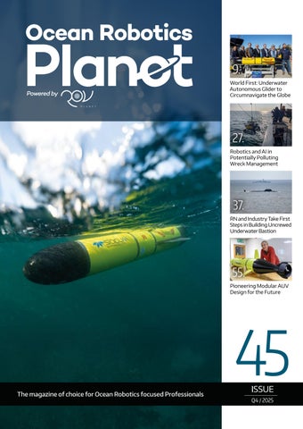
WELCOME TO OCEAN ROBOTICS PLANET! Dear Reader, In a previous issue, we highlighted the story of Doug Webb and his pioneering contributions to ocean science, focusing on the vision behind the Sentinel Glider mission. That vision has now become reality with the launch of Redwing, an underwater glider set to circumnavigate the globe. Regularly surfacing to transmit data via satellite, Redwing will deliver vital ocean information to NOAA’s global monitoring system. This will allow scientists and universities around the world to access real-time data, fostering international collaboration and interest in the mission. You can also see Redwing featured on this issue’s front cover! Dr. Lee Willett reports on the REPMUS naval exercise that brings together military forces and private industry to test and develop new unmanned maritime technologies. The goal is to use these dual-use systems to improve how NATO and its members respond to challenges and threats at sea. In a separate article he looks at the ‘Bastion’ concept, a new idea for strengthening underwater defence across the North Atlantic, stretching from the Mid-Atlantic Ridge to the Norwegian Sea. It combines crewed and uncrewed vessels into a flexible network that can work together or operate independently. In other defence-related articles, we explore how optical sensors are transforming mine countermeasure operations. These missions involve a series of carefully coordinated steps: detecting potential threats across vast areas of the seafloor, classifying them amid numerous false contacts, positively identifying them to prevent unnecessary interventions, and neutralizing them safely. We also examine the use of passive and active acoustic monitoring in maritime defence and discuss how advancements in maritime autonomy are enhancing these capabilities. Finally, we turn to Project Tangaroa, which unites international experts to establish standards and protocols for assessing and managing potentially polluting wrecks (PPWs). With over 8,500 shipwrecks from twentieth-century conflicts resting on the ocean floor - containing an estimated 2.5 to 20 million tons of pollutants - these PPWs continue to deteriorate due to decades of corrosion, increasing the risk of catastrophic oil spills each day. The question is: How can robotics and AI help achieve the environmental protection outcomes we urgently need, while keeping costs under control? We invite the ocean robotics industry to engage with the PPW management community, adapting existing technologies and developing specialized solutions for this complex application. Explore these stories and many more inside. I truly hope you enjoy this quarter’s issue. Best regards, Richie Enzmann
Connecting What’s Needed with What’s Next™
OPTIMIZE YOUR OPERATIONS We enable SIMOPS with our enhanced Ocean Intervention II vessel, USV, and AUV to seamlessly support simultaneous acquisition of high-quality geophysical and geotechnical data.
Connect with what’s next at oceaneering.com/autonomous-surveys Copyright © 2025 Oceaneering International, Inc. All rights reserved.
SPRINT-Nav The ultimate solution for underwater navigation
Imagine a navigation system that delivers unparalleled precision, effortless integration and reliable performance for every operation. The SPRINT-Nav family offers a class-leading, all-in-one subsea navigation solution for all marine robotics and autonomous vehicles. Want to take your marine robotics operations to the next level? Scan the QR code and get in touch with us today!
Sonardyne.com
Courtesy of Teledyne Marine
WORLD-FIRST
UNDERWATER AUTONOMOUS GLIDER TO CIRCUMNAVIGATE THE GLOBE In a world-first for marine science and technology, Teledyne Marine in collaboration with Rutgers University-New Brunswick, will conduct a pioneering mission to circumnavigate the globe with an autonomous underwater glider.
Using Teledyne’s ‘Redwing’, the most advanced commercial subsea glider ever developed, the near five-year Sentinel Mission departs on 10 October 2025 following a ceremony at Woods Hole Oceanographic Institution (WHOI), which operates the second largest glider fleet in the world.
Launched from the edge of the continental shelf south of Martha’s Vineyard, Massachusetts, the next generation Slocum Sentinel Glider will gather unparalleled levels of data on ocean currents, sea temperature and their impact on weather systems and the planet. This data will help refine weather models and improve hurricane intensity forecasting. The data will also help to inform ocean policy and conservation efforts.
| 9
WORLD-FIRST: UNDERWATER AUTONOMOUS GLIDER TO CIRCUMNAVIGATE THE GLOBE
Courtesy of Teledyne Marine
“This is a truly historic mission,” says Brian Maguire, COO at Teledyne Marine. “It will pave the way for a future where a global fleet of autonomous underwater gliders will be able to continuously sample our oceans. These gliders will deliver early warnings of extreme weather and will track the impact of shifting ocean currents so that we can refine long-term weather projections in a way that scientists have dreamed of for decades. “It will also prove that long-range, next-generation, low energy autonomous underwater vehicles (AUVs) are capable
Courtesy of Teledyne Marine
10 |
of carrying more complex, heavier, and increasingly energy hungry sensors on missions that we could only have imagined previously.”
A LEGACY REALISED The culmination of a vision first imagined by glider inventor Doug Webb — who pioneered autonomous ocean vehicles at Teledyne Webb Research — the Sentinel Mission serves as both a tribute to Webb, who passed away in 2024 at the age of 94, and a response to the urgent need for global ocean monitoring.
Courtesy of Teledyne Marine / Daniel Cojanu
Specially built for the mission ‘Redwing’ – an acronym for Research & Education Doug Webb Inter-National Glider – will surf global ocean currents on its epic mission gathering critical ocean data from under-sampled, remote regions of the globe.
A GLOBAL FLIGHT PATH Redwing’s first leg will see it ride the Gulf Stream south of Martha’s Vineyard toward Europe, before sweeping south to stop at Gran Canaria off the coast of North West Africa. Its next leg will take it to Cape town in South Africa, before crossing the Indian Ocean to stop at Perth in Western Australia, then on to Wellington, New Zealand. It will then navigate the Antarctic Circumpolar Current — the most powerful current on Earth — taking it on its longest leg to the Falkland Islands. From here there will be possible stops in Brazil and the Caribbean before heading back to Cape Cod in the U.S.
PROVIDING VITAL DATA
Courtesy of Teledyne Marine / Daniel Cojanu
SMART DESIGN Redwing’s carbon fibre hull flexes under pressure, compressing slightly during descent, while its buoyancy is adjusted via an oil pump and pitch battery system. This ingenious design allows Redwing to “surf” rather than fight ocean currents, travelling at an average speed of 0.75-1 knots as it efficiently propels its way forward, enabling it to travel vast distances, staying deployed for longer. PAYLOAD AND SENSORS At 2.57m long and 0.33m in diameter, Redwing carries a payload of up to 3.5kg, including: ƀ CTD sensor (conductivity, temperature, depth/density) ƀ Altimeter to avoid the seafloor ƀ Attitude and compass sensors for navigation ƀ And a fish monitor from Dalhousie University, tracking tagged marine life such as sharks and whales
Transmitting information via satellite when it surfaces every Shea Quinn, Sentinel Mission Project Lead and Slocum 8-12 hours, Redwing will share vital data on ocean tempera- Glider Product Line Manager, explains: “As we travel ture, salinity, currents, and ocean health via the National through the layers of the ocean, which move over and Oceanic and Atmospheric Administration’s (NOAA) global under each other in different directions, we’ll gather data monitoring system. This will ensure that scientists, ocean- on water temperature and density, and we’ll pick up pings ographers, meteorologists, universities, and even schools from tagged marine life. worldwide will be able to access real-time results internationally, building interest in the mission. “We’ll be able to see what’s happening at the surface and deeper underwater where huge patches of cold water and INSIDE THE SENTINEL REDWING warm water move. This data will help us to show, for example, where a hurricane is going to go next and how intense it’s BUILT FOR ENDURANCE going to be. We’ll also build a better knowledge about the The Sentinel Redwing is a new class of sea glider, purpose- impact of ocean currents on our weather patterns, informing designed for ultra-long missions across some of the harshest global ocean models of the future, and our understanding of seas on Earth. Specially engineered with extended battery long-term climate change.” capacity and additional sensor capability, it can travel up to Supported by partners from Spain, Gran Canaria, South 15,000 kilometres on a single leg. Africa, Australia, New Zealand, Brazil, the UK, and the U.S, the mission is a truly international undertaking. DEPTH AND PERFORMANCE Redwing will dive to depths of 1,000 metres before returning to the surface to transmit data every 8-12 hours. Using only COLLABORATING WITH ACADEMIA gravity and buoyancy for propulsion, it flies in a sawtooth Teledyne Marine engineers will work closely with more than pattern through the water, conserving energy for years-long 50 Rutgers University students at the Center for Ocean deployments. Observing Leadership (COOL), who have helped programme
| 11
WORLD-FIRST: UNDERWATER AUTONOMOUS GLIDER TO CIRCUMNAVIGATE THE GLOBE
Courtesy of Teledyne Marine
the navigation software that will guide Redwing across the oceans. Together, they will track Redwing from their shared mission control bases and will keep it on its flight path, making necessary adjustments each time it surfaces throughout the 73,000km journey.
Oscar Schofield, Distinguished Professor in the Department of Marine and Coastal Sciences at Rutgers, added: “There’s no doubt in my mind that this mission will not only shape our understanding of the oceans and their impact on the climate in a new way, but it will also change the future of autonomous ocean exploration.
“This is a pivotal moment for ocean science,” said Scott Glenn, Distinguished Professor in the Department of Marine and Coastal Sciences at Rutgers. “We’re deploying an autonomous glider that will travel the world’s oceans, gathering data. And we’re doing it with students, educators and international collaborators every step of the way.”
“Fittingly, it will also realise a piece of science-fiction written by Henry Strommel of Woods Hole Oceanographic Institution that appeared in Oceanography Magazine in 1989. This foresaw an international race between three Slocumb Sentinel gliders to circumnavigate the globe first, and a time when there would be a fleet of underwater gliders taking part in missions around the world.”
The Sentinel Mission’s progress will be updated on www.teledynemarine.com/sentinelmission and can be followed on Instagram: @teledynemarinevehicles
12 |
TRANSFORM YOUR CAPABILITY
REAL-TIME IMAGING IN ALL CONDITIONS Oculus Multibeam Imaging Sonars
High resolution imaging in turbid water for improved situational awareness and target identification. Available in 375kHz to 3.0MHz. Depth rated to 500m, 1000m, or 4000m.
www.blueprintsubsea.com enquiries@blueprintsubsea.com
Equipment you can count on. People you can trust.
Redefining the standard in equipment rental services Significant provider of rental equipment to the offshore, subsea, and renewable energy industries – supporting projects from the North Sea to the Americas.
offshorerental.com
REPMUS EXERCISE ENHANCES INDUSTRY PARTNERING TO DELIVER
NAVAL UNMANNED CAPABILITY Dr Lee Willett, Tróia, Portugal
The annual Portuguese Navy/NATO-led ‘REPMUS’ maritime unmanned systems (MUS) exercise is continuing to build partnerships with commercial industry to harness dual-use unmanned technologies, as it seeks to develop and exploit such technology to tackle threats NATO and its member states face at sea.
Manned and unmanned systems, the latter including Exail’s Drix USV, are pictured off the main ‘REPMUS’ base at Tróia. (Photo: Dr Lee Willett)
| 15
REPMUS EXERCISE ENHANCES INDUSTRY PARTNERING TO DELIVER NAVAL UNMANNED CAPABILITY
Sonobot is a mobile USV that operates as a gateway buoy that can connect the underwater and surface domains. (Photo: Dr Lee Willett)
In particular, the exercise is accelerating its development of such capability to an increasing degree each year, by pushing such capabilities through operational experimentation (OPEX) designed to test, prove, and demonstrate their utility in real-world operational scenarios. “The exercise is focused on experimentation with unmanned systems with implications in both military and civilian contexts,” Captain Nuno Palmeiro Ribeiro – exercise controller for ‘REPMUS’ as Director of the Portuguese Navy’s Centre for Naval Operational Experimentation (Centro de Experimentação Operacional da Marinha: CEOM), which leads the navy’s ‘REPMUS’ contribution – told a media briefing at the exercise on 23 September. ‘REPMUS’ takes place each September around the Tróia peninsula in southern Portugal. The peninsula provides a unique experimentation environment for maritime systems, with the main exercise base (CEOM’s headquarters at Tróia) situated along the shallow waters of the Sado River estuary on the peninsula’s sheltered inshore side; seaward, exercise activities – including the mine-countermeasures (MCM) hub further west on the coast at Sesimbra – can draw on the advantage of deep water close in, including the 1400 m depth Setúbal Canyon. In alternate years, including 2025, ‘REPMUS’ runs in tandem with NATO Allied Maritime Command’s (MARCOM’s) own dedicated MUS OPEX activity, ‘Dynamic Messenger’.
EXERCISE OUTPUT In military-operational terms, “‘REPMUS’ brings the strategic, operational, and tactical levels, allowing forces to test interoperability, integration, and innovation in a real-world environment,” said Capt Ribeiro.
16 |
This year, ‘REPMUS’/‘Dynamic Messenger’ was held over more than 25 days, and was divided into three phases, including preparation and integration, tactical activities to build progress from basic to advanced serials, and a final phase providing OPEX relating to high-end warfighting. This final phase encompassed a multidomain threat in which the opposing forces were tasked with defending or gaining control of an area. This scenario required the assembled unmanned forces on both sides to operate in integrated mass. To achieve this, each participating MUS vehicle was required to be able to integrate its sensors and data directly into the exercise control’s common operational picture. The exercise’s broad scenario, and the specific serials therein, encompassed a range of tasks against which the assembled unmanned systems were required to demonstrate their various capabilities. These tasks included rapid environmental assessment, underwater warfare including MCM operations, above-water warfare (AWW), amphibious operations, harbour protection, and maritime safety and security including critical undersea infrastructure (CUI) protection. The AWW task included this year, for the first time in ‘REPMUS’, the use of unmanned systems in jammingrelated electronic warfare activities. This reflected very much a lesson learned from combat operations in Ukraine, where Ukrainian forces in particular are required to overcome persistent and wide-area Russian jamming efforts. As another ‘first’ this year in the exercise’s history – a history that dates back to 2010 – the assembled unmanned and manned forces (the latter numbering 18 ships in total) were divided up into ‘blue force’ and ‘red force’ elements. “The Ukrainian Navy is leading the ‘red forces’, and we have a lot to learn from them through their experience,” said Capt Ribeiro.
The Ukrainian Navy’s participation in ‘REPMUS’ has been significant in the last couple of years, culminating in leading the ‘red force’ this year. This was the first time the Ukrainian Navy had taken on such a role in the exercise, Captain Valter de Bulha Almeida – Commanding Officer of Commander Task Group (CTG) 443.90 during ‘REPMUS’, and Director of the Portuguese Navy’s tactical operations training and evaluation centre (Centro Integrado de Tática e Análise Naval: CITAN) – told the media briefing. The scenario developed for the exercise drew on lessons learned from Ukraine’s experiences in its on-going war with Russia. Moreover, the Ukrainian Navy’s participation in the exercise provided a significant opportunity for NATO navies and the Ukrainian Navy to learn a lot about each other’s capabilities and approaches, said Capt Almeida.
EXERCISE PARTNERSHIP In civil-military terms, ‘REPMUS 25’ brought together not only 24 participating countries plus 13 observer countries, but academia and commercial industry. The latter provided the bulk of the 276 unmanned systems present. Industry participation in the exercise has grown significantly since 2023 in particular, and this is illustrated in the number of contributing companies and vehicles. While ‘Dynamic Messenger’ will have added to the numbers of unmanned systems present for this year, the increase from 105 in 2024 up to 276 is still significant. Of the unmanned systems present across all domains at the exercise, 157 were assigned to ‘blue forces’ and 119 to ‘red forces’. In terms of the unmanned surface vessels (USVs) present, 19 were provided under NATO Allied Command Transformation (ACT), which through its Task Force X programme has been developing the capacity to generate USVs at sea, within its wider work on enabling the accelerated development, acquisition, and delivery of new technology and capability including under NATO’s new Rapid Adoption Action Plan (RAAP). The RAAP acquisition approach was endorsed at NATO’s Hague Summit, which took place in late June. As regards the range of different MUS provided by industry at ‘REPMUS’, this was reflected in the MCM serials, conducted out of Sesimbra. A ‘sail past’ demonstration for media assembled onboard the Portuguese Navy’s Viana Do Castelo (NPO 2000)-class offshore patrol vessel Figueira Da Foz was used to showcase a number of these systems. More were present on Sesimbra’s quayside. Several of these systems were participating in the exercise for the first time. Some also demonstrated new technologies and conceptual angles they potentially bring. For example, EvoLogic’s Sonobot 5 small USV is a mobile gateway buoy, able to connect underwater sensors to the surface and beyond and to be able to relocate where and when required to do so. Naval Group and the ‘MCM Lab’ brought the Cormorant hybrid, multi-environment unmanned system – a ship-
The ‘MCM Lab’ Cormorant connects two domains by deploying from a surface ship as a UAV before diving below the surface to conduct MCM operations as a UUV. (Photo: Dr Lee Willett)
launched unmanned aerial vehicle (UAV) that can transition into the underwater environment to operate in unmanned underwater vehicle (UUV) mode, before returning to its host platform. The UAV is designed to support the MCM role, and brings an adaptable payload. The Euroatlas Greyshark Bravo autonomous underwater vehicle (AUV) was tested in the exercise’s anti-submarine warfare (ASW) and MCM serials, harnessing the four different high-resolution sensors it was carrying. Overall, 100 of the MUS systems present at ‘REPMUS’ were deployed for the MCM task, Commander Andreas Montag – head of MUS at the German Navy’s 3rd Minesweeping Squadron, and leading the staff responsible for running the MCM activities at ‘REPMUS’ as the naval mine warfare tasking authority – told a media briefing in Sesimbra on 23 September. ‘REPMUS’ now features a wide variety of unmanned systems provided by industry that support the MCM task through offering a wide range of capabilities, Cdr Montag added. Of course, it was for the MCM task and to support the requirement to remove the operator from the minefield that saw navies turn to commercial industry in the first place to draw on the ‘stand-off’ approach offered by unmanned systems. ‘REPMUS 25’ is a clear illustration of how the navy/ industry partnership has developed, and the expanding impact commercially developed MUS are having on naval operations.
| 17
GUARDI AN AUV® chosen to deliver: long range, large payload capacity, adaptable performance, autonomy and persistence.
CHANGING THE PARADIGM OF SURVEY, SCIENCE AND SECURITY THROUGH LONG RANGE MODULAR AUTONOMOUS UNDERWATER VEHICLES www.cellula.com
+1 604540 5330
info@cellula.com
SEEING CLEARLY UNDERWATER
HOW OPTICAL SENSORS ARE RESHAPING MINE COUNTERMEASURE OPERATIONS Mine countermeasure (MCM) operations remain one of the most dangerous and complex undertakings in naval defense. The threat posed by sea mines is as real today as it has ever been, capable of disrupting commercial shipping, threatening naval fleets, and endangering coastal infrastructure. Detecting, identifying, and neutralizing these hidden dangers is not a straightforward task. It requires a chain of carefully orchestrated actions: locating potential threats over large swaths of seafloor (detection), classifying them among countless false contacts (classification), positively identifying them to avoid unnecessary interventions (identification), and finally, neutralizing them safely (disposal).
Courtesy of Voyis
| 19
SEEING CLEARLY UNDERWATER: HOW OPTICAL SENSORS ARE RESHAPING MINE COUNTERMEASURE OPERATIONS
Stills images taken with Voyis Imaging Systems from MCM missions for accurate identification. (Courtesy of Voyis)
Traditionally, sonar systems have been the foundation of this mission set. Their ability to cover wide areas efficiently and detect objects buried in sediment has made them indispensable. Yet, sonar alone has its limits. Mines often sit in cluttered seabed environments, where wreckage, boulders, or even industrial debris can mimic mine-like returns. These false positives increase operator workload and prolong missions. The final stages of identification and neutralization demand a level of detail and situational awareness that sonar simply cannot provide. Historically, these final stages have been carried out by divers, placing personnel near live ordnance in highly uncertain conditions. However, the introduction of advanced optical sensors now allows remotely operated vehicles (ROVs) to take on these identification and disposal tasks, reducing risk to human life while maintaining operational precision. This is where optical sensors, like high-resolution still cameras, along with underwater laser scanners, are proving transformative.
THE NATURE OF MCM MISSIONS The sequence of an MCM mission is often described as a four-stage process: detection, classification, identification, and neutralization. Detection begins with wide-area sonar sweeps that provide the first indication of potential threats. Classification follows, where algorithms or human operators attempt to discriminate mines from harmless clutter. Yet detection and classification can only take the mission so far. The stakes rise dramatically at the identification stage, where operators must determine with certainty whether an object is a mine. Any ambiguity can lead either to wasted time neutralizing harmless items or to catastrophic oversight if a mine is left undetected. Finally, neutralization demands precise piloting and absolute confidence, as vehicles are sent to deploy charges or manipulators in direct proximity to explosive devices. Each of these stages has unique technical requirements. Detection demands broad coverage. Classification requires discrimination in complex acoustic data. Identification calls for clarity and fine detail under difficult operating environments with turbidity, while neutralization requires real-time
20 |
awareness and precise control. Optical sensors, once considered secondary in underwater operations, are now emerging as essential technologies for meeting these requirements.
BEYOND THE LIMITS OF ACOUSTICS The reliance on acoustics for the initial phases of MCM remains undisputed. High-frequency side-scan sonar and synthetic aperture sonar have improved tremendously, providing imagery at extended range. Yet even the best acoustic systems cannot reveal surface textures, colors, or fine geometric features that often hold the key to distinguishing between a mine and a benign object. In shallow littoral zones where clutter is abundant, sonar images can become ambiguous, generating long lists of potential contacts that demand closer inspection. This is where the shortcomings of acoustic sensing become apparent. The inability to resolve fine detail leads to high false alarm rates, increasing the time, cost, and risk of operations. Mines that are partially buried or obscured by marine growth add further complexity. At the identification stage, sonar can suggest what an object might be, but rarely can it confirm it with the certainty that operators and mission commanders require. To overcome these limitations, navies and research groups have turned increasingly to optical sensing technologies.
OPTICAL SENSING FOR IDENTIFICATION High-resolution still and video cameras, such as the Voyis Observer Imaging system for AUVs or the Voyis Discovery Stereo camera for ROVs, provide a fundamentally different type of information than sonar. They capture visual cues, fuse assemblies, surface markings, weld seams, or evidence of corrosion, that can reveal the true nature of an object. Photogrammetry techniques take this a step further by stitching overlapping images into three-dimensional reconstructions. These reconstructions allow operators to examine a suspected mine from multiple angles, measuring its proportions and comparing its features to known mine templates. In addition to that, high image quality allows navies to look at training their own ATR algorithms, which was not possible in the past.
Laser scanners, like the Voyis Insight Laser Scanner, add yet another dimension by capturing dense three-dimensional point clouds with millimeter to centimeter accuracy. Unlike sonar, which offers an acoustic outline, laser scanning produces a metric 3D model of the object, preserving its exact geometry. When combined with high-resolution imagery, these models offer both the visual and geometric evidence needed to reduce uncertainty. This fusion of optical modalities means operators no longer rely solely on judgment; they have quantifiable data to back their decisions. The result is fewer false positives, faster decision-making, and a lower risk of unnecessary or dangerous neutralizations.
VISION FOR THE NEUTRALIZATION STAGE Once an object has been identified as a mine, the mission shifts to neutralization. At this stage, the requirements for optical sensing are very different. Operators are less concerned with fine detail and more focused on real-time situational awareness. Remotely operated vehicles (ROVs) or autonomous systems tasked with placing charges must approach carefully and with precision. Low-latency video feeds are critical, providing operators with immediate feedback on the vehicle’s position relative to the mine. Piloting cameras optimized for this task, such as the Voyis Discovery Piloting Camera, are designed with wide fields of view to maintain awareness of both the mine and its surroundings. Real-time image enhancement further supports visibility in turbid waters, ensuring that operators can clearly see manipulator arms, deployment systems, and the mine itself. This combination of high situational awareness and minimal latency allows for controlled, deliberate approaches, reducing the risk of accidents during the most dangerous stage of the mission. The pairing of detailed pre-inspection imagery with live piloting video creates a comprehensive workflow, blending forensic precision with operational safety.
INTEGRATION WITH NAVIGATION AND MULTI-SENSOR SYSTEMS While powerful on their own, optical sensors realize their full potential when integrated with navigation and acoustic systems. Inertial navigation systems (INS) ensure that optical data is geo-referenced, enabling precise return to targets identified during sonar sweeps. Doppler velocity logs and depth sensors provide further positional stability. Multisensor acoustic systems guide vehicles toward areas of interest, narrowing the search field before optical sensors are deployed for confirmation. This layered approach creates a robust pipeline. Sonar provides wide-area coverage, reducing the operational area. Acoustic classification narrows the list of potential threats. Optical sensors then deliver definitive identification, and piloting cameras guide safe neutralization. Visual-inertial fusion methods even allow optical sensors to contribute to localization accuracy, producing consistent pose estimates that improve navigation in GPS denied environments. The result is a comprehensive sensor stack in which each technology complements the others, producing outcomes greater than the sum of their parts.
TOWARD AUTONOMY IN MCM The growing role of optical sensors is also enabling greater autonomy in MCM missions. With the ability to capture highresolution images and 3D models, these sensors provide the data required for machine vision algorithms to assist with recognition and classification. Algorithms trained on optical datasets can identify mines automatically, flagging features of interest and reducing operator workload. In the neutralization stage, real-time optical feedback can be coupled with autonomous control algorithms to refine approach trajectories or align charges automatically. Such
Courtesy of Voyis
| 21
SEEING CLEARLY UNDERWATER: HOW OPTICAL SENSORS ARE RESHAPING MINE COUNTERMEASURE OPERATIONS
semi-autonomous behaviors reduce the need for constant human input, speeding up operations while lowering risk. As the defense sector continues to explore greater autonomy, optical sensing will play an increasingly central role in providing the data fidelity required for reliable automated decision-making.
OPERATIONAL BENEFITS AND FUTURE OUTLOOK The integration of optical sensors into MCM missions brings measurable benefits. Identification becomes faster and more reliable, reducing the time spent resolving false alarms. Neutralization becomes safer, with operators given the visual awareness needed for precise control. Mission timelines shorten, risks decrease, and forensic data for post-operation analysis becomes richer and more detailed. Looking ahead, advances in optical technologies, such as higher sensitivity sensors, improved laser systems, and better real-time image processing, promise to expand their utility even further. Coupled with ongoing developments in autonomy and multi-sensor fusion, optical systems are set to become a cornerstone of next-generation MCM operations.
They do not replace sonar or navigation systems; instead, they complete them, filling the critical gaps and enabling missions to be executed with confidence and precision. Mine countermeasure missions will always demand a careful balance of caution and decisiveness. The dangers are real, the environments are challenging, and the margin for error is slim. Yet the integration of advanced optical sensors is shifting that balance. By providing high-resolution detail during identification and real-time awareness during neutralization, cameras and laser scanners are elevating the effectiveness of MCM operations. When combined with inertial navigation and acoustic systems, optical sensors create a layered defense against one of the ocean’s most persistent threats. They transform ambiguity into certainty, risk into managed procedure, and human workload into shared responsibility with autonomous systems. As navies and defense organizations look to the future, the adoption of optical sensing in MCM is not simply a technological upgrade—it is a fundamental transformation in how underwater threats are confronted and neutralized.
Hyperion Crude Oil Detects hydrocarbons during ROV and AUV deployments across a range of applications including leak detection and environmental monitoring Learn more about Hyperion | valeport.co.uk 22 |
The VideoRay Defender ROV is frequently used in defense applications including explosive ordnance disposal (EOD), where reliable performance, including of the navigation system, is key. (Courtesy of VideoRay)
VIDEORAY RELIES ON NORTEK DVLS FOR
TRUSTED PERFORMANCE IN HIGH-STAKES MISSIONS
VideoRay’s Mission Specialist Defender ROV, the industry standard ROV for use in defense applications including explosive ordnance disposal (EOD), relies on Nortek’s DVL 500 Compact for navigation and vehicle control during sensitive missions.
Pennsylvania-based VideoRay, an AV company, is the world’s leading manufacturer of underwater robotic systems. Their Defender ROV is trusted and proven in defense applications and has been selected by the U.S. Navy to support the Navy’s Explosive Ordnance Disposal Underwater Vehicle
Program and the MESR (US Navy’s Maritime Expeditionary Standoff Response) program of record. For this application, the Defender relies on Nortek’s DVL 500 Compact for navigation and vehicle control, crucial functions during complex and high-stakes missions.
| 23
VIDEORAY RELIES ON NORTEK DVLS FOR TRUSTED PERFORMANCE IN HIGH-STAKES MISSIONS
RELIABLE NAVIGATION SENSORS: CRUCIAL FOR VEHICLE PERFORMANCE Underwater operations are increasingly relying on highperformance uncrewed and autonomous systems to perform tasks which previously put divers in harm’s way. Reliable navigation sensors are key to making this transition possible. The Defender uses Nortek’s DVL 500 Compact as the core of the vehicle’s navigation system, providing pilots with pinpoint positioning in environments where GNSS is unavailable. From station keeping to advanced mission profiles such as automated waypoint following, it is the enabling technology that allows operators to push ROVs into missions once thought to be beyond reach.
reliability, including the performance of its navigation system. The industry is moving increasingly towards the use of uncrewed and autonomous systems in hazardous and high-risk environments, and innovation and dependability will continue to be key. As the ocean economy expands and subsea missions grow more complex, one thing is clear: in underwater robotics, the future doesn’t belong to the biggest machines, it belongs to the smartest collaborations.
“The DVL is arguably one of the most important sensors we have in the system,” says Andy Goldstein, Product Line Chief Engineer at VideoRay. “As we move forward and add more autonomy like coupled manipulation and one-click inspections, the performance of the DVL becomes more and more critical.”
TRUSTED PERFORMANCE IN DEFENSE APPLICATIONS ROVs like the Defender are frequently used in Explosive Ordnance Disposal (EOD) missions: locating and safely neutralizing explosive material, such as underwater mines, in high-risk areas in contested environments.
Nortek’s DVL 500 Compact, shown here in the 6000 m- rated housing, offers a bottom-track range of 175 m and a compact form factor. (Courtesy of Nortek)
Eric Wirstrom, VideoRay’s Vice President of Sales and Business Development who previously worked as an EOD officer for the U.S. Navy, emphasizes the importance of replacing human divers with robotic systems when possible in dangerous underwater environments. “The vehicle, equipped with advanced sensors and highly accurate navigation, allows military personnel to quickly and reliably detect threats, often at depths that are unreachable by manned solutions like diving,” he explains. “We’re able to provide that reach and standoff to enable dangerous missions to be executed.”
The VideoRay Defender ROV uses the Nortek DVL 500 Compact, visible here underneath the vehicle, for navigation and positioning. (Courtesy of VideoRay)
MOVING UNDERWATER TECHNOLOGY FORWARD As both ROV and sensor technology has developed over the years, VideoRay and Nortek have worked closely together to ensure top performance. While the Defender originally used the DVL 1000, VideoRay required a sensor with longer range and better performance in a noisy environment. Nortek’s DVL 500 Compact offers the same housing as the original DVL 1000 but offers more than twice the range, as well as additional features including noise shielding. This made it the ideal solution for the Defender. This ability to be agile and quickly develop technology to meet industry needs exemplifies the collaborative and innovative approach both Nortek and VideoRay value highly.
COLLABORATION THAT SCALES The Defender is the industry-standard choice for EOD missions and other high-stakes defense applications because of its proven
24 |
The Defender’s small size makes it easily deployable. Its small footprint and big capabilities are enabled by sensors like the DVL 500 Compact. (Courtesy of VideoRay)
Empowering the Blue Economy Through Advanced Ocean Technology.
High resolution sonar system solutions for Mine Counter Measures and other military applications.
Advanced instruments used in oceanography and subsea navigation to help measure movement in underwater environments.
Adaptive robotic arms for intervention and control in offshore energy and modern naval landscapes.
Supporting ocean scientists, engineers and the maritime industries overall by providing underwater technology.
Mission-ready Hybrid ROV system with fully integrated sensors for fast deployment.
Robust, reliable underwater sensors for the planet’s harshest environments and most difficult applications.
Find out more
Seaeye Falcon
Empowering
The professional portable underwater vehicle. The Seaeye Falcon is the most versatile underwater electric robotic system in its class. Compact, powerful, and depth-rated to 300m or 1000m, it excels in demanding missions making it the trusted choice for critical underwater tasks worldwide. Learn more at: saabseaeye.com
ROBOTICS AND AI IN POTENTIALLY POLLUTING WRECK MANAGEMENT
ARE WE READY FOR THE DEEP? Mark J. Spalding (President, The Ocean Foundation), Simon Burnay (CEO, Waves Group / S.Burnay@waves-group.co.uk), Prof. Fraser Sturt (University of Southampton)
More than 8,500 shipwrecks from twentieth-century conflicts rest on the ocean floor, containing between 2.5 and 20 million tons of pollutants. As these potentially polluting wrecks (PPWs) deteriorate after decades of corrosion – accelerated by climate change impacts including warming waters, acidification, and increasingly powerful storms – the risk of catastrophic oil spills grows daily. How can robotics and artificial intelligence help deliver the environmental protection outcomes we urgently need at a manageable cost?
THE SCALE OF THE CHALLENGE These wrecks can disrupt maritime systems and threaten local biodiversity. They also hold significant heritage value—many contain human remains and are considered war graves. Current arrangements for spill prevention and response remain inadequate. Project Tangaroa, initiated by Lloyd's Register Foundation in 2023, has brought together international experts to develop standards and protocols for PPW assessment and intervention, accelerating the shift from reactive emergency response LRF Insight Report toward proactive strategic management.
The nature and scale of the challenge is, sadly, illustrated by a significant spill from a PPW that is unresolved at the time of writing. There are over 1,200 PPWs in the Pacific Ocean, many from WWII. A significant concentration of these wrecks lies in Chuuk Lagoon, resulting from Operation Hailstone in February 1944, a destructive three-day U.S. attack that sank over 50 Japanese warships and supply ships. On September 11th, 2025, recreational divers reported oil leaking from the popular dive site, Rio de Janeiro Maru. With oil having reached nearby islands, including Panitiw, Nukanap, and Sopota, Governor Alexander R. Narruhn officially declared a state of emergency on September 15, 2025. Aid was requested from the United States and Japan. President Wesley W. Simina used his address at the UN General Assembly on September 26, 2025, to appeal for urgent international assistance:
Photo: Richie Enzmann
| 27
ROBOTICS AND AI IN POTENTIALLY POLLUTING WRECK MANAGEMENT: ARE WE READY FOR THE DEEP?
‘Sunken Ships of the Second World War’ database by Paul Heersink. Blue dots represent Allied ships; red dots are Axis.
“These remnants of war now threaten our fisheries, our communities and our livelihoods…The scale of this crisis far exceeds Micronesia’s capacity to address alone. As we mark the 80th anniversary of the war’s end, we appeal to the international community to work with us in transforming this legacy of war into an opportunity for cooperation.” It has been reported that the UN system in Micronesia is working to broker immediate international commitment to action to contain the spill, secure emergency funding for cleanup, and conduct risk assessments of all other high-risk wrecks. So, we have a situation in which a well-known PPW poses an immediate threat to the environment and communities of a nation that played no role in creating the problem. But, because such legacy wrecks fall outside of most current arrangements for funding oil spill response, rather than the automatic provision of resources and finance through established, predictable mechanisms, the nation’s leadership must appeal for help, enter negotiations, and work through multinational structures. Inevitably, this causes delay and uncertainty, and potentially greater harm.
INNOVATION IN ROBOTICS IS KEY TO IMPROVING ALL ASPECTS OF PPW MANAGEMENT. Recent surveys indicate that leaks occur not through single catastrophic events but through the generalized weakening of seams and fastenings, suggesting a decline in structural integrity across aging wrecks. Some mystery oil spills already detected may originate from undetected PPWs. The challenge is compounded by limited or imprecise information about most wreck locations and conditions, creating an urgent need for scalable monitoring and intervention capabilities. For PPW management, we need a greater ability to establish baseline conditions and track changes over time across multiple sites
28 |
to develop predictive modelling of structural deterioration. Real-time monitoring could prove especially valuable in areas like Iron Bottom Sound, where multiple wrecks cluster in single locations, enabling early warning of emerging threats before catastrophic releases occur. Importantly, AUVs increasingly offer a route to doing this at lower carbon cost, diminishing the time and distance (or need) for large survey vessels.
DEPTH AND ENVIRONMENTAL CHALLENGES In some regions, such as the Caribbean, PPWs lie at considerable depths. Modelling on the potential impact of leaks from such wrecks has begun, but a key requirement is better information on their current condition. Work has also started on a new database of PPWs in the Arctic; Arctic wrecks combine accessibility challenges from ice cover and remoteness, and extreme cold with additional heightened environmental sensitivity — oil spills in polar regions persist longer and prove more damaging to cold-adapted ecosystems. We urgently need to enhance awareness of the potential for robotics and AUVs to contribute to management plans in such locations – especially where PPWs lie close to, or within, MPAs.
STRUCTURAL INTERACTION CAPABILITIES During the Tangaroa Workshop programme, the challenge of operating in and around heavily dilapidated, tangled structures was highlighted. While the latest inspection class ROVs offer great agility, specialized crawlers under development, such as those being tested by REMARCO (SEE CASE STUDY), promise more nuanced capabilities for inspection and potentially remediation activities. Advanced robotic arms with sophisticated manipulation capabilities – demonstrated in deep-sea biological research – could be adapted for PPW intervention tasks, from deploying monitoring sensors to executing precision repairs or containment measures on compromised hull sections.
INTEGRATION WITH COMPLEMENTARY TECHNOLOGIES Satellite surveillance can provide broad-scale monitoring, triggering robotic investigation when anomalies are detected. Digital twin technologies, augmented through AI analysis, could create evolving models of wreck conditions, predicting failure points and optimizing intervention strategies. This systems approach aligns with the technology roadmap developed through Project Tangaroa, which emphasizes integrated solutions for optimized assessments and interventions.
AI CAPABILITIES While robotics provides the physical tools, AI enables datadriven approaches to ocean resource management. Pattern recognition could potentially identify subtle changes in wreck condition data that signal accelerating deterioration. Realtime optimization is already proving effective in ocean plastic cleanup operations; AI routing increased plastic pollution collection efficiency by over 60% and could optimize robotic PPW survey missions. Computer vision and remote sensing technologies, enhanced by AI, could also enable tracking of shifting effects on flora and fauna, which can act as broader proxies for impact. However, artificial intelligence may also face significant constraints in the PPW context – the currently available historical data may provide an insufficient basis for reliable predictions of the complex interactions between climate change accelerators and century-old steel structures under varying oceanographic conditions. Training and operating AI models require significant data to learn from and energy. This means the environmental cost of running sophisticated AI systems must be weighed against the benefits gained. Additionally, autonomous systems operating on the seafloor can present documented risks to wildlife and natural habitats, requiring careful consideration of deployment protocols. Regulatory challenges compound technical limitations. AI systems for PPW management would collect and analyze large amounts of data, presenting privacy and security concerns, particularly regarding protected war grave sites. Ensuring responsible use without negative environmental or social impacts requires new regulatory frameworks still under development.
WHAT STILL NEEDS DEVELOPMENT For robotics and AI to fulfill their potential in PPW management, several critical gaps require attention: STANDARDIZED DATA PROTOCOLS: Effective AI requires consistent, high-quality data. The supporting data and archive strategy identified by Project Tangaroa must establish standards for robotic data collection, ensuring information from different systems, operators, and locations can be integrated meaningfully. ADAPTED HARDWARE: Purpose-designed robotic systems are needed for PPW applications, balancing the gentleness required for deteriorating structures with the robustness
demanded by harsh operating environments. Comprehensive toolkits covering various intervention requirements are still in development. ENERGY SOLUTIONS: Extending robotic deployment periods, particularly for resident monitoring systems, requires advances in underwater power systems. Energy-efficient AI algorithms must be prioritized to reduce operational costs and environmental footprints. TRANSPARENT DECISION FRAMEWORKS: AI-based prioritization systems for intervention decisions must be transparent and accountable, particularly given the heritage values and human remains associated with many PPWs. Stakeholders, including descendant communities, heritage organizations, and environmental groups, must understand and trust how AI systems inform decisions about which wrecks receive attention. COST DEMOCRATIZATION: Current advanced robotic systems remain expensive, potentially accessible only to well-funded national programs. For global PPW management, costs must decrease substantially. Partnerships with organizations like the Schmidt Ocean Institute, which already supports cutting-edge ocean research, could help democratize access to robotic capabilities. REGULATORY FRAMEWORKS: Clear international protocols must govern robotic and AI operations at PPW sites, balancing environmental protection needs with heritage preservation requirements and navigating complex jurisdictional questions.
A CALL TO STRATEGIC ACTION Robotics and AI are not silver bullets for PPW management, but they are essential components of effective solutions. We invite the robotics industry to engage with the PPW management community, adapting existing technologies and developing specialized solutions for this complex application. Project Tangaroa provides a framework for this collaboration, bringing together expertise from industry, government, research institutions, and heritage organizations. As the Malta Manifesto emphasizes, we know how to manage risks posed by these wrecks—we must urgently marshal resources and collective will to deploy that knowledge at scale. The corrosion clock ticks relentlessly, accelerated by climate change impacts. Every year we delay implementing systematic robotic monitoring and intervention capabilities increases the risk of catastrophic releases that could have been prevented. The question is not whether artificial intelligence is ready to improve environmental protection outcomes from potentially polluting wrecks. Instead, it is whether we are prepared to thoughtfully deploy the robotic and AI tools available today while simultaneously addressing their current limitations and developing the enhanced capabilities tomorrow's challenges will demand. The answer must be yes – the ocean cannot wait.
| 29
ROBOTICS AND AI IN POTENTIALLY POLLUTING WRECK MANAGEMENT: ARE WE READY FOR THE DEEP?
Arm of the crawler grabs an anemone from the hull of the wreck of WW I light cruiser SMS Ariadne (Photo: SeaTerra 2025)
Crawler and transponder buoy at the debris field of Tirpitz near Tromsø in northern Norway (Photo: SeaTerra 2025).
DEVELOPMENT OF UNDERWATER CRAWLING SYSTEMS FOR THE MONITORING OF MUNITION HOTSPOTS AT SEA
Dr. Matthias Brenner (Alfred Wegener Institute – AWI), Dieter Guldin & Patrik Wetzel (SeaTerra GmbH) Millions of tons of munition dumped into our seas during and after the two world wars are now found in nearly all marine areas. In summer 2024 the federal government of Germany financed a first remediation pilot in Lübeck Bay at Germany’s Baltic Sea coast. Here, piles of dumped conventional munition are laying on the seafloor, close to shore providing good conditions for remediation; in the next phase, a floating platform will be built, able to delaborate and burn the munition, to avoid expensive, and risky overland shipping to existing plants onshore. Dump sites in the German part of the North Sea are generally buried under a thick layer of sediment, limiting the usefulness of ship-based video and sonar monitoring. To address this, as part of the EU co-funded project REMARCO (https://www.interregnorthsea.eu/remarco) a crawler equipped with rotating water sampler device and a manipulator arm capable to sample sediment at discreate locations was developed, built and tested by the project partner SeaTerra. Following tests at the Alfred Wegener Institute (AWI), the crawler was deployed from the German research vessel HEINCKE and was tested at the dump site “Nördlich Spiekeroog”. The area a few nautical miles north of the Frisian Island of Spiekeroog is today fully covered by migrating sand dune in 20-25 m depth, where the crawler can easily manoeuvre. Here the crawler was steered remotely to a known magnetic anomaly and took samples of water and sediments according to a pre-programmed geo-referenced grid.
Crawler operated onboard of RV HEINCKE at the dump site of conventional munition in the German Bight called “Nördlich Spiekeroog” (Photo: U. Marx 2025).
30 |
In addition, the crawler was used to conduct a sampling mission around the wrecks site of the German WW I light cruiser SMS Ariadne laying approx. 20 nautical miles southwest of the island of Heligoland; the crawler toured in 40m depth around the keel up wreck of about 100m in length. At several discrete locations, such as bow, stern and several bigger holes in the hull, the crawler took remotely and videocontrolled samples of sediment and water. Furthermore, by changing the grabbing tool at the arm, organisms growing on the steel hull of the wreck could also be sampled. The crawler was also tested at the nearshore wreck site of the Tirpitz near Tromsø in northern Norway. To access the salvage site of Tirpitz, the crawler had to climb down onshore a steep hill to the beach, where it still had to a stoney shore before operating in the debris field of the Tirpitz, sampling water and sediment supported by a team of divers. The crawler certainly demonstrated its capabilities as a monitoring tool for munition hotspots and development of a fully autonomous operation mode is underway.
Crawler equipped with rotating water sampler and manipulator arm for sediment sampling, craned into AWI’s test pool facility (Photo: K. Liebrecht 2024).
Example of ground-truth image collected in challenging environments at 90m depth in the Atlantic, in high resolution, georeferenced, and viewable/downloadable through Cosma’s web platform. (Courtesy of Cosma Tech)
ENVIRONMENTAL MONITORING & HAZARD IDENTIFICATION WITH
MICRO-AUVS
Cosma was a company founded with IFREMER in France in 2022. Their mission represents a novel convergence of their passion for benthic ecosystems with a productivity driven ocean bottom acquisition expertise derived from industrial geophysics. This synergy allowed the French start-up to offer a new insight into the ocean floor. Their work serves both the demanding needs of marine biology, as well as essential requirements for infrastructure planning, inspection, and decommissioning. Their services may also prove particularly relevant to growing security demands.
THE FOUNDATION: GEOPHYSICAL HERITAGE APPLIED TO BENTHIC ECOLOGY Cosma's methodology is rooted in the founders' experience in developing and deploying large-scale data acquisition and processing techniques used in Ocean Bottom Cable/Node (OBC/ OBN) seismic campaigns. It was during these campaigns that Cosma co-founders Frédéric Mittaine and Yannick Pennecot met in 2008. Optimising cost and operational efficiency while making the best data available to marine biologists and subsea infrastructure managers became an obsession for their team of 15 roboticists, field operators, data scientists, and biologists.
Example of geolocated macro-waste detection displayed on the seabed digital twin, with associated ground-truth imagery, viewable and downloadable through Cosma’s web platform. (Courtesy of Cosma Tech)
| 31
ENVIRONMENTAL MONITORING & HAZARD IDENTIFICATION WITH MICRO-AUVS
Example of a wreck detected using sonar and subsequently identified through complementary optical acquisitions. (Courtesy of Cosma Tech)
The core innovation involves simultaneously deploying a multitude of micro underwater drones (micro-AUVs) navigating very near the seabed, to capture continuous photographic coverage of the seafloor. This scalable approach to close-range measurements provides a decisive break from traditional methods like divers, wired Remotely Operated Vehicles (ROVs) which cannot cover large areas efficiently. The entire process, from acquisition to interpretation, is supported by a robust, cloud-native processing chain which utilizes scalable photogrammetry, AI, and geospatial analysis.
ULTIMATE INSIGHT FOR MARINE BIOLOGY: DATA QUALITY AND COST EFFICIENCY Marine biology is considered the most demanding market segment in terms of data quality and cost. The combination of computer vision and scalable robotics directly addresses this by offering precision and repeatability with minimal marine means. By enabling systematic inventory and regular monitoring of the seabed, the team strives to provide marine biologists with modern tools to study benthic ecosystems and define optimal strategies for their protection. Key deliverables and features for biological users include: ƀ GROUND TRUTH EVERYWHERE: providing complete photographic coverage of the studied areas; ƀ HIGH RESOLUTION: achieving millimetric resolution, capturing colours and textures. This provides richness of information superior to typical acoustic methods; ƀ LARGE-SCALE MAPPING: generating cartographies of benthic biocenoses over large areas (one hectare per day per drone means square kilometres per week with 15+ units); ƀ AI-ASSISTED INTERPRETATION: utilising AI to assist in interpreting and mapping submarine habitats and detect species (e.g., Posidonia seagrass meadows, cold-water corals, etc.); ƀ QUANTIFICATION AND MONITORING: enabling quantification of species by biologists and repeatable follow-up over time, thanks to the fine positioning precision of the cartographies.
32 |
Example of geolocated species detection displayed on the seabed digital twin, with associated ground-truth imagery, viewable and downloadable through Cosma’s web platform. (Courtesy of Cosma Tech)
Example of geolocated object or instrument detection displayed on the seabed digital twin, with associated ground-truth imagery, viewable and downloadable through Cosma’s web platform. (Courtesy of Cosma Tech)
The team provides spot or multi-year services with efficiency gains (delivery within hours instead of months for traditional methods). It allows for regular environmental monitoring necessary to meet regulatory obligations, such as the followup of the good ecological status of zones and compliance with the National Strategy on Protected Areas.
A FLEXIBLE TOOL FOR SUBSEA INFRASTRUCTURES: ACTIONABLE DATA AND RISK MITIGATION Whether for coastal protection, offshore wind infrastructure or submarine cables (HVDC and data transmission), the subsea industry needs flexible, end-to-end delivery of actionable data. With congested seabed, co-use of marine areas and public concerns toward anthropic pressure on biodiversity, detailed and authoritative data are becoming critical at every stage of the infrastructure life cycle from Planning to Inspection and Decommissioning. The technologies and operational methods implemented by Cosma can derisk projects by providing relatable images for initial studies, monitoring during and after construction and even for the definition of the most appropriate decommissioning strategy based on infrastructure integrity and biodiversity at the end of its life cycle.
ACCELERATED SECURITY ROADMAP: UXO IDENTIFICATION AND SURVEILLANCE In response to the need for pyrotechnic clearance of Unexploded Ordnance (UXO) in many areas across the globe – as well as current geopolitical context – Cosma has accelerated its security roadmap, integrating UXO identification and
Example of AI-assisted species detection results, viewable and downloadable through Cosma’s web platform. (Courtesy of Cosma Tech)
surveillance capabilities into its autonomous systems. The underlying innovation is the integration of a multi-sensors on its autonomous vehicles. This allows combined environmental monitoring and security surveys in a single pass, thereby optimising marine resources. Key components of the security capabilities include: 1. MAGNETOMETER INTEGRATION: the precise positioning derived from photogrammetry, coupled with magnetometers on the AUVs, enables the creation of an extremely fine gradiometer system capable of detecting buried metallic objects (UXOs or cables);
CONCLUSION A new generation of subsea mapping and monitoring technologies is emerging, driven by the ongoing revolutions in robotics and AI, including affordable subsea components. Expertise in safe and efficient deployment at sea, in the most challenging environments, remains the cornerstone of the subsea industry. To deliver on their promises, those technologies will have to be embraced by NGOs, industrial companies and governmental agencies, and delivered by individuals with intimate knowledge of operations at sea.
2. HIGH-RESOLUTION SONAR DEPLOYMENT: mounted on USVs for fast-track mapping or on AUVs for high-density, low-altitude surveys, side scan sonar, multibeam echosounders and sub-bottom profilers can increase the efficiency of mapping and complement the ground truthing of images in very turbid environments; 3. AI-DRIVEN PROCESSING: combining these high-resolution datasets and accurately positioning them through photogrammetry allows for true multi-attribute analysis and enhanced discrimination; 4. UXO IDENTIFICATION: the system's operational advantages – a dense sensor mesh (small line spacing) and very close proximity to the seafloor – are crucial for achieving high detection sensitivity. For threat identification, Cosma partners with leading European companies to issue ALARP reports from multiparameter magnetic and optical anomalies.
Example of mapping results (substrate and/or habitat segmentation), viewable and downloadable through Cosma’s web platform. (Courtesy of Cosma Tech)
| 33
Please check out our website on:
www.oceanroboticsplanet.com
Courtesy of Fugro
Hear and See What Matters Beneath the Surface Innovative technologies to understand, protect, and defend the marine domain. Teledyne Marine offers a comprehensive range of advanced solutions for marine defense applications. From passive and active acoustic monitoring of harbors and critical underwater infrastructure to autonomous systems for rapid environmental assessments of expansive subsea areas, Teledyne Marine equips your naval missions. Visit us at TeledyneMarine.com
A Russian Yasen/Severodvinsk-class nuclear-powered attack submarine is shadowed off Norway in 2021 by the UK Royal Navy ASW-focused Type 23 frigate HMS Portland. The growing Russian underwater threat is driving UK development of its uncrewed system-based ‘Atlantic Bastion’ concept. (Crown copyright / UK Ministry of Defence, 2021)
AUGMENTING AUTONOMY
RN AND INDUSTRY TAKE FIRST STEPS IN BUILDING UNCREWED UNDERWATER ‘BASTION’ Dr Lee Willett, London
The UK’s Strategic Defence Review (SDR), published in June, illustrated sharper national- and NATO-level focus on North Atlantic security. Two of SDR’s three core roles for the UK armed forces are North Atlantic-centric: Role 1, defence of UK territories and interests; and Role 2, deter and defend in the North Atlantic. Consequently, the Royal Navy (RN) has significant primacy for the UK in delivering security there. Particularly, the RN’s multidomain antisubmarine warfare (ASW) capabilities are crucial in prosecuting an advanced, evolving Russian underwater threat.
| 37
AUGMENTING AUTONOMY: RN AND INDUSTRY TAKE FIRST STEPS IN BUILDING UNCREWED UNDERWATER ‘BASTION’
The threat’s tactical, operational, and strategic effects have taken underwater warfare into a new era. Previously, NATO navies rarely talked about submarines and underwater operations: now, the extent of the threat means strategic- and theatre-level underwater risk elements are discussed openly, as shown by SDR. Notable was its discussion of the navy’s emerging ‘Atlantic Bastion’ concept.
frigates. Yet there remains a requirement for greater mass, especially to enhance sensing presence – and to do so quickly. Speaking at the DSEI defence and security exhibition in London in September, RN First Sea Lord and Chief of Naval Staff General Sir Gwyn Jenkins said the navy was aiming to deploy its first ‘Atlantic Bastion’ sensors in 2026.
“‘Atlantic Bastion’ is the RN’s plan to secure the North Atlantic for the UK and NATO against the persistent and growing underwater threat from a modernising Russian submarine force,” SDR said. “The UK’s ASW capabilities are a central aspect of European defence, and are important capabilities with which to meet the alliance’s changing needs.”
Gen Jenkins also discussed the ‘Bastion’ operational concept. “It will provide a formidable underwater defence posture from the Mid-Atlantic Ridge to the Norwegian Sea,” he said. “A blend of crewed and uncrewed host platforms will be networked together, but capable of independent operations, creating a ‘system of systems’ that will enable us to find, track, and, if required, act against our opponents, adding Alongside the growing threat, the North Atlantic’s geostra- both mass and lethality to our already-capable submarines, tegic nature presents a problem for the RN and other NATO ships, and aircraft in the North Atlantic.” navies – namely, generating massed presence for surveillance and target prosecution across a vast area. ASW focus The requirement for rapid capability procurement to build a for NATO navies falls east of the Greenland-Iceland-UK ‘system of systems’ construct to meet the concept’s operational (GIUK) Gap, into the Norwegian Sea, and up towards the Bear requirements was reflected in the navy’s announcement in Island Gap, to push Kalibr cruise missile-capable Russian mid-October of the first acquisition steps in building ‘Bastion’. submarines back up into the Barents Sea, out of range of central European NATO targets. Under the procurement programme Project CABOT, ‘Bastion’ is divided into two separate, sequential phases. Phase one, UNCREWED CAPABILITY ‘Atlantic Net’, will deploy uncrewed underwater vehicles Covering this large area with crewed platforms is imprac- (UUVs) to build ISR sensing capacity, including in key areas tical, because: presence must be sustainable (and affordable); like the GIUK Gap. For phase two, ‘Atlantic Bastion’, the UUV NATO navies have limited crewed platform numbers; and the capability will be integrated with the ASW-focused crewed high-end capabilities of these exquisite, crewed platforms platforms and deployed more widely. must be focused on the tactical requirements of prosecuting targets and securing certain waters. In sum, another solution In the procurement tender notice, the Ministry of Defence is needed to deliver the ‘3-D’ (‘dull, dirty, and dangerous’) (MoD) set out the intent to issue an invitation to tender (ITT) routine sensing requirements for ASW-related intelligence, under plans to contract commercial mission partners to help deliver an ISR capability for ‘Atlantic Net’, using a contractorsurveillance, and reconnaissance (ISR). owned/contractor-operated/naval oversight (COCONO) The UK is building an integrated spread of crewed platforms construct. “‘Atlantic Net’ will be data focused, providing designed to enhance national and NATO North Atlantic information direct to the maritime operational commander ASW capability, including augmenting the RN’s Astute- ashore to inform decision making,” the notice said. class submarine capabilities through a mid-life upgrade programme, fully exploiting the Royal Air Force’s P-8 mari- SUSTAINABLE SENSING time patrol aircraft, and delivering the RN’s in-build Type 26 For ‘Bastion’, UUV use is central to building wide-area sensing capability in a sustainable, affordable manner. “We need to ... look at how we can generate mass and persistence not for the cost of a new nuclear submarine, but a magnitude lower cost point,” Captain Christoper Hill – Bastion ASW Programme Director in the RN’s Develop Directorate – told Ocean Robotics Planet. Uncrewed systems provide an optimal route for generating mass and persistence, as they can be delivered faster and more affordably. “We’ve recognised we need to move at pace to embrace new technologies like uncrewed autonomy,” said Capt Hill.
The Royal Navy has been developing uncrewed underwater system capabilities for some time, but is now needing to apply them to a real-world, real-time operational threat. (US Department of Defense / Royal Navy imagery)
38 |
Uncrewed system impact also relates to more than vehicle numbers. “We’ve targeted artificial intelligence and machine learning (AI/ML) for specific elements of decision support,
and language models to support continued learning of the environment to improve sensor employment and performance for the operational commander,” said Capt Hill. Using AI/ML to enhance the effects of low-value, attritable-type capabilities like uncrewed systems is a learning point from the Russo-Ukraine war, he added.
OPERATIONAL RELATIONS AND REQUIREMENTS ‘Bastion’ capability requirements involve using uncrewed systems to cover the width of a geographical area and conduct detection over a depth range to pick out sub-surface platforms, Capt Hill explained. “It’s about being able to detect a Russian submarine and provide a tripwire, effectively, where we haven’t necessarily got the coverage we want, and to be more targeted where we employ our high-end assets.” Uncrewed systems will not provide the same data fidelity a crewed, specialist ASW platform generates: however, their use will allow the specialist, crewed platforms to be more targeted in their higher-fidelity data collection. The ‘Bastion’ concept will impact both ‘blue’ and ‘red’ forces, Capt Hill explained. “By deploying a new type of capability, we’re getting the benefit of more sensor mass in the North Atlantic, so we’ve got greater coverage .... We’re giving Fleet Operations, the operational commander, more ‘detect’ capability,” he said. “It provides a level of information to the operational commander that they will fuse with other data and make decisions based on that.” These decisions, drawing on assured data generated, will include where to deploy the capability. “The data is the benefit – the currency – and we’re contracting for that, effectively,” Capt Hill added.
platforms to enhance and expand the persistent sensing mass across a wider geographic region and against a broader task set. The programme’s broad concept, Capt Hill explained, has been to ask industry ‘how would you deal with this?’ “It’s how we work with industry to say ‘this is our operational problem: what have you got out there that could help address that? We’d like to work with you through a different model to achieve that in a short space of time’.” Sharing a problem statement – rather than detailed requirements and metrics – to see how industry can assist, the navy will work collegiately with industry to evolve the capability. For uncrewed systems, industry possesses the expertise and skills currently, said Capt Hill. “We’re good at setting requirements for crewed platforms, but this is different because the knowledge base isn’t necessarily in defence: it’s in industry, and we recognise that.” Industry has been very engaged in the programme to date. Earlier in 2025, 250 industry partners attended a ‘kick-off’ meeting. This was followed later by interactive workshops refining the operational requirements. The tender notice was issued the same day a procurement launch event took place. The ‘Net’ COCONO-based, mission partner approach is designed to support that phase ‘going live’ by the end of 2027. “We’ll learn from industry over the next couple of years, and at the end of that they’ll be delivering a ‘sense service’ to augment our crewed platforms and fixed ASW infrastructure,” said Capt Hill.
“Providing a different type of capability ... is a different “In parallel, [we’ll] develop the requirements and commence problem set for the adversary,” the Capt continued, noting the acquisition process to deliver an expeditionary ASW that creating more means of detection creates more prob- element for ‘Bastion’,” he added. The GOGO construct will lems for the opponent. “It’s going to make them burn see ‘Bastion’ provide enhanced ASW sensing flexibility at resource to counter this.” an operational level through being a military-delivered capability. Harnessing the underwater domain’s habitual opaqueness, using UUVs will have another impact on ‘red’ forces, Starting with ‘Net’, the requirement is to develop a offering the ‘information operations’ angle of being able to minimum deployable sensing capability that can be iterated publicly state a new capability is present, alongside physically throughout the concept’s process. This minimum deployable possessing it, Capt Hill explained. capability must be available by the end of 2026, with a view to enhancing functionality by the end of 2027.
SENSE SERVICE
Crucial for the RN in introducing uncrewed systems across both ‘Bastion’ phases is a new relationship with industry, providing capability that can be deployed quickly, scaled in due course, and generating the data needed.
The requirement for iterated, scalable capability means the RN and industry can co-operate continuously to refine that capability and develop how it augments other systems, within a ‘system of systems’ construct. Capt Hill noted that the navy may also get wider use out of the initial sensing capability once deployed.
Under its COCONO arrangement, ‘Atlantic Net’ will deliver UUV capability as a ‘sensing service’ to increase mass and persistence, releasing crewed platforms for other tasks. For “We’ll learn what’s achievable from industry in the [‘Net’] ‘Atlantic Bastion’, this approach will evolve into a govern- period,” said Capt Hill. “When we go for acquisition of ment-owned/government-operated (GOGO) capability RN-deployed and -owned ASW capabilities, we’ll have a really use model, with the navy at its core, operating UUVs and good idea of what’s achievable and what’s capable, and some uncrewed surface vessels (USVs) integrated with crewed of it would have proven itself at sea.”
| 39
NEXT GENERATION TECHNOLOGY
STREAMLINED Precision Engineered for Reliable Communication in the Toughest Environments
PHORCYS ENABLED & JANUS COMPLIANT
Interoperable Acoustic Links For Coalition Forces
MARIA DRIVEN The Marine Acoustic Rapid Innovation Architecture enables your secret algorithm on our standard modem.
WEB INTERFACE Real-time Spectrogram High-Resolution Recording Audio Monitoring Shell Interface Python API
PopotoModem C1500 Acoustic Modem
SeaSignal
Smarter Recording Deeper Ocean Understanding
Ultra-Low Noise, High Dynamic Range Recording Gigabit Ethernet for Extremely Fast Transfer Speeds Long-lasting, Rechargeable Battery TensorFlow-Enabled Signal Recognition (Coming Soon)
info@popotomodem.com
www.popotomodem.com
(800)-541-6407
Close up images of a mine like object using Teledyne RESON T20 module on GAVIA vehicle (Courtesy of Teledyne Marine)
THE OCEAN’S FRONTLINE:
PASSIVE AND ACTIVE ACOUSTIC MONITORING IN MARITIME DEFENCE Ed Cheesman, Business Development Director, Teledyne Marine
| Pim Kuus, Senior Hydrographer and Product Manager, Teledyne Marine
Beneath the ocean’s surface lies a hidden network of infrastructure that has quietly become vital to keeping modern life running. Subsea cables, pipelines, and offshore installations form the backbone of modern global economies – carrying critical data, delivering essential hydrocarbons for industry and facilitating the flow of electricity from production to point of use.
Being distant and out of sight, these assets are often taken for granted. However, these unseen assets have key vulnerabilities. And while the ocean environment itself can be unforgiving to underwater infrastructure (the first subsea cable laid in 1858 lasted just a few weeks); it is not only natural forces or accidental damage which need to concern us these days.
The sabotage of the Nordstream pipeline in 2022, brought into sharp focus how a deliberate act of hybrid warfare can cause major disruption to energy supply. Furthermore, since October 2023, no fewer than 11 submarine cables have been cut in the Baltic Sea in a series of suspect incidents. With regard to societal disruption, the threat to undersea fibre optic communication cables is perhaps the most serious. With over 95% of global communications, including $10 trillion in daily financial transactions passing through fewer than 250 subsea cables, the risk in terms of societal disruption should these be systematically attacked is one to ignore at our peril. A Policy Exchange paper written in 2017 by Rishi Sunak, at the time a little-known UK MP, highlighted the need to take this
| 41
THE OCEAN’S FRONTLINE: PASSIVE AND ACTIVE ACOUSTIC MONITORING IN MARITIME DEFENCE
During NATO TaskForce X, over 60 MAS platforms demonstrated persistent surveillance in the Baltic Sea (Courtesy of NATO)
topic very seriously, stating: “Put simply, if an adversary were to succeed in executing a successful attack against Britain’s undersea cable infrastructure, the result would be financial disaster on an unprecedented scale.”
Active acoustic monitoring, by contrast, is a technique used in marine and environmental science that involves emitting sound waves into the water and analysing the echoes that bounce back from objects, organisms, or the seafloor.
Among several recommendations, he went on to make, Sunak pushed for governments to pay attention to the proactive protection of these vital underwater assets, in particular the deployment of “better monitoring equipment... [using] sensors that detect sonar frequencies near key undersea infrastructure and along cable routes”.
Recent demos, such as those conducted during SEASEC’s challenge week in the Netherlands (SCW25), have shown how a combination of these two acoustic technologies can prove particularly effective for underwater surveillance. Using both passive and active sonar, operators can both “listen” and “look” underwater to detect, identify and track potential threats to critical subsea infrastructure.
Defending these underwater networks, however, is no easy task. Whereas above the waves, AIS (Automatic Identification Systems), radar and camera systems all play a significant part in any surveillance solution, underwater imaging is far more complex. Here, acoustics, both passive and active, become indispensable tools for monitoring the area around critical underwater assets. But how do passive and acoustic technologies differ? Passive Acoustic Monitoring (PAM) uses hydrophones (underwater microphones) to record ambient sounds in aquatic environments. Unlike active sonar, which emits sound pulses, PAM is passive – it simply listens to the natural and human-made sounds already present in the water.
42 |
Essentially, the two technologies complement one another. Where highly sensitive piezo electric hydrophone arrays may be used to detect unusual or man-made sounds underwater, active imaging sonar systems complete the picture by imaging, in realtime, what the PAM system has detected. This can enable those responsible to take appropriate and timely protective action. Think of a microphone picking up a sound, then triggering a video camera to zoom in on a target and image and track what’s there, and you’ll get the idea, albeit the video camera is creating an image using sound rather than light. Clearly, this type of acoustic sensor package is a useful combination for real-time surveillance around a localised asset or chokepoint and simply requires integration within an asset owner’s security architecture to complete the solution and
Close up images of a mine like object using Teledyne RESON T20 module on GAVIA vehicle (Courtesy of Teledyne Marine)
Teledyne PAM solution effectively demonstrates AUV detection and tracking during SEASEC's 2025 challenge week (Courtesy of Teledyne Marine)
Close up images of a mine like object using Teledyne RESON T20 module on GAVIA vehicle (Courtesy of Teledyne Marine)
Teledyne PAM solution effectively demonstrates AUV detection and tracking during SEASEC’s 2025 challenge week (Courtesy of Teledyne Marine)
set to work. In challenging coastal and offshore conditions, where visibility is often limited by turbidity and strong currents, such acoustic sensors are vital to ensure early detection of suspicious activities, giving time to respond and hopefully deter or defend against any would-be attack. But what about protecting complete cable or pipeline routes spanning much longer distances? Here, mobile assets, oftentimes uncrewed and/or autonomous, can prove effective in helping monitor underwater assets and protect against hostile actions, and as with fixed installations, passive and active sonar each have a role to play.
PERSISTENT SURVEILLANCE USING MARITIME AUTONOMOUS SYSTEMS (MAS) Maritime Autonomous Systems (MAS) for persistent surveillance include Uncrewed Surface Vessels (USVs), Autonomous Underwater Vehicles (AUVs) and Underwater Gliders – a special type of long-duration AUV propelled by a buoyancy engine and ideal for extended missions. Cost-effective and rapidly deployable, MAS need not be tied to a specific location or task but rather may be reassigned at any time to investigate suspect activities, be they above or below the waves. USVs can act as mobile monitoring solutions on the surface, collecting radar data and broadcasting live camera feed both day and night from sophisticated electro-optical/infrared cameras. They can also simultaneously monitor what is going on underwater using PAM systems lowered on a wire and imaging sonar mounted to their hulls, sending information back in real time via satellite communications to a Remote Operating Centre (ROC).
When it comes to wide area mapping, the use of multibeam echo sounders (MBES), another type of active sonar, is also commonly used from USVs.
THE ROLE OF MULTIBEAM ECHO SOUNDERS IN SEABED SECURITY Multibeam Echo Sounders, work by emitting multiple acoustic beams across the seafloor to produce detailed, high-resolution images of the seabed and nearby objects and are a powerful tool for real-time detection and mapping of underwater environments. Surveys of pipe and cable routes using MBES are already a key component of inspection, repair and maintenance (IRM) routines conducted by offshore asset owners. Such surveys ensure integrity of their underwater infrastructure and guard against potential environmental changes which may impact the same. A key factor is erosion, which may lead to integrity issues like free spans, upheaval buckling and exposure of buried pipes or cables, causing potential loss of thermal insulation or physical protection, e.g. from over-trawl by fishing vessels or ship anchors. The MBES data, along with associated camera footage, is also routinely analysed to check for unexploded ordinance (UXO). UXO are shells, mines, and bombs left over from times of previous conflict, either as munitions that failed to hit their targets or in many cases deliberately disposed of at sea, much of it after World War II, in the mistaken belief that out of sight is out of mind. While most UXOs prove upon removal to be inert after decades in the sea, a good number still hold potential to do significant damage if detonated.
| 43
THE OCEAN’S FRONTLINE: PASSIVE AND ACTIVE ACOUSTIC MONITORING IN MARITIME DEFENCE
During NATO TaskForce X, over 60 MAS platforms demonstrated persistent surveillance in the Baltic Sea (Courtesy of NATO)
Clearly, the techniques involved to detect historic UXO are identical to those required to identify modern devices which might be planted on a pipe or cable. Therefore, MBES is a critical tool for imaging such targets. These surveys, once exclusively the realm of expensive survey ships, are increasingly being conducted by MAS, and as confidence in these systems grows and legislation is adapted for their use (particularly relevant in the case of USVs), they are becoming a much more familiar sight in our waters.
The installation of passive and active sonar systems to give advance warning of potential threats to critical underwater infrastructure is a must. Likewise, increasing the frequency of acoustic multibeam surveys, whether by crewed, uncrewed vessels or AUVs, is an obvious decision that asset owners should consider an investment and governments should mandate without delay. The threat is real and now is the time to act. www.teledynemarine.com
Where water is shallow, high-resolution data may be collected from a USV. As water gets deeper however, an underwater vehicle such as an AUV holds the key to acquiring the detailed imagery required to detect and identify targets of interest.
MAS IN ACTION FOR PERSISTENT SURVEILLANCE NATO’s recent Taskforce X exercise in the Baltic Sea showed how maritime autonomous systems could be rapidly deployed at scale to monitor multi-domain threats, including airborne, surface and subsurface threats. The initiative, which saw over 60 uncrewed systems utilised over the three-week exercise, was a direct response to threats against undersea cables and pipelines, particularly in the Baltic Sea and used a variety of autonomous platforms to demonstrate the interoperable use of MAS to detect, track, and deter potential threats. Similarly, a dedicated exercise at NATO’s annual REPMUS (Robotic Experimentation and Prototyping using Maritime Uncrewed Systems) event in Portugal saw a variety of MAS systems deploy passive and active sonar solutions to detect, track, and respond to threats to underwater assets.
CONCLUSION With the rise of hybrid warfare, there is a real and observable increase in incidents associated with damage to critical underwater infrastructure.
44 |
ED CHEESMAN Business Development Director, Teledyne Marine Ed Cheesman is responsible for driving strategic growth across European markets for Teledyne Marine. With deep expertise in maritime systems and underwater technology, Ed builds trusted partnerships and delivers innovative solutions that support mission-critical operations.
PIM KUUS, Senior Hydrographer and Product Manager at Teledyne Marine Pim Kuus is a Senior Hydrographer and Product Manager based in Aberdeen. He holds a post-grad from the Ocean Mapping Group, where he also did research with Geological Survey Canada. After years in the offshore industry, Pim now focuses on building practical, data-driven tools that make marine mapping smarter and easier.
NAVY TECH SYSTEM OF SYSTEMS
SCAN TO FIND OUT MORE
3 - 5 FEBRUARY 2026 GOTHENBURG, SWEDEN EVENT OVERVIEW
Naval forces worldwide are adapting to an era of fast-evolving, complex threats—from uncrewed systems and anti-ship missiles to cyber attacks and electronic warfare. As peer and near-peer adversaries modernise at pace, it is critical that navies transform physically, conceptually, and culturally to retain operational advantage.
700+ Attendees
Navy Tech 2026, taking place from 3–5 February 2026 in Gothenburg, Sweden, provides a focused, professional forum for addressing these urgent challenges. This tabletop exhibition and conference brings together an authoritative speaker faculty alongside programme managers, front-line commanders, engineers, scientists, and leading industry experts. The goal: to identify capability gaps, share insights, and accelerate innovation for future naval warfare.
45+ Nations 100+ Exhibitors
Across three days of presentations and discussions, Navy Tech will explore how digital integration, expeditionary design, and multi-domain operations are reshaping the modern fleet. With an emphasis on collaboration between industry, military, and research communities, the event supports informed decision-making and solution development at pace.
90+ Speakers
KEY SPEAKERS
Rear Admiral Johan Norlén, Commander of the Navy, Swedish Navy
Rear Admiral Tuomas Tilikainen, Commander of the Navy, Finnish Navy
Commodore Claus Lundholm Andersen, Director of Naval Program, Danish Defence Acquisition and Logistics Organisation
FORCE MULTIPLIERS
ISR
Colonel Matthew Robbins, Deputy Commander, USMC Europe and Africa
CONFERENCE THEMES
LITTORAL OPERATIONS
WWW.NAVYLEADERS.COM/NT
UNCREWED SYSTEMS INFO@DEFENCELEADERS.COM
PROGRESS IN OCEAN ROBOTICS
SEATRAC SYSTEM’S USV EXPANDS THE FRONTIERS OF MARINE SCIENCE By: Hobie Boeschenstein, SeaTrac Systems
Over the past year, SeaTrac Systems has served as a catalyst in advancing ocean robotics through a series of successful science and monitoring missions powered by its SP-48 uncrewed surface vehicle (USV). Designed for persistent, high-endurance operations, the solar-powered SP-48 continues to prove its versatility as a multipurpose work platform – collecting oceanographic data, mapping hypoxia zones, calibrating satellite altimetry, performing acoustic monitoring, and more.
Teamwork: USM and NOAA utilized SeaTrac for a 14-day mission to map hypoxic “dead-zones” offshore. (Courtesy of SeaTrac Systems)
| 47
PROGRESS IN OCEAN ROBOTICS: SEATRAC SYSTEM’S USV EXPANDS THE FRONTIERS OF MARINE SCIENCE
SeaTrac’s recent deployments have expanded the operational reach of the SP-48, demonstrating reliable over-the-horizon performance in challenging offshore environments, including areas influenced by the powerful Loop Current System (LCS). At the same time, the company has introduced significant hardware improvements to the vehicle’s integrated winch system, now equipped with advanced tangle-free and bottom-detection capabilities. The upgraded winch supports heavier payloads, including both AML 3 and AML 6 sondes, and enables profiling to depths of up to 200 meters, even in rough sea conditions. Together, these advancements underscore SeaTrac’s growing role in enabling autonomous, data-driven ocean research. The following mission highlights from the past year showcase how the SP-48 – enhanced with real-time connectivity via Starlink – is delivering reliable, cost-effective performance across a diverse range of scientific and operational use cases.
MARINE MAMMAL MONITORING WITH JASCO In collaboration with JASCO Applied Sciences, SeaTrac deployed its SP-48, which is “sensor agnostic” and highly adaptive in its payload configurations, with a Passive Acoustic Monitoring (PAM) system aboard in support of the ISC RealTime Marine Mammal Monitoring via Uncrewed Surface Vessel program. Between December 2024 and April 2025, four field trials in Marblehead, Mass.; Point Judith, R.I.; and Cape Cod Bay, Mass., successfully detected endangered North Atlantic Right Whales using a dipping, collapsible directional acoustic array deployed via a heave-compensating winch. ƀ Unlike traditional towed arrays, which require vessel motion, SeaTrac and Jasco’s approach supported “sprint and drift” operations, allowing the USV to remain stationary while collecting data, reducing energy consumption and enabling longer deployments. ƀ The 48 V battery on the SP-48 powered JASCO’s winch, controlled by an onboard SBC, to deploy and retrieve the array autonomously. SP-48 requires no wind or waves for propulsion. ƀ Real-time detections, ambient sound metrics, and operational summaries were streamed back via Starlink, enabling remote reconfiguration and monitoring. ƀ Trials demonstrated robust operations even in variable sea states, validating the concept of unmanned, persistent acoustic monitoring.
A route a SeaTrac USV followed to survey the U.S. Gulf's Loop Current System for Sonardyne and URI. (Courtesy of SeaTrac Systems)
This mission also underscores how integrating Starlink into a USV’s standard platform unlocks real-time insights, further enhancing remote ocean work.
LOOP CURRENT OCEANOGRAPHIC PROFILING WITH SONARDYNE AND URI SeaTrac also conducted a multi-phase mission to survey the LCS in the Gulf of America using the SP-48 in support of Sonardyne and the University of Rhode Island (URI). The goal: To tap deep-sea Acoustic Doppler Current Profilers (ADCPs) and Current Pressure Inverted Echo Sounders (CPIES) on the seabed and gather data on topographic Rossby wave U.S. Gulf currents remotely and autonomously. The LCS deeply impacts everything from hurricane intensity to subsea safety and marine food cycles. ƀ The SP-48 launched from LUMCON in Cocodrie, La., and was remote-piloted over 580 nms in the first leg, with subsequent missions of 525nm and 450nm, totaling ~1,500nm of emission-free transit. ƀ SeaTrac relied on adaptive mission planning to negotiate variable currents, optimizing pathing to reach sensors while conserving power. ƀ A Sonardyne HPT 7000L transceiver onboard acoustically gathered the data from the ADCPs and CPIES, at depths ranging from 1,800m to 3,200m, without requiring a crewed vessel. ƀ This configuration avoided risks to personnel, dramatically cut operational costs (crewed vessel options can burn thousands of gallons of diesel and cost upwards of $20K/ day), and eliminated emissions. ƀ During the latest phase, Starlink connectivity allowed realtime data uplink, diagnostic telemetry, and course corrections en route.
HYPOXIA MAPPING IN THE U.S. GULF WITH USM AND NOAA
SeaTrac SP-48s are designed for challenging conditions thanks to their battery power and self-righting capabilities. (Courtesy of SeaTrac Systems)
48 |
Partnering with the University of Southern Mississippi (USM) and NOAA’s Office of Marine and Aviation Operations (OMAO), USM deployed a SeaTrac SP-48 over a 14-day mission to map hypoxic “dead-zone” conditions in the U.S. Gulf. Hypoxia zones are areas in which oxygen levels in water are decreased due to nutrient pollution, negatively impacting marine life. Helping these zones regain appropriate oxygen levels includes decreasing nutrient levels through better agricultural practices, improving wastewater treatment, and watershed management strategies.
Successful USV missions support advancements in marine science and expand our critical understanding of the oceans. (Courtesy of SeaTrac Systems)
ƀ The SP-48 operated fully uncrewed, gathering waterquality profiles 24/7 via the profiling winch system, sampling the bottom meter while maintaining station. ƀ The USV winch’s bottom-detection feature was critical, ensuring data was collected all the way down to the seabed despite wave motion, enabling precise depth control and accurate data gathering in varying sea states. ƀ Data were transmitted in real time via cellular and satellite (including Starlink) to USM and NOAA servers. ƀ Through an energy-saving, solar-charging process, this mission demonstrated how researchers can collect data efficiently and sustainably, enhancing missions of NOAA and similar institutions. ƀ The mission emphasized how real-time mapping and autonomy enhance spatial-temporal resolution beyond what crewed vessels alone can provide.
SATELLITE ALTIMETRY CALIBRATION WITH NOAA AND NASA In a collaborative mission with NOAA’s Pacific Marine Environmental Laboratory (PMEL) and NASA’s Jet Propulsion Laboratory, SeaTrac deployed the SP-48 off Point Conception, Calif., to perform satellite altimetry calibration and atmospheric/ionospheric measurements. ƀ Traditionally, calibration missions rely on fixed buoys with GPS receivers and atmospheric sensors. In this mission, the SP-48 replaced the buoy, station-holding offshore and collecting the same data on sea surface height and atmospheric moisture. ƀ The USV’s measurements aligned with buoy and satellite data to validate sea surface height and ionospheric moisture, demonstrating cost-effective alternatives to buoy deployment. ƀ During the mission, onboard cameras unexpectedly captured a Starlink rocket launch roughly five miles off the coast – offering symbolic synergy between satellite systems and autonomous marine platforms.
Remotely piloted missions ensure humans remain safe and work is executed 24/7. (Courtesy of SeaTrac Systems)
SeaTrac’s winch supports profiling waters as deep as 200 meters (Courtesy of SeaTrac Systems)
HELPING RESEARCH GO DEEPER WITH AN ADVANCED WINCH Over the past year, SeaTrac operationally tested and improved the winch, which resulted in predictable and reliable performance. As one example of this success, SeaTrac notes the upgraded ability to carry the AML-6 sonde. The AML-6’s charging collar enables it to recharge in situ, facilitating longer-duration profiling missions without manual retrieval. When such advanced technology is paired with a USV platform designed for endurance missions, marine researchers can execute projects for months at a time. SeaTrac’s winch routinely supports profiling waters as deep as 200 meters, enabling applications from hypoxia zone mapping to water-column surveys, even in energetic seas where wave motion would otherwise complicate deployment. This winch remains a product differentiator; while many companies might include Starlink or satellite links in their platforms, few can reliably deploy profiling sondes autonomously with bottom detection and recharge capabilities.
ADVANCING OCEAN ROBOTICS, MISSION BY MISSION SeaTrac’s SP-48 has evolved beyond a proof-of-concept platform to become a trusted operational asset for complex missions, both offshore and within nearshore environments. From marine mammal acoustic monitoring and deepcurrent profiling to hypoxia mapping and satellite calibration, each deployment demonstrates continued advancement in remotely commanded missions, real-time connectivity, sensor integration, and system resilience – capabilities essential for sustained ocean observation and research. SeaTrac’s invaluable work over the past year is ultimately demonstrating how innovative end emerging technologies can be leveraged to support major strides in marine science and expand our critical understanding of the oceans.
A single remote pilot can control multiple missions at one time maximizing operational gains. (Courtesy of SeaTrac Systems)
| 49
COMBINED NAVAL EVENT
SCAN TO FIND OUT MORE
EUROPE’S LARGEST ANNUAL NAVAL EVENT 19 - 21 MAY 2026 | FARNBOROUGH, UK KEY THEMES
2500+ Attendees
Future Surface Fleet C6ISR & Digital Transformation Future Submarines & Innovation
80+ Nations
Underwater Defence & Security
Tuesday, 19 May, 2026 To Thursday, 21 May, 2026 Farnborough International Exhibition & Conference Centre
250+ Exhibitors 190+ Speakers
2025 SPEAKERS
Vice Admiral Paul Marshall CB CBE, Director General Options and Commissioning, UK MoD DE&S
Vice Admiral Rob Gaucher, Commander Submarine Forces, US Navy
WWW.NAVYLEADERS.COM/CNE
Rear Admiral Piotr Sikora, Commander of 8th Coastal Defence Flotilla, Polish Navy
Rear Admiral (UH) Erdinç Yetkìn, Commander Istanbul Naval Shipyard,, Turkish Ministry of National Defence
INFO@DEFENCELEADERS.COM
T38 Devil Ray USV (Courtesy of MARTAC / Jack Rowley)
WHAT WILL THE U.S. NAVY DO WITH ITS UNMANNED SURFACE VESSELS? By Captain George Galdorisi, U.S. Navy (ret.)
The U. S. Navy has a rich history of developing and fielding innovative platforms, systems, sensors, and weapons. Now, as the Service celebrates its 250th birthday, it stands at the precipice of a new era of technology advancement. In an address at a military-industry conference, the U.S. Chief of Naval Operations, Admiral Michael Gilday, revealed the Navy’s goal to grow to 500 ships, to include 350 crewed ships and 150 unmanned maritime vessels. This plan has been dubbed a hybrid fleet. Subsequently, in an address at the Reagan National Defense Forum, CNO Lisa Franchetti cited the Navy’s commitment to achieve a hybrid fleet.
| 51
WHAT WILL THE U.S. NAVY DO WITH ITS UNMANNED SURFACE VESSELS?
T12 USV (Courtesy of MARTAC / Jack Rowley)
The reason for this commitment to unmanned maritime vehicles is clear. During the height of the Reagan Defense Buildup in the mid-1980s, the U.S. Navy evolved a strategy to build a “600-ship Navy.” That effort resulted in a total number of Navy ships that reached 594 in 1987. That number has declined during the past three-and-one-half decades, and today the Navy has less than half the number of ships than it had then. Today, the rapid growth of the technologies that make unmanned surface vehicles increasingly capable and affordable has provided the Navy with a potential way to put more hulls in the water. That is good as far as it goes. However, the U.S. Congress has been reluctant to authorize the Navy’s planned investment of billions of dollars in unmanned surface vessels (USVs) until the Service can come up with a concept of operations (CONOPS) for using them. Congress has a point. The Navy has announced plans to procure large numbers of unmanned systems—especially large and medium unmanned surface
vehicles—but a CONOPS has not yet emerged. While the composition of the future Navy’s crewed vessels is relatively well understood—based on ships being built and being planned—what those unmanned surface vessels will look like, let alone what they will do, has yet to be fully determined. That said, the Navy has taken several actions to define what unmanned surface vessels will do and thus accelerate its journey to have unmanned platforms populate the fleet. These include publishing an UNCREWED Campaign Framework, standing up an Uncrewed Task Force, establishing Surface Development Squadron One in San Diego and Uncrewed Surface Vessel Division One in Port Hueneme, CA, and conducting a large number of exercises, experiments and demonstrations where operators have had the opportunity to evaluate unmanned maritime vessels. All of these initiatives will serve the Navy well in evolving a convincing CONOPS to describe how these innovative platforms can be leveraged. Fleshing out how this is to be done will require that the Navy describe how these platforms will get to the operating area where they are needed (for example, the Western Pacific), as well as what missions they will perform once they arrive there.
A CONCEPT OF OPERATIONS FOR FIELDING A HYBRID FLEET
T38 Devil Ray USV (Courtesy of MARTAC / Jack Rowley)
52 |
The concept of operations proposed is to marry various size surface, subsurface and aerial unmanned vehicles to perform missions that the U.S. Navy has—and will continue to have—as a hybrid fleet evolves. The Navy can use evolving large, unmanned surface vessels as a “truck” to move smaller unmanned surface vessels (USVs), unmanned underwater vessels (UUVs) and unmanned air vehicles (UAVs) into the battle space in the increasingly contested littoral environment. The Navy has several alternatives for this platform:
T82 Logistics USV (Courtesy of MARTAC / Jack Rowley)
ƀ The Navy’s program of record LUSV. The Navy envisions these LUSVs as being 200 feet to 300 feet in length and having full load displacements of 1,000 tons to 2,000 tons, which would make them the size of a corvette.
USV technology is, it often requires a human hand to perform preventative maintenance or conduct emergent repairs. This is impossible if unmanned surface vessels are steaming independently of crewed ships.
ƀ Unmanned Surface Vessel Division One (USVDIV-1) has stewardship for two surrogates for LUSVs, the Ranger and Mariner, as well as two MUSV prototypes, Sea Hunter and Seahawk. The Navy was sufficiently confident in the operation of its LUSV and MUSV prototypes to deploy them to the international Rim of the Pacific (RIMPAC) 2022 exercise.
The U.S. Navy understands this imperative. At a militaryindustry conference, then-Chief of Naval Operations, Admiral Michael Gilday announced that the Navy’s intention to deploy large, unmanned surface vessels with carrier strike groups (CSGs) and expeditionary strike groups (ESGs): “By 2026 or 2027, and sooner if I can.”
ƀ The MARTAC T82 Leviathan, a scaled-up version of the T38 Devil Ray, is an MUSV capable of either carrying an approximately 40,000-pound payload or, alternatively, carrying smaller craft and launching them toward the objective area. Once in the operating area, the Leviathan can launch multiple Devil Ray craft that are ideally suited to perform missions such as intelligence surveillance and reconnaissance (ISR), mine countermeasures (MCM), and contested logistics, among others.
This CONOPS will serve the Navy well. Transiting with crewed ships will provide the opportunity for sailors aboard those ships to be sent via helicopter to perform preventative maintenance or conduct emergent repairs. This is crucial to ensure that all of these unmanned surface vessels reach the intended area of operations.
As noted above, while this large USV will carry smaller USVs, as well as UUVs and UAVs, into the battlespace where they can perform a plethora of important missions, they will likely need to traverse an expanse of ocean to arrive there, as well as be sustained on station. This is not a trivial task, as centuries of experience by navies worldwide proves one thing: Operating complex machinery is the harsh maritime environment all but guarantees that equipment with occasionally break. Many years ago, some pundits envisioned the U.S. Navy fielding a “Ghost Fleet” of completely unmanned surface vessels traversing the ocean independently to replace carrier strike groups and expeditionary strike groups. If all navies have learned anything during well over a decade of exercises, experiments and demonstrations, it is that as marvelous as
While Admiral Gilday’s goal of 2026 or 2027 sounds ambitious, the U.S. Navy can leverage what the Royal Navy is about to implement. The United Kingdom’s First Sea Lord recently announced that the next Royal Navy Pacific carrier deployment will feature unmanned ships in the strike group. This is the case where the U.S. Navy can be a “fast follower” and learn valuable lessons from one of our closest allies. As the U.S. Navy continues to develop and field unmanned maritime vessels, industry would be well-served to understand that what these innovative platforms will do will most likely not replace, but rather, supplement the crewed ships of CSG or ESG, thereby providing enhanced capabilities to a U.S. Navy populated with only a discrete number of crewed ships. The views expressed in this article are those of the author and do not reflect the official policy or position of the Department of Defense or the U.S. government.
| 53
NEW
10 –12 March 2026 | ExCeL London
Connecting the Global Ocean Technology Community LEARN MORE www.oceanologyinternational.com/OR
LEARN MORE
SPECIALISED MARKETPLACE
Henry Robinson (CEO) with the Dynautics Phantom 2 AUV. (Courtesy of Dynautics)
PIONEERING MODULAR AUV DESIGN
FOR THE FUTURE Dr Henry Robinson, CEO – Dynautics
In the dynamic field of autonomous underwater vehicles (AUVs), modularity is the key to unlocking technology that can reliably perform a diverse range of subsea tasks across the scientific, commercial marine and defence sectors. Today’s AUVs need to accommodate different payloads and work at various depths for extended periods of time, and a modular approach to design helps to facilitate these requirements with minimal downtime.
Grounded in Dynautics’ prior success with Phantom 1, a compact (1.3m), cost-effective AUV built for the US Navy, the company recently set out on an ambitious development cycle to scale this design for a new project. Phantom 2 needed to be larger and capable of carrying varied payloads, such as side scan sonar, as well as offering greater endurance and operational depth. Based on this payload, factors such as motor output,
battery capacity, physical size and weight became critical design considerations. Endurance and depth of operation also played a significant role in guiding the team’s design decisions. Scientific and defence stakeholders demand reliability and robustness. Versatility, a high level of redundancy and absolute dependability offshore were key drivers for project success.
| 55
PIONEERING MODULAR AUV DESIGN FOR THE FUTURE
ENGINEERING CHALLENGES AND SOLUTIONS The Phantom 2 project presented several technical and operational challenges that needed to be overcome so that depth, range, speed and endurance requirements could be met. ƀ Achieving the optimal centre of gravity (CG) and centre of buoyancy (CB) required iterative design and simulation to ensure stability. ƀ The undersea battery was fitted into the aft section with an intermediate sealing design to maintain safety in the event of a leak in the main system. ƀ The 3m, 120kg AUV breaks down into four, manageable components, each of which is more robust and easier to handle, simplifying transport and logistics. ƀ Phantom 2 was designed to float in a steep, nose-up position to communicate with a vehicle on the surface, concentrating the emergent geometry in one place to maximise antenna exposure and enable data download and mission updates without recovery – an innovation that proved highly effective during testing.
Phantom 2 trials (L-R): Alison Little, Pritesh Patel, Mark Duckworth, Henry Robinson (Courtesy of Dynautics)
ƀ To meet the high levels of redundancy and dependability required, Dynautics undertook FMEA (Failure Mode and Effect Analysis) on the subsystems and overall design to provide the highest results achievable.
TECHNOLOGIES AND TOOLS Phantom 2 is a combination of proven and bespoke solutions. Dynautics used its proprietary MicroSpectre C firmware for vessel dynamics, and its AUV simulation tool to tune vessel control and provide the first insights into hydrodynamics, location and fin response times. A holistic approach to power management was implemented, with specific firmware developed to monitor the entire vessel and prioritise critical systems, thereby ensuring safe retrieval of the AUV – and its valuable data – under all conditions. Robust communications from the base station to the AUV were a cornerstone of the design. On the surface, Dynautics’ remote-control RF unit and Wi-Fi enable line of sight and close quarter communication, such as the download of firmware updates and mission plans. Below the waves, ultrasound communications maintain control and data flow for the AUV to remotely complete its mission.
DATA ANALYSIS AND PERFORMANCE Within the initial project delivery scope of 18 months, Dynautics went from concept, through the design and simulation stage, including prototyping and the production of a digital twin, to tethered trials and preparation, to ultimately delivering the first phase of the Phantom 2 project in autumn 2025. Phantom 2 nose cone view. (Courtesy of Dynautics)
56 |
Phantom 2 trials preparation. (Courtesy of Dynautics)
During tests, Phantom 2 operated at shallow depths and demonstrated a cruising speed of 4 knots, with 12 hours endurance at that pace. The design is rated to 100m depths, providing access to littoral areas and much of the continental shelf. Deeper diving versions can be manufactured using a modified internal hull structure. Repeated missions were completed without the need for interim recovery, validating the modular design and communication systems for enhanced operational efficiency. The AUV also demonstrated exceptional surface manoeuvrability.
Phantom 2 is proving to be a versatile platform ready for commercial, scientific and security applications. We fully intend to further extend the capabilities of our modular and reliable AUVs so that they are well positioned to support a sustainable future for subsea exploration.
The next phase of testing for Phantom 2, integrating a side scan sonar, is now underway, following which the company expects to release further performance details. Dr Henry Robinson (Courtesy of Dynautics)
Phantom 2 rear prop view. (Courtesy of Dynautics)
Dr Henry Robinson is the founder and CEO of Dynautics. Henry has a degree in Physics and a PhD in Electronic Engineering and has been working in marine electronics and autopilots for the last 25 years.
| 57
4-5 February 2026 | P&J Live, Aberdeen
A world-leading subsea exhibition and conference www.subseaexpo.com Organised by
Meet and connect with thousands of UK and overseas visitors Showcase your products, services and latest technologies alongside 100+ exhibitors Debate and discuss leading industry topics across multiple conference sessions Align your brand with this established event through sponsorship
Media partners at Subsea Expo
THE EVOLVING ROLE OF USVS AND THEIR IMPACT IN OFFSHORE WORK By Nick Simmons, Service Line Director, USV Services at Fugro
Uncrewed surface vessels (USVs) are moving rapidly from niche to necessity in offshore industries. USVs combine remote operations and monitoring capabilities with sophisticated sensors and near real-time data analysis. They are redefining how the marine industry works at sea by offering more cost-effective, efficient, safer, smarter, and more sustainable ways to carry out complex offshore work. By combining remote operations, advanced autonomy, and efficient propulsion systems, USVs are showing that reliability, fuel efficiency, and safety are no longer tradeoffs, but interconnected advantages.
Fugro Blue Eclipse® deployed at sea (Courtesy of Fugro)
| 59
THE EVOLVING ROLE OF USVS AND THEIR IMPACT IN OFFSHORE WORK
A computer-generated graphic detailing the Fugro Blue Eclipse® conducting inspection activities in tandem with the Fugro Blue Volta® eROV, as well as mapping the sea floor in a standalone deployment. (Courtesy of Fugro)
PIONEERING USVS Fugro has been at the forefront of deploying USVs in Europe since 2022. The first time the technology was specifically used on a windfarm project globally was in April 2023. This involved our 12m Blue Essence® USV, together with Blue Volta®, our electric remotely operated vehicle, for performing visual inspections. This project demonstrated not just the ability to work out in the real world, but also the operational speed and cost savings that smaller, smarter vessels bring to offshore operations, alongside clear emissions reductions and safety gains.
host crew at sea, USVs come out with a significantly smaller and lighter platform, enabling agile operations in areas where conventional vessels would be impractical. Even larger USVs like our 18m Blue Eclipse® are expected to achieve carbon reductions of around 90%, demonstrating that there doesn’t need to be a trade-off between sustainability and capability.
DRIVING SAFER AND GREENER OPERATIONS
Beyond environmental benefits, USVs also accelerate the delivery of Geo-data. Faster access to results and recommendations enables client project teams to make informed decisions sooner, helping to compress project timelines, reduce overall campaign costs, and cut the time to financial return.
USVs are central to the offshore sector’s ongoing decarbonisation efforts. Our Blue Essence® vessels produce up to 95% fewer emissions compared to a conventional survey vessel, thanks to significantly lower fuel consumption. By removing the extra space and weight that would be required to safely
The other half of the USV equation are remote operations centres (ROCs), physical command centres where experts can sit and pilot these craft around the clock. This working
Fugro Blue Essence deployed in the North Sea®(Courtesy of Fugro)
60 |
DEPLOYING WORKFORCES IN NEW WAYS
practice minimises physical exposure hours, enhancing safety and maximising operational uptime. Instead of requiring a full crew offshore, teams of surveyors, pilots, and mariners can oversee multiple vessels and ROVs simultaneously from these centres. With subject matter experts supporting operations remotely, data can be reviewed in near real-time, enhancing quality control and enabling a single team to support multiple assets at once. ROCs based in different time zones can even hand off to one another, ensuring continuous operations 24/7.
NOT JUST OFFSHORE WIND Wind turbines are just one of a range of marine assets where USVs can bring huge value. This includes vast amounts of existing oil and gas infrastructure that require frequent inspection, service and monitoring. By collecting detailed seabed data and assessing the condition of critical assets, USVs provide operators with the insights needed to make informed maintenance and investment decisions. Another example is critical industry tasks such as transocean cable route surveys needed to meet the increase in demand for data communications. USVs can acquire highresolution data to efficiently visualise cable routes, their depth of burial positions and detect anomalies. These tasks can be completed with significantly lower operational costs and without the need to place personnel offshore, offering a safer and more efficient alternative to conventional survey methods.
The rise of ROCs is having a transformative impact not just on operations but also who the sector can recruit and retain, with a shift in what the typical marine engineering job looks like. Remote operations require new and different skills, with a need for greater understanding in areas such as data science, modelling, IT and artificial intelligence.
A SMARTER, MORE SUSTAINABLE FUTURE
Thanks to remote operations, staff no longer need to spend days at a time at sea, away from friends and family. It immediately makes these jobs more appealing to a wider range of candidates, bringing in new perspectives and life experiences to drive everyone forward.
As industry standards evolve and adoption widens, we’ll no doubt see new and increasingly innovative ways to capture, live stream and analyse the data USVs gather, helping clients become more responsive and agile. USVs are well positioned to become an invaluable part of the marine engineering fleet, boosting efficiency, resilience, and sustainability at sea.
Inside Fugro’s Aberdeen Remote Operations Centre (ROC) (Courtesy of Fugro)
| 61
THE FUTURE; UNDERWAY. The future of maritime starts at The International WorkBoat Show. For over four decades, WorkBoat has been the launching point for next-gen technology, breakthrough solutions, and critical connections that shape the future of the commercial marine industry. This December, join us in New Orleans alongside Underwater Intervention and be part of the energy, innovation, and evolution driving the next wave of maritime and subsea advancement.
STAY CONNECTED
with
Visit workboatshow.com to learn more.
DEC 3-5, 2025 / NEW ORLEANS Morial Convention Center, Halls B, C, D, E & F
Produced by
Presented by
Courtesy of Saronic
SARONIC IS NOT ULTRASONIC,
BUT WE HEAR THEM LOUD AND CLEAR! By Capt. Marc Deglinnocenti
Saronic Technologies is an American military oriented Autonomous Surface Vessel (ASV) designer and manufacturer headquartered in Austin, Texas, USA. They are currently all the rage within the U.S. Department of Defense, and all the scorn of their competitors. Right now they are a company valued at $4 billion and expanding faster than the ultrasonic speed of sound. Saronic was founded in 2022 with 250 employees in a 150,000 square foot building. They keep adding additional manufacturing and office space bringing their facility up to 520,000 square feet (48,310 square metres). They may have started out with only 250 employees, but now they have over 600 of them. That’s just in Texas. They are now in San Diego, California too. That new 80,000 square foot facility was opened with great fanfare. San Diego’s Mayor Todd Gloria said:
| 63
SARONIC IS NOT ULTRASONIC, BUT WE HEAR THEM LOUD AND CLEAR!
Courtesy of Saronic
“With Saronic expanding here, we’re strengthening our city’s leadership in defense technology and creating new opportunities for San Diegans to power the next generation of maritime innovation. This investment means more good jobs for San Diegans and stronger partnerships to support the men and women who serve our country.” The City of San Diego also proclaimed October 21st as Saronic Day. Why all the fuss? Even the City of San Diego knows that Saronic is the next big up and coming U.S. Navy defense contractor in the United States. Having a huge autonomous marine vehicle division in the heart of the huge San Diego Naval Base can only be recognized as a major step forward for everyone concerned. Saronic ASVs planted in San Diego Bay means better access to Naval personnel. The term “access” means so much more than just being able to look at the ASVs themselves. It means education and understanding how these new defense systems work for both the leadership and the operators in the water. It means hands-on training by the Navy personnel under the direction of Saronic trainers as well. It means technical support nearby and at hand. It means close by planning meetings between the Navy and Saronic for current ASV uses and future Saronic ASV developments and more. You might say that the benefits of the San Diego Saronic facility run as deep as the nearby Pacific Ocean. Saronic acquired a 100-acre (404,686 square metre) shipyard in Franklin, Louisiana, USA which will soon employ another 500 workers. They partnered with Palantir Technologies which will hopefully bring more Artificial Intelligence (AI) to their ASVs. The ASVs will now be able to analyze data that they collect and then make decisions in real time as to what actions to take if any. Their simple product line of three SUVs is also expanding to six larger ones in the very near future.
64 |
The three smaller ones available now are as follows: The ASV Spyglass is easily deployed and recovered from larger vessels. It works alone or in groups called swarms. Length: 6 feet (1.8 metres) Range: 30 nautical miles Payload: 40 pounds Top Speed: 20 knots /300 nm
ASV Cutlass (Courtesy of Saronic)
ASV Cutlass can observe and track enemy vessels. It can also automatically deploy smaller uncrewed vehicles, equipment, sensors, or weapons. Length: 14 feet (4.3 metres) Range: 300 nautical miles Payload: 200 pounds Top Speed: 20 knots
ASV Corsair (Courtesy of Saronic)
Saronic didn’t purchase a large ship construction facility to just keep making small ASVs. Saronic plans on building much larger ASVs soon. They have already announced plans for a 40 foot (12 metre), 60 foot (18 metre), and 150 foot (46 metre) ASVs. The future ones available are as follows: The ASV Mirage has an open flat deck for various types of cargo, equipment, or weapons. Length: 40 feet (12.192 metres) Range: 2,000 nautical miles Payload: 2,000 pounds Top Speed: 35+ knots ASV Corsair (Courtesy of Saronic)
ASV Corsair can also observe and track enemy vessels. It can also automatically deploy smaller uncrewed vehicles, equipment, sensors, or weapons, but on a much larger scale than the ASV Cutlass. Length: 24 feet (7.3 metres) Range: 1,000 nautical miles Payload: 1,000 pounds Top Speed: 35+ knots How can an average ASV company that offers three common lengths of ASVs become so popular with the American military and private investors so quickly? It all starts at the top with cofounder and CEO Dino Mavrookas. He’s a big ASV software fan too. He knows that the vital added software capabilities of their ASVs turns simple uncrewed boats into smart fighting weapons with multiple capabilities. He’s also trusted by the military, because he’s a former U.S. Navy Seal. “Thank you for your service, Dino.” I’m sure that he’s heard that before, but it’s not only his past that inspires trust. It’s his future plans that carry the day.
The ASV Cipher has an open flat deck for various types of cargo, equipment, weapons, or one TEU (Twenty feet Equivalent Units) cargo container. Length: 60 feet (18.288 metres) Range: 3,000 nautical miles Payload: 10,000 pounds Top Speed: 35+ knots The ASV Marauder is a four TEU cargo container carrier. Length: 150 feet (45.72 metres) Range: 3,500 nautical miles Payload: 80,000 pounds Top Speed: 18+ knots You must admit that their future three ASVs are quite an impressive addition to their current line of ASVs. I don’t think that those three new ASV plans will represent the limit of Saronic’s future imagination though. I believe that they have the creativity bug. They certainly have their plate full with adapting software, building their current line of ASVs, tooling
| 65
SARONIC IS NOT ULTRASONIC, BUT WE HEAR THEM LOUD AND CLEAR!
Courtesy of Saronic
their new shipyard to manufacture their three larger planned ASVs, hiring all those new people and training them, and expanding all of their support locations among other things. I do want to find out what future ASVs plans they have beyond what’s already on the drawing board though. Will Saronic eventually build larger ASVs over 50 metres in length, thus becoming a U.S. Maritime Autonomous Surface Ship (MASS) builder? MASS is the designation given to large autonomous ships by the International Maritime Organisation (IMO). My prediction is a definite yes. They have the facilities now, the technical knowledge, and they have the funds. I also think that they have an overwhelming desire to expand even more into some future ASV and MASS markets. So, I predict a strong yes for Saronic’s future MASS, over 50 metre vessel construction, even though there is no official confirmation of that assumption. A bit of news that supports that assumption has recently come up. Saronic Technologies and NVIDIA have collaborated to achieve even further advancements in maritime autonomy. NVIDIA is a world leading developer of Artificial Intelligence (AI). You might have heard that President Trump has recently wooed NVIDIA to invest five billion dollars into the American chip maker Intel. The U.S. Government will also invest 8.9 billion dollars into Intel for an almost 10% stake of Intel. These huge investments by both NVIDIA and the U.S. Government
66 |
into Intel AI chip production can potentially fit into another one of President Trump’s initiatives. President Trump’s “Restoring America’s Maritime Dominance” Executive Order and his great desire for a permanent Congressional SHIPS ACT can certainly tie into Saronic’s agreement with NVIDIA’s AI technologies. Those AI influences and maritime technologies may lead Saronic right into the larger MASS vessel market. That’s not just a wild theory on my part, because there is a quote from Saronic’s CEO and Co-founder Dino Mavrookas to backup my prediction. I will share it with you: “By combining Saronic’s deep exper tise in maritime autonomy and next-generation shipbuilding with NVIDIA’s world-class AI and computing capabilities, we’re simultaneously developing the most capable and resilient maritime systems in the world and building the industrial engine to produce them at scale and pace. This collaboration reinforces our leadership in maritime innovation and enables us to move even faster to scale the delivery of next-generation autonomous vessels and ships to meet the strategic demands of the maritime domain.” I bring your attention to the word “ships” as in meaning much larger autonomous vessels or MASS. That’s my interpretation of his quote. Time will tell if I’m right though.
DID YOU KNOW
the annual Ocean Robotics Planet Buyer's Guide has been upgraded and now offers specification data on all the active ROVs & AUVs!
New additions for 2025, including a whole new USV section All entries & contents pages are linked for your easy navigation
You are encouraged & welcome to enquire!
CLICK here TO LINK DIRECTLY TO THE BUYER'S GUIDE! | 67