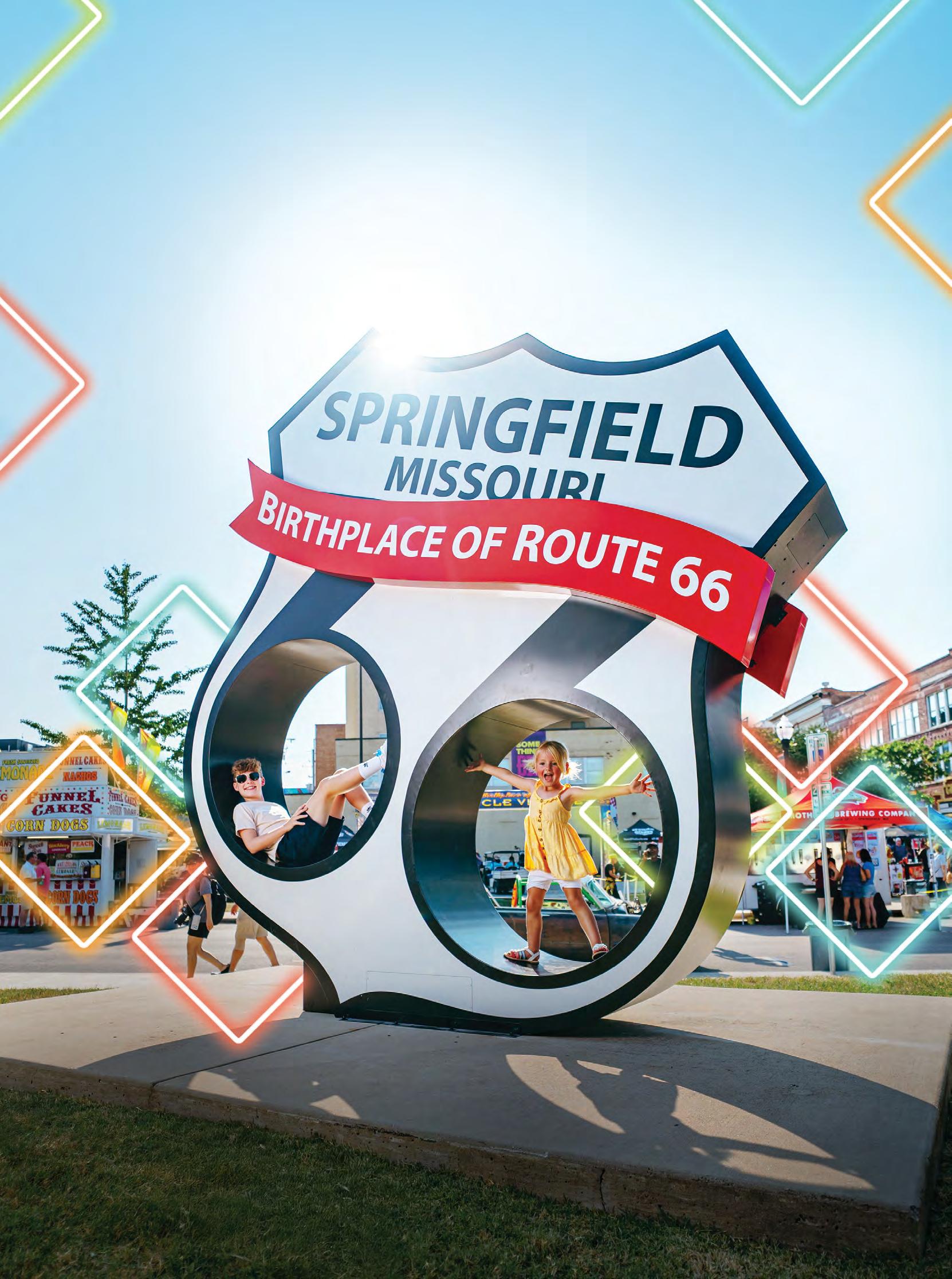
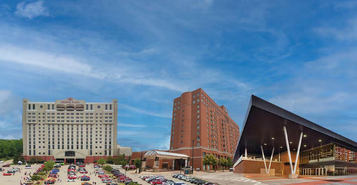
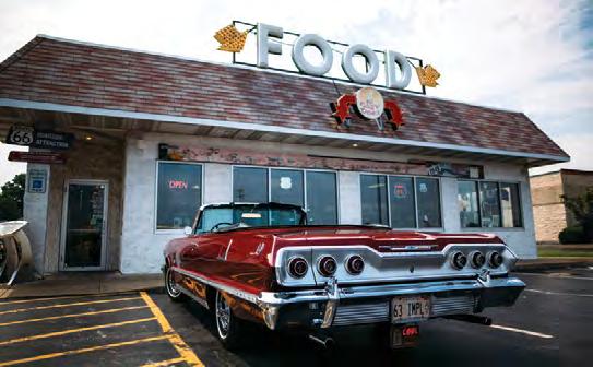
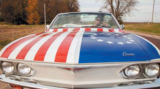
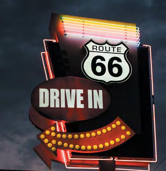
Plan your next visit to Springfield, Missouri and celebrate 100 years of America’s most iconic highway right in its birthplace. Explore classic diners, historic landmarks, and hidden gems that keep the spirit of the road alive. Here in the City of the Ozarks, it’s all about making it your own.






































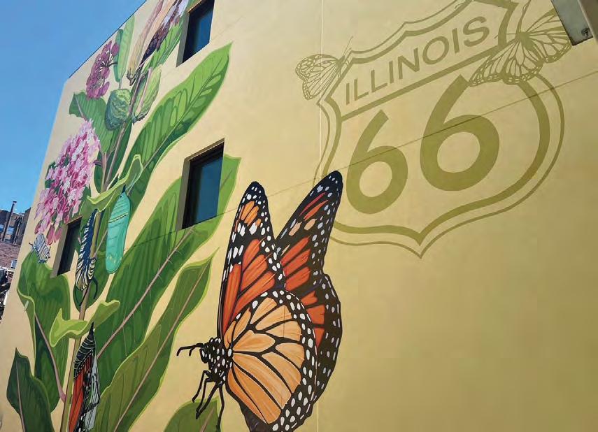
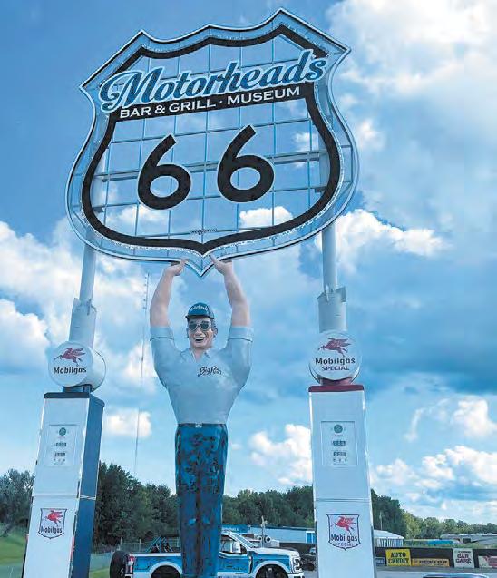
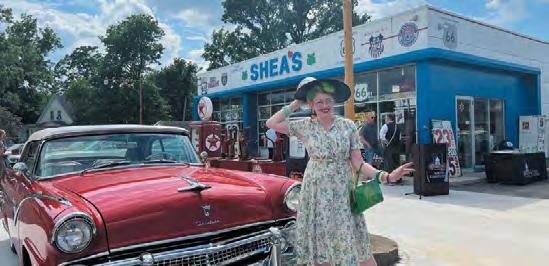
By Jake Baur
Discover the story behind Joplin, Missouri’s captivating 3D murals, and how these immersive works of art came to life and why they’re creating a fresh, memorable experience for Route 66 travelers.
By Mitchell Brown
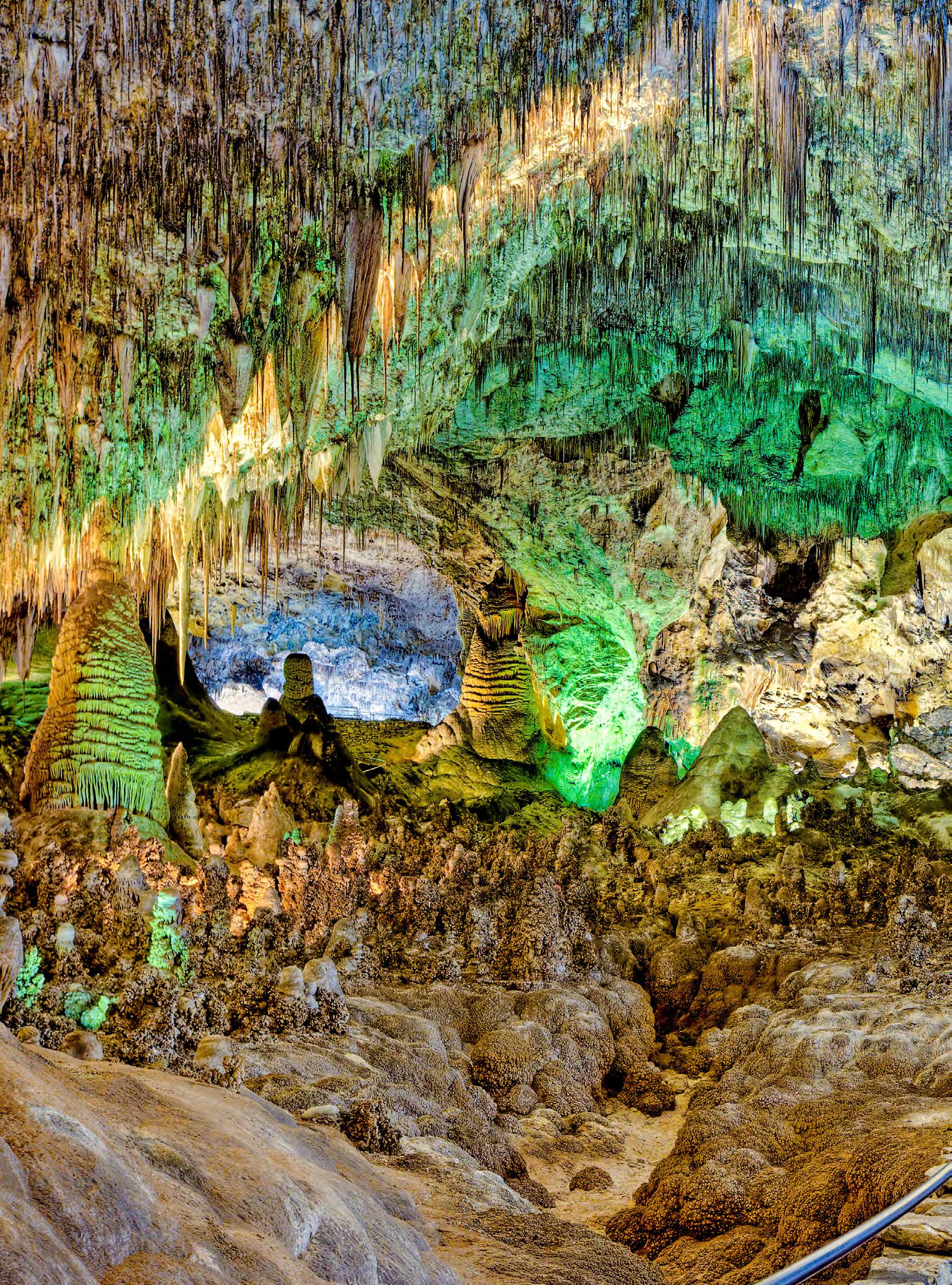
Journey beneath the surface in our feature on Carlsbad Caverns, where nature has crafted one of the world’s most extraordinary underground landscapes. Discover the history, mystery, and wonder of this hidden New Mexican treasure, and see why it remains an unforgettable stop for travelers exploring America’s open roads.
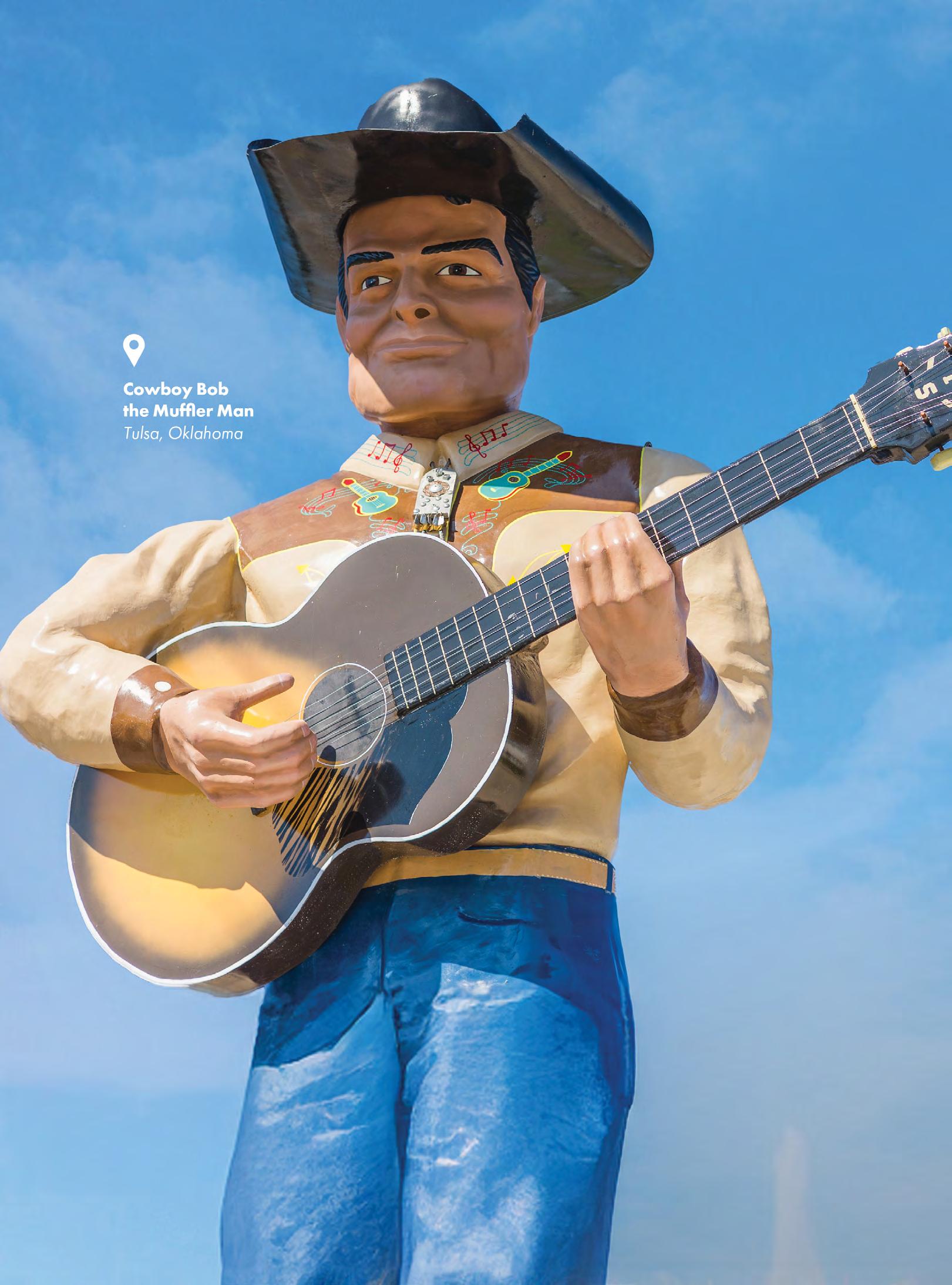
Meet the towering icons of Route 66 in our guide to the best restored Muffler Men giants still standing along America’s Main Street. From their roadside beginnings to their colorful second lives, this feature brings to life the history, character, and charm of these larger-than-life landmarks that continue to delight travelers and preserve the spirit of classic Americana.
By Abigail Singrey
Once a familiar stop for travelers crossing the Texas Panhandle, the Cactus Inn Motel is being lovingly restored by owners determined to preserve its vintage character while welcoming a new generation of road trippers. Discover the story behind this Route 66 revival and the challenges of breathing new life into a historic motel.
By Holly Riddle
What began in a small Milwaukee workshop in 1903 grew into one of America's most enduring icons. More than a motorcycle company, Harley-Davidson became a way of life—a symbol of freedom, craftsmanship, rebellion, and the irresistible call of the open road. This is its story.
By Samuel Ender
Zachari Dunes in quaint Oxnard, California, captures the timeless appeal of a coastal escape, where ocean views, sandy shores, and relaxed elegance come together. Opened in 2024, this new beachside property draws inspiration from the romance of the coastline and offers a great detour when an adventure down America’s most beloved highway is over.
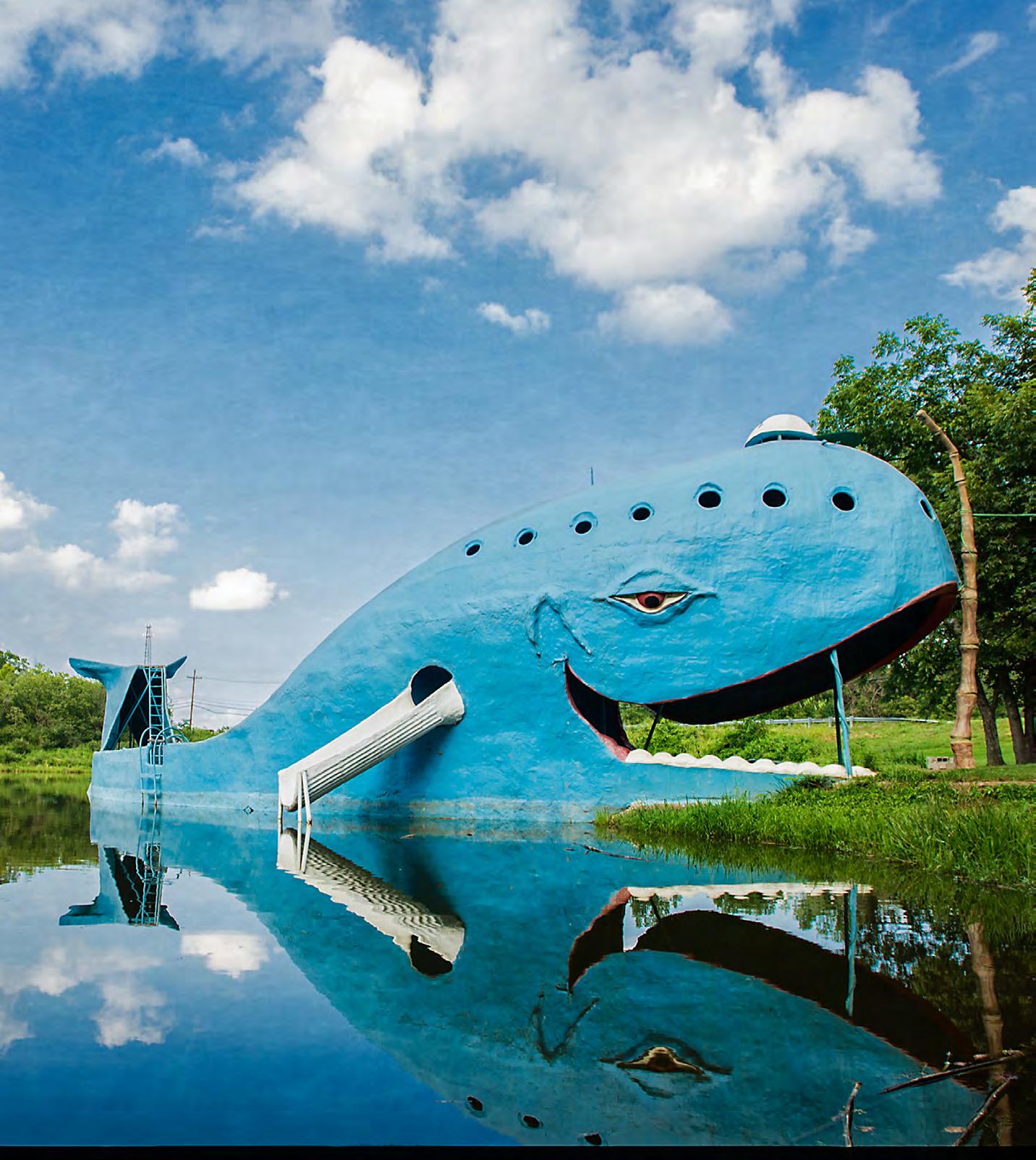
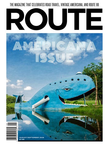
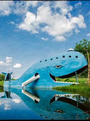
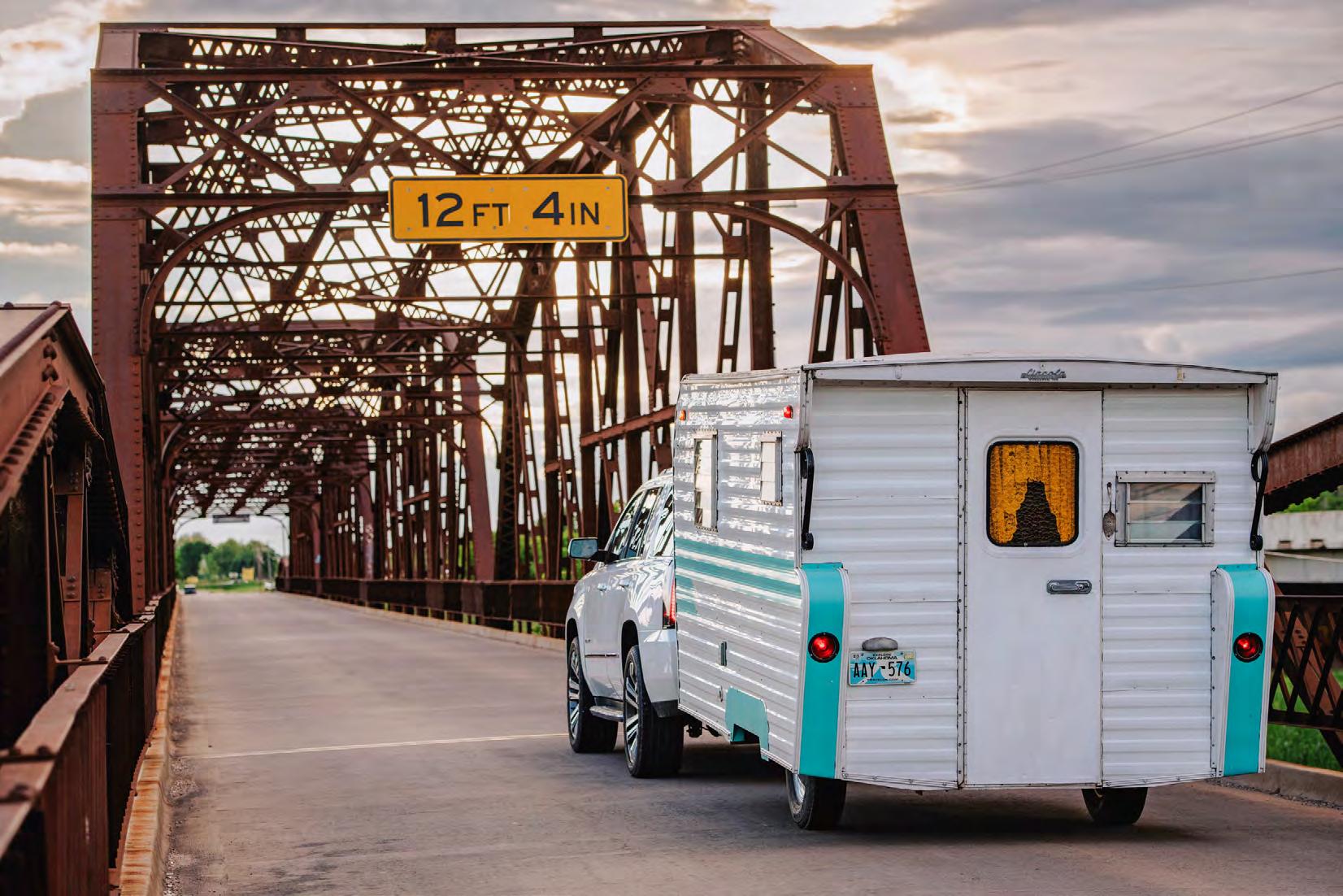
Blue Whale, Catoosa, OK.
Photograph by David J. Schwartz –Pics On Route 66.

There is something wonderfully peculiar about America’s highways. Beyond the thousands of miles of pavement and the destinations marked on a map lies a world of imagination, creativity, and pure roadside curiosity. It is a world where bigger is always better, stranger is truly memorable, and the unexpected becomes the reason to turn the wheel.
For generations, America’s roads have been lined with attractions that make little logical sense— and that is precisely why they endure. People will travel hundreds of miles to visit a gift shop filled with bizarre treasures, explore a roadside wonder, or stand in front of something that they never expected to find. They come to see places like Wall Drug in South Dakota, where a simple roadside stop became a legend; Cadillac Ranch in Amarillo, TX, where ten half-buried cars transformed into public art; or the International Banana Museum in California, celebrating one of the world’s most ordinary fruits in the most extraordinary way; proving almost anything can become an attraction. These destinations remind us that travel was never only about arriving. It was about discovery.
This fascination is not limited to America. Visitors from around the world are captivated by the unusual roadside landmarks that tell a uniquely American story. They reveal a nation built by dreamers, builders, artists, and entrepreneurs who asked, “What can I create here?” or “How can I get people to pull over?”
That spirit is definitely worth protecting, but it is also worth continuing. America has always been a nation on the move. From wagon trails to highways, reinvention is part of our identity. The roadside has never been static. Every generation has added something new, leaving behind landmarks that eventually become part of America’s story. I believe the future of America’s roads should not be about freezing them places time, but about allowing new creativity to join the old. New roadside attractions like the Uranus Fudge Factory, in Pulaski County, MO, are vital, and bold ideas should continue to appear along the highways because they are part of the same tradition that created the classics we celebrate today.
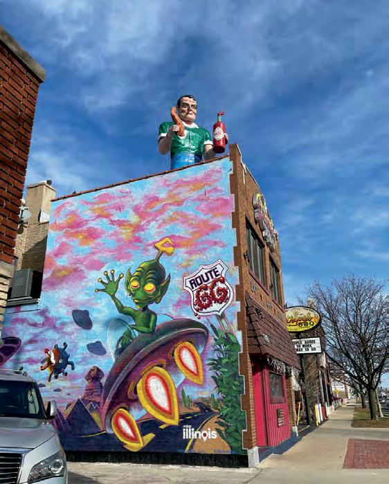
At the same time, we must recognize the importance of preserving the essential places that came before. Too often, history disappears not because it has lost its meaning, but because the land beneath it has become more valuable than the story it holds. When every space is judged only by its commercial potential, we risk losing the character that makes our roads unlike anywhere else in the world. Over the past decade, I’ve watched beloved landmarks disappear at an alarming pace. The towering Glancy Hotel sign in Clinton, OK, is gone. The giant Totem Pole Gift Shop sign in Rolla, MO, now overlooks an empty lot. One of the famous Twin Arrows near Winslow, AZ has fallen, leaving only one standing. Fort Courage and the Pancake House in Houck, AZ, have been demolished. Two Guns continues to crumble. Even when landmarks survive, as the Gemini Giant has in Wilmington, IL, their future often depends on extraordinary efforts rather than certainty. Sadly, this is only a small sample. Countless other places have quietly slipped away. Others will surely follow.
America’s great highways are living collections of memories. Their value cannot always be measured in dollars per acre. Sometimes their greatest worth lies in the smile they bring, the conversations they spark, or the unexpected reason they give us to pull off the road.
The beauty of these places is that they do not apologize for being different. They celebrate imagination and remind us that a highway can be more than a route between two points. It can be a gallery of human creativity where every mile holds the possibility of something surprising waiting just beyond the next curve in the road. That is worth saving and celebrating
Blessings,
Brennen Matthews
Editor
PUBLISHER
Thin Tread Media LLC
EDITOR
Brennen Matthews
DEPUTY EDITOR
Kate Wambui
EDITOR-AT-LARGE
Nick Gerlich
LEAD EDITORIAL
PHOTOGRAPHER
David J. Schwartz
EDITORIAL ASSISTANT
Sonora Mae
LAYOUT AND DESIGN
Tom Heffron
DIGITAL
Yasir Ahmed
ILLUSTRATOR
Jennifer Mallon CONTRIBUTORS AND PHOTOGRAPHERS
Abigail Singrey
Doug Meek
Harley-Davidson
Holly Riddle
Jake Baur
Jim Luning
Joel Baker
Katy Pair
Matthew Baits
Mitchell Brown
Samuel Ender
Sandra Foyt
Editorial submissions should be sent to brennen@routemagazine.us. To subscribe or purchase available back issues visit us at www.routemagazine.us.
Advertising inquiries should be sent to advertising@routemagazine.us.
ROUTE is published six times per year by Thin Tread Media LLC. No part of this publication may be copied or reprinted without the written consent of the Publisher. The views expressed by the contributors are not necessarily those of the Publisher, Editor, or service contractors. Every effort has been made to maintain the accuracy of the information presented in this publication. No responsibility is assumed for errors, changes or omissions. The Publisher does not take any responsibility for unsolicited manuscripts or photography.
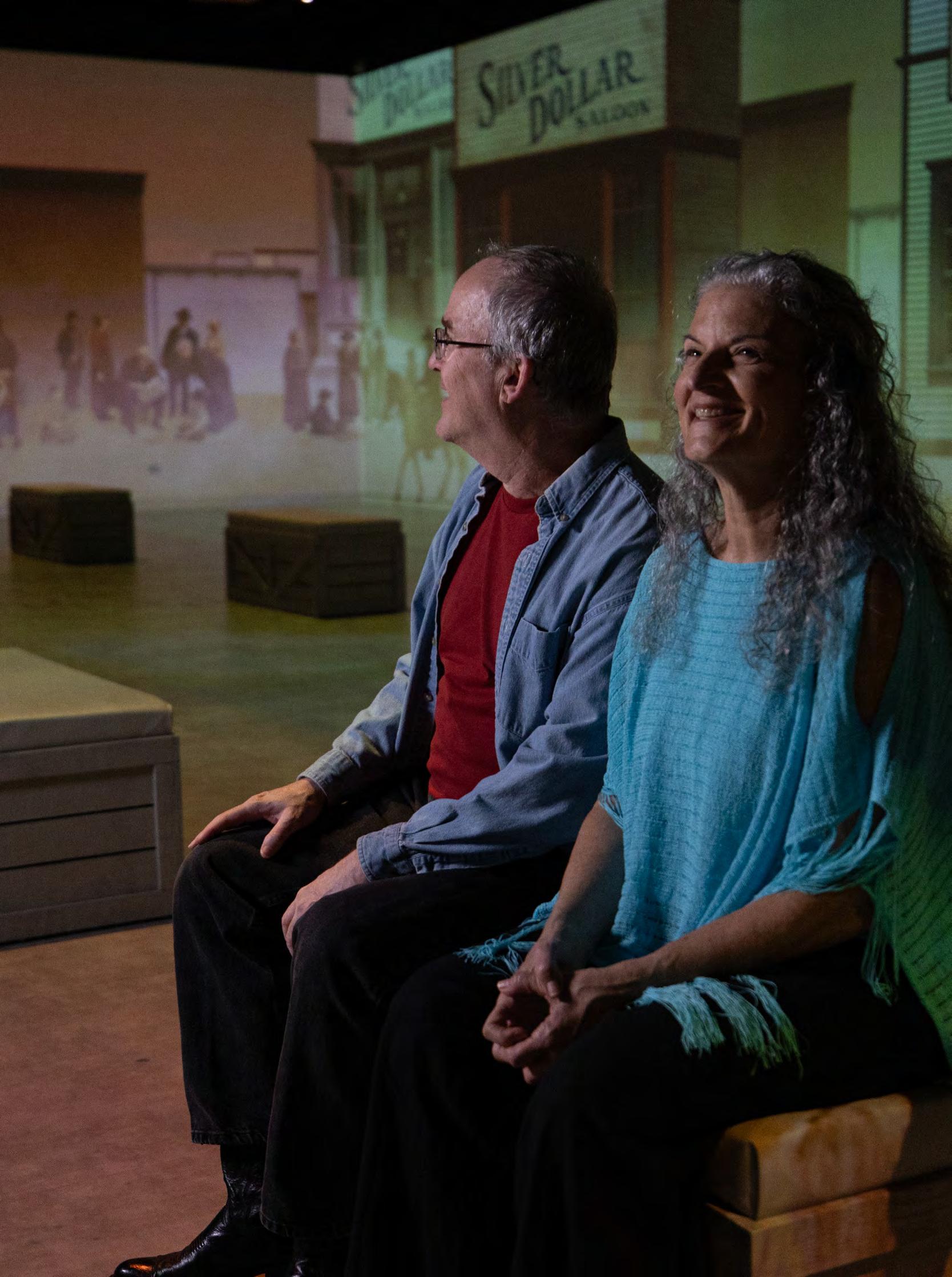
Experience the history, art and culture of the American West with new immersive exhibits.

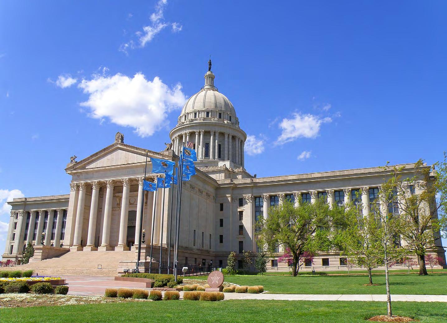

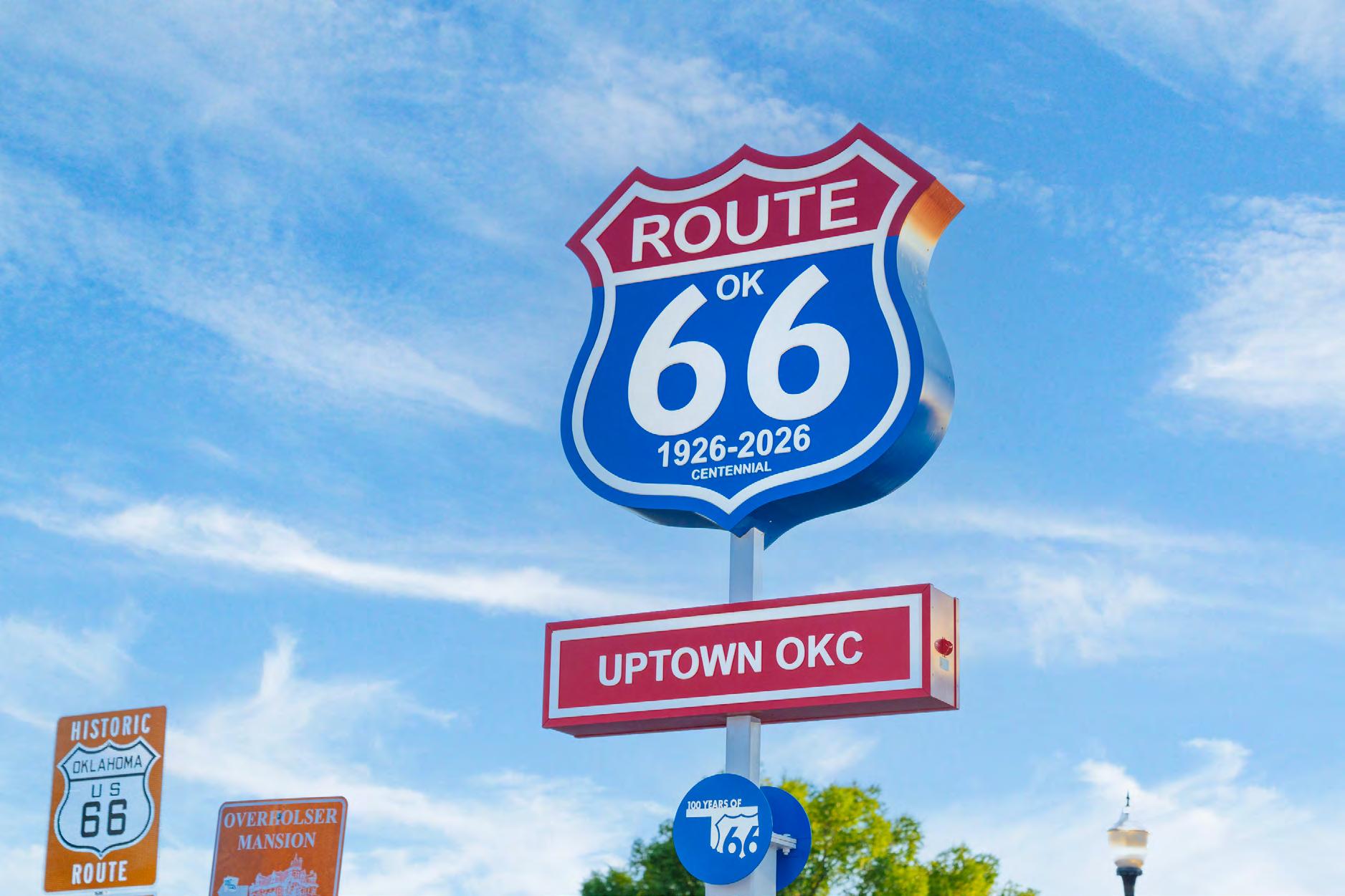
Uptown23rdDistrict
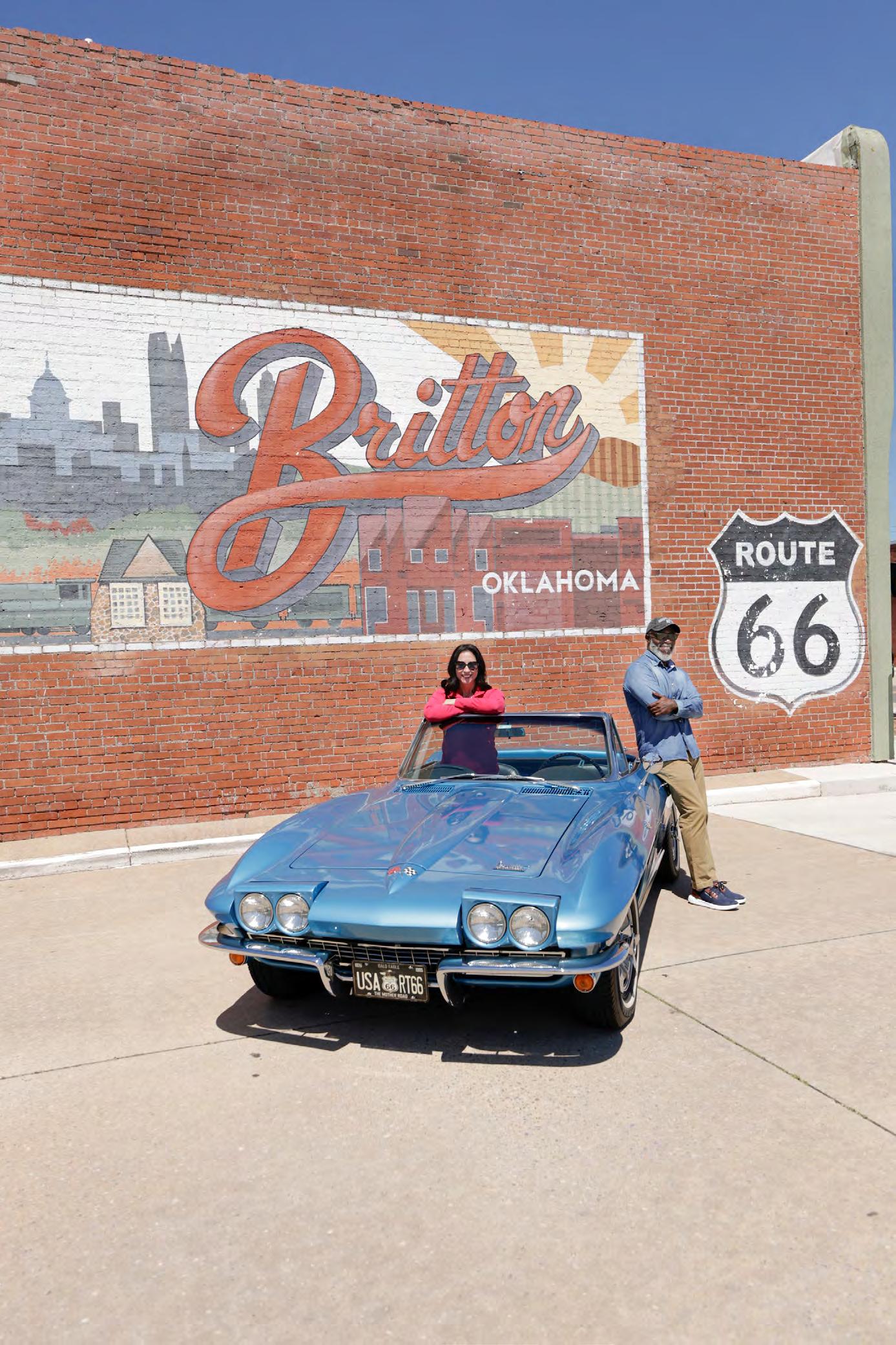



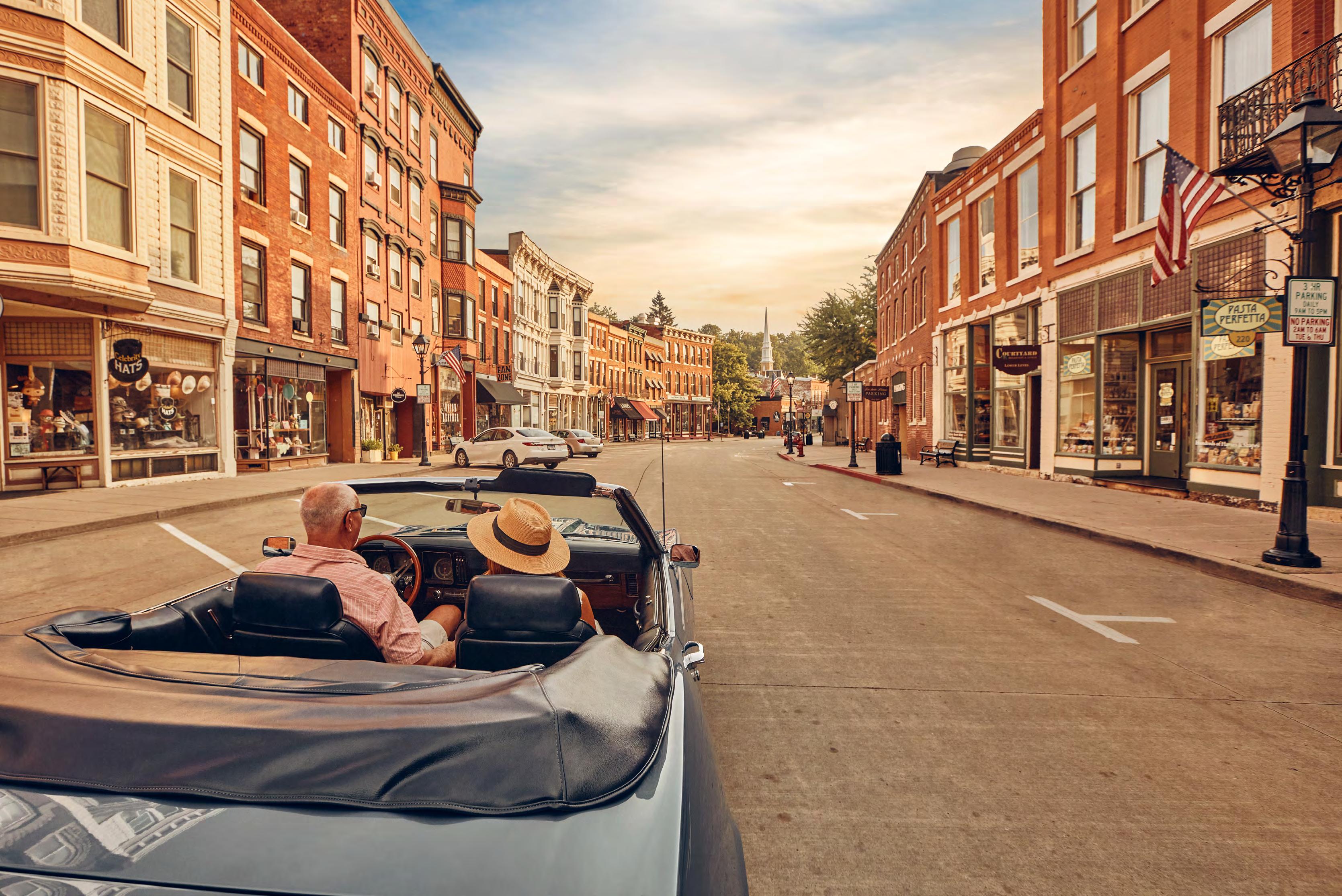
Celebrate 100 years of road tripping in the only place in America where the Mother Road of Route 66 meets the scenic beauty of the Great River Road. Follow the neon signs to the It’s Electric Neon Sign Park, dine at historic Route 66 roadside cafes, take a walk through the river bluffs and prairies and relax with a glass of locally crafted wine beside the Mighty Mississippi River.
Your one-of-a-kind adventure begins at www.RiversandRoutes.com.
By Jake Baur
Nestled in the southwestern corner of Missouri, where Missouri, Kansas, and Oklahoma meet, Joplin hums with history and possibility. Once the heart of the Tri-State Mining District, the city now sits along the storied Route 66 Tri-State Corridor, a ribbon of road that has connected mining towns, tribal nations, and cow towns into a living tapestry of American life. As the build-up to the Route 66 Centennial celebration gathers momentum, Joplin is leading the way with bold creations for travelers seeking unique experiences along this legendary highway. Here, streets are more than asphalt, they have become stages for stories and imagination, where travelers can step into large-scale, perspective-bending 3D murals and truly become part of the artwork.
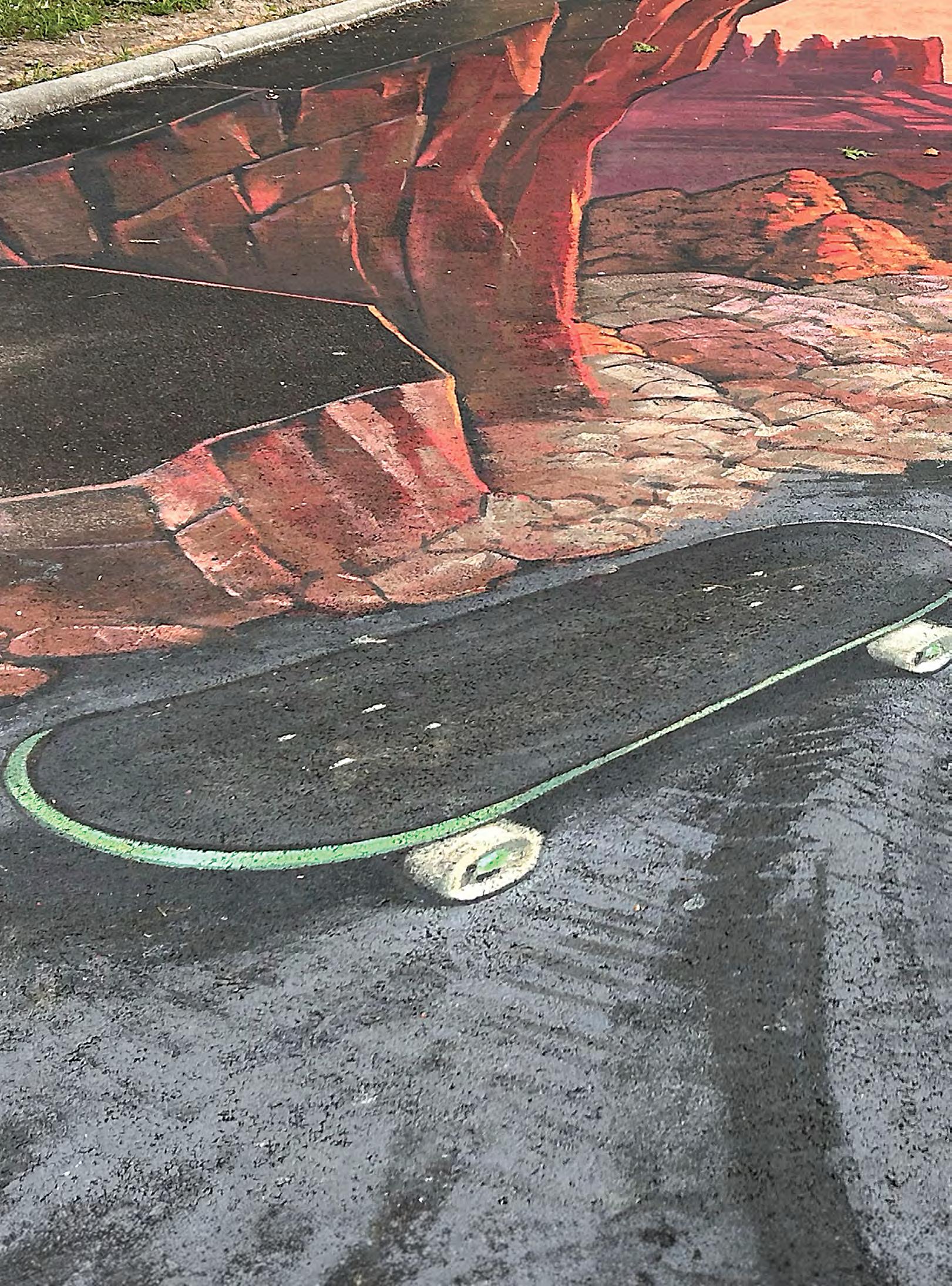
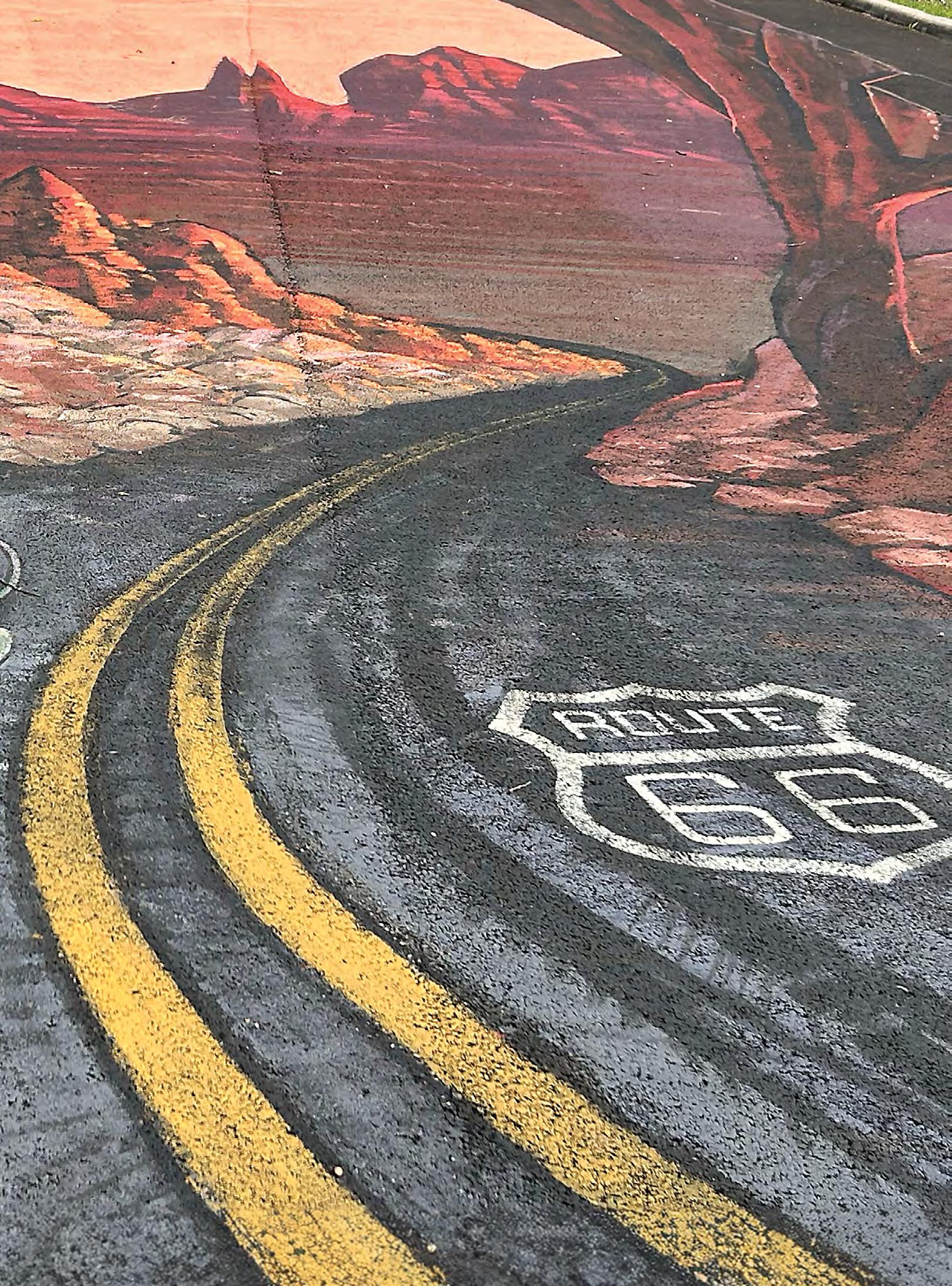
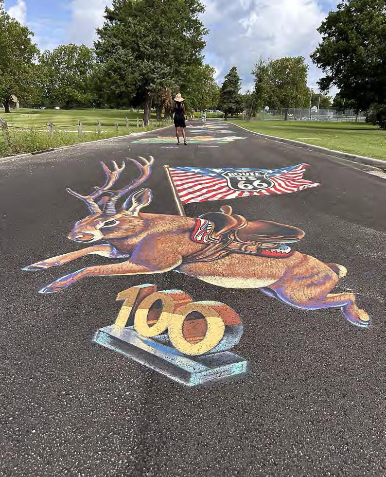
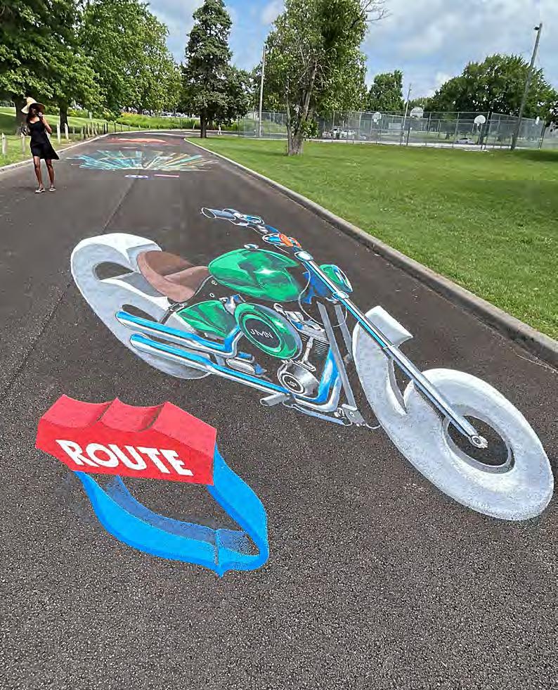
This multi-year artistic initiative began in 2024 as a pilot program, when Joplin, in partnership with the Netherlands-based World Street Painting Foundation, invited three American artists to create large-scale 3D murals inspired by the spirit of Route 66. One piece placed visitors in the sidecar of a vintage motorcycle, complete with a goggle-wearing pup, so they could feel like they were cruising the Mother Road. Another transformed a bright orange Volkswagen Beetle into a flying Route 66 adventure, where participants could “surf” on its roof, sit inside for a joyride, or pose as if clinging on for dear life. The third mural lets viewers straddle a motorcycle, gripping the handlebars and
experiencing the illusion of speeding down Route 66. Think Easy Rider. Together, these interactive artworks have turned boring pavement into a vivid, living canvas of optical illusions, inviting visitors to step into the scene and experience the thrill of the open road in imaginative new ways.
The initiative quickly gained momentum, and in 2025 it expanded into a second, larger festival with ten new 3D murals created by two U.S. artists and eight international artists at Schifferdecker Park, right on Route 66 at the corner of 7th Street and Schifferdecker Avenue. These new works were unveiled during the inaugural World Street Painting Festival: Route 66 3D Artwork, held June 4–7, 2025, where visitors could watch internationally renowned artists paint live on the street. Guests strolling this short strip could step into the illusions themselves: riding along with Joplin’s groundhog mascot on a motorcycle, jamming on giant sheet music to “Get Your Kicks on Route 66,” fueling up with aliens at a retro gas station, or even hitching a ride on a mythical jackalope. Together, these interactive works transformed Schifferdecker Park into an open-air gallery. The festival returned June 3–6, 2026, with 16 international artists creating interactive 3D street paintings at 1717 West 7th Street. Visitors watched the illusions come to life over four days before they were unveiled during a community celebration on June 6. The World Street Painting Festival returns again in June 2027.
“So, he [Mike Kothuis, from WSP] and I got talking and the idea was: can we preserve these? Can we put something over them so they can hang onto them for a time? Because by the end of the Centennial, by the end of 2027 tourist season, we will have 33 pieces of art on the ground from 33 world renowned artists,” said Patrick Tuttle, Visit Joplin director. Normally, the artists use latex house paints for their creations, so the paintings last approximately six months, depending on the weather and foot traffic. Then they’re power-washed
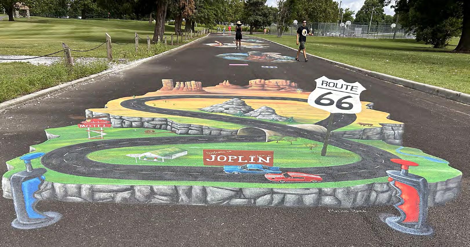
away, and the pavement becomes a blank canvas once more. “We did put a thin coat of shellac over them, and we’re hoping that’ll help preserve them and they’ll last through the Centennial,” added Tuttle.
Behind the scenes, the project is as much a collaboration as the art itself. The World Street Painting Foundation, a global leader in promoting street art as a medium for cultural exchange and public engagement, selects and contracts the artists, coordinates international logistics such as visas, and promotes the festival to audiences overseas. Meanwhile, Visit Joplin arranges housing, provides funding for the event, and welcomes the artists into the community. Together, they’ve transformed America’s “longest museum”, the Mother Road itself, into an ever-growing gallery, where international artists can literally lay their work at the feet of travelers.
The themes that unfold on the pavement tell their own story. The first three murals created by American artists in 2024 focused on movement: sidecar rides, a driver’s-eye motorcycle view, and a whimsical Volkswagen Bug, all celebrating the road’s spirit of adventure. “But you’ll find most of the international artists depict landmarks. We’re excited for all the diversity, and it’ll be interesting to see what unique landmarks across the Mother Road the artists gravitate toward [going forward] and decide to paint,” noted Tuttle.
Watching these murals come to life is part of the magic. Each piece stretches across the pavement, often more than twelve feet wide, so large that it defies the eye until the forms fall into place. On day one, chalk outlines sprawl across the asphalt like blueprints. By days two and three, layers of color build into forms that seem to rise from the pavement exploring how height, width, and depth can trick the eye while bringing art and life together. “Some artists used an app on their phone that tracked the shadows of their points. It helps them determine the best actual placement of the mural, but then they also painted certain colors in the sunlight and certain colors in the shade to help with the 3D illusion,” explained Tuttle. “It’s really interesting and impressive to see how they do that process.” Using these GPS-enabled apps, artists can anticipate how shadows will travel throughout the day, ensuring that each perspectivebending effect works perfectly from every angle.
What makes 3D street painting in Joplin so captivating, is its interactive nature; spectators aren’t just viewers, they become part of the artwork. Each piece invites playful engagement, creating personalized, shareable moments that extend beyond the pavement and into photos and memories. That spirit of participation defines Joplin’s Centennial tribute: a living, shifting celebration of Route 66, where the line between art and audience blurs. Today, visitors can explore 29 interactive 3D street paintings year-round across Schifferdecker Park, the Cornell Complex, and West 7th Street. By 2027, with 33 murals completed, Joplin will offer a one-of-a-kind outdoor gallery that doesn't just commemorate America's most famous road, it lets you step inside it and become part of the story yourself.

By Mitchell Brown
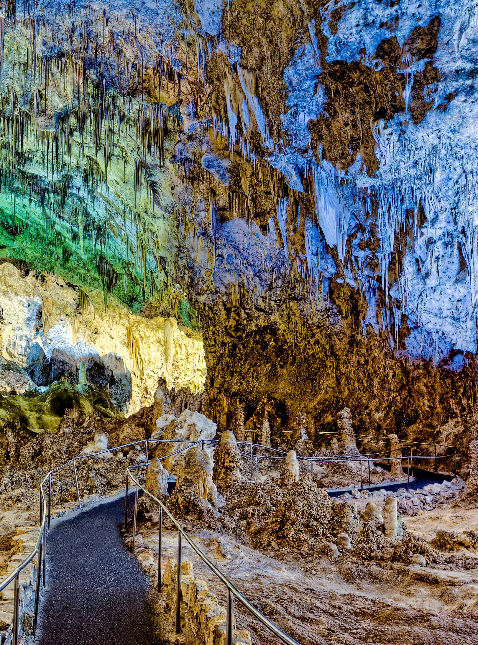
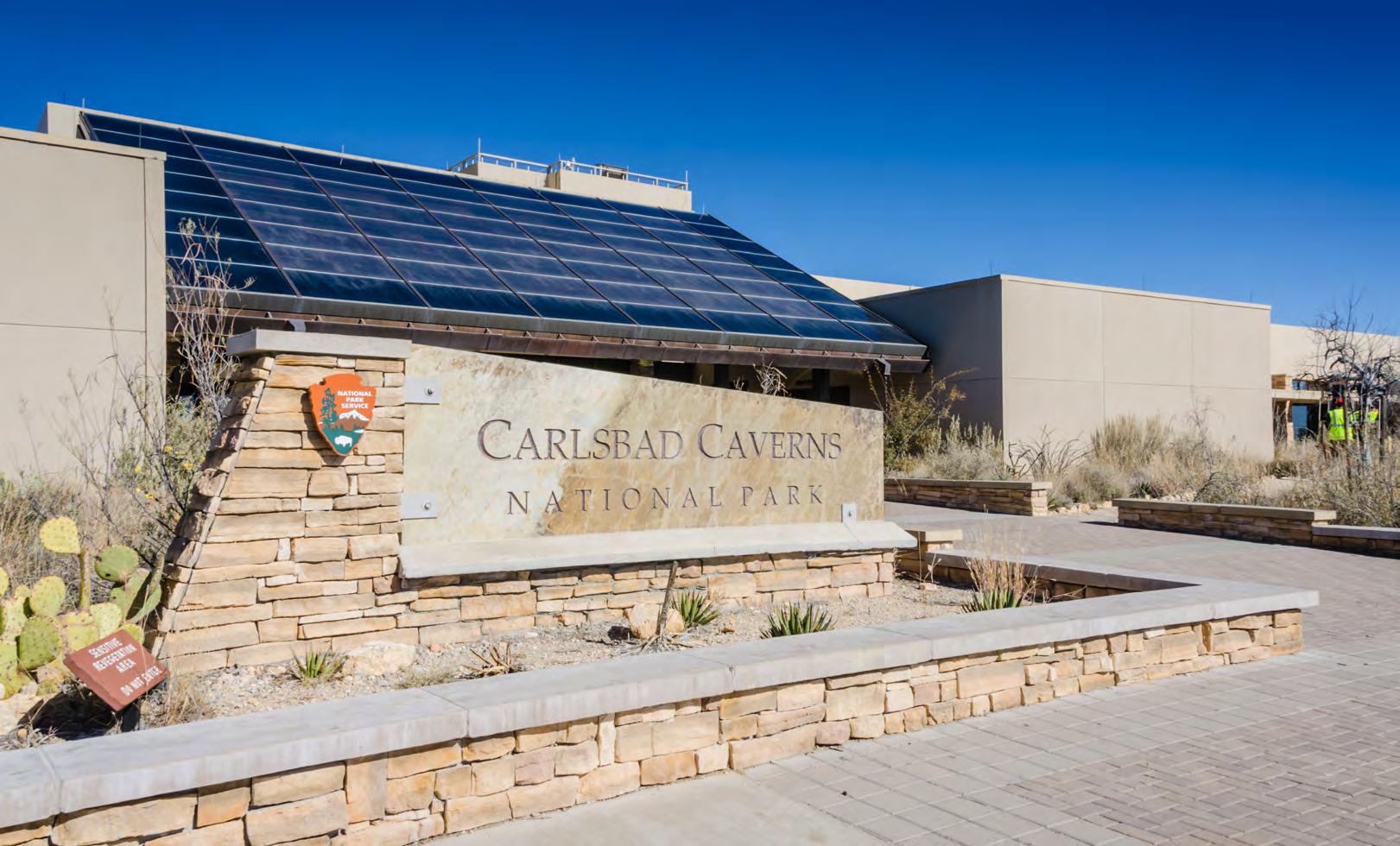
Beneath the sun-scorched expanse of New Mexico’s Chihuahuan Desert, a land etched with rugged canyons, resilient cacti, and the quiet drama of the wild, lies a hidden masterpiece. Above ground, the landscape stretches like a living Maynard Dixon painting, in sunbaked tones of gold, red, and brown shaped by wind, heat, and time. But deep below, carved silently into the earth near the Guadalupe Mountains, is a subterranean wonder: a vast cathedral of stone where nature sculpts in silence. Here, colossal chambers and delicate passageways unfold, adorned with miles-long galleries of limestone, stalagmites, and dagger-like stalactites. To the outside world, it’s one of America’s most breathtaking geological marvels, but to the people of Eddy County, it’s simply known as Carlsbad Caverns.
Named after the nearby city of Carlsbad, whose own name was inspired by the famous European spa town now known as Karlovy Vary in the Czech Republic, Carlsbad Caverns is believed to be the product of hundreds of millions of years of geological transformation. Long ago, acidic groundwater from an ancient shallow sea seeped deep into the limestone bedrock, slowly dissolving the stone and carving out vast chambers and passageways. Over the recent centuries, the cave’s more intricate features began to take shape. Water dripping and pooling in the darkness sculpted towering columns, delicate helictites, and otherworldly shapes — transforming the underground landscape with the slow patience of nature, as if chipping away at limestone to reveal a hidden work of art.
Despite the caverns’ ancient origins, human interaction with them is a relatively recent chapter in their history. Indigenous peoples have lived in the region for potentially 14,000 years, leaving behind evidence such as pictographs and cooking ring sites. While there are signs that Native peoples entered the cave over the past thousand years, including cave paintings near the entrance, there is no indication that they ventured far into the so-called “dark zone,” the part of the cave where no sunlight penetrates. It wasn’t until the late 1800s that people began to explore the caverns in earnest and uncover the vast subterranean world that had remained hidden for centuries. That chapter begins with James Larkin White.
In the summer of 1898, fourteen years before New Mexico gained statehood, sixteen-year-old James (Jim) White was working on a nearby ranch when he spotted what looked like a plume of smoke rising in the distance. Whether it was a massive fire that occurred in the brush
or some type of volcanic activity, the sight definitely caught his attention. His curiosity led him closer. But it wasn’t smoke at all — it was a swirling mass of bats pouring out of a cave opening. Stunned by the sheer volume of winged creatures, White reasoned that such a massive exodus could only come from something equally massive within. His attention shifted from the sky to the dark mouth of the cave.
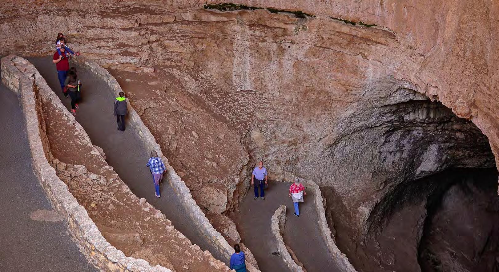
Intrigued, White decided to uncover what lay in the shadowy depths below. His only spelunking equipment was a makeshift ladder made from fence wire and tree limbs, and a lantern fashioned from a coffee pot filled with oil and a wick threaded through the spout. With only this crude gear, he descended some 750 feet into uncharted territory — a realm of complete darkness, unmapped and known only to bats and stone. He stepped into what experts would one day call The Big Room. And this wouldn’t be his last descent. Over the following years, White would return again and again, venturing deeper into the maze of tunnels and chambers, driven by an explorer’s heart and an unrelenting sense of wonder.
That’s the popular legend of how the caverns were discovered, but the story behind the “discovery” of Carlsbad Caverns is a bit more complex, with conflicting accounts. One of the most debated versions centers on a man named Abijah Long. Long had moved to Carlsbad from Goldthwaite, Texas, in 1901, where he initially tried his hand at running the Schlitz Hotel and later a saloon, but eventually abandoned both ventures. He then acquired a few mules and started a hauling business. The story goes that Long stumbled upon what appeared to be a hole or cavity in the ground with a vast empty space below. Using a rope ladder, Long descended into the dark cavern, which became known as the Big Cave or Bat Cave. At the bottom, he discovered something that would spark the future of this underground world — bat guano.
“Abijah Long was out here in 1903, feeding his mules, when he and one of the people with him went down a rope and found guano, and that’s when they went back to town and got a mining claim for the place. That’s the first record of the discovery,” said Ephriam D. Dickson III, Deputy Superintendent of Carlsbad Caverns National Park. “I think the challenge is, we always want to know who discovered something and who was the first, but to me, it’s not who discovered it.... The question is, who actually began to explore and access it? Abijah Long built a ladder and began mining, and he hired Jim White as one of his miners to help him get the guano out. Then, in their spare time, they begin exploring deeper into the cave. And that’s where their contributions really are, their early explorations. The discovery isn’t the important part; it’s the exploration and learning that there’s something else here. That’s what Jim White contributed.”
The sheer number of bats meant a large supply of guano — highly valued as fertilizer in demand as far away as California, where a single ton could sell for $90. Mining operations began on March 28, 1903, with Long replacing White as foreman. For the next three
years, Long led the venture, hiring workers, managing operations, and even building a road to provide better access to the cave. However, the time and effort involved in extracting the guano and transporting it soon outweighed any profits. So, by 1906, Long sold his mining claim and equipment for just $500, equivalent to roughly $18,170 today, accounting for inflation.
While Abijah Long eventually left the guano business behind, Jim White remained. Through every changing ownership, he stuck with the caverns. He would remain there for the next 20 years. His quiet loyalty didn’t go unnoticed. When he married Fannie Jane Hill in 1912 — he was 30 years old at the time — the then-owners, the Carlsbad Guano and Fertilizer Company, built the couple a two-room shack near the cave and paid White $175 a month to mine for them. It wasn’t much by city standards, but for Jim and Fannie, it was home — close to the place he had come to know better than anyone.
White continued to explore deeper into the cave, documenting his discoveries as best he could, and naming many of the rooms himself, including the Big Room, New Mexico Room, King’s Palace, Queen’s Chamber, Papoose Room, and Green Lake Room, each name a reflection of either the landscape’s majesty or his own sense of wonder. For years, he spoke to anyone who would listen about what he had seen: cathedrallike spaces hidden beneath the earth, a subterranean world that rivaled anything above ground. But few took him seriously. It would take more than just “stories” to change minds.
That moment came unexpectedly, when, in 1921, a pair of young travelers showed up, hoping to see the caverns for themselves. They wanted to capture what they saw but lacked the flash powder needed for photography in the pitch-black depths. White pointed them to a local photographer named Ray V. Davis. That single suggestion would become the first spark in a chain of events that would shift Carlsbad Caverns from a quiet commercial venture into a nationally celebrated natural wonder. But let’s rewind a bit.
In 1913, the Davis family had been traveling from Kansas to California when, during a stop in Clovis, New Mexico, they encountered land boosters from Eddy County, pitching Carlsbad as a promising place to farm — far better, they claimed, than anything waiting for them in California. Intrigued by the possibilities, the Davis family, along with their 19-year-old son, Ray V. Davis, decided to settle in Carlsbad instead. However, for Ray Davis, any dreams of farming quickly faded.
“Instead of farming, he took up photography and, in some time, around 1915 to 1918, his paths crossed with Jim White, and Jim invited him to photograph the Caverns,” said Hunter Carroll, park archivist of Carlsbad Caverns National Park. “His earliest photographs were turned over to the New Mexico Land Office, which then ended up in the U.S. General Land Office. They subsequently sent those photos to the National Park Service.” The photographs sparked a frenzy of interest in town with people clamoring for a chance to see the cavern with their own eyes. With no formal infrastructure in place, White resorted to lowering these tourists two at a time using a guano bucket.
The first 24 photos Davis took would map out the future of Carlsbad Caverns. By November 18, 1923, the images would eventually work their way into the pages of The New York Times, with the article hailing the cave as “Among the largest and most beautiful in the world.” By that point, the U.S. government had already taken an interest, as back in April of the same year, the General Land Office in Washington, D.C. sent a surveyor to decide whether it warranted the protection of a national monument. This led to a month-long survey of the cave by mineral examiner Robert Holley, who deemed that the cave had earned the status of being a national monument. With the combination of Holley’s assessment and letters from high-profile El Paso attorney Major Richard F. Burges, President Coolidge would declare the cave a national monument on October 25, 1923.
In the years that followed, the caverns became a hub of exploration and drew increasing numbers of visitors, including Amelia Earhart in September 1928. Between 1923 and 1927, the first trails were established and a staircase to the Bat Cave was constructed, finally replacing the guano bucket system, which remained in use until 1925. During this time, W.F. McIlvain was appointed the caverns’ first superintendent. Serving as a liaison with the city’s Chamber of Commerce — who donated the staircase — McIlvain also oversaw operations and became Jim White’s supervisor. That same year, White was officially named Chief Ranger of Carlsbad Caverns.
By 1926 and 1927, the National Park Service began installing the first electric light system and building a network of trails. Dirt paths and wooden stairways wound their way through King’s Palace, Queen’s Chamber, the Main Corridor, much of the Big Room, and even past the mysterious Bottomless Pit. In June 1927, the caverns hosted their first wedding ceremony
— a tradition later discontinued to preserve the fragile cave environment. James White remained involved in caverns’ exploration until stepping down as Chief Ranger in 1929 due to health concerns. He was succeeded by Edith Lehnert, but White’s legacy never dimmed. Many affectionately referred to him as “Mr. Carlsbad Caverns.” He lived out the rest of his life in Carlsbad, passing away in 1946. Today, his gravestone, shared with his wife Fannie — who died in 1964 — bears a simple yet powerful tribute: The Discoverer of Carlsbad Caverns.
Just over a year after White’s departure, on May 14, 1930, Congress designated Carlsbad Caverns as a national park. Over the next two years, major developments transformed the visitor experience. Between January 1931 and January 1932, an elevator shaft was installed, offering direct access from the surface to the cave depths. They would also have six miles of pipeline laid to connect the caverns to Rattlesnake Springs, which, by 1934, replaced Oak Springs as the park’s main water source. Visitors continued to arrive in droves, and by September 28, 1937, the park welcomed its millionth guest. While the park was a popular attraction, it wasn’t without its freak occurrences. One of the most unusual occurred in 1939 and involved ranger Leslie Thompson.
“Due to a fluke with the elevator cage, [he] fell down the shaft nearly a hundred feet headfirst. Miraculously, he caught the elevator cable with his arms and managed to stop his freefall,” shared Carroll. “After a prompt rescue from the other elevator car, Thompson was no worse for wear other than skinned fingers and a ‘thoroughly greased uniform.’ Thomas Boles, the Superintendent at the time, promptly contacted Robert L. Ripley of Ripley’s Believe It or Not, to share the story.”
Over the following decades, the park continued to expand, both underground and above. Inside the cave, researchers pushed deeper into the darkness, uncovering new passages and chambers that had never been mapped. In 1937, a man named Tom Tucker stumbled upon Slaughter Canyon while searching for his missing goats, and in 1966, explorers discovered the Guadalupe Room, the second-largest chamber in the main cave system, further cementing the caverns as a geological marvel. Above ground, the park was transforming as well. “A lot of historic buildings here are from the ‘20s and ‘30s, when the park was growing from just the initial cavern to a national destination that people come to. Almost all of our buildings are historic stone structures built in the 1930s,” said Dickson III. “Some are offices, some are quarters, some are going through restoration now, but most of them have a purpose. The visitor’s center is newer;
the elevator was put in in the 1930s, so the visitor’s center was built around that in later years.”
By 1957, guano mining had officially come to an end anywhere within Carlsbad Caverns National Park, closing a chapter in the caverns’ early commercial history. Two years later, in 1959, construction of the visitor center was completed to support the growing number of tour operations. Coincidentally, the same year, Carlsbad Caverns served as a filming location for Journey to the Center of the Earth, starring James Mason and Pat Boone. But this was far from the first time Hollywood had turned its lens on the caverns. Over the years, they were featured in more than 20 films, including Cave of Outlaws (1951), The Night the World Exploded (1957), and even as early as 1931 in White Renegade.
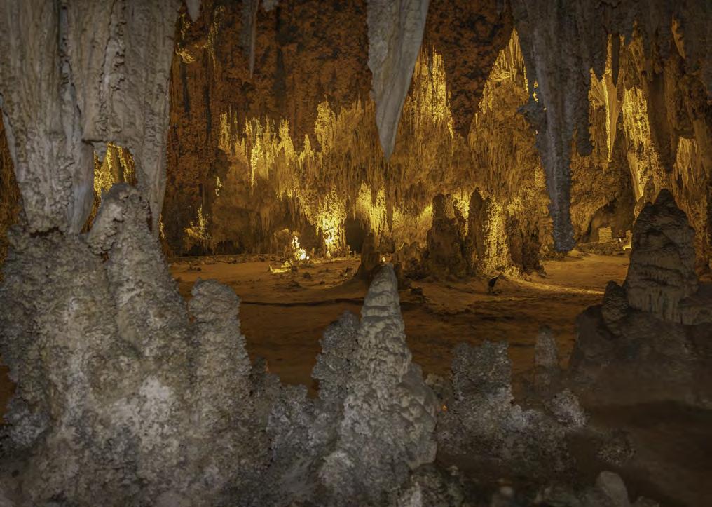
One of the park’s most popular additions was completed in 1963: the Bat Flight Amphitheater, built just outside the cave’s natural entrance. For nearly 17 years, plans for the amphitheater had been considered, inspired by the awe-inspiring sight of thousands of Mexican free-tailed bats pouring out of the cave each evening — a spectacle that had become a favorite among visitors. The idea gained momentum in 1960 with a formal proposal, and soon after, the project was officially approved. Since its completion, the amphitheater has drawn nightly crowds between April and October, all gathered to witness the breathtaking swirl of bats ascending into the twilight sky. By 1995, Carlsbad Caverns had gained global recognition. That year, the park and its 119 connected caves, including Lechuguilla Cave, one of the deepest and longest in the world at 110 miles of passageway, were declared a UNESCO World Heritage Site. With their extensive size, visually striking beauty, and the groundbreaking scientific discoveries since 1986, it was clear the caverns were a treasure worth protecting for all of humanity.
Since its designation as a national monument, the Carlsbad Caverns have welcomed over 46.5 million visitors (as of 2023), with advance reservations strongly recommended. As with any popular site, maintaining and upgrading infrastructure has been crucial. In 2024, a $20 million project was completed to update the elevators that take visitors the equivalent of 75 stories down from the surface to The Big Room, which is the most widely seen portion of the caverns. Ongoing efforts continue to ensure the safety of visitors while protecting the cavern’s natural integrity.
Today, Carlsbad Caverns National Park sprawls across more than 46,000 acres of rugged desert and underground wonder. Over 33,000 of those acres are designated wilderness, preserved in their natural state, while more than 32 miles of the cave system have been carefully developed for public exploration. At the heart of it all lies the Big Room — an awe-inspiring chamber spanning 8.2 acres — making it the largest easily accessible cave room in North America. It’s a place where visitors can stand in silence, dwarfed by nature’s scale, and feel the same sense of wonder that Jim White must have felt over a century ago. Researchers still venture into its vast, uncharted interior, mapping hidden passageways and uncovering secrets in the darkness — territory that only the bold and adventurous dare to experience. Above ground and below, the park draws crowds from both near and far, captivated by this underground Grand Canyon.
Carlsbad Caverns may be a national treasure today, but at its heart, it remains what it has always been: a simple place of mystery and indescribable majesty.
When people speak about Texas, the Panhandle is not often at the top of their mind. Other than the bustling destination of Amarillo, northern Texas is pretty quiet, and tiny McLean is definitely not on most people’s radar. But it once thrived as a town. By 1940, there were 59 businesses, including gas stations, restaurants, motels, hotels, and even a brassiere factory lining the streets of this Texan ville.
In modern days, Interstate 40 Business Route (Old U.S. 66) still passes through town on two parallel one-way streets — First Street and Railroad Street — but those lanes are mostly quiet now. While there are still a few local relics of the early- and mid-20 th Century to be seen, including the factory repurposed as the Devil’s Rope and Route 66 Museum, it is the restored Phillips 66 service station that really pulls people off the highway.
The Phillips Petroleum Company was founded in 1917 but did not sell gas at retail until a decade later, operating at first only in Oklahoma (its home state) and Kansas with their soon-to-be-iconic Tudor Revival-style brick station buildings. In contrast to many early gas stations, which were little more than tin or wood shacks, the Phillips structures had the appearance of cozy cottages, blending them into the neighborhoods where they were placed and emanating a sense of comfort and reassurance. The company branded itself Phillips 66, after a road test of their new fuel resulted in a car reaching a speed of 66 mph on Route 66.
years, until Route 66 enthusiasts Delbert and Ruth Trew of nearby Alanreed took notice. The Trews had been instrumental in founding the Texas Old Route 66 Association along with preservation efforts across the Panhandle, and they adopted the shabby Phillips 66 gas station as their next project.
“The station was in pretty bad shape at the time,” noted Trew. “We talked to the man that owned it, and he said that he would give it to us. And boy, did we paint that station.”
While indeed there was a lot of painting, there was an awful lot more that went into the restoration accomplished by the Trews and their crew of volunteers. The windows had been broken out, and boards were cut to fit over the openings and painted trompe l’oeil to look like actual windows. A grease rack from a station in Alanreed was brought in to add to the authenticity. An old field truck and some borrowed barrels and pumps provided the finishing touches.
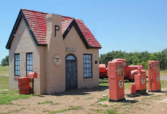
Founders Frank and L.E. Phillips were anxious to expand and tweaked their initial station design as Type B to mark their entry into the Texas market. The first station with the newly adjusted design opened in Turkey, Texas, in 1928, followed by the station in McLean in 1929, the first of this style on Route 66. The brothers continued to adjust the design (up through Type U) but kept its basic Tudor cottage appeal as they expanded throughout the midsection of the U.S.
The McLean station was immediately successful along busy Route 66 and became one of the most important and popular fueling locations in the state for many years. But as 66 was replaced by interstate travel, the station officially ended service in 1977. It stood in silence for
Guided by the Trews, the community brought the iconic Phillips 66 gas station back to life. In the process, it brought townspeople closer, all with one goal: to keep history alive.
“The minute people heard about this Route 66 project, there was all kinds of community effort,” Trew laughed.
“People told us stories while we worked, brought us stuff, and helped out. It didn’t make much money, but we gathered enough from donations to buy paint, shingles, and do whatever needed to be done. It was a community effort.”
While there are numerous other historic gas stations along Route 66, the Phillips 66 station in McLean stands unique from the others. It was one of the first restoration projects along Route 66, and it inspired other individuals and state associations to follow in their footsteps. Thanks to the efforts of the Trews, the station has become a magnet, drawing travelers off the freeway and into town. The gas station quickly became one of the most visited attractions along the Texas portion of Route 66 and put humble McLean on the map. Little did the Phillips brothers know nearly a century ago that their Type B design would have a second life and become a window into the past.




































































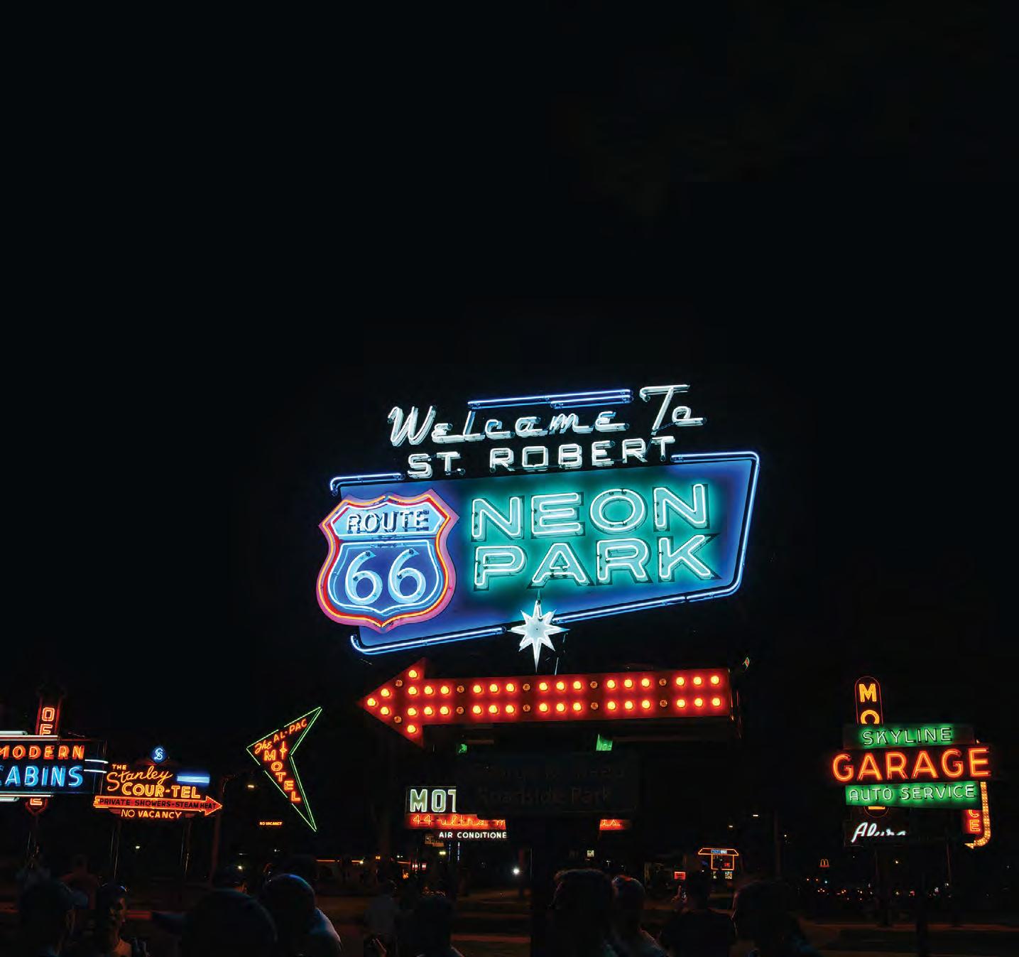

Welcome to the Route 66 Neon Park. Once le to decay in roadside fields or buried under piles of junk in dusty sheds, these mid-century marvels have been meticulously restored to their original glory. Travel back in time anytime between sunrise and midnight at this one-of-a-kind open-air museum.
Celebrate the Route 66 Centennial in Pulaski County, MO. For more information, directions, and an online interactive map, visit pulaskicountyusa.com.

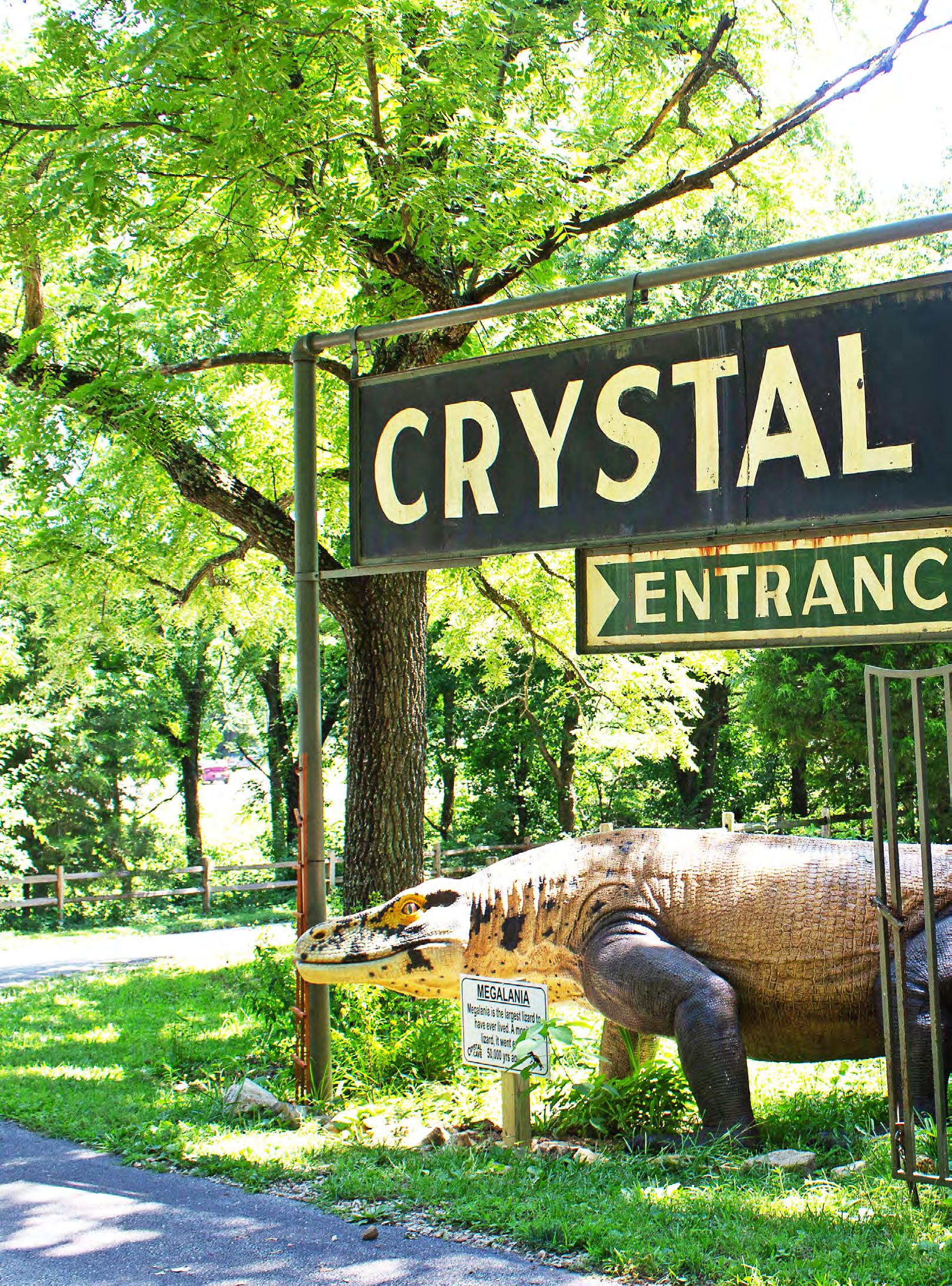
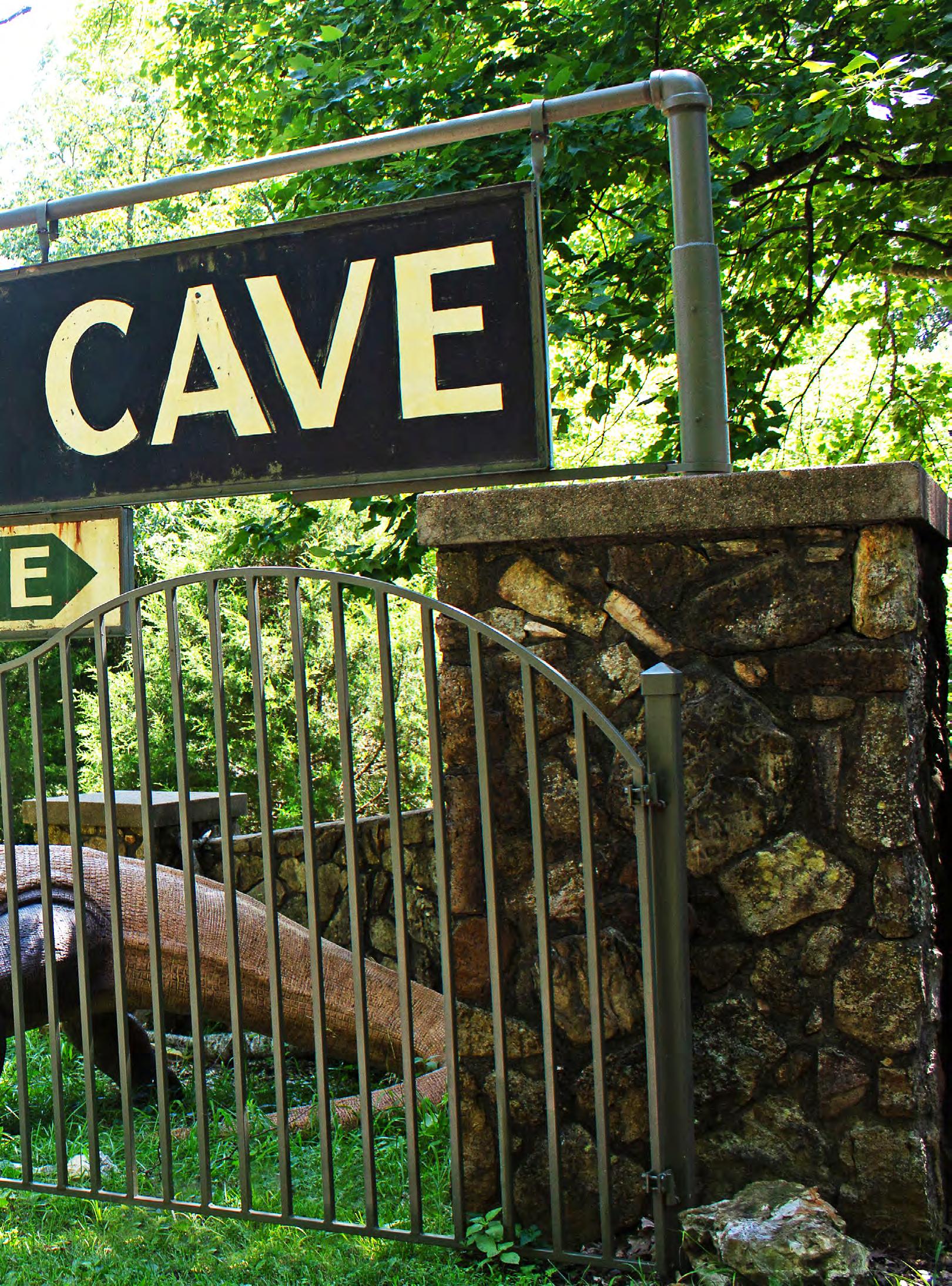
America has many underground places, each with its own unique story and each a mystery to those who dwell in the sunny safety above. But this one is special. Different than many of the others. The entrance to this underground cave feels like stepping into a hidden dungeon. Old iron gates from Springfield’s original jailhouse creak open onto a narrow, moss-lined staircase that descends into a sunless world where bats flit, bugs crawl, and “ghostly” formations loom. The air grows cooler with each step, ripe with the heady scent of earth and ancient stone. An expansive chamber soon opens, but quickly gives way to tighter spaces with low ceilings that force you to duck or crouch. Deeper still, over 80 rooms reveal stalactites hanging like frozen chandeliers, inching toward stalagmites rising from the floor, their silent growth an emotive testament to millennia. Every step feels like a discovery, a journey into a secret world waiting to be explored. This is Crystal Cave, the second-oldest show cave in Missouri, and one of only three commercial caves in Springfield.
Records of Crystal Cave’s early ownership are sparse, with only a few scattered references to William A. Wallace, and later William Jenkins around 1882, before history picks up again when English immigrant and entrepreneur Alfred Mann entered the story and gave the cave its first real chapter.
In 1887, Mann settled in Springfield with his wife, Agnes, and their four children, daughters Agnes, Ada, and Margaret, and son Willie, and established a furniture and mattress business. Like all immigrant families, they focused and worked hard until three years later in 1890, tragedy struck when Willie died from an accidental gunshot following Fourth of July celebrations. It was a devastating blow to the family that may have influenced their decision to move away from Springfield’s city streets. Grieving or seeking a quieter life, the Manns purchased a 72-acre property north of the city in 1892, known as the “Old Jenkins Place,” which included two ponds, a spring, and a cave.
The family moved into the farmhouse on the property, and although farming remained Mann’s main focus, earning him awards for red and yellow sweet potatoes at the 1897 Farmer’s Institute Convention, he soon turned his attention underground to growing mushrooms and celery in the cool caverns. He also turned his attention to developing the cave further, adding more discernible paths, steps, and railings, officially opening Crystal Cave to the public in 1893. As similar nearby attractions such as Sequiota Cave (1896) and Doling Park Cave (1898) later gained popularity, Mann expanded his own operation into a full-fledged tourist destination with guided tours, underground events, and even camping. By 1905, a group of four could rent an automobile — a rare commodity at the time — to visit the caves and come back, for only $10. Given the cave’s glittering mineral formations, it was likely during this time that the name “Crystal Cave” was adopted to showcase its natural beauty and attract visitors. This venture posed a physical risk to Mann, who suffered severe burns when a gasoline lamp exploded during a tour. However, time proved that it was a risk worth taking, and for a long time, the business grew.
Sadly, Alfred Mann passed away in 1925 at the age of 74, followed by his wife in 1930 at 82. With their
parents gone, the farm and cave passed into the care of the Mann sisters. All unmarried, they devoted their lives to preserving and sharing their family’s legacy, personally leading tours and tending to the property for more than forty years, until the last surviving sister, Ada, died in 1969 at the age of 92.
“About 45 minutes into [the Wild Cave Tour], there’s a room that has these burnt charcoal dates on the walls, they’re from the Mann sisters,” said Dirk Dole, the current owner. “So, they left their mark. In fact, if you look throughout the cave, you’ll see dates and writings on the wall, some carved in with chisels from the early 1900s.”
When Ada passed away, she willed the property to longtime family friend Estle Funkhouser, an educational leader in Springfield. Funkhouser tended to the property diligently, repairing fences, clearing fallen trees, and installing new entrance signs, stewarding it for the next generation until 1982, when she sold it to her sister and brother-in-law, Loyd and Edith Richardson.
The Richardsons, too, dedicated themselves to preserving the cave and enhancing the visitor experience. Loyd spent countless hours hauling dirt by hand, building stone walls, and installing electric lighting that unveiled chambers once too narrow and too dark to explore. Under their care, Crystal Cave became a cherished local attraction, and in 1990, it was recognized as a Greene County historic site. After Edith passed in 2011 and Loyd in 2014, the property transferred to a family trust managed by their children, Barbara Blowers and Ken Richardson. The cave closed to the public and the property remained private until 2016, when it was listed for sale, awaiting a new caretaker to carry its mysterious story forward.
Enter Dirk Dole, a California businessman and owner of Dole Family Properties LLC, which specializes in the revitalization of historic attractions. “I have two boys, and when they were younger, we would do RV trips, and we were always stopping at roadside attractions and unique things,” said Dole. “I would just look at them and say, ‘Wow, this is actually really cool.’ So, I thought, ‘When I have the financial ability, I’m going to try a couple of these.’” The Doles saw Crystal Cave as a perfect opportunity “to be involved in preserving a little bit of roadside history and roadside attractions.”
However, Dole was no stranger to restoration projects. In 2017, he oversaw renovations at Mr. Putter’s Putt Putt in Atascadero, California, updating its 18-hole course and hands-on attractions like gemstone mining and fossil digs. Drawing on that experience, the Doles purchased the dilapidated Crystal Cave property in 2021 and immediately began its restoration, installing LED lighting, repairing handrails, and replacing slippery clay floors with a continuous concrete walkway that invited visitors to explore the 102-foot-deep chambers better. Above ground, they refurbished the gift shop and added a variety of family-friendly attractions and fun oddities: a nine-hole indoor miniature golf course, gemstone mining, and a Dino trail inspired by Dole’s own family vacations. These additions enhance the experience with lessons in science and history. Along the scenic Dino Trail, families can learn about over 30 prehistoric creatures
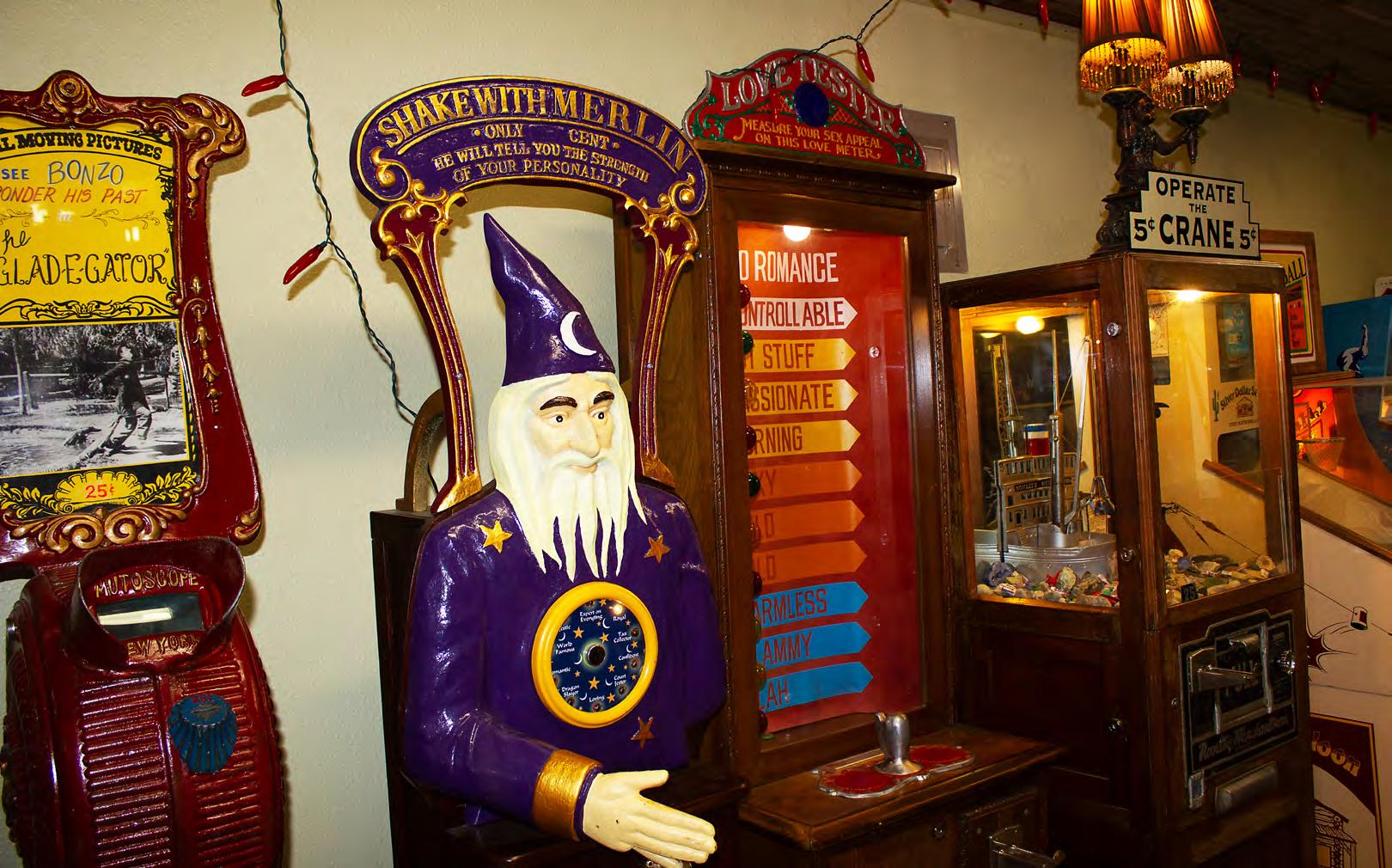
with educational signs in front of each display. The gift shop and arcade games transport visitors to a mid-century world of curios, magic tricks, gumball machines, and vintage collectibles. Items like rubber band guns, jacks and balls, and nearly 20 penny arcade games, decorate the inside of the shop, enhancing the retro experience even more! There is even a Love Tester and Shake Hands with Merlin game! “They’re all old school, old mechanical games,” said Dole. “No video screens or anything like that at all. They built stuff to last, which is artistic in its own way, really.”
By March 23, 2022, Crystal Cave officially reopened for the first time in over a decade, ready to welcome curious explorers once more. The cave maintains a constant 59°F (15°C) year-round and opens into eight main chambers, including the Ghost Room, with 13 pure white stalagmites, each over two feet tall; the Chimes Room, where stalactites produce musical tones when struck beneath its natural dome; and the Rocky Mountain Chamber, featuring the Washington Monument, a formation replicated by Smithsonian curators and displayed at the Smithsonian Institution.
“We have some folks that come out maybe three times a year, because every visit is different,” said Dole. “The first visit’s like, ‘Oh my gosh, look at this place.’ Second one: ‘Wow, I had no idea this was such an active, living environment.’ The third visit — that’s when you really see the formations.”
Reviving Crystal Cave was just the beginning of the Doles’ ongoing celebration of classic Americana. Currently, they operate Mystery Hill in Onsted, Michigan, which has a collection of eccentric oddities and a wonky house with abnormal forces of gravity. The Doles also recently started taking on projects further west, such as the Crystal Gold Mine and RV Park in Kellogg, Idaho, that they purchased in 2022. In 2024, they purchased Meteor City Trading Post in Winslow, Arizona, a Route 66 icon, that until recently, was very much on the verge of decay, and reopened it in 2025. “I just love restoring them, bringing them back and sharing them with folks,” Dole said. “It’s Americana, and if you don’t preserve it, it’s gone. And when it’s gone, it’s gone. These things should be enjoyed and preserved because they’re one of a kind.”
When the Manns first opened the cave, they advertised it as a place of relaxation and rejuvenation. The Doles are continuing this tradition by maintaining the pond area outside of the cave, where groups enjoy sack lunches at picnic tables as they watch local birds and turtles in blissful solitude.
The gates may creak, stalactites may drip, and whispers of the past may linger in the shadows, but every visitor to Crystal Cave, stepping into the same darkness that first inspired Alfred Mann and those who followed, becomes part of its story, feeling the same quiet awe that has held generations in its earthly spell.
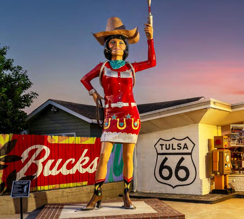
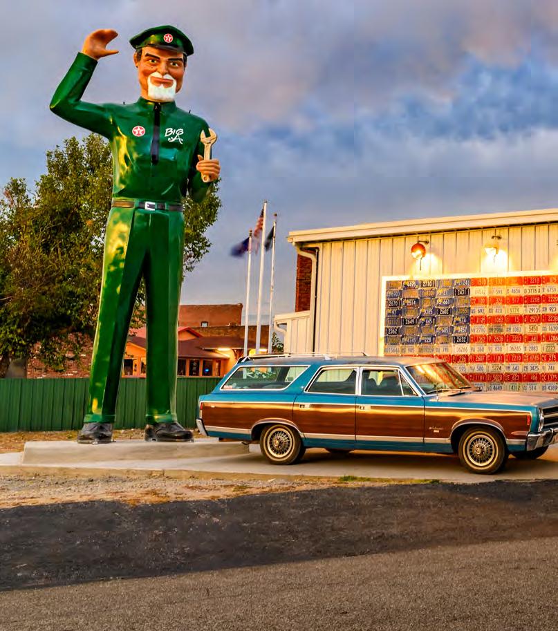
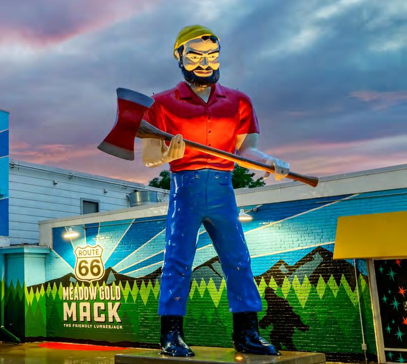
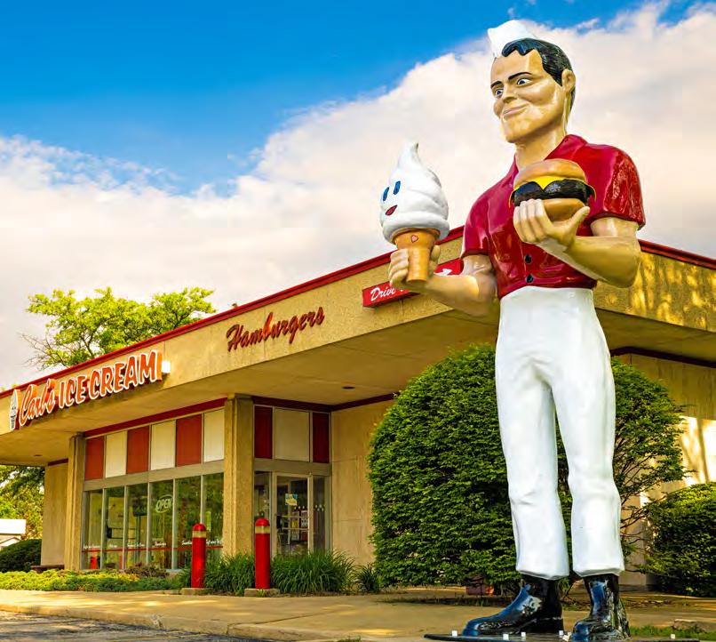
The golden era of the American roadside was defined by a fierce competition for the attention of motorists traveling at sixty miles per hour. In the early 1960s, the solution arrived in the form of towering fiberglass titans, often reaching 18 to 25 feet tall: the Muffler Men. These figures, primarily manufactured by International Fiberglass in Venice, California, became definitive landmarks along Route 66 and highways across America. Whether clutching axes, tires, or hot dogs, they served as oversized salesmen for local businesses. However, as the interstate bypassed the Mother Road in the 1970s and 1980s, many were abandoned, sold for scrap, or left to decay.
The recent resurgence of interest in these mid-century icons has sparked a renewed preservation movement. No longer seen as kitsch, they are now protected as legitimate cultural artifacts. This curated list highlights the most significant original restored giants still standing along historic Route 66. By focusing on authentic figures cast from 1960s molds, we honor the craftsmen and business owners who have ensured these towering sentinels remain part of the highway’s skyline for years to come.
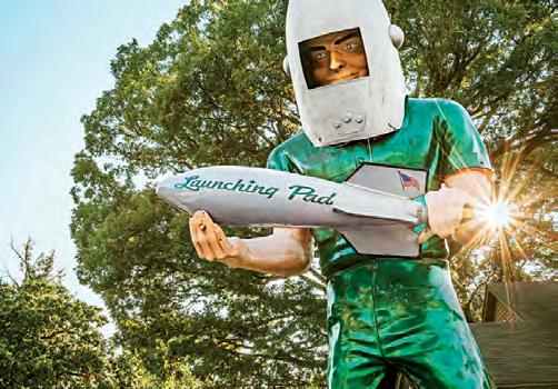
Gemini is a rare version of the “Muffler Man” lineage. In fact, there have been very few fiberglass spacemen in existence. In 1965, John and Bernice Korelc, owners of the Launching Pad Drive-In, in Wilmington, Illinois, purchased a standard 20-foot fiberglass Paul Bunyan shell from International Fiberglass. Seeking to capitalize on the Space Race, they customized it into a helmet-wearing astronaut holding a rocket. A local naming contest inspired by Project Gemini gave the statue its moniker. The Korelcs remained owners until 2007 and then the restaurant entered a period of changing ownership and gradual decline. After years of vacancy, the property was revived in 2017 by new owners who briefly restored the diner before its final closure in 2022. For nearly 60 years, Gemini remained a landmark even as the restaurant faced long periods of vacancy.
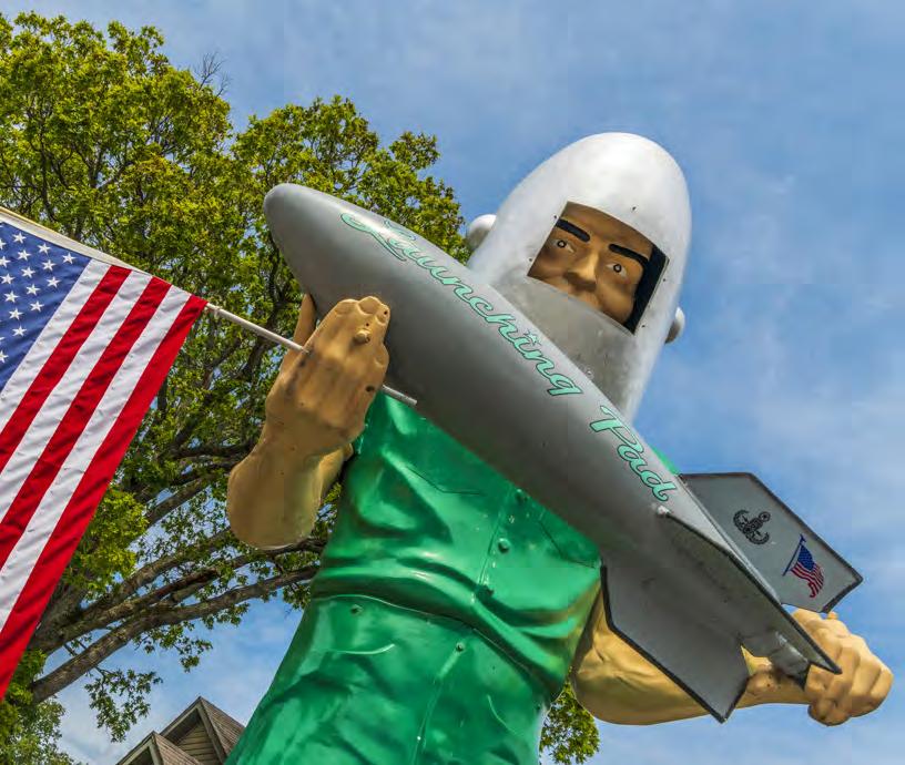
In 2024, the statue was auctioned separately, marking a pivotal shift in its history. Acquired by the Joliet Area Historical Museum, it was preserved and relocated to South Island Park later that year, ensuring its future as a public landmark independent of the restaurant that first gave it life.
Paul, Atlanta, IL
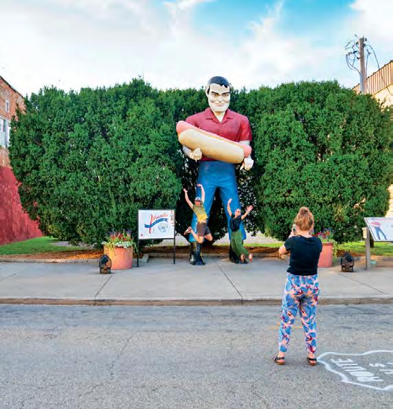
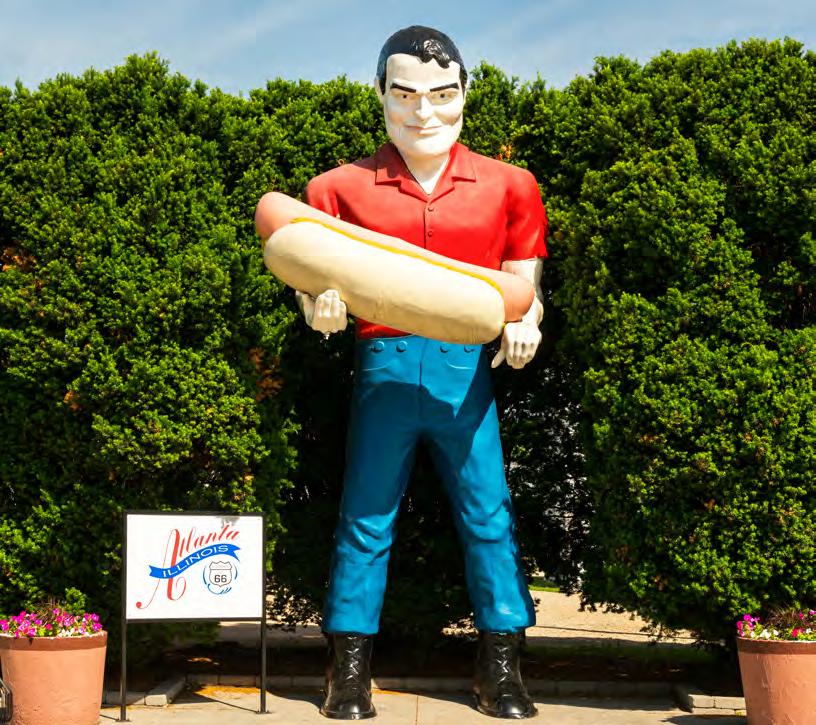
In 1966, Hamlet A. Stephens purchased a classic Paul Bunyan statue to tower over his newly opened Bunyon’s Service Station in Cicero, Illinois. Like Gemini, this giant was uniquely modified to hold a massive fiberglass hot dog instead of an axe, serving as a literal billboard for the snacks sold on-site. For decades, he was a staple of the Chicagoarea Route 66 landscape. Following the station’s closure in 2002, the giant faced an uncertain future until 2003, when the Atlanta Public Library and local advocates coordinated its relocation to town. This move rescued the figure from being lost to private collectors. Now standing in Route 66 Park, “Tall Paul” was officially inducted into the Route 66 Hall of Fame in 2007. He remains a testament to Thomas’s original vision and Atlanta’s commitment to preserving roadside kitsch for new generations.
Lauterbach Giant, Springfield, IL
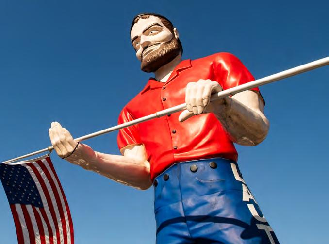
Standing outside Lauterbach Tire & Auto Service in Springfield, this 19-foot figure is one of the few original Muffler Men still residing at its primary business home. It was originally installed in 1978 by shop owner Jerry Lauterbach, who wanted a distinct landmark to differentiate his service station from the competition on the Illinois capital’s stretch of the Mother Road. While it began as a standard lumberjack model, the giant has survived significant physical trauma; a 2006 tornado famously ripped the statue’s head from its shoulders, blowing it several blocks away. The family painstakingly repaired and reinforced the figure, returning it to its pedestal with an American flag gripped in its hands. Unlike the relocated giants in other towns, the Lauterbach family has maintained continuous stewardship over the statue for nearly 50 years. It serves as a gritty, authentic symbol of local business resilience, surviving both the decommissioning of Route 66 in 1985 and the volatile Illinois weather.
The Livingston Uniroyal Gal, Livingston, IL
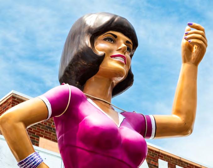
Standing tall at the Pink Elephant Antique Mall, this approximately 20-foot fiberglass figure represents the rare feminine counterpart to the male giants. Produced by International Fiberglass in the mid-1960s, she was originally designed as a promotional tool for Uniroyal Tires, styled with a “Jackie Kennedy” bob and a signature mid-century silhouette. This model was part of Uniroyal’s national promotional campaign before being acquired by entrepreneur Thomas Skarupa. In 2013, she was permanently installed at the site of the former Livingston High School, which Skarupa transformed into a sprawling Route 66 destination. Unlike the rugged lumberjacks, the Uniroyal Gal exudes a refined, Mid-century Mod aesthetic. While many of her counterparts were lost to the elements or destroyed after the marketing campaign ended in the 1970s, this statue was meticulously restored in the mid-2010s. She now sports a colourful blouse, blue skirt, and a white apron bearing a Route 66 shield—giving her the appearance of a mid-century roadside waitress. She remains a unique matriarch of the Illinois giant collection, anchoring the “Pink Elephant” legacy.
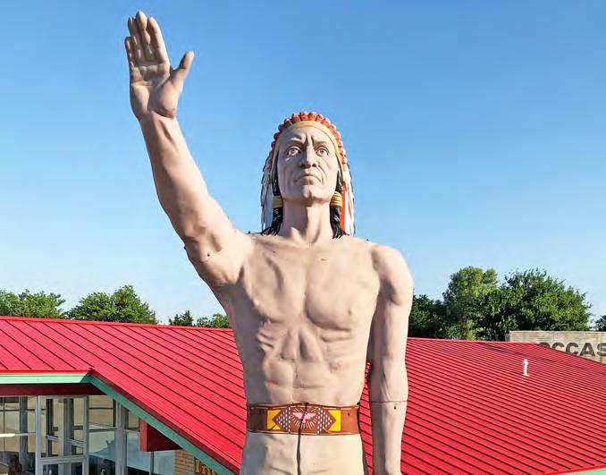
Set just off Route 66 in Calumet, the towering figure outside the Indian Trading Post & Art Gallery stands as one of the more distinctive survivors of roadside America’s golden age. Known as the “Big Chief,” the statue is a rare “Big Indian” variant of the classic Muffler Man—a design that departs from the more common blue-collar lumberjack figures that once lined the Mother Road.
Bare-chested, rising approximately 20 feet, and crowned with a traditional feathered headdress, he stands with his right hand raised in a gesture often interpreted as a greeting or sign of peace. Unlike other Muffler Men that grip tools or products, this version conveys a quieter, more symbolic presence.
Originally installed at a car dealership in El Reno and later associated with Howe Motors in Clinton, the statue was relocated around 2010 to its current home in Calumet. Today, it anchors the Indian Trading Post, a family-run operation that has evolved from a modest roadside business into a destination for Native American art, jewelry, and souvenirs under the Wheeler family.
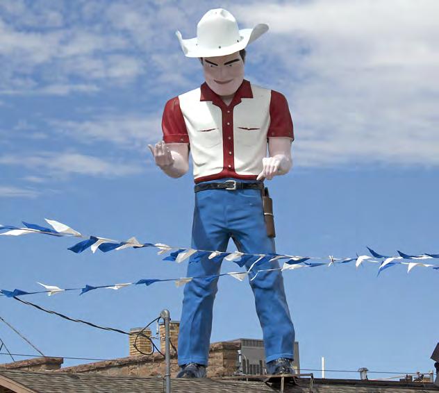
The Dude Man, Gallup, NM
Perched prominently on a dealership rooftop, this 20-foot fiberglass cowboy acts as a silent salesman for the rows of classic American steel below. Produced by the International Fiberglass Company, it represents a customized cowboy variation of the classic Muffler Man, featuring a broadbrimmed Stetson and a molded sidearm holster.
Affectionately nicknamed “Dude Man,” the figure is believed to have first stood at a Dodge dealership known as Gallup Auto Sales back in the 1970s. When the business eventually closed, the statue was acquired by John DeArmond, who relocated it to his dealership—John’s Used Cars—where it remains today.
While many vintage giants were sold off, this figure endured as a constant presence in Gallup’s roadside landscape, maintained over the decades as the surrounding corridor changed. Like many long-standing roadside icons, it bears the marks of time, including a small bullet hole in its head—the result of a .22-caliber shot decades ago. Dressed in blue jeans, a red-and-white shirt, and a white Stetson, the giant carries a distinctly high-desert identity, watching over Gallup as the road evolves.
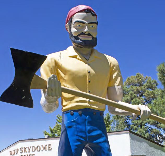
the Lumberjack Twins, Flagstaff, AZ
Just north of Route 66 in Flagstaff, the story of “Louie” begins not on campus, but along the Mother Road itself. In 1962, a towering fiberglass lumberjack—widely regarded as among the earliest known examples of the Muffler Man form—was installed outside the Lumberjack Café, complete with a knit cap and rugged, bearded features. A second, nearly identical figure soon joined it, and together they stood watch over Route 66 during its golden years.
In 1973, following a change in ownership of the café, the statues were donated to Northern Arizona University and installed at the Lumberjack Stadium. One figure was positioned outdoors, where it still stands, while the second was installed inside the Walkup Skydome following its opening in 1977.
Today, the twins stand as rare survivors of Route 66’s commercial past—transformed into one of the most distinctive collegiate adaptations of the American roadside giant.
Boy (The Statue of Liberty of Los Angeles), Los Angeles, CA
In 1969, the Chicken Boy restaurant on South Broadway in Los Angeles sought a landmark that would stand out in the crowded skyline. The owner purchased an original International Fiberglass “Paul Bunyan” model, but instead of the standard lumberjack head, he commissioned a custom, oversized chicken head to match the menu. Holding a giant bucket of fried chicken, the 22-foot hybrid became a surrealist beacon for hungry travelers entering the final stretch of the Mother Road. When the restaurant faced demolition in 1984, the future of the flightless giant was grim until graphic designer Amy Inouye spearheaded a grassroots “Save the Boy” campaign.
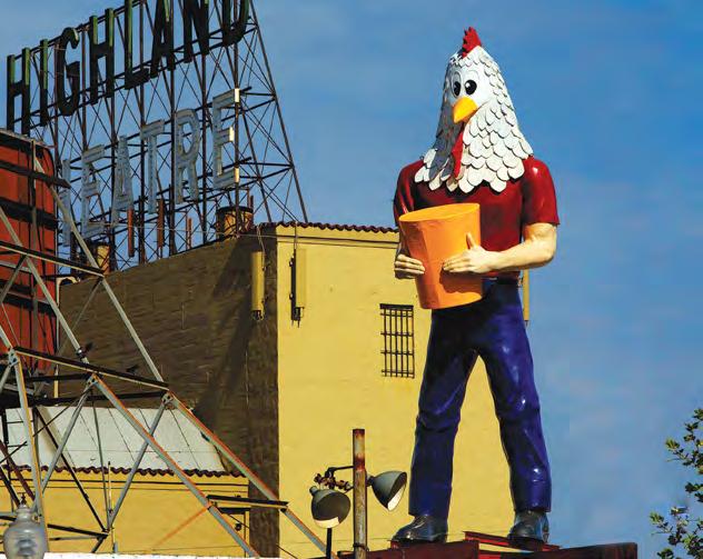
After a decade in storage, the statue was triumphantly relocated to the roof of Future Studio in the Highland Park neighborhood in 2007. This move was made possible by a 2005 state grant and local donations, preserving one of the most eccentric modifications in the Muffler Man lineage. Today, Chicken Boy is a cherished folk-art icon, standing as a whimsical sentinel along Route 66.
By Abigail Singrey
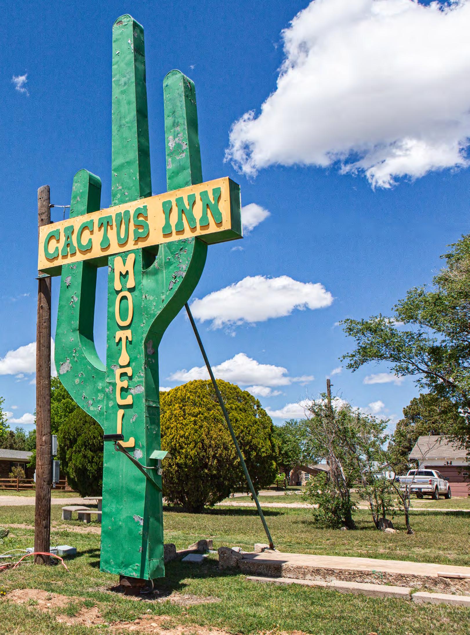
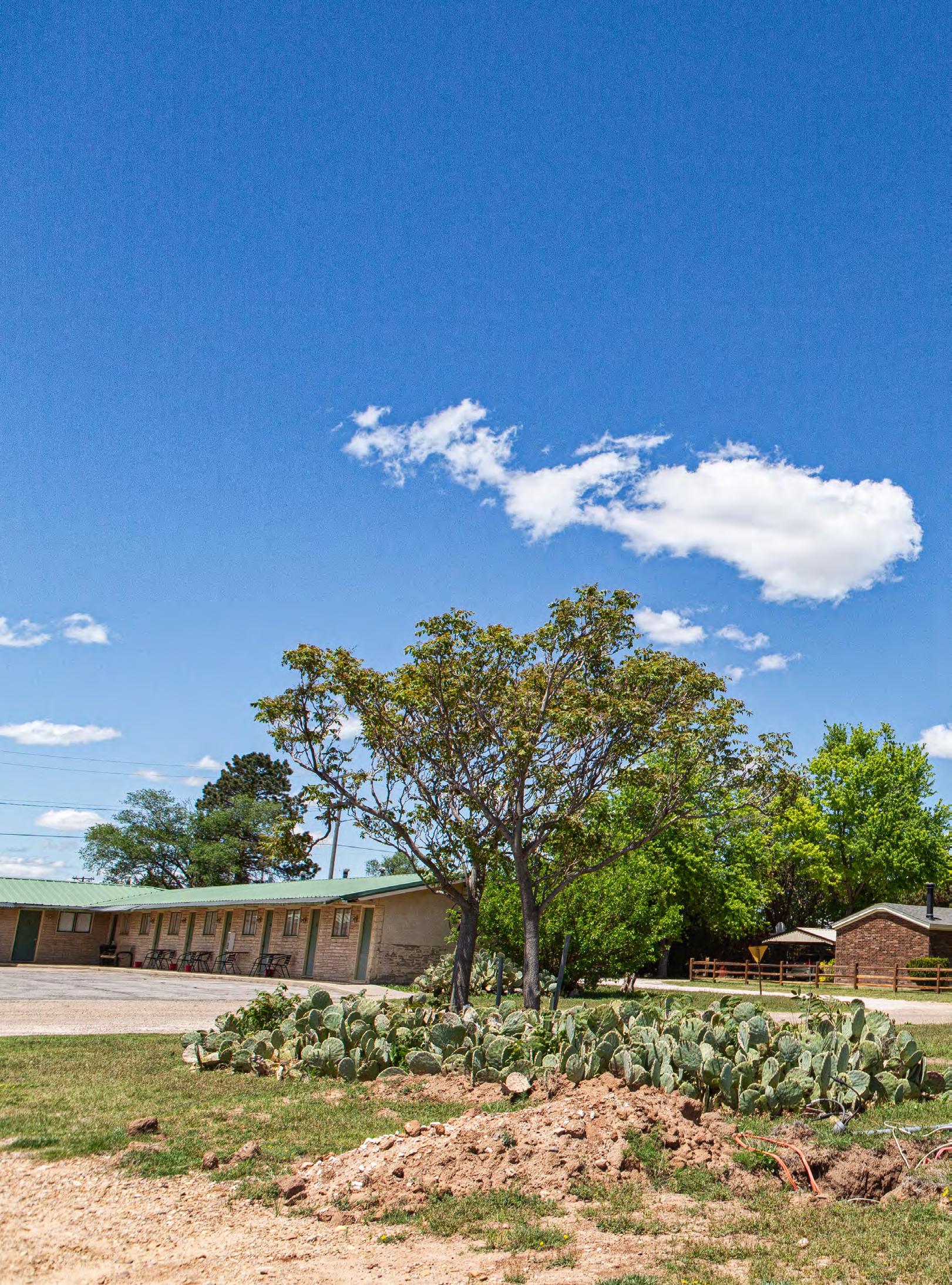
It’s a “blink and you’ll miss it” landmark on Old Route 66—a dusty, slightly rusted cactus sign rising over a grassy field in the small town of McLean, Texas. Standing across from its namesake, Cactus Inn Motel, the sign marks the middle of a future RV parking area and evokes the spirit of Route 66’s golden age of road trips.
During the early days — 1926–1933 — when construction of the new Route 66 highway was carried out along the Texas Panhandle’s 185 miles of would-be road, it quickly became clear to locals that opportunities abounded, and the future was theirs for the taking. It was an exciting time. Just 12 miles from McLean lay the infamous Jericho Gap—a treacherous, unpaved, and muddy stretch of road where countless vehicles became stuck. This 18-mile section stranded so many travelers that a tow truck industry flourished, with locals even rumored to water the roads to boost towing fees. In 1933, however, funding was secured to pave the gap, and a young and industrious E.J. “Slim” Windom stepped up to play a role in the project, driving a dump truck for the construction crew. But he had bigger dreams.
The years rolled on and lives changed and developed, and in 1956, E.J. and his wife, Grace, knew that their time had come. Venturing into the hotel business, the couple constructed the West Wind Motel in their homebase of McLean. Early photographs capture the squat, traditional motor lodge’s exterior, featuring a sign with a large arrow pointing to the inn and a lifesize cowboy standing beside it to draw in travelers. The front lawn housed a metal playground, all set against the backdrop of a single-story, 10-room motel. Doors set into the stone exterior opened onto a concrete sidewalk, and guests were able to park right outside their room. This was not as common at the time. Later, the Windoms updated the sign to showcase a giant cactus bearing the words, “West Wind Motel,” a pivot in their attempts to charm travelers. By the 1960s, the couple decided to retire and sold the property. The new owners renamed it Cactus Inn Motel, a name that endures to this day. Though it’s not clear when she bought it, eventually local resident Rubie Christner ended up with the property. In 1983, she turned the motel over to Parbhubhai Patel — an Indian national — through a contract-for-deed transaction — a financing arrangement where the buyer makes payments directly to the seller, who retains the property’s legal title until the contract is fully paid. The future must have looked bright for Patel and local business owners. However, the construction of Interstate 40 through Texas in the early 1980’s bypassed
many of the original Route 66 Lonestar towns, greatly reducing tourist traffic. Just one year after Patel took over the motel, in 1984, the interstate bypassed McLean, and the effect was immediate.
“Within three to four weeks, twenty-some businesses had shut down,” said local rancher Delbert Trew. “The filling stations closed, the garages closed, and of about five to six inns, Cactus Inn Motel was the only survivor. It was a terrible time, a terrible downturn for McLean.”
While McLean, with its pretty red brick road through downtown, has maintained a small local population, many nearby towns, including Jericho, are now ghost towns. The bypassing of these towns reshaped their futures, leaving behind echoes of a once-vibrant way of life that is now hidden behind overgrown paths and crumbling facades.
In 1993, the Patels decided to move on from the motel, never having completed the real estate transaction. The property reverted back to the Christner family. As Rubie Christner had died in 1988, her son, John Hal Christner, sold the property that same year to Gordon and Jane Shepler.
The Sheplers purchased the property as a retirement project. Initially, they didn’t plan to operate it as a motel. Instead, they renovated a few rooms for their adult children to use during visits. Over time, however, they reopened it to the public, running a bare bones operation with just one room available for guests.
On June 8, 1995, a tornado dropped down just north of McLean, damaging homes and the stockyards in nearby Wheeler. Several local businesses were damaged by high winds; Cactus Inn Motel was one of them. Its tall cactus-shaped sign was knocked down. Eventually, the Sheplers called on Trew for help. In addition to being a rancher in the area, Trew has been a champion of Route 66 for years, founding the Devil’s Rope Museum — a barbed wire museum, in McLean — and starting the Texas Route 66 Association. He used his metalworking skills to help repair the damaged sign.
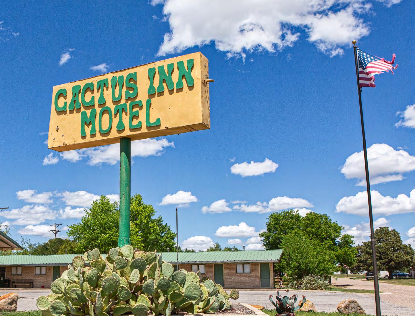
“The tornado blew the sign down and bent it up pretty bad,” Trew noted. “The inn was empty for a while, but eventually the owners wanted the sign restored. [My friend] Johnny Day and I took a winch truck… We had a cutting torch and cut the base and lowered it onto the trailer and carried it back to my ranch. While it was on the trailer, I knocked all the dents out. It had been neon, but the neon was all busted up. We couldn’t afford to put neon on it, so, I removed all the neon parts. It was riveted together, and I replaced some of the rivets and repainted it cactus green by hand. It was a pleasure to restore the sign, and I’m very proud of it. It’s a Route 66 icon.”
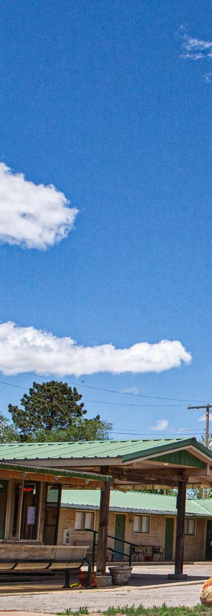
Gordon Shepler — himself a skilled carpenter — played a key role in restoring many of the motel’s rooms and installed a new tin roof and constructed a front porch for the motel office entrance. To complement the theme, he and his wife also created a cactus garden. As their work progressed, the Sheplers gradually opened more rooms, but they resisted adopting modern technology. Even as late as early 2009, reservations still had to be made by phone.
In 2009, Cactus Inn Motel was sold again, this time to local Ben Reeves, with plans spearheaded by his wife to renovate the property. Unfortunately, due to poor health, most of their intended updates never materialized. After a
decade, the motel was put back on the market again. This is actually not that uncommon in small town America.
By chance, Angela Morland, a Dallas-area resident with no ties to McLean, came across the listing. She had a master’s degree in early elementary and teaching from East Texas A&M University and had taught at Mesquite Independent School District for 23 years. She was looking for a way to shake up her life and had started browsing real estate listings.
Despite having no experience within the hotel industry, Morland had grown up in Oklahoma near the Mother Road and long dreamed of owning her own business. When she visited Cactus Inn Motel and walked the grounds, she fell in love with the 10-room property and purchased it on February 13, 2020. Her new venture kicked off with a bang—on her very first night of ownership, two guests checked in.
“I wanted to have a business. I have it in my blood,” Morland said. “My grandmother owned a department store in a little town that my mother grew up in, Rush Springs, Oklahoma. It was called Jolley’s. It burned down in a fire when my mother was a senior in high school. My
grandparents then helped a friend manage a motel, taking on the role of managers at the Park Inn in Ruidoso, New Mexico, for a time. That’s where my parents met.”
When Morland purchased the motel, it was clear that it had been frozen in time. Despite the Sheplers’ updates to the roof and front porch, the plumbing was original to the 1950s, the furnishings were outdated, and the room doors had noticeable gaps at the bottom, allowing drafts to seep in. One of Morland’s first priorities was replacing the doors, ensuring a more secure and comfortable experience for guests.
“The doors were a huge problem,” Morland said. “There was a half inch gap under every door. You could see the sunshine coming through. And so, dirt would get in and make the rooms dusty. I got that fixed right away, and that made a big difference.”
Shortly after Morland purchased the motel, the COVID-19 pandemic drastically altered travel plans for many. Fortunately, nurses from the local nursing home began staying at the inn, providing crucial support that allowed Morland to keep her doors open.
“The pandemic was a curse and a blessing at the same time, because number one, we had the nurses staying here,” continued Morland. “I really don’t know what I would have done without them. I was teaching virtually (classes at a school in the Dallas area), so I was able to be at the motel to do cleanup. I was on fire with getting things cleaned up and thrown away and cleared out. I really got a lot done in those first six months.”
This momentum drove a creative transformation of the motel, starting with rooms themed to honor the eight states along Route 66. Morland and her mother began by removing the thick, outdated carpet, replacing it with sleek tile in two rooms. They revamped the Missouri room’s decor, giving it a fresh and nostalgic feel, while Morland’s father, Ronnie Dean Morland, poured his heart into making the Oklahoma room a true passion project.
“My father is what I call Mr. Oklahoma. Unfortunately, he’s passed away. I still need to figure out how to secure things better on the walls. Somebody stole a metal piece from the Oklahoma room that my dad had put together that said, ‘Okie.’ So that was sad,” shared Morland.
The Gallery Room is the truest reflection of Morland’s personal style, showcasing an array of prints and artwork that she collected during her years in Dallas. Meanwhile, the future Illinois room remains closed to guests as Morland diligently saves funds to bring her vision for its renovation to life. She’s working to keep the feel warm and cozy, like she imagines it originally was in the 1950s, while adding modern updates.
With the help of a grant from the Route 66 Corridor Preservation Program, Morland has been able to focus on revitalizing the motel’s exterior. She repaired the awnings and gave the building a fresh coat of paint, while staying true to the original color scheme. She also opened her first RV parking spot, complete with a 50-amp power hookup. Her next project is updating the original 1950s plumbing and replacing the outdated gas heater. Additionally, Morland moved the motel’s iconic sign to a lot she owns across the street, where she
has steadily expanded the motel’s RV accommodations. What began as a single RV site has grown to seven fullservice sites, each with water and electrical hookups, with plans for additional expansion. She also dreams of doing some restoration on the iconic cactus sign and is hoping for another grant to help defray the cost. Who knows, maybe it will even become neon again someday.
For Morland, the most fulfilling part of owning the motel is the people she meets. She encourages them to visit other area attractions, including the Devil’s Rope Museum, housed in an old brassiere factory, and a restored 1929 Route 66 gas station, just a few blocks from Main Street. In addition to Route 66 travelers, she sees a lot of traveling construction workers, hunters, and medical staff. Despite being new to the area, Morland has made a home for herself in the tiny Texan town.
“Ben Reeves — a previous owner of the property — saw what I had done in six months of owning the motel. I had never met him before buying the motel. He asked, ‘Do you think you can do something with the Main Street building that I have?’ I said, ‘Yes,’ and my first thought was a daycare, since I’m a teacher. But then I thought, ‘I really like to drink beer.’ I’m a beer nerd, so I decided on a taphouse, where I can serve beer and wine.”
And so, Cactus Rose Taphouse was born. But that is a story for another time.
In addition to launching new businesses, Morland is eager to help McLean improve its image. With the town undertaking clean-up projects, she’s decided to take a hands-on approach and run for mayor to help drive these efforts forward. She also has ambitious plans for Cactus Inn Motel, including the eventual addition of a commercial kitchen to create a bed-and-breakfast atmosphere. While there’s no breakfast currently, guests can always count on the motel’s signature old-fashioned hospitality.
“We’re doing our best to make this a great destination, and we really care. It’s not just that I want to make a profit—of course I want it to be my retirement and possibly build something for my son. But it’s a passion, and I love it. It’s like having a home with 10 bedrooms. I think I’ve done a pretty good job. I’ve never bought a motel before, and I’ve never been a mayor before, but why not? I have no regrets. I love this life.”
Cactus Inn Motel in McLean, Texas, remains a beacon of the Route 66 heyday, when quirky roadside motels turned highways into adventures and every stop held a story. Beneath the shadow of its iconic giant cactus sign, the motel whispers tales of simpler times, of travelers drawn by the allure of the open road. As these vintage gems find new life in preservation, the Cactus offers hope that the spirit of Route 66 — quirky, bold, and endlessly inviting — will live on, inspiring dreamers to follow the highway’s winding path into the heart of Americana.
*The photographs accompanying this story were taken in 2024. Since then, the Cactus Inn Motel has continued to evolve with ongoing property improvements and thoughtful beautification projects, underscoring a continued commitment to preserving this Route 66 landmark.
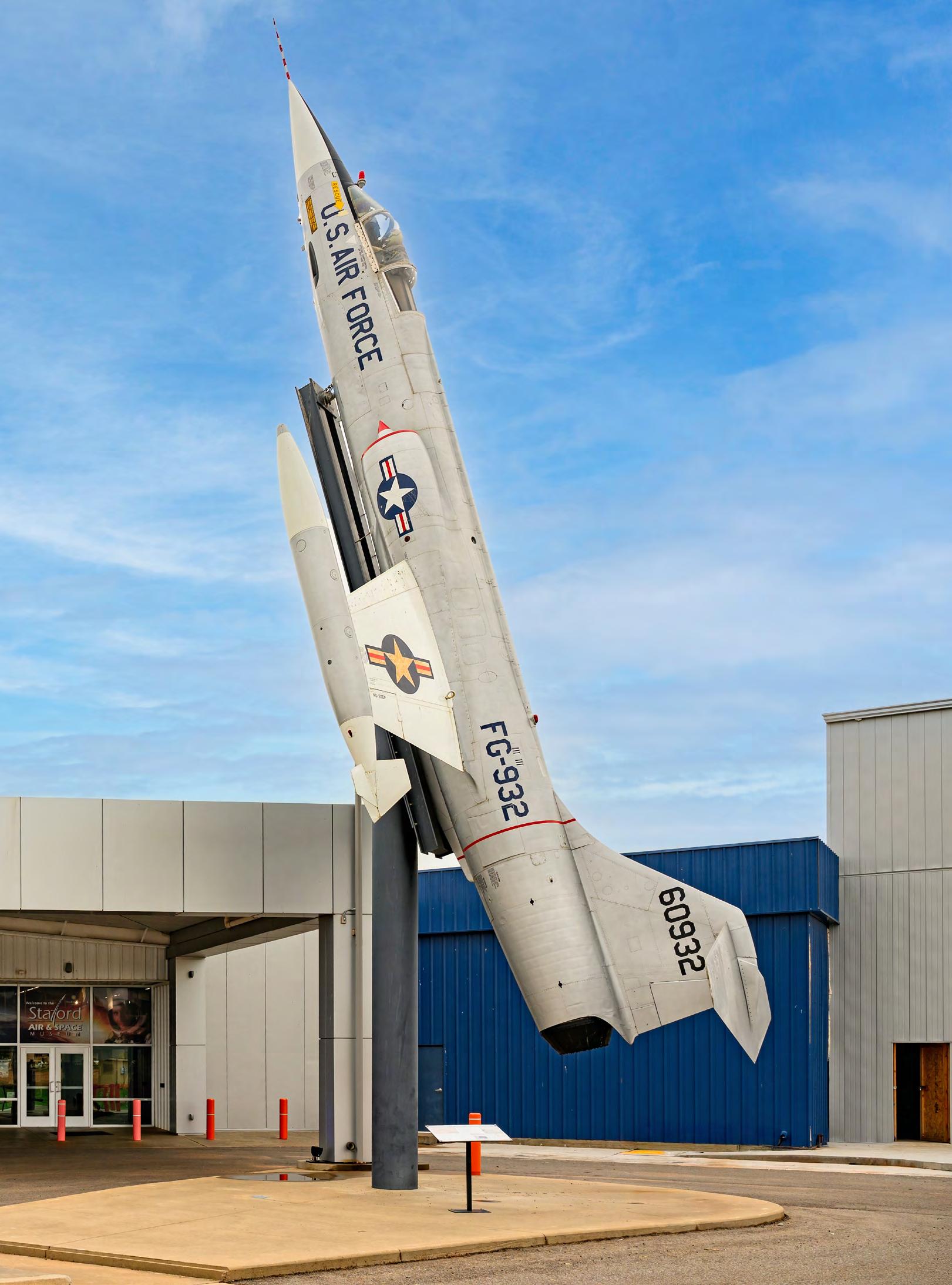
As evening settles over Weatherford, Oklahoma, the sky falls dark above the softly buzzing businesses that line Old Route 66. Beyond the lights of town, the western plains open to an expansive night sky where, on clear evenings, the Milky Way still reveals itself.
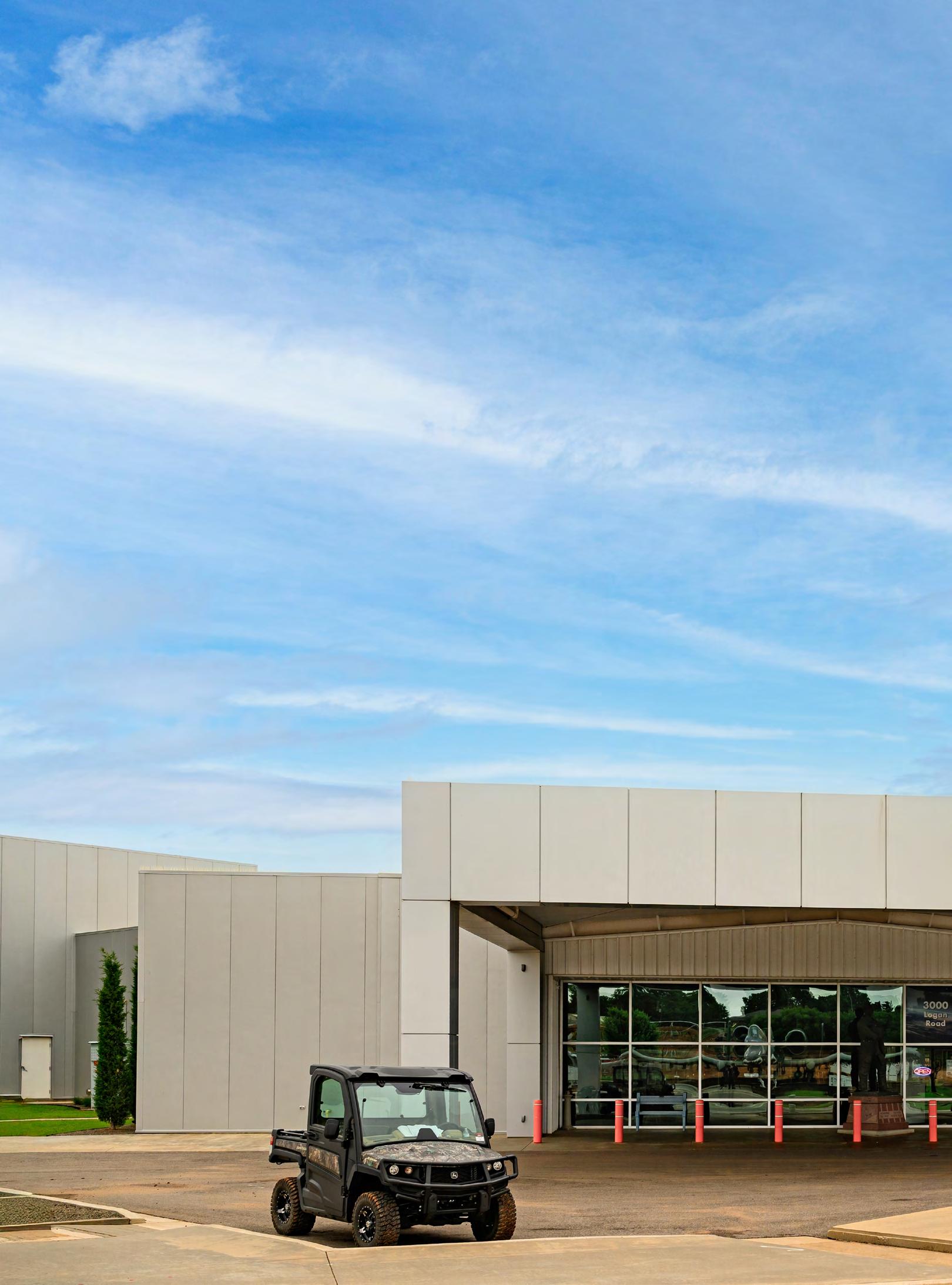
Under skies like these, it is easy to understand how a generation of dreamers became determined to push beyond the limits of Earth itself. One of those explorers was Lt. General Thomas P. Stafford, a Weatherford native and one of the few men ever to fly to the moon. Inspired by a lifetime of exploration, Stafford later returned to his hometown with a vision of creating a place that would ignite that same sense of wonder in others. Today, the Stafford Air & Space Museum is a sprawling modern complex housing an extensive collection of aviation and space artifacts tied to Stafford’s career. Despite the museum’s world-class collection, it remains a tribute to a local boy who looked skyward and helped carry humanity into a new frontier.
Thomas Patten Stafford was born in Weatherford, Oklahoma, on September 17, 1930, to town dentist Thomas S. Stafford and schoolteacher Mary Ellen Stafford. An only child, Stafford grew up during the hardships of the Great Depression, yet his imagination was constantly drawn skyward. After graduating from Weatherford High School in 1948, Stafford joined the United States Naval Academy in Annapolis, Maryland, where he met his future co-pilot, John Young. Finishing near the top of his class in 1952, Stafford was accepted into the newly formed U.S. Air Force—the start of a stellar career.
With his pilot wings earned, Stafford joined the elite Experimental Test Pilot School at Edwards Air Force Base, graduating in 1959. Recognized for his skill and precision, he became a test pilot instructor and co-authored two training manuals. Yet, even while teaching others the extremes of flight, he was drawn toward a far greater frontier. In April 1962, he applied to NASA’s next round of astronaut selection. A few months later, in September, at 31 years of age, he was named one of nine men chosen for NASA Astronaut Group 2. Known as the ‘Next Nine’, this handpicked team would go down in history as the pioneers of the Space Race.
In May 1969, Stafford embarked on the historic Apollo 10 mission alongside his former roommate, John Young, and fellow astronaut Gene Cernan. Flying the lunar module to within just nine miles of the moon’s surface, the mission served as the crucial dress rehearsal for the Apollo 11 Moon Landing just two months later.
In 1975, Stafford co-commanded the Apollo–Soyuz Test Project, the final Apollo mission and the first joint spaceflight between the United States and the Soviet Union. The Soviet Soyuz spacecraft docked with the American Apollo capsule in orbit, culminating in the famed “handshake in space” between Stafford and Soviet cosmonaut Alexei Leonov. At the height of the Cold War, this mission served as a symbol of unity, signaling that the Space Race had become a powerful symbol of cooperation during the Cold War.
Following the Apollo–Soyuz Test Project, Stafford resigned from NASA and returned full time to the U.S. Air Force. In 1972, he made history becoming the first active astronaut promoted to Brigadier General. In 1978, he
advanced to Lieutenant General before retiring in 1979 after a distinguished career that carried him from the beautiful plains of Oklahoma to the forefront of America’s space program.
In the late ‘70s, the manager of the Weatherford Airport asked Stafford if they could showcase some of his space artifacts in the terminal. Stafford generously obliged and soon a six-foot display case in the lobby featured several of the general’s personal military and NASA artifacts. For a man who had spent his life pushing beyond limits, Stafford envisioned something far greater. In 1993, just steps from the airport, he opened the first two rooms of what would become the Stafford Air & Space Museum.
From the beginning, Stafford intended the museum to do more than preserve history. He wanted it to inspire future generations to pursue aviation and space exploration.
Alongside the museum’s founding, he established an endowment with Southwestern Oklahoma State University that allowed selected students to work at the museum while receiving scholarships. “[The museum] wasn’t about having a space for himself to showcase all of his accomplishments,” said Julie Lenius, Marketing Director at the Stafford Air and Space Museum. “It was always about encouraging the children of Oklahoma to be that next explorer, and to give them a space that they can explore and spark that curiosity.”
Known as Stafford Scholars, some students have gone on to careers at NASA; a reflection of the ambition Stafford hoped to inspire.
Over the next decades, the museum went through six major expansions and by 2006, it had grown to encompass four interconnected buildings. Its collection continued to expand as well. “You would get a phone call from the General, and he would be like, ‘Make room for this, because we’re going to be getting this aircraft,’” said Lenius. “It was always in continuous growth mode.”
By 2009, the museum had acquired one of the few surviving Titan II rockets––a pencil-shaped, high-speed missile Stafford described as the “Corvette of rockets.” Other landmark additions, like the Gemini VI spacecraft and the Skylab 4 command module reflected Stafford’s zeal and passion for sharing knowledge. The museum became a Smithsonian Affiliate in 2011, helping bring even more remarkable pieces of aviation and space history to Weatherford.
Thomas P. Stafford passed away in March 2024 at the age of 93, but his legacy continues to shape the future in his hometown of Weatherford. Today, museum staff and community leaders are carrying his vision forward through new projects. As part of its newest expansion — bringing the museum to nearly 75,000 square feet — the museum is developing Shooting Star Park, an aerospace-themed outdoor space designed to encourage imagination and hands-on play opportunities for kids. “It’s about that underlying mission of ours to encourage kids to get out and explore,” said Lenius. “Get out there, jump on things. Don’t be afraid to get wet. Don’t be afraid to play in the dirt.” In many ways, that fearless spirit of exploration is exactly what the museum has always sought to preserve.
In an age where the once-imagined future of the Space Age steadily becomes reality, places like the Stafford Air & Space Museum remind us why wonder matters in the first place. The next time you find yourself cruising through Weatherford, spend an hour or two reveling in novel sights and standing in the presence of rockets that have touched the stars.


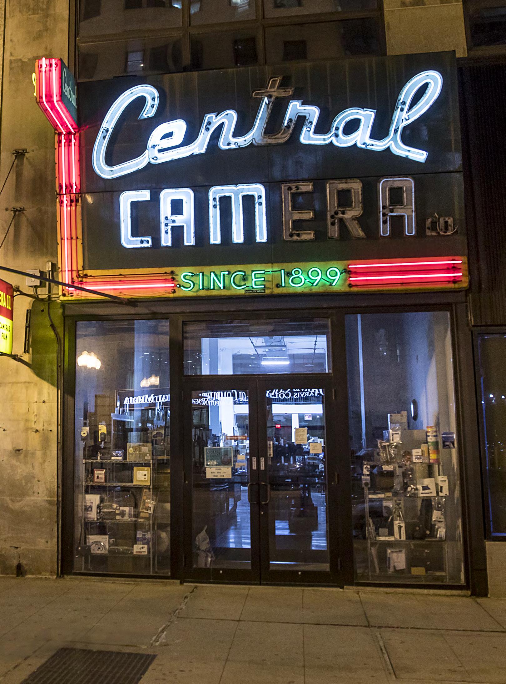
From the sidewalk, Central Camera’s narrow storefront looks like a scene from another era, frozen in time, yet unmistakably alive. A large, weathered sign in deep green enamel reads “Central Camera Co.” in bold, vintage neon script that arches and angles with mid-century flair. For decades, it has stood, just steps from the starting point of Route 66, where travelers once stocked up on Kodaks before chasing the Mother Road west.
“This store has been the center of the photography community, not just in retail sales, but we serve students, professionals, just your ordinary mom-and-pop type people needing help with their cameras,” said Timothy Shaver, longtime employee of the store. “As far as the equipment, it’s secondary to what the customer’s experience is.”
Walk through the door, and you step into a story that began more than a century ago with a boy from Hungary named Albert Flesch and a boatload of ambition.
In 1891, at the age of 13, Flesch was facing a grim reality: conscription into the army. To keep him from the frontlines, his parents made the difficult decision to send him alone across continents. His father, a humble poultry farmer, hoped America might give his son a better life. He would be right. After a long journey, Flesch eventually made his way to Chicago, where he lived with relatives. By the time he was 18, Flesch had landed a job in the camera department of Chicago’s bustling Siegel-Cooper store. It was here that his fascination with cameras and their potential was sparked. In 1899, he opened his own modest shop, Central Camera Company, at 31 E. Adams Street. Kodak’s easy-to-operate box cameras were taking the world by storm, and business quickly took off. Between 1907 and 1929, the store briefly relocated to the Palmer House Hotel side of Wabash Avenue, but when the hotel was demolished in 1929, Central Camera found a new home just a few blocks away at 230 S Wabash Ave, settling into a former piano store where it remains to this day.
Flesch didn’t just sell cameras — by 1900, he was already offering commercial developing and print processing, turning his shop into a full-service photography hub. To reach customers beyond Chicago, he introduced a mailorder catalog, extending Central Camera’s reach far past the city limits.
As the years rolled on, Flesch’s family grew. He had two sons, Harold and Stanley, who spent their childhoods learning the ropes, helping out in the store their father had built from the ground up. Flesch ran the business for more than five decades, guiding it through the shifting tides of photography, until his life was cut short by a heart attack in 1953. He was just 56. After his passing, Harold and Stanley took over the business with the same handson dedication. Under their leadership, Central Camera flourished, becoming a beloved landmark in the Chicago Loop and a beacon for shutterbugs across the city.
Harold had three children — Caren, and twin boys Ronald and Albert Donald — the latter named after his grandfather but known simply as Don. From a young age, Don too spent time at Central Camera, learning the rhythms of the shop. By 1968, at age 20, he joined the store full-time. When his father, Harold, passed away in 1983, Don became co-owner. Then, in 1990, he purchased the remaining shares from his uncle, Stanley,
becoming the sole owner and continuing the Flesch family legacy into its third generation.
“I came here in ‘94 with my wife, as she entered Chicago University, and I started looking for a job,” said Shaver. “I had worked in other camera stores in Ohio, and when I walked into Central Camera, Don hired me. I started photography in high school, excited about the equipment and the actual film, then coming to Central, it was kind of like ground zero for everything photo.”
For over 30 years now, Shaver has worked alongside Don, witnessing the store’s seismic shifts in photography — from film to digital and into the e-commerce age.
“Back in the day, it was all film, and there was no digital,” continued Shaver. “We’ve seen a real decline in business. One, because of the internet, and two, because of digital. When I started, we were servicing police departments, hospitals, schools. We had a delivery service where we would bring professionals their particular films and supplies.”
But even a lifetime of history couldn’t shield Central Camera from the devastating blows of the 21st century. When the COVID-19 pandemic swept across the globe, small family-run businesses like Central were hit hard. Then, as unrest and protests swept across the nation, chaos erupted in downtown Chicago, and amid the turmoil, looters broke into Central Camera and set it ablaze.
“It was a very emotional time for our staff and for the community, all the customers,” reflected Shaver. “Don’s daughter started a GoFundMe right away, and it was about two weeks after the fire that we set up a sidewalk table, and we were selling film, taking in photo processing for maybe four hours, three days a week. Don wanted to have a presence to let people know we were still alive, even though the store was burnt down,” continued Shaver. “Fortunately, as Don would say, ‘nobody got hurt, nobody got killed,’ and right away he was planning to rebuild.”
The community rallied behind them. The GoFundMe campaign quickly surpassed $225,000, and with those funds, Don was able to rent the vacant space next door as a temporary home for the business. But adversity wasn’t finished with Central Camera yet. By 2021, a year and a half into their temporary setup, a pipe burst in the building, leaking through the ceiling and ruining more inventory. Once again, they moved — this time back into their original, still-under-construction space.
Yet, through it all, the soul of Central Camera has remained intact. The heart of the store was never just in the gear it sold, but in the way it welcomed people, encouraging curiosity and celebrating the tactile magic of analog art.
“We just do our best, kind of a day at a time, you might say. We are assuming this store will never close and we will keep on doing our best to make that happen,” said Shaver.
For now, Central Camera’s glowing sign still hums, quietly marking time as the city changes around it. Just steps from the historic beginning of America’s most famous highway, it remains a touchstone for travelers and dreamers alike — a place where the past isn’t just remembered, it’s still developing.

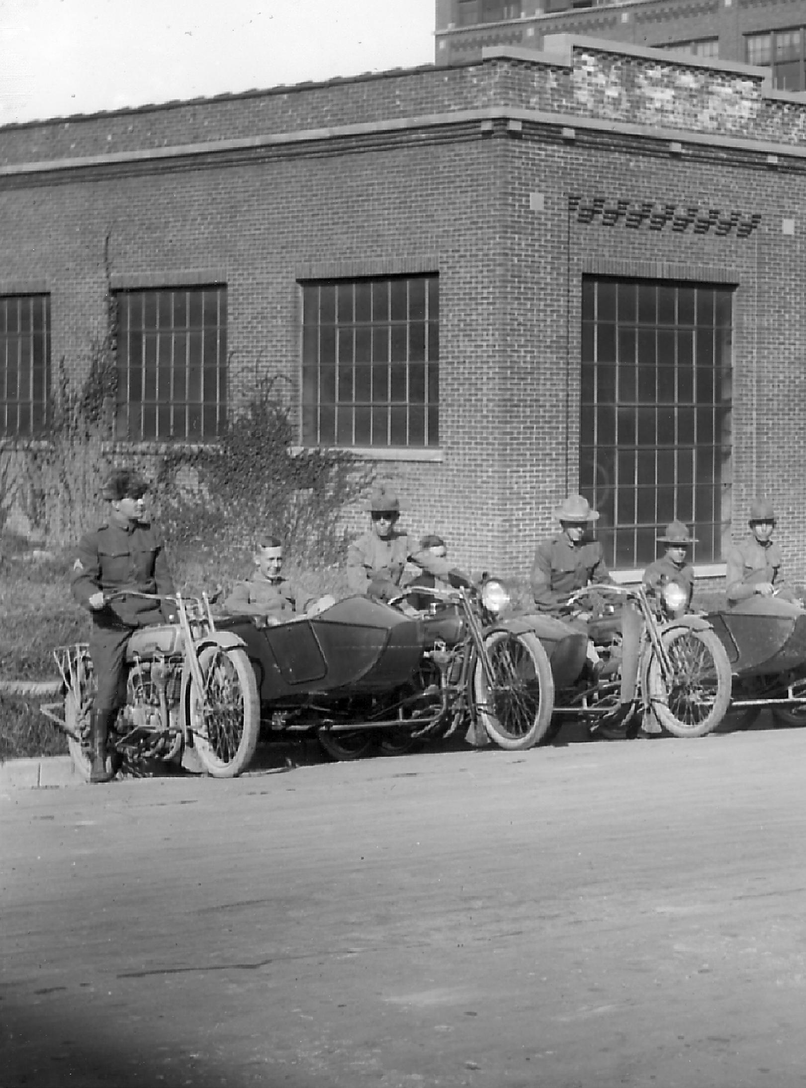
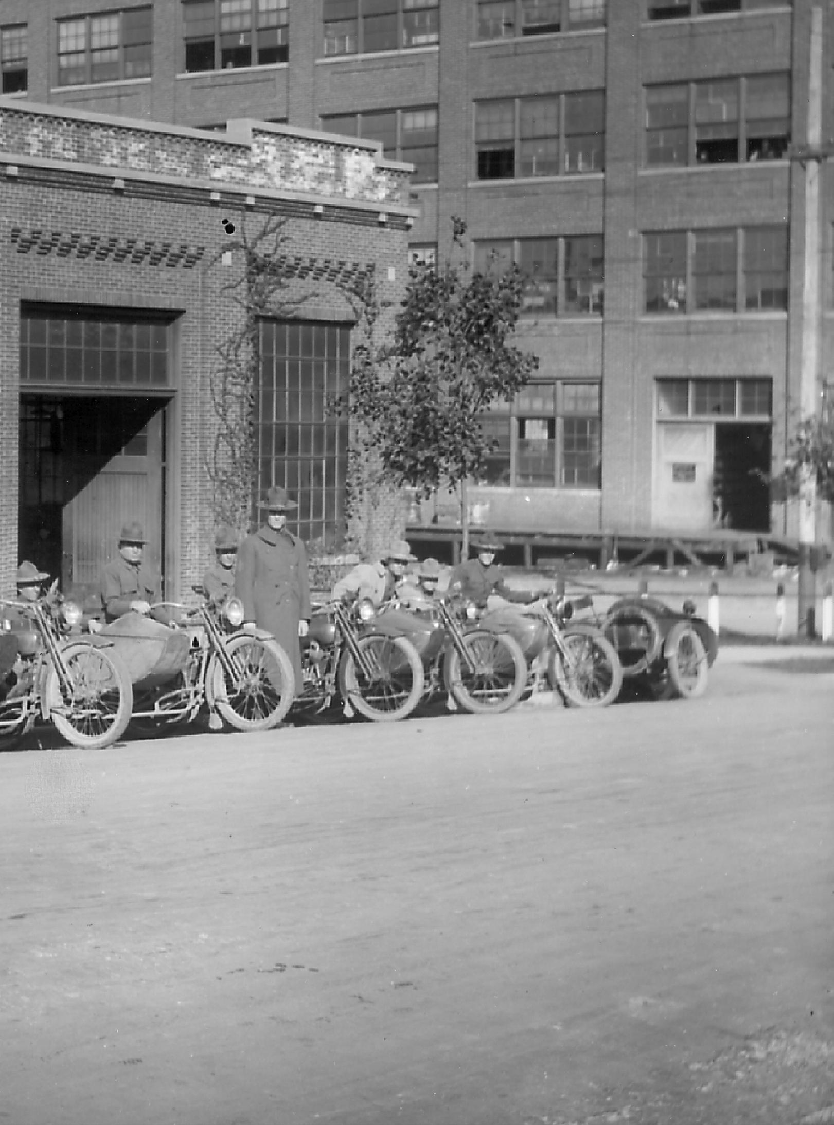
By
The unmistakable rumble of a Harley-Davidson has become as much a part of Route 66 as neon signs, roadside diners, and giant Muffler Men. For generations, riders have sought out the Mother Road in search of freedom, adventure, and a deeper connection to America’s iconic landscapes and history. Along Route 66, Harley-Davidson motorcycles gather at rallies, line the parking lots of iconic roadside stops, and carry travelers across the same miles that have inspired dreamers for nearly a century. Yet, the story of HarleyDavidson begins long before the interstate, before tailfins, and before America’s Main Street. Before there was Harley-Davidson, there was simply a bicycle.
Toward the end of the 1800s, the horse was still the go-to way to get around, but bicycles were beginning to catch on. You had the penny-farthing bike in the 1870s and early 1880s, which you’d probably recognize, even if you don’t know it by name. It’s the almost cartoonish bicycle with the giant front wheel and the tiny-in-comparison back wheel. Then the “safety bicycle” came on to the scene in 1885, thanks to British inventor John Kemp Starley, looking much more like the bicycles we know today.
“[By the late 1800s], people were getting used to two-wheel travel,” said George Canavan, a vintage motorcycle enthusiast and longtime volunteer at the National Automobile Museum in Reno, Nevada. “There were a lot of bicycle shops that took advantage of this fad, which then became an industry.”
Bicycle shops were looking for more and more ways to increase their customer base. As the internal combustion
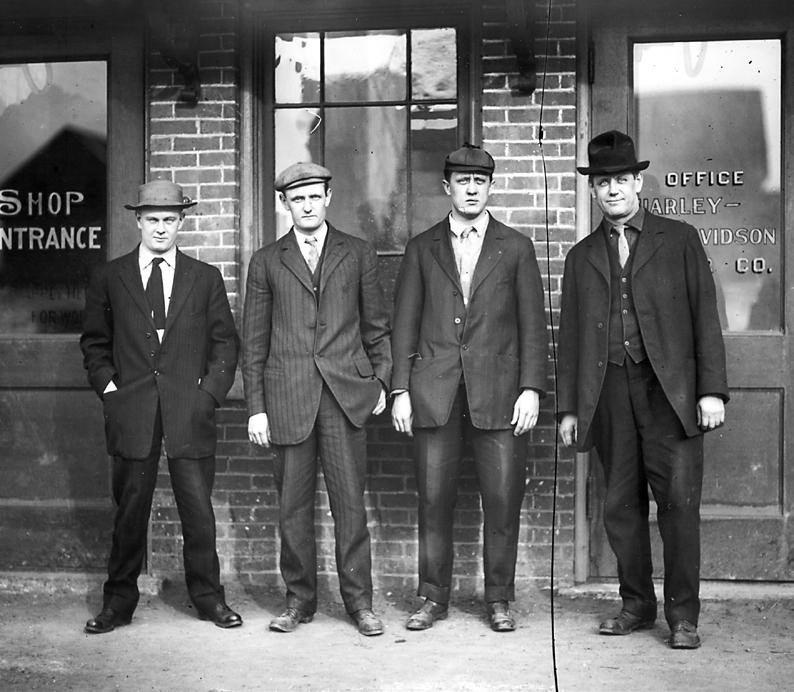
engine became more compact, practical and reliable, a few enterprising shops decided to add these engines to their bicycle frames.
“In a town like Reading, Pennsylvania, where you have big hills, bicycles weren’t as popular as they were elsewhere,” said Canavan. “But now, with a little motor, all of a sudden anybody could get up the hill without working up a sweat.”
According to Harley-Davidson, when friends William S. Harley and Arthur Davidson spotted one such bicycle powered by a single-cylinder engine, they saw its potential. In 1903, that spark of inspiration led to the founding of Harley-Davidson, though the company would not officially incorporate until 1907.
William Sylvester Harley (born 1880) and Arthur Davidson (born 1881) grew up in Milwaukee, Wisconsin, and came of age during America’s bicycle boom of the 1890s. Their friendship developed through a shared fascination with bicycles, mechanics, and engineering.
In 1901, Harley drew plans for a small engine designed to fit inside a bicycle frame, and he and Davidson began experimenting with motor-assisted cycles. Joined by Arthur’s brothers, Walter and William, the friends spent the next several years tinkering in a modest 10-by-15foot wooden shed behind the Davidson family home. In 1903, they completed their first capable motorcycle. In 1904, one of the fledgling company’s motorcycles appeared in a race at the Wisconsin State Fair Park in Milwaukee, helping introduce Harley-Davidson to a wider audience.
The partnership proved remarkably complementary. Harley, the quiet engineer, obsessed with design and innovation, while Davidson emerged as an energetic promoter with a talent for sales. Neither Harley nor Davidson could have known that their backyard tinkering was laying the foundation for one of the world’s most recognizable brands. But their timing couldn’t have been much better.
Americans were growing increasingly comfortable with two-wheel travel, and motorcycles offered a practical alternative to the transportation options of the day. So, it was perhaps no surprise that Harley-Davidson, and motorcycles in general, found relatively quick success. At the time, the only real alternative to a motorcycle (unless you were willing to pedal everywhere you went) was the horse. But horse ownership came with significant expenses, including a barn, feed, blacksmith services, and veterinary care. By comparison, a HarleyDavidson could be purchased for just a few hundred dollars. “You had a better return than if you owned a horse and buggy,” explained Canavan, “so that created an economic incentive for people to transition.”
However, Harley-Davidson’s early success wasn’t simply a matter of timing. Despite entering a crowded marketplace that included more than 40 motorcycle manufacturers in the United States by 1907, the company quickly distinguished itself from its competitors.
“One of the very first, possibly the very first, written review [of Harley-Davidson] that we have is from 1905,
in which the reviewing magazine says that Harley really holds its own against veterans that have been around for a little bit. Everybody in the automotive space was new at that point, whether it was cars, motorcycles, but [Harley-Davidson’s] quality was the first thing that they called out,” said Bill Jackson, manager of archives and heritage services at the Harley-Davidson Museum in Milwaukee.
Additionally, William Harley and Arthur Davidson were excellent when it came to sales and marketing, and they tapped into commercial and business use. They would sell to law enforcement and businesses that could use motorcycles to transport their cargo.
In 1903, Harley-Davidson sold three motorcycles. By 1909, it was selling more than a thousand per year. Of course, by that time, the Ford Model T had come onto the market, and it became a viable competitor. Henry Ford knew how to cut production costs, which allowed him to offer the Model T for a mere fraction of the price other automobiles sold for—a price much closer to that of a motorcycle. When consumers compared the two, some opted for the automobile instead.
Faced with growing competition from increasingly affordable cars, Harley-Davidson began looking beyond practical transportation and toward the leisure buyer.
All the while, though, it wasn’t as if Harley-Davidson was the only major motorcycle brand in the game. Indian Motorcycle likewise got its start right after the turn of the century. However, if you were to ask most non-motorcycle enthusiasts today to name a motorcycle brand — any brand — they’re far more likely to say “Harley-Davidson” than anything else. This fact comes right down to the brand’s marketing savvy and business acumen. Arthur Davidson had quickly recognized the importance of building a sales force and dealer network.
One account published in the March/April 2007 issue of HOG Tales Magazine identifies a Chicago dealership established in 1904 as Harley-Davidson’s first. In 1907, Harley-Davidson went to the Chicago Auto Show to recruit dealers, and Davidson drove one of the motorcycles to New England for further recruitment. The next year, there were dealerships in New York City, Chicago, Philadelphia, Atlanta and Newark, among others, and Davidson expanded his efforts to the West Coast. In 1912, the company established its first international dealership, in Japan, followed by London a few years later. By 1920, Harley-Davidson had dealerships in an impressive nearly 70 countries, with an unprecedented more than 2,000 dealers worldwide.
“You see this explosion, in the late teens of [HarleyDavidson] marketing, almost kind of depicting city life as not great. It’s hot and noisy in the city. It’s smoky. You can take a motorcycle, and go out in the country, get away from it all,” said Jackson. “It has a little bit of a romantic element, too. If you have a sidecar, your partner can go out with you, and you can have a picnic.” The motorcycle represented a lifestyle. By 1920, HarleyDavidson had become the world’s largest motorcycle manufacturer, producing more than 28,000 motorcycles annually.
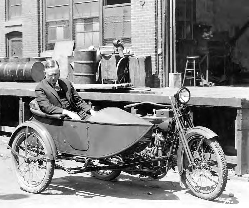
There were other factors at play during this time period that helped Harley-Davidson along, though. In 1913, the Lincoln Highway was dedicated, as one of the country’s very first transcontinental highways. Stretching from New York City to San Francisco, over more than 3,300 miles, and originally passing through more than a dozen states, it was also one of the first routes in the country to be designed with the growing driving population in mind. Then, of course, in 1926, Route 66 was established.
“The quality and construction of roads and the quality and construction of vehicles were influencing each other,” continued Jackson. As roads improved and expanded throughout the 1920s and into the 1930s, more Americans were encouraged to get behind the wheel and explore the country for themselves. “Instead of reading about Yellowstone Park, you could actually drive there and see it for yourself.”
Then, the Great Depression hit, and Harley-Davidson’s sales plummeted. Still, the company was able to persist, as motorcycles, compared to the automobiles of the day, offered a lower cost of operation. Whereas a car of the day might get 14–16 miles to the gallon, a motorcycle could get up to 30. Additionally, Harley-Davidson began to get a little creative with its offerings. At first, all the brand’s motorcycles were black. Then, gray was offered, then green. In 1933, however, Harley-Davidson introduced beautiful Art Deco designs, a decision that helped during an otherwise tumultuous period.
Throughout the World Wars, Harley-Davidson also acquired and maintained military contracts, creating motorcycles to U.S. Army specs. In fact, the company devoted nearly all of its motorcycle production during World War II to outfitting the Allies. Many of these were utilized as part of the World War II Lend-Lease Act, sent off to Allied countries for their use. Today, you can still find these motorcycles in some of the same countries. Harley-Davidson won three rare Army-Navy E
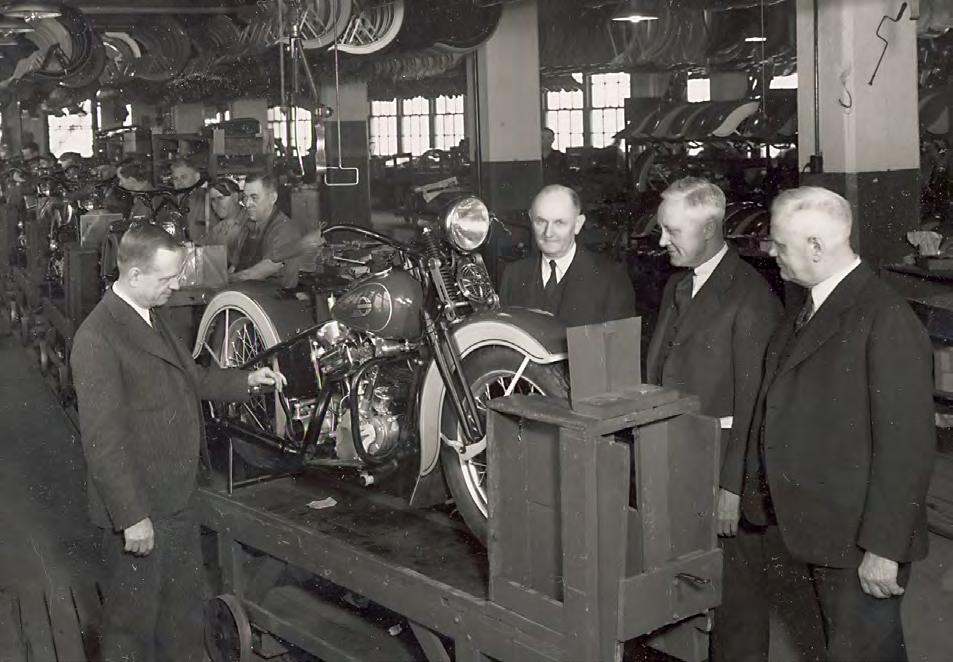
awards, which were presented to manufacturers for their “excellence in production” as part of the war effort.
In 1945, though, at the end of World War II, HarleyDavidson had sold even fewer motorcycles back home than it had in 1933: just under 1,500 units.
“When they came out of the war effort, Harley was well-positioned financially,” explained Canavan. “What they did not probably anticipate was the trend toward lighter, faster, more economical to operate, easier to ride and perhaps more exciting [motorcycles].”
American soldiers coming back from the European Theater wanted British motorcycles. Unfortunately, they were difficult to come by in the States, but rather than turning to Harley-Davidson, the veterans began purchasing war surplus bikes and customizing them to their own specifications.
Still, Harley-Davidson wasn’t just waiting around for public taste to swing back in its favor. It introduced a lighter competitor, the Model K.
“The Model K was a smaller engine, lighter weight and more performance oriented,” said Canavan. “We were migrating out of touring as a main purpose and out of industrial or municipal use and into sportier, less purpose driven, less economic-return kind of use of motorcycles and into entertainment and enthusiasm. HarleyDavidson’s marketing lassoed a bunch of Hollywood stars to ride their motorcycles, so they cranked up their PR engine. The Model K went on for a few years, and then Harley realized that ‘We’re really onto something here. This is tremendous.’ So, shortly after that came the Harley-Davidson Sportster, which was the lighter, quicker, enthusiast-type of motorcycle, as compared to, ‘I ride this to work because I get 41 miles to the gallon’ kind of commuter use.”
However, while Harley-Davidson certainly faced (and overcame) challenges in the Great Depression and right after World War II, there were more yet to come.
By the 1960s–1970s, Harley-Davidson was living off its traditional products. Meanwhile, production
tools were beginning to wear out. The company needed cash. All of that added up to a sale to American Machine and Foundry, or AMF, which manufactured a slew of products completely unrelated to motorcycles, from tennis racquets to skis, golf clubs to yachts. AMF began to reengineer engine configurations, and made significant investment into the brand, but ultimately, it didn’t cut it. So, in the early 1980s, a group of investors purchased the company.
“Things went from bad to worse,” said Jackson. “That was a challenging period, coming out of AMF. There was a perfect storm of catastrophically high interest rates and flagging motorcycle sales. Harley was contending with quality issues and the importation of bikes from both Europe and Asia. That’s the point at which, had Harley not made some of the decisions it made, it would not be here now.”
Those decisions included introducing its Softail series of motorcycles, changing the company’s manufacturing strategy entirely, and creating the Harley Owners Group (HOG). While motorcycle clubs had existed since the very beginning of motorcycles, Harley-Davidson describes its own as the world’s first factory-sponsored motorcycle club. It allowed dealers to really connect and engage with riders, keeping them coming back and interacting with the brand. Harley-Davidson also came out with the Evolution, or Evo, in 1984.
“The engine was designed to address a lot of the typical Harley-Davidson product issues. It had a belt drive. It had a five-speed transmission. There weren’t giant pools of oil underneath it after parking overnight,” explained Canavan. “The toughest [struggle at the time] was the Japanese entry into the heavyweight motorcycle market.” They offered viable brands and diversity, but Harley was able to stay afloat.
The 1970s and 1980s marked the period when HarleyDavidson and its riders really began establishing the image that many still associate with the brand today, that of freedom on the open road.
Arthur Davidson died at age 69 on December 30, 1950, in an automobile accident near Waukesha, Wisconsin, his wife Clara and two others were also killed in the crash, too. William S. Harley died of a heart attack in Milwaukee on September 18, 1943, at the age of 62. Far too early for both men. But if they were alive today to see what their dream, their motorcycles have become — an American icon — they would likely be proud.
Today, Harley-Davidson remains one of the most recognizable brands in the world. Its success has never been guaranteed, but through wars, economic downturns, technological advances, and shifting consumer tastes, the company has repeatedly found ways to move forward. In that regard, Harley-Davidson shares something with Route 66 itself: an ability to adapt while continuing to inspire and capture the imagination of travelers.
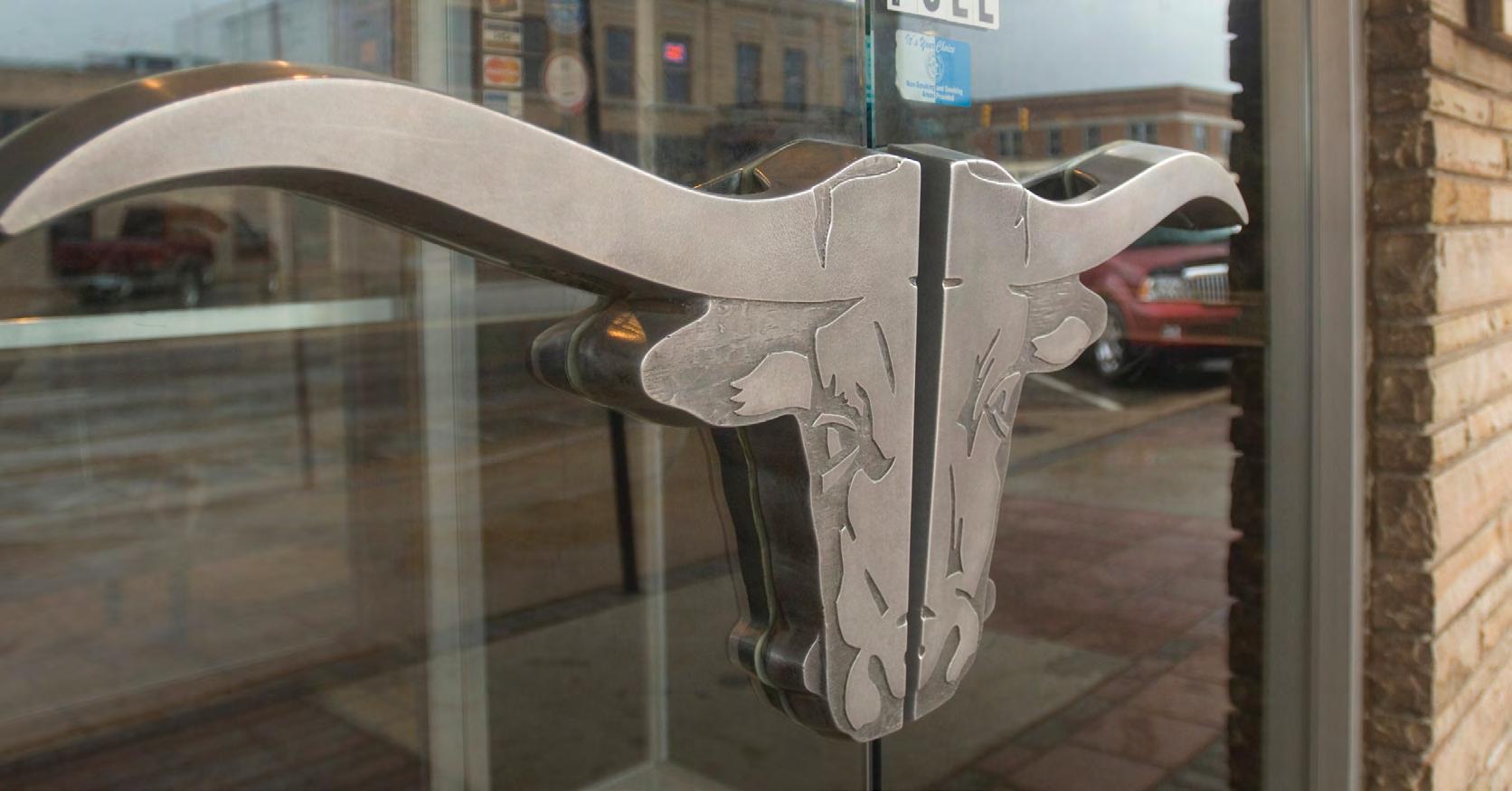

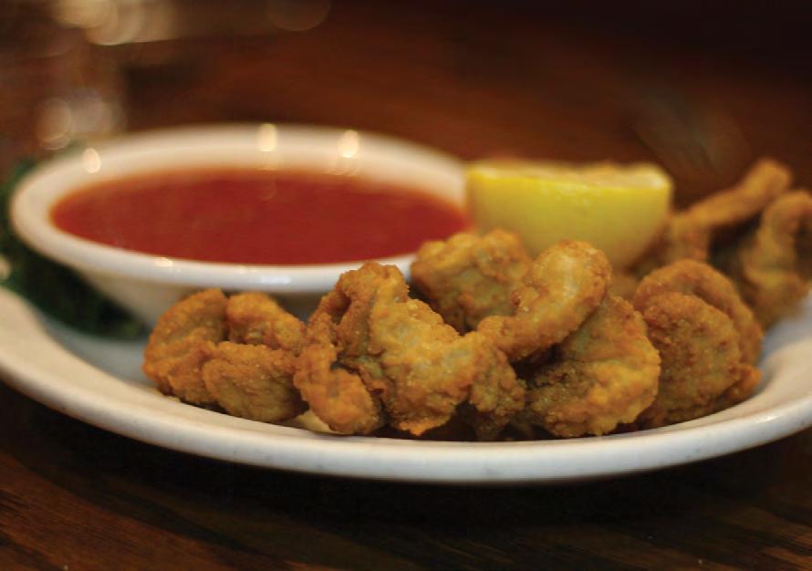
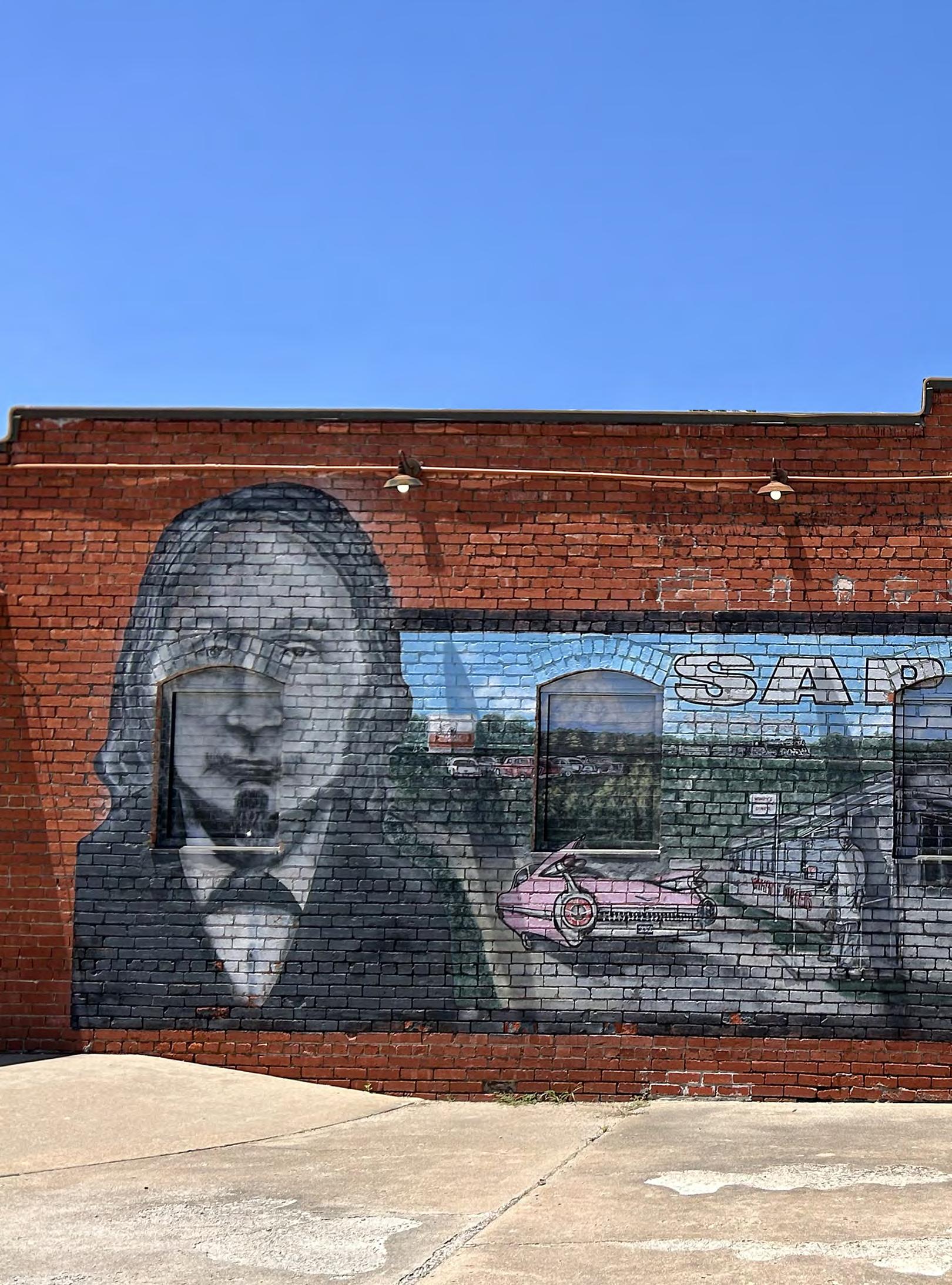
By Mitchell Brown
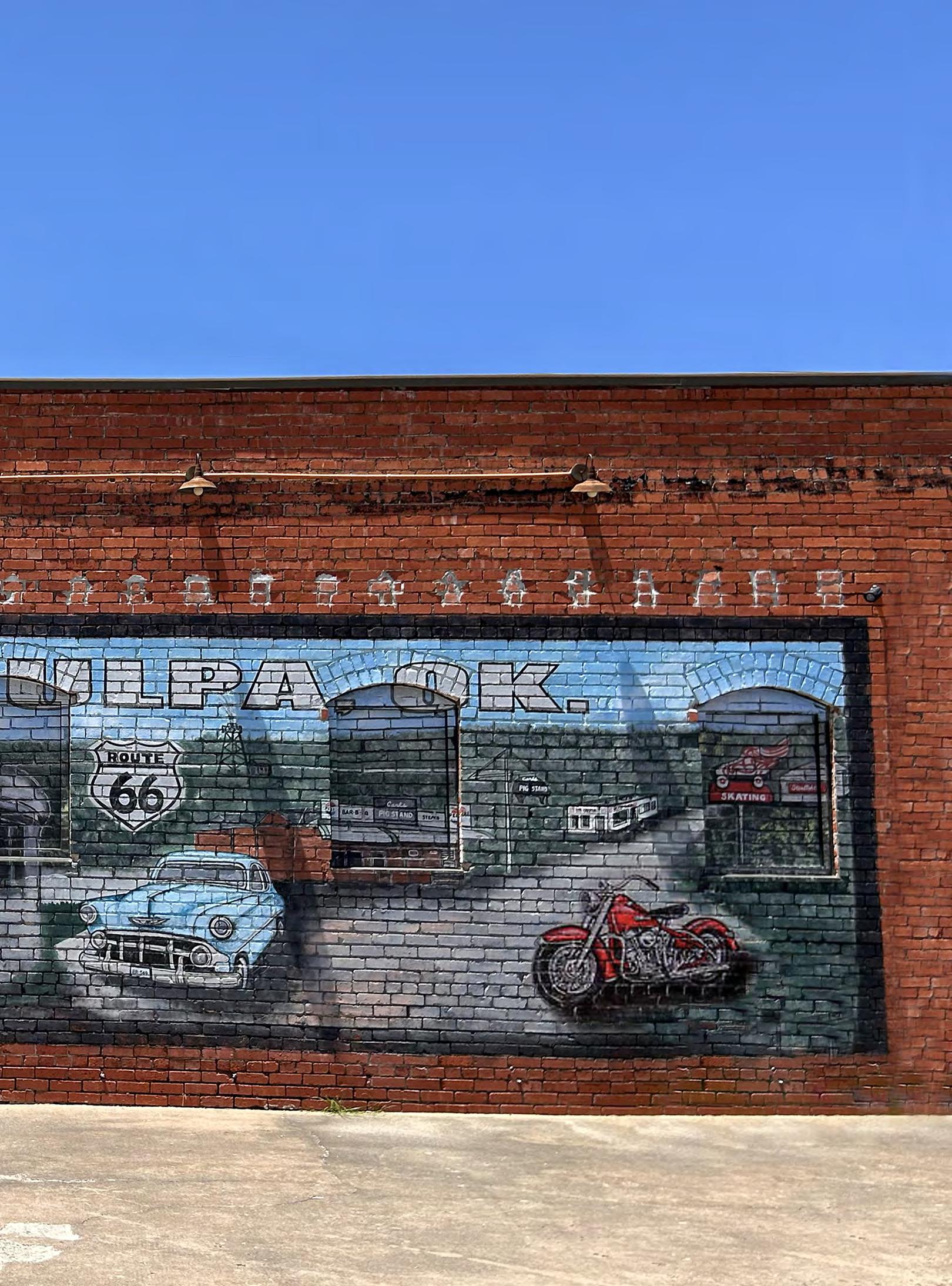
Once known as the “Oil City of the Southwest,” Sapulpa, Oklahoma, has gradually become known for something else as well: its murals. Throughout downtown and beyond, walls that might otherwise go unnoticed have been transformed into colorful works of art. Some celebrate the city’s history through nostalgic imagery, while others embrace a more contemporary style, together creating an outdoor gallery that reflects both Sapulpa’s past and its evolving identity.
Today, more than 40 murals can be found woven throughout the city’s streets, alleyways, and building facades. Some trace their roots back to the early days of automobile travel, when the crossroads of Route 66 and U.S. Highway 75 brought visitors through town and businesses used painted advertisements to capture their attention. One mural in particular, however, stands apart. Located just north of historic Route 66, east of must-visit Gasoline Alley Classics, and a few blocks from the Heart of Route 66 Auto Museum, it occupies a prominent place in downtown Sapulpa. Stretching across the side of the Reed Architecture and Interior building at 18 E. Hobson Avenue, the mural tells a story all its own.
From 2014 until 2020, the building at 18 E. Hobson Avenue housed the eclectic Signs of the Times. Known for its collection of vintage signs, classic Americana, and local memorabilia, the venue quickly gained the attention of residents. The building itself, however, had nearly been lost to neglect until Larry White, owner of Emco Termite & Pest Control, purchased the property in 2013. Looking for a place to house his growing collection of signs and memorabilia, White settled on the 5,000-square-foot building. However, the property was in undeniably rough condition and required extensive restoration. “If you could’ve seen the building before I ever started, there was a tree growing through the back,” said White. “All the way through the building! Nobody took care of it for years. We had to [completely] redo the inside and restructure the outside.”
It was during those renovations that White turned his attention to the building’s exterior wall and began work on a mural that remains one of downtown Sapulpa’s most recognizable pieces of public art. Prominently displayed near the building’s entrance, the 12-by-20-foot mural immediately draws the eye. It prominently features (Chief) James Sapulpa, the Creek leader for whom the city is named. A full-blooded Lower Creek of the Kasihta Tribe from Osocheetown, Alabama, Sapulpa arrived in the area around 1850 and established a trading post near the confluence of Polecat and Rock creeks, about a mile southeast of present-day downtown. Although he held the title of chief in name only, he became a well-known and respected figure in the region. His influence on the area’s early development was such that when the railroad arrived in 1886, the new stop became known as Sapulpa Station. Along with Chief Sapulpa’s profile, the mural showcases classic cars, motorcycles, and a drive-in theater, pieces of imagery associated with the city’s past, all of which were hand-picked personally by White and developed by local artist, Kenneth Hollingshead. “He
had done some other painting for me, and I saw some artwork that he had done in Okmulgee, Oklahoma,” noted White. “Every place that I put on there was a place to go in Sapulpa in the ’50s and ’60s. I tried to get everything back from the olden days. I’ve lived here so long that I knew all those places personally, and I wanted them all put on the mural so that everyone could remember the old joints of Sapulpa. I told him what I wanted, and he showed me a picture on a paper.”
The mural also depicts Wimpy’s Diner, one of Sapulpa’s famous local eateries and landmarks. Named for owner Whitney “Wimpy” Martin, whose nickname was borrowed from J. Wellington Wimpy of the Popeye comic strip, the diner operated out of a converted interurban streetcar that Martin purchased in 1932. After opening in 1934, the unique restaurant became a local landmark and a favorite gathering place for generations of locals.
The mural came together gradually. White began work on it while restoring the building and completed it within the first year of Signs of the Times’ operation. Along the way, he added painted horse heads to the windows beside the entrance, transforming part of the building’s exterior into the illusion of a stable. The horses were more than artistic whimsy, they were a nod to the property’s earlier history, when it reportedly served as a stable for the horses that pulled Sapulpa’s fire engine, before the city transitioned to motorized equipment around 1910. The fire station those horses served stood just two buildings away. Pre-2013 history of the structure has been largely lost to time.
Signs of the Times was open for seven years before closing in 2020. Over the years, White had transitioned to include live music, and the venue became a popular local event spot. Unfortunately, the workload became too much for White, who was still operating his termite and pest control business, so he decided it was time to step away. The timing proved fortuitous, as he closed the business on March 1, right before the COVID-19 pandemic shut everything down.
Later that same month, the property was then purchased by David Reed of Reed Architecture. Under Reed’s ownership, the art installation has been preserved and continues to serve as a popular backdrop for both visitors and local residents. “People come by all the time to take a picture of the mural. Last week, we had a couple from South Africa. We also have lots of Sapulpa High School students getting their senior pictures taken there, using the mural as a backdrop,” said Reed. “We are very grateful to have the mural as part of our building and love the history and the story it tells about Sapulpa.”
More than a decade after Larry White first envisioned the mural during the building’s restoration, it continues to do exactly what he hoped it would: remind people of the places, personalities, and stories that helped shape Sapulpa. So, if you’re cruising through town on your Route 66 journey, consider making a stop at 18 E. Hobson Avenue. There, amid the city’s growing collection of fantastic murals, you’ll find not just a work of art, but a lasting celebration of an Oklahoma town’s enduring heritage.

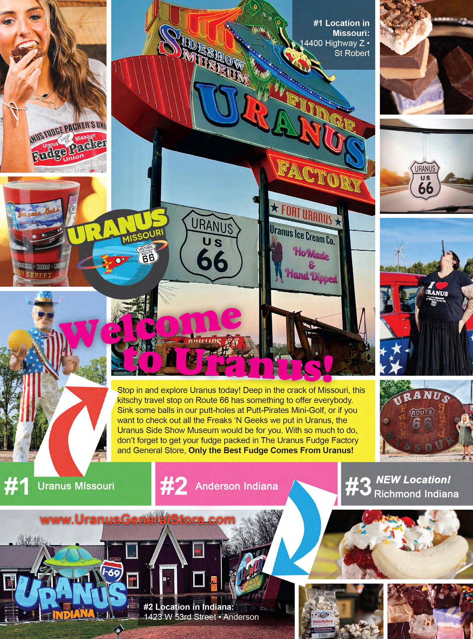
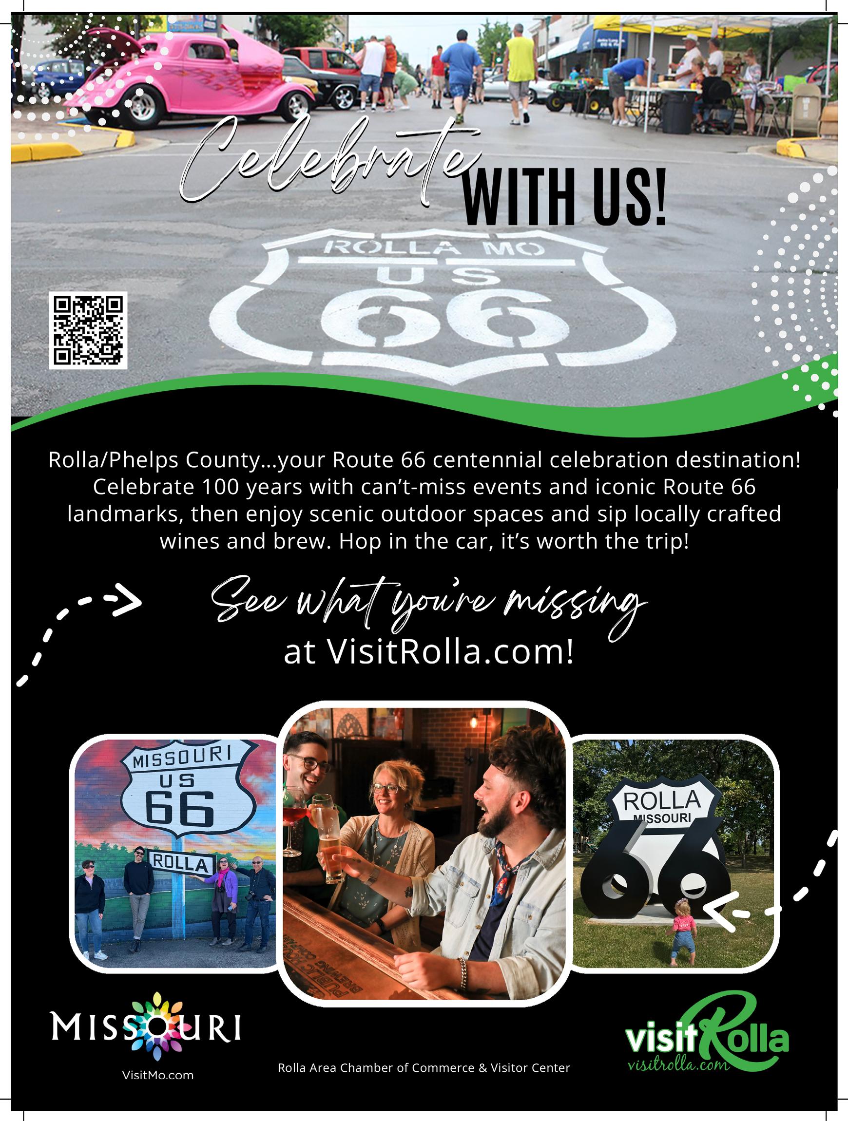
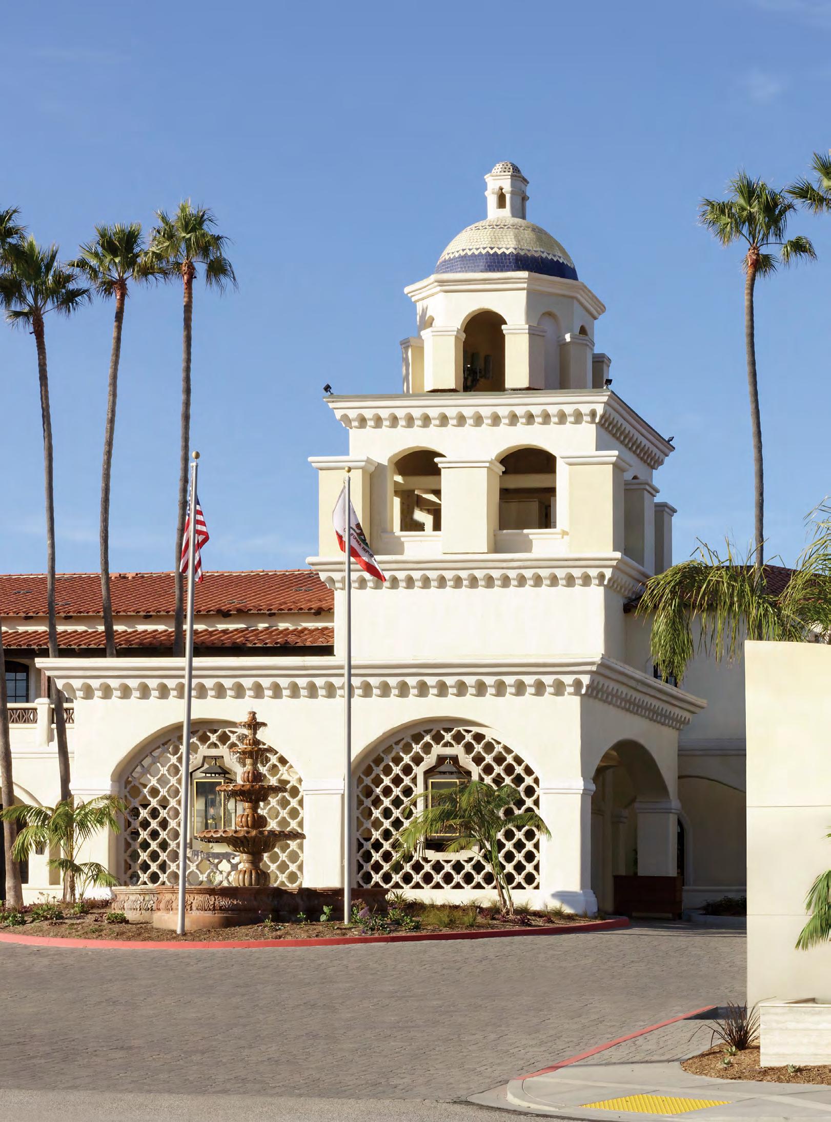
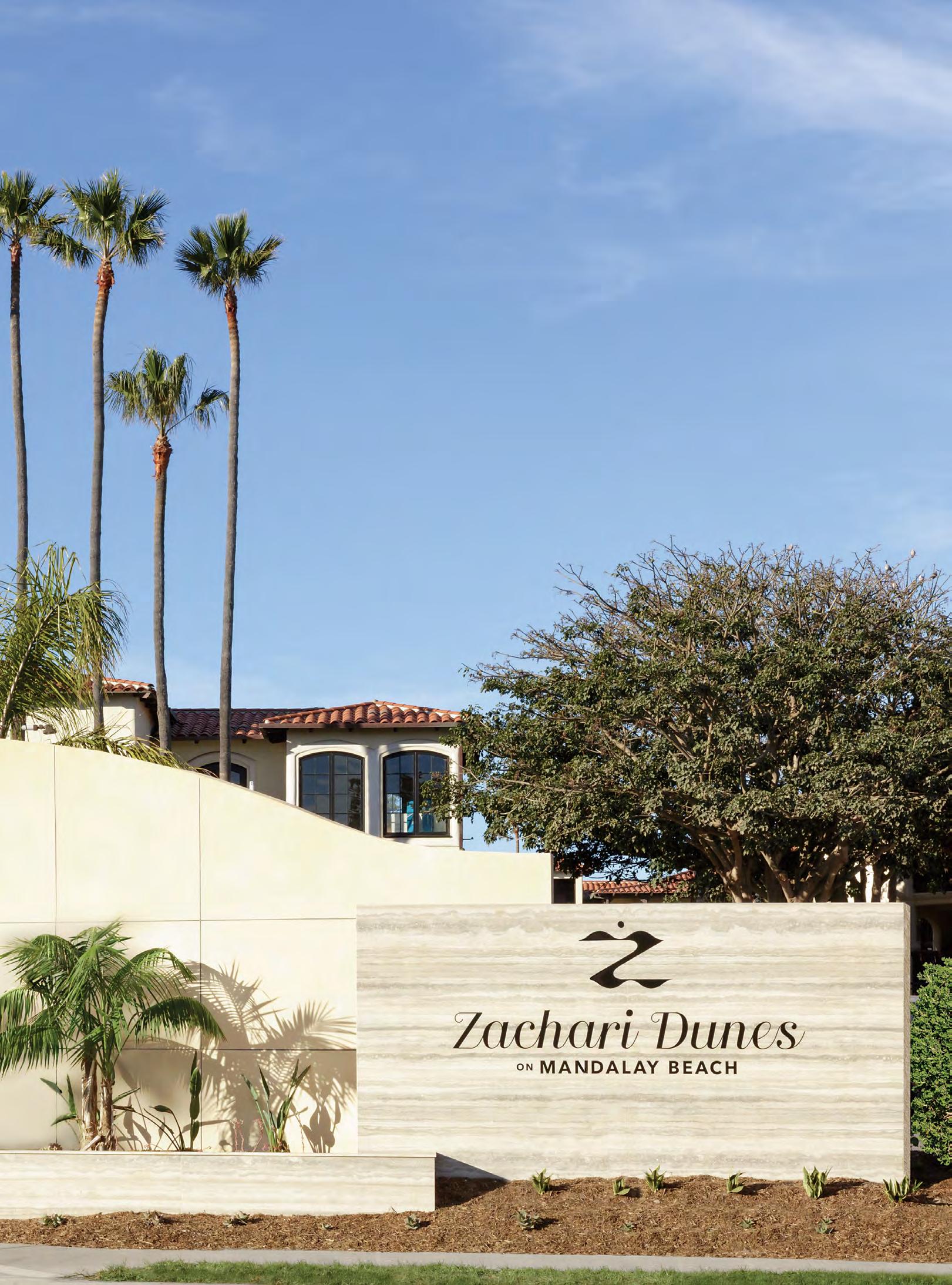
By Samuel Ender
In Santa Monica, California, a famous black-and-white wooden road sign reads “66” and “End of the Trail.” For many travelers, this sign marks the triumphant conclusion of a cross-country journey along the historic Route 66, the 2,488-mile highway that once carried Dust Bowl migrants west, fueled postwar road trips, and earned the nickname the “Mother Road.” For others, however, reaching the designated end of Route 66 is only the beginning of their West Coast adventure.
About 50 miles west of the Santa Monica Pier and roughly 40 miles north of the renowned shores of Malibu, a quieter stretch of coastline waits patiently beyond the spotlight. There, along the serene sands of Mandalay Beach, a hidden paradise invites families, honeymooners, and road-weary explorers alike with soft dunes, expansive suites, and wildlife dancing just offshore. It’s Zachari Dunes on Mandalay Beach — and it may be Southern California’s best-kept secret.
Towns across America boast rich histories, but Oxnard’s story is uniquely sweet. The city of Oxnard, home to Mandalay Beach and Zachari Dunes, was named after its founder, Henry T. Oxnard, a French-American entrepreneur who became one of the most influential sugar magnates in the United States during the late 19th Century.
Born in France in 1860 and raised in the American Midwest, Henry Oxnard and his brothers — Robert, Benjamin, and James — recognized the economic potential of sugar beets at a time when the U.S. was still heavily dependent on imported cane sugar. In 1891, the Oxnard brothers opened a sugar beet refinery in Chino, California. The factory proved enormously successful, benefiting from fertile soil and a growing domestic appetite for sugar.
But Henry Oxnard was not content to stop there. He turned his attention westward to Ventura County, where vast agricultural fields and a temperate coastal climate promised even higher yields. A Ventura farmer named Albert F. Maulhardt demonstrated that locally grown sugar beets would produce a higher sugar content, convincing Oxnard that the region was ideal for expansion.
In August 1899, the American Sugar Beet Company factory opened in Ventura County. It quickly became one of the most significant industrial operations in the region. The refinery processed thousands of tons of beets annually, and in doing so, it transformed an agricultural outpost into a bustling company town.
The factory created more than sugar. It created a city. Chinese, Japanese, and Mexican laborers arrived seeking opportunity, forming the backbone of the workforce.
Their contributions shaped the cultural fabric of the region, though not without hardship. Labor strikes and racial tensions marked the early 1900s, including a major 1903 strike led largely by Japanese and Mexican workers advocating for better wages. Schools, churches, and small businesses rose near the refinery, and the Southern Pacific Railroad established a spur line to transport what locals called “white gold.”
Oxnard initially hoped to pay homage to the area’s booming agriculture with a name reminiscent of those sugar beets: “Zachari,” derived from the Greek word for “sugar.” Accounts vary as to why the town never officially adopted the name—some attribute it to political disputes with state officials, others to a poor telephone connection with the Sacramento office recording the paperwork. Either way, the entrepreneur resolved the matter by lending the city his own surname. In June 1903, the flourishing town was formally incorporated as Oxnard.
More than a century later, the sweetness of that original vision lingers, not in beet fields, but in ocean breezes and soft dunes.
Today, a beachfront lifestyle resort keeps Oxnard’s sweet dream alive. Originally opened in 1986 as the Mandalay Beach Resort and Conference Hotel, the property debuted with 250 deluxe suites and six presidential suites spread across eight breezy acres of California coastline. Designed in a Spanish Colonial Revival style, it reflected the architectural traditions that define much of Southern California.
Its arrival, however, did not come without controversy. In the 16 years leading up to construction, environmentalists and residents voiced strong opposition to building on the pristine coastline. Coastal preservation efforts were gaining momentum throughout California in the 1970s and 1980s, and Mandalay Beach’s fragile dune ecosystems were a serious concern. Ultimately, developers and community advocates reached a compromise that limited surrounding development and preserved large stretches of open shoreline.
Now in 2026, the resort stands proudly — and notably alone — on the fluffy shores of Oxnard. There are no structures to the left for a quarter mile and none to the right for a full mile. The absence of neighboring highrises gives the property a sense of rare isolation along Southern California’s often crowded coast.
In 2022, the resort underwent a multimillion-dollar renovation and rebranding under RLJ Lodging Trust, a hotel investment company that owns more than 90 properties across the United States, including numerous hotels throughout California. As part of the transformation, the property joined Hilton’s Curio Collection.
The rebrand offered an opportunity to reconnect the property with its roots. The refreshed design introduced an open-air plaza, cozy fire pits, and a lighter, coastal color palette that mirrors Oxnard’s natural landscape. A revitalized lobby, new dining concepts, and updated suites signaled a fresh chapter, and with it, a meaningful name.
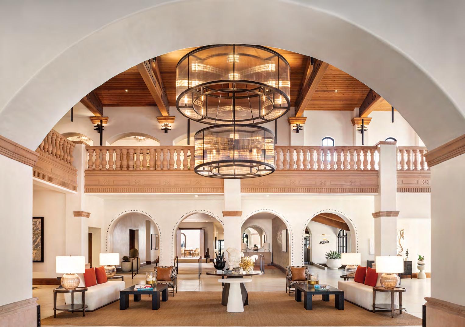
On October 1, 2022, Zachari Dunes on Mandalay Beach was born, finally granting Henry Oxnard’s original sugar-inspired name to the shoreline he helped establish.
Even before stepping onto the sand, guests at Zachari Dunes are welcomed by unmistakable West Coast charm. Terracotta Spanish tile roofs crown the 36,000-square-foot resort, while its white stucco exterior reflects the golden California sun. Grand archways frame entryways and courtyards, evoking the elegance of a coastal hacienda.
Inside, Mediterranean influence continues in ornate balusters and an impressive spiral staircase that cascades dramatically through the lobby.
When night falls, guests can retreat to one of the resort’s all-suite accommodations, each offering views of the ocean, pool, gardens, or the glowing Dunes Pyre fire pit. The Californian coast is a beautiful place, filled with many memorable destinations, but for the road tripper, the serenity and isolation of this beach just feels unique and perhaps rejuvenating after so many days on the road.
The sands are as white and soft as any in neighboring Malibu, yet remarkably uncrowded. Palm trees sway in rhythm with the waves, and wide dunes create a sense of privacy that feels increasingly rare in Southern California. On many mornings, you may find yourself
alone on a stretch of coastline that feels untouched.
“[We’ll] literally have an empty beach, and the sand dunes are so big and so fluffy,” said Tom LaVaccare, the Director of Sales and Marketing at Zachari Dunes. “There’s no house, no structure [near us]. Just a pure virgin, huge beach. We’re just the next beach town above Malibu. No one really knows about us. We’re still that hidden gem.”
Just offshore lies another treasure: the Channel Islands. Located about 15 miles from the coast, this five-island chain — Anacapa, Santa Cruz, Santa Rosa, San Miguel, and Santa Barbara — is often called the “Galapagos of America” due to its remarkable biodiversity. More than 2,000 species of plants and animals inhabit the islands, many found nowhere else on Earth.
The islands were once home to the Chumash people for thousands of years before European contact. Today, their cultural legacy endures, including in the renaming of Oxnard Beach Park to ‘olołkoy Beach Park, using the Chumash word for “dolphin.”
“It’s like Sea World live,” said LaVaccare. “We don’t have to pay a ticket. We just walk out to our beach, and we see these dolphins playing with each other, teaching each other how to swim and how to fish. And then we’re seeing the whales just right here off the beach. On a super clear day, which is regular, you see the nooks and crannies of the Channel Islands. You can see everything.”
Whale migration seasons bring gray whales and humpbacks past the coast, while dolphins frequently surf
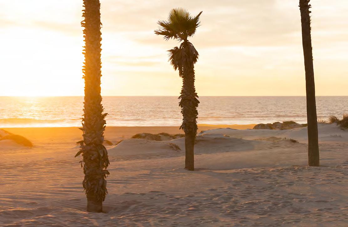
alongside boats departing from Channel Islands Harbor, located just a mile from the resort. Kayaking through sea caves, hiking windswept bluffs, or simply watching the horizon from shore adds a layer of adventure to an otherwise tranquil stay.
And when it’s time to return to the open road, Ventura County offers one of California’s most scenic coastal drives. Though it may be a detour from Route 66, the
spirit of the Mother Road lives on here with its wide skies overhead, the Pacific shimmering beside you, and possibility stretching ahead.
“Anyone who’s driving inland, they want to drive along the coast,” LaVaccare said. “And this drive is just lovely. Just north of us, when you get to Ventura, you want to hop on freeway 101. And then Rincon is kind of Big Sur-ish. If you’re going north, it’s mountain on the right, beach on the left, and there’s nothing else.”
Nothing except you, the highway, and views that linger long after the journey ends. Tune into 88.5 FM — the SoCal Sound — for a soundtrack of classic rock and ska, roll down the windows, and breathe in the fresh salt air.
The Mother Road may officially end in Santa Monica, but the spirit of exploration does not. Sometimes, the best discoveries lie just beyond the expected destination. And sometimes, they lead to soft, sugary sands, where history, ocean breeze, and open highway converge in the next great beach town.