
5 minute read
Getaways: The Chenes Route

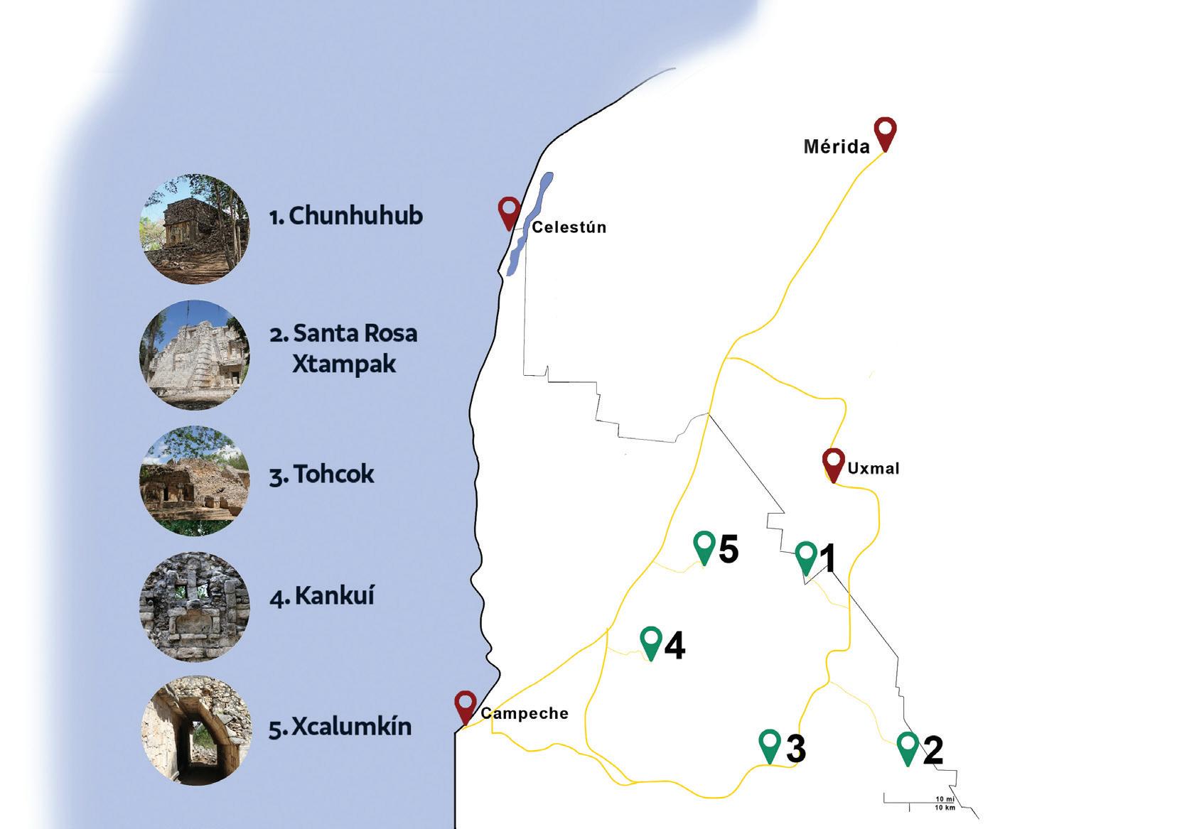
La Ruta de Los Chenes
Inspired by La Ruta Puuc, we present our very own archaeological circuit
TEXT, GRAPHIC AND PHOTOS BY CARLOS ROSADO VAN DER GRACHT
Aside from world-famous sites like Chichén Itzá, Uxmal, or Calakmul, the Yucatán Peninsula’s more obscure ancient sites are often difficult to reach.
Inspired by the idea of La Ruta Puuc, which was first promoted in the late 1950s, we present our very own archaeological circuit in the state of Campeche. We call it La Ruta de Los Chenes.
Nicknamed “La República de los Chenes,” Los Chenes also refers to a geographical area made up by several communities including Hopelchén, Komchén and Dzitbalché — which all share the suffix Chen, meaning watering hole or well in Yucatec-Maya.
Like with La Ruta Puuc, La Ruta de Los Chenes can be covered in a single day if you start early enough. But you will likely require
Santa Rosa Xtampak may be difficult to get to but is very much worth the effort. Below, an artist’s amalgamation of the region’s architecture and motifs.

an overnight stay if you want to include Uxmal or Santa Rosa Xtampak.
The circuit can be started from either Mérida or Campeche and includes the archaeological sites of Chunhuhub, Tohcok, Xcalumkín, Kankí, plus Santa Rosa Xtampak, for the ambitious explorer. All of these archaeological sites are open to the public but are extremely under-visited, so don’t be surprised if you find yourself alone in one or all of these spots.
As with La Ruta Puuc, there is no “right” order to visit these sites, but if you want to make the most of your day, we suggest the following order. Also, before we begin, remember to fill up your tank whenever you have the chance, as sometimes gas stations in the area run out of petrol and can be few and far between.
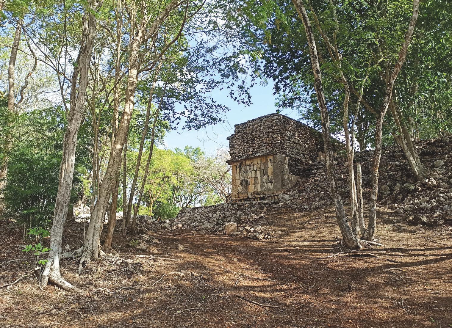
Chunhuhub
Meaning “next to the root” in Yucatec-
Maya, Chunhuhub is like many sites in the region, having apparently reached its zenith sometime in the 5th century. It had likely been occupied for several hundred years before that. The site has many structures, though only its main palace has been restored. It is also possible to observe several stelae preserved in a small hut next to the ticketing booth (which is also a small hut). The facilities are quite good and have adequate bathrooms and running water. Admission is free.

Like La Ruta Puuc, La Ruta de Los Chenes takes its name from the dominant architectural style of the region, though the influence of other styles is readily visible.
Santa Rosa Xtampak
Santa Rosa Xtampak is the heavy hitter of the Chenes route. It is believed that it was one of the most important city-states in the entire region and held under its yoke at least a dozen smaller communities. The site boasts several pyramids, residential complexes, and a structure that resembles Chenes’ Monster of the Earth facade but is known as the Snake Mouth Portal. The road to the site is treacherous and full of potholes, so make sure your vehicle is up to the challenge. Cellphone reception in the area is sketchy at best. If you decide to include Santa Rosa Xtampak in your itinerary, consider spending the night in the nearby town of Hopelchén. The entrance fee to the site is 45 pesos.

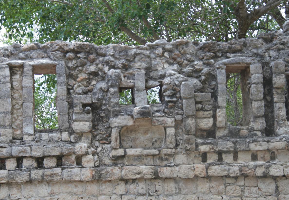
Tohcok
Tohcok is a recently restored site just a few kilometers from Hopelchén. In 1951, Tohcok was rediscovered and documented by Edwin Shook and the Russian-born Tatiana Proskouriakoff, one of the first and greatest women in Mesoamerican archaeology. In the YucatecMaya language, Tohcok roughly translates as “the place of the precious flint knife.” Though the site itself is relatively small, it is jam packed with fabulous vaulted structures and even frescoes depicting anthropomorphic creatures in red paint. The facades of the temples of Tohcok make ample reference to the sky god Itzamná as well as the rain god Chaac and the god of maize, Yum-Kaax. Entrance to Tohcok is free of charge.

Kankí
The archaeological site of Kankí shares its name with a nearby community in the municipality of Tenabo. It is likely named after a local species of agave, recognizable for its small yellow flowers. The site is full of impressive structures, notably an immense ceremonial complex adorned with Chaac roof combs (not your typical Puuc-style hook-nosed profiles). Your GPS navigation app of choice will likely be of little help in finding the site. The site is well hidden among corn fields. To make things even more complicated, the signage is poor and feels almost deliberately obtuse. Follow the signs as best you can, but when you come across the third one, just ignore it and go straight to the smaller road instead of continuing on the road that circumvents the entire field. Make sure to drive slowly; the road is not much more than a path, and getting stuck here would be pretty unpleasant. Entrance to the site is free.

Xcalumkín
There is debate regarding the meaning of the name Xcalumkín. Some insist that it roughly translates as “the place of good soil that receives the sun,” while others’ translations are closer to “window/entrance of the sun.” The site is among several rolling hills, some of which were used by the Maya as natural platforms for temples. Chenes and Puuc architecture are on full display, which makes perfect sense considering their geography. Driving toward the site, notice several other hills, many of which also sport the remains of ancient temples at their summits. Walking through these fields is not advisable, but not impossible. If you have a decent telephoto lens, photograph them from the road, as encountering a snake would be no fun. Entrance to the sight is free, and ample parking spaces and bathroom amenities exist.

