Appendix 4: Existing Infrastructure and Site Report
Introduction
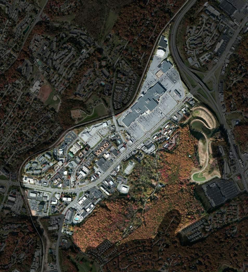
In 2016, Roanoke County began a planning study for roughly 390 acres along Route 419. Anchored by Tanglewood Mall, the area includes the South Peak planned community, vacant property owned by Old Heritage Corporation as well as numerous commercial, office and high-density residential uses.
As the largest metropolitan region in southwest Virginia, the Roanoke Valley offers a high quality of life that includes a strong school system, enviable outdoor recreation opportunities, and desirable communities, both rural and suburban. Yet, major shifts in the retail industry have had negative impacts on the area under study. Visitors to Tanglewood Mall and nearby locations can easily see the multiple store vacancies and other forms of disinvestment as signs of an area in decline.
The County wants to eliminate those misleading indicators. It also understands that to remain economically viable, this region must work harder to attract a skilled, diverse,
and creative workforce. The young, educated workforce it needs to build in order to draw new employers has demonstrated a strong interest in living in vibrant, urban areas, not conventional, drive-everywhere suburbs. At the same time, empty nesters and small families have turned in a similar direction. To meet this new market demand, traditional suburban areas across the U.S. have begun adapting auto-oriented commercial strips into pedestrian-friendly, mixed-use town centers and main street settings. With almost no vacant land available for development, the County has to look at previously built environments—including vacant storefronts—if it wants to compete in this market.
With its ideal access, strong demographics, and several large property owners, the 419 study area is an ideal candidate for this kind of redevelopment.
In order to identify the most realistic and achievable ways to get there, this planning
study began with comprehensive analyses of both the residential and retail markets. Both showed strong unmet demand, but the residential analysis in particular identified significant opportunity for mixed-use, town center-oriented development.
But a market analysis alone doesn’t produce a successful plan. It must involve a highly transparent community engagement and visioning effort in order to account for local tastes, opinions, and dreams. The 419 Town Center Plan process combined those two key elements, holding public-engagement events almost every month and organizing several online engagement initiatives. Hundreds of people got a chance to participate, provide input, and help create the overall vision and goals.
Over the course of the planning study, a dynamic new urban design framework emerged that calls for a highly walkable and bikeable mixed-use district that connects to the neighborhoods around it. Importantly, the plan emphasizes concrete implementation strategies for the next five years to ten years while also providing a comprehensive discussion of how the whole area can transform over the next twenty years and beyond.
With this 419 Town Center Plan, county residents, property owners, and businesses have begun shaping their future. This visionary
plan, grounded in market realities and shaped by residents’ deep love for the area, will guide the study area’s transition into an authentic and vibrant town center for the Roanoke Valley and Southwest Virginia.
Relationship to the Comprehensive Plan
The Commonwealth of Virginia requires that every locality adopt a Comprehensive Plan for “guiding and accomplishing a coordinated, adjusted and harmonious development of the territory … which will best promote the health, safety, morals, order, convenience, prosperity and general welfare of the inhabitants” (Code of Virginia 15.2-2223).
Roanoke County’s Comprehensive Plan states that it “is a blueprint for the future growth and development of the County over the next 1015 years. It provides direction and guidance for both the public and private sectors, in making decisions about land development, public services and resource protection. The Plan allows decision makers to study the longterm consequences of current decisions and recognize that today’s actions will impact the County for many years to come.”
The 419 Town Center Plan, which is proposed to be adopted into the Roanoke County Comprehensive Plan, will aid decision-making for future development in the Plan’s study area. This document is one in a series of area, corridor and community planning studies that aim to provide detailed, area-specific analyses and recommendations for the areas in which they are conducted.
Implementation
Implementation of the 419 Town Center Plan will be completed in stages over the next 20-plus years. Successful implementation depends on the necessary regulatory tools, continued community engagement, and appropriate financing policies that can encourage and guide private development along with strategic public investment. This Plan provides an overall vision for a mixeduse, multi-modal area with recommendations on how to achieve this vision. Specific implementation strategies will need to be studied and evaluated prior to any actions taken by the Planning Commission and Board of Supervisors. As this Plan is implemented over time, it will be necessary to review the Plan and its implementation strategies, and make revisions as needed to address changing conditions and any development impacts on existing public services. Keeping residents, businesses and the general public informed will also be critical as progress is made toward implementing this Plan.
Conceptual Renderings
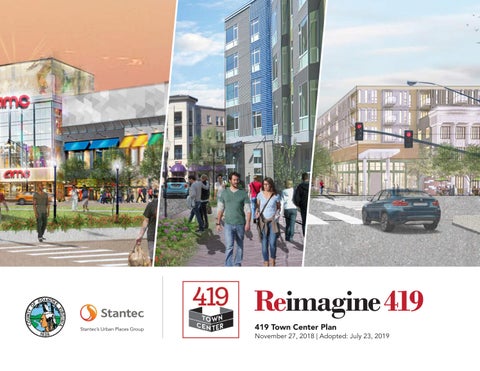
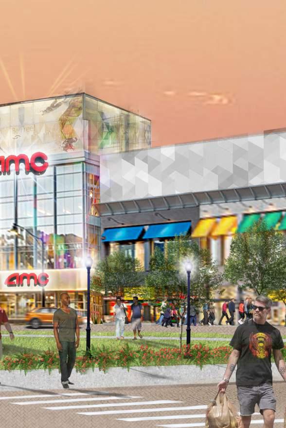
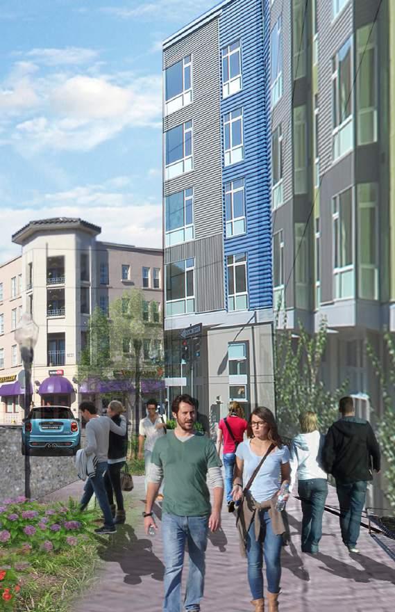
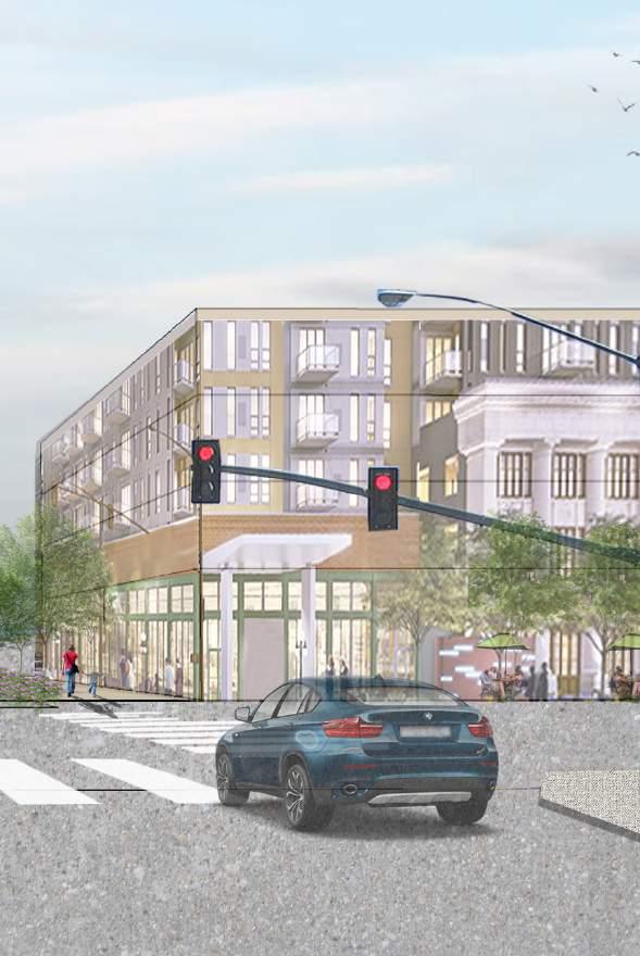
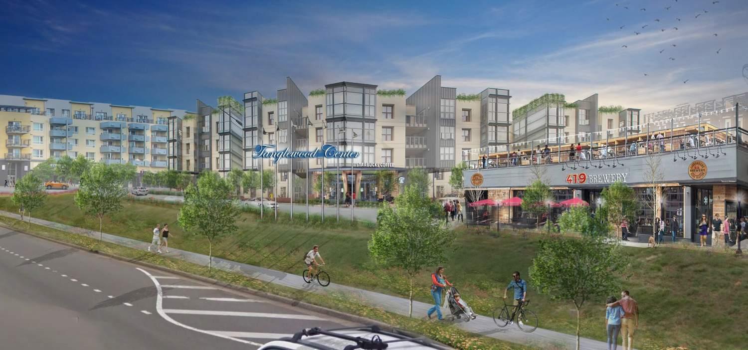
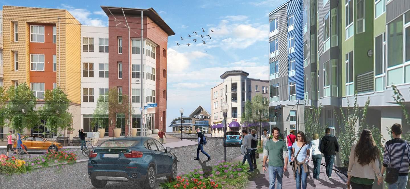
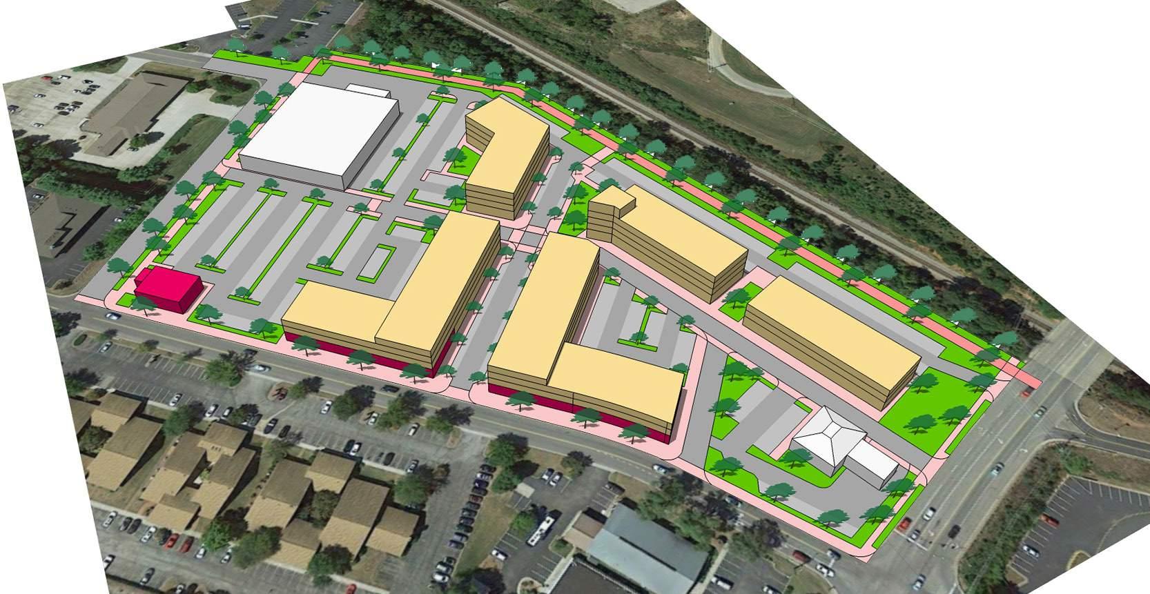
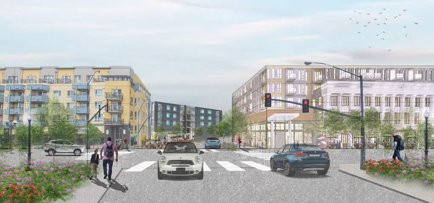
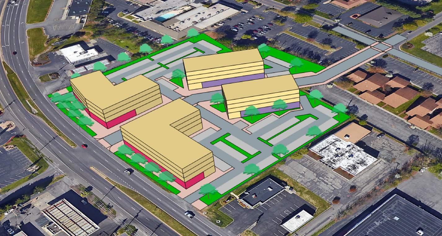
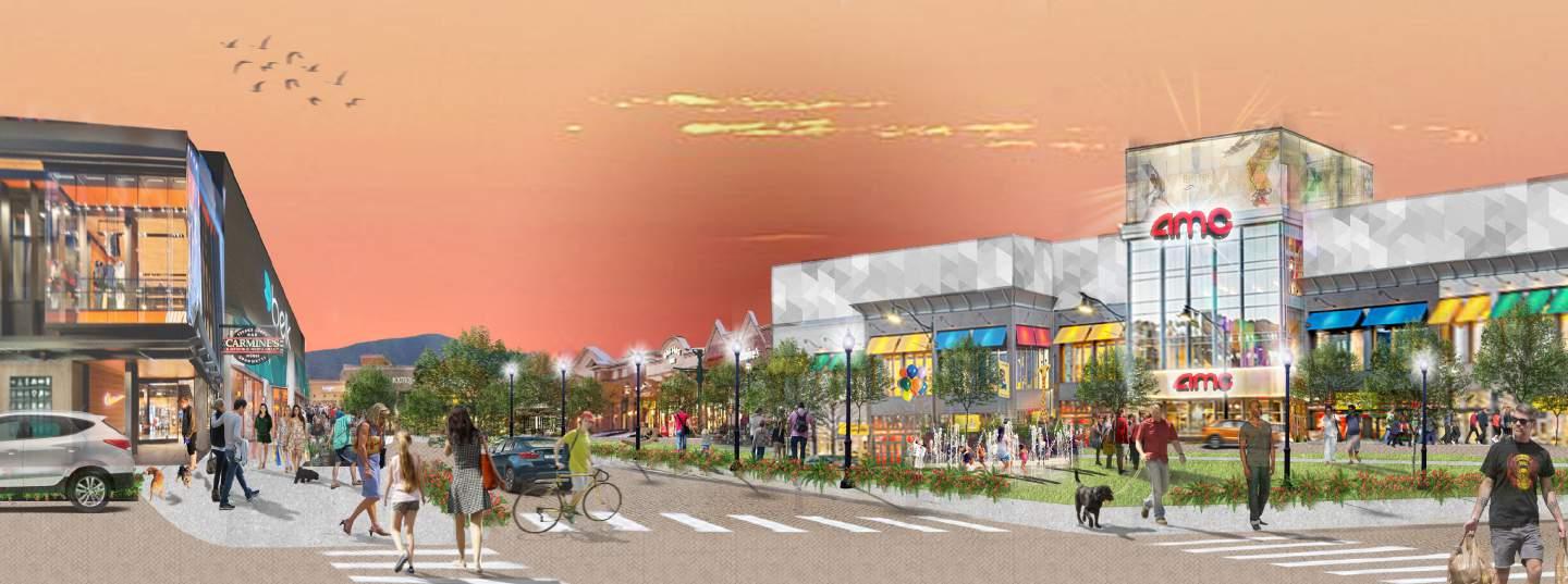
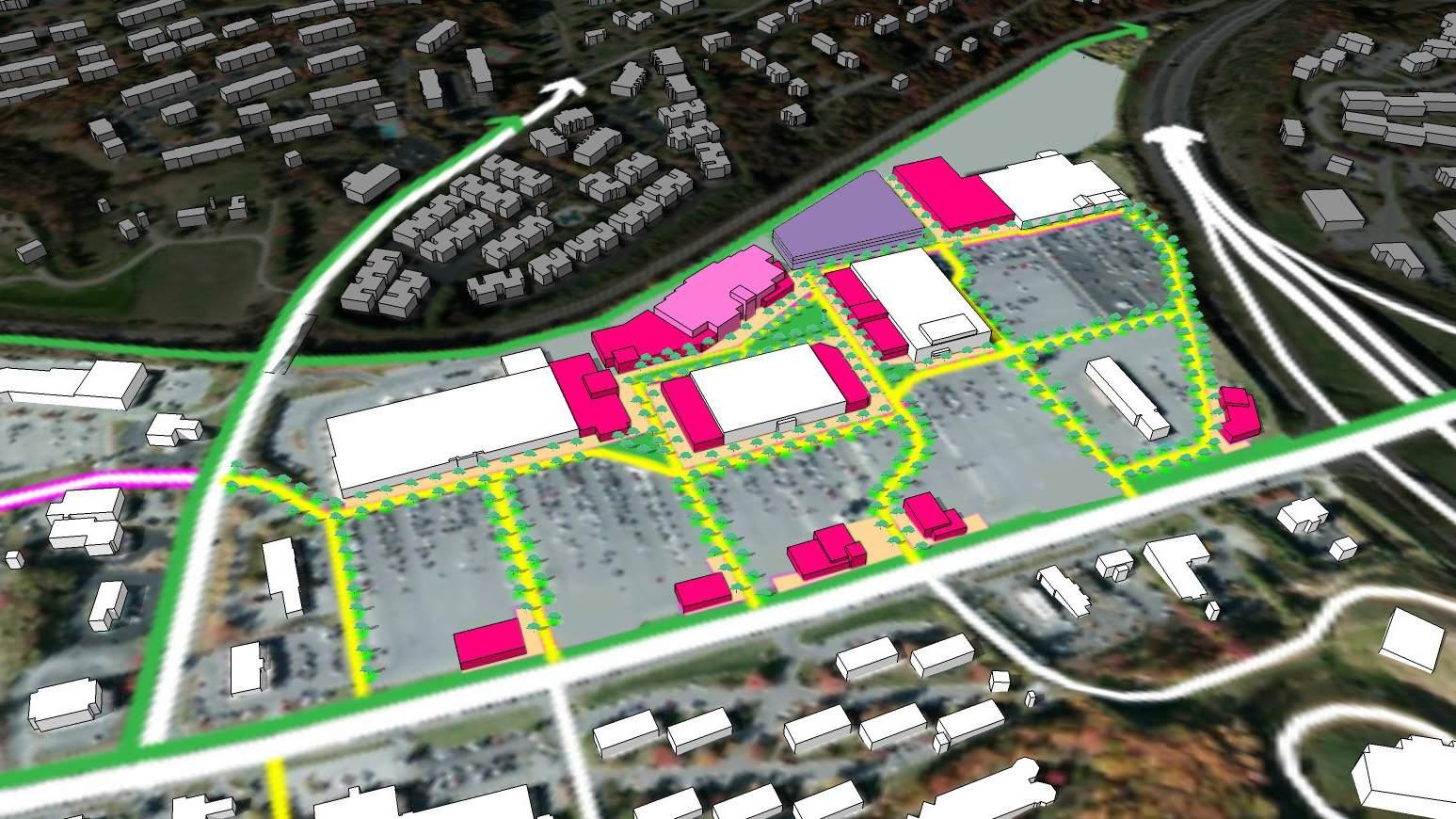
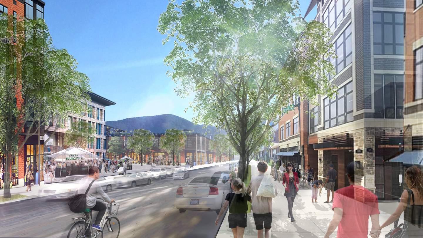
Throughout the 419 Town Center Plan document, there are numerous conceptual renderings. These renderings represent various design principles, elements, and concepts associated with a future town center development pattern and how they may be applied to a particular property. The conceptual renderings show a possible development scenario; however, this is not the only development scenario that could take place on that property. Development will happen over time on a case-by-case
basis. Staff will work with property owners, businesses, and developers to incorporate recommended design principles, elements, and concepts into each project.
Plan Structure
The 419 Town Center Plan is divided into several sections covering a different aspect of the plan and/or its development. The sections following this introduction include: a summary of the existing conditions; a summary of the residential and retail market analyses; an overview of the various community engagement activities; the Plan’s vision and principles; details of the Urban Design Framework including development types, circulation, the public realm, and green infrastructure; potential development scenarios for three catalyst sites – Old Country Plaza, Madison Square, and Tanglewood Mall; additional residential opportunities; and implementation steps and actions. Included in the Plan are four (4) appendices: Existing Conditions Report (Appendix 1); Residential Market Analysis (Appendix 2); Retail Market Analysis (Appendix 3); and Existing Infrastructure and Site Report (Appendix 4).
Existing Conditions Summary
The Route 419 Town Center Plan covers about 390 acres—roughly 300 football fields or three-fifths of a square mile. In 2011, Roanoke County staff analyzed 15 areas in the county for possible higher-density development and redevelopment under the State’s Urban Development Area (UDA) requirements. Of the areas studied, Tanglewood Mall ranked #1 and South Peak ranked #3 for areas with high-density zoning, existing utilities and good transportation access. While the Board of Supervisors did not adopt Urban Growth Areas at that time, the UDA analysis has been used for other planning efforts.
refer to Appendix 1. Existing Conditions report for additional information.
demographics within a one-mile radius of Tanglewood Mall
5,400 residents in 2,830 households
41 residents’ median age
$69,000 average household income
91% drive alone to work + 5.4% carpool
79% went to a family restaurant in the last six months
47% own a pet
owner-occupied housing
Source: ESRI; 2016
Tanglewood Mall Site
Zoning
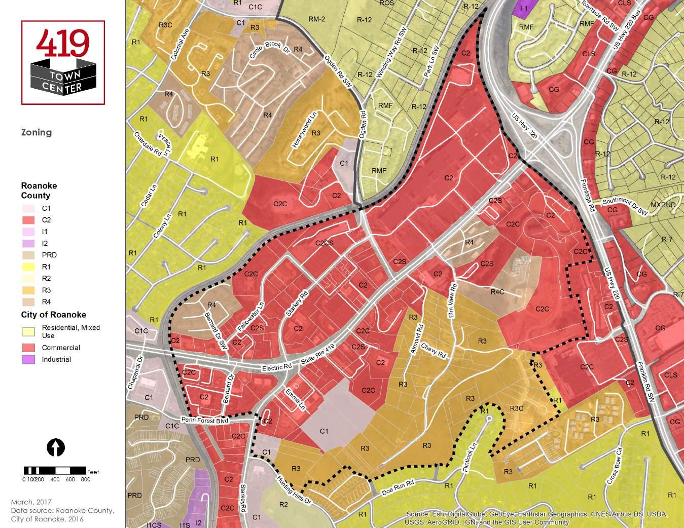
The study area currently is zoned for highdensity commercial and residential uses. The zoning breakdown in the study area is as follows:
C-2 zoning occurs throughout the study area, mainly for Route 419 frontage parcels and the South Peak development. Properties zoned C-1 are located at the end of Emma Lane. Properties zoned R-4 include the Copper Croft Apartments, the South Peak Condominiums, and Windy Hill Key Apartments. The majority of the R-3 zoned properties are located along Elm View Road. A zoning map of the study area appears on the facing page. Refer to the Zoning section of Appendix 1: Existing Conditions Report, for additional details.
The study area is primarily zoned for a mix of high density commercial and multifamily residential uses.
Roanoke County
City of Roanoke
Future Land use
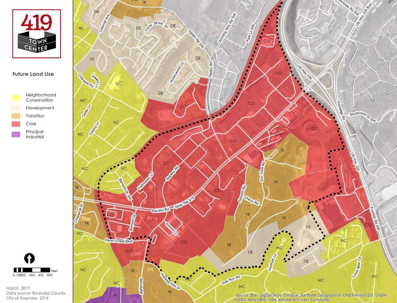
The Roanoke County Comprehensive Plan contains future land use maps and designations that provide a policy framework for future land use decisions within the County. The future land use designations identify which types of land uses are desirable within each designation and is used by the Planning Commission and Board of Supervisors in the evaluation of requested land use amendments.
The future land use breakdown in the study area is as follows:
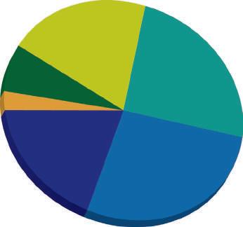
• Core: 71 percent
• Transition: 17 percent
• Development: 7 percent
• Neighborhood Conservation: 5 percent
Higher-density commercial and residential are recommended uses in the Core and Transition future land use designations, which account for 88% of the study area. A map of the study area’s future land use designations appears on the facing page. Refer to the Future Land Use section of Appendix 1: Existing Conditions Report, for additional details.
Mill Mountain Coffee sign, Roanoke
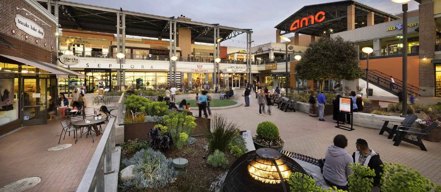
Higher-density commercial and residential on the Tanglewood Mall property
Topography
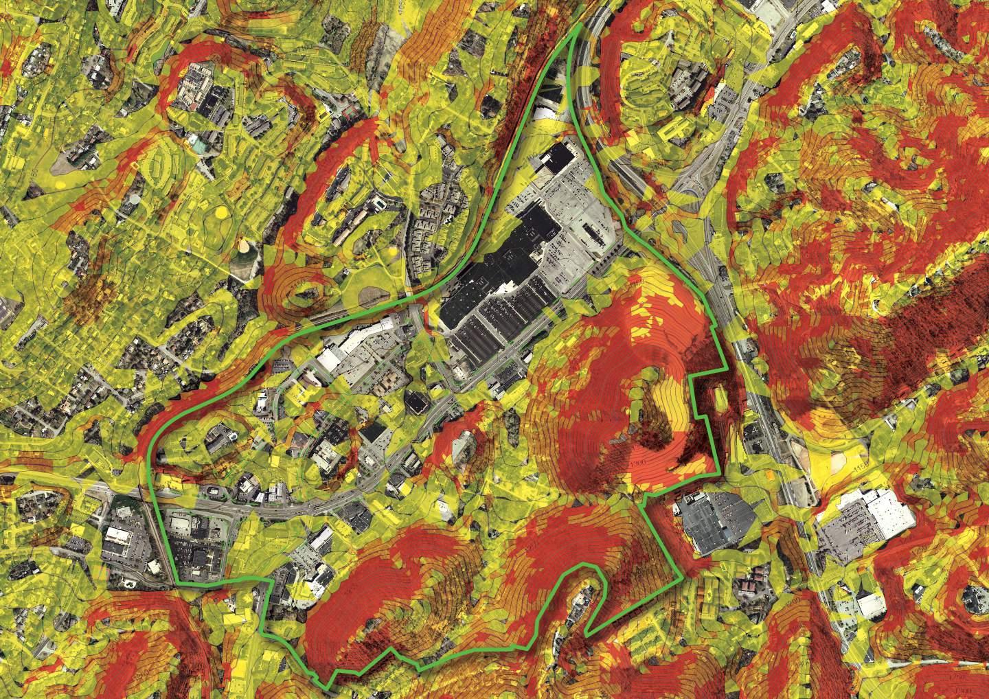
The topography of the 419 Town Center study area features some significantly steep terrain. The areas that are located on the southeast side of the study area (where the majority of parcels are owned by Smith/Packett or Old Heritage Corporation) are particularly mountainous, with the majority of the property over 15% slopes and a large amount exceeding 25%, as seen in the Topographic Map on the following page. This area features the majority of the steep 25% slopes for the entire area of study.
Development on the steep terrain will most likely require a larger amount of earthwork, as well as the construction of retaining walls, increasing construction costs. Recent construction, as a part of the South Peak development, demonstrates the extent of walls that could be necessary. Additionally, longer access drives and roads may be required to navigate across the excessive grade. While no geotechnical borings have been done as a part of this study, it is reasonable to expect to encounter rock while performing earthwork in this area.
The northwest side of 419 features slopes that are 15% or less and easier to be redeveloped. While some of these areas may require the use of retaining walls, the magnitude of that need is greatly reduced, allowing for development costs to be saved against the need for retaining walls.
The area immediately to the southeast of 419 features some steep slopes and existing retaining walls, however there is an opportunity for commercial redevelopment on approximately the first two hundred feet from the road, as these areas were previously developed and graded out.
The previously developed areas along the 419 corridor are fairly level, as they were graded out during the original development of these parcels. These areas include Tanglewood Mall and the Old Country Plaza at the corner of Ogden Road and Starkey Road, as seen in the areas featuring no shading in the Topographic Map on the facing page.
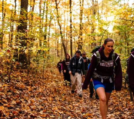
Hikers in Roanoke
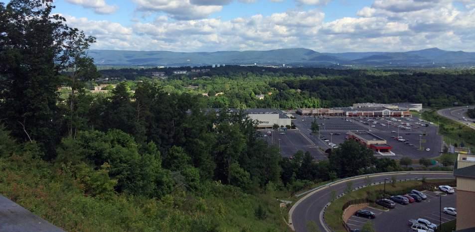
Looking over Tanglewood Mall from South Peak
Major (50’)
Minor (10’)
Contour Slope
Topographic Map Indicating Slope
Source: Timmons Group
Transportation
Traffic Counts
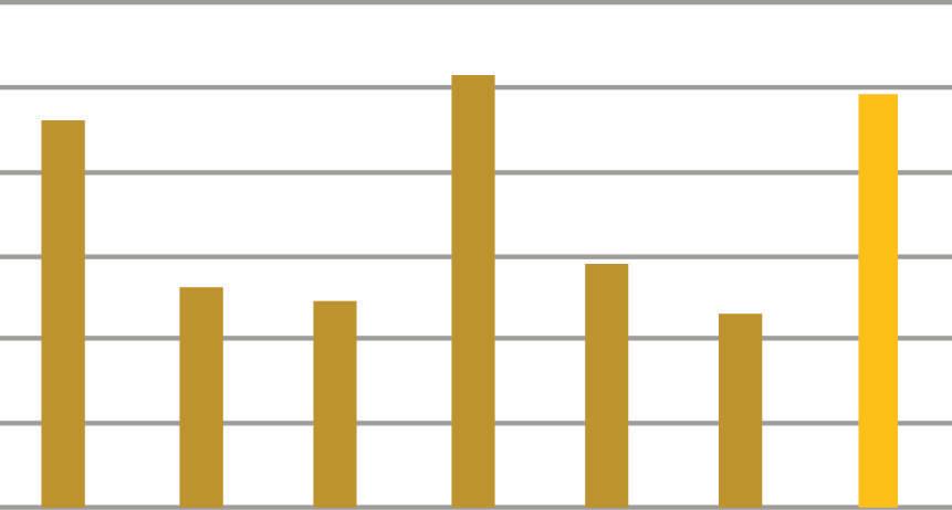
According to 2015 VDOT Annual Average Daily Traffic Volume Estimate data, the section of Route 419/Electric Road between US 220/ Franklin Road in the City of Roanoke and Starkey Road in Roanoke County is the thirdbusiest road segment in the Roanoke Valley. The busiest segment is US 220 between Elm Avenue and Wonju Street (64,000 trips), and the second-busiest is US 220 between Wonju Street and Business Route 220/ US 419 (49,000 trips). Traffic counts for US 220 and Route 419 from 2014 to 2017 are listed below:
Transit
Valley Metro bus service currently serves Tanglewood Mall and has stops on Route 419 between Ogden Road and US 220 and has stops on Ogden Road between Route 419 and Colonial Avenue.
Pedestrian and Bicycle Accomodations
Pedestrian conditions within the study area vary greatly. While they are relatively safe within each of the existing developments, there is very little to no connections between areas in the corridor. Limited bicycle amenities currently exist in the study area and the closest greenway trail (Murray Run Greenway) is a mile away from the study area.
Route 419 Transportation Improvements
Smart Scale funding was approved in 2016 for a multimodal project along the most congested part of Route 419, between Ogden Road and US 220. The estimated cost for this project is $5.8 million. Preliminary Engineering is currently underway, and the project is planned to be completed by 2022. Refer to the Transportation section of Appendix 1: Existing Conditions Report for additional project details.
Traffic counts for route 220 and route 419 from 2014 to 2017
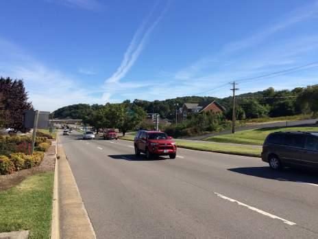
Existing conditions on Route 419 at Tanglewood Mall
Infrastructure
The existing utility infrastructure was evaluated throughout the corridor, using information gathered from existing drawings, site data, and a group of interviews with the utility providers in Roanoke County on October 11, 2016. In general, the wet and dry utilities did not feature any deficiencies of particular concern, as utilities were not only in good working order, but also had adequate capacity. Furthermore, improved broadband capabilities have been completed, improving connection and reliability throughout the study area.
Water and Sanitary Sewer (Wet Utilities)
Water and Sewer are provided in and throughout the study area, with both systems operated by the Western Virginia Water Authority (WVWA). The existing systems are appropriately sized for future development, with capacity for both water and sewer available.
While there are some unique existing elements, such as the interior waterline at Tanglewood Mall owned by the WVWA or a few private sanitary lines, there are no concerns for future development. Any redevelopment of the existing sites would require that water and sanitary lines be placed in easements, alleviating any existing operational concerns. The sanitary system drains to the Roanoke Regional Water Pollution Control Plant, which
has a capacity of 55 million gallons per day (MGD), but currently sees an average daily flow of 37 MGD. The redevelopment of the corridor will not put any unnecessary strain on the treatment plant, as it has more than adequate capacity for additional development.
Electric, Gas, and Broadband (Dry Utilities)
Meetings with Appalachian Electric Power and Roanoke Gas confirmed that both utilities are available to provide supply to any redevelopment in the area. Both services, power and gas, noted that the existing infrastructure would support increased useage and that improvements and service could be expanded during redevelopment to meet the needs of new residential and commercial development.
In October 2017, the Roanoke Valley Broadband Authority completed a fiber expansion project, which broadened the bandwidth throughout the region. This phase expanded the fiber network 25 miles, with a portion of this running through Electric Road corridor. This expansion provides high speed (200 gigabit) fiber through Electric Road, providing a pure play optical network with low latency.
Stormwater
Currently, the majority of the study area just off of Electric Road is highly impervious. This will allow improvements to occur with the benefit of the redevelopment guidelines, as outlined in the Type IIB Stormwater guidelines. These guidelines, which make use of the Runoff Reduction Method Spreadsheet, will require redevelopment of impervious surfaces to treat approximately 20% of the generated pollutant load.
In addition, flow runoff from future development in the currently developed areas will benefit by being able to more easily meet the requirements of the downstream channel. The downstream channel, if inadequate, requires analysis to demonstrate that the postdeveloped flow rate is equal or less than the pre-developed flow multiplied by a reduction factor and a ratio of the predeveloped volume to the post-developed volume. This ratio for the highly impervious existing parcels could be greater than one, especially if some green spaces are added as a part of the revitalization. Lastly, the existing storm infrastructure appears to be in good standing. The largest concern is the stormwater infrastructure at Tanglewood Mall, as a large pipe runs underneath the existing building. This issue would need to be addressed and resolved during future development.
Market Analysis
The market analysis conducted for the 419 Town Center Plan focused on the residential and retail markets, and the findings indicated that both had strong potential. (Due to the current amount of existing office space and the low rents that they generate, it was determined that an office market analysis was not needed.) Detailed reports appear in the appendices; key findings are highlighted below.
residential
This analysis identifies the depth and breadth of the market for newly-introduced housing units that could be developed in the area surrounding Tanglewood Mall. The study details the optimum market position for a residential component, to be constructed in conjunction with commercial uses, and the target residential mix for 400-500 new higherdensity dwelling units that could be developed in the study area over the next five to seven years.
The depth and breadth were determined by analyzing the housing and neighborhood preferences and financial capacities of “draw area” households—identified through Zimmerman/Volk Associates’ proprietary target-market methodology. This technique
includes analysis of migration, mobility and Geo-demographic characteristics of households currently inside defined nearby areas. The full report appears in Appendix 2: residential Market Analysis.
retail
As part of the new 419 Town Center Plan, a comprehensive analysis of the area’s retail market was completed. It found that this location is well-positioned in the Southwest Roanoke market for both its existing retail and new retail development.
Existing Conditions
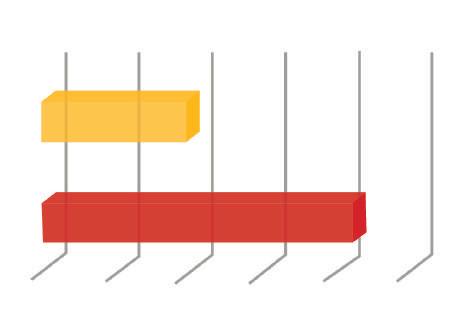
Roanoke is a regional shopping hub that can attract shoppers from more than 60 miles away. As the table on the right indicates, shoppers from outside the Roanoke Valley account for almost 40% or approximately $600 million in sales. This level of sales indicates another opportunity to increase retail levels and choices within the study area.
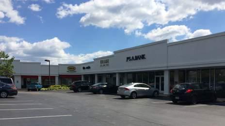
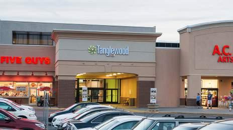
Some existing conditions will have an impact on how the area can be transformed into a town center. Tanglewood Mall accounts for approximately 800,000 square feet, with a mix of anchor tenants (such as Belk and T.J. Maxx Homegoods) and numerous interior storefronts, many of which are vacant or used for non-retail purposes. An additional 1,000,000 square feet of commercial properties and smaller shopping locations lie within the study area. There are 18 eating and drinking establishments in the area.
Each property within the study area comes with characteristics that can complicate redevelopment. For example, the major
rETAIL ExPEndITurE PoTEnTIAL Vs. sALEs ROANOKE COUNTY, ROANOKE CITY AND SALEM
ESRI; 2016
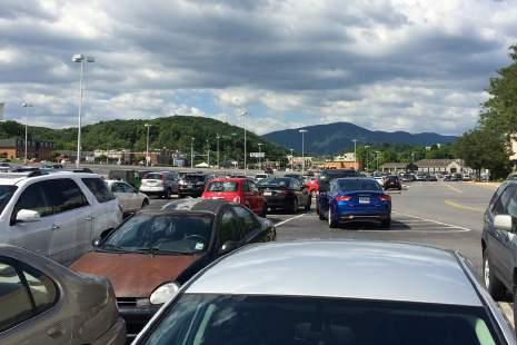
department stores and other mall anchor tenants have long-term leases that include control over the parking in front of their stores. The department stores value their high visibility strongly—42,000 vehicles pass each day along Electric Road—and will not easily allow development that might reduce it.
However, as the retail analysis shows, the future success of this area will depend on different retail patterns that occur within town center/open air shopping environments. To
remain viable in the future as well as to take advantage of the value that can come with higher density, mixed-use development, many businesses and property owners will see the benefit of adapting their retail formats. However, changing parking conditions and other configurations that are regulated by leases will very likely require both approval and, potentially, compensation.
Market Expenditure Potential
Market Sales Source:
Demographics
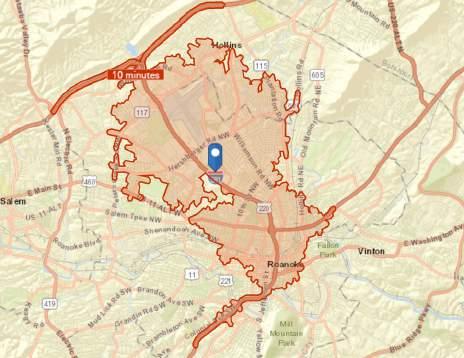
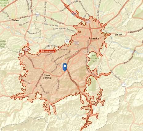
More than 64,000 people live within a 10-minute drive of the study area. In comparison, only 48,000 people live within a 10-minute drive of Valley View Mall. This regional mall, with more than 1 million square feet of retail space, is located on the north side of Roanoke City and is approximately 10 miles (20-minute drive) from the study area.
Key Findings
• Households near Tanglewood Mall have high educational attainment levels. This is important: higher-end retailers—which the community wants to attract—increasingly use this metric to help determine where to locate new stores.
rEsIdEnTs WITH BACHELor’s dEgrEE or HIgHEr
Source: ESRI; 2016; W-ZHA
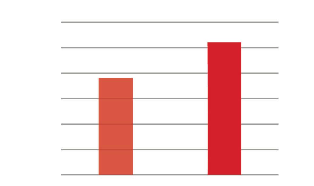
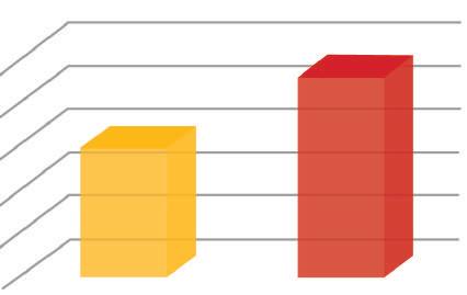
• The surrounding demographics are strong. Households near Tanglewood Mall spend close to the national average on clothes and services, significantly more than the households surrounding Valley View Mall (the average family spends approximately $1,700 a year on apparel and services). In addition, the households near Tanglewood Mall have significantly higher average incomes and per capita incomes than households near Valley View Mall.
Valley View
Valley View Tanglewood Source: ESRI; 2016; W-ZHA
Key Findings
These findings highlight the opportunity for attracting additional retail to the study area.
• Moody’s Analytics projects that jobs in the Roanoke Metropolitan Area will grow by 5.6% between 2015 and 2025. This will have a significantly positive impact on supporting existing and new retail, as increases in jobs translates into increased consumer spending.
• The 419 Town Center study area is a prime location for community shopping because of the road network, traffic counts (42,000 vehicles per day) and visibility from both Routes 419 and U.S. 220.
• The retail analysis found that the high number of vacancies at Tanglewood Mall is not due to the retail market, which is stronger than in many comparably sized cities (see the comparison chart). Rather, the problem lies in Tanglewood’s format: interior storefronts do not align well with community-oriented retail. This finding presents a strong indication that the market is open to alternative retail choices.
• According to the analysis, this is a prime location for restaurants, with a market opportunity for 15,000–20,000 square feet of new restaurants. This demand would increase if the area shifts to a more walkable, pedestrian-friendly environment.
rETAIL sALEs PEr CAPITA
* Net of vehicle, gas, and non-store sales. Sources: ESRI, 2016; W-ZHA
• Overall, there is the potential for up to130,000 square feet of new retail within the study area and immediate surroundings. This figure does not take into account the numerous vacant interior storefronts within Tanglewood Mall. When those are accounted for, there is the opportunity for more than 175,000 square feet of retail within the study area.
• retail—75,000–110,000 sq Ft
» Anchors: $8–$10/ Sq Ft
» In-line shops, lifestyle: $28–$30/ Sq Ft
» In-line shops, other: $18–$22/ Sq Ft
» Tenant thoughts: Trader Joe’s; Total Wine; Sports; Shoes; REI
• Eat/drink- 15,000–20,000 sq Ft
» High-middle income target
» Fast casual, full-service
» International, healthy
» Tenant thoughts: Starbucks; Texas de Brazil; Saha Med Grill
» Large: $14/ Sq Ft
» Small: $20/ Sq Ft
Source: W-ZHA
Market Potential for 419 Town Center
Community Engagement
From the start of the 419 Town Center study, Roanoke County set a framework for a comprehensive, fully transparent community engagement process. In addition to traditional public meetings, unique events such as a Planning Night, aimed at young professionals, and a high school workshop were held so that a diverse cross-section of Roanoke Valley residents could participate in the planning effort. Multiple online engagement tools created avenues into the process that allowed other residents unable to take part in person to weigh in on the plan and help develop the vision. In total, more than 500 individuals participated in this planning effort. The staff also visited more than 170 businesses in the study area, in person, on three different occasions.
kickoff Event
Overview
September 15, 2016, marked the official launch of the 419 Town Center planning process. The event took place at the Holiday Inn Tanglewood at 4468 Starkey Road from 6:30 p.m. to 8:30 p.m. More than 150 participants took part, working together to provide insights into what they hoped to see for the future of the 419 study area.
A series of posters highlighted some current conditions within the area, including land use, land values, and key demographic data on the surrounding community. This information appears in Appendix 1: Existing Conditions report of this document.
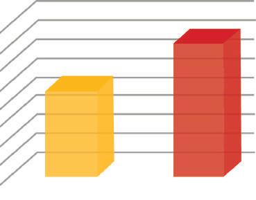
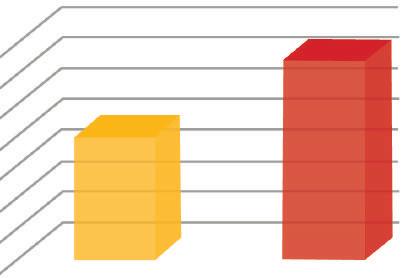
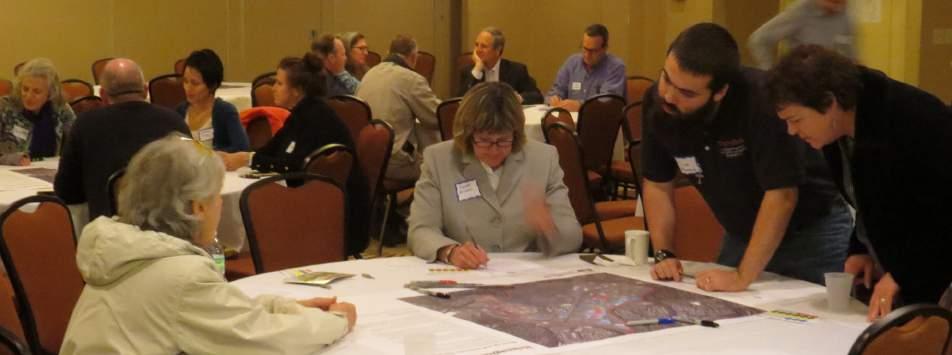
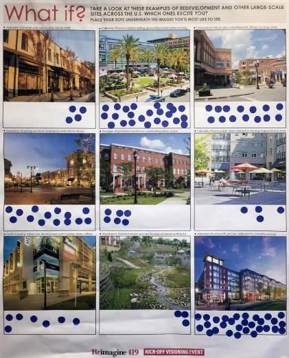
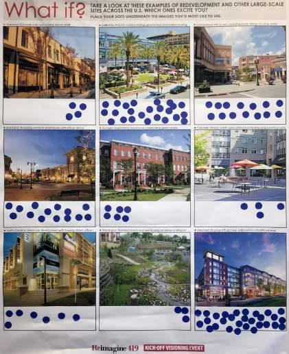
As participants signed in, they were asked to complete a visual-assessment exercise by reviewing two posters with images from town and lifestyle centers across the United States. Images included outdoor eating and shopping areas, Main Streets, small public spaces, and mixed-use buildings with retail, commercial, and residential uses. Participants received five adhesive dots each and used them to indicate which images they found most appealing.
As the images to the right show, the responses varied widely, but some key concepts were favored. These included:
• Shared public, outdoor space
• Active first floors in mixed-use developments
• Green space
• Activities for children
Presentation
The event included a presentation that focused on shifting demographics and how they could create beneficial outcomes for the study area.
The presentation concluded with a discussion of how the consultant team would begin to analyze the study area and how they would approach the planning process. An overview of the community engagement approach was provided, and it was noted that this study would take place over the next 6-8 months. The importance of transparent community engagement throughout the planning initiative was emphasized.
Community Workshop
Following the presentation, attendees participated in a community visioning workshop that included an individual and a group exercise. The goal was to develop a sense of the community’s understanding of what a town center is and to encourage people to begin thinking about what they wanted in this area. Working collaboratively, participants compiled lists of strengths and weaknesses within the area today.
stakeholder Interviews
Community members with specific knowledge or expertise were interviewed individually and in groups during the first two months of the planning process. Participants in these interviews included representatives from:
• Board of Supervisors
• Planning Commission
• Economic Development Authority
• County department heads
• Commercial and residential realtors
• Regional economic development/planning agencies
• Large property owners
• Business owners (retail, restaurant, hotels)
• Public safety (fire and rescue, police)
• Transportation and infrastructure experts (VDOT, transit, stormwater, utilities)
• Transit providers
The knowledge and expertise gained during these interviews helped the planning team to quickly identify potential infrastructure issues, market realities, potential funding sources, policy concerns, and other information.
Importantly, it allowed quick development of a broad framework of realistic implementation initiatives.
Participants, using dots, identified what images they thought were most appealing for a new town center.
design Workshop
Overview
From Monday, November 14, 2016, through Wednesday, November 16, 2016, Roanoke County held a three-day workshop focused on placemaking and the development of an urban design framework to guide the overall development of the 419 Town Center Plan. The event took place at the Holiday Inn Tanglewood. More than 150 attendees took part, including a large group of high school students from the Burton Center for Arts and Technology.
Monday, November 14
The public event on Monday took place from 6:30 p.m. to 8:30 p.m., with approximately 55 participants in attendance.
Presentation
The presentation included these key discussions:
• Identification of the stakeholder interviews
and what the team learned from them
• Overview of community outreach to date
• Summary of the Strengths and Weaknesses exercise from the Kickoff Event
• An initial assessment and identification of sub-areas within the study area that could support different uses
• A review of residential and retail market dynamics/potential, and how it could impact locations differently within the study area
• Draft vision statement and guiding principles
• Diagrammatic application of the “Core Qualities” of the emerging plan elements (described below)
• Review of implementation choices, both in terms of incremental changes and through major redevelopments
• Assumptions to guide incremental growth:
» Infill housing
» Changes in transportation choices
» Walkable retail
» Variety of office models
Review of Draft Vision and Principles
Based on the visioning exercise completed by the community during the Kickoff Event, the following draft vision and principles were developed. This is important, as the vision statement and principles will ultimately guide development decisions for new projects.
Vision
The 419 Town Center creates a vibrant new focus for community life, embraced by the spectacular beauty of the Roanoke Valley. Our Town Center mixes diverse new housing options; job opportunities; shopping, dining, and entertainment choices; and chances to enjoy art and music—all within a short walk. Our Town Center offers people opportunities to live healthier lifestyles, reinforces our commitment to environmental responsibility, and advances the Town Center’s emergence as a center of knowledge and innovation.
Principles
• Harness the power of our location and market strengths to enhance the Town Center’s livability.
• Improve connectivity.
• Create an authentic place.
• Celebrate the Town Center’s nature and the corridor’s natural setting.
• Promote a sense of community and inclusion.
Core Qualities for the Town Center
Through a series of diagrams, the planning team described in detail the core qualities that new development would need to have. They included:
• A district of neighborhoods, rather than a series of proximate developments
» Integrated street grid
» Coordinated mixed use across parcels and developments
• Main Streets
» Walkable
» Live, work, and shop
» Emphasis on public realm—sidewalks, plazas, and parks
» Variety of building scales, types, uses, and ages
» Buildings all related to shared public realm, and each other
» Shared parking strategies
Community Workshop/Mapping Exercise
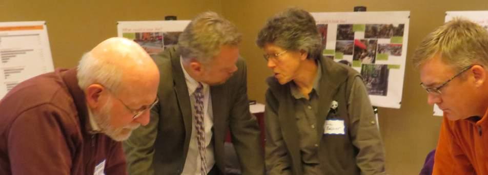
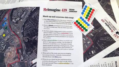
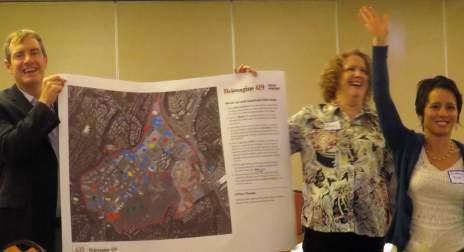
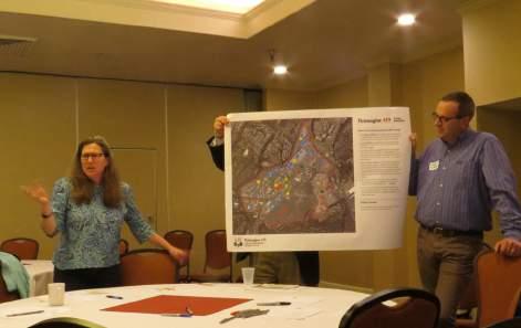
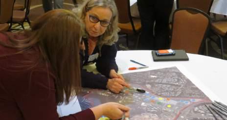
Following the presentation, a community mapping exercise began. Each table had a large map of the study area. Participants identified important areas on the map through a dot exercise with instructions to:
• Place blue stickers on a store, restaurant, or other places that they visit most frequently and list the names of these locations next to the sticker.
• Draw their typical route/routes to and through the study area (multiple routes were allowed).
• Place a red sticker on the map where they wanted to see stores, restaurants or other
amenities, and describe the desired use next to the sticker.
• Place a green sticker where they thought new green or public spaces could go. List the types of places they wanted to see, such as passive parks for strolling or having lunch; active spaces such as outdoor gyms, play fountains and playgrounds; pocket plazas; and outdoor cultural venues.
• Using a blue pen, identify parts of the study area they could imagine becoming an attractive, walkable, destination.
• Place a yellow sticker at sites where they thought the first implementation activities should occur—in other words, where should the plan get started?
After discussing what was most important to them, participants were asked to list the top five shared priorities at their table. Each table identified a spokesperson, and these individuals shared their tables’ priorities with the entire group during a report-back.
Common themes included:
• Support local restaurants and businesses
• Make sure that the Town Center is accessible to all
• Connect the Town Center to a nearby greenway
• Improve traffic conditions along Rt. 419
• Attract more upscale national retail
• Improve public transportation
• Include affordable housing in new developments
Tuesday, November 15
Public Urban Design Workshop
The design team worked during the day to develop the urban design framework for the study area. The team worked in the same room where the public events took place, and the session was open to the public. Participants arrived throughout the day and were greeted by both the consultant team and Roanoke County employees who explained what was taking place. Some residents who’d been unable to participate the previous night added their comments on available comment sheets and extra table maps. In addition, several stakeholder discussions with large property owners took place to fully coordinate potential redevelopment opportunities with the emerging urban design framework.
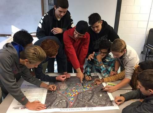
event and provided information about the role of civil engineering, architecture, landscape architecture, and other design professions related to urban design and planning.
Following the presentation, the students worked in groups on the same maps used during the public workshop to develop their own sets of priorities. Two students then came to the event on Wednesday night to present their priorities. The priorities included:
• Retail options oriented toward teenagers
• Places to bike
• Outdoor public space
• A skate park
• More entertainment options
Wednesday, November 16 Community Presentation
Burton Center for Arts and Technology
To capture a younger demographic, the planning team gave a presentation to over 50 high school students at the Burton Center for Arts and Technology (BCAT). The presentation combined elements from the previous night’s
The public event on Wednesday took place from 6:30 p.m. to 8:00 p.m., with approximately 60 participants in attendance. After a day-long team work session, the planning team presented the following components of the emerging urban design framework:
• The plan vision and principles, updated based on input from the participants.
• Community priorities were summarized from the maps from the public workshop.
• A brief summary by BCAT students of what was most important to them in a new Town Center.
• An overview of the strengths of the retail and residential markets.
• Core elements of a 20-year urban design
and redevelopment framework:
» Different typologies, ranging from walkable to auto-focused environments.
» Explanation of the need for visibility from a retail perspective.
» Discussion of use priorities (market strengths dictate a need for residential, retail, and entertainment uses).
» Discussion of connectivity and universal access within the study area and to surrounding neighborhoods.
» Main Street environments were identified for areas such as Starkey Road, Fallowater Lane, and the Tanglewood Mall site.
» A 3-D model of the 20-year vision, created during the workshop.
• Areas to focus on within a 5-year timeframe:
» Tanglewood Mall site
» Starkey Road
» Fallowater Lane
» South of Rt. 419 across from Madison Square, where a new intersection is being proposed
» South of Rt. 419 near Starkey Road
Following the presentation, design team members made themselves available to discuss in detail various elements of the plan. Comment sheets were available for anyone who wanted to provide additional feedback. Based on the conversations that took place, the community was overwhelmingly positive about the direction of the planning effort.
Transportation discussions
Overview
Since transportation issues were considered such an important component of the planning process, it was decided to add three engagement events that would focus just on this component. An open house and a Roanoke County employee event were held in October to introduce transportation issues and opportunities. This was followed by a community presentation in January to review draft recommendations. In total, over 200 participants attended these events.
October 11 Open House
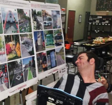
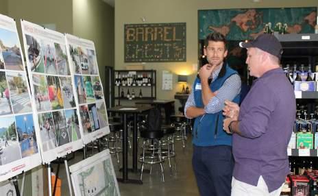
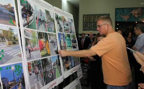
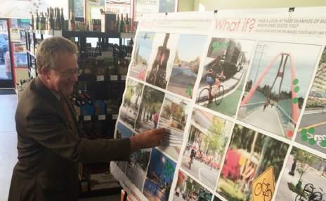
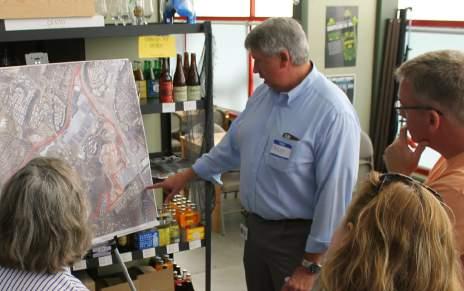
On October 11, 2016, an open house took place at the Barrel Chest Beer and Wine store on Electric Road. The event was held here in part to attract and capture the insights of millennials and young professionals; outreach was specifically targeted to this demographic group. More than 60 participants attended the event, from 5:00 p.m. to 7:30 p.m. The planning team members for the transportation and infrastructure components of the initiative led this event. Roanoke County Planning and Economic Development employees also participated in and assisted with resident engagement.
Transportation Best Practices Preference Exercise
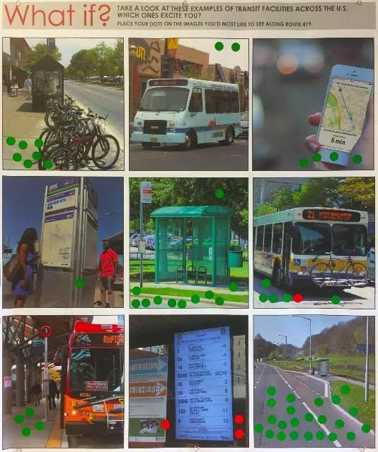
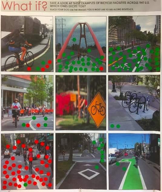
A series of posters highlighted elements of multimodal transportation options, including biking, walking, public transportation, and automobiles. Participants were asked to place green dots on the images they felt showed the best options for the study area and red dots on images they saw as inappropriate for the study area.
Overall, residents preferred:
• Separated walking and biking paths
• Improved public transportation services and amenities
• Improved sidewalks and connections to surrounding neighborhoods
• Improved lighting
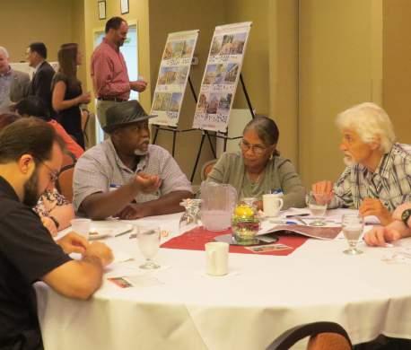
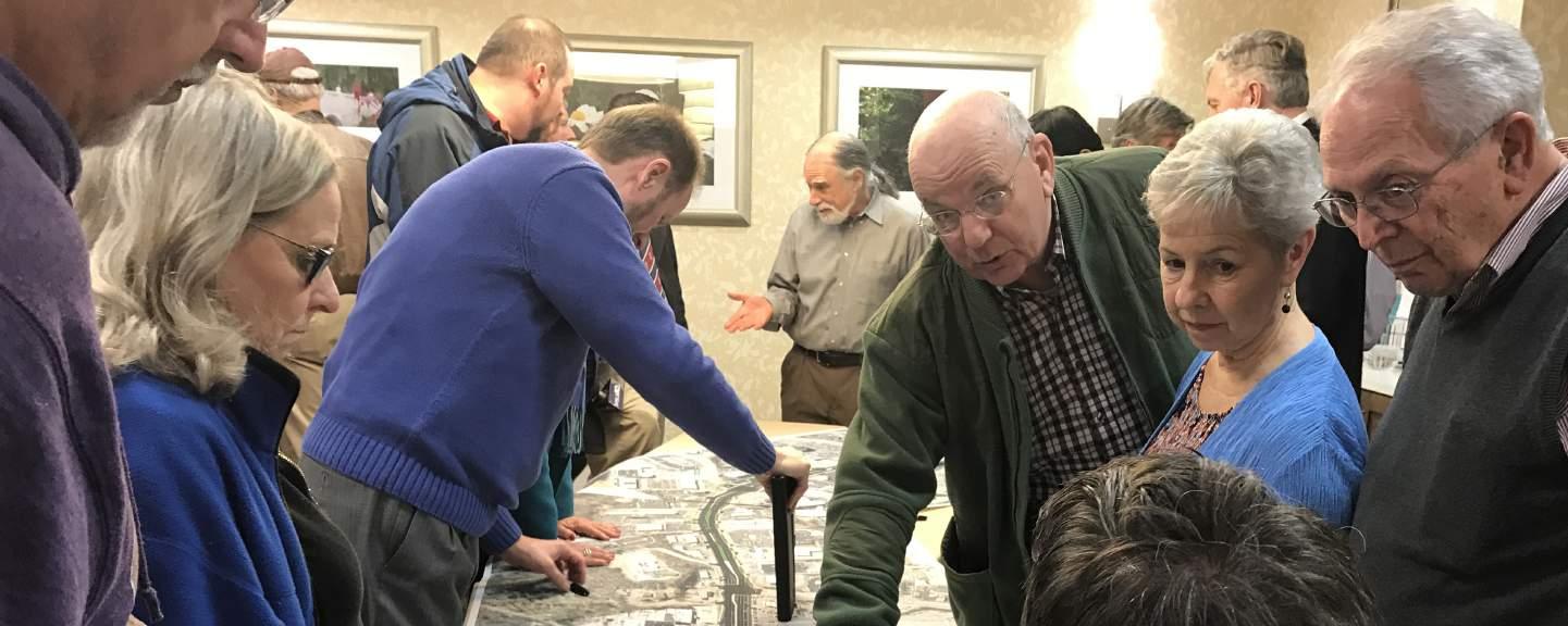
Members of the community reviewing transportation findings at the October 11th open house.
Photo Credit: RVTV3
Real-time Polling
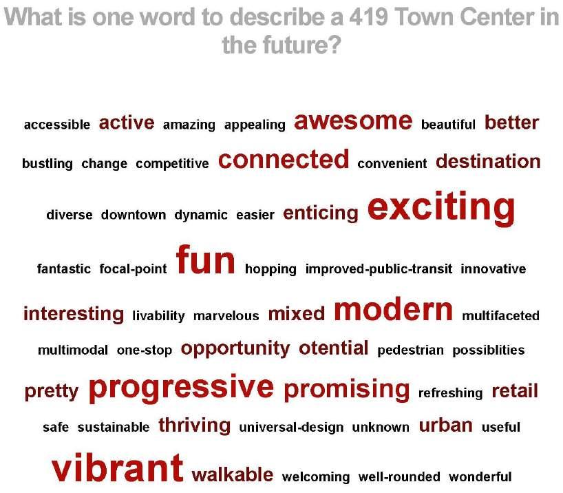
During the event, residents were able to participate in real-time polling with their smart phones. Questions centered on how often residents visit the study area, what their thoughts are about the current conditions, and what would they like the area to become in the future. The word cloud on the right presents an example of the results from the polling (words that were repeated by multiple participants grew larger).
Infrastructure
Infrastructure issues were discussed with residents, and topics addressed included:
• The impact of study area topography on development options within the study area, particularly south of Electric Road
• How existing infrastructure (stormwater, sewer, and water systems) needs to be understood prior to creation of new development scenarios
• A brief review of existing infrastructure conditions
• Sustainable stormwater options
A word cloud generated by the real-time polling event
Philip Thompson, Deputy Director of Planning, explaining elements of the plan to community members.
Roanoke County Employee Event
On Friday, October 14, 2016 between 11:30 a.m. and 2 p.m. the planning team held an employee event outside the Roanoke County Administration Center. Employees were asked to complete a brief survey about the study and provide feedback on multi-modal transportation examples. About 90 employees filled out the survey and completed the dot exercises, while staff guided group discussions about connectivity in the Route 419 study area.
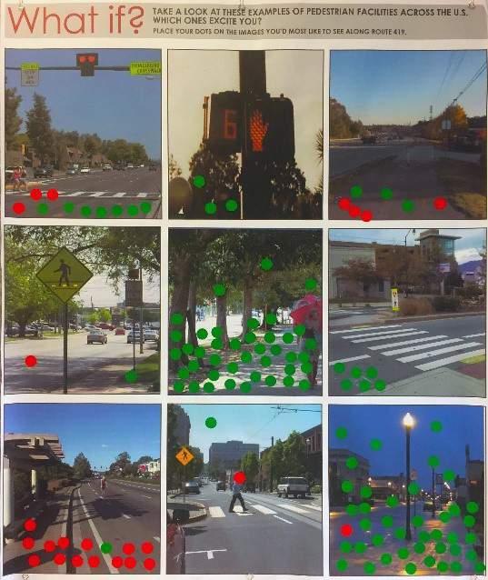
This event included three displays featuring pedestrian, bicycle and transit accommodations. Participants indicated examples they most liked and disliked with green and red dots, respectively. Each precedent board included nine examples from around the U.S. Images included route design, wayfinding signage, traffic lights, assistive technology and parking improvements.
The most popular examples included:
• Separate spaces for different uses
• Safe, sheltered places to wait or park
• Landscaping and shade
• Aesthetic and interesting design
Precedent board results from Roanoke County Employee Event.
January 4 Transportation Scenarios Meeting
The planning team developed the draft transportation plan from October to December. These recommendations were incorporated into a preferred access plan, submitted to the County in late December and presented to the community on January 4 at the Hilton Garden Inn on South Peak Boulevard. Almost 60 people participated. A large map of the preferred access plan was displayed at the public presentation.
The presentation highlighted the key transportation recommendations for the plan (these recommendations can be found in the transportation section of the plan).
After the presentation, residents were able to view the large preferred access plan map as well as several posters highlighting other transportation recommendations. Using dots, participants voted on what types of transportation improvements they felt represented the best options for the study area.
The planning team answered questions on both transportation issues and the larger planning initiatives for participants who were attending for the first time.
draft Plan reveal
Overview
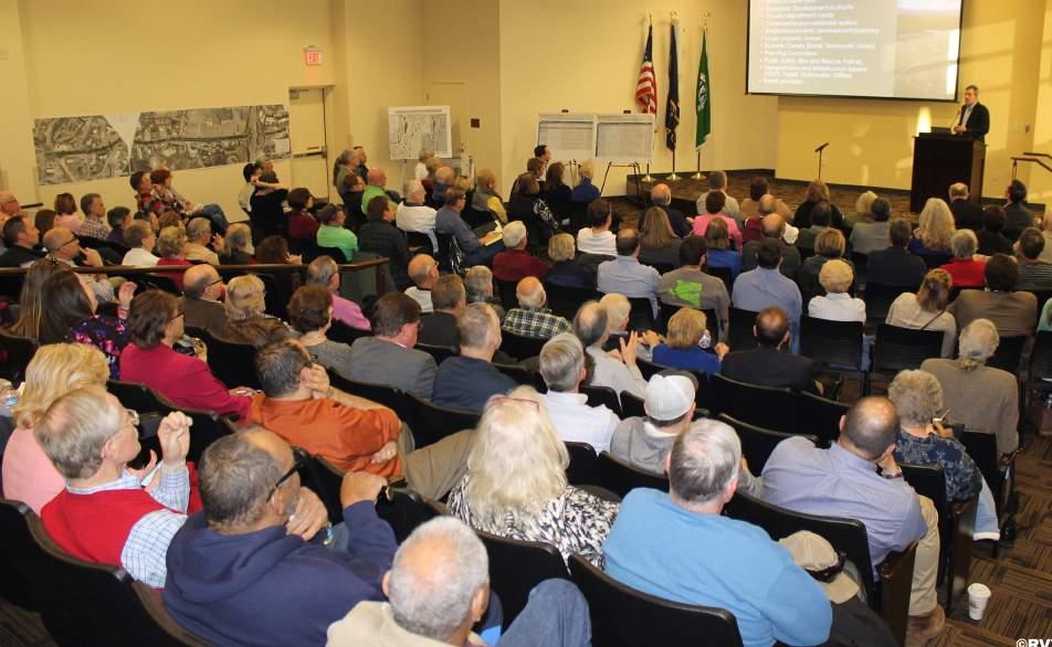
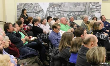
Once the Draft 419 Town Center Plan was completed and reviewed by Roanoke County, an Open House was held on March 23 at the South County Library. More than 200 community members filled the auditorium and an additional room with a monitor to watch a live stream of the presentation.
The presentation highlighted the key elements of the overall plan and planning process, but then focused on three catalytic development
scenarios as well as the transportation recommendations for the Route 419 Corridor.
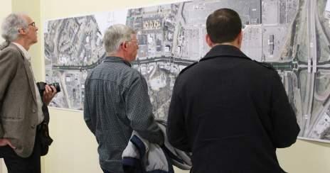
Large-scale posters lined the walls and the stage, and provided an opportunity for community members to spend time reviewing the plan in closer detail both before and after the event.
Commission/ Board Meetings
The Roanoke County Planning Commission held a public hearing on May 2, 2017, to consider incorporating the 419 Town Center Plan into the Roanoke County Comprehensive Plan. A presentation provided an overview of the draft plan. The Planning Commissioner discussed the desire for realistic expectations and prioritizing development. Four citizens spoke during the public hearing with comments about the importance of incorporating pet-friendly accommodations and businesses, support for and concern about Tanglewood Mall, support for the concept and direction of the plan, and the importance of aiming high with the plan.
On June 6, 2017, a joint meeting was held with the Roanoke County Board of Supervisors and the Planning Commission. The presentation reviewed included a review of the draft 419 Town Center Plan, community outreach efforts and the implementation process. The Board of Supervisors requested additional time to review the draft 419 Town Center Plan. The Board of Supervisors held a work session and provided feedback to the Planning Commission at its July 25, 2017, meeting.
At its June 20, 2017, Work Session, the Roanoke County Planning Commission reviewed and discussed an implementation matrix for the Draft 419 Town Center Plan. Planning Commissioners discussed specific strategies and action steps related to the
implementation matrix categories. The Planning Commission continued to discuss proposed implementation strategies at its July 18, 2017, and August 15, 2017, Work Sessions.
Staff comments and proposed revisions to the draft 419 Town Center Plan were discussed at the September 19, 2017, Planning Commission Work Session. The Planning Commission recommended approval of the Draft Route 419 Town Center Plan, with revisions as presented by staff.
In May 2017, Stantec’s contract was amended to conduct a traffic impact analysis on the Diverging Diamond Interchange at Route 419 and Route 220. The planning process was delayed until this analysis could be completed. The traffic impact analysis was not completed until August 2018. Once completed, staff worked with Stantec to prepare a finalized draft of the 419 Town Center Plan, which it received in late-November 2018.
The Planning Commission reviewed the finalized draft Plan at its January 15, 2019, meeting. Due to the extent of the changes made to the finalized draft, the Planning Commission decided to hold a public hearing on the finalized draft. The Planning Commission held a public hearing on the finalized draft of the 419 Town Center Plan on March 5, 2019. One citizen spoke during the public hearing providing comments on
the ADA transportation improvements in the plan, inquiring about funding for these improvements, and the need for lower income apartments. The Planning Commission also provided for a 30-day comment period on the revised draft. Over 30 comments were received. The comments covered a variety of topics including development of the study area, Tanglewood Mall, housing, natural resources, open space, environmental issues, infrastructure, and transportation/traffic concerns. The Planning Commission reviewed these comments at its April 16, 2019, and May 21, 2019, meetings. Staff suggested several minor revisions to the revised draft plan to the Planning Commission at its May 21, 2019, meeting. The Planning Commission adopted a resolution recommending that the 419 Town Center Plan as amended by staff be incorporated into the County’s Comprehensive Plan on May 21, 2019.
On June 25, 2019 the Board of Supervisors held a work session with staff on the finalized draft of the 419 Town Center Plan. The Board of Supervisors held a public hearing on this finalized draft on July 23, 2019. Six citizens spoke during the public hearing. After the public hearing, the Board of Supervisors adopted a resolution to incorporate the 419 Town Center Plan into the Roanoke County Comprehensive Plan.
online Engagement
Overview
The planning team understood that finding time to attend public meetings can be challenging for many residents. Therefore, in addition to the public workshops and meetings, multiple on-line engagement activities were incorporated.
Official Web Page
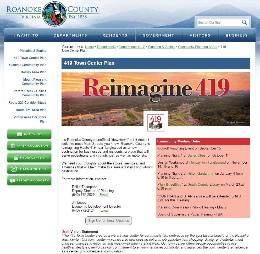
The County created and continues to maintain an official web page dedicated to the 419 Town Center Plan. Visitors can learn about upcoming events, review presentations from previous events, and download supporting analyses and other materials that have gone into the making of the plan.
mySidewalk Online Community Forum
An on-line community forum website was created that mirrored the discussions taking place during the public events for the 419 Town Center Plan. This allowed residents who could not attend public events a way to provide input on what was most important to them.
These examples reflect on-line comments expressing what residents hope to see happen:
“Convert the mall area into a nice mixed-use development site. I think this fits into the character of the area and would really be attractive to business. It would also provide more affordable urban housing option for
The project web page can be found at www.roanokecountyva.gov/419
people moving into the area who do not necessarily want to pay the high cost of living downtown but still want that kind of lifestyle.”
“I like that the area has a good mix of business and office. I also enjoy its convenient connections to 220/581. I find myself in this area frequently already in my day to day life.”
“I would love to see strides made to alleviate traffic…I would like to see the desert of parking lots replaced with structured parking.”
“I would love an area where we could bring our dogs. I’d love to see this area more open.”
“It definitely need more green space to be welcoming to people visiting.”
Online Survey
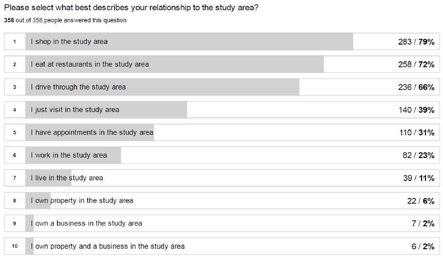
A detailed on-line survey was created to learn about how residents currently experience the Town Center study area, and what is most important to them. More than 350 residents completed the survey. Key findings from the survey included:
• 78% believe the study area has potential to improve.
• A majority of the community believes the area is very safe during the day and at night.
• Exactly half believe that the area has some unique qualities but that there is room for improvement.
• Restaurants and shopping are critical features for the community.
• Traffic circulation is the biggest infrastructure concern.
• 54% of the community would like to see parks/open space added.
• 72% of the community want to see sidewalks addressed or improved upon.
More than 350 residents responded to the on-line survey
Hello!
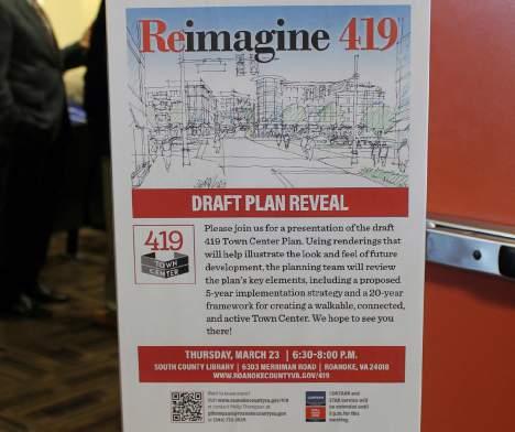
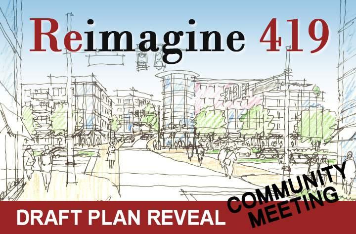
This month we approach the end of the Reimagine 419 study with a community meeting to reveal the draft Plan! This presentation will outline the implementation steps that are necessary to develop the Route 419 Town Center over the next 20 years, as well as the Plan's key design components.
Following the meeting, the draft Plan will be available for public comment online and in hardcopy at County libraries.
Get the Details
Draft Plan Reveal Community Meeting Thursday, March 23 6:30 - 8:00 p.m. South County Library
Public outreach
In addition to supporting and participating in all the planned engagement activities, Roanoke County led numerous initiatives to ensure that community members, business owners, employees, and others had ample opportunities to contribute to the planning effort. The initiatives included:
• Three sets of postcard mailings to inform community members of upcoming events. The postcards were mailed to over 7,000 households and businesses within the study area and a one-mile radius of the study area.
• Route 419 Town Center Study fact sheets to help residents understand what the initiative was all about.
• Monthly e-newsletter articles sent to 3,500 residents that summarized the key findings and emerging recommendations of the plan. This newsletter was sent to the County’s existing email list-serve as well as a separate list of all participants who signed in during the public events.
• Three outreach visits to businesses within the study area to highlight important events related to the planning effort.
• Social media announcements and commentary posted throughout the planning effort.
• Press releases and outreach to the media encouraging substantial coverage.
• Cross-promotion at other planningrelated meetings to encourage additional participation.
The Plan
As all the elements of the planning process began to come together—community engagement, stakeholder interviews, market realities, infrastructure issues, and transportation necessities—a plan began to emerge. Ambitious in its vision and guided by community-generated principles, the plan is also realistic and achievable. This chapter identifies the key strategies of the plan, and describes what needs to be done to create a high quality Town Center environment within the Route 419 Corridor.
Vision & Principles
Input from community members shaped the plan vision and principles. Residents also reviewed and approved them during the multiday workshop event. As new developments, both private and public, are proposed to the County, each should demonstrate how it reflects these principles and supporting strategies.
VIsIon
The 419 Town Center creates a vibrant new focus for community life, embraced by the spectacular beauty of the Roanoke Valley. Our Town Center mixes diverse new housing options; job opportunities; shopping, dining, and entertainment choices; and chances to enjoy art and music—all within a short walk. Our Town Center offers people opportunities to live healthier lifestyles, reinforces our commitment to environmental responsibility, and advances the Town Center’s emergence as a center of knowledge and innovation.
PrInCIPLEs
1. Harness the power of our location and market strengths to enhance the Town Center’s livability.
2. Create an authentic place.
3. Improve connectivity.
4. Celebrate the Town Center’s nature and the corridor’s natural setting.
5. Promote a sense of community and inclusion.
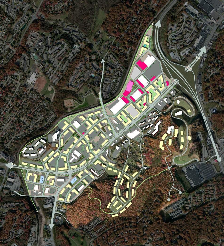
419 Town Center Vision
Interchange improvements
Tanglewood Mall redevelopment
Old Country Plaza redevelopment
Madison Square redevelopment
Electric Road reconfiguration
Walkable and accessible intersections
New signal at Fallowater Lane extension
Signature office development sites
Multifamily development
Network of trails
Main Street retail
Community green space
Harness the power of our location and market strengths to enhance the Town Center’s livability.
Strong demographics and a highly accessible location make the study area one of the strongest market locations within the region.
CORE CONCEPT EXAMPLES OF SUPPORTING INITIATIVES
Strengthen the corridor’s competitive position.
Increase housing and retail options.
> Develop high quality standards that support a town center environment.
> Introduce flex-space, shared workspace and incubator space.
> Introduce live-work housing.
> Build mixed-use developments that include office space.
Create an authentic place.
As the study area transforms into a walkable town center environment, it incorporates local elements to create a distinct destination in the Roanoke Valley.
CORE CONCEPT EXAMPLES OF SUPPORTING INITIATIVES
Mix private, public, and civic uses.
> Hold flea/antique markets in parking lots.
> Encourage shared-parking strategies to reduce parking levels.
> Welcome civic events.
Incorporate elements unique to the Roanoke Valley.
Enhance landscaping; create public green spaces.
> Reflect Roanoke’s history in new developments.
> Support and prioritize local retail.
> Utilize surrounding views and environment to attract new development.
> Increase green features in parking lots by adding trees and sustainable stormwater features.
> Incorporate public green space into the design of large-scale mixed-use developments.
> Connect the surrounding trail network to the study area.
Improve connectivity.
Access to the study area gets easier, not harder. Improvements are made for people of all abilities on foot, in wheelchairs, on bikes, in cars and on public transportation.
CORE CONCEPT EXAMPLES OF SUPPORTING INITIATIVES
Ensure safer and better access for cars and for transit.
Incorporate sidewalks throughout the Town Center.
> Ensure that changes to Electric Road do not decrease auto and transit access.
> Ensure that all new developments include sidewalks that connect to the surrounding street network.
> Ensure that new streetscape projects include sidewalks.
> Encourage existing property owners to add or improve sidewalks.
Improve street crossings.
> Provide safe crossings along Electric Road.
> Clearly mark pedestrian crossings on all new streets.
Add separated multi-purpose paths along 419
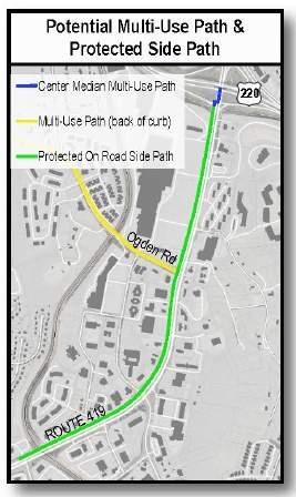
> Build a separated multipurpose path along the northern/Tanglewood Mall side of the corridor.
Celebrate the Town Center’s nature and the corridor’s natural setting.
Roanoke Valley has long embraced healthy lifestyles and strong connections to the landscape. The future redevelopment of the study area will actively reflect this.
CORE CONCEPT EXAMPLES OF SUPPORTING INITIATIVES
Incorporate green infrastructure.
Create and connect to greenway/bike trails.
> Increase green features in parking lots with tree plantings.
> Encourage the use of sustainable stormwater systems.
> Ensure that large-scale mixeduse developments incorporate public green space into their design.
> Ensure that all new developments include bike systems to connect to greater system
> Build a separated multi-purpose path along the northern/ Tanglewood Mall side of the corridor.
> Encourage and support additional bike trails along streets and the rail line. Encourage healthy amenities in public spaces.
> Support a local farmers market.
> Expand the bike/trail system.
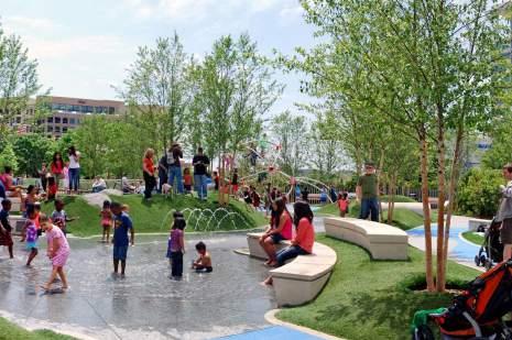
> Support active children’s play spaces within the public realm.
> Actively encourage healthoriented facilities (gyms, training clubs, rock-climbing facilities) to locate in the study area.
Promote a sense of community and inclusion.
The reimagined 419 Town Center is truly a place where everyone—residents, visitors and employees—feels welcome.
CORE CONCEPT EXAMPLES OF SUPPORTING INITIATIVES
Expand choices for younger residents and families.
> Support a mix of retail uses attractive to children, teenagers, adults, and seniors.
> Support active children’s play spaces within the public realm.
> Support mixed-use developments designed to appeal to young professionals and empty nesters.
> Support high-quality residential developments along the ridge designed to appeal to young professionals and empty nesters.
Encourage a diverse mix of retail and cultural choices.
Celebrate our history.
Promote the area to increase tourism.
> Support a mix of retail uses attractive to children, teenagers, adults, and seniors.
> Encourage cultural and civic events to take place within public spaces.
> Ensure that new development reflects Roanoke’s history.
> Ensure that the public realm includes historic elements.
> Develop and actively implement a branding campaign.
> Strengthen partnerships with regional tourism agencies.
> Support festivals and other larger events that can act as regional draws.
Urban Design Framework
development Types
The plan encourages the following types of development as the area around Tanglewood Mall makes its transition to a true town center, but each type depends on its location and setting. For example, a single-use residential development should not be located within a town center environment. Whatever its type, all new development needs to align with the Vision and supporting Principles.
This type needs easy auto access and high visibility to drivers. It should be located along main corridors, such as facing Route 220.
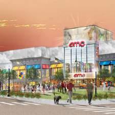
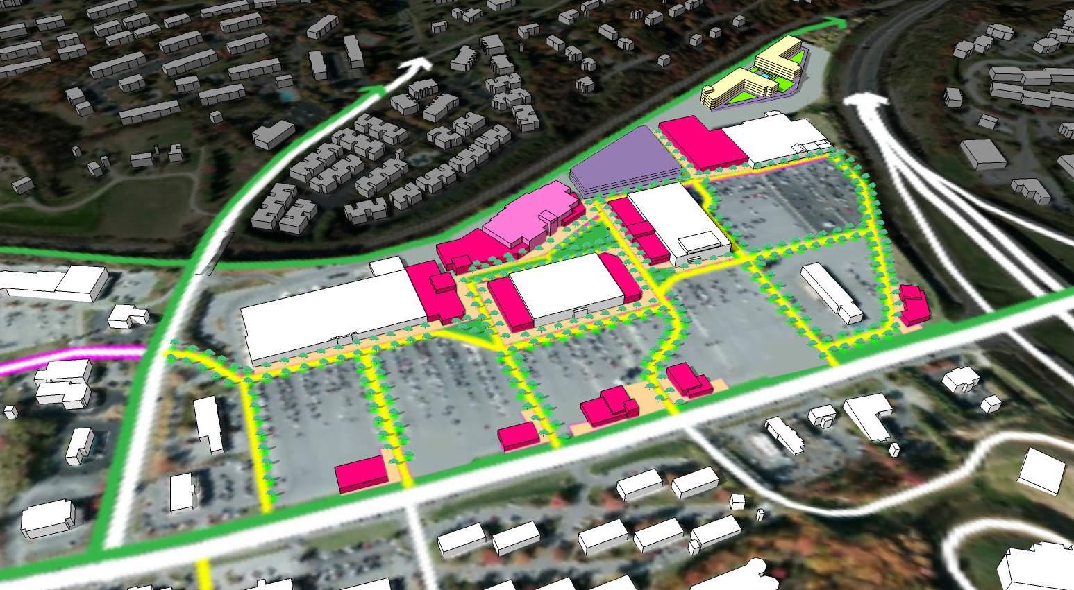
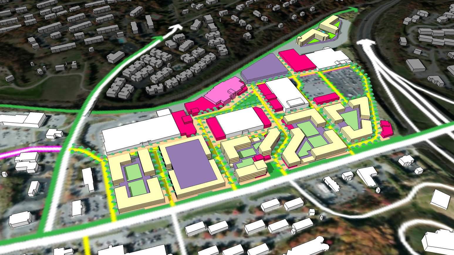
Tanglewood Mall is the most likely location for this type of development, with the entire mall or portions of it demolished and replaced with mixed-use development and outdoor public spaces.
This kind of smaller-scale development re-uses or replaces properties along arterial roads. High-quality design standards should be incorporated.
These developments include retail and/or peopleoriented commercial (for example, a bank or real estate office) on the first floor with housing above. This can also include office space. Development focuses on a public open space.
These developments include retail and/or people-oriented commercial uses on the first floor (for example, a bank or real estate office) with offices above.
This type of development includes only housing, which can be either apartments (rental) or condos (ownership). Green spaces or other outdoor areas are typically private and for the use of the developments’ residents.
MIxEd-usE ToWn CEnTEr
MIxEd-usE oFFICE
ArTErIAL InFILL
MuLTIFAMILy
MALL rETroFIT
development Types
AREAS
Auto-oriented
Mall retrofit
Arterial infill
Mixed-use town center
Mixed-use office
Multifamily
BUILDINGS
Existing buildings to remain
New residential
New retail
New office
New special building
MIxEd-usE ToWn CEnTEr
MIxEd-usE oFFICE
MALL rETroFIT
ArTErIAL InFILL
MuLTIFAMILy
Circulation
Improving mobility for all users will be a critical component for any redevelopment effort around the Town Center. Walkable and bikeable development requires a network of streets that accommodates all users, not just cars. Features such as generous sidewalks, street trees, bike lanes, on-street parking, and adjacent uses built close to the street with activated storefronts will make streets come alive. Shared parking set behind mixed-use buildings will screen the parking from the street and reduce the total amount of parking needed. Reducing automobile congestion along the primary routes as well as at the Route 220 interchange will further improve the attractiveness of the area and the quality of life for everyone who visits, works, or lives in the area.
Build a Walkable and Bikeable Network
• Build a multi-use path for walking and biking along Electric Road. Where a multi-use path will not fit, build sidewalks and bicycle lanes.
• Upgrade Starkey Road, Fallowater Lane, Ogden Road, Bernard Drive, and other secondary streets with improved sidewalks, bike lanes, ADA-accessible amenities, and other pedestrian-friendly amenities.
• Include bike lanes and parking lanes where feasible.
• Where allowable, locate on-street parking and generous sidewalks immediately behind the back of curb.
• Construct a multi-use path for walking and biking along the rail right of way.
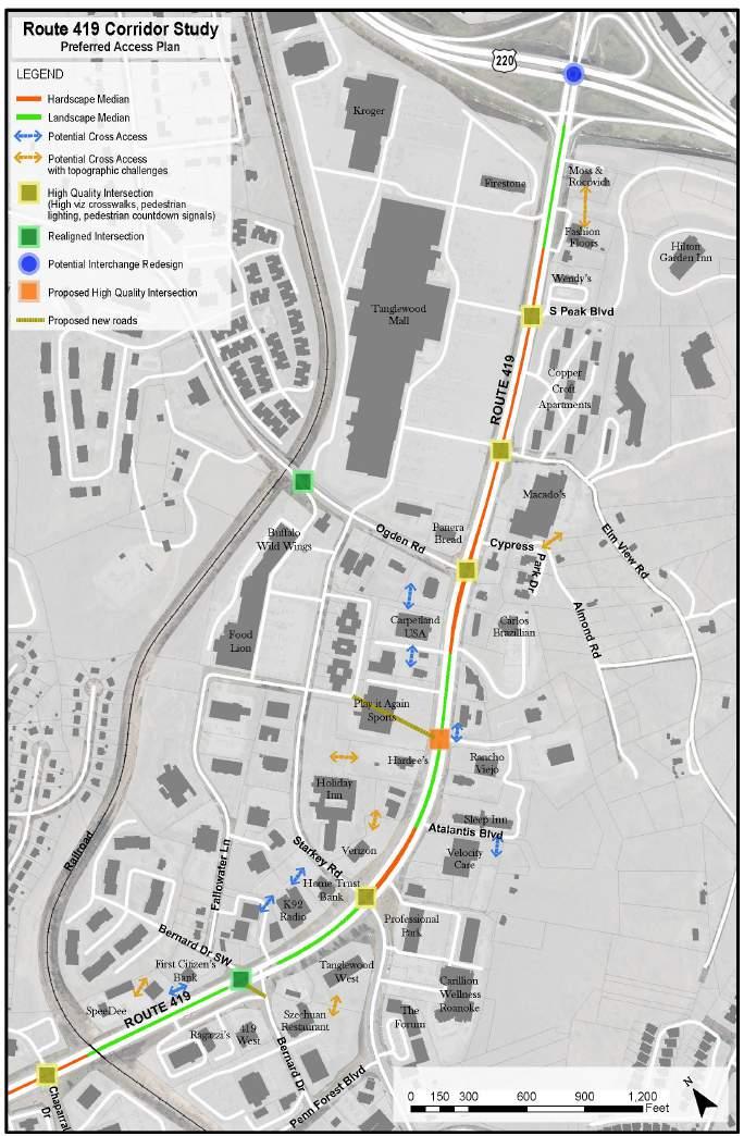
• Create high-visibility intersections with crosswalks, full pedestrian signalization and street lights on applicable legs at all traffic signals.
Improve the Route 220 Interchange
• Make improvements to the interchange to address congestion and create a pedestrian and cyclist island.
Link Fallowater Lane to Electric Road
• Extend Fallowater Lane to connect to Electric Road to ensure that pedestrians can cross Route 419 within a 90-second walk. Add a new traffic signal at the intersection.
Implement Bike Facilities across the Network
• Regulate the spacing of curb cuts to preserve sidewalk continuity for pedestrians and preserve on-street parking spaces in areas where highly pedestrian-friendly conditions are desired.
• Incorporate bike stations, including a fix-it station, pump, and covered bike racks where feasible.
Promote Shared-parking Agreements and Make Parking more Conducive to an Urban Form
• Promote shared-parking agreements to improve the usage rate of parking throughout the day and reduce the total number of spaces required. Establish parking maximums to discourage overbuilding of parking in the Town Center.
• Locate parking behind pedestrian-oriented development or to its side when rear parking isn’t feasible.
• Connect parking areas to adjacent structures with sidewalks or breezeways through buildings.
• Encourage parking lots to be designed to drain into infiltration areas and landscaped beds with plant and tree species that can withstand parking-lot pollutants. Landscape surface lots with trees.
• Consider using economic incentives and financing tools to construct shared structured parking in priority areas as development demand warrants.
Make Development more Bike-Friendly
• Add bicycle lanes along corridors. If adding bicycle lanes is not feasible, clearly designate a shared bicycle route in the traffic lane.
• Provide short-term bike parking near
PrInCIPLEs
building entrances in places that are illuminated and conspicuous. Place more parking near destinations that may attract higher volumes of users, such as ice cream and coffee shops and eating and drinking establishments. Short-term parking may be provided by placing bike corrals in some on-street parking spaces, or where parking is prohibited due to sight-distance restrictions. On-sidewalk parking should not block the clear walking zone.
• Provide long-term bike parking in residential developments. Parking should be secured and covered.
• Bicycle racks should conform with Association of Bicycle and Pedestrian Professionals standards.
Make Development more Transit-friendly
• Design new streetscapes to accommodate buses and bus stops at appropriate locations.
• Work with the regional transit authority to evaluate the feasibility of a separately branded circulator route using buses or shuttles, running on a loop to link the Town Center to businesses, hotels, and destinations in the vicinity.
FALLoWATEr LAnE sECTIon
rouTE
PrInCIPLEs AddrEssEd 1
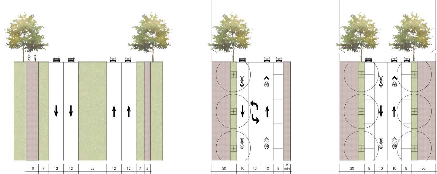
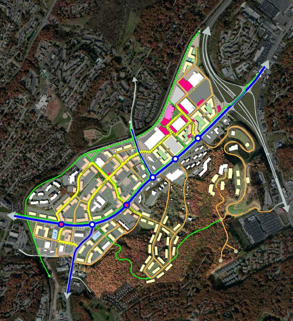
A multi-use path runs along the north side of the street. The center island is a turning lane at intersections. (This section represents the Route 419 Town Center plan goals. It does not reflect the cross section proposed as part of the Smart Scale application for the Tanglewood Mall frontage, which includes three travel lanes in each direction, sidewalks, and bike lanes.)
The right-of-way is expanded along development edges to allow for wider sidewalks, curbside parking, and street trees.
The Fallowater Lane Extension is designed as a complete street. The generous right of way contains wide sidewalks to support walkable retail and curbside parking.
Route 419
Starkey Road
Fallowater Lane Extension
Arterial thoroughfare
Main street
Secondary street
Multi-use trail
Existing signalized intersection
New signalized intersection
Public realm
A well-designed public realm attracts people and makes them want to linger. Great sidewalks don’t just move pedestrians, they promote strolling, dining, people-watching, and spontaneous social gatherings. They also knit together an integrated system of public spaces.
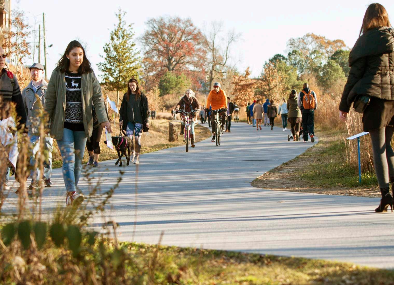
Within this system are places for people who want to walk a dog, ride a bike, sit and talk with friends, or enjoy public space in just about any way imaginable. Good design also accounts for human comfort in every season, with an emphasis on shade in the summer and heat in the spring and fall to extend the outdoor environment.
Enhancing the public realm with facilities like sidewalks, bikeways, parks and public gathering places will create an environment that is most attractive to residents and visitors who seek a more urban and walkable environment.
The following strategies can enhance the public realm throughout the study area to increase a sense of community and provide an attractive, inviting, and safe environment.
Create New Public Gathering Spaces
Working with private developers, ensure that public gathering spaces are part of mixed-use redevelopment projects.
Encourage Outdoor Sales
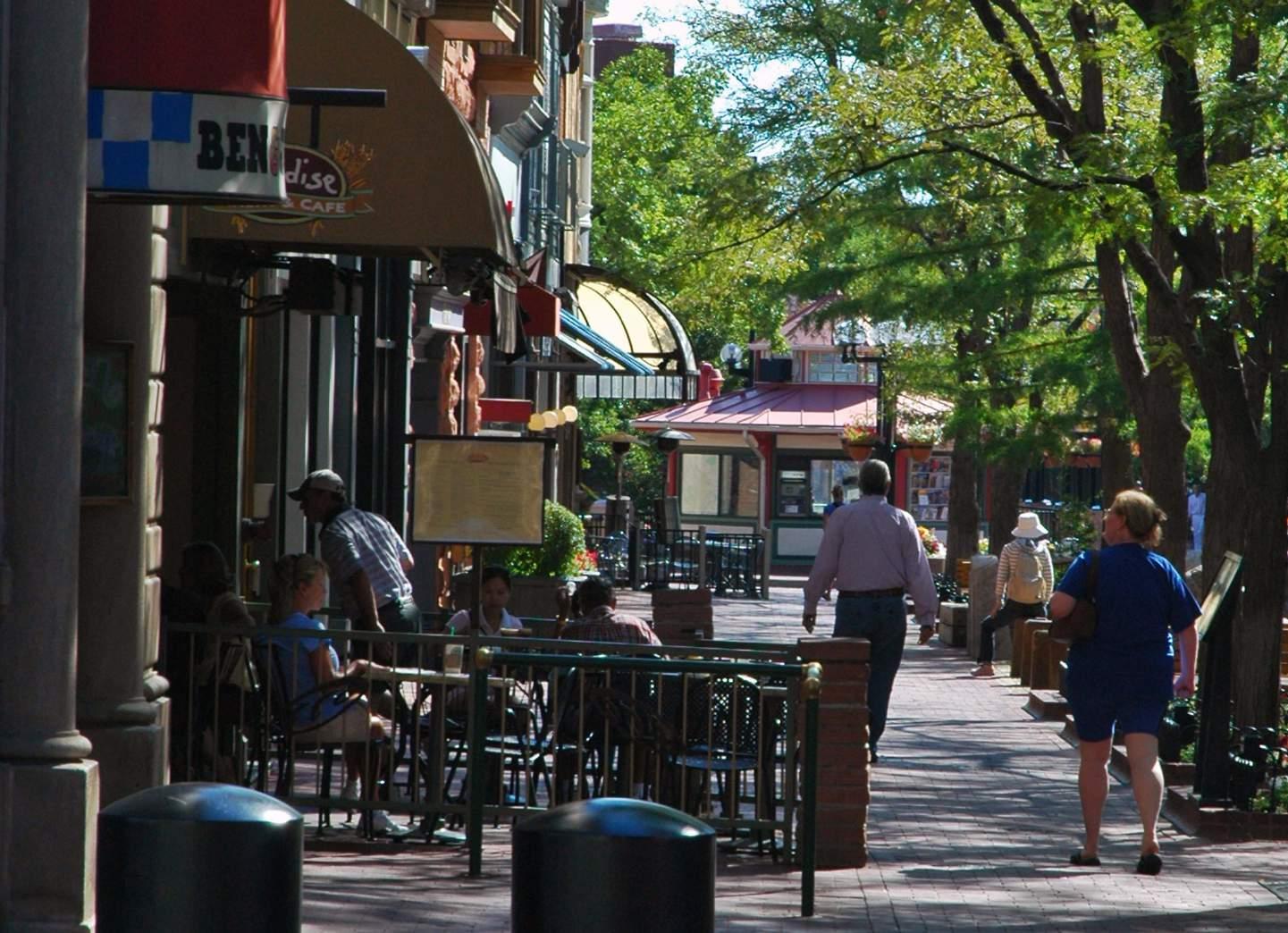
People tend to favor busy sidewalk areas with a complex visual environment; allowing retailers to “bring the store out into the street” is one effective way to create this environment. The outdoor displays provide an interesting aesthetic as long as they are properly managed. The key is to ensure that they don’t overwhelm the sidewalk by:
• Allowing displays to extend only 3-4 feet from the building facade;
• Maintaining a minimum horizontal clearance of at least 5 feet; and
• Only permitting displays during business hours and requiring that they be designed to be removed from the sidewalk each evening if necessary.
Activate the Public Realm
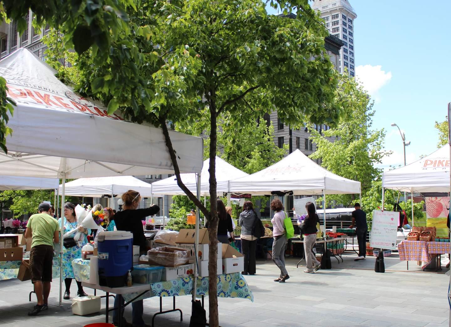
Temporary and programmed uses such as bazaars, festivals, carnivals, produce stands, food trucks, and seasonal outdoor sales are another excellent strategy for activating the public realm. These should be encouraged both in the proposed green spaces as well as within existing parking lots. Appropriate regulations may need to be created to safely and effectively manage these events. Any regulations should be flexible and more
PrInCIPLEs
permissive to encourage creative and lively environments.
Add Streetscape Amenities
Benches, trash and recycling receptacles, wayfinding kiosks, and other street amenities are important components of complete street design, but they also require routine maintenance in order to provide a high-quality environment. Identify grants and other funding sources to purchase and install high-quality amenities.
Improve Lighting
Upgrade street lights and lighting in open spaces, paying attention to both security and the design quality of fixtures. Install pedestrianlevel lighting along the secondary network to coincide with redevelopment initiatives. Ensure all new development plans include a full range of lighting strategies to enhance the public realm.
Consolidate Utility Lines
Overhead lines still exist throughout much of the study area. Undertake an assessment to determine the physical and financial feasibility of moving all utility lines underground or behind businesses.
Install Public Art
Public art creates visual excitement and will help to draw visitors—and activity—to the public realm. The County should consider including temporary and permanent art installations as part of any redevelopment, events or marketing initiatives.
Introduce Stronger Landscape Standards
Adopt specific landscape standards for the Town Center, with an emphasis on areas adjacent to Electric Road as an important arterial street. Require all new developments to adhere to new standards. Encourage current owners to upgrade existing landscaping.
Green and Screen Parking Lots
Parking lots and garage structures should be shielded as much as possible from sidewalks and streets through various landscaping and screening options.
Enhance Gateways
Install branding elements, landscaping, and other aesthetic improvements at key gateways throughout the study area. New and visible investment in these gateways will immediately signal that positive change is taking place within the Town Center.
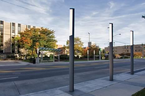
All new development and public realm improvements should include pedestrian level lighting.
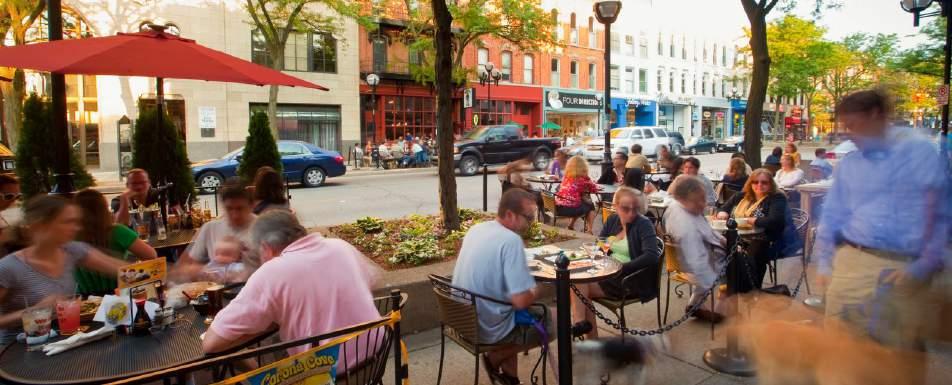
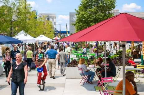
Outdoor sales and programming can help create a sense of place.
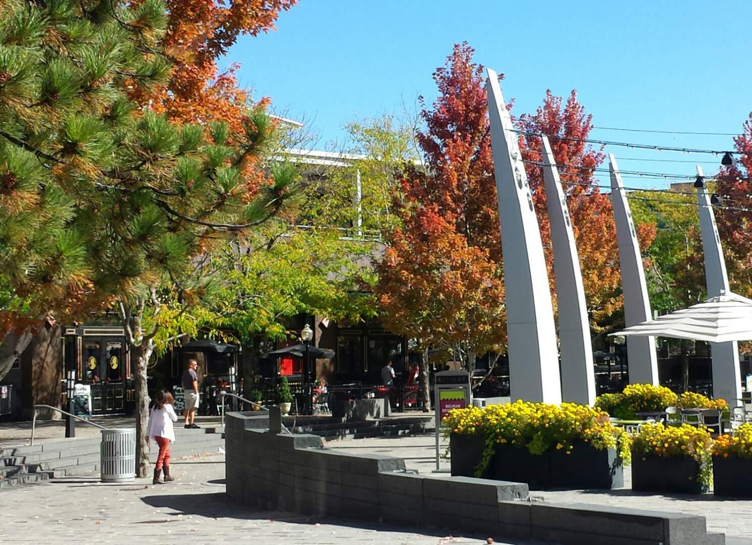
Plazas and public art can create multiple benefits and draw people to the area.
green Infrastructure
Introduction
Stormwater runoff is a major source of water pollution in urban areas. When rain falls in undeveloped areas, soil and plants absorb and filter the rainwater as it travels to underlying aquifers. When rain falls on roofs or paved streets and parking lots, however, the water cannot soak into the ground. In most urban areas, it drains through engineered collection systems that empty into nearby bodies of water. As it travels through this system, the stormwater picks up trash, bacteria, heavy metals, oil and other pollutants, polluting the receiving waters. Higher flows also can cause erosion and flooding in urban streams, damaging habitat, property, and infrastructure.
Green infrastructure (GI) is an approach to water management that protects, restores, or mimics the natural water cycle. In community planning and development, a site or development that combines multiple GI practices is often called low-impact development (LID). When properly designed and implemented, GI features work effectively as retrofits that can improve the quality of stormwater runoff in existing built areas as well as new developments. GI features can treat and manage stormwater at the source. In addition to stormwater management, green infrastructure can provide many community benefits, including reduced energy consumption, better air quality, carbon sequestration, and a boost to property values.
This section explores some GI options that may make sense in the Town Center. Smart selection, design, placement, maintenance and use of GI practices play a central role in preparing a stormwater management plan for an individual development. This discussion provides general background information for a general introduction to GI practices. It also provides a planning-level view of available options. It does not include recommendations for specific projects. Costs, benefits, maintenance needs and site-specific details all can help zero in on viable options for a particular project.
Environmental Benefits
Some of the largest and most obvious benefits from GI techniques are environmental. GI can provide at-the-source treatment and storage that reduces runoff volumes, pollution of receiving waters, and erosion of property. At the same time, it improves wildlife habitat in lakes, rivers and streams. The permeable ground and vegetation designed into GI features can also yield better air quality and reduce heat island effects.
Economic Benefits
Sustainable design and infrastructure doesn’t just help the environment, it also improves the bottom line. Ecological enhancements bring economic benefits like increased land values (brought by aesthetic natural improvements), reduced energy cost (brought by cooling/
insulation from trees and green roofs), reduced water demands and a need for smaller waterretention or storage basins, which increases land available for development.
Best Management Practices Menu
Enhancements of the built environment in the Town Center area can implement a range of GI best management practices (BMPs).
Improvements and redevelopment in the Town Center will likely not use every GI BMP
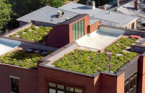
The green roof at the Friends Committee on National Legislation building, designed by Stantec.
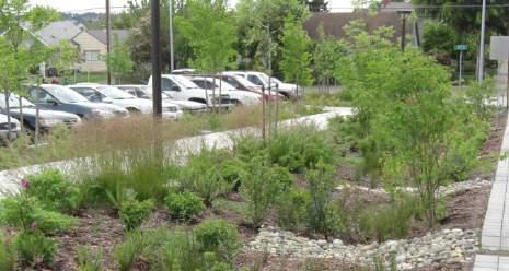
LID applied to a parking lot
described below; the specifics of any site will govern how feasible any particular practice proves for that site; those decisions will occur in the design phase of any project. This list offers a general picture of the available options.
Planter Boxes
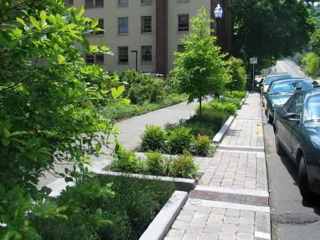
Planter boxes treat stormwater through filtration and adsorption. Once captured, the stormwater travels through the soil/planting medium and root zone—with some escaping via evapotranspiration by plants—before being discharged to the storm-drain system.
Filter Strips
Grass or vegetated filter strips improve the quality of small water flows from paved areas. These uniform swaths of dense turf or meadow grasses have minimum slope and are best suited to accept diffused flows from roads and highways, roof downspouts, and very small parking lots. Usually the runoff continues on for collection in swales, ditches or storm drains.
Rain Gardens/Bioswale
A rain garden or bioswale is a broad, shallow channel with a dense stand of vegetation covering its sides and bottom. Bioswales treat stormwater primarily through filtration and plant uptake before the flow reaches a downstream discharge location. The vegetation lessens flow velocity to prevent erosion.
Green Roofs
A green roof, or rooftop garden, is a vegetative layer on a rooftop. Green roofs provide shade and remove heat from the air through evapotranspiration, cooling both the roof surface and the surrounding air. A wide range of buildings can accept a green roof, from industrial facilities to individual houses. A green roof can be as simple as a 2-inch covering of hardy groundcover or as complex as a fully accessible park complete with trees. Green roofs have been proven to reduce the cost of heating and cooling buildings by significant amounts.
Bioretention/Constructed Wetlands
A bioretention area consists of a depression in the ground that encourages shallow pools of runoff that then percolate gradually into the soil. From there, the water either exfiltrates through underlying soils and recharges groundwater supply or enters the storm sewer system through drains buried below the surface. Bioretention features can be designed to capture and treat volumes of runoff produced during a range of storm events. They can also be designed as an accessible pedestrian amenity.
Permeable Pavement and Pavers
Conventional concrete, asphalt, bricks and pavers are impermeable; water is unable to penetrate through them and instead flows over their surface. Permeable pavements (including asphalt) and pavers, however, feature small
pores or cracks that allow rainwater to drain through or between them, allowing it to filter through the ground and recharge groundwater supplies as it would in a natural setting, reducing pressure on municipal drain systems.
Rainwater Harvesting and Storage
Rainwater can be captured by property owners and reused for multiple purposes. This helps reduce potable water use and decreases building and landscape operation cost. Rain barrels are a form of rainwater harvesting that are simple in concept and in operation. Rain collected from rooftops is funneled into a barrel that holds water until it is released and used for purposes like irrigation.
The planning team, working with Roanoke County and property owners along with input from the community, identified and evaluated potential development scenarios within the 419 Town Center study area. In total, the team identified three catalyst sites and developed conceptual plans for:
• Old Country Plaza
• Madison Square
• Tanglewood Mall
These sites emerged as the best choices because they fall within the part of the
study area identified as most conducive to transforming into a town center. Additionally, each site included land in parcel sizes that would appeal to developers, had easy road access, and had the potential to spur future development in surrounding parcels.
Note that these are conceptual developments that demonstrate how properties can be combined to create the mixed-use environment of a town center. In order for these—or similar—developments to become a reality, the value of new development must
exceed the value of the existing uses, so that both property owners and developers have an incentive to invest. Spurring redevelopment in the near term will likely require County support in the form of public-private financing tools that can aid with infrastructure, demolition, creation of public spaces, and other components that create the high-quality public amenities that will help assure the new town center’s success.
3. Tanglewood Mall
1. Old Country Plaza
2. Madison Square
1. old Country Plaza
Food Lion remains as Old Country Plaza is redeveloped into a mixed-use neighborhood with multifamily housing.
Site area: 10 acres
Total new development: 304,000sf
> New retail: 28,000 sf
> Residential: 276,000sf / 230 units
Parking provided: 410 spaces
Parking needed: 400 spaces (86 spaces for Food Lion)
Density: 23 units/acre
2. Madison square
Fallowater Lane is extended past Starkey Road to create a new intersection at Route 419 framed by new mixed-use buildings.
Site area: 5.1 acres
Total development: 201,175sf
> Retail: 22,000 sf
> Residential: 164,650sf/ 137 units
> Ground-floor parking: 14,525sf/ 41 spaces
Parking provided: 275 spaces
Parking needed: 272 spaces
Density: 26.9 units/acre
3. Tanglewood Mall
An active open space framed by remaining anchor tenants, including Belk, as well as a new theater and main street retail.
Potential near-Term Plan
Potential future development site
Site area: 58.6 acres
Total new development: 427,000sf
> New retail: Approx. 180,000sf
> Theater: 47,000sf
> Structured Parking: 200,000sf/ 500 spaces
Parking provided: 2,900 spaces
Parking needed: 2,616 spaces
5- to 7-year Plan
Total new development: 205,000sf
> Residential: 145,000sf / 120 units
> Podium Parking: 60,000 sf/ 120 spaces
Residential development: 145,000sf/ 120 units
(Location also could support office and/or hotel as alternative use)
(Location also could support office and/or hotel as alternative use)
4-story residential:170 units
podium parking with roof garden:180 spaces
4-story
4-story residential:195 units podium parking with roof garden: 205 spaces
Ground-floor retail:16k sf
4-story residential:125 units
podium parking with roof garden: 125 spaces
Total new redevelopment: 1,554,000sf
> New retail: 42,000sf
> Residential: 950,000sf / 760 total units
> Parking (podium + garage): 562,000sf / 1,455 total spaces
Additional on-street parking: 250 to 300 spaces
Site area: 58.6 acres
Total development: 2,156,500sf
> Retail: 192,500sf
> Residential: 1,095,000sf / 880 total units
> Theatre: 47,000sf
> Parking (podium + garage): 822,000sf / 1,455 total spaces (additional on-street parking: 250 to 300 spaces)
Conceptual rendering of the 20-year vision for the Tanglewood
Mall site
Additional Residential Opportunities
As mentioned earlier, Roanoke County conducted a residential analysis to identify the market potential and optimum market position for new housing within and adjacent to a walkable mixed-use town center at the intersection of Routes 220 and 419. The results were strong.
The overall annual potential market within the study area for higher-density dwelling units is between 400 and 500 units over the next five years. While 70% of these households prefer rental apartments, there is still opportunity for both condominiums (14%) and for-sale townhouse development (16%).
While the study focused on the market for mixed-use development, it found that there was still a healthy market for single-use
residential development. This is important because, due to study area topography, mixed-use development doesn’t make sense in all locations. However, the households that will be attracted to these types of development will support a stronger mix of restaurants and retail in the study area, especially in the more walkable, town center, locations.
The area around Tanglewood Mall can support almost 400 higher-density units of housing-only development over the next five years.
Development Opportunities: The Ridges During the planning process, it was determined that the Ridges location—owned in large part by Old Heritage Corporation and South Peak—would be a good candidate for this type of development. While it would not include a mix of uses, these additional households would support new retail within the mixed-use parts of the study area. The plan does recommend the inclusion of a public trail that crosses this property and connects the entire ridge area to the surrounding network of bike and pedestrian paths.
Condominiums 8 units
For-sale townhouses 9 units
HOUSING TYPE DEMAND PER YEAR (OVER FIVE YEARS)
Rental apartments 58 units
LEGEND
Multi-family development along “The Ridges”
Total new residential square footage: 600,000sf–900,000sf
Total new parking: 800-1,200 spaces
Implementation
The Route 419 Town Center Plan illustrates a vision for the area. The contents of the plan demonstrate the priorities and opportunities that were determined through the planning process. However, successful implementation of the Plan depends on regulatory tools, community engagement, and financing policies that can guide and encourage private development alongside public investment.
Design Principles
Roanoke County will develop standards or guidelines to implement the design principles of the Plan. This process will involve the adoption and/or revision of new and existing ordinances, which may include: the Zoning Ordinance, the Subdivision Ordinance, Design Guidelines, the Stormwater Management Ordinance and others. New design guidelines for the planning area, like form-based codes, or a unique overlay district addressing many different standards may be appropriate. Those standards could incorporate: uses (permitted, special use); buildings (location, height, design features, coverage, etc.); lighting; parking; landscaping; pedestrian/bicycle/streetscape amenities; open space/gathering space;
signage; stormwater management and other development features.
Funding Strategies
Roanoke County will invest staff resources in the Plan, particularly through creation of an interdepartmental implementation team. One important staff responsibility will be to seek funding from state and federal sources for all aspects of the Plan, including multimodal transportation and sustainable infrastructure improvements. Staff will also dedicate time to engage current business and land owners while promoting the 419 Town Center to new developers whose projects represent the goals of the Plan. Redevelopment of existing buildings and any new development will depend on private investment, guided by standards developed and encouraged by the County.
Timing
The Plan will be achieved in stages over the next 20-plus years. While some implementation steps could be taken immediately following the adoption of the Plan, others will occur or evolve over time. As different components of the plan are
implemented, periodic reviews of the Plan will be necessary and adjustments made based on changing conditions.
Communication
It will be crucial for Roanoke County to keep residents, businesses and the larger area informed about progress. The existing 419 website will shift both to market and to communicate about development within the 419 Town Center. Current email lists will be used to update those interested as progress occurs. The community may also be engaged through branding development, transportation and development projects, and future updates of the Plan document.
Accessibility
The 419 Town Center Plan implementation should accommodate and welcome all people through accessible design. Roanoke County will consult with local representatives of the disabled community to recommend improvements that accomplish this goal.
Getting Started
The first step is adoption of the 419 Town Center Plan. This includes the specific implementation steps recommended by the Plan, listed below. After adoption, Roanoke County will analyze and determine the most appropriate tools to achieve the Plan’s design strategy and also attract private investment in the 419 Town Center.
Implementation steps
Apply 419 Town Center Plan design strategy.
• Develop and adopt design guidelines and/or development standards for the study area.
• Schedule periodic reviews to examine the Plan’s implementation and design standards in light of changing circumstances.
determine desired land uses (by right and special use permit).
• Identify preferred land uses that are consistent with the 419 Town Center Plan vision and goals.
Enhance pedestrian safety with lighting standards.
• Ensure pedestrian safety throughout the Town Center with appropriately scaled lighting, wayfinding signage and buildings oriented toward the street.
• Implement consistent lighting fixture design along public streets as redevelopment occurs.
update parking standards.
• Develop parking standards for new development in the Town Center that deemphasize off-street parking in front of buildings but encourage on-street parking and off-street rear or side parking areas.
• Reduce the number of parking spaces required for multi-family housing.
• Identify vacant or underutilized parking lots and encourage their redevelopment.
• Encourage retrofitting of existing parking lots with new shade trees and vegetated medians.
Establish landscape guidelines.
• Develop design recommendations for landscaping in the Town Center that encourage native plants, street trees and “green screening” of large gray surfaces.
• Encourage property owners to add landscaping in undeveloped spaces between properties.
• Minimize landscape buffers between commercial and residential properties in the Town Center to allow integration of existing multifamily housing and reduce future loss of developable land.
• Consider a basic landscape maintenance program through a public process so that expectations are understood by leadership, staff, maintenance workers, and the public.
Encourage a mix of public/private spaces in the Town Center.
• Look for opportunities to add public space in partnership with private redevelopment of the Town Center.
• Include public space where feasible as part of other public right of way projects.
• Allow outdoor sales so retailers can “bring the store out into the street.”
Emphasize green infrastructure as an amenity.
• Encourage green stormwater infrastructure like sidewalk planter boxes, filter strips, rain gardens, green roofs, constructed wetlands, permeable pavement and rainwater harvesting and storage systems.
• Encourage options for stormwater retention and treatment strategies that can be designed as amenities (e.g., rain gardens, wetland parks, and accessible green roofs)
• Seek out state and federal grants for sustainable infrastructure improvements.
Look for opportunities to incorporate art into the public realm.
• Consider including temporary and permanent art installations as part of any redevelopment, events or marketing initiatives.
Consolidate
utility lines.
• Consider undertaking an assessment to determine the physical and financial feasibility of moving utility lines underground or behind businesses.
Implementation steps
InCrEAsE MoBILITy And ConnECTIVITy THrougHouT THE sTudy ArEA
Address automobile congestion in the vicinity.
• Work with VDOT to improve the capacity of the Route 220/Route 419 interchange.
• Implement access management along Electric Road to redirect Town Center traffic to an internal street network along secondary roads as redevelopment occurs.
• Seek out state and federal grants for improvements to the internal street network according to design guidelines or standards.
• Implement on-street parking standards for new development or public road projects.
Make area more walkable and bikeable.
• Create a means for walking and biking along Electric Road, using a combination of shared-use paths, sidewalks and/or bike lanes, depending on location constraints.
• Upgrade Starkey Road, Fallowater Lane, Ogden Road, Bernard Drive, and other secondary streets with improved sidewalks, bike lanes and ADA-accessible amenities.
• Create high-visibility intersections with crosswalks, full pedestrian signalization and street lights on applicable legs at all traffic signals.
• Regulate the spacing of curb cuts to preserve sidewalk continuity for pedestrians and preserve on-street parking spaces in areas where highly pedestrian-friendly conditions are desired.
• Locate on-street parking and sidewalks with a walking zone (free of street trees and fixtures) in the vicinity of ground-floor retail.
• Extend Fallowater Lane to connect to Electric Road to ensure that pedestrians can cross Route 419 within a 90-second walk. Add a new traffic signal at the intersection.
Add streetscape amenities as part of public road projects.
• Install street trees in a tree lawn as well as within medians.
• Incorporate benches, lighting fixtures, trash receptacles and other pedestrian amenities along sidewalks.
• Include planted areas and stormwater best management practices in sidewalk design.
• Use decorative pavement to enhance sidewalk appearance.
Ensure new development incorporates bicycle and pedestrian options that connect to the greater network.
• Develop cross sections for every road in the study area, showing travel lanes, bike lanes, parking lanes, sidewalks and medians.
• Continue to develop a bike and pedestrian network that connects the Town Center to other destinations.
Encourage development to be bike-friendly.
• Encourage developers to provide safe shortterm bike parking near building entrances.
• Encourage developers to provide long-term bike parking in residential developments.
Expand transit options and integrate with the regional system.
• Consider future transit development in the redesign of roadways. New streetscapes should accommodate buses and bus stops every two to three blocks.
• Work with the regional transit authority to evaluate the feasibility of a separately branded circulator route using buses or shuttles, running on a loop to link the Town Center to businesses, hotels, and destinations in the vicinity.
• Develop a connection to target areas beyond the Town Center by way of a trolley, shuttle or other dedicated bus service.
Implementation steps
ConTInuE To EngAgE THE CoMMunITy In THE IMPLEMEnTATIon ProCEss
Actively seek out developer partners interested in and capable of developing mixed-use projects.
• Identify potential developers through marketing efforts, networking and requests for qualifications.
• Consider financial incentives as part of public/private partnerships on a case by case basis.
• Plan events and provide media exposure to recognize and reward successful developers.
Actively promote the Town Center to family-friendly entertainment businesses.
• Solicit new entertainment tenants as development occurs.
• Work with developers to encourage inclusion of the entertainment businesses called for in the Plan.
Attract new residents and shoppers.
• Transition the current Web page to focus exclusively on promoting the Town Center as an exciting 18-hour environment for residents, workers and visitors.
• Collaborate with local organizations, business groups, existing farmers markets and festivals to utilize new or existing open space areas for programming.
Establish a brand to build Town Center identity.
• Develop a Town Center brand with input from Roanoke County, the business community and residents.
• Determine types of signs and branding elements needed.
Incorporate identity into the public realm.
• Include the Town Center logo on any new street furnishings, including benches, trash cans and other features as part of public road redevelopment projects.
• Encourage the use of temporary signage with branding for public events in the Town Center.
Encourage businesses and property owners to embrace the new identity.
• Encourage businesses and property owners to incorporate the “Town Center” brand into their own signage and marketing materials.
• Provide electronic branding files to all interested participants.
Enhance gateways.
• Identify funding opportunities for branding at key intersections.
• Include large branded signs at major intersections and entrances to the Town Center as redevelopment occurs.
• Use landscape features like street trees and planted beds to frame vehicular and pedestrian entrances to the area.
Increase awareness of the 419 Town Center Plan.
• Provide all County departments with information on preferred locations for investment.
• Create materials, in addition to planning documents, with examples that promote good housing and retail design for existing or new businesses.
Maintain communication with business and property owners.
• Continue communication with business and property owners about development and redevelopment opportunities and implementation of the Plan.
• Assist area businesses that wish to learn more about the Plan.