OUTCROP Newsletter of the Rocky Mountain Association of Geologists
Volume 75 • No. 1 • January 2026
SUMMIT SPONSORS Platinum Sponsors
Gold Sponsors
Silver Sponsors
OUTCROP | January 2026
2
Vol. 75, No. 1 | www.rmag.org
OUTCROP Newsletter of the Rocky Mountain Association of Geologists
730 17th Street, B1, Denver, CO 80202 • 720-672-9898 The Rocky Mountain Association of Geologists (RMAG) is a nonprofit organization whose purposes are to promote interest in geology and allied sciences and their practical application, to foster scientific research and to encourage fellowship and cooperation among its members. The Outcrop is a monthly publication of the RMAG.
2026 OFFICERS AND BOARD OF DIRECTORS PRESIDENT
2nd VICE PRESIDENT-ELECT
Sandra Labrum slabrum@slb.com
Ashley Castaldo acastaldo@slb.com
PRESIDENT-ELECT
SECRETARY
Ali Sloan ali@4jresources.com
Stephanie Forstner sforstner@diagenyx.com
1st VICE PRESIDENT
TREASURER
Nate La Fontaine nlafontaine@sm-energy.com
Walter Nelson wnelson@integratedenergyresources.com
1st VICE PRESIDENT-ELECT
TREASURER-ELECT
Danielle Robinson danielle.robinson@dvn.com
Dan Bassett dbassett@sm-energy.com
2nd VICE PRESIDENT
COUNSELOR
Lisa Wolff lwolff@bayless-cos.com
John Benton jhbenton@mines.edu
ADVERTISING INFORMATION
Rates and sizes can be found on page 52. Advertising rates apply to either black and white or color ads. Submit color ads in RGB color to be compatible with web format. Borders are recommended for advertisements that comprise less than one half page. Digital files must be PC compatible submitted in png, jpg, tif, pdf or eps formats at a minimum of 300 dpi. If you have any questions, please call the RMAG office at 720-672-9898. Ad copy, signed contract and payment must be received before advertising insertion. Contact the RMAG office for details. DEADLINES: Ad submissions are the 1st of every month for the following month’s publication. The Outcrop is a monthly publication of the Rocky Mountain Association of Geologists
RMAG STAFF EXECUTIVE DIRECTOR
Bridget Crowther bcrowther@rmag.org LEAD EDITOR
Danielle Robinson danielle.robinson@dvn.com CONTRIBUTING EDITORS
Elijah Adeniyi eadeniyi@slb.com Nate LaFontaine nlafontaine@sm-energy.com
RMAG CODE OF CONDUCT RMAG promotes, provides, and expects professional behavior in every engagement that members and non-members have with the organization and each other. This includes respectful and inclusive interactions free of harassment, intimidation, and discrimination during both online and in-person events, as well as any content delivered by invited speakers and instructors. Oral, written or electronic communications that contain offensive comments or demeaning images related to race, color, religion, sex, national origin, age, disability, or appearance are not appropriate in any venue or media. RMAG reminds members of the diversity and mission statements found on our website. Please direct any questions to staff@rmag.org.
DESIGN/LAYOUT: Nate Silva | n8silva.com
Vol. 75, No. 1 | www.rmag.org
3 3
Outcrop | January 2026 OUTCROP
2026 NETWORKING EVENTS MARK YOUR CALENDARS
JANUARY 7 FEBRUARY 4 4 MARCH 1 APRIL 6 MAY 3 JUNE
JULY AUGUST
1 5 SEPTEMBER 2 OCTOBER 7 NOVEMBER 4 DECEMBER 2
HAPPY HOUR TUESDAY 4PM JANUARY FEBRUARY MARCH APRIL MAY JUNE
15 19 19 16 21 18
JULY 15 AUGUST 20 SEPTEMBER 17 OCTOBER 22 NOVEMBER 19
LUNCHEON WEDNESDAY 12PM
JANUARY FEBRUARY MARCH APRIL MAY JUNE
27 24 31 28 26 23
JULY 28 AUGUST 25 SEPTEMBER 29 OCTOBER 27 DECEMBER 1
COFFEE HOUR
FOR MORE INFORMATION ON THESE EVENTS AND TO SEE WHAT ELSE IS COMING VISIT: www.rmag.org/events
THURSDAY 10AM
OUTCROP Newsletter of the Rocky Mountain Association of Geologists
CONTENTS FEATURES
ASSOCIATION NEWS
13 RMAG Coffee Hour
14 Lead Story: From Outcrops to Oceans, Part 1— A Rocky Mountain Geologist’s Guide to Going to Sea
2 RMAG Summit Sponsors
13 RMAG Happy Hour
4 RMAG Networking Events
33 Yampa River And Green River Float Trip
36 Vote for the Best Outcrop Cover of 2025
6 2026 RMAG Summit Sponsorship Packet 11 Rockbusters Ball 2026
40 RMAG On the Rocks: Dotsero Volcanic Crater
DEPARTMENTS 10 RMAG December 2025 Board Of Directors Meeting
COVER PHOTO
12 President’s Letter
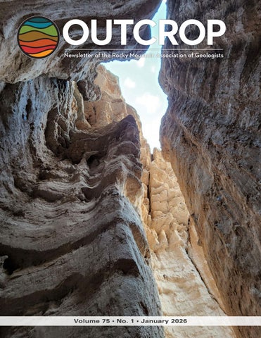
Deeply cut box canyons through volcaniclastic conglomerates of the Sevier River Formation and rhyolite ash-flow tuffs of the Joe Lott Tuff in the Marysvale Volcanic Field near Castle Rock Campground, Joe Lott Creek, Utah. Photo by Tanner Nielsen.
32 January Hybrid Lunch Talk: Rachael Moreland 34 February Hybrid Lunch Talk: Riley Brinkerhoff 38 In The Pipeline 52 Outcrop Advertising Rates 52 Welcome New RMAG Members! 53 Calendar 53 Advertiser Index
Vol. 75, No. 1 | www.rmag.org
5
OUTCROP | January 2026
IN 2025YOUR SUMMIT SPONSORSHIP DOLLARS SUPPORTED: MEMBERS
1,200
EVENT ATTENDEES
1,400
WEBSITE VISITORS
8,000
OUTCROP READERS
8,000
COMMUNITY CONTACTS
7,000
EMAIL SUBSCRIBERS
4,000
infographic link
NETWORKING EVENTS
28
CONTINUING EDUCATION EVENTS
13
FIELD TRIPS
8
OUTCROP | January 2026
6
2 0 2 6
Vol. 75, No. 1 | www.rmag.org
October 24, 2025 Geoscience Community: We greatly appreciate every Summit Sponsor and Event Sponsor who contributed to RMAG over the last year. Your support is essential to our organization. In 2025, the Rocky Mountain Association of Geologists was proud to host a dynamic lineup of events, including the North American Helium & Hydrogen conference, which examined the quickly growing field. Members explored the beauty and geological wonders of the Grand Canyon and the San Jaun’s as well geology across the state. Volunteers shared their passion for geoscience with students across the region through classroom visits and community festivals. Members also enjoyed numerous opportunities to connect outside the office through monthly lunches, coffees, happy hours, and our annual Golf Tournament. Looking ahead, 2026 brings new opportunities for RMAG and our partners. Your financial support allows us to start the year off with a luncheon on the State of the Industry before diving into the impacts of new and evolving technologies on industry including in AI’s ever-growing presence. Plans are coming together to host a fundamentals class series throughout the year, two separate symposiums on the research out of USGS and research on the Mowry. Networking in 2026 will include our regular happy hours and coffee hour networking, plus we’ll have Rockbusters, the Golf Tournament and we’re bringing back the Clay Shoot. With your support RMAG Members share the wonders of earth sciences through community and school outreach. Finally, your financial support is crucial to our publication efforts, which include the monthly Outcrop newsletter and the quarterly Mountain Geologist journal. Your financial commitment includes enrollment opportunities across all the RMAG events, whether joining the educational opportunities and joining the comradery of the golf tournament your employees will gain access. RMAG also recognizes Summit Sponsors through in-person signage, on our website, in our publications, and on social media. Thank you to our current Summit Sponsors; we look forward to your continued support in 2026. For those not yet sponsoring, now is the perfect time to get involved. Sponsorship with RMAG directly supports the geoscience community – fueling education, networking, and professional development opportunities throughout the Rocky Mountain region. We invite you to review or sponsorship packages and find the level that best aligns with your company’s goals. Whether you choose to become an annual Summit Sponsor or support a single event, your partnership will help us advance geoscience education and keep our community thriving. Become a Summit Sponsor by contacting RMAG Executive Director, Bridget Crowther at bcrowther@rmag.org or 720-672-9898 to discuss opportunities and reserve your sponsorship for 2026. Sincerely, Sandra Labrum 2026 RMAG President
Bridget Crowther RMAG Executive Director
P: (720)672-9898 staff@rmag.org www.rmag.org Vol. 75, No. 1 | www.rmag.org
730 17th Street, B1 Denver, CO 80202
7
OUTCROP | January 2026
RMAG ANNUAL
SUMMIT SPONSORSHIP
PLATINUM, GOLD, & SILVER
SPONSORSHIP LEVEL
PLATINUM
GOLD
SILVER
$10,000
$5,000
$2,500
$835
$417
$208
$10,000
$5,000
$3,000
4
2
1
Contribution Level Monthly Cost
Benefits Value
RMAG MEMBERSHIP Active or Associate Membership in the Association for employees
RMAG WEBSITE BENEFITS Company Logo on Summit Sponsor Page of www.rmag.org
Large Logo & Link
Articles and Ads on special Advertisers web page
4 articles & 4 large ads
Medium Logo and Link 2 articles & 2 medium ads
Small Logo and Link 2 small ads
PUBLICATION ADVERTISING 12 months of Outcrop advertising: To receive 12 full months, company logos and ad art must be received no later than the 20th of the month in which you register. The Outcrop (receive benefits for 12 issues, monthly online publication
Full page ad
2/3 page ad
1/2 page ad
Company Logo listed as an annual Sponsor in The Outcrop
Large Logo
Medium Logo
Small Logo
EVENT ADVERTISING Sponsorship will be acknowledged as part the summit sponsors at all RMAG Events. Additional Sponsorship Opportunities will be available for all RMAG Events. Company Logo Looping in Slide Decks
Large logo individual Slide
Medium logo
Small Logo
Company Logo on Summit Sponsor Signage at all events
Large logo
Medium Logo
Small logo
RMAG EDUCATION EVENTS Registration points are cumulative and can be used for Symposiums or Short Courses. For example a Platinum Sponsor can send 4 people to the upcoming symposium conferences and register for 2 short courses. Total Educational Tickets
6
3
1
RMAG SOCIAL EVENTS Registration Points are cumulative and can be used for any social event. For example, 1 point means 1 golfer, or 1 registration for Rockbusters. *2 points can be used for a golf hole if that makes more sense for your company. Total Social Event Tickets
8
4
2
3
2
RMAG LUNCHEONS & FIELD TRIP TICKETS Registration Points are cumulative for luncheons or one day field trips. Total Luncheon & Field Trip Tickets
5
For all event tickets please contact the RMAG office at staff@rmag.org to use your spots.
OUTCROP | January 2026
8
Vol. 75, No. 1 | www.rmag.org
RMAG 2026 SUMMIT SPONSORSHIP Payment Options
All sponsor benefits event tickets follow RMAG event registration deadlines. All benefits end 12 months after registration. RMAG 2026 ANNUAL SUMMIT SPONSOR OPPORTUNITIES Platinum Sponsor Gold Sponsor Silver Sponsor
Summit Sponsorship benefit term is for 12 months! Specify type of payment on signed form, and send logo and advertisements to staff@rmag.org Company: Company Representative: Address: City:
State:
Phone:
Zip Code: Email:
Payment Method:
Credit Card
Credit Card Information: Select Card: AMEX
ACH
Check VISA
Mastercard
Discover
Name as it appears on Credit Card: Credit Card #: Expiration Date:
Security Code:
Signature: ACH: contact the RMAG office at staff@rmag.org for directions. Mail Checks payable to RMAG: Rocky Mountain Association of Geologists (RMAG) 730 17th Street, B1 Denver, CO 80202
RMAG events are subject to change. Cancellation or rescheduling of events does not give the sponsor the right to refund. Summit Sponsors will receive benefits at any new events added into the RMAG schedule.
Thank you for your generous support! P: (720)672-9898 staff@rmag.org www.rmag.org
Vol. 75, No. 1 | www.rmag.org
730 17th Street, B1 Denver, CO 80202
9
OUTCROP | January 2026
RMAG DECEMBER 2025 BOARD OF DIRECTORS MEETING By Drew Scherer, Secretary flatirongeo@gmail.com
John C. Webb
Consulting Geologist Stratigraphy, Sedimentology and Petrography of Clastic and Carbonate Systems
Reservoir Characterization Petroleum, SWD, CCUS, Geothermal
OUTCROP | January 2026
Louisville, Colorado Johnwebb20@comcast.net 303.917.0644
students and geologists at any stage in their career. The Membership Committee reports that Coffee and Happy Hour will return in January and are working on planning events such as The Rockbuster’s Ball (January 30th), Clay Shoot (May 8th), and Golf Tournament (late August) as well as spring and summer social events. The Publications Committee will have a new link for Member’s Corner submissions streamlining the process and The Outcrop has a solid pipeline of articles through early Spring. The Winter edition of The Mountain Geologist should be released by the end of the year. The On the Rocks Committee is at no shortage of ideas for our 2026 field season and some trips, such as the Yampa/Green River float trip have already been sold out. Lastly, some new business, our YouTube Channel (@RMAGDenver) has launched, showcasing Luncheon talks and other videos that are at least a year old. More recent talks can still be bought on the RMAG site. This is a great addition to our media portfolio providing a great resource for teachers, students and interested parties to learn more about geology, while creating some nominal revenue for the organization in the process. The board also voted during the meeting to approve the 2026 budget, and Bridget’s compensation package. This will be my last Secretary’s note as my 2-year term has ended this month. Not to worry, you all will be in great hands with our new Secretary, Stephanie, who will take over starting on next month’s issue. Thank you to all who have made my time at RMAG such an enjoyable experience, especially Bridget and the Board members. I am planning on remaining an active member following this post and will be back to contributing to the Continuing Education Committee. Hope you all have a happy holiday and a great new year!
The Board of Directors met on December 12th, 2025, in-person at the Denver Earth Resources Library at 3pm. All current board members were present except for one. We also had two of our 2026 new board members join us for the meeting. The office began with reporting membership numbers. Notably we crossed the 1200 active member threshold which is a great milestone and added 20 new members this month. Attendance for our end of year events was as expected for this time of the year. The Finance Committee reported a net revenue of -$8.1k, which is to be expected around the end of the year. This past month the Finance Committee executed on our new investment policy which includes a slightly more conservative portfolio of assets as well as operating expenses held in liquid/cash assets. At the meeting the board voted to approve new investment policy language in our governing documents. The CEC committee reported that Luncheon attendance was good despite the weather and has talks organized through March of next year. They are working on planning a USGS Symposium in the Spring for papers and posters that did not get presented at the RMS-AAPG event in the Fall due to the Government shutdown, and are planning a Basin Conference focusing on the Mowry for next fall, with a call for papers to come out in a couple of months. They will also organize a series of 101 classes with topics including Data Science and Analytics, Geosteering, Reservoir Engineering, Economics, Geothermal and more, relevant to both
10
Vol. 75, No. 1 | www.rmag.org
PLEASE JOIN RMAG FOR THE
ROCKBUSTERS BALL
2026
JANUARY
30
2026
AT 6 O’CLOCK IN THE EVENING
MINES MUSEUM OF EARTH SCIENCE 1310 MAPLE ST. GOLDEN, CO 80401 SPONSORSHIP OPPORTUNITIES AVAILABLE
rmag.org/rockbusters
THANKS TO OUR SPONSORS
Vol. 75, No. 1 | www.rmag.org
11
OUTCROP | January 2026
PRESIDENT’S LETTER By Sandra Labrum slabrum@slb.com
A Year of Connections First of all, Happy New Year! I am so thrilled to be writing to you in 2026. I like to begin each new year by taking stock of what mattered most in the year behind us and by setting an intention for the year ahead, even if that focus devolves as the year unfolds. In that spirit, I want to start by thanking our outgoing Board members for their time, passion, and commitment to RMAG. I know you’ve heard it a hundred times, but it truly bears repeating: RMAG would not be the society it is without dedicated volunteers who are willing to step up and serve. Your contributions make a real and lasting impact.
OUTCROP | January 2026
I would also like to extend my heartfelt thanks to our incredible Executive Director, Bridget. Your leadership, organization, and vision have elevated RMAG and made us the envy of many professional societies. We are incredibly fortunate to have you. As we look ahead, I would love for 2026 to be a year of continued growth for RMAG. Over the past several years, we have settled into a pattern of thoughtful diversification, and I am excited to see that momentum continue. We have expanded our technical programming to better serve not only the oil and gas community, but also the broad and evolving range of geologic interests represented in our membership. We have embraced new technology with the launch of the RMAG YouTube Channel (check it out if you haven’t yet @RMAGDenver it’s a fantastic resource). And this year, we are offering a diverse slate of field trips that I hope will spark curiosity and engagement across our community. Most of all, I hope we can make 2026 a year of new connections. I encourage you to attend an event you haven’t been to before, volunteer for a committee (please, please, please!), or consider signing up to give a lunch talk. My goal is to leave my term as RMAG President having helped foster a stronger, more connected society. There’s a saying that goes: If you want to go fast, go alone. If you want to go far, go together. Let’s see just how far we can go together with RMAG in 2026. Warm regards and Happy New Year, —Sandra Labrum
Hi All,
12
Vol. 75, No. 1 | www.rmag.org
COFFEE HOUR Thur s da y J a nua r y 1 5, 2025 10 am Huckleberry Roasters - Dairy Block 1800 Wazee Street Denver, CO 80202 rmag.org/coffee
JANUARY HAPPY HOUR JOIN YOUR FELLOW GEOSCIENTISTS FOR A DRINK Tuesday, January 27, 2026 4pm Mad Macks Brewing Applegrove Shopping Center 1921 Youngfield St. #120 Golden, CO 80401
RMAG.ORG/HAPPYHOUR
Vol. 75, No. 1 | www.rmag.org
13
OUTCROP | January 2026
LEAD STORY
FROM OUTCROPS TO OCEANS PART 1
A ROCKY MOUNTAIN GEOLOGIST’S GUIDE TO GOING TO SEA BY CODY BAHLAU cbahlau@ldeo.columbia.edu
experience aboard the R/V Marcus G. Langseth. Operated by Columbia University’s Lamont-Doherty Earth Observatory (LDEO) and supported by the U.S. National Science Foundation, the Langseth carries forward a proud legacy of ocean exploration. Its predecessors, including the R/V Vema, R/V Robert D. Conrad, and R/V Maurice Ewing, played pivotal roles in defining modern marine geology. These ships supported decades of transformative science, from seafloor spreading confirmation to global bathymetric mapping. The legacy includes figures such as Marie Tharp, who worked at Lamont and co-created the first comprehensive maps of the ocean floor. Her work revealed the Mid-Atlantic Ridge and transformed our understanding of plate tectonics. Originally built in 1991 for the oil and gas industry and refitted for academic research in 2008, the R/V Marcus G. Langseth is a global-class research
INTRODUCTION Fieldwork often conjures images of outcrops, rock hammers, and rugged terrain, but some of the most valuable geologic data lies hidden beneath the sea. For geologists accustomed to the Rockies, fieldwork typically means direct observation of exposed structure. Offshore, the landscape is submerged, and data is gathered through remote sensing, acoustic imaging, and sampling tools. Yet the scientific goals remain strikingly similar: mapping structure, interpreting stratigraphy, and reconstructing tectonic history. This article is the first in a two-part series designed to help geoscientists navigate the transition from land to sea. Here, the focus is on preparation, logistics, and daily life aboard a research vessel. A follow-up article will take a deeper dive into the geophysical tools, data collection techniques, and technology that power offshore exploration. The guidance provided draws from firsthand
OUTCROP | January 2026
14
Vol. 75, No. 1 | www.rmag.org
PHOTO 1:
R/V Marcus G. Langseth (MGL) as it sails past the Statue of Liberty. PHOTO 2:
Technicians on MGL before sailing over the Mid-AtlanticRidge.
LEAD STORY Foundation (NSF). Proposals must align with a program’s scientific priorities and follow the guidelines in the NSF Proposal and Award Policies and Procedures Guide (PAPPG). This includes sections on intellectual merit, broader impacts, and a detailed data management plan. Proposals are submitted through Research.gov or Grants.gov, and institutional registrations must be completed in advance. Principal Investigators (PIs) are most often university faculty, research scientists at nonprofit institutions, or staff scientists at national laboratories. In some cases, postdoctoral researchers may serve as PIs, depending on the requirements of the specific NSF program. Regardless of background, all PIs must be affiliated with an eligible U.S.-based institution that can receive federal research funding. For those new to oceanographic fieldwork or unfamiliar with requesting ship time, the NSF–UNOLS Chief Scientist Training Cruise Program offers a valuable introduction. This multi-day cruise, along with pre- and post-cruise workshops, guides early-career marine scientists, such as PhD students and postdocs, through the process of planning, executing, and leading shipboard research aboard a UNOLS vessel. The program also covers how to request research time for specialized equipment like ROVs and submersibles. Participants often receive stipends to help with travel and research costs, making it a practical and educational first step toward becoming a Chief Scientist. Once funded, PIs work closely with the University-National Oceanographic Laboratory System (UNOLS) and vessel operators to determine the feasibility of their proposed work, coordinate cruise logistics, and ensure compliance with permitting and data archiving requirements. Successful PIs are responsible not only for meeting the scientific goals of the cruise but also for mentoring early-career participants and ensuring that data are properly archived through programs such as Rolling Deck to Repository (R2R).
vessel specializing in marine geophysics. Its capabilities include 2D and 3D multichannel seismic acquisition, multibeam bathymetry, sub-bottom profiling, sediment coring, dredging, and deployment of ocean bottom seismometers. From the Arctic to the Southern Ocean, it supports international collaboration that explores plate boundaries, rift zones, and geologic hazards. Since joining the academic fleet, the Langseth has sailed more than 700,000 kilometers in pursuit of ocean science. The author, Cody Bahlau, serves as Chief Science Officer aboard the Langseth and has participated in over 30 oceanographic expeditions worldwide. With a background in geology, a graduate certificate in GIS, and prior experience in the oil and gas sector, he manages shipboard operations, coordinates technical teams, and bridges communication between scientists, crew, and shore-based institutions. His work spans seismic surveys, coring campaigns, and public outreach, including livestreams that connect offshore science with classrooms across North America.
I. GETTING INVOLVED IN OFFSHORE RESEARCH:
Offshore research is inherently collaborative, drawing together scientists, students, and technical professionals from across the U.S. and beyond. These teams not only work together but often live together for weeks or months at sea. Institutions such as Lamont-Doherty Earth Observatory (LDEO), Woods Hole Oceanographic Institution (WHOI), Scripps Institution of Oceanography, and the University of Texas Institute for Geophysics (UTIG) regularly lead or contribute to expeditions aboard the Langseth and other research vessels. Opportunities to sail aboard research ships are open to a wide range of participants, including principal investigators, graduate and undergraduate students, technical staff, and outreach specialists. These roles exist not only within the U.S. academic fleet but also through federal agencies and private foundations. Each path has its own entry points, requirements, and expectations. Principal Investigators (PIs) Researchers typically begin their involvement by submitting a proposal to the National Science OUTCROP | January 2026
PHOTO 3: MGL at port in Savanah, Ga preparing to sail. PHOTO 4: The Laundry Room on board the MGL. PHOTO 5: Marine crew and scientist during a abandon
ship drill. 16
Vol. 75, No. 1 | www.rmag.org
3
4
5
Vol. 75, No. 1 | www.rmag.org
17
OUTCROP | January 2026
6 7
PHOTO 6:
Crew member going down the gangway to start preparation of lifting it back onboard before sailing. PHOTO 7:
Typical scientist cabin.
LEAD STORY
Technical Professionals Technicians play a critical role in every offshore expedition, supporting the operation, deployment, and maintenance of complex instruments and systems. Their work spans multiple disciplines, including electronics, data engineering, sonar operations, mechanical systems, deck equipment handling and Vol. 75, No. 1 | www.rmag.org
Students and Early-Career Scientists Graduate and undergraduate students often join research cruises as part of a PI’s science team, contributing to data collection, instrumentation, and sampling. These shipboard experiences offer valuable exposure to multidisciplinary science, technical workflows, and collaborative research in a remote setting. Many participants are recruited directly through university departments and research labs, where PIs advertise open berths via email lists, bulletin boards, or faculty networks. Opportunities are also shared through national platforms such as the UNOLS Opportunities page and the UNOLS Early Career Programs page, which highlight internships, training cruises, and open calls for cruise participation. Several structured programs support student engagement: • STEMSEAS (STEM Student Experiences Aboard Ships) offers short-term exploratory cruises for undergraduates, particularly those from underrepresented backgrounds or with limited prior field experience. • NSF-supported programs, such as the OCE Postdoctoral Research Fellowships and other awards, may include cruise participation as part of fieldbased training. • Scientist at Sea (Eckerd College) provides undergraduate students with introductory, hands-on research experiences aboard active oceanographic cruises, with a focus on building technical skills and career exposure. Additional opportunities may be listed on NSF-funded project websites, professional society job boards (such as AGU, GSA, or MTS), or distributed via listservs and social media platforms like Twitter/X and LinkedIn. Staying connected to these networks and letting faculty know of your interest can increase your chances of being invited to sea.
PHOTO 8: MGL’s library and quiet room.
19
project management. These specialists manage science gear, troubleshoot technical issues, ensure data integrity, and work closely with scientists to execute successful research operations at sea. Opportunities include: • UNOLS Tech Pool: A shared national pool of marine technicians supporting research across the UNOLS fleet. This system ensures vessels can access skilled personnel with the right technical background for each project. The Tech Pool is for those who already have experience going to sea on UNOLS vessels. • Institutional Expertise: Certain institutions specialize in specific marine instrumentation. For example: » Woods Hole Oceanographic Institution (WHOI) and Scripps Institution of Oceanography contribute to the Ocean Bottom
OUTCROP | January 2026
LEAD STORY NOAA’s Okeanos Explorer conducts ROV-based deep-sea exploration and streams live video and data in real time to shore-based scientists and the public. The Explorer-in-Training program provides undergraduate and graduate students with hands-on experience in ocean mapping and exploration technologies. Additionally, NOAA’s Teacher at Sea program allows K–12 educators to join research cruises aboard NOAA vessels, helping them translate ocean science into classroom learning. USGS scientists sometimes join research cruises on UNOLS vessels, often as part of collaborative projects focused on seafloor habitats, methane seeps, sediment transport, and marine hazards. They also conduct independent marine fieldwork using NOAA vessels, chartered ships, or USGS-operated platforms. While the agency does not run cruise-specific student programs, it offers hands-on research opportunities through internships and academic partnerships, especially in sedimentology, geophysics, and coastal ecology.
Seismograph Instrument Pool (OBSIP), with staff skilled in deploying OBS units, hydrophones, and seafloor sensors. » Oregon State University’s MARSSAM group leads many U.S. sediment coring & rock dredging operations, providing both equipment and specialized technical support. • Shipboard Hiring: Operators such as Lamont-Doherty Earth Observatory (LDEO), WHOI, Scripps, Oregon State and many more institutions operating ships in the UNOLS fleet employ full-time technical staff to support various at-sea science operations where their contribution will involve deck work, navigation, seismic data acquisition, mechanical systems, and IT. • UNOLS MATE Internship Program: This long-running initiative places students and recent graduates aboard vessels to train in marine technology. Interns gain hands-on experience with deployment systems, winch operations, sensor configuration, and deck safety. • Industry Crossover: The R/V Marcus G. Langseth, originally built for oil and gas seismic exploration, frequently hires or contracts technicians with backgrounds in industry. Its complex equipment and operational demands are well suited to professionals with prior experience in offshore energy.
Outreach Specialists Many modern expeditions include dedicated roles for science communicators, educators, and artists-at-sea. These outreach specialists help bridge the gap between shipboard science and the public, using livestreams, classroom programs, blog posts, social media, and visual storytelling to share discoveries in real time. Candidates often have a STEM background paired with communication or education experience. Federal Agencies: NOAA & USGS Opportunities Offshore research extends beyond the academic fleet. Agencies like NOAA and the U.S. Geological Survey (USGS) also operate missions where geologists, oceanographers, and educators can get involved. Their ships support a range of work, from deep-sea mapping to ecological surveys, and often welcome early-career participants alongside seasoned researchers. OUTCROP | January 2026
20
Private and Nonprofit Opportunities Not all research cruises are part of the NSF-funded UNOLS fleet. Several high-profile research vessels operated by private foundations, nonprofits, or international organizations offer additional opportunities for scientists, students, and outreach professionals. These vessels often focus on technology-driven exploration, public engagement, and open-access science. • E/V Nautilus (operated by Ocean Exploration Trust) supports deep-sea exploration using remotely operated vehicles (ROVs), with an onboard team of scientists, engineers, and educators. The ship is known for its livestreamed missions, real-time science communication, and robust outreach programs. • R/V Falkor (too) (operated by Schmidt Ocean Institute) focuses on cutting-edge oceanographic research and supports open sharing of data, imagery, and findings. Falkor routinely includes an artist-at-sea or outreach specialist as part of the science party. • R/V Tara (run by Fondation Tara Océan) conducts global marine biology and climate missions, often with multidisciplinary teams that include scientists, educators, journalists, and documentarians.
Vol. 75, No. 1 | www.rmag.org
PHOTO 9:
MGL’s galley and hot table. PHOTO 10:
MGL’s mess room, where the crew meets to eat and socialize.
9
10
Vol. 75, No. 1 | www.rmag.org
21
OUTCROP | January 2026
12 11
PHOTO 11:
MGL’s movie and game room. PHOTO 12:
MGL’s gym, just like on shore, Clean After USE!!
LEAD STORY At this stage, estimating time for mobilization, equipment deployment, data collection, and transit is critical. Previous cruise reports and advice from vessel operators can help develop realistic schedules that align your science goals with operational limits.
• OceanXplorer (operated by OceanX) is one of the most advanced exploration vessels ever built, combining scientific research with high-end media production. OceanXplorer supports deep-sea exploration using submersibles, ROVs, and advanced imaging technologies. The ship’s missions often feature collaborations with scientists, educators, and filmmakers to expand ocean knowledge and inspire global audiences. These ships often issue open calls for proposals or participation, and they tend to place a strong emphasis on interdisciplinary collaboration and broad public engagement.
One Year Before Sailing Once funding is secured, focus shifts to permits and logistics. Environmental permits, foreign clearances, and coordination with international partners should begin early, as they can take several months. A pre-cruise meeting, ideally 6 to 9 months before departure, should align science plans, workflows, deck layouts, and safety protocols. Researchers should also reserve specialized equipment during this window. For more technical projects, this is the time to finalize equipment plans, system configurations, and integration of any personal instrumentation. Time estimates for mobilization, operations, and transits should be refined.
II. CRUISE PLANNING OVERVIEW
Planning a research cruise begins long before the ship leaves the dock. For National Science Foundation (NSF)-funded expeditions, this process often starts 18 to 24 months in advance, especially if you’re requesting a large vessel or specialized equipment. The timeline includes everything from submitting proposals and securing permits to assembling the right team and coordinating equipment needs. Much of the best-practice guidance for cruise planning is provided by the University-National Oceanographic Laboratory System (UNOLS), a consortium of academic institutions and national labs that coordinate the U.S. Academic Research Fleet. UNOLS supports efficient scheduling, technical readiness, and safe operations aboard federally funded vessels. Their website offers detailed resources on proposal forms, permitting timelines, equipment requests, and cruise planning. If you’re preparing to sail with the U.S. Academic Research Fleet, early engagement with your vessel operator and close adherence to UNOLS guidance are essential. Cruise planning unfolds in several key phases to help ensure a smooth, efficient, and well-supported expedition.
One and Half to Two Years Before Sailing Planning begins with developing your NSF proposal and ship-time request. Early discussions with the vessel operator are important to confirm ship capabilities and equipment compatibility. Proposal budgets should include pre-cruise travel, technical services, shipping, and potential collaboration needs. Vol. 75, No. 1 | www.rmag.org
Within 6 Months Before Sailing As the cruise approaches, technical planning ramps up. Complete the ship’s pre-cruise questionnaire, finalize lab and deck layouts, and confirm shipping and customs details. If bringing personal equipment, ensure it meets safety and technical standards. By now, your data management plan should be in place, including arrangements to archive cruise data for future access. This is also the time to start assembling your full team. Many cruises include graduate students, undergraduates, and early-career scientists who contribute to the project while gaining valuable field experience. If your cruise has open berths for students or outreach specialists, begin recruiting and confirming participants now. Connecting with your team early helps align expectations, assign responsibilities, and build familiarity before setting sail.
23
One Month Before Sailing In the final weeks, verify that all permits, shipping, and travel logistics are complete. Finalize medical clearances, safety training, and any special requirements for participants. If deploying ocean bottom seismometers or other long-term instruments, notify the vessel operator to coordinate logistics.
OUTCROP | January 2026
LEAD STORY medications, including extras. • Keep medications in original containers in case customs requires verification. • Carry any daily-use items like allergy meds, inhalers, or EpiPens. Motion sickness is common, especially for firsttime sailors. Options like Dramamine or scopolamine patches can help, but they’re most effective when taken before symptoms appear, so consult your doctor in advance. On many vessels, there is no doctor or nurse onboard. For example, the R/V Marcus G. Langseth relies on the Captain as the primary medical provider. The ship is equipped with a well-stocked ship hospital and has access to 24/7 telemedicine services, offering real-time consultation with physicians if needed. If you have a pre-existing condition, share it with the operations coordinator or university staff ahead of time to assess risk and make sure proper arrangements are in place.
Don’t Let Paperwork Sink Your Cruise Missing deadlines or documents can jeopardize even a well-planned expedition. Fortunately, vessel operators and institutional support teams are available to help. Their expertise covers: • Technical specifications and system requirements • Letters of support for proposals • Logistics and equipment integration • Realistic schedules for operations and potential delays With early coordination and support from experienced teams, you can confidently plan a successful offshore research cruise.
III. CRUISE PARTICIPANT PREPARATION
Preparing to join a research cruise involves more than packing your sea bags. Each participant must complete a set of administrative, medical, and safety requirements to be cleared for embarkation. These steps help ensure the safety of the science party, crew, and vessel operations while also supporting coordination across institutions. Delays or omissions in this process, especially for seismic or international cruises, can jeopardize participation. Permitting and clearance often require significant lead time, so it’s important to stay organized and communicate regularly with the vessel operator and university support staff. Typical requirements include: • Passport or ID scans and visas, if entering foreign ports • Medical clearance, vaccinations, and emergency contact forms • Safety or civility-at-sea training (usually provided by the university) • Signed Statement of Responsibility outlining onboard conduct • Dietary restrictions or allergy declarations (to inform galley staff)
Health and Medical Preparation At sea, medical emergencies are more serious due to limited access to immediate care. Evacuation may take days. For that reason, plan ahead: • Schedule a routine medical and dental check-up before your cruise. • Bring an ample supply of prescription OUTCROP | January 2026
Internet and Communication at Sea Internet access varies greatly across vessels. Many now use Starlink or similar satellite systems, offering relatively stable access for messaging and basic browsing. However, dropouts are common and speeds vary with location, weather, and user traffic. Before sailing: • Set recurring bills to autopay. • Enable an automatic email reply. • Download and test messaging apps like WhatsApp or Signal, which perform well with limited bandwidth. Avoid planning for heavy data use like large file transfers or video conferencing unless specifically arranged. Assume communications will be basic, and plan accordingly. Packing and Living Aboard Space is limited, so pack efficiently. Use soft-sided duffel bags or backpacks that fit into small cabin storage areas. Think utility and compactness: a mix between camping and lab life. Laundry facilities are PHOTO 13: MGL’s Bridge.
24
Vol. 75, No. 1 | www.rmag.org
Vol. 75, No. 1 | www.rmag.org 13
25
OUTCROP | January 2026
LEAD STORY Some vessels provide PPE; others do not. Check in advance. Layered clothing is essential for changing weather conditions. Planning an offshore expedition can seem daunting at first, but support is built into the process. The vessel operator and university support staff are there to guide the process. With clear communication, timely paperwork, and a collaborative approach, your first cruise can be both successful and rewarding, even if you’ve never set foot on a ship before.
available but limited by schedule or machine availability. Regardless of the destination, pack layers, interior spaces like labs and lounges are often air conditioned and can be unexpectedly cold. And remember, there’s no running to Home Depot or CVS in the middle of the ocean, so make sure you bring everything you might need! A suggested packing list is included at the end of this article.
Personal Protective Equipment (PPE) PPE is required for any deck operations. At a minimum, plan to wear: • Steel-toe or composite-toe boots, Hard hat, Safety glasses, Work gloves, Rain or foul-weather gear.
IV. LIFE ABOARD: ORIENTATION, ROUTINES, AND SHIPBOARD CULTURE
Boarding a research vessel marks the start of a unique offshore experience, equal parts laboratory, home, and workplace. For many, stepping onto a ship for the first time is like entering a small floating
PHOTO 14: MGL’s technicians at work preparing equipment.
14
OUTCROP | January 2026
26
Vol. 75, No. 1 | www.rmag.org
LEAD STORY
Vol. 75, No. 1 | www.rmag.org
eye masks, and apps for white noise can help block out distractions. Meals are served on a strict schedule three times a day, usually buffet-style, with hearty, calorie-dense options to fuel long work hours. Snacks, coffee, and drinks are available between meals. Galley space is shared, so clean up after yourself and respect meal times. Dietary restrictions must be communicated well before sailing; last-minute requests may not be accommodated due to remote operations. Beyond work and meals, shipboard life offers limited but welcome downtime. Many vessels have a lounge with movies, a small gym, or a library. WiFi is normally available on most ships, often through satellite systems like Starlink, but bandwidth is limited. Email, messaging apps, and basic browsing are usually accessible, though speeds vary with location, weather, and user traffic. Streaming, video calls, or large downloads should be avoided unless specifically arranged with the vessel operator. Use the opportunity to unplug, read, or get to know your shipmates. Newcomers will quickly notice that research vessels have their own language. A few quick translations: • Port = Left side of the ship facing forward • Starboard = Right side of the ship facing forward • Bow = Front of the ship • Stern = Back of the ship • Galley = Kitchen • Mess = Dining area • Head = Bathroom • Berth = Bed or sleeping area If a term or tool is unfamiliar, ask questions, curiosity is welcomed, and most crew or technicians are glad to explain. Every expedition is a learning experience, even for seasoned sailors. Finally, respect is the foundation of life at sea. Shared spaces require teamwork and patience. Keep your bunk tidy, respect quiet hours, be on time for meetings and drills, and always follow safety protocols. Only operate equipment you’ve been trained on. A positive, flexible attitude goes a long way toward building camaraderie and ensuring your offshore experience is both productive and rewarding for everyone aboard.
community with its own routines, structure, and culture. Upon arrival, science personnel are typically greeted by crew members or marine technicians, shown to their cabins, and introduced to shared laboratory and living spaces. Accommodations are tight, and facilities vary by vessel, so arriving organized, adaptable, and with minimal luggage is key. Depending on the ship, your cabin could range from a private room to shared quarters with up to eight bunks. Two-person cabins are fairly standard on most research vessels, but larger shared rooms are common, especially on older ships or those operating with big science teams. Space is limited, so soft-sided duffel bags and smart packing will make your life easier. Expect to share close quarters for several weeks, making personal organization and respect for others essential. A mandatory safety orientation takes place shortly after boarding or before departure. This includes a walkthrough of critical areas, such as the bridge, galley, labs, and working decks, as well as instruction on muster stations, evacuation routes, and the use of life jackets and immersion suits. A full safety drill is conducted within 24 hours of sailing, often involving donning a survival suit and locating emergency gear. Even experienced sailors should take these drills seriously; in a real emergency, clear knowledge of procedures can save lives. Once underway, the ship operates around the clock. Research does not stop for sunsets, weather, or weekends. Most science teams work on fixed 12hour or 8-hour shifts, though some projects follow rotating 4-hour watches. You may be assigned to a day or night shift depending on project needs. Even if you’re not directly involved in running equipment, there is always work to do; prepping gear, assisting with deployments, logging metadata, monitoring instruments, or supporting recoveries. Every task matters, and shift handovers are critical to maintaining continuity. All work is logged in digital databases or physical notebooks, forming an essential record of the mission. Prepare for your sleep schedule to shift dramatically. If assigned to nights, your body may need several days to adjust. It often feels like a bad case of jet lag, compounded by ship motion and noise. When off shift, sleep whenever possible. Earplugs,
27
OUTCROP | January 2026
LEAD STORY
Second Engineer, Third Engineer, Oilers • Steward Department: Chief Steward, Cooks, Utilities • Technical Support: Lead Technician, along with 2 to 12 specialized technicians depending on cruise complexity These multidisciplinary teams ensure science missions run smoothly, from data collection to shipboard life, keeping operations safe and on schedule even in challenging offshore environments.
V. WORKING WITH MARINE TEAMS Research vessels operate under well-defined hierarchies to ensure safety, efficiency, and clear communication. The Captain has ultimate authority over all ship operations, while the Chief Scientist is responsible for delivering the cruise’s scientific objectives. Technical execution and coordination typically fall under a Lead Technician, who serves as a bridge between the science party, vessel crew, and shorebased support teams. The Lead Technician oversees science operations, coordinates instrument deployment and recovery, manages acquisition systems, and ensures that both research goals and shipboard procedures remain aligned. On complex expeditions, technicians with specialized skills work alongside the science team to support every aspect of operations. Technicians wear many hats, their roles vary by cruise type but often include: • Electronic & Communications Technicians: Maintain navigation computers, sonar systems, satellite communications, data networks, and shipboard IT infrastructure. • Computer & Data Engineers: Oversee data acquisition, processing, storage, and real-time system monitoring to ensure data quality and integrity. • Sonar & Survey Technicians: Deploy and operate multibeam echosounders, side-scan sonar, sub-bottom profilers, magnetometers, and other remote sensing tools. • Winch & Deck Technicians: Manage corers, dredges, ocean-bottom seismometers, and streamers, ensuring safe and efficient overboard operations. • Mechanical Technicians: Support deck systems, hydraulics, robotics, and deployed equipment essential to handling and positioning science gear. • Surveyors & Geologists: Assist with seafloor mapping, instrument calibration, and preliminary interpretation of geophysical data. Every department works together to support safe, efficient operations at sea: Vessel Departments • Deck and Navigation: Chief Mate, Second Mate, Third Mate, Bosun, Able Seamen (ABs), Ordinary Seamen (OSs) • Engineering: Chief Engineer, First Engineer, OUTCROP | January 2026
VI. SCIENCE AT SEA
28
Offshore research builds on familiar geologic objectives such as mapping structure, interpreting stratigraphy, and investigating tectonic processes, but applies them in a remote, instrument-driven environment. Unlike onshore fieldwork, where geologists may often set their own pace, marine operations run on tightly structured shifts, coordinated teams, and synchronized systems. Understanding these workflows helps anticipate daily schedules, tool limitations, and operational constraints. Marine geophysical cruises rely on continuous, large-scale data collection using a variety of tools: • Multibeam sonar provides high-resolution seafloor maps throughout the cruise. • Sub-bottom profilers image shallow sediment structures below the seafloor. • Seismic reflection surveys use long streamers and powerful sources to probe deep subsurface structure. These are among the most logistically intensive activities offshore. Deploying an 8–15 km streamer can take 12–24 hours; recoveries often exceed 12 hours. Source arrays take several hours to deploy and require servicing every 12 hours. Long streamers reduce maneuverability and slow the vessel to 4.5–5 knots. • Magnetometers and gravimeters passively log the Earth’s physical properties, with minimal intervention beyond initial setup. • Sediment coring (gravity, piston, and multicore) recovers physical samples to support geophysical interpretations. • Ocean Bottom Seismometers (OBS) record passive ground motion and are tracked acoustically for precise placement and later recovery.
Vol. 75, No. 1 | www.rmag.org
LEAD STORY
PHOTO 15: Main Lab, 40+ monitors, data acquisition and observation.
The technical details, tools, and acquisition techniques that support offshore science are diverse and specialized. These systems will be explored in much greater detail in Part Two of this series, which focuses specifically on the equipment, technology, and methodologies used aboard the R/V Marcus G. Langseth and other research vessels. For now, understanding that offshore surveys depend on careful planning, continuous teamwork, and reliable instrumentation will help you prepare for life and work at sea.
VII. SCIENTIFIC OUTPUT AND DATA MANAGEMENT
Offshore surveys produce large amounts of data across multiple systems. Depending on your role, you may help monitor acquisition, check data quality, or Vol. 75, No. 1 | www.rmag.org
29
flag gaps. Understanding the differences between raw, processed, and final data is key, along with knowing how files are organized and backed up. Most systems use specialized software. Ask the lead technician early on about available tools and post-cruise needs. Vessels typically follow standard routines for backups, metadata, and file integrity. Each cruise ends with a data package that may include: • Raw and processed data, Navigation and metadata logs, Survey summaries and cruise rep, Physical samples Confirm archiving requirements with the vessel operator or university before sailing. In the U.S., most data is archived through Rolling Deck to Repository (R2R), a national program that ensures long-term access and NSF compliance.
OUTCROP | January 2026
LEAD STORY
coordination, from permitting and protected species monitoring to international collaboration. These challenges provide a broader view of applied geoscience and expose participants to large-scale, interdisciplinary workflows that are rarely encountered in domestic land-based campaigns. Offshore research isn’t just a change of scenery; it’s a chance to hoist anchor on a new chapter of your scientific journey. Whether you’re teaming up with marine crews or simply curious how those colorful seafloor maps come to life, life at sea expands more than just your geoscience toolkit. It shifts your perspective, deepens your skills, and gives you a frontrow seat to how Earth’s hidden stories are written beneath the waves. So, stow your gear, brace for adventure, and get ready to sail into science. For those interested in a deeper dive, a follow-up article, Beneath the Waves: How Offshore Tools Reveal Earth’s Hidden Geology, takes a closer look at the technologies and techniques used aboard the R/V Marcus G. Langseth. It explores how seismic sources, streamers, multibeam sonar, coring tools, dredges, and ocean bottom sensors are deployed offshore to map the seafloor, image Earth’s crust, and recover physical samples. These tools not only reveal what lies beneath the ocean, but also help bridge offshore data with onshore geology.
VIII. A FEW KEY DIFFERENCES FROM ONSHORE FIELDWORK Working offshore shares many of the scientific goals familiar to field geologists, but the environment changes everything. Here are a few of the most notable differences: • Time and Schedule: You don’t control the clock. Shipboard schedules are dictated by operations, weather, and daylight (if applicable). Patience and flexibility are crucial. • Instrument-Based Workflows: Instead of rock hammers and field notes, you’ll rely on complex instrumentation, streamers, sonars, corers, and navigation systems, to gather indirect data from beneath the seafloor. • Chain of Command: Communications and decisions follow a strict structure, from the Captain to the Chief Scientist and technical leads. Respecting this hierarchy keeps operations safe and efficient. • Limited Personal Freedom: A research vessel is a closed environment. There’s no stepping away for a break or driving to the next site. Collaboration and adaptability become essential life skills. • Emergency Protocols: From equipment failures to medical incidents, all responses follow predefined procedures. Know your role and muster station before you sail. • Multidisciplinary Teams: You’ll work alongside oceanographers, engineers, technicians, and students. Embracing different perspectives strengthens both the science and the shipboard experience. • Pack what you’ll need: There’s no Home Depot or CVS around the corner. Careful planning, backup supplies, and a few well-chosen redundancies can make all the difference once you’re offshore.
IX. BRIDGING THE GAP
For field geologists, offshore research may feel unfamiliar at first. You trade outcrops for instruments, but the goals remain the same. Marine geophysical cruises expand your skillset with tools like subsurface imaging, geospatial analysis, and systems integration, skills that complement and enhance traditional fieldwork. Cruises also offer experience in complex OUTCROP | January 2026
30
Suggested Packing List: • Required Documents » Passport » Government-issued identification » Vaccination Card – Confirm with Research Vessel Team • On-Deck Work Clothes » Steel-toe or composite-toe boots/shoes (water resistant preferred) » Hiking pants or old jeans » T-shirts » Personal coveralls or overalls » Baseball cap or fishing hat » Thick socks (for cold and work-boot comfort) • Regular Clothes » Hiking pants, leggings, jeans, shorts » Short and long sleeve shirts, T-shirts » Sweatshirts/hoodies » Off-shift lounge clothes
Vol. 75, No. 1 | www.rmag.org
LEAD STORY
» Wet weather gear » Work-out clothes » Thermal layers » Beanie or thermal cap » Socks and underwear • Shoes » Shower sandals » Comfortable close-toed shoes for lab work (sneakers, Vans, Crocs, etc.) • Hygiene and Bathroom Essentials » Shampoo, conditioner, body/face soap » Hand soap (optional for cabin use) » Moisturizer and ChapStick » Sunscreen » Menstrual products » Travel-sized Kleenex/tissue packets • Personal first-aid kit » Dramamine/anti-nausea meds » Ibuprofen/Advil » Antacids (Tums)
» Vitamins/supplements • Miscellaneous » Ear plugs and eye mask for sleeping » Headbands/hair ties » Reusable water bottle » Reusable coffee mug » Small brush or sponge (for mug cleaning) » Glasses/sunglasses and cases (lanyards if desired) » Computer/tablet for downtime » Chargers (for all electronics) » External power bank » Small extension cord » Notebook for work notes or gear tracking » Books or eReader » Snacks (optional) » Laundry detergent (if you need a specific type) » Laundry bag (plastic or fabric) » Camping-style clothing organizers (optional) » Daypack or backpack (highly recommended)
Publish with… Why contribute? • Reach a broad industry and academic audience • Quarterly peer-reviewed journal • Permanent archiving includes AAPG Datapages • Quick turn-around time • Every subdiscipline in the geosciences Expanded geologic focus: • Entire greater Rocky Mountain area of North America • West Texas and New Mexico to northern British Columbia • Great Plains and Mid-Continent region
Email: mgeditor@rmag.org https://www.rmag.org/publications/the-mountain-geologist/
Vol. 75, No. 1 | www.rmag.org
31
OUTCROP | January 2026
HYBRID LUNCH TALK Speaker: Rachael Moreland Date: January 8, 2026 | 12:00 pm - 1:00 pm
Geoscience Insights Shaping the Future of Energy: The Outlook for 2026 Presenter: Rachael Moreland, S&P Global Commodity Insights basin-scale carbon storage potential and the resurgence of exploration “green shoots” in advantaged basins. Attendees will gain a data-grounded perspective on capital flows, regulatory shifts, geoscience innovation, and the evolving risk/reward balance across North America and key international regions. The session will highlight how geoscientists can play a more strategic role in optimizing resources, lowering development emissions, and enabling a more resilient, technology-powered E&P future.
As the upstream sector enters a pivotal phase of technological acceleration and portfolio recalibration, geoscience is reasserting its role at the center of value creation. This year’s session provides a forward-looking assessment of the influences that will shape exploration and production activity in 2026. We will also explore opportunities for geoscience expertise in near adjacent energy segments. The talk examines emerging geoscience-driven trends, from advanced subsurface imaging and AI-enabled prospect evaluation to
RACHAEL MORELAND is the Head of Energy Software & Technology Solutions at S&P Global Commodity Insights where she leverages her expertise to deliver cutting-edge solutions to the energy sector. She is a leading product management expert and a trusted advisor in the energy technology space who believes in bringing people together to connect, collaborate, and innovate. In early 2024 she was recognized as one of the Top 50 Women of Impact in Technology. She focuses on advising energy companies, boards, and leadership teams on their technology strategies and is recognized for her ability to craft and execute transformative plans that drive business growth in high-tech, matrixed organizations. Rachael shares insights with the product management community through her blog at strategizeproduct.com. She also serves on the board of directors for Energy Outreach Colorado, a nonprofit dedicated to ensuring energy affordability for the state of Colorado and adjacent communities. She holds degrees in Geology and Neuroscience from Hanover College, and certifications in global energy leadership, product management, AI, agile methodologies, and cloud architecture. A passionate advocate for diversity in technology, she actively mentors the next generation of leaders through Women in Tech programs.
OUTCROP | January 2026
32
Vol. 75, No. 1 | www.rmag.org
YAMPA RIVER YAMPA RIVER AND AND GREEN GREEN RIVER RIVER FLOAT FLOAT TRIP TRIP JUNE 1-5, JUNE 1-5, 2026 2026
Join RMAG for a five-day float trip on the Yampa and Green Rivers! Guided by Dr. Gary Gianniny, this unforgettable geologic adventure will explore the breathtaking stratigraphy and structures of Dinosaur National Monument including towering Paleozoic canyons to iconic features like the Mitten Park Fault and Split Mountain Anticline.
FOR MORE INFORMATION AND TO JOIN THE WAITLIST VISIT: RMAG.ORG/FLOATTRIP
Vol. 75, No. 1 | www.rmag.org
33
OUTCROP | January 2026
HYBRID LUNCH TALK Speaker: Riley Brinkerhoff Date: February 4, 2026 | 12:00 pm - 1:00 pm
The Ongoing Development of the Upper Cube Adding Sticks Across the Uinta Basin By Riley Brinkerhoff, HIVE Partners As such, Upper Cube stratigraphy is distinguished by argillaceous mudstones, lack of molluscan fauna and interspersed, rather isolated, fluvial-dominated deltaic sets. In the deep Uinta Basin where it has proven oil production, it ranges from 800’ to 1700’ thick. Hydrocarbon productivity in this member is strongly influenced by its depositional and burial history, which controls organic richness, thermal maturity, and reservoir quality. Unlike the more prolific Uteland Butte, the Upper Cube’s hydrocarbon potential is largely limited to portions of the Uinta Basin where it has achieved a thermal maturation of at least 1.0 VRo. Otherwise, connate waters from poorly to completely uncharged dolostones and sandstones tend to overwhelm potential oil production. The presentation will close with some predictions for the Uinta Basin Upper Cube, both on where nearterm development will occur, plus what drivers and risks operators are considering.
After large deals in 2024 and increased rig-counts in 2025, Uinta operators are searching for new reserves in 2026. Low oil prices and a need to find value in existing acreage means that everyone has to make bigger wells with less. Enter the Uinta Upper Cube. This presentation will briefly review the status of the Uinta horizontal oil play, what zones are being targeted and where, and the results that different operators are seeing. Providing a definition of the upper cube, why it is developed separately from the lower cube, and what drillable zones exist within it. Following with an examination of the technical limits for the play, and what may be done to expand it, including the wells that have tested it so far. Upper Cube rocks of the Green River Formation in the Uinta Basin of NE Utah represents lacustrine sediments from fluvial-deltaic sediments of the Douglas Creek Member to the rich oil shales and argillaceous dolostones of the overlying Parachute Creek Member.
RILEY BRINKERHOFF is a petroleum geologist and most recently helped found HIVE Partners, which is focused on Uinta horizontal developments. In 2024, he raised $30 MM and spearheaded the successful Upper Cube NE extension. In 2025, HIVE raised another $120 MM and is pushing new Upper Cube wells across the Uinta Basin. Prior to HIVE, Riley served as exploration manager for WEM beginning in 2019, raising $550 MM for various Uinta Basin developments, most particularly as the exploration geologist in 130 playexpanding wells in five distinct target horizons. Before WEM, he worked as an asset and BD geologist at Newfield, SM Energy and QEP. He started his career at BP America. Riley holds bachelor’s and master’s degrees in geology from Brigham Young University and an MBA from the University of Utah.
OUTCROP | January 2026
34
Vol. 75, No. 1 | www.rmag.org
Detailed and accurate geology at your fingertips in Petra, GeoGraphix, ArcGIS, AccuMap, geoSCOUT and other digital mapping applications
Western Canada Geological Edge Set
Energy Alternatives & Critical Minerals - Canada Western USA Geological Edge Set Eastern USA & Eastern Canada Geological Edge Set
Energy Alternatives & Critical Minerals - USA
Central USA Geological Edge Set Mexico Geological Edge Set
Map layers provided in shapefile format for easy import into all mapping applications. Deliverables include: formation limits, outcrops, subcrop edges, O&G fields, structural elements, reefs, shorelines, channels, production fairways, shale gas trends, structure contours, isopachs, general culture, renewable & non-renewable energy projects, mineral deposits, mines, Petra Thematic Map projects, GeoGraphix GeoAtlas projects, ArcGIS MXD and Layer files, regional cross-sections, and full technical support.
Vol. 75, No. 1 | www.rmag.org
For more information: Joel Harding at +1 403 870 8122 35 joelharding@geoedges.com www.geoedges.com
OUTCROP | January 2026
January 2025 Credit Jonatha Evans
February 2025 Photo by Peter Bucknam
West Spanish Peak as seen from La Veta
Geology Train in Precambrian Basement at Rock Tunnel
March 2025 Photo by Lauren and Dave Heerschop Raid Peak Basin in the Winds
Vote for the Best Outcrop Cover of 2025
July 2025 Photo by Ryan Allen Badlands near Glendive Montana containing Hell Creek Fossils
OUTCROP | January 2026
August 2025 Photo by Steve Lovelace Early Triassic Fluvial Deposits in the upper Red Peak Formation of the Chugwater Group are well exposed along the Red Wall of central WY. This unit preserves a divers track and trace fossil assemblage that offers a glimpse of post Permian extinction biotic recovery.
36
September 2025 Photo byJames Mauch, WSGS Photography of the Gros Ventre Slide in June 2025 100 years after it occurred. View is to the south from the north side of the Gros Ventre River Valley. Credit James Mauch Vol. 75, No. 1 | www.rmag.org
April 2025 Photo by Geoscience Outreach Committee Isabella Bird Community School students examining rocks with RMAG Geoscience Outreach Committee Volunteers.
May 2025 Photo by Geoffrey Ellis, USGS Serpentinized Rocks of The Trinity Ophiolite Complex, California
June 2025 Photo by Steve Quane
Hole in the Wall, a window through the Virgelle Sandstone in the White Cliffs Section of the Upper Missouri River Breaks National Monument, Montana
WWW.RMAG.ORG/OCBESTCOVERPHOTO
October 2025 Photo by Wyoming State Geological Survey Deep-seated landslide susceptibility in Teton County, Wyoming. Map view is centered over Teton Pass, with Wyoming Highway bisecting the image from the east to west. Darker red colors symbolize higher landslide susceptibility. Scale is 1:50,000. Vol. 75, No. 1 | www.rmag.org
November 2025 Photo by Jani Radebaugh
December 2025 Photo by Dan Bassett
The playa on the western edge of the Great Salt Lake
Loveland Pass, Colorado
37
OUTCROP | January 2026
IN THE PIPELINE Contact holly.sell@yahoo.com to add Pipeline events.
RMAG Geoscience Outreach Committee. 3-4PM.
RMAG Membership Committee Meeting. 12:00-1:00 PM.
JANUARY 7, 2026
JANUARY 15, 2026
RMAG Luncheon. Speaker: Rachael Moreland. “Geoscience Insights Shaping the Future of Energy: The Outlook for 2026.” 12:00-1:00 PM. DERL, 730 17th Street, B1, Denver.
WOGA Lean In. Speaker: Tien Do. “Vision Reset: Designing Your 2026 Blueprint.” 11AM-12:30PM. In Person and Virtual.
JANUARY 8, 2026
RMS-SEPM Luncheon. Speaker: Jane Hearon. “Integrated stratigraphic and geochemical analysis of a drill core of the Maastrichtian Lewis Shale in the Eastern Washakie Basin, Wyoming.” information@rmssepm. org. Wynkoop Brewing Co., 11:30AM-1:30 PM
WOGA Wellhead Wake-Up. Virtual Monthly Coffee Chat. 8AM-9AM. JANUARY 13, 2026 RMAG Publications Committee Meeting. 1 1:00AM-12:00PM. JANUARY 13, 2026 RMAG Continuing Education Committee Meeting. 12:00-1:00PM. JANUARY 15, 2026 RMAG On the Rocks Committee Meeting. 9:00-10:00AM. JANUARY 15, 2026
JANUARY 30, 2026
JANUARY 15, 2026
JANUARY 6, 2026
RMAG Rockbusters Ball. 6PM at the Mines Museum of Earth Science, Golden, CO. RMAG.org/Rockbusters. FEBRUARY 4, 2026 RMAG Luncheon. 12:00-1:00 PM. DERL, 730 17th Street, B1, Denver. FEBRUARY 12, 2026
JANUARY 27, 2026
JANUARY 27, 2026 RMAG Happy Hour. 4PM. JANUARY 28, 2026 WOGA Q1 Tech Lunch. “Recycling, Regulation, and Reality: Understanding Colorado’s Produced Water Future.” 600 17th Street, 23rd Floor, Denver. 11:00 AM12:30 PM.
WOGA Wellhead Wake -Up Virtual Monthly Coffee Chat) Virtual. 8 AM. FEBRUARY 19, 2026 RMAG Coffee Hour. 10:00-11:00AM. Huckleberry Roasters, Denver. FEBRUARY 19, 2026 WOGA Lean- In. Speaker: Amelia Dias De Silva. “The Charisma Factor: Cultivating Presence That Commands Respect.” CANUSA, 600 17th Street, 23rd Floor, Denver. 11:00 AM12:30 PM. FEBRUARY 24, 2026 RMAG Happy Hour. 4PM.
RMAG Coffee Hour. 10:00-11:00AM. Huckleberry Roasters, Denver.
OUTCROP | January 2026
38
Vol. 75, No. 1 | www.rmag.org
CALL FOR PAPERS PETROLEUM HISTORY INSTITUTE
2026 ANNUAL SYMPOSIUM AND FIELD TRIP BAKERSFIELD, CALIFORNIA
The World of West Coast Petroleum
April 16-18, 2026
REGISTRATION AND EVENING RECEPTION Thursday, April 16, 2026
PRESENTATIONS-ORAL AND POSTER – Friday, April 17, 2026 Proceedings to be published in the 2026 Volume of Oil-Industry History
FIELD TRIP – Saturday, April 18, 2026 HEADQUARTERS HOTEL – Double Tree by Hilton, Bakersfield, California RLBK_DT_Hotel@hilton.com, or (661)-323-7111 or (661) 632-2202 For group Rate mention “Petroleum History Institute” REGISTRATION DETAILS TO FOLLOW ABSTRACTS BEING ACCEPTED
Deadline: March 1, 2026
Please send abstracts to: Dr. William Brice - wbrice@pitt.edu or call Co-chair Vaughn Thompson – (805) 794-0070; geologistvaughn@gmail.com
Vol. 75, No. 1 | www.rmag.org
39
OUTCROP | January 2026
RMAG ON THE ROCKS
THE ACTIVE VOLCANO IN RMAG’S BACKYARD DOTSERO VOLCANIC CRATER SEPTEMBER 14, 2025 By Shannon Rentz & David Schoderbek visible in narrow canyons between the highway and the crater. Figure 2 shows the view from the near the vent on the north side of the crater, looking south across the Eagle River valley.
INTRODUCTION On a perfect Colorado late summer Sunday, Dr. Wendy Bohrson and PhD Candidate Valerie Strasser led the On The Rocks group into the belly of the (extinct) beast. In the categorization of volcanologists, the Dotsero volcanic crater is technically still active. The most recent group of eruptive events took place approx. 4,150 years ago (Sweeny et al., 2018). According to the USGS, an “active” volcano has erupted within the last 10,000 years. The Dotsero site is an excellent combination of accessibility, exposure, and interesting maar-type structural elements preserved from the threephase eruption activity.
GEOLOGIC SETTING AND PREVIOUS WORK
LOCATION
The eruption crater is barely visible looking north from I-70 at Exit 133. The most distal outflows from the first eruptive pulse of the Dotsero Volcano traveled all the way south across the Eagle River Valley and likely dammed the river temporarily. Trachybasalt lavas are also present beneath Interstate 70 (See Figure 10) and are
OUTCROP | January 2026
40
The crater location is within the northern extent of the Rio Grande Rift (Figure 3), between the Gore Range to the north, and the Sawatch Range to the south. The hotly debated origins of the rifting aside, the Dotsero volcano erupted trachybasalts in a multi-pulse, relatively short-lived eruption (Sweeny et al., 2018). Eruptive products included both magmatic and phreatomagmatic deposits that occurred in three phases with deposition likely controlled by paleotopography. The extensional tectonic regime that produced the rift likely began ~38-35 Ma in the southern extent, with the major rift opening into the modern configuration ~ 21 Ma (Van Wijk et al., 2018). The crater and accompanying pyroclastic and
Vol. 75, No. 1 | www.rmag.org
1
FIGURE 1: Group Photo of Field Trip Participants at the crater overlook (Photo: R. Parker). FIGURE 2: South-facing crater view (Photo: S. Rentz)
2
Vol. 75, No. 1 | www.rmag.org
41
OUTCROP | January 2026
RMAG ON THE ROCKS: DOTSERO VOLCANIC CRATER lava flows are shown in Figure 4. Note the travel distance of the trachybasalt flow (unit Qtb), which crossed the valley to the south of the crater, and the aerial extent of the unconsolidated lapilli tuff falls surrounding the crater and to the northeast.
FIELD OBSERVATIONS
Previous work in the field (Sweeny et al., 2018) identified three magmatic pulses of activity and described it thusly: Dotsero eruptive products “...record evidence of a progression from effusive magmatic activity through explosive phreatomagmatic maar-forming activity to a final explosive magmatic phase.” The field trip group observed the evidence described by the authors in person.
3 PULSES OF MAGMATISM
• Phase 1- Lava fountains and flows, spatter and agglomerate. This phase produced the flows FIGURE 3: Topographic map with tectonic setting of the Rio Grande rift (blue) in that likely crossed the Eagle Rivthe western United States, and Paleogene volcanic fields (red dashed lines). JVF er, see also Figure 10 for timeJemez volcanic field, MDVF - Mogollon Datil volcanic field, SBVF – Sierra Blanca lapse Google Earth images of valvolcanic field, SJVF - San Juan volcanic field, TPVF – Trans-Pecos volcanic field. State ley-filling trachybasalt flow. abbreviations: UT – Utah, CO – Colorado, AZ – Arizona, NM – New Mexico, TX – • Phase 2 – Interaction with water Texas (from Van Wijk et al., 2018). of an unidentified source, resulting in maar-type eruptions reanatexis (partial melting) but sufficient to lead to sponsible for deposition of lapilli tuffs. the growth of secondary minerals such as biotite. • Phase 3: Transition from explosive products back • Quartz inclusions: Quartz inclusions frequentto magmatic flows. ly are encapsulated or partially surrounded by a Field trip participant Lewis C. Kleinhans, Ph.D. green acicular mineral or glass. The quartz inclumade petrographic observations about samples colsions themselves may be the high-T end-member lected at the field location, and his description sumof thermally metamorphosed sedimentary xenomary and a photo are included below. liths, where at least partial melting has occurred, • Sedimentary Xenoliths: The spotted “igneas indicated by vesiculation observed in both the ous-like” texture observed in the field of one xegreen encapsulating domains and, locally, within nolith is believed to be the product of a high level of thermal metamorphism insufficient to lead to the quartz domains. OUTCROP | January 2026
42
Vol. 75, No. 1 | www.rmag.org
RMAG ON THE ROCKS: DOTSERO VOLCANIC CRATER
FIGURE 4: Geologic Map of the Dotsero Quadrangle, Eagle & Garfield Counties (Streufert et al., 2008).
Vol. 75, No. 1 | www.rmag.org
43
OUTCROP | January 2026
RMAG ON THE ROCKS: DOTSERO VOLCANIC CRATER
FIGURE 5: Lava outflows to the north of the Eagle River and south of I-70 (Photo: S. Rentz).
Land Management is the administrator of this location, and information may be found at https://www. blm.gov/visit/dotsero-crater-rec-site. The ease of access to the location combined with the variety of volcanics available to explore, should entice any volcano aficionado to make the stop in Colorado and visit the crater in their backyard.
• Celadonite Alteration: Likely green celadonite vug and fracture linings were noted at Dotsero by Ron Parker. Ron reported on this mineral and its presence in the San Juan volcanic rocks near Pagosa Springs (https://issuu.com/rmagdenver/docs/ oc_2024-06_june_v02/52). At Dotsero (Figure 11), the green phase appears to also be present as a pervasive alteration product. The green vug and fracture coatings and alteration are hard (>5), i.e., harder than one would expect for celadonite (~ 2); but this might be due to some retained hardness associated with the host basalt.
REFERENCES
Streufert, R. K., Kirkham, R.M., Schroeder II, T. J., and Widmann, B.L., 2008, OF-08-14 Geologic Map of the Dotsero Quadrangle, Garfield and Eagle Counties, Colorado, Open File Report Colorado Geological Survey, Department of Natural Resources, 2009: https://coloradogeologicalsurvey.org/publications/ geologic-map-dotsero-quadrangle- garfield-eagle-colorado. Sweeney, M.R., Grosso, Z.S. & Valentine, G.A., 2018, Topographic controls on a phreatomagmatic maar-diatreme eruption: field and numerical results from the Holocene Dotsero volcano (Colorado, USA). Bulletin of Volcanology Volume 80, Article 78. https://doi. org/10.1007/s00445-018-1253-x Van Wijk, J., Koning, D., Axen, G., Coblentz, D., Gragg, E., Sion, B., 2018, Tectonic subsidence, geoid analysis, and the Miocene-Pliocene unconformity in the Rio Grande rift, southwestern United States: Implications for mantle upwelling as a driving force for rift opening. Geosphere 2018; v. 14 (2), p. 684–709. doi: https://doi.org/10.1130/ GES01522.1
CONCLUSIONS
The Dotsero eruption left behind interesting evidence of various intra-plate volcanic processes. Excellent work has previously been done in the area, and there are opportunities to build upon that and learn more about the tectonic and eruptive factors that influenced magmatism in the area. Site access does require a 4-wheel drive vehicle with high clearance, but is quite close to the road. The U.S. Bureau of OUTCROP | January 2026
44
Vol. 75, No. 1 | www.rmag.org
Stable Isotope Laboratory
Oil Gas Water Serving Global Energy since 2006 Contact us today: +1 (303) 531-2030 - digforenergy.com Vol. 74, 75, No. 10 1 | |www.rmag.org www.rmag.org
45 27
OUTCROP | October January 2026 2025
RMAG ON THE ROCKS: DOTSERO VOLCANIC CRATER
6
8
7
FIGURE 6:
Lithic-rich lapilli tuff outcrop, with trekking pole for scale (Photo: D. Schoderbek). FIGURE 7:
Additional lithic-rich lapilli tuff outcrop along the northeast crater rim (Photo: S. Rentz). FIGURE 8:
The volcanics erupted through and overlie the Pennsylvania Maroon Formation sandstone. Here trip participants examine the contact on the northeast rim of the crater (Photo: S. Rentz). OUTCROP | January 2026
46
Vol. 75, No. 1 | www.rmag.org
Confluence Resources is an upstream exploration and production company Confluence Resources is an confluenceresources.com upstream exploration and production company confluenceresources.com Vol. 75, No. 1 | www.rmag.org
47
OUTCROP | January 2026
RMAG ON THE ROCKS: DOTSERO VOLCANIC CRATER
FIGURE 9:
Vesiculated basalt near vent location, possibly a product of the Phase 3 activity (Photo: R. Parker).
FIGURE 10A: Valley-bottom lava flow in 1993: note only remnants of faint curvilinear
flow features/pressure ridges remain near west and southwest edges of flow. OUTCROP | January 2026
48
Vol. 75, No. 1 | www.rmag.org
RMAG ON THE ROCKS: DOTSERO VOLCANIC CRATER
FIGURE 10B:
Valley-bottom lava flow in 2005: no evidence of flow features are present in this image, though evidence of quarrying and other surface disturbance is abundant.
FIGURE 10C:
Valley-bottom lava flow in 2023: no evidence of flow features are present on this contemporary image, though scars of man-made activity continue to expand.
Vol. 75, No. 1 | www.rmag.org
49
OUTCROP | January 2026
RMAG ON THE ROCKS: DOTSERO VOLCANIC CRATER
11 FIGURE 11:
Celadonite Alteration (Photo: L. Kleinhans). FIGURE 12:
Trip leaders showing and telling at the crater wall (Photo: S. Rentz). FIGURE 13:
The remnant of the cone is visible on the north rim of the crater (Photo: S. Rentz).
12
OUTCROP | January 2026
50
Vol. 75, No. 1 | www.rmag.org
RMAG ON THE ROCKS: DOTSERO VOLCANIC CRATER
13
Vol. 75, No. 1 | www.rmag.org
51
OUTCROP | January 2026
WELCOME NEW RMAG MEMBERS!
Jaydan Booth
Scott Williamson
Robert Hettinger
is a Student at the University of Colorado
with Montrose Enviromental Solutions from Fort Collins, Colorado
with the U.S. Geological Survey from Lakewood, Colorado
with Shell from Fulshear, Texas
from Houston, Texas
from Lakewood, Colorado
with Intrepid from Denver, Colorado
with Reservoir Insight Geosolutions, LLC from Arvada, Colorado
Matthew Poole
Amber Robbins
with Eagle Adventure Tech LLC from Littleton, Colorado
Richard Blessing
with Montrose Enviromental Solutions from Denver, Colorado
Timothy Davis Dan Tschopp
William Priakos
from Lakewood, Colorado
Kevin Schill
Wendy Hettinger Chad Baillie Eli Zizka
from Washington D.C.
with Longmire Well Service from Houston Colorado
OUTCROP ADVERTISING RATES 1 Time
2 Times
6 Times
12 Times
Full page (7-1/2” x 9-1/4”)
$350
$650
$1,800
$3,400
2/3 page (4-7/8” x 9-1/4”)
$250
$465
$1,290
$2,430
1/2 page (7-1/2” x 4-5/8”)
$200
$370
$1,030
$1,950
1/3 page horizontal (4-7/8” x 4-7/8”)
$175
$325
$900
$1,700
1/3 page vertical (2-3/8” x 9-1/4”)
$175
$325
$900
$1,700
1/6 page (2-3/8” x 4-7/8”)
$100
$185
$520
$970
Professional Card (2-5/8” x 1-1/2”)
$30
$55
$155
$290
OUTCROP | January 2026
52
Vol. 75, No. 1 | www.rmag.org
ADVERTISER INDEX
•Confluence Resources �����������������������������������������������������������������������������������47 •Dolan Integration Group ��������������������������������������������������������������������������������45 •GeoEdges ������������������������������������������������������������������������������������������������������35 •John C. Webb ������������������������������������������������������������������������������������������������10 •LMKR Gverse Geographix �����������������������������������������������������������������������������47 •Petroleum History Institute ���������������������������������������������������������������������������39 •Tracerco ���������������������������������������������������������������������������������������������������������33
CALENDAR – JANUARY 2026 SUNDAY
MONDAY
4
TUESDAY
5
WEDNESDAY
6 RMAG Geoscience Outreach Committee.
11
12
13
7 RMAG Luncheon.
14
THURSDAY
FRIDAY
SATURDAY
1
2
3
8
9
10
16
17
RMAG Publications Committee. RMAG Continuing Education Committee.
15
RMAG On the Rocks Committee. RMAG Coffee Hour. RMAG Membership Committee.
WOGA Lean In.
18
19
25
26
20
21
22
23
24
27
28
29
30
31
RMS-SEPM Luncheon. RMAG Happy Hour.
WOGA Q1 Tech Lunch.
See Pipeline on page 38 for more upcoming events.
Vol. 75, No. 1 | www.rmag.org
53
OUTCROP | January 2026