OUTCROP Newsletter of the Rocky Mountain Association of Geologists
Volume 75 • No. 8 • August 2026
SUMMIT SPONSORS Platinum Sponsor
Silver Sponsors
OUTCROP | August 2026
2
Vol. 75, No. 8 | www.rmag.org
OUTCROP Newsletter of the Rocky Mountain Association of Geologists
730 17th Street, B1, Denver, CO 80202 • 720-672-9898 The Rocky Mountain Association of Geologists (RMAG) is a nonprofit organization whose purposes are to promote interest in geology and allied sciences and their practical application, to foster scientific research and to encourage fellowship and cooperation among its members. The Outcrop is a monthly publication of the RMAG.
2026 OFFICERS AND BOARD OF DIRECTORS
RMAG STAFF
PRESIDENT
2nd VICE PRESIDENT-ELECT
EXECUTIVE DIRECTOR
Sandra Labrum slabrum@slb.com
Ashley Castaldo acastaldo@slb.com
Bridget Crowther bcrowther@rmag.org
PRESIDENT-ELECT
SECRETARY
LEAD EDITOR
Ali Sloan ali@4jresources.com
Stephanie Forstner sforstner@diagenyx.com
Danielle Robinson danielle.robinson@dvn.com
1st VICE PRESIDENT
TREASURER
Nate La Fontaine nlafontaine@sm-energy.com
Walter Nelson wnelson@integratedenergyresources.com
CONTRIBUTING EDITORS
1st VICE PRESIDENT-ELECT
TREASURER-ELECT
Danielle Robinson danielle.robinson@dvn.com
Dan Bassett dbassett@sm-energy.com
Nate La Fontaine nlafontaine@sm-energy.com
2nd VICE PRESIDENT
COUNSELOR
Lisa Wolff lwolff@bayless-cos.com
John Benton jhbenton@mines.edu
Bobby Schoen bschoen@sm-energy.com
ADVERTISING INFORMATION
Rates and sizes can be found on page 35. Advertising rates apply to either black and white or color ads. Submit color ads in RGB color to be compatible with web format. Borders are recommended for advertisements that comprise less than one half page. Digital files must be PC compatible submitted in png, jpg, tif, pdf or eps formats at a minimum of 300 dpi. If you have any questions, please call the RMAG office at 720-672-9898. Ad copy, signed contract and payment must be received before advertising insertion. Contact the RMAG office for details. DEADLINES: Ad submissions are the 1st of every month for the following month’s publication. The Outcrop is a monthly publication of the Rocky Mountain Association of Geologists DESIGN/LAYOUT: Nate Silva | n8silva.com
Vol. 75, No. 8 | www.rmag.org
3 3
Elijah Adeniyi eadeniyi@slb.com
RMAG CODE OF CONDUCT RMAG promotes, provides, and expects professional behavior in every engagement that members and non-members have with the organization and each other. This includes respectful and inclusive interactions free of harassment, intimidation, and discrimination during both online and in-person events, as well as any content delivered by invited speakers and instructors. Oral, written or electronic communications that contain offensive comments or demeaning images related to race, color, religion, sex, national origin, age, disability, or appearance are not appropriate in any venue or media. RMAG reminds members of the diversity and mission statements found on our website. Please direct any questions to staff@rmag.org.
Outcrop | August 2026 OUTCROP
2026 NETWORKING EVENTS MARK YOUR CALENDARS
AUGUST SEPTEMBER OCTOBER NOVEMBER DECEMBER
5 2 7 4 2
LUNCHEON WEDNESDAY 12PM
HAPPY HOUR TUESDAY 4PM
FOR MORE INFORMATION ON THESE EVENTS AND TO SEE WHAT ELSE IS COMING VISIT: www.rmag.org/events
JULY AUGUST
28 25
SEPTEMBER OCTOBER DECEMBER
29 27 1
OUTCROP Newsletter of the Rocky Mountain Association of Geologists
CONTENTS FEATURES
ASSOCIATION NEWS
6 2026 RMAG Summit Sponsorship Packet
2 RMAG Summit Sponsors
16 Lead Story: First Tracks: Undergraduate Citizen Science in the Ferron Sandstone of Central Utah
4 RMAG Networking Events 11 Join On-The-Rocks This Summer! 13 RMAG Shortcourse: Practical Python For Earth Scientists
15 RMAG Shortcourse: From Planning To Completions, Life Cycle Of A Well In StarSteer 27 Mowry Formation Symposium 29 RMAG Golf Tournament 2026 33 August Happy Hour 35 Mountain Geologist— Seeking Editor
DEPARTMENTS 10 RMAG July 2026 Board Of Directors Meeting 12 President’s Letter
COVER PHOTO
30 September Hybrid Lunch Talk: Zane Jobe
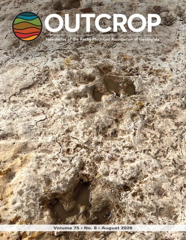
The trackway of a Turonian tridactyl trackmaker becoming clearly visible on the surface of the sandstone after a rainstorm at Mary Ann’s Tracksite in central Utah. Photo by Ryan King
32 In The Pipeline 34 Welcome New RMAG Members! 35 Outcrop Advertising Rates 36 Calendar 36 Advertiser Index
Vol. 75, No. 8 | www.rmag.org
5
OUTCROP | August 2026
IN 2025YOUR SUMMIT SPONSORSHIP DOLLARS SUPPORTED: MEMBERS
1,200
EVENT ATTENDEES
1,400
WEBSITE VISITORS
8,000
OUTCROP READERS
8,000
COMMUNITY CONTACTS
7,000
EMAIL SUBSCRIBERS
4,000
infographic link
NETWORKING EVENTS
28
CONTINUING EDUCATION EVENTS
13
FIELD TRIPS
8
OUTCROP | August 2026
6
2 0 2 6
Vol. 75, No. 8 | www.rmag.org
October 24, 2025 Geoscience Community: We greatly appreciate every Summit Sponsor and Event Sponsor who contributed to RMAG over the last year. Your support is essential to our organization. In 2025, the Rocky Mountain Association of Geologists was proud to host a dynamic lineup of events, including the North American Helium & Hydrogen conference, which examined the quickly growing field. Members explored the beauty and geological wonders of the Grand Canyon and the San Jaun’s as well geology across the state. Volunteers shared their passion for geoscience with students across the region through classroom visits and community festivals. Members also enjoyed numerous opportunities to connect outside the office through monthly lunches, coffees, happy hours, and our annual Golf Tournament. Looking ahead, 2026 brings new opportunities for RMAG and our partners. Your financial support allows us to start the year off with a luncheon on the State of the Industry before diving into the impacts of new and evolving technologies on industry including in AI’s ever-growing presence. Plans are coming together to host a fundamentals class series throughout the year, two separate symposiums on the research out of USGS and research on the Mowry. Networking in 2026 will include our regular happy hours and coffee hour networking, plus we’ll have Rockbusters, the Golf Tournament and we’re bringing back the Clay Shoot. With your support RMAG Members share the wonders of earth sciences through community and school outreach. Finally, your financial support is crucial to our publication efforts, which include the monthly Outcrop newsletter and the quarterly Mountain Geologist journal. Your financial commitment includes enrollment opportunities across all the RMAG events, whether joining the educational opportunities and joining the comradery of the golf tournament your employees will gain access. RMAG also recognizes Summit Sponsors through in-person signage, on our website, in our publications, and on social media. Thank you to our current Summit Sponsors; we look forward to your continued support in 2026. For those not yet sponsoring, now is the perfect time to get involved. Sponsorship with RMAG directly supports the geoscience community – fueling education, networking, and professional development opportunities throughout the Rocky Mountain region. We invite you to review or sponsorship packages and find the level that best aligns with your company’s goals. Whether you choose to become an annual Summit Sponsor or support a single event, your partnership will help us advance geoscience education and keep our community thriving. Become a Summit Sponsor by contacting RMAG Executive Director, Bridget Crowther at bcrowther@rmag.org or 720-672-9898 to discuss opportunities and reserve your sponsorship for 2026. Sincerely, Sandra Labrum 2026 RMAG President
Bridget Crowther RMAG Executive Director
P: (720)672-9898 staff@rmag.org www.rmag.org Vol. 75, No. 8 | www.rmag.org
730 17th Street, B1 Denver, CO 80202
7
OUTCROP | August 2026
RMAG ANNUAL
SUMMIT SPONSORSHIP
PLATINUM, GOLD, & SILVER
SPONSORSHIP LEVEL
PLATINUM
GOLD
SILVER
$10,000
$5,000
$2,500
$835
$417
$208
$10,000
$5,000
$3,000
4
2
1
Contribution Level Monthly Cost
Benefits Value
RMAG MEMBERSHIP Active or Associate Membership in the Association for employees
RMAG WEBSITE BENEFITS Company Logo on Summit Sponsor Page of www.rmag.org
Large Logo & Link
Articles and Ads on special Advertisers web page
4 articles & 4 large ads
Medium Logo and Link 2 articles & 2 medium ads
Small Logo and Link 2 small ads
PUBLICATION ADVERTISING 12 months of Outcrop advertising: To receive 12 full months, company logos and ad art must be received no later than the 20th of the month in which you register. The Outcrop (receive benefits for 12 issues, monthly online publication
Full page ad
2/3 page ad
1/2 page ad
Company Logo listed as an annual Sponsor in The Outcrop
Large Logo
Medium Logo
Small Logo
EVENT ADVERTISING Sponsorship will be acknowledged as part the summit sponsors at all RMAG Events. Additional Sponsorship Opportunities will be available for all RMAG Events. Company Logo Looping in Slide Decks
Large logo individual Slide
Medium logo
Small Logo
Company Logo on Summit Sponsor Signage at all events
Large logo
Medium Logo
Small logo
RMAG EDUCATION EVENTS Registration points are cumulative and can be used for Symposiums or Short Courses. For example a Platinum Sponsor can send 4 people to the upcoming symposium conferences and register for 2 short courses. Total Educational Tickets
6
3
1
RMAG SOCIAL EVENTS Registration Points are cumulative and can be used for any social event. For example, 1 point means 1 golfer, or 1 registration for Rockbusters. *2 points can be used for a golf hole if that makes more sense for your company. Total Social Event Tickets
8
4
2
3
2
RMAG LUNCHEONS & FIELD TRIP TICKETS Registration Points are cumulative for luncheons or one day field trips. Total Luncheon & Field Trip Tickets
5
For all event tickets please contact the RMAG office at staff@rmag.org to use your spots.
OUTCROP | August 2026
8
Vol. 75, No. 8 | www.rmag.org
RMAG 2026 SUMMIT SPONSORSHIP Payment Options
All sponsor benefits event tickets follow RMAG event registration deadlines. All benefits end 12 months after registration. RMAG 2026 ANNUAL SUMMIT SPONSOR OPPORTUNITIES Platinum Sponsor Gold Sponsor Silver Sponsor
Summit Sponsorship benefit term is for 12 months! Specify type of payment on signed form, and send logo and advertisements to staff@rmag.org Company: Company Representative: Address: City:
State:
Phone:
Zip Code: Email:
Payment Method:
Credit Card
Credit Card Information: Select Card: AMEX
ACH
Check VISA
Mastercard
Discover
Name as it appears on Credit Card: Credit Card #: Expiration Date:
Security Code:
Signature: ACH: contact the RMAG office at staff@rmag.org for directions. Mail Checks payable to RMAG: Rocky Mountain Association of Geologists (RMAG) 730 17th Street, B1 Denver, CO 80202
RMAG events are subject to change. Cancellation or rescheduling of events does not give the sponsor the right to refund. Summit Sponsors will receive benefits at any new events added into the RMAG schedule.
Thank you for your generous support! P: (720)672-9898 staff@rmag.org www.rmag.org
Vol. 75, No. 8 | www.rmag.org
730 17th Street, B1 Denver, CO 80202
9
OUTCROP | August 2026
RMAG JULY 2026 BOARD OF DIRECTORS MEETING By Stephanie Forstner, Secretary sforstner@diagenyx.com
OUTCROP | August 2026
spot this summer. The Golf Tournament drew another strong turnout, and it’s been encouraging to see new faces at our events throughout the year. The inaugural Rocky Mountain Discovery Series also launched last month, huge thanks to Robert Sterling for sharing his experiences and wisdom. One of RMAG’s greatest strengths is creating opportunities for geoscientists at every career stage to learn from one another, and it’s exciting to see those opportunities continue to grow. The Publications Committee is putting together another excellent lineup for The Outcrop, while also discussing ways to encourage more student contributions. If you’ve ever considered writing an article, sharing field photography, or highlighting an interesting project, I hope you’ll consider contributing. One of the things that makes The Outcrop unique is that it’s written by our community, for our community. The On the Rocks Committee has no shortage of adventures planned. Upcoming trips include the South Park Basin, the Lyons Sandstone, Clear Creek gold panning, and the Picketwire Dinosaur Trackway. Planning is also underway for an exciting lineup of 2027 excursions, a reminder that many of RMAG’s most popular events begin taking shape well over a year in advance. Thank you to everyone who volunteers their time to RMAG. Whether you’re organizing a field trip, reviewing manuscripts, planning a symposium, or simply welcoming a first-time attendee at an event, your efforts help make this community what it is. I hope you enjoy the rest of your summer, and I look forward to seeing many of you this fall.
By August, summer has a way of speeding up. Field trips and vacations are in full swing and before long we’re trading hiking boots for conference badges and luncheon talks. While the RMAG Board traditionally does not hold a formal meeting in July, our committees have been busy keeping the organization moving forward, and I wanted to share a few highlights from their work. The Continuing Education Committee is already looking toward the fall. Planning continues for the Mowry Symposium, the search is on for a September luncheon speaker, and several technical short courses are in development, including Python, ROGII, and geochemistry. If you have an idea for a future luncheon or know someone with a great technical story to tell, we’d love to hear your suggestions. Membership and events continue to be a bright
10
Vol. 75, No. 8 | www.rmag.org
JOIN ON THE ROCKS THIS SUMMER! South Park Basin AUGUST 14&15
This field trip through one of Colorado's scenic gems will examine how Paleozoic, Mesozoic, and Cenozoic strata record the tectonic signatures of at least three orogenic episodes. We will cross the Elkhorn–Williams Range thrust system into the structural block caught between Laramide uplifts preserving synorogenic sediments from the Pennsylvanian-Permian ancestral Rocky Mountain tectonic episode in juxtaposition with synorogenic sediments from the subsequent Laramide tectonic episode.
Finding Gold: The Arapahoe Gold Bar Panning Park September 18
Join us for this family-friendly gold panning field trip that will transport you to Colorado’s gold rush era of the 1800s. This two-hour field trip to the Arapahoe Bar Gold Panning Park in Golden, Colorado will be guided by Kevin A. Singel, author of “Finding Gold in Colorado”.
Picket Wire Canyon Lands Dinosaur Tracks September 26-27
Join the Rocky Mountain Association of Geologists for a tour of the "Mother" of all dinosaur tracksites at Picket Wire Canyonlands. The trip will begin with a visit to local outcrops representing the rocks we'll see on Sunday in the Picketwire Canyon, and potential fossil collecting. We'll make our way to see the track site located in the Comanche Grasslands along the Purgatoire River, this tracksite ("Dinosaur Lake") is considered the largest continuously mapped dinosaur fossil footprint assemblage known in the Jurassic Morrison formation and contains some of the world's longest trackways. Roughly 1,300 tracks representing ~100 trackways were reported from a 5,600 m 2 area in 1986. Extensive new excavations have revealed more than 800 additional tracks in a 2,600 m 2 area.
For details on all of these field trips, and to register, go to: rmag.org/fieldtrips Vol. 75, No. 8 | www.rmag.org
11
OUTCROP | August 2026
PRESIDENT’S LETTER By Sandra Labrum slabrum@slb.com
The Lifeblood Of Our Association luncheon, field trip, workshop, networking event, publication, and outreach activity that our members enjoy exists because volunteers dedicate their time and creativity behind the scenes. Our committees truly are the lifeblood of the association. One of the greatest strengths of RMAG is that there is a place for everyone, regardless of where your interests lie. If you’re passionate about learning and sharing technical knowledge, the Continuing Education Committee helps develop the educational programming that keeps our members at the forefront of our profession. From monthly luncheon speakers and short courses to workshops and conferences,
Back-to-school season is here, and I honestly can’t believe how quickly this summer has flown by. It feels like just yesterday we were making plans for field season, and now stores are full of backpacks and notebooks again. Whether you’re sending kids back to school, enjoying a quieter house, or simply settling back into a more predictable routine after summer vacations, August often feels like a reset. As our schedules begin to normalize, I’d like to encourage you to consider getting more involved with RMAG by joining one of our committees. One thing I’ve learned during my time on the Board is that RMAG doesn’t simply happen. Every
Publish with… Why contribute? • Reach a broad industry and academic audience • Quarterly peer-reviewed journal • Permanent archiving includes AAPG Datapages • Quick turn-around time • Every subdiscipline in the geosciences Expanded geologic focus: • Entire greater Rocky Mountain area of North America • West Texas and New Mexico to northern British Columbia • Great Plains and Mid-Continent region
Email: mgeditor@rmag.org https://www.rmag.org/publications/the-mountain-geologist/
OUTCROP | August 2026
12
Vol. 75, No. 8 | www.rmag.org
& COLORADO SCHOOL OF MINES AAPG STUDENT CHAPTER
101 SHORTCOURSE SERIES
PRACTICAL PYTHON FOR EARTH SCIENTISTS SATURDAY SEPTEMBER 12, 2026 COLORADO SCHOOL OF MINES Practical Python for Earth Scientists is a hands-on course intended to introduce basic concepts and give working examples of python code that can be used in daily geoscience workflows. No prior knowledge of python or other programming languages is necessary to attend this course. Topics covered: Basic python syntax Loops, functions, and classes Sorting and plotting data (pandas and matplotlib) Local python installation (optional, requires admin rights) Geospatial data (e.g., shapefiles) Well logs (las files) Data scraping Machine-learning (unsupervised and supervised methods)
Register at rmag.org/python $50 Members Students Free - Email staff@rmag.org Vol. 75, No. 8 | www.rmag.org
13
OUTCROP | August 2026
PRESIDENT’S LETTER idea to publication and help ensure RMAG continues its long tradition of sharing high-quality geologic information. Finally, if you want to inspire the next generation of geoscientists, the Geoscience Outreach Committee offers countless opportunities to make an impact. Whether volunteering at community events, visiting classrooms, or sharing rock and mineral collections with curious students, this committee helps introduce people of all ages to the excitement of Earth science. Few experiences are as rewarding as watching someone discover geology for the first time. Serving on a committee doesn’t require decades of experience or a huge time commitment. It simply requires an interest in helping build the association you’d like to be a part of. RMAG’s staff and committee leadership provide plenty of support, and you’ll quickly discover that volunteering is one of the best ways to build lasting professional relationships while giving back to our community. As we head into the fall, I encourage you to think about how you’d like to engage with RMAG beyond attending events. If you’ve ever found yourself saying, “It would be great if RMAG offered...” or “Someone should organize...”, consider being that someone. Your ideas, energy, and perspective can help shape the future of our association. I hope to see many of you at an upcoming committee meeting or better yet, working alongside you to continue making RMAG one of the strongest geologic organizations in the country. See you at the next RMAG event! —Sandra
this committee shapes the technical conversations happening throughout the year. Whether you have an idea for a new symposium, know an outstanding speaker, or simply want to help identify emerging topics, from petroleum geology to geothermal, carbon storage, hydrogen, or critical minerals, your ideas can directly influence RMAG’s educational offerings. If your favorite part of RMAG is catching up with colleagues over coffee or meeting someone new at a Happy Hour, the Membership Committee may be the perfect fit. This group creates the sense of community that makes RMAG more than just a professional society. They organize networking events, the Golf Tournament, the Rockbusters Ball, and are continually developing new family-friendly activities and opportunities to welcome new members into our geologic community. For those who believe geology is best experienced with muddy boots rather than PowerPoint slides, there’s the On-the-Rocks Committee. Their motto, “See More Rocks,” says it all. Committee members organize the field trips that allow us to explore the incredible geology throughout Colorado and the Rocky Mountain region. Whether it’s planning a day trip to revisit a classic outcrop or organizing an ambitious multi-day excursion, this committee gives you the opportunity to turn your dream field trip into reality. If you enjoy writing, editing, or helping communicate great science, consider joining the Publications Committee. This dedicated team produces both The Outcrop and The Mountain Geologist, preserving the research, stories, and accomplishments of our community. They work with authors from
WRITE FOR THE OUTCROP
John C. Webb
Consulting Geologist Stratigraphy, Sedimentology and Petrography of Clastic and Carbonate Systems
Reservoir Characterization Petroleum, SWD, CCUS, Geothermal
OUTCROP | August 2026
The Outcrop is the monthly online newsletter of the Rocky Mountain Association of Geologists. The Outcrop circulates to the 1900-plus members of the RMAG and about 200 university libraries and industry associates. It's a great opportunity for young professionals to get their name out to other geologists in the community. It provides articles for the benefit and edification of its readers and gives authors a chance to reach local geologists on subjects that interest or concern them. Learn more here.
Louisville, Colorado Johnwebb20@comcast.net 303.917.0644
14
Vol. 75, No. 8 | www.rmag.org
101 SHORTCOURSE SERIES
FROM PLANNING TO COMPLETIONS: LIFE CYCLE OF A WELL IN STARSTEER WEDNESDAY SEPTEMBER 16, 2026 DENVER EARTH RESOURCE LIBRARY
This introductory course provides an overview of how StarSteer supports the complete lifecycle of a well, from initial planning through geosteering and into completions. Participants will be introduced to the core tools and workflows used throughout each phase of development, gaining a foundational understanding of how data flows through the software and how StarSteer supports day-to-day operations. Course Goals: Navigate the StarSteer interface with confidence. Understand how StarSteer supports each stage of the well life cycle. Recognize the primary workflows used during planning, drilling, and completions. Perform basic data import and export tasks. Understand how geologic and operational data are managed within StarSteer. Topics Covered: Introduction to the StarSteer interface Well planning fundamentals Importing planning and operational data Introduction to geosteering workflows
Creating and managing geologic tops Updating maps during drilling operations Basic project and data management Importing and exporting project data Overview of completion data workflows Best practices for working within StarSteer
Register at rmag.org/shortcourse $50 Members/ $75 Non-Members
Presented by: Vol. 75, No. 8 | www.rmag.org
15
OUTCROP | August 2026
LEAD STORY
FIRST TRACKS
UNDERGRADUATE CITIZEN SCIENCE IN THE FERRON SANDSTONE OF CENTRAL UTAH ABBY C. KRUEGER, MIRANDA B. NOONAN, AND M. RYAN KING
UCH LIKE SKIING IN THE ROCKIES, where a person’s first
were just discovered. Individual tracks are important for understanding which animals lived in the area, but do not give you the same information as a trackway (a succession of tracks) or the relationship between trackways as to animal behavior and directional preference in travel. Collecting track data on a large surface is a lot of work and thus many individuals can be helpful to speed up this process if they collect data in a standardized manner. As such, a class of students can be a valuable resource for collecting and disseminating data to the scientific community and to the public. To utilize citizen science, Dr. King planned this as part of his Fall 2024 paleontology class at WCU to give undergraduates the ability to come to their own conclusions because no preconceived notions were known about the tracksite. This opportunity could also lead toward a pathway to individually provide beneficial outcomes to students for being able to present this data at internal and regional conferences. This journey is subsequently presented through the eyes of two students from this initial class trip. This process included collecting and analyzing the data, to that
M
Western Colorado University, Gunnison, Colorado
venture into a new area is one of critical thinking and discovery, so is initial scientific research for undergraduate students. It is an eye-opening adventure that pulls back the curtain to the realization that anyone can do science with simple observation of repeatable features. Similarly, this journey begins with a couple of geoscientists out on a casual walk in a new area of central Utah and making an observation. On this walk Paul Anderson and his wife Mary Ann Wright, both keen observers, were just enjoying time out in nature, when Mary Ann brought Paul’s attention to one track, then another, then another, potentially a hundred or more tracks on one surface. Paul notified Ryan King at Western Colorado University (WCU) as the two had worked on trace fossils before in this geologic unit, the Cretaceous Ferron Sandstone. Paul knew these were important because almost all of the previously discovered tracks were individual natural casts that had weathered out of the cliffsides, not in situ tracks as
OUTCROP | August 2026
16
Vol. 75, No. 8 | www.rmag.org
FIGURE 1:
Student measuring orientation of track down the central digit (digit III).
Vol. 75, No. 8 | www.rmag.org
17
OUTCROP | August 2026
LEAD STORY
BRIEF GEOLOGIC HISTORY
Mary Ann’s Tracksite is a 14x28 meter surface containing numerous tracks as impressions (moulds). This tracksite lies within the Turonian-Coniacian Ferron Sandstone of central Utah, a formation well known for its deltaic depositional setting and abundance of marginal marine invertebrate trace fossils (Anderson et al. 2004; Gardner et al. 1992; Garrison and van den Bergh 2004). In contrast, vertebrate trace fossils and body fossils from this unit are rare. Previous studies by Jones (2001), Gierliński and Lockley (2013), King and Anderson (2013), King (2015), and King et al. (2020) have documented vertebrate tracks within the Ferron Sandstone; however, these reports from coastal plain deposits largely focus on individual track morphologies, a consequence of the cliff-forming nature of the unit. In this area, the Ferron Sandstone is known as the Last Chance Delta on the western margin of the Western Interior Seaway. The Upper Ferron Sandstone, which contains these tracks, reaches thicknesses of up to 150 meters and is bounded by the Tununk Shale below and the Blue Gate Shale above (Ryer 2004).
DATA
Data was collected during two field trips. The initial trip took place in the fall of 2024 and involved nineteen students enrolled in the paleontology course. A second trip in late spring of 2025 involved ten of those students, who volunteered their own time over a free weekend to collect supplementary data. During the second trip, drone imagery was also collected for photogrammetry OUTCROP | August 2026
(constructing three-dimensional models from oriented, calibrated images). Before any fieldwork occurred, the class established a standardized methodology. This was accomplished through reading and discussing the literature on how tracks are typically measured, both for individual tracks and for trackways. This process standardized data collection across the class prior to entering the field. We addressed how to measure track length and width, digit lengths, the angle between digits (divarication angle), the anterior projection of the load-bearing central digit (anterior triangle), and how these measurements differ in three-, four-, or five-toed prints. As with bird tracks, which may appear similar to a casual observer, accurate identification relies on attention to subtle details. For successive tracks within trackways, the students also learned how to measure pace, pace angulation, and stride length. While the geology students were familiar with meticulous data collection strategies, none had previously applied them in this capacity. The project also included students from archaeology, biology, mathematics, and art, with each participant contributing a different skill set and perspective. This standardization ensured that accurate and replicable data could be collected regardless of which student performed the measurements. Once in the field, the students began by standardizing orientation. Each student calibrated their Brunton compass to local magnetic declination, allowing orientation measurements for each track to be collected consistently (Fig. 1). This also allowed a datum to be established for mapping, using a west to east orientation of 270 degrees to 90 degrees, that can be replicated in future studies. Prior to mapping, the tracksite was thoroughly cleaned using brushes, both to ensure accurate data collection and to support photogrammetry. Upon arrival, the site was heavily covered with dirt and rocks due to debris that funneled into the valley from surrounding slopes. Clearing the tracks (Fig. 2) required substantially more time than anticipated, with most of the first day devoted to sweeping. Overnight wind and rain repeatedly re-covered portions of the site, requiring additional cleaning each morning, though to a lesser extent than the
of grant writing to collect more targeted data on a second trip, to an outcome of public presentation at a regional conference. All of this work was made possible by the assistance of the Bureau of Land Management (under long standing Paleontological Permits to M.R. King prior to this research) and through internal WCU SOURCE funding allowing students the opportunity to check their previously collected data and to travel and attend a regional conference for presentation purposes.
18
Vol. 75, No. 8 | www.rmag.org
2026
RMS-AAPG ANNUAL MEETING Butte, Montana
OCT 24-26 Call for Abstracts Session on the following and more: 1.Rocky Mountain Petroliferous Basins 2.Geology and Engineering Challenges and Best Practices in Unconventional and Tight Rock Reservoirs in the Rockies 3.Geothermal Resources and Prospects in Montana and the Mountain West 4.Geologic Hydrogen and Helium Resources Exploration and Production in the West 5.Geologic and Engineering Aspects of Carbon Sequestration and Natural Gas (i.e., Energy) Storage 6.The Intersection of Petroleum (Geology and Engineering) and Critical Minerals in the Rocky Mountain Region 7.Issues Around Orphaned and Abandoned Wells, Including Engineering and Remediation 8.Managing Produced Water (e.g., Production Variability, Disposal, and Beneficial Reuse) 9.Sedimentary Rocks and Mine Waste as a Source of Critical Minerals 10.Economic Geology in the Rockies 11.Rare Earth Element Deposits in the West and Related Geochemistry 12.Rockies Regional Mapping Including Belt Supergroup 13.Rocky Mountain Tectonics and Basin Analysis, Including Geophysical Interpretation 14.Structural Geology Topics in Rocky Mountains Energy Exploration 15.Sedimentology and Stratigraphy Topics, Including Lacustrine Systems 16.Posters with Core Displays 17.Student Posters!
Registration Now Open Early Bird Professional Registration: $300 Early Bird Student Registration: $50
Join cutting-edge discussions, engaging field trips, and contribute to the advancement of geoscience in the Rockies. Vol. 75, No. 8 | www.rmag.org 19 OUTCROP | August 2026 rms-aagp2026.com
LEAD STORY
FIGURE 2: Students making initial observations after clearing the surface (foreground) while other students are cleaning other parts
of the tracksite with brooms and buckets (back right).
OUTCROP | August 2026
the baseline data that students needed to begin asking scientific questions. After returning from the field, each student group developed a research question based on the tracks they had documented. These questions explored a wide range of topics, including which animals made the tracks, whether behavior changed along a trackway, what behaviors produced elongate track structures, how fast the animals were moving, how much size variation existed among track makers, and the directions in which the animals were traveling. One group expanded the dataset by incorporating tracks found in a stratigraphic layer above the main track surface. All groups contributed their measurements to a shared online database, which allowed students to synthesize their data and test their ideas. The
initial effort. After the tracksite was cleared, students worked in pairs to document individual square meters using one-meter quadrats. Track locations were drawn and labeled according to a grid system, with letters A through N oriented south to north; and numbers 1 through 38 oriented west to east. This systematic approach allowed track data to be collected in an organized manner, and later each student group’s drafted squares were compiled into a complete site map (Fig. 3). On the first field trip, students focused primarily on collecting individual track measurements. While a few clear track successions (trackways) were identified and documented, most detailed trackway analysis was deferred until a later visit. This initial trip served as a foundation, providing
20
Vol. 75, No. 8 | www.rmag.org
Detailed and accurate geology at your fingertips in Petra, GeoGraphix, ArcGIS, AccuMap, geoSCOUT and other digital mapping applications
Western Canada Geological Edge Set
Energy Alternatives & Critical Minerals - Canada Western USA Geological Edge Set Eastern USA & Eastern Canada Geological Edge Set
Energy Alternatives & Critical Minerals - USA
Central USA Geological Edge Set Mexico Geological Edge Set
Map layers provided in shapefile format for easy import into all mapping applications. Deliverables include: formation limits, outcrops, subcrop edges, O&G fields, structural elements, reefs, shorelines, channels, production fairways, shale gas trends, structure contours, isopachs, general culture, renewable & non-renewable energy projects, mineral deposits, mines, Petra Thematic Map projects, GeoGraphix GeoAtlas projects, ArcGIS MXD and Layer files, regional cross-sections, and full technical support.
Vol. 75, No. 8 | www.rmag.org
For more information: Joel Harding at +1 403 870 8122 21 joelharding@geoedges.com www.geoedges.com
OUTCROP | August 2026
LEAD STORY
FIGURE 3:
Overview of Mary Ann’s Tracksite: left) one-meter grid map of the tracksite created from individual group squares with letters indicating columns and numbers indicating the row of each square, tracks indicated in dark silhouettes; east direction is at the top; right) dronebased orthophoto of the tracksite created utilizing the photogrammetry methods of Matthews et al. (2016) with closerange drone imagery.
OUTCROP | August 2026
22
Vol. 75, No. 8 | www.rmag.org
LEAD STORY
FIGURE 4: Drone photography of the tracksite by student under the supervision of Dr. Phil Crossley.
Vol. 75, No. 8 | www.rmag.org
behavior, identifying directional trends across the track surface, and evaluating the effectiveness of ground-based versus drone-based photogrammetry for documenting tracksites. The second trip was focused on answering these specific questions with some individuals forming larger groups than the initial two student sets to collect supplementary data. Again, the tracksite was cleaned before collecting data. Although, this time everyone had to be aware as to where the drone was photographing (Fig. 4) and switch to the other side of the trackway accordingly to allow that to be completed, and during lunch when no one was present on the surface. The drone imagery was largely coordinated by W. Davis (GIS student) who calibrated the locations and planned flight paths and that of Dr. Crossley (GIS professor at WCU) as an interdisciplinary effort. Ground-based
results of this work were presented as nine posters at the Western Colorado University Celebration of Scholarship, an internal research conference. For many students, this experience sparked a desire to continue the project and pursue a more ambitious goal of presenting their work at the regional Geological Society of America conference in the spring. To support this next step, a second field trip was organized to refine data collection, strengthen analyses, and prepare research for a scientific audience of their peers. Students also took the lead in securing funding for both the return trip to the tracksite and conference travel through internal SOURCE grants. As the project evolved, the individual research questions were distilled into four overarching objectives: documenting variation in track morphology at the site, comparing the three most prominent trackways to assess speed and
23
OUTCROP | August 2026
LEAD STORY
OUTCROP | August 2026
photogrammetry (utilizing a stationary tripod) of the tracksite was done primarily by Dr. King with some students utilizing this setup for more focused photographing of individual tracks and the trackways in their research studies. This second trip collected new data, but also double checked and cleaned their data before compiling it to present at the research conference. At the end of this research, the students had documented details of 104 individual tracks and three trackways. These details produced four sets of results. The student presentation of Davis et al. 2025 identified three dominant morphologies based off measurements and morphological characteristics, with the morphologies comparable to Iguanodontipus (Sarjeant et al. 1998, Thulborn 1990, Beckles 1854, Meyer and Thuring 2003), Amblydactylus (Currie 1983, Sternberg 1932, and Currie and Sarjeant 1979), and Therangospodus (Lockley et al. 1998). The tracksite is overwhelmingly tridactyl (threetoed tracks), with ornithopod tracks (Iguanodontipus, Amblydactylus) appearing to be significantly more common than the theropod tracks (Therangospodus) (Fig. 5). In the three trackways studied by the students in Funk et al. (2025), the tridactyl trackmakers show a range of estimated hip heights from 0.9 to 1.46 m and walking speeds from 3.5 to 6.6 km/ hr, with one trackway indicating a transition from walking to a trotting gait. A change in the morphology of tracks was also noted with the change in speed, with the posterior portions of the tracks disappearing suggesting potentially a shift to a more digitigrade stance (weight shift onto the toes) with the increase in speed. The orientation study of the students in Krueger et al. (2025) showed some evidence of directional bias. The southeastward-northwestward track trend (Bottom left - top right direction of tracks in Fig. 2) might suggest gregarious behavior, but differences in track size and morphology as well as the presence of tracks moving in opposite directions argue against a single coordinated group. These tracks oriented roughly perpendicular to ripple crests likely reflect movement to and from a shoreline, while tracks parallel to the crests in a secondary trend suggest a shoreline barrier
FIGURE 5: Dominant track morphologies of Mary Ann’s
Tracksite: a) Iguanodontipus with three blunt toe impressions with separated interdigital area, b) Amblydactylus with interconnected digits potentially from webbing, c) Therangospodus with an elongate middle toe impression and sharp distal terminations. All tracks facing toward the top, all scales are checkerboards of 10 cm x 2 cm. 24
Vol. 75, No. 8 | www.rmag.org
Vol. 75, No. 8 | www.rmag.org
25
OUTCROP | August 2026
LEAD STORY were able to strengthen existing skills and clarify future career goals. The project helped illustrate the value of balancing fieldwork with laboratory and classroom research, and how this combination can align with long-term professional aspirations of being a scientist. For others, it inspired further interest in integrating scientific research with a preexisting passion for photography. By combining visual storytelling with scientific inquiry, research can be communicated in ways that are engaging and accessible to a broader audience, including those with limited interest in science. Overall, this project provided the students with greater confidence in conducting field-based research and pursuing questions about past organisms and environments using simple observations and previously accepted/defined methodologies. Some felt as if this project gave them the confidence to walk into the field and explore their questions about the past to come up with accurate and meaningful answers, and hopefully projects like this will help others to do the same in the future.
influencing travel direction. The comparison of ground-based versus dronebased photogrammetry by student Davis with King (2025) provided indications of time-savings associated with drone methods, whereas ground methods were slower but produced higher resolution models. Drone imagery was also useful because it can be done in preprogrammed paths negating potential holes in models related to not enough overlap in human established paths of ground-based methods. Additionally, the drone helped on the edges of the tracksite where sudden elevation gain made acquiring overlapping images at the same elevation difficult.
BECOMING BETTER SCIENTISTS
This study demonstrated the many perspectives and analytical lenses that can guide scientific research in different directions. Within a single tracksite, students investigated topics ranging from dinosaur behavior and track morphology to sedimentary structures, depositional processes, and size variation among track makers. The class itself was interdisciplinary, consisting of students of many backgrounds. These varied academic backgrounds contributed to a well-rounded investigation that connected research across these multiple disciplines. The project also highlighted the diverse ways in which science, particularly geoscience, can be approached. Geoscience research encompasses a wide range of laboratory and field-based methods, each playing a critical role. Through this experience, some students developed a greater appreciation for the importance of fieldwork and its essential connection to laboratory analysis. Additionally, this project challenged the notion for some that the most important science is done in a laboratory. Laboratory work remains vital, but this project demonstrated that rigorous field data collection is important. One student noted that field work requires a lot of grit and determination, but the end result is worth it one hundred times over. This experience reinforced some geology students’ interest in sedimentology and stratigraphy and sparked a growing curiosity for many in paleontology. In addition to developing new interests, some students
OUTCROP | August 2026
ACKNOWLEDGEMENTS
26
We thank Paul Anderson and Mary Ann Wright, along with all of the students who participated in data collection and research, including Leandro Aragon, Jillian Baker, Shea Calkins, Teagan Delaney, Kaj Deslatte, Christopher Francis, John Funk, Sean House, Ryan Largent, Jordan Maldonado, Ella Mizenko, Michael Overstreet, Mitchell Simpkins, Connor Smith, Brennan Stice, Eric Sutton, Hannah Volpe, Maddison Wedgewood, and Nicholas Wheeler Jory. We also thank William Davis and Dr. Phil Crossley for providing drone imagery that supplemented the ground-based imagery. Photos in Figures 1, 2, and 4 were provided with the permission of Abby Krueger. Funding for initial fieldwork and presentation at the regional Geological Society of America meeting was provided by SOURCE grants from the Western Colorado University Research Council to W. Davis, M. Noonan, and C. Smith. We thank the Bureau of Land Management, Dr. Emily Lessner, and Georgia Knauss for their assistance. This project was conducted under Bureau of
Vol. 75, No. 8 | www.rmag.org
2026 RMAG MOWRY FORMATION SYMPOSIUM Thursday, November 5, 2026 Denver West Marriott | Denver, Colorado
The Rocky Mountain Association of Geologists invites abstract submissions for a one-day symposium dedicated to the exploration and production of the Mowry Formation. Join geoscientists, engineers, and industry professionals to share research, exploration insights, and field developments related to one of the Rocky Mountain region's significant unconventional resource plays.
PROGRAMMING ON: Regional geology and stratigraphy Geochemistry & source rock characterization Reservoir characterization & petrophysics Drilling, completion & stimulation Production performance & field case studies Seismic interpretation & subsurface mapping Basin modeling & resource assessment Emerging technologies & future exploration
REGISTRATION DETAILS
RMAG Members $300 Non-Members $400 Student Members $50
SPONSORSHIP OPPORTUNITIES AVAILABLE
rmag.org/mowry | staff@mag.org | (720) 672-9898 27 OUTCROP | August 2026
Vol. 75, No. 8 | www.rmag.org
LEAD STORY therizinosaur (cf. Macropodosaurus) tracks from North America, with notes on the neglected vertebrate ichnofauna of the Ferron Sandstone (Late Cretaceous) of central Utah. In A. L. Titus & M. A. Loewen (Eds.), At the Top of the Grand Staircase: The Late Cretaceous of Southern Utah (pp. 530–535). Indiana University Press. Jones, R. (2001). Dinosaur trackway from the Ferron Sandstone Member of the Mancos Shale Formation (Upper Cretaceous) of central Utah. Proceedings of the 6th Fossil Resources Conference, 48–51. Geologic Resources Division Technical Report NPS/NRGED/GRDTR-01/01. King, M., & Anderson, P. (2013). Over-thickened nearshore sand body near its landward pinchout and the relation to transgression, Ferron Sandstone, central Utah. In T. H. Morris & R. Ressetar (Eds.), The San Rafael Swell and Henry Mountains Basin—Geologic Centerpiece of Utah (pp. 319–340). Utah Geological Association Publication. King, M. R. (2015). Application of ichnology towards a geological understanding of the Ferron Sandstone in central Utah. Doctoral dissertation, University of Alberta, 336 p. King, M. R., Botterill, S. E., Gingras, M. K., & Pemberton, S. G. (2020). Rhizocorallium and turtle tracks: A Late Cretaceous proximal distributary channel trace-fossil assemblage, central Utah. Ichnos, 27(4), 406–427. Krueger, A.C., Noonan, M.B., Deslatte, K.J., Volpe, H., House, S.D., Sutton, E., and King, M.R., 2025, Preferential orientation of dinosaur tracks in the Late Cretaceous Ferron Sandstone, central Utah: Geological Society of America Abstracts with Programs, Rocky Mountain Section Meeting, Provo, Utah, poster presentation. Lockley, M. G., Meyer, C. A., & Moratalla, J. J. (1998). Therangospodus: Trackway evidence for the widespread distribution of a Late Jurassic theropod with well-padded feet. In B. P. Pérez-Moreno, T. Holtz Jr., J. L. Sanz, & J. Moratalla (Eds.), Gaia: Aspects of Theropod Paleobiology, 15, 339–353. Matthews, N. A., Noble, T. A., Breithaupt, B. H., Falkingham, P. L., Marty, D., & Richter, A. (2016). Close-range photogrammetry for 3-D ichnology: The basics of photogrammetric ichnology. In P. L. Falkingham, D. Marty, & A. Richter (Eds.), Dinosaur Tracks: The Next Steps (pp. 29–55). Geological Society of London. Meyer, C. A., & Thüring, B. (2003). The first iguanodontid dinosaur tracks from the Swiss Alps (Schrattenkalk Formation, Aptian). Ichnos, 10(2–4), 221–228. Ryer, T. A. (2004). Previous studies of the Ferron Sandstone. In T. C. Chidsey Jr., R. D. Adams, & T. H. Morris (Eds.), Regional to Wellbore Analog for Fluvial-Deltaic Modeling: The Ferron Sandstone of Utah (pp. 3–38). American Association of Petroleum Geologists, Studies in Geology 50. Sarjeant, W. A. S., Delair, J. B., & Lockley, M. G. (1998). The footprints of Iguanodon: A history and taxonomic study. Ichnos, 6(3), 183–202. Sternberg, C. M. (1932). Dinosaur tracks from Peace River, British Columbia. National Museum of Canada Annual Report, 1930, 59–85. Thulborn, R. A. (1990). Dinosaur Tracks. Chapman and Hall, 410 p.
Land Management Paleontological Resource Permit UT24-011 issued to M. R. King. Permits are required for any interaction with protected resources, including vertebrate fossils, on public lands.
REFERENCES
Anderson, P.B., and Ryer, T.A., 2004, Regional stratigraphy of the Ferron Sandstone, in Chidsey, T.C., Jr., Adams, R.D., and Morris, T.H., eds., Regional to Wellbore Analog for Fluvial-Deltaic Reservoir Modeling: The Ferron Sandstone of Utah (AAPG Studies in Geology No. 50): Tulsa, Oklahoma, American Association of Petroleum Geologists, p. 211–224. Beckles, S. H. (1854). On the Ornithoidichnites of the Wealden. Quarterly Journal of the Geological Society, 10(1–2), 456–464. Currie, P.J., 1983, Hadrosaur trackways from the Lower Cretaceous of Canada: Acta Palaeontologica Polonica, v. 28, p. 63–73. Currie, P. J., & Sarjeant, W. A. S. (1979). Lower Cretaceous dinosaur footprints from the Peace River Canyon, British Columbia, Canada. Palaeogeography, Palaeoclimatology, Palaeoecology, 28, 103–115. Davis, W.M., Largent, R., Wedgewood, M.R., Aragon, L.O., Mizenko, E., Francis, C.M., Calkins, S.E., Baker, J.R., Smith, C.J., and King, M.R., 2025, Preliminary report of track morphologies in the area of Mary Ann’s Tracksite, Ferron Sandstone, central Utah: Geological Society of America Abstracts with Programs, Rocky Mountain Section Meeting, Provo, Utah, poster presentation. Davis, W.M., and King, M.R., 2025, Comparative analysis of UAV and DSLR photogrammetry for geological mapping of dinosaur tracks in the Ferron Sandstone, central Utah: Geological Society of America Abstracts with Programs, Rocky Mountain Section Meeting, Provo, Utah, poster presentation. Funk, J.D., Maldonado, J.A., Simpkins, M.E., Wheeler Jory, N.H., Stice, B., Overstreet, M., Delaney, T., and King, M.R., 2025, Turonian trackway disparity at Mary Ann’s Tracksite, central Utah: Geological Society of America Abstracts with Programs, Rocky Mountain Section Meeting, Provo, Utah, poster presentation. Gardner, M. H., Barton, M. D., Tyler, N., & Fisher, R. S. (1992). Architecture and permeability structure of fluvial-deltaic sandstones, Ferron Sandstone, east-central Utah. In R. M. Flores (Ed.), Mesozoic of the Western Interior: SEPM Rocky Mountain Section Field Guide (pp. 5–19). Society for Sedimentary Geology (SEPM). Garrison, J. R., & van den Bergh, T. C. V. (2004). High-resolution depositional sequence stratigraphy of the Upper Ferron Sandstone Last Chance Delta: An application of coal-zone stratigraphy. In T. C. Chidsey Jr., R. D. Adams, & T. H. Morris (Eds.), Regional to Wellbore Analog for Fluvial-Deltaic Modeling: The Ferron Sandstone of Utah (pp. 125– 192). American Association of Petroleum Geologists. Gierliński, G. D., & Lockley, M. G. (2013). First report of probable
OUTCROP | August 2026
28
Vol. 75, No. 8 | www.rmag.org
THA N K F L O S G O T U S O R P T N O E M N A N R SOR U O T S ! 6 2 20
Vol. 75, No. 8 | www.rmag.org
29
OUTCROP | August 2026
HYBRID LUNCH TALK Speaker: Zane Jobe Date: September 2, 2026 | 12:00 pm - 1:00 pm
Brushy Canyon “Redux” Digital outcrop models synthesize legacy and new outcrop data for conventional & unconventional reservoirs, saltwater disposal, and for training the next generation of geoscientists Speaker: Zane Jobe, Colorado School of Mines Additional Authors: Rick Beaubouef, Christin Rossen, Brian Burnham
for conventional and unconventional reservoirs, saltwater disposal, and emerging industry applications. (e.g., CCUS). Legacy data from extensive outcrop-based fieldwork is being migrated into georeferenced and modern digital frameworks (e.g., VRGS, Petrel), and integrated with newly collected drone-based photogrammetry, lidar, and targeted fieldwork that focuses on siltstone and organic-rich-siltstone facies in proximal locales that were not previously studied in detail. The integrated dataset enables improved stratigraphic correlation between localities, refinement of existing facies mapping, and quantitative characterization of stratigraphic architecture at scales ranging from event beds to channel complexes. These workflows demonstrate that digital outcrop data, supported by the rocks as a grounding force, is an important tool for training the next generation of geoscientists to better interpret and predict reservoir heterogeneity in the subsurface.
The future of the energy industry relies on understanding increasingly complex geological settings, and geoscientists must be able to think in three (and sometimes four) dimensions to better interrogate the subsurface. While nothing replaces learning from real outcrops, digital outcrop models offer a powerful solution that provides immersive and accessible 3D geological data and context that help build spatial-reasoning and critical-thinking skills necessary to interpret sparse subsurface data. Where these models truly excel is the spatial and geological bridge that they provide between small- (i.e., thin section) and large-scale (i.e. seismic) data that are hard to visualize in the field alone. Yet, few training resources focus on translating detailed digital-outcrop geology to the data-sparse subsurface. This study focuses on world-class outcrop and subsurface data from the Delaware Mountain Group of the Permian Basin, Texas, relevant
Zane Jobe is a sedimentologist and research professor at Colorado School of Mines. His work focuses on using outcrop analogs to improve prediction of subsurface fluid flow. He aims to better understand the stratigraphic architecture, scaling relationships, and sediment budgets for clastic depositional systems, with an emphasis on submarine environments. He uses outcrop analogs, core, subsurface datasets, and modern-seafloor observations to improve prediction of reservoir architecture, heterogeneity, and fluid flow. Zane also leads industry-focused field trips for integrated teams (e.g., geology, geophysics, petrophysics, reservoir engineers, production engineers, facilities) to outcropping deep-water deposits that are highly relevant for producing assets in the GoM, west Africa, and South America, including: Southern California; Permian Basin, Texas; County Clare, Ireland; Magallanes Basin, Chile. He also enjoys cycling in the summer and driveway snow removal in the winter.
OUTCROP | August 2026
30
Vol. 75, No. 8 | www.rmag.org
ADVENTURE AWAITS
Journey beyond Dinosaur Ridge with our expert-led travel programs. Explore world-renowned fossil sites, visit historical collections, and experience the excitement of discovery firsthand.
2026 TRIPS
Fossil Frontiers of New England
October 1 - 6
St. George Tracksites & Quarry
October 23-27
Travel with Dinosaur Ridge on an immersive paleontology adventure through the museums, dinosaur tracksites, and historic discoveries that shaped our understanding of American Paleontology. $1,950/person (member rates available)
Dig for fossils, explore dinosaur tracksites, and uncover Utah's ancient history on an immersive paleontology adventure in St. George at the Nation's #2 Dinosaur tracksites. $1,600/person (member rates available)
Vol. 75, No. 8 | www.rmag.org
BOOK NOW
31
OUTCROP | August 2026
h t t p s : //d i n o r i d g e . o r g /p r o g r a m s - a n d - e v e n t s / t r a v e l - a n d - fi e l d - p r o g r a m s /
IN THE PIPELINE AUGUST 20, 2026
AUGUST 5, 2026 RMAG Luncheon. Speaker: Rachel Stocking, Ubiterra Corporation (ZoneVu). Talk Title: “ Fault Activation Behavior in the Austin Chalk of South Texas: Integrating Seismic Symmetry and Completions Diagnostics.”
WOGA Lean-In. Speaker: Peighton Crawford. Talk: “Your Reputation Precedes You: Brand Strategy for Rising Leaders.” 11:00 AM-12:30 PM. AUGUST 25, 2026
AUGUST 6, 2026
RMAG Happy Hour. Barquentine Brewing CO. Edgewater, CO.
WOGA Swing Into Confidence Clinic. 3:30 PM- 6:30 PM. Broken Tee Golf Course, Englewood, CO.
RMS-SEPM Luncheon. Speaker: Dr. Timothy Macintyre. Talk: “An Introduction to Sediment-hosted Copper Deposits, Paradox Basin Evaporites, and the Cashin Cu-Ag Deposit.” 11:30 AM- 1:30 PM. Wynkoop Brewing Company. Denver, CO.
AUGUST 13, 2026 WOGA Wellhead Wake-Up Virtual Coffee Chat. 8 AM - 9 AM. Denver Energy Network Talks. Speaker: Stefanie Bednar. Talk: “Power Gen Trends & The Energy Shift: What’s Powering Tomorrow.” Baker Tilly Offices, 675 15th Street, Denver, CO. Clarity in Diagnostics: Overcoming Complex Well Challenges using High-Resolution Acoustic Imaging.” 5:00 PM - 7:00 PM. Baker Tilly, 675 15th St Suite 1900, Denver, CO.
AUGUST 27, 2026 Denver Energy Network Drinks. 4:00 PM - 7:00 PM. AUGUST 28, 2026
AUGUST 14, 2026
RMPC Clay Shoot. 8 AM- 2 PM. Kiowa Creek, Bennett, CO.
RMAG On the Rocks Field Trip. South Park Basin, CO.
RMAG Golf Tournament. Arrowhead Golf Club, Littleton, CO.
OUTCROP | August 2026
32
Vol. 75, No. 8 | www.rmag.org
AUGUST HAPPY HOUR JOIN YOUR FELLOW GEOSCIENTISTS FOR A DRINK Tuesday, August 25, 2026 4pm Barquentine Brewing CO 5505 West 20th Ave. STE 17 Edgewater, CO 80214
RMAG.ORG/HAPPYHOUR
Vol. 75, No. 8 | www.rmag.org
33
OUTCROP | August 2026
WELCOME NEW RMAG MEMBERS!
Shannon Lemkie
with Epsilon Energy from Durango, Colorado
Kristy Milliken
from Fort Collins, Colorado
Lisa Burgess
with Geosyntec Consultants from Denver, Colorado
OUTCROP | August 2026
Valarie Armenta
with Intertek Westport Technology Center from Houston, Texas
Camryn Guerrero from Parker, Colorado
Mitzi Leaver
from Buena Vista, Colorado
Jon Thorson
from Denver, Colorado
Dan Dowers
from Boulder, Colorado
34
Vol. 75, No. 8 | www.rmag.org
OUTCROP ADVERTISING RATES 1 Time
2 Times
6 Times
12 Times
Full page (7-1/2” x 9-1/4”)
$350
$650
$1,800
$3,400
2/3 page (4-7/8” x 9-1/4”)
$250
$465
$1,290
$2,430
1/2 page (7-1/2” x 4-5/8”)
$200
$370
$1,030
$1,950
1/3 page horizontal (4-7/8” x 4-7/8”)
$175
$325
$900
$1,700
1/3 page vertical (2-3/8” x 9-1/4”)
$175
$325
$900
$1,700
1/6 page (2-3/8” x 4-7/8”)
$100
$185
$520
$970
Professional Card (2-5/8” x 1-1/2”)
$30
$55
$155
$290
Seeking Editor Oversee a peer-reviewed journal Source articles from the entire Rocky Mountain Region Manage Peer-Review process Interest? Email: staff@rmag.org
Vol. 75, No. 8 | www.rmag.org
35
OUTCROP | August 2026
ADVERTISER INDEX
•Dinosaur Ridge ����������������������������������������������������������������������������������������������31 •Dolan Integration Group ��������������������������������������������������������������������������������25 •GeoEdges ������������������������������������������������������������������������������������������������������21 •John C. Webb ������������������������������������������������������������������������������������������������14 •LMKR Gverse Geographix �����������������������������������������������������������������������������33 •RMS-AAPG ����������������������������������������������������������������������������������������������������19 •ROGII �������������������������������������������������������������������������������������������������������������34
CALENDAR – AUGUST 2026 SUNDAY
MONDAY
TUESDAY
WEDNESDAY
THURSDAY
FRIDAY
SATURDAY
1 2
9
3
10
4
5
6
RMAG Luncheon.
WOGA Swing Into Confidence Clinic.
11
12
13
WOGA Virtual Coffee Chat.
Denver Energy Network Talks.
16
17
18
19
7
8
14
15
RMAG On the Rocks Field Trip.
20
21
22
28
29
WOGA Lean-In.
23
24
25
26
RMAG Happy Hour.
Denver Energy Network Drinks.
RMS-SEPM Luncheon.
30
27
RMPC Clay Shoot.
RMAG Golf Tournament.
31 See Pipeline on page 32 for more about upcoming events.
OUTCROP | August 2026
36
Vol. 75, No. 8 | www.rmag.org