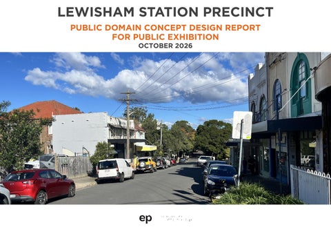
LEWISHAM STATION PRECINCT PUBLIC DOMAIN CONCEPT DESIGN REPORT FOR PUBLIC EXHIBITION OCTOBER 2026
1.0 SITE ANALYSIS
1.1
SITE ANALYSIS
CONTEXT
Study Area
Greenway
L DOBROYD POINT
L
L
L
LILYFIELD
T BURWOOD
L ANNANDALE
T
L T
L
ASHFIELD
BURWOOD HEIGHTS
LEICHHARDT
T SUMMER HILL
L
T
LEWISHAM
T
T
PETERSHAM
T
L
ASHBURY
T
ENMORE
NEWTOWN
L
T
DULWICH HILL
L T T
T CANTERBURY
COOK
MARRICKVILLE
T
S RIVE
R
Lewisham Station Precinct • Public Domain Concept Design Report - For Public Exhibition • October 2026
T M
4
SITE ANALYSIS
OBSERVATIONS
The study area is predominantly zoned for residential uses, with higher-density residential zoning concentrated along Railway Terrace, Jubilee Hunter Street. The northern end of Victoria Street, adjacent to the train station, is zoned as a Local Centre. While intended to support retail and commercial activity, the area currently comprises a mix of shopfronts, cafés and residential buildings. A second commercial precinct is located within the Mixed Use zoned land along Hudson Street and Old Canterbury Road, positioned in close proximity to the light rail station.
• •
CURRENT ZONING
•
9.5m LEGEND
9.5m
ZONING
9.5m
EOW
EOW
EOW
EOW
Study area
EOW
9.5m
R1 - General Residential R2 - Low Density Residential R3 - Med Density Residential
R4 - High9.5m Density Residential
17m 9.5m
14m R5 - Large Lot Residential E1 - Local Centre
E2 - Commercial Centre
15m
E3 - Productivity Support E4 - General Industrial
9.5m
9.5m
MU1 - Mixed Use
RE1 - Public Recreation RE2 - Private Recreation
LONGPORT ST
EOW
EOW
EOW
EOW
EOW
EOW
EOW
EOW
EOW
EOW
EOW
EOW
EOW
EOW
EOW
EOW
EOW
EOW
SP2 - Infrastructure
EOW
EOW
EOW
EOW
EOW EOW
EOW
EOW
Xm
EOW
EOW
EOW
EOW
EOW
EOW EOW
EOW
EOW EOW
Building height
EOW EOW
EOW EOW EOW
EOW
EOW EOW
EOW
EOW EOW EOW
EOW
EOW EOW EOW
EOW
EOW EOW
EOW
EOW EOW EOW
EOW
EOW EOW EOW EOW
EOW EOW EOW
EOW
EOW EOW
EOW
EOW EOW EOW
EOW
EOW
9.5m
EOW EOW
EOW
EOW EOW EOW EOW EOW
EOW
EOW EOW EOW EOW
EOW EOW EOW
EOW
EOW EOW
EOW
EOW EOW EOW EOW
EOW EOW EOW
EOW
EOW EOW EOW
EOW
10m
EOW
17m
EOW EOW
EOW
EOW EOW EOW EOW
EOW
EOW
EOW EOW EOW EOW EOW EOW EOW EOW EOW
RAIL WAY TE EOW
EOW
EOW
EOW
EOW
EOW
EOW
EOW
EOW
EOW
EOW
EOW
EOW
EOW
EOW
EOW
EOW
EOW
EOW
EOW
EOW
EOW
20m
EOW
EOW
EOW
EOW
EOW
D
EOW EOW EOW EOW EOW EOW EOW EOW EOW EOW EOW EOW
EOW EOW EOW
EOW
EOW
EOW
EOW EOW EOW EOW
EOW EOW EOW EOW EOW EOW EOW EOW EOW EOW EOW EOW EOW EOW EOW EOW EOW EOW EOW EOW EOW EOW
EOW EOW EOW EOW EOW EOW
EOW EOW EOW EOW EOW EOW EOW
9.5m
EOW EOW EOW EOW EOW EOW EOW EOW EOW EOW EOW EOW EOW EOW EOW EOW EOW EOW
TE
EOW EOW EOW
EOW EOW EOW EOW EOW EOW
11m
EOW EOW EOW EOW
EOW EOW EOW EOW EOW EOW EOW EOW EOW EOW EOW EOW EOW EOW EOW EOW EOW EOW EOW EOW
17m
EOW EOW EOW EOW EOW EOW EOW EOW EOW EOW EOW EOW EOW EOW EOW EOW EOW EOW EOW EOW EOW EOW EOW EOW EOW EOW EOW EOW EOW EOW EOW EOW EOW EOW EOW
EOW EOW EOW EOW EOW EOW EOW EOW EOW EOW EOW EOW EOW EOW EOW EOW EOW EOW EOW EOW EOW
ST
EOW EOW EOW EOW EOW EOW EOW EOW EOW EOW EOW EOW EOW EOW EOW EOW EOW EOW EOW EOW EOW EOW EOW EOW EOW EOW EOW EOW EOW EOW EOW EOW EOW EOW EOW EOW EOW EOW EOW EOW EOW EOW EOW EOW EOW EOW EOW EOW EOW EOW
EOW
EOW
EOW
EOW
EOW
EOW
EOW EOW EOW EOW EOW EOW EOW EOW EOW EOW EOW EOW
EOW EOW EOW EOW EOW EOW EOW EOW EOW EOW
EOW EOW EOW EOW EOW EOW EOW EOW EOW EOW EOW EOW EOW EOW EOW EOW EOW EOW EOW EOW EOW EOW EOW EOW EOW EOW EOW EOW
EOW EOW EOW
EOW EOW
EOW
EOW EOW
EOW
EOW
EOW
EOW EOW
EOW
EOW EOW
EOW
EOW
ST
EOW
EOW
EOW
EOW EOW
EOW EOW
EOW
EOW EOW
EOW
EOW
EOW
EOW
EOW
EOW EOW
EOW
EOW EOW
EOW
EOW
ST
EOW
EOW
EOW
EOW
EOW EOW
EOW
EOW EOW
EOW
EOW EOW
EOW
EOW EOW
EOW EOW EOW EOW
EOW
EOW
EOW
EOW
EOW
EOW
EOW
EOW
EOW
EOW EOW
EOW
EOW EOW EOW EOW EOW EOW EOW EOW EOW EOW
EOW
9.5m
EOW EOW
EOW
EOW
EOW
EOW EOW
EOW EOW
EOW
EOW
EOW
EOW EOW
EOW
EOW
EOW
EOW
EOW
EOW
EOW
EOW
EOW
EOW
EOW
EOW
EOW EOW
EOW
EOW
EOW
EOW
EOW
EOW
EOW
EOW
EOW
EOW
EOW
EOW
EOW
EOW
EOW
EOW
EOW
EOW
EOW
EOW
EOW EOW
EOW
EOW
EOW
EOW
EOW
EOW
EOW
EOW EOW
EOW
EOW
EOW
EOW
EOW
ON
EOW EOW
IS
EOW
EOW
EOW EOW EOW EOW EOW EOW EOW EOW EOW EOW EOW EOW EOW EOW
EOW
EOW
EOW EOW
EOW
N DE
EOW
RD
EOW
EOW
EOW
EOW
EOW
EOW
EOW
EOW
9.5m
ST
EOW
EOW
EOW
EOW
WE
EOW
EOW
EOW
EOW
EOW
9.5m
EOW EOW
EOW EOW
EOW
EOW
EOW
EOW EOW
EOW
EOW
EOW
EOW
EOW
EOW
EOW
EOW
EOW
EOW
EOW
EOW
EOW
EOW EOW
EOW
EOW
EOW
EOW
EOW
EOW
EOW
EOW
EOW EOW
EOW
EOW
EOW
9.5m
9.5m
EOW
EOW
EOW
9.5m
S
EOW
EOW
BB
9.5m
EOW
EOW
EOW
EOW
EOW
EOW
EOW
11m
9.5m
ST
EOW
EOW
EOW
EOW EOW
EOW EOW
EOW
EOW
EOW
EOW
EOW
EOW
EOW EOW
EOW
EOW
EOW
EOW
EOW EOW
EOW
EOW
EOW
EOW EOW EOW
EOW
EOW
EOW
EOW EOW
20m
EOW
NR Y
EOW
38m
EOW
ST
HE
HO
29m
9.5m
ER
17m
20m
14m
11m
9.5m
NT
N ST
EOW
EOW
VI
ST
EOW
17m
EOW
E
17m
EOW
EOW
EOW
EOW
EOW
EOW
EOW
EOW
EOW
9.5m
EOW
LE
A
EOW EOW EOW EOW EOW EOW EOW
EOW
EOW
EOW
EOW
EOW
9.5m
EOW
BI
RI
JU
EOW
HU
HUDSO
10m
9.5m
EOW
CT O
EOW EOW EOW
EOW
CE
EOW
AN
EOW EOW EOW EOW EOW EOW
EOW
EOW
DC
EOW EOW EOW EOW EOW EOW EOW EOW
EOW
RRA
RB
EOW
17m
EOW
EOW
32m
EOW
UR YR
32m
EOW
OL
1.2
EOW
EOW
EOW EOW
EOW
EOW
EOW
EOW
EOW
EOW EOW
EOW
EOW
EOW EOW EOW
EOW
EOW EOW
EOW
EOW
EOW EOW
EOW EOW
EOW
EOW
EOW
EOW EOW
EOW
EOW
EOW
EOW
EOW EOW
EOW EOW
EOW
EOW
EOW
EOW
EOW
EOW
EOW EOW
EOW
EOW
EOW
EOW
EOW EOW
EOW
EOW
EOW EOW
EOW
EOW
EOW
EOW
EOW
EOW EOW
EOW
EOW
EOW
EOW
EOW
EOW
EOW
EOW EOW
EOW
EOW
EOW
EOW
EOW EOW
EOW
EOW
EOW
EOW EOW EOW
EOW
EOW
EOW
EOW EOW
EOW
EOW
EOW EOW
EOW
EOW
EOW
EOW
EOW
EOW EOW
EOW EOW
EOW
EOW
EOW
EOW
EOW
EOW
EOW
EOW
EOW
EOW
EOW
EOW
EOW
EOW
EOW EOW
EOW EOW
EOW
EOW
EOW
EOW EOW
TH
EOW
EOW
O TO
OR CT
EOW
EOW
EOW EOW
EOW
VI
ST
EOW
EOW
9.5m
IA
EOW
EOW
EOW
EOW
EOW EOW
EOW
EOW
EOW
EOW
EOW
EOW
EOW
EOW EOW
EOW
EOW
IL
EOW
EOW
EOW EOW
EOW
EOW
EOW EOW
EOW
EOW
EOW
EOW
L
EOW
EOW
EOW
EOW
EOW
EOW EOW EOW
ST
EOW
EOW
EOW
EOW
EOW
EOW
EOW
EOW EOW
9.5m
EOW
EOW
EOW EOW
EOW
EOW
EOW
EOW
EOW
EOW EOW
EOW
EOW
EOW
EOW
EOW
EOW EOW
EOW
EOW
EOW
EOW
9.5m
EOW
EOW
EOW
EOW
EOW
EOW
EOW
EOW
EOW
EOW
EOW
EOW
EOW
EOW
EOW
EOW
EOW
EOW
EOW
EOW
EOW
EOW
EOW EOW
EOW
EOW
EOW
EOW
EOW
EOW EOW
EOW
EOW
EOW
EOW EOW
EOW EOW
EOW
EOW
EOW
EOW EOW
EOW EOW EOW
9.5m
EOW
EOW
EOW EOW
EOW EOW
EOW
EOW
EOW
EOW EOW
EOW EOW
EOW
EOW
EOW
EOW EOW
EOW EOW
EOW
EOW
EOW
EOW EOW
RD
EOW EOW EOW EOW EOW EOW EOW
9.5m
EOW EOW EOW EOW EOW EOW EOW
DE
EOW EOW EOW EOW
S NI
ON
EOW
EOW
EOW
EOW
EOW
EOW
EOW
EOW
EOW
EOW
EOW
EOW
EOW
EOW
EOW
EOW
EOW
EOW EOW EOW
9.5m
EOW
EOW
EOW
EOW
EOW
EOW
EOW
EOW
EOW
EOW
EOW
EOW
EOW
EOW
EOW
EOW
EOW EOW
EOW
EOW
EOW
EOW
EOW
EOW EOW
EOW
EOW
EOW
EOW
EOW
EOW EOW
EOW
EOW
EOW
EOW
EOW
EOW EOW
EOW
EOW
EOW
EOW
EOW
EOW EOW
EOW
EOW
EOW
EOW
EOW
EOW EOW
EOW
EOW
EOW
EOW
EOW
EOW EOW
EOW
EOW
EOW
EOW EOW
EOW EOW
EOW
EOW
EOW
EOW EOW
EOW EOW
EOW
EOW
EOW
EOW EOW
EOW EOW
EOW
EOW
EOW
EOW EOW
EOW EOW
EOW
EOW
9.5m
EOW
EOW EOW
EOW EOW
9.5m
EOW
EOW
EOW
EOW EOW
EOW EOW
EOW
EOW
EOW
EOW EOW
EOW EOW
EOW
9.5m
EOW
EOW
EOW EOW
EOW EOW
EOW
EOW
EOW
EOW EOW
EOW EOW
EOW
EOW
EOW
EOW EOW
EOW EOW
EOW
9.5m 14m
0 10 17m DATE JUNE
2026
CLIENT
TITLE
Lewisham Station Precinct • Public Domain Concept ZoningDesign Report - For Public Exhibition • October 2026
Inner West Council
PROJECT
LEWISHAM
SCALE
50m
N
DRAWING NO.
1:1000 @ A1 1:2000 @ A3
4022.AN.02
SCALE 1:50@ A1 / 1:100 @A3
5 N
SITE ANALYSIS
OBSERVATIONS •
PUBLIC TRANSPORT
• •
The train station and light rail station are located approximately 400 metres apart, providing access to two key public transport modes within walking distance. Bus services border the study area, with routes operating along Railway Terrace and Old Canterbury Road, providing connections to the surrounding suburbs. A dedicated school bus route operates south of the study area, travelling along Toothill Street and connecting to Old Canterbury Road. LEGEND LEGEND
PUBLIC TRANSPORT PUBLIC TRANSPORT Study area Study area Lewisham train station T Lewisham train station T Train station entrances Train station entrances Lewisham West light rail station L Lewisham West light rail station L Light rail entrance Light rail entrance Bus stops B Bus stops B Bus route Bus route School Bus route School Bus route
LONGPORT ST LONGPORT ST
T 400m
L
OO LL DDCC AA NN TT EE RR BB UU RR YYRR DD
500m
RAIL RAILWA WAY YT TE ER RR RA AC CE E
300m
200m
100m
TT TTSS SS EE WW
TT SS LL ILIL TH TH OO TO TO
IA A OR RI CTTO VIIC V
TT SS SS BB BB OO HH
HE HEN NR RYY ST ST
B B
B B TT SS RR EE TT NN UU HH
HUDSO HUDSON ST N ST
B B
B B VIVI CC TO TO RR IAIA STST
1.3
RD D NR N SO O I S NI E N DE D
STT S
N SO N NIISO N DE E D
RD RD
0 10 DATE DATE JUNE JUNE
2 20 02 26 6
CLIENT CLIENT
TITLE TITLE
Public Transport Lewisham Station Precinct Distance • Publicfrom Domain Concept Design Report - For Public Exhibition • October 2026 Public Transport victoria st station Inner Inner West West Council Council
PROJECT PROJECT
LEWISHAM LEWISHAM
SCALE SCALE
1:1000 @ A1 1:1000 @ A1 1:2000 @ A3 1:2000 @ A3
50m
N
DRAWING NO. DRAWING NO.
4022.AN.01 4022.AN.01 4022.AN.10
N N
6
SITE ANALYSIS
OBSERVATIONS •
CYCLE ROUTES
• •
The surrounding cycling network comprises a combination of on-road and off-road routes. A signposted on-road “safe” cycle route passes through the study area via Hobb Street, a one-way street that permits two-way cycling. The GreenWay shared path is located in close proximity to the study area, with the nearest access point adjacent to the Lewisham Light Rail Station. Safe pedestrian and cyclist crossings of Old Canterbury Road are currently limited to signalised intersections at Railway Terrace and Toothill Street. Neither crossing provides a direct connection to the GreenWay, reducing the legibility and convenience of access. LEGEND
CYCLE ROUTES Study area Roads Cycle routes - off road Cycle routes - on road Cycle routes - signposted on road Greenway - off road Greenway - on road
PETERSHAM PARK GADIGAL RESERVE
Shops/Cafes Schools Church Open Space
T
Lewisham train station
L
Lewisham West light rail station Traffic lights Raised pedestrian crossing Pedestrian crossing Refuge island Pram ramps
LO
NG
PO
RT
ST
RAIL WAY TE
A
LE
E
ST
HU
N ST
RY ER CA O
BB
LD
HO S ST
O TO TH
C VI
R TO
IA
ST
DE
S NI
ON
ST
NT
ST
ST
NR Y
WE
HE
ST
BU
ER
RD
NT
HUDSO
BI
RI
JU
HUDSON ST PARK
CE
CT O
L
RRA
ST
HARVEST PARK
T
VI
1.4
RD
TH
EB
L OU
AR EV
DE
NSW SCHOOL OF LANGUAGES
IL L ST
PETERSHAM PUBLIC SCHOOL
D
I EN
SO
N
RD
CHRISTIAN BROTHERS HIGH SCHOOL
0 10 DATE AUGUST
2026
CLIENT
TITLE
Lewisham Station Precinct • Public Domain Concept Cycle routesDesign Report - For Public Exhibition • October 2026
Inner West Council
PROJECT
LEWISHAM
SCALE
1:1500 @ A1 1:3000 @ A3
50
100m
N
DRAWING NO.
4022.AN.05
7 N
1.5
SITE ANALYSIS
OBSERVATIONS
A key pedestrian movement connects the train station and the light rail station, generating high levels of through movement within the study area. The GreenWay is a popular recreational destination, with the primary access point located adjacent to the Lewisham light rail station. Several schools located south of the study area contribute to increased pedestrian activity, particularly during peak school travel periods as students move between the stations and surrounding neighbourhoods. Retail uses are located on both sides of Old Canterbury Road; however, the absence of a direct pedestrian crossing reduces connectivity between them.
• • •
PEDESTRIAN ROUTES
•
PETERSHAM PARK
LONGPORT ST
T RAIL WAY TE
RRA
CE
RB
UR YR
D
HARVEST PARK
TE
B
OL
DC
AN
L
A
ST
B NT
N ST
ER ST
HE
ST
ST
NR Y
ST
B
WE
22
7m
HUDSO
HU
VI
CT O
RI
HUDSON ST PARK
HO BB
B
S ST
DE
O TO TH
VI
OR CT
IA
N
O IS
N
RD
NSW SCHOOL OF LANGUAGES
ST
IL L
LEGEND
ST
PEDESTRIAN ROUTES
PETERSHAM PUBLIC SCHOOL
Study area
T
Roads Transport connection route Greenway/Recreation route School route Commercial route Open space route Community route Local foot traffic Lewisham train station
L
Lewisham West light rail station
B
DE
S NI
ON
RD
Train station entrances Light rail entrance Bus stops Shops/Cafes Schools Church Open space Traffic lights
CHRISTIAN BROTHERS HIGH SCHOOL
Raised pedestrian crossing Pedestrian crossing Refuge island Pram ramps DATE JUNE
2026
CLIENT
0 10 TITLE
Lewisham Station Precinct • Public Domain Concept Design Report - For Public Exhibition • October 2026 Pedestrian routes
Inner West Council
PROJECT
LEWISHAM
SCALE
50m
N
DRAWING NO.
1:1000 @ A1 1:2000 @ A3
4022.AN.03
SCALE 1:50@ A1 / 1:100 @A3
8 N
SITE ANALYSIS
OBSERVATIONS • • • •
TOPOGRAPHY
The study area generally falls from the south-east towards the north-west. The railway line forms a ridge along the northern edge of the study area. Victoria Street exhibits the steepest road gradient within the study area, while Jubilee Street has the gentlest gradient. Several streets, including Victoria Street, contain localised low points that appear to function as drainage collection points within the road network. LEGEND
TOPOGRAPHY Study area Roads +XX
Road level
1:XX
Road gradient 0.5m contours High Point Low Point
+21.5
+15.5 +9.5
1:2
6
1:23
+22
1:27
+14.5
+24.5
+12.5
15
1:
67
+11.5
1:
1.6
1:4 4
+29.5
+12.5 +13
+23.5
+16 43
+30
1:
1:
+15.5
1:
+23
17.5+
1:2
26
24
27
1:
1:
+17
34 19.5+
20
20+
+32
5 1:1
+17
9
+23.5
33
1:
9
1:2
1: 1 1:
+20
29+
7
+21
40
1: +22
33
1:
16
1: +27.5
+38
0 10 DATE JUNE
2026
CLIENT
TITLE
Lewisham Station Precinct • Public DomainTopography Concept Design Report - For Public Exhibition • October 2026
Inner West Council
PROJECT
LEWISHAM
SCALE
50m
N
DRAWING NO.
1:1000 @ A1 1:2000 @ A3
4022.AN.08
SCALE 1:50@ A1 / 1:100 @A3
9 N
SITE ANALYSIS
OBSERVATIONS •
ROAD CORRIDORS
• •
The Railway Terrace corridor varies in width from approximately 9.9 to 15.3 metres, with the narrowest section located between the train station and Victoria Street. Jubilee Street and Henry Street have the widest road reserves within the study area, providing greater opportunities for public domain improvements. The study area contains a network of narrow laneways, with an average width of approximately 6 metres, which primarily provide rear loading access to adjoining properties. LEGEND
ROAD CORRIDORS Study area Roads Road corridor width
12.5m
LONGPORT ST
19. 3m
10.7 m
RRA
CE
D
RAIL WAY TE
ST
22 .7 m
CT O 15 .4 m
6. 4m
VI
6. 3m 6. 4m
.1m 15
ST
6. 1m
ST
ST
6. 2m
.2m 12
WE
19 .9 m
20 .1 m
ST
NR Y
ER
HE
5. 9m
HO
.1m 15
S
6. 1m
BB
.2m 18
ST
19 .8 m
6. 2m
1m 6.
6. 2m
m .4 15
DE
6. 2m
19 .9 m
14.7m
NT
20 m
N ST
.6m 19
HU
HUDSO
15.3m
RI
E
6.4m
15 .7 m
5. 9m
LE
ST
5. 9m
BI
6. 1m
AN DC OL
JU
19 .5m
10.6 m
5.9m
20 .1 m
A
TE
RB
UR YR
9.9m
6. 5m
1.7
NI
S
ON
.7m 15
RD
m 15
.5m 12 m .8 14
O TO IL
9m 5.
TH L ST
C VI
R TO
IA
.2m 18
ST
.9m 14
.4m 15 m .1 14
m 15
DE
N
O IS
N
RD
m .1 14
.3m 15
0 DATE AUGUST
2026
CLIENT
TITLE
Lewisham Station Precinct • Public Domain Concept Design Report - For Public Exhibition • October 2026 Road corridors
Inner West Council
PROJECT
LEWISHAM
SCALE
1:750 @ A1 1:1500 @ A3
10
50m
N
DRAWING NO.
4022.AN.04
10 N
SITE ANALYSIS
• • •
PARKING
•
Due to the narrow road reserve, Railway Terrace provides little to no on-street parking along most of its length. Streets surrounding the train station are predominantly subject to two-hour parking restrictions, with exemptions available for resident parking permit holders. The network of rear-access laneways reduces the need for individual property driveways along Jubilee Street and Henry Street, despite these streets having the widest road reserves within the study area.
LEGEND PARKING
TOPOGRAPHY
LONGPORT ST
Study area
Study area
Roads
Roads
Road level
Driveways No stopping/parking No parking (6.30-9am, 3.30-6pm M-F) No parking (3.30-6.30pm M-F) No parking (6.30-9am M-F) Untimed Timed 2hrs (8.30-6pm M-F) Mail Zone Bus Zone Bus Zone (7-5pm M-F)
Road gradient 0.5m contours High Point Low Point
RRA
X
CE
Number of spaces available
UR YR
D
RAIL WAY TE
TE
RB
3 5
AN DC OL
1
1 JU
11
9
3
BI
LE
E
1 6
ST A RI
ST
3
CT O
2
3
2
DE
S NI
ON
RD
2 1
ST
1
IL
1
L ST
1
3
1 2
ST
TH
2
2
IA
S
O TO
V
R TO IC
1
1 2
3
4 BB
4
4
2 6
1
2
1
5 2
5
3
ST
ST
1
WE
NR Y
2
5
2
3
HO
2
1
4
ST
HE
3
ER
4
3
2
1
2
4
NT
3
2
N ST
2 HU
6 HUDSO
2
4 ST
VI
1.8
OBSERVATIONS
1
DE
S NI
ON
RD
0 DATE JULY
2026
CLIENT
TITLE
Lewisham Station Precinct • Public Domain Concept ParkingDesign Report - For Public Exhibition • October 2026
Inner West Council
PROJECT
LEWISHAM
SCALE
1:750 @ A1 1:1500 @ A3
10
50m
N
DRAWING NO.
4022.AN.06
11 N
1.9
SITE ANALYSIS
OBSERVATIONS
Between Victoria St and Old Canterbury Rd, the narrow road reserve along Railway Terrace accommodates only a single verge on the side opposite the train station. The verge is limited in width and is further constrained by the presence of power poles. Along the eastern side of Victoria St, the verge is generally wider; however, tree pits reduce the effective footpath width to as little as 1.3 metres in some locations, creating pinch points along the shopfront frontage. Jubilee and Henry St contain the widest verges within the study area, presenting greater opportunities for pedestrian amenity and other public domain improvements.
•
FOOTPATH WIDTHS
• •
LEGEND
FOOTPATH WIDTH EOW
LONGPORT ST
EOW
EOW
EOW
Study area
EOW
Xm
Footpath width
Xm
Verge width
EOW
EOW
EOW EOW EOW EOW EOW EOW EOW
EOW
EOW EOW EOW EOW EOW EOW EOW
EOW
EOW
EOW
EOW
EOW
EOW EOW
EOW
EOW
EOW
EOW
EOW
EOW
EOW
EOW EOW
EOW
EOW EOW EOW
EOW
EOW EOW EOW
EOW
EOW EOW
EOW
EOW EOW EOW
EOW
EOW EOW EOW
EOW
EOW EOW
EOW
EOW EOW EOW
EOW
EOW EOW EOW
EOW
EOW EOW EOW
EOW
EOW EOW
EOW
EOW EOW EOW
EOW
EOW EOW EOW
EOW
EOW EOW
EOW
EOW EOW EOW
EOW EOW
EOW
EOW EOW EOW
EOW
EOW EOW EOW
EOW
2.4 m 3.5 m
EOW
EOW
EOW EOW
EOW
EOW EOW EOW
EOW
EOW EOW
EOW
EOW EOW EOW
EOW
EOW EOW EOW
EOW
EOW EOW
0.6m 0.6m RAIL WAY TE R RAC E 1.71.9m 1.71.9m EOW
EOW
EOW
EOW
EOW
EOW
EOW
EOW
EOW
EOW
EOW
EOW
EOW
EOW
EOW
EOW
EOW
EOW
EOW
EOW
EOW
EOW
EOW
EOW
EOW
EOW
EOW
EOW
EOW
EOW
EOW
EOW
EOW
EOW
EOW EOW EOW EOW EOW
0 0. .6m 6m
EOW EOW EOW EOW EOW EOW EOW EOW
EOW
EOW
EOW
EOW
EOW
EOW
EOW
EOW
EOW
EOW
EOW
EOW EOW EOW EOW EOW EOW EOW EOW EOW EOW EOW EOW EOW EOW EOW EOW EOW EOW EOW EOW EOW EOW EOW EOW EOW EOW EOW EOW EOW EOW EOW EOW EOW EOW EOW EOW EOW EOW EOW EOW EOW EOW EOW EOW EOW EOW EOW EOW EOW EOW EOW EOW EOW EOW EOW EOW EOW EOW EOW EOW EOW EOW EOW EOW EOW EOW EOW EOW EOW EOW EOW EOW EOW EOW EOW EOW EOW EOW EOW EOW EOW EOW EOW EOW EOW EOW EOW EOW EOW EOW EOW EOW EOW EOW EOW EOW
EOW
EOW
EOW
EOW
EOW EOW EOW EOW EOW EOW EOW EOW
EOW
EOW
EOW EOW EOW EOW EOW EOW
1. 52. 2.6 6m m
EOW
EOW EOW EOW
EOW
EOW
EOW
EOW
EOW
EOW
EOW
EOW
EOW
EOW
EOW
EOW
EOW
EOW
EOW
EOW
EOW
EOW
EOW
EOW
EOW
EOW
EOW
EOW
EOW
EOW
EOW
EOW
EOW
EOW
EOW
EOW
EOW
EOW
EOW
EOW
EOW
EOW
EOW
EOW
EOW
EOW
EOW
EOW
EOW
EOW
EOW
EOW
EOW
EOW
EOW
S
RD
EOW
EOW
EOW
EOW
EOW
EOW
EOW EOW EOW
NI
ON
EOW
EOW
EOW
EOW
EOW
EOW
EOW EOW
EOW
EOW
EOW EOW
EOW EOW
DE
EOW
EOW
EOW
EOW
EOW
EOW EOW
EOW
EOW
EOW
EOW EOW
EOW
EOW
EOW
EOW
EOW
EOW EOW
EOW
EOW
EOW
EOW
EOW
EOW
EOW
EOW
EOW
EOW
EOW
EOW
EOW EOW
EOW
EOW
EOW
EOW
EOW
5m 1. 5m 2.
EOW
EOW
EOW
EOW
EOW
EOW
EOW
EOW
EOW
EOW
EOW
EOW
EOW
EOW
EOW
EOW
EOW
EOW
EOW
EOW
EOW
EOW
EOW
EOW
EOW
EOW
EOW
EOW
EOW
EOW
EOW
EOW EOW
EOW
EOW
EOW
EOW EOW
EOW
EOW
EOW
EOW EOW
EOW
EOW
EOW EOW
EOW EOW
EOW
EOW
EOW
EOW
EOW
EOW
EOW
EOW
EOW
EOW
EOW
EOW
EOW
EOW
EOW
EOW
EOW
EOW
EOW EOW
EOW
EOW
EOW
EOW EOW
EOW
EOW EOW
EOW
EOW
EOW EOW
EOW
EOW
EOW
EOW
EOW
EOW
EOW EOW
EOW
EOW EOW
EOW
EOW
EOW
EOW
EOW EOW
EOW
EOW
EOW
EOW EOW
EOW
EOW
EOW EOW
EOW
EOW
EOW
EOW
EOW
EOW
EOW
EOW
EOW EOW
EOW
EOW
EOW
EOW
EOW
EOW
EOW
EOW
EOW EOW
EOW
EOW
EOW
EOW EOW
EOW
EOW EOW
EOW
EOW
EOW
EOW
EOW
EOW EOW
EOW
EOW
EOW
EOW
EOW
EOW
EOW
EOW
EOW
EOW
EOW
EOW
EOW
EOW EOW
EOW
EOW
EOW
EOW
EOW EOW
IL
EOW
TH
EOW
EOW
EOW
O TO
EOW
EOW
EOW
EOW
EOW
EOW
EOW
EOW EOW
EOW
EOW
L
EOW
EOW
EOW
EOW
EOW
EOW
ST
EOW EOW EOW EOW EOW
5m 1. 5m 2.
O CT
ST
A RI
EOW
EOW
EOW
EOW
EOW
EOW
m .5 -2 m 55 .5 1. 45-2 2.
VI
5m 1. 5m 5 2.
EOW
EOW
m 55 0. 55m 0.
EOW
5m 1.6 2.7m 4.4 EOW
EOW EOW
5m .7 -2 65 5m 1. 2.7
EOW
m 1.5 5m 2.8
EOW
m 1.7 .65m 5-2 3 . 4
EOW
EOW
m 55 0. 55m 0.
0. 0. 45m 45 m
EOW EOW EOW EOW EOW EOW EOW EOW
A RI
2.6-3 m 2.6-3 m
1. 52. 2.6 6m m
0 0. .65m 65 m
0. 0. 65m 65 m
EOW
EOW
1. 3. 6m 3m
0. 0. 3m 3m
EOW
EOW
0. 0. 5m 5m
0.6m 0.6m
EOW
EOW
0. 0. 5-0 5- .7 0. m 7m
EOW
EOW
0. 0. 65m 65 m
EOW
EOW
0. 0. 7m 7m
3. 1.5 5- m 4. 85 m
EOW
CT O
EOW
EOW EOW EOW EOW EOW EOW EOW EOW EOW EOW EOW EOW EOW EOW EOW EOW EOW EOW EOW EOW EOW EOW EOW EOW EOW
EOW
EOW
EOW
EOW
EOW
EOW
EOW
EOW
EOW
EOW
EOW
EOW
EOW
EOW
EOW
EOW
1m -3. 1.5 .1m 3
2. 2. 7-3 7- m 3m
0. 0. 4m 4m
2.2-3 .2 2.2-3 m .2m
EOW
EOW
EOW
EOW
EOW
EOW
EOW
EOW
EOW
EOW
EOW
EOW
EOW
2-2 2-2 .4m .4m
EOW
EOW
EOW
EOW
EOW
EOW
EOW
EOW
EOW
EOW
EOW
EOW
EOW
ST
EOW
EOW
NR Y
EOW
EOW
1. 3. 75m 75 m
EOW
EOW
HE
1. 3. 7m 7m
EOW
VI
0 0. .6m 6m
1. 45 3. -1.5 8m m
EOW
EOW
EOW
EOW
EOW
EOW
EOW
EOW
EOW
EOW
0. 0. 55m 55 m
EOW
ST
1. 3. 5m 8m
EOW
EOW
ST
EOW
2 2. .5555 8. -8 5m 1. .5 2. 3-2 m 45 .6 -2 5m .6 5m
0 0. .75m 75 m
EOW EOW
EOW
EOW
EOW
EOW
EOW
EOW EOW EOW EOW EOW EOW
E
0. 0. 55m 55 m
EOW
EOW
LE
0 0. .45m 45 m
AN OL
EOW EOW EOW EOW EOW EOW EOW EOW
EOW EOW EOW EOW
EOW
EOW
2-3 . 3.5 5m m
BI
1. 3. 5m 8m
EOW EOW EOW EOW EOW EOW EOW EOW EOW EOW EOW
EOW EOW
0.6m 0.6m
1 3. .5m 85 m
EOW
1. 35 2. -2.4 4m m
1.7 -2 3.6 .4m -4m
EOW EOW EOW EOW EOW EOW EOW
EOW
EOW
DC
EOW EOW EOW EOW EOW EOW
EOW
EOW
EOW
EOW
0.60 0.6- .7m 0.7m
EOW
EOW
EOW
EOW
EOW
EOW
EOW
EOW
EOW
EOW
EOW
EOW
EOW
EOW
EOW
EOW
EOW
EOW
EOW
EOW
EOW
EOW
EOW
EOW
EOW
1. 53. 3.5 5m m
EOW
EOW
1. 7 3. 5m 4m
EOW
EOW
EOW
EOW
EOW
EOW
EOW
EOW
m 65 -2. 1.8 .65m 2
EOW
EOW
ST
EOW
EOW
ST
EOW
EOW
WE
EOW
EOW
EOW
EOW
EOW
EOW
EOW
EOW
EOW
EOW
EOW
EOW
EOW
EOW
EOW
2 2. -3. 6- 9m 3. 9m
EOW
EOW
EOW
EOW
EOW
EOW
EOW
EOW
EOW
EOW
EOW
EOW
EOW
EOW
EOW
EOW
EOW
EOW
EOW
EOW
EOW
EOW
EOW
EOW
EOW
ST
EOW
EOW
S
EOW
EOW
.2m -2 1.2 2.2m
EOW
EOW
.3m -2 1.2 2.3m
EOW
EOW
BB
EOW
EOW
HO
EOW
EOW
m 1.5 3m 2.8
2.25-2.4m 2.25-2.4m
EOW
ST
4.15-1.75m 4.15-1.75m
EOW
EOW
1 3. .7m 7m
m 35 0. 35m 0.
EOW
3.6-3.65m 3.6-3.65m
EOW
EOW
0. 0. 55m 55 m
0 0. .6m 6m
EOW
EOW
JU
0. 0. 75m 75 m
EOW
ER
3m 3m
EOW
NT
N ST
EOW
HU
HUDSO
EOW
m 25 -3. 1.7 .25m 3
1.2-5.5 m 1.2-3.5 m
EOW
EOW
TE
EOW
EOW
EOW
EOW
RB
EOW
EOW
EOW
EOW
EOW
EOW
EOW
EOW
EOW
UR YR
EOW
EOW
D
EOW
EOW
EOW
EOW
EOW
EOW
EOW
EOW
EOW EOW
EOW
EOW
EOW
EOW
EOW
EOW
EOW
EOW
EOW
EOW
EOW
EOW
EOW
EOW
EOW
EOW
EOW
EOW
EOW
EOW
EOW
EOW
EOW
EOW
EOW
EOW EOW
EOW
EOW
EOW
EOW
EOW
EOW EOW
EOW
EOW
EOW
EOW
EOW
EOW EOW
EOW
EOW
EOW
EOW
EOW
EOW EOW
EOW
EOW
EOW
EOW
EOW
EOW EOW
EOW
EOW
EOW
EOW
EOW
EOW EOW
EOW
EOW
EOW
EOW EOW
EOW EOW
EOW
EOW
EOW
EOW EOW
EOW EOW
EOW
EOW
EOW
EOW EOW
EOW EOW
EOW
EOW
EOW
EOW EOW
EOW EOW
EOW
EOW
EOW
EOW EOW
EOW
EOW
EOW
EOW
EOW
EOW EOW
EOW
EOW
EOW
EOW
EOW
EOW EOW
EOW
EOW
RD
EOW EOW EOW EOW EOW EOW
5m 2. m 2- .5 1. 5-2 1 2.
EOW EOW EOW EOW EOW EOW EOW EOW EOW EOW EOW
DE
N
O IS
EOW
N
EOW
EOW
EOW
EOW
EOW
EOW
EOW
EOW
EOW
EOW
EOW
EOW
EOW
EOW
EOW
EOW
EOW
EOW
EOW
EOW
EOW
EOW
EOW
EOW
EOW
EOW
EOW
EOW
EOW
5m 2. 4- 8m 1. 5-3. 2.
EOW
EOW
EOW
EOW
EOW
EOW
EOW
EOW
EOW
EOW
EOW
EOW
EOW
EOW
EOW
EOW
EOW
EOW
EOW
EOW
EOW
EOW
EOW
EOW
EOW
EOW
EOW EOW
EOW
EOW
EOW
EOW
EOW
EOW EOW
EOW
EOW
EOW
EOW
EOW
EOW EOW
EOW
EOW
EOW
EOW EOW
EOW EOW
EOW
EOW
EOW
EOW EOW
EOW EOW
EOW
EOW
EOW
EOW EOW
EOW EOW
EOW
EOW
EOW
EOW EOW
EOW EOW
EOW
EOW
EOW
EOW EOW
EOW EOW
EOW
EOW
EOW
EOW EOW
EOW
EOW
EOW
EOW
EOW
EOW EOW
EOW
EOW
EOW
0
EOW
EOW
EOW EOW
EOW
EOW
EOW
EOW
EOW
EOW EOW
EOW
EOW
EOW
EOW
EOW
10
50m
N
EOW EOW
EOW
EOW
EOW
EOW
EOW
EOW
EOW
DATE JUNE
2026
EOW
CLIENT
TITLE
Lewisham Station Precinct • Public Domain Concept Design Report - For Public Exhibition • October 2026 Footpath widths
Inner West Council
PROJECT
LEWISHAM
SCALE
DRAWING NO.
1:1000 @ A1 1:2000 @ A3
4022.AN.09
SCALE 1:50@ A1 / 1:100 @A3
12 N
1.10 SITE ANALYSIS
OBSERVATIONS
There are currently no street trees along Railway Terrace between Victoria St and Old Canterbury road due to the lack of space available Species in the study area are a mix of native and exotics
•
SOFT LANDSCAPE
•
LEGEND
SOFT LANDSCAPE EOW
EOW
EOW
EOW
Study area
EOW
Open Space/Turf verge Garden bed
LONGPORT ST
EOW
Existing trees
EOW
EOW EOW EOW EOW EOW EOW EOW
EOW
EOW EOW EOW EOW EOW EOW EOW
EOW
EOW
EOW
EOW
EOW
EOW EOW
EOW
EOW
EOW
EOW
EOW
EOW
EOW
EOW EOW
EOW
EOW EOW EOW
EOW
EOW EOW EOW
EOW
EOW EOW
EOW
EOW EOW EOW
EOW
EOW EOW EOW
EOW
EOW EOW
EOW
EOW EOW EOW
EOW
EOW EOW EOW
EOW
EOW EOW EOW
EOW
EOW EOW
EOW
EOW EOW EOW
EOW
EOW EOW EOW
EOW
EOW EOW
EOW
EOW EOW EOW
EOW
EOW EOW EOW
EOW
EOW EOW EOW
EOW
EOW EOW
EOW
EOW EOW EOW
EOW
EOW EOW EOW
EOW
EOW EOW
EOW
EOW EOW EOW
EOW
EOW EOW EOW
EOW
EOW EOW
RAIL WAY TE EOW
EOW
EOW
EOW
EOW
EOW
EOW
EOW
EOW
EOW
EOW EOW EOW EOW EOW EOW EOW EOW
RRA
EOW EOW EOW EOW EOW EOW EOW
CE
EOW EOW EOW EOW EOW EOW EOW EOW EOW EOW EOW EOW EOW EOW EOW EOW EOW EOW EOW EOW EOW EOW EOW EOW EOW EOW EOW EOW EOW EOW EOW EOW EOW EOW EOW EOW EOW EOW EOW EOW EOW EOW EOW EOW EOW EOW EOW EOW EOW EOW EOW EOW EOW EOW EOW EOW EOW EOW EOW EOW EOW EOW EOW EOW EOW EOW EOW EOW EOW EOW EOW EOW EOW EOW EOW EOW EOW EOW EOW EOW EOW EOW EOW EOW EOW EOW EOW EOW EOW EOW EOW EOW
EOW
EOW
EOW
EOW
OL
EOW
EOW
EOW
EOW
EOW
DC
EOW
EOW
EOW
EOW
AN
EOW
EOW
EOW
EOW
TE
EOW
EOW
EOW
EOW
RB
EOW
EOW
EOW
EOW
EOW
EOW
EOW
EOW
EOW
UR YR
EOW
EOW
D
EOW
EOW
EOW
EOW
EOW
EOW
EOW
EOW
EOW EOW EOW EOW EOW EOW EOW EOW EOW EOW EOW EOW EOW
EOW
EOW EOW EOW
EOW
EOW EOW EOW
EOW
EOW EOW EOW
EOW
EOW EOW EOW EOW EOW
EOW
EOW EOW EOW EOW EOW EOW
ST
EOW EOW EOW EOW EOW EOW EOW EOW EOW EOW EOW EOW EOW EOW EOW EOW EOW EOW EOW EOW EOW EOW EOW EOW EOW EOW EOW EOW EOW EOW EOW
A
EOW
EOW EOW EOW EOW EOW
RI
EOW EOW EOW EOW EOW EOW EOW EOW EOW EOW EOW EOW EOW EOW EOW EOW EOW EOW EOW EOW EOW EOW EOW EOW EOW EOW EOW EOW EOW EOW EOW EOW EOW EOW EOW EOW EOW
EOW
EOW
EOW
EOW
EOW EOW EOW EOW EOW EOW EOW
EOW EOW EOW EOW EOW EOW EOW EOW EOW EOW
EOW EOW
EOW
EOW EOW
EOW
EOW EOW
EOW
EOW EOW
EOW
EOW
EOW
EOW
EOW
EOW
EOW
ST
Callistemon viminalis Sapium sebiferum
Jacaranda mimosifolia
EOW
EOW
EOW EOW
EOW
EOW
EOW
ER
N ST
EOW
EOW
EOW
EOW
EOW
NT
HUDSO
EOW
EOW EOW EOW
HU
EOW
EOW
Tristaniopsis laurina Callistemon viminalis
EOW
EOW EOW EOW
EOW
EOW
EOW
EOW
EOW
EOW
EOW EOW EOW EOW
EOW
EOW
Callistemon viminalis Cupaniopsis anacardioides
CT O
EOW
EOW
EOW
ST
EOW
HUDSON ST PARK
EOW
Tristaniopsis laurina x 2
EOW
E
EOW
EOW
LE
VI
BI
EOW
EOW
EOW
EOW
EOW
EOW
EOW
EOW
EOW
EOW
EOW
JU
EOW
EOW
EOW
EOW
EOW EOW EOW EOW EOW EOW EOW EOW EOW EOW EOW EOW
EOW EOW
EOW
EOW EOW
EOW
EOW EOW EOW EOW EOW
EOW
EOW EOW EOW
EOW EOW EOW
EOW
EOW
EOW
HO
EOW
EOW
EOW
EOW
EOW
EOW
EOW
EOW
Melaleuca bracteata x 2
ST
ST
EOW
EOW
Sapium sebiferum x 2
ST
NR Y
EOW
WE
HE
EOW
EOW EOW EOW
EOW EOW
EOW
EOW
BB
EOW EOW
EOW
EOW
EOW
S
EOW
EOW EOW EOW
EOW EOW
EOW
EOW
EOW
ST
EOW
EOW
EOW
EOW
EOW
EOW
EOW
EOW
EOW
EOW
EOW
EOW
EOW
EOW
EOW
EOW EOW
EOW
EOW
EOW
EOW
EOW
EOW
EOW EOW
EOW
EOW
EOW
EOW EOW
EOW
EOW
EOW
EOW
EOW
EOW
EOW
EOW
EOW
EOW
EOW
EOW
EOW
EOW
EOW
EOW
EOW
EOW
EOW
EOW
EOW
EOW EOW
EOW
EOW
EOW
EOW
EOW
EOW
EOW
EOW EOW
EOW
EOW EOW
EOW
EOW
EOW
EOW EOW EOW EOW EOW EOW EOW
EOW
EOW
EOW EOW EOW
EOW
EOW
EOW
EOW
EOW
EOW EOW
EOW
EOW
EOW
EOW EOW
EOW
EOW
EOW
EOW
EOW
EOW EOW
EOW EOW
EOW EOW
EOW
EOW
EOW
EOW
EOW
EOW
EOW
EOW
EOW EOW
EOW
EOW
EOW
EOW
EOW
EOW
EOW
RD
EOW
EOW EOW EOW
EOW
EOW
EOW
EOW
EOW
EOW
EOW
EOW
EOW
EOW EOW
EOW
EOW
EOW
EOW
EOW
EOW
EOW
EOW
EOW
EOW
EOW
EOW
EOW
EOW
EOW
EOW
EOW
EOW
DE
NI
N SO
EOW
EOW
EOW
EOW
EOW
EOW
EOW
EOW
EOW
EOW EOW
EOW
EOW
EOW
EOW EOW
EOW
EOW
EOW
EOW EOW
EOW
EOW
EOW
EOW EOW
EOW EOW
EOW
EOW EOW
EOW EOW
EOW
EOW
EOW
EOW
EOW
EOW
EOW
EOW
EOW EOW EOW
EOW
EOW
EOW
EOW EOW
EOW
EOW
EOW
EOW EOW
EOW EOW
EOW EOW
EOW EOW
EOW
EOW
EOW
EOW
EOW
EOW
EOW
EOW EOW EOW
EOW
EOW
EOW
EOW EOW
EOW
EOW
EOW
EOW
EOW EOW
EOW
EOW
EOW
EOW
EOW
EOW EOW
EOW
EOW
EOW
EOW EOW
EOW
EOW EOW
EOW
EOW
EOW EOW
EOW
EOW
EOW
EOW
EOW
EOW
EOW EOW
EOW
EOW
EOW
EOW EOW
EOW
EOW
EOW EOW
EOW
O TO
EOW
EOW
EOW
EOW
EOW
EOW
EOW
EOW
EOW EOW
EOW
EOW
EOW
EOW
EOW
EOW
EOW
EOW
EOW
EOW EOW EOW
EOW
EOW
EOW
EOW EOW
EOW
EOW
EOW EOW
EOW
TH
EOW
EOW
EOW EOW EOW
EOW
EOW EOW
EOW
EOW
EOW
EOW
EOW
EOW
EOW
EOW
IL
EOW
EOW
EOW
EOW
EOW
EOW
EOW
EOW
EOW
EOW
EOW EOW
EOW
L
EOW
EOW
EOW EOW
EOW
EOW
EOW
EOW
EOW EOW
EOW
EOW
EOW
EOW
EOW
EOW EOW EOW EOW EOW EOW EOW
EOW
IA
EOW EOW
EOW
EOW
EOW EOW EOW
VI
EOW EOW EOW
OR CT
EOW
EOW
EOW
ST
EOW
EOW
EOW
EOW
ST
EOW
EOW EOW
EOW
EOW
EOW
EOW
EOW
EOW
EOW
EOW
EOW
EOW
EOW
EOW
EOW
EOW
EOW
EOW
EOW
EOW
EOW
EOW
EOW
EOW
EOW
EOW EOW
EOW
EOW
EOW
EOW
EOW
EOW EOW
EOW
EOW
EOW
EOW
EOW
EOW EOW
EOW
EOW
EOW
EOW
EOW
EOW EOW
EOW
EOW
EOW
EOW
EOW
EOW EOW
EOW
EOW
EOW
EOW EOW
EOW EOW
EOW
EOW
EOW
EOW EOW
EOW EOW
EOW
EOW
EOW
EOW EOW
EOW EOW
EOW
EOW
EOW
EOW EOW
EOW EOW
EOW
EOW
EOW
EOW EOW
EOW
EOW
EOW
EOW
EOW
EOW EOW
EOW
EOW
EOW
EOW
EOW
EOW EOW
EOW
EOW
EOW
EOW
EOW
EOW EOW
EOW
EOW
EOW
EOW
EOW
EOW EOW
EOW
EOW
EOW
EOW
EOW
EOW EOW
EOW
EOW
EOW
EOW
EOW
EOW EOW
EOW
EOW
EOW
EOW
EOW
EOW EOW
EOW
EOW
EOW
EOW
EOW
EOW EOW
EOW
EOW
EOW
EOW
EOW
EOW EOW
EOW
EOW
EOW
EOW
RD
EOW EOW EOW EOW EOW EOW EOW EOW EOW EOW EOW
DE
EOW EOW
NI
SO
N
EOW
EOW
EOW
EOW
EOW
EOW
EOW
EOW
EOW
EOW
EOW
EOW
EOW
EOW
EOW
EOW
EOW
EOW
EOW
EOW
EOW
EOW
EOW
EOW
EOW
EOW
EOW
EOW
EOW EOW
EOW EOW
EOW
EOW
EOW
EOW EOW
EOW EOW
EOW
EOW
EOW
EOW EOW
EOW EOW
EOW
EOW
EOW
EOW EOW
EOW EOW
EOW
EOW
EOW
EOW EOW
EOW EOW
EOW
EOW
EOW
EOW EOW
EOW
EOW
EOW
EOW
EOW
EOW EOW
EOW
EOW
EOW
EOW
EOW
0
EOW EOW
EOW
EOW
EOW
EOW
EOW
EOW EOW
EOW
EOW
EOW
EOW
EOW
EOW EOW
10
50m
N
EOW
EOW
EOW
EOW
EOW
EOW EOW
EOW
EOW
DATE JUNE
2026
EOW
CLIENT
TITLE
Lewisham Station Precinct • Public Domain Concept Design Report - For Public Exhibition • October 2026 Soft Landscape
Inner West Council
PROJECT
LEWISHAM
SCALE
1:750 @ A1 1:1500 @ A3
DRAWING NO.
4022.AN.07
13 N
2.0 CONCEPT DESIGN
2.1
CONCEPT DESIGN
KEYPLAN
LONGPORT ST
RAIL WAY TE
RRA
CE
4
NE LA E LE
ST
ST A
E
BI
ER
1
VI
OL
D
2
ST
CT O
RI
ER
HUDSO
E
NT
NT
LE
CA
BI
LA N
HU
BU
JU
ILEE
JU
RY R
D
JU B
3 N ST
HO BB S ST
HE
NR Y
ST
The diagram above identifies the areas proposed for intervention as part of this report. The works comprise a combination of Council-delivered projects and improvements to be advocated for delivery by Transport for NSW (TfNSW). In some cases several different options have been provided for comment. D
The proposed works are grouped into the following areas: Council-delivered works 1. Victoria Street 2. Jubilee Street
0
VI
OR CT
IA
I EN
SO
N
10
50m
20
N
RD
ST
O TO
TH IL
L
Works for advocacy to TfNSW 3. Old Canterbury Road / Henry Street 4. Railway Terrace / Hunter Street ST
DATE AUGUST
2026
CLIENT
TITLE
Lewisham Station Precinct • Public Domain Concept Design Report - For Public Exhibition • October 2026 Keyplan
Inner West Council
PROJECT
LEWISHAM
SCALE
DRAWING NO.
1:500 @ A1 1:1000 @ A3
4022.CO.12
SCALE 1:50@ A1 / 1:100 @A3
15 N
2.2 CONCEPT DESIGN
TRAFFIC STUDY OUTCOMES Victoria Street The traffic study investigates the potential impacts of converting Victoria Street to one-way operation and considers both northbound-only and southbound-only arrangements. The table opposite summarises the key advantages and disadvantages identified for each option. From a pedestrian and cyclist perspective, the northbound-only option is preferred. It enables the kiss-and-drop facility to be located on the station side of the street and provides a more direct and safer active transport connection between Lewisham West Light Rail Station, the GreenWay recreational network and Lewisham Station.
VICTORIA STREET Northbound One Way Only
ADVANTAGES • • •
Southbound One Way Only
•
DISADVANTAGES
Does not increase demands for right turn from Toothill Street to Old Canterbury Road Allows for kiss and drop bay to be located on the station side of Victoria, people don’t have to cross the road for access Right turns onto Railway Terrace can be permitted except during AM peak times
•
Results in an increased re-routing of vehicular traffic when compared to southbound only option
Results in an decreased re-routing of vehicular traffic when compared to northbound only option
•
Traffic re-routes beyond the scope of the study area, cannot fully determine impact at local intersections Vehicle re-routing results in a 13% increse in right turning vehicles from Toothill Street to Old Canterbury Road Kiss and drop bay would be located on the opposite side of the station, people will have to cross the road for access Hobbs Street one way would have to change direction
•
Old Canterbury Road Crossing Investigations into providing a pedestrian and cyclist crossing across Old Canterbury Road determined that a signalised crossing is the most appropriate treatment given the four-lane road configuration and associated traffic volumes.
• •
The investigation also identified that a partial or full closure of Henry Street would be required to achieve appropriate safety conditions due to the crossing’s proximity to the intersection. The traffic study identifies the partial closure with left-exit-only access as the preferred outcome, as a full closure would place additional pressure on the Toothill Street and Victoria Street intersection. Swept path analysis has been undertaken for Henry Street, with a 14m turning circle adopted at the northern end to allow a large passenger vehicle to turn safely and clear within the street. Under the preferred partial closure option, waste vehicles can continue through to Old Canterbury Road, avoiding the need for a larger turning circle to accommodate waste collection vehicles. Railway Terrace Pedestrian Path Widening The potential widening of the pedestrian path along Railway Terrace, between Victoria Street and Old Canterbury Road, has been investigated to improve pedestrian and cyclist safety and connectivity along this busy section of road. The investigation confirms that the existing carriageway can be reduced to 7.3m while maintaining compliance with the Austroads Guide to Road Design Part 3 requirements for two-way bus movements. This provides an opportunity to reallocate road space to increase the available pedestrian path width. Swept path Henry Street: Large passenger vehicle 14m turning circle
Swept path Henry Street: 9.7m Garbage truck 3 point turn requires 17.65m turning cicrcle
Lewisham Station Precinct • Public Domain Concept Design Report - For Public Exhibition • October 2026
16
2.3 CONCEPT DESIGN
VICTORIA STREET PRINCIPLES
• Integrate with and compliment rail access improvements • Win back vehicular space for improved pedestrian amenity • Create usable and attractive spaces for street life • Increase greening character • Work with the limitations of street gradient • Recognise the limitations of approved development and mitigate where possible
Lewisham Station Precinct • Public Domain Concept Design Report - For Public Exhibition • October 2026
17
2.4 CONCEPT DESIGN
VICTORIA STREET PARKING
PARALLEL PARKING P 10m offset
2300
2400
10m offset
5968
10m offset
2500
10m offset
The parallel parking arrangement also provides greater flexibility, allowing parking to be distributed along both sides of the street and supporting convenient access to adjoining businesses and destinations. Importantly, the arrangement gives flexibility within the road reserve to introduce wider footpaths, pedestrian blisters and additional street tree planting where appropriate.
CLIENT
Inner West Council
TITLE
Parking Parallel
10m offset
6000
2400
10m offset DATE AUGUST
KING SPOT
9
Plus kiss & drop PROJECT
LEWISHAM
SCALE
DRAWING NO.
1:100 @ A1 1:200 @ A3
4022.CO.01
15532
SCALE 1:50@ A1 / 1:100 @A3
N
2500
10m offset
VICTORIA ST
10m offset
4400
15403
2026
AR
S
P
60 DEGREE PARKING
10579
The additional streetscape space provides an opportunity to balance parking provision with broader public domain objectives, including improved pedestrian movement, increased shade and amenity, and opportunities for outdoor dining and business activation. Overall, the parallel parking arrangement provides the strongest balance between retaining on-street parking and creating a more pedestrianfocused and flexible streetscape.
10
Plus kiss & drop
2300
VICTORIA ST
KING SPOT
10579
The assessment found that parallel parking provided the best overall outcome, accommodating 10 on-street spaces compared with 9 spaces under the 60-degree parking arrangement and 7 spaces under the 45-degree option. While the angled parking arrangements provided opportunities to increase parking efficiency in some locations, the wider parking footprint reduced opportunities to improve the pedestrian environment.
AR
S
Parking configurations were tested along the southern section of Victoria Street to determine the most effective arrangement for maximising on-street parking while balancing pedestrian amenity, streetscape improvements and opportunities for business activation.
TITLE
Parking 60 degree
10m offset
PROJECT
LEWISHAM 10579
7
SCALE
DRAWING NO.
1:100 @ A1 1:200 @ A3
4022.CO.01
SCALE 1:50@ A1 / 1:100 @A3
N
Lewisham Station Precinct • Public Domain Concept Design Report - For Public Exhibition • October 2026
10m offset
10m offset
VICTORIA ST
2500
4400
15403
KING SPOT
Plus kiss & drop 15532
CLIENT
Inner West Council
5700
2400
10m offset DATE AUGUST
2026
AR
S
P
45 DEGREE PARKING
18
2.5 CONCEPT DESIGN LONGPORT ST
LWA Y TE
RRA
CE
5
DC
AN
TE
RB
UR YR
D
RAI
OL
JU B
E
ST
ST
LE
1 E
A
BI
LA N
CT O
RI
JU
IL E E
HU
VI
4
NT
N ST
8
ST
HUDSO
ER
2
7
6
3
KE
EP
CL
EA
R
HO BB ST
NR Y
S
HE
ST
LEGEND
LEGEND
Existing Footprint Asphalt
Existing Footprint Asphalt Concrete pedestrian pavement
Concrete pedestrian pavement
Concrete vehicular pavement
Concrete vehicular pavement
Pedestrian area paving
Traffic direction
Vehicular paving
Existing no stopping signs Existing light pole
Traffic direction
Turf verge
Public furniture
1. Victoria Street one way northbound 2. Victoria Street footpath widening, blisters and tree plantings 3. Hobbs Street blisters and tree planting 4. Jubilee Street angled parking with turning head 5. Railway Terrace footpath widening 6. Hunter Street TfNSW accessible parking 7. Old Canterbury Road signalised crossing ST IA R 8. Henry Street partial closure with turning head O C VI
T
LEGEND
Existing Footprint Asphalt
Commercial movable furniture
Garden bed
Existing no stopping signs Bollard LEGEND
Existing trees
0
Existing light pole Existing Footprint Potential light Asphalt pole removal
ON
RD
10
Proposed trees 20
50m
LEGEND N
Existing Foot Asphalt
Concrete pedestrian pavement
S Commercial movable planter/barrier NI Concrete pedestrian pavement
Concrete vehicular pavement
Turf verge
Pedestrian area paving
Garden bed Traffic direction
Paving
Vehicular paving
Existing trees Existing no stopping signs Existing light pole Proposed trees
Traffic directi
Traffic direction Public furniture
O TO
Commercial movable furniture
DE
Concrete vehicular pavement
Turf verge Trees to be removed Garden bed
TH IL
Existing no stopping signs Bollard
Existing trees
L
Proposed trees
Concrete ped
Concrete veh
No stopping z
Public furnitu LEGEND Existing no s
Stage 1: Sh Bollard
Existing Stage 2:light Me
ST
Turf verge Potential light pole removal Lewisham Station Precinct • Public Domain Concept Design Report - For Public Exhibition • October 2026 Commercial movable planter/barrier
Turf verge
Garden bed 39
Existing trees
Proposed tre
2.5 CONCEPT DESIGN SOFT LANDSCAPE
RRA
CE
R
15
8
AN
TE R
BU
RY R
D
LWA Y TE
OVED TRE M E
ES
RAI
OSED TRE OP
ES
PR
LONGPORT ST
OL
DC
JU B
E
ST
ST
LE
E
A
BI
LA N
VI
CT O
RI
JU
IL E E
HU NT ER ST
HUDSO
N ST KE
EP
CL
EA
R
HO BB S
LEGEND
Existing Footprint Asphalt
ment
Concrete pedestrian pavement
ent
Concrete vehicular pavement xxxx
Existing width (mm)
xxxx
Proposed width (mm)
ST
LEGEND
Existing Footprint Asphalt
Roads Proposed main cycle route - off road Proposed main cycle route - on road Cycle routes - off road Cycle routes - on road Greenway - off road Greenway - on road Shops/Cafes Schools Church
O TO
Turf verge
TH IL L ST
Existing trees
NR Y
LEGEND
Existing light pole Potential light pole removal Potential new wall light Garden bed
ST
HE
C VI
R TO
IA
Concrete pedestrian pavement Shared zone paving Concrete vehicular pavement
ST
xxxx
LEGEND
Event area Existing Footprint Asphalt Concrete pedestrian pavement Concrete vehicular pavement
Traffic direction Existing light pole
Shared zone paving
Existing corridor width (mm)
Traffic direction
Turf verge
Public furniture
Open Space
Garden bed
T
Lewisham train station
Existing trees
L
Lewisham West light rail station
Proposed trees
LEGEND
Vehicular paving
Turf verge Garden bed
DE
S NI
ON
10
20
50m
N
RD
Existing trees Proposed trees Trees to be removed
Commercial movable furniture Existing no stopping signs Bollard Existing light pole
Lewisham Station Precinct • Public Domain Concept Design Report - For Public Exhibition • October 2026
Traffic lights
0
Potential light pole removal Event stall/van area
40
2.5 CONCEPT DESIGN
VICTORIA STREET - One-way northbound OSED PARK OP IN R P
15
Plus 26 on Jubilee St
G
10
G
The design reconfigures Victoria Street to establish one-way northbound movement north of Hobbs Street, right turn onto Railway Terrace would not be allowed during AM peak times. A 4.4 m wide carriageway is retained to accommodate waste collection and emergency vehicle access while reducing vehicle dominance within the street.
ING PARK IST IN EX
JUB
ILEE
LWA Y TE
3
Plus 22 on Jubilee St
RRA
CE
5
REFER TO JUBILEE ST FOR MORE INFORMATION
A dedicated station kiss-and-drop zone is provided south of Jubilee Lane, with vehicles able to utilise the laneway to loop back south if required. A mid-block carriageway realignment introduces traffic calming to encourage lower vehicle speeds and improve pedestrian safety and comfort.
RAI
2
1
6
4
LAN
E 7
Parallel parking is retained, providing 10 on-street spaces, compared with 15 existing spaces. Additional parking is available on Jubilee Street, allowing greater priority to be given to pedestrian movement and public domain uses.
8
NEW DEVELOPMENT 9
Dr
op
The eastern footpath is widened to 3.5 m, providing generous space for pedestrian movement, outdoor dining and increased activation along the adjoining shopfronts. The feasibility of under grounding existing power infrastructure will also be investigated, with removal of the existing electrical pole helping to declutter the streetscape.
&
LEGEND
A
ST
Ki
ss
Existing Footprint Asphalt
CT O
RI
Concrete pedestrian pavement
VI
Within the northern block, permanent integrated bench seating responds to the existing steep gradient while providing flexible opportunities for informal gathering. A series of seating terraces step down from the existing 1:15 pedestrian grade, providing level seating areas with accessible connections integrated throughout. Landscape planting softens the interface between the carriageway and public domain.
Concrete vehicular pavement
11
Pedestrian area paving Vehicular paving Traffic direction
10
Public furniture Commercial movable furniture
JU
BI
E
15
12
ST
S
BB
HO
South of Jubilee Lane, the existing 2.4m western footpath is retained, narrowing to approximately 1.4m where required to accommodate tree planting. A widened pedestrian blister at the Hobbs Street intersection provides additional space for outdoor dining and business activation.
LE
OSED TRE OP ES PR
ST
14
Along Victoria St north of Jubilee St
EX
ISTING TREE
5
Existing no stopping signs Bollard
S
Existing light pole Potential light pole removal Commercial movable planter/barrier Turf verge
Along Victoria St north of Jubilee St
Garden bed Existing trees Proposed trees Trees to be removed
New street trees strengthen the landscape character, improve visual amenity and provide much-needed summer shade. Together, the widened footpaths, integrated seating, planting and reduced vehicle dominance create a more comfortable, activated and pedestrian-focused public domain while maintaining essential street functions.
13 0 DATE
1. 2. 3. 4. 5.
CLIENT
Inner West Council One way northbound 4.4m wide 2026 Right turn onto Railway Terrace would not be allowed during AM peak times Bike racks Widening of 2.5m footpath to 7.8m wide blister Integrated permanent bench seating is used to manage level changes to create flexible spaces for café seating and informal gathering 6. Widening of footpath from 2.5 to 3.5m 7. Tree approved for removal under new development 8. Traffic calming realignment AUGUST
TITLE
5
10 PROJECT
20m SCALE
N DRAWING NO.
1:150 @ A1 4022.CO.01 9. Optional under grounding of power/light poleLEWISHAM to be investigated 1:300 @ A3 SCALE 1:50@ A1 / 1:100 @A3 10. Removal of two trees to accommodate footpath widening 11. Retention of two existing trees 12. New blister to accommodate dining opportunities 13. New blister to accommodate additional tree planting on Hobbs St 14. New blister on corner of Jubilee St
Concept 1
Lewisham Station Precinct • Public Domain Concept Design Report - For Public Exhibition • October 2026
35
2.5 CONCEPT DESIGN
VICTORIA STREET - One-way northbound
AA - North South Elevation
BB - East West Section
CLIENT
Inner West Council
TITLE
Sections
20
Lewisham Station Precinct • Public Domain Concept Design Report - ForPROJECT Public Exhibition • October 2026DRAWING NO. SCALE
LEWISHAM
4022.CO.16
N
2.5 CONCEPT DESIGN
VICTORIA STREET - One-way northbound
Artist Impression Lewisham Station Precinct • Public Domain Concept Design Report - For Public Exhibition • October 2026
21
2.5 CONCEPT DESIGN
EX
26
TIN IS
G PAR
KI
22
NG
PR
SED PAR PO K
G IN
O
JUBILEE STREET
JUBILEE LANE
6
7 3
4
7
VICTORIA ST
JUBILEE ST
5
8
1
2
VICTORIA LANE
The proposal increases on-street parking through the introduction of 60-degree, rear-tokerb angled parking along one side of the street. A 12.5m turning head is provided at the end of the existing dead-end street to facilitate safe vehicle manoeuvring. Existing no stopping zones are retained at lane intersections to maintain sightlines and access. Overall, parking capacity increases from 22 to 26 spaces, helping to offset the reduction in parking resulting from the proposed Victoria Street reconfiguration. At the western end of the street, the existing path junctions adjoining the park are reconfigured to improve pedestrian and cyclist access and provide a clearer connection into Jubilee Street.
1. 6 x 60LEGEND degree angle rear to kerb parking Existingas Footprint 2. 1 x parallel parking per existing Asphalt 3. 6 x parallel parking 4. 13 x 60 degreeConcrete anglepedestrian rear to pavement kerb parking Concrete vehicular pavement 5. 12.5m diameter turning circle Pedestrian area paving 6. Pedestrian pavement realignment to Vehicular paving improve access Traffic direction 7. New planted landscape blisters Public furniture 8. Pavement extension to improve pedestrian Commercial movable furniture access Existing no stopping signs
LEGEND
Bollard
0
Existing Footprint Asphalt
5
10
LEGENDN 20m
Existing Footprint Asphalt
Concrete pedestrian pavement
Concrete pedestr
Concrete vehicular pavement
Concrete vehicula
Traffic direction
Paving
Existing no stopping signs Existing light pole
No stopping zone Traffic direction
Turf verge
Existing trees
Public furniture Existing no stopp Bollard
Proposed trees
Existing light pole
Garden bed
Existing light pole
Turf verge
Potential light pole removal
Garden bed
Commercial movable planter/barrier
Existing trees
Turf verge
Proposed trees
Garden bed DATE AUGUST
2026
CLIENT
Inner West Council
TITLE
Jubilee Street_3 point turn
Existing trees Proposed trees Trees to be removed
PROJECT
SCALE
LEWISHAM
1:150 @ A1 1:300 @ A3
DRAWING NO.
4022.CO.04
NN
LEGEND Stage 1: Short term Stage 2: Medium - long term
Lewisham Station Precinct • Public Domain Concept Design Report - For Public Exhibition • October 2026
36
2.5 CONCEPT DESIGN
OLD CANTERBURY ROAD SIGNALISED CROSSING - Henry St left exit lane P
ING PARK IN IST G EX
Between McGill and William St
Between McGill and William St
16
SUBJECT TO TfNSW APPROVAL
23
3 9
TIME MANAGED PARKING ON OLD CANTERBURY RD
To improve safety and visibility around the proposed crossing, Henry Street would be converted to a left-exit-only lane under this option. This arrangement would improve sightlines and stopping distances on the approach to the crossing while supporting more orderly traffic movements. A turning head would be provided at the northern end of Henry Street to facilitate safe vehicle manoeuvring.
3
1 9 3
5
6
HUDSO
N ST
LA
NE
4
NR Y
7
HE
The crossing is positioned approximately 20 m north of Hudson Street to assist with traffic management and minimise conflicts between vehicle and crossing movements. A Keep Clear zone would be provided at the Hudson Street intersection, with a No Stopping zone extending from Hudson Street to the signalised crossing and a further 20 m beyond the crossing on the northern side. Five trees would need to be removed to maintain the required sightlines.
SED PARK PO IN RO
G
To improve connectivity between Lewisham Station, the Lewisham local centre, Lewisham West Light Rail Station and the GreenWay recreational network, we advocate for the installation of a signalised pedestrian and cyclist crossing across Old Canterbury Road. The crossing would provide a more direct, legible and safer connection between these key destinations, supporting increased walking and cycling throughout the precinct.
3
KE
While these areas currently operate as peak-period clearways, the proposal would result in the loss of seven time-managed parking spaces—five on the western side and two on the eastern side. This reduction in parking is considered necessary to achieve the required sightlines, safety and operational conditions for the proposed crossing.
EP
2
CL
EA
HE
NR Y
R 8
ST
Concrete vehicular pavement
First block of Henry St
Concrete pedestrian pavement Concrete vehicular pavement
Pedestrian area paving
Traffic direction
Vehicular paving
Existing no stopping signs Existing light pole
1. Proposed signalised crossing Traffic direction 2. Keep clear zone across the intersection of Hudson St Turf verge Public furniture 3. No stopping zones 20m either side of crossing,Commercial 7 time restricted parking spaces removedGarden bed LEGEND LEGEND movable furniture 4. Left lane exit Existing only out of Henry St Existingsigns Footprint Footprint Existing no stopping Existing trees 5. Small parklet Asphalt space with exit onto Henry St for Bollard cyclists Asphalt Proposed trees Existing light pole Concrete pedestrian pavement Concrete pedestrian 6. 14m turning head with rolledpavement kerb pole removal vehicular pavement Concrete pavement 7. No Parking zone, 2 xvehicular parking spaces removed Potential light Concrete Commercial movable planter/barrier Traffic direction area paving 8. Parking startsPedestrian after garden blister, 2 x parking spaces removed Turf verge Vehicular paving 9. 5 trees to be removed to maintain required sightlines Existing no stopping signs Garden bed Existing light pole Traffic direction Turf verge Lewisham StationPublic Precinct • Public Domain Concept Design Report - For Public Exhibition • October 2026 Existing trees furniture Commercial movable furniture Existing no stopping signs
Garden bed Proposed trees Existing Trees to be removed trees
Existing Footprint Asphalt
LA NE
First block of Henry St
6
LEGEND
Existing Footprint Asphalt
Concrete pedestrian pav
RY
Concrete pedestrian pavement
2
LEGEND
HE N
RY BU
ER NT CA LD O
Existing Footprint Asphalt
ING PARK IST IN EX
G
The partial closure and left-exit-only arrangement provides a balanced approach, retaining the improved active transport connection while maintaining limited vehicle access and minimising additional pressure on the surrounding road network.
LEGEND
OSED PARK OP IN R P
G
The traffic assessment identified a full closure of Henry Street as undesirable from a network operation perspective. Full closure would redirect additional vehicle movements onto the surrounding road network, increasing traffic pressure at the Toothill Street and Victoria Street intersections. As a result, the partial closure arrangement was deemed preferable.
RD
Traffic Assessment
Concrete vehicular pave Paving No stopping zone
0
5
10
LEGEND Existing Footprint Asphalt
N
Traffic direction 20m Public furniture LEGEND Existing no stopping sign Bollard Existing Footprin Asphalt Existing light pole
Concrete pedestrian pavement
Concrete pedes Turf verge
Concrete vehicular pavement
Concrete vehicu Garden bed xxxx Existing width (m Existing trees
Paving No stopping zone Traffic direction Public furniture Existing no stopping signs Bollard
xxxx Proposed width Proposed trees Existing light po Potential light po 37 Potential new w Turf verge
2.5 CONCEPT DESIGN
OLD CANTERBURY ROAD SIGNALISED CROSSING - Henry St left exit lane
Artist Impression Lewisham Station Precinct • Public Domain Concept Design Report - For Public Exhibition • October 2026
30
2.5 CONCEPT DESIGN
RAILWAY TERRACE - Widening of pedestrian path SUBJECT TO TfNSW APPROVAL LEWISHAM TRAIN ST ATION
A 450
1
8094 7300 1830
2572
2
1750 2520
RAILWAY TERRACE
3200 3200 450
1750 2038
A
ST
HU
IA TO R
ER
ST
VIC
JUBILEE LANE
3
NT
The existing southern footpath along Railway Terrace varies between approximately 1.7 m and 1.86 m in width. The effective pedestrian zone is further constrained by a row of electricity poles, with clear path widths reducing to less than 1.2 m in some LEGEND locations. Existing Footprint
1. Narrowing of carriageway to TNSW guidelines between Old Canterbury Rd and Hunter St 2. Widening of pedestrian path to 2 - 2.5m to improve access 3. New accessible parking spot and pram ramp on Hunter St LEGEND LEGEND
Asphalt
The existing road corridor presents an opportunity to reallocate carriageway space to Concrete pedestrian pavement improve pedestrian and active transport amenity. A reduced carriageway width of 7.3 Concrete vehicular pavement m, compared with the existing 7.5–8.1 m, has been investigated. ThisPedestrian would area comprise paving two 3.2 m travel lanes with 450 mm gutters on either side, consistentVehicular with Transport paving for NSW requirements for a two-way bus route. Traffic direction Commercial movable The reconfiguration would increase the southern footpath width to between 2.05 m furniture Existing no stopping and 2.57 m, including the 150 mm kerb. Subject to advocacy with Ausgrid for the signs relocation of existing power poles, this would enable a continuous 2.5Bollard m shared Existing light pole path along approximately half of the block, tapering to 2.0 m at the Victoria Street Potential light pole removal intersection.
TfNSW’s proposal for an accessible parking space on Hunter Street to service the station and bus stop is supported. However, we advocate for relocating the space to the opposite side of the road to avoid requiring users to cross the street. Due to the steep gradients along Victoria Street, this represents the only feasible location for an accessible access point on the southern side of the station.
LEGEND
Concrete pedestrian pavement
Concrete pedestrian pavement
Concrete pedestrian pavement
Concrete vehicular pavement
Concrete vehicular pavement
Concrete vehicular pavement
Traffic direction
Paving
xxxx
Existing width (mm)
Existing no stopping signs Existing light pole
No stopping zone
xxxx
Proposed width (mm) Existing light pole Potential light pole removal Potential new wall light
Traffic direction
Existing trees
Public furniture Existing no stopping signs Bollard
Proposed trees
Existing light pole
Garden bed
Turf verge
Existing trees
Garden bed
Turf verge
Garden bed Existing trees Proposed trees
AA - Street Section
TITLE
FOOT PATH
Trees to be removed
N
Existing Footprint Asphalt
Turf verge
2026
20m
Existing Footprint Asphalt
Commercial movable planter/barrier
While the narrowing at the Victoria Street intersection is not ideal, theGarden proposed bed arrangement represents a significant improvement to the existing constrained Existing trees pedestrian environment and wouldDATE provide enhanced connectivity, accessibility CLIENTand Proposed trees safety for both pedestrians and cyclists. Inner West Council AUGUST
10
Existing Footprint Asphalt
Turf verge
Public furniture
5
0
Railway Terrace/Hunter Street
PROJECT
LEWISHAM
LEGEND
SCALE
DRAWING NO.
1:350 @ A1 1:700 @ A3
4022.CO.08
SCALE 1:50@ A1 / 1:100 @A3
Stage 1: Short term Stage 2: Medium - long term
2520
450
3200
3200
450 600
7300
Lewisham Station Precinct • Public Domain Concept Design Report - For Public Exhibition • October 2026
38
N
2.5 CONCEPT DESIGN VICTORIA STREET - Event Mode The proposed public domain improvements provide an opportunity for Victoria Street to function as a flexible event space for Council-led community events, markets and other activations. During events, the northern end of Victoria Street and a section of Jubilee Lane could be temporarily closed to general traffic, with temporary traffic barriers used to restrict normal vehicle movements and create a safe, pedestrianfocused environment.
ees
LWA Y TE
RRA
CE
1
Access to the new development driveway would be maintained throughout the event, with restricted resident-only two-way access provided from Railway Terrace. A qualified traffic controller would be required to manage this access for the duration of the event, ensuring resident vehicles can enter and exit safely while preventing general through-traffic.
JUB
ILEE
LAN
E
6
4
7
5
Existing Footprint Asphalt
Proposed width (mm) Existing light pole Potential light pole removal Potential new wall light
Traffic direction
Public furniture A temporary stage or performance area could be Existing no stopping signs accommodated at the entrance to Jubilee Lane, Bollardwith the
adjoining space around the intersection providing Existinggenerous light pole capacity for audience gathering and temporary Where Turf seating. verge a stage is not required, Jubilee Lane could accommodate Garden bed additional market stalls, food vans or other temporary Existing trees event infrastructure, allowing the street layout to respond to different Proposed trees event types and scales. The lane could also provide space for vendor storage or parking during events.
Existing trees
JU
Shared zone paving
Existing corridor width (mm)
Traffic direction
Church
Turf verge
Public furniture
Open Space
Garden bed
Commercial movable furniture
Existing trees
Existing no stopping signs Bollard
Proposed trees
Existing light pole
Schools
Garden bed
Concrete vehicular pavement
Traffic direction Existing light pole
Shops/Cafes
Turf verge
Concrete pedestrian pavement
Concrete vehicular pavement
A
Existing width (mm)
xxxx
Concrete pedestrian pavement
RI
xxxx
2
xxxx
11
T
Lewisham train station
L
Lewisham West light rail station
Vehicular paving
Potential light pole removal
Traffic lights1
BI
LE
E
ST
Event stall/van area
Raised pedestrian crossing
Event stage
Pedestrian crossing Refuge island Pram ramps
Commercial movable planter/barrier
Potential event power locations
HO
Turf verge
BB
Overall, the proposed street configuration provides a flexible, LEGEND event-ready public space that can transition between its Stage 1: Short term everyday pedestrian, dining and local access functions and a Stage 2: Medium - long term larger community event environment. Temporary infrastructure allows the street to be adapted as required while maintaining clear access, pedestrian circulation and essential residential servicing.
LEGE
Event area Existing Footprint Asphalt
4Shared zone paving
CT O
Concrete vehicular pavement
ST
Proposed main cycle route - off road Proposed main cycle route - on road Cycle routes - off road Cycle routes - on road Greenway - off road 2 Greenway - on road
LEGEND
Existing Footprint Asphalt
Roads
Concrete pedestrian pavement
NEW DEVELOPMENT
3 LEGEND
LEGEND
LEGEND
VI
The southern section of Victoria Street could accommodate LEGEND temporary event stalls, food vans and other vendor uses. A tprint Existingtables, Footprint loose dedicated breakout area could provide café-style Asphalt seating and benches for patrons, creating opportunities to stop, destrian pavement Concrete pedestrian gather and enjoy the event. Event power connection pointspavement hicular pavement Concrete vehicular pavement could be incorporated at the northern and southern ends of the ion Paving street, as indicated, to support vendor, lighting and other event stopping signs No stopping zone infrastructure. pole
s
RAI
7
Garden bed
S ST
Existing trees Proposed trees Trees to be removed
0 DATE
1. 2. 3. 4. 5. 6. 7.
CLIENT
5
10
TITLE
PROJECT
Victoria Street - Event Mode Inner West Council Street traffic barrier 2 0 2 6 Event stall or van setup area Event seating area Potential event power locations Stage area Storage/vendor parking Development driveway access maintained with restricted resident only two way access to top of Victoria Street
LEWISHAM
AUGUST
Lewisham Station Precinct • Public Domain Concept Design Report - For Public Exhibition • October 2026
20m SCALE
N DRAWING NO.
1:150 @ A1 1:300 @ A3
4022.CO.19
SCALE 1:50@ A1 / 1:100 @A3
26
2.6 WORK STAGING RRA
CE
VI
CT O
RI
A
ST
RAIL WAY TE
LA
E
ST
E
LE
STAGE 1
E
LE
BI
LA N
JU
BI
JU
ILEE
NE
JU B
Existing Footprint Asphalt
Existing Footprint Asphalt
Existing F Asphalt
Concrete pedestrian pavement
Concrete pedestrian pavement
Concrete
Concrete vehicular pavement
Concrete vehicular pavement
Concrete
Pedestrian area paving
Traffic direction
Paving
STAGE 2 Vehicular paving Traffic direction
Existing no stopping signs Existing light pole
Traffic dire
Public furniture
Turf verge
Commercial movable furniture
Garden bed
Existing no stopping signs Bollard
Existing trees
No stoppin
Public furn Existing n Bollard
RI
A
ST
STAGE 1
LEGEND
LEGEND
LEGEND
Existing lig
CT O
Proposed trees
Existing light pole VI
Turf verge
Potential light pole removal
Garden be
Commercial movable planter/barrier
Existing tr
Turf verge
S ST
Proposed trees
BB
Existing trees
Proposed HO
Garden bed
Trees to be removed
LEGEND Stage 1: Short term Stage 2: Medium - long term
Stage 1 will focus on improvements to the northern section of Victoria Street and Jubilee Street. Stage 2 works to be delivered progressively as funding becomes available. DATE
CLIENT
AUGUST
Inner West Council
TITLE
PROJECT
Work Staging
LEWISHAM
2026
0 SCALE
5
10
20m
1:250 @ A1 1:500 @ A3
4022.CO.13
SCALE 1:50@ A1 / 1:100 @A3
Lewisham Station Precinct • Public Domain Concept Design Report - For Public Exhibition • October 2026
N
DRAWING NO.
N
27
4.0 ACTIVE TRANSPORT
4.1
ACTIVE TRANSPORT
PETERSHAM PARK
PROPOSED CYCLING ROUTE
GADIGAL RESERVE
A new safe cycling route is proposed as part of the local active transport network, providing a more direct connection between Lewisham Station, Lewisham West Light Rail Station and the GreenWay recreational network. The proposed route takes advantage of the new TfNSW lift access to Lewisham Station, providing active transport users with a more direct connection to the station at the top of Victoria Street and improving access between the station and surrounding destinations.
LO
NG
PO
RT
ST
T
In addition to providing a more direct and legible route, the alignment follows the existing local business precinct, bringing cyclists and pedestrians directly past local shops and businesses. This provides an opportunity to increase pedestrian activity, support local businesses and strengthen street activation within the precinct.
RAIL WAY TE
RRA
CE
HARVEST PARK
JU
HUDSON ST PARK
BI
A
ST
VI
NT
HUDSO
HU
CT O
E
ST
LE
RI
L
ER
N ST
ST
RD
HE
RY BU ER NT
S
CA
BB
ST
HO
ST
ST
WE
NR Y
O
LD
ST
ON
RD
S NI
DE
DE
NSW SCHOOL OF LANGUAGES
AR EV
O TO
IA
L OU
EB
ST
TH
TH
R TO IC
L
IL
V
ST PETERSHAM PUBLIC SCHOOL
Existing Footprint Asphalt
Existing Footprint Asphalt
Existing Footprint Asphalt
Concrete pedestrian pavement
Concrete pedestrian pavement
Concrete pedestrian pavement
Concrete vehicular pavement
Concrete vehicular pavement
Concrete vehicular pavement
Traffic direction Existing no stopping signs Existing light pole LEGEND Turf verge
vement
ement
LEGEND
LEGEND
LEGEND
LEGEND
Paving
xxxx
Existing width (mm)
No stopping zone
xxxx
Proposed width (mm)
LEGEND Traffic direction
Garden bed
Existing Footprint Asphalt
Existing trees
Concrete pedestrian pavement
Existing Footprint Public furniture Asphalt Existing no stopping signs Bollard Concrete pedestrian pavement
Proposed trees
Concrete vehicular pavement
Existing light pole vehicular pavement Concrete
Paving
gns LEGEND
LEGEND No stopping zone
Existing Footprint Asphalt
Existing Footprint Traffic direction Asphalt Public furniture
Concrete pedestrian pavement
Concrete pedestrian Existing no stopping signspavement Bollard Concrete vehicular pavement
Concrete vehicular pavement Paving No stopping zone Traffic direction Public furniture Existing no stopping signs Bollard
light width pole (mm) xxxx Existing Existing xxxx Turf Proposed width (mm) verge
LEGEND Existing light pole
Garden bed Stage 1: Short term Potential light pole removal Existing trees Potential new wall light Stage 2: Medium - long term Proposed trees Turf verge
Existing light pole
Garden bed
Turf verge
Existing trees
Existing light pole LEGEND Potential light pole removal Roads Potential new wall light Proposed main cycle route - off road Turf verge CHRISTIAN Proposed main cycle route - on road BROTHERS Garden bed HIGH SCHOOL Cycle routes - off road Cycletrees routes - on road Existing Greenway - off road LEGEND Greenway - on road Existing Footprint Shops/Cafes Asphalt Schools
N
RD
LEGEND
SO
I EN
D
Proposed main cycle route - off road Proposed main cycle route - on road Cycle routes - off road Cycle routes - on road Greenway - off road Greenway - on road Shops/Cafes LEGEND Existing Footprint Schools Asphalt Church Open Space
Concrete pedestrian pavement
Shared zone paving Lewisham train station T Turf verge xxxx Existing width (mm) Concrete vehicular pavement Lewisham West light rail station L xxxx Proposed width (mm) Garden bed LEGEND LEGEND Traffic direction Existing light pole Event area Existing light pole ExistingRoads trees Traffic lights Existingcorridor Footprint Potential light pole removal xxxx Existing width (mm) Proposed Proposed trees main cycle route - off road Potential new wall light Asphalt Raised pedestrian crossing Proposed main cycle route - on road Concrete pedestrian pavement Turf verge Church Turf verge Cycle routes - off road Concrete pedestrian pavement Pedestrian crossing Shared zone paving Garden bed DATE CLIENTOpen Space TITLE Cycle routes Garden bed - on road Refuge island Concrete vehicular pavement New Cycle routes Concrete vehicular pavement Existing trees AUGUST Greenway - off road Inner West Council Lewisham train station T Pram ramps Existing trees Shared zone paving 2026 Traffic direction Greenway - on road Proposed trees Lewisham West light rail station L Vehicular paving Existing light pole Shops/Cafes Schools Church
xxxx Traffic lightsExisting corridor width (mm) Turf verge Raised pedestrian Gardencrossing bed
Traffic direction Public furniture
Commercial movable furniture OpenStation Space Precinct • Public Domain Concept Design Report - For Public Exhibition • October 2026 Lewisham Existing no stopping signs Pedestrian crossing Existing trees Lewisham train station T Bollard Refuge island Proposed trees Existing light pole Lewisham West light rail station
LEGEND
Existing Footprint Asphalt
Roads
Concrete pedestrian pavement
Event area Existing Footprint Asphalt
Shared zone paving
Concrete pedestria
Concrete vehicula
Concrete vehicular pavement
Shared zone pavin
Traffic direction Existing light pole LEGEND xxxx
Vehicular paving LEGEND
Existing corridor Event area width (mm)
Traffic direction
Existing Footprint Turf verge Asphalt Garden bed Concrete pedestrian pavement Existing trees Concrete vehicular pavement Proposed trees Shared zone paving LEGEND
Public furniture Turf ve
Vehicular paving
0 10
Commercial mova Garden Existing no stoppin Existing Bollard Propos Existing light pole
50
Traffic direction Turf verge Public furniture Garden bed Commercial movable furniture PROJECT Existing trees Existing no stopping signs Proposed treesLEWISHAM Bollard be removed ExistingTrees light to pole Potential light pole removal Event stall/van area Event stage Potential event power locations Commercial movable planter/barrier
N
Trees Potential light polet 100m Event stall/van are Event stage
Potential event po SCALE
Commercial mova 1:1500 @ A1 1:3000 @ A3 Turf verge
SCALE 1:50
Garden bed Existing trees Proposed trees
Trees33 to be remov