4 minute read
VISION & PLAN SUMMARY

by REA site

COMBINING THE ELEMENTS: IMPLEMENTATION
This chapter zooms in on the proposed improvements listed for infrastructure/design, buildings and the economy, creating stepby-step project sheets for each recommendation. These project sheets can serve as guides for moving from planning to action.
Advertisement
The chapter also shows how recommendations from the different disciplines can work together to strengthen revitalization efforts. Various project sheets are grouped under categories:
Prairie Creek System
• Prairie Creek Park
• Prairie Creek Trail
• Revitalize the Ross Building
• Improve buildings along Prairie Creek
Revitalize Downtown Facades
• 50-62 West Washington Street
• 58-62 West Washington Street
• 2-10 North Main Street
• 51 and 55 North Jackson Street
• 259 and 265 East Clinton Street
• Revise Design Guidelines
Washington Street Corridor
• Promote Walkability
• Washington Street Multi-Use Trail
• Veterans Park Renovation
• Introduce New Infill Construction
Courthouse Square Improvements
• Downtown Street Improvements
• Create Incentives for Downtown Housing
Funding Revitalization
• Optimize Funding For Downtown Building Restoration
• Form a Local Investment Group
Building the Downtown Economy
• Encourage Local Entrepreneurs
• Build Toward Regional Tourism
Implementation is the most important factor in ensuring the success of a revitalization plan, so the final chapter includes a detailed implementation chart.
After implementation, periodic review is needed to keep the goals of the plan alive. Every year or so the mayor, Main Street and other leaders should review the implementation chart and make note of possible future changes.
This plan provides years’ worth of suggestions for projects, and it can be overwhelming to think about undertaking them all. However, with leadership and perseverance, this plan will be a tool to guide public and private investment toward a more exciting, prosperous future.
ELEMENT: DESIGN/INFRASTRUCTURE
DESIGN: Existing Conditions
Downtown Land Uses
Frankfort became known as “Gem City” due to its advances in the new electric light era, acting as a beacon for miles around. The same could be said for its downtown as it was historically bustling with activity. Like most small midwestern communities, however, the once thriving downtown has experienced significant losses in downtown commerce, housing, and entertainment as a result of changing socio-economic trends and the pressure from sprawl development that has taken over so many communities.
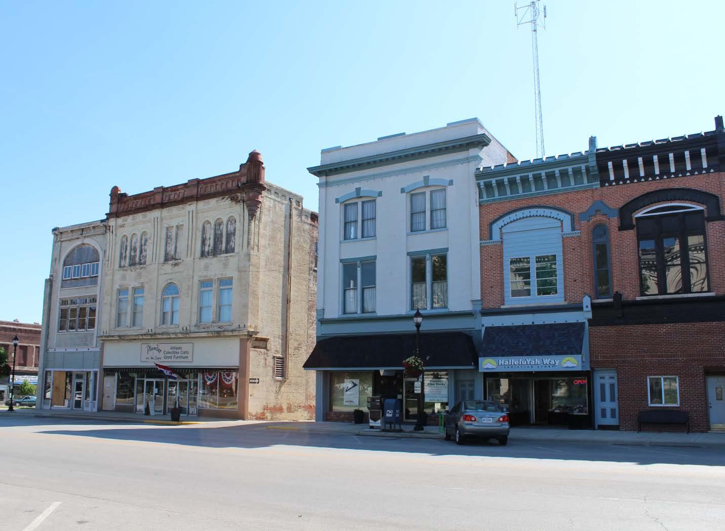
Today, the majority of the downtown core that surrounds the courthouse square remains intact, however, the density of the historic commerical core reduces greatly as one travels away from the courthouse square in any direction. Vacant storefronts, accompanied by uninhabited upperstory apartments are evidence of the downtown’s continued struggles. These struggles are compounded by the proximity to larger communities such as Lafayette and Indianapolis, which draw people for their variety of offerings that include entertainment, dining, and shopping. Yet, as the county seat, downtown Frankfort remains the hub for Clinton County’s government. Despite the losses and challenges that downtown Frankfort has faced, there is still a strong interest in the long-term viability of the downtown, and new public and private investment can be found throughout the downtown, evidenced by improvements occurring to and within multiple downtown buildings.
Within the downtown, governmental presence includes the Clinton County Courthouse, Clinton County Circuit Court, Frankfort Municipal Utilities, the Frankfort Police Department, and Frankfort Community Public Library. The rest of the downtown is mainly comprised of service-related businesses, including two banks -- The Farmers Bank and Regions Bank. There are several restaurants downtown which include Arni’s, Pepe’s, Flavors, Main Street Grille, and Johnny V’s Sports Pub. Retail still persevering downtown includes a couple of clothing boutiques, a flower shop, a couple of jewelers, and numerous antiques and collectibles shops.
Frankfort has very limited commercial options. Only a select number reside within the downtown area and are mostly comprised of antique shops. The Wal-mart and Rural King Supply, along with other chain stores and restaurants, are located on State Road 28 to the east.
DESIGN: Existing Conditions
DESIGN: Existing Conditions
Adjacent Neighborhoods

Primary residential neighborhoods are located north, south and east of downtown. To the west of downtown is the Frankfort Industrial Park (F.I.P.).
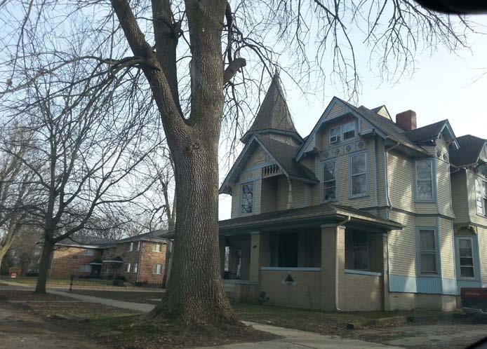
The residential neighborhood to the east of downtown is the Christian Ridge Historic District, as seen on the opposite page. This historic district is on the National Register of Historic Places. Its period of significance, according to the National Register, ranges from 1825 to 1949. Primary building types within the neighborhood included residential, educational, and religious structures, which architectural styles from the Late Victorian Era, and Late 19th and 20th Century Revivals. Old Stoney, the current city hall, and a former historic high school, is located within this neighborhood. Streets within this neighborhood are characterized by an abundnace of trees in substantial tree lawns and roads large enough to accomodate two traffic lanes and on-street parking. The sidewalks are about three feet wide and in fair to deteriorating condition.
South Frankfort Historic District, also on the National Register of Historic Places, is to the south of downtown. It has a similar historic make up as the Christian Ridge Historic District, with similar architectural styles and building uses, though only dating back to around 1875. It generally has wider streets and fewer trees than the Christian Ridge Historic District. Sidewalks are standard size, about three feet wide, typically with a tree lawn next to the road. They are in good condition along Jackson Street, but are in different states of disrepair, from a little overgrown to non-existent,
DESIGN: Existing Conditions
throughout the rest of the neighborhood. The wider streets are especially apparent along State Road 39.
The Frankfort Industrial Park (F.I.P.) started back in the 1950s. With over 1,000 acres, it is one of the largest industrial parks in central Indiana. It has access to two railroads, the Norfolk Southern and CSX, and is bisected by State Road 28 which offers easy access to Interstate 65. The park is home to such industrial big shots as Frito-Lay/Pepsico and Land O’ Lakes Purina Feeds LLC. Today F.I.P. employs over 3,500 people, most of whom do not live in Frankfort.
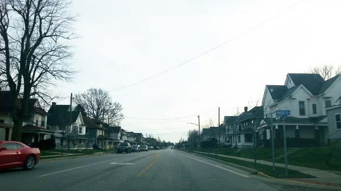
The residential neighborhood to the north is of a newer and more diverse housing stock. Streets are still substantially wide, though trees are fewer and younger. Some of the sidewalks appear newer, while others are fairly overgrown.