CONSOLIDATED ECONOMIC AND REDEVELOPMENT PLAN
August 22, 2025
August 22, 2025
It is with gratitude that we acknowledge the many individuals from the City of Beech Grove who helped develop this plan.
Redevelopment Commission
Matthew Kochevar, President
David Copenhaver, Vice President
Andrew Noone, Secretary
Phil Davis
Jenny Wensel
Rob Challis, School Board liaison
Common (City) Council
Elizabeth Lamping, Council District 1
Ryan Matkins, Council District 2
Michael Hemmelgarn, Council District 3
Avis Frieson, Council District 4
Mike Earnest, Council District 5
Dan McMillan, Council at Large
Chris Duffer, Council at Large
Mayor
James W. Coffman
Clerk-Treasurer
Samantha S. Stratton
Steering Committee
John O’Gara, Business Entrepreneur
Josh Goodin, Main St. Business Owner
Cheri Brewster, Amtrak
Rob Challis, BG School Board, RDC
Anthony Schneider, Realtor/Broker
Andrew Wolf, PE, Crossroads Engineers
Bruce Bye, Eli Lilly Employee
Terry Dilk, Small Business Owner, Former Mayor
Cindy Kirchhofer, Former Indiana State Representative
Liz Lamping, City Council, Past RDC Member
Tom Hannan, BG Parks Director
Pastor Dan Bailey, Minister
Sister Mary Luke, Our Lady of Grace Monastery
Stephanie Bramlett, Senior Citizens Center Director
Samantha S. Stratton, Clerk Treasurer
James W. Coffman, Mayor
In consultation with


The Beech Grove Consolidated Economic Development and Redevelopment Plan is intended to serve as a roadmap for the City of Beech Grove and the Redevelopment Commission (RDC) to move forward with increasing opportunity in Beech Grove for new development in places where development has been constrained and in places in need of redevelopment. Economic development areas are those areas where there has not been private investment and government investment could encourage growth. Redevelopment areas are those who have existing development that is underutilized, vacant, or abandoned and is generally in need of redevelopment in ways that the private market has not chosen to invest.
The powerful tool that the Beech Grove Redevelopment Commission uses most often is Tax Increment Finance. This tax tool allows a base assessment to be established for an area prior to development or redevelopment. Any new development assessed value is considered the increment and the taxes on that increment are captured by the RDC for investment. The RDC may bond for infrastructure or similar work to encourage development and pay the bonds from the TIF district revenue. A district expires 25 years after the initial debt service (typically bond) is established.
This is a consolidated plan for both economic development and redevelopment; it is not a comprehensive plan for the jurisdiction that considers land use, transportation, and public investments throughout the community. As an included city in Marion County, Beech Grove is under the Indianapolis Department of Metropolitan Development for planning, though control over rezoning has been recently returned to the City of Beech Grove. Some of the streets in Beech Grove are considered thoroughfares and are under the Indianapolis Department of Public Works. Utilities are generally privately owned.
The concepts presented in the plan for opportunity areas are ideas for what is possible on those sites and what would be involved in implementing that idea. There is no plan for the city to implement these concepts without participation from the property owners, now or in the future. These concepts can be used in developing the future when property ownership changes or when a property owner decides to change the current use of their property. Many of the opportunity areas will extend beyond five, 10, or even 20 years without significant change.
The plan includes a vision that the community has set, goals and pillars for guiding the work of the RDC and the city, and recommendations for the RDC and the city to increase the vitality of the local economy.
The local property tax environment in Indiana is shifting and those shifts may increase the difficulty of implementing recommendations. The plan is intended to have regular updates based on new information.
From the traditional Main Street to the Emerson Corridor and the interstate fronting industrial area, Beech Grove strives to bring to the city a wide variety of businesses and services that sustains a broad tax base, employs more individuals in the city limits, and offers residents a high quality of life through well-connected local and regional access, diverse and competitive housing options, and ample green space through the city’s beautiful parks and trail system.
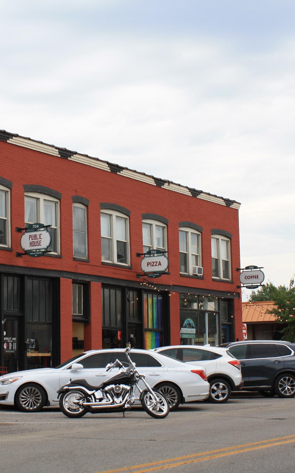
A vibrant city - Beech Grove is a place that is active and attractive. It preserves local history and identity while embracing change.
Goal 1: Attract new residents to the city, particularly young professionals and families, through investment in the city’s strengths.
Goal 2: Sustain Beech Grove as a “familycentric” community with strong schools, quality public safety, and a sense of community.
Goal 3: Use code enforcement to educate property owners and reduce violations.
A place with exceptional recreation opportunities and amenities- Beech Grove has something for people of all ages to enjoy all year round and attracts people from the region with their recreational opportunities and events
Goal 1: Grow current greenway trail system for Beech Grove residents to encourage public health and community identity.
Goal 2: Maintain and extend the sidewalk network to connect neighborhoods to greenways, parks, and community destinations.
Goal 3: Enhance public parks and recreation facilities targeted at youth to encourage participation in a range of youth and adult sports.
Goal 4: Redevelop vacant land for recreational purposes.
An enduring community identity- Beech Grove is a community of hard workers who have strong generational ties to the community and strong connections to the railroads. The community’s identity welcomes others as they discover Beech Grove.
Goal 1: Focus on Main Street as a pedestrianoriented destination with activated alleys, infill development, lighting and sign improvements, and programming.
Goal 2: Create a gateway system that defines the boundaries of Beech Grove and has a unified theme and design.
Goal 3: Ensure sidewalks are complete and accessible in the downtown area and enhance character and safety with consistent street lighting.
A modern and advanced local economyBeech Grove is a city of opportunity for a range of businesses and industries. Housing and educational opportunity support Beech Grove’s economic advancement.
Goal 1: Promote and encourage commercial redevelopment with emphasis on Emerson Avenue and Main Street as key redevelopment corridors.
Goal 2: Support redevelopment or improvement of industrial development on Emerson Avenue and Churchman Avenue.
Goal 3: Enhance the capacity of the city to be successful in economic development and redevelopment through re-establishment of an Economic Development Commission, continuing education for EDC and RDC members, and considering an economic development staff person or consultant to guide the city in decision-making.
A place where there is housing for all- Beech Grove is a place where people at all stages of life can find good housing to support their growth.
Goal 1: Invest in the city’s housing stock through renovation, redevelopment, and development of new housing.
Goal 2: Encourage conversion of underutilized buildings to housing units.
Goal 3: Redevelop larger parcels for mixed housing types.
A city with Intentional infrastructure investment- Beech Grove maintains the infrastructure that supports residents, retail businesses, and commercial and industrial businesses as well as providing transportation choices.
Goal 1: Eliminate local environmental pollution to encourage industrial redevelopment and generate tax revenue for public improvements.
Goal 2: Use TIF to generate revenue to improve areas in need of redevelopment.
Goal 3: Work with property owners and Citizens’ Energy to reconstruct the sanitary sewer laterals for an improved system.
Goal 4: Continue to partner with the City of Indianapolis and the Indianapolis Metropolitan Planning Organization and others on infrastructure improvements.
The recommendations of the plan build on the public engagement, existing conditions, goals of the plan, and the opportunity areas for redevelopment. The also consider economic development activities that are not in redevelopment areas. The recommendations are in four categories: policy, program, project, and zoning.
Policies are the considerations that the RDC and the City of Beech Grove should take into consideration when making decisions about proposed development or redevelopment opportunities, infrastructure investments, and public programming.
1. Collaborate with the schools to support a quality environment for families with children.
2. Thoroughly document all transactions for increased government accountability and transparency.
Programming is the activity portion of the work of communities, how people engage with and experience the community.
1. Develop and foster a relationship with Indy Economic Development (formerly Develop Indy) to promote the opportunities in Beech Grove.
2. Establish a Business Retention and Expansion (BR&E) program to understand the needs and challenges of employers in the city.
3. Provide incentives to businesses who are expanding their physical presence or employment in Beech Grove, with appropriate claw-back provisions for failure to meet goals.
4. Market the Beech Grove community as a place to do business.
5. Assist businesses with location, navigating zoning and permitting, staff recruitment, and marketing.
Projects are concrete efforts that have a visible impact on the community. These require plans and funding, including maintenance (in most cases).
1. Complete the peding roundabout projects.
2. Develop a trail along Emerson Avenue.
3. Install consistent gateway signs.
4. Continue to improve infrastructure including roads, sidewalks, drainage, and water/sewer – in partnership with other units of government and the private utilities as appropriate.
5. Implement the opportunity area concepts as practical.
The zoning ordinance is the Marion County Zoning Ordinance/ ReZone Indy and those provisions apply in Beech Grove, including for economic development and redevelopment projects. Beech Grove now has more control over zoning changes than it has historically and can leverage that control to support economic development and redevelopment priorities for the city. Some excluded cities in Marion County are also considering use of Overlay Districts or other options for more localized zoning standards.
1. Consider development of overlay districts for Main Street, Emerson Avenue, Churchman Avenue, and the CSX site.
2. Support continuing education for Board of Zoning Appeals (BZA) members and city council members on the role of the citizen planner.
The main goals of business retention are to provide assistance with issues that could force a company to fail, close, or relocate to another community.
The main goal of business expansion is to help existing businesses grow.
A business rentention and expansion program includes intentional efforts to build relationships with business leaders on a one-on-one basis to understand their concerns, needs, and plans for the future. These relationships are typically built by a professional who works for the community or a separate local economic development organization. In some cases a mayor or appointed person can be tasked with the relationship building. The information learned from the relationships is typically kept confidential and used only to support the needs of the business.
Businesses may need assistance with finding land or buildings for future operations, securing financing for equipment, training new workers, permissing or infrastructure, or similar issues.
~ International Economic Development Council
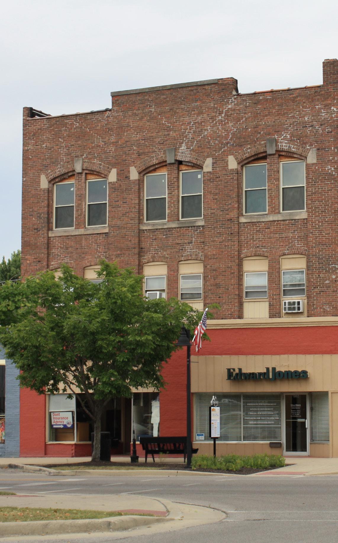
The Consolidated Economic Development and Redevelopment Plan for the City of Beech Grove provides guidance to the City of Beech Grove and the Beech Grove Redevelopment Commission (RDC) on the opportunities for both economic development projects and redevelopment projects in the city through 2030. Some of the concepts for redevelopment may have a longer time horizon as the city does not necessarily intend to purchase property or exercise eminent domain to acquire property to implement any of the potential redevelopment concepts. Redevelopment happens over time as property ownership changes and/or the owner decides to change the use of their property. In such cases, the concepts presented for redevelopment are a starting point for discussions between the city and the property owner or developer.
The Beech Grove Redevelopment Commission supports economic development and redevelopment in the City of Beech Grove and manages the city Tax Increment Finance (TIF) districts. The city does not presently have professional economic development or redevelopment staff, or a consultant managing development on behalf of the city. Previously the city had an Economic Development Commission, but it was put on hiatus by the previous administration.
Some of the work of the RDC and the city administration to bring economic opportunity to Beech Grove may require rezoning or other planning functions. As an excluded city in the Consolidated City of Indianapolis and Marion County, there are certain functions that are retained by the Department of Metropolitan Development and some infrastructure is owned and maintained by the Indianapolis Department of Public Works, particularly the roads designated as thoroughfares. The City of Beech Grove is a stand alone member of the Indianapolis Metropolitan Planning Organization for the distribution of transportation funds.
The purpose of a redevelopment commission is to plan for and address areas needing redevelopment.
The State of Indiana replaced the language of “blighted” in favor of areas in need of redevelopment in IC 36-7-14-1.3 which took effect June 30, 2005.
A redevelopment commission is subject to oversight by the city council, including a review by the city council of the commission’s annual budget. A redevelopment commission is:
1. subject to audit by the state board of accounts under IC 5-11;
2. covered by IC 5-14-1.5 (the public meetings law); and
3. covered by IC 5-14-3 (the public records law).
The five (5) commissioners for a municipal redevelopment commission are appointed as follows:
1. Three (3) shall be appointed by the mayor.
2. Two (2) shall be appointed by the city council.
The mayor also appoints a member of the school board to serve as a nonvoting adviser to the redevelopment commission.
The city clerk-treasurer is the treasurer of the redevelopment commission. The treasurer has charge over and is responsible for the administration, investment, and disbursement of all funds and accounts of the redevelopment commission in accordance with the requirements of state laws that apply to other funds and accounts administered by the clerk-treasurer as the city’s fiscal officer. The treasurer of the redevelopment commission may disburse funds of the redevelopment commission only after the redevelopment commission allows and approves the disbursement. However, the redevelopment commission may, by rule or resolution, authorize the treasurer to make certain types of disbursements before the redevelopment commission’s allowance and approval at its next regular meeting.
The duties of the redevelopment commission include:
1. investigate, study, and survey areas needing redevelopment within the corporate boundaries of the unit
2. investigate, study, determine, and, to the extent possible, combat the causes of areas needing redevelopment
3. promote the use of land in the manner that best serves the interests of the unit and its inhabitants
4. cooperate with the departments and agencies of the city, and other governmental entities,
5. make findings and reports on their activities under this section, and keep those reports open to inspection by the public at the offices of the department
6. select and acquire the areas needing redevelopment to be redeveloped
7. replan and dispose of the areas needing redevelopment in the manner that best serves the social and economic interests of the city and its residents.
In order to carry out these duties, the redevelopment commission may:
1. Acquire by purchase, exchange, gift, grant, condemnation, or lease, or any combination of methods, any personal property or interest in real property needed for the redevelopment of areas needing redevelopment that are located within the city limits.
2. Hold, use, sell, exchange, lease, rent, or otherwise dispose of property acquired for use in the redevelopment of areas needing redevelopment on the terms and conditions that the commission considers best for the city and its residents.
3. Sell, lease, or grant interests in all or part of the real property acquired for redevelopment purposes to any other department of the unit or to any other governmental agency for public ways, levees, sewerage, parks, playgrounds, schools, and other public purposes on any terms that may be agreed on.
4. Clear real property acquired for redevelopment purposes.
5. Enter on or into, inspect, investigate, and assess real property and structures acquired or to be acquired for redevelopment purposes to determine the existence, source, nature, and extent of any environmental contamination, including hazardous substances, petroleum, or other pollutants.
6. Remediate environmental contamination, including the following, found on any real property or structures acquired for redevelopment purposes: hazardous substances, petroleum, or other pollutants.
7. Repair and maintain structures acquired for redevelopment purposes.
8. Remodel, rebuild, enlarge, or make major structural improvements on structures acquired for redevelopment purposes.
9. Survey or examine any land to determine whether it should be included within an area needing redevelopment to be acquired for redevelopment purposes and to determine the value of that land.
10. Appear before any other department or agency of the unit, or before any other governmental agency in respect to any matter affecting real property acquired or being acquired for redevelopment purposes; any area needing redevelopment within the jurisdiction.
11. Institute or defend in the name of the unit any civil action.
12. Use any legal or equitable remedy that is necessary or considered proper to protect and enforce the rights of and perform the duties of the redevelopment commission.
There are a number of powers and duties of the redevelopment commission that apply to commissions with redevelopment departments. A redevelopment department may be created by the redevelopment commission.
1. Appoint an executive director, appraisers, real estate experts, engineers, architects, surveyors, and attorneys.
2. Appoint clerks, guards, laborers, and other employees the commission considers advisable, except that those appointments must be made in accordance with the merit system of the unit if such a system exists.
3. Prescribe the duties and regulate the compensation of employees of the department of redevelopment.
4. Provide a pension and retirement system for employees of the department of redevelopment by using the Indiana public employees’ retirement fund or a retirement plan approved by the United States Department of Housing and Urban Development.
5. Discharge and appoint successors to employees of the department of redevelopment.
6. Rent offices for use of the department of redevelopment
or accept the use of offices furnished by the city.
7. Equip the offices of the department of redevelopment with the necessary furniture, furnishings, equipment, records, and supplies.
There are powers related to contracting and the granting and receiving of funds:
1. Expend, on behalf of the special taxing district, all or any part of the money of the special taxing district.
2. Contract for the construction of local public improvements (as defined in IC 36-7-14.5-6) or structures that are necessary for redevelopment of areas needing redevelopment or economic development within the corporate boundaries of the unit or any structure that enhances development or economic development.
3. Contract for the construction, extension, or improvement of pedestrian skyways.
4. Accept loans, grants, and other forms of financial assistance from the federal government, the state government, a municipal corporation, a special taxing district, a foundation, or any other source.
5. Provide financial assistance (including grants and loans) to enable individuals and families to purchase or lease residential units in a multiple unit residential structure within the district. However, financial assistance may be provided only to individuals and families whose income is at or below the unit’s median income for individuals and families, respectively.
6. Provide financial assistance (including grants and loans) to neighborhood development corporations to permit them to provide financial assistance for the purposes described in #5 (above) or construct, rehabilitate, or repair commercial property within the district.
7. Require as a condition of financial assistance to the owner of a multiple unit residential structure that any of the units leased by the owner must be leased: for a period to be determined by the commission, which may not be less than five (5) years or to families whose income does not exceed eighty percent (80%) of the unit’s median income for families at an affordable rate.
8. Expend revenues from a tax increment financing district that are allocated for police and
fire services on both capital expenditures and operating expenses.
A redevelopment commission may not exercise the power of eminent domain.
Indiana Code 36-7-12-3 establishes the purpose of an economic development commission, which is to finance economic development (or pollution control) projects or a program for economic development, that has a likelihood of retaining or creating jobs, creating business opportunities, provide reliable water service, or reduce or abate pollution.
Beech Grove established an economic development commission in October 2017 as a 5-member commission, but over time the commission has not had appointed members or meetings. If the commission has new members appointed, then they would have the powers and duties described in IC 36-7-12.
An economic development commission shall investigate, study, and survey the need for additional job opportunities, industrial diversification, water services, and pollution control facilities in
the unit, and shall recommend action to improve or promote job opportunities, industrial diversification, water services, and availability of pollution control facilities in the unit.
A city through the economic development commission may:
1. enter into agreements concerning, and acquire by any lawful means, land or interests in land and personal property needed for the purposes of economic development and pollution control;
2. exercise its power of eminent domain to acquire unimproved land, unoccupied economic development facilities, or pollution control facilities and the land relating to those facilities;
3. purchase, lease as lessee, construct, remodel, rebuild, enlarge, or substantially improve economic development or pollution control facilities, including land, machinery, or equipment;
4. lease economic development or pollution control facilities to users or developers, with or without an option to purchase;
5. sell economic development or pollution control facilities to users or developers, for
consideration to be paid in installments or otherwise;
6. make direct loans to users or developers for the cost of acquisition, construction, or installation of economic development or pollution control facilities, including land, machinery, or equipment, with the loans to be secured by the pledge of one (1) or more taxable or tax-exempt bonds or other secured or unsecured debt obligations of the users or developers;
7. enter into agreements with users or developers to allow the users or developers to wholly or partially construct economic development or pollution control facilities to be acquired by the unit;
8. issue taxable or tax-exempt bonds under this chapter for single or multiple, identified or unidentified, economic development or pollution control facilities to accomplish the purposes of this chapter, and secure their payment;
9. establish reserves from the proceeds of the sale of taxable or tax-exempt bonds, other funds, or both, to secure the payment of the principal and interest on the bonds;
10. lend or deposit the proceeds
of bonds to or with a lender for the purpose of furnishing funds to the lender for the purpose of making a loan to a specifically identified developer or user for the financing of specifically identified economic development or pollution control facilities; and
11. reimburse from bond proceeds expenditures for pollution control facilities or economic development facilities.
The Indiana code does not authorize the financing of economic development facilities for a developer unless any written agreement that may exist between the developer and the user is fully disclosed to, and approved by, the economic development commission or the fiscal body of the unit. Bonding powers are outlined in IC 36-7-12-18.
As an excluded city, Beech Grove does not have independent planning functions, planning decisions are made by the Metropolitan Development Commission (MDC) with staff support from the Department of Metropolitan Development (DMD).
The MDC is a nine-member board with five members appointed by the Mayor of Indianapolis and four members appointed by the City-
County Council. With legislative changes the relationship between the excluded cities and DMD is changing and Beech Grove has more control over decision-making regarding planning and zoning.
Beech Grove is included in the Land Use Plan for Marion County, which serves as the Consolidated City and County comprehensive plan. The land use type map identifies parcels as residential, commercial, industrial, or special purpose. Parks and open space, environmentally sensitive areas, and town centers are also identified in the land use plan. The comprehensive plan is the basis for the zoning ordinance and subdivision control ordinance.
Under the zoning ordinance, which applies throughout Marion County, “for matters pertaining to a zoning map amendment within the corporate boundaries of an excluded city, the Commission shall refer the matter to the excluded city’s legislative body, who, at their first regularly scheduled meeting, may conduct the public hearing within 30 days of that meeting in accordance with IC 36-7-4-604(h).”
“The Metropolitan Board of Zoning Appeals has territorial jurisdiction over all the land subject to the Zoning Ordinance, except for the corporate boundaries of
the excluded cities of Lawrence, Speedway, and Beech Grove. The Municipal Board of Zoning Appeals established by an excluded city shall have jurisdiction within the corporate boundaries of that municipality.” As for the excluded city BZA, “the municipal board of zoning appeals for an excluded city shall consists of 5 members as follows: 3 citizen members appointed by the legislative body of the excluded city, and 2 citizen members.” The City of Beech Grove has established a Board of Zoning Appeals to consider rezoning petitions (zoning map amendments) within the municipal boundaries of Beech Grove. The Department of Metropolitan Development serves as staff to those boards, but petitions must be filed in the City of Beech Grove. The city has a consultant to assist with development at hearings.
The most common incentives used by Indiana municipalities in economic development and redevelopment are tax abatement and redevelopment. Tax abatement
Tax abatement is a tool that can be used on a project basis for real or personal property in an economic revitalization area. It is not necessary to designate an economic revitalization area ahead of a project, but that can be done.
Under Indiana code, “economic revitalization area” means an area which is within the corporate limits of a city, town, or county which has become undesirable for, or impossible of, normal development and occupancy because of a lack of development, cessation of growth, deterioration of improvements or character of occupancy, age, obsolescence, substandard buildings, or other factors which have impaired values or prevent a normal development of property or use of property. The term “economic revitalization area” also includes any area where a facility or a group of facilities that are technologically, economically, or energy obsolete are located and where the obsolescence
may lead to a decline in employment and tax revenues; a residentially distressed area; and an area of land classified as agricultural land for property tax purposes that, as a condition of being designated an economic revitalization area, will be predominately used for agricultural purposes for a period specified by the designating body.
The designating body for an economic revitalization area in Marion County is the Metropolitan Development Commission (MDC). There are procedures for designating residential areas as distressed in Marion County under limited circumstances.
When the Metropolitan Development Commission receives a request for property tax abatement in an excluded city like Beech Grove, it has an obligation to provide notice to that city under IC 6-1.1-12.1-2.6.
Personal property tax abatement is a property tax deduction from the assessed valuation granted by a designating body for the installation of qualifying abatable equipment in an economic revitalization area.
Real property tax abatement is a property tax deduction from the assessed valuation granted by the designating body for the construction of a new structure or a rehabilitation
of property in an economic revitalization are, it does not include land.
Real property abatement will be based on the increase to assessed value because of that project and not the actual cost for the building project.
Tax increment finance (TIF) is a means for counties, cities and towns to pay for infrastructure intended to promote economic development. With TIF, an enacting government establishes a TIF district, and may issue a bond to finance infrastructure— roads, water and sewer systems, buildings, amenities—that promotes new economic development. Governments continue to tax the existing assessed value of property in the district, but revenue generated by the added assessed value from the development is diverted to repay the bond. TIF districts are usually established for a period of 20 to 25 years, during which time all incremental real estate tax revenues above the base rate at the time the district is established, flow into the TIF. Indiana law is clear that TIF is intended for use when development would not occur without the infrastructure financed by the TIF revenue, this is sometimes referred
to as the “but for” condition, short for “but for the public investment the development would not occur.” TIF is not meant as a permanent source of revenue for government expenditures.
The TIF process generally has 7 steps:
1. The city council creates a redevelopment commission (RDC) [this is only done once]
2. The RDC makes a declaration of public purpose
3. The RDC makes findings and prepares a plan
4. The RDC approves a declaratory resolution
5. The plan is approved by the city council at a public hearing
6. The RDC adopts a confirmatory resolution to establish the redevelopment project area or economic development area
7. The city council approves the determination of the project area
An annual report needs to be filed in the Indiana Gateway system that lists the RDC members, staff to the RDC and salaries, expenditures from the previous year, an accounting of the TIF revenues spent as grants or loans, the amount of funds on hand, and similar information.
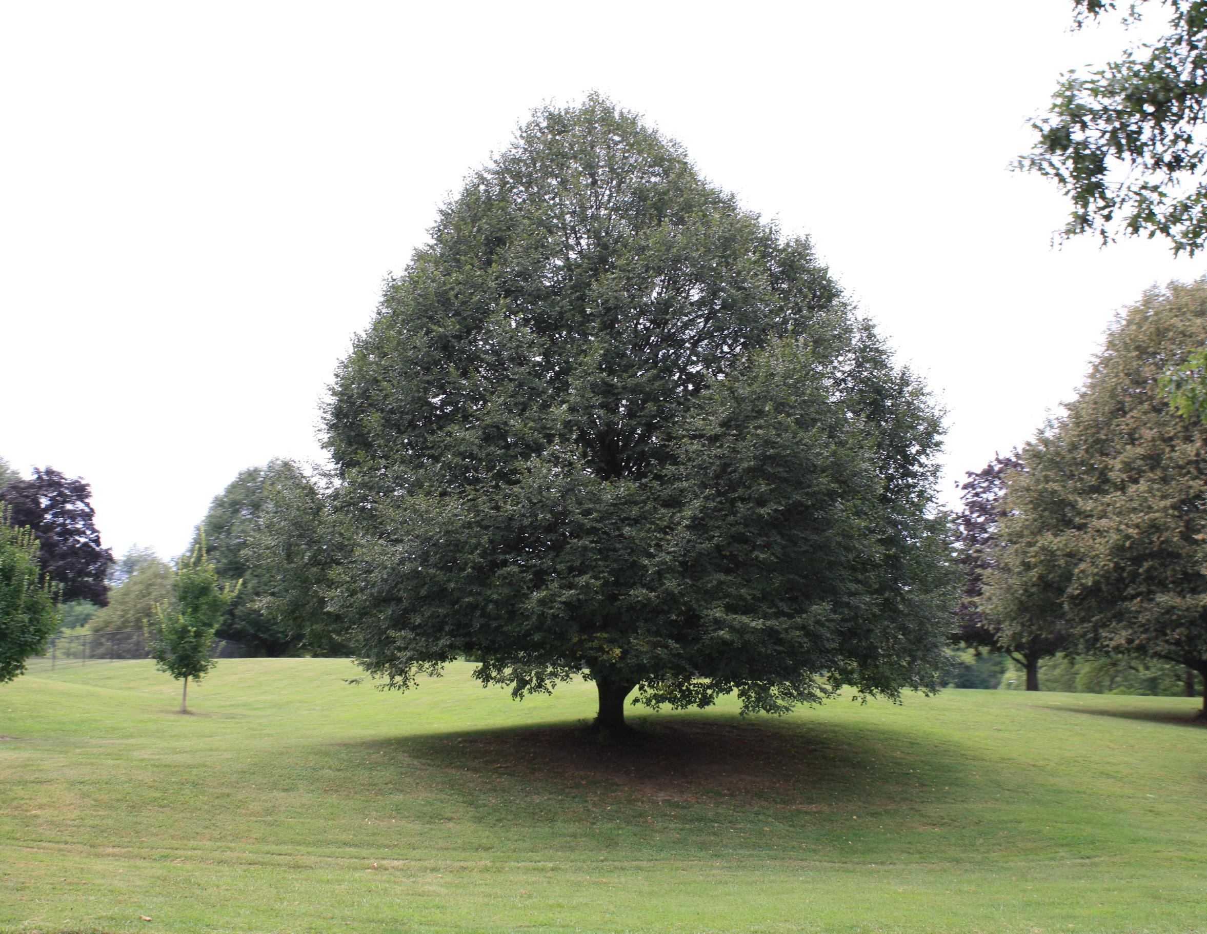
The vision and themes for the Beech Grove Consolidated Economic Development and Redevelopment Plan were established through the planning process, which include a steering committee of local stakeholders, public input opportunities, and presentations to the Beech Grove RDC.
The process included four phases: Discovery, Visioning, Framework, and Action. In the Discovery phase, the planning team worked with the city to collect prior plans and documents related to the redevelopment commission, demographic and economic data, create base maps, and begin the project webpage. 2025 began with the Community Planning Week, where the project team conducted focus groups, worked on concepts, met with the steering committee, and presented preliminary concepts to the RDC during their regular meeting.
Following development of the vision and themes, the planning team more fully developed the redevelopment concepts and developed cost estimates as well as revenue projections for those sites. The plan was built on the framework of the themes – addressing both economic development and redevelopment areas.
In the final stage, the plan document was drafted for review and comment and then entered the adoption process. Once adopted and filed with the Department of Local Government Finance (DLGF) at the State of Indiana, the plan will serve as both the redevelopment and economic development plan for the City of Beech Grove.
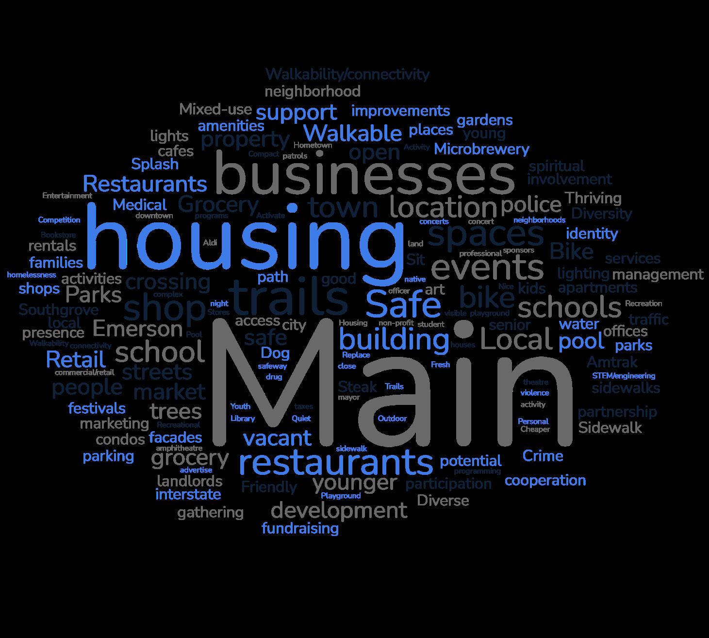
During Community Planning Week several key themes emerged from the conversations with the focus groups and the participants in the open house. Those comments behind them are incorporated in a word cloud.
The plan considers ways to intersect with these themes. Housing and retail/restaurants are issues where it is more difficult for the RDC to make direct investments, but the investments recommended will provide the environment in which desired commercial uses like retail, restaurants, and grocery stores can thrive.
The known public project are being done in partnership with the Indianapolis MPO. A soon-to-be completed project is the Hornet Park Trail.
The Indianapolis MPO has awarded funds for a roundabout at Churchman and Emerson for 2027 construction. Engineering is underway in 2025. The anticipated project cost is approximately $5M, with a local investment of $670,000 as the project was submitted to the Indianapolis MPO.
The Indianapolis MPO has awarded funds for a roundabout at Arlington, Elmwood, and Hanna Avenues. The project has an estimated total cost of $2,277,300 and will go to letting (contract bidding) in Fall 2025. The IMPO investment is $1,743,570 of federal funds exchange dollars.
There are private redevelopment projects underway, they are explained in the Opportunity Areas. One exception is Our Lady Grace Monastery.
The Sisters of Our Lady of Grace are building a new monastery on the same property at 1402 Southern Ave. The sisters will continue to live in the current monastery until construction is complete. The monastery and the former Benedict Inn Retreat & Conference Center will be taken down once the new monastery is completed and the sisters have moved into their new home. The building is projected to be completed in February of 2026.
The Sisters of Our Lady of Grace have allowed people to use the walking trails on their campus and will continue to do so, extending recreation opportunities in Beech Grove.
We reccomend the city work to incorporate the Our Lady of Grace walking trails into any future plans for Beech Grove’s trail system.
The Indiana General Assembly passed a bill that changes many aspects of taxation that will have impacts on local units of government. The bill was signed into law by the Governor and is currently known Public Law 68-2025. The impacts are not widely known at the time of adoption of this plan as the members of the General Assembly have stated that there will likely be bills in the 2026 and 2027 sessions to amend the provisions of the 2025 act that will take effect July 1, 2027. The City of Beech Grove and the Redevelopment Commission (RDC) will need to work closely with fiscal and legal counsel to understand the implications of the legislation on economic development and redevelopment in the city over the coming years.
From the traditional Main Street to the Emerson Corridor and the interstate fronting industrial area, Beech Grove strives to bring to the city a wide variety of businesses and services that sustains a broad tax base, employs more individuals in the city limits, and offers residents a high quality of life through well-connected local and regional access, diverse and competitive housing options, and ample green space through the city’s beautiful parks and trail system.
A vibrant city - Beech Grove is a place that is active and attractive. It preserves local history and identity while embracing change.
• Activate Main Street’s sidewalks and storefronts with more shops and restaurants
• Promote pride of place with building restoration and remodeling, keeping streets clean, and planting landscaping
• Revitalize the under-used properties on Albany Street through infill development and adaptive reuse for housing, offices, and other businesses.
• Apply design standards to beautify Beech Grove
A place with exceptional recreation opportunities and amenitiesBeech Grove has something for people of all ages to enjoy all year round and attracts people from the region with their recreational opportunities and events.
• Promote Beech Grove’s range of entertainment and recreational opportunities
• Connect youth sports destinations to Main Street
• Expand and connect the trails system
• Program activities for all ages
• Develop public amenities that are attractive to families
• Support development of private recreation assets to support activities for residents locally
• Program activities that engage residents year-round with input from residents
An enduring community identity- Beech Grove is a community of hard workers who have strong generational ties to the community and strong connections to the railroads. The community’s identity welcomes others as they discover Beech Grove.
• Promote community values of support, cooperation, and neighborliness
• Promote Beech Grove’s excellent relationships between citizens and public safety, city services, and community and religious organizations
• A “city within a city,” Beech Grove has both the communal feeling of a small, close-knit community and all the advantages of being near Indianapolis
• Improve the gateways into Beech Grove to create a sense of arrival and a distinction from Indianapolis
• Celebrate long-time residents’ generational ties and investment in Beech Grove
• Connect people who move to Beech Grove with established residents to support their interest in remaining in the community for the long term
A modern and advanced local economy - Beech Grove is a city of opportunity for a range of businesses and industries. Housing and educational opportunity support Beech Grove’s economic advancement.
• Use industrial zoning and TIF districts to attract businesses
• Re-establish an Economic Development Commission to focus on local business retention, expansion, attraction, and entrepreneurship
• Develop nodes of economic activity throughout the city
• Develop a skilled workforce through partnerships between schools and trades
• Partner with University of Indianapolis to attract students, alumni, and faculty to engage with Beech Grove
A place where there is housing for all- Beech Grove is a place where people at all stages of life can find good housing to support their growth.
• Increase housing variety with Main Street lofts, single-family homes, and apartment communities
• Renovate or redevelop older housing
• Attract young professionals and families by promoting competitive housing prices
• Promote Beech Grove’s location for commuters and UIndy students, faculty, and staff
A city with intentional infrastructure investment- Beech Grove maintains the infrastructure that supports residents, retail businesses, and commercial and industrial businesses as well as providing transportation choices.
• Modernize sewer infrastructure through phased improvements
• Improve Main Street and other sidewalks with consistent decorative lighting
• Increase connectivity for bicyclists and pedestrians
• Make public transit more enjoyable and convenient with bus stop improvements
• Maintain a safe and connected street network for passenger vehicles and commercial trucks
• Develop a multi-use path along Emerson Avenue
• Improve safety for children to walk and bike to school
• Continue to focus on road improvements, plans, and safety studies

1. Attract new residents to the city, particularly young professionals and families, through investment in the city’s strengths.
2. Sustain Beech Grove as a “family-centric” community with strong schools, quality public safety, and a sense of community.
3. Use code enforcement to educate property owners and reduce violations.
1. Grow current greenway trail system for Beech Grove residents to encourage public health and community identity.
2. Maintain and extend the sidewalk network to connect neighborhoods to greenways, parks, and community destinations.
3. Enhance public parks and recreation facilities targeted at youth to encourage participation in a range of youth and adult sports.
4. Redevelop vacant land for recreational purposes.
1. Focus on Main Street as a pedestrian-oriented destination with activated alleys, infill development, lighting and sign improvements, and programming.
2. Create a gateway system that defines the boundaries of Beech Grove and has a unified theme and design.
3. Ensure sidewalks are complete and accessible in the downtown area and enhance character and safety with consistent street lighting.
1. Promote and encourage commercial redevelopment with emphasis on Emerson Avenue and Main Street as key redevelopment corridors.
2. Support redevelopment or improvement of industrial development on Emerson Avenue and Churchman Avenue.
3. Enhance the capacity of the city to be successful in economic development and redevelopment through re-establishment of an Economic Development Commission, continuing education for EDC and RDC members, and considering an economic development staff person or consultant to guide the city in decision-making.
1. Invest in the city’s housing stock through renovation, redevelopment, and development of new housing.
2. Encourage conversion of underutilized buildings to housing units.
3. Redevelop larger parcels for mixed housing types.
1. Eliminate local environmental pollution to encourage industrial redevelopment and generate tax revenue for public improvements.
2. Use TIF to generate revenue to improve areas in need of redevelopment.
3. Work with property owners and Citizens’ Energy to reconstruct the sanitary sewer laterals for an improved system.
4. Continue to partner with the City of Indianapolis and the Indianapolis Metropolitan Planning Organization and others on infrastructure improvements.
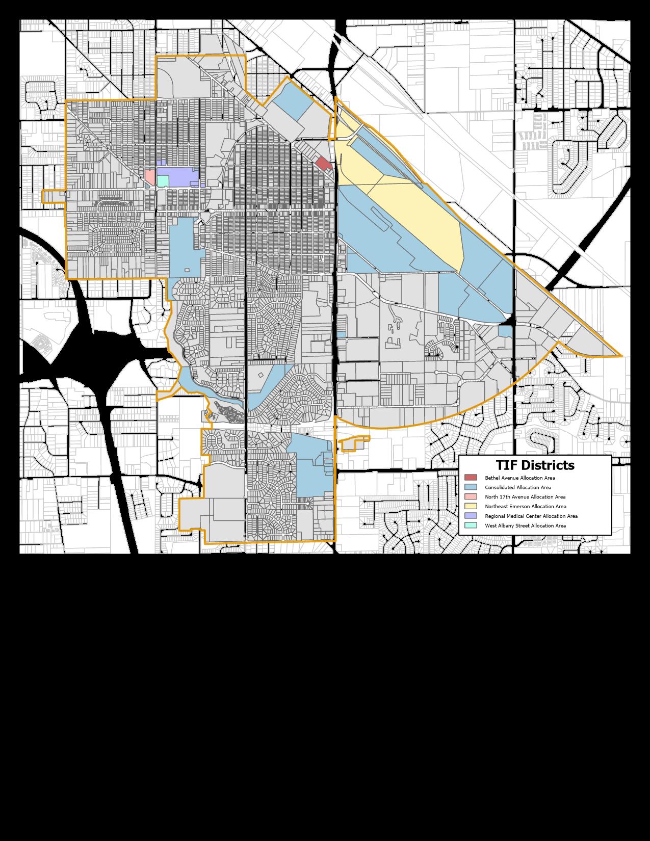
The following information regarding the sunset dates and statutory framework of Beech Grove’s allocation areas was drawn from the Beech Grove annual report created by Jeff Peters of Peters Franklin LTD.
The City of Beech Grove through its Redevelopment Commission has strategically utilized Tax Increment Financing (TIF) as a tool to support revitalization, economic development, and public infrastructure improvements in designated areas in need of reinvestment. These TIF districts—referred to as allocation areas—are established under Indiana Code 36-7-14, which governs redevelopment commissions and provides mechanisms for fostering redevelopment in areas identified as in need of redevelopment.
Date Established: April 5, 2000
Legal Authority: IC 36-7-14
Designation: Area Needing Redevelopment / Redevelopment Project Area
Sunset Date: April 4, 2030
This is one of the city’s earliest TIF districts and includes portions of the downtown and surrounding areas. The “expanded” designation reflects the city’s intent to broaden the redevelopment scope over time to support core infrastructure, streetscape enhancements, and private investment. As a designated Redevelopment Project Area, this district was intended to fund larger-scale public-private initiatives, often requiring phased planning and capital investment.
Significant businesses in this allocation area include Beech Grove Senior LLC, National Railroad Passenger Corporation, Alro Steel Corp., Lowe’s Home Centers, Inc., and Wal-Mart Real Estate Business Trust.
Date Established: November 13, 2008
Legal Authority: IC 36-7-14
Designation: Area Needing Redevelopment
Sunset Date: January 31, 2034
This allocation area was formed to support the redevelopment of the former St. Francis Hospital site and surrounding parcels. The area’s anticipated TIF revenues will be directed toward infrastructure improvements and site preparation to attract new commercial development, replacing a vacated and underutilized property with productive uses that contribute to the local economy, job growth, new resident attraction and tax base.
The parcels in this allocation area were owned by the Sisters of St. Francis and Alverno Administrative at the time the district was created.
Date Established: October 17, 2019
Legal Authority: IC 36-7-14
Designation: Area Needing Redevelopment
Sunset Date: 25 years from the date of first financial obligation
Created to facilitate redevelopment and reinvestment along a key corridor, this district’s expiration date will be calculated based on when its first financial obligation is formally incurred—typically triggered by the issuance of TIFbacked bonds or entry into a developer-backed reimbursement agreement. It is anticipated that this area will contribute to job creation and tax base growth. The area is expected to catalyze industrial use investment along Emerson Avenue to take advantage of interstate and rail access.
The key property owners are Tibbs Property Investments, LLC, National Railroad Passenger Corp., The Penn Central Corp., and CSX Transportation.
Date Established: October 22, 2020,
Legal Authority: IC 36-7-14
Designation: Area Needing Redevelopment
Sunset Date: 25 years from the date of first financial obligation
This district was created to support redevelopment along West Albany Street, an area with aging infrastructure and underutilized parcels. As with other areas governed by the 25-year rule, the specific expiration will align with the start of financial obligations. TIF proceeds are expected to support transportation improvements, stormwater upgrades, and potentially workforce housing or commercial redevelopment initiatives.
At the time of establishment, the parcel was owned by Sisters of St. Francis to be transferred to CRE Properties, LLC.
Date Established: November 17, 2022,
Legal Authority: IC 36-7-14
Designation: Area Needing Redevelopment
Sunset Date: 25 years from the date of first financial obligation
This is the city’s most recently established allocation area. Located along Bethel Avenue, the district was identified due to declining property conditions and the need for infrastructure modernization. Future investments may include street reconstruction, sidewalk improvements, utility upgrades, and private development incentives. The district offers flexibility to respond to changing economic conditions while aligning with broader redevelopment strategies.
The property is owned by JZB Investments, LLC.
Together, these allocation areas reflect Beech Grove’s comprehensive approach to urban renewal. By establishing defined timeframes for each district, the city ensures fiscal accountability, planning predictability, and compliance with state redevelopment law. These sunset dates also serve as important milestones for evaluating progress and determining the future of each area’s redevelopment potential.
Date Established: TBD
Legal Authority: IC 36-7-14
Designation: Area Needing Redevelopment
Sunset Date: 25 years from the date of first financial obligation
Created to support redevelopment of a parcel that is in need of redevelopment as the area has shifted focus from medical uses and needs additional housing. Future improvements could include sidewalk improvements, utility upgrades, and private development incentives.
The property owner MPD Properties LLC.
This chapter explores opportunity areas throughout the Beech Grove community as identified through the public engagement process and meetings with the project steering committee and Redevelopment Commission. These sites represent a variety of redevelopment opportunities that could have a significant impact on Beech Grove in the future. The concepts outlined on the following pages for each of the sites represent one scenario for how redevelopment could occur based on current market conditions and trends. They are intended to represent the type of development that could complement existing conditions, better position Beech Grove as an attractive community for future residents and businesses, and support this plan’s vision, pillars, and goals (Chapter 2: Vision, Pillars, and Goals).
This plan also recognizes the City of Beech Grove is continuously evolving, as are local, national, and global market opportunities and conditions that may include, but are not limited to property ownership; community demographics; land use; and market trends related to how people shop and use services, product and business popularity, and other influencing factors. This plan, and the concepts presented on the following pages, do not represent any intent by the City of Beech Grove to acquire or modify existing property. Redevelopment of any property within Beech Grove will be largely driven by private interests and individual developers and their unique interests.
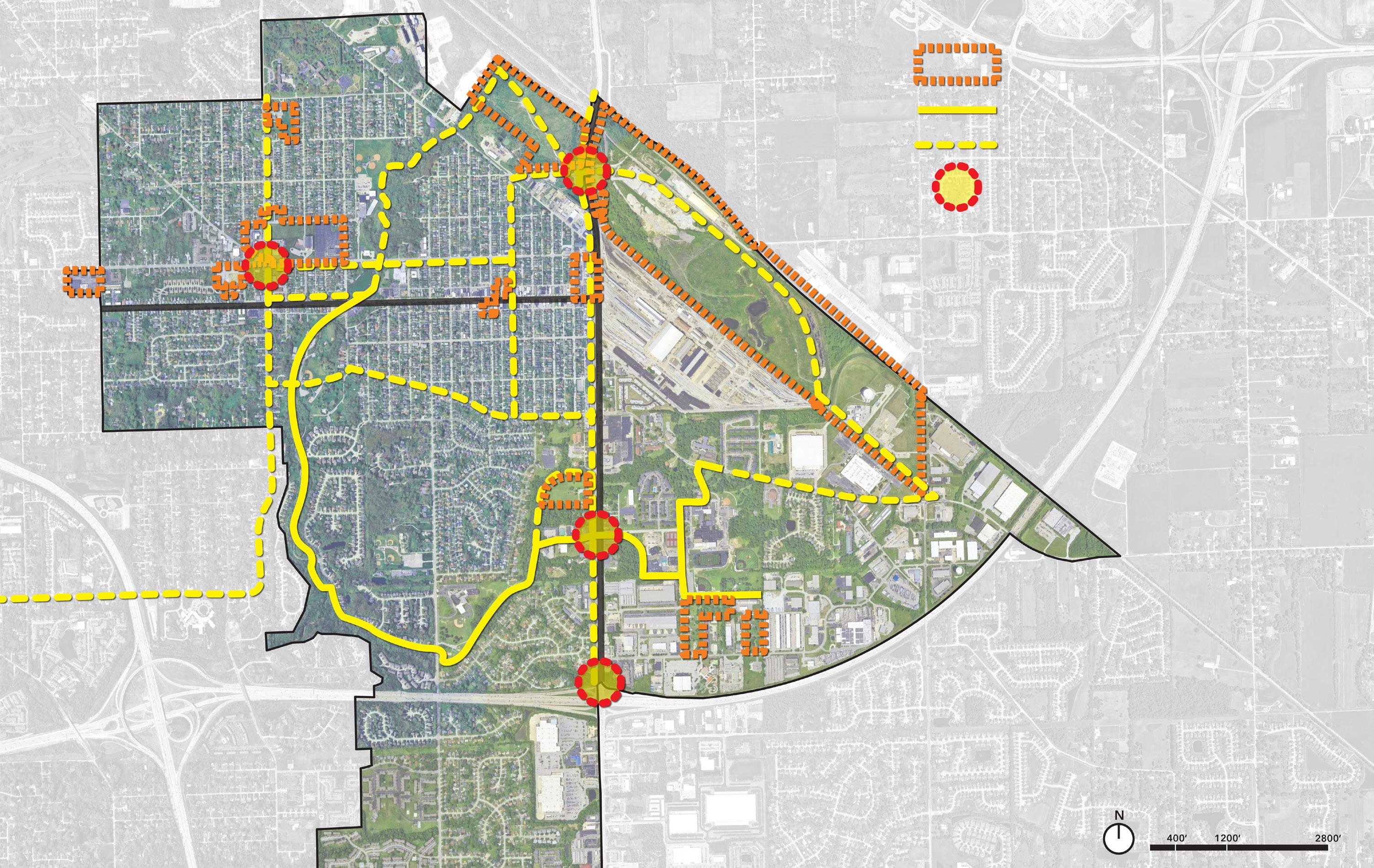
The opportunity areas explored on the following pages are represented on the adjacent map and have been assigned unique names for the purposes of this plan and for ease of reference. They include:
• CSX District – Industrial
• St. Francis District
• N. 17th Ave. Trail
• Plumbing School Site
• CSX District – Park
• Bailey Park Neighborhood Expansion
• Industrial Redevelopment District
• Emerson Housing Development
• E. Troy Ave. Redevelopment
• Main Street Redevelopment District
• Main Street Infill
CSX DISTRICT - PARK
BAILEY PARK
NEIGHBORHOOD EXPANSION ST. FRANCIS DISTRICT
PLUMBING SCHOOL SITE 17TH AVE. TRAIL
E. TROY AVE. REDEVELOPMENT
EMERSON/SUBWAY GATEWAY
ALBANY/17TH AVE. GATEWAY
MAIN STREET INFILL MAIN STREET REDEVELOPMENT
CSX DISTRICT - INDUSTRIAL
FOCUS AREA
EXISTING TRAIL
PROPOSED TRAIL GATEWAY ENHANCEMENT
EMERSON HOUSING DEVELOPMENT
EMERSON/HORNET GATEWAY
EMERSON/I-465 GATEWAY
Beyond the opportunity areas, there are general types of redevelopment that are encouraged in Beech Grove. The criteria for redevelopment sites are:
1. Danger to health, safety, or welfare of the community.
2. Change of ownership that allows for the RDC to purchase land or partner with new ownership to shape the redevelopment.
3. Parcel use, building condition, or maintenance is not consistent with the needs of the city for jobs, tax base, and quality of place to attract residents.
When new redevelopment opportunities become available the desired outcome is one or more of the following:
1. Improved drainage, sewer conditions, sidewalks, and connectivity to public places.
2. Appropriate siting of buildings relative to the road, neighborhood context, and other factors like trails or schools.
3. Design that improves the visual character of the corridor for development along Main, Churchman, or Emerson.
4. Creating opportunities for recreation that addresses the needs of residents from families with young children to older adults.
5. Developing high-quality attainable housing.
6. Attracting new businesses to Beech Grove or supporting the expansion of existing businesses.
Within each opportunity area, a general description of the existing conditions and relevant context are provided. In addition, concept illustrations are provided to represent the redevelopment intent. The illustrations are supported by key considerations and design best practices. Each opportunity area also includes a preliminary cost opinion for the anticipated public investment that is intended to provide an approximate magnitude of cost. In general, the public investment is assumed to include public utility improvements, including storm, sanitary, water, and electrical service points necessary to service the illustrated redevelopment; improvements within the public rights-of-way that may include street and sidewalk improvements, trees, and lighting; and any park or public open space improvements. The cost opinions are based on average prices from similar public improvement projects over the past three years and include contingencies for unknown conditions and typical contractor mark-ups. They do not include costs for property acquisition, private utility costs, or inflation. In addition, it should be noted that the preliminary concepts were developed using available, public base information including local GIS and aerials. The accuracy of the base information cannot be confirmed, and cost opinions will change with the acquisition of more accurate base information. Each opportunity area also includes an anticipated private investment impact on the city based on the illustrated (re)development concept(s). [The
assumptions in the Beech Grove Consolidated Economic Development and Redevelopment Plan provide the foundational data and parameters used to calculate the fiscal and economic impacts across each of the redevelopment project areas. These assumptions ensure consistency in modeling the 25-year impacts of private investments, job creation, residential growth, and tax revenues.
Years of the TIF: 25 years after debt obligations are incurred.
All impact estimates are projected over a 25-year period, which is the standard duration for Tax Increment Financing (TIF) districts in Indiana. This timeframe aligns with the expected useful life of infrastructure investments and provides a longrange view of fiscal return.
These rates estimate the annual property tax generation per square foot of new development:
Estimated Residential Property Tax Rate: $1.565 per square foot is used to calculate the annual property tax revenue generated from new single-family, duplex, and multifamily housing developments.
Commercial Property Tax Rate: $1.617 per square foot is applied to retail, office, and mixed-use commercial developments.
Industrial Property Tax Rate: $1.127 per square foot is used for manufacturing and logistics-related facilities.
These values reflect local tax rates and assessed valuation expectations specific to Beech Grove and are used to forecast both annual and cumulative 25-year tax revenues from each development type. With changes to the taxing structure in the State of Indiana these estimated rates will likely vary.
These assumptions estimate the amount of square footage required per employee and typical wage levels for each sector:
Commercial Employee Space Requirement: 500 square feet per employee. Based on typical retail and service sector floor plans, this helps translate building size into jobs.
Industrial Employee Space Requirement: 1,308 square feet per employee. This reflects lower employee density in manufacturing, warehousing, and logistics facilities.
Used to calculate payroll and corresponding local economic impact for commercial employers.
Average Annual Salary – Commercial Employees:
$30,000
Average Annual Salary – Industrial Employees:
$51,352
Sourced from Stats Indiana, this reflects higherwage industrial positions that drive stronger income and spending multipliers.
Wages and square footages will vary per business and sector.
Employee Disposable Income: 60 percent of total salary. This assumes 60 percent of gross income is spent locally after taxes, savings, and external expenditures. This disposable income is a key driver of local economic impact through spending at businesses, housing, and services.
These assumptions convert residential units into population and student projections:
People per Housing Unit: 2.3 is based on Stats Indiana data, this average is used to estimate the population increase from each new residential project.
School-Age Children per Unit: 0.54, provides a basis for estimating new students entering local school systems due to housing developments.
Per Student Distribution: $6,750 annually.
This represents state and local funding allocated per student for public school services. Used to calculate annual and 25-year fiscal obligations or contributions toward education services resulting from new residents.
Per Capita Personal Income: $51,352, is used to benchmark broader economic effects and verify that employment wage assumptions are aligned with local earnings norms.
Local Income Tax (LIT) Rate
Annual LIT Rate: 0.25%
The local income tax is used to estimate revenue generated from wage-earning residents and employees, which is captured for economic development line items throughout the project tabs.
These assumptions are central to the uniform forecasting model used in the plan. They inform every calculation—from estimating the number of jobs created per square foot, to projecting tax revenues, household income, and school enrollment impacts. By anchoring all projections to these consistent assumptions, the city can evaluate each redevelopment scenario on an equal footing and assess its long-term return on public investment.
In 2015, the Indiana General Assembly enacted legislation that replaced the County Adjusted Gross Income Tax, County Option Income Tax, and County Economic Development Income Tax (CAGIT, COIT, and CEDIT with a single Local Income Tax (LIT). LITs became effective beginning with the 2017 tax year. At this time, all counties in Indiana have enacted a LIT. The rate is divided into categories including economic development. Economic development revenues can be distributed to counties, cities, and towns and counties may opt to distribute them based on certified levy or population. Senate Enrolled Act 1 (SEA 1) changes the structure of the LIT starting with the 2028 budget. The legislation permits cities with populations of 3,500 or more to impose a 1.2% LIT for municipal services, while counties can implement a 1.2% LIT for county services.
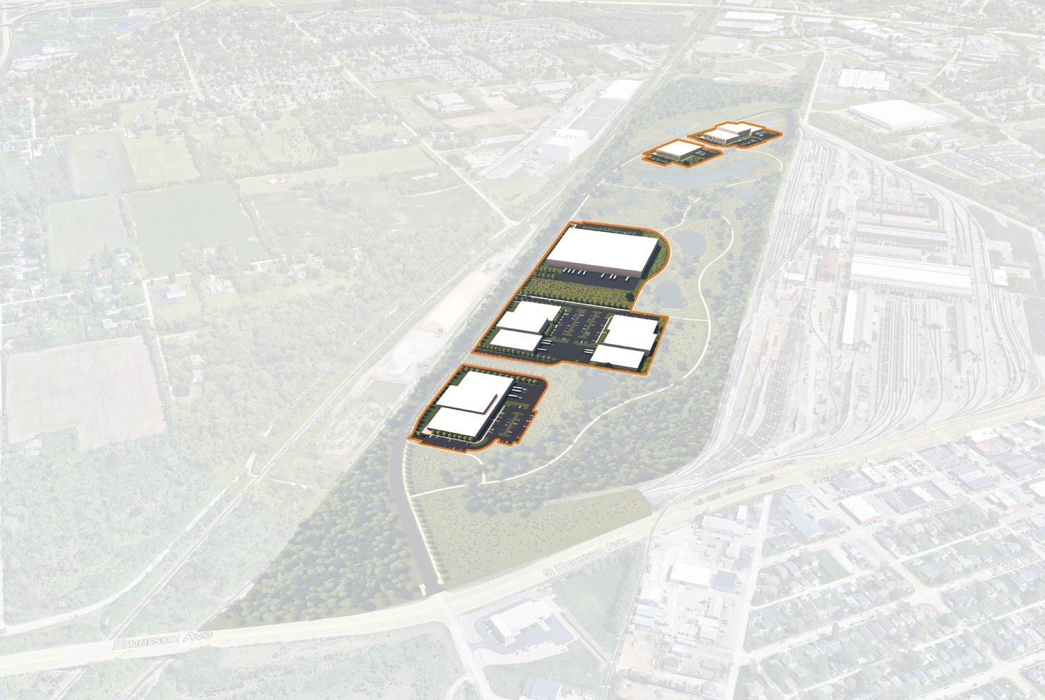
The CSX-Industrial site refers to the former CSX railroad property located in north-central Beech Grove, immediately south of the CSX railroad, east of Emerson Ave., north of Amtrak, and west of Arlington Ave. and the Kinder Morgan – Indianapolis South Liquified Natural Gas Plant. Approximately 130 acres in area, the property is privately owned and contains multiple parcels. It can be accessed from Subway St. and Emerson Ave. on the west and Big 4 Rd. and Arlington Ave. on the east.
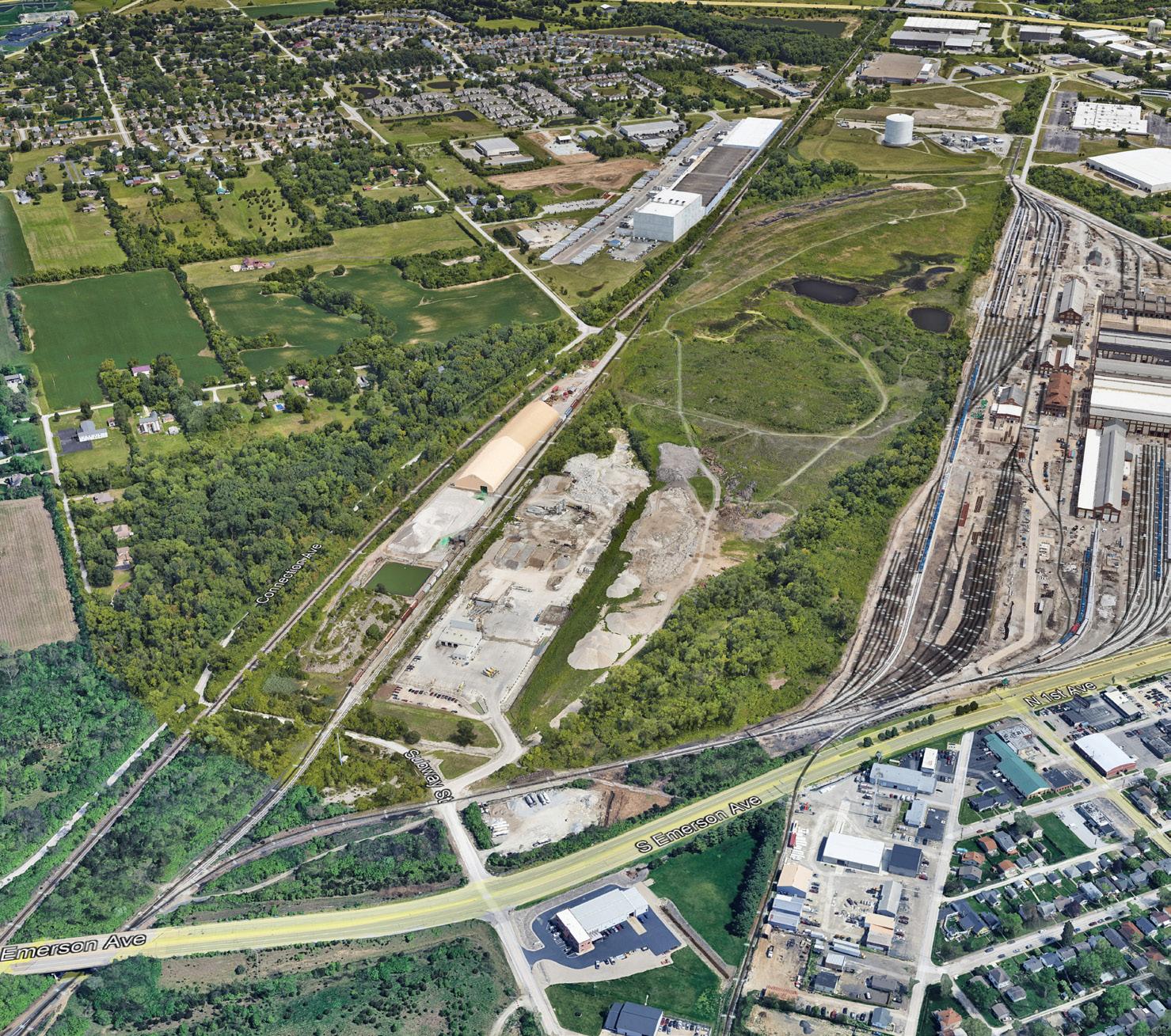
The property is relatively flat, gently sloping about 30 feet from the east towards the west. Pullman Creek originates from several small ponds and flows from southwest to northeast within the southern one-third of the property. Vegetation is largely characterized by large trees around the perimeter of the property and adjacent to the creek and ponds. The remaining site primarily consists of grasses, shrubby growth, and smaller trees.
The property has several attributes that make it well-suited for light industrial or manufacturing use. Those include its former use by the railroad for industrial purposes, the surrounding context and land use which is primarily industrial, proximity to an active railroad, access to large transportation corridors including Emerson Ave. and Arlington Ave., and the property’s large size. Approximately 130 acres, the site represents a unique opportunity for industrial and manufacturing development within a city that is primarily landlocked and surrounded by existing development. Additionally, while no known contamination is present on-site that would preclude future residential development, the site’s history as an industrial site could complicate alternate uses beyond manufacturing or industrial use.
As illustrated in the adjacent concept rendering, recommendations for (re) development focus on scalable, light industrial and manufacturing facilities ranging in size from 50,000 to 250,000 square feet located throughout the property to promote a variety of new businesses. These facilities would be supported by a new, primary access road connecting Subway St. on the west to Big 4 Rd. on the east. As illustrated, the service road is located near the northern property boundary to promote well-designed and functionable intersections at both Emerson Ave. and Arlington Ave., while also consolidating developable area for private redevelopment. Development of the property as indicated would likely increase traffic volumes on Emerson Ave. which may require an intersection improvement at the intersection of Subway St. and Emerson Ave. When implemented, the signalization would include pedestrian improvements to allow the safe and efficient crossing of bikes and pedestrians over Emerson Ave.
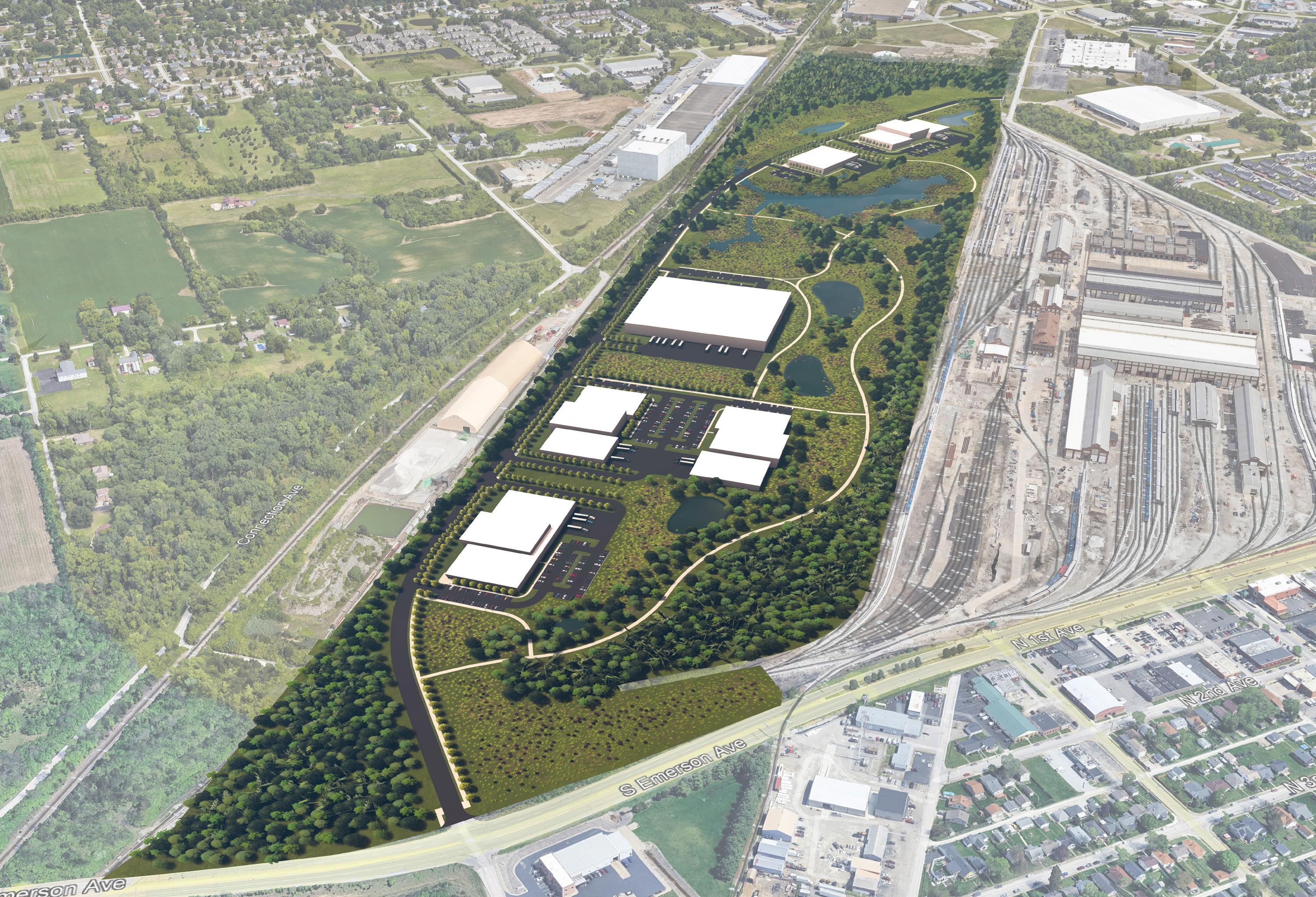
Additional recommendations for the property include protecting the existing wetland and pond features through intentional building setbacks and inclusion of native plantings to filter stormwater runoff and buffer those environmentally and ecologically sensitive areas. The non-developable areas of the property could be re-established with native plantings, trees, and walking and biking trails to improve aesthetics, buffer the new development from adjacent development, and to act as an extension of the proposed park west of Emerson Ave. as described in the previous section.
Public Investment
• Align new roads with existing roadway intersections.
• Consider signalization of Subway St. and Emerson Ave. intersection to improve pedestrian safety and account for changes in traffic patterns and increased future traffic volumes.
• Align interior roadways adjacent to the railroad and northern property boundary to create optimal roadway alignment at intersections, improve pedestrian connectivity, and maximize buildable area for private investment.
• Treat non-developable areas as public open space with trails and planted buffers to protect existing water bodies and sensitive ecological areas.
• Integrate green infrastructure into naturalized areas to help manage development runoff.
Private Investment
• Maintain appropriate building setbacks from future roadways and adjacent development.
• Set a minimum building size for development this district.
• Locate loading and service docks at the rear of buildings.
• Prohibit large truck traffic from travelling through employee parking areas.
• Locate employee parking to the sides or rear of new development.
• Integrate green infrastructure into surface parking lots and manage all stormwater on-site.
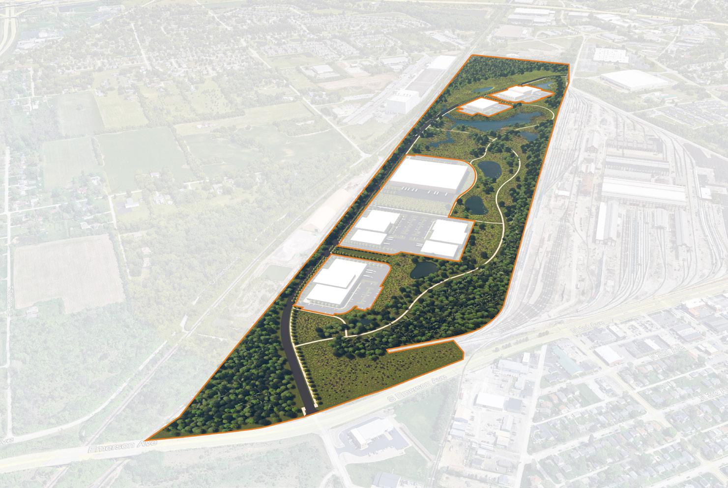
The anticipated public investment for the industrial opportunity area is approximately $14.7 million. As illustrated in the exhibit below, the public investment cost opinion assumes development of necessary roadways, improvements to the intersections of the new service road, Emerson Ave., and Big 4 Rd. (including signalization of the Subway St. and Emerson Ave. intersection), development of trails and walking paths, lighting, street trees, and limited reforestation and native planting establishment. The public investment cost opinion also assumes extension of storm and sanitary sewers, water infrastructure, and establishing a main electrical point of service. Due to the elevation of the property in relation to the rest of the city, the cost opinion includes a sanitary lift station and force main.
Representing a major industrial redevelopment initiative, the CSX District includes three large-scale industrial complexes totaling 334,000 square feet as illustrated in the exhibit below. Backed by $129.15 million in private investment, the site will house 6 industrial employers and provide jobs for 255 workers.
Economic and fiscal outcomes are especially strong:
• Workers will earn an average salary of $51,352, resulting in $13.1 million in annual salaries.
• Over 25 years, disposable income (at 60 percent) will exceed $196.7 million.
• Annual property taxes from this formerly underutilized industrial land will reach $376,280, for a total of $9.4 million over 25 years.
• The LIT revenue will reach $819,670 across the TIF period.
• A Return on Investment (ROI) of 82x in property tax growth highlights this district as a critical employment and fiscal engine.
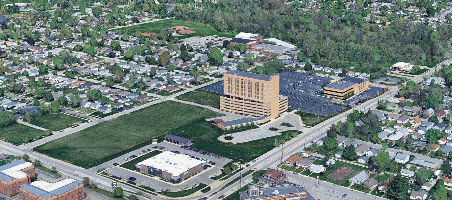
The St. Francis District refers to the former site of Franciscan Health’s Beech Grove hospital. Approximately 25 acres in size, the property represents a significant (re)development opportunity within the heart of the community located at the intersection of three primary roads that include Albany St., Churchman Ave., and N. 17th Ave. The site is primarily bounded by Buffalo St. on the north, N. 17th Ave. on the west, Albany St. on the south, and N. 13th Ave. on the east. The northwest corner of the site extends slightly north of Buffalo St. between N. 17th Ave. and N. 16th Ave. for approximately 200 feet. The opportunity area also incorporates the property immediately west of N. 17th Ave., locally known as the Medical Arts Building, at 110 N. 17th Ave., which was recently purchased and is being redeveloped into a mixed use redevelopment with first floor retail and upper level housing.
Additional existing development within the district includes: CrossRoad Engineers office near the northeast corner of Albany St. and N. 17th Ave. at 115 N. 17th Ave.; ten-story parking garage and IT services/office building [five-stories parking garage (approx. 400 parking spaces based on a visual estimation) and five-stories office building (approx. 30,000 sq. ft. based on a visual estimation] from the Franciscan Health Hospital at 1600 Albany St., near the center of the focus area; and Franciscan Health’s VNS Home Care Facility, 116 N. 13th Ave., at the intersection of Albany St. and N. 13th Ave. near the southeast corner of the focus area. The existing parking garage presents
Existing Site
a unique opportunity for future (re)development in the area. Parking structures are very costly to construct which is why most developments use large, surface parking in less urban areas when feasible. This helps reduce overall cost but also leads to less dense, and more suburban, development. The parking garage should be protected as an asset to help promote more dense development, however, removal of the one-story attached lobby and five-stories of office above the parking garage may be considered as a way to help reduce the overall scale of the structure and to allow it to be more appropriately scaled to the surrounding single-family neighborhoods.
Beyond these structures, the site is largely vacant. Large open lawns are maintained, and an extensive asphalt parking lot is located immediately east of the remaining parking garage, and west of the VNS Home Care Facility. The site is predominately flat with very little topography. Surrounding development primarily consists of single-family homes with some commercial development and religious institutions to the south and west, and a school to the east. Southwest of the N. 17th Ave., Albany St., and Churchman Ave. intersection, the former Safeway grocery store site is vacant with plans for redevelopment as a plumbing school as discussed within the following opportunity area.
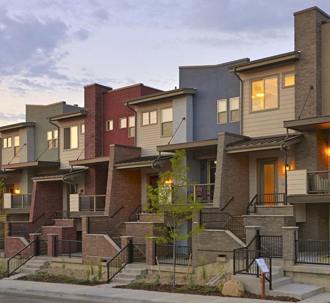
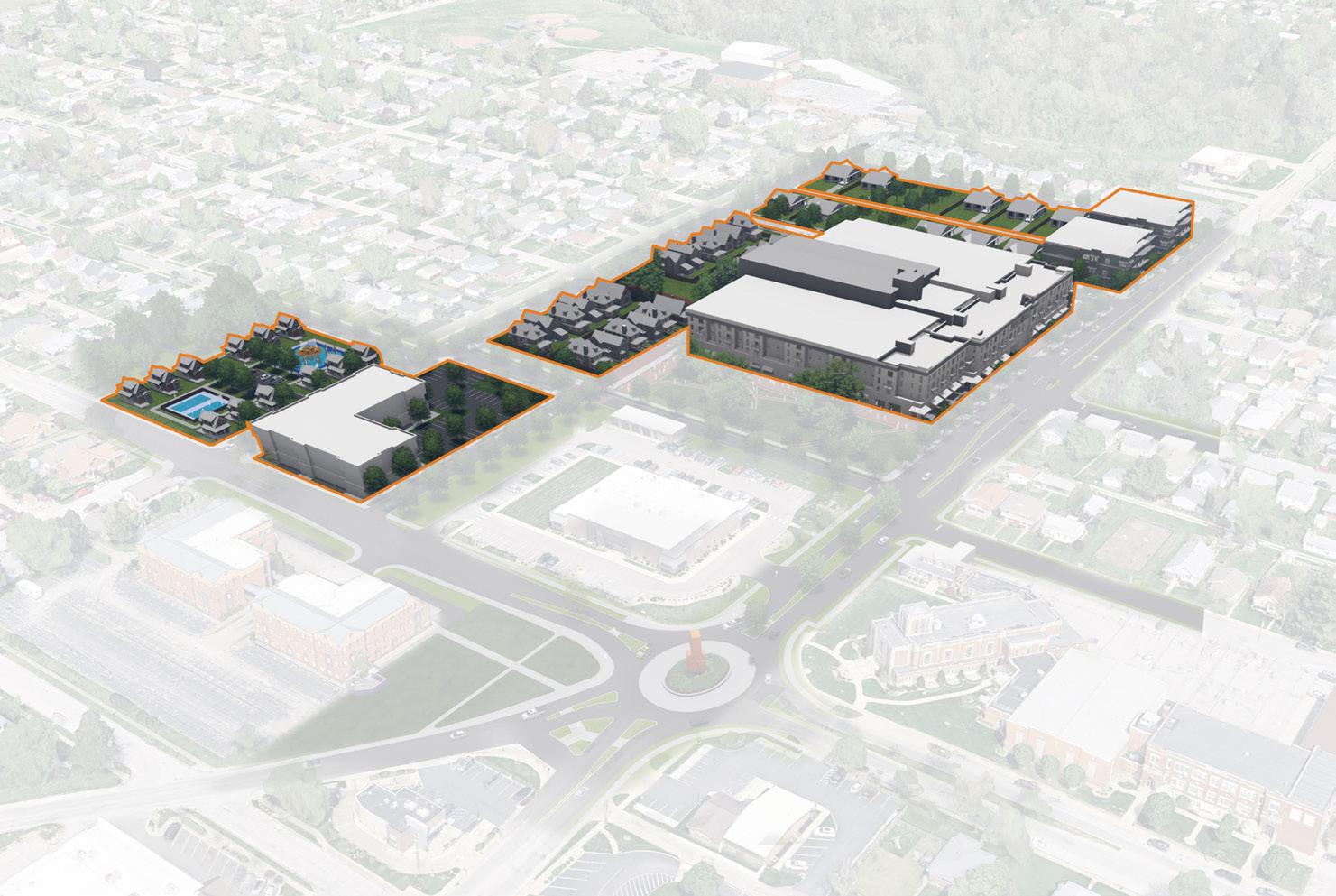
Due to its prominent location in the heart of Beech Grove, the surrounding single-family residential development, and the commercial development along key corridors including Albany St., Churchman Ave., and S. 17th Ave., this opportunity area is recommended for mixed-use development, multifamily dwellings, and additional single-family homes as illustrated in the adjacent concept illustrations Mixed-use and higher density development are focused along Albany St. and density decreases to the north as development approaches the adjacent neighborhood. The concept protects the remaining parking garage (indicated in gray in the illustration) but recommends removing the five floors of office space above the existing parking garage. The parking garage could then be wrapped with a mixeduse building featuring ground level retail/commercial space and three or four stories of apartments above. The concept suggests additional mixeduse, or apartment buildings, immediately east of the parking garage along Albany St. with quad-plex housing (small apartment buildings with four dwelling units) located north of the apartment buildings that could appear as large, single-family homes as they transition back into the residential neighborhood to the north.
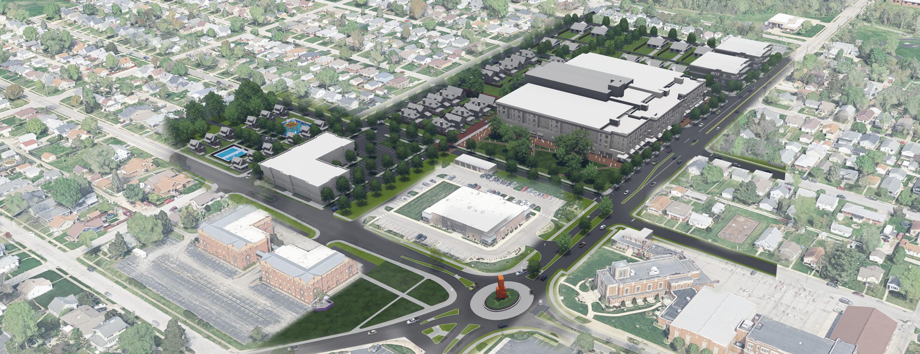
Immediately west of the existing parking garage and proposed mixed-use building, a small outdoor gathering area is proposed to provide outdoor recreational opportunities for residents of the area. North of the existing CrossRoad Engineers office building, an additional office building is proposed along N. 17th Ave. East of the office building and north of the parking garage/mixed-use building, new single-family homes, or town homes are indicated. These homes would be slightly larger than most of the homes in the neighborhood to the north, providing a unique housing option for existing and future residents of Beech Grove. North of the proposed office building, cottage-style, single-family homes are recommended to provide a more affordable alternative to other single-family homes and blend with the scale of the surrounding neighborhood. Cottage-style homes are typically small single-family homes less than 1,800 sq. feet in size. They often share a common front or back yard and sometimes have consolidated parking areas. The smaller lots and more dense development allows them to be a more affordable home for young professionals and they are often attractive to older demographics who may be looking for smaller homes with less yard maintenance.
Additional improvements within the St. Francis District opportunity area include the extension of N. 16th Ave. and N. 14th Ave. to re-establish the city grid and maintain a development scale that is consistent with surrounding neighborhoods. All new streets would incorporate sidewalks, lighting, and trees. Alleys are indicated in key locations to promote connectivity and serviceability of new development. Additionally, the roundabout at the intersection of Albany St. and N. 17th Ave. could incorporate public art or an updated community gateway welcoming people to Beech Grove as they travel from the west. As discussed on page 48, N. 17th Ave. is suggested to receive a multi-use path that would provide enhanced connectivity between the St. Francis District and nearby destinations including Our Lady of Grace Monastery on the north and Sarah T. Bolton Park and downtown to the south.
Public Investment
• Align and extend N. 14th Ave. and N. 16th Ave. through the former hospital site to Buffalo St.
• Extend the mid-block alley between N. 14th Ave. and N. 13th Ave. north through the former hospital site to Buffalo St.
• Incorporate public art and/or a community gateway into the roundabout at the intersection of Albany St. and 17th Ave.
• Improve pedestrian connectivity and accessibility from the former hospital site across Albany St.
• Provide public open space for outdoor recreation and to incentive residents to live in the neighborhood.
Private Investment
• Maintain the existing parking garage but remove the office spaces and top stories that are non-parking.
• Surrounding/wrap the existing parking garage with mixed-use infill.
• Limit mixed-use and high-density development to the Albany St. corridor and four-stories in height.
• Support office space development north of CrossRoad Engineer’s office building.
• Reduce building scale from Albany St. north towards Buffalo St. and the adjacent neighborhood to the north.
• Orient new buildings towards their adjacent street frontage.
• Promote parking lots behind buildings.
• Encourage multi-unit development (four units or more) where to possible to maximize property tax return.
• Integrate green infrastructure into surface parking to minimize stormwater runoff.
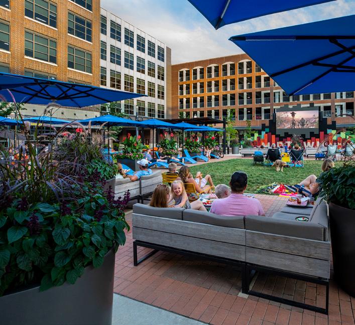
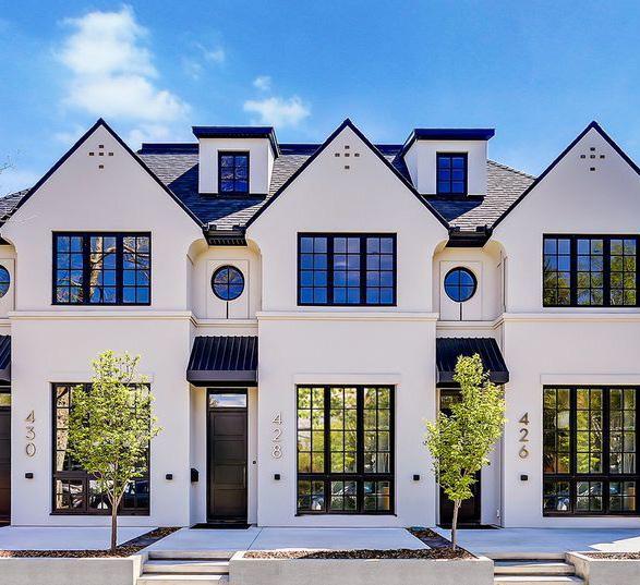
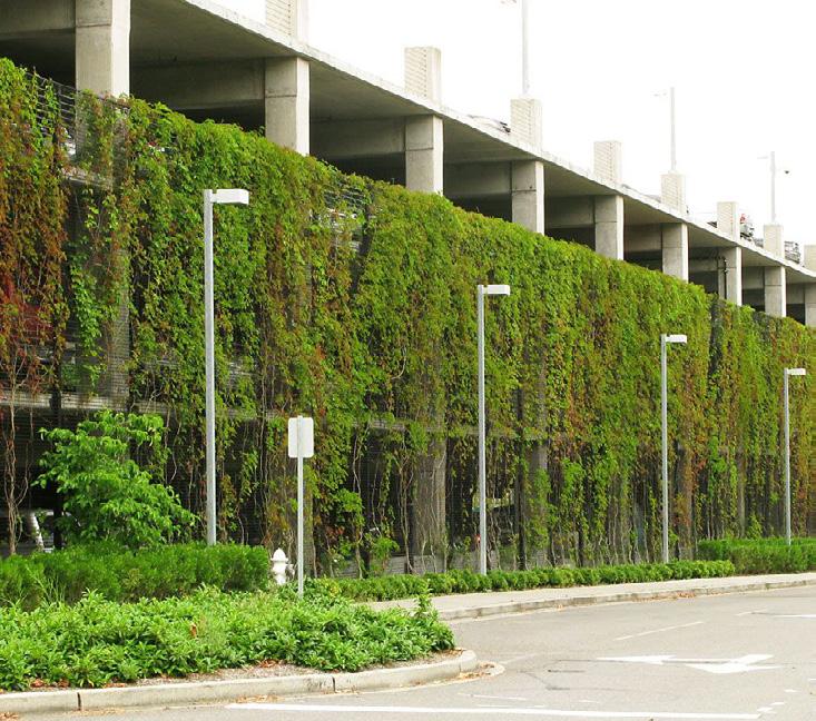
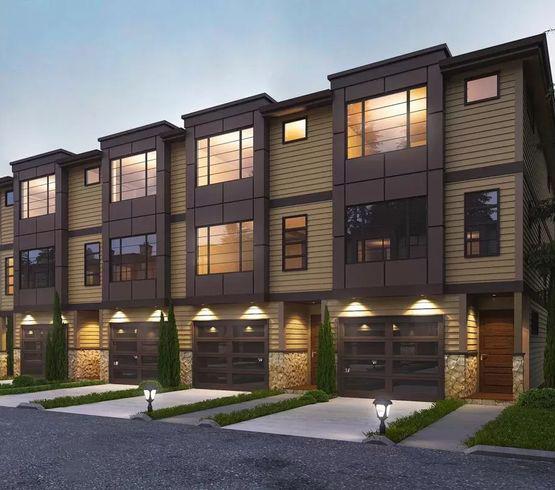
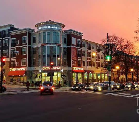
The anticipated public investment for the St. Francis District is approximately $5.5 million. As indicated in the adjacent exhibit [see page 18 from 2025-0515 RDC meeting presentation], the public investment is focused on right-of way improvements and street extensions, creation of public gathering space, improvements to the existing Troy St./Albany St. and N. 17th Ave. roundabout, and alley creation and extension. Primary utilities are located nearby, but the cost opinion does account for new storm sewers, primary sanitary sewer, water utility extension, and electrical service points.
The largest project in the plan, the St. Francis District combines substantial housing (32 single-family, 328 multifamily units) with 20 new commercial businesses as indicated in the adjacent exhibit [see page 20 from 2025-0515 RDC meeting presentation]. With a total anticipated private investment of $91.94 million, it is expected to yield the most transformative impact.
• 828 residents, 621 workers, and 194 students.
• $31.89 million in annual salaries, with $19.13 million in annual disposable income.
• Over 25 years: $478 million in disposable income.
• Annual property taxes: $846,920, or $21.17 million over 25 years.
• LIT: $1.99 million.
• With the highest resident count and one of the largest employment bases, this district anchors the city’s long-term economic vitality.

Trails and multi-use paths are critical infrastructure for connecting the assets within a community. This plan recommends completion of a community-wide bike and pedestrian master plan to guide strategic trail development within Beech Grove. This could be in conjunction with the 2026-2030 Beech Grove 5-Year Parks and Recreation Master Plan. The 2021-2016 plan called for parks in the city to be connected via greenway. One critical corridor for multi-use path/trail consideration is N. 17th Ave. The corridor extends through Beech Grove becoming Sherman Drive to the north and the south. To the south, Sherman Drive transitions to Hanna Ave. which extends west to the University of Indianapolis and beyond.
Through Beech Grove, the corridor connects Our Lady of Grace Monastery on the north to the adjacent neighborhoods, St. Francis District opportunity area, Plumbing School opportunity area, Main Street, and Sarah T. Bolton Park on the south end of the community. The right-of-way width of N. 17th Ave. varies along its length, but generally includes two travel lanes (one north and one south), sidewalks along each side of the road, and turning lanes at primary intersections. In some locations, the right-of-way includes tree lawns that separate the sidewalks from the curb line which include street trees, signage, and other streetscape amenities.
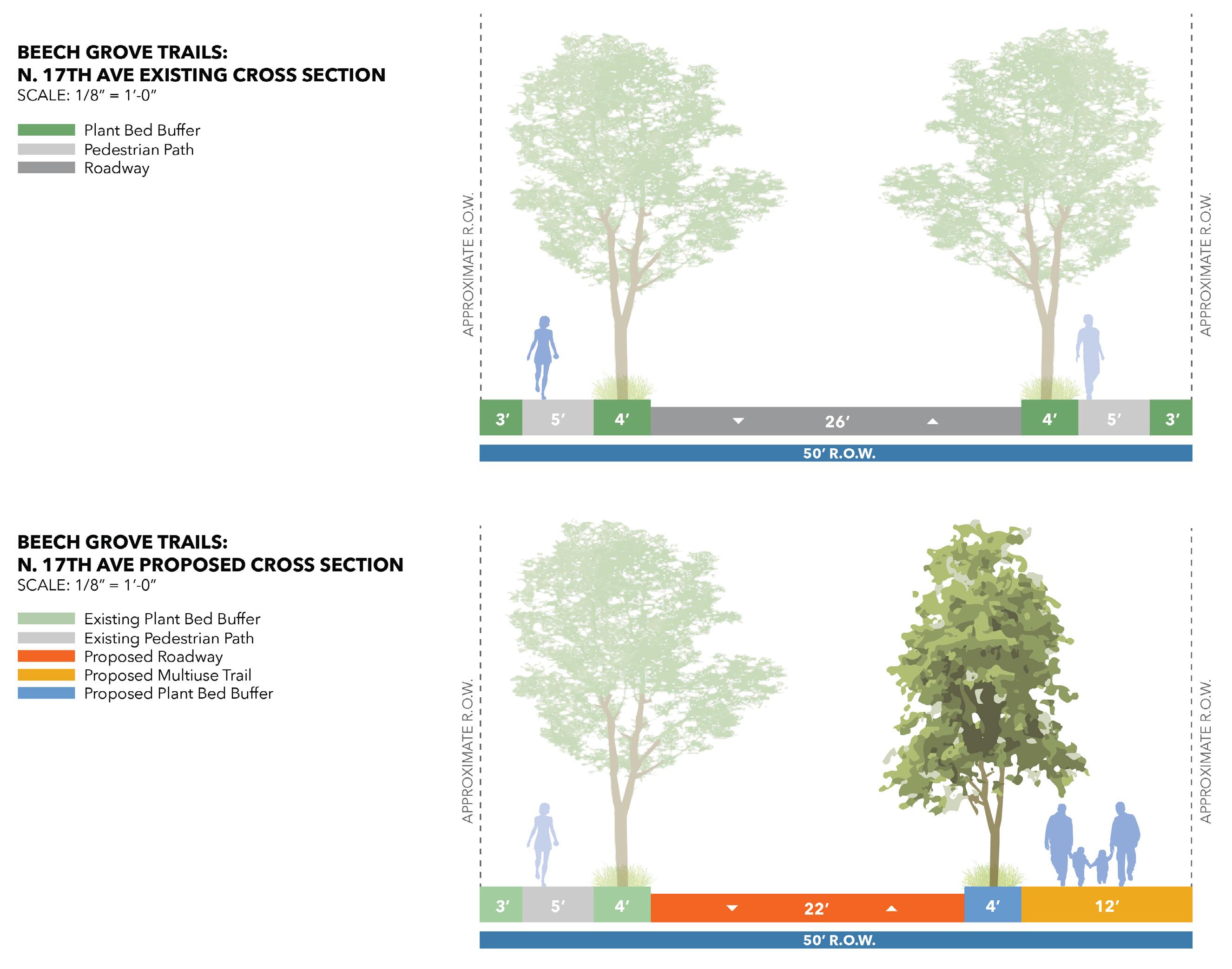
This plan recommends a phase one N. 17th Ave. multi-use path project that would provide a physical connection between Our Lady of Grace Monastery on the north, the Capra Court Neighborhood opportunity area, St. Francis District opportunity area, Plumbing School opportunity area, Main Street, and Sarah T. Bolton Park on the south. As shown in the exhibit on the following page illustrating the existing condition of N. 17th Ave. in this area, the street right-of-way currently contains a 26’ wide asphalt roadway, 4’ tree lawns, and 5’ sidewalks offset from the adjacent properties by approximately 3’.
The proposed condition, as illustrated in the exhibit on the following page, shifts one curb line and narrows the roadway to accommodate a larger, multi-use path. The path would remain separated from the adjacent road by a 4’ tree lawn. The tree lawn would also serve as an amenity zone for trail signage, lighting, and other amenities, including bike racks in strategic locations. This scenario is ideal for families with young children who find more comfort walking and biking with separation from the adjacent road as opposed to biking on-street within a painted bike lane. Long-term, a N. 17th Ave. multi-use path trail extension should be considered south to Hanna Ave. that could provide a desired connection to the University of Indianapolis. Doing so could have direct benefits to the community for students, faculty, and staff who may choose to patronize Beech Grove businesses and reside in the residential neighborhoods.
Public Investment
• Maintain one curb line of N. 17 Ave. in place where possible to reduce overall cost.
• Narrow asphalt travel lanes.
• Establish multi-use path on one side of the roadway with a minimum 8’ width.
• Maintain a tree lawn/amenity zone between the multi-use path and street to serve as a buffer for trail users.
• Implement on-street parking adjacent the multi-use path side of the roadway where space allows.
Private Investment
• Connect to the 17th Ave. multi-use path where feasible to enhance pedestrian mobility and development attraction.
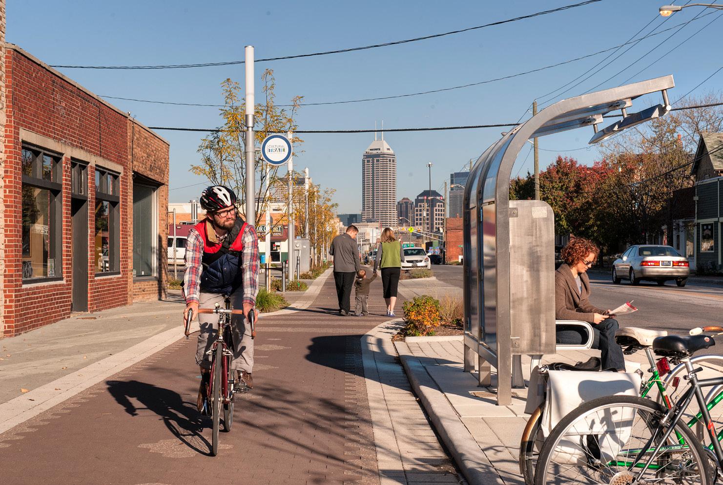
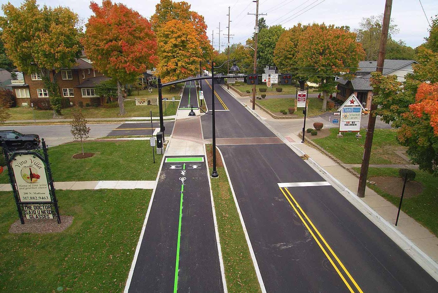
The N. 17th Ave. trail project is assumed to be a public investment project because all work will occur within the public right-of-way. The anticipated cost for constructing the section of trail connecting Our Lady of Grace Monastery on the north to Sarah T. Bolton Park on the south is estimated to cost approximately $2.2 million. This cost assumes selective demolition of some existing roadway asphalt, new curb on one side of the street, street trees, and lighting. It also assumes new storm sewer in coordination with new curb construction. The project would require coordination with the City of Indianapolis for approval. Beech Grove should approach Indianapolis to participate in the cost of the improvements as well.
Similar to the CSX District – Park opportunity area, no direct private investment impact has been calculated for the trail project since it is expected to be a public investment project. Similar to parks, however, trails and other quality of life improvements, have been shown to promote community (re) development and well-being. While the direct financial impact to the City of Beech Grove is difficult to calculate for a trail project, it can be expected to help in both existing and future resident and business attraction. Parks, trails, and beautification projects should continue to be a priority for public investment by the City to help encourage new development and redevelopment, and private sponsorships may also be considered to help fund trail development.
The plumbing school opportunity area is located one block southwest of the St. Francis District opportunity area and is the location of the former Safeway grocery store. The area occupies the addresses of 1815, 1825, and 1831 Albany St., and is approximately three acres in size. A Walgreens and senior living center are located on the opposite side of Albany St., while the remaining surrounding development is primarily single-family residential. The former grocery store was removed by the city several years ago and the site has been largely vacant since 2022. The remaining site is flat and occupied by an asphalt parking lot.
The property was recently purchased by Mechanical Skills, Inc. with plans to construct a trades school focused on training future plumbers. Preliminary planning is underway and the building is anticipated to be approximately 25,000 square feet and occupy the northeast corner of the site. The remaining site will be used for student and instructor parking, and outdoor training.
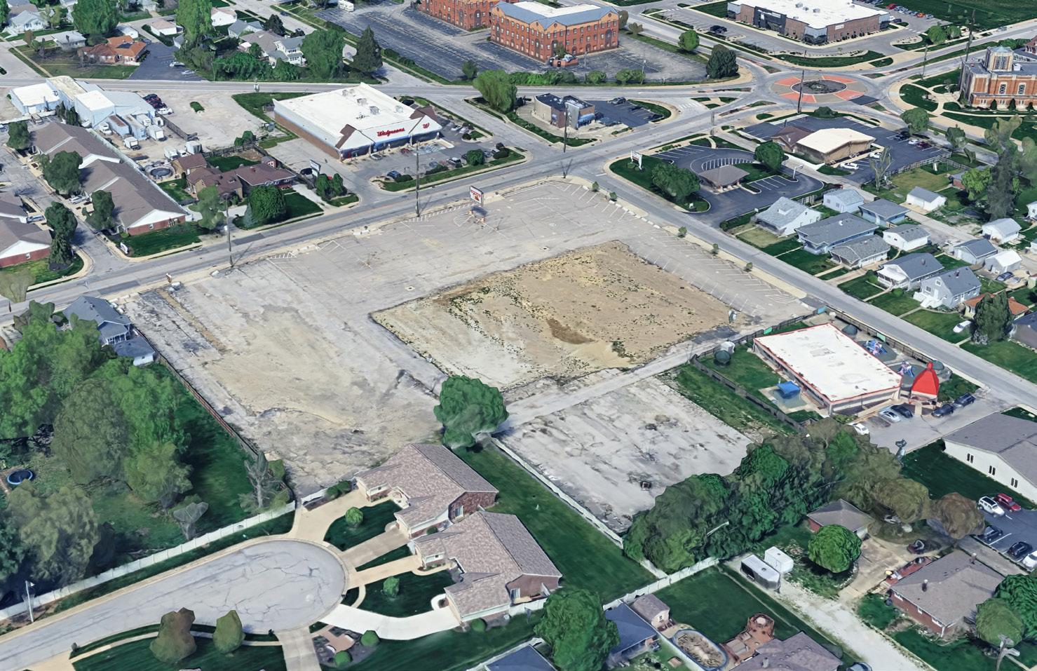
The plumbing school opportunity area is prominently located along Albany St./Troy St. and in close proximity of the St. Francis District. The addition of a plumbing school to this area will be a great asset to the community that will introduce thousands of people to the community including students, instructors, and visitors. The influx of people will create demand for new housing, retail, dining, and commercial opportunities.
Planning long-term in coordination with the (re)development of the St. Francis District, the plumbing school should consider developing their new school building as a two-story structure as shown on the following page. Developing the school as a two-story building could allow the development of a second structure on the west side of the site used for rental housing and to serve as a revenue generator for the developer and the city. The two facilities could share an interior parking lot, maintaining open space for outdoor training.
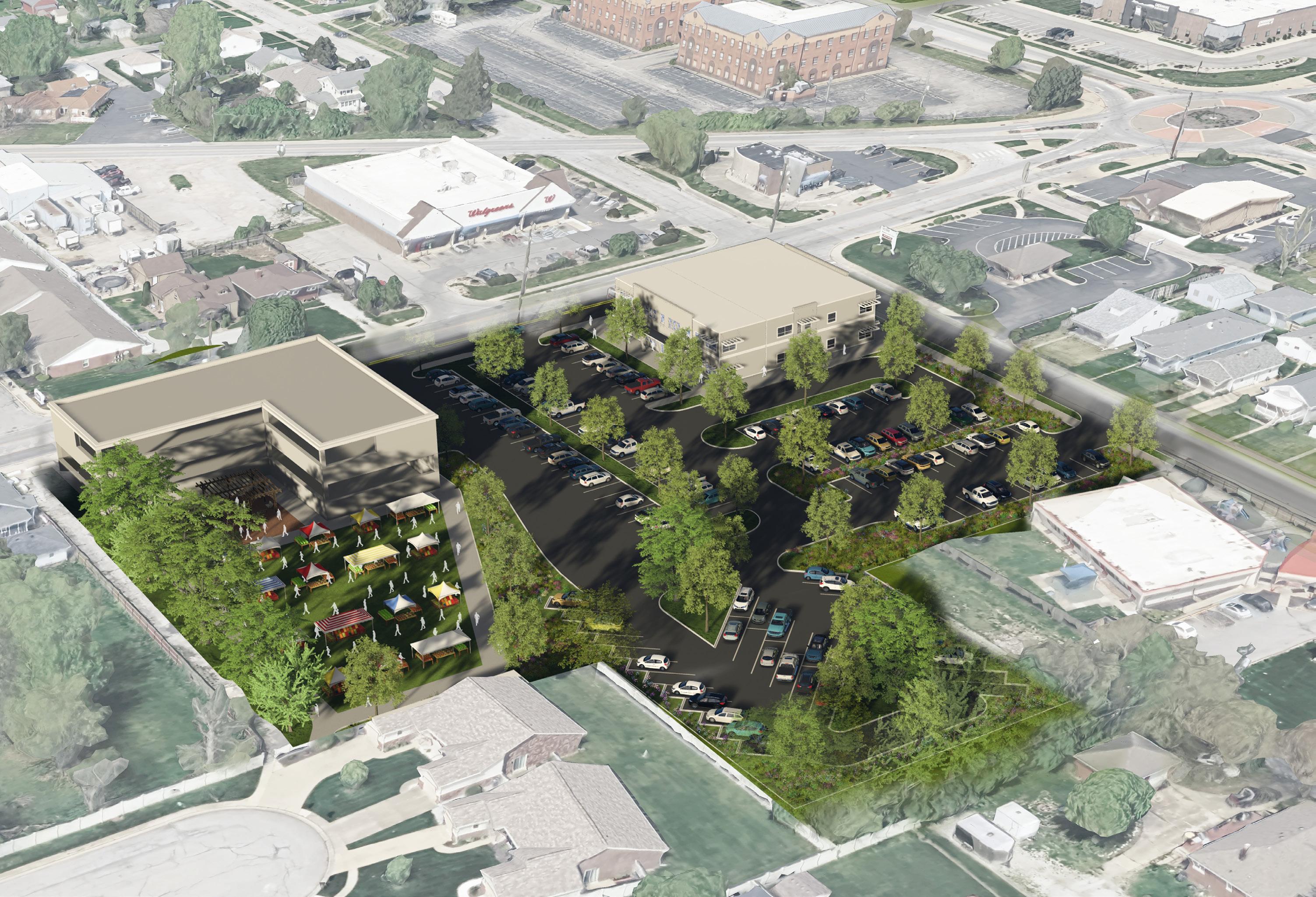
Public Investment
• Improve sidewalks, lighting, and street trees along Albany St. and N. 17th Ave.
• Connect to the N. 17th Ave. improvements as discussed in the following opportunity area.
Private Investment
• Develop plumbing school as a two-story structure near the intersection of N. 17th Ave. and Albany St.
• Develop a commercial/multi-family residential structure on the west side of the site.
• Orient buildings towards and immediately adjacent to the street frontage.
• Construct parking towards the center and rear of the property with access from both Albany St. and N. 17th Ave.
• Integrate green infrastructure into surface parking areas to manage stormwater on-site.
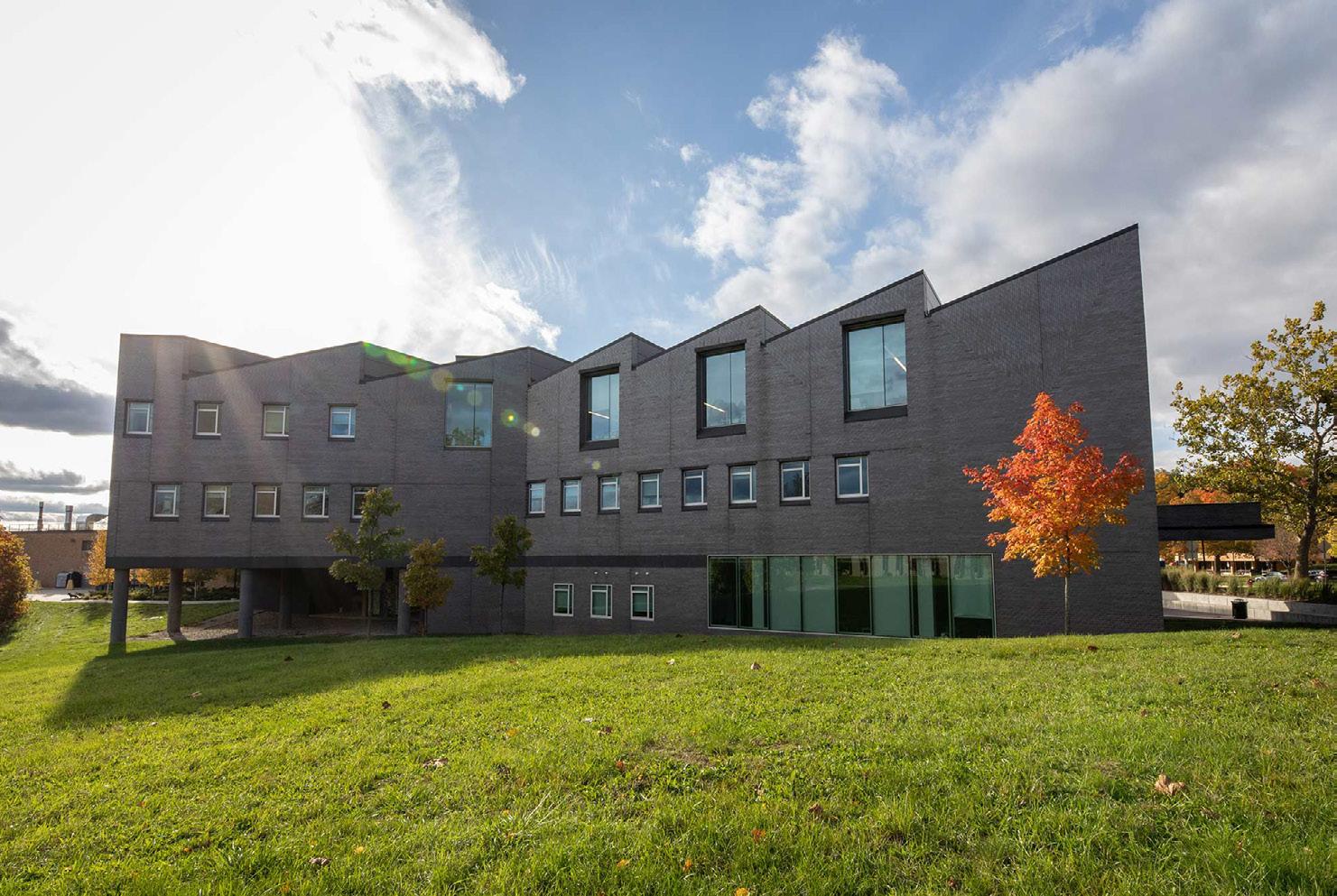
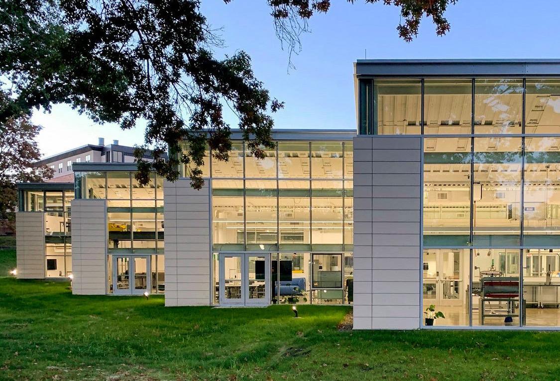
The anticipated total public investment for the plumbing school opportunity area is approximately $1.4 million. This investment assumes public participation in the primary parking lot and adjacent right of ways as indicated in the exhibit below.
The exhibit below highlights the anticipated private investment areas based on the illustrated concept. This mixed-use site brings together multifamily housing and vocational training facilities. The project’s $8.68 million private investment supports 24 apartment units and a 20,000 square-foot Plumbing School. The site will accommodate 55 new residents, including 41 workers and 13 students, and supports 1 commercial business with 40 employees.
The long-term economic benefits include:
• $2.13 million in gross annual salaries, leading to $1.28 million in disposable income annually.
• Over 25 years, that disposable income totals $31.89 million.
• Property tax generation increases to $37,513 annually, totaling $937,829 over the TIF term.
• The LIT revenue contributes an additional $132,873 across 25 years.
• The project shows a ROI of 3.65x in new tax revenues compared to baseline levels.
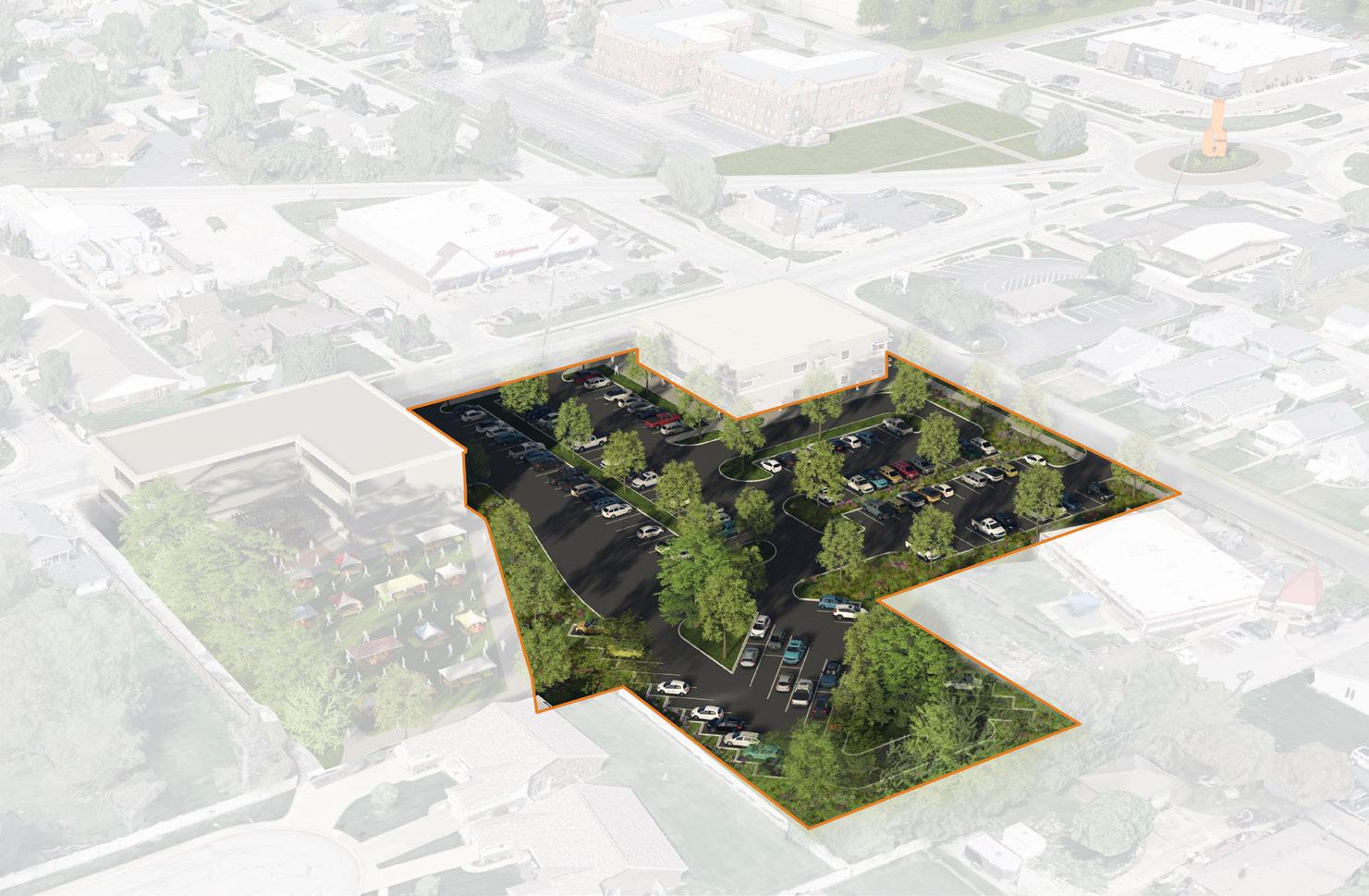
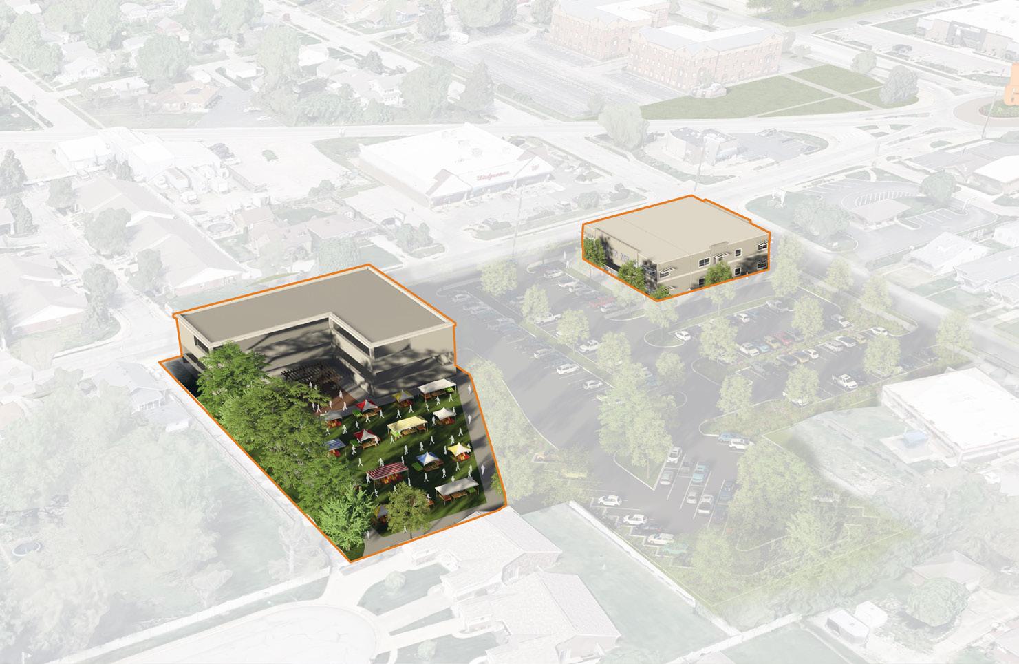
The CSX District – Park refers to the former City of Indianapolis landfill located on the north side of Beech Grove at 2650 Emerson Ave. It is bounded by Emerson Ave. on the east, the CSX railroad and tributary to Lick Creek on the north, Lick Creek and adjacent light industrial development to the west, and Subway St. and adjacent light industrial development to the south. Two parcels comprise the former landfill, a west parcel owned by the City of Beech Grove, and an east parcel owned by a private property owner. Restrictions from the annexation agreement between the City of Indianapolis and the City
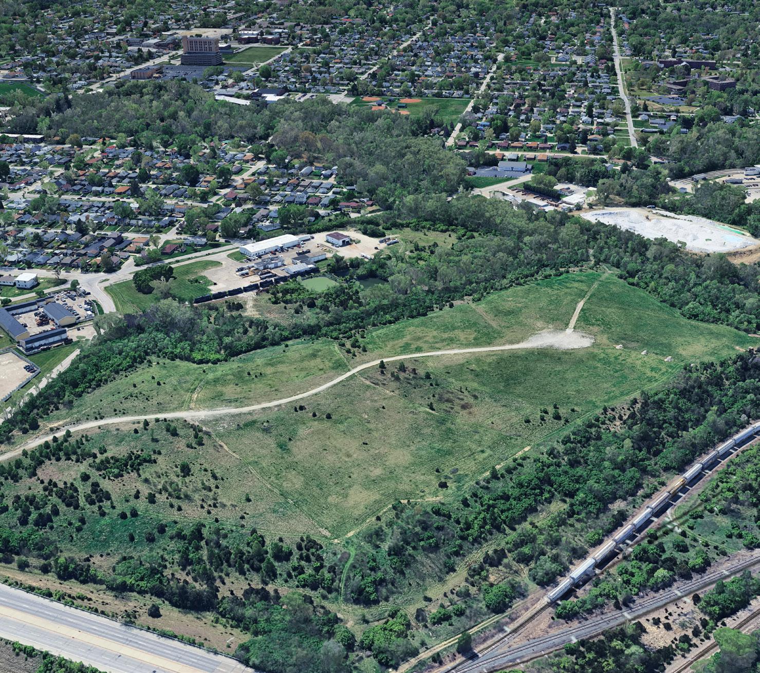
of Beech Grove for the parcel owned by the City of Beech Grove currently limit redevelopment to recreational and park use. In addition, due to the site’s former use as a municipal landfill, it has redevelopment restrictions caused by environmental contaminants and limited soil bearing capacity that prohibit residential, and large structures.
The site is characterized by rolling topography but is generally perched above the adjacent properties with a high point approximately centered in the parcel owned by the City of Beech Grove to the west. The high point is approximately 7 feet higher than Emerson Ave. as it rises over the CSX railroad and more than 40 feet higher than the banks of Lick Creek to the west. Trees and shrubby vegetation surround the perimeter of the property while tall grass and shrubby growth characterize the vegetation at the center of the property.
Due to redevelopment limitations, the former landfill is recommended for redevelopment as a new municipal park as illustrated in the rendering on the following page. Taking advantage of the site’s topography, the site could be redeveloped as a nature park with walking, hiking, and biking trails to provide a unique offering within the community and larger Indianapolis metropolitan area. Recognizing the prominent lookout over the community at the site’s high point, this specific location could be developed with a parking lot, trailhead, small rentable shelter, and playground. A primary park drive with adjacent bike trail would connect the parking lot to Subway Street near the existing drive location, providing access to the city’s trail systems and other nearby attractions.
Coordination with local and state environmental agencies, including the Indiana Department of Environmental Management (IDEM) and the Indiana Department of Natural Resources (IDNR), will be required to develop a successful, and permittable, remediation strategy. The property could be planted with native, prairie grass style plantings and trees. These improvements in combination with occasional shade structures and benches along the trails would promote the site’s restoration and attractiveness, while also encouraging passive recreational opportunities such as bird watching and plant identification. Interpretive signage could be provided throughout the park to educate the public on the site history, reclamation and monitoring process, and plant materials and unique ecosystems.
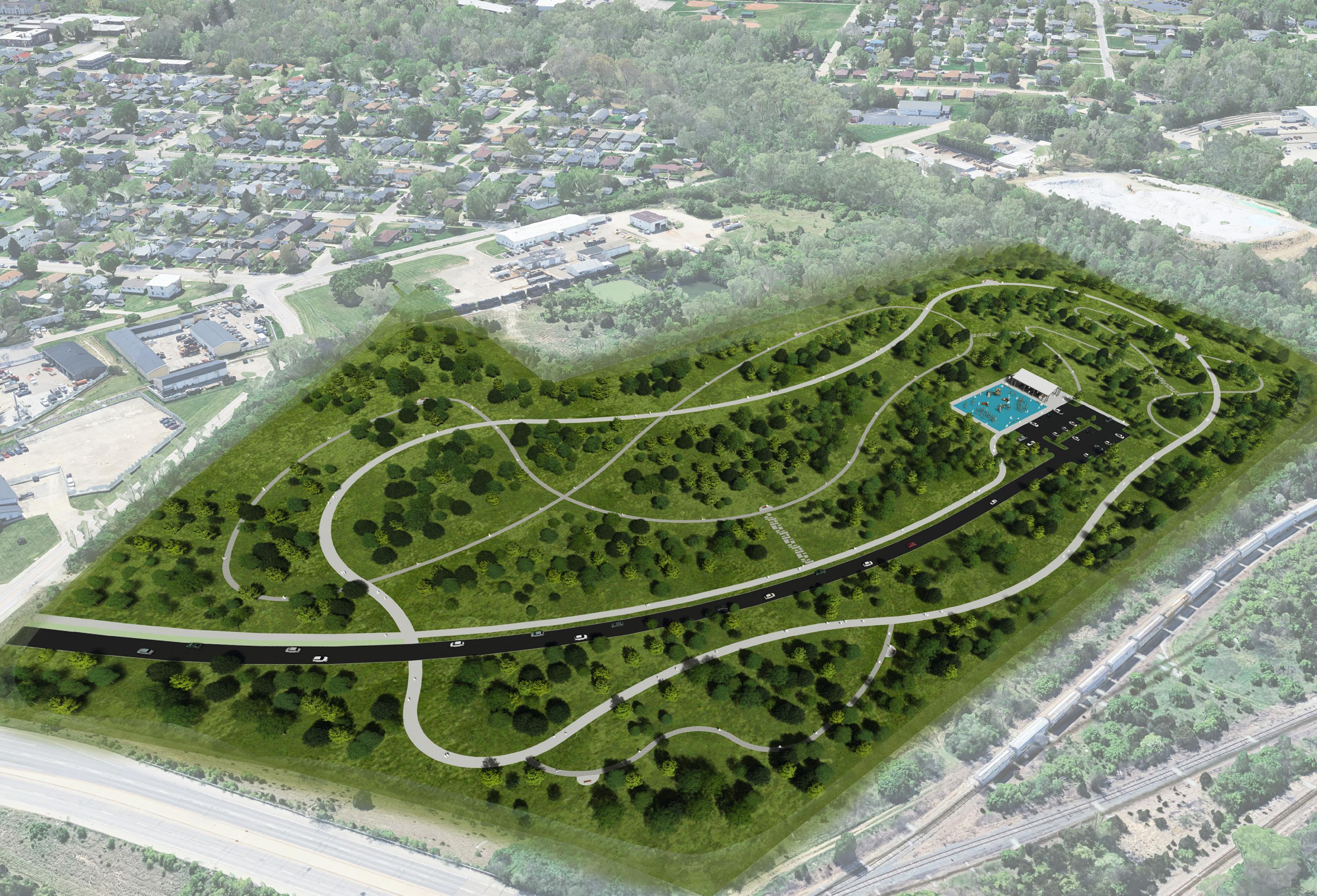
Public Investment
• Early coordination with adjacent property owners and local and state permitting agencies such as IDEM and IDNR will be critical to ensuring successful redevelopment.
• New park drives should align with existing curb cuts on Subway Street to avoid unnecessary automobile conflicts.
• Park features should take advantage of the site topography. Specifically, the site’s high point which provides unique views of Beech Grove and nearby development.
• New trails and sidewalks should connect to existing and planned city walking and biking infrastructure to promote pedestrian walkability and connectivity throughout the community. (A city-wide trails master plan is recommended as a part of the N. 17th Ave. Trail Enhancments Opportunity Area.)
• Multi-use paths intended to accommodate both pedestrians and bikers should be a minimum of 8 feet wide.
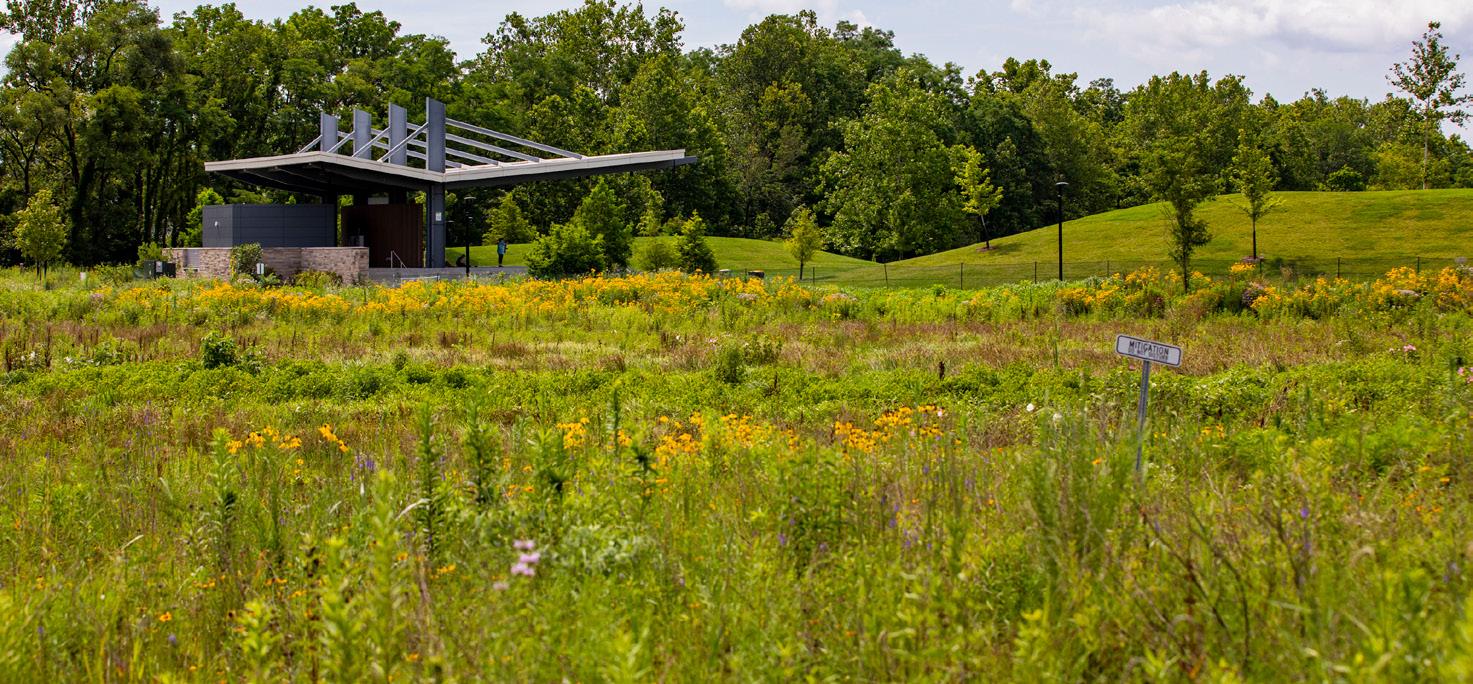
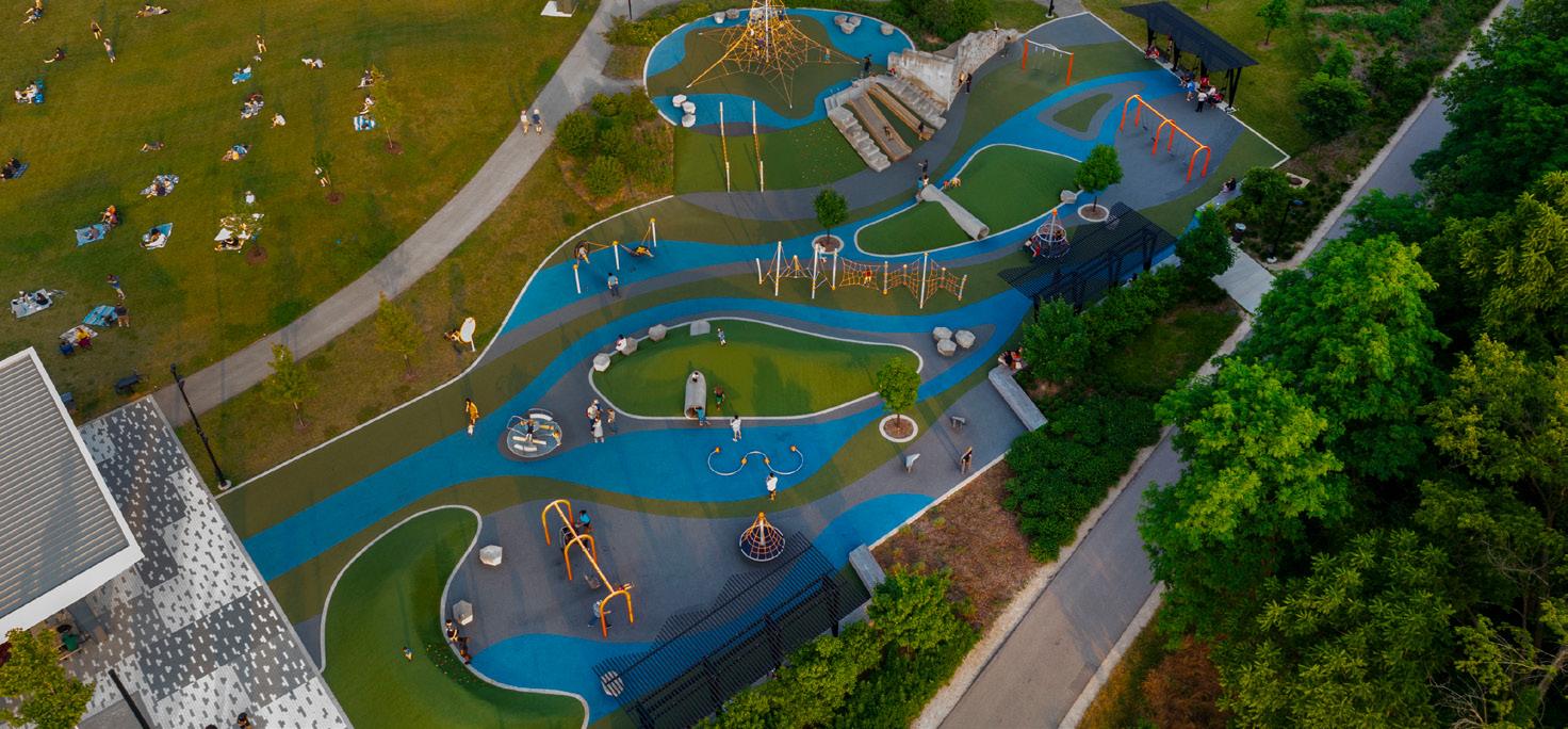

The anticipated public investment for the park is approximately $6 million based on the illustrated concept. Because the property is recommended for (re)development as a municipal park, it is assumed that all costs associated with the park’s development will be a public investment. The cost opinion incorporates an allowance for environmental remediation, but that expense could be lower or higher based on additional conversations with local and state permitting agencies.
No direct private investment impact has been calculated for the park project since it is expected to be a public investment project, however, parks, and other quality of life improvements, have been shown to promote community redevelopment and well-being. While the direct financial impact to the City of Beech Grove is difficult to calculate for the park project, it can be expected to help in both existing and future resident and business attraction. Parks, trails, and beautification projects should continue to be a priority for public investment by the City to help encourage new development and redevelopment, and private sponsorships may also be considered to help fund park improvements.
The Bailey Park Neighborhood is located immediately south of Our Lady of Grace Monastery. The neighborhood is accessed via Capra Court which dead ends at a cul-de-sac on the road’s east end. The neighborhood currently contains five, single-story duplex residences. East of the neighborhood, a 1.5 acre vacant parcel (currently owned by Holy Name) extends north/south which is presently used as a community open space. Along the west edge of the vacant parcel, a platted, but undeveloped right-of-way, connects Southern Ave. on the north to Detroit St. on the south.
As illustrated in the concept on the following page, the Bailey Park Neighborhood has the opportunity for expansion onto the adjacent vacant parcel. As shown, six additional duplex structures and one single-family home could be developed in a north/south orientation. The existing, platted right-of-way could serve as an extension of Capra Ct. or N. 16th Ave. to the south providing access to each of the homes. If desired, the roadway could be developed to provide a direct connection to Southern Ave. on the north.
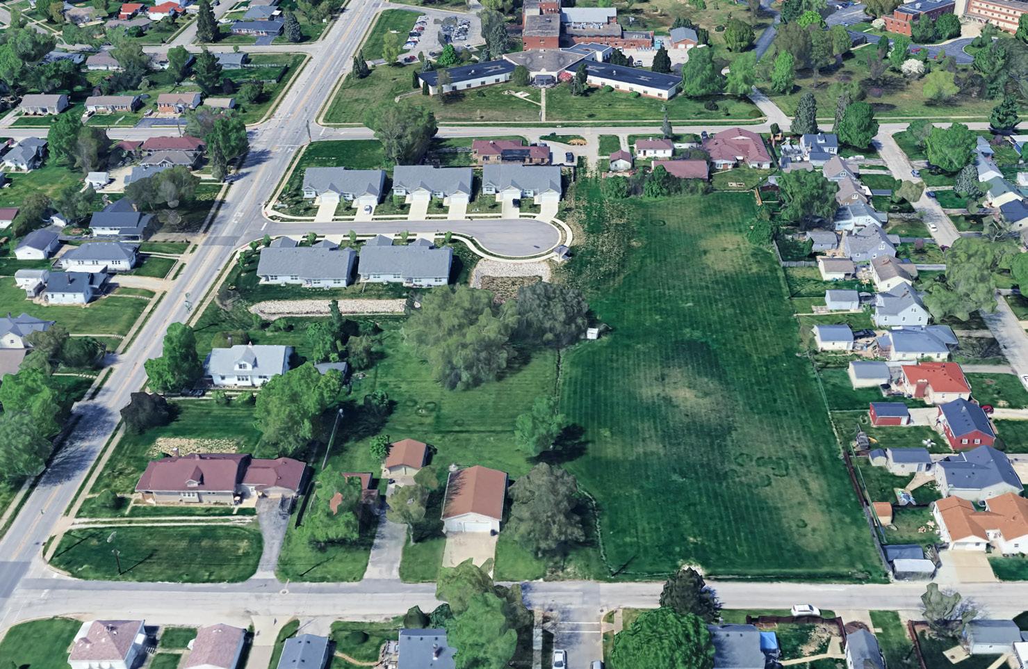
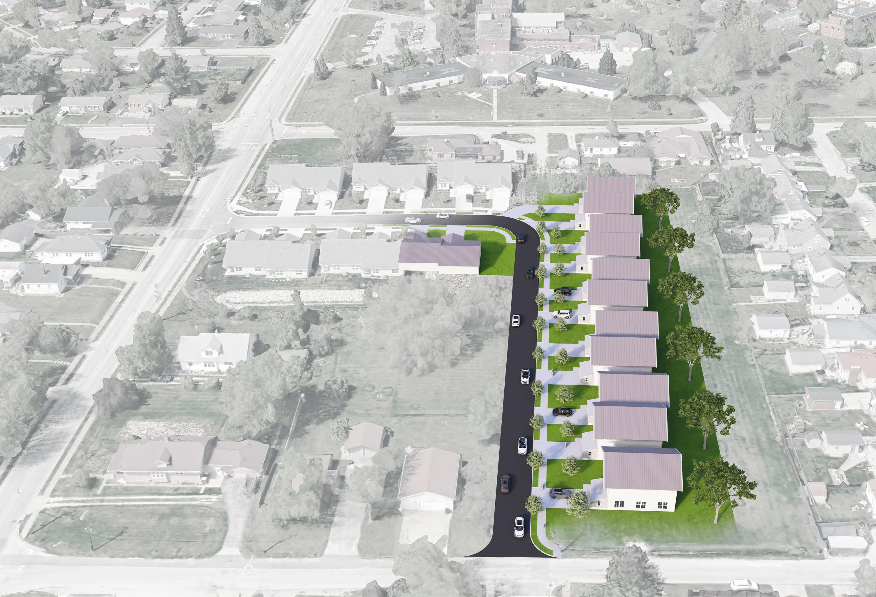
N17th Ave.
Public Investment
• Remove cul-de-sac and extend Capra Court/N. 16th Avenue to Southern Ave. on the north and Detroit Street on the south using the existing, platted right-of-way.
• Extend pedestrian infrastructure along the north and east curb line of the new road to provide connectivity throughout the neighborhood.
Private Investment
• Continue development of duplex structures to maintain neighborhood character and create greater density.
• Maintain home design and development standards to ensure cohesive neighborhood development.
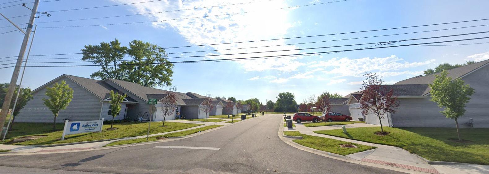
The value of public investment for the Bailey Park Neighborhood Expansion opportunity area is approximately $725,000. This cost assumes expansion of Capra Ct./N. 16th Ave. to the east and south to connect to Detroit St. on the south as illustrated in the exhibit below. Street trees, lighting, sidewalks, asphalt, and drive aprons are assumed as a part of the cost of the public investment. In addition, major utilities including storm sewers, sanitary sewers, water infrastructure, and electrical service points are included in the estimate.
Bailey Park neighborhood expansion is a modest residential infill development focused on low-density housing. With a total private investment of $4.78 million, the site includes 1 single-family home and 12 duplex units, totaling approximately 27,300 square feet of new residential construction as illustrated in the exhibit on the lower right. The development is expected to house approximately 30 residents, including 22 working adults and 5 students.
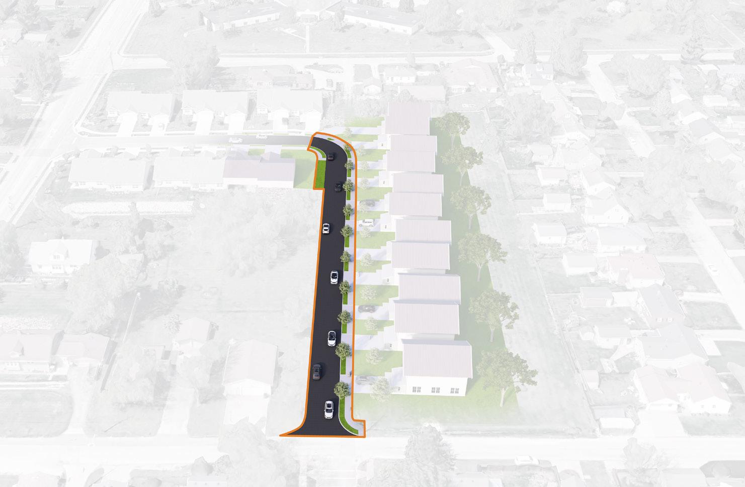
This project generates significant long-term fiscal and economic value:
• Annual salaries from resident employment total over $1.15 million, resulting in $690,941 in annual disposable income.
• Over 25 years, this results in a cumulative $17.27 million in local disposable income, supporting neighborhood businesses and services.
• Tax revenues increase from just $1 annually pre-development to $42,738 post-development, totaling $1.07 million over 25 years.
• The Local Income Tax (LIT) generates $2,879 annually or $71,973 over the TIF’s lifespan.
• The ROI in new taxes versus pre-development levels is a staggering 42,738%, illustrating the immense value of reinvesting in underutilized lots.
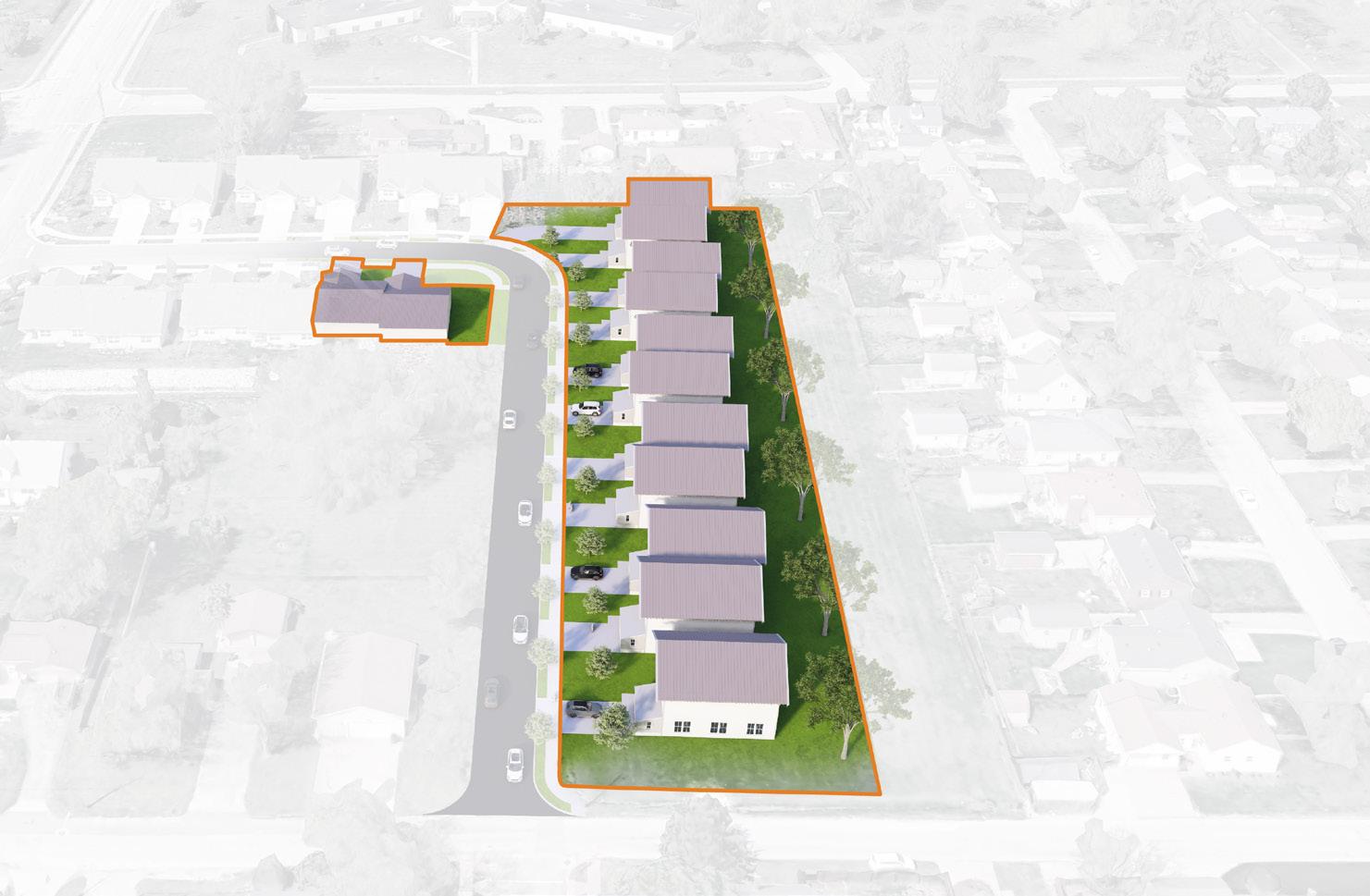
The Industrial Redevelopment District opportunity area is located on the south side of the community east of Emerson Ave. near I-465. The area is characterized by several light industrial and manufacturing businesses along the Elmwood Ave. corridor that connects to Emerson Ave. Interspersed throughout the industrial and manufacturing development are approximately 28 residential parcels totaling approximately 15 acres. The parcels are located south of Adelaide St., west of S. Butler Ave., northeast of the S. Butler Ave. and Elmwood Ave. intersection, east of Cashard Ave., and northeast of the Cashard Ave. and Elmwood Ave. intersection. The parcels are relatively flat and contain single family homes. Butler Ave., Cashard Ave., and Adelaide St. are relatively small and built to accommodate local traffic and non-commercial automobiles. A multi-use path was recently constructed north of Adelaide St. on school property, but the street dead ends northwest of Cashard Ave.
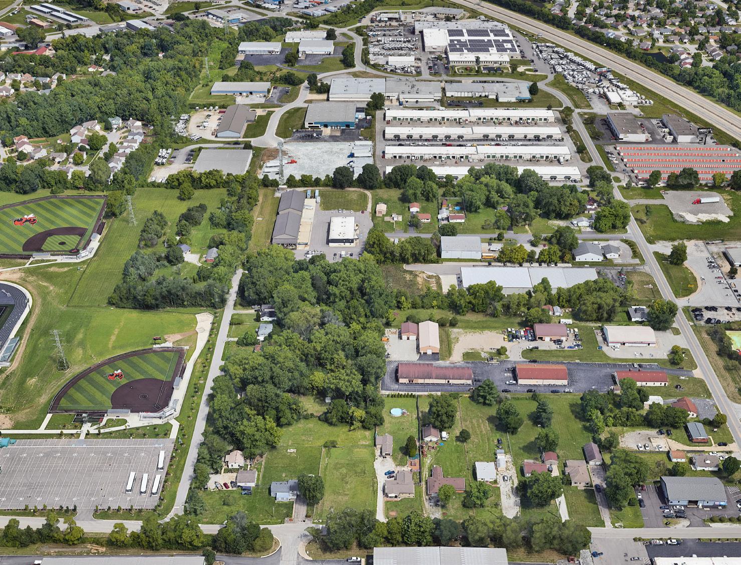
Based on the surrounding land use and development patterns, it is likely that the residential uses will redevelop as light industrial and small manufacturing facilities over time. The exhibit on the following page illustrates one concept for how that could occur. As shown, five new industrial/manufacturing buildings can be accommodated across the 15 acres of existing residential parcels. The new structures would range in size from 16,000 square feet to approximately 70,000 square feet which is similar to the scale of the surrounding non-residential development. Some of the larger buildings may be subdivided to accommodate multiple tenants. The structures are set back from the adjacent roads to allow employee parking in front of the buildings and to maintain service access and deliveries to the rear and sides of the buildings. Open space is maintained for on-site stormwater management and buffering development from adjacent properties.
The concept also recommends right-of-way improvements to Elmwood Ave. where (re)development occurs to include new street trees, lighting, and sidewalks. Similarly, S. Butler Ave. and Cashard Ave. are recommended for right-of-way improvements to include widening, asphalt reconstruction to accommodate larger trucks and deliveries, and sidewalks, street trees, and lighting. An extension of Adelaide St. east to Elmwood Ct. is recommended to improve circulation for trucks throughout the area. Additionally, Adelaide St. would likely require reconstruction to accommodate heavier truck traffic and should incorporate new sidewalks along the southern curb line as well as lighting and street trees. Connection to the multi-use path along the north curb line of Adelaide St. is recommended to provide pedestrians and workforce and alternative means of accessing the industrial development district.
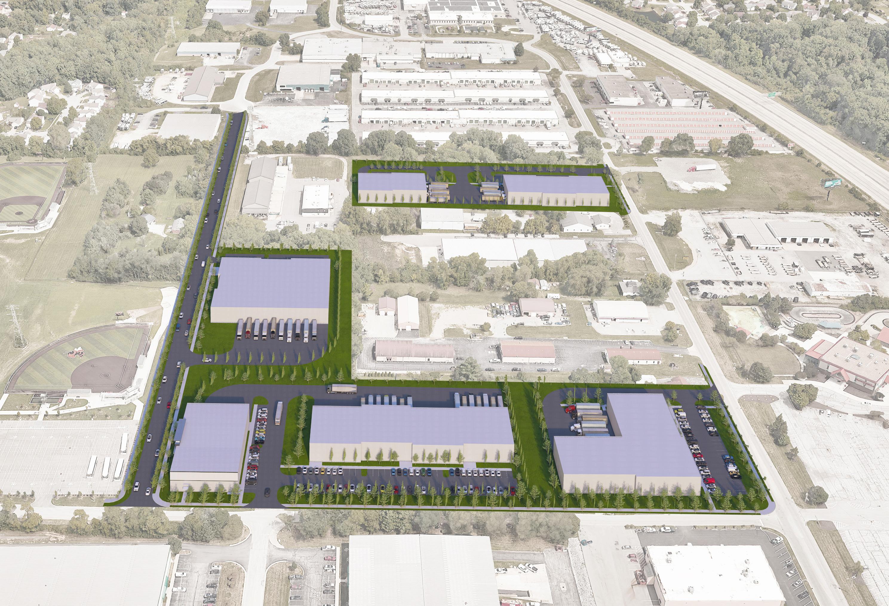
Public Investment
• Improve the Elmwood Avenue right-of-way with sidewalks, street trees, and lighting.
• Improve the S. Butler Avenue, Cashard Avenue, and Adelaide Street rights-of-way with asphalt reconstruction to accommodate large trucks and service vehicles, as well as new sidewalks, street trees, and lighting.
• Extend Adelaide Street east to Elmwood Court to provide improved vehicular circulation for both the local workforce and commercial traffic.
• Provide a connection to the multi-use path along the north curb line of Adelaide Street to improve pedestrian connectivity to the industrial district from other parts of the community.
Private Investment
• Limit new manufacturing and industrial buildings to one story in height
• Orient building faces towards the adjacent street
• Offset building faces for large structures exceeding specific lengths.
• Develop minimum and maximum building sizes.
• Develop minimum open space requirements for vegetative buffering and stormwater management.
• Separate employee and visitor parking from large truck parking and service areas.
• Maintain large truck parking and service areas to the rear or sides of buildings.
• Align driveways with adjacent street intersections or entry drives.
• Provide accessible pedestrian routes from building entrances to adjacent rights-of-way.
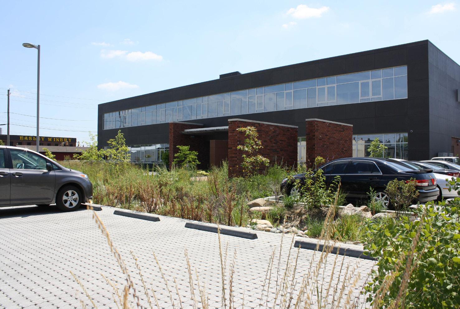
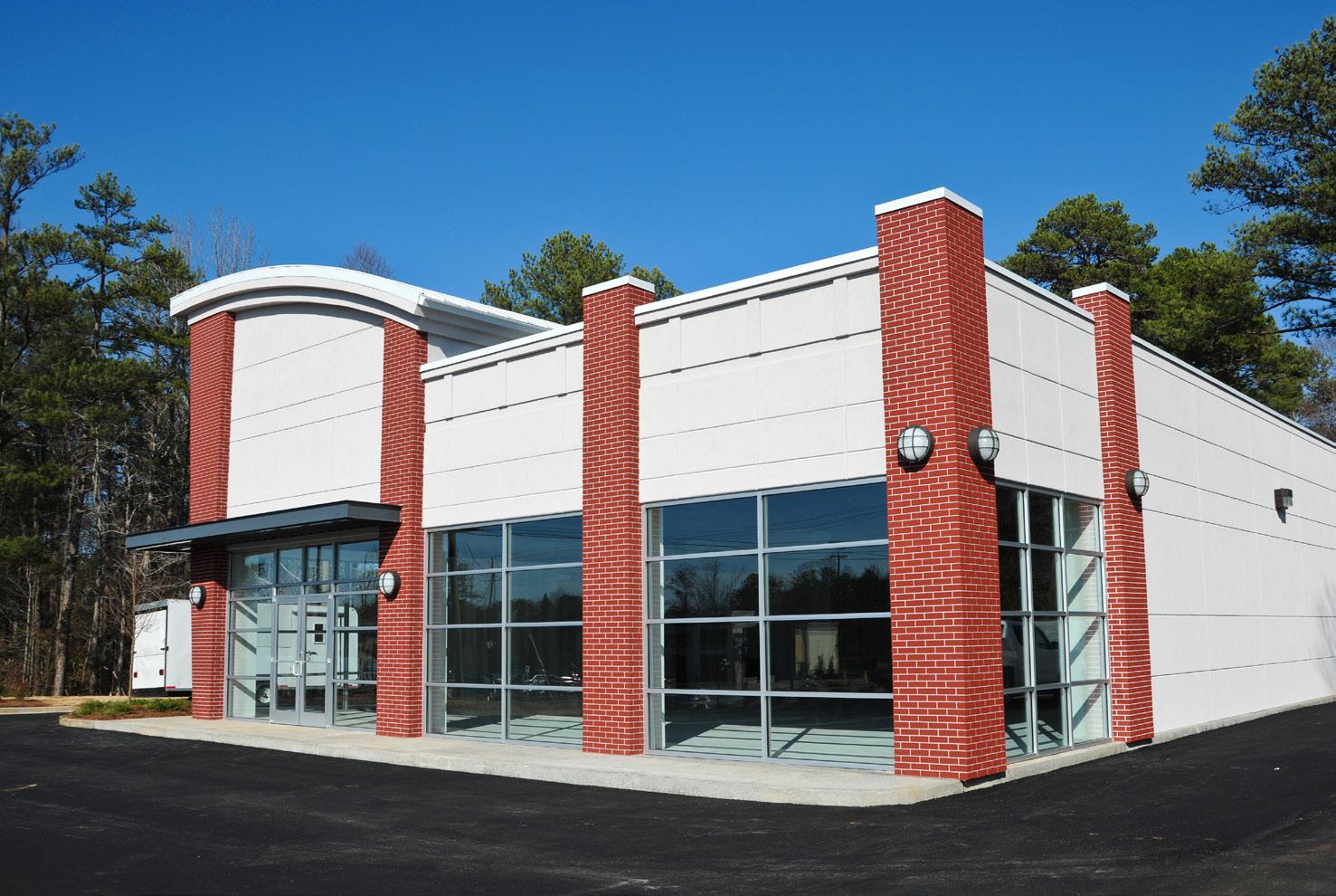
The public investment costs are assumed to include the right-of-way improvements to Elmwood Ave., S. Butler Ave., Cashard Ave., and Adelaide St. as indicated in the exhibit below and are estimated to be approximately $4 million. As noted, right-of-way improvements would include selective asphalt repair and replacement, sidewalks, street trees, and street lights. Additional improvements include sanitary and water utility extensions to new buildings and storm sewer improvements to the Adelaide St. extension.
As indicated in the exhibit below, this opportunity area assumes five industrial buildings totaling 217,400 square feet and is backed by $48.92 million in private investment. It is expected to host 9 industrial businesses employing 166 workers.
The resulting benefits:
• $8.54 million in annual payroll, with $5.12 million in disposable income each year.
• Over 25 years, the cumulative disposable income reaches $128 million.
• New property tax revenue is $244,920 annually, with a 25-year total of $6.12 million.
• LIT revenues total $533,522.
• Represents a mid-sized but stable job generator with solid fiscal return and a tax ROI of 4x.
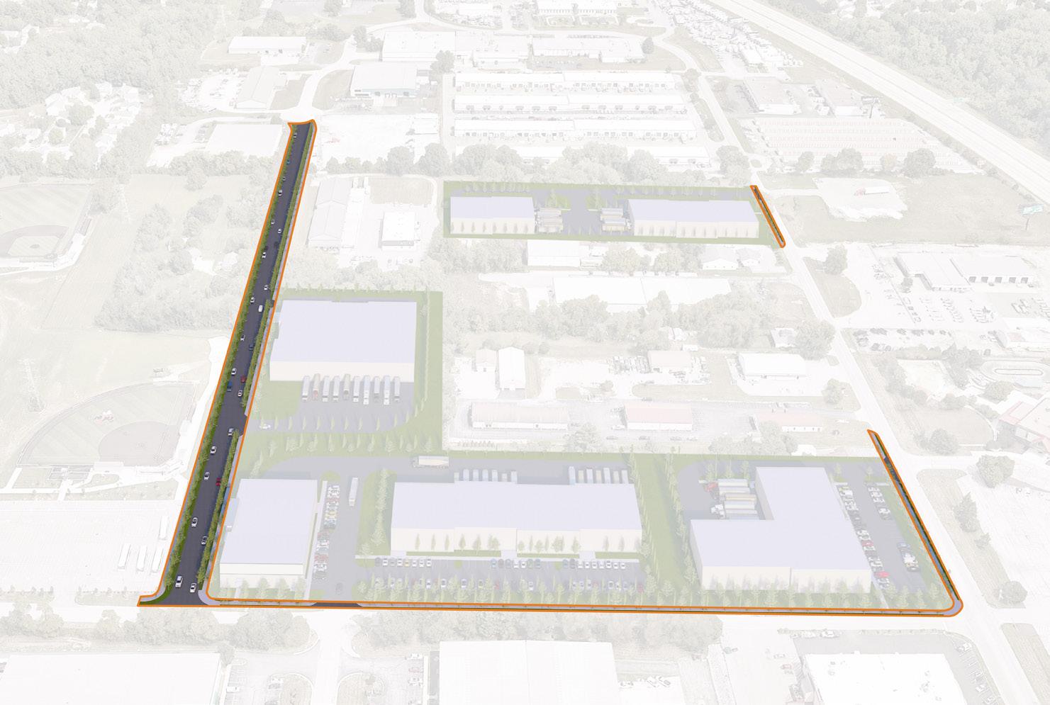
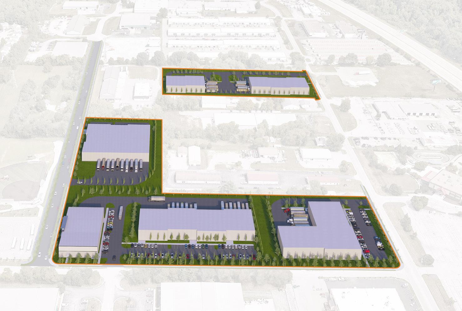
The Emerson Ave. Housing Development opportunity area refers to the approximately 7-acre parcel located at 3720 S. Emerson Ave. that was recently sold and an additional 3.5 acres to the northeast and south of Beech Creek that is owned by the adjacent Southwood Baptist Church. The two parcels combined create a 10.5-acre site located immediately west of Emerson Ave. that is bounded by Beech Creek and commercial development to the north and south, single-family housing to the west, and commercial and multi-family development east of Emerson Ave.
In this location, Emerson Ave. rises over Beech Creek perching the roadway more than ten feet higher than the adjacent property. For this reason, a secondary access road within public right-of-way parallels Emerson Ave. (also noted as Emerson Ave. on MapIndy’s website) and connects to the
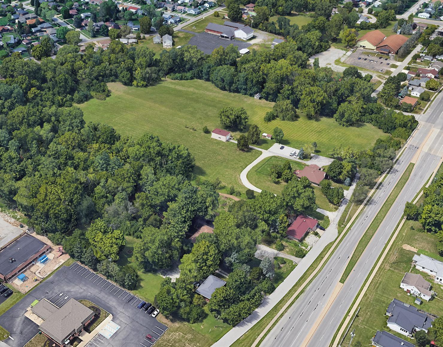
opportunity area and several other single-family residences and commercial buildings. The flood plain of Beech Creek also extends into the church parcel on the north side of the opportunity area limiting development potential. The site is primarily lawn with dense tree cover surrounding Beech Creek.
Due to access challenges from Emerson Ave. and the significant change in elevation, as well as the existing floodplain of Beech Creek, the Emerson Ave. Housing Development opportunity area seems best suited for singlefamily and multi-family residential development as shown in the exhibit on the following page. A four-story apartment building is recommended adjacent to Emerson Ave. Placing the structure in this location will help provide visibility from Emerson Ave. without it feeling overbearing since the structure’s first floor will be at a significantly lower elevation. Parking for the apartment building will occur east of the structure and will be largely hidden from view due to the elevation difference. The west side of the apartment building would provide outdoor gathering and recreation space that could be shared with the rest of the housing development.
Additional housing recommended in this opportunity area includes 17 single-family homes and six cottage-style, single-family homes. The homes would be sited parallel to Emerson Ave. and the cottage-style family homes would share a common green space. All housing development would occur outside of the regulated floodplain. Portions of the opportunity area within the floodplain would incorporate walking paths and be planted with native plantings to help manage stormwater more efficiently on-site and provide residents with passive recreation opportunities. The secondary access road from Emerson Ave. would be improved and extended into the site with access to the apartment building parking lot and each single-family home. If desired, the neighborhood road could extend over Beech Creek and connect to the existing single-family development to the west at Birch St. An alley would be developed along the southern property line behind the single-family homes to allow for garage and service access.
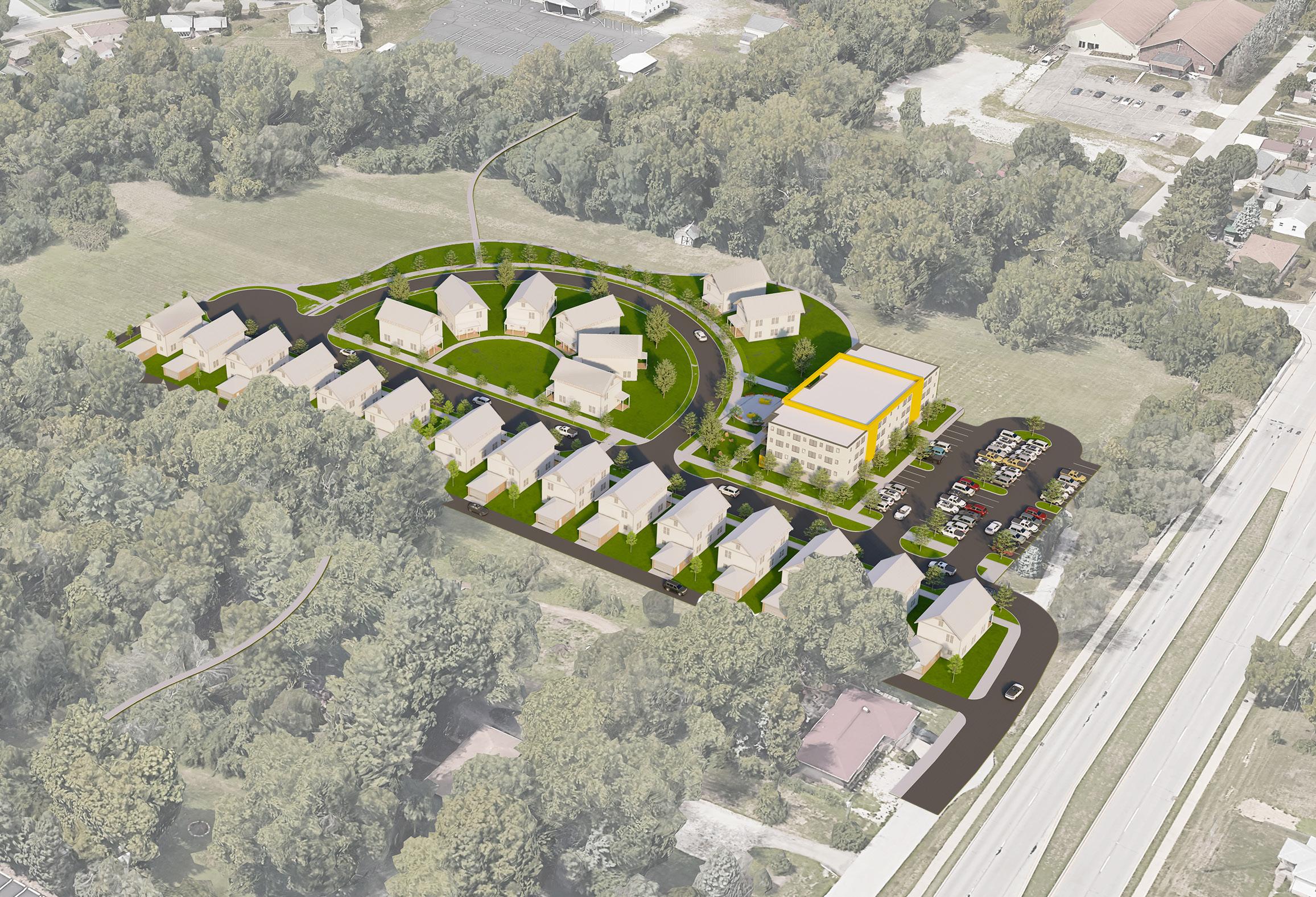
Public Investment
• Extend the secondary access road into the site and develop an alley for rear home access.
• Incorporate sidewalks, street trees, lighting, and additional amenities with the roadway infrastructure.
• Provide alleys where feasible for rear access to single-family homes.
• Utilize the flood plain for passive recreation space with trails and native plantings.
• Provide a multi-use path connection over Beech Creek and to the Southwood Baptist Church.
Private Investment
• Site a multi-family apartment building with parking near Emerson Avenue.
• Develop the apartment building to be several stories tall to remain visible from Emerson Avenue.
• Develop single-family homes interior to the opportunity area.
• Provide a shared green space between the apartment building and single-family homes.
• Preserve the floodplain and avoid housing development within it.
• Provide rear access parking to single-family homes where possible.
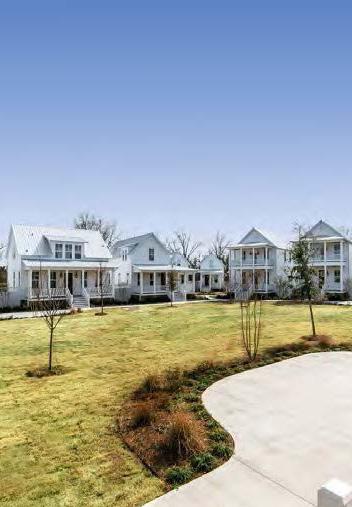
The anticipated public investment for the Emerson Ave. Housing Development Opportunity Area is approximately $3.2 million. As illustrated in the exhibit below, this cost assumes: public investment in the secondary access road extension, including street trees, lighting, and complete road construction; alley way development; shared open spaces; and flood plain improvements. It also includes the extension of primary utilities including storm sewers, sanitary sewers, water lines, primary electrical connections, and on-site stormwater management.
With $31.48 million in private investment, the Emerson Housing project introduces a mixed-residential neighborhood anchored by 23 single-family homes and 40 multifamily units as shown in the exhibit below. It will add 133 new residents, with 100 of them in the workforce.
Key fiscal and economic features include:
• Annual gross income of $5.14 million, with $3.08 million in disposable income.
• Cumulative disposable income of $77.07 million over 25 years.
• $520,483 in new annual tax revenue, amounting to $13.01 million over the life of the TIF.
• LIT contributions of $321,110.
• Supports school funding with 31 new students, generating $5.27 million in per-student appropriations.
• A healthy balance of housing, employment, and local fiscal benefit.
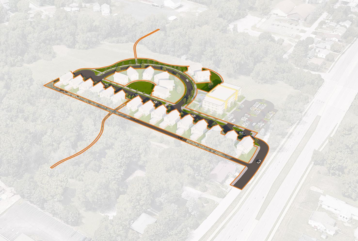
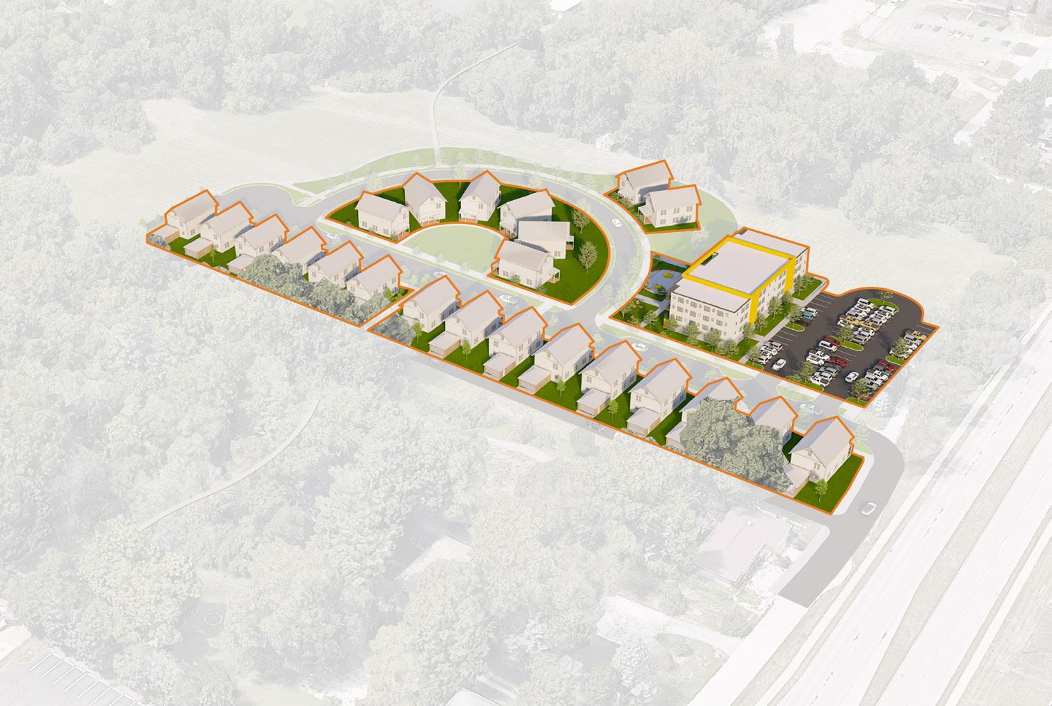
The E. Troy Ave. Redevelopment opportunity area is located at the southwest corner of the intersection of E. Troy Ave. and N. 25th Ave. The site is approximately four acres and contains a gas station and strip mall surrounded by a large surface parking lot. The strip mall has been developed near the rear of the site and is significantly set back from E. Troy Ave. Surrounding development includes single-family residential neighborhoods to the north and south, an apartment complex to the east, and additional small businesses to the west.
As shown in the exhibit on the following page, the concept illustrates infill of the site with new mixed-use development buildings adjacent to the public right-of-way. Parking is located behind the buildings and can be accessed from either E. Troy Ave. or N. 25th Ave. Space is also provided behind the buildings for creation of outdoor gathering space for both resident gathering and retail/restaurant use.
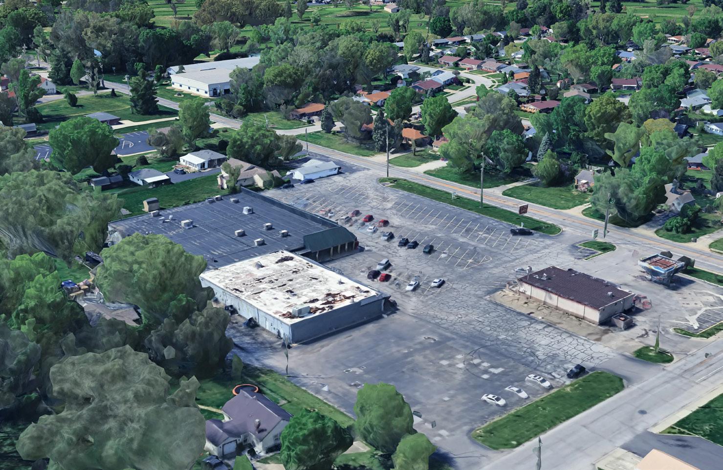
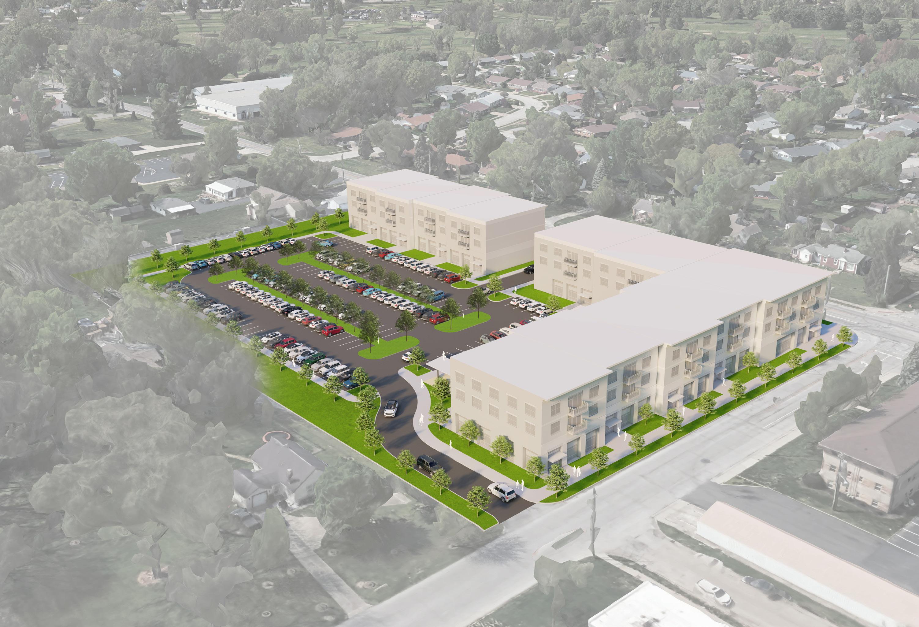
Public Investment
• Improve and extend sidewalks within the Albany Street and N. 25th Ave. rights-of-way.
• Provide lighting, street trees, and amenities within the public rights-ofway.
Private Investment
• Develop mixed-use buildings with lower-level retail and multi-family, upper level residential use.
• Orient buildings toward the adjacent street frontage with minimum setbacks from the right-of-way.
• Offset building faces to avoid large, overwhelming building development.
• Limit building height to three stories to be sensitive to surrounding neighborhood development.
• Locate parking interior to the site and utilize green infrastructure for stormwater management purposes.
• Dedicate interior space for outdoor gathering.
• Screen development from the surrounding residential neighborhoods on the south and west.
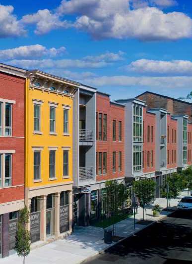
As shown in the exhibit below, public investment for the E. Troy Ave. opportunity area is assumed to include improvements within the E. Troy Ave. and N. 25th Ave. rights-of-way. Specific improvements include new curb ramps, selective curb replacement, sidewalks, lighting, and street trees. The cost opinion assumes existing public infrastructure is adequate and not in need of repair or replacement. The total anticipated public investment cost is approximately $650,000.
As shown in the exhibit below, this development includes 88 multifamily units and 9 businesses, generating 86 jobs and housing 202 residents. The private investment totals $28.96 million.
Performance metrics:
• Annual payroll of $7.79 million and $4.68 million in disposable income.
• 25-year disposable income: $116.9 million.
• Annual property tax: $208,101, totaling $5.2 million.
• LIT revenue: $487,202.
• A medium-sized, workforce-driven development with balanced housing and employment impacts.
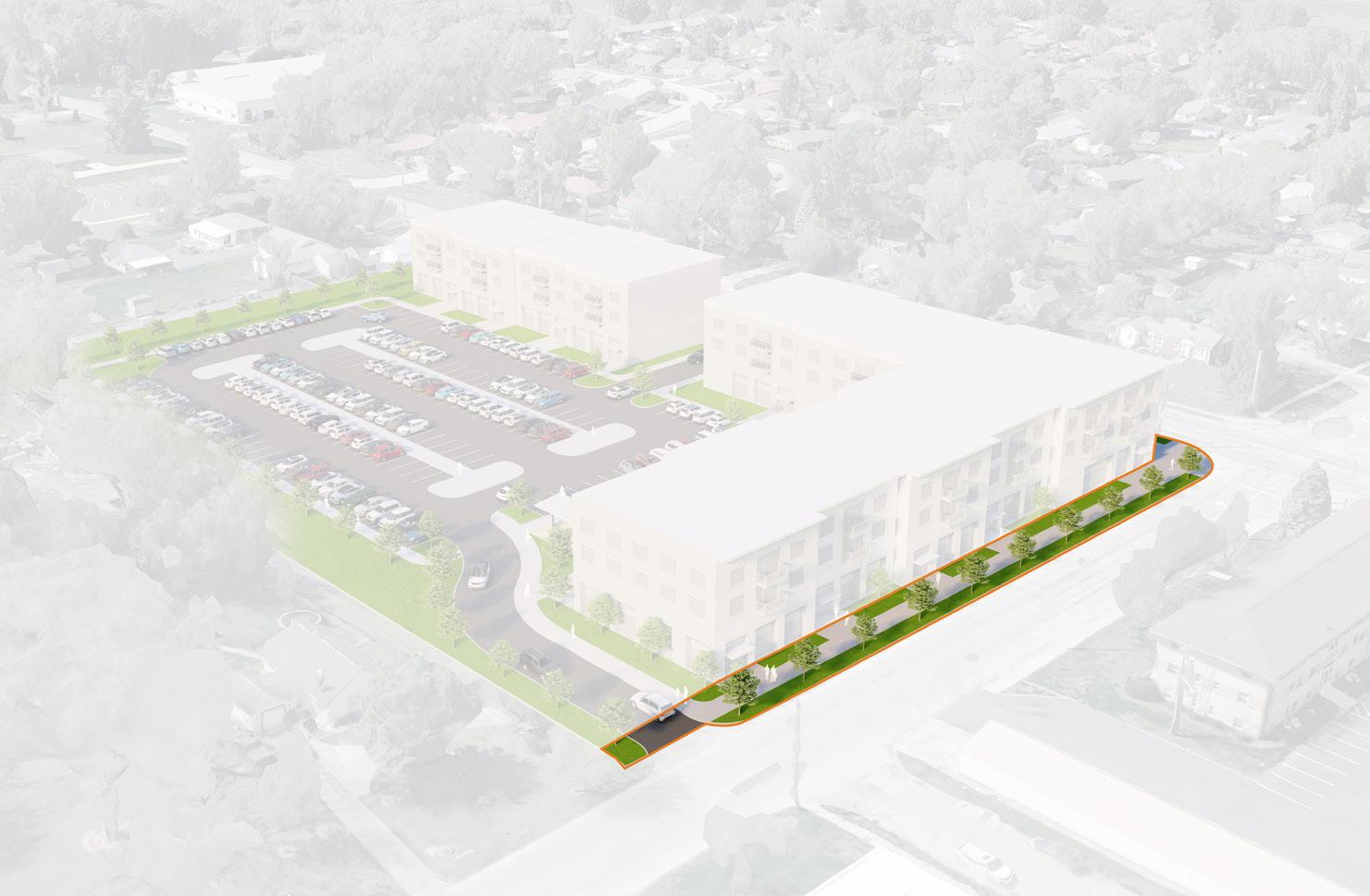
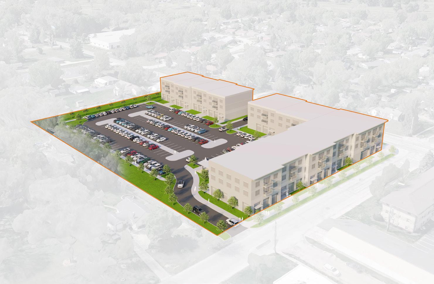
The Main Street Redevelopment District opportunity area is located at the northwest corner of the intersection of Main St. and Emerson Ave. and extends north to Troy St. The area is bounded on the west by N. 2nd Ave. and the total area is approximately four acres. Existing development includes several large surface parking lots adjacent to Emerson Ave., as well as multiple commercial buildings and structures. The Main Street corridor was part of a Downtown Plan that the city completed in 2018. This opportunity area plan should be used in conjunction with the recommendations of the downtown plan.
The Beech Grove Police Department is located on the south side of Main St and commercial buildings extend west along both sides of Main St. Approximately one block north and south of Main St. development transitions to single-family residential development. Amtrak is located east of Emerson Ave., which is four travel lanes and a central median through Beech Grove. The large scale of Emerson Ave. and Amtrak’s security wall and fence to the east create a strong visual and physical edge to the development west of Emerson Ave.
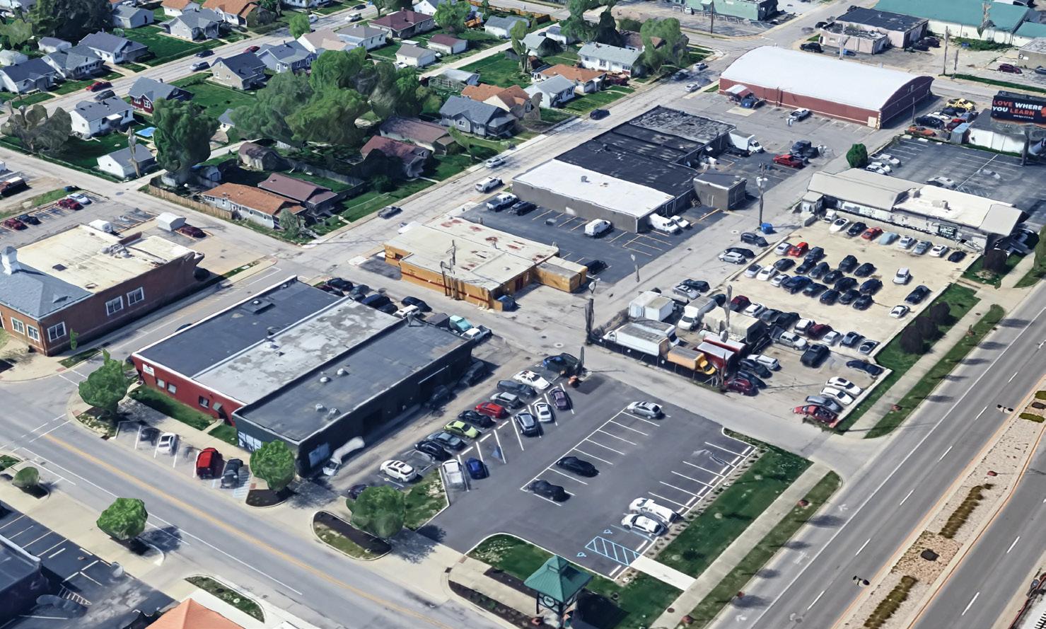
Existing Site
As shown in illustration on the following page, one concept for redevelopment of the Main Street opportunity area includes the development of a mixed-use neighborhood that occupies the large block. The adjacent scenario indicates eight large mixed-use buildings. The structures are recommended for development with first floor retail and commercial space, and up to two stories of residential development above. The buildings are setback from Emerson Ave. to allow for outdoor gathering space. Adjacent to Main St., N. 2nd Ave., and Troy St., the buildings would be adjacent to the right-of-way to maintain the character of the adjacent streets and neighborhoods.
Surface parking is proposed interior to the development area, however, depending on demand and scale, a centralized parking structure could be developed which would service the new development and larger downtown area. Right-of-way improvements surrounding the development would include new curbs, sidewalks, street trees, lights, and curb ramps adjacent to the development. A small outdoor plaza is indicated adjacent to Main Street to promote access to the adjacent commercial development and to support programmed activities in the downtown.
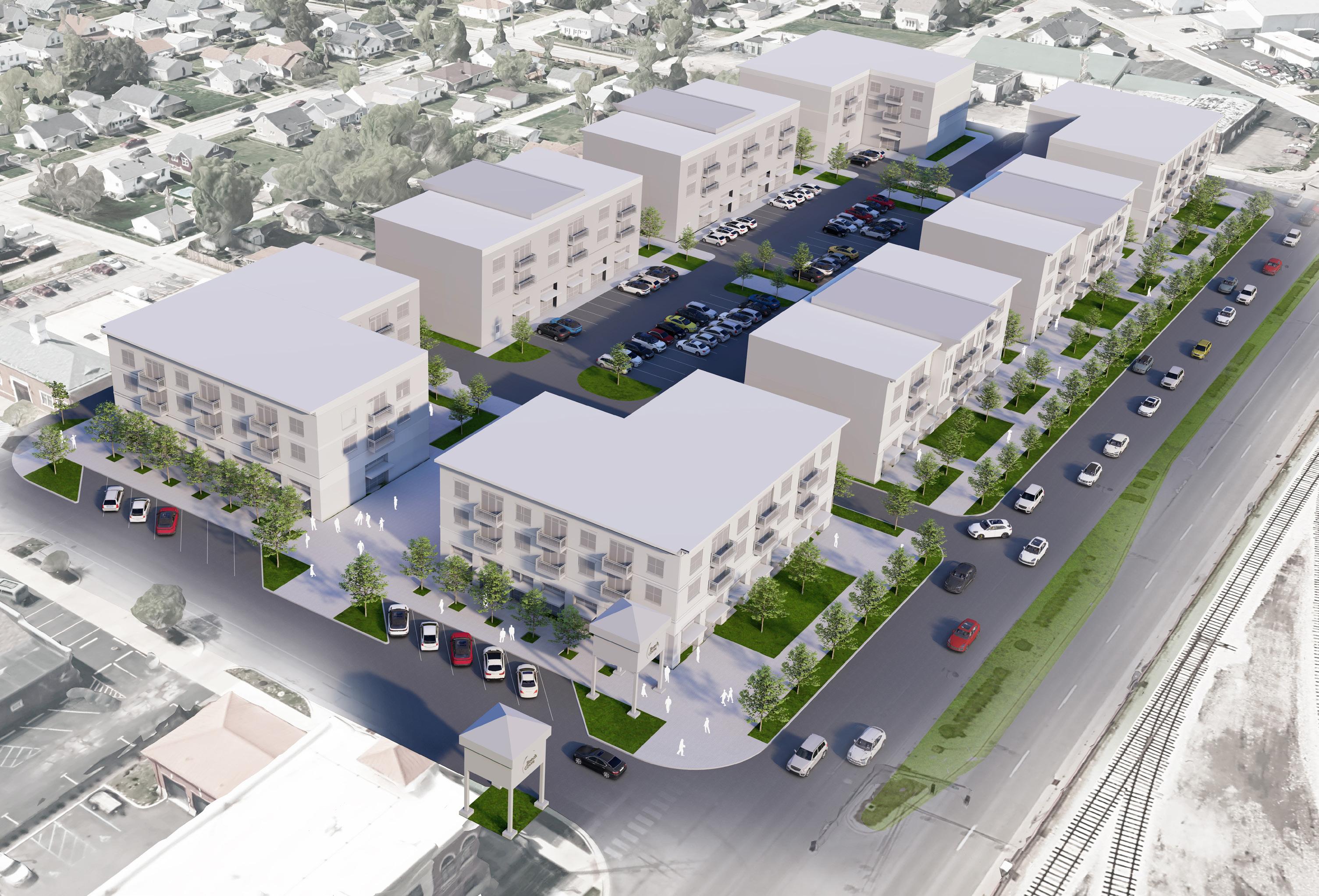
Public Investment
• Extend angle parking and Main Street streetscape east to Emerson Avenue
• Maintain on-street parking along N. 2nd Avenue.
• Incorporate street trees, lighting, and other streetscape amenities consistent with downtown’s character and standards.
Private Investment
• Orient buildings toward the adjacent street frontages.
• Develop a minimum setback away from the right-of-way along Emerson Avenue.
• Develop a setback immediately adjacent the right-of-way along N. 2nd Avenue, Main Street, and Albany Street.
• Develop structures as mixed-use buildings with lower level commercial and retail space and upper-level residential use.
• Establish a maximum building height of three stories.
• Maintain parking interior to the development.
• Screen the parking lot from Emerson Avenue and adjacent development.
• Establish access to the parking lot from N. 2nd Ave. and Albany Street.
• Establish minimum green space dedication requirements.
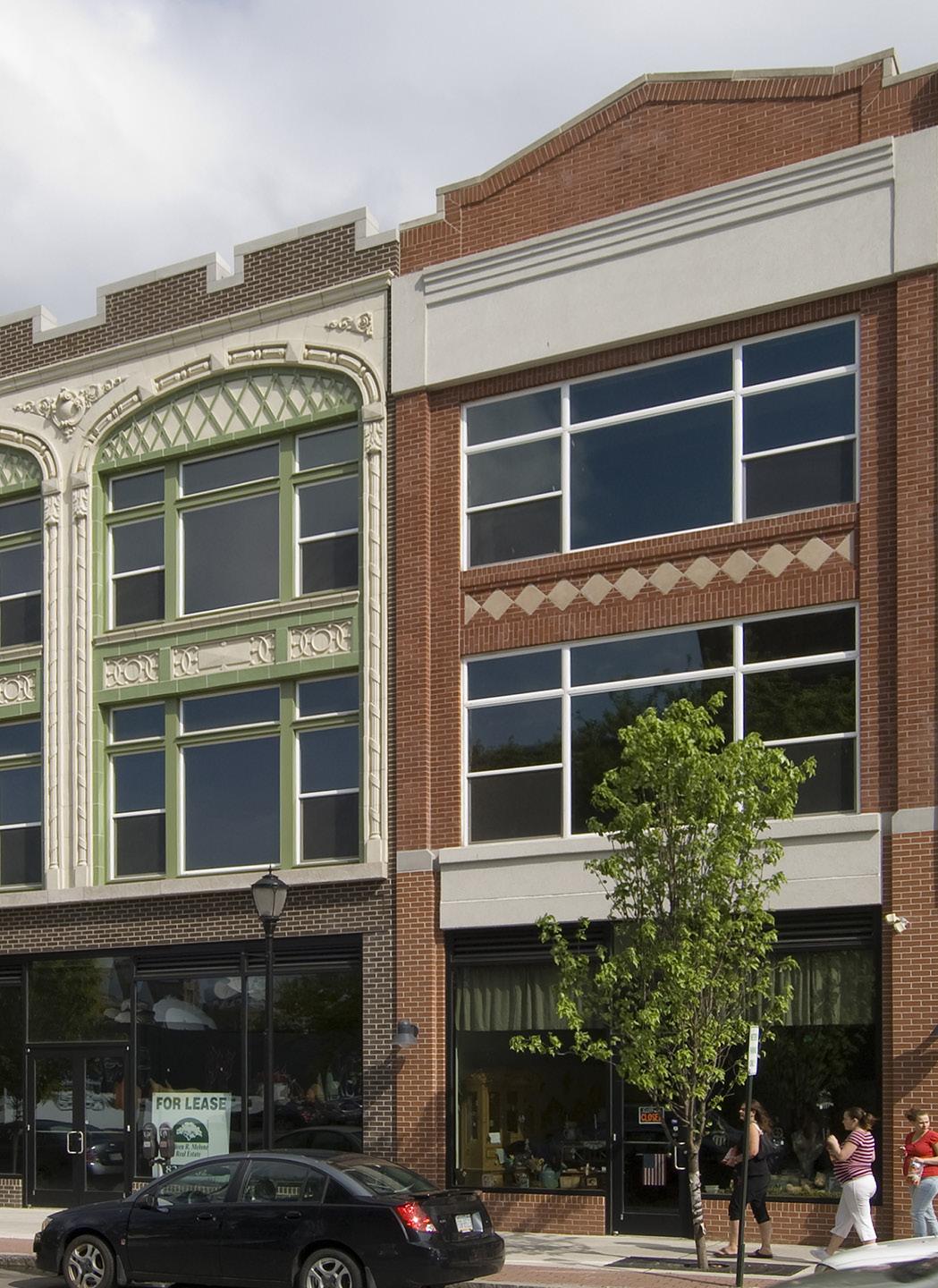
As indicated in the exhibit below, public investment is assumed to include right-of-way improvements to Emerson Ave., Main St., N. 2nd Ave., and Troy St. These improvements include curbs, sidewalks, street trees, and lighting, and additional streetscape amenities. The cost opinion assumes public infrastructure is in good condition with no investment needed. The anticipated public investment value is approximately $1.2 million.
A robust mixed-use redevelopment along Main Street, this project supports 125 multifamily units and 13 commercial businesses, producing 130 jobs. The total investment is $42.05 million. As illustrated in the exhibit below, the private investment assumes development of eight mixed-use buildings, the interior parking lot, and surrounding site work.
Outcomes include:
• 288 new residents and 216 new workers.
• Annual payroll reaches $11.07 million, with $6.64 million in annual disposable income.
• Over 25 years, residents and workers generate $166 million in disposable income.
• Property taxes yield $316,922 annually, totaling $7.92 million.
• LIT returns are strong at $692,048.
• An economic and community cornerstone project with high residential and employment density.
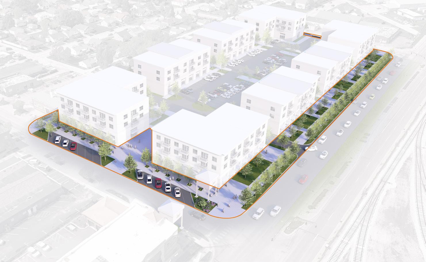
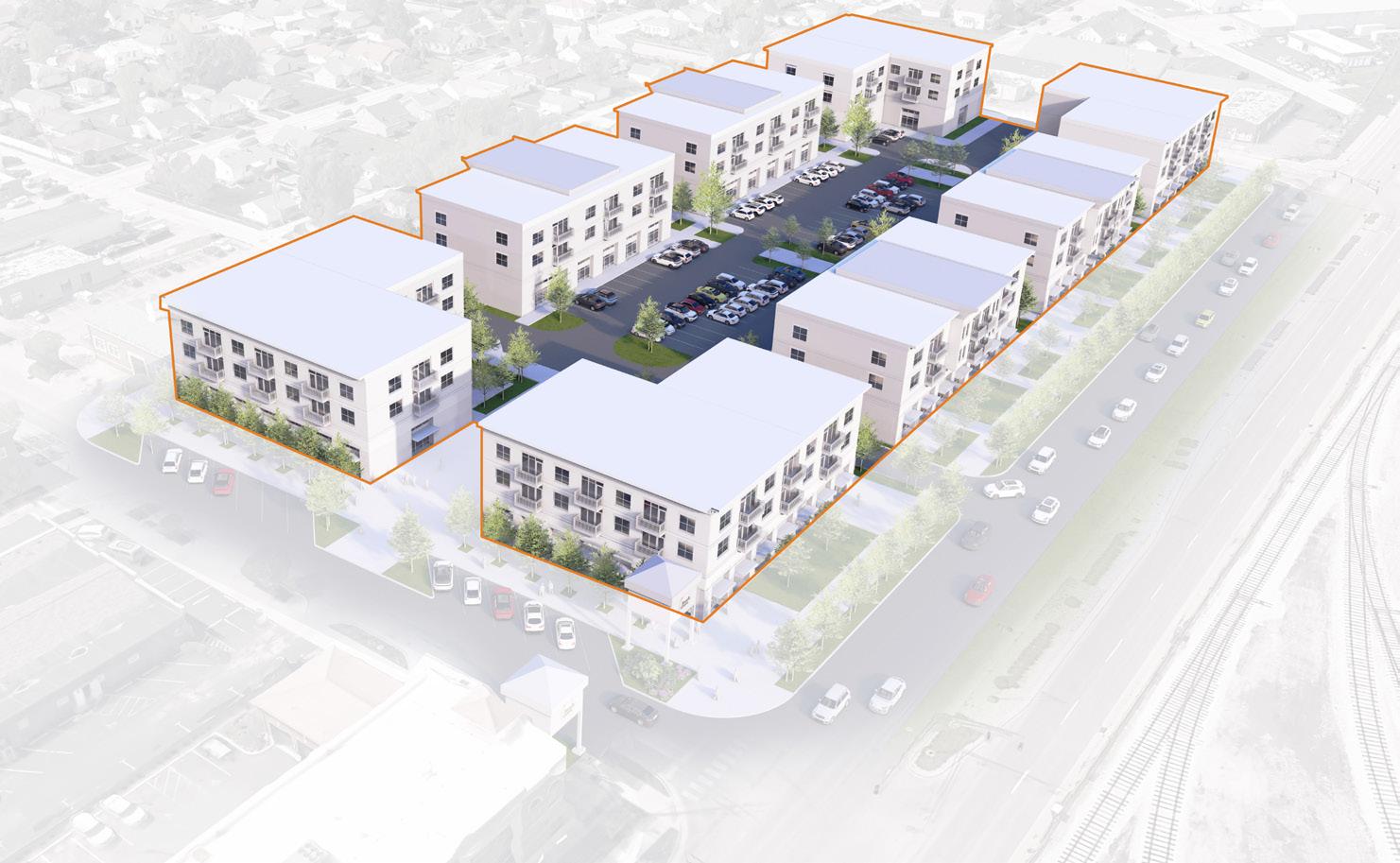
Downtown Beech Grove is characterized by quaint commercial buildings that create a pleasant and walkable atmosphere for downtown patrons between Emerson Ave. on the east and 8th Ave. on the west. With a few exceptions, most buildings are one or two stories and have been developed immediately adjacent to the Main Street right-of-way. Most parcels the buildings occupy are similar size, ranging from 50 to 65 feet wide, and approximately 140 feet deep. Over time, several downtown buildings have been demolished for various reasons, and today, multiple vacant lots and surface parking lots exist in former building locations and immediately adjacent to Main Street throughout the downtown commercial district. As downtown becomes more active, there will likely be development pressure to consider infill opportunities throughout the downtown.
The adjacent exhibits on the right intend to illustrate the appropriate character for infill development along Main Street to ensure the charming nature of downtown is maintained and protected long-term. Two development scenarios are provided, one for mid-block infill, and one for corner lot infill.
As shown in the exhibit on the following page, mid-block infill should be limited to a height of not more than two stories. Structures should be developed immediately adjacent to the Main Street right-of-way and use materials that are characteristic of the surrounding buildings. Additionally, a minimum transparency, or percentage of windows, should be used on the building facades to make them more welcoming and active. The city may also consider enforcing sign standards related to size, style, and placement. Corner lot infill should consider similar building characteristics as midblock infill, however, height limitations could be increased to three stories for corner lots which is typical for traditional downtown buildings where corners structures are often more prominent (as illustrated in the exhibit on the following page).
Also indicated in the exhibits on the following page, intersecting alleys can promote pedestrian connectivity to adjacent neighborhoods and should be improved with additional lighting, murals and public art, site furnishings, and improved pavements. Where appropriate, they City may consider implementing mid-block crosswalks at alley intersections to promote connectivity and improved pedestrian safety across Main St. Additional improvements would include new street trees and lighting within the Main St. right-of-way where they are impacted by new infill development.
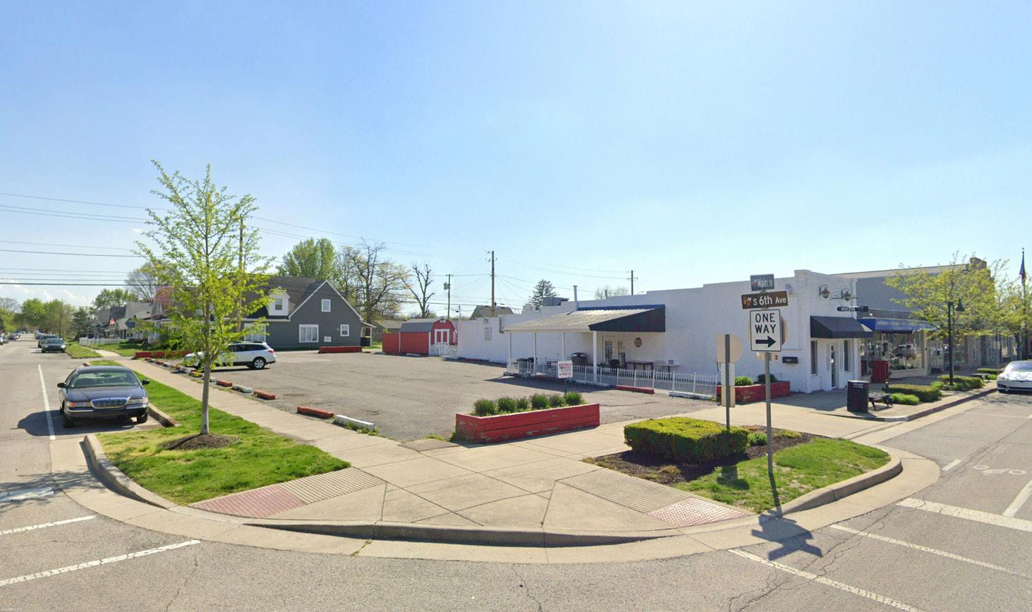
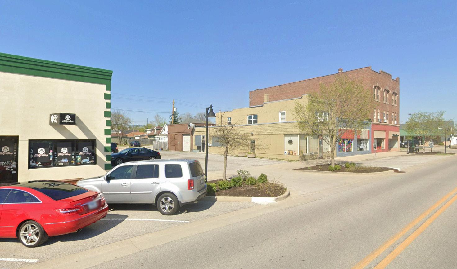
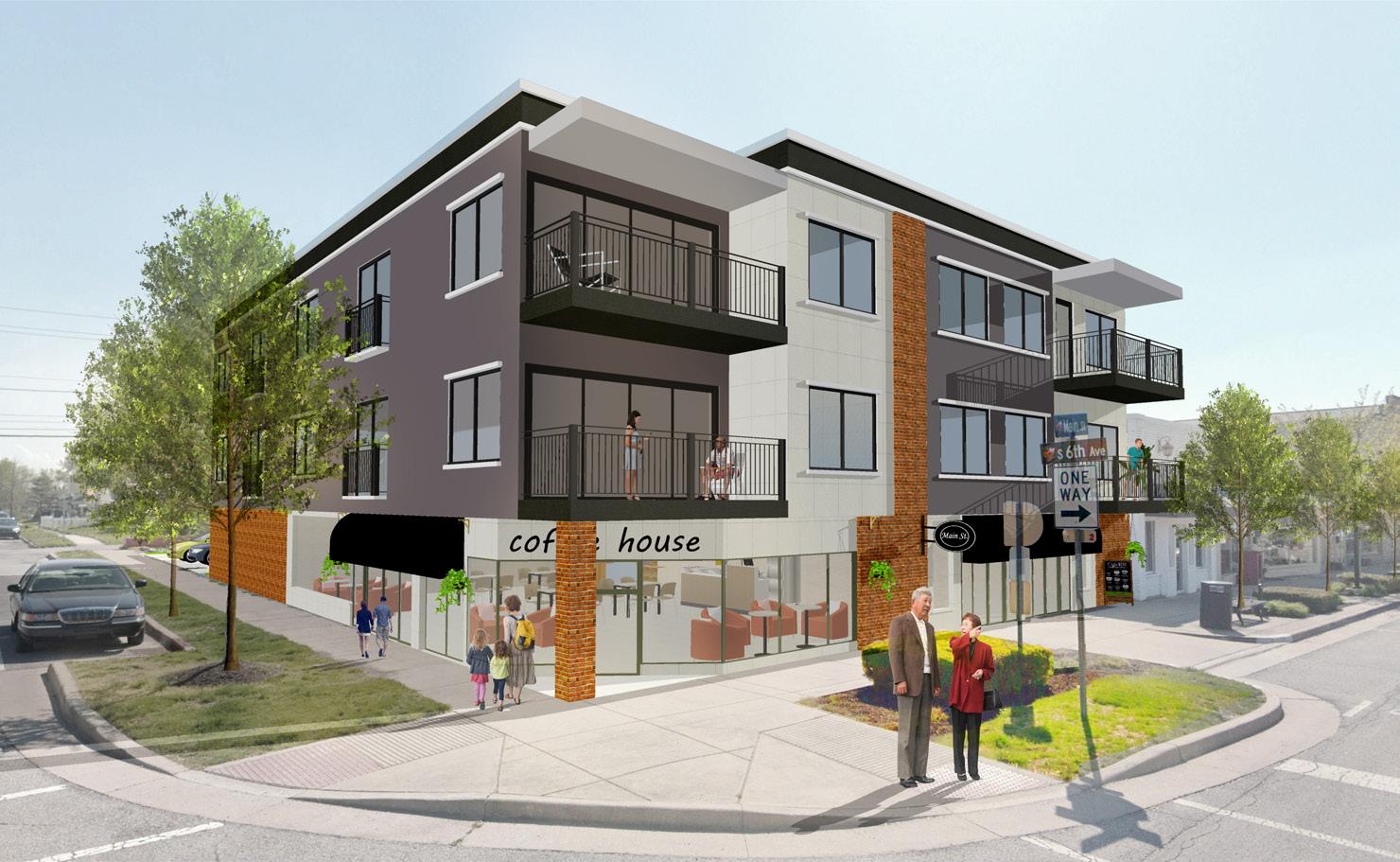
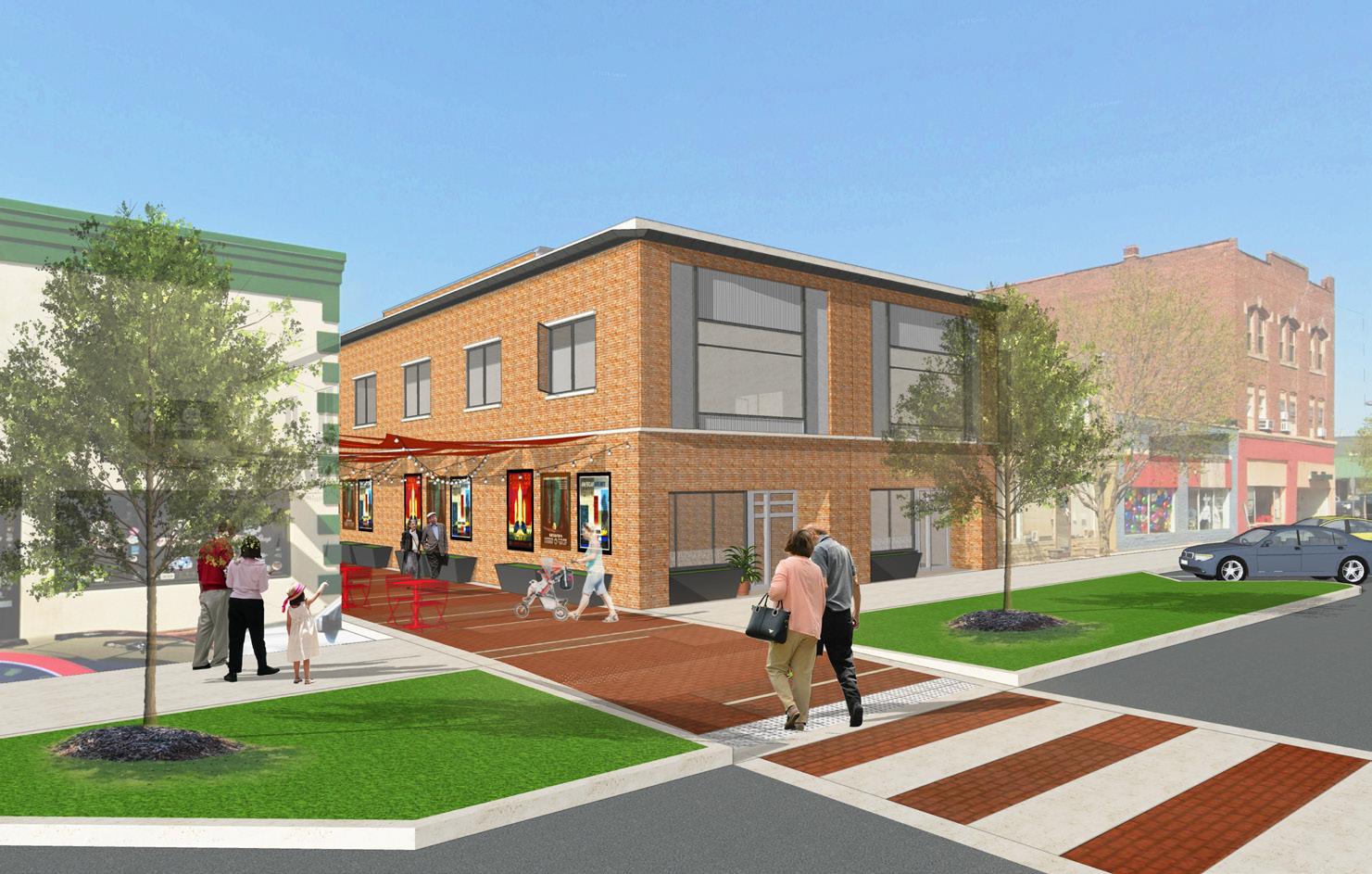
Public Investment
• Activate and improve alleys to encourage pedestrian use from adjacent neighborhoods.
• Consider curb bump-outs and mid-block crossings at alley intersections to calm traffic and improve connectivity across Main Street.
• Implement street lighting and tree enhancements as infill occurs.
Private Investment
• Develop infill buildings immediately adjacent to the Main Street right-of-way with setbacks consistent with adjacent commercial buildings.
• Limit building heights to two stories for mid-block infill and three storis for corner lot infill.
• Require building materials that complement existing buildings in the downtown.
• Establish a minimum amount of transparency on street facing building facades.
• Develop maximum building lengths adjacent the right-of-way and require building offsets when buildings exceed a specific length.
• Establish signage standards for downtown buildings.
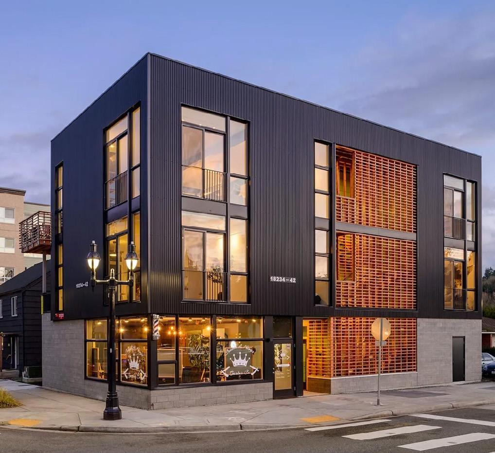
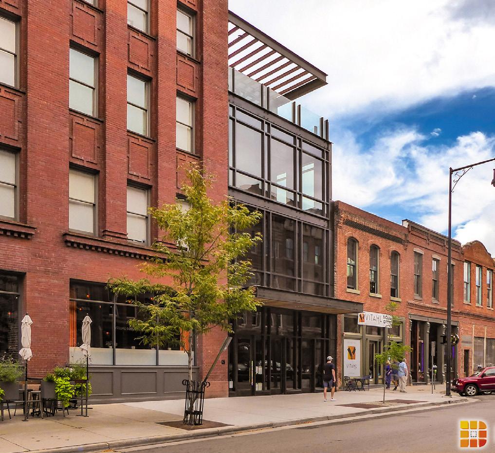
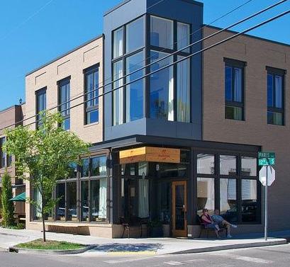
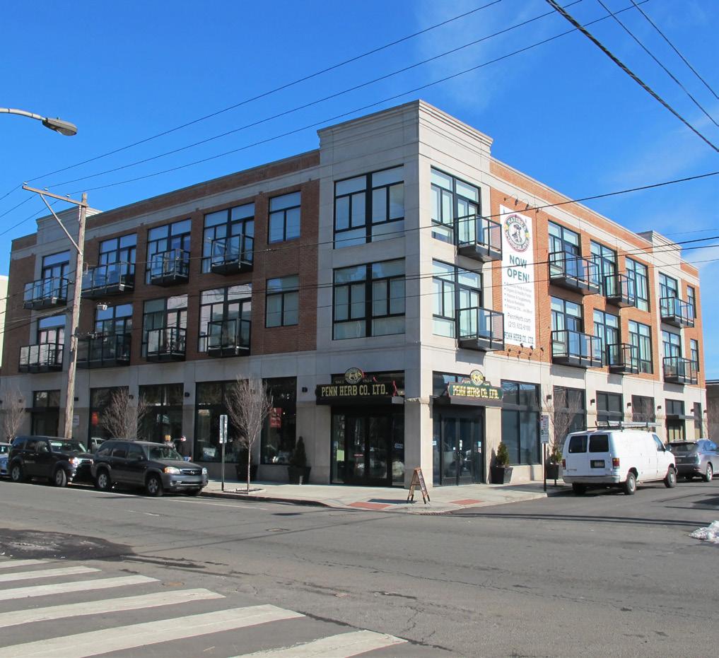
Public investment costs are assumed to be limited to improvements within public rights-of-way. As indicated in the exhibit below, public investment costs are calculated for the indicated alley improvements, curb-bump outs, and mid-block crossings. The total public investment cost as illustrated would be approximately $320,000. Public investment costs are assumed for the illustrated corner lot infill project.
Targeting underutilized parcels along Main Street, this project assumes two new infill buildings as illustrated in the exhibits below. The two structures combined create 14 residential units and two small commercial spaces for a total private investment of $4.23 million.
Key metrics:
• 32 new residents, 24 of whom are working adults.
• 17 jobs created, generating $513,600 in payroll annually.
• Over 25 years, local disposable income adds up to $18.6 million.
• Property taxes reach $35,169 annually, or $879,215 over 25 years.
• LIT contributions exceed $77,509.
• A strategic infill project that enhances density and pedestrian-oriented redevelopment.
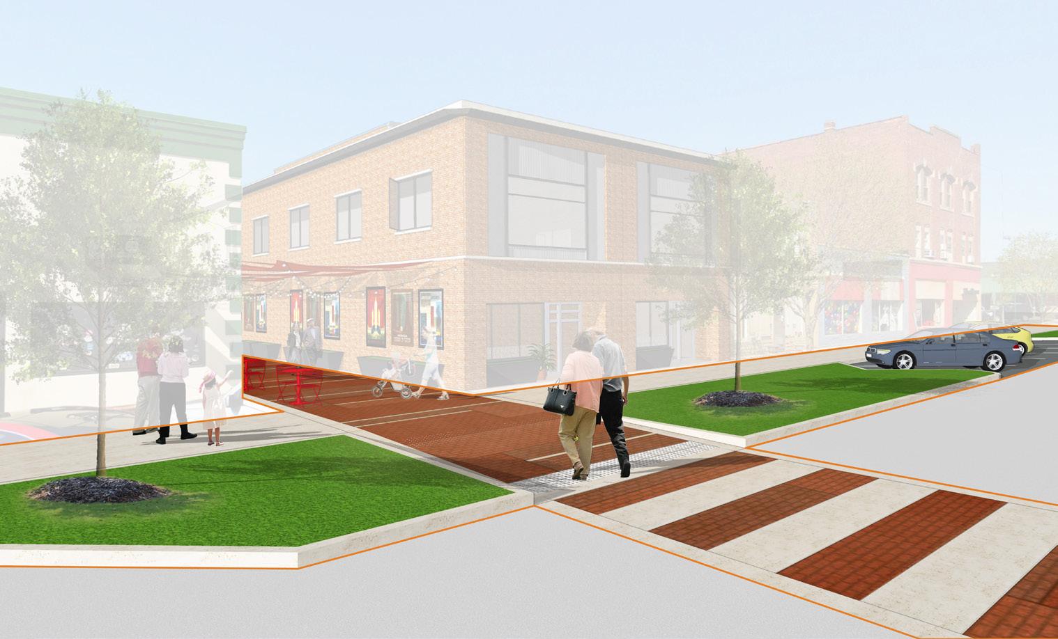
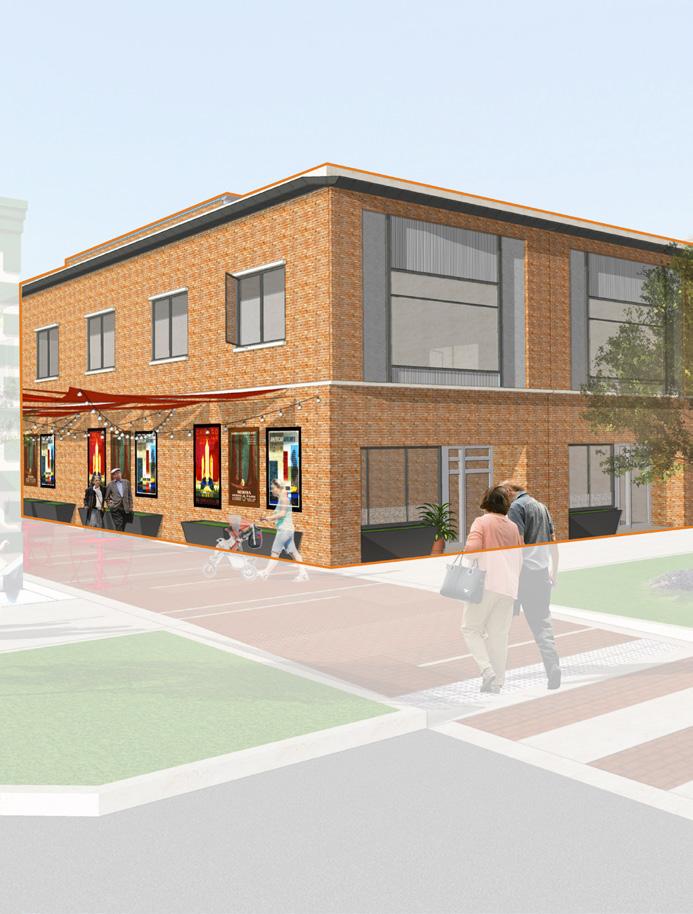
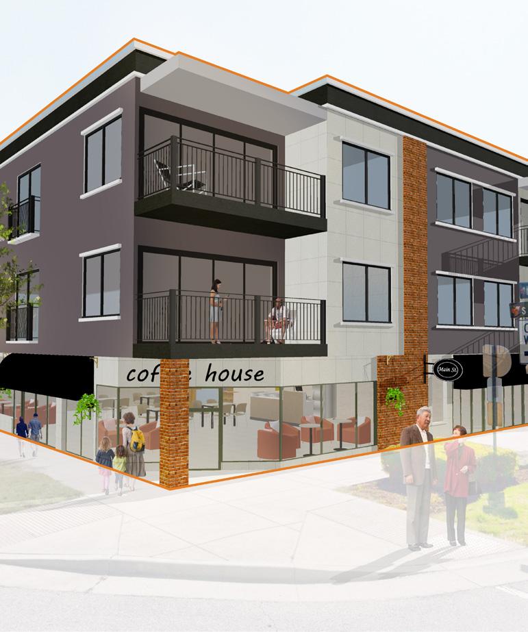
Gateways and signage are critical to announcing arrival to and celebrating a community. They provide unique branding and marketing opportunities that allow visitors and individuals who are unfamiliar with a particular community to identify a symbol or landmark with them. Gateways are typically thought of as individual elements or constructions, but they should be thought of as experiences and can include landscaping lighting, and the overall appearance of a place.
Gateway constructions often occur at different scales that this plan refers to as regional, local, and district. Regional gateways are typically the largest and are constructed at the edges of a community on major thoroughfares, or principal arterials, where they get the most exposure to visitors and non-residents. They need to be large to be legible and memorable for automobiles travelling at higher rates of speed. Local gateways are smaller than regional gateways and typically occur on secondary arterials, or collector streets, where there may be multiple lanes of automobile traffic, but they are travelling slower and there are more frequent, signalized intersections. District gateways typically occur on local streets and announce arrival to specific parts of a community such as a neighborhood, downtown, or local destination. In addition, communities may extend their community branding to additional elements such as individual street signs.
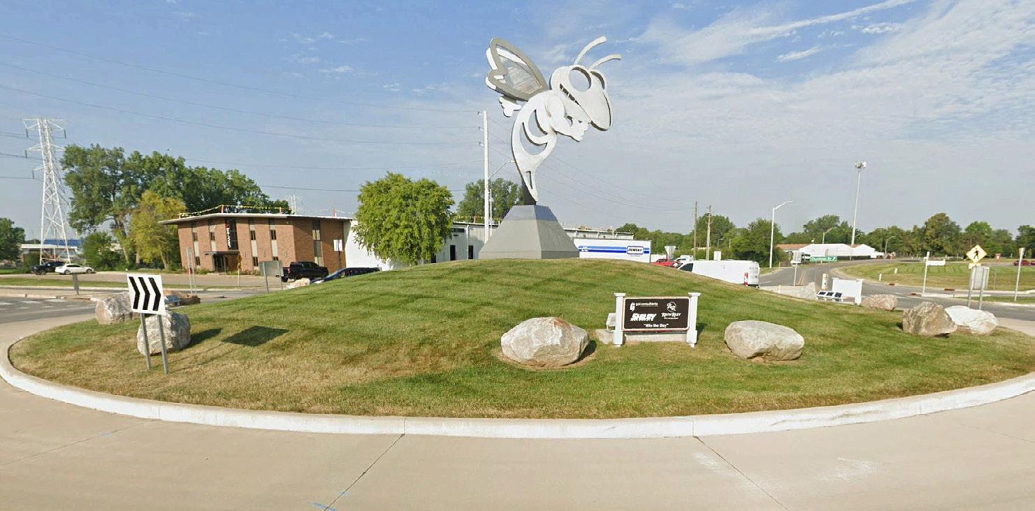
Currently, the City of Beech Grove has multiple, local and district gateways. Existing local gateways include the decorative structures at the Emerson Ave. and Main St. intersection, and the bus stop just south of the intersection, that is designed with a similar style and announces arrival to the downtown and commercial core. Other local gateways occur as public art within the median of Emerson Ave. and in the center of the roundabout at the intersection of Big 4 Rd., Arlington Ave., and the Churchman Bypass. The roundabout at the intersection of N. 17th Ave., Troy St., and Churchman Ave. also acts as a local gateway with a large flagpole and decorative landscaping within the center of the roundabout. Smaller, decorative signs provide welcome to visitors and Beech Grove throughout the city near the corporate boundaries of secondary arterials and collector streets.
The vision for gateways within Beech Grove is to establish identifiable gateways and wayfinding signage within the community that are directly linked to the city’s branding standards and which establish a unique sense of place within the larger Indianapolis metropolitan area. One of the main opportunities for establishing a unique identity is at the intersection of Emerson Ave. and Interstate 465. I-465 conveys tens of thousands of vehicles around the City of Indianapolis daily and the Emerson Ave. exit is non-descript and appears like most exits within the City of Indianapolis. Beech Grove should consider establishing a regional gateway at this intersection that is prominent for both east and west bound traffic. Other communities throughout the state have been able to coordinate with INDOT on the development of regional gateways at interstate intersections. Examples include Lebanon and Greenfield who have created unique experiences along Interstate 65 and Interstate 70 respectively through large gateway elements that serve as landmarks for travelers, and which are visually interesting.
Within Beech Grove, additional opportunities exist for local gateways as well. There is currently no gateway at the north corporate limits of Beech Grove along Emerson Ave. A potential location could be the intersection
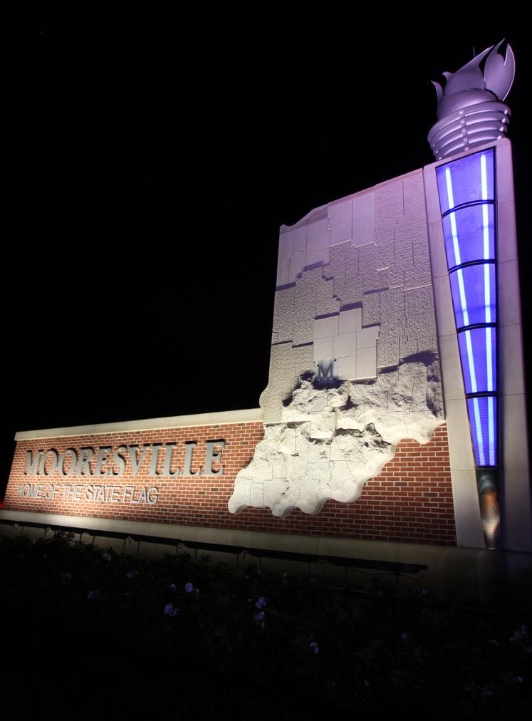
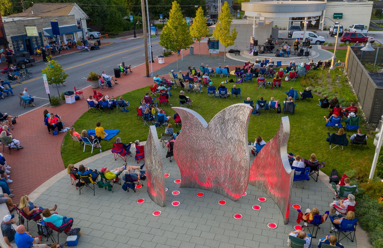
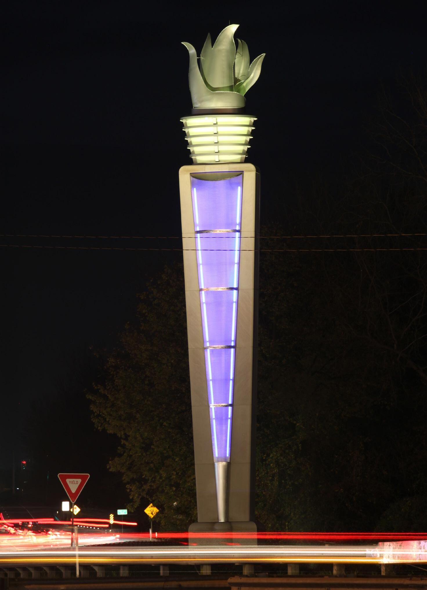
of Subway St. and Emerson Ave. in coordination with proposed intersection improvements and as redevelopment occurs in that area. Similarly, a local gateway may be appropriate on the south end of Beech Grove at the intersection of Thompson Road and Emerson Avenue. The medians of Emerson Avenue can also act as future gateways to the city and should be considered for landscape and lighting improvements to add color and visual interest throughout the community. Additional opportunities for local gateways could be near the city’s corporate boundary and along secondary arterials including Sherman Drive to the north and south, Churchman Ave. to the northwest, Albany Street. to the west, and Arlington Avenue to the southeast.
There are currently significant and identifiable gateways at the intersection of Main Street and Emerson Avenue, but additional Main Street gateways should be considered at 17th Avenue and at 8th Avenue near the beginning of the commercial district and historic downtown. Other district gateways may be appropriate near Our Lady of Grace Monastery, the former Franciscan Hospital site, and other local interest points including the southern industrial district. Examples of district gateways completed by other communities are included for inspirational purposes.
• Consider developing a gateway brand in coordination with the city’s branding strategy and establish a family of gateways to be implemented throughout the community.
• Locate regional gateways at the intersections of primary arterials with significant traffic volumes.
• Locate local gateways at the intersections of secondary arterials and local collector streets.
• Use district gateways to mark arrival, or brand, specific locations within a community.
• Design gateways to be simple and legible for automobiles and be considerate of the speed limit and amount of time that individuals have to experience a gateway as they drive by.
The costs for municipal gateways is typically covered by the municipality or local government. Costs can vary greatly depending on the size and complexity of the gateway, but in general, a regional gateway could be as little as $500,000, or as much as $2 million or more. Local gateways are typically $100,000 to $500,000, and district gateways can be as little as a few hundred dollars, or as expensive as a few hundred thousand dollars.
Similar to the trails and parks, no direct private investment impact has been calculated for future gateways since they are expected to be public investment projects. Like other quality of life improvements, gateways indirectly promote community (re)development and well-being through creating a unique sense of place and supporting local community pride. While the direct financial impacts to the city of Beech Grove are difficult to calculate for gateways, they can be expected to help in existing and future resident and business attraction. Gateways and other beautification projects should continue to be a priority for public investment by the City to help encourage new development and redevelopment, and private sponsorships may also be considered to help fund beautification and quality of life improvements such as gateways.
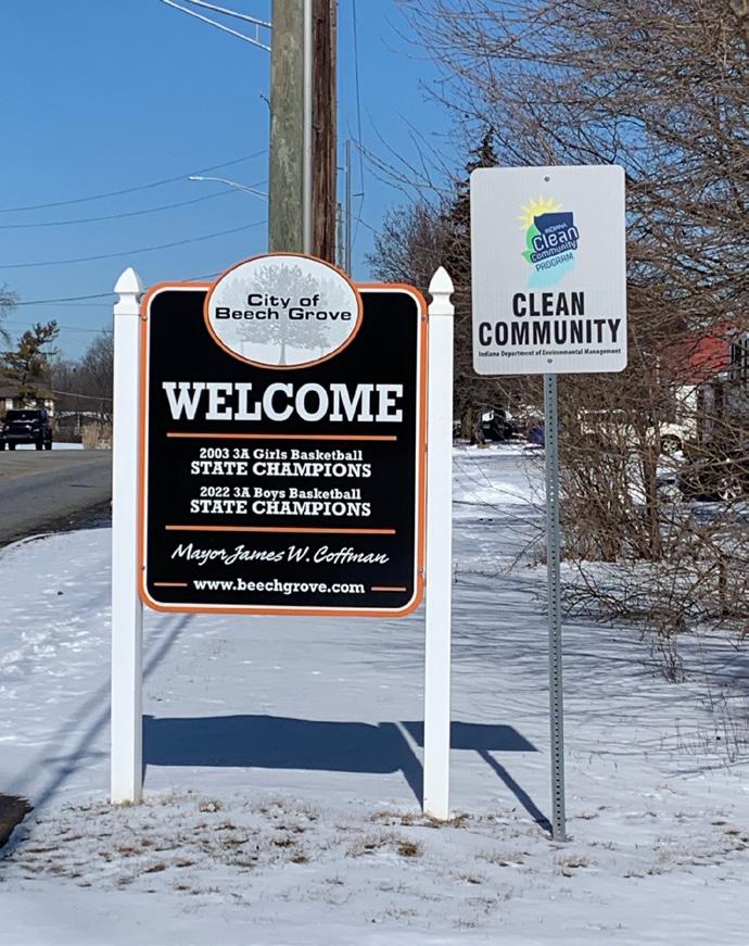
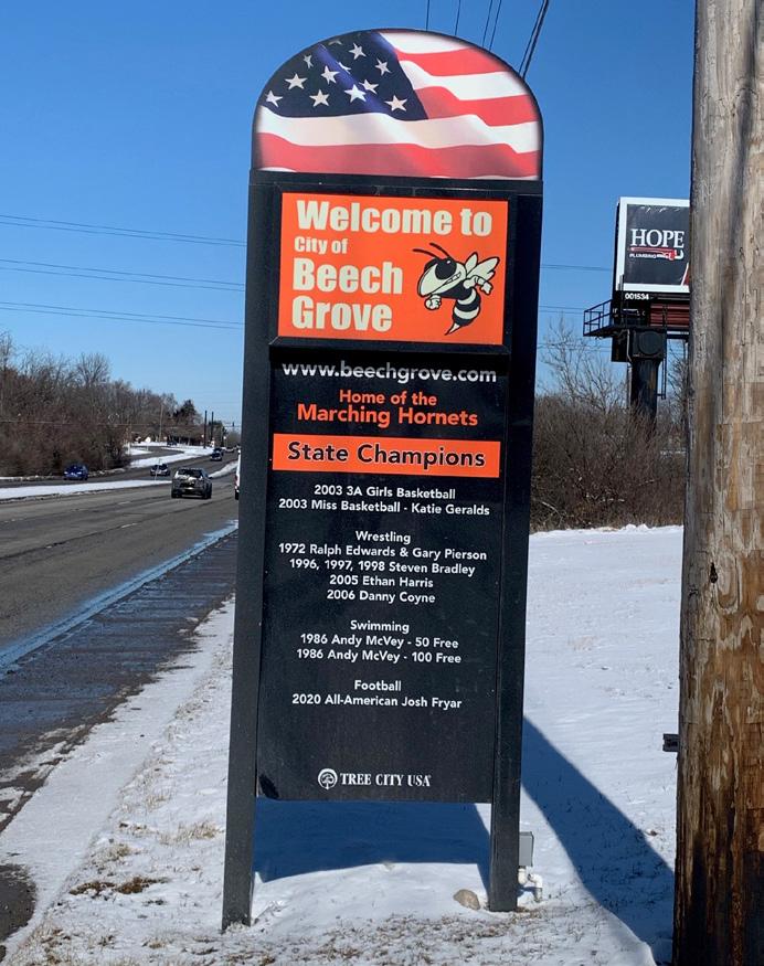
The Appendix E: TIF Projections table offers a forecast of financial activity associated with Beech Grove’s Tax Increment Financing (TIF) districts from 2025 through 2032. It serves as a critical planning tool, outlining fund balances, revenue sources, and assumptions that guide the city’s redevelopment and infrastructure financing strategy. This data was provided by Jeff Peters of Peters Franklin LTD.
The document is organized into time-series financial data with columns representing budget and projected fiscal years (2025–2032) and rows categorizing different types of financial entries, including beginning balances, encumbrances, fund balances, and revenue allocations by TIF district.
• The beginning cash balance in 2025 is listed at $1,618,430.
• There are no encumbrances (reserved obligations), indicating all funds are available for allocation at the start of each year.
• This results in a beginning fund balance of $1,618,430 for 2025, which serves as the base for subsequent year projections.
• Projected fund balances increase each year, reflecting compounding revenue inflows and prudent financial management:
2026: $2,278,682
2027: $3,249,473
2028: $4,220,263
2029: $5,245,917
2030: $6,271,572
2031: $7,297,226
2032: $8,322,881
These figures suggest a strong trajectory of TIF revenue growth over the eight-year horizon.
Revenues are broken down by specific allocation areas within the TIF district:
Beech Grove Regional Medical Center (T49171):
Generates a nominal and consistent annual revenue of $693 across all years. This may represent a minor legacy allocation or administrative placeholder.
Northeast Emerson Allocation Area (T49753):
Provides a reliable annual revenue stream of $171,579.
This allocation appears to be a key contributor, likely tied to stable or high-value assessed properties with ongoing redevelopment impact.
West Albany Street Allocation Area (T49178):
Contributes $76,465 annually in TIF revenue.
While not as significant as Northeast Emerson, it represents a meaningful portion of the TIF’s recurring income.
Annual Revenue: contributes $36,546 annually.
Description: The Bethel Avenue TIF is probably centered on a strategic corridor targeted for infrastructure improvements and mixed-use development. This area may serve as a gateway or commercial transition zone, positioned to support walkability, infill development, and enhanced connectivity.
Beech Grove Expanded Allocation Area
Annual Revenue: Contributes $745,895 annually until 2032.
Description: This TIF was likely created to support broader-scale redevelopment beyond the original medical center district. It may include older commercial centers, transitional properties, and opportunity sites poised for reinvestment. Its designation as “expanded” suggests a responsive effort to include more eligible parcels in the city’s growth areas.
These consistent revenue streams across three distinct allocation areas illustrate a diversified and stable TIF structure, capable of sustaining the city’s redevelopment objectives over time.
3. Strategic Implications
The projections show an average annual increase of roughly $1 million in fund balance, suggesting that TIF revenue is outpacing expenditures or obligations. This growth can support capital improvements, debt service for bonds issued to fund infrastructure, land acquisition, or development incentives.
Moreover, the detailed breakdown by allocation area allows the City of Beech Grove to monitor the performance and yield of each district individually. This supports more strategic resource allocation, ensuring high-performing districts can be reinvested in or expanded while underperforming areas may be reassessed or supported with complementary efforts.
In sum, the spreadsheet provides a detailed fiscal outlook for Beech Grove’s TIF districts, projecting growing fund balances supported by reliable, district-specific revenues. It underscores a solid financial foundation for leveraging redevelopment projects and maintaining long-term financial sustainability through the TIF mechanism.
As discussed in the previous chapter, opinions of probable cost were developed for the anticipated public investment for each opportunity area to help incentivize private development based on the (re)development concepts presented. The aggregate public investment cost for the opportunity areas is approximately $26 million. The aggregate cost is a large number that will take time, phasing, strategy, and partnerships to implement, but as noted below, the potential return on investment represents a significant opportunity for the City of Beech Grove.
As noted, the costs are based on a series of assumptions that the City of Beech Grove can incentivize (re)development through strategic investments in critical infrastructure and utility extensions; right-of-way improvements including roads, lighting, and street trees; and amenities and quality of life improvements including parks, trails, and gateways. A full explanation of assumptions can be found in the previous chapter, and as noted, every (re) development project will be unique and will require a different level of public investment that will be a discussion and negotiation with the development community. Additionally, the opportunity areas discussed within this plan should not be treated as a means of limiting the city’s funding potential. Opportunities will arise within the city that cannot be forecasted within this plan and the city should maintain the flexibility and ability to react to those opportunities on an individual basis.
The Beech Grove Consolidated Economic and Redevelopment Plan outlines a transformative 25-year vision that will bring substantial private investment, new development, and long-term fiscal benefits to the community. Anchored by $390 million in private investment, the plan is projected to catalyze widespread economic growth through new commercial, industrial, and residential activity within the designated Tax Increment Financing (TIF) districts.
On the commercial side, the redevelopment is expected to result in 44 new businesses employing 435 individuals, each earning an average salary of $30,000. This equates to over $13 million in annual wages, generating $326 million in total salaries over the 25-year period. After accounting for disposable income at 60%, this translates to nearly $196 million in spending power circulating through the local economy. In parallel, industrial expansion will add 15 businesses with 437 employees earning an average of $51,352 annually, producing more than $22 million in annual wages. Over the life of the TIF, industrial employees will earn a combined $561 million, with $337 million in disposable income supporting local consumption and reinvestment.
The housing component of the plan includes 631 multifamily units and 54 single-family homes, accommodating an estimated 1,576 new residents. Of these, approximately 1,182 will be part of the workforce, and 369 will be students. With a per-student funding allocation of $6,750 annually, the local school system is expected to receive nearly $2.5 million each year, totaling over $62 million across 25 years.
Altogether, annual salaries across all sectors are projected to exceed $60 million, of which more than $36 million will be disposable income—sustaining retail, housing, and service industries throughout the city. Over the full term of the TIF, this results in a cumulative economic contribution of over $910 million in wages and disposable income alone.
Fiscal impacts are also substantial. Local income tax (LIT) revenue is expected to grow by more than $151,000 per year, or $3.8 million over the 25-year period. Property tax revenue is anticipated to increase from the current $225,000 annually to more than $2.6 million, generating over $65 million in new tax revenues over the life of the plan. This reflects a 12-fold return on investment when comparing future tax revenues to existing levels.
In total, the redevelopment plan projects $1.96 billion in cumulative benefits, including wages, taxes, student funding, and private investment. This comprehensive approach positions Beech Grove for long-term economic vitality, improved public services, and enhanced quality of life for its residents.
THIS PAGE IS INTENTIONALLY BLANK
The recommendations of the plan build on the public engagement, existing conditions, goals of the plan, and the opportunity areas for redevelopment. The recommendations also consider economic development activities that are not in redevelopment areas. The recommendations are in four categories: policy, program, project, and zoning.
Policies are the considerations that the RDC and the City of Beech Grove should take into consideration when making decisions about proposed development or redevelopment opportunities, infrastructure investments, and public programming.
1. Collaborate with the schools to support a quality environment for families with children
2. Thoroughly document all transactions for increased government accountability and transparency
Programming is the activity portion of the work of communities, how people engage with and experience the community.
1. Develop and foster a relationship with Indy Economic Development (formerly Develop Indy) to promote the opportunities in Beech Grove
2. Establish a Business Retention and Expansion (BR&E) program to understand the needs and challenges of employers in the city
3. Provide incentives to businesses who are expanding their physical presence or employment in Beech Grove, with appropriate claw-back provisions for failure to meet goals
4. Market the Beech Grove community as a place to do business
5. Assist businesses with location, navigating zoning and permitting, staff recruitment, and marketing
Projects are concrete efforts that have a visible impact on the community. These require plans and funding, including maintenance (in most cases).
1. Develop a trail along Emerson Avenue
2. Install consistent gateway signs
3. Continue to improve infrastructure including roads, sidewalks, drainage, and water/sewer – in partnership with other units of government and the private utilities as appropriate
4. Implement the opportunity area concepts as practical
The zoning ordinance is the Marion County Zoning Ordinance/ReZone Indy and those provisions apply in Beech Grove, including for economic development and redevelopment projects. Beech Grove now has more control over zoning changes than it has historically and can leverage that control to support economic development and redevelopment priorities for the city. Some excluded cities in Marion County are also considering use of Overlay Districts or other options for more localized zoning standards.
1. Consider development of overlay districts for Main Street, Emerson Avenue, Churchman Avenue, and the CSX site.
2. Support continuing education for Board of Zoning Appeals (BZA) members and city council members on the role of the citizen planner.
When an “allocation area” is established the commercial and industrial property in the area will be assigned an assessed value as of January 1st of the year the allocation area was created. This assessment prior to redevelopment is referred to as the “base assessed value” (AV) and belongs to all taxing districts overlapping the TIF district. When a TIF is created, generally redevelopment activity is soon to follow. New development increases the AV from the initial base at the onset of the TIF. Throughout the lifespan of the TIF, which is 25-years from the first obligation, the incremental increases over the base are collected into the TIF. The original Base AV still belongs to the taxing units. Increment that is captured over the life of the TIF flows to the Redevelopment Commission and can be used to fulfil debt obligations of the initial project, can be reinvested into other projects within the TIF district, etc. At the end of a TIF’s life, all of the increases in assessment transition to what becomes the new AV, which now belongs to all taxing districts.
With some TIF districts expiring and others that may not be generating increment, it is important for the RDC to regularly assess the need for new allocation areas or the need to remove one or more properties from an allocation area (if not removing an entire allocation area). The following are criteria for establishing new allocation areas:
1. The Redevelopment Commission is required to make a specific finding of fact that the adoption of the allocation provision will result in new property taxes in the area that would not have been generated but for the adoption of the allocation provision.
2. Redevelopment of the area benefits the public health, safety, morals, and welfare.
3. Redevelopment will increase the economic well-being of the unit and the state.
4. Redevelopment will serve to protect and increase property values in the unit and the state.
5. The uses are public uses and purposes for which public money may be spent and private property may be acquired. (IC 36-7-14-2.5)
Additionally, the following considerations may be applicable in the findings for establishing a new allocation area:
1. The plan promotes significant opportunities for gainful employment of Beech Grove residents.
2. The plan for the Beech Grove Area cannot be achieved by regulatory process or by the ordinary operation of private enterprise without resorting to the powers allowed the Redevelopment Commission under IC 36-7-14.
3. The public health and welfare will be benefited by the accomplishment of the Economic Development Plan for the Economic Development Area.
4. 4. The accomplishment of the Economic Development Plan for the Beech Grove Area will be a public utility and benefit
5. The Economic Development Plan for the Economic Development Area conforms to other development and redevelopment plans for the governmental unit.
The implementation matrix includes action steps that will support achieving the vision of the Consolidated Economic Development and Redevelopment Plan. Some of the actions are carried forward from prior plans as they still are relevant to the future of Beech Grove.
Action Timeline
Develop a code enforcement education campaign
Host quarterly “Coffee with a Cop” to maintain positive relationships between public safety and residents/businesses
Establish Fridays during the academic year as Hornet Days by proclamation of the city and the school board
Increase communication through social media across several platforms to reach different audiences
Offer a façade improvement grant for Main Street businesses
Improve bus stops
Develop a Safe Routes to School Plan
Consider establishment of a Designated Outdoor Refreshment Area (DORA)
City of Beech Grove Administration
Beech Grove Police Department
Beech Grove Schools, Mayor’s Office
Mayor’s Office
Beech Grove Redevelopment Commission (RDC)
City of Beech Grove, IndyGo
Beech Grove Schools, City of Beech Grove Engineering
City of Beech Grove Town Council, Mayor
Promote walking trail availability at the monastery grounds
Host a weekly “Walk with the Mayor” on Hornet Greenway
Beech Grove Parks Department, Our Lady of Cgrace Monastery
Mayor
Develop a new 5-Year Parks and Recreation Master Plan 2026
Continue to develop a major greenway trail system
Improve connectivity between key destinations for pedestrians and bicyclists
Develop public parks and recreation facilities targeted to Beech Grove youth
Recruit and promote indoor recreation opportunities for people of all ages
Install trail amenities like shade structures, benches, lighting, and fountains
Develop a trail along Emerson Avenue
Beech Grove Parks Department
City of Beech Grove, Indianapolis
Metropolitan Planning Organization (MPO)
City of Beech Grove
Beech Grove Parks Department
City of Beech Grove - Parks
Beech Grove Parks Department
Beech Grove Parks Department, Engineering Department
Install gateway signs
Improve street lighting on Main Street
Activate Main Street alleys between buildings
Develop and implement a wayfinding system
City of Beech Grove
City of Beech Grove
City of Beech Grove
City of Beech Grove
Use TIF to generate revenue to address redevelopment
Encourage and implement redevelopment of commercial and industrial areas
Encourage commercial development with emphasis on Emerson Avenue and Main Street
Encourage workforce development and career training
Beech Grove Redevelopment Commission (RDC), Beech Grove City Council
Beech Grove Redevelopment Commission (RDC), Beech Grove City Council
Beech Grove Redevelopment Commission (RDC), Beech Grove City Council
Beech Grove Redevelopment Commission (RDC), City of Beech Grove Administration
Establish a business retention and expansion program
Beech Grove Redevelopment Commission (RDC) or newly appointed Beech Grove Economic Development Commission (EDC)
Re-establish the Economic Development Commission (EDC) Mayor
Invest in continuing education for EDC and RDC members
Engage with an economic development consultant or hire an economic development professional to support the EDC and RDC
Support development of a co-working space
Support development of a makerspace
Develop a relationship with the University of Indianapolis
Consider developing a Memorandum of Understanding (MOU) to develop the SISTERS OF ST FRANCIS, HEALTH SERVICES INC property for the mutual benefit of the city and Sisters of St. Francis.
Consider developing a Memorandum of Understanding (MOU) to develop the TIBBS PROPERTY INVESTMENTS et al. (CSX parcel) property for the mutual benefit of the city and Tibbs Property Investments
Consider the creation of a not-for-profit specifically for the pursuit of economic development of Beech Grove.
Beech Grove Redevelopment Commission (RDC) or newly appointed Beech Grove Economic Development Commission (EDC)
Beech Grove Redevelopment Commission (RDC), newly appointed Beech Grove Economic Development Commission (EDC)
Beech Grove City Council
Beech Grove Redevelopment Commission (RDC)
Beech Grove Redevelopment Commission (RDC)
Beech Grove Mayor’s Office
Beech Grove Redevelopment Commission (RDC)
Beech Grove Redevelopment Commission (RDC)
Beech Grove City Council
Fund and implement a homeowner rehab grant program
Host tenant rights workshops
Promote the development concepts to developers and landowners
City of Beech Grove
City of Beech Grove
City of Beech Grove
Address historic issues with streets/pavement conditions, drainage, and sidewalks
Implement a solution to the sewer lateral issues
Invest in infrastructure improvements
Adopt and implement a local complete streets policy
Upgrade sidewalks to ensure accessibility and connectivity
City of Beech Grove
Citizens Energy Group
City of Beech Grove, Indianapolis Department of Public Works, Indianapolis Metropolitan Planning Organization (MPO)
Beech Grove City Council
City of Beech Grove
This section provides a brief summary of the public engagement that was conducted as part of the planning process.
January 13 – 16, 2025 at Hornet Park Community Center
This week with REA in residence included a series of focus groups targeting specific interests within Beech Grove, a community open house, a steering committee meeting, and a meeting with the Redevelopment Commission to present findings.
January 13, 2025 at Hornet Park Community Center
Five focus groups were held on January 13th in residence. Each group was asked a series of questions to discuss and provide insight to the REA team.
These five groups are listed below.
1. Main Street business owners
2. City department heads
3. Emerson Avenue business leaders
4. Not for profit organizations
5. Real estate, brokers, and large landowners.
Discussion Summary
Participants emphasized the importance of Beech Grove’s downtown and its proximity to downtown Indianapolis and universities. They described Beech Grove as having a “small town feel”, being safe, and celebrated the presence of trails. Business owners had concerns about chain stores moving into Main Street, parking facilities, and crime. Non-profit stakeholders expressed concerns about limitations to growth, funding for the school system, and pointed towards Speedway, Indiana as a positive example on how to implement infill and redevelopment.
January 13, 2025 at Hornet Park Community Center
4:00 PM – 6:00 PM
Participants: 23
Discussion Summary
Members of the public were invited to share their thoughts about Beech Grove’s present and future on a series of interactive boards. Participants identified walking and personal vehicles as their current method of getting around Beech Grove but indicated that walking and biking were their preferred methods by wide margins. They expressed pride in Beech Grove’s trails, sense of walkability, and small-town feel, describing Beech Grove as “vibrant”, “welcoming to all”, and a “destination”. Participants emphasized the importance of revitalizing Main Street but voiced concern about exploitative property management entities with little stake in the community.
Participants worked to chart the future of Beech Grove. They identified intersections and streets in need of improvement for walkability, bikability, and trail connections. Hotspots for improvement include the intersections of Mann and Churchman, Churchman and Emerson, Main Street, Albany Street, and Emerson Avenue. Considering amenities, participants highlighted senior housing, multifamily residential, townhomes, public art, and mixeduse development as desired, among others. Participants also indicated a preference for 1-2 story, historic, mixed-use architecture along Main Street.
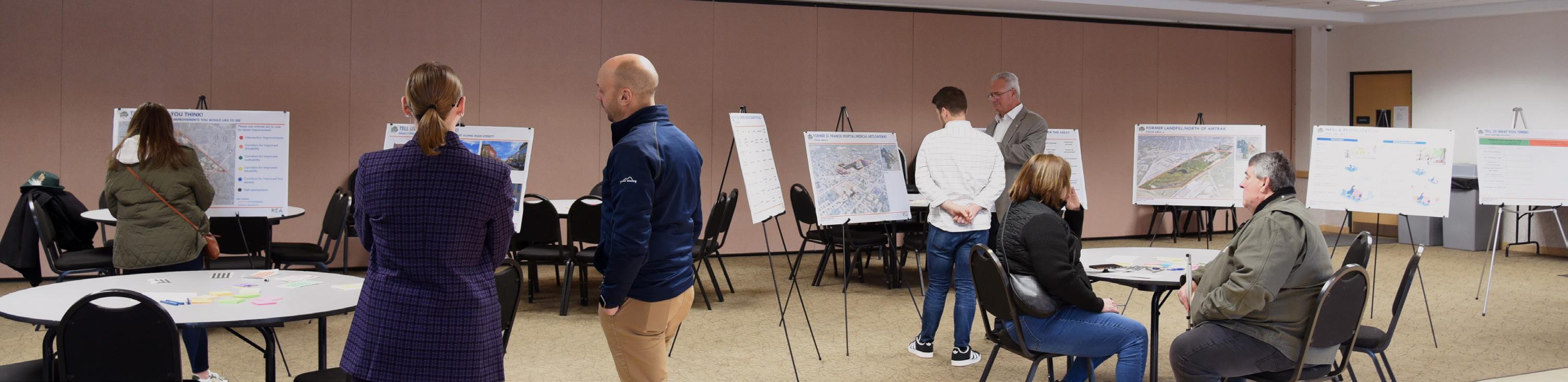

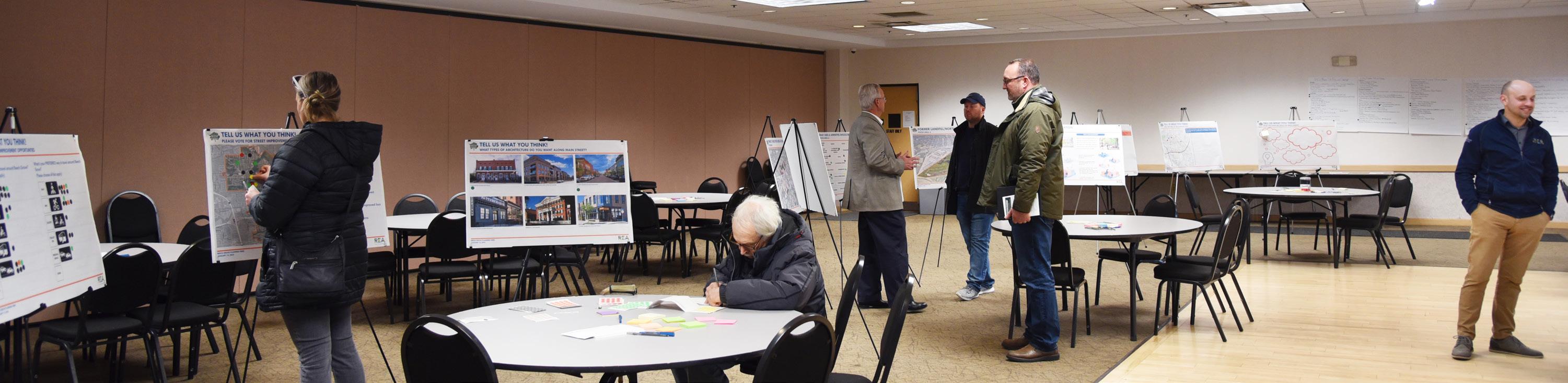
September 14, 2024 on Main Street
Beech Grove Fall Fest is a vibrant yearly celebration featuring food, rides, and fun. At this community event, residents had the opportunity to share their favorite things about the City of Beech Grove and what they wish it had. This included an interactive analysis of the strengths, challenges, opportunities, and barriers to success, in addition to an board to identify precise locations of interest.

September 27, 2024 at Holy Name of Jesus Church
At this event, attendees interacted with a series of boards involving the strengths and weaknesses of Beech Grove, and the priorities of its residents. Participants expressed big ideas for the city, from railroad tours to a public pool. Participants additionally expressed that their top priorities for the city were improvements to Main Street and the development of vacant lots.

At public events, participants were asked to fill out a short demographic survey. The survey identified generic information such as age and sex as well as economic indicators such as income and educational attainment.
January 13, 2025 at Hornet Park Community Center 4:00 PM – 6:00 PM
Responses: 15
The results from the demographic survey were as follows:
• Almost all respondents lived in Beech Grove (87%).
• Most respondents either worked in Beech Grove (47%) or were retired and no longer worked (33%). 22% worked outside of Beech Grove.
• Respondents were almost evenly split between male (47%) and female (53%).
• Nearly all respondents identified as White/Caucasian (93%).
• All respondents were homeowners (100%).
• Most respondents were part of the 45-64 age group (47%), with minorities in the 25-44 (20%) and 65-74 groups (20%).
• Most respondents had bachelor’s degrees (53%), with some having their master’s (13%), some having an associate’s/technical degree (13%), some having attended some college (7%), and some having a GED/High School Diploma as their highest educational attainment (13%).
• Most respondents made over $100k (33%), some made between $25k and $50k (27%), some made between $50k and $75k (20%), and some opted not to say (20%).
• Almost none of the respondents had a child under 18 in their household (87%).
City of Beech Grove Consolidated Economic Development & Redevelopment Plan
1. Do you live in Beech Grove? Yes No
2. Do you work in Beech Grove? Yes No, I am employed outside of Beech Grove No, I am unemployed No, I am retired
3.What is your sex?
Female
Male
Prefer not to answer
4.What is your race? (check all that apply) White/Caucasian Black/African American Asian or Pacific Islander
Indigenous/Native American Latinx or Hispanic
Other:____________________
Prefer not to say
5.What is your living arrangement? Homeowner
City of Beech Grove Consolidated Economic Development & Redevelopment Plan
Renter
Other: ______________________
Prefer not to say
6.What is your age?
Under 18 years old
18 to 24 years old
25 to
75 years old and over
Prefer not to say
7.What is your highest level of education?
diploma High School diploma/GED only
Some college, no degree
Associate / technical degree
Bachelor’s degree
Master’s / professional degree
Prefer not to say
8.What is annual income range of your household?
Less than $25,000
$25,000 to $49,999
$50,000 to $74,999
$75,000 to $100,000
More than $100,000
Prefer not to say
9.Are there children under 18 in your household?
Yes No
City of Beech Grove Consolidated Economic Development & Redevelopment Plan
1.Do you live in Beech Grove? Yes No
2.Do you work in Beech Grove? Yes No, am employed outside of Beech Grove No, am unemployed No, am retired
3.What is your sex? Female
Male
Prefer not to answer
4.What is your race? (check all that apply) White/Caucasian
Black/African American
Asian or Pacific Islander
Indigenous/Native American
Latinx or Hispanic
Other:________________________
Prefer not to say
5.What is your living arrangement? Homeowner Renter
City of Beech Grove Consolidated Economic Development & Redevelopment Plan
Other: _______________________ Prefer not to say
6.What is your age?
Under 18 years old
18 to 24 years old
25 to 44 years old
45 to 64 years old
65 to 74 years old
75 years old and over
Prefer not to say
7.What is your highest level of education?
No diploma
High School diploma/GED only
Some college, no degree
Associate / technical degree
Bachelor’s degree
Master’s / professional degree
Prefer not to say
8.What is annual income range of your household?
Less than $25,000
$25,000 to $49,999
$50,000 to $74,999
$75,000 to $100,000
More than $100,000
Prefer not to say
9.Are there children under 18 in your household?
Yes No
Project Website: PlanBeechGrove.com
Responses: 49
The online survey was more in-depth than the participant survey to provide an opportunity for people who were not at the open house to provide more information about their experiences in Beech Grove.
The demographics from the online survey were as follows:
• 90% of respondents live in Beech Grove
• 37% of respondents work in Beech Grove where 41% work outside of Beech Grove, and 12% are retired.
• 14% have lived in Beech Grove for 1-5 years, 20% for 6-10 years, 33% for 11+ years, and 22% have lived in Beech Grove for their entire life.
• 2% of respondents are ages 18-24, 33% are 25-34, 29% are 35-54, 18% are 55-64, and 18% are 65-74.
• The median age in Beech Grove is 36.4 (2023 ACS).
• 53% of respondents are female, where 47% are male.
• Only 12% of respondents are renters, where 74% are homeowners.
• The overall homeownership rate in Beech Grove is 55% (2023 ACS). This means that in this survey, homeowners were overrepresented, and renters were underrepresented.
• Only 29% of respondents have a child living in their household.
• 95% of respondents identify as White/ Caucasian.
• 12% of respondents’ highest educational attainment is a High School Diploma/GED, 22% attended some college, 20% have an associate’s degree, 31% have a bachelor’s degree, and 14% have a master’s degree.
• Only 2% of respondents make less than $25k annually, where 14% make between $25k and $49k, 27% make between $50k and $74k, 10% make between $75k and $99k, and 41% make over $100k.
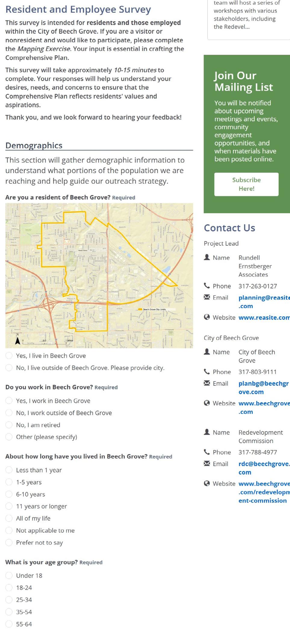
Portion of page 1 of Online Survey
Participants were also asked about their behaviors and experiences:
• 29% of respondents reported grocery stores as a frequently used business in Beech Grove, 71% reported restaurants and cafés, 45% reported retail shops, 35% reported professional services, 20% reported healthcare services, 27% reported entertainment, and 16% reported “other”.
• 27% of respondents travel less than 5 miles to access businesses or services not available in Beech Grove while 47% travel 5-10 miles, 20% travel 10-20 miles, and 6% travel more than 20 miles.
• 45% of respondents reported price as a factor that influences their decision to shop or dine outside of Beech Grove, 86% reported variety of products/services, 53% reported quality, 33% reported customer service, 14% reported proximity to work, and 8% reported “other”.
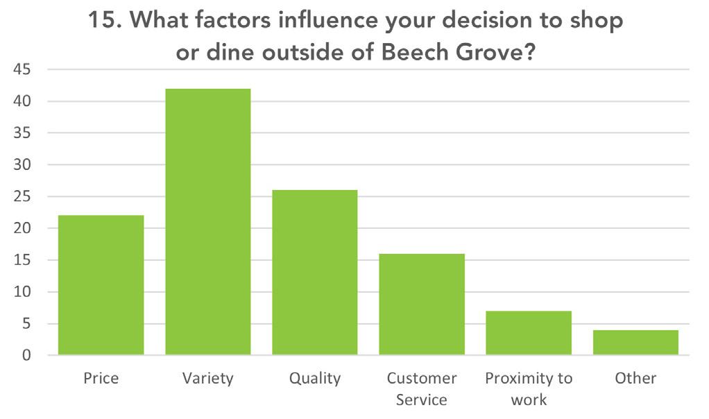
• 16% of respondents rated the overall quality of businesses and services in Beech Grove as excellent, 53% rated it good, 14% rated it fair, and 14% rated it poor.
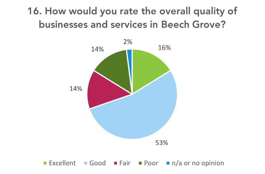
Additionally, participants were asked about employment, workforce, and the economy:
• Only 14% of respondents feel that Beech Grove offers enough employment opportunities in their field.
• SELECT MULTIPLE: 33% of respondents who work outside of Beech Grove do so for better job opportunities, 33% for higher salaries, 31% for career growth, 6% for proximity to home, and 10% for “other” reasons.
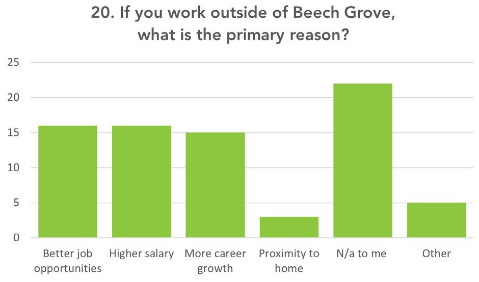
• SELECT MULTIPLE: 50% of respondents would like to see job training programs for career development in Beech Grove, 39% would like adult education courses, 47% would like networking events, 43% would like mentorship opportunities, 43% would like certification programs, and 12% would like “other”.
• SELECT MULTIPLE: 55% of respondents would like to see workshops and seminars as lifelong learning opportunities in Beech Grove, 41% would like continuing education classes, 18% would like online learning programs, 55% would like community learning groups, 57% would like technical skills courses, and 8% would like “other”.
• 31% of respondents indicated interest in local career fairs or industry-specific networking events.
• SELECT MULTIPLE: 37% of respondents prefer to access learning and career development opportunities through in-person classes, 39% prefer online classes,41% prefer hybrid environments, 33% prefer self-paced learning courses, and 37% prefer community workshops.
Opinions about parks and recreation opportunities were also solicited through the survey:
• SELECT MULTIPLE: Of community amenities, 76% use parks most frequently, 69% use trails, 71% use festivals and events, 37% use community centers, 49% use libraries, and 8% use “other” amenities.
• SELECT MULTIPLE: 39% of respondents would like to see more parks or green spaces in Beech Grove, 45% would like expanded trails or bike paths, 61% would like new or enhanced festivals and events, 49% would like additional recreation facilities, 49% would like community gardens or urban farming initiatives, 29% would like expanded youth programming or classes, 29% would like expanded adult programming or classes, 14% would like expanded senior programming or classes, 22% would like more volunteering and community service opportunities, and 14% would like “other” additional amenities or programs.
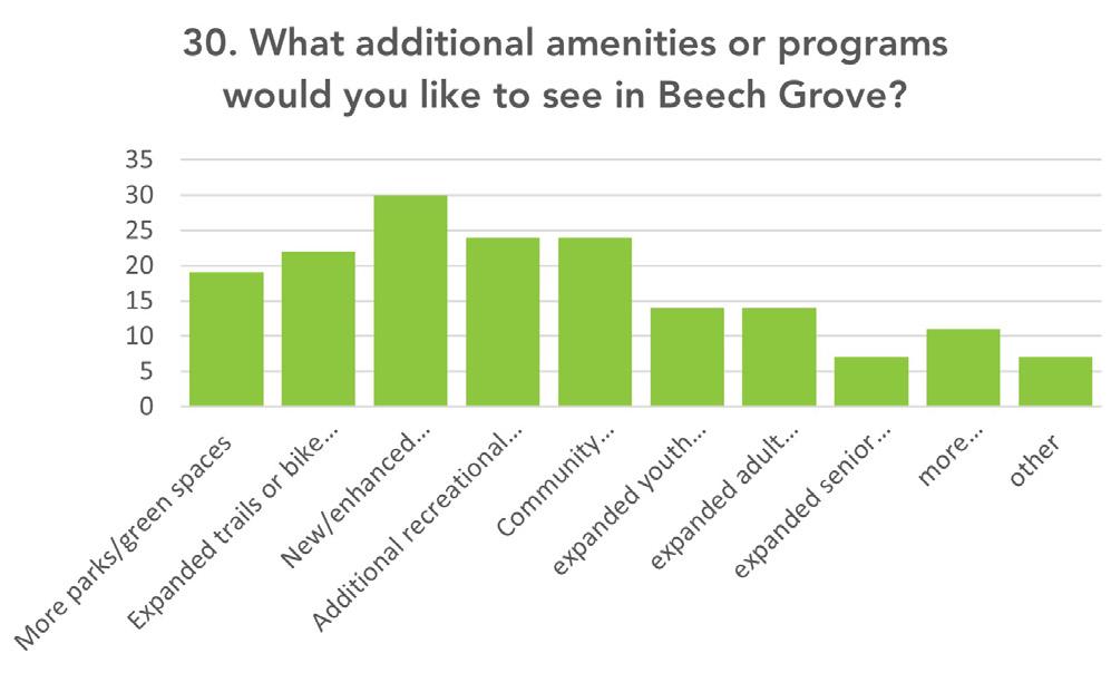
• 67% of respondents reported local festivals and events as “very important” to their sense of community in Beech Grove.
• 60% of respondents feel that Beech Grove’s amenities meet the needs of residents and workers.
• 63% of respondents reported that they do not experience difficulties accessing public buildings, parks, or other community spaces due to mobility issues or other disabilities.
• 67% of respondents feel there are enough opportunities for social interaction and community engagement in Beech Grove.
Quality of Life, quality of place, and community satisfaction were the final topics for the survey:
• 22% of respondents feel “very satisfied” with living or working in Beech Grove, where 35% feel “satisfied”, 24% feel “somewhat satisfied”, 8% feel “neutral”, 4% feel “somewhat dissatisfied”, 2% feel “dissatisfied”, and 4 feel “very dissatisfied”.
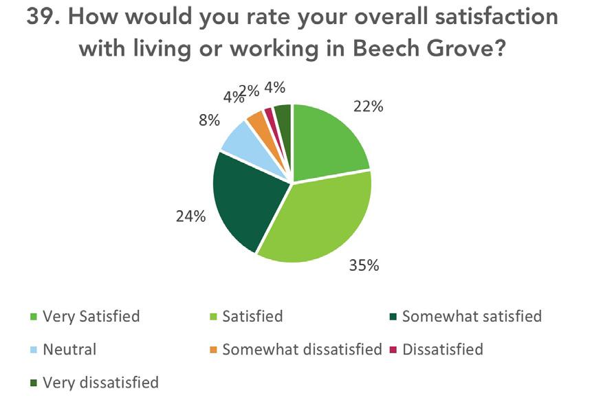
• 27% of respondents describe their experience with cost of living or working Beech Grove as “very affordable”, 27% describe it as “somewhat affordable”, 24% describe it as “neutral”, 20% describe it as “somewhat expensive”, and 2% describe it as “very expensive”.
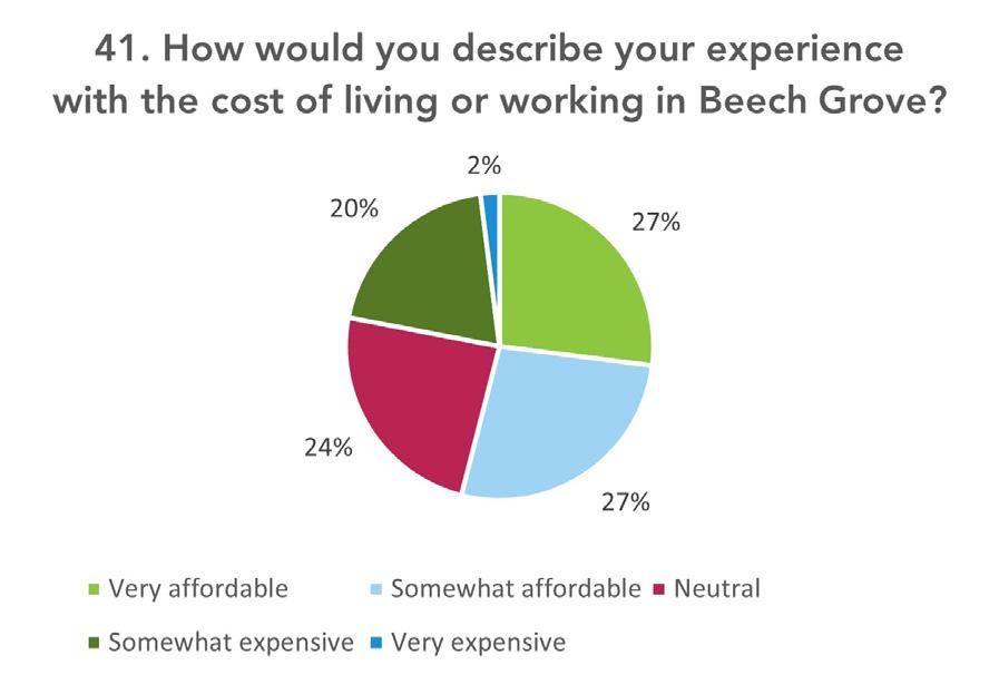
• SELECT MULTIPLE: 51% of respondents identified increased cost of living as a concern about the future of Beech Grove, 22% identified low wages from jobs within Beech Grove, 40% identified housing affordability, 16% identified environmental issues, such as challenges with floodplain areas, 51% identified public safety, 24% identified availability of emergency services (healthcare, EMT, fire, police), and 27% identified “other”.
• Only 34% of respondents agreed that there are sufficient services and programs available for seniors in [their] community, where 59% were unsure.
• SELECT MULTIPLE: 63% of respondents feel downtown should be prioritized for development, while 43% feel parks, trails, and recreational facilities should be prioritized, 27% feel residential neighborhoods should be prioritized, 27% feel schools and educational facilities should be prioritized, 51% feel infrastructure (e.g., utilities, services, roads, internet) should be prioritized, and 10% feel “other” areas should be prioritized.
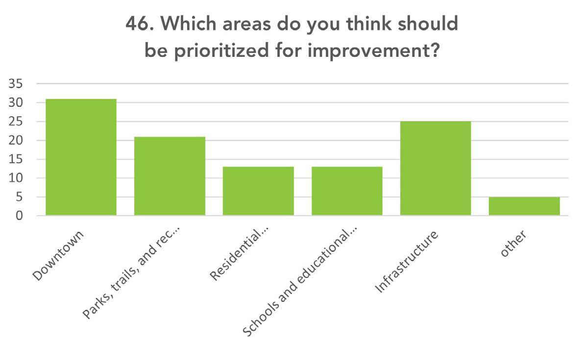
• SELECT MULTIPLE: 71% of respondents report improved amenities as a factor that would make them more likely to recommend Beech Grove as a place to live or work, 22% reported more employment opportunities, 45% reported enhanced community programs, 35% reported better infrastructure, 39% reported lower cost of living, and 16% reported “other” factors.
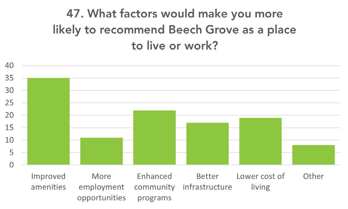
Notable
findings from the mapping exercise are as follows:
Website visitors were invited to place markers on a map of Beech Grove to highlight areas of importance such as notable sites, areas of concern, locations facing challenges, valuable community resources, and areas of opportunity.
Responses: 74
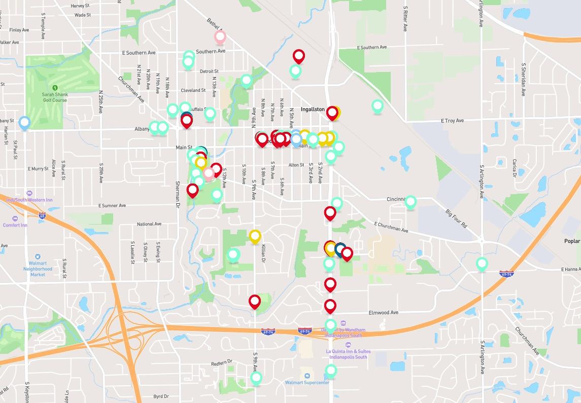
Website visitors were given access to the same interactive boards as the in-person open house during community planning week on a digital format. Respondents shared Beech Grove’s strength and weaknesses, identified priorities, and shared big ideas with the team.
Responses: 7
Comment Summary
Respondents shared their love of Beech Grove as a small community with ample amenities for families. Additionally, respondents expressed a sincere desire for the city to take advantage of its proximity to Indianapolis and to improve the conditions of the rental market.
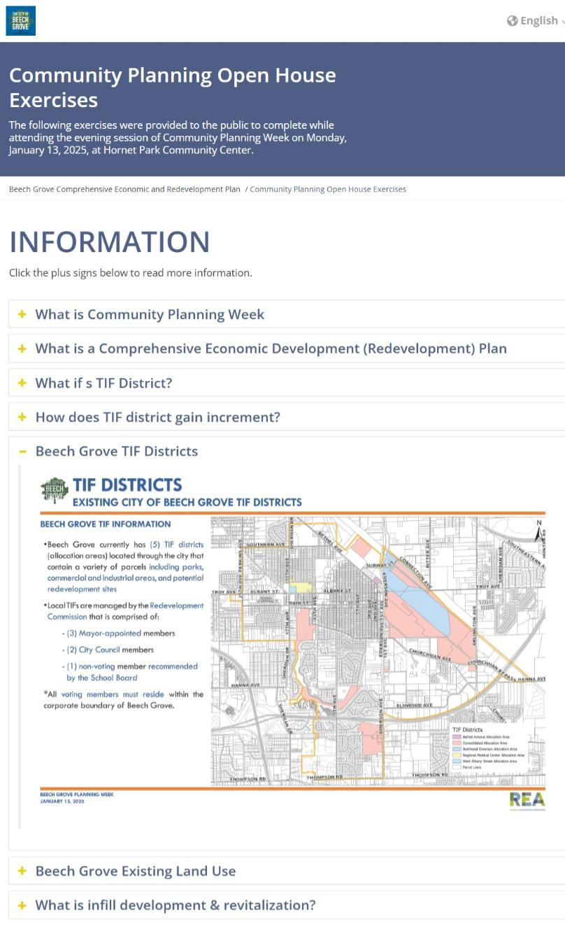
Beech Grove is an excluded city in Marion County. When the City of Indianapolis consolidated with Marion County in 1971, Beech Grove was an existing city in the county and determined it would participate in the consolidated city and county as an excluded city. This status retains Beech Grove’s local control of many aspects of community life including police, elected officials, and local economic development and redevelopment. Beech Grove residents vote for the mayor of Indianapolis as that position, under the consolidated statutes, is the highest elected county official. Planning and zoning functions throughout Marion County are handled by the Metropolitan Development Commission (MDC) and administered by the Indianapolis Department of Metropolitan Development (DMD).





The City of Beech Grove incorporated in 1906, as a company town for Beech Grove Shops, a railroad repair facility of the Cleveland, Cincinnati, Chicago, and St. Louis Railroad (nicknamed the “Big Four”). The community has a rich rail heritage that began with the Big Four and continued with the Amtrack maintenance yard and the numerous jobs that Amtrak provides in the community, approximately 550 currently. Beech Grove grew with two annexations after World War II, with the final one (1967) taking place just before the Unigov legislation which merged Indianapolis with most of the rest of Marion County, preventing future annexation. Residents over time have taken great pride in the Beech Grove Community Schools, which are an independent school district from township school districts, an asset considering Beech Grove sits in four Marion County townships (Perry, Center, Franklin, and Warren). Beech Grove City Schools consists of five facilities (Hornet Park Elementary, South Grove Elementary School, Central Intermediate School, Beech Grove Middle School, and Beech Grove High School). The district also has an early childhood center. Also within the city limits are the Holy Name of Jesus School (Roman Catholic, grades pre-school to 8), built in 1922.
St. Francis Hospital was founded in Beech Grove and served the community from 1914 to 2012.
Beech Grove is a member of the Indianapolis Metropolitan Planning Organization (IMPO), which convenes, informs, plans, and funds with communities in Central Indiana. The primary function of the IMPO is to distribute federal transportation funds. Beech Grove has received funding for trails and roundabouts from these federal funds in recent years.
Beech Grove is also a member of the Central Indiana Regional Development Authority (CIRDA), which works across many communities in the center of Indiana to take advantage of state and federal funding opportunities.

The Central Indiana Regional Transportation Authority (CIRTA), was established in 2004 to expand and improve mass transit in Central Indiana. They offer programs like workforce connect, commuter connect, and county connect that seek to address transportation gaps between communities. Residents and businesses in Beech Grove are eligible to participate in CIRTA programs.



Many communities have other communities that they use as benchmarks for their budgeting, event planning, and other activities. Some are peer communities, generally similar in size and/or growth rate and having similar features, and some are more aspirational, something the community would like to be comparable to. Beech Grove benchmarks itself against Franklin, Speedway, Shelbyville, and Lawrence, all of which are other communities in Central Indiana. Lawrence and Speedway are also excluded cities in Marion County.
Franklin is the county seat of Johnson County, located in Central Indiana directly south of Indianapolis. Franklin is served centrally by US 31 and SR 144 but has convenient access to I-65 from SR 144. Youngs Creek runs through the community south of downtown and connects with Hurricane Creek that is on the east side of the city. Flooding has been a concern in Franklin historically and significant redevelopment of downtown was initiated after a major flood in June 2008 that submerged downtown and the Bluff Acres neighborhood. Franklin is home to Franklin College, a private liberal arts college founded in 1834 located east of downtown with 985 students (12:1 faculty staff ratio). Primary academic programs include: accounting, art, biology, business, chemistry, physics, computing, economics, elementary education, English, exercise science, history, mathematics, journalism, music, neuroscience, philosophy and religious studies, political science, psychology, public relations, sports communication, and theater. Franklin is also the location of the Indiana Masonic Home, which was founded as a living community for orphans and widows in 1916. During the past 20 years the Masonic Home has expanded services and is focused on continuum of care housing for older adults with more than 400 residents currently.
Franklin has a historic downtown and courthouse square. Franklin is a nationally accredited Main Street community, recognized by the National Main Street organization as well as Indiana Main Street.
Speedway is an excluded city in Marion County on the east side of the county. It is home to the Indianapolis Motor Speedway and much of the community’s development is related to the speedway. The community has invested heavily in transportation on 16th Street and Crawfordsville Road in recent years and in redevelopment of their Main Street. Increased focus on a local trail system and connection to regional trail networks like the B&O Trail have been part of their development strategy. Like Beech Grove, Speedway has an independent school district and the core housing is compact. Limited development area is available in Speedway, especially for residential development to increase the diversity of neighborhood choices. Speedway is served by I-465 and I-74 in addition to regionally significant corridors like 16th Street and 30th Street as well as Crawfordsville Road, which becomes US 136 west of I-465. Eagle Creek runs along the southern perimeter of the community and CSX Transportation rail lines run through the community, including along the east side of the speedway.
Speedway has redeveloped their historic Main Street drawing on the rich connection to automotive racing and connecting industrial/research operations facilities with traditional Main Street businesses and the Indianapolis Motor Speedway.
Shelbyville is the county seat of Shelby County. Shelbyville is on the outskirts of the Indianapolis metro area and is less tied to Indianapolis than some of the other peer communities. It is located along I-74 and is northeast of Franklin and connects to Franklin via SR 144. The community is also served by SR 9, a north-south highway that extends through much of the state. The outskirts of Shelbyville are home to the Horseshoe Casino, which located northwest of the community, is owned by Caesar’s Entertainment. The Big Blue River runs through the north side of the community. CSX Transportation and the Central Railroad Company of Central Indiana have rail line that run through the city and have spurs that serve local businesses.
Shelbyville is also a nationally accredited Main Street community.
Lawrence is located in northeast Marion County and is the largest of the excluded cities. Much of the community’s history and identity are connected to the former Fort Benjamin Harrison installation. Fort Harrison went through Base Realignment and Closure in the 1990s and the redevelopment is nearly complete. Fort Harrison State Park is part of the former installation that is not being redeveloped and includes hiking and mountain biking trails, lakes, a walnut tree grove, fishing, picnic sites, a sledding hill, horse stables, and a golf course. The Defense Finance and Accounting Services (DFAS) operations have remained in Lawrence and are a significant employer in the community along with a number of government and military consulting firms. Lawrence is served by Lawrence Township Schools. Major roads serving Lawrence include I-465, US 36/ Pendleton Pike, and 56th Street. CSX Transportation has a rail line through the community. Fall Creek is the most significant body of water in the city and has a trail connecting to local trails and running into downtown Indianapolis. Geist Reservoir is located north of Lawrence on the Marion/ Hamilton/Hancock county lines.
A redevelopment plan for the Amtrak Redevelopment Area focused on returning tax revenue to the city from the site given congressional action that made the site tax exempt. Amtrak was a regional employer and only a small portion of the employees lived in Beech Grove, so there would be little job loss to the community if Amtrak closed, but there was significant revenue loss from the exempt declaration. The 1999 Indiana General Assembly took action in 1999 to allow for Tax Increment Finance (TIF) to be used in excluded cities like Beech Grove and this redevelopment plan set the stage for a TIF allocation area. Recommended projects included infrastructure redevelopment and acquisition and demolition though no sites were identified for acquisition or demolition.
The 2005 Amendment to the South Emerson Redevelopment Plan and Area integrated all Beech Grove Redevelopment Areas and Plans with amended boundaries and added projects including aesthetic improvements on South Emerson and addition of wireless internet infrastructure. The intent of the consolidation was to commit TIF revenue from the original South Emerson Redevelopment Area to projects in other redevelopment areas.
The redevelopment plan encouraged redevelopment of the CSX site (120 acres), Refined Materials/ Exide site (22 acres), Amtrak site (105 acres), and Rock Pile site (6-7 acres) as well as stimulating redevelopment of commercial sites in the Emerson Avenue corridor, Main Street corridor, and on the St. Francis Hospital Campus. The conclusions and recommendations included redeveloping neighborhood infrastructure, discouraging conversion of single-family residences into rental units, industrial redevelopment strategies, and commercial redevelopment strategies.
The study area was defined as Main Street from Emerson to 8th Avenue, a half block north and south of Main Street to the alleyways that back the buildings, plus one block north to Albany Street and one block south to Alton Street on Second Avenue. The study included a significant photo inventory of buildings in the study area. The implementation plan had recommendations for creation of an Economic Improvement District (EID), development of a local façade improvement program, historic preservation designations, establishing design guidelines, a downtown pocket park at Main and Third Avenue, streetscape enhancement (mostly lighting), enhancing downtown transit stops, studying improved trail access to UIndy, Fountain Square, and downtown Indianapolis, the East Gateway Development, a plaza at the Amtrak Visitors Center and Museum, a wayfinding master plan, and creation of a Community Development Corporation.
Goals were established in this 5-year parks and recreation plan to preserve enough open space and natural areas to meet present and future needs, link existing parks through a greenway system including linking to neighborhoods and commercial centers, use sound environmental practices and contribute to a healthy community, establish and maintain partnerships, provide programs that increase inspiration, recreation, health, and quality of life, and provide an attractive park setting. The plan includes a projects list.
10 sites were identified as Brownfields and an additional 22 sites were identified as sites of interest. The sites of interest include gas stations, public works site, Amtrak maintenance facility, the police/fire station, the old street department site, and a funeral home still in operation.
The landfill was opened in 1958 as a burn dump and stopped taking waste in October 1978. The site is approximately 31 acres (varying reports) and has two parcels, the north parcel is owned by the City of Beech Grove and the south parcel owned by Moorehouse Body Shop, Inc. Waste has been leaching into Lick Creek via erosion gullies. There are several areas with exposed trash. A wooden structure must be removed.
Memo was created for the potential acquisition of the landfill site by Denny Excavating. There is a 2 foot clay cap on the landfill, but there have been post closure issues including those noted in the July 2024 IDEM inspection report. Environmentally Restrictive Covenants (ERCs) related to the closure limit future uses of the site. There is a complete history of documents in the memo.
Lick Creek, a tributary of White River, runs through Beech Grove. The creek is surrounded on the north end (within Beech Grove) by trees and is bordered on the west side by Beech Grove Public Schools properties including the middle school and track. The creek runs alongside the western part of Sarah Bolton Park and winds through neighborhoods before I-465. There are several smaller creeks in parts of the community that feed into Lick Creek as well.
Sarah T. Bolton Park is a nearly 32-acre municipal park featuring picnic areas, athletic courts and fields, a dog park, and play equipment with shelters and restrooms. The Franciscan Health Trail is a paved trail that is a recent addition to the park. The park is recognized as a National Wildlife Federation Certified Wildlife Habitat. The park was purchased from the Bolton estate in 1930. Sarah Bolton was a pioneer poet and crusader for women’s rights. She lived at “Beech Bank” from 1871 to 1893.
Hornet Park is adjacent to Beech Grove High School and is roughly 14.5 acres with a picnic area and open lawn. The park is primarily home to the Hornet Park Community Center, which is where the parks office is, as well as a fitness center, meeting rooms, and banquet rooms. The Beech Grove High School tennis courts are available for public use outside scheduled school activities.
Don Challis Park is adjacent to South Grove Elementary School and is a 14acre facility that includes a picnic shelter, play equipment, and a volleyball court in addition to open lawns with mature trees.
Hartman Park is the smallest Beech Grove Park and is located west of Don Challis Park. The park includes five baseball diamonds, restrooms, and a concession building. The park was deeded to the city specifically for use as the home of the Beech Grove Little League.
The first independently organized baseball team in Beech Grove was called the Hillside Team and was made up of mostly members of the Churchman family. Games were played at the southeast corner of Churchman Pike and First Ave (Now Churchman Ave and Emerson Ave, where the Family Dollar/ Dollar Store is) from around 1890 through 1912. The Beech Grove Reds organized in 1919, using a stadium located on the southwest corner of First Ave and Main St, where the Beech Grove Police Station currently stands. Beech Grove Little League first chartered with Little League Baseball in 1954, under the name Southside ‘Y’ Little League. BGLL played on several different fields in the first decade and has been playing primarily at Hartman Park since 1971. (Beech Grove Little League)
The Emerson Avenue Landfill was opened in 1958 as a burn dump and stopped taking waste in October 1978. The site is approximately 31 acres (varying reports) and has two parcels. Waste has been leaching into Lick Creek via erosion gullies and there are several areas with exposed trash.
Five sites in Beech Grove are in the Indiana Brownfield Program:
• Ammons Service Station (102 Main)
• CSX Transportation (2700 S Emerson)
• Emerson Avenue Landfill (2600 S Emerson)
• Beech Grove Rock Pile (SW corner of Bellefontaine and Garstang)
• Rail Yard (Albany and Emerson)
Many other sites in Beech Grove may be Brownfields that are not participating in the Indiana Brownfields Program.
Like many communities, Beech Grove was built with a grid street pattern that was relatively compact and curvilinear streets with larger lots were developed outside of that core area later. Lick Creek runs through the community and divides it east-west in terms of the historic street pattern. The most compact area of Beech Grove is centered on Main Street from Bethel Avenue to Churchman Avenue. Aside from Main Street, much of this area is small lot single-family residential. Most of the newer development outside the primary commercial and industrial areas is also single-family residential, with a different street pattern and character than the compact core.
The commercial core of Main Street extends from 8th Avenue to the west and Emerson Avenue to the east. Most of the buildings on Main Street are typically one- and two-story without a single architectural style or theme. Main Street is one lane in each direction with parallel parking on the south side of the street and angle parking on the north side of the street. There are sidewalks on both sides of the street and ADA curb ramps at crossings. Anecdotally most of the space is occupied, but not all of the ground floor is retail or serving foot traffic. Upper stories, where they exist are used for apartments or storage. There is a Main Street organization that serves the businesses in the Main Street corridor called Next Stop Beech Grove. The organization hosts events including First Friday Art Walks, Music on Main, and Main Street Express Events. Next Stop Beech Grove is an Indiana Main Street affiliate community organization.
Emerson Avenue is the eastern primary corridor for the City of Beech Grove and extends both north and south of the city serving the region. It is the corridor that intersects with I-465 on the south side of the community. South of Churchman Avenue to the south side of the city limits is primarily a regional-scale commercial corridor with shopping centers and chain/ franchise businesses including drivethru businesses. It is a primarily autooriented corridor. There are sidewalks along the corridor.
Amtrak’s principal heavy maintenance facility is in Beech Grove, southeast of Indianapolis. Here, more than 550 employees rebuild and overhaul Amtrak’s bilevel Superliner and single-level Viewliner, Surfliner, and Horizon car fleets. Beech Grove shop forces conduct preventive maintenance on P32 and P42 locomotives for use across the Amtrak system. The site also acts as a storage location for some Siemens Charger locomotive components. Amtrak performs heavy overhaul, periodic maintenance, repainting, and other upkeep on bi-level Coach, Sleeping, and Food Service cars, single-level Coach, Dining, and Baggage cars, and locomotives at this facility. The Beech Grove Shops supply components to other Amtrak facilities, including couplers, overhauled air conditioners, overhauled air brake valves, and over 230 other types of components unavailable elsewhere. (Amtrak)
St. Francis Hospital and Health Centers was founded in 1914 in Beech Grove. St. Francis Hospital was a 12-story facility with nearly 900,000 square feet of patient rooms, labs and operating rooms. The hospital closed in 2012 and was demolished in 2017 after a new use could not be found for the building. The parking garage and professional office building remain on the site. The former St. Francis property includes a trail head on Albany memorializing the history of the property with signage including salvaged bricks, limestone, and cornices from the former hospital.
Marsh grocery store was located at the corner of 18th Avenue and Troy Avenue. After the Marsh chain ended operations in 2017 after expanding through Indiana in the decades prior. The Beech Grove location opened in 1958 and was not part of the transaction that transferred several former Marsh locations to Kroger. Safeway opened in the former Marsh building in summer 2017 and operated until 2018 and the building was demolished in 2022. In early 2025 the site was purchased by a nonprofit that plans to open a plumbing apprenticeship center on the site.
Our Lady of Grace was founded by the Benedictine sisters of Ferdinand, Indiana at the prompting of Paul C. Schulte, Archbishop of Indianapolis. It was the Archbishop’s desire to have a home for the elderly in his diocese. The new community found their home on 30 acres of swampland in Beech Grove. Attached to the monastery building is the Benedict Inn Retreat & Conference Center (formerly Our Lady of Grace Academy). After the academy closed in 1978 and in its place a new ministry began. The Inn hosted thousands of people annually for programs focusing on women, families and spiritual growth. The Sisters of Our Lady of Grace are rebuilding on the same property to right size their facility. The sisters will continue to live in the current monastery until construction is complete. The monastery and the former Benedict Inn Retreat & Conference Center will be taken down once the new monastery is completed and the sisters have moved into their new home.
Beech Grove City Schools is the primary public school district serving the City of Beech Grove. The district has an early childhood education program at Hornet Park Early Childhood Center for those younger than kindergarten age. Kindergarten and first grade are at Hornet Park Elementary, grades two through four are at South Grove Elementary, and grades five and six are at Central Intermediate School. Beech Grove Middle School has seventh and eighth grade, and Beech Grove High School has the traditional grades nine through 12. In the 2024-2025 school year the district had an enrollment of 2,790 from pre-K to 12th grade. The pre-K program enrollment was 69, K-6 enrollment 1,367, Middle School 440, and High School 914.
School choice, both public and non-public, has an impact on Beech Grove Schools. The district has 1,612 resident enrolled students. While 247 students transfer out to other public schools and 189 transfer out to non-public schools, there are 1,135 students who don’t live in Beech Grove enrolled in the school district. (Fall 2024-2025 school year, Indiana Department of Education)
Each of the township school districts adjacent and Indianapolis Public Schools have more students who transfer out of their districts than transfer in.
Following the federal accountability ratings for the schools for 2022-2023, the overall rating for each school is:
• High School – approaches expectations
• Middle School - approaches expectations
• Central Intermediate School –approaches expectations
• South Grove Elementary School – does not meet expectations
• Hornet Park Elementary School – does not meet expectations
The Beech Grove City School district is currently working on a strategic plan for the district and expects completing in Summer 2025.
Holy Name Catholic School has a total enrollment of 297 in grades pre-K through eight. Of those, 269 are in grades K-8.
Primary transportation corridors in the community are Emerson Avenue (north-south) and Churchman Avenue (east-west). Emerson Avenue has a 5-6 lane cross section through the community and has traffic signals at Troy, Main, Churchman, Hornet, and Elmwood. Churchman Avenue has a 2-4 lane cross section with a traffic signal at Emerson. Roundabout have been installed at Churchman Avenue and Arlington Avenue as well as Troy and 17th Avenue. I-465 is the southern border of Beech Grove east of Emerson.
Roads are classified using a Functional Classification System (FCS) which has interstates at the highest level, followed by arterials, collectors, and local streets. Arterials may be classified as principal or minor, while collectors may be classified as major or minor. In Beech Grove, Emerson Avenue is a principal arterial where 15th, Albany, Churchman, and Thompson Road are minor arterials.
IndyGo route 16 serves Beech Grove via Troy Avenue. Route 16 connects to the IndyGo Red Line Bus Rapid Transit at Shelby and Troy. IndyGo route 56 serves Emerson Avenue to Thompson Road with a loop on Albany Street and Main Street between Emerson and 13th Avenue. Route 13 serve 17th/ Sherman from Raymond to Troy with a loop at Main Street before connecting to Keystone. Each of these routes (16, 13, and 56) have 60-minute frequencies, meaning a bus arrives at a stop once an hour.
Citizens Energy Group provides water and wastewater treatment for residents in the City of Beech Grove. The city collects the wastewater fees through the Beech Grove Sewage Works. Sewage flow is metered by eight flow meters located throughout Beech Grove. The city manages payments for sewer, stormwater, and solid waste (trash) through Beech Grove sewage works. The city participates in MS4 (municipal separate storm sewer) programs.
Beech Grove has invested $40 million in a new police station and gun range at the gateway to Main Street at Emerson Avenue.
Beech Grove has outsourced fire protection to the Indianapolis Fire Department, which expanded the capacity and quality of service in Beech Grove.
Three ambulances serve Beech Grove.
People in the community live alone or organize into households. Some households are families, while others are not. Income is both individual and household or family based and different size households and families have different income and housing needs at different stages in their lives.
The population of Beech Grove is 15,082. There are considerably more women in Beech Grove than men, with 56 percent of the population being female. The median age in the city is 36.4 years, with 27 percent of the population being under age 18 and less than 16 percent over age 65.
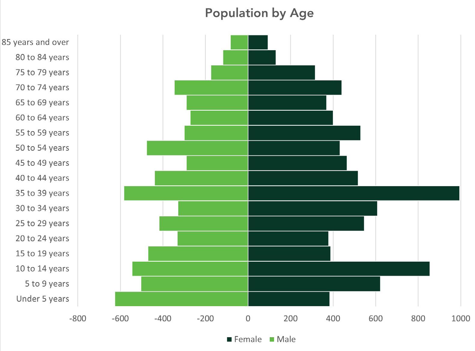
There are 6,483 households in Beech Grove and the average household size is 2.3 people. Less than 30 percent of households have a person under 18 living in them, the same is true for households with a person over age 65. More than 40 percent of households are people living alone, more than 15 percent over age 65.
There are 3,301 families in Beech Grove and the city has an average family size of 3.3 people.
The median household income (2023 inflation adjusted dollars) is $49,452 in Beech Grove. The median family income is $67,842.
The 2023 Federal Poverty Level for a single person was $14,580. The amount increases in small increments for additional people in the household, up to $30,000 for a four-person household. In Beech Grove 1,529 people live below the Federal Poverty Level. The highest levels of poverty are for people over age 60. Among people over age 25, the highest poverty rate is for people who do not have a high school diploma or higher education.
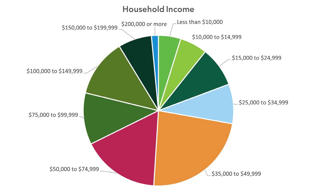
Housing is an essential element of what makes a community. Without appropriate places for people to live, most communities are unable to retain existing residents, attract new residents, and in turn attract commercial and industrial development. Housing is now widely considered a component of economic development. There are 6,983 housing units in Beech Grove.
Housing in Beech Grove, whether owner-occupied or rental housing, was generally built before 2000. Owner occupied housing was primarily built in the 1940s through 1970s, with more than 65 percent of housing being built in that period. Apartments/rental units are newer than much of the owneroccupied housing, but still more than 25 years old. Most of the rental housing was built in the 1960s through 1990s, with nearly half being built in the 1960s and 1970s.
There are 6,483 occupied housing units in Beech Grove. Sixty percent of them are single-family detached homes and an additional 15 percent are larger apartment buildings with 10 or more units. Nearly 11 percent are single-family attached homes, or townhouses. Not surprisingly, 95 percent of owneroccupied homes are single-family detached units. More than a quarter of renter occupied homes are in buildings with 10 or more units. Nearly threequarters of the occupied housing in Beech Grove has two or three bedrooms. The average household size is 2.3 people.
A healthy vacancy rate for housing is generally considered to be in the 5-8 percent range, which allows enough inventory for people who are looking for housing to have options in the community. There are 500 vacant housing units in Beech Grove, mostly single-family detached homes and apartment building units. The homeowner vacancy rate is less than one percent, and the rental vacancy rate is 3.3 percent. Overall, with 500 vacant units, the vacancy rate is 7.2 percent. This is within the healthy range.
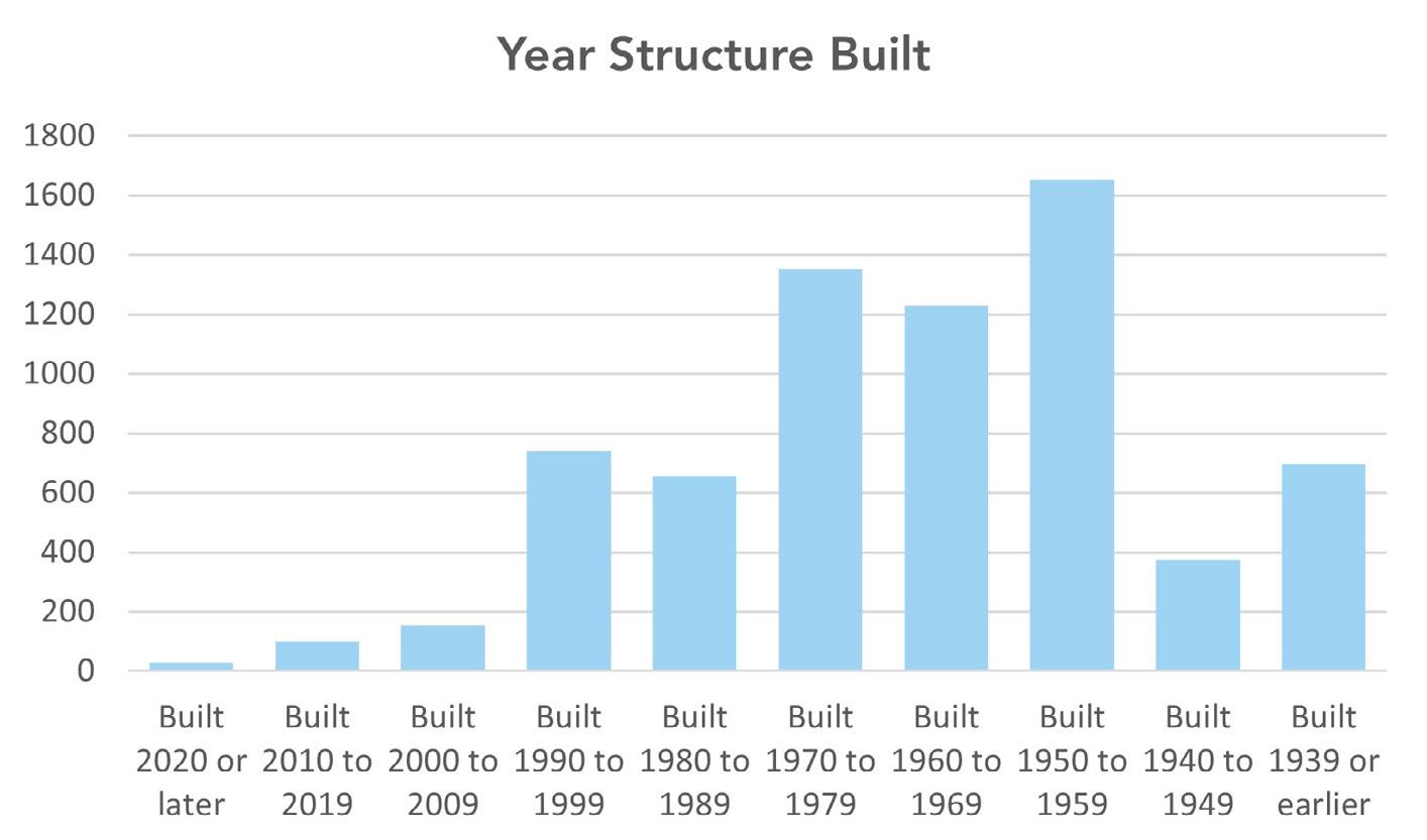
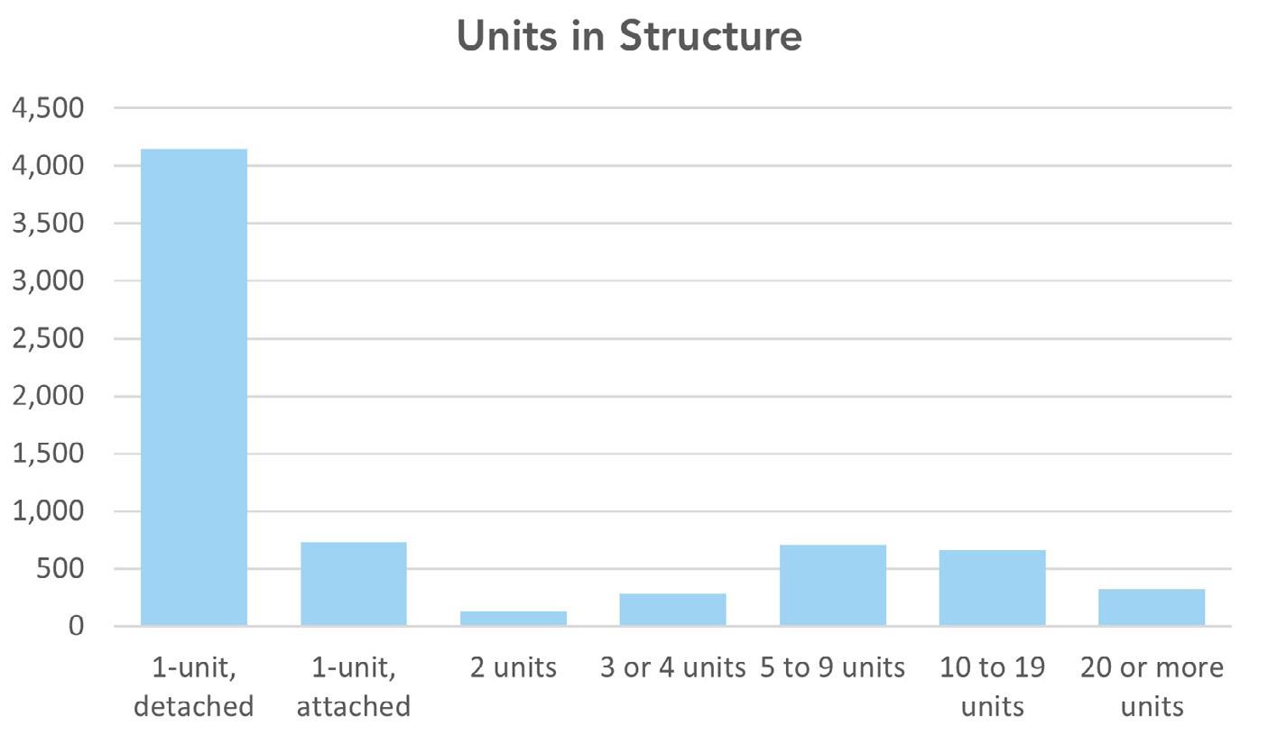
Slightly more than half of the housing in Beech Grove is owner-occupied. Married-couple families are most likely to own, with 79 percent of married couples owning their homes. Non-family households like single people or unrelated people living together are most likely to rent, with 64 percent of those households renting.
More than half of Beech Grove householders moved into their home between 2010 and 2020. Forty-six percent of renters moved in between 2018 and 2020, while most homeowners moved in between 2020 and 2017. Some may have been moving from another location in Beech Grove and in the community longer than in their current home.
Three quarters of owner-occupied homes in Beech Grove have a value between $100,000 and $300,000, with more than half valued between $100,000 and $200,000. Approximately 73 percent of owner-occupied homes have a mortgage. The median monthly ownership cost is $1,155 for units with a mortgage. Without a mortgage the median monthly cost of ownership is $491.
Affordability is defined as a household spending less than 30 percent of their gross household income on housing costs. Those spending more than 30 percent are considered “cost burdened.” Similarly, those spending more than 45 percent of their household income on housing costs combined with transportation costs are burdened.
According to the Center for Neighborhood Technology Housing + Transportation Cost Index, households in Beech Grove spend 18% of household income on housing and 21% on transportation, for a combined 40% on housing and transportation.
Roughly 20 percent of homeowners with a mortgage are spending more than 30 percent of their gross household income on housing costs, meaning they are cost burdened. Fourteen percent are spending more than 35 percent of their income on housing. A little more than five percent of owners without a mortgage are cost burdened.
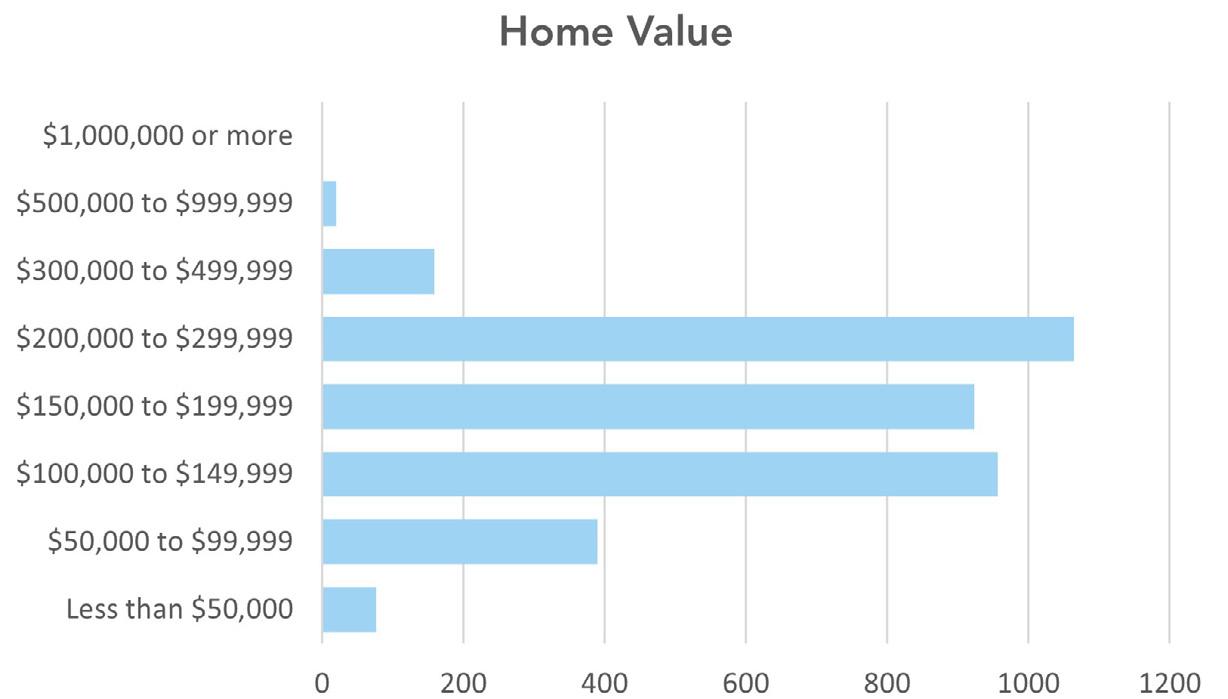
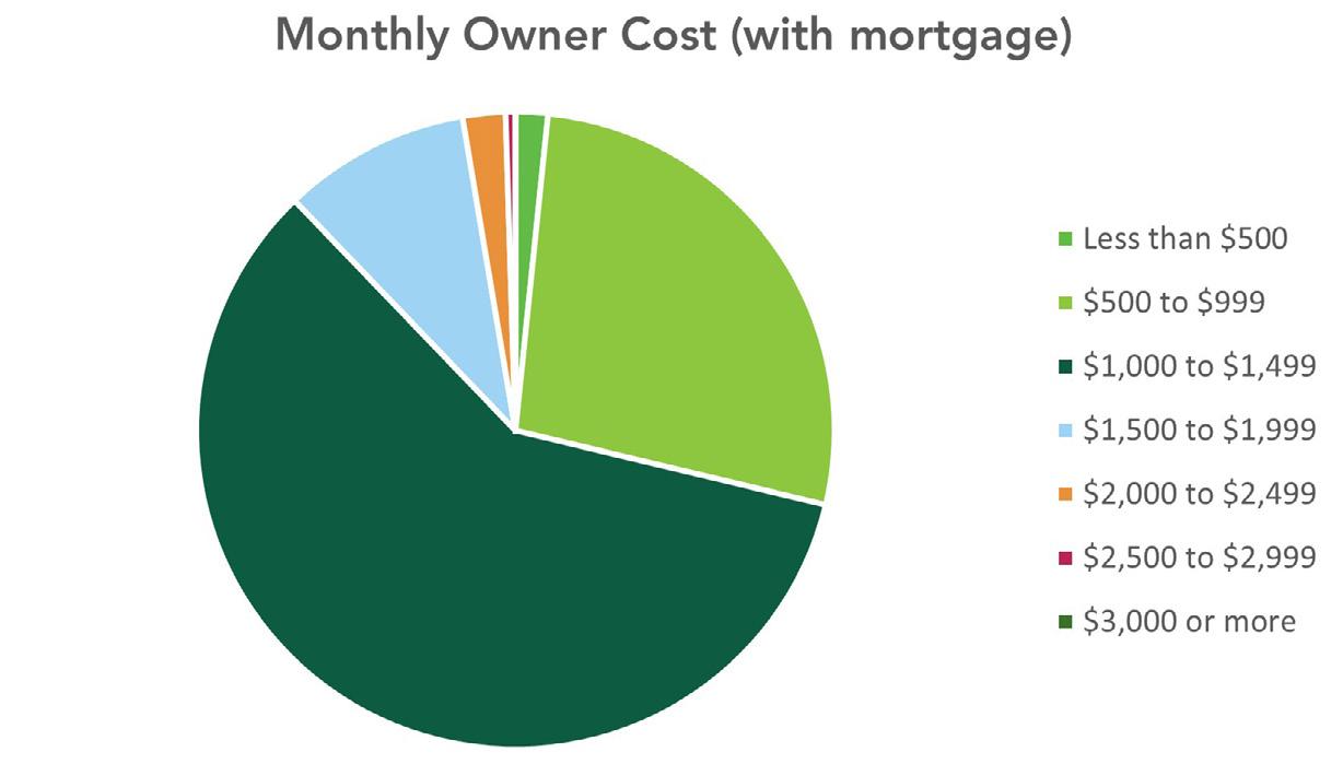
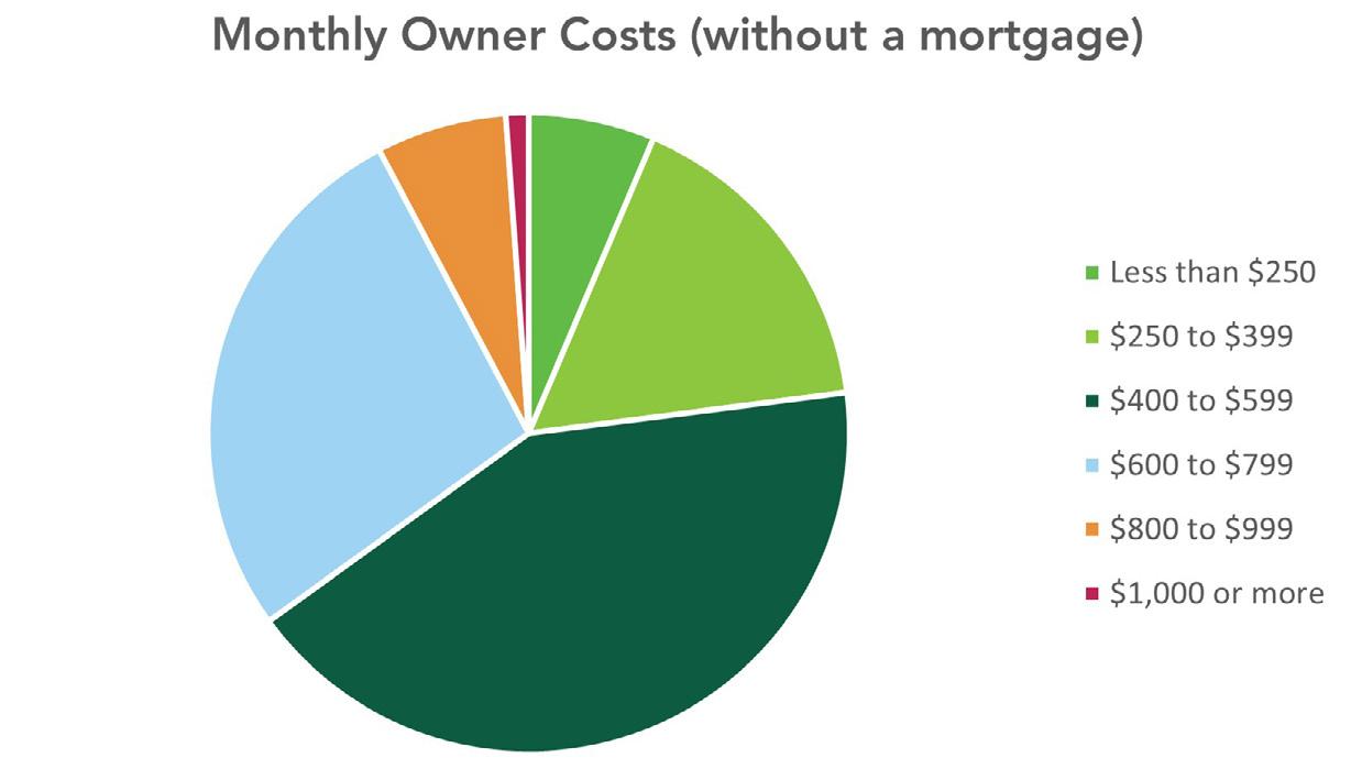
The median gross rent in Beech Grove is $931 per month. Nearly 88 percent of renters pay $500 to $1,500 per month. Nearly 60 percent of renters spend more than 30 percent of their gross household income on rent, with 35 percent spending more than 35 percent of income.
Fair Market Rent (FMR) is set by the federal government for areas. The FMR by number of bedrooms is used to set the minimum and maximum rents that can be charged in public housing authority programs. The minimum is 90% of the FMR and the maximum is 110% of FMR. In Beech Grove, the small area FMR for 2025 is in the table below.
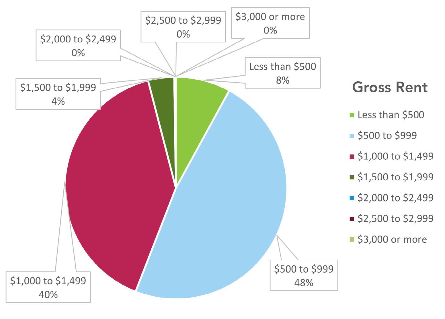
The economy has several facets: the work force and labor force, wages, and key employers are important to the city’s functioning.
Work force is the people who work in the community, regardless of where they live. Labor force, sometimes called resident labor force, is the people who live in the city who work, regardless of where they work. There is a group of people who both live and work in the community and they are considered both part of the local work force and resident labor force. These commuting patterns affect the transportation networks, but also the timing of community events to best serve residents and understanding who is in the community during traditional first shift hours and who local businesses are serving based on hours of operation.
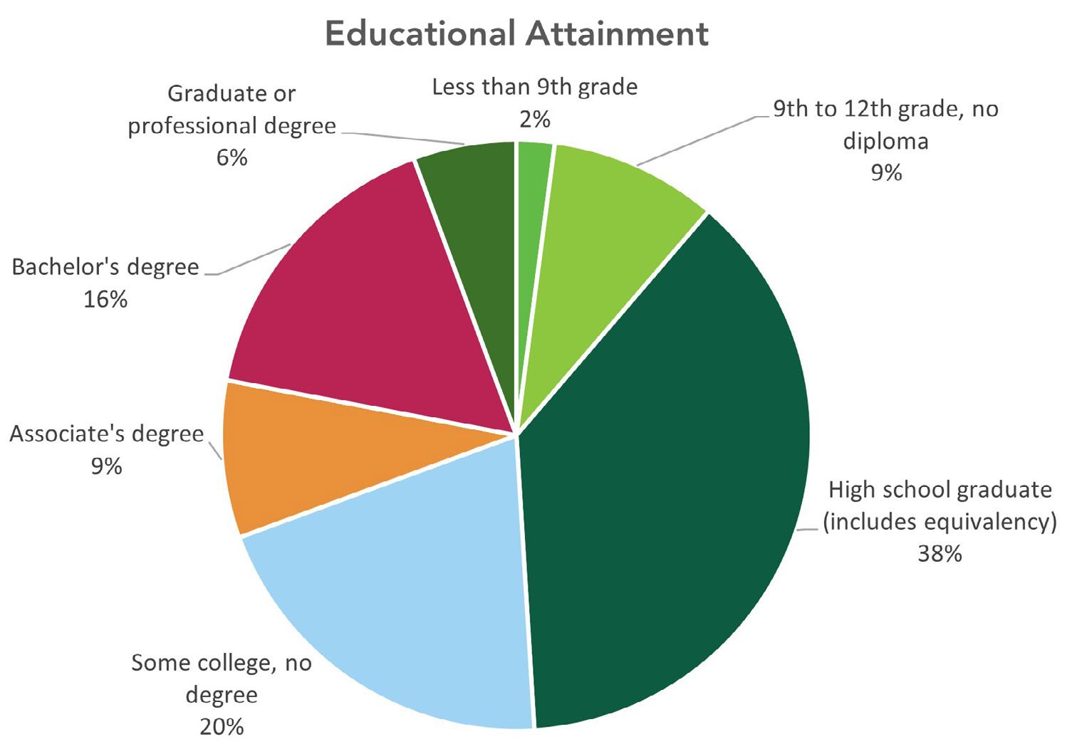
Educational attainment considers the highest level of education completed for adults over age 25. It is an important indicator because it is related to both the wages of employees (generally) and the types of jobs that may be attracted to the community given the existing resident labor force, or potentially available workers.
Skilled trades are generally higher wage occupations and often don’t require formal education beyond high school. Some require certificates or completion of an apprenticeship that does not result in a degree. The highest level of education completed is one metric, that needs to be considered in context of industry, occupation, and wages.
In Beech Grove 35 percent of householders have a high school diploma as their highest level of education. Nearly 23 percent of householders have at least a bachelor’s degrees. Homeowners are more likely to have a bachelor’s degree or higher, while renters tend to have a high school diploma or equivalency. For all adults over age 25, 22 percent have a bachelor’s degree or higher. There are not significant differences in educational attainment by gender in the city.
People living in Beech Grove who are over age 25 and have earnings make the most (2023 inflation adjusted dollars) with a bachelor’s degree at $70,151. High School graduate earnings average $41,033.
The industry and occupation in which people work are often closely connected. It makes sense that if someone works in the retail industry their occupation will be sales. However, there are also people in the retail industry who work in management occupations. Across manufacturing there can be management, science professionals, graphic designers, salespeople, office operations people, and production and transportation staff. The chart below shows the industry and occupation for residents of Beech Grove who are civilian workers over age 16. The largest industry for Beech Grove residents is education, health care, and social assistance, followed by retail trade.
Source: ACS 5-year estimates 2019-2023
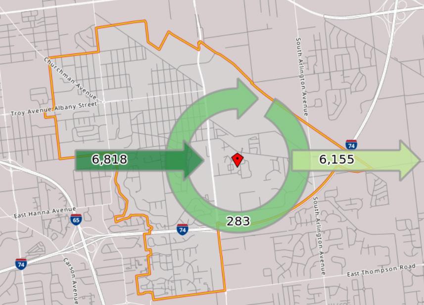
Earnings vary by occupation. The median earnings (2023 inflation adjusted dollars) across all occupations for Beech Grove residents is $48,347. This ranges from a high of $64,774 in management, business, science, and art occupations to $41,213 for sales and office occupations.
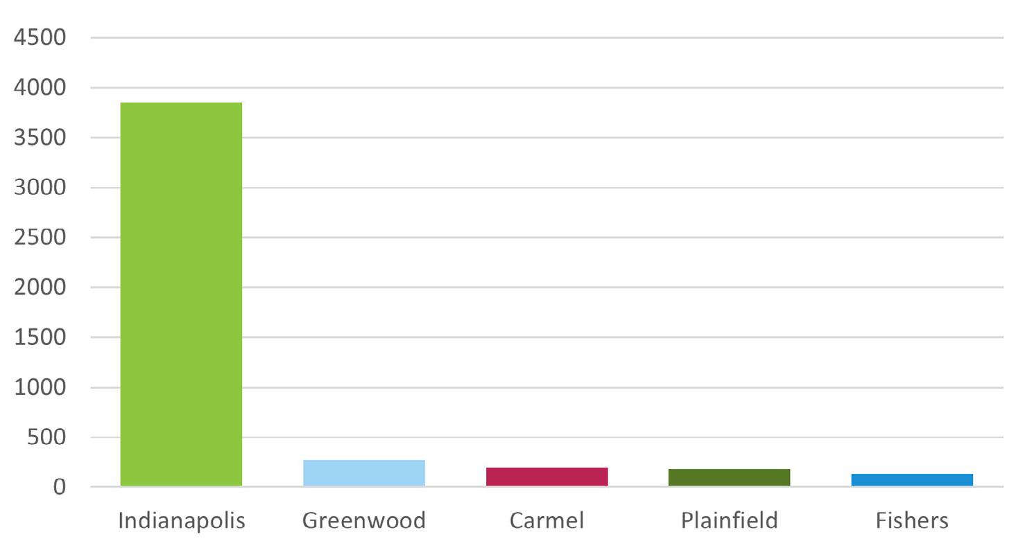
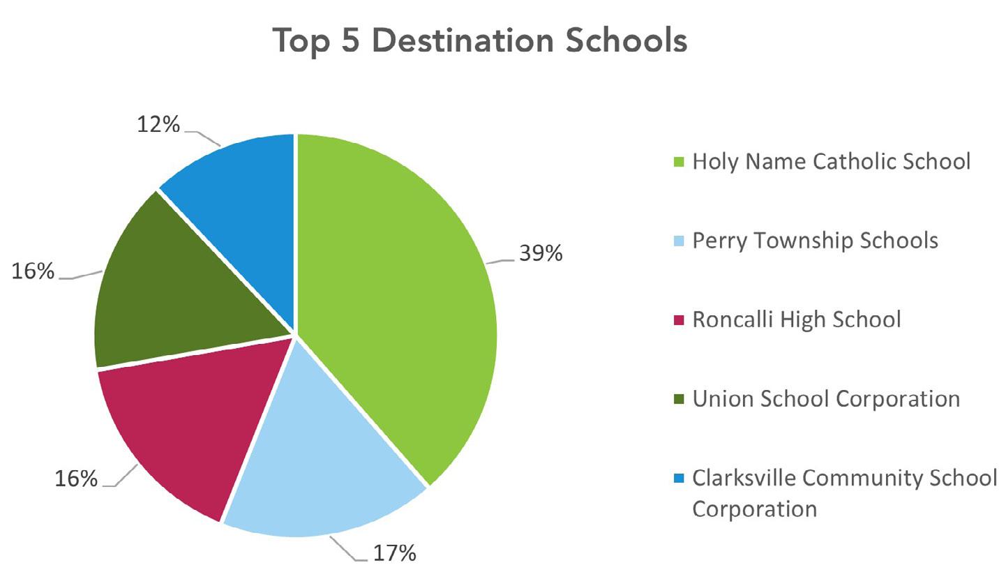
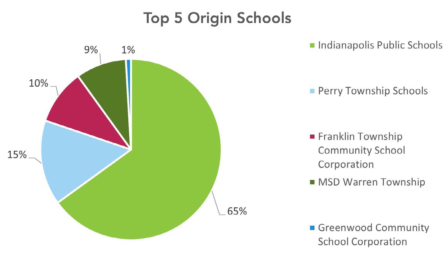
From 2024 Indiana Code: “that part of a redevelopment project area to which an allocation provision of a declaratory resolution…refers for the purposes of distribution and allocation of property taxes”.
A Board of Zoning Appeals is a body appointed by municipal entities whose primary goal is to hold public hearings and make decisions on variances of zoning ordinances, special exceptions, and appeals of administrative decisions.
A Designated Outdoor Refreshment Area is district wherein open alcoholic beverages can be carried and consumed. Beverages must have been purchased from a participating member. A DORA may be established my a local unit of government.
The main goals of business retention are to provide assistance with issues that could force a company to fail, close, or relocate to another community.
The main goal of business expansion is to help existing businesses grow.
A business rentention and expansion program includes intentional efforts to build relationships with business leaders on a one-on-one basis to understand their concerns, needs, and plans for the future.
Disposable Income is the amount of money an individual or household has after taxes and other mandatory expenses are deducted. Disposable income may help indicate the amount of money residents can be expected to spend in the local economy on businesses, leisure, and more.
A cottage court is a type of middledensity housing characterized by clusters of smaller single-family homes oriented around a shared green space or plaza. Cottage courts may be desirable for young families looking for a starter home, residents who desire a close-knit community, or those who prefer views of green space over roads and cars.
Co-working spaces facilitate the social components of work in an increasingly digital world. At a coworking space, workers can work remotely in shared space with other remote workers, or groups of workers may congregate to collaborate on projects. Co-working spaces are a valuable social amenity for a digitized workforce.
An Economic Development Commission is a municipal\ entity whose mission is to promote economic development within a specific geographical area. In Indiana, a local EDC may utilize eminent domain to acquire land, make improvements to land and buildings, enter agreements with developers, make loans or bonds, and more.
From 2024 Indiana Code: “An area which is within the corporate limits of a city, town, or county which has become undesirable for, or impossible of, normal development and occupancy because of a lack of development, cessation of growth, deterioration of improvements or character of occupancy, age, obsolescence, substandard buildings, or other factors which have impaired values or prevent a normal development of property or use of property” (IC 6-1.1-12.1-1).
Gateways mark an important point of entry or egress of a destination, district, or community. They may assist in wayfinding or accentuate the importance of a location through large, recognizable imagery or text.
The Indiana Department of Environmental Management is a state-level agency responsible for implementing federal and state regulations to protect human health and the environment while allowing the environmentally sound operations of agricultural, commercial, and governmental activities vital to a prosperous economy.
The Indiana Department of Local Government Finance is a state-level agency responsible for ensuring property tax assessment and local government budgeting are carried out in accordance with Indiana law.
Indianapolis Metropolitan Development Commission (MDC)
The Indianapolis Department of Public Works (DPW) is a city-county entity which maintains roads, stormwater, fleet, and residential services for the City of Indianapolis and Marion County, as well as engaging in planning, design, and construction of right-of-way infrastructure.
Infill development is the process of developing vacant or under-utilized parcels within existing urban areas that are already largely developed. Most communities have significant vacant land within their city limits, which, for various reasons, has been passed over in the normal course of urbanization
A local income tax is a special income tax imposed by a local or regional entity on a local group of residents. Local income taxes are usually imposed to pay for unique local needs like school improvements, infrastructure upgrades, or economic development projects.
A makerspace is a collaborative workspace where individuals may gather to create, invent, and use a variety of shared materials and tools. Makerspaces are valuable places for STEM and art-based activities, education, and youth engagement.
The Opinion of Probable Cost is a preliminary estimate used in project management to formulate a budget or scope for a project.
A Memorandum of Understanding is a non-binding document that expresses shared intentions between parties.
Right-of-Way refers to the land owned and maintained by differing entities, and the boundaries that defend those entities’ property rights. For example, the space between residential parcels on opposite sides of a street is usually the city or town’s right-of-way and describes the space where a city or town has the right to develop and maintain road and utility infrastructure.
An overlay district is a secondary zoning district, limited to specific geographics areas, that adds requirements for development in addition to the primary zoning distirct. In the Indianapolis and Marion County Zoning Ordinance they are established in Chapter 742, Article II.
Personal property includes any asset that is movable and not fixed to one location. Personal property can include furniture, vehicles, electronics, stocks, collectibles, and more.
Real property includes the land and permanent structures on a lot as well as the ownership rights coming with it.
ROI measures the amount of expected return on a particular investment, relative to the investment’s cost. ROI evaluates the efficiency or profitability of an investment (Investopedia). For example, a town may evaluate the ROI of a new business park in the form of the estimated tax revenue and income gained.
TIF is a financial tool used by local governments to fund economic development. Through TIF, local governments are allowed to use revenue generated by a particular development to pay the cost of the development. When a development is constructed, improved infrastructure and amenities generally raise the assessed value of a particular property or group of properties. This increase is known as the “tax increment”. If this development is part of a TIF district, then the tax increment can be used to pay off the initial cost of development.
A Redevelopment Commission is a municipal entity whose mission is to promote strategic redevelopment of land in a specific geographical area. In Indiana, a local RDC may (1) investigate areas needing redevelopment (2) combat causes of redevelopment need (3) promote repurposing of land (4) make findings and reports (5) acquire land and (6) replan areas needing redevelopment.
Wayfinding refers to how infrastructure is employed to assist drivers, bikers, and pedestrians as they navigate their environment. It may include signage, waypoints, print maps, lines and arrows, or digital wayfinding tools.
THIS PAGE IS INTENTIONALLY BLANK

$5,245,917
THIS DOCUMENT IS FOR INTERNAL MANAGEMENT USE ONLY. ACTUAL RESULTS MAY VARY AND THE DIFFERENCES MAY BE MATERIAL. THIS INFORMATION IS FROM JEFF PETERS OF PETERS FRANKLIN LTD.
$54,864