
San Diego County

CommunityWildfireProtectionPlans (CWPP)areblueprintsfor preparednessattheneighborhood level.Theyorganizeacommunity’s effortstoprotectitselfagainstwildfire, andempowercitizenstomoveina cohesive,commondirection.
Amongthekeygoalsof theSanDiegoCounty CWPP,whichwasdevelopedcollaborativelyby citizens,andfederal,stateandlocalmanagement agencies,areto:
● Alignwiththelocalfireagency’scohesive pre-firestrategy,whichincludeseducating homeownersandbuildingunderstandingof wildlandfire,ensuringdefensiblespace clearingandstructurehardening, safeguardingcommunitiesthroughfuels treatment,andprotectingevacuation corridors.
● Identifyandprioritize areasforhazardous fuelreductiontreatment.
● Recommendthetypesandmethodsof treatmentthatwillprotectthecommunity.
● Recommendmeasurestoreducethe ignitabilityofstructuresthroughoutthearea addressedbytheplan.
Note:TheCWPPisnottobeconstruedasindicative ofproject“activity”asdefinedunderthe “CommunityGuidetotheCaliforniaEnvironmental QualityAct,ChapterThree,ProjectsSubjectto CEQA.”Anyactualprojectactivitiesundertaken thatmeetthisdefinitionofprojectactivityandare undertakenbytheCWPPparticipantsoragencies listedshallmeetwithlocal,state,andfederal environmentalcompliancerequirements.
TheResourceConservationDistrictofGreaterSanDiegoCountyproduced thisreportinpartnershipwiththe FireSafe CouncilofSanDiegoCounty whichiscomprisedofa15-memberboardofdirectorsconsistingofleading representativesfromfederal, state,andlocalagenciesandstakeholders throughoutSanDiegoCounty.InaccordancewithfederallawandU.S. DepartmentofAgriculturepolicy,thisinstitutionisprohibitedfrom discriminationonthebasisofrace,color,nationalorigin,sex,age,or disability.

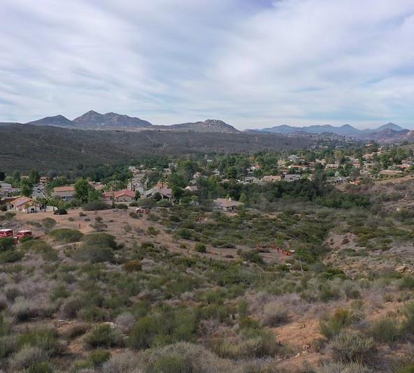
EachcommunityinSanDiegoCountyhasauniquehistoryandidentity.Belowisa descriptionofwhatsetsthisareaapart,includingitslandscape,preparedness,and firefightingresources.
SanDiegoCounty
SanDiegoCountycoversroughly4,500square miles,spanningcoastalcities,inlandvalleys, mountains,anddesertregions.Thecountyishome toabroadrangeofvegetationcommunities includingcoastalsagescrub,chaparral,oak woodland,montaneconifer,grasslands,sparse desertscrub,andmore.Wildfiresinthecountyare drivenbyfuelpatterns,extendeddrought,and seasonalwindevents(notablystrongoffshoredry windsthatcandriverapidfirespreadininlandand foothillareas).Thisplanisregionalinnature, coveringtheentiretyofSanDiegoCounty.This regionalCWPPincorporatesandcomplements localCWPPsandwildfirepreparednessplans developedbyindividualcommunitiesand jurisdictions.
SanDiegoCountyfacesavarietyofchallengesthat increasewildfirerisk.Thisincludesurbanand suburbandevelopmentadjacenttonatural vegetationintheWildland-UrbanInterface, evacuationvulnerabilities,drought,climate change,andintroducedinvasivepests.SanDiego County’sMulti-JurisdictionalHazardMitigation
PlanidentifieshazardsmostsignificanttoSan Diego,withwildfireandclimatechangebothbeing extremelyprobableandwitha highoverall significance.Althoughourregionfacesmany challengesandrisks,strongcollaborationis presentbetweenfireagencies,community-based organizations,FirewiseCommunitiesandFireSafe Councils,localutilities,andotherpartners,working togetheronlocallyledsolutions.These collaborationsallowforregionalcohesionwhen facingwildfirechallenges.
SanDiegoCountyisoneofNorthAmerica’smost biologicallydiverseregions,shapedbyits Mediterraneanclimate,variedtopography,and widerangeofhabitatsincludingcoastal,chaparral, forest,riparian,anddesertecosystems.This biodiversitysupportsnumerousthreatened, endangered,andendemicspecieswhilealso contributingtowildfireresilience.Diversenative ecosystemscaninfluencefuelpatterns,landscape heterogeneity,andfirebehavior,supporting ecologicalhealthandlong-termresilience
Population: Roughly3.3Million
SanDiegoCountyexhibitsabroadtopographic rangefromsealeveltoalpineelevationsabove 6,000feetintheLagunaandCuyamacaranges. Vegetationtypesarestronglyinfluencedby elevationandmoisturegradients:
● Coastalandlowland:coastalsagescrub, mixedchaparral,grasslands.
● Coastalcanyons:riparianwetlands, uplandcoastalsagescrubandchaparral.
● Foothillsandslopes:mixedchaparral.
● Higherelevations:oakwoodlandsand mixedconiferstands.
● Deserteast:sparsescrubandgrassland withlowercontiguouscanopy.
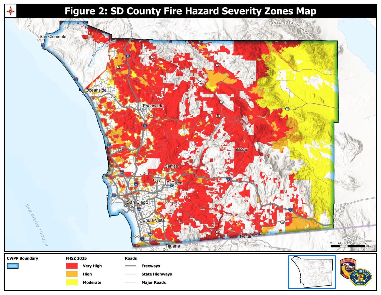
TheWildland-UrbanInterface(WUI)inSanDiego Countyisnotasinglelandscapetypebutamosaic ofdistinctcommunitycontexts,eachwithdifferent riskprofiles.CALFIREclassifiesthemajorityofthe county'sinland,foothill,andcanyon-rim communitieswithinHighandVeryHighFireHazard SeverityZones(FHSZ),includingcommunitiessuch asRamona,Alpine,Potrero,Lakeside,Julian, Descanso,andPineValley,whichfaceelevated exposureduetochaparralfuelloads,steepterrain, andlimitedingressandegress.
WithintheCityofSanDiego,auniqueurbanembeddedWUIexistsacrossthecanyonsystem, includingcanyonsincommunitieslikeTierrasanta, Kensington,andScrippsRanch,whereresidential neighborhoodsdirectlyabutopenspacewith limitedsetbacksandhighembertransport potential.Theseareaspresentastructure-to-
structurespreadriskdistinctfromtheruralWUI, requiringtargetedember-resistantconstruction andcanyonedgedefensiblespacestrategies alongsidetraditionalfuelmanagement.
AcrossallWUIcontexts,riskisshapedbythe intersectionofvegetationtype,complex topography,andseasonaloffshorewindevents. WUIriskisfurthercompoundedbystructure density,limitedevacuationroutes,and vulnerabilitytoemberignition.Mitigationrequires integratedapplicationofdefensiblespace(PRC 4291),ignition-resistantconstruction(CBCChapter 7A),strategicvegetationmanagement,and coordinatedevacuationplanning.
Forthousandsofyears,theKumeyaayused beneficialfireasanintentionallandmanagement practicetomaintainecosystemhealthandbalance. Thesecarefullytimed,low-intensityfiresreduced hazardousfuelaccumulation,promoted biodiversity,encouragedthegrowthofculturally significantplantssuchasoaktreesandnativefood resources,improvedhabitatconditionsforwildlife, andhelpedprotectcommunitiesfromcatastrophic wildfire.Frequentculturalburningcreatedresilient landscapepatternsacrossgrasslands,coastalsage scrub,chaparralmargins,andoakwoodlands, resultinginhealthierecosystemsthatwerebetter adaptedtofire.
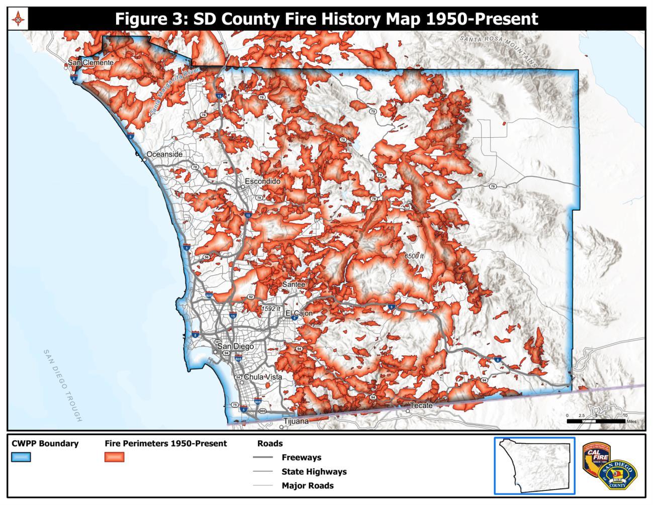
Inmoderntimes,SanDiegoCountyhas experiencednumerouslargefires,manywithrapid spreadunderoffshorewindanddrought conditions.Historicalperimetersshowa concentrationoflargefiresintheinlandand foothillchaparralzones;coastalurbanfireshave historicallybeendrivenbyemberexposureand structure-to-structurespread.
Notablefiresincludethe1970LagunaFire,2003 CedarFire,2007WitchCreek,Guejito,andHarris Fires,andthe2014Cocos,Poinsettia,andBernardo Fires.
SeeAppendixB,Figure3,forSanDiegoCounty’s FireHistoryorvisittheinteractive FireHistoryMap here
SanDiegoCountyhasmanyvaluableassetsthat couldbethreatenedbywildfire:
● TransportationInfrastructure:Essentialfor evacuationandfirstresponderaccess, majorhighways,roads,bridges,andpublic transitfacilitiesarefoundinSanDiego County.
● Airports&Airfields:Servingashubsfor emergencyresponse,travel,andmore, SanDiegoCountyhasanInternational Airportandregionalairportssuchas MontgomeryGibbsandBrownField,which providebasesforfirefightingaircraftand emergencyoperations.
● WaterSupply&Dams:Waterinfrastructure iscriticalnotjustforresidents,butalsofor firefightingneedsandforthelong-term resilienceofSanDiegoCounty.
● Utilities&Services:Utilitiesprovidethe backboneforresidentialsafetyand emergencyoperations.SanDiegoGasand Electricinfrastructureincludes transmissionlines,substations,and distributionnetworks.Criticalfacilities includefireandpolicestations,emergency operationscenters,andhospitals.Public SafetyPowerShutoffsareconductedto protectthepubliconhighfireriskdays.
● Watersheds:SanDiegoCountyhas11 westwarddrainingwatershedswhich includeunique,sensitivehabitat.
● Recreationalopportunities:SanDiego CountyhasmanyCity,County,State,and Regionalparkswhichofferopportunities forthepublictoenjoynatureandare hometomanyuniqueandspecialstatus speciesandnaturalresources.
● MilitaryBases:Thereare6majormilitary installationsofficiallyoperatingintheSan Diegometropolitanarea,alongsidemore thanadozensmallerspecializedsupport facilitiesandreservecentersacrossthe county.
● Agriculture:SanDiegoCountyishometo thelargestnumberofsmallfarmsaswell asthelargestnumberoforganicproducers outofanycountyintheUnitedStates. Agricultureisvitaltoourregion’s economy,environmentalsustainability, andculture.
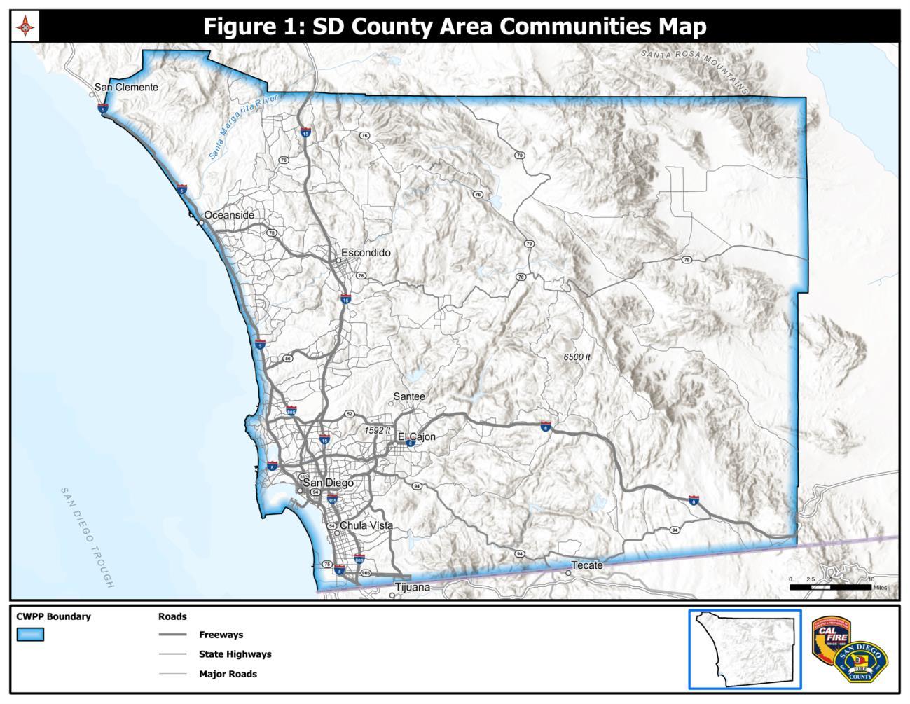
Usingtechnologyandlocalexpertise,thesponsors ofthisCWPPhaveincludedaseriesofmaps depictingthesiteandsituationofSanDiegoCounty (AppendixB).Thefollowingmapsarevisualaids for agencies,stakeholders,andcommunitymembers toassessandmakerecommendations.
1. AreaCommunitiesMap
2. FireHazardSeveritymap
3. FireHistory
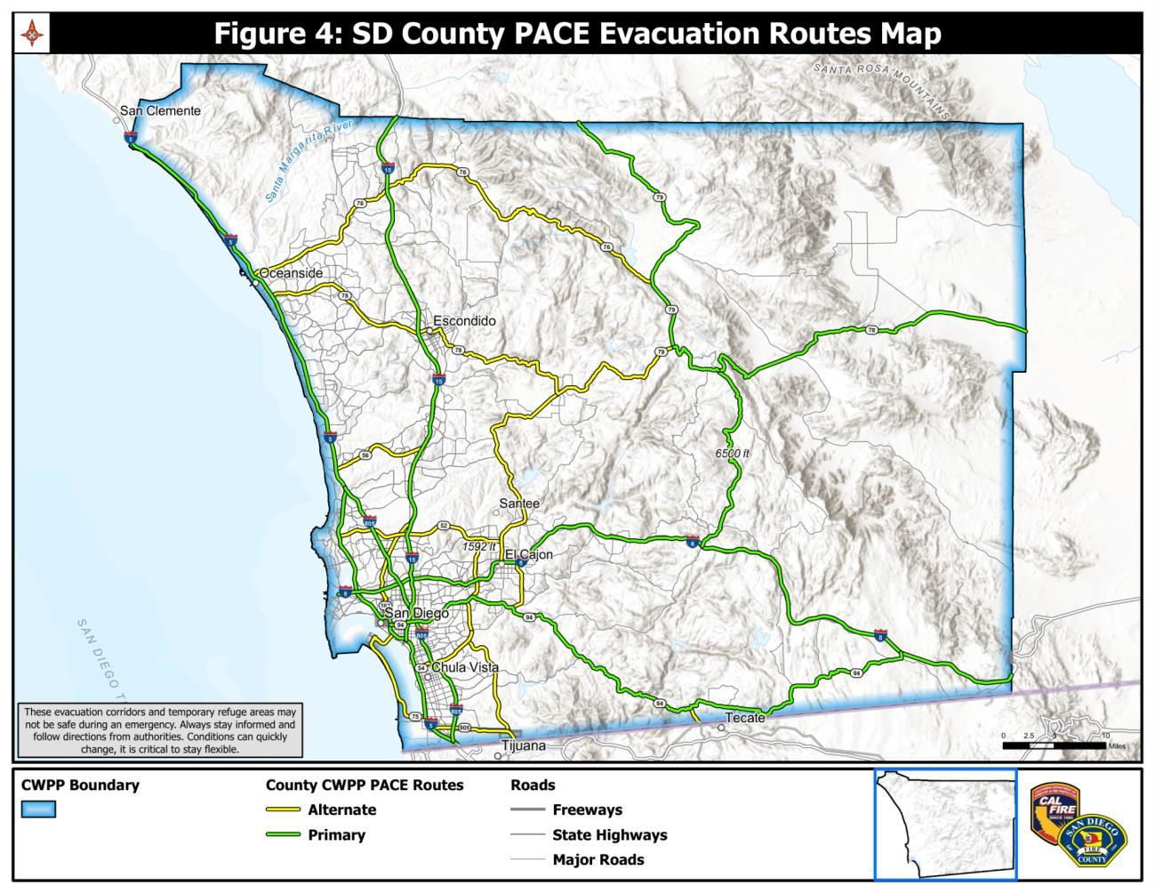
4. EvacuationMap

AninteractivemapwascreatedbyCWPPpartners toassistcommunitymembersandagencieswith interactingwiththeCWPP.
ThemapisavailablehereandthroughtheQRCode: https://tinyurl.com/sd-cwpp
MajorfireprotectionentitiesoperatinginSanDiego Countyinclude(butarenotlimitedto):
● CALFIRE/SanDiegoCountyFire ProtectionDistrict(countywideservices andplanningforCSAareasandCounty Fireoperations).
● Localfiredepartmentsanddistricts(e.g., CityofSanDiegoFire-Rescue,Escondido, ChulaVista,Oceanside,Carlsbad,BonitaSunnyside,NorthCounty,etc).
● UnitedStatesForestServiceCleveland NationalForest
● UnitedStatesWildlandFireService (formallyBureauofLandManagement)
● CaliforniaDepartmentofFish&Wildlife
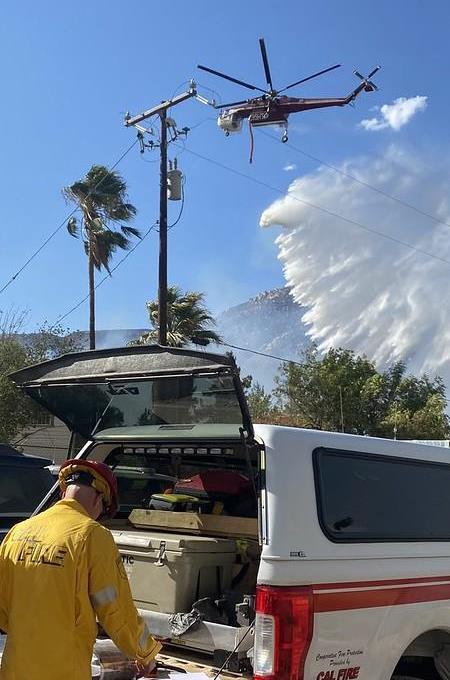
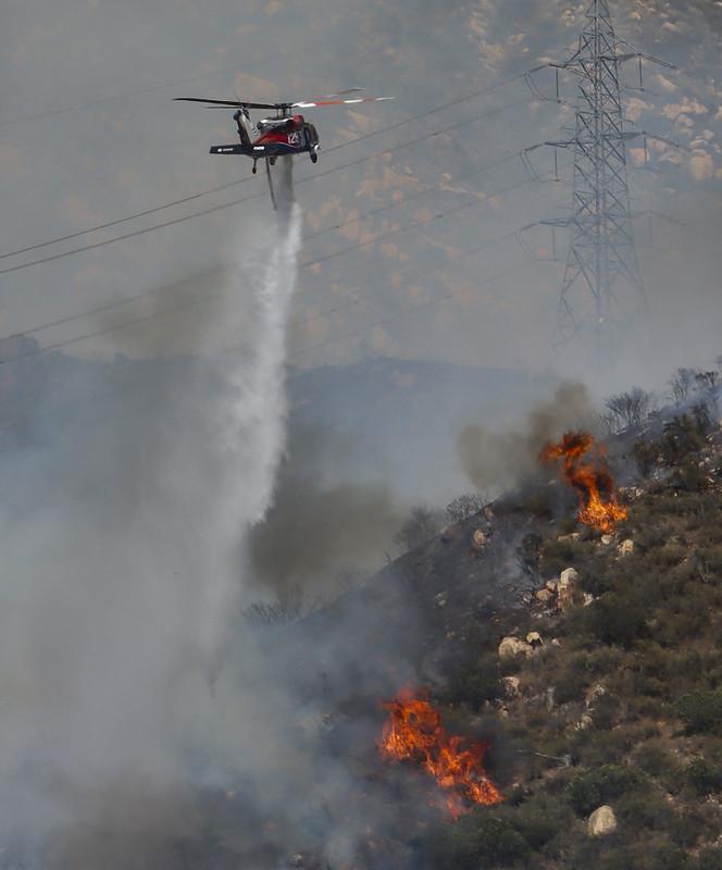
● Equipmentincludes,butisnotlimitedto engines,watertenders,TypeI/IIIengines, dozers,handcrews,aerialresources(fixed wingandhelicoptersupportcoordinated throughstate/federalaviationpools).
● Airoperationsfacilitiesandcontracted aerialfirefightingresourcesareutilized throughoutpeakfireseason.
Strongworkingrelationshipsarecriticalinensuringthatourcommunitiesare well-prepared.Thissectiondescribesthosekeypartnersandtheirrolesin developingthisCWPP.
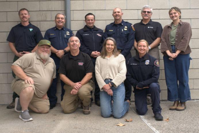
TheResourceConservationDistrictofGreaterSanDiegoCountyinpartnershipwiththeFireSafeCouncilofSan DiegoCountyledthedevelopmentofthisCommunityWildfireProtectionPlan(CWPP),withguidanceand supportfromseveralpartners.Thedevelopmentteamincludesrepresentativesfromtheagenciesdescribedin thetablebelow.
ResourceConservationDistrictofGreaterSan DiegoCountyinpartnershipwiththeFireSafe CouncilofSanDiegoCounty
LeadregionalCWPPcoordination,drafting, stakeholderoutreach,andintegrationof communityprioritiesintocountywidewildfire resiliencestrategies.Facilitatecollaboration betweenlocalcommunities,agencies,and partnerorganizationswhilesupportinglongtermcapacitybuilding.
LocalFireSafeCouncils
CALFIRE/SanDiegoCountyFireProtection District
Representcommunity-levelwildfireconcerns andpriorities,supportlocalCWPPintegration, andserveastrustedconnectorsbetween residentsandregionalpartners.
Providecountywidefirepreventionleadership, assistwithdevelopmentofCWPPanddecision making,communityriskassessment, developmentofcommunityprotection priorities,andestablishmentoffuelstreatment projectareasandmethods.LeadUnitFirePlan implementationandcoordinatewildfire
SanDiegoCityFireRescue
USForestService
BureauofLandManagementandUnitedStates WildlandFireService
CaliforniaDepartmentofFish&Wildlife
SanDiegoCanyonlands
Communitymembers
mitigationstrategiesintheStateResponsibility Areas.
ProvideinputandexpertiseonCityofSanDiego lands,fire,vegetation,andfiresafeconcepts, includingriskandvalueassessment. ParticipationinCWPPReviewCommitteeand integrationofCityofSanDiegoCWPPsintothe regionalplan.
Inputandexpertiseonfederallands,fire,and vegetationmanagement.ParticipationinCWPP ReviewCommittee.
Providingtechnicalinputandexpertiseon federallands,fire,andvegetationmanagement. ParticipationinCWPPReviewCommittee.
Providingtechnicalinputandexpertiseonstate lands,fire,andvegetationmanagement. ParticipationinCWPPReviewCommittee.
Providedinputandexpertiseonwildfireand habitatresilienceinitiatives,community education,andFireSafeCouncilsupport.
ACWPPsurveywascirculatedduringthe draftingprocesstocapturecommunity-level feedbackandprioritiestoinformtheplan.46 surveyresponseswerecapturedwithdefensible spacebeingthehighestpriorityforthe respondents.

Understandingwildfireriskisakeybuildingblockinpreventingthelossofpropertyand life.Thissectiondiscusseseffortstobuildawareness,startingwiththeindividual.
I.PRIORITIES
● Increaseopportunitiesforcapacitybuilding andeducationforlocalFireSafeCouncils andFirewiseCommunities.
● Increaseparticipationandunderstanding ofreal-timeevacuationandalerttools.
● Conductconsistentmessagingonwildfire risk,defensiblespace,homehardening, andevacuationpreparedness.
● Prioritizeoutreachtosociallyvulnerable communities,includingseniors,lowincomehouseholds,non-Englishspeaking residents,students,andDACcommunities.
II.COMPLETED&ONGOINGPROJECTS
● AsapartoftheCWPPupdate,staff createdandcirculatedafeedbacksurvey tocollectcommunity-levelprioritiesto informtheplan.46surveyresponses werecapturedwiththetopprioritybeing defensiblespaceandtheneedto understandwhatisrequiredandreceive assistancewithimplementation.
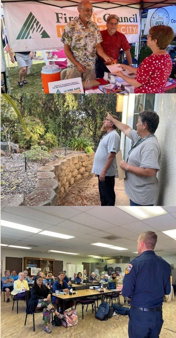
● FireSafeCouncilWorkshops –Partner withcommunityFireSafeCouncilsto conductvariousworkshopsincludingthe “LastChanceSurvivalSimulation Workshop”,“Wildland-UrbanInterface Workshop”,“Open-SourceIntelligence Workshop”,AmericanRedCrossDisaster Readinesspresentations,andothers dependentonFSCgoalsandpriorities.
● WildfireSafetyFairs–Various organizationshostengagingfairswhere residentscanmeetorganizations workingonwildfireresilienceandgain resourcesandinformation.SanDiego GasandElectrichostsannualfairsin high-riskcommunitiesacrosstheCounty.
● CALFIRE“Ready,Set,Go!”Campaign–Ongoingeducationaloutreachacrossthe County,carriedoutbySDCFPDandlocal FSCs.
● HomeAssessmentProgram–Offer educationalhomeignitionzone assessmentstohelpcommunities understandwildfireresilienceprinciples andgainresourcestoaddresstheirgoals.
● ExpandFirewiseandFireSafeCouncil participation–Supportlocalcommunities withoutrecognitiontoformalocalchapter.
● Increasecollaborationandintegrationof localCERTteamsandFireSafeCouncils. ThiswouldincludecrosstrainingFSC volunteerstobecomeCERTmembersand encouragingCERTmemberstojointheir localFSCs.
● CapacityBuildingforCommunityFireSafe Councils–OffertrainingontopicsthatFSCs wouldliketolearnmoreabouttohelp communityvolunteersgrow,suchas conductingwildfirehomeassessments, nonprofitlicensing,administration,fire behavior,etc.
● Digitaleducationtools–Updatethe FSCSDCwebsitewithinteractivehome hardeninganddefensiblespacetools.
● CommunityAmbassadorProgram –Train localFireSafeCouncilsaswildfire preparednesseducatorsabletogivenonregulatoryhomeassessmentsand understandregionalwildfireresilience goalsandobjectives.
● AnnualWildfireSafetyMonth –Coordinate publiceventseveryspringwithpartner agencies(CALFIRE,SDCFPD,SDG&E, RCDGSDC,FSC,SanDiegoCityFireRescue, andlocalFSCs).
● PromoteawarenessandenrollmentinAlert SanDiego,GenasysProtect,PulsePoint, andotherreal-timeevacuationandalert toolsthroughworkshops,FSCmeetings, andoutreachcampaigns.
● Integratewildfireeducationintoschool safetyprogramsandconductoutreachto localschooldistricts.
Longbeforeawildfire sparks,therearenumerousstepsthatresidentscantaketo protecttheirhomesandotherstructures.Thissectiondescribessomeofthoseefforts.
● Encouragereplacementofvulnerable materialssuchaswoodshakeroofs,open eaves,vents,andsingle-panewindows withWUIcompliantalternatives.
● SupportfullcomplianceofChapter7Aof theCaliforniaBuildingCodefornew constructionbuildingsandfullcompliance ofCaliforniaDepartmentofInsurance “SaferfromWildfire”frameworkforall homes.
● Developrebate,grant,orcost-share programstosupportat-riskhomeownersin makingimprovements.
● Coordinatewithinsurerstolinkhardening measurestoreducedpremiumsand eligibilityforcoverage.
● CollaboratewithHOAstoaligntheir covenants,conditions,andrestrictions withhomehardeningrecommendations.
● SunrisePowerlinkWildfireMitigation GrantProgram–Overtheyears,SPLMGP hasawardedhomeownersintheirservice areagrantstoupgradetoWUIcompliant vents.
● CaliforniaWildfireMitigationProgram HomeHardeningInitiative–AnOESand CALFIREprogramthatfocuseson developingcommunityhomehardening programstoretrofit,harden,andcreate defensiblespaceforhomesathighriskto wildfire.Thisprogramtargetshighsocial vulnerabilitycommunitiesandprovides financialassistancetoqualifyinglowandmoderate-incomehouseholds.Three SanDiegocommunitieshavebeen identifiedtopilottheHHP,Dulzura, Campo,andPotrero.
● LocalFireSafeCouncilshavecompleted variousprojectstosupportresidents withhardeningtheirhomes.For example,AlvaradoEstatesFSCoffersa ventcost-shareprogram,SanElijoHills FSCoffersafencereplacementcostshareprogram,amongmanyothers offeringlocally-ledhomehardening programs.
● Homehardeningandemberignition workshopsinpartnershipwithCALFIRE, USWildlandFireService,andlocalfire agenciesforcommunityFSCs.
● Developaninteractivehomehardening guideontheFSCSDCwebsite.
● Developavettedlistoflocalcontractors trainedinwildfireretrofitstostreamline homeownersandFSCaccess.
● Launcharetrofitincentiveprogramfor vulnerablehomesintheVeryHighFire HazardSeverityZone(VHFHSZ)toassist residentswithupgradingvents,attached fencing,eaves,andcreatingZone0. Collaboratewithlocalfireagencies,Fire SafeCouncils,HOAs,andother stakeholderstoreachthemostvulnerable populations.
● Coordinatewithhomeinsurance companies/otherpublicinsurancemodels todeveloprobustinsuranceopportunities forhomeowners.

Creatingabufferbetweenbuildingsandthegrass,trees,shrubs,andsurrounding wildlandareasisessentialtoimprovingsurvivability.Thissectionlooksateffortsto buildthiskeylayerofprotection.
I.PRIORITIES
● Advocateforresidentstocomplywith PublicResourcesCode4291andlocal ordinancesrequiringdefensiblespace aroundstructures.Eachlocalfireagency havingjurisdiction(LFAHJ)mayhave specificguidelinesarounddefensible space,recommendedplants, andmore. Communitymembersareencouragedto receivebestpracticesforcreating defensiblespacefromtheirLFAHJ.
● Promotedefensiblespacezonesforhome ignitionzonemanagement:
o Zone0:Maintaina noncombustibleareaaround thehome(excludeattached fences,mulch,in-groundplants, furniture,andothercombustible materials).
o Zone1:Createandmaintain properhorizontalandvertical spacingstandardsbetween vegetationtointerrupt continuity.
o Zone2:Thinandseparatelarger vegetationtoslowapproaching fireandreduceradiantheat.
● Expanddefensiblespaceassistancefor seniors,disabledindividuals,andlowincomeresidentswhocannotperform clearingworkindependently.
● FocusresourcesinVeryHighFireHazard SeverityZonesandDACcommunities.
● DefensibleSpaceAssistanceProgram: OperatedbytheRCDGSDCandFSCSDC, thisprogramassistsresidentswhoare facingbarrierstocreatingdefensible space.Assistanceistargetedat communitieswithinVHFHSZs,and priorityisgiventoresidentswhohave receivednoticestoabatebytheirlocal fireagency.
● DefensibleSpaceInspections –CALFIRE, SanDiegoCountyFire,andlocalfire agenciesthroughouttheCountyconduct DefensibleSpaceInspectionstonotify propertyownersoftheircurrent compliancewithfirecode.Continued
collaborationbetweentheFSCSDC, CAL FIRE,SDCFPD,andotherlocalfire agencies,toconnectpropertyownersto resourcesavailabletoassistwith complianceiscritical.
● CommunityChippingPrograms –Offer opportunitiesforcommunitiesto participateinChippingDays.Thiscan takeplacethroughtheFSCSDC’s curbsidechippingprogram,SanDiego CountyFire’sCommunityChipping Events,communityFireSafeCouncil events,andothers.
○ Notableprojectsincludethe RegionalResilienceGrant Program,acollaborativeproject betweenSanDiegoCountyFire, SanDiegoCityFireRescue,and theFireSafeCouncilofSan DiegoCounty,wherethe organizationsworkedtogether tocoordinatechippingeventsin theirvariousjurisdictionsto offeropportunitiesfor communitymemberstodispose ofhazardousvegetation collectedwhencreating defensiblespace.
○ CurbsideChippingProgram:The RCDGSDCandFSCSDChave offeredacurbsidechipping serviceformanyyears,assisting residentsinat-riskcommunities createdefensiblespace. CurbsidechippinginWUI communitiesandVeryHighFire HazardSeverityZone(VHFHSZ) continuestobeapriority.
● FireSafeCouncilsacrosstheCountyoffer eventssuchas“Dumpathons”where communitymemberscandisposeof debriswhenclearingdefensiblespace. Theseeventscleartonsofmaterialeach yearandareapriorityformany communities.
● EncourageFireSafeCouncils,Firewise Communities,andothergroupsto completeCALFIRE’sQualifiedEntities Programandotherlocalprogramsto educatecommunitiesonhowtoconduct homeassessments.
● SupportFSCswithcreatingvolunteer-led fuelsreductioncrewstohelpin-need residentsintheircommunitiescreate defensiblespace.Asapartofthisproject, ensureFSCsunderstandhowtocreate habitatsensitive,firecodecompliant managementstrategies.
● ActivateCBOs,non-profits,andcommunity groupstosupportbestpracticedefensible spaceonpubliclands,i.e.Canyonlands partnerswiththeCityofSanDiegoto increasedefensiblespacecapacityonCityownedpubliclands.
● Developmentofalocallyledfireadapted plantguide,inalignmentwithlocalfire agencyjurisdictionandCALFIRE guidelines.
Fuelsarecombustiblematerialssuchasgrasses,leaves,plants,shrubsandtreesthat feedflames.Thissectiondescribeseffortstotreatandmanagethesematerialsinthe community.
VegetationmanagementprioritiesinSanDiego Countyareguidedbyrisk-basedplanning, communityinput,vegetationtypeanalysis,and interagencycoordination.Keyprioritiesinclude:
● Developandimplementhazardousfuels treatmentprojectsthatcross ownership andjurisdictionalboundariesusingtools suchasGoodNeighborAuthority and cooperativeagreementstoachieve landscape-scaleriskreduction.
● Utilizeadvancedplanningtools, includingtheVibrantPlanetplatform,to identifyandprioritizetreatmentareas basedonstructureexposure,fire behaviormodeling,vegetationtype analysis,andcommunityriskprofiles,to accountforprojectsthatincrease ecologicalvalueandreducefirerisk.
● FocustreatmentsinWildland-Urban Interface(WUI)communities,particularly thoselocatedwithinVHFHSZs, prioritizingtheprotectionofat-risk communitiesandassets.
● Prioritizefuelsreductionalongprimary, alternate,andcontingencyevacuation
routestoimproveegressreliabilityand reduceroadsideignitionandentrapment hazards.
● Prioritizeignitionreductionprograms thatreducehuman-causedwildfirestarts inhigh-riskareas.
● Prioritizestrategicecosystem managementprogramsonascalethat providemulti-benefitorwin-win outcomes.
● Reducehazardousfuelsnearutilities, communicationsites,water infrastructure,andotheressential facilitiestosupportcontinuityof operationsduringwildfireevents.
● Managehazardousvegetation surroundingdesignatedTemporary RefugeAreastoimprovesurvivability shouldevacuationnotbeimmediately possible.
● Aligntreatmentprioritiesacross jurisdictionalboundariestomaximize landscapescaleeffectiveness.
● Identifyproductiveusesforcleared biomassandbuildcapacityforits utilizationinthecounty.
● Prioritizeregionalcoordinationaround high-riskinvasivespeciesapproaches.
● Maintainandrestorebiodiversity throughecosystem-basedmanagement, invasivespeciescontrol,andstrategic vegetationtreatmentstoenhance landscapewildfireresilience.These approachessupportecologicalhealth whilealsocontributingtomoreeffective, long-termwildfireriskreductioninSan DiegoCounty.
● Measureprojectsuccessbasedonvalueaddedratherthansimply“acres treated”.
● “SavingSanDiego’slastMixedConifer Forest”-TheResourceConservation DistrictofGreaterSanDiegoCounty receivedaCALFIREForestHealthgrantto workacrossjurisdictionalboundariesto conducthazardousfuelsreductionand restoreforesthealth.Thisproject coordinatedseverallandowners,from privateandstateentities,and
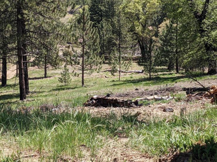
emphasizedecologicalandcommunity resilience.
● CALFIRE/SanDiegoCountyFire RoadsideTreatmentProgram: Implementationofa20-footroadside clearanceprogramalongcountymaintainedroadstoreduceignitionrisk, improveevacuationsafety,andenhance firefighteraccess(seeinteractivemapfor projectspecifics).
● StateandFederalAgencyFuelsPrograms: CALFIRE,theU.S.ForestService,Bureau ofLandManagement,Fish&Wildlife,and otherpartnersconductfuelstreatments andprescribedfireprojectsonpublic landsthroughoutthecounty, subjectto weatherandenvironmentalconditions.
o AnnualTreatment accomplishmentsvarywidely, withyearlytotalsvaryingbased onweather,staffing,and environmentalcompliance requirements.
o Federalpartnersmaintain annualfuelstreatmenttargets thatvaryyear-to-yeardepending onfunding,staffing,andburn windows.
o Theseongoingefforts collectivelyreducehazardous fuelloads,disruptfuel continuity,andsupportsafer wildfiresuppressionoperations.
● CALFIRECommunityProjects:
o CrestCommunityFuelBreak: This159.83-acrecommunityfuel breakisaimedatprotectingthe communityofCrest,establishing defensiblespacetoslowwildfire spread,andimprovefirefighter safety.LedbyCALFIRE,crews managenonnativevegetationto establishafuelbreak approximately200feetinwidth.
o GuatayCommunityFuelBreak: This71.53-acrewildfire mitigationprojectslowswildfire spread,improvesfirefighter access,andincreases operationalsafetyduring suppressionefforts.Itisledby CALFIRESanDiego,establishing astrategicfuelbreakdesigned toprotectthe800residentsof Guatayandnearbycommunities ofPineValleyandDescanso.
o WarnerSpringsEstatesFuel Break:Locatedinnortheastern SanDiegoCounty,thiswildfire mitigationprojectisdesignedto protectthecommunityof WarnerSprings,andnearby ranches,triballands,andcritical accessroutes.LedbyCALFIRE, thisprojectcovers16.52acres andprovidesenhanced protectionforroughly3,000 residents.
● SanDiegoCanyonlandsMid-cityCanyons
PalmRemovalandRestoration:
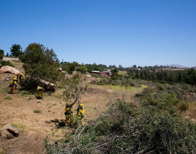
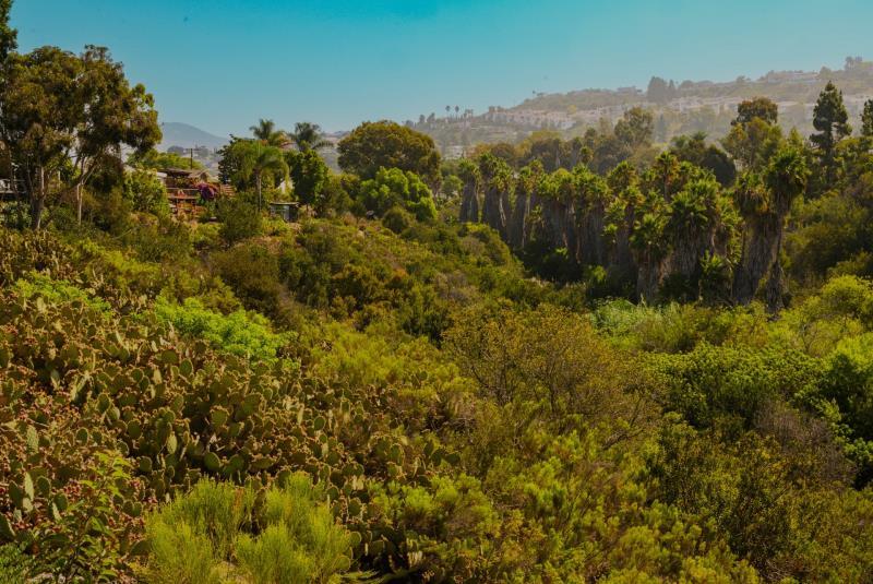
Implementationofinvasivespecies removal,includinghighfireriskMexican fanpalms,pampasgrass,andArundo donaxwithintheripariancorridorsof urban-embeddedcanyons.Theproject includeshelicopterremovaloflarge invasivepalmsandtrees,followedby ecologicalupliftofriparianandupland habitatsforwholecanyonsystem wildfireresilience.
● SanDiegoCanyonlandsandDelMar MesaFSC:Community-led,preventative treatmentofemergentinvasivefuels includingpampasgrassandflashy annuals,tomutuallyaddresscommunity wildfireresiliencewhileminimizing encroachmentofinvasivespeciesinto areasofhighbiologicalsensitivity.
Futurefuelstreatmenteffortswillbuildonexisting programswhileexpandingthescale,coordination, andeffectivenessoftreatmentsacrossSanDiego County.
● CountyFire/CALFIREtoutilizetargeted grazingasafueltreatmentmethodin partnershipwithCountyParksandother
suitableopenspacestomanagefinefuels andreducefirespreadpotential.
● Increasetheuseofprescribedfirewhere feasibletoreduceaccumulatedfuels, restorefire-adaptedecosystems,and improvelong-termlandscaperesilience, subjecttoairquality,weather,and regulatoryconstraints.Whenprescribed fireisutilizedinecologicallyappropriate contexts,itisbothariskreductionand restorationtool.
● Continueintegratingfiremodeling, structureexposureanalysis,andlocal knowledgeintofuelsplanningtoensure treatmentsarestrategicallyplacedand cost-effective.
● SupportFSCsinidentifyingpriorityfuels projectswithintheircommunitiesand coordinatingwithagenciestoadvance implementation.
● Supportthedevelopmentofhandcrews toconductbrushmanagementincityownedorcounty-ownedpropertiesthat arewithin100feetofstructures.
● Supportregionalcoordinationand programmaticapproachestohigh-risk invasivespeciesremovali.e. palm/eucalyptusremovalfromcanyons, earlyresponsetoemergentinvasive speciespopulations.
● Developandsupportworkforce developmentprogrammingtobuild equitablepipelinesforindividualsto entertheenvironmentalandwildfire resiliencesectors.

Identifyingkeycorridorsinandoutofacommunity –aswellastemporaryrefuge areas–isessentialtobeingpreparedforevacuation.Thissectionprovidesan overviewofthePACEsystem(primary,alternate,contingencyandemergency)usedto planahead.
Evacuationplanningisadynamicprocesssubjecttothenuancesofeachcommunity.Belowisanoverviewof SanDiegoCounty’skeyingressandegress,aswellasdesignatedevacuationcorridors,TemporaryRefuge Areas,completedprojects,prioritiesandfutureprojects.
SanDiegoCounty’stransportationnetwork includesamixofmajorhighways,arterialroads, ruralroads,andnarrowmountaincorridors.Many communities,particularlythoseintheWUI,have limitedaccesspoints,steepterrain,androads borderedbyopenspace.
MainthoroughfaresinSanDiegoCountyinclude themajorfreeways,Interstates5,15,805,and8,as wellasthefollowingstateroutes:52,54,56,67, 79,94,125,163,and905.Caltranshelpsto maintainsaferoadwaysbyconductingregular weedabatementalongthesewell-traveledroutes.
Residentsareencouragedto:
● Knowatleasttwowaysoutoftheir neighborhoodandtwowaysoutoftheir broadercommunity.
● Identifyevacuationroutesinadvanceand avoidrelianceonasingleroadway.Many FSCshaveidentifiedtheirownPACEplans
whichcommunitiesareencouragedto familiarizethemselveswith.
● Understandthatevacuationroutesmay changebasedonfirelocation,wind direction,andreal-timeconditions.
SeeAppendixB,Figure4,whichidentifiesmajor roadways,evacuationcorridors,andTemporary RefugeAreas.
AninteractivemapisavailablehereofallFSCsand theirPACEplans:https://tinyurl.com/sd-cwpp
Specificroutesvarybycommunityandare identifiedthroughcoordinationwithlocalfire agencies,lawenforcement,Caltrans,County DepartmentofPublicWorks,andFireSafe Councils.
Finalevacuationinstructionsarealways communicatedbyemergencyofficialsandshould befollowedregardlessofpre-planning.Major arteriesinSanDiegoCountyarelistedbelow.
Itisencouragedforeachcommunitytocreate theirownuniquePACEEvacuationplan,local plansandorderswillsupersedethecounty-level PACE.
PRIMARY MajorinterstatesincludeI5,15,8,805, andstateroutes94,79,and78
ALTERNATE Stateroutesincluding78,76,56,54, 163,and75
CONTINGENCY SeeyourlocalPACEplan
EMERGENCY SeeyourlocalPACEplan
Alwaysstayinformedandfollowdirectionsfromauthorities. Conditionscanquicklychange,itiscriticaltostayflexible.
TemporaryRefugeAreas(TRAs)arelocations intendedtoprovidealast-resortoptionif evacuationisnotimmediatelypossible.TRAsare notevacuationdestinationsandshouldonlybe usedwhendirectedorwhenevacuationroutes areunavailable.ManycommunityFSCshave identifiedTRAswithintheirCWPPs.
● Improveroutereliabilitybycoordinating fuelstreatmentandroadsidevegetation managementalongevacuationcorridors, includingpartnershipswithCaltransand theCountyDepartmentofPublicWorks.
● Ensurecrossjurisdictionalalignmentby conductingevacuationplanningwith federal,state,andlocalpartners.
● Increasepublicawarenessofevacuation routesandinformationsharingby promotingtheuseofAlertSanDiego, GenasysProtect,andotherofficial
notificationplatformstoensureresidents receivetimelyevacuationinformation.
● Supportcommunitylevelplanningby workingwithFireSafeCouncilsand FirewiseCommunitiestoidentifyPACE routeswhilereinforcingthatreal-time evacuationorderssupersedepreidentifiedplans.
● Increaseequityandaccessbyprioritizing outreachtosociallyvulnerable populations,includingseniors,people withdisabilities,non-Englishspeakers, andhouseholdswithoutaccesstoprivate transportation.
● Expandedcoordinationwith transportationandpublicworks agenciestoalignevacuationrouteswith fuelstreatmentpriorities.
● Increasedintegrationofevacuation planningintocommunitywildfire educationandFireSafeCouncil programming.
● Improvedidentification,mapping,and publicawarenessofTemporaryRefuge Areas.
● Enhancedplanningforassisted evacuationneeds,including transportationsupportandevacuation assistanceprograms.
● Continuedevaluationandimprovement ofevacuationcorridorresiliencethrough modeling,after-actionreviews,and communityfeedback.
● TemporaryRefugeAreaIdentificationand Improvement:Continuetoidentify, evaluate,andenhanceTRAsforuseduring wildfireeventswhenevacuationisnot immediatelypossible.Futureeffortswill includecompletingaformalevaluationof candidatesites,developingTRAsite standards,andconductingpubliceducation toclarifythatTRAsarelastresortoptions andnotsubstitutesforearlyevacuation. Significantcoordinationwithcity jurisdictions,fireagencies,federalpartners, andcommunityorganizationsisnecessary.
● EvacuationRouteImprovements:Aprimary focusoffutureprojectswillbeimproving thereliabilityandsafetyofdesignated evacuationcorridorswithafocuson communitiesindesignatedVHFSZsandone wayin,onewayoutcommunities.Future effortsmayincludevegetationclearance, strategicremovalofhazardssuchasdead treesandoverhanginglimbs,and coordinationwithCaltrans,CALFIRE,and localpartners.
● AlertingandPublicNotification Enhancements:Outreachfocusingon enrollmentinAlertSanDiegoandGenasys andmultilingualcommunicationmaterials toincreasetimelyandaccessible communicationduringadisaster.

Therearecountlesswaysthatcommunitiescanacttoprotectthemselvesaheadof wildfires.Thissectiondetailsadditionalpast,currentandfutureeffortsunderway thatwerenotpreviouslymentioned.
I.PRIORITIES
● Educatecommunitymembersaboutthe toolsavailabletoincreaseinsurance coverageandreducecostsincludingIBHS WildfirePreparedHomedesignationand NFPAFirewise.
● ExpandFirewiseparticipation,particularly inHighandVeryHighFireHazardSeverity Zonestoincreasecommunityeducation andpreparedness.
● Supportaregionalframeworktosupport long-termnaturalresourcemanagement efforts,specificallyresourcemaintenance.
II.COMPLETEDAND/ORONGOING PROJECTS
● SanDiegoCountyisestablishedasa “Fire RiskReductionCommunity”.Mandated byPRC4290.1,thislistoflocalagencies locatedinastateresponsibilityareaor VeryHighFireHazardSeverityZone (VHFHSZ)designatescommunitiesthat meetbestpracticesforlocalfire
planning.Thislistwasdevelopedandis maintainedbytheBoardofForestry.San DiegoCountywasdesignatedasaFRR Communityin2024.
o Additionalcommunitieswithin SanDiegoCountyarealso designatedincludingChulaVista FireDepartment,CityofChula Vista,andAlpineFireProtection District.
● SanDiegoCounty“AgPass”isan identificationprogramthatallowsvetted commercialfarmersandranchersto accesstheirpropertiesduringemergency evacuations,includingwildfires.The programwascreatedtoaddressthe2018 wildfiresandofficiallyapprovedin2022 topreventlossoflivestockand agricultureinfrastructure.
● KnoxBoxprogramsprovideeligible residentswithafree,secure,wallmountedlockboxinstalledbyfire officialsneartheirfrontdoor.Itholdsa sparehousekey,allowingfirst
respondersquickaccessduringmedical emergenciesanddisasters.KnoxBox programsarecurrentlyofferedbySan DiegoFire-RescueandSanDiegoCounty FireProtectionDistrict.
● AmericanRedCrossHomeFireCampaign
-TheAmericanRedCrosssupportsrisk reductioninSanDiegoCountythrough itsHomeFireCampaign,providingfree smokealarminstallationsandfiresafety education.Anyresidentqualifiesfor assistance,andtheprogramprioritizes vulnerablepopulations,including seniors,low-incomehouseholds,and residentsinhighfirehazardareas. Additionally,notificationdevicesare providedforthosewhoaredeafandhard ofhearing.
● Encourageadditionalcommunitiesinhigh andveryhighwildfireseverityzonesto becomedesignatedFireRiskReduction Communities.
● CoordinatewithpartnersacrosstheCounty fromlocalFireSafeCouncils,firedistricts, andFirewiseCommunitiestooffer educationalhomeassessmentsintheir jurisdictions.
● EducatefarmersandranchersabouttheAg Passprogramthroughworkshops,printed materials,andpresentationswithResource ConservationDistricts,NRCS,USDA,San DiegoCounty,andotherpartners.
● ExpandtheKnoxBoxprograminadditional communities.
● SupportlocalIndigenouscommunitiesby increasingaccesstoanduseofbeneficial fireontheirownterms.
Thisplanmustbeapprovedbythefollowingkeyparties:thelocalauthor(examples includeFireSafeCouncilPresident,Firewise Community,TribalNational,HOA,etc.), thechiefoftheprimaryrespondingfireagency,theCALFIREUnitChief,andchairof theCWPPreviewcommittee.Thissectionincludesthesesignoffs.
TheCommunityWildfireProtectionPlan,asdevelopedfor SanDiegoCounty:
● WascollaborativelydevelopedandmeetstheintentoftheHealthyForestRestorationAct (HFRA)inemphasizingtheneedforagenciestoworkcollaborativelywithcommunitiesin developinghazardousfuelreductionprojects,andplacespriorityontreatmentareas identifiedbycommunitiesthemselvesinaCWPP.Interestedpartiesandfederalland managementagenciesinthevicinityofthisCWPPhavebeenconsulted.
● Identifiesandprioritizesareasforhazardousfuelreductiontreatmentsandrecommends thetypesandmethodsoftreatmentthatwillprotectareaswithinthisCWPP.
● Recommendsmeasurestoreduceignitabilityofstructuresthroughoutthearea addressedbytheplan.
● Isintendedforuseasaplanningandassessmenttoolonly,utilizingacompilationof communityissues/goalsandprojectedfiremitigationstrategies.TheCWPPisnottobe construedasindicativeofproject“activity”asdefinedunderthe“CommunityGuideto theCaliforniaEnvironmentalQualityAct,ChapterThree,ProjectsSubjecttoCEQA.”Per theCommunityGuide,Section3.1.1,“CEQAonlyappliestopublicagencydecisionsto approve,oractionstocarryout,adiscretionaryproject.”Anyactualproject activities meetingthisdefinitionofprojectactivityandundertakenbytheCWPPparticipantsor agencieslistedshallmeetwithlocal,state,andfederalenvironmentalcompliance requirements.
● Assistsandencouragescompliancewithcurrentcountyandstatefirecodestandards.

XAnn Baldridge Executive Director, RCD of Greater SD County
ThisCWPPwasreviewedandrecommendedforapprovalbytheSanDiegoCommunityWildfire ProtectionPlanReviewCommitteeasdemonstratedbythesignaturebelow.

XDonald Butz President, FSC of San Diego County
TheCALFIREUnitChiefhasfinalsigningauthorityonCWPPsinSanDiegoCounty.Thesignature belowatteststhatthestandardslistedinthesectionaboveandthecontentofthisCommunity WildfireProtectionPlanareproposedtobemetandmutuallyaccepted.

XTony Mecham Unit Chief, CAL FIRE SDU
Thissectionincludesimportantadditionalinformationthatcomplementsotherportions oftheplan.
APPENDIXA. MEETINGTRACKINGDOCUMENTS
ThisCWPPwasdevelopedforSanDiegoCounty, throughaseriesofcommunitymeetings.TheFireSafe CouncilofSanDiegoCountymemberswhocontributed tothedocumentincludethefollowing:
● TheSanDiegoCountyCWPPwas reviewed, andfeedbackwasprovidedbySanDiego County’snetworkofcommunityFireSafe Councils.
● Thedocumentwasdistributedtoover 300+communityFSCrepresentatives, agencyrepresentatives,community members,andcommunity-based organizations.46responseswerecaptured viaafeedbacksurveyandotherresponses frompartnersandagencieswerecaptured inthecommentssectionoftheliveGoogle Document.
● ThesurveyresponsesshowedDefensible Spacewasthehighestprioritybyawide margin,withthedemandforenforcement clarityandassistancewith implementation.Someresidentsstillfeel underinformed,showingtheneedfor
increasedcommunicationandoutreachto thecommunity.
● SenatorBrianJonesdistributedthedraft planandfeedbacksurveyinearlyApril 2026.
● RyanSilva,CALFIRE/SanDiegoCountyFire (SDCFPD)
● JessicaMartinez,SanDiegoCounty
● DonSolleder,CALFIRE/SDCFPD
● MichaelCornette,CALFIRE/SDCFPD
● MorganDioli,FSCSDC/RCDGSDCStaff
● EricJust,CALFIRE
● BriceSmith,CALFIRE
● RexHambly,UnitedStatesWildlandFire Service
● ScottGrasmick,USForestService
● JimMitchell,USFish&Wildlife
● DonaldButz,FSCSDCPresident
● HeatherCady,FSCSDC/RCDGSDCStaff
● AlexKane,SanDiegoCityFireRescue
● SierraBrown,SanDiegoCityFireRescue
● HelenSylvia,SanDiegoCityFireRescue
● JuliaRichards,SanDiegoRiverConservancy
● MikeRottenberg,SanDiegoGas&Electric
● MelissaAltman,AmericanRedCross
● JeshuaTaucher,SanDiegoCanyonlands
● CodyGallagher,OfficeofEmergencyServices
● LucaCarmignani,SanDiegoState University/FireScienceConsortium
● 11/13/25–FSCSDCExecutiveBoardMeeting announcingaCWPPworkplan
● 12/17/25–InitialSanDiegoCountyCWPP DraftingSession
● 1/8/26-FSCSDCExecutiveBoard&General Meetings:TheExecutiveCommitteereviewed draftmapsandoutreachplan,duringthe GeneralMeetingthedraftCWPPwascirculated forfeedbacktothecommunityFSC/partner network
● 1/15/26-FSCSDCandCALFIREmettodiscuss theCWPPmapsandworkwithGISstaffto disseminatefeedbackfromtheexecutive committeeandexploretheopportunityto developaninteractiveversionofthestandard CWPPmaps.
● 3/12/26-FSCSDCExecutiveBoard&General Meetings:TheExecutiveCommitteereviewed therevisedmapsandprovidedfurther direction,duringtheGeneralMeetingan additionalremindertoreviewthedraftplan andprovidefeedbackwasprovided.
● 3/25/26-Anadditionalfeedbackreminderwas solicitedtotheFSCSDCstakeholdernetwork.
● 4/3/26-SenatorBrianJonesdistributedthe communityfeedbacksurveytohisconstituents.
● 4/15/26-SanDiegoCountyCWPPReview CommitteeMeeting
● 5/14/26-FSCSDCExecutiveBoardMeetingplan ratification
APPENDIXB. MAPS
1AreaCommunitiesMap
2FireHazardSeverityMap